Open Space Web-Map builder Codehttps://openspace.ordnancesurvey.co.uk/osmapapi/openspace.js?key=3119F72552FD5C22E0530C6CA40A5A92https://openspace.ordnancesurvey.co.uk/osmapapi/script/mapbuilder/basicmap.jshttps://openspace.ordnancesurvey.co.uk/osmapapi/script/mapbuilder/searchbox.js//variables for routes var linesLayer, points, lineFeature, lineString, routeMarkersLayer, routepos, routesize, routeoffset, routeicon; var style_blue = {strokeColor: “#0000CD”, strokeOpacity: 0.5, strokeWidth: 4.5}; function initmapbuilder() { //initiate the map var options = {resolutions: [2500, 1000, 500, 200, 100, 50, 25, 10, 5, 4, 2.5, 2, 1]}; osMap = new OpenSpace.Map(‘map’, options); //configure map options (basicmap.js) setglobaloptions(); //set the center of the map and the zoom level osMap.setCenter(new OpenSpace.MapPoint(263274.99874115,361010.00125885),7); linesLayer = osMap.getVectorLayer(); // Set up layer for route markers routeMarkersLayer = new OpenLayers.Layer.Markers(“Route Markers”); //make a route points = new Array(); points.push(new OpenLayers.Geometry.Point(265003.33206177,360331.66793823)); points.push(new OpenLayers.Geometry.Point(265158.33206177,360101.66793823)); points.push(new OpenLayers.Geometry.Point(264718.33206177,359841.66793823)); points.push(new OpenLayers.Geometry.Point(264473.33206177,359931.66793823)); points.push(new OpenLayers.Geometry.Point(264263.33206177,359956.66793823)); points.push(new OpenLayers.Geometry.Point(264103.33206177,359971.66793823)); points.push(new OpenLayers.Geometry.Point(263948.33206177,360031.66793823)); points.push(new OpenLayers.Geometry.Point(263828.33206177,359871.66793823)); points.push(new OpenLayers.Geometry.Point(263768.33206177,359871.66793823)); points.push(new OpenLayers.Geometry.Point(263653.33206177,360031.66793823)); points.push(new OpenLayers.Geometry.Point(263368.33206177,359936.66793823)); points.push(new OpenLayers.Geometry.Point(263108.33206177,359831.66793823)); points.push(new OpenLayers.Geometry.Point(263013.33206177,359756.66793823)); points.push(new OpenLayers.Geometry.Point(263033.33206177,359541.66793823)); points.push(new OpenLayers.Geometry.Point(263003.33206177,359751.66793823)); points.push(new OpenLayers.Geometry.Point(262813.33206177,359881.66793823)); points.push(new OpenLayers.Geometry.Point(262703.33206177,360111.66793823)); points.push(new OpenLayers.Geometry.Point(262603.33206177,360421.66793823)); points.push(new OpenLayers.Geometry.Point(262533.33206177,360626.66793823)); points.push(new OpenLayers.Geometry.Point(262593.33206177,360906.66793823)); points.push(new OpenLayers.Geometry.Point(262633.33206177,361226.66793823)); points.push(new OpenLayers.Geometry.Point(262528.33206177,361516.66793823)); points.push(new OpenLayers.Geometry.Point(262398.33206177,361646.66793823)); points.push(new OpenLayers.Geometry.Point(262138.33206177,361651.66793823)); points.push(new OpenLayers.Geometry.Point(262013.33206177,361551.66793823)); points.push(new OpenLayers.Geometry.Point(261783.33206177,361456.66793823)); points.push(new OpenLayers.Geometry.Point(261463.33206177,361401.66793823)); points.push(new OpenLayers.Geometry.Point(261248.33206177,361356.66793823)); points.push(new OpenLayers.Geometry.Point(261143.33206177,361296.66793823)); points.push(new OpenLayers.Geometry.Point(261248.33206177,361356.66793823)); points.push(new OpenLayers.Geometry.Point(261758.33206177,361436.66793823)); points.push(new OpenLayers.Geometry.Point(262088.33206177,361656.66793823)); points.push(new OpenLayers.Geometry.Point(262298.33206177,361901.66793823)); points.push(new OpenLayers.Geometry.Point(262273.33206177,362301.66793823)); points.push(new OpenLayers.Geometry.Point(262108.33206177,362546.66793823)); points.push(new OpenLayers.Geometry.Point(262048.33206177,362616.66793823)); points.push(new OpenLayers.Geometry.Point(262033.33206177,362766.66793823)); points.push(new OpenLayers.Geometry.Point(262053.33206177,362636.66793823)); points.push(new OpenLayers.Geometry.Point(262268.33206177,362321.66793823)); points.push(new OpenLayers.Geometry.Point(262323.33206177,361896.66793823)); points.push(new OpenLayers.Geometry.Point(262433.33206177,361646.66793823)); points.push(new OpenLayers.Geometry.Point(262658.33206177,361221.66793823)); points.push(new OpenLayers.Geometry.Point(262758.33206177,361211.66793823)); points.push(new OpenLayers.Geometry.Point(262848.33206177,361231.66793823)); points.push(new OpenLayers.Geometry.Point(262893.33206177,361081.66793823)); points.push(new OpenLayers.Geometry.Point(262993.33206177,360996.66793823)); points.push(new OpenLayers.Geometry.Point(263348.33206177,360981.66793823)); points.push(new OpenLayers.Geometry.Point(263428.33206177,360941.66793823)); points.push(new OpenLayers.Geometry.Point(263548.33206177,360871.66793823)); points.push(new OpenLayers.Geometry.Point(263593.33206177,360721.66793823)); points.push(new OpenLayers.Geometry.Point(263613.33206177,360576.66793823)); points.push(new OpenLayers.Geometry.Point(263798.33206177,360336.66793823)); points.push(new OpenLayers.Geometry.Point(263933.33206177,360276.66793823)); points.push(new OpenLayers.Geometry.Point(264068.33206177,360206.66793823)); points.push(new OpenLayers.Geometry.Point(264133.33206177,360156.66793823)); points.push(new OpenLayers.Geometry.Point(264168.33206177,360006.66793823)); points.push(new OpenLayers.Geometry.Point(264168.33206177,359986.66793823)); points.push(new OpenLayers.Geometry.Point(264553.33206177,359966.66793823)); points.push(new OpenLayers.Geometry.Point(264888.33206177,360231.66793823)); points.push(new OpenLayers.Geometry.Point(265003.33206177,360331.66793823)); // create a polyline feature from the array of points lineString = new OpenLayers.Geometry.LineString(points); lineFeature = new OpenLayers.Feature.Vector(lineString, null, style_blue); linesLayer.addFeatures([lineFeature]); //crate a route start/end marker routepos = new OpenSpace.MapPoint(265003.33206177,360331.66793823); routesize = new OpenLayers.Size(33,45); routeoffset = new OpenLayers.Pixel(-5,-37); routeicon = new OpenSpace.Icon(‘https://openspace.ordnancesurvey.co.uk/osmapapi/img_versions/img_1.1/mapbuilder/routemarker-startend.png’, routesize, routeoffset, null, null); routeMarkersLayer.addMarker(new OpenLayers.Marker(routepos, routeicon)); osMap.addLayer(routeMarkersLayer);}
Route: Idwal Cottage, Cwm Idwal, Pinnacle Crag, Y Garn, Bwlch y Brecan, Bwlch y Marchlyn, Elidir Fawr, Mynydd Perfedd, Carnedd y Filiast, Foel-goch, Y Llymllyd, Cwm Idwal, Idwal Cottage
Date: 25/09/2016
From: A5 – Idwal Cottage
Parking: Laybys on A5
Start Point: Idwal Cottage
Region: Snowdonia
Route length: 9.7 miles (15.6 km)
Time taken: 04:47
Average speed: 2.0 mph
Ascent: 1,130m
Descent: 1,134m
Summits: Y Garn (947m), Elidir Fawr (924m), Mynydd Perfedd (812m), Carnedd y Filiast (821m), Foel-goch (831m)
Other points of interest: Cwm Clyd, Cwm Cywion, Marchlyn Mawr
Having had a hands on day on Tryfan and Bristly Ridge, we were back in more familiar hill-walking territory we, staying in Snowdonia to tick off another pair of Wales’ 3,000ft peaks – Y Garn and Elidir Fawr (translated uninspiringly as ‘the cairn‘ and ‘Elidir’s big hill‘). Don’t let that fool you into thinking this wouldn’t be an interesting walk, however.
Y Garn is an impressive mountain stood among some impressive scenery on the bend of the Ogwen valley. There are a number of routes up the mountain – we would be climbing the north east ridge.
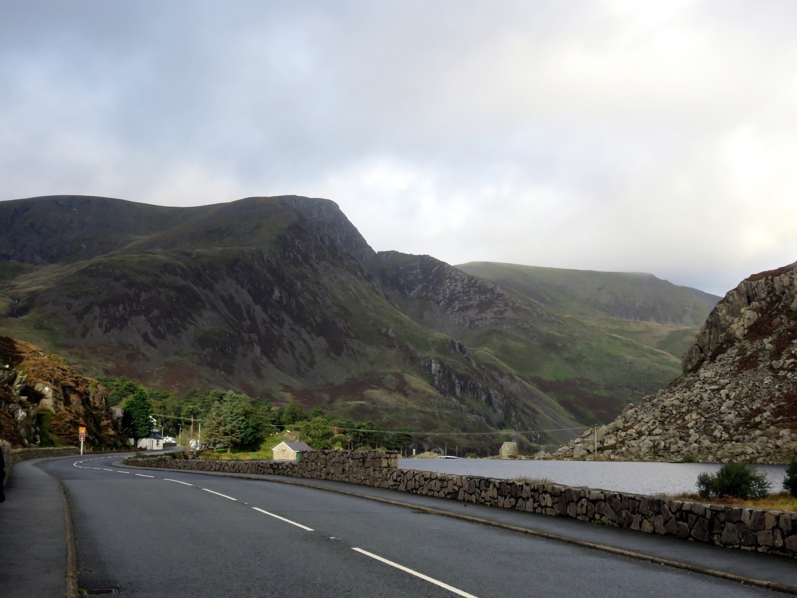
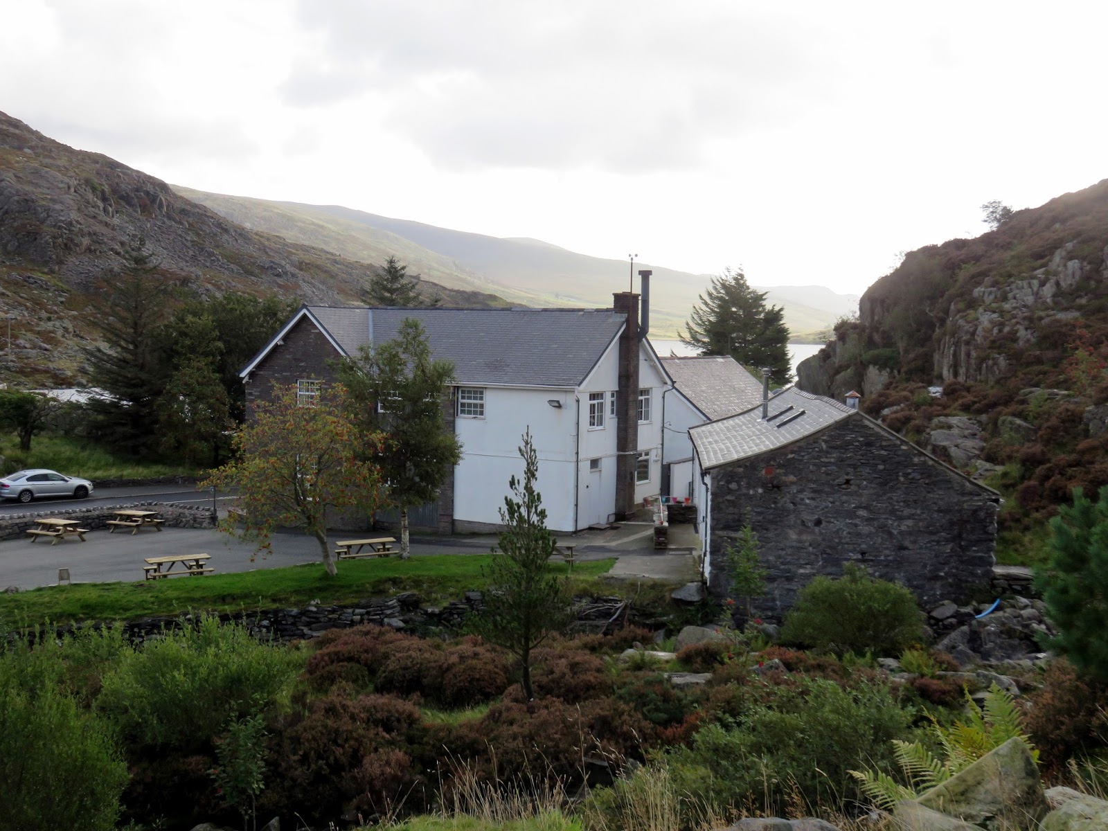
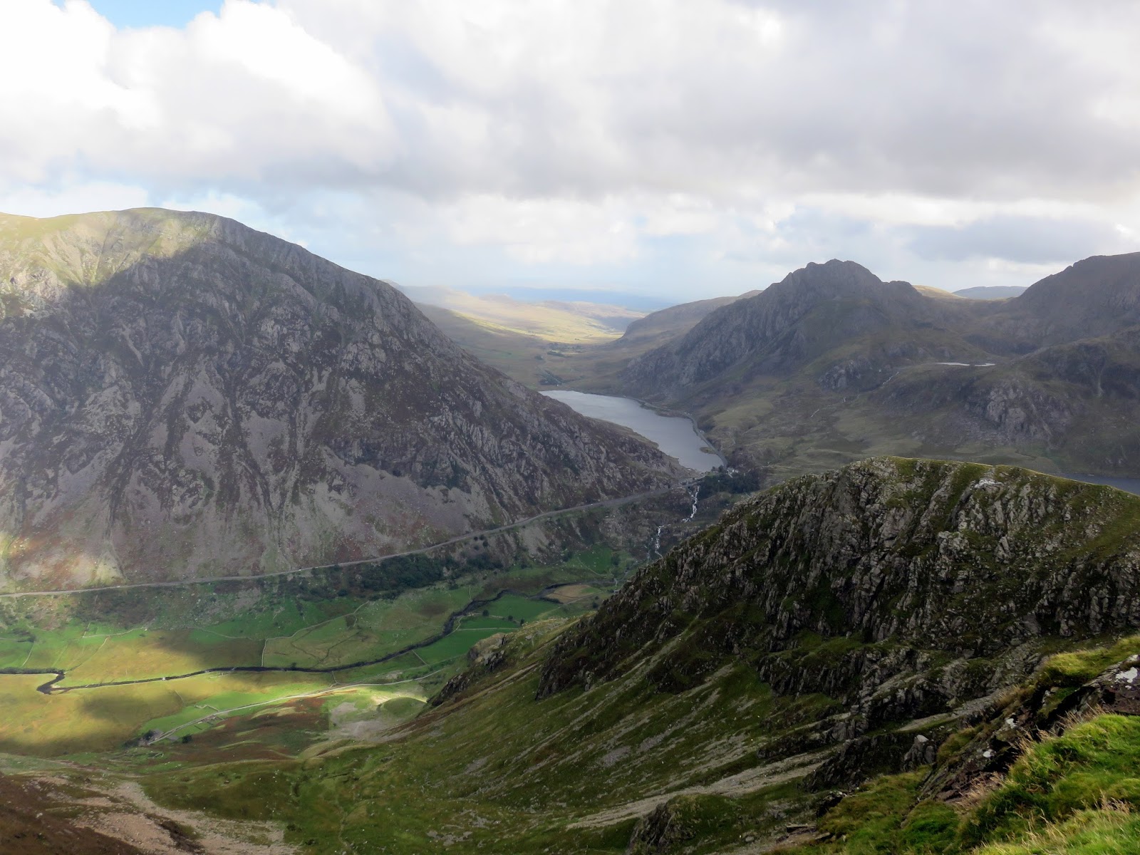
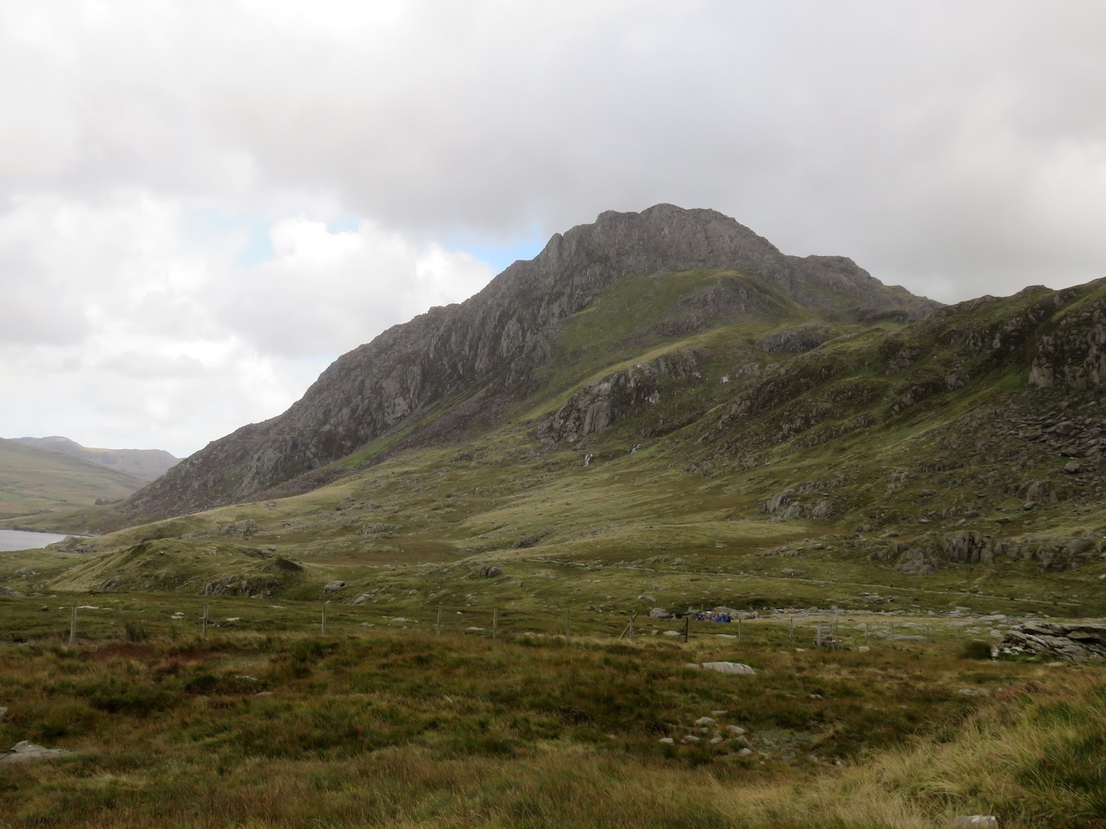
We left the cars in one of the many free laybys that line the A5 and made the short stroll to Idwal Cottage which sits at the end of Llyn Ogwen. A well-paved path leaves from behind the information centre and gently makes its way up to Llyn Idwal, providing an ideal warm up for the day.
 |
| Idwal Cottage |
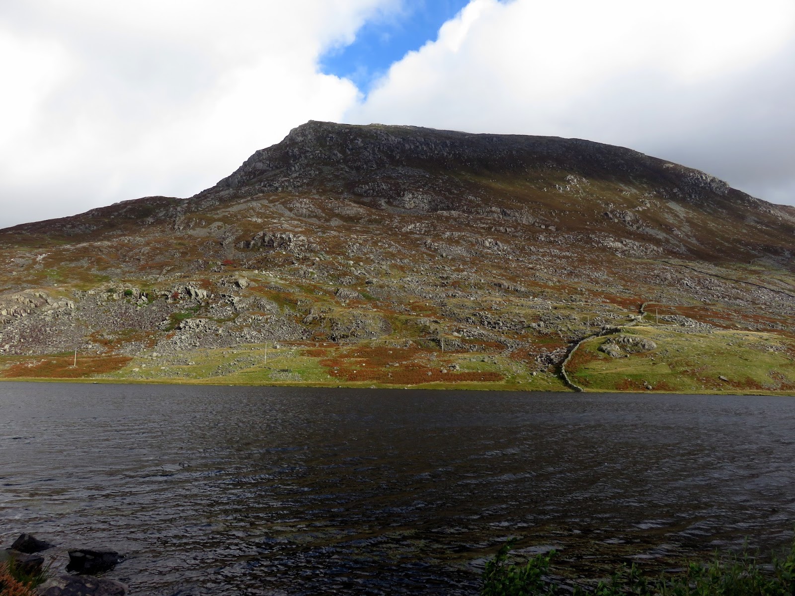
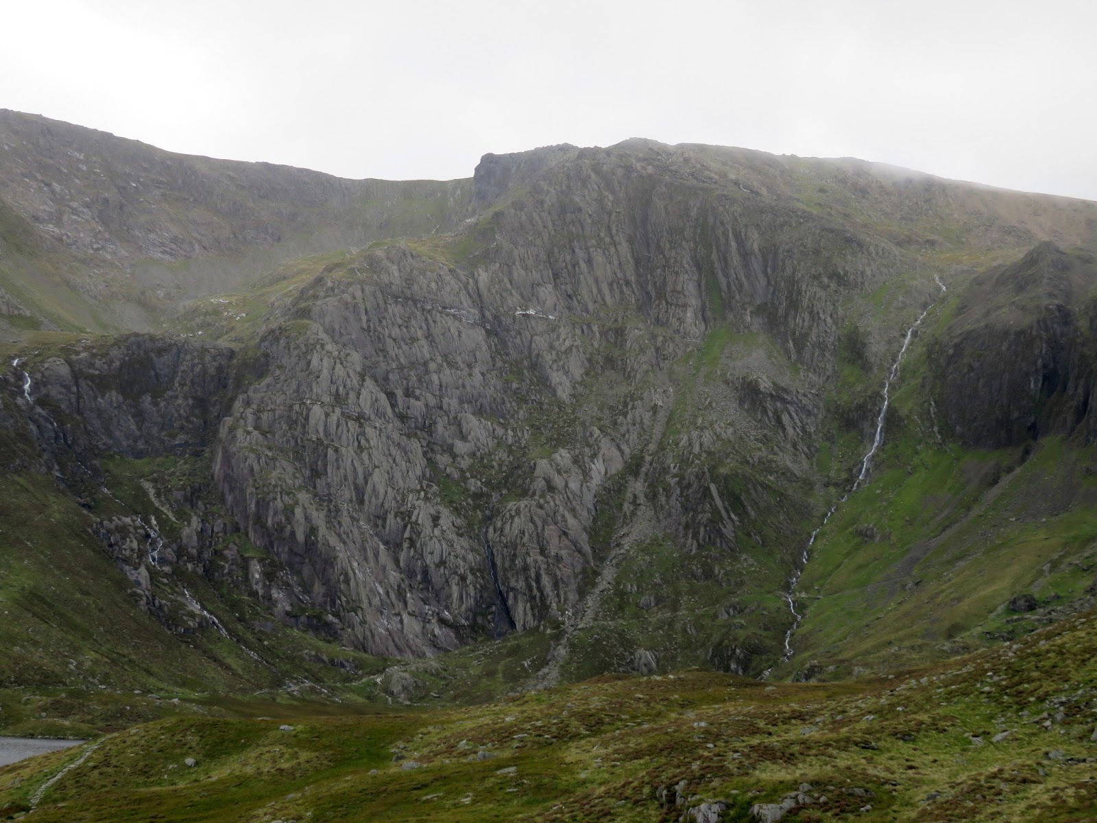
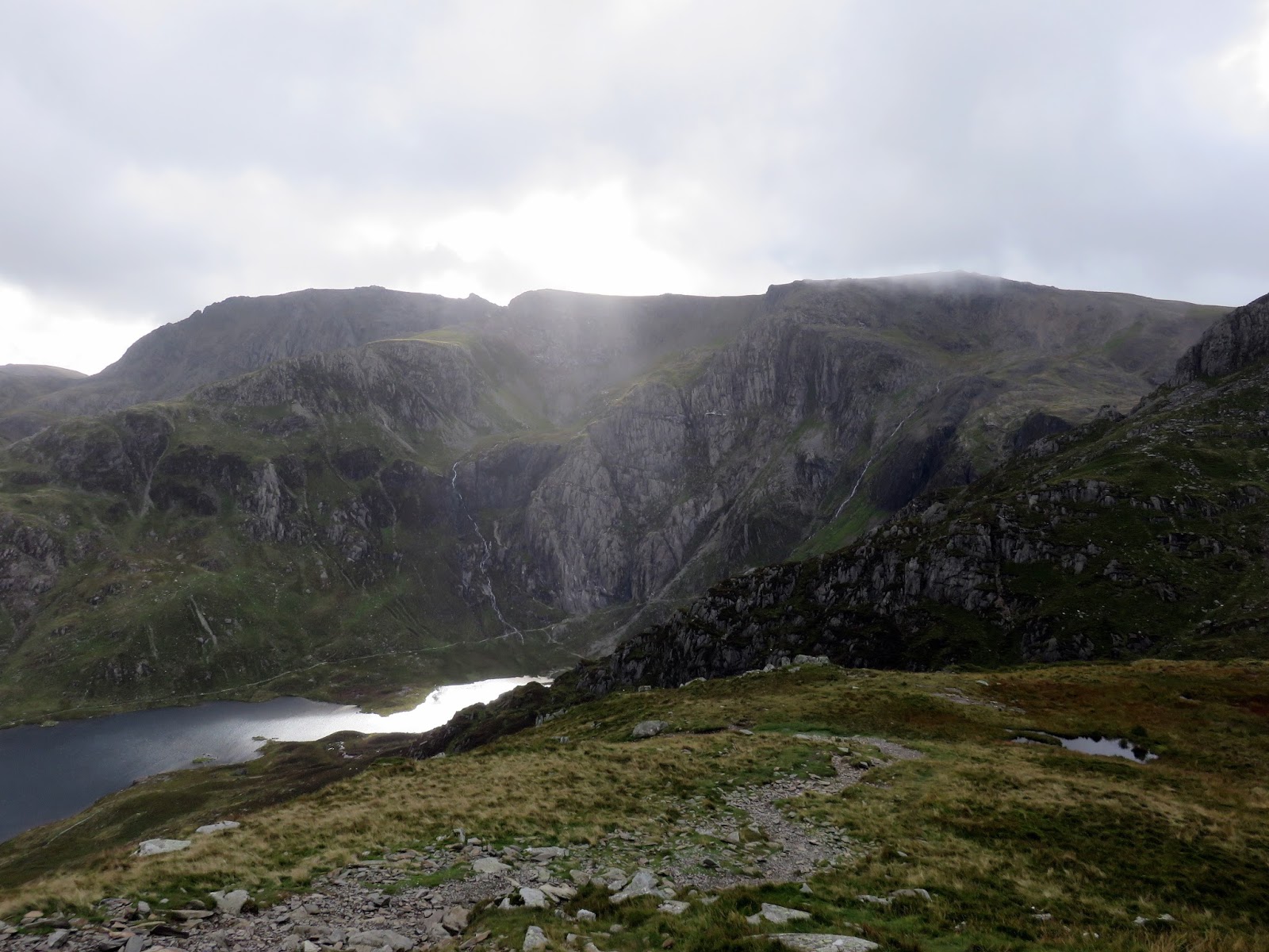
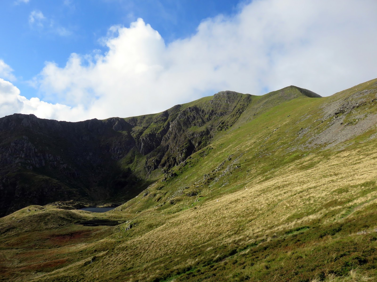
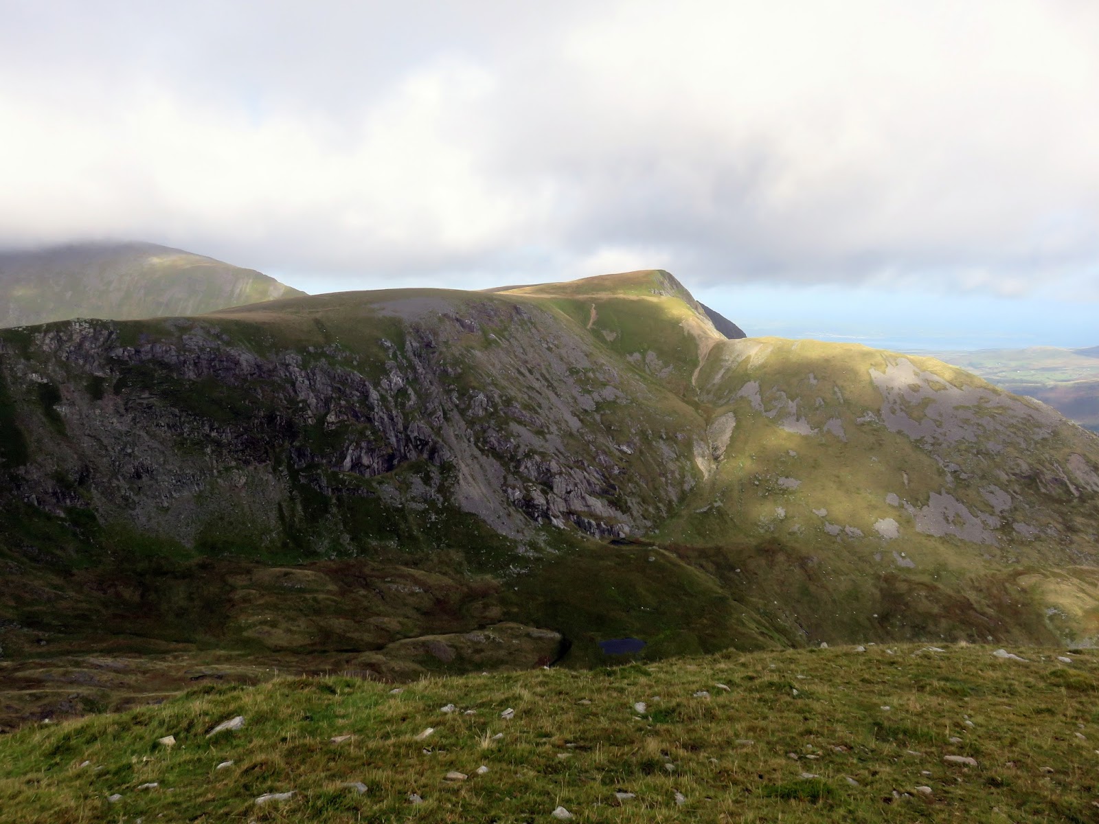
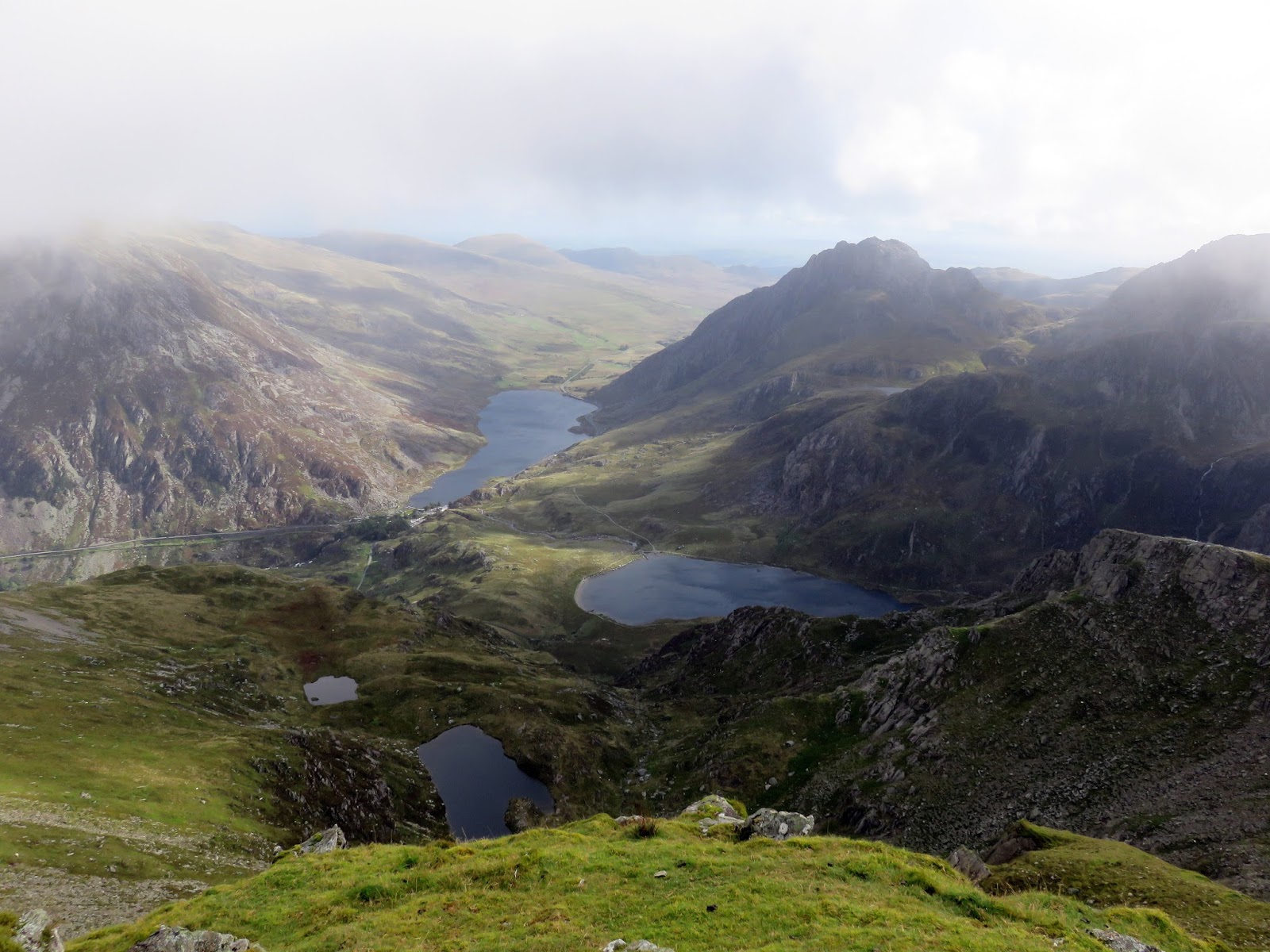
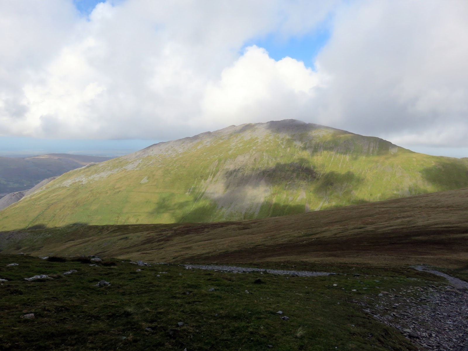
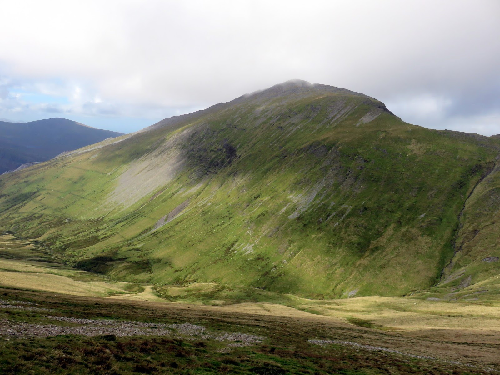
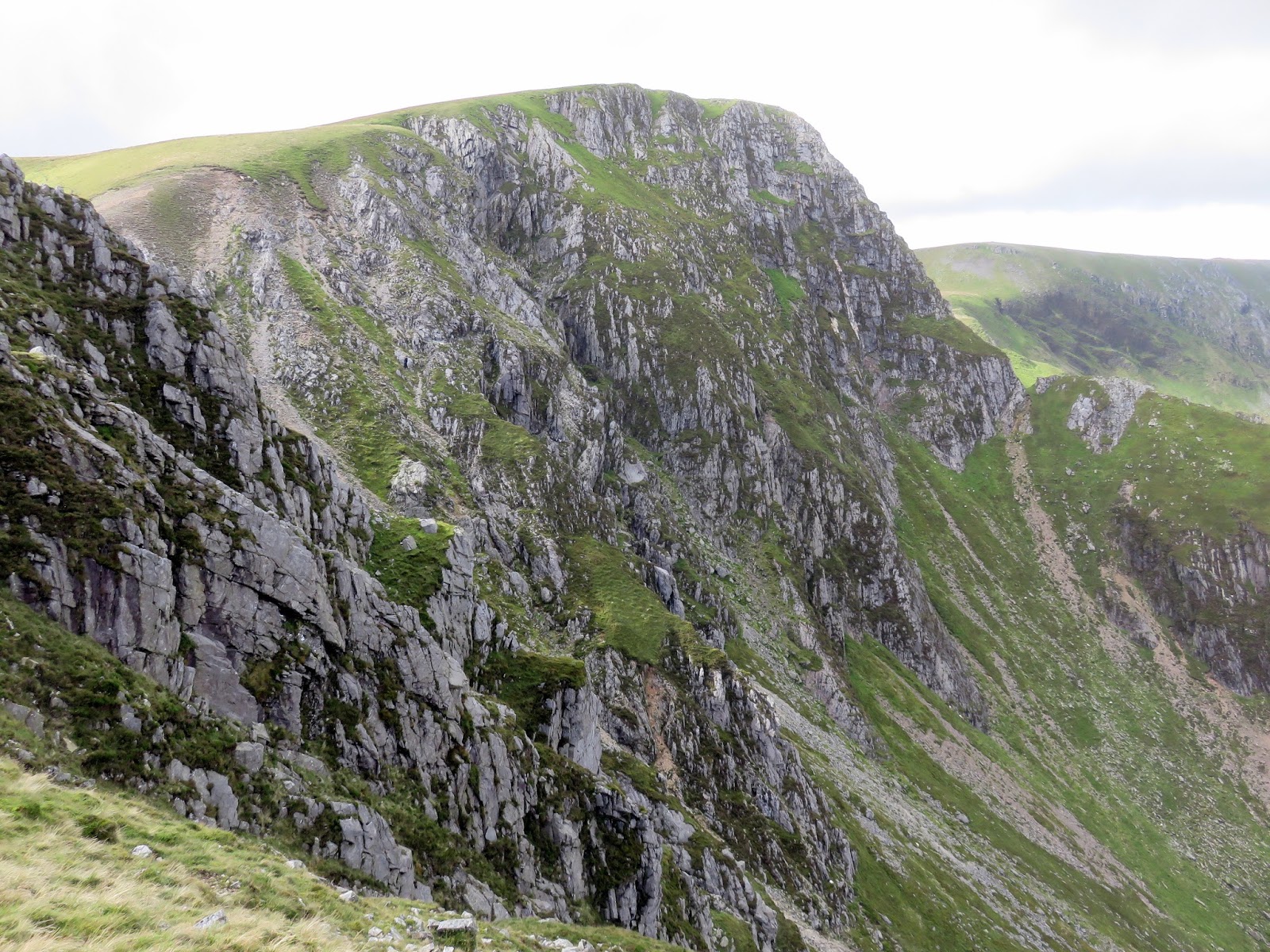
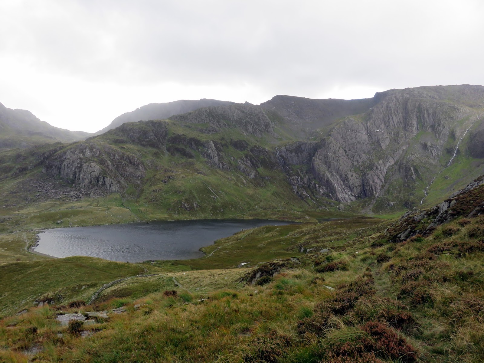
The route up the north east ridge starts from the north end of Llyn Idwal and can be reached by crossing the footbridge at the lake’s outlet. Heading west, the path climbs steeply for 250m around the rear of Pinnacle Crag. The entire climb up Y Garn is pretty steep but there is some respite when you reach Cwm Clyd, one of two glacial cwms that make their home on the slopes of Y Garn.
 |
| Y Garn below the clouds |
 |
| The famous Idwal Slabs |
 |
| The view back along the Ogwen Valley |
 |
| Morning sunshine over the Glyders |
 |
| Looking up the north east ridge from Cwm Cyld |
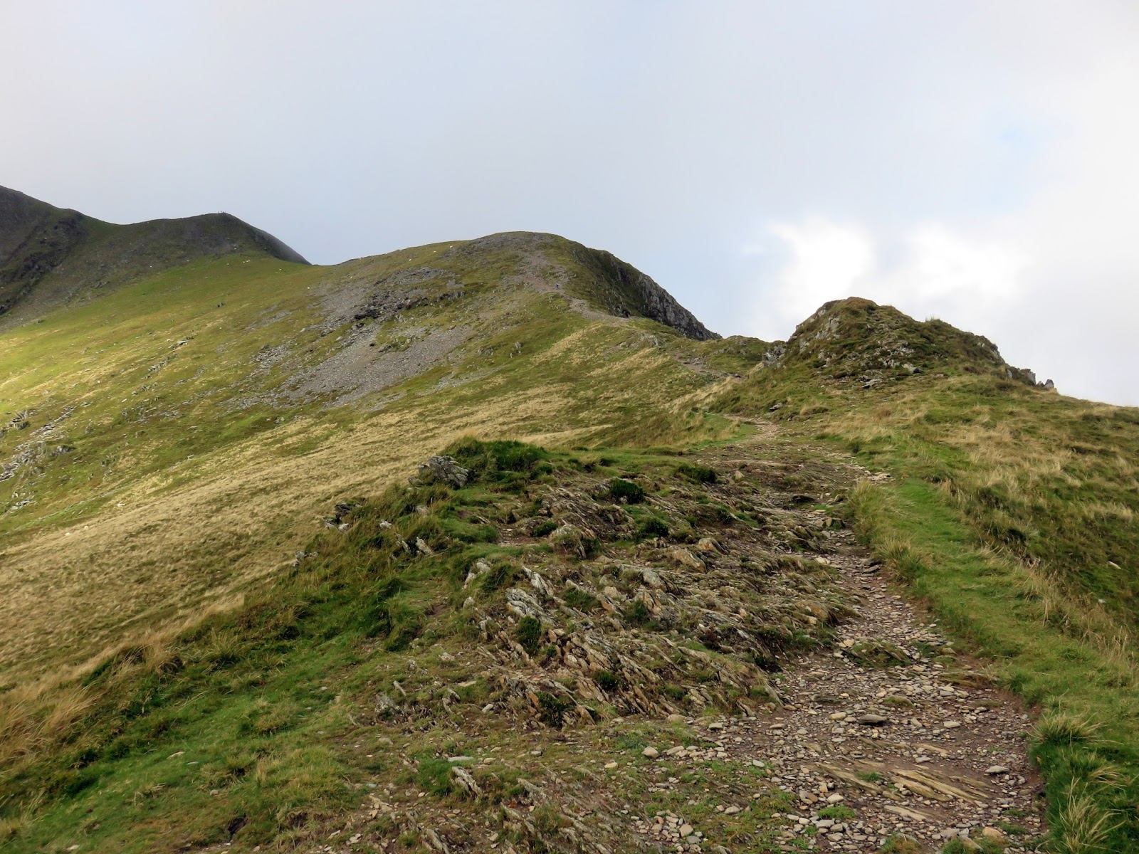
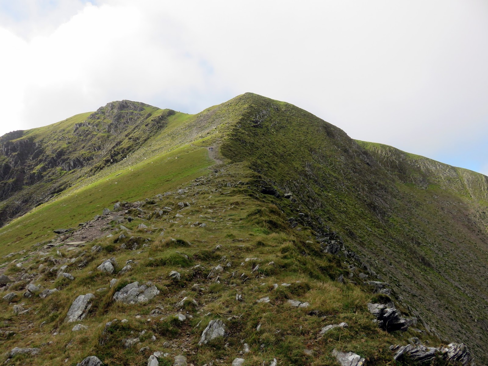
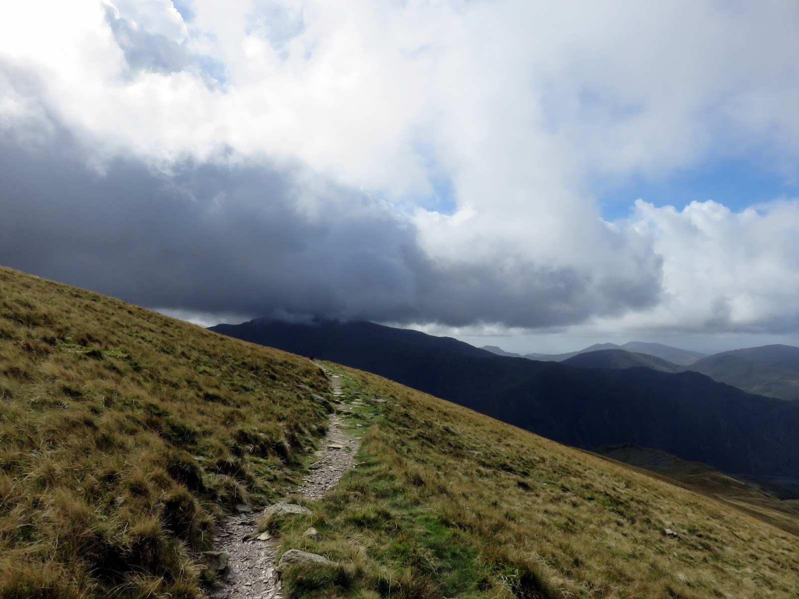
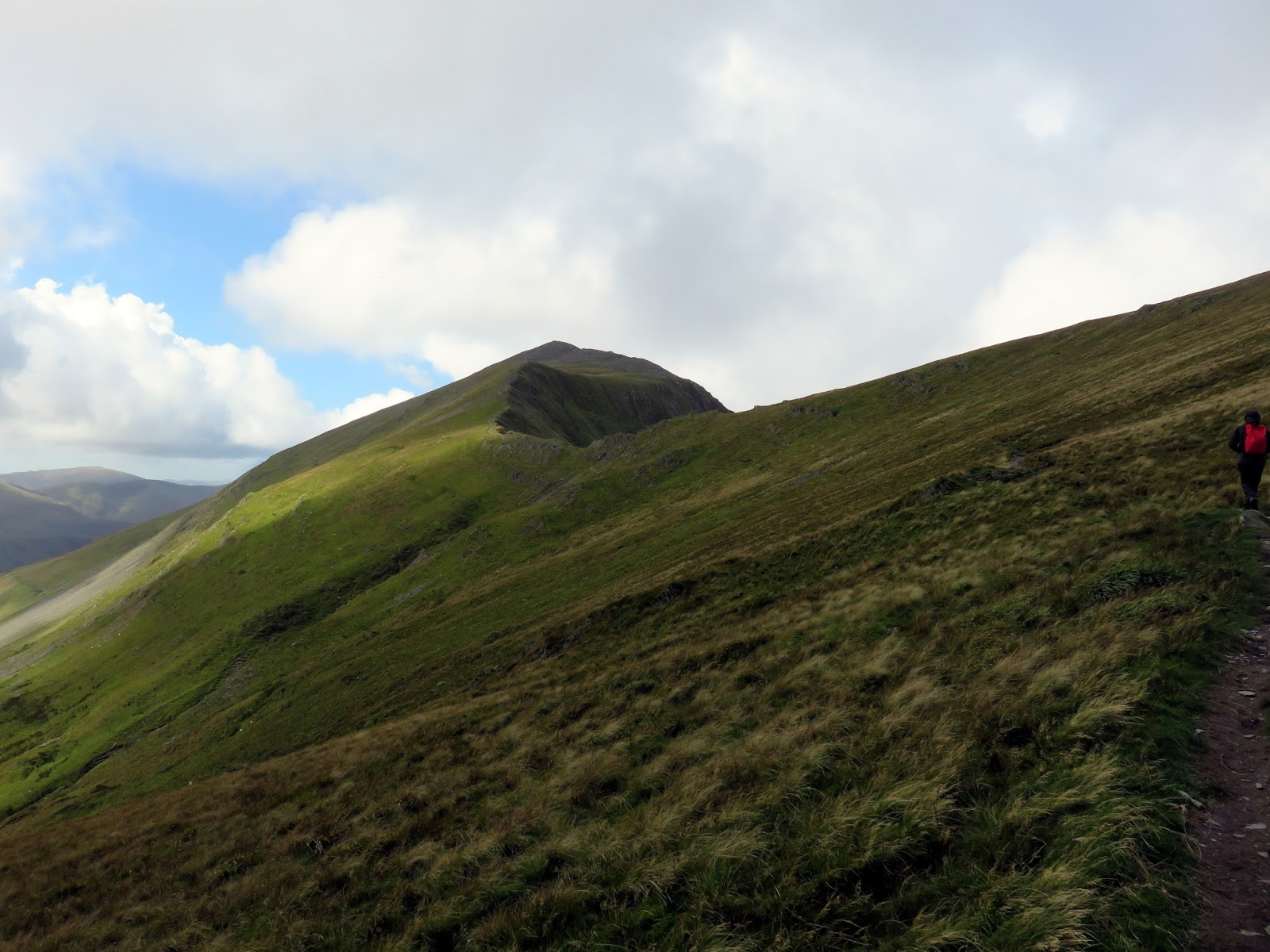
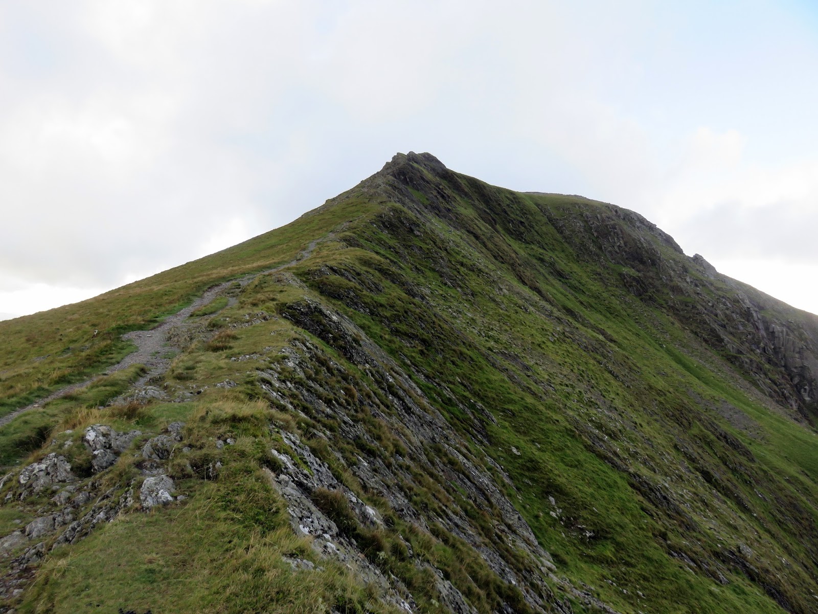
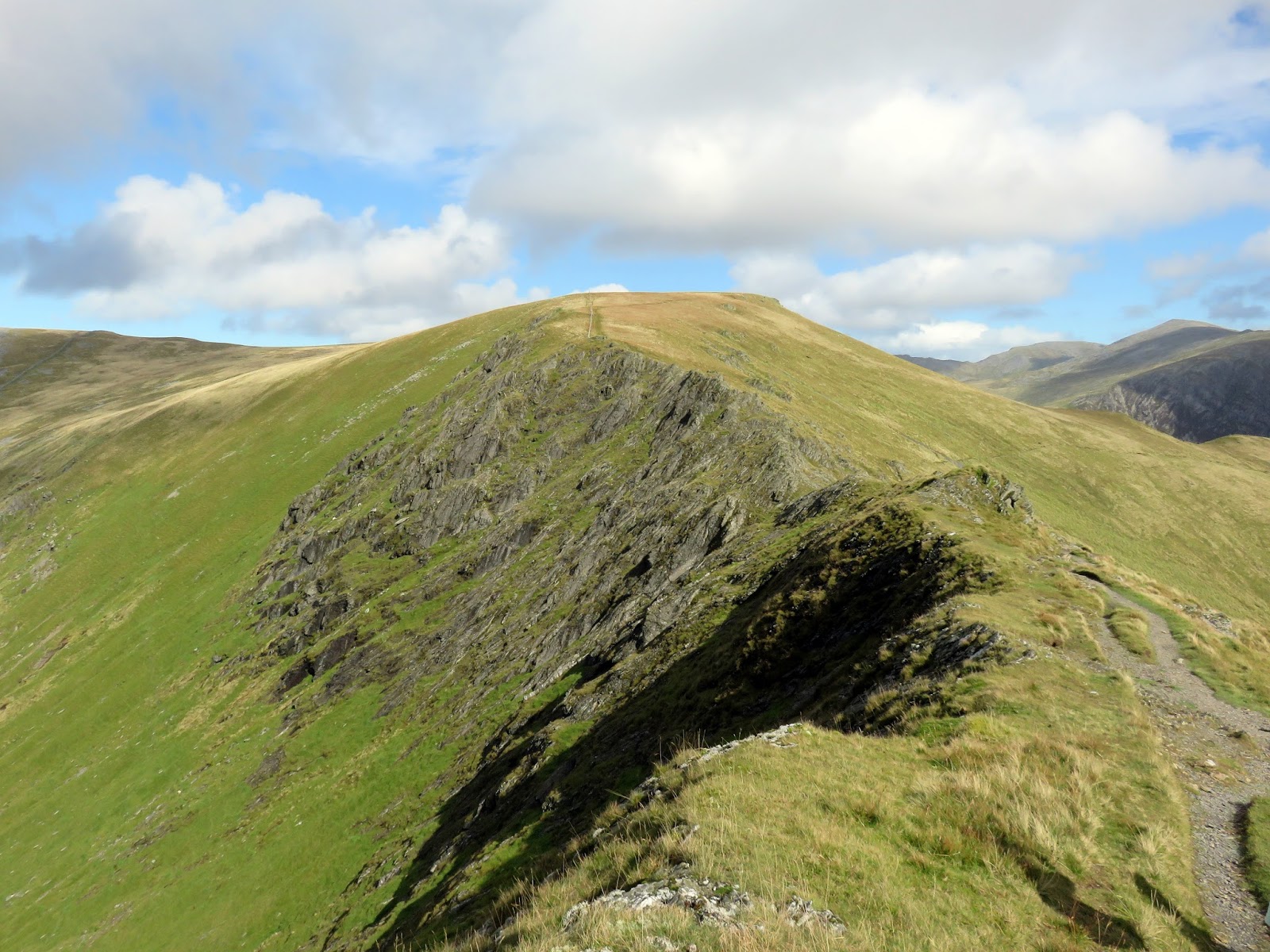
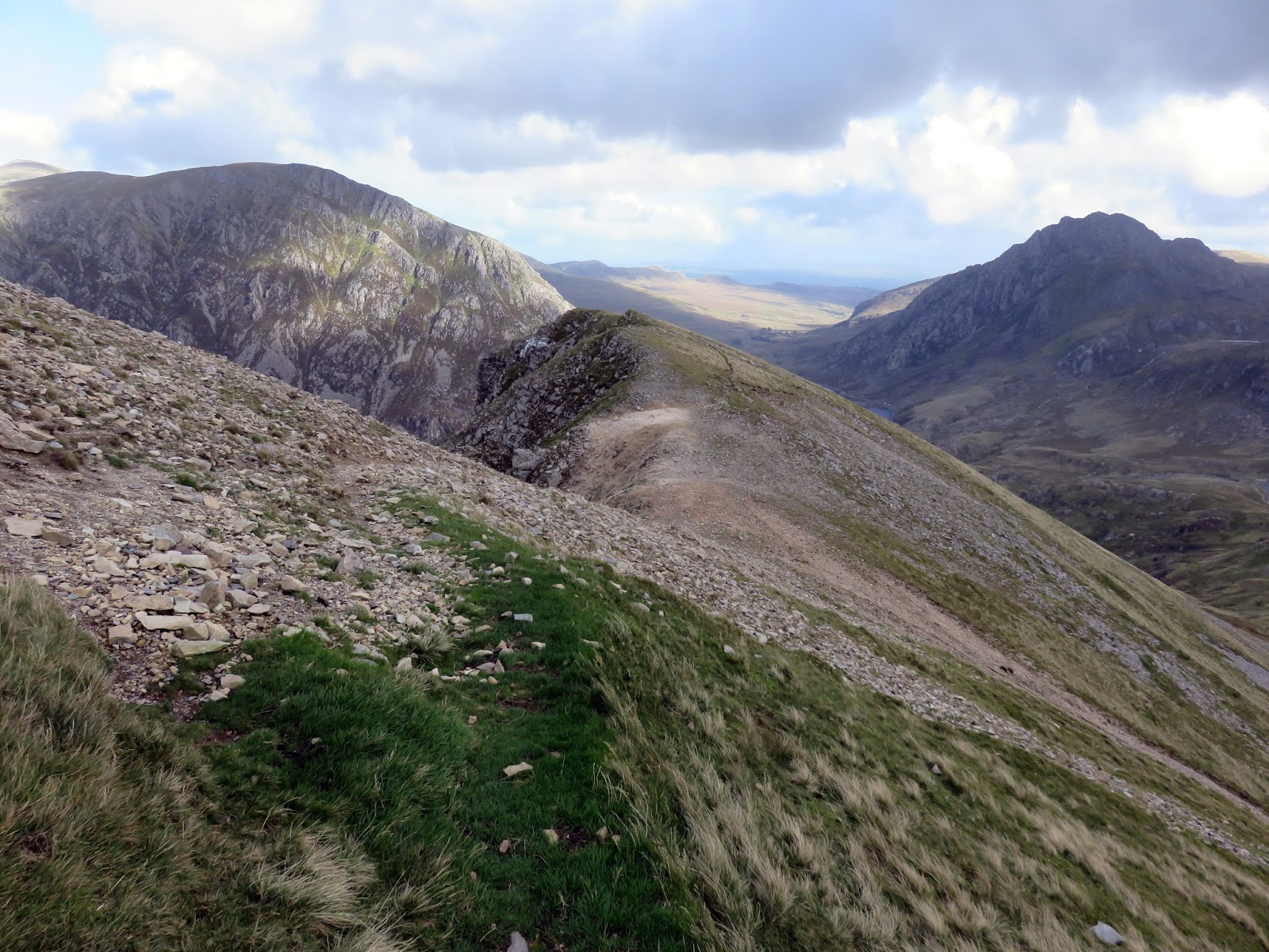
Once at Cwm Clyd, the route continues up the north east ridge proper, a path that gets very steep towards the top but provides tremendous views down into the cwms on either side. The summit sits a short distance from the top of the ridge.
 |
| The north east ridge |
 |
| The ridge rises ahead |
 |
| Looking down as the ridge steepens |
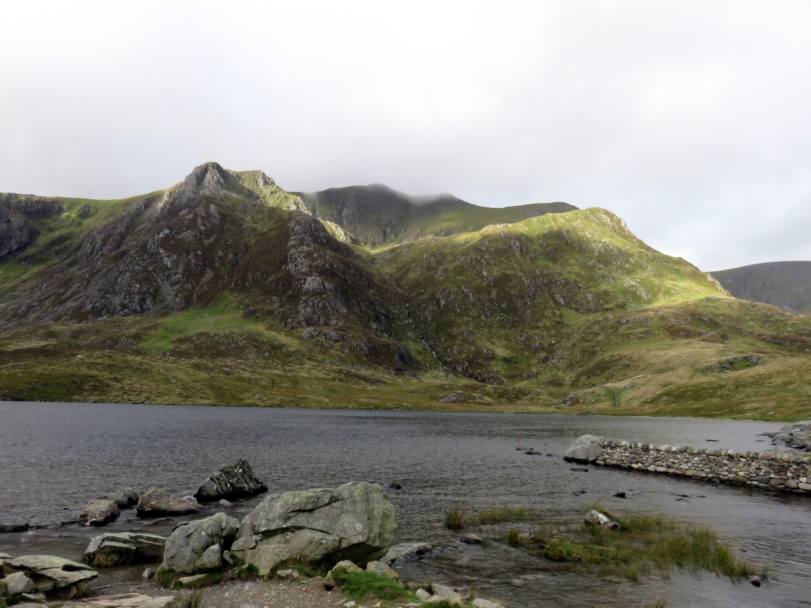
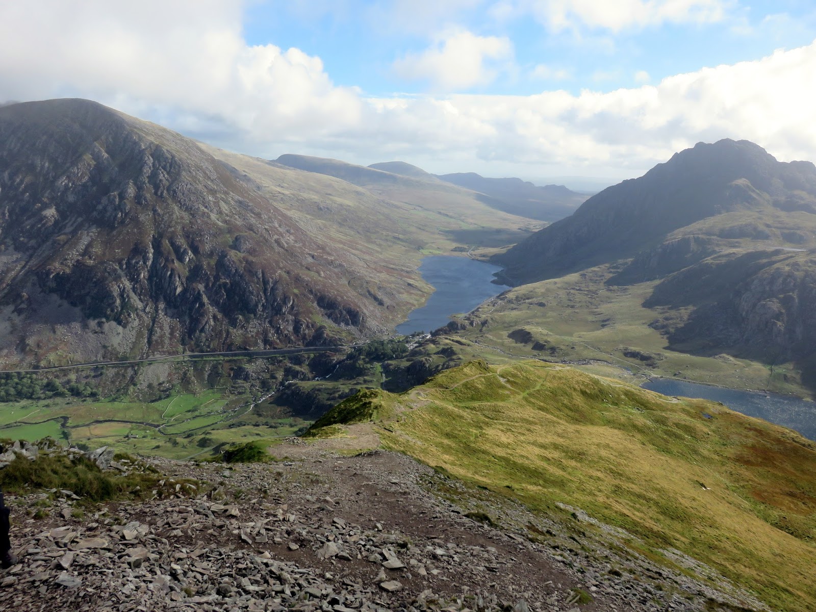
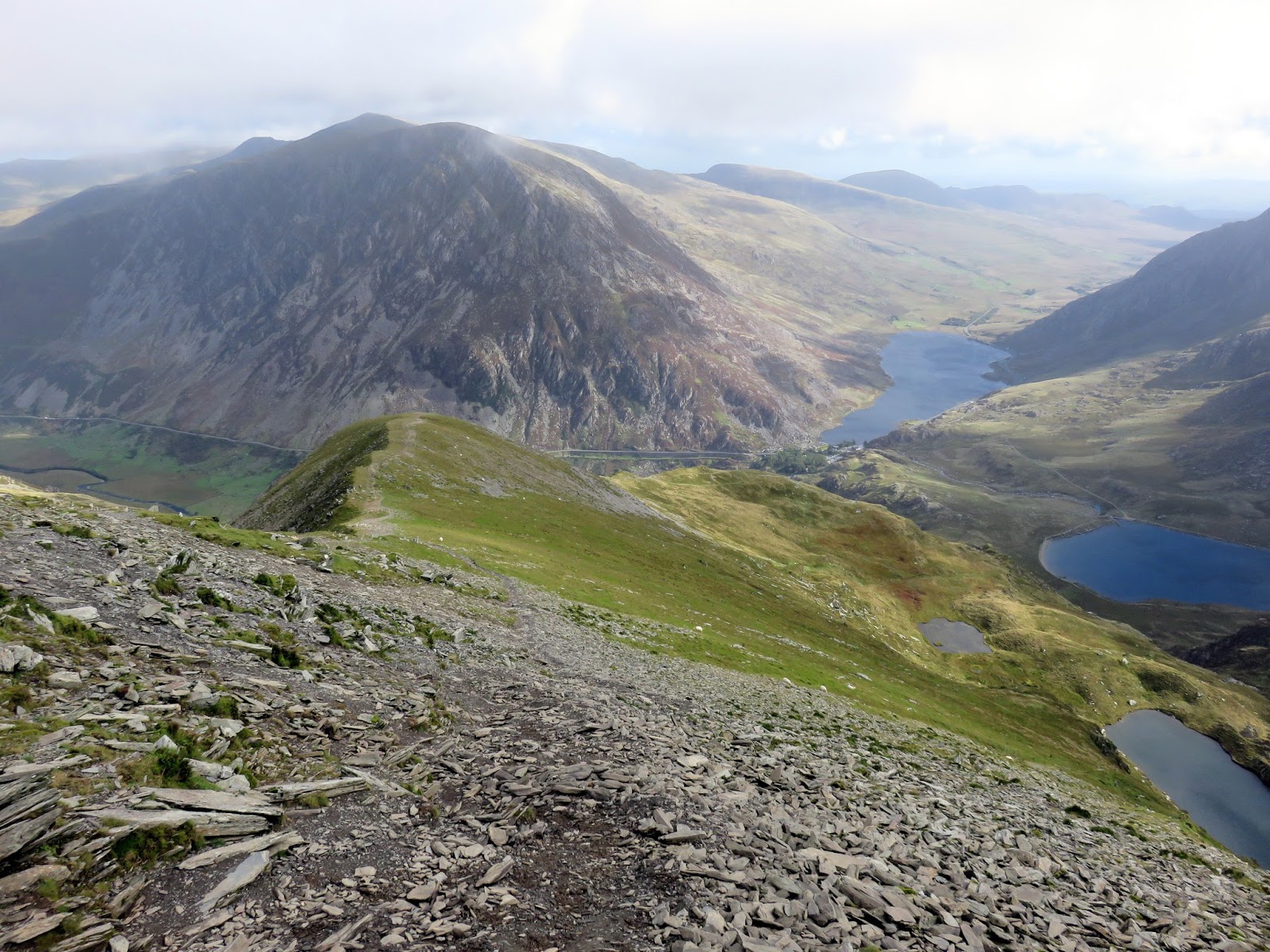
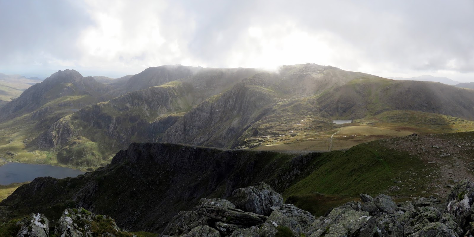
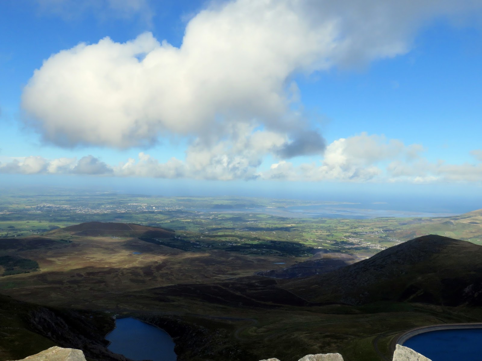
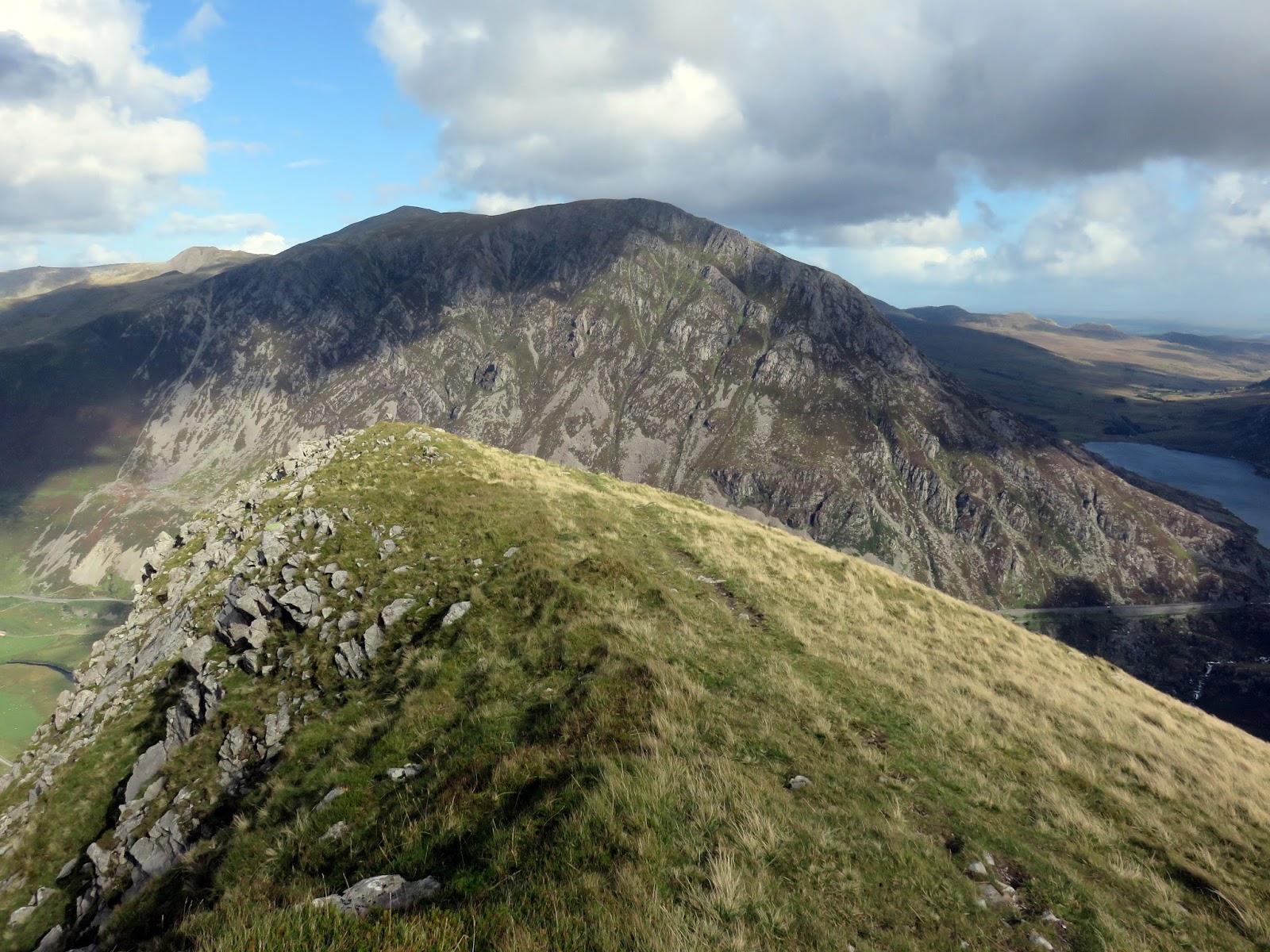
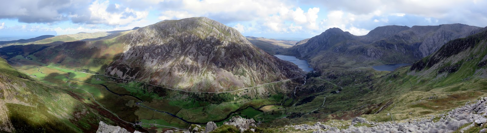
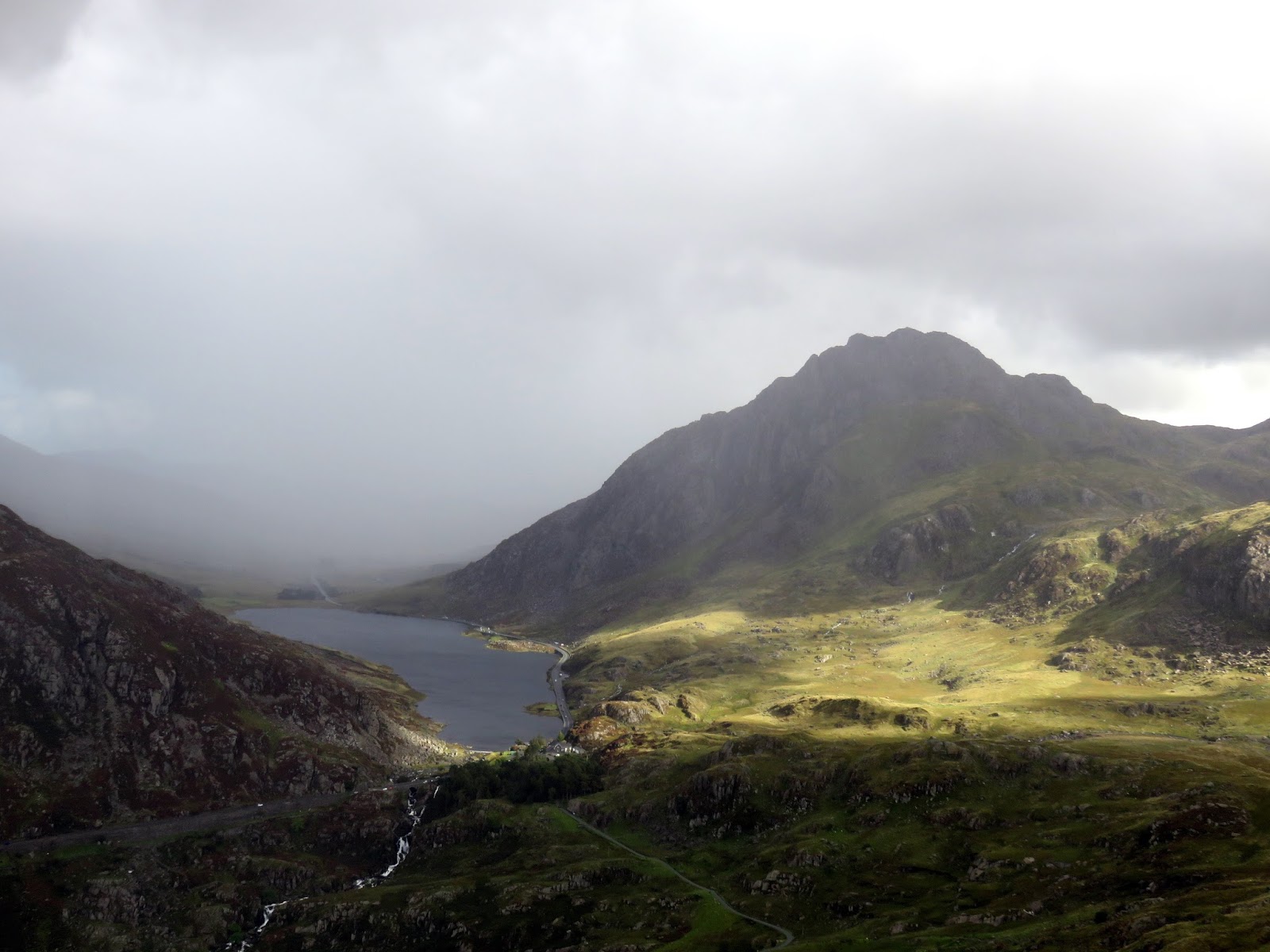
It was fairly blustery on the summit, much cooler than recent days and a reminder that autumn is not far away. Of all the Welsh mountains called Y Garn (translated as ‘the cairn’ or ‘the rock’), this particular variant is the tenth highest in the country and has a superb panorama thanks to its location on the bend of the Ogwen valley. To the east is Llyn Owgen, Tryfan and the Glyders while Nant Ffrancon stretches away to the north. To the south stands Crib Goch, Garnedd Ugain and Yr Wyddfa, which had a patch of cloud on it today.
 |
| Cwm Clyd, Cwm Idwal and Llyn Ogwen from Y Garn |
 |
| A fine mountain panorama from Y Garn |
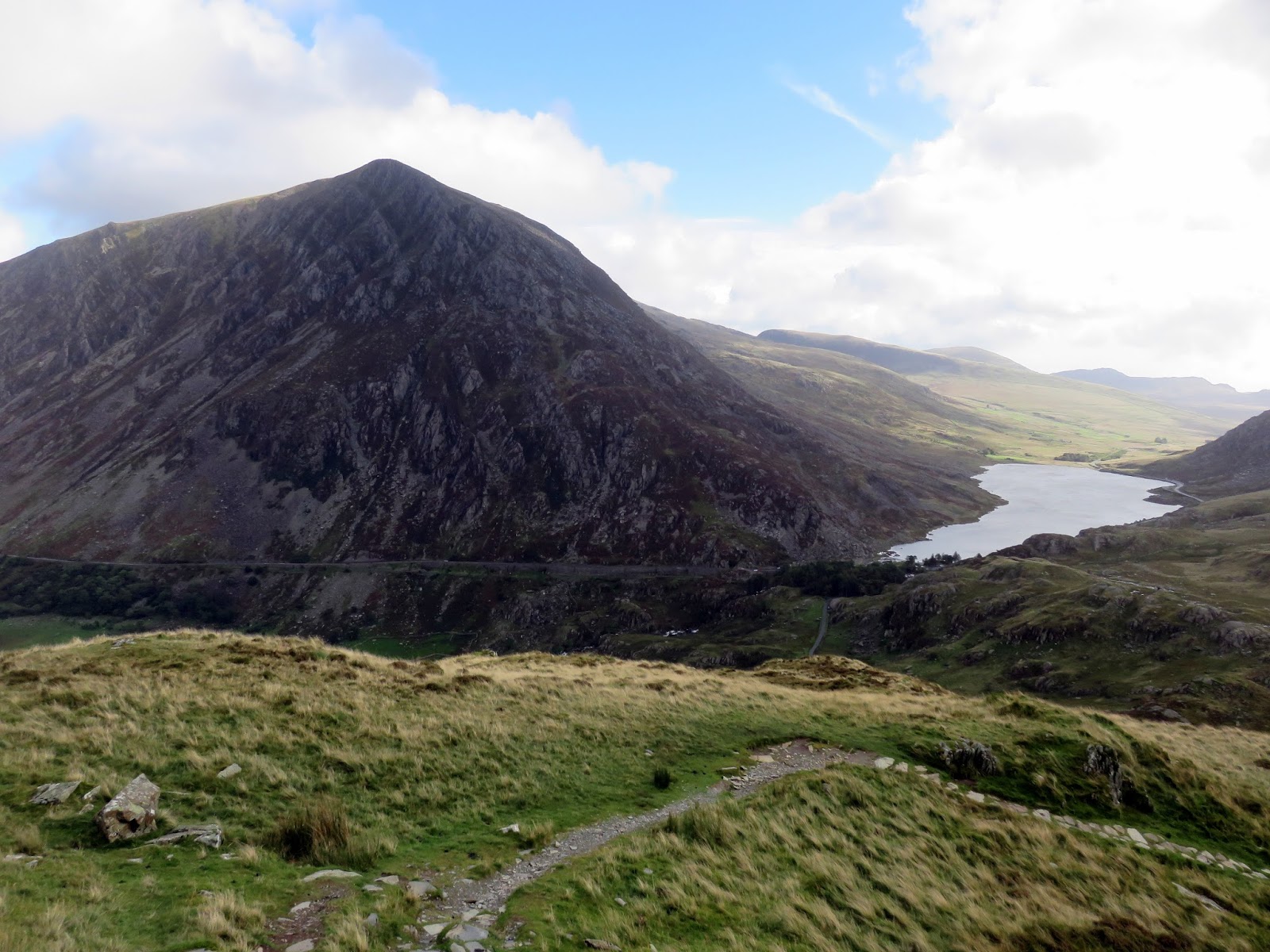
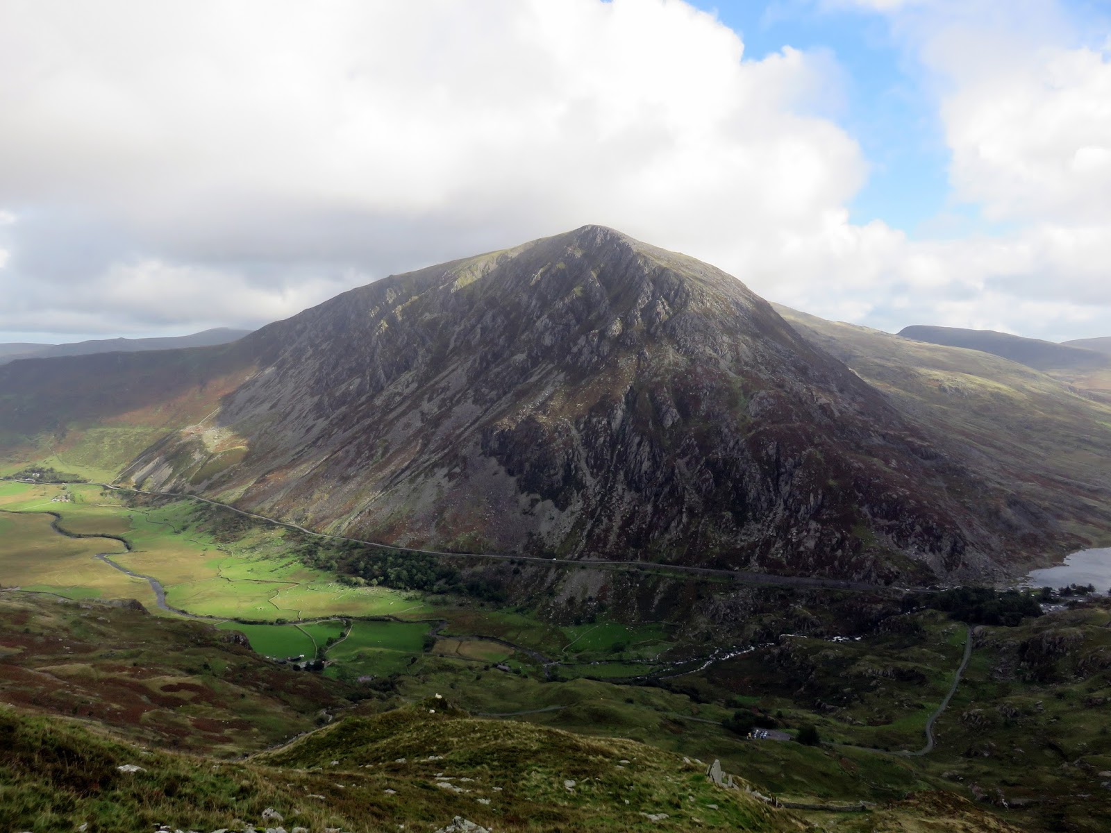
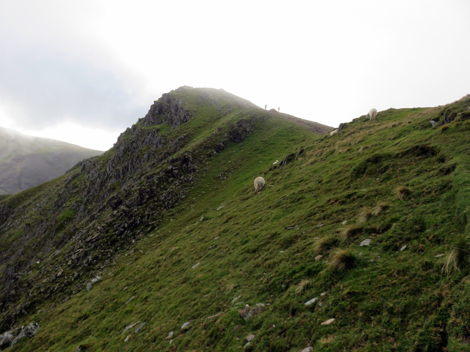
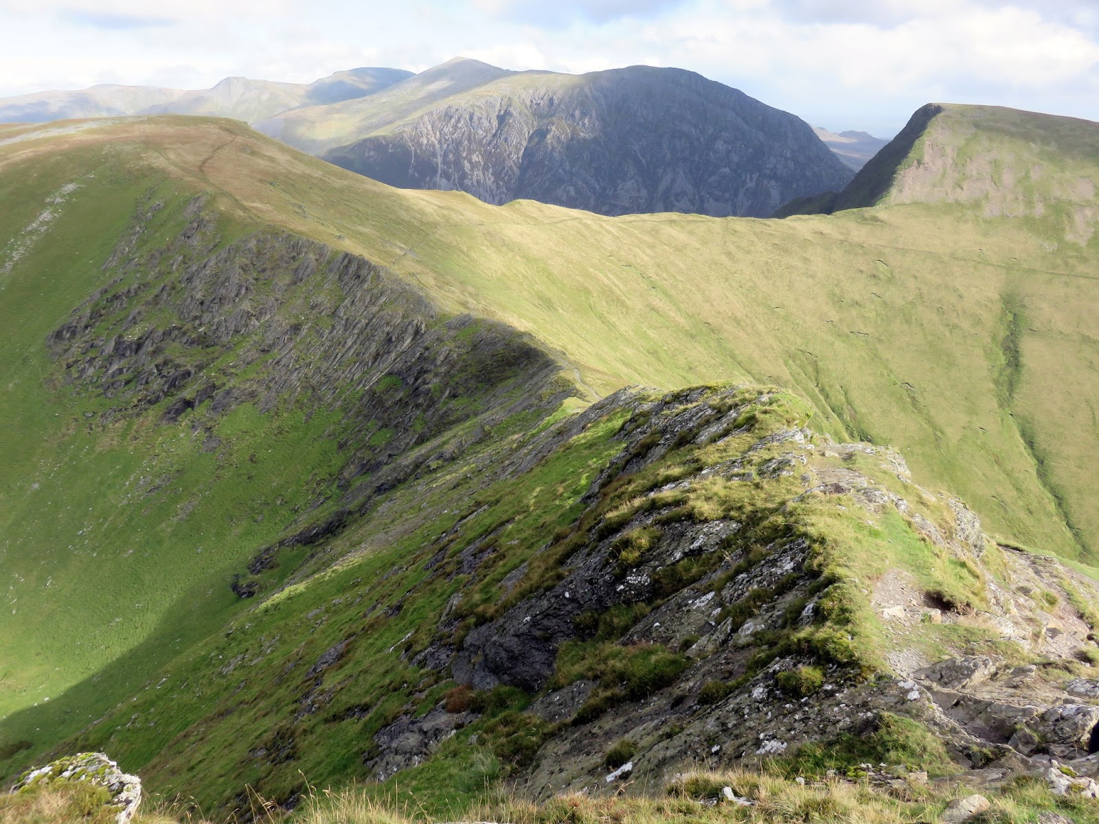
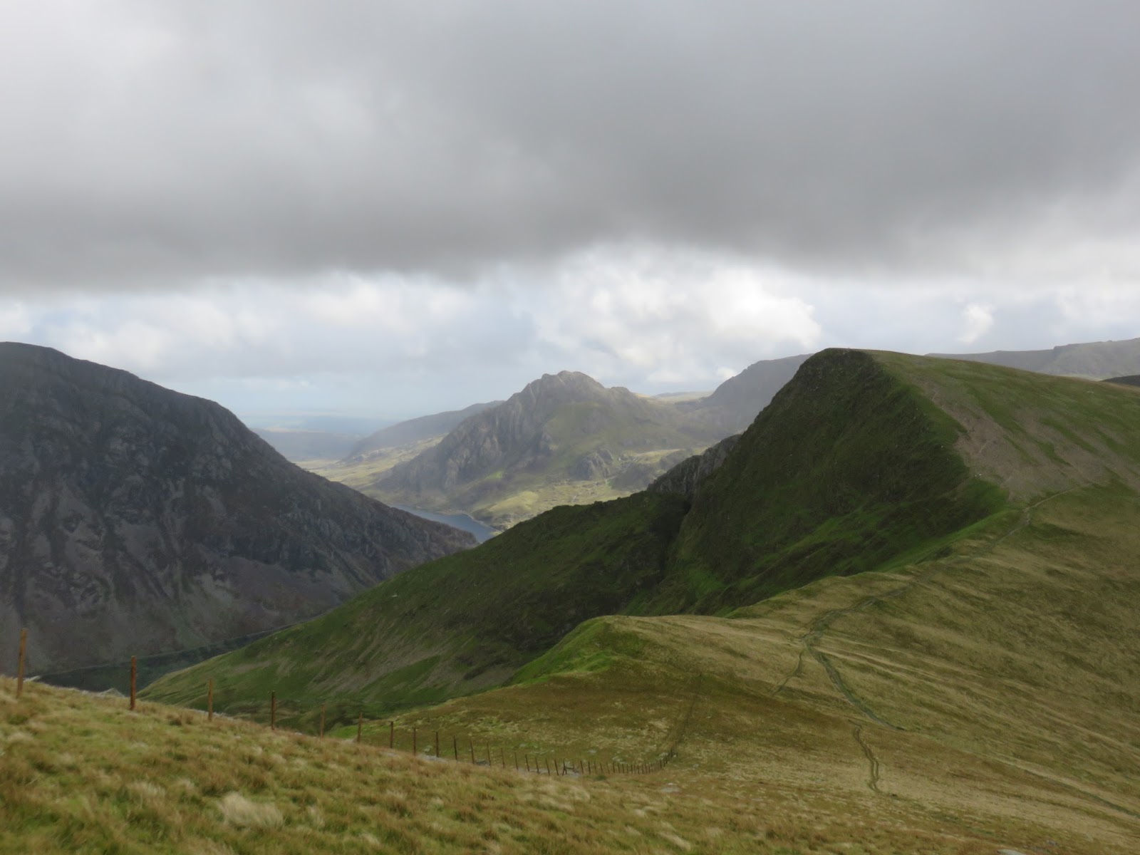
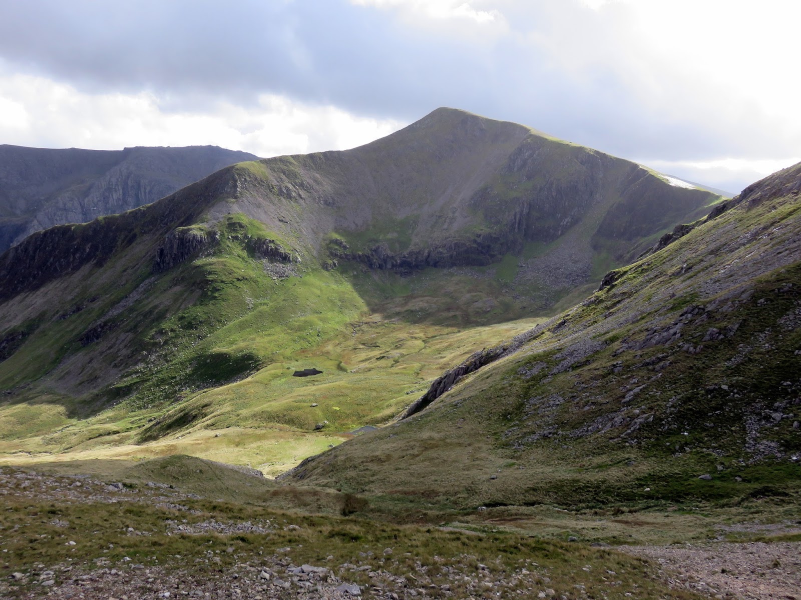
We left the summit heading northwards, following the obvious path towards Foel-goch but taking the level line below the summit to Bwlch y Brecan. Here, the path rounds the top of Cwm Dudodyn before a short climb onto the ridge the links Elidir Fawr to the main bulk of the Glyderau.
 |
| It was a day with ever changing weather |
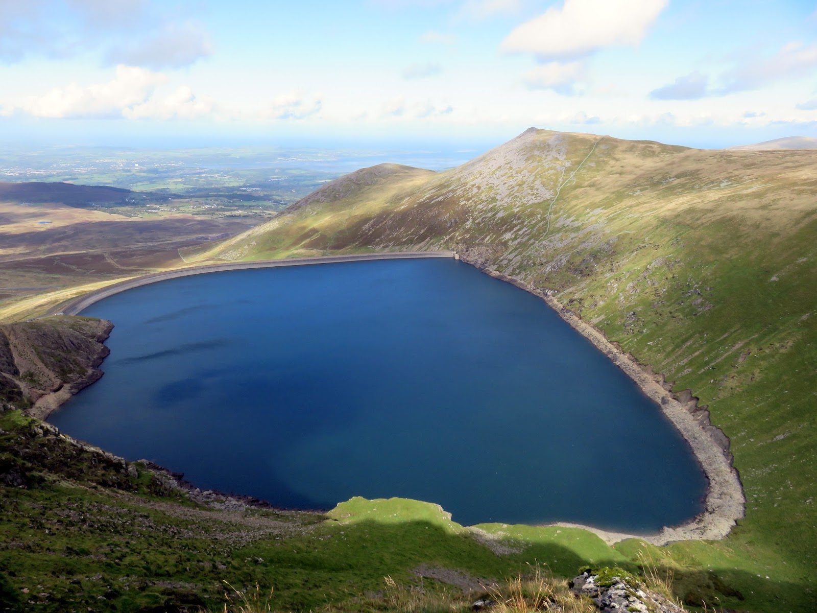
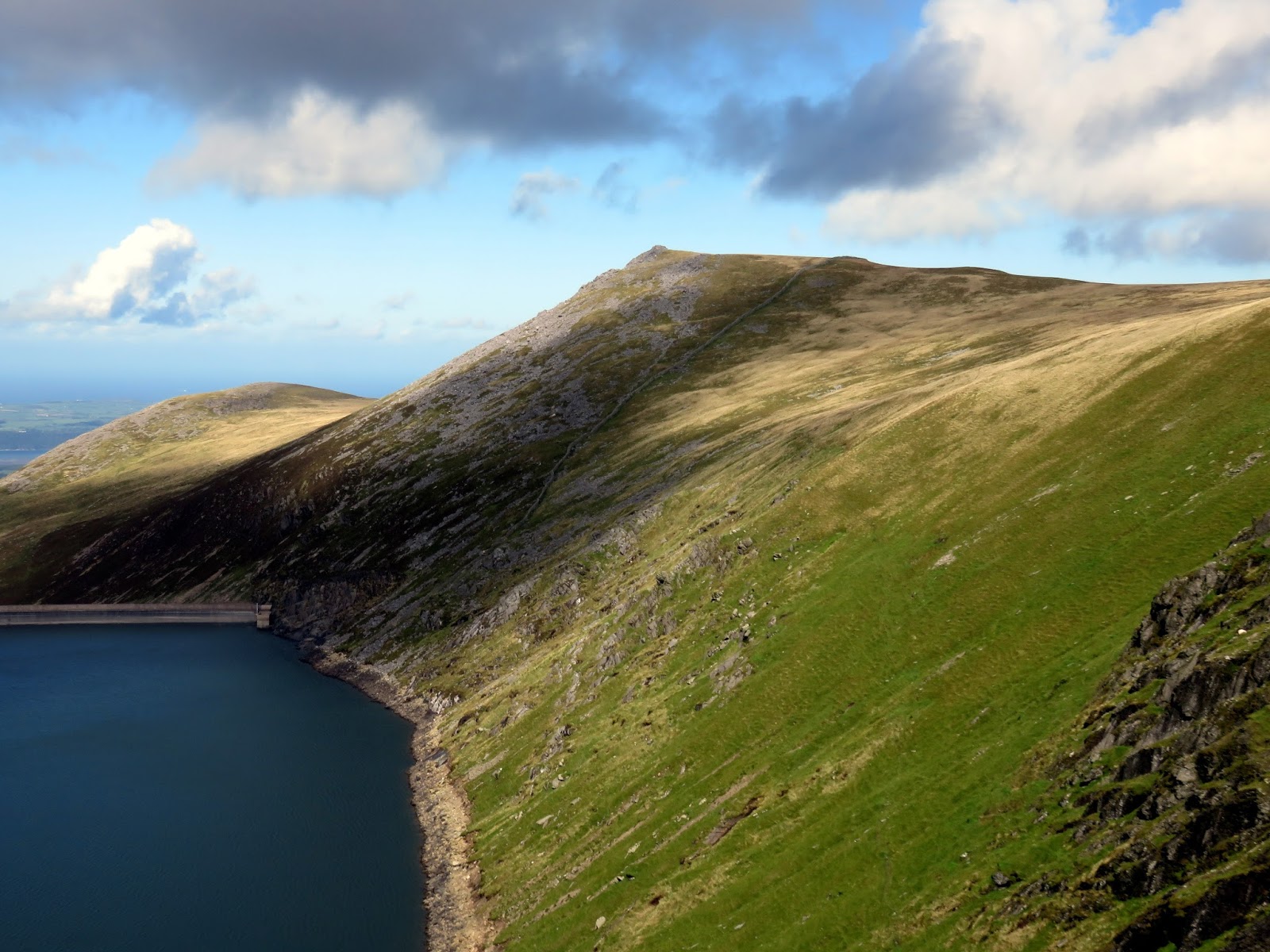
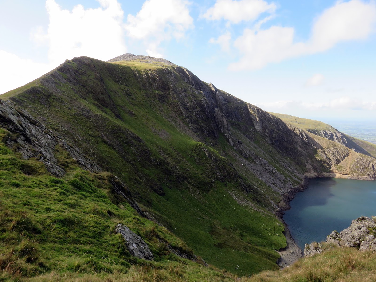
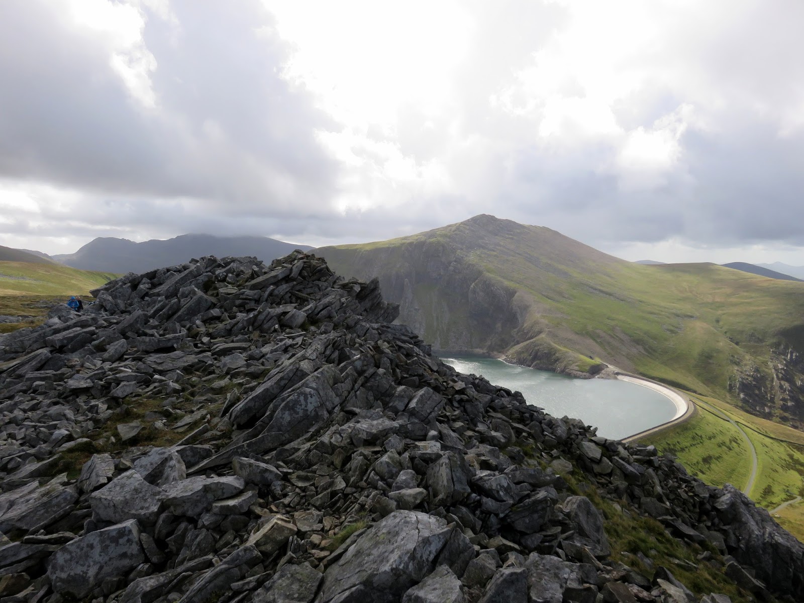
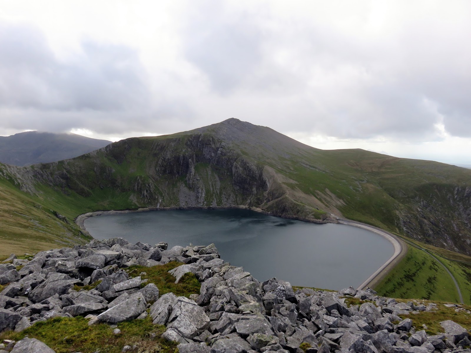
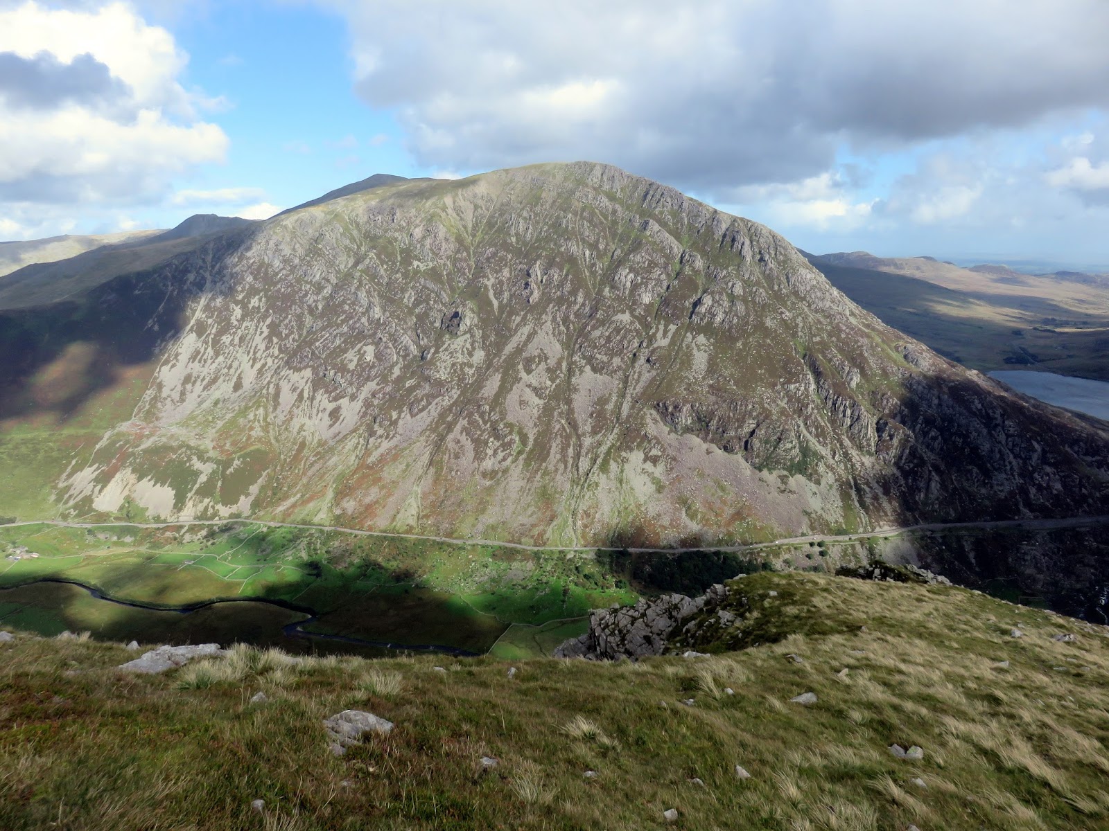
The ridge is formed of a superb arête, with an impressive view of the Marchlyn Mawr Reservoir that is used to feed the hydroelectric power station hidden within Elidir Fawr. It is a pumped storage system used to supply electricity at times of high demand. Water is pumped up to the upper lake (Marchlyn Mawr) using off-peak electricity, and when there is high demand this is dropped through turbines to generate additional electricity, ending in Llyn Peris. This gives Elidir Fawr an alternate name – the electric mountain.
 |
| Bwlch y Marchlyn |
 |
| Marchlyn Mawr |
 |
| The east ridge |
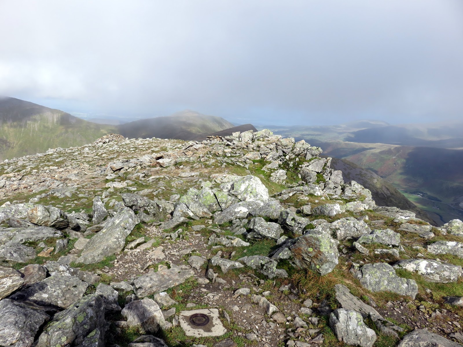
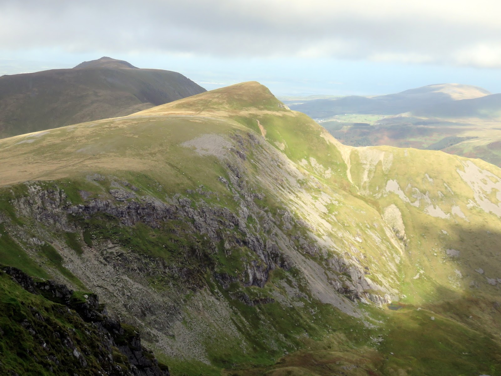
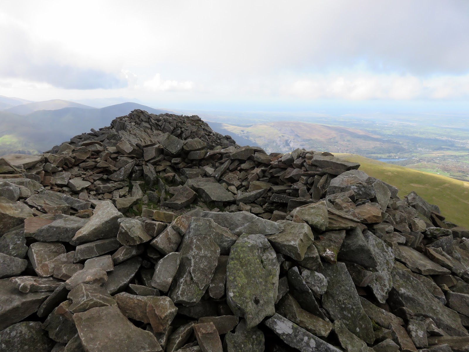
Elidir Fawr has a fine rocky summit, crowned by a large shelter that was a welcome respite from the wind and the perfect spot for lunch and preparation for the next couple of peaks. Retracing our steps we descended back to Bwlch y Marchlyn before making the short climb up to Mynydd Perfedd. A quick out-and-back bagged the summit of Carnedd y Filiast – the most northerly summit of the Glyderau (along with is subsidiary top, Y Fronllywd).
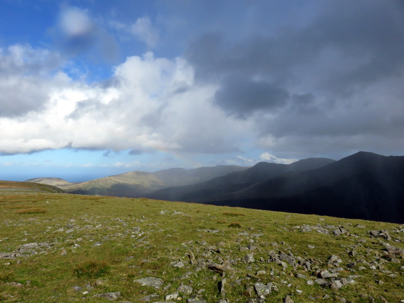
 |
| Showers over the Carneddau |
A few showers had started to roll in by the time I had made it back to the summit of Mynydd Perfedd though I was treated to a few fleeting rainbows of the Carneddau. The route back to Ogwen to be a suck and see affair as there are no paths marked between Mynydd Perfedd and valley though I had seen a few routes that used the ridge descending from Foel-goch and that was where I was heading.
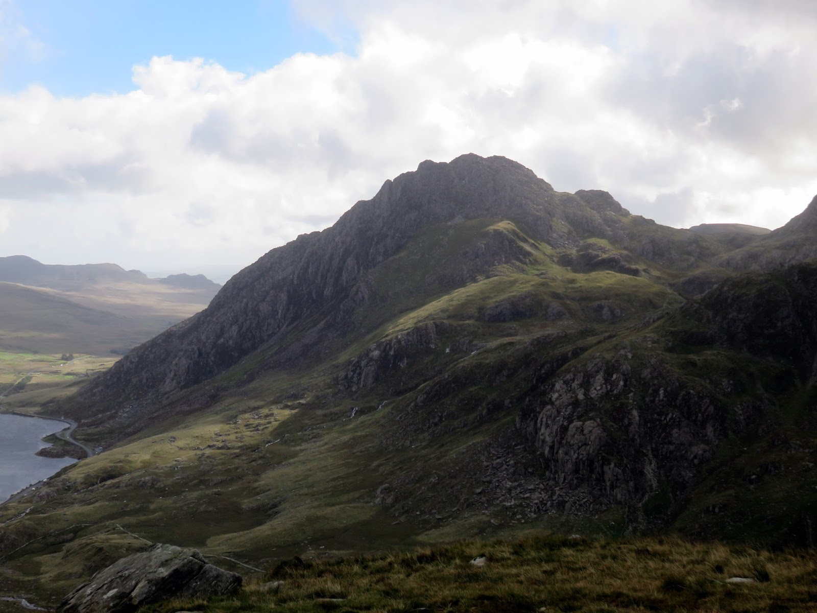
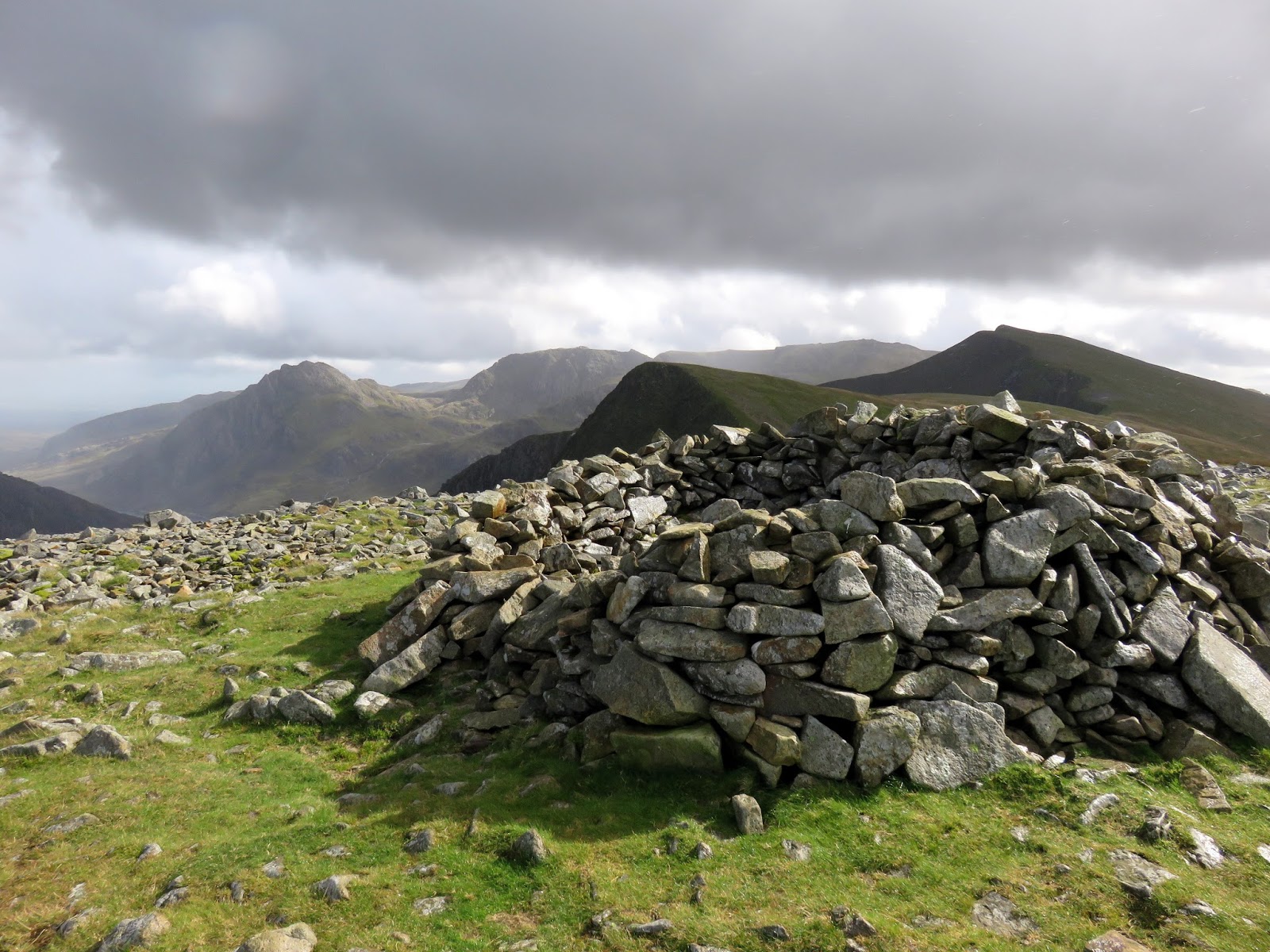
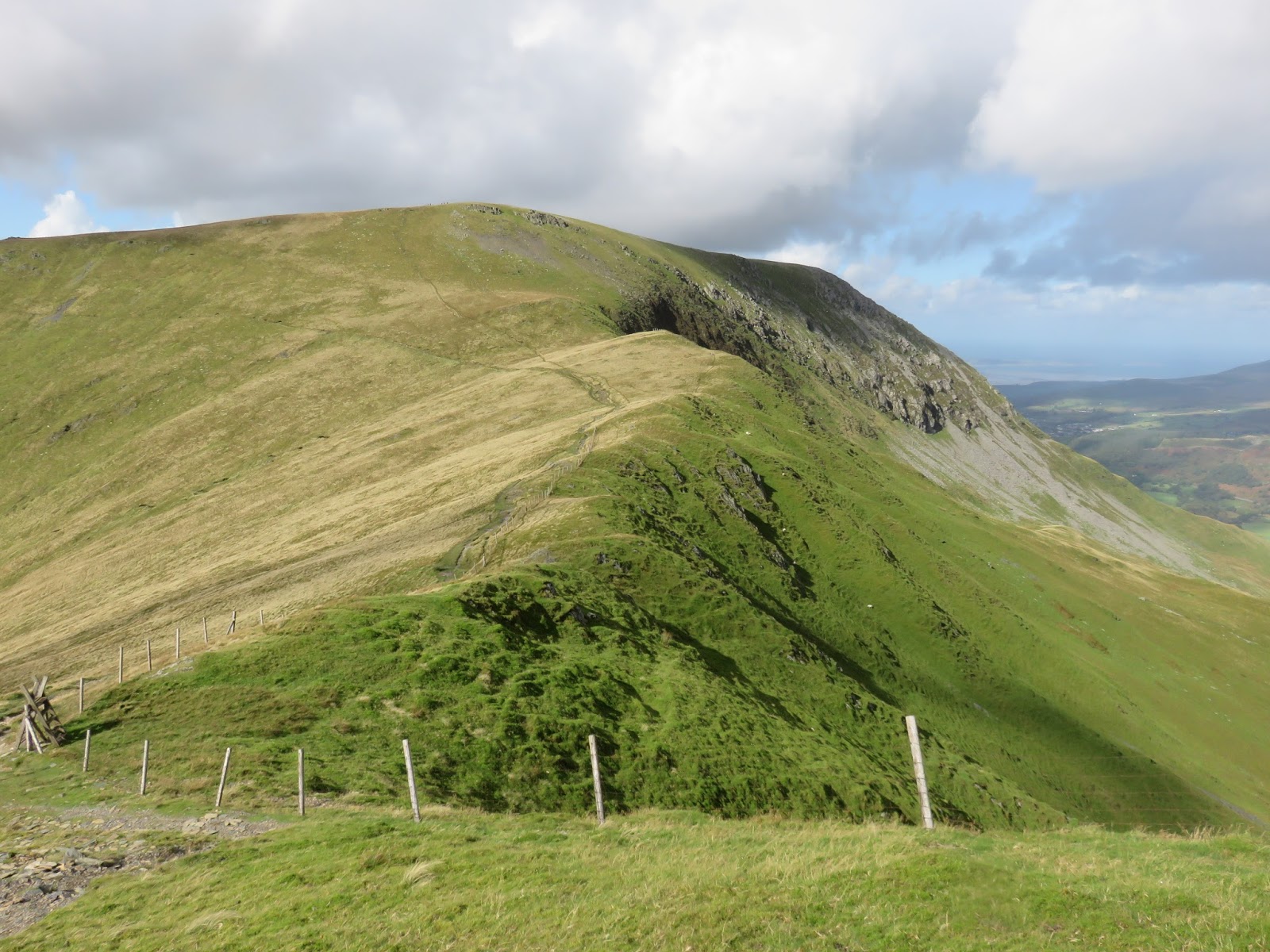
The north-west side of Foel-goch (that we had skirted under earlier in the day) is tremendously steep, especially towards the end of the day but it is mercifully short, just a few hundred metres. A small cairn perched on the edge of the cliffs marks the summit. The cliffs form an impressive line of crag between Foel-goch and Carnedd y Filiast and is home to the famous Atlantic Slab, a vast expanse of layered rock that is popular with climbers.
 |
| The Ogwen valley with Y Llymllwyd in the foreground |
 |
| Y Llymllwyd |
 |
| The ridge descends abruptly |
 |
| The Ogwen valley |
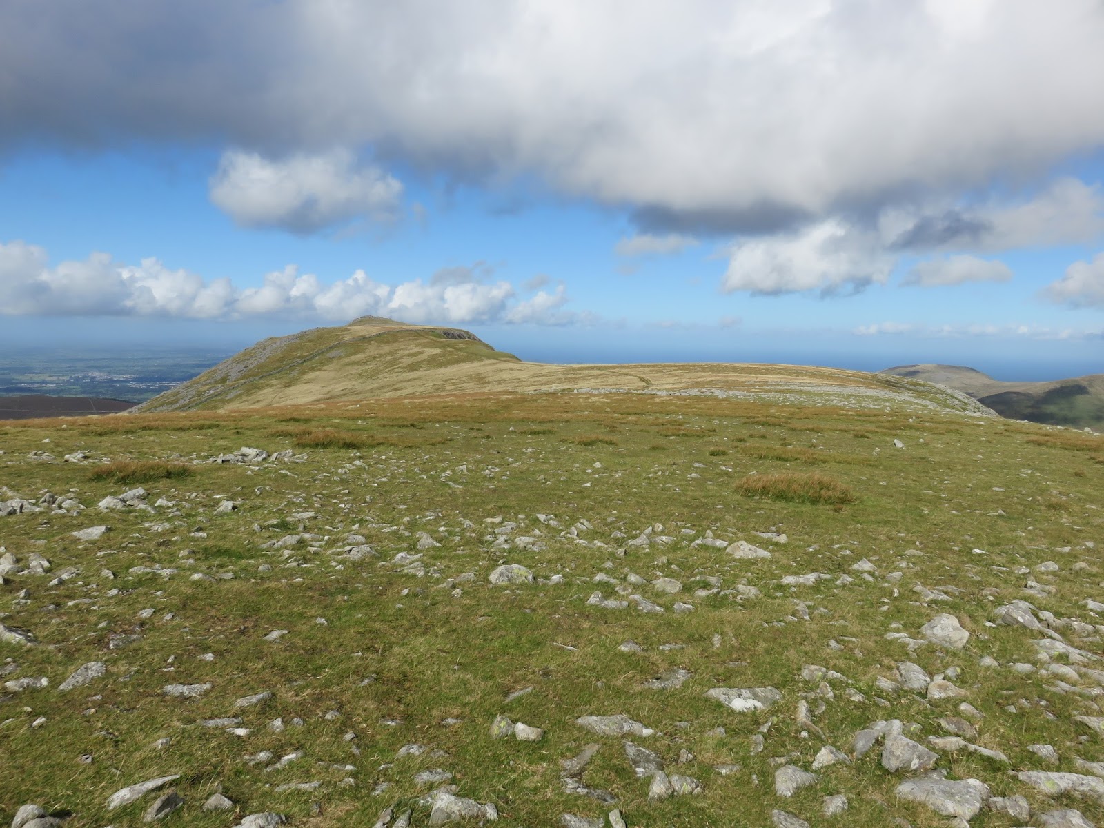
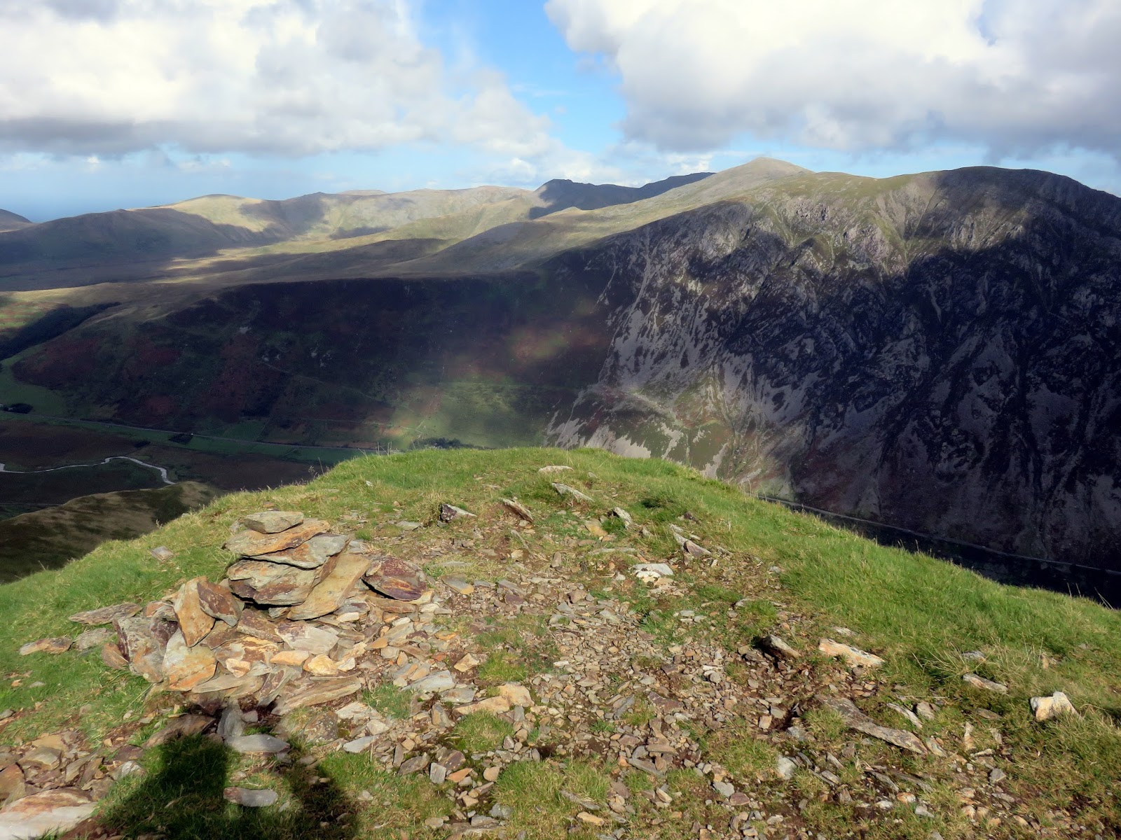
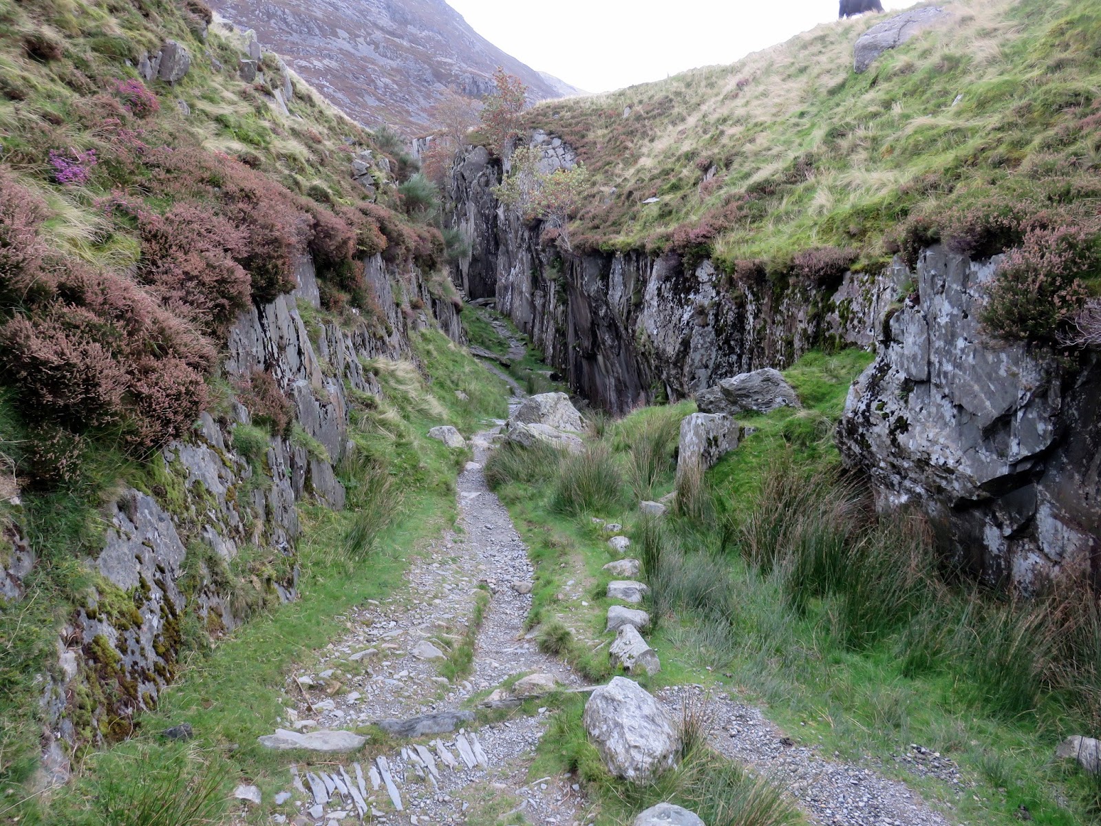
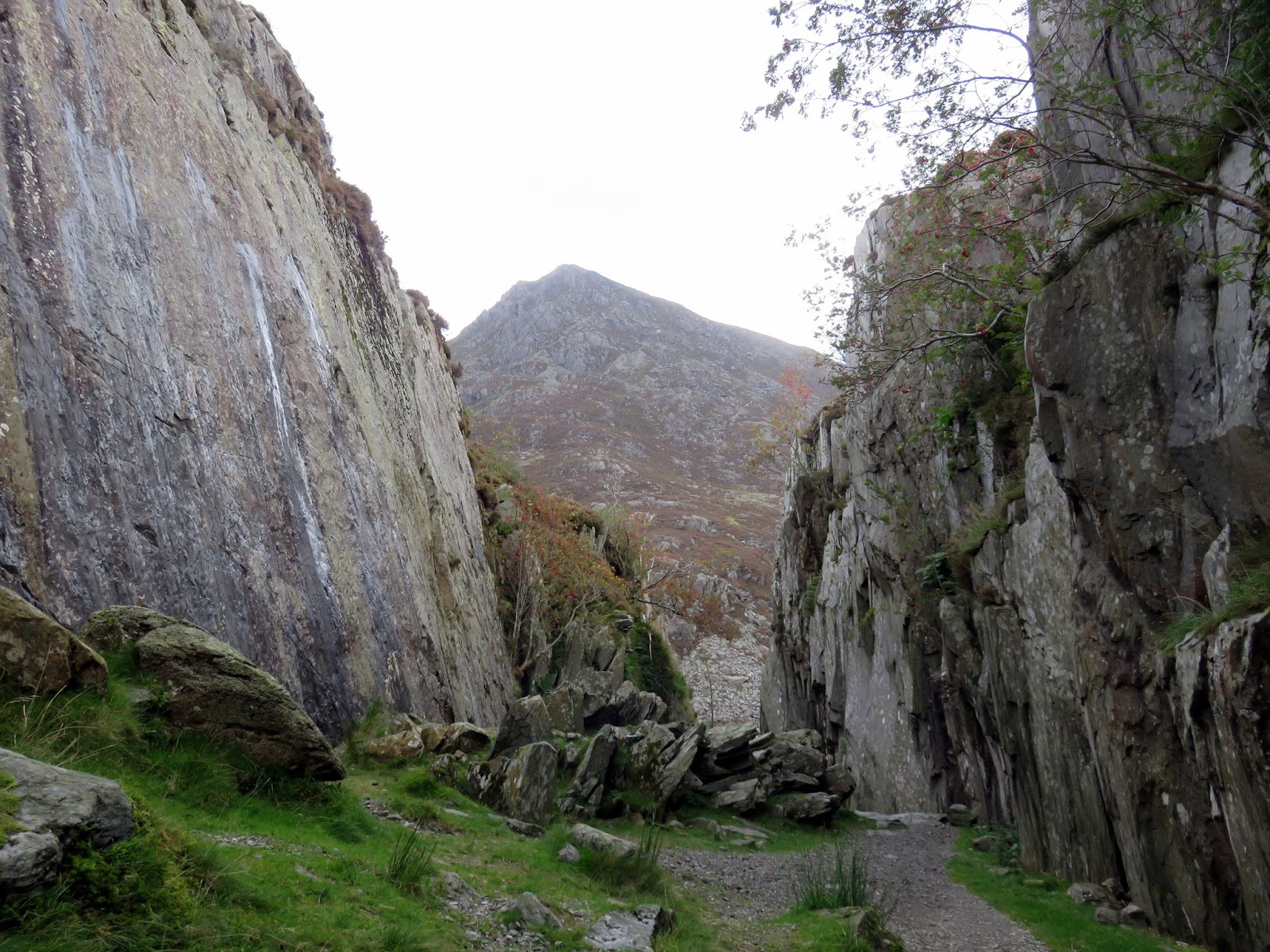
As more showers began to roll in I began my descent down the ridge of Y Llymllywd which turned out to be a nice way down. A faint path follows the ridge to the curiously named Mushroom Garden and then follows a drystone wall all the way back to Llyn Idwal. The final bit of interest is passing through the disused quarry that stands behind Idwal Cottage before returning to the car and facing the long drive back to Leeds.
 |
| Cwm Idwal |
 |
| The Idwal Quarry |
 |
| The Idwal Quarry |
North Wales is quickly becoming a firm favourite and two more days exploring the mountains have done nothing but enhance its appeal. It’s the natural advancement to walking the Lake District and I have grand plans to explore as much as possible.
