Open Space Web-Map builder Codehttps://openspace.ordnancesurvey.co.uk/osmapapi/openspace.js?key=3119F72552FD5C22E0530C6CA40A5A92https://openspace.ordnancesurvey.co.uk/osmapapi/script/mapbuilder/basicmap.jshttps://openspace.ordnancesurvey.co.uk/osmapapi/script/mapbuilder/searchbox.js//variables for routes var linesLayer, points, lineFeature, lineString, routeMarkersLayer, routepos, routesize, routeoffset, routeicon; var style_blue = {strokeColor: “#0000CD”, strokeOpacity: 0.5, strokeWidth: 4.5}; function initmapbuilder() { //initiate the map var options = {resolutions: [2500, 1000, 500, 200, 100, 50, 25, 10, 5, 4, 2.5, 2, 1]}; osMap = new OpenSpace.Map(‘map’, options); //configure map options (basicmap.js) setglobaloptions(); //set the center of the map and the zoom level osMap.setCenter(new OpenSpace.MapPoint(265443.5,359523.5),7); linesLayer = osMap.getVectorLayer(); // Set up layer for route markers routeMarkersLayer = new OpenLayers.Layer.Markers(“Route Markers”); //make a route points = new Array(); points.push(new OpenLayers.Geometry.Point(265000,360380)); points.push(new OpenLayers.Geometry.Point(265122,360330)); points.push(new OpenLayers.Geometry.Point(265462,360272)); points.push(new OpenLayers.Geometry.Point(265654,360242)); points.push(new OpenLayers.Geometry.Point(265820,360192)); points.push(new OpenLayers.Geometry.Point(265904.5,360195)); points.push(new OpenLayers.Geometry.Point(266071.5,360261)); points.push(new OpenLayers.Geometry.Point(266337.5,360242.5)); points.push(new OpenLayers.Geometry.Point(266367.5,360127.5)); points.push(new OpenLayers.Geometry.Point(266467.5,360067.5)); points.push(new OpenLayers.Geometry.Point(266592.5,360032.5)); points.push(new OpenLayers.Geometry.Point(266662.5,359997.5)); points.push(new OpenLayers.Geometry.Point(266607.5,359917.5)); points.push(new OpenLayers.Geometry.Point(266612.5,359847.5)); points.push(new OpenLayers.Geometry.Point(266502.5,359742.5)); points.push(new OpenLayers.Geometry.Point(266477.5,359687.5)); points.push(new OpenLayers.Geometry.Point(266447.5,359552.5)); points.push(new OpenLayers.Geometry.Point(266427.5,359497.5)); points.push(new OpenLayers.Geometry.Point(266412.5,359422.5)); points.push(new OpenLayers.Geometry.Point(266377.5,359357.5)); points.push(new OpenLayers.Geometry.Point(266327.5,359297.5)); points.push(new OpenLayers.Geometry.Point(266257.5,359237.5)); points.push(new OpenLayers.Geometry.Point(266207.5,359127.5)); points.push(new OpenLayers.Geometry.Point(266197.5,359057.5)); points.push(new OpenLayers.Geometry.Point(266148.5,358928.5)); points.push(new OpenLayers.Geometry.Point(266128.5,358853.5)); points.push(new OpenLayers.Geometry.Point(266018.5,358813.5)); points.push(new OpenLayers.Geometry.Point(265978.5,358728.5)); points.push(new OpenLayers.Geometry.Point(265973.5,358633.5)); points.push(new OpenLayers.Geometry.Point(265943.5,358553.5)); points.push(new OpenLayers.Geometry.Point(265943.5,358488.5)); points.push(new OpenLayers.Geometry.Point(265843.5,358428.5)); points.push(new OpenLayers.Geometry.Point(265658.5,358328.5)); points.push(new OpenLayers.Geometry.Point(265523.5,358273.5)); points.push(new OpenLayers.Geometry.Point(265378.5,358203.5)); points.push(new OpenLayers.Geometry.Point(265238.5,358183.5)); points.push(new OpenLayers.Geometry.Point(265198.5,358208.5)); points.push(new OpenLayers.Geometry.Point(265078.5,358238.5)); points.push(new OpenLayers.Geometry.Point(265028.5,358328.5)); points.push(new OpenLayers.Geometry.Point(265038.5,358483.5)); points.push(new OpenLayers.Geometry.Point(265068.5,358578.5)); points.push(new OpenLayers.Geometry.Point(265108.5,358673.5)); points.push(new OpenLayers.Geometry.Point(265068.5,358738.5)); points.push(new OpenLayers.Geometry.Point(265038.5,358763.5)); points.push(new OpenLayers.Geometry.Point(265028.5,358858.5)); points.push(new OpenLayers.Geometry.Point(265048.5,358908.5)); points.push(new OpenLayers.Geometry.Point(265088.5,359113.5)); points.push(new OpenLayers.Geometry.Point(265108.5,359173.5)); points.push(new OpenLayers.Geometry.Point(265118.5,359213.5)); points.push(new OpenLayers.Geometry.Point(265083.5,359343.5)); points.push(new OpenLayers.Geometry.Point(264853.5,359418.5)); points.push(new OpenLayers.Geometry.Point(264698.5,359573.5)); points.push(new OpenLayers.Geometry.Point(264668.5,359578.5)); points.push(new OpenLayers.Geometry.Point(264688.5,359868.5)); points.push(new OpenLayers.Geometry.Point(264858.5,359948.5)); points.push(new OpenLayers.Geometry.Point(265018.5,360043.5)); points.push(new OpenLayers.Geometry.Point(265123.5,360098.5)); points.push(new OpenLayers.Geometry.Point(265138.5,360138.5)); points.push(new OpenLayers.Geometry.Point(265000,360380)); // create a polyline feature from the array of points lineString = new OpenLayers.Geometry.LineString(points); lineFeature = new OpenLayers.Feature.Vector(lineString, null, style_blue); linesLayer.addFeatures([lineFeature]); //crate a route start/end marker routepos = new OpenSpace.MapPoint(265000,360380); routesize = new OpenLayers.Size(33,45); routeoffset = new OpenLayers.Pixel(-5,-37); routeicon = new OpenSpace.Icon(‘https://openspace.ordnancesurvey.co.uk/osmapapi/img_versions/img_1.1/mapbuilder/routemarker-startend.png’, routesize, routeoffset, null, null); routeMarkersLayer.addMarker(new OpenLayers.Marker(routepos, routeicon)); osMap.addLayer(routeMarkersLayer);}
Route: Tryfan North Ridge, Tryfan, Bwlch Tryfan, Bristly Ridge, Glyder Fach, Castell y Gwynt, Bwlch y Ddwy-Glyder, Y Gribin, Llyn Bochlwyd, Bochlwyd Buttress, A5
Date: 30/03/2019
From: A5 – Idwal Cottage
Parking: Laybys on A5
Start Point: Milestone Buttress
Region: Snowdonia
Route length: 5.3 miles (8.5 km)
Time taken: 07:50
Average speed: 1.0 mph
Ascent: 957m
Descent: 970m
Summits: Tryfan (917m), Glyder Fach (994m), Castell y Gwynt (972m)
Other points of interest: The Cannon, Bristly Ridge, The Cantilever, Y Gribin
The Bochlwyd Horseshoe is a full-day adventure; an almost non-stop scramble around the popular Glyderau. It includes all the popular scrambles of the range; Tryfan North Ridge, Tryfan South Ridge, Bristly Ridge and Y Gribin. It also has several of the classic north Wales photo ops; the Cannon, Adam and Eve and the Cantilever. I think it’s fair to say this route is rivalled only by the Snowdon Horseshoe.
 |
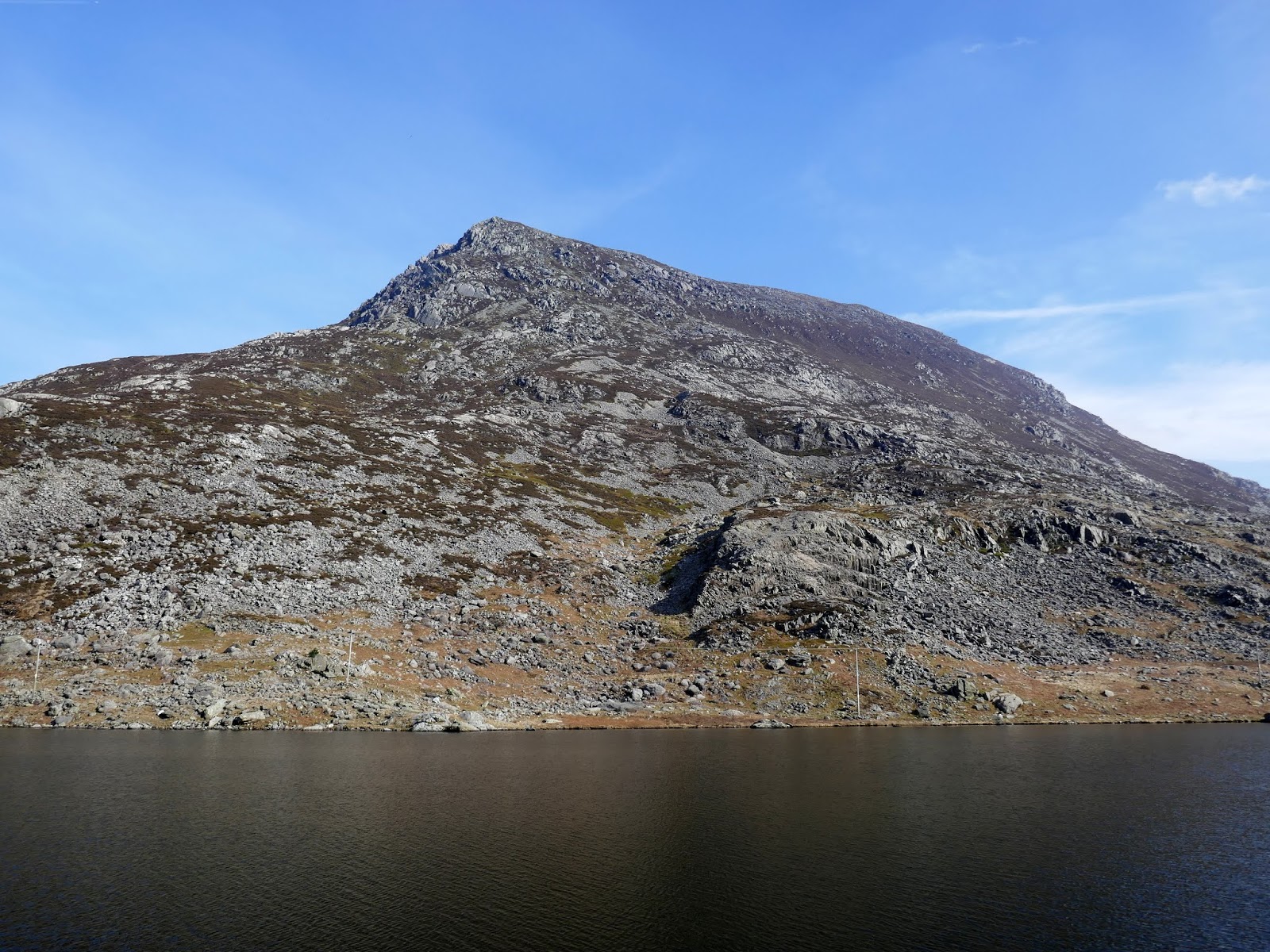
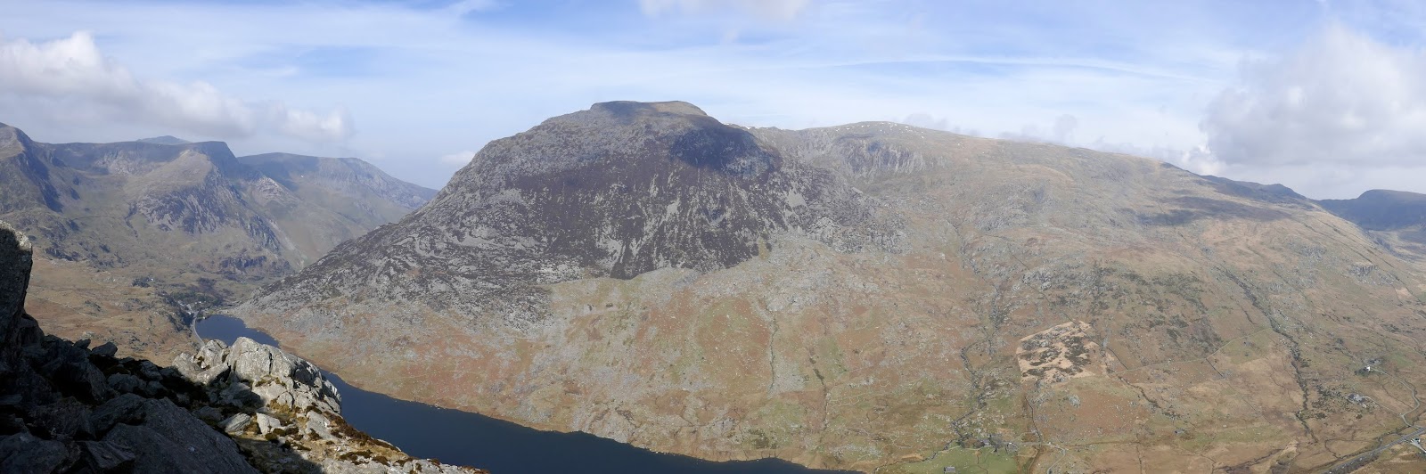
| Pen yr Ole Wen |
 |
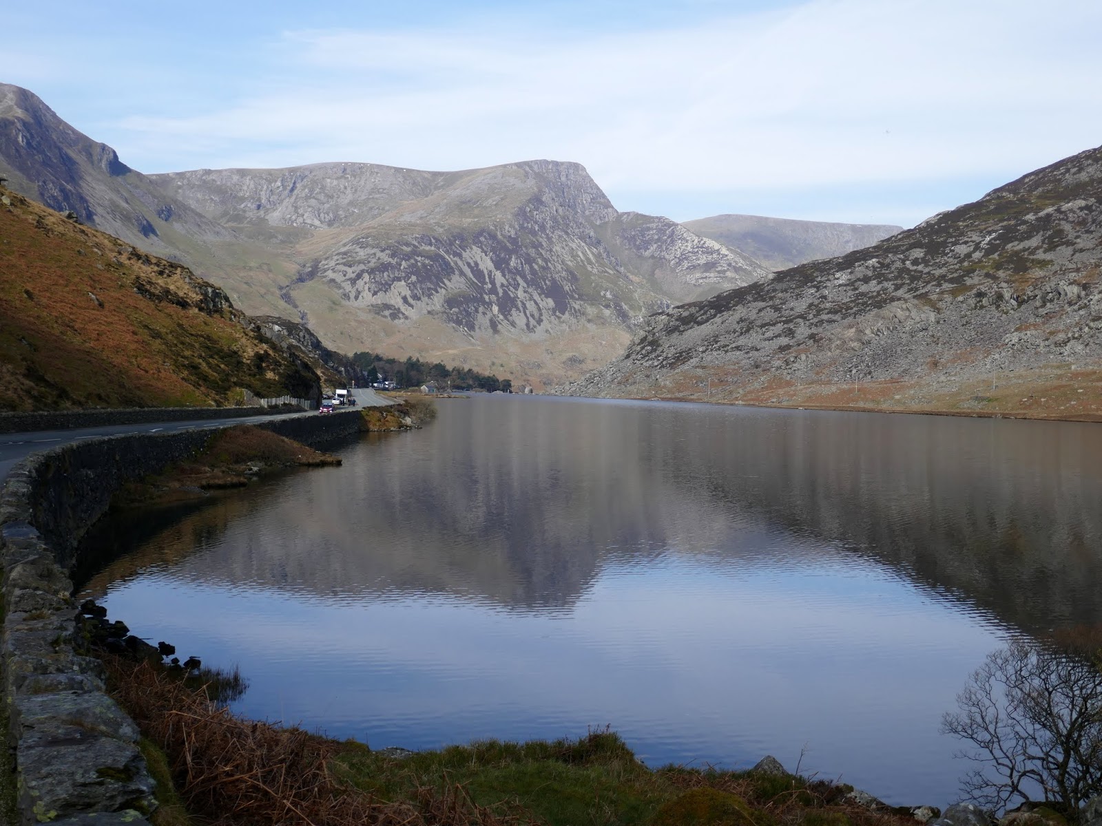
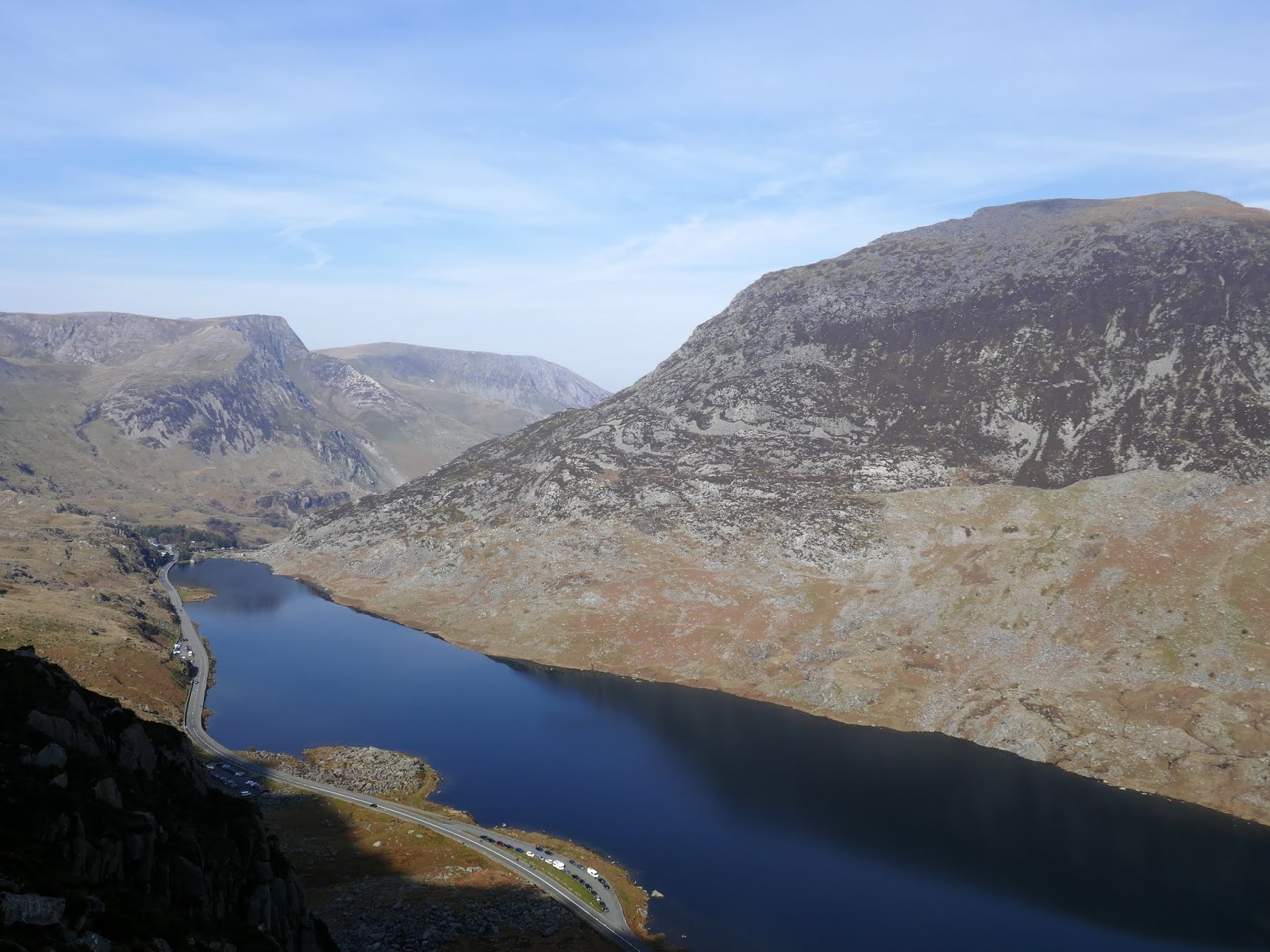
| The sparkling Llyn Ogwen |
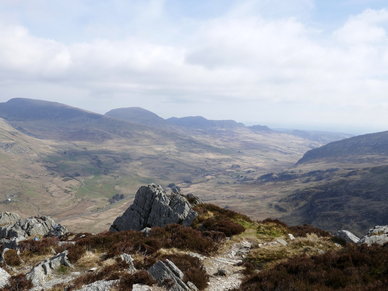
While the distance is very short (around 5 miles) it’s a tough day with hands on rock from almost the word go. We made our way from the youth hostel to the foot of the imposing Milestone Buttress, a popular haunt for climbers, home to a number of longer mountaineering routes if you are that way inclined. We would be heading the way most walkers tend to begin with, following the drystone wall from the car park before scaling a fairly obvious path that heads in an easterly direction, towards the north ridge.
 |
| The initial, bouldery climb from the roadside |
 |
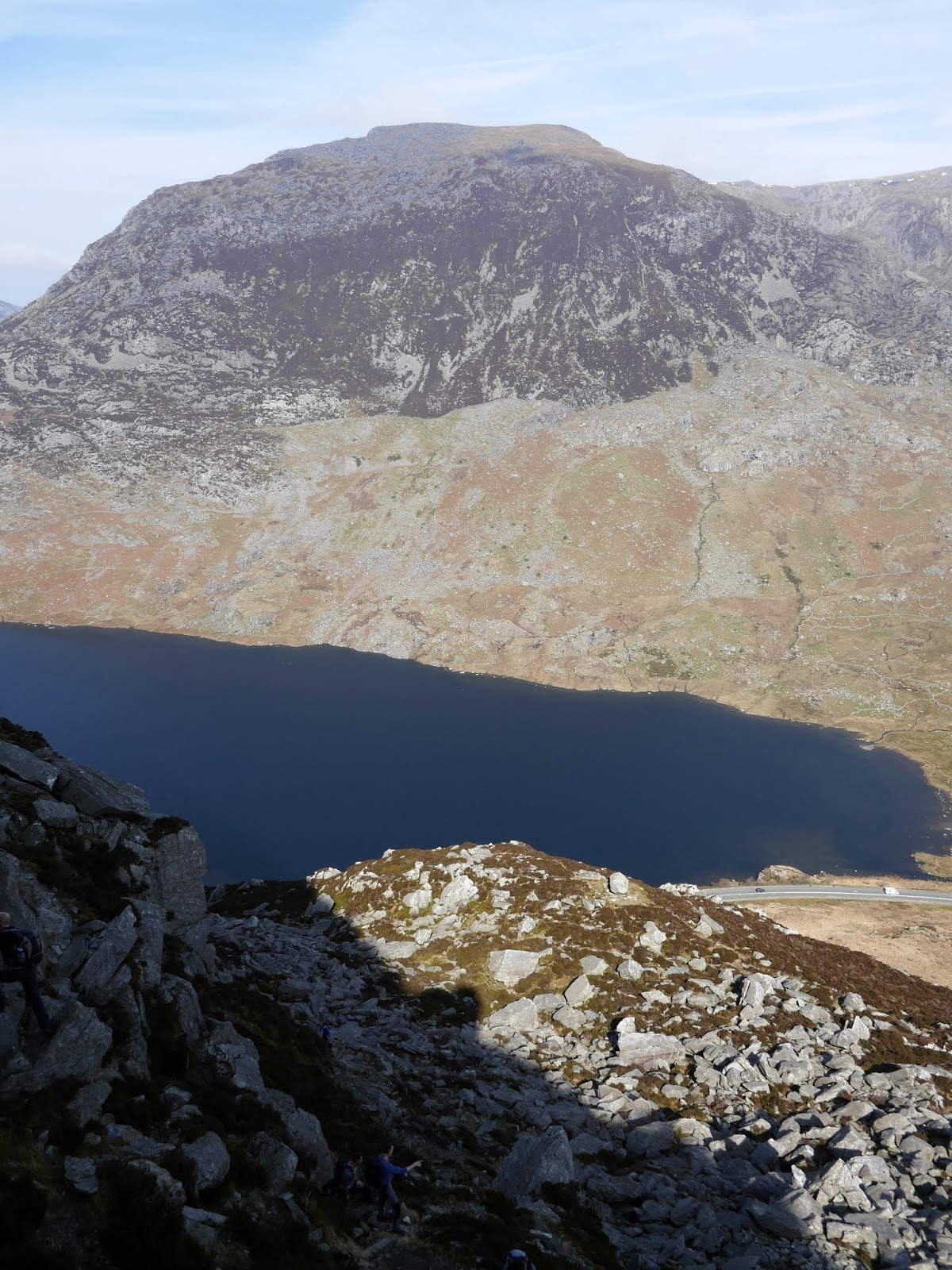
| Looking down on Llyn Ogwen |
 |
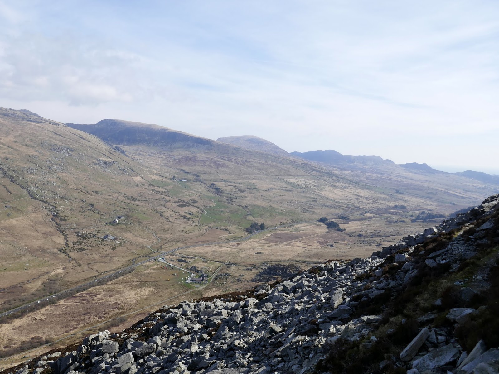
| The east end of the Ogwen valley |
 |
| Rounding the shoulder to gain the main ridge |
 |
| The high Carneddau |
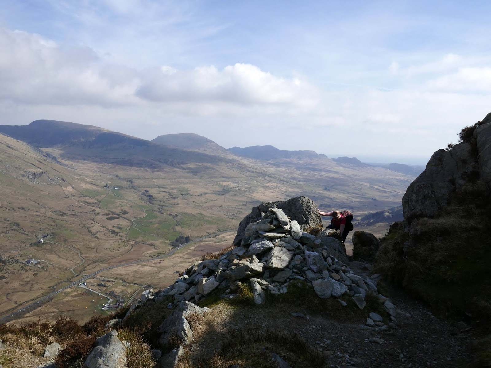
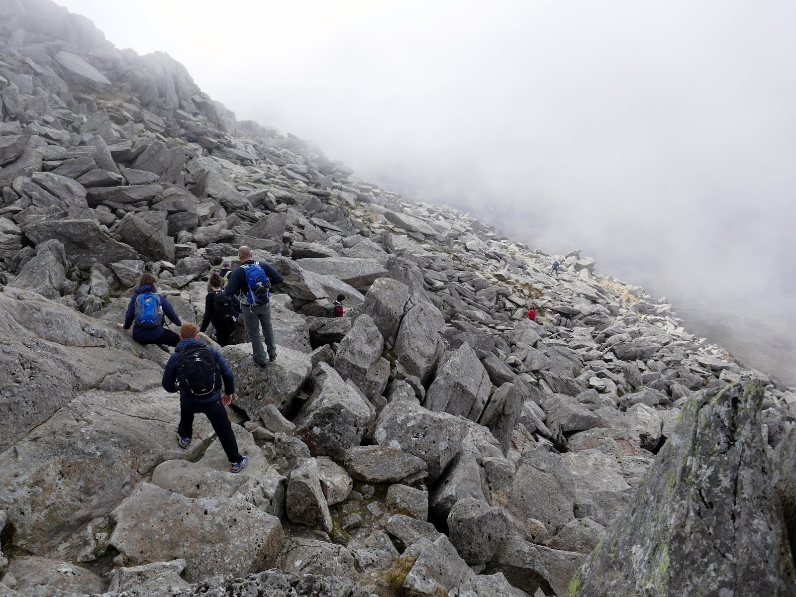
We followed the path until we reached a heather covered shoulder, an obvious landmark among a sea of rock. We were aiming to reach the crest of the ridge, the most direct and easy to follow line towards the summit. Here, a scree-strewn path starts to climb up and around a seemingly impenetrable wall of rock (no doubt experienced scramblers will enjoy finding their own way up) and before long, reaches a relatively flat area with a large cairn – an area supposedly known as Piccadilly Circus as it can get very busy.
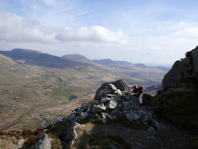 |
| The large cairn at Picaddilly Circus |
 |
| The north ridge leading to the Nose |
Some modest walking through heather and rocks is required before we tackled a few more entertaining scrambles. As with most routes on Tryfan, the can be made as easy or difficult as you choose and many of the really challenging parts can be easily bypassed. After some more climbing, we found our way to the Cannon.
The Cannon is one of the icons of North Wales, a jutting slab of rock, visible from the valley floor which simply begs to be photographed, usually with someone teetering on the end of it.
 |
| Tryfan’s famed Cannon |
 |
| Easier walking above the Cannon |
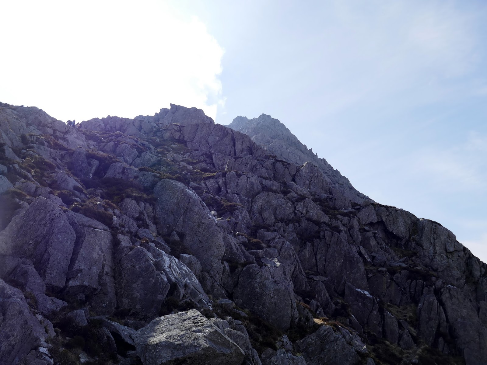
The route between the Cannon and the Nose is generally pretty straightforward and more of a walk than a scramble, though you can seek out the odd hands-on route I’m sure – it’s a nice respite for the arms before the stiffer challenges ahead. On a clear day, the Nose will be a clear objective.
 |
| Tryfan’s north ridge |
 |
| Looking across to Y Garn and Foel Goch |
 |
| The Nose |
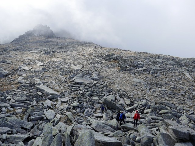
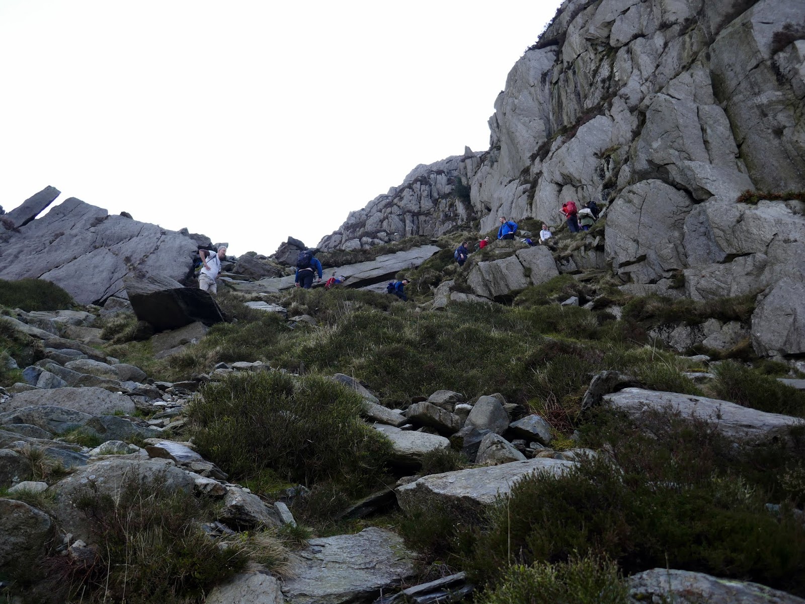
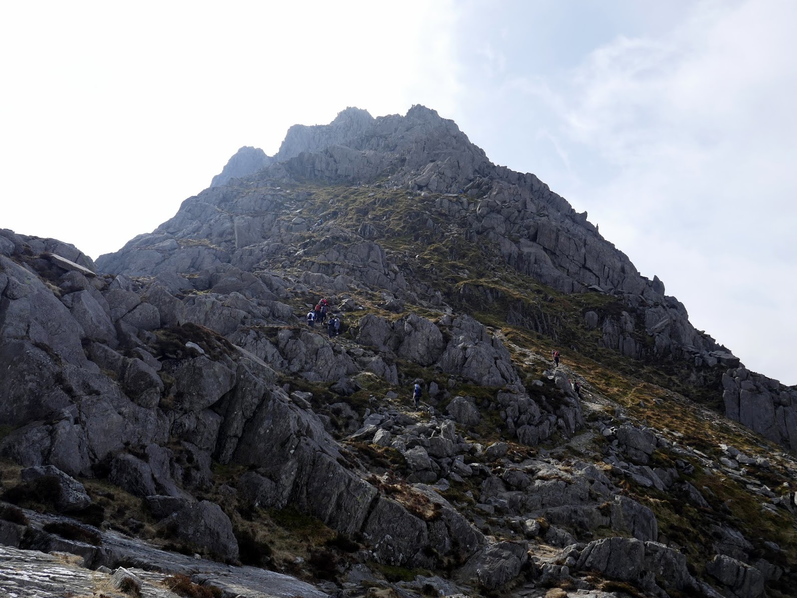
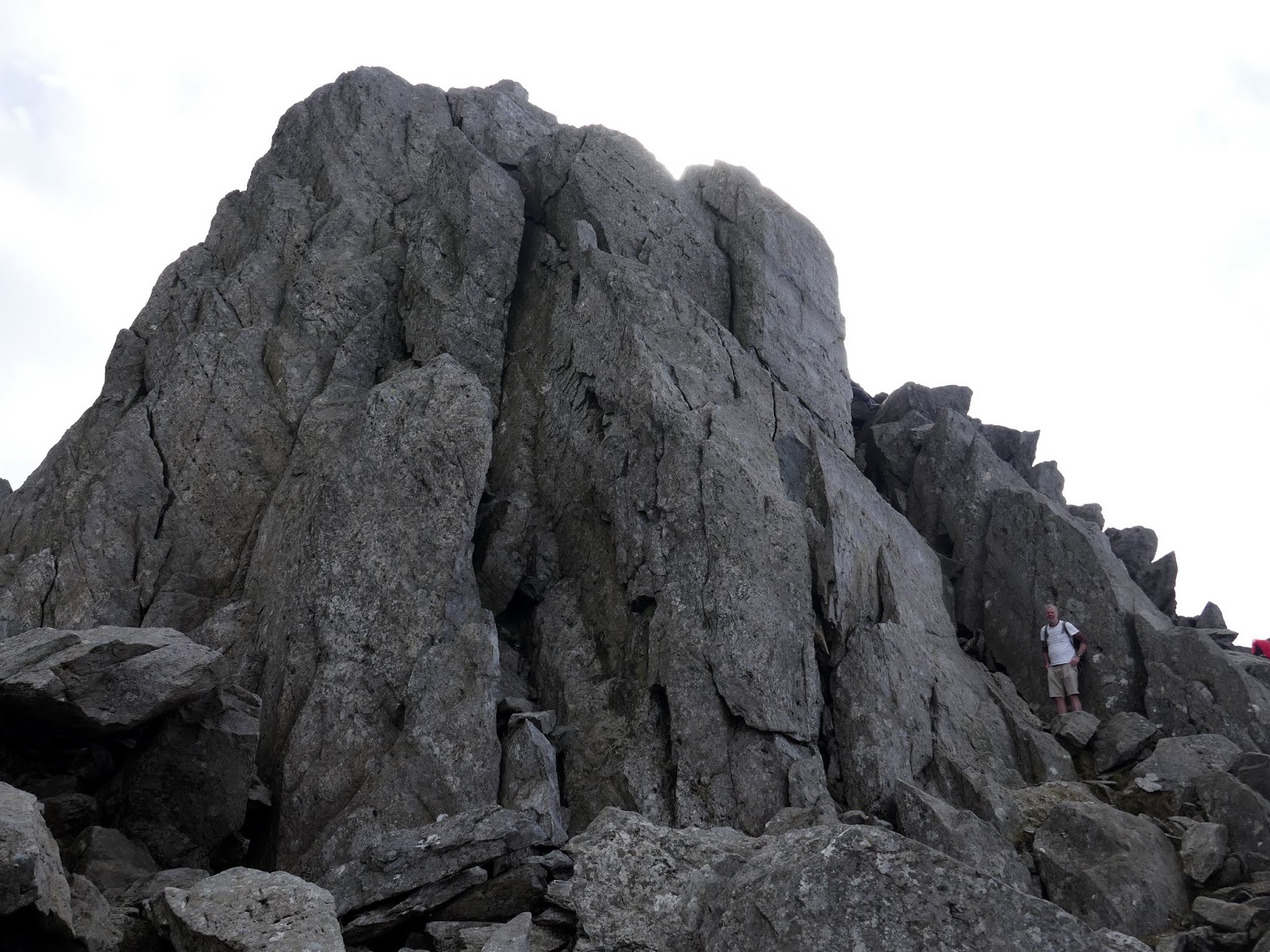
The Nose is an imposing pyramid of rock that bars the north ridge route. By far the best way is to tackle it head-on. Again, the main routes should be easy to pick out given the amount of polished rock. We opted for a slightly different line to avoid a queue forming though still remained around a scrambling grade of Grade 1 with the odd 2 thrown in for good measure. If you chose to bypass the nose, a path skirts to the left, cutting across the slopes and a number of gullies. I’d highly recommend you attempt to climb the first gully (the upper reaches of Nor Nor gully) to get back up onto the ridge before you find yourself on uncertain ground.
 |
| A line of people follow the easiest route up the Nose |
 |
| The upper section of the Nose |
 |
| Above the Nose |
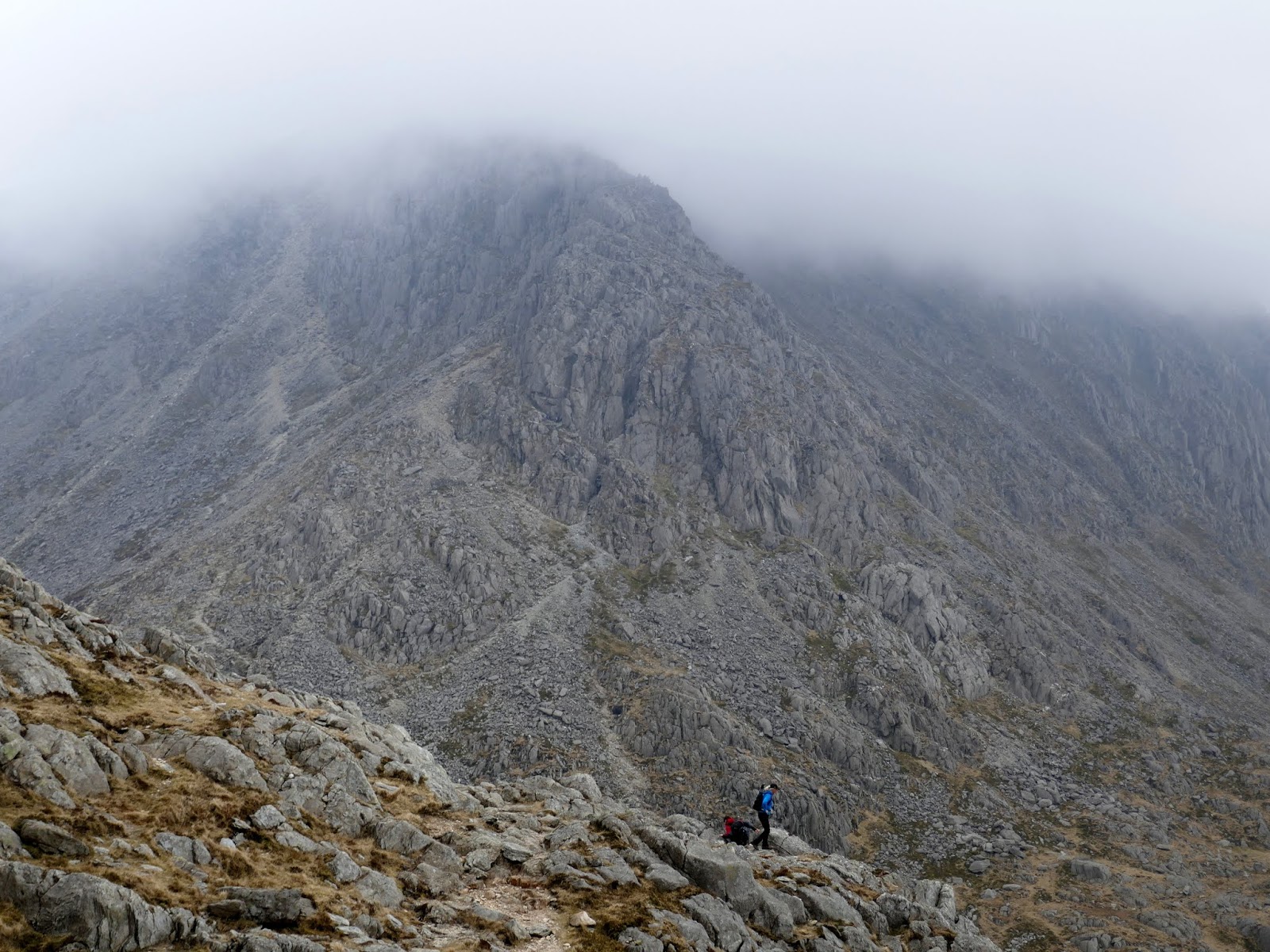
After the Nose, another flatter section beckons and leads to the North Tower. The North Tower is as you might expect, a tall tower of rock on the north ridge. The easiest route (which we took) heads to the right of the tower to make some easy scrambling up onto the ridge. The Tower can be attempted directly but the grading here is probably a high 2 and looks technically quite difficult.
 |
| The North Tower |
 |
| The North Tower |
 |
| The gully to the rear of the North Tower |
 |
| Tryfan’s summit from the top of the North Tower |
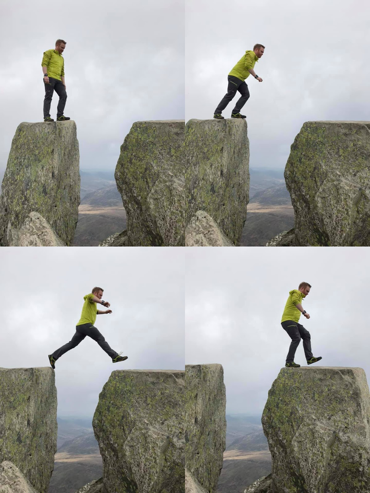
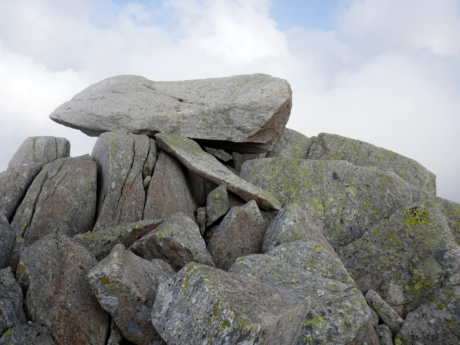
Once up and over (or around) the tower, Tryfan’s summit will present itself. After a brief notch in the ridge, the final scramble leads to the summit proper, marked by the two immense monoliths – Adam and Eve. To hop across the 1.2m gap between them is to gain the ‘Freedom of Tryfan’ and is perhaps more intimidating than it looks.
 |
| Tryfan’s summit |
 |
| Gaining the freedom of Tryfan |
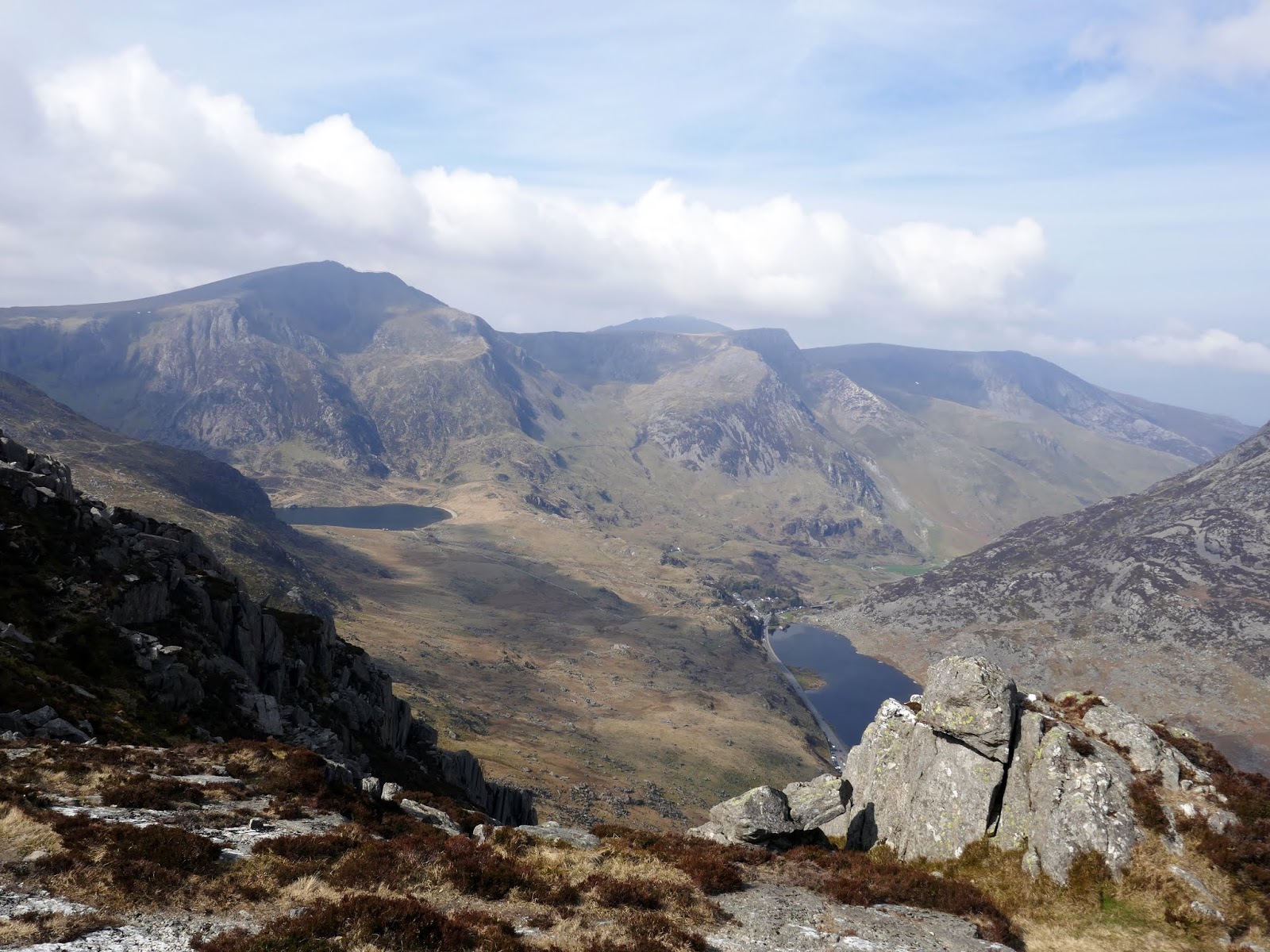
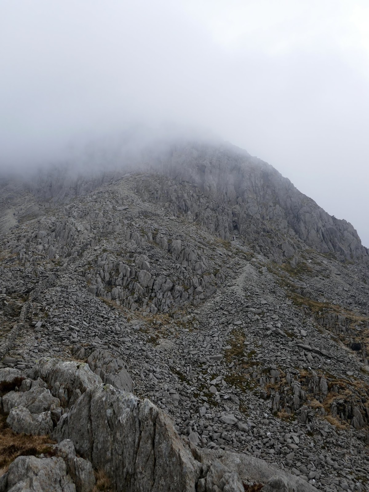
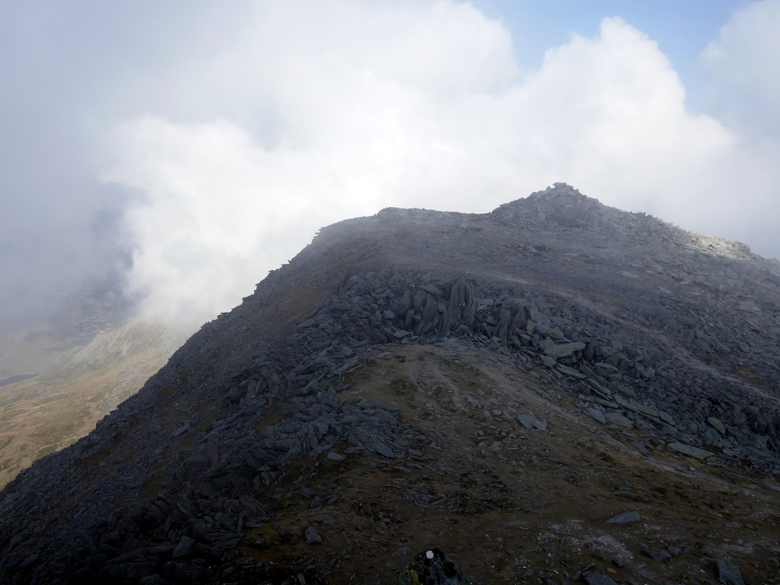
With no rain forecast but the clouds lowering, we made tracks towards Bristly Ridge where some more quality scrambling awaits. Descending Tryfan’s south ridge is easy compared to the scramble up the north and we found our way down to Bwlch Tryfan. Bristly Ridge rises up overhead.
 |
| The start of the south ridge |
 |
| Descending the south ridge |
 |
| Bristly Ridge in the gloom |
 |
| Approaching the foot of Bristly Ridge |
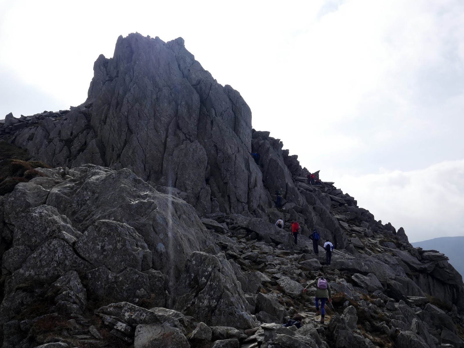
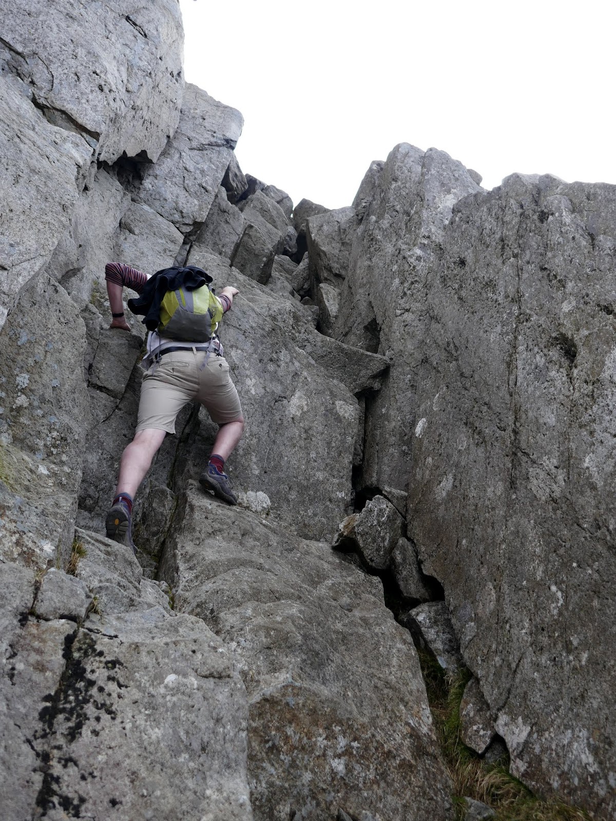
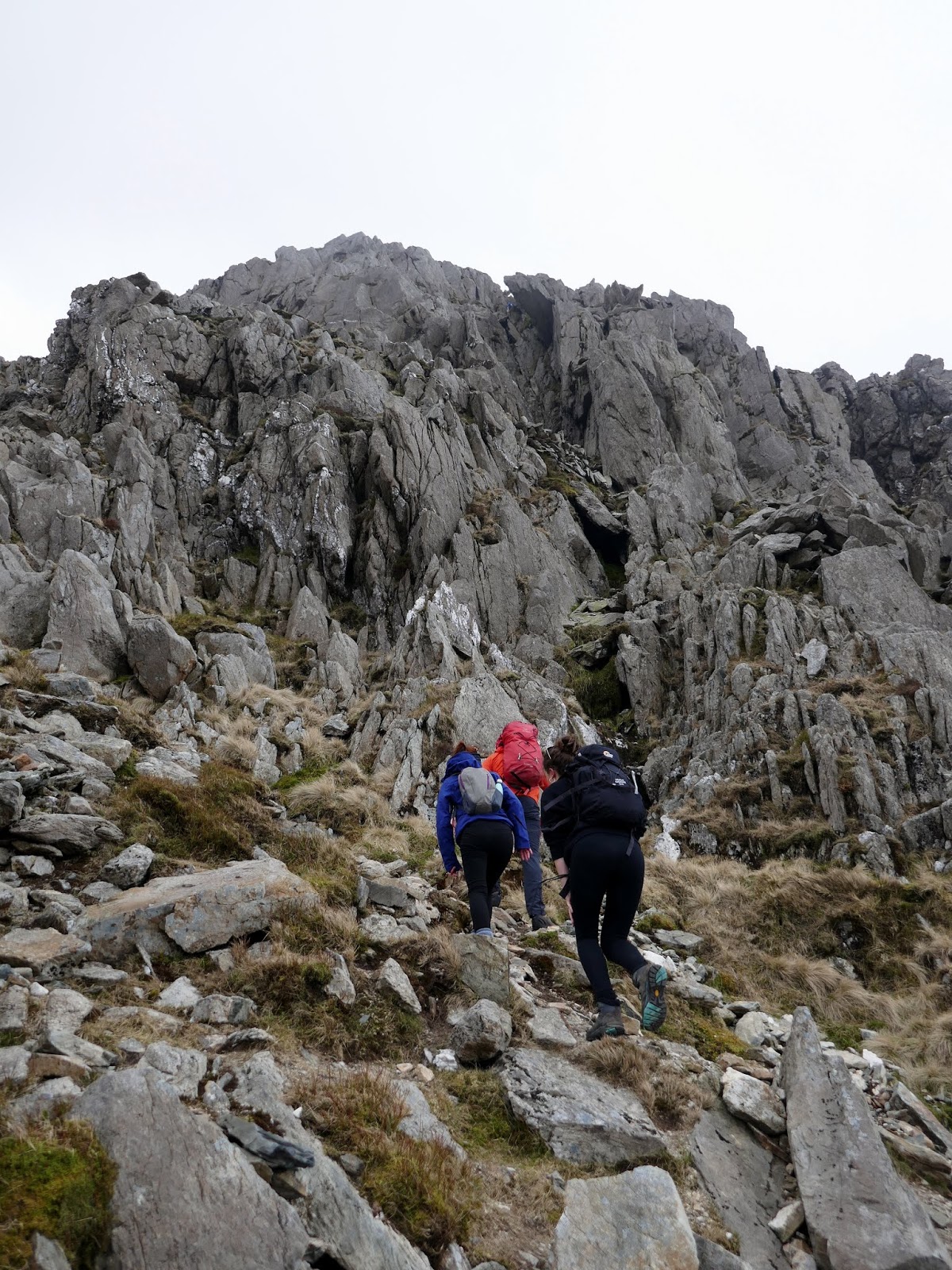
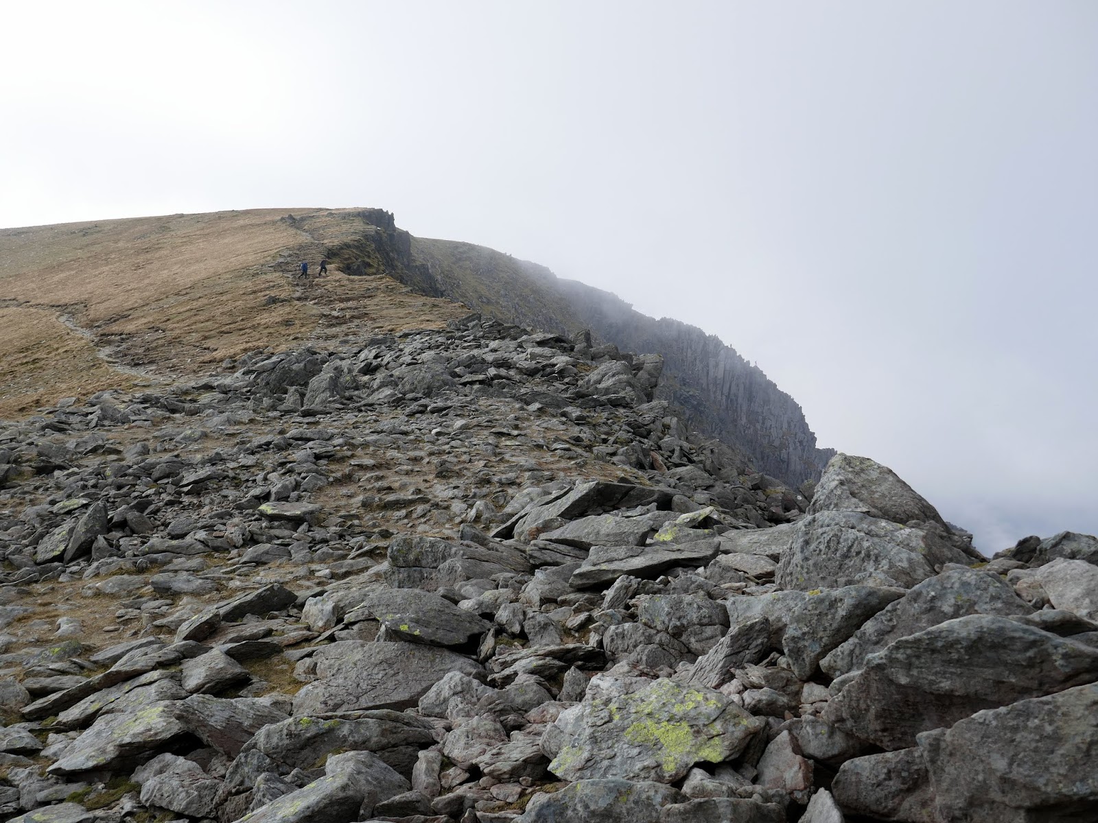
The first challenge is getting up onto the to ridge itself, achieved via one of two gullys; Sinister or Main Gully. While the name ‘sinister’ may not be overly appealing, it is, in fact, the easier of the two taking its name from the Latin for ‘left’ – it is the left-most gully of the two. You can identify it by the large, overhanging rock above it.
 |
| Climbing to the foot of Sinister Gully |
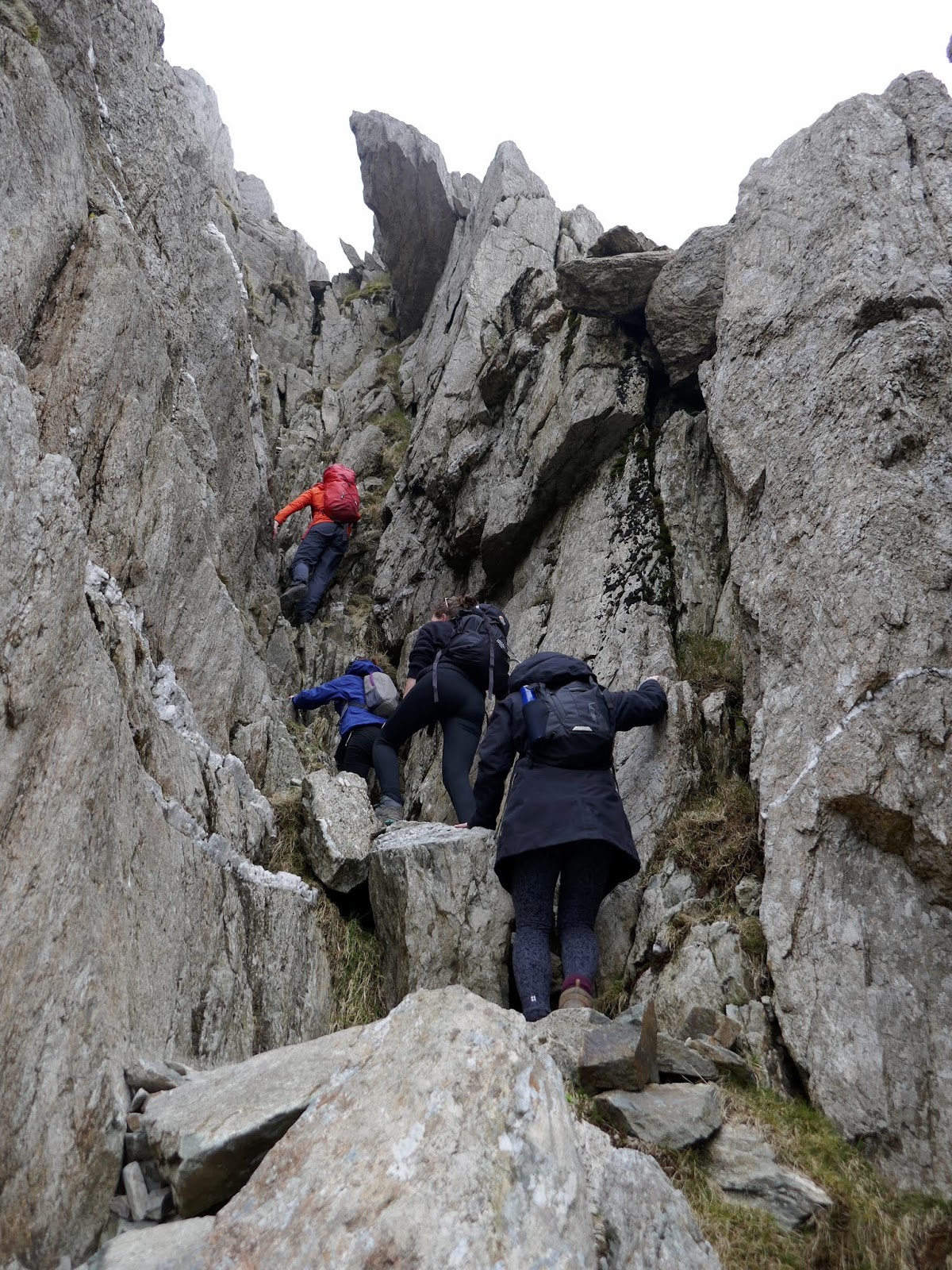
Sinister Gully is a fairly straightforward climb, though steeper than any of the main routes on Tryfan. Again, there is an abundance of hand and footholds and the whole route shouldn’t pose many problems to an experienced scrambler.
 |
| Sinister Gully |
 |
| Looking down Sinister Gully |
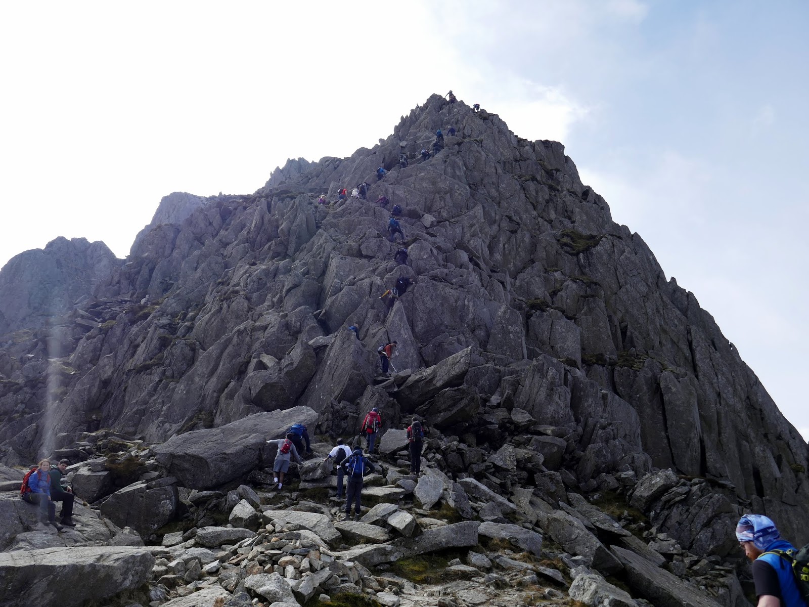
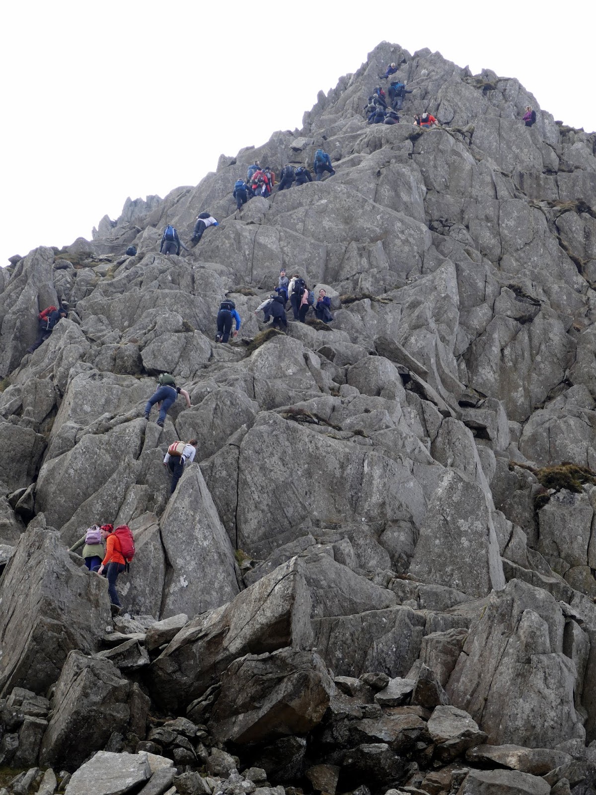
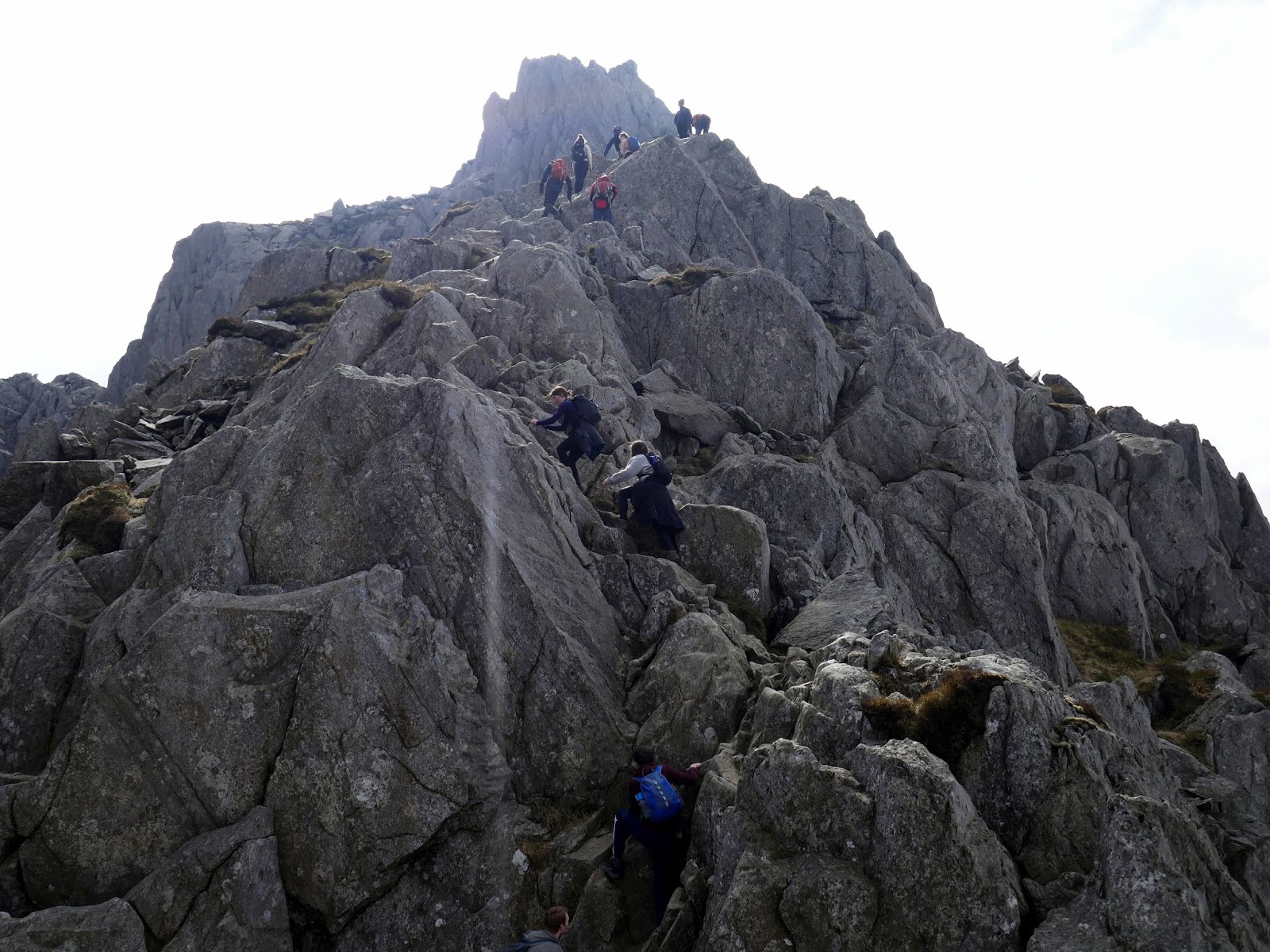
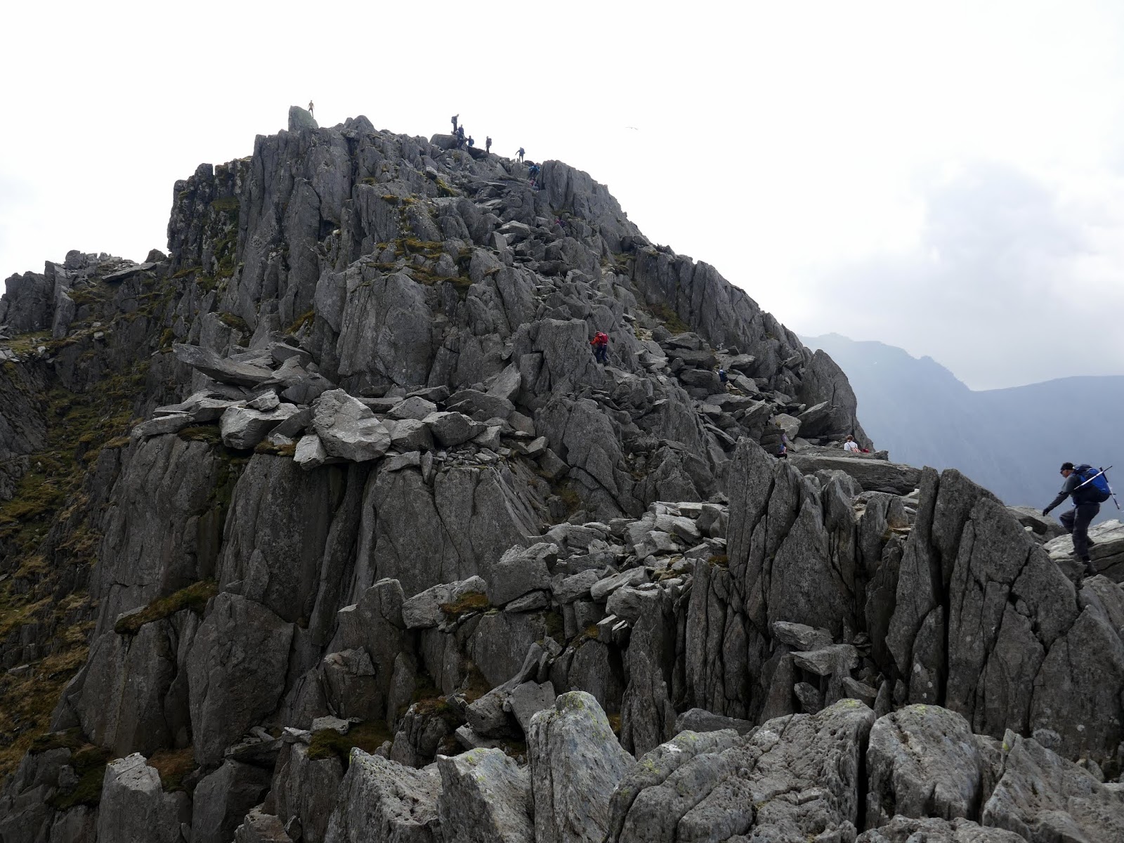
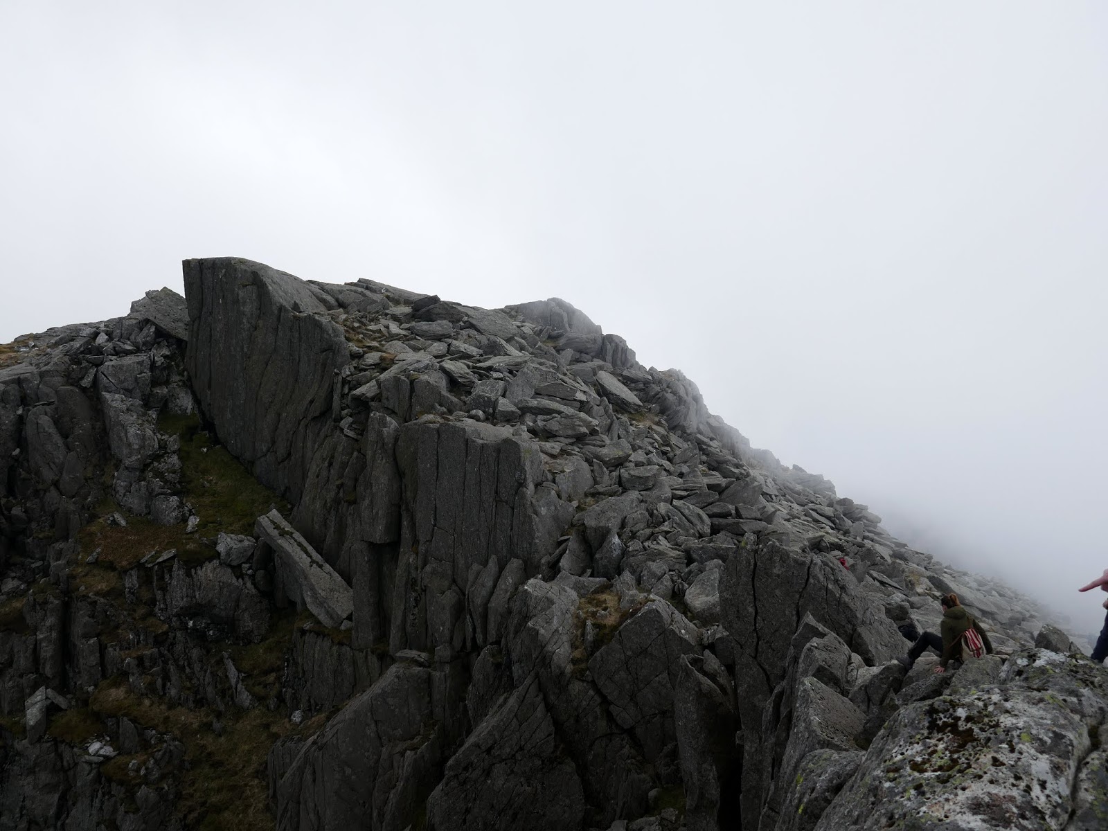
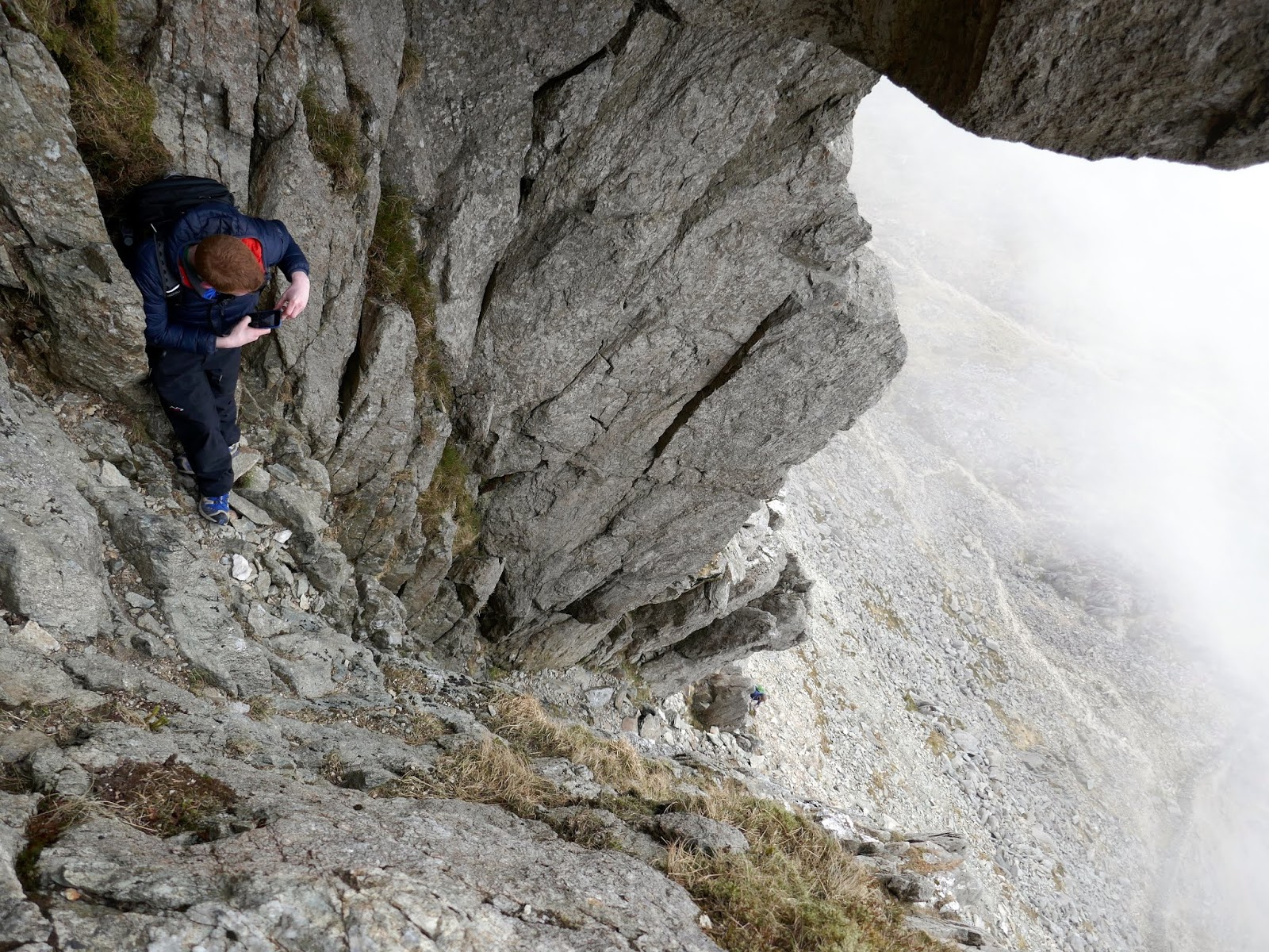
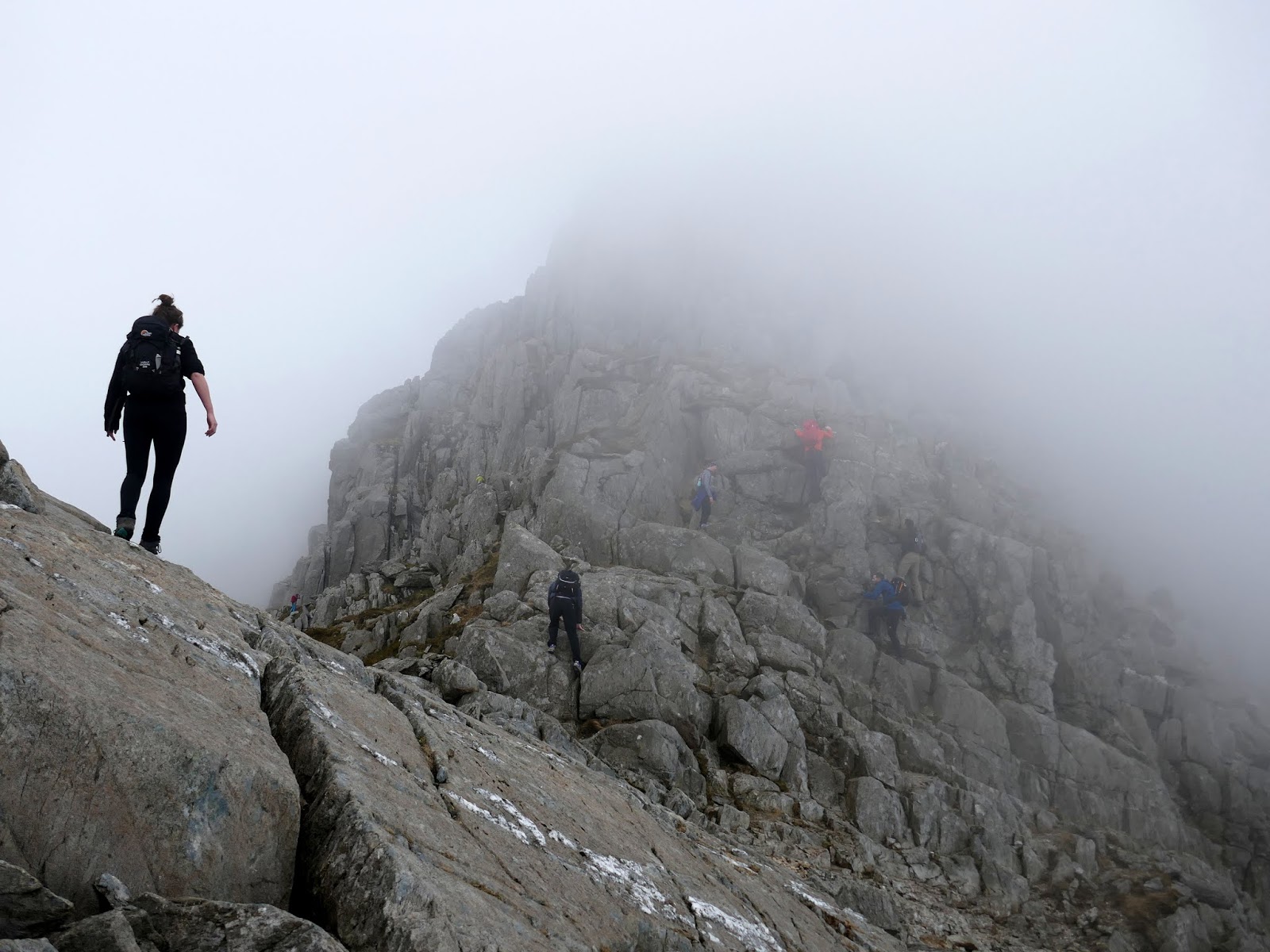
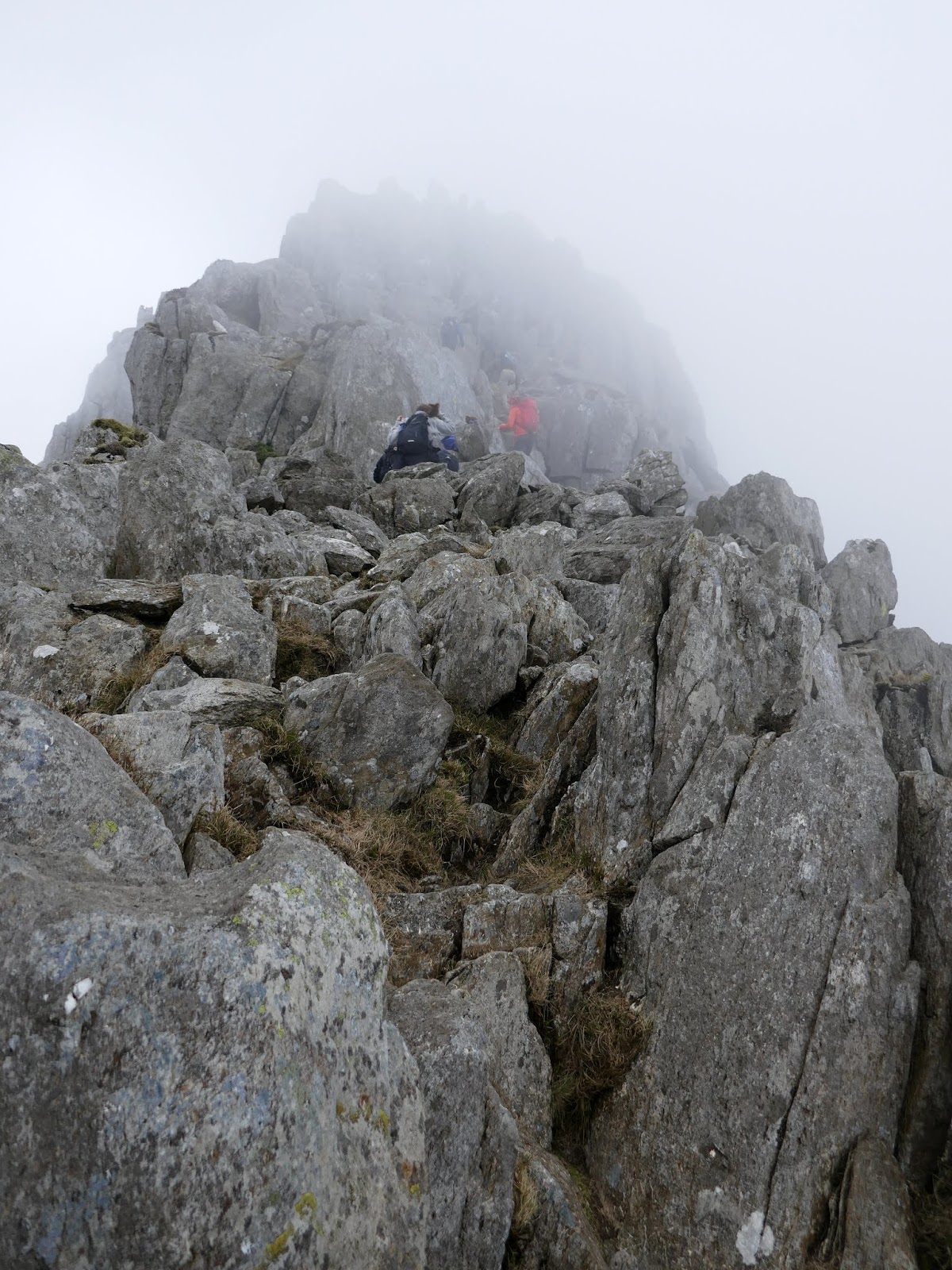
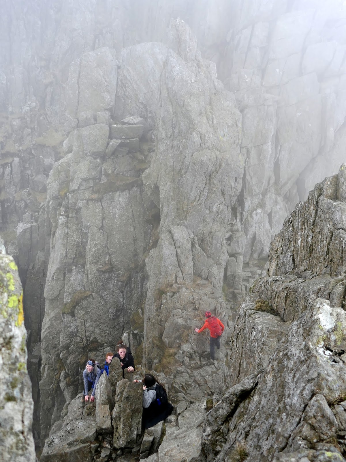
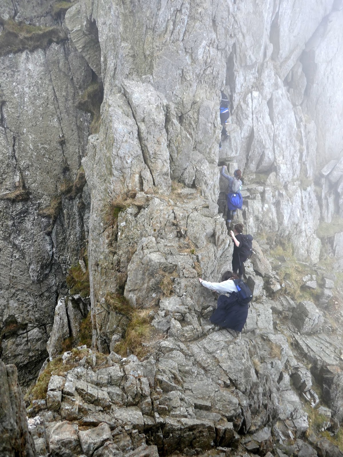
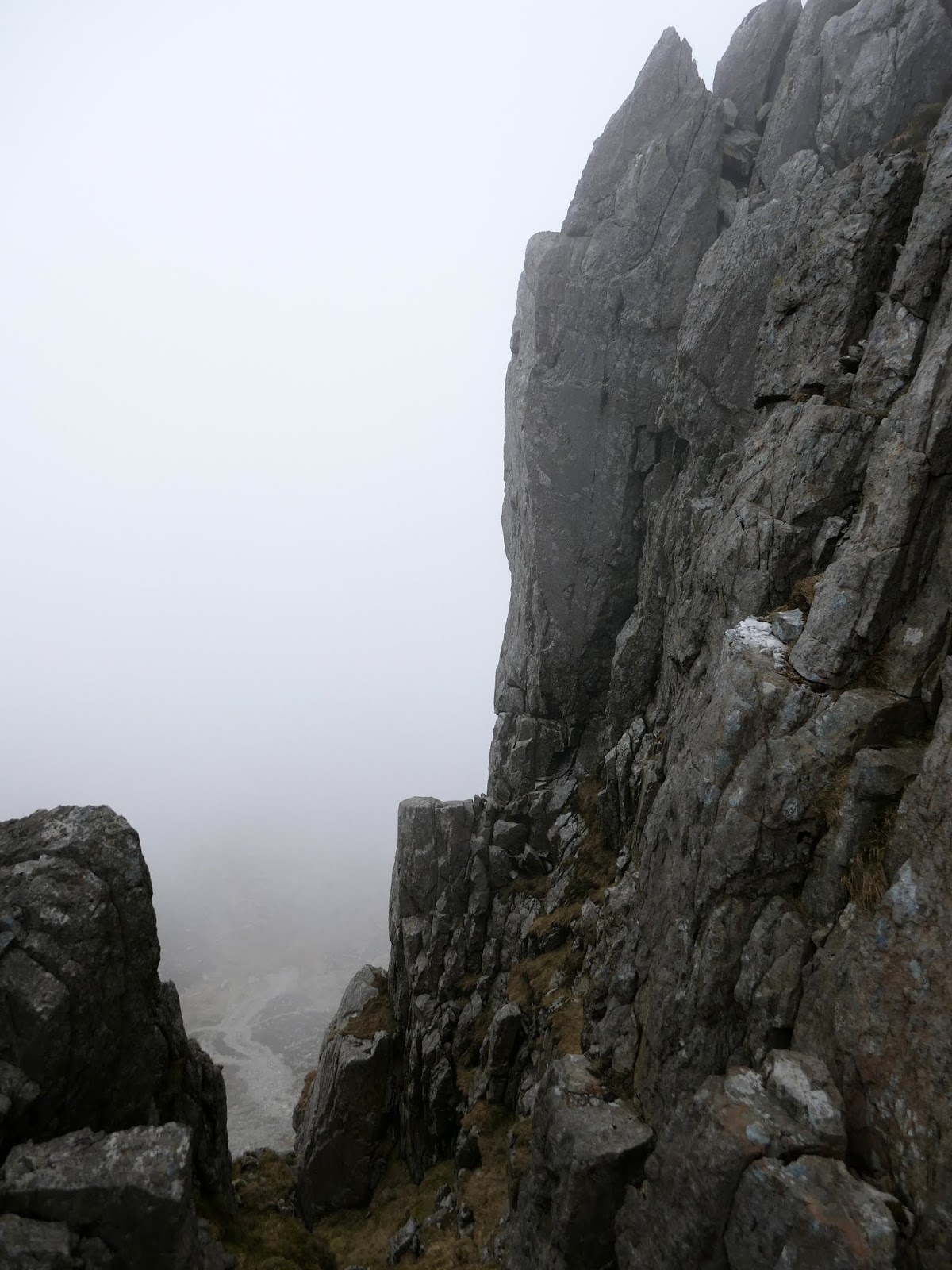
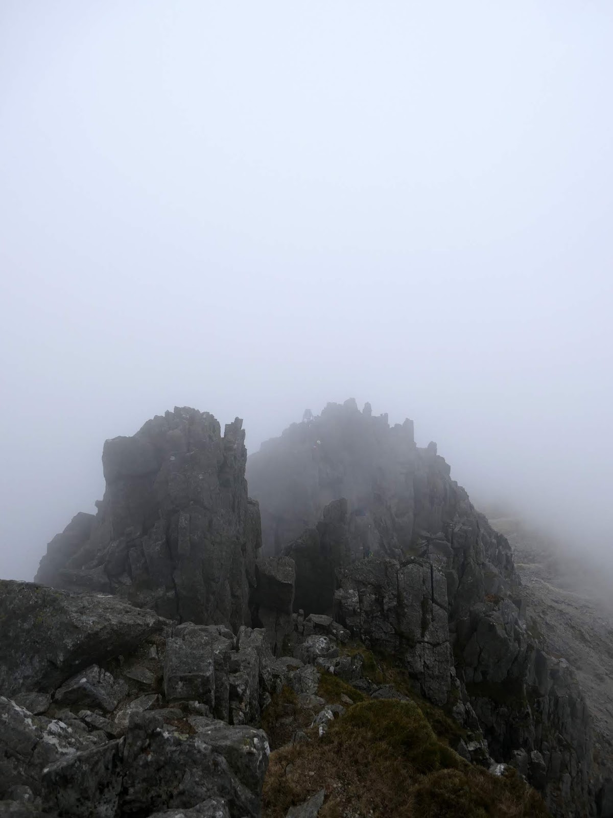
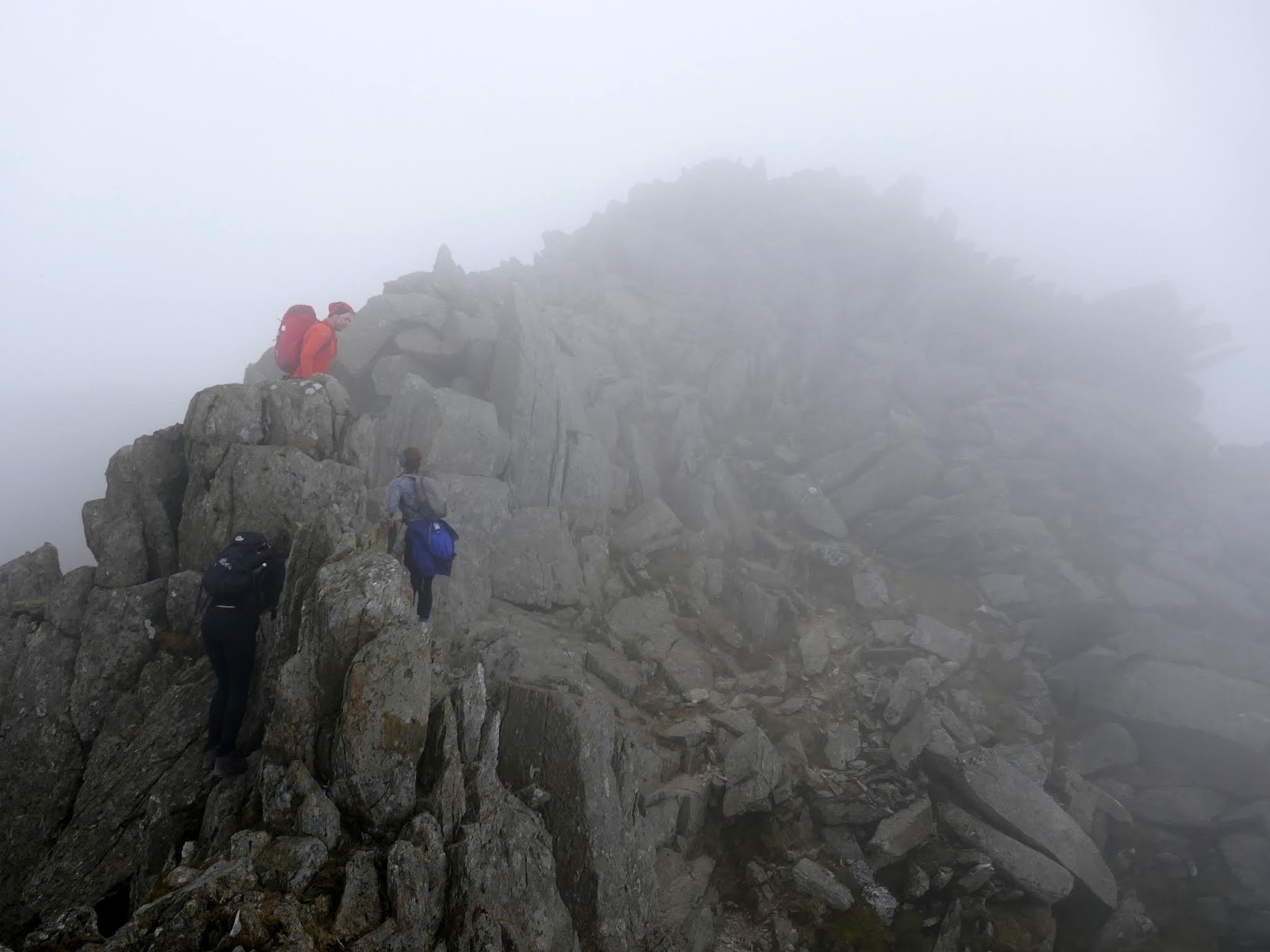
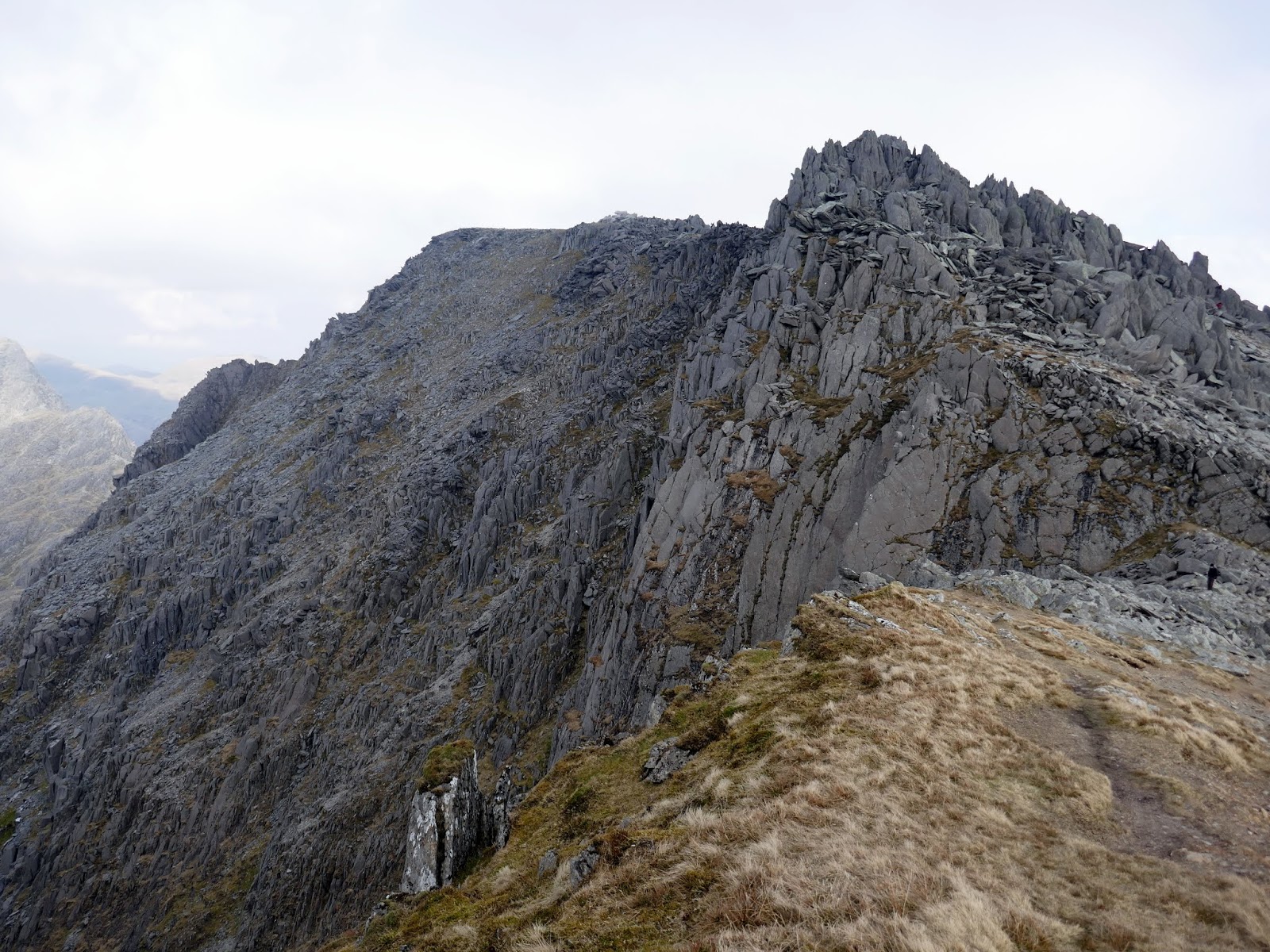
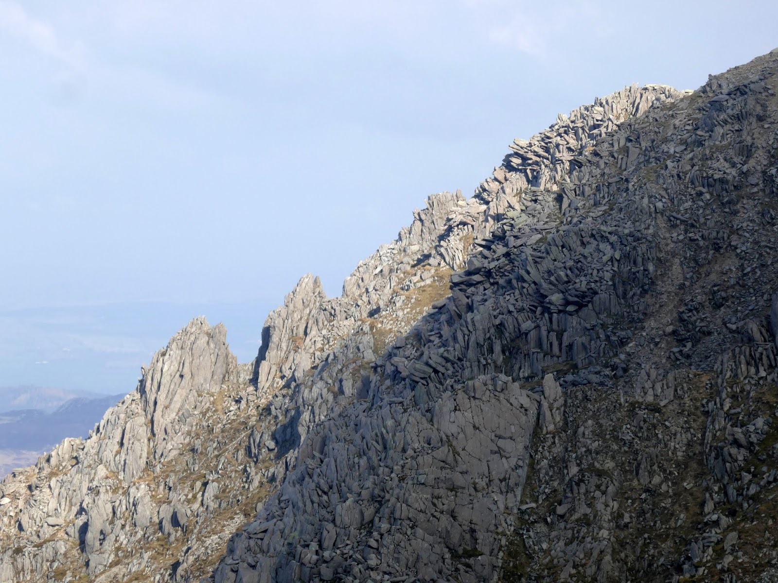
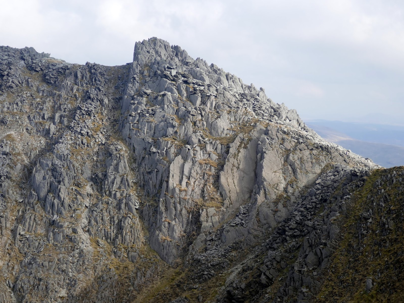
Sinister Gully led us onto Bristly Ridge itself where some easy walking is interspersed with some light scrambling. Don’t let this fool you, however, the ridge is only just getting started. After clambering around some smaller pinnacles we reached the Great Pinnacle Gap, a deep notch in the ridge preceding an immense spire of rock. This is the crux of the ridge.
 |
| Heading along Bristly Ridge |
 |
| Climbing towards the pinnacles |
 |
| Great Pinnacle Gap |
 |
| The platform in the pinnacle gap |
Getting to the notch requires a tricky downclimb though, as ever, there are hand and footholds when you search them out. The downclimb leads to a fairly narrow, flat slab which can be lethally slippery when wet. Upon first inspection, the spire of the Great Pinnacle seems to block the onwards route, however, passing around to the right reveals a blocky gully which leads back up to the ridgeline
 |
| The Bristly Ridge pinnacles |
 |
| The top of the pinnacles |
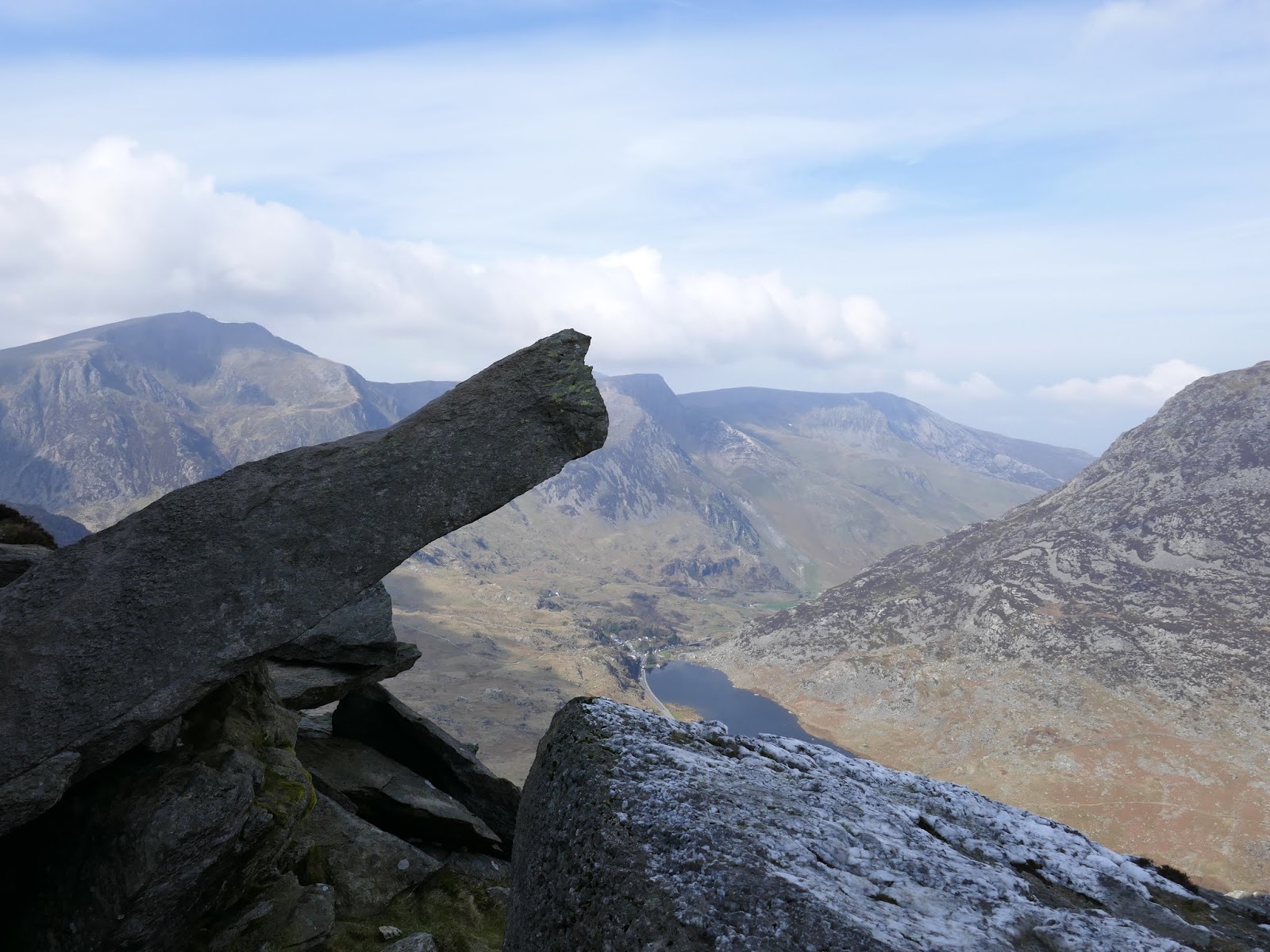
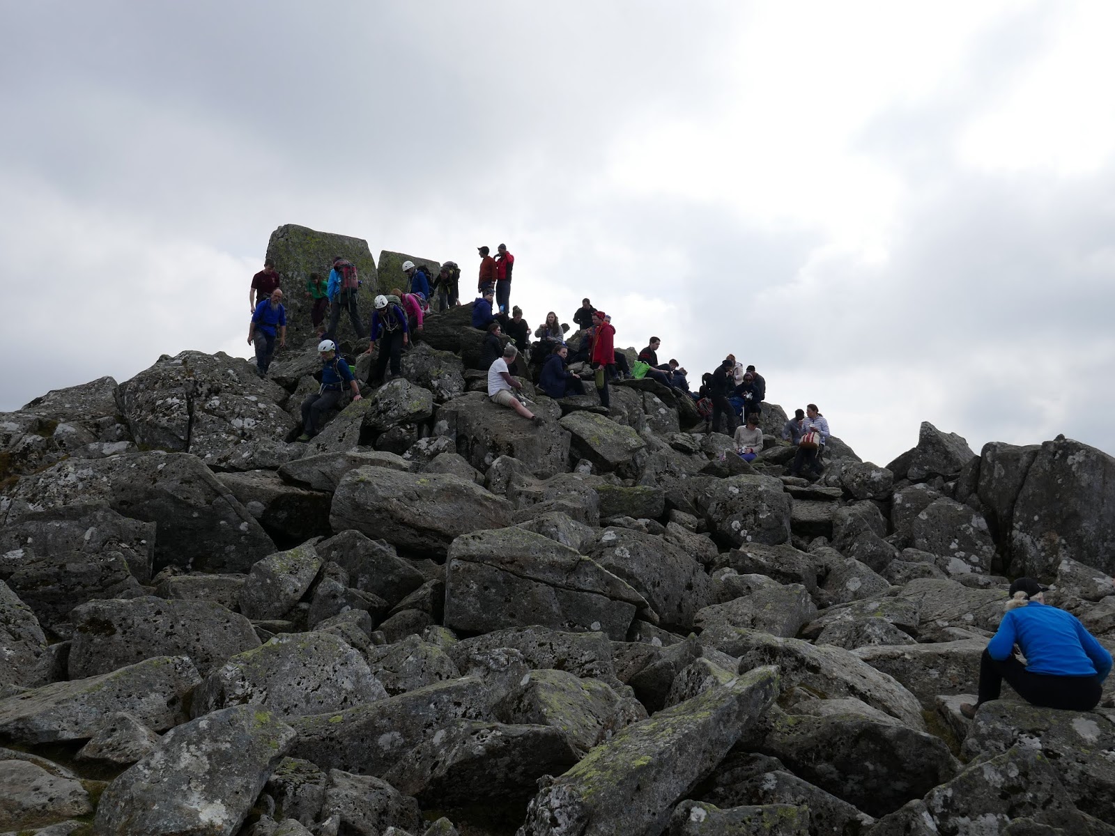
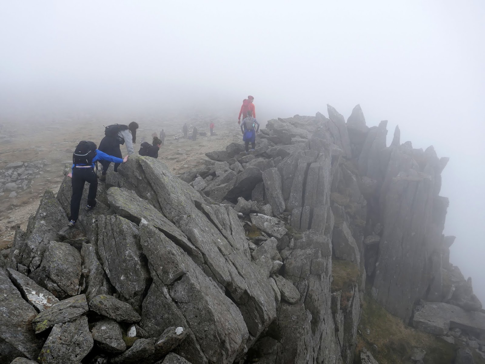
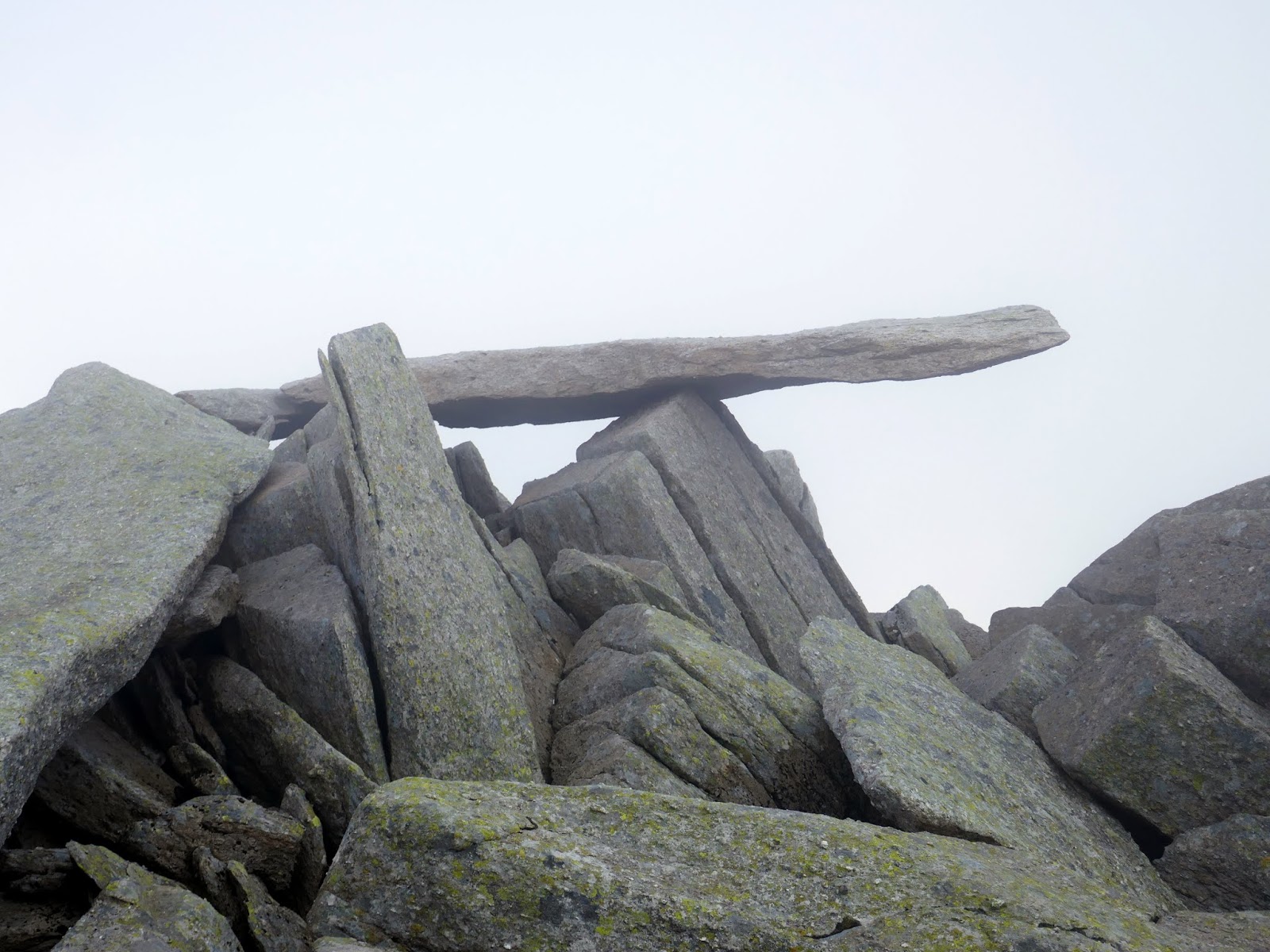
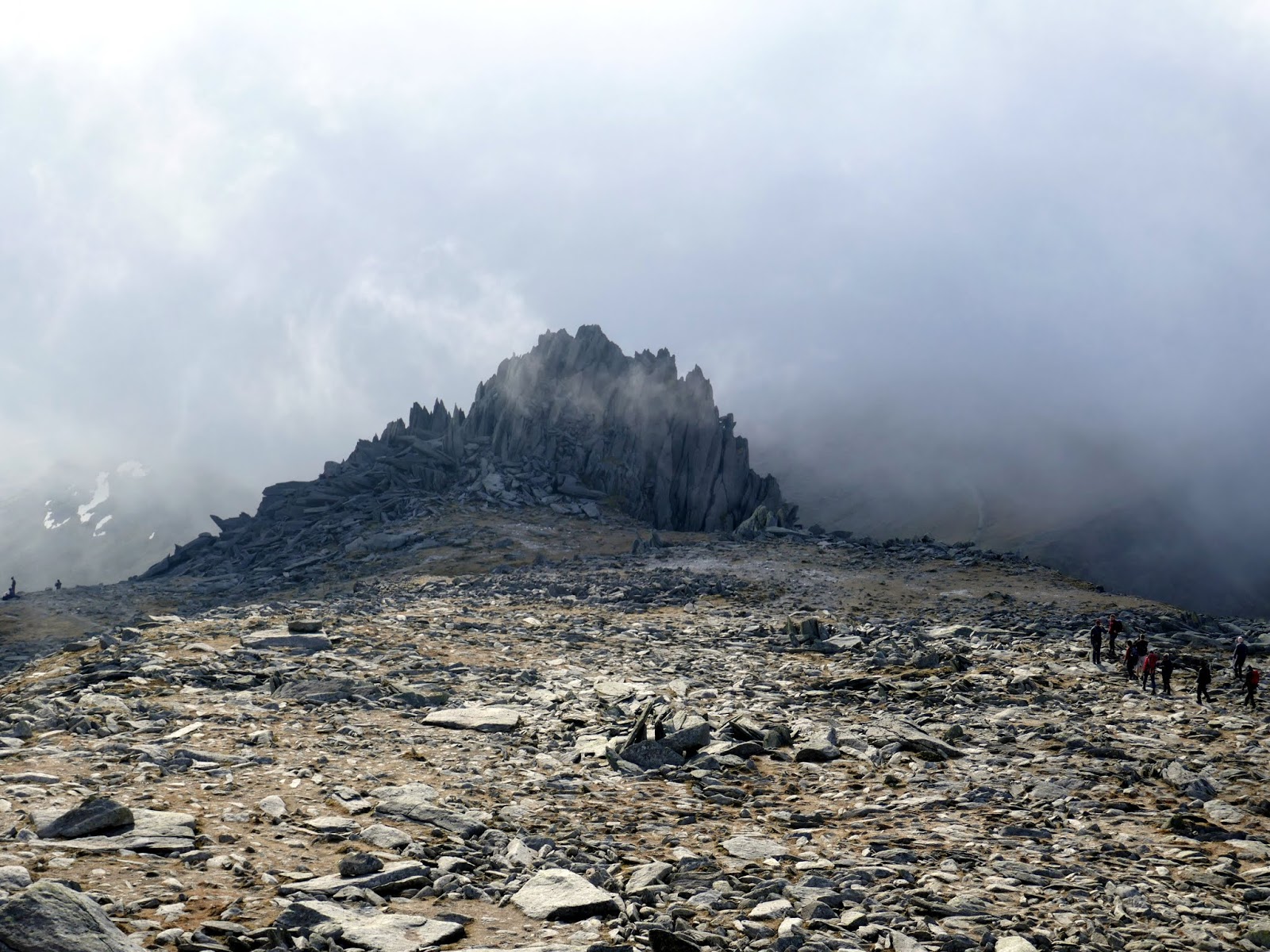
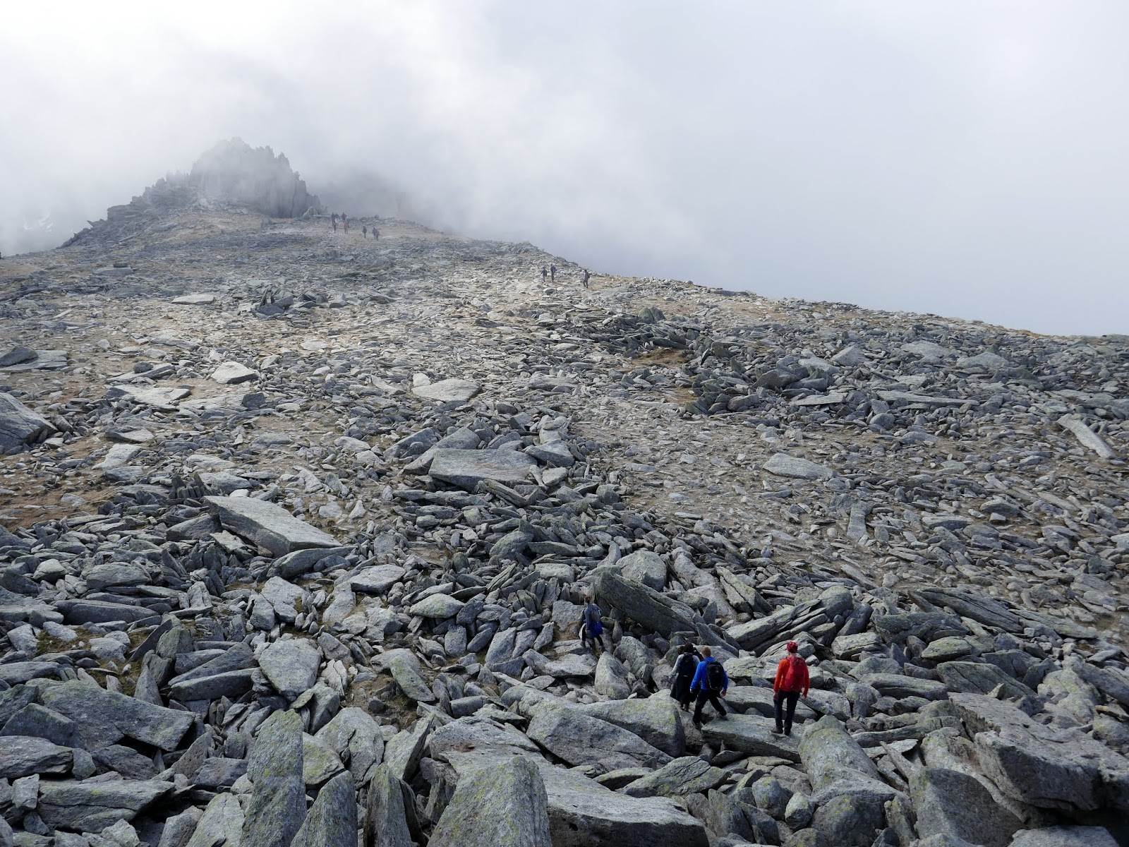
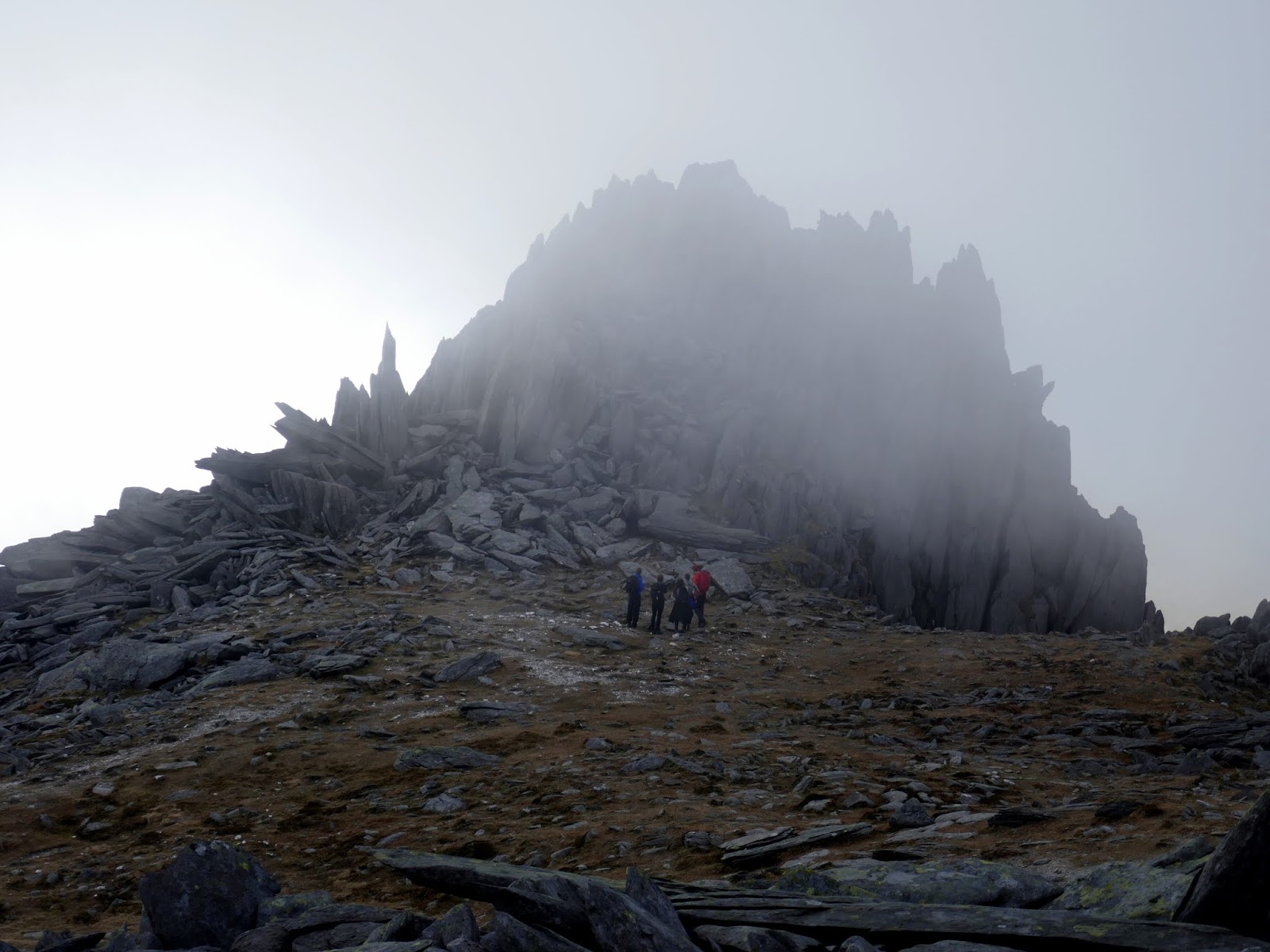
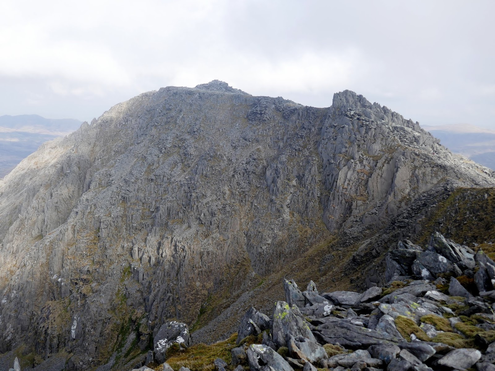
After tackling the gap a final, steep scramble is required to finish Bristly Ridge. We emerged on the summit of Glyder Fach to some wavering sunshine, the layer of cloud was lifting at just the right time. An hour earlier and we’d have been right in the thick of it. We passed the famed Cantilever; a seemingly precariously balanced slab of rock that simply begs to be photographed, usually with people on it. Glyder Fach’s summit is a short distance away but requires some additional scrambling to reach the very top.
 |
| Bristly Ridge |
 |
| The end of Bristly Ridge |
 |
| The Cantilever |
 |
| The clouds begin to part |
 |
| Looking back to the Cantilever |
 |
| Pen yr Ole Wen appears across the valley |
 |
| Glyder Fach’s summit |
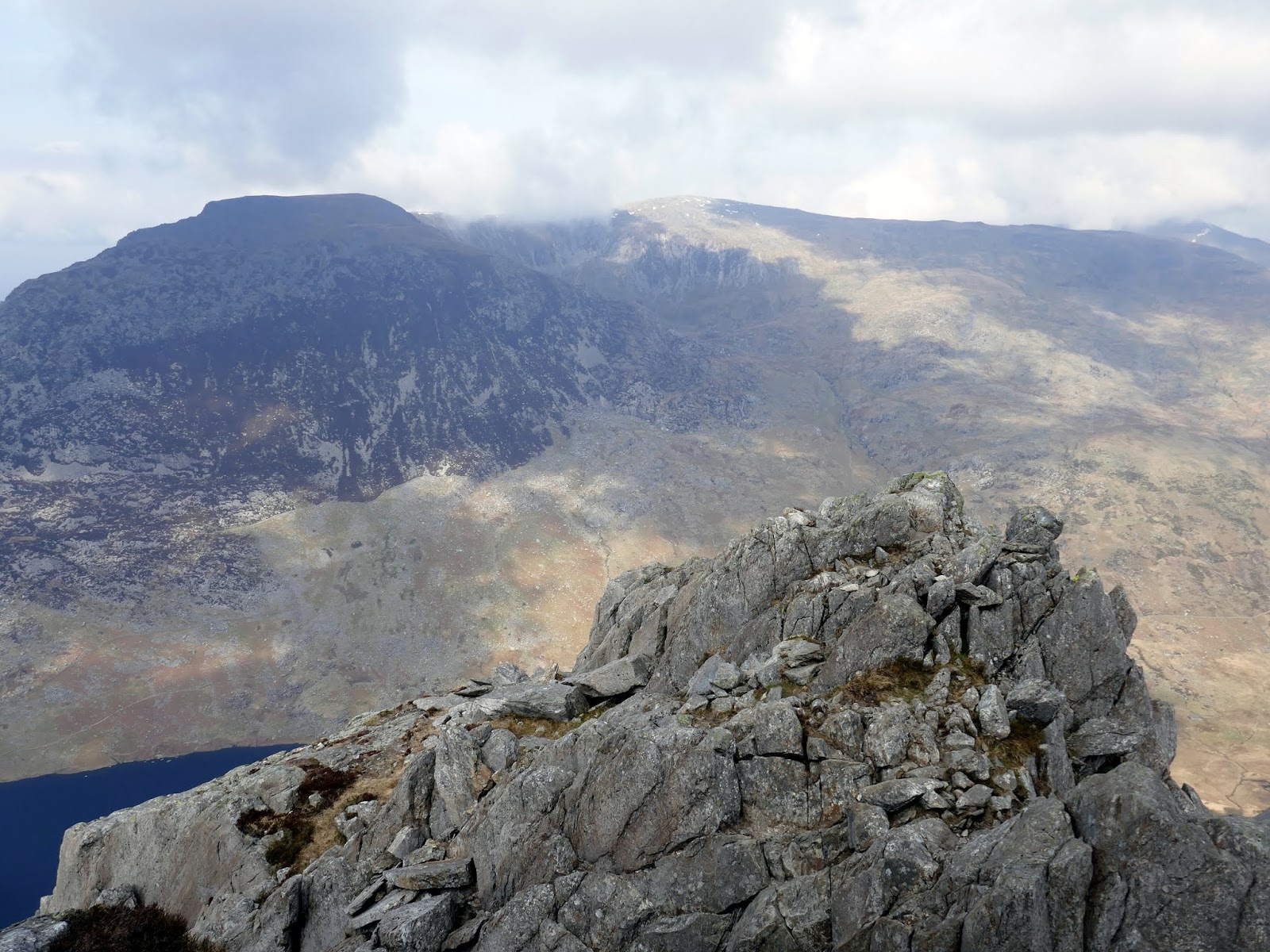
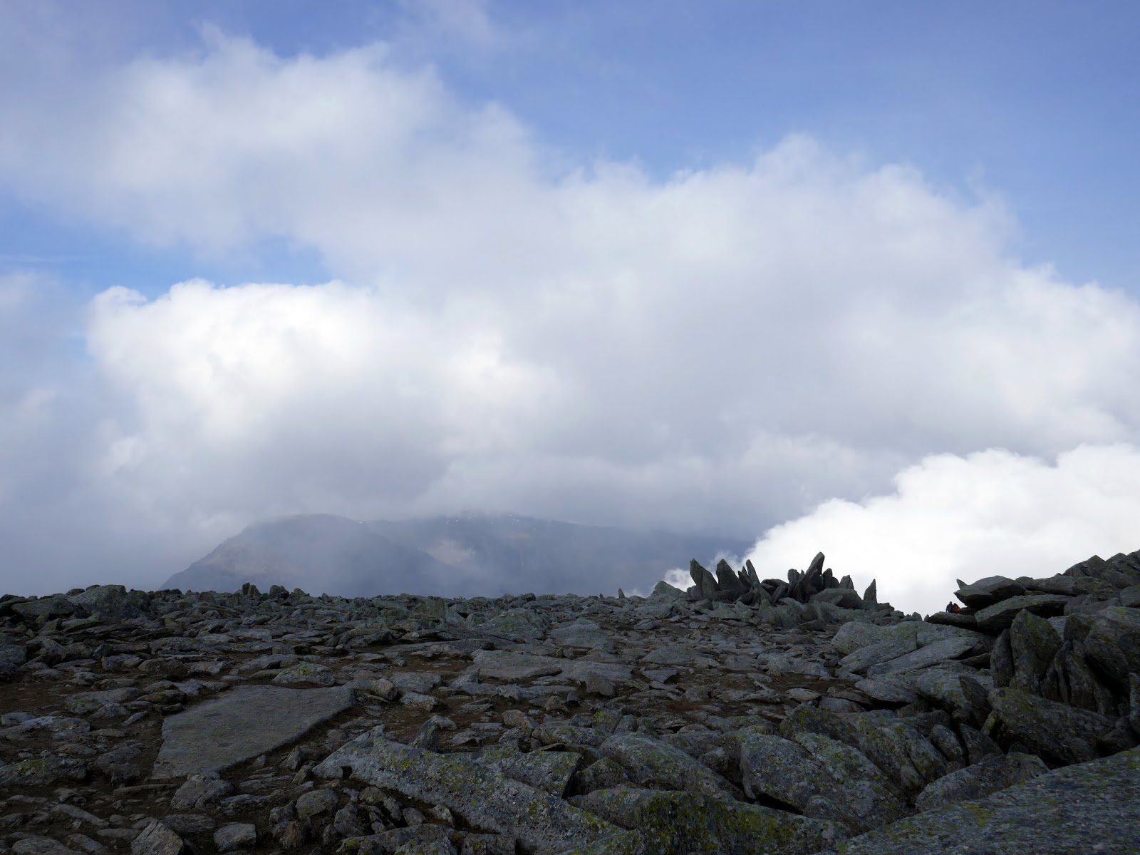
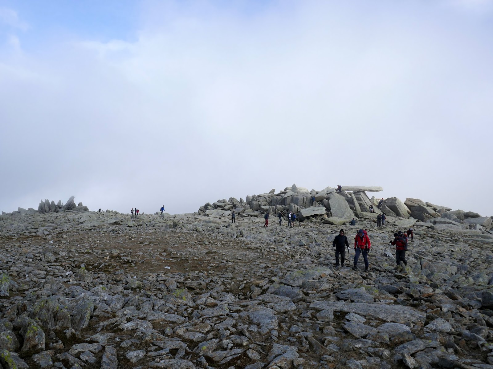
After clambering round to the other side, a short flat section of the mountaintop leads to the odd Castell y Gwynt – a spiky rock protrusion at the end of the main Glyder Fach ridge. In some circles its classed as one of the Welsh 3,000s, reason enough for another short scramble through the spires to the top.
 |
| Castell y Gwynt |
 |
| The route from Glyder Fach to Castell y Gwynt |
 |
| Castell y Gwynt |
 |
| Looking back to Glyder Fach |
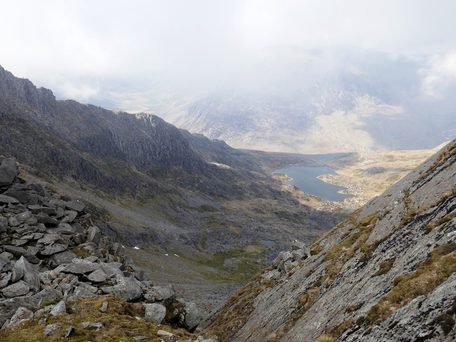
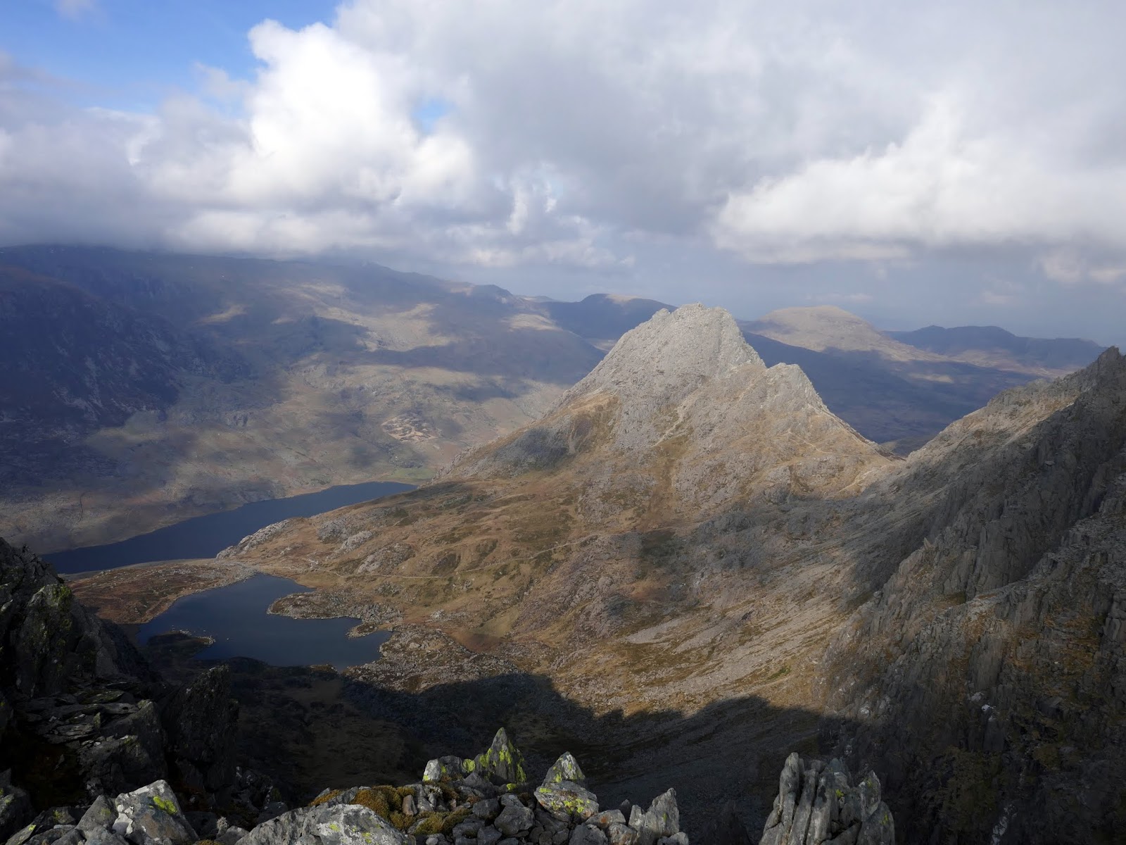
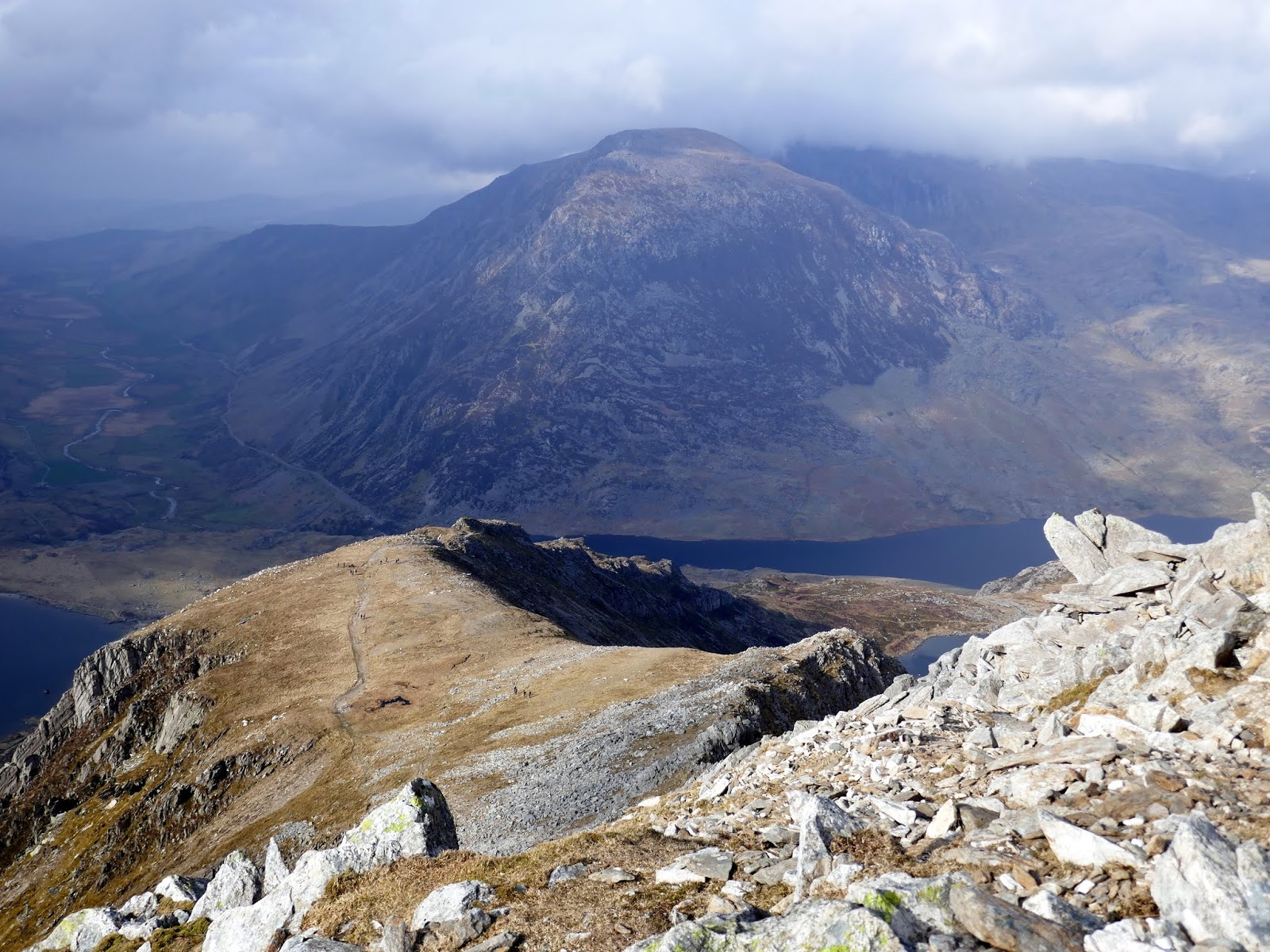
The clouds had all by broken by the time we had crossed Glyder Fach. Beyond Castell y Gwynt, the path crosses Bwlch y Ddwy-Glyder, skirts around the head of Cwm Bochlwyd and onto Y Gribin and further scrambling.
 |
| Bwlch y Ddwy-Glyder |
 |
| Cwm Bochlwyd |
 |
| Castell y Gwynt and Glyder Fach |
 |
| Glyder Fach |
 |
| Cwm Bochlwyd and Tryfan |
 |
| The top of Y Gribin |
 |
| The famed Cneifion arete |
 |
| The football field at the foot of Y Gribin |
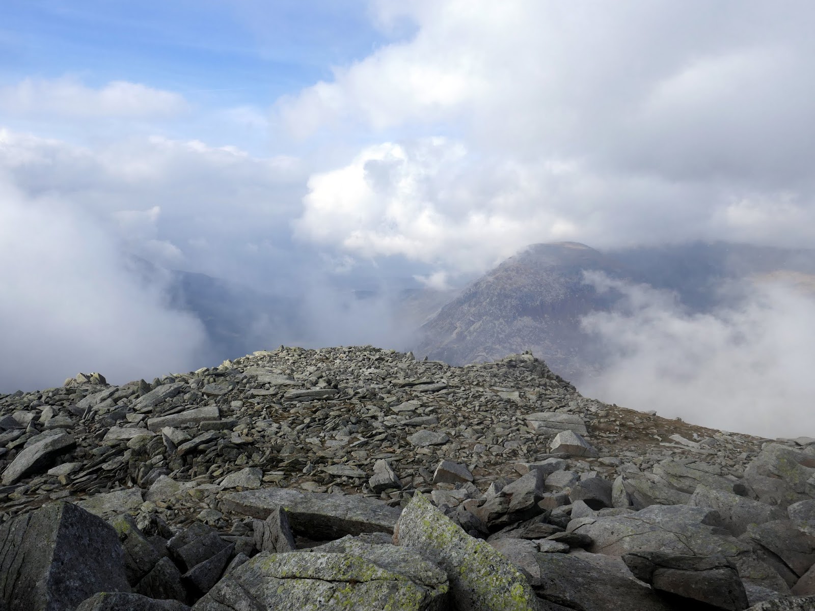
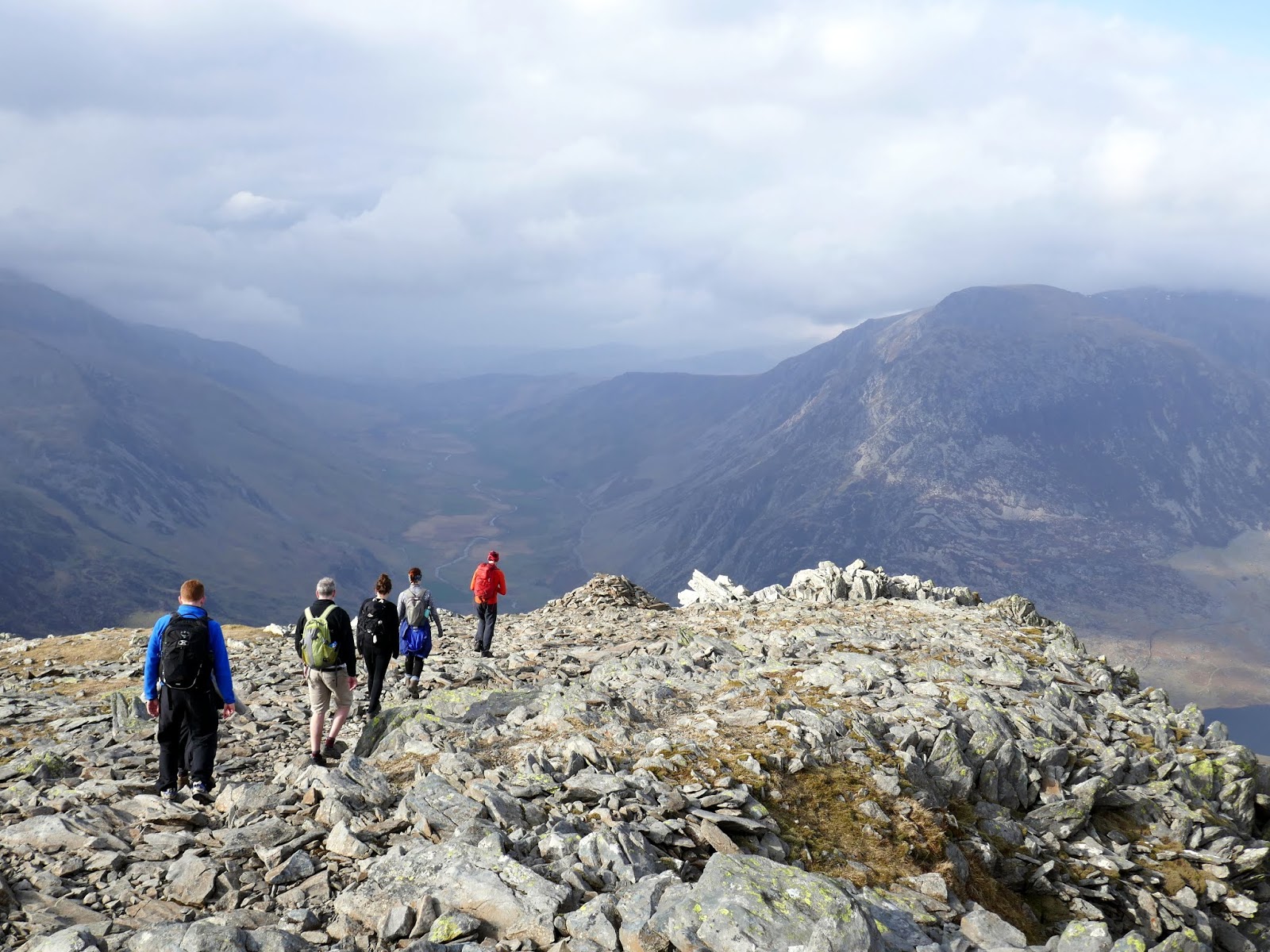
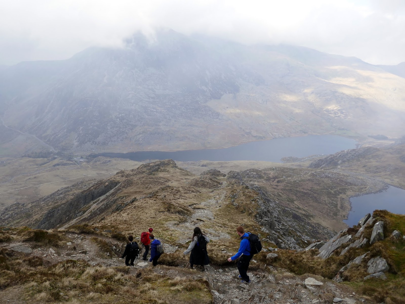
Y Gribin is a narrow ridge which separates Cwm Bochlwyd and Cwn Cneifion / Cwm Idwal. The crest offers the best line, though a loose path avoids it if necessary. The main scramble doesn’t last long, eventually petering out at a broad, flat, grassy area along the ridge – ‘the football field’.
 |
| A perfect view of Bristly Ridge |
 |
| Castell y Gwynt |
 |
| Looking down Y Gribin |
 |
| The football field as the cloud closes in once again |
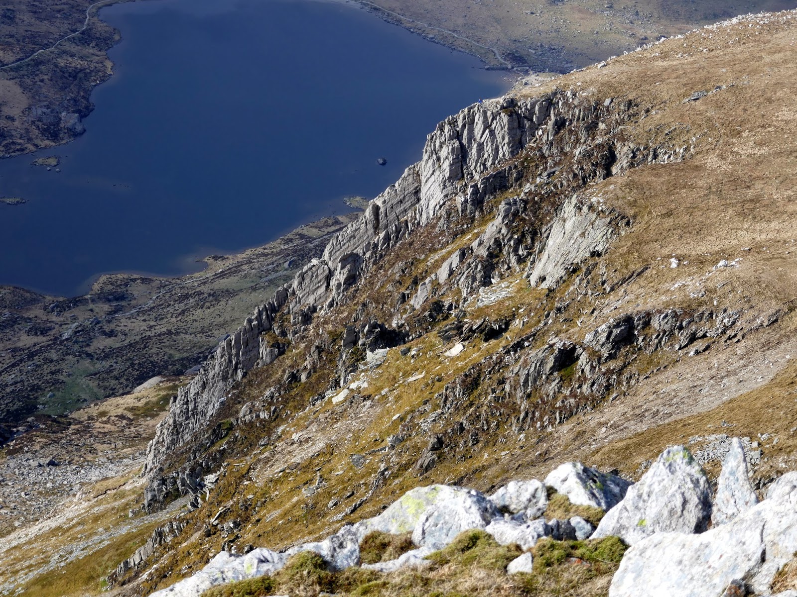
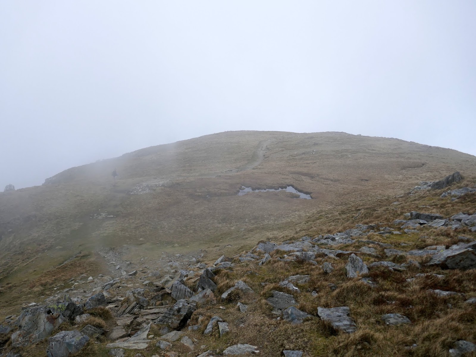
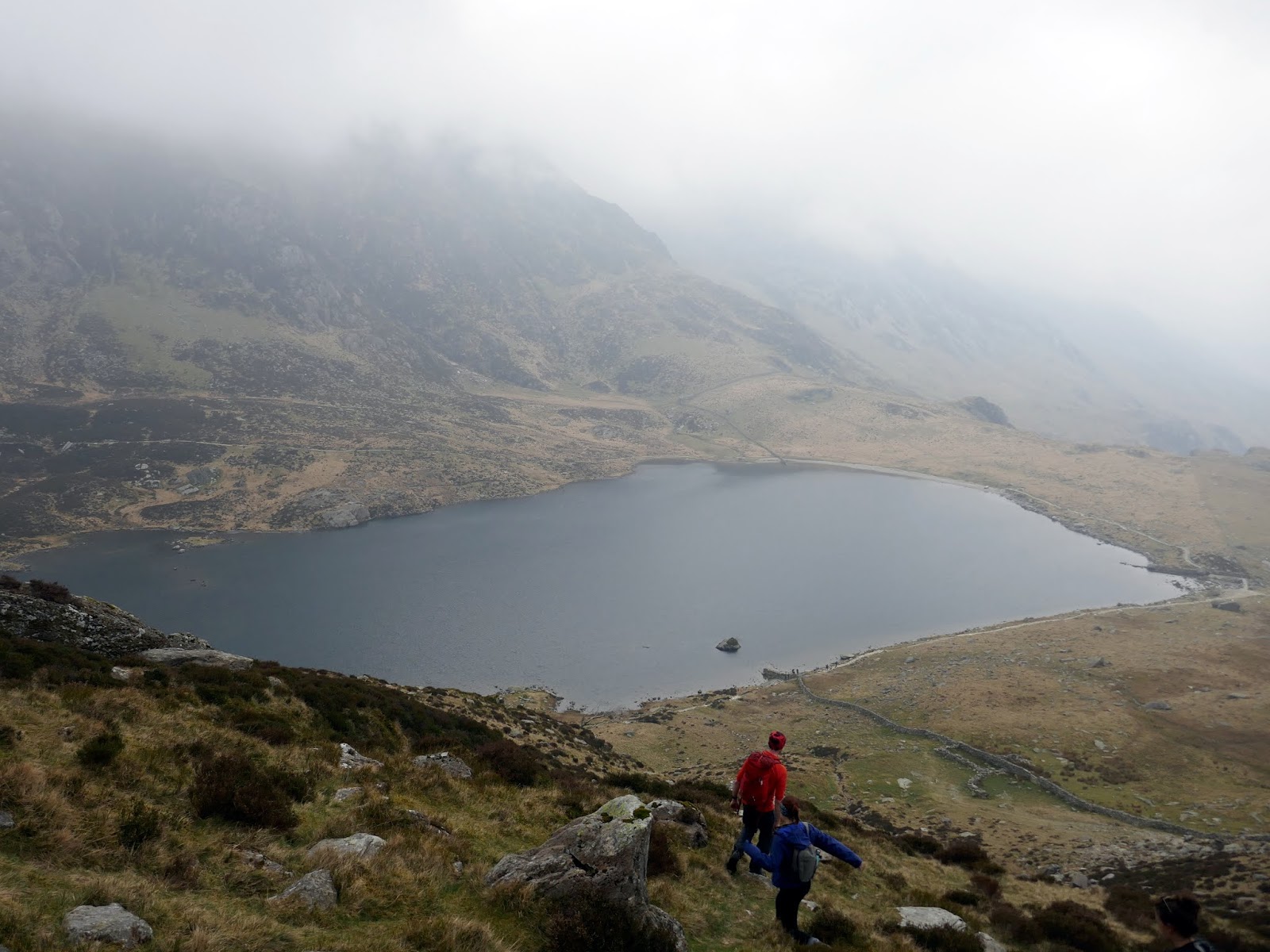
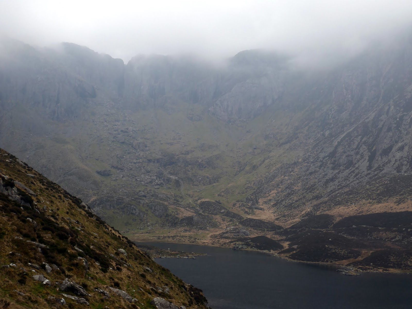
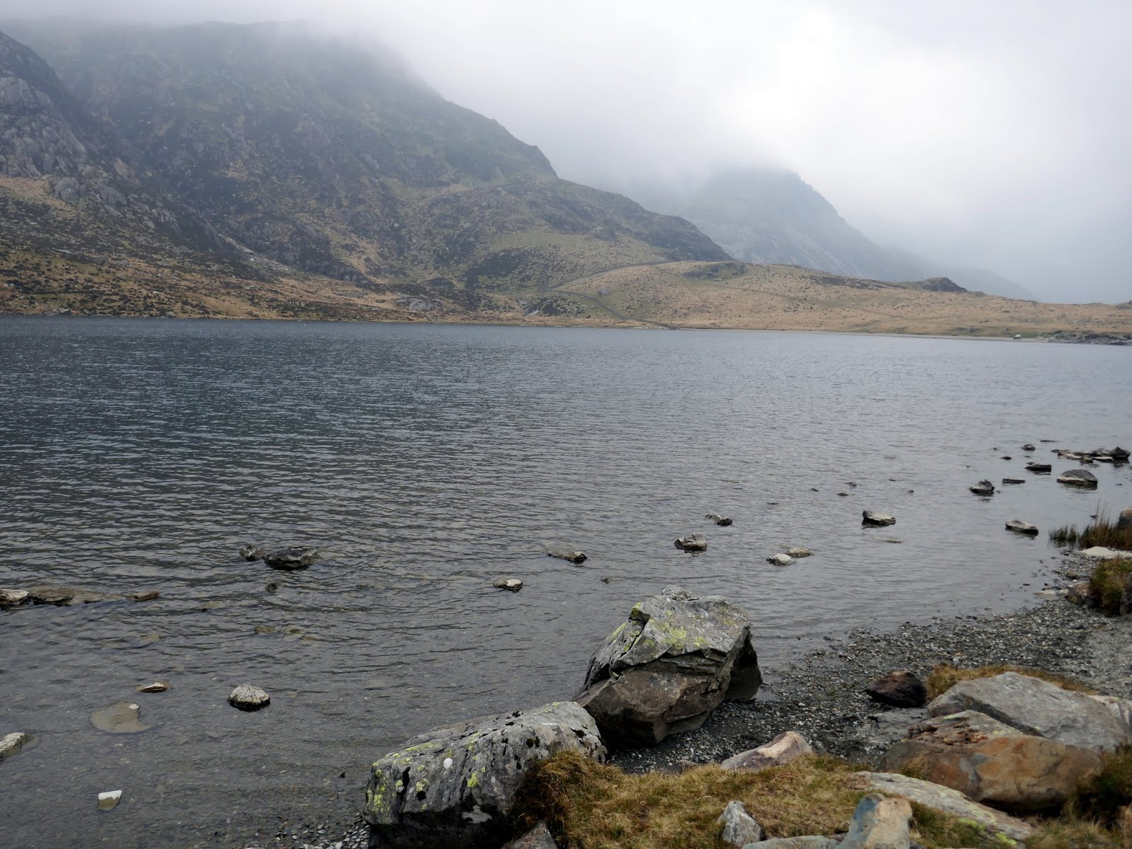
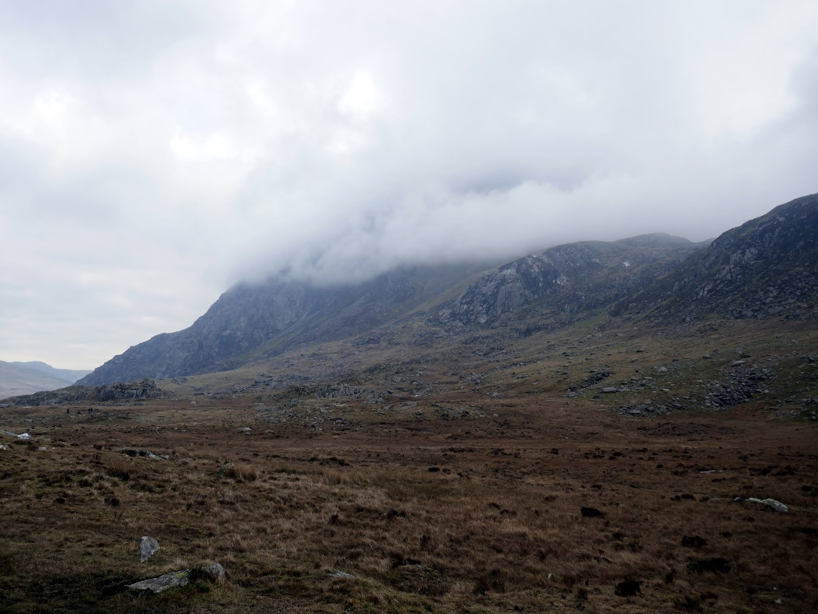
From the football field, we followed another path which descends firstly towards Llyn Bochlwyd before cutting across towards Llyn Idwal. By now the clouds had returned, shrouding the main summits in mist. We crossed some pathless ground until we reached the shore of Llyn Idwal. From here it’s a simple stroll back to the hostel.
 |
| The path leading down from the football field |
 |
| Llyn Idwal |
 |
| Clouds swirl around Devils Kitchen |
 |
| Llyn Idwal |
 |
| A cloudy Tryfan |
This a truly sensational outing, one that will live long in the memory. In my opinion, the scrambling is just the right level of difficulty. Challenging enough to feel a real sense of achievement but not over the top for a typical walker like myself.

