Open Space Web-Map builder Codehttps://openspace.ordnancesurvey.co.uk/osmapapi/openspace.js?key=3119F72552FD5C22E0530C6CA40A5A92https://openspace.ordnancesurvey.co.uk/osmapapi/script/mapbuilder/basicmap.jshttps://openspace.ordnancesurvey.co.uk/osmapapi/script/mapbuilder/searchbox.js//variables for routes var linesLayer, points, lineFeature, lineString, routeMarkersLayer, routepos, routesize, routeoffset, routeicon; var style_blue = {strokeColor: “#0000CD”, strokeOpacity: 0.5, strokeWidth: 4.5}; function initmapbuilder() { //initiate the map var options = {resolutions: [2500, 1000, 500, 200, 100, 50, 25, 10, 5, 4, 2.5, 2, 1]}; osMap = new OpenSpace.Map(‘map’, options); //configure map options (basicmap.js) setglobaloptions(); //set the center of the map and the zoom level osMap.setCenter(new OpenSpace.MapPoint(420725,450201.22464286),7); linesLayer = osMap.getVectorLayer(); // Set up layer for route markers routeMarkersLayer = new OpenLayers.Layer.Markers(“Route Markers”); //make a route points = new Array(); points.push(new OpenLayers.Geometry.Point(420910,449815)); points.push(new OpenLayers.Geometry.Point(420835,449870)); points.push(new OpenLayers.Geometry.Point(420620,449950)); points.push(new OpenLayers.Geometry.Point(420560,450015)); points.push(new OpenLayers.Geometry.Point(420280,450215)); points.push(new OpenLayers.Geometry.Point(420214,450266)); points.push(new OpenLayers.Geometry.Point(420144,450331)); points.push(new OpenLayers.Geometry.Point(420149,450411)); points.push(new OpenLayers.Geometry.Point(419974,450461)); points.push(new OpenLayers.Geometry.Point(419899,450716)); points.push(new OpenLayers.Geometry.Point(419789,450851)); points.push(new OpenLayers.Geometry.Point(419674,450916)); points.push(new OpenLayers.Geometry.Point(419614,450831)); points.push(new OpenLayers.Geometry.Point(419464,450861)); points.push(new OpenLayers.Geometry.Point(419329,451026)); points.push(new OpenLayers.Geometry.Point(419019,451016)); points.push(new OpenLayers.Geometry.Point(419004,451086)); points.push(new OpenLayers.Geometry.Point(419014,451176)); points.push(new OpenLayers.Geometry.Point(418914,451441)); points.push(new OpenLayers.Geometry.Point(418839,451541)); points.push(new OpenLayers.Geometry.Point(418794,451666)); points.push(new OpenLayers.Geometry.Point(418804,451751)); points.push(new OpenLayers.Geometry.Point(418834,451801)); points.push(new OpenLayers.Geometry.Point(418949,451866)); points.push(new OpenLayers.Geometry.Point(418984,451791)); points.push(new OpenLayers.Geometry.Point(418969,451721)); points.push(new OpenLayers.Geometry.Point(419094,451571)); points.push(new OpenLayers.Geometry.Point(419104,451476)); points.push(new OpenLayers.Geometry.Point(419149,451441)); points.push(new OpenLayers.Geometry.Point(419179,451516)); points.push(new OpenLayers.Geometry.Point(419314,451596)); points.push(new OpenLayers.Geometry.Point(419439,451556)); points.push(new OpenLayers.Geometry.Point(419434,451601)); points.push(new OpenLayers.Geometry.Point(419514,451611)); points.push(new OpenLayers.Geometry.Point(419624,451581)); points.push(new OpenLayers.Geometry.Point(419744,451571)); points.push(new OpenLayers.Geometry.Point(420009,451536)); points.push(new OpenLayers.Geometry.Point(420179,451576)); points.push(new OpenLayers.Geometry.Point(420279,451601)); points.push(new OpenLayers.Geometry.Point(420876.5,451591)); points.push(new OpenLayers.Geometry.Point(420879,451473.5)); points.push(new OpenLayers.Geometry.Point(420971.5,451351)); points.push(new OpenLayers.Geometry.Point(421075.5,451252)); points.push(new OpenLayers.Geometry.Point(421265.5,451137)); points.push(new OpenLayers.Geometry.Point(421360.5,451112)); points.push(new OpenLayers.Geometry.Point(421600.5,451047)); points.push(new OpenLayers.Geometry.Point(421645.5,450967)); points.push(new OpenLayers.Geometry.Point(421630.5,450827)); points.push(new OpenLayers.Geometry.Point(421665.5,450777)); points.push(new OpenLayers.Geometry.Point(421645.5,450597)); points.push(new OpenLayers.Geometry.Point(421635.5,450524.5)); points.push(new OpenLayers.Geometry.Point(421695.5,450487)); points.push(new OpenLayers.Geometry.Point(421820.5,450489.5)); points.push(new OpenLayers.Geometry.Point(421860.5,450522)); points.push(new OpenLayers.Geometry.Point(421881.5,450535)); points.push(new OpenLayers.Geometry.Point(421956.5,450430)); points.push(new OpenLayers.Geometry.Point(422091.5,450090)); points.push(new OpenLayers.Geometry.Point(422136.5,449930)); points.push(new OpenLayers.Geometry.Point(422111.5,449780)); points.push(new OpenLayers.Geometry.Point(421956.5,449590)); points.push(new OpenLayers.Geometry.Point(421876.5,449430)); points.push(new OpenLayers.Geometry.Point(421911.5,449340)); points.push(new OpenLayers.Geometry.Point(422006.5,449205)); points.push(new OpenLayers.Geometry.Point(422051.5,449055)); points.push(new OpenLayers.Geometry.Point(422126.5,448995)); points.push(new OpenLayers.Geometry.Point(422371.5,448930)); points.push(new OpenLayers.Geometry.Point(422446.5,448875)); points.push(new OpenLayers.Geometry.Point(422521.5,448525)); points.push(new OpenLayers.Geometry.Point(422486.5,448395)); points.push(new OpenLayers.Geometry.Point(422429,448435)); points.push(new OpenLayers.Geometry.Point(422319.5,448511)); points.push(new OpenLayers.Geometry.Point(422109.5,448656)); points.push(new OpenLayers.Geometry.Point(422034.5,448796)); points.push(new OpenLayers.Geometry.Point(421959.5,448866)); points.push(new OpenLayers.Geometry.Point(421879.5,448961)); points.push(new OpenLayers.Geometry.Point(421799.5,449021)); points.push(new OpenLayers.Geometry.Point(421624.5,449261)); points.push(new OpenLayers.Geometry.Point(421639.5,449416)); points.push(new OpenLayers.Geometry.Point(421529.5,449396)); points.push(new OpenLayers.Geometry.Point(421414.5,449536)); points.push(new OpenLayers.Geometry.Point(421304.5,449781)); points.push(new OpenLayers.Geometry.Point(421194.5,449871)); points.push(new OpenLayers.Geometry.Point(421131.5,449915)); points.push(new OpenLayers.Geometry.Point(421047.5,449962)); points.push(new OpenLayers.Geometry.Point(420967.5,449986)); points.push(new OpenLayers.Geometry.Point(420925.5,449856)); points.push(new OpenLayers.Geometry.Point(420910,449815)); // create a polyline feature from the array of points lineString = new OpenLayers.Geometry.LineString(points); lineFeature = new OpenLayers.Feature.Vector(lineString, null, style_blue); linesLayer.addFeatures([lineFeature]); //crate a route start/end marker routepos = new OpenSpace.MapPoint(420910,449815); routesize = new OpenLayers.Size(33,45); routeoffset = new OpenLayers.Pixel(-5,-37); routeicon = new OpenSpace.Icon(‘https://openspace.ordnancesurvey.co.uk/osmapapi/img_versions/img_1.1/mapbuilder/routemarker-startend.png’, routesize, routeoffset, null, null); routeMarkersLayer.addMarker(new OpenLayers.Marker(routepos, routeicon)); osMap.addLayer(routeMarkersLayer);}
Route: Viaduct, Dob Park Bridge, Ellers Wood, Six Dales Trail, Folly Hall, Sword Point, Top Lane, Norwood Edge, Prospecthouse Farm, Greystone Beck, Lindley Wood Farm, Lindley Green, Lindley Bridge, Lindley Wood
Date: 24/03/2019
From: Lindley Wood Reservoir
Parking: Roadside – B6451
Start Point: Lindley Wood Reservoir viaduct
Region: West Yorkshire
Route length: 7.8 miles (12.5km)
Time taken: 03:35
Average speed: 2.5 mph
Ascent: 304m
Descent: 293m
Other points of interest: Dob Park Bridge, Folly Hall, Norwood Edge
The River Washburn originates high in the Yorkshire Dales and flows through the Nidderdale Area of Outstanding Natural Beauty. Though it is barely nine miles in length, the Washburn has been dammed to a series of four reservoirs, all built to supply water to the city of Leeds. The lower three (Lindley Wood, Swinsty and Fewston) were built at the end of the 19th century, while the fourth, Thruscross, was delayed until the 1960s.
We recently did a walk from Thruscross to the wild Rocking Moor and its isolating shooting lodge. Now it was our turn to investigate the tranquil surrounds of Lindley Wood Reservoir, the lowest of the chain. Unlike Thruscross, parking is a little awkward around Lindley Wood but we were early enough to nab a layby space near the road bridge.
 |
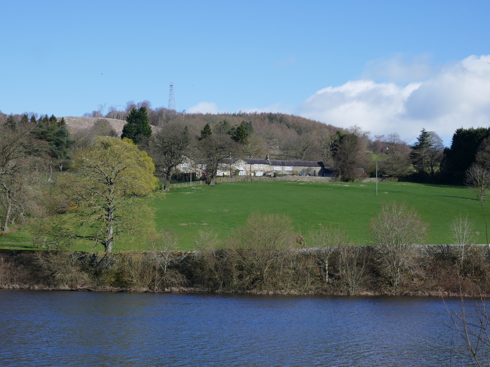
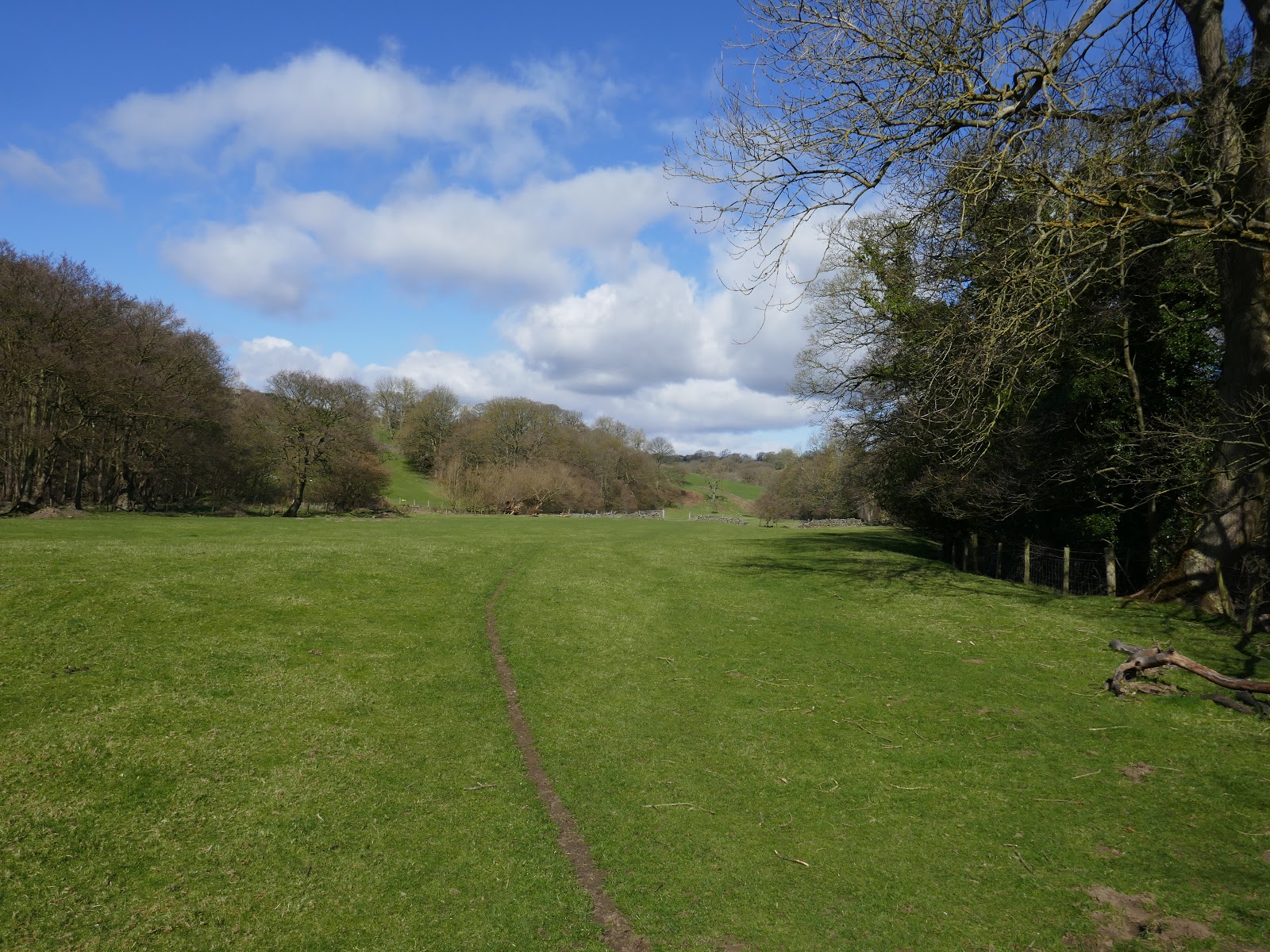
| Norwood Bottom and the Norwood transmitter |
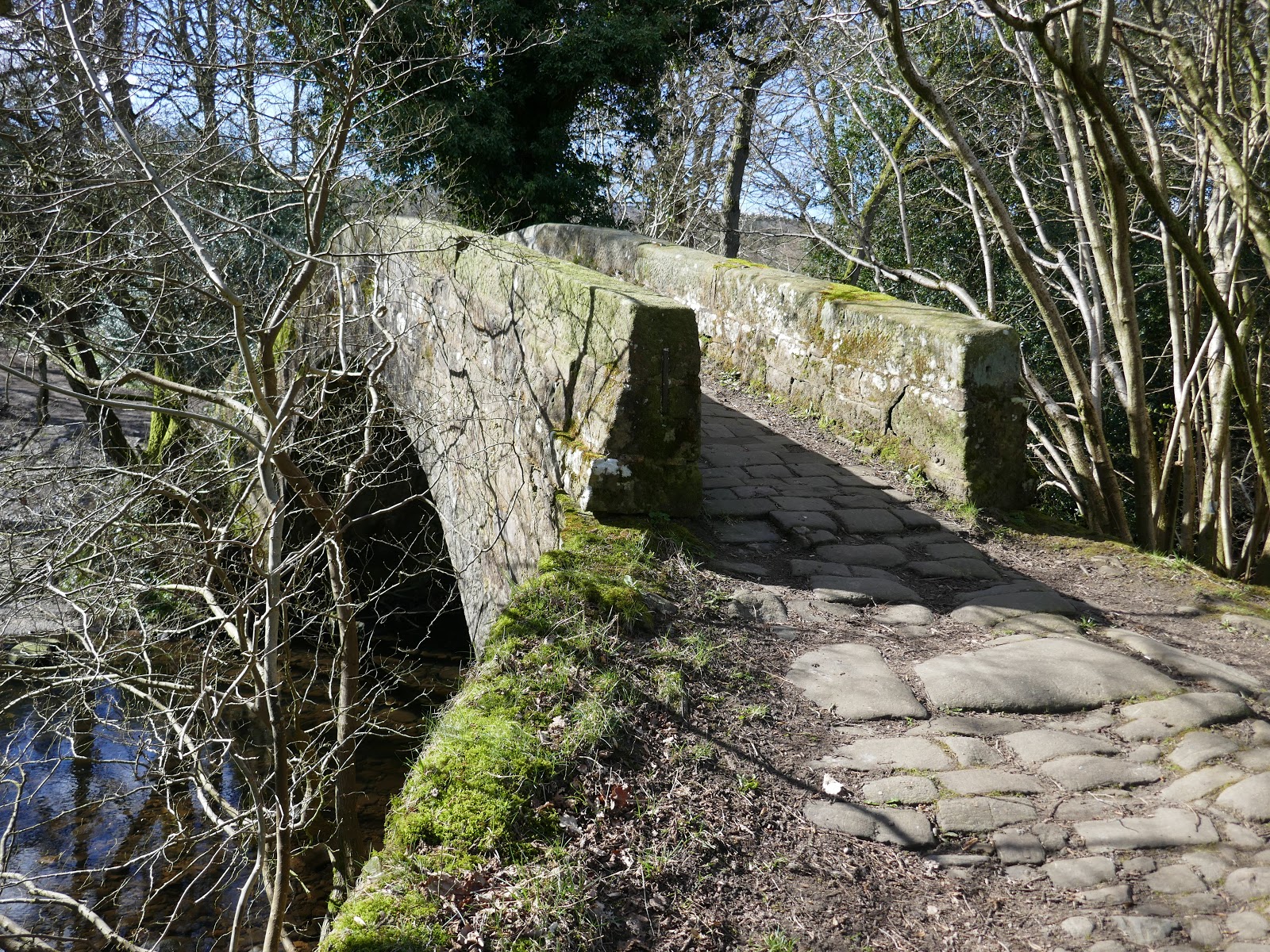
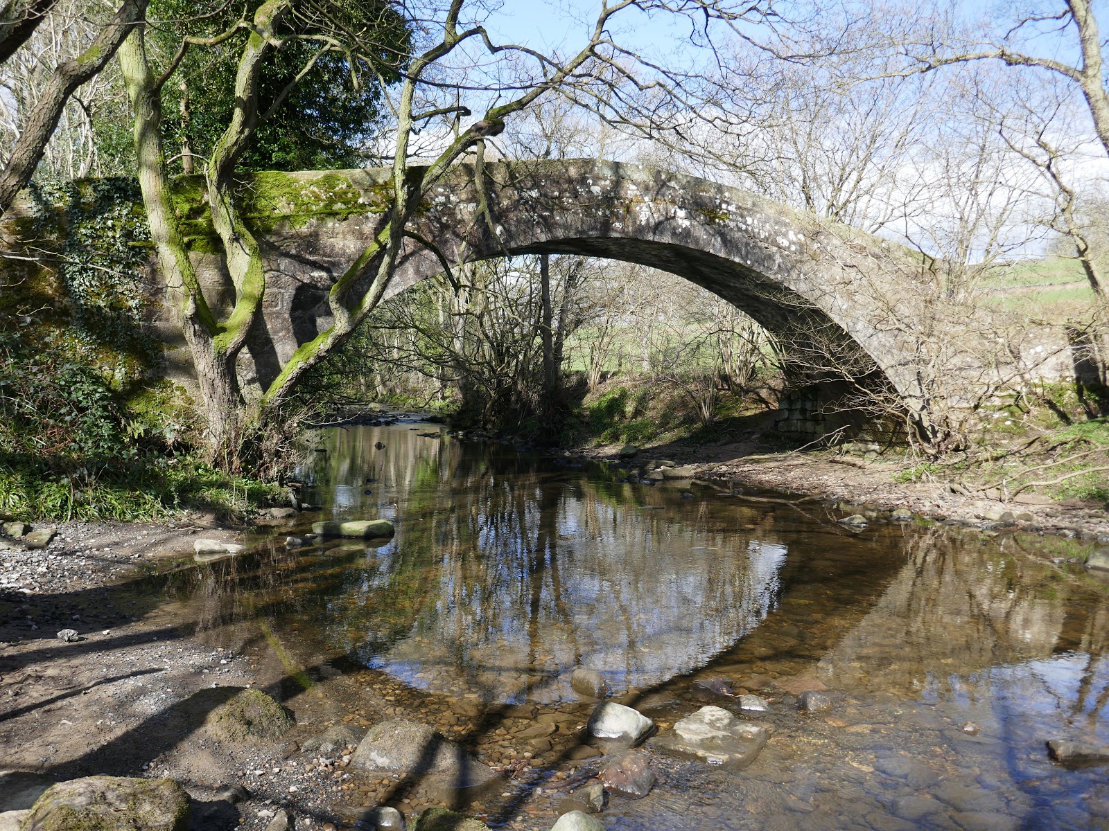
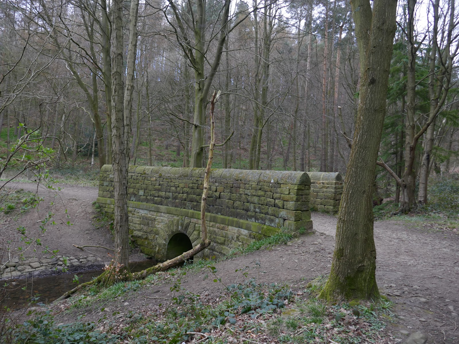
Immediately, we were a footpath leading along the western end of the reservoir. The path heads through the fields of Norwood Bottom until it reaches the 400-year-old Dob Park Bridge. The sweeping arch bridge, a listed structure, was part of a medieval monastic trade route between Otley and Nidderdale. The present bridge was built in 1767 after an earlier span was swept away in a flood caused by a violent thunderstorm over Pockstones Moor, where the Washburn originates.
 |
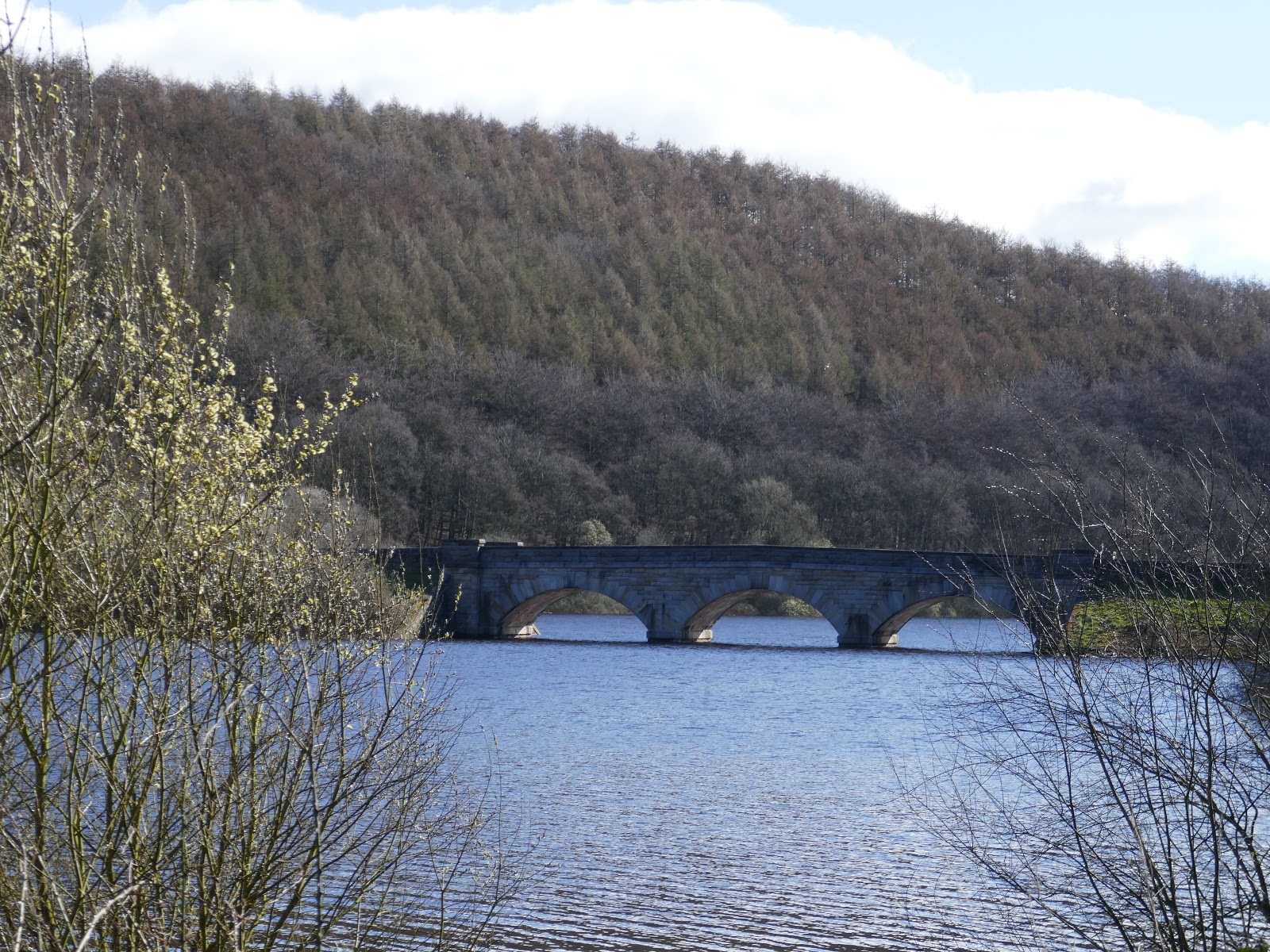
| Lindley Wood Reservoir viaduct |
 |
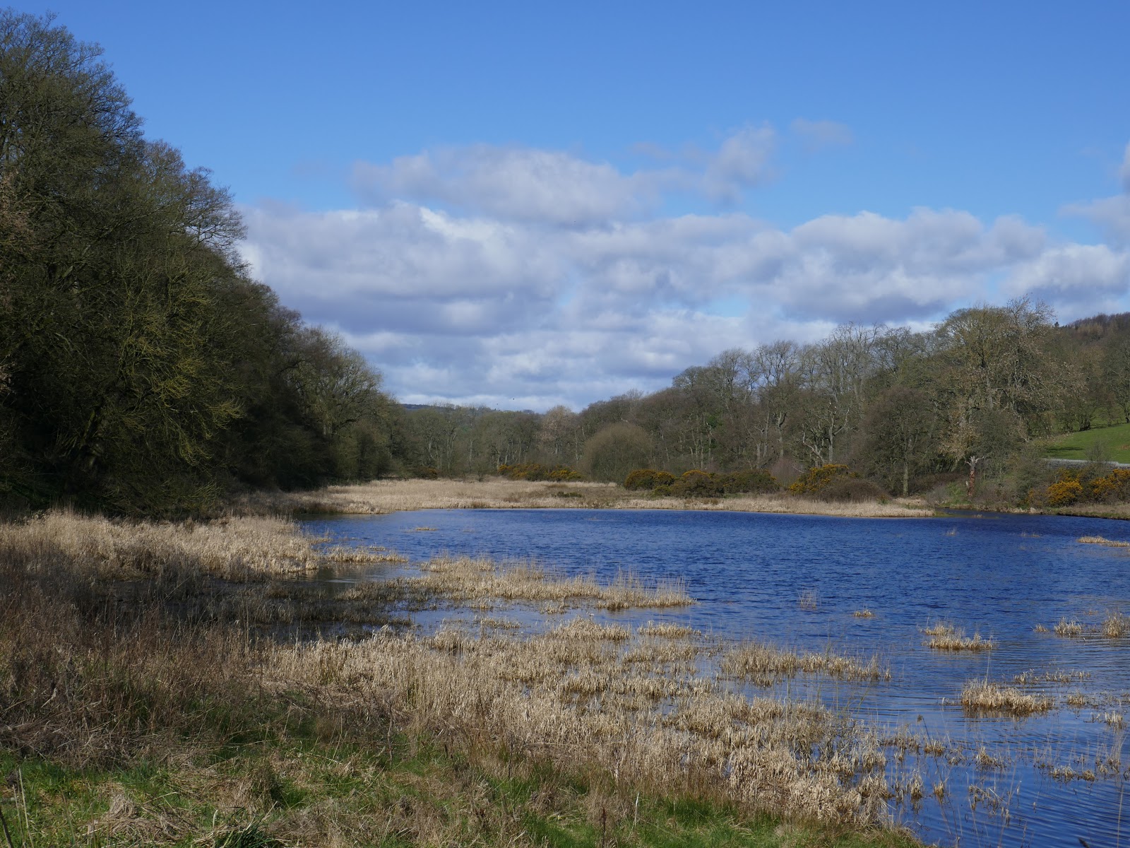
| The top end of Lindley Wood Reservoir |
 |
| Dob Park Bridge |
 |
| Dob Park Bridge and the River Washburn |
Beyond the bridge, we joined the Six Dales Trail, a long distance path which the trail crosses the five watersheds that separate the six dales that give the trail its name. From Wharfedale it crosses into Washburndale, then into Nidderdale, Colsterdale, Coverdale and finally Wensleydale. The path swept us around a bend in the Washburn to another, more modern crossing of the river. After turning back on ourselves a track climbs up to Folly Hall.
 |
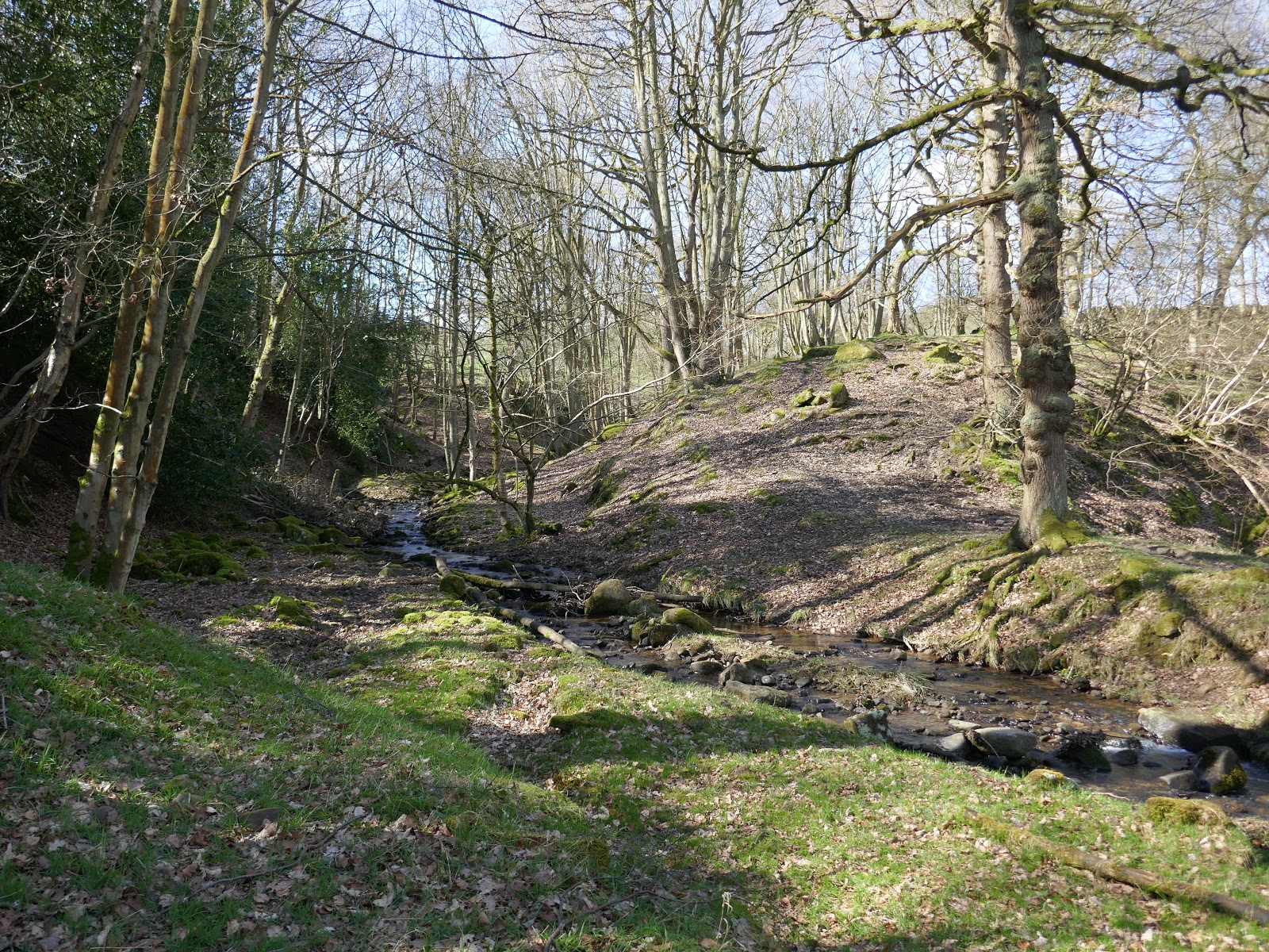
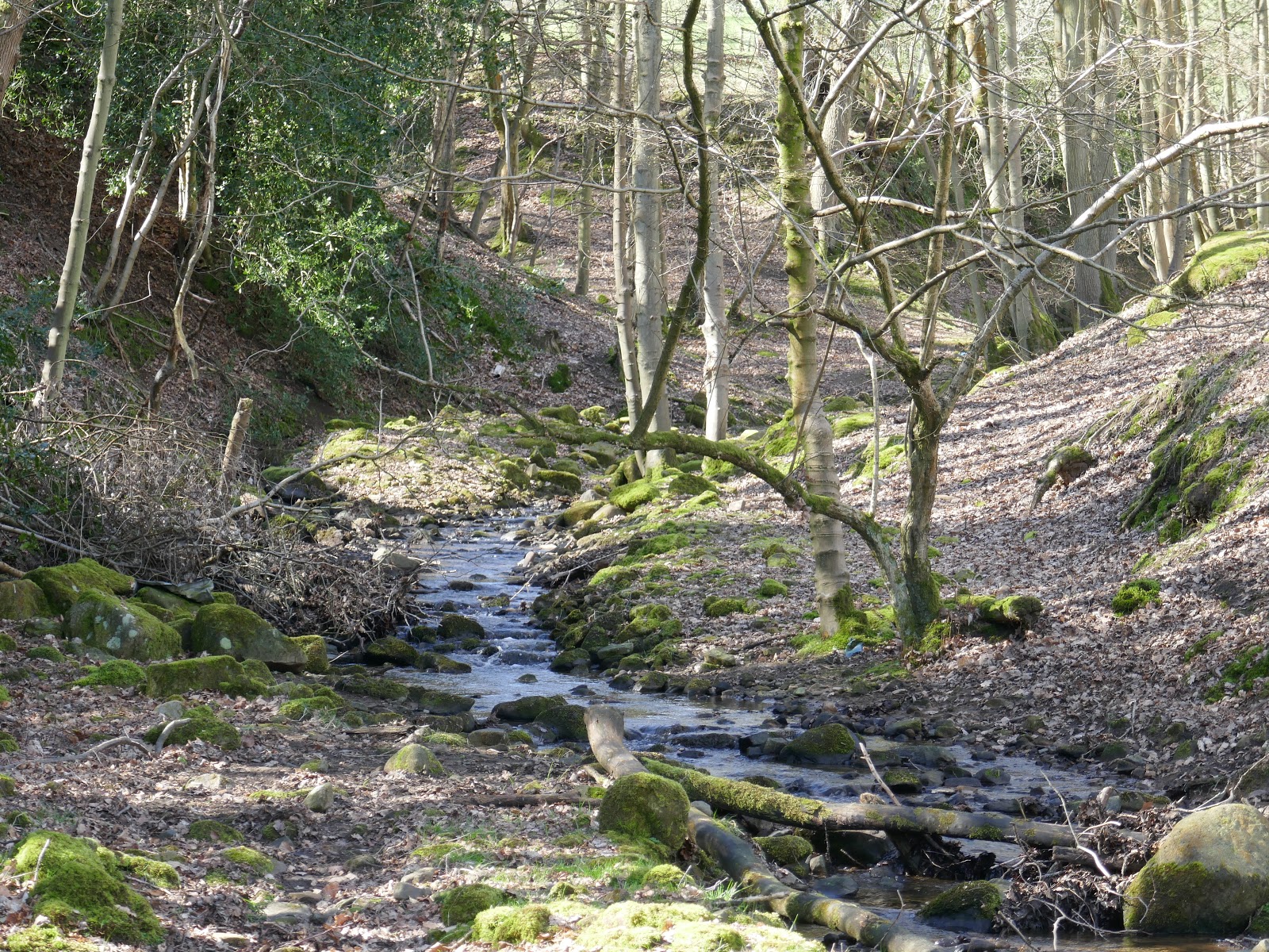
| Snowden Beck in Ellers Wood |
 |
| Snowden Beck |
 |
| The Six Dales Trail |
Folly Hall is an impressive 18th-century, three-storey farmhouse, its size and grandeur seemingly out of place in such a rural location. Its name reflects the fortunes of its builder, who spent so much on its construction he went bust. Despite this, it stands in a superb location overlooking the Washburn Valley.
 |
| Dob Park Wood from Folly Hall |
 |
| Folly Hall |
It is in this area that famed artist JMW Turner sketched several views of the Washburn. He chose a vantage point below Folly Hall, looking across the valley to the dramatic ruined tower of Dob Park Lodge, a 16th-century hunting house of the Vavasours, Lords of the Manor, whose house was situated at Weston, near Otley.
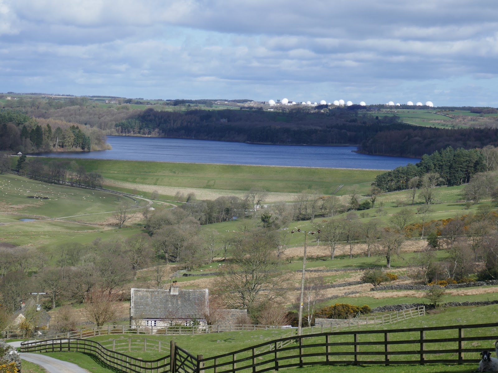
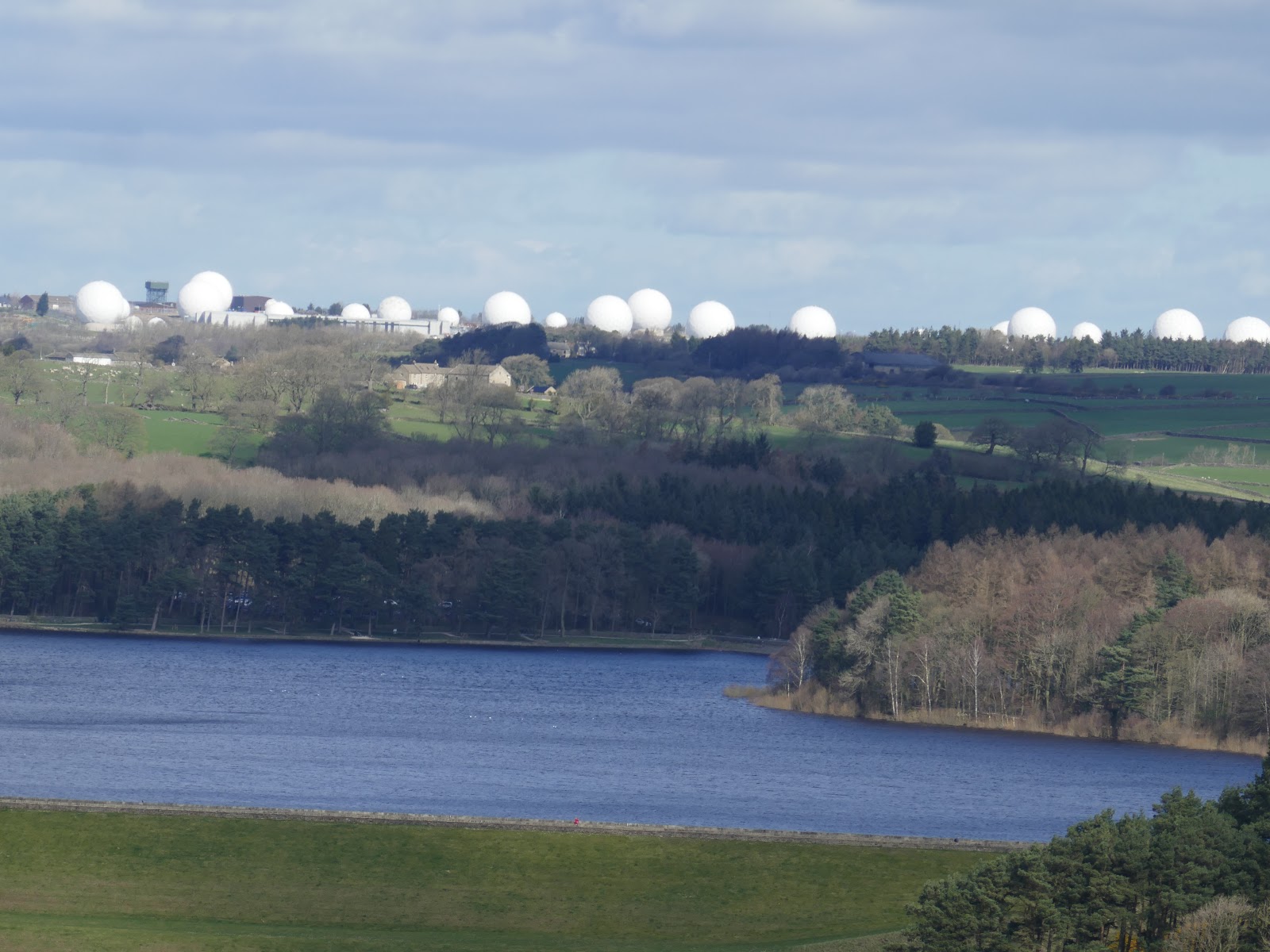
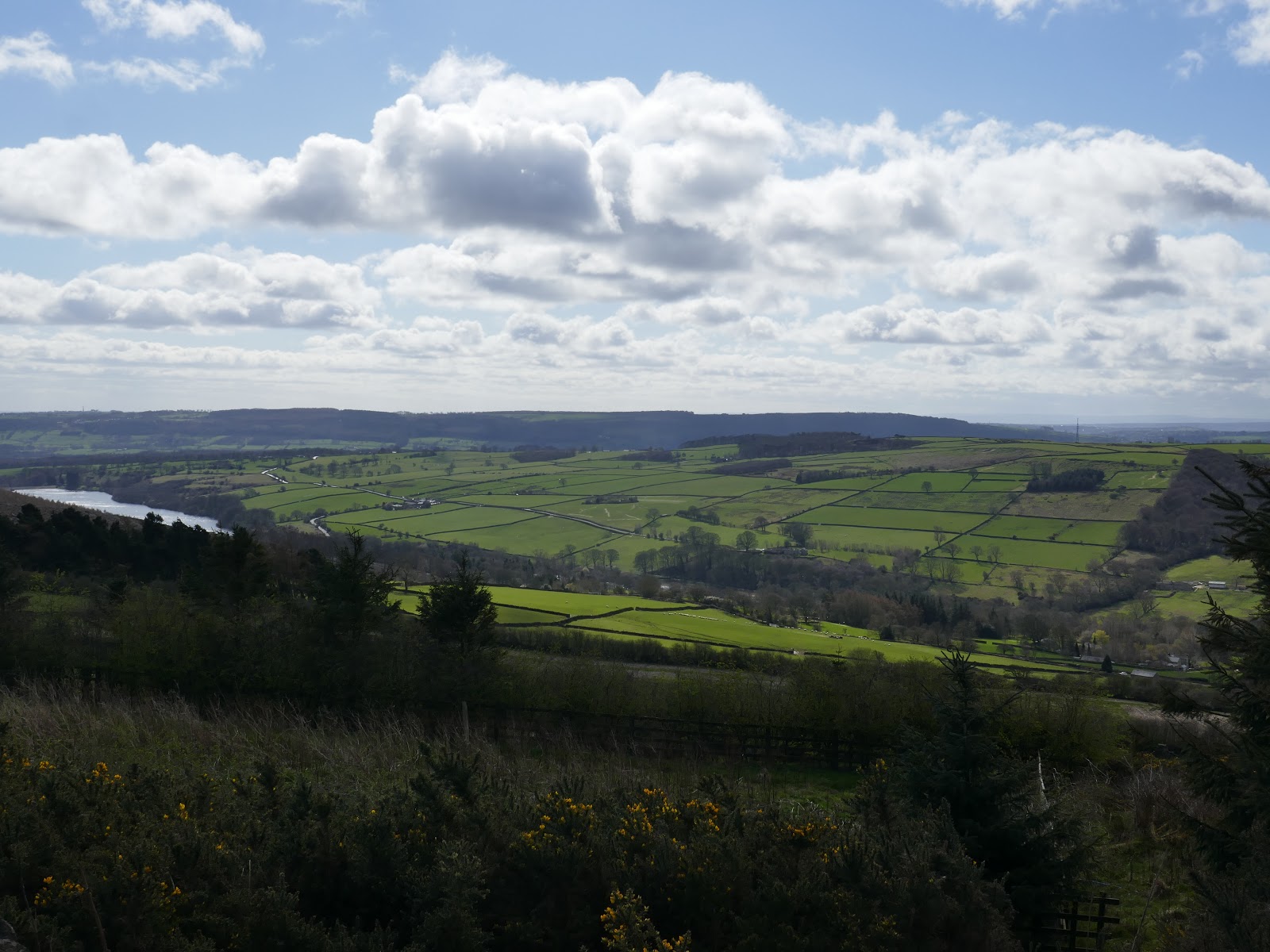
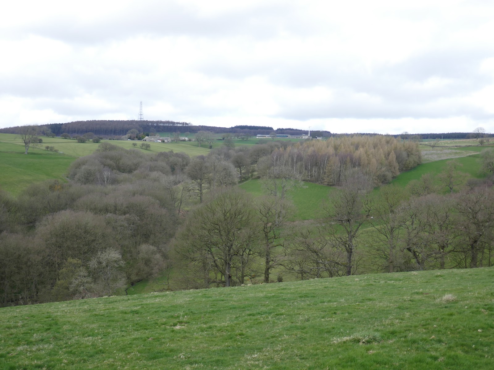
As the road climbs out of the valley beyond Folly Hall, the views along the valley open up. At Jack Hill Lane, an overgrown path disappears along Sword Point, a prominent ridge which climbs up to some ever impressive views. To the north is Swinsty reservoir with its immense dam, overlooked by the curious globes of RAF Menwith Hill, one of the largest electronic monitoring sites in the world.
 |
| Heading for Jack Hill Lane |
 |
| Swinsty Reservoir |
 |
| Menwith Hill Camp |
 |
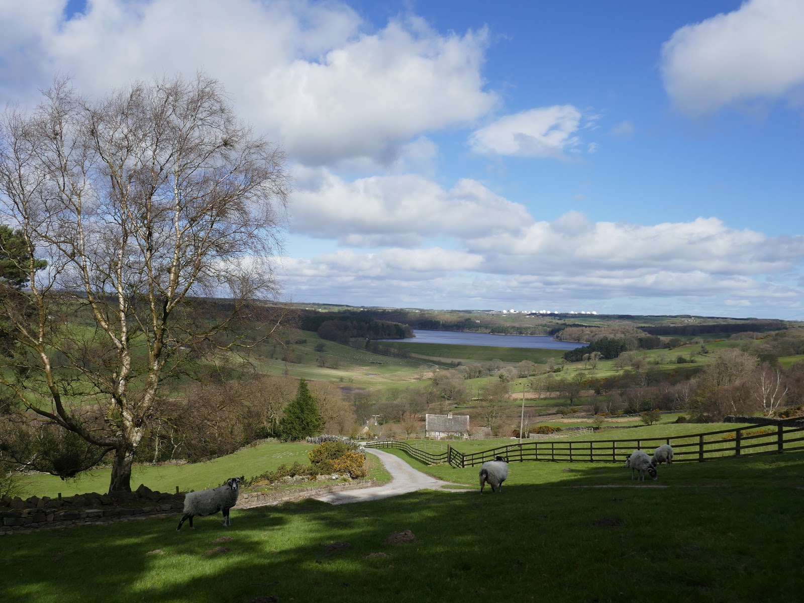
| The Washburn valley |
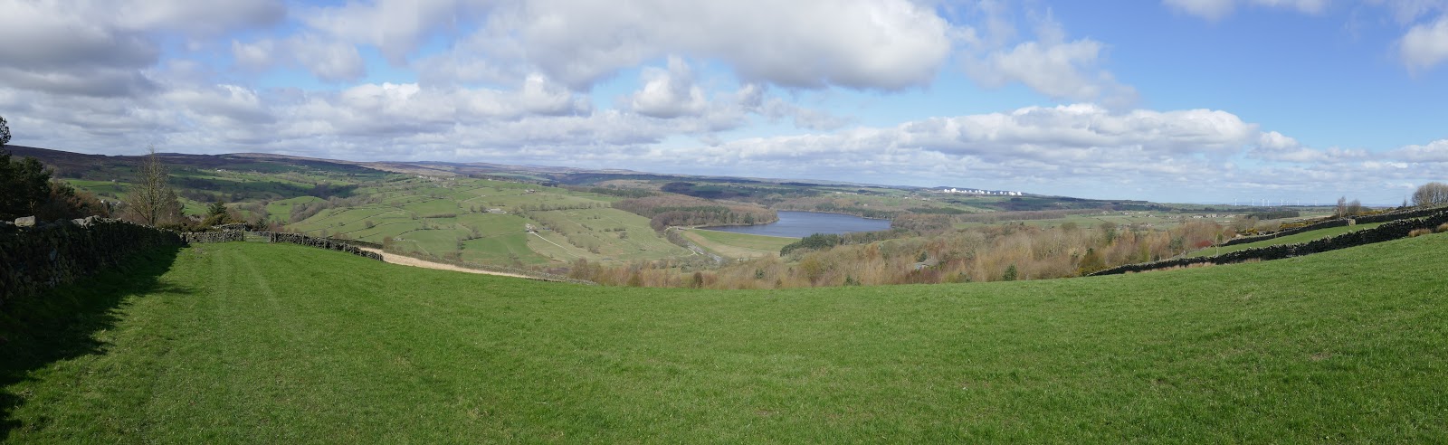
 |
| Panorama from Sword Point |
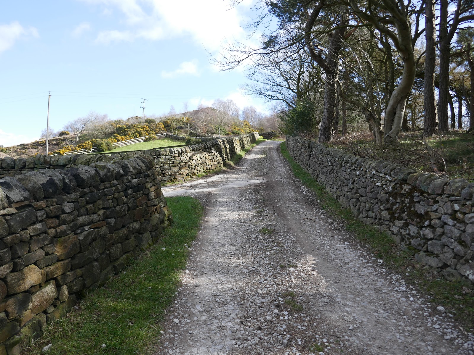
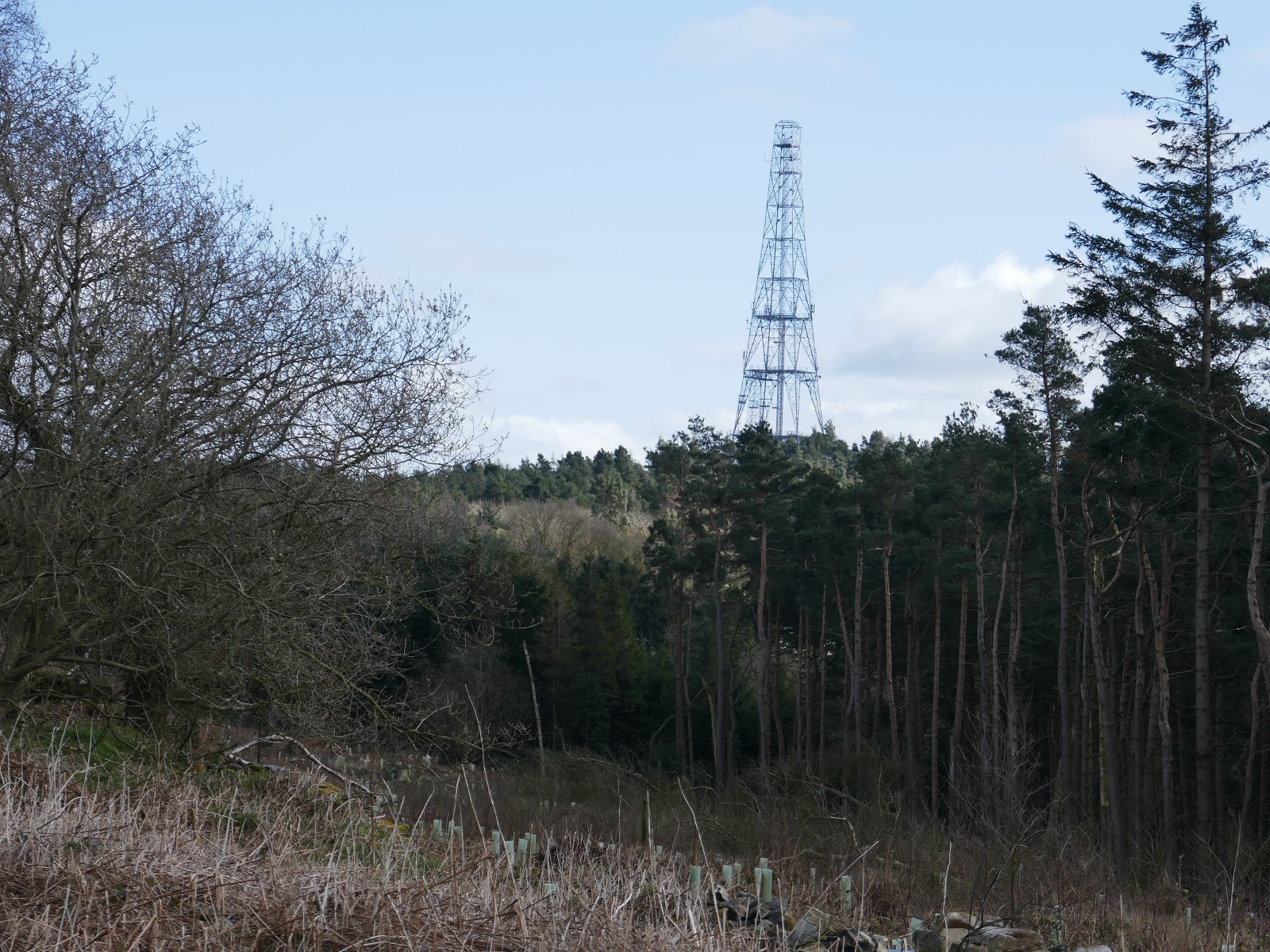
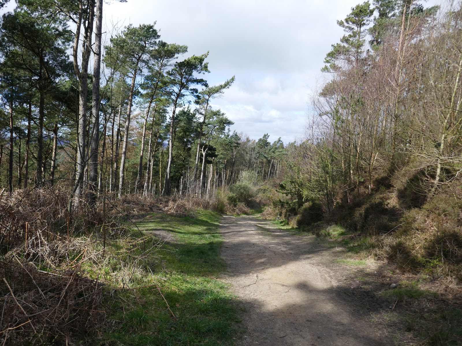
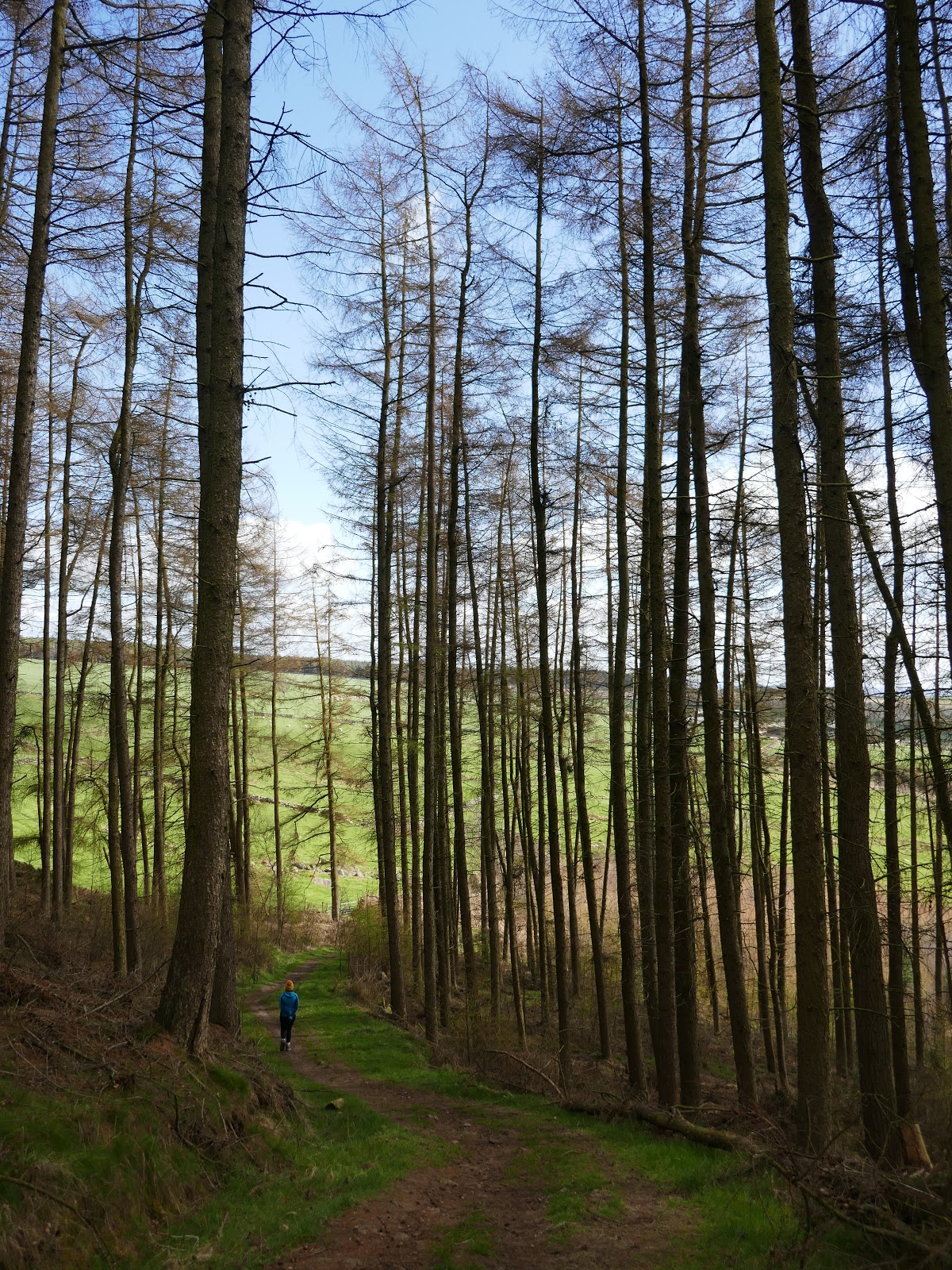
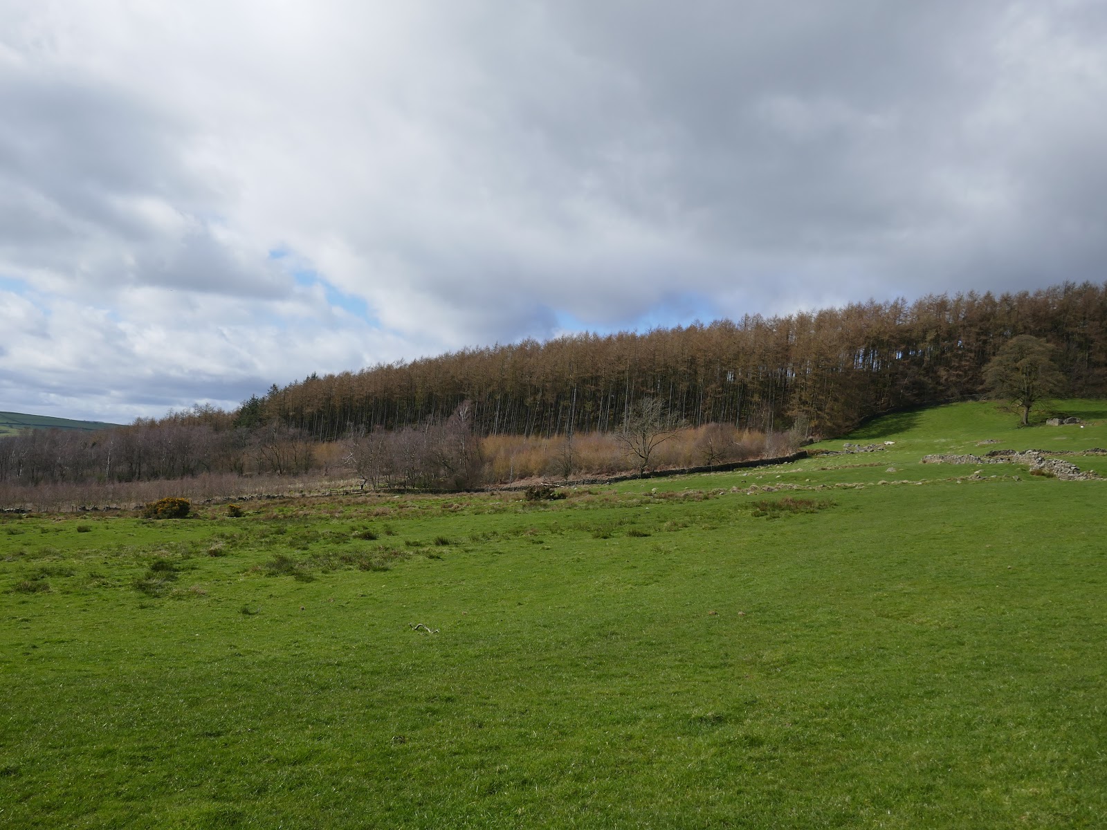
The path rises to reach Top Lane which leads along the top of Norwood Edge to the main road at Norwood Edge Plantation. A prominent transmitter tower marks the summit of the moor. We crossed the road and entered the plantation, following the forest track through the woods until we reached the eastern edge of the trees. Beyond are the open fields of Prospecthouse Farm.
 |
| Norwood transmitter |
 |
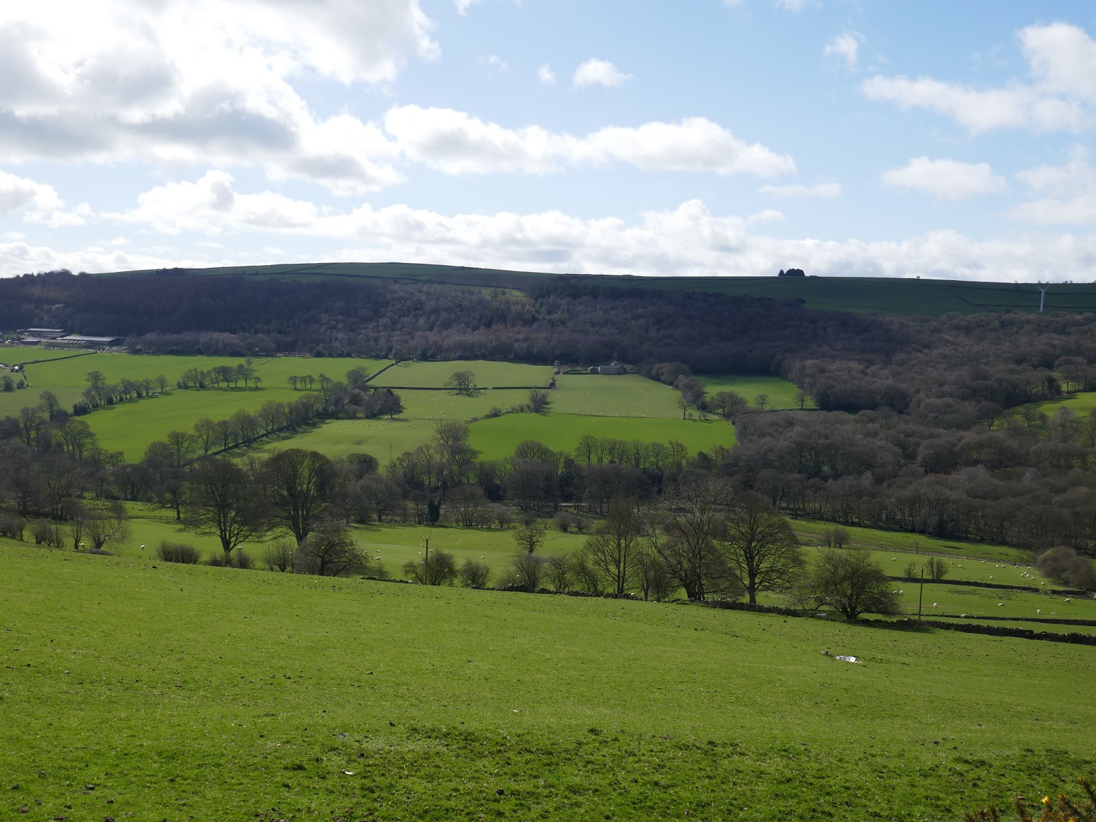
| The Washburn valley from Norwood Edge |
 |
| Norwood Edge Plantation |
 |
| Norwood Edge Plantation |
 |
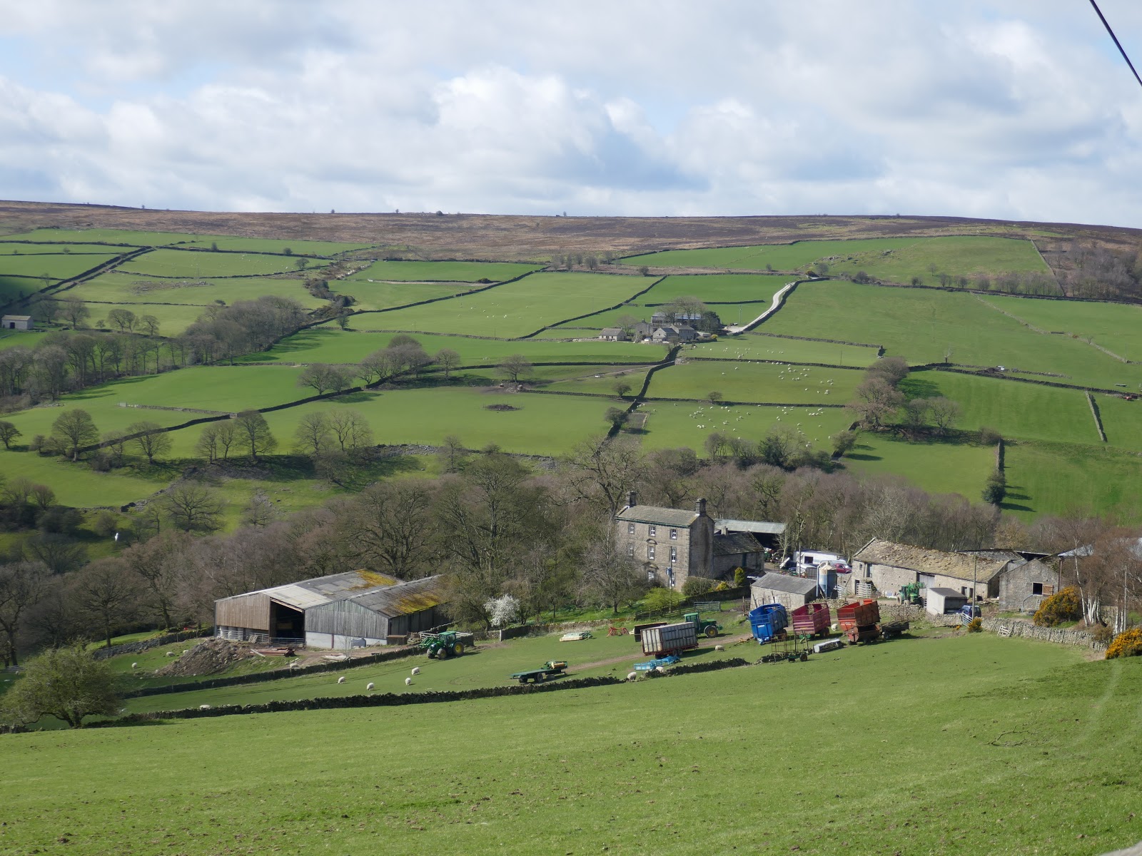
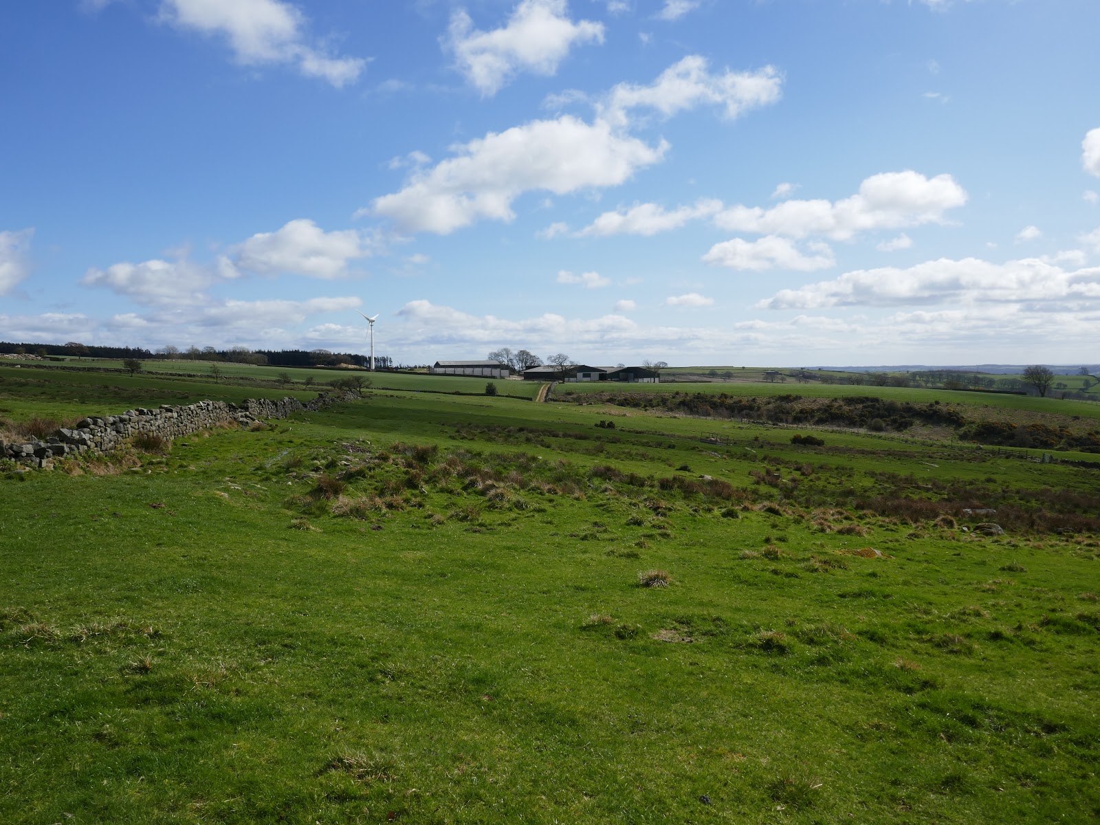
| Prospecthouse Farm |
The route gets a little tricky to follow here as there is no obvious path on the ground, though a couple of markers and the odd stile prove you are on the right course. Once around the farm, we followed the lane east to Greystone Beck and left it, making our way along the valley.
 |
| Norwood Edge |
 |
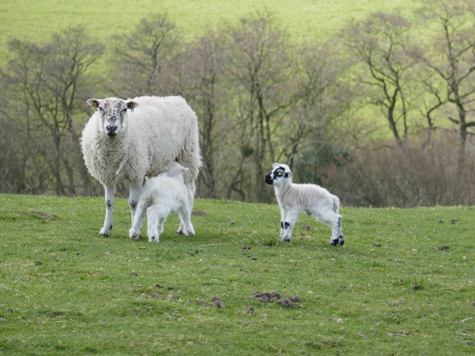
| Spring has official sprung |
 |
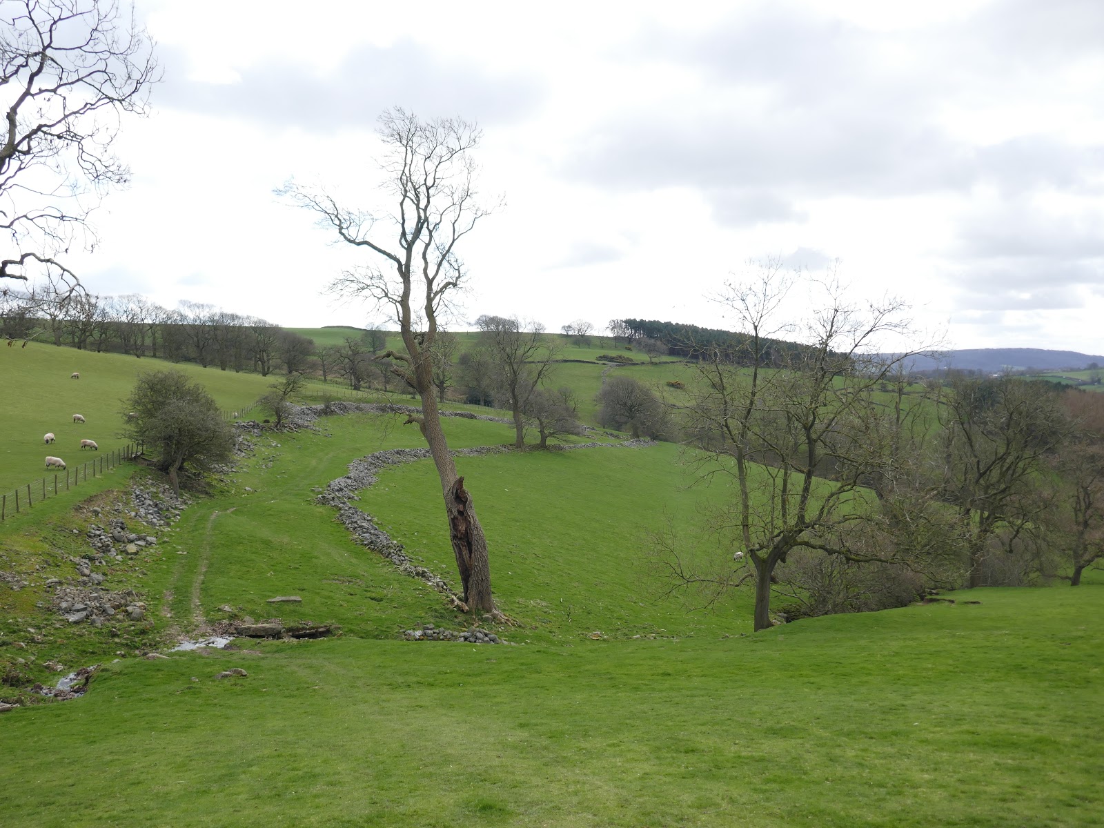
| The valley of Greystone Beck |
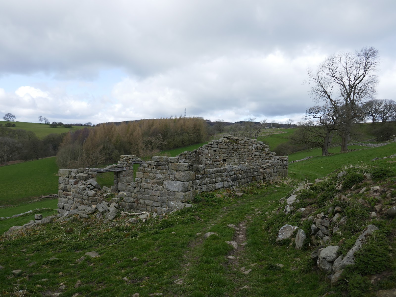
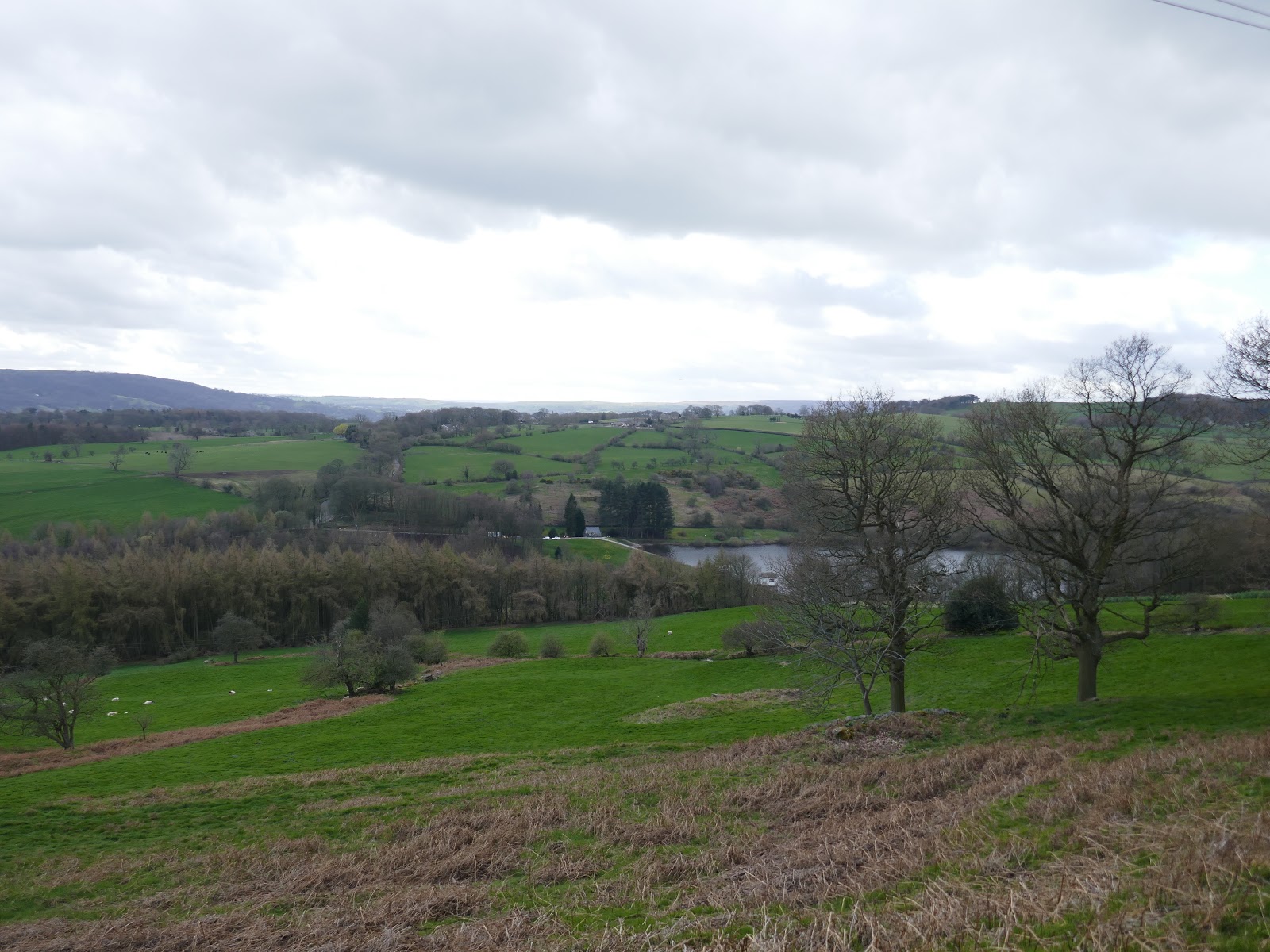
Clouds had filled in much of the sky by the afternoon and it was quite chilly as we stopped at a ruined barn for a quick bite to eat. The path stays high up the valley side until it passes Lindley Wood Farm, eventually descending to Washburn at Lindley Green, a short distance below the dam of Lindley Wood Reservoir.
 |
| Ruined barn |
 |
| Looking across to Norwood Edge |
 |
| Lindley Wood Reservoir |
 |
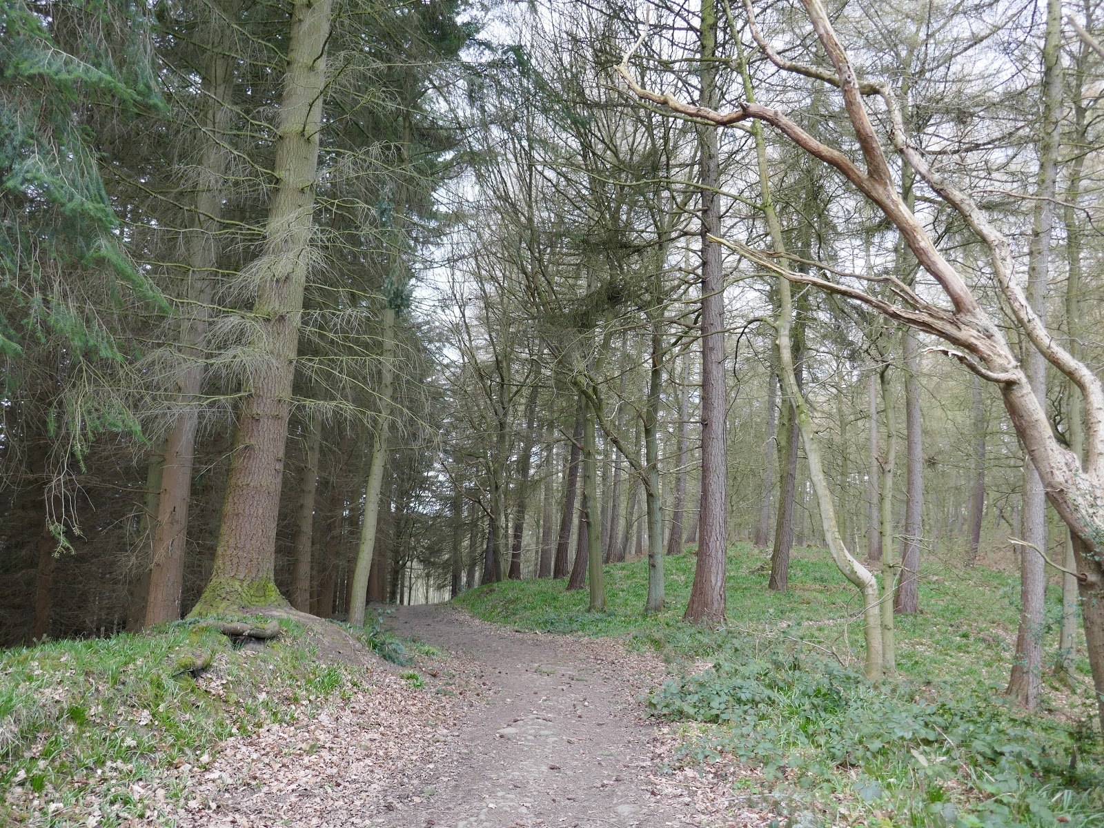
| Lindley Wood |
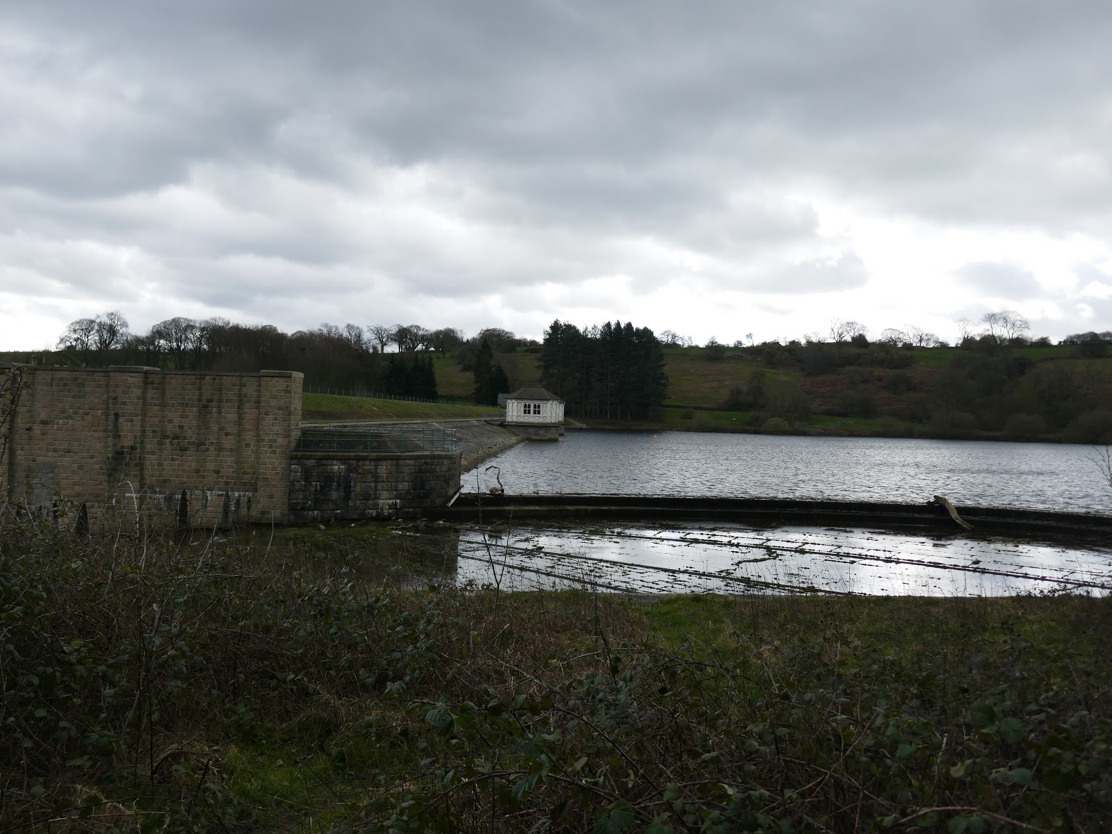
The path enters Lindley Wood and climbs alongside the spillway of the reservoir to the top of the dam (mostly obscured behind trees). While the reservoir forms part of the chain in the Washburn valley, its water is not used for supplying Leeds. Instead, it is used to maintain flow in the River Washburn with the higher three reservoirs being used to supply the city.
 |
| The dam of the reservoir |
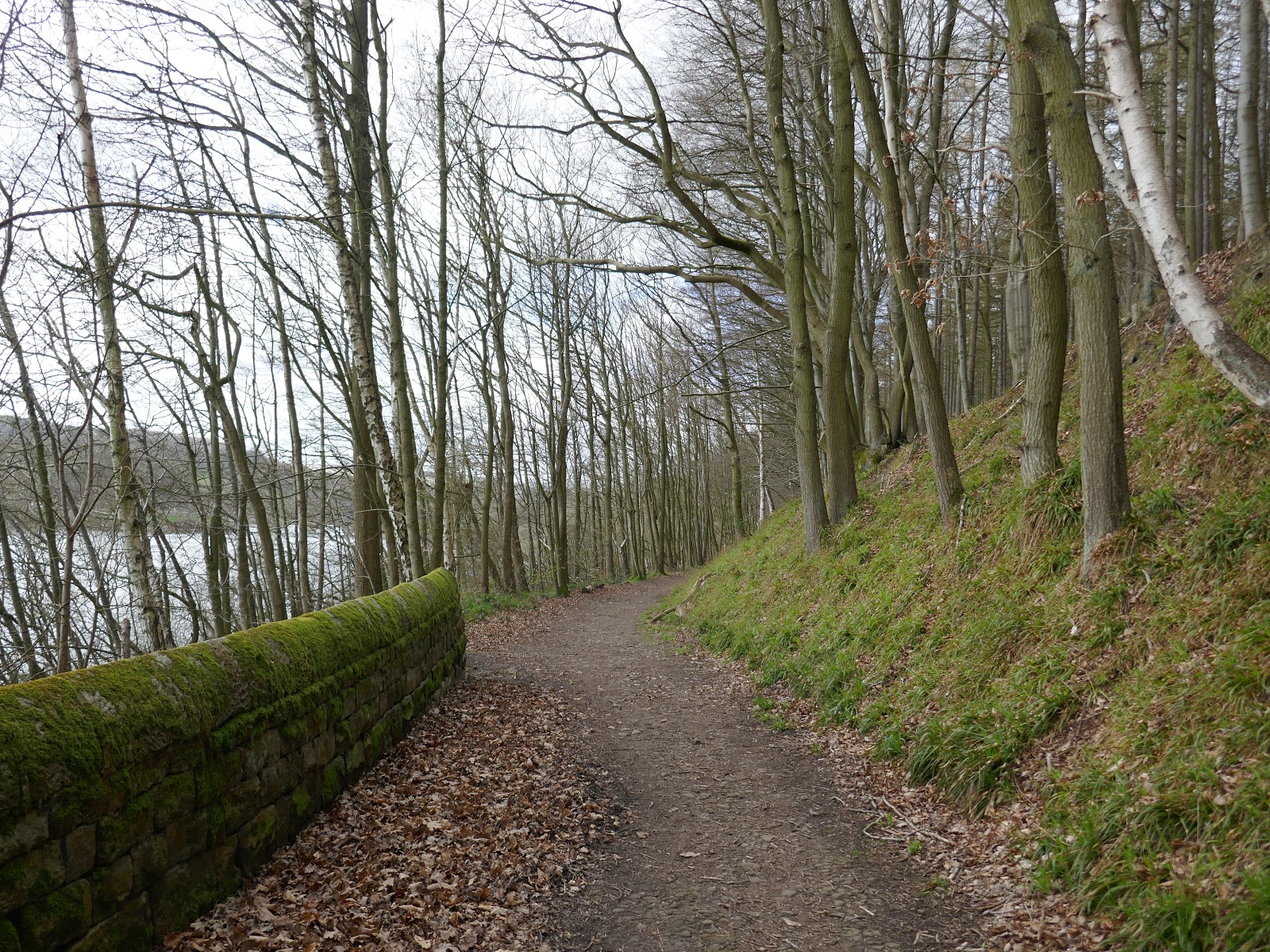
The path on the north shore of the reservoir passes through the trees of the woods which give it its name. While it is not unpleasant, the trees block most of the views of the reservoir itself. It does, however, cross a fine bridge at Greystone Beck (the same stream we were walking along earlier). The north shore path continues until it reaches the layby at the road bridge once again.
 |
| Bridge over Greystone Beck |
 |
| Lindley Wood |
