Open Space Web-Map builder Codehttps://openspace.ordnancesurvey.co.uk/osmapapi/openspace.js?key=3119F72552FD5C22E0530C6CA40A5A92https://openspace.ordnancesurvey.co.uk/osmapapi/script/mapbuilder/basicmap.jshttps://openspace.ordnancesurvey.co.uk/osmapapi/script/mapbuilder/searchbox.js//variables for routes var linesLayer, points, lineFeature, lineString, routeMarkersLayer, routepos, routesize, routeoffset, routeicon; var style_blue = {strokeColor: “#0000CD”, strokeOpacity: 0.5, strokeWidth: 4.5}; function initmapbuilder() { //initiate the map var options = {resolutions: [2500, 1000, 500, 200, 100, 50, 25, 10, 5, 4, 2.5, 2, 1]}; osMap = new OpenSpace.Map(‘map’, options); //configure map options (basicmap.js) setglobaloptions(); //set the center of the map and the zoom level osMap.setCenter(new OpenSpace.MapPoint(427529,468735),8); linesLayer = osMap.getVectorLayer(); // Set up layer for route markers routeMarkersLayer = new OpenLayers.Layer.Markers(“Route Markers”); //make a route points = new Array(); points.push(new OpenLayers.Geometry.Point(427214,468620)); points.push(new OpenLayers.Geometry.Point(427264,468455)); points.push(new OpenLayers.Geometry.Point(427259,468400)); points.push(new OpenLayers.Geometry.Point(427054,468335)); points.push(new OpenLayers.Geometry.Point(427079,468295)); points.push(new OpenLayers.Geometry.Point(427234,468295)); points.push(new OpenLayers.Geometry.Point(427264,468295)); points.push(new OpenLayers.Geometry.Point(427289,468255)); points.push(new OpenLayers.Geometry.Point(427344,468255)); points.push(new OpenLayers.Geometry.Point(427459,468325)); points.push(new OpenLayers.Geometry.Point(427604,468390)); points.push(new OpenLayers.Geometry.Point(427794,468420)); points.push(new OpenLayers.Geometry.Point(427904,468455)); points.push(new OpenLayers.Geometry.Point(427959,468490)); points.push(new OpenLayers.Geometry.Point(427964,468545)); points.push(new OpenLayers.Geometry.Point(427904,468575)); points.push(new OpenLayers.Geometry.Point(427859,468670)); points.push(new OpenLayers.Geometry.Point(427844,468760)); points.push(new OpenLayers.Geometry.Point(427894,468870)); points.push(new OpenLayers.Geometry.Point(427904,468945)); points.push(new OpenLayers.Geometry.Point(427944,469030)); points.push(new OpenLayers.Geometry.Point(427884,469090)); points.push(new OpenLayers.Geometry.Point(427884,469185)); points.push(new OpenLayers.Geometry.Point(427939,469320)); points.push(new OpenLayers.Geometry.Point(427994,469335)); points.push(new OpenLayers.Geometry.Point(428014,469385)); points.push(new OpenLayers.Geometry.Point(428124,469365)); points.push(new OpenLayers.Geometry.Point(428169,469295)); points.push(new OpenLayers.Geometry.Point(428254,469315)); points.push(new OpenLayers.Geometry.Point(428314,469320)); points.push(new OpenLayers.Geometry.Point(428464,469140)); points.push(new OpenLayers.Geometry.Point(428319,469320)); points.push(new OpenLayers.Geometry.Point(428189,469300)); points.push(new OpenLayers.Geometry.Point(428134,469345)); points.push(new OpenLayers.Geometry.Point(428019,469375)); points.push(new OpenLayers.Geometry.Point(427934,469295)); points.push(new OpenLayers.Geometry.Point(427869,469150)); points.push(new OpenLayers.Geometry.Point(427894,469090)); points.push(new OpenLayers.Geometry.Point(428039,469070)); points.push(new OpenLayers.Geometry.Point(428034,468980)); points.push(new OpenLayers.Geometry.Point(428094,468940)); points.push(new OpenLayers.Geometry.Point(428124,468815)); points.push(new OpenLayers.Geometry.Point(428129,468725)); points.push(new OpenLayers.Geometry.Point(428149,468675)); points.push(new OpenLayers.Geometry.Point(428184,468650)); points.push(new OpenLayers.Geometry.Point(428224,468595)); points.push(new OpenLayers.Geometry.Point(428224,468535)); points.push(new OpenLayers.Geometry.Point(428214,468485)); points.push(new OpenLayers.Geometry.Point(428114,468425)); points.push(new OpenLayers.Geometry.Point(427889,468355)); points.push(new OpenLayers.Geometry.Point(427699,468305)); points.push(new OpenLayers.Geometry.Point(427554,468245)); points.push(new OpenLayers.Geometry.Point(427459,468175)); points.push(new OpenLayers.Geometry.Point(427359,468155)); points.push(new OpenLayers.Geometry.Point(427284,468175)); points.push(new OpenLayers.Geometry.Point(427274,468250)); points.push(new OpenLayers.Geometry.Point(427264,468275)); points.push(new OpenLayers.Geometry.Point(427079,468285)); points.push(new OpenLayers.Geometry.Point(427044,468340)); points.push(new OpenLayers.Geometry.Point(427264,468400)); points.push(new OpenLayers.Geometry.Point(427264,468475)); points.push(new OpenLayers.Geometry.Point(427214,468620)); // create a polyline feature from the array of points lineString = new OpenLayers.Geometry.LineString(points); lineFeature = new OpenLayers.Feature.Vector(lineString, null, style_blue); linesLayer.addFeatures([lineFeature]); //crate a route start/end marker routepos = new OpenSpace.MapPoint(427214,468620); routesize = new OpenLayers.Size(33,45); routeoffset = new OpenLayers.Pixel(-5,-37); routeicon = new OpenSpace.Icon(‘https://openspace.ordnancesurvey.co.uk/osmapapi/img_versions/img_1.1/mapbuilder/routemarker-startend.png’, routesize, routeoffset, null, null); routeMarkersLayer.addMarker(new OpenLayers.Marker(routepos, routeicon)); osMap.addLayer(routeMarkersLayer);}
Route: Fountains Hall, Fountains Abbey, Studley Water Garden, The Lake, Seven Bridges Valley, Octagon Tower, Temple of Fame, High Ride, Fountains Bridge
Date: 03/03/2019
From: Fountains Abbey
Parking: Fountains Abbey
Start Point: Fountains Abbey
Region: North Yorkshire
Route length: 4.8 miles (7.7km)
Time taken: 01:55
Average speed: 2.5 mph
Ascent: 155m
Descent: 146m
Other points of interest: Fountains Hall, Fountains Abbey, Studley Royal, The Lake
Fountains Abbey is one of the largest and best preserved Cistercian monasteries and not far from HQ in Leeds. Its pastoral setting along the River Skell is a delight and lends itself to a short but interesting walk. As members of the National Trust, entry for us was free – for none members, it costs £17, which is quite expensive. Walking here is easy with little in the way of description required so think of this as more of a brief history tour.
 |
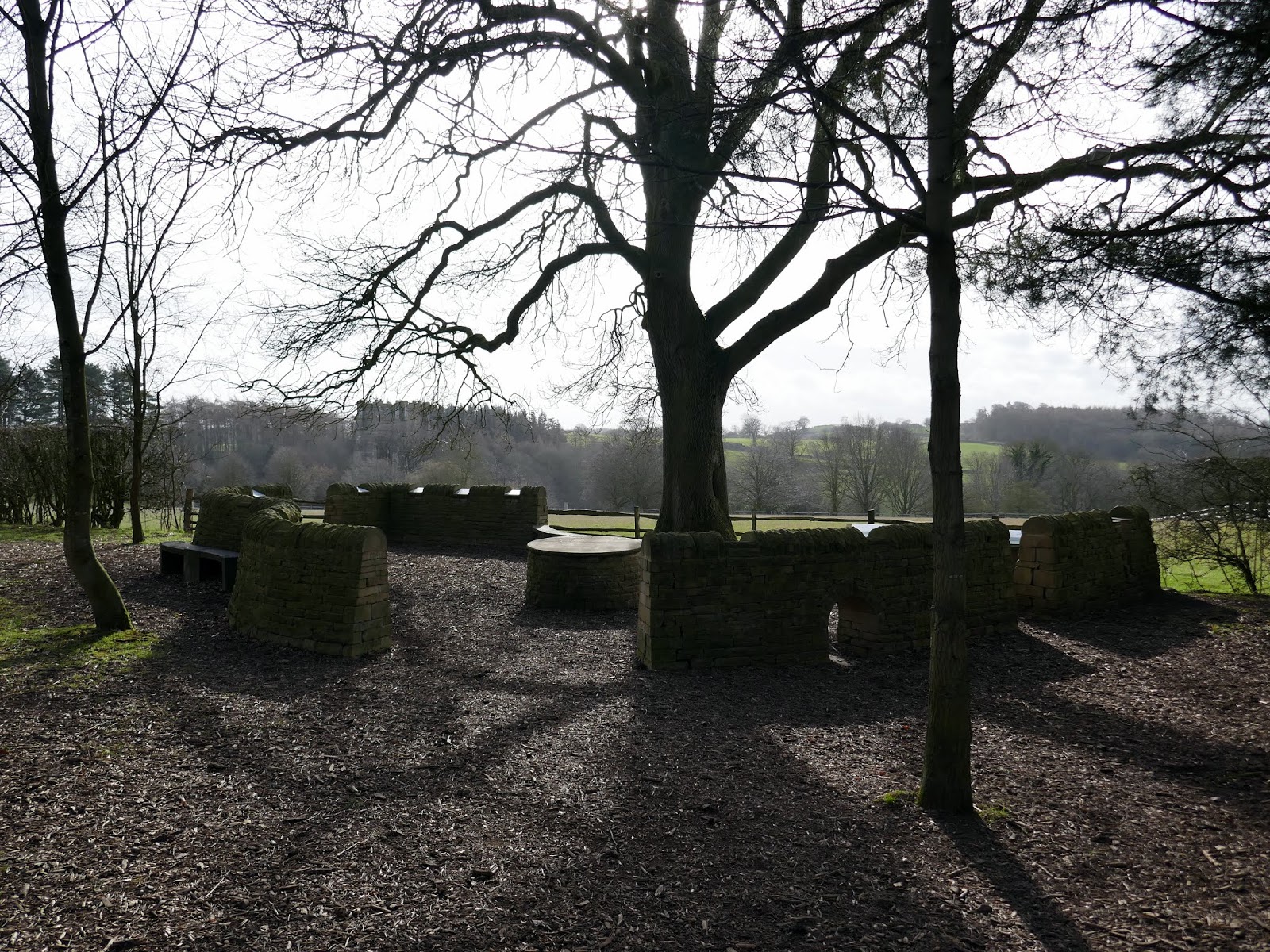
| An orientation site above the Abbey |
The entire estate is owned by the National Trust though actually managed by English Heritage. There’s an impressive visitor centre where we grabbed one of the many leaflet guided walks. Ours would take us on a whirlwind tour of the highlights of Fountains Abbey and the adjoining Studley Royal, starting at Fountains Hall.
 |
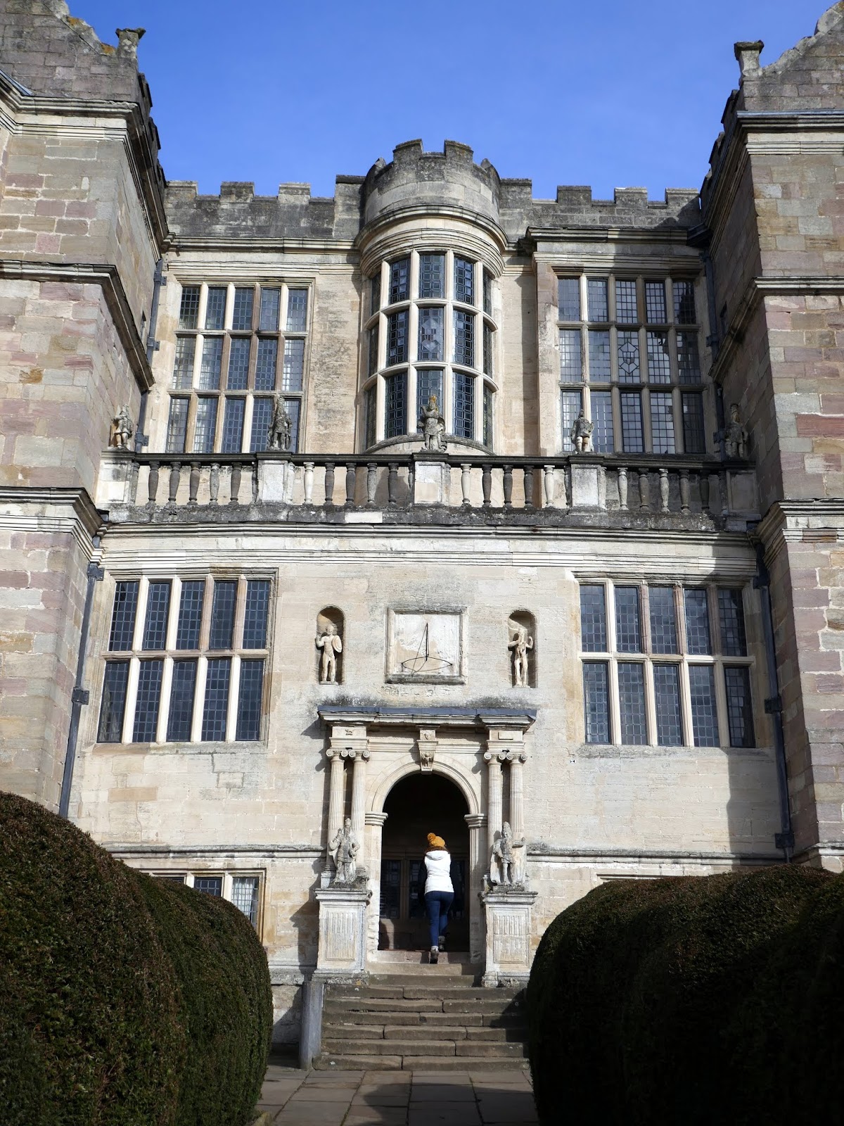
| Fountains Hall |
The hall was built in the early 1600s, partly using stone from the nearby Abbey ruins. It’s an example of what is known as a prodigy house – a large, showy country home. Depending on your taste they were either “noble palaces of an awesome scale” or “proud, ambitious heaps”. Other notable examples include Hardwick Hall, Longleat House and Wollaton Hall.
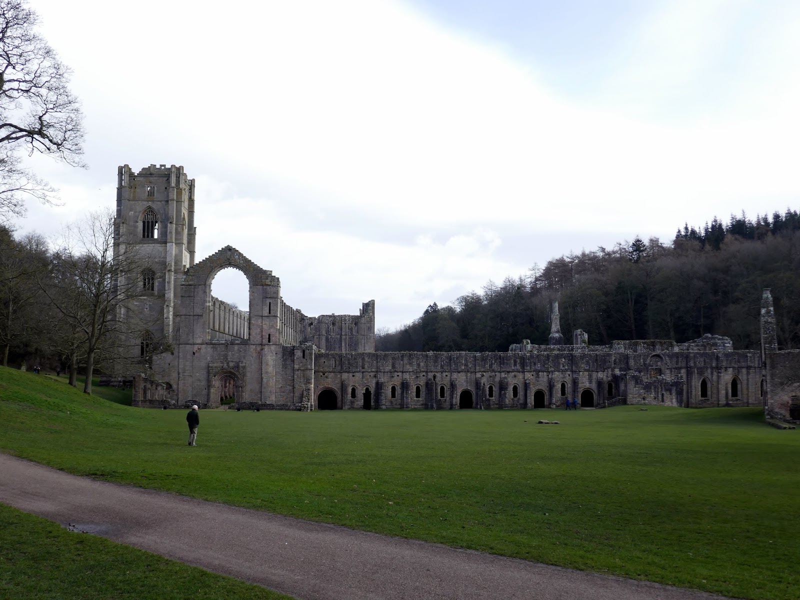
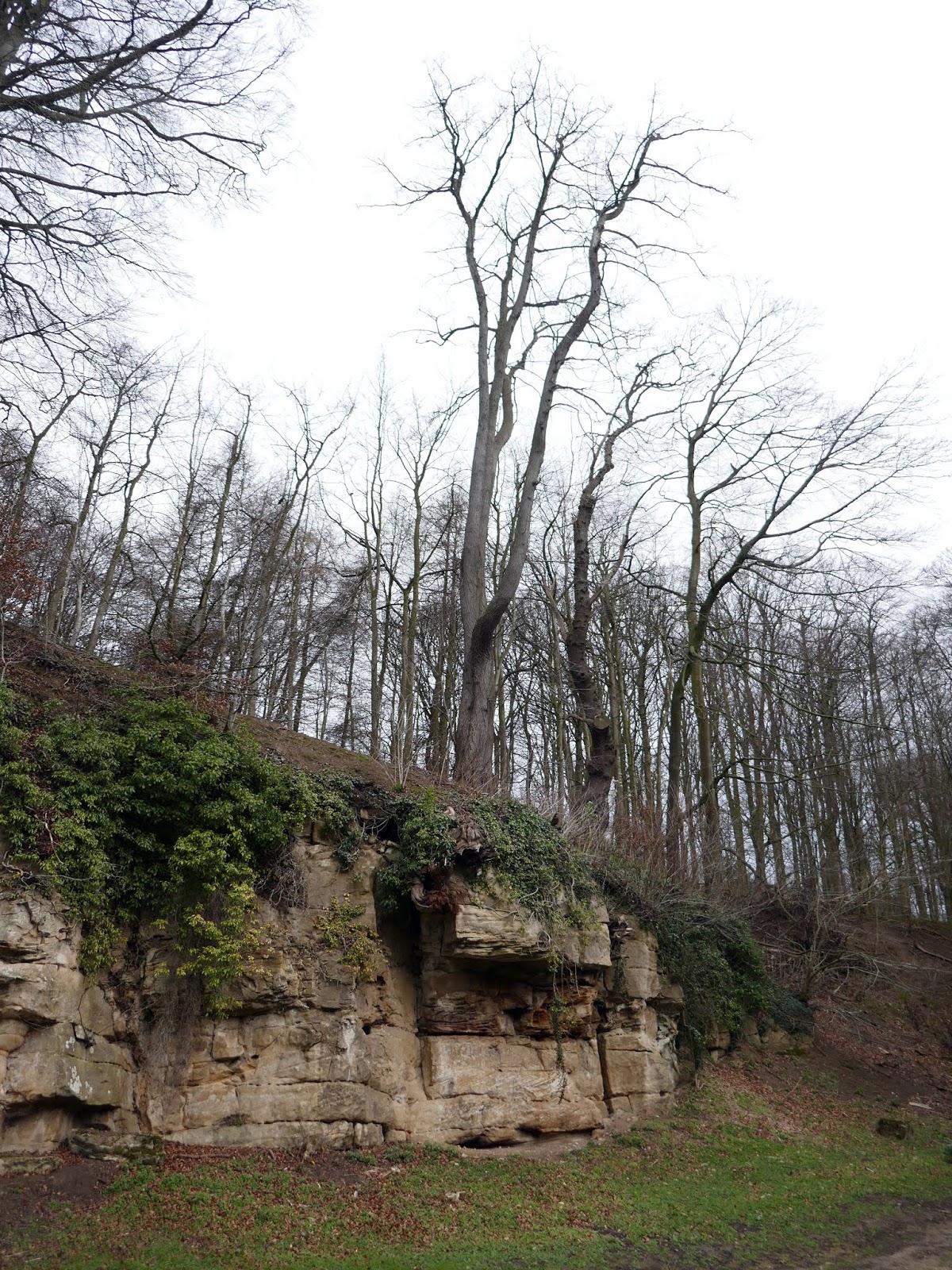
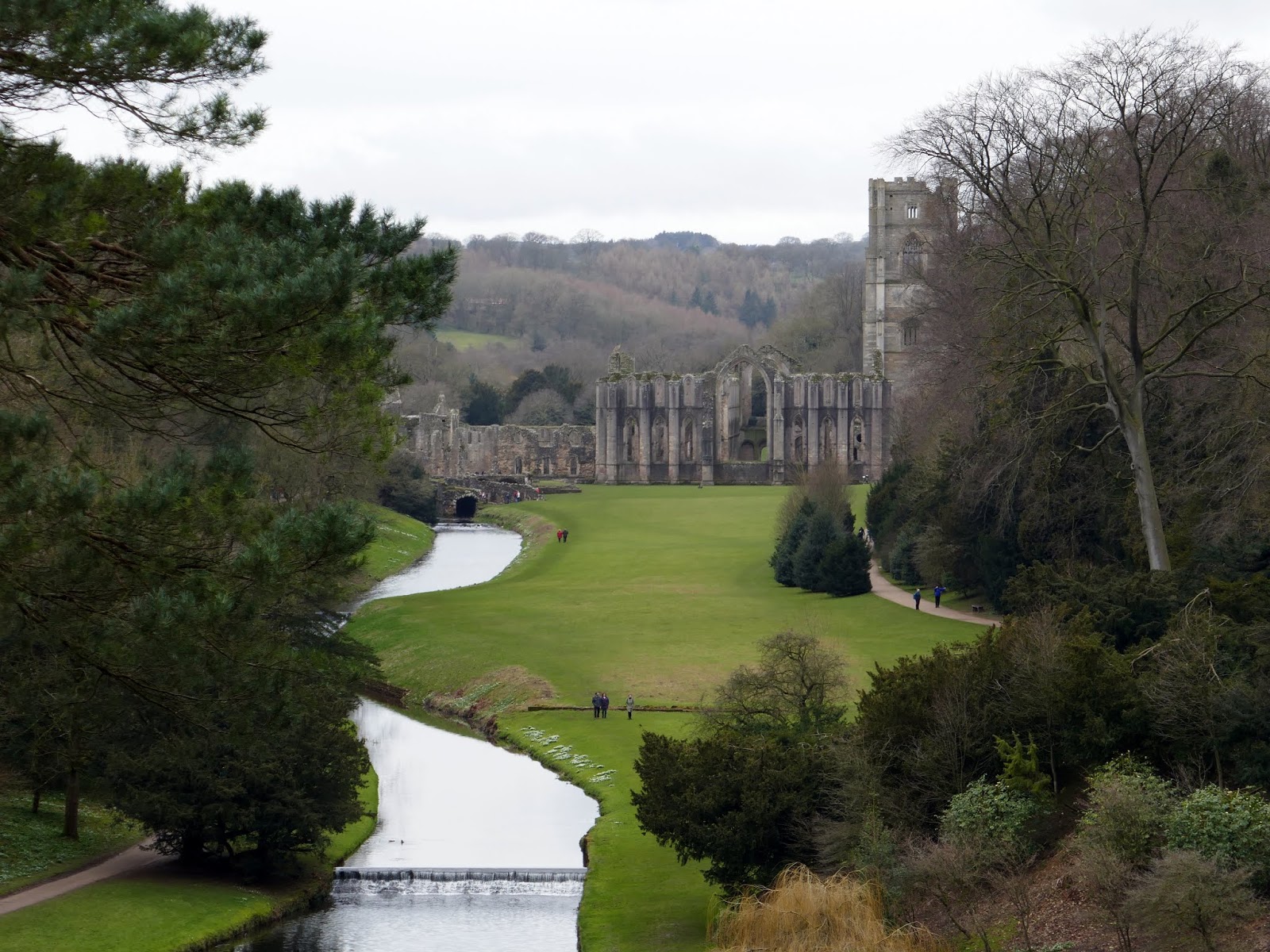
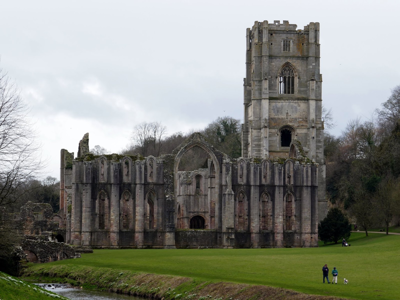
The signed path passes beneath a stand of imposing, overhanging trees until it emerges on the western lawn of Fountains Abbey. The ruined abbey is a spectacular sight, even though it is not entirely complete.
 |
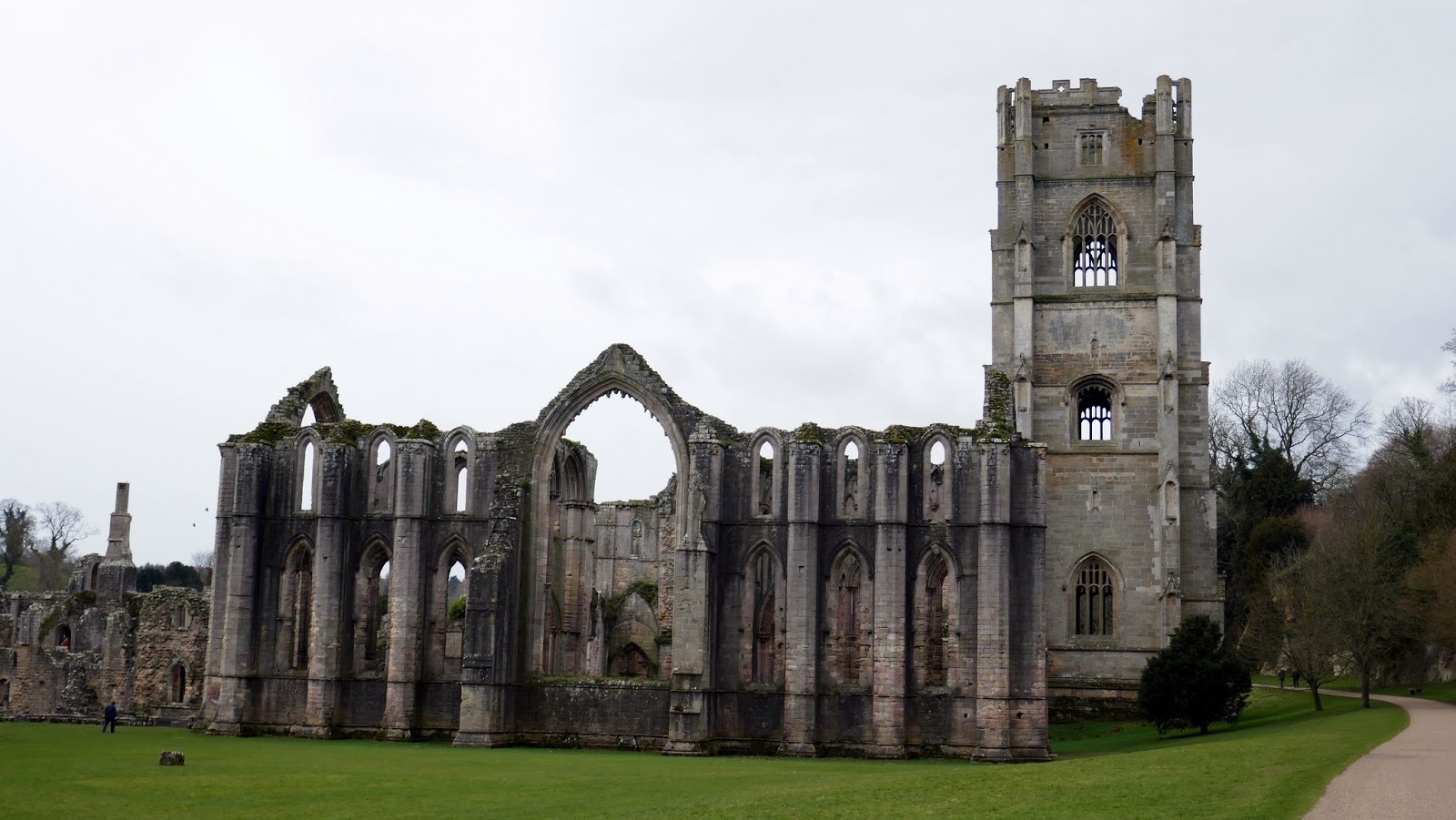
| Fountains Abbey |
The original abbey was founded in 1102 and became one of the wealthiest monasteries in the country until the dissolution in 1539 by Henry VIII. The enclosed valley of the River Skell was ideal for the foundation of the monastery thanks to its shelter and, supply of water and building materials. Fountain Abbey became the second Cistercian house after Rievaulx.
 |
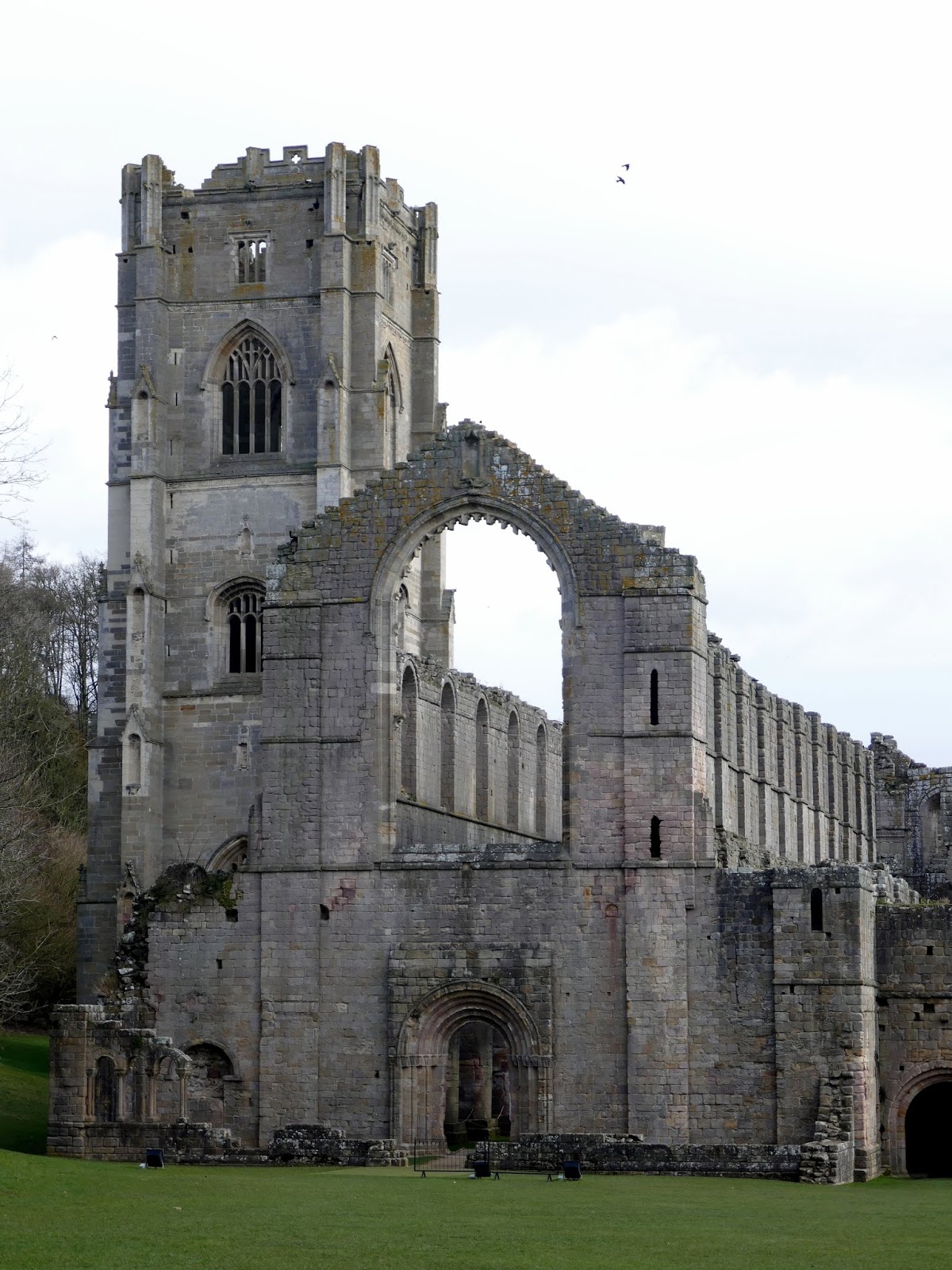
| Fountains Abbey |
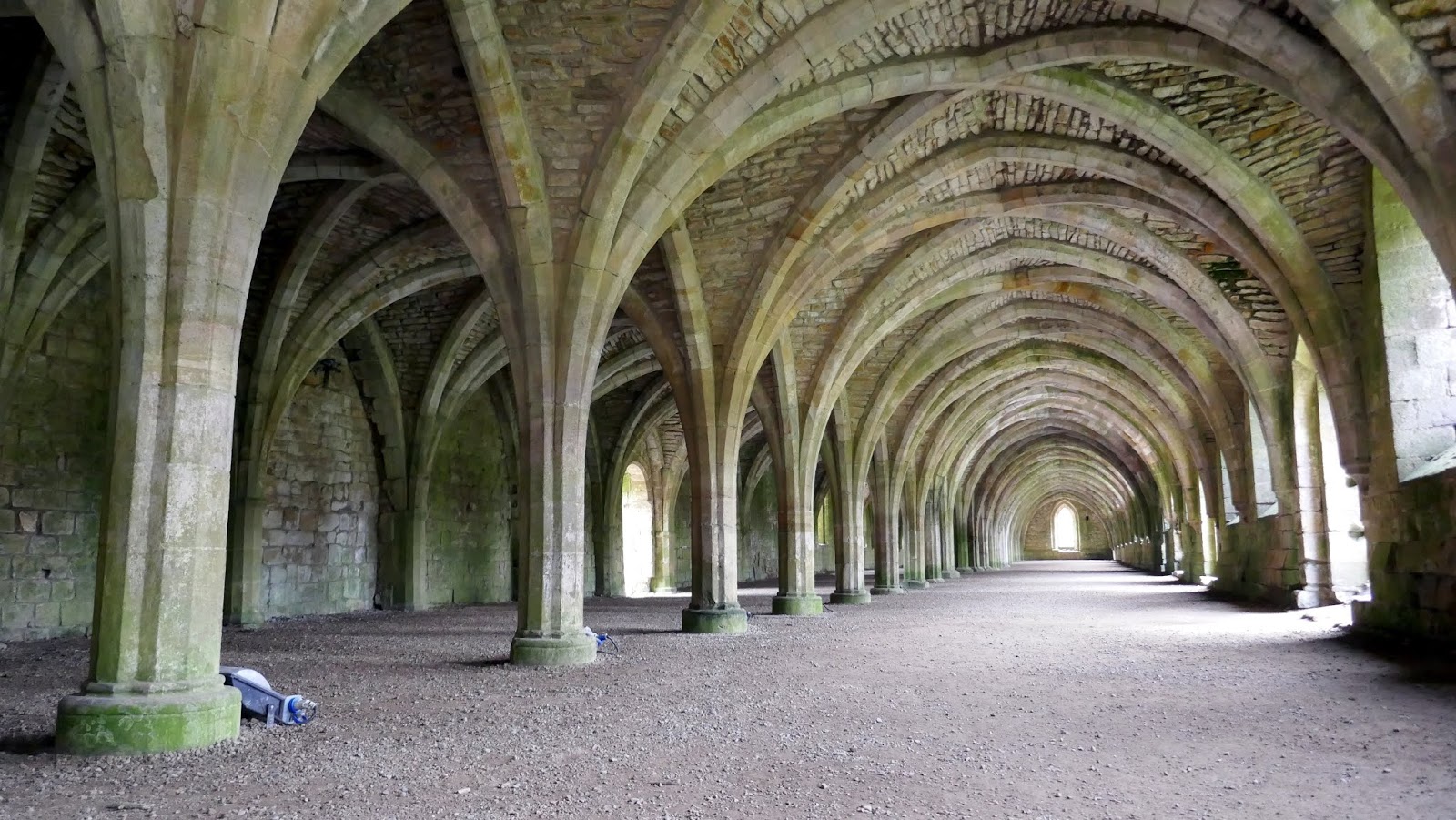
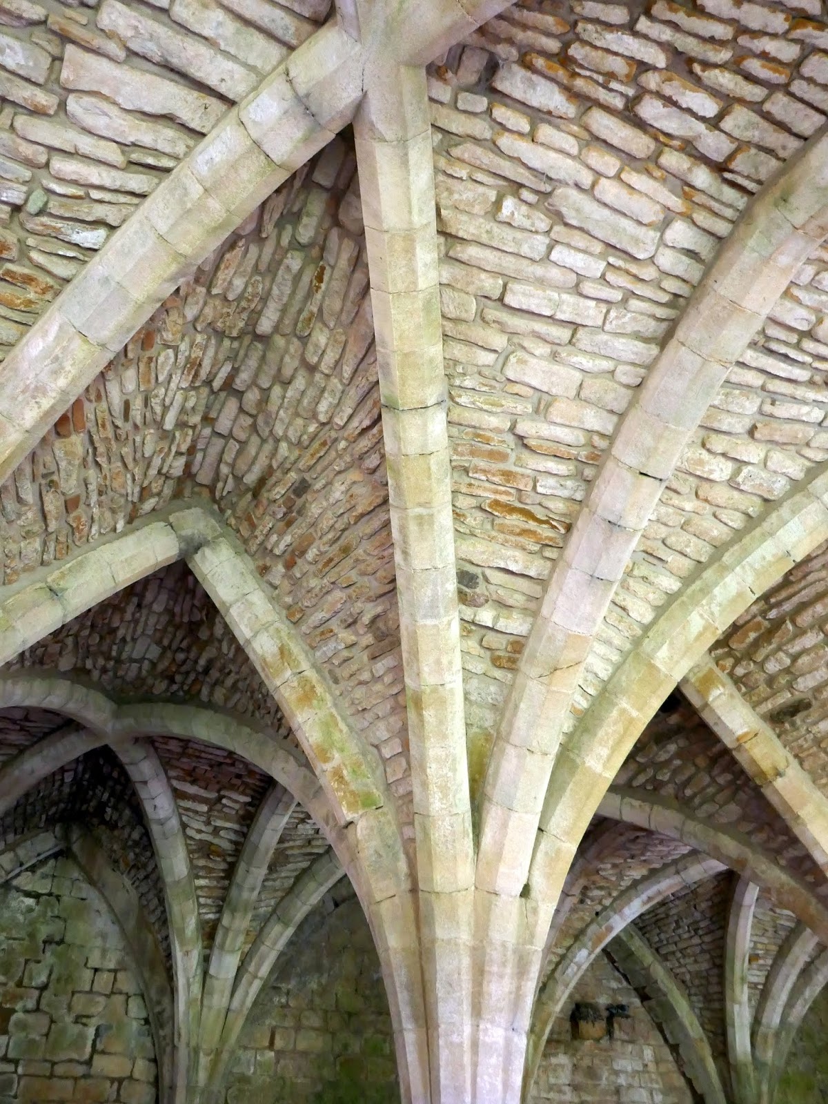
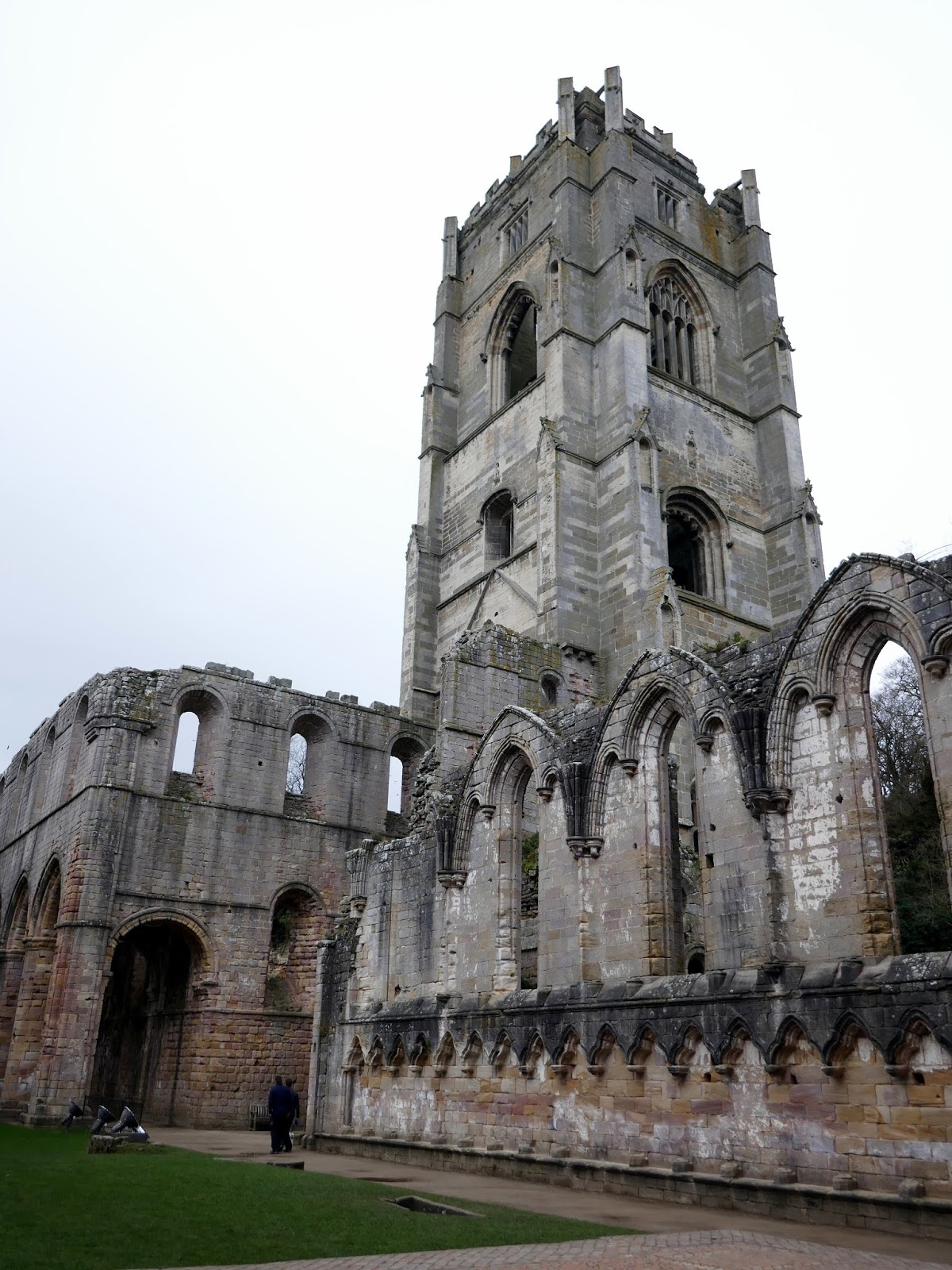
Wandering around the ruins of the abbey is highly recommended. Arguably the highlight and most photographed part is the vaulted cellarium.
 |
| The cellarium |
 |
| The cellariums vaulted ceiling |
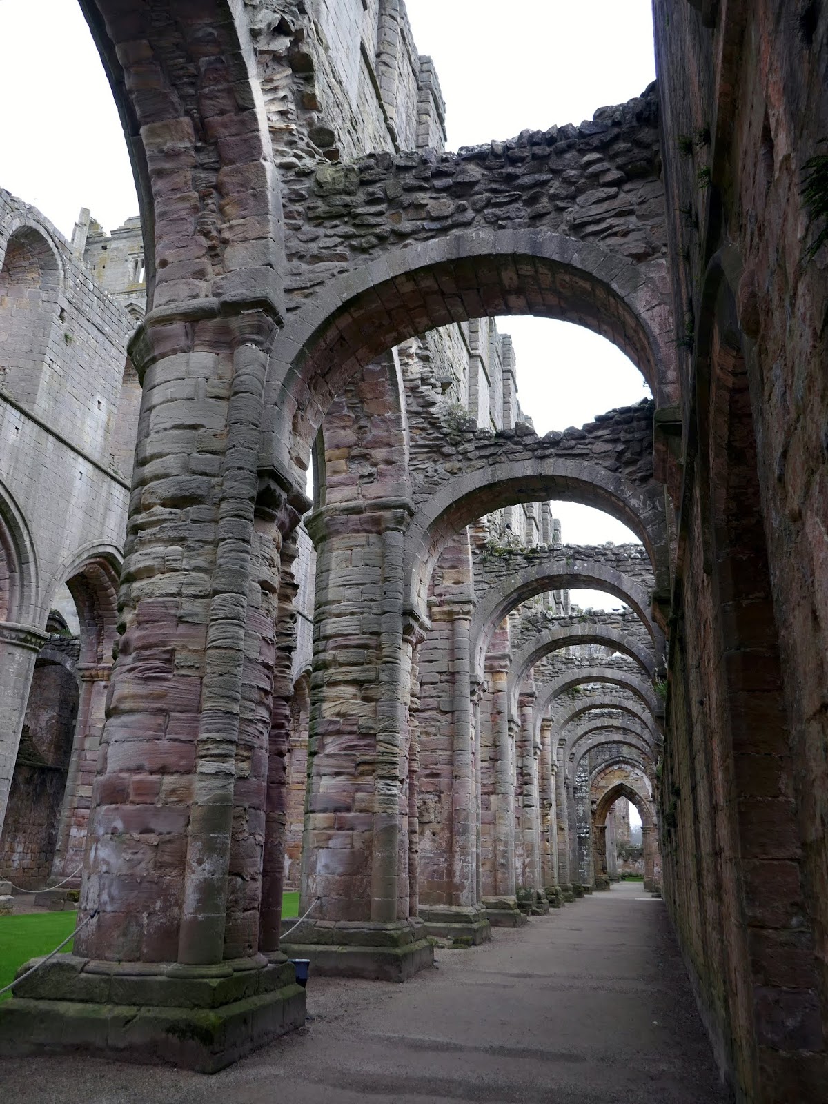
 |
| The nave |
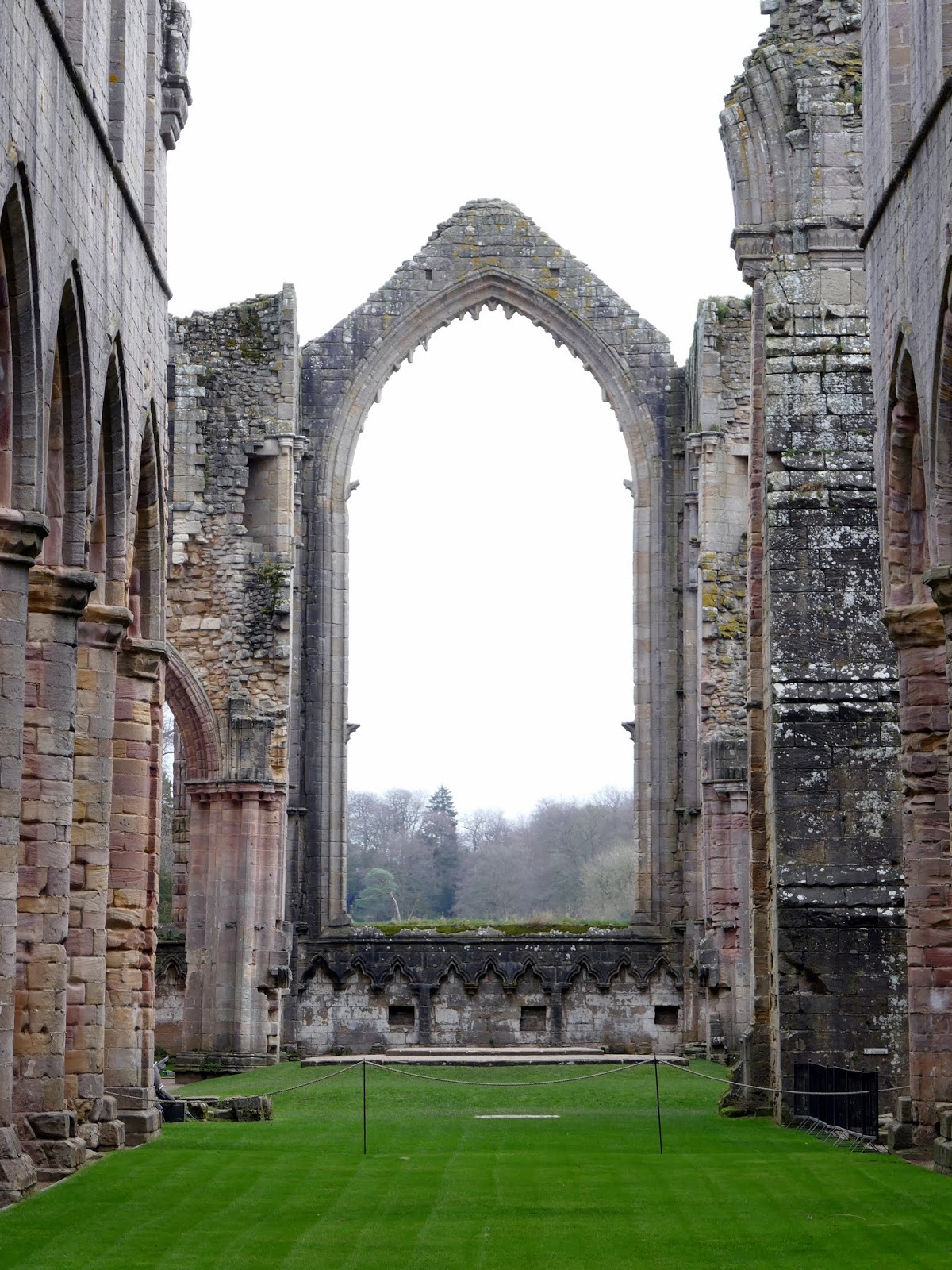
 |
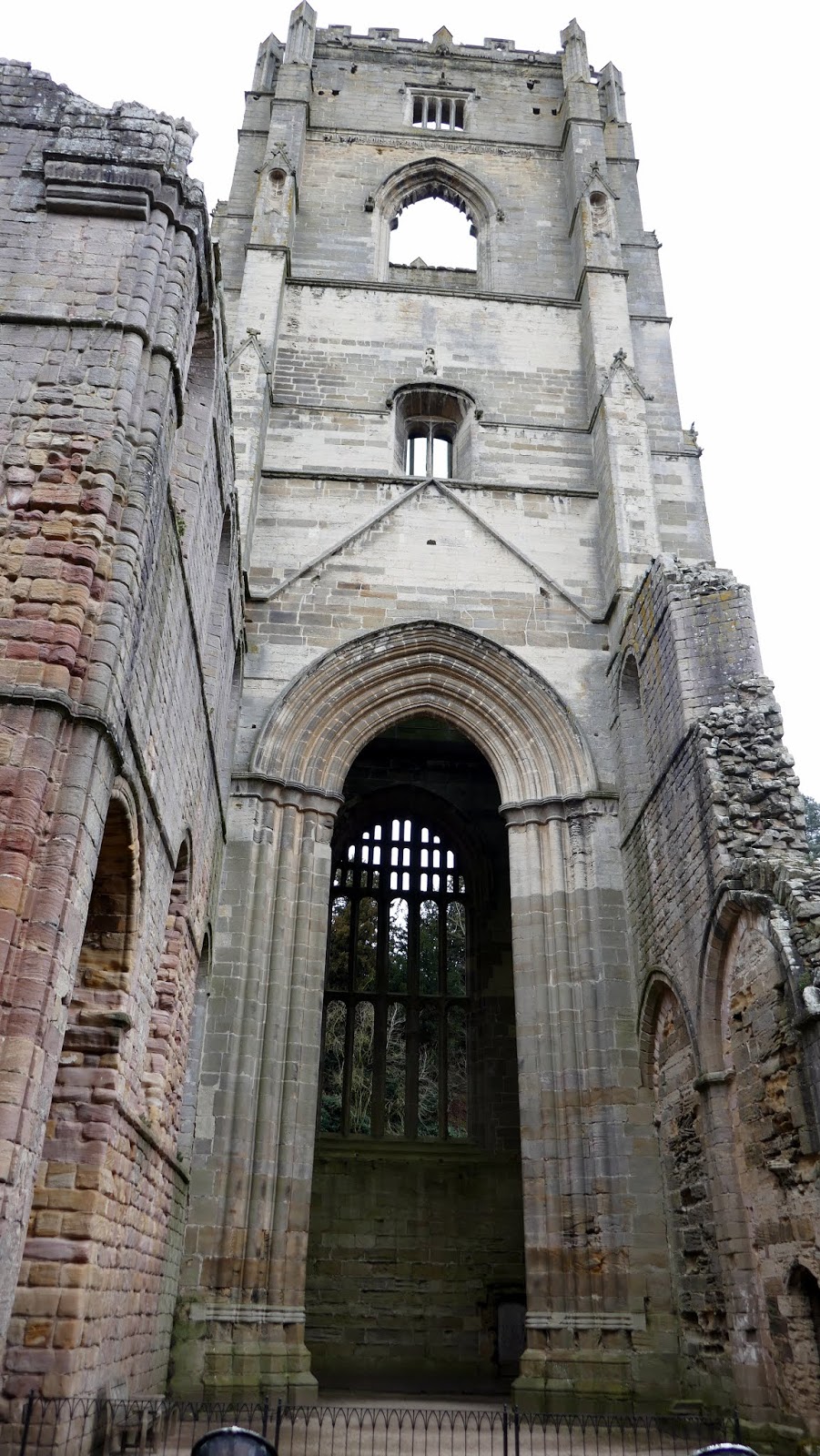
| The enormous window above the Chapel of the Nine Altars |
 |
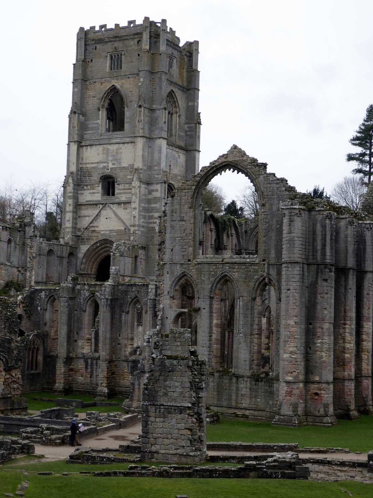
| The bell tower |
 |
| The bell tower |
 |
| Fountains Abbey |
We exited the abbey along a path which heads east towards Studley Royal Water Garden- an expansive garden designed to impress visitors to the Yorkshire estate of John Aislabie; one-time owner of Studley Royal – a neighbouring country house (sadly lost to a fire in 1946). John’s son, William, bought Fountains Hall in the 1700s, uniting the two estates (though still spent most of his time in Studley Royal). The entire area, Fountains Abbey included, is now a World Heritage Site.
 |
| Add caption |
 |
| The River Skell |
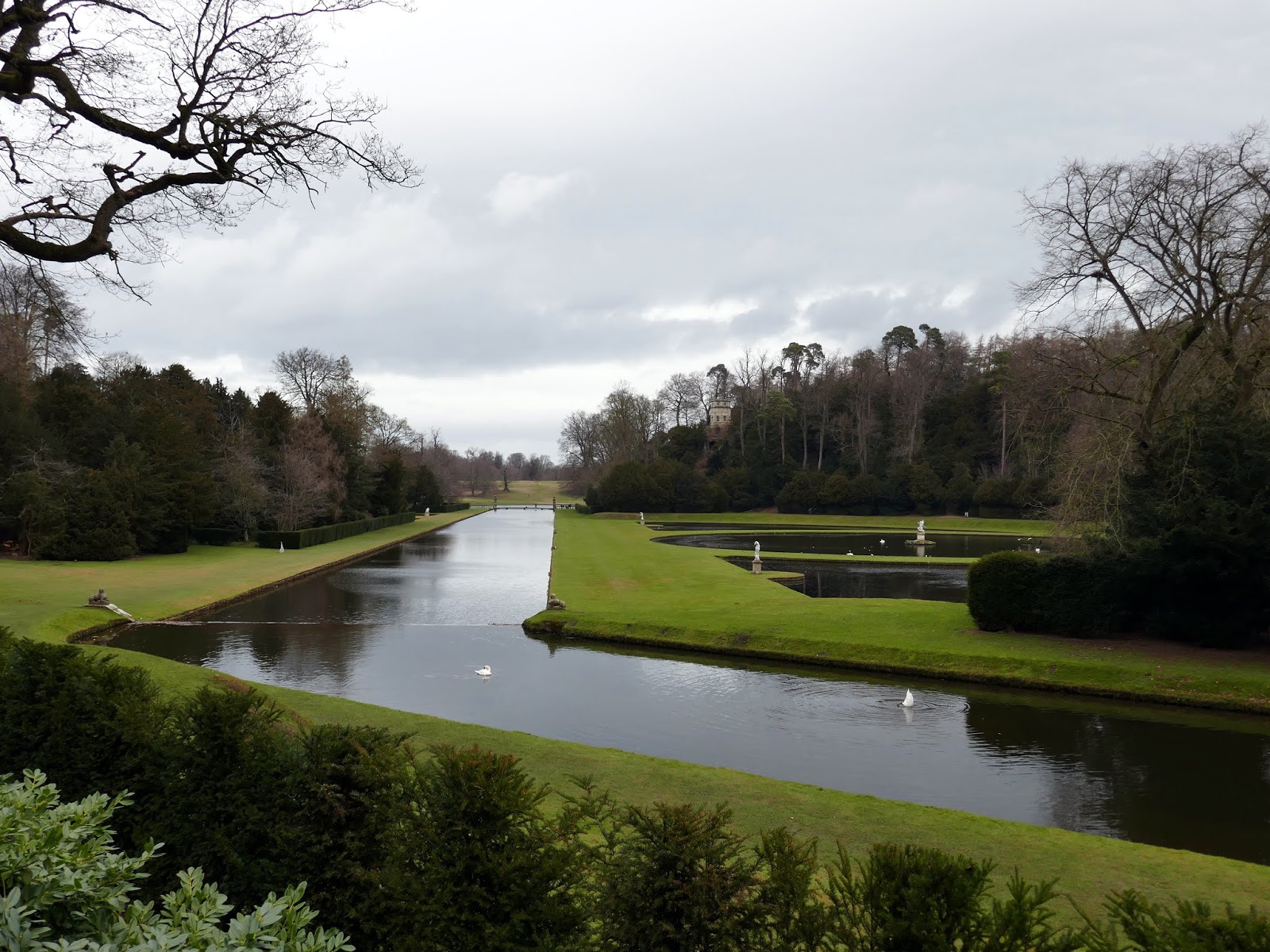
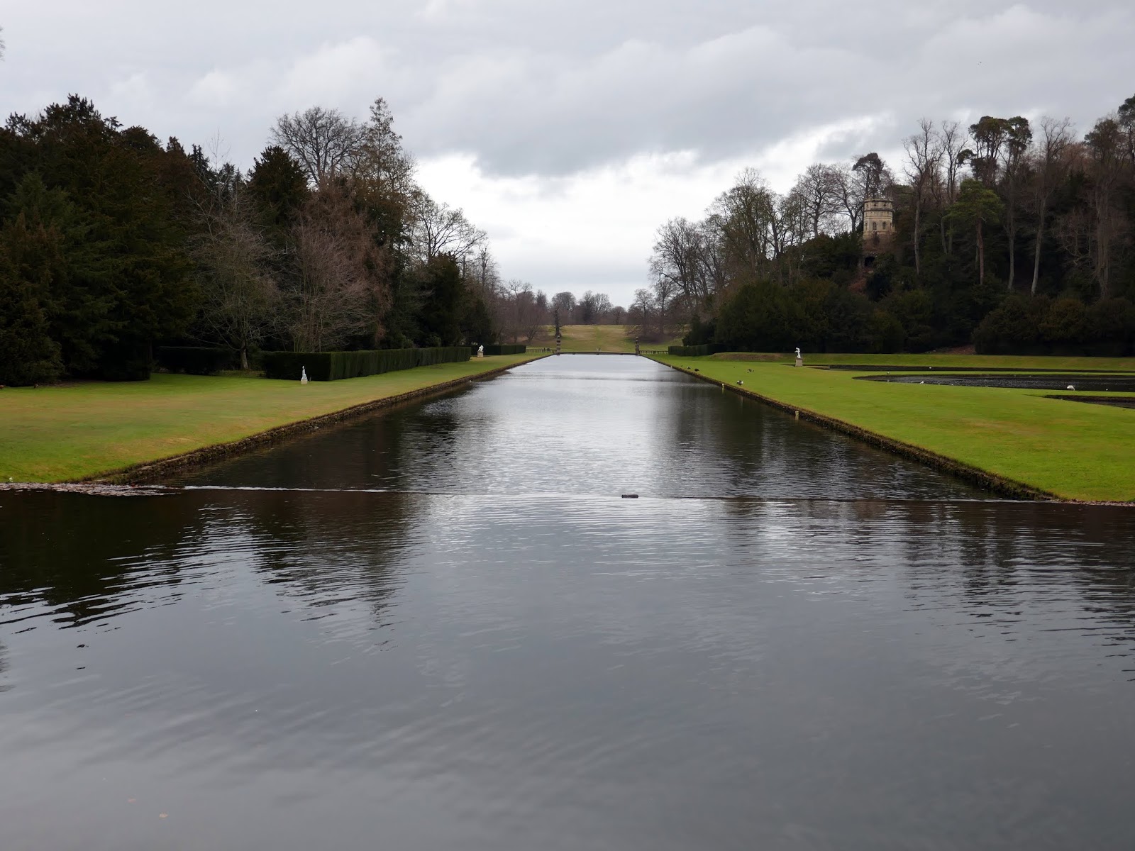
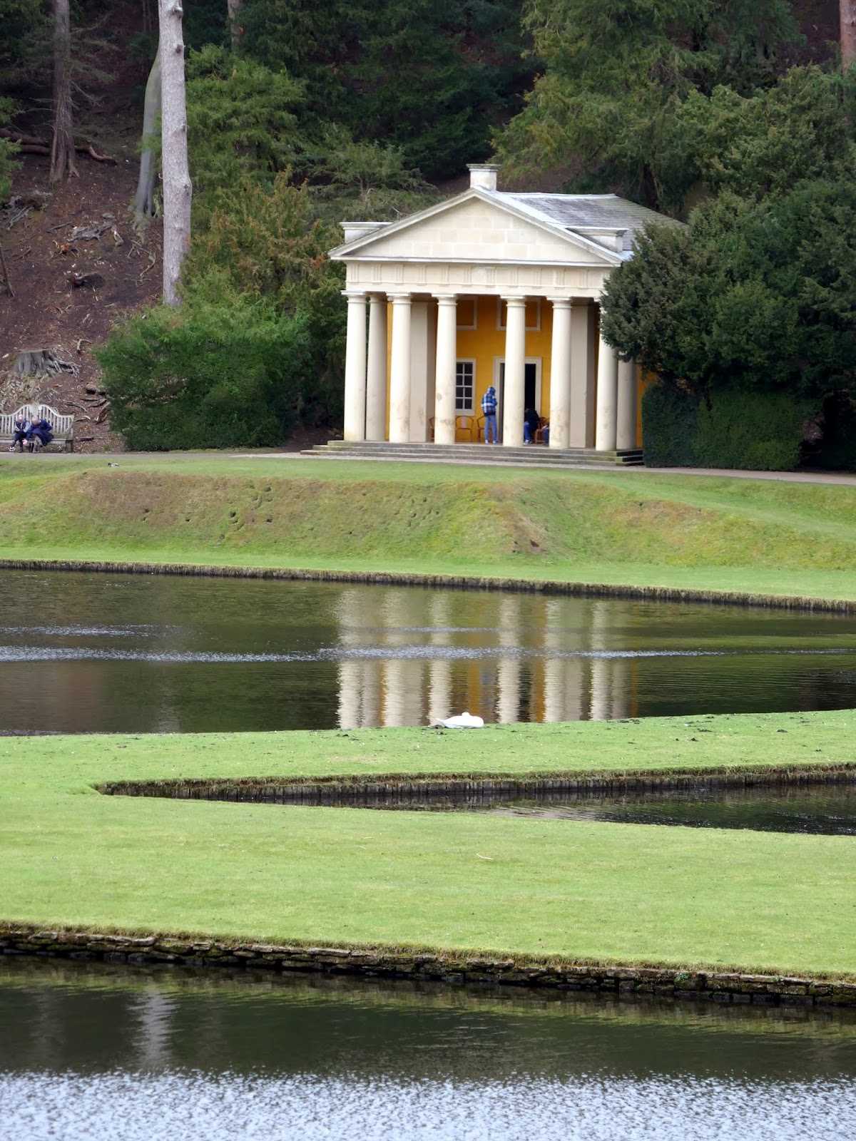
The water garden itself consists of several ornate lakes and canals through which the River Skell flows. Highly manicured lawns, classical statues and curious follies complete the scene making Studley Royal one of the best surviving examples of its type.
 |
| Studley Royal |
 |
| Studley Royal |
 |
| The Temple of Piety |
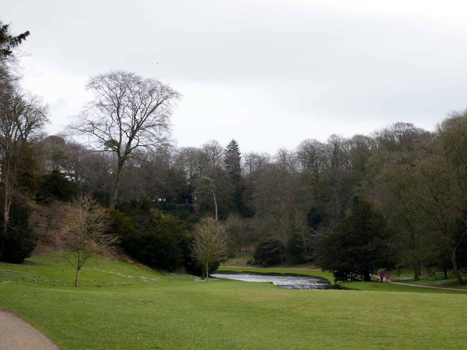
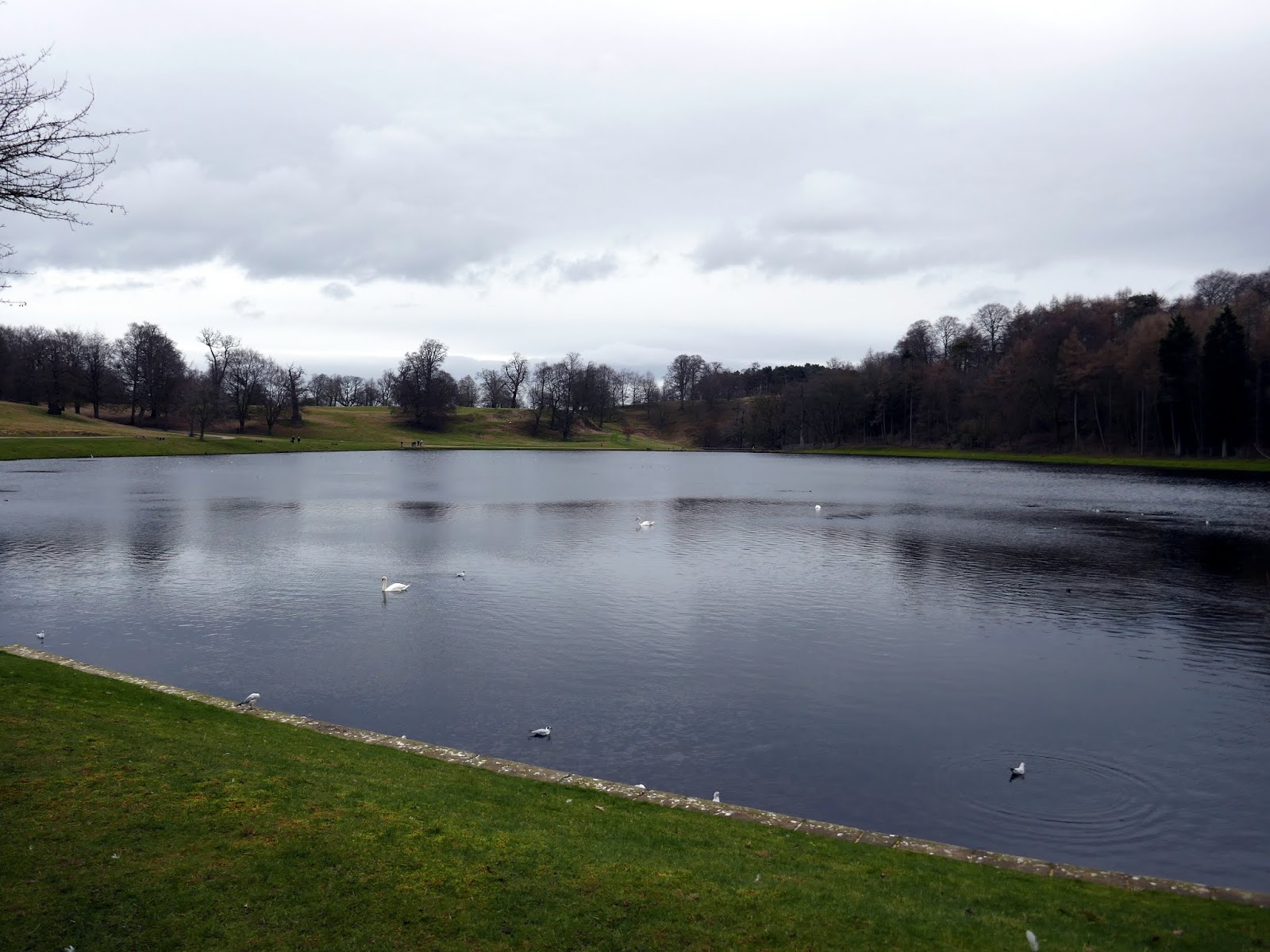
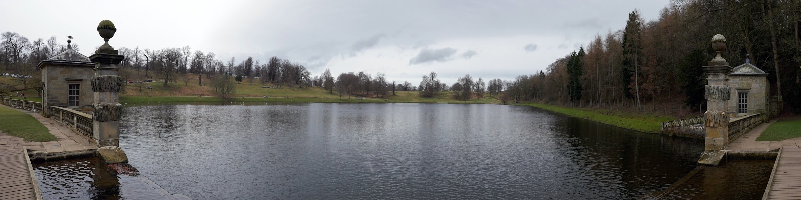
The path along the edge of the water garden leads to The Lake, the furthest extent of the water garden. We left the land of the trust briefly to make the short walk to the far end of the lake and Seven Bridges Valley.
 |
| The Lake |
 |
| The Lake |
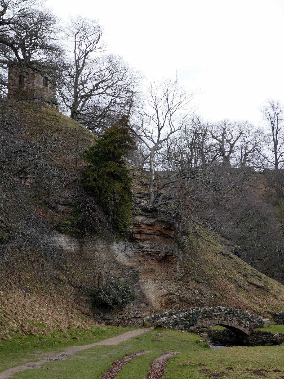
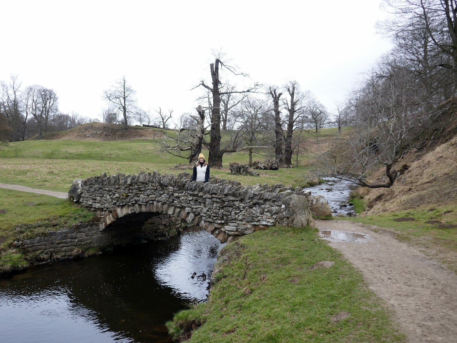
As its name implies, the Seven Bridges Valley is a valley with bridges in it, though only five of original seven bridges across the River Skell remain. Built around 1740, it is thought that the bridges were originally used for transport access, creating a more straightforward route over the many bends in the river.
 |
| The Valley of the Seven Bridges |
 |
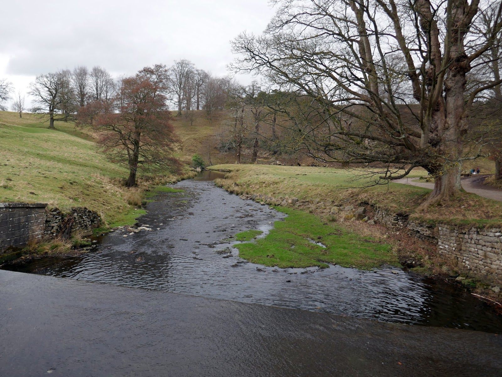
| The River Skell |
 |
| The River Skell |
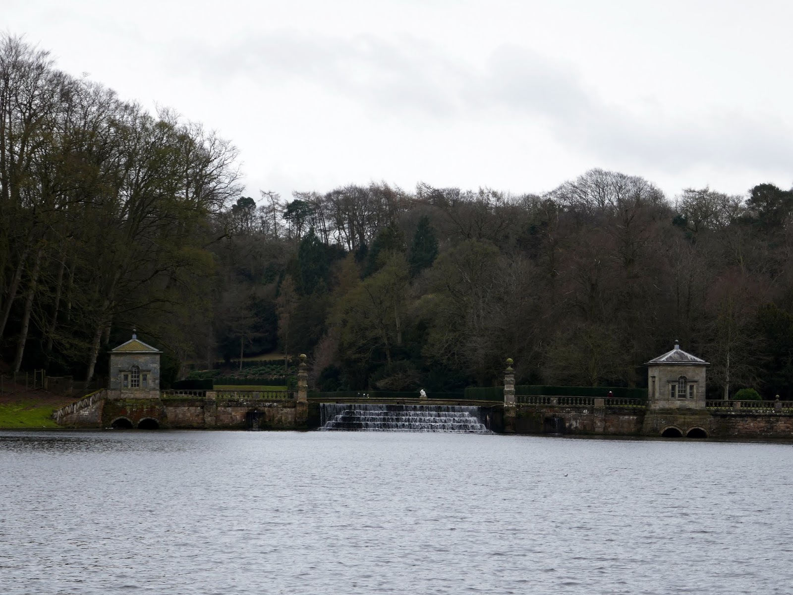
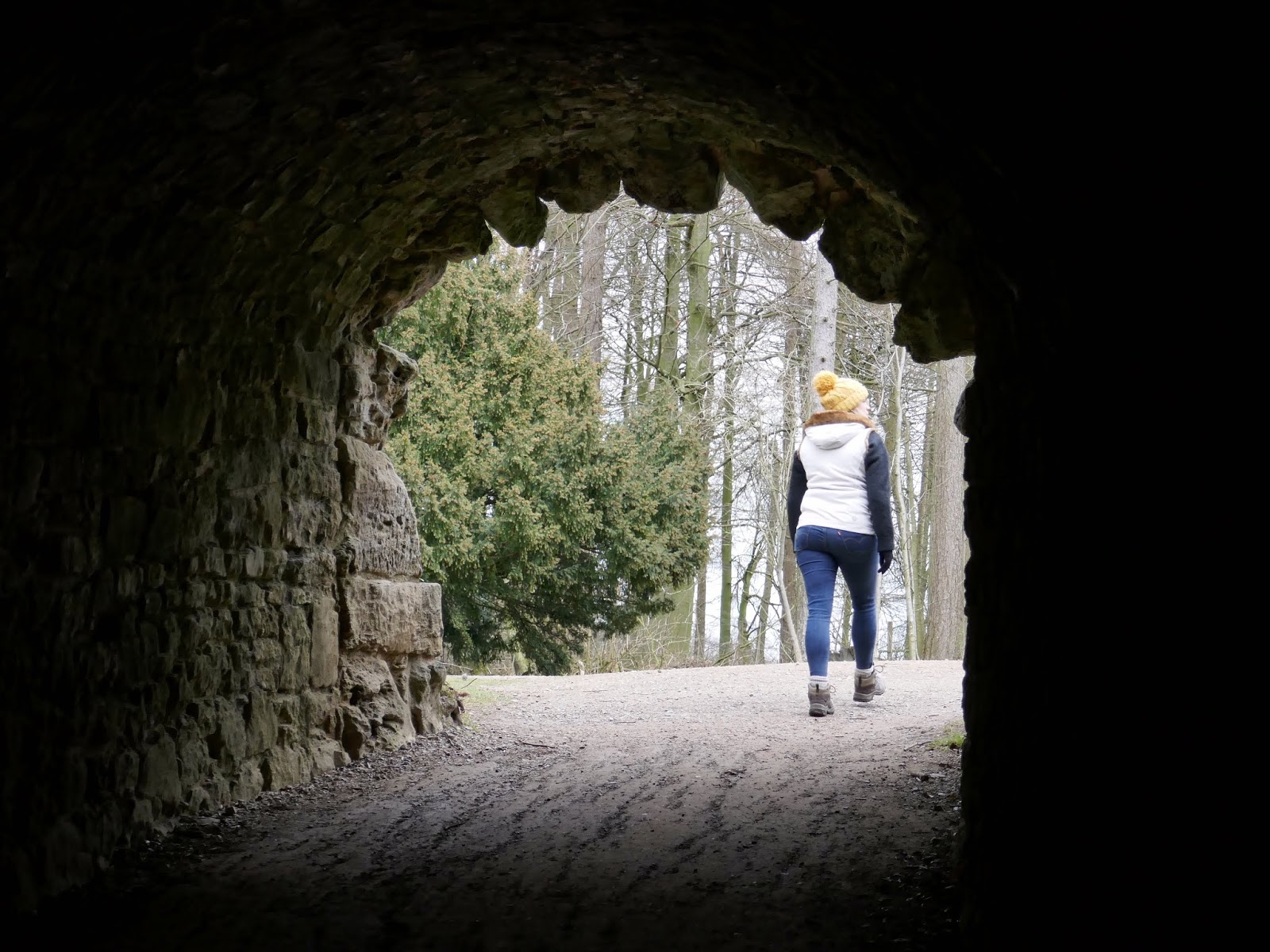
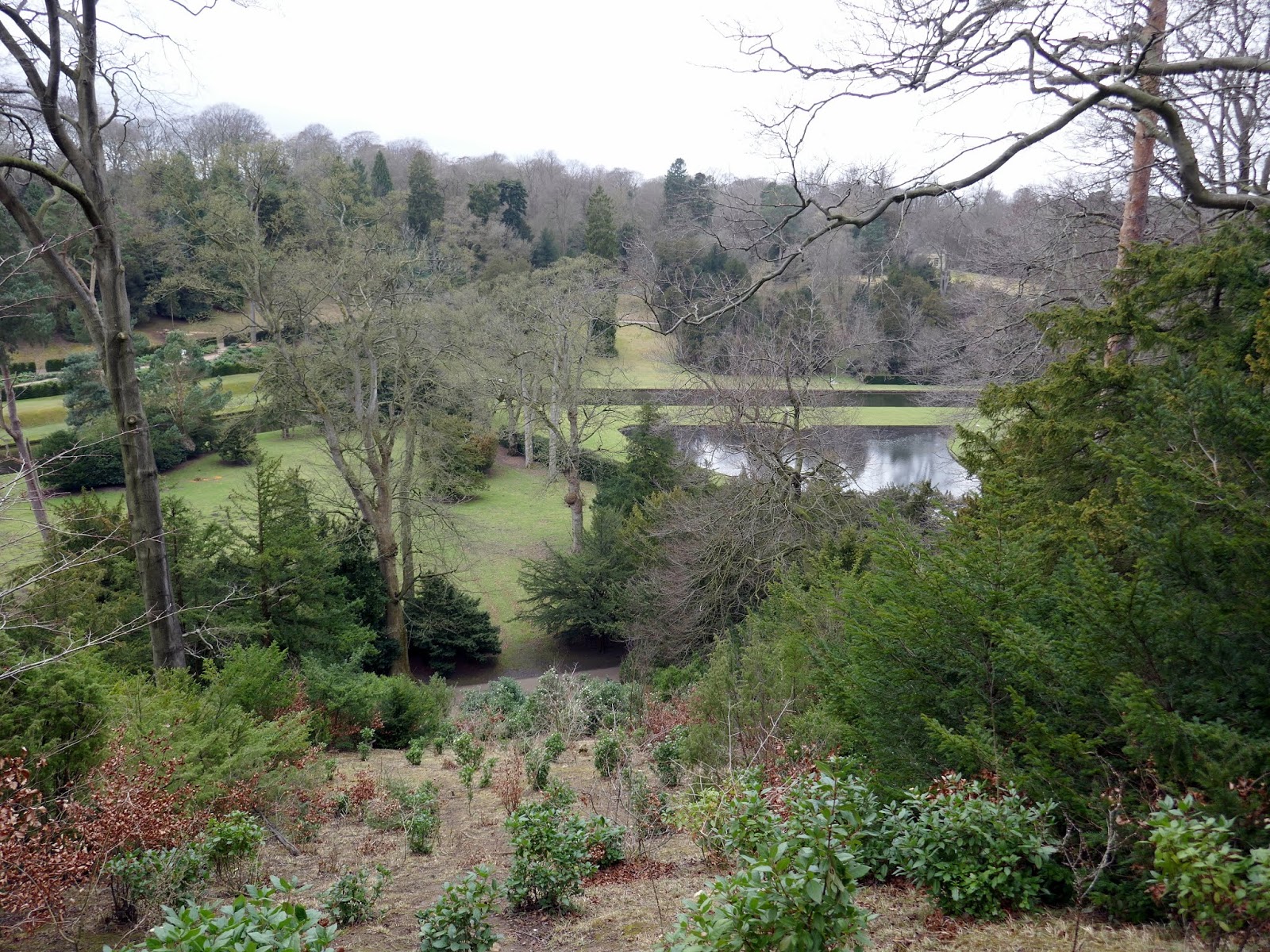
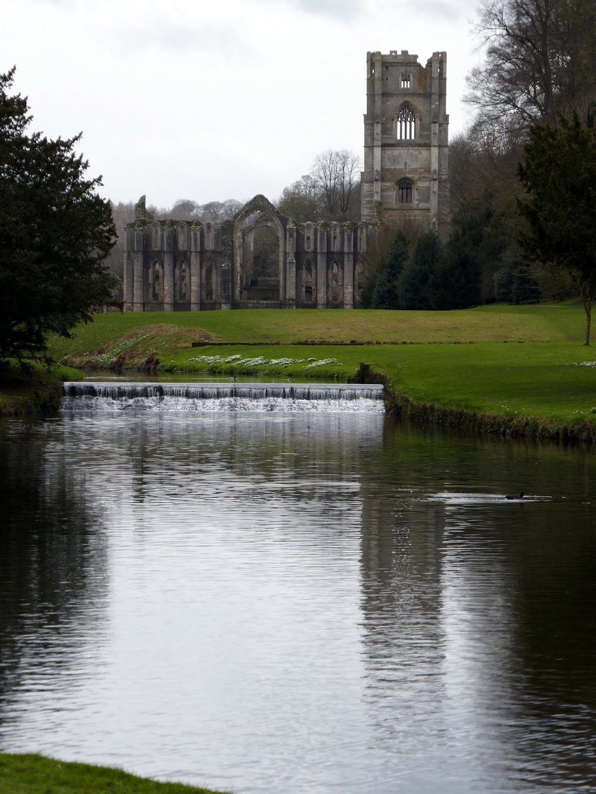
We returned to The Lake and re-entered the water garden, this time on the south side of the river. Here the path passes a number of the curious follies which line the lakes and ponds of Studley Royal. We opted to climb to the higher path – know as the High Ride – which misses many of the larger follies but has a superb view along the river to Fountains Abbey.
 |
| The Lake |
 |
| Sara climbs the Serpentine Tunnel |
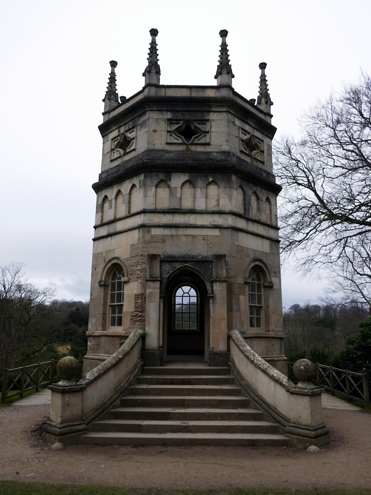
 |
| The Octagon Tower |
 |
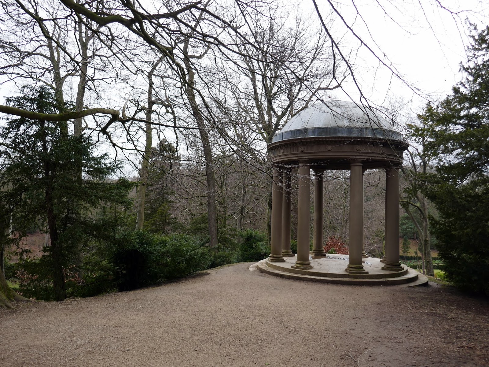
| Temple of Fame – actually painted wood rather than stone |
 |
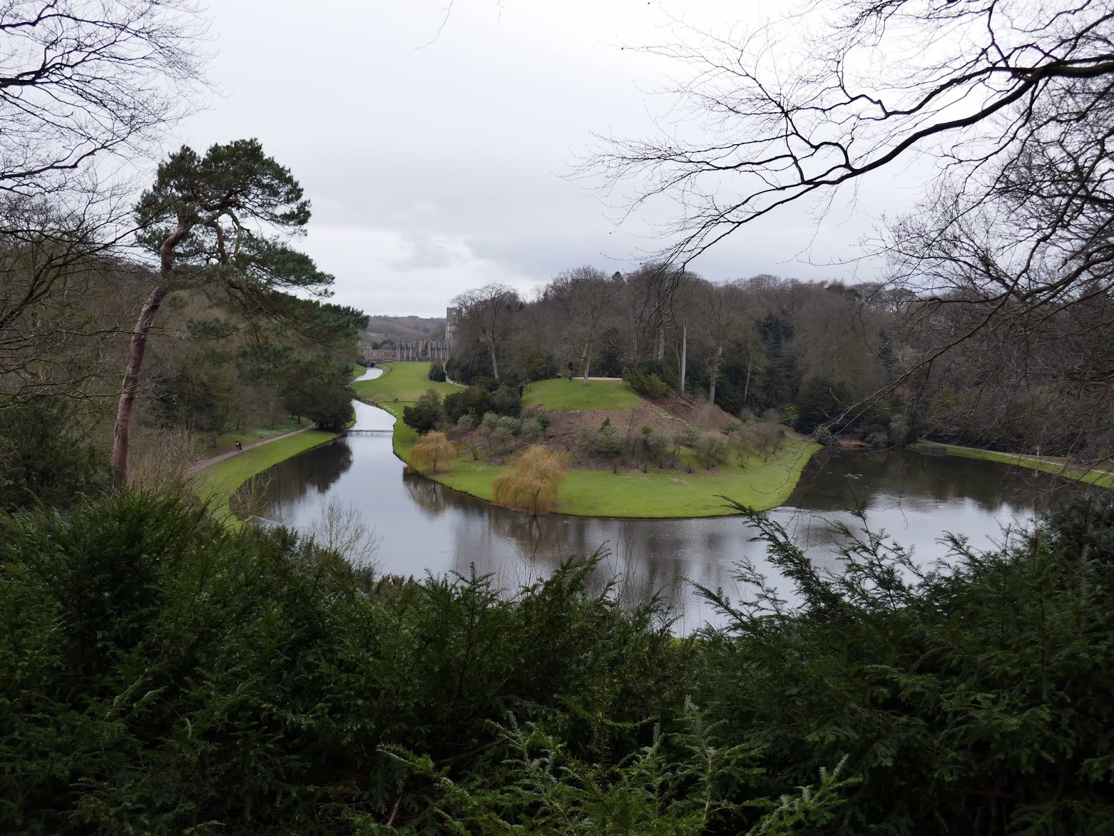
| Looking across the River Skell from the High Ride |
 |
| View from the High Ride |
 |
| Fountains Abbey |
After dropping back down to the river bank, we followed it upstream back to the abbey. Here you can see where the river flows beneath the building – I believe it was once the location of the latrines. A short walk back up the hill led us back to the visitor centre and its large restaurant – the perfect place to grab some lunch before setting off back to Leeds.
 |
| Fountains Abbey and the River Skell |
 |
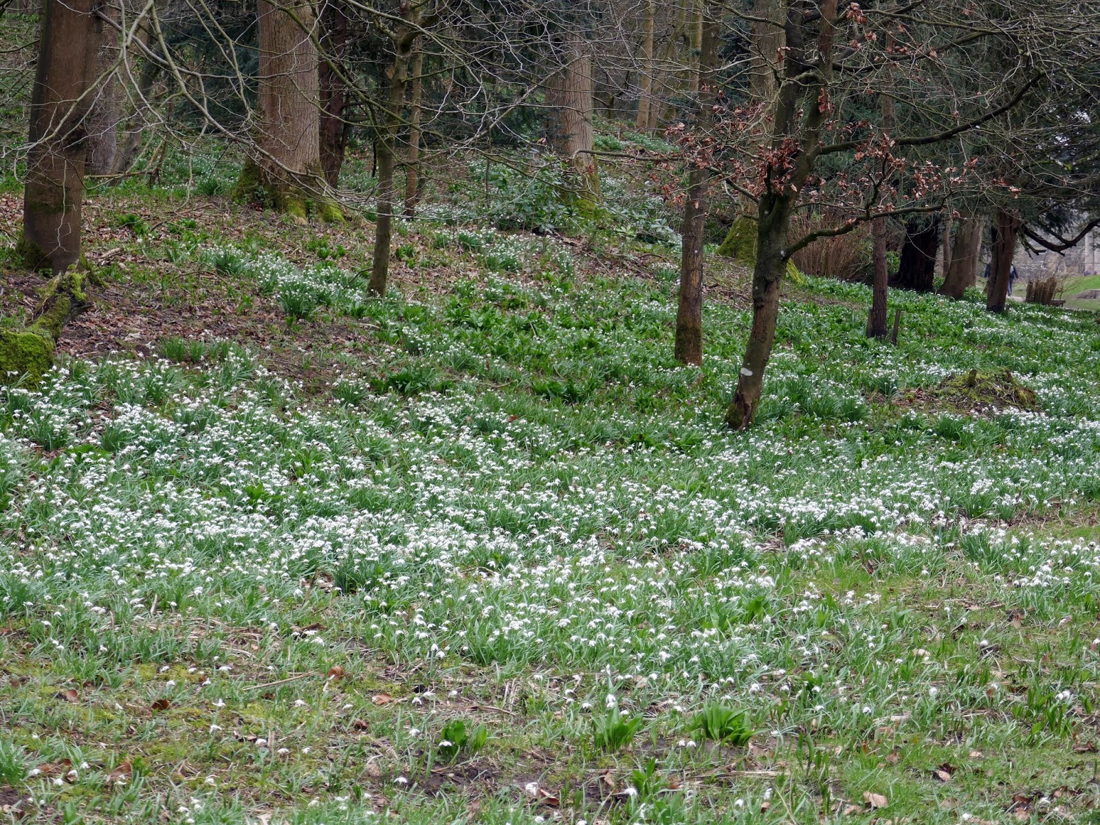
| Early spring Snowdrops |
 |
| Fountains Abbey |
 |
| Fountains Abbey |
It had been a very pleasant stroll around the abbey and water garden,s one I would recommend – especially if you are a National Trust member.
