Open Space Web-Map builder Codehttps://openspace.ordnancesurvey.co.uk/osmapapi/openspace.js?key=3119F72552FD5C22E0530C6CA40A5A92https://openspace.ordnancesurvey.co.uk/osmapapi/script/mapbuilder/basicmap.jshttps://openspace.ordnancesurvey.co.uk/osmapapi/script/mapbuilder/searchbox.js//variables for routes var linesLayer, points, lineFeature, lineString, routeMarkersLayer, routepos, routesize, routeoffset, routeicon; var style_blue = {strokeColor: “#0000CD”, strokeOpacity: 0.5, strokeWidth: 4.5}; function initmapbuilder() { //initiate the map var options = {resolutions: [2500, 1000, 500, 200, 100, 50, 25, 10, 5, 4, 2.5, 2, 1]}; osMap = new OpenSpace.Map(‘map’, options); //configure map options (basicmap.js) setglobaloptions(); //set the center of the map and the zoom level osMap.setCenter(new OpenSpace.MapPoint(409521.5,386934.5),7); linesLayer = osMap.getVectorLayer(); // Set up layer for route markers routeMarkersLayer = new OpenLayers.Layer.Markers(“Route Markers”); //make a route points = new Array(); points.push(new OpenLayers.Geometry.Point(410680.5,384708.5)); points.push(new OpenLayers.Geometry.Point(410498,384866)); points.push(new OpenLayers.Geometry.Point(410345.5,384951)); points.push(new OpenLayers.Geometry.Point(410388,385006)); points.push(new OpenLayers.Geometry.Point(410395.5,385078.5)); points.push(new OpenLayers.Geometry.Point(410358,385138.5)); points.push(new OpenLayers.Geometry.Point(410292.5,385237)); points.push(new OpenLayers.Geometry.Point(410272.5,385277)); points.push(new OpenLayers.Geometry.Point(410248.5,385313)); points.push(new OpenLayers.Geometry.Point(410224.5,385329)); points.push(new OpenLayers.Geometry.Point(410231.5,385519.5)); points.push(new OpenLayers.Geometry.Point(410221.5,385639.5)); points.push(new OpenLayers.Geometry.Point(410196.5,385784.5)); points.push(new OpenLayers.Geometry.Point(410251.5,386029.5)); points.push(new OpenLayers.Geometry.Point(410256.5,386169.5)); points.push(new OpenLayers.Geometry.Point(410181.5,386359.5)); points.push(new OpenLayers.Geometry.Point(409986.5,386729.5)); points.push(new OpenLayers.Geometry.Point(409871.5,386799.5)); points.push(new OpenLayers.Geometry.Point(409721.5,386934.5)); points.push(new OpenLayers.Geometry.Point(409631.5,387024.5)); points.push(new OpenLayers.Geometry.Point(409571.5,387114.5)); points.push(new OpenLayers.Geometry.Point(409536.5,387179.5)); points.push(new OpenLayers.Geometry.Point(409486.5,387254.5)); points.push(new OpenLayers.Geometry.Point(409526.5,387419.5)); points.push(new OpenLayers.Geometry.Point(409386.5,387919.5)); points.push(new OpenLayers.Geometry.Point(409306.5,388104.5)); points.push(new OpenLayers.Geometry.Point(409146.5,388214.5)); points.push(new OpenLayers.Geometry.Point(408981.5,388304.5)); points.push(new OpenLayers.Geometry.Point(408896.5,388354.5)); points.push(new OpenLayers.Geometry.Point(408861.5,388434.5)); points.push(new OpenLayers.Geometry.Point(408761.5,388754.5)); points.push(new OpenLayers.Geometry.Point(408686.5,388819.5)); points.push(new OpenLayers.Geometry.Point(408626.5,388839.5)); points.push(new OpenLayers.Geometry.Point(408526.5,388924.5)); points.push(new OpenLayers.Geometry.Point(408396.5,388994.5)); points.push(new OpenLayers.Geometry.Point(408311.5,388944.5)); points.push(new OpenLayers.Geometry.Point(408246.5,388909.5)); points.push(new OpenLayers.Geometry.Point(408251.5,388769.5)); points.push(new OpenLayers.Geometry.Point(408226.5,388619.5)); points.push(new OpenLayers.Geometry.Point(408116.5,388329.5)); points.push(new OpenLayers.Geometry.Point(408056.5,388144.5)); points.push(new OpenLayers.Geometry.Point(408031.5,388029.5)); points.push(new OpenLayers.Geometry.Point(407976.5,387974.5)); points.push(new OpenLayers.Geometry.Point(407936.5,387924.5)); points.push(new OpenLayers.Geometry.Point(407886.5,387819.5)); points.push(new OpenLayers.Geometry.Point(407856.5,387649.5)); points.push(new OpenLayers.Geometry.Point(407806.5,387544.5)); points.push(new OpenLayers.Geometry.Point(407806.5,387404.5)); points.push(new OpenLayers.Geometry.Point(407846.5,387324.5)); points.push(new OpenLayers.Geometry.Point(407841.5,387224.5)); points.push(new OpenLayers.Geometry.Point(407831.5,387104.5)); points.push(new OpenLayers.Geometry.Point(407866.5,387034.5)); points.push(new OpenLayers.Geometry.Point(407911.5,386929.5)); points.push(new OpenLayers.Geometry.Point(408076.5,386859.5)); points.push(new OpenLayers.Geometry.Point(408206.5,386909.5)); points.push(new OpenLayers.Geometry.Point(408301.5,386979.5)); points.push(new OpenLayers.Geometry.Point(408416.5,387029.5)); points.push(new OpenLayers.Geometry.Point(408546.5,387044.5)); points.push(new OpenLayers.Geometry.Point(408656.5,387039.5)); points.push(new OpenLayers.Geometry.Point(408786.5,387024.5)); points.push(new OpenLayers.Geometry.Point(408946.5,387014.5)); points.push(new OpenLayers.Geometry.Point(409046.5,387004.5)); points.push(new OpenLayers.Geometry.Point(409141.5,386984.5)); points.push(new OpenLayers.Geometry.Point(409206.5,386964.5)); points.push(new OpenLayers.Geometry.Point(409331.5,387014.5)); points.push(new OpenLayers.Geometry.Point(409406.5,387074.5)); points.push(new OpenLayers.Geometry.Point(409451.5,387224.5)); points.push(new OpenLayers.Geometry.Point(409466.5,387309.5)); points.push(new OpenLayers.Geometry.Point(409561.5,387254.5)); points.push(new OpenLayers.Geometry.Point(409641.5,387214.5)); points.push(new OpenLayers.Geometry.Point(409841.5,387279.5)); points.push(new OpenLayers.Geometry.Point(410071.5,387159.5)); points.push(new OpenLayers.Geometry.Point(410161.5,387164.5)); points.push(new OpenLayers.Geometry.Point(410291.5,387164.5)); points.push(new OpenLayers.Geometry.Point(410366.5,387179.5)); points.push(new OpenLayers.Geometry.Point(410511.5,387229.5)); points.push(new OpenLayers.Geometry.Point(410641.5,387094.5)); points.push(new OpenLayers.Geometry.Point(410676.5,387049.5)); points.push(new OpenLayers.Geometry.Point(410781.5,386974.5)); points.push(new OpenLayers.Geometry.Point(410891.5,386924.5)); points.push(new OpenLayers.Geometry.Point(410956.5,386889.5)); points.push(new OpenLayers.Geometry.Point(410951.5,386839.5)); points.push(new OpenLayers.Geometry.Point(410951.5,386744.5)); points.push(new OpenLayers.Geometry.Point(410941.5,386559.5)); points.push(new OpenLayers.Geometry.Point(410996.5,386499.5)); points.push(new OpenLayers.Geometry.Point(410951.5,386174.5)); points.push(new OpenLayers.Geometry.Point(410951.5,386099.5)); points.push(new OpenLayers.Geometry.Point(410956.5,385989.5)); points.push(new OpenLayers.Geometry.Point(410906.5,385909.5)); points.push(new OpenLayers.Geometry.Point(410881.5,385804.5)); points.push(new OpenLayers.Geometry.Point(410851.5,385749.5)); points.push(new OpenLayers.Geometry.Point(410781.5,385629.5)); points.push(new OpenLayers.Geometry.Point(410656.5,385409.5)); points.push(new OpenLayers.Geometry.Point(410536.5,385344.5)); points.push(new OpenLayers.Geometry.Point(410361.5,385339.5)); points.push(new OpenLayers.Geometry.Point(410236.5,385329.5)); points.push(new OpenLayers.Geometry.Point(410386.5,385084.5)); points.push(new OpenLayers.Geometry.Point(410356.5,384954.5)); points.push(new OpenLayers.Geometry.Point(410680.5,384708.5)); // create a polyline feature from the array of points lineString = new OpenLayers.Geometry.LineString(points); lineFeature = new OpenLayers.Feature.Vector(lineString, null, style_blue); linesLayer.addFeatures([lineFeature]); //crate a route start/end marker routepos = new OpenSpace.MapPoint(410680.5,384708.5); routesize = new OpenLayers.Size(33,45); routeoffset = new OpenLayers.Pixel(-5,-37); routeicon = new OpenSpace.Icon(‘https://openspace.ordnancesurvey.co.uk/osmapapi/img_versions/img_1.1/mapbuilder/routemarker-startend.png’, routesize, routeoffset, null, null); routeMarkersLayer.addMarker(new OpenLayers.Marker(routepos, routeicon)); osMap.addLayer(routeMarkersLayer);}
Route: Upper Booth, Crowden Clough, Kinder Scout, Kinder Gates, Kinder Downfall, Kinder Low, Pym Chair, Wool Packs, Crowden Tower, Grindslow Knoll, Broadlee-Bank Tor, Upper Booth
Date: 28/09/2018
From: Upper Booth
Parking: Car park near Upper Booth
Start Point: Upper Booth
Region: Peak District – Dark Peak
Route length: 8.9 miles (14.3 km)
Time taken: 04:05
Average speed: 2.2 mph
Ascent: 560m
Descent: 565m
Summits: None
Other points of interest: Crowden Clough, Crowden Tower, Kinder Gates, Kinder Downfall
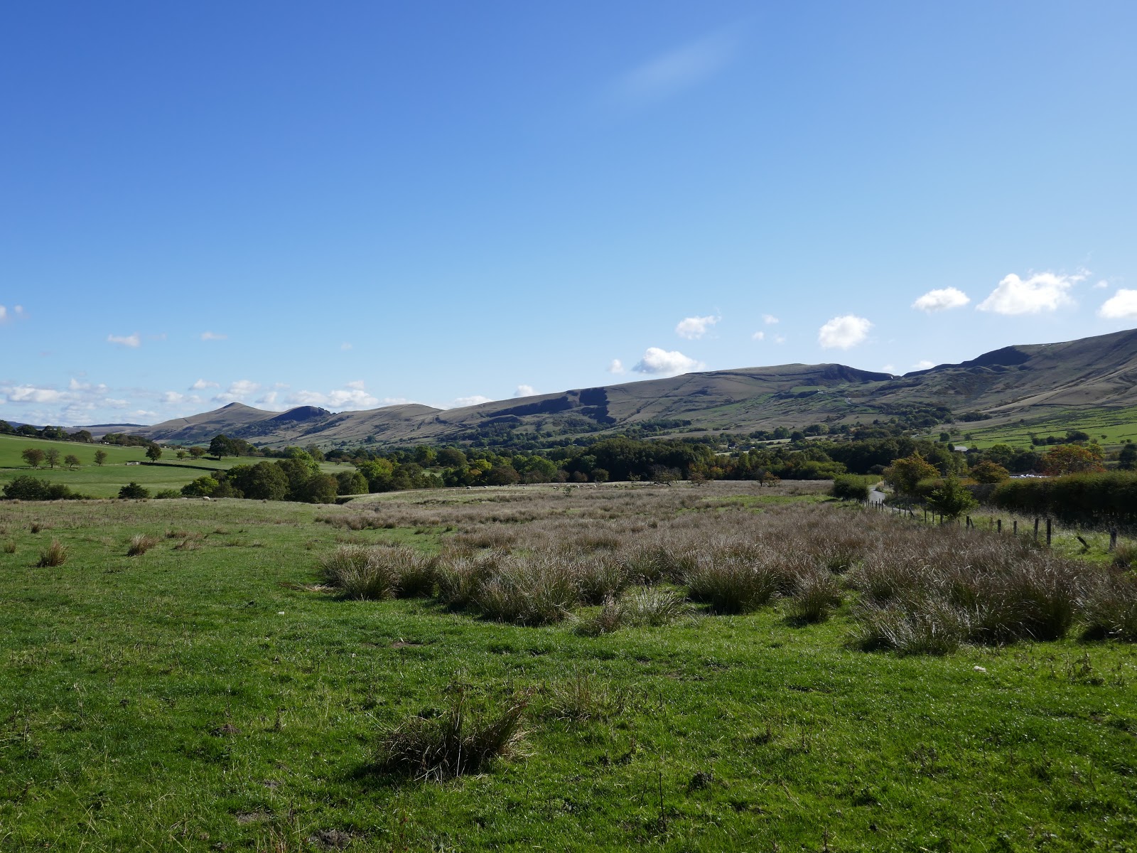
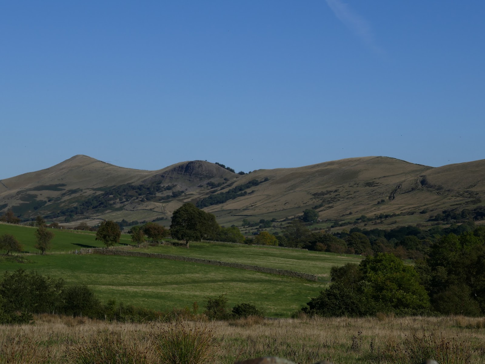
It is estimated that 20 million people live within an hours drive of the Peak District, Sara and I are included in the figure. We’re lucky that our hour takes us to the wild and woolly Dark Peak with its famous open moors and gritstone edges. The crowning glory of this area is Kinder Scout. The huge moorland plateau rises to a height of over 2,000ft – the highest point in the Peak District but its charms lie away from this fact.
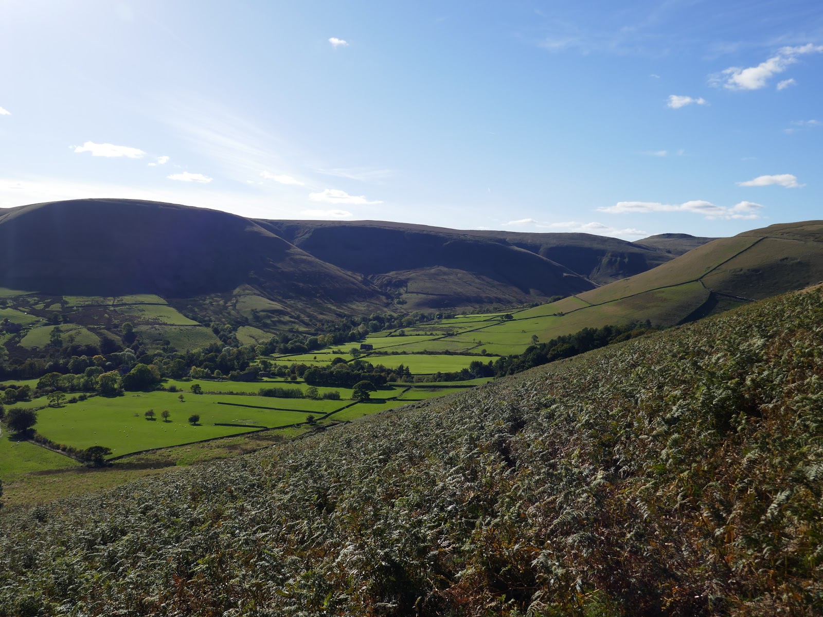
The Kinder edges are the real highlight and the southern edge is the most popular but arguably the best. I’ve walked the various edges on a number of occasions from a variety of starting points including Hayfield, Edale and Snake Pass, culminating in the classic Kinder Circuit. Today I’d be visiting the southern edge once again, by climbing Crowden Clough – a boulder-strewn valley with an all-too-rare scramble at the top.
I had originally planned to get up to the top end of the Howden Reservoir road, which is only open mid-week. Having managed to get 2/3 of the way along, I found that it was closed for logging work, leaving me in a quandary of what to do. Nowhere to leave a car on the narrow road so I retraced back to Fairholmes. Maybe Derwent Edge? Maybe Alport Castles? After some head scratching, I decided to drive round into Edale to re-visit Kinder Scout, specifically Crowden Clough.
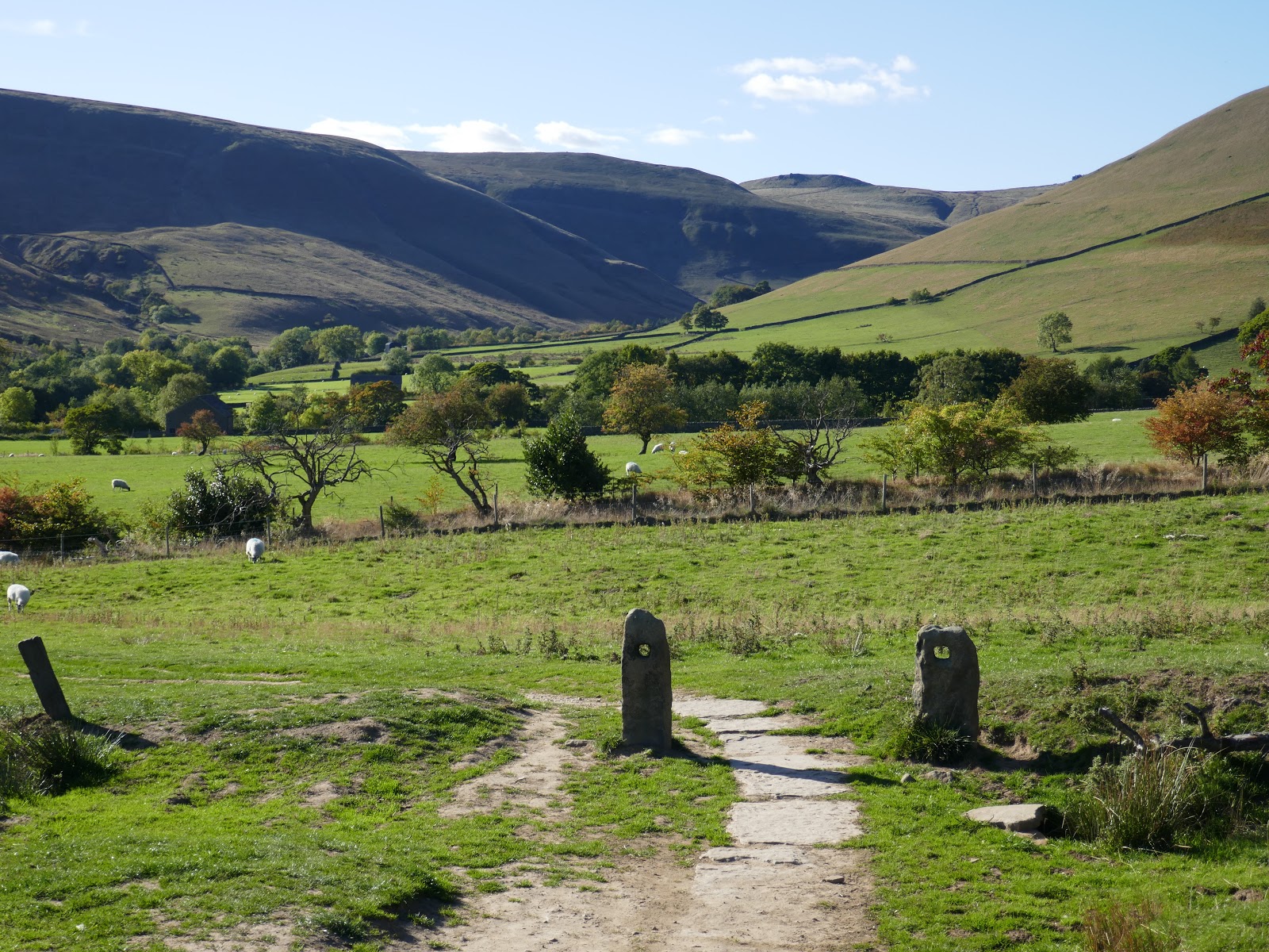
After a bit of driving, and manoeuvring the car into a small space at Upper Booth, I was finally ready to go, following the road a short distance westwards to Crowden Clough.
 |
| Horsehill Tor |
 |
| Broadlee-Bank Tor |
 |
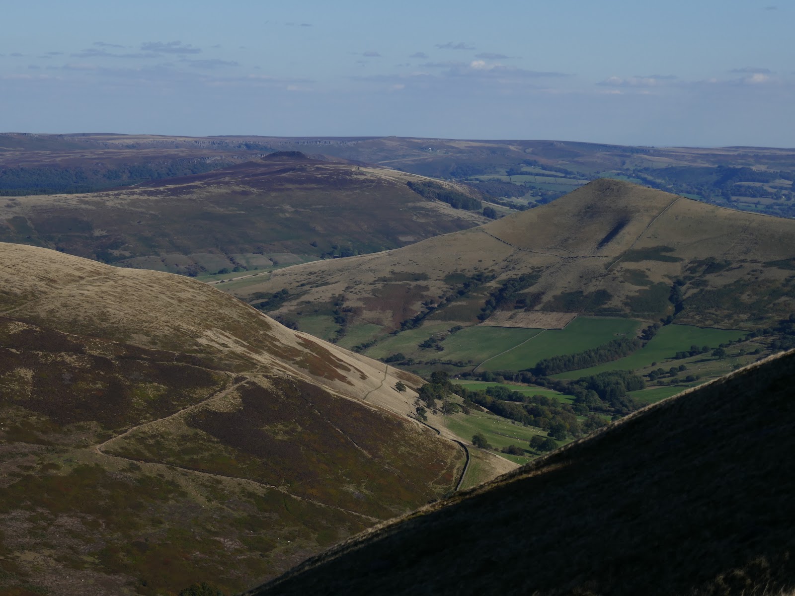
| The Great Ridge |
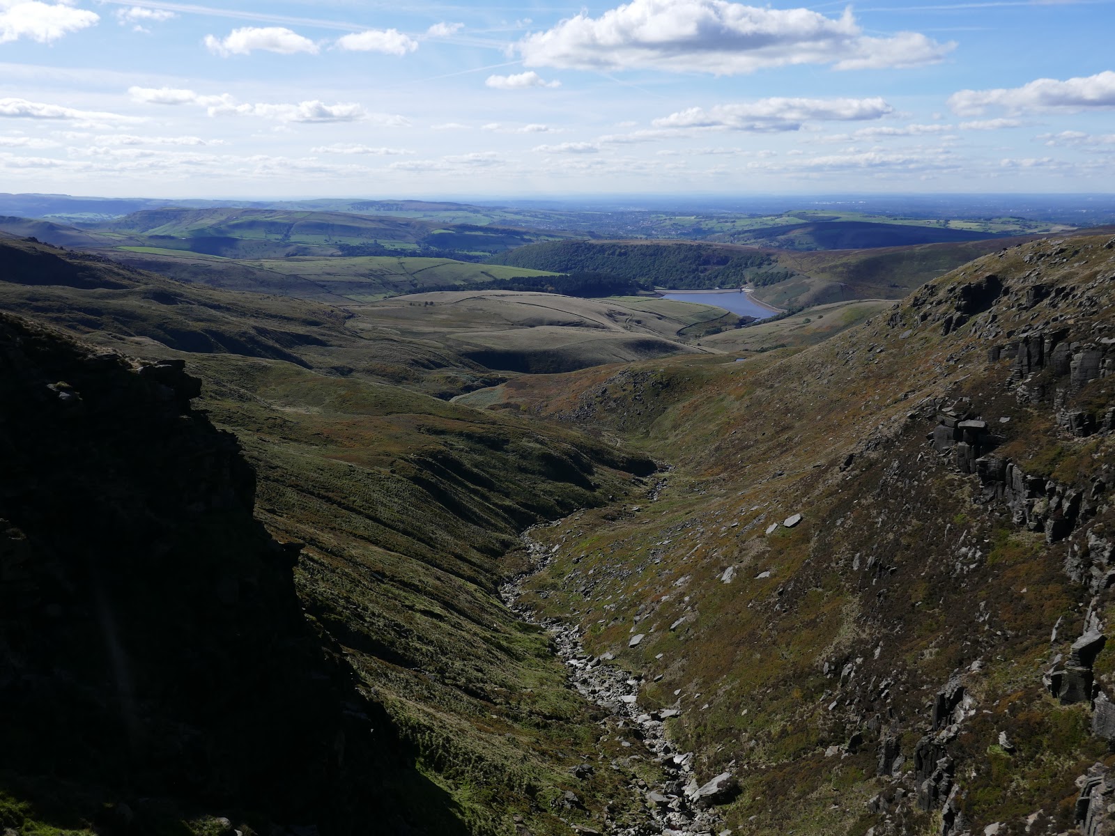
Leaving the road, a path runs parallel to Crowden Clough as it gently rises up towards the slope of Kinder – Crowden Tower peers down the valley from its perch high on the horizon.
 |
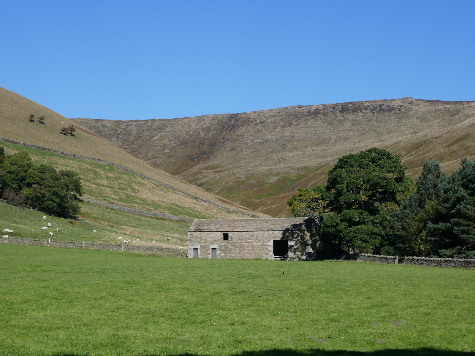
| A barn near Upper Booth |
 |
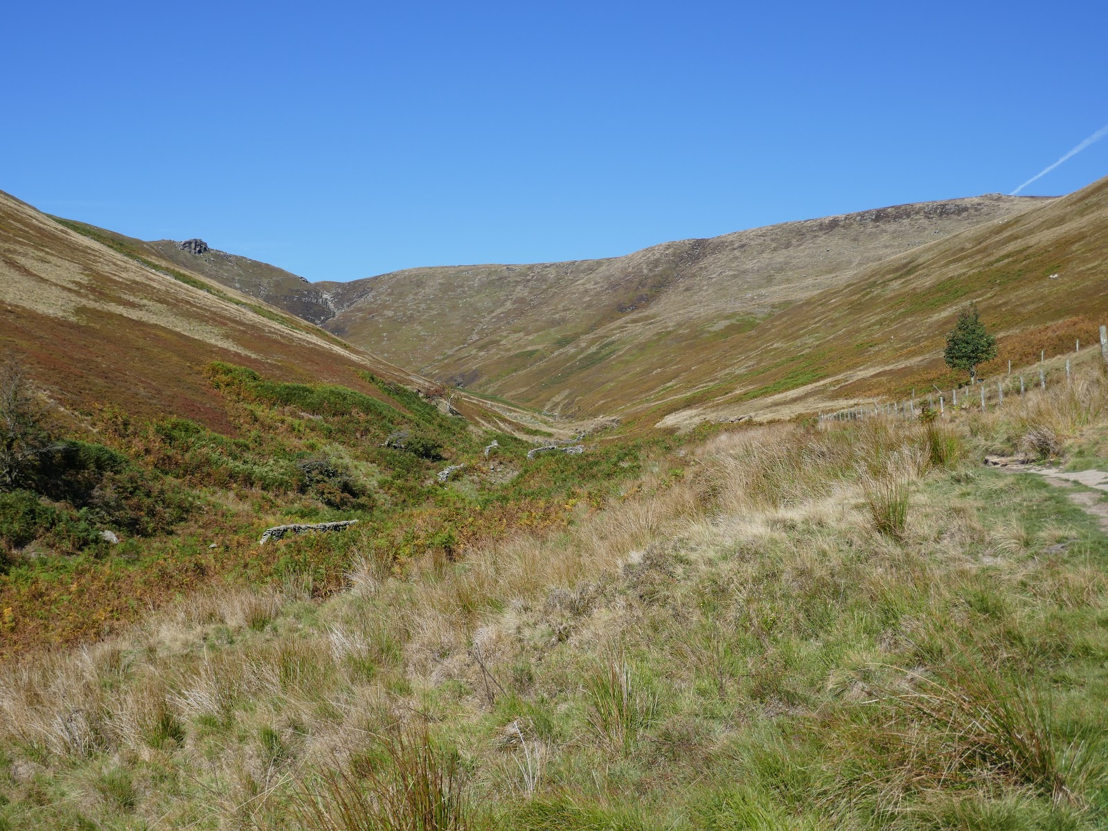
| The grassy lower each of Crowden Clough |
 |
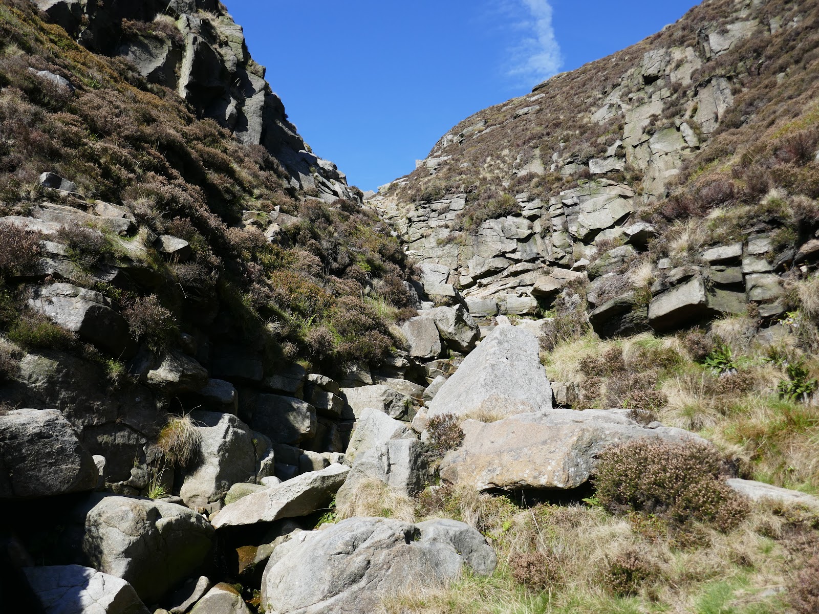
| Crowden Clough |
 |
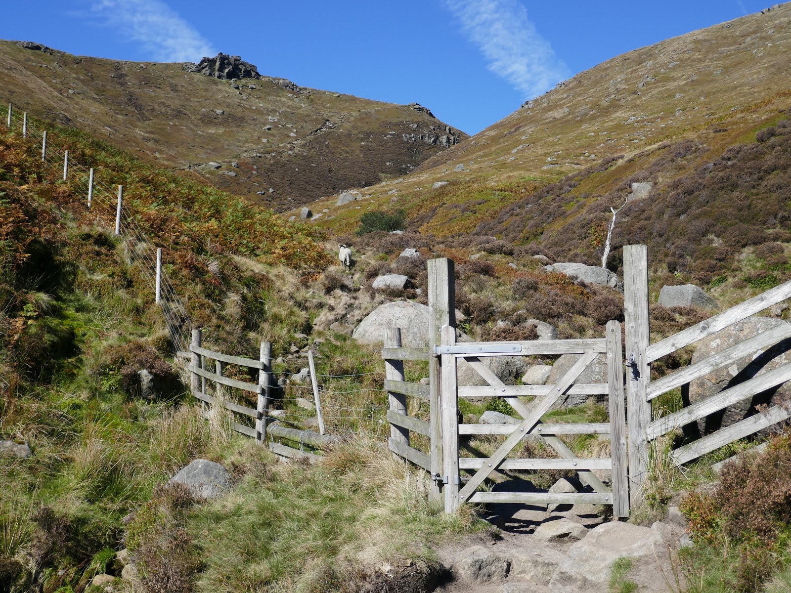
| A fence at gate marks the beginning of the Access Land |
 |
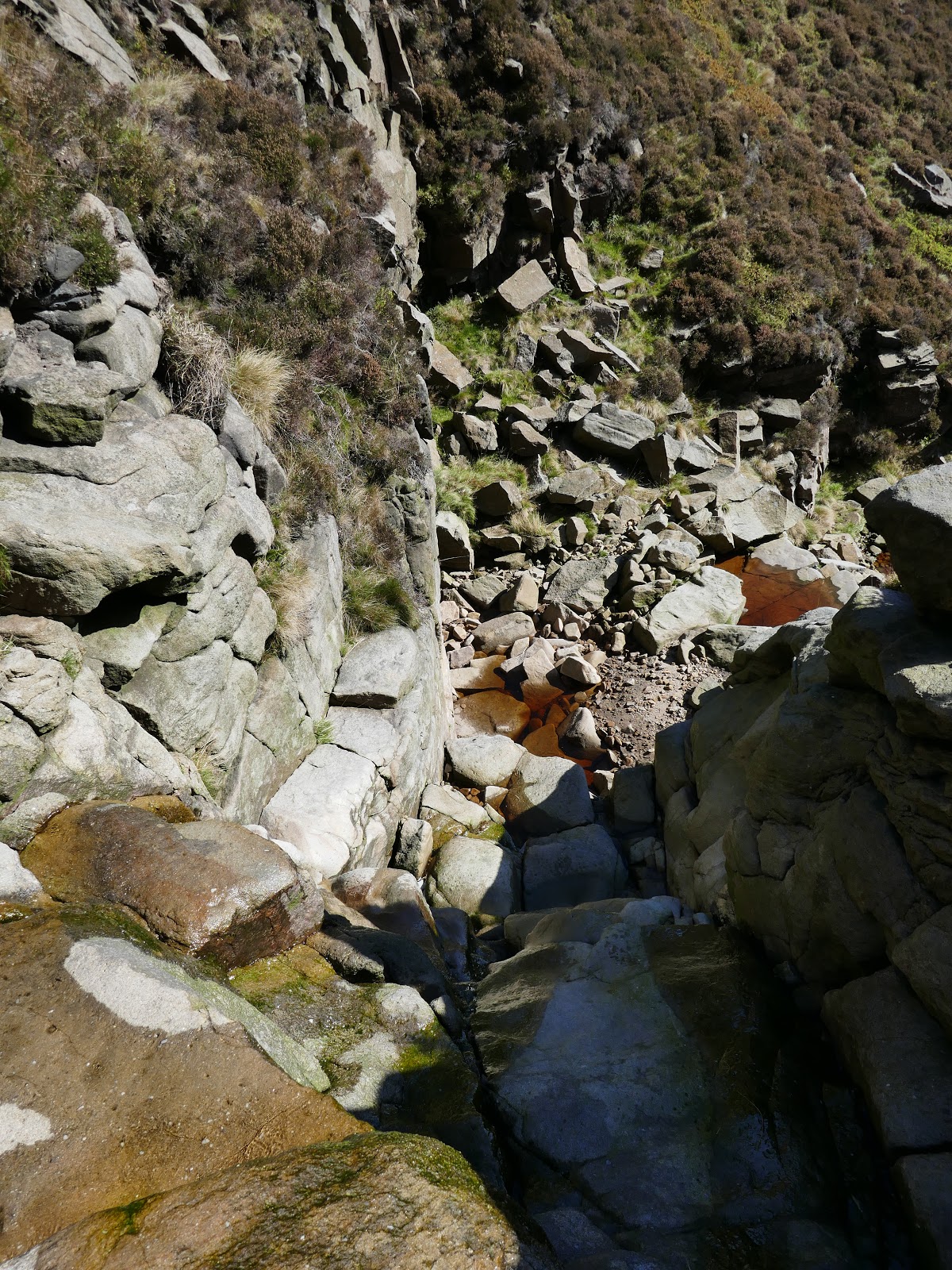
| Crowden Clough |
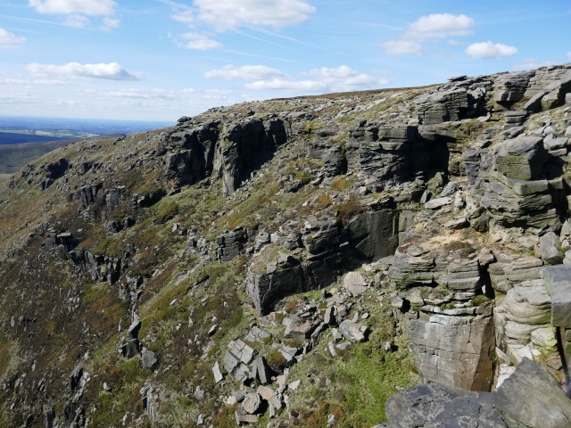
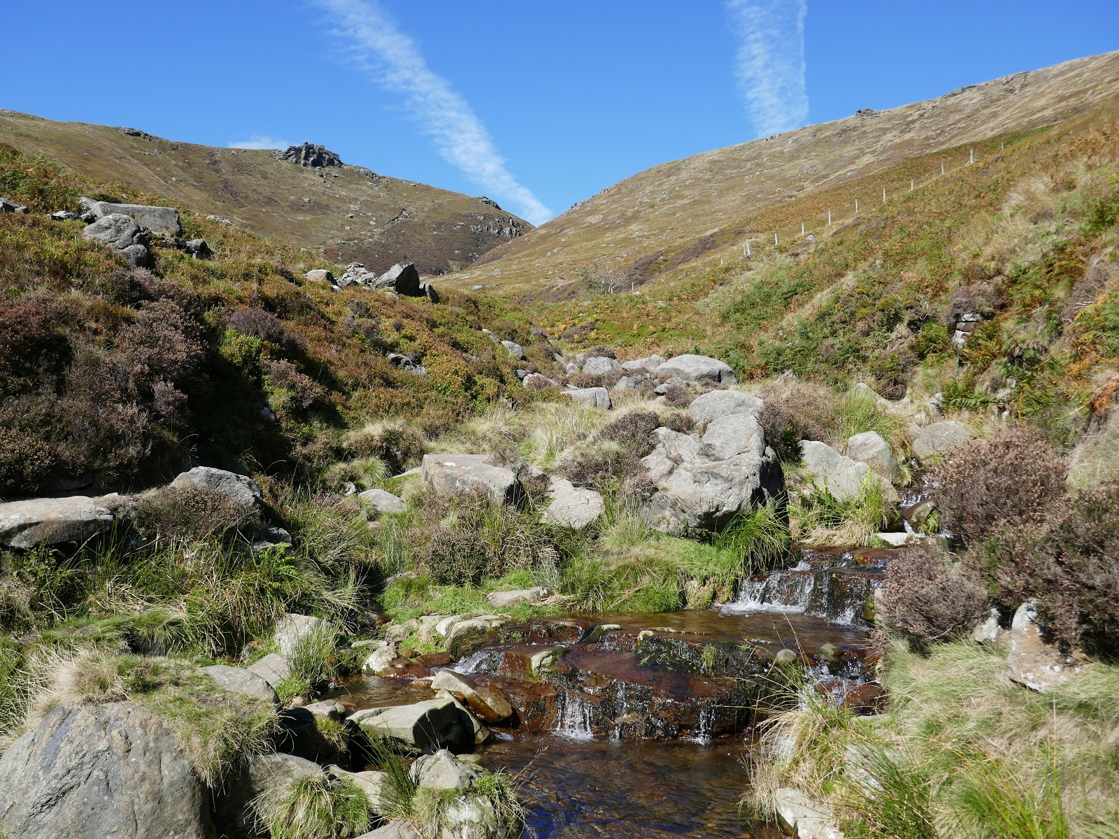
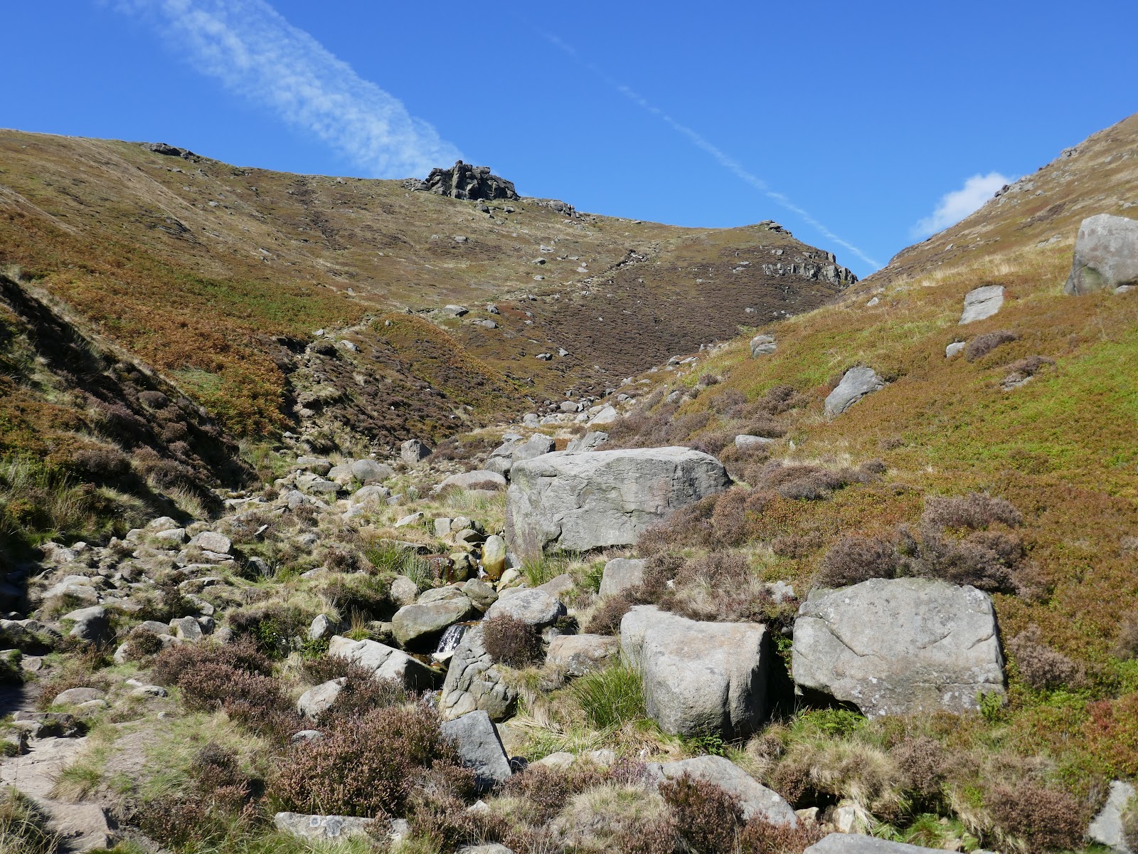
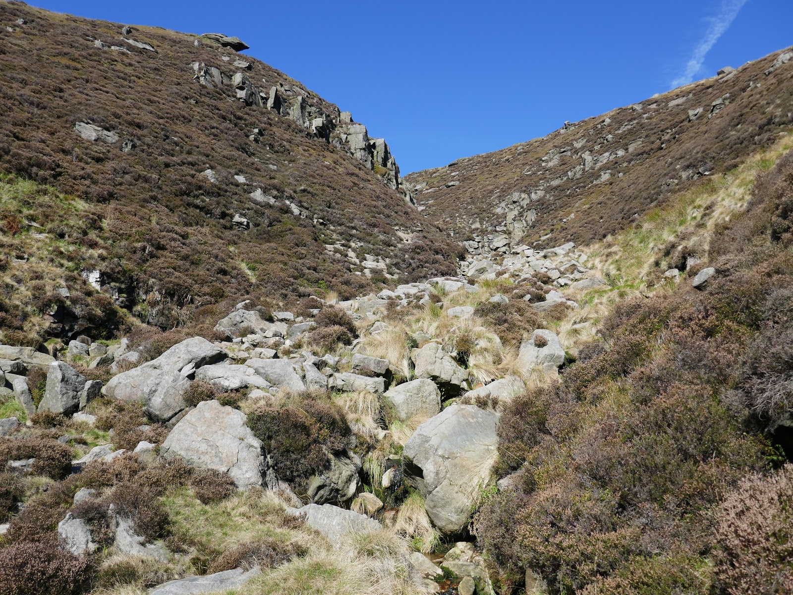
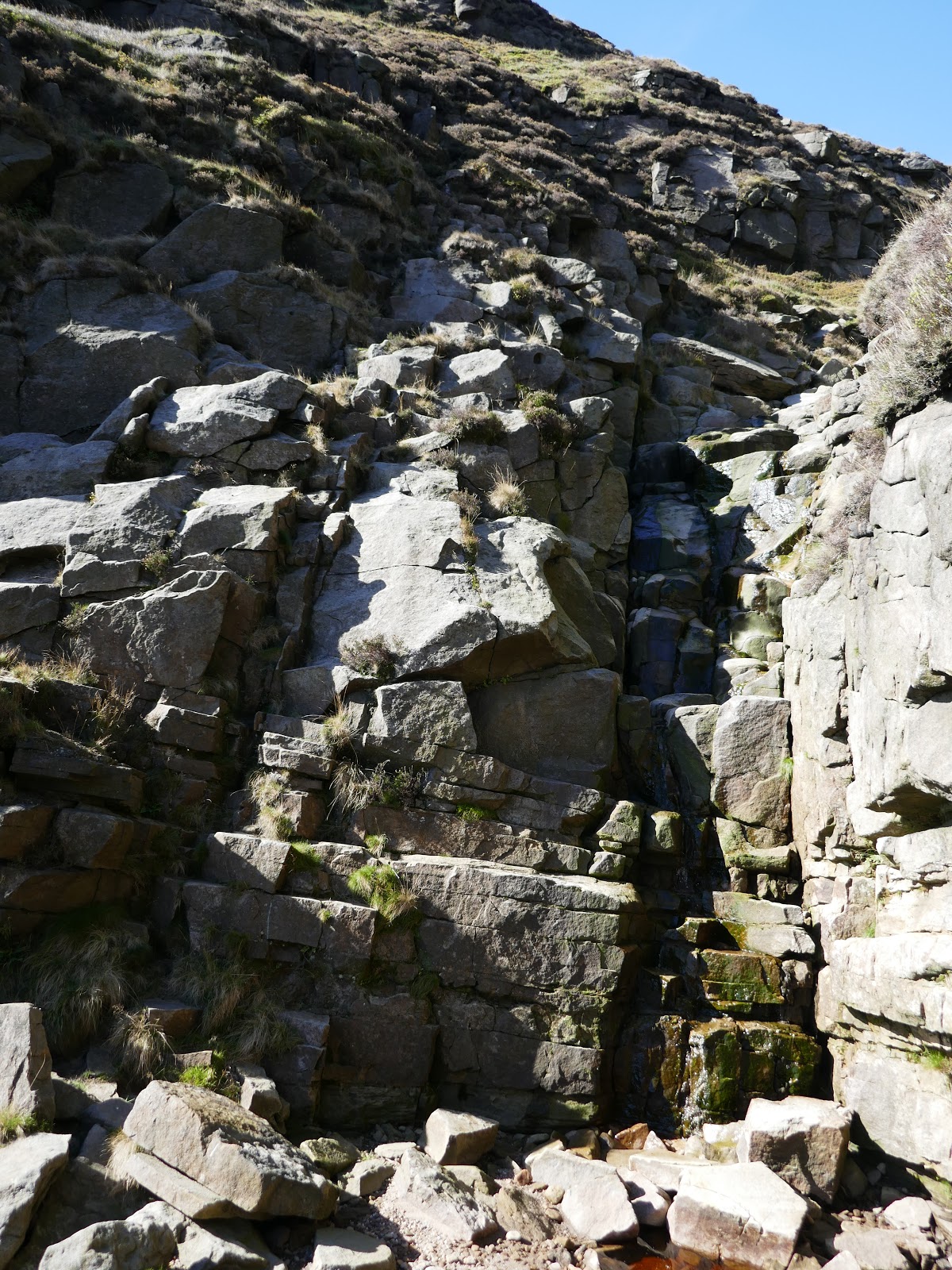
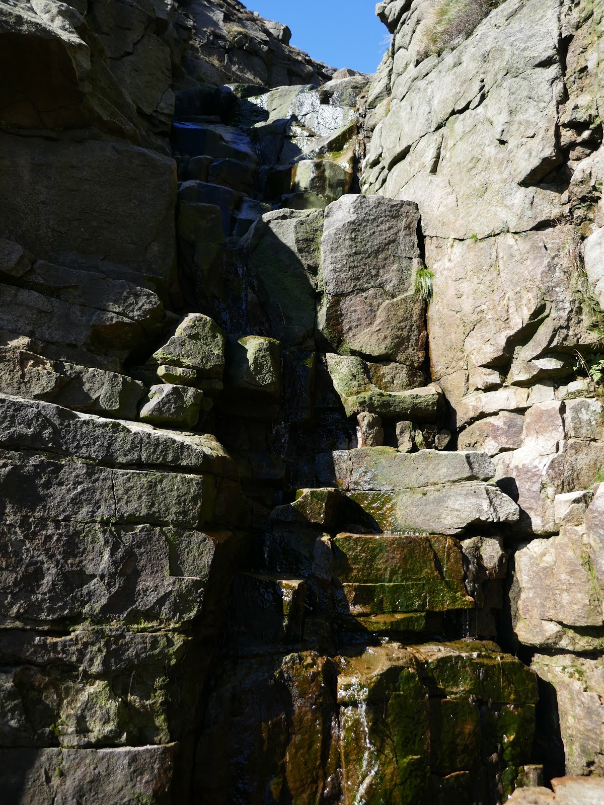
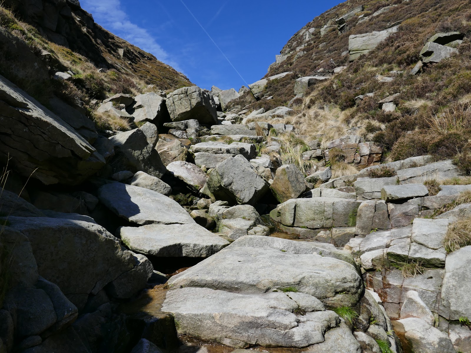
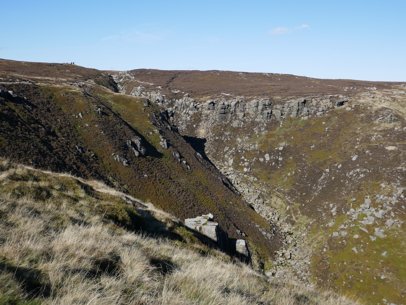
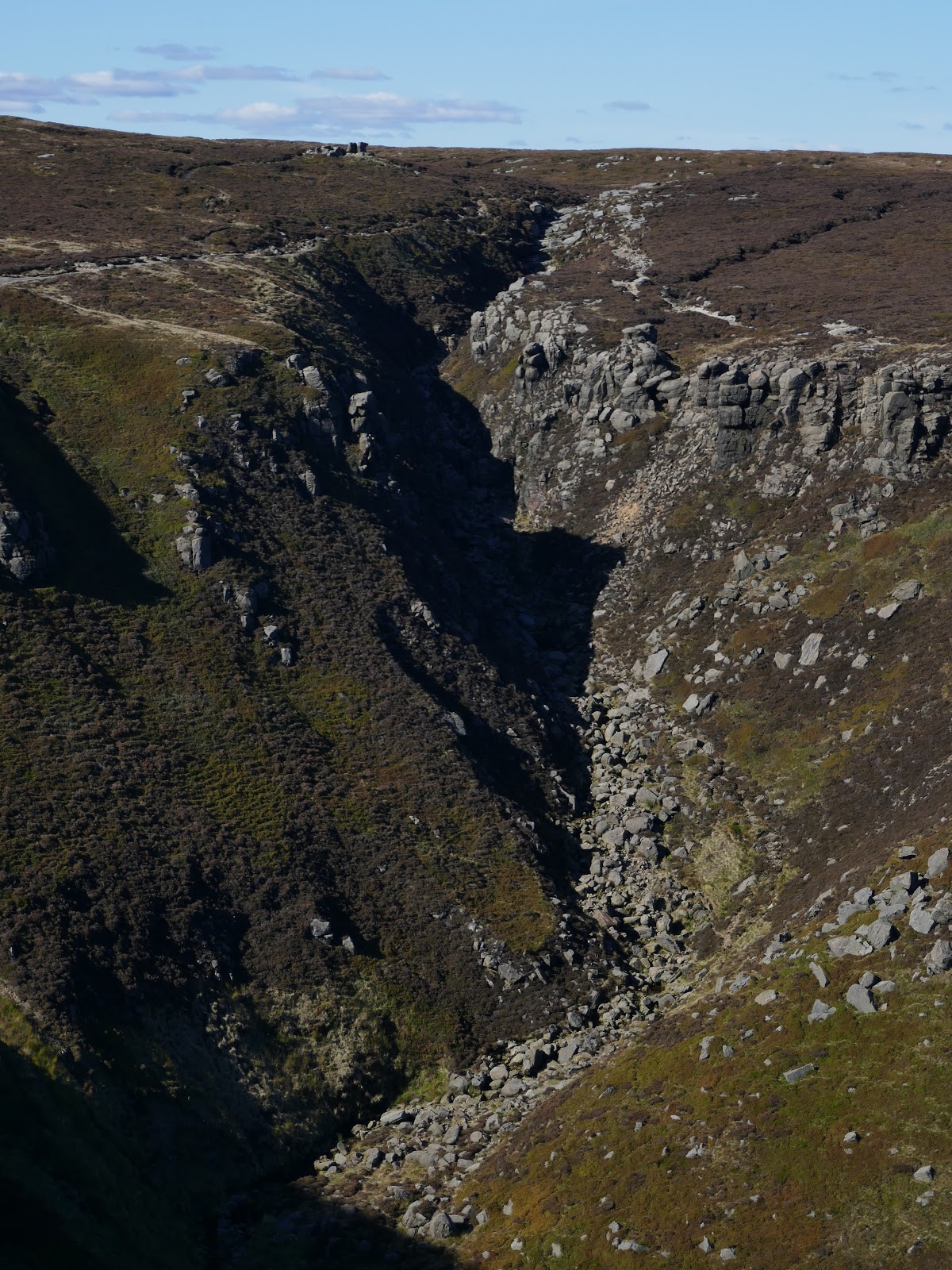
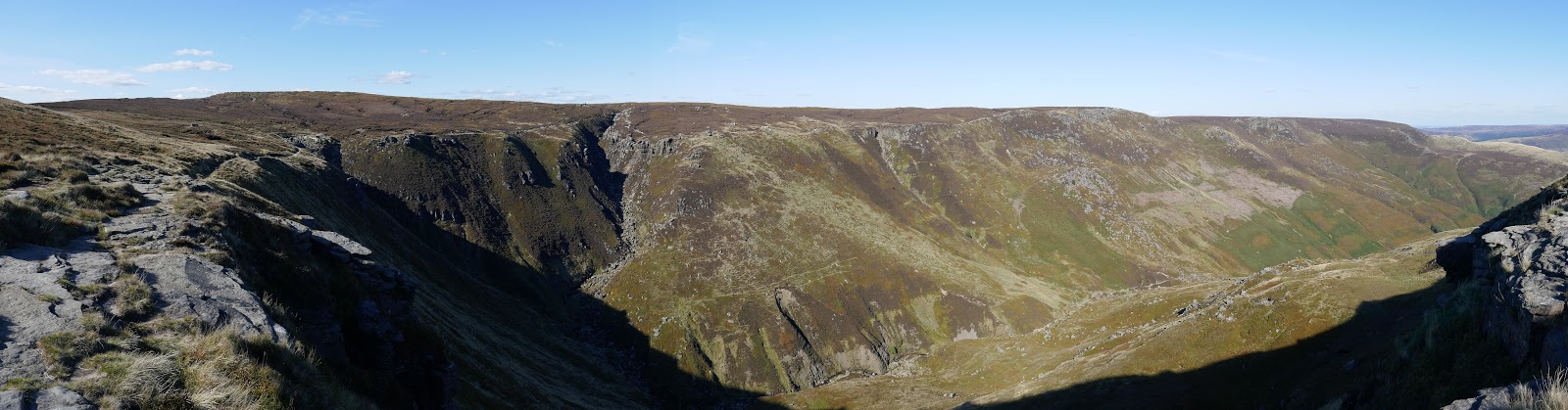
After some modest climbing, things become much more interesting and rockier with no one route better than another. Keep to the stream and keep following it up is my advice. Eventually, you will reach a rocky avenue where the brook tumbles down a series of protruding slabs. In dry conditions, like today, it’s possible to ascent the route directly otherwise a short but enjoyable scramble leads up the left-hand side. Once complete, you will have gained Kinder’s southern edge.
 |
| Looking back down Crowden Clough |
 |
| Crowden Clough |
 |
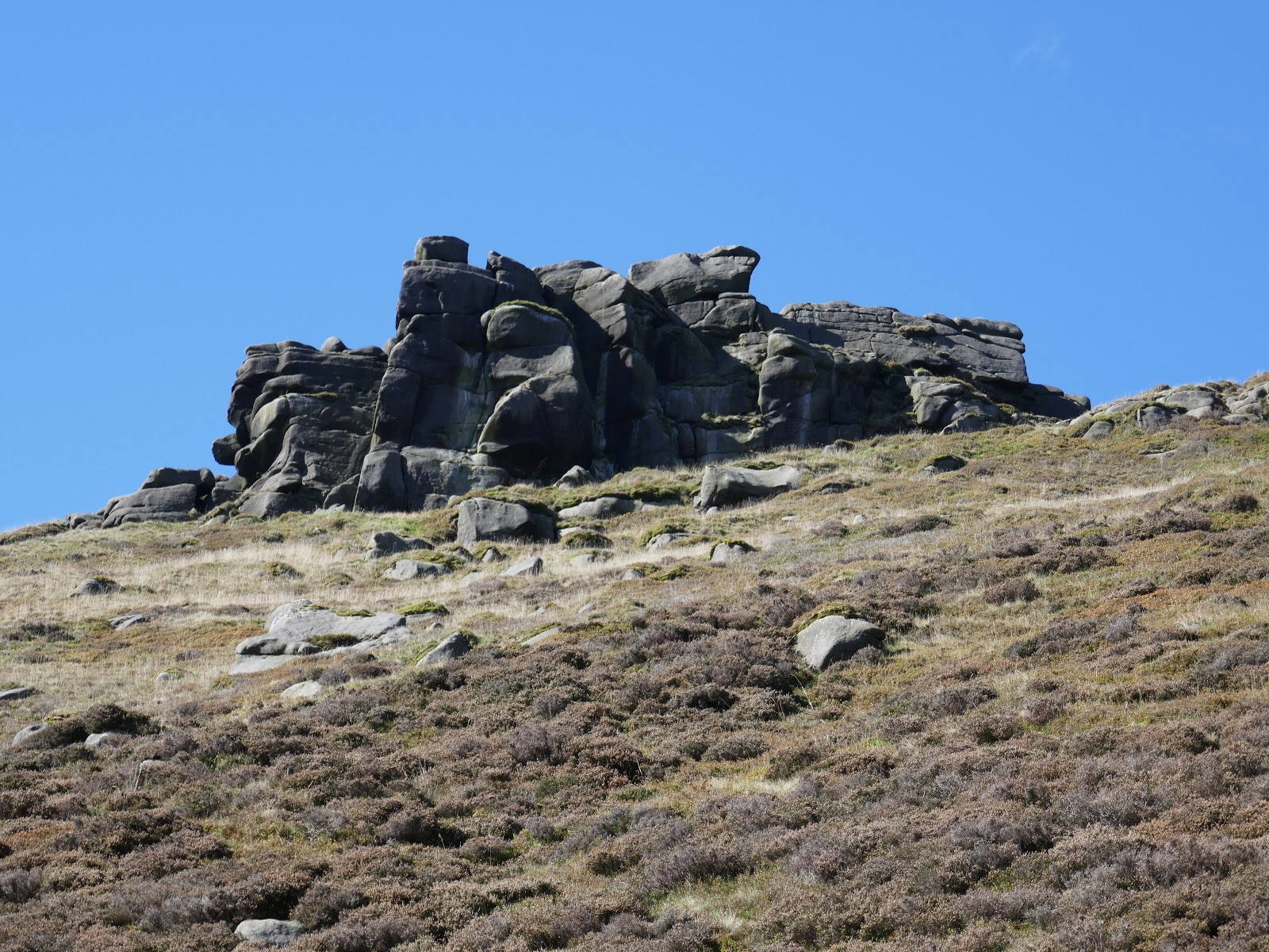
| Crowden Tower |
 |
| Crowden Clough |
 |
| The short scramble |
 |
| The direct route up the waterfall |
 |
| Looking down the scramble |
 |
| Crowden Clough |
 |
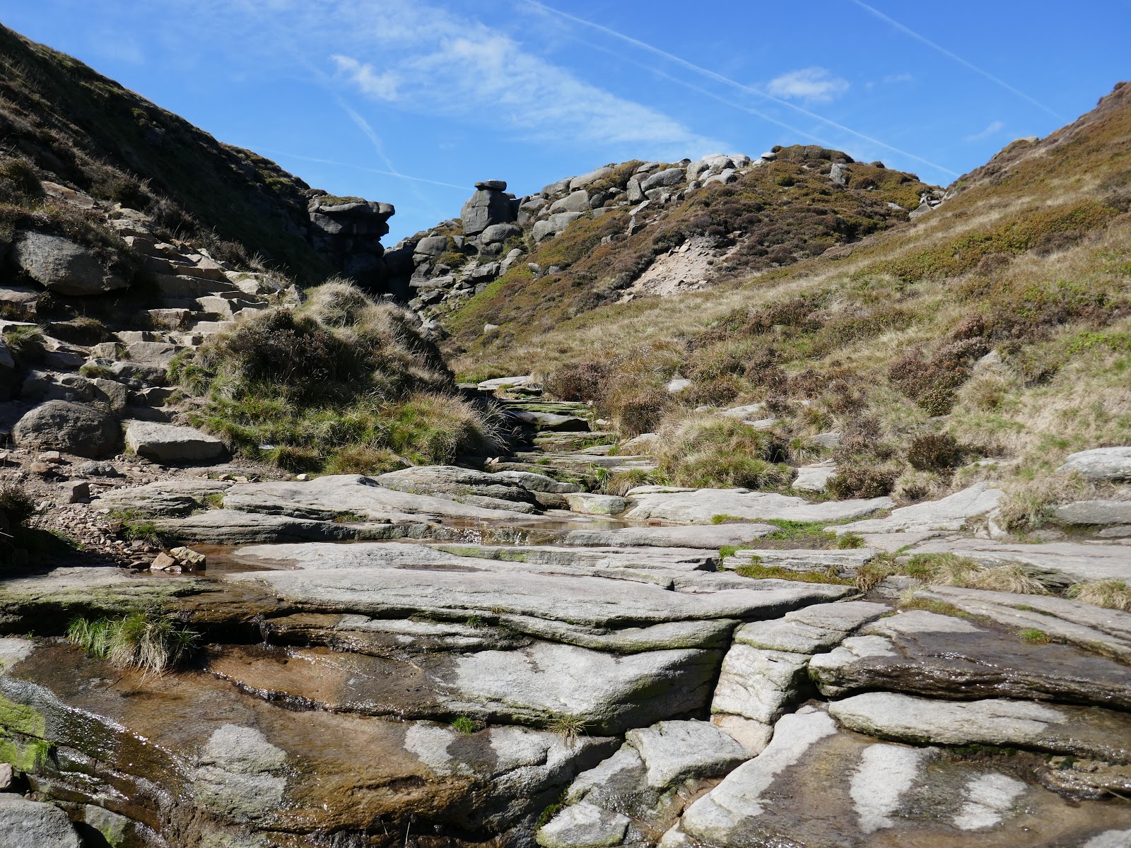
| Crowden Clough emerges onto Kinder Scout |
 |
| Kinder Scout |
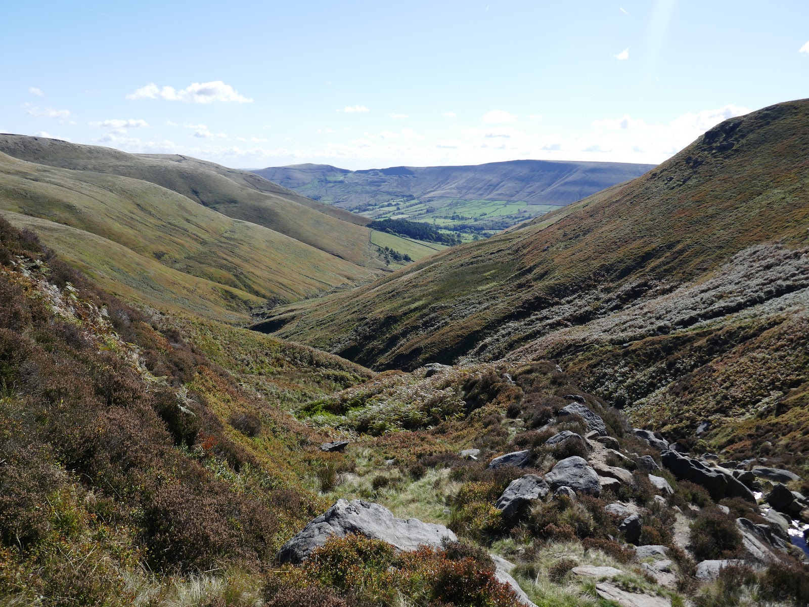
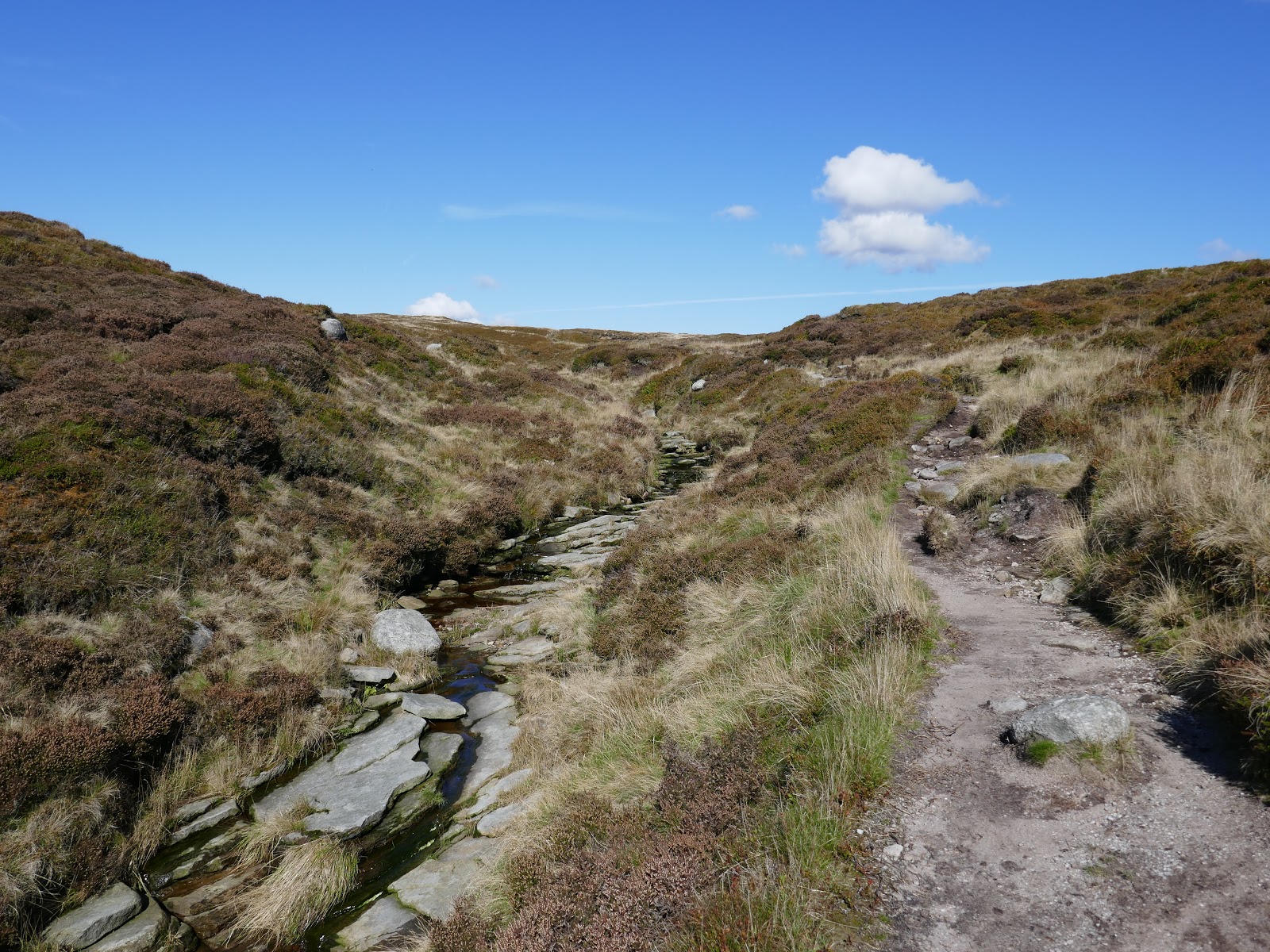
Another decision to make, which way to go? Left towards the Wool Packs or right to Rigning Roger? In the end, I decided on directly ahead, following Crowden Clough as it makes its way into the depths of Kinder’s plateau. I followed the route of the old Pennine Way across the groughs and peat hags of Kinder’s interior, eventually reaching Kinder Gates, confirmation that I had not made a wrong turn along the way.
 |
| Crowden Tower |
 |
| Kinder’s interior |
 |
| Kinder Scout |
 |
| Kinder Gates |
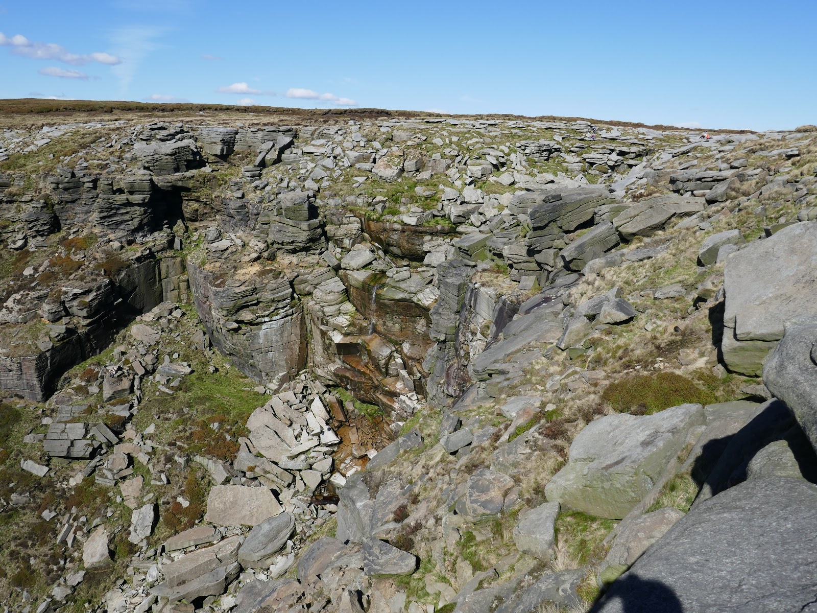
The Kinder Gates are a large pair of outcrops which flank the infant Kinder River and, as I mentioned, are the perfect way-point in an otherwise featureless area. Once at the gates, you can follow the river all the way to Kinder Downfall; Kinder Scout’s famed waterfall. The waterfall was previously called Kinder Scut – no prizes for guessing what it eventually lent its name to. The waterfall is a 30m high jumble of rocks and boulders and has a habit of being blown backwards when the wind is strong and from the west.
 |
| The Kinder River |
 |
| Kinder Downfall |
 |
| Kinder River continues on its way |
 |
| Kinder Downfall |
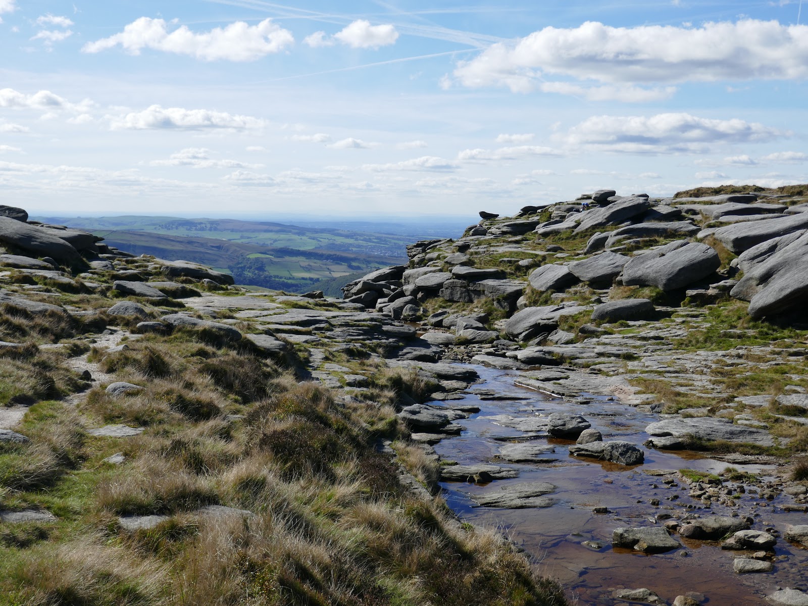
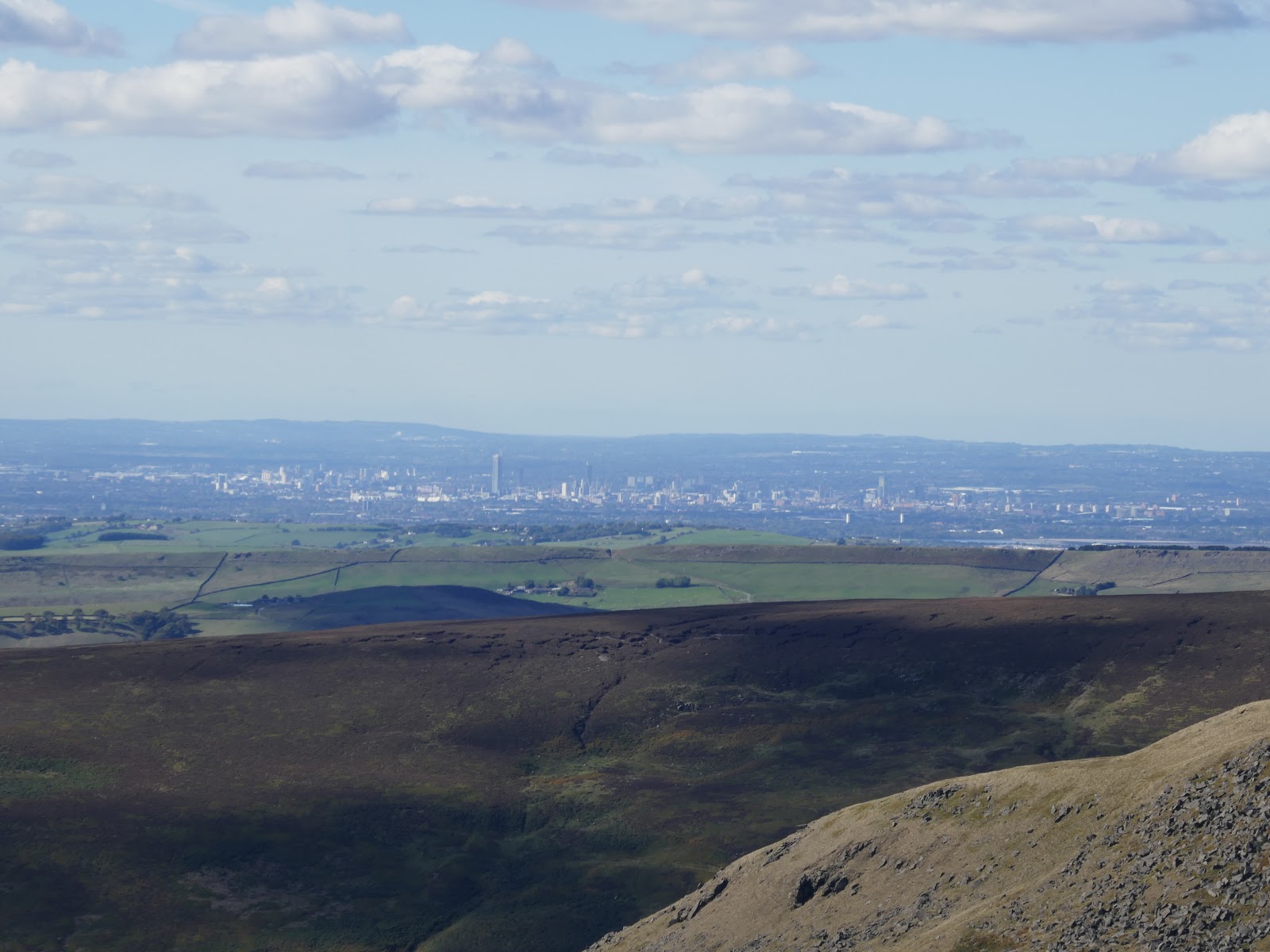
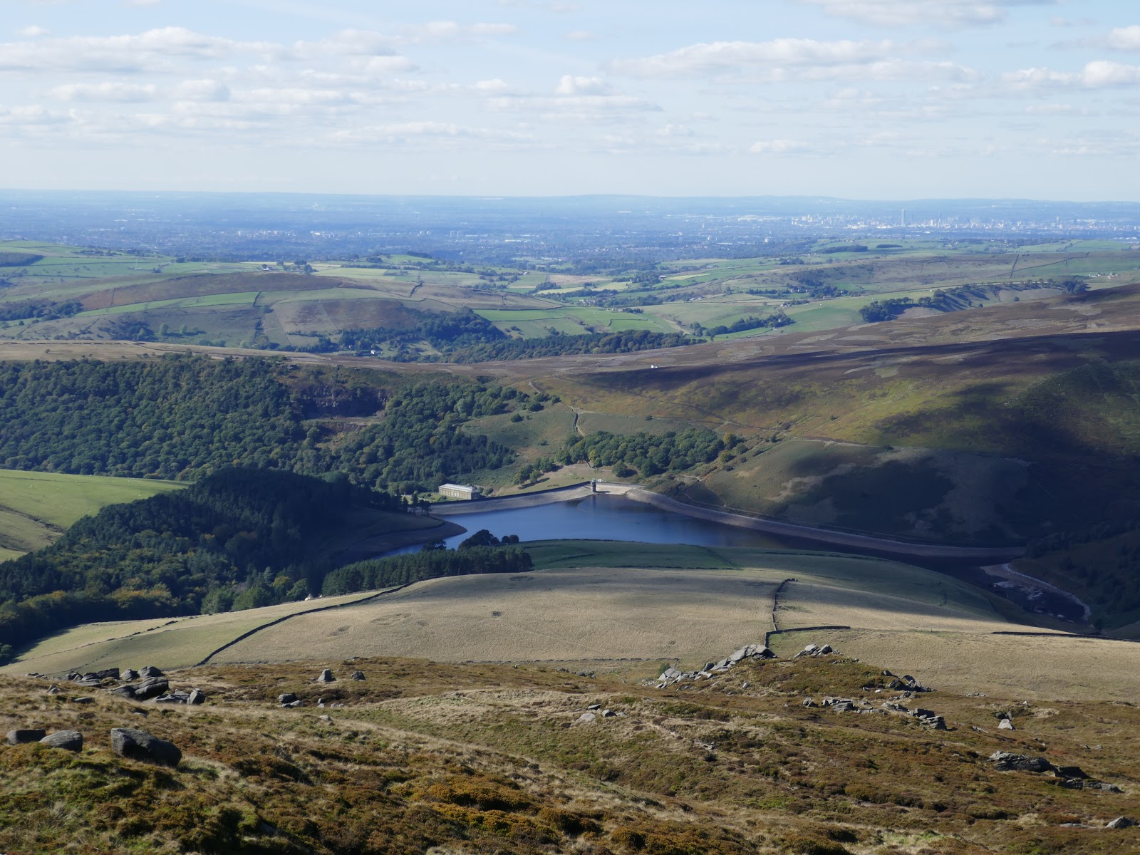
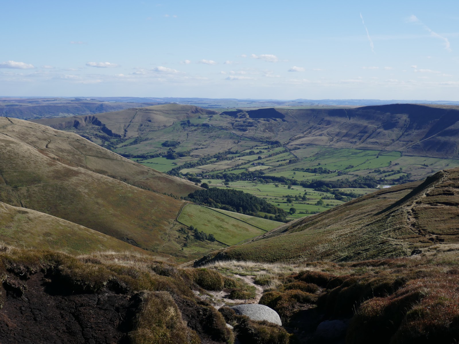
The current Pennine Way passes the downfall as it skirts the western edge of the plateau, with sweeping views across the Kinder Reservoir and Hayfield to the west. Today the view extended as far as the shimmering towers of Manchester.
 |
| Manchester |
 |
| Kinder Scout |
 |
| Cluther Rocks |
 |
| The west side of Kinder Scout |
 |
| Kinder Reservoir |
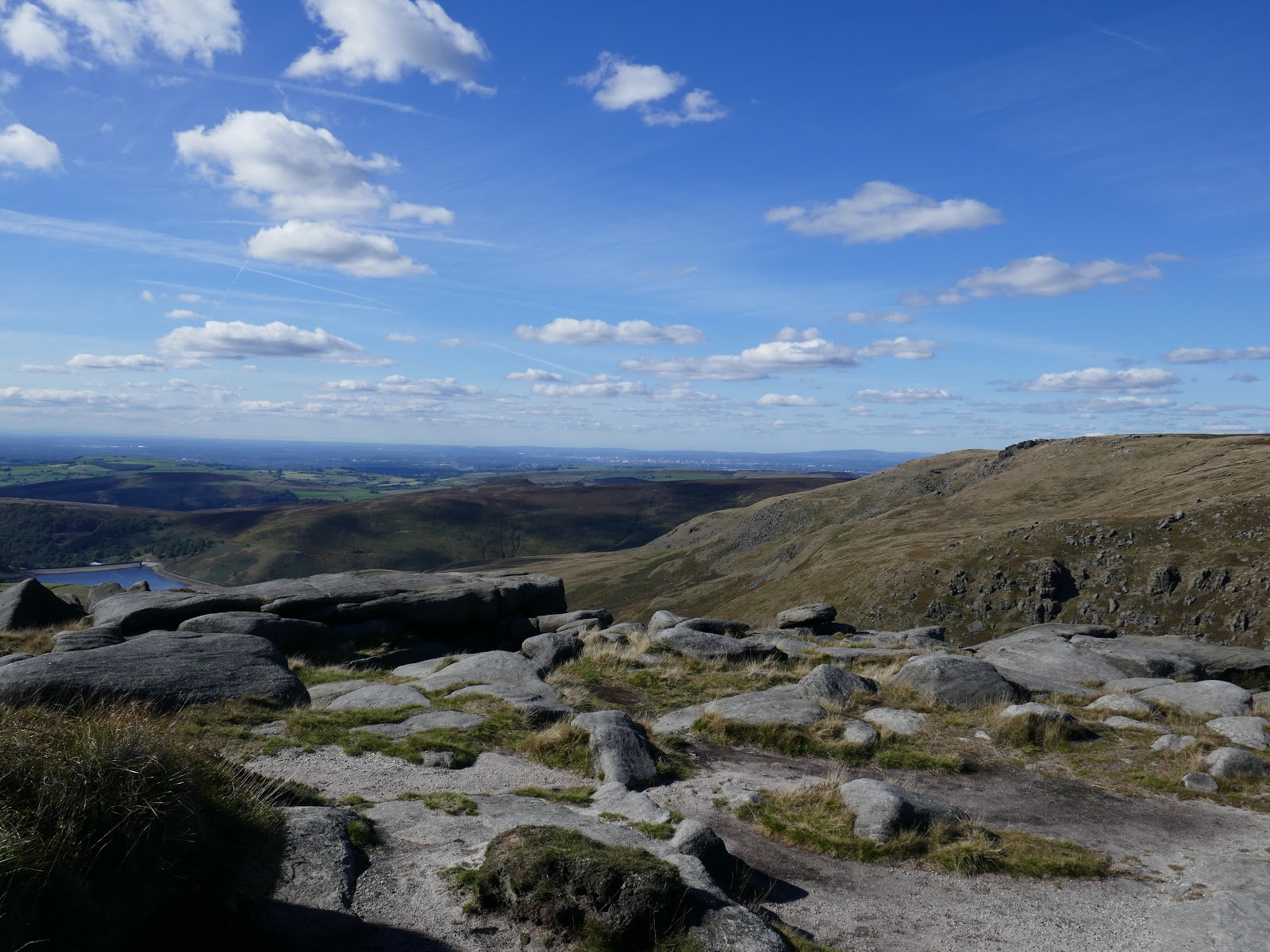
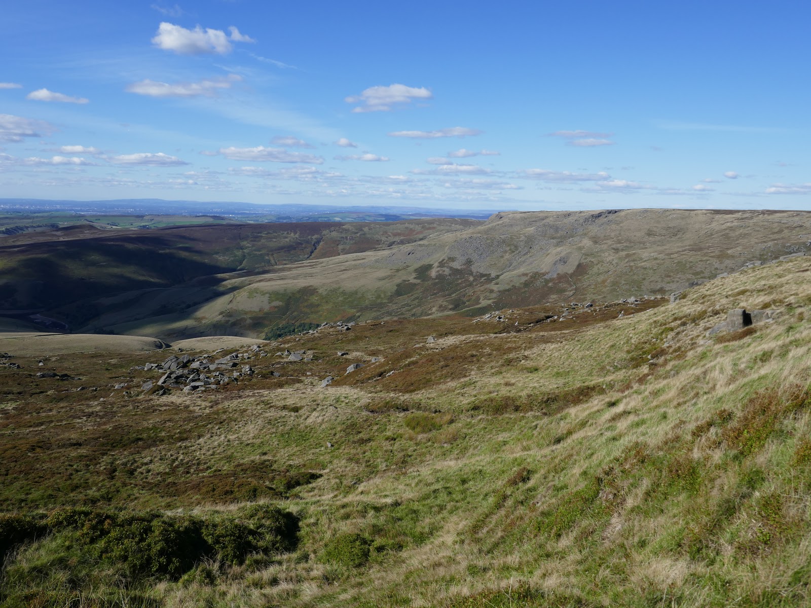
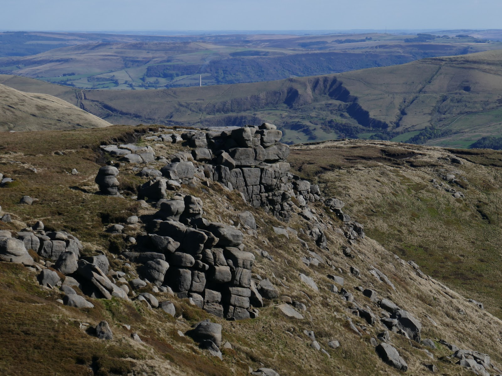
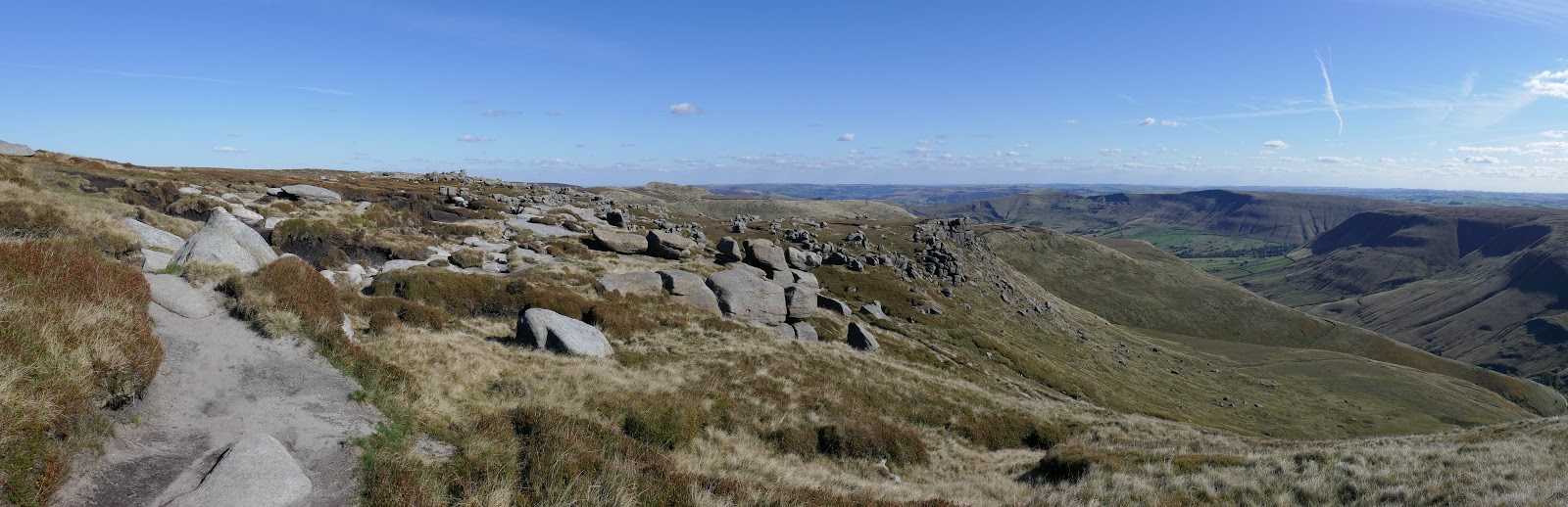
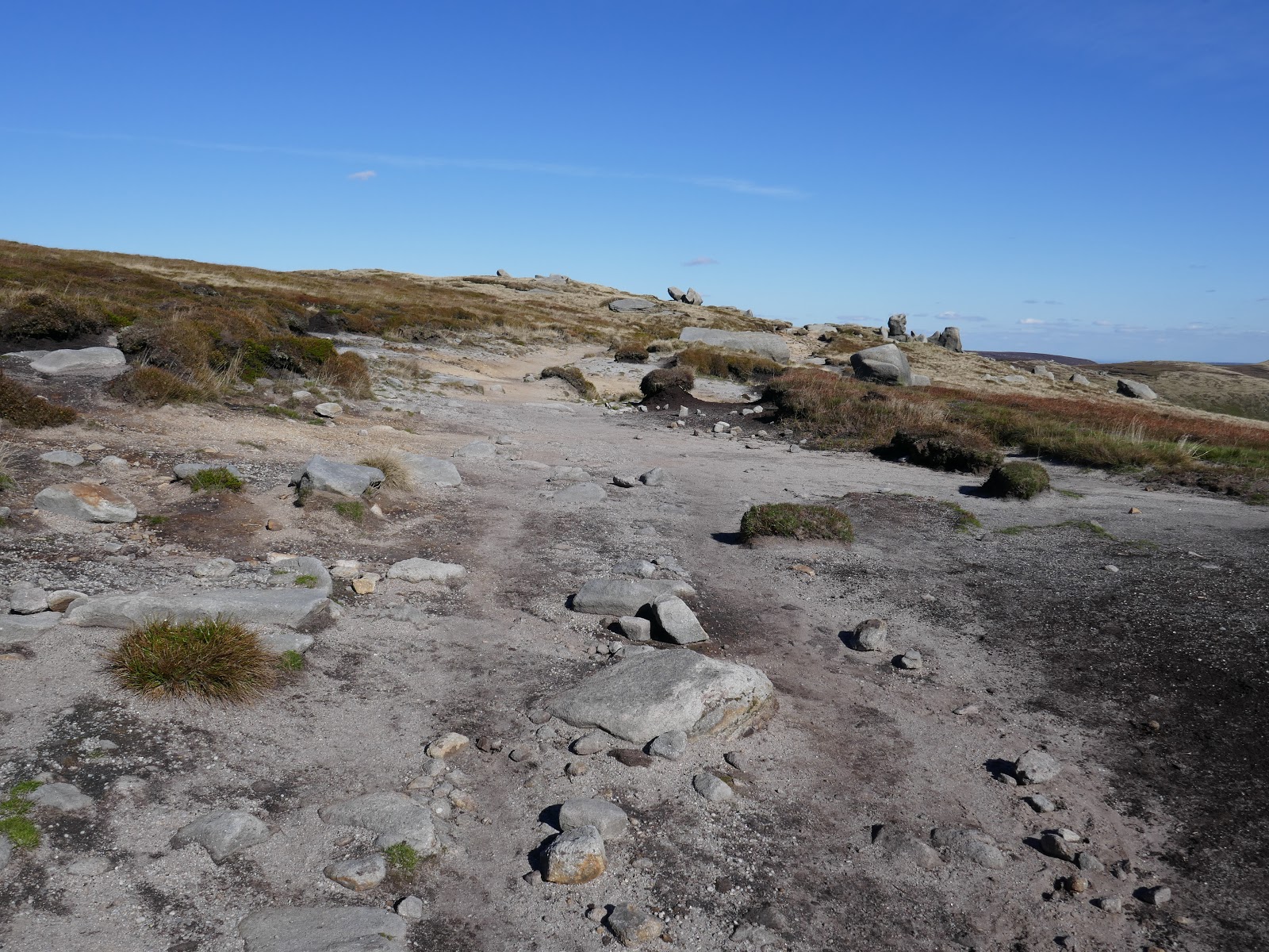
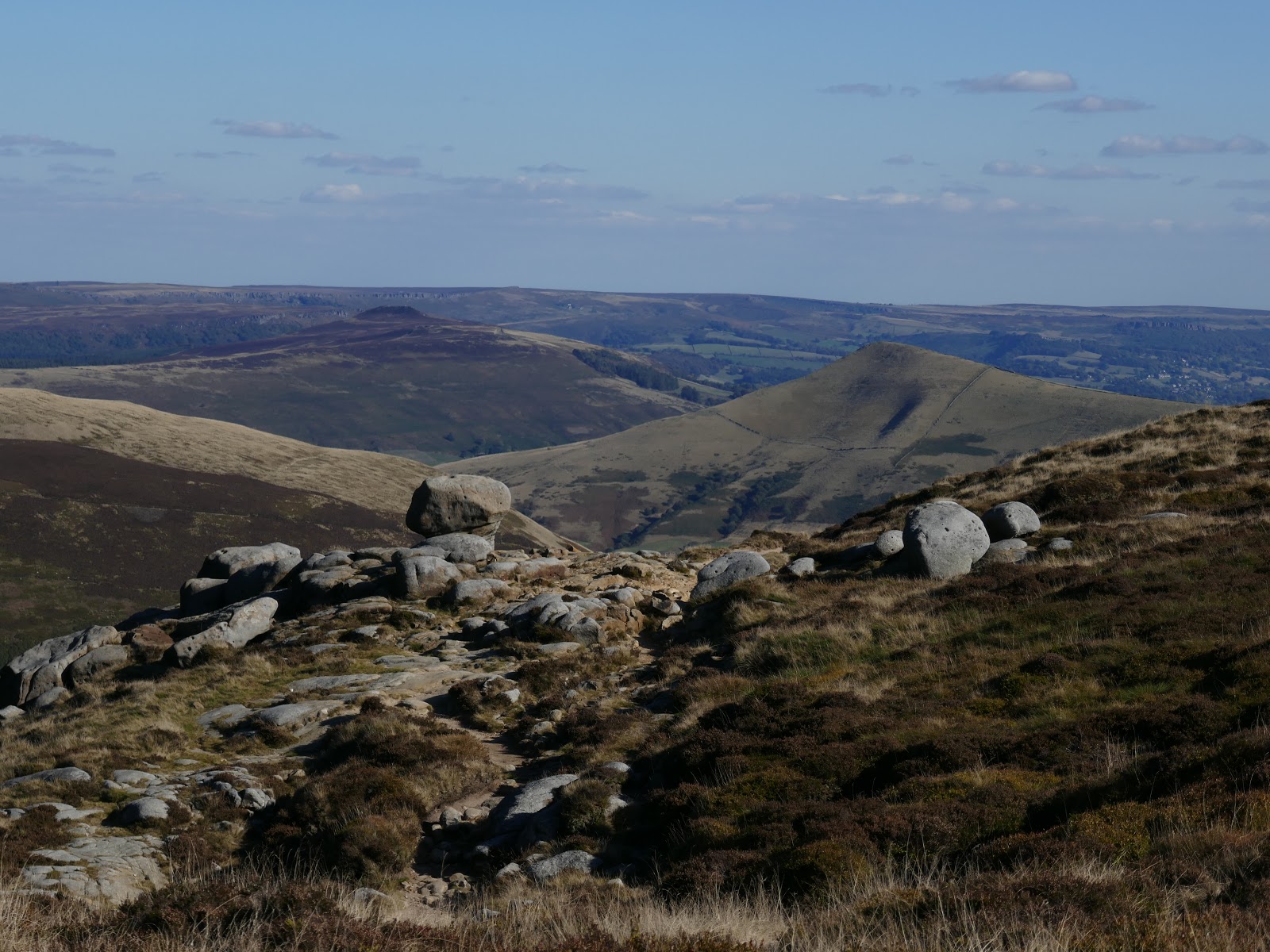
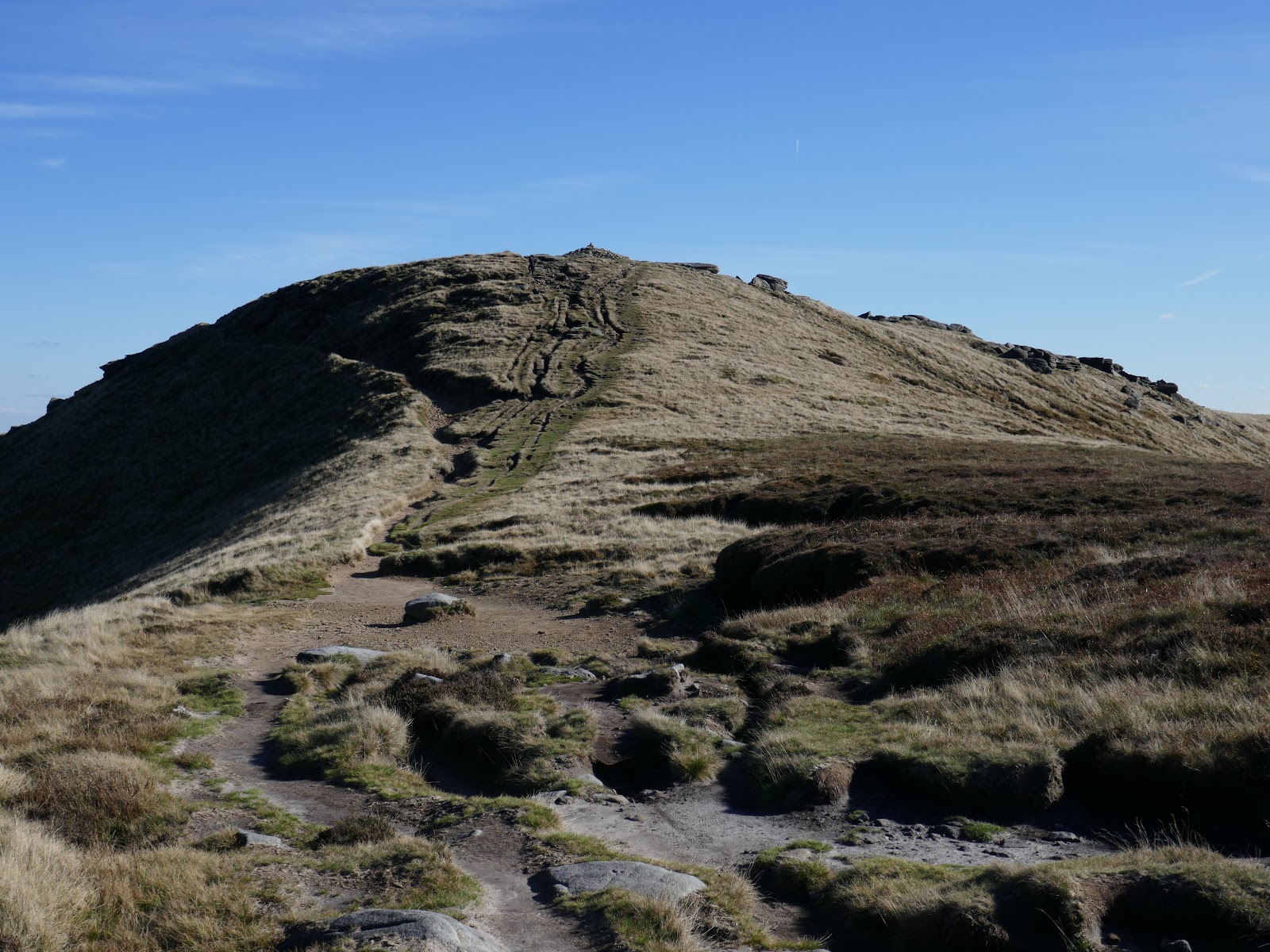
Ultimately, the path runs the entire length of the perimeter of Kinder Scout, no doubt a relic of ancient travellers combined with the modern tourist. I was approaching the most popular part between Kinder Low and Nether Tor. The path is both easy to follow and (once you’ve made the climb to reach it) relatively flat.
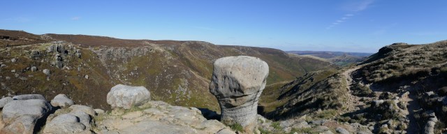
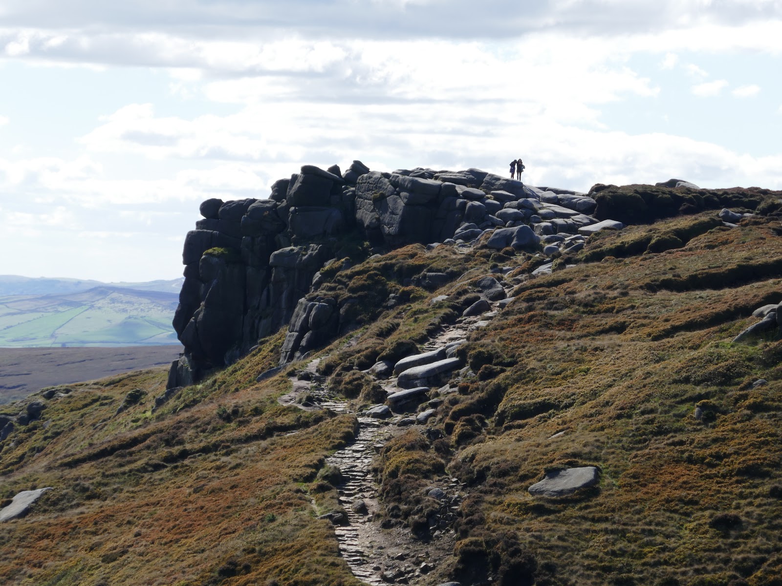
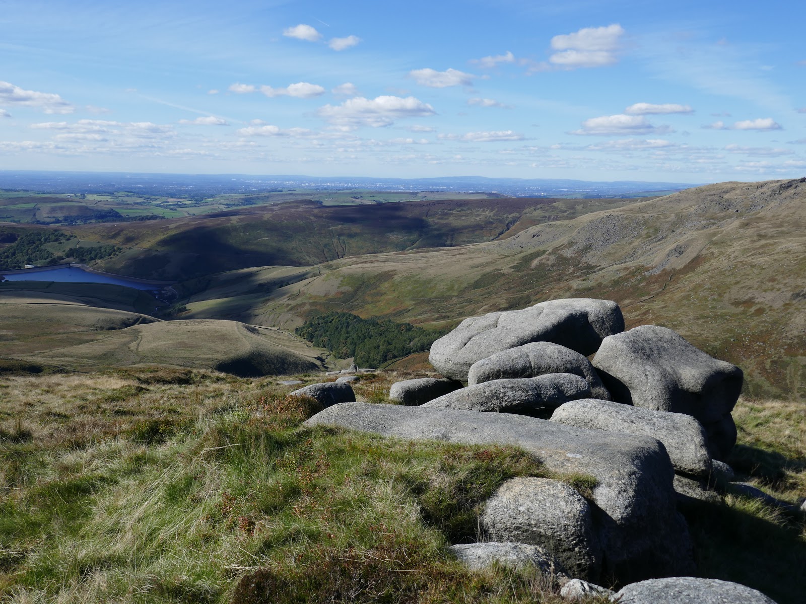
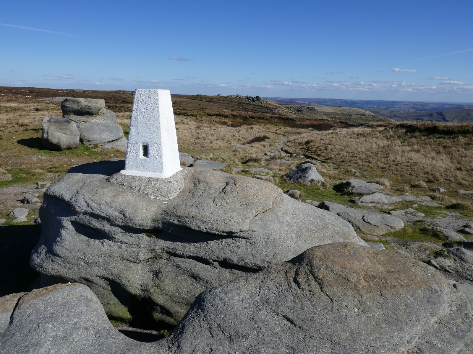
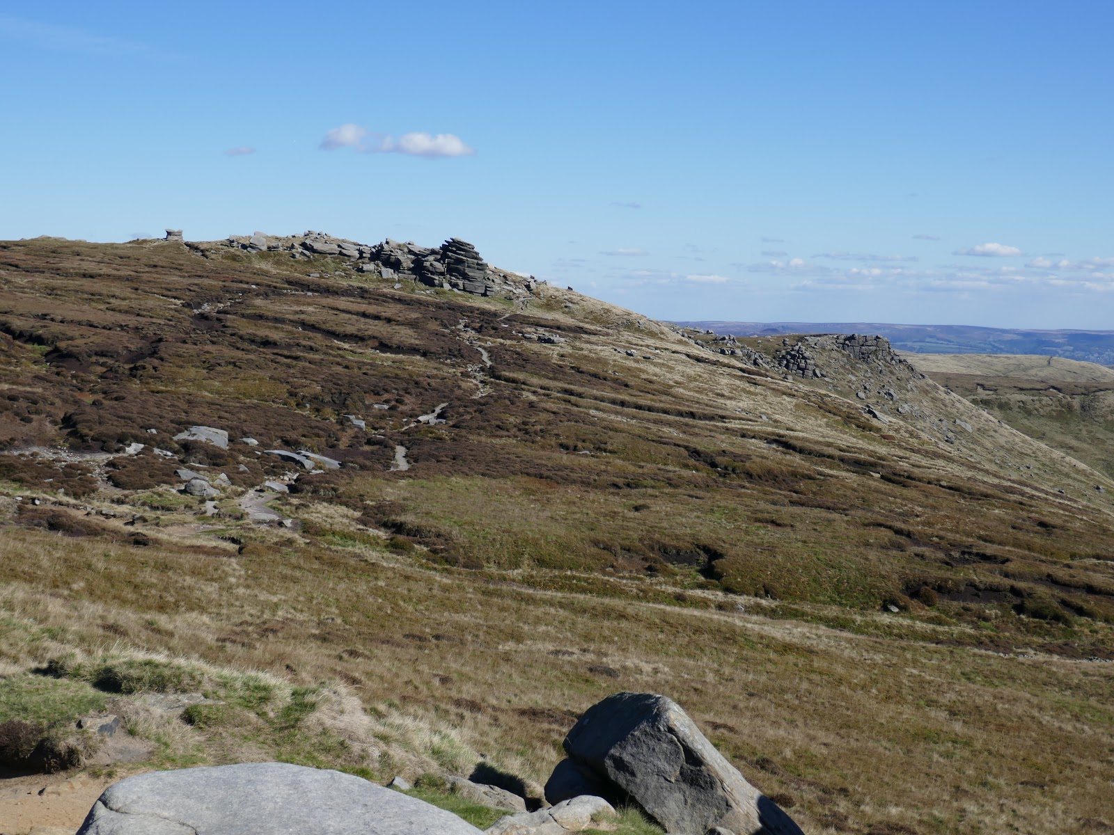
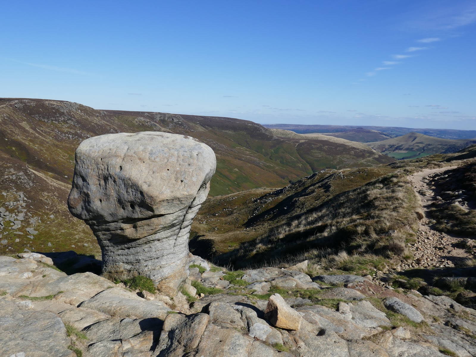
There is a trig pillar perched upon a rock at Kinder Low which many wrongly believe to the highest point of the moor, though there is little difference between this and the actual summit. After passing Edale Rocks, I reached Noe Stool and the Wool Packs, probably my favourite part of the walk.
 |
| Kinder Low |
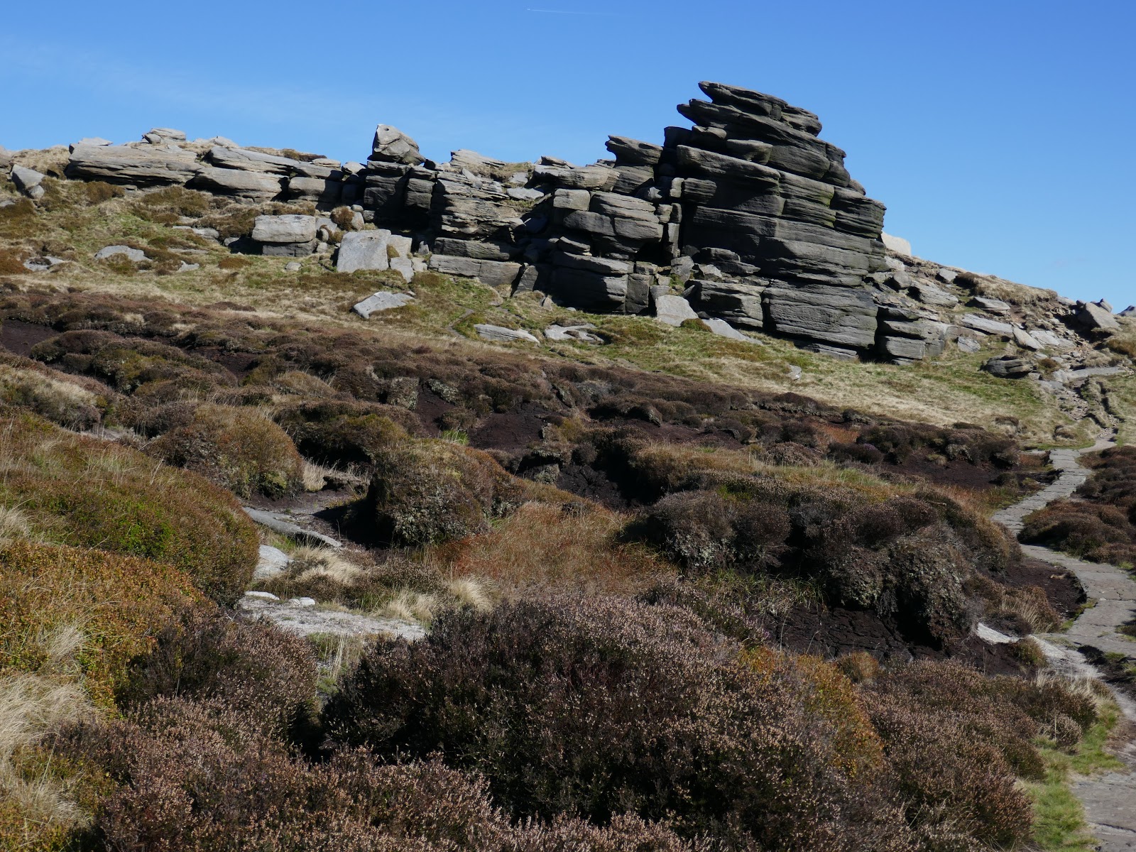
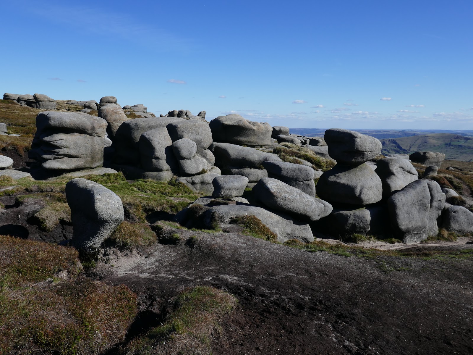
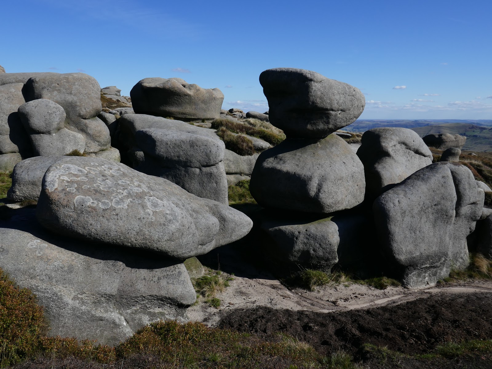
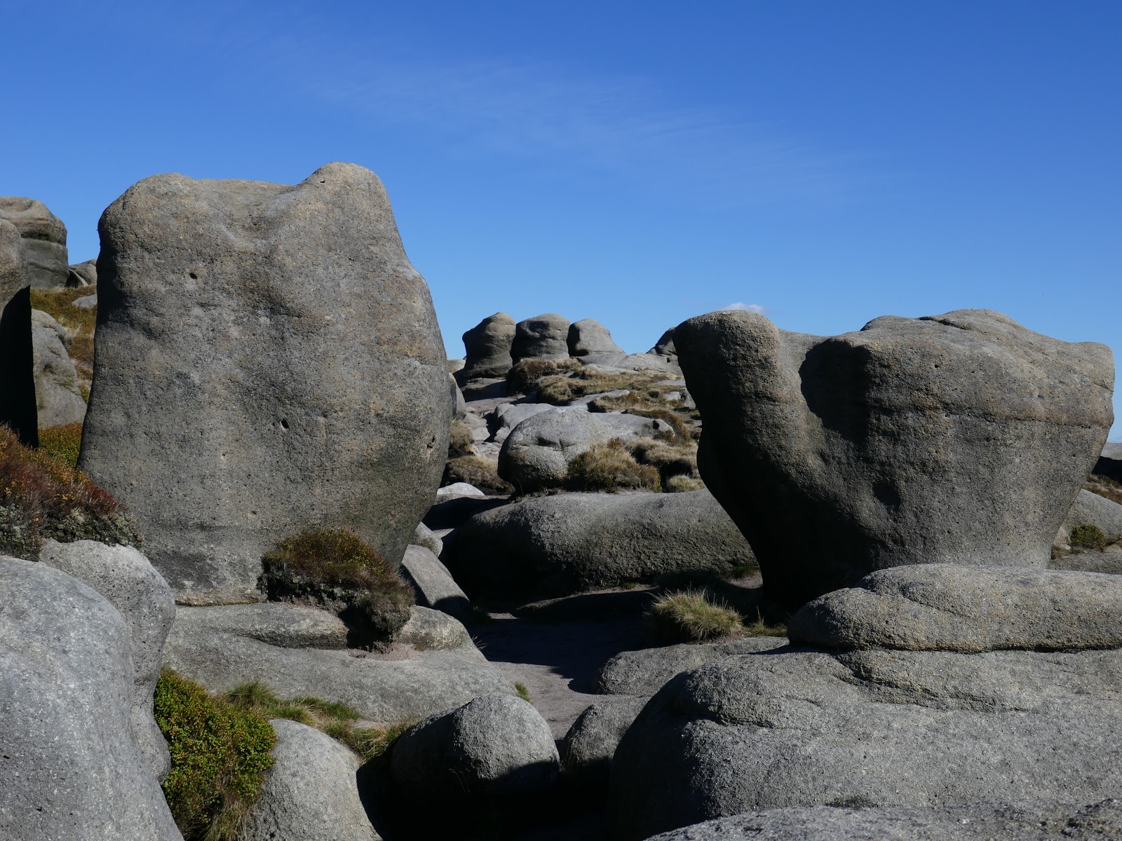
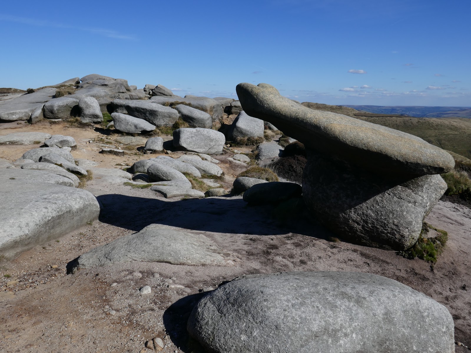
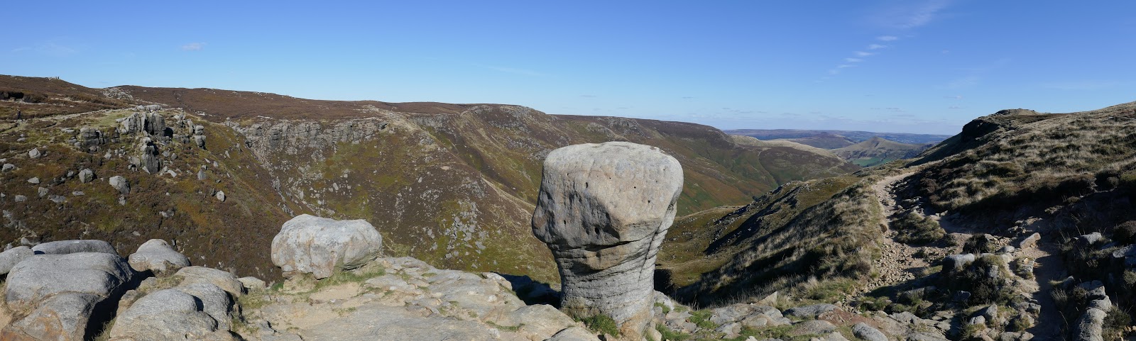
The path here winds its way through the Wool Packs, a series of enormous gritstone blocks, tossed about the landscape like discarded children’s toys. This really is an amazing place. Some very boggy bits litter the main walking path making the going slightly more treacherous.
 |
| The route along the southern edge |
 |
| The rocks at Pym Chair |
 |
| The Wool Packs |
 |
| Kinder’s southern edge |
 |
| The Wool Packs |
 |
| The Wool Packs |
 |
| The Wool Packs |
 |
| Erosion along the southern edge |
Crowden Tower bounds the Wool Packs to the east, the towering fortress of gritstone that guards the head of Crowden Clough. The path, wide and easy to follow, rounds the top of Crowden Clough and crosses a short, open section of moor to Grindsbrook Clough, the and largest and most popular of all the valleys radiating from the plateau.
 |
| More interesting shapes along Kinder’s edge |
 |
| Edale |
 |
| Win Hill and Lose Hill |
 |
| A prominent stone stands above Grindsbrook Clough |
 |
| Above Grindsbrook |
 |
| Grindsbrook Clough |
 |
| Grindsbrook Clough |
 |
| Grindsbrook Clough and the south edge of Kinder |
 |
| Win Hill and Lose Hill with Stanage Edge in the distance |
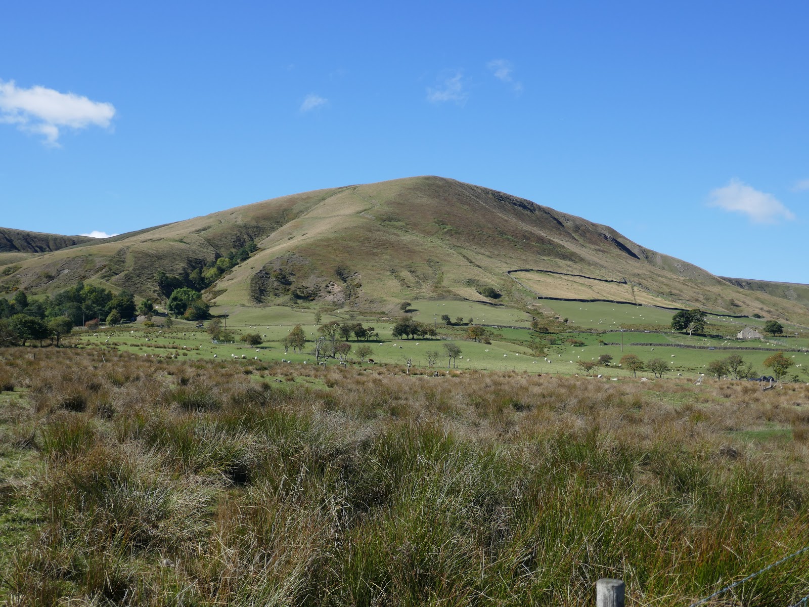
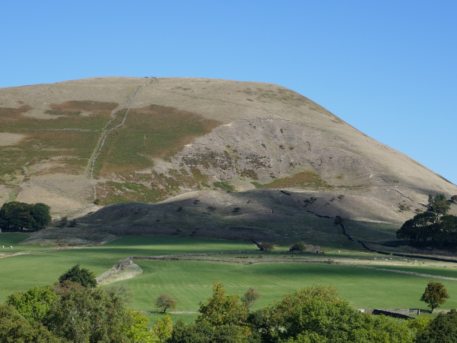
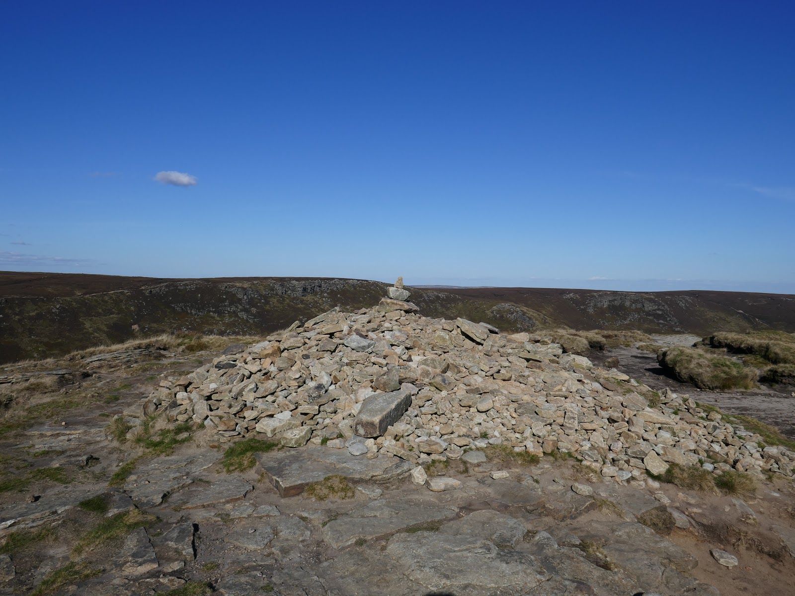
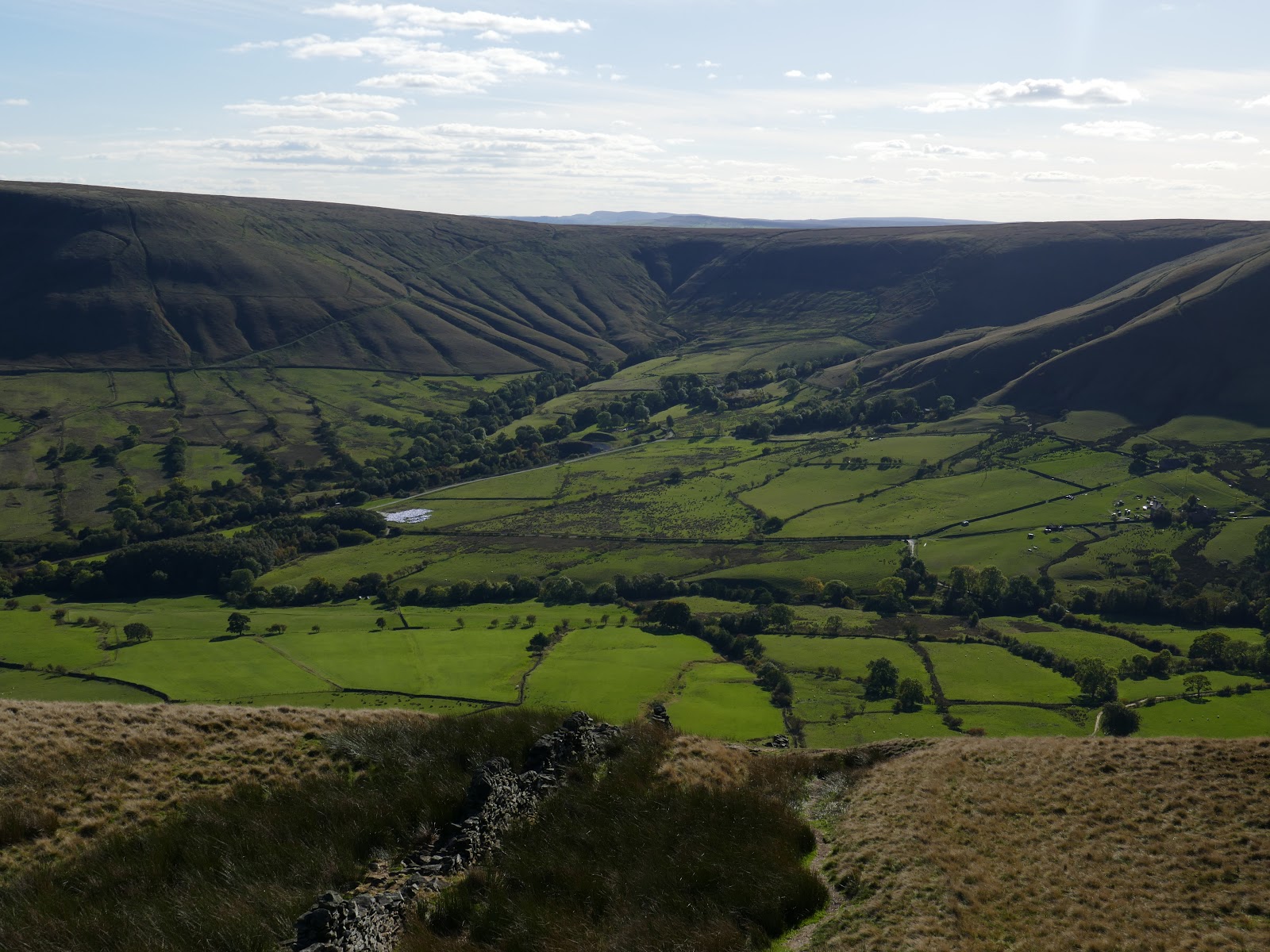
The path leads to Grindslow Knoll where it was time to make a swift descent back to Upper Booth. Heading south, a vague path crosses the open hillside until the ground begins to steepen over Broadlee-Bank Tor. I followed the line of a fence towards the valley until it met the Pennine Way. From here it’s an easy stroll back to the car park.
 |
| Grindslow Knoll |
 |
| A sizeable cairn sits atop Grindslow Knoll |
 |
| Whitemoor Clough |
 |
| The head of Edale |
 |
| The Pennine Way |
 |
| The Great Ridge |


