Open Space Web-Map builder Codehttps://openspace.ordnancesurvey.co.uk/osmapapi/openspace.js?key=3119F72552FD5C22E0530C6CA40A5A92https://openspace.ordnancesurvey.co.uk/osmapapi/script/mapbuilder/basicmap.jshttps://openspace.ordnancesurvey.co.uk/osmapapi/script/mapbuilder/searchbox.js//variables for routes var linesLayer, points, lineFeature, lineString, routeMarkersLayer, routepos, routesize, routeoffset, routeicon; var style_blue = {strokeColor: “#0000CD”, strokeOpacity: 0.5, strokeWidth: 4.5}; function initmapbuilder() { //initiate the map var options = {resolutions: [2500, 1000, 500, 200, 100, 50, 25, 10, 5, 4, 2.5, 2, 1]}; osMap = new OpenSpace.Map(‘map’, options); //configure map options (basicmap.js) setglobaloptions(); //set the center of the map and the zoom level osMap.setCenter(new OpenSpace.MapPoint(418110.5,386308.5),7); linesLayer = osMap.getVectorLayer(); // Set up layer for route markers routeMarkersLayer = new OpenLayers.Layer.Markers(“Route Markers”); //make a route points = new Array(); points.push(new OpenLayers.Geometry.Point(420186,385956)); points.push(new OpenLayers.Geometry.Point(420166,385876)); points.push(new OpenLayers.Geometry.Point(420194,385628)); points.push(new OpenLayers.Geometry.Point(420142,385452)); points.push(new OpenLayers.Geometry.Point(419877,385472)); points.push(new OpenLayers.Geometry.Point(419737,385462)); points.push(new OpenLayers.Geometry.Point(419707,385527)); points.push(new OpenLayers.Geometry.Point(419742,385632)); points.push(new OpenLayers.Geometry.Point(419707,385767)); points.push(new OpenLayers.Geometry.Point(419647,385972)); points.push(new OpenLayers.Geometry.Point(419537,386102)); points.push(new OpenLayers.Geometry.Point(419367,386132)); points.push(new OpenLayers.Geometry.Point(419277,386092)); points.push(new OpenLayers.Geometry.Point(419107,386092)); points.push(new OpenLayers.Geometry.Point(418737,386017)); points.push(new OpenLayers.Geometry.Point(418682,385957)); points.push(new OpenLayers.Geometry.Point(418422,385957)); points.push(new OpenLayers.Geometry.Point(418182,385992)); points.push(new OpenLayers.Geometry.Point(417932,386217)); points.push(new OpenLayers.Geometry.Point(417772,386527)); points.push(new OpenLayers.Geometry.Point(417582,386712)); points.push(new OpenLayers.Geometry.Point(417272,386832)); points.push(new OpenLayers.Geometry.Point(416877,387002)); points.push(new OpenLayers.Geometry.Point(416722,387092)); points.push(new OpenLayers.Geometry.Point(416467,387322)); points.push(new OpenLayers.Geometry.Point(416372,387497)); points.push(new OpenLayers.Geometry.Point(416337,387682)); points.push(new OpenLayers.Geometry.Point(416332,387862)); points.push(new OpenLayers.Geometry.Point(416257,387987)); points.push(new OpenLayers.Geometry.Point(416147,387797)); points.push(new OpenLayers.Geometry.Point(416167,387627)); points.push(new OpenLayers.Geometry.Point(416097,387432)); points.push(new OpenLayers.Geometry.Point(416277,387207)); points.push(new OpenLayers.Geometry.Point(416502,386892)); points.push(new OpenLayers.Geometry.Point(416757,386622)); points.push(new OpenLayers.Geometry.Point(416912,386462)); points.push(new OpenLayers.Geometry.Point(417137,386162)); points.push(new OpenLayers.Geometry.Point(417197,386047)); points.push(new OpenLayers.Geometry.Point(417267,385797)); points.push(new OpenLayers.Geometry.Point(417547,385392)); points.push(new OpenLayers.Geometry.Point(417707,385122)); points.push(new OpenLayers.Geometry.Point(417872,384982)); points.push(new OpenLayers.Geometry.Point(418137,385007)); points.push(new OpenLayers.Geometry.Point(418372,385042)); points.push(new OpenLayers.Geometry.Point(418647,385087)); points.push(new OpenLayers.Geometry.Point(418772,385062)); points.push(new OpenLayers.Geometry.Point(418852,385122)); points.push(new OpenLayers.Geometry.Point(419192,385082)); points.push(new OpenLayers.Geometry.Point(419712,385032)); points.push(new OpenLayers.Geometry.Point(419779.5,385022)); points.push(new OpenLayers.Geometry.Point(419794.5,384959.5)); points.push(new OpenLayers.Geometry.Point(419832,384967)); points.push(new OpenLayers.Geometry.Point(419910.5,384926)); points.push(new OpenLayers.Geometry.Point(419850.5,385141)); points.push(new OpenLayers.Geometry.Point(420040.5,385316)); points.push(new OpenLayers.Geometry.Point(420105.5,385321)); points.push(new OpenLayers.Geometry.Point(420125.5,385343.5)); points.push(new OpenLayers.Geometry.Point(420155.5,385483.5)); points.push(new OpenLayers.Geometry.Point(420193,385606)); points.push(new OpenLayers.Geometry.Point(420168,385863.5)); points.push(new OpenLayers.Geometry.Point(420186,385956)); // create a polyline feature from the array of points lineString = new OpenLayers.Geometry.LineString(points); lineFeature = new OpenLayers.Feature.Vector(lineString, null, style_blue); linesLayer.addFeatures([lineFeature]); //crate a route start/end marker routepos = new OpenSpace.MapPoint(420186,385956); routesize = new OpenLayers.Size(33,45); routeoffset = new OpenLayers.Pixel(-5,-37); routeicon = new OpenSpace.Icon(‘https://openspace.ordnancesurvey.co.uk/osmapapi/img_versions/img_1.1/mapbuilder/routemarker-startend.png’, routesize, routeoffset, null, null); routeMarkersLayer.addMarker(new OpenLayers.Marker(routepos, routeicon)); osMap.addLayer(routeMarkersLayer);}
Route: Heatherdene, Ladybower dam, The Springs, Wiseman Hey Clough Plantation, Woodlands Valley, Hope Cross, Roman Road, Hope Brink, Thornhill Brink, Winhill Pike, Parkin Clough, Yorkshire Bridge, Heatherdene
Date: 18/08/2018
From: Heatherdene
Parking: Heatherdene
Start Point: Ladybower dam
Region: Peak District – Dark Peak
Route length: 7.9 miles (12.7 km)
Time taken: 02:50
Average speed: 2.8 mph
Ascent: 611m
Descent: 622m
Summits: Win Hill (462m)
Other points of interest: Ladybower, Hope Cross, Parkin Clough
I was in search of an easy days walking after wind and rain dashed any hopes of a decent weekend in the Lake District. After scouring the map searching for somewhere new I cast my eyes upon the Peak District – close to home but still offering the chance of new adventures. Despite an uninspiring forecast, I decided that Win Hill was deserving of my attention.
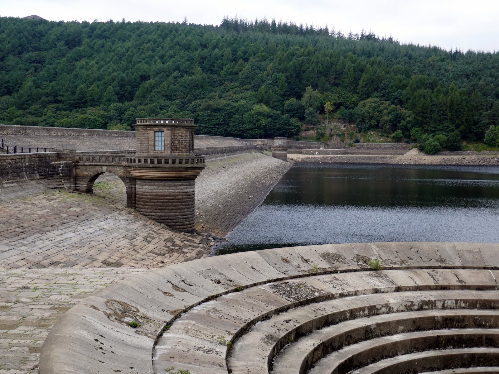
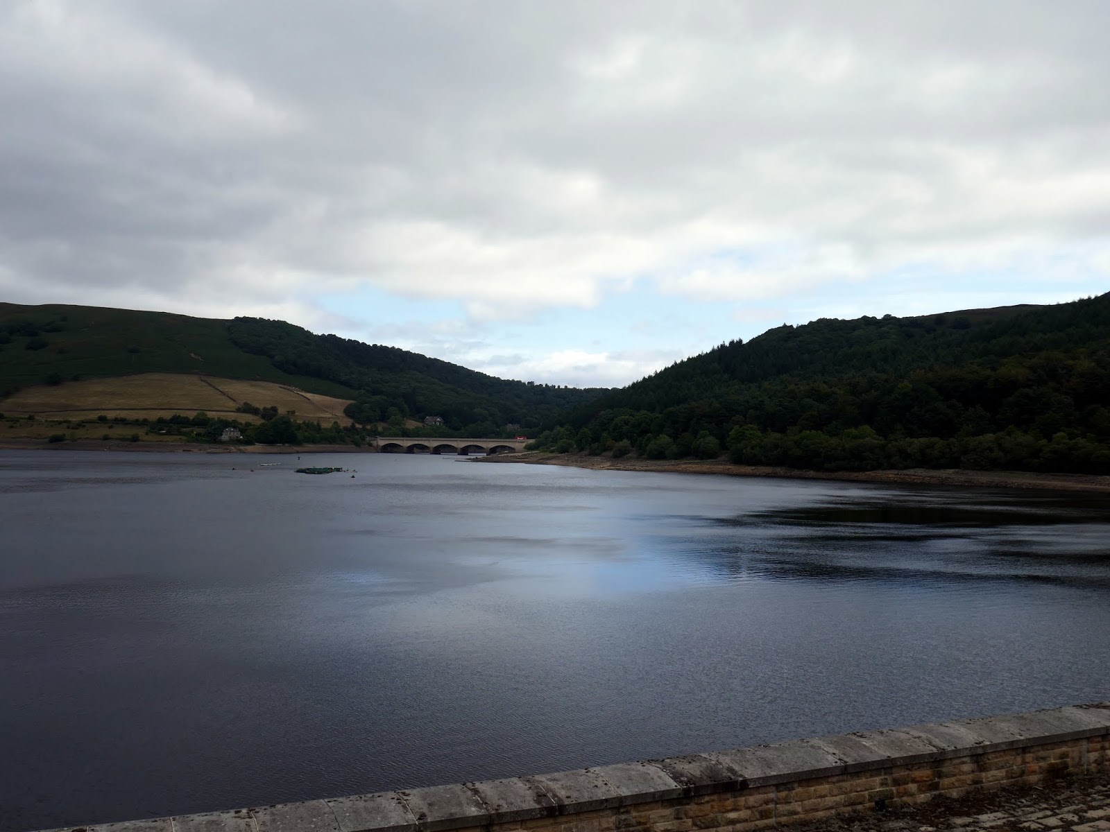
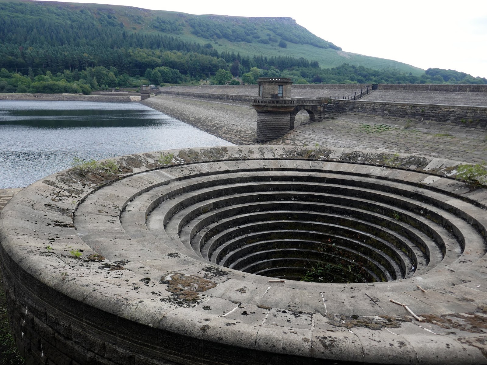
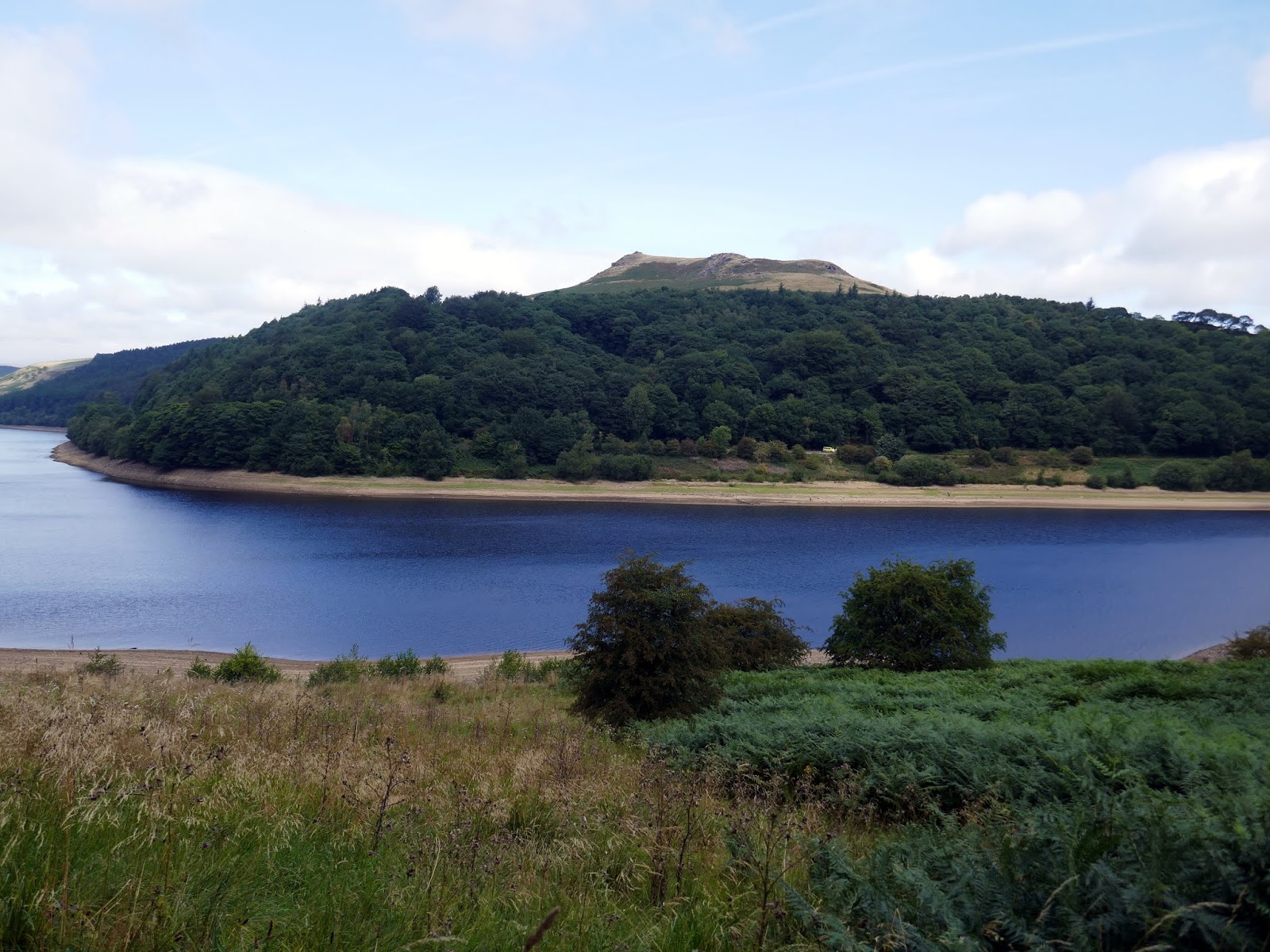
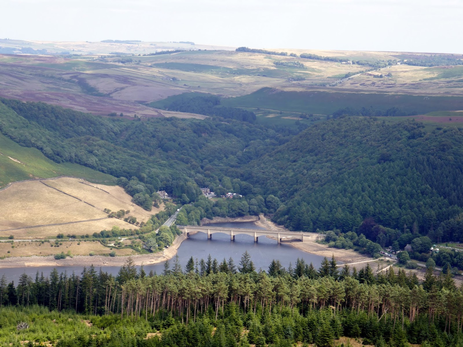
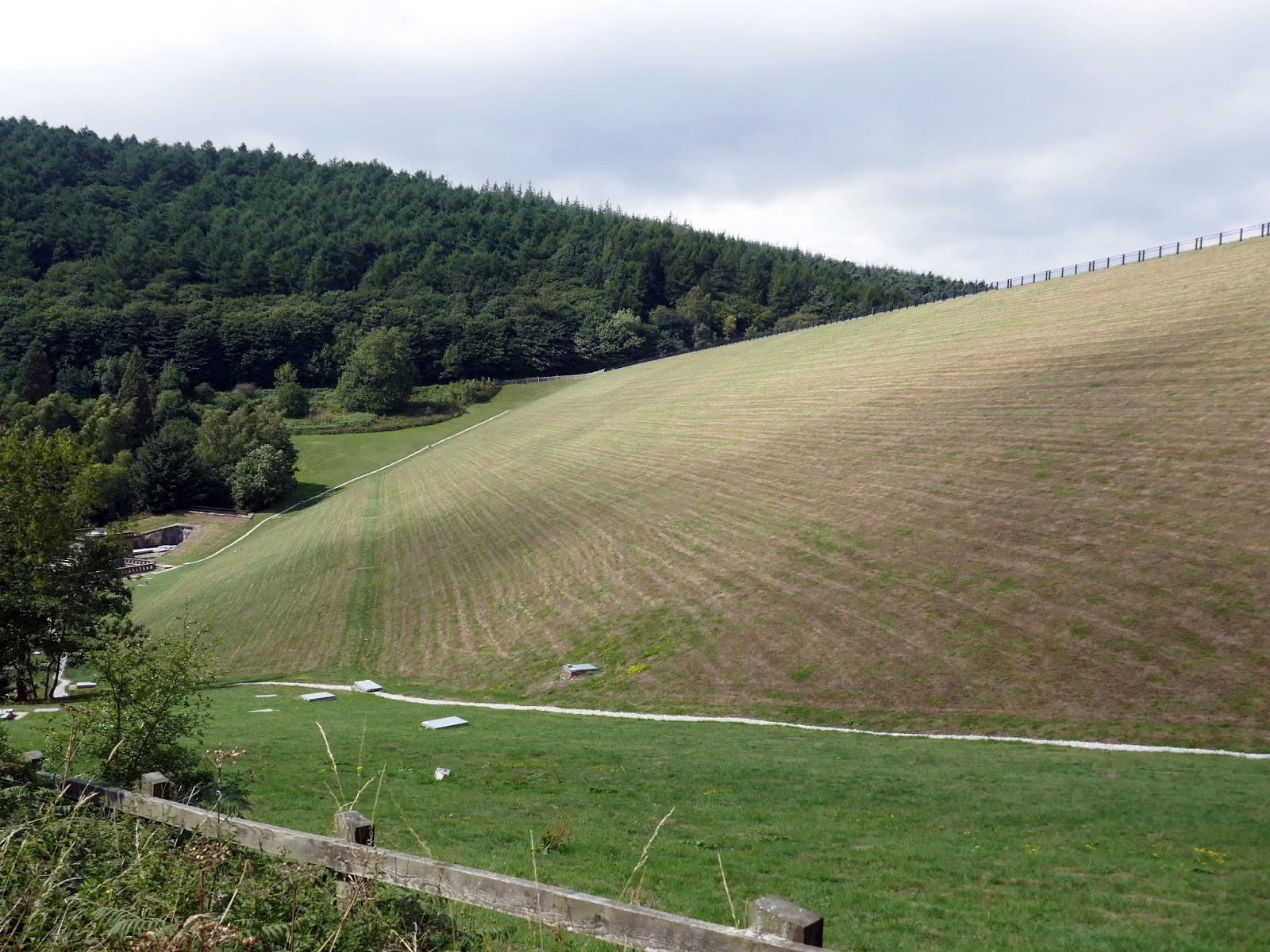
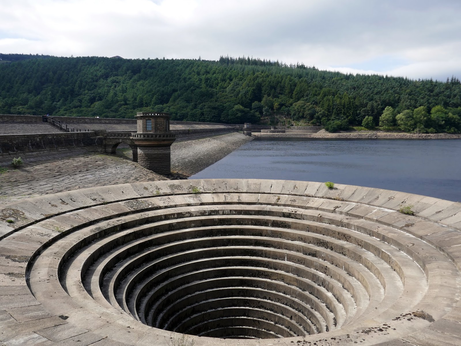
I parked up at Heatherdene which charges a respectable £3 for the entire day. Leaving the car park, I made my way along the road to the dam at the bottom end of Ladybower Reservoir, peering over the wall to have a look at the immense overflow that acts like a plug hole, although this one is on a much larger scale. A bridleway leads across the top of the dam holding back the water.
 |
| Ladybower and Crook Hill |
 |
| The Ladybower dam |
 |
| The earth dam and outlet structure |
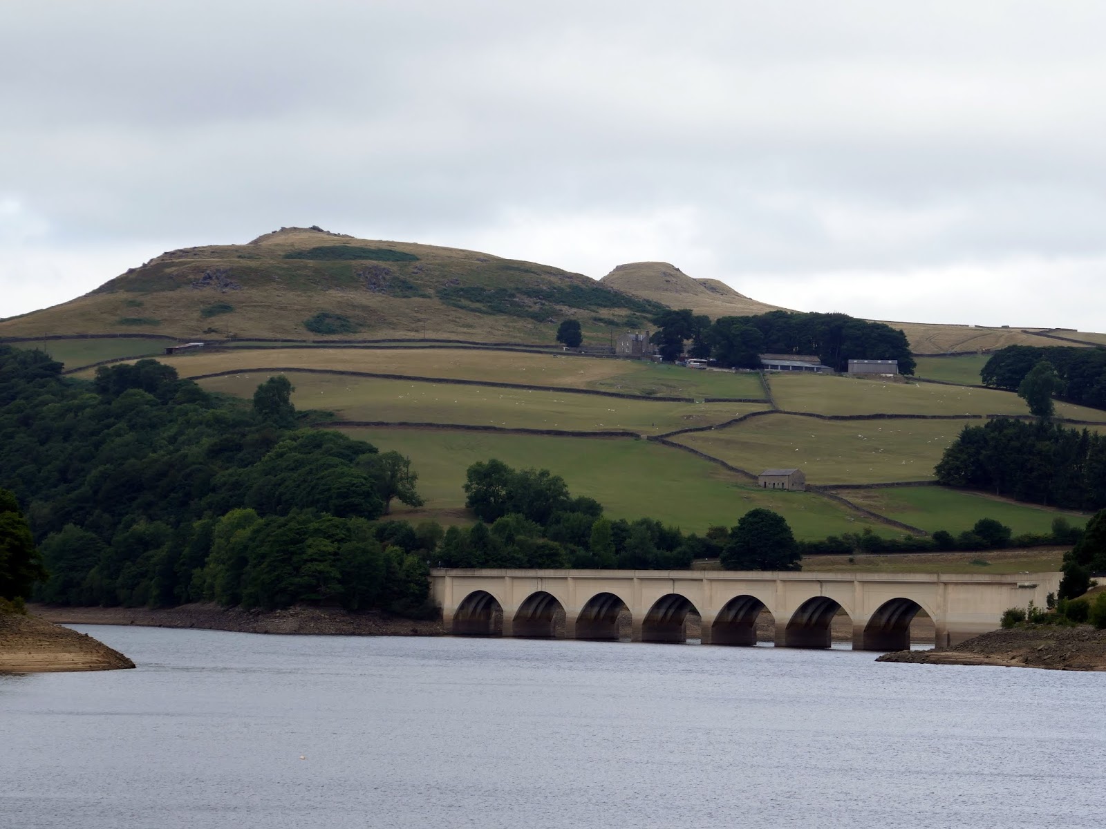
Ladybower was built between 1935 and 1943 by the Derwent Valley Water Board to supplement the other two reservoirs in supplying the water needs of the East Midlands.
 |
| Ladybower |
Despite the construction of the Howden and Derwent reservoirs, demand continued to grow and the decision was taken to build one very large reservoir, to be called Ladybower. This entailed the flooding of the villages of Ashopton and Derwent and caused considerable unrest. However, the project went ahead and the villagers were moved to houses built specially for them at Yorkshire Bridge.
The packhorse bridge that stood near to the gates of Derwent Hall, which had a Preservation Order on it, was moved stone by stone and rebuilt at Slippery Stones at the head of the Howden Reservoir. All the graves in the churchyard were excavated and the bodies reburied in nearby Bamford churchyard.
A few properties built on slightly higher land, including the Shooting Lodge and former Roman Catholic School, survived. But the majority were demolished and flooded, leaving the church spire eerily poking out above the waters. The flooding was completed in 1945, and the opening ceremony was carried out on Tuesday, September 25th 1945 by King George VI. Two years later the church spire was destroyed.
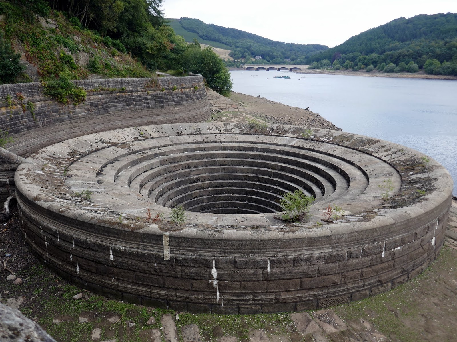
 |
| One of the two over overflows |
 |
| Ladybower dam |
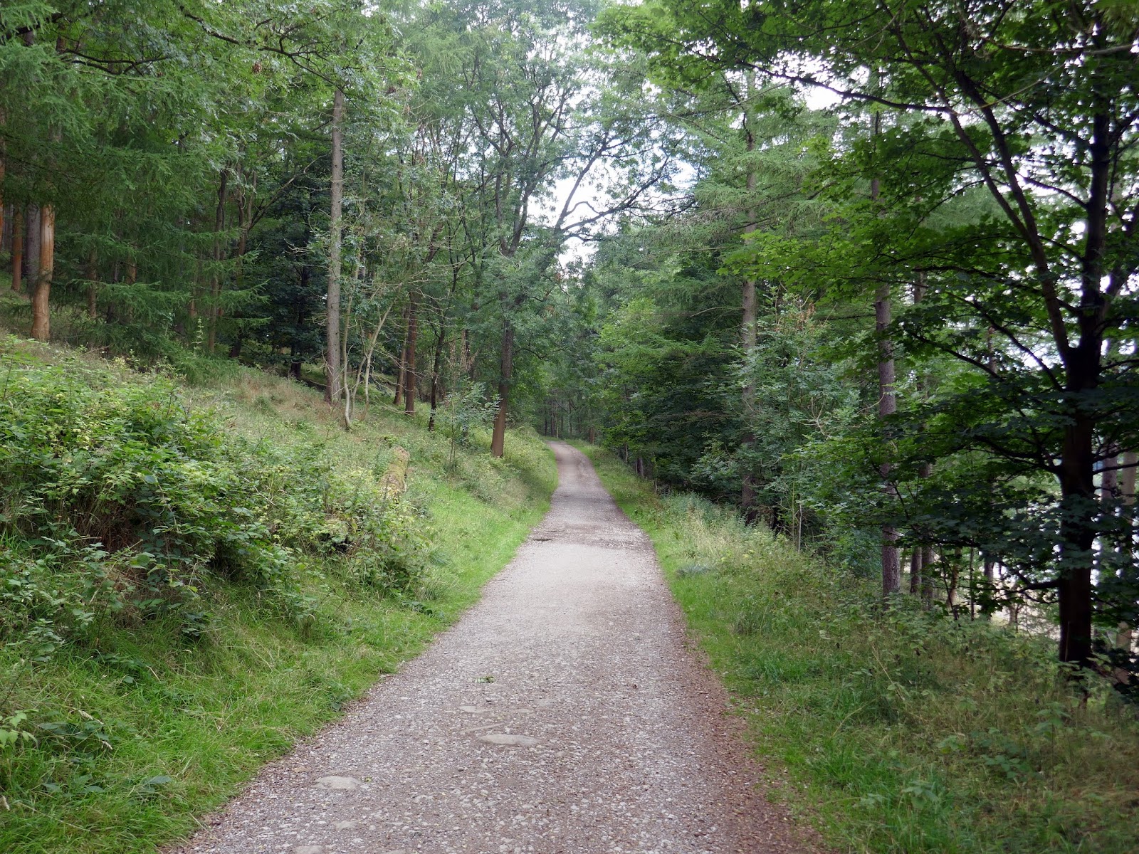
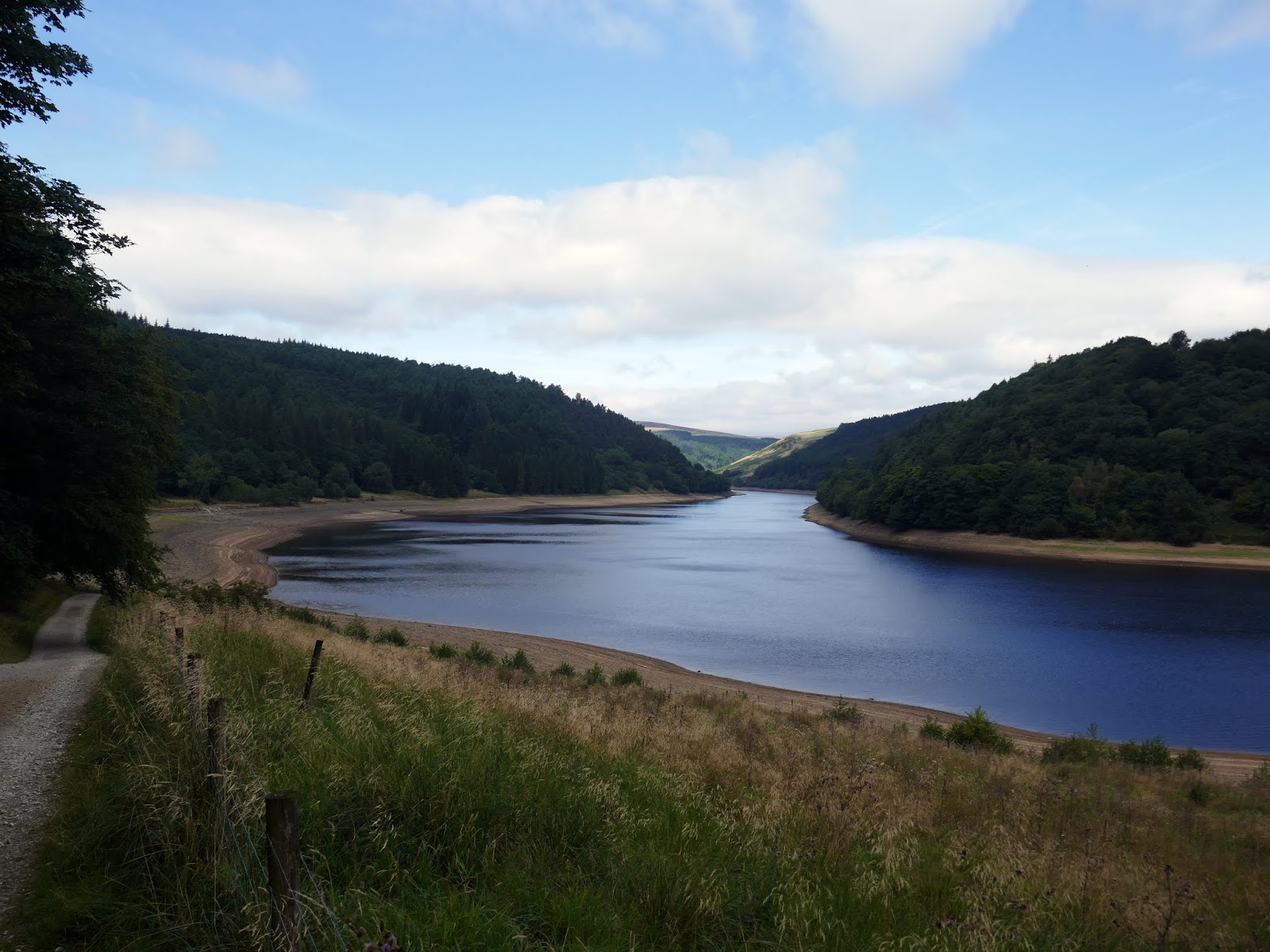
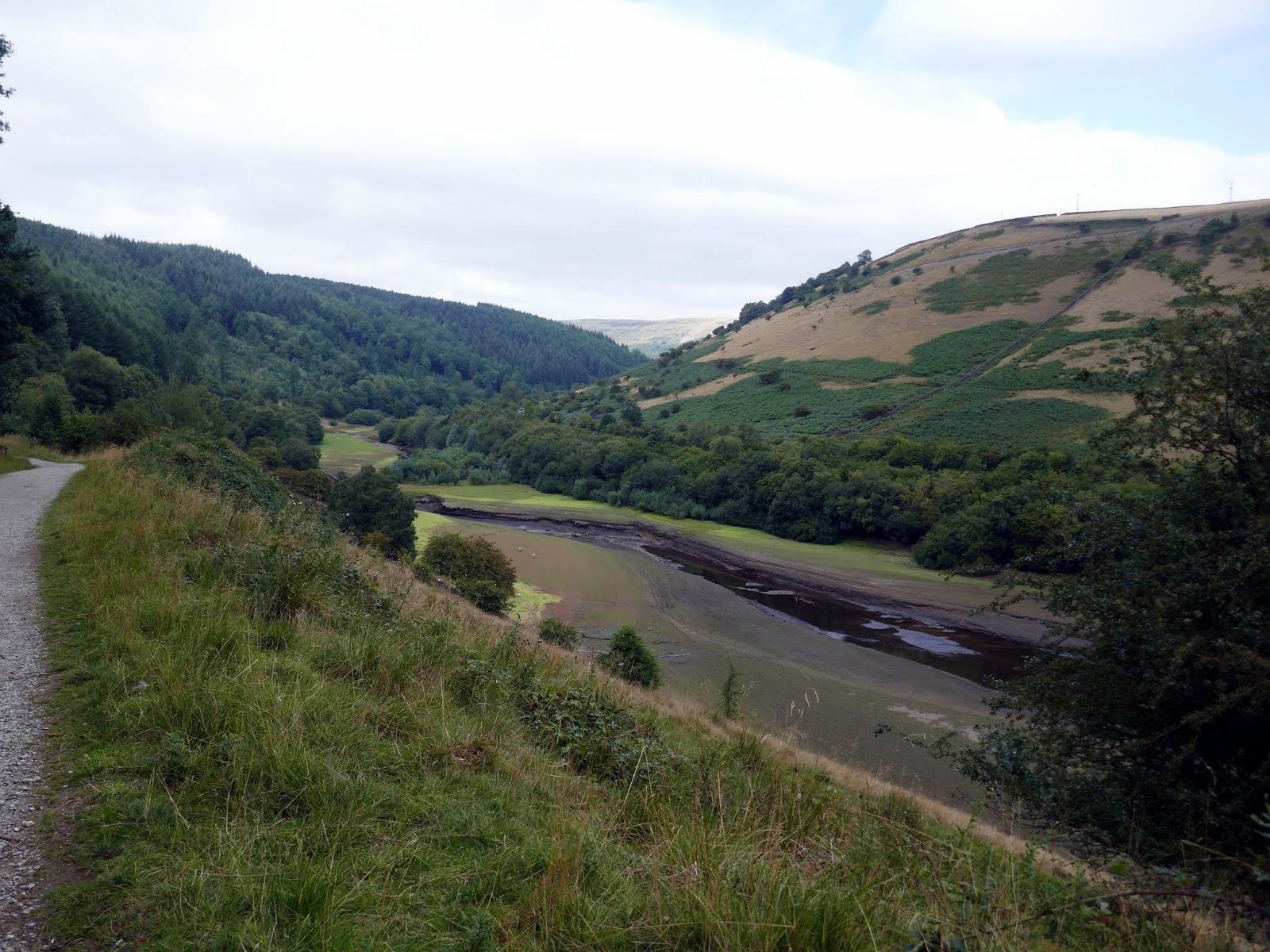
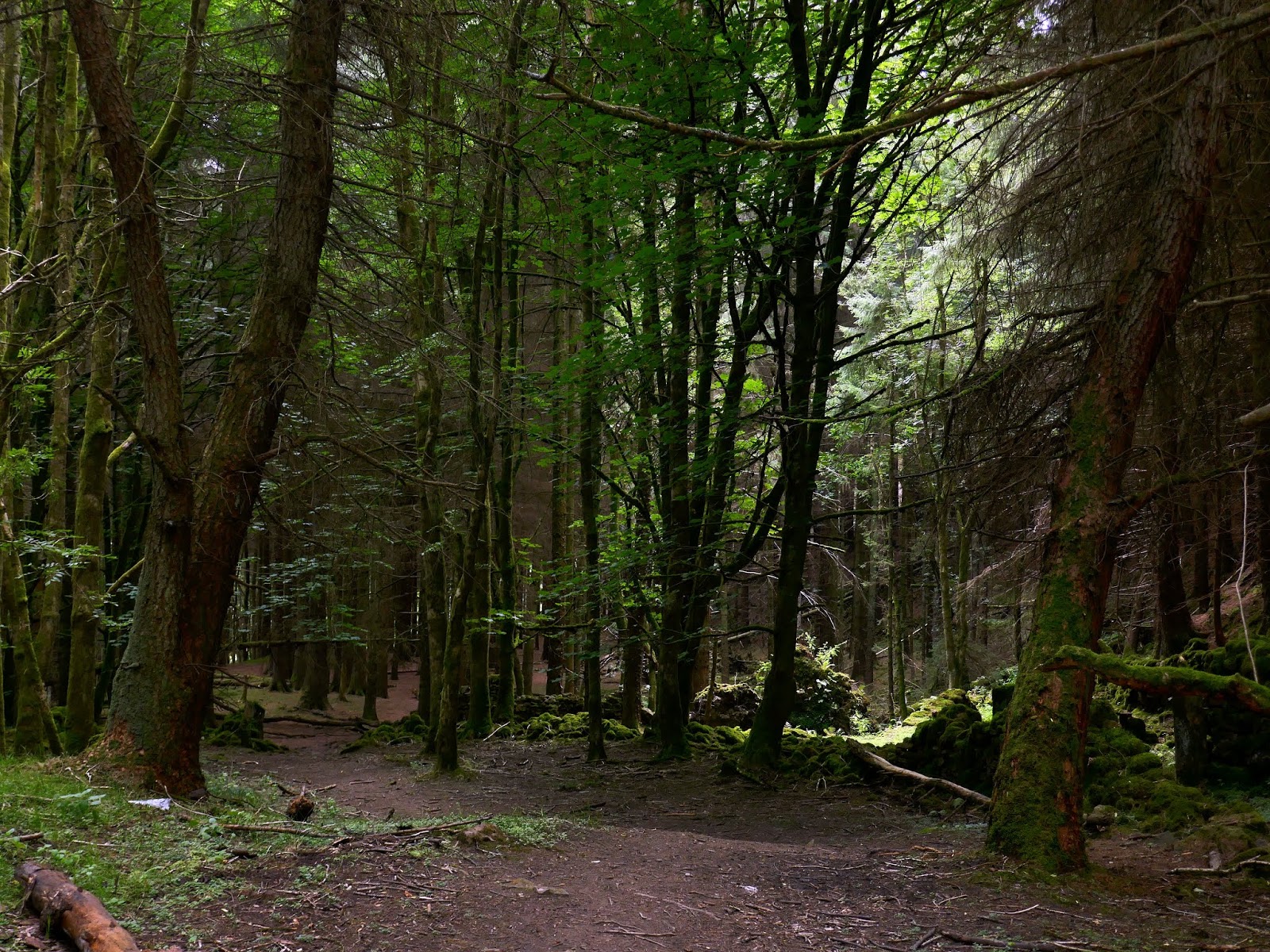
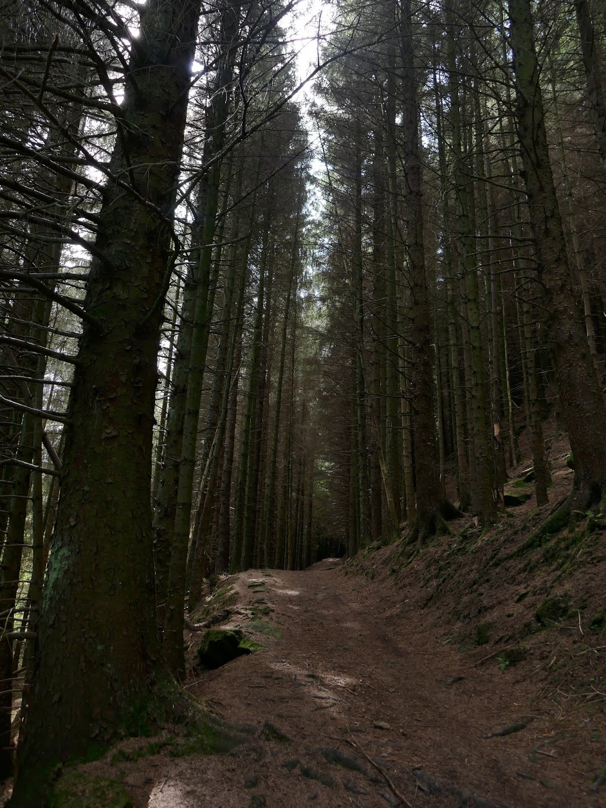
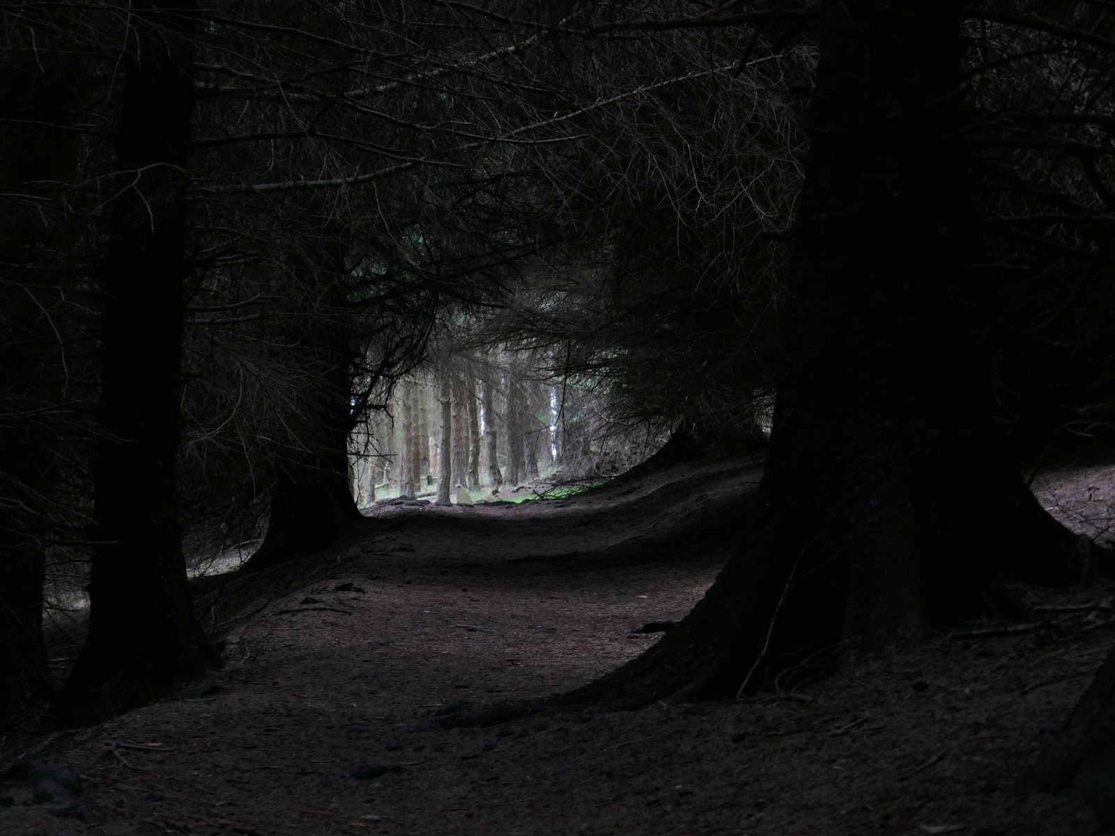
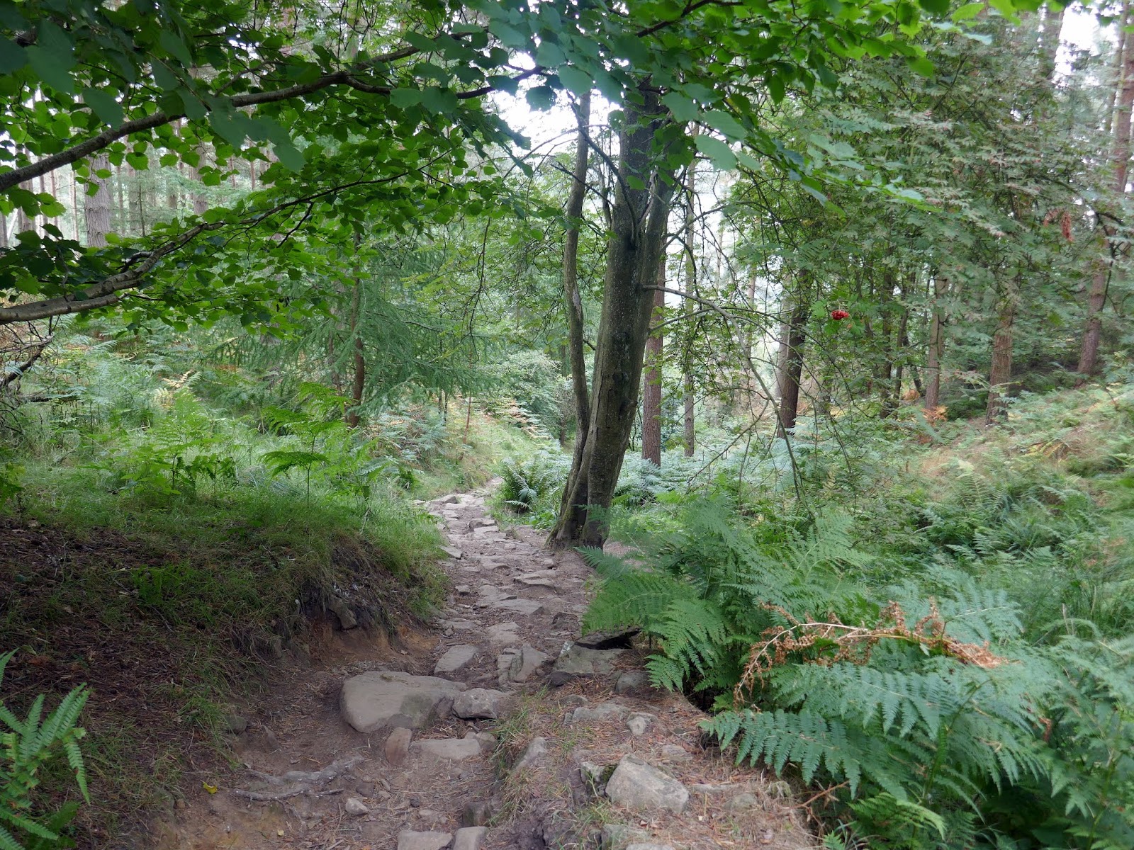
A number of surfaced tracks follow the curves of Ladybower and make for some speedy walking. After crossing the dam, I followed the undulating track north as it heads along the southwestern side of the reservoir, eventually reaching the point where the River Ashop flows in. Here a path cuts up through the trees, passing a series of derelict buildings and makes for Hope Cross.
 |
| The path at The Springs |
 |
| Crook Hill |
 |
| Ladybowers western arm |
 |
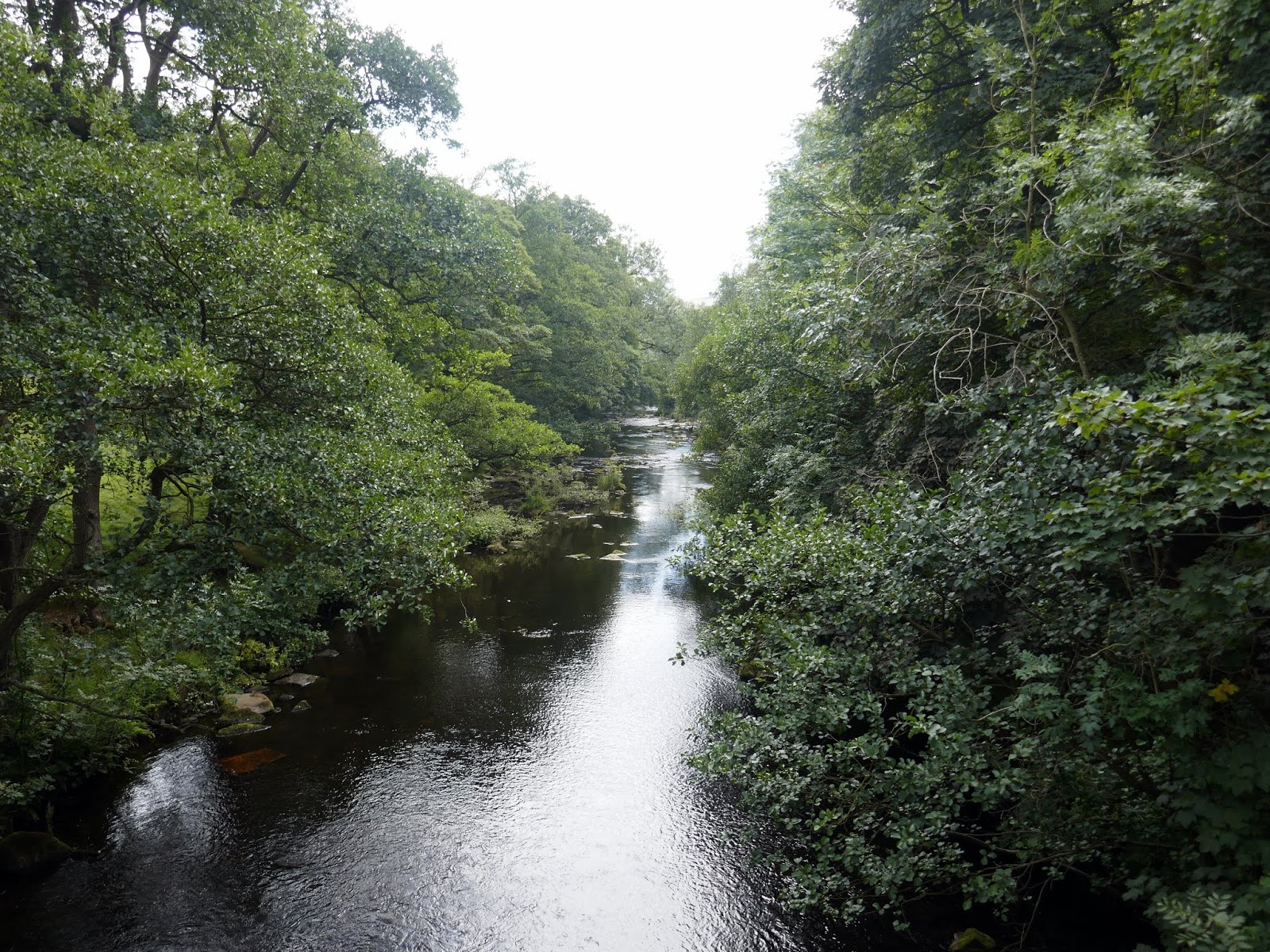
| The River Ashop |
 |
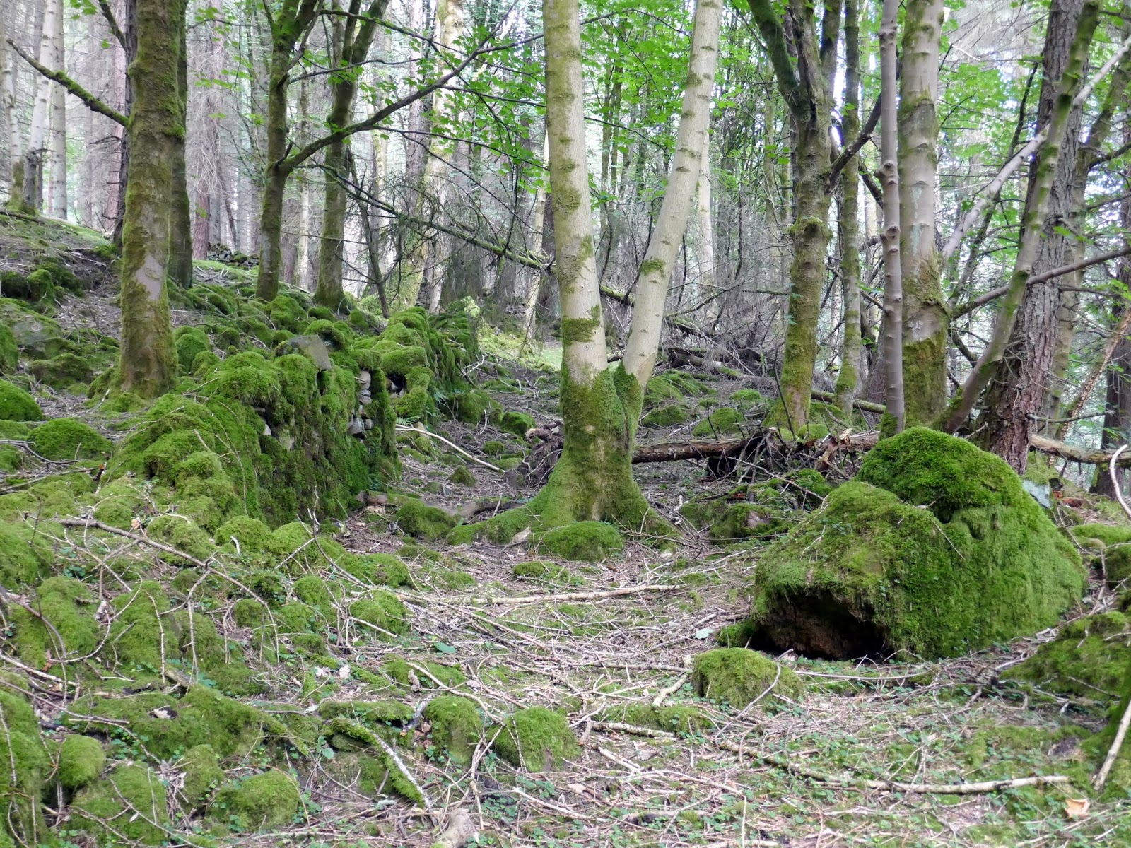
| Trees close to Hagglee |
 |
| Woods near Hagglee |
 |
| The path up through the trees |
 |
| Appraoching the Hope Cross |
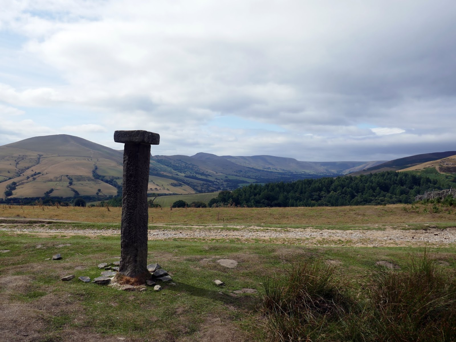
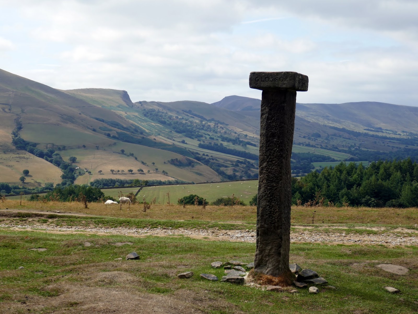
Hope cross lies at the crossroads of an important ancient packhorse route through the Peak District. It stands some 2m high with a square capstone bearing the names of Edale, Glossop, Hope and Sheffield on its face. The date 1737 is carved on the shaft below the Hope face and this is the date this medieval stoop was either restored or replaced. The view from the monument along Edale is quite amazing.
 |
| Hope Cross |
 |
| Hope Cross |
 |
| Panorama from Hope Cross |
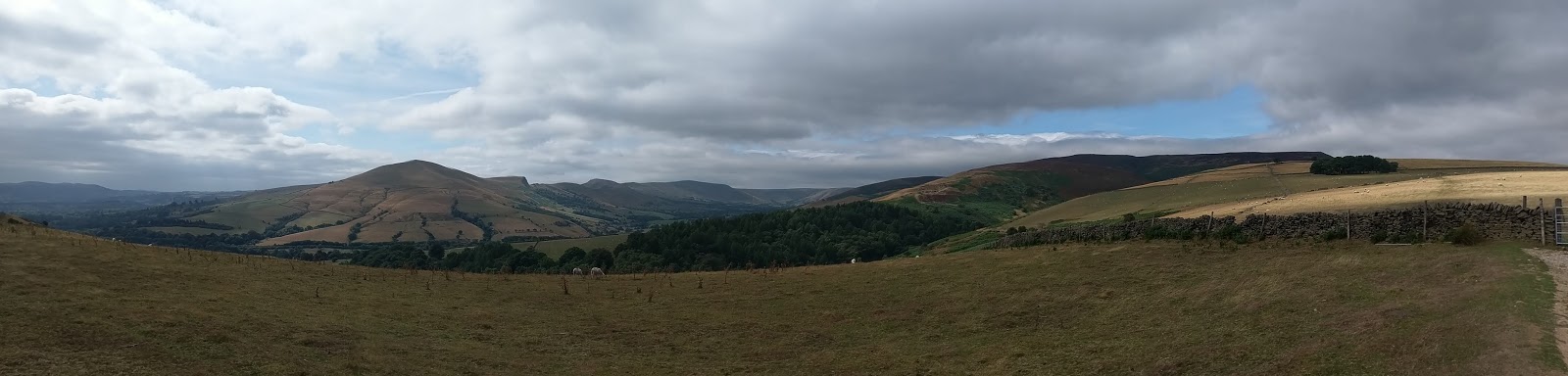
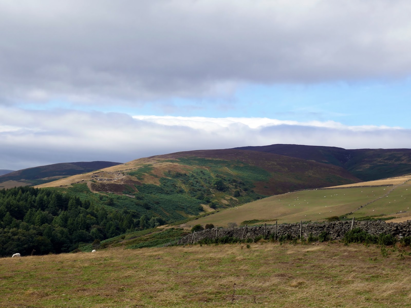
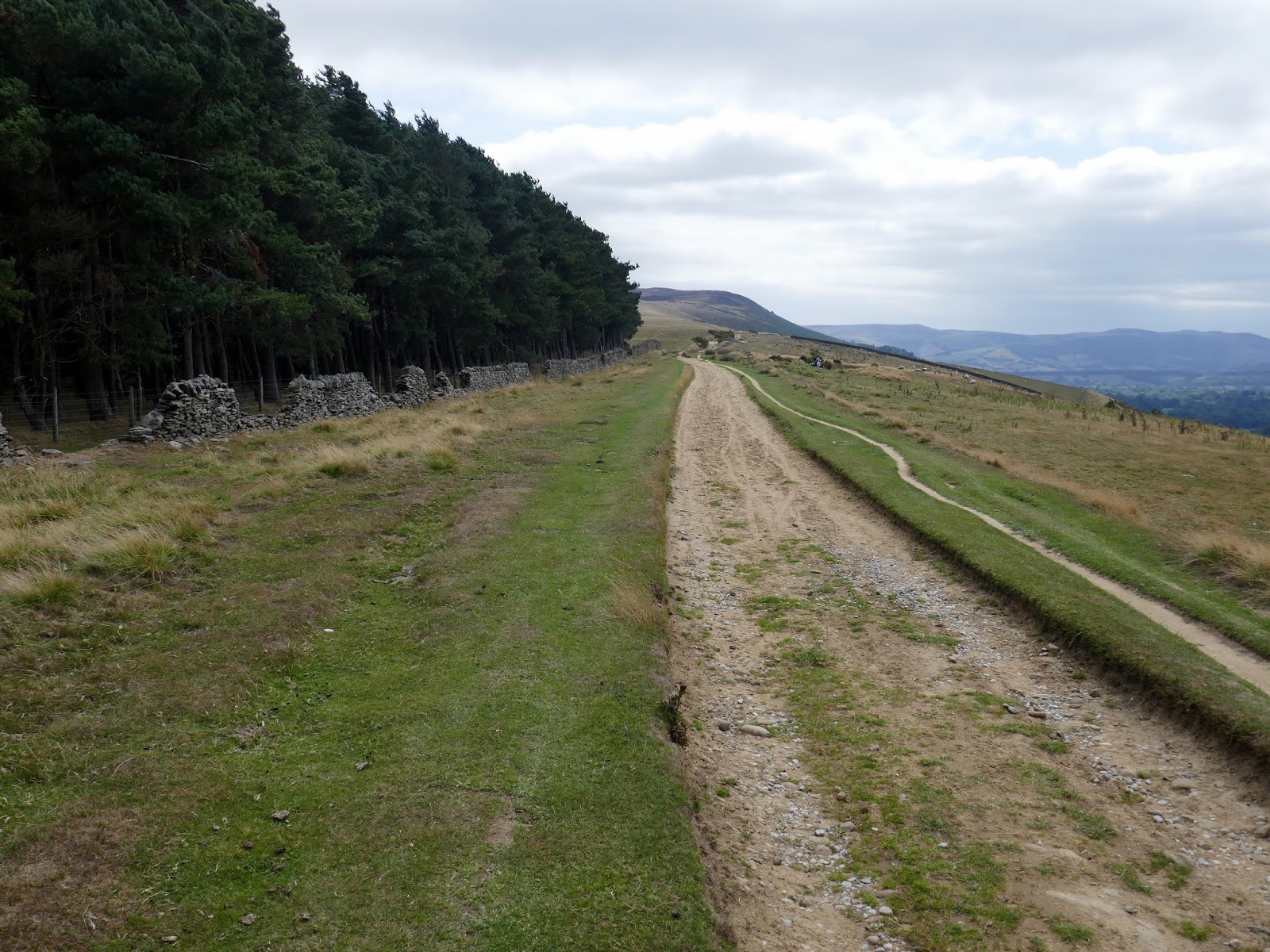
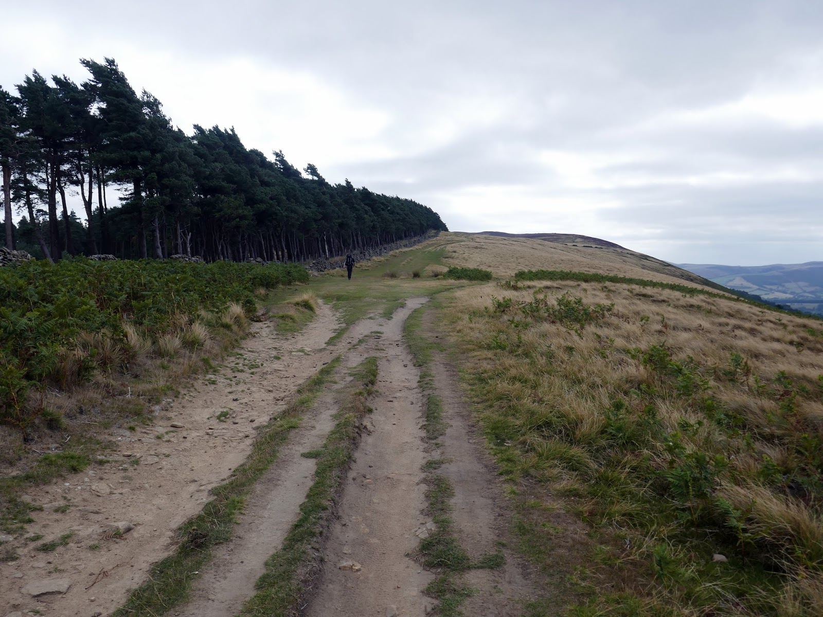
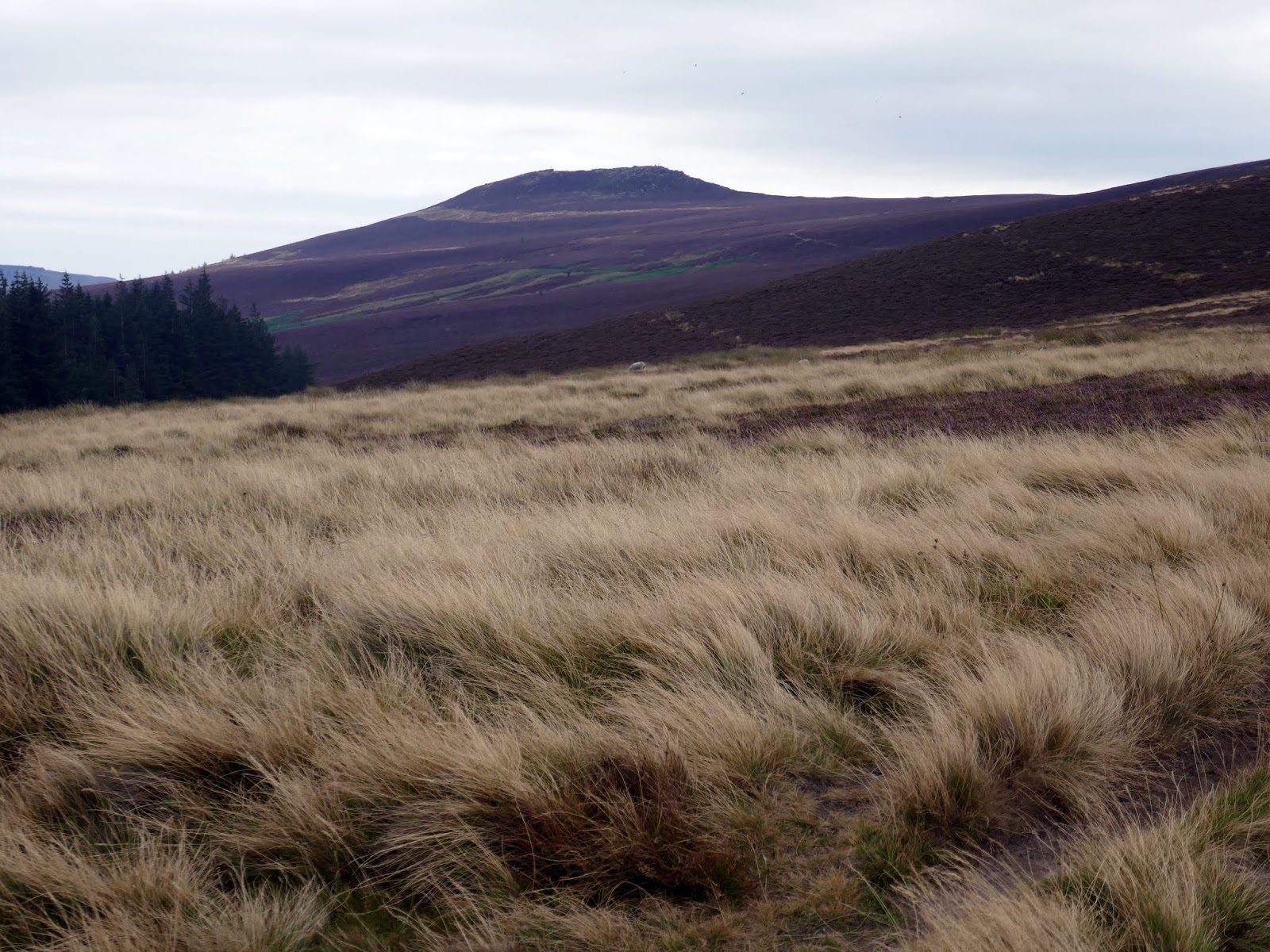
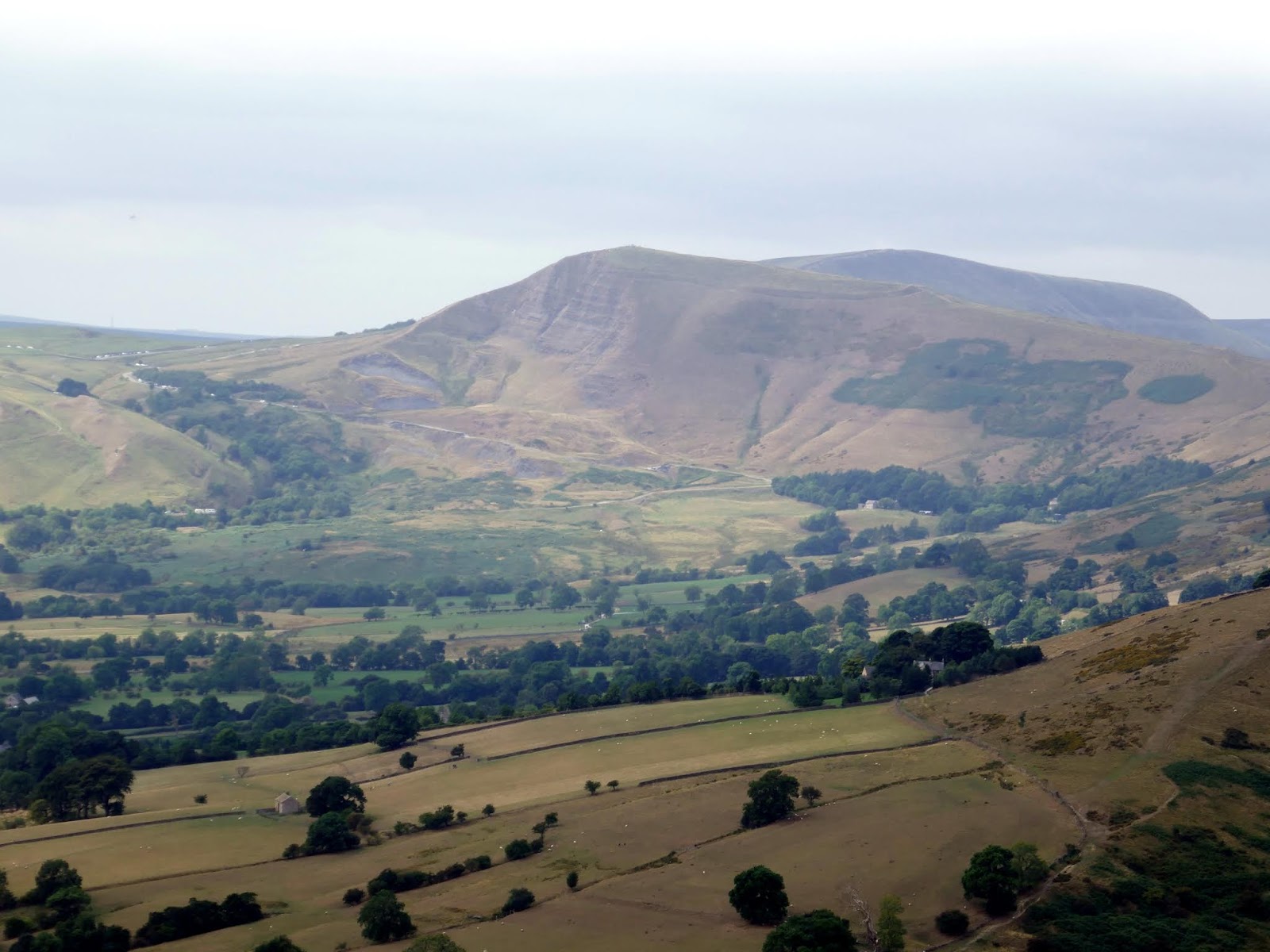
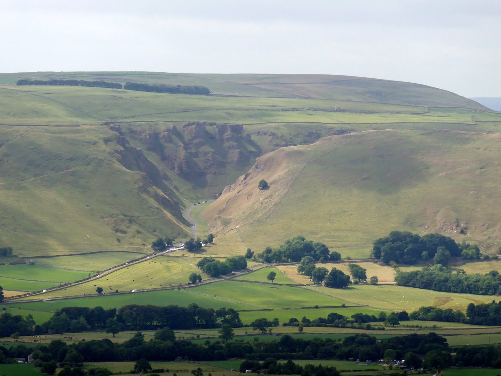
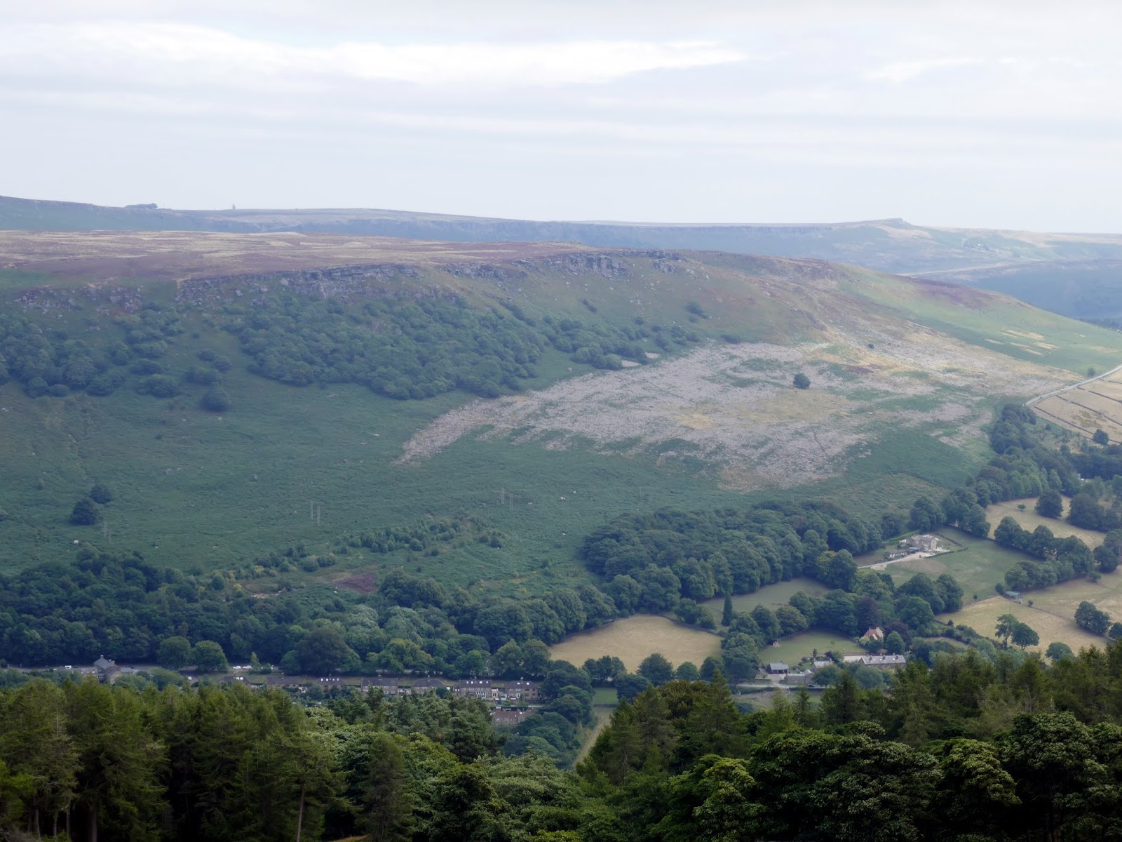
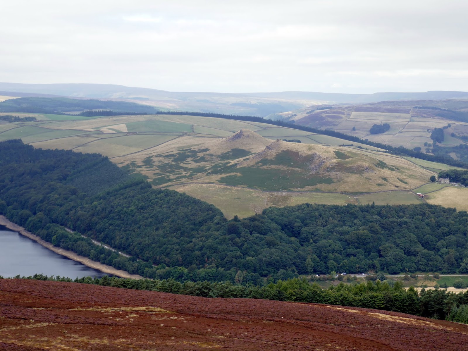
An ancient Roman Road runs along the spine of Win Hill, part of a route from Glossop over the Snake Pass to the old Roman outpost of Brough in the Hope Valley. Being an old road, the gradient is very easy as it gently climbs up to Win Hills summit – Win Hill Pike.
 |
| Cowms Moors |
 |
| The Great Ridge |
 |
| The Roman road leading towards Win Hill |
 |
| Kinder Scout |
 |
| Following the spine of the ridge |
 |
| Lose Hill and Edale |
 |
| Win Hill over Thornhill Brink |
 |
| Lose Hill and the Hope Valley |
 |
| Mam Tor |
 |
| Winnats Pass |
 |
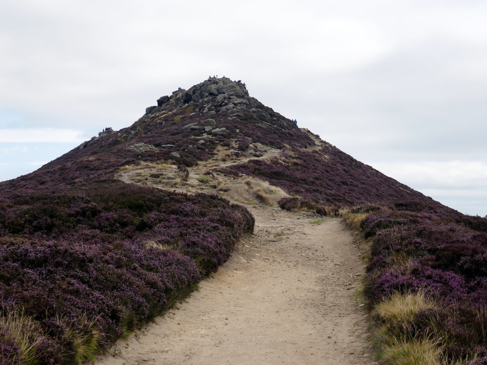
| Win Hill Pike |
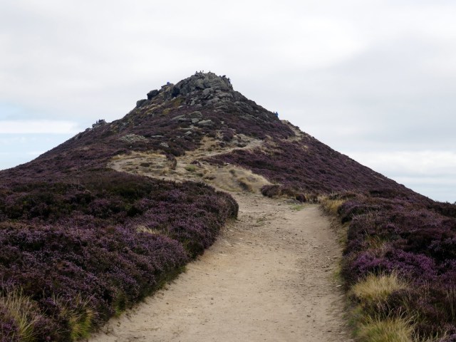
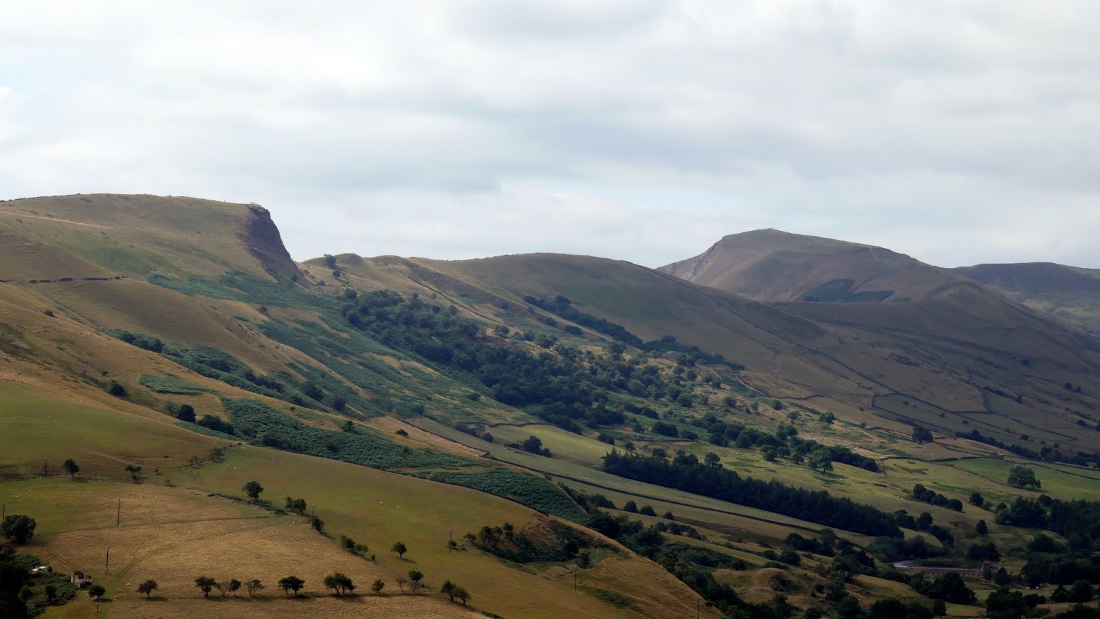
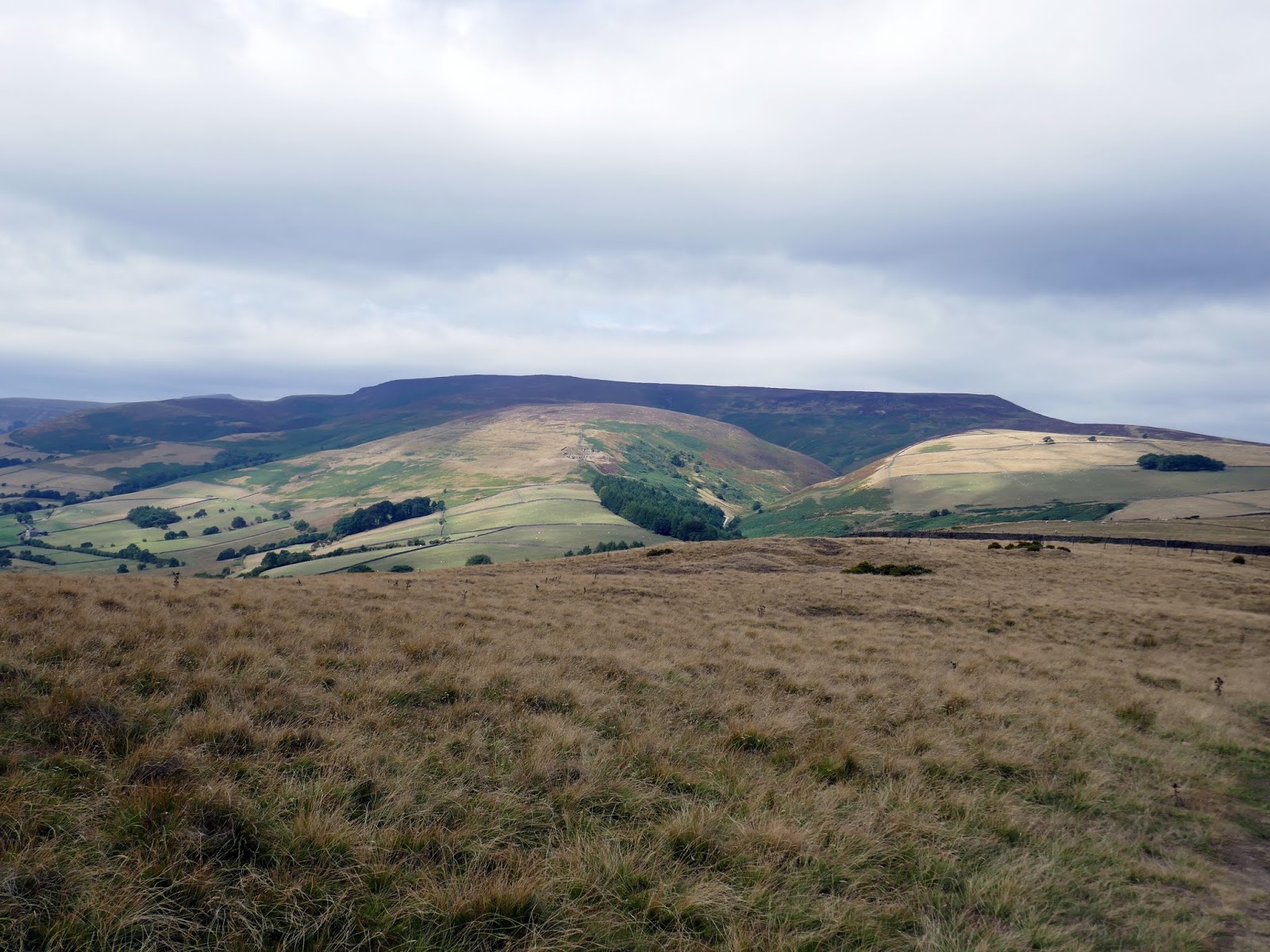
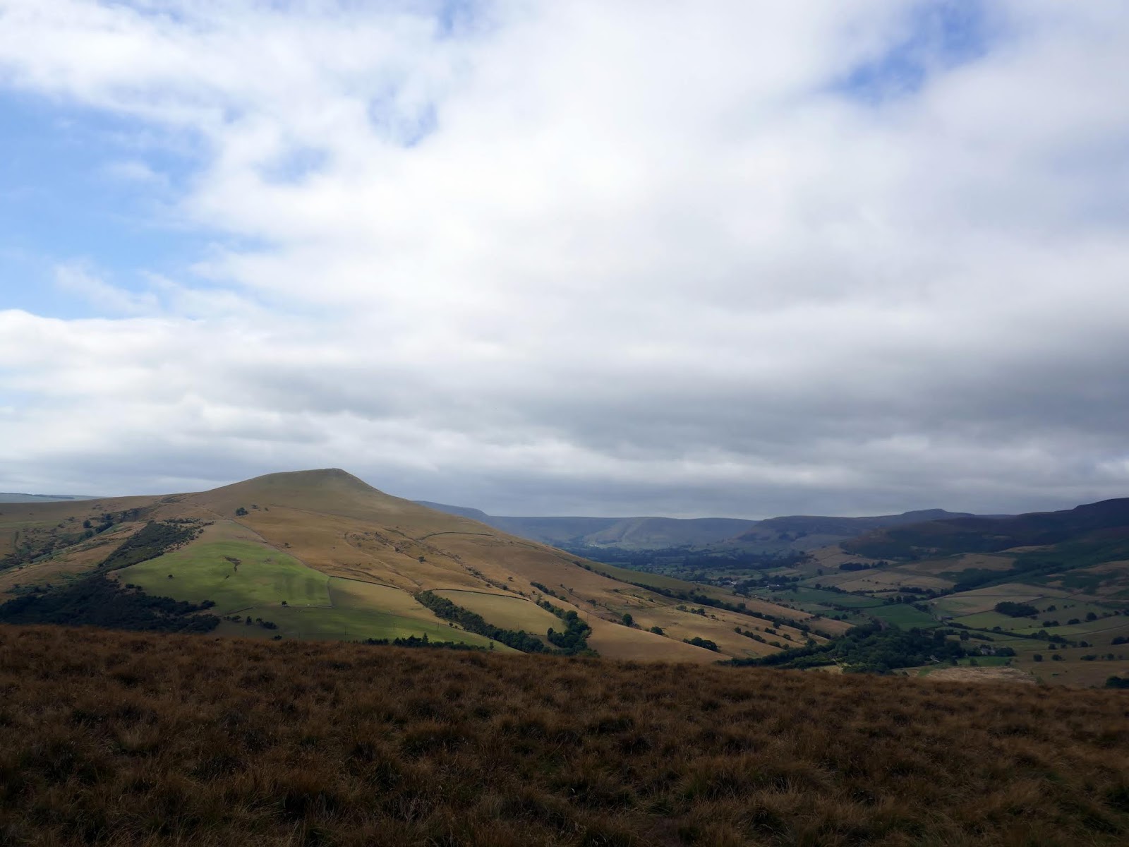
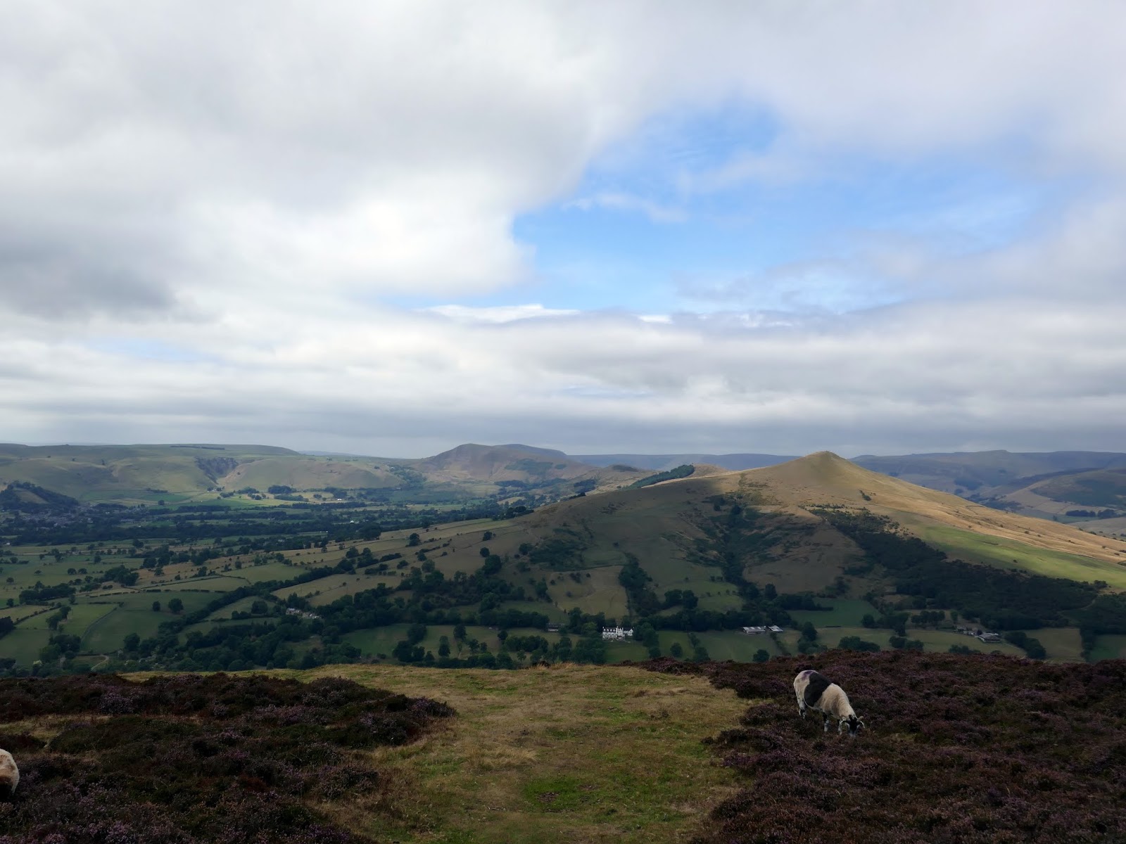
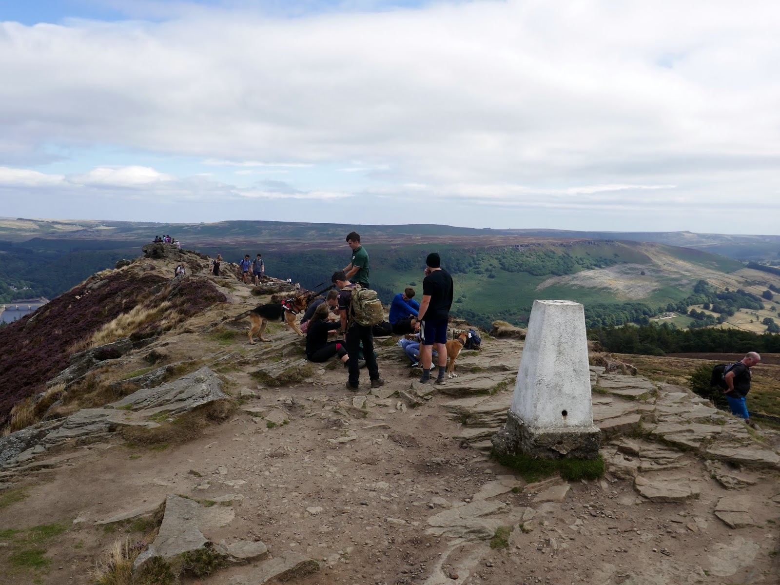
Thanks to its prominent peak and position at the end of the Hope Valley, the views from Win Hill are quite something, extending along the southern side of Kinder Scout, along Stanage Edge and right around the Hope Valley. Given the fine weather and weekend in the midst of the summer holidays, there were a fair few folk around enjoying the views.
 |
| Win Hill’s summit |
 |
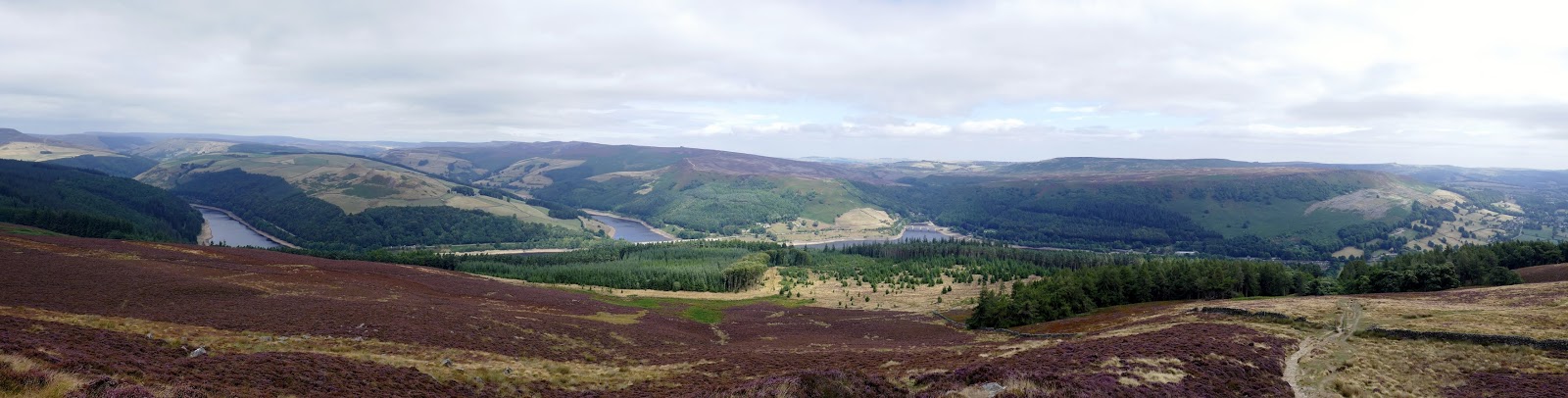
| Panorama from Win Hill |
 |
| Stanage Edge and Bamford Edge |
 |
| Ladybower |
 |
| Crook Hill |
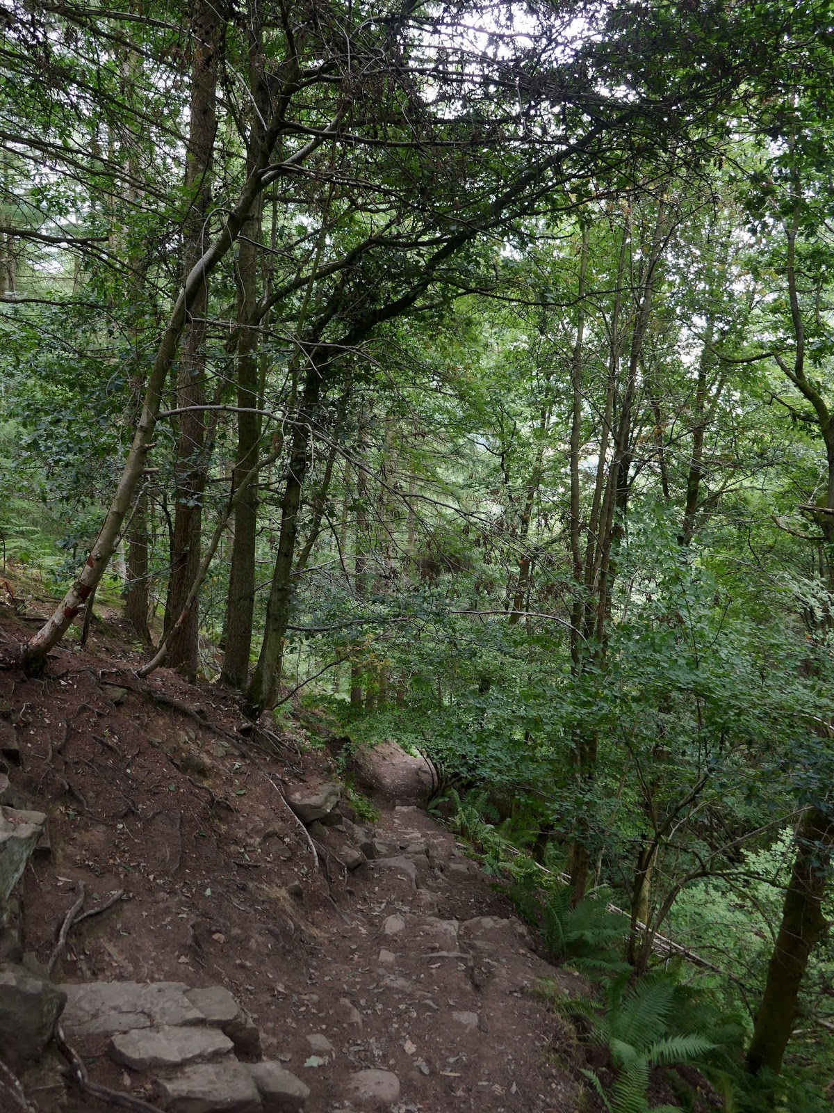
Leaving the summit behind, a path begins a swift descent back down towards Yorkshire Bridge, following the line of Parkin Clough. To say this route was steep is an understatement though the path is impressive as it clings to the side of the ravine. I’m glad I was coming down rather than heading up.
 |
| The path into the woods at Parkin Clough |
 |
| Parkin Clough |
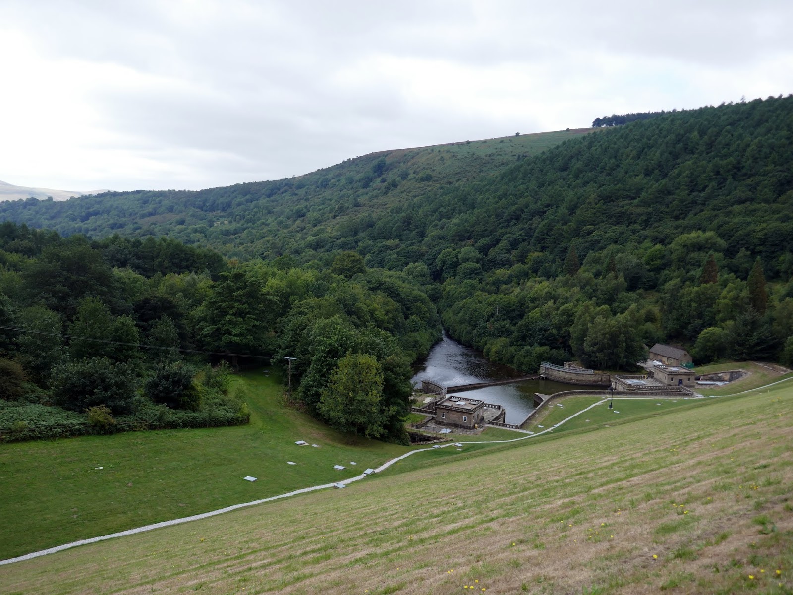
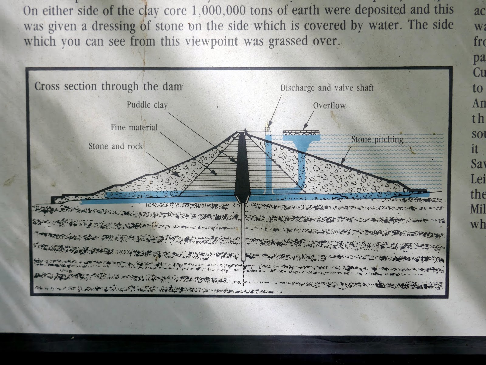
Crossing Yorkshire Bridge I followed the path to the eastern side of the River Derwent which climbs slowly beneath the earth dam of Ladybower. There’s an information board here that explains the inner workings of the dam.
 |
| The River Derwent |
 |
| Diagram of the Ladybower dam |
 |
| The dam itself |
 |
| The overflow once again |
No trip to the Hope Valley is complete without a quick trip to the excellent cafe at Outside – the perfect end to a very good day out on the hills.
