Open Space Web-Map builder Codehttps://openspace.ordnancesurvey.co.uk/osmapapi/openspace.js?key=3119F72552FD5C22E0530C6CA40A5A92https://openspace.ordnancesurvey.co.uk/osmapapi/script/mapbuilder/basicmap.jshttps://openspace.ordnancesurvey.co.uk/osmapapi/script/mapbuilder/searchbox.js//variables for routes var linesLayer, points, lineFeature, lineString, routeMarkersLayer, routepos, routesize, routeoffset, routeicon; var style_blue = {strokeColor: “#0000CD”, strokeOpacity: 0.5, strokeWidth: 4.5}; function initmapbuilder() { //initiate the map var options = {resolutions: [2500, 1000, 500, 200, 100, 50, 25, 10, 5, 4, 2.5, 2, 1]}; osMap = new OpenSpace.Map(‘map’, options); //configure map options (basicmap.js) setglobaloptions(); //set the center of the map and the zoom level osMap.setCenter(new OpenSpace.MapPoint(266093.5,359449),8); linesLayer = osMap.getVectorLayer(); // Set up layer for route markers routeMarkersLayer = new OpenLayers.Layer.Markers(“Route Markers”); //make a route points = new Array(); points.push(new OpenLayers.Geometry.Point(266307.5,360257.5)); points.push(new OpenLayers.Geometry.Point(266342.5,360147.5)); points.push(new OpenLayers.Geometry.Point(266262.5,360017.5)); points.push(new OpenLayers.Geometry.Point(266332.5,359957.5)); points.push(new OpenLayers.Geometry.Point(266397.5,359917.5)); points.push(new OpenLayers.Geometry.Point(266577.5,359892.5)); points.push(new OpenLayers.Geometry.Point(266552.5,359802.5)); points.push(new OpenLayers.Geometry.Point(266447.5,359647.5)); points.push(new OpenLayers.Geometry.Point(266412.5,359427.5)); points.push(new OpenLayers.Geometry.Point(266337.5,359237.5)); points.push(new OpenLayers.Geometry.Point(266202.5,359067.5)); points.push(new OpenLayers.Geometry.Point(266117.5,358952.5)); points.push(new OpenLayers.Geometry.Point(266077.5,358902.5)); points.push(new OpenLayers.Geometry.Point(266022.5,358872.5)); points.push(new OpenLayers.Geometry.Point(265992.5,358782.5)); points.push(new OpenLayers.Geometry.Point(265952.5,358572.5)); points.push(new OpenLayers.Geometry.Point(265937.5,358502.5)); points.push(new OpenLayers.Geometry.Point(265907.5,358467.5)); points.push(new OpenLayers.Geometry.Point(266012.5,358472.5)); points.push(new OpenLayers.Geometry.Point(266082.5,358592.5)); points.push(new OpenLayers.Geometry.Point(266157.5,358737.5)); points.push(new OpenLayers.Geometry.Point(266142.5,358772.5)); points.push(new OpenLayers.Geometry.Point(266102.5,358862.5)); points.push(new OpenLayers.Geometry.Point(266017.5,358937.5)); points.push(new OpenLayers.Geometry.Point(265922.5,359067.5)); points.push(new OpenLayers.Geometry.Point(265847.5,359122.5)); points.push(new OpenLayers.Geometry.Point(265687.5,359192.5)); points.push(new OpenLayers.Geometry.Point(265577.5,359392.5)); points.push(new OpenLayers.Geometry.Point(265657.5,359407.5)); points.push(new OpenLayers.Geometry.Point(265732.5,359667.5)); points.push(new OpenLayers.Geometry.Point(265807.5,359837.5)); points.push(new OpenLayers.Geometry.Point(265772.5,359972.5)); points.push(new OpenLayers.Geometry.Point(265717.5,360102.5)); points.push(new OpenLayers.Geometry.Point(265767.5,360167.5)); points.push(new OpenLayers.Geometry.Point(265810,360192.5)); points.push(new OpenLayers.Geometry.Point(265945,360197.5)); points.push(new OpenLayers.Geometry.Point(266090,360257.5)); points.push(new OpenLayers.Geometry.Point(266307.5,360257.5)); // create a polyline feature from the array of points lineString = new OpenLayers.Geometry.LineString(points); lineFeature = new OpenLayers.Feature.Vector(lineString, null, style_blue); linesLayer.addFeatures([lineFeature]); //crate a route start/end marker routepos = new OpenSpace.MapPoint(266307.5,360257.5); routesize = new OpenLayers.Size(33,45); routeoffset = new OpenLayers.Pixel(-5,-37); routeicon = new OpenSpace.Icon(‘https://openspace.ordnancesurvey.co.uk/osmapapi/img_versions/img_1.1/mapbuilder/routemarker-startend.png’, routesize, routeoffset, null, null); routeMarkersLayer.addMarker(new OpenLayers.Marker(routepos, routeicon)); osMap.addLayer(routeMarkersLayer);}
Route: Milestone Buttress, Milestone Gully, Tryfan North Ridge, Tryfan, Bwlch Tryfan, Bristly Ridge, Bristly Screes, Bwlch Tryfan
Date: 11/08/2018
From: A5 – Milestone Buttress
Parking: Laybys on A5
Start Point: Milestone Buttress
Region: Snowdonia
Route length: 3.4 miles (5.5 km)
Time taken: 06:00
Average speed: 1.5 mph
Ascent: 845m
Descent: 861m
Summits: Tryfan (917m)
Other points of interest: Milestone Gully, The Cannon, Bristly Ridge
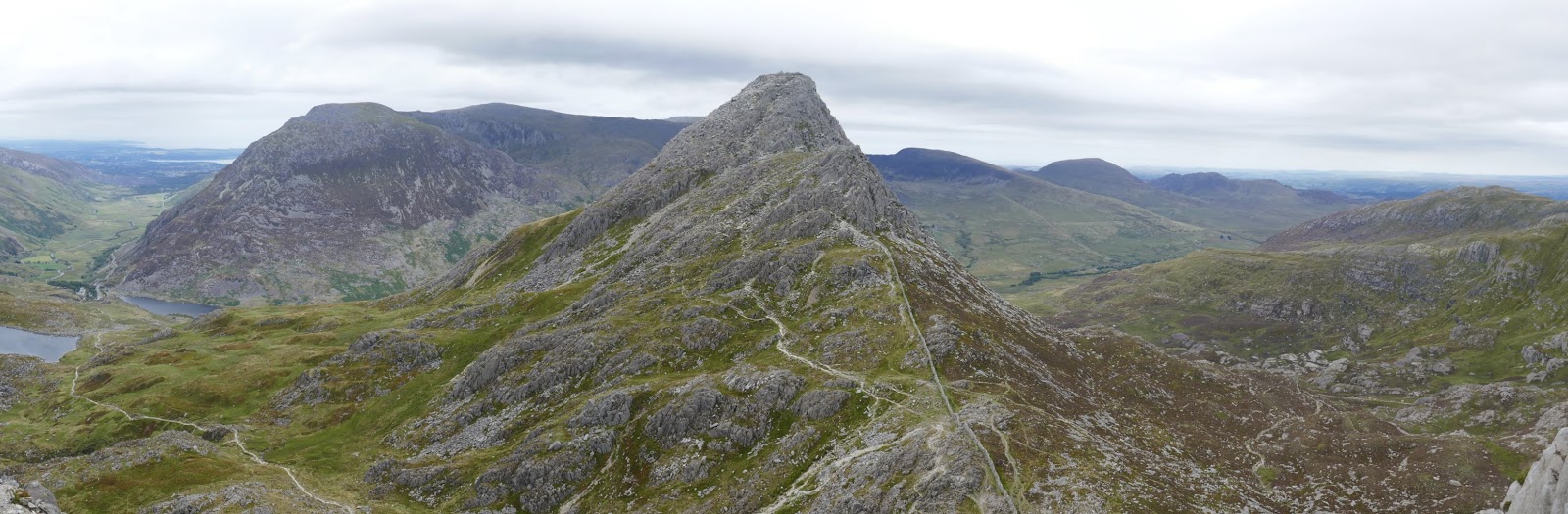
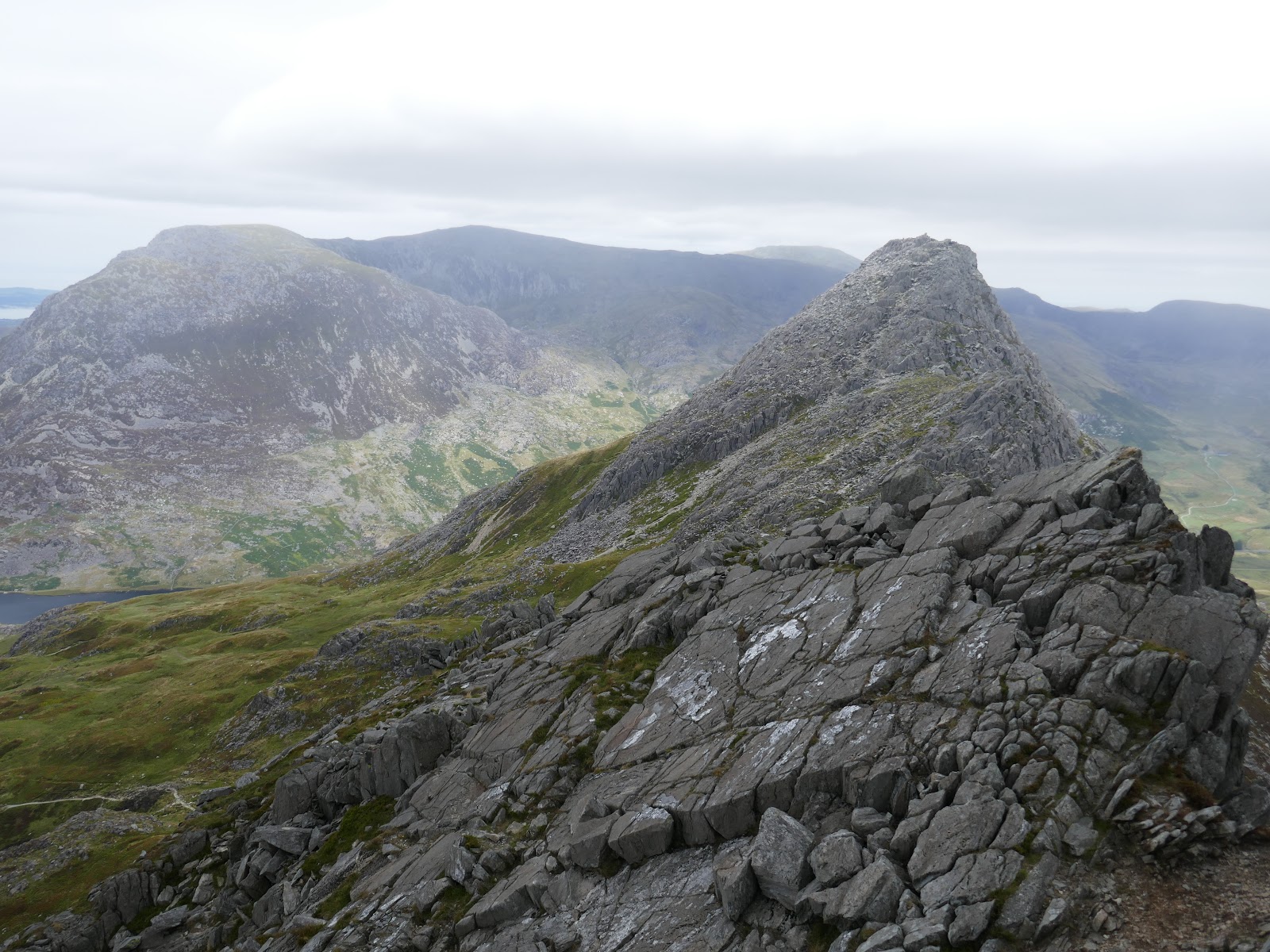
The opportunity to scramble Tryfan’s north ridge is one never to be passed up – it is one of the great mountain days in the UK and the more times you do it, the more confident and adventurous you can get. Having done Tryfan and Bristly before, my main objective was the leap between the summit stones of Tryfan. More on that later.
We’d be a little under the pressure of time today as rain was forecast in the afternoon – anytime between 1pm and 4pm (this despite a glorious morning). We had planned to reach the summit of Tryfan by midday so we were confident we’d be getting most of our scrambling done on dry rock.
I think the scramble up Tryfan can be broken down into a handful of sections, or waypoints. These include the Car Park, the Cannon, the Nose, the North Tower and eventually the summit. Each waypoint is difficult to miss and getting between them is at the discretion of the scrambler. Each section can be made as hard or as difficult as you feel comfortable with.
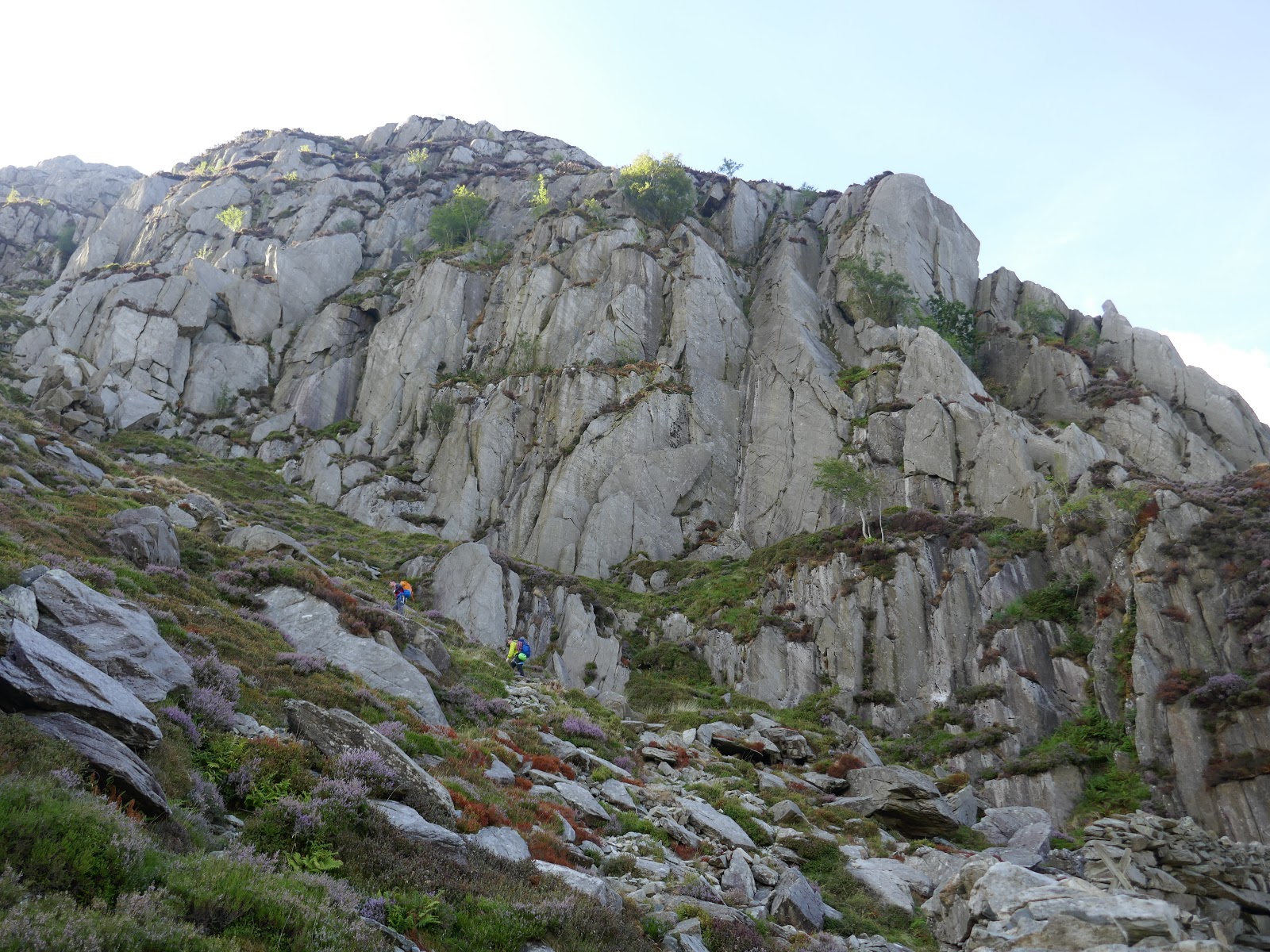
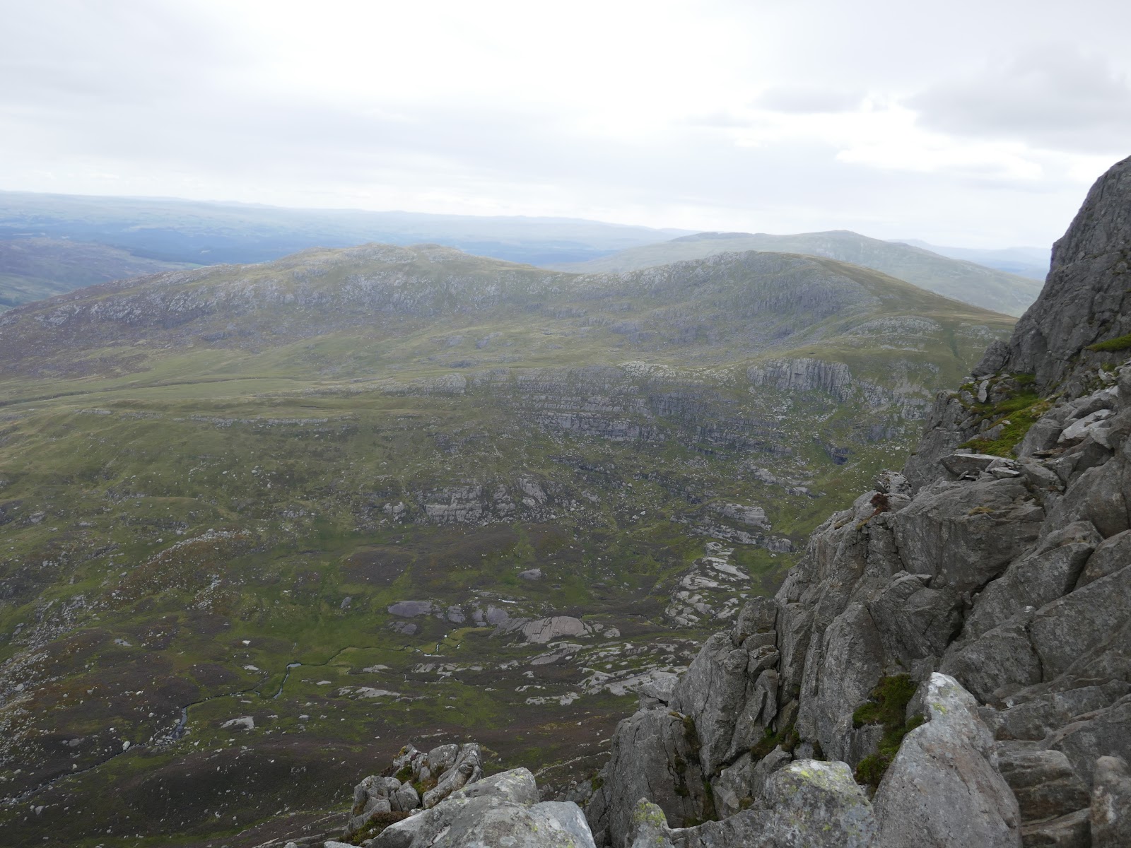
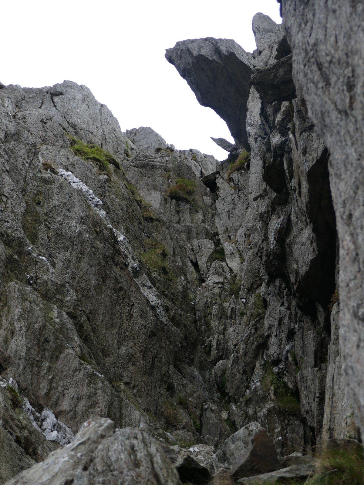
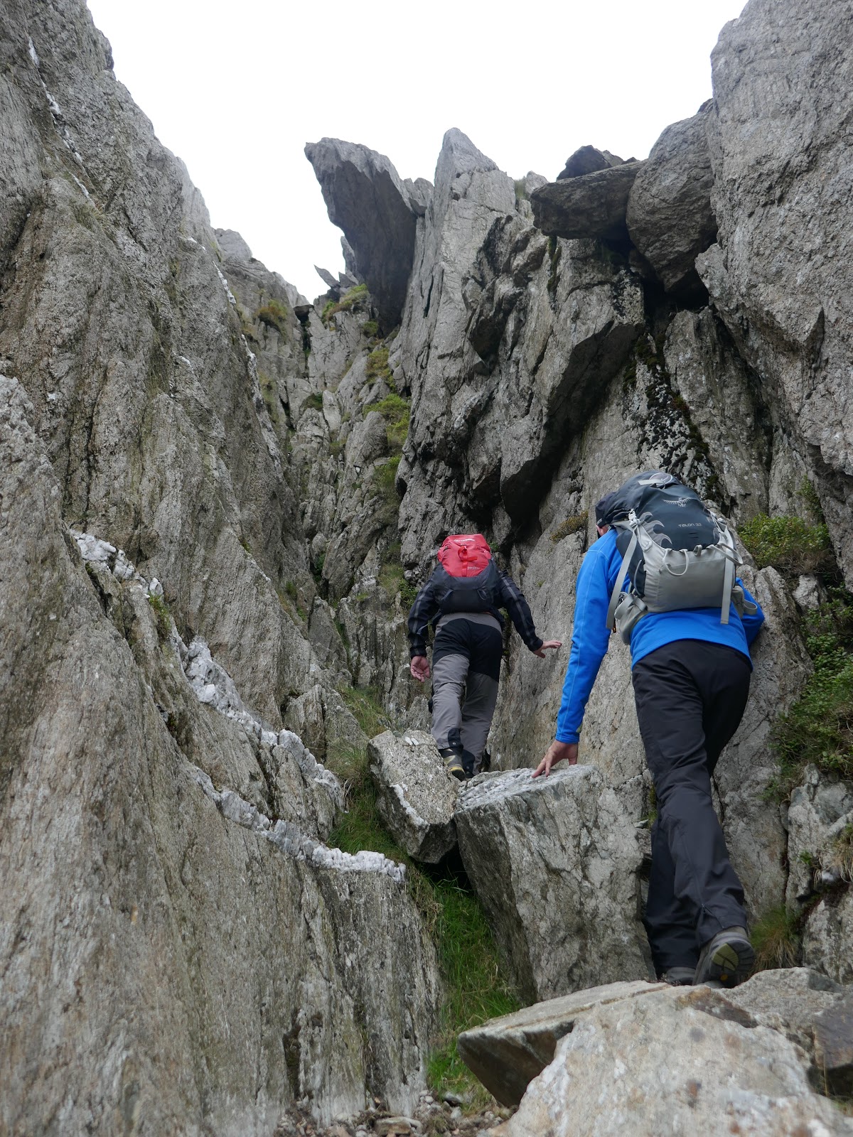
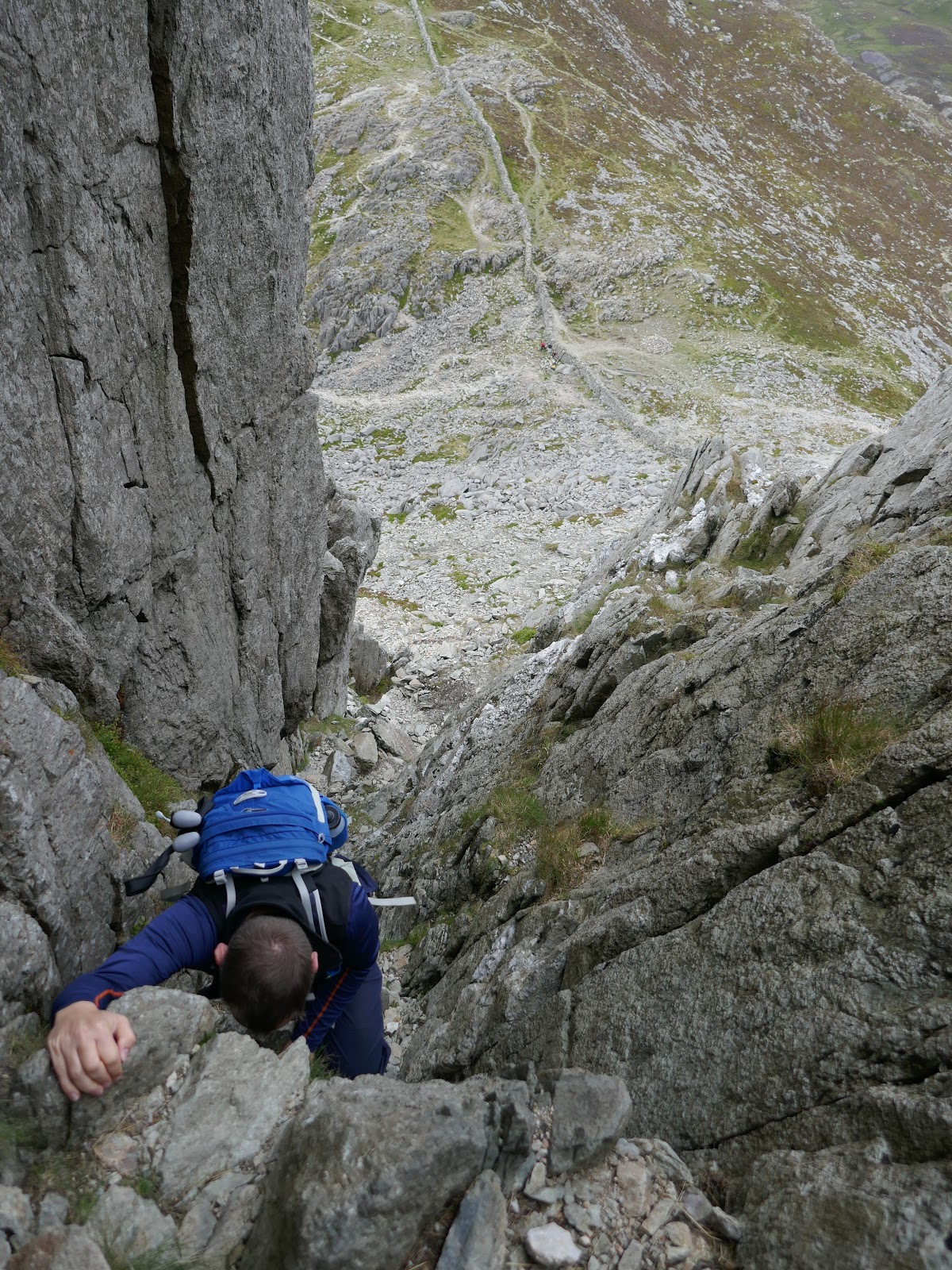
So, section one – car park to the Cannon. We opted to hit the ground running with a lesser used scramble up Milestone Gully, located on the western side of the mountain. After following the path a short while we deviated off, over the ladder stile and passing below Milestone Buttress.
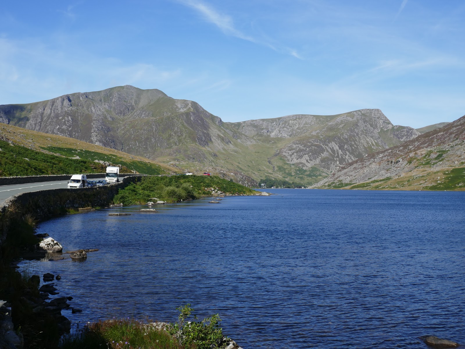
 |
| Llyn Ogwen |
 |
| The shadow of Milestone Buttress |
 |
| Milestone Buttress |
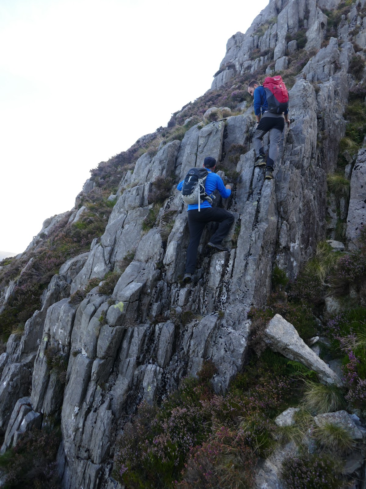
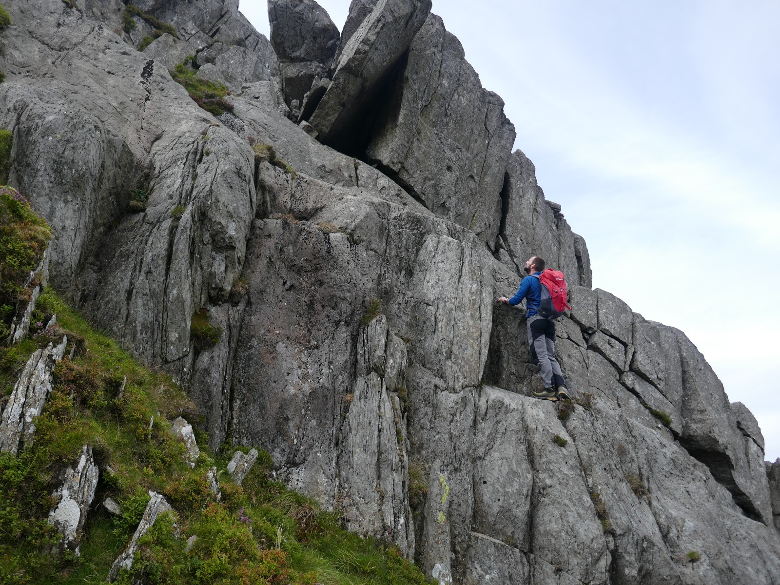
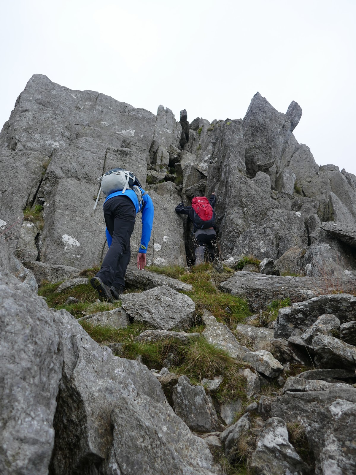
Milestone Gully Approach is a Grade 1/2 scramble which climbs a gully to the right of the buttress. We all managed to pass the first test, a high shelf at the base (assisted by a modest pile of stone), before making the climb up the gully. Climbing the left side is the easiest line with good hand and footholds throughout. The climb is quite sustained but we eventually emerged unscathed at the top of the buttress.
 |
| Milestone Gully |
 |
| The awkward shelf |
 |
| Milestone Gully |
 |
| Climbing the gully |
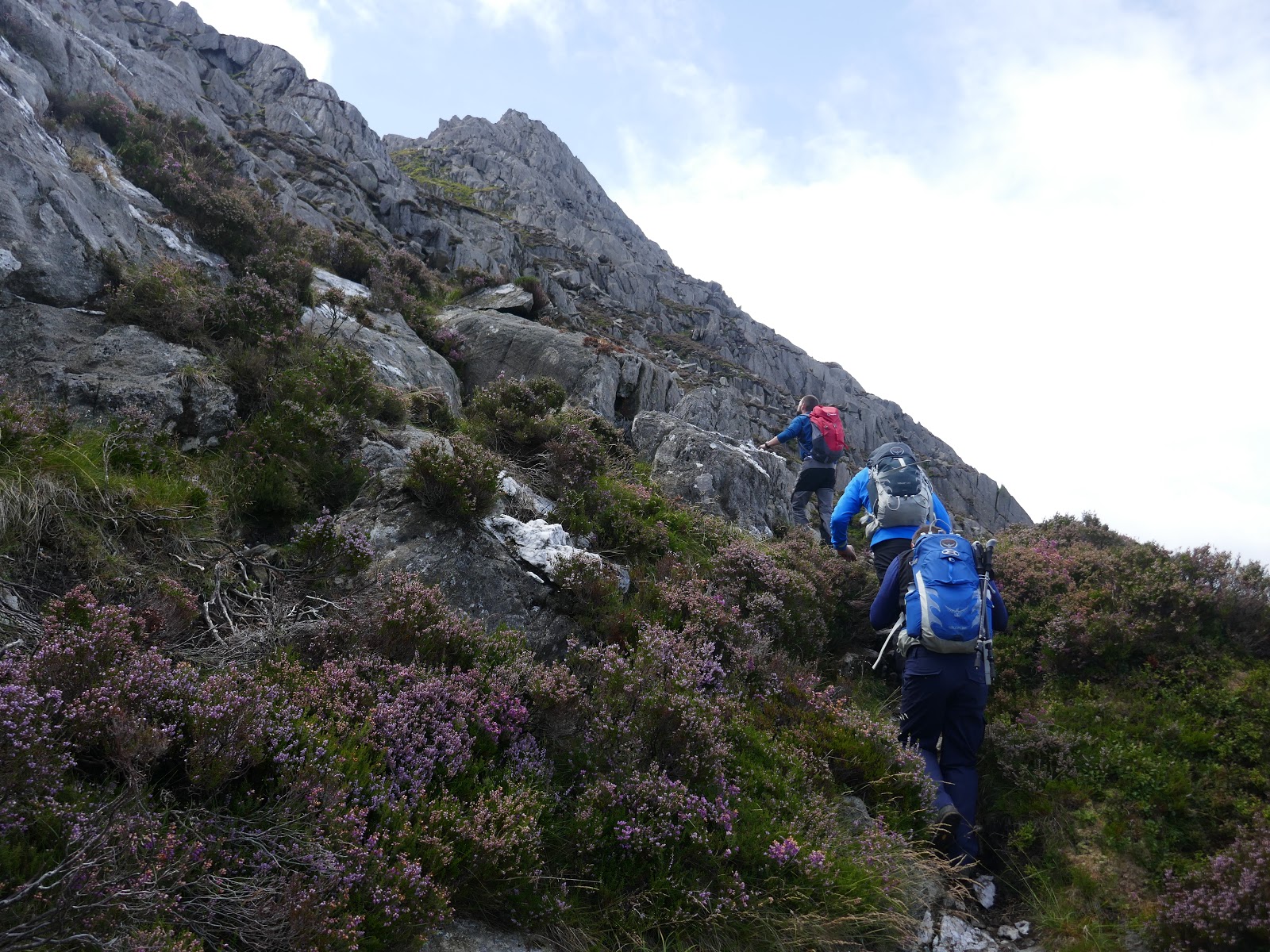
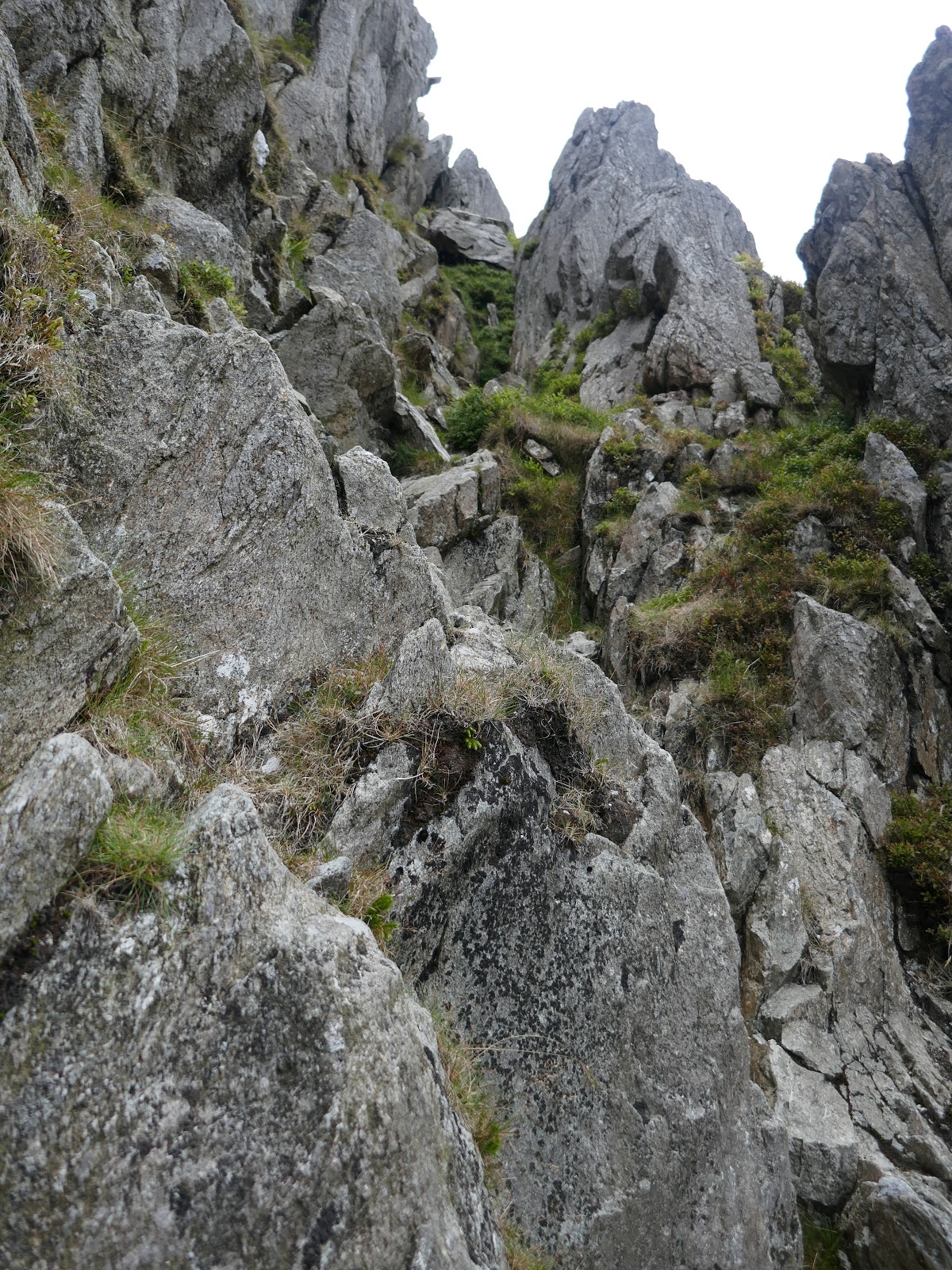
Some modest walking through heather and rocks is required before we tackled a few more entertaining scrambles, including an imposing, craggy wall. As with most routes on Tryfan, the can be made as easy or difficult as you choose and many of the really challenging parts can be easily bypassed. After some more climbing, we found our way to the Cannon.
 |
| Crossing the heather-clad slopes to find the north ridge |
 |
| Some easier scrambling |
 |
| Approaching the ridge |
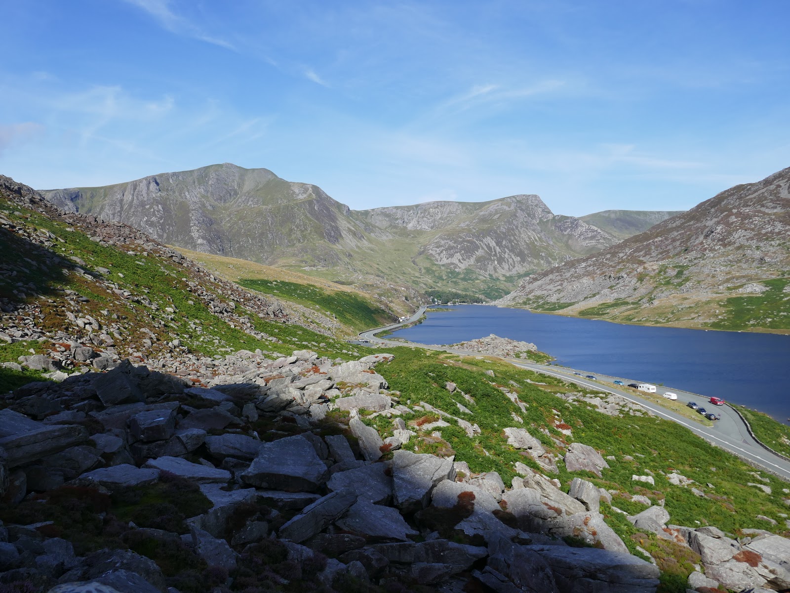
 |
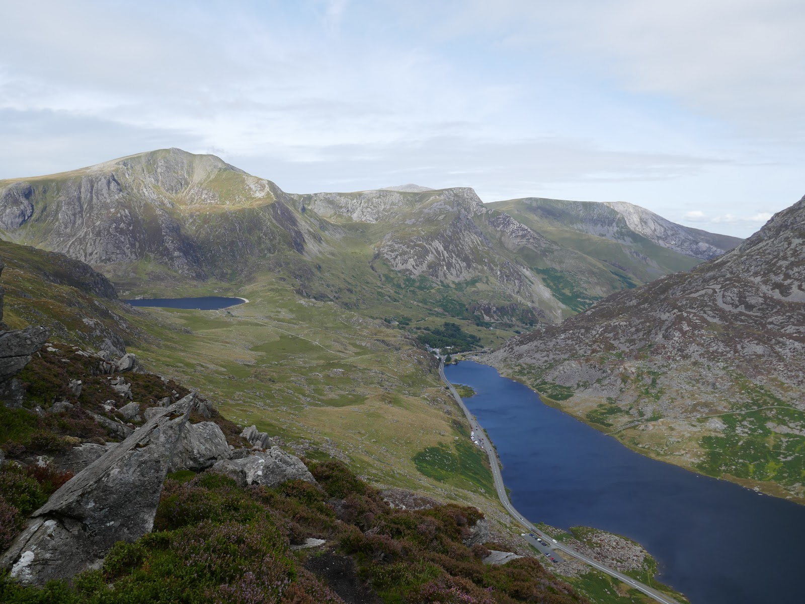
| Looking down on Llyn Ogwen |
 |
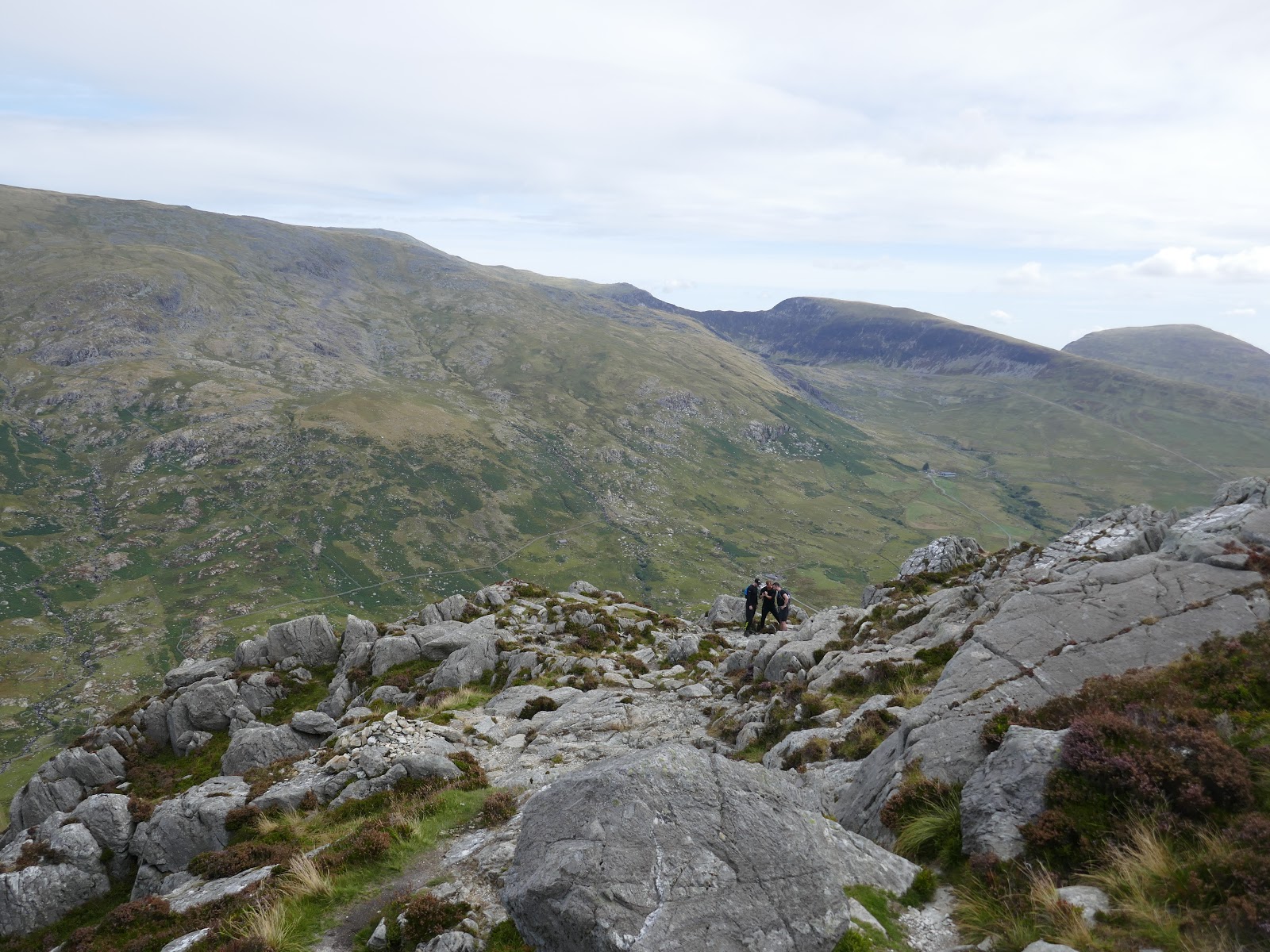
| Some of the slightly higher grade scrambling on the route |
 |
| Looking across to Pen yr Helgi Du |
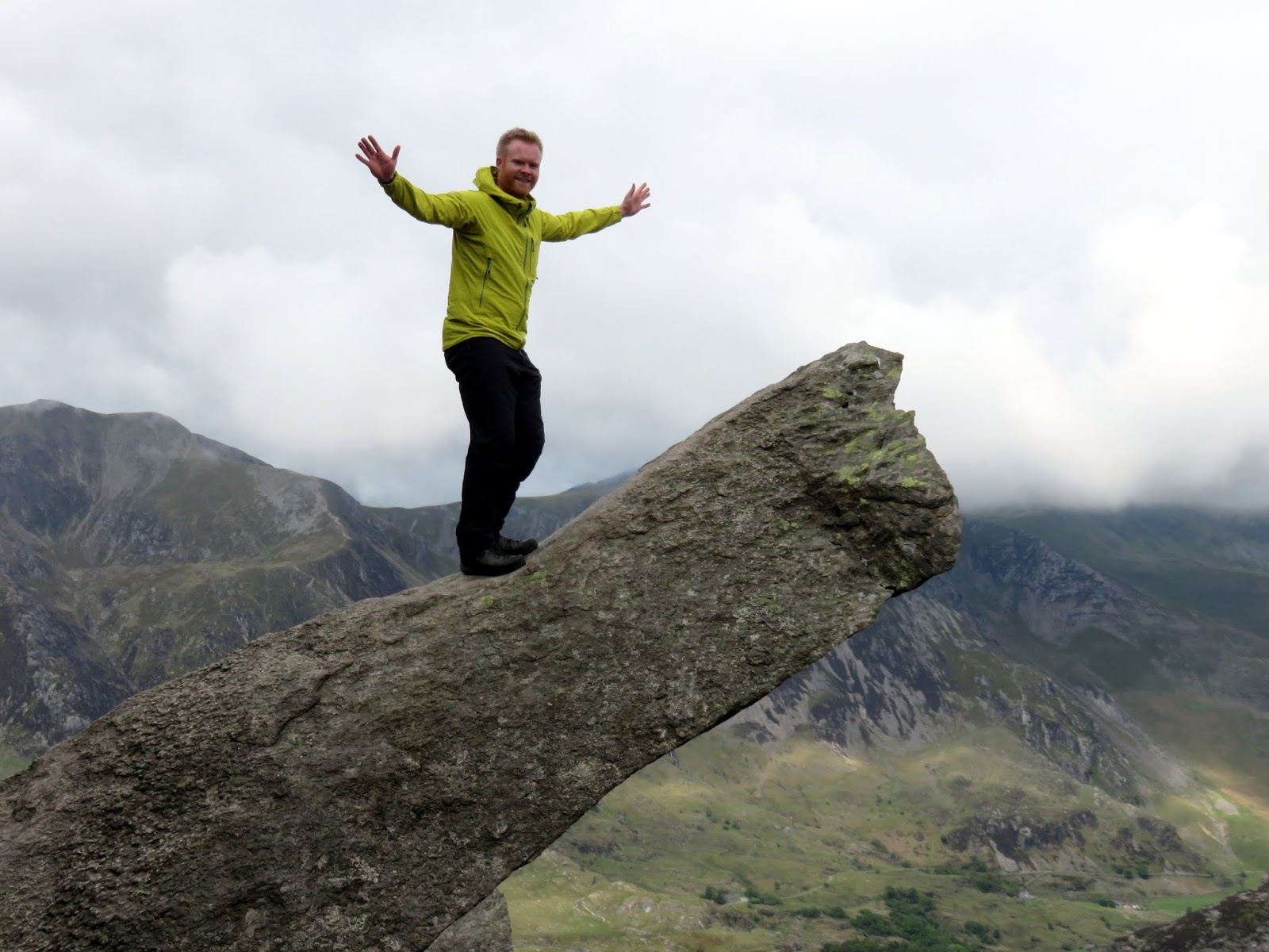
The Cannon is one of the icons of North Wales, a jutting slab of rock, visible from the valley floor which simply begs to be photographed, usually with someone teetering on the end of it. I took my turn a couple of years ago – here I am looking less-than-comfortable.
 |
| The Cannon |
Section two then, the Cannon to the Nose. This part is generally pretty straightforward and more of a walk than a scramble, though you can seek out the odd hands-on route I’m sure – it’s a nice respite for the arms before the stiffer challenges ahead. On a clear day, the Nose will be a clear objective.
 |
| The Cannon and Pen yr Ole Wen |
 |
| The route leading up to The Nose |
 |
| Some more scrambling for good measure |
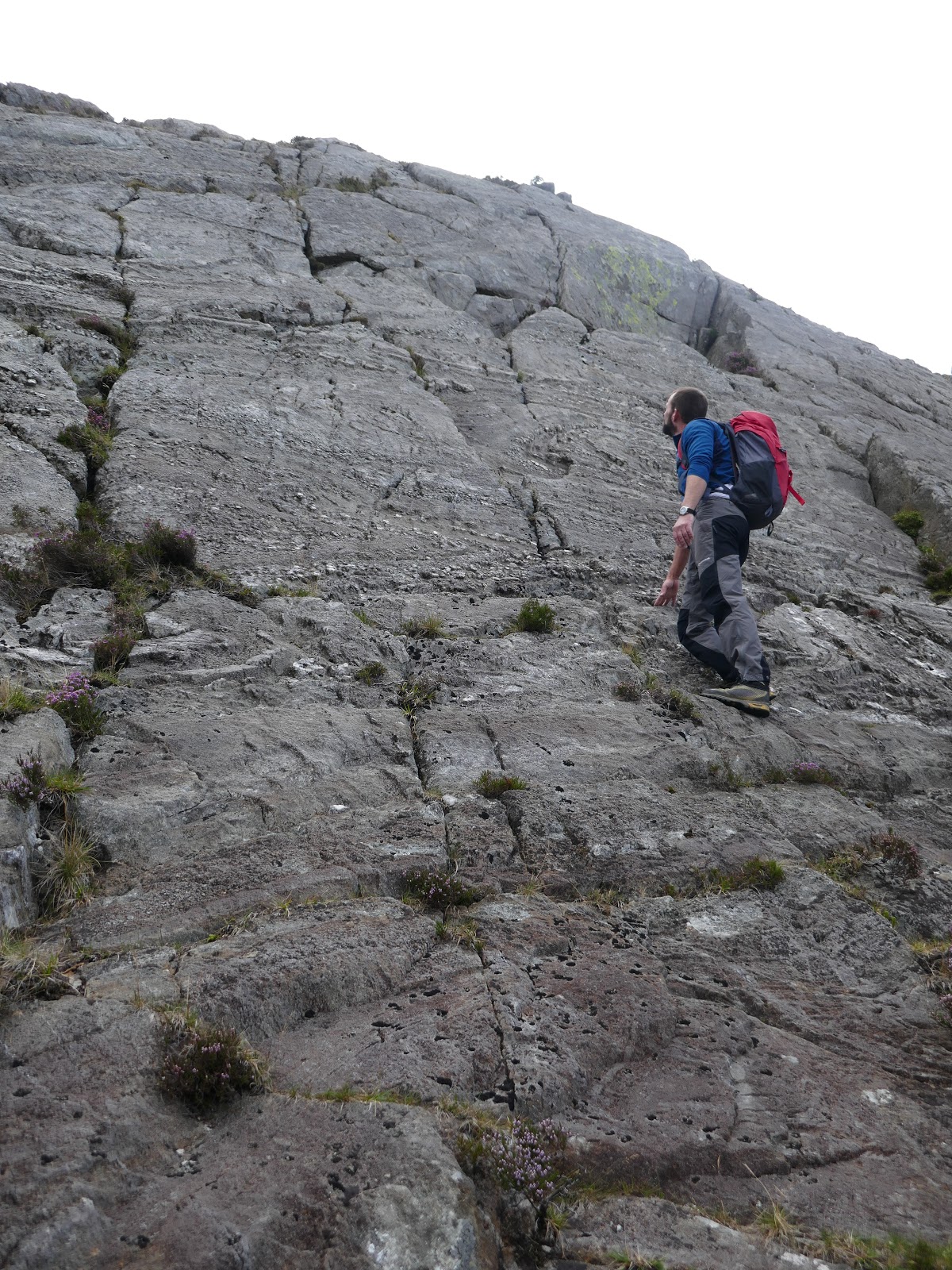
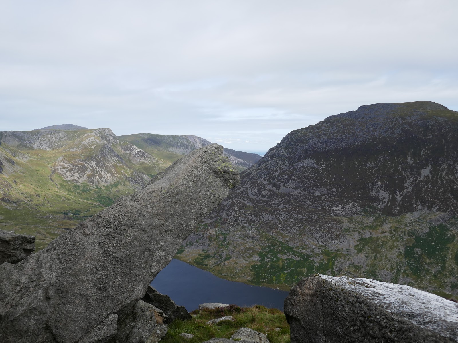
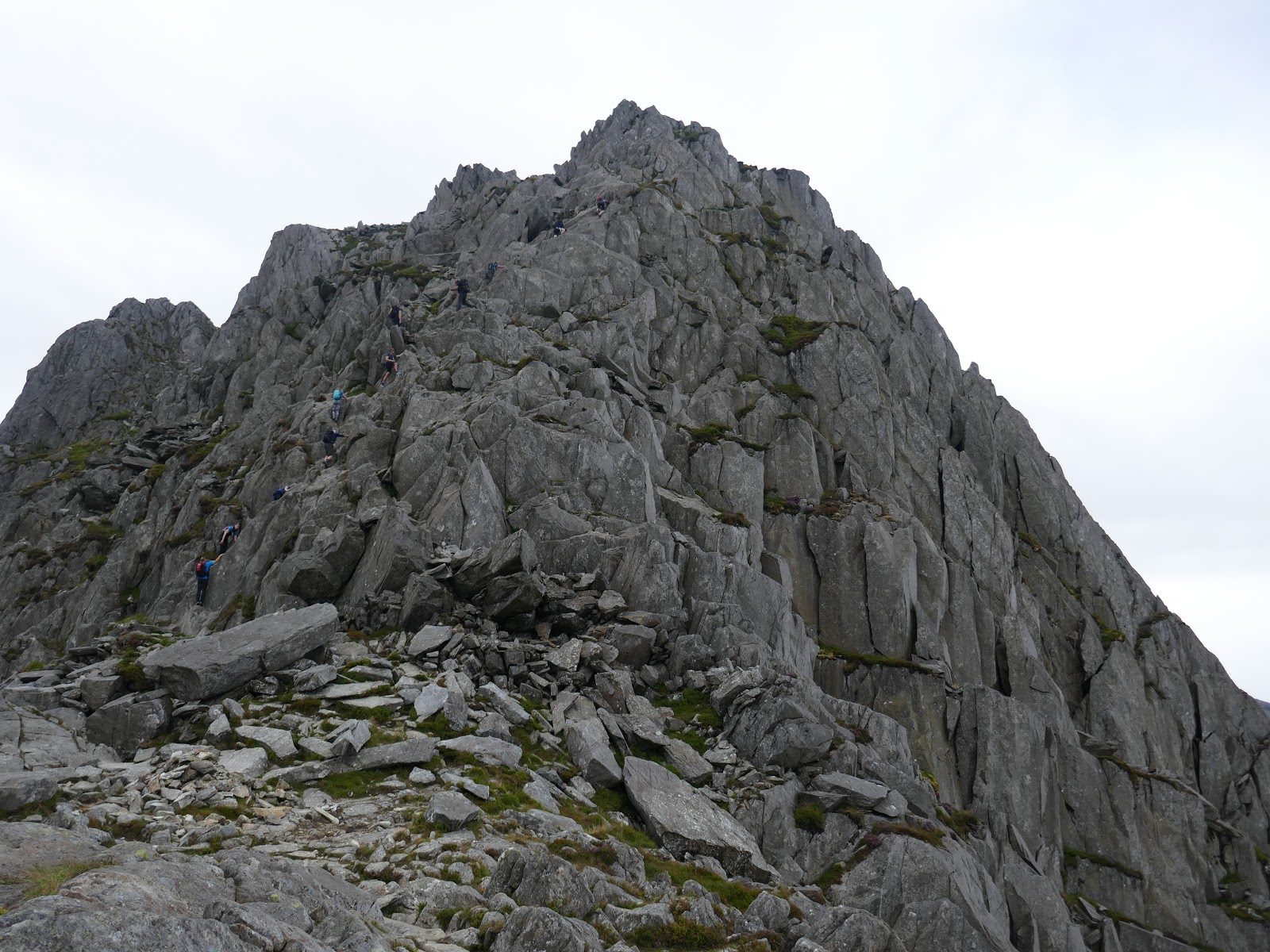
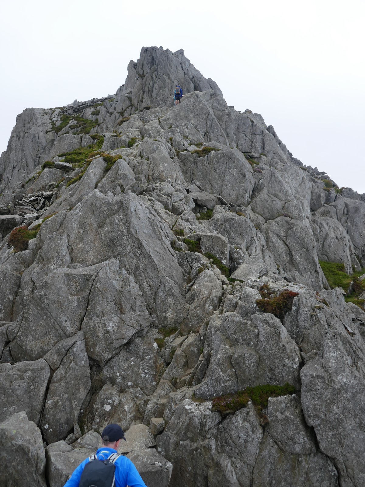
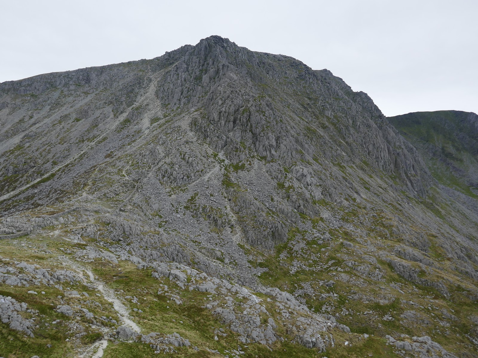
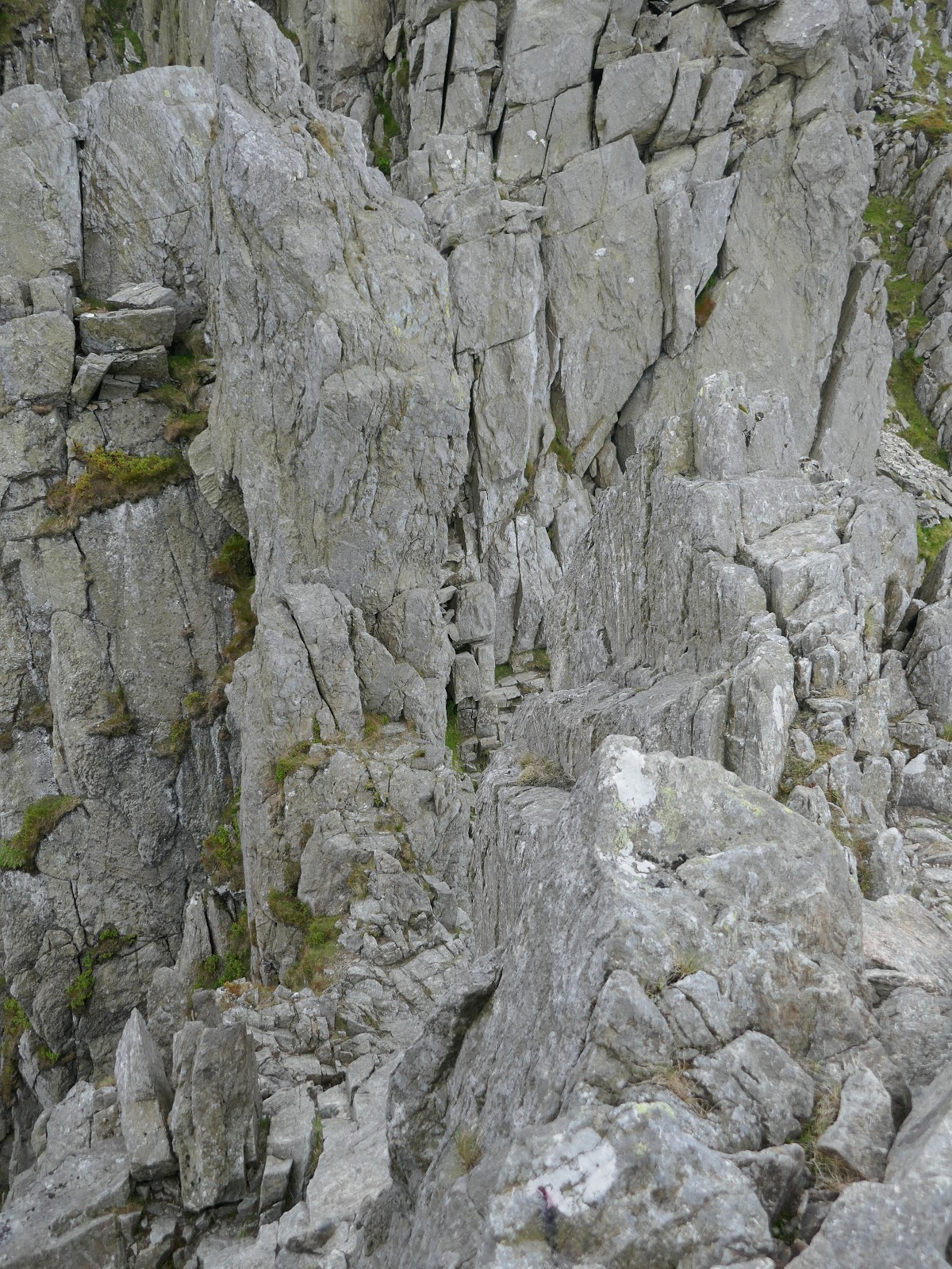
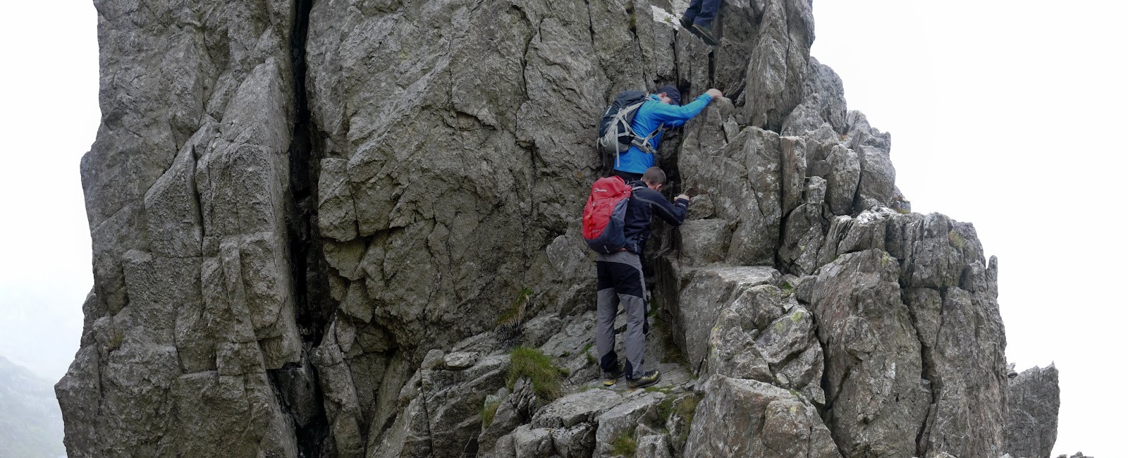
The Nose is an imposing pyramid of rock that bars the north ridge route. By far the best way is to tackle it head-on. Again, the main routes should be easy to pick out given the amount of polished rock. We opted for a slightly different line to avoid a queue forming though still remained around a scrambling grade of Grade 1 with the odd 2 thrown in for good measure. If you chose to bypass the tower, a path skirts to the left, cutting across the slopes and a number of gullies. I’d highly recommend you attempt to climb the first gully (the upper reaches of Nor Nor gully) to get back up onto the ridge before you find yourself on uncertain ground.
 |
| The Nose |
 |
| Ogwen Valley |
 |
| Looking down the North Ridge from The Nose |
 |
| Gallt yr Ogof and Y Foel Goch |
 |
| The final part of The Nose |
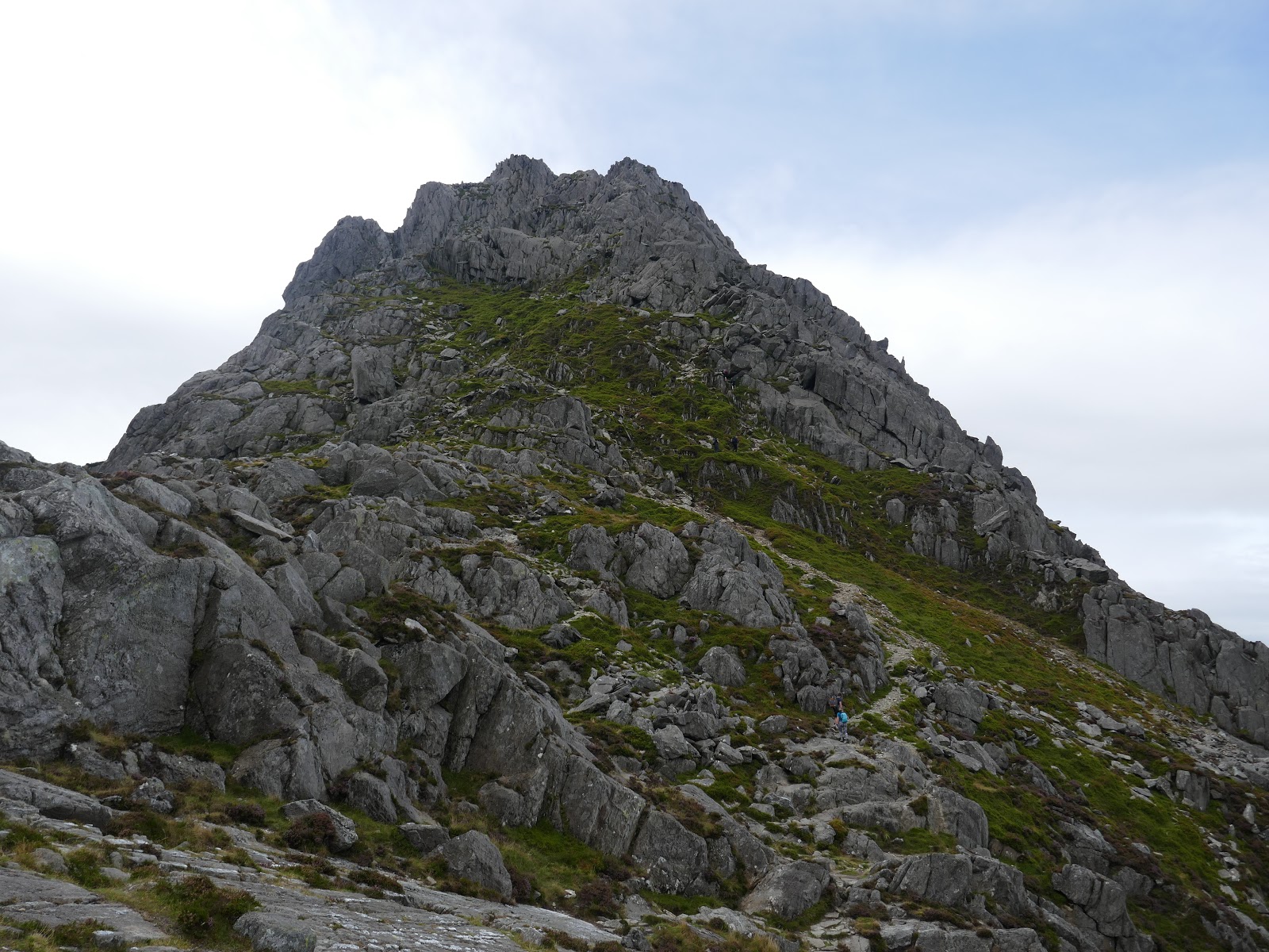
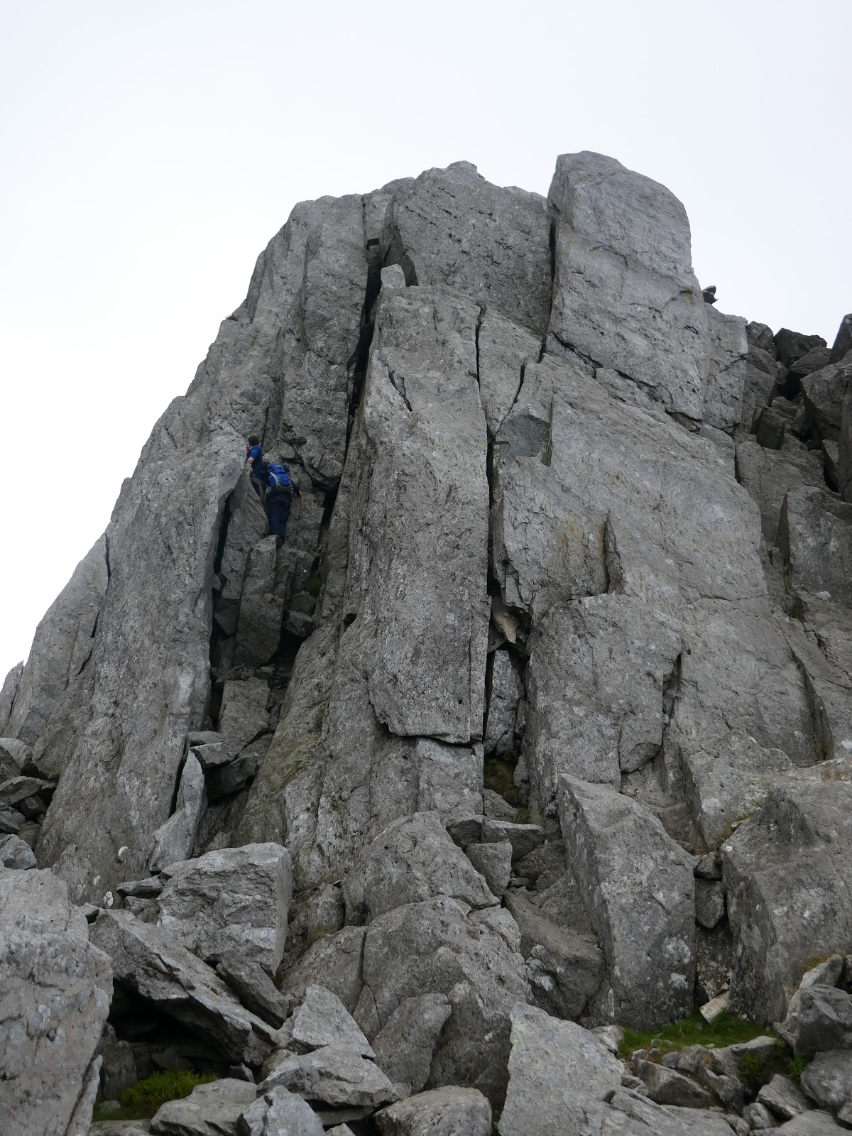
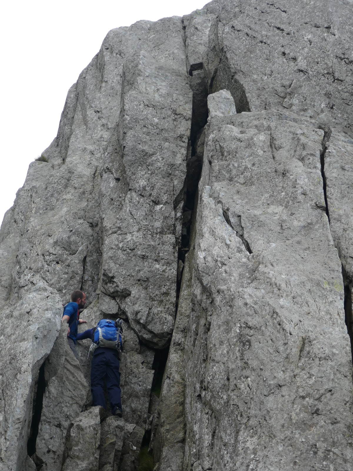
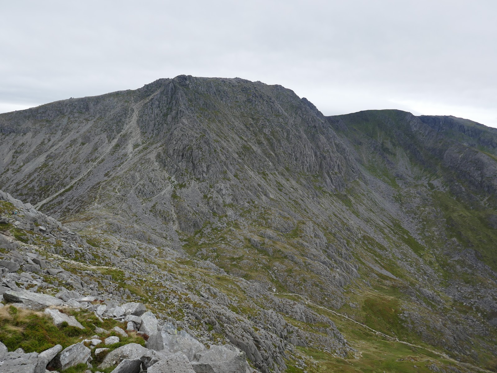
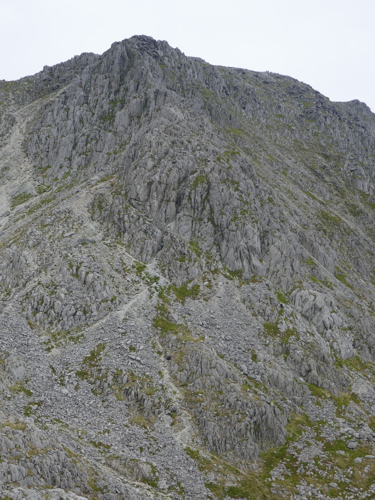
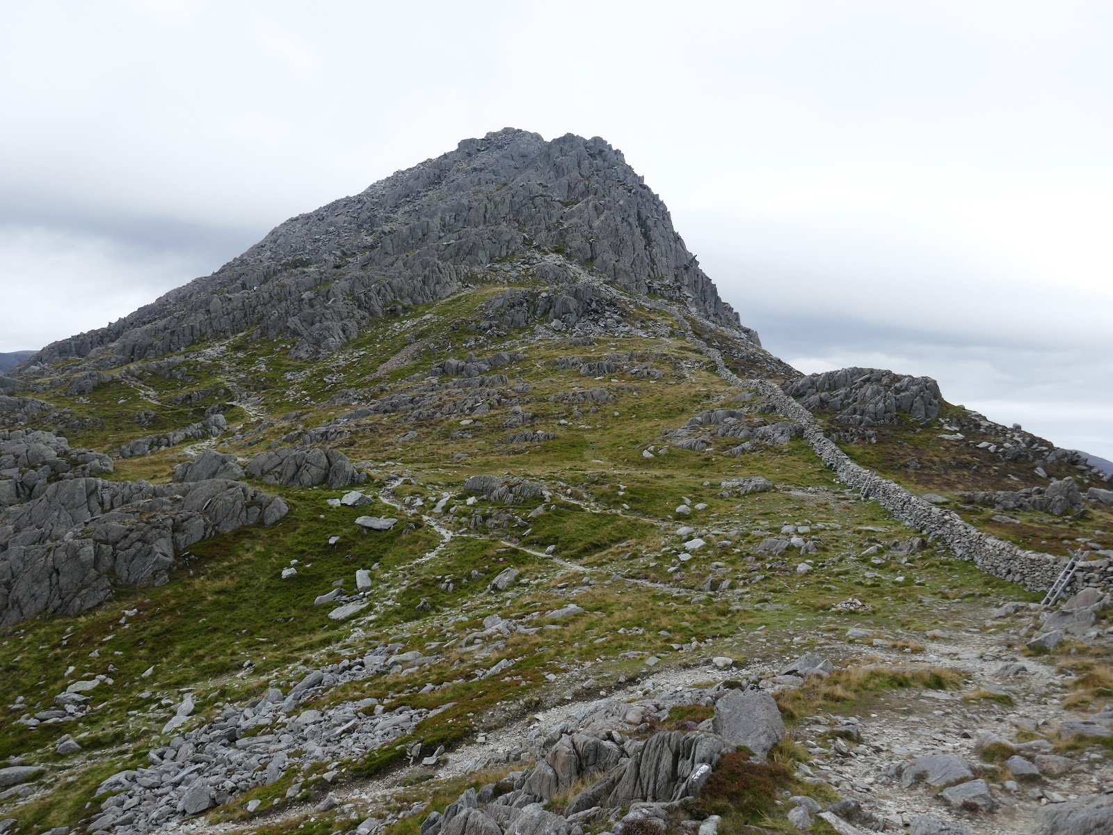
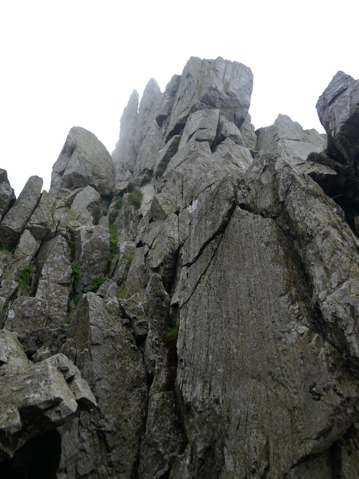
After the Nose, another flatter section beckons and leads to the North Tower and section 3. The North Tower is as you might expect, a tall tower of rock on the north ridge. The easiest route (which we took) heads to the right of the tower to make some easy scrambling up onto the ridge. The Tower can be attempted directly but the grading here is probably a high 2 and looks technically quite difficult.
 |
| The North Tower |
 |
| Scrambling on the North Tower |
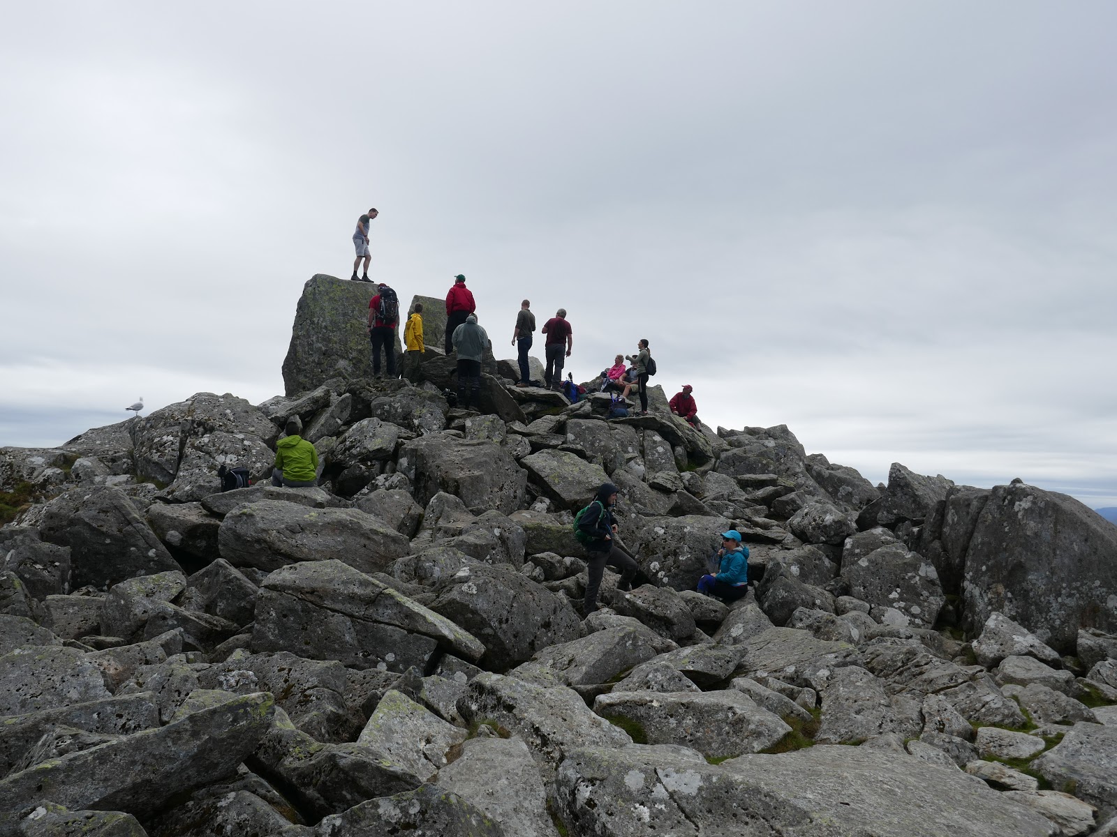
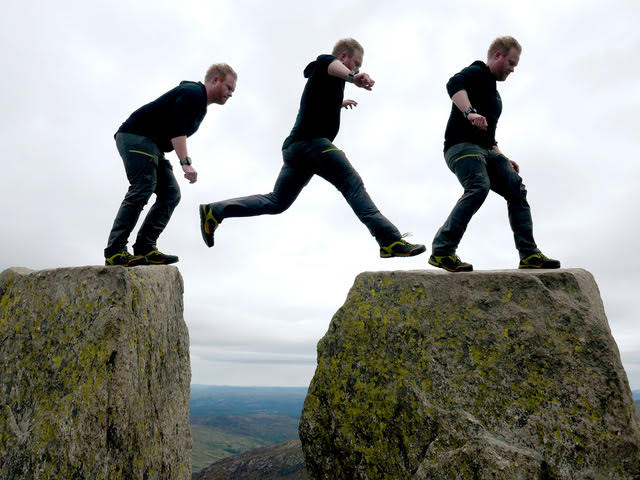
Once up and over (or around) the tower, Tryfan’s summit will present itself. After a brief notch in the ridge, the final scramble leads to the summit proper, marked by the two immense monoliths – Adam and Eve. To hop across the 1.2m gap between them is to gain the ‘Freedom of Tryfan’, something I did for the very first time. As a first-timer, it’s a pretty nerve-wracking experience but one I’m glad to have finally done.
 |
| Tryfan’s summit from the North Tower |
 |
| The depression between the North Tower and the summit |
 |
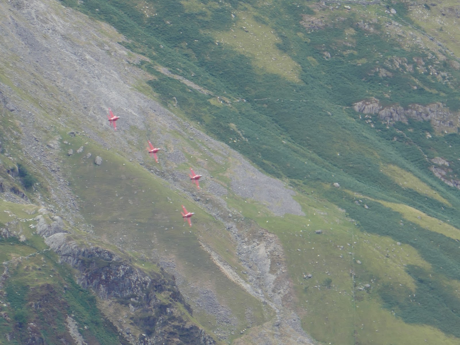
| An impromptu flyby from the Red Arrows |
 |
| Tryfan’s summit |
 |
| The Freedom of Tryfan |
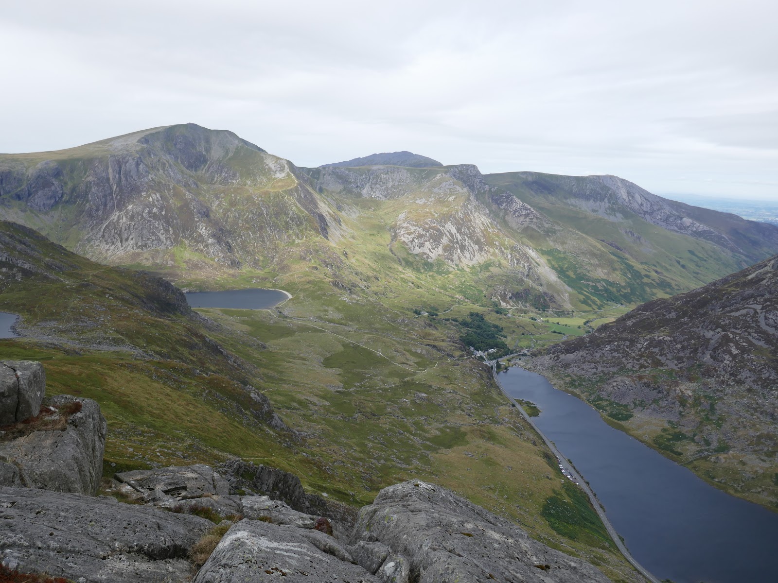
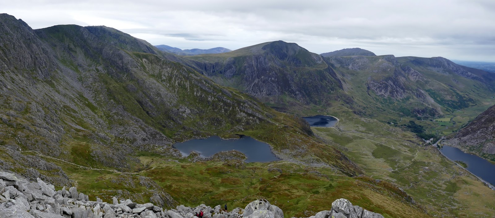
The weather was holding so we decided to stick to the plan and make tracks towards Bristly Ridge where some more quality scrambling awaits. Descending Tryfan’s south ridge is easy compared to the scramble up the north and we found our way down to Bwlch Tryfan. Bristly Ridge rises up overhead.
 |
| Glyder Fach |
 |
| Bristly Ridge |
 |
| Cwm Bochlwyd |
 |
| Glyder Fach |
 |
| The two gullys; Main Gully is the more obvious one in this photo |
 |
| Tryfan’s Far South Peak |
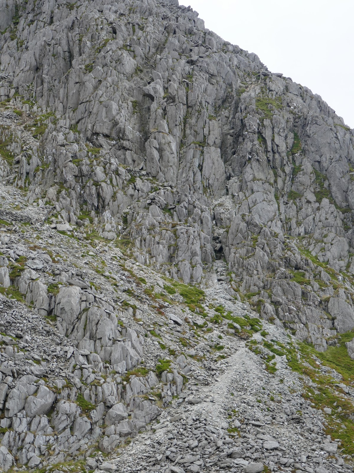
The first challenge is getting up onto the to ridge itself, achieved via one of two gullys; Sinister or Main gully. While the name ‘sinister’ may not be overly appealing, it is, in fact, the easier of the two taking its name from the Latin for ‘left’ – it is the left-most gully of the two. You can identify it by the large, overhanging rock above it.
 |
| Sinister Gully |
 |
| Sinister Gully |
 |
| Climbing the gully |
Sinister Gully is a fairly straightforward climb, similar to Milestone Gully we had climbed earlier in the day. Again, there is an abundance of hand and footholds and the whole route shouldn’t pose many problems to an experienced scrambler.
 |
| Looking down Sinister Gully |
 |
| The upper section |
 |
| Tryfan from Sinister Gully |
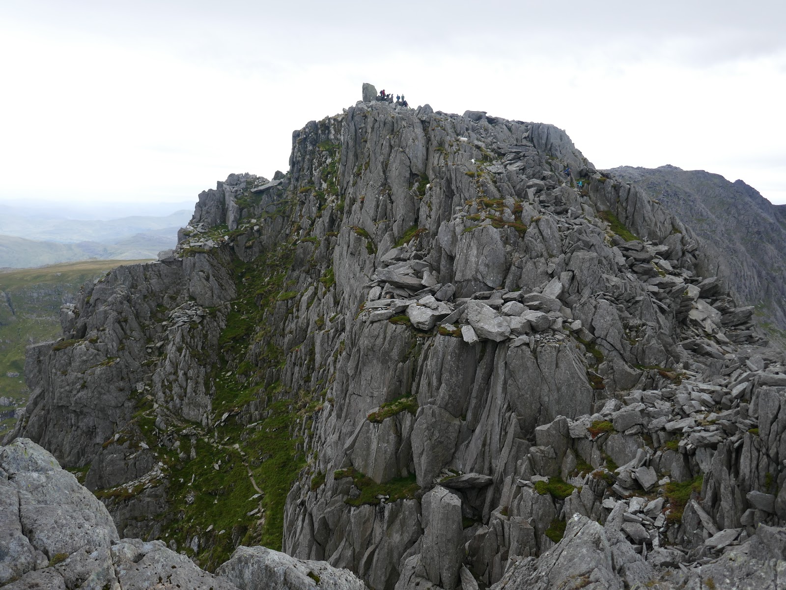
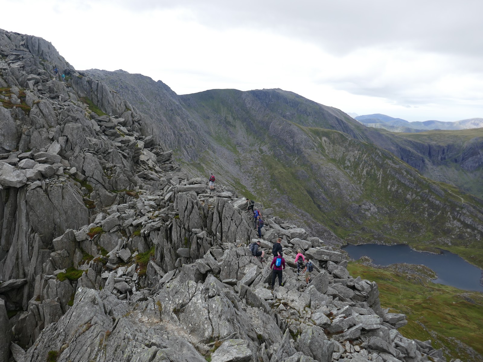
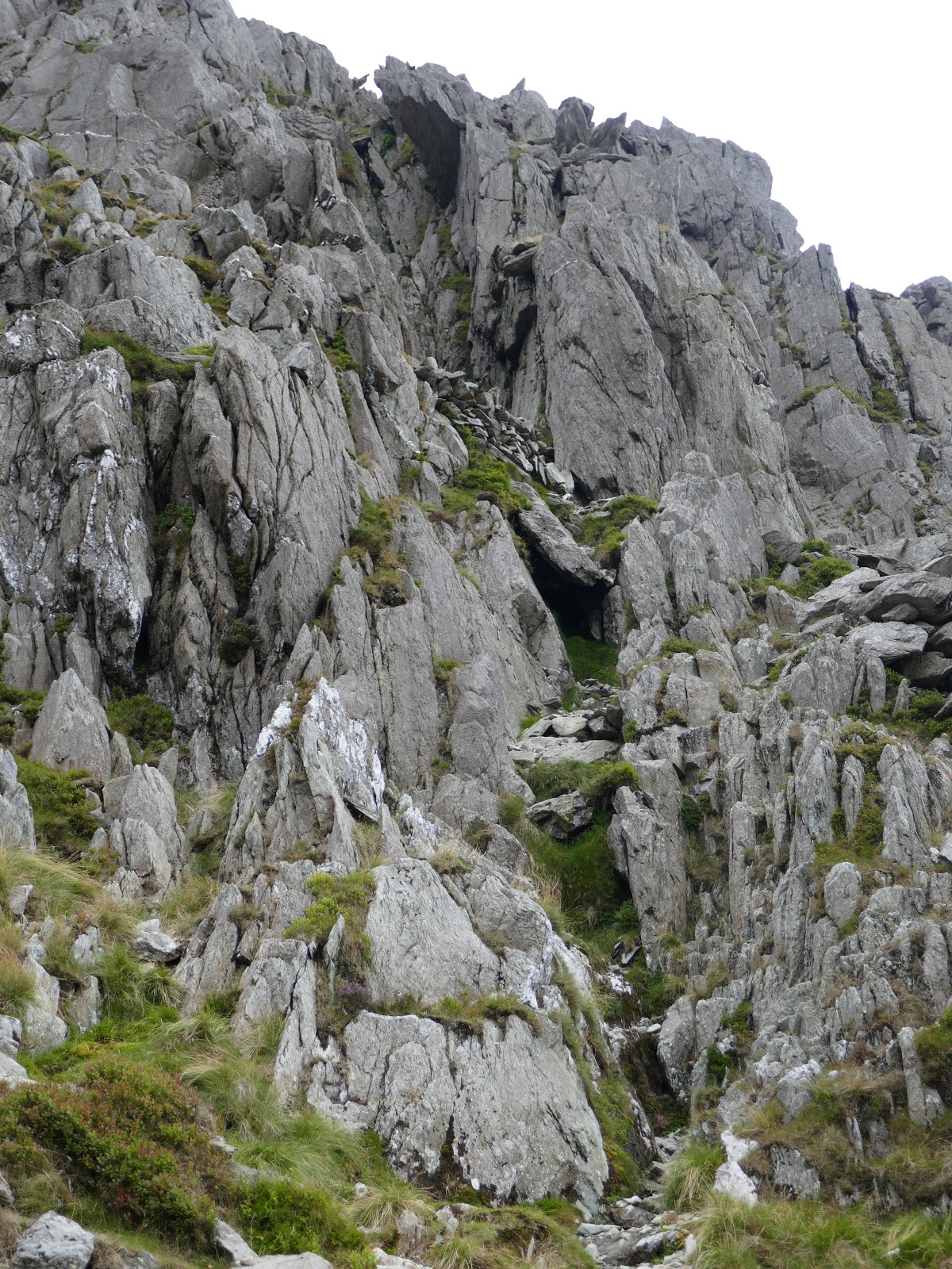
Sinister Gully led us onto Bristly Ridge itself where some easy walking is interspersed with some light scrambling. Don’t let this fool you, however, the ridge is only just getting started. After clambering around some smaller pinnacles we reached the Great Pinnacle Gap, a deep notch in the ridge preceding an immense spire of rock. This is the crux of the ridge.
 |
| Bristly Ridge and Tryfan |
 |
| Scrambling on Bristly Ridge |
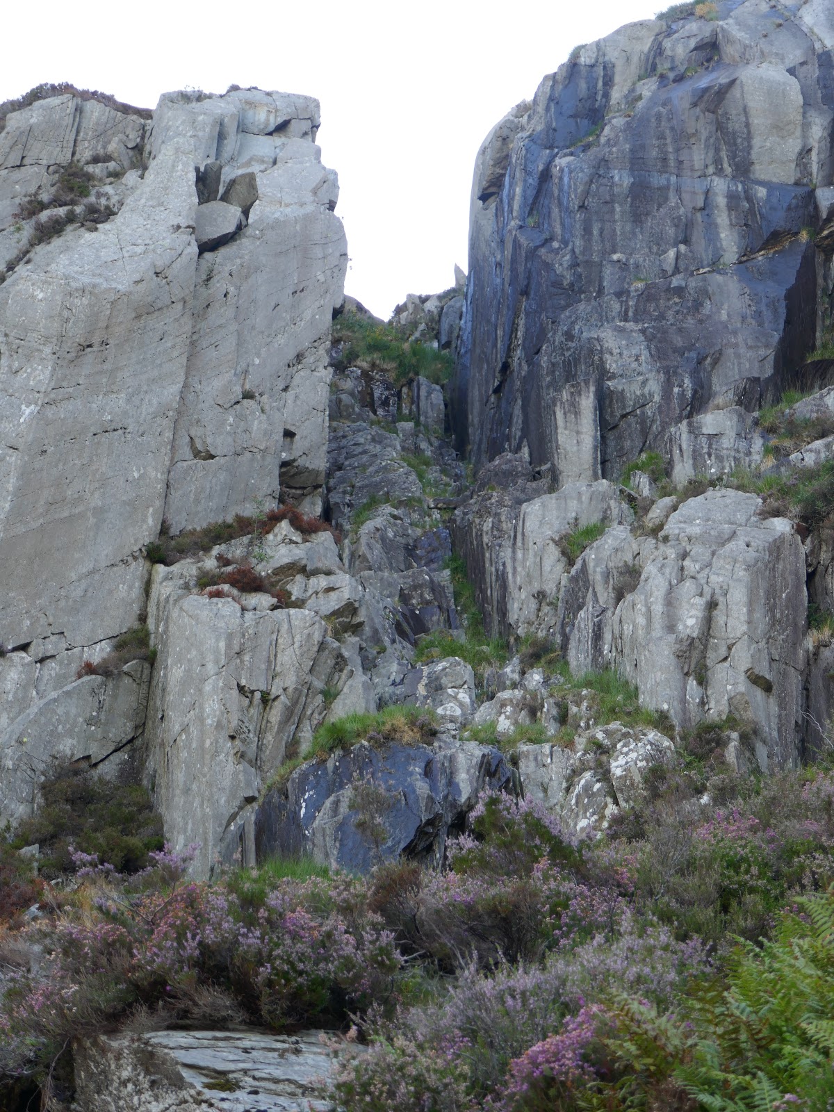
Getting to the notch requires a tricky downclimb though, as ever, there are hand and footholds when you search them out. The downclimb leads to a fairly narrow, flat slab which can be lethally slippery when wet. Upon first inspection, the spire of the Great Pinnacle seems to block the onwards route, however, passing around to the right reveals a blocky gully which leads back up to the ridgeline.
 |
| Looking down into the Pinnacle Gap |
 |
| Pinnacle Gap |
 |
| The final scramble before the top |
After we had tackled the gap, the weather began to close in quickly, leaving us little time to complete the route before the rain arrived. A final, steep scramble is required to finish Bristly Ridge where most people will probably continue on to Glyder Fach and its famed Cantilever. Given the deteriorating weather, we decided against said route, instead opting to start making our way back to the cars.
 |
| The top of Bristly Ridge |
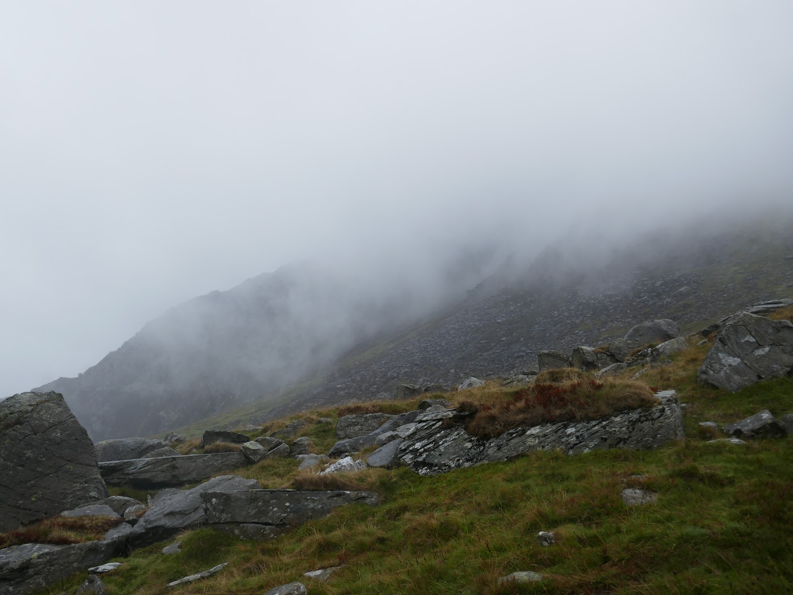
We descended down the Bristly Screes which is a horrendous route. It is steep and heavily eroded, I would favour Bristly Ridge over this any day. Even the longer route to the Miner’s Path is preferable to the screes. It was raining heavily by the time we reached the bottom of the screes and Bwlch Tryfan once again.
 |
| The Bristly Screes |
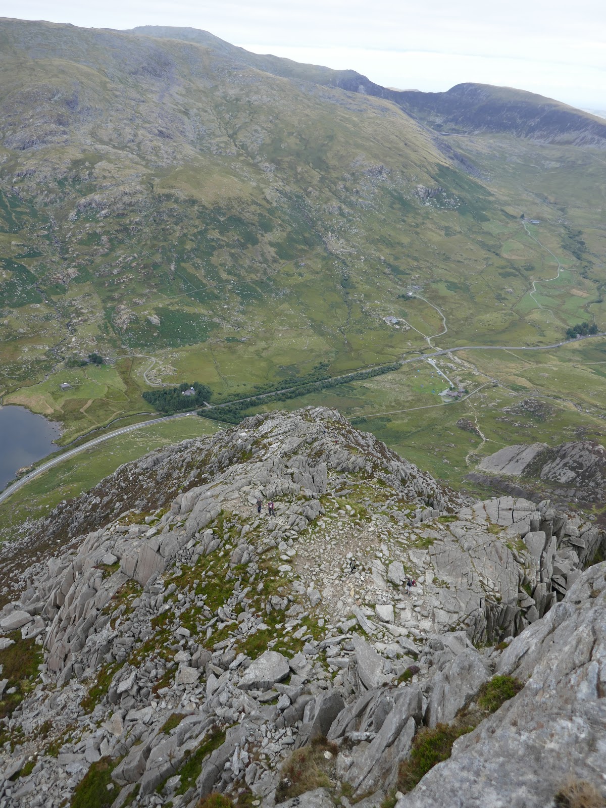
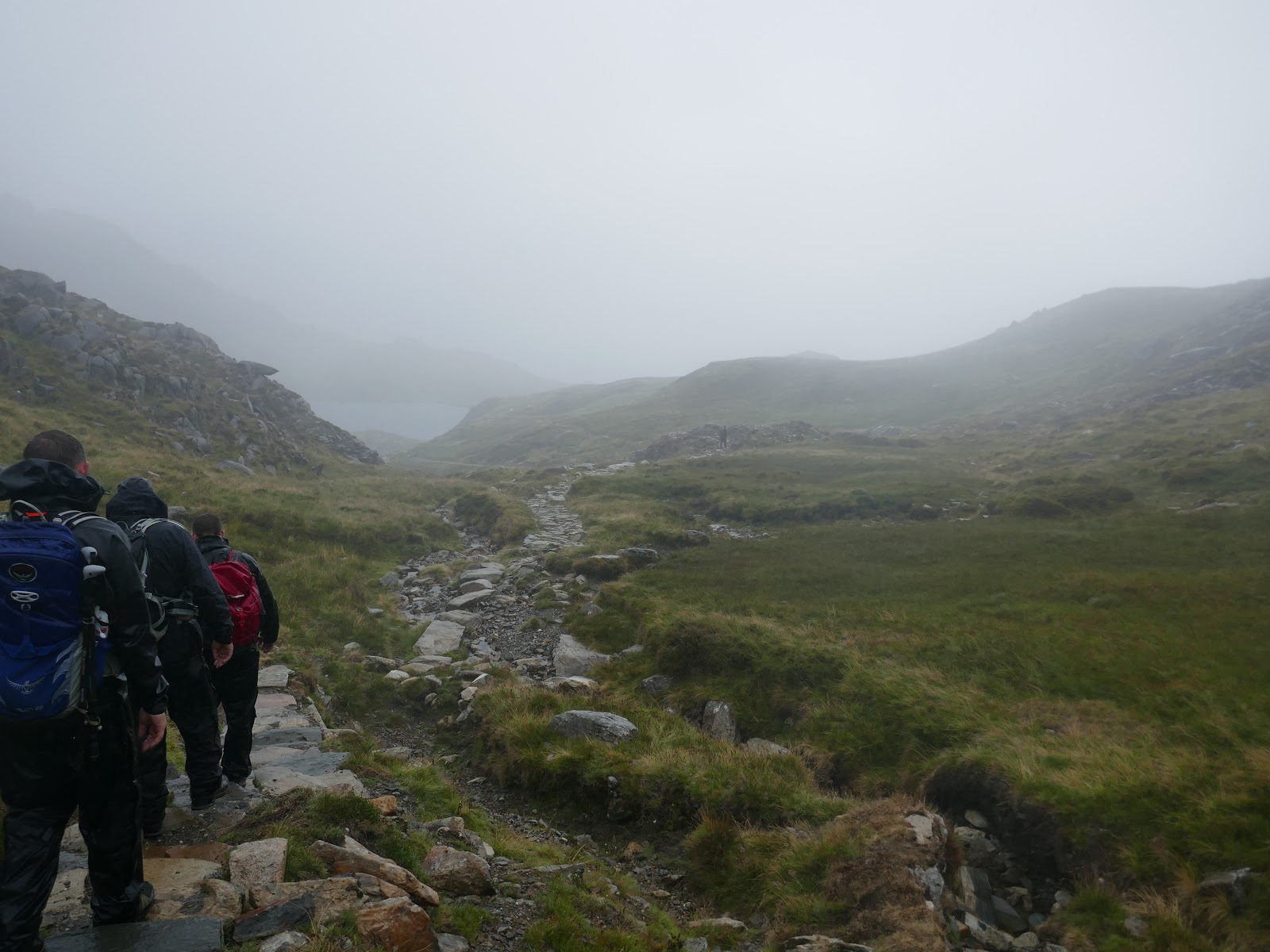
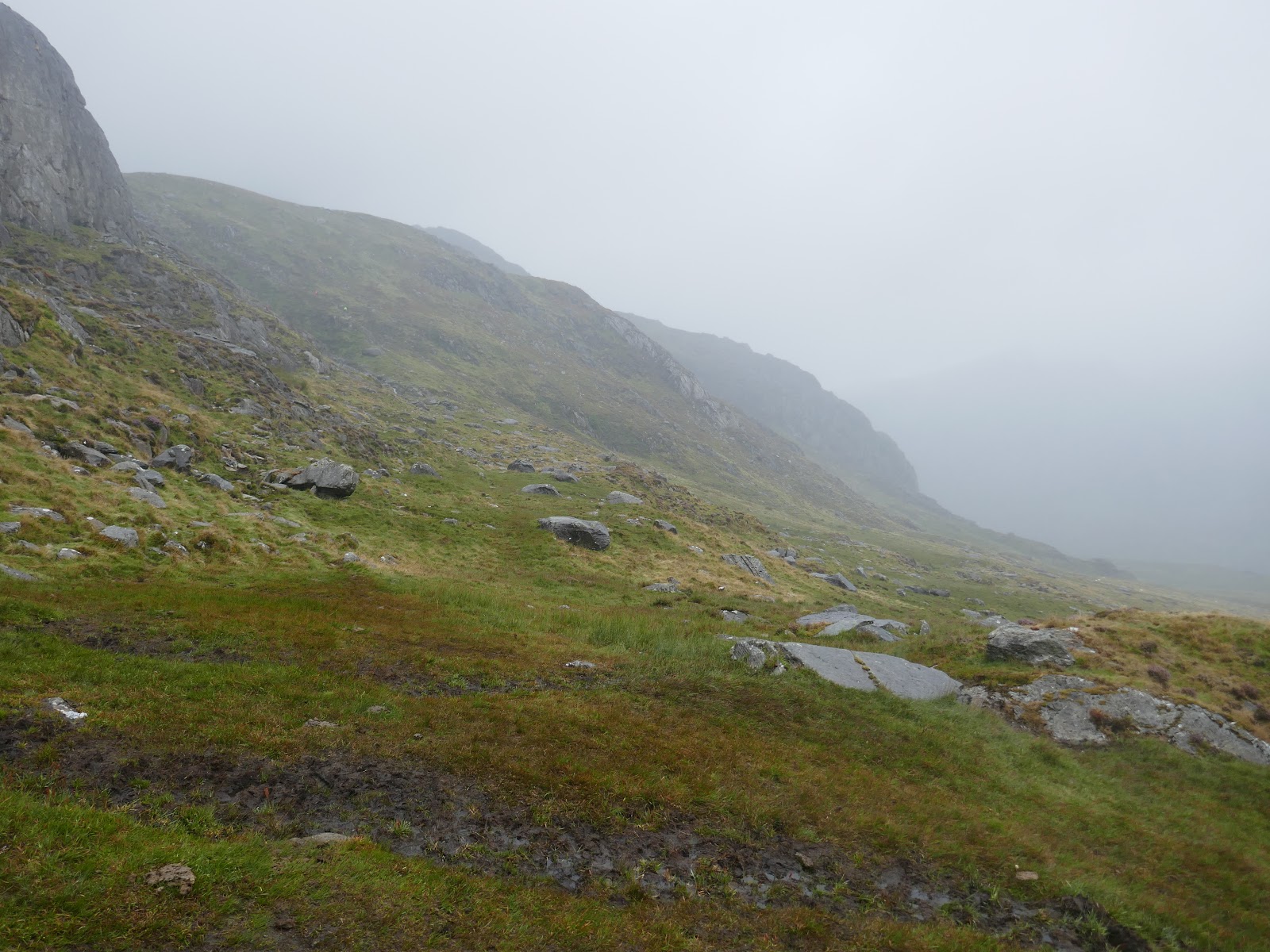
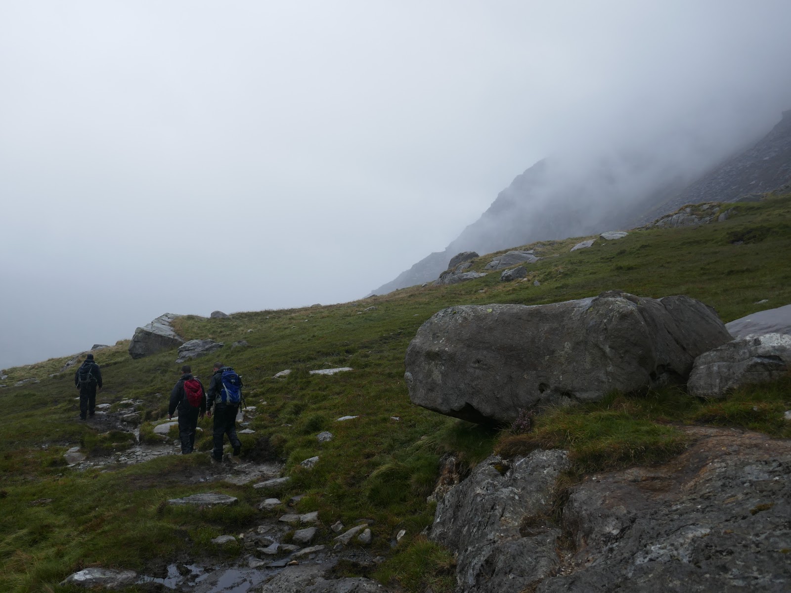
Crossing the ladder stile, a path leads down to the interesting Cwm Bochlwyd and the shores of Llyn Bochlwyd. We emerged below the mists as we descended alongside Nant Bochlwyd before following an increasingly boggy path below Bochlwyd Buttress down to the A5.
 |
| Heading for Llyn Bochlwyd |
 |
| The end of Y Gribin |
 |
| Below Bochlwyd Buttress |
 |
| What was left of Tryfan |

