Open Space Web-Map builder Codehttps://openspace.ordnancesurvey.co.uk/osmapapi/openspace.js?key=3119F72552FD5C22E0530C6CA40A5A92https://openspace.ordnancesurvey.co.uk/osmapapi/script/mapbuilder/basicmap.jshttps://openspace.ordnancesurvey.co.uk/osmapapi/script/mapbuilder/searchbox.js//variables for routes var linesLayer, points, lineFeature, lineString, routeMarkersLayer, routepos, routesize, routeoffset, routeicon; var style_blue = {strokeColor: “#0000CD”, strokeOpacity: 0.5, strokeWidth: 4.5}; function initmapbuilder() { //initiate the map var options = {resolutions: [2500, 1000, 500, 200, 100, 50, 25, 10, 5, 4, 2.5, 2, 1]}; osMap = new OpenSpace.Map(‘map’, options); //configure map options (basicmap.js) setglobaloptions(); //set the center of the map and the zoom level osMap.setCenter(new OpenSpace.MapPoint(252872.5,351339),7); linesLayer = osMap.getVectorLayer(); // Set up layer for route markers routeMarkersLayer = new OpenLayers.Layer.Markers(“Route Markers”); //make a route points = new Array(); points.push(new OpenLayers.Geometry.Point(256653,352598)); points.push(new OpenLayers.Geometry.Point(256493,352458)); points.push(new OpenLayers.Geometry.Point(256318,352428)); points.push(new OpenLayers.Geometry.Point(256153,352318)); points.push(new OpenLayers.Geometry.Point(255953,352388)); points.push(new OpenLayers.Geometry.Point(255593,352368)); points.push(new OpenLayers.Geometry.Point(255373,352448)); points.push(new OpenLayers.Geometry.Point(255113,352628)); points.push(new OpenLayers.Geometry.Point(255033,352273)); points.push(new OpenLayers.Geometry.Point(254953,352008)); points.push(new OpenLayers.Geometry.Point(254908,351798)); points.push(new OpenLayers.Geometry.Point(254813,351673)); points.push(new OpenLayers.Geometry.Point(254703,351618)); points.push(new OpenLayers.Geometry.Point(254458,351648)); points.push(new OpenLayers.Geometry.Point(254263,351408)); points.push(new OpenLayers.Geometry.Point(253993,351388)); points.push(new OpenLayers.Geometry.Point(253798,351383)); points.push(new OpenLayers.Geometry.Point(253523,351393)); points.push(new OpenLayers.Geometry.Point(253503,351158)); points.push(new OpenLayers.Geometry.Point(253423,350963)); points.push(new OpenLayers.Geometry.Point(253223,350813)); points.push(new OpenLayers.Geometry.Point(252988,350733)); points.push(new OpenLayers.Geometry.Point(252788,350743)); points.push(new OpenLayers.Geometry.Point(252623,350688)); points.push(new OpenLayers.Geometry.Point(252813,350583)); points.push(new OpenLayers.Geometry.Point(252773,350408)); points.push(new OpenLayers.Geometry.Point(252713,350313)); points.push(new OpenLayers.Geometry.Point(252553,350253)); points.push(new OpenLayers.Geometry.Point(252278,350233)); points.push(new OpenLayers.Geometry.Point(251993,350078)); points.push(new OpenLayers.Geometry.Point(251798,349863)); points.push(new OpenLayers.Geometry.Point(251418,349843)); points.push(new OpenLayers.Geometry.Point(251238,349963)); points.push(new OpenLayers.Geometry.Point(251003,350113)); points.push(new OpenLayers.Geometry.Point(250928,350348)); points.push(new OpenLayers.Geometry.Point(250888,350613)); points.push(new OpenLayers.Geometry.Point(250773,350933)); points.push(new OpenLayers.Geometry.Point(250653,351143)); points.push(new OpenLayers.Geometry.Point(250353,351128)); points.push(new OpenLayers.Geometry.Point(250078,351098)); points.push(new OpenLayers.Geometry.Point(249768,351038)); points.push(new OpenLayers.Geometry.Point(249492.5,351074)); points.push(new OpenLayers.Geometry.Point(249272.5,351089)); points.push(new OpenLayers.Geometry.Point(248892.5,351269)); points.push(new OpenLayers.Geometry.Point(248607.5,351299)); points.push(new OpenLayers.Geometry.Point(248382.5,351514)); points.push(new OpenLayers.Geometry.Point(248332.5,351654)); points.push(new OpenLayers.Geometry.Point(248152.5,351739)); points.push(new OpenLayers.Geometry.Point(248172.5,351809)); points.push(new OpenLayers.Geometry.Point(248112.5,351944)); points.push(new OpenLayers.Geometry.Point(248057.5,352074)); // create a polyline feature from the array of points lineString = new OpenLayers.Geometry.LineString(points); lineFeature = new OpenLayers.Feature.Vector(lineString, null, style_blue); linesLayer.addFeatures([lineFeature]); //crate a route start/end marker routepos = new OpenSpace.MapPoint(256653,352598); routesize = new OpenLayers.Size(33,45); routeoffset = new OpenLayers.Pixel(-5,-37); routeicon = new OpenSpace.Icon(‘https://openspace.ordnancesurvey.co.uk/osmapapi/img_versions/img_1.1/mapbuilder/routemarker-start.png’, routesize, routeoffset, null, null); routeMarkersLayer.addMarker(new OpenLayers.Marker(routepos, routeicon)); //crate a route start/end marker routepos = new OpenSpace.MapPoint(248057.5,352074); routesize = new OpenLayers.Size(33,45); routeoffset = new OpenLayers.Pixel(-5,-37); routeicon = new OpenSpace.Icon(‘https://openspace.ordnancesurvey.co.uk/osmapapi/img_versions/img_1.1/mapbuilder/routemarker-end.png’, routesize, routeoffset, null, null); routeMarkersLayer.addMarker(new OpenLayers.Marker(routepos, routeicon)); osMap.addLayer(routeMarkersLayer);}
Route: Rhyd-Ddu, Drwsycoed Uchaf, Y Garn, Mynydd Drws-y-coed, Trum y Ddysgl, The Hiatus, Mynydd Tal-y-mignedd, Bwlch Dross-bern, Craig Pennant, Craig Cwm Silyn, Clogwyn y Cysgod, Maen-llwyd
Date: 20/05/2018
From: Rhyd-Ddu
Parking: Roadside in Rhyd-Ddu
Start Point: Rhyd-Ddu
Region: Snowdonia
Route length: 7.8 miles (12.5 km)
Time taken: 04:05
Average speed: 1.9 mph
Ascent: 887m
Descent: 980m
Summits: Y Garn (633m), Mynydd Drws-y-coed (695m), Trum y Ddysgl (709m), Mynydd Tal-y-mignedd (653m), Craig Cwm Silyn (734m)
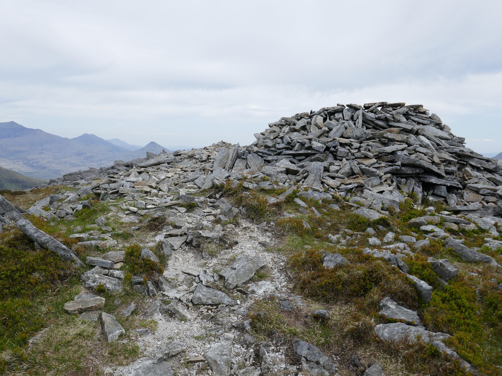
Other points of interest: The Hiatus, Craig Pennant
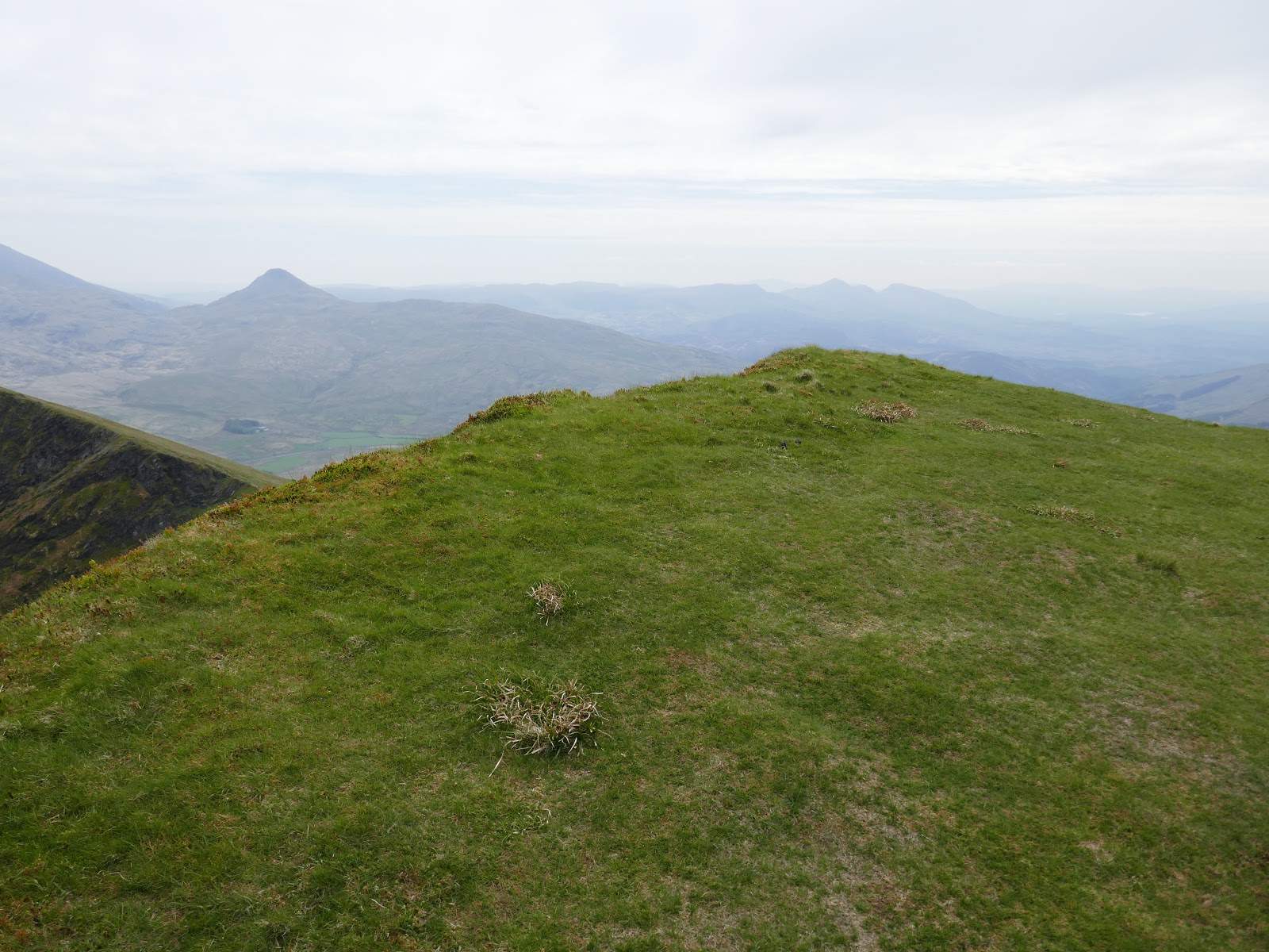
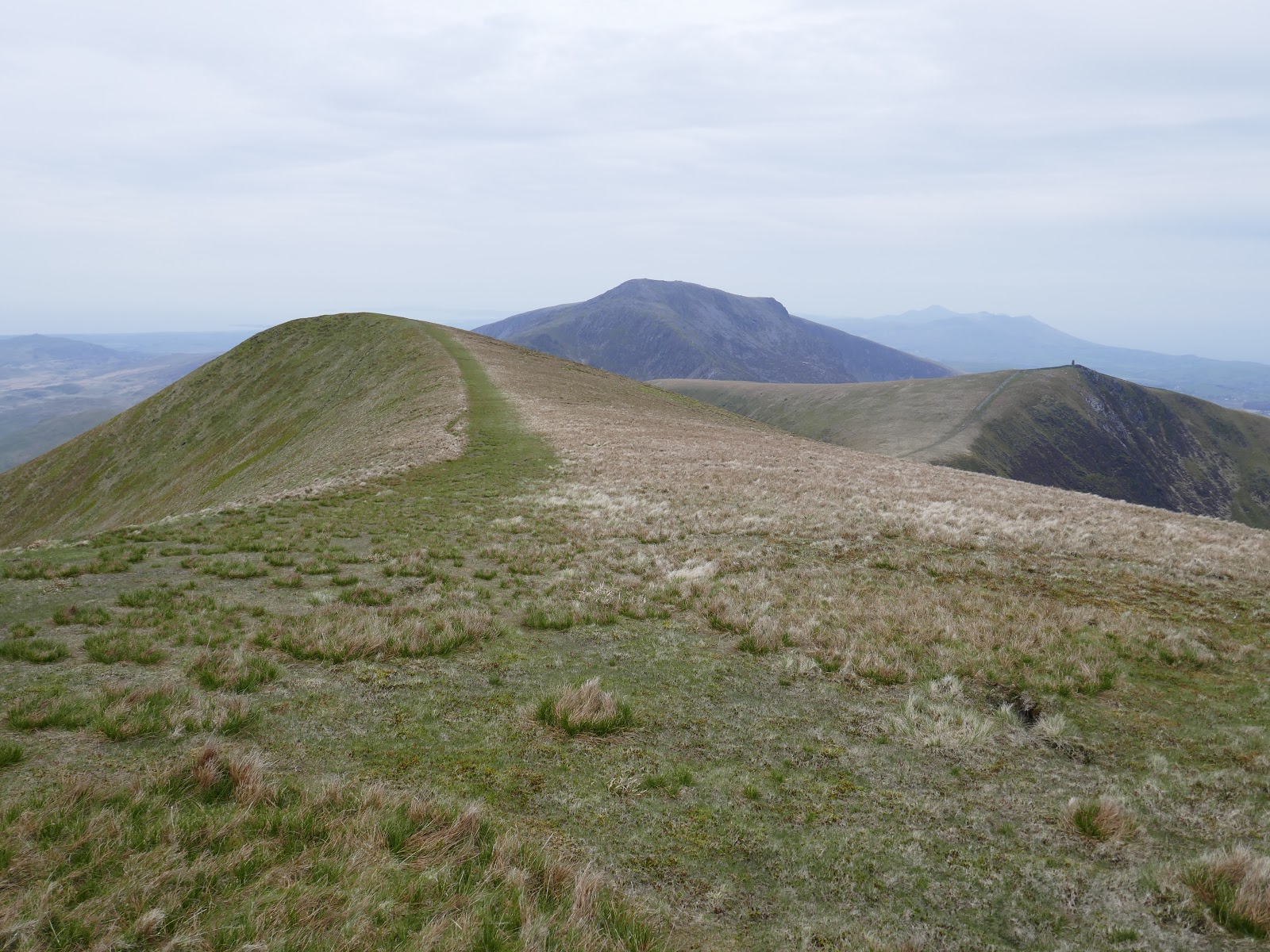
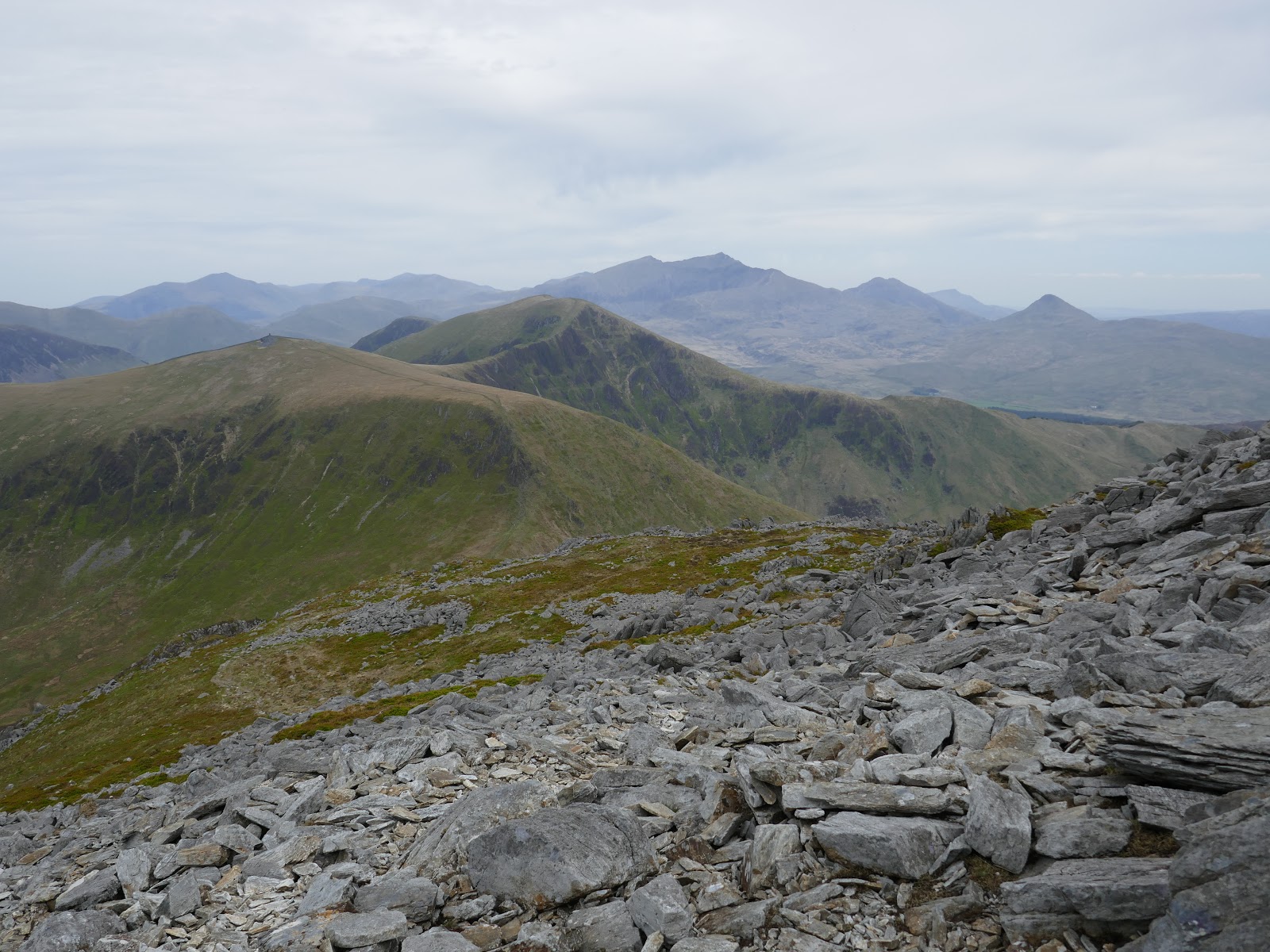
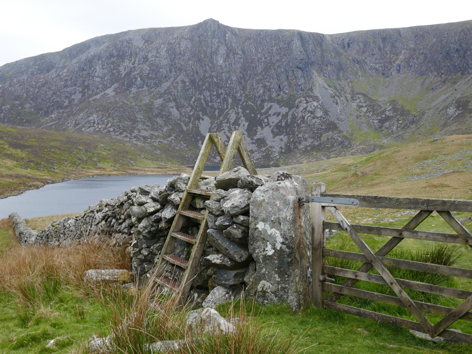
If the prospect of scaling Snowdon on a busy, sunny weekend fills you with dread then cast an eye to the south-west and the modest line of peaks the stretch out westwards from Rhyd-Ddu. At first glance, they may appear inconsequential, grassy and fairly dull, but a closer inspection reveals lines of crags and the promise of an action-packed day. This line of mountains forms the Nantlle Ridge, one of the finest ridge walks in the country.
We chose to make the most of having two cars by walking the length of the Nantlle Ridge from Rhyd-Ddu towards the small village of Nebo. That would involve crossing several named peaks including the exciting scramble up Clogwyn Marchnad.
 |
| Y Garn |
 |
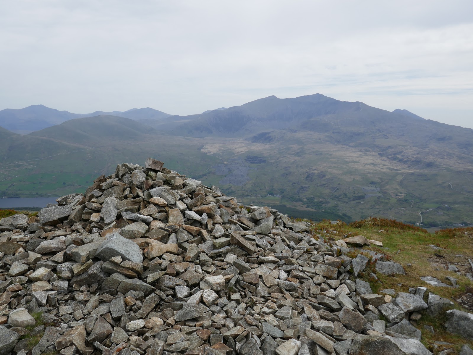
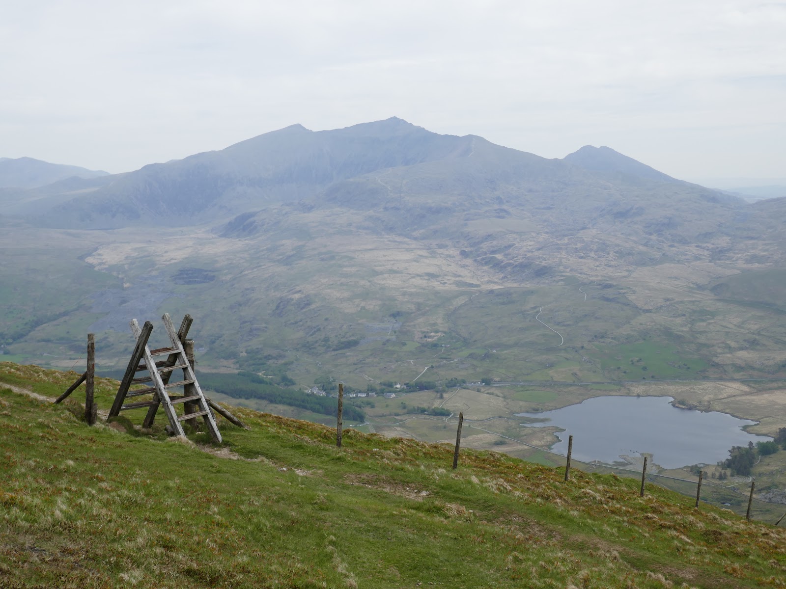
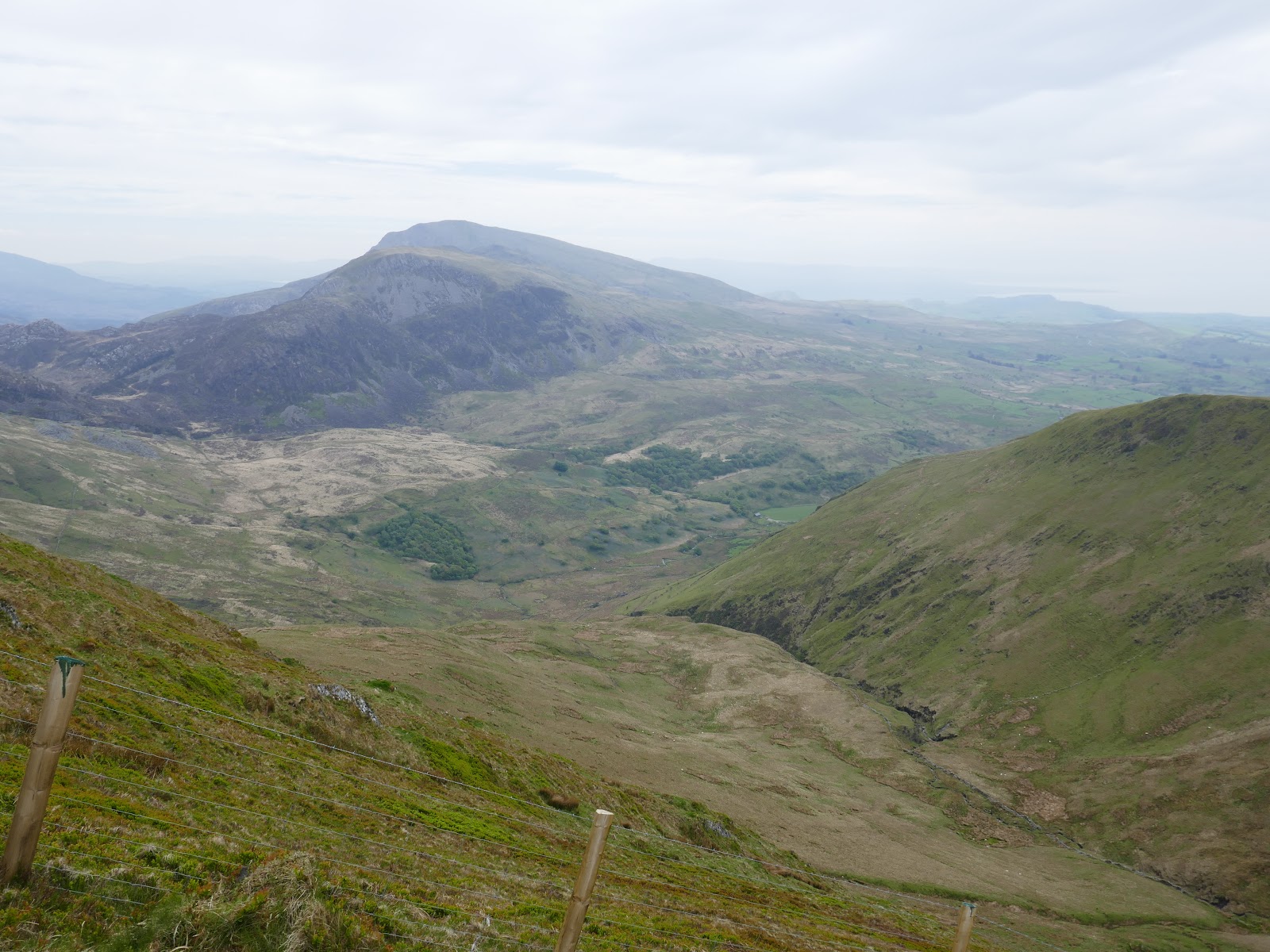
| Snowdon and Yr Aran |
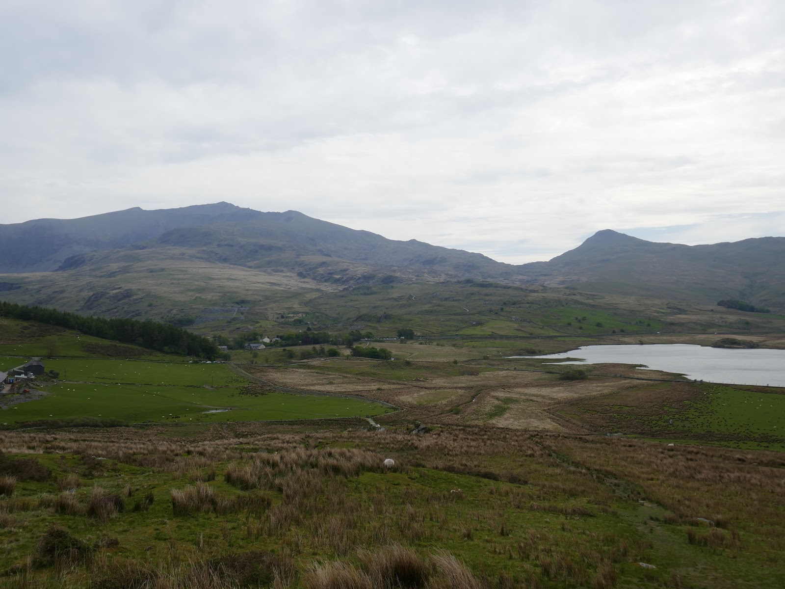
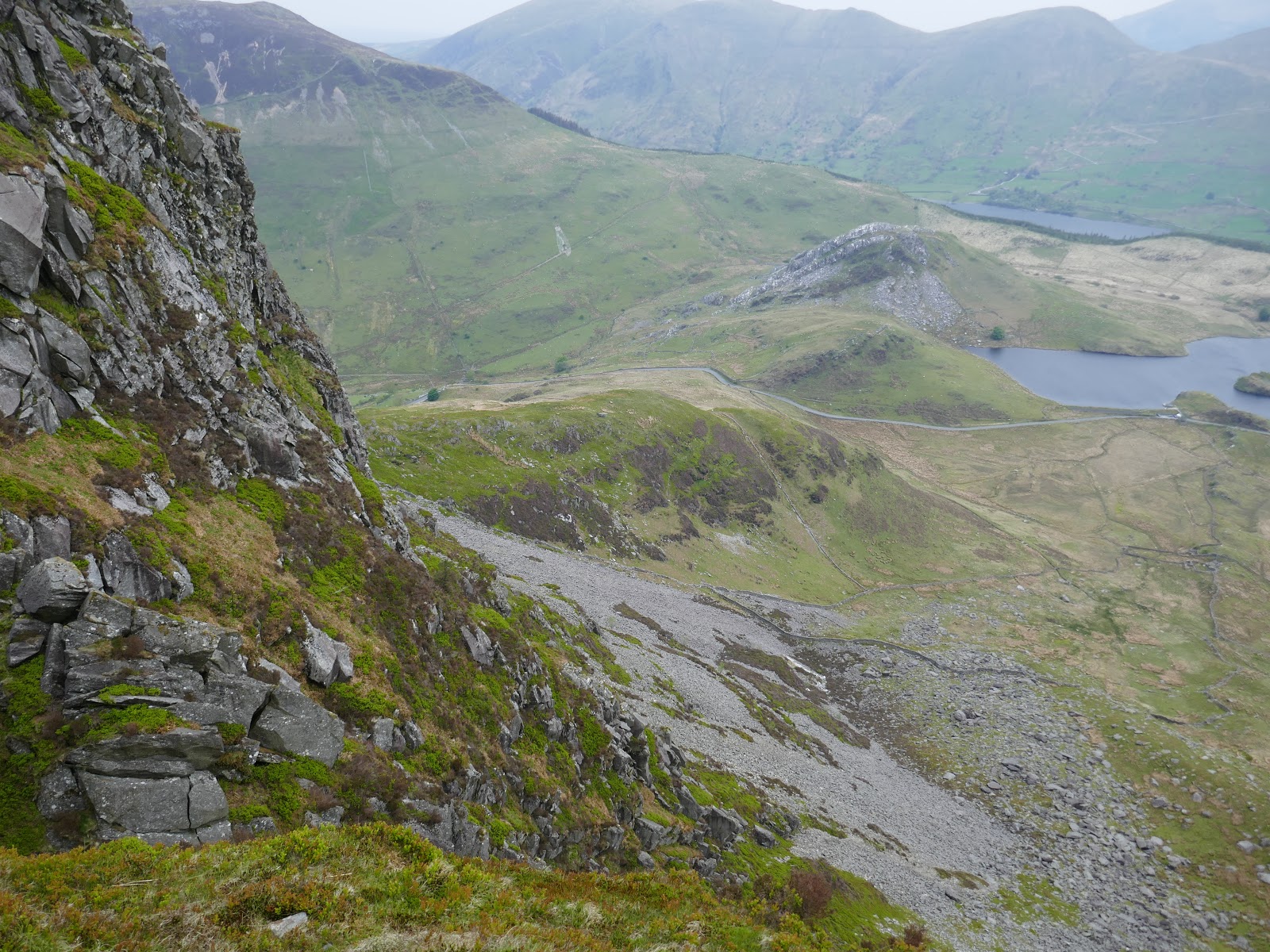
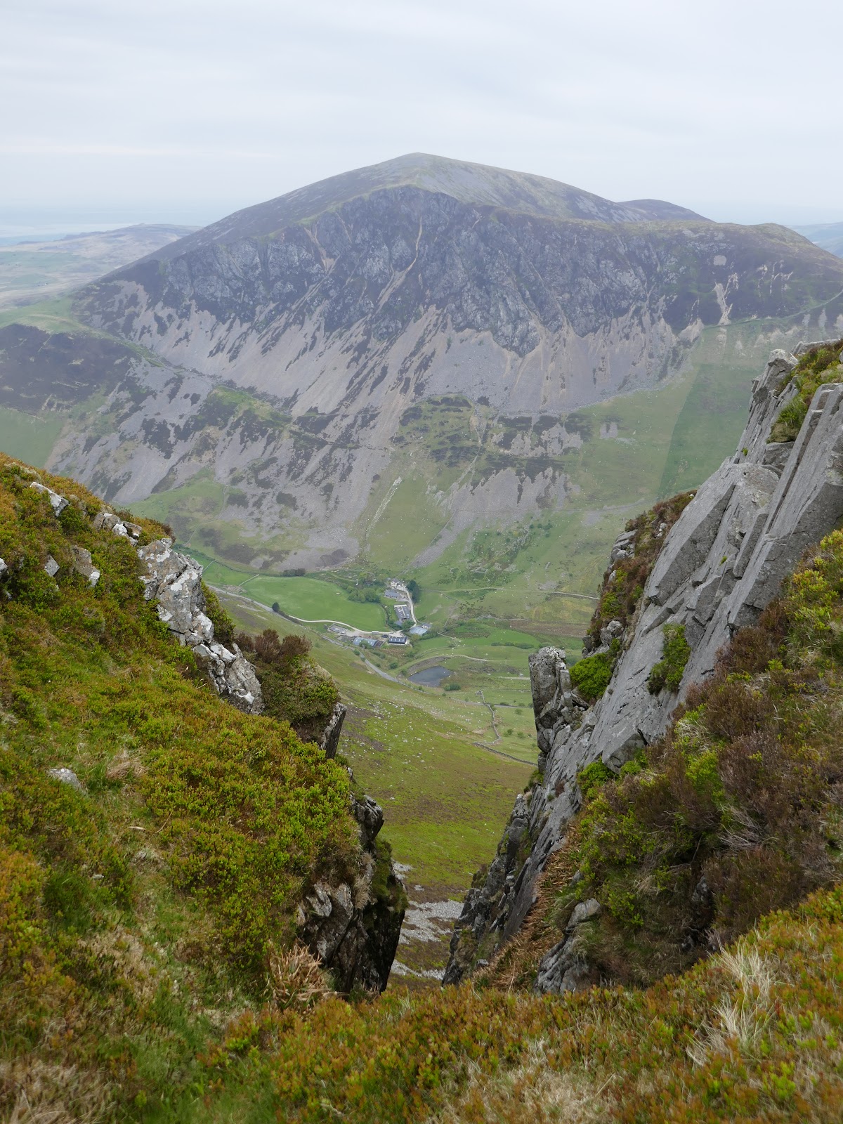
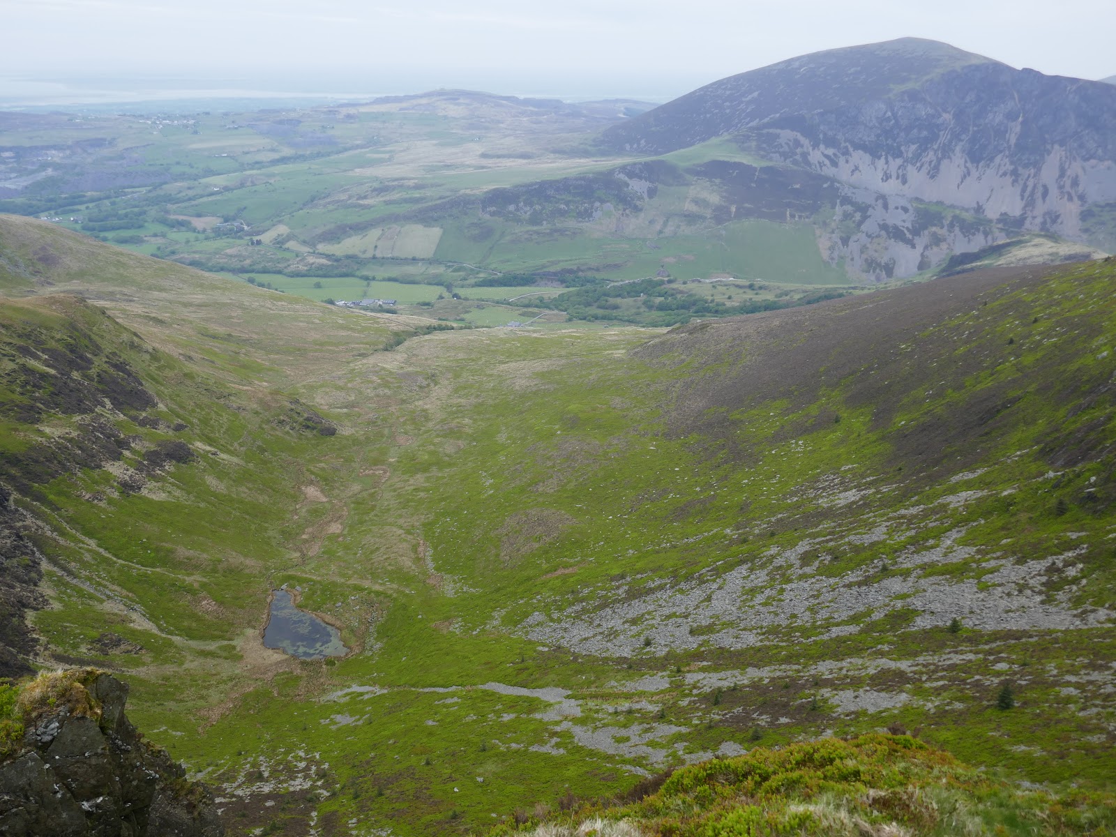
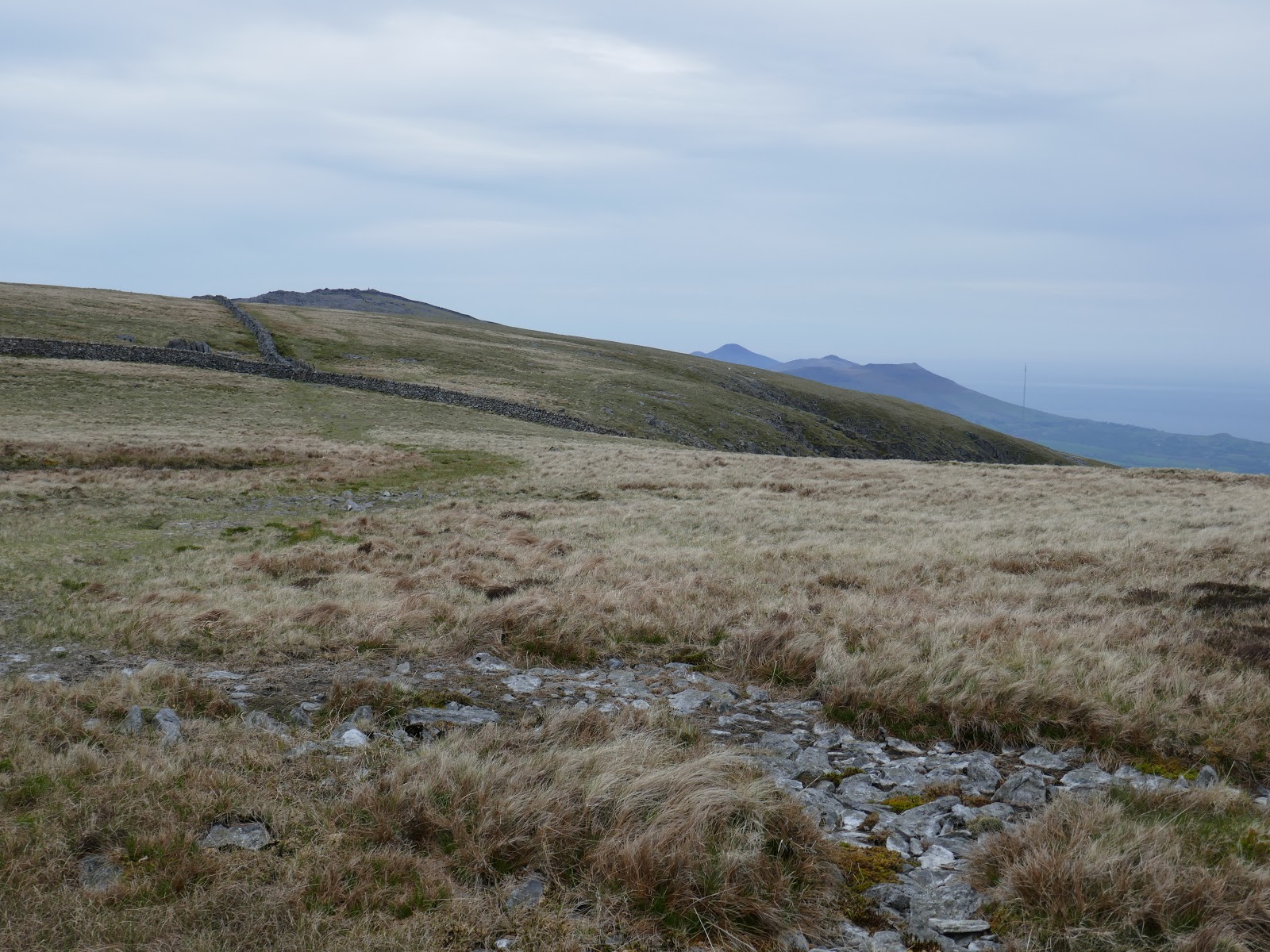
We set off underneath cloudy skies heading for Y Garn, the first peak of the ridge. Leaving Rhyd-Ddu, we followed the B4418 a short distance before joining the bridleway at Drwsycoed Uchaf and heading towards the mountain. Unmarked on the map is a path that makes a direct ascent of Y Garn’s eastern slopes. It’s a steep, uninspiring climb.
 |
| Approaching the stiff climb up Y Garn |
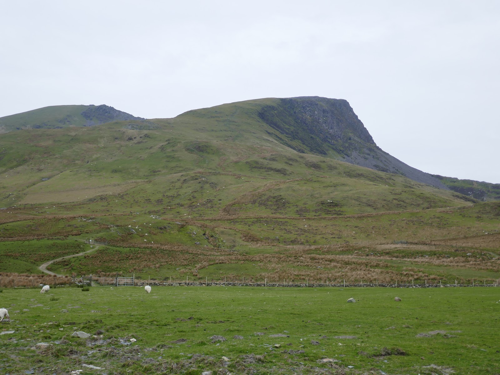
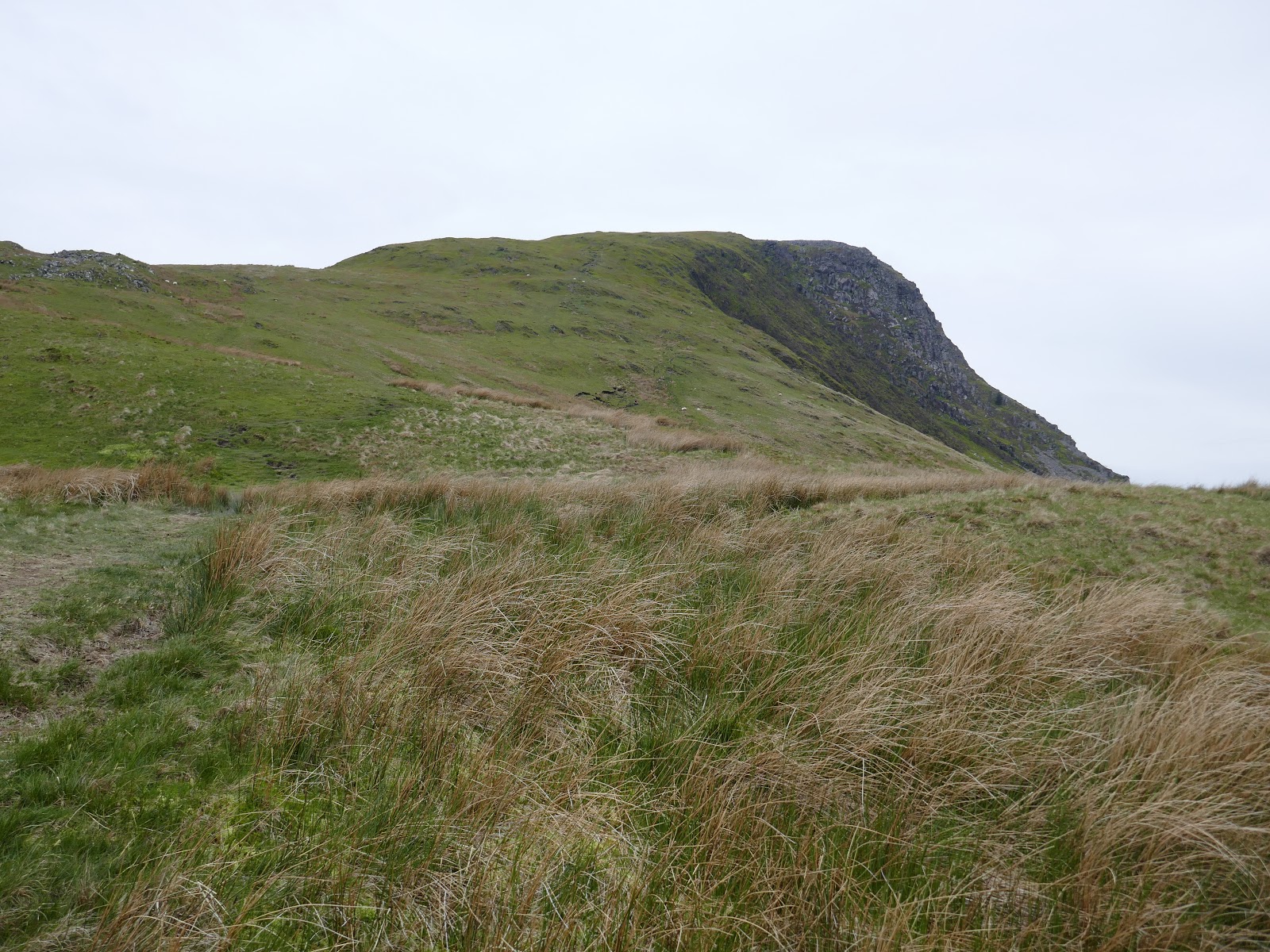
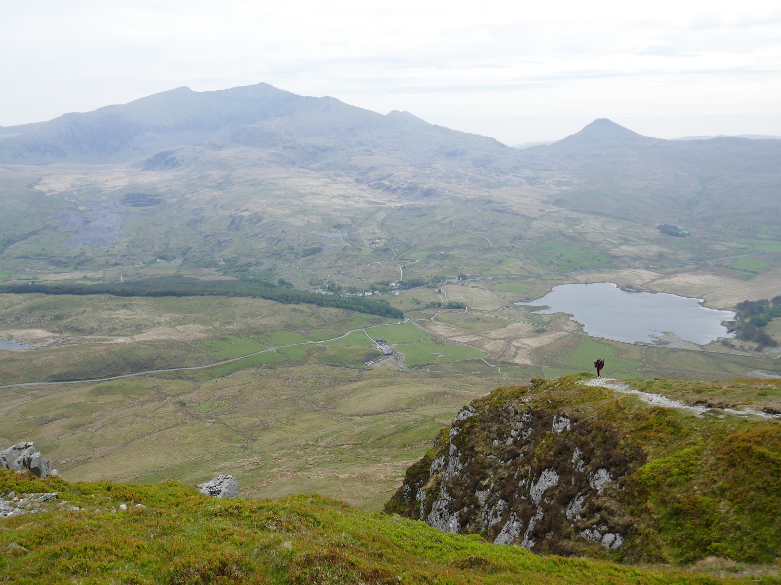
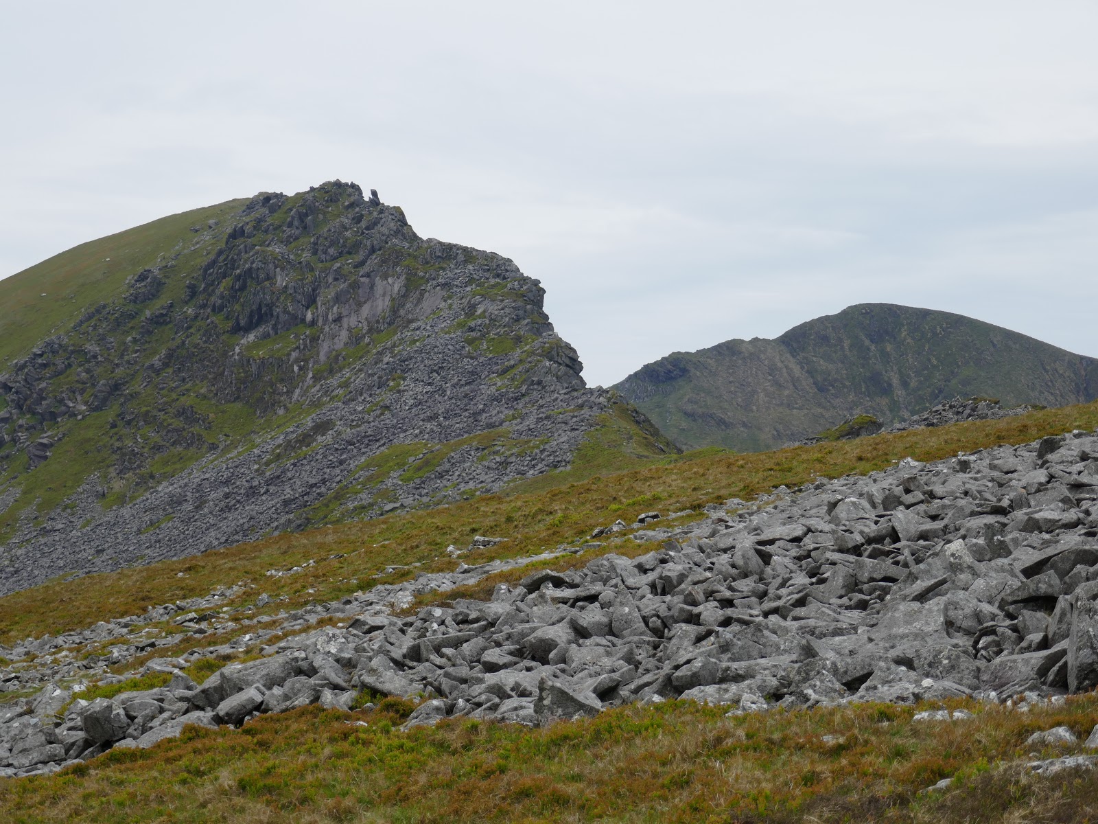
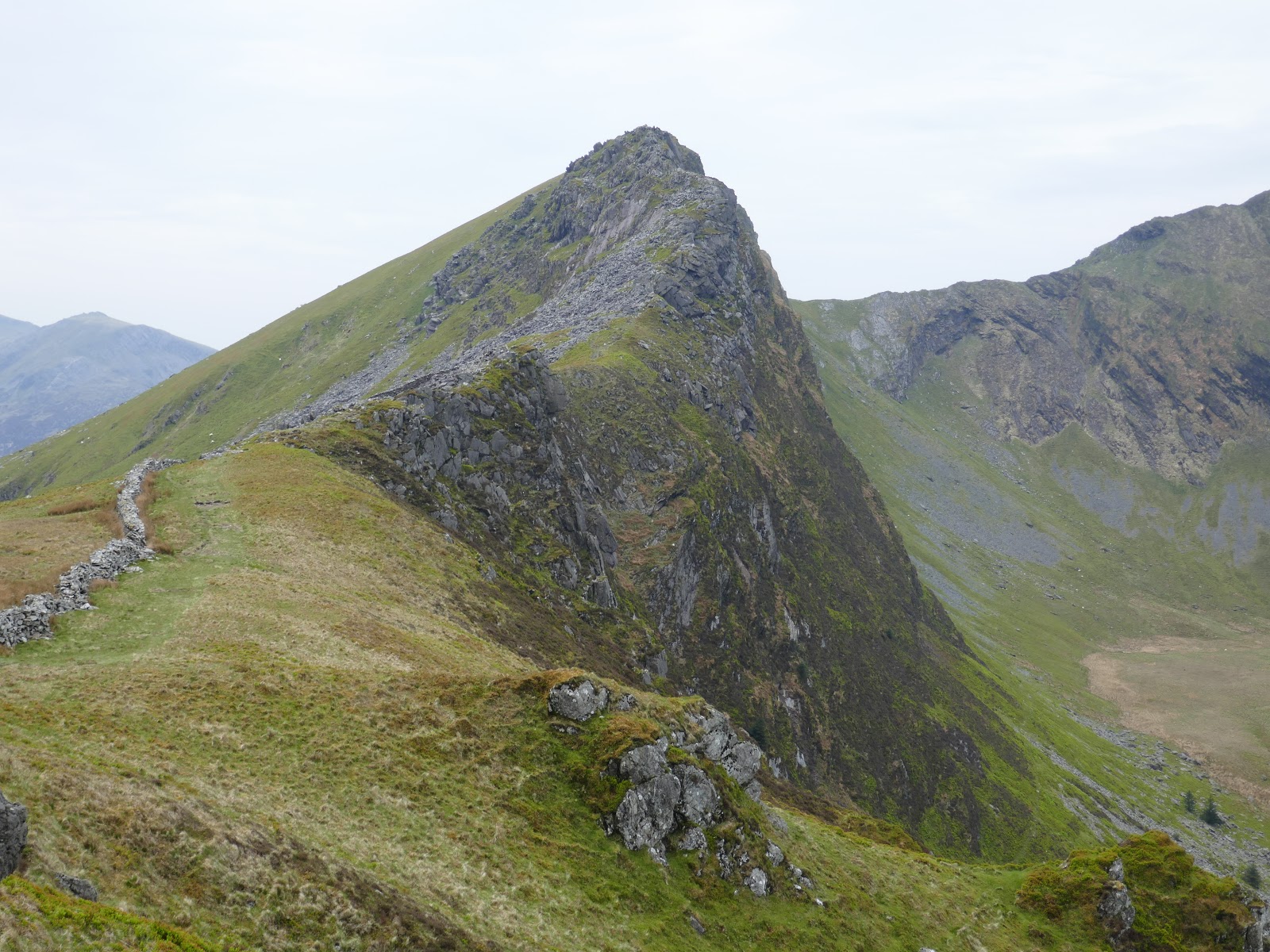
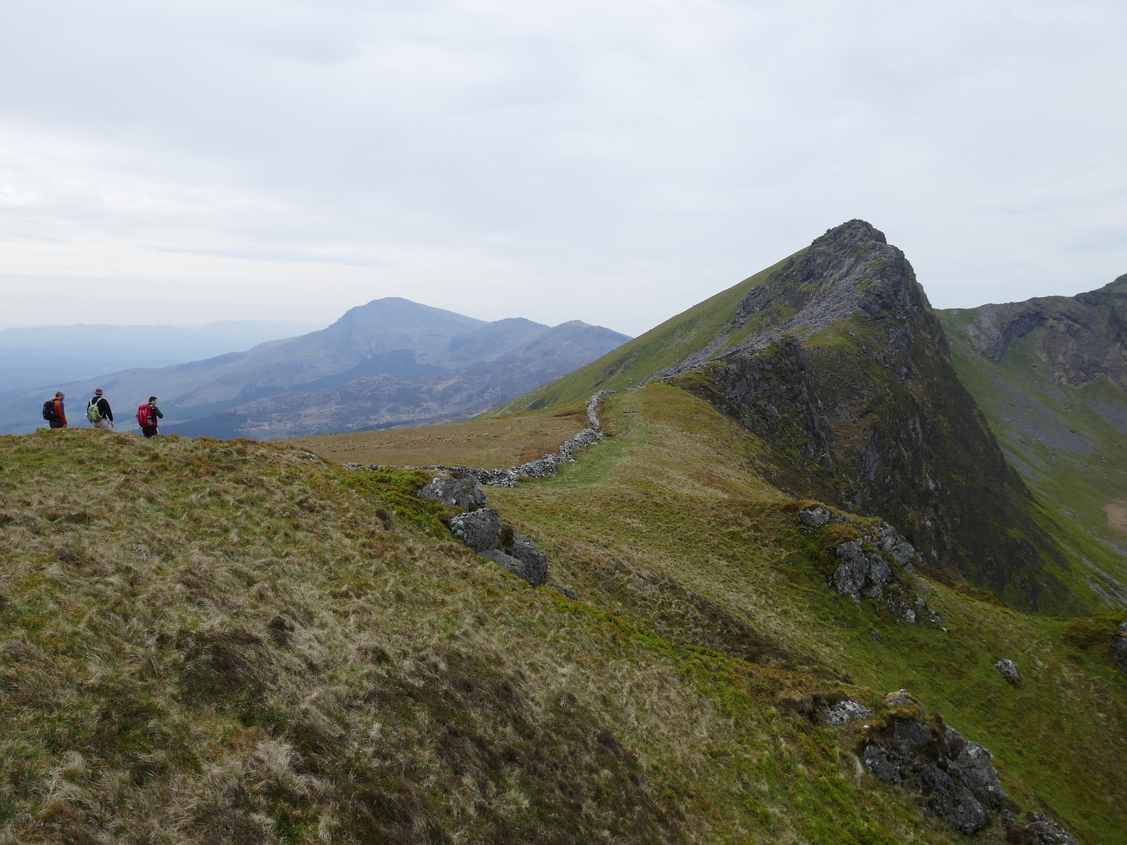
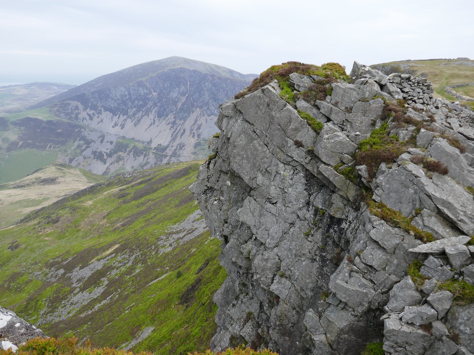
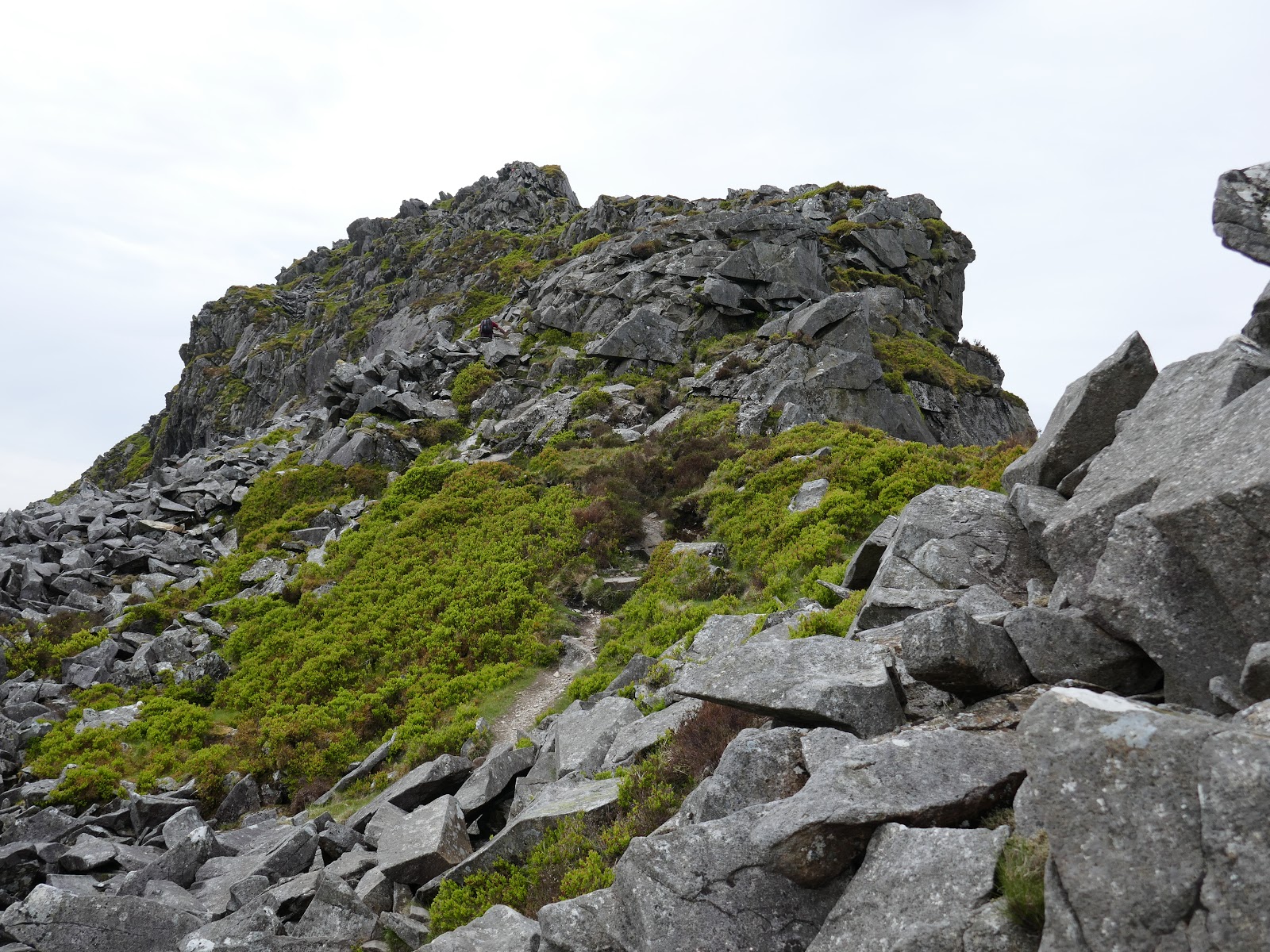
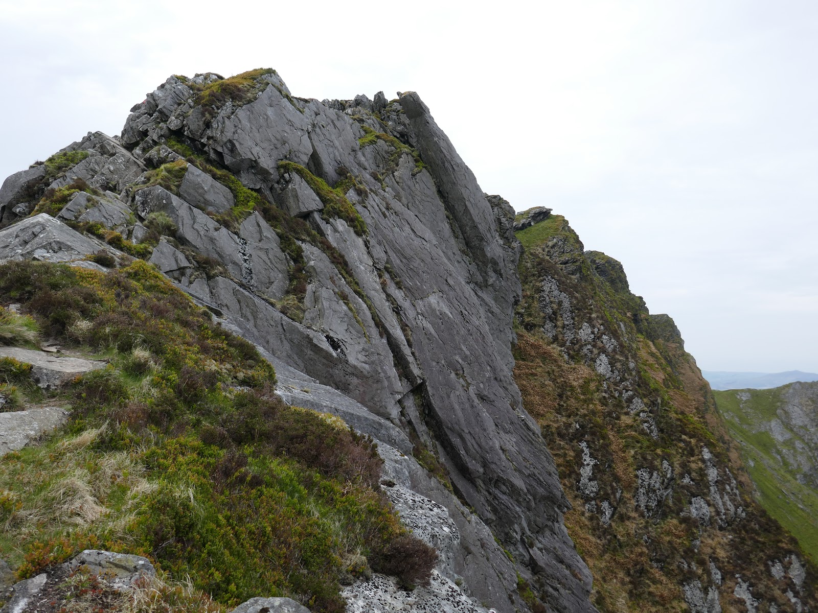
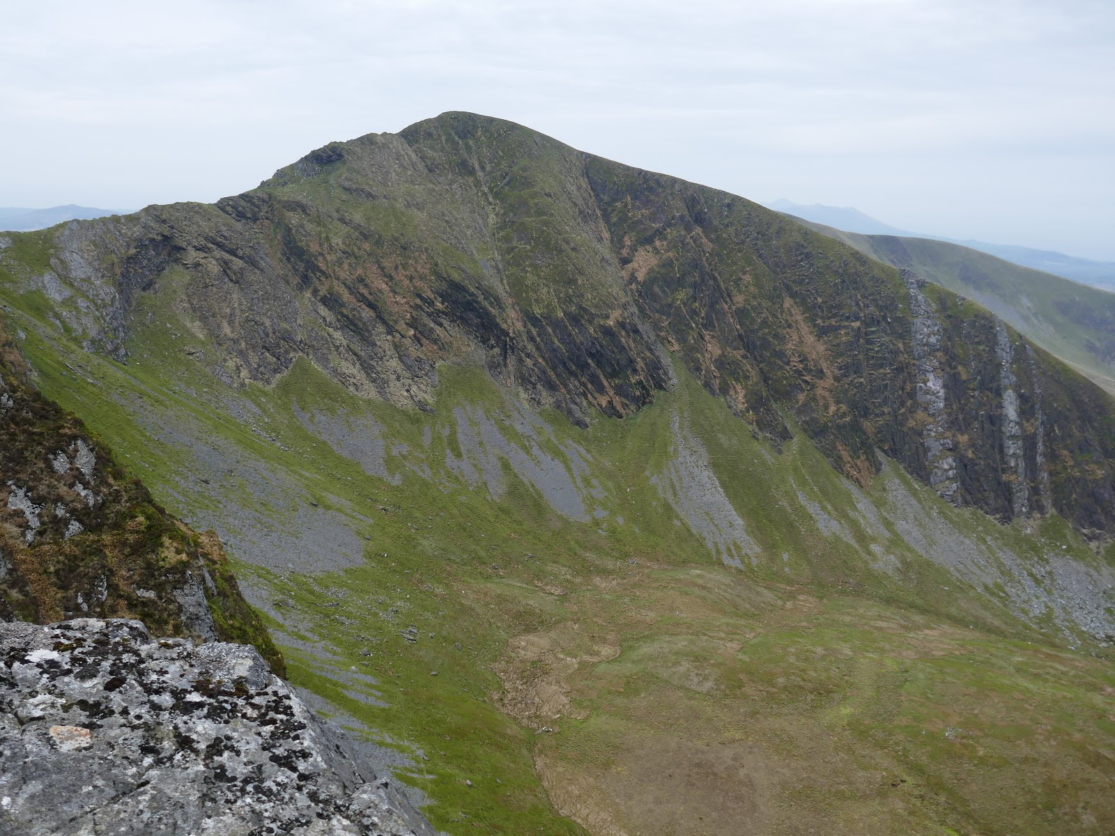
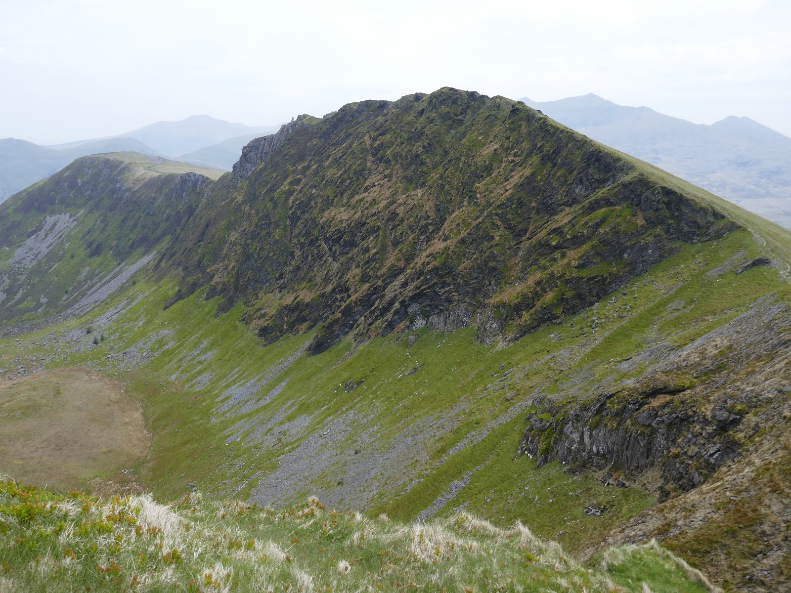
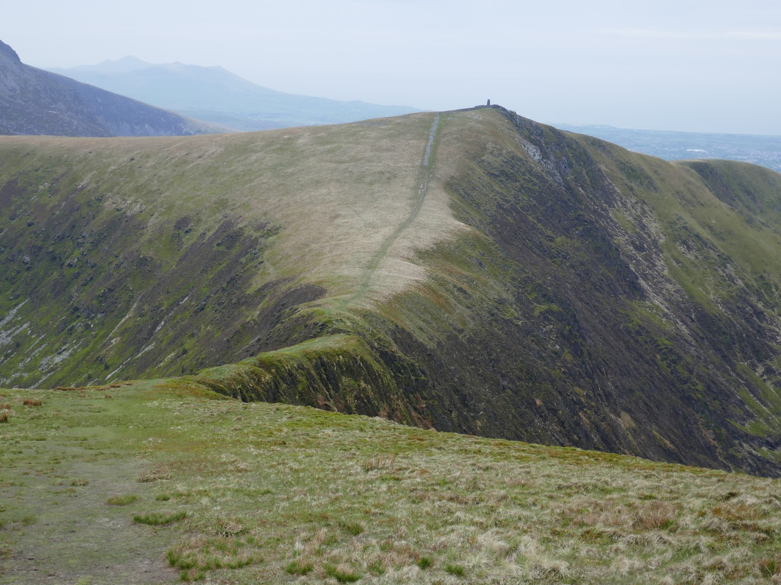
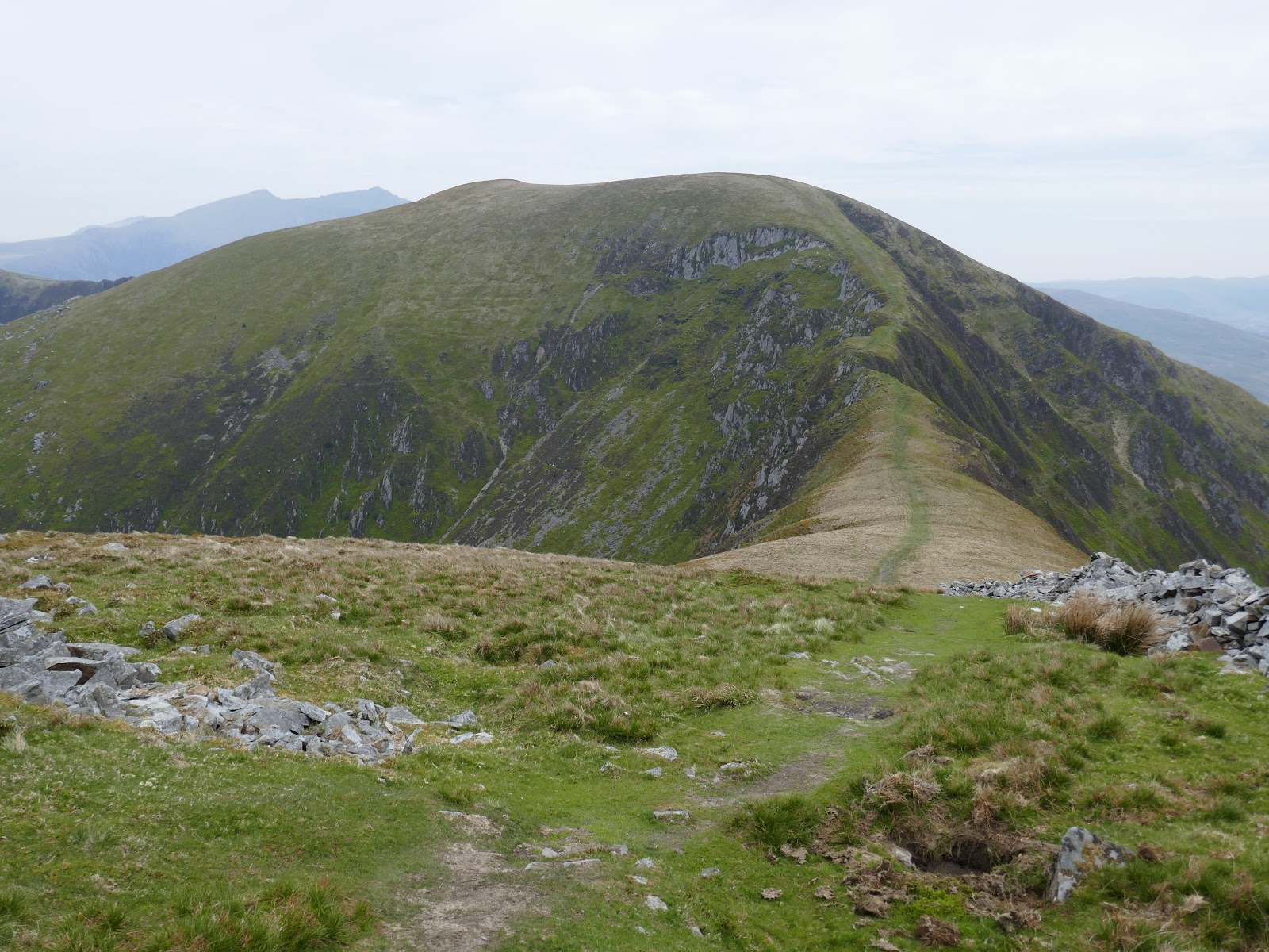
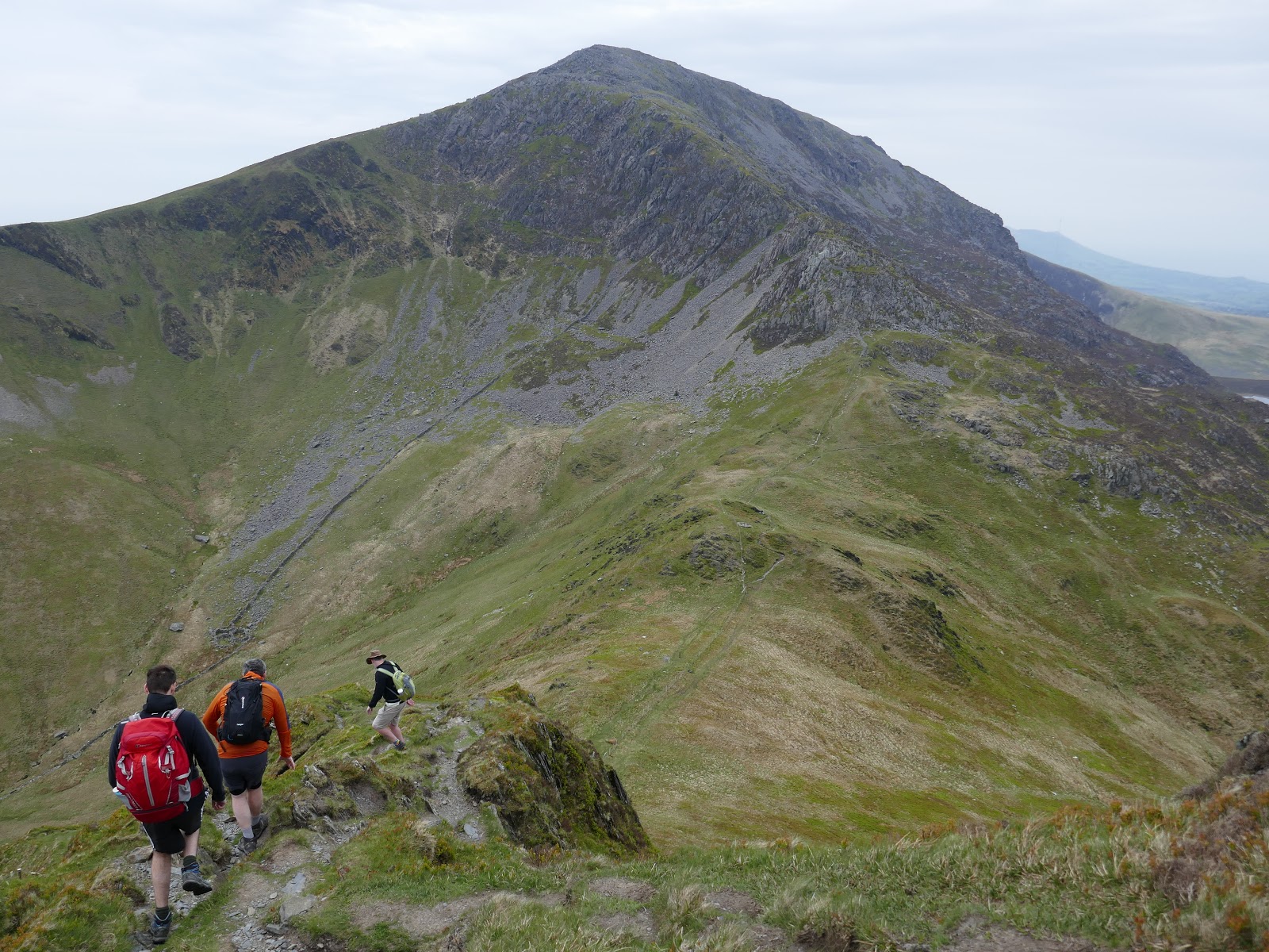
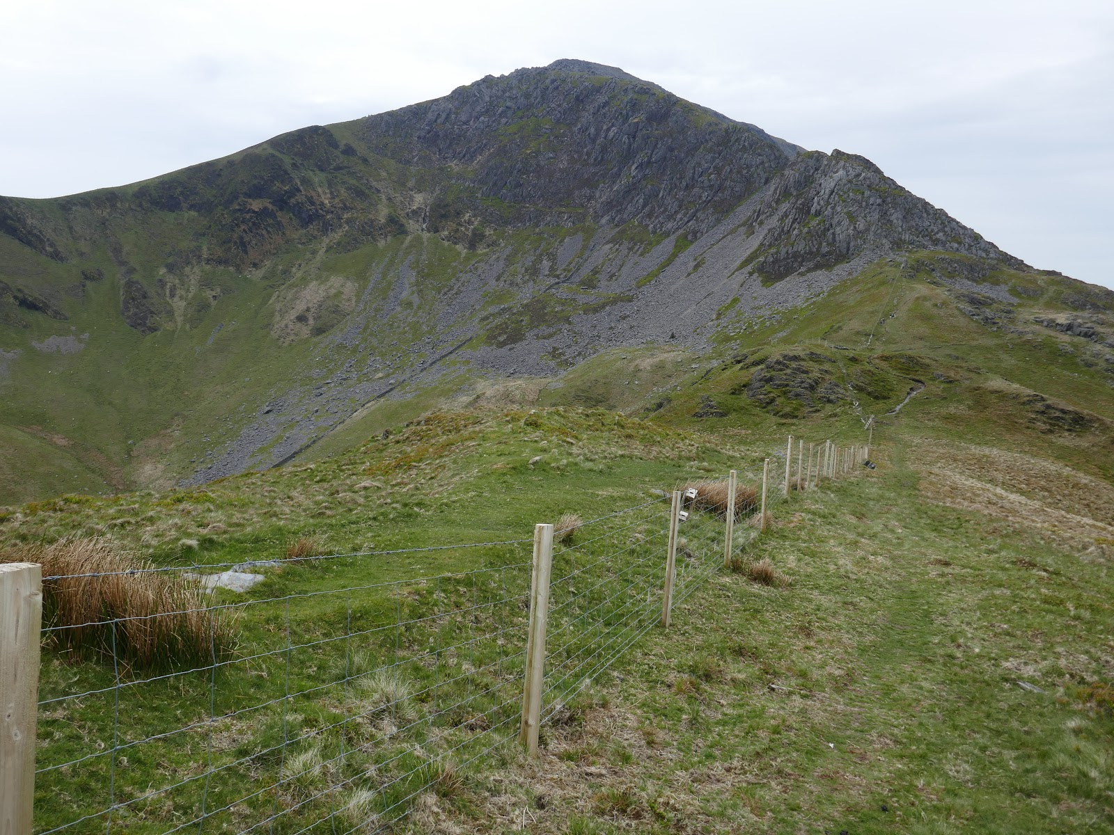
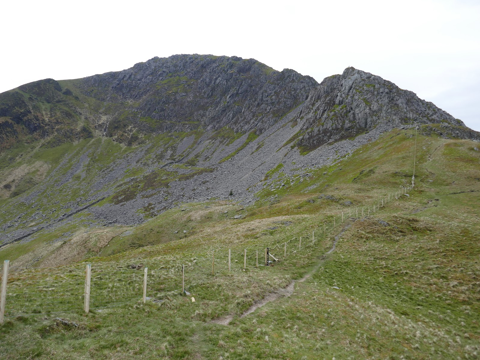
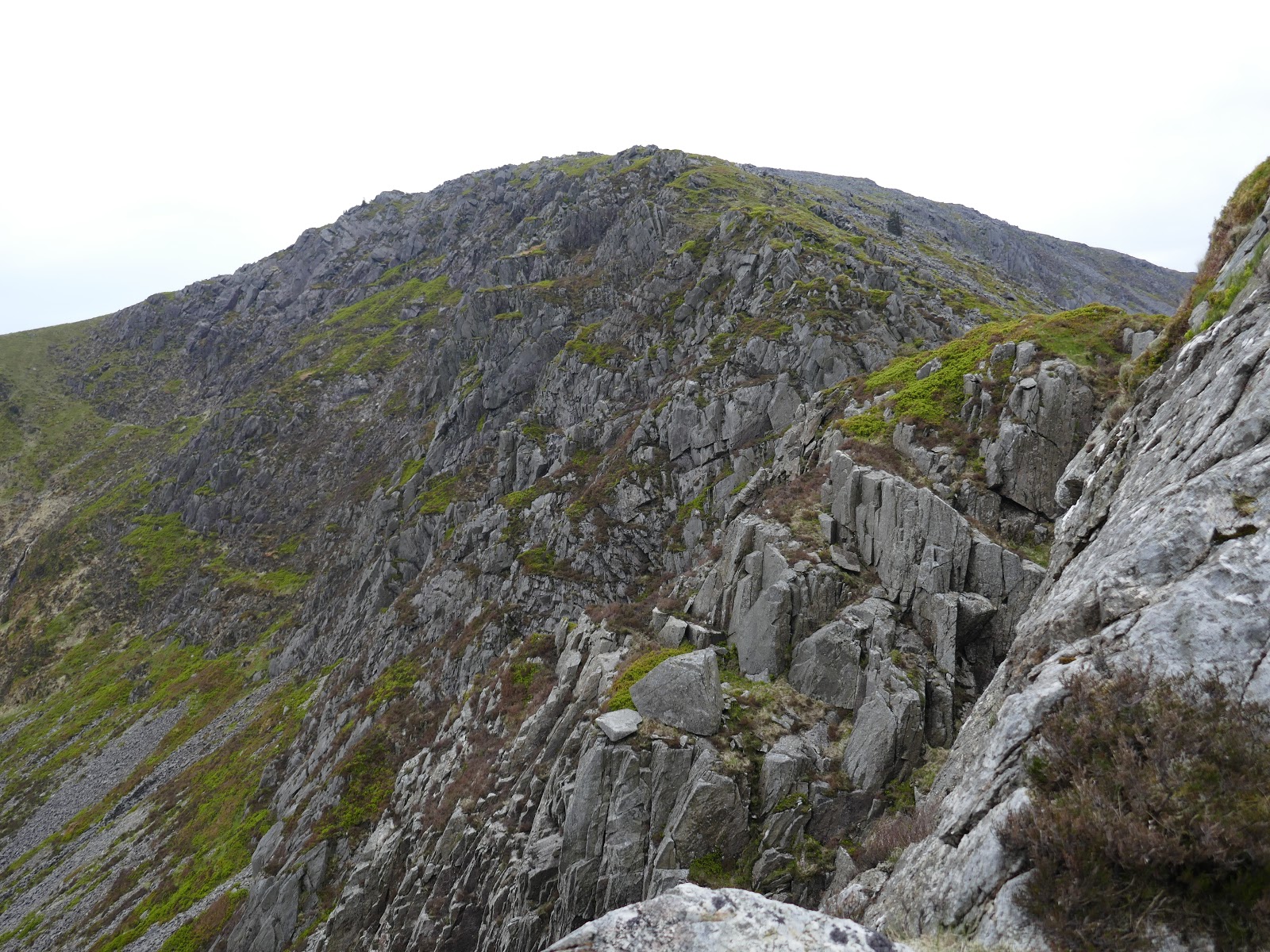
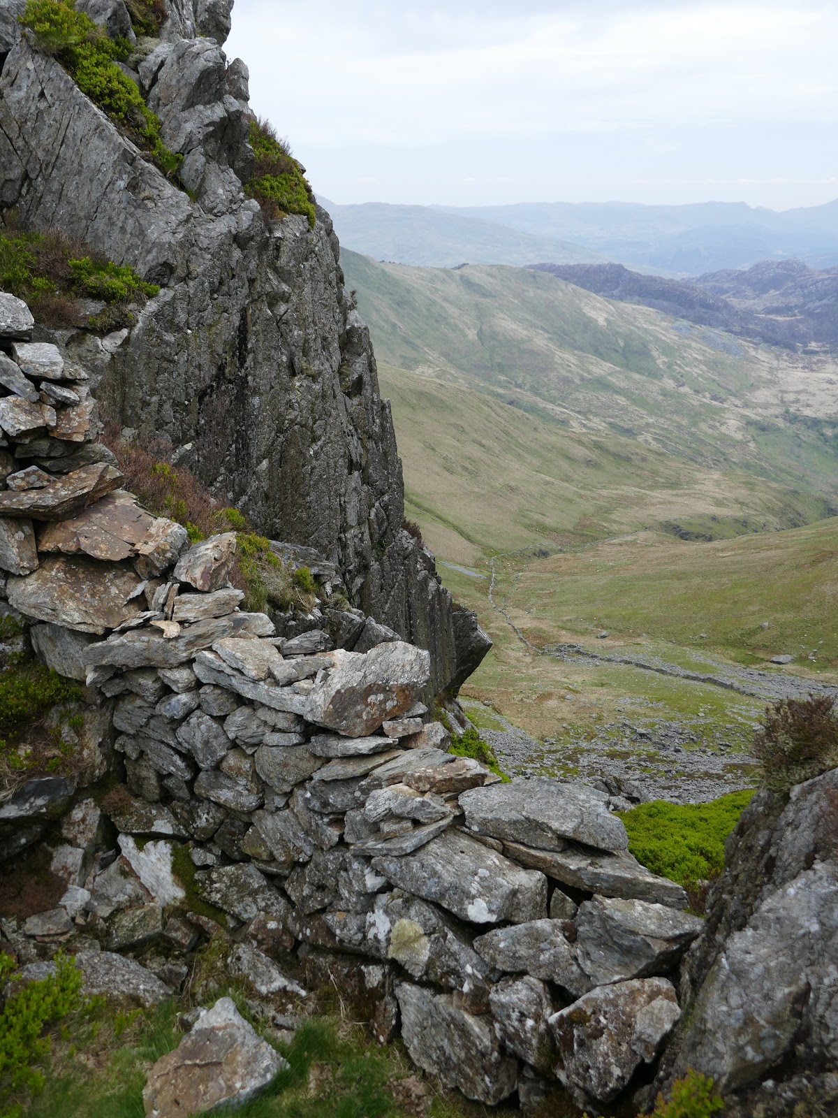
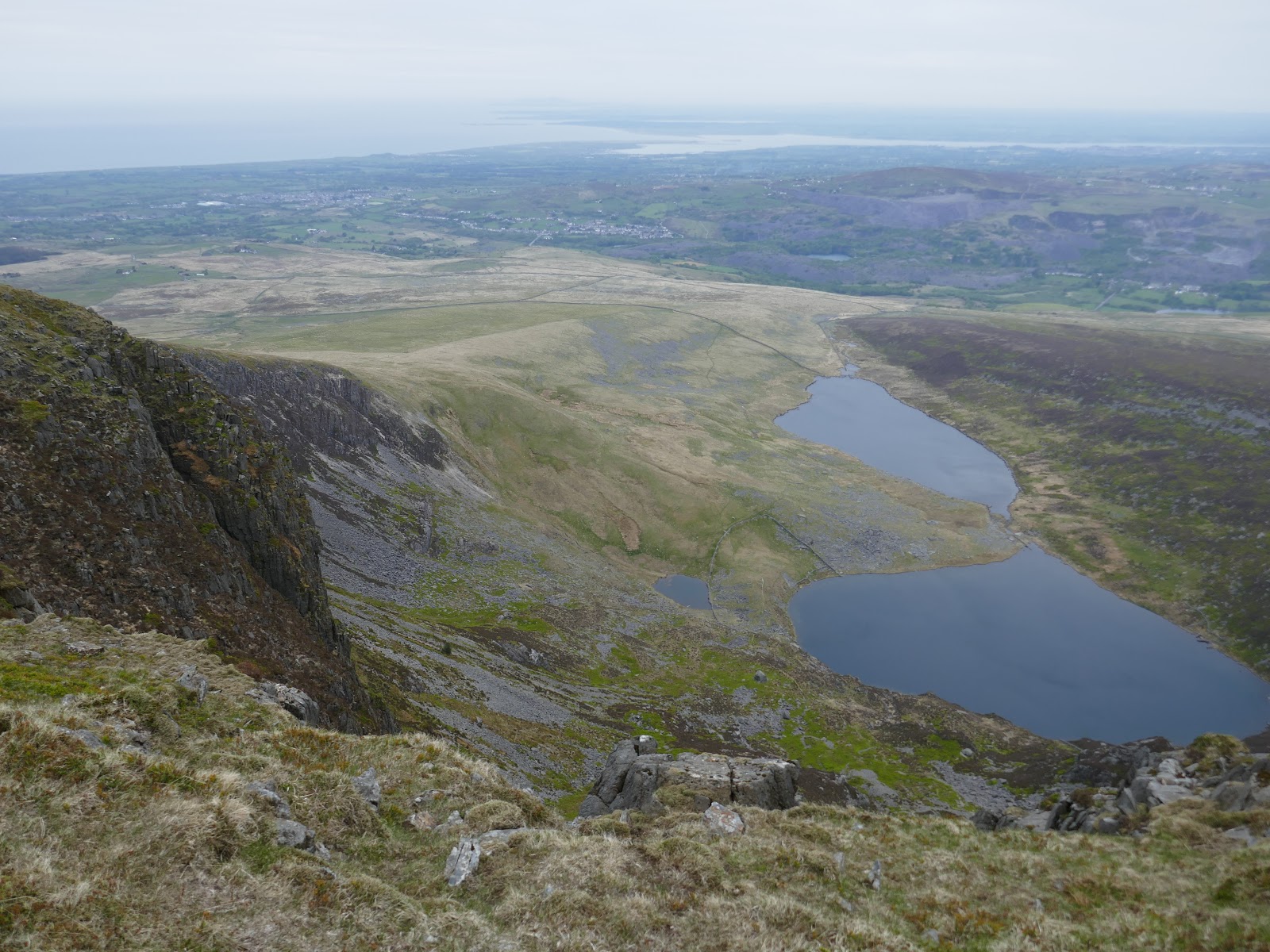
Reaching the summit reveals the charm of the Nantlle Ridge. The impressive, cliffs of Clogwyn Marchnad are the highlight while the steep cliffs of Y Garn expose a dramatic view down to the valley below. We turned south following the wall that leads off Y Garn’s summit. Ahead is an exciting and sometimes exposed scramble to the summit of Mynydd Drws-y-coed, easily the best part of the walk.
 |
| Looking down to the road at Bryn Gwyn |
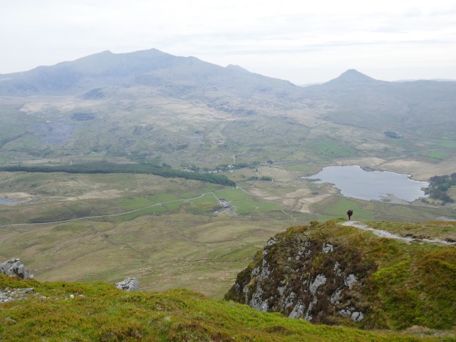 |
| A view across to Snowdon |
 |
| Add caption |
 |
| The amazing Clogwyn Marchnad |
 |
| Looking down one of the steep gullies on Y Garn |
 |
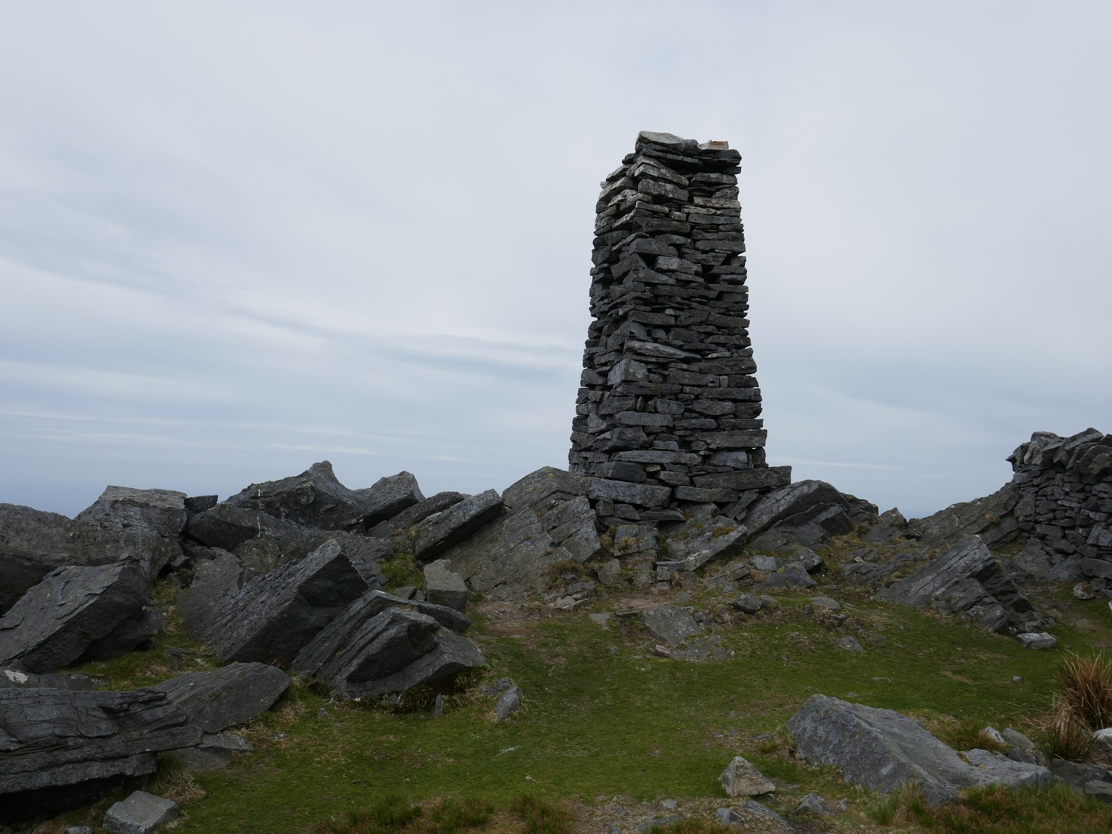
| Y Garn’s summit |
 |
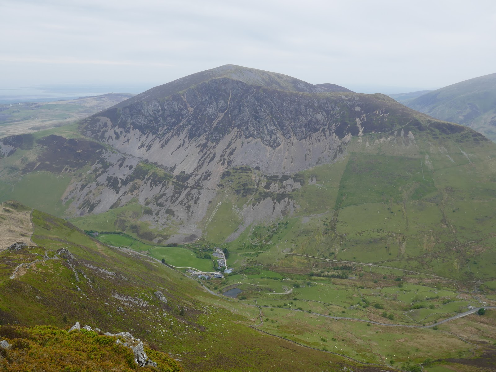
| Mynydd Mawr |
 |
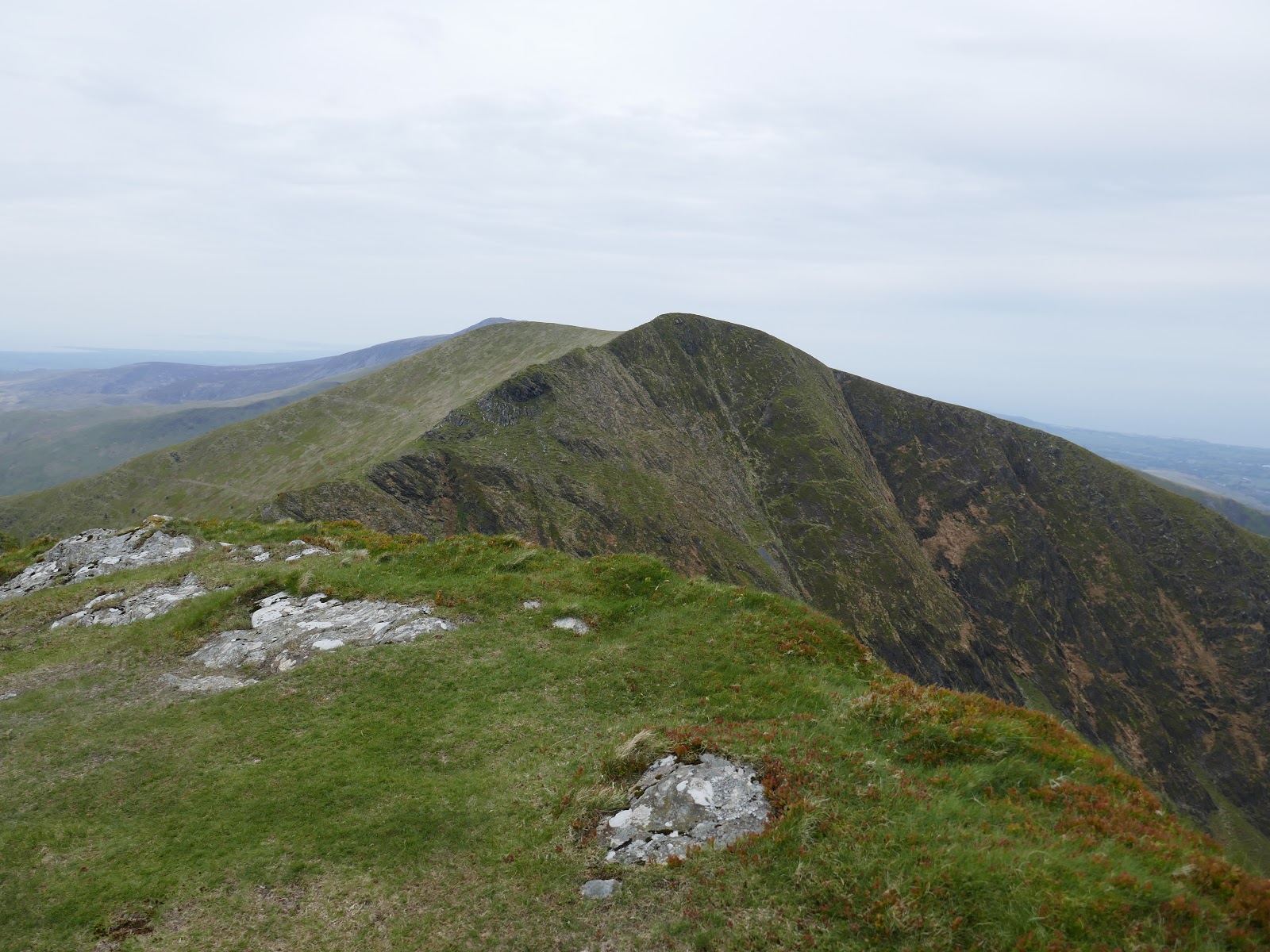
| Mynydd Drws-y-Coed |
 |
| Mynydd Drws-y-Coed |
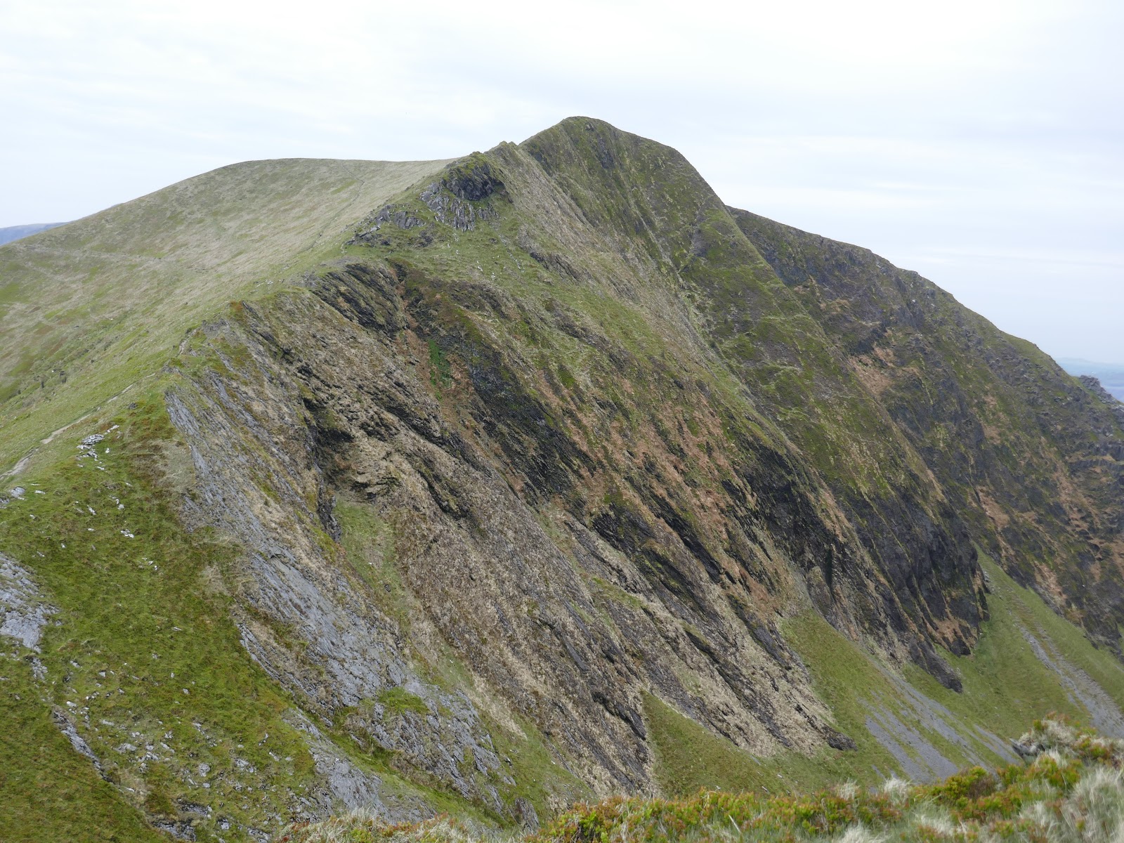
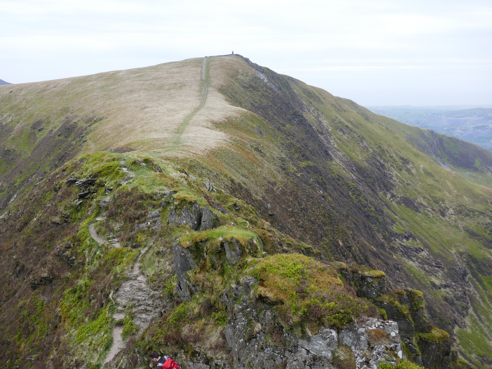
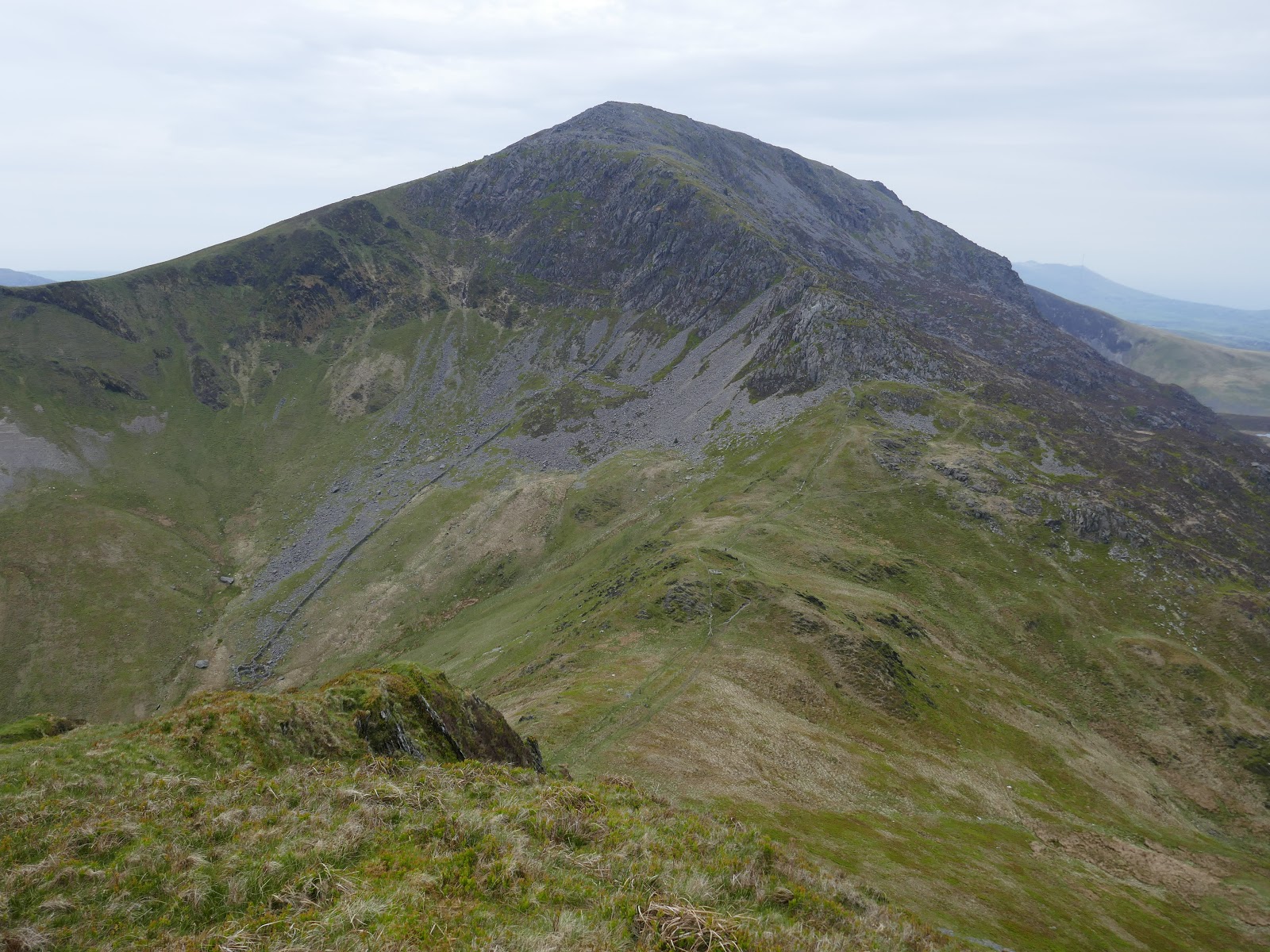
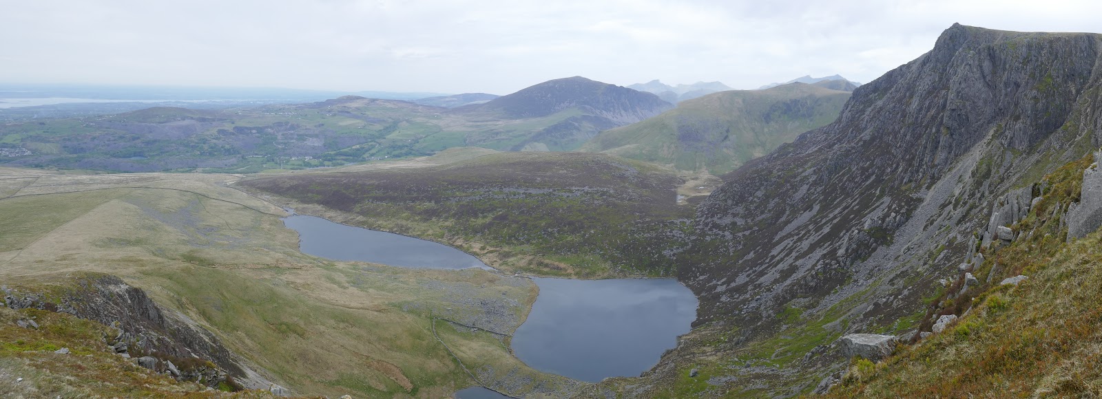
s with much of Wales, the scramble can be as easy or challenging as you want – most of the really exposed bits can be bypassed by a path just off the line of crags. The views down into the valley below are incredible and stretch as far as Caernarfon on the Menai Strait. After the scrambling, Mynydd Drws-y-Coed has an interesting little summit.
 |
| Clogwyn Marchnad |
 |
| Scrambling Clogwyn Marchnad |
 |
| Clogwyn Marchnad |
 |
| Trum y Ddysgl |
 |
| Snowdon |
 |
| The summit of Mynydd Drws-y-Coed |
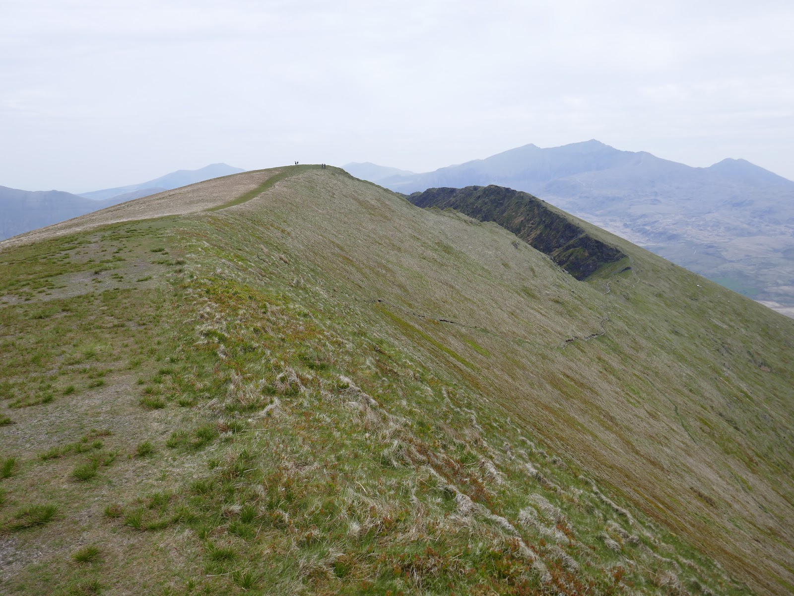
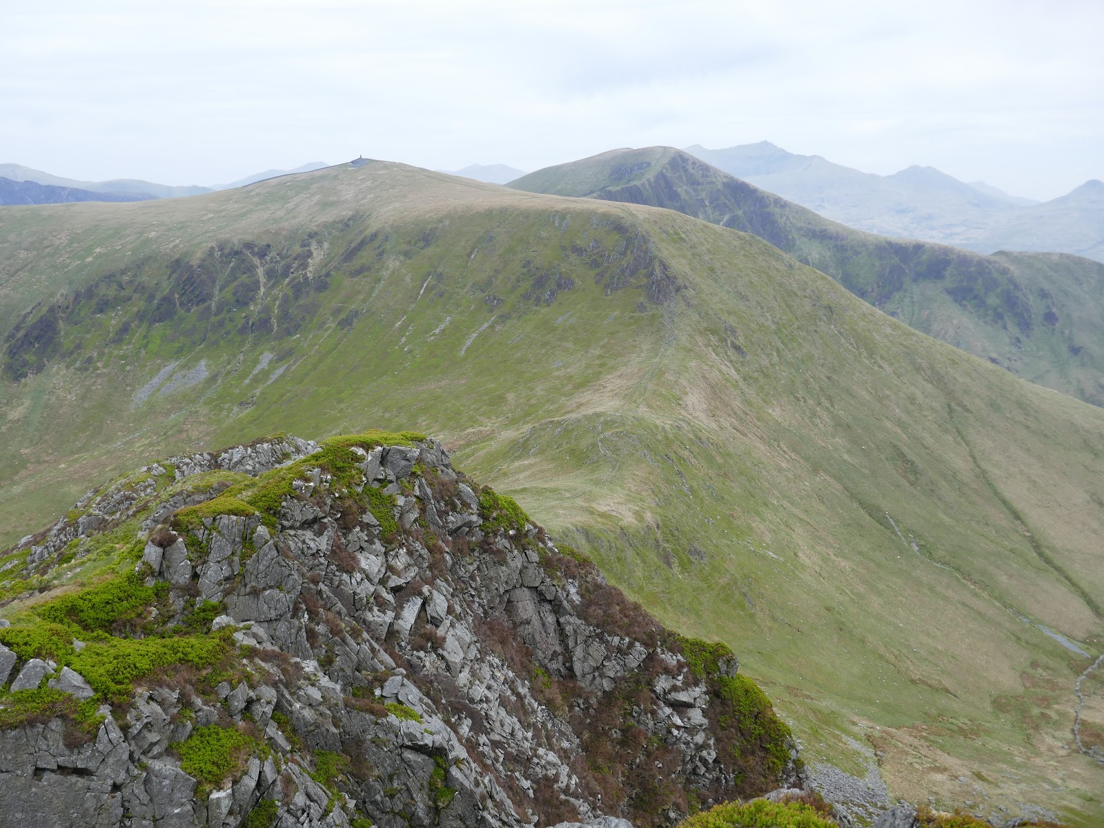
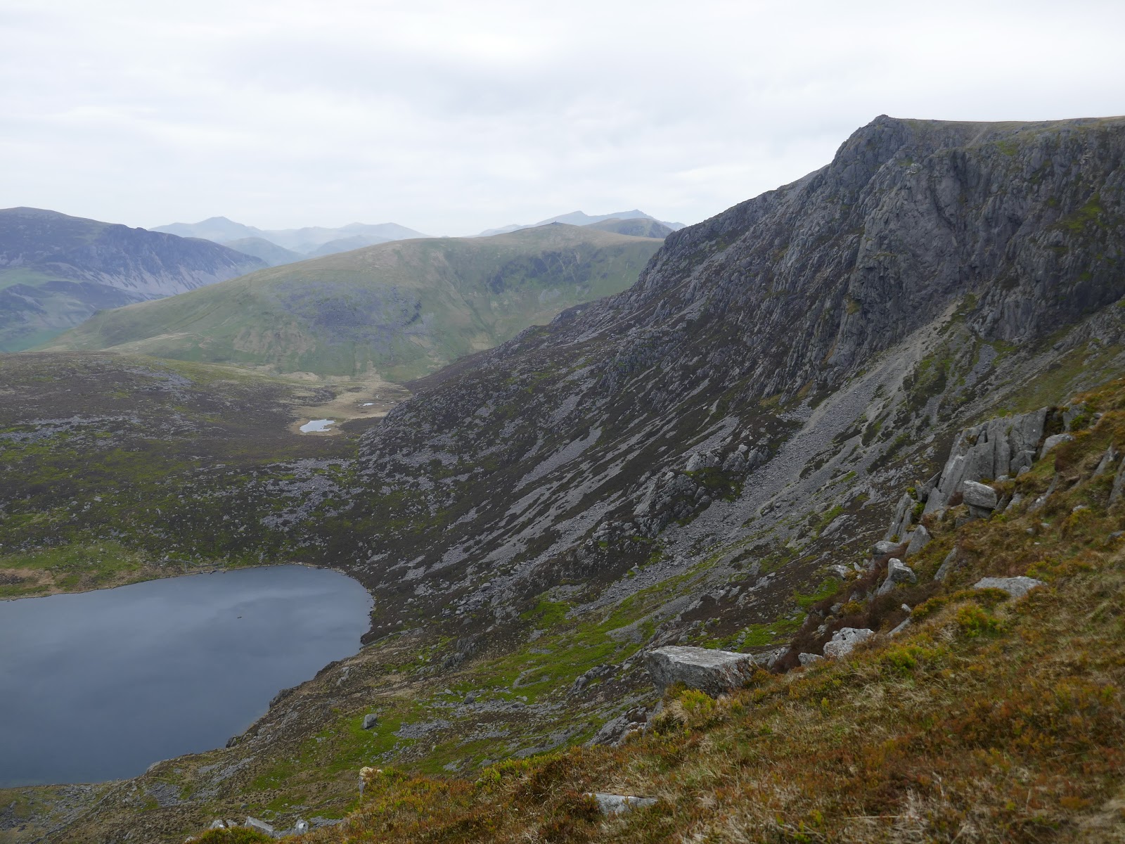
A narrow arete separates Mynydd Drws-y-Coed from the neighbouring Trum y Ddysgl, itself an impressive mountain with an equally impressive view to Mynydd Drws-y Coed.
