Open Space Web-Map builder Codehttps://openspace.ordnancesurvey.co.uk/osmapapi/openspace.js?key=3119F72552FD5C22E0530C6CA40A5A92https://openspace.ordnancesurvey.co.uk/osmapapi/script/mapbuilder/basicmap.jshttps://openspace.ordnancesurvey.co.uk/osmapapi/script/mapbuilder/searchbox.js//variables for routes var linesLayer, points, lineFeature, lineString, routeMarkersLayer, routepos, routesize, routeoffset, routeicon; var style_blue = {strokeColor: “#0000CD”, strokeOpacity: 0.5, strokeWidth: 4.5}; function initmapbuilder() { //initiate the map var options = {resolutions: [2500, 1000, 500, 200, 100, 50, 25, 10, 5, 4, 2.5, 2, 1]}; osMap = new OpenSpace.Map(‘map’, options); //configure map options (basicmap.js) setglobaloptions(); //set the center of the map and the zoom level osMap.setCenter(new OpenSpace.MapPoint(332043.5,526712.5),7); linesLayer = osMap.getVectorLayer(); // Set up layer for route markers routeMarkersLayer = new OpenLayers.Layer.Markers(“Route Markers”); //make a route points = new Array(); points.push(new OpenLayers.Geometry.Point(332473.5,525402.5)); points.push(new OpenLayers.Geometry.Point(332423.5,525497.5)); points.push(new OpenLayers.Geometry.Point(332603.5,525857.5)); points.push(new OpenLayers.Geometry.Point(332453.5,526072.5)); points.push(new OpenLayers.Geometry.Point(332483.5,526097.5)); points.push(new OpenLayers.Geometry.Point(332443.5,526202.5)); points.push(new OpenLayers.Geometry.Point(332518.5,526337.5)); points.push(new OpenLayers.Geometry.Point(332533.5,526542.5)); points.push(new OpenLayers.Geometry.Point(332728.5,526702.5)); points.push(new OpenLayers.Geometry.Point(332648.5,526777.5)); points.push(new OpenLayers.Geometry.Point(332648.5,527102.5)); points.push(new OpenLayers.Geometry.Point(332468.5,527482.5)); points.push(new OpenLayers.Geometry.Point(332328.5,527762.5)); points.push(new OpenLayers.Geometry.Point(332478.5,527827.5)); points.push(new OpenLayers.Geometry.Point(332688.5,527787.5)); points.push(new OpenLayers.Geometry.Point(332868.5,527847.5)); points.push(new OpenLayers.Geometry.Point(332988.5,528177.5)); points.push(new OpenLayers.Geometry.Point(332898.5,528342.5)); points.push(new OpenLayers.Geometry.Point(332768.5,528392.5)); points.push(new OpenLayers.Geometry.Point(332503.5,528312.5)); points.push(new OpenLayers.Geometry.Point(332463.5,527902.5)); points.push(new OpenLayers.Geometry.Point(332333.5,527772.5)); points.push(new OpenLayers.Geometry.Point(332048.5,527657.5)); points.push(new OpenLayers.Geometry.Point(331773.5,527387.5)); points.push(new OpenLayers.Geometry.Point(331573.5,527307.5)); points.push(new OpenLayers.Geometry.Point(331303.5,527222.5)); points.push(new OpenLayers.Geometry.Point(331178.5,527122.5)); points.push(new OpenLayers.Geometry.Point(331113.5,526942.5)); points.push(new OpenLayers.Geometry.Point(330953.5,526862.5)); points.push(new OpenLayers.Geometry.Point(330648.5,526617.5)); points.push(new OpenLayers.Geometry.Point(330683.5,526502.5)); points.push(new OpenLayers.Geometry.Point(330688.5,526292.5)); points.push(new OpenLayers.Geometry.Point(330708.5,526152.5)); points.push(new OpenLayers.Geometry.Point(330778.5,526017.5)); points.push(new OpenLayers.Geometry.Point(330928.5,525997.5)); points.push(new OpenLayers.Geometry.Point(331228.5,526137.5)); points.push(new OpenLayers.Geometry.Point(331268.5,525967.5)); points.push(new OpenLayers.Geometry.Point(331593.5,526047.5)); points.push(new OpenLayers.Geometry.Point(331598.5,525917.5)); points.push(new OpenLayers.Geometry.Point(331808.5,525632.5)); points.push(new OpenLayers.Geometry.Point(331881,525532.5)); points.push(new OpenLayers.Geometry.Point(331961,525390)); points.push(new OpenLayers.Geometry.Point(332043.5,525375)); points.push(new OpenLayers.Geometry.Point(332133.5,525360)); points.push(new OpenLayers.Geometry.Point(332293.5,525412.5)); points.push(new OpenLayers.Geometry.Point(332418.5,525380)); points.push(new OpenLayers.Geometry.Point(332473.5,525402.5)); // create a polyline feature from the array of points lineString = new OpenLayers.Geometry.LineString(points); lineFeature = new OpenLayers.Feature.Vector(lineString, null, style_blue); linesLayer.addFeatures([lineFeature]); //crate a route start/end marker routepos = new OpenSpace.MapPoint(332473.5,525402.5); routesize = new OpenLayers.Size(33,45); routeoffset = new OpenLayers.Pixel(-5,-37); routeicon = new OpenSpace.Icon(‘https://openspace.ordnancesurvey.co.uk/osmapapi/img_versions/img_1.1/mapbuilder/routemarker-startend.png’, routesize, routeoffset, null, null); routeMarkersLayer.addMarker(new OpenLayers.Marker(routepos, routeicon)); osMap.addLayer(routeMarkersLayer);}
Route: Threlkeld, Gategill, Hall’s Fell, Hall’s Fell Ridge, Blencathra, Scales Tarn, Sharp Edge, Atkinson Pike, Blencathra, Gategill Fell Top, Knowe Crags, Blease Fell, Blease Farm, Threlkeld
Date: 08/04/2018
From: Threlkeld
Parking: Threlkeld Cricket Club
Start Point: Threlkeld
Region: Northern Fells
Route length: 6.5 miles (km)
Time taken: 03:20
Average speed: 2.0mph
Ascent: 1,061m
Descent: 1,068m
Wainwrights on this walk:
Blencathra (868m)
Additional summits: Atkinson Pike (845m), Gategill Fell Top (851m), Knowe Crags (804m)
Other points of interest: Hall’s Fell Ridge, Scales Tarn, Sharp Edge
Today would be a bit of an adventure, stringing together the two classic Blencathra ascents – Hall’s Fell Ridge and Sharp Edge.
 |
| Blencathra and Hall’s Fell Ridge |
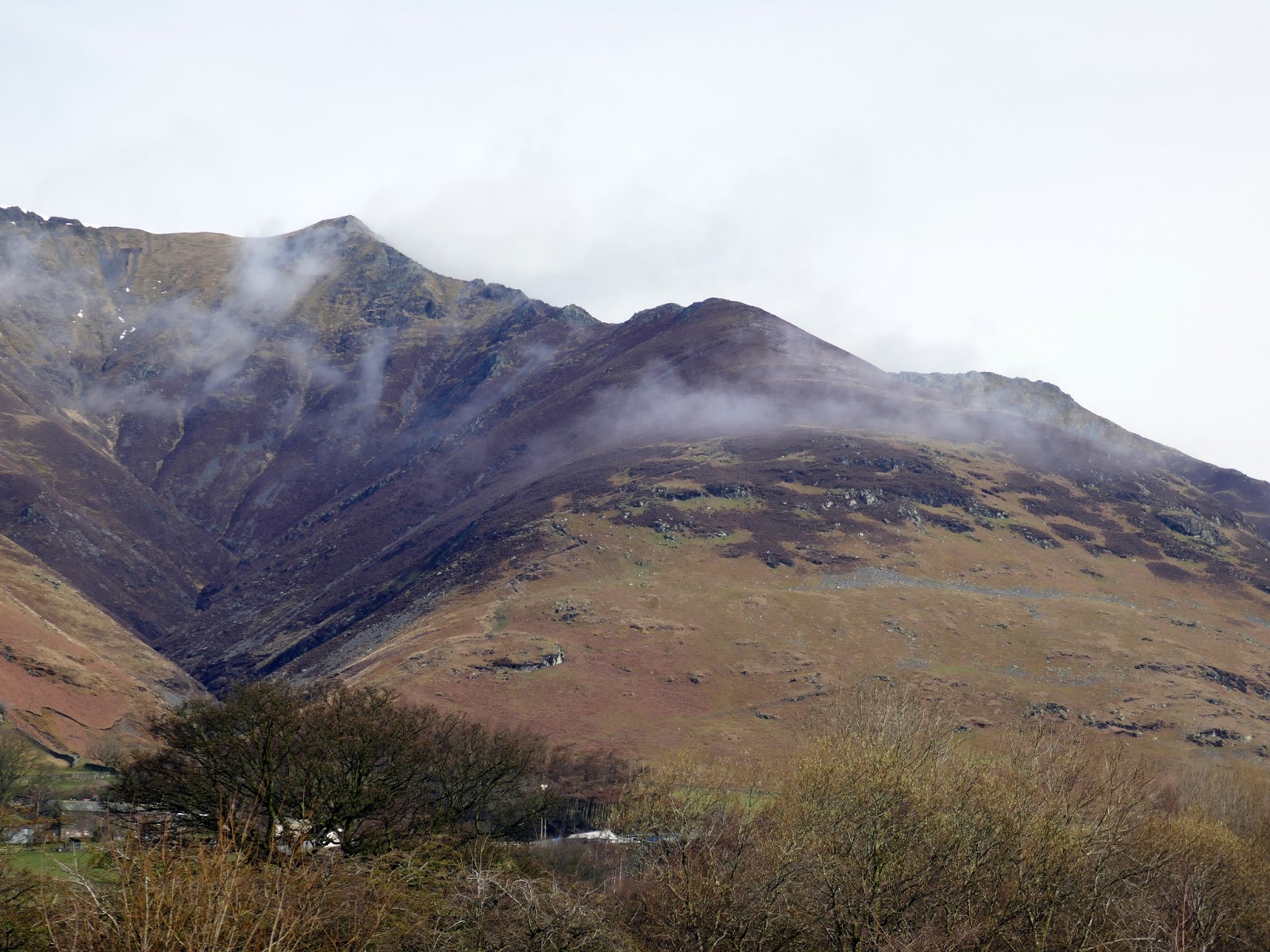
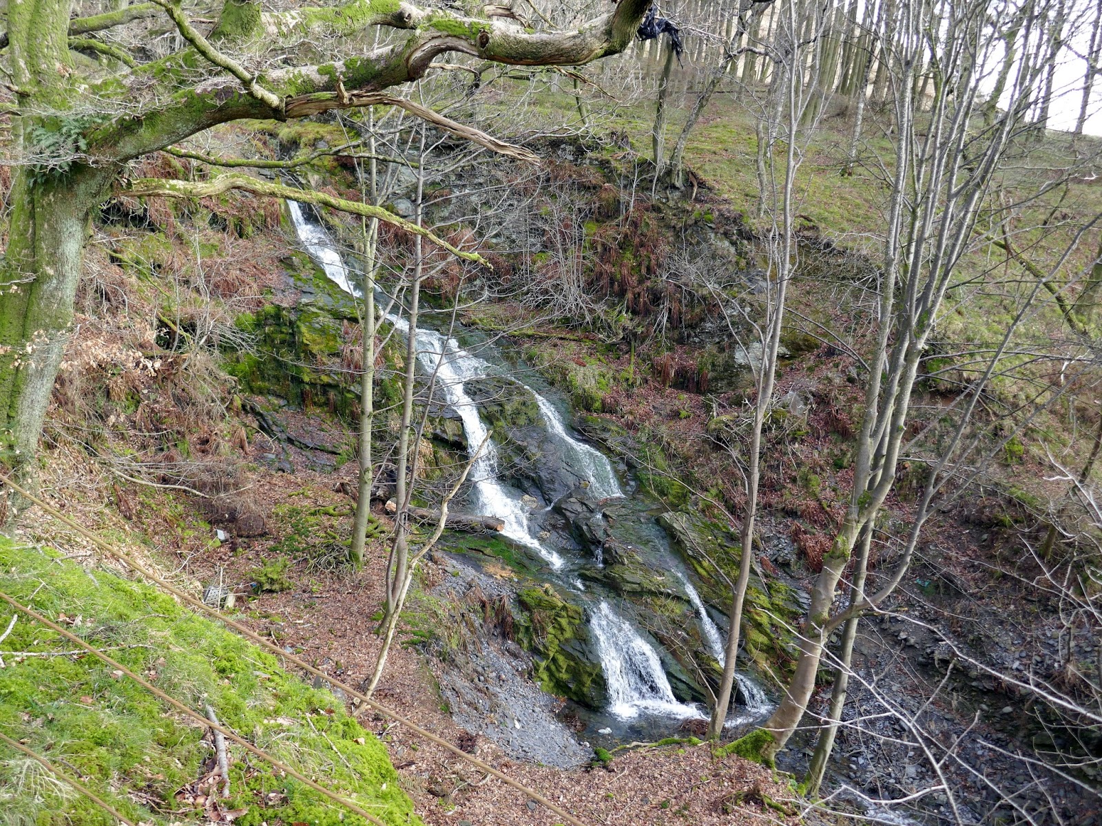
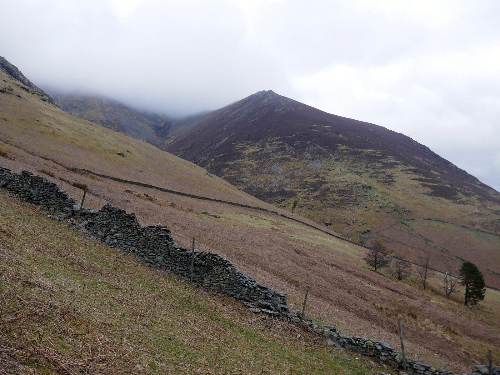
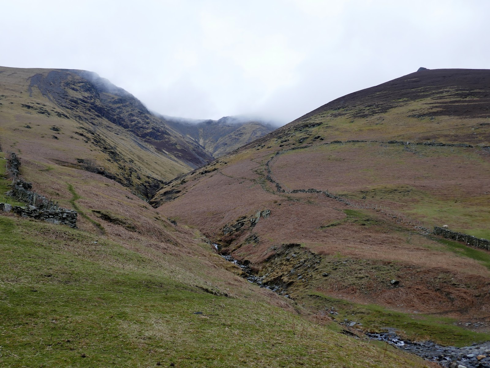
The day started with much promise; fluffy white clouds filling the blue sky though these were due to thicken as the day progressed. Ee started in Thelkeld, which sits in the shadow of the fell, making our way along farm tracks fields to the foot of the ridge. After crossing Gate Gill, the steep climb begins.
 |
| Gate Gill |
 |
| Gate Gill |
 |
| Clouds swoop onto Blencathra’s summit |
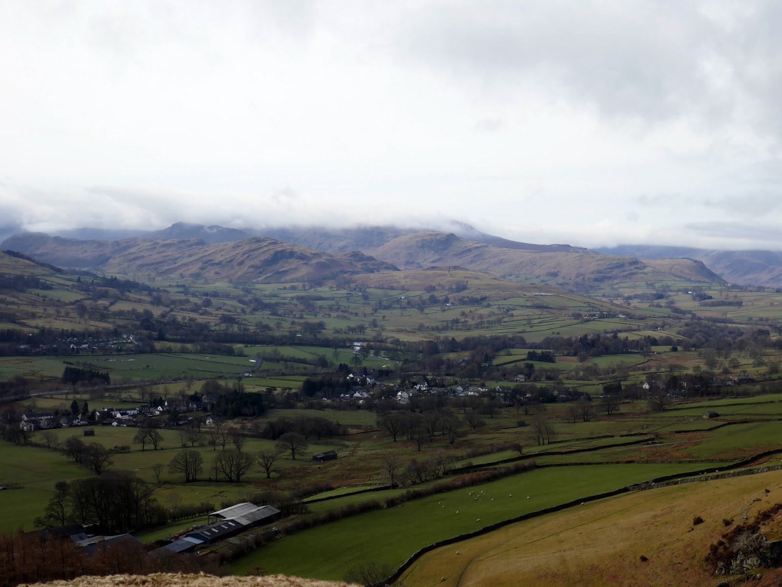
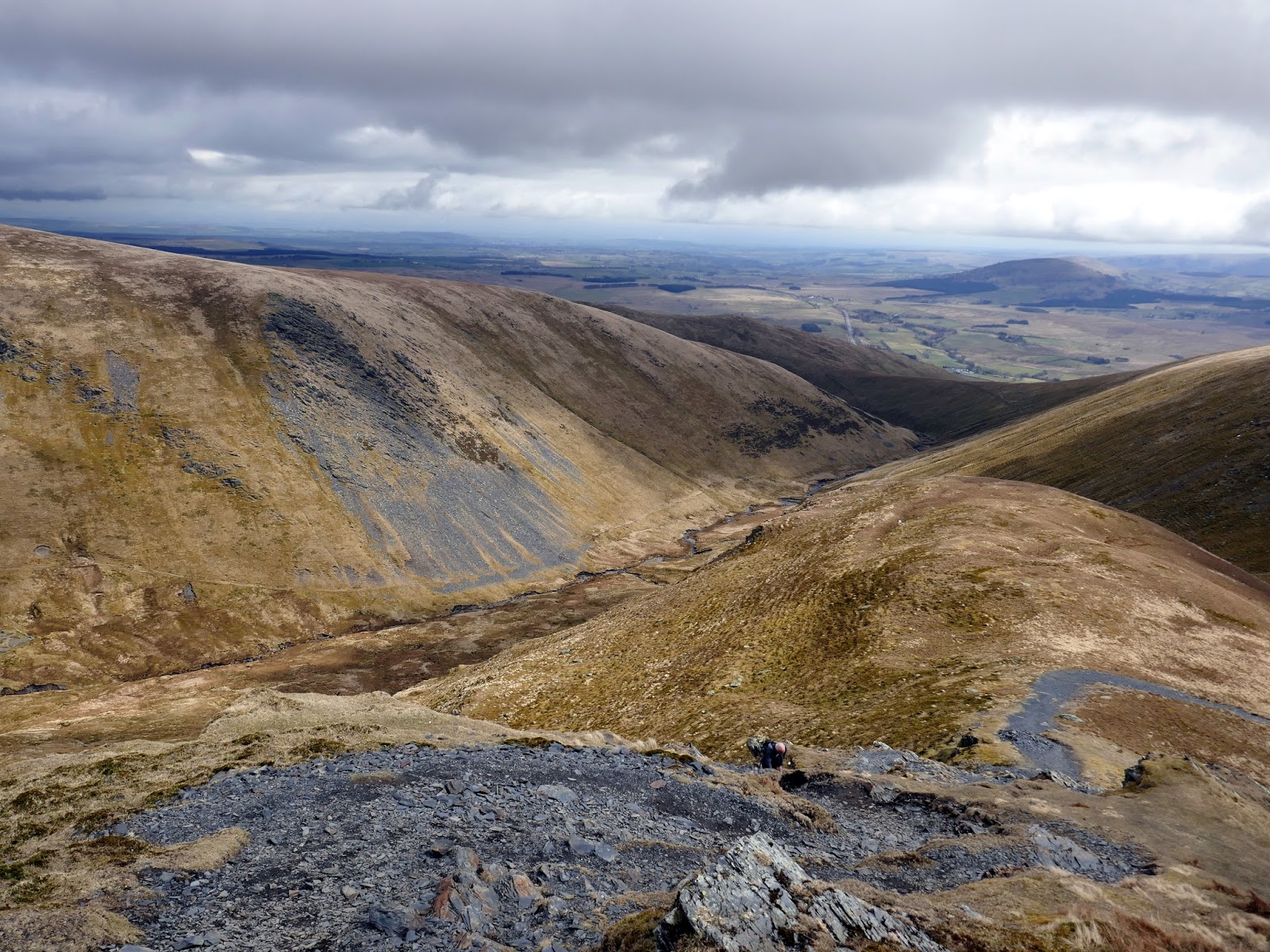
The first third of the ridge is a fairly tiring slog up a steep but easy to follow path. In fact, once on the ridge, you can’t really go wrong in terms of navigation. The steepness does lead to ever increasing views across the Vale of Keswick and down the steep valleys of Gate Gill and Doddick Gill.
 |
| The Vale of Keswick |
 |
| Clough Head |
 |
| Add caption |
 |
| Rounding the heather shoulder and heading into the cloud |
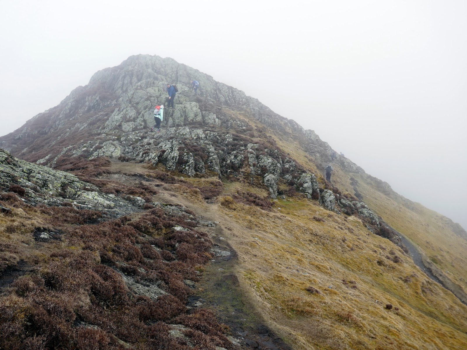
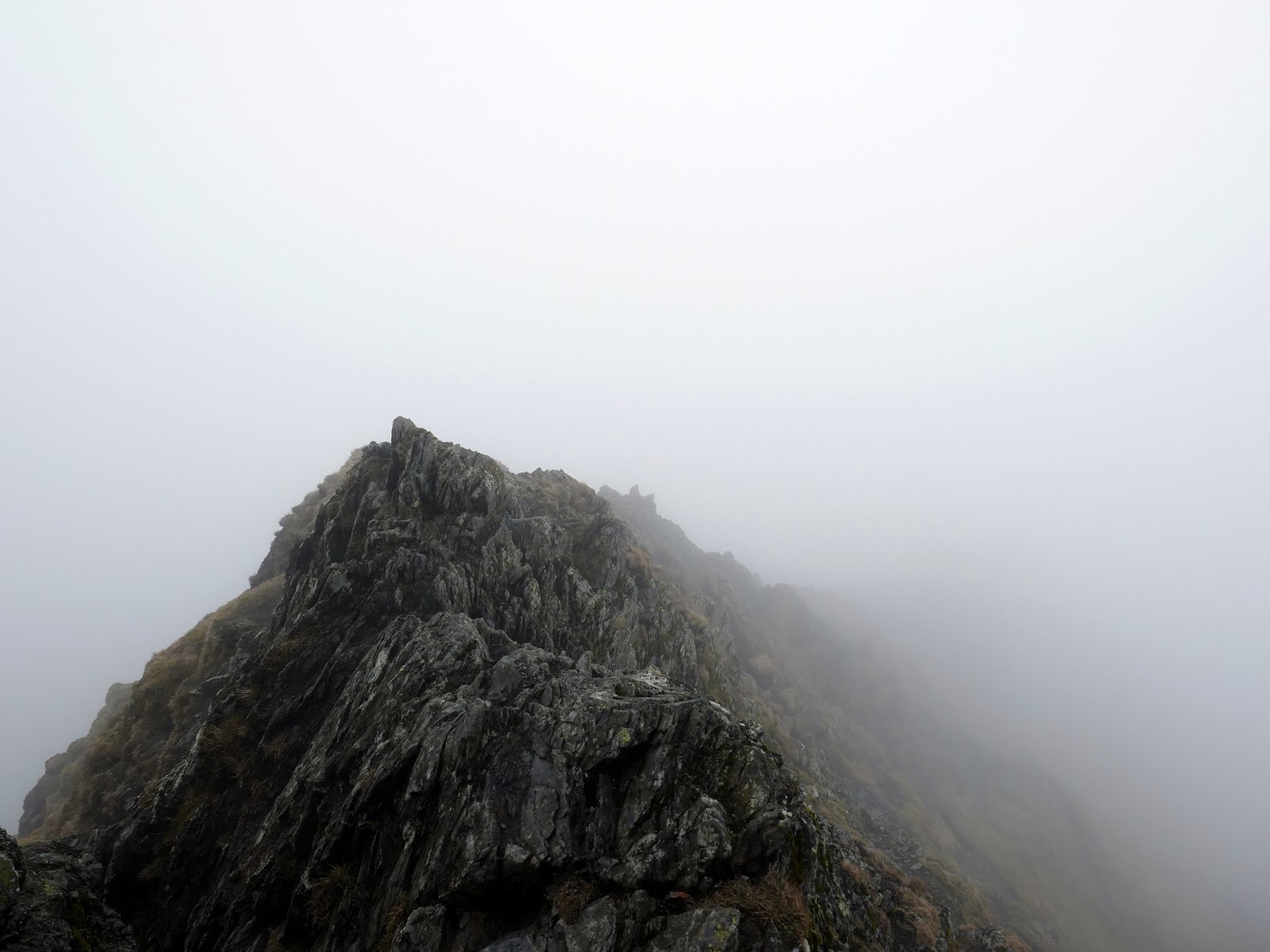
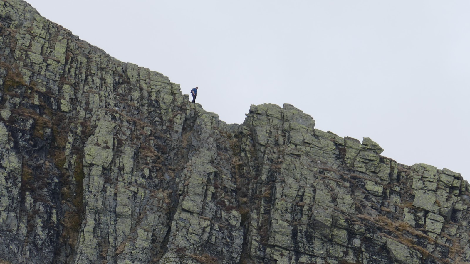
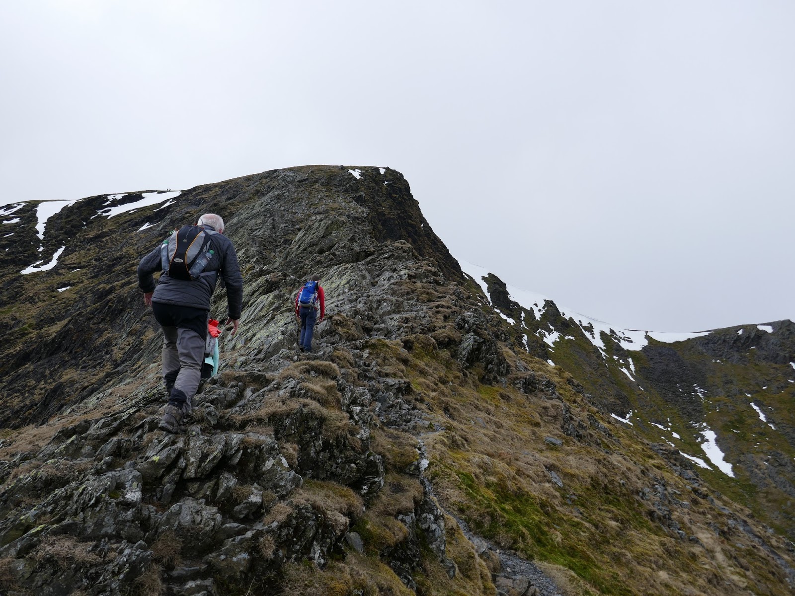
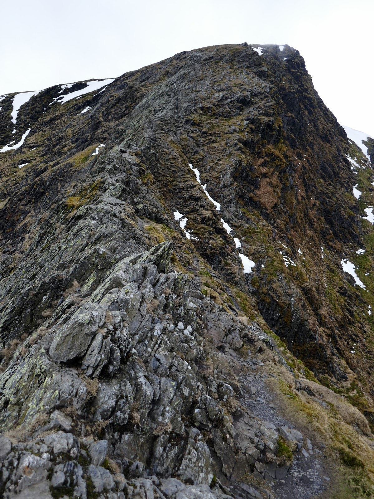
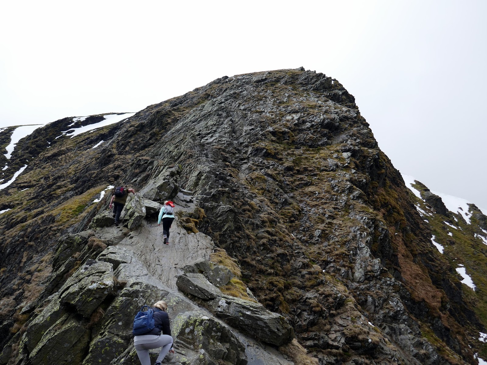
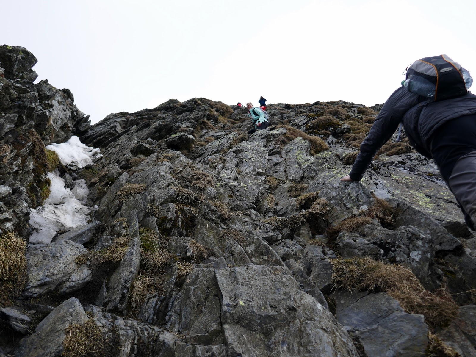
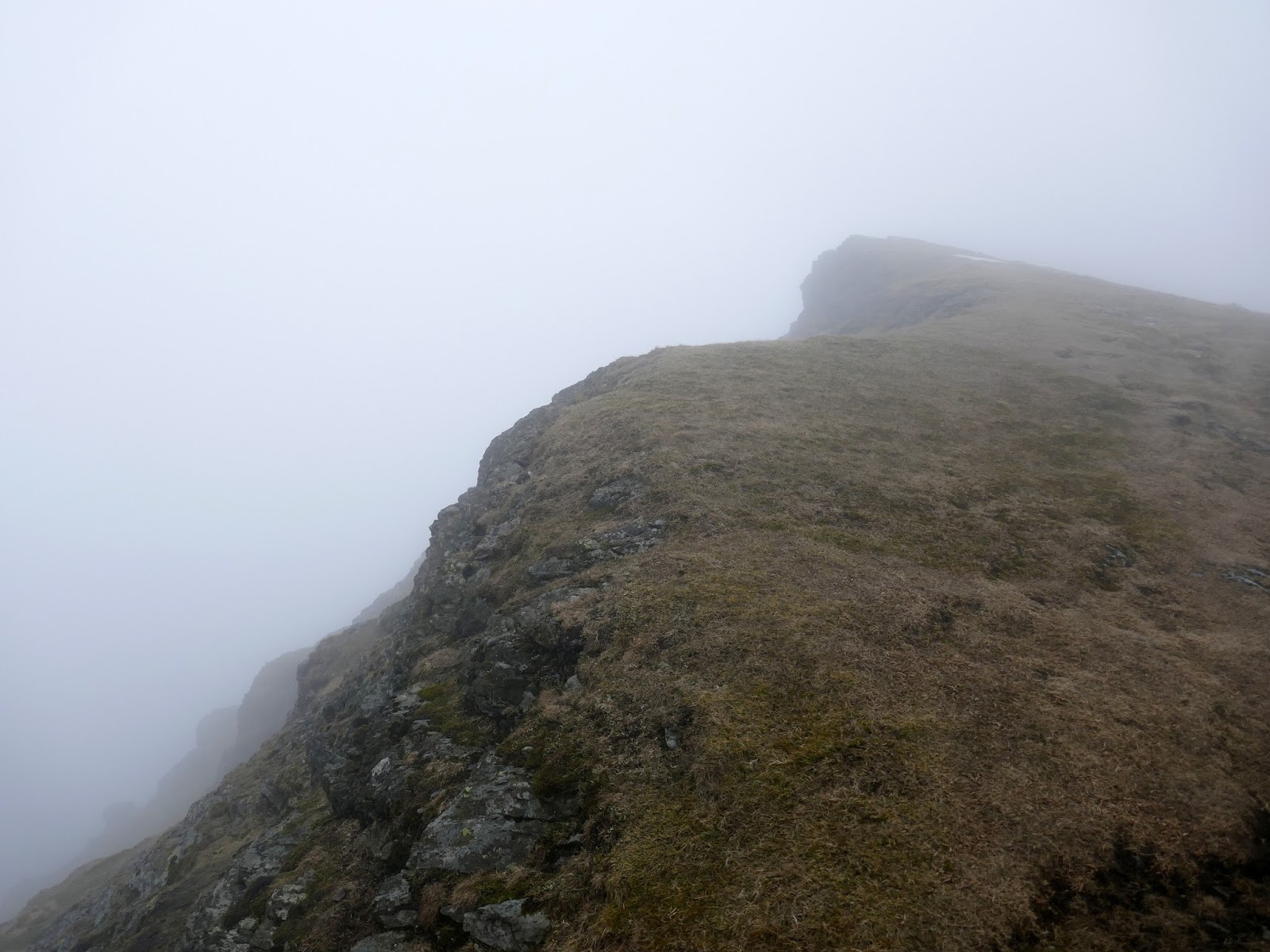
Eventually, the steep path rounds a heathery shoulder and reveals the superb Hall’s Fell Ridge – or it should have done had the clouds not descended as we arrived. The ridge shares many similarities to Striding Edge and requires just as much respect to negotiate it safely. The most interesting route is directly along the crest which climbs directly to Blencathra’s summit. There is an element of exposure, so a good head for heights is required.
 |
| The beginning of Hall’s Fell Ridge |
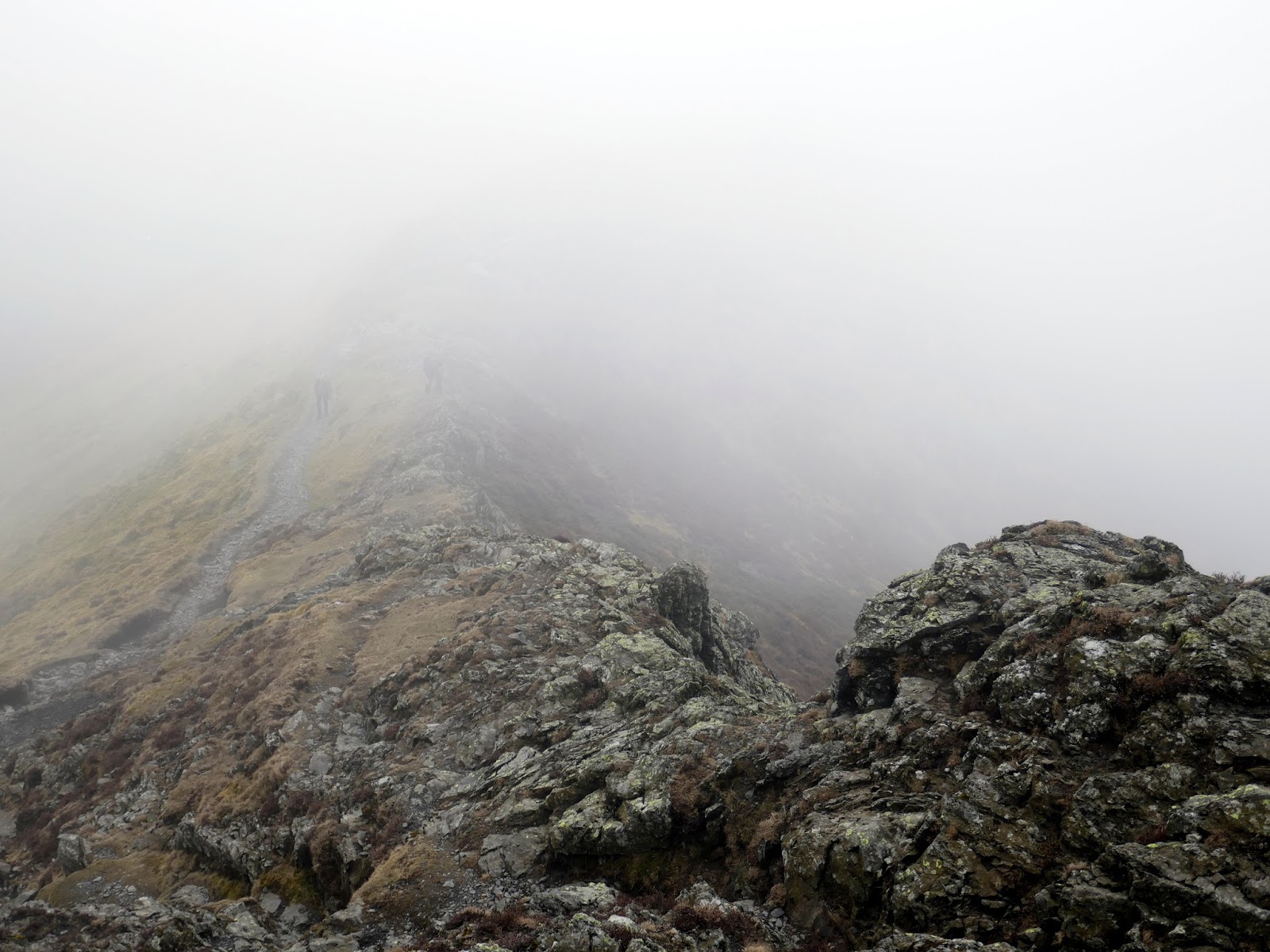
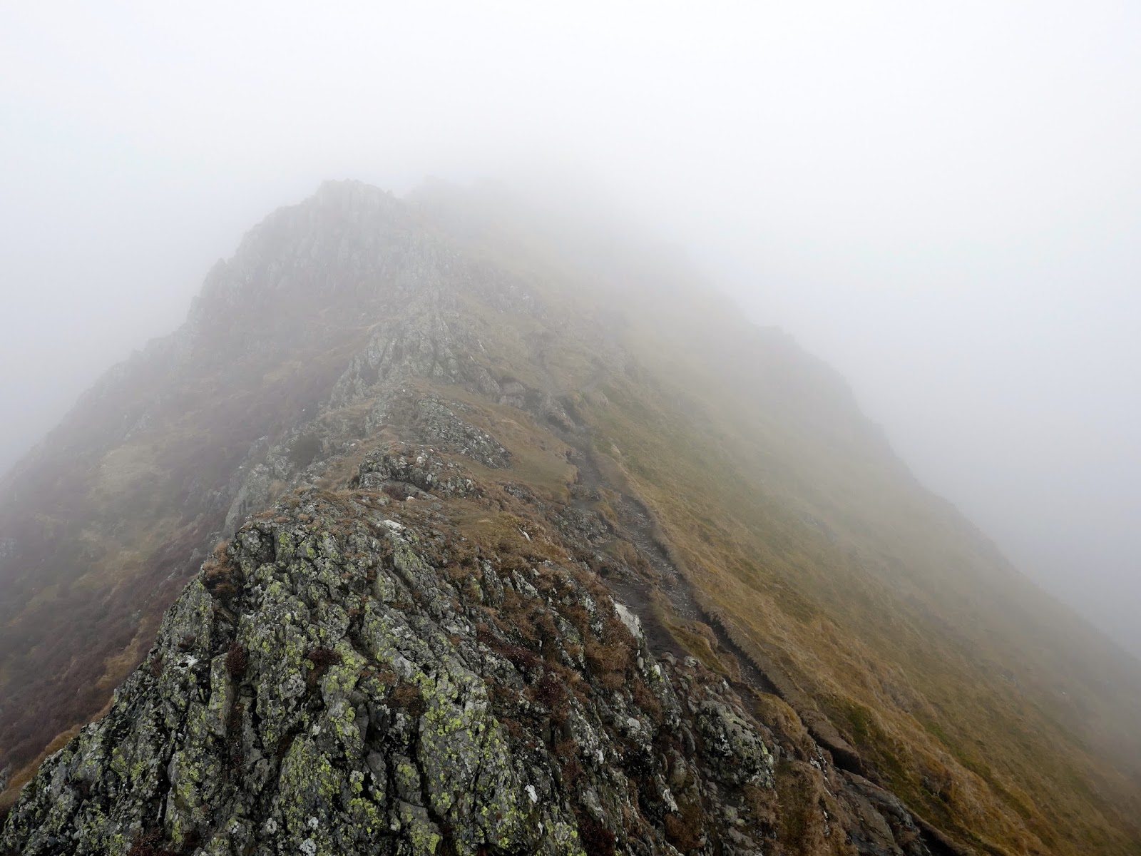
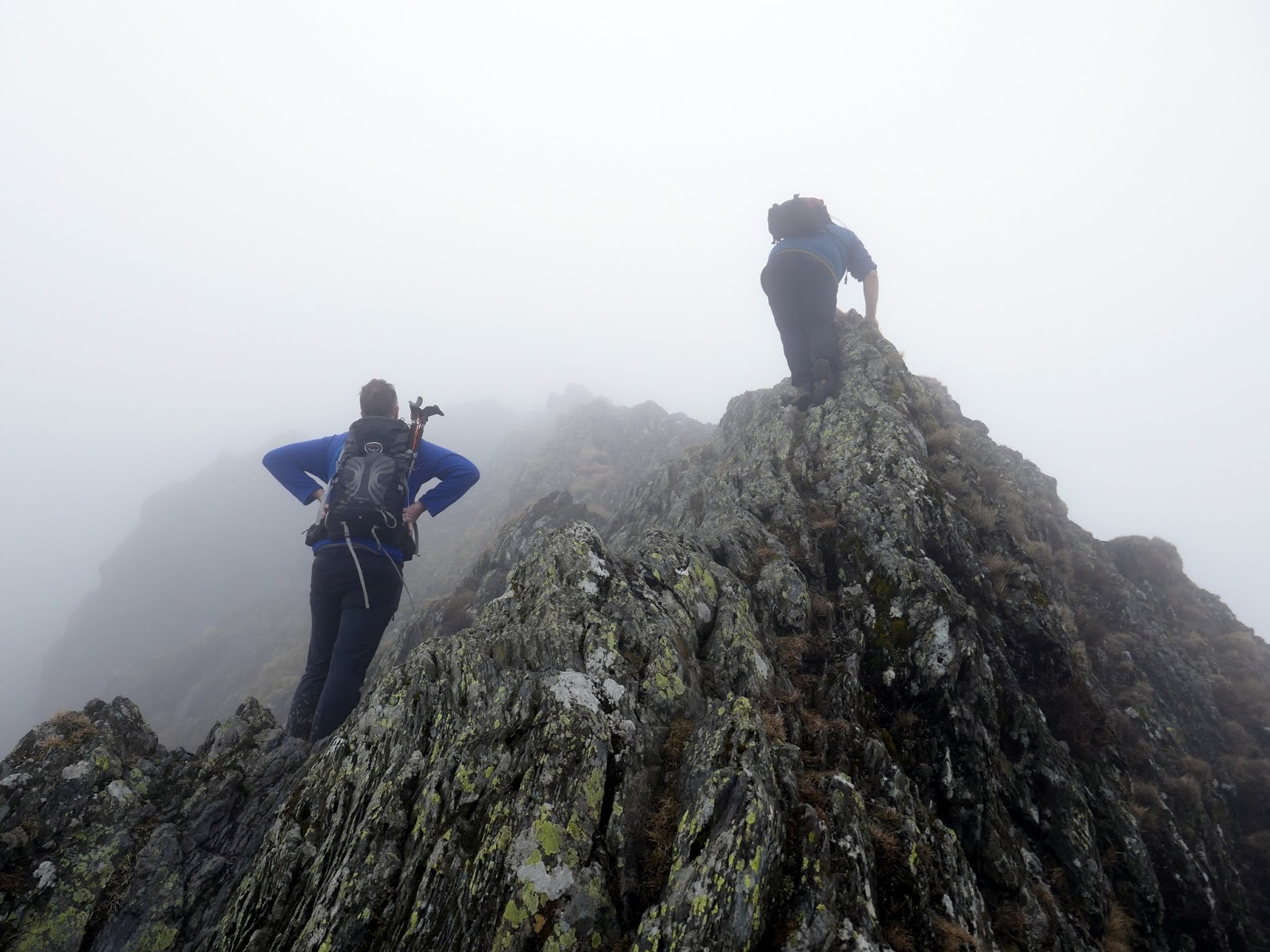
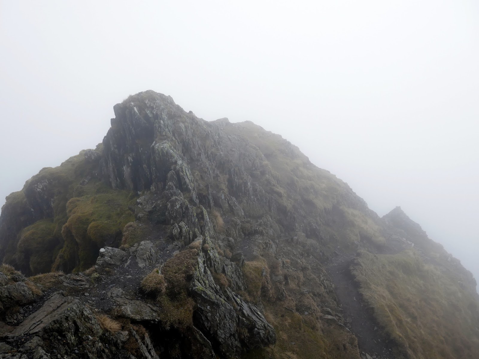
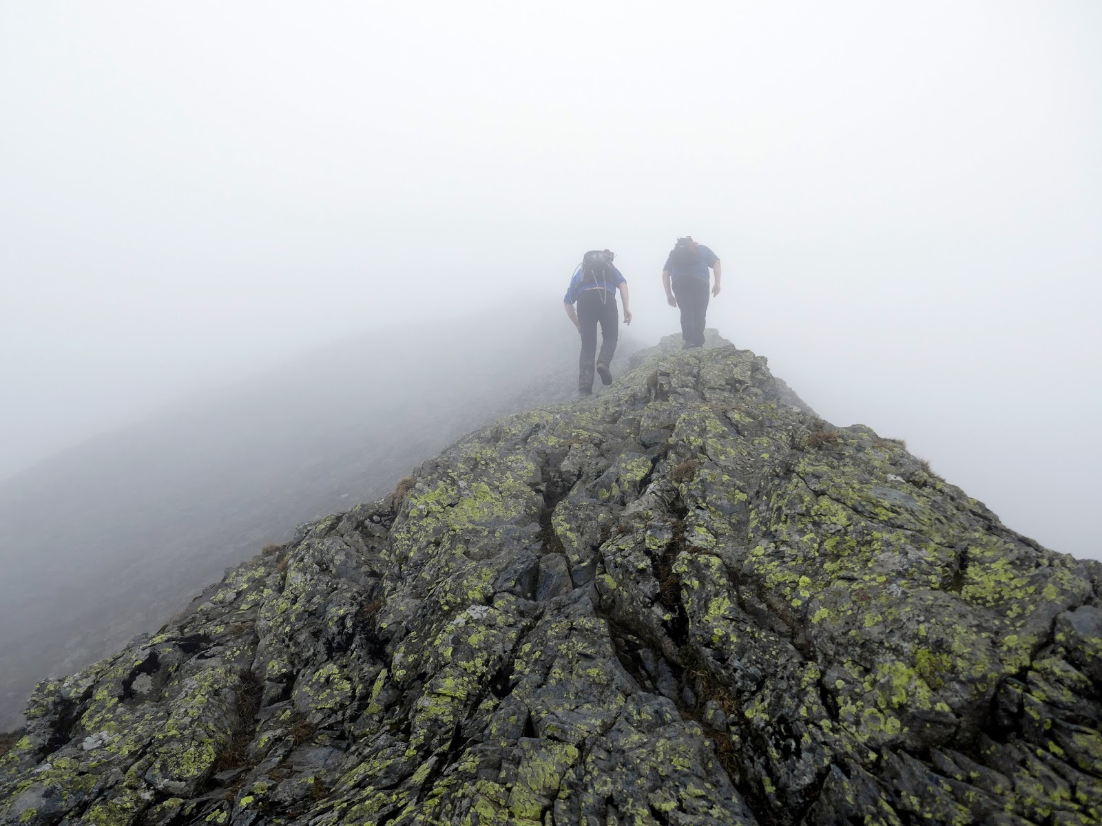
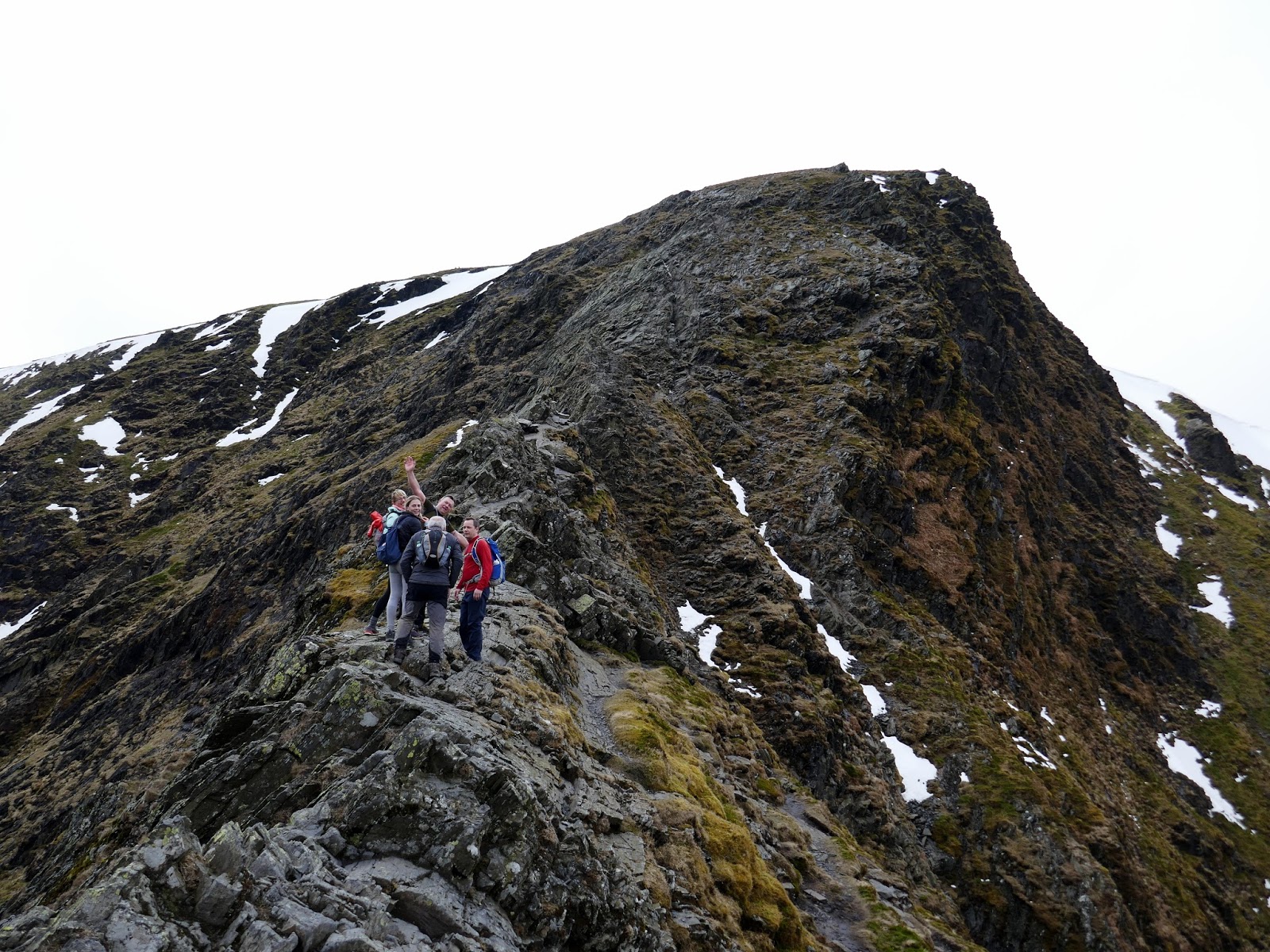
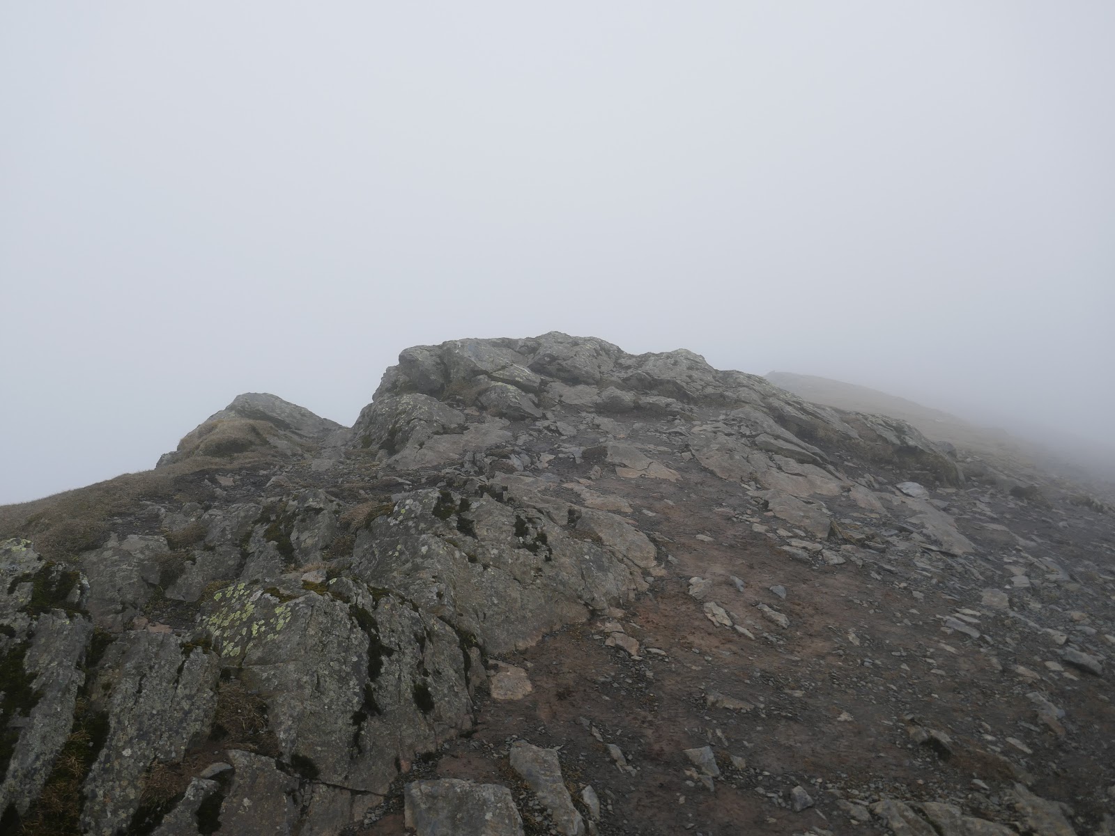
While the first part of Hall’s Fell is very good, it gets even better as the ridge makes a subtle curve on its way up. Here there are some seriously narrow parts which make for an exhilarating few minutes. If you so please, these parts can be bypassed but where’s the fun in that?
 |
| Hall’s Fell Ridge |
 |
| Hall’s Fell Ridge |
 |
| Scrambling the ridge |
 |
| Hall’s Fell Ridge |
 |
| Hall’s Fell Ridge |
 |
| The final push to the summit |
 |
| Hall’s Fell Ridge emerges at Blencathra’s summit |
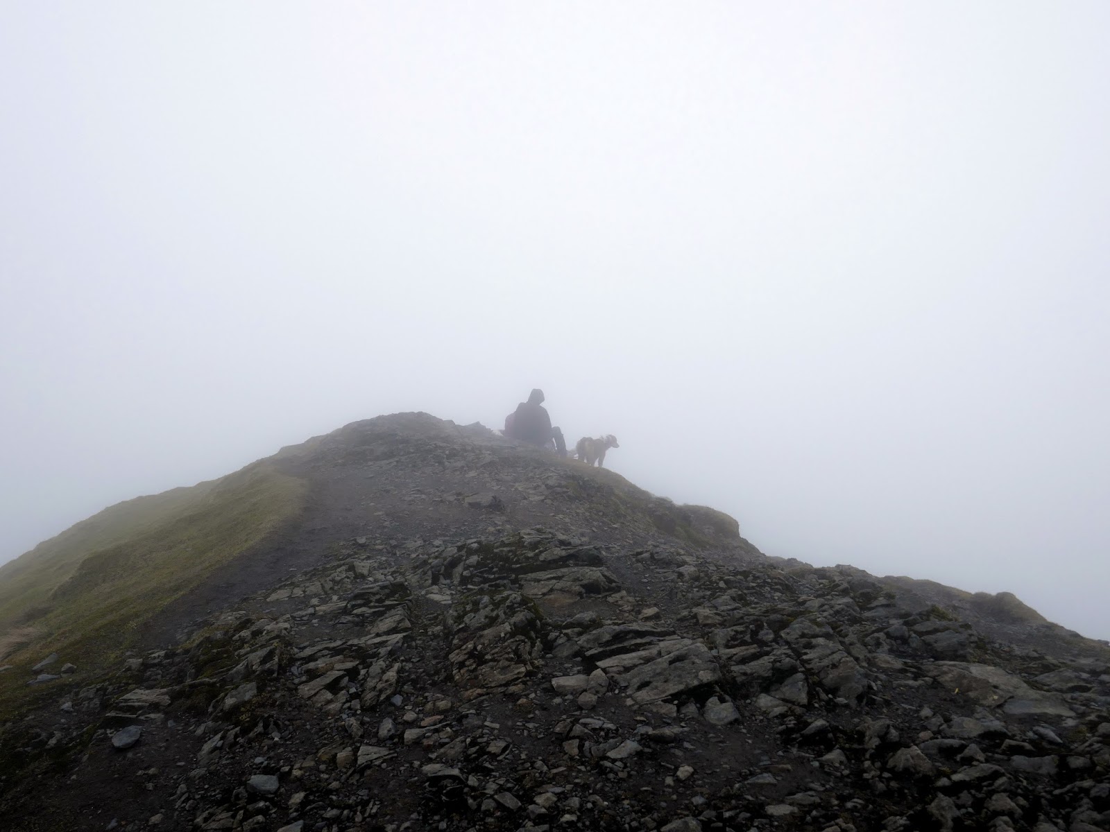
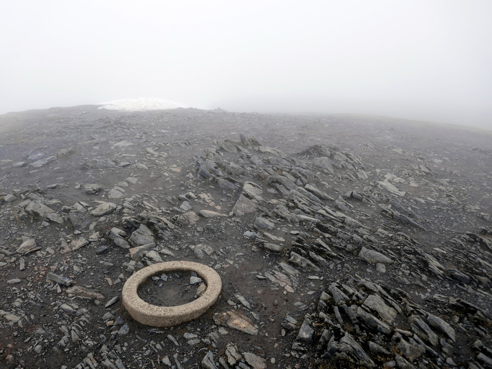
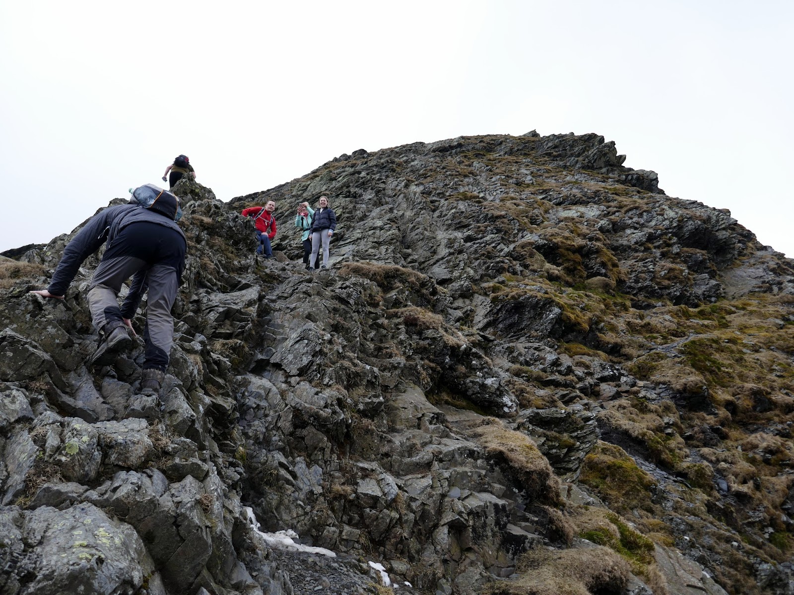
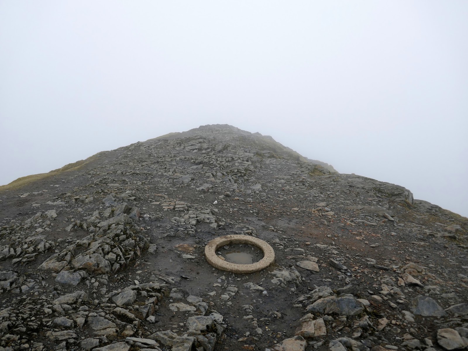
The final pull to the summit still involves a little scrambling but is perhaps the easiest part of the ridge, reaching the top just yards from the small concrete ring that marks Blencathra’s summit.
 |
| Blencathra’s summit |
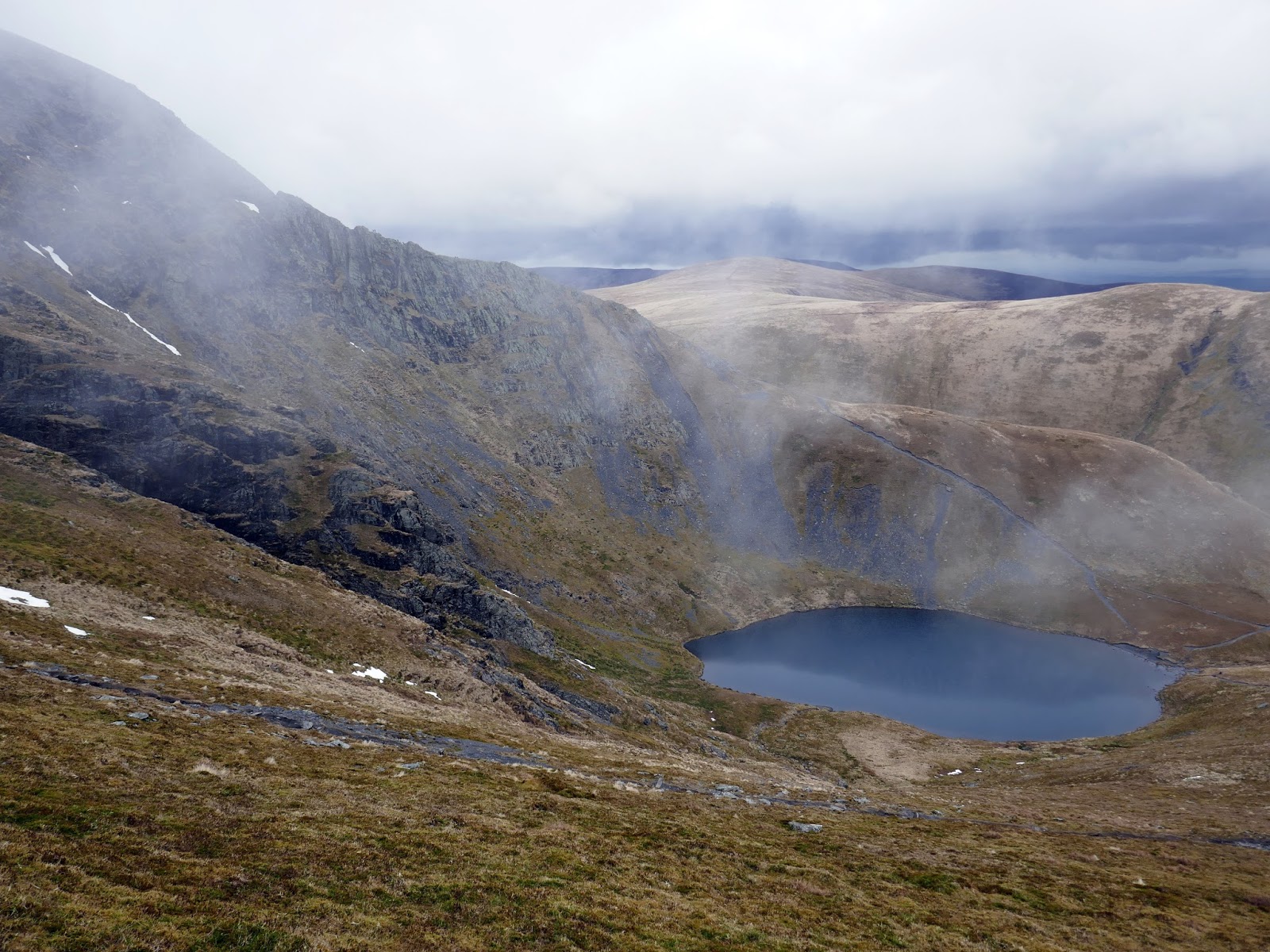
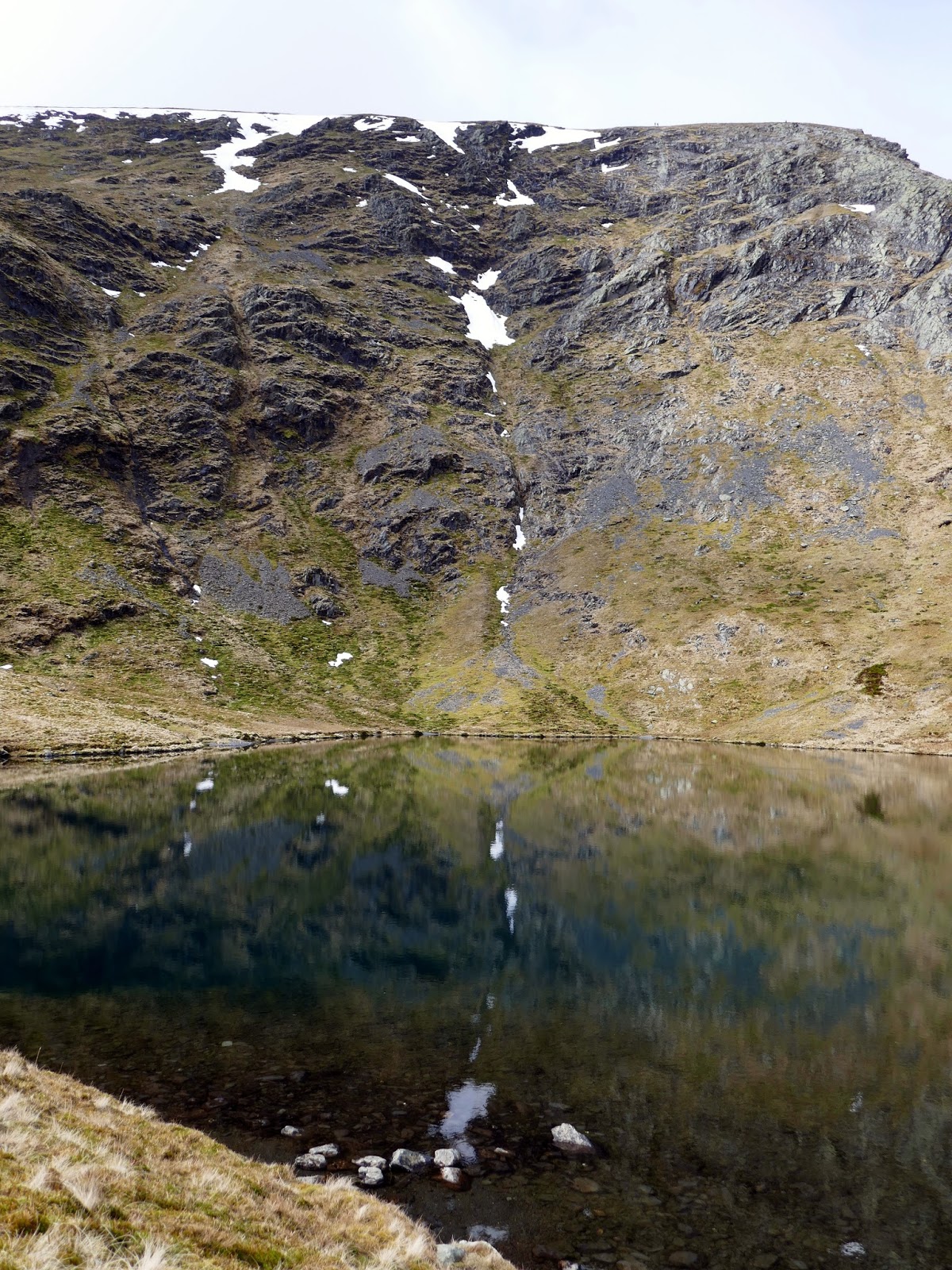
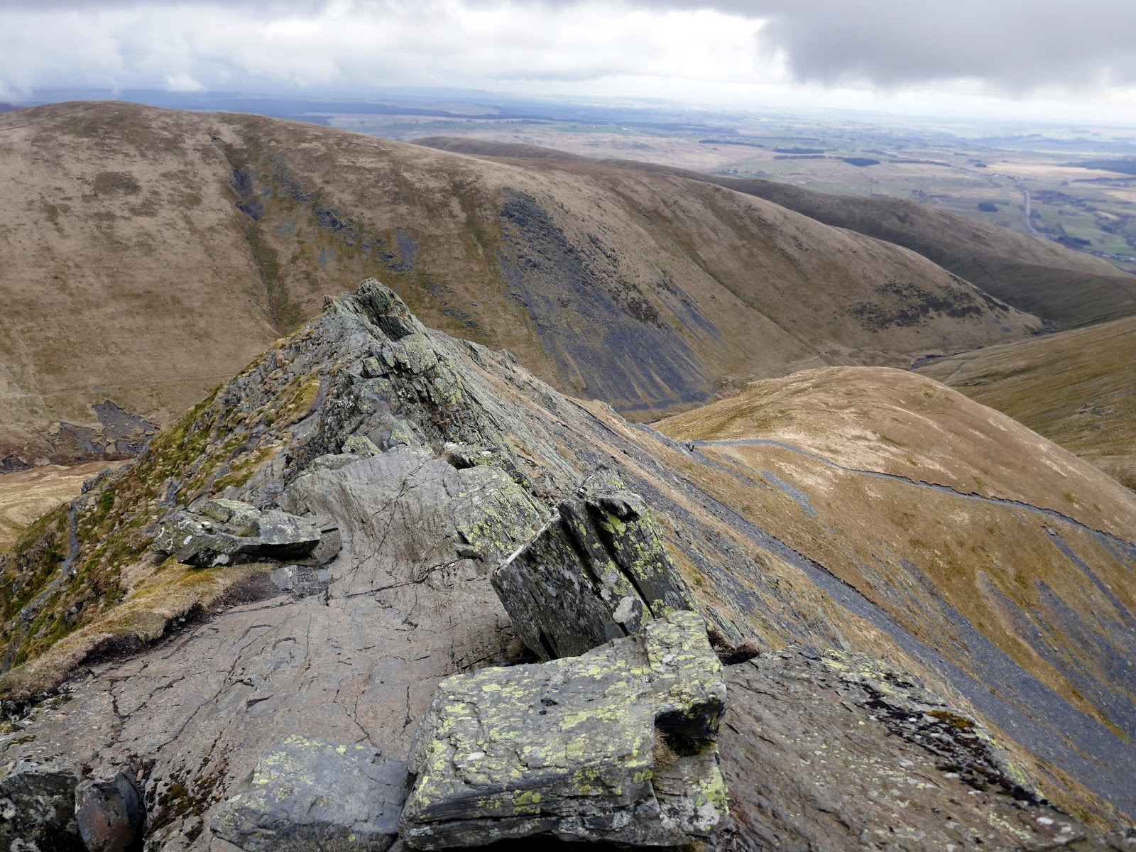
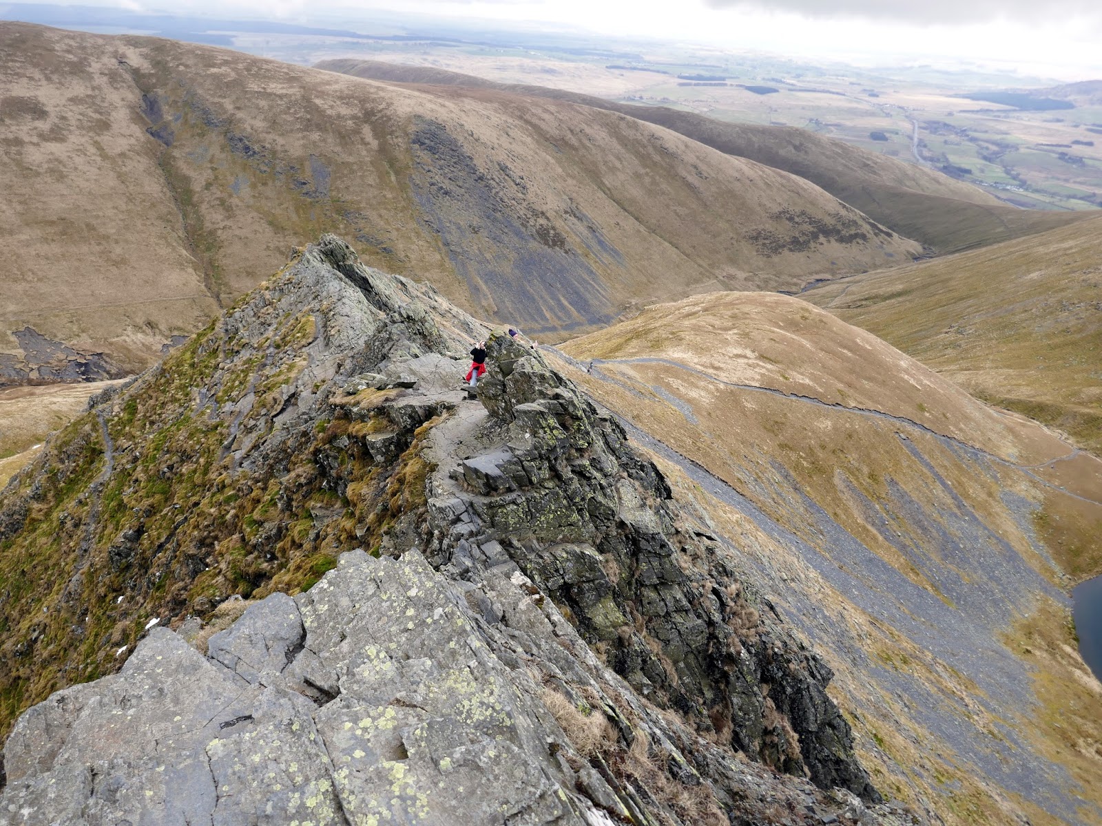
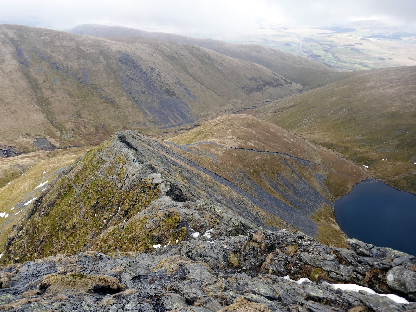
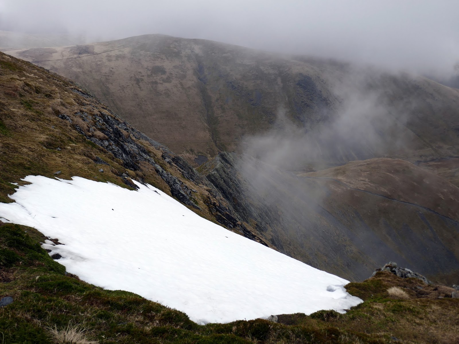
From Blencathra’s summit, it’s an easy descent down the zigzags of Scales Fell, diverting off down to Scales Tarn – a perfect glacial tarn. As we descended the cloud fortuitously began to lift, just in time for the main event – Sharp Edge.
 |
| A brief break in the cloud |
 |
| Scales Tarn |
 |
| Scales Tarn below Sharp Edge – yes, this really is the same day |
 |
| A lone walker on Sharp Edge |
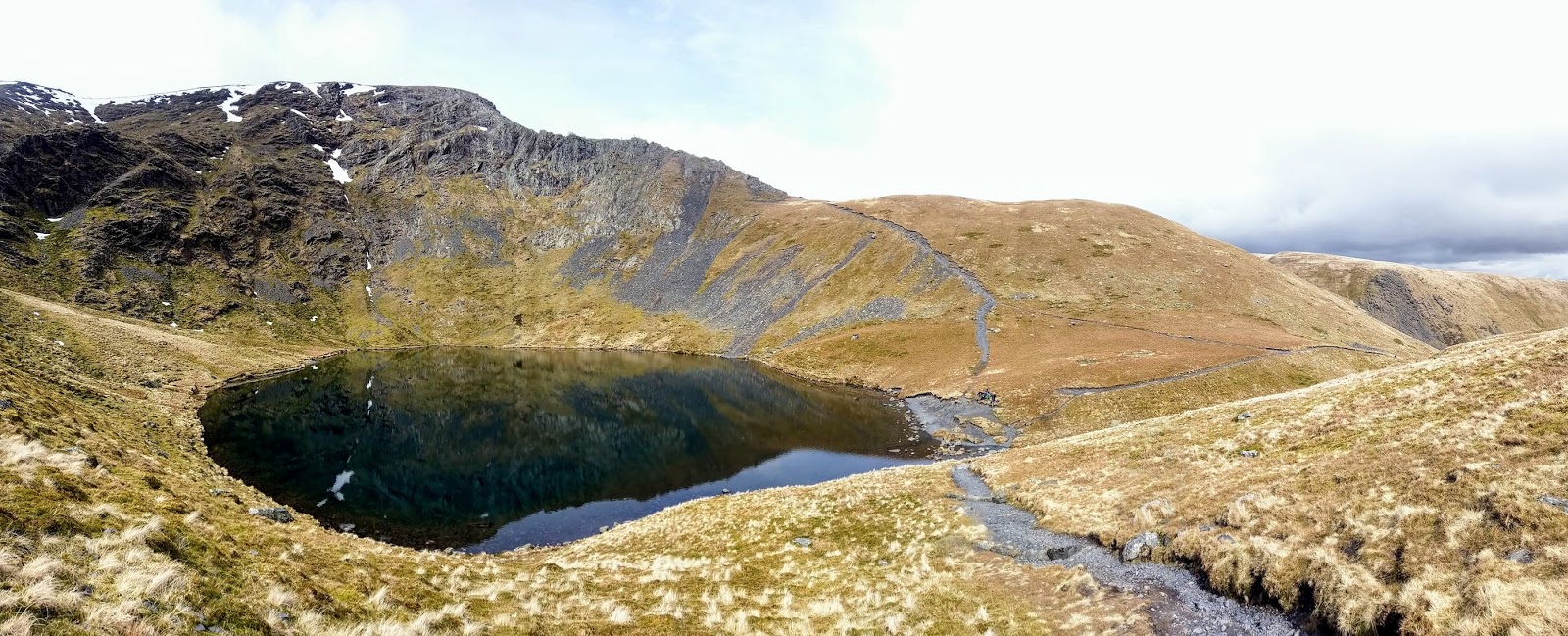
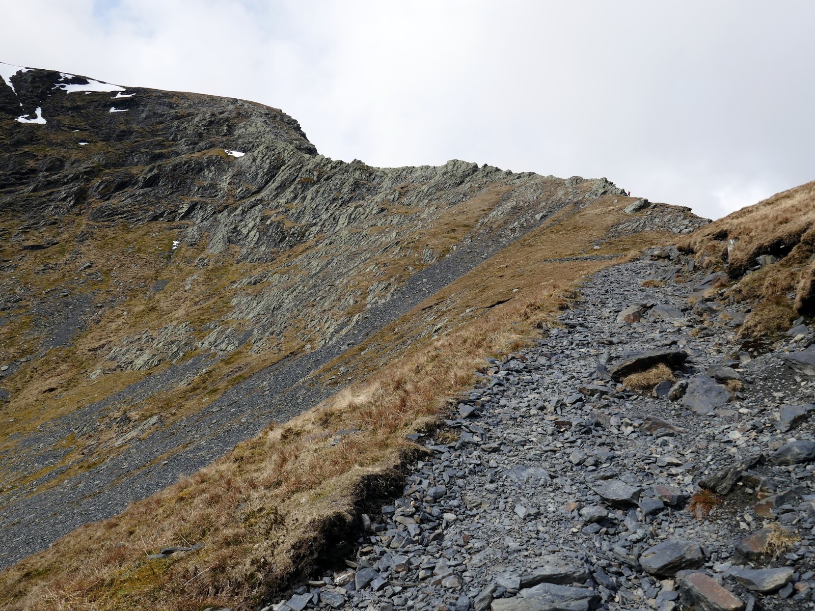
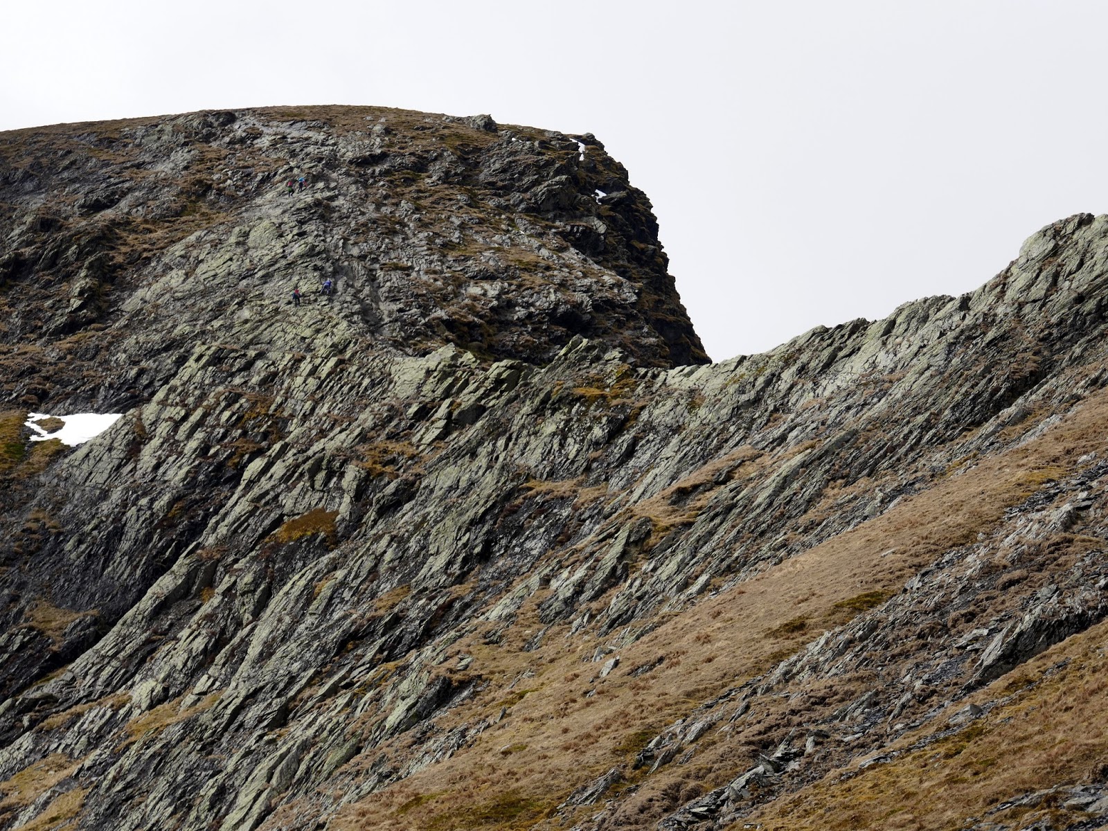
The initial climb along the path is easy enough until it reaches the first series of rock outcrops where the scrambling begins. Here, it is straightforward with many lines and no cause for difficulty. This short section will take you to the start of Sharp Edge, the vertiginous ridge ahead and it is here you can decide whether to take on the challenge or return to Scales Tarn to find another route. If you decide to carry on, here’s what you can expect to find.
 |
| Scales Tarn and Tarn Crags |
 |
| The climb to Sharp Edge |
 |
| Sharp Edge and Foule Crag |
 |
| The River Glenderamackin |
 |
| The final scramble to the edge |
 |
| Sharp Edge |
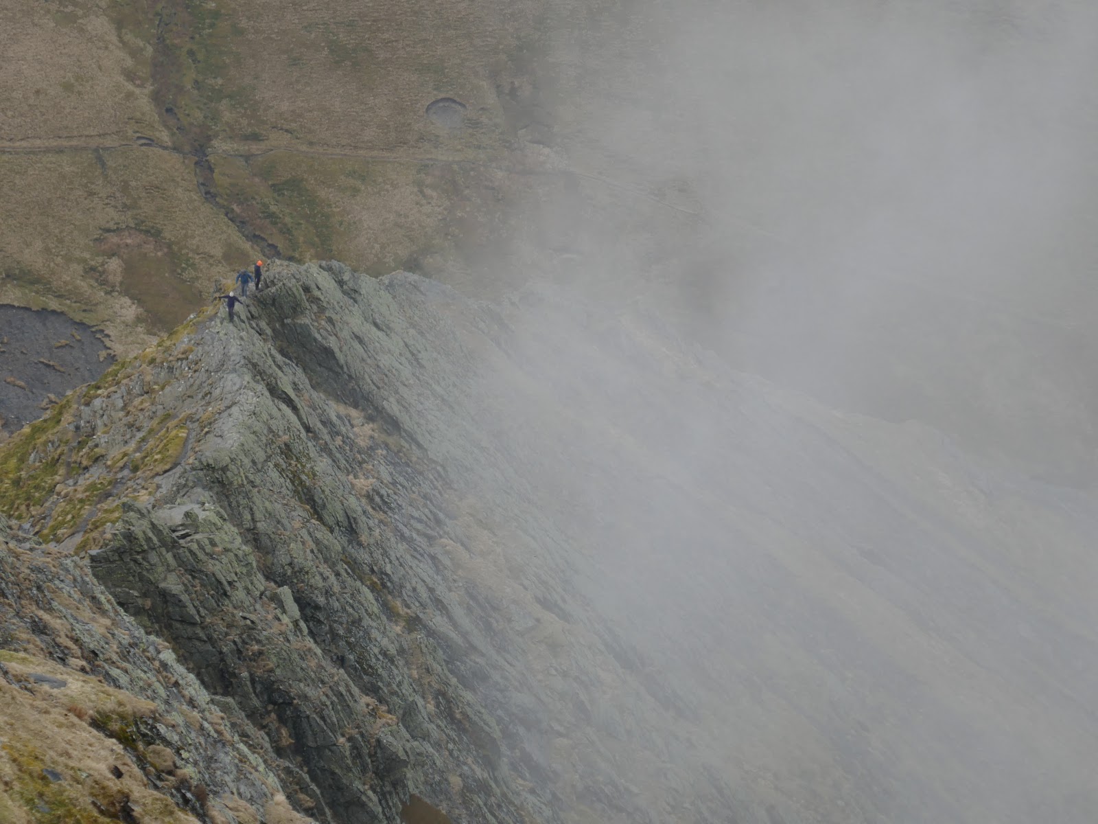
Sharp Edge sweeps up ahead of you, an extremely narrow ridge with steep drops on either side. If you can stomach the exposure, clambering along its crest is not too difficult and most sections can be done without using your hands.
 |
| Venturing out on to the edge |
 |
| Climbing the slab |
 |
| The flat slab before the Bad Step |
Around halfway, after crossing a flat slab, you will reach a small notch on the ridge with a short, jutting rock poking out at the top. This is widely known as the Bad Step, as the rock has been expertly polished by thousands of backsides. In the dry, you may not even notice it and continue on regardless, but when it is wet, the underlying slate can become lethally slippery with a number of casualties ending up the ‘usual gully’ as the Mountain Rescue put it.
 |
| A look back at the Bad Step |
With the Bad Step negotiated, Sharp Edge starts to climb before ending at the base of Foule Crag. Short but sweet, it’s a great introduction to exposed ridges and a real shame that it doesn’t last longer. Scrambling up Foule Crag is entertaining in itself, the noticeable gully to the right being the most obvious route of ascent. Views back along Sharp Edge are understandably excellent.
 |
| Foule Crag |
 |
| Foule Crag |
 |
| Sharp Edge from Foule Crag |
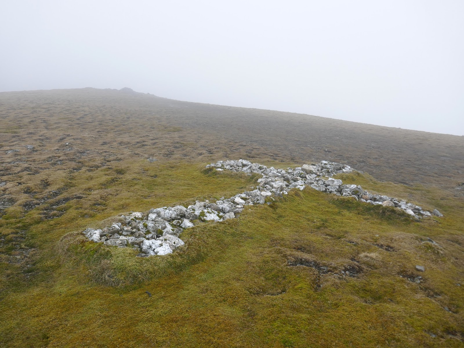
Eventually, you will reach the top of Foule Crag where a path will lead you up the final climb to Blencathra’s summit. I briefly detoured to Atkinson Pike (the true summit of Foule Crag) and went off in search of the White Cross.
 |
| Sharp Edge and Bannerdale Crags |
 |
| Clouds sweep up against Sharp Edge |
Located in the depression between Atkinson Pike and Blencathra, the White Cross is a large crucifix made entirely from pale rocks and boulders. Its origin is uncertain, but an extension to its current size is attributed to a Harold Robinson of Threlkeld who frequently visited the fell after World War 2.
 |
| The White Cross |
I returned back to Blencathra’s summit using the wide path that skirts the edge of Tarn Crags.
 |
| Blencathra’s summit again – same weather |
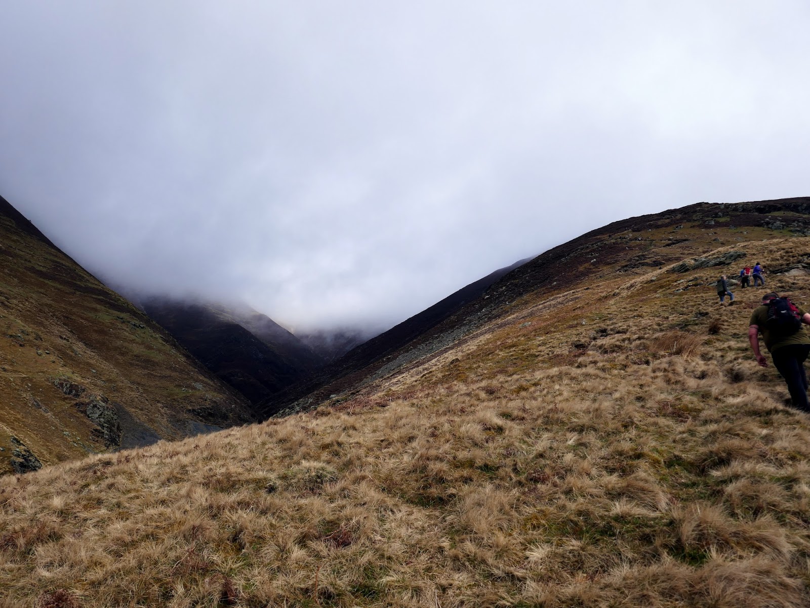
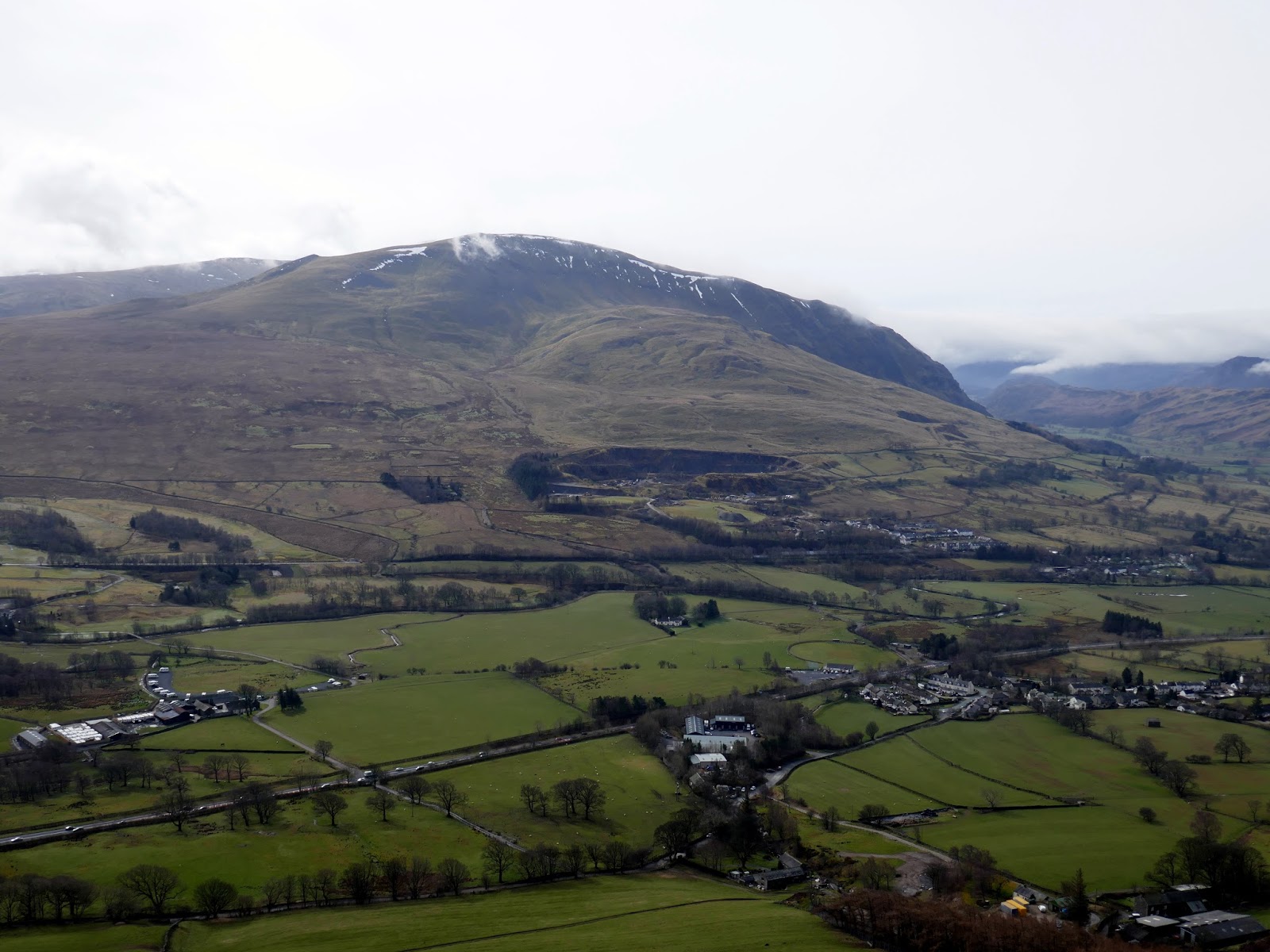
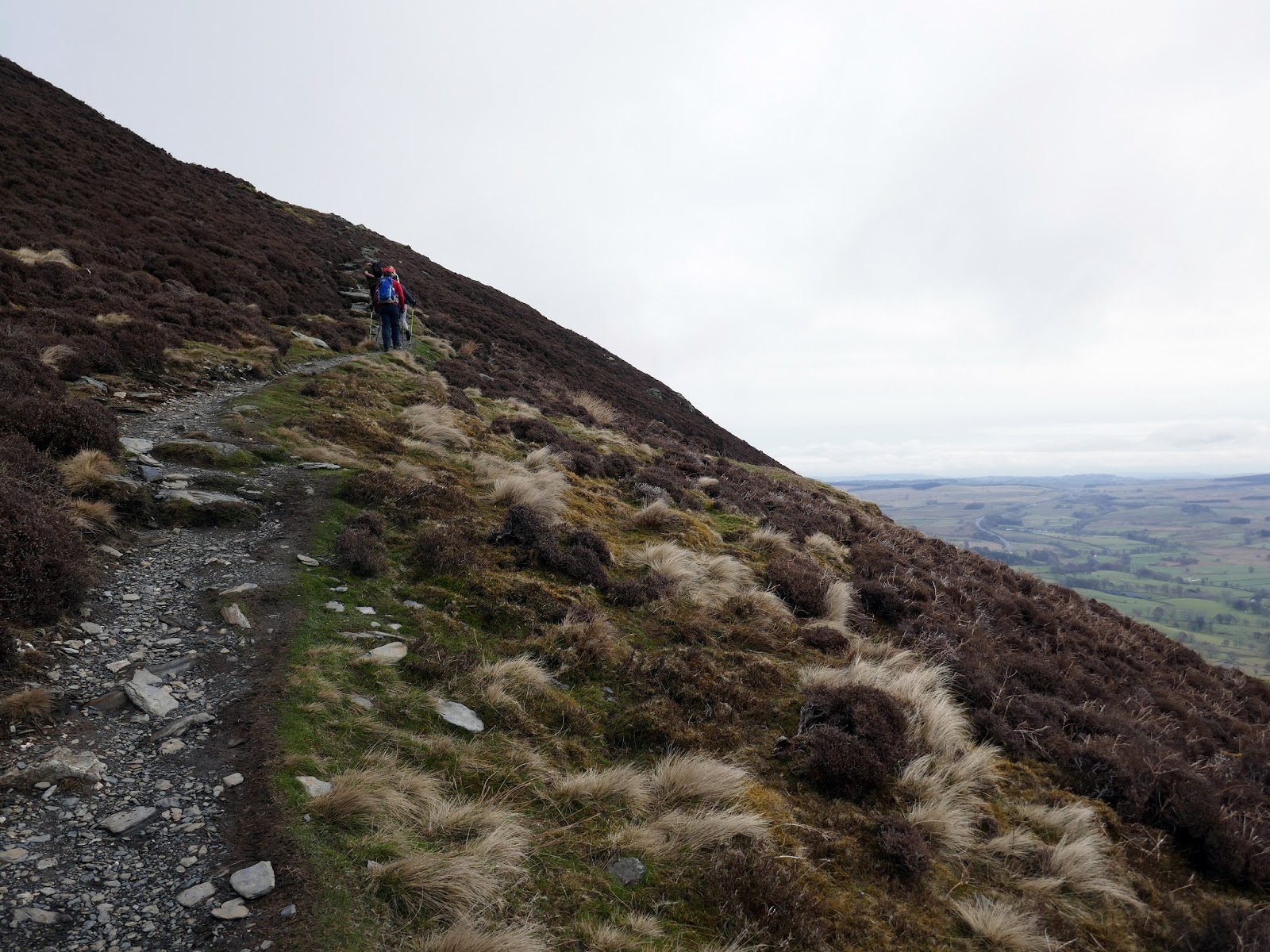
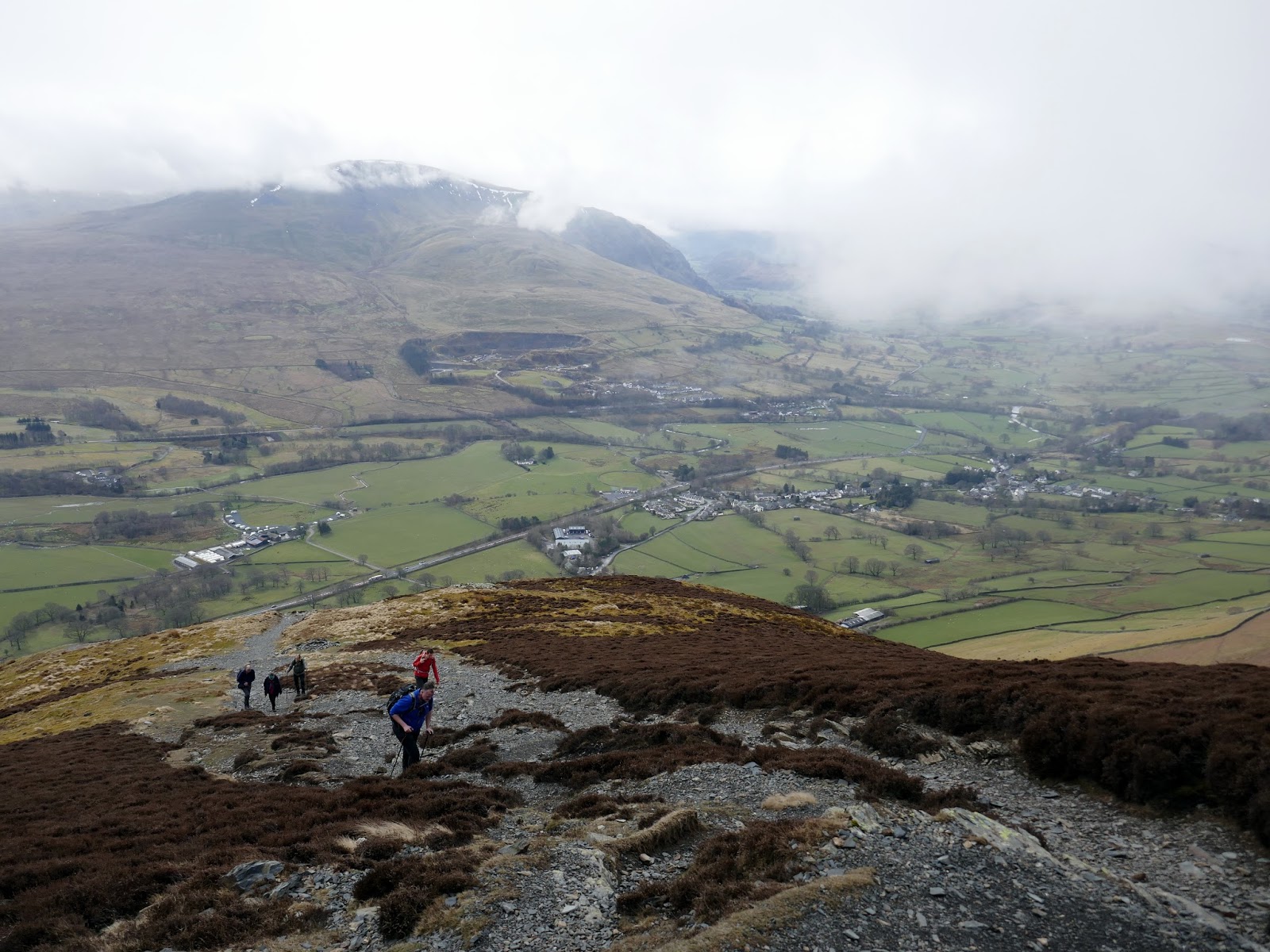
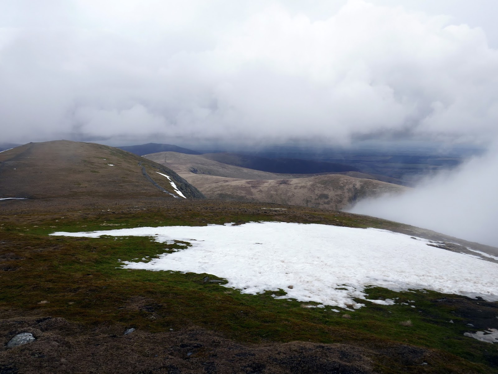
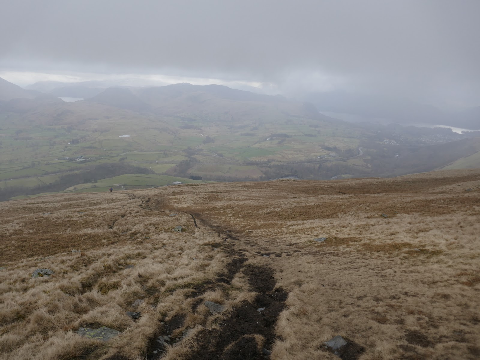
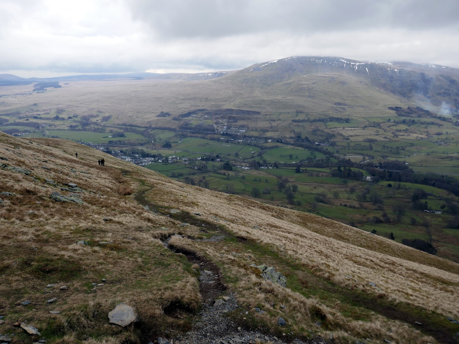
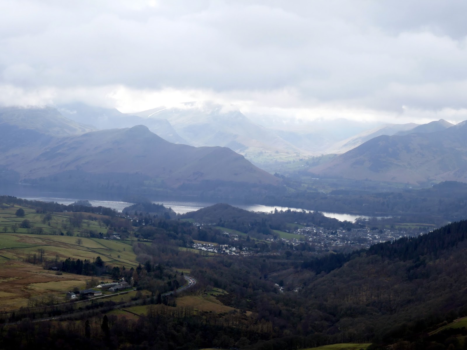
The walk along the top of Blencathra was shrouded in the cloud again, which is a shame as it is superb. After passing the tops of Gategill Fill and Knowe Crags, it’s an easy descent down Blease Fell where the path has been engineered into a series of zigzags – the views from here over Keswick are tremendous. To return to Thelkeld requires a detour from the main path, following a much fainter route south and then turning east towards the village.
 |
| The rocky top of Gategill Fell |
 |
| Knowe Crags |
 |
| Emerging from the cloud once again |
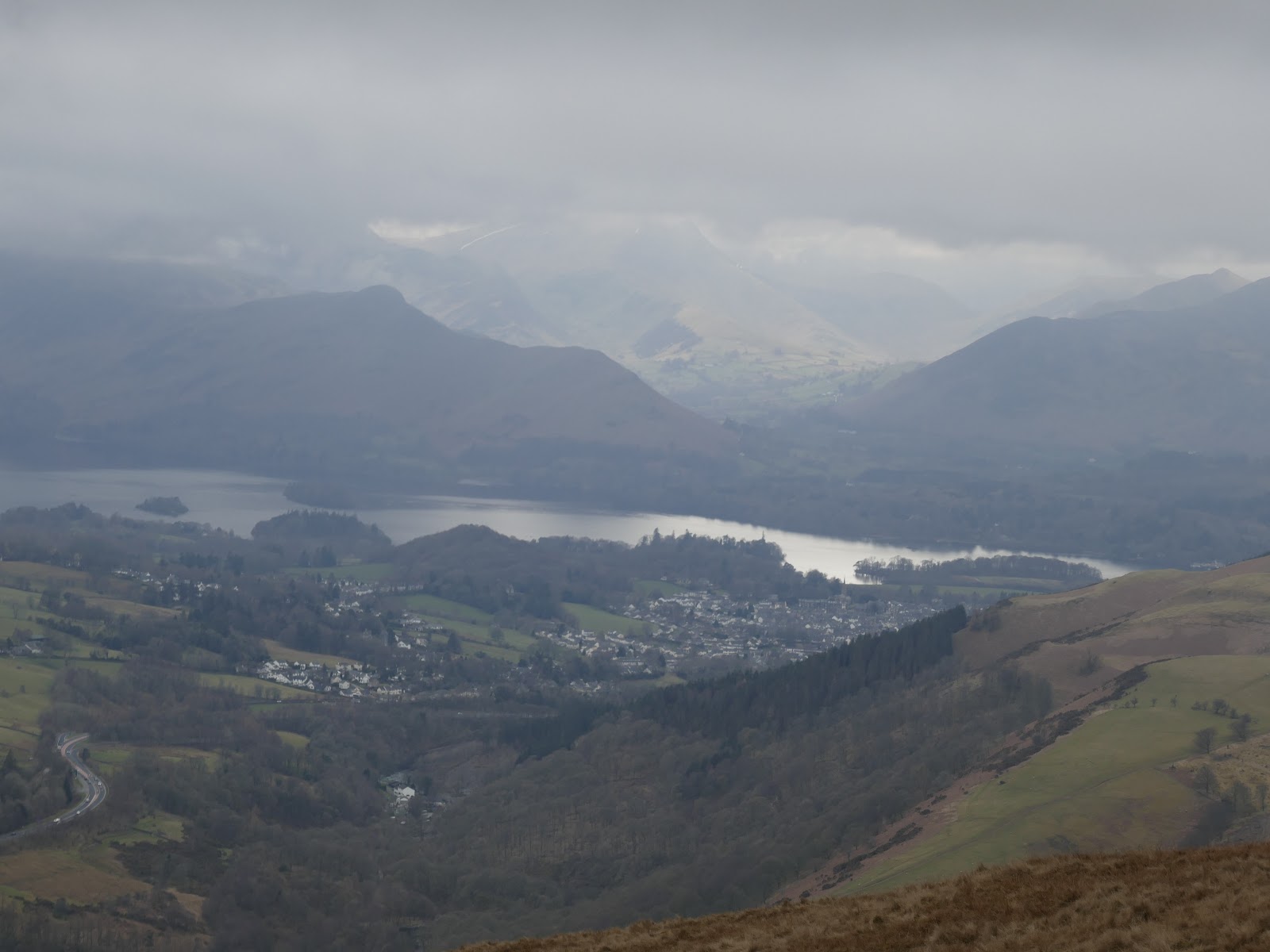
 |
| Keswick |
 |
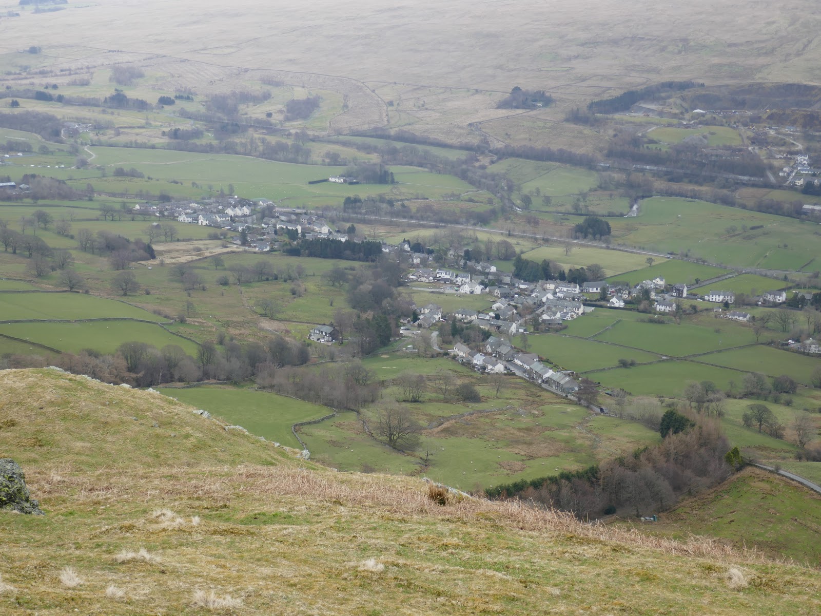
| Threlkeld |
 |
| High Rigg |
 |
| Keswick and Derwentwater backed by Catbells |
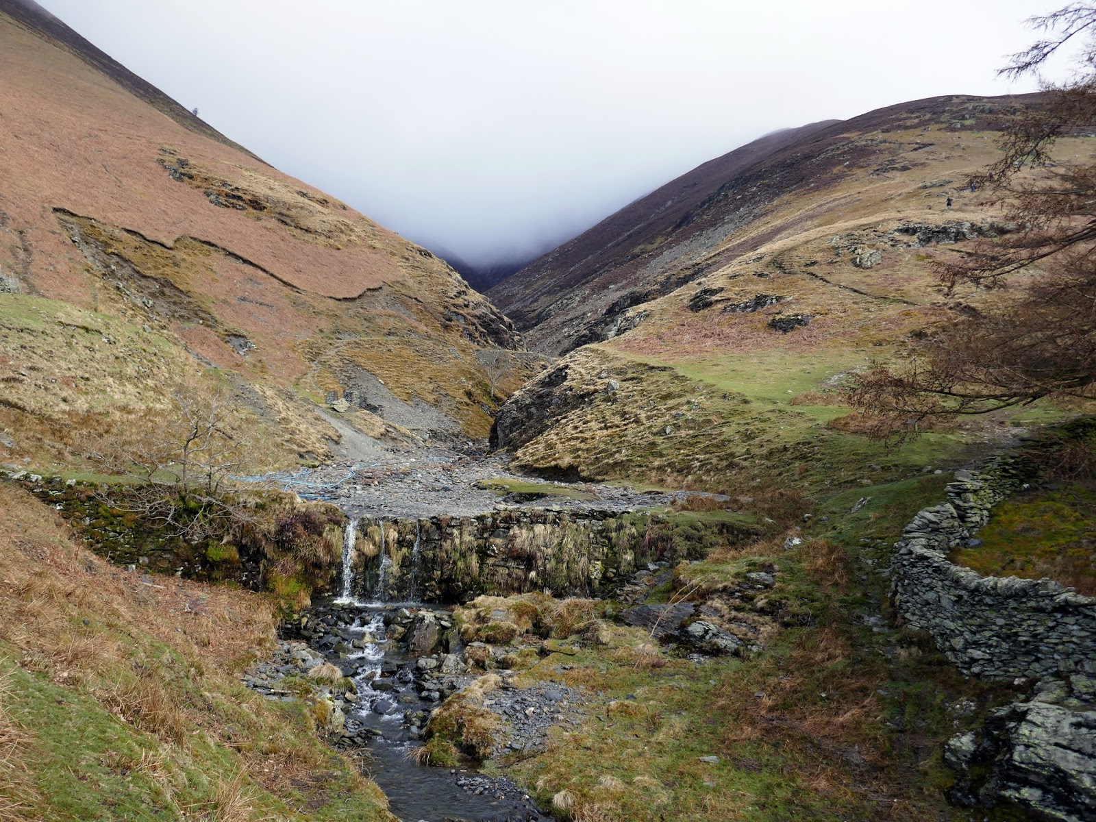
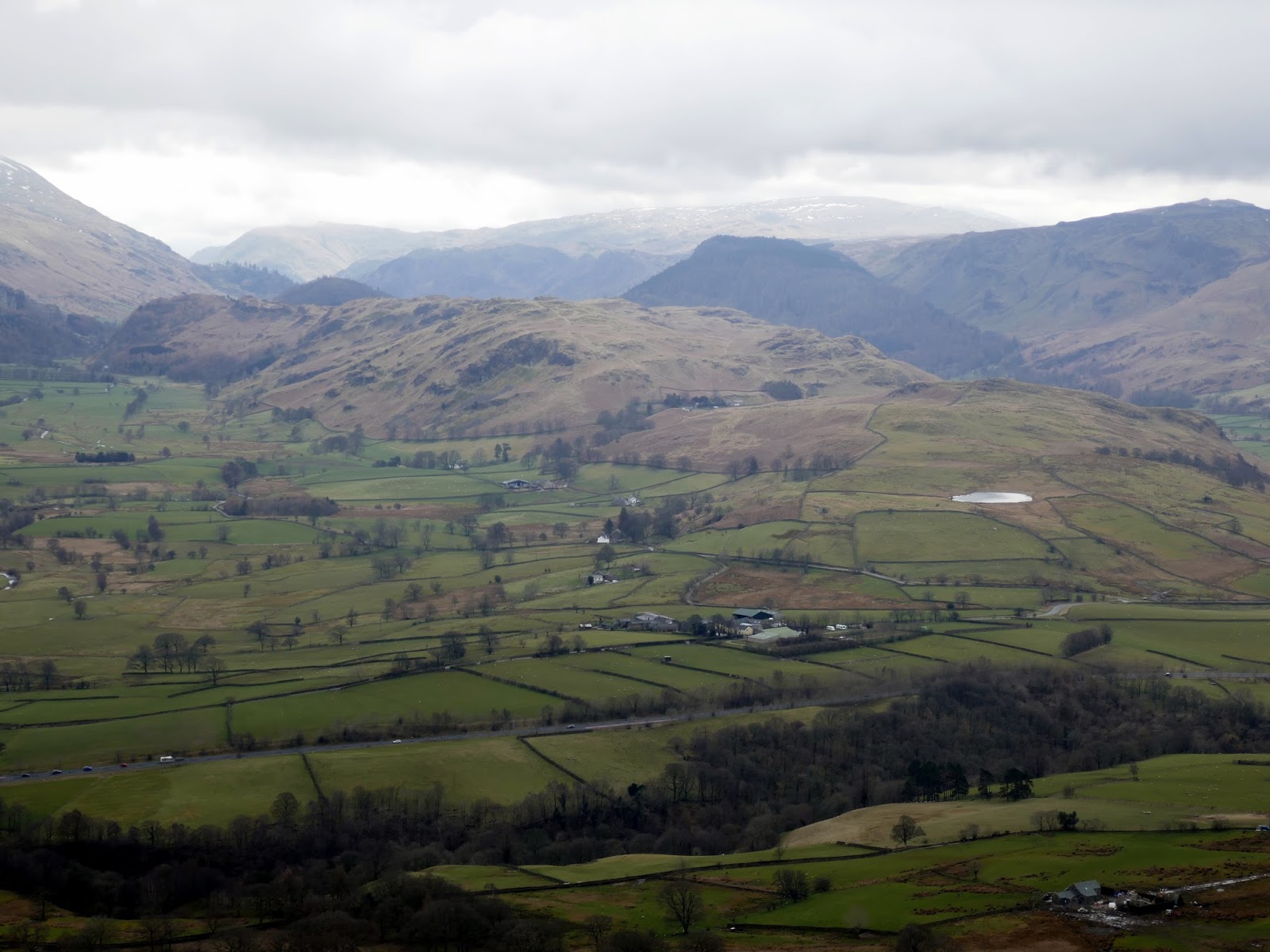
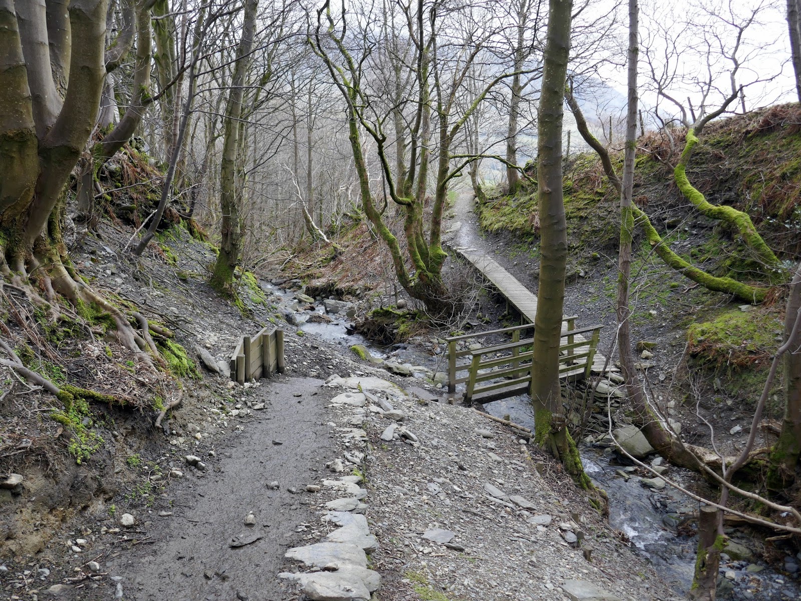
The path descends to Blease Gill, following the stream down to the edge of the village. From here, it’s an easy stroll back to the car park.
 |
| Threlkeld |
 |
| Knott Halloo |
 |
| Blease Gill |
 |
| Blease Gill |
