Open Space Web-Map builder Codehttps://openspace.ordnancesurvey.co.uk/osmapapi/openspace.js?key=3119F72552FD5C22E0530C6CA40A5A92https://openspace.ordnancesurvey.co.uk/osmapapi/script/mapbuilder/basicmap.jshttps://openspace.ordnancesurvey.co.uk/osmapapi/script/mapbuilder/searchbox.js//variables for routes var linesLayer, points, lineFeature, lineString, routeMarkersLayer, routepos, routesize, routeoffset, routeicon; var style_blue = {strokeColor: “#0000CD”, strokeOpacity: 0.5, strokeWidth: 4.5}; function initmapbuilder() { //initiate the map var options = {resolutions: [2500, 1000, 500, 200, 100, 50, 25, 10, 5, 4, 2.5, 2, 1]}; osMap = new OpenSpace.Map(‘map’, options); //configure map options (basicmap.js) setglobaloptions(); //set the center of the map and the zoom level osMap.setCenter(new OpenSpace.MapPoint(407272.5,397650),7); linesLayer = osMap.getVectorLayer(); // Set up layer for route markers routeMarkersLayer = new OpenLayers.Layer.Markers(“Route Markers”); //make a route points = new Array(); points.push(new OpenLayers.Geometry.Point(408195,399375)); points.push(new OpenLayers.Geometry.Point(408030,399205)); points.push(new OpenLayers.Geometry.Point(407770,398995)); points.push(new OpenLayers.Geometry.Point(407440,398825)); points.push(new OpenLayers.Geometry.Point(407285,398685)); points.push(new OpenLayers.Geometry.Point(407170,398515)); points.push(new OpenLayers.Geometry.Point(407240,398445)); points.push(new OpenLayers.Geometry.Point(407495,398365)); points.push(new OpenLayers.Geometry.Point(407620,398325)); points.push(new OpenLayers.Geometry.Point(407705,398245)); points.push(new OpenLayers.Geometry.Point(407820,398195)); points.push(new OpenLayers.Geometry.Point(407960,398015)); points.push(new OpenLayers.Geometry.Point(408090,397855)); points.push(new OpenLayers.Geometry.Point(408200,397715)); points.push(new OpenLayers.Geometry.Point(408270,397665)); points.push(new OpenLayers.Geometry.Point(408300,397565)); points.push(new OpenLayers.Geometry.Point(408390,397495)); points.push(new OpenLayers.Geometry.Point(408555,397305)); points.push(new OpenLayers.Geometry.Point(408600,397215)); points.push(new OpenLayers.Geometry.Point(408635,397135)); points.push(new OpenLayers.Geometry.Point(408675,397075)); points.push(new OpenLayers.Geometry.Point(408765,396925)); points.push(new OpenLayers.Geometry.Point(408945,396705)); points.push(new OpenLayers.Geometry.Point(408995,396635)); points.push(new OpenLayers.Geometry.Point(409190,396625)); points.push(new OpenLayers.Geometry.Point(409240,396430)); points.push(new OpenLayers.Geometry.Point(409355,396220)); points.push(new OpenLayers.Geometry.Point(409385,396120)); points.push(new OpenLayers.Geometry.Point(409385,396060)); points.push(new OpenLayers.Geometry.Point(409250,395960)); points.push(new OpenLayers.Geometry.Point(409370,396060)); points.push(new OpenLayers.Geometry.Point(409350,396220)); points.push(new OpenLayers.Geometry.Point(409240,396450)); points.push(new OpenLayers.Geometry.Point(409185,396660)); points.push(new OpenLayers.Geometry.Point(408940,396620)); points.push(new OpenLayers.Geometry.Point(408640,396530)); points.push(new OpenLayers.Geometry.Point(408500,396530)); points.push(new OpenLayers.Geometry.Point(408340,396520)); points.push(new OpenLayers.Geometry.Point(408040,396470)); points.push(new OpenLayers.Geometry.Point(408035,396575)); points.push(new OpenLayers.Geometry.Point(407830,396785)); points.push(new OpenLayers.Geometry.Point(407470,396965)); points.push(new OpenLayers.Geometry.Point(406995,396995)); points.push(new OpenLayers.Geometry.Point(406705,397045)); points.push(new OpenLayers.Geometry.Point(406465,397155)); points.push(new OpenLayers.Geometry.Point(406355,397295)); points.push(new OpenLayers.Geometry.Point(406275,397515)); points.push(new OpenLayers.Geometry.Point(406290,397575)); points.push(new OpenLayers.Geometry.Point(406395,397665)); points.push(new OpenLayers.Geometry.Point(406265,397835)); points.push(new OpenLayers.Geometry.Point(406145,397915)); points.push(new OpenLayers.Geometry.Point(405995,397955)); points.push(new OpenLayers.Geometry.Point(405765,398015)); points.push(new OpenLayers.Geometry.Point(405780,398085)); points.push(new OpenLayers.Geometry.Point(406190,397995)); points.push(new OpenLayers.Geometry.Point(406435,397995)); points.push(new OpenLayers.Geometry.Point(406615,398055)); points.push(new OpenLayers.Geometry.Point(406840,398145)); points.push(new OpenLayers.Geometry.Point(406995,398295)); points.push(new OpenLayers.Geometry.Point(407165,398505)); points.push(new OpenLayers.Geometry.Point(407285,398687.5)); points.push(new OpenLayers.Geometry.Point(407412.5,398810)); points.push(new OpenLayers.Geometry.Point(407655,398950)); points.push(new OpenLayers.Geometry.Point(407865,399060)); points.push(new OpenLayers.Geometry.Point(408065,399220)); points.push(new OpenLayers.Geometry.Point(408195,399375)); // create a polyline feature from the array of points lineString = new OpenLayers.Geometry.LineString(points); lineFeature = new OpenLayers.Feature.Vector(lineString, null, style_blue); linesLayer.addFeatures([lineFeature]); //crate a route start/end marker routepos = new OpenSpace.MapPoint(408195,399375); routesize = new OpenLayers.Size(33,45); routeoffset = new OpenLayers.Pixel(-5,-37); routeicon = new OpenSpace.Icon(‘https://openspace.ordnancesurvey.co.uk/osmapapi/img_versions/img_1.1/mapbuilder/routemarker-startend.png’, routesize, routeoffset, null, null); routeMarkersLayer.addMarker(new OpenLayers.Marker(routepos, routeicon)); osMap.addLayer(routeMarkersLayer);}
Route: Woodhead Reservoir, Trans Pennine Trail, Wildboar Clough, Far Moss, Bleaklow Head, Far Moss, Wildboar Grain, Torside Clough, Clough Edge, Reaps, Torside Bridge, Trans Pennine Trail
Date: 02/12/2017
From: Torside Reservoir
Parking: Woodhead Reservoir Dam
Start Point: Woodhead Reservoir Dam
Region: Peak District – Dark Peak
Route length: 8.2 miles (13.2 km)
Time taken: 04:02
Average speed: 2.0 mph
Ascent: 511m
Descent: 511m
Summits: Bleaklow (633m)
Other points of interest: Wildboar Clough
The name Wildboar Clough was unknown to me until I queried a friend who knows the area well, looking for something interesting for a gloomy looking day. It turns out its one of the great scrambles in the Peak District, one of only a few which are actually testing. The clough is one of many which drain the northern slopes of Bleaklow though the only one that harbours accessible, rocky interest.
We left a car close to Salters Brook Bridge to the east of Bleaklow with the intention of having a wander across the main watershed, taking another to the start point close to Torside reservoir (the main road was closed so we ended up parking in a layby on the south side of the reservoir dam). A number of routes were on the cards depending on time and daylight but all would include climbing Wildboar Clough.
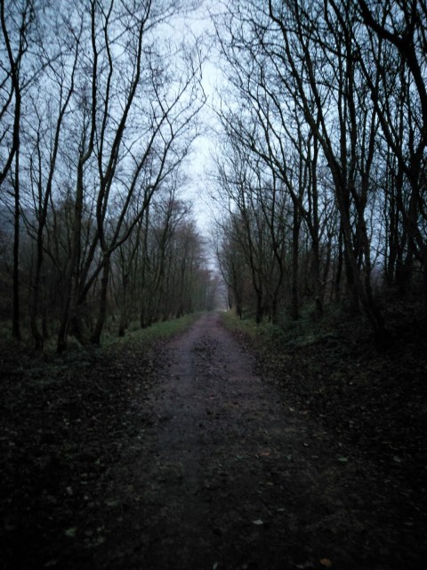
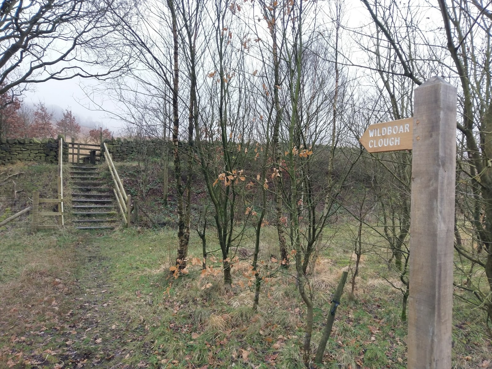
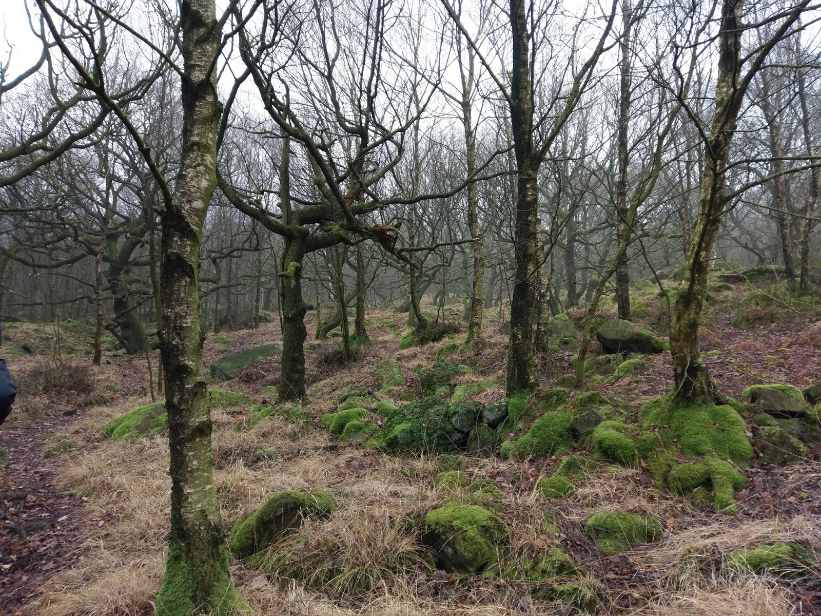
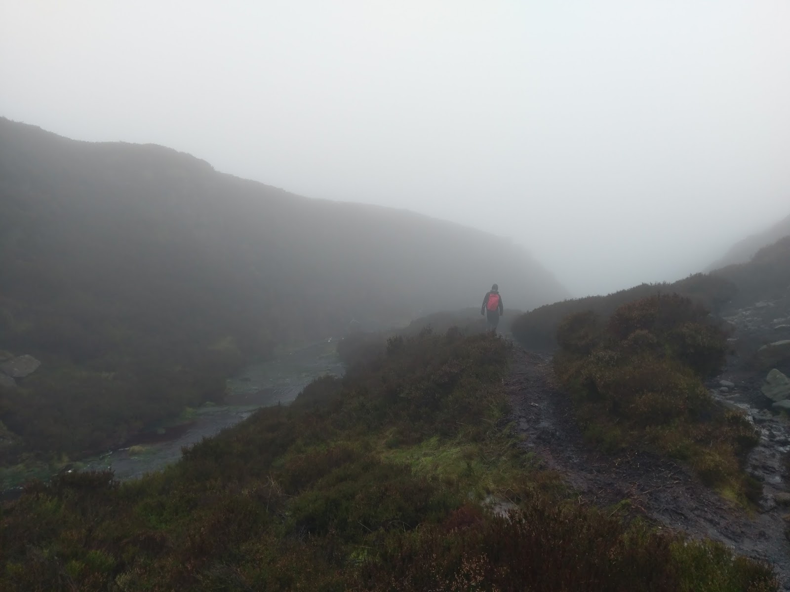
Following the Trans Pennine Trail (not to be confused with the Pennine Way) took us to a brand new fingerpost directing the way to Wildboar Clough. Here begins a straightforward climb up through some ancient woodland.
 |
| Leaving the Trans Pennine Trail |
 |
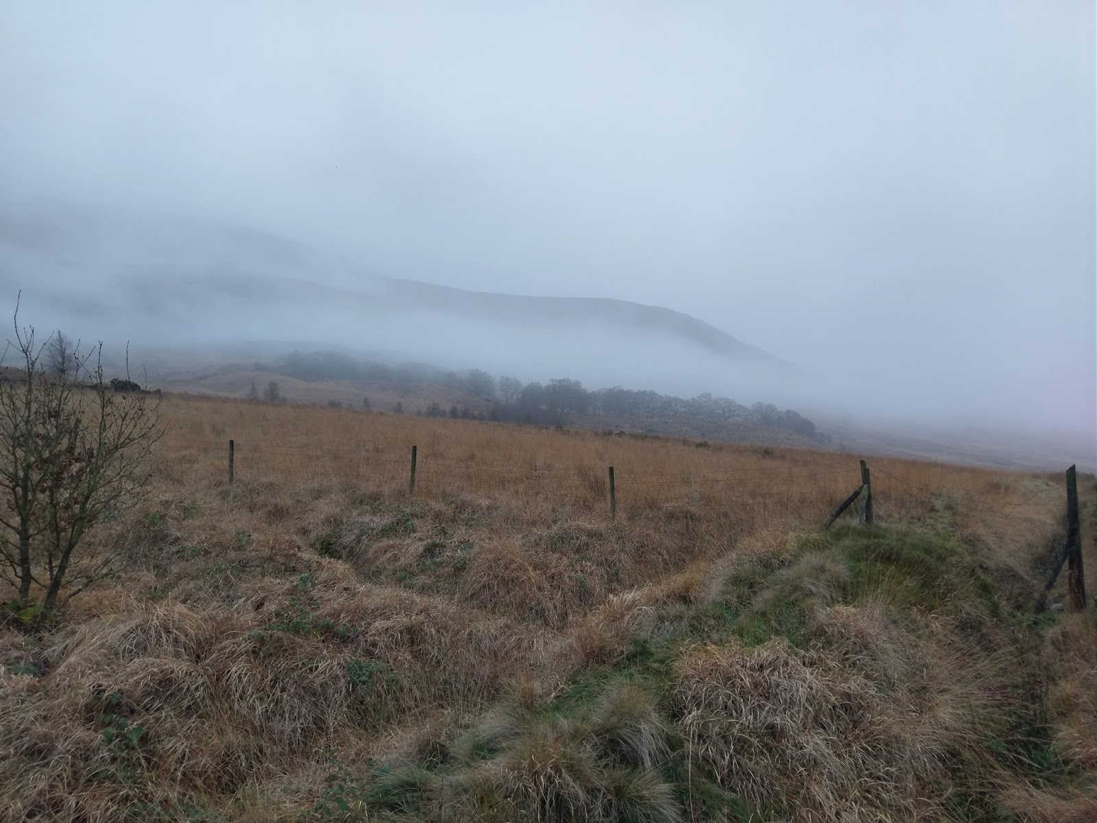
| Mist swirl around Peaknaze Moor |
 |
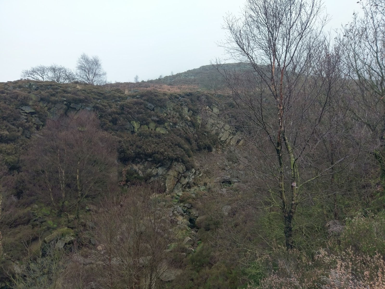
| The woods guarding Wildboar Clough |
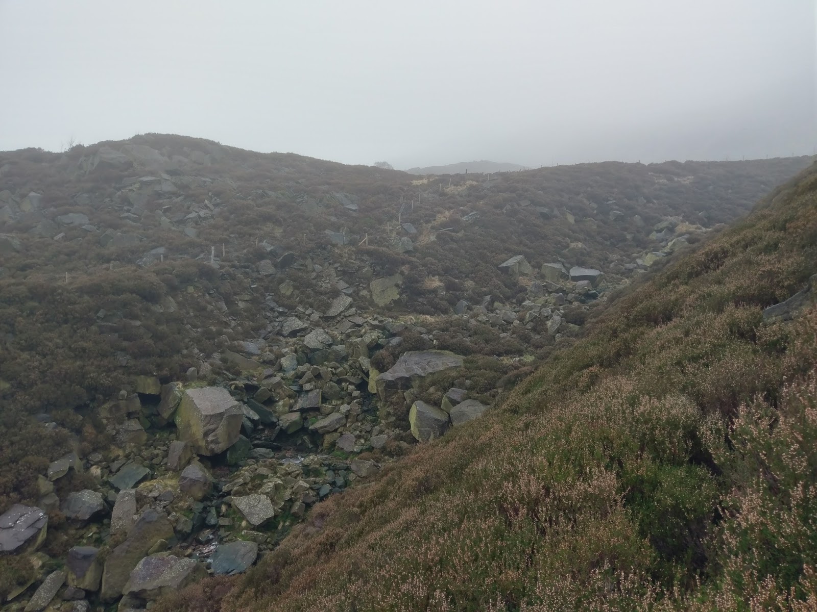
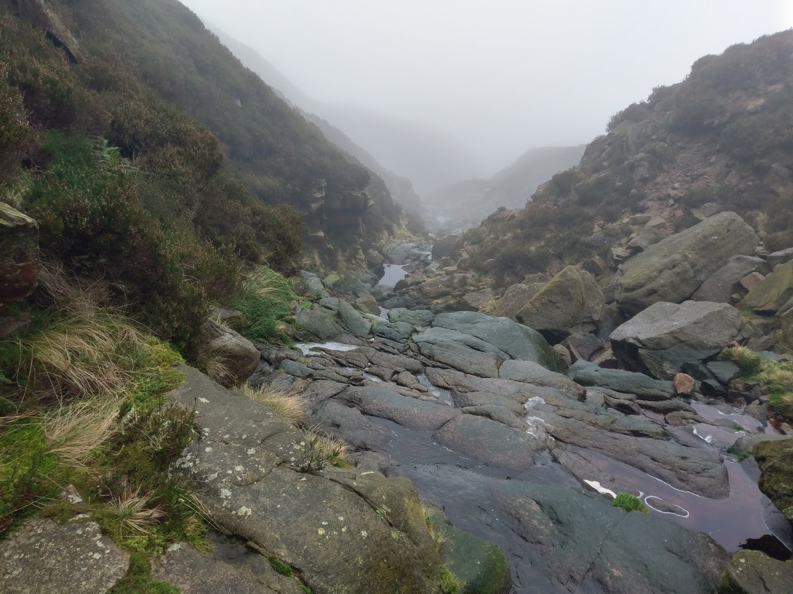
Once clear of the woods, the path eventually drops easily into the valley of Wildboar Clough close to Rollick Stones. Initially, the route is fairly simple, following the streambed much of the way, negotiating a few extremely slippery frozen sections.
 |
| First glimpses of the ravine |
 |
| Wildboar Clough – not quite time to get into it yet |
 |
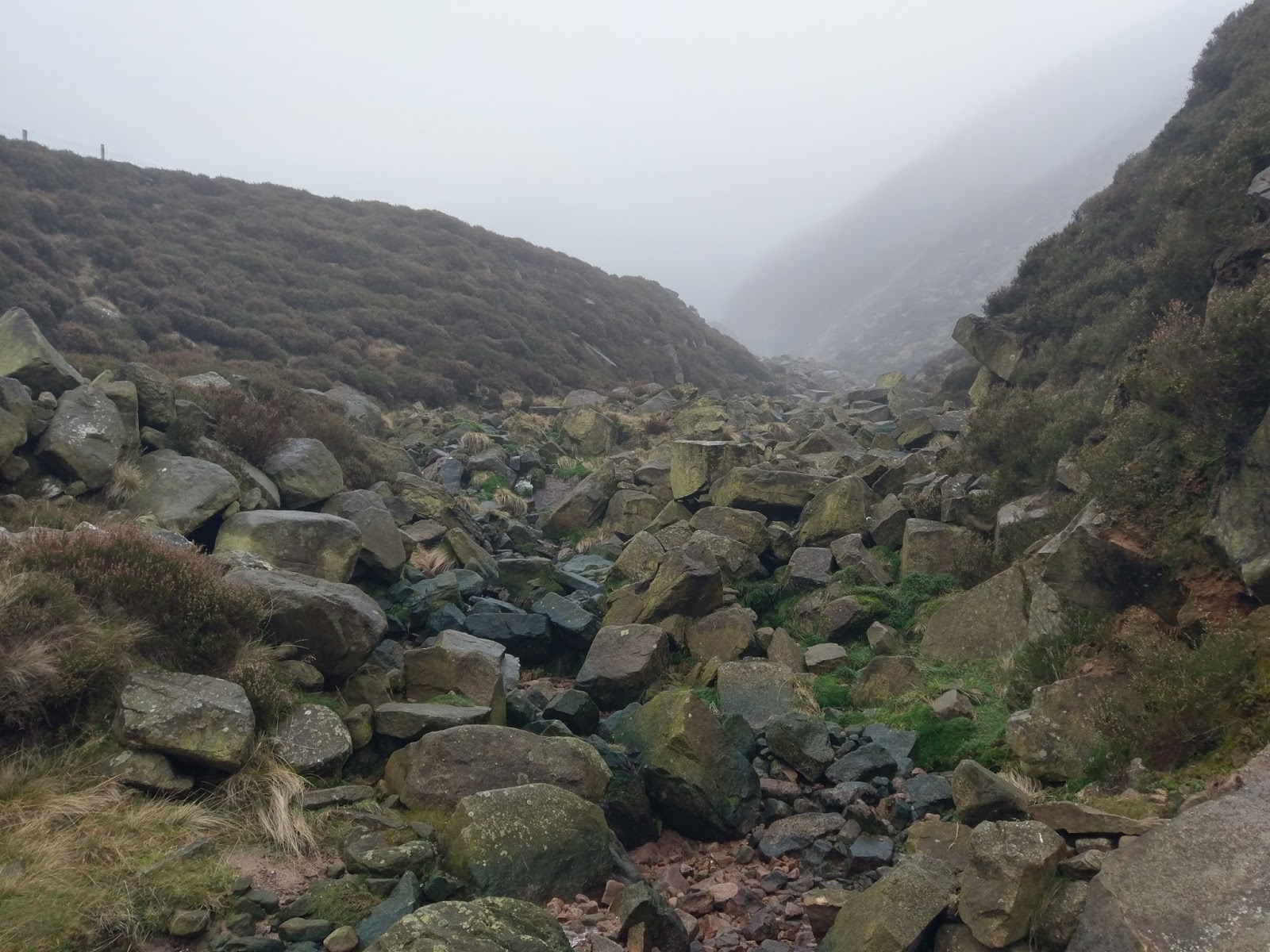
| Within Wildboar Clough |
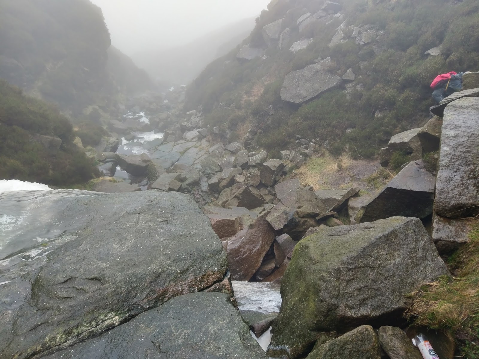
Eventually, the rock walls narrow and you will reach the first of three significant obstacles in the river, all of which should be manageable if you are competent scrambler and the conditions are favourable. Our conditions were less than ideal but we had a good go regardless. The three obstacles can be bypassed, though, if you bypass the first one you will likely find it difficult to get back down to tackle the second one. This is my opinion anyway.
 |
| Wildboar Clough |
 |
| Beginnings of the icy sections |
 |
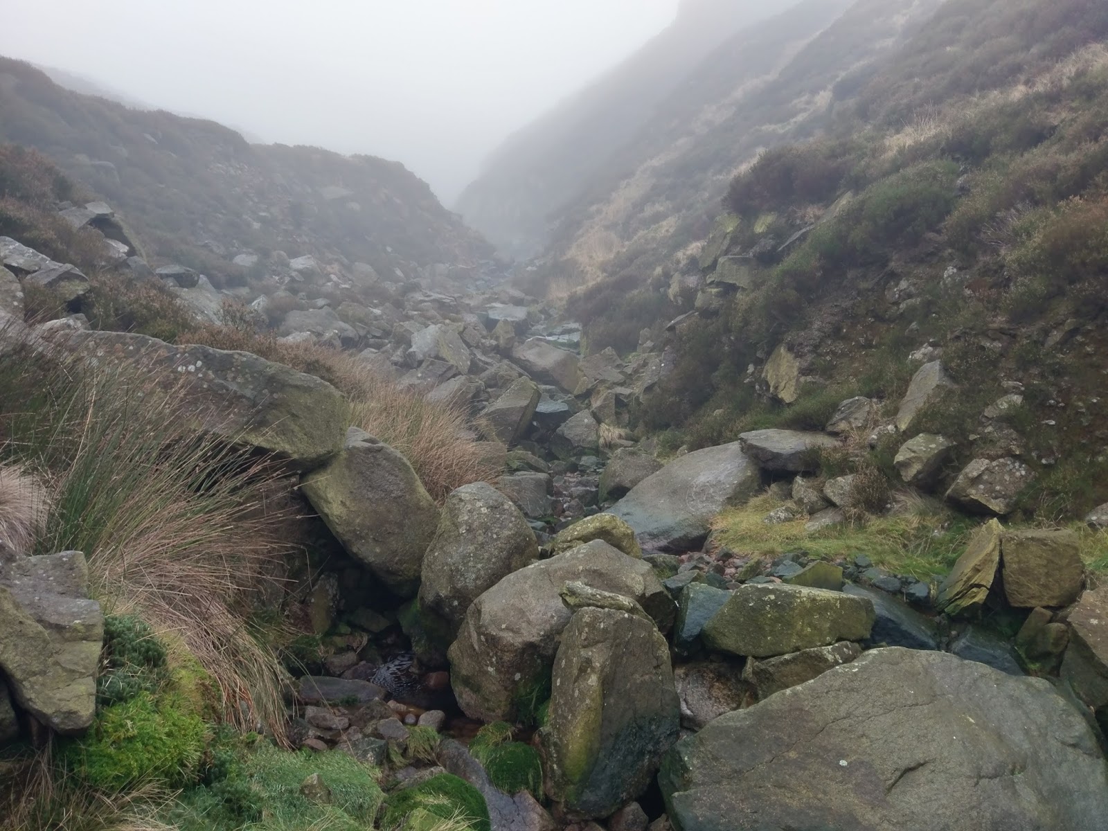
| Wildboar Clough |
At first the route around the first obstacle is unclear – I did do some research before venturing out. The typical route is by shimmying up slanted, ice-free rock to the left of the photo. I’ve seen it referred to as ‘Riding the Rock’ as it does require putting your legs either side of it and shuffling up to reach the higher holds. It’s trickier than it looks, particularly because there is little in the way of footholds on the smooth rock. After some in-elegant shuffling, I managed it in the end.
 |
| The first obstacle – the easier route is up the ice-free rock to the left, straddling the crest to reach holds higher above |
 |
| Ice on the first obstacle |
 |
| Looking down the first obstacle |
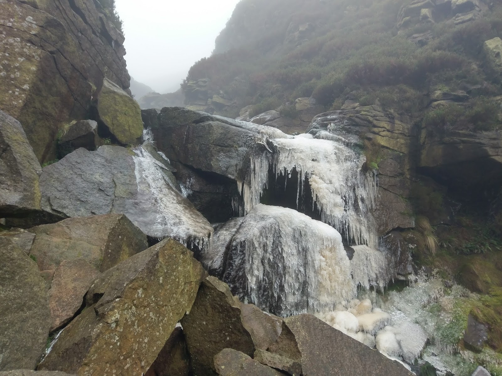
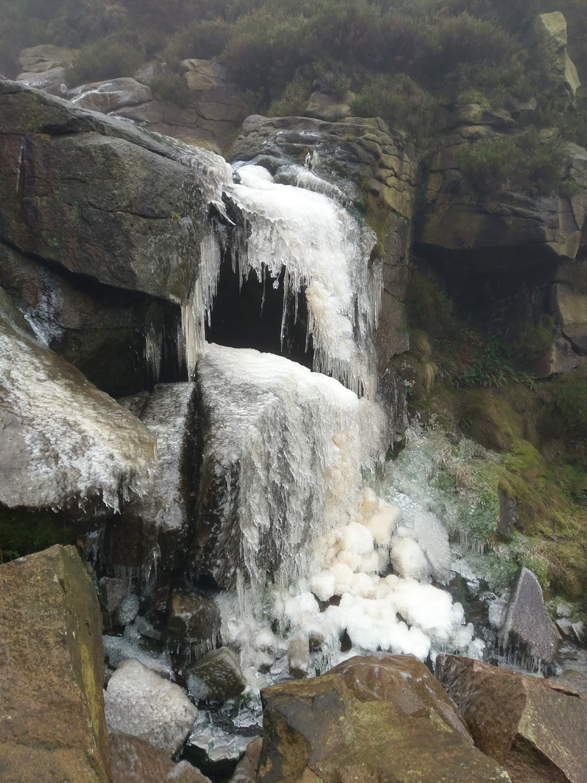
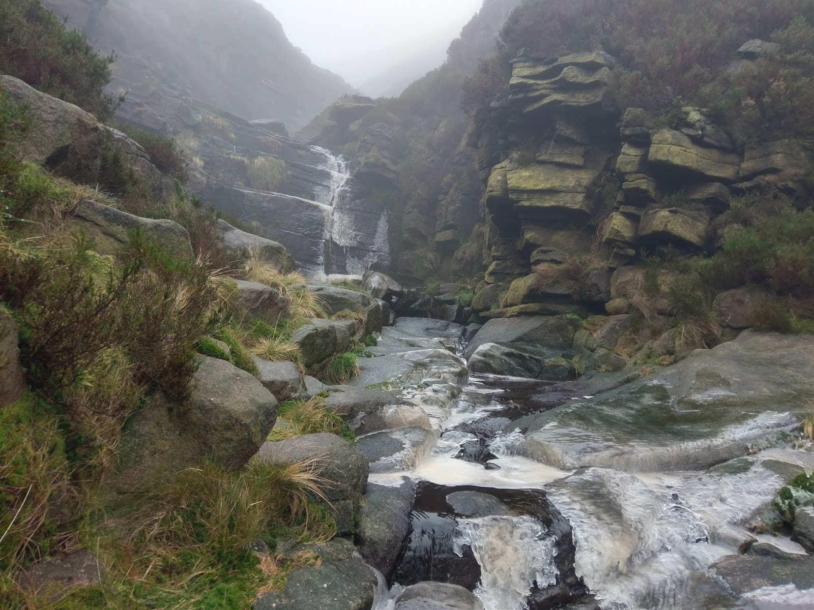
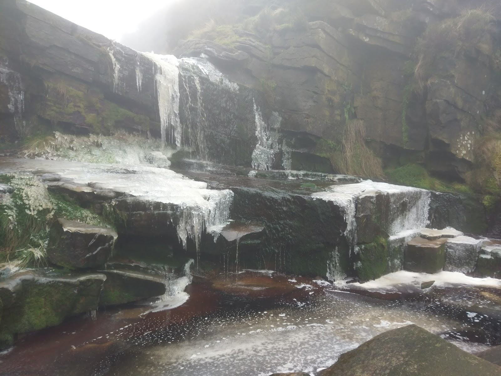
Completing the first obstacle leads directly to the second, an impressive vertical waterfall. This one is tackled via a mossy gully just left of the main waterfall. Plenty of hand and footholds are available with the biggest risk being the slipperiness of the rock.
 |
| Approaching the second waterfall |
 |
| The second waterfall – the route here is up the obvious crack to the left of the waterfall |
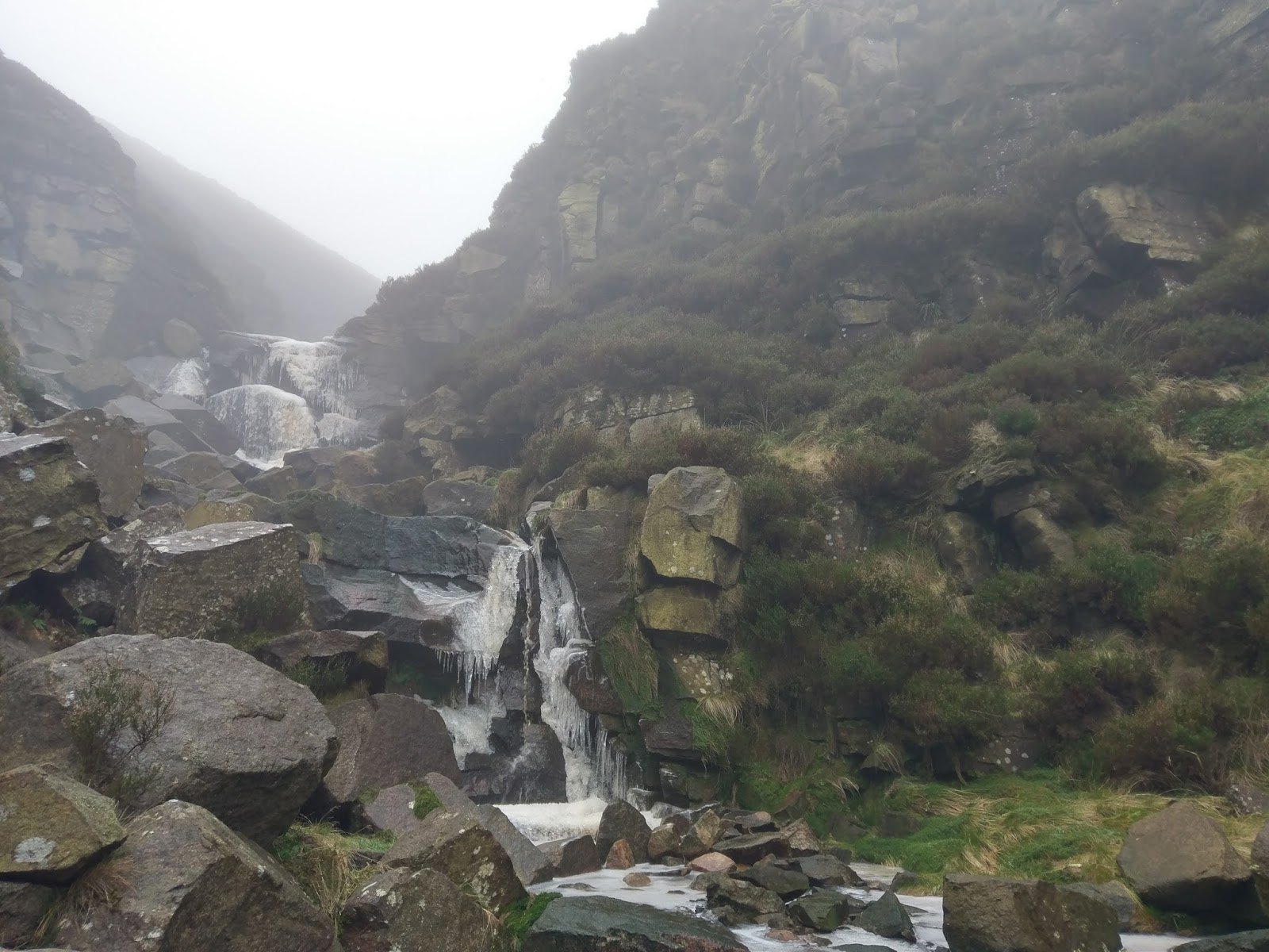
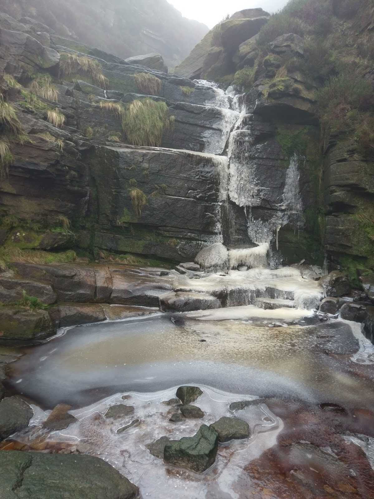
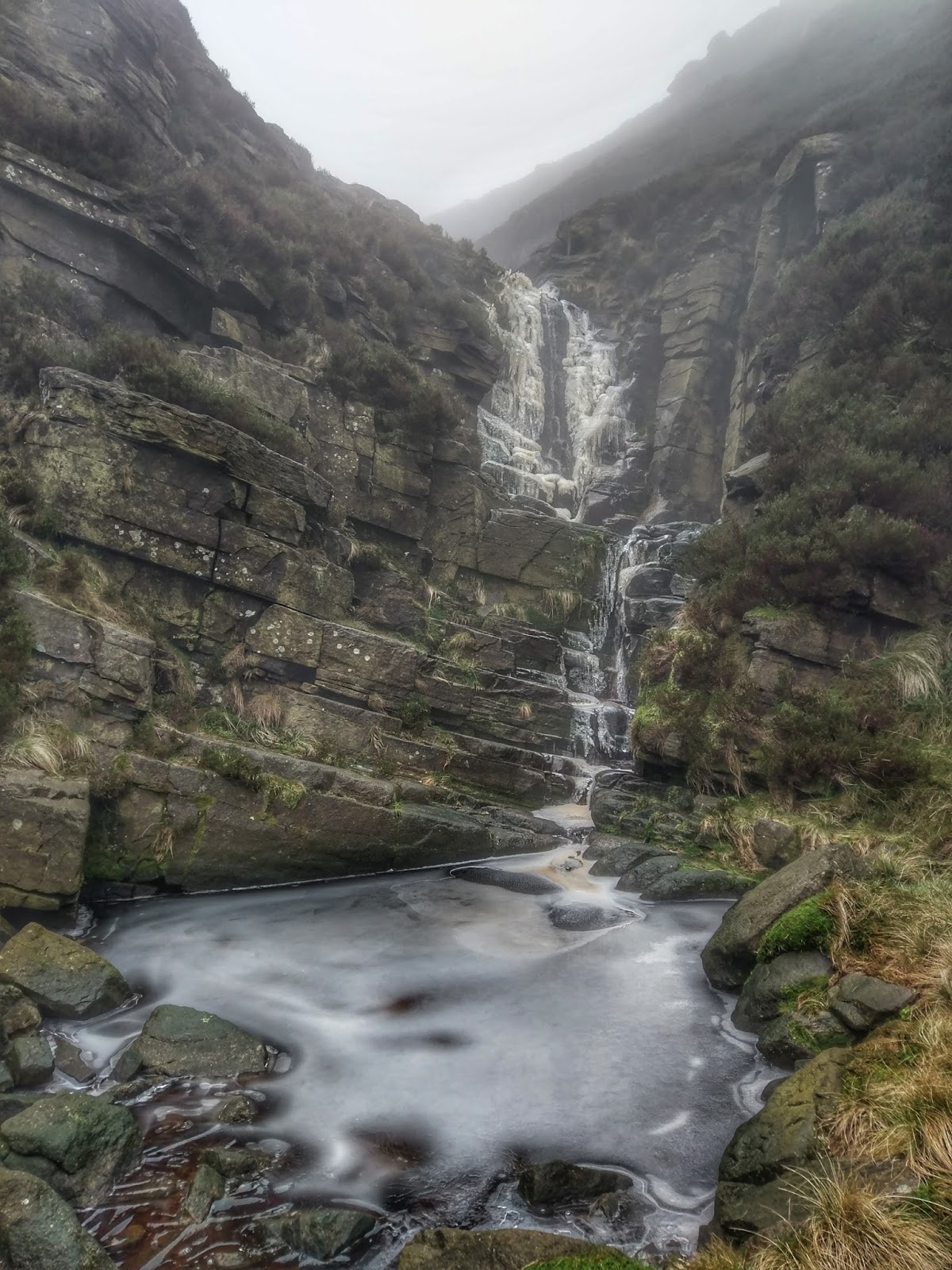
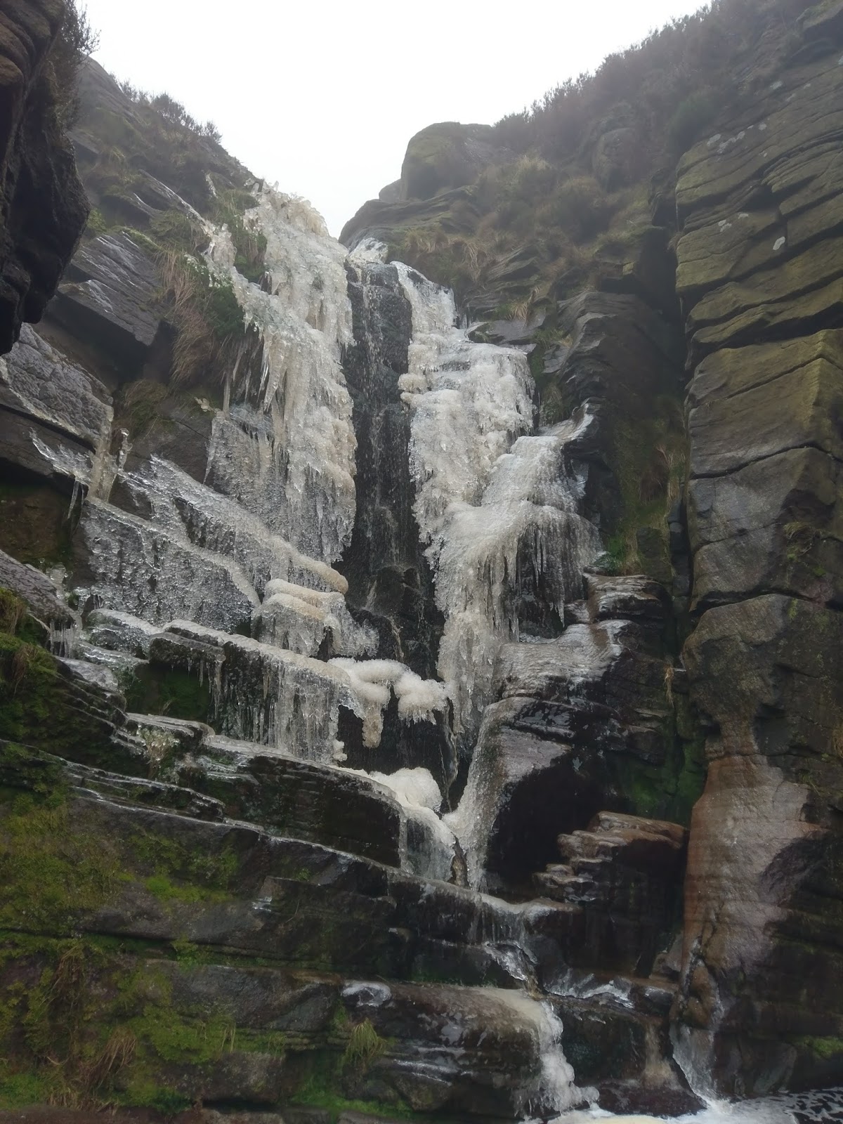
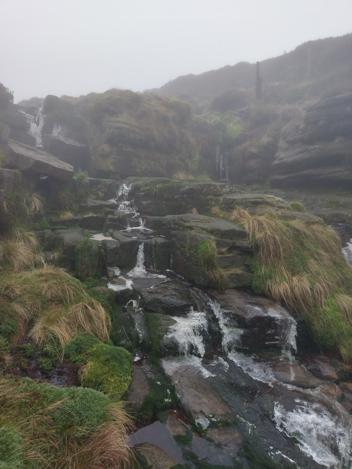
The third obstacle lies dead ahead – another vertical waterfall though much larger this time – the most impressive of the lot, and the most challenging. There are a few routes that negotiate this one, however, the build-up of ice made this one a no-go. Time for a bypass, after the first tier. It seems a lot of people bypass this one as the main routes are close to the waterfall which is either too wet or, in our case, too icy.
 |
| The magnificent third waterfall |
 |
| The main section of the third waterfall, too icy today |
 |
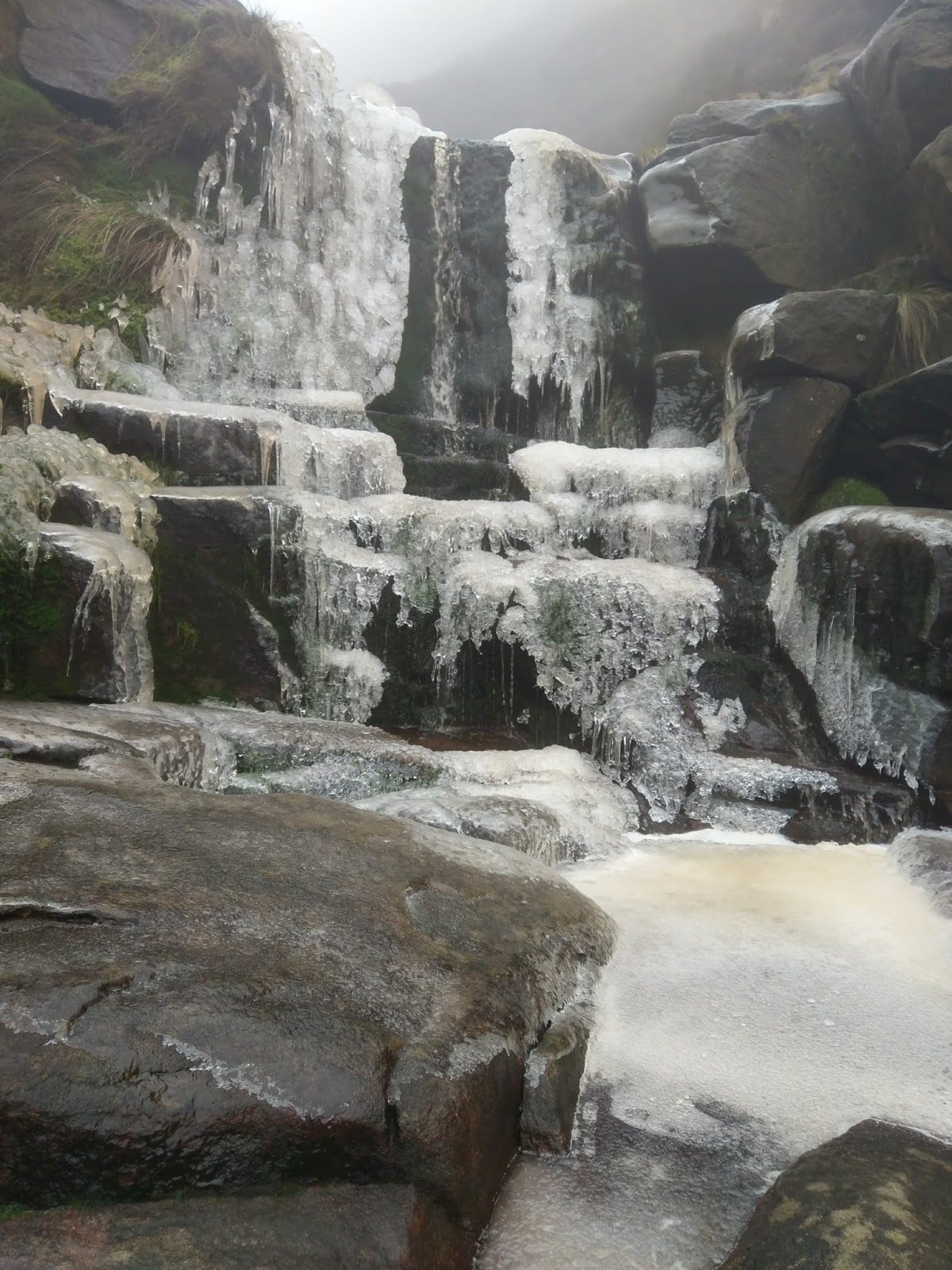
| Smaller falls lie beyond the third fall, most are easily negotiated |
 |
| Further falls in Wildboard Clough |
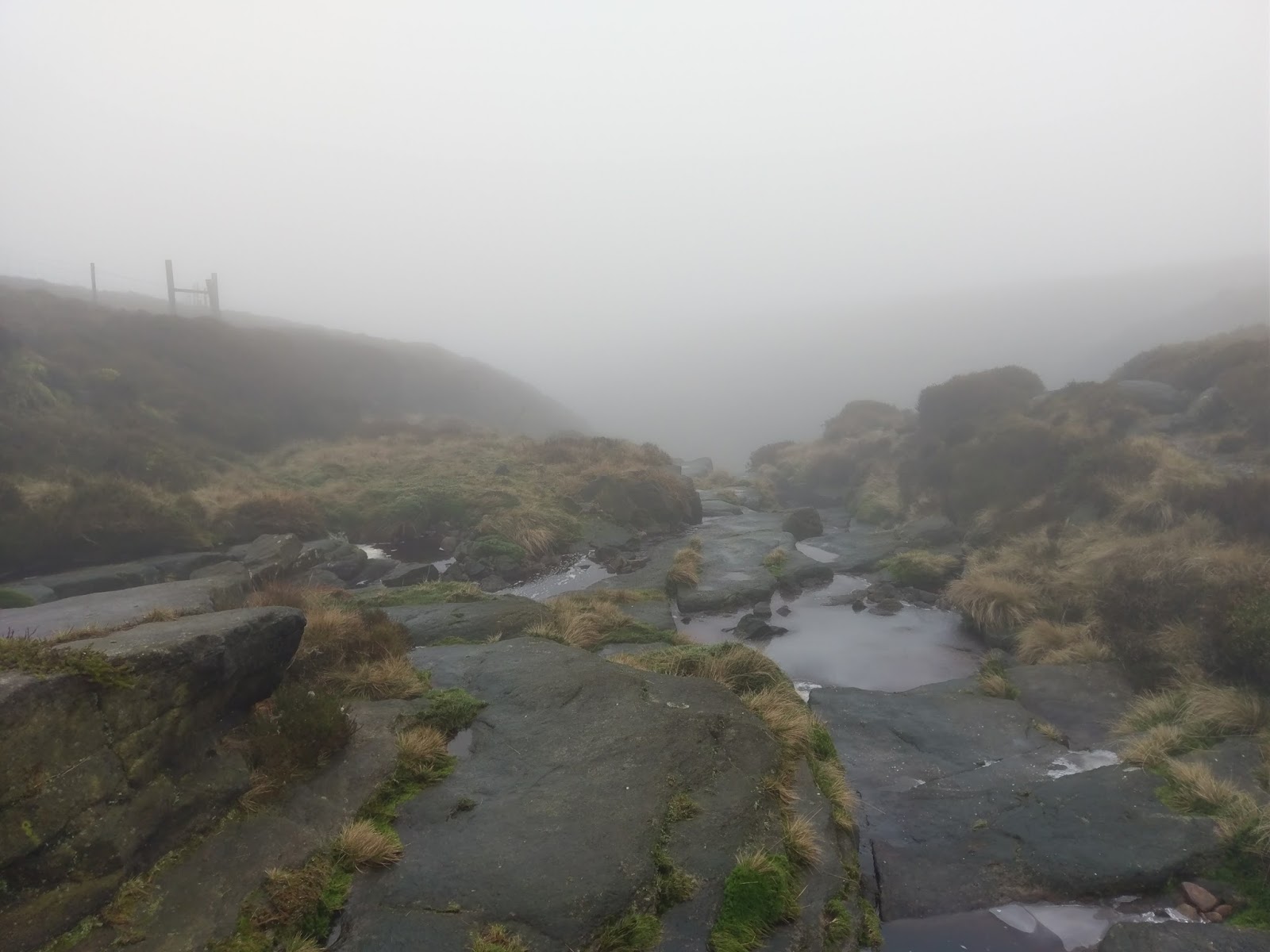
Once around the three main falls, things get a little easier once more, however, we were thwarted a final time on a shorter waterfall which had covered the only route in solid ice.
 |
| Add caption |
 |
| Wildboar Clough begins to diminish |
 |
| The top of Wildboar Clough |
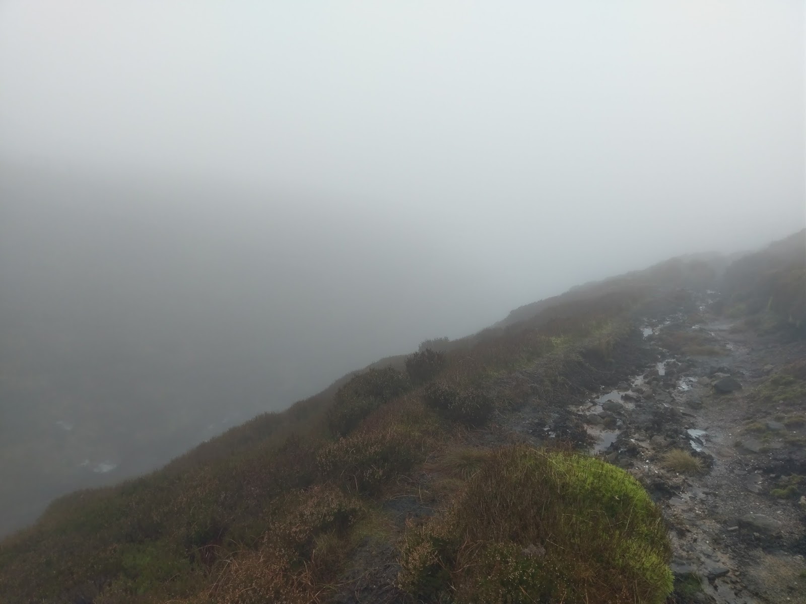
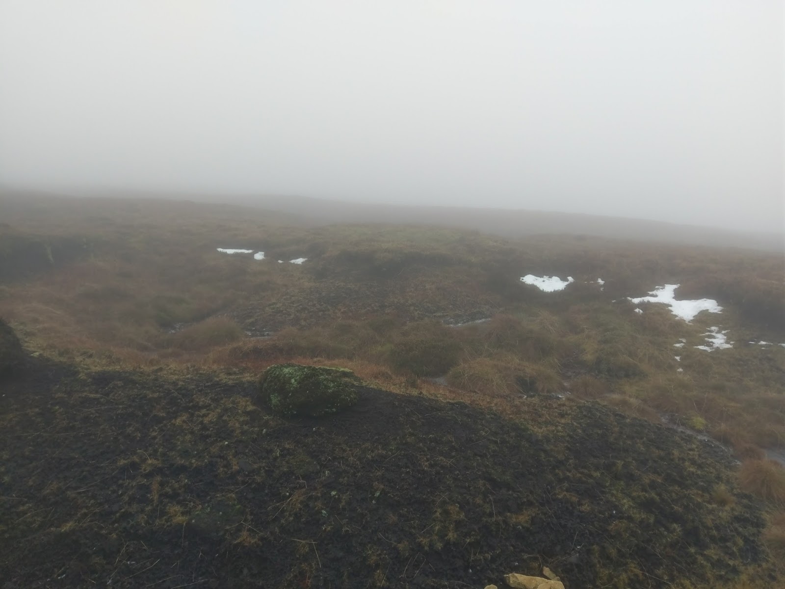
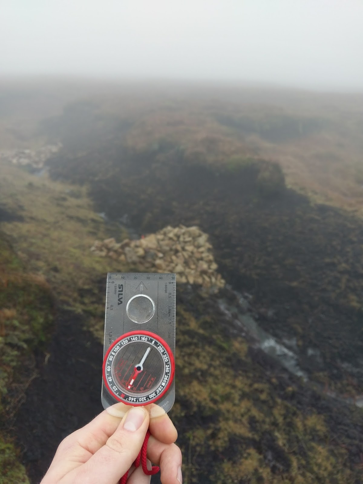
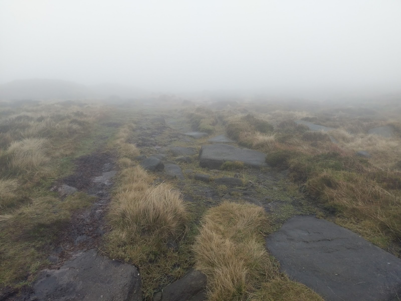
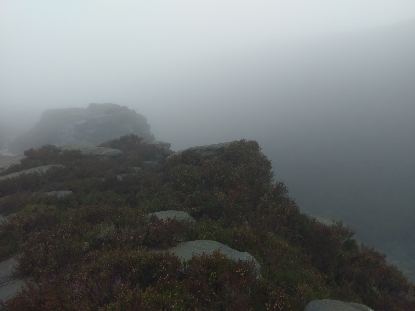
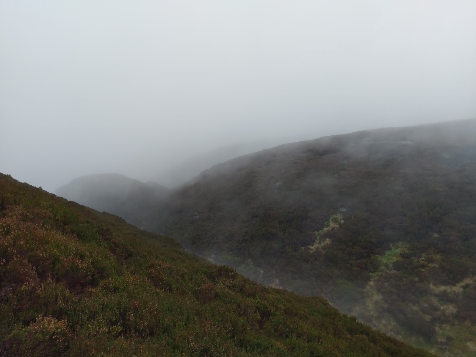
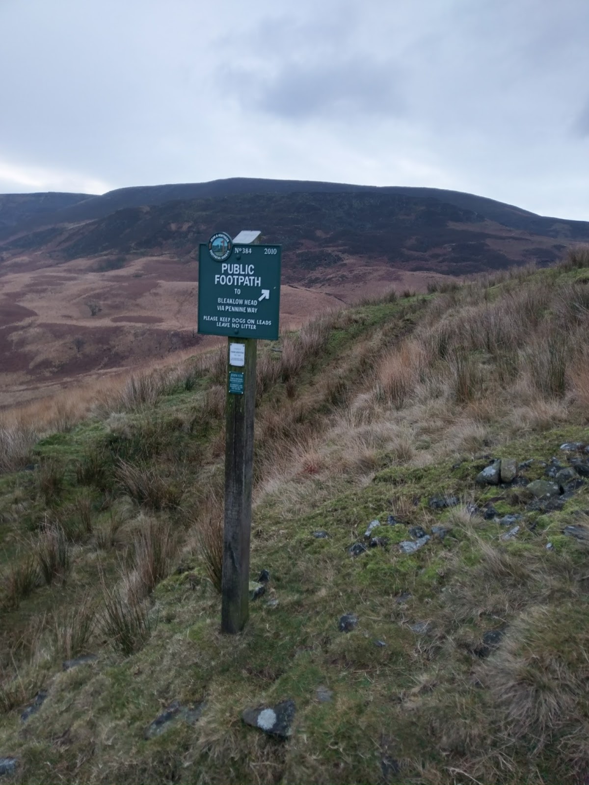
We emerged onto the plateau which was shrouded in a thick fog – classic Bleaklow some would say. Despite this, it makes an excellent location to get the compass out and practice from real navigation for once. With our bearing set on the Pennine Way, we set off into the murk.
 |
| Heading out onto Bleaklow |
 |
| Time for some real navigation |
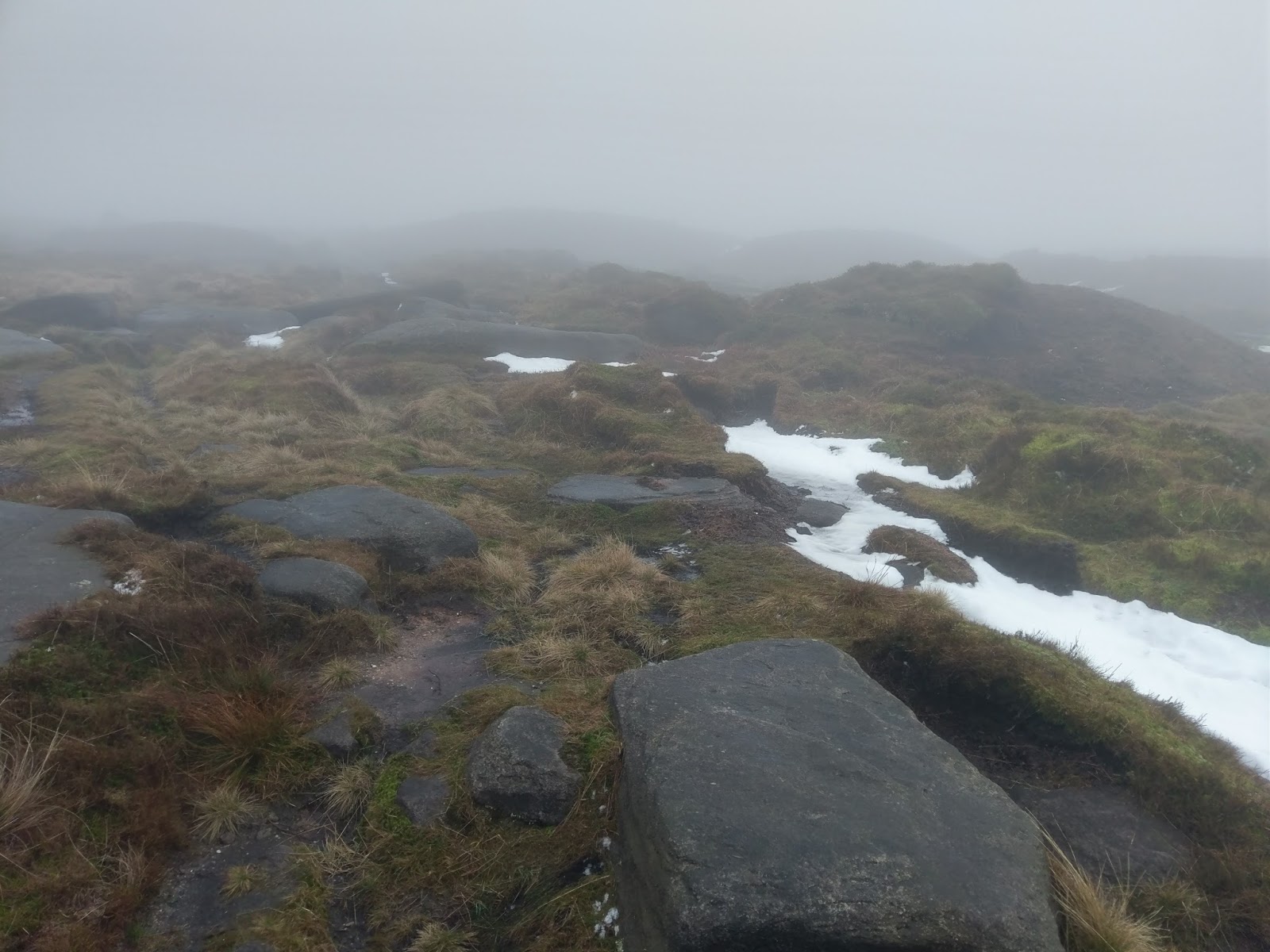
A mile of Pennine nothing-ness lay between us and our destination. We used numerous small features in the landscape to keep on our bearing before reaching a noticeable pile of rocks which gave us an opportunity to stop for lunch. We found the Pennine Way shortly after setting off again which leads to Bleaklow Head, Bleaklow’s highest point.
 |
| The Pennine Way |
 |
| The Pennine Way |
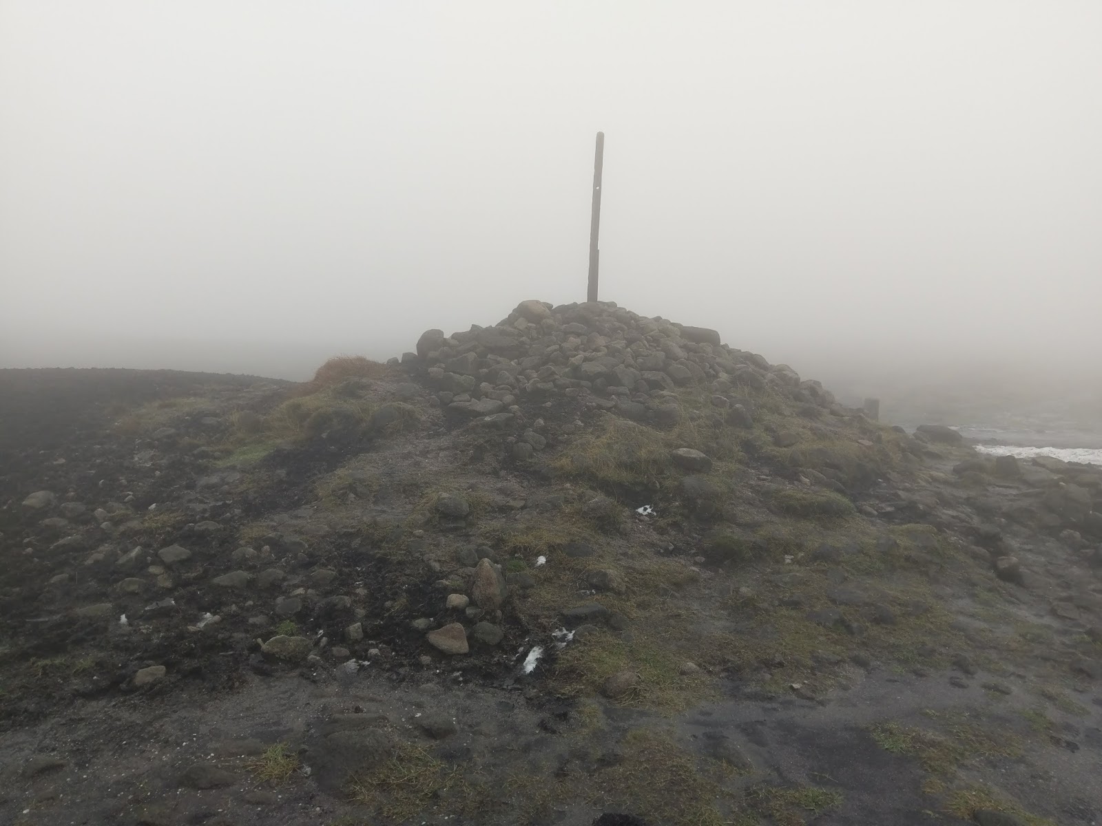
A large cairn stands at Bleaklow Head though the true summit is located away in the mists and is marked by its own, smaller pile of stones. As I mentioned earlier, we had considered venturing along the watershed but time was against us so, instead, we decided we’d follow the Pennine Way along Torside Clough and back to the car near Crowden.
 |
| Bleaklow Head |
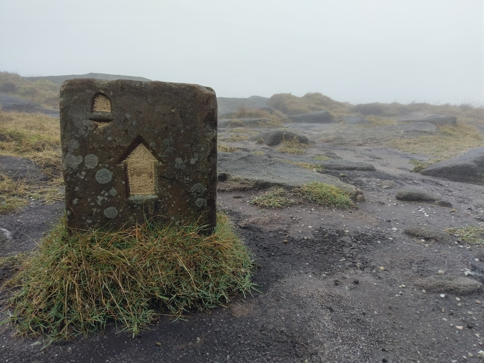
 |
| Pennine Way marker |
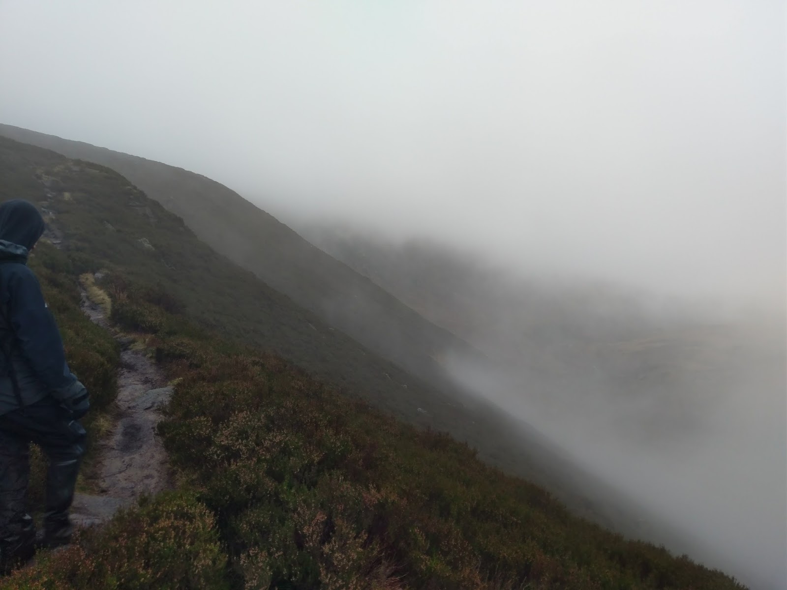
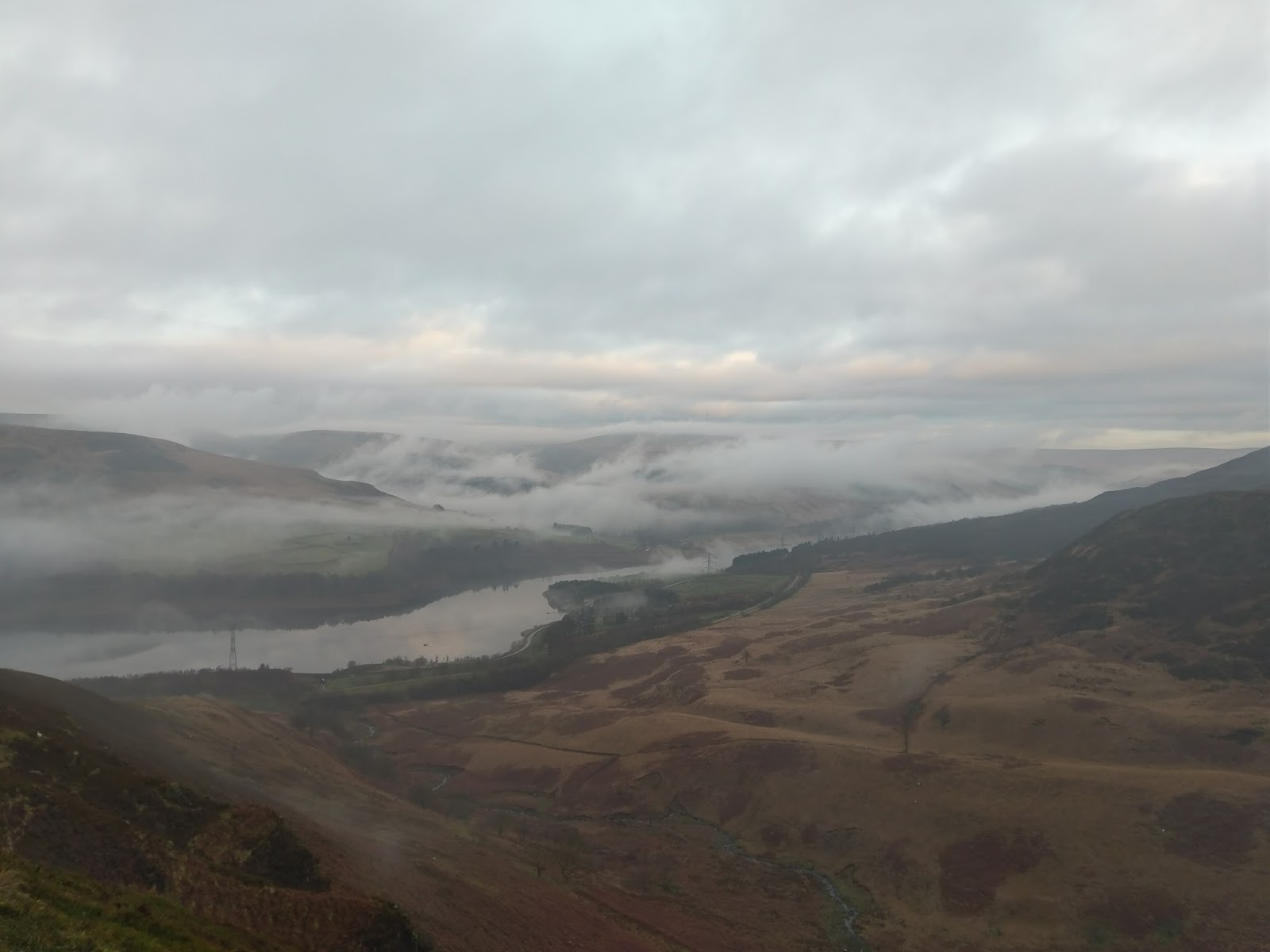
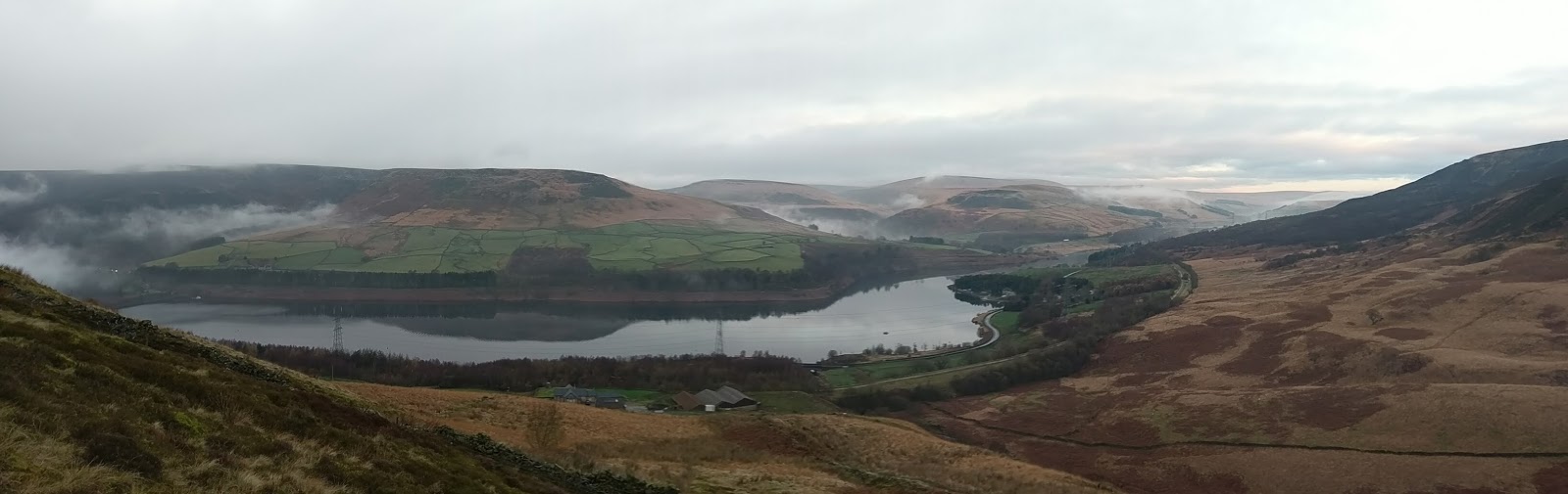
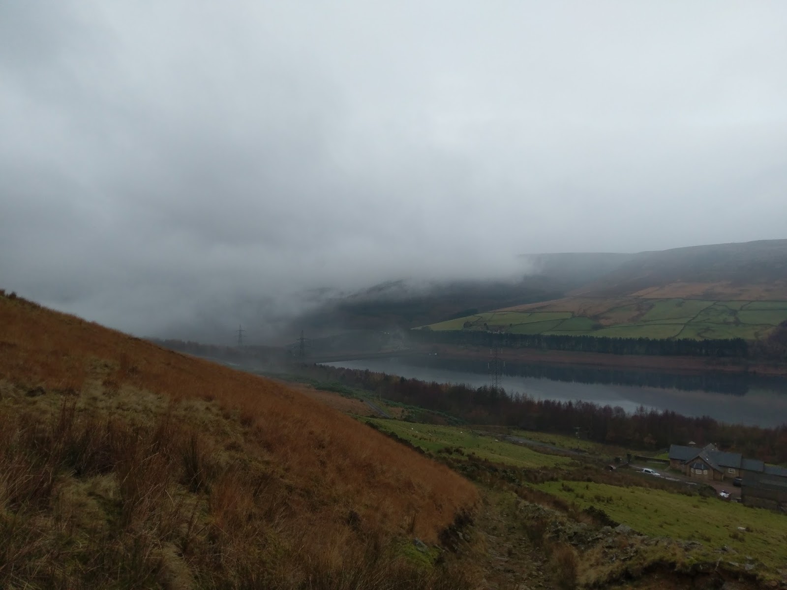
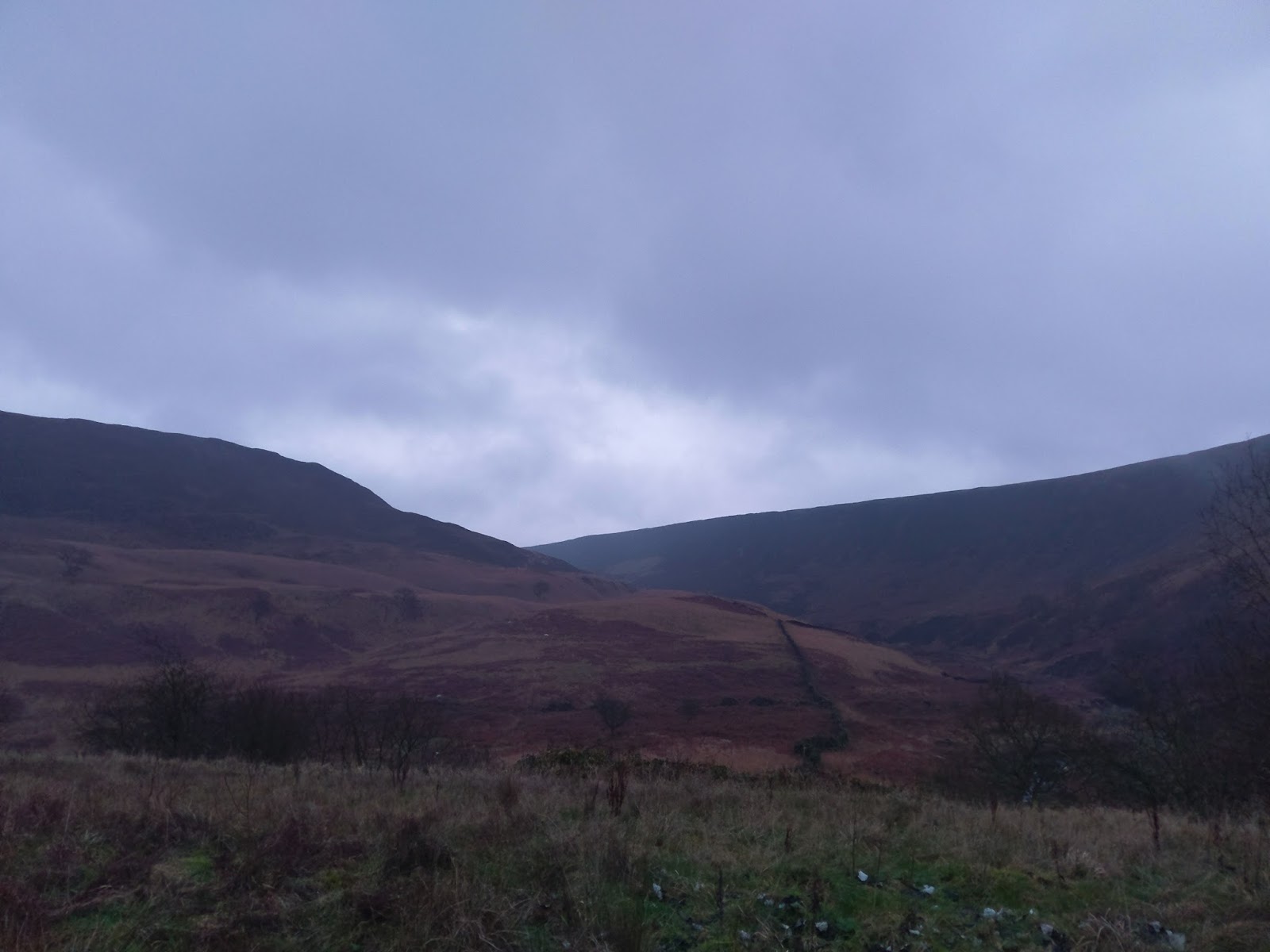
In the mist, the descent along Torside Clough seemed to take a long time. It wasn’t until we reached Clough Edge that the clouds departed, revealing a wondrous view of the valley and Longdendale.
 |
| Torside Clough |
 |
| Torside Clough |
 |
| Torside Clough |
 |
| Torside Clough |
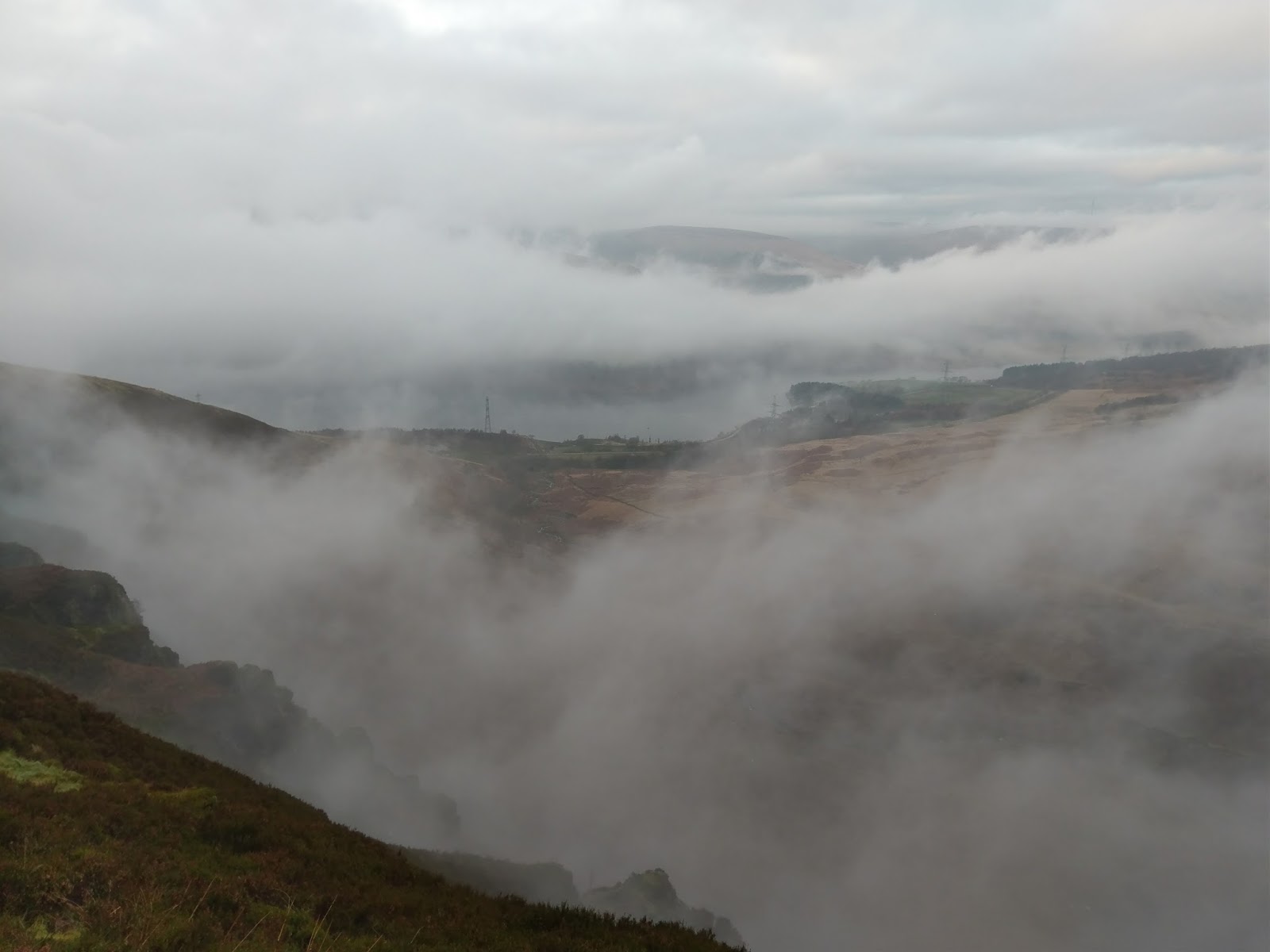
 |
| Longdendale begins to emerge |
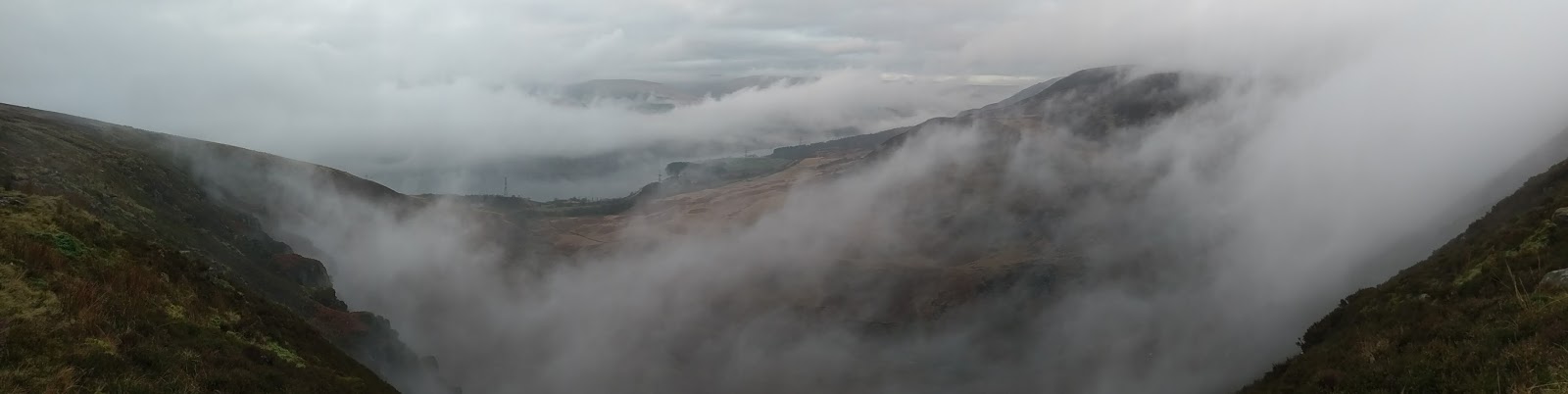
 |
| Torside Clough panorama |
 |
| Longdendale |
 |
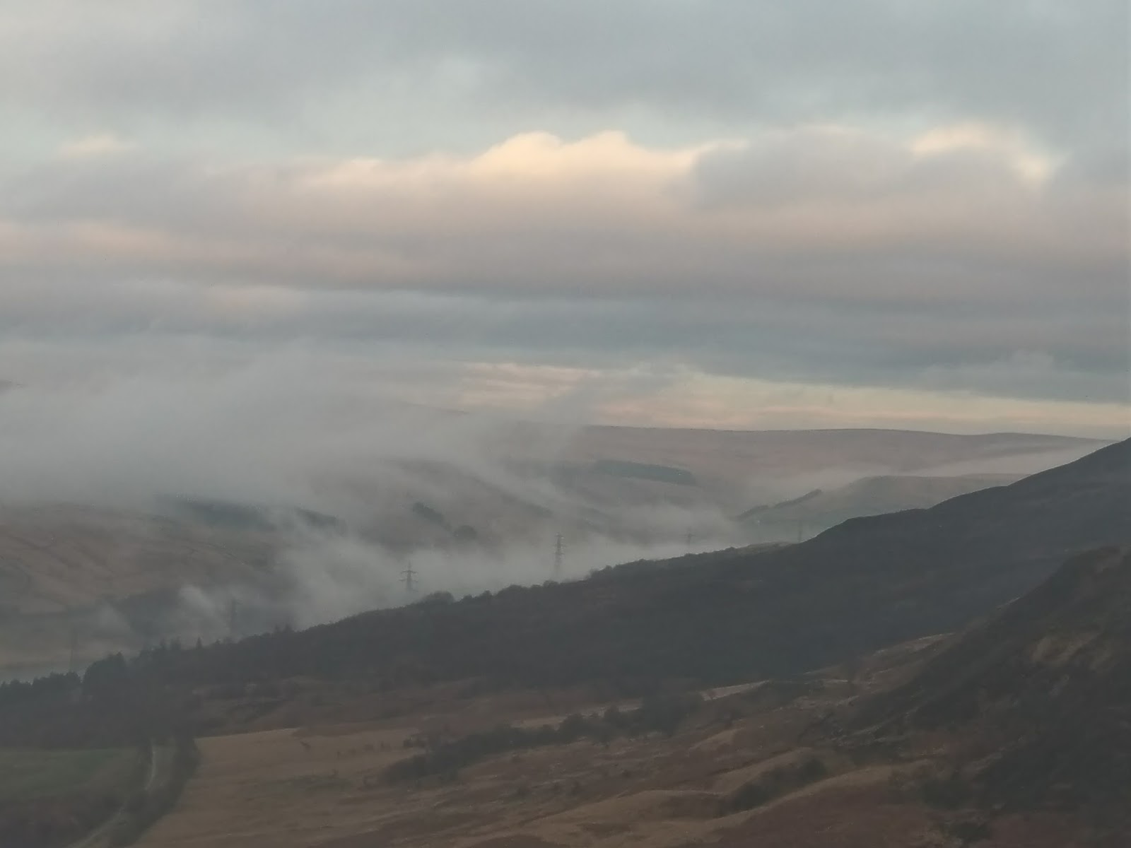
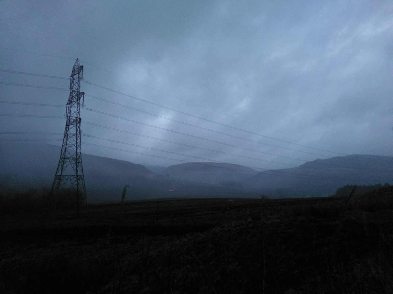
| Pylons rise from the mist |
A steep descent leads back into the valley and onto the Trans Pennine Trail which would provide easy walking back to the car, which was important as it was starting to get dark. Nighttime had fallen by the time eventually reached the car. This was a very entertaining walk – classic Bleaklow some would say but with the added excitement of a bit of scrambling. Now I know what to expect, I’m keen to give this another go when it’s a bit drier – something for the summer perhaps.
 |
| Longdendale |
 |
| The foot of Torside Clough |
 |
| Torside Reservoir |
 |
| Torside Clough |
 |
| The Trans Pennine Trail |
 |
| Darkness falls on Longdendale |

