Open Space Web-Map builder Codehttps://openspace.ordnancesurvey.co.uk/osmapapi/openspace.js?key=3119F72552FD5C22E0530C6CA40A5A92https://openspace.ordnancesurvey.co.uk/osmapapi/script/mapbuilder/basicmap.jshttps://openspace.ordnancesurvey.co.uk/osmapapi/script/mapbuilder/searchbox.js//variables for routes var linesLayer, points, lineFeature, lineString, routeMarkersLayer, routepos, routesize, routeoffset, routeicon; var style_blue = {strokeColor: “#0000CD”, strokeOpacity: 0.5, strokeWidth: 4.5}; function initmapbuilder() { //initiate the map var options = {resolutions: [2500, 1000, 500, 200, 100, 50, 25, 10, 5, 4, 2.5, 2, 1]}; osMap = new OpenSpace.Map(‘map’, options); //configure map options (basicmap.js) setglobaloptions(); //set the center of the map and the zoom level osMap.setCenter(new OpenSpace.MapPoint(422417,385353),7); linesLayer = osMap.getVectorLayer(); // Set up layer for route markers routeMarkersLayer = new OpenLayers.Layer.Markers(“Route Markers”); //make a route points = new Array(); points.push(new OpenLayers.Geometry.Point(422710,384320)); points.push(new OpenLayers.Geometry.Point(422660,384180)); points.push(new OpenLayers.Geometry.Point(422550,384040)); points.push(new OpenLayers.Geometry.Point(422266,383890)); points.push(new OpenLayers.Geometry.Point(422122,383958)); points.push(new OpenLayers.Geometry.Point(421982,384062)); points.push(new OpenLayers.Geometry.Point(421858,384110)); points.push(new OpenLayers.Geometry.Point(421714,384010)); points.push(new OpenLayers.Geometry.Point(421578,383942)); points.push(new OpenLayers.Geometry.Point(421446,383954)); points.push(new OpenLayers.Geometry.Point(421417,384153)); points.push(new OpenLayers.Geometry.Point(421477,384268)); points.push(new OpenLayers.Geometry.Point(421342,384433)); points.push(new OpenLayers.Geometry.Point(421162,384583)); points.push(new OpenLayers.Geometry.Point(420957,384663)); points.push(new OpenLayers.Geometry.Point(420787,384838)); points.push(new OpenLayers.Geometry.Point(420727,384913)); points.push(new OpenLayers.Geometry.Point(420987,385168)); points.push(new OpenLayers.Geometry.Point(421322,385223)); points.push(new OpenLayers.Geometry.Point(422022,385318)); points.push(new OpenLayers.Geometry.Point(422117,385503)); points.push(new OpenLayers.Geometry.Point(422182,385883)); points.push(new OpenLayers.Geometry.Point(422177,386123)); points.push(new OpenLayers.Geometry.Point(422207,386348)); points.push(new OpenLayers.Geometry.Point(422257,386528)); points.push(new OpenLayers.Geometry.Point(422527,386893)); points.push(new OpenLayers.Geometry.Point(422587,386643)); points.push(new OpenLayers.Geometry.Point(422512,386403)); points.push(new OpenLayers.Geometry.Point(422467,386108)); points.push(new OpenLayers.Geometry.Point(422457,385823)); points.push(new OpenLayers.Geometry.Point(422472,385638)); points.push(new OpenLayers.Geometry.Point(422572,385503)); points.push(new OpenLayers.Geometry.Point(422782,385308)); points.push(new OpenLayers.Geometry.Point(423117,385128)); points.push(new OpenLayers.Geometry.Point(423527,384868)); points.push(new OpenLayers.Geometry.Point(423667,384788)); points.push(new OpenLayers.Geometry.Point(423837,384618)); points.push(new OpenLayers.Geometry.Point(423962,384418)); points.push(new OpenLayers.Geometry.Point(424102,384348)); points.push(new OpenLayers.Geometry.Point(424422,384388)); points.push(new OpenLayers.Geometry.Point(424572,384408)); points.push(new OpenLayers.Geometry.Point(424652,384413)); points.push(new OpenLayers.Geometry.Point(424102,384353)); points.push(new OpenLayers.Geometry.Point(423952,384418)); points.push(new OpenLayers.Geometry.Point(423692,384663)); points.push(new OpenLayers.Geometry.Point(423447,384808)); points.push(new OpenLayers.Geometry.Point(423157,384763)); points.push(new OpenLayers.Geometry.Point(423032,384753)); points.push(new OpenLayers.Geometry.Point(422922,384783)); points.push(new OpenLayers.Geometry.Point(422762,384748)); points.push(new OpenLayers.Geometry.Point(422687,384618)); points.push(new OpenLayers.Geometry.Point(422710,384320)); // create a polyline feature from the array of points lineString = new OpenLayers.Geometry.LineString(points); lineFeature = new OpenLayers.Feature.Vector(lineString, null, style_blue); linesLayer.addFeatures([lineFeature]); //crate a route start/end marker routepos = new OpenSpace.MapPoint(422710,384320); routesize = new OpenLayers.Size(33,45); routeoffset = new OpenLayers.Pixel(-5,-37); routeicon = new OpenSpace.Icon(‘https://openspace.ordnancesurvey.co.uk/osmapapi/img_versions/img_1.1/mapbuilder/routemarker-startend.png’, routesize, routeoffset, null, null); routeMarkersLayer.addMarker(new OpenLayers.Marker(routepos, routeicon)); osMap.addLayer(routeMarkersLayer);}
Route: Dennis Knoll, Bole Hill, Bamford Edge, Great Tor, Bamford Moor, Moscar Moor, Stanage End, Crow Chin, High Neb, Stanage Edge, Stanedge Pole, Long Causeway, Dennis Knoll
Date: 18/11/2017
From: Dennis Knoll
Parking: Dennis Knoll
Start Point: Dennis Knoll
Region: Peak District – Dark Peak
Route length: 7.1 miles (11.4 km)
Time taken: 03:23
Average speed: 2.1 mph
Ascent: 295m
Descent: 295m
Other points of interest: Bamford Edge, Stanage Edge, Stanedge Pole
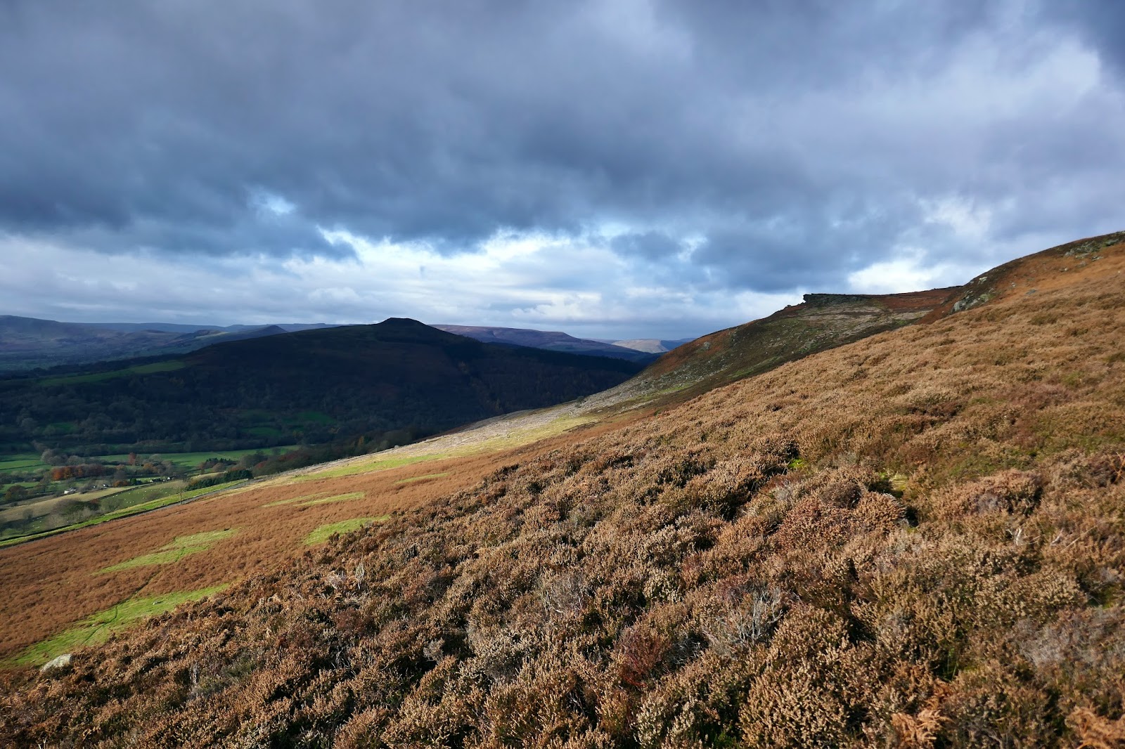
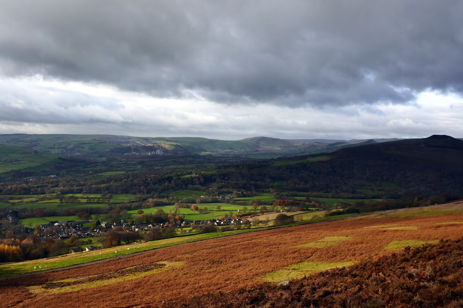
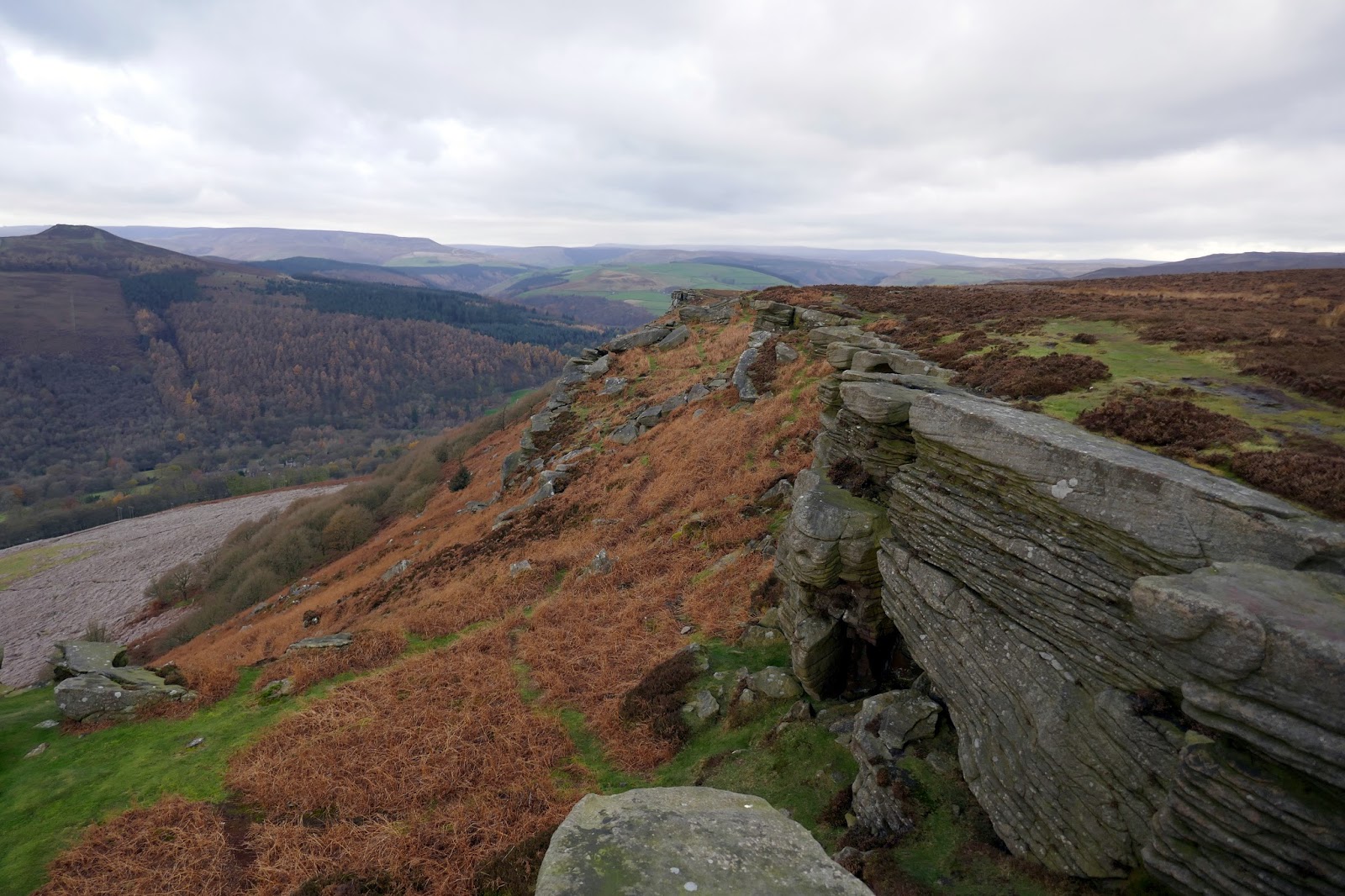
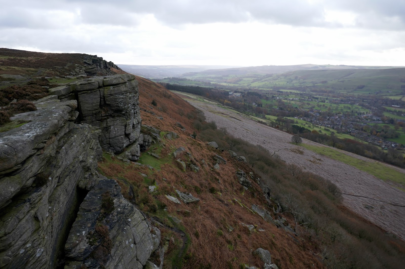
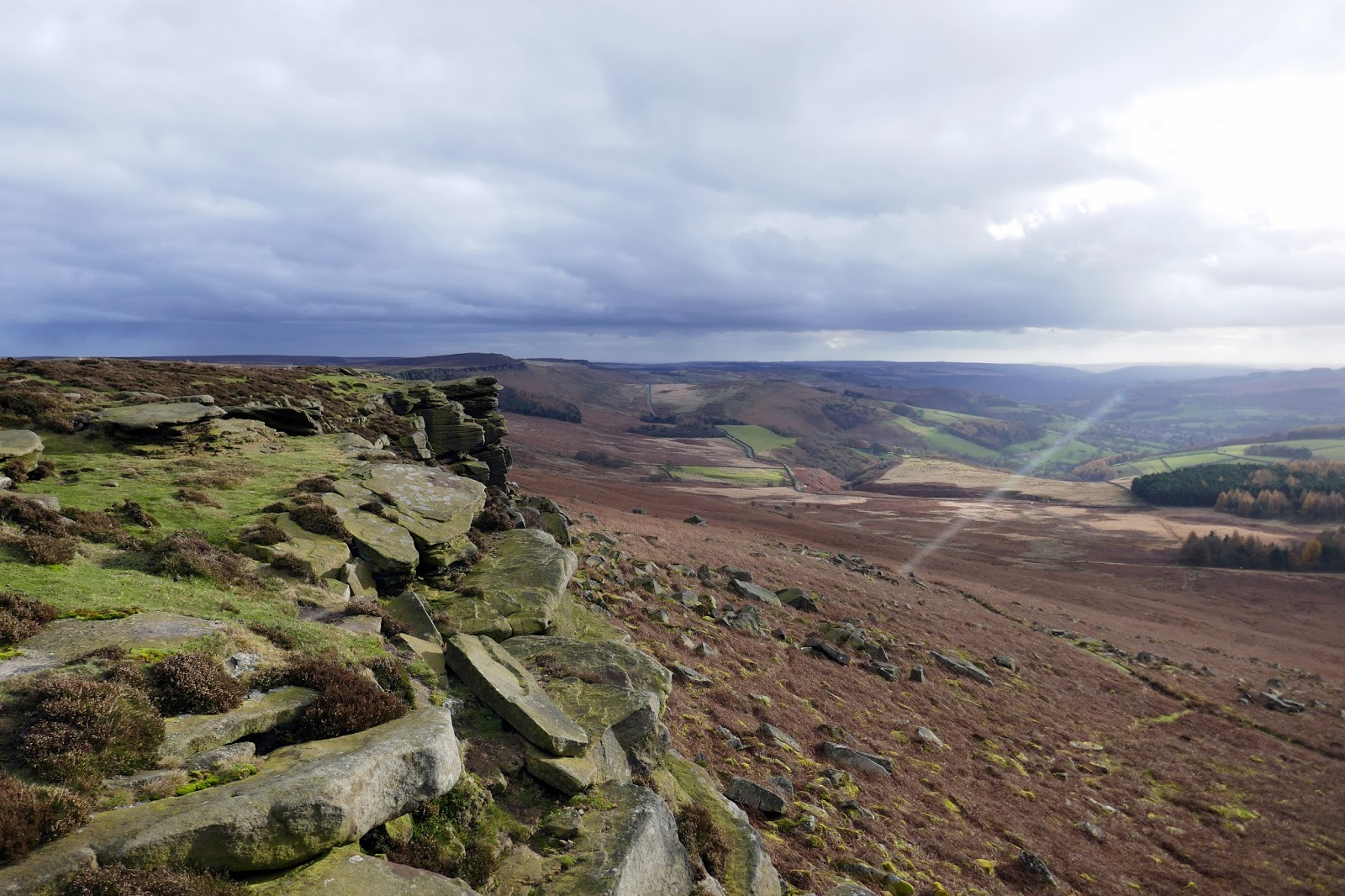
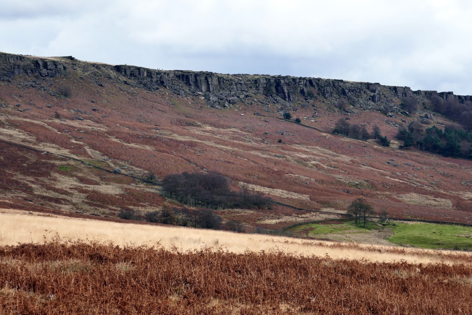
Bamford Edge is the sibling of Stanage Edge, standing parallel to but at a lower elevation than its illustrious neighbour. This, however, should not be a reason to discard this lesser-walked edge, as it has its own merits as we were to find out on a cloudy November day.
We parked up near Dennis Knoll, a small layby at the lower end of the Long Causeway, Stanage Edge’s historic road. The walk would not be too long or strenuous so would be an ideal opportunity to give a new pair of walking boots an outing. A short walk down the road is required before you can leave through a gate and make a short climb to the start of Bamford Edge.
 |
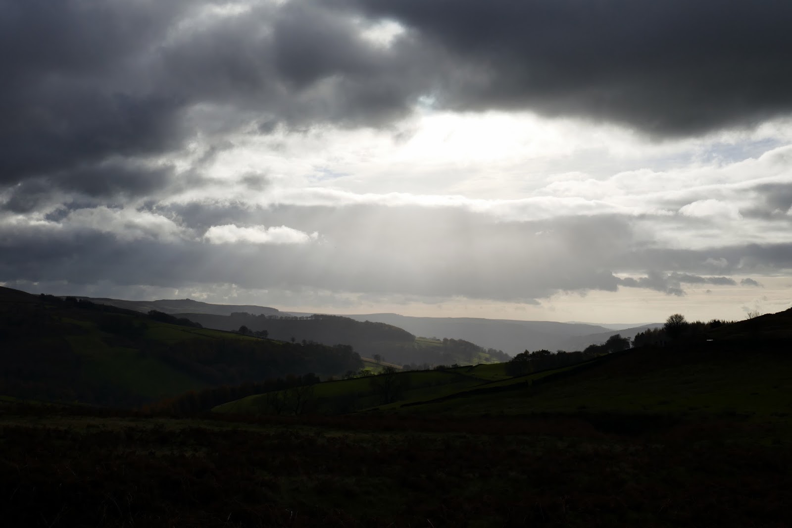
| Shafts of sun over Hathersage |
 |
| Upper Hurst Brook |
 |
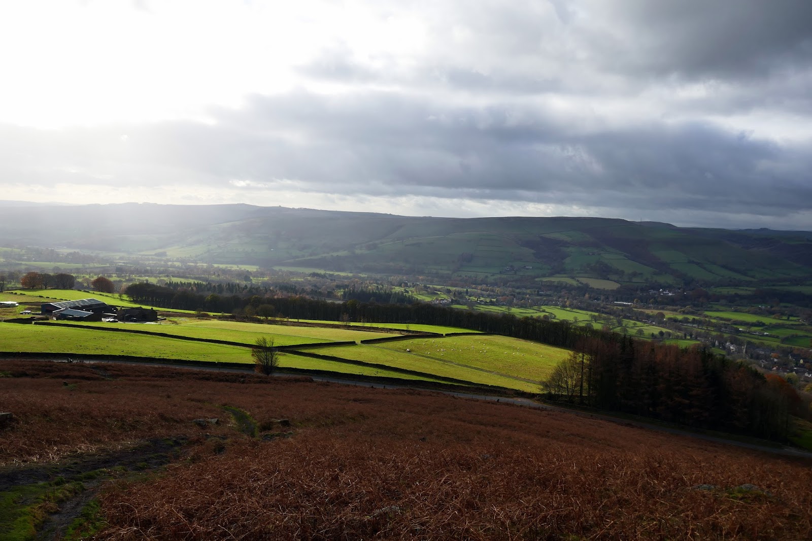
| The Hope Valley |
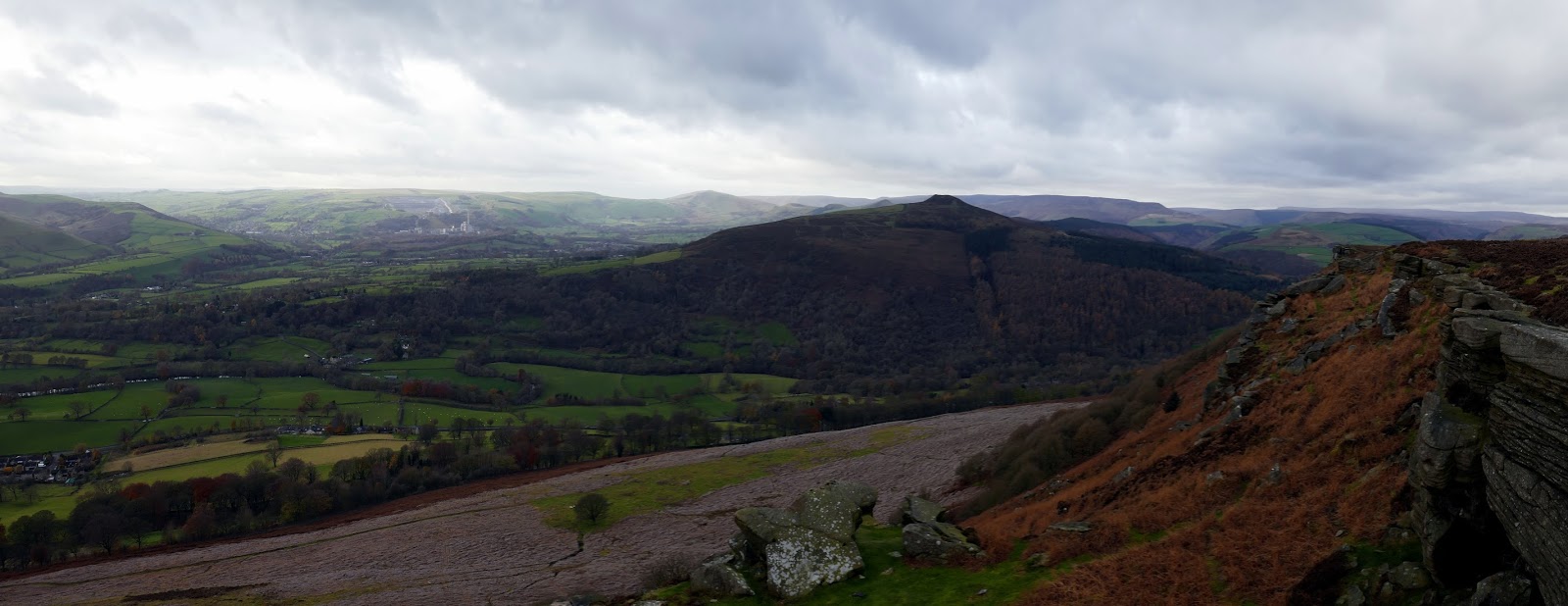
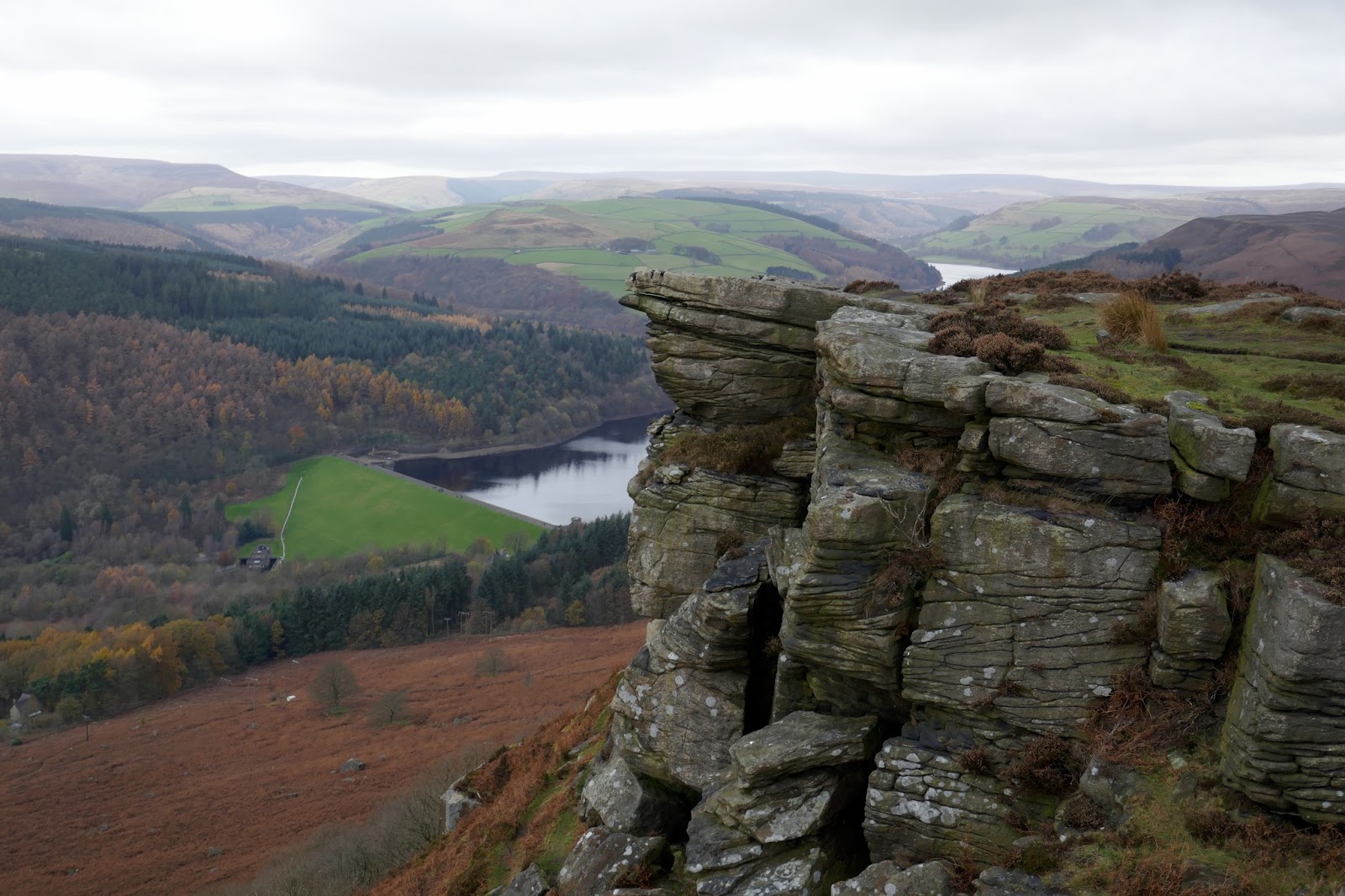
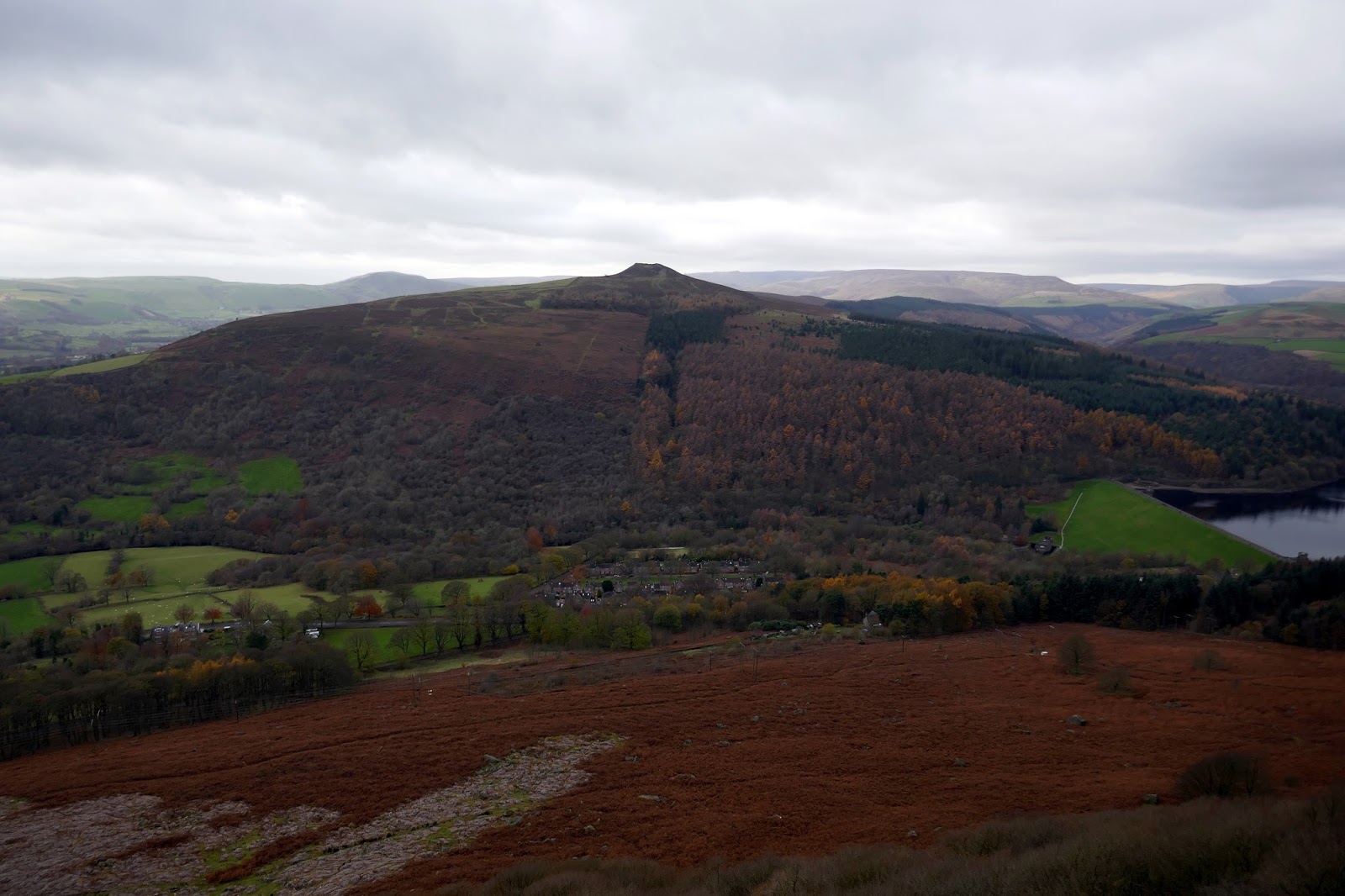
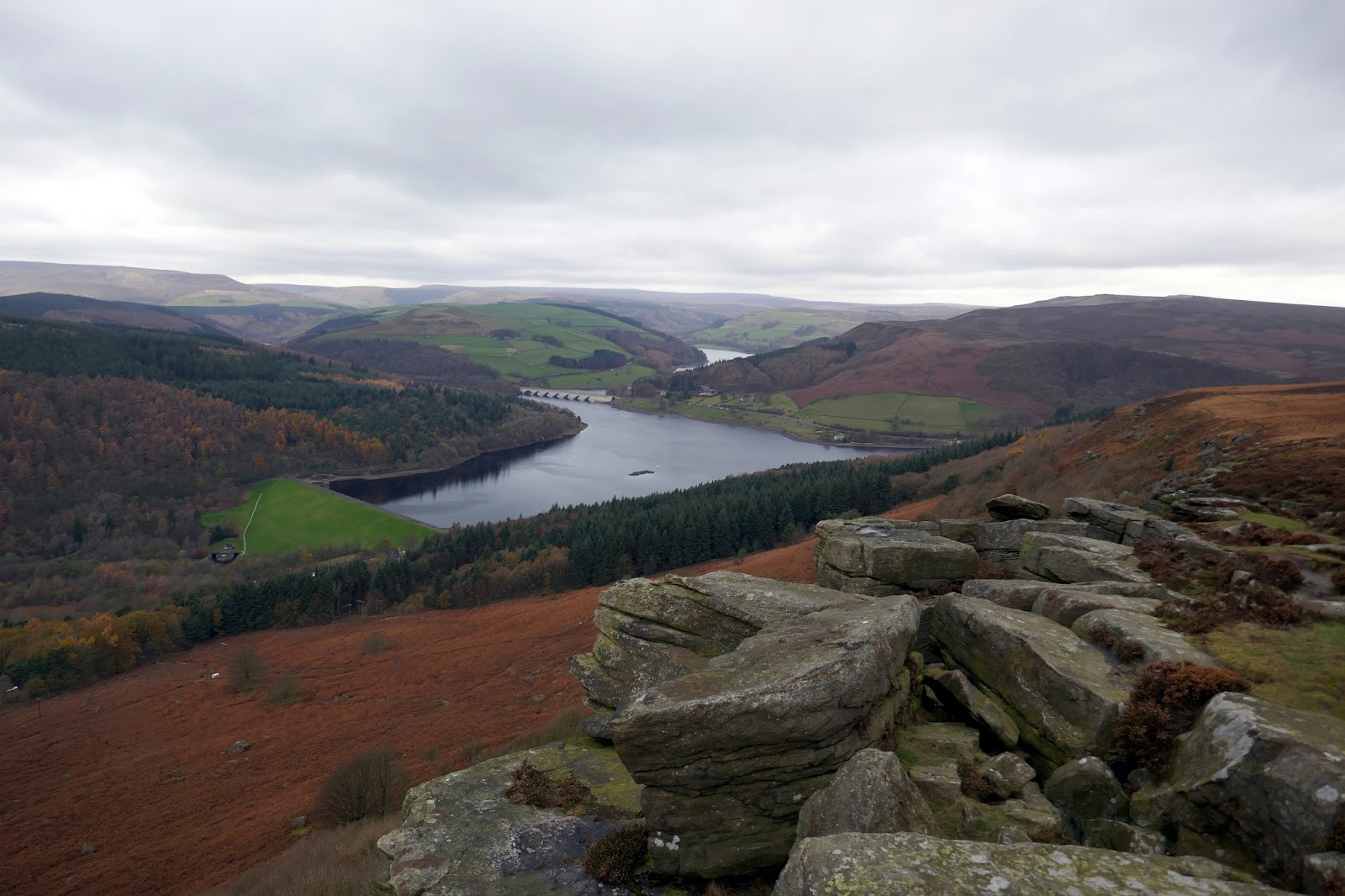
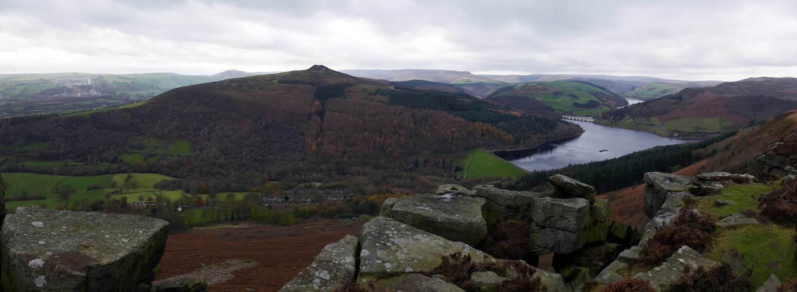
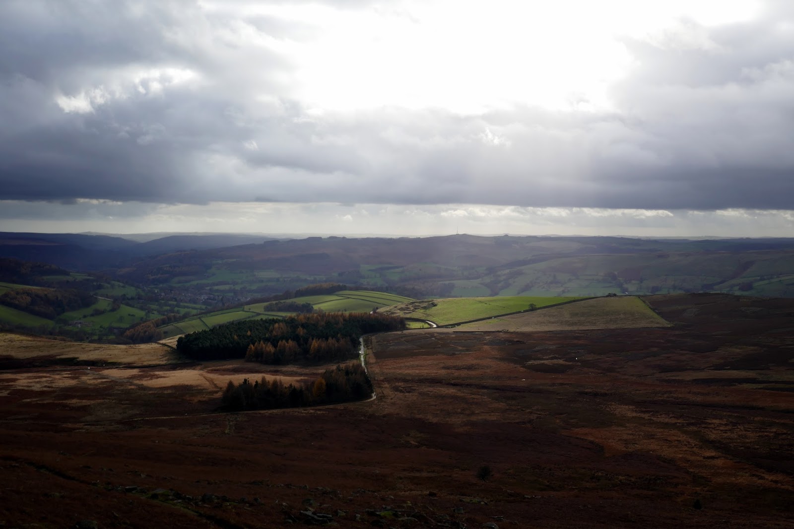
Though short, Bamford Edge is perhaps the most photogenic of all the great Dark Peak edges, primarily because it overlooks both the Hope and Derwent Valleys and, unlike Stanage, has a great view of Ladybower Reservoir. Great Tor, a large mass of rock in the centre, marks the highlight of the whole edge.
 |
| Approaching Bamford Edge |
 |
| Looking towards Castleton and Mam Tor |
 |
| Above Bamford Edge |
 |
| Bamford Edge |
 |
| Bamford Edge |
 |
| Win Hill and Bamford Edge |
 |
| Great Tor |
 |
| Win Hill |
 |
| Bamford Edge |
 |
| Bamford Edge and Ladybower |
 |
| Panorama from Great Tor |
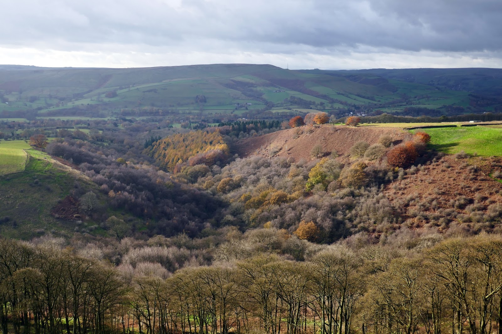
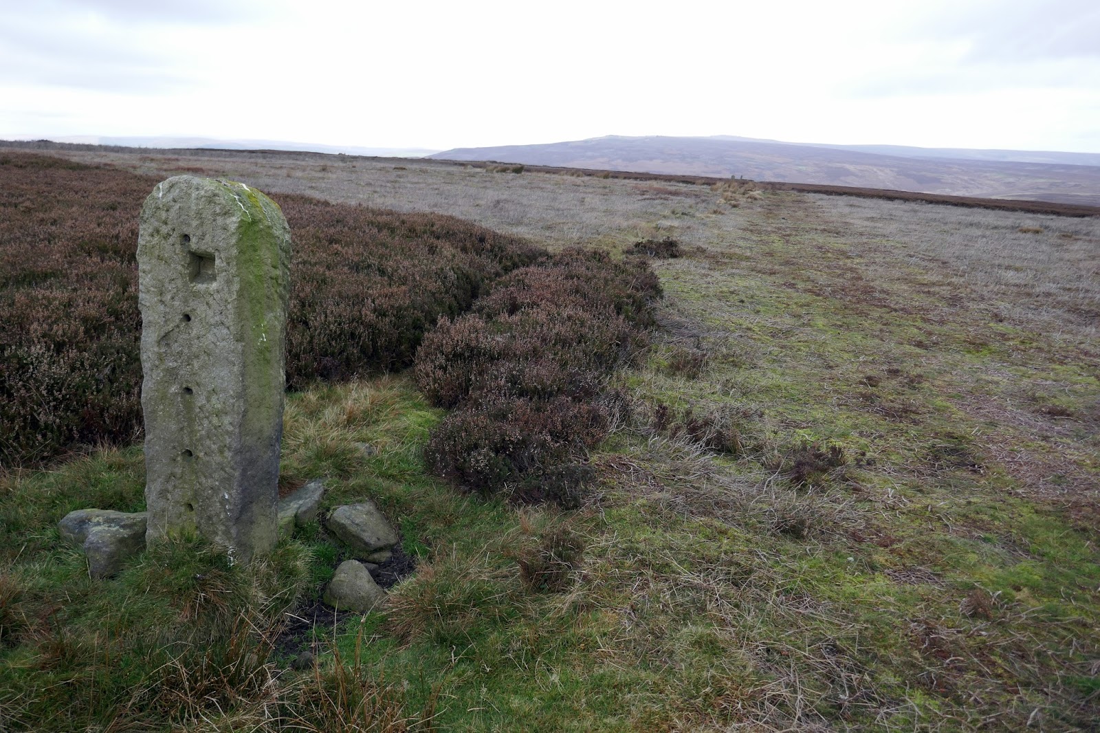
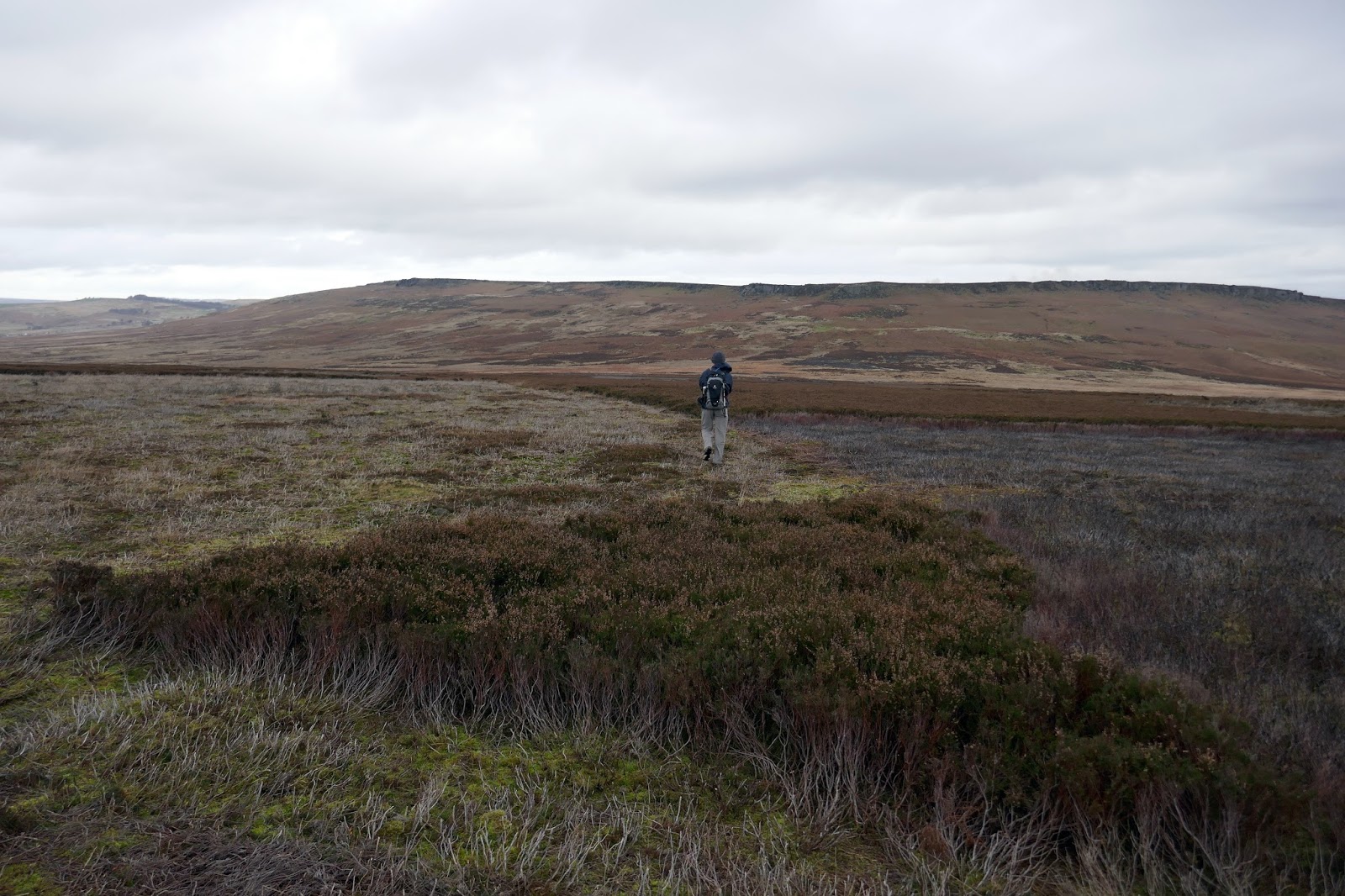
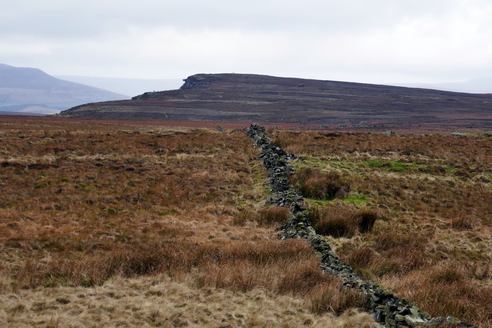
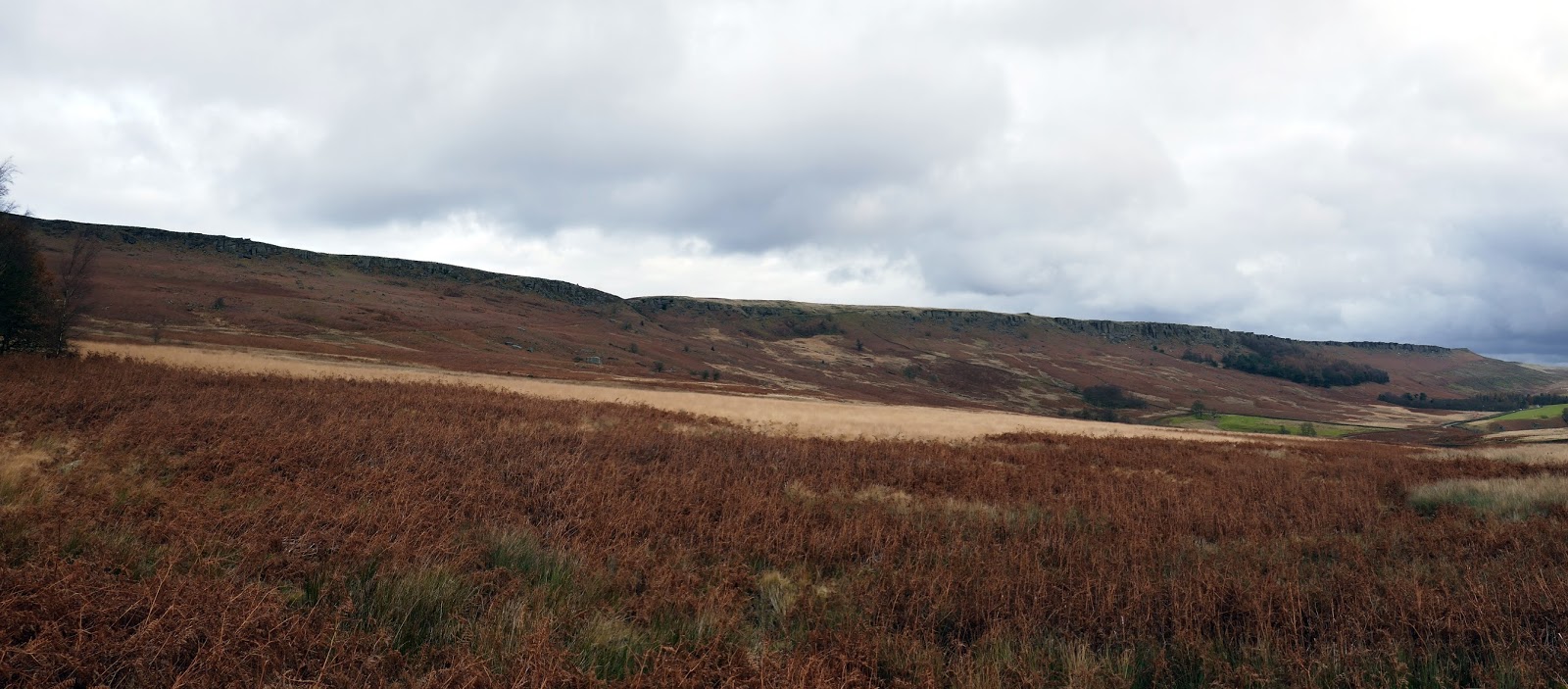
In theory, linking Bamford and Stanage is not particularly difficult as they are only a kilometre apart. However, that 1km is across Bamford Moor which is wholly pathless, covered in heather and extremely boggy as it approaches Jarvis Clough. Waterproof footwear is a must if you want to keep your feet dry.
 |
| Bamford Moor |
 |
| An old line of fence posts on Bamford Moor |
 |
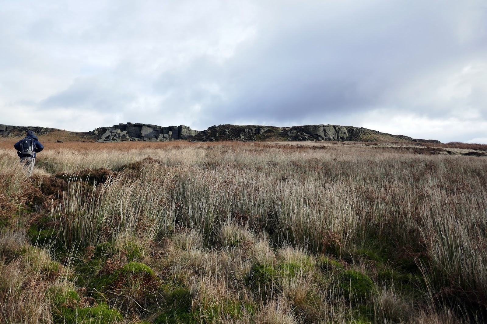
| Bamford Moor with Stanage Edge ahead |
 |
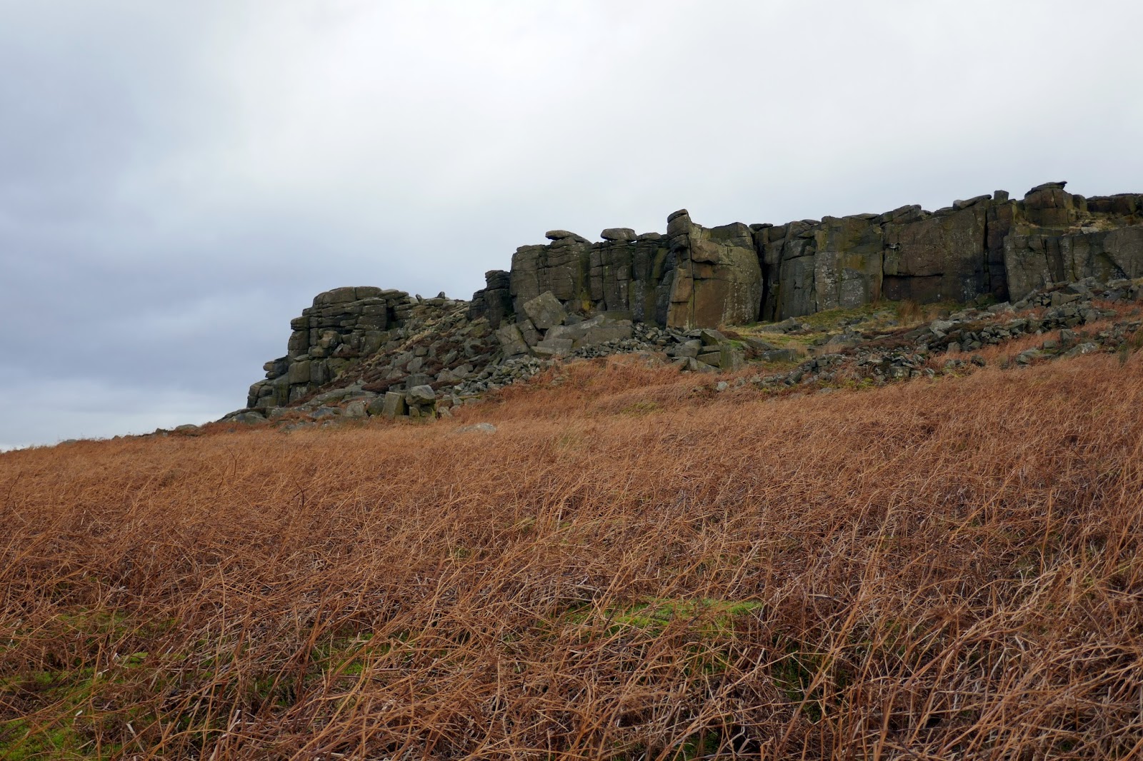
| Stanage Edge |
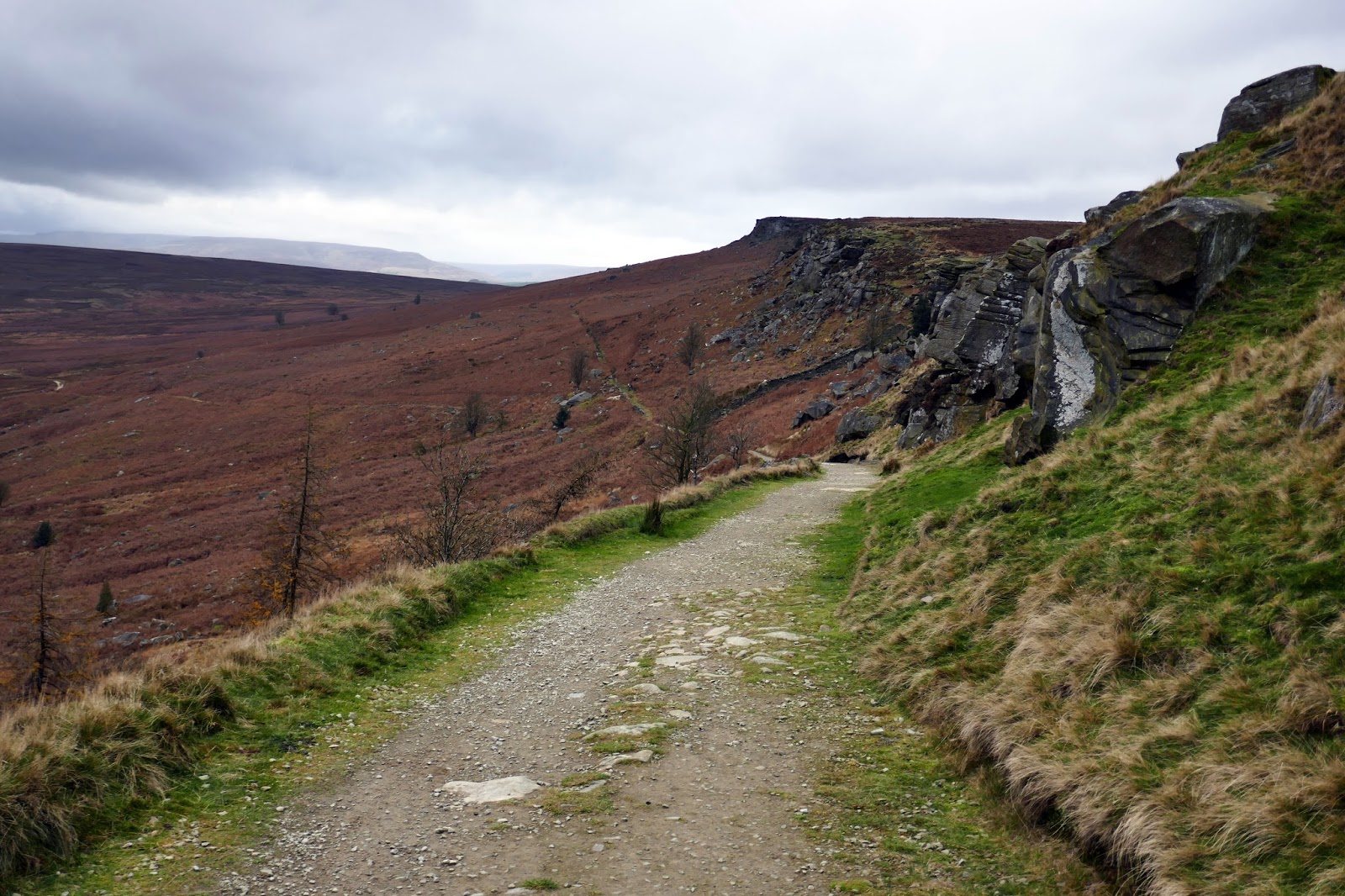
Below Crow Chin, the prominent bend in Stanage Edge, we picked up a rough path heading north beneath the crags to a Stanage End where we climbed up to the edge itself through a breach in the rocks.
 |
| Stanage Edge at Crow Chin |
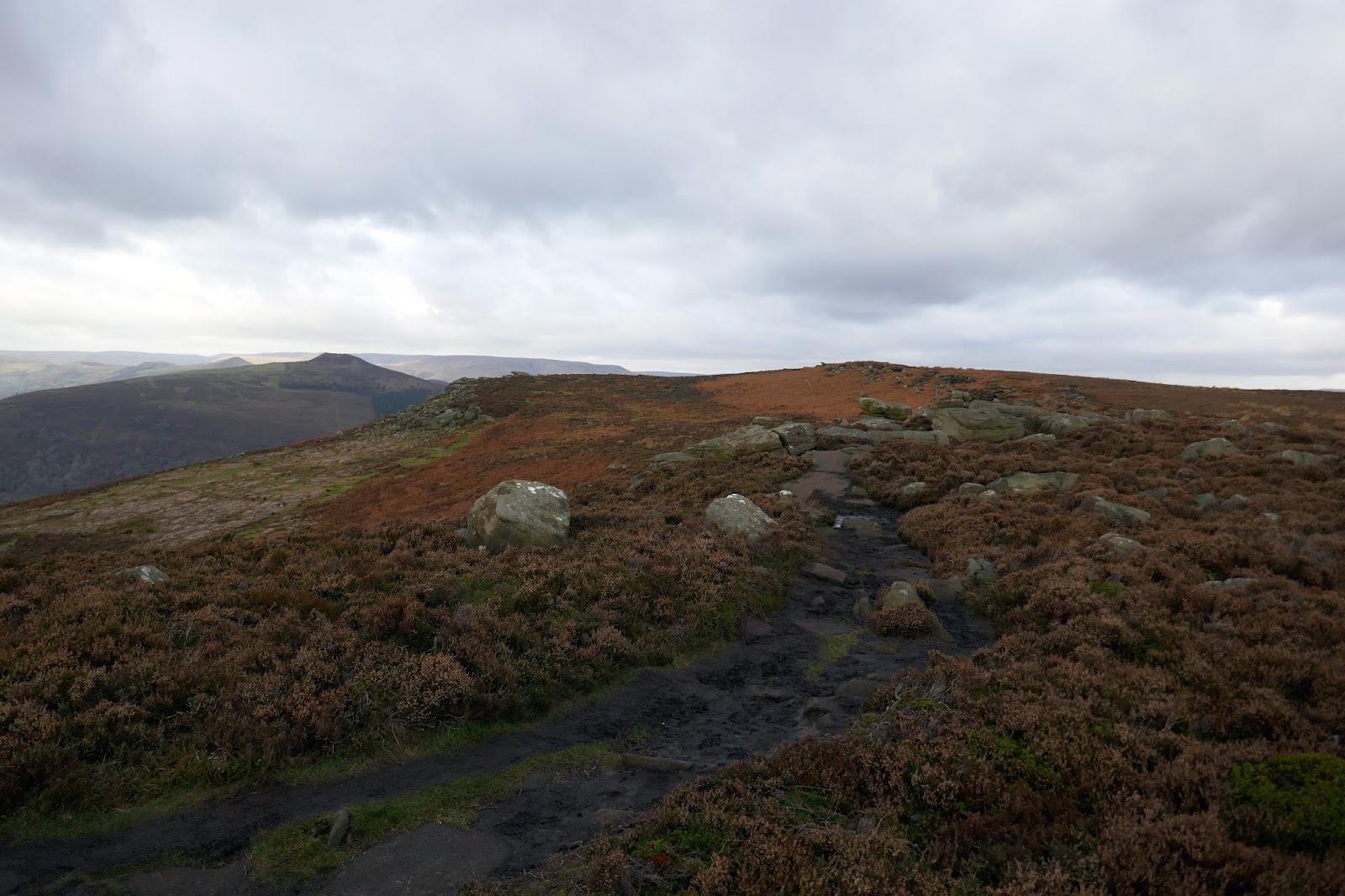
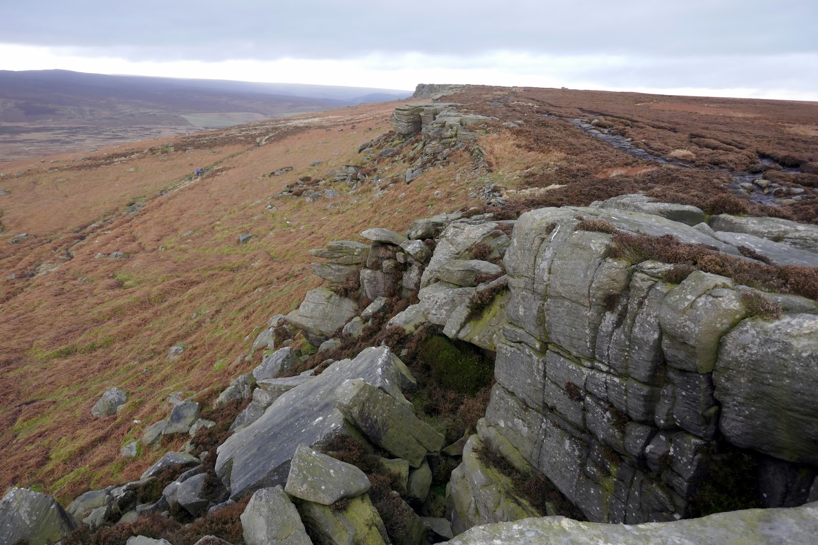
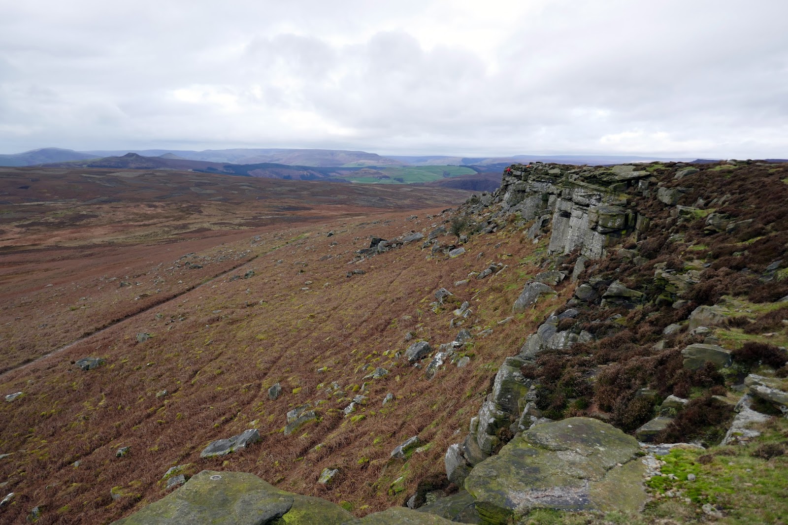
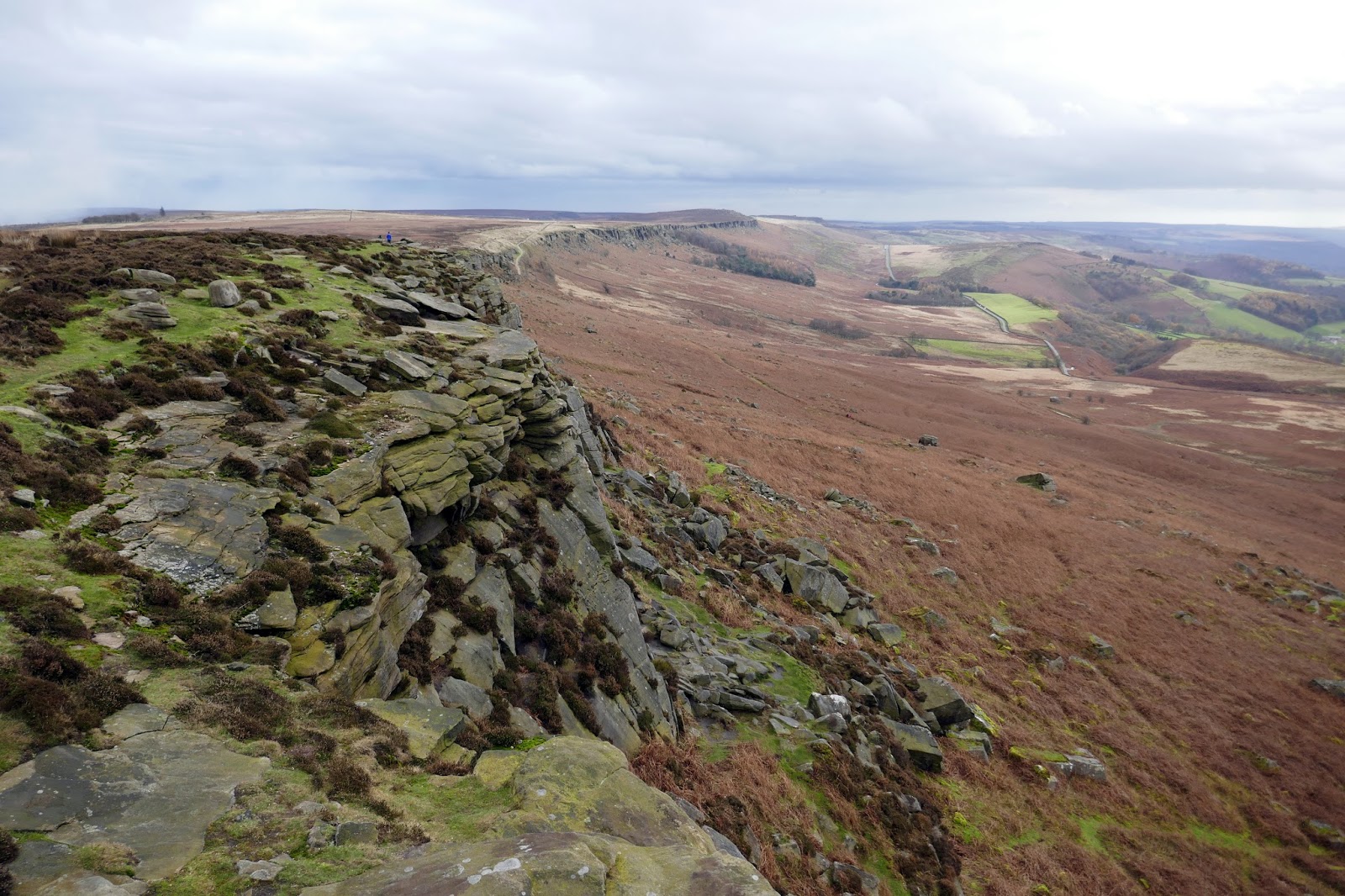
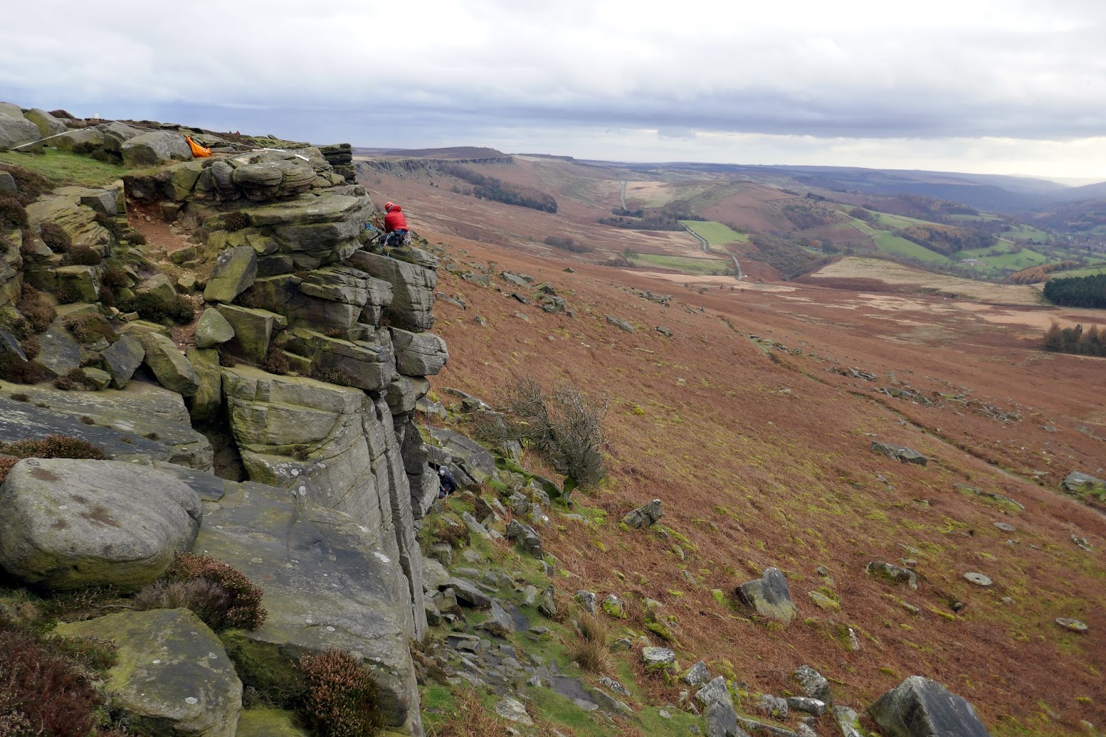
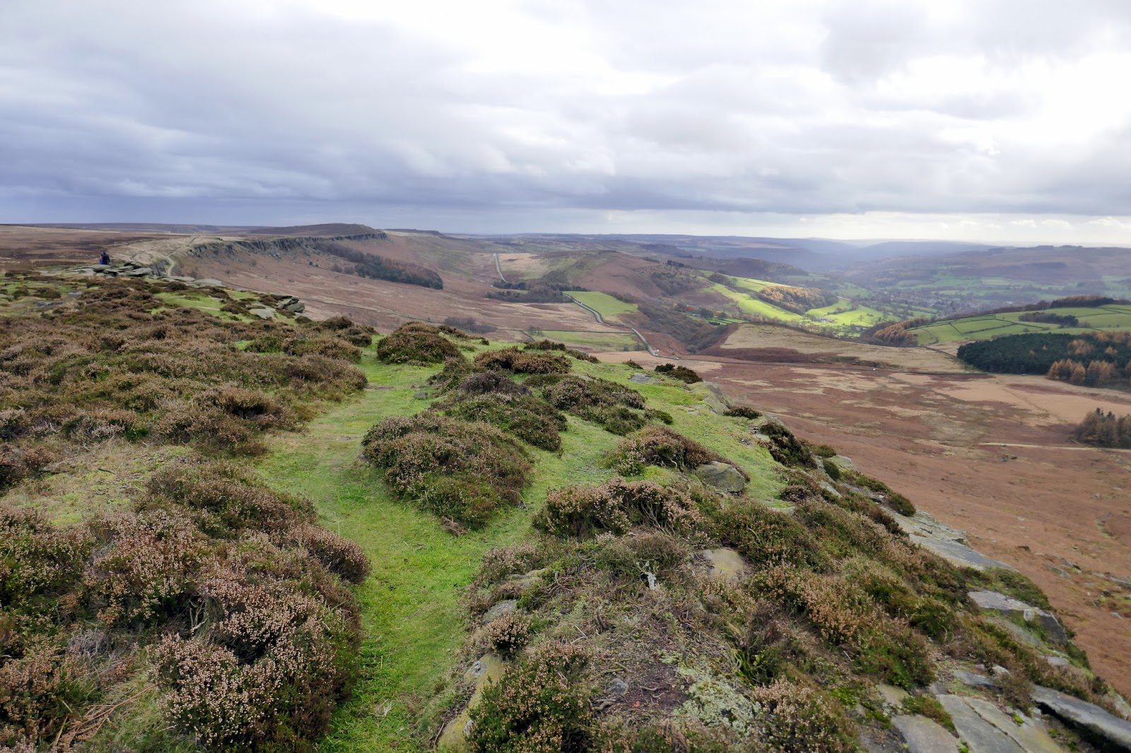
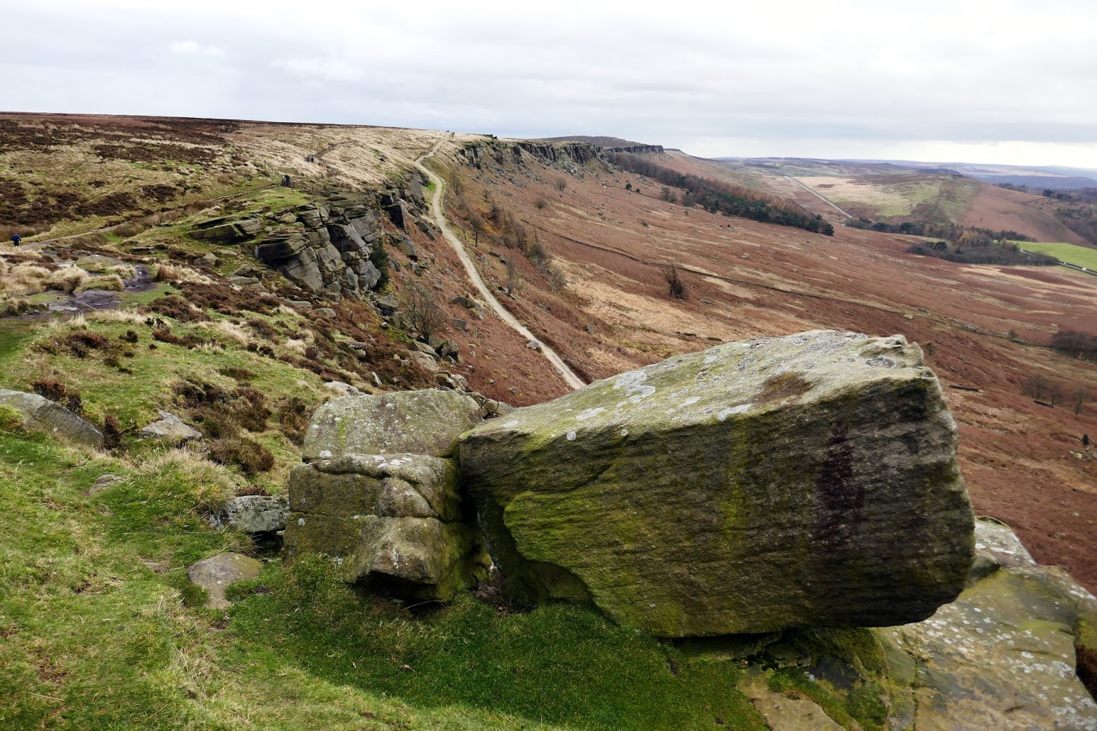
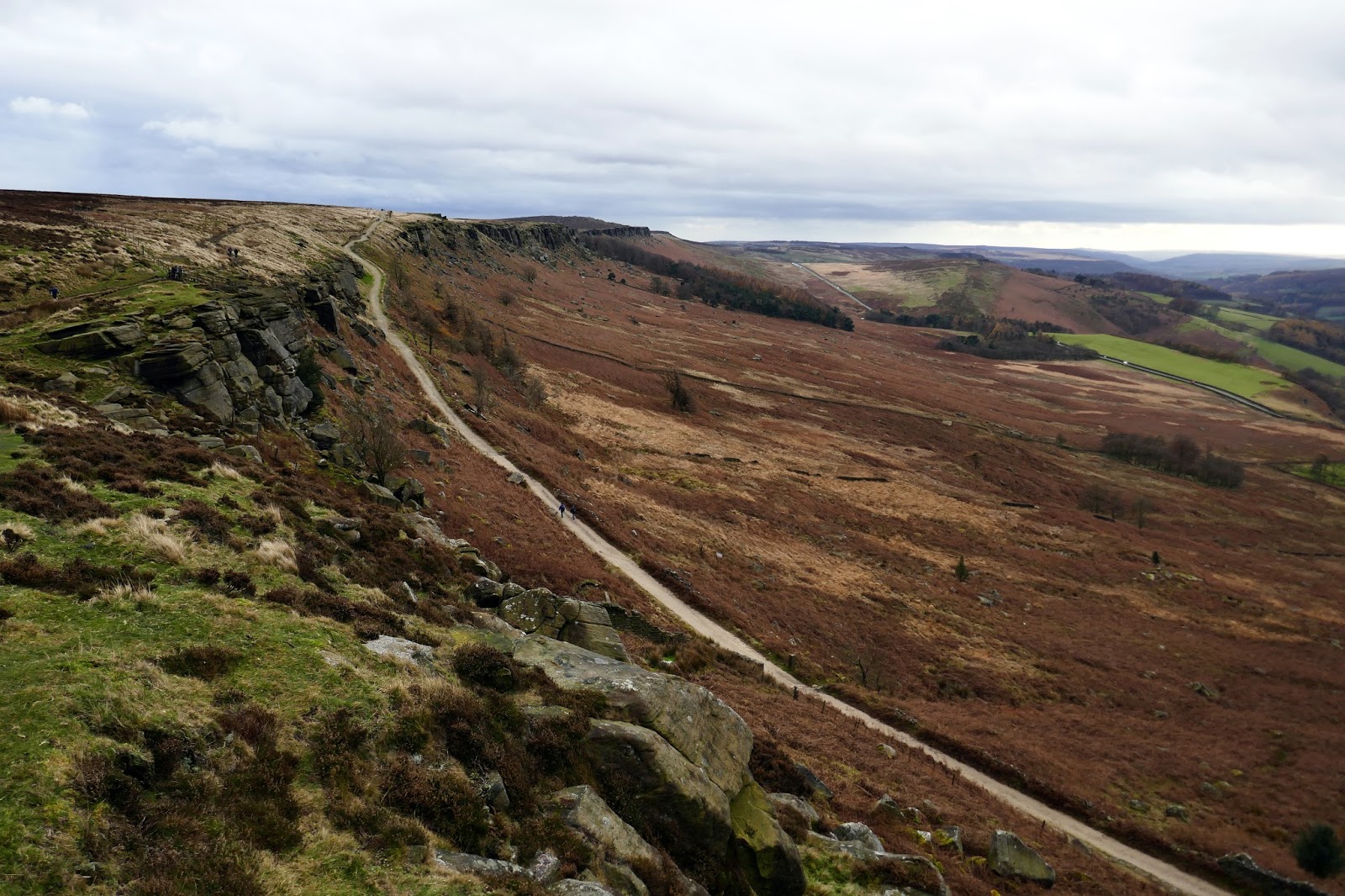
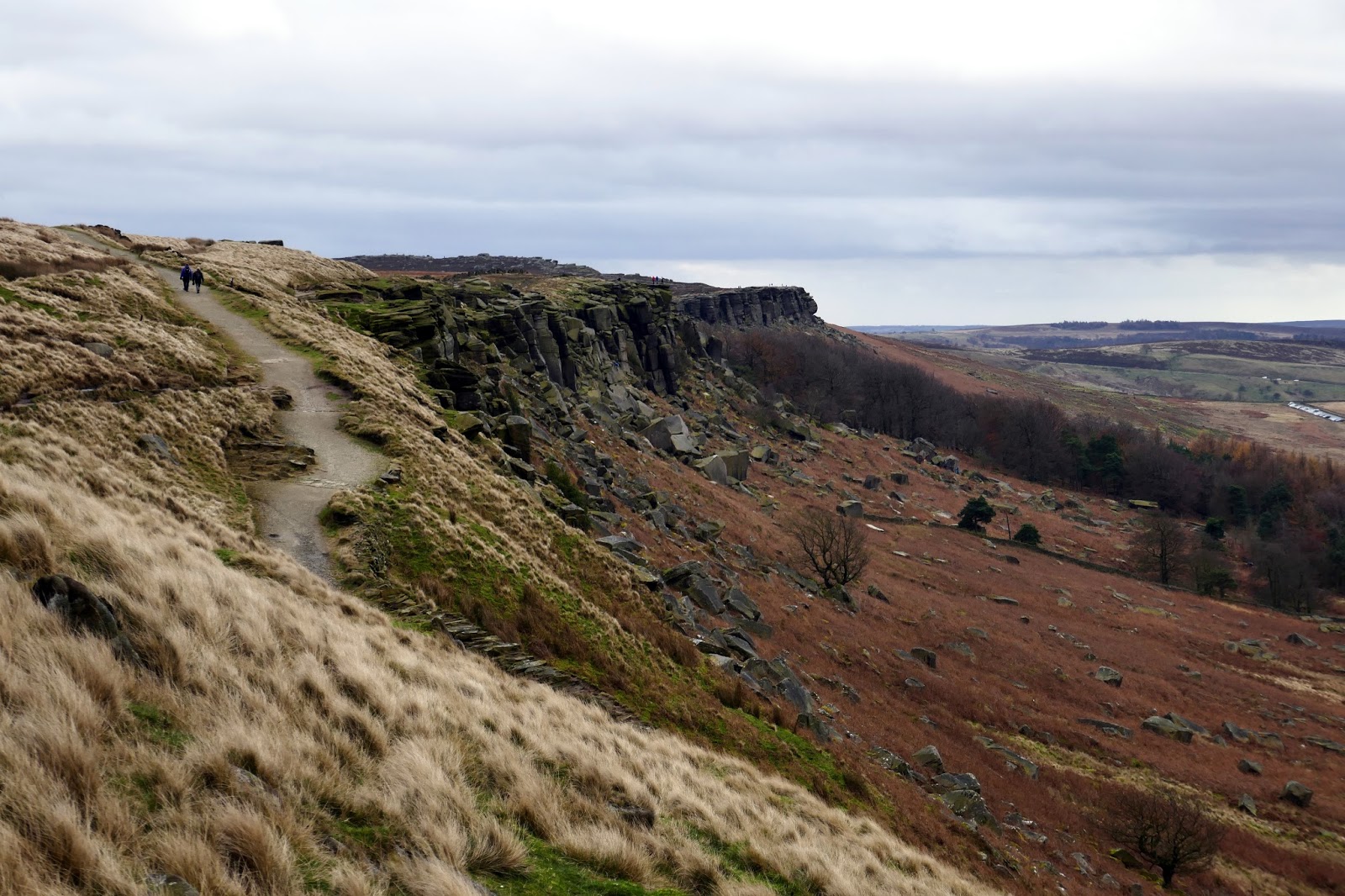
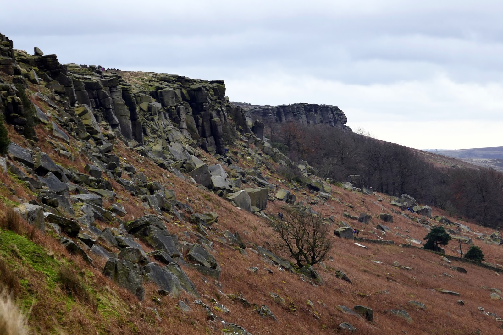
Stanage Edge needs little in the way of an introduction – it is perhaps one of the most famed Dark Peak features along with Mam Tor and Kinder Scout. It is the longest and most impressive of all the gritstone edges and a magnet for walkers, bikers and climbers alike.
 |
| Kinder Scout picked out by the sun |
 |
| Stanage Edge |
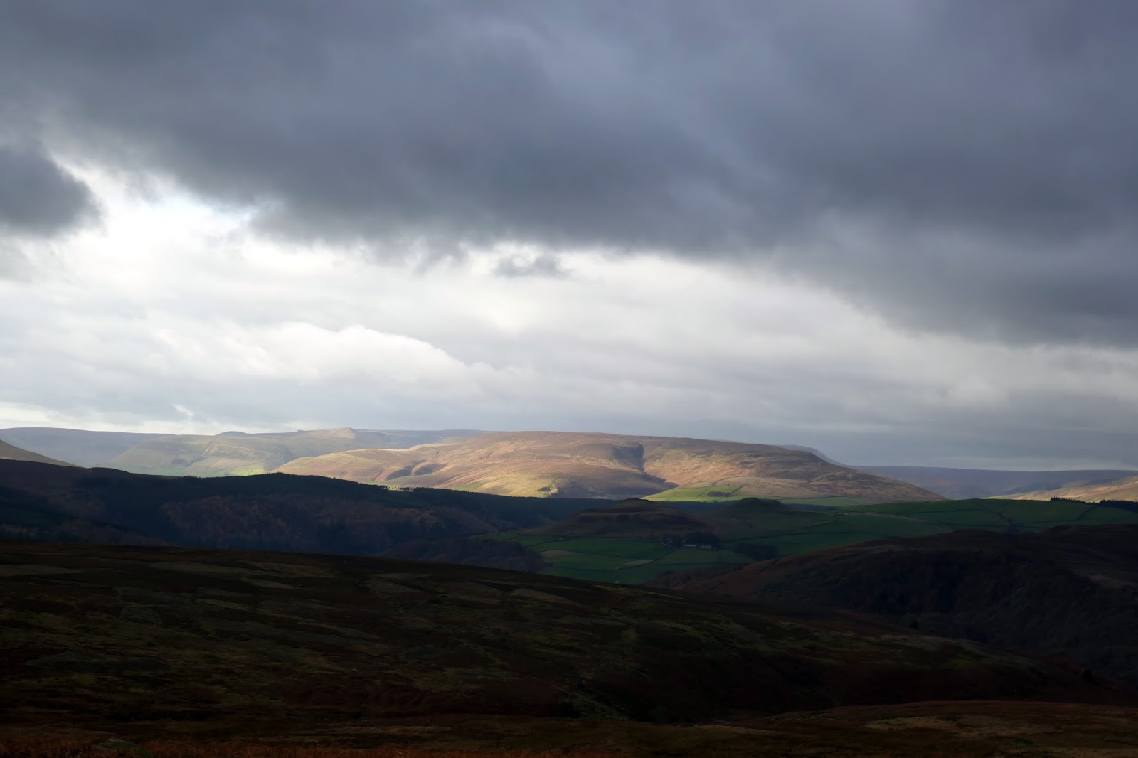
Walking the edge is a delight and we managed to include the high point at High Neb. The walking is also very easy and largely flat with a few undulations on the way. Views across are impressive though views along the length of the edge are perhaps even better.
 |
| The Dennis Knoll car park from Stanage Edge |
 |
| Stanage Edge |
 |
| Stanage Edge |
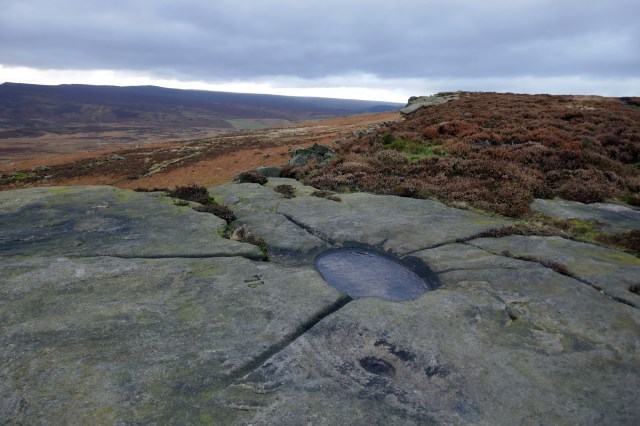
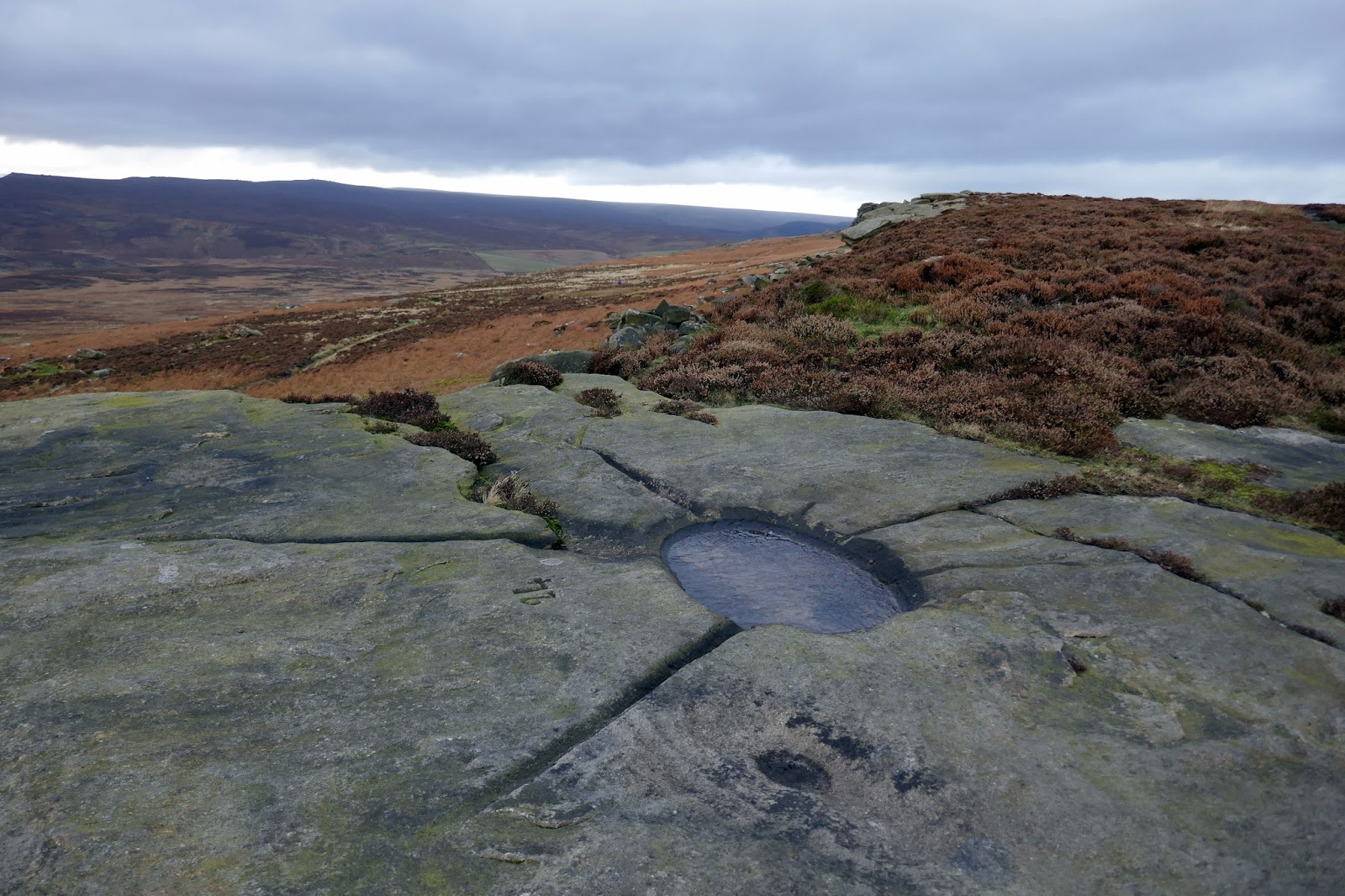
As you make tour way along the edge, you should keep an eye out for the following curiosities. Firstly, you will no doubt notice a few ‘bowls’ carved directly into the rocks, each numbered in turn. These were created in the early 1900s by the local gamekeepers to catch rainwater to form grouse drinking basins. They date from the time Stanage Edge was a privately owned grouse moor, around the early 20th century. Most are beautifully carved with strategically designed feeder grooves to channel rainwater into the basin.
 |
| Carved water bowl |
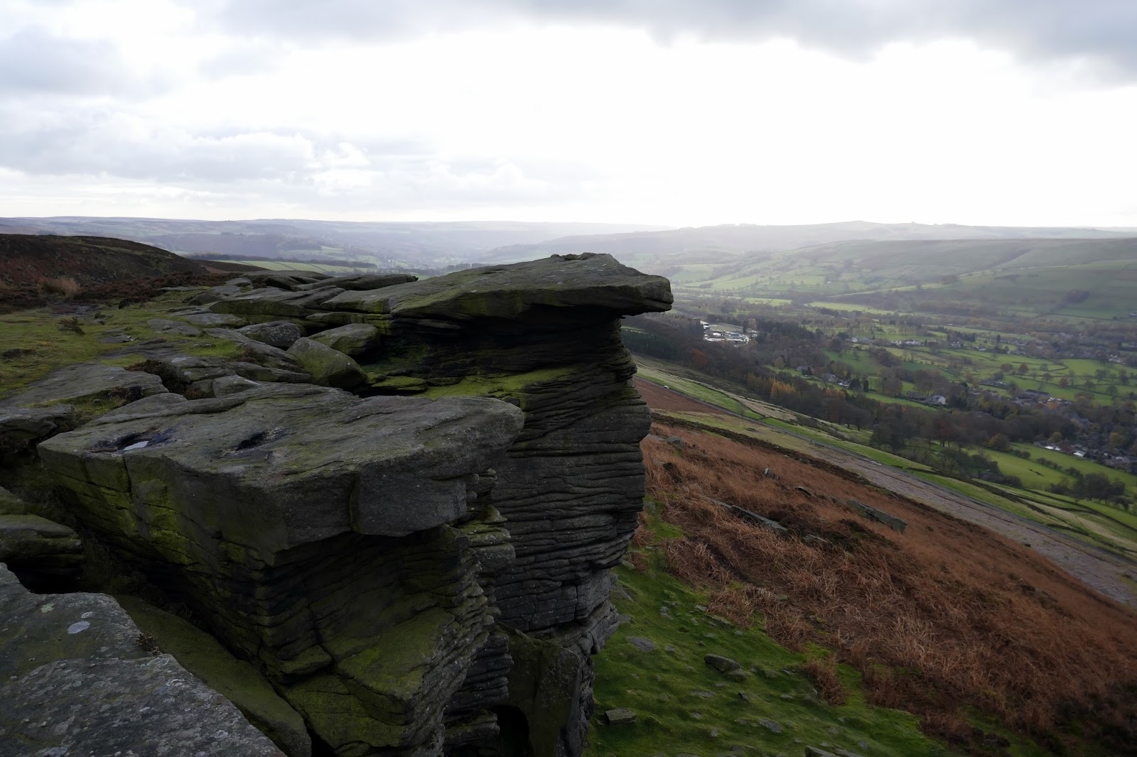
Secondly, if you pear down from the edge, you will likely see arrangements of abandoned millstones, piled up where they were left years ago. Millstone production, along with lead mining was one of the main medieval industries of the Peak District and the two main centres of production were above Hathersage and Baslow. Production is believed to have started as early as the 14th century, reaching its peak in the late 16th and 17th centuries. It was a huge industry.
 |
| Stanage Edge |
Traditionally the stones were quarried by individual stone masons, each making about 16 pairs per year up on the hillside near to where the stone was quarried. They would then be transported down the hill and taken away by road or river. Peak District Millstones found their way all over the UK.
 |
| Stanage Edge |
 |
| High Neb |
 |
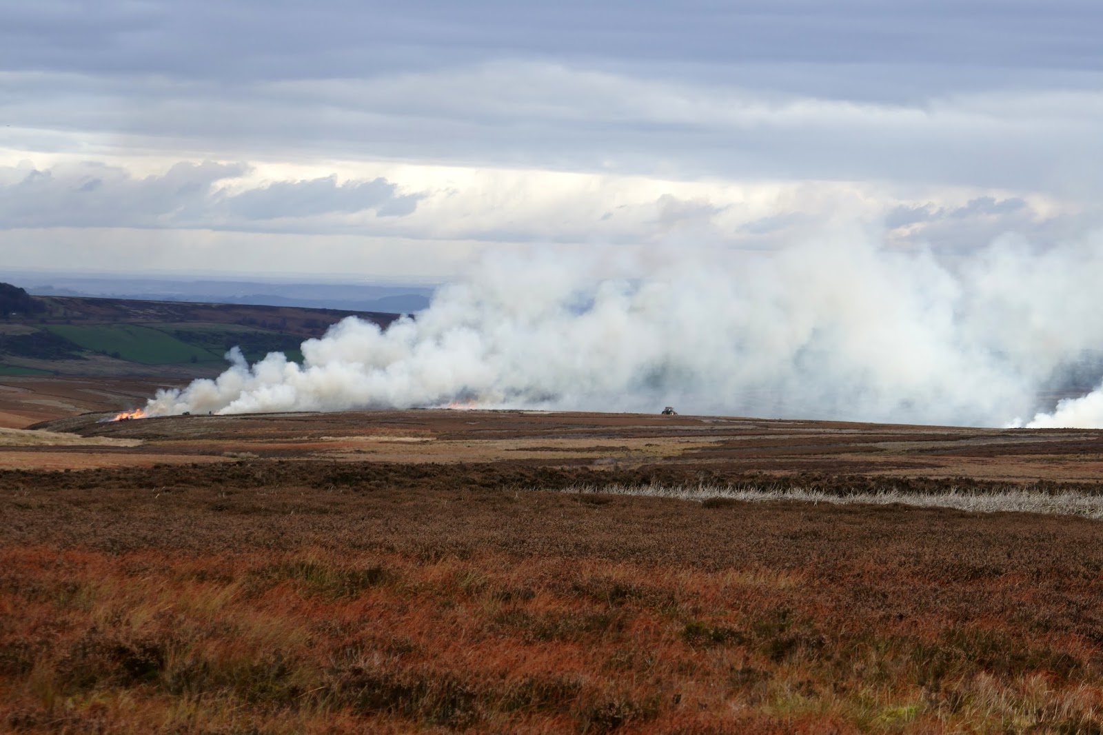
| Heather burning on Hallam Moor |
It is thought that the market for local Peak District millstones disappeared very suddenly mid-18th century and dozens of millstones in production in the Peak District couldn’t be sold and still lie today exactly where they were produced – up on the hills below the gritstone edges.
 |
| Stanage Edge |
 |
| Stanage Edge |
 |
| Stanage Edge and the Long Causeway |
 |
| Stanage Edge and the Long Causeway |
 |
| The Long Causeway leading to Stanedge Pole |
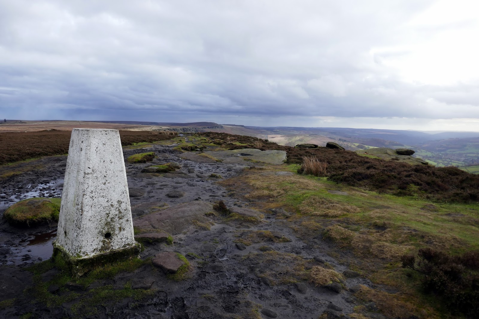
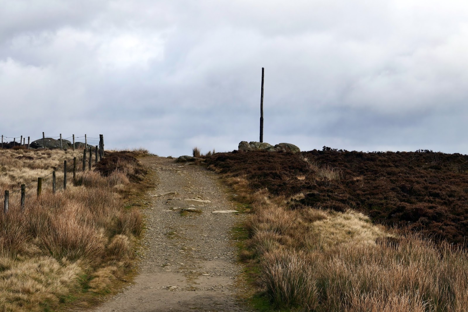
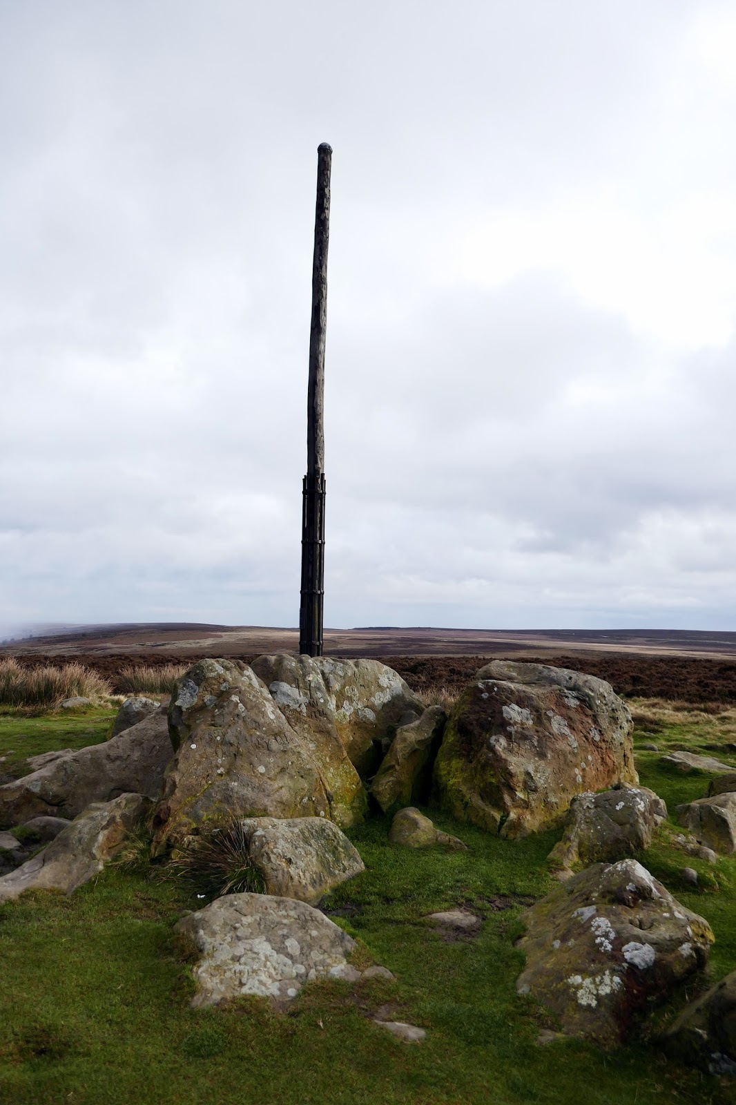
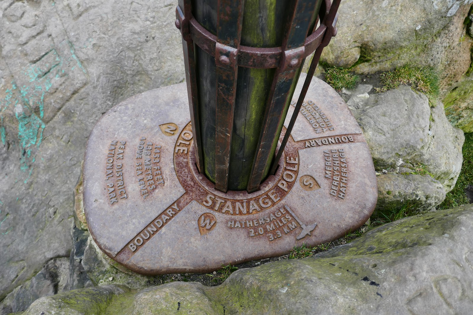
Eventually, we reached Stanedge Pole, a tall wooden mast set on top of a pile of large rocks. It is a landmark on Hallam Moors, standing at a height of 438m and marks the border between Derbyshire and South Yorkshire.
 |
| Stanedge Pole |
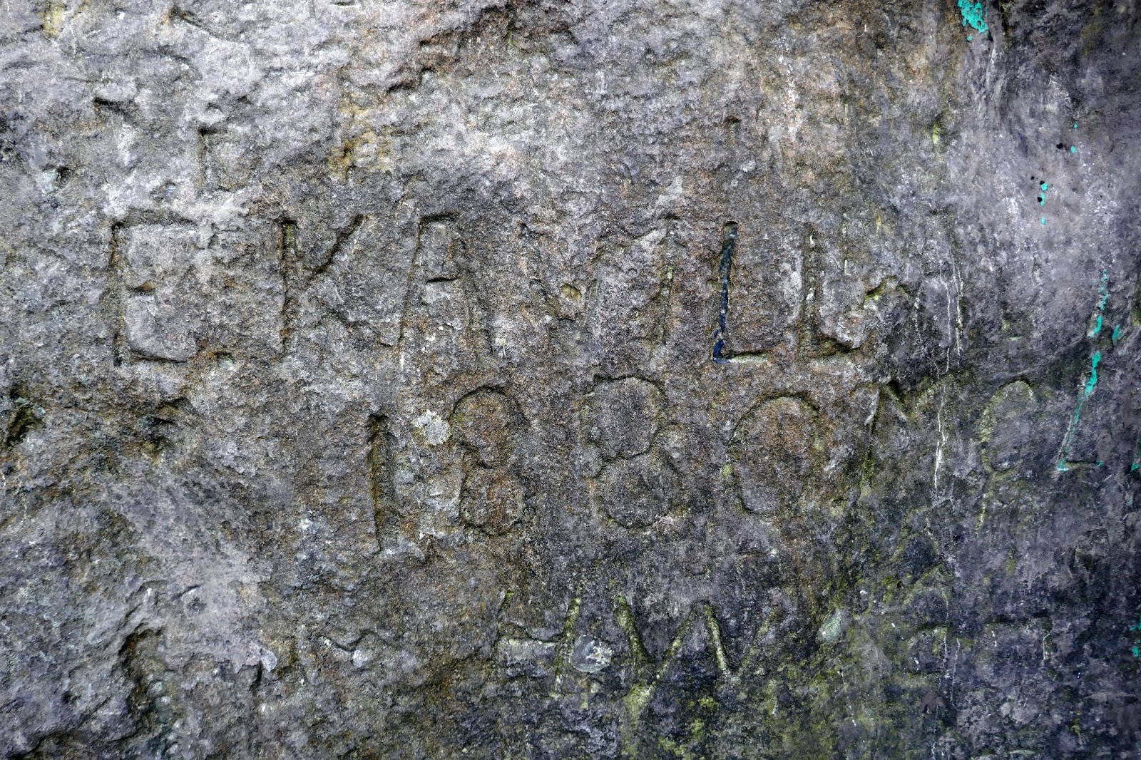
A pole has stood on the site since at least 1550. Many initials have been carved into the rock that supports it, and five can be identified as initials of the parish road surveyors who renewed the pole when needed. “T.C. 1550”, “H.W. 1581”, “T.M. 1631”, “H.H. 1697” and “F.N. 1740” are the marks of the parish surveyors and the date the pole was renewed.
 |
| Stanedge Pole |
 |
| The 1880 date we could make out |
 |
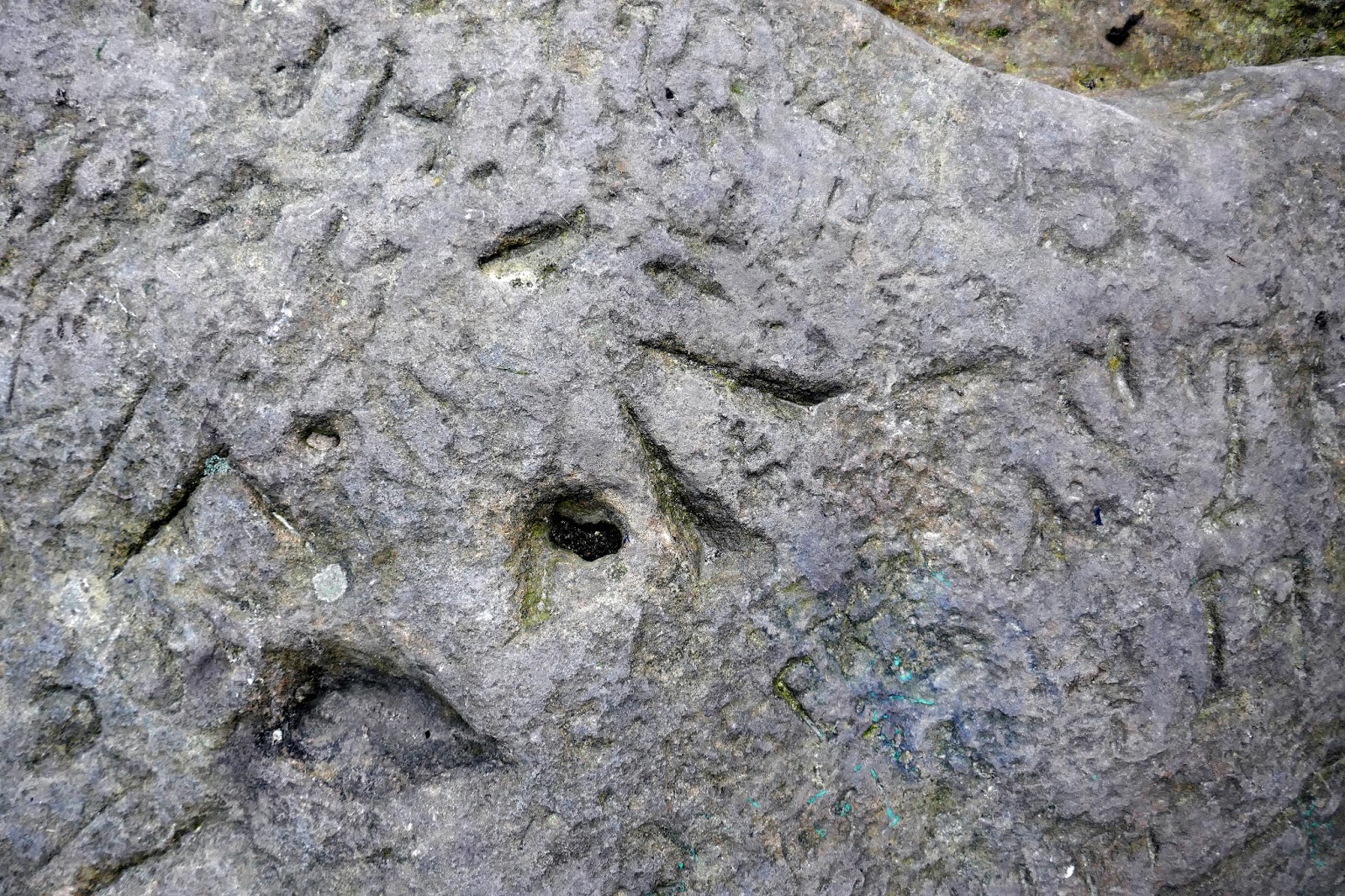
| An old survey benchmark |
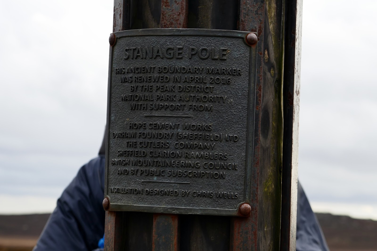
On 17 April 2016 a group of people with an interest in the pole and surrounding environment, including the Peak District National Park Authority and the British Mountaineering Council, erected a new pole at the site to mark the 65th anniversary of the creation of the Peak District National Park.
 |
| Stanedge Pole’s base |
 |
| Stanedge Pole |
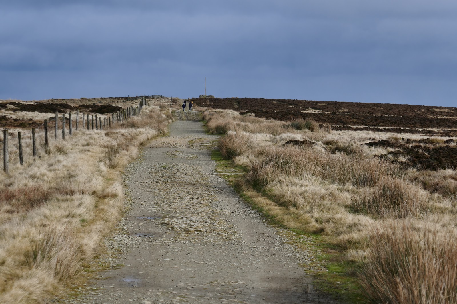
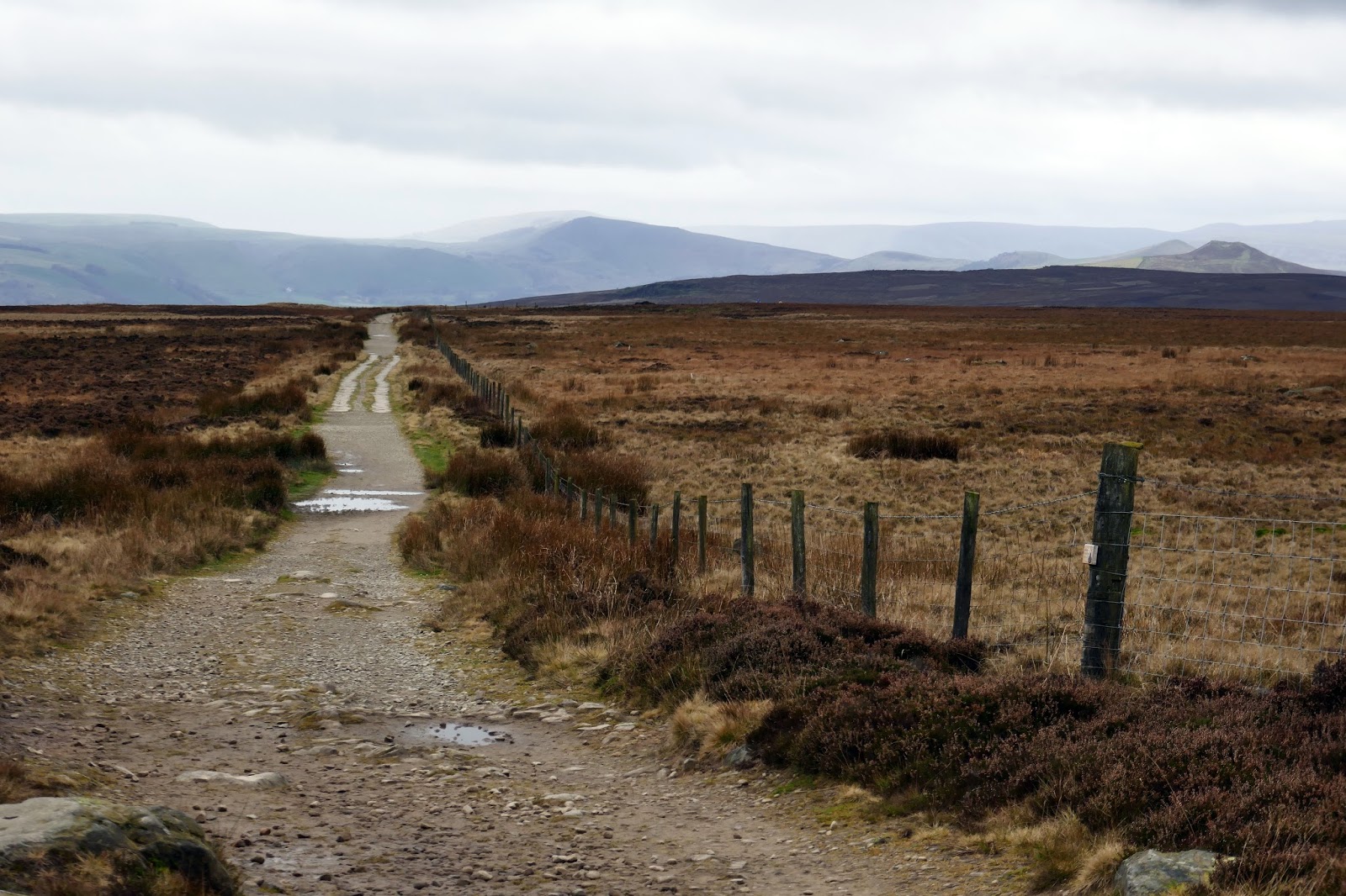
The route back to Dennis Knoll and the waiting car is along the Long Causeway,a Medieval packhorse route which ran between Sheffield and Hathersage. The section between Redmires Reservoir and Dennis Knoll is the only existing section and survives as an unsurfaced track which crosses the moor and descends from Stanage Edge back to the car.
 |
| The Long Causeway |
 |
| High Neb from the Long Causeway |
 |
| The Long Causeway |
 |
| Stanage Edge |
 |
| Stanage Edge |
 |
| Stanage Edge |
With a long day, you could extend this walk by walking the rest of Stanage Edge to the Cowper Stone though this would leave an unsatisfactory return along the lanes. The whole of Stanage is perhaps best seen using two cars, strategically placed at either end though we were happy with the results of our outing and enjoyed our day in the Dark Peak.

