Open Space Web-Map builder Codehttps://openspace.ordnancesurvey.co.uk/osmapapi/openspace.js?key=3119F72552FD5C22E0530C6CA40A5A92https://openspace.ordnancesurvey.co.uk/osmapapi/script/mapbuilder/basicmap.jshttps://openspace.ordnancesurvey.co.uk/osmapapi/script/mapbuilder/searchbox.js//variables for routes var linesLayer, points, lineFeature, lineString, routeMarkersLayer, routepos, routesize, routeoffset, routeicon; var style_blue = {strokeColor: “#0000CD”, strokeOpacity: 0.5, strokeWidth: 4.5}; function initmapbuilder() { //initiate the map var options = {resolutions: [2500, 1000, 500, 200, 100, 50, 25, 10, 5, 4, 2.5, 2, 1]}; osMap = new OpenSpace.Map(‘map’, options); //configure map options (basicmap.js) setglobaloptions(); //set the center of the map and the zoom level osMap.setCenter(new OpenSpace.MapPoint(415788,390981),7); linesLayer = osMap.getVectorLayer(); // Set up layer for route markers routeMarkersLayer = new OpenLayers.Layer.Markers(“Route Markers”); //make a route points = new Array(); points.push(new OpenLayers.Geometry.Point(417161,389374)); points.push(new OpenLayers.Geometry.Point(417141,389634)); points.push(new OpenLayers.Geometry.Point(417073,389826)); points.push(new OpenLayers.Geometry.Point(417001,389946)); points.push(new OpenLayers.Geometry.Point(416977,390298)); points.push(new OpenLayers.Geometry.Point(416965,390746)); points.push(new OpenLayers.Geometry.Point(416881,390994)); points.push(new OpenLayers.Geometry.Point(416753,391050)); points.push(new OpenLayers.Geometry.Point(416517,391034)); points.push(new OpenLayers.Geometry.Point(416509,391090)); points.push(new OpenLayers.Geometry.Point(416693,391182)); points.push(new OpenLayers.Geometry.Point(416709,391242)); points.push(new OpenLayers.Geometry.Point(416621,391502)); points.push(new OpenLayers.Geometry.Point(416709,391842)); points.push(new OpenLayers.Geometry.Point(416793,392150)); points.push(new OpenLayers.Geometry.Point(416793,392438)); points.push(new OpenLayers.Geometry.Point(416885,392694)); points.push(new OpenLayers.Geometry.Point(416873,392762)); points.push(new OpenLayers.Geometry.Point(416485,392998)); points.push(new OpenLayers.Geometry.Point(416169,393030)); points.push(new OpenLayers.Geometry.Point(416053,393002)); points.push(new OpenLayers.Geometry.Point(415849,392818)); points.push(new OpenLayers.Geometry.Point(415689,392746)); points.push(new OpenLayers.Geometry.Point(415489,392750)); points.push(new OpenLayers.Geometry.Point(415384,392765)); points.push(new OpenLayers.Geometry.Point(415289,392805)); points.push(new OpenLayers.Geometry.Point(415114,392755)); points.push(new OpenLayers.Geometry.Point(414859,392480)); points.push(new OpenLayers.Geometry.Point(414544,392160)); points.push(new OpenLayers.Geometry.Point(414074,391620)); points.push(new OpenLayers.Geometry.Point(414279,391490)); points.push(new OpenLayers.Geometry.Point(414439,391330)); points.push(new OpenLayers.Geometry.Point(414554,391200)); points.push(new OpenLayers.Geometry.Point(414639,390870)); points.push(new OpenLayers.Geometry.Point(414719,390720)); points.push(new OpenLayers.Geometry.Point(414794,390450)); points.push(new OpenLayers.Geometry.Point(414859,390335)); points.push(new OpenLayers.Geometry.Point(415244,390155)); points.push(new OpenLayers.Geometry.Point(415359,390000)); points.push(new OpenLayers.Geometry.Point(415509,389880)); points.push(new OpenLayers.Geometry.Point(415749,389755)); points.push(new OpenLayers.Geometry.Point(415999,389525)); points.push(new OpenLayers.Geometry.Point(416129,389445)); points.push(new OpenLayers.Geometry.Point(416268,389421)); points.push(new OpenLayers.Geometry.Point(416498,389436)); points.push(new OpenLayers.Geometry.Point(416693,389466)); points.push(new OpenLayers.Geometry.Point(416768,389326)); points.push(new OpenLayers.Geometry.Point(416898,389321)); points.push(new OpenLayers.Geometry.Point(417008,389211)); points.push(new OpenLayers.Geometry.Point(417213,389166)); points.push(new OpenLayers.Geometry.Point(417161,389374)); // create a polyline feature from the array of points lineString = new OpenLayers.Geometry.LineString(points); lineFeature = new OpenLayers.Feature.Vector(lineString, null, style_blue); linesLayer.addFeatures([lineFeature]); //crate a route start/end marker routepos = new OpenSpace.MapPoint(417161,389374); routesize = new OpenLayers.Size(33,45); routeoffset = new OpenLayers.Pixel(-5,-37); routeicon = new OpenSpace.Icon(‘https://openspace.ordnancesurvey.co.uk/osmapapi/img_versions/img_1.1/mapbuilder/routemarker-startend.png’, routesize, routeoffset, null, null); routeMarkersLayer.addMarker(new OpenLayers.Marker(routepos, routeicon)); osMap.addLayer(routeMarkersLayer);}
Route: Fairholmes, Nabs Wood, Gores Farm, Birchinlee East Plantation, Howden Dam, Hern Side, Ditch Clough Plantation, Birchin Hat, Alport Castles, Rowlee Pasture, Bellhag Tor, Lockerbrook Coppice, Fairholmes
Date: 15/10/2017
From: Fairholmes
Parking: Fairholmes
Start Point: Derwent Dam
Region: Peak District – Dark Peak
Route length: 8.2 miles (13.2 km)
Time taken: 03:16
Average speed: 2.5 mph
Ascent: 438m
Descent: 462m
Other points of interest: Alport Castles
The last time we visited Alport Castles we picked a truly awful day and didn’t actually see much of it, so we were back to make amends. For those of you who don’t know it, Alport Castles bit of a hidden gem.
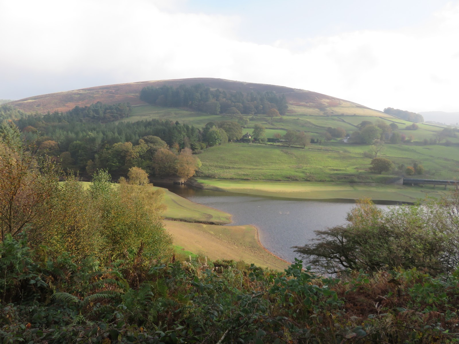
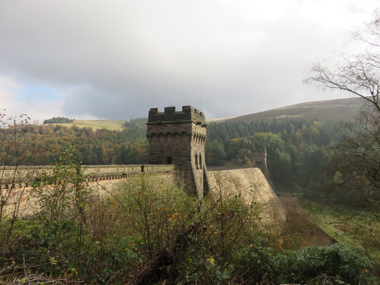
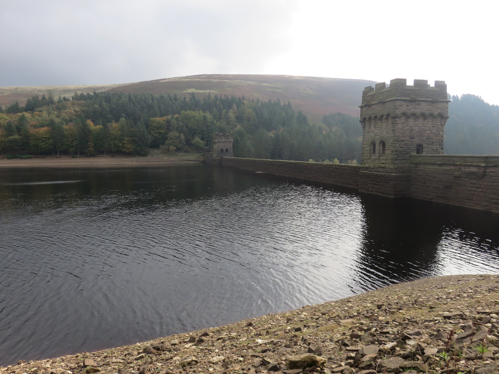
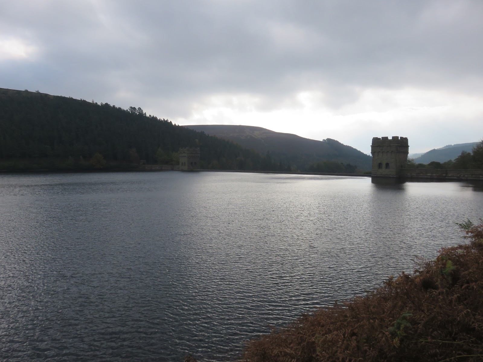
We parked in Fairholmes, a large car park located between the Ladybower and Derwent reservoirs, close to the magnificent Derwent Dams. These solid masonry dams were built in the 1900s to provide water for practically the whole of Derbyshire. They were so similar to the famous German dams in the Ruhr valley that they were used to train the Dambuster pilots of World War II, much to the annoyance of the locals.
 |
| Pike Low above Ladybower |
 |
| The woods at Fairholmes |
 |
| The Derwent Dam |
 |
| The Derwent Dam and Ladybower |
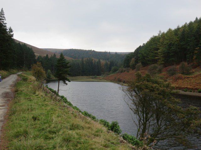
We decided on a different route to our previous outing and set off to follow the western shore of Ladybower for a few miles, past the Howden Dam to where the River Westend meets the reservoir at Fox’s Piece.
 |
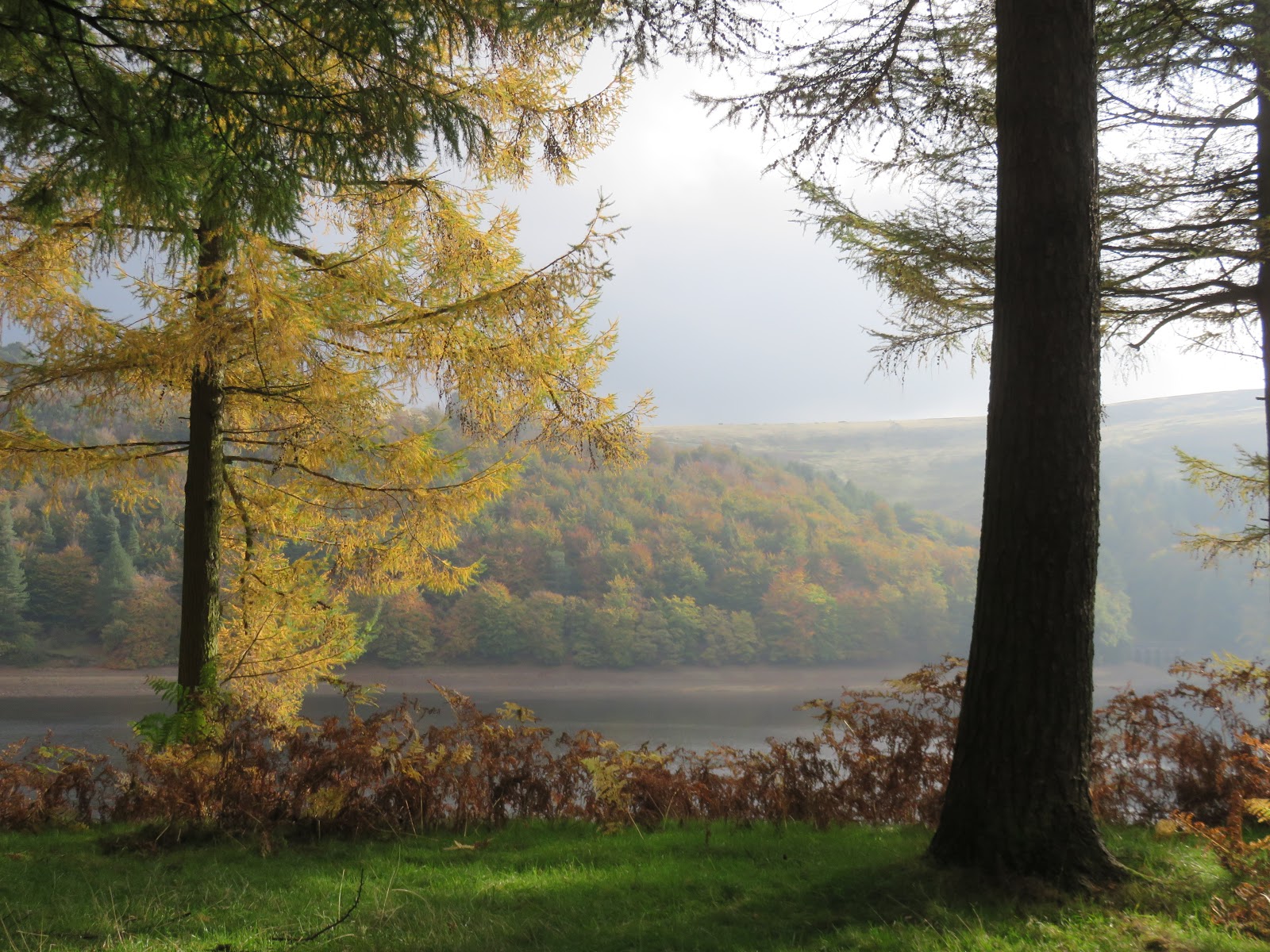
| Some autumn colours on show |
 |
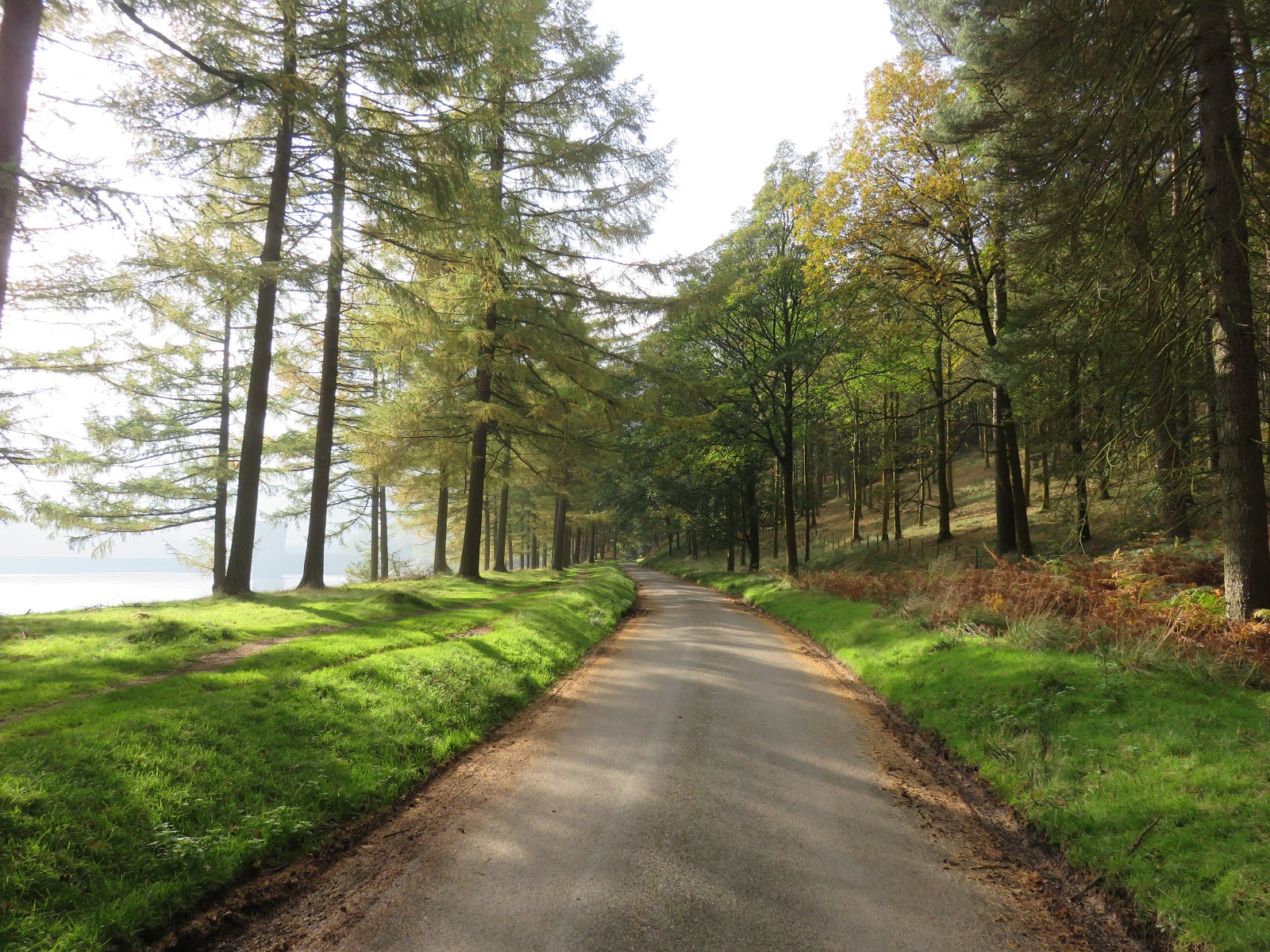
| Ladybower’s access road |
 |
| Howden Clough with Featherbed Moss and Margery Hill rising beyond |
 |
| Howden Dam |
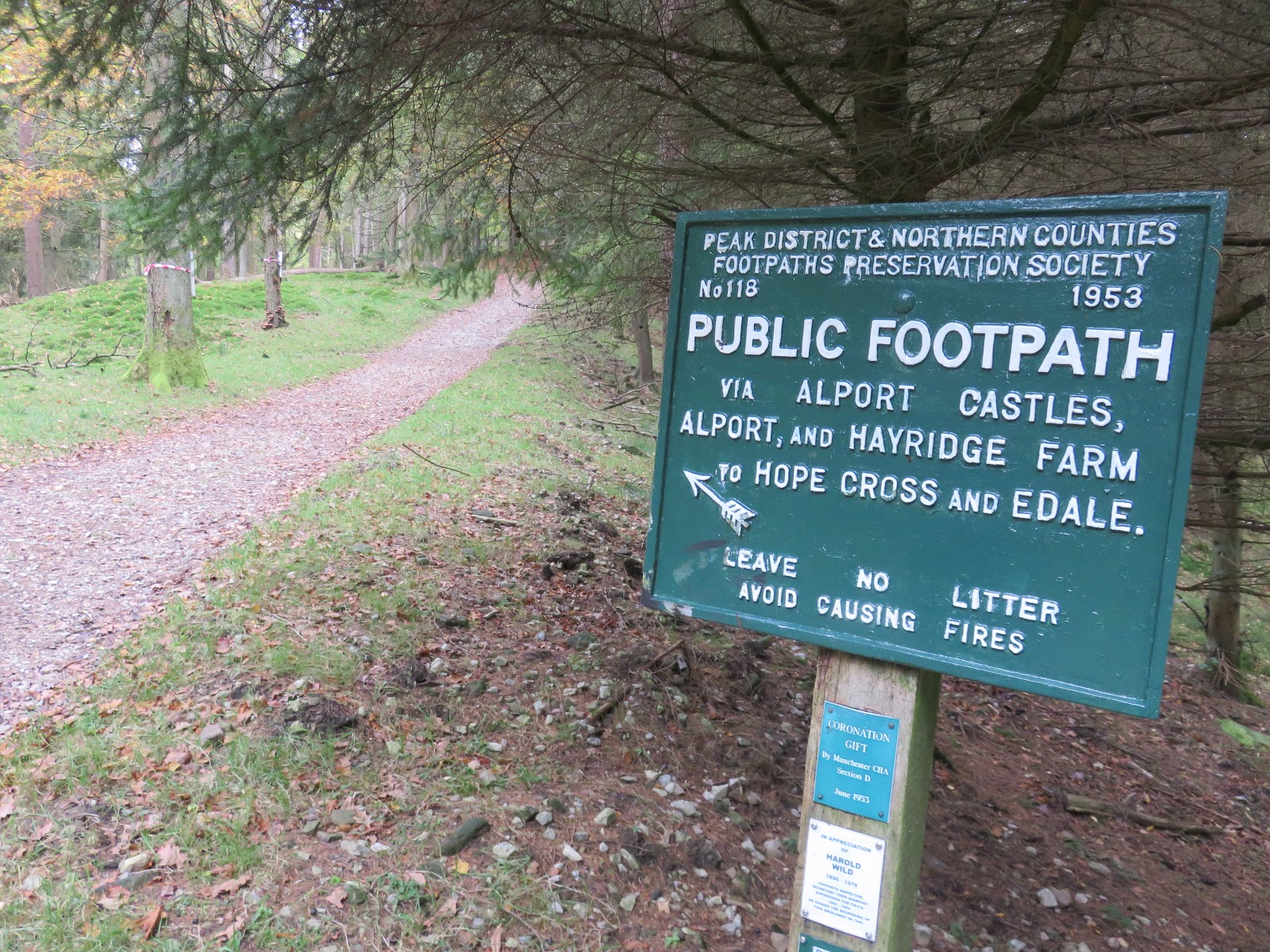
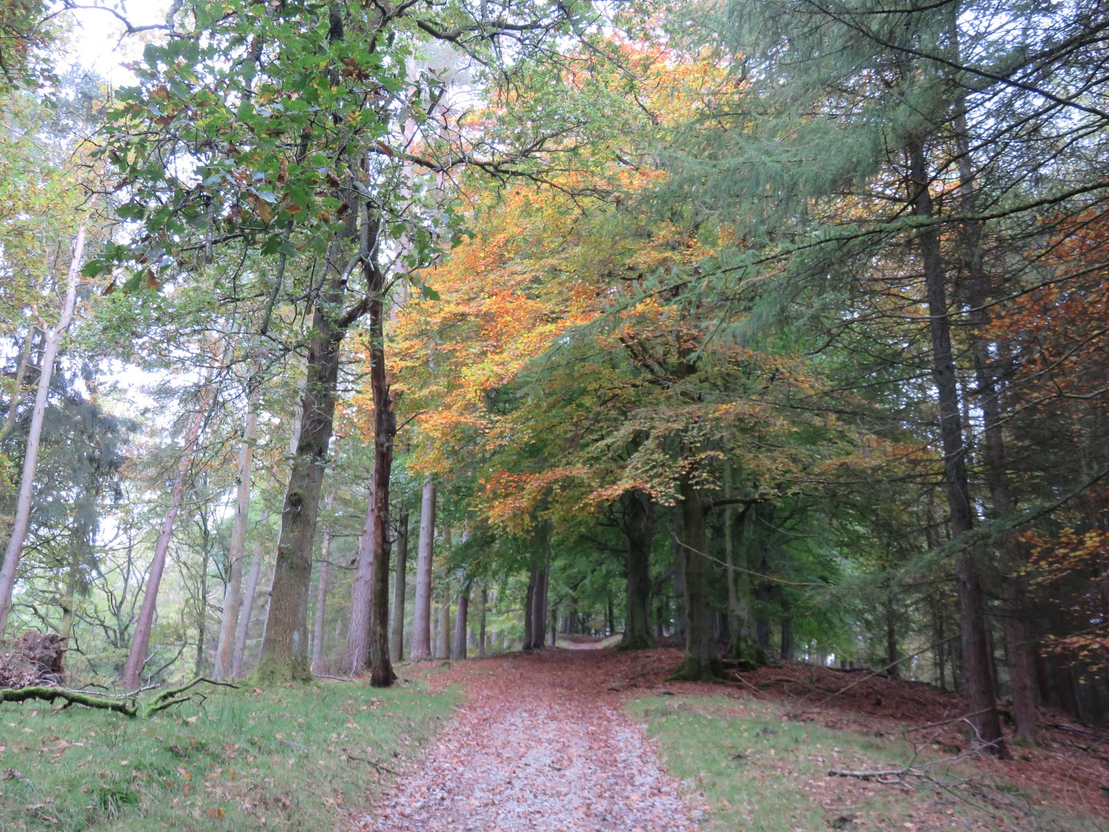
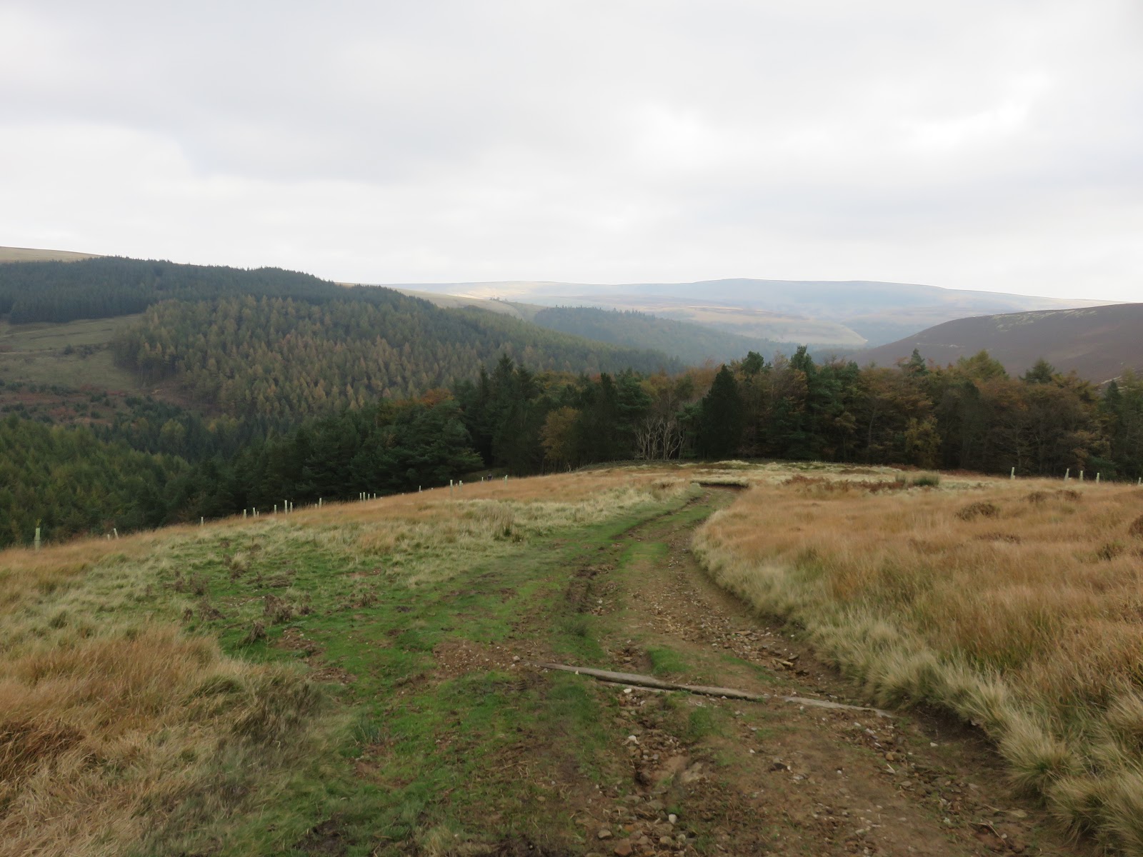
Here is the one and only climb of the walk, a reasonably gentle path that runs up alongside Ditch Clough and onto Birchinlee Pasture. Though initially through the woods of Ditch Clough Plantation, views quickly open up encompassing the rugged moorland of the Dark Peak.
 |
| Ladybower at Hern Side |
 |
| THe path up the hill is well signposted |
 |
| Ditch Clough Plantation |
 |
| Looking back towards the woodland |
 |
| Birchinlee Pasture |
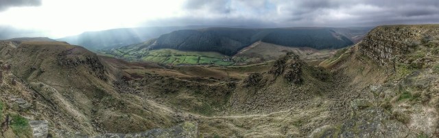
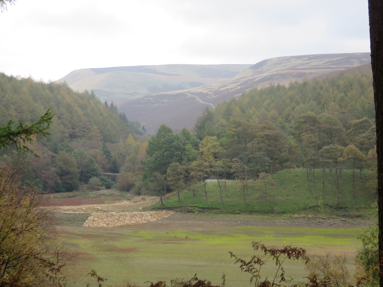
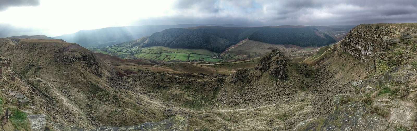
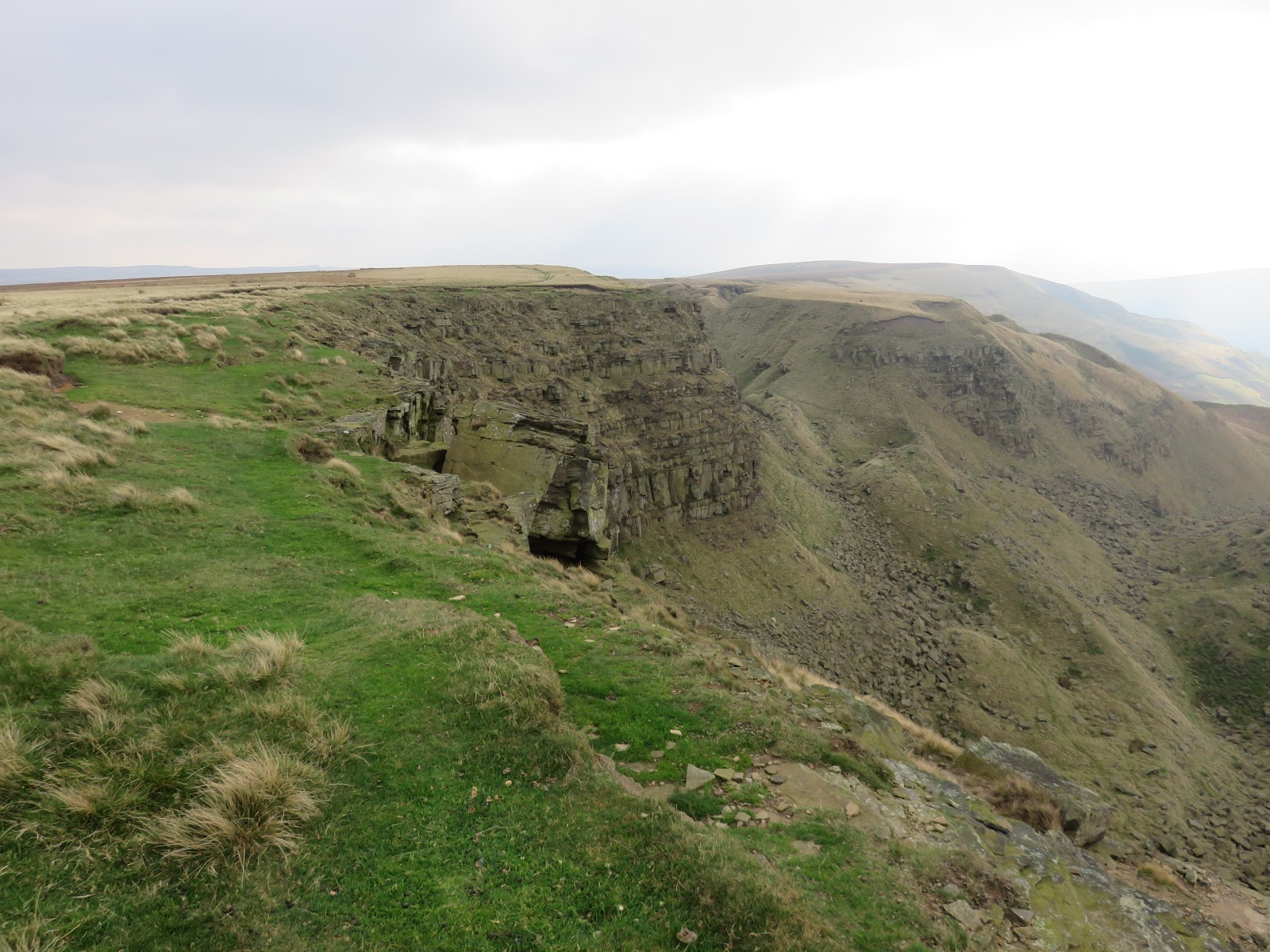
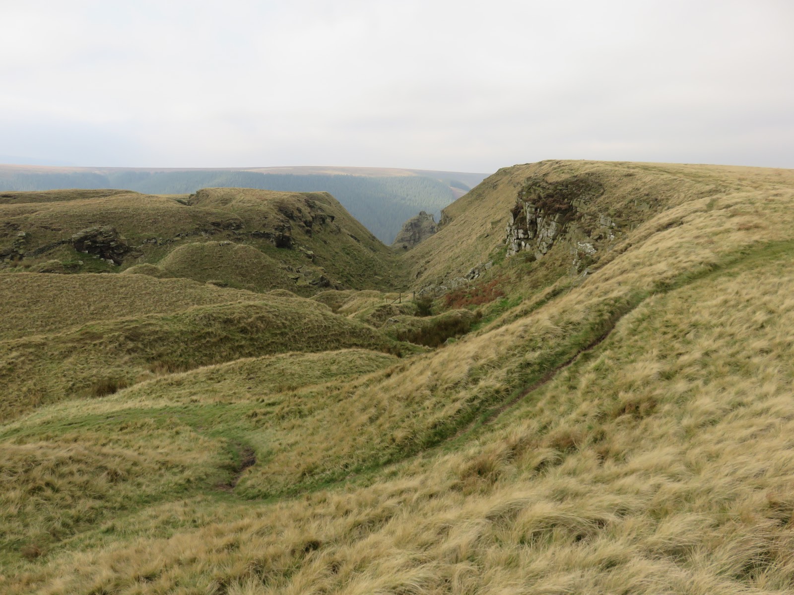
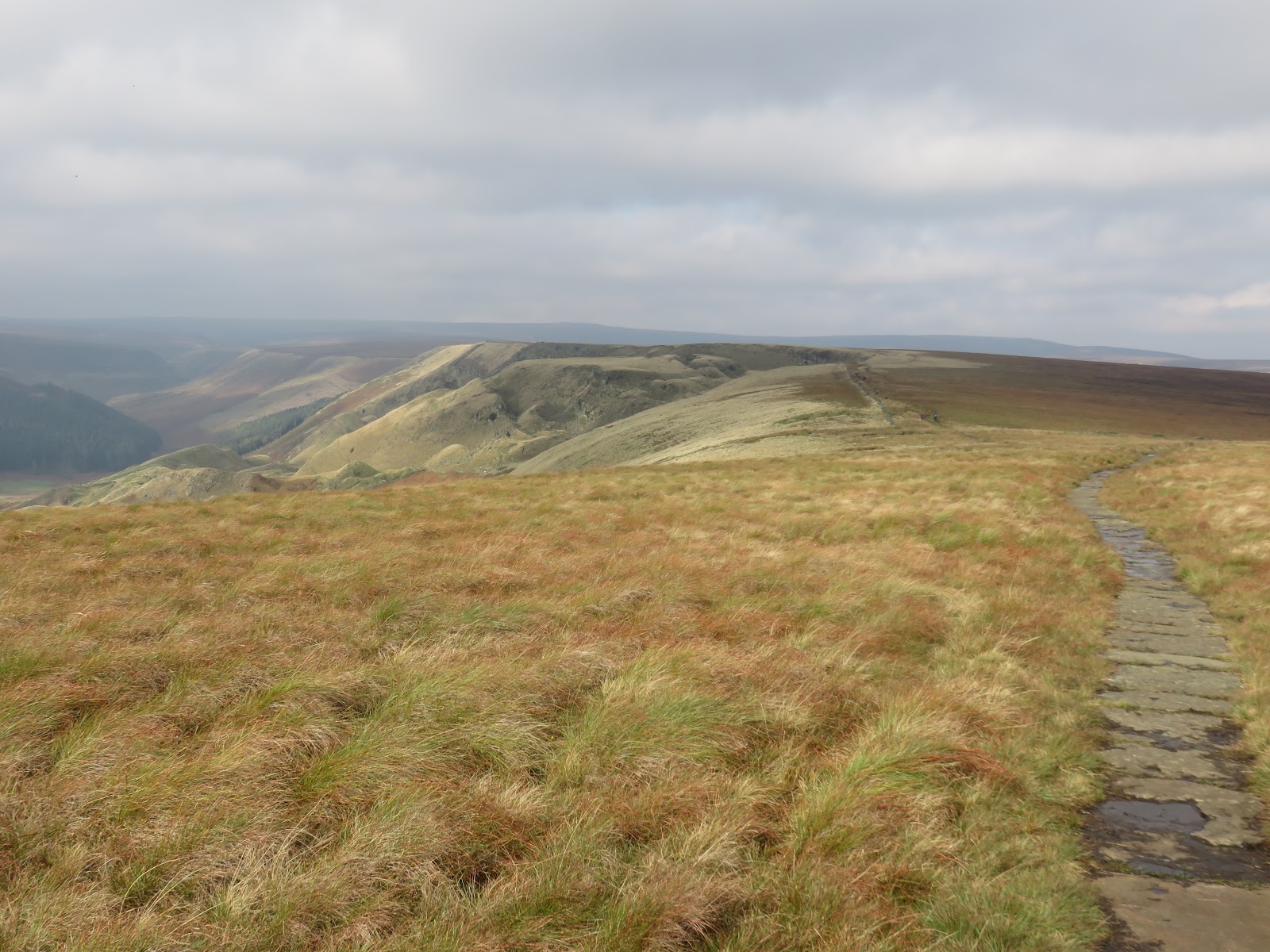
The path stops abruptly at a steep edge that falls a number of metres down into the valley, marking the beginning of the large landslip that forms the remarkable Alport Castles.
 |
| Alport Castles |
The exact cause of the landslide is unknown, but similar if less dramatic landslips occur all around the Dark Peak, notably on Mam Tor. 300 million years ago, the area was part of a river delta that flowed into a shallow tropical sea which covered the Peak District. Millions of years the mud and sand deposited by the river compressed to form the layers of soft shale and hard gritstone rocks which can be seen today. One theory is that the River Alport eroded the softer layers, causing the landslide.
 |
| Alport Castles |
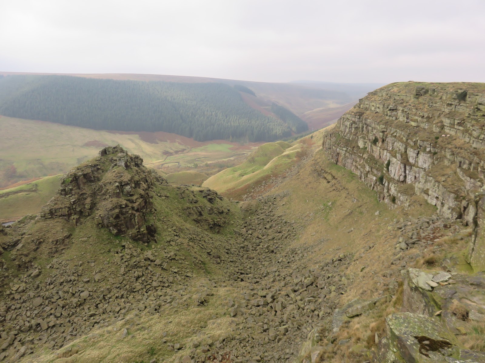
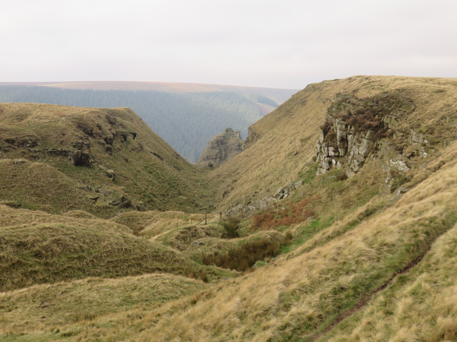
The path hugs the cliff tops, peering down into the chaos below. Thousands of scattered rocks and boulders litter the place, clear evidence of the cliff walls collapse. The landslip is half mile long and tens of metres high. Everything still looks quite perilous, almost like it could slip or collapse at any time and nowhere is this more evident that The Tower.
 |
| The cliff above Alport Castles |
 |
| The Tower |
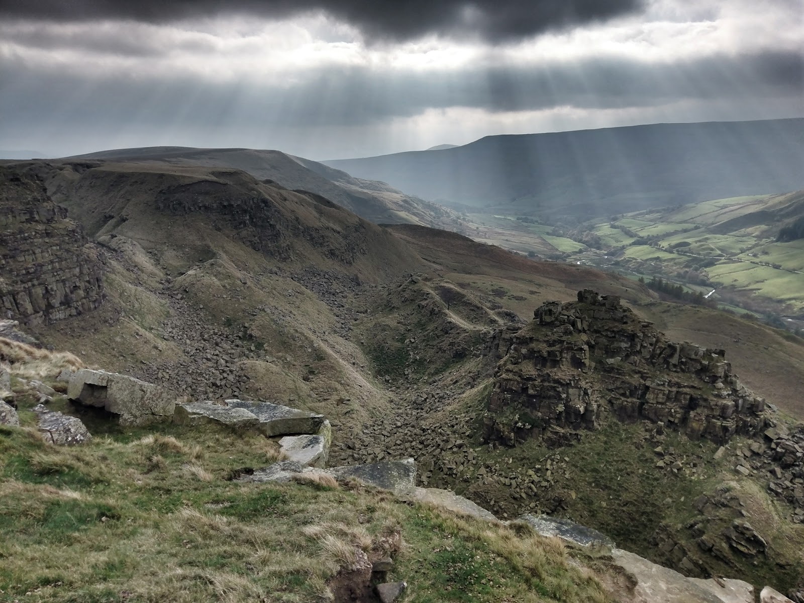
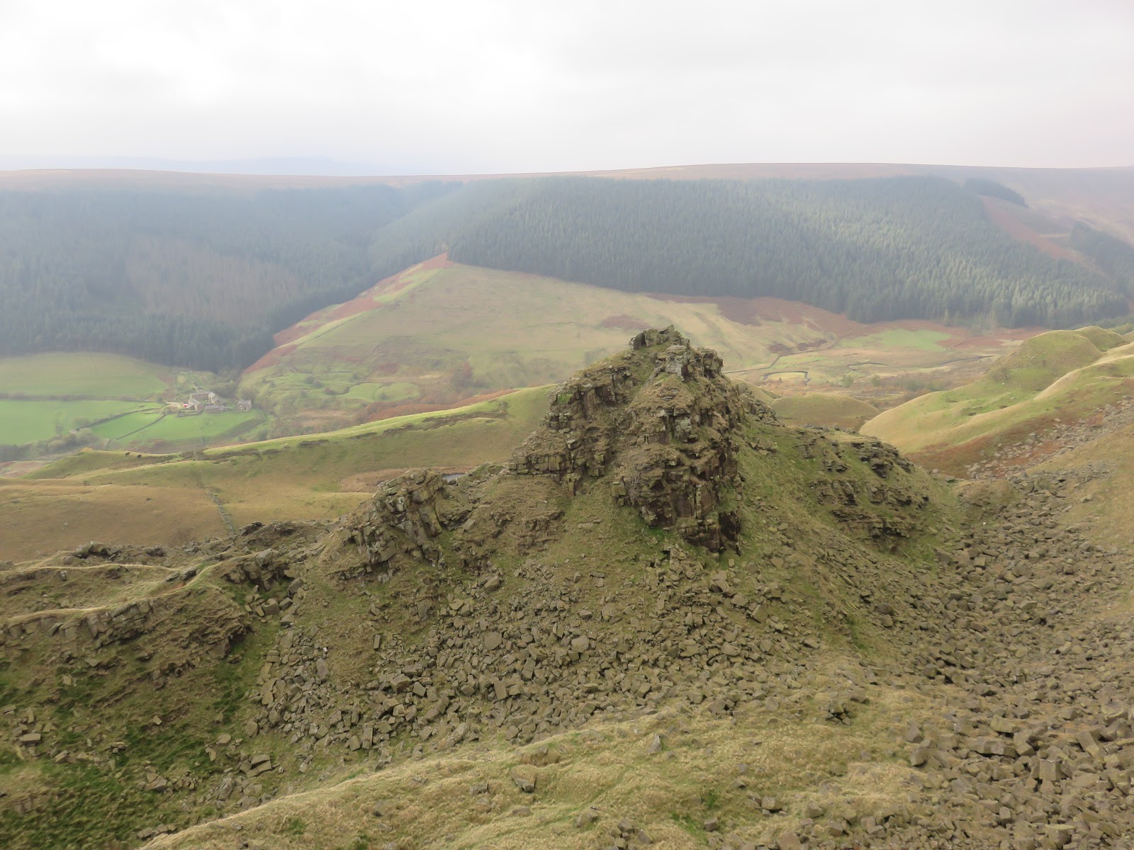
The Tower is perhaps the reason behind Alport Castles’ unusual name. From all angles it looks almost exactly like a motte and bailey castle, standing proudly in the centre of a huge amphitheatre of cliffs. It is accessible from nearly all sides and climbing it is difficult to resist.
 |
| The Tower |
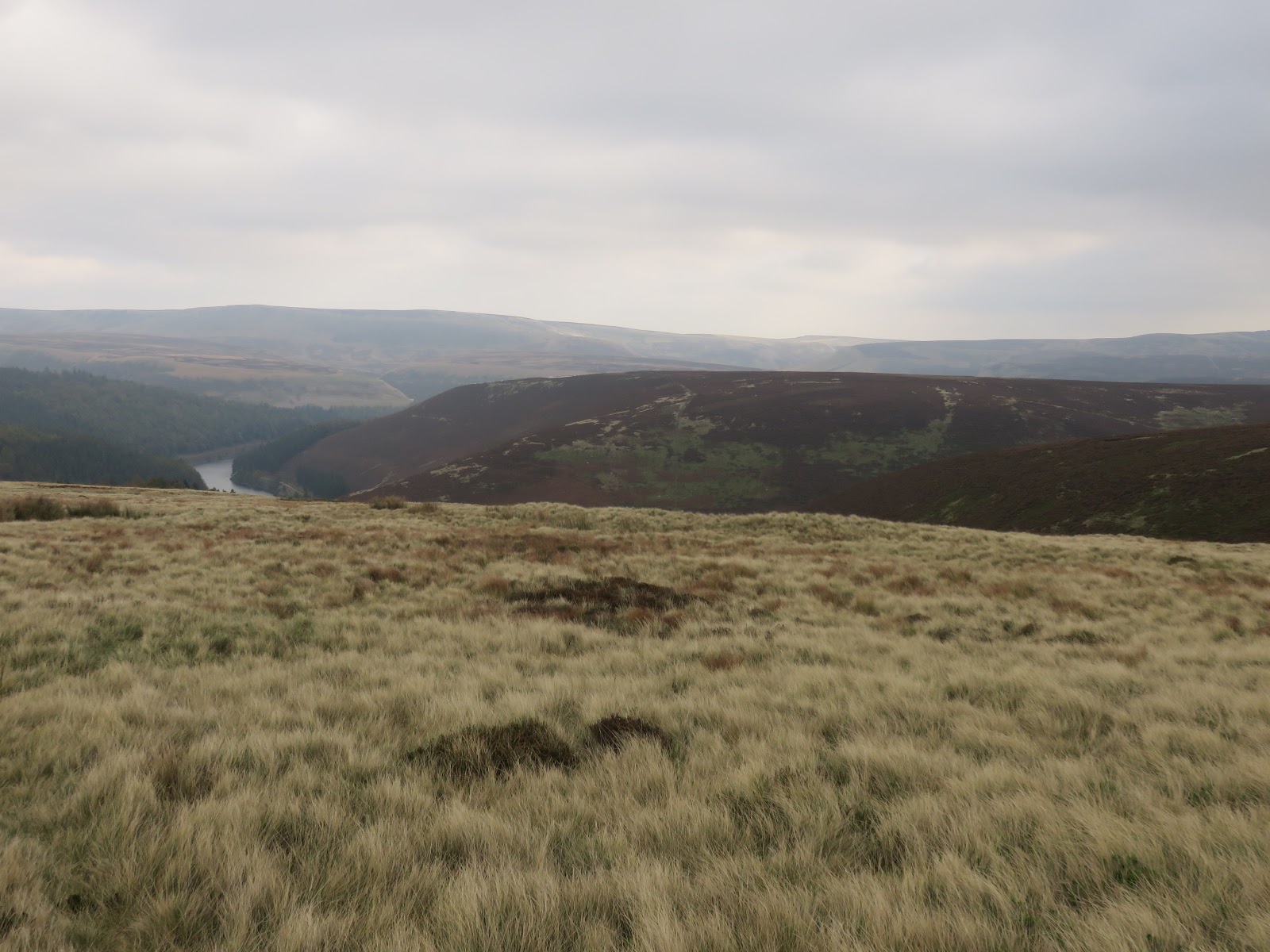
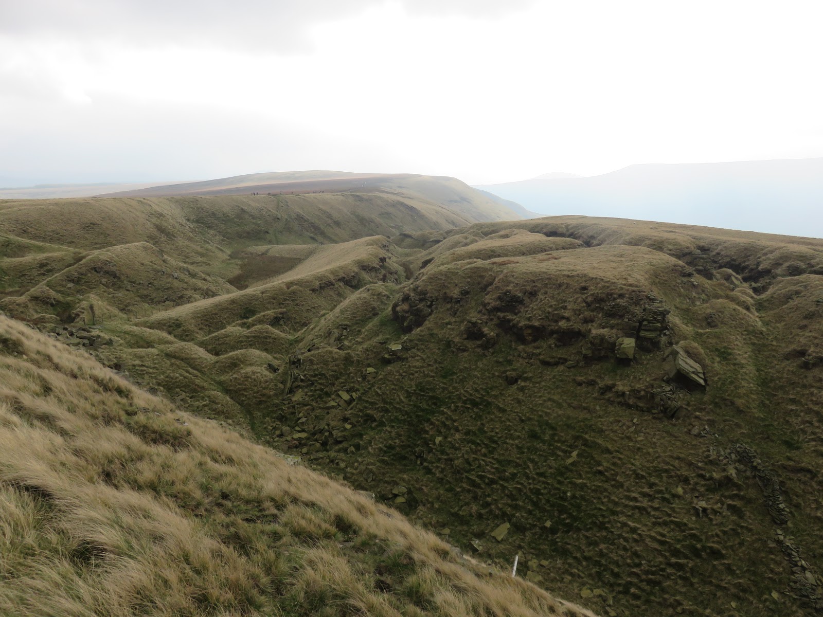
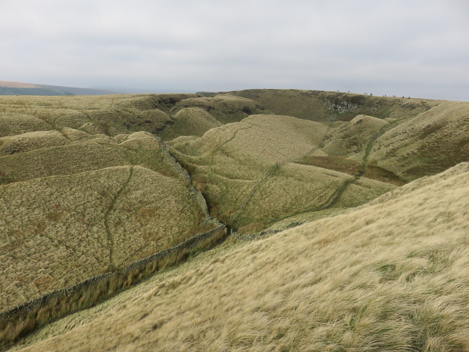
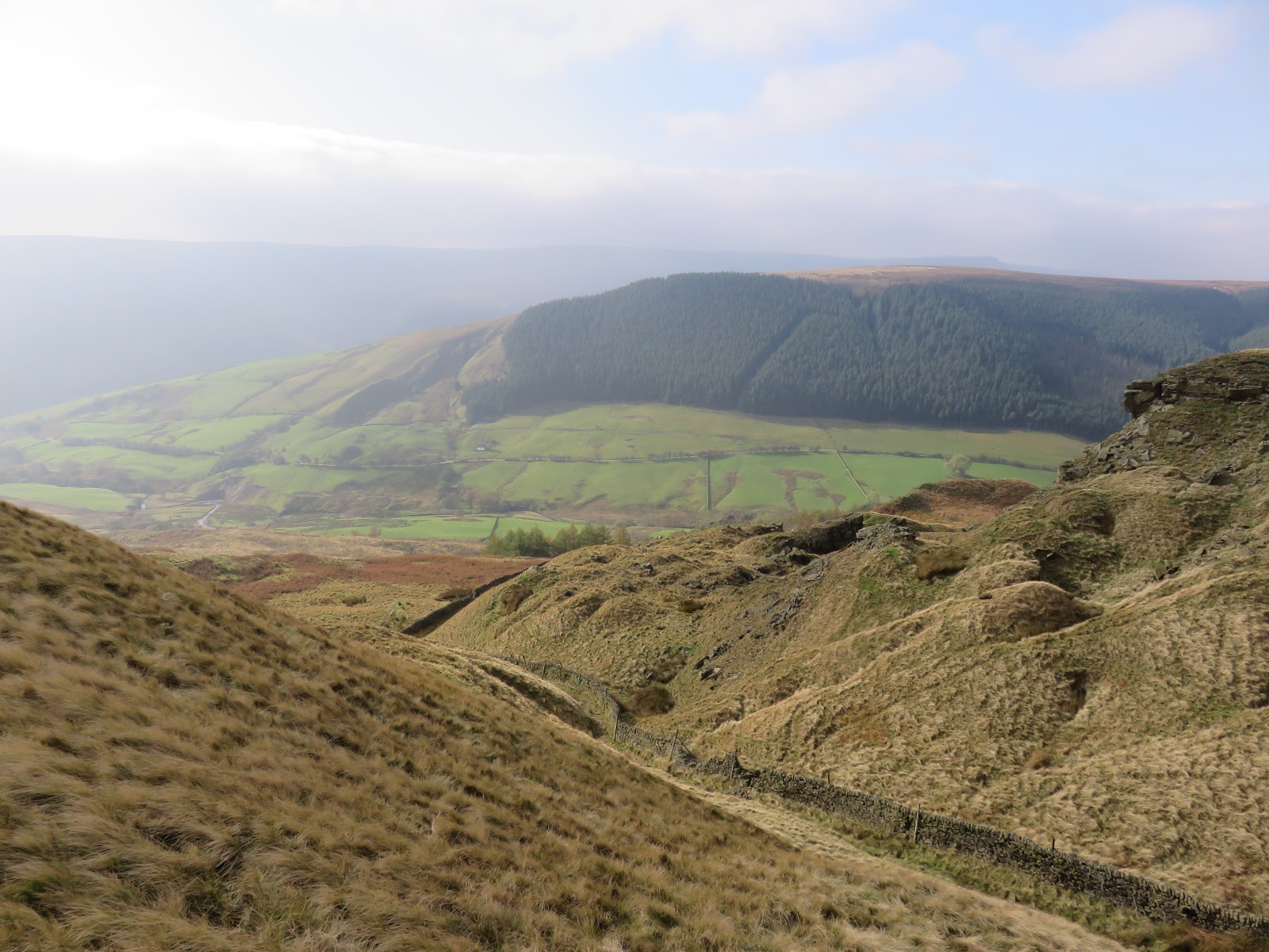
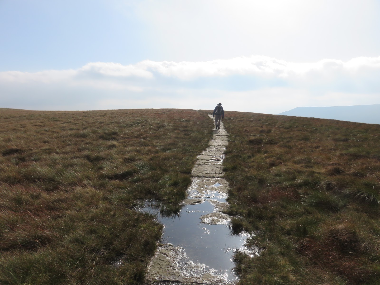
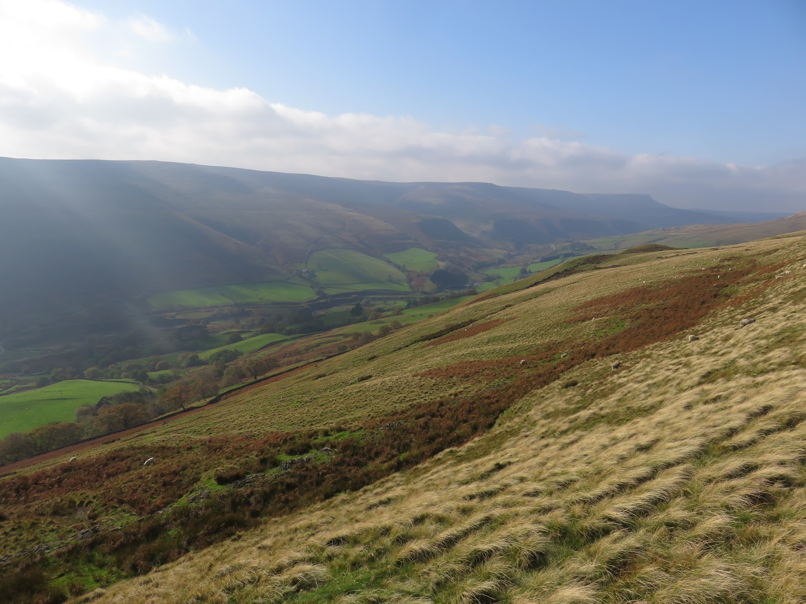
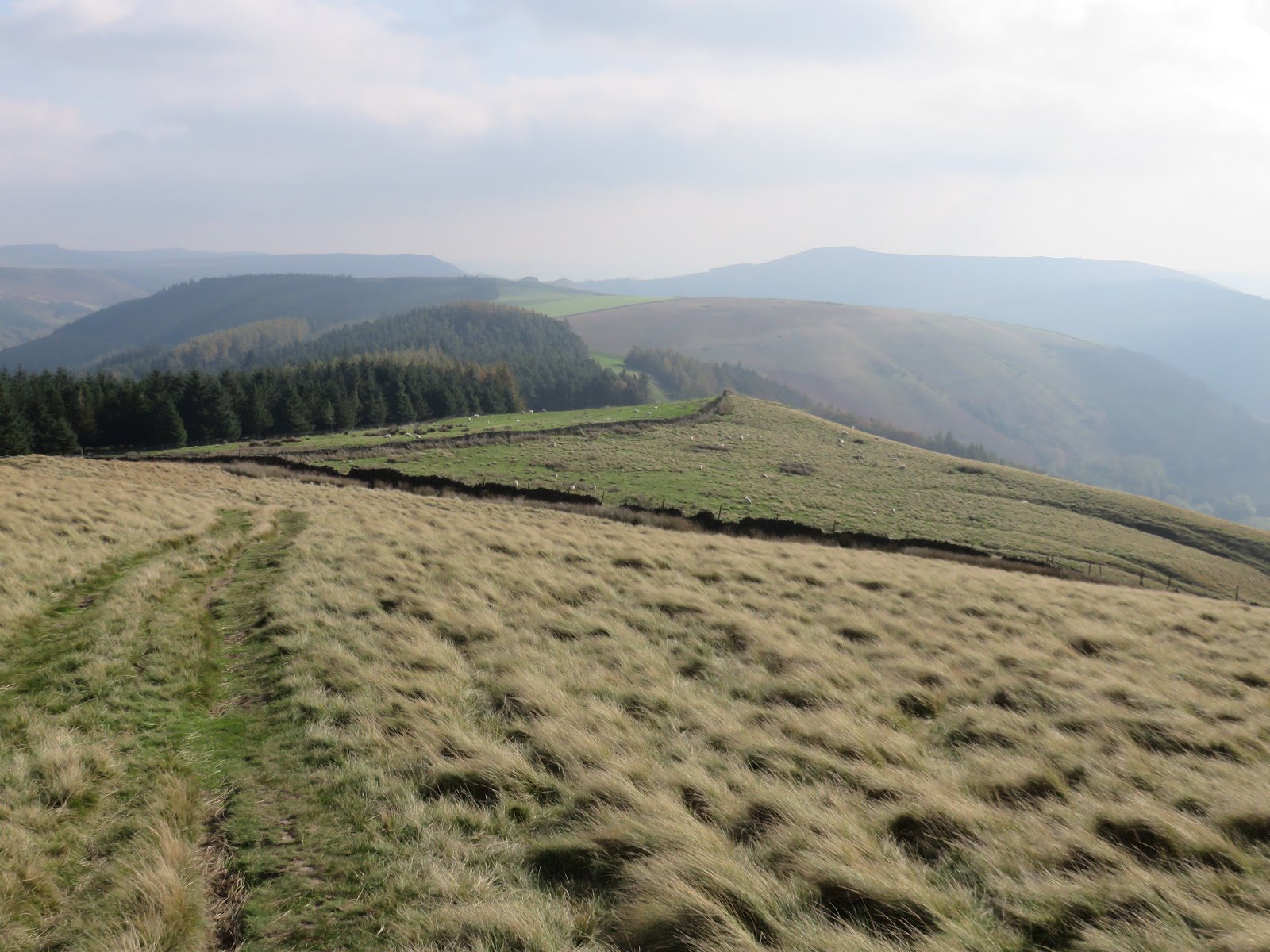
Despite the emerging sunshine, a cold wind was blowing across the ridge as we made our way southeast onto Rowlee Pasture. The path here skirts the edge of the moor, giving fine views down into both the valleys of the River Ashop and the River Alport.
 |
| The landslips at Alport Castles |
 |
| Alport Castles |
 |
| The Tower emerges at the end of the valley |
 |
| Alport Castles |
 |
| Hey Ridge |
 |
| Rowlee Pasture looking back to Alport Castles |
 |
| Rowless Pasture |
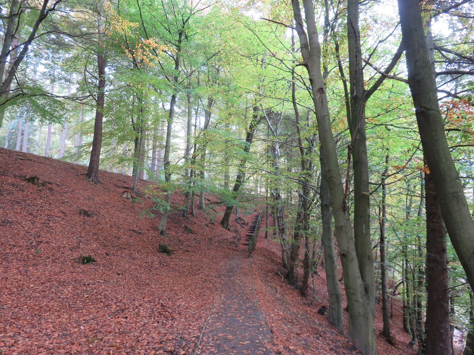
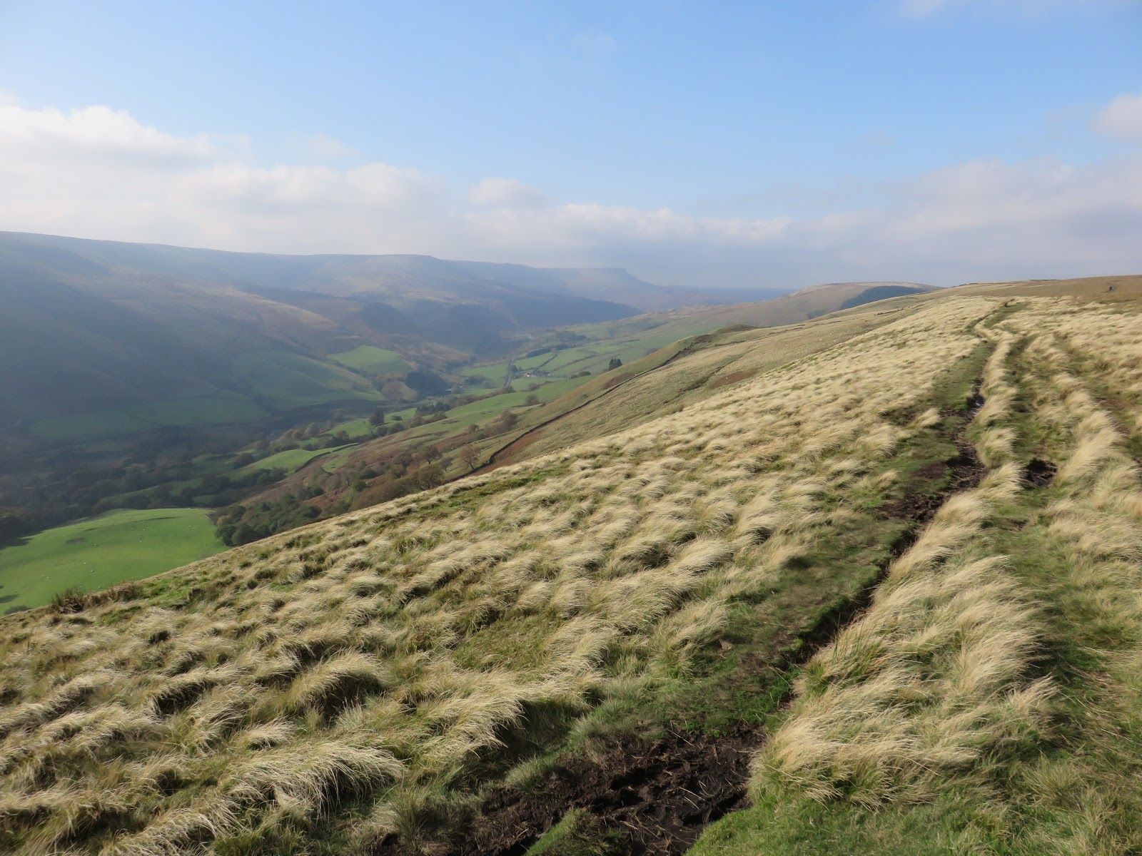
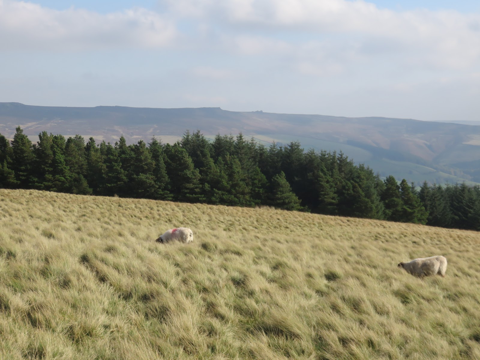
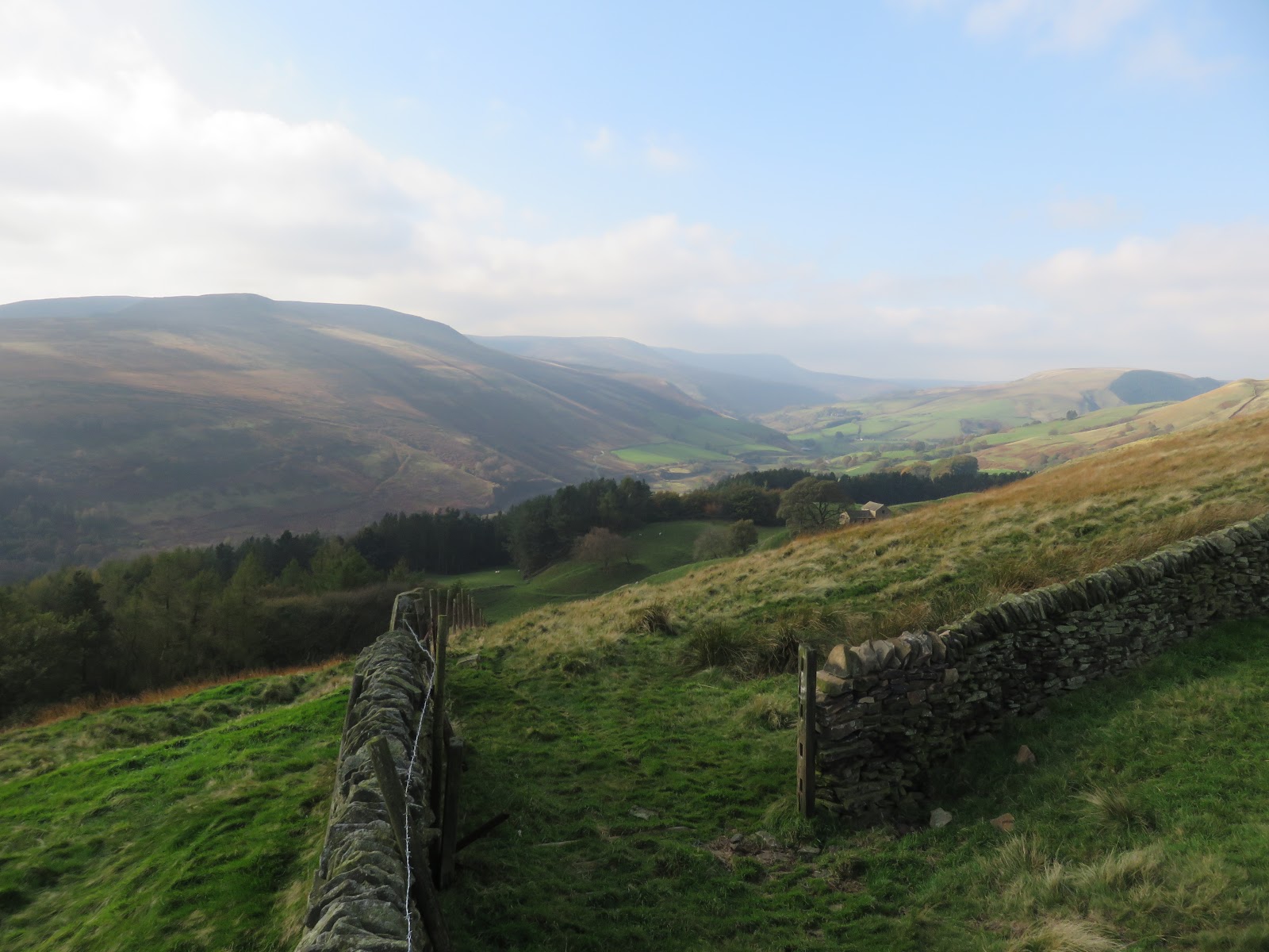
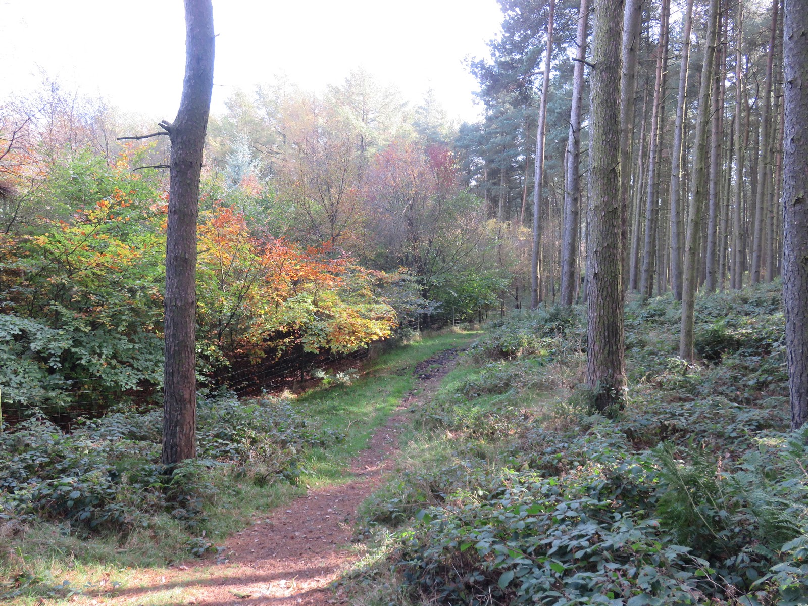
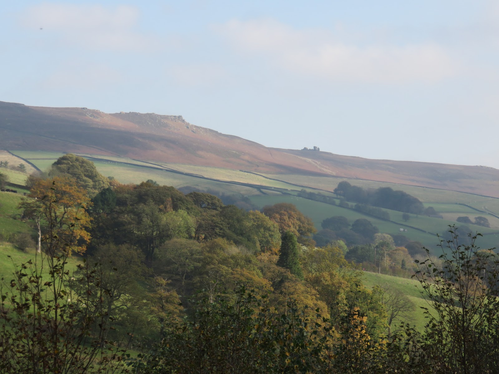
The path slowly descends to the top of Bellhag Tor. From here, though not marked on the map, a path wends its way down through the woods of Hagg Side, emerging at the access road to the Fairholmes car park.
 |
| Woodlands Valley |
 |
| Woodlands Valley |
 |
| Bellhag Tor |
 |
| Lockerbrook Heights |
 |
| Looking along the Woodlands Valley – Kinder Scout is to the left |
 |
| Lockerbrook Heights |
 |
| Derwent Edge |
On the whole, this is a very easy walk given that much of takes place on level ground, namely the first few miles alongside the reservoir. The only climb is easy enough but the rewards are excellent. I’d recommend heading into Alport Castles and having a look around, particularly at The Tower, which is an enjoyable little scramble and a small part of a grand day out.

