Open Space Web-Map builder Codehttps://openspace.ordnancesurvey.co.uk/osmapapi/openspace.js?key=3119F72552FD5C22E0530C6CA40A5A92https://openspace.ordnancesurvey.co.uk/osmapapi/script/mapbuilder/basicmap.jshttps://openspace.ordnancesurvey.co.uk/osmapapi/script/mapbuilder/searchbox.js//variables for routes var linesLayer, points, lineFeature, lineString, routeMarkersLayer, routepos, routesize, routeoffset, routeicon; var style_blue = {strokeColor: “#0000CD”, strokeOpacity: 0.5, strokeWidth: 4.5}; function initmapbuilder() { //initiate the map var options = {resolutions: [2500, 1000, 500, 200, 100, 50, 25, 10, 5, 4, 2.5, 2, 1]}; osMap = new OpenSpace.Map(‘map’, options); //configure map options (basicmap.js) setglobaloptions(); //set the center of the map and the zoom level osMap.setCenter(new OpenSpace.MapPoint(325246.00865031,515263),8); linesLayer = osMap.getVectorLayer(); // Set up layer for route markers routeMarkersLayer = new OpenLayers.Layer.Markers(“Route Markers”); //make a route points = new Array(); points.push(new OpenLayers.Geometry.Point(325901,514783)); points.push(new OpenLayers.Geometry.Point(325851,514903)); points.push(new OpenLayers.Geometry.Point(325731,514788)); points.push(new OpenLayers.Geometry.Point(325451,514868)); points.push(new OpenLayers.Geometry.Point(325371,514863)); points.push(new OpenLayers.Geometry.Point(325221,515088)); points.push(new OpenLayers.Geometry.Point(325166,515068)); points.push(new OpenLayers.Geometry.Point(325141,515158)); points.push(new OpenLayers.Geometry.Point(324951,515198)); points.push(new OpenLayers.Geometry.Point(324796,515308)); points.push(new OpenLayers.Geometry.Point(324746,515543)); points.push(new OpenLayers.Geometry.Point(324881,515788)); points.push(new OpenLayers.Geometry.Point(324886,515843)); points.push(new OpenLayers.Geometry.Point(324931,515943)); points.push(new OpenLayers.Geometry.Point(324941,515773)); points.push(new OpenLayers.Geometry.Point(325076,515748)); points.push(new OpenLayers.Geometry.Point(325181,515463)); points.push(new OpenLayers.Geometry.Point(325266,515398)); points.push(new OpenLayers.Geometry.Point(325131,515233)); points.push(new OpenLayers.Geometry.Point(325131,515153)); points.push(new OpenLayers.Geometry.Point(325151,515068)); points.push(new OpenLayers.Geometry.Point(325236,515103)); points.push(new OpenLayers.Geometry.Point(325351,514873)); points.push(new OpenLayers.Geometry.Point(325501,514858)); points.push(new OpenLayers.Geometry.Point(325706,514793)); points.push(new OpenLayers.Geometry.Point(325856,514913)); points.push(new OpenLayers.Geometry.Point(325901,514783)); // create a polyline feature from the array of points lineString = new OpenLayers.Geometry.LineString(points); lineFeature = new OpenLayers.Feature.Vector(lineString, null, style_blue); linesLayer.addFeatures([lineFeature]); //crate a route start/end marker routepos = new OpenSpace.MapPoint(325901,514783); routesize = new OpenLayers.Size(33,45); routeoffset = new OpenLayers.Pixel(-5,-37); routeicon = new OpenSpace.Icon(‘https://openspace.ordnancesurvey.co.uk/osmapapi/img_versions/img_1.1/mapbuilder/routemarker-startend.png’, routesize, routeoffset, null, null); routeMarkersLayer.addMarker(new OpenLayers.Marker(routepos, routeicon)); osMap.addLayer(routeMarkersLayer);}
Route: Rosthwaite, Cumbria Way, New Bridge, Lingy Bank, Castle Crag, High Hows Wood, Cumbria Way, Rosthwaite
Date: 20/08/2017
From: Rosthwaite
Parking: Rosthwaite
Start Point: Rosthwaite
Region: Central Fells
Route length: 2.7 miles (4.3 km)
Time taken: 01:33
Average speed: 1.7 mph
Ascent: 255m
Descent: 261m
Wainwrights on this walk:
Castle Crag (290m)
Other Summits: None
This walk takes place within one of the ‘loveliest square miles of Lakeland’, according to Wainwright. The square mile, in this case, is the Jaws of Borrowdale and our fell for the day – Castle Crag. Though the smallest of Wainwright’s 214 fells, it’s certainly not one that should be overlooked.
The ascent of Castle Crag from the National Trust car park in Rosthwaite offers some moderate challenges but the 1 1/2 mile walk to the summit can be achieved in an hour without hurrying. It provides wonderful views over some of the prettiest scenes in the Lake District.
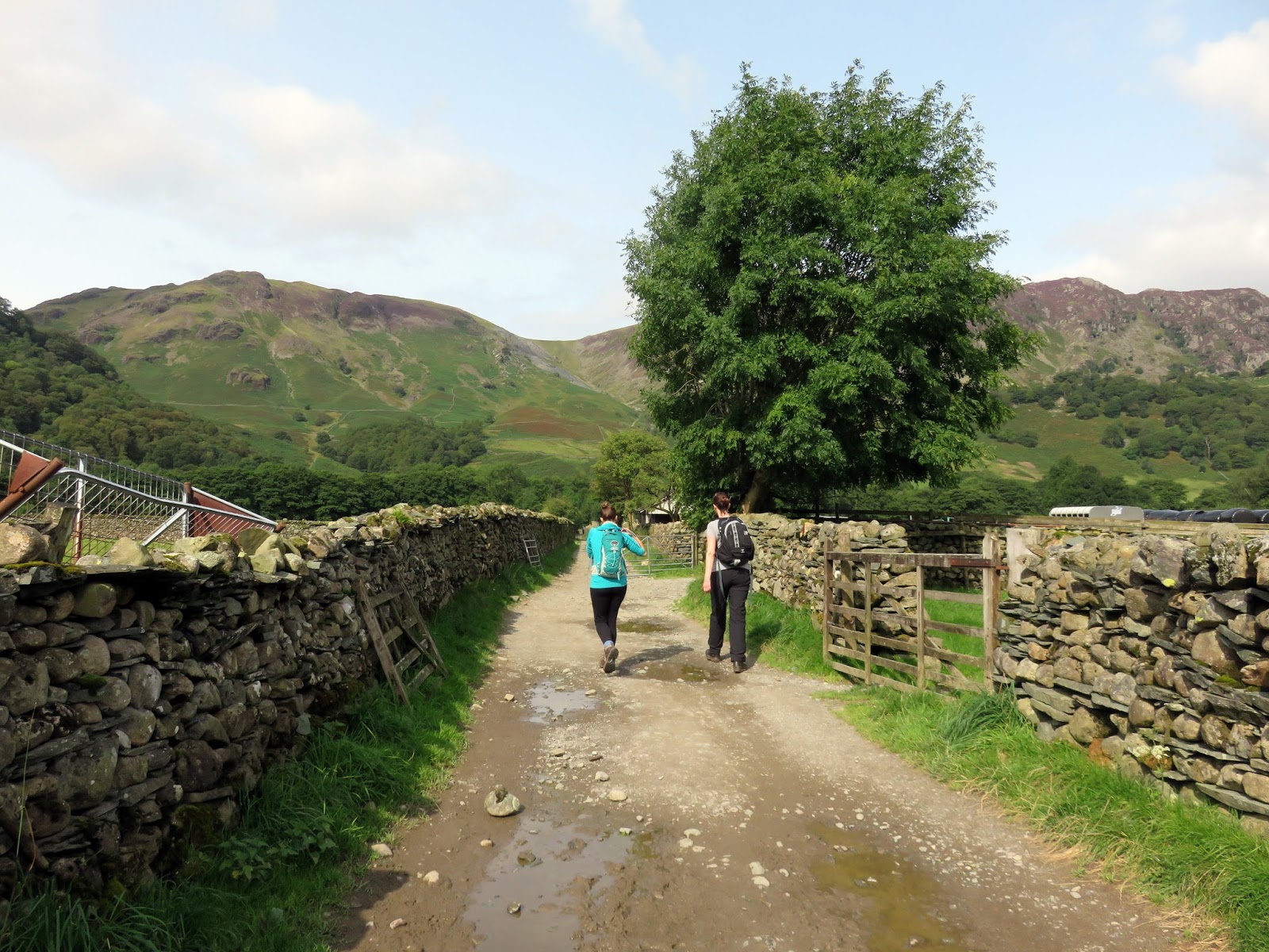
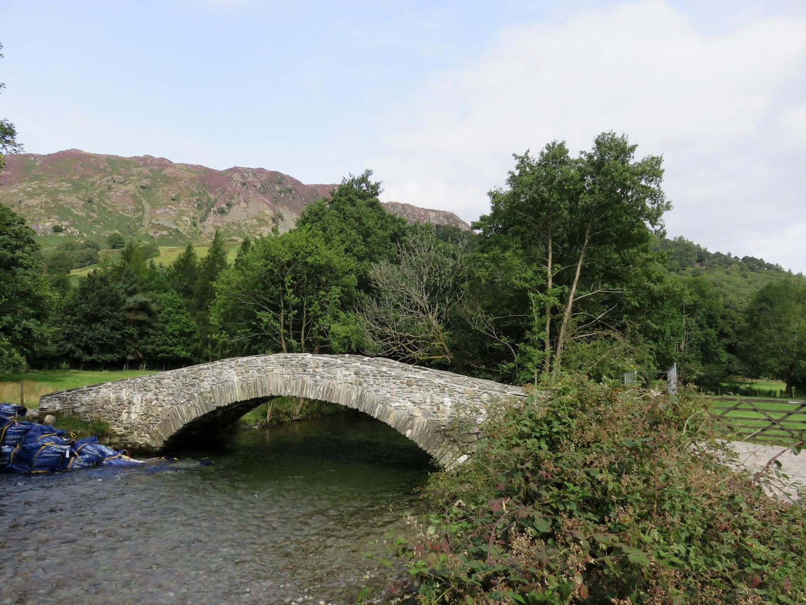
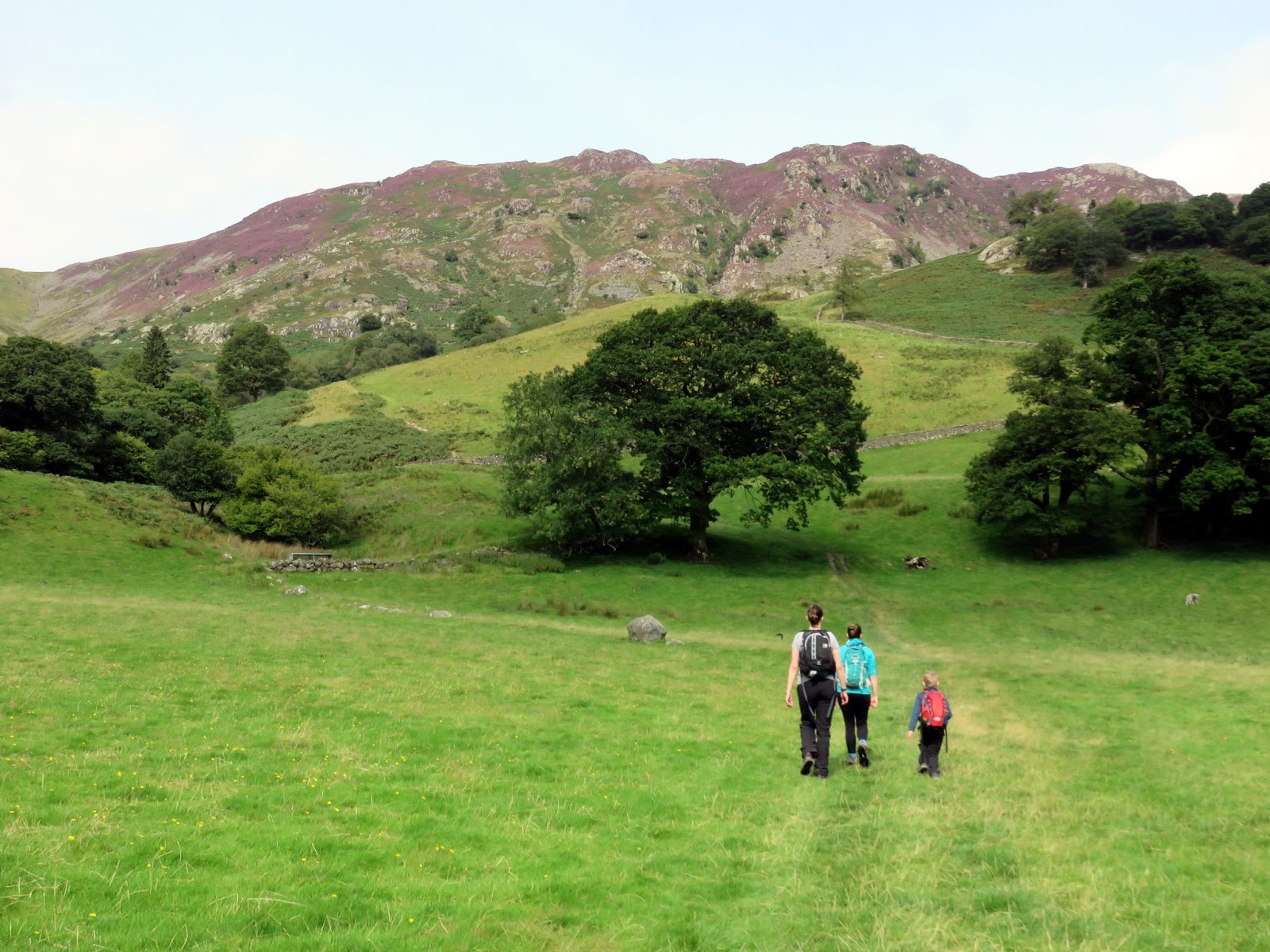
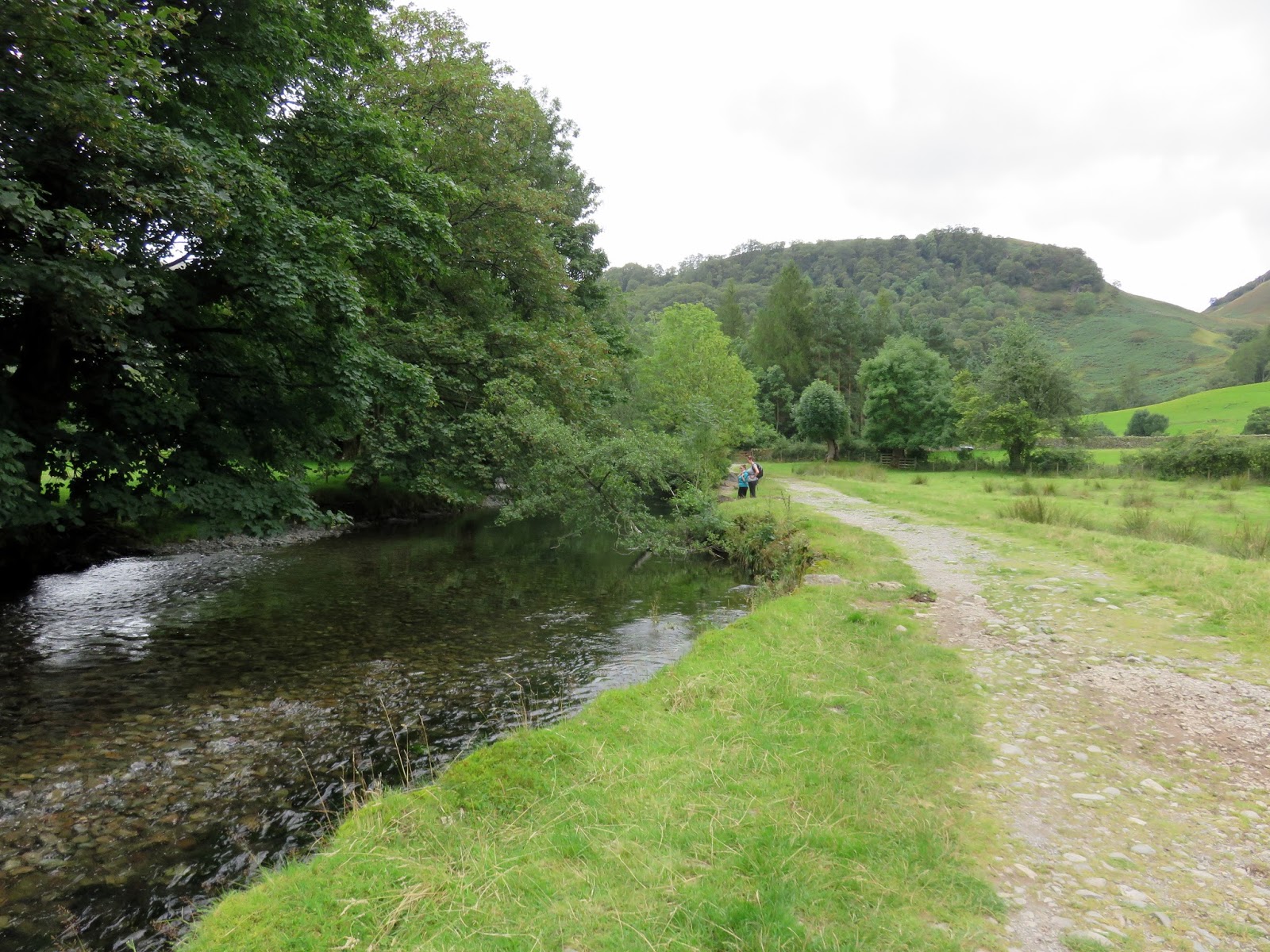
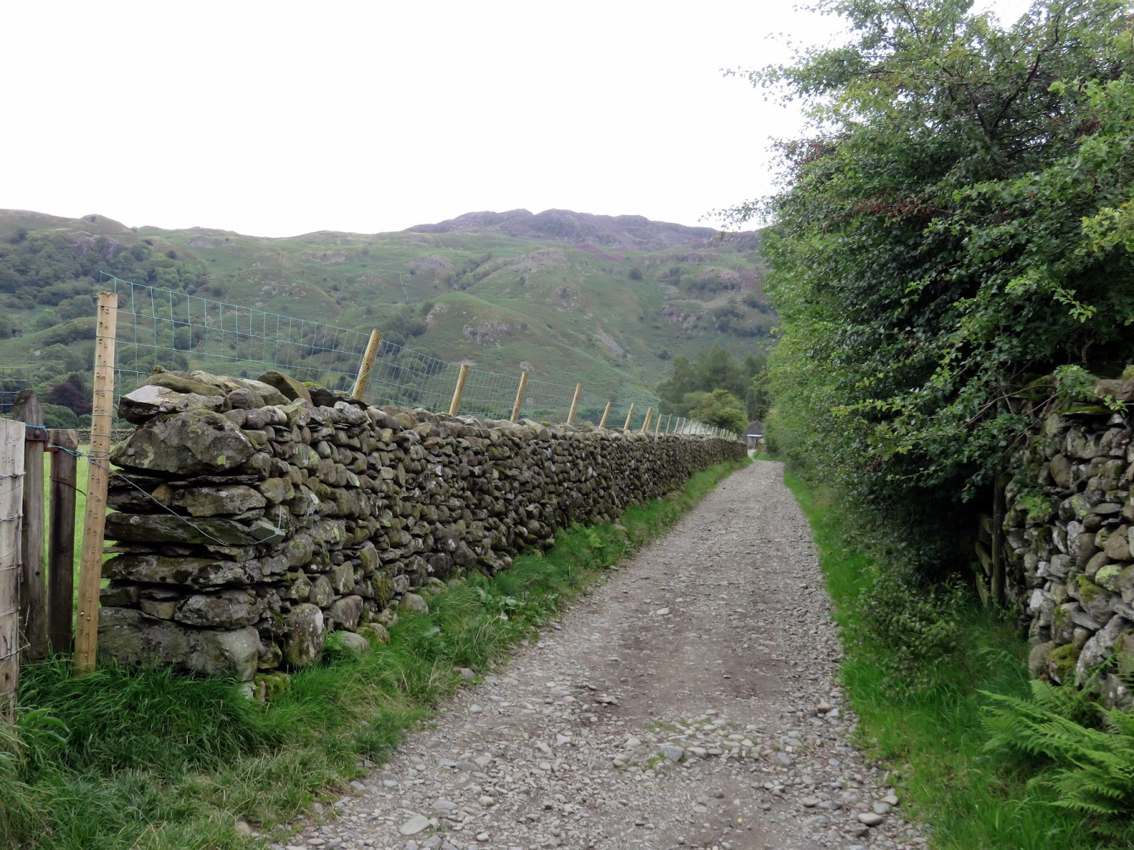
We actually ended up parking in the car park of the Scafell Hotel as the National Trust car park was already full. We set off, passing the village tea rooms to follow a track between stone walls. We soon found ourselves alongside the River Derwent, on the Cumbria Way. The river needs to be crossed and can be achieved by means of stepping stones or via New Bridge, a beautiful single arch stone bridge, a short distance further along the path.
 |
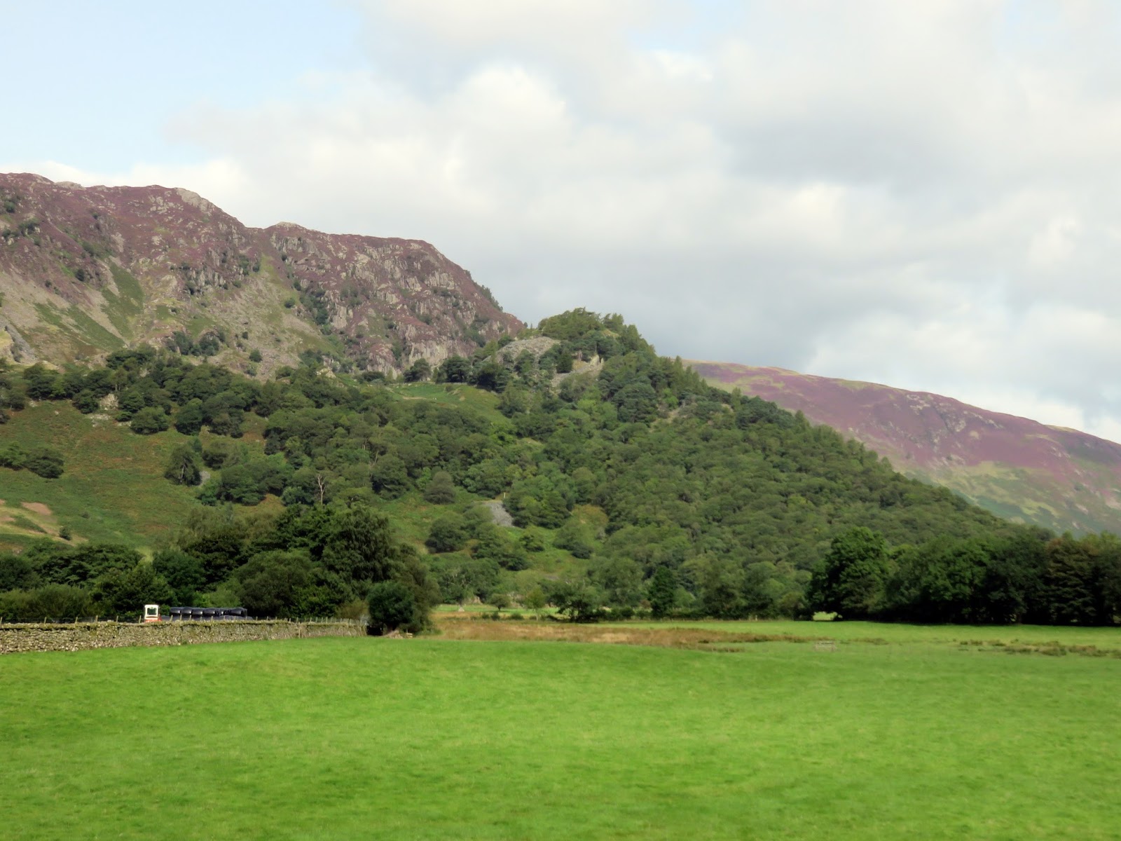
| Grange Fell |
 |
| The Cumbria Way as it leads out of Rosthwaite |
 |
| New Bridge over the River Derwent |
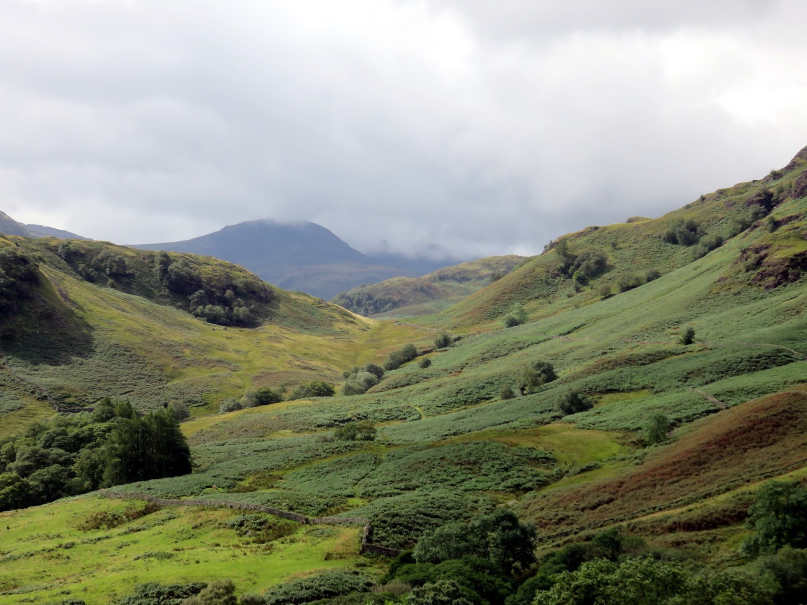
After crossing the river, we left the Cumbria Way, passing through a gate into open fields/ The way ahead gate leads across a field to a stile at its top end and continues up the slopes of Lingy Bank.
 |
| Heading for Lingy Bank |
 |
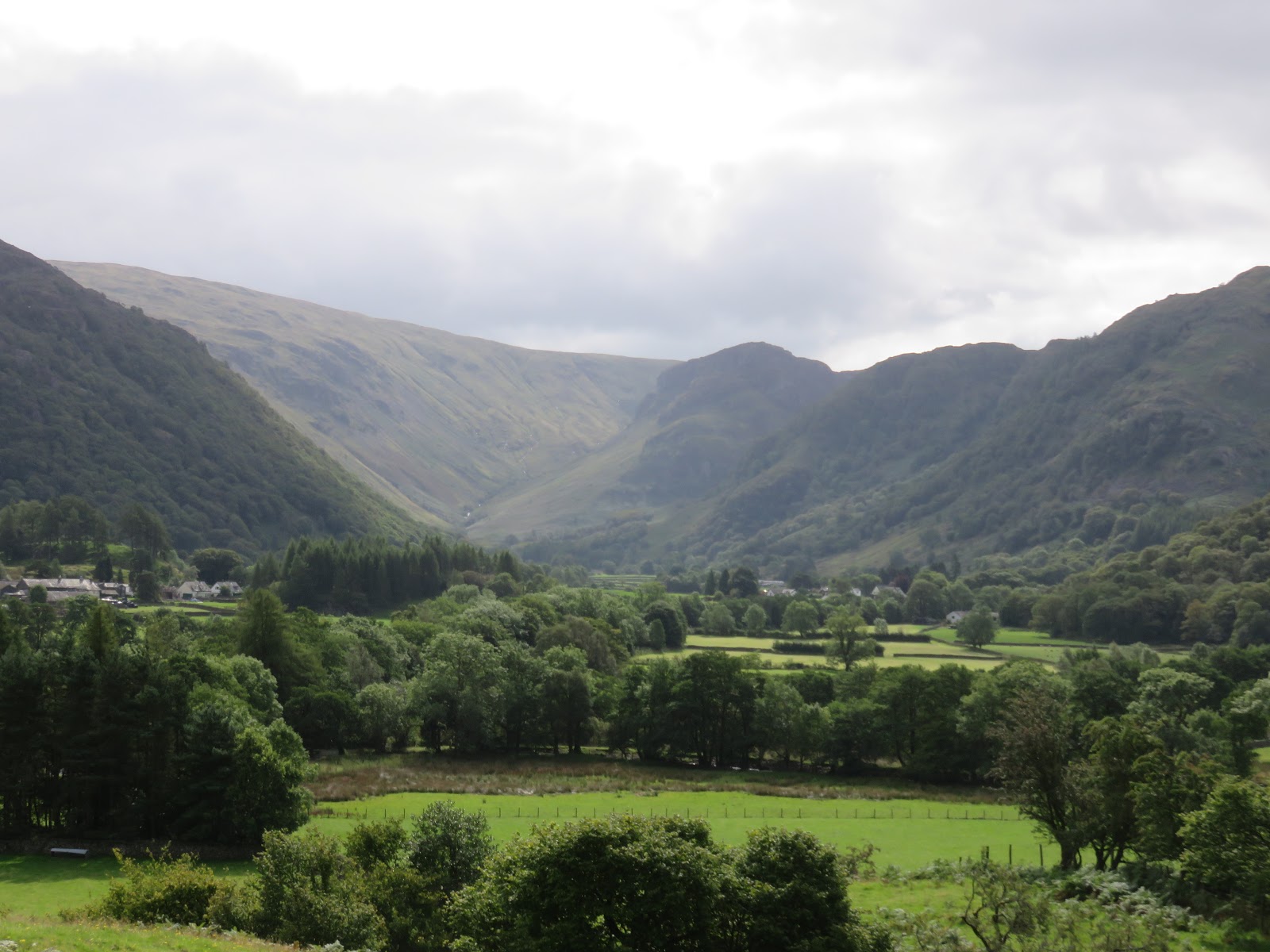
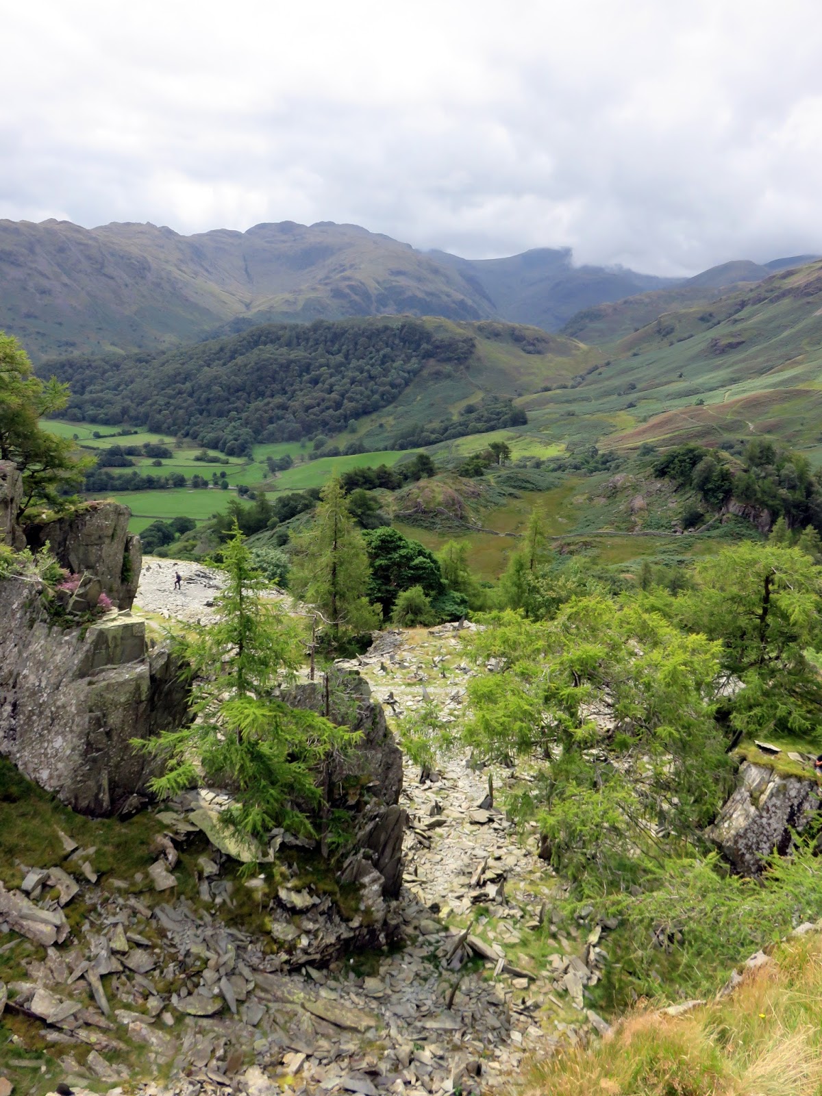
| Hazy views along Stonethwaite |
 |
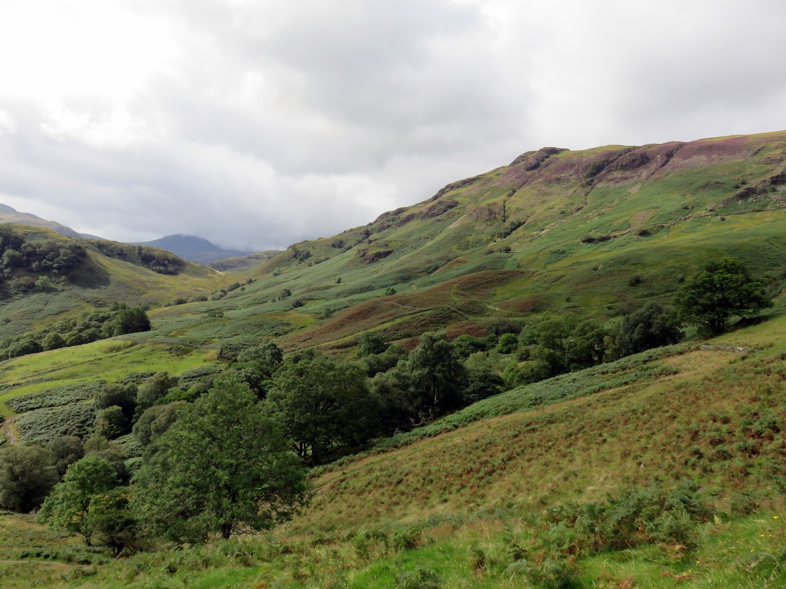
| Low Scawdel |
 |
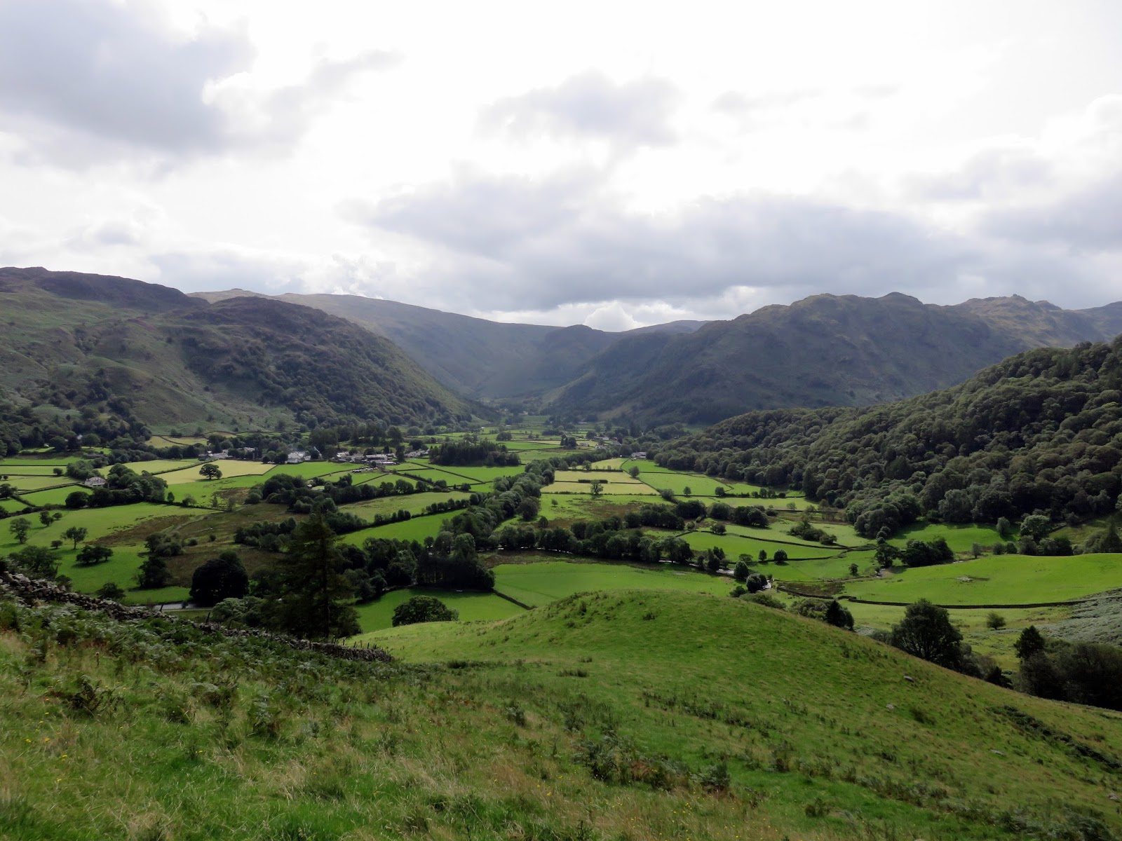
| Borrowdale |
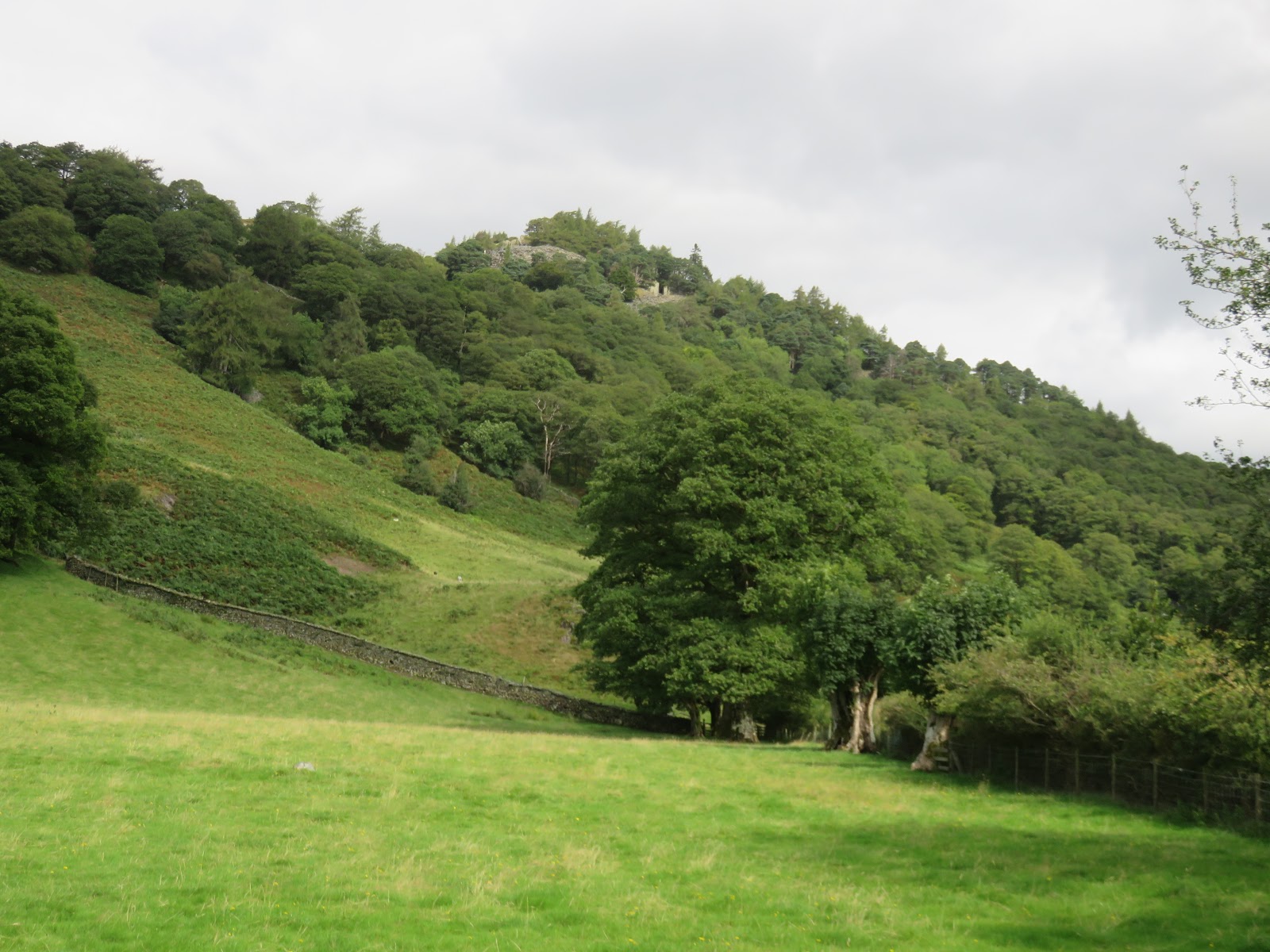
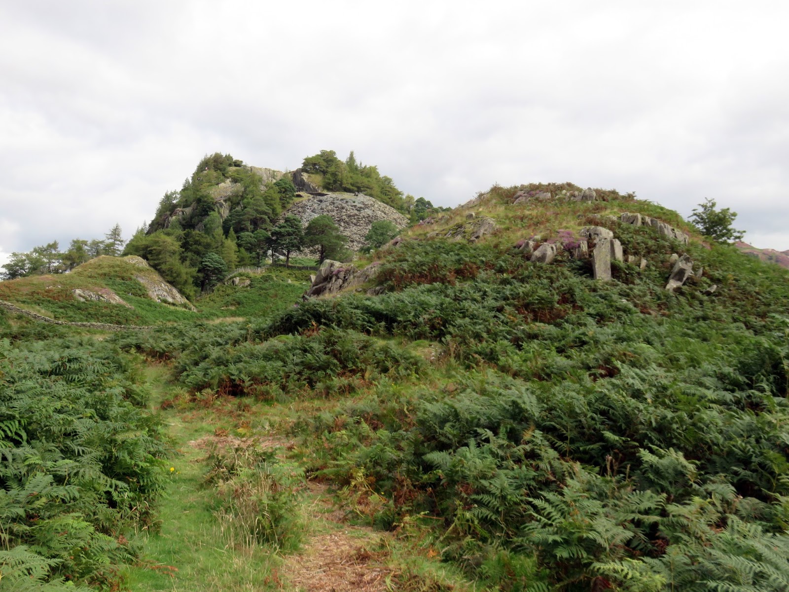
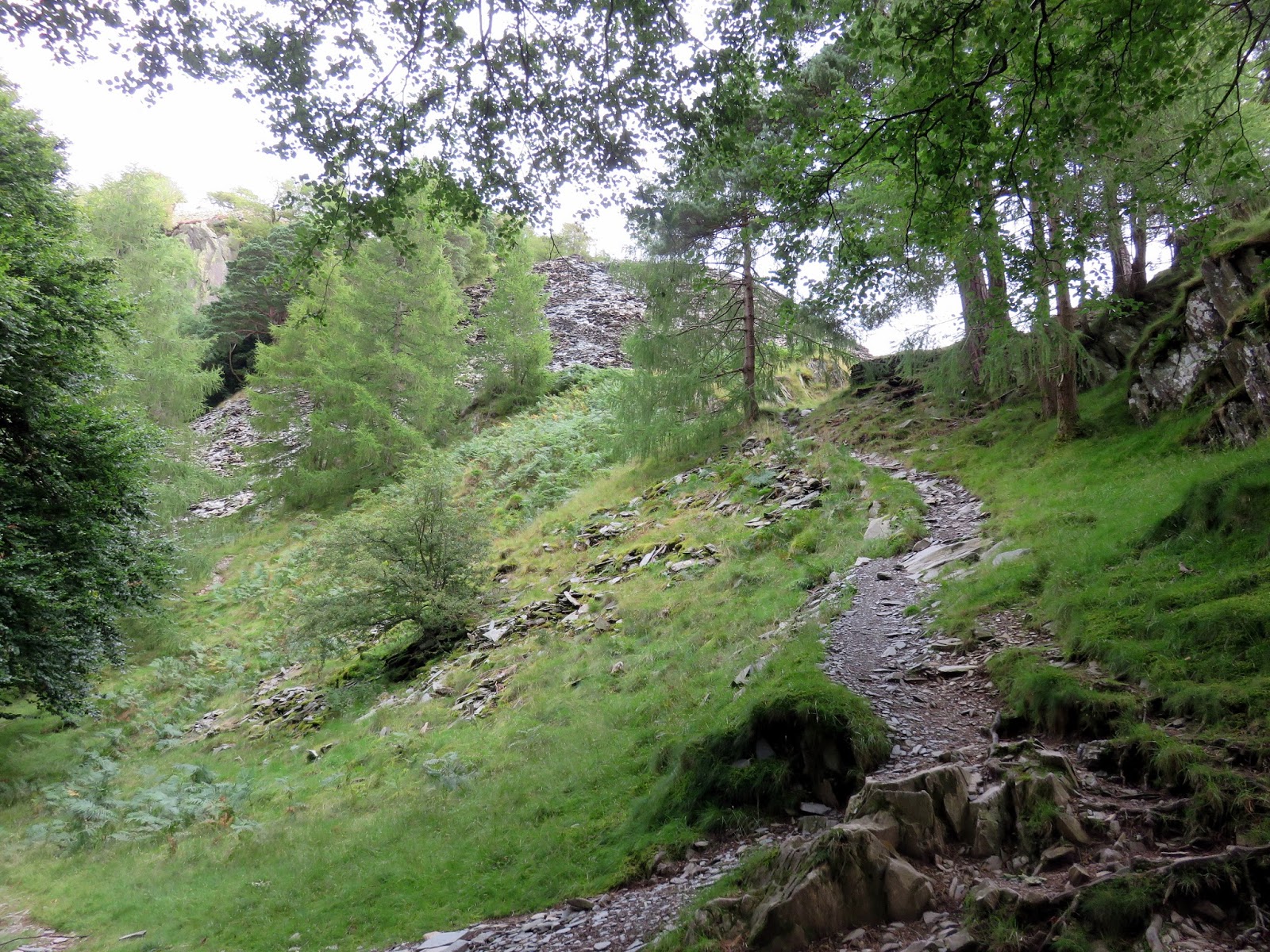
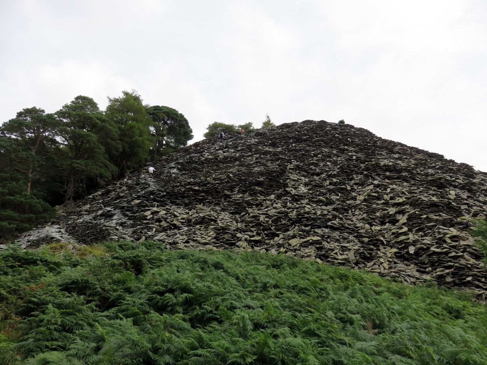
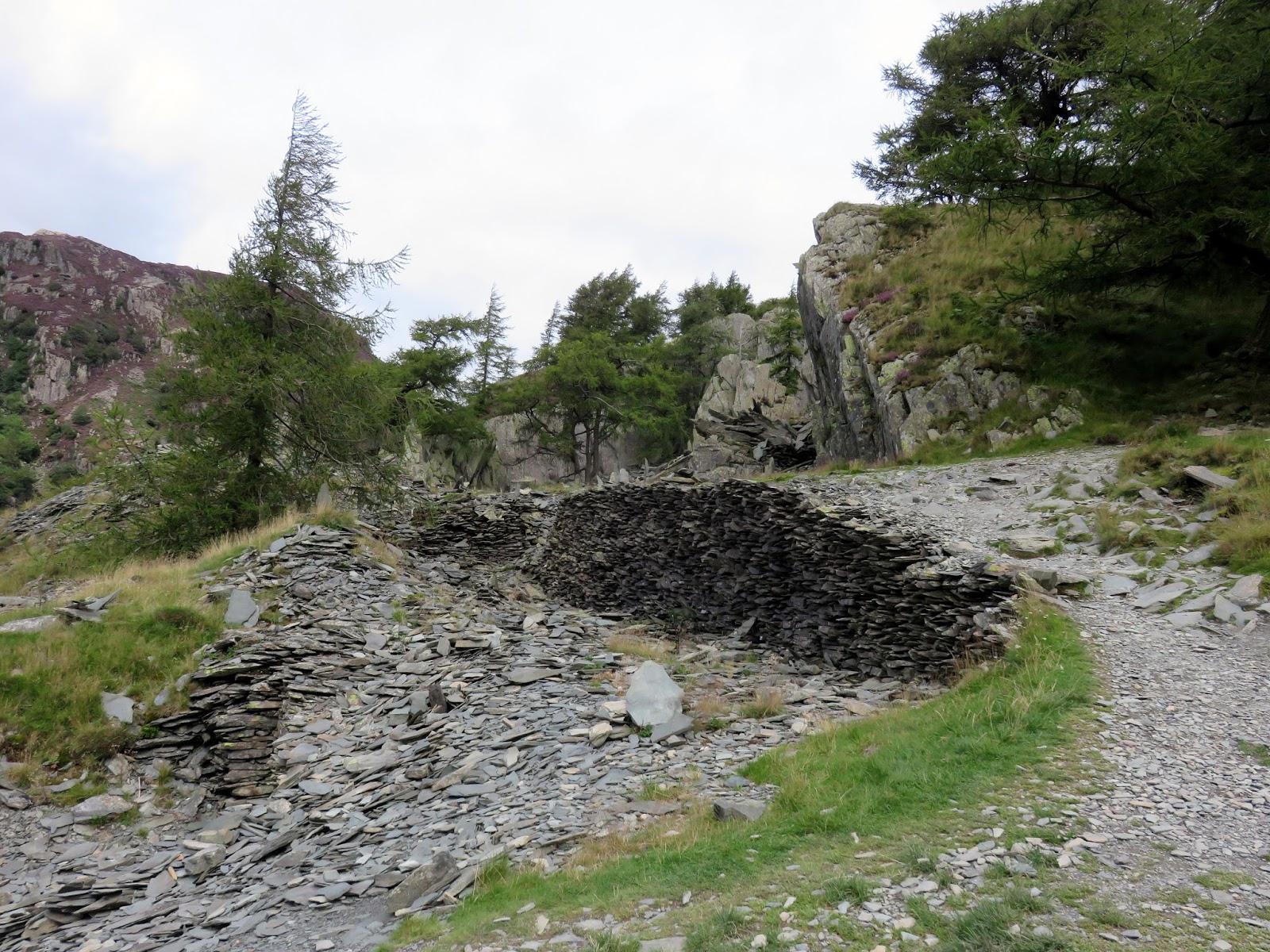
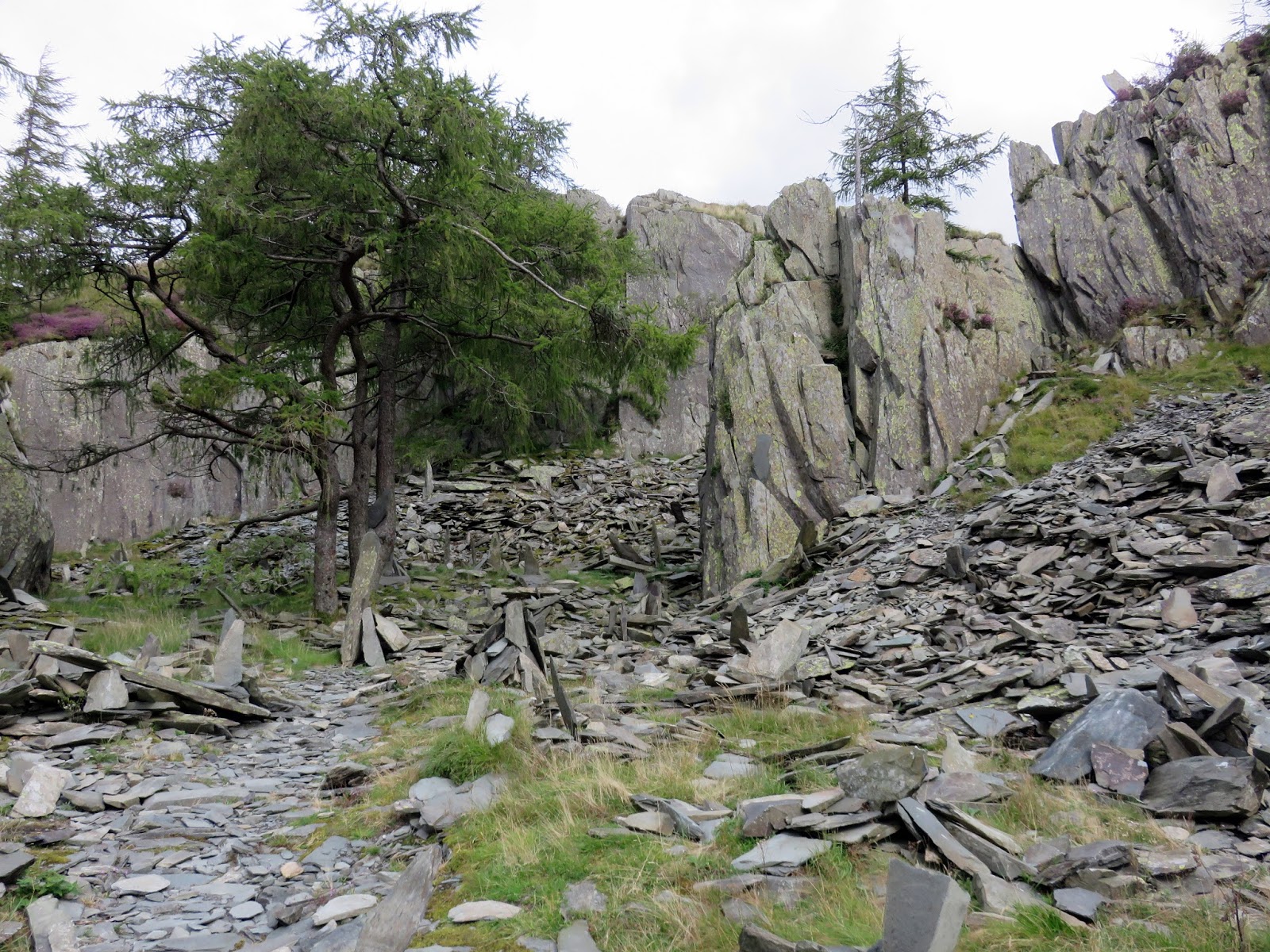
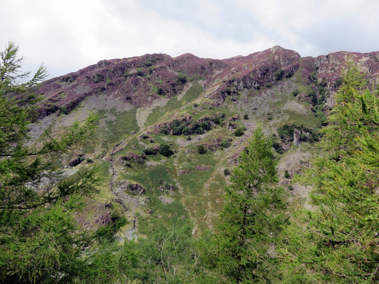
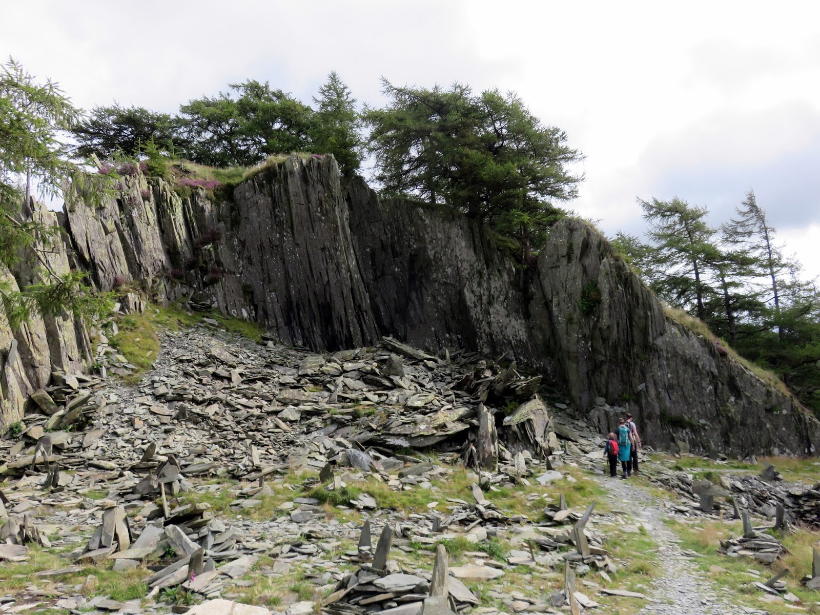
After cutting across a marsh, we reached the base of a large spoil heap. From below, the spoil heap looks like a treacherous pile of loose stones; but a well-beaten path winds its way up the mound. It is the waste from a quarry which is found on Castle Crag’s summit.
 |
| Approaching the spoil heap |
 |
| The path winds up the slope |
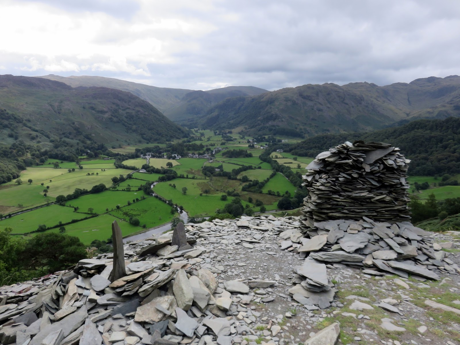
The path is short but steep, wasting no time getting to the top of the pile and back onto true terra firma. This is the most interesting part of the walk, for you begin to pass through weird piles of slate, creating bizarre formations, sticking out at all angles. The views into Stonethwaite from the top of the spoil heap are tremendous.
 |
| Borrowdale from the top of the slate pile |
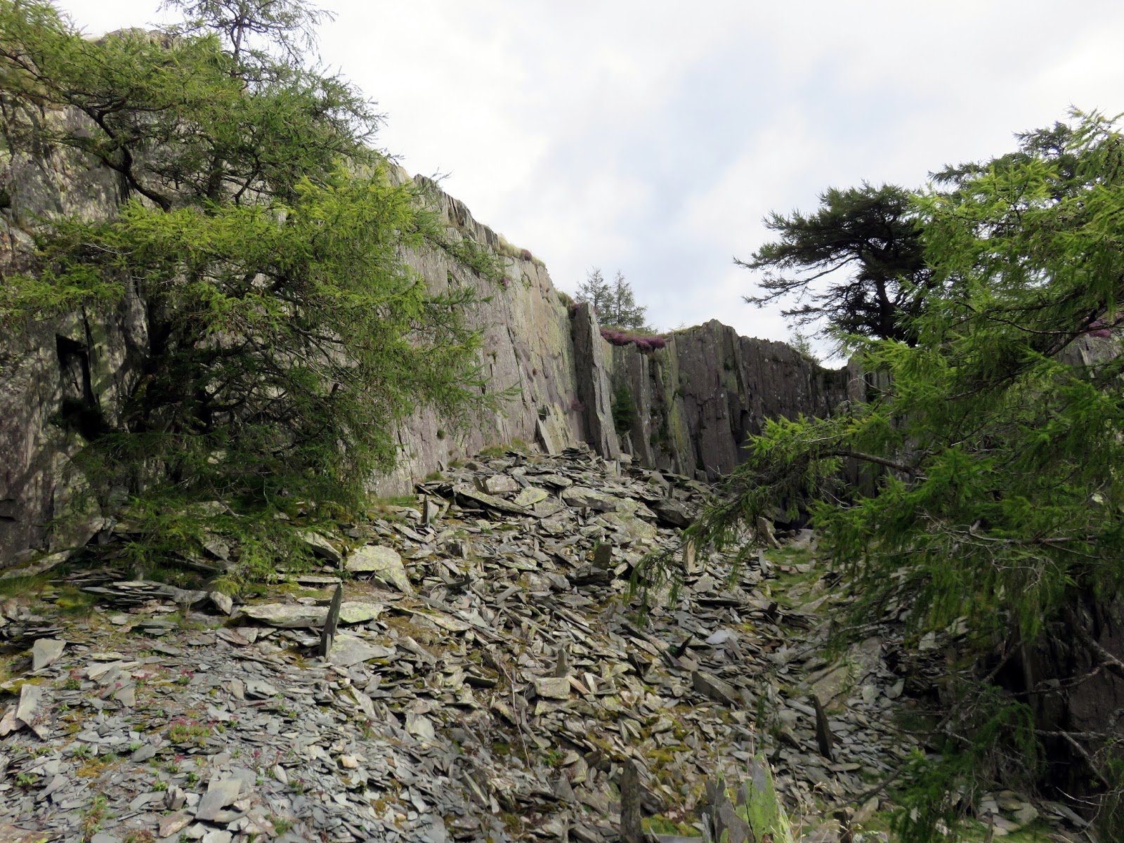
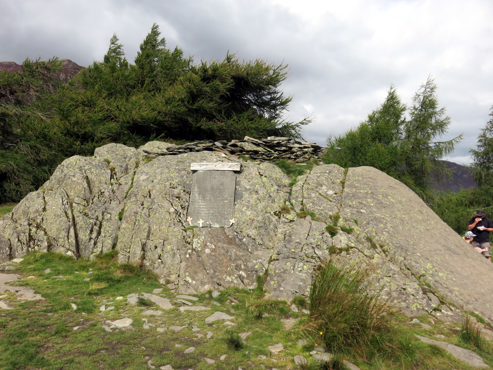
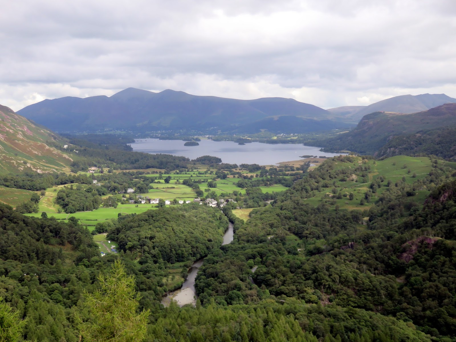
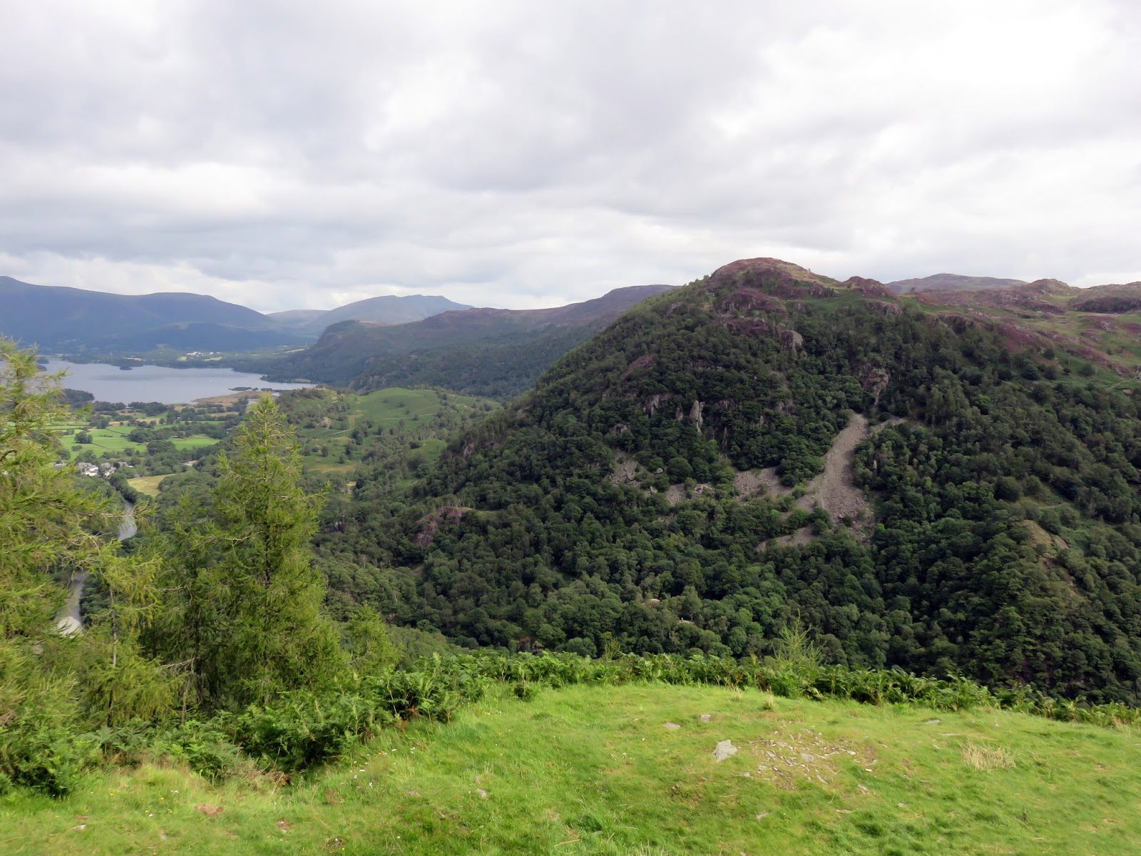
The top of Castle Crag stands above the old quarry, accessed by a winding path through the trees. The summit area is believed to have been an ancient hill fort. The very highest point is a rock outcrop with a memorial to Borrowdale men killed in World War I is affixed to the side. This time, the views along Derwentwater to Skiddaw are the highlight.
 |
| The quarry once again |
 |
| …and one more for good measure |
 |
| A closeup of Low Scawdel |
 |
| The quarry and curious slate creations |
 |
| The summit outcrop |
 |
| Looking over the quarry into Borrowdale |
 |
| Kings How |
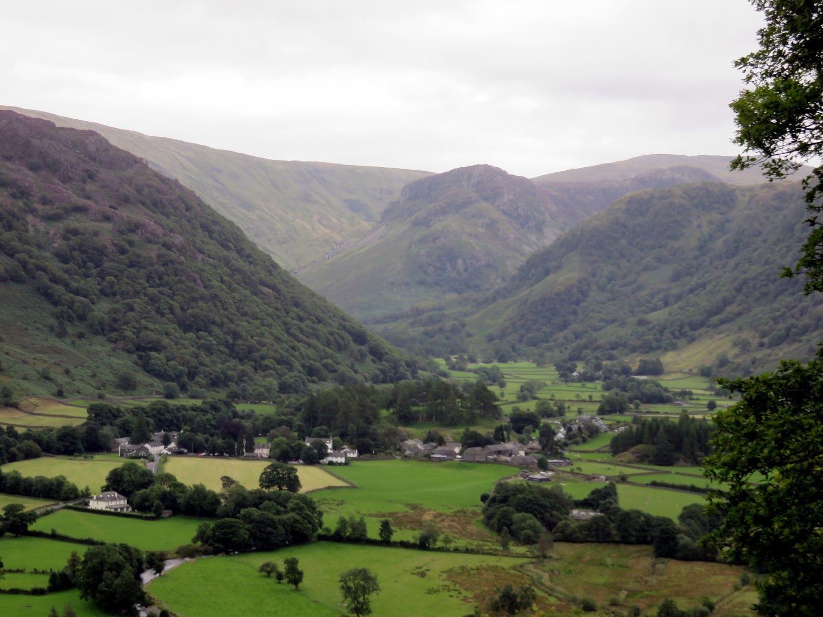
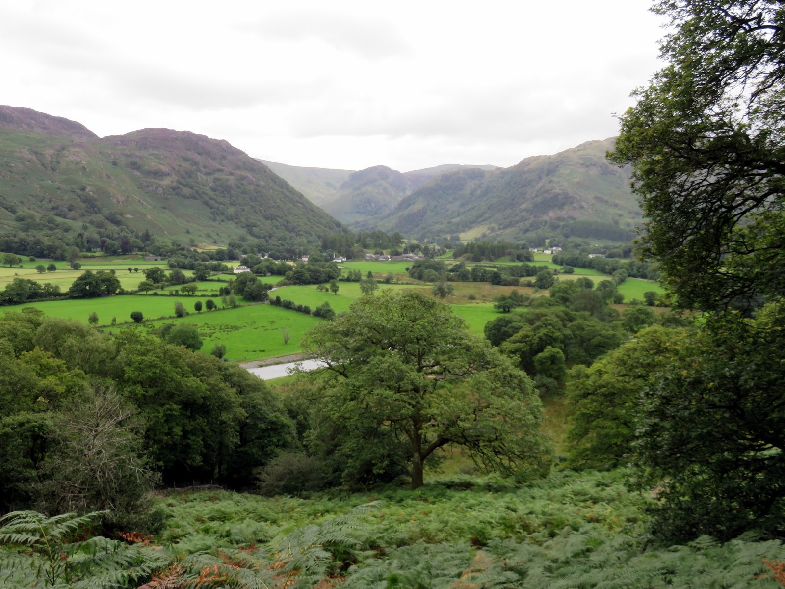
We began our return to Rosthwaite by skidding back down the slate pile to the bottom, this time picking up the path which heads into the woods towards the River Derwent. A series of stone steps carry the path most of the way until it reaches the Cumbria Way by the riverside. From here, it’s a simple case of following the Cumbria Way and retracting the route back to Rosthwaite.
 |
| Rosthwaite |
 |
| Borrowdale |
 |
| The River Derwent and the Cumbria Way |
 |
| The Cumbria Way leading back into Rosthwaite |


