Open Space Web-Map builder Codehttps://openspace.ordnancesurvey.co.uk/osmapapi/openspace.js?key=3119F72552FD5C22E0530C6CA40A5A92https://openspace.ordnancesurvey.co.uk/osmapapi/script/mapbuilder/basicmap.jshttps://openspace.ordnancesurvey.co.uk/osmapapi/script/mapbuilder/searchbox.js//variables for routes var linesLayer, points, lineFeature, lineString, routeMarkersLayer, routepos, routesize, routeoffset, routeicon; var style_blue = {strokeColor: “#0000CD”, strokeOpacity: 0.5, strokeWidth: 4.5}; function initmapbuilder() { //initiate the map var options = {resolutions: [2500, 1000, 500, 200, 100, 50, 25, 10, 5, 4, 2.5, 2, 1]}; osMap = new OpenSpace.Map(‘map’, options); //configure map options (basicmap.js) setglobaloptions(); //set the center of the map and the zoom level osMap.setCenter(new OpenSpace.MapPoint(401533.97941066,462116.02058934),7); linesLayer = osMap.getVectorLayer(); // Set up layer for route markers routeMarkersLayer = new OpenLayers.Layer.Markers(“Route Markers”); //make a route points = new Array(); points.push(new OpenLayers.Geometry.Point(403239,461167)); points.push(new OpenLayers.Geometry.Point(403314,461402)); points.push(new OpenLayers.Geometry.Point(403284,461542)); points.push(new OpenLayers.Geometry.Point(403134,461697)); points.push(new OpenLayers.Geometry.Point(403079,461727)); points.push(new OpenLayers.Geometry.Point(402944,461722)); points.push(new OpenLayers.Geometry.Point(402709,461882)); points.push(new OpenLayers.Geometry.Point(402674,462077)); points.push(new OpenLayers.Geometry.Point(402554,462217)); points.push(new OpenLayers.Geometry.Point(402489,462327)); points.push(new OpenLayers.Geometry.Point(402589,462402)); points.push(new OpenLayers.Geometry.Point(402284,462512)); points.push(new OpenLayers.Geometry.Point(402069,462592)); points.push(new OpenLayers.Geometry.Point(401729,462607)); points.push(new OpenLayers.Geometry.Point(401599,462682)); points.push(new OpenLayers.Geometry.Point(401419,462727)); points.push(new OpenLayers.Geometry.Point(400984,462892)); points.push(new OpenLayers.Geometry.Point(400849,463037)); points.push(new OpenLayers.Geometry.Point(400774,463072)); points.push(new OpenLayers.Geometry.Point(400699,463237)); points.push(new OpenLayers.Geometry.Point(400664,463307)); points.push(new OpenLayers.Geometry.Point(400589,463347)); points.push(new OpenLayers.Geometry.Point(400384,463322)); points.push(new OpenLayers.Geometry.Point(400304,463287)); points.push(new OpenLayers.Geometry.Point(400219,463297)); points.push(new OpenLayers.Geometry.Point(400129,463352)); points.push(new OpenLayers.Geometry.Point(400029,463277)); points.push(new OpenLayers.Geometry.Point(400154,463197)); points.push(new OpenLayers.Geometry.Point(400274,463167)); points.push(new OpenLayers.Geometry.Point(400184,462932)); points.push(new OpenLayers.Geometry.Point(400059,462912)); points.push(new OpenLayers.Geometry.Point(399919,462852)); points.push(new OpenLayers.Geometry.Point(399789,462837)); points.push(new OpenLayers.Geometry.Point(399739,462787)); points.push(new OpenLayers.Geometry.Point(399764,462657)); points.push(new OpenLayers.Geometry.Point(399859,462627)); points.push(new OpenLayers.Geometry.Point(399954,462527)); points.push(new OpenLayers.Geometry.Point(400074,462497)); points.push(new OpenLayers.Geometry.Point(400429,462192)); points.push(new OpenLayers.Geometry.Point(400524,462167)); points.push(new OpenLayers.Geometry.Point(400539,462097)); points.push(new OpenLayers.Geometry.Point(400651,462122)); points.push(new OpenLayers.Geometry.Point(400739,462074)); points.push(new OpenLayers.Geometry.Point(400915,462038)); points.push(new OpenLayers.Geometry.Point(401003,462002)); points.push(new OpenLayers.Geometry.Point(401147,462022)); points.push(new OpenLayers.Geometry.Point(401247,461950)); points.push(new OpenLayers.Geometry.Point(401265,461835)); points.push(new OpenLayers.Geometry.Point(401337,461815)); points.push(new OpenLayers.Geometry.Point(401509,461891)); points.push(new OpenLayers.Geometry.Point(401599,461836)); points.push(new OpenLayers.Geometry.Point(401744,461831)); points.push(new OpenLayers.Geometry.Point(401854,461686)); points.push(new OpenLayers.Geometry.Point(402139,461726)); points.push(new OpenLayers.Geometry.Point(402309,461731)); points.push(new OpenLayers.Geometry.Point(402524,461751)); points.push(new OpenLayers.Geometry.Point(402724,461696)); points.push(new OpenLayers.Geometry.Point(402759,461591)); points.push(new OpenLayers.Geometry.Point(403069,461421)); points.push(new OpenLayers.Geometry.Point(403109,461361)); points.push(new OpenLayers.Geometry.Point(403194,461281)); points.push(new OpenLayers.Geometry.Point(403239,461167)); // create a polyline feature from the array of points lineString = new OpenLayers.Geometry.LineString(points); lineFeature = new OpenLayers.Feature.Vector(lineString, null, style_blue); linesLayer.addFeatures([lineFeature]); //crate a route start/end marker routepos = new OpenSpace.MapPoint(403239,461167); routesize = new OpenLayers.Size(33,45); routeoffset = new OpenLayers.Pixel(-5,-37); routeicon = new OpenSpace.Icon(‘https://openspace.ordnancesurvey.co.uk/osmapapi/img_versions/img_1.1/mapbuilder/routemarker-startend.png’, routesize, routeoffset, null, null); routeMarkersLayer.addMarker(new OpenLayers.Marker(routepos, routeicon)); osMap.addLayer(routeMarkersLayer);}
Route: Burnsall, Wilfrid Scar, Loup Scar, Stepping Stones, Dales Way, Lythe House, Linton Falls, Linton, Waddle Lathe, Thorpe Lane, Thorpe, Badger Lane, Burnsall
Date: 05/08/2017
From: Burnsall
Parking: Burnsall
Start Point: The Red Lion Inn
Region: Yorkshire Dales
Route length: 6.2 miles (9.9km)
Time taken: 02:32
Average speed: 2.5mph
Ascent: 311m
Descent: 308m
Points of interest: Burnsall Bridge, Linton Falls
This may only be a short stroll by our usual standards but this is one of our favourite walks, one that we’ve repeated a number of times. It’s a short-ish circular walk that links the two villages of Burnsall and Linton (as you may have guessed from the title) and includes some pretty typical Yorkshire Dales scenery. There is also a pair of fantastic pubs, which probably explains why we’re so fond of it…..
You can start the walk in either Burnsall or Linton; we favour Burnsall because there are more places to leave the car. Arrive early enough and you may even be rewarded with a spot next to the village green.
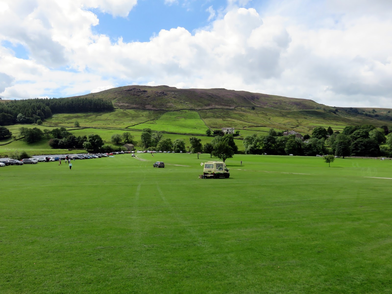
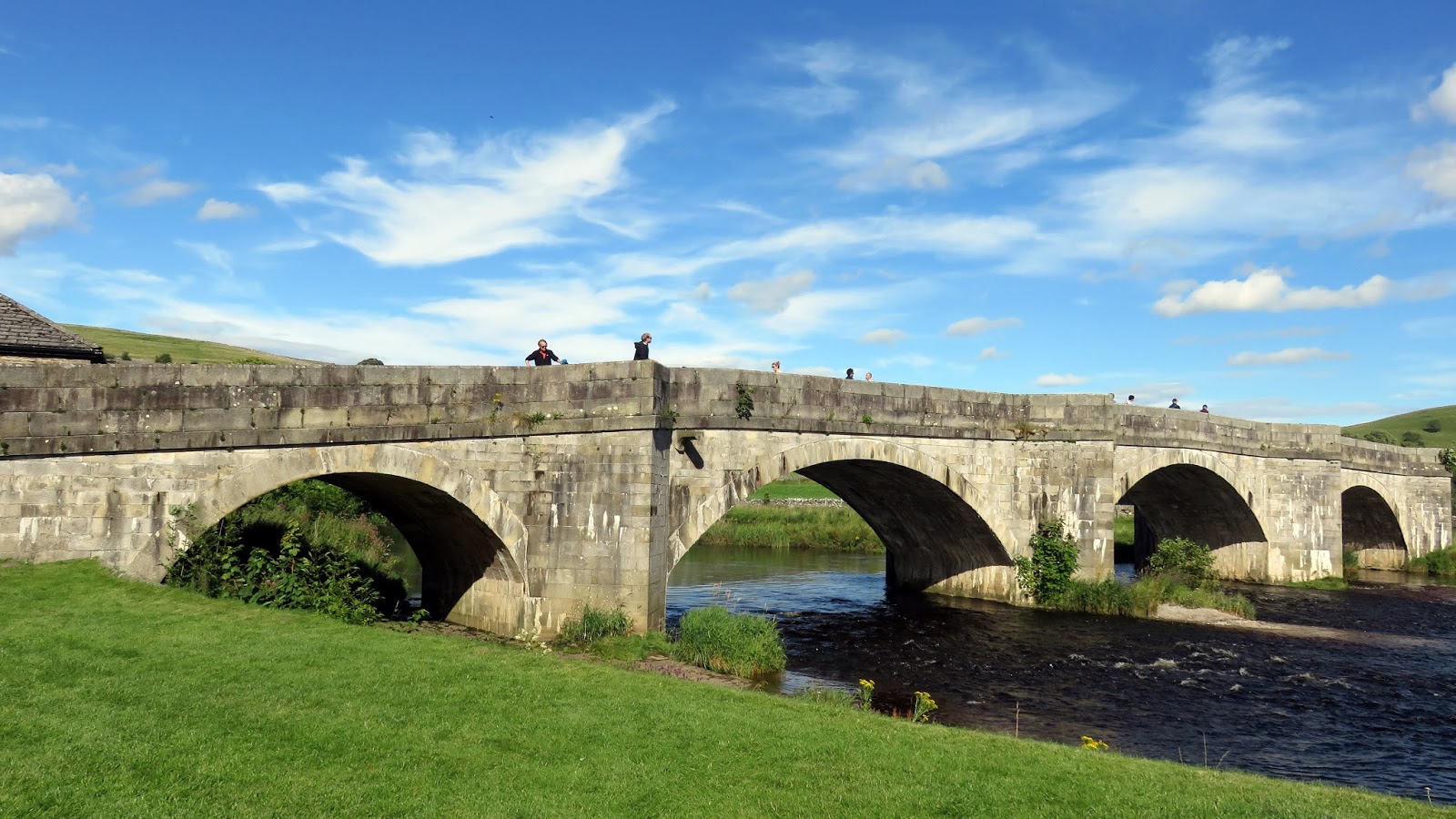
Burnsall is your atypical Yorkshire Dales village; small and picturesque, largely thanks to the stunning 16th Century bridge that spans the River Wharfe while Thorpe Fell provides a suitably impressive backdrop.
 |
| Burnsall and Thorpe Fell |
The village sits right on the Dales Way, an 80 mile route between Ilkley and Bowness in Cumbria and the long distance route leads to our halfway point in Linton. But that’s getting ahead of ourselves a bit.
 |
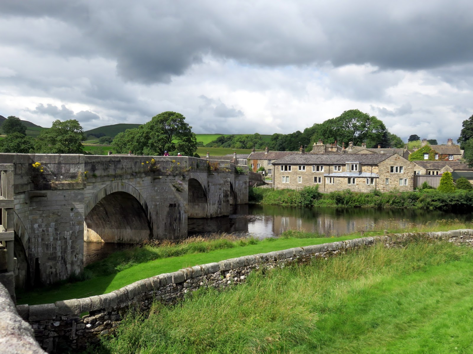
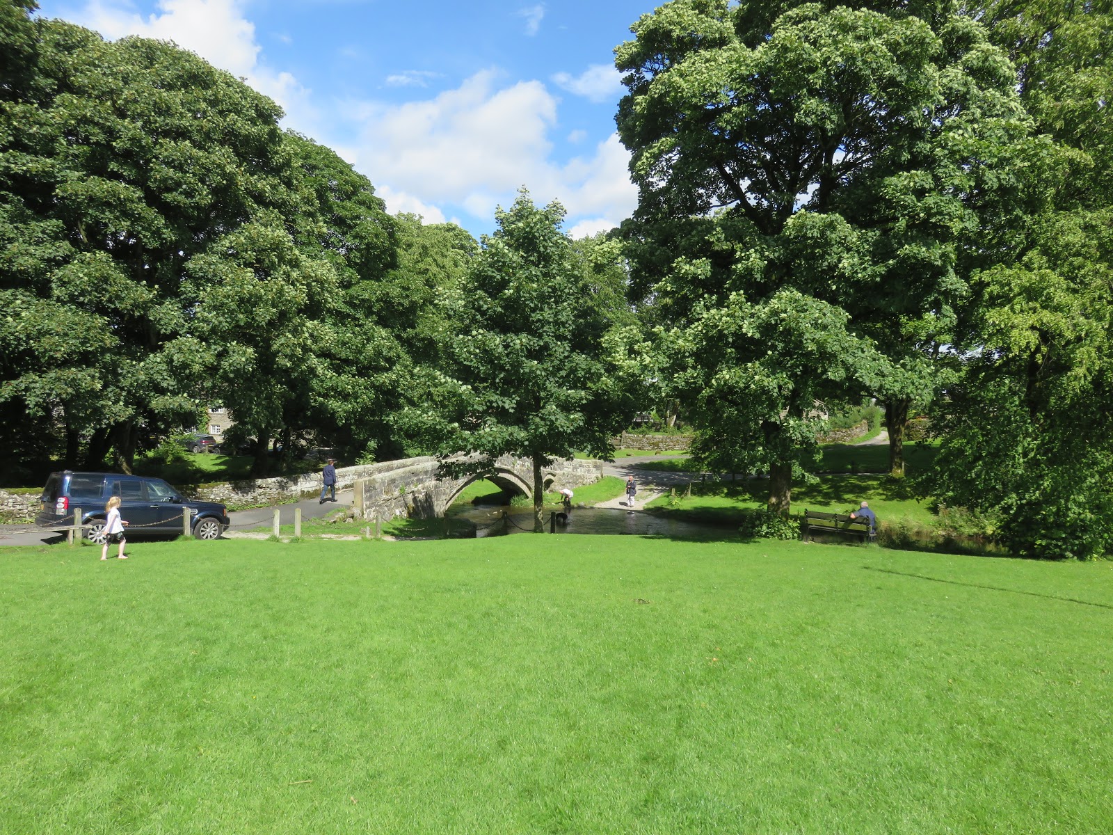
| Burnsall Bridge and the Red Lion |
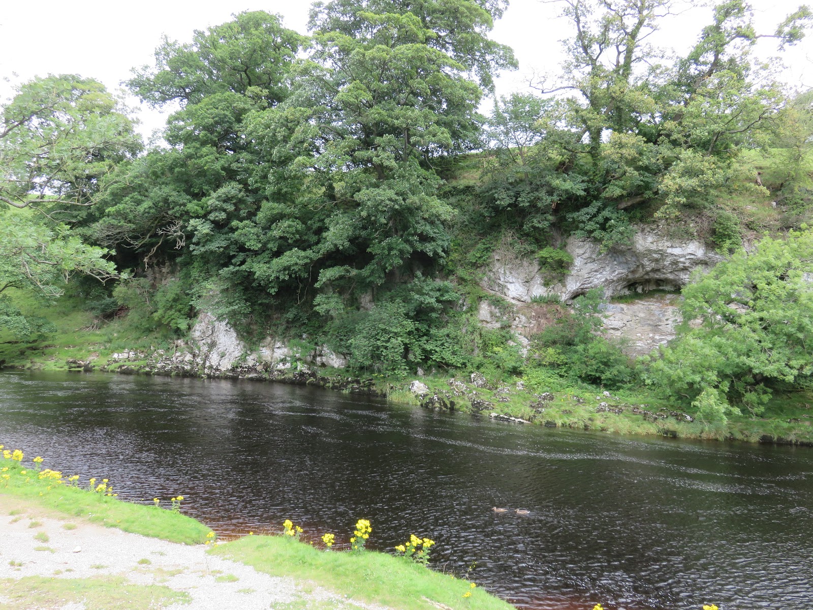
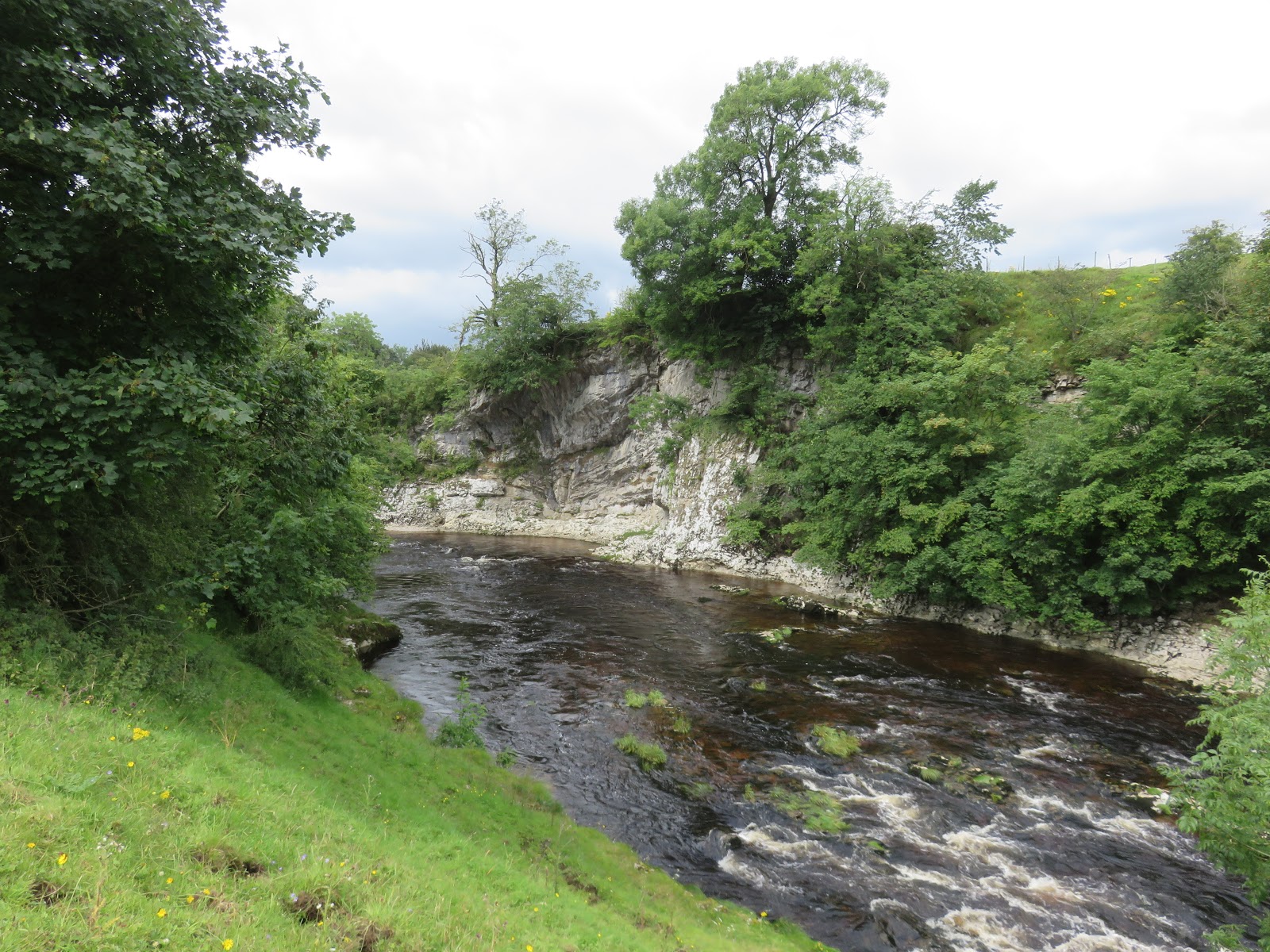
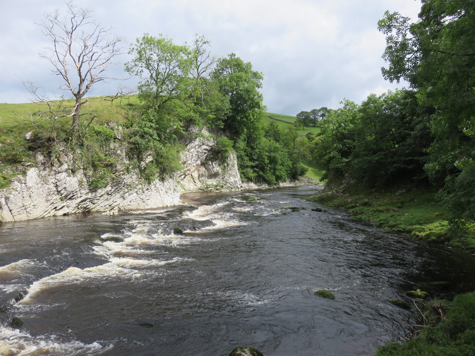
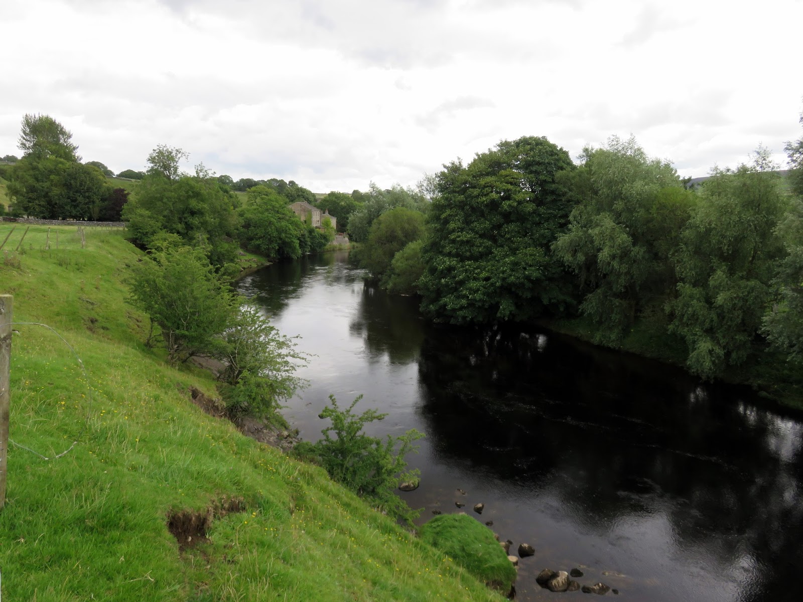
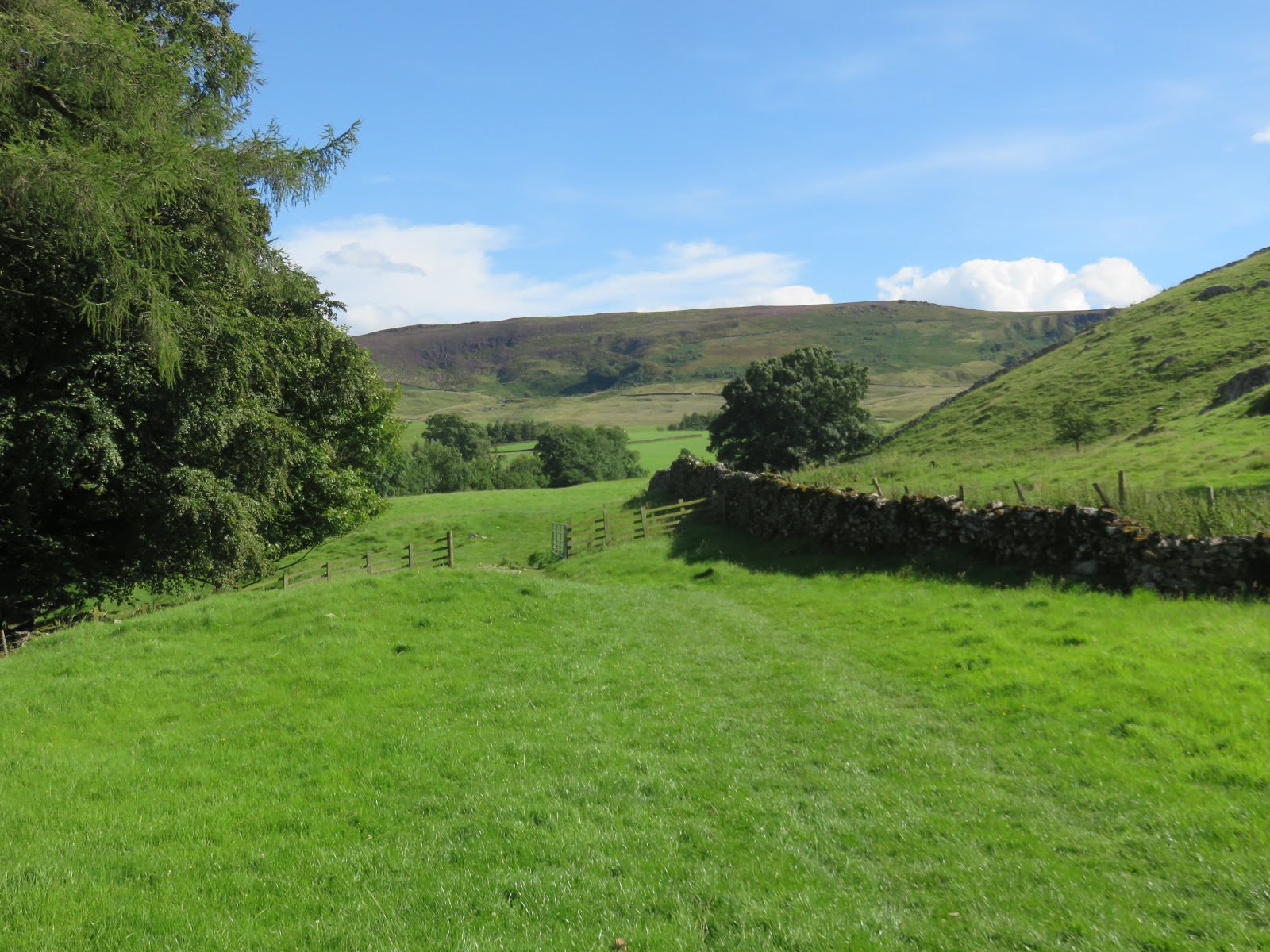
After arriving at Burnsall and crossing the bridge, the Dales Way sandwiches itself between the Red Lion Inn and the River Wharfe, bound for the relative drama of Wilfred Scar. The scar is an interesting contrast to the tranquillity of the river Wharfe as it stroll through Burnsall. The limestone cliff face is the result of the erosive force of the river, undercutting the rock as it passes by. Beyond Wilfred Scar is the equally impressive and slightly narrower Loup Scar, a great place to spend a summers day frolicking in the river, or so I’ve heard.
 |
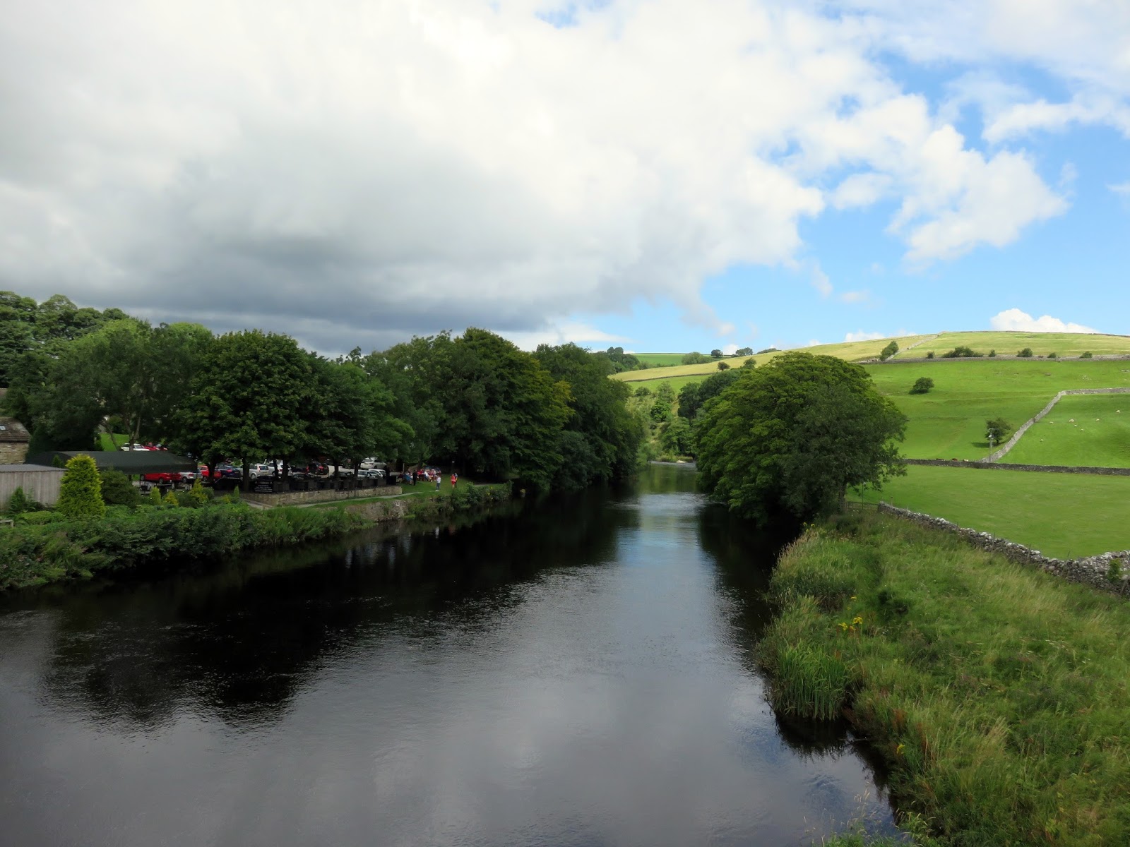
| The River Wharfe |
 |
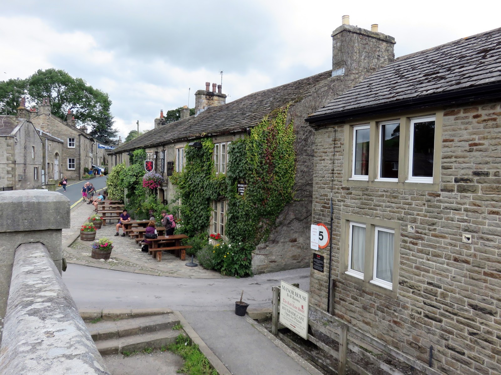
| The Red Lion Inn |
 |
| Wilfrid Scar |
 |
| Loup Scar |
 |
| The River Wharfe at Loup Scar |
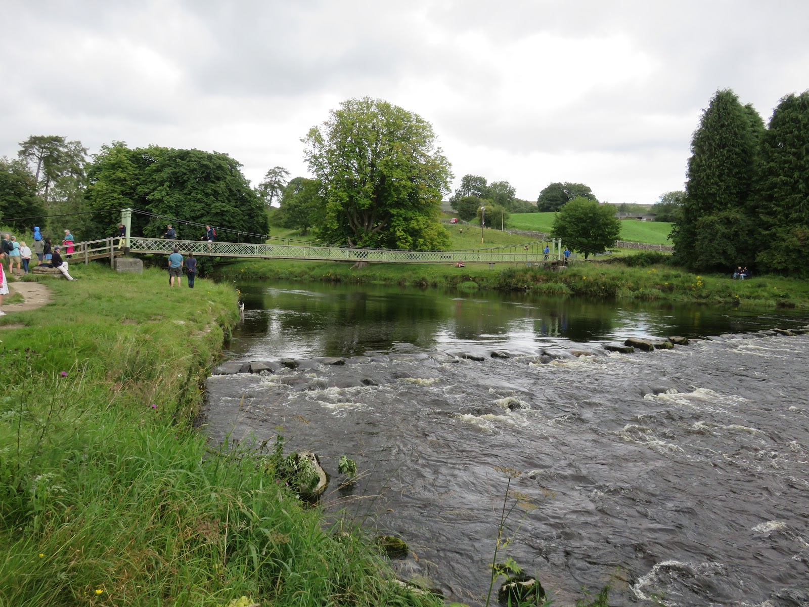
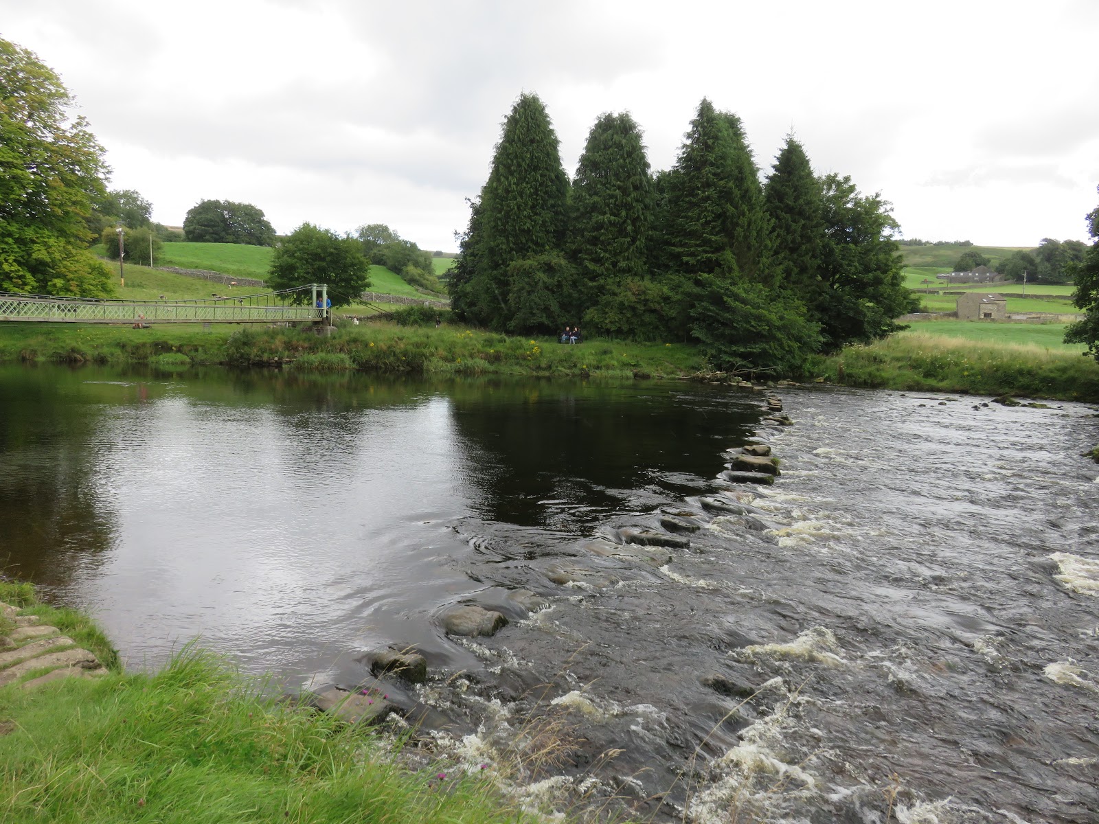
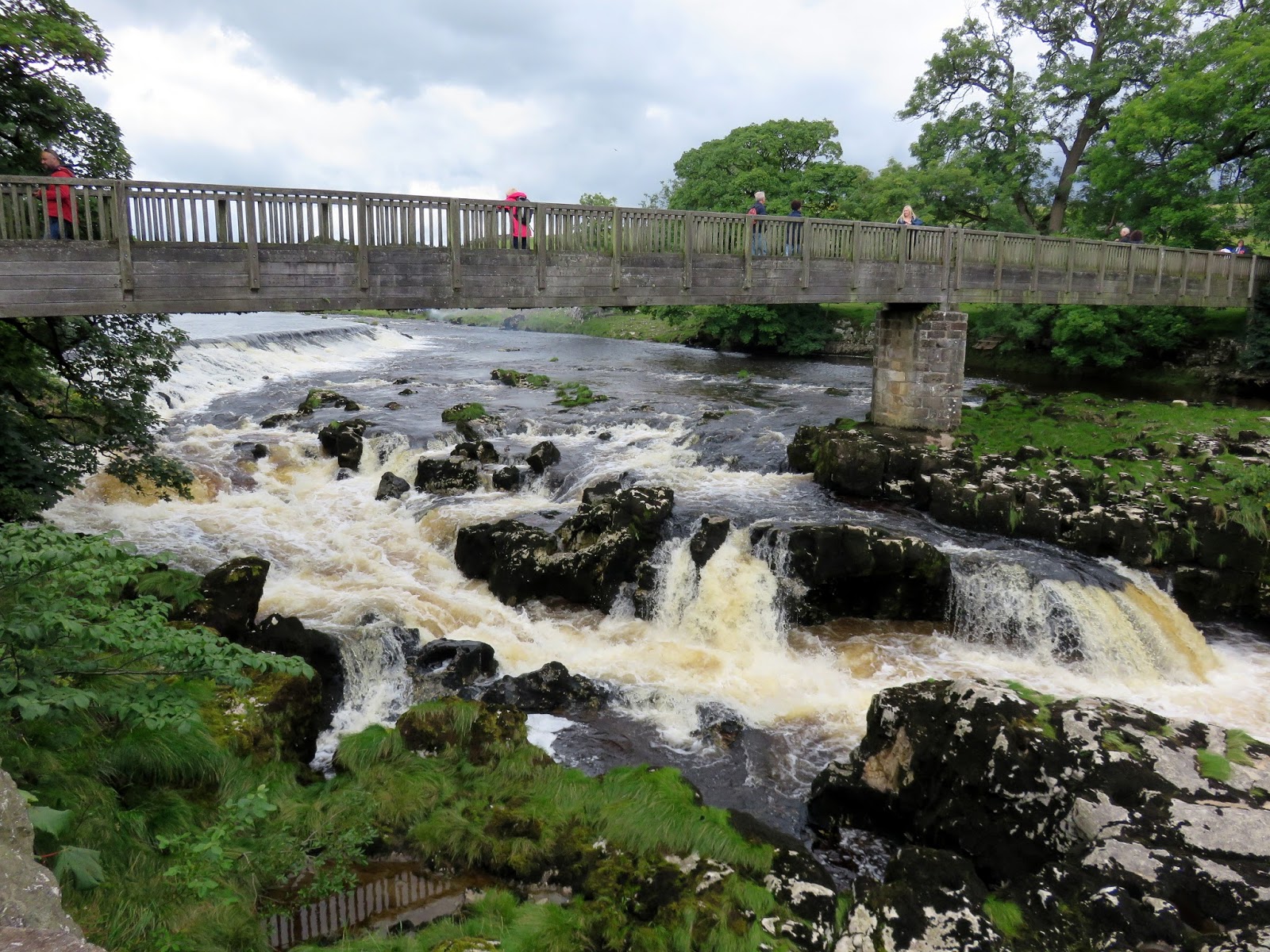
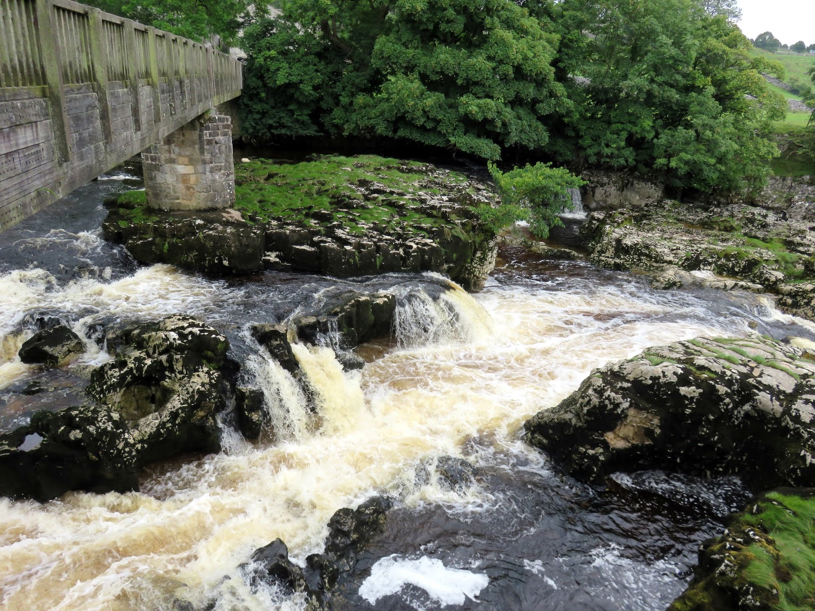
Things calm down a bit after that, a 2 mile stroll along the Dales Way, paved in a number of areas, leads to Linton and, more importantly, Linton Falls. The best way to include them on circular walk is to not cross the river at the second set of stepping stones but to continue on the Dales Way to Sedber Lane, which crosses the falls perched on top of a small bridge.
 |
| The Dales Way crosses the Wharfe on a Victorian suspension bridge |
 |
| The first set of stepping stones at the footbridge |
 |
| The Dales Way |
 |
| The River Wharfe |
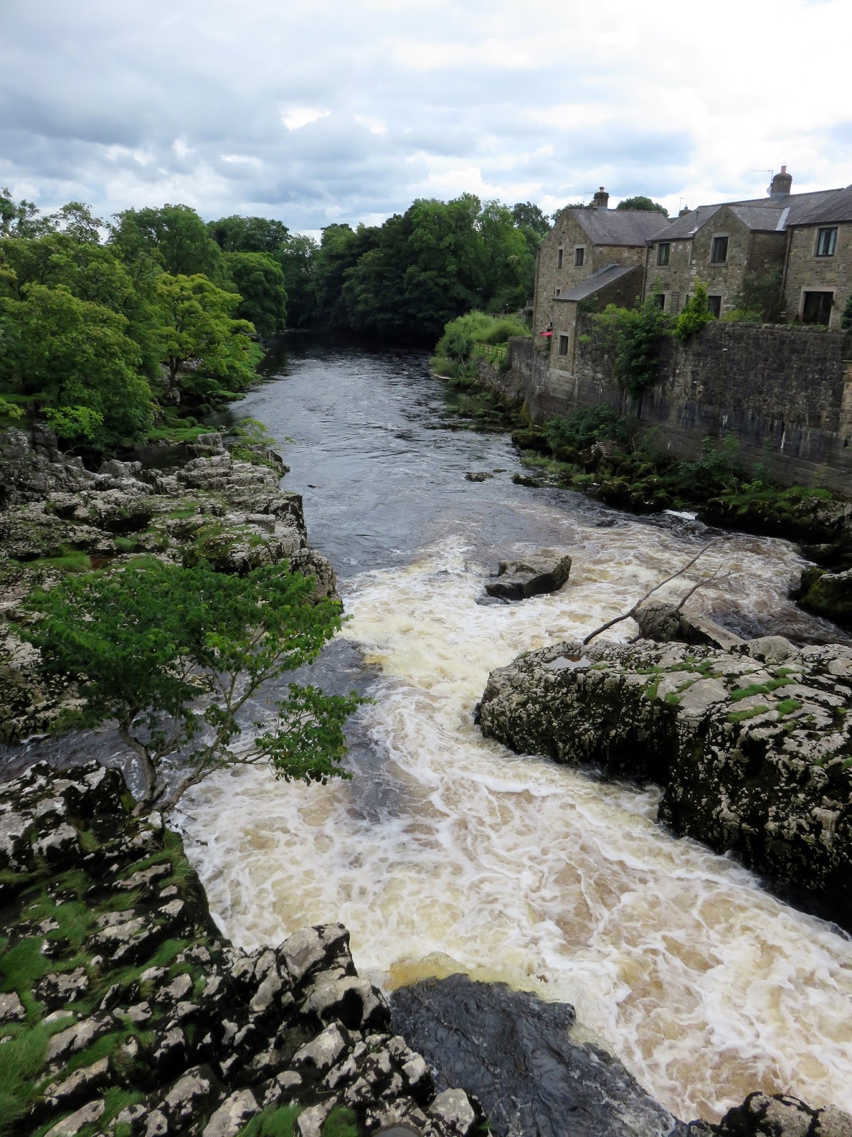
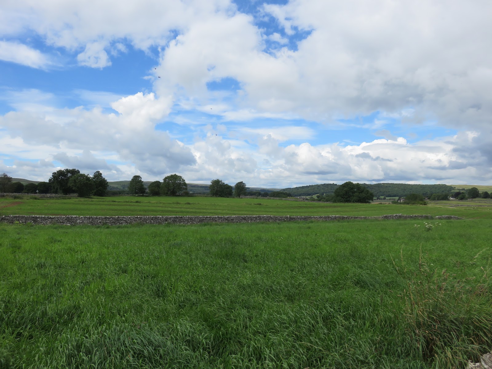
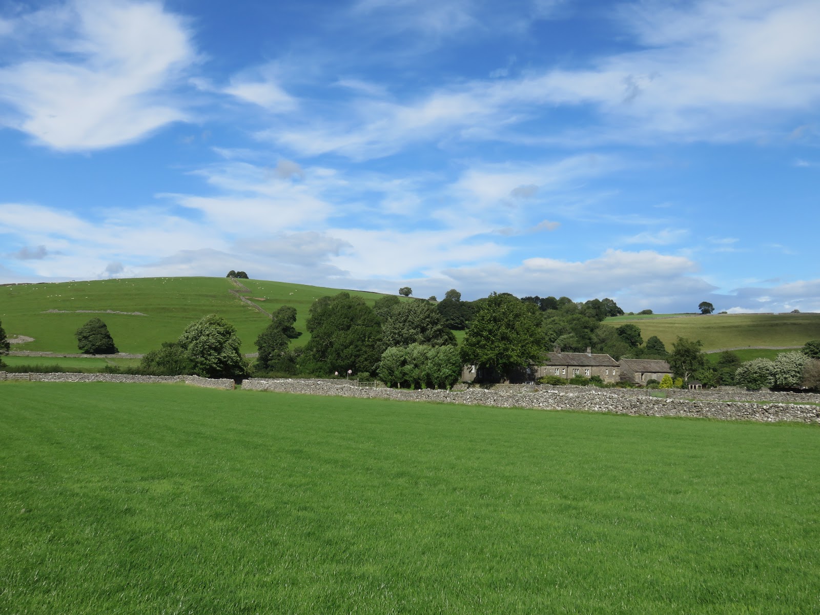
The falls, the result of the same geology that forms much of the scenery around Malham, are impressive indeed. They are one of the eastern-most features of the Craven Fault and are a popular location for white water kayaking. The route continues through the small collection of houses clustered near the falls before crossing through a field and reaching the B6160, arriving from Burnsall. By following the road west a short distance and cutting down a small lane, we arrived in Linton (perfectly timed for dinner).
 |
| Linton Falls |
 |
| Linton Falls |
 |
| Linton Falls |
 |
| Open fields near Linton |
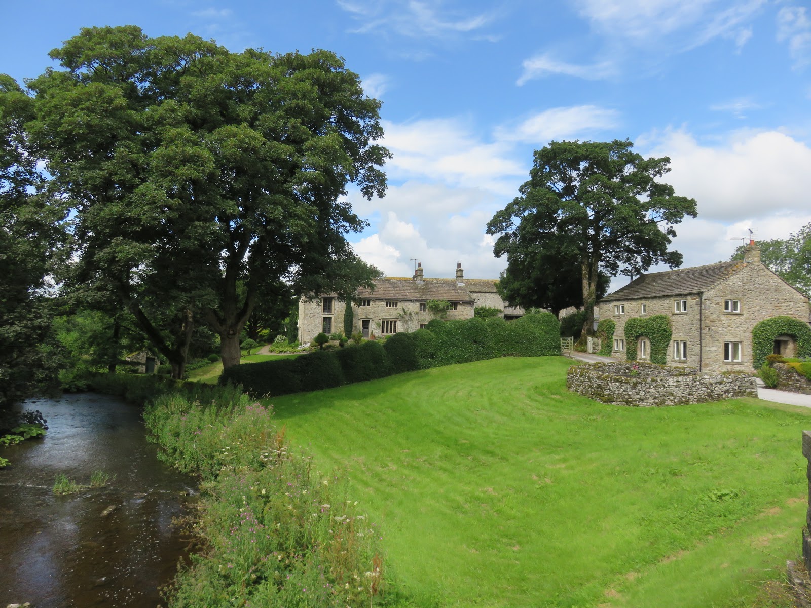
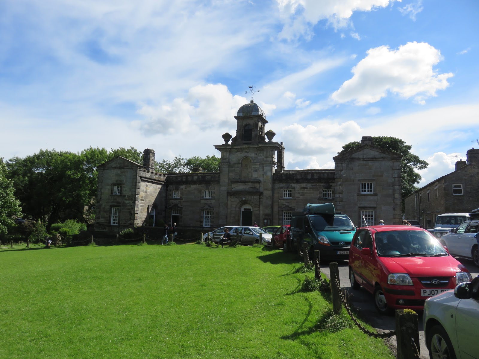
Though small, Linton is beautiful, the focal point being a large village green sat beside Linton Beck and its old packhorse bridge. Also in the vicinity is The Fountaine Inn, a fantastic pub that has never let us down in the past. Needless to say we stopped for a slap-up pub dinner.
 |
| Linton |
 |
| Linton |
 |
| Linton |
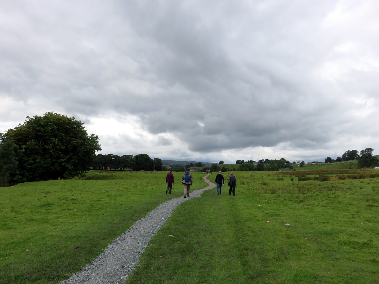
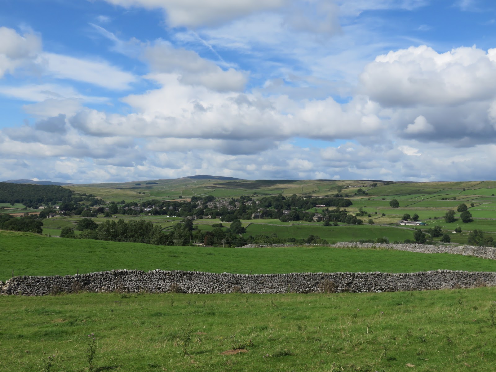
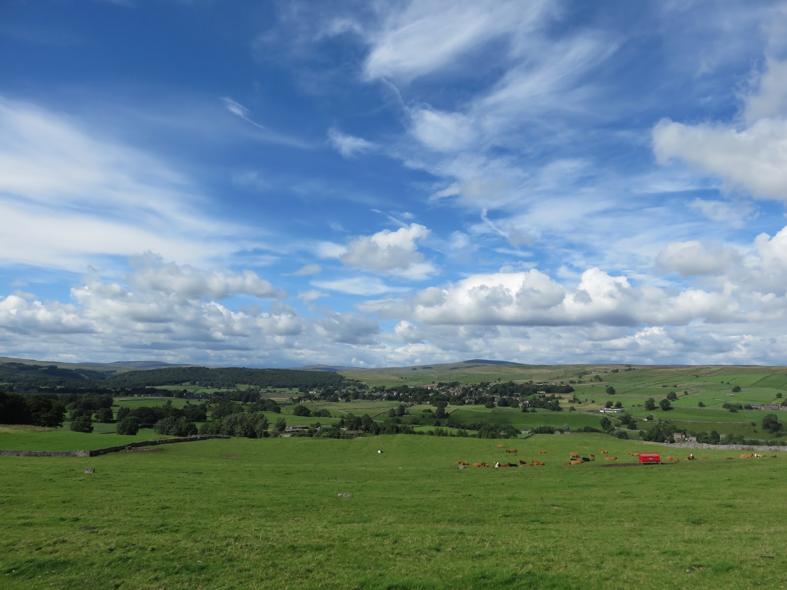
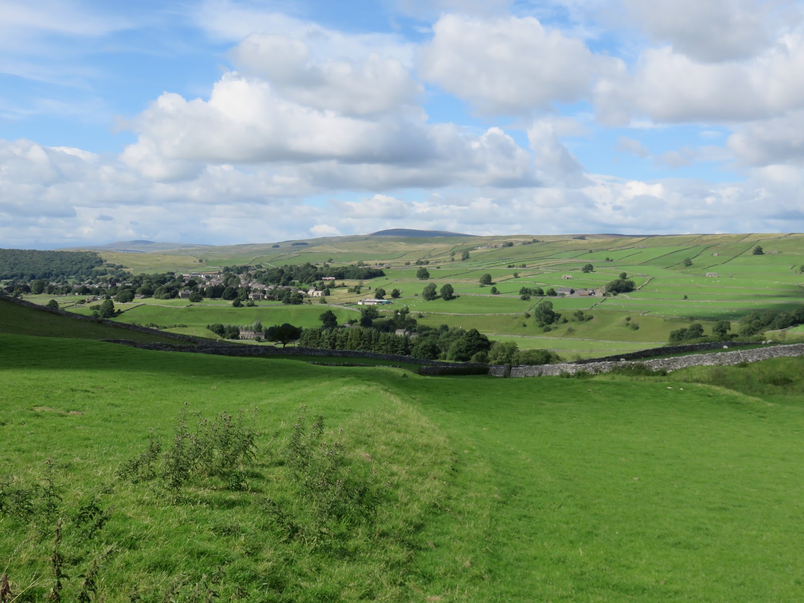
Fully laden with food now we headed on, past the church and through the village where the lane takes on a distinctly more agricultural feel and begins a swift climb up an unexpectedly steep hill. In fact, the climb up the lane and across the subsequent fields adds a good 60m in height to this part of the walk, a fairly mean feat after spending a good hour in the pub.
 |
| Yorkshire Dales on a superb day |
 |
| Looking across the Wharfe valley |
 |
| Looking down into Wharfedale |
Upon reaching the undulating Thorpe Lane, the going gets a bit easier, eventually reaching the small hamlet of Thorpe before a path begins the slow descent back to Burnsall. It passes between Kail Hill and Skulberts Hill, two of the local Cracoe Reef Knolls, ancient coral reefs that formed during warmer, more tropical times. This really is a splendid part of the walk, passing through some of the most picture-perfect Yorkshire Dales scenery.
 |
| Simon’s Seat |
 |
| Re-entering Burnsall |
A final bound across a number of fields and stiles leads straight back to Burnsall and the completion of this short yet rewarding walk. Definitely one to save for a sunny day; we’ve done it in the lashing rain and it doesn’t quite hold the same charm. If you do do it on a nice day it’s a perfect introduction to the tranquillities of the Yorkshire Dales.
 |
| Burnsall Bridge |
