Open Space Web-Map builder Codehttps://openspace.ordnancesurvey.co.uk/osmapapi/openspace.js?key=3119F72552FD5C22E0530C6CA40A5A92https://openspace.ordnancesurvey.co.uk/osmapapi/script/mapbuilder/basicmap.jshttps://openspace.ordnancesurvey.co.uk/osmapapi/script/mapbuilder/searchbox.js//variables for routes var linesLayer, points, lineFeature, lineString, routeMarkersLayer, routepos, routesize, routeoffset, routeicon; var style_blue = {strokeColor: “#0000CD”, strokeOpacity: 0.5, strokeWidth: 4.5}; function initmapbuilder() { //initiate the map var options = {resolutions: [2500, 1000, 500, 200, 100, 50, 25, 10, 5, 4, 2.5, 2, 1]}; osMap = new OpenSpace.Map(‘map’, options); //configure map options (basicmap.js) setglobaloptions(); //set the center of the map and the zoom level osMap.setCenter(new OpenSpace.MapPoint(333712,527366),7); linesLayer = osMap.getVectorLayer(); // Set up layer for route markers routeMarkersLayer = new OpenLayers.Layer.Markers(“Route Markers”); //make a route points = new Array(); points.push(new OpenLayers.Geometry.Point(335377,527116)); points.push(new OpenLayers.Geometry.Point(335332,527251)); points.push(new OpenLayers.Geometry.Point(335467,527351)); points.push(new OpenLayers.Geometry.Point(335402,527381)); points.push(new OpenLayers.Geometry.Point(335267,527361)); points.push(new OpenLayers.Geometry.Point(335222,527381)); points.push(new OpenLayers.Geometry.Point(335237,527556)); points.push(new OpenLayers.Geometry.Point(335152,527571)); points.push(new OpenLayers.Geometry.Point(334972,527626)); points.push(new OpenLayers.Geometry.Point(334847,527801)); points.push(new OpenLayers.Geometry.Point(334727,527911)); points.push(new OpenLayers.Geometry.Point(334672,527901)); points.push(new OpenLayers.Geometry.Point(334442,527821)); points.push(new OpenLayers.Geometry.Point(334252,527786)); points.push(new OpenLayers.Geometry.Point(334132,527816)); points.push(new OpenLayers.Geometry.Point(333912,527946)); points.push(new OpenLayers.Geometry.Point(333652,528091)); points.push(new OpenLayers.Geometry.Point(333392,528221)); points.push(new OpenLayers.Geometry.Point(333242,528231)); points.push(new OpenLayers.Geometry.Point(333147,528226)); points.push(new OpenLayers.Geometry.Point(333037,528206)); points.push(new OpenLayers.Geometry.Point(332977,528261)); points.push(new OpenLayers.Geometry.Point(332952,528351)); points.push(new OpenLayers.Geometry.Point(332832,528426)); points.push(new OpenLayers.Geometry.Point(332652,528356)); points.push(new OpenLayers.Geometry.Point(332507,528316)); points.push(new OpenLayers.Geometry.Point(332472,528166)); points.push(new OpenLayers.Geometry.Point(332472,528021)); points.push(new OpenLayers.Geometry.Point(332327,527761)); points.push(new OpenLayers.Geometry.Point(332497,527826)); points.push(new OpenLayers.Geometry.Point(332752,527771)); points.push(new OpenLayers.Geometry.Point(332887,527751)); points.push(new OpenLayers.Geometry.Point(332967,527661)); points.push(new OpenLayers.Geometry.Point(333012,527506)); points.push(new OpenLayers.Geometry.Point(333102,527391)); points.push(new OpenLayers.Geometry.Point(333187,527206)); points.push(new OpenLayers.Geometry.Point(333262,527001)); points.push(new OpenLayers.Geometry.Point(333187,526911)); points.push(new OpenLayers.Geometry.Point(333167,526671)); points.push(new OpenLayers.Geometry.Point(333117,526586)); points.push(new OpenLayers.Geometry.Point(333217,526556)); points.push(new OpenLayers.Geometry.Point(333447,526636)); points.push(new OpenLayers.Geometry.Point(333567,526716)); points.push(new OpenLayers.Geometry.Point(333592,526776)); points.push(new OpenLayers.Geometry.Point(333592,526846)); points.push(new OpenLayers.Geometry.Point(333617,526896)); points.push(new OpenLayers.Geometry.Point(333672,526861)); points.push(new OpenLayers.Geometry.Point(333727,526791)); points.push(new OpenLayers.Geometry.Point(333862,526836)); points.push(new OpenLayers.Geometry.Point(333957,526856)); points.push(new OpenLayers.Geometry.Point(334022,526856)); points.push(new OpenLayers.Geometry.Point(334217,526946)); points.push(new OpenLayers.Geometry.Point(334287,527001)); points.push(new OpenLayers.Geometry.Point(334447,526946)); points.push(new OpenLayers.Geometry.Point(334762,527031)); points.push(new OpenLayers.Geometry.Point(335012,527081)); points.push(new OpenLayers.Geometry.Point(335377,527116)); // create a polyline feature from the array of points lineString = new OpenLayers.Geometry.LineString(points); lineFeature = new OpenLayers.Feature.Vector(lineString, null, style_blue); linesLayer.addFeatures([lineFeature]); //crate a route start/end marker routepos = new OpenSpace.MapPoint(335377,527116); routesize = new OpenLayers.Size(33,45); routeoffset = new OpenLayers.Pixel(-5,-37); routeicon = new OpenSpace.Icon(‘https://openspace.ordnancesurvey.co.uk/osmapapi/img_versions/img_1.1/mapbuilder/routemarker-startend.png’, routesize, routeoffset, null, null); routeMarkersLayer.addMarker(new OpenLayers.Marker(routepos, routeicon)); osMap.addLayer(routeMarkersLayer);}
Route: Scales, Knotts, Mousthwaite Comb, Brunt Knott, Scales Tarn, Sharp Edge, Foule Crag, Atkinson Pike, Blencathra, Doddick Fell, Doddick Farm, Scaley Beck, Scale
Date: 09/07/2017
From: Scales
Parking: A66
Start Point: Scales
Region: Northern Fells
Route length: 5.7 miles (9.2 km)
Time taken: 02:49
Average speed: 2.0 mph
Ascent: 715m
Descent: 710m
Wainwrights on this walk:
Blencathra (868m)
Other Summits: Doddick Fell (742m)
Other points of interest: Scales Tarn, Sharp Edge
Sharp Edge is one of the quintessential Lakeland outings, often held in the same regard as Striding Edge and (to some extent) Crib Goch – though it is much shorter than it’s illustrious Welsh counterpart.
This walk, though short, packs a lot into a short space. First, there’s Sharp Edge, the narrow arête that either invokes a sense of delight or, possibly, terror depending on your outlook.
Following immediately is a modest scramble up Foule Crag to reach Atkinson Pike. Then there’s Blencathra and its tremendous views before a descent of Doddick Fell that takes you right back to the valley below. All in all, a grand day (or afternoon) out.
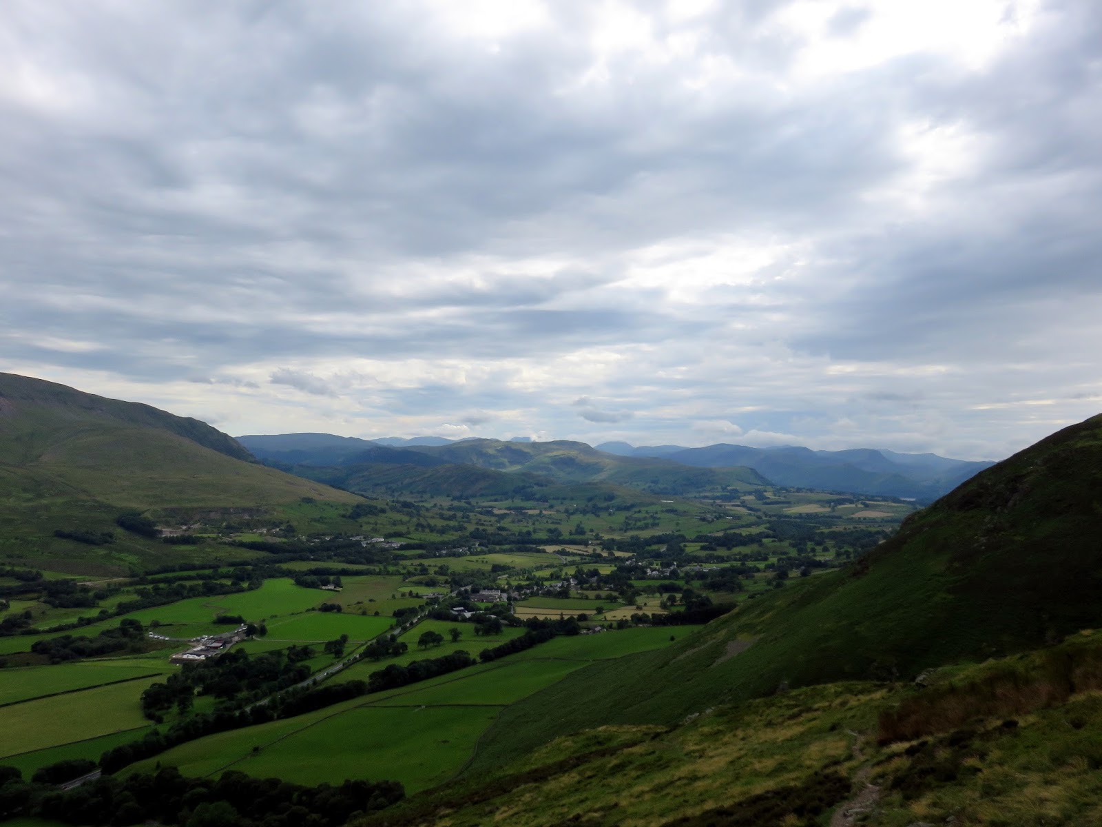
We parked in one of the many lay-bys that line the A66 beneath the steep slopes of Blencathra and, after some mild trespassing, found the path that would take us up the southern end of Souther Fell.
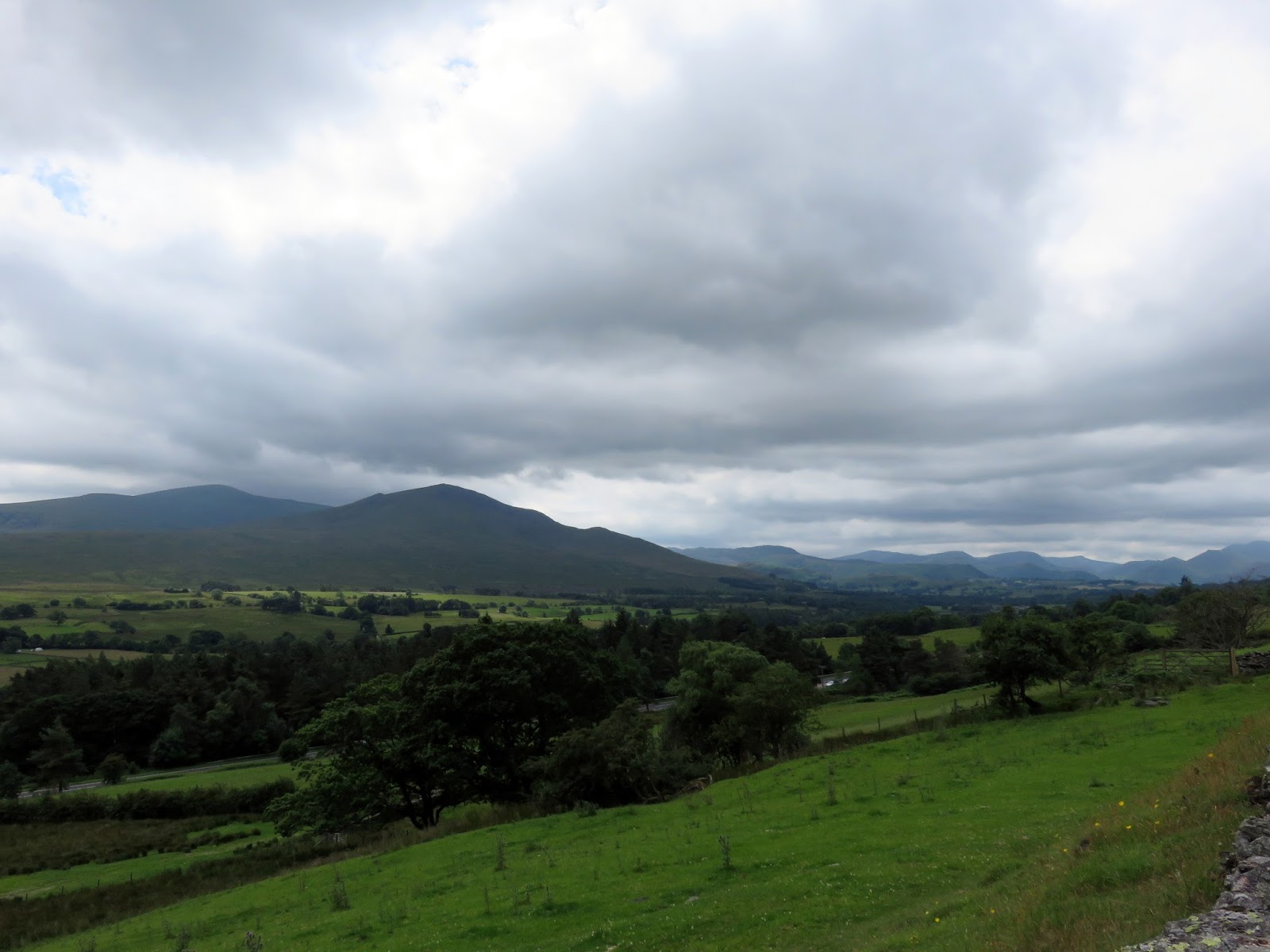
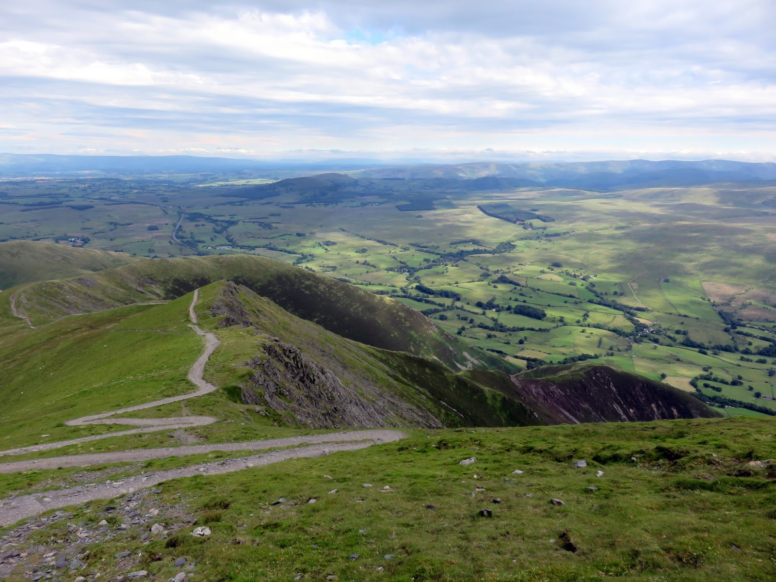
 |
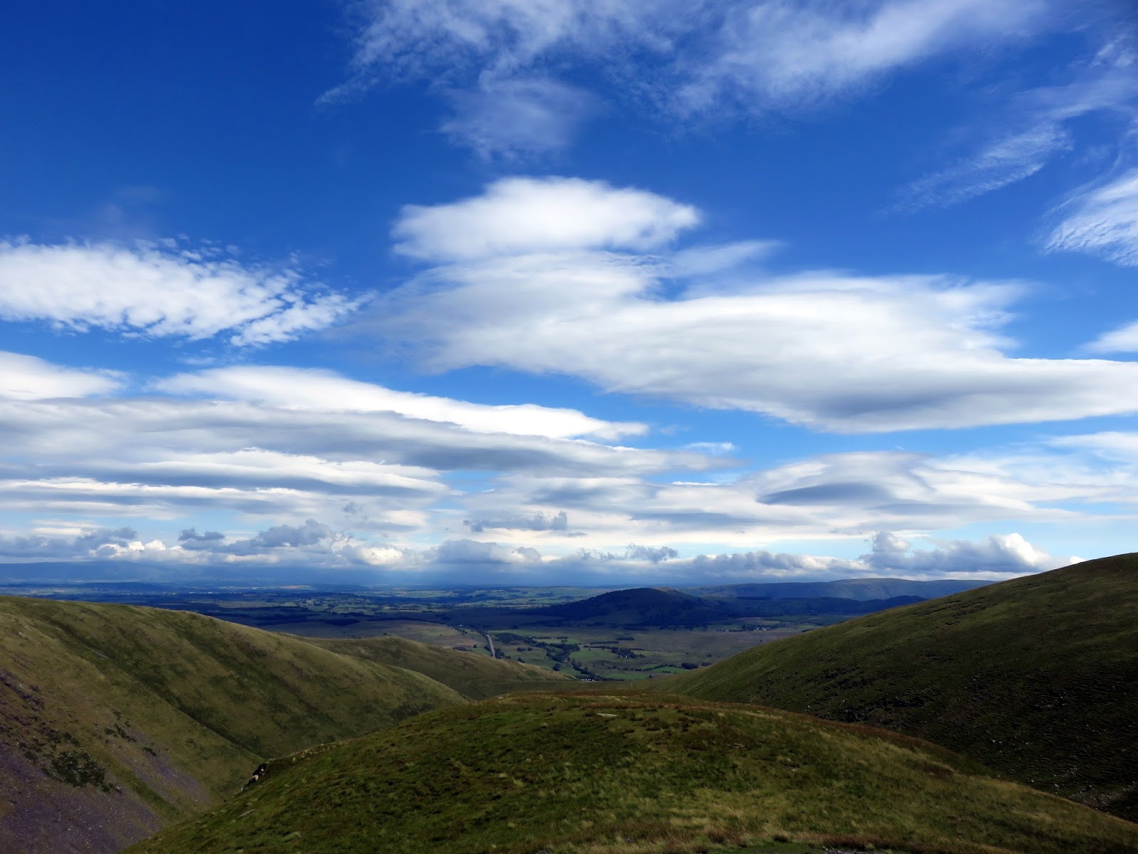
| The Vale of Keswick |
 |
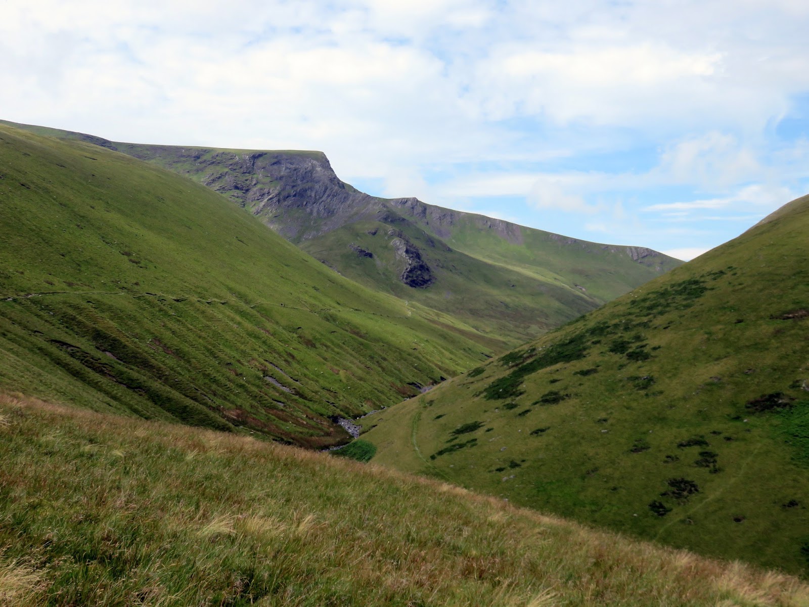
| Mousthwaite Combe with Sharp Edge in the background |
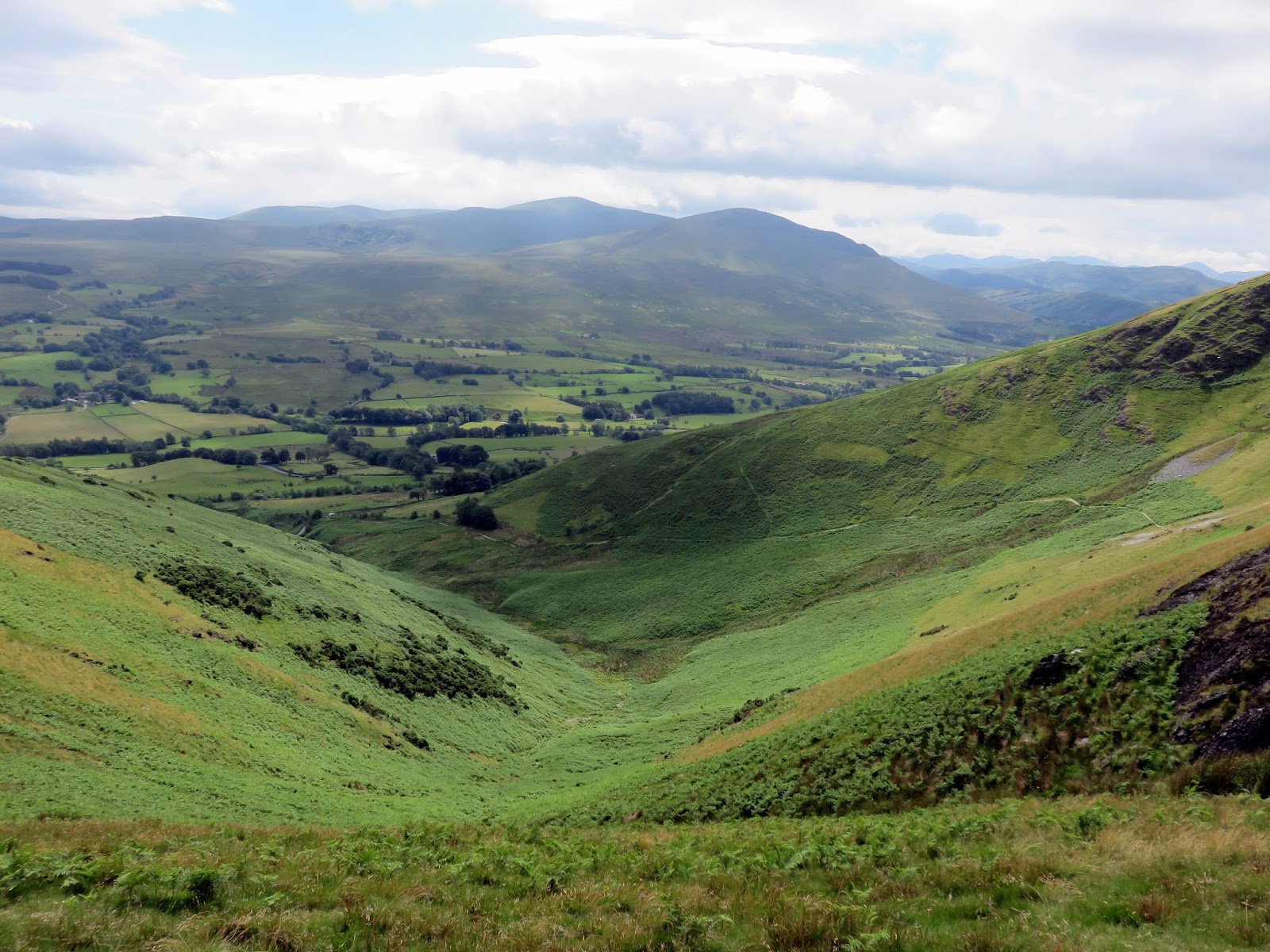
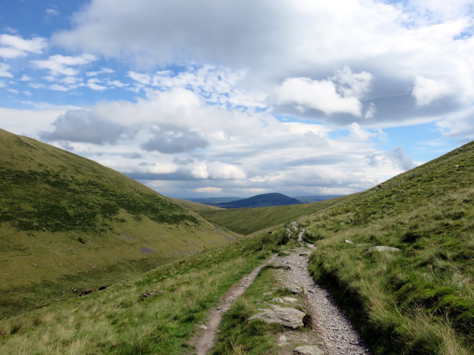
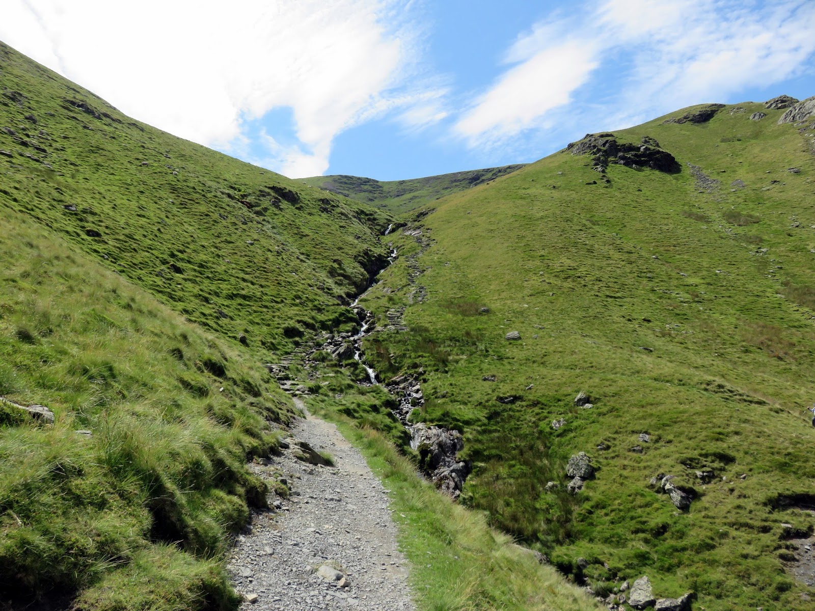
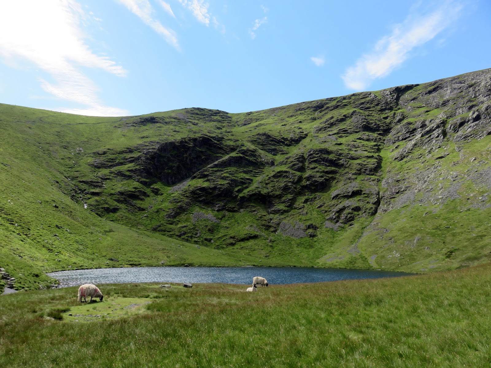
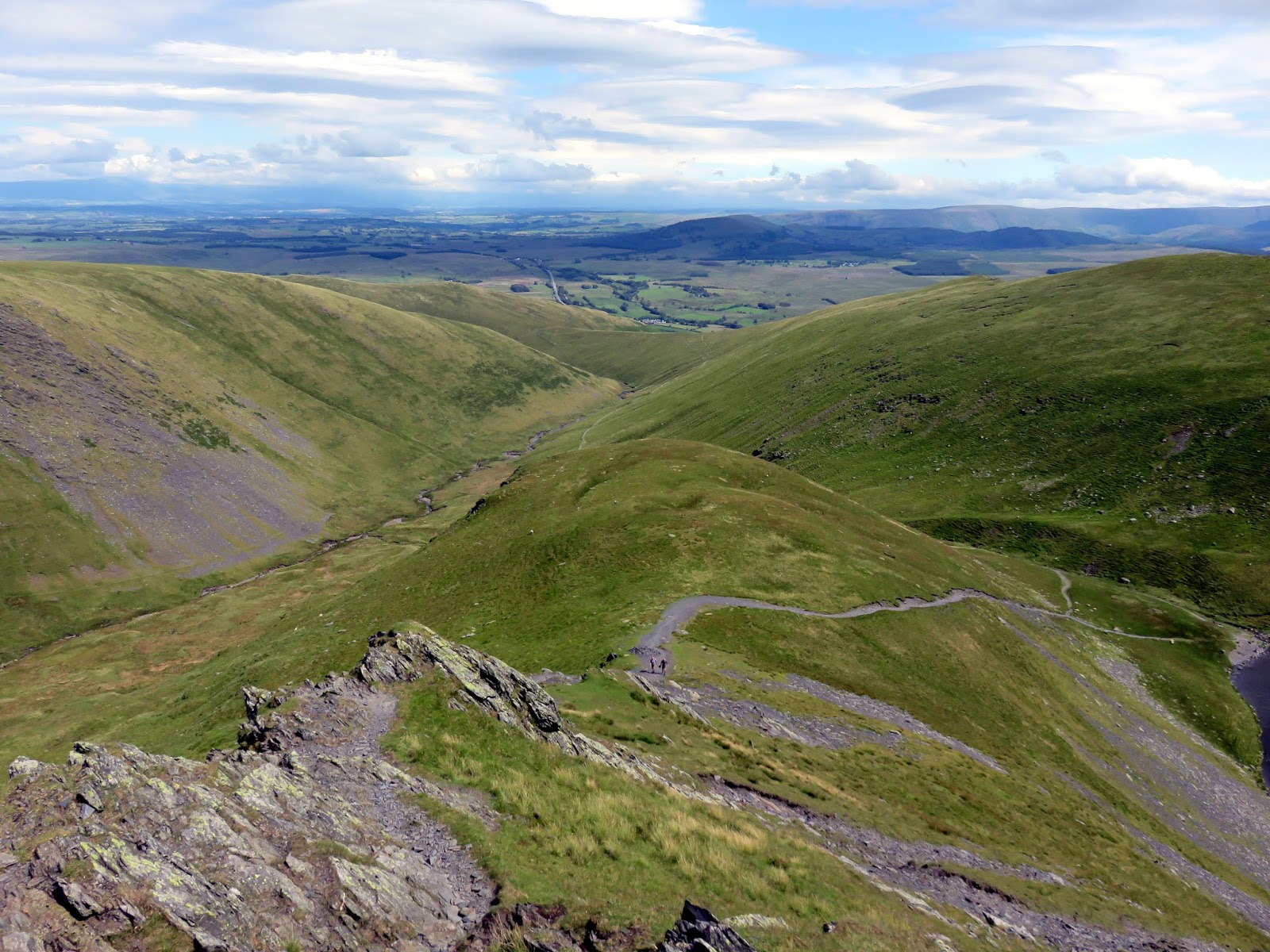
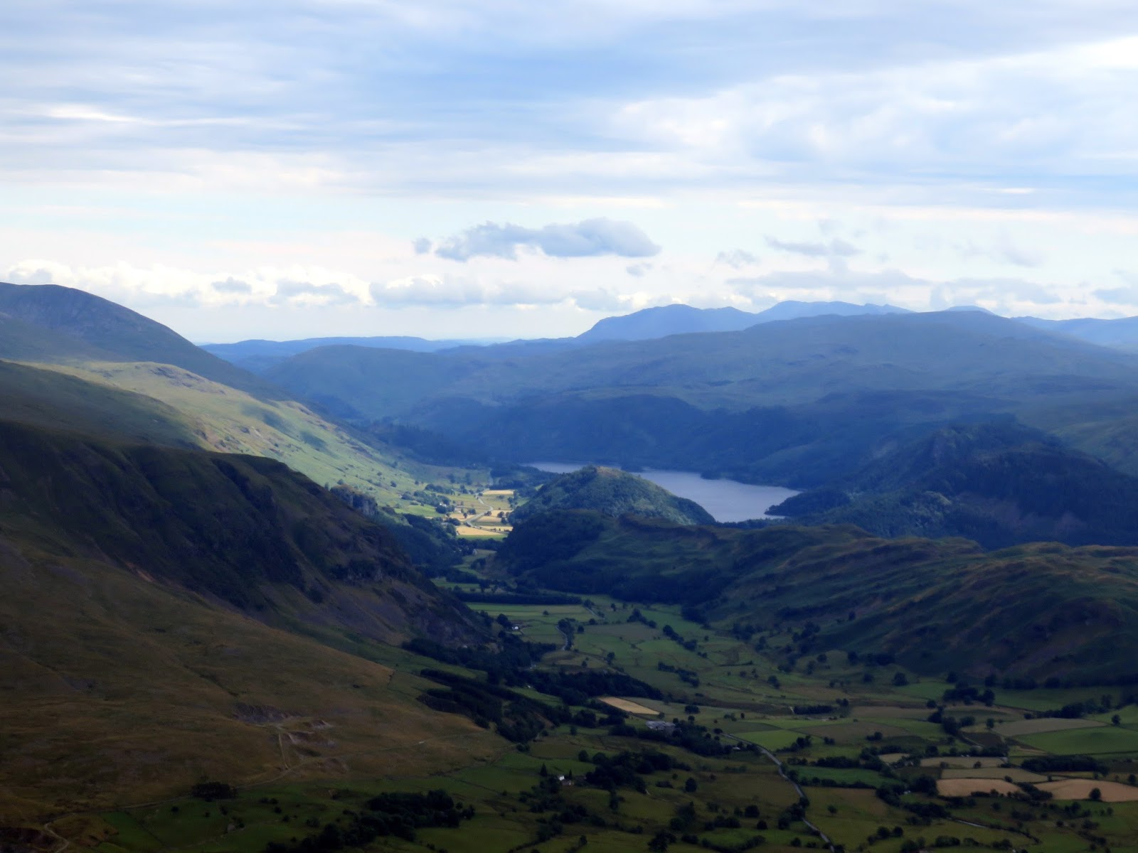
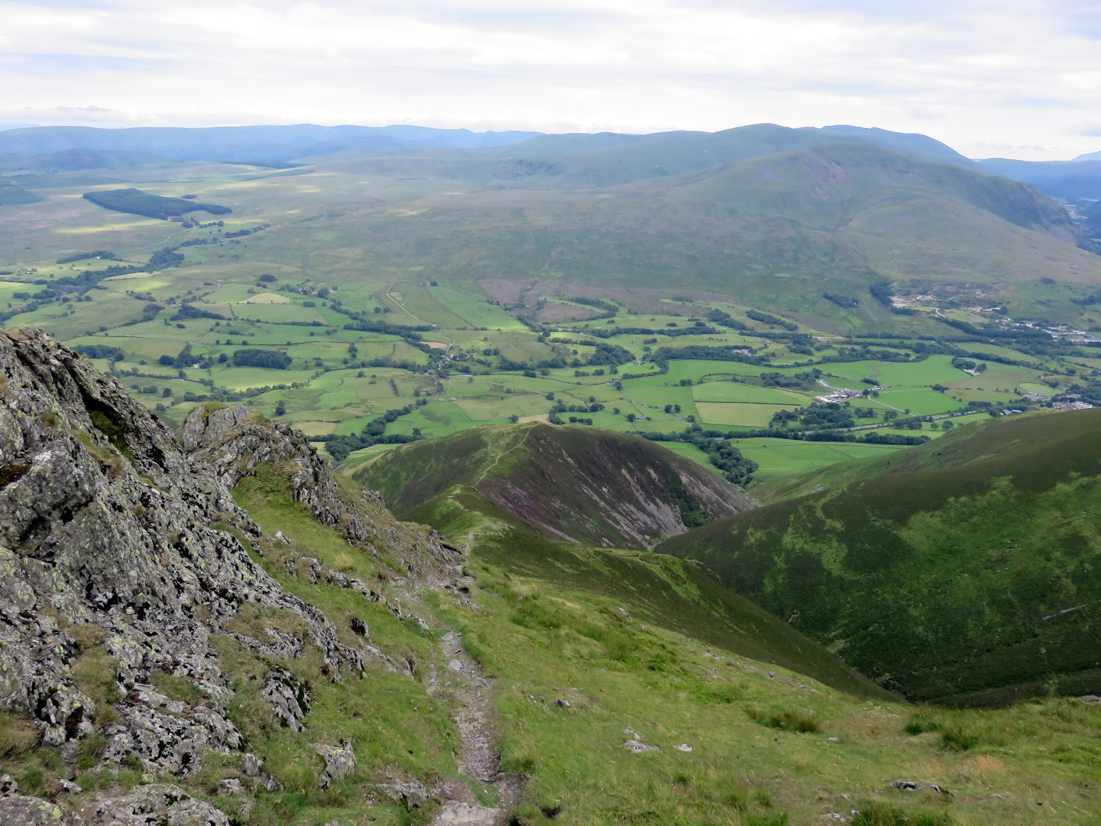
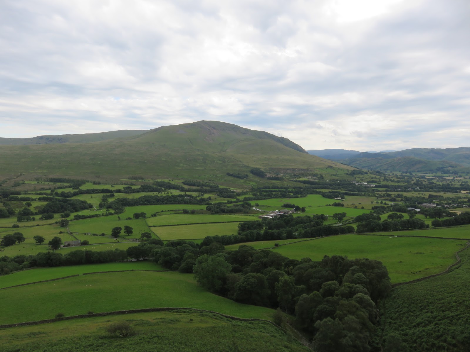
Here, the path climbs fairly steeply up the side of Mousthwaite Comb, a curious barrier to the River Glenderamackin, sending it on its circuitous course around Souther Fell. At the head of the coum, the route follows a well-established path up the Glenderamackin valley to reach Scales Beck below Brunt Knott where it climbs once again up to Scales Tarn. From here, things start to get a little more exciting.
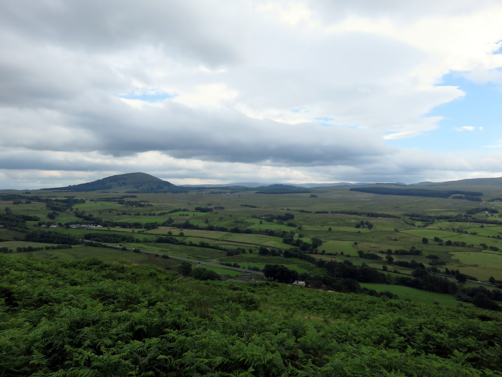
 |
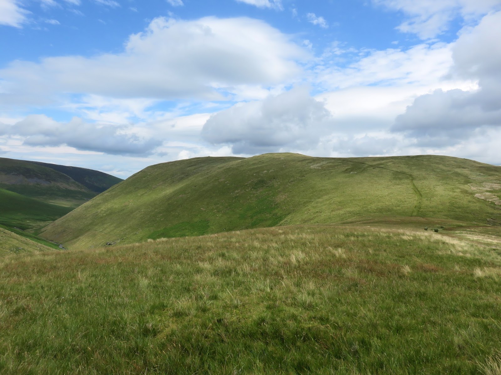
| Looking down Mousthwaite Comb |
 |
| The River Glenderamackin |
 |
| The Gelnderamackin once again |
 |
| Sharp Edge |
 |
| Looking back down the valley |
 |
| Scales Beck |
 |
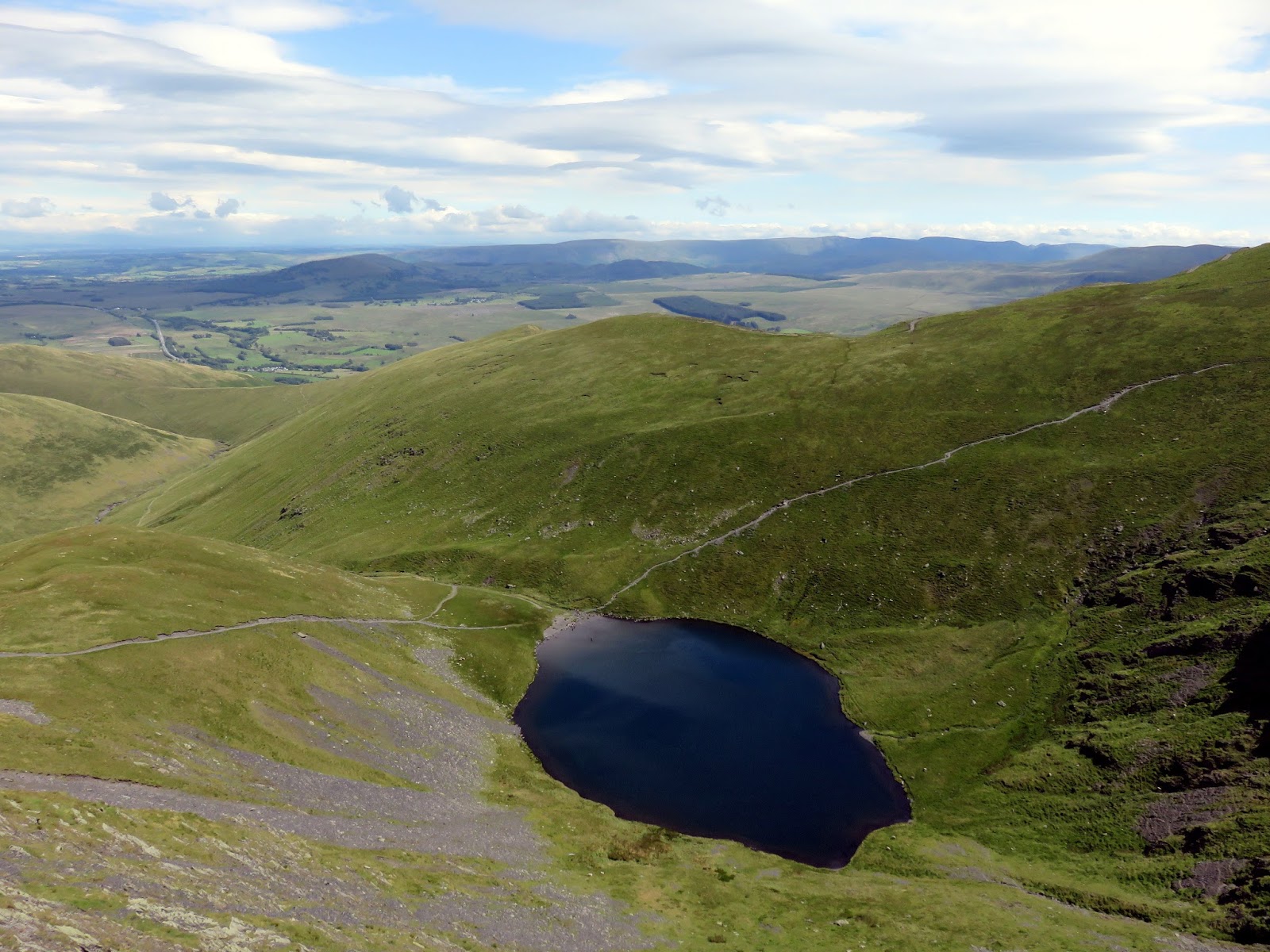
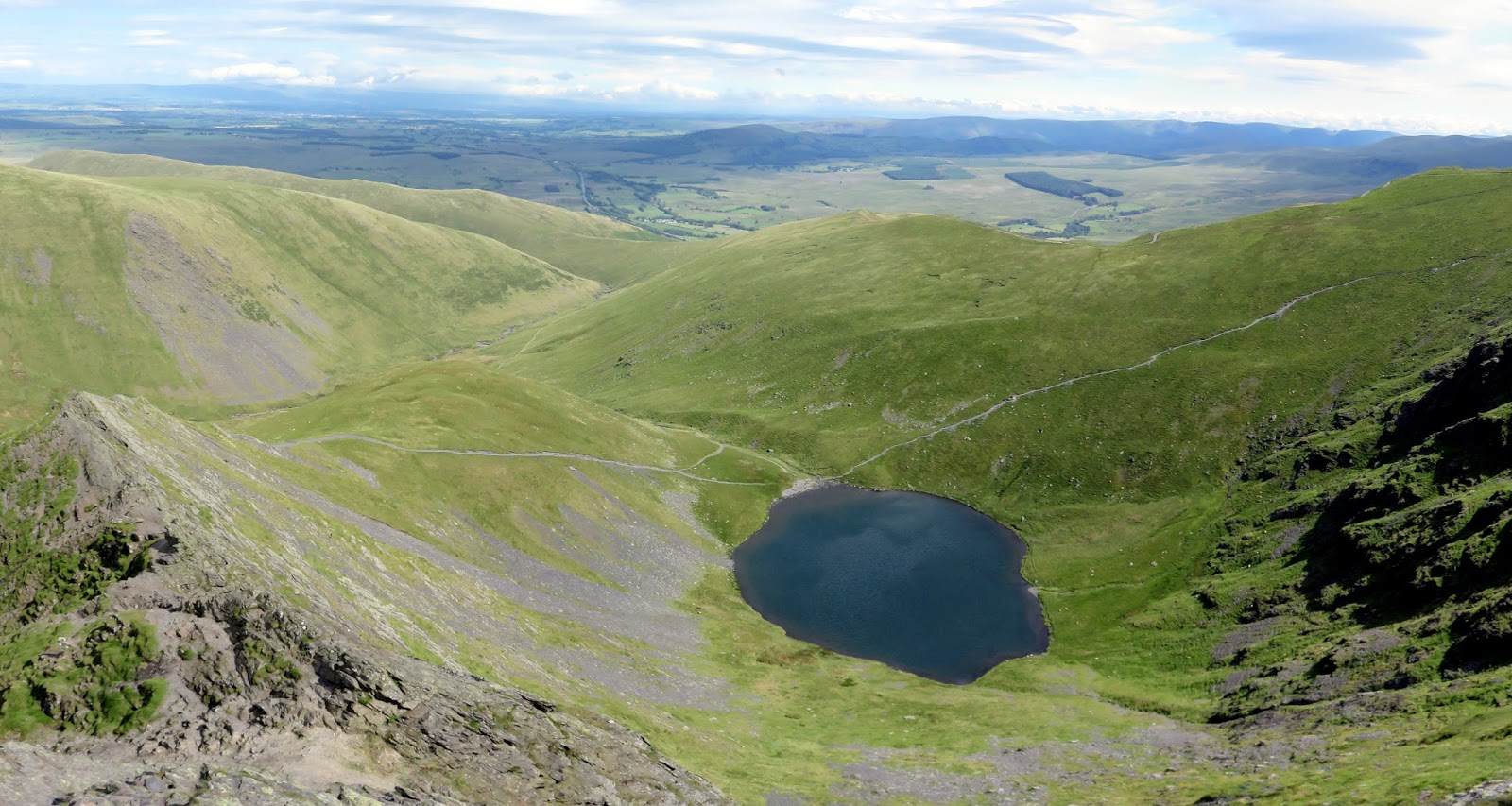
| Scales Tarn |
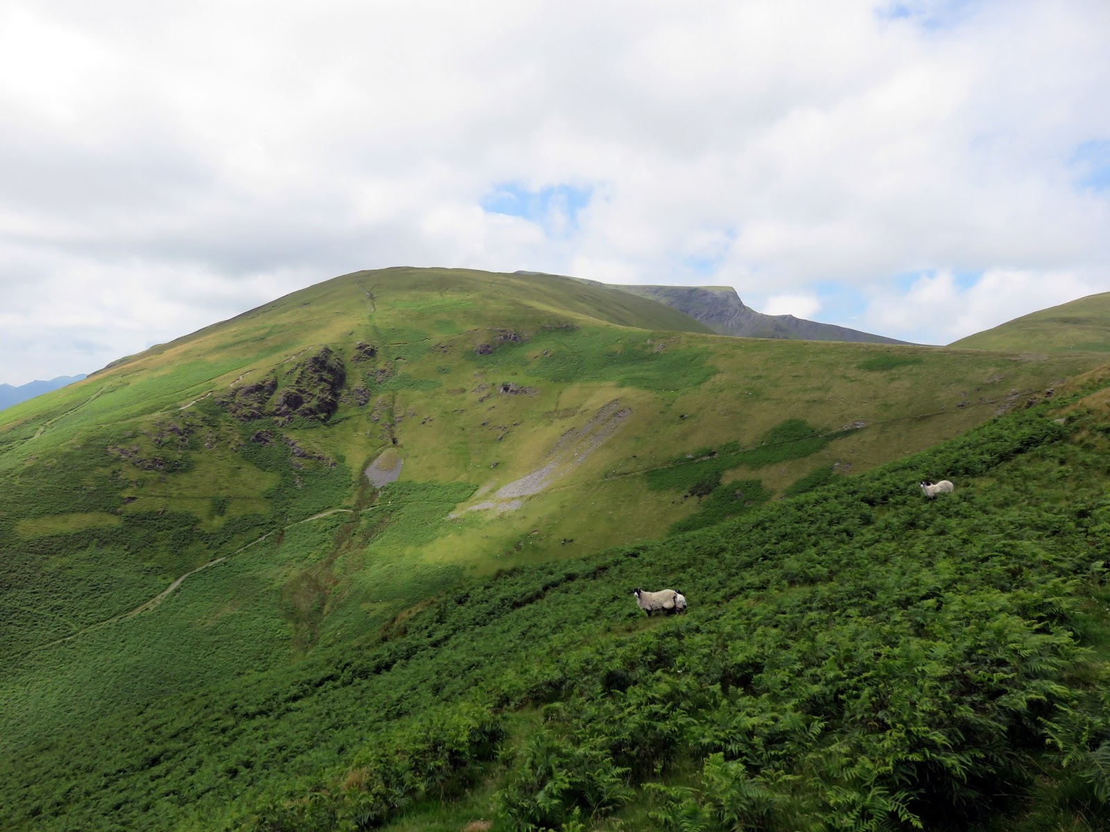
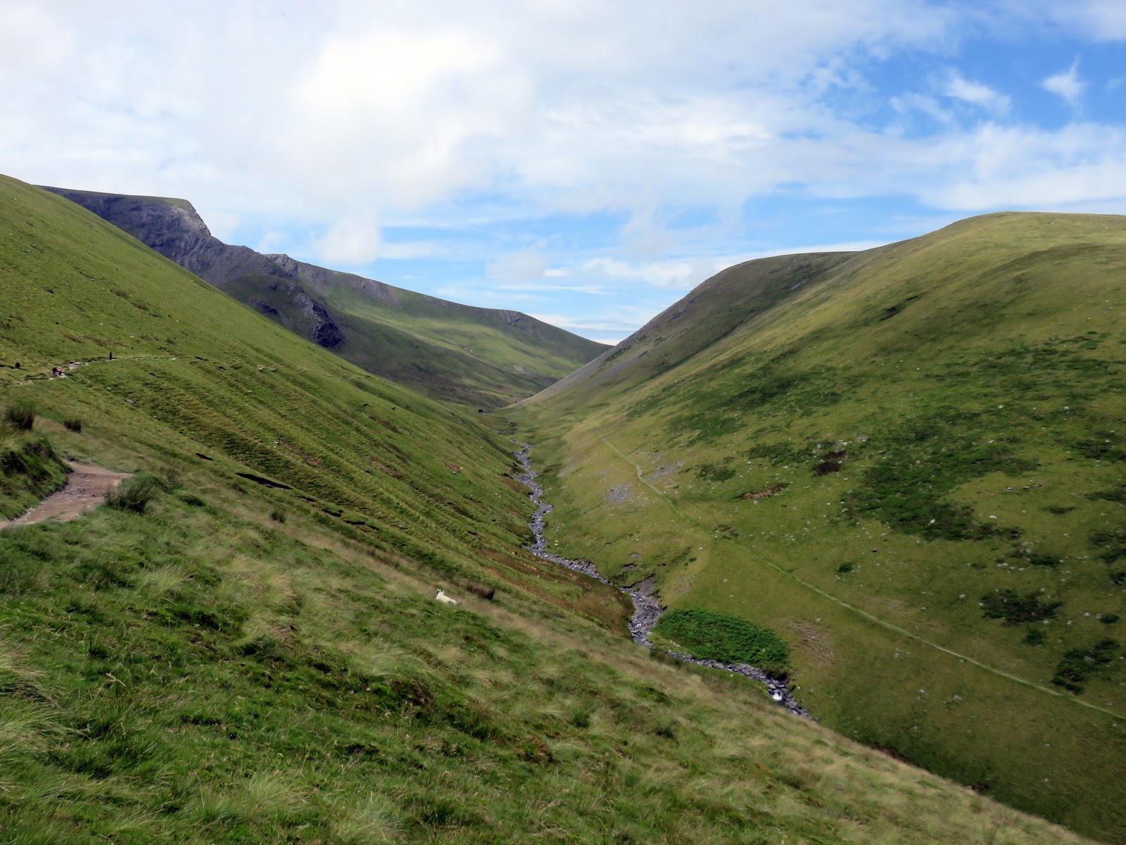
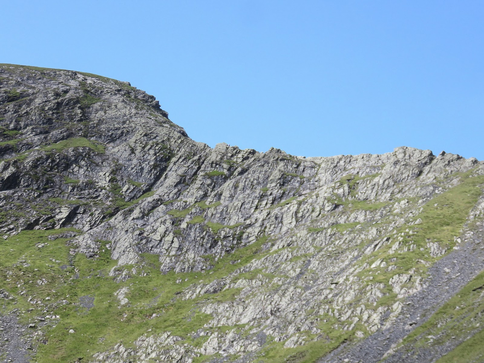
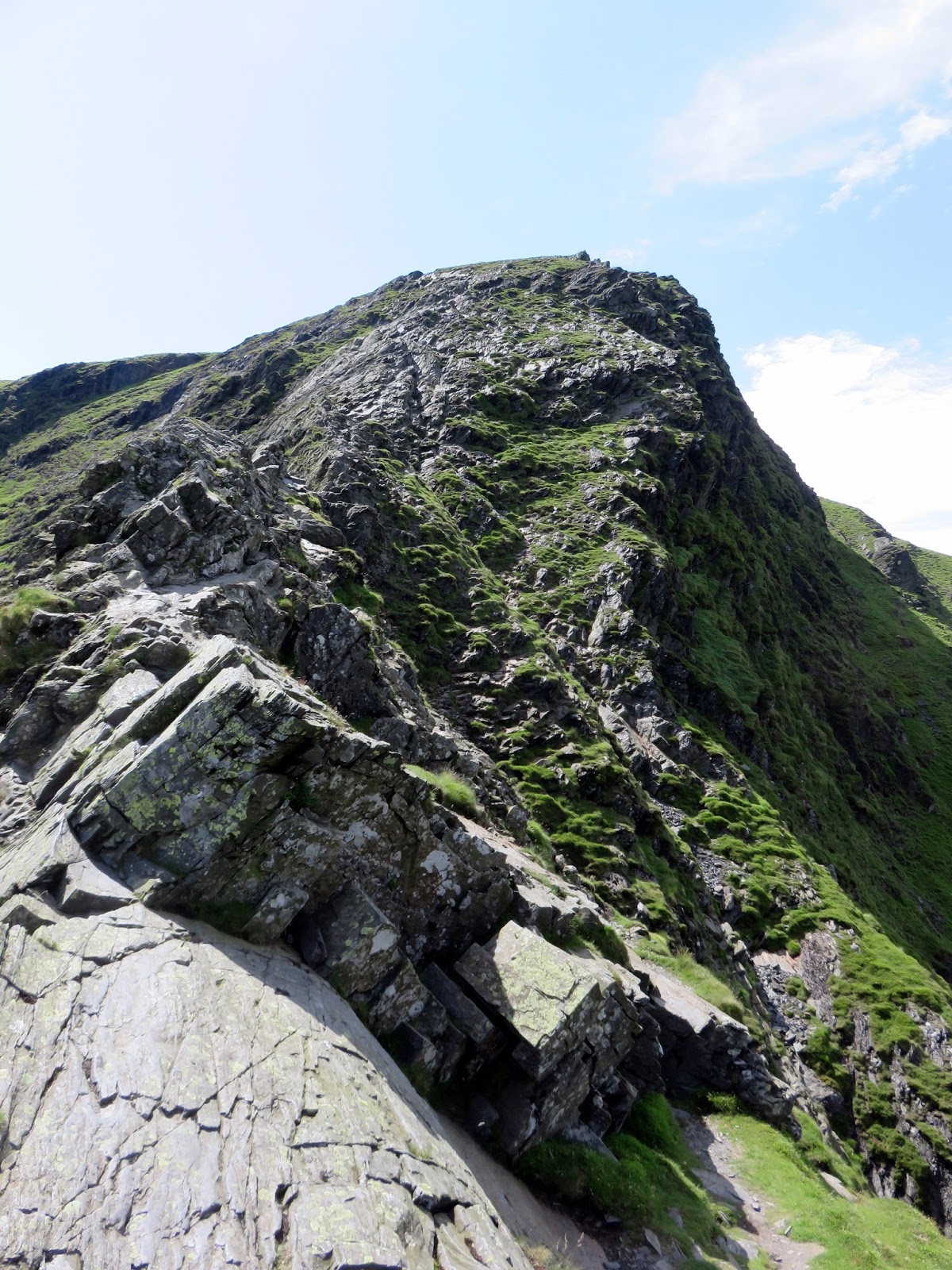
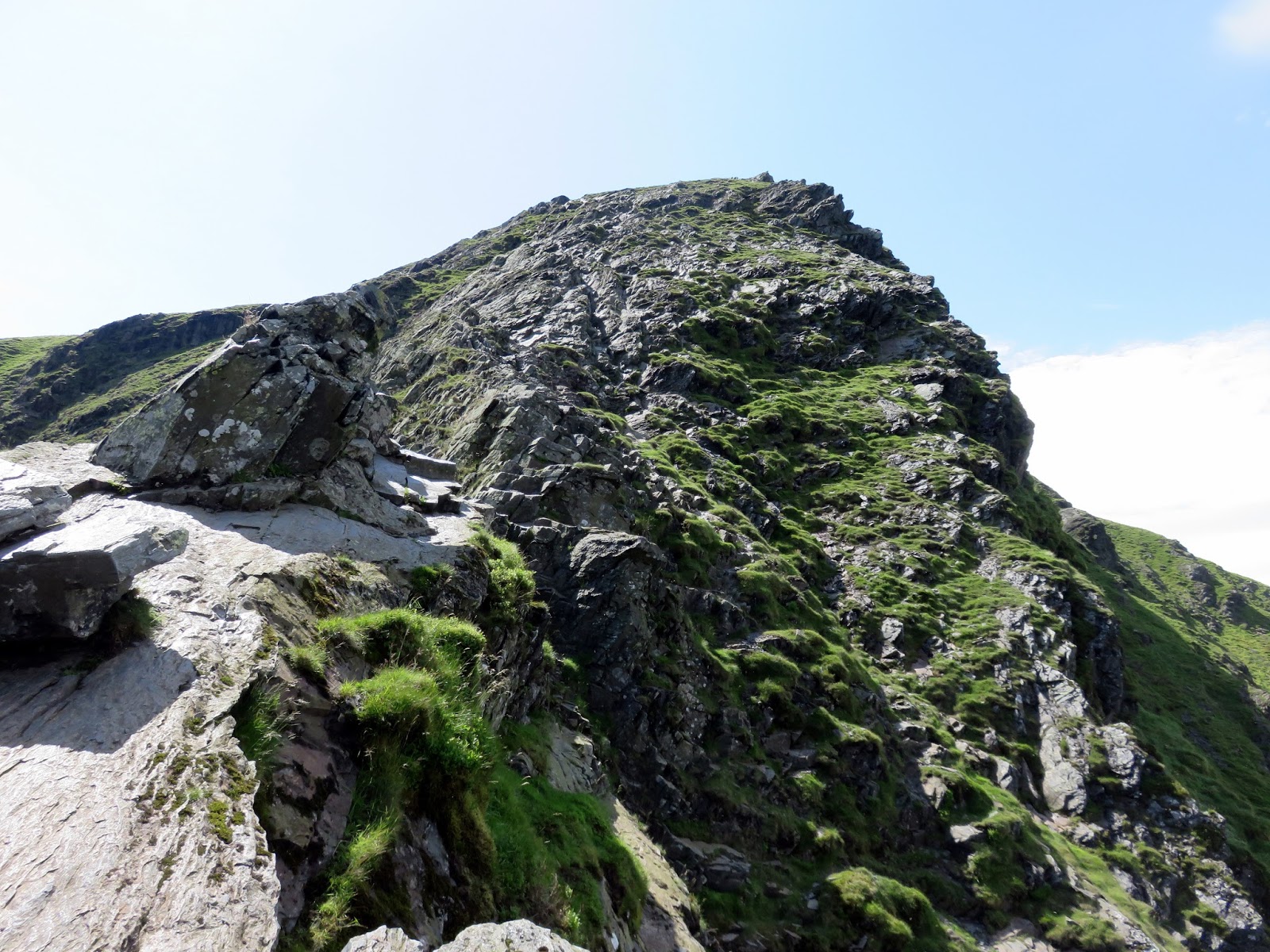
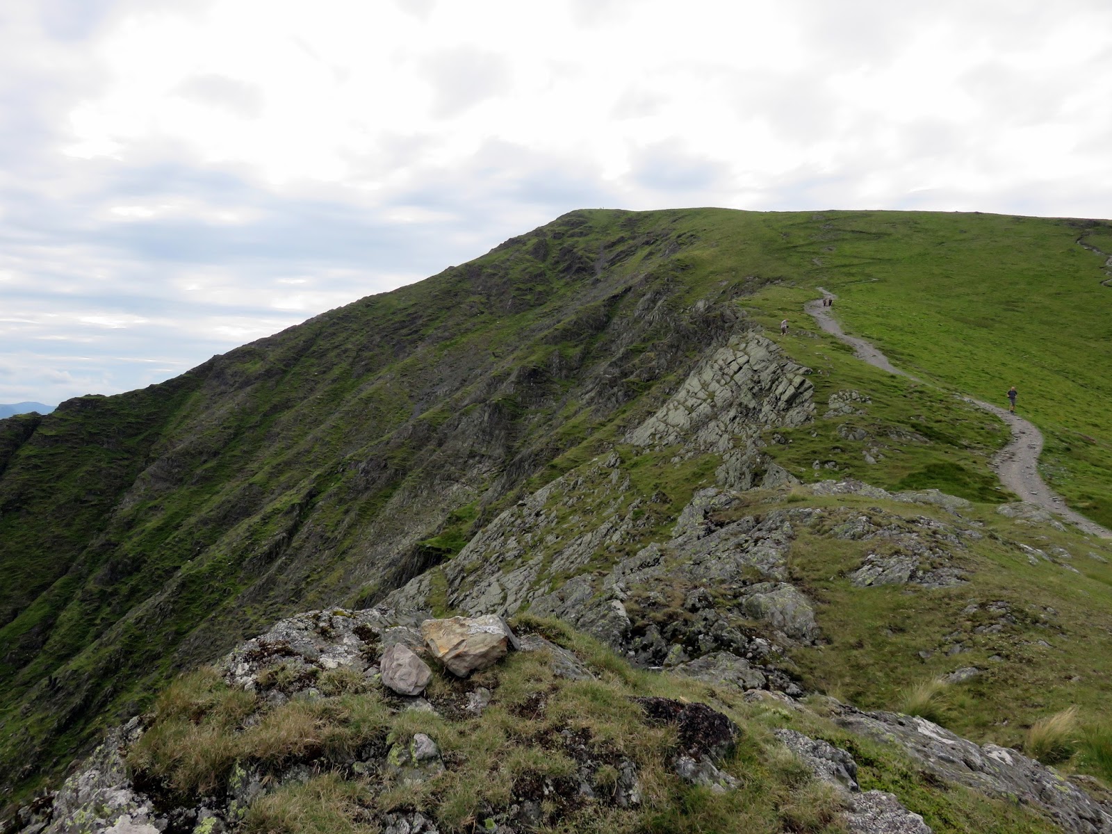
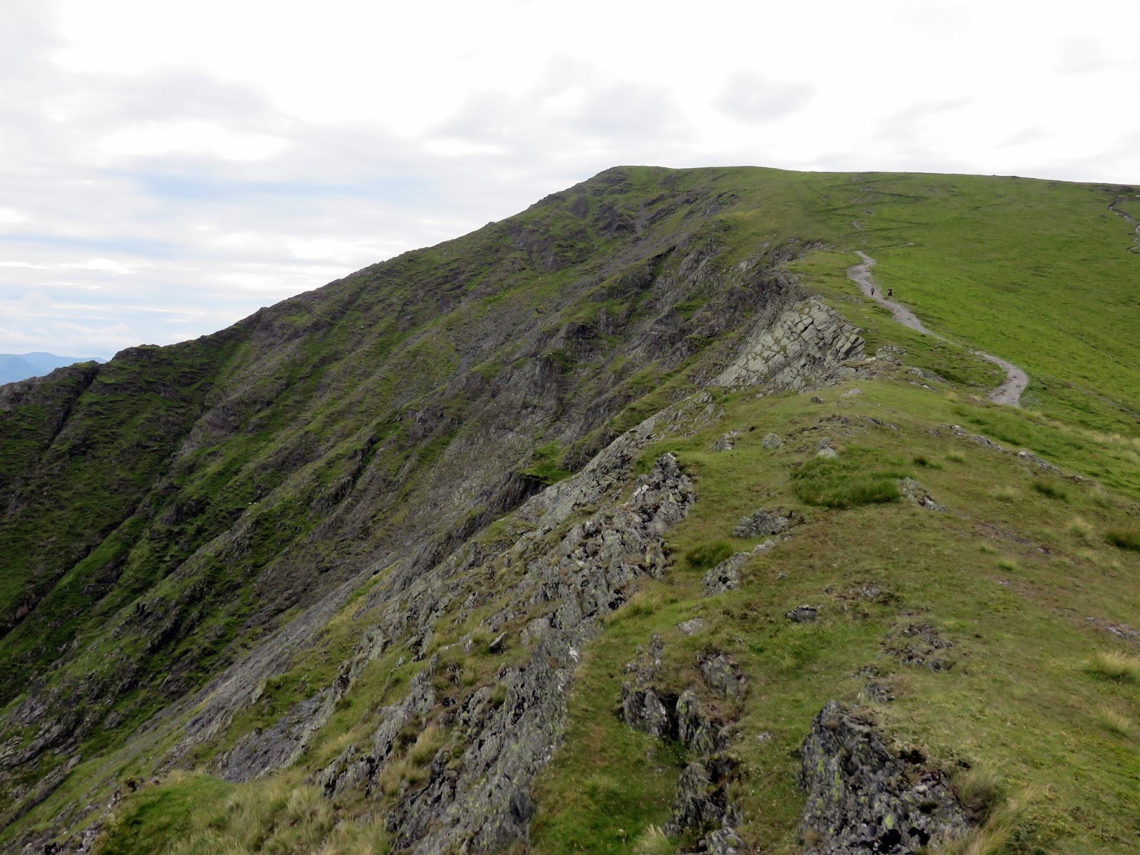
For a while, Sharp Edge has been looming up ahead, the very obvious light grey ridge seen in profile, often with a number of walkers, silhouetted against the skyline. It can be accessed by the very obvious path that branches right up the hillside but it is worth stopping for a moment at Scales Tarn to savour the impressive mountain scenery in front of you.
 |
| The way to Sharp Edge is obvious |
 |
| Sharp Edge |
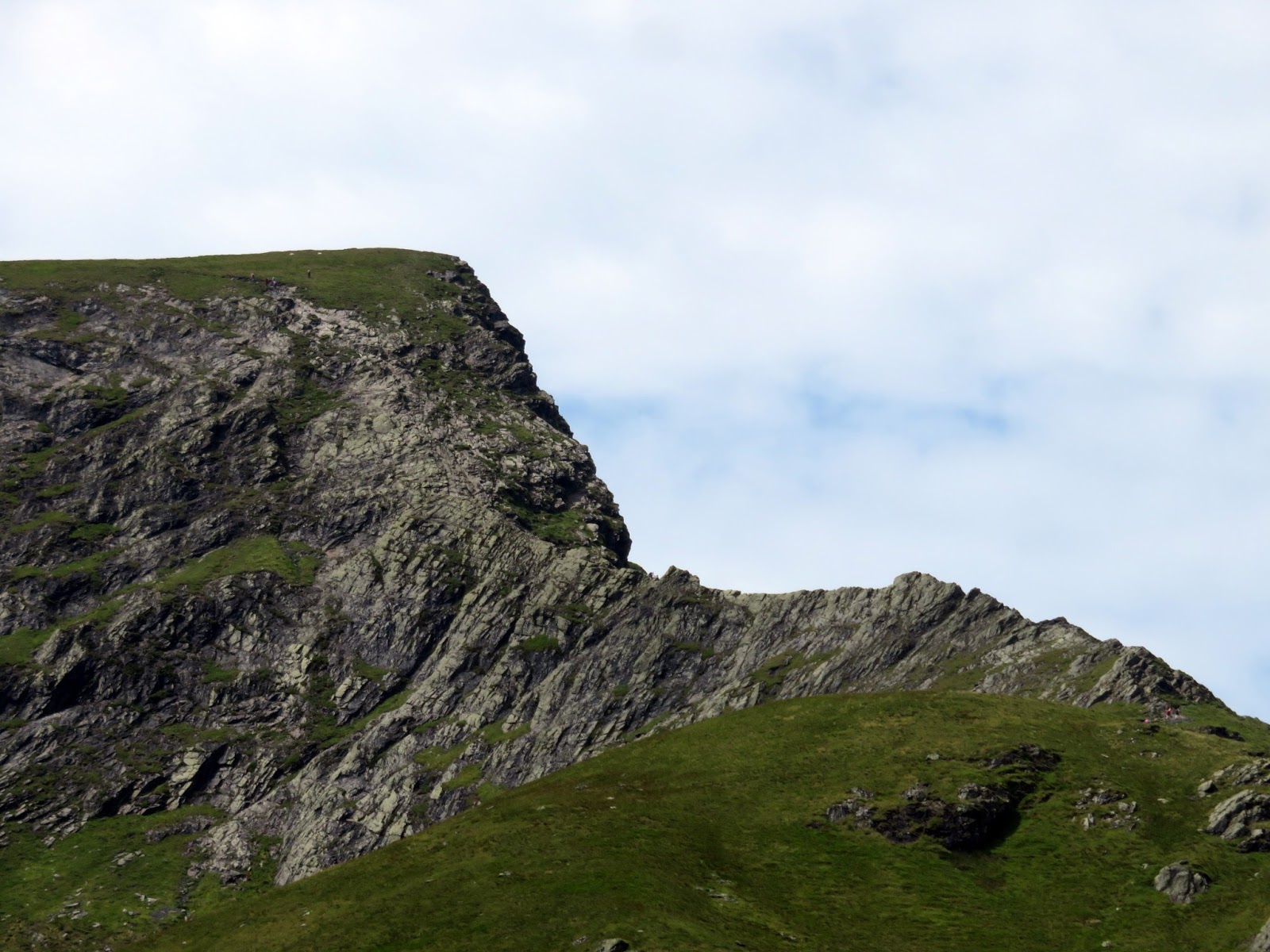
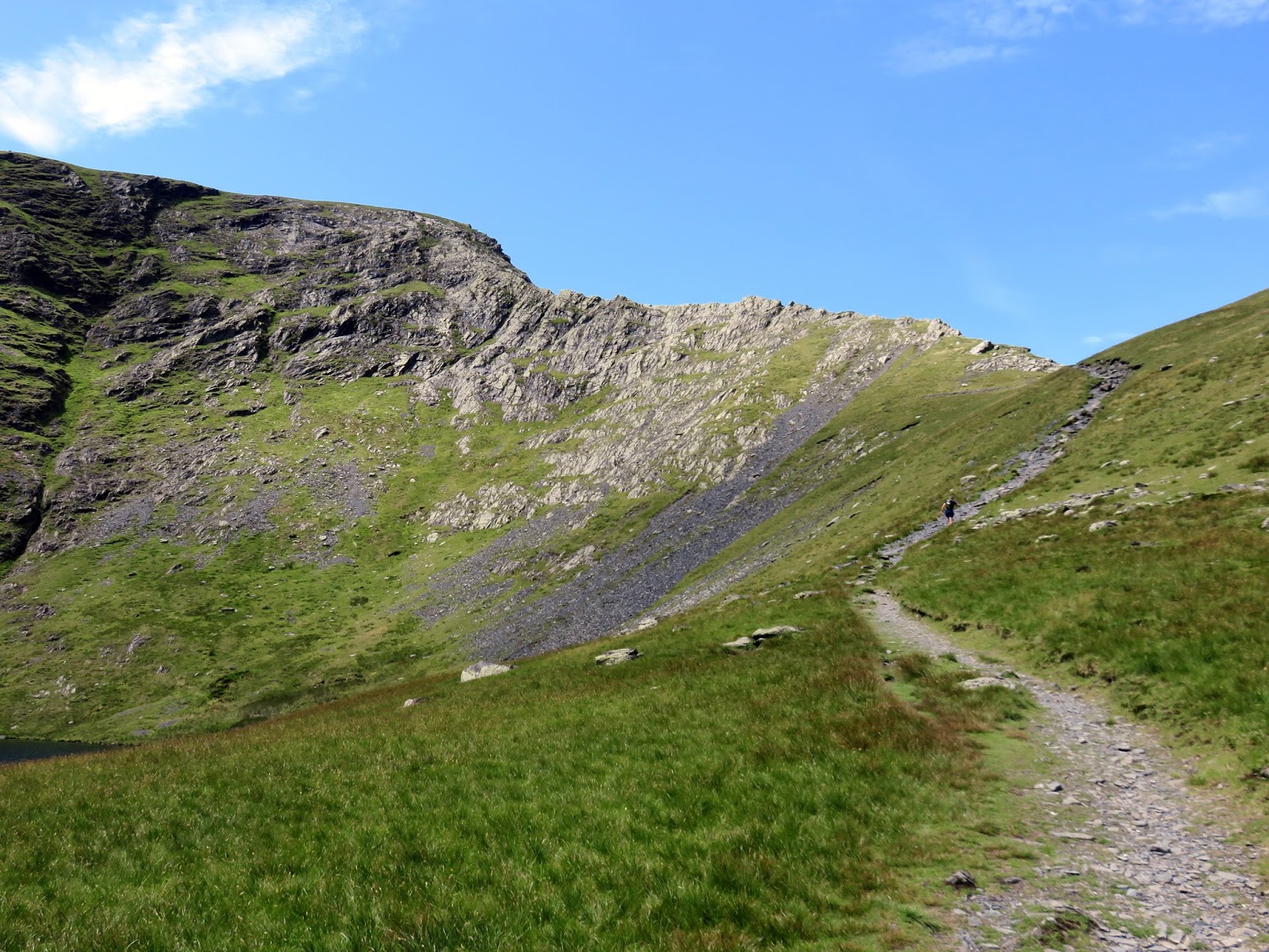
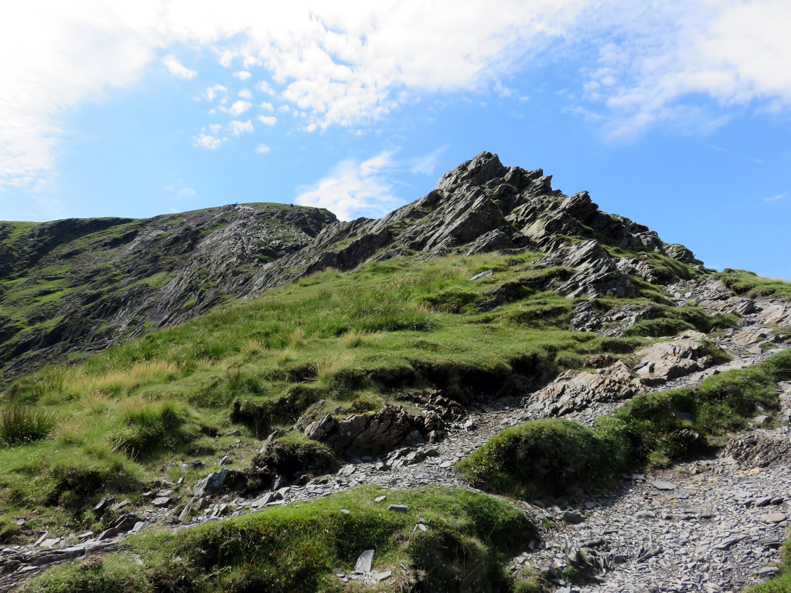
The initial climb along the path is easy enough until it reaches the first series of rock outcrops where the scrambling begins. Here, it is straightforward with many lines and no cause for difficulty. This short section will take you to the start of Sharp Edge, the vertiginous ridge ahead, and it is here you can decide whether to take on the challenge or return to Scales Tarn to find another route. If you decide to carry on, here’s what you can expect to find.
 |
| Approaching Sharp Edge |
 |
| It had turned into an amazing afternoon |
 |
| The first hurdle on Sharp Edge |
 |
| Looking back down to Scales Beck |
 |
| Sharp Edge |
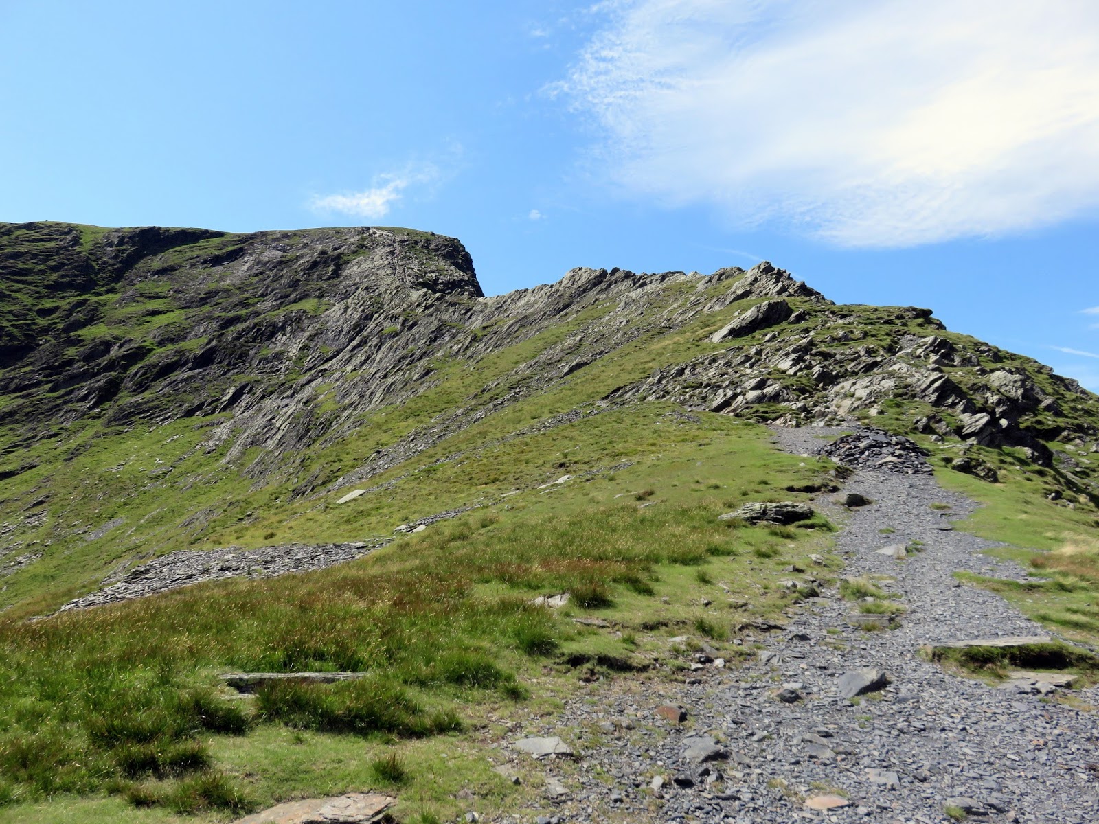
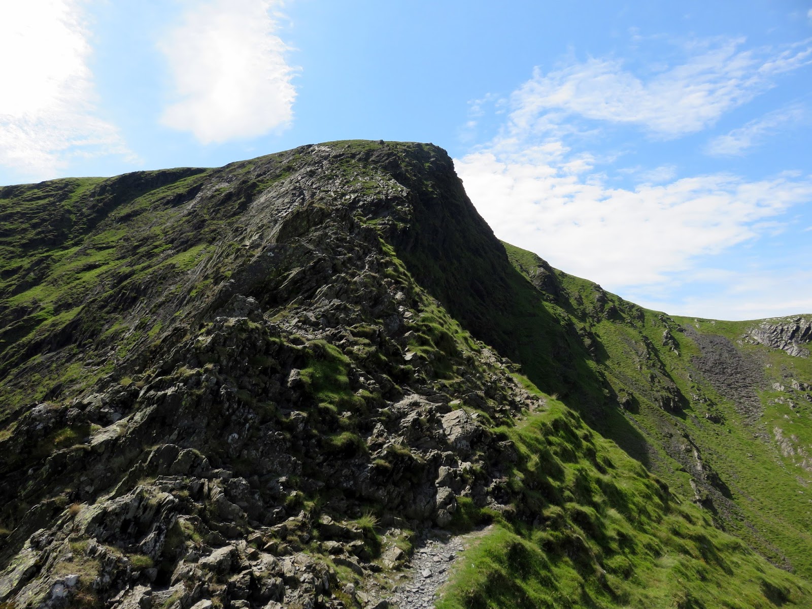
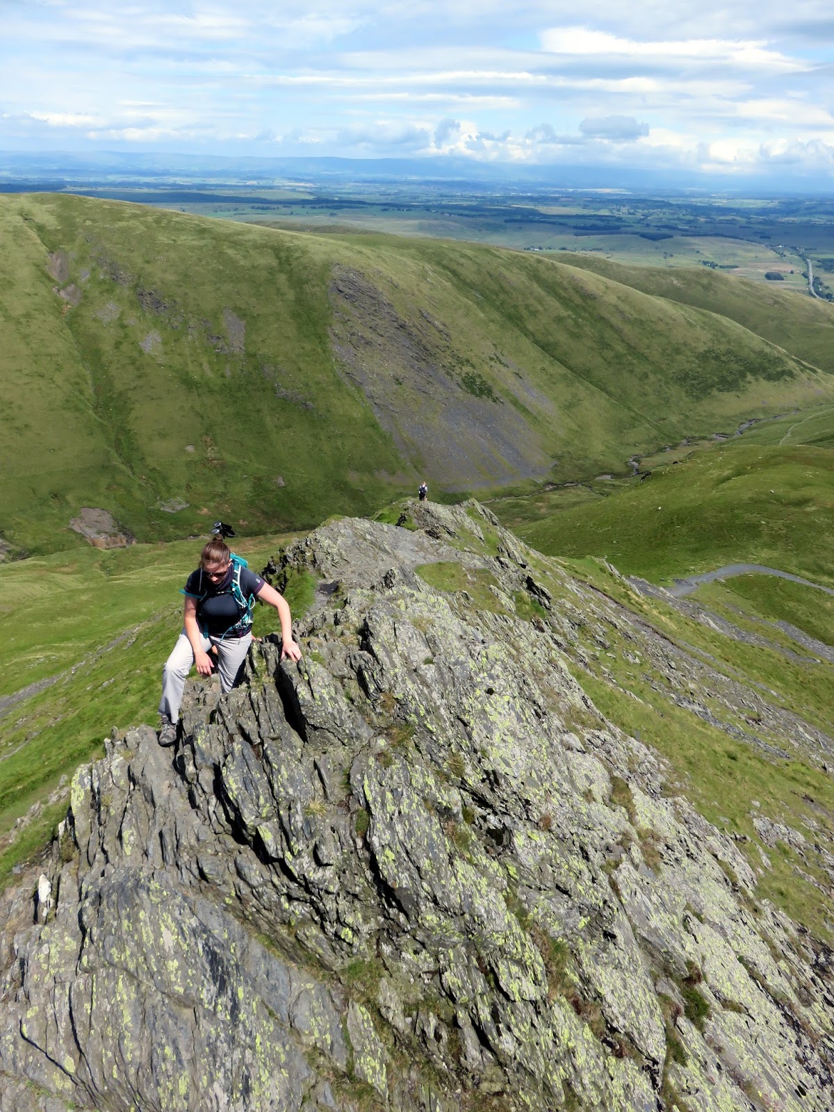
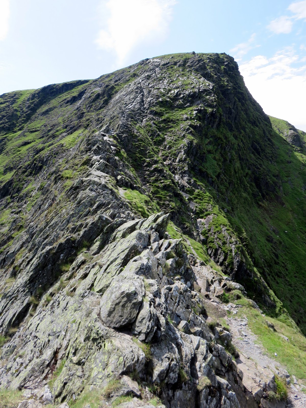
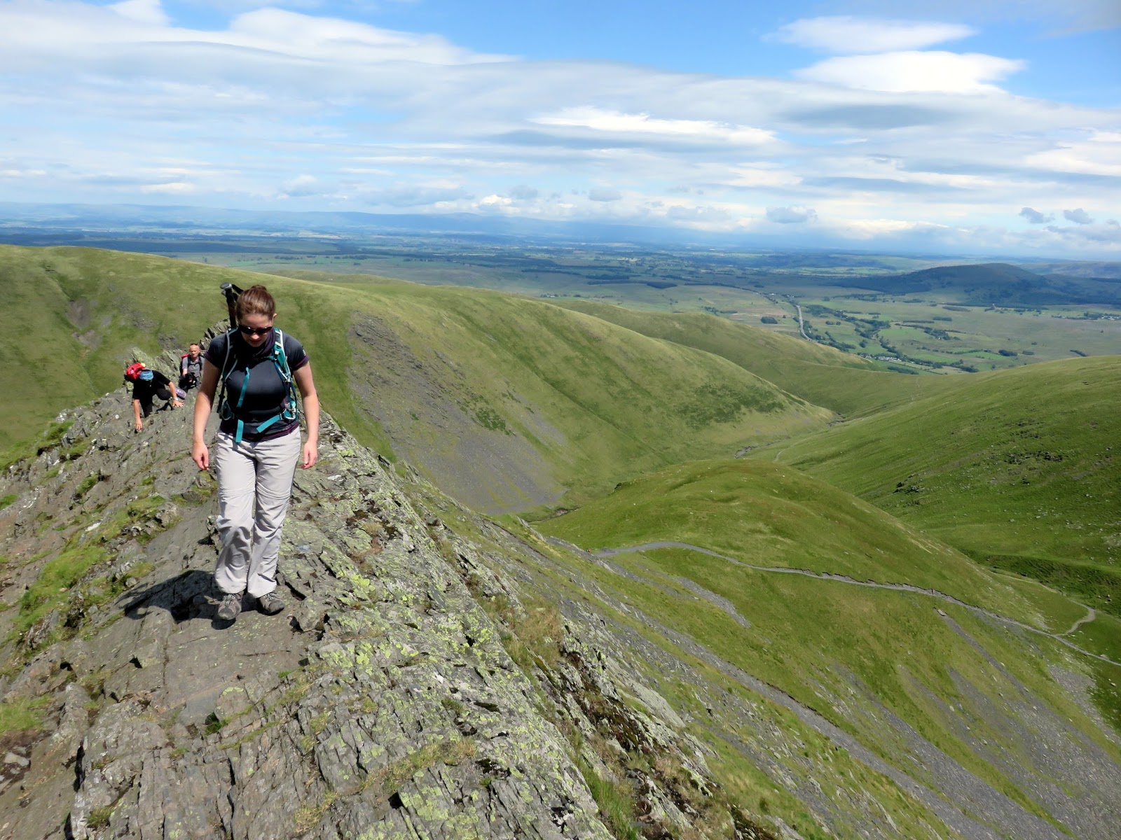
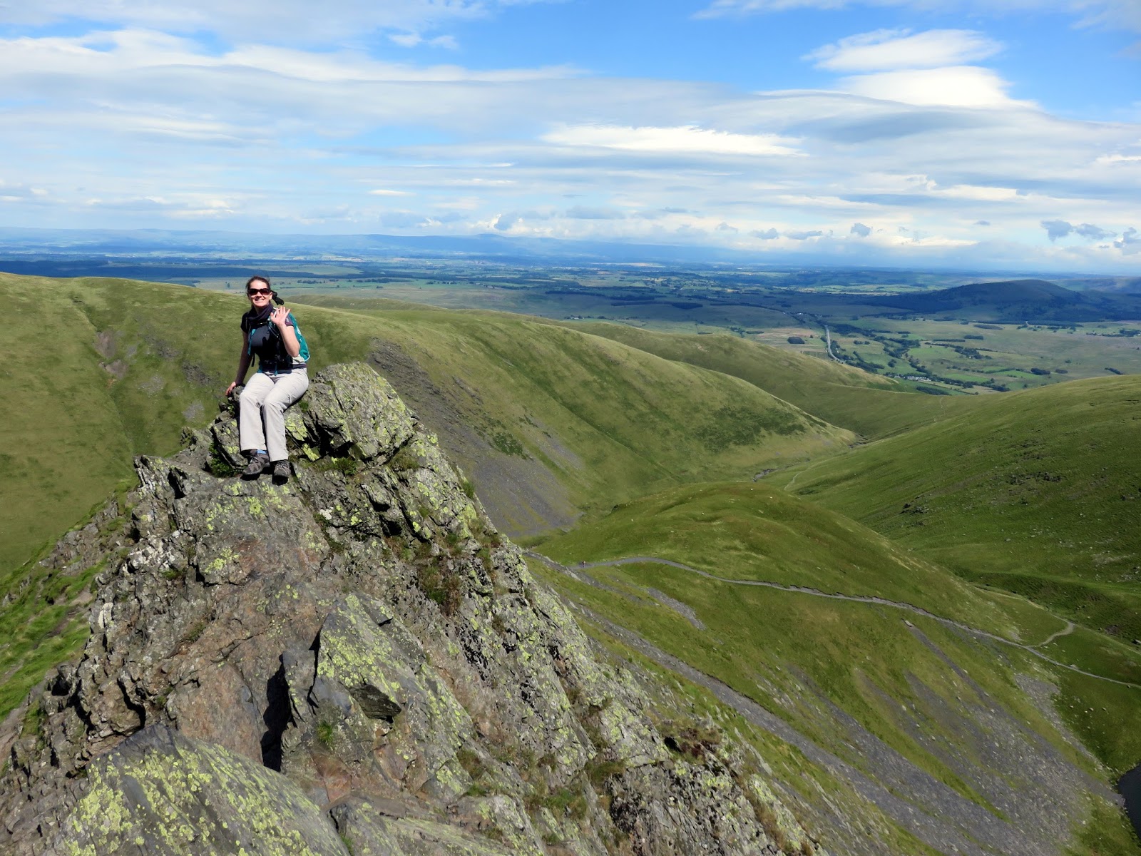
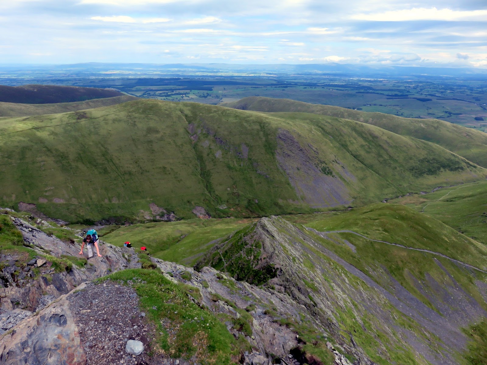
Sharp Edge sweeps up ahead of you, an extremely narrow ridge with steep drops on either side. If you can stomach the exposure, clambering along its crest is not too difficult and most sections can be done without using your hands. I’d say that it’s actually slightly wider than it first appears with only one or two truly ‘knife-edge’ sections to tackle.
 |
| Sara negotiating Sharp Edge |
 |
| Sharp Edge |
 |
| Sharp Edge |
 |
| Sara on one of the wider sections |
 |
| Sara on Sharp Edge |
Around half way, you will reach a notch on the ridge with a short, jutting rock poking out at the top. This is widely known as the Bad Step, as the rock has been expertly polished by thousands of backsides. In the dry, you may not even notice it and continue on regardless, but when it is wet, the underlying slate can become lethally slippery with a number of casualties ending up the ‘usual gully’ as the Mountain Rescue put it.
 |
| Continuing Sharp Edge |
 |
| Down to Scales Tarn |
 |
| The Bad Step on Sharp Edge |
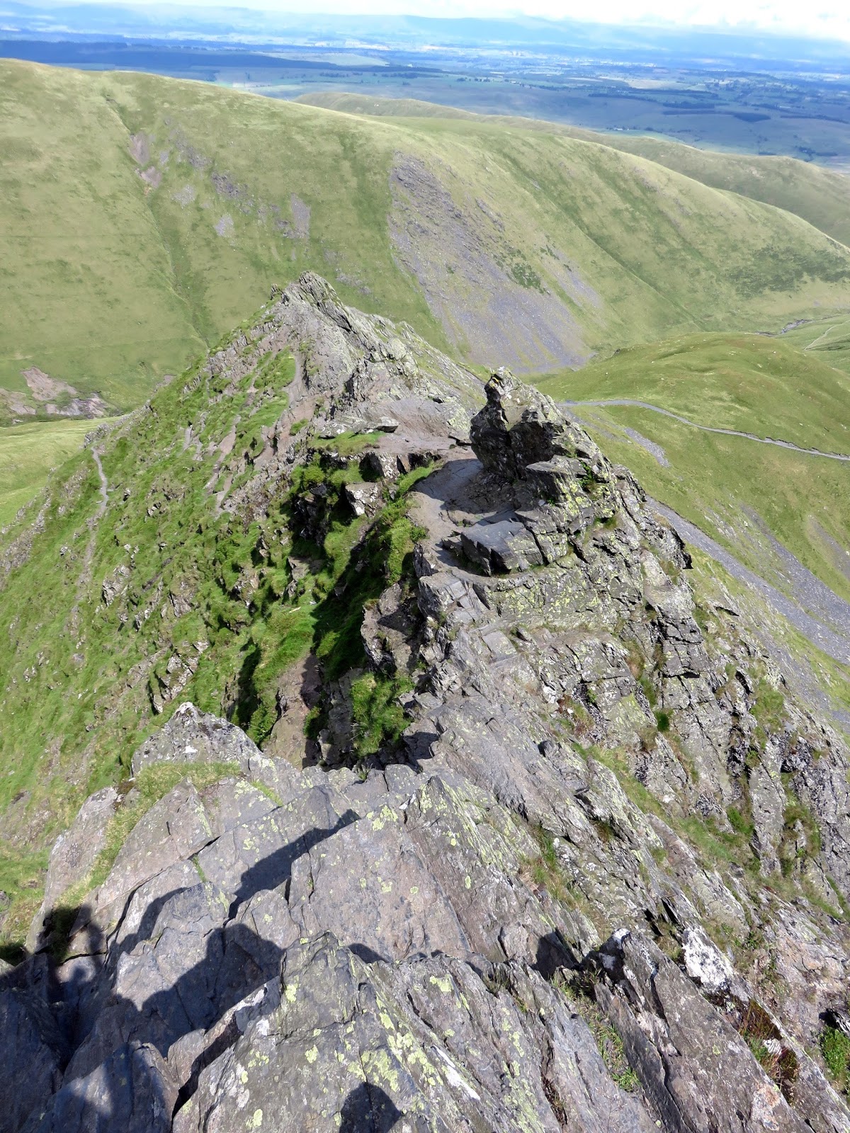
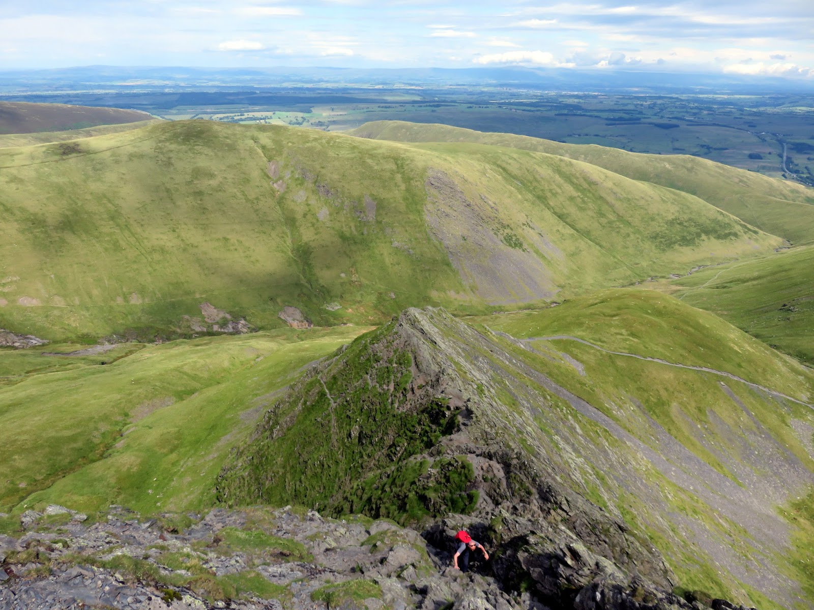
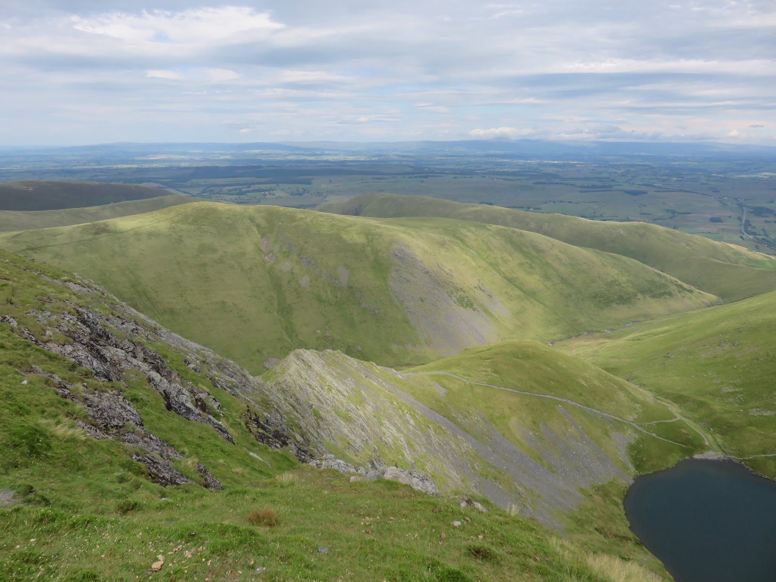
With the Bad Step negotiated, Sharp Edge starts to climb before ending at the base of Foule Crag. Short but sweet, it’s a great introduction to exposed ridges and a real shame that it doesn’t last longer. Scrambling up Foule Crag is entertaining in itself, the noticeable gully to the right being the most obvious route of ascent. Views back along Sharp Edge and down to Scales Tarn are understandably excellent.
 |
| Sharp Edge from Foule Crag |
 |
| Sharp Edge and Scales Tarn |
 |
| Finishing Sharp Edge |
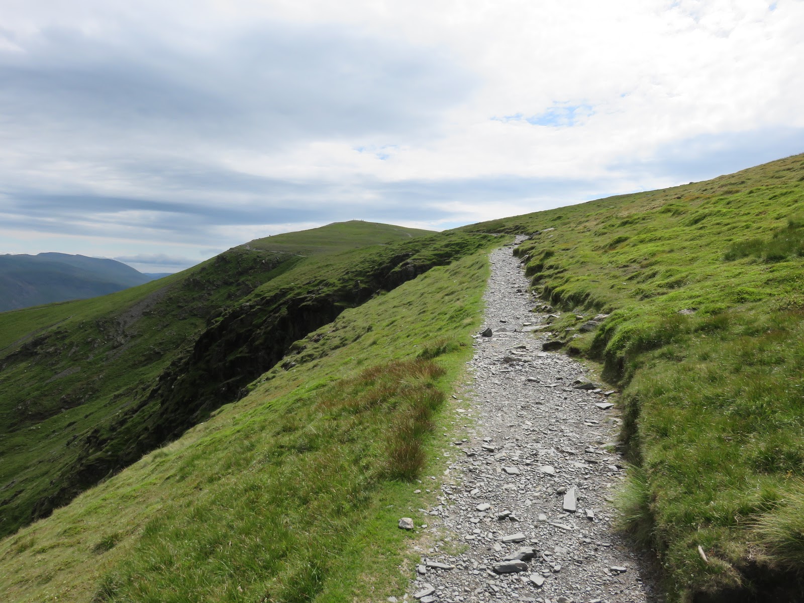
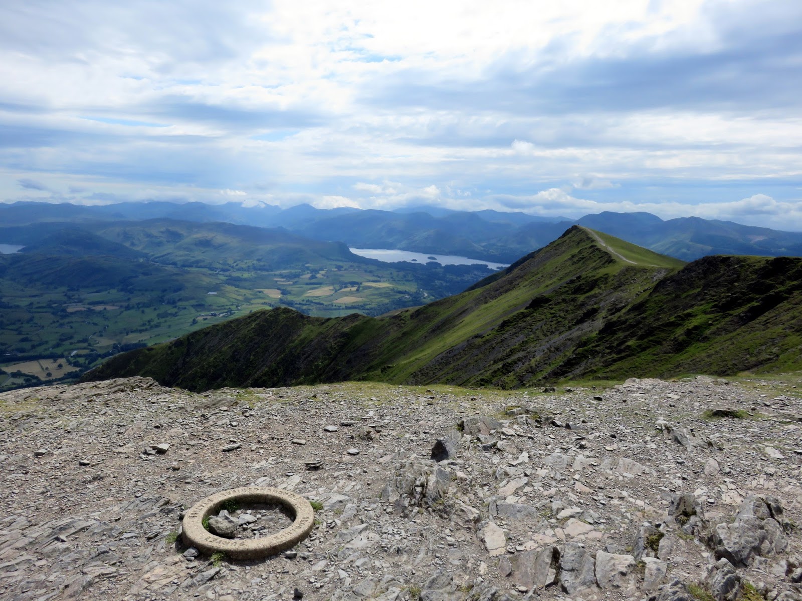
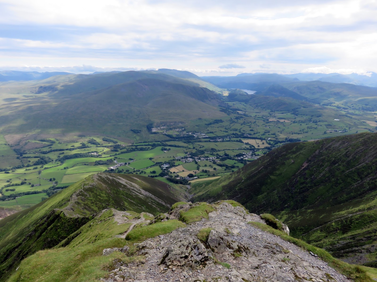
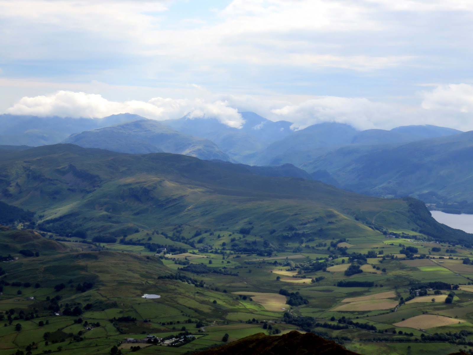
Eventually, you will reach the top of Foule Crag where a path will lead you along the top of Tarn Crags and the final climb to Blencathra’s summit. Instead of a traditional trig pillar, there is instead a small circular ring to denote the summit. Views from Blencathra are something special. taking in a huge sweep of the entire national park.
 |
| Atop Tarn Crags |
 |
| Sharp Edge and Scales Tarn |
 |
| Hall’s Fell Ridge |
 |
| St. John’s in the Vale |
 |
| The central ridge |
 |
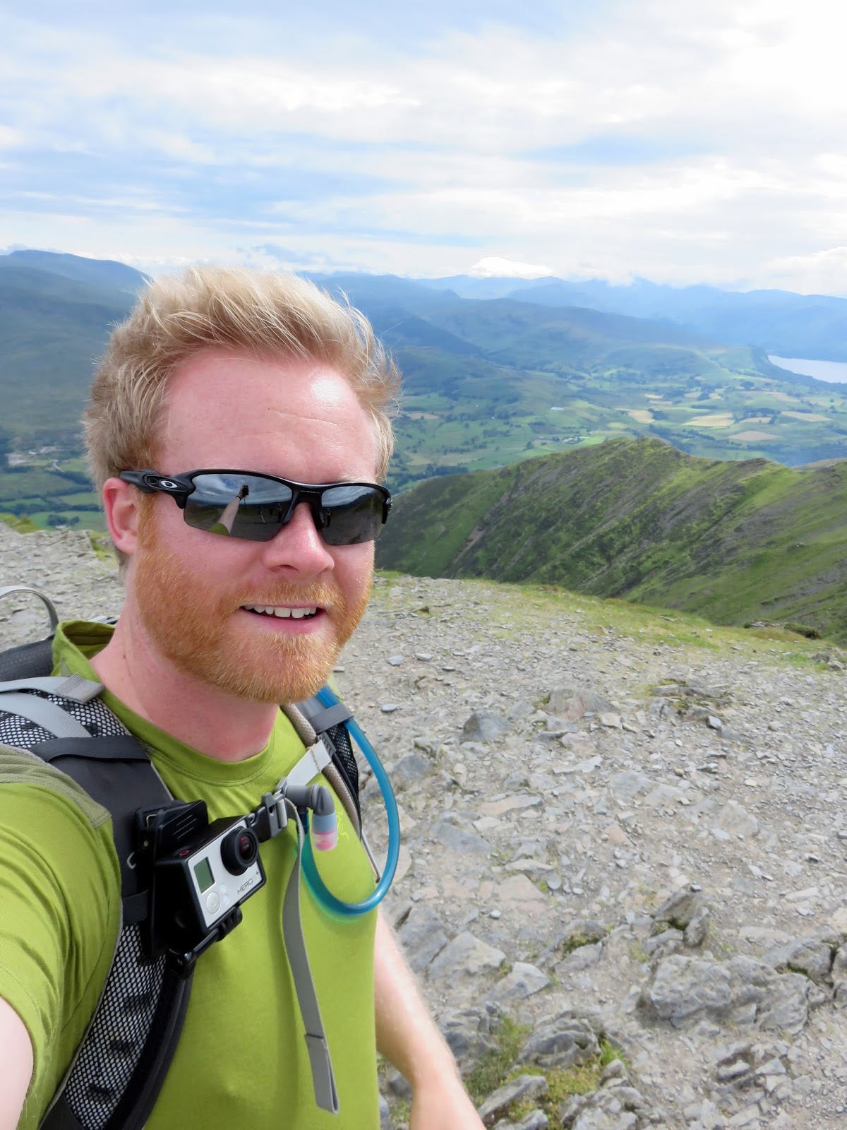
| At the top! |
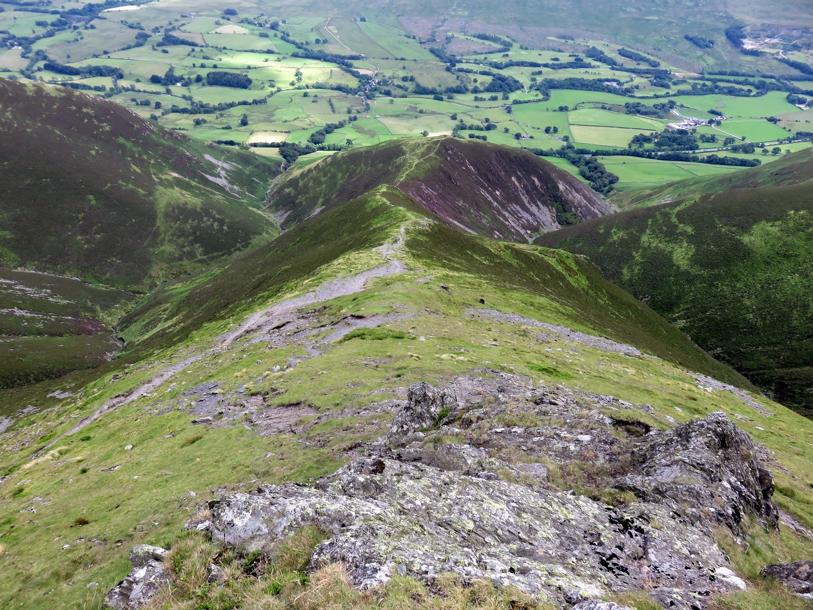
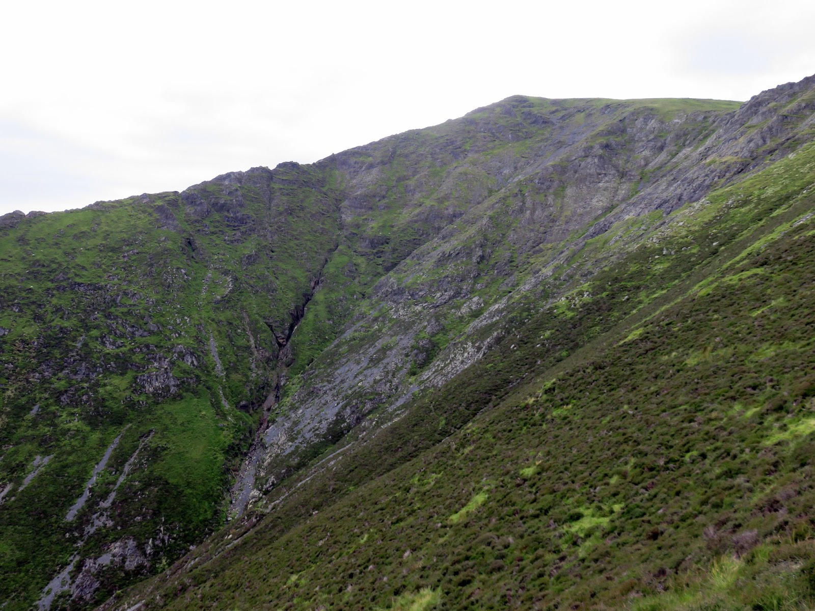
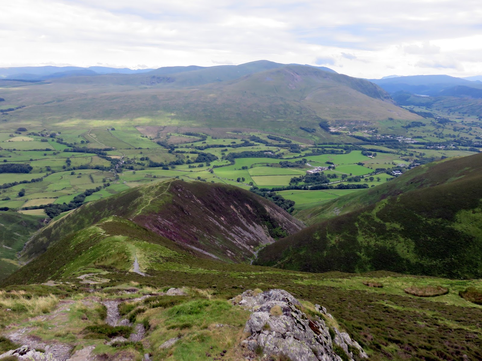
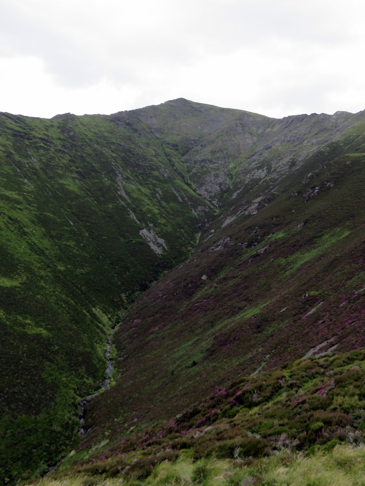
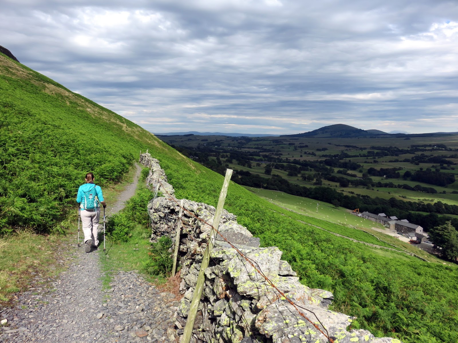
After some brief map consultation we decided to follow the Scales Fell ridge to the top of Doddick Fell, one of the many ridges that run south from Blencathra’s main ridge, Hall’s Fell being the best of the lot. Doddick Fell, while lacking some of the excitement of Hall’s Fell, does have superb views of Doddick Gill and the crags below Blencathra’s summit – something you don’t really see from the other ridges.
 |
| Scales Fell |
 |
| The top of Doddick Fell |
 |
| Doddick Fell |
 |
| Doddick Fell |
 |
| Doddick Fell and Doddick Gill |
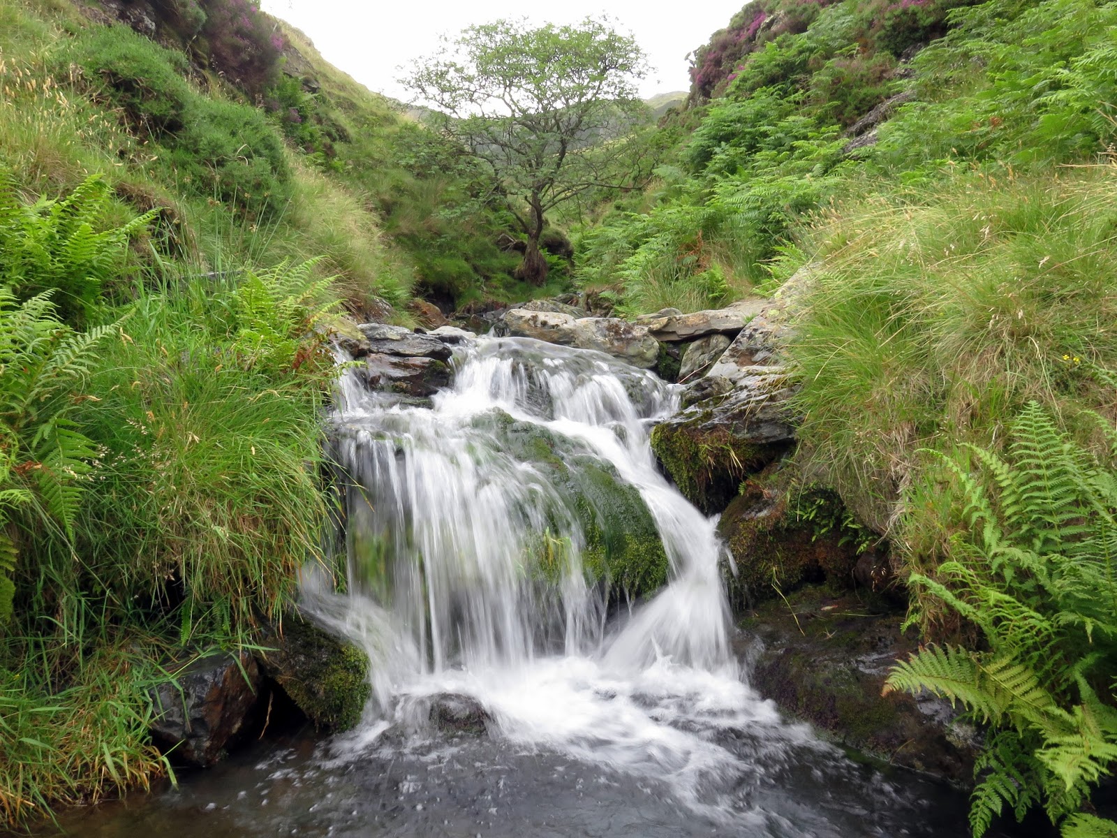
Descending the ridge takes some time though it’s not particularly difficult. Upon reaching the bottom, all that was left was to follow the wall back towards the layby where the car was waiting. There was one tricky little section at Scaley Beck where a rock step needs negotiating but again, the route is largely trouble free.
 |
| The Vale of Keswick |
 |
| The path above Doddick Farm |
 |
| Scaley Beck |
In all, a great afternoon out on a superb fell. Sharp Edge is an excellent scramble the absolutely has to be done. It’s just a shame the excitement is short lived. This walk is a short, sharp blast of entertainment – pun intended.
