Open Space Web-Map builder Codehttps://openspace.ordnancesurvey.co.uk/osmapapi/openspace.js?key=3119F72552FD5C22E0530C6CA40A5A92https://openspace.ordnancesurvey.co.uk/osmapapi/script/mapbuilder/basicmap.jshttps://openspace.ordnancesurvey.co.uk/osmapapi/script/mapbuilder/searchbox.js//variables for routes var linesLayer, points, lineFeature, lineString, routeMarkersLayer, routepos, routesize, routeoffset, routeicon; var style_blue = {strokeColor: “#0000CD”, strokeOpacity: 0.5, strokeWidth: 4.5}; function initmapbuilder() { //initiate the map var options = {resolutions: [2500, 1000, 500, 200, 100, 50, 25, 10, 5, 4, 2.5, 2, 1]}; osMap = new OpenSpace.Map(‘map’, options); //configure map options (basicmap.js) setglobaloptions(); //set the center of the map and the zoom level osMap.setCenter(new OpenSpace.MapPoint(258272,357477),7); linesLayer = osMap.getVectorLayer(); // Set up layer for route markers routeMarkersLayer = new OpenLayers.Layer.Markers(“Route Markers”); //make a route points = new Array(); points.push(new OpenLayers.Geometry.Point(257788,360399)); points.push(new OpenLayers.Geometry.Point(257632,360363)); points.push(new OpenLayers.Geometry.Point(257420,360395)); points.push(new OpenLayers.Geometry.Point(257036,360347)); points.push(new OpenLayers.Geometry.Point(256952,360315)); points.push(new OpenLayers.Geometry.Point(256871,360326)); points.push(new OpenLayers.Geometry.Point(256801,360416)); points.push(new OpenLayers.Geometry.Point(256616,360321)); points.push(new OpenLayers.Geometry.Point(256331,360261)); points.push(new OpenLayers.Geometry.Point(256101,360181)); points.push(new OpenLayers.Geometry.Point(255871,360091)); points.push(new OpenLayers.Geometry.Point(255821,360006)); points.push(new OpenLayers.Geometry.Point(255676,359946)); points.push(new OpenLayers.Geometry.Point(255701,359871)); points.push(new OpenLayers.Geometry.Point(255776,359761)); points.push(new OpenLayers.Geometry.Point(255816,359616)); points.push(new OpenLayers.Geometry.Point(255766,359476)); points.push(new OpenLayers.Geometry.Point(255701,359306)); points.push(new OpenLayers.Geometry.Point(255671,358936)); points.push(new OpenLayers.Geometry.Point(255676,358696)); points.push(new OpenLayers.Geometry.Point(255676,358426)); points.push(new OpenLayers.Geometry.Point(255701,358191)); points.push(new OpenLayers.Geometry.Point(255726,358131)); points.push(new OpenLayers.Geometry.Point(255706,357986)); points.push(new OpenLayers.Geometry.Point(255586,357726)); points.push(new OpenLayers.Geometry.Point(255651,357576)); points.push(new OpenLayers.Geometry.Point(255831,357236)); points.push(new OpenLayers.Geometry.Point(255876,357036)); points.push(new OpenLayers.Geometry.Point(255981,356876)); points.push(new OpenLayers.Geometry.Point(256151,356706)); points.push(new OpenLayers.Geometry.Point(256316,356591)); points.push(new OpenLayers.Geometry.Point(256411,356526)); points.push(new OpenLayers.Geometry.Point(256631,356361)); points.push(new OpenLayers.Geometry.Point(256866,356326)); points.push(new OpenLayers.Geometry.Point(257076,356356)); points.push(new OpenLayers.Geometry.Point(257051,356131)); points.push(new OpenLayers.Geometry.Point(257146,355936)); points.push(new OpenLayers.Geometry.Point(257236,355851)); points.push(new OpenLayers.Geometry.Point(257461,355936)); points.push(new OpenLayers.Geometry.Point(257636,355956)); points.push(new OpenLayers.Geometry.Point(257786,356036)); points.push(new OpenLayers.Geometry.Point(257941,356131)); points.push(new OpenLayers.Geometry.Point(258126,356171)); points.push(new OpenLayers.Geometry.Point(258311,356196)); points.push(new OpenLayers.Geometry.Point(258476,356296)); points.push(new OpenLayers.Geometry.Point(258626,356361)); points.push(new OpenLayers.Geometry.Point(258801,356171)); points.push(new OpenLayers.Geometry.Point(258941,355981)); points.push(new OpenLayers.Geometry.Point(259086,355821)); points.push(new OpenLayers.Geometry.Point(259191,355641)); points.push(new OpenLayers.Geometry.Point(259296,355576)); points.push(new OpenLayers.Geometry.Point(259301,355626)); points.push(new OpenLayers.Geometry.Point(259356,355601)); points.push(new OpenLayers.Geometry.Point(259356,355636)); points.push(new OpenLayers.Geometry.Point(259556,355526)); points.push(new OpenLayers.Geometry.Point(259571,355611)); points.push(new OpenLayers.Geometry.Point(259811,355501)); points.push(new OpenLayers.Geometry.Point(259831,355521)); points.push(new OpenLayers.Geometry.Point(260051,355436)); points.push(new OpenLayers.Geometry.Point(260131,355321)); points.push(new OpenLayers.Geometry.Point(260486,355316)); points.push(new OpenLayers.Geometry.Point(260626,355171)); points.push(new OpenLayers.Geometry.Point(260716,354996)); points.push(new OpenLayers.Geometry.Point(260781,354936)); points.push(new OpenLayers.Geometry.Point(260791,354806)); points.push(new OpenLayers.Geometry.Point(260861,354616)); points.push(new OpenLayers.Geometry.Point(260991,354401)); points.push(new OpenLayers.Geometry.Point(260866,354611)); points.push(new OpenLayers.Geometry.Point(260776,354876)); points.push(new OpenLayers.Geometry.Point(260791,354946)); points.push(new OpenLayers.Geometry.Point(260921,355086)); points.push(new OpenLayers.Geometry.Point(261111,355176)); points.push(new OpenLayers.Geometry.Point(260886,355261)); points.push(new OpenLayers.Geometry.Point(260786,355351)); points.push(new OpenLayers.Geometry.Point(260956,355616)); points.push(new OpenLayers.Geometry.Point(261036,355701)); points.push(new OpenLayers.Geometry.Point(261036,355786)); points.push(new OpenLayers.Geometry.Point(260981,355881)); points.push(new OpenLayers.Geometry.Point(260861,356036)); points.push(new OpenLayers.Geometry.Point(260756,356171)); points.push(new OpenLayers.Geometry.Point(260711,356326)); points.push(new OpenLayers.Geometry.Point(260626,356431)); points.push(new OpenLayers.Geometry.Point(260576,356601)); points.push(new OpenLayers.Geometry.Point(260616,356751)); points.push(new OpenLayers.Geometry.Point(260671,356816)); points.push(new OpenLayers.Geometry.Point(260626,356811)); points.push(new OpenLayers.Geometry.Point(260516,356876)); points.push(new OpenLayers.Geometry.Point(260341,357016)); points.push(new OpenLayers.Geometry.Point(260171,357141)); points.push(new OpenLayers.Geometry.Point(260116,357296)); points.push(new OpenLayers.Geometry.Point(260096,357511)); points.push(new OpenLayers.Geometry.Point(259971,357746)); points.push(new OpenLayers.Geometry.Point(259851,357831)); points.push(new OpenLayers.Geometry.Point(259701,357956)); points.push(new OpenLayers.Geometry.Point(259666,358026)); points.push(new OpenLayers.Geometry.Point(259586,358161)); points.push(new OpenLayers.Geometry.Point(259486,358166)); points.push(new OpenLayers.Geometry.Point(259361,358146)); points.push(new OpenLayers.Geometry.Point(259071,358101)); points.push(new OpenLayers.Geometry.Point(258916,358231)); points.push(new OpenLayers.Geometry.Point(258636,358391)); points.push(new OpenLayers.Geometry.Point(258436,358641)); points.push(new OpenLayers.Geometry.Point(258296,358896)); points.push(new OpenLayers.Geometry.Point(258236,358941)); points.push(new OpenLayers.Geometry.Point(258186,358871)); points.push(new OpenLayers.Geometry.Point(258095,359028)); points.push(new OpenLayers.Geometry.Point(258075,359140)); points.push(new OpenLayers.Geometry.Point(258031,359136)); points.push(new OpenLayers.Geometry.Point(257979,359108)); points.push(new OpenLayers.Geometry.Point(257943,359132)); points.push(new OpenLayers.Geometry.Point(257895,359252)); points.push(new OpenLayers.Geometry.Point(257923,359372)); points.push(new OpenLayers.Geometry.Point(257911,359396)); points.push(new OpenLayers.Geometry.Point(257927,359416)); points.push(new OpenLayers.Geometry.Point(258047,359424)); points.push(new OpenLayers.Geometry.Point(258119,359508)); points.push(new OpenLayers.Geometry.Point(258023,359552)); points.push(new OpenLayers.Geometry.Point(257971,359568)); points.push(new OpenLayers.Geometry.Point(257931,359588)); points.push(new OpenLayers.Geometry.Point(257863,359672)); points.push(new OpenLayers.Geometry.Point(257827,359696)); points.push(new OpenLayers.Geometry.Point(257791,359756)); points.push(new OpenLayers.Geometry.Point(257835,359796)); points.push(new OpenLayers.Geometry.Point(257835,359852)); points.push(new OpenLayers.Geometry.Point(257947,360036)); points.push(new OpenLayers.Geometry.Point(257823,360088)); points.push(new OpenLayers.Geometry.Point(257783,360176)); points.push(new OpenLayers.Geometry.Point(257788,360399)); // create a polyline feature from the array of points lineString = new OpenLayers.Geometry.LineString(points); lineFeature = new OpenLayers.Feature.Vector(lineString, null, style_blue); linesLayer.addFeatures([lineFeature]); //crate a route start/end marker routepos = new OpenSpace.MapPoint(257788,360399); routesize = new OpenLayers.Size(33,45); routeoffset = new OpenLayers.Pixel(-5,-37); routeicon = new OpenSpace.Icon(‘https://openspace.ordnancesurvey.co.uk/osmapapi/img_versions/img_1.1/mapbuilder/routemarker-startend.png’, routesize, routeoffset, null, null); routeMarkersLayer.addMarker(new OpenLayers.Marker(routepos, routeicon)); osMap.addLayer(routeMarkersLayer);}
Route: Llanberis, Bwlch-y-groes, Bryn Mawr, Moel Eilio, Bwlch Cwm Caseg, Foel Gron, Foel Goch, Bwlch Maesgwm, Moel Cynghorion, Bwlch Cwm Brwynog, Snowdon Ranger Path, Clogwyn Du’r Arddu, Bwlch Glas, Snowdon, Bwlch Glas, Garnedd Ugain, Gryn Las, Clogwyn Station, Llechog, Tryfan, Llanberis Path, Llanberis
Date: 03/06/2017
From: Llanberis
Parking: Llanberis
Start Point: Pete’s Eats, Llanberis
Region: Snowdonia – Snowdon
Route length: 14.1 miles (22.7 km)
Time taken: 06:36
Average speed: 2.1 mph
Ascent: 1,752m
Descent: 1,774m
Summits: Moel Eilio (726m), Foel Gron (629m), Moel Cynghorion (674m), Yr Wyddfa (Snowdon) (1,085m), Garnedd Ugain (1,065m), Llechog (718m)
Other points of interest: Cwm Dwyhtwch, Snowdon Ranger Path, Hafod Eryri, Clogwyn Station
This long route to Snowdon is one I’ve had in mind for a few months now; I nearly did it instead of the Cwm Eigiau Horseshoe I completed a few weeks ago. This walk joins a number of outings into one continuous route and includes a large proportion of the Moel Eilio Horseshoe, the main section of the Snowdon Ranger Path and an easy descent down the Llanberis Path. It promised to be a great day.
We deliberately delayed our start time until late morning, not planning on arriving at Snowdon until early evening. While Snowdon is a great mountain, it can be crowded on a summer day so we were anticipating it being a little less busy by the time we arrived which would also, hopefully, coincide with some brighter weather – the threat of showers would accompany us for much of the day.
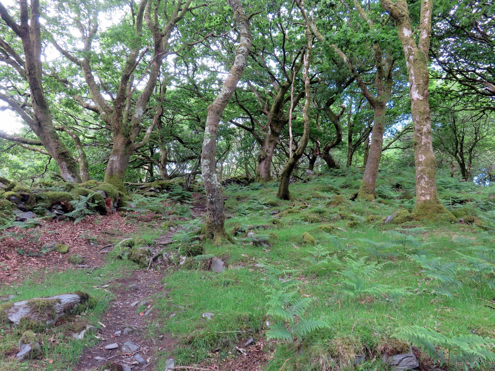
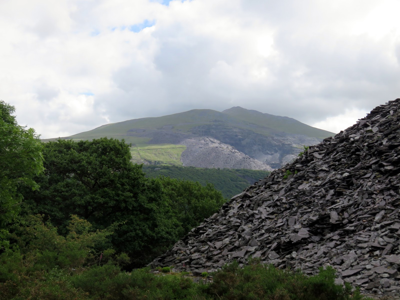
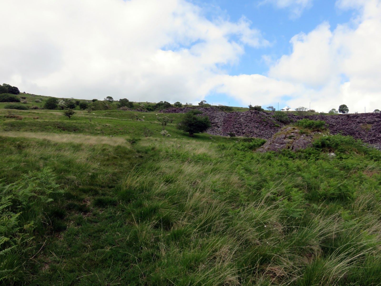
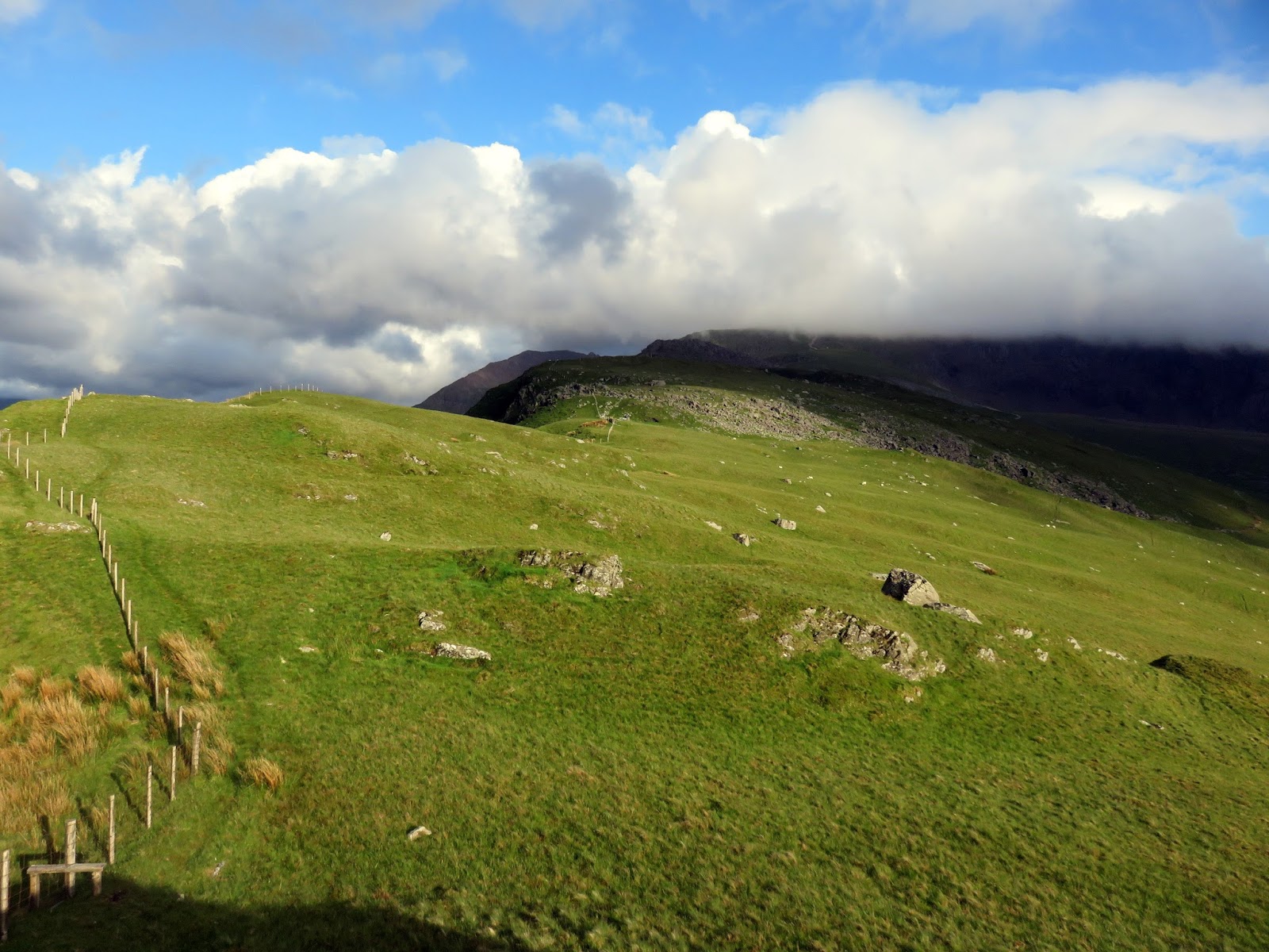
Starting in Llanberis, we made our way along Goodman Street to reach Ffordd Clegir and the old slate quarries to the west of the town. A signposted path wends up through the spoil heaps to Bwlch-y-groes and the bottom of Moel Eilio’s north ridge.
 |
| Woodland above Llanberis |
 |
| More slate spoil approaching Bwlch-y-groes |
 |
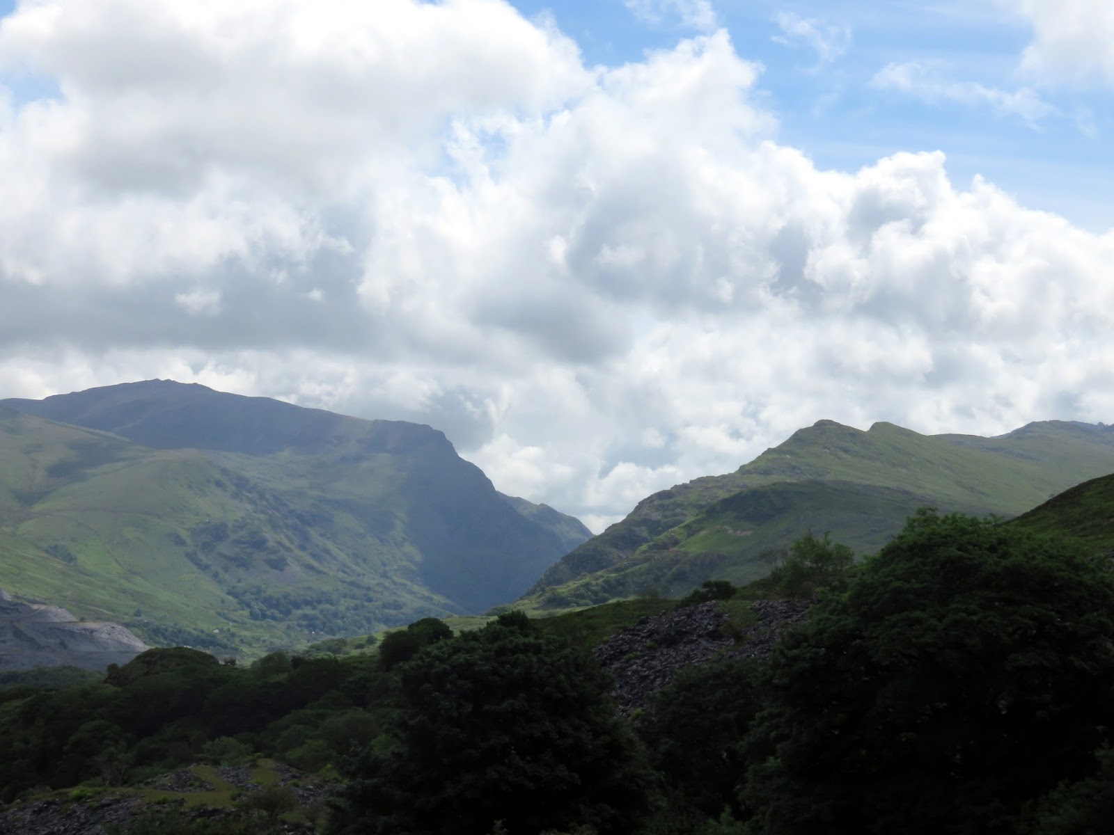
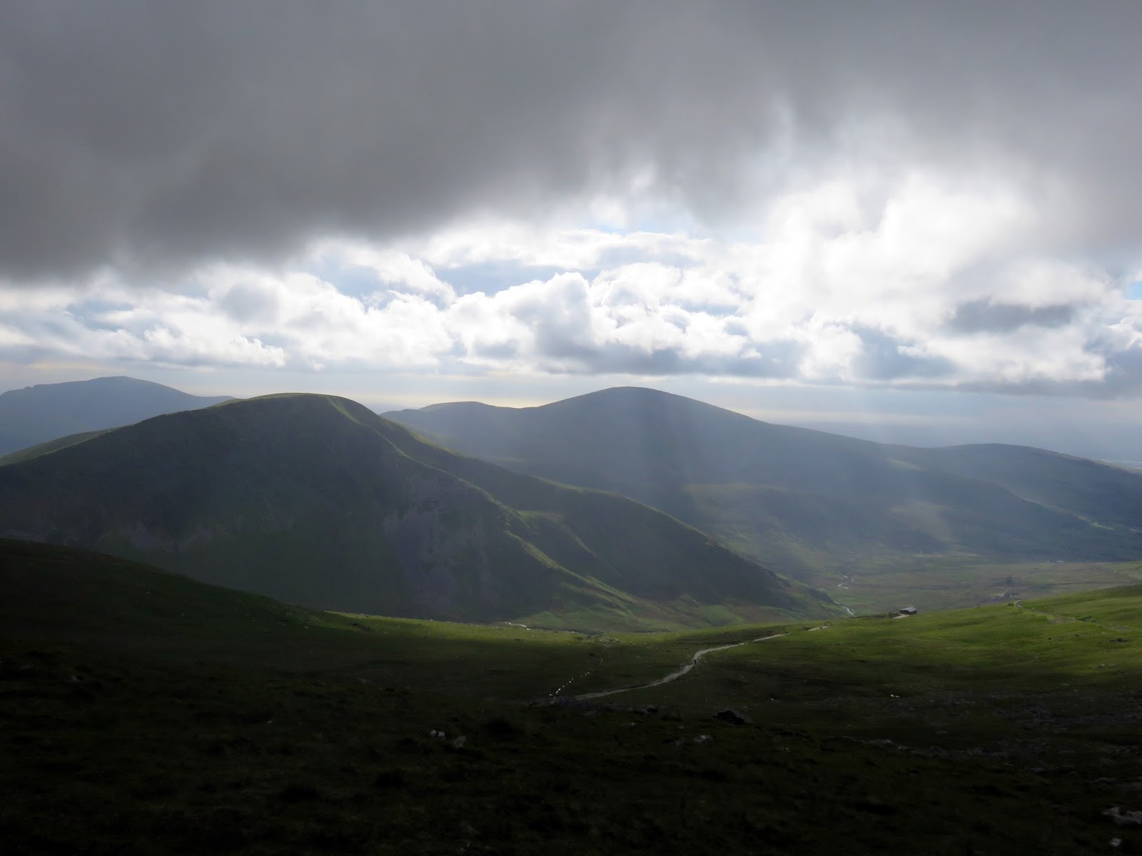
| Mountains surrounding the Llanberis Pass |
 |
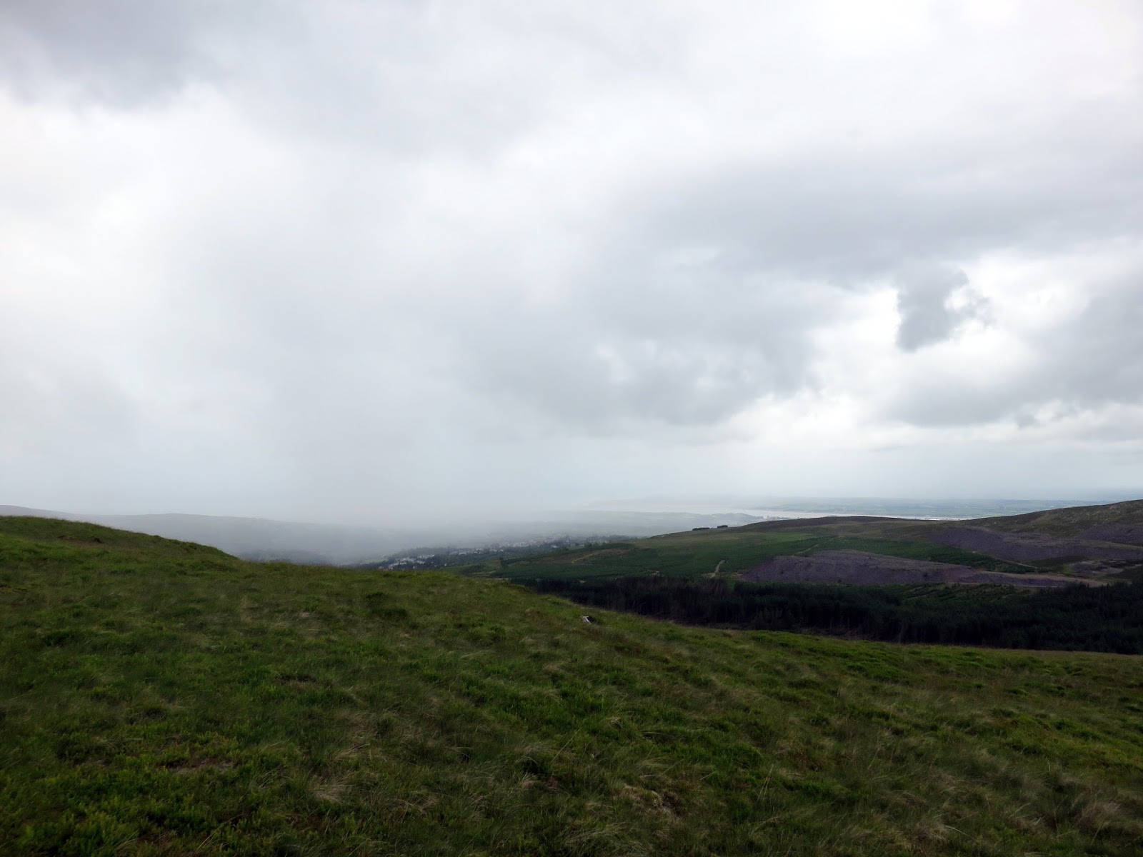
| A large shower over Penygroes |
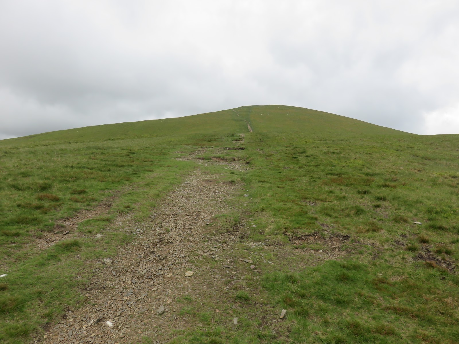
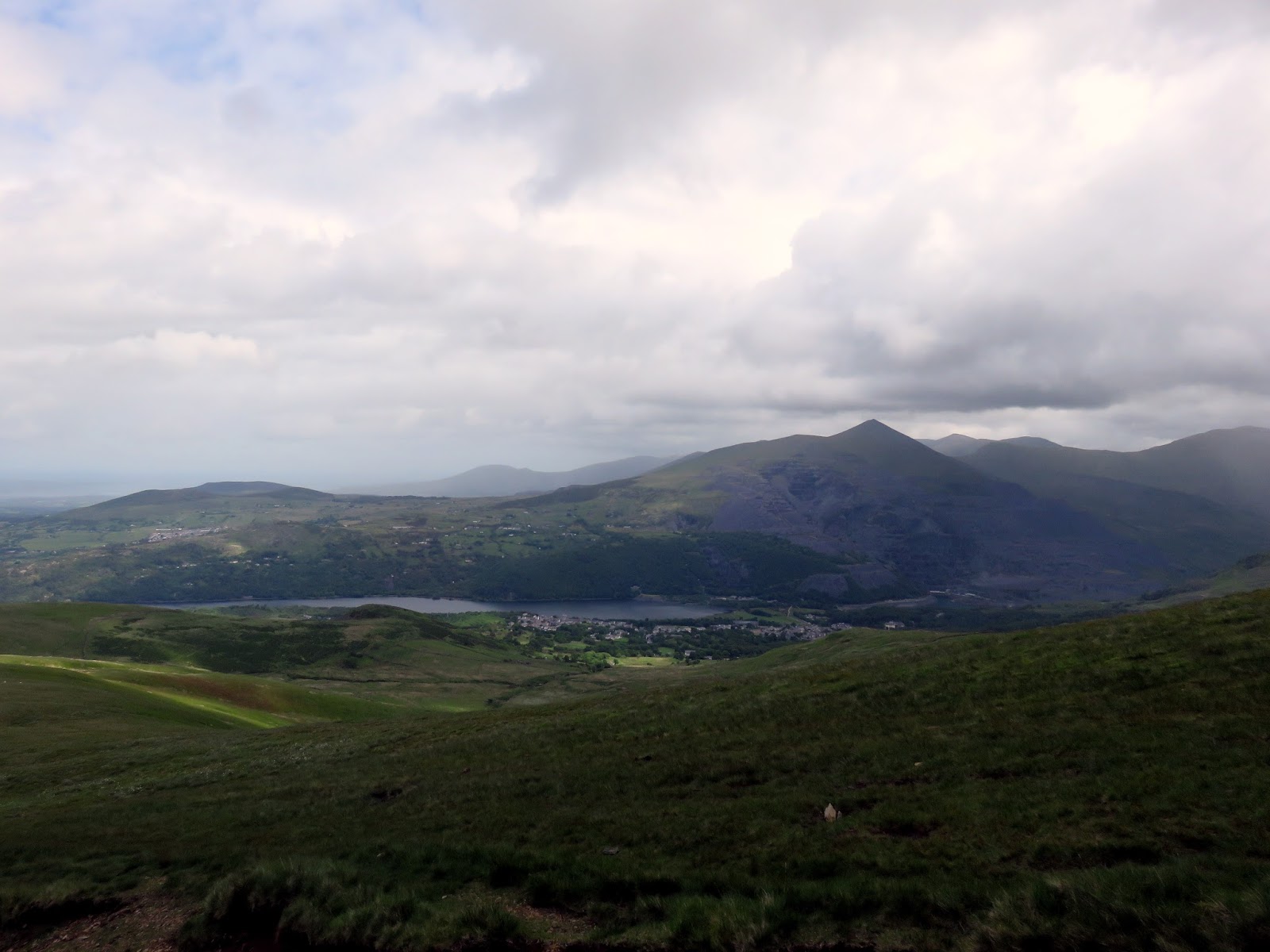
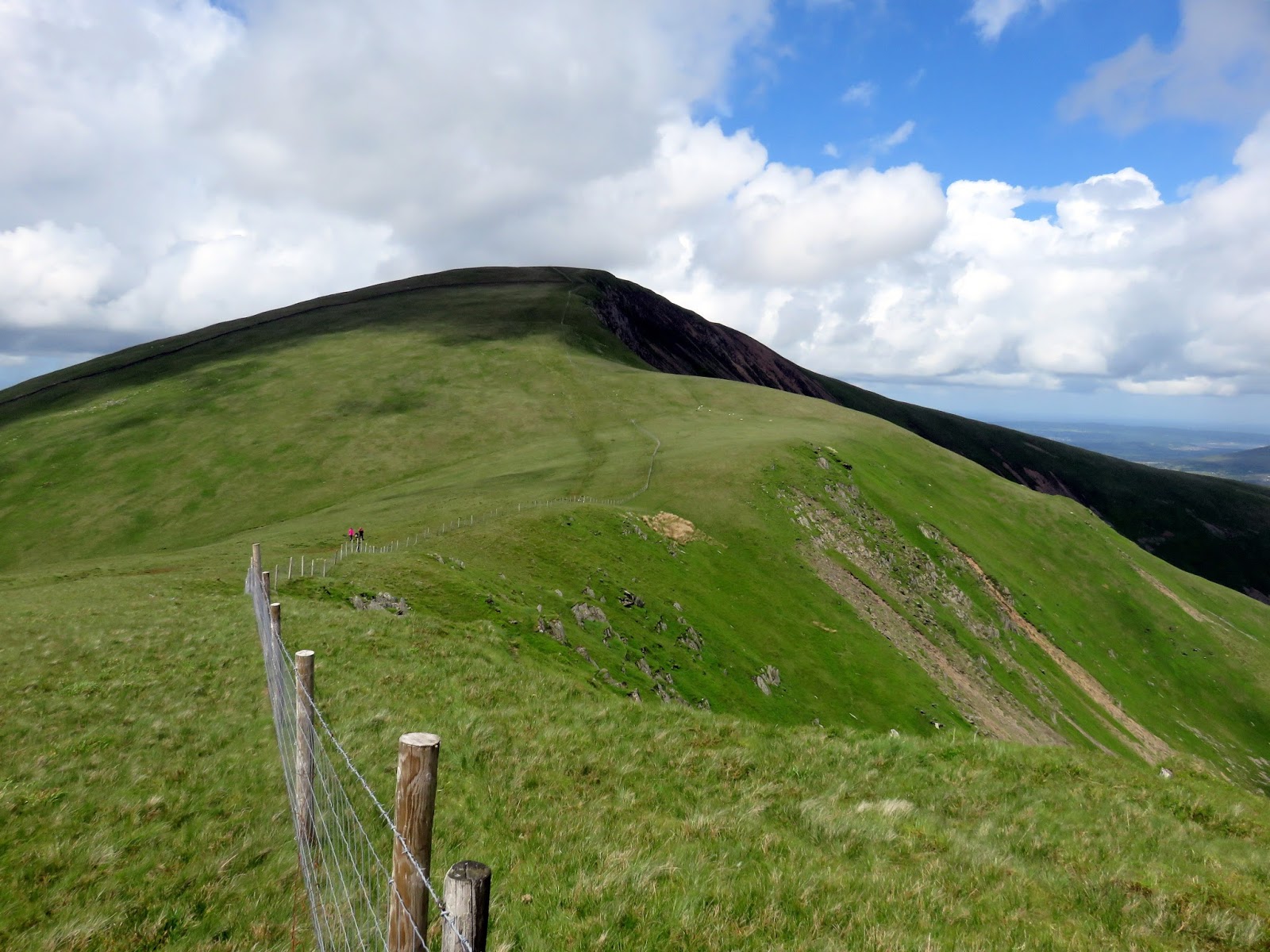
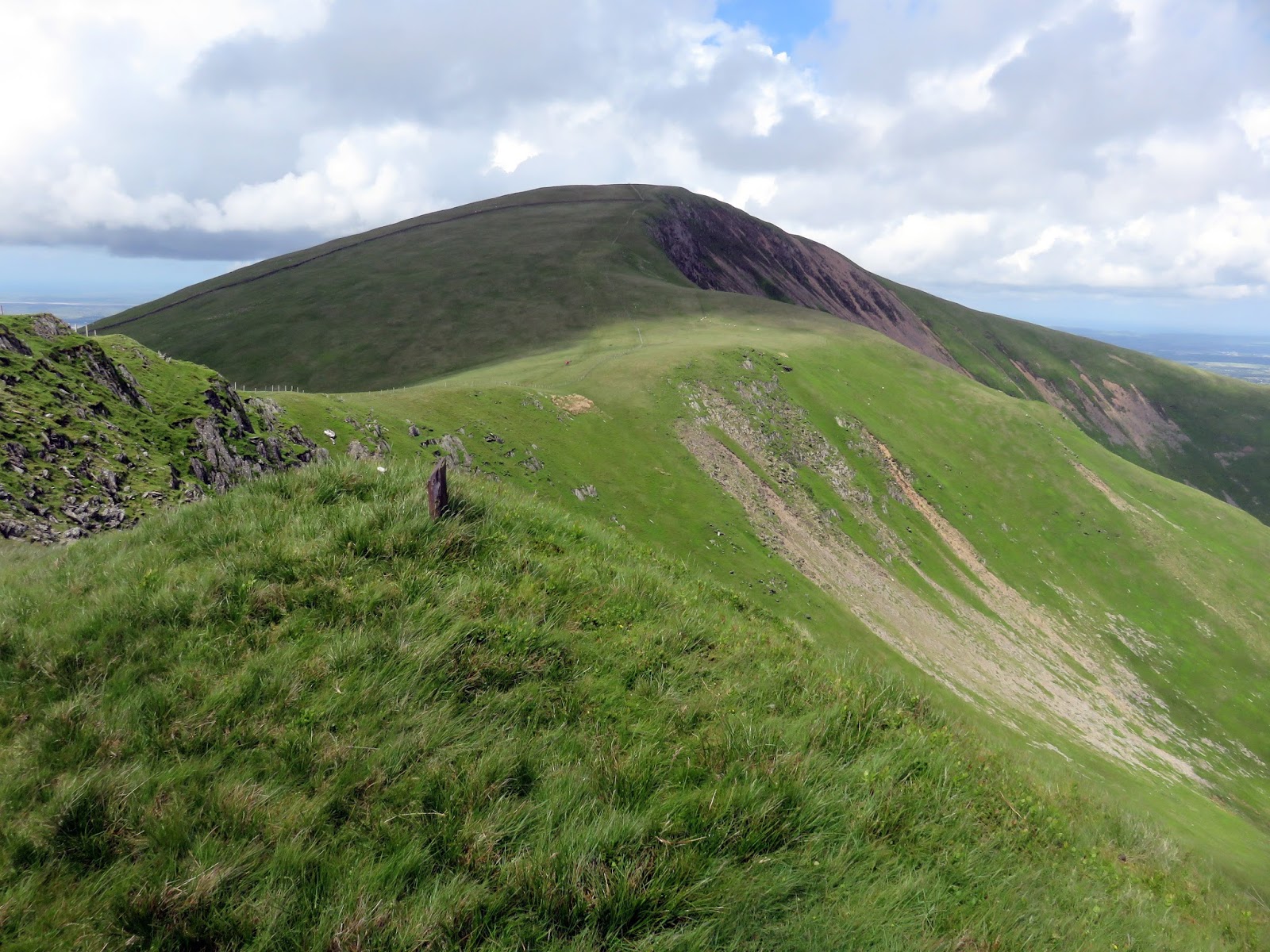
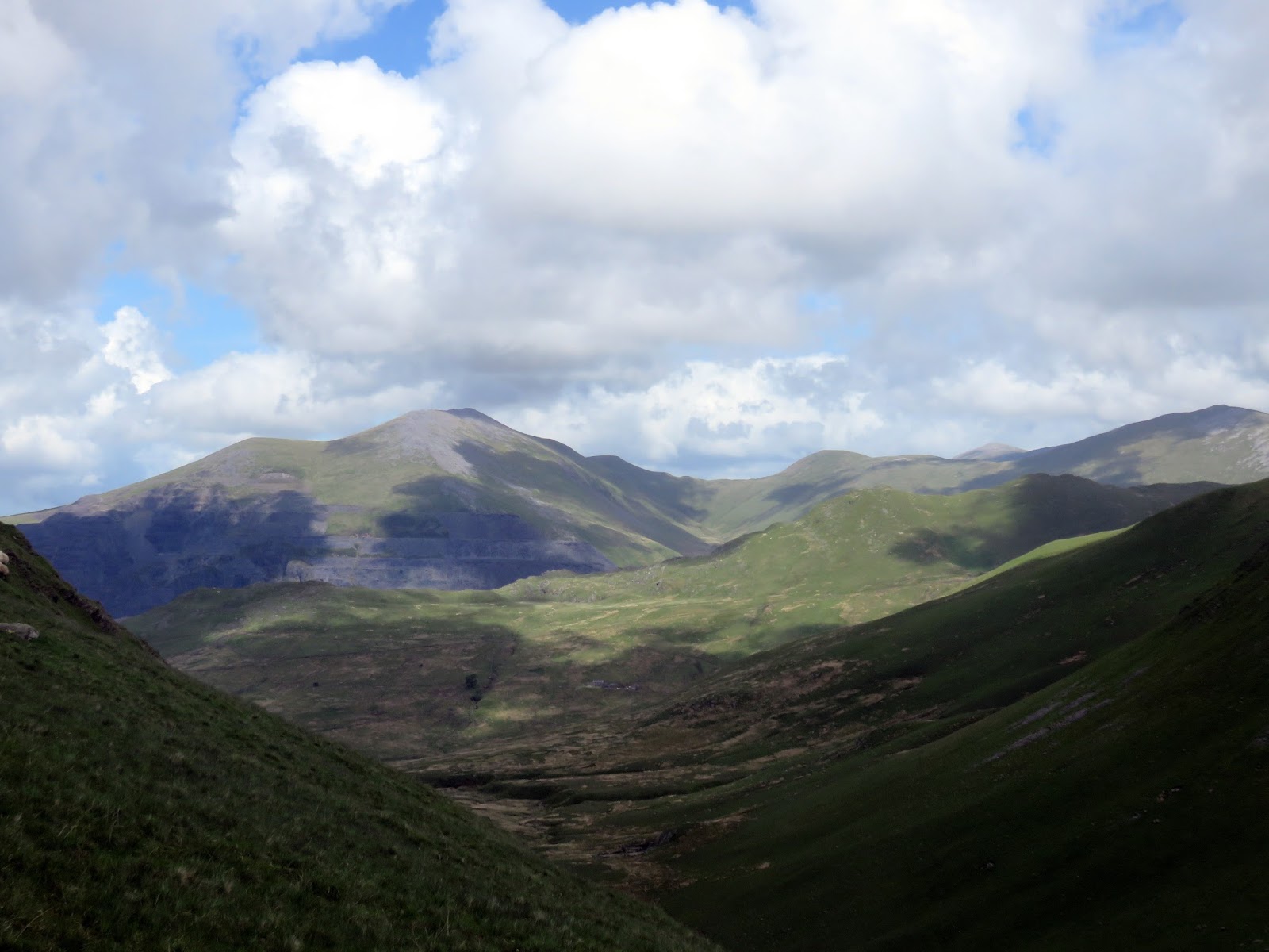
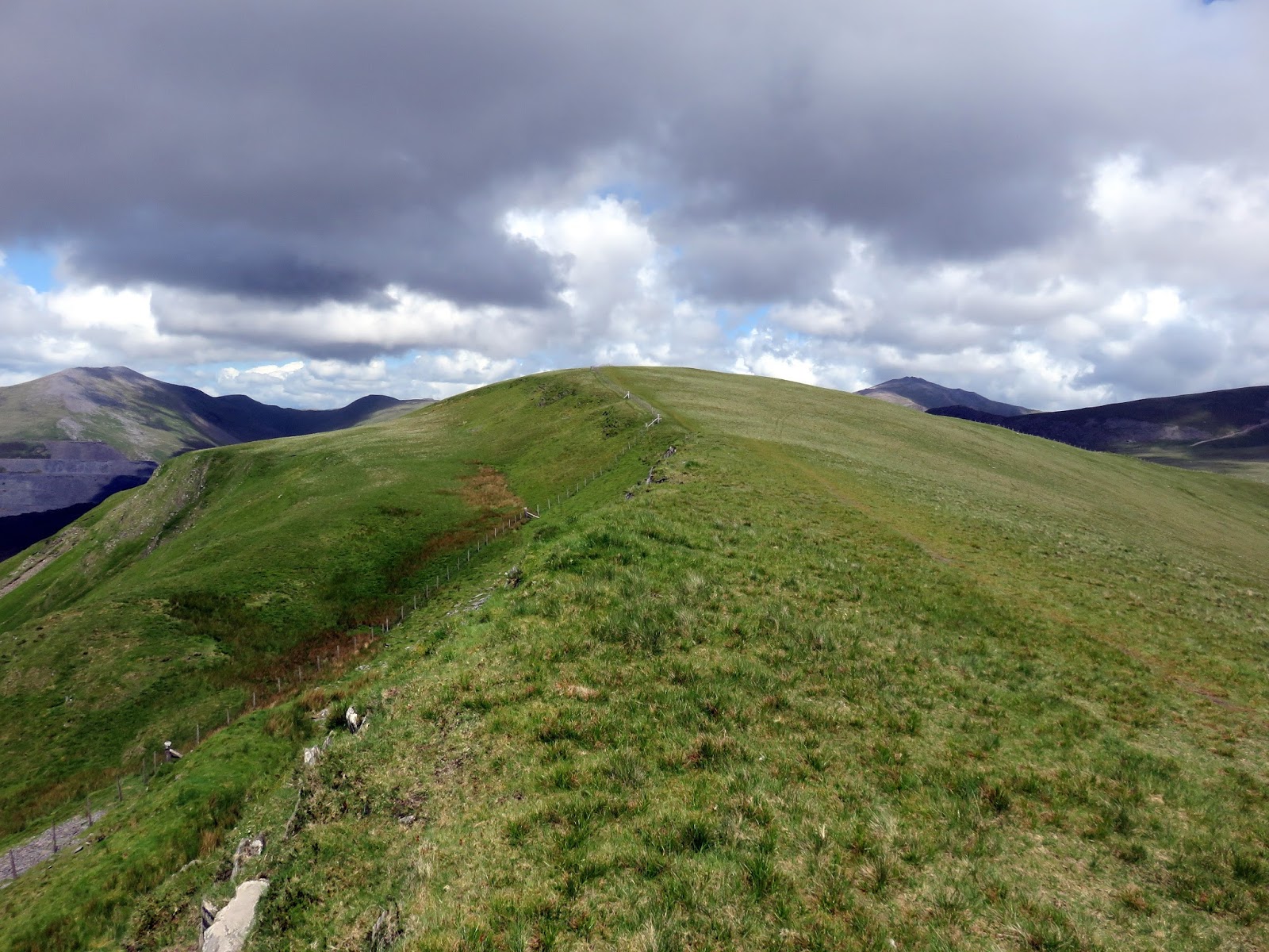
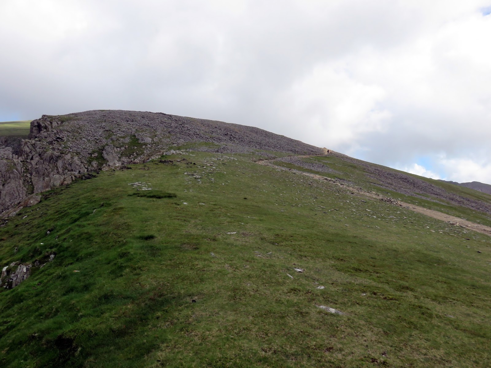
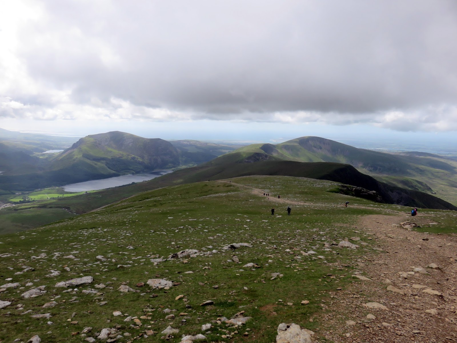
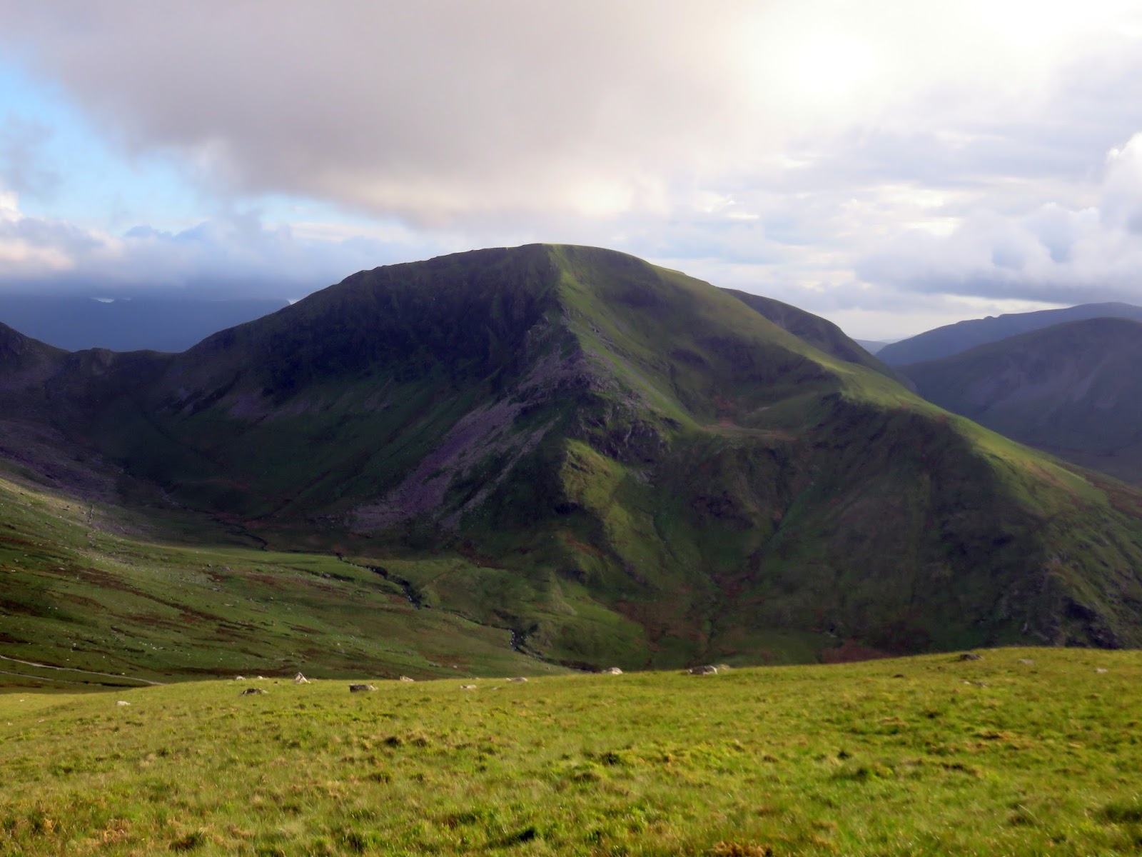
The climb up to Moel Eilio is longer than it first seems – the map shows a fairly unimpressive ridge that would perhaps wouldn’t give a second thought to. The ridge, however, lasts for around 2km at a pretty even gradient, steepening for the 200m blast to the summit. View to the north are pretty good but behind you so you don’t see a great deal until reaching the summit.
 |
| Grey skies over Llanberis |
 |
| The line up Moel Eilio |
 |
| Showers begin to clear |
 |
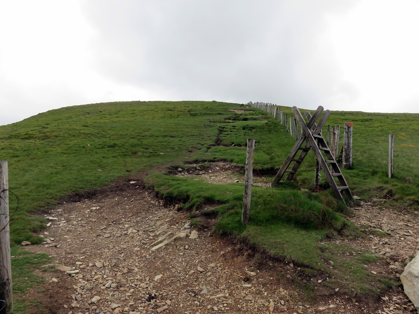
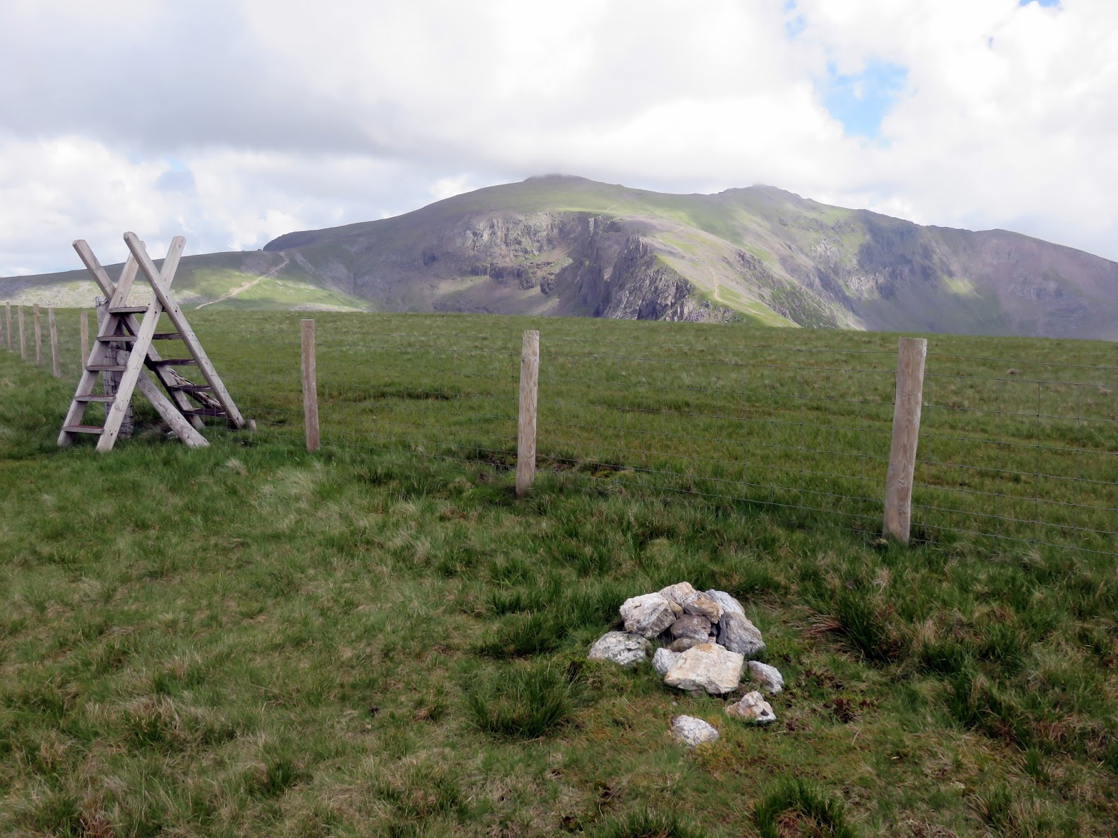
| A superfluous stile |
 |
| Approaching the summit |
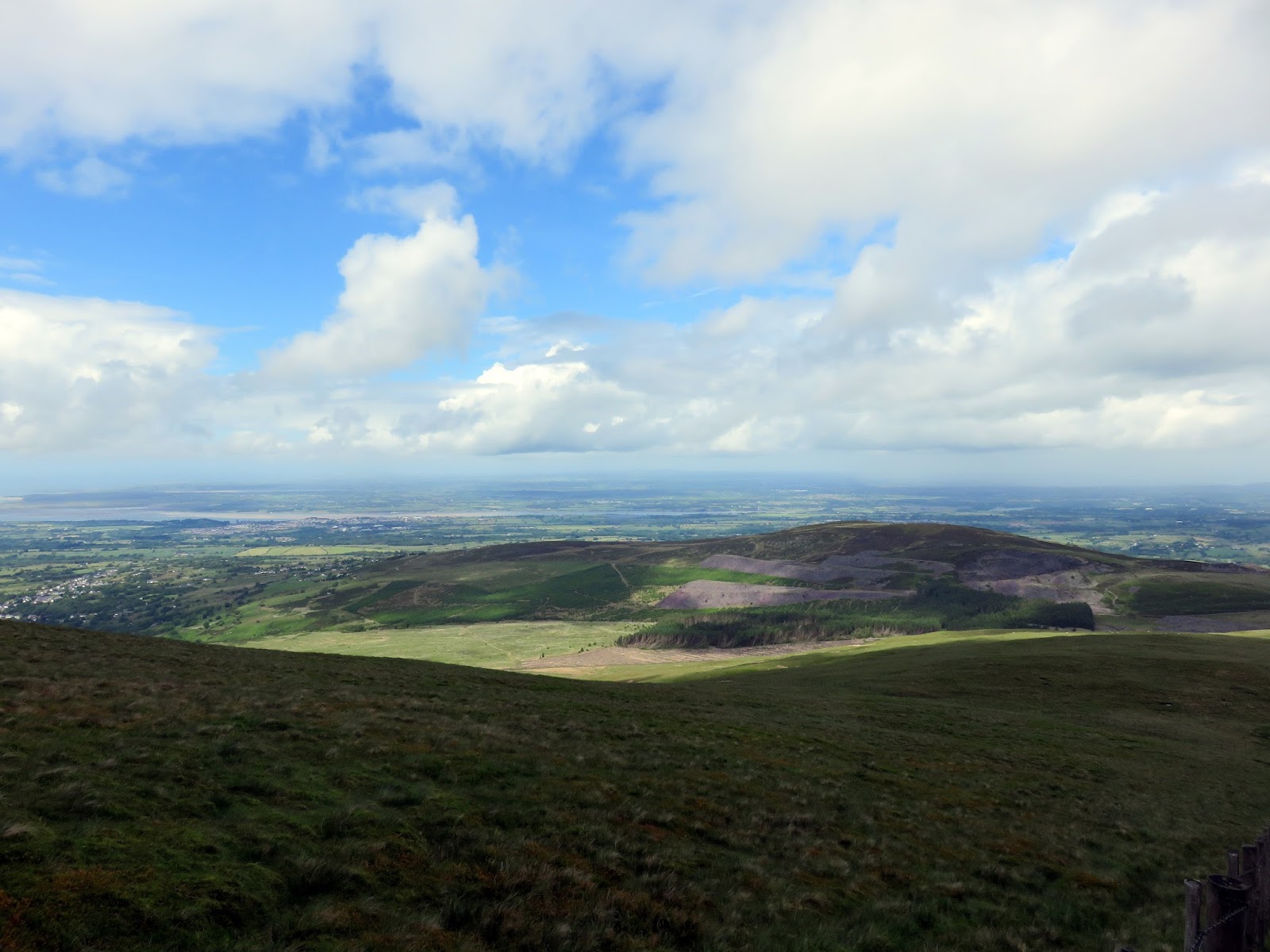
The summit is broad and grassy and immediate views from the large wind shelter are unimpressive. Take a short wander east though, and a huge panorama over Cwm yr Hafod and Llyn Dwythwch is revealed thanks to Moel Eilio’s steep, scree tinged eastern face.
 |
| Cwm yr Hafod |
 |
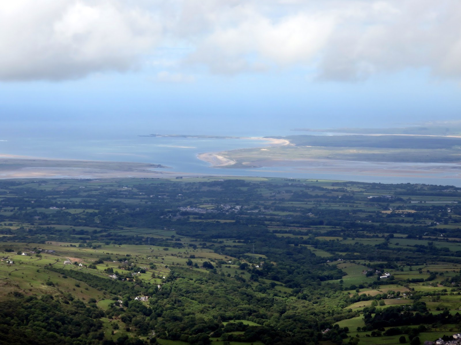
| The Menai Strait |
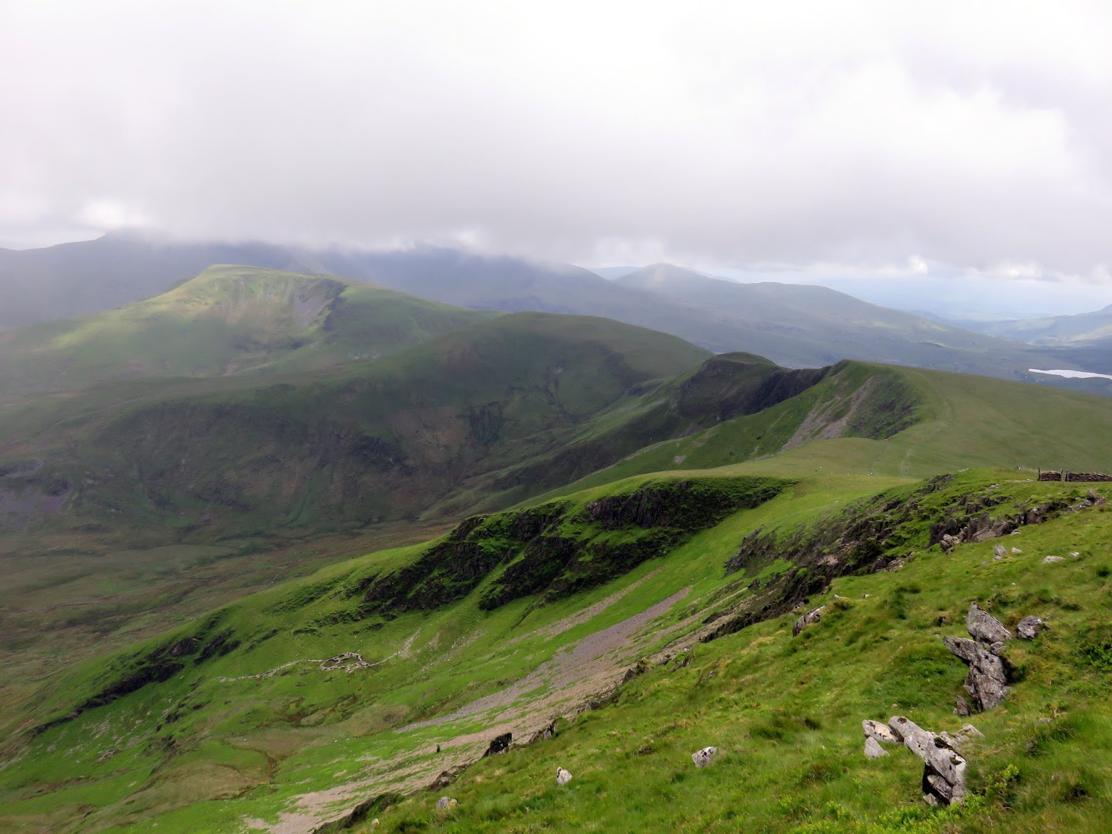
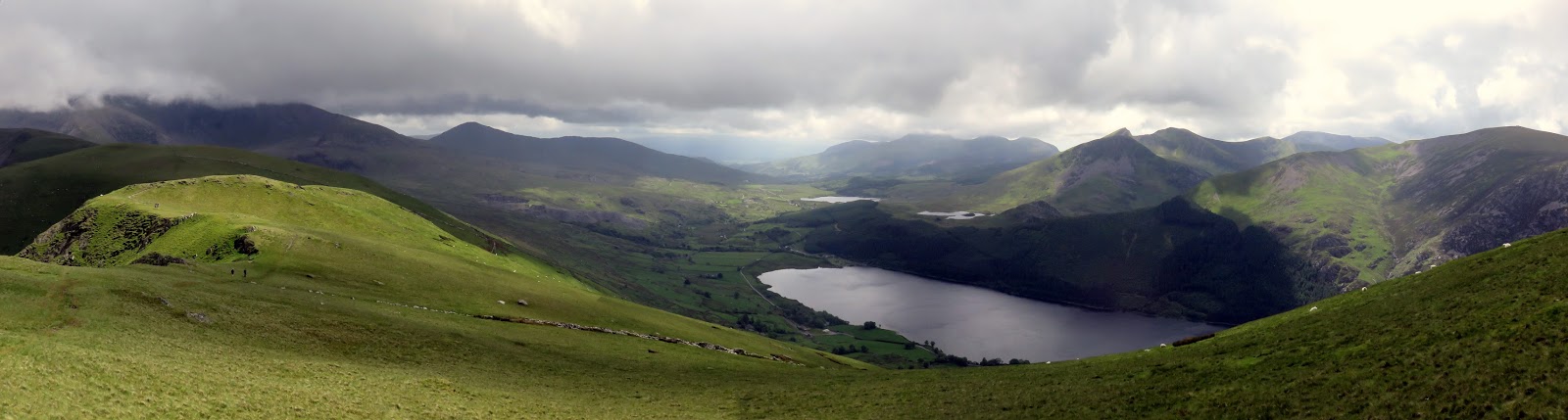
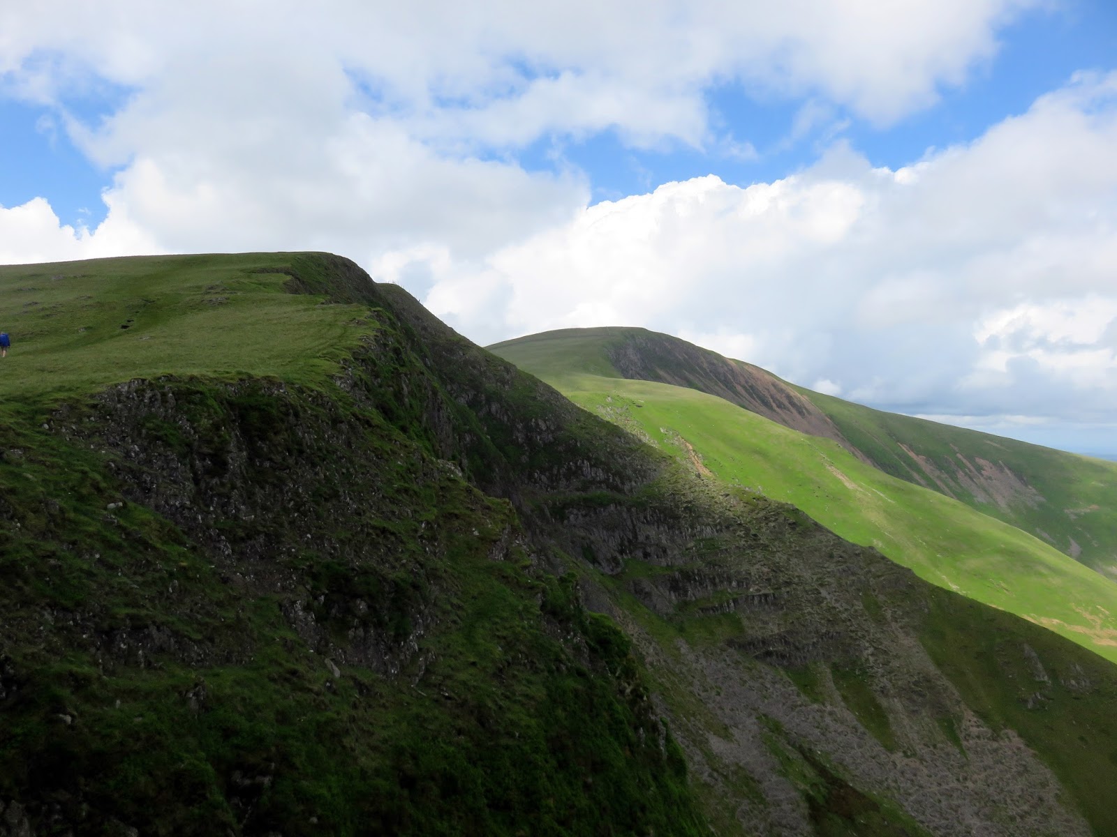
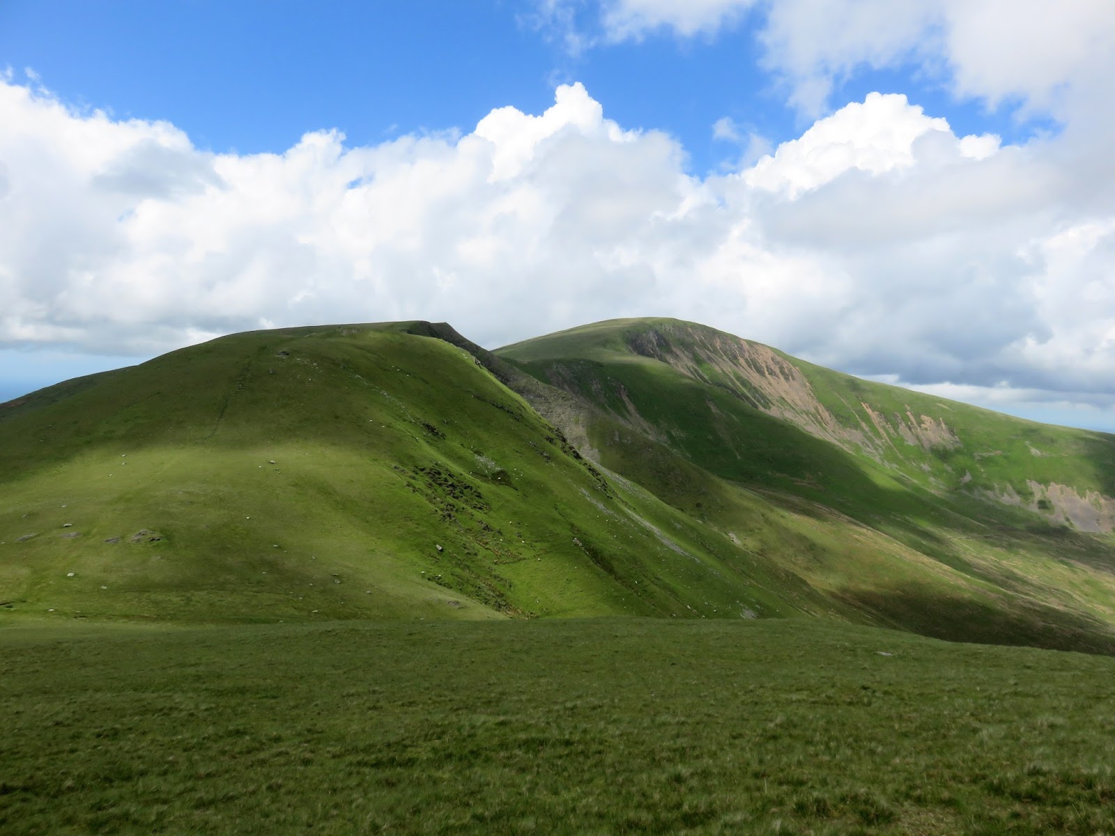
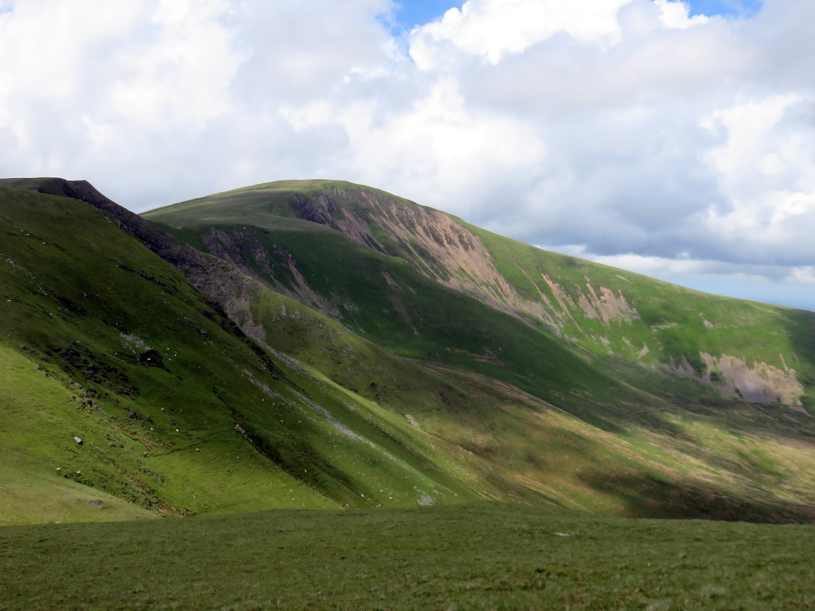
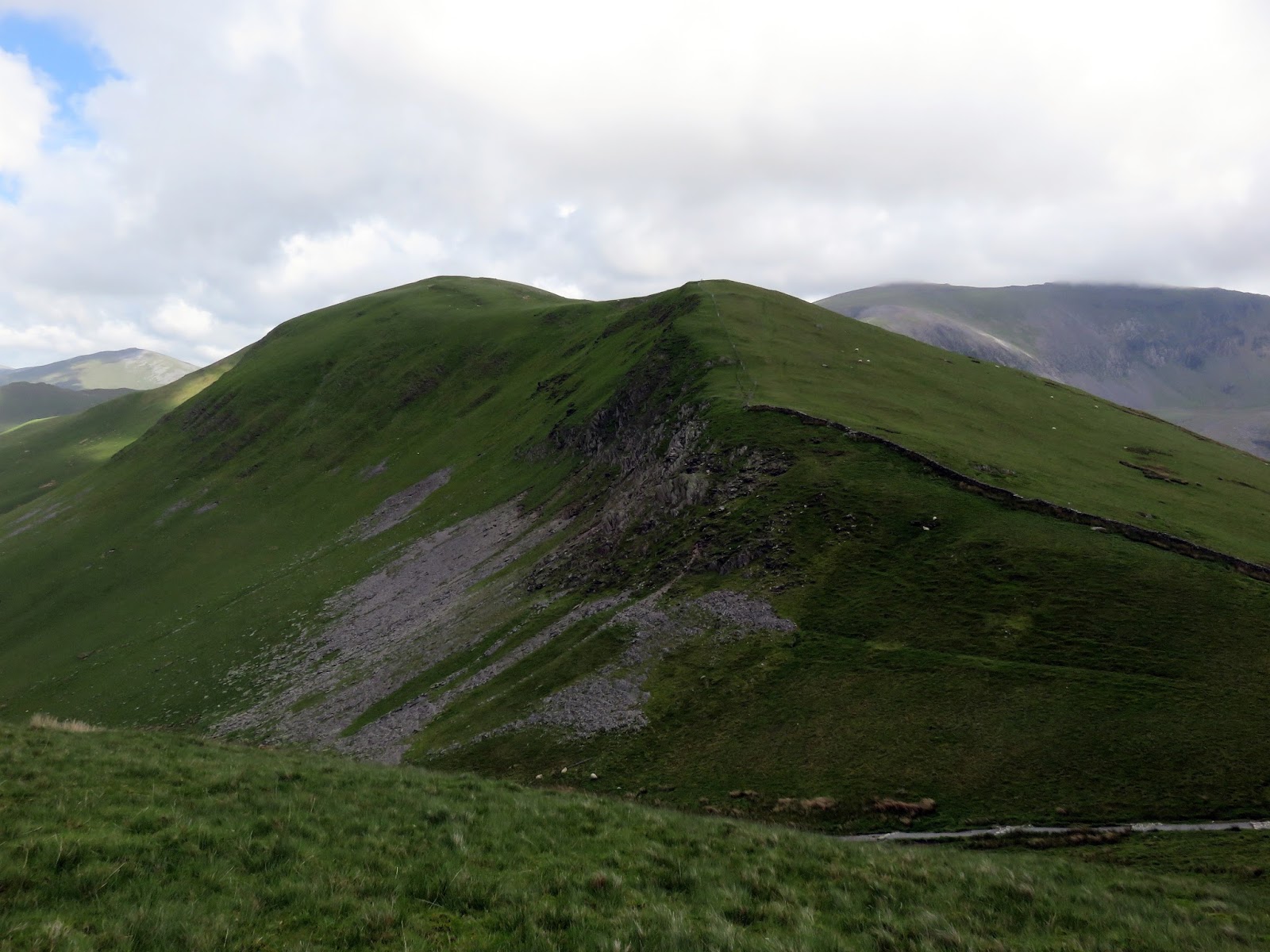
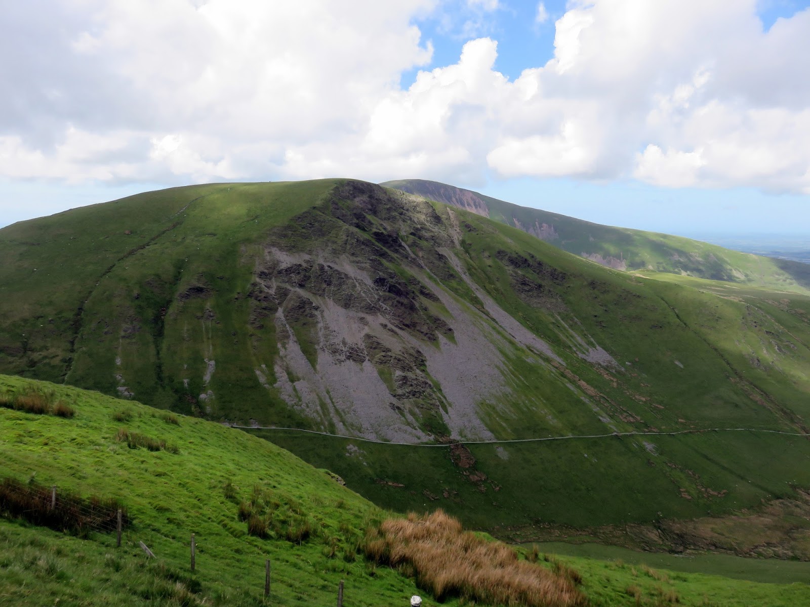
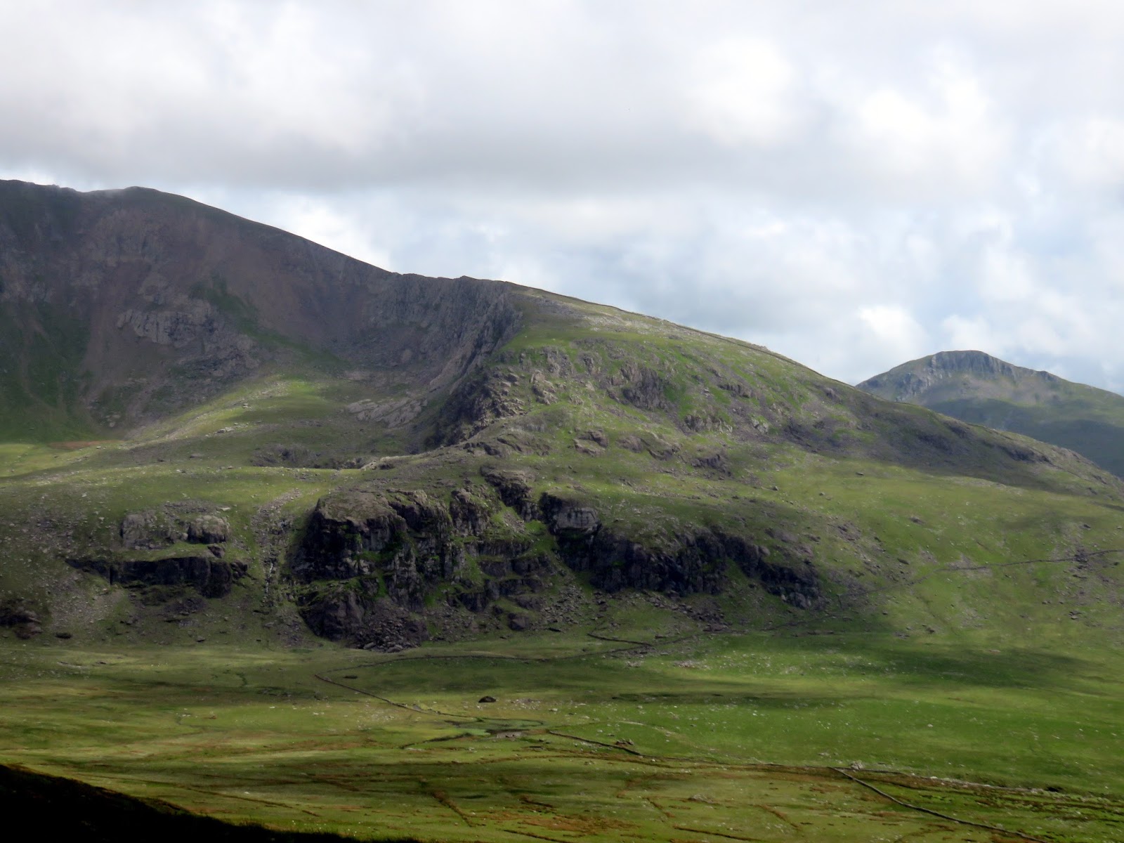
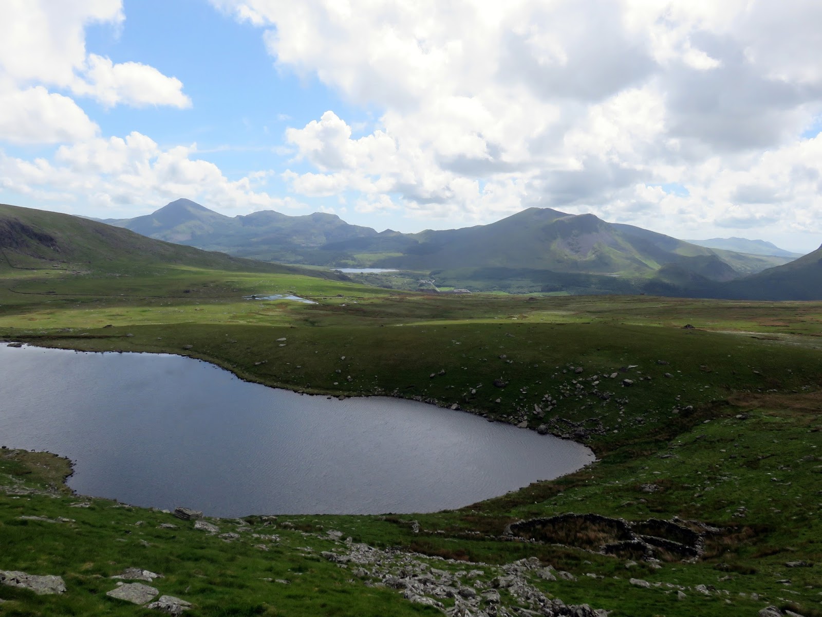
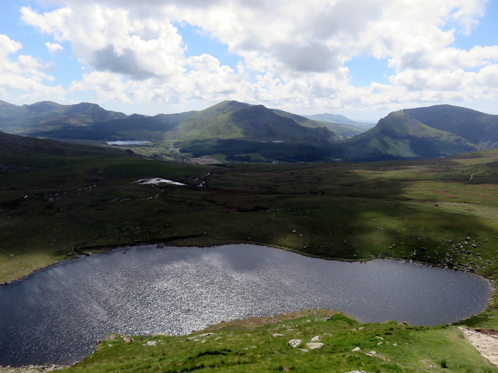
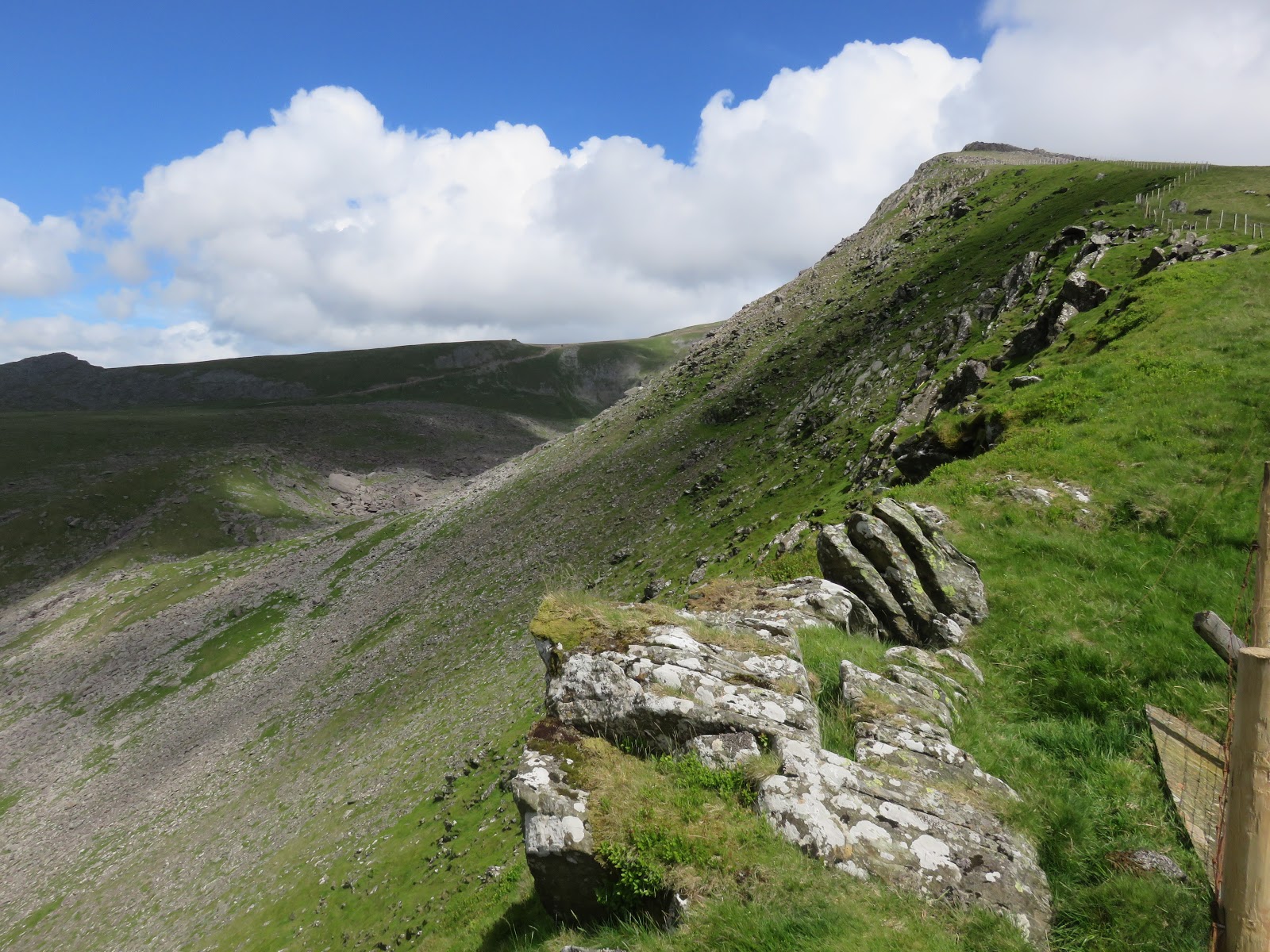
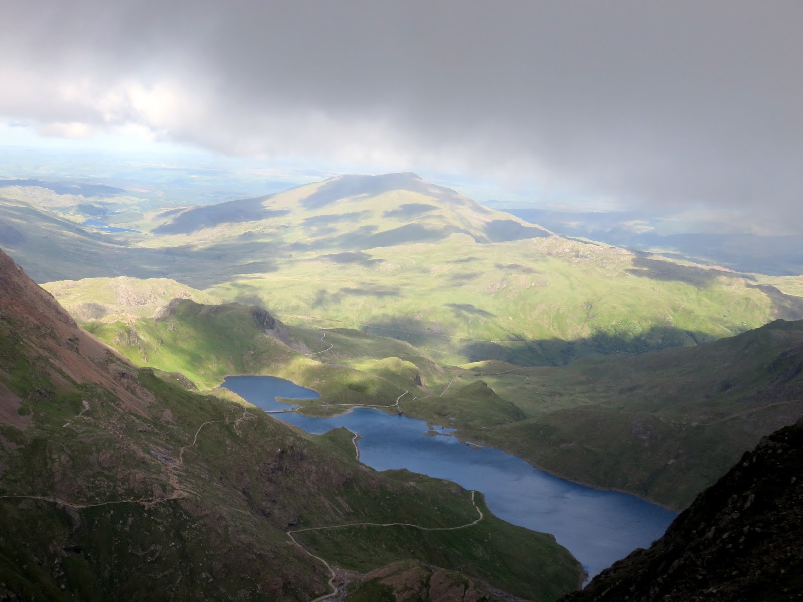
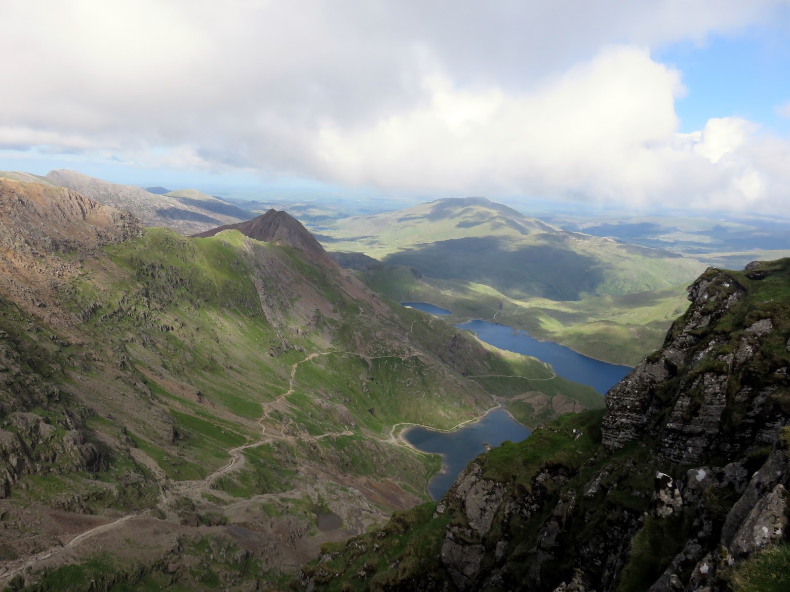
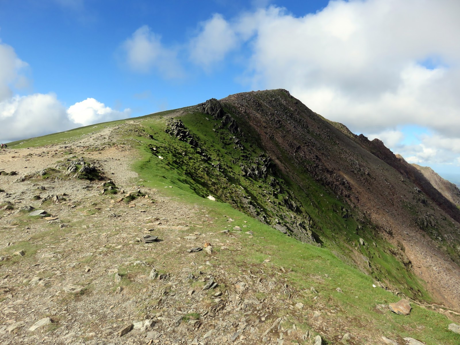
The ridge walk ahead is a delight with steep crags providing superb views over the many cwms of the horseshoe. The route undulates over the two tops of Foel Gron, over the minor summit of Foel Goch and down into Bwlch Maesgwm, a mountain pass that will get you from Rhyd-ddu to Llanberis without having to go over Snowdon or any of the Moel Eilio range.
 |
| Cwm yr Hafod and Llyn Dwythwch |
 |
| The dramatic Nantlle ridge |
 |
| Cwm Cesig |
 |
| Llyn Cwellyn |
 |
| Foel Goch |
 |
| Looking along Maesgwm |
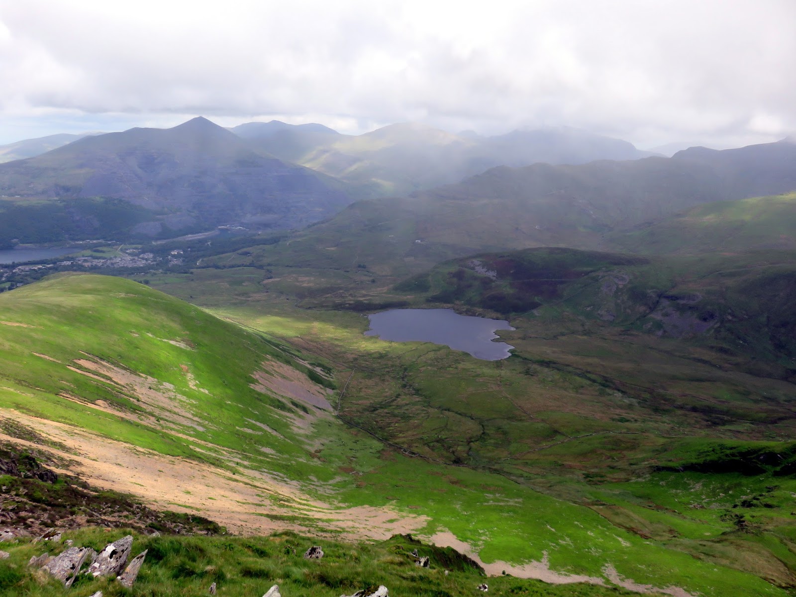
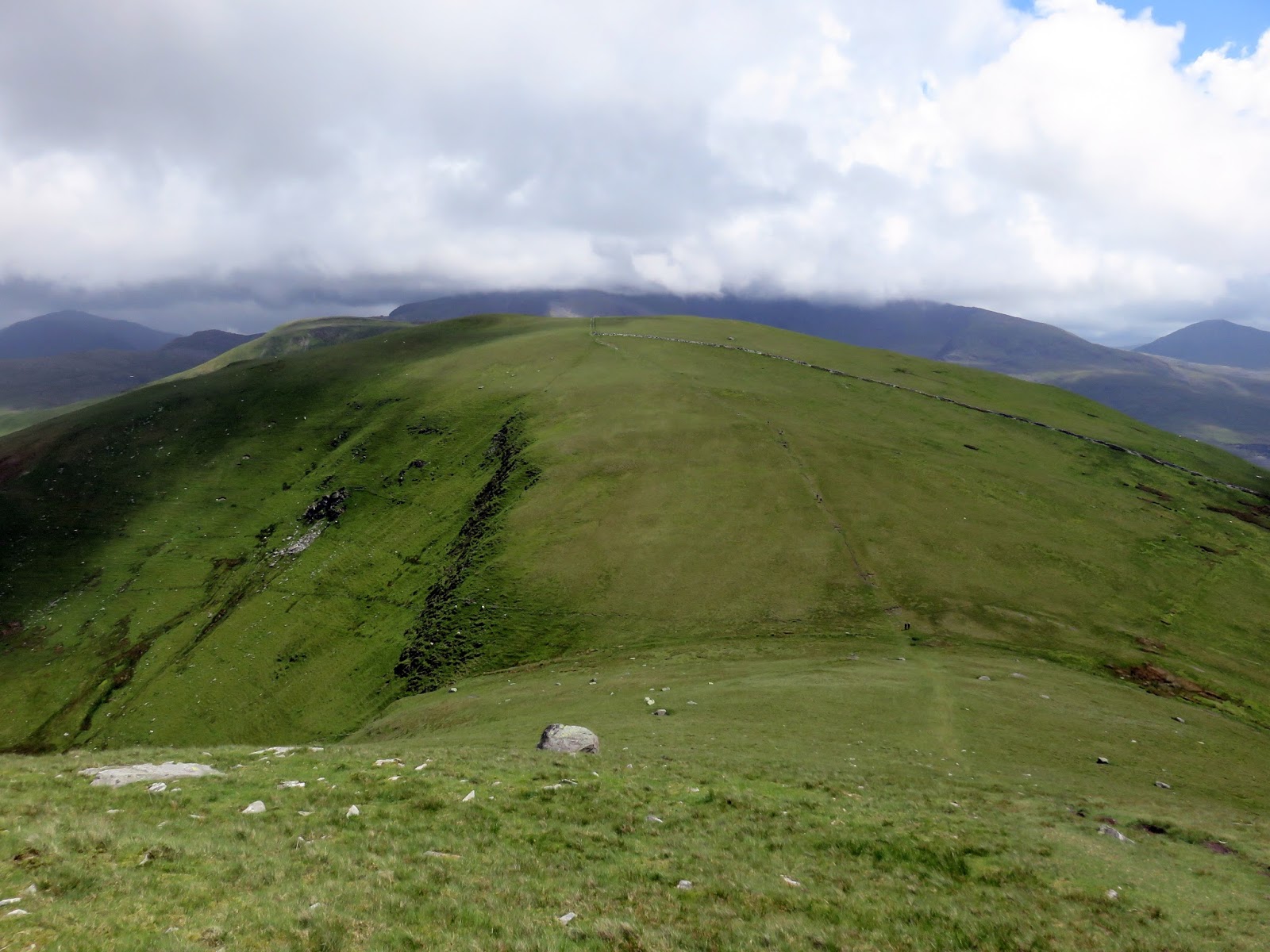
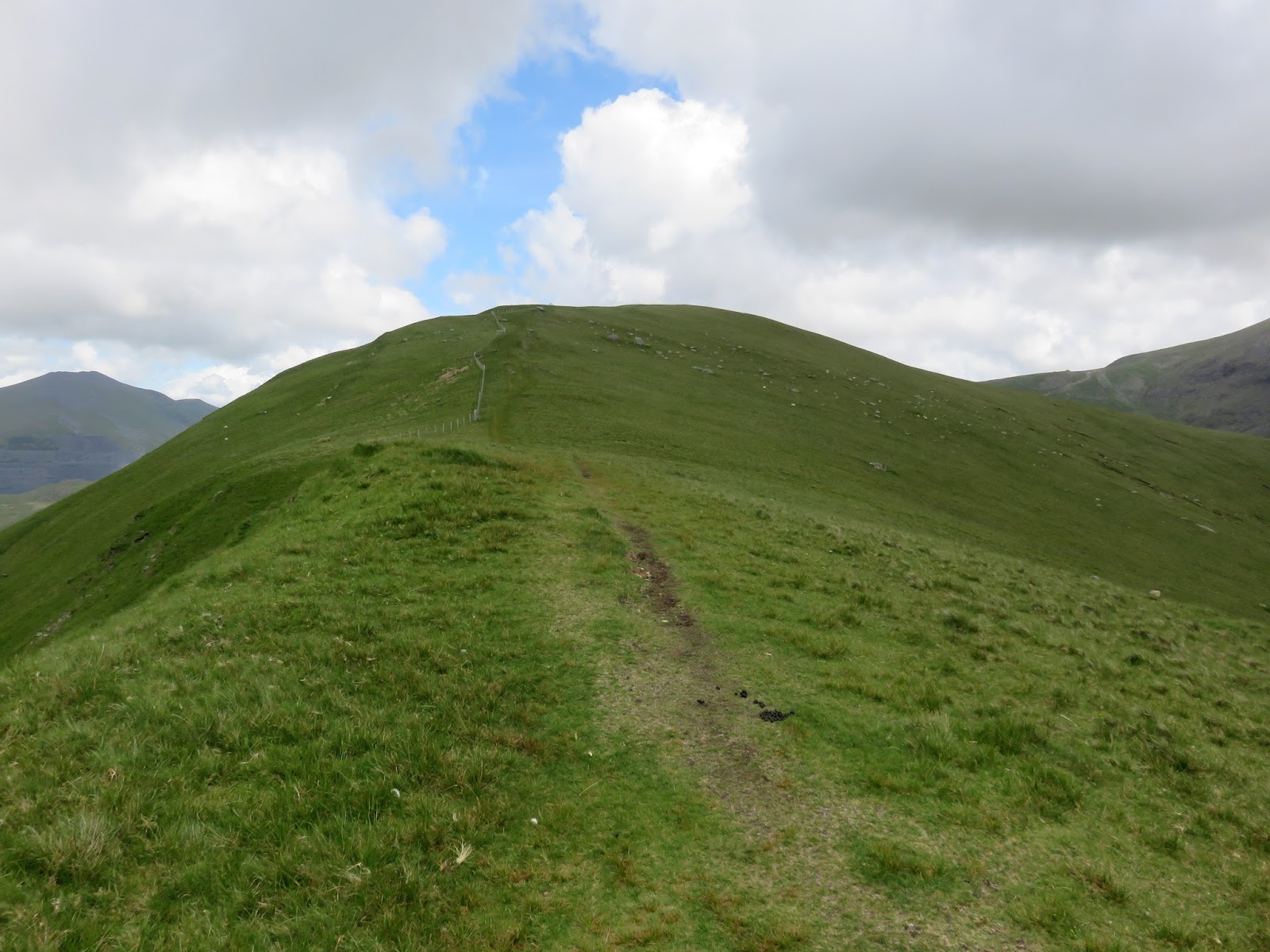
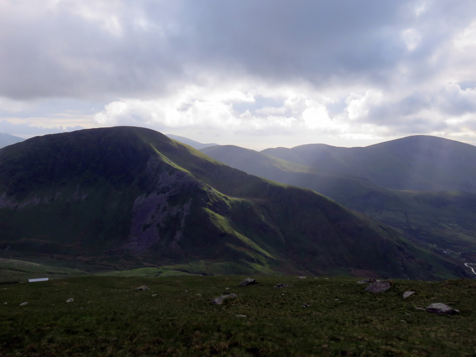
The weather was noticeably improving as we traversed the ridge with clouds lifting off the dramatic mountains of the Nantlle Ridge and slowly creeping higher on Snowdon itself. Another substantial climb from Bwlch Maesgwm awaits, up the western ridge of Moel Cynghorion, along Bwlch Carreg y Gigfran.
 |
| The path leading along Bwlch Carreg y Gigfran |
 |
| Foel Goch above Maesgwm |
 |
| The Snowdon Ranger Path |
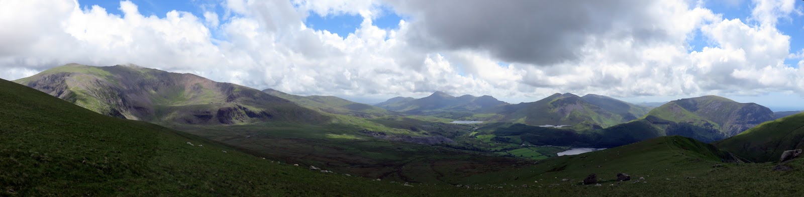
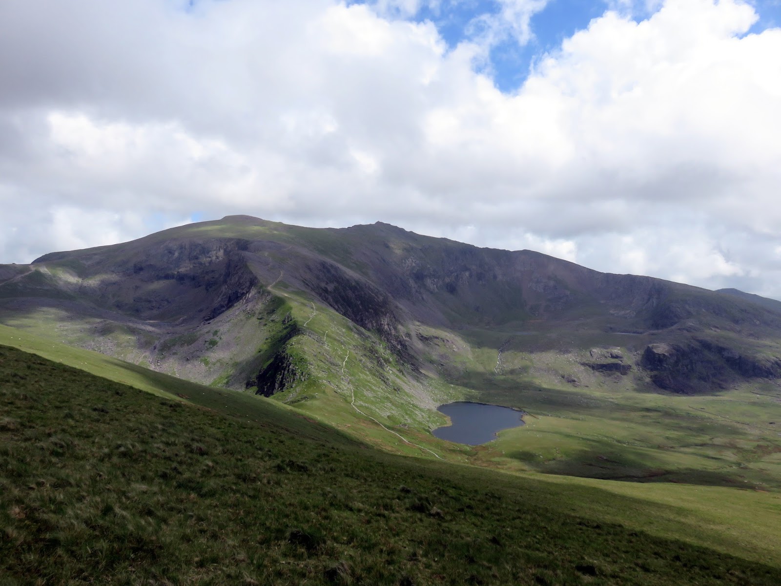
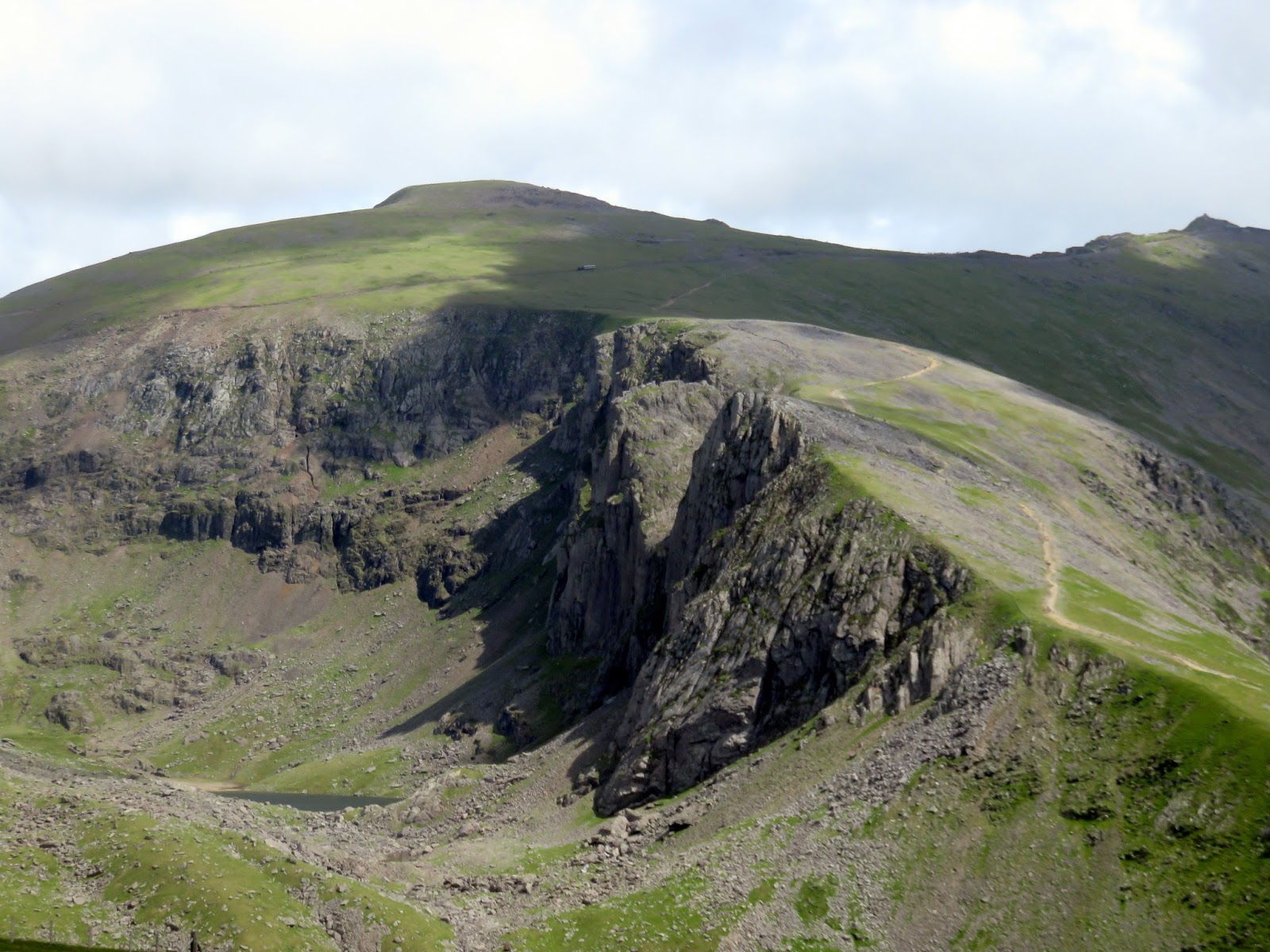
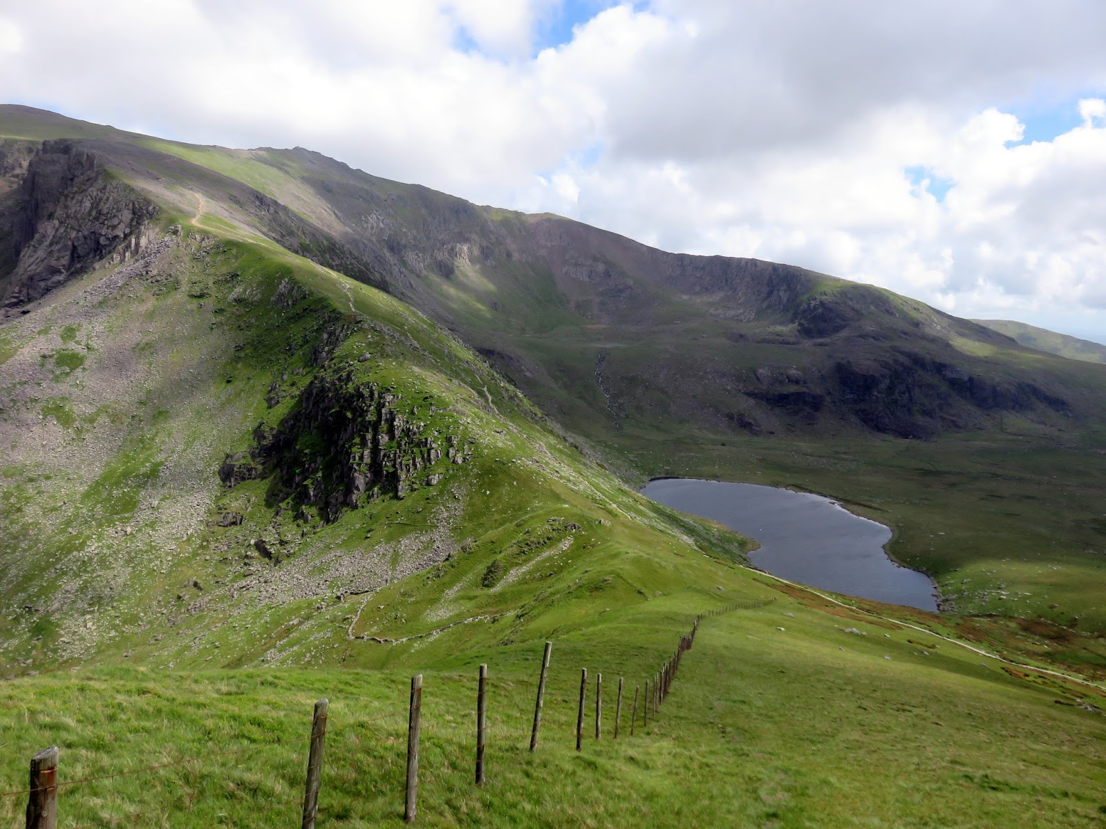
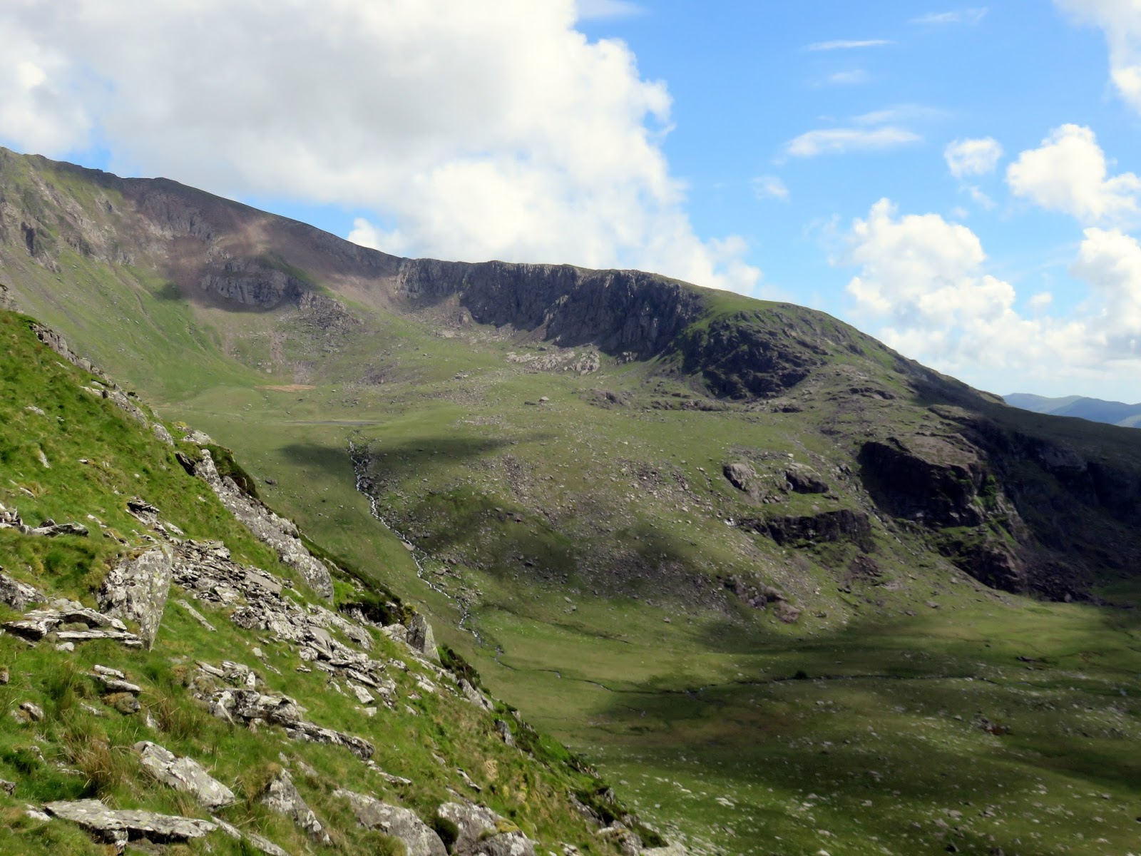
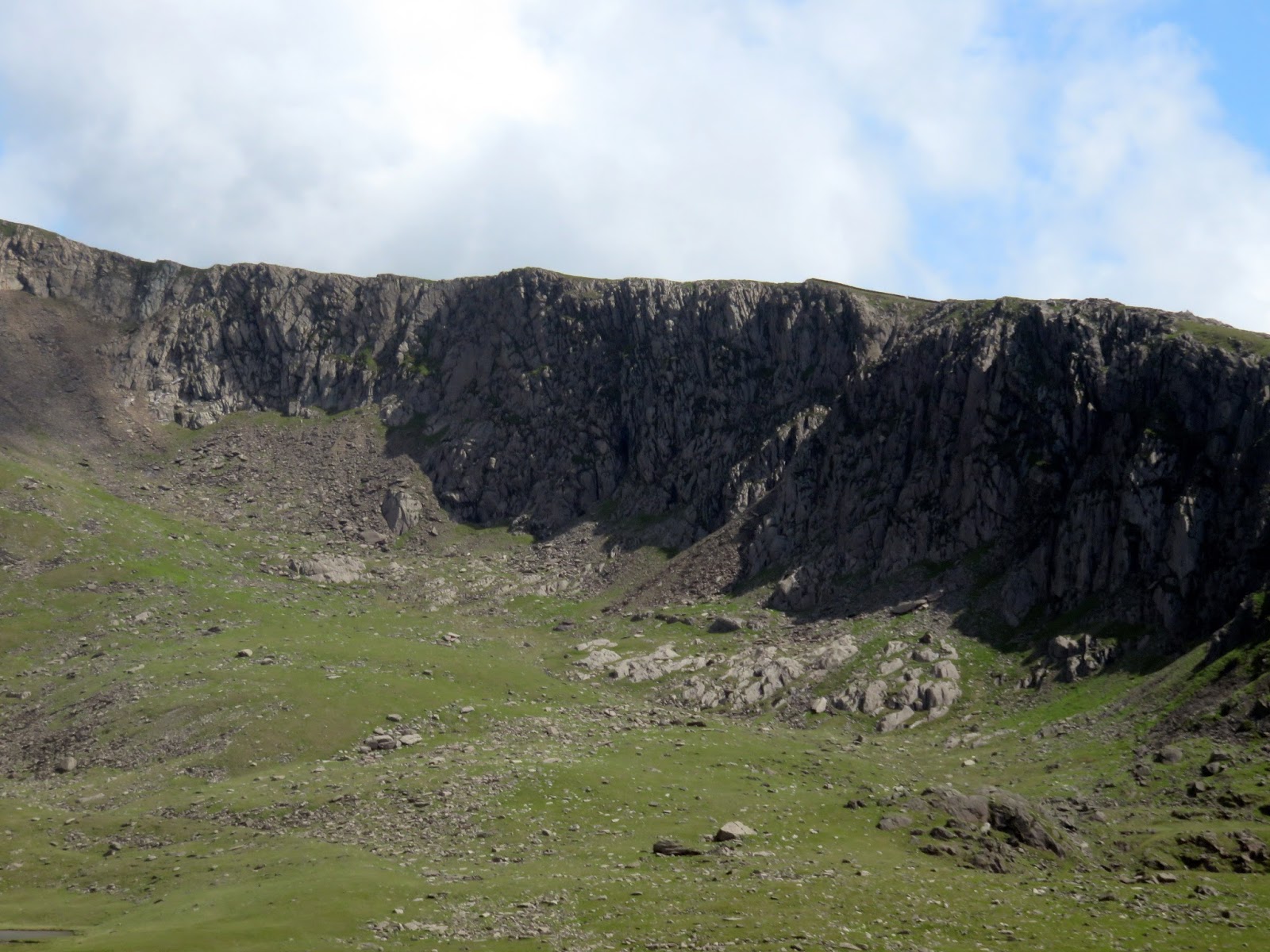
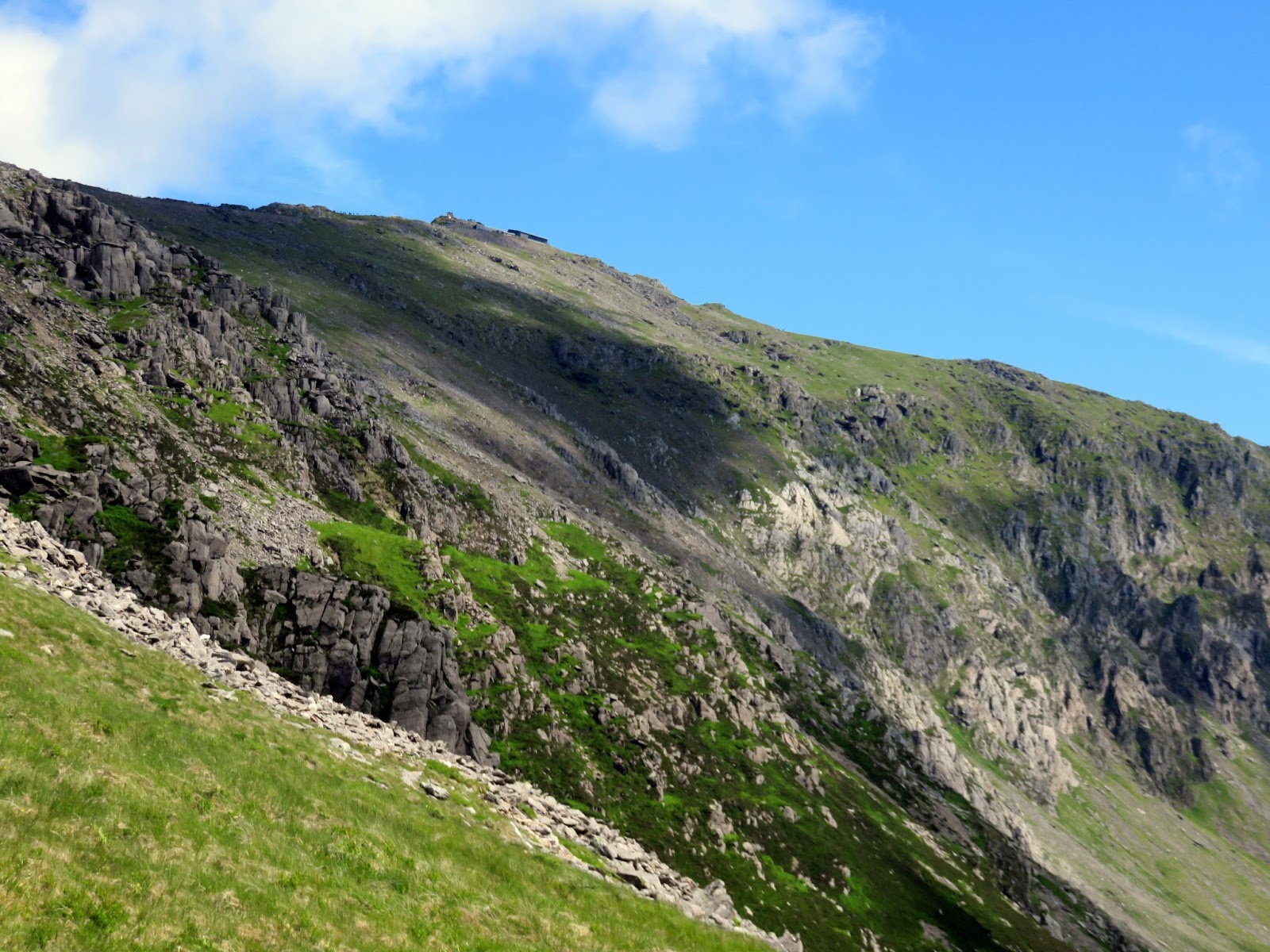
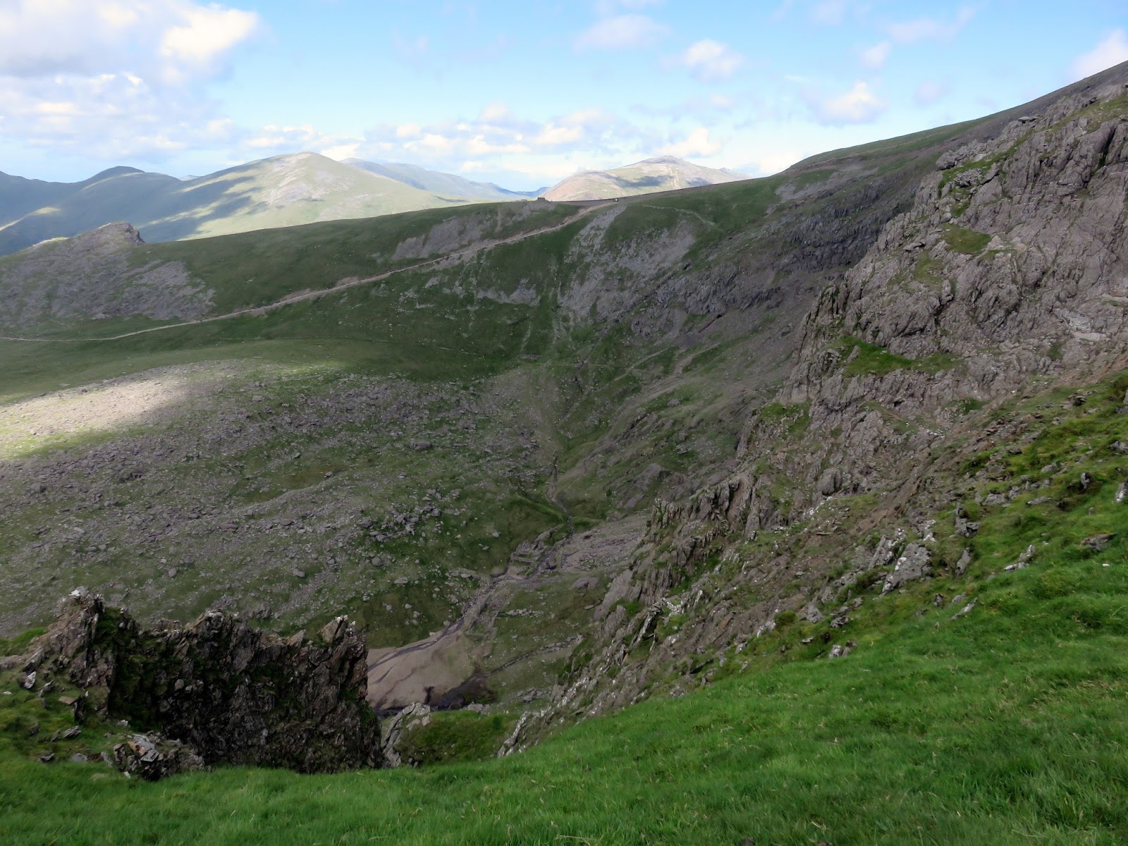
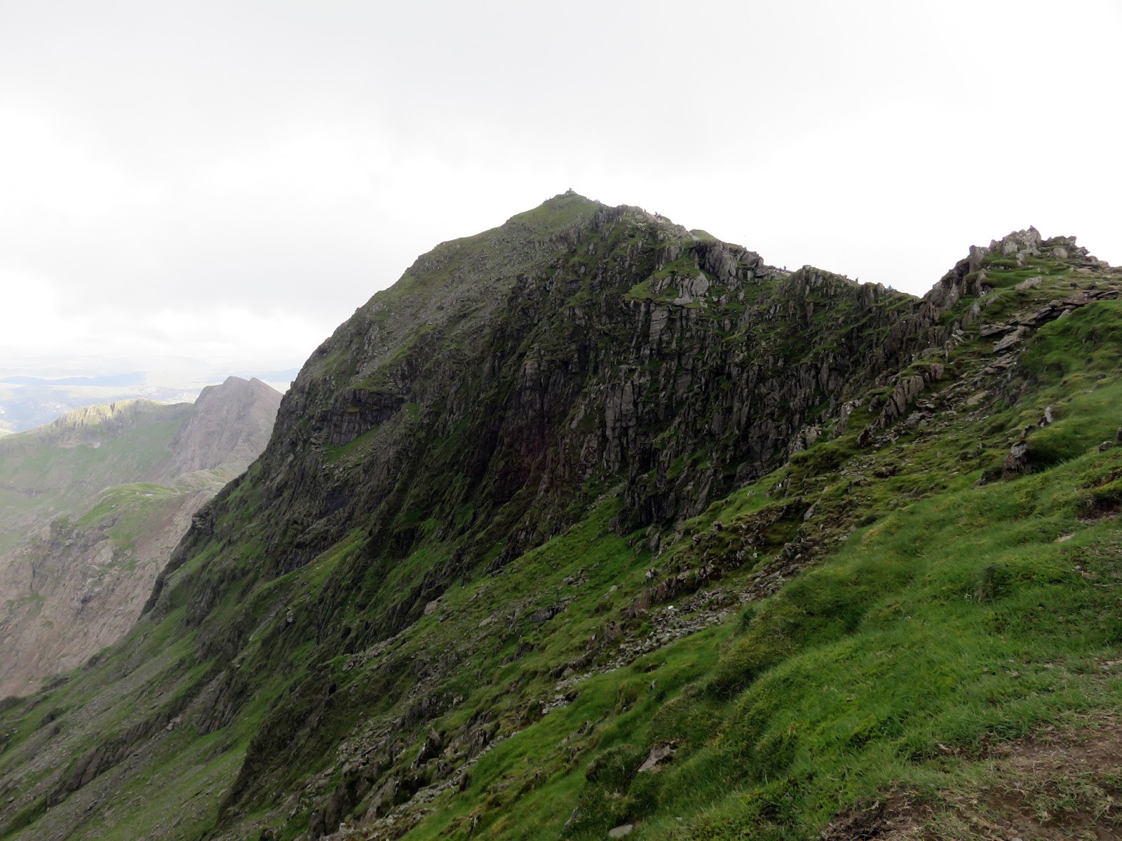
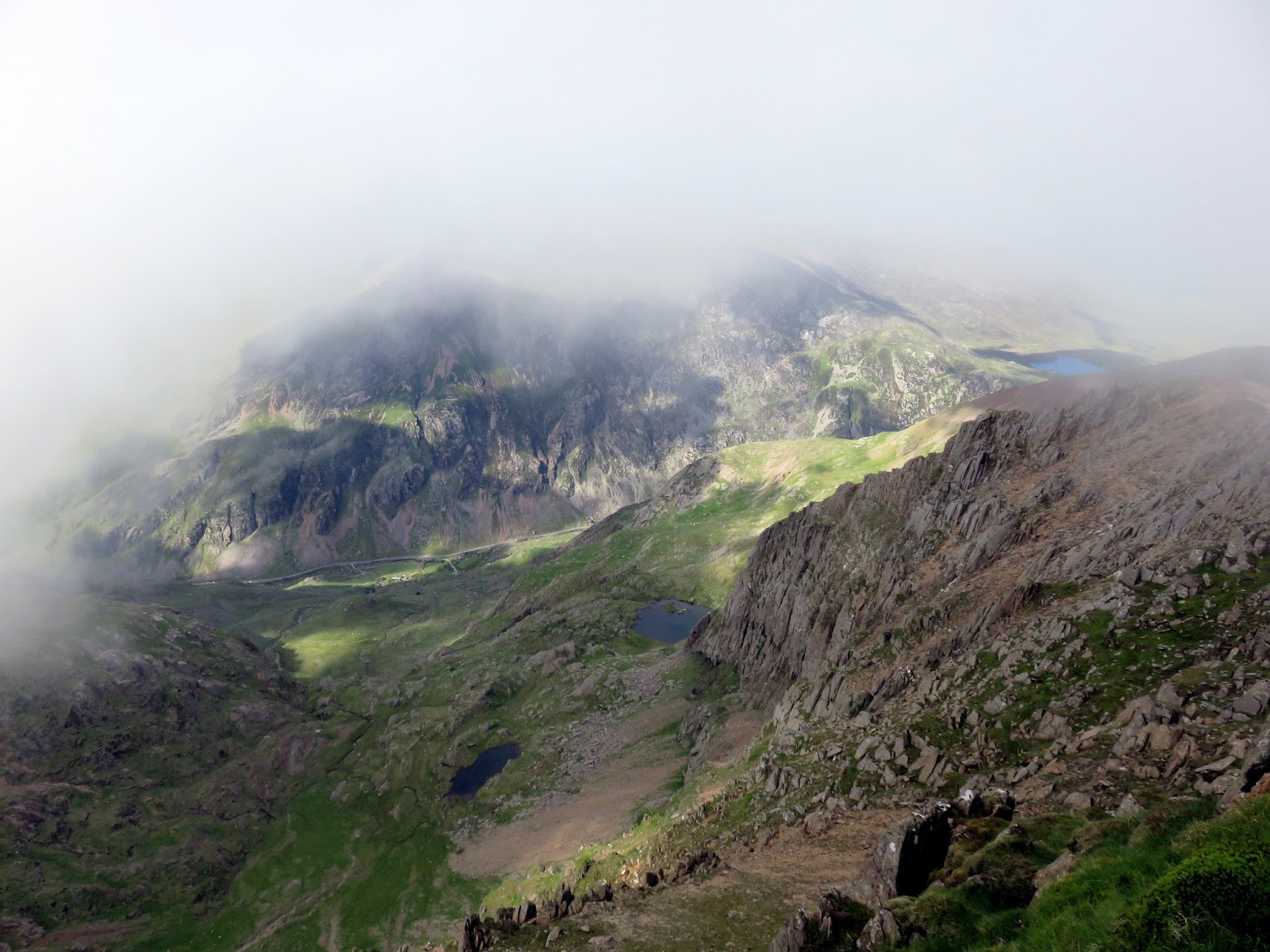
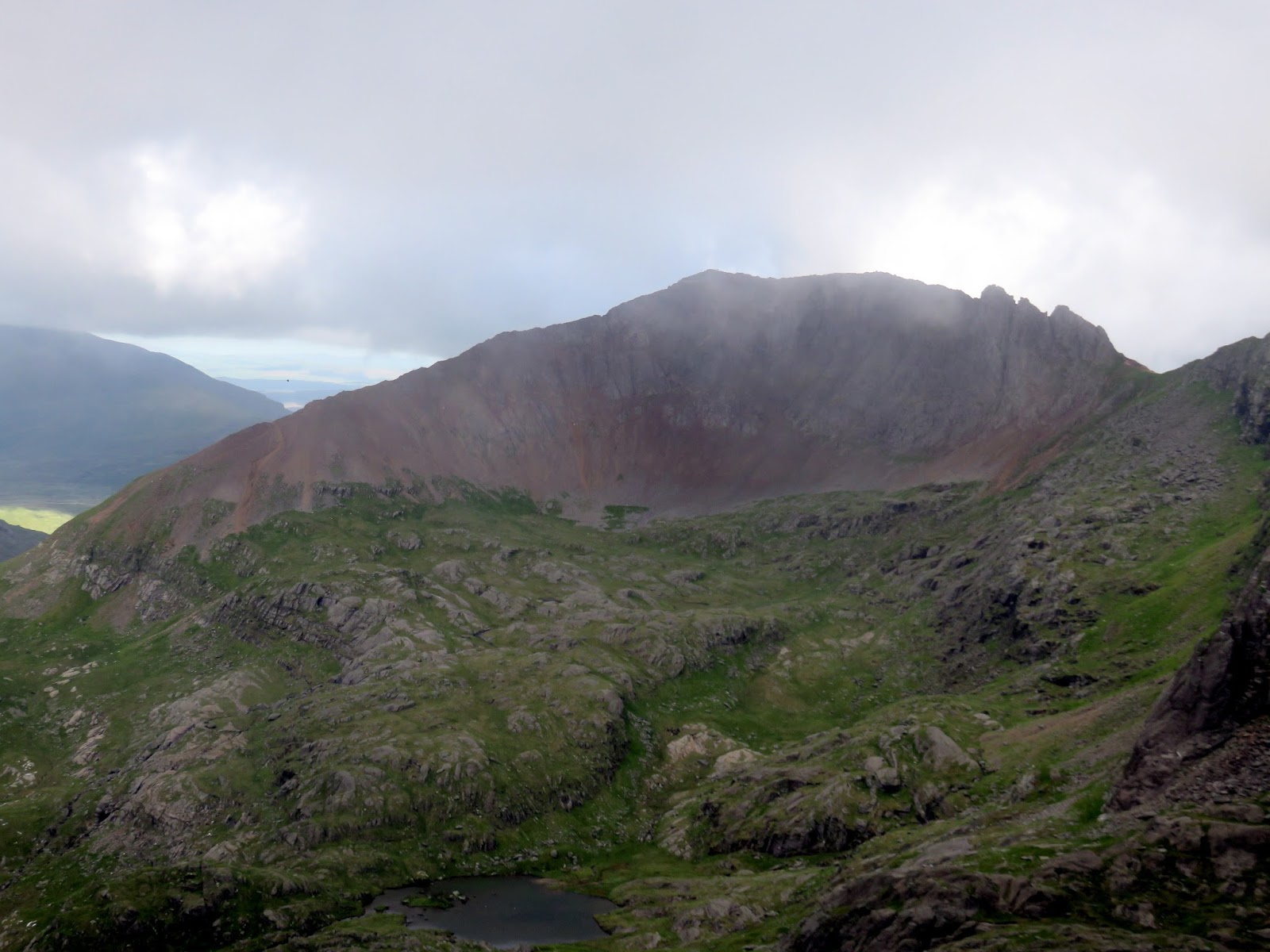
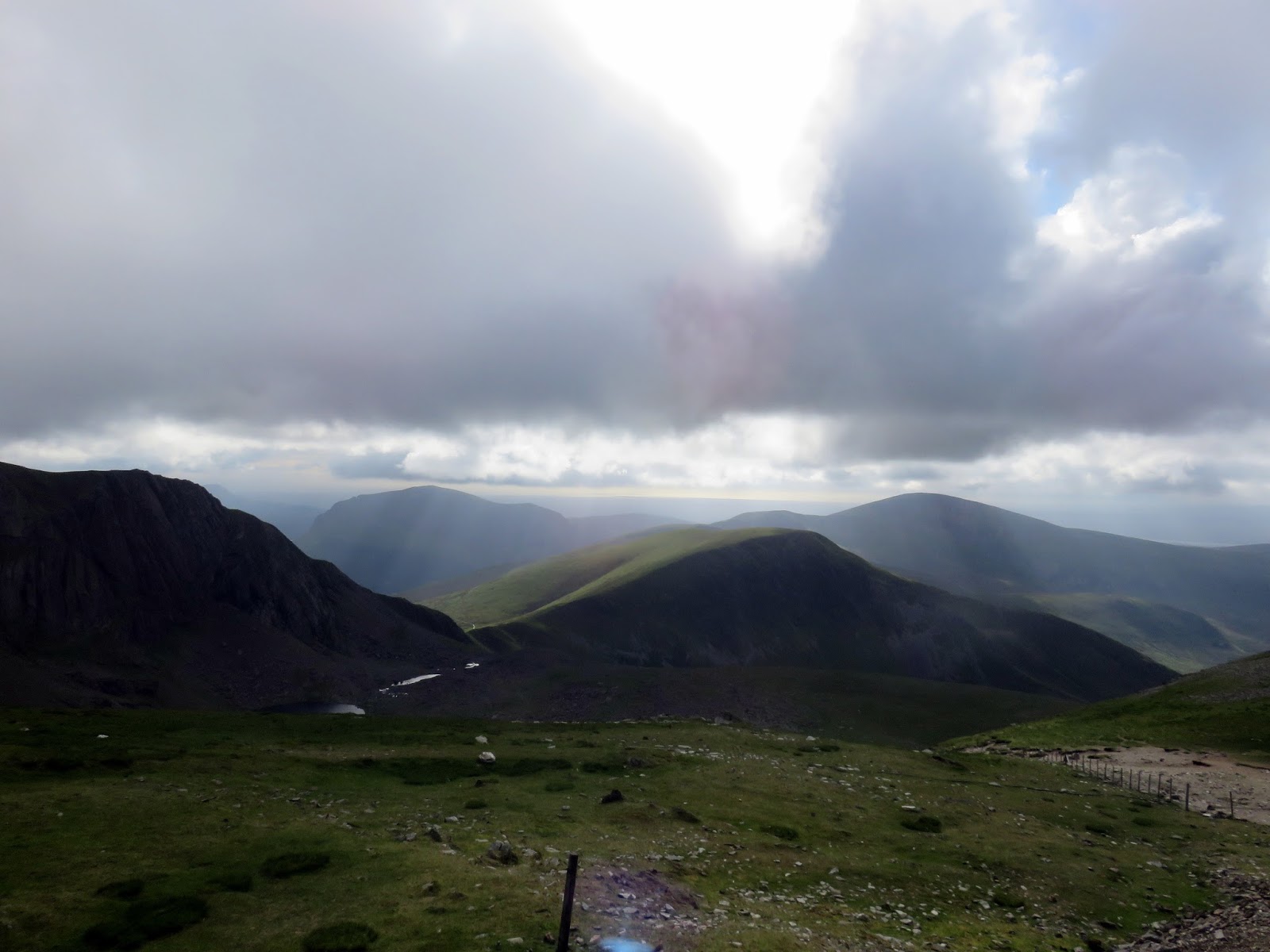
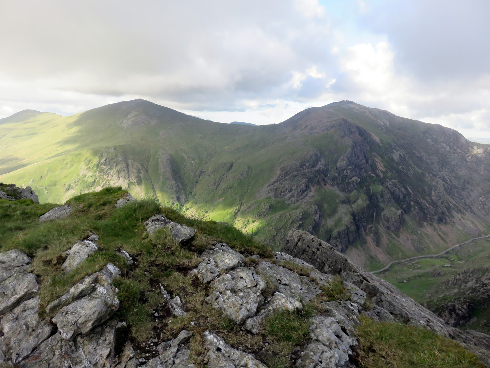
Like Moel Eilio, Moel Cynghorion has a broad, grassy top that limits the views, however, Snowdon is ever present, as is the excellent-looking Clogwyn Du’r Arddu ridge. The Snowdon Ranger path follows this ridge from Bwlch Cwm Brwynog at 500m, all the way to Snowdon’s summit – an ascent of nearly 600m.
 |
| Clogwyn Du’r Arddu |
From Moel Cynghorion, the path follows a fence steeply down Clogwyn Llechwedd Llo to Bwlch Cwm Crwynog where it meets the Snowdon Ranger Path. The Ranger Path is thought to be the oldest of the main routes to Snowdon’s summit, it’s beginnings being in the mining industry.
 |
| Bwlch Cwm Brwynog below Clogwyn Du’r Arddu |
 |
| Llyn Ffynnon-y-gwas |
 |
| Cwm Clogwyn and Llechog |
 |
| Llechog |
 |
| Ffynnon-y-gwas |
The path was named in English after a mountain guide called John Morton who called himself the ‘Snowdon Ranger’. At the beginning of the 19th Century, he built an inn on the site where the YHA Snowdon Ranger stands today. The inn was known as the ‘Snowdon Ranger’, ‘Snowdon Inn’ or ‘Glanllyn’ from where he would guide visitors to the summit of Snowdon along this path.
 |
| Clogwyn Du’r Arddu |
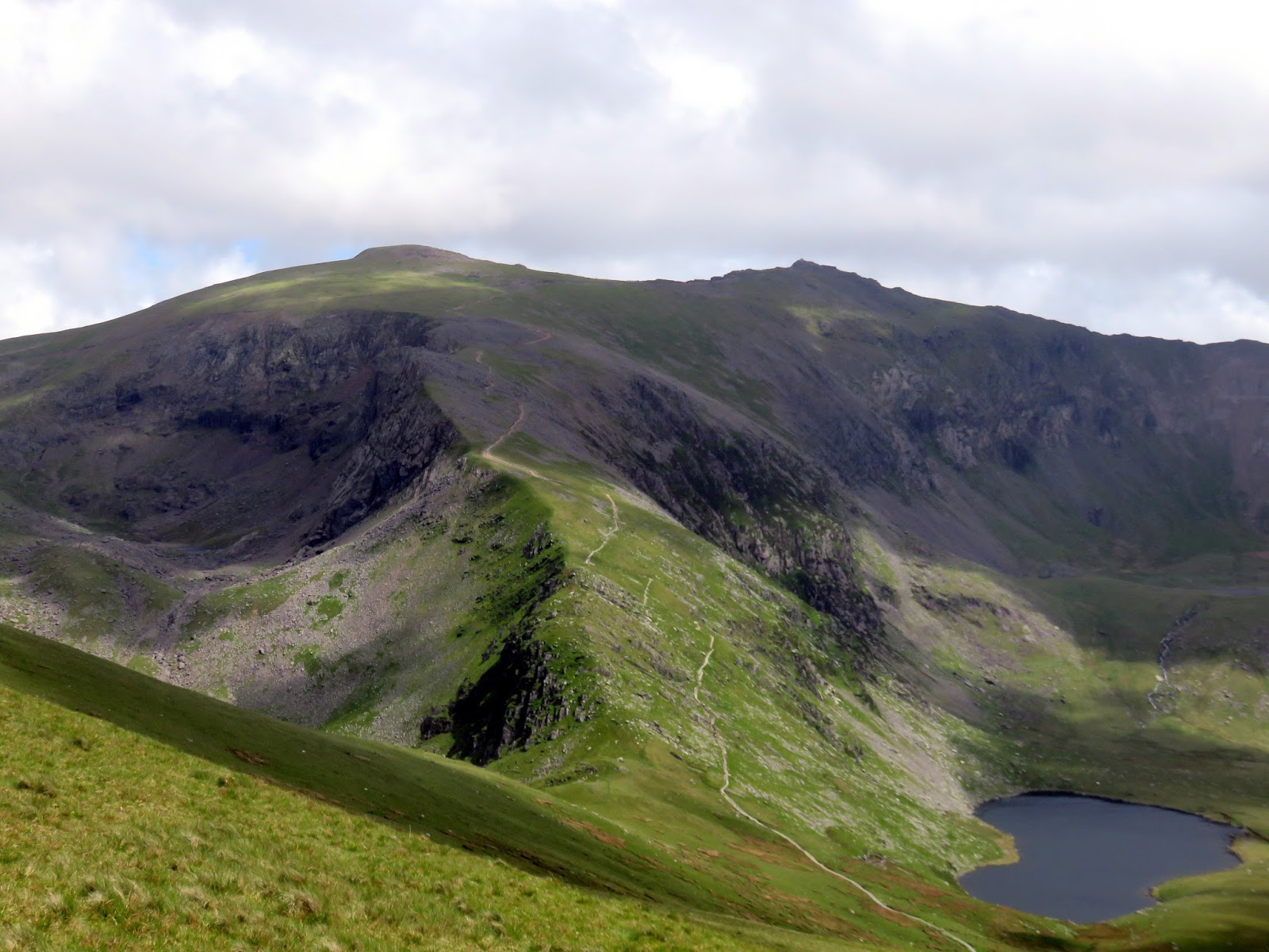
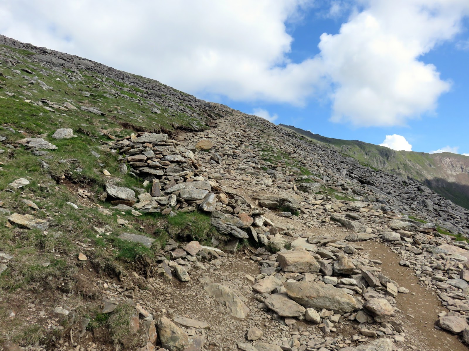
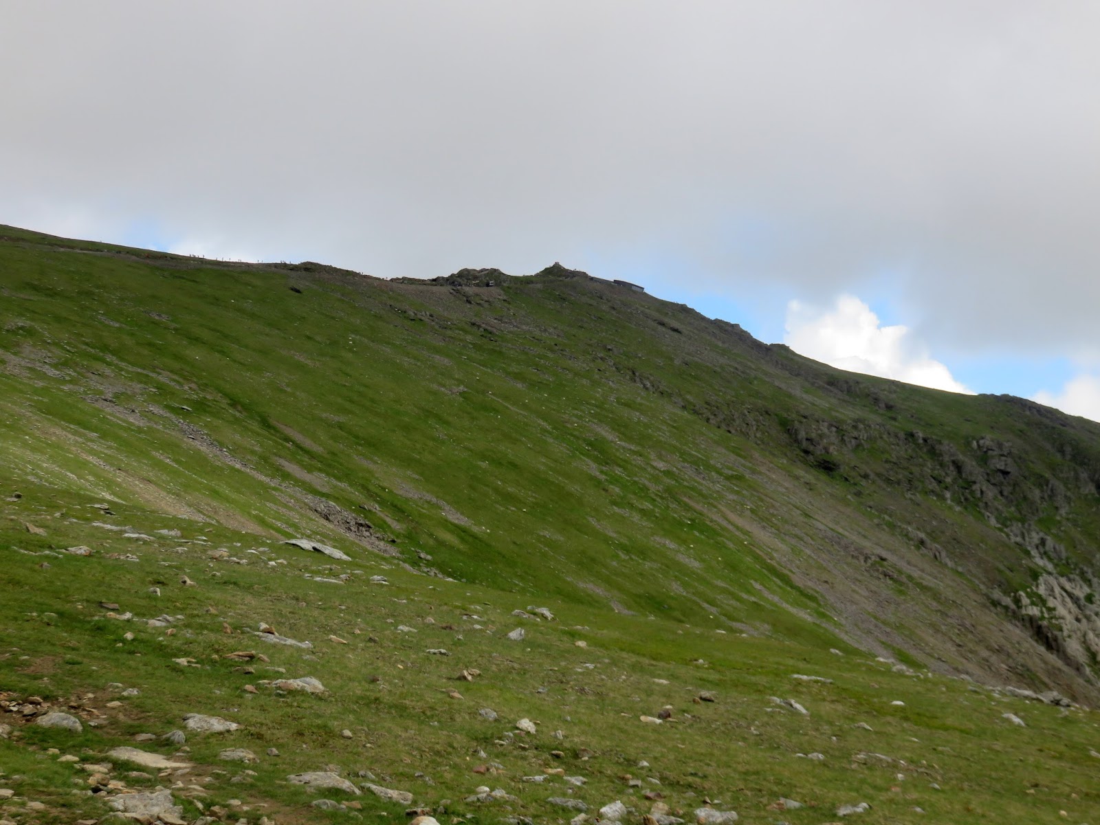
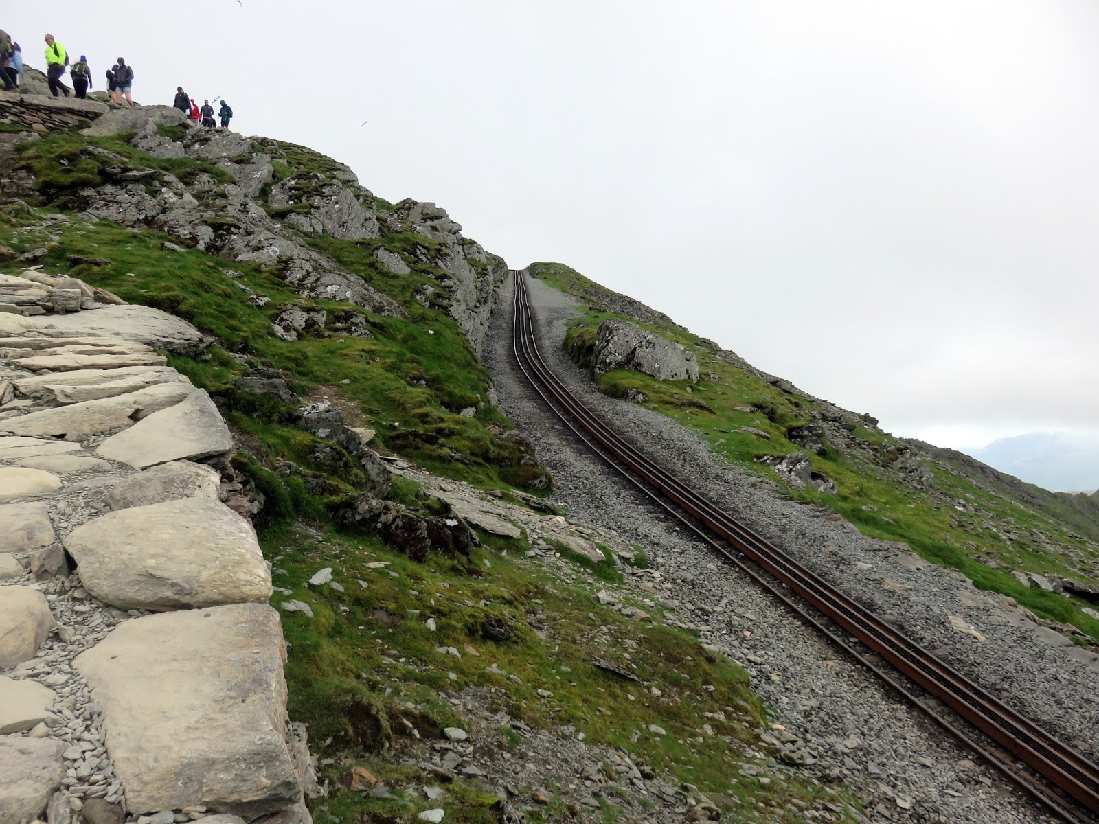
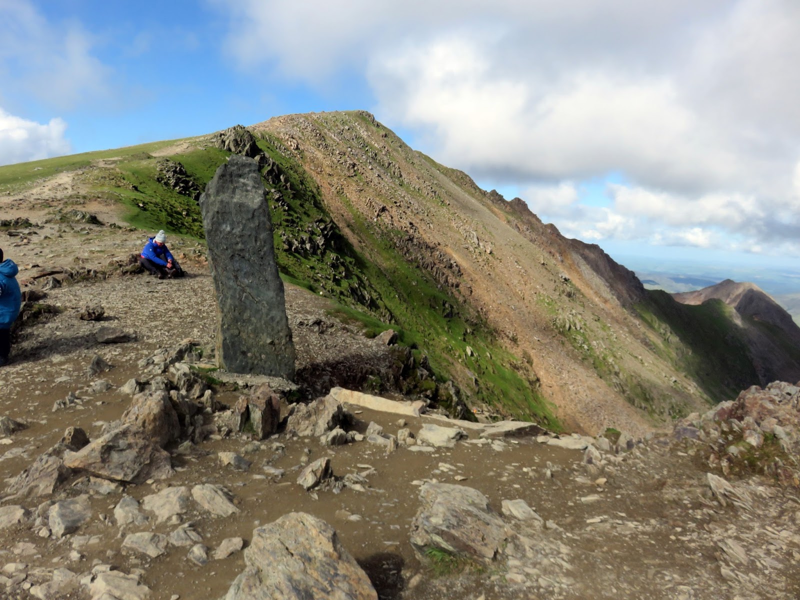
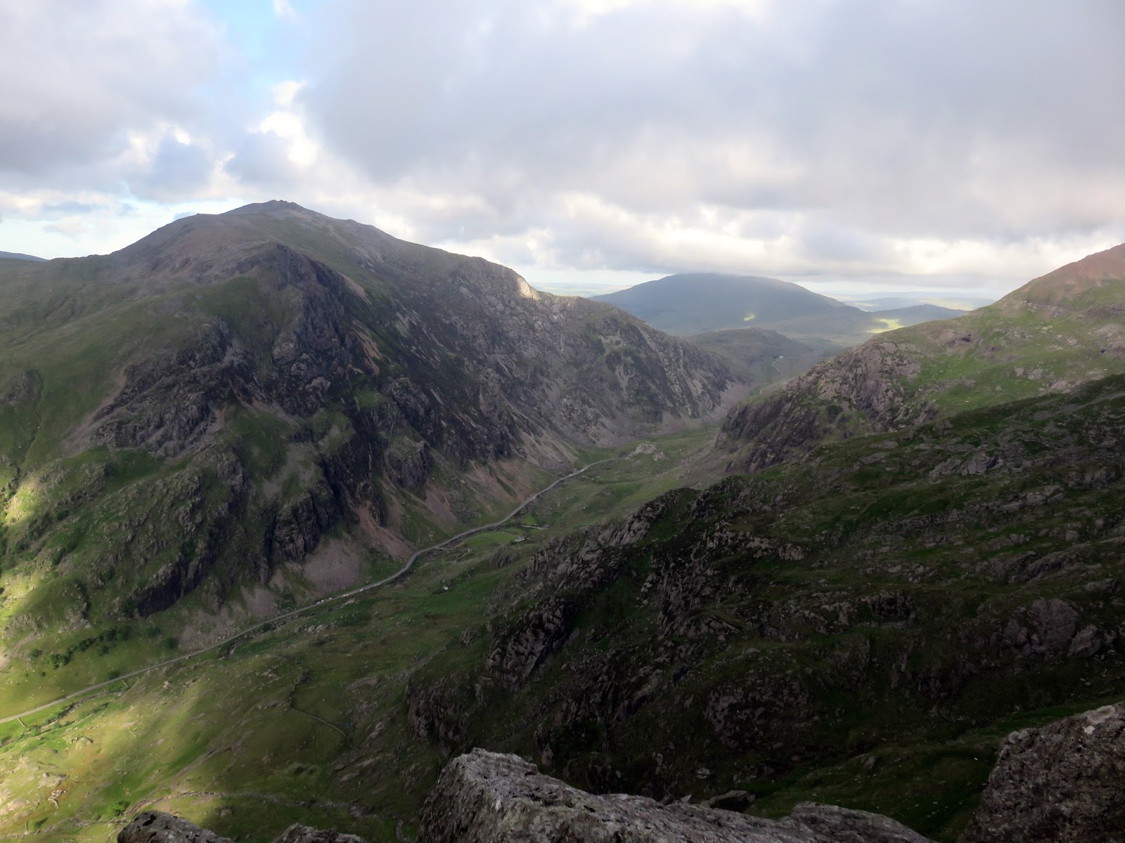
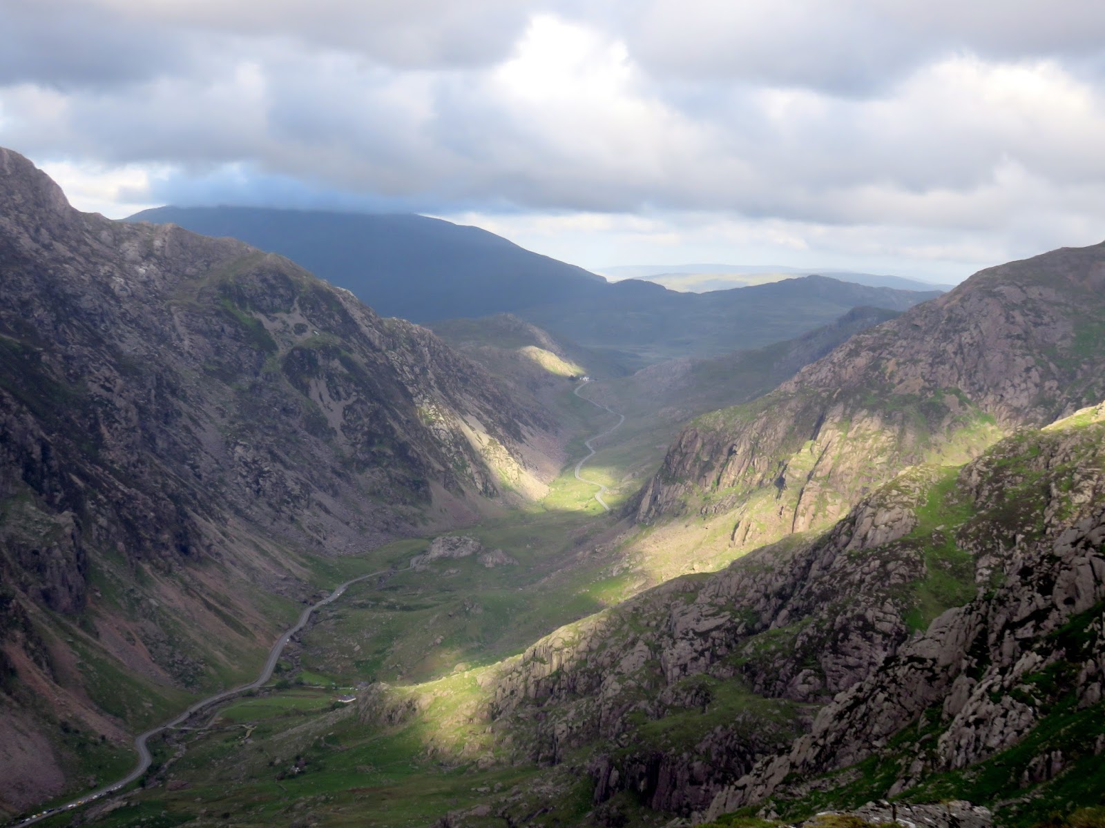
Though it appears steep, the path uses a number of zig-zags the climb the main Clogwyn Du’r Arddu ridge until it reaches a broad, grass shoulder at Clogwyn Coch. Here, it sweeps south to meet the Mountain Railway and the Llanberis Path immediately before the Pyg Track joins at the stone finger-post at Bwlch Glas. Views over Cwm Clogwyn to Llechog are outstanding. A final 100m climb follows the railway to Snowdon’s summit.
 |
| The Snowdon Ranger path |
 |
| The path as the gradient starts to ease |
 |
| Looking down into Cwm Clogwyn |
 |
| The Nantlle Ridge and Mynydd Mawr |
 |
| Looking down the Snowdon Ranger Path |
 |
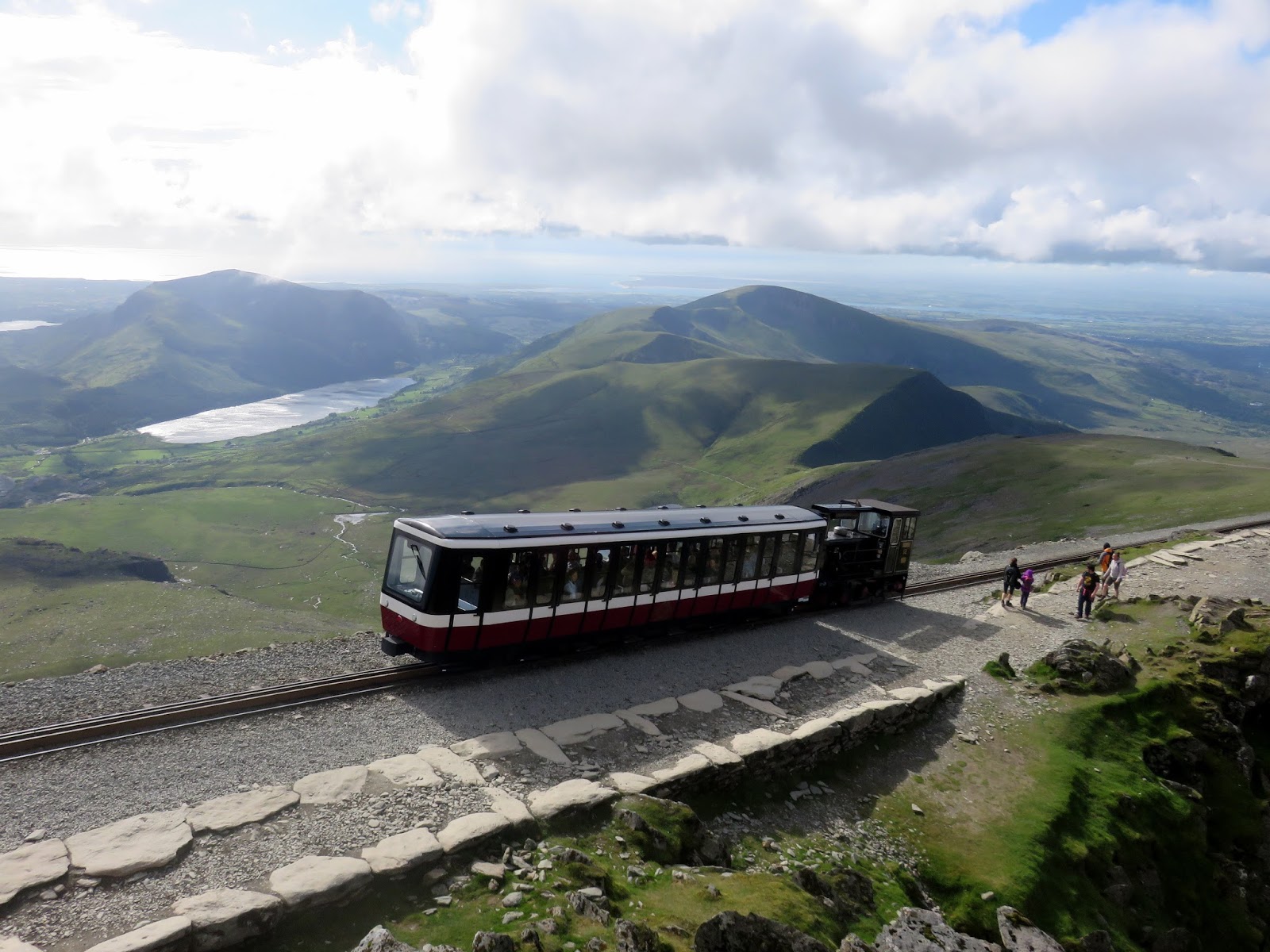
| The famous Snowdon Mountain Railway |
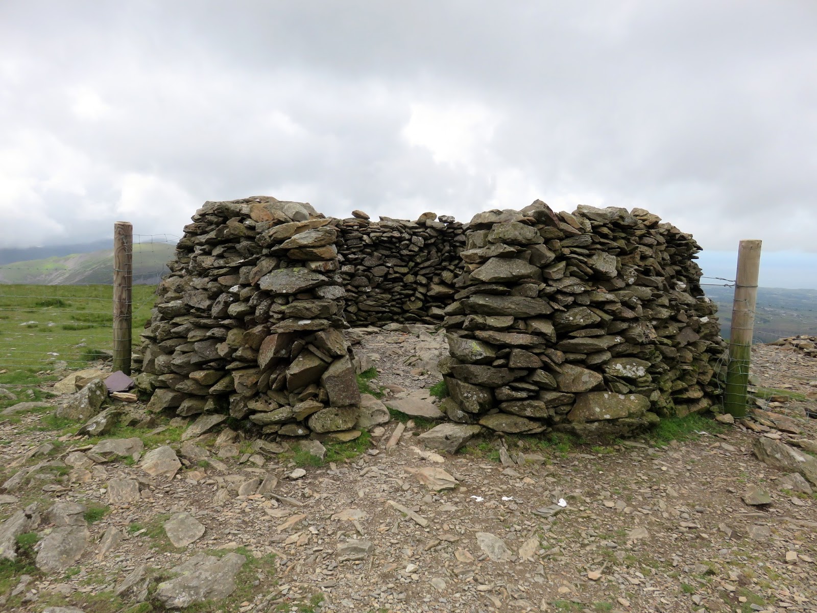
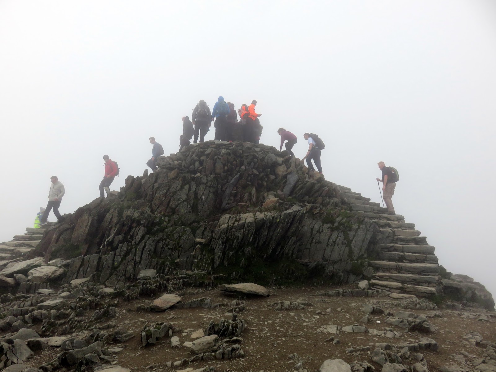
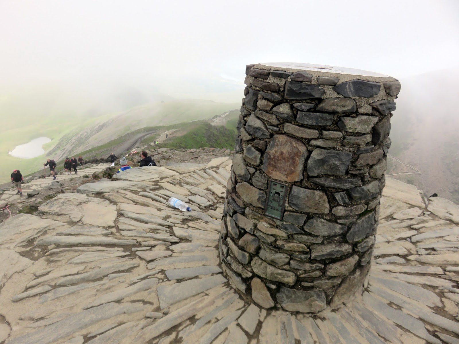
Though busy, as is usually the case, our plan of leaving late appeared to have worked. There were much more people leaving than were arriving. What didn’t pan out so well was the weather, a dirty grey cloud settled itself on the summit just as we arrived.
 |
| Another empty summit photo |
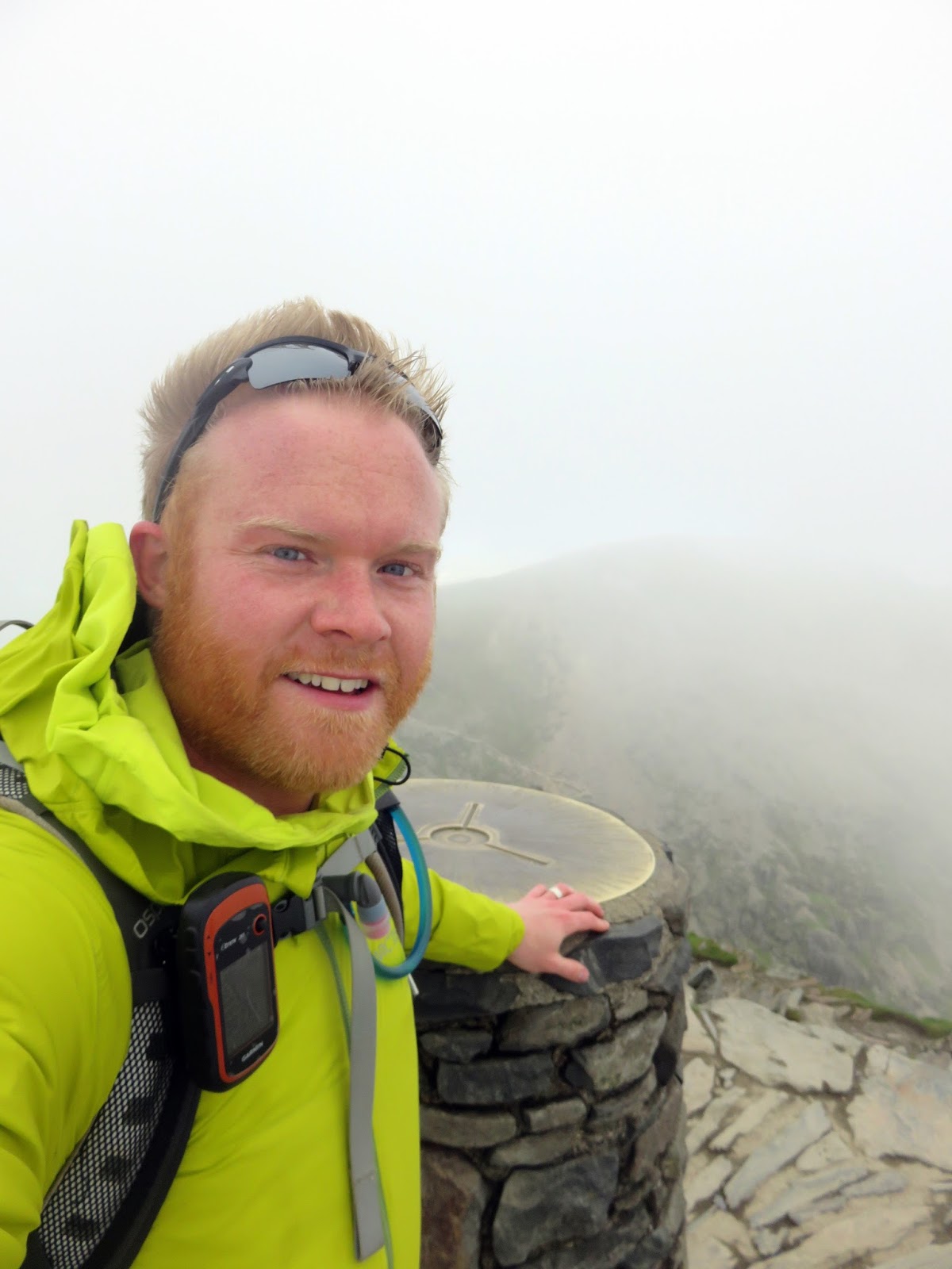
After wandering around a bit, using the facilities at Hafod Eryri and generally wasting time, the crowds started to thin out leaving a momentarily free summit – time to grab that all-too-rare empty summit photo. Luckily, our procrastinating did mean we saw some of the fine views over Glaslyn as the clouds briefly lifted.
 |
| Yours truly |
 |
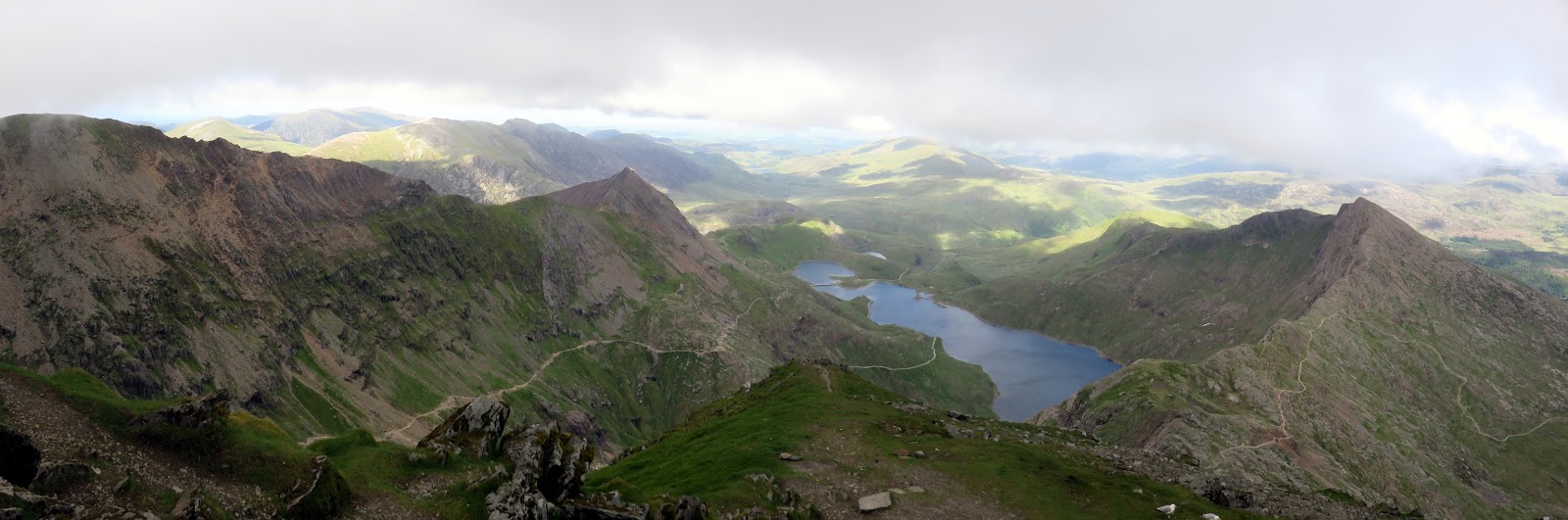
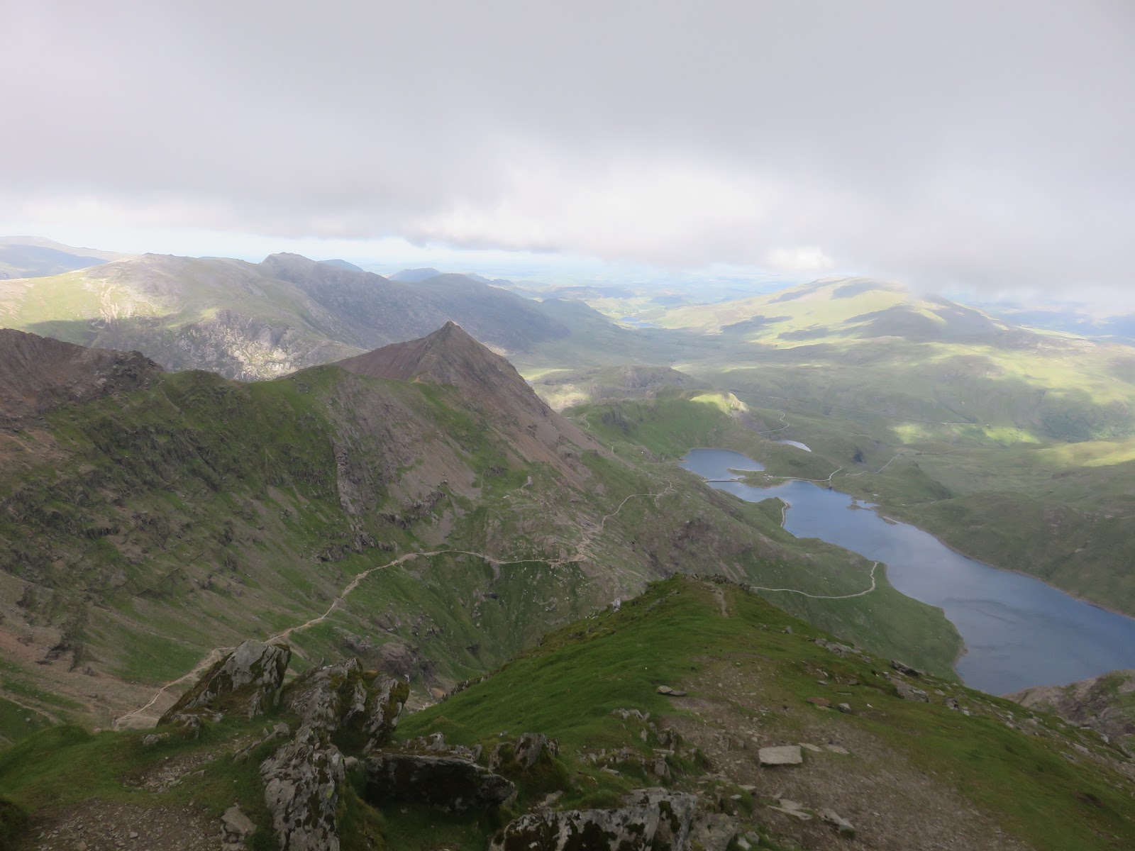
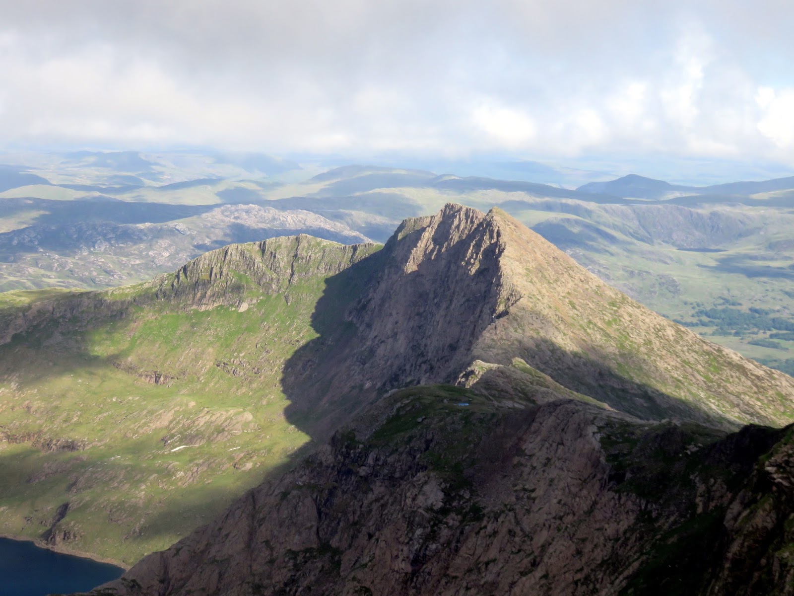
| Crib Goch, Llyn Llydaw and Y Lliwedd seen from the summit |
 |
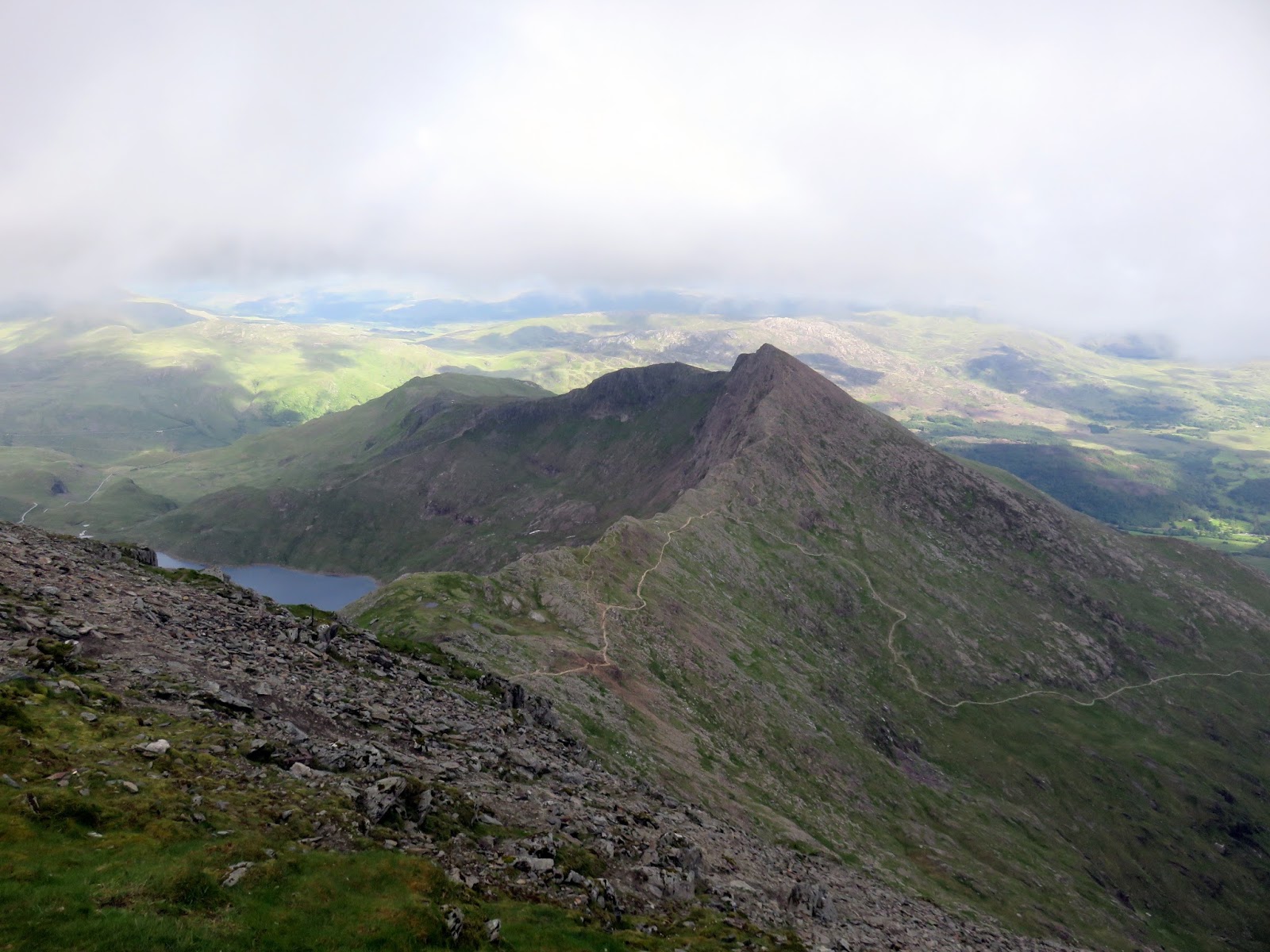
| Y Lliwedd and the Watkin Path |
 |
| Moel Siabod plays havoc with the exposure |
 |
| The Pyg and Miners’ Tracks meet above Glaslyn |
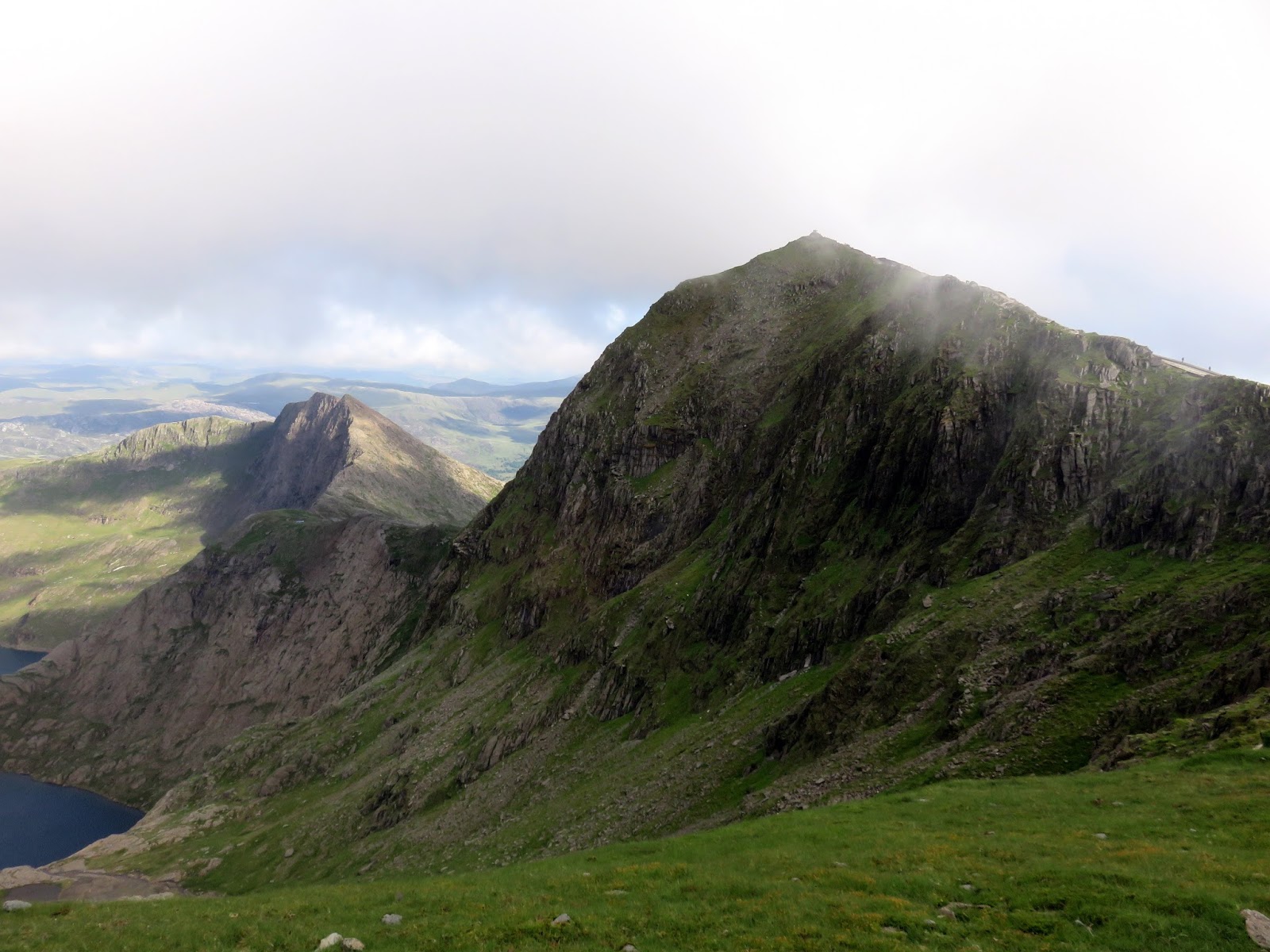
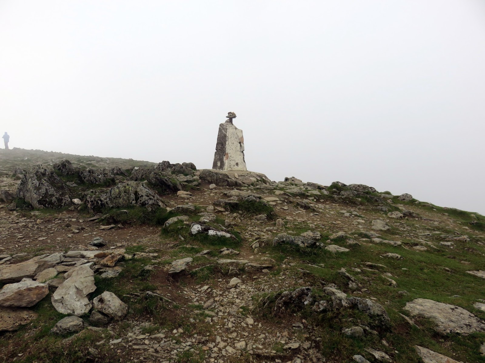
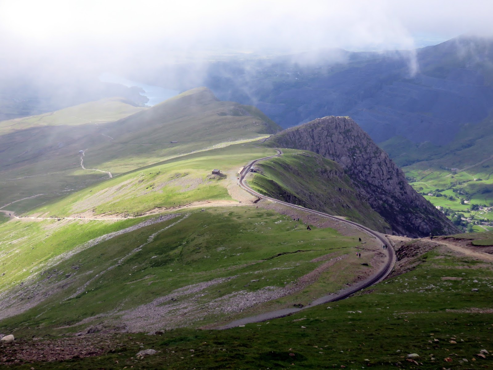
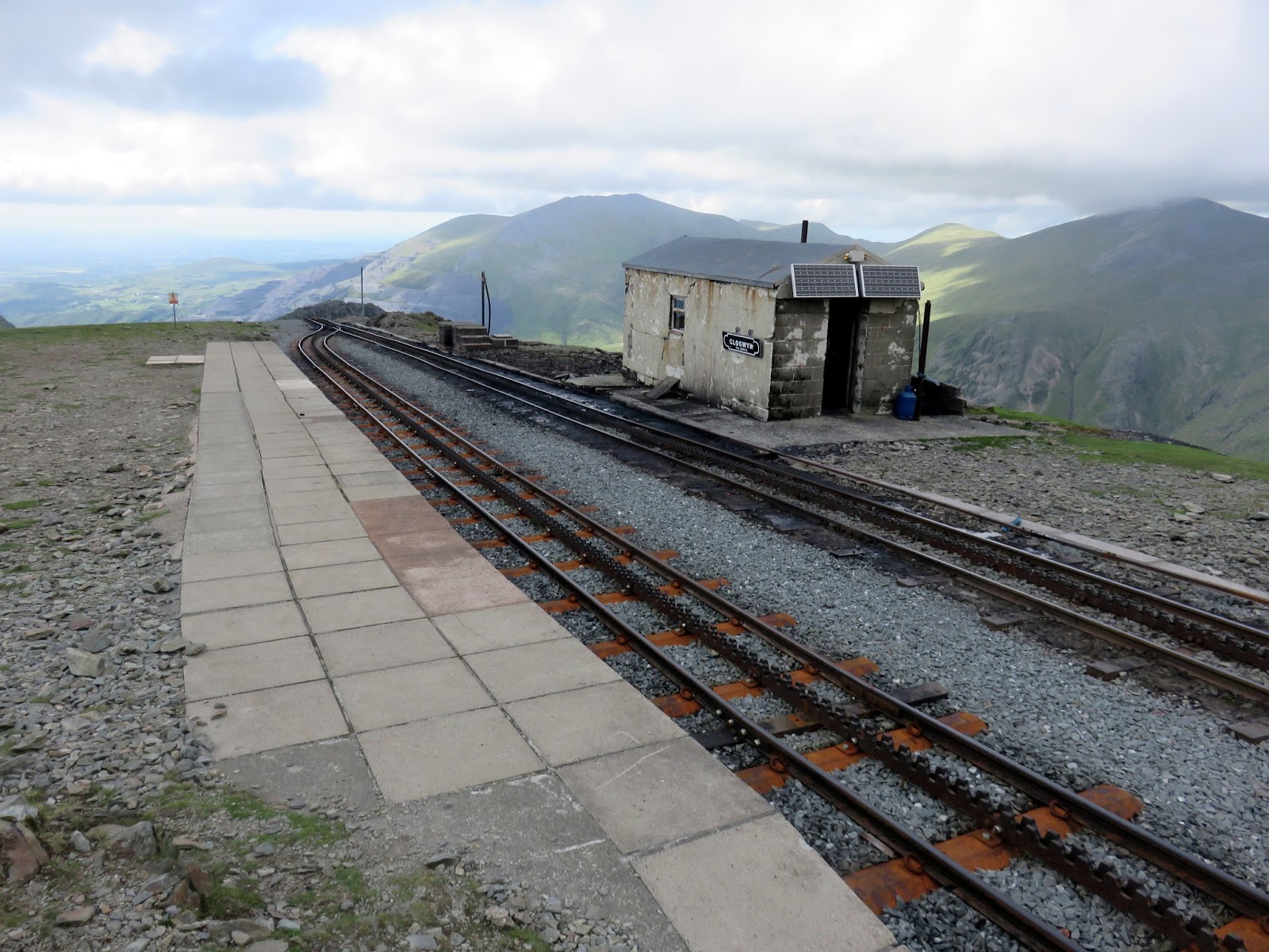
Our next port of call was Garnedd Ugain, Wales’ second highest mountain and perhaps one of its most overlooked. It’s only a short distance from Snowdon and has an excellent view of the cliffs below Snowdon’s summit. The trig pillar seems to have taken a bit of a hammering since I was last here in 2016.
 |
| The Snowdon Mountain Railway climbs to the summit |
 |
| The Pyg Track at Blwch Glas |
 |
| Y Lliwedd |
 |
| A glimpse down Cwm Glas to the Llanberis Pass |
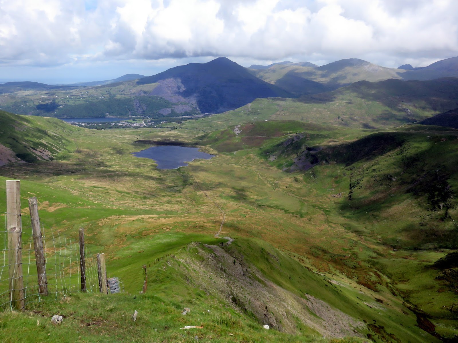
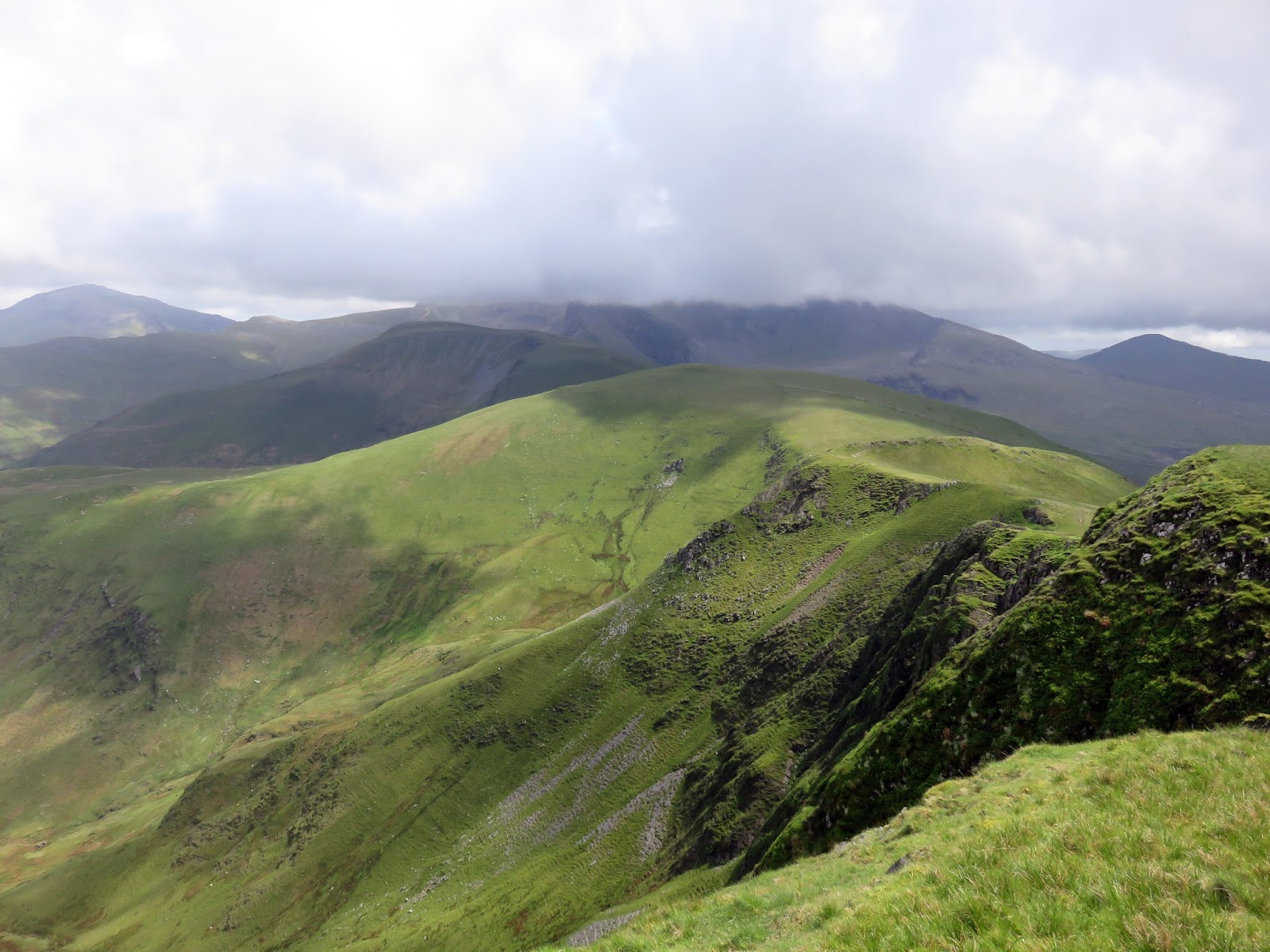
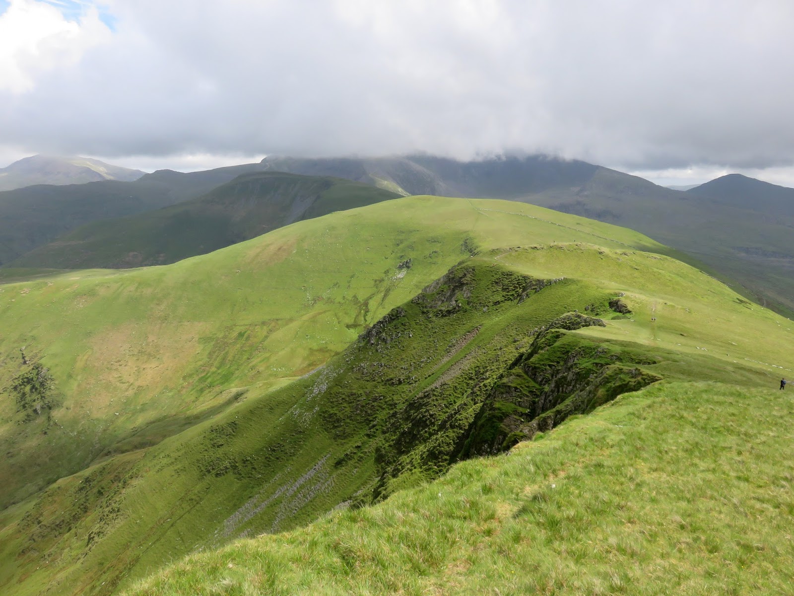
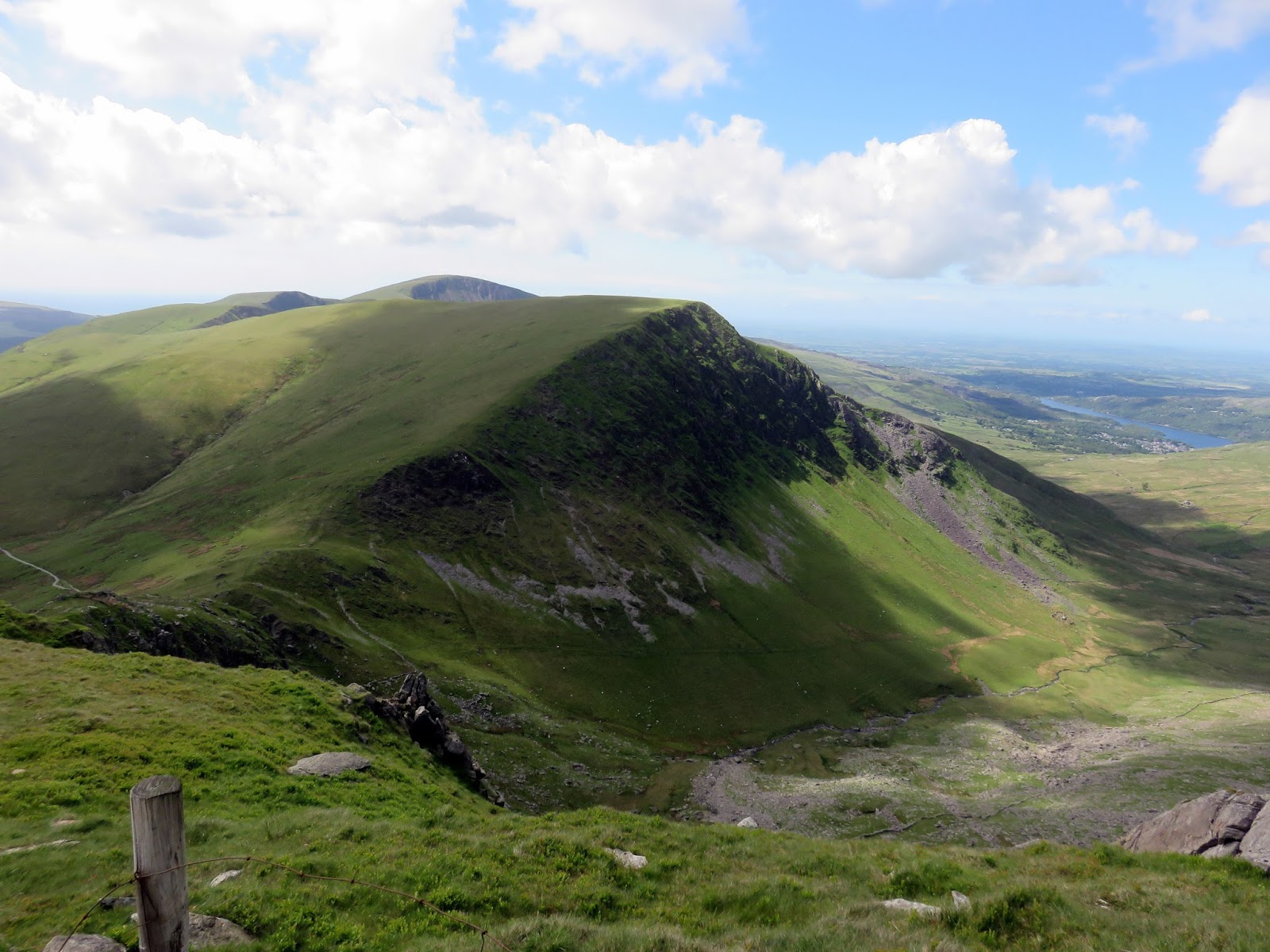
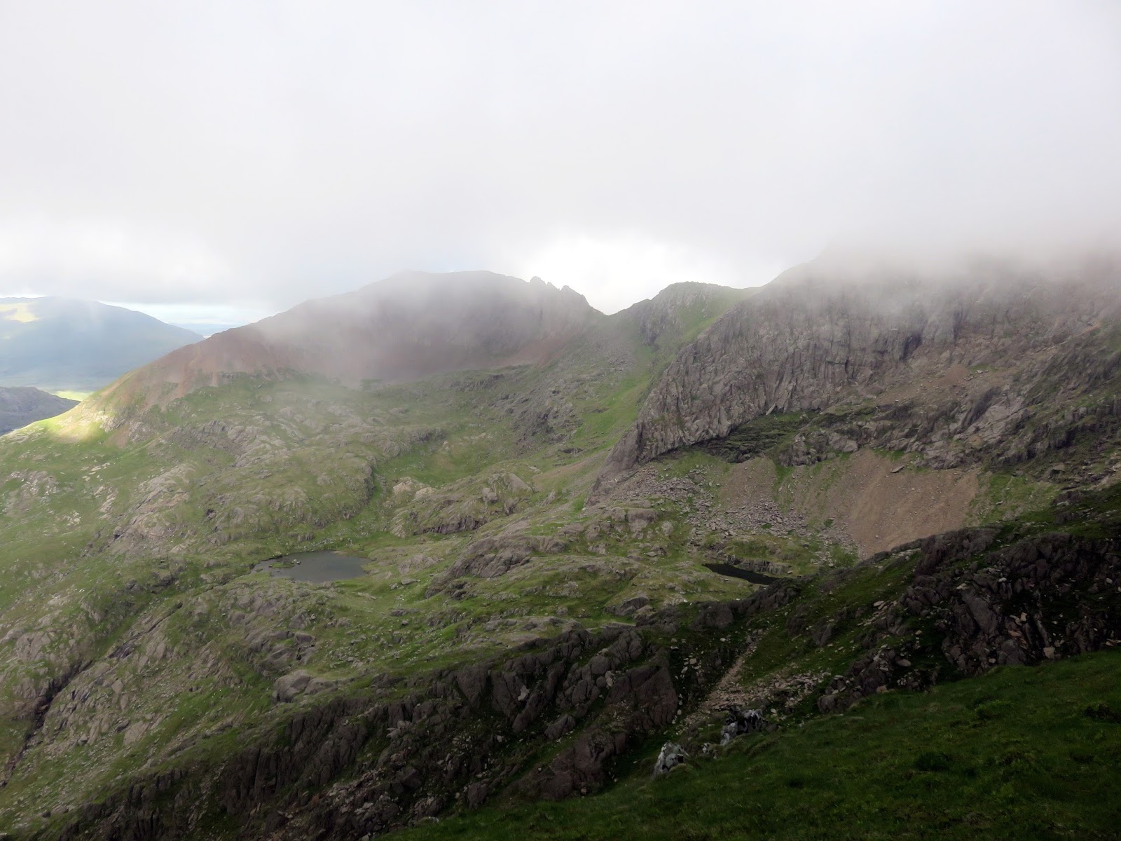
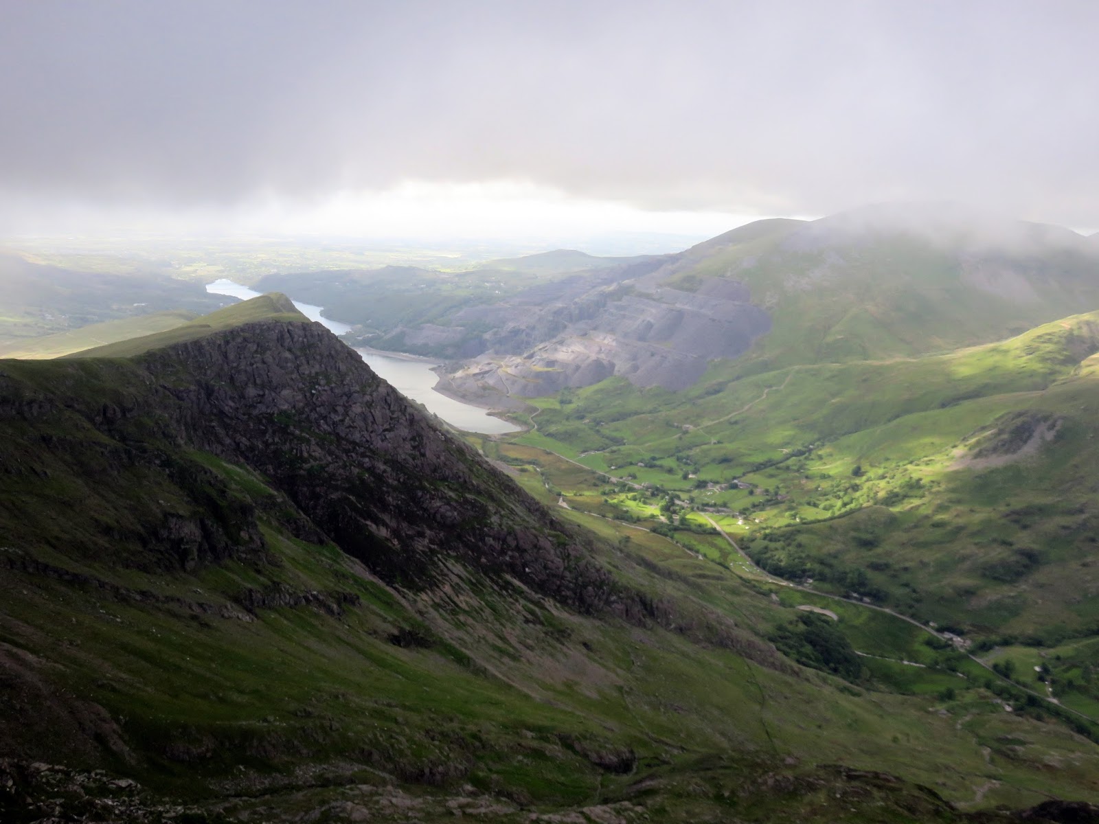
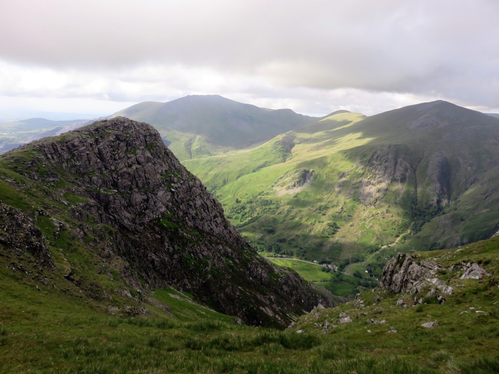
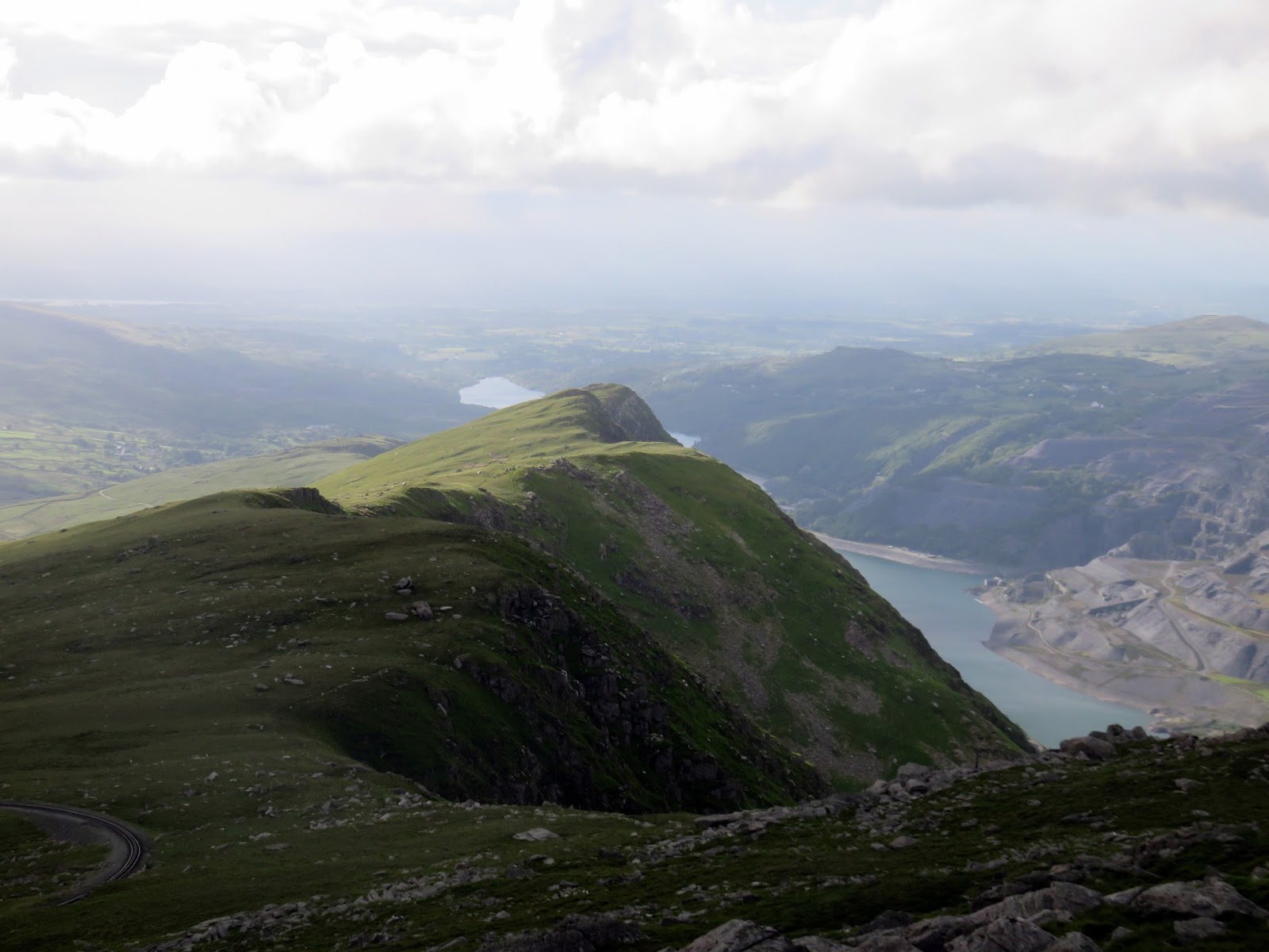
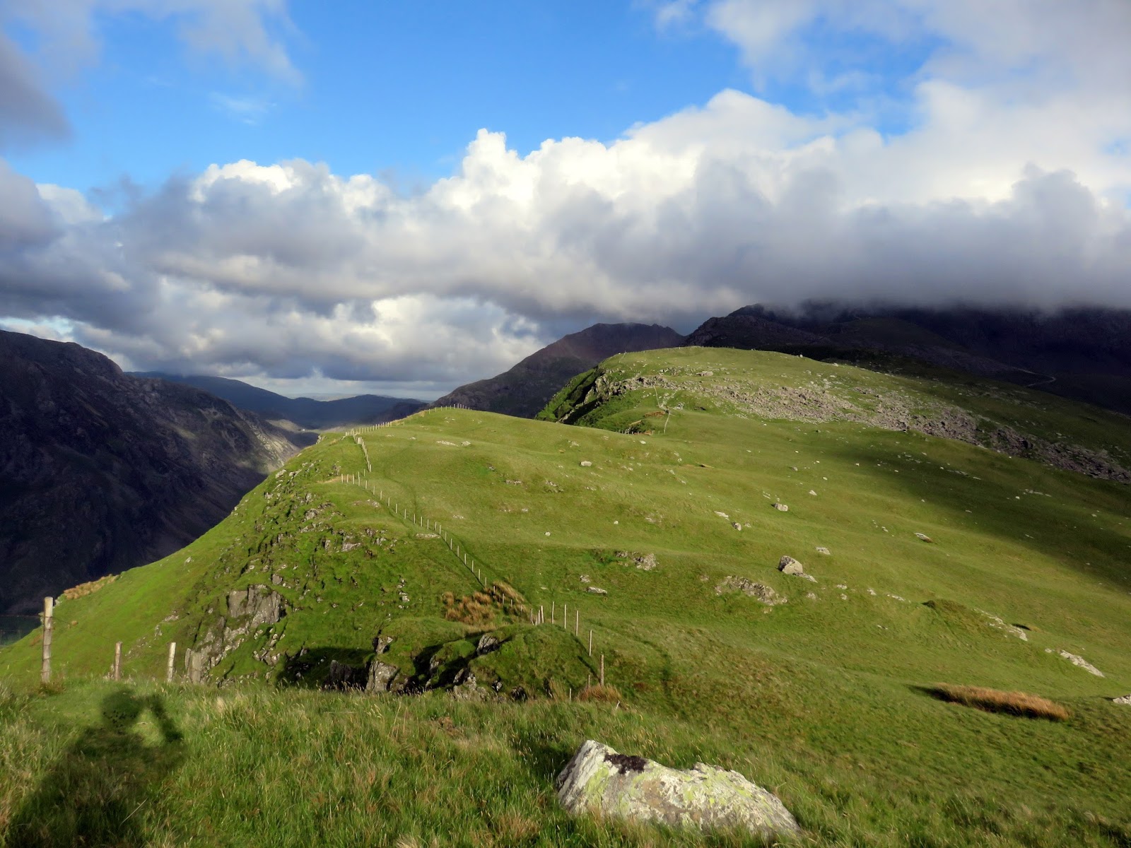
We returned to the Llanberis Path and followed it to the top of the Gryn Las ridge to survey the impressive scenery around Cwm Glas and Cwm Uchaf. The view of Crib Goch from here is pretty impressive. We returned the path and crossed to Clogwyn Station, following the ridge top to Llechog – the final peak of the day. Again, after a short climb, views from the top an excellent and it’s unlikely you’ll come across many people up there.
 |
| Cwm Uchaf |
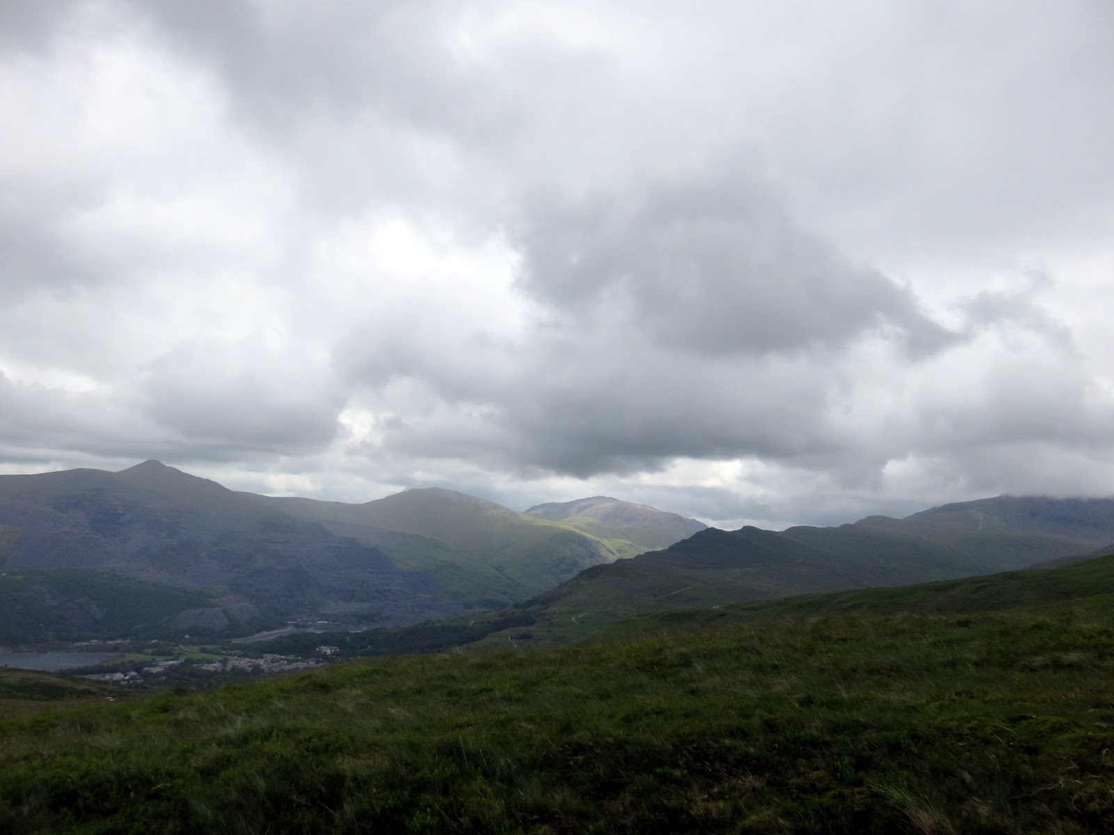
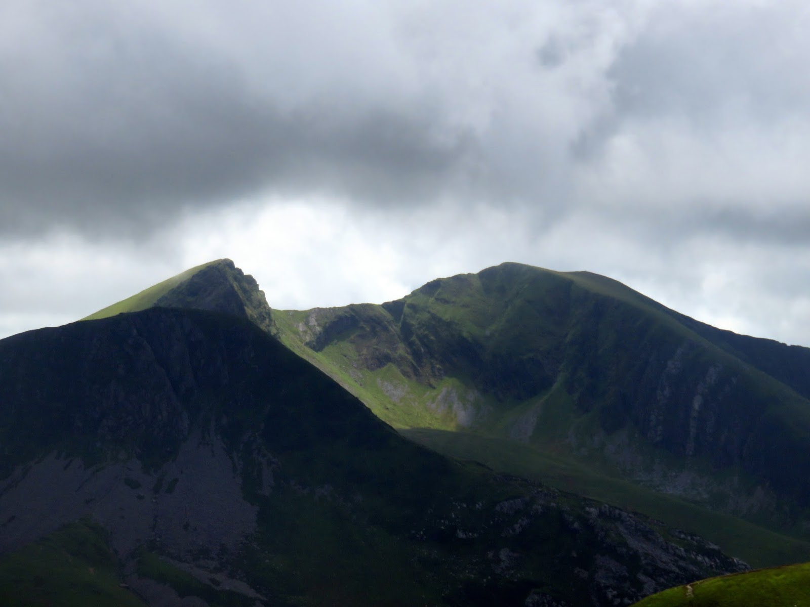
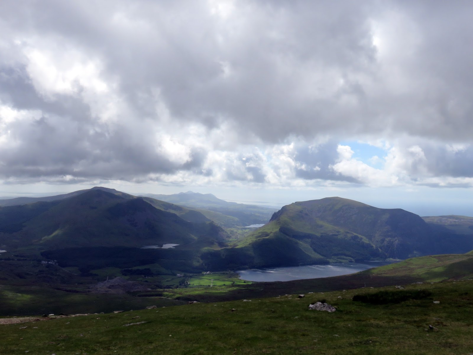
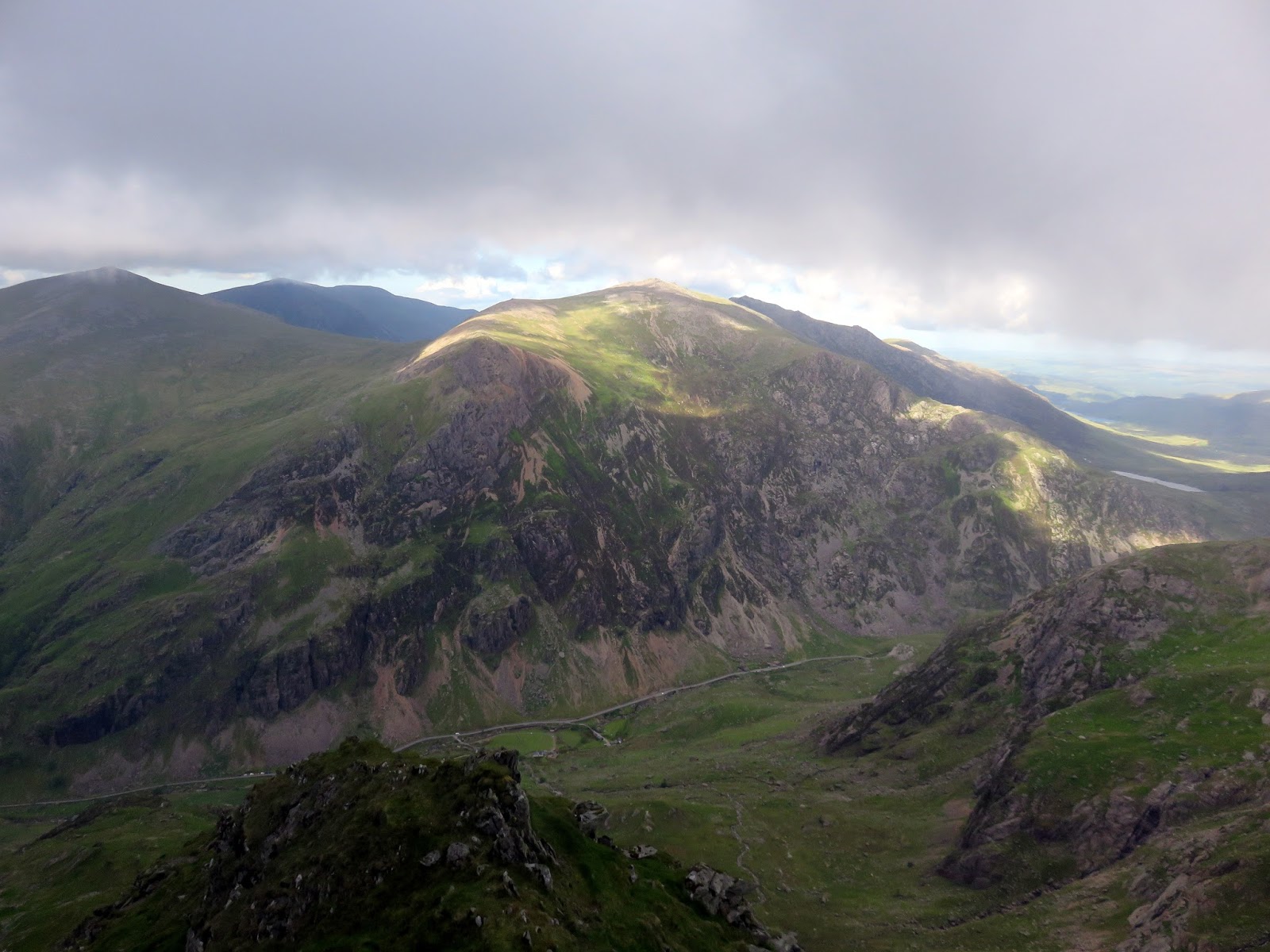
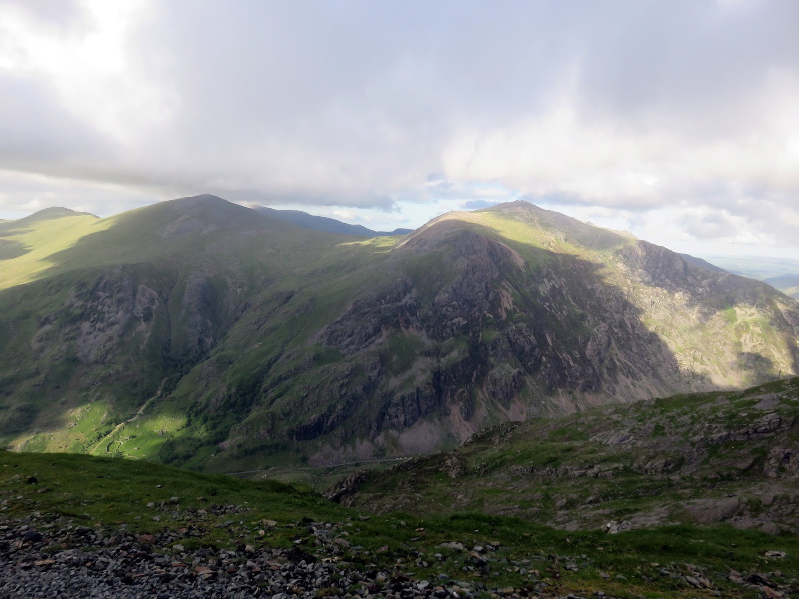
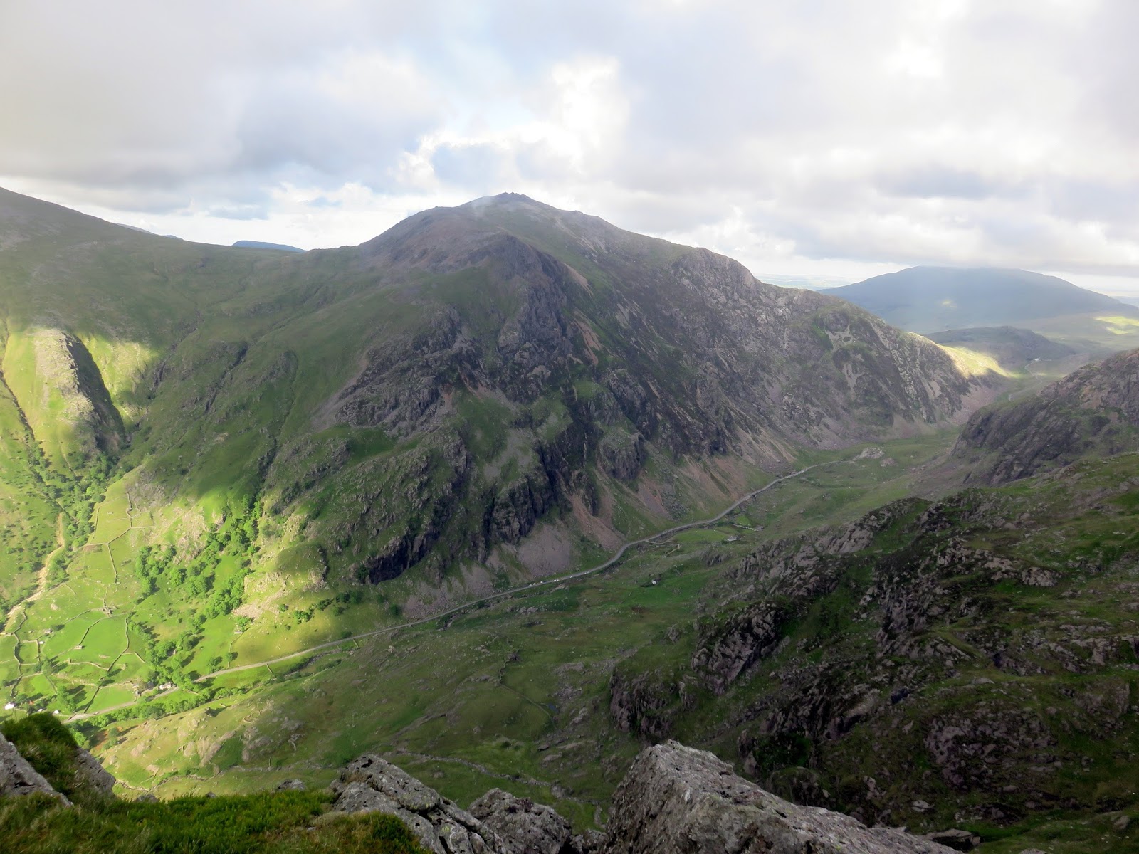
We stuck to the ridge top, enjoying the views of the Llanberis Pass and the Glyderau which were catching some early evening sun. Tryfan even makes an appearance through the gap between Glyder Fawr and Y Garn. Tryfan was to be our next port of call, though not the 3,000ft variant – there is a similarly named section of the ridge as it translates to ‘three peaks’ or ‘three rocks’.
 |
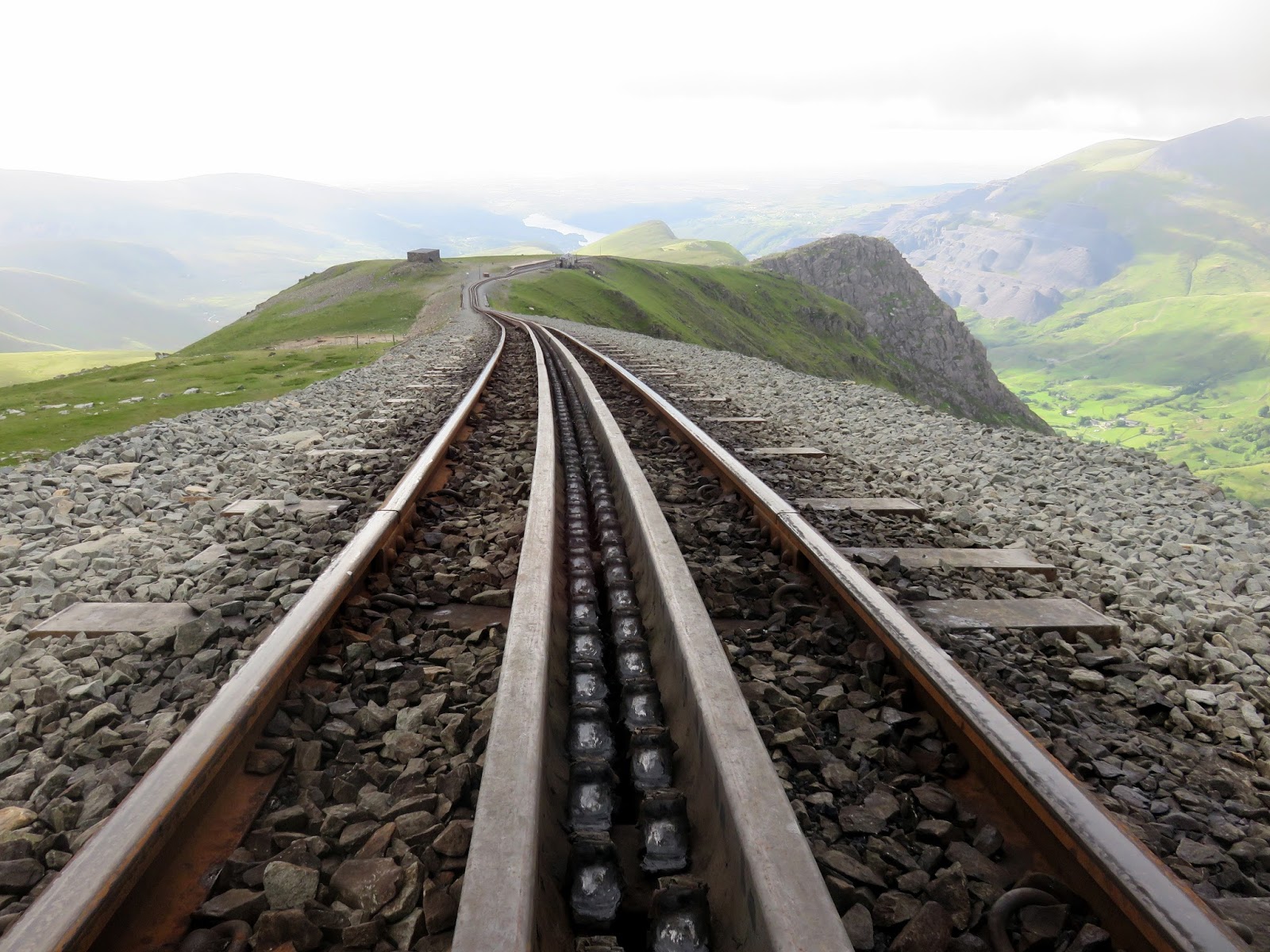
| The Mountain Railway |
 |
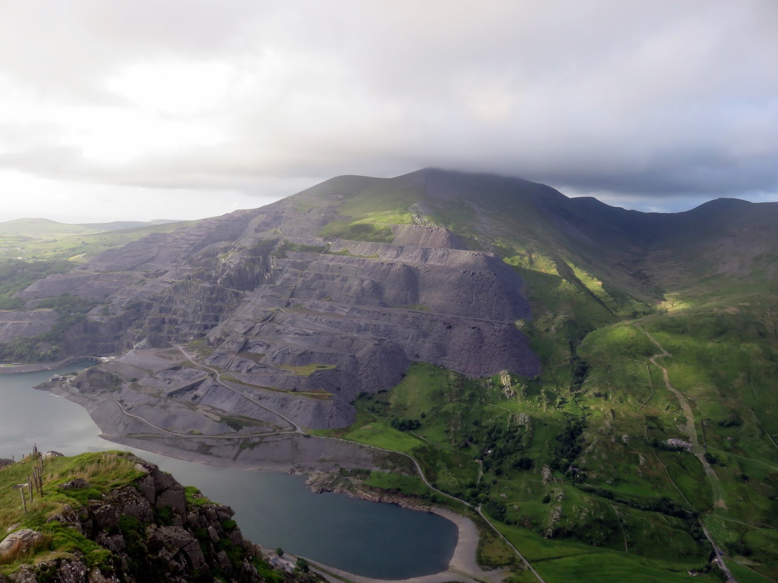
| Clogwyn Station |
 |
| The Llanberis Pass |
 |
| The ridge route to Llanberis |
 |
| The Llanberis Pass |
 |
| Two of Tryfan’s three peaks |
 |
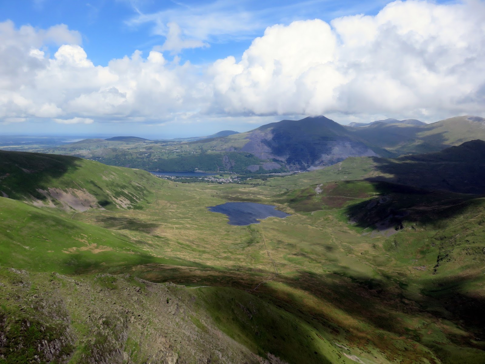
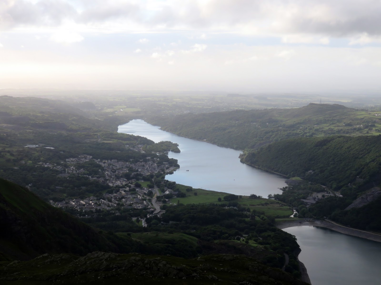
| Llanberis and Llyn Padarn |
From Tryfan, a steep grassy slope leads back to the Llanberis Path which, in turn, took us back to Llanberis via the steep at Coed Victoria. After tramping along a few more back roads we returned to Pete’s Eats where we had begun several hours earlier. The joy of walking in summer meant that, despite it being around 9pm, there was still plenty of light.
Climbing Snowdon is always exciting and this long route is no exception, combining the excellent Moel Eilio horseshoe and the Snowdon Ranger Path to create an awesome mountain day out.
