Open Space Web-Map builder Codehttps://openspace.ordnancesurvey.co.uk/osmapapi/openspace.js?key=3119F72552FD5C22E0530C6CA40A5A92https://openspace.ordnancesurvey.co.uk/osmapapi/script/mapbuilder/basicmap.jshttps://openspace.ordnancesurvey.co.uk/osmapapi/script/mapbuilder/searchbox.js//variables for routes var linesLayer, points, lineFeature, lineString, routeMarkersLayer, routepos, routesize, routeoffset, routeicon; var style_blue = {strokeColor: “#0000CD”, strokeOpacity: 0.5, strokeWidth: 4.5}; function initmapbuilder() { //initiate the map var options = {resolutions: [2500, 1000, 500, 200, 100, 50, 25, 10, 5, 4, 2.5, 2, 1]}; osMap = new OpenSpace.Map(‘map’, options); //configure map options (basicmap.js) setglobaloptions(); //set the center of the map and the zoom level osMap.setCenter(new OpenSpace.MapPoint(410415,385150),7); linesLayer = osMap.getVectorLayer(); // Set up layer for route markers routeMarkersLayer = new OpenLayers.Layer.Markers(“Route Markers”); //make a route points = new Array(); points.push(new OpenLayers.Geometry.Point(410680,384700)); points.push(new OpenLayers.Geometry.Point(410365,384935)); points.push(new OpenLayers.Geometry.Point(410400,385035)); points.push(new OpenLayers.Geometry.Point(410245,385315)); points.push(new OpenLayers.Geometry.Point(410225,385450)); points.push(new OpenLayers.Geometry.Point(410240,385620)); points.push(new OpenLayers.Geometry.Point(410215,385750)); points.push(new OpenLayers.Geometry.Point(410215,385905)); points.push(new OpenLayers.Geometry.Point(410265,386050)); points.push(new OpenLayers.Geometry.Point(410000,386690)); points.push(new OpenLayers.Geometry.Point(409950,386760)); points.push(new OpenLayers.Geometry.Point(409805,386860)); points.push(new OpenLayers.Geometry.Point(409680,386945)); points.push(new OpenLayers.Geometry.Point(409600,387065)); points.push(new OpenLayers.Geometry.Point(409520,387165)); points.push(new OpenLayers.Geometry.Point(409490,387245)); points.push(new OpenLayers.Geometry.Point(409495,387310)); points.push(new OpenLayers.Geometry.Point(409455,387270)); points.push(new OpenLayers.Geometry.Point(409395,387075)); points.push(new OpenLayers.Geometry.Point(409250,386980)); points.push(new OpenLayers.Geometry.Point(409150,386980)); points.push(new OpenLayers.Geometry.Point(409085,387010)); points.push(new OpenLayers.Geometry.Point(408925,387015)); points.push(new OpenLayers.Geometry.Point(408765,387045)); points.push(new OpenLayers.Geometry.Point(408640,387525)); points.push(new OpenLayers.Geometry.Point(407885,387050)); points.push(new OpenLayers.Geometry.Point(407820,386815)); points.push(new OpenLayers.Geometry.Point(407945,386425)); points.push(new OpenLayers.Geometry.Point(408000,386250)); points.push(new OpenLayers.Geometry.Point(408170,386005)); points.push(new OpenLayers.Geometry.Point(408275,385920)); points.push(new OpenLayers.Geometry.Point(408220,385800)); points.push(new OpenLayers.Geometry.Point(408240,385330)); points.push(new OpenLayers.Geometry.Point(408335,385140)); points.push(new OpenLayers.Geometry.Point(408500,385065)); points.push(new OpenLayers.Geometry.Point(408765,384830)); points.push(new OpenLayers.Geometry.Point(408875,384630)); points.push(new OpenLayers.Geometry.Point(408910,384370)); points.push(new OpenLayers.Geometry.Point(409625,383405)); points.push(new OpenLayers.Geometry.Point(409700,383245)); points.push(new OpenLayers.Geometry.Point(409835,383160)); points.push(new OpenLayers.Geometry.Point(409865,383045)); points.push(new OpenLayers.Geometry.Point(409910,382910)); points.push(new OpenLayers.Geometry.Point(410135,382900)); points.push(new OpenLayers.Geometry.Point(410560,383130)); points.push(new OpenLayers.Geometry.Point(411120,383425)); points.push(new OpenLayers.Geometry.Point(411235,383445)); points.push(new OpenLayers.Geometry.Point(411835,383435)); points.push(new OpenLayers.Geometry.Point(412000,383440)); points.push(new OpenLayers.Geometry.Point(412045,383465)); points.push(new OpenLayers.Geometry.Point(412450,383440)); points.push(new OpenLayers.Geometry.Point(412530,383440)); points.push(new OpenLayers.Geometry.Point(412745,383605)); points.push(new OpenLayers.Geometry.Point(412790,383495)); points.push(new OpenLayers.Geometry.Point(412935,383455)); points.push(new OpenLayers.Geometry.Point(413135,383460)); points.push(new OpenLayers.Geometry.Point(413115,383285)); points.push(new OpenLayers.Geometry.Point(413040,383200)); points.push(new OpenLayers.Geometry.Point(412875,383165)); points.push(new OpenLayers.Geometry.Point(412820,383070)); points.push(new OpenLayers.Geometry.Point(412510,383160)); points.push(new OpenLayers.Geometry.Point(412320,383155)); // create a polyline feature from the array of points lineString = new OpenLayers.Geometry.LineString(points); lineFeature = new OpenLayers.Feature.Vector(lineString, null, style_blue); linesLayer.addFeatures([lineFeature]); //crate a route start/end marker routepos = new OpenSpace.MapPoint(410680,384700); routesize = new OpenLayers.Size(33,45); routeoffset = new OpenLayers.Pixel(-5,-37); routeicon = new OpenSpace.Icon(‘https://openspace.ordnancesurvey.co.uk/osmapapi/img_versions/img_1.1/mapbuilder/routemarker-start.png’, routesize, routeoffset, null, null); routeMarkersLayer.addMarker(new OpenLayers.Marker(routepos, routeicon)); //crate a route start/end marker routepos = new OpenSpace.MapPoint(412320,383155); routesize = new OpenLayers.Size(33,45); routeoffset = new OpenLayers.Pixel(-5,-37); routeicon = new OpenSpace.Icon(‘https://openspace.ordnancesurvey.co.uk/osmapapi/img_versions/img_1.1/mapbuilder/routemarker-end.png’, routesize, routeoffset, null, null); routeMarkersLayer.addMarker(new OpenLayers.Marker(routepos, routeicon)); osMap.addLayer(routeMarkersLayer);}
Route: Upper Booth, Crowden Clough, Crowden Tower, Wool Packs, Pym Chair, Kinder Scout, Kinder Low, Swine’s Back, Brown Knoll, Horsehill Tor, Colbourne, Rushup Edge, Lord’s Seat, Mam Tor
Date: 06/05/2017
From: Upper Booth
Parking: Upper Booth
Start Point: Upper Booth
Region: Peak District – Dark Peak
Route length: 9.6 miles (15.4 km)
Time taken: 04:11
Average speed: 2.3 mph
Ascent: 682m
Descent: 535m
Summits on this walk:
Kinder Scout (636m), Brown Knoll (569m), Rushup Edge (550m), Mam Tor (517m)
Other points of interest: Crowden Clough, Wool Packs, Pym Chair
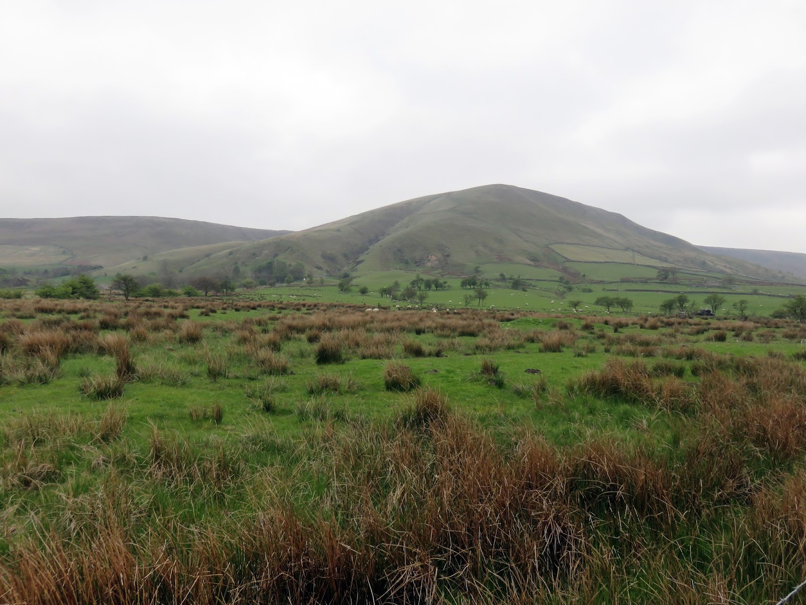
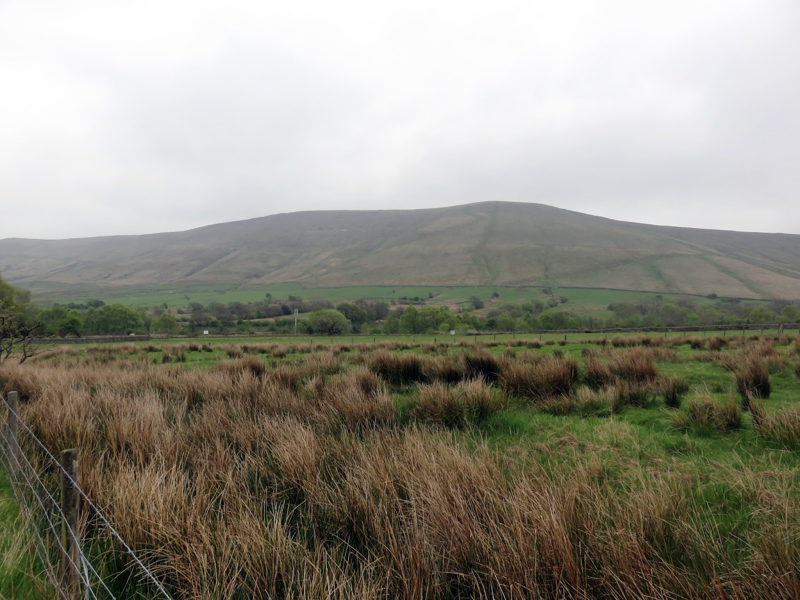
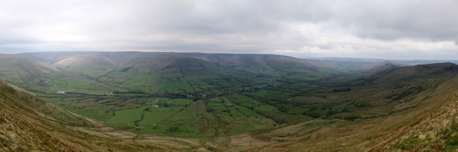
We were back on Kinder again this weekend, it’s the default place when there are no real plans afoot and a walk is called for. This time, however, we’d be treading some new paths around the head of Edale including the tops of Brown Knoll and Rushup Edge as well as having a look at climbing Crowden Clough for the first time.
Kinder Scout is a vast moorland plateau, stretching some 8km east to west and 3km north to south (at the widest point). There are three OS pillar on Kinder, located in the south-west, the north-west and the far east of the plateau though none actually mark the highest point. This is reserved for an unmarked area (other than a spot height on the OS map) that lies a height of 636m close to Kinder Low (the southwestern trig pillar). There are several notable features on Kinder, many of which we’d see later, but the most important is perhaps Kinder Downfall.
The Downfall is actually a ramshackle waterfall, the highest in the National Park at 30m. Originally called Kinder Scut, it is the source of the plateau’s modern name, translated to mean ‘Water over the edge’. Famously, in certain wind conditions, the water is blown back on itself, and the resulting cloud of spray can be seen from several miles away.
We had had plans to do the Edale skyline, the 20 mile walk along the Great Ridge, Edale head and Kinder’s southern edge, however, the weather wasn’t particularly great so we decided on a modified version (i.e. half the distance) to have a look at some of the areas we didn’t know too well.
 |
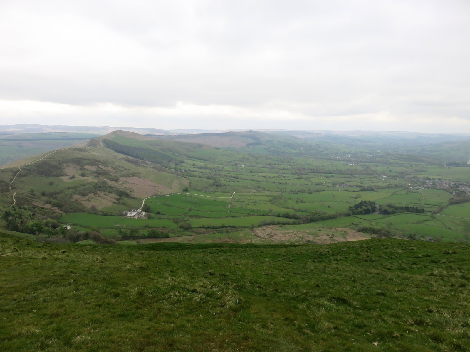
| Horsehill Tor |
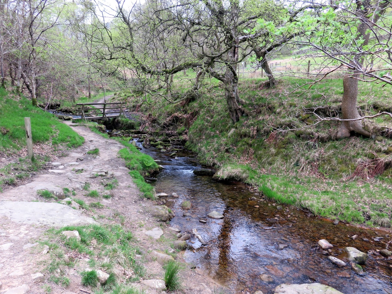
With two cars at our disposal, we left one in the car park at the foot of Mam Tor before taking one into Edale and leaving it close to Upper Booth. We began with a short, easy stroll along the road to the Pennine Way and Crowden Clough.
 |
| Crowden Brook |
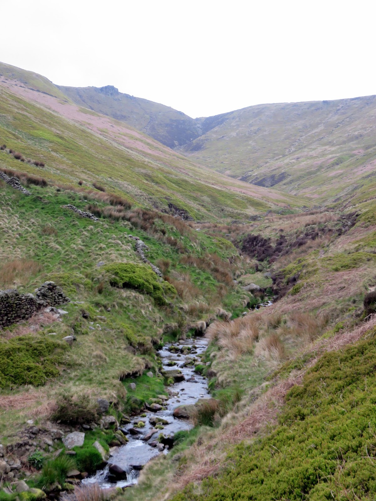
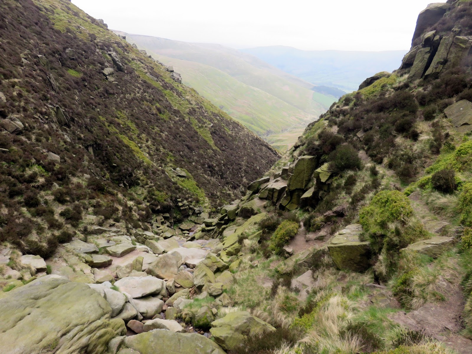
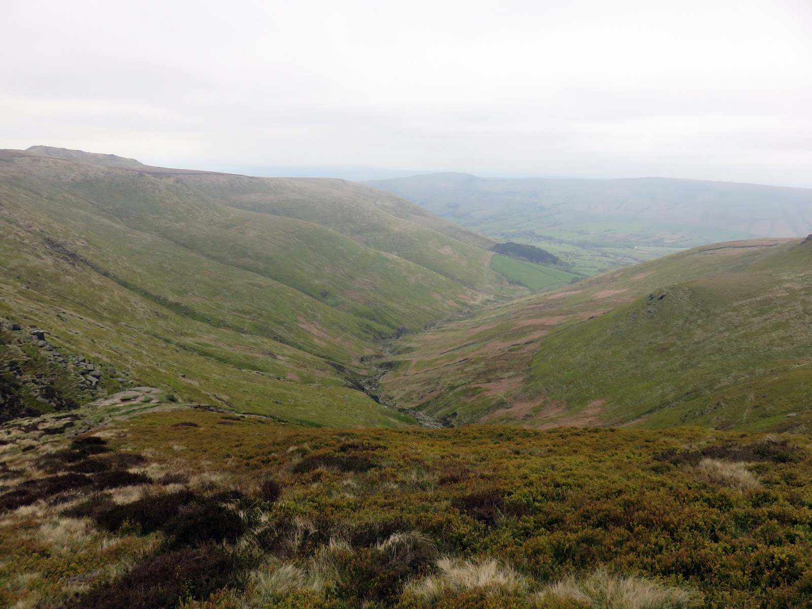
Leaving the road, a path runs parallel to Crowden Clough as it gently rises up towards the slope of Kinder – Crowden Tower peers down the valley from its perch high on the horizon.
 |
| Crowden Clough |
 |
| Crownden Clough |
 |
| Crowden Clough |
 |
| Looking back down the valley |
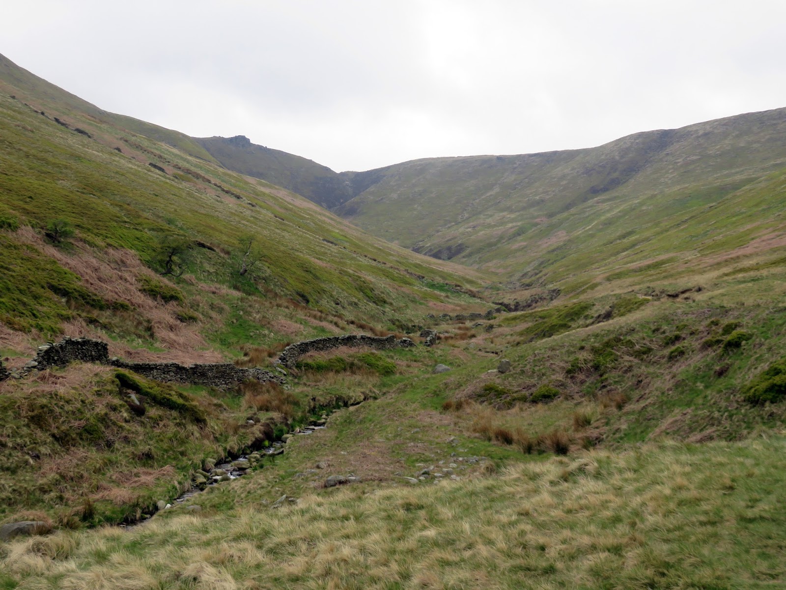
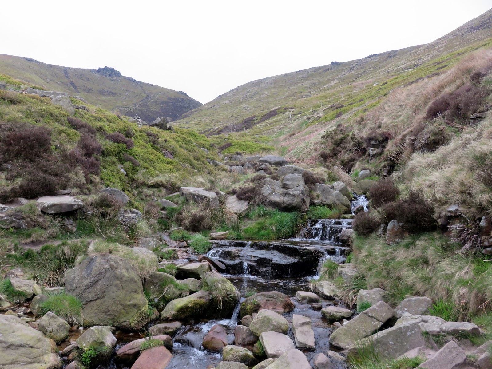
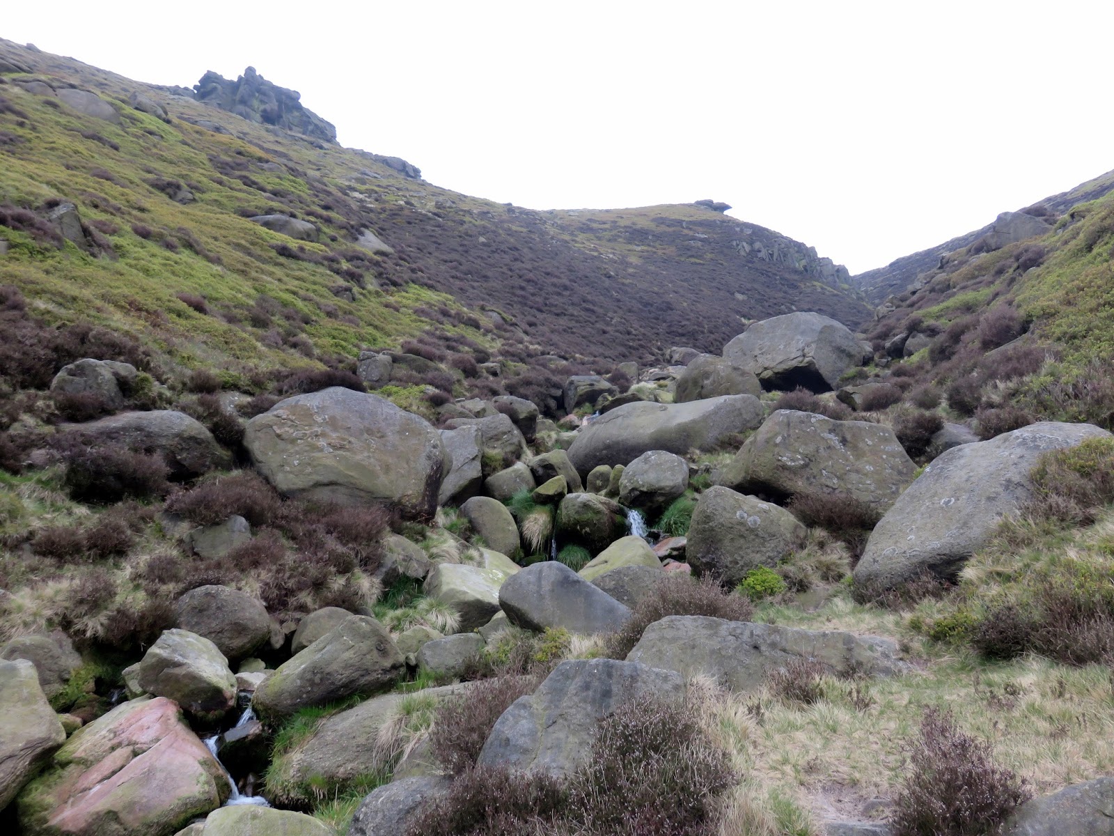
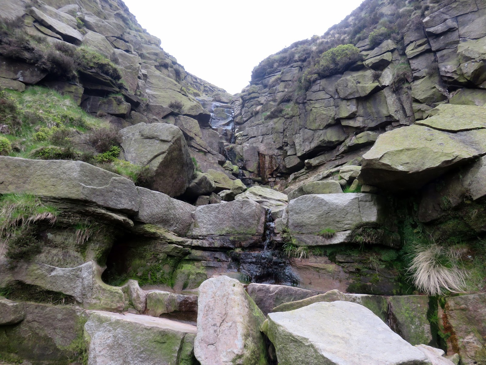
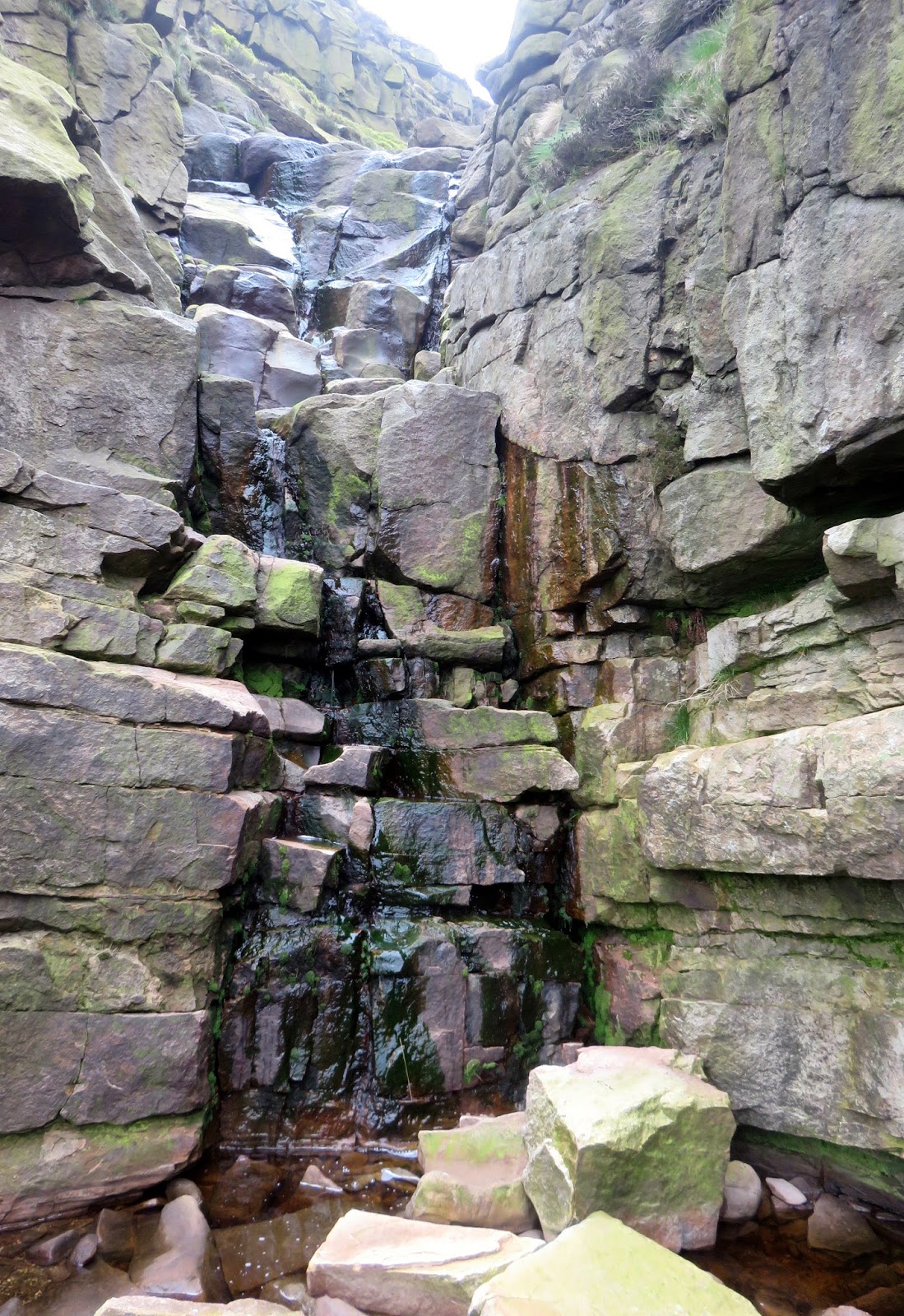
After some modest climbing, things become much more interesting and rockier with no one route better than another. Keep to the stream and keep following it up is my advice. Eventually, you will reach a rocky avenue where the brook tumbles down a series of protruding slabs. In dry conditions, like today, it’s possible to ascent the route directly otherwise a short but enjoyable scramble leads up the left-hand side. Once complete, you will have gained Kinder’s southern edge.
 |
| Crowden Clough below Crowden Tower |
 |
| Crowden Clough |
 |
| Some entertainig scrambling in the clough |
 |
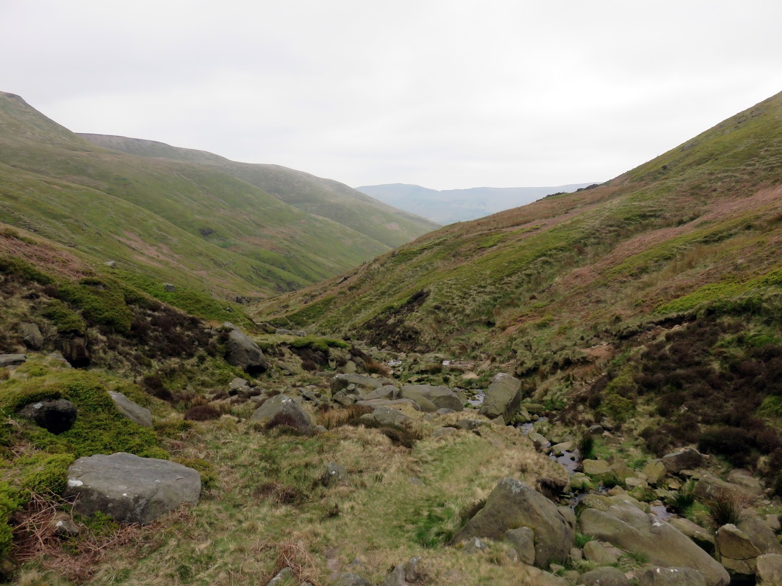
| Looking back down the valley |
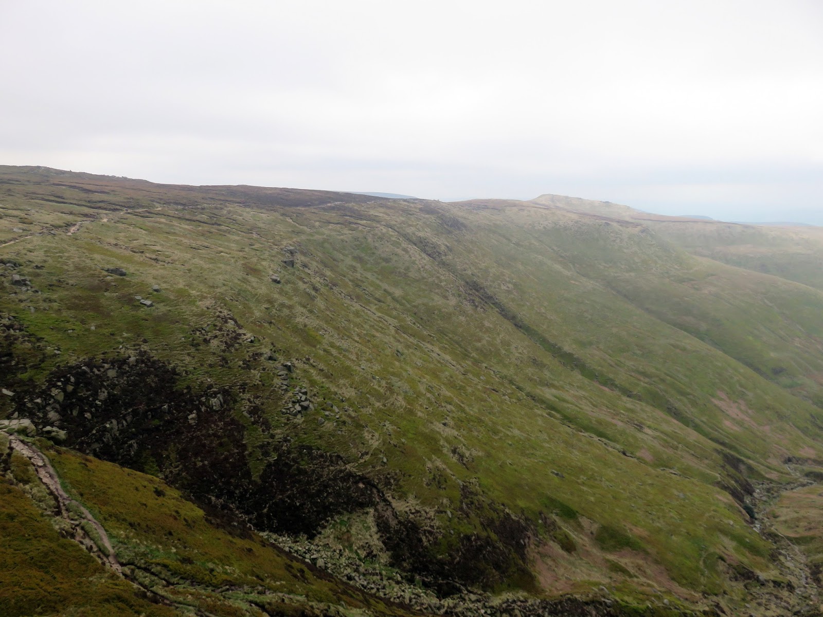
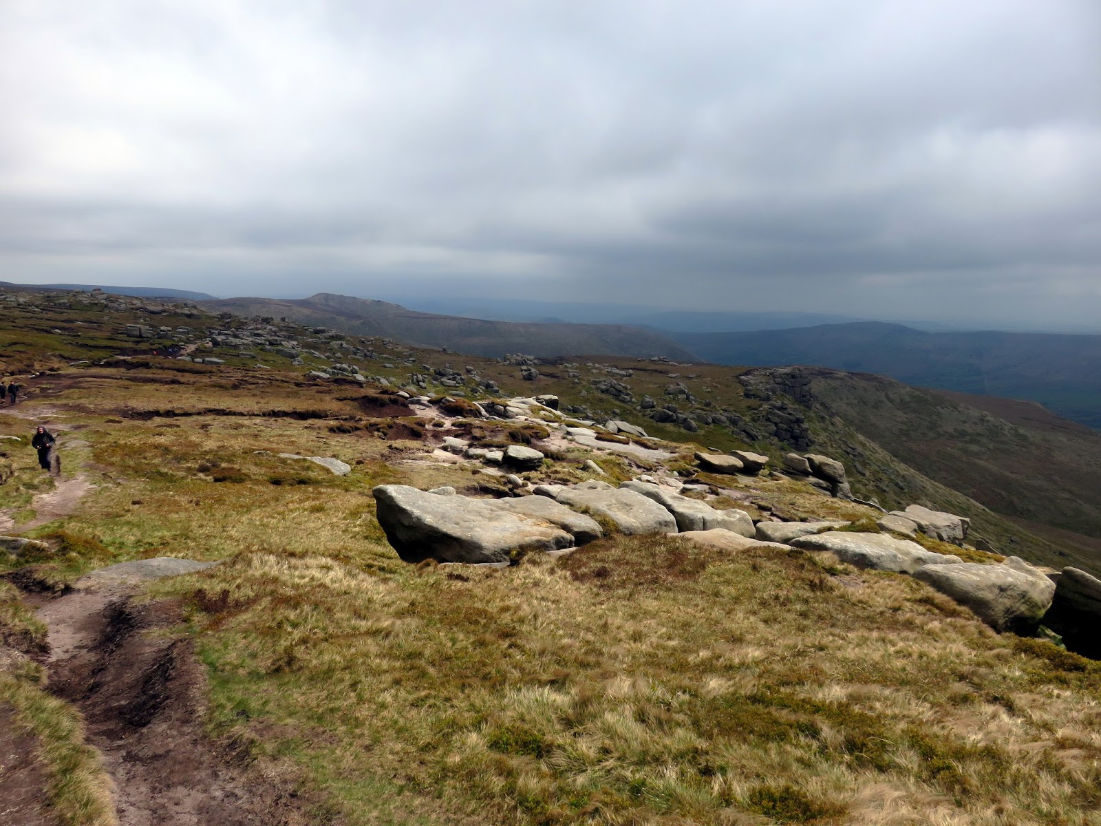
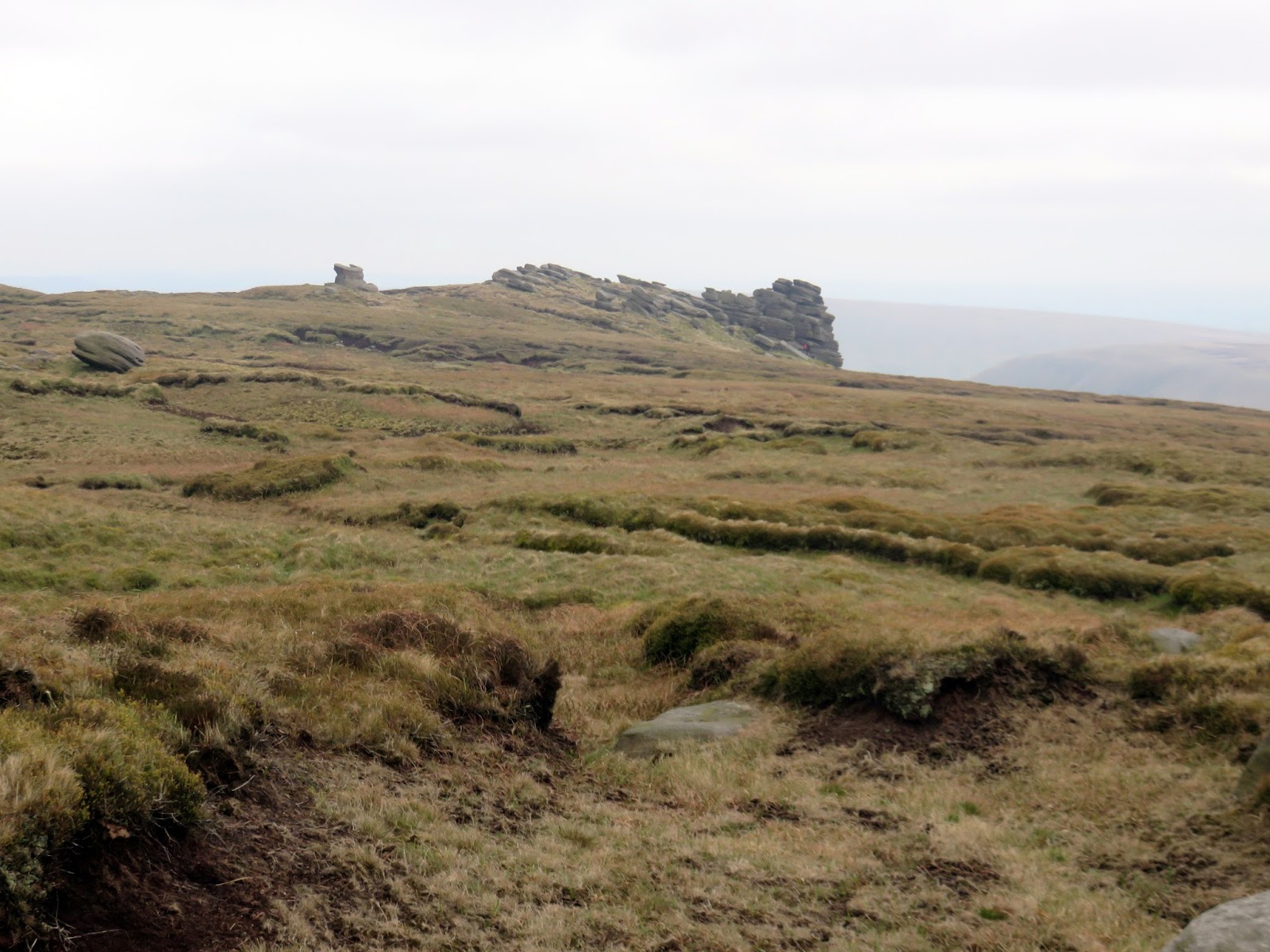
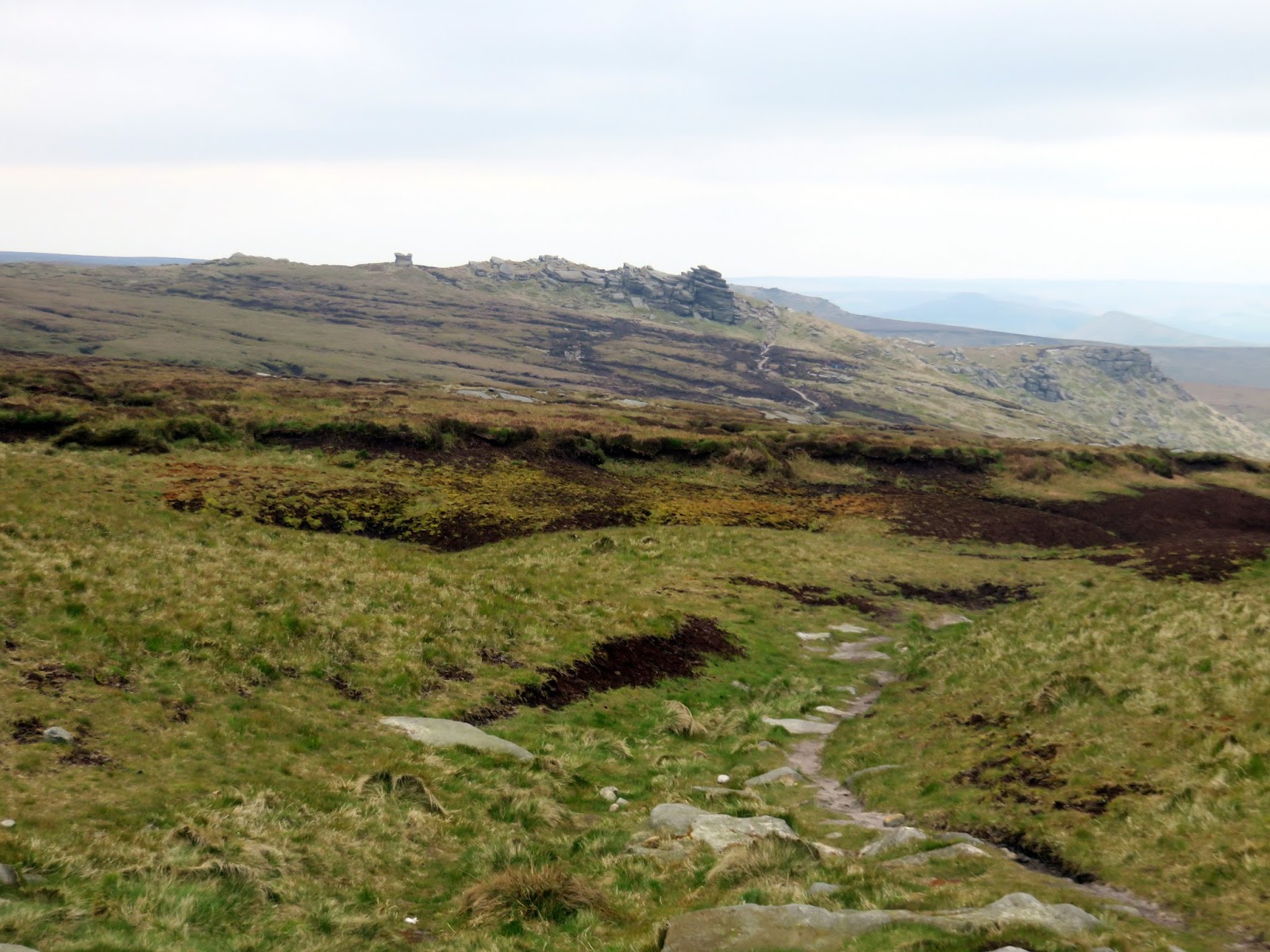
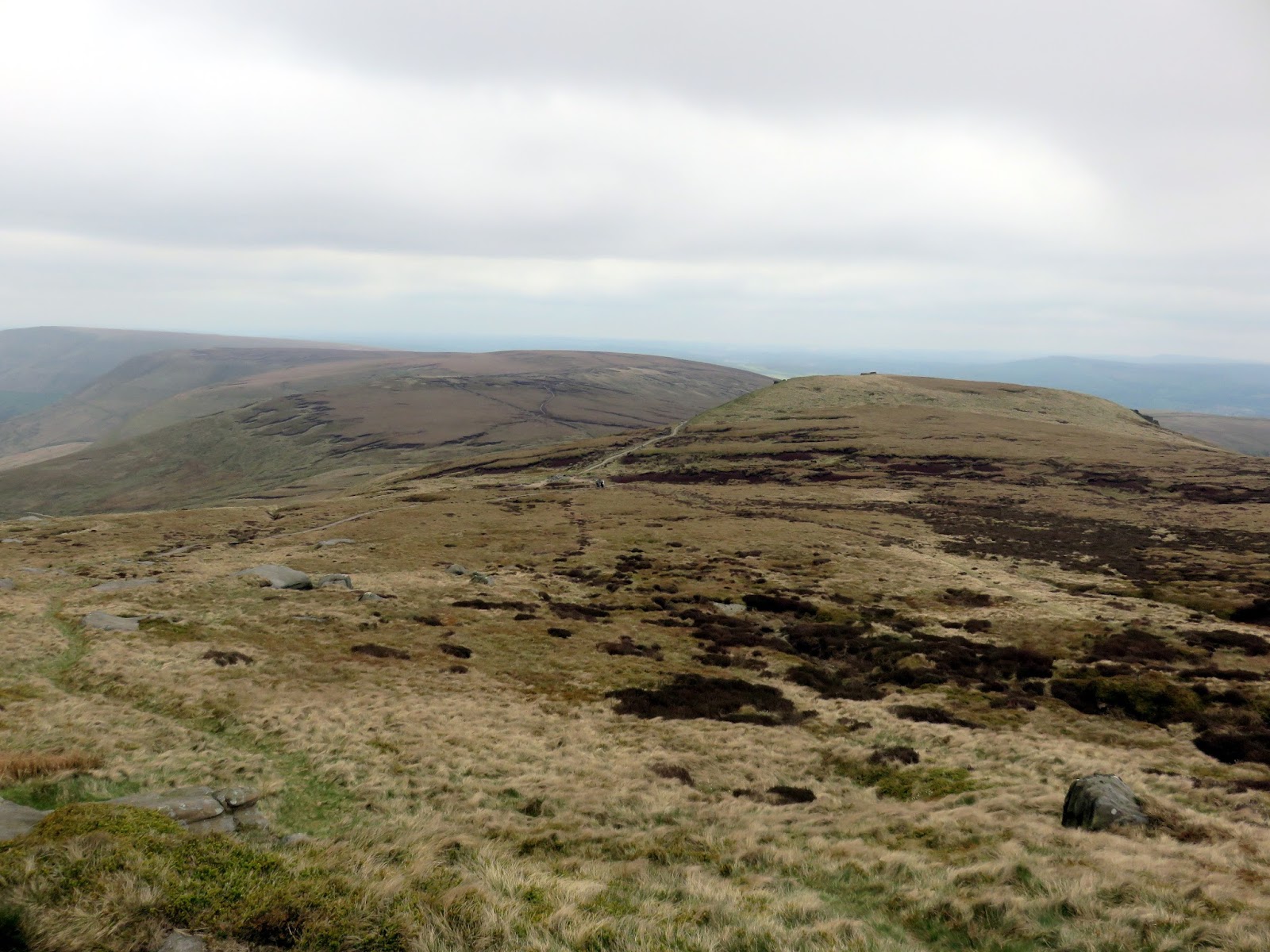
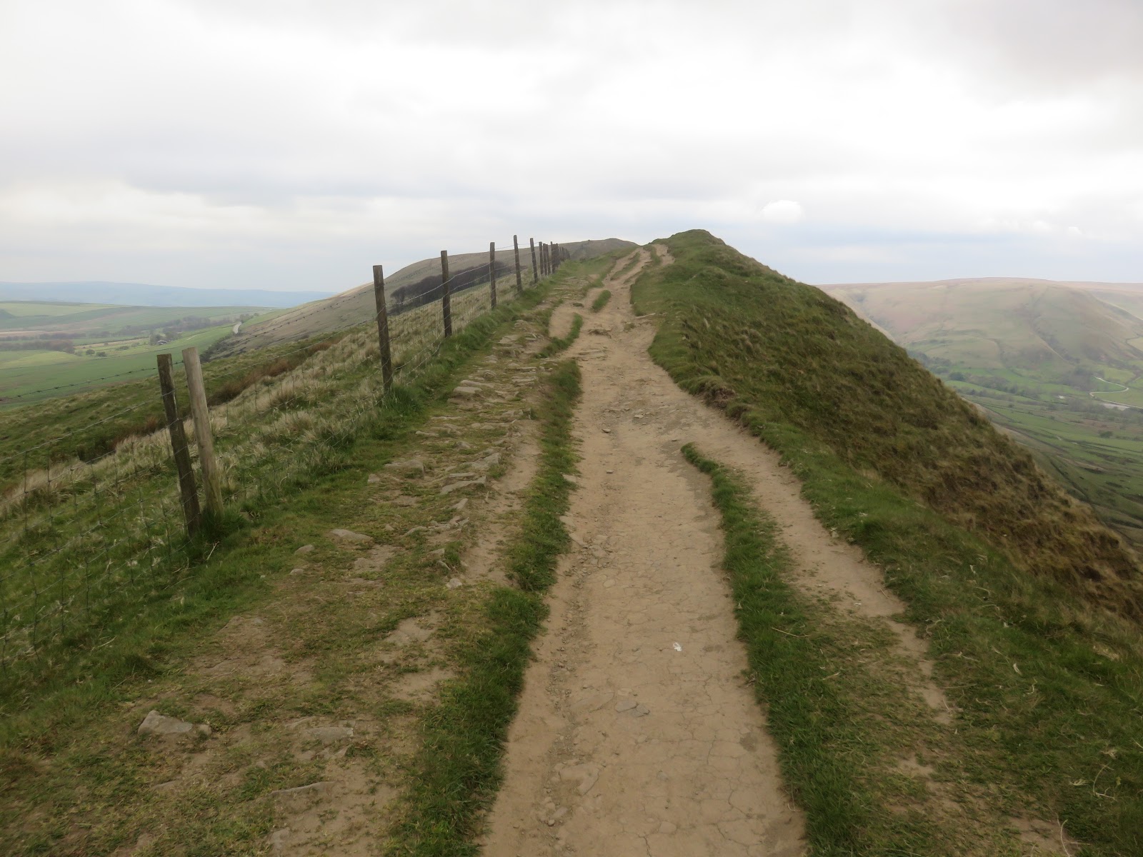
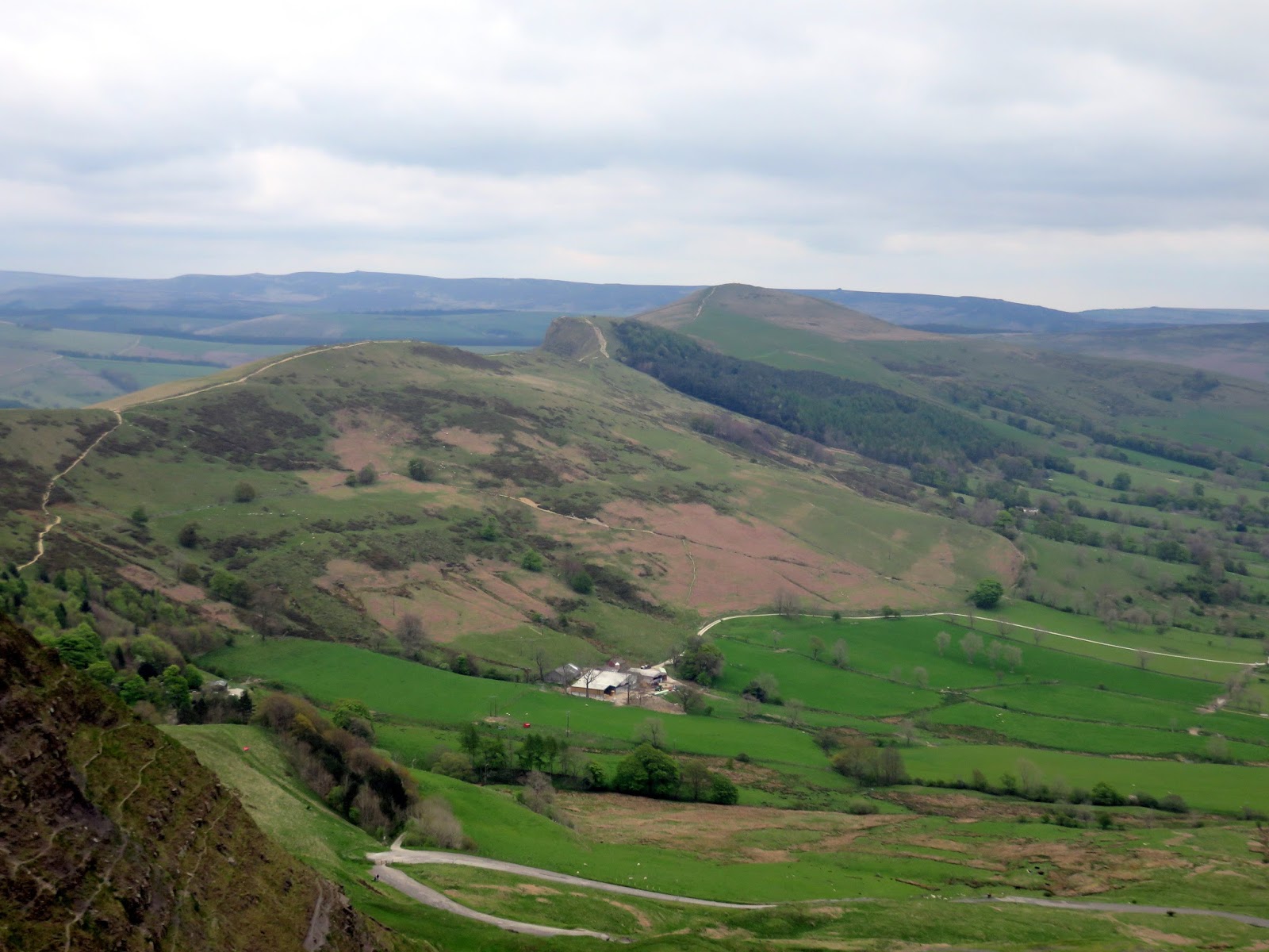
A path runs the entire length of the perimeter of Kinder Scout, no doubt a relic of ancient travellers combined with the modern tourist. The most popular part runs between Nether Tor and Kinder Low and passes many of the interesting sights that Kinder has to offer. It’s both easy to follow and (once you’ve made the climb to reach it) relatively flat. Strolling along there are some wonderful changes in scenery, from the craggy tors to the precipitous valley of Grindsbrook Clough and all that’s in between.
 |
| Kinder’s southern edge |
 |
| Crowden Clough |
 |
| Rock forms on the southern edge |
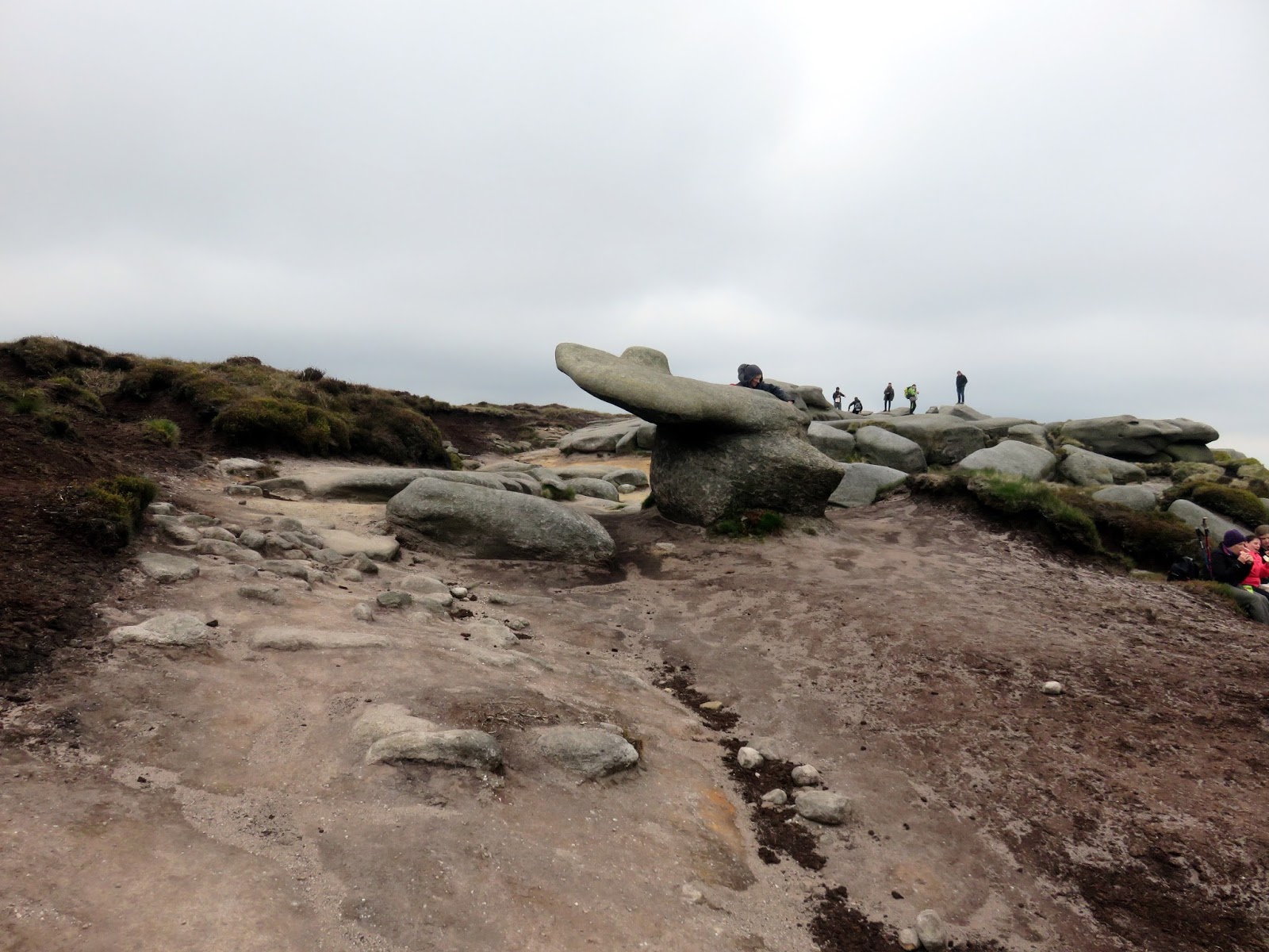
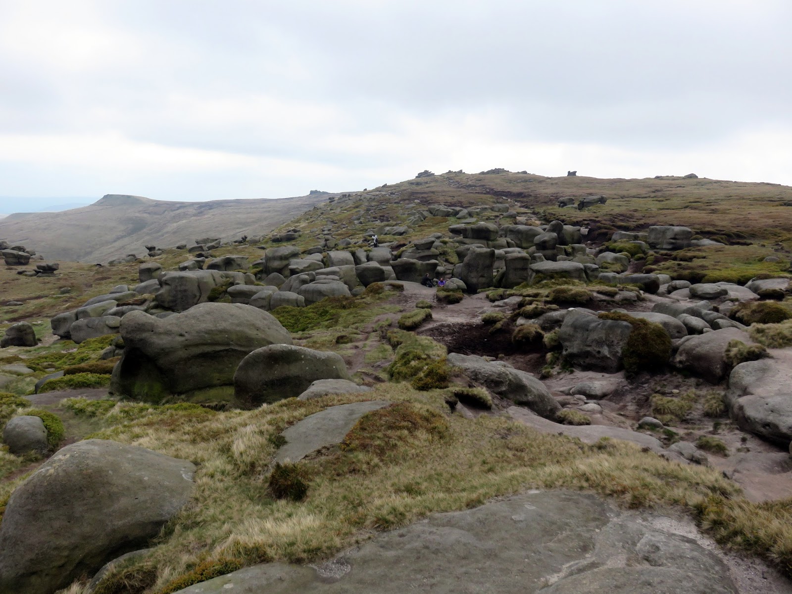
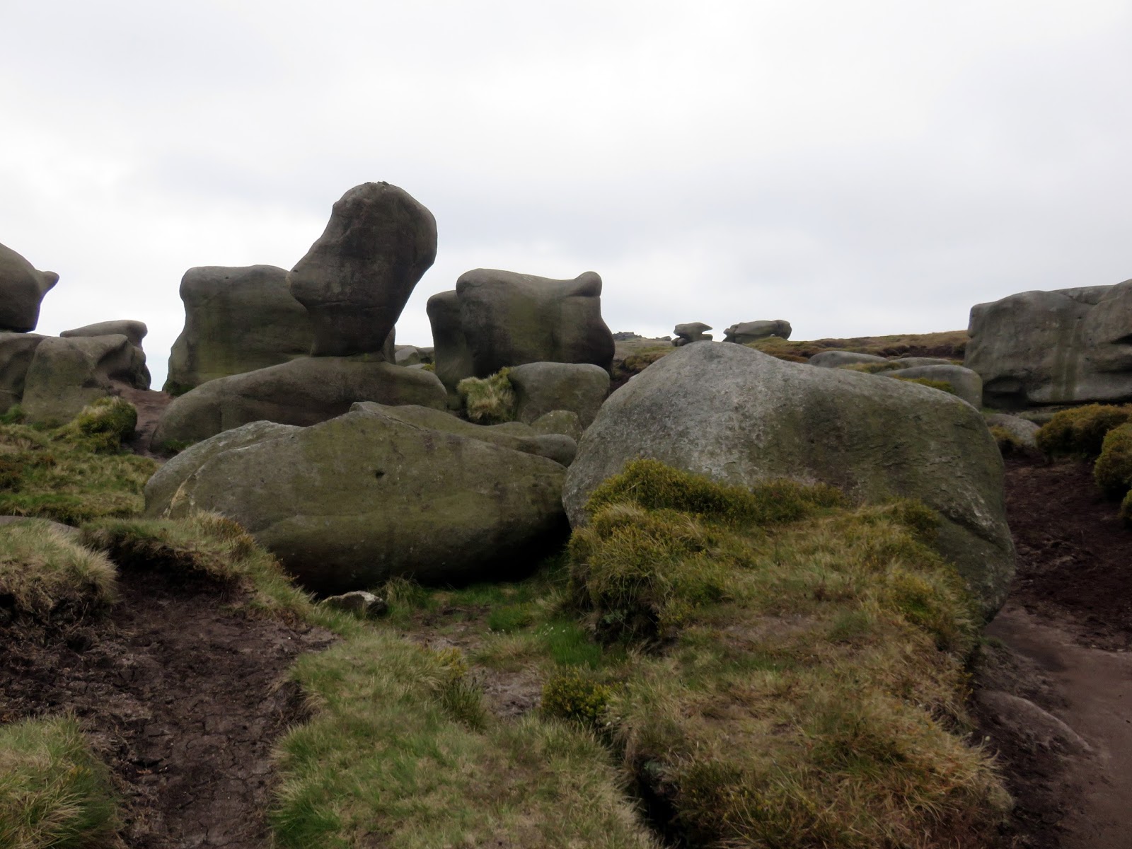
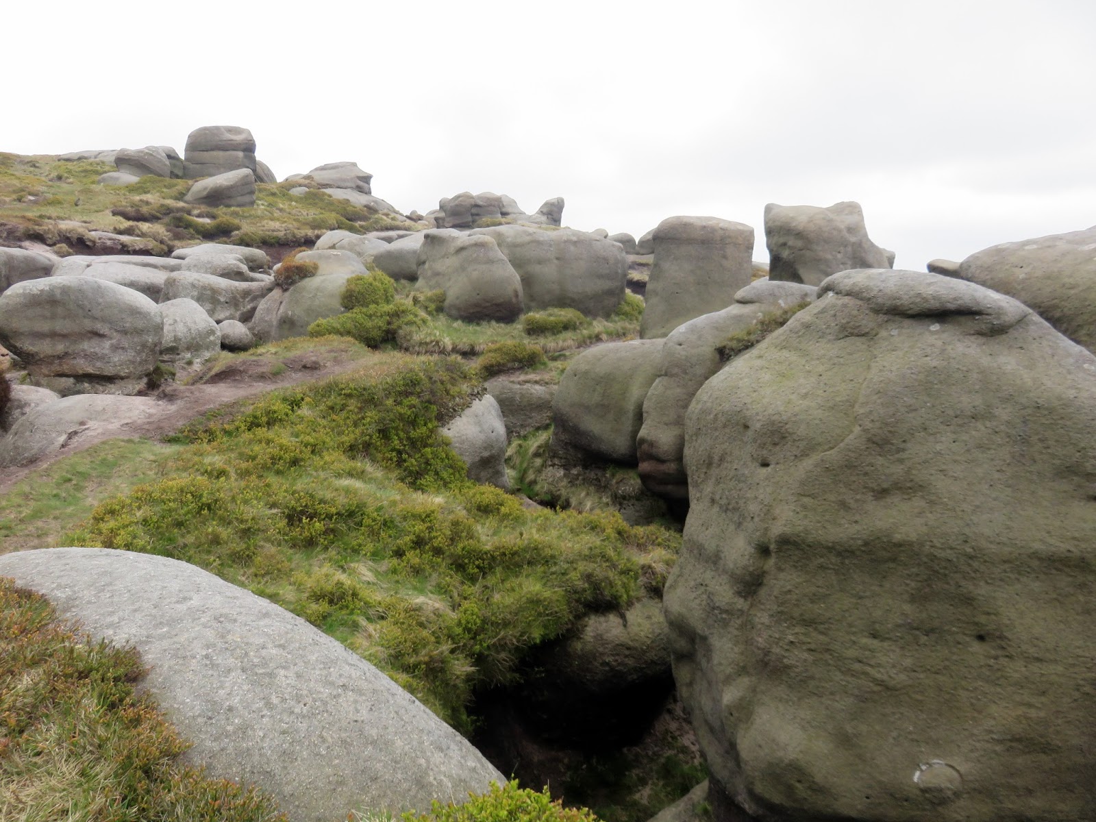
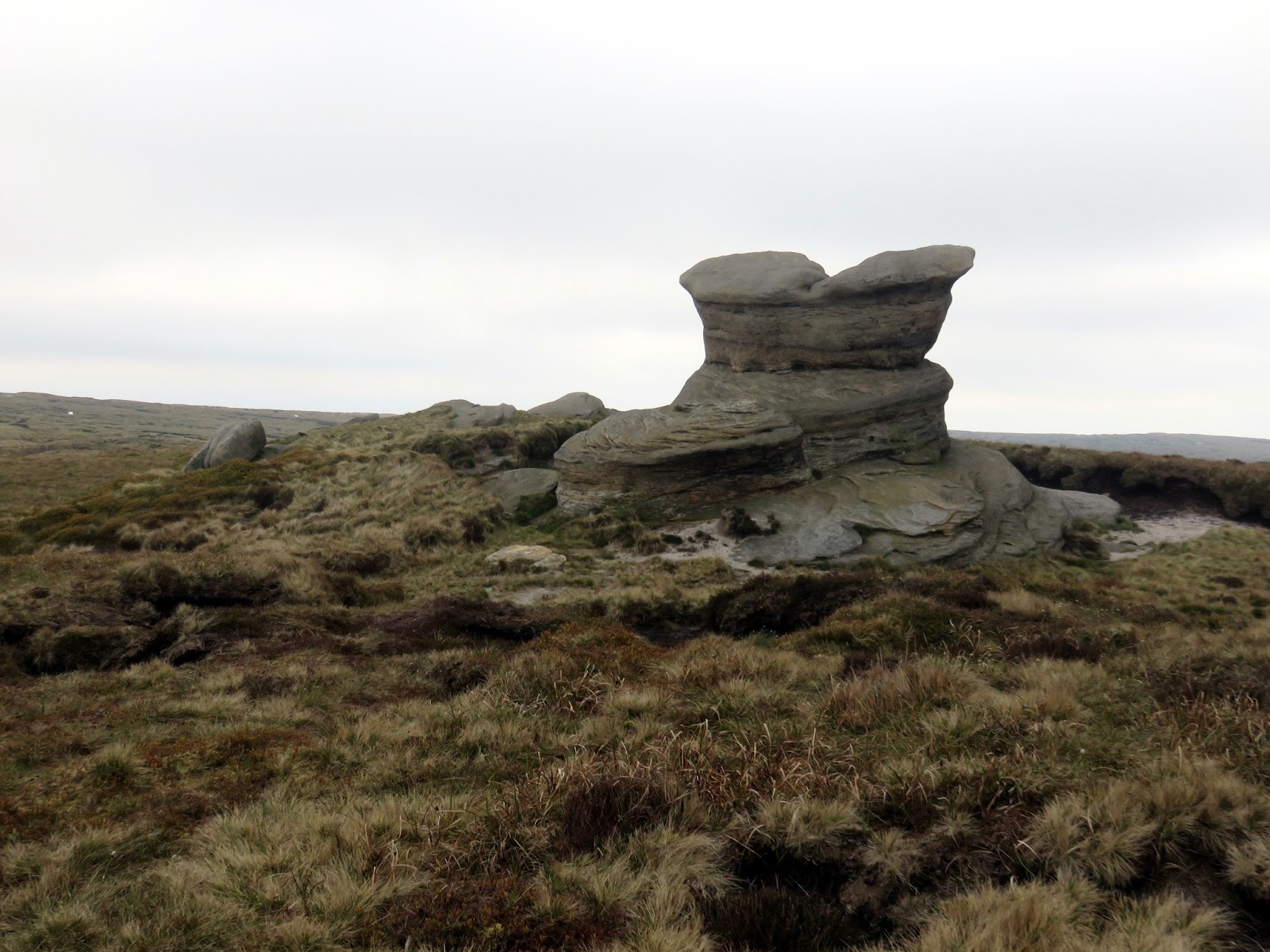
The path winds its way through the Wool Packs, a series of enormous gritstone blocks, tossed about the landscape like discarded children’s toys. This really is an amazing place and perhaps my favourite part of Kinder Scout.
 |
| The Wool Packs |
 |
| The Wool Packs |
 |
| The Wool Packs |
 |
| A rare burst of sunshine |
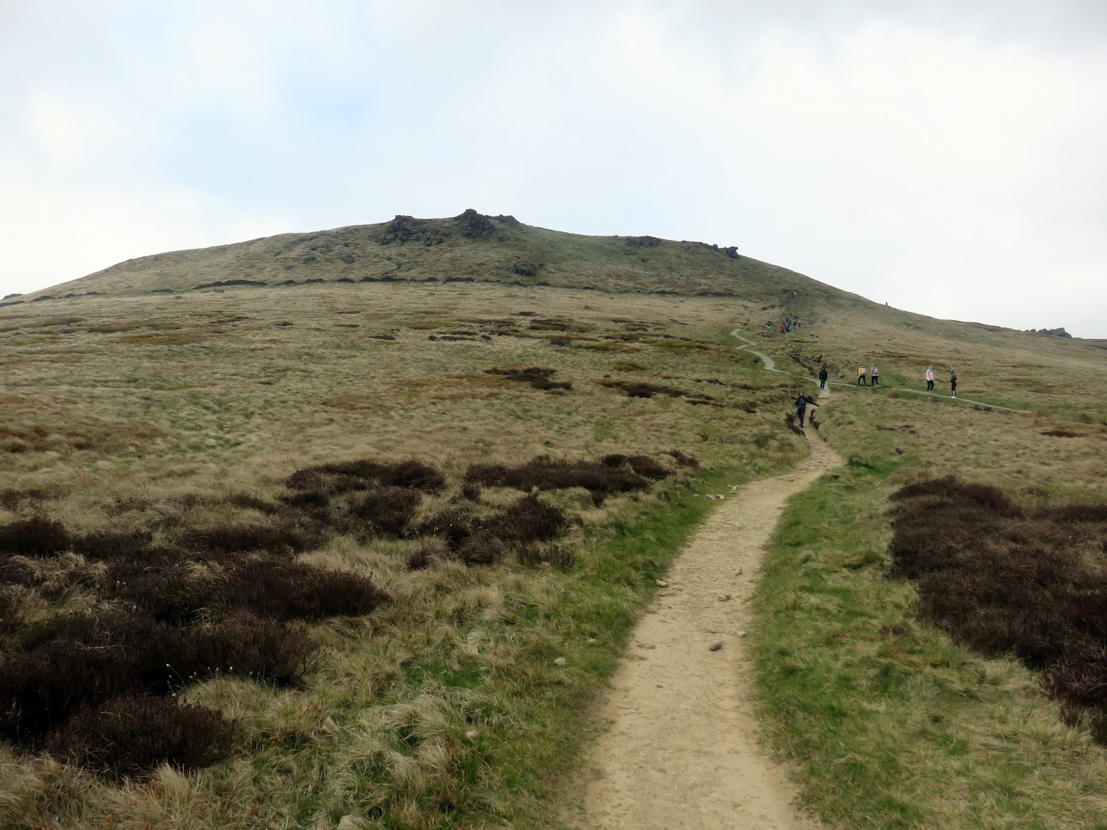
We made it through the Wool Packs to Pym Chair and were ready to try and find the elusive summit. It is said that Pym Chair was the chosen location for a local preacher to deliver sermons though I prefer the tale that it was the location of a highwayman who preyed on unwitting travellers on the lonely moor.
 |
| Looking towards Kinder Low |
 |
| Swine’s Back |
 |
| Pym Chair |
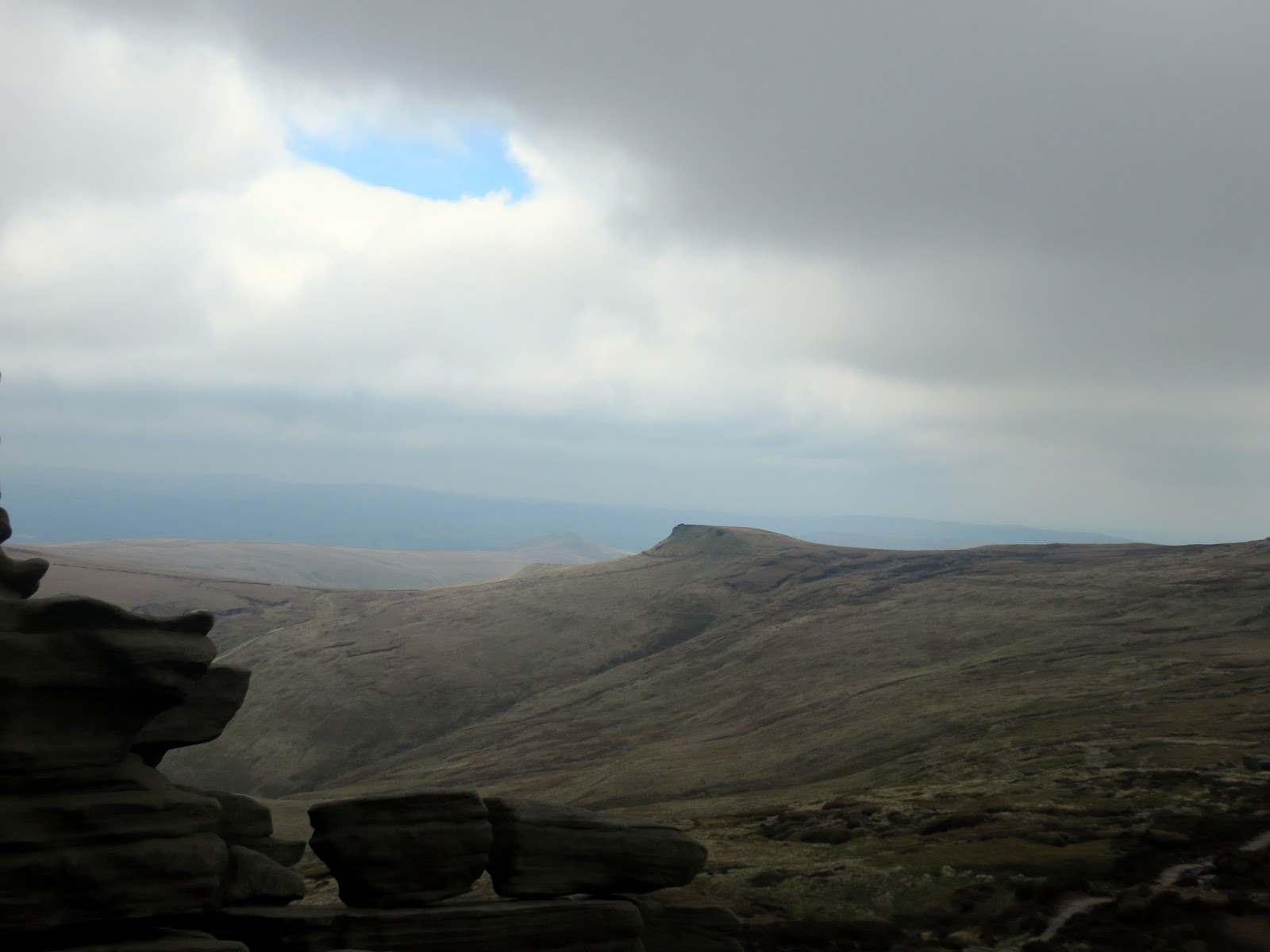
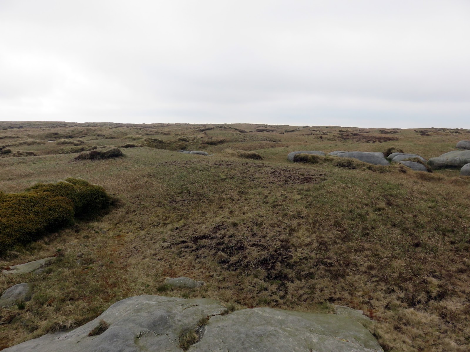
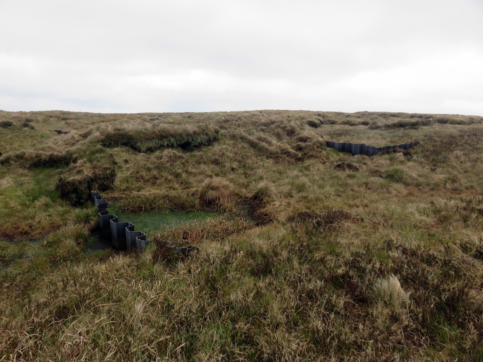
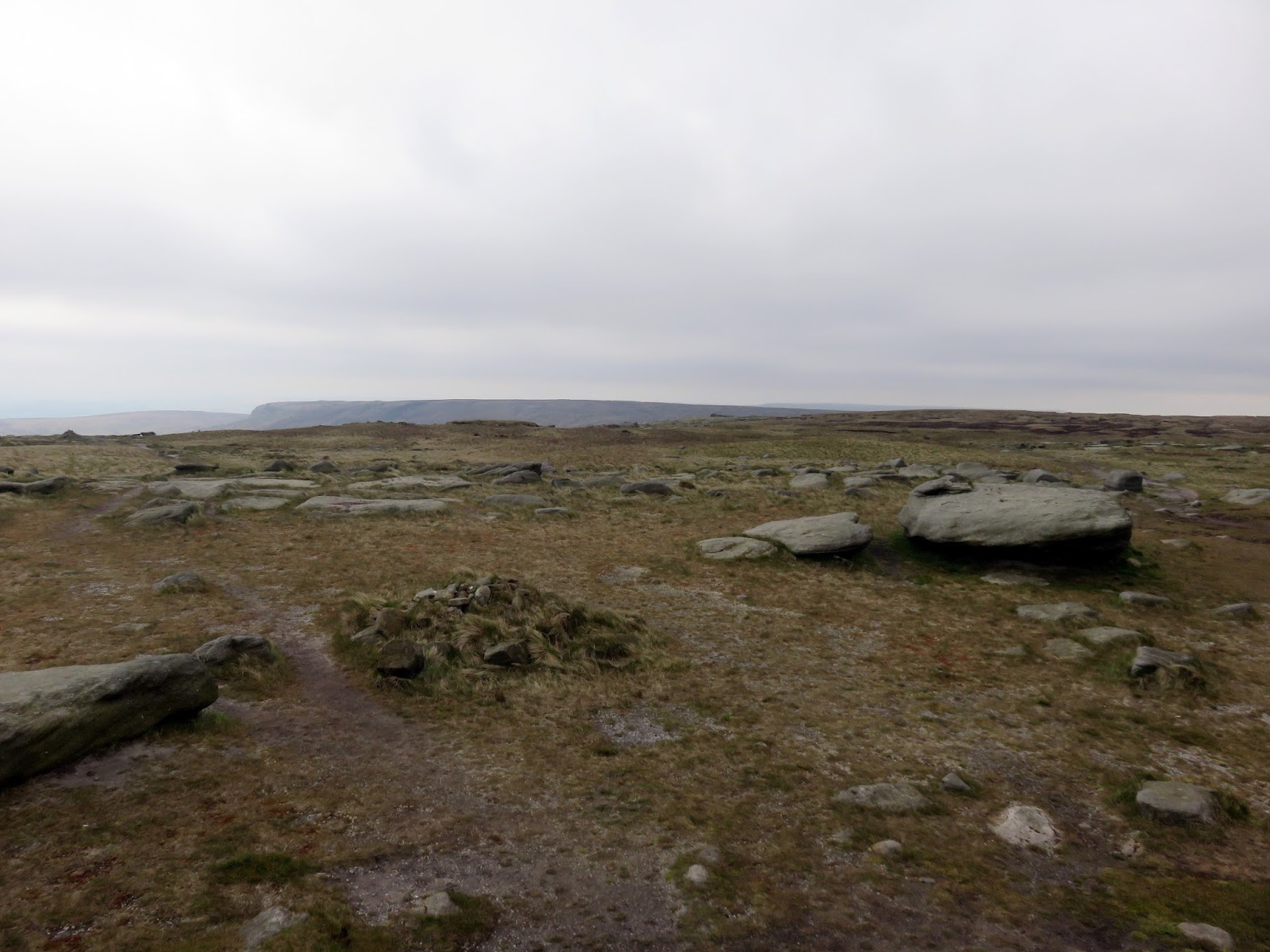
The actual summit of Kinder Scout is debatable. According to the map, it lies due north-west of Pym Chair, the direction that we headed in order to find it. As we observed previously, much of Kinder is being managed to reduce the erosion and the hard work appears to be paying dividends, especially in the area surrounding the highest point. The artificial dams designed to hold back water and re-silt the channels are working well alongside the seeded areas of bare peat that are starting to grown and really take hold.
 |
| Classic Kinder |
 |
| The view back to Pym Chair |
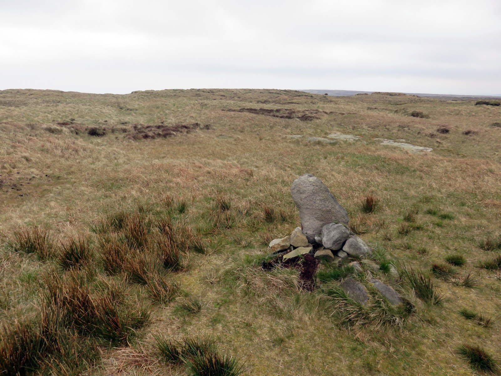
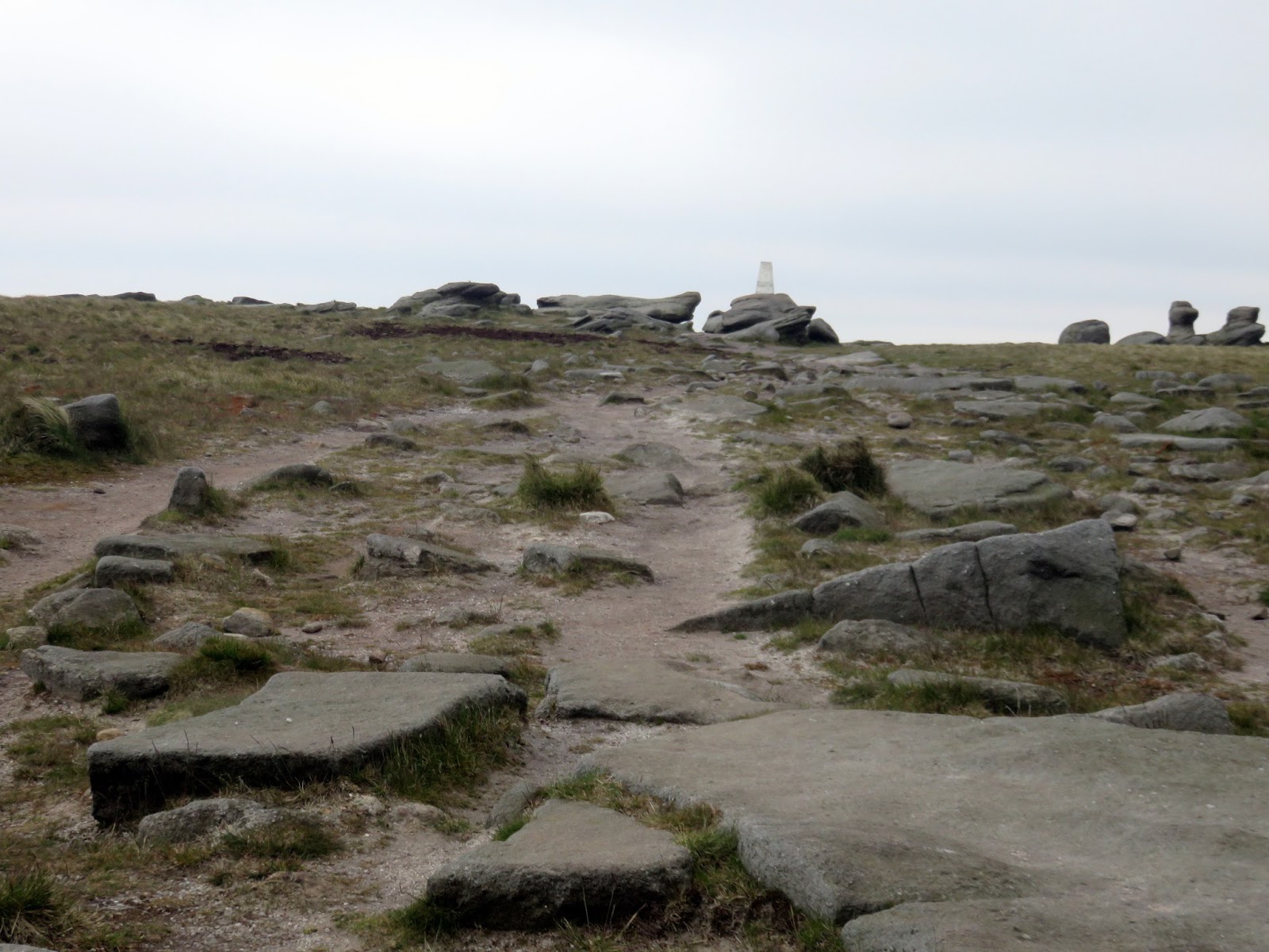
Following the compass and GPS, we found our way to the spot height marked, it is marked by a very small cairn. Despite this, a number of surrounding humps appear higher, one, in particular, seeming to stand above the cairn. However, upon reaching it the roles were reversed with the cairn now appearing higher. Such is the nature of Kinder’s ‘summit’.
 |
| A cairn in the location of Kinder’s summit |
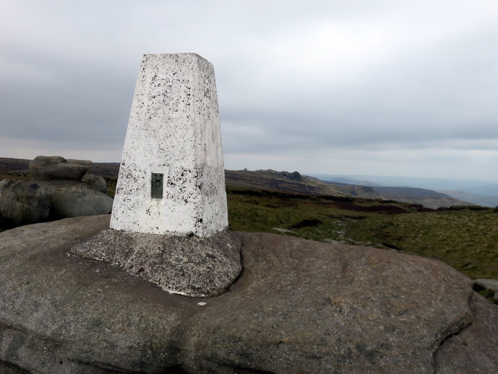
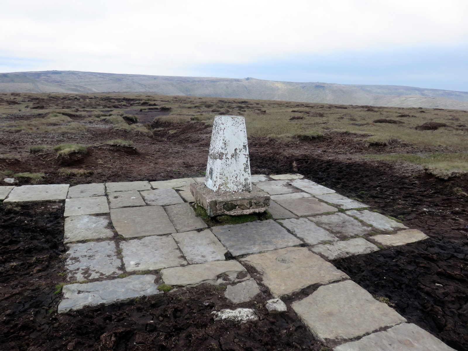
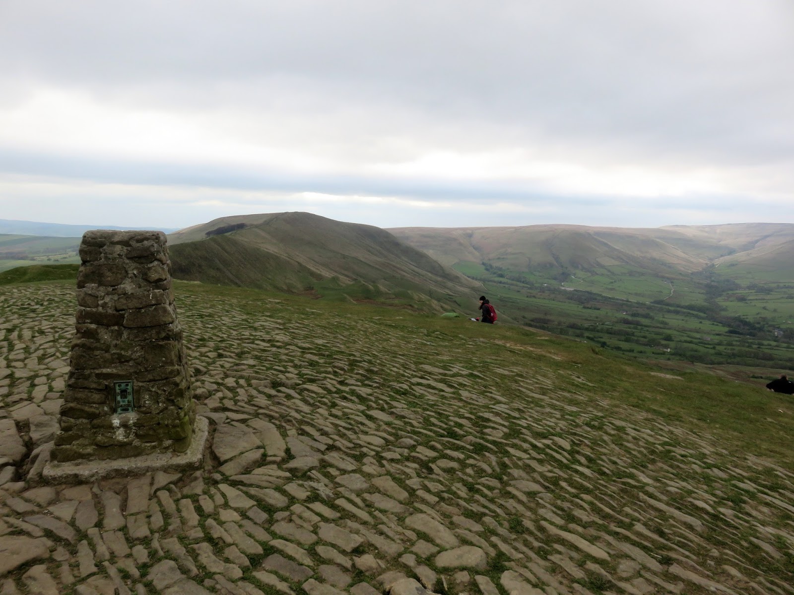
After satisfying ourselves that we’d probably reached the highest point, we set our sights on the trig pillar at Kinder Low, standing proudly on the skyline. Until recently, this area was a bare, dusty, almost moon-like landscape but now, things are starting to look much greener. The trig pillar gazes down towards Hayfield, the site of the start of the infamous Kinder mass trespass.
 |
| A distant Pym Chair |
 |
| Kinder Low |
 |
| Kinder Low |
 |
| Kinder Low |
We descended from Kinder Low to the pass between Edale and Hayfield, not far from the ancient Edale Cross. We were heading south, climbing the broad slopes of Brown Knoll.
 |
| Below Swine’s Back |
 |
| Add caption |
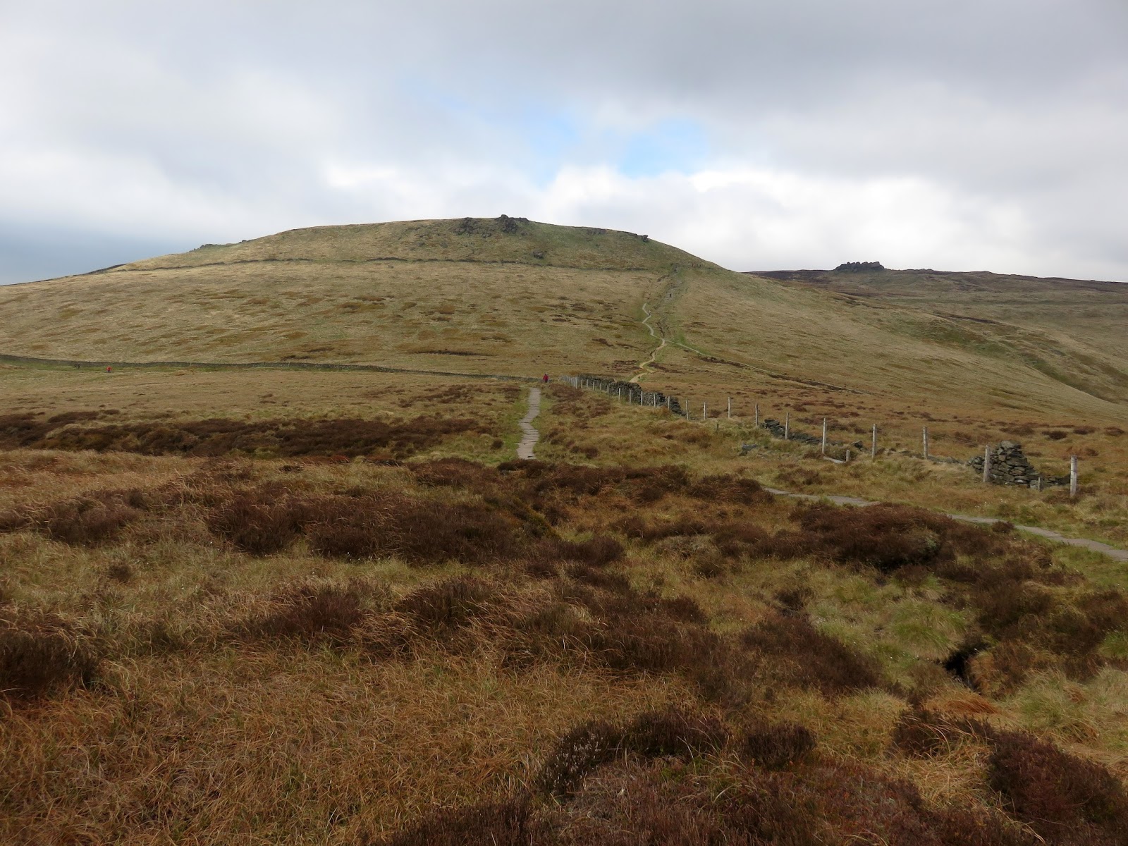
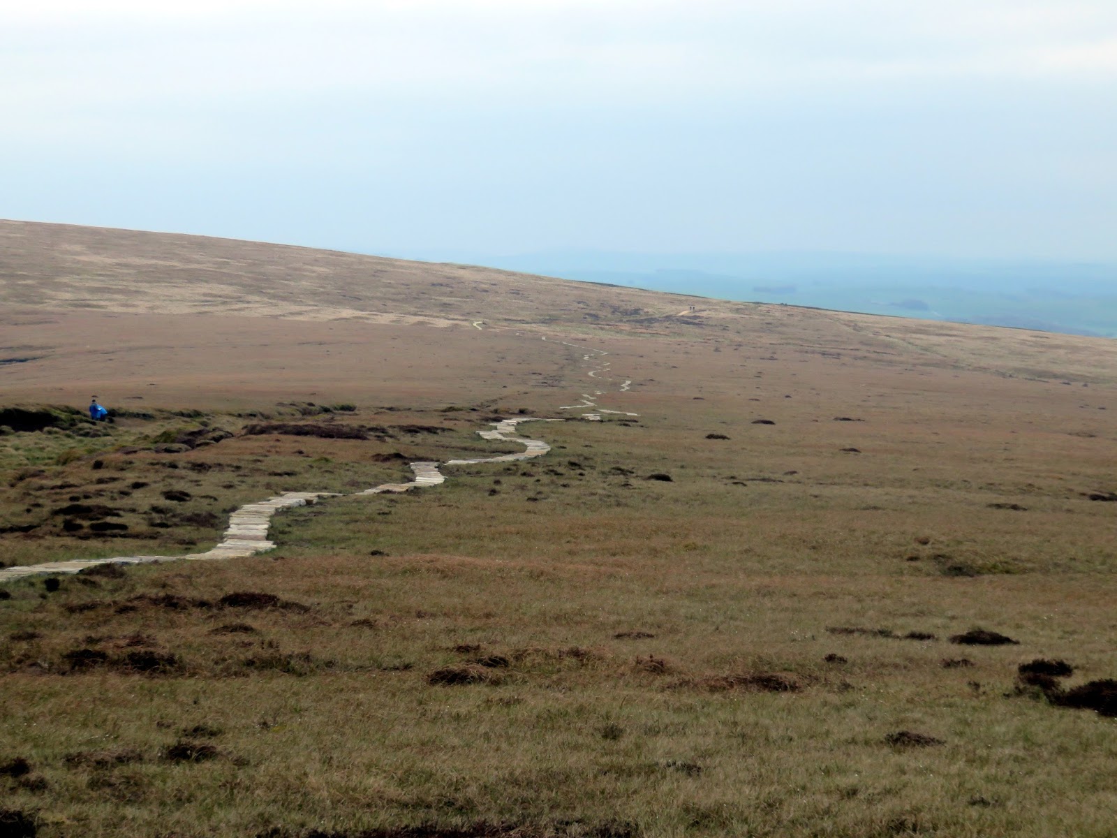
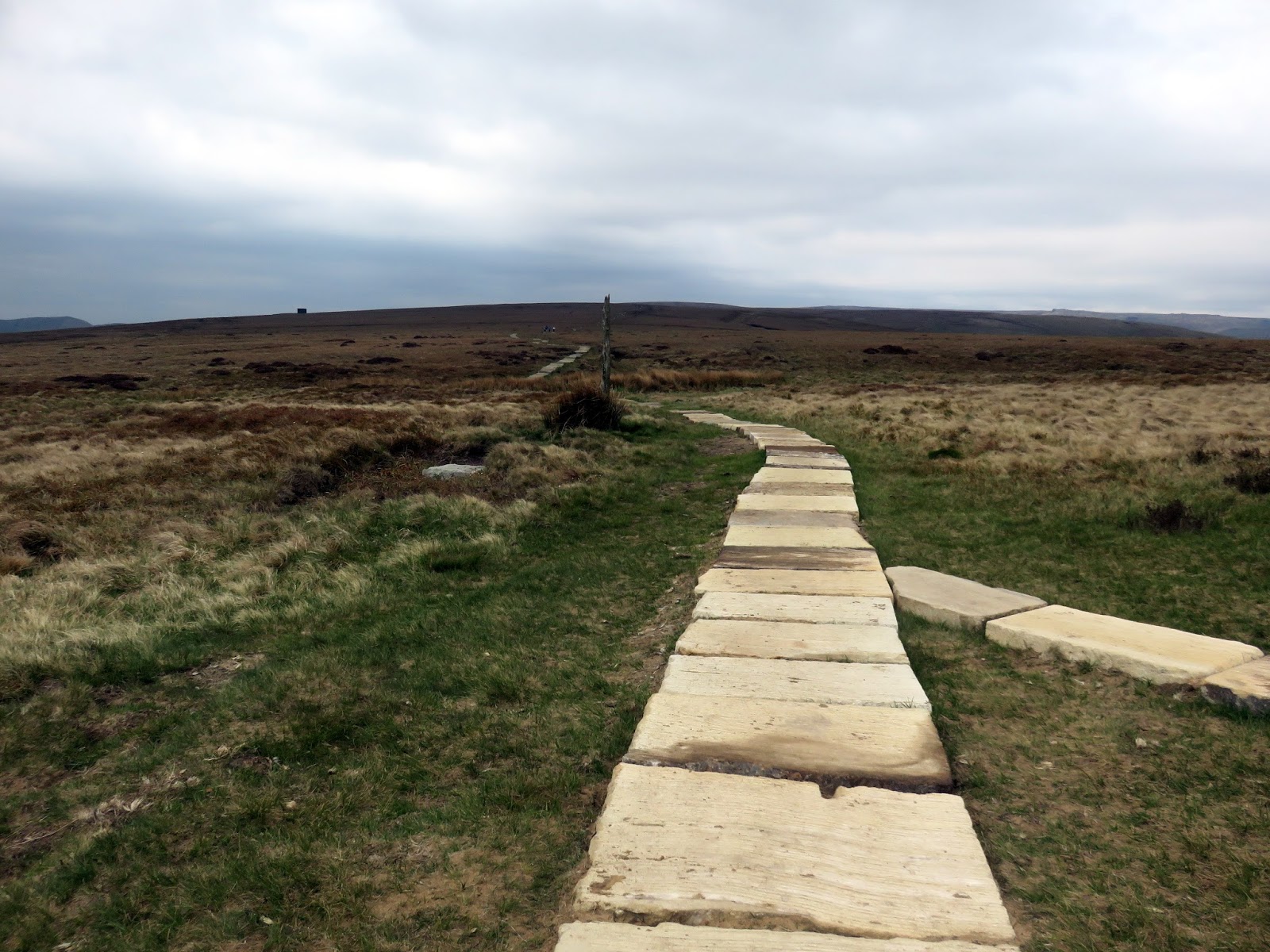
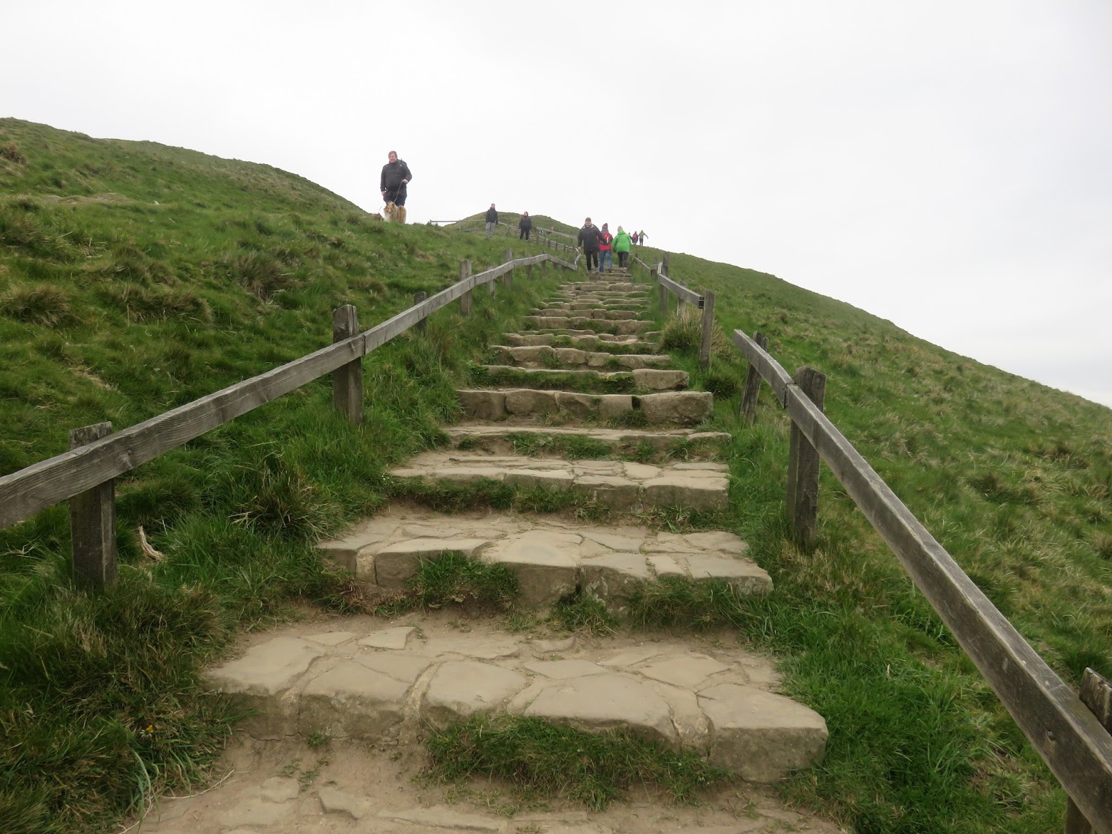
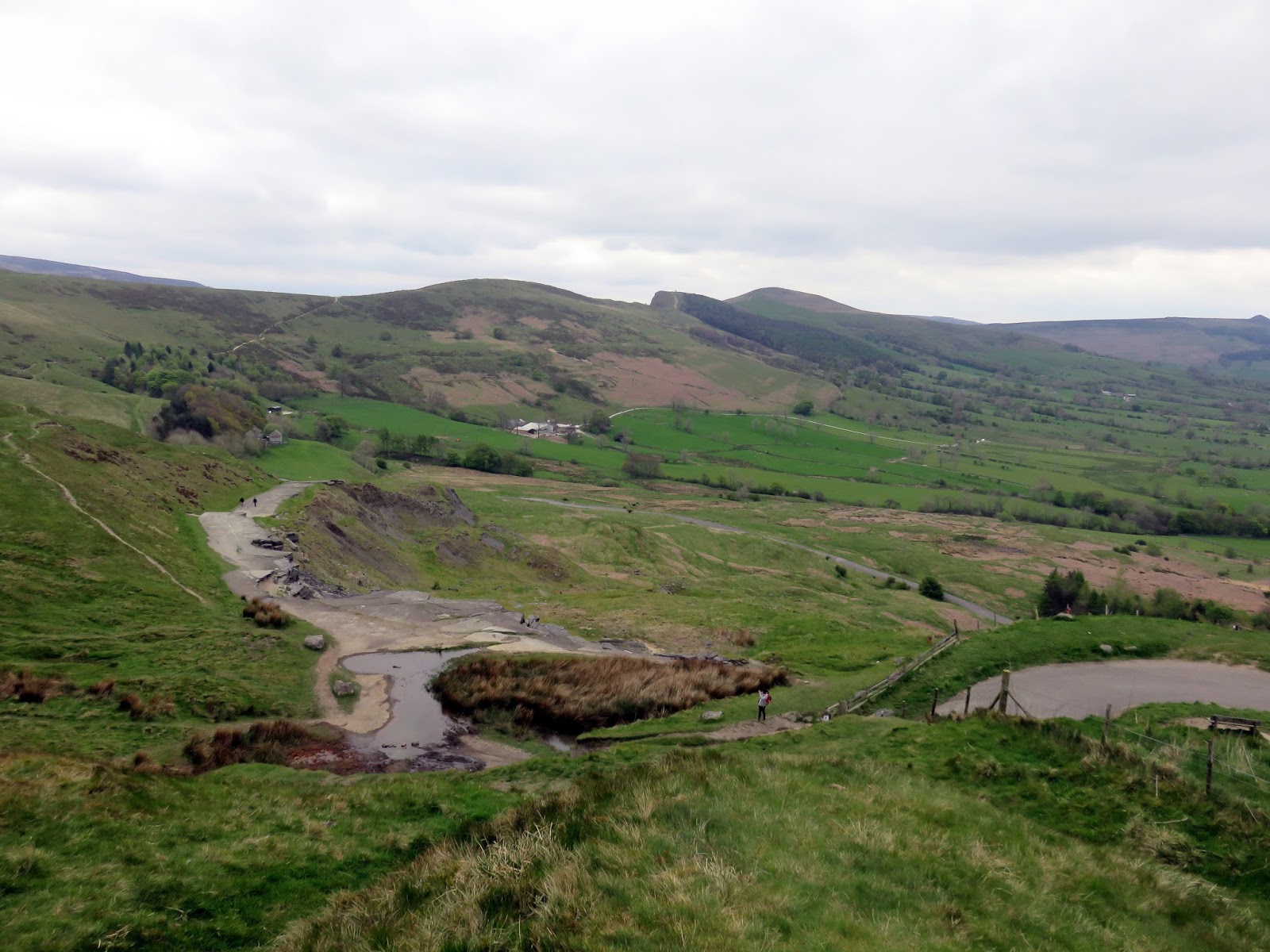
Last time we visited Brown Knoll we found the trig pillar marooned in the middle of a deep bog. What a difference a few years makes. Now the pillar is surrounded by stone slabs and it can be reached without fear of wet feet. In fact, contrary to my expectation, the whole route between Kinder Scout and Rushup Edge now benefits from a paved path. I believe the work has only been undertaken in the last year or so.
 |
| The long paved path over Colbourne |
 |
| The new paving |
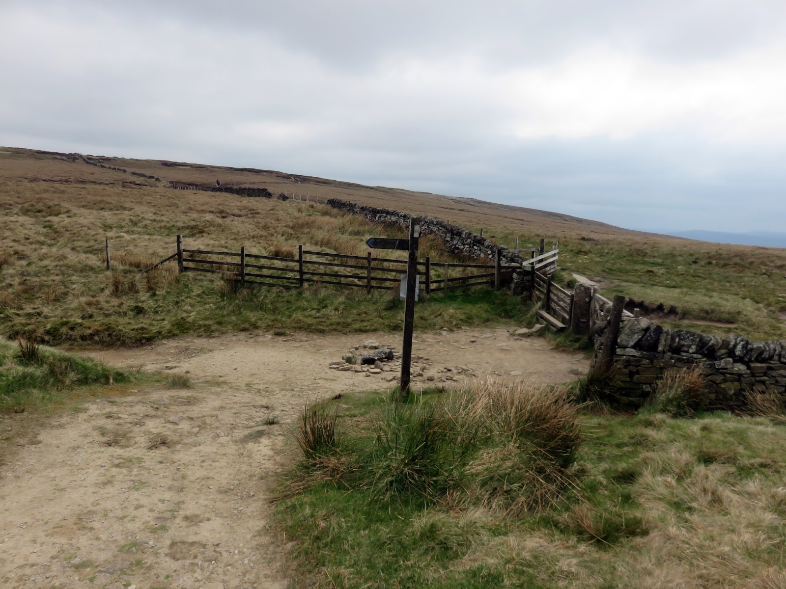
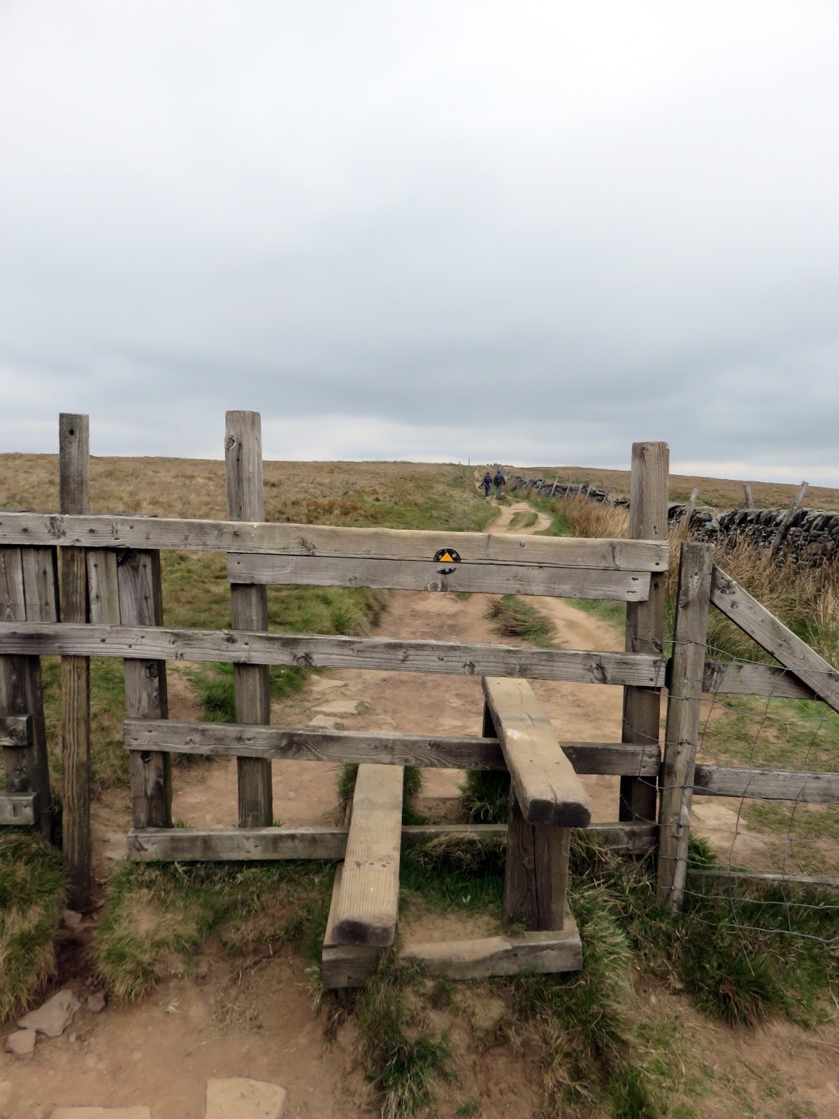
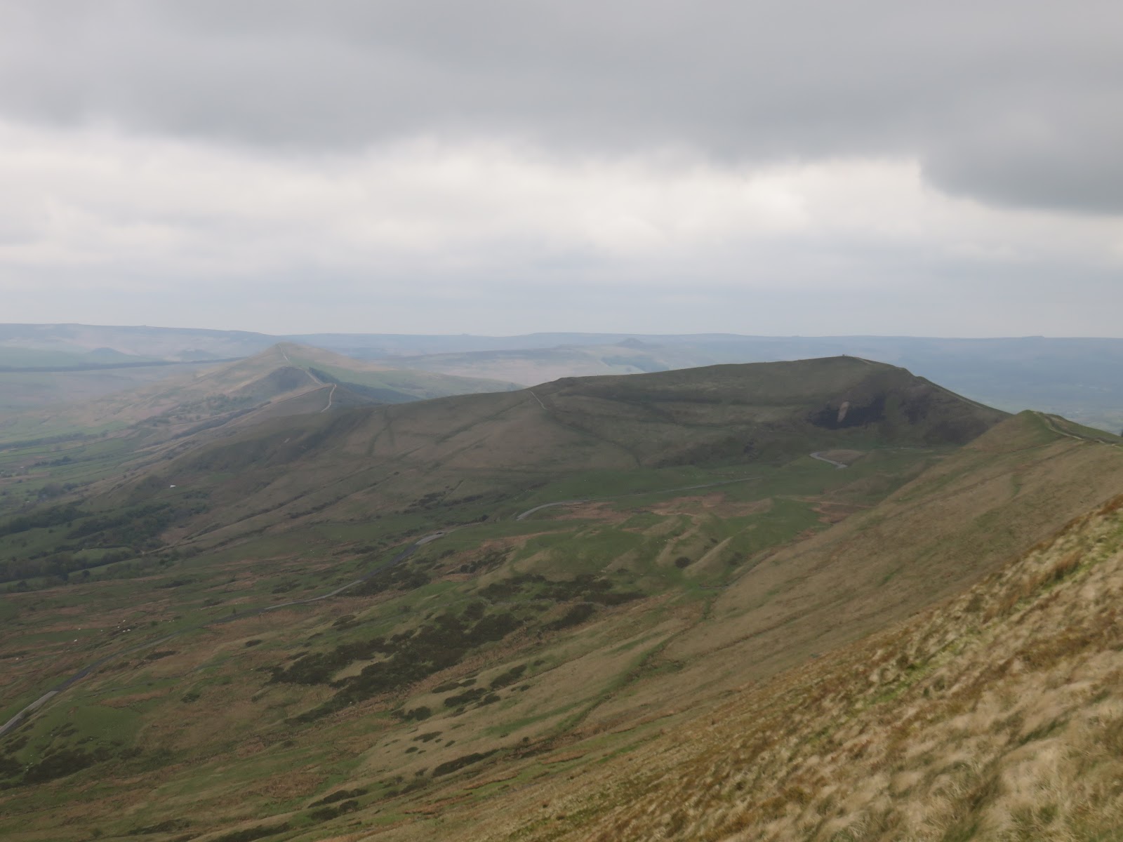
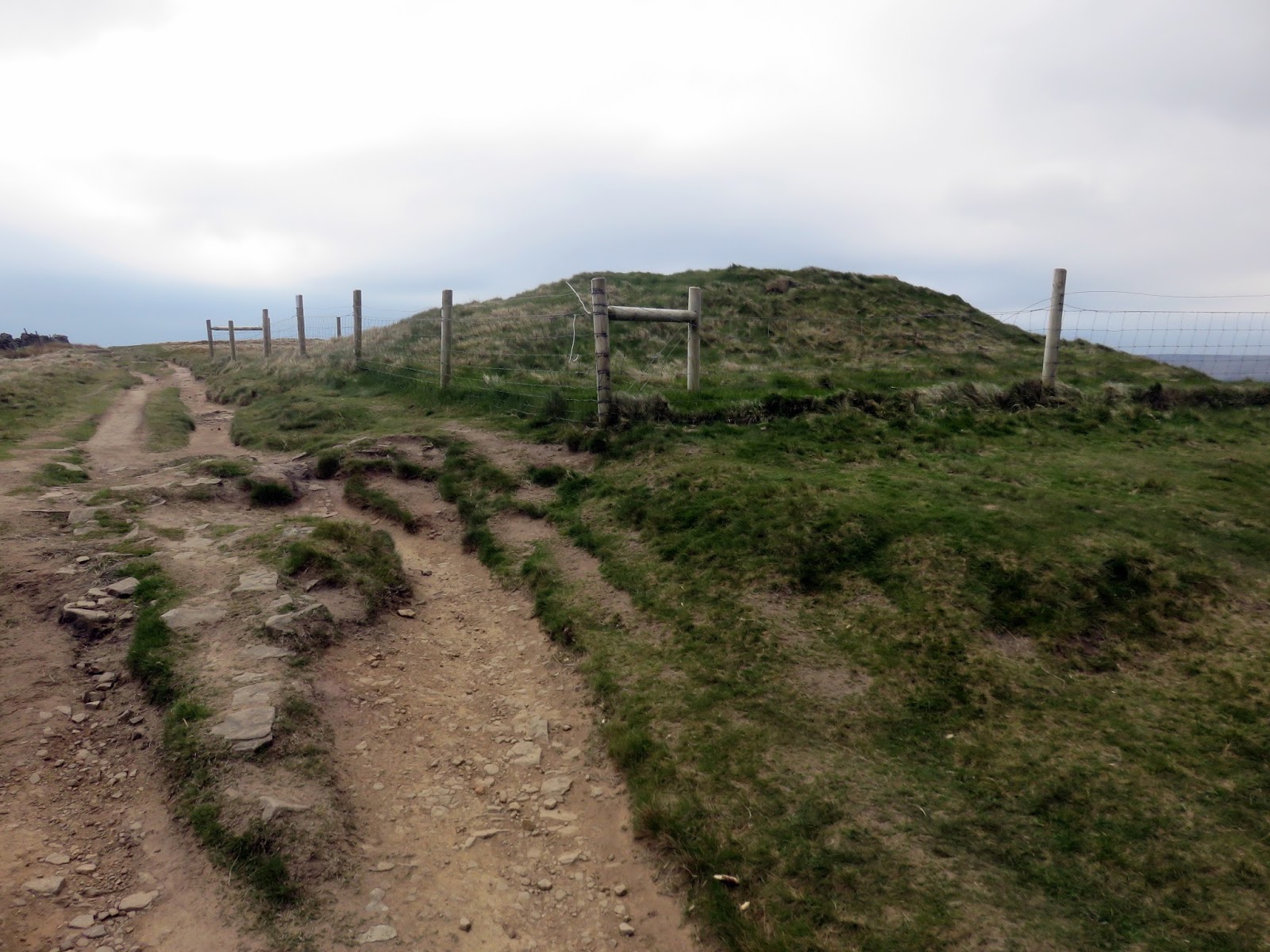
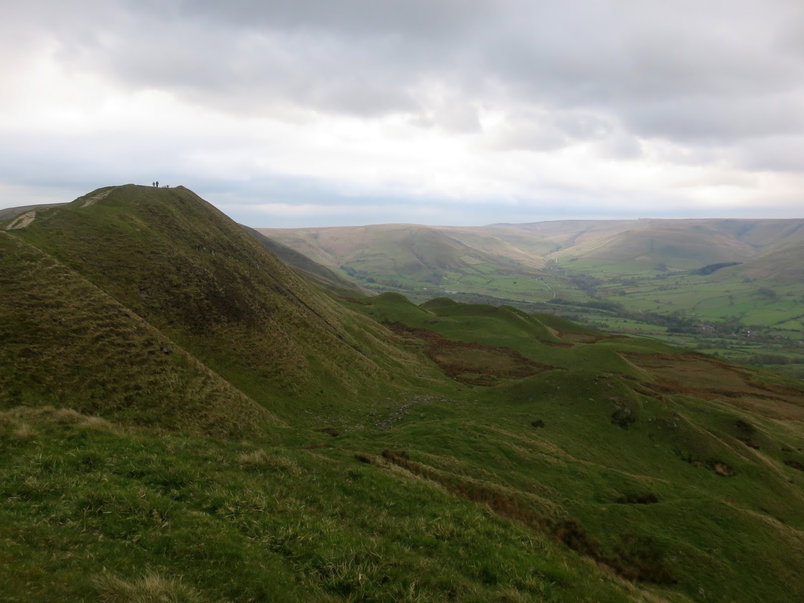
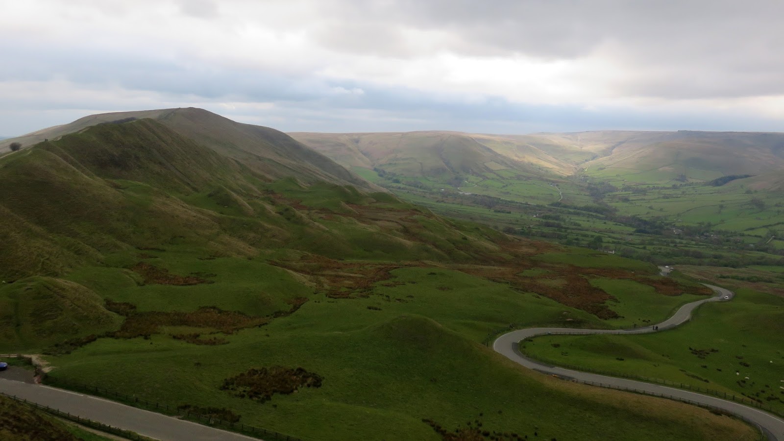
After an unexpectedly dry crossing of Horsehill Tor and Colbourne we arrived at the foot of Rushup Edge, a modest hill with a fine, narrow ridge that leads to Mam Tor. The highest point, Lord’s Seat, in an ancient Round Barrow which has been fenced off to reduce damage from passers-by.
 |
| Edale |
 |
| Lord’s Seat |
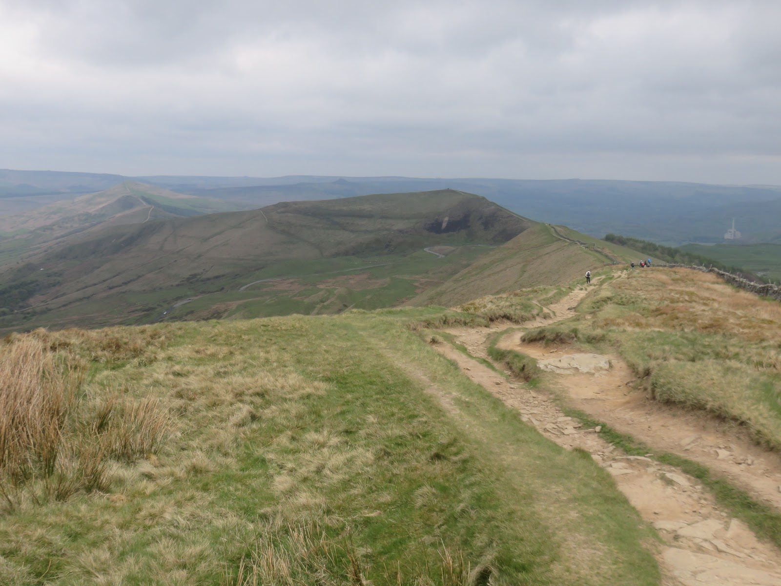
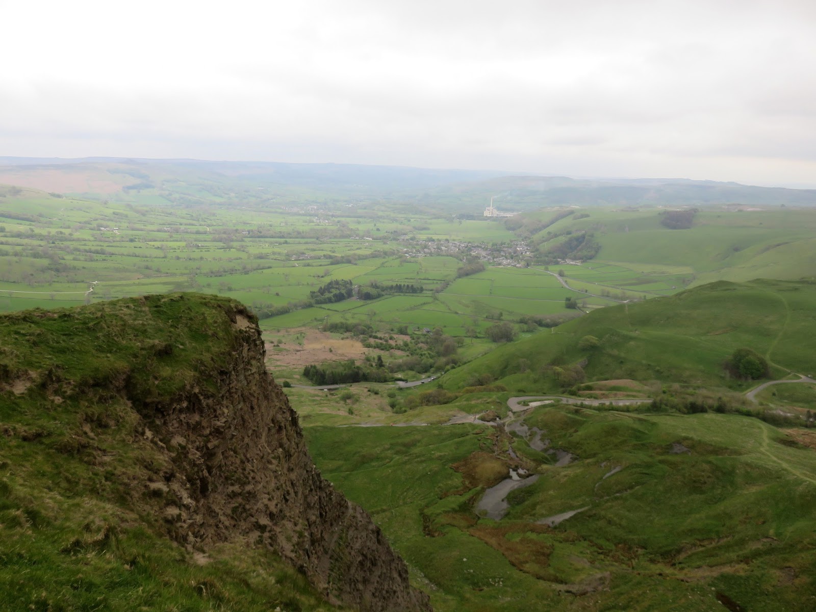
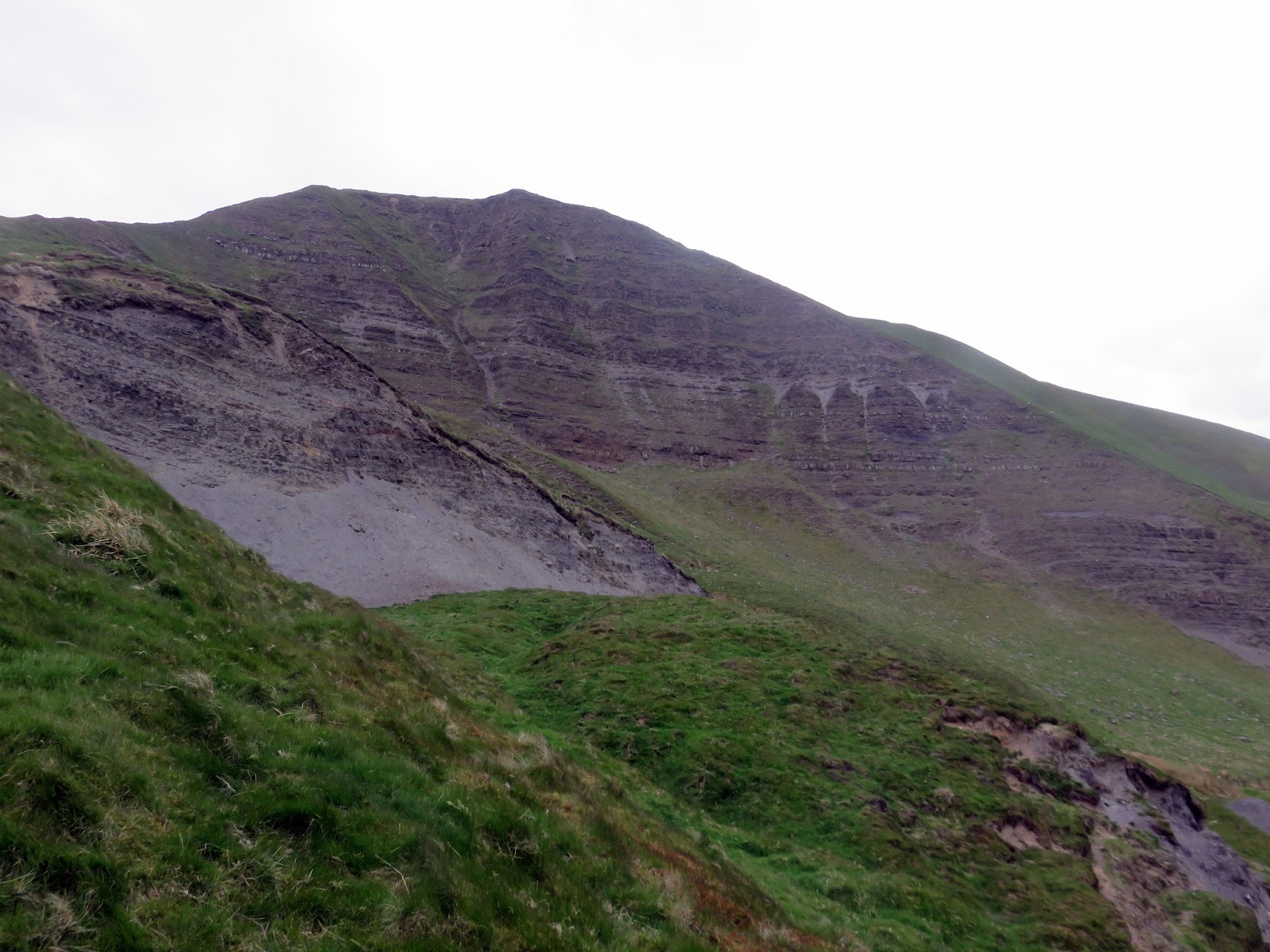
A road passes between Rushup Edge and Mam Tor and it’s a short the road up to the summit of Mam Tor. Mam Tor (or mother hill) is one of the most famous hills in the Peak District. It gets its name thanks to the numerous small hillocks located on its eastern side, the result of frequent landslips. These landslips, which are caused by unstable lower layers of shale, also give the hill its alternative name of Shivering Mountain.
 |
| The Great Ridge and the Hope Valley |
The summit of Mam Tor is encircled by a late Bronze Age and early Iron Age hill fort. Radiocarbon analysis suggests occupation from around 1200 BC. The earliest remaining features are two Bronze Age burial mounds, one just below the summit and the other on the summit itself, though now buried under the paving.
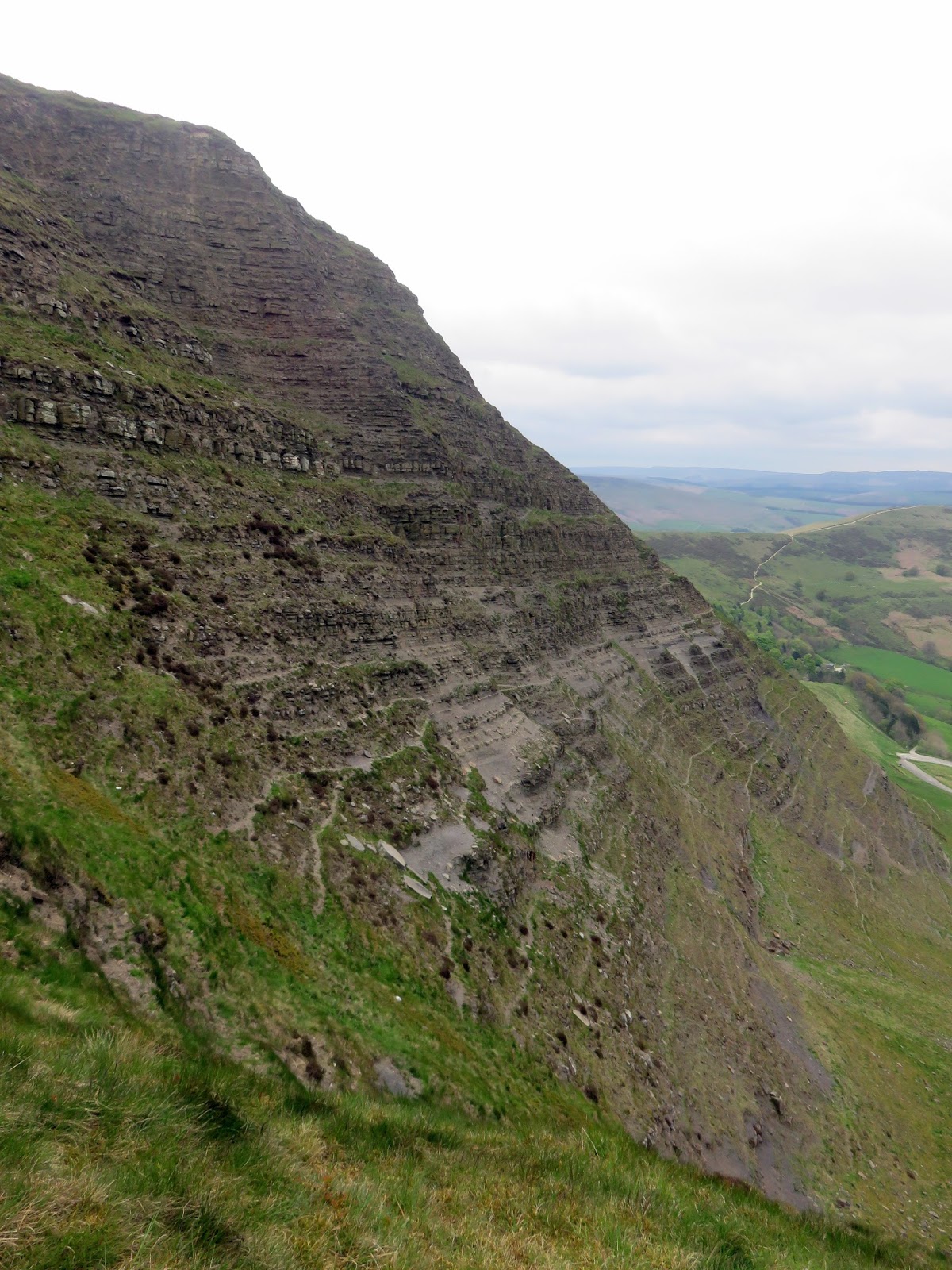
The most notable feature of Mam Tor is the active landslip which invades its south-east side almost to the summit, and interrupts the ramparts of the hillfort unless its builders used it as part of the defences. This rotational landslide began roughly 4,000 years ago. The toe is a debris flow. The landslide is due to weak shales underlying sandstones, a common phenomenon all around the Dark Peak, notably at Alport Castles. Indeed, three larger landslips occur on the north side of Mam Tor, one of them cutting the main ridge at Mam Nick which allows a minor road over into Edale; another creates the striking crag of Back Tor well seen from Mam Tor.
 |
| The Hope Valley |
 |
| The Great Ridge |
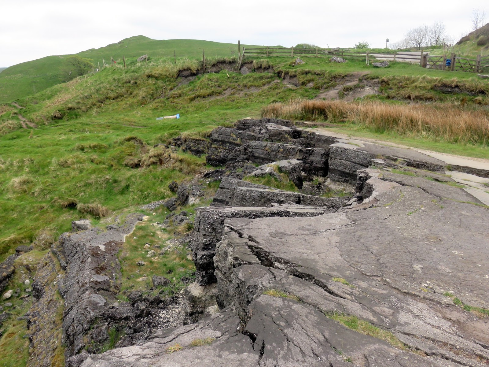
We dropped down alongside the huge land slipped face of Mam Tor, getting an up-close view of the rocks that cause such a problem. Below is the crumbling remains of the A625 which was eventually closed in 1979 after a continual battle against the constantly shifting mountain. We had a poke around for a bit before returning to the car after another thoroughly enjoyable day around Kinder Scout and Edale.
 |
| The Great Ridge and the remains of the A625 |
 |
| Layer upon layer of road |

