Open Space Web-Map builder Codehttps://openspace.ordnancesurvey.co.uk/osmapapi/openspace.js?key=3119F72552FD5C22E0530C6CA40A5A92https://openspace.ordnancesurvey.co.uk/osmapapi/script/mapbuilder/basicmap.jshttps://openspace.ordnancesurvey.co.uk/osmapapi/script/mapbuilder/searchbox.js//variables for routes var linesLayer, points, lineFeature, lineString, routeMarkersLayer, routepos, routesize, routeoffset, routeicon; var style_blue = {strokeColor: “#0000CD”, strokeOpacity: 0.5, strokeWidth: 4.5}; function initmapbuilder() { //initiate the map var options = {resolutions: [2500, 1000, 500, 200, 100, 50, 25, 10, 5, 4, 2.5, 2, 1]}; osMap = new OpenSpace.Map(‘map’, options); //configure map options (basicmap.js) setglobaloptions(); //set the center of the map and the zoom level osMap.setCenter(new OpenSpace.MapPoint(315390.49874115,509189.00125885),7); linesLayer = osMap.getVectorLayer(); // Set up layer for route markers routeMarkersLayer = new OpenLayers.Layer.Markers(“Route Markers”); //make a route points = new Array(); points.push(new OpenLayers.Geometry.Point(316756.33206177,506827.66793823)); points.push(new OpenLayers.Geometry.Point(316631.33206177,507002.66793823)); points.push(new OpenLayers.Geometry.Point(316726.33206177,507217.66793823)); points.push(new OpenLayers.Geometry.Point(316691.33206177,507557.66793823)); points.push(new OpenLayers.Geometry.Point(316646.33206177,507697.66793823)); points.push(new OpenLayers.Geometry.Point(316626.33206177,507947.66793823)); points.push(new OpenLayers.Geometry.Point(316691.33206177,508327.66793823)); points.push(new OpenLayers.Geometry.Point(316796.33206177,508707.66793823)); points.push(new OpenLayers.Geometry.Point(316856.33206177,508902.66793823)); points.push(new OpenLayers.Geometry.Point(317056.33206177,509062.66793823)); points.push(new OpenLayers.Geometry.Point(317276.33206177,509222.66793823)); points.push(new OpenLayers.Geometry.Point(317426.33206177,509527.66793823)); points.push(new OpenLayers.Geometry.Point(317371.33206177,509647.66793823)); points.push(new OpenLayers.Geometry.Point(317151.33206177,509687.66793823)); points.push(new OpenLayers.Geometry.Point(316916.33206177,509767.66793823)); points.push(new OpenLayers.Geometry.Point(316641.33206177,510052.66793823)); points.push(new OpenLayers.Geometry.Point(316541.33206177,510202.66793823)); points.push(new OpenLayers.Geometry.Point(316501.33206177,510362.66793823)); points.push(new OpenLayers.Geometry.Point(316536.33206177,510552.66793823)); points.push(new OpenLayers.Geometry.Point(316496.33206177,510602.66793823)); points.push(new OpenLayers.Geometry.Point(316476.33206177,510702.66793823)); points.push(new OpenLayers.Geometry.Point(316336.33206177,510792.66793823)); points.push(new OpenLayers.Geometry.Point(316306.33206177,510927.66793823)); points.push(new OpenLayers.Geometry.Point(316076.33206177,511197.66793823)); points.push(new OpenLayers.Geometry.Point(315991.33206177,511367.66793823)); points.push(new OpenLayers.Geometry.Point(315821.33206177,511402.66793823)); points.push(new OpenLayers.Geometry.Point(315776.33206177,511437.66793823)); points.push(new OpenLayers.Geometry.Point(315731.33206177,511567.66793823)); points.push(new OpenLayers.Geometry.Point(315731.33206177,511697.66793823)); points.push(new OpenLayers.Geometry.Point(315761.33206177,511457.66793823)); points.push(new OpenLayers.Geometry.Point(315721.33206177,511342.66793823)); points.push(new OpenLayers.Geometry.Point(315496.33206177,511187.66793823)); points.push(new OpenLayers.Geometry.Point(315201.33206177,511077.66793823)); points.push(new OpenLayers.Geometry.Point(314831.33206177,510927.66793823)); points.push(new OpenLayers.Geometry.Point(314631.33206177,510837.66793823)); points.push(new OpenLayers.Geometry.Point(314436.33206177,510682.66793823)); points.push(new OpenLayers.Geometry.Point(314181.33206177,510877.66793823)); points.push(new OpenLayers.Geometry.Point(314016.33206177,510887.66793823)); points.push(new OpenLayers.Geometry.Point(313841.33206177,511002.66793823)); points.push(new OpenLayers.Geometry.Point(313511.33206177,511027.66793823)); points.push(new OpenLayers.Geometry.Point(313151.33206177,510947.66793823)); points.push(new OpenLayers.Geometry.Point(313526.33206177,511042.66793823)); points.push(new OpenLayers.Geometry.Point(313766.33206177,511057.66793823)); points.push(new OpenLayers.Geometry.Point(314006.33206177,511007.66793823)); points.push(new OpenLayers.Geometry.Point(314186.33206177,510882.66793823)); points.push(new OpenLayers.Geometry.Point(314441.33206177,510667.66793823)); points.push(new OpenLayers.Geometry.Point(314871.33206177,510857.66793823)); points.push(new OpenLayers.Geometry.Point(315016.33206177,510697.66793823)); points.push(new OpenLayers.Geometry.Point(315176.33206177,510262.66793823)); points.push(new OpenLayers.Geometry.Point(315196.33206177,510007.66793823)); points.push(new OpenLayers.Geometry.Point(315061.33206177,509727.66793823)); points.push(new OpenLayers.Geometry.Point(315016.33206177,509527.66793823)); points.push(new OpenLayers.Geometry.Point(315016.33206177,509432.66793823)); points.push(new OpenLayers.Geometry.Point(314936.33206177,509052.66793823)); points.push(new OpenLayers.Geometry.Point(314861.33206177,508782.66793823)); points.push(new OpenLayers.Geometry.Point(315041.33206177,508592.66793823)); points.push(new OpenLayers.Geometry.Point(315221.33206177,508372.66793823)); points.push(new OpenLayers.Geometry.Point(315416.33206177,508252.66793823)); points.push(new OpenLayers.Geometry.Point(315581.33206177,508052.66793823)); points.push(new OpenLayers.Geometry.Point(315771.33206177,507747.66793823)); points.push(new OpenLayers.Geometry.Point(315946.33206177,507512.66793823)); points.push(new OpenLayers.Geometry.Point(315966.33206177,507172.66793823)); points.push(new OpenLayers.Geometry.Point(316021.33206177,506932.66793823)); points.push(new OpenLayers.Geometry.Point(316006.33206177,506762.66793823)); points.push(new OpenLayers.Geometry.Point(316086.33206177,506497.66793823)); points.push(new OpenLayers.Geometry.Point(316146.33206177,506595.66793823)); points.push(new OpenLayers.Geometry.Point(316253.83206177,506598.16793823)); points.push(new OpenLayers.Geometry.Point(316368.83206177,506670.66793823)); points.push(new OpenLayers.Geometry.Point(316448.83206177,506678.16793823)); points.push(new OpenLayers.Geometry.Point(316528.83206177,506718.16793823)); points.push(new OpenLayers.Geometry.Point(316761.33206177,506790.66793823)); points.push(new OpenLayers.Geometry.Point(316756.33206177,506827.66793823)); // create a polyline feature from the array of points lineString = new OpenLayers.Geometry.LineString(points); lineFeature = new OpenLayers.Feature.Vector(lineString, null, style_blue); linesLayer.addFeatures([lineFeature]); //crate a route start/end marker routepos = new OpenSpace.MapPoint(316756.33206177,506827.66793823); routesize = new OpenLayers.Size(33,45); routeoffset = new OpenLayers.Pixel(-5,-37); routeicon = new OpenSpace.Icon(‘https://openspace.ordnancesurvey.co.uk/osmapapi/img_versions/img_1.1/mapbuilder/routemarker-startend.png’, routesize, routeoffset, null, null); routeMarkersLayer.addMarker(new OpenLayers.Marker(routepos, routeicon)); osMap.addLayer(routeMarkersLayer);}
Route: Overbeck Bridge, Over Beck, Gosforth Crag Moss, Dore Head, Foster Beds, Red Pike, Scoat Fell, Steeple, Haycock, Caw Fell, Little Gowder Crag, Haycock, Little Lad Crag, Nether Beck, Netherbeck Bridge, Overbeck Bridge
Date: 25/03/2017
From: Overbeck Bridge
Parking: Overbeck Bridge Car Park
Start Point: Overbeck Bridge
Region: Western Fells
Route length: 10.9 miles (17.54 km)
Time taken: 06:03
Average speed: 1.8 mph
Ascent: 1,180m
Descent: 1,184m
Wainwrights on this walk:
Red Pike (821m), Scoat Fell (841m), Steeple (819m), Haycock (797m), Caw Fell (697m)
Other Summits: Little Gowder Crag (733m)
Other points of interest: Dore Head
As Lakeland fells go, Haycock and Caw Fell are among the most remote and inaccessible, hidden in the depths of the western fells. For this reason, they are often some of the last fells to be visited by any discerning Wainwright bagger and this fact is what drew us here today.
 |
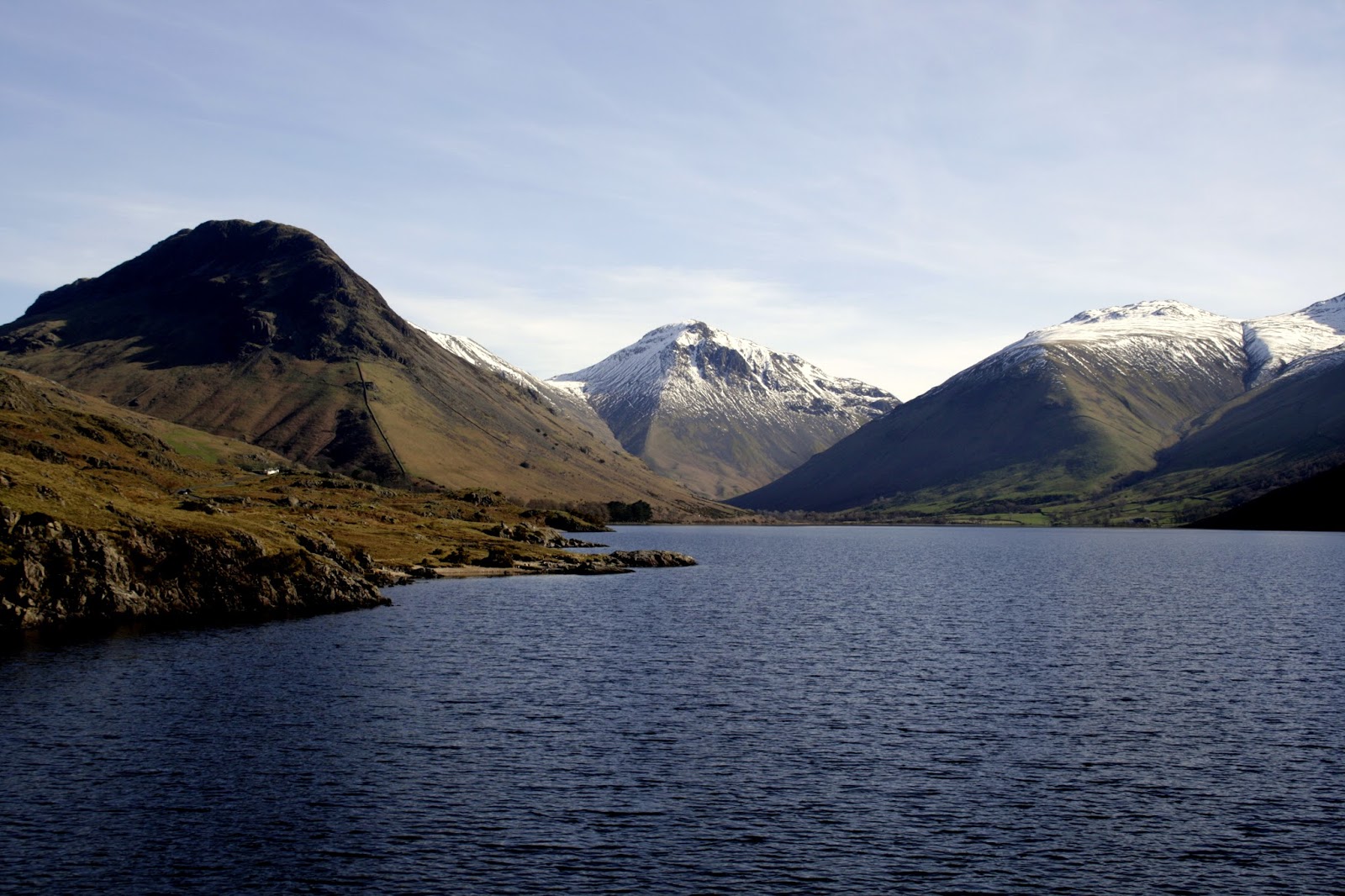
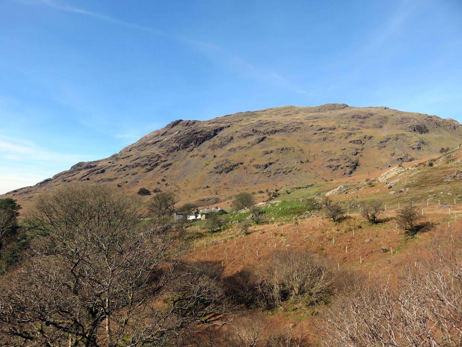
| It was a fine morning in Wasdale |
It promised to be a memorable day thanks to a dazzling combination of late winter snow and early spring sunshine. It was certainly warm as we began our long trek to the high fells along the valley of Over Beck, below the slopes of Yewbarrow.
 |
| Wasdale |
 |
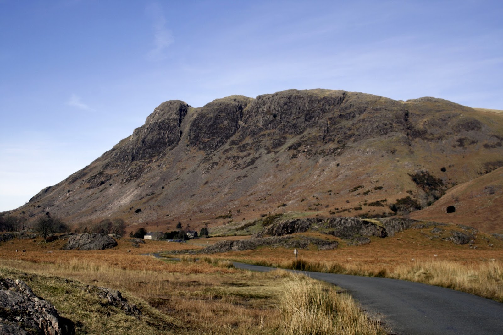
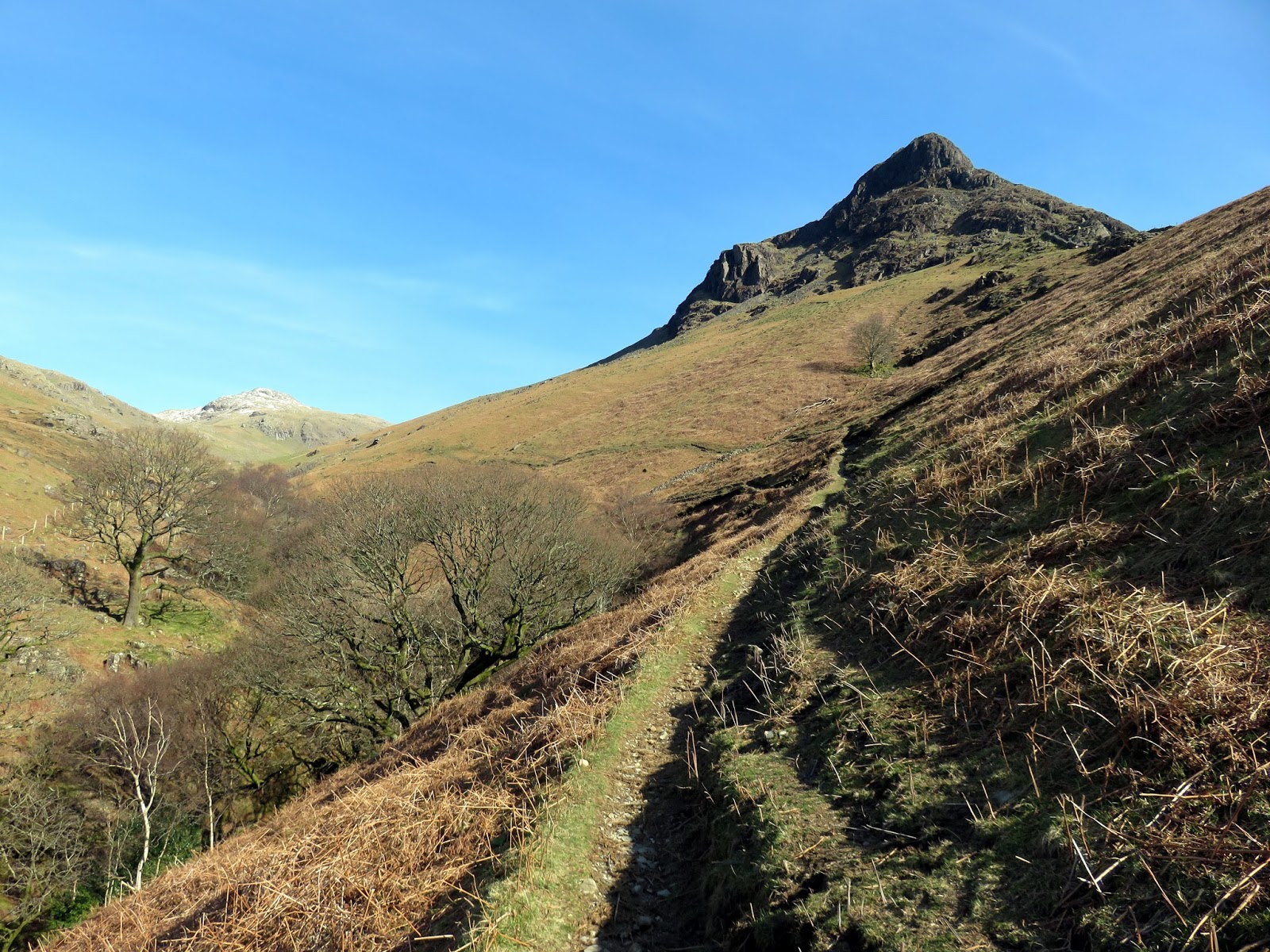
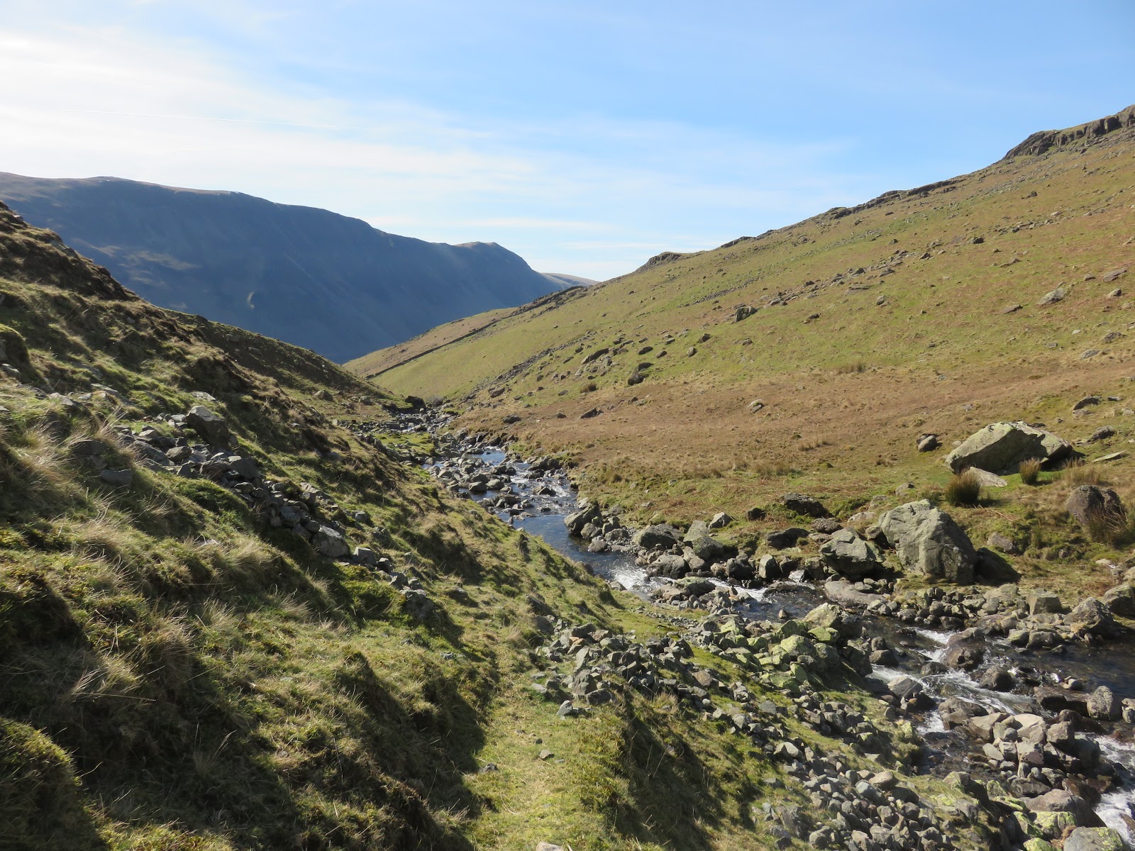
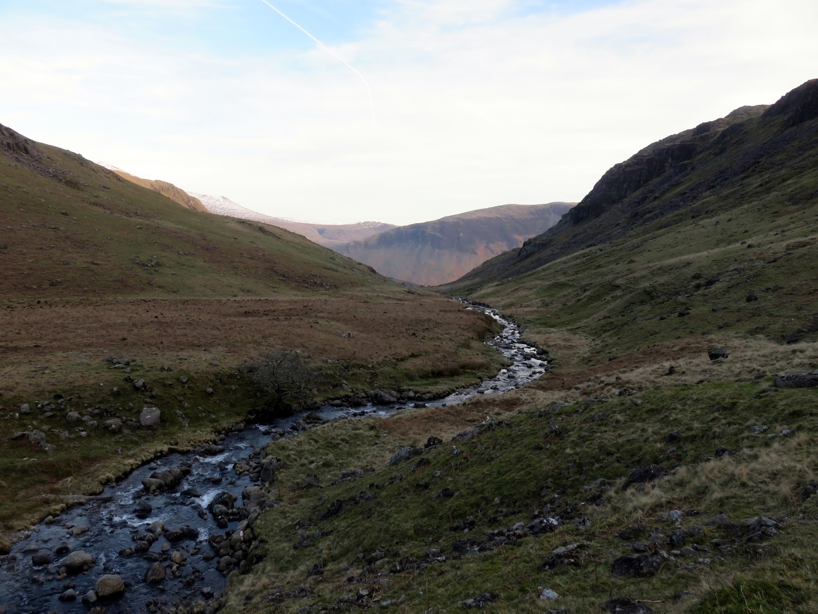
| The path along Over Beck passes beneath Bell Rib |
 |
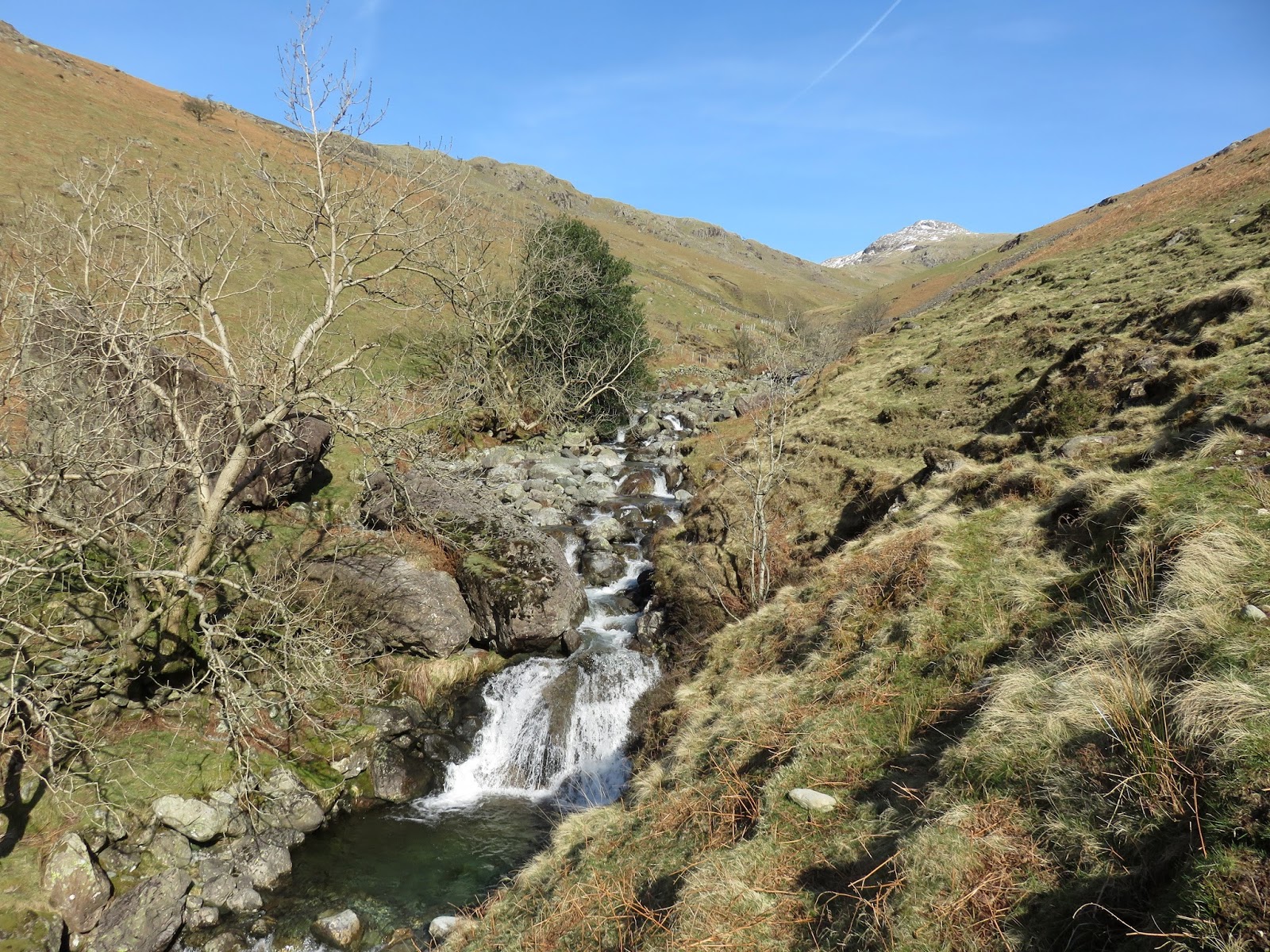
| Over Beck |
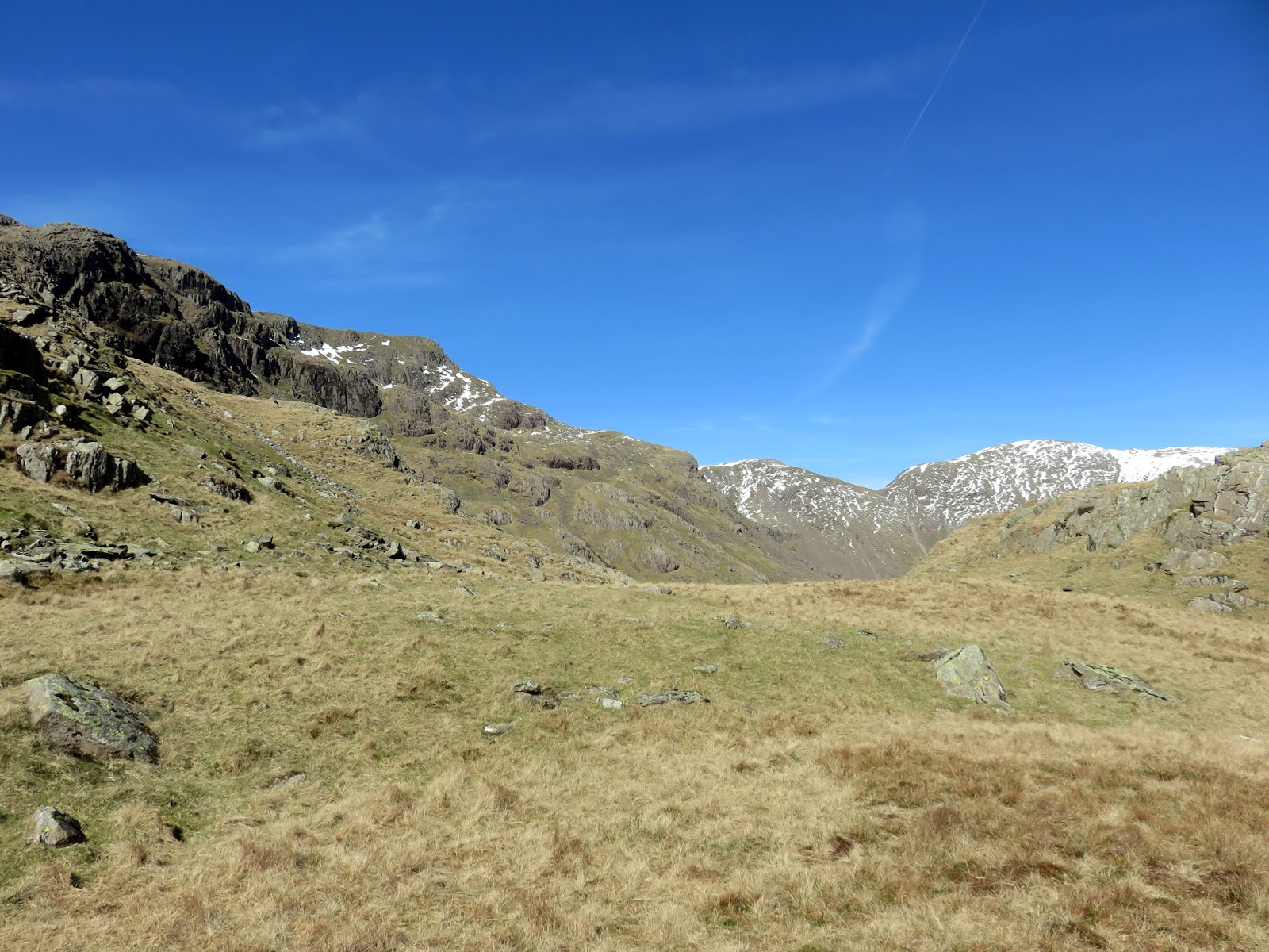
The climb up the Over Beck valley is very gradual, easing you up towards Dore Head over a couple of miles. That said, the sheltered valley and strong sunlight made for a sweaty climb.
 |
| Over Beck |
 |
| Over Beck |
 |
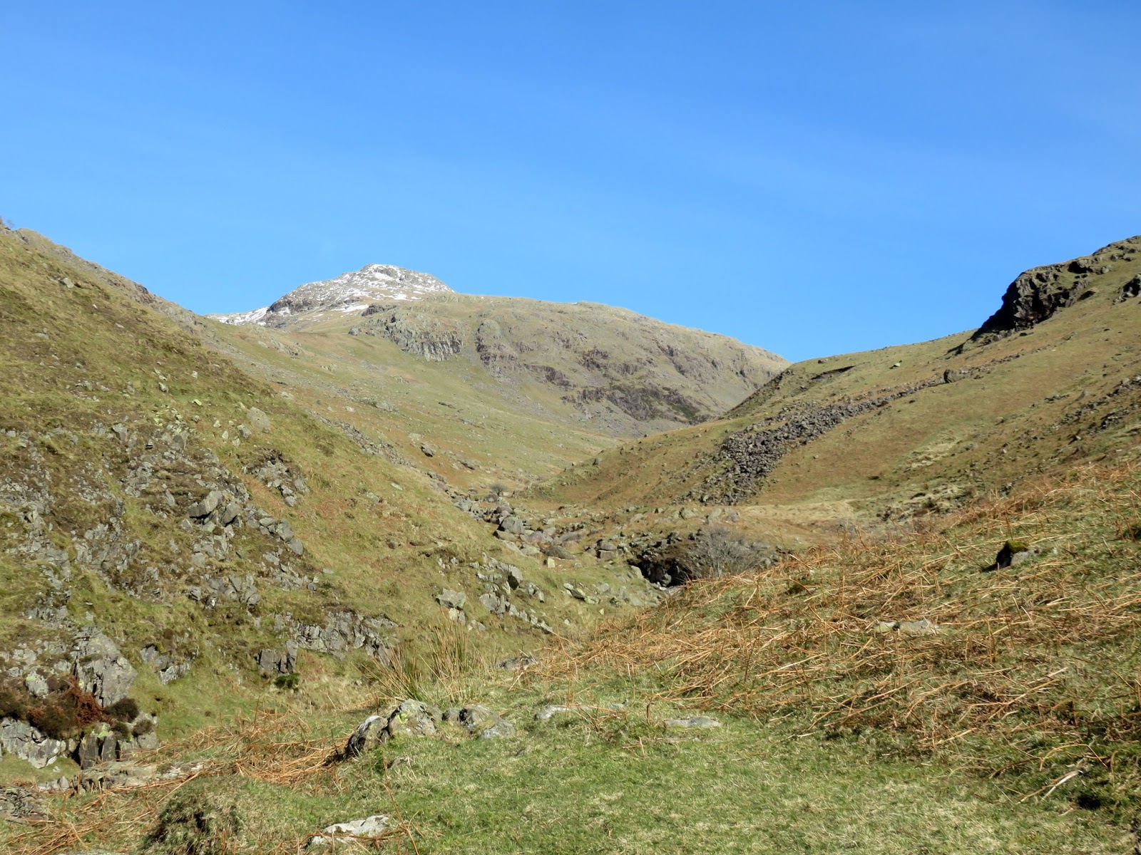
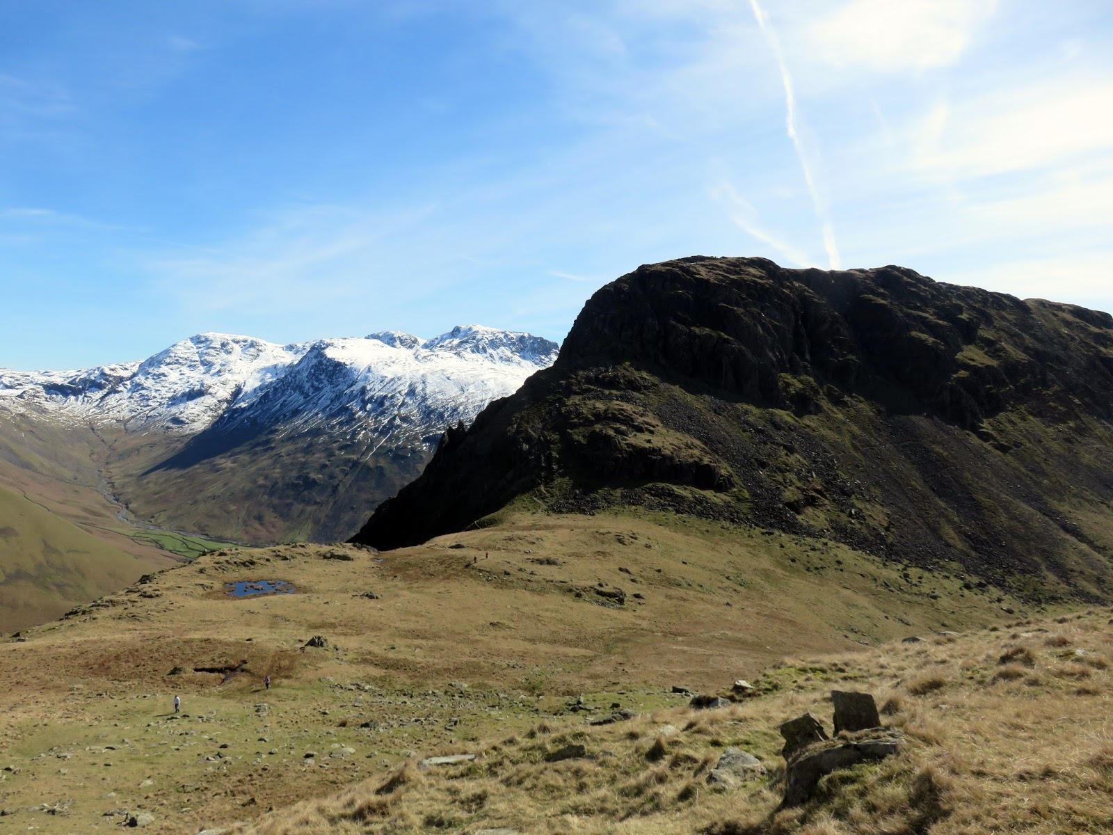
| Approaching Dore Head |
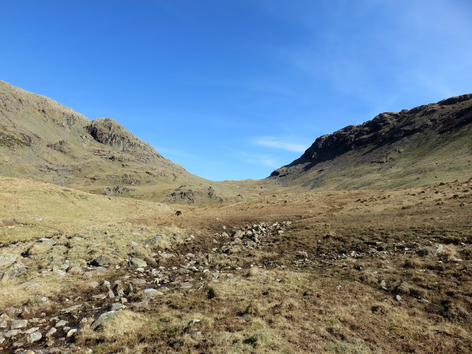
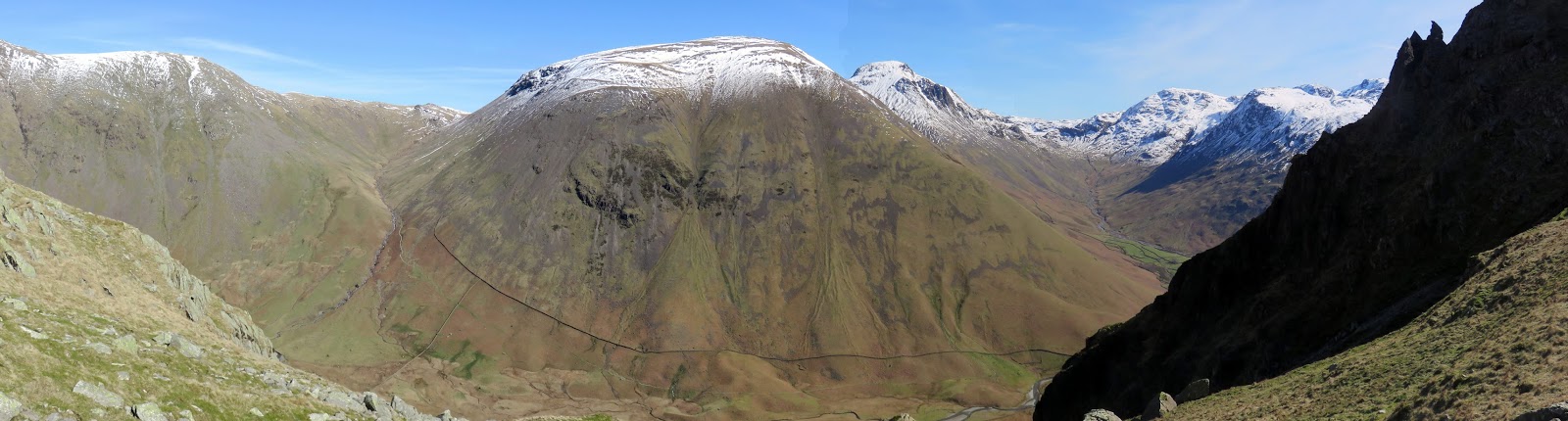
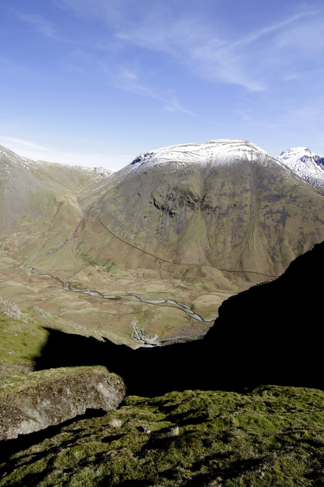
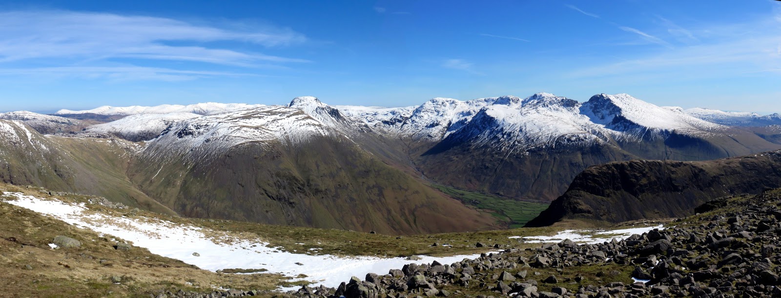
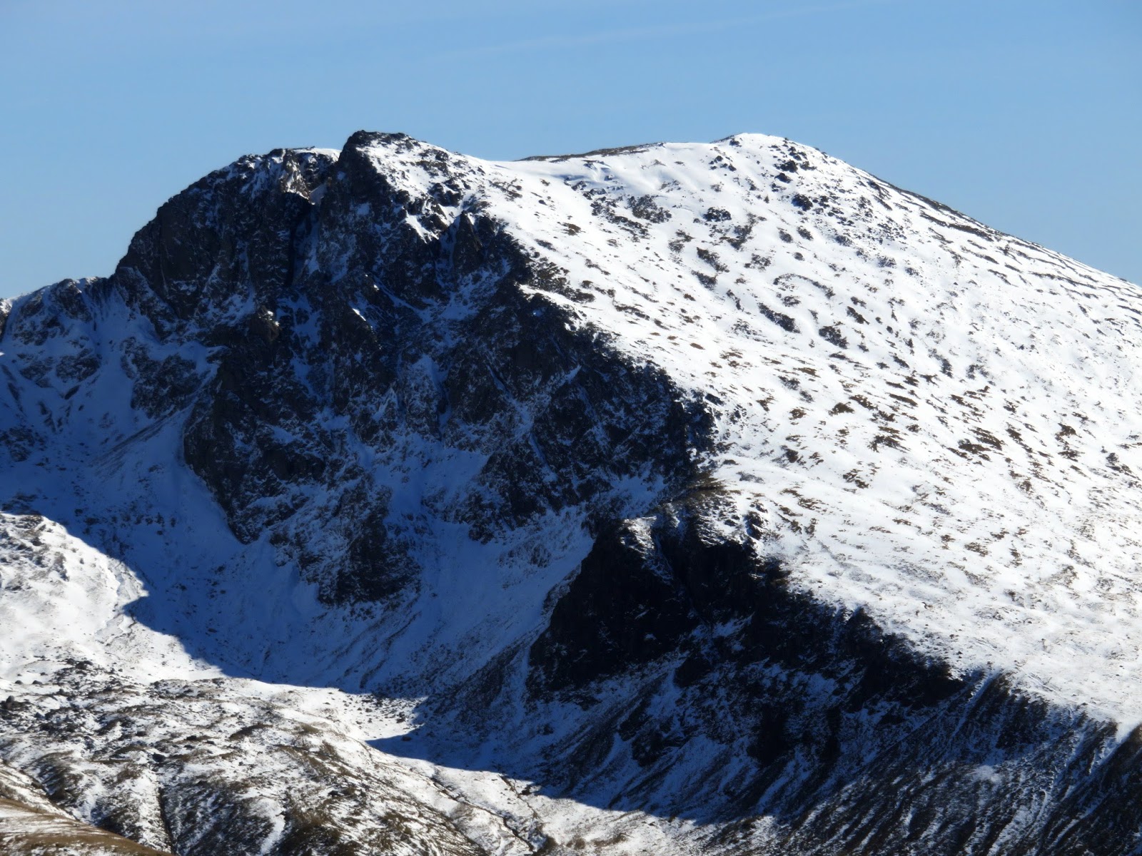
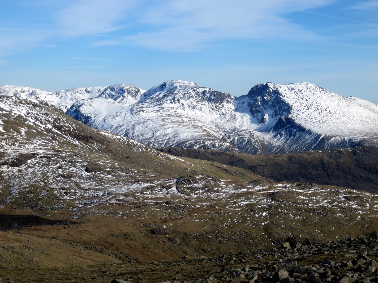
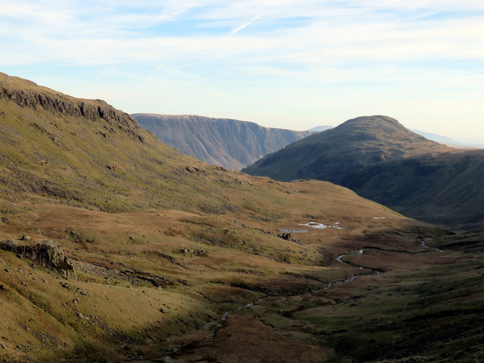
We emerged at Dore Head to the staggering view of Mosedale far below and the huge bulk of Kirk Fell across the valley. We also caught our first glimpse of the Scafells, looking resplendent with their winter topping. We loitered for a while contemplating the next task, a long climb up Red Pike.
 |
| Wasdale Head |
 |
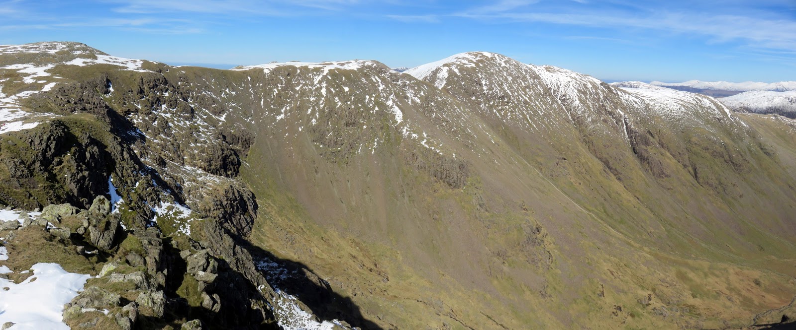
| Panorama from Dore Head |
 |
| The view down Dore Head Screes |
 |
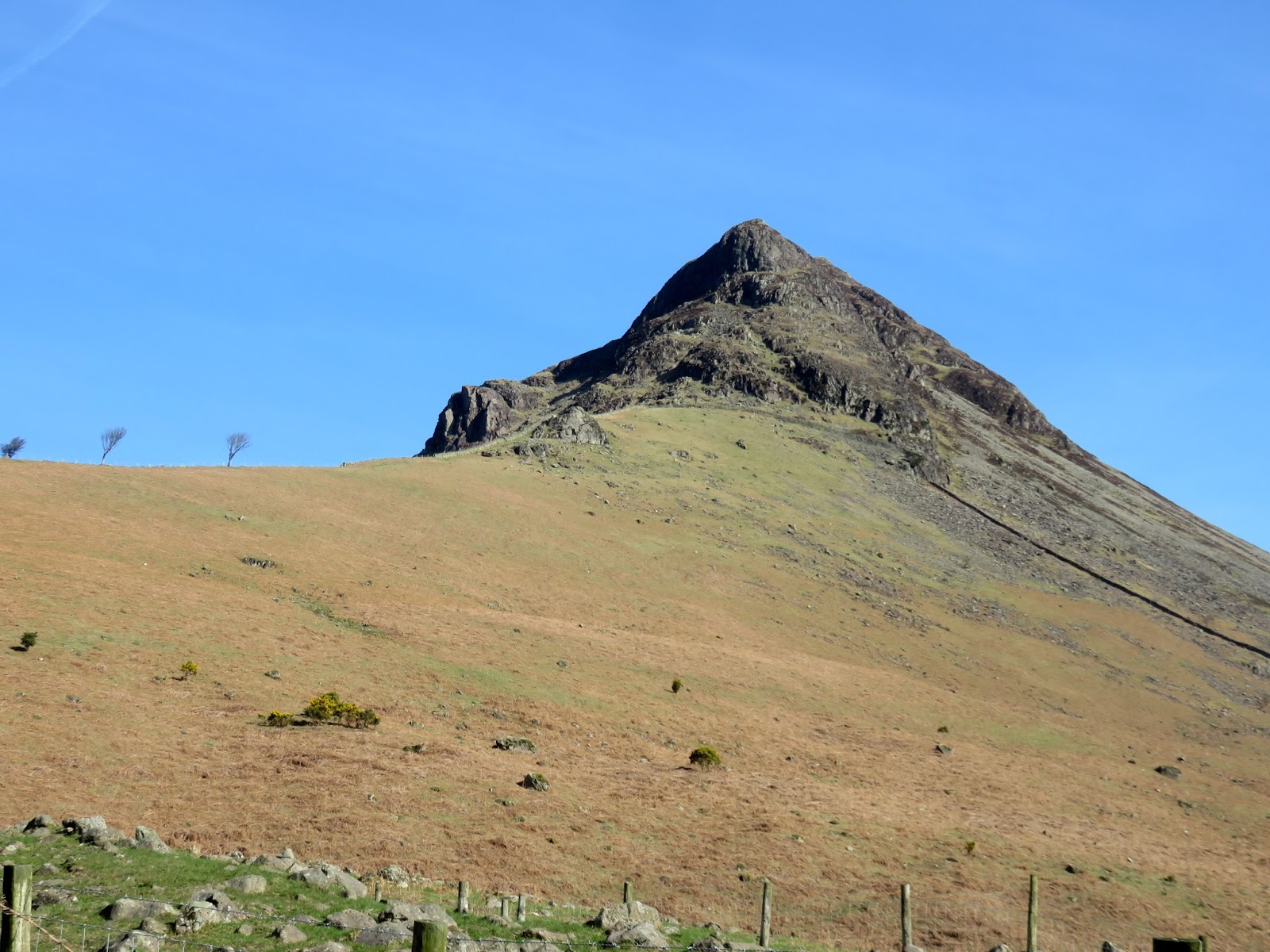
| Stirrup Crag |
 |
| Wasdale Head |
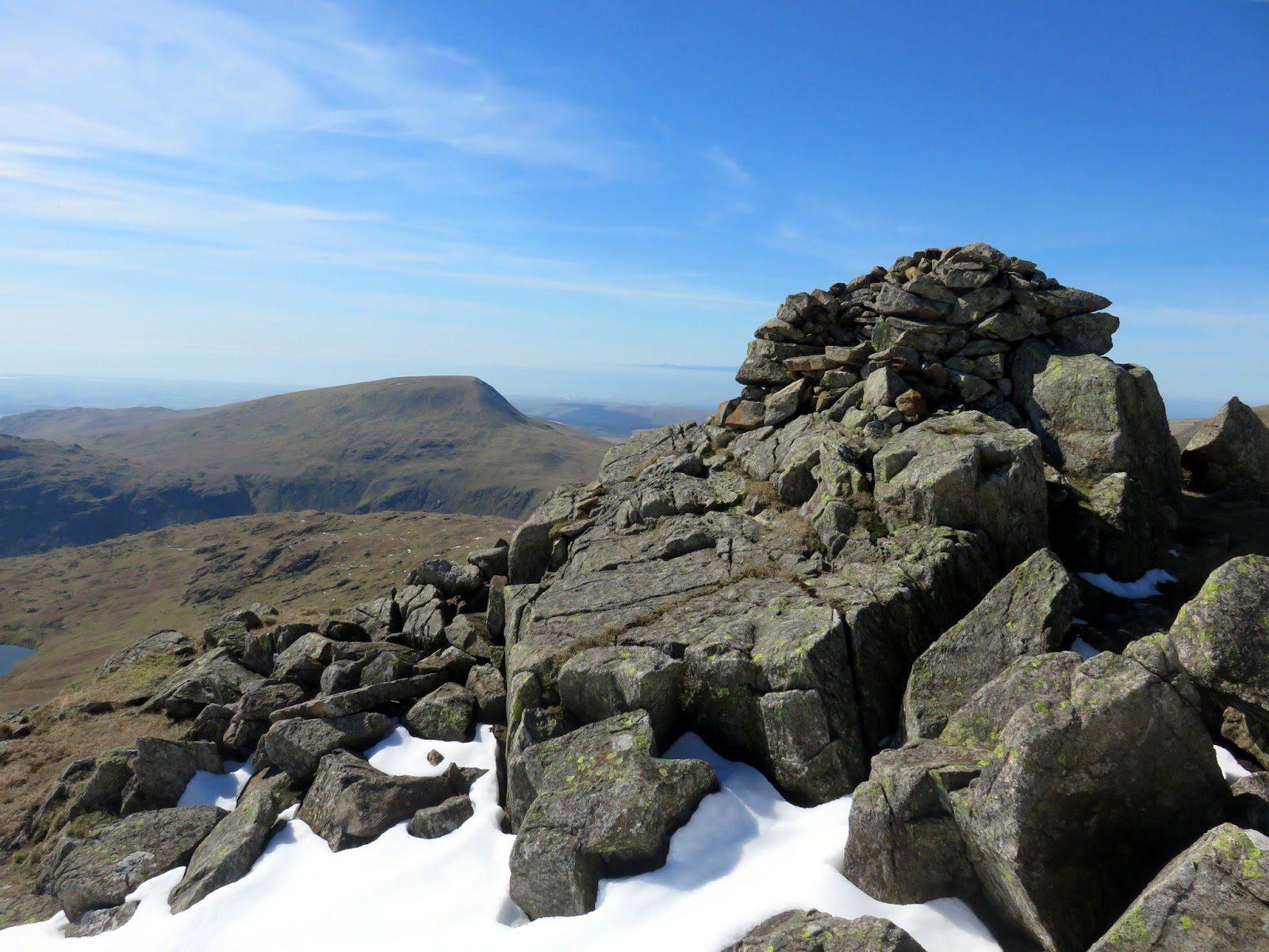
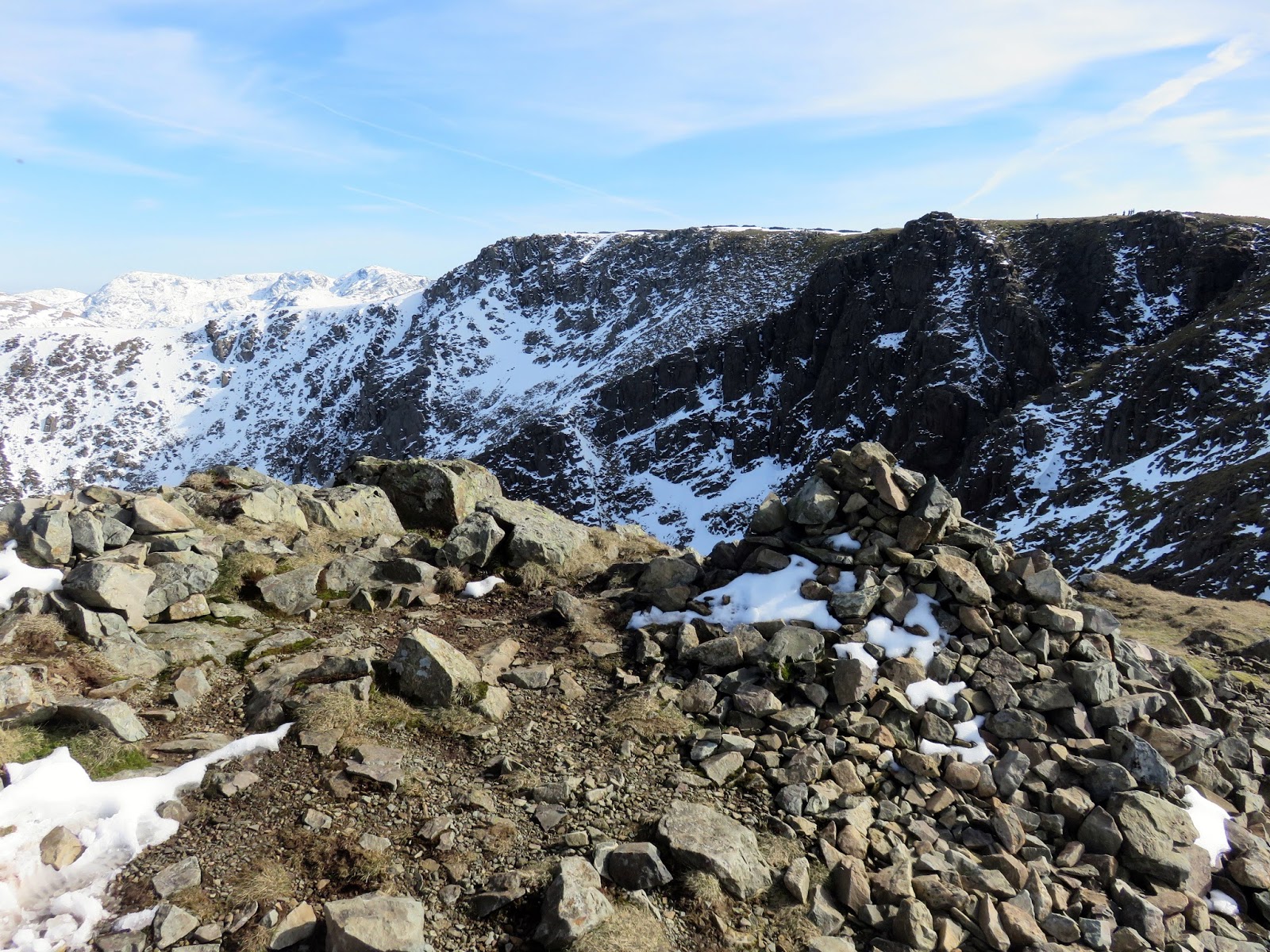
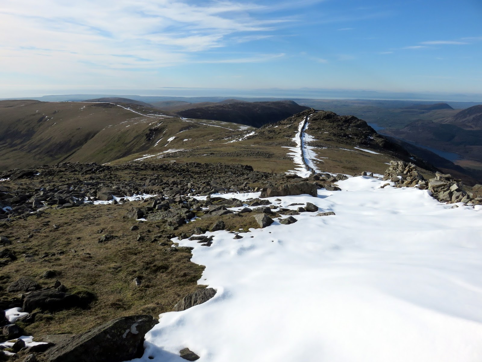
It wasn’t long before we reached the snow line but it was patchy enough not to need any of our winter gear. We plodded upwards with the sun in our face until the slope eventually gives way to a flatter area marked by a cairn. Close by (out towards Scoat Tarn) is a cairn built into the shape of a chair, called ‘The Chair’. So prominent is its location that the fell used to bear this name. A short distance further is the summit of Red Pike, perched high above Mosedale Crags.
 |
| The Chair |
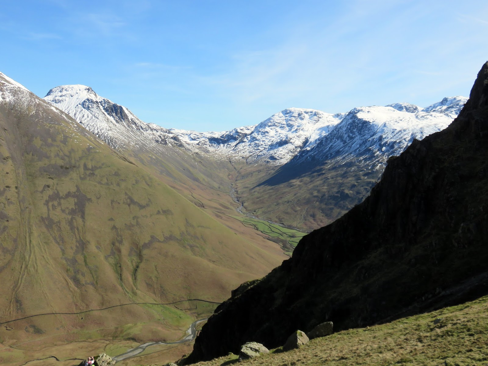
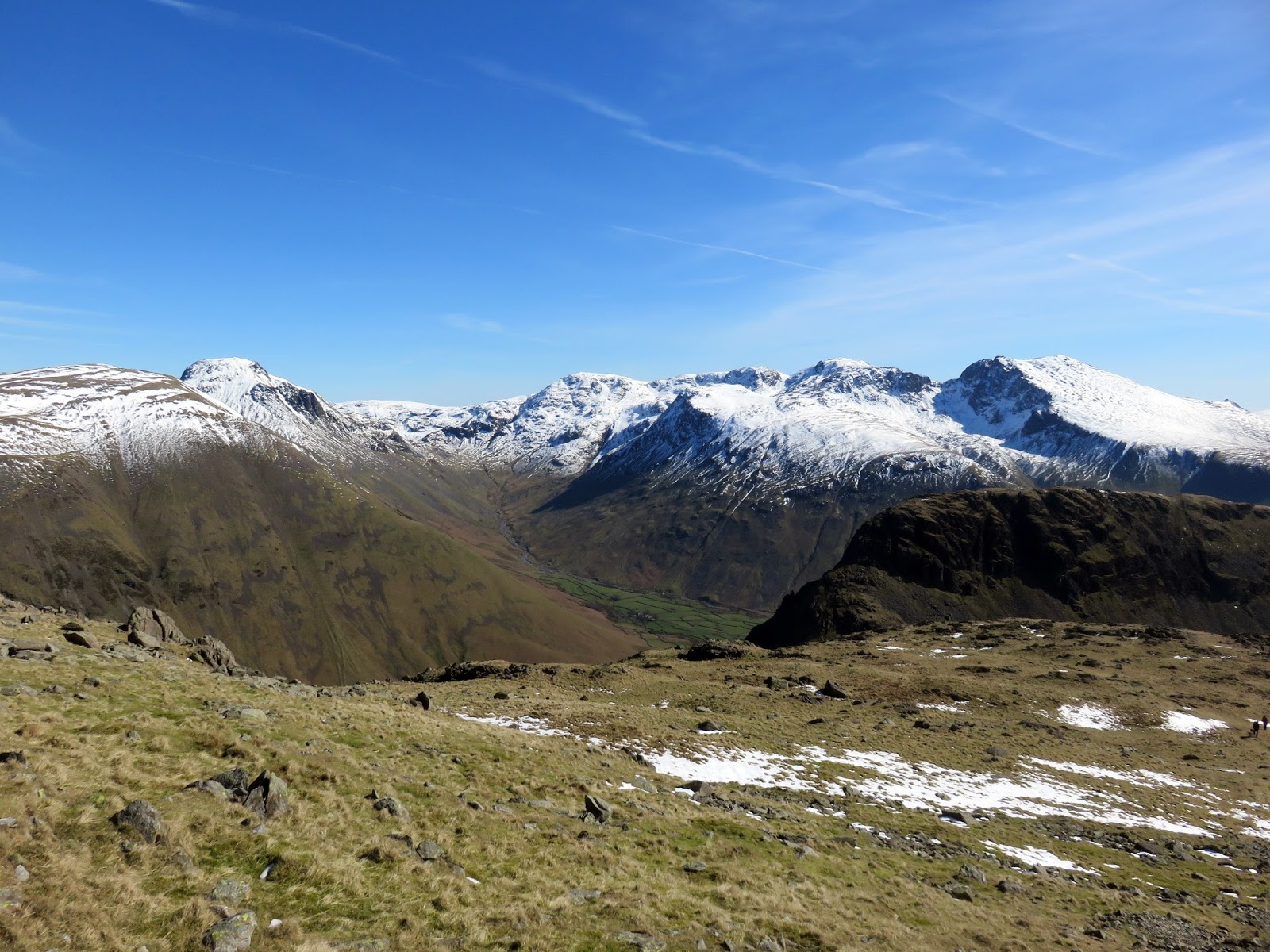
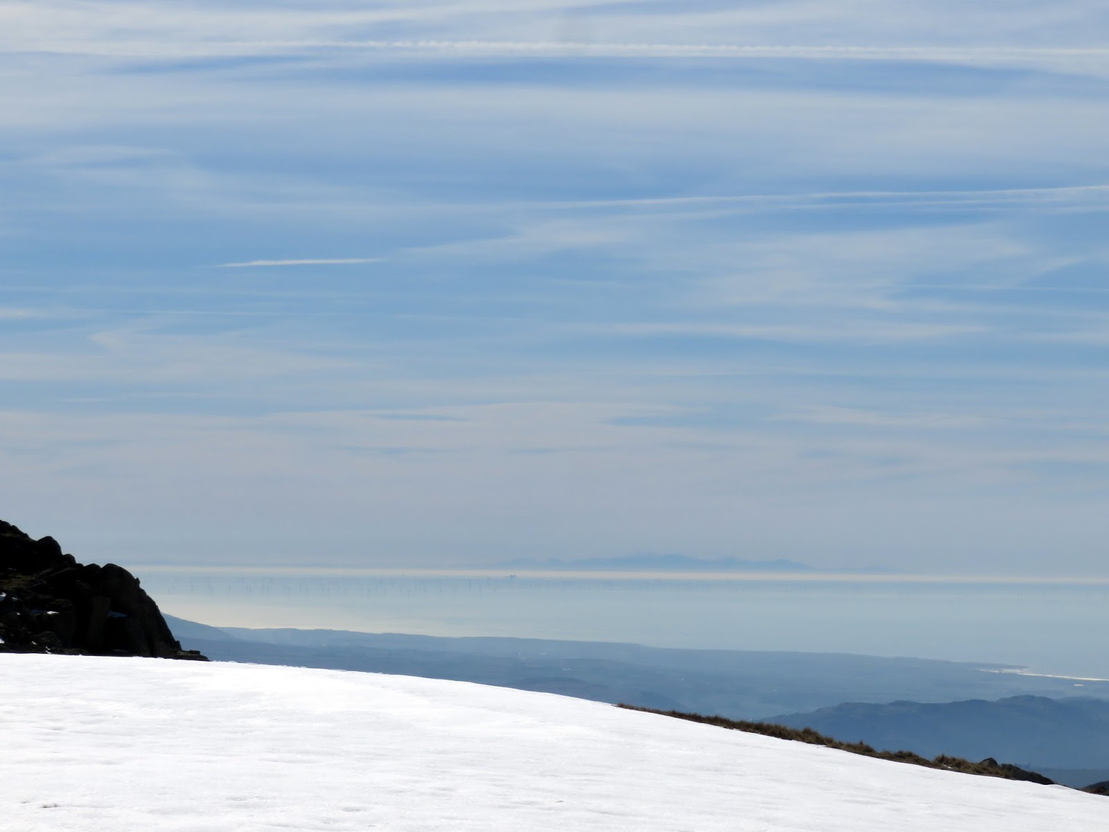
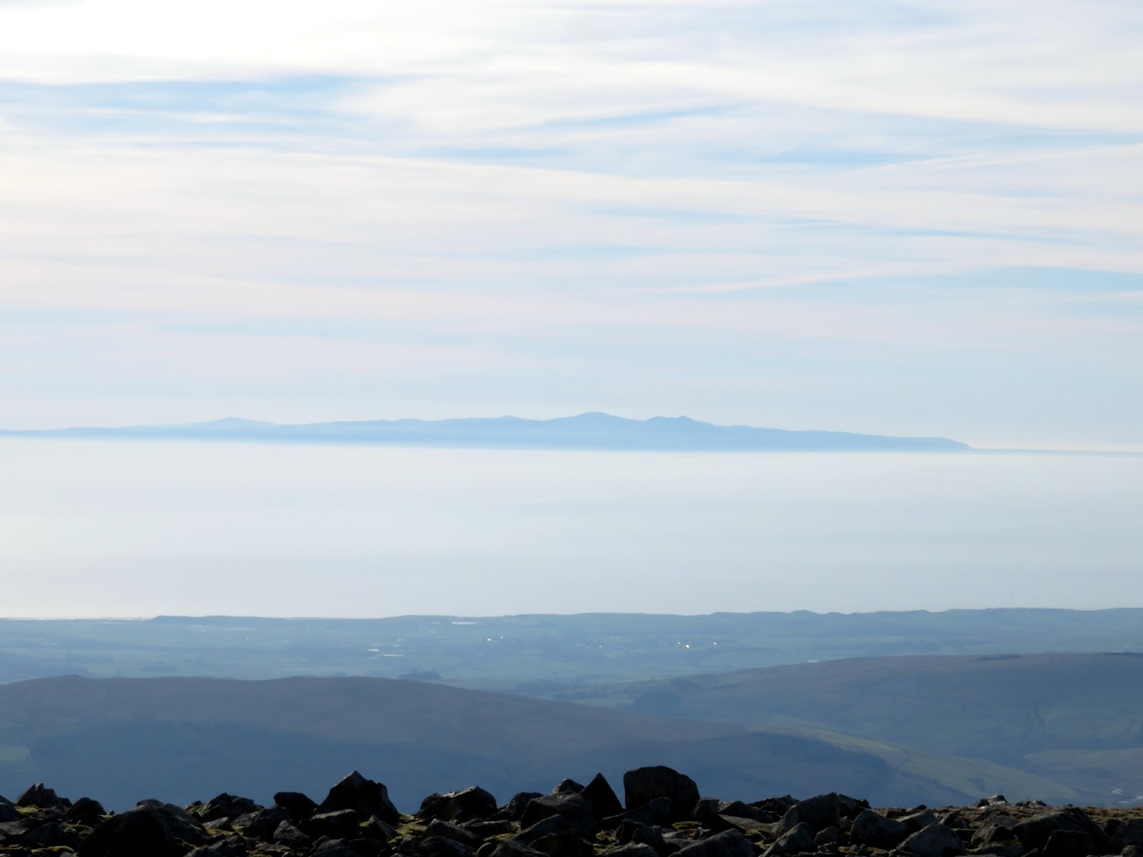
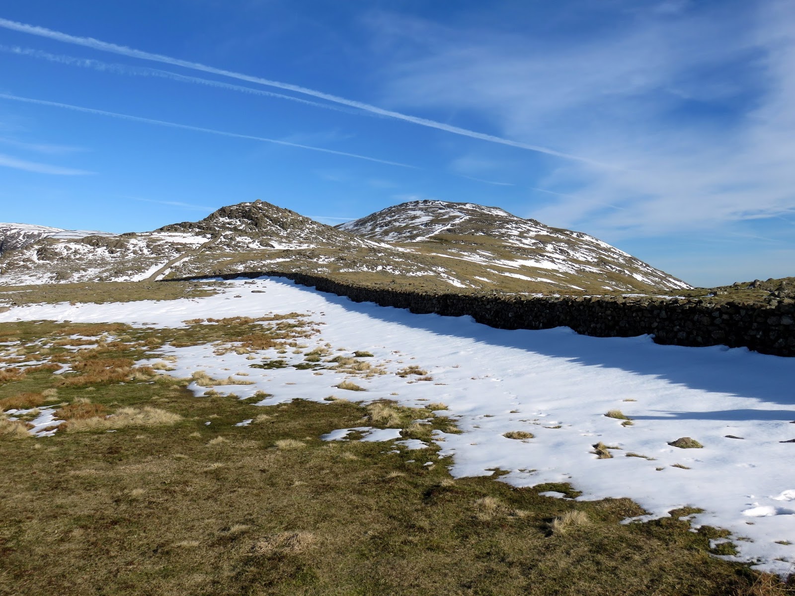
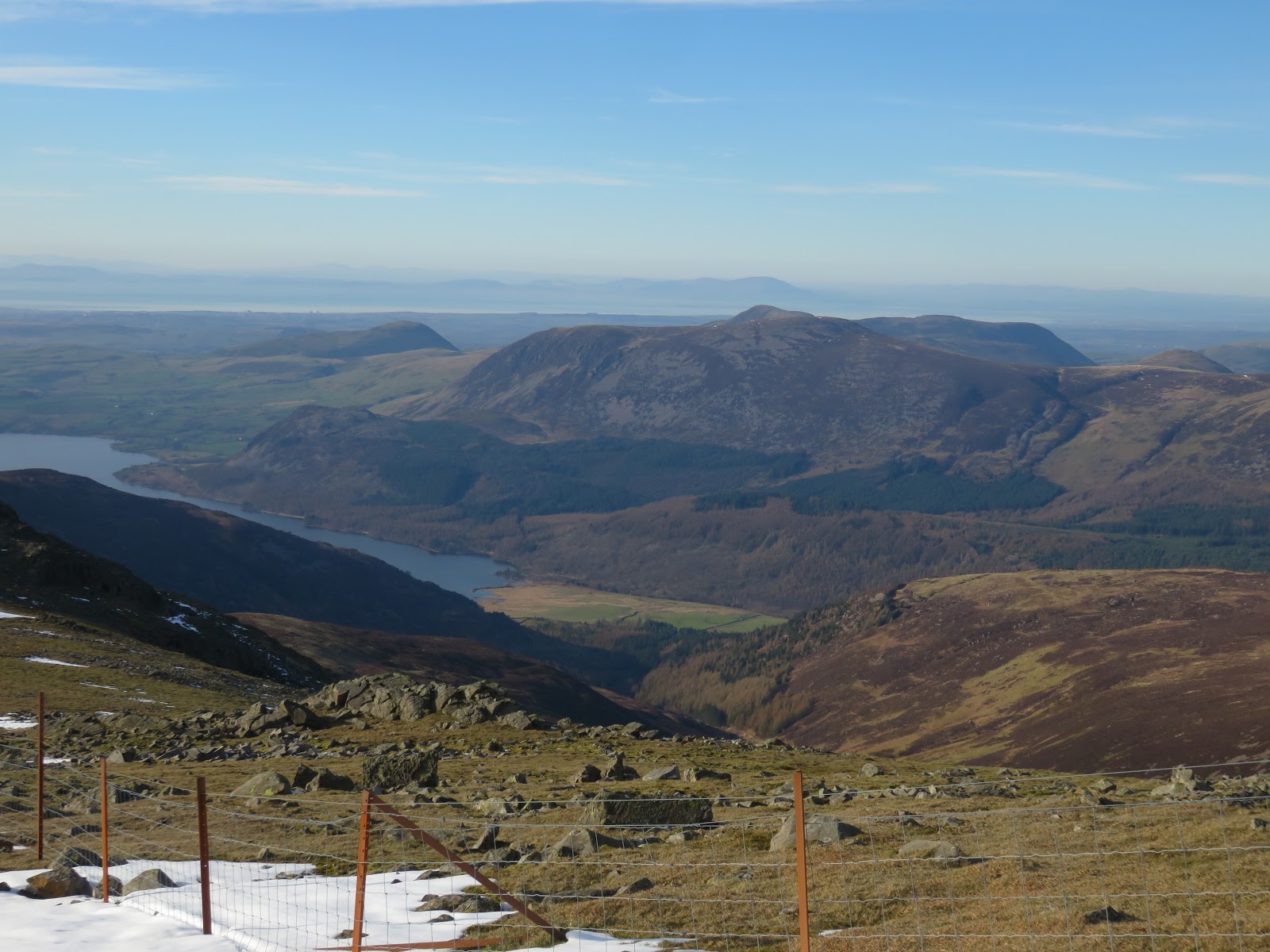
After a short descent, a further climb is required to reach the lofty height of Scoat Fell with its remarkable view of Steeple and Ennerdale. In addition to this, it was possible to see the mountains of southern Scotland, the Isle of Man, a distant North Wales and an even more distant Northern Ireland, something I’ve never seen before.
 |
| A very distant North Wales |
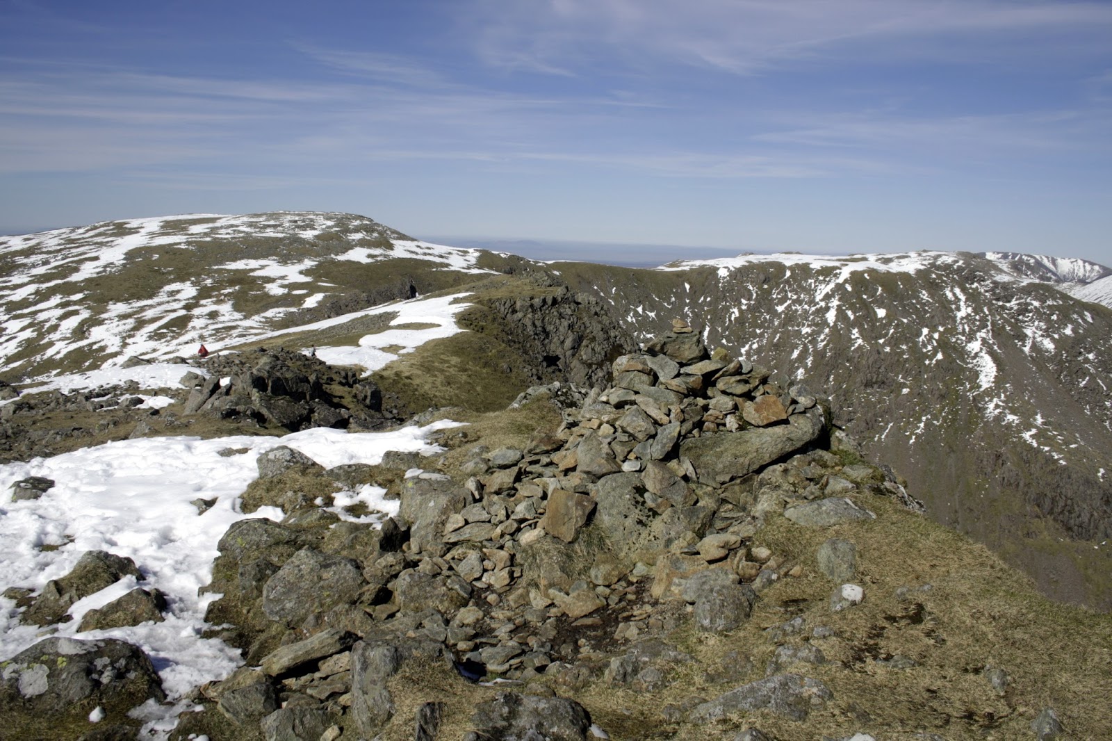
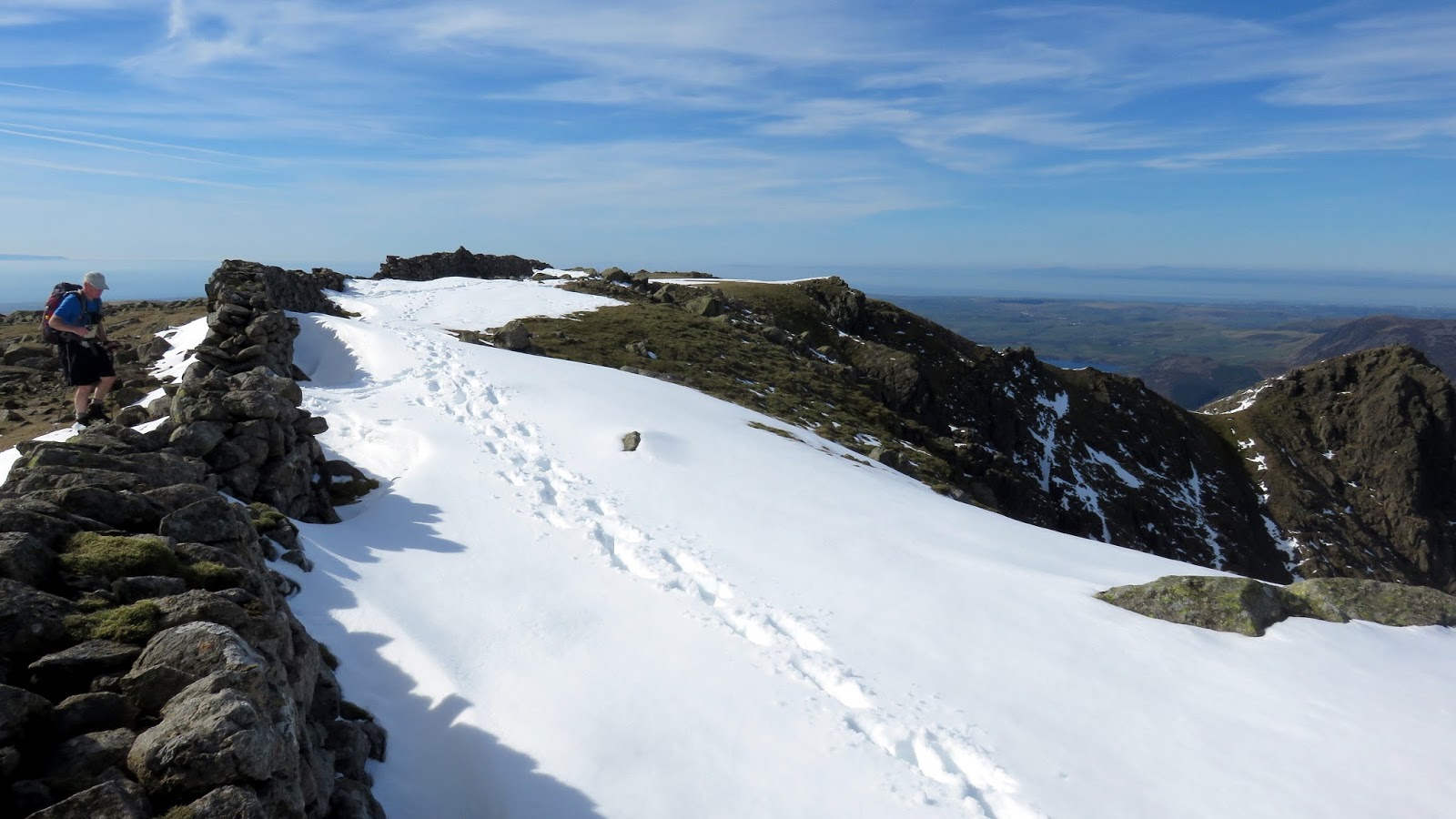
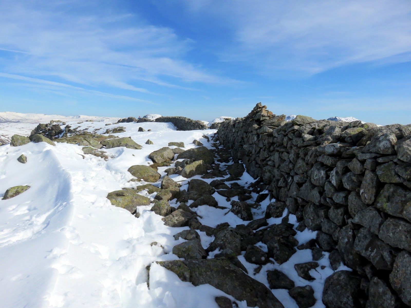
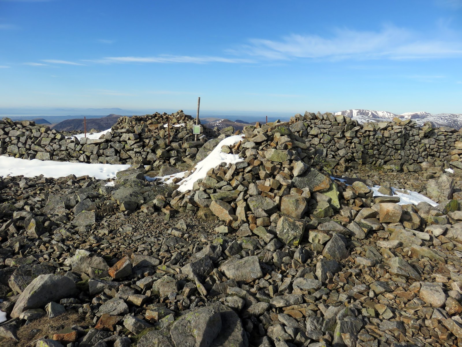
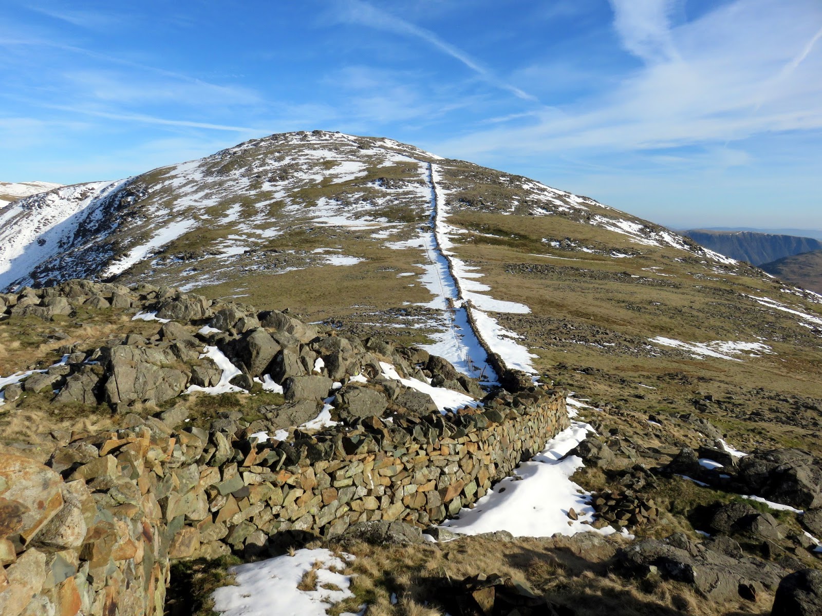
Some large drifts of snow had built up behind the wall that crosses the top of Scoat Fell. The wall is part of the Ennerdale Fence, a historic boundary that runs around the Ennerdale valley and provides a handy marker for any of the ridge walks in the area. Scoat Fell’s summit cairn sits atop the wall.
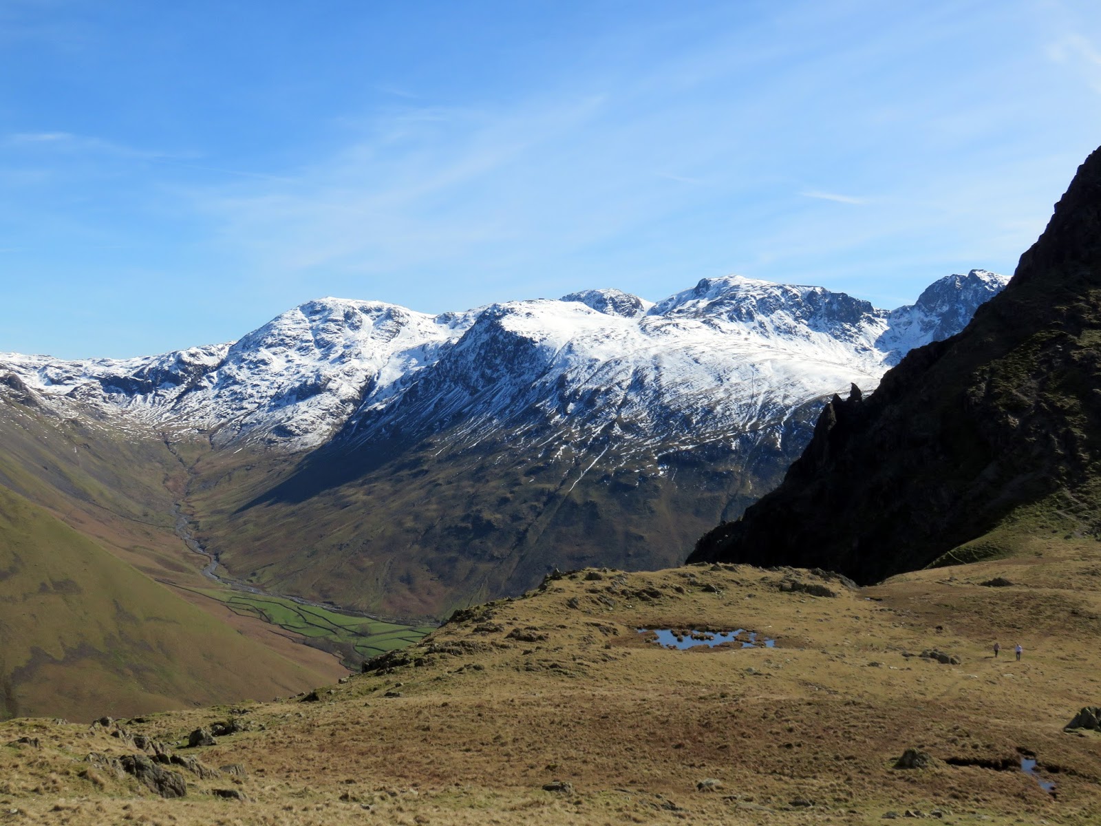
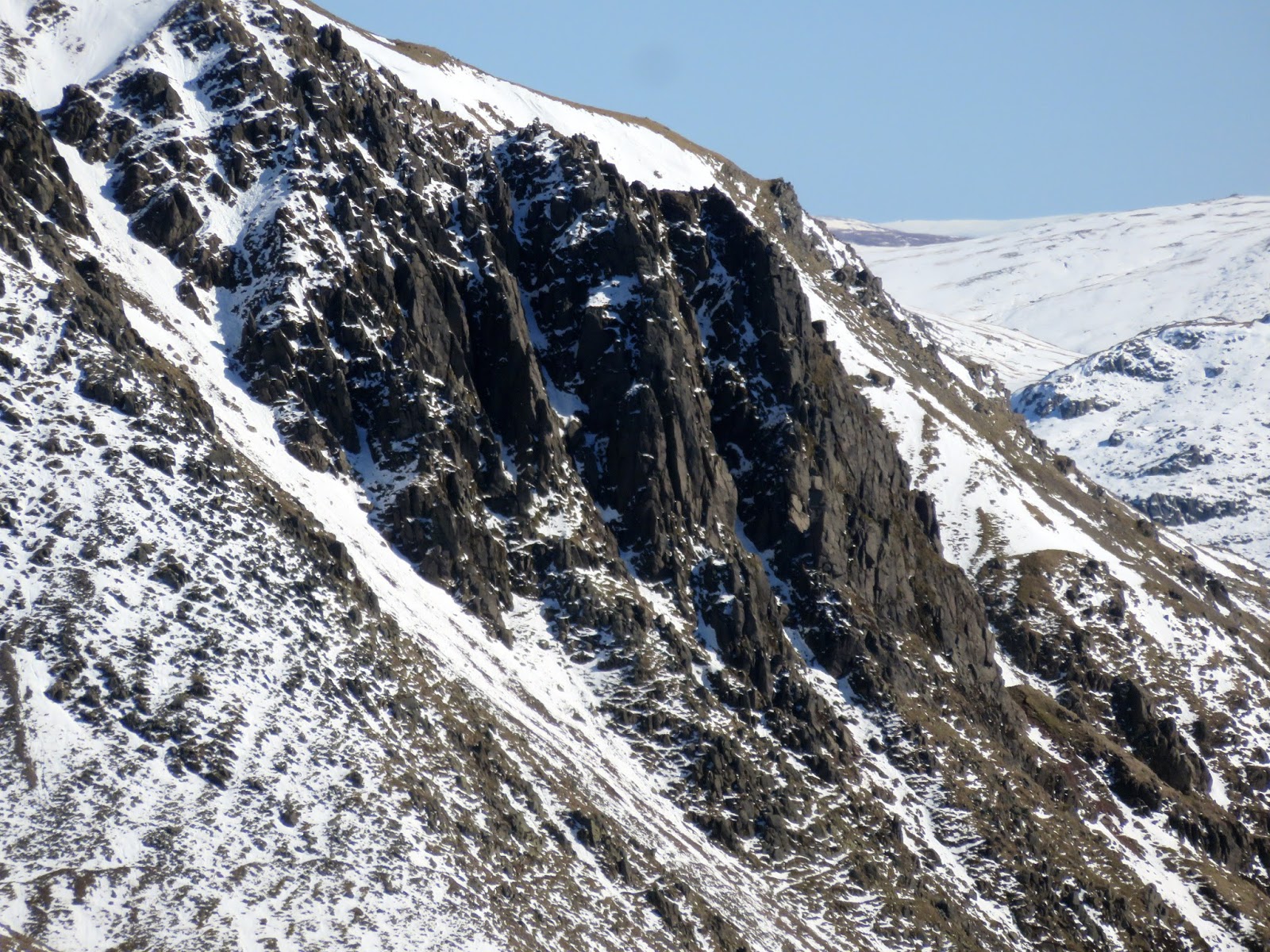
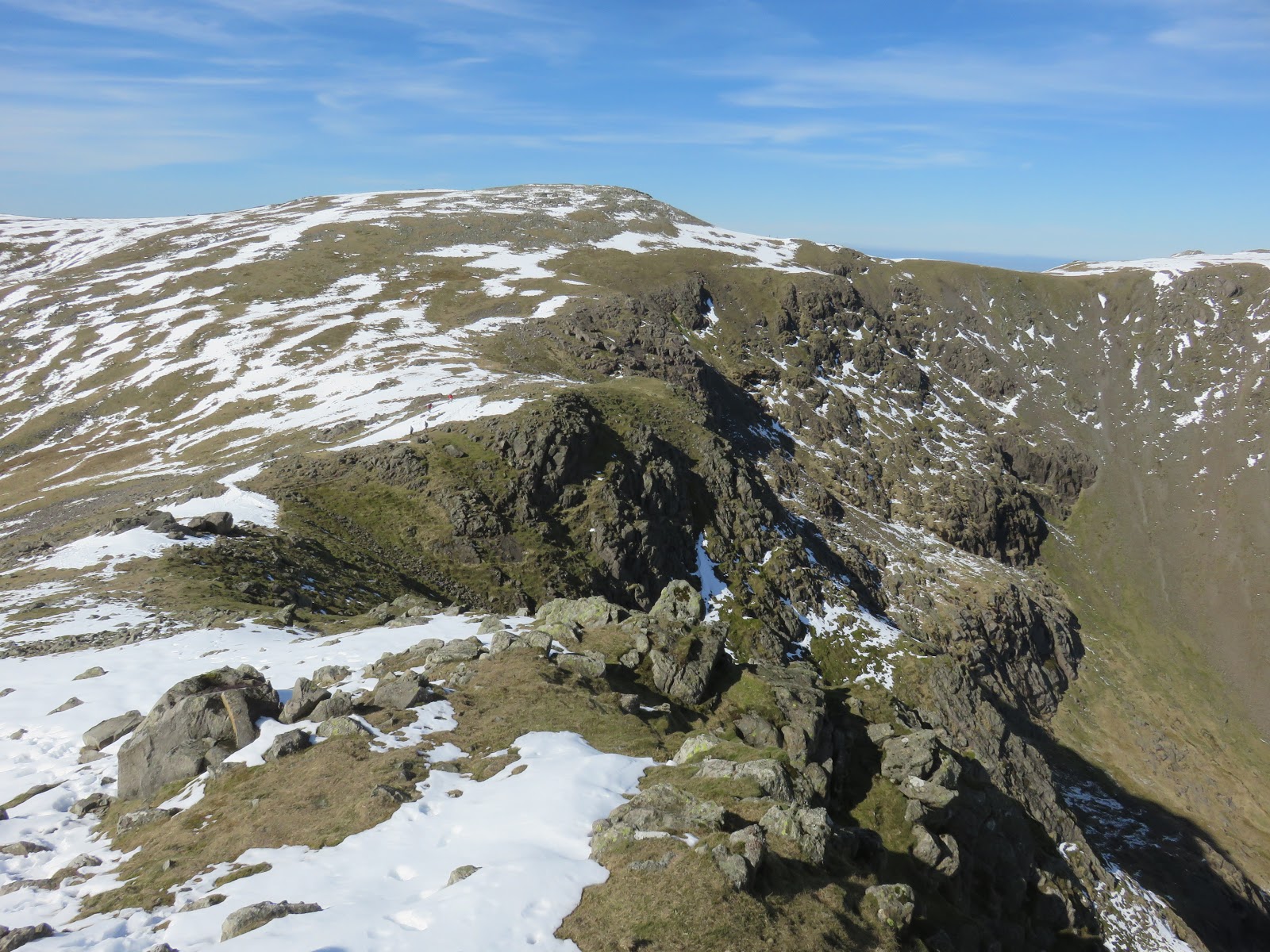
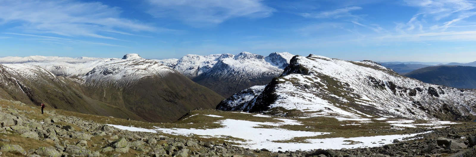
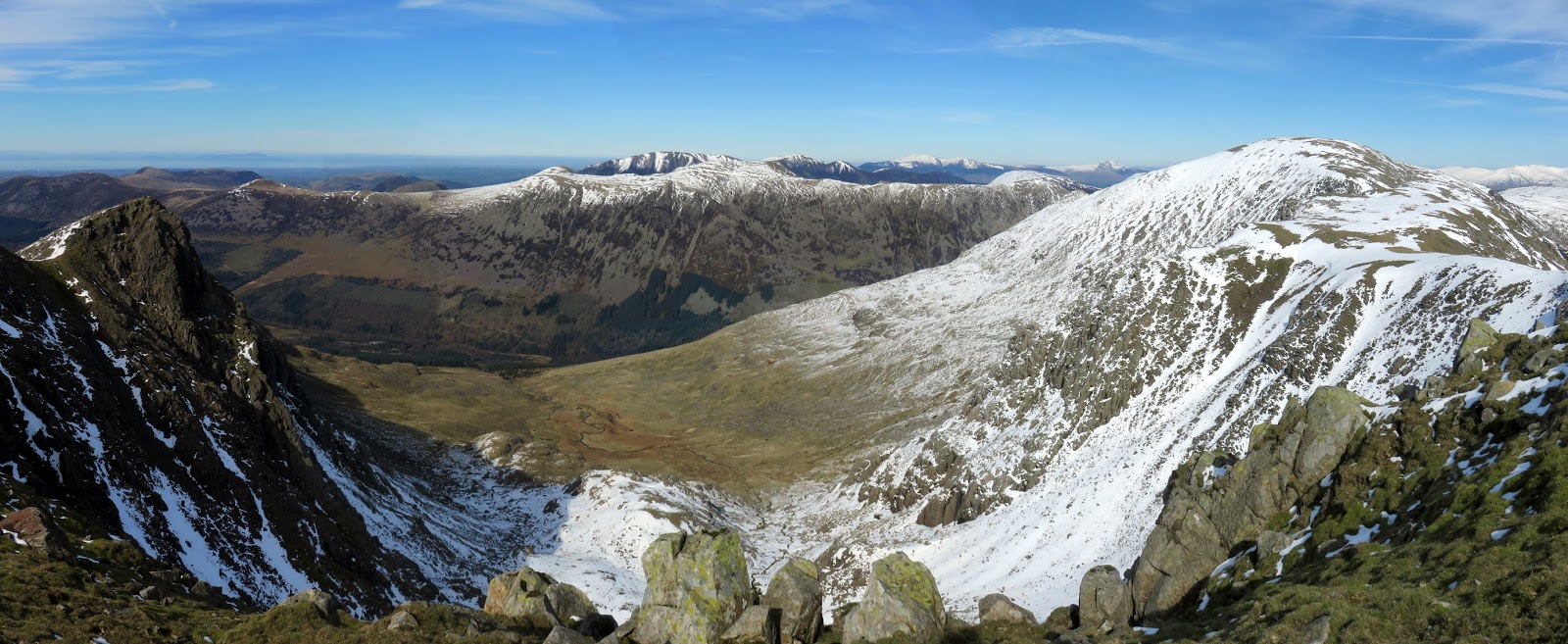
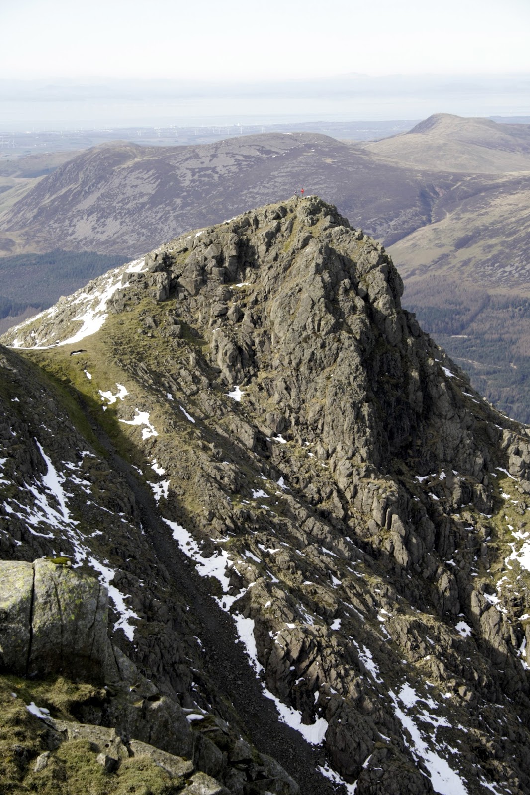
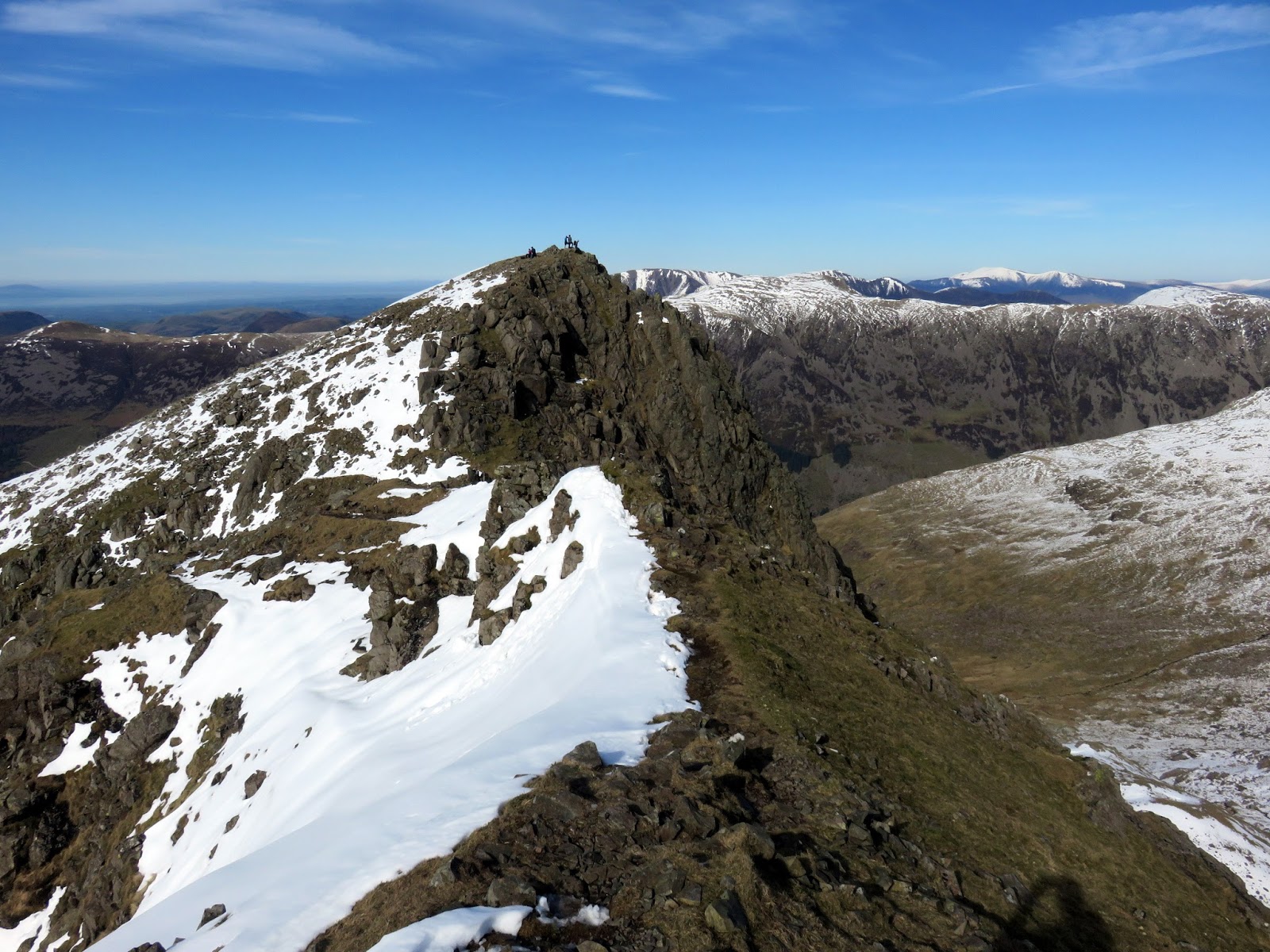
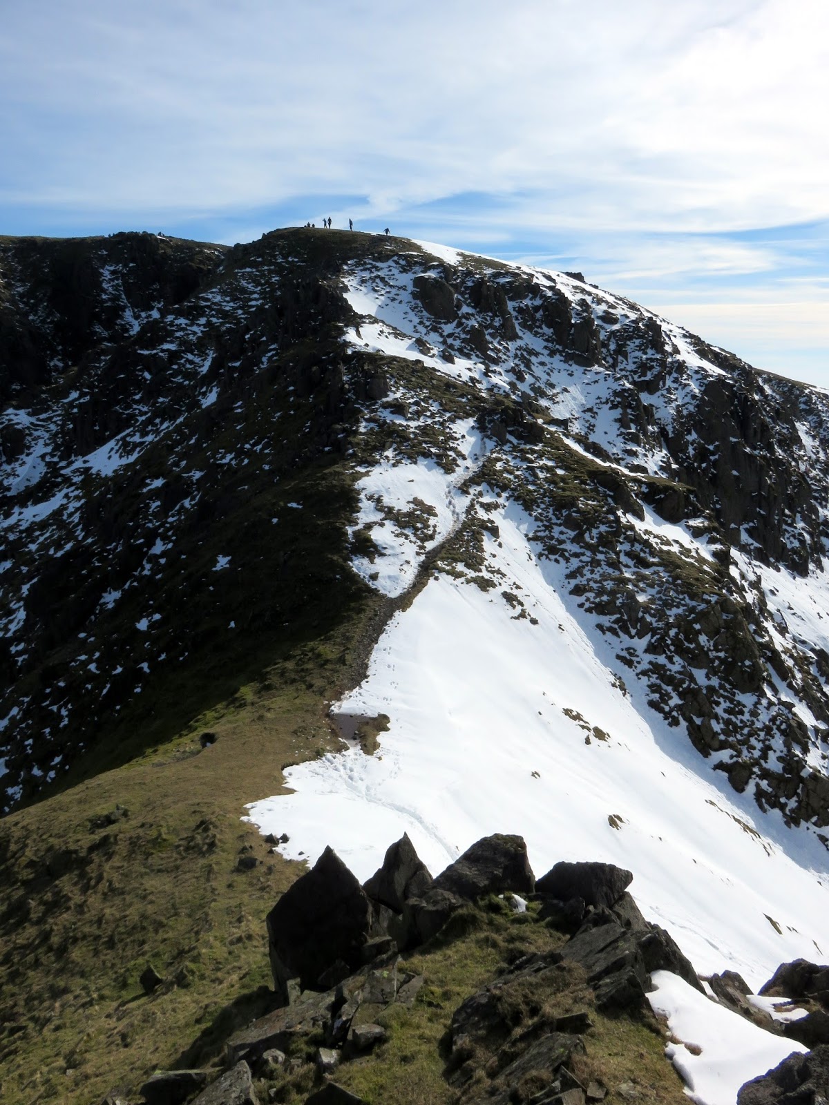
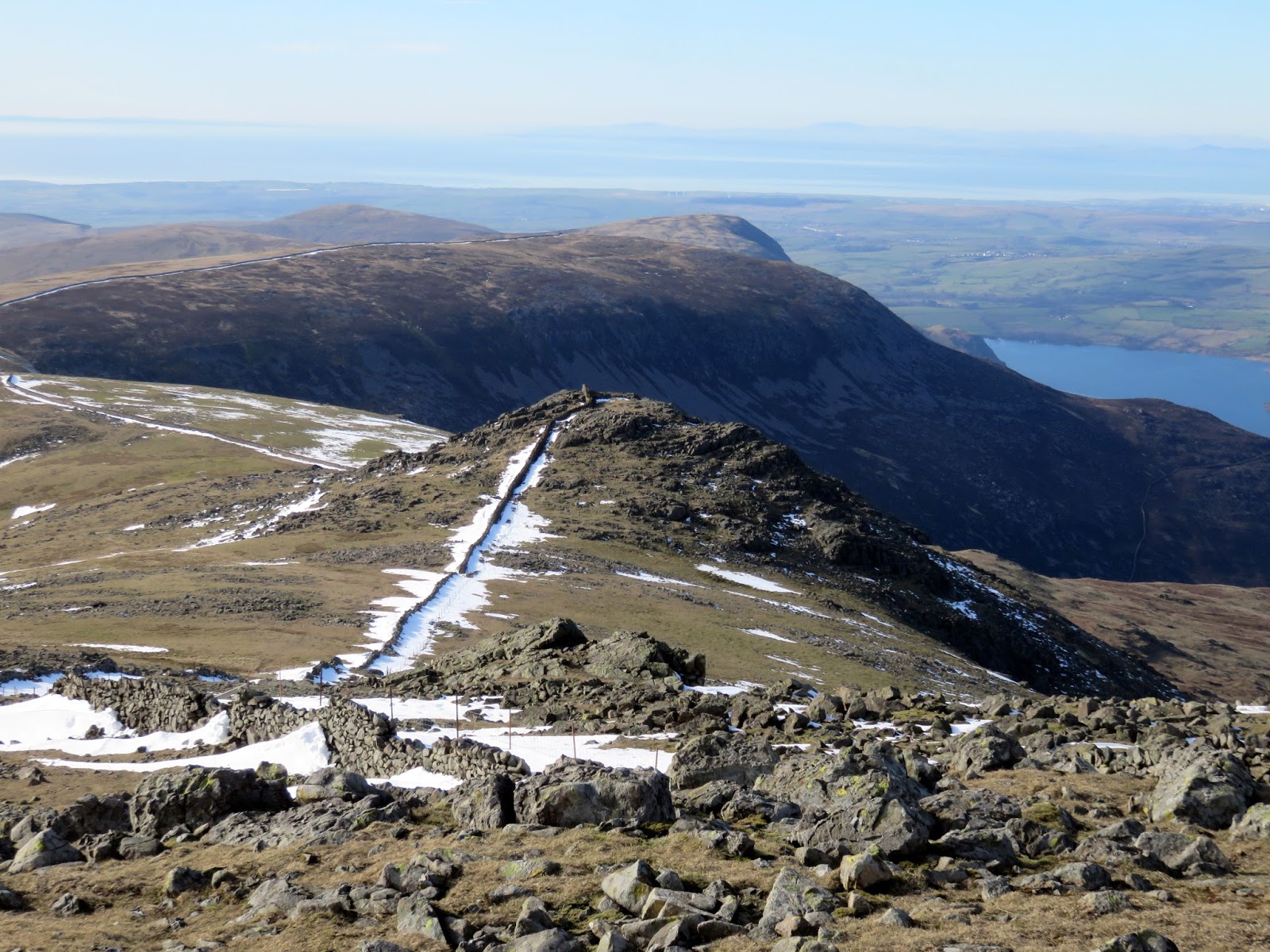
There is a superb view across to Steeple and down into Ennerdale though the airy ridge leading out to Steeple is a real highlight of the walk, especially with the added snow. Steeple is a fine viewpoint, particularly if you want to study the crags of Pillar, Black Crags and Scoat Fell.
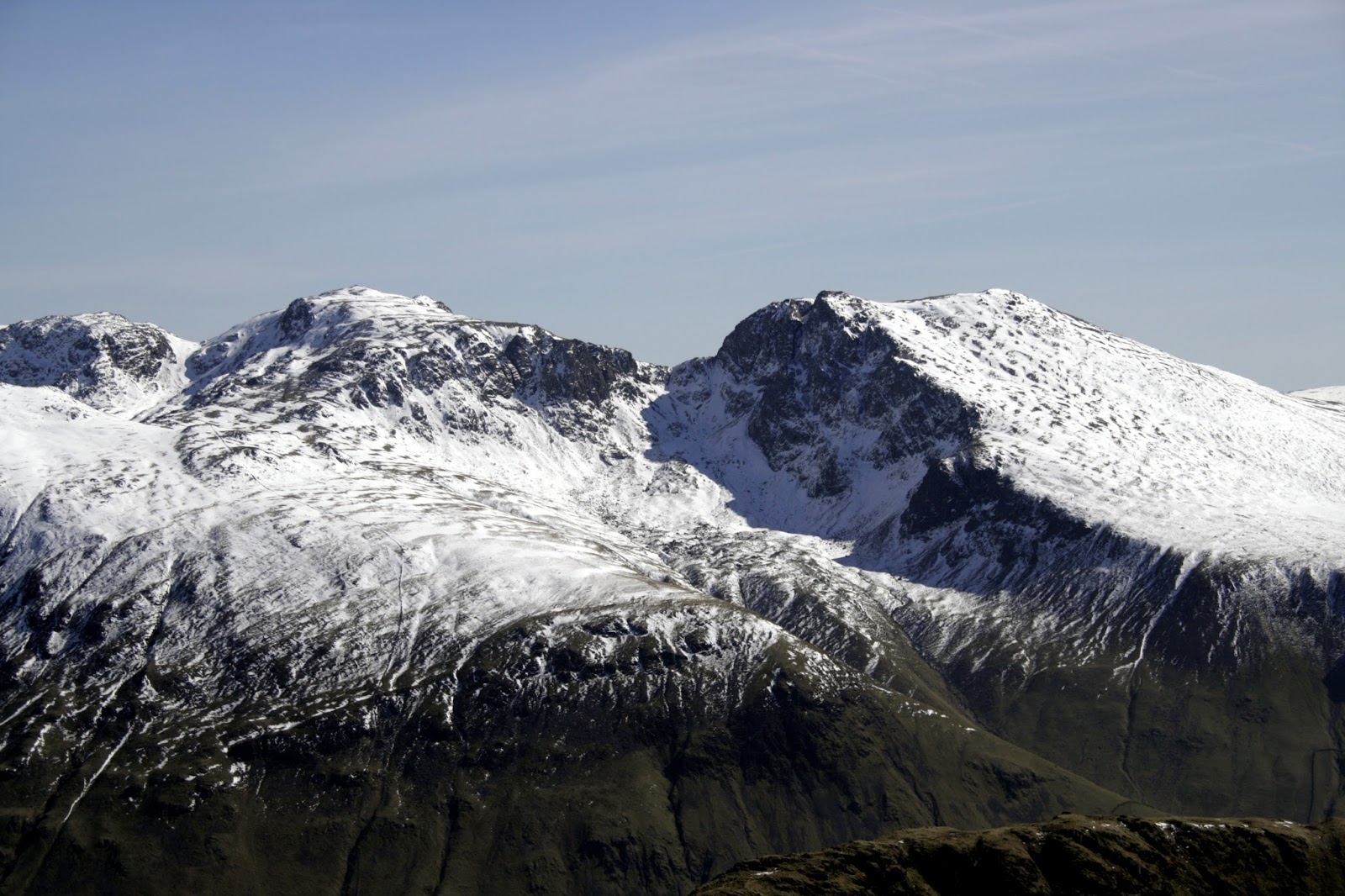
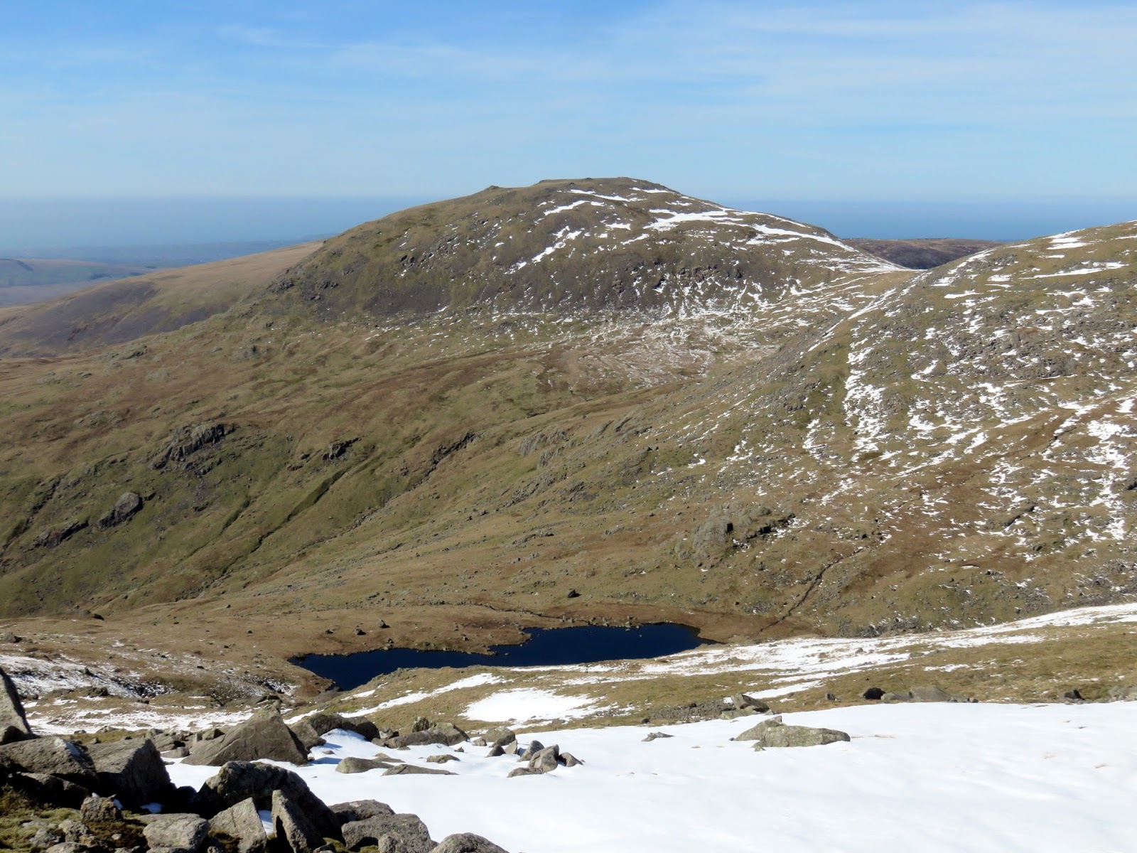
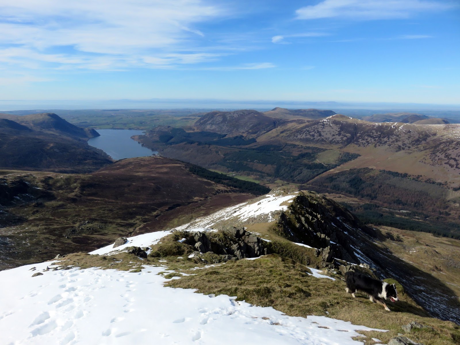
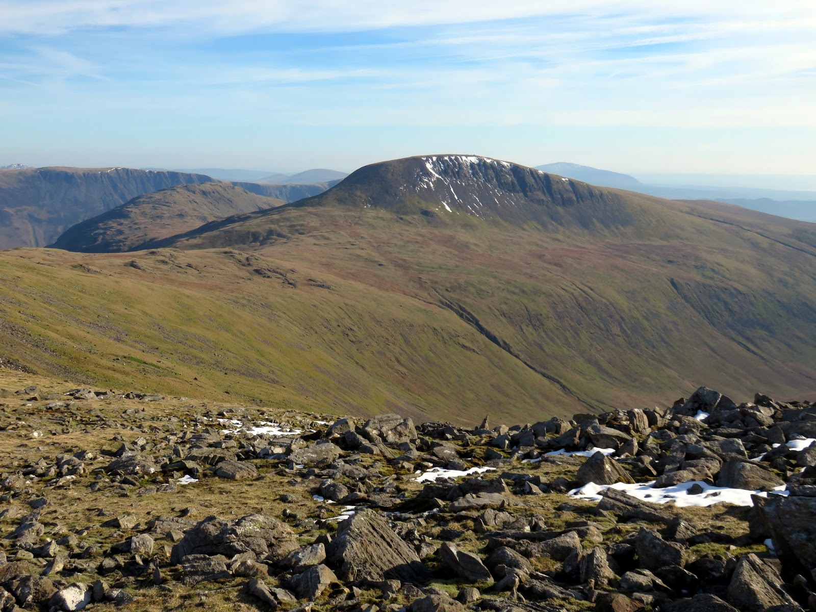
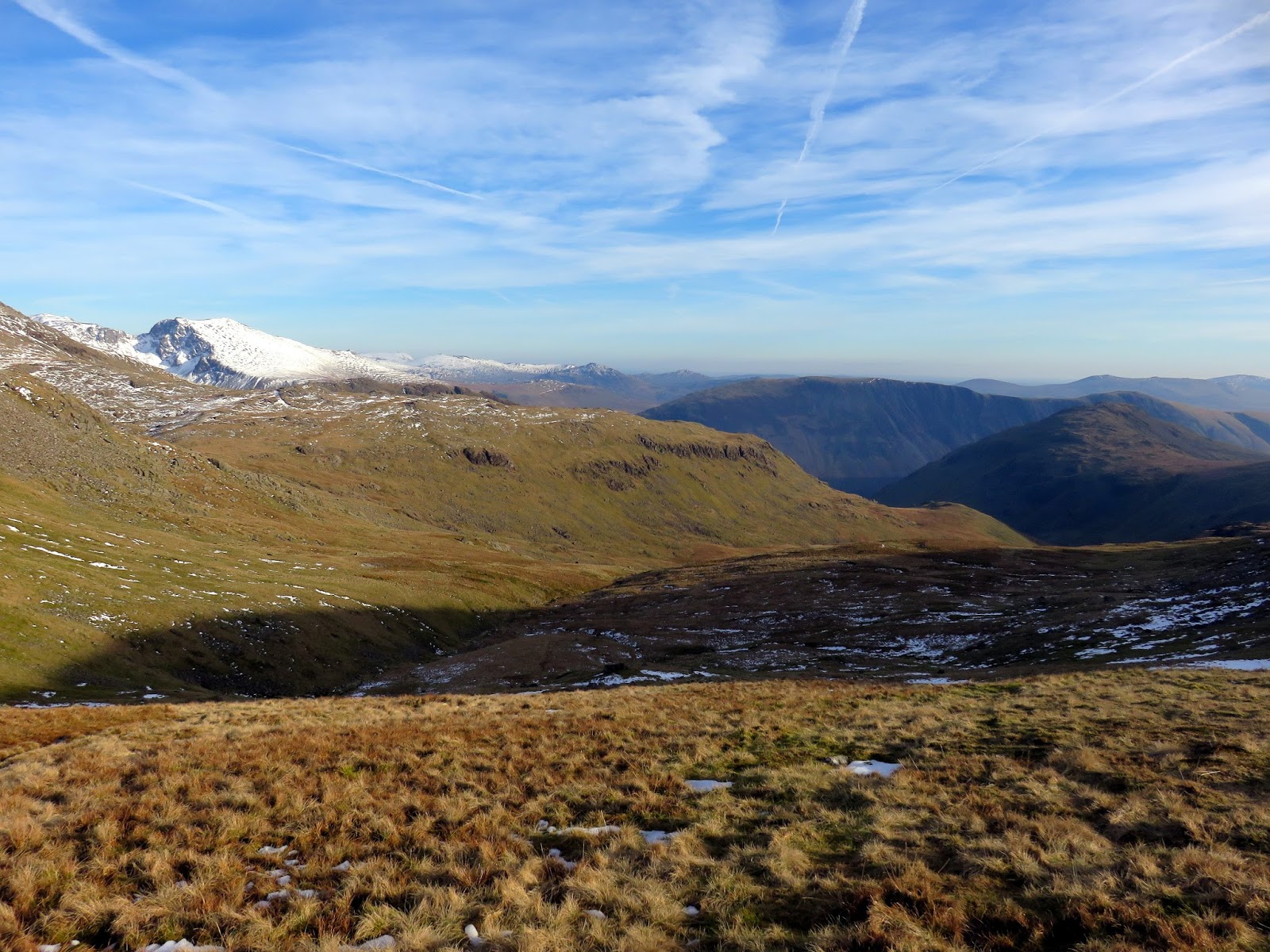
Time was racing towards mid afternoon and there was still a fair way to walk so we got our skates on (literally in some cases) as we descend to the top of Nether Beck before a dull climb up onto Haycock. Despite the fine views available from. the summit, Haycock is not a popular fell thanks to its remoteness from the main valleys.
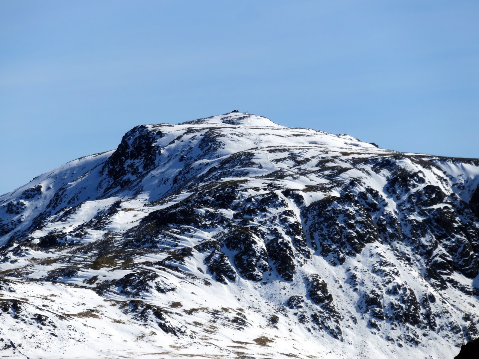
 |
| The Scafells |
 |
| The Isle of Man |
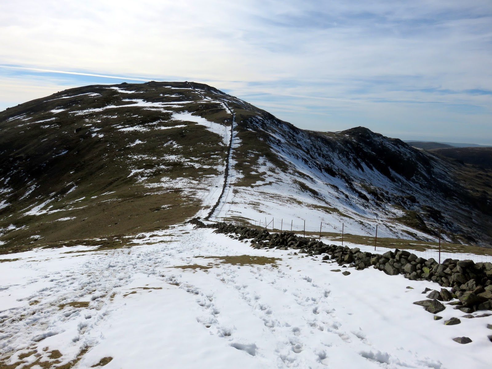
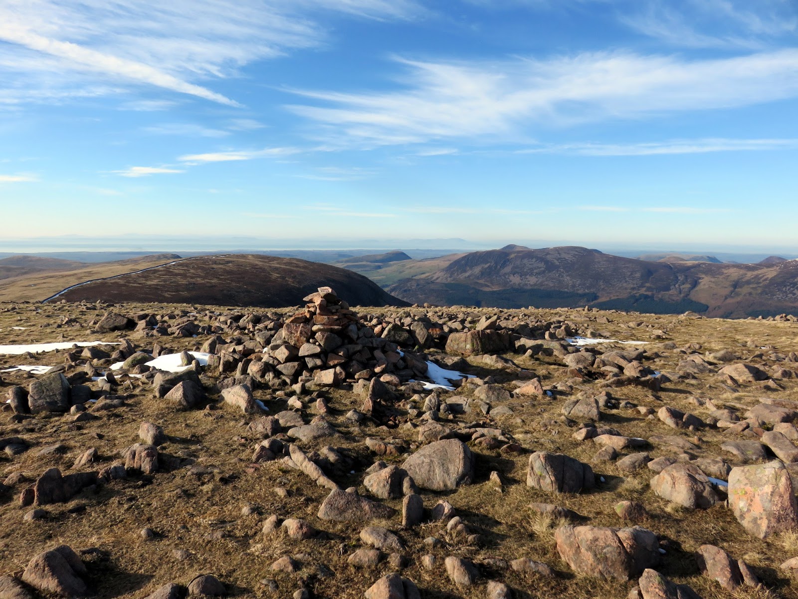
A sweeping ridge leaves Haycock to the north – the southern arm of Ennerdale. The ridge rises over Caw Fell, our last destination’ where it drops over Iron Crag to the fells of Crag Fell and Grike – the western-most Wainwright fells. Though Caw Fell covers a large area, the summit is located almost immediately at the top of the shallow climb up the fell when approaching from Haycock.
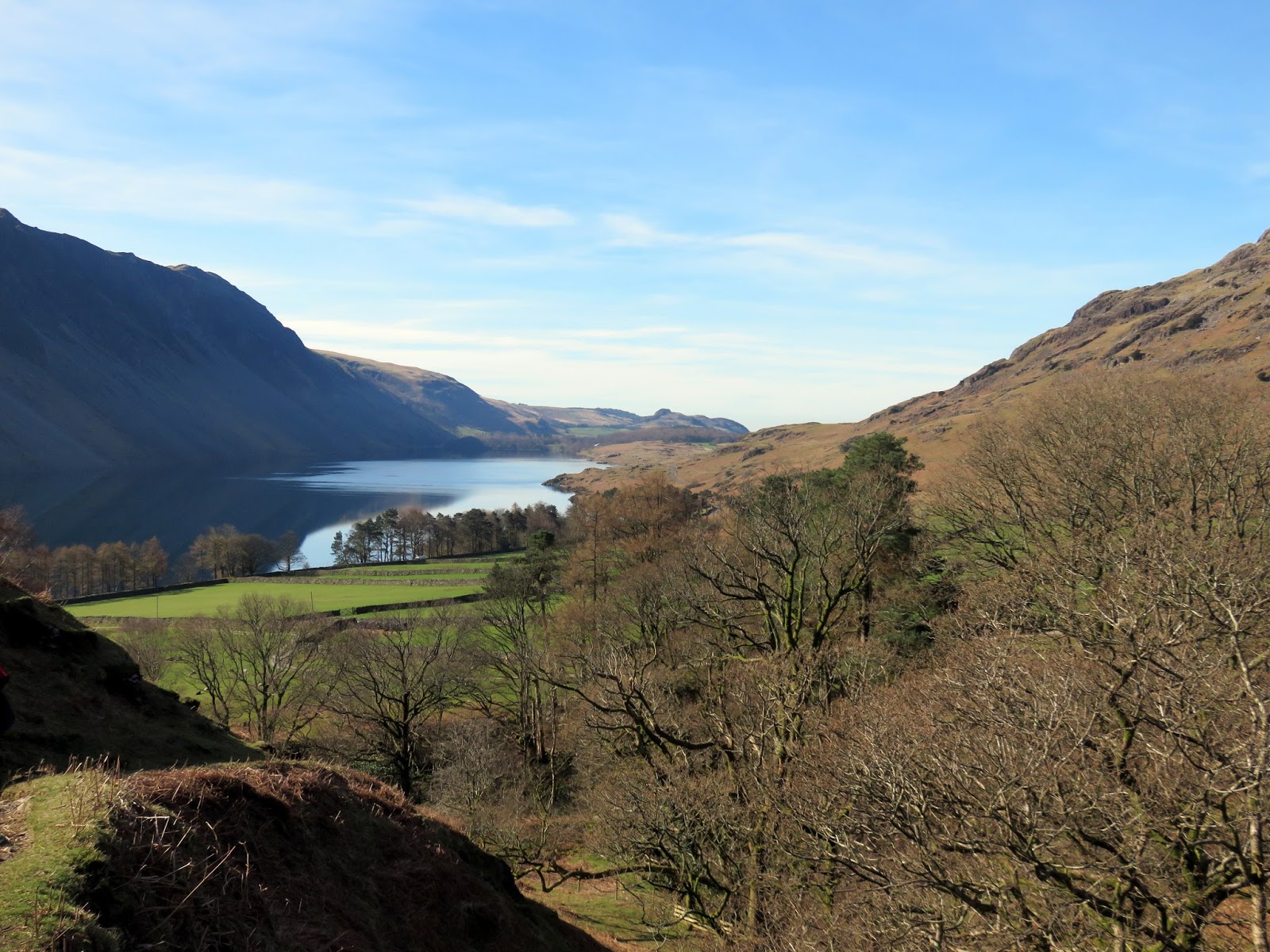
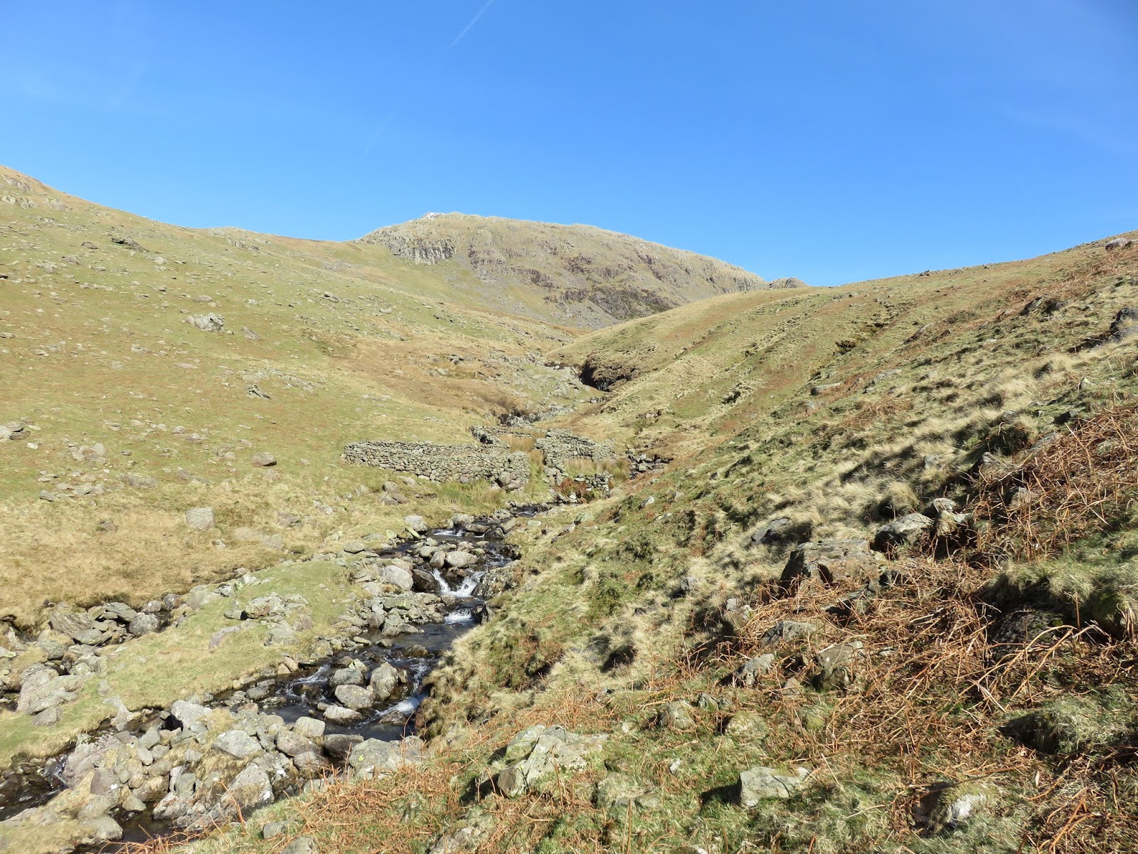
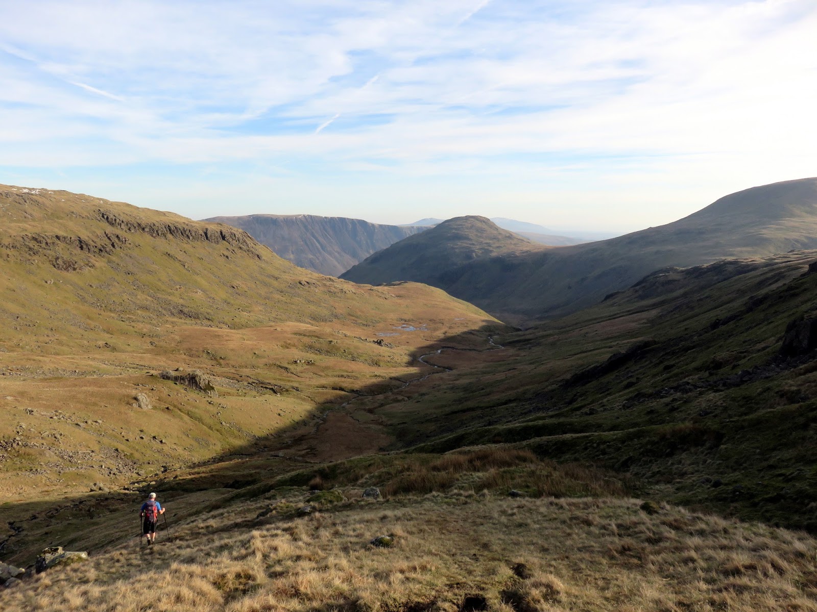
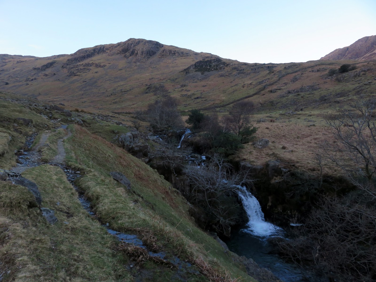
We were now as far from the car as possible and our return began with a re-ascent of Haycock to reach the head of Nether Beck in the col between Haycock and Scoat Fell. This long valley provides a gradual descent back to Wasdale and a pleasant route off the fells.
 |
| Nether Beck |
 |
| Nether Beck |
 |
| Nether Beck |
 |
| Nether Beck |
 |
| Nether Beck and Blackbeck Knotts |
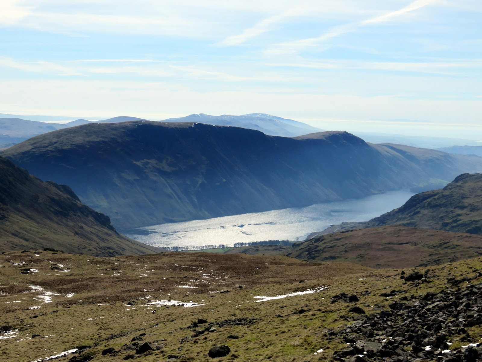
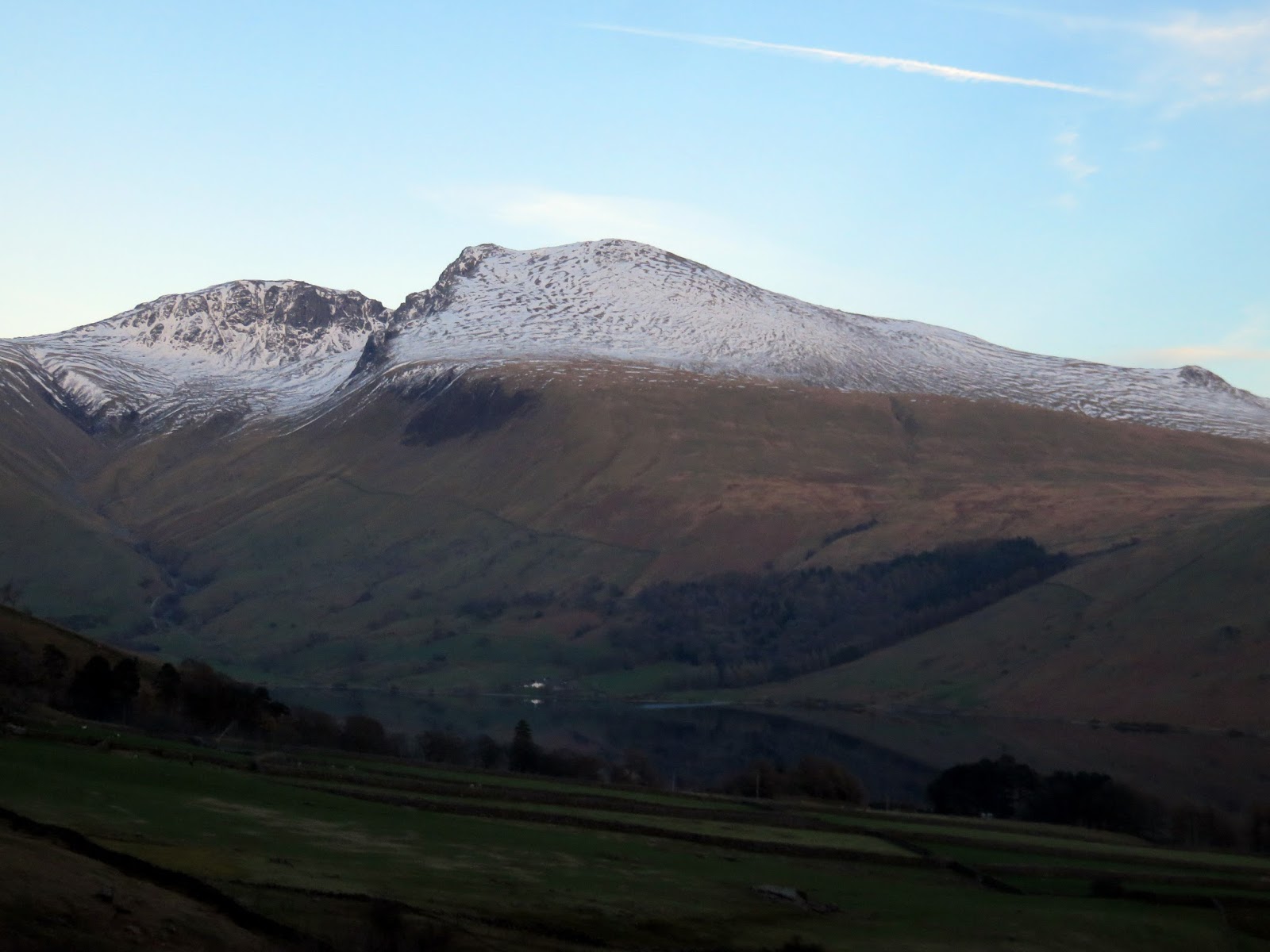
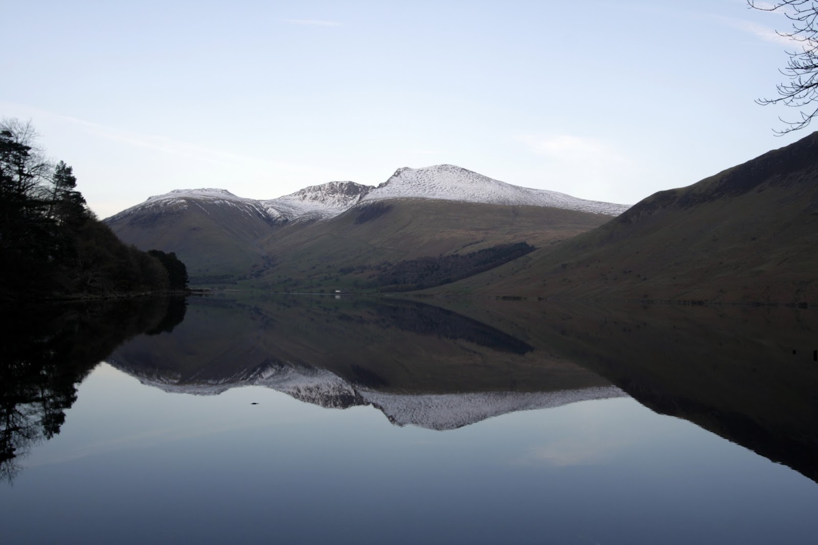
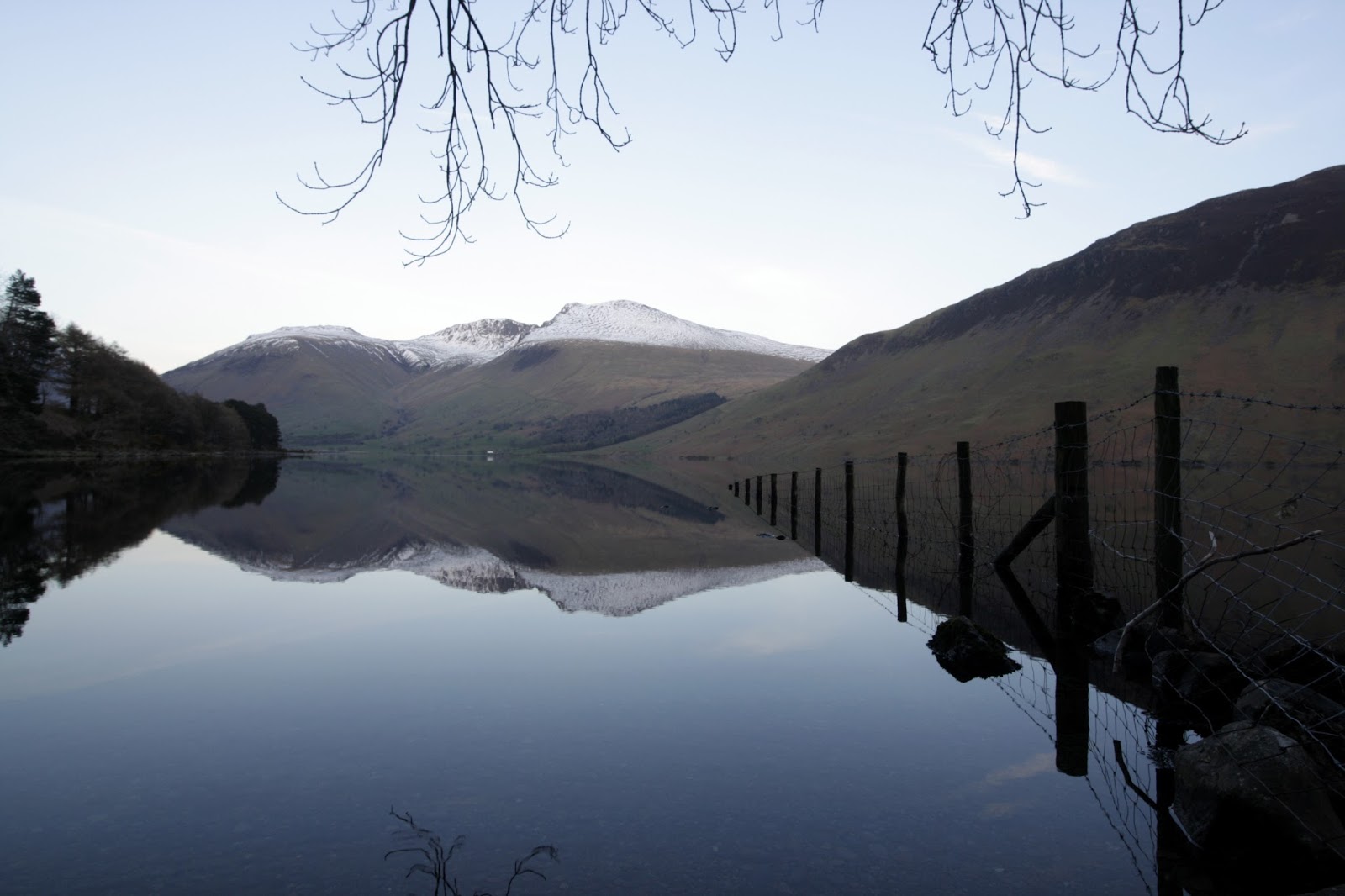
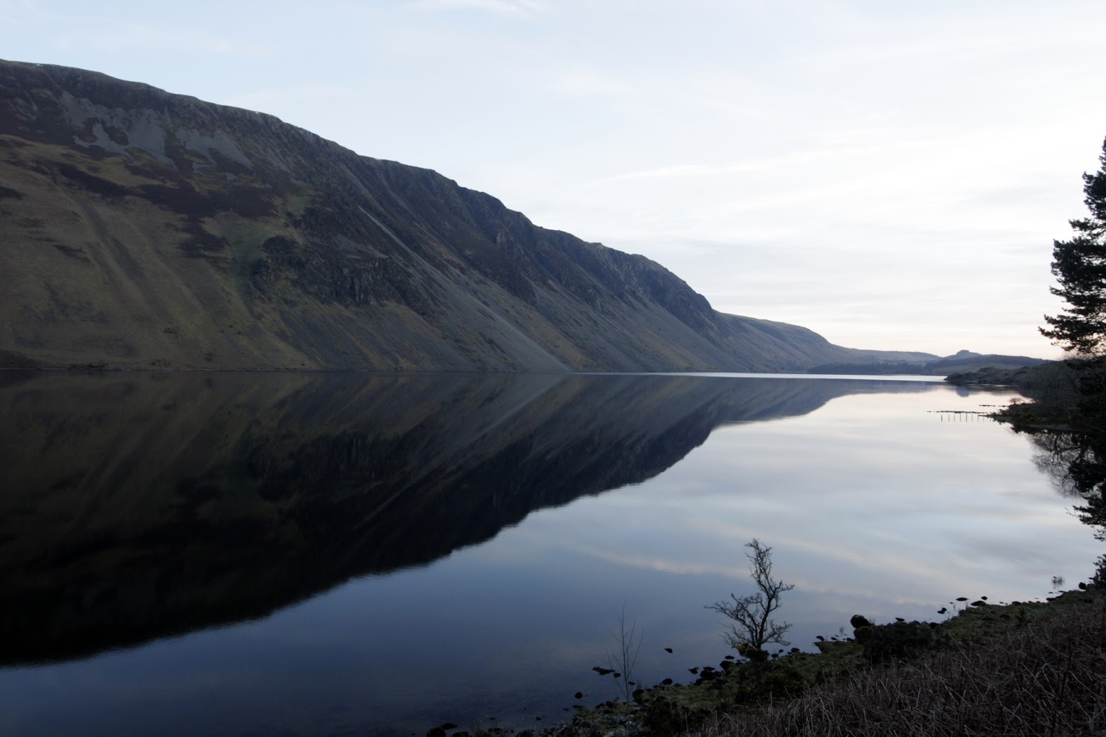
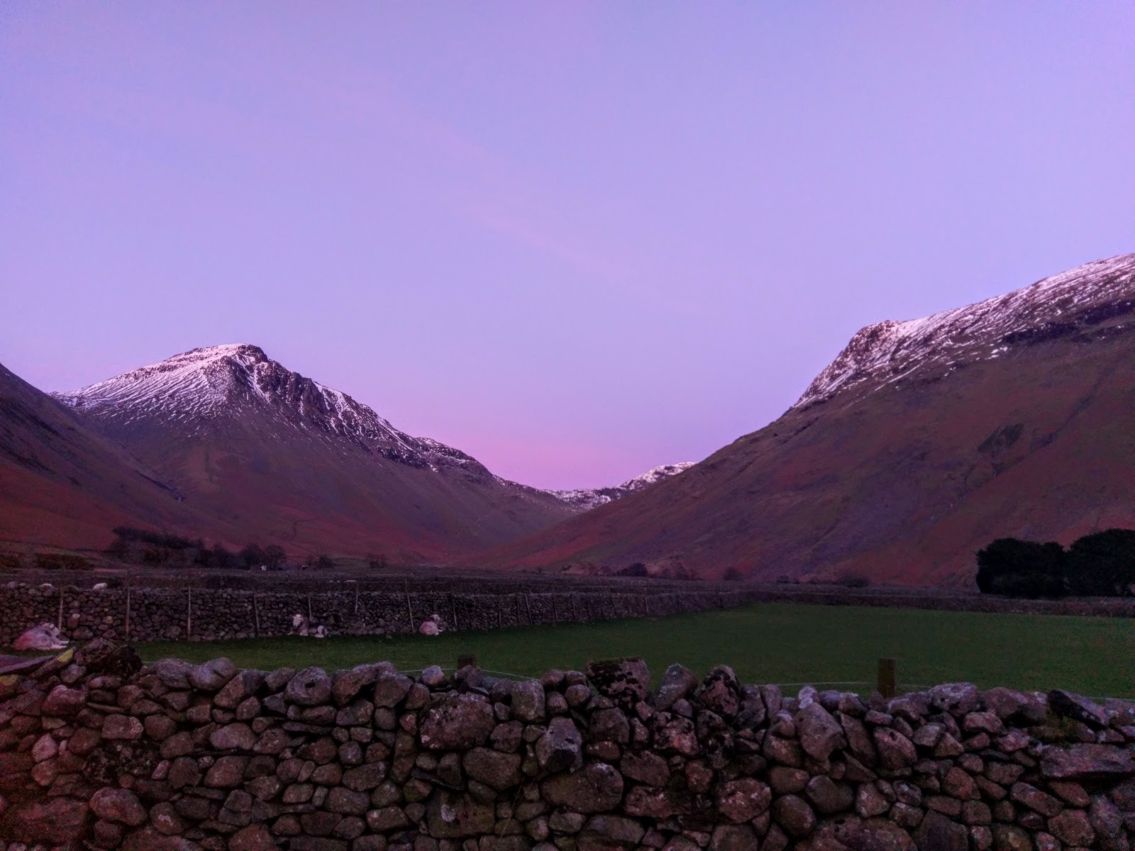
A short section of road leads back to the Over Beck car park, taking us along the shores of a mirror-like Wastwater. The sun had just set by the time we reached the car so we decided to make the short drive to Wasdale Head for a well-earned pub dinner at the Wasdale Head Inn, concluding my idea of a great day out.
 |
| The Scafells |
 |
| Wastwater |
 |
| The Screes |
 |
| Early evening at Wasdale Head |
