Open Space Web-Map builder Codehttps://openspace.ordnancesurvey.co.uk/osmapapi/openspace.js?key=3119F72552FD5C22E0530C6CA40A5A92https://openspace.ordnancesurvey.co.uk/osmapapi/script/mapbuilder/basicmap.jshttps://openspace.ordnancesurvey.co.uk/osmapapi/script/mapbuilder/searchbox.js//variables for routes var linesLayer, points, lineFeature, lineString, routeMarkersLayer, routepos, routesize, routeoffset, routeicon; var style_blue = {strokeColor: “#0000CD”, strokeOpacity: 0.5, strokeWidth: 4.5}; function initmapbuilder() { //initiate the map var options = {resolutions: [2500, 1000, 500, 200, 100, 50, 25, 10, 5, 4, 2.5, 2, 1]}; osMap = new OpenSpace.Map(‘map’, options); //configure map options (basicmap.js) setglobaloptions(); //set the center of the map and the zoom level osMap.setCenter(new OpenSpace.MapPoint(410005.9974823,387043.00125885),7); linesLayer = osMap.getVectorLayer(); // Set up layer for route markers routeMarkersLayer = new OpenLayers.Layer.Markers(“Route Markers”); //make a route points = new Array(); points.push(new OpenLayers.Geometry.Point(412382.66412354,385291.66793823)); points.push(new OpenLayers.Geometry.Point(412330.66412354,385375.66793823)); points.push(new OpenLayers.Geometry.Point(412294.66412354,385535.66793823)); points.push(new OpenLayers.Geometry.Point(412318.66412354,385595.66793823)); points.push(new OpenLayers.Geometry.Point(412366.66412354,385643.66793823)); points.push(new OpenLayers.Geometry.Point(412374.66412354,385775.66793823)); points.push(new OpenLayers.Geometry.Point(412346.66412354,385883.66793823)); points.push(new OpenLayers.Geometry.Point(412254.66412354,386027.66793823)); points.push(new OpenLayers.Geometry.Point(412171.66412354,386132.66793823)); points.push(new OpenLayers.Geometry.Point(412271.66412354,386192.66793823)); points.push(new OpenLayers.Geometry.Point(412261.66412354,386302.66793823)); points.push(new OpenLayers.Geometry.Point(412146.66412354,386447.66793823)); points.push(new OpenLayers.Geometry.Point(412126.66412354,386562.66793823)); points.push(new OpenLayers.Geometry.Point(412041.66412354,386767.66793823)); points.push(new OpenLayers.Geometry.Point(412011.66412354,386882.66793823)); points.push(new OpenLayers.Geometry.Point(411906.66412354,387037.66793823)); points.push(new OpenLayers.Geometry.Point(411581.66412354,387172.66793823)); points.push(new OpenLayers.Geometry.Point(411321.66412354,387222.66793823)); points.push(new OpenLayers.Geometry.Point(411146.66412354,387262.66793823)); points.push(new OpenLayers.Geometry.Point(410966.66412354,387252.66793823)); points.push(new OpenLayers.Geometry.Point(410836.66412354,387222.66793823)); points.push(new OpenLayers.Geometry.Point(410696.66412354,387212.66793823)); points.push(new OpenLayers.Geometry.Point(410696.66412354,387357.66793823)); points.push(new OpenLayers.Geometry.Point(410641.66412354,387422.66793823)); points.push(new OpenLayers.Geometry.Point(410626.66412354,387602.66793823)); points.push(new OpenLayers.Geometry.Point(410576.66412354,387617.66793823)); points.push(new OpenLayers.Geometry.Point(410576.66412354,387397.66793823)); points.push(new OpenLayers.Geometry.Point(410586.66412354,387357.66793823)); points.push(new OpenLayers.Geometry.Point(410556.66412354,387282.66793823)); points.push(new OpenLayers.Geometry.Point(410496.66412354,387222.66793823)); points.push(new OpenLayers.Geometry.Point(410586.66412354,387137.66793823)); points.push(new OpenLayers.Geometry.Point(410686.66412354,387017.66793823)); points.push(new OpenLayers.Geometry.Point(410781.66412354,386962.66793823)); points.push(new OpenLayers.Geometry.Point(410881.66412354,386937.66793823)); points.push(new OpenLayers.Geometry.Point(411010.66412354,386838.66793823)); points.push(new OpenLayers.Geometry.Point(410950.66412354,386768.66793823)); points.push(new OpenLayers.Geometry.Point(410800.66412354,386863.66793823)); points.push(new OpenLayers.Geometry.Point(410610.66412354,386948.66793823)); points.push(new OpenLayers.Geometry.Point(410465.66412354,387003.66793823)); points.push(new OpenLayers.Geometry.Point(410340.66412354,387113.66793823)); points.push(new OpenLayers.Geometry.Point(410265.66412354,387153.66793823)); points.push(new OpenLayers.Geometry.Point(410065.66412354,387163.66793823)); points.push(new OpenLayers.Geometry.Point(409835.66412354,387283.66793823)); points.push(new OpenLayers.Geometry.Point(409635.66412354,387203.66793823)); points.push(new OpenLayers.Geometry.Point(409475.66412354,387283.66793823)); points.push(new OpenLayers.Geometry.Point(409485.66412354,387443.66793823)); points.push(new OpenLayers.Geometry.Point(409485.66412354,387618.66793823)); points.push(new OpenLayers.Geometry.Point(409440.66412354,387873.66793823)); points.push(new OpenLayers.Geometry.Point(409300.66412354,388143.66793823)); points.push(new OpenLayers.Geometry.Point(409010.66412354,388308.66793823)); points.push(new OpenLayers.Geometry.Point(408865.66412354,388378.66793823)); points.push(new OpenLayers.Geometry.Point(408810.66412354,388638.66793823)); points.push(new OpenLayers.Geometry.Point(408665.66412354,388858.66793823)); points.push(new OpenLayers.Geometry.Point(408520.66412354,388928.66793823)); points.push(new OpenLayers.Geometry.Point(408370.66412354,388978.66793823)); points.push(new OpenLayers.Geometry.Point(408265.66412354,388908.66793823)); points.push(new OpenLayers.Geometry.Point(408250.66412354,388848.66793823)); points.push(new OpenLayers.Geometry.Point(408090.66412354,388283.66793823)); points.push(new OpenLayers.Geometry.Point(408040.66412354,388103.66793823)); points.push(new OpenLayers.Geometry.Point(408040.66412354,388008.66793823)); points.push(new OpenLayers.Geometry.Point(407880.66412354,387733.66793823)); points.push(new OpenLayers.Geometry.Point(407790.66412354,387498.66793823)); points.push(new OpenLayers.Geometry.Point(407805.66412354,387353.66793823)); points.push(new OpenLayers.Geometry.Point(407830.66412354,387273.66793823)); points.push(new OpenLayers.Geometry.Point(407870.66412354,387013.66793823)); points.push(new OpenLayers.Geometry.Point(407940.66412354,386863.66793823)); points.push(new OpenLayers.Geometry.Point(407925.66412354,386398.66793823)); points.push(new OpenLayers.Geometry.Point(408060.66412354,386093.66793823)); points.push(new OpenLayers.Geometry.Point(408165.66412354,386198.66793823)); points.push(new OpenLayers.Geometry.Point(408600.66412354,386208.66793823)); points.push(new OpenLayers.Geometry.Point(408700.66412354,386308.66793823)); points.push(new OpenLayers.Geometry.Point(408745.66412354,386308.66793823)); points.push(new OpenLayers.Geometry.Point(408780.66412354,386193.66793823)); points.push(new OpenLayers.Geometry.Point(408850.66412354,386108.66793823)); points.push(new OpenLayers.Geometry.Point(409025.66412354,386013.66793823)); points.push(new OpenLayers.Geometry.Point(409210.66412354,385873.66793823)); points.push(new OpenLayers.Geometry.Point(409603.66412354,385557.66793823)); points.push(new OpenLayers.Geometry.Point(409763.66412354,385462.66793823)); points.push(new OpenLayers.Geometry.Point(410109.66412354,385410.66793823)); points.push(new OpenLayers.Geometry.Point(410185.66412354,385318.66793823)); points.push(new OpenLayers.Geometry.Point(410253.66412354,385314.66793823)); points.push(new OpenLayers.Geometry.Point(410654.66412354,385441.66793823)); points.push(new OpenLayers.Geometry.Point(410789.66412354,385511.66793823)); points.push(new OpenLayers.Geometry.Point(411254.66412354,385551.66793823)); points.push(new OpenLayers.Geometry.Point(411469.66412354,385691.66793823)); points.push(new OpenLayers.Geometry.Point(411689.66412354,385786.66793823)); points.push(new OpenLayers.Geometry.Point(411874.66412354,385921.66793823)); points.push(new OpenLayers.Geometry.Point(412153.66412354,385956.66793823)); points.push(new OpenLayers.Geometry.Point(412288.66412354,385971.66793823)); points.push(new OpenLayers.Geometry.Point(412368.66412354,385859.66793823)); points.push(new OpenLayers.Geometry.Point(412372.66412354,385707.66793823)); points.push(new OpenLayers.Geometry.Point(412372.66412354,385639.66793823)); points.push(new OpenLayers.Geometry.Point(412304.66412354,385559.66793823)); points.push(new OpenLayers.Geometry.Point(412316.66412354,385447.66793823)); points.push(new OpenLayers.Geometry.Point(412332.66412354,385395.66793823)); points.push(new OpenLayers.Geometry.Point(412382.66412354,385291.66793823)); // create a polyline feature from the array of points lineString = new OpenLayers.Geometry.LineString(points); lineFeature = new OpenLayers.Feature.Vector(lineString, null, style_blue); linesLayer.addFeatures([lineFeature]); //crate a route start/end marker routepos = new OpenSpace.MapPoint(412382.66412354,385291.66793823); routesize = new OpenLayers.Size(33,45); routeoffset = new OpenLayers.Pixel(-5,-37); routeicon = new OpenSpace.Icon(‘https://openspace.ordnancesurvey.co.uk/osmapapi/img_versions/img_1.1/mapbuilder/routemarker-startend.png’, routesize, routeoffset, null, null); routeMarkersLayer.addMarker(new OpenLayers.Marker(routepos, routeicon)); osMap.addLayer(routeMarkersLayer);}
Route: Edale, Grindsbrook Booth, Heardman’s Plantation, Grindsbrook Clough, Crowden Brook, Crowden Tower, Kinder Gates, Kinder Downfall, Cluther Rocks, Kinder Low, Swine’s Back, Jacob’s Ladder, Lee House, Upper Booth, Broadlee-Bank, Grindsbrook Booth, Edale
Date: 12/03/2017
From: Edale
Parking: Car park in Edale
Start Point: Edale
Region: Peak District Dark Peak
Route length: 11.1 miles (17.8 km)
Time taken: 05:05
Average speed: 2.2 mph
Ascent: 681m
Descent: 675m
Summits: None
Other points of interest: Grindsbrook Clough, Crowden Tower, Jacob’s Ladder
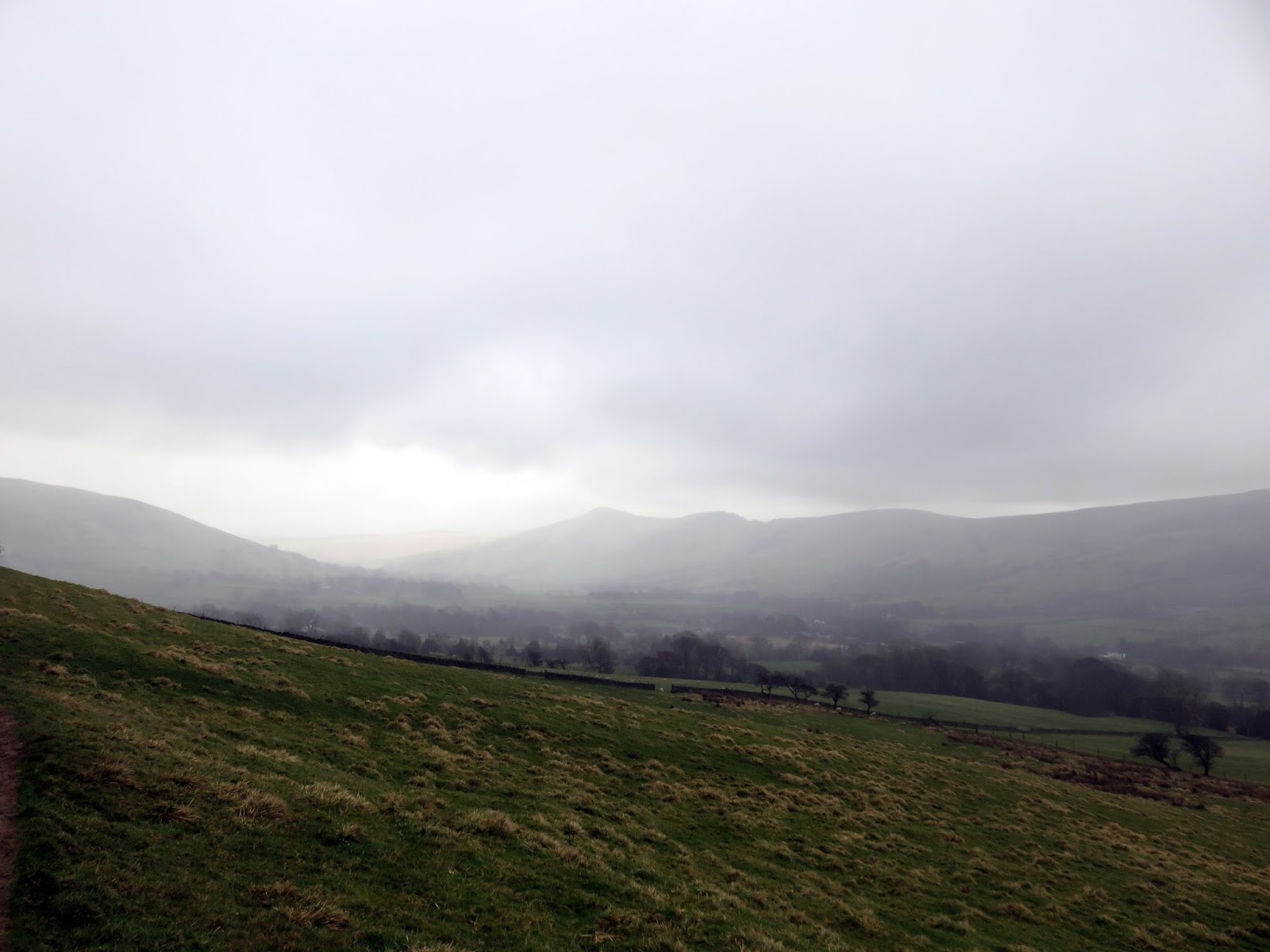
It is estimated that 20 million people live within an hours drive of the Peak District, Sara and I are included in the figure. We’re lucky that our hour takes us to the wild and woolly Dark Peak with its famous open moors and gritstone edges. The crowning glory of this area is Kinder Scout. The huge moorland plateau rises to a height of over 2,000ft – the highest point in the Peak District but its charms lie away from this fact.
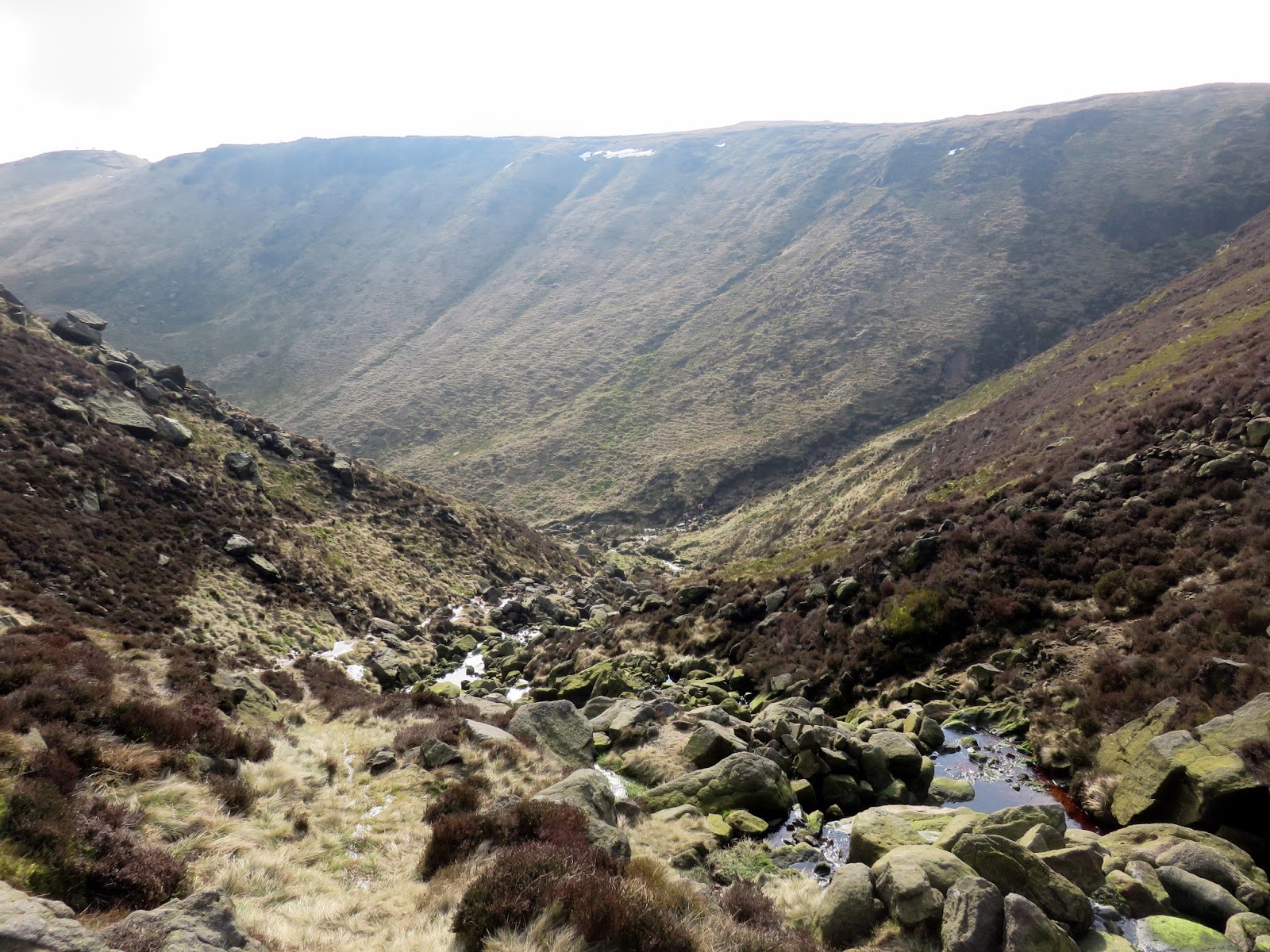
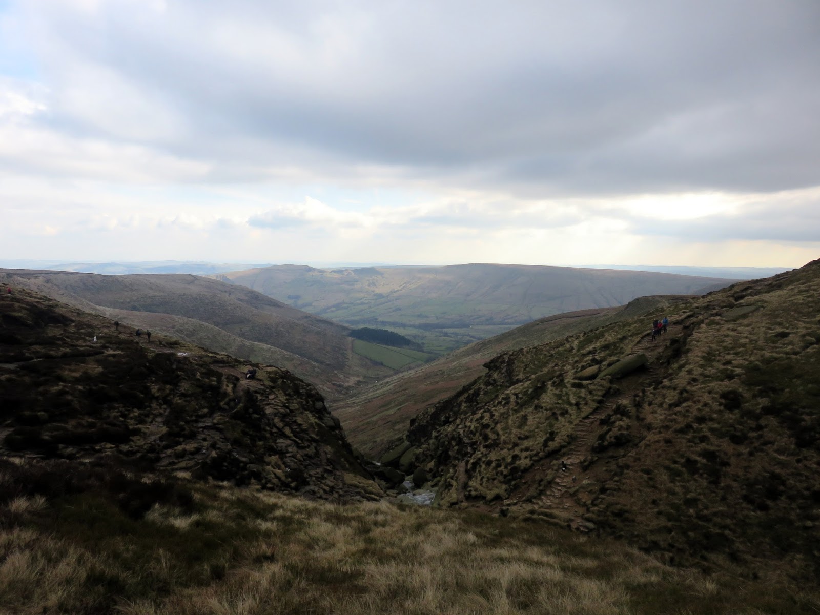
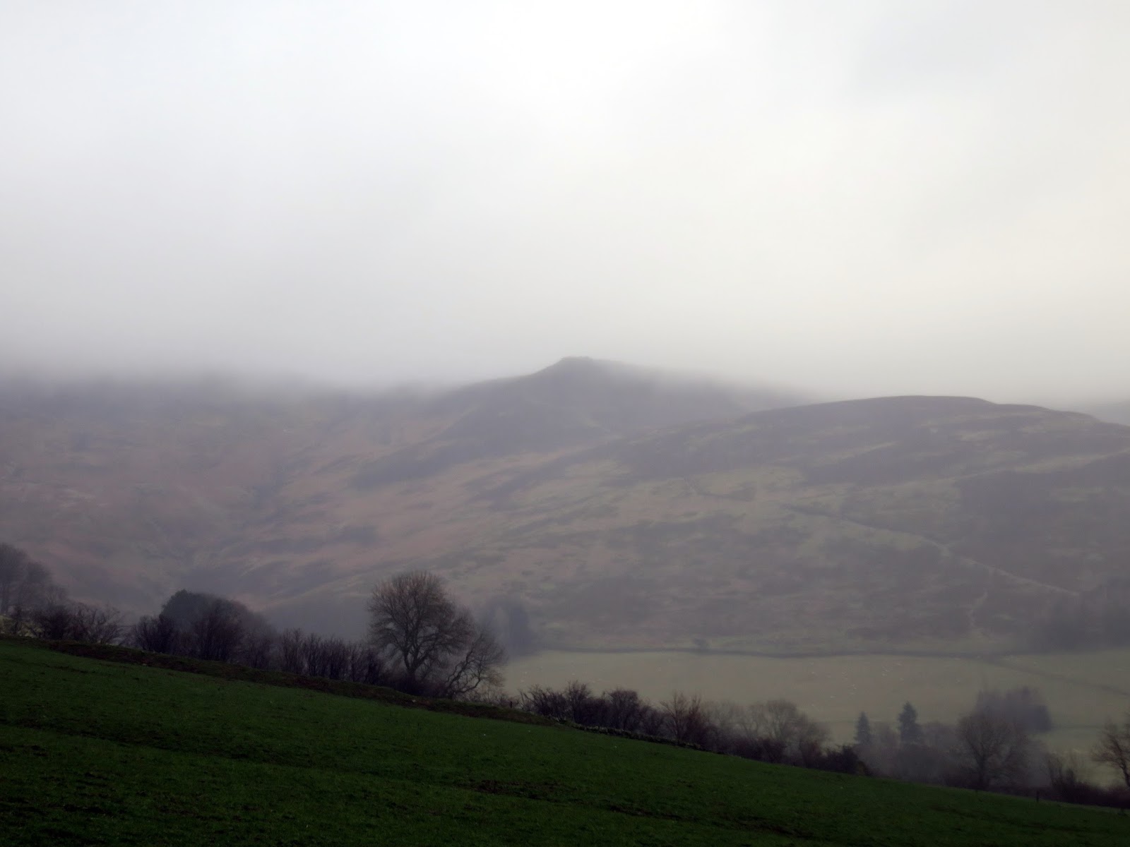
The Kinder edges are the real highlight and the southern edge is the most popular but arguably the best. I’ve walked the various edges on a number of occasions from a variety of starting points including Hayfield, Edale and Snake Pass, culminating in the classic Kinder Circuit. Today we’d be visiting the southern edge by climbing Grindsbrook Clough – a popular boulder-strewn valley that I have peered down into many times.
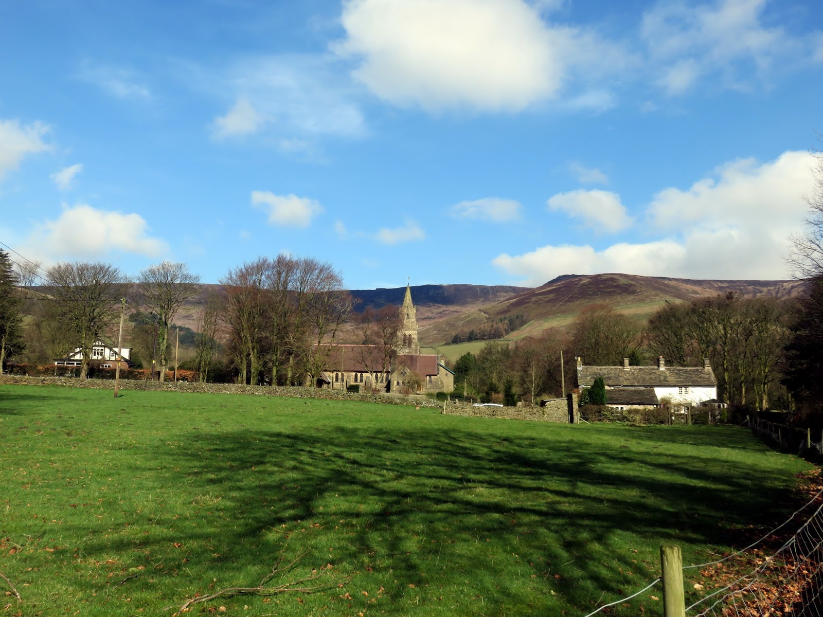
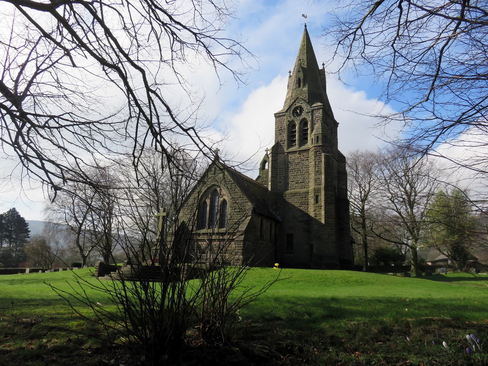
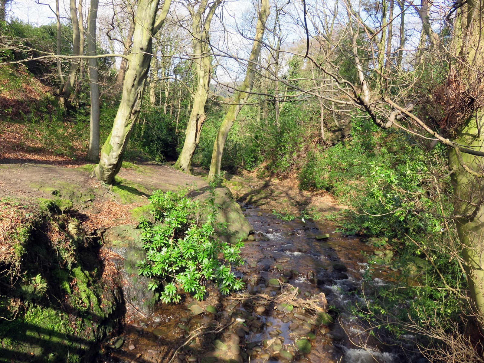
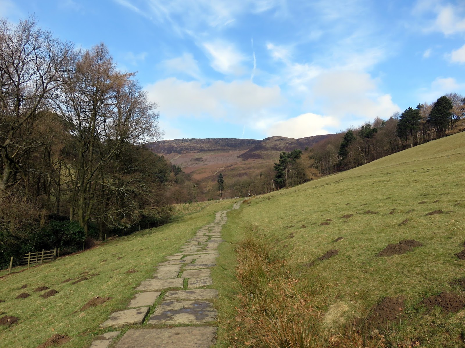
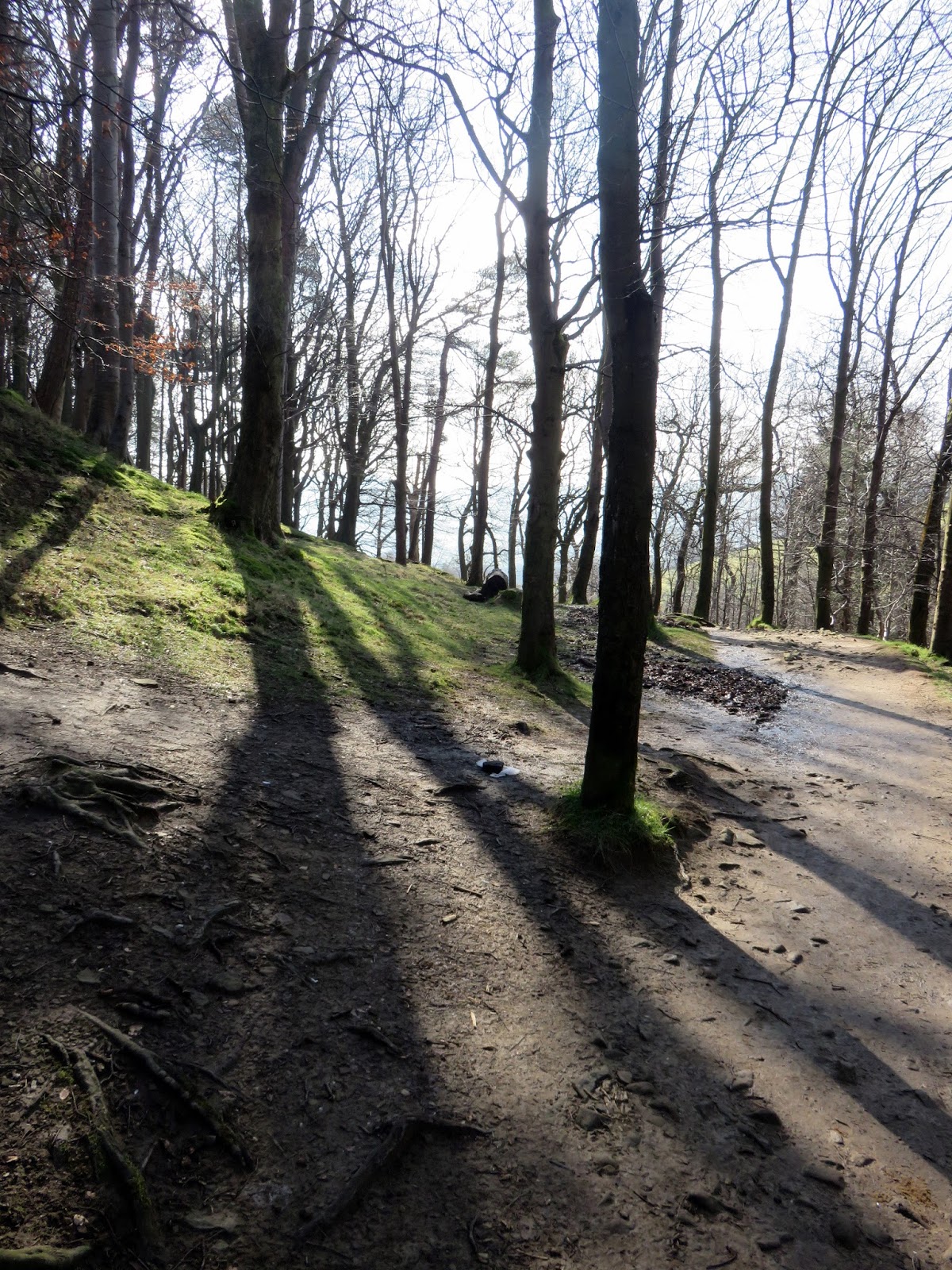
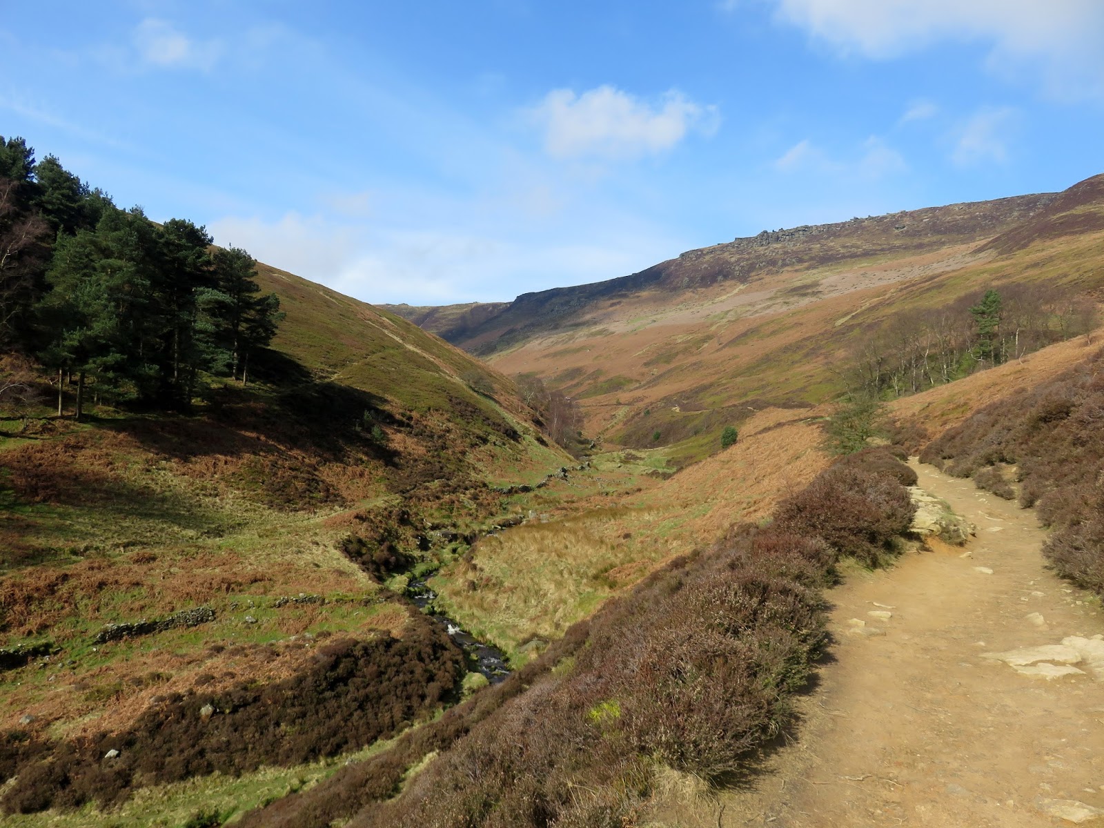
We began in Edale, as many heading for Kinder Scout invariably do, making our way past the station and along the lane leading past the church to Grindsbrook Booth, a hamlet consisting of a few cottages, a farm, a school and the all important pub. As the lane reaches the gates of Grindslow House, a shady path leaves to the right, crossing Grinds Brook and entering the open fields below The Nab.
 |
| Edale on a sunny morning |
 |
| Edale church |
 |
| Grinds Brook |
 |
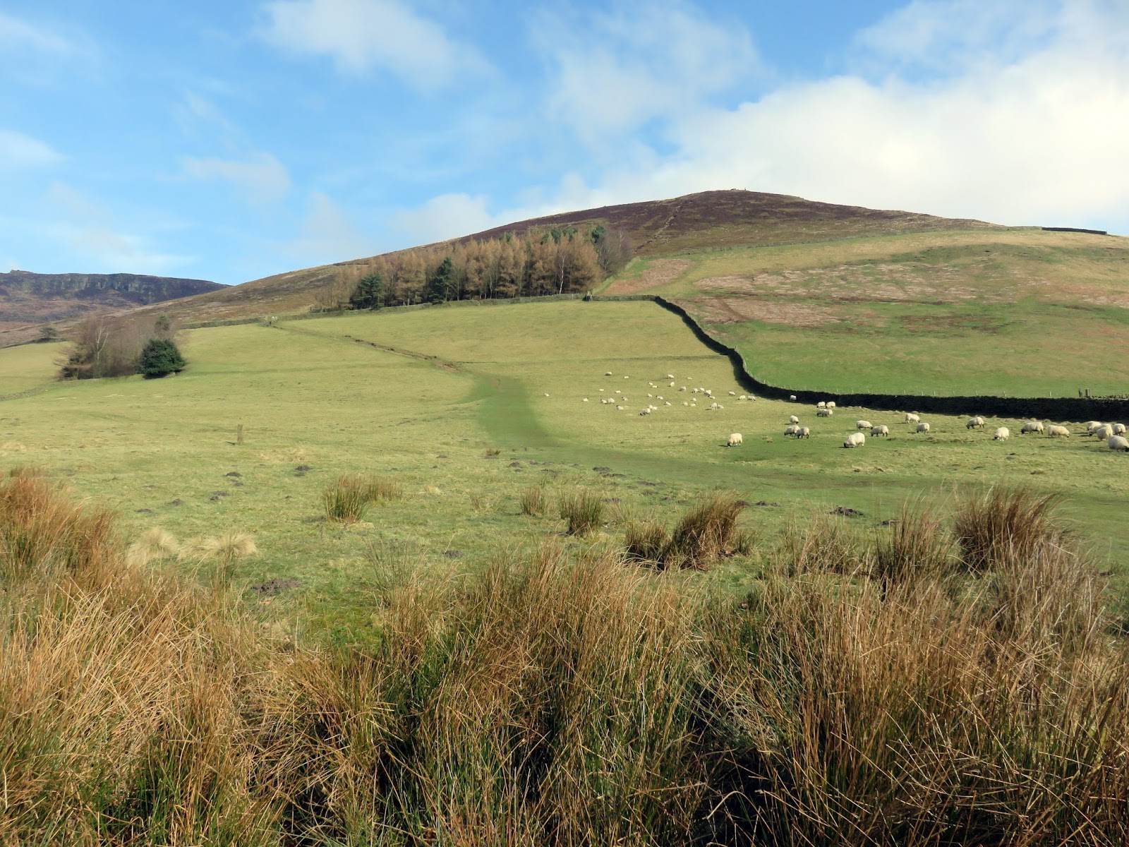
| The Nab |
 |
| The path leading to Grindsbrook Clough |
 |
| Add caption |
 |
| Golden Clough and Ringing Roger |
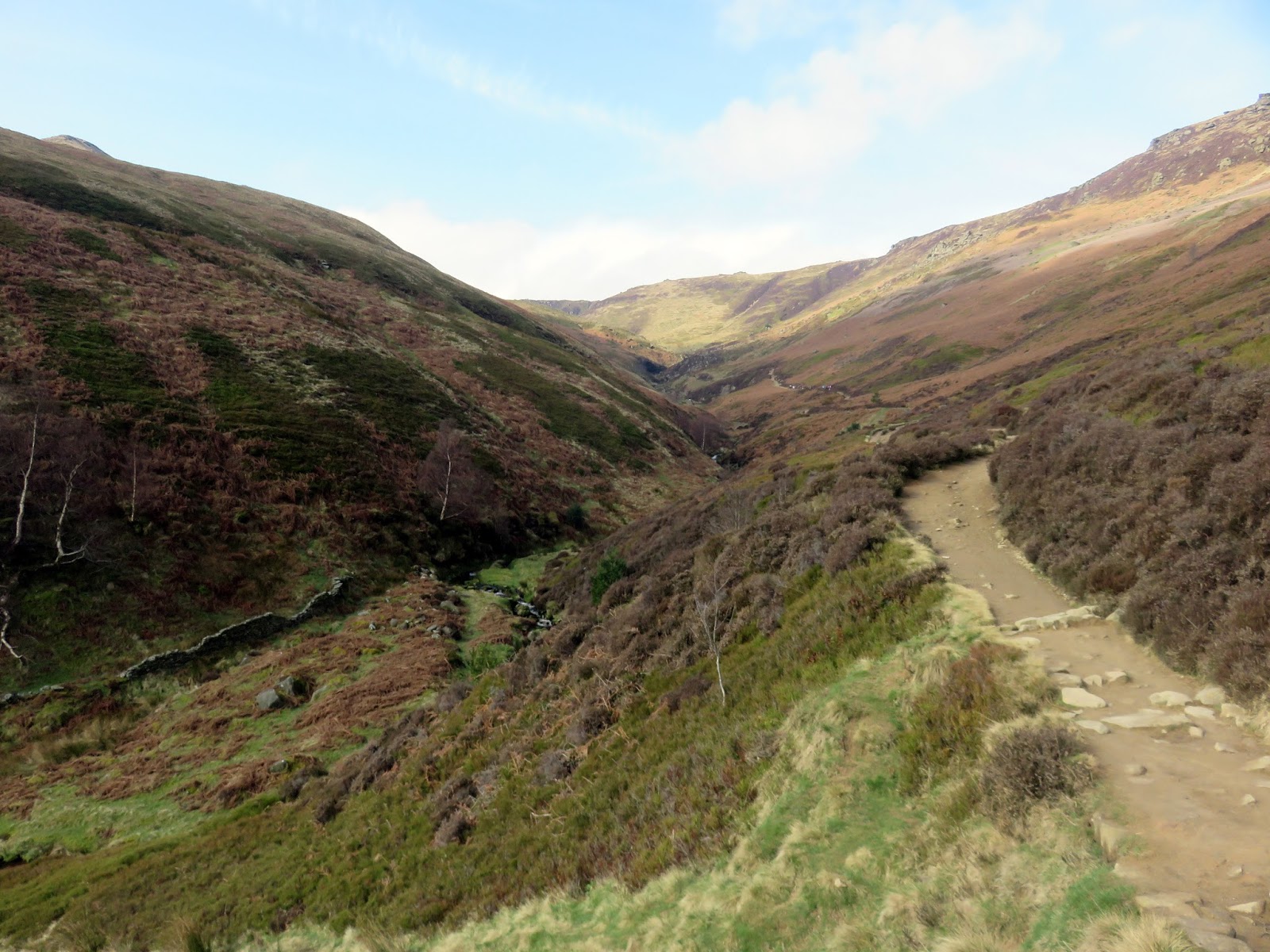
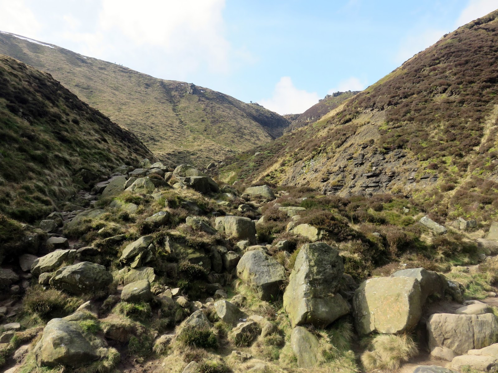
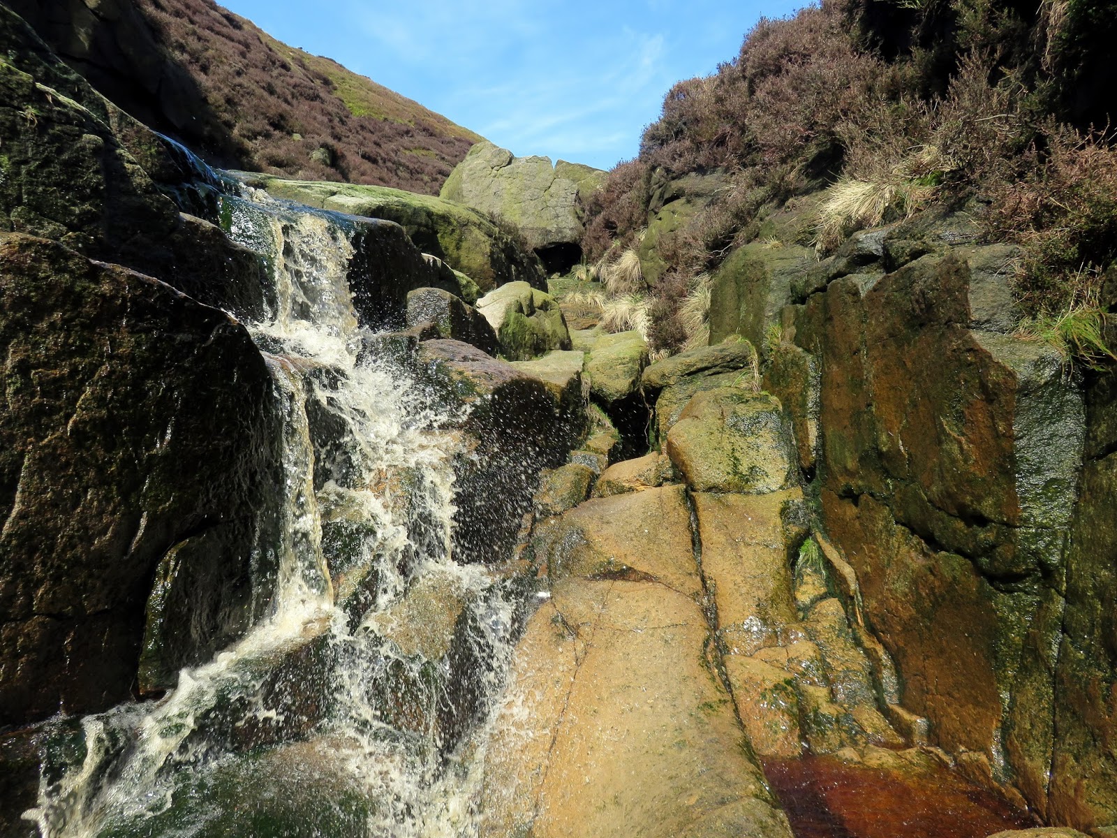
Paving slabs lead the way into Grindsbrook Clough ending to become a substantial track at Golden Clough that climbs at an easy gradient above the tumbling stream. At a bend in the stream between a rock outcrop, take the opportunity to leave the track to make the rest of the climb alongside the stream itself. If it has recently been raining, you may want to consider waterproof boots for this bit.
 |
| Ringing Roger |
 |
| Grindsbrook Clough |
 |
| Grindsbrook Clough |
 |
| Grindsbrook Clough |
 |
| Looking down Grindsbrook Clough |
 |
| Grindsbrook Clough |
 |
| The head of Grindsbrook Clough |
 |
| Grindsbrook Clough |
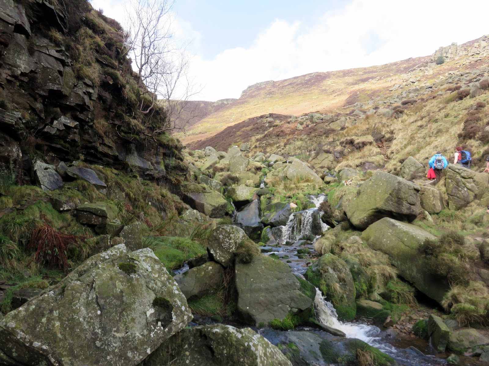
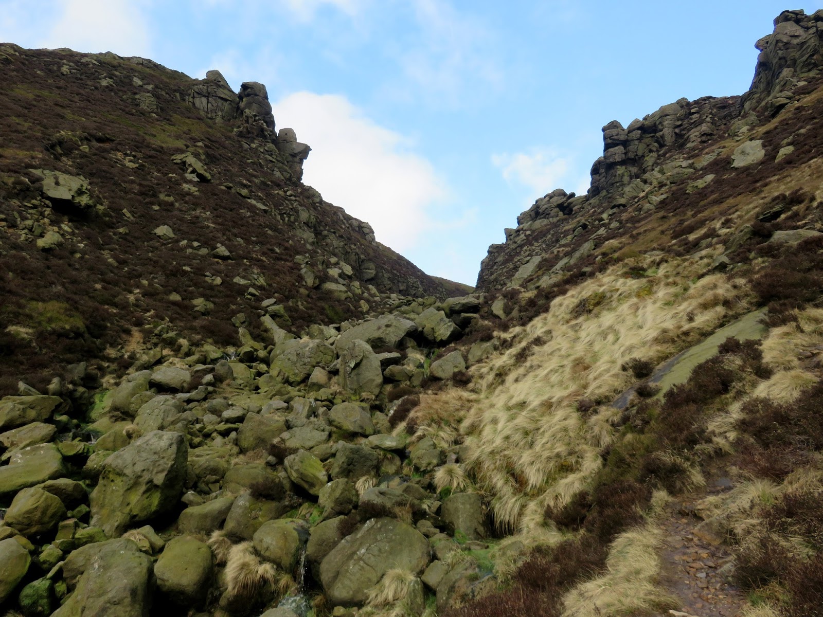
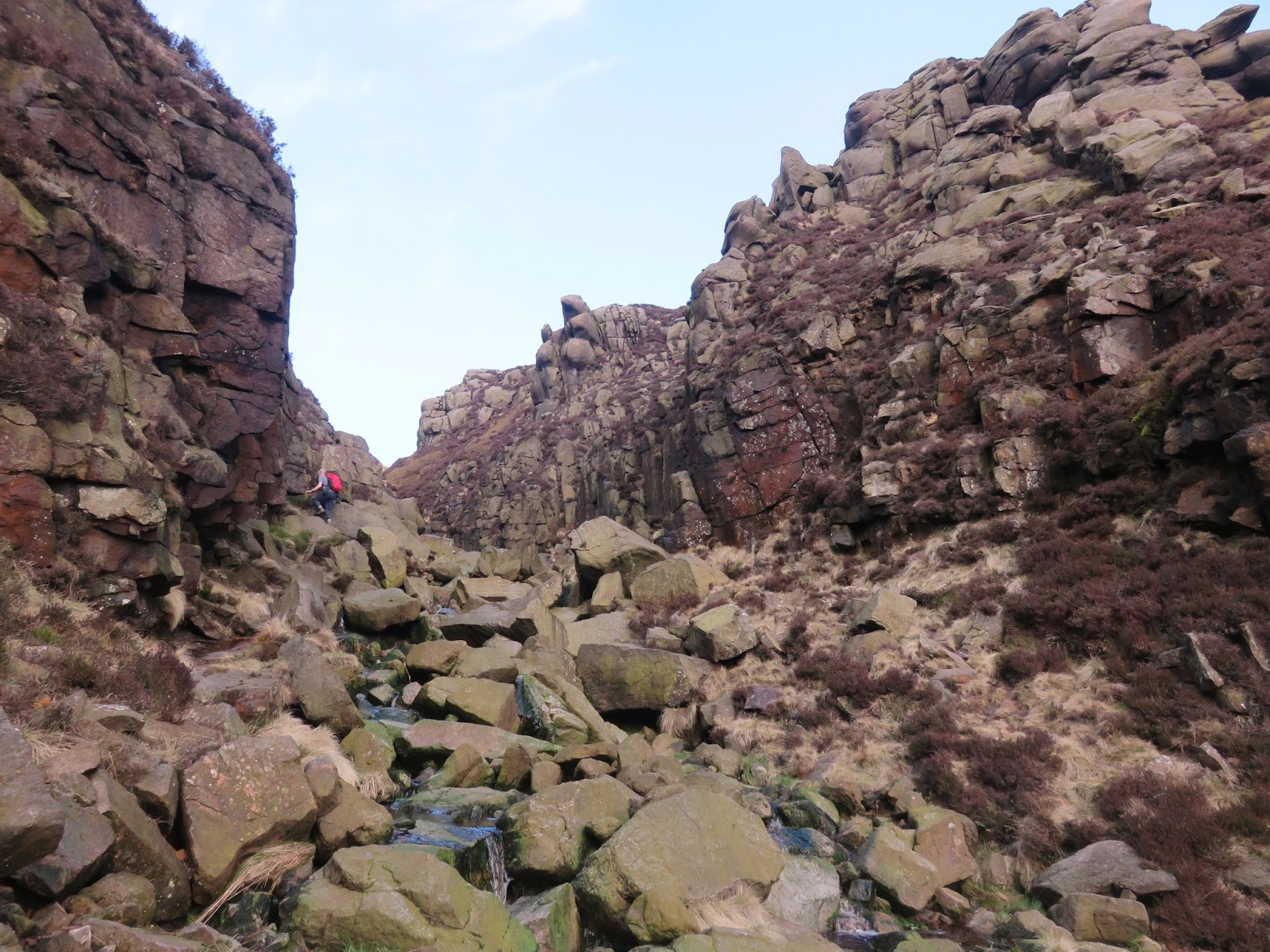
The path on the map continues directly ahead and this way looks perfectly acceptable, however, more interest can be found by turning your attention to the right-hand gorge and heading that way instead. Some mild scrambling is involved climbing the stream but again, there is nothing too difficult.
 |
| Grindsbrook Clough |
 |
| Grindsbrook Clough |
 |
| Grindsbrook Clough |
 |
| Grindsbrook Clough |
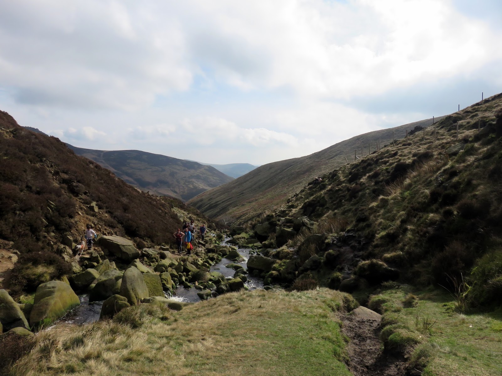
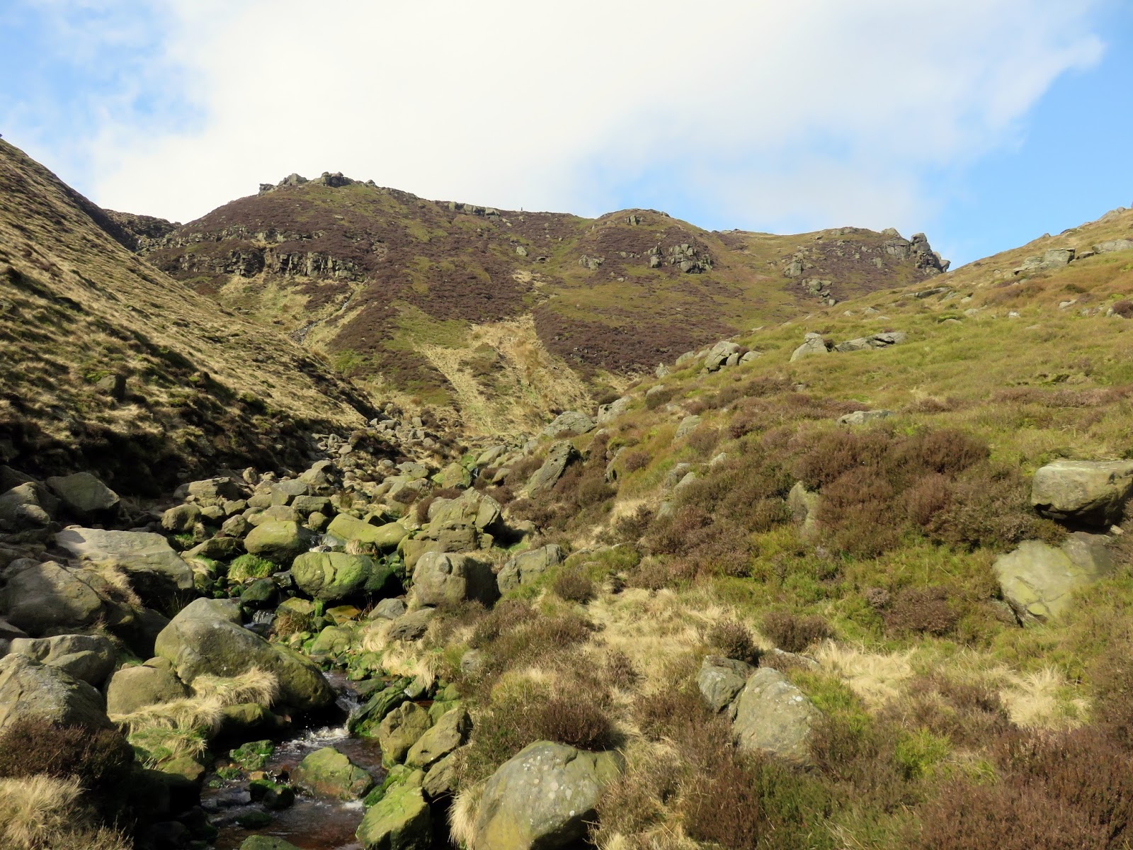
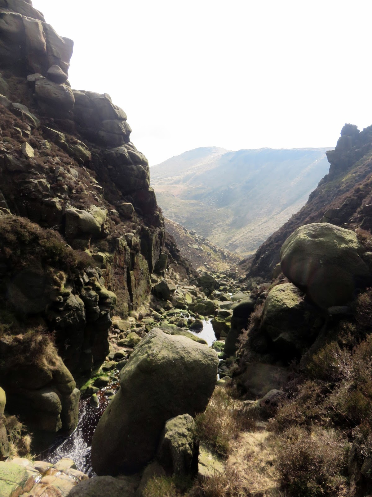
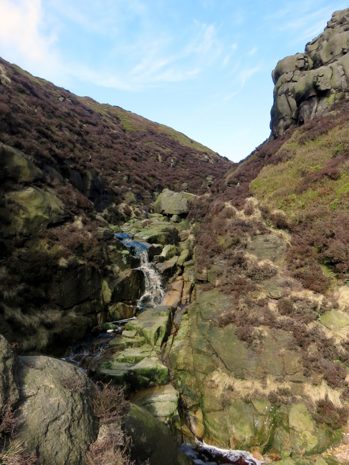
We reached a pool at the foot of a small waterfall that seems to bar the way – it is easy enough to hop over and continue up to the head of the valley and the main Kinder edge, though, after heavy rainfall you may have to make alternative arrangements. It can be passed by climbing the gully to the right or up the heathery bank to the left.
 |
| Grindsbrook Clough |
 |
| The infant Grinds Brook |
 |
| The top of Grindsbrook Clough |
 |
| Grindsbrook Clough with Grindslow Knoll beyond |
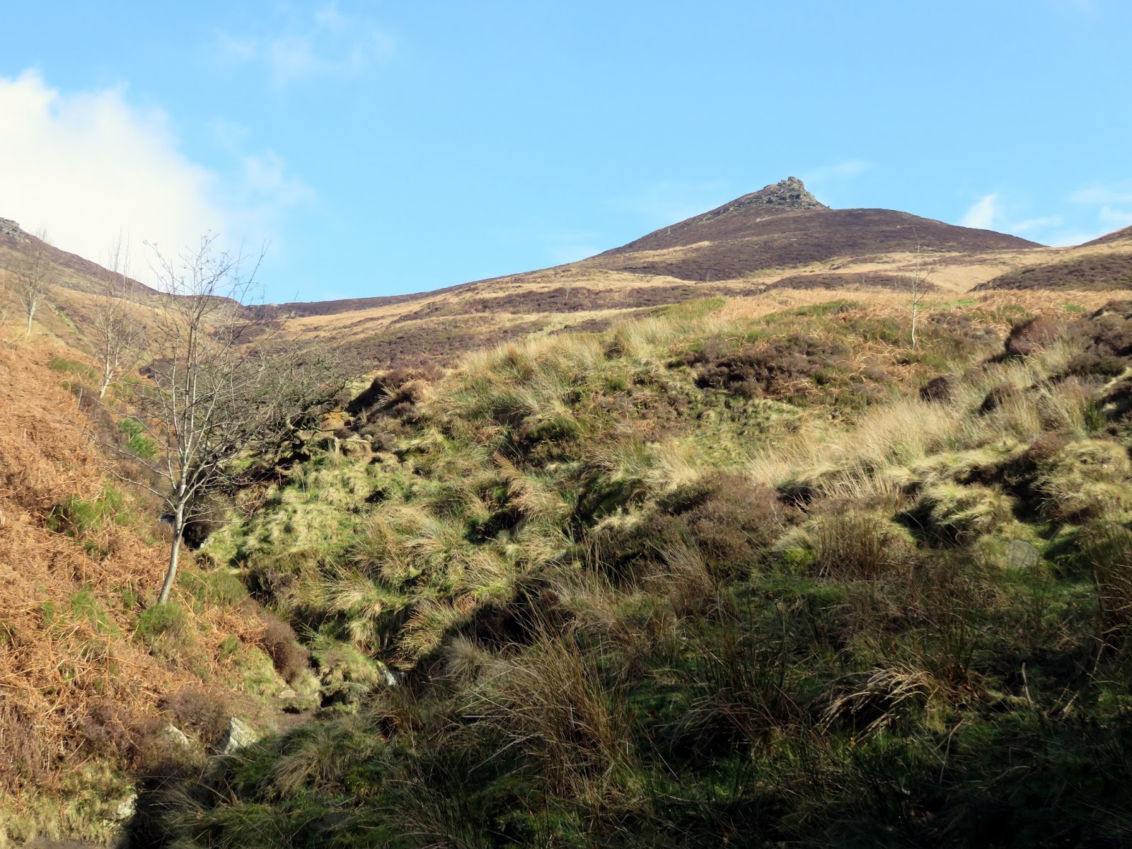
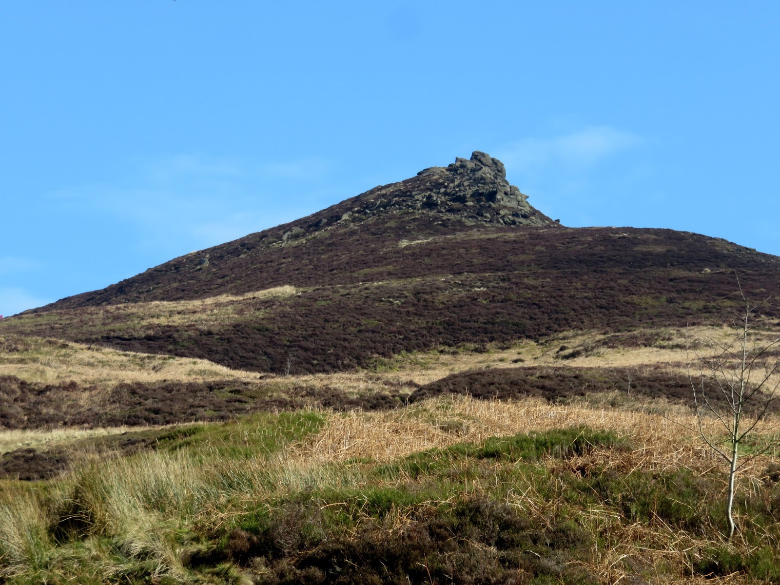
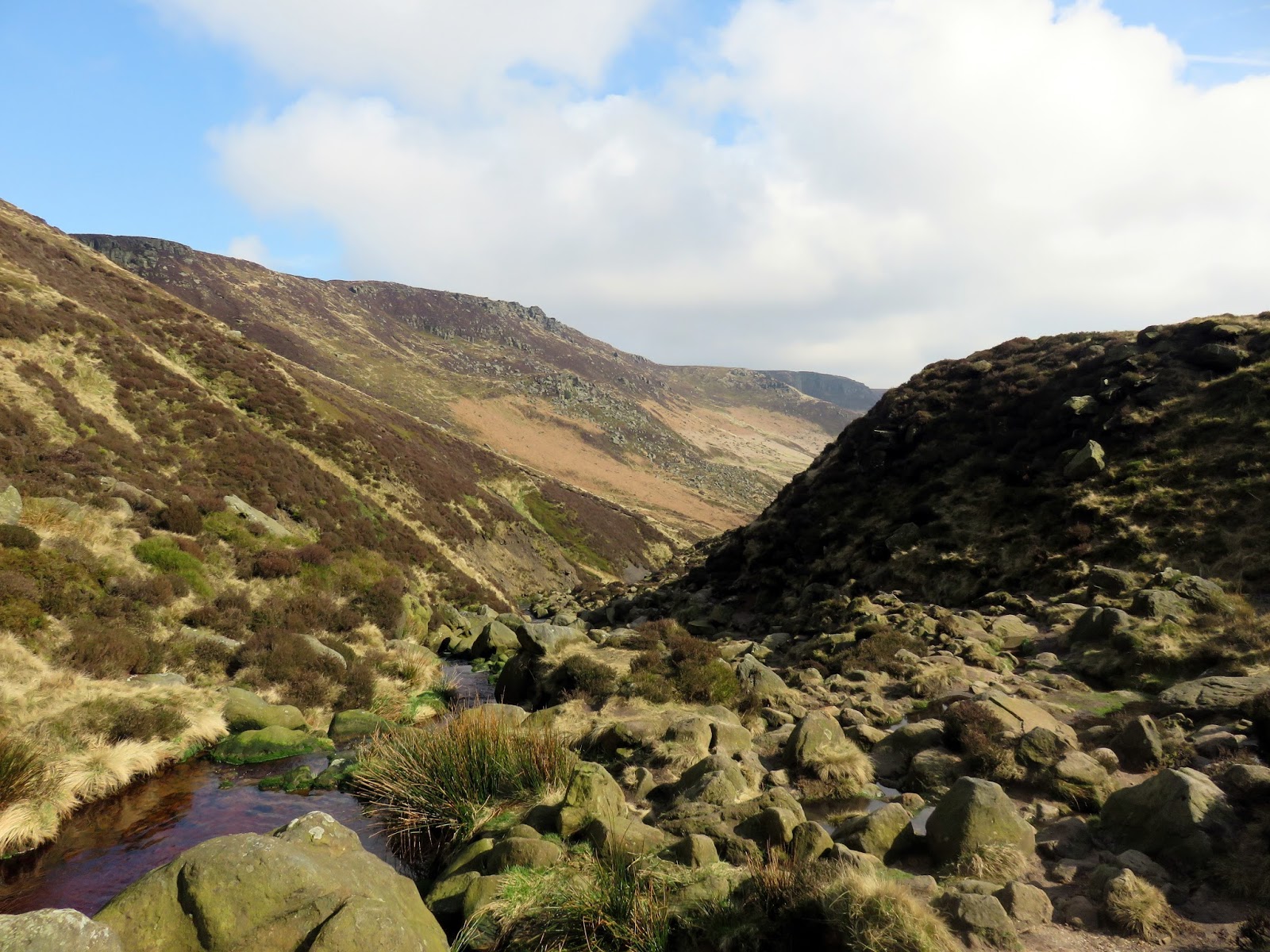
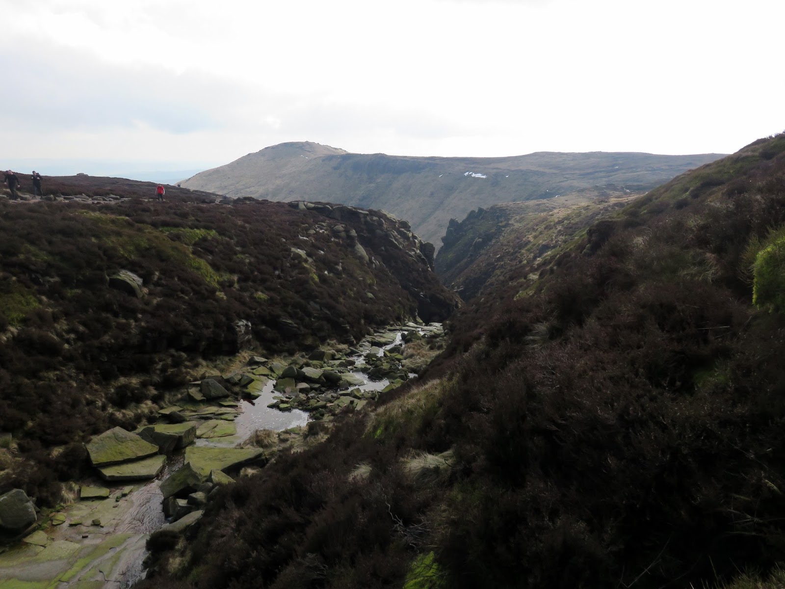
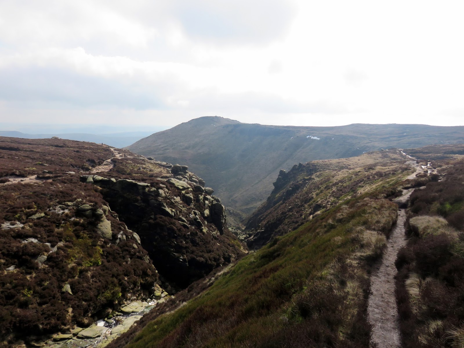
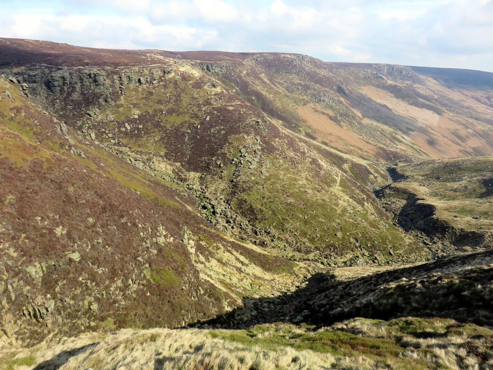
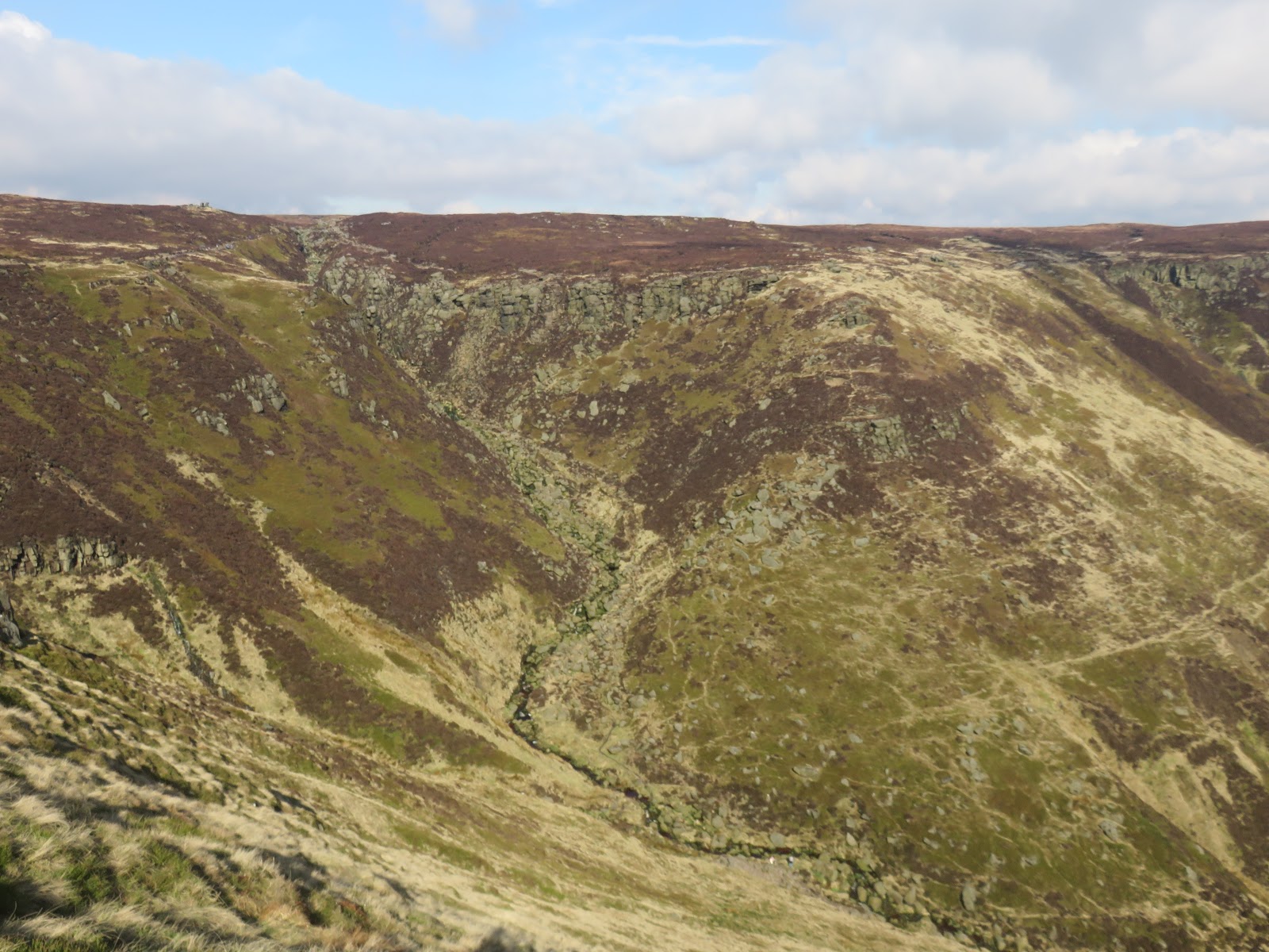
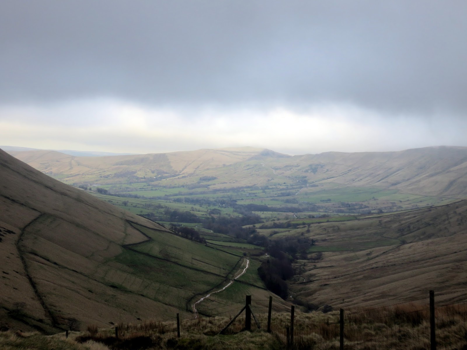
Once on the main ridge, we followed the path round the south side of Grindsbrook Clough to Grindslow Knoll, a route that provides superb views of the valley and across to Kinder Scout itself.
 |
| Grindsbrook Clough and Grindslow Knoll |
 |
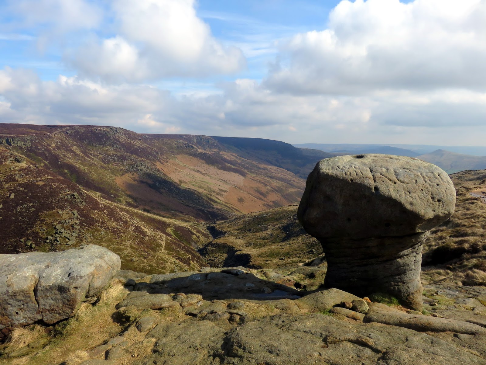
| A prominent rock above Grindsbrook Clough |
 |
| Upper Tor and Nether Tor above Grindsbrook Clough |
 |
| Grindsbrook Clough’s right-hand fork |
 |
| Looking west along the south edge |
 |
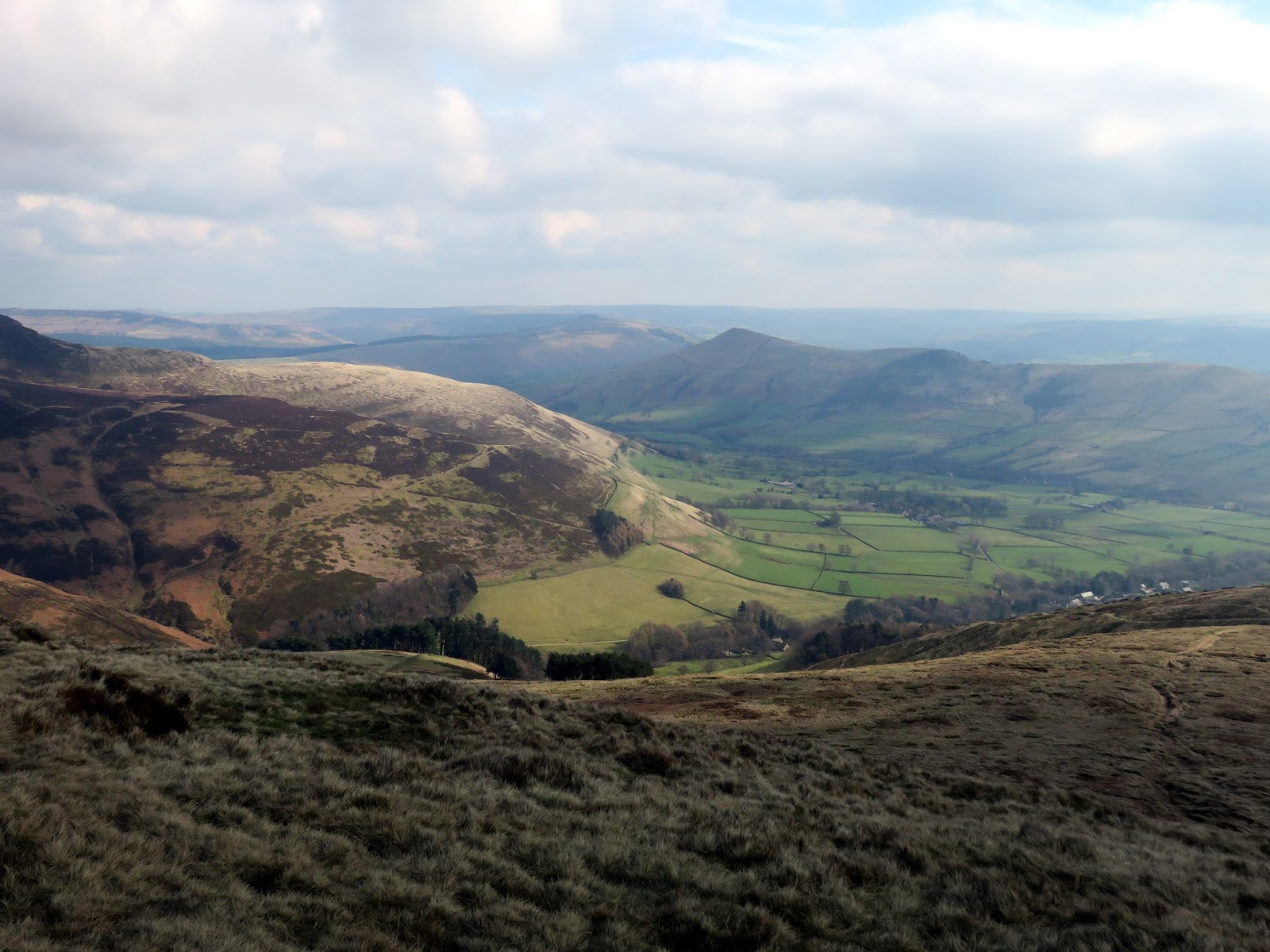
| Vale of Edale |
 |
| Grindslow Knoll |
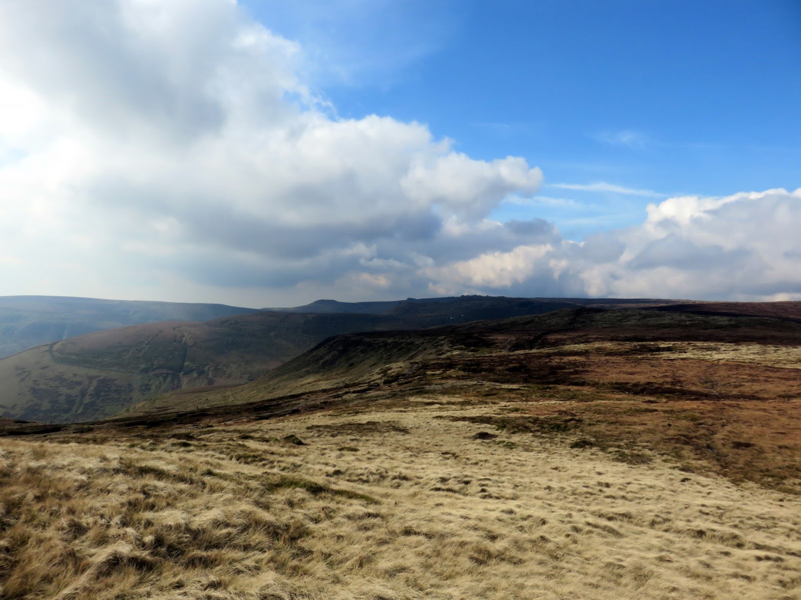
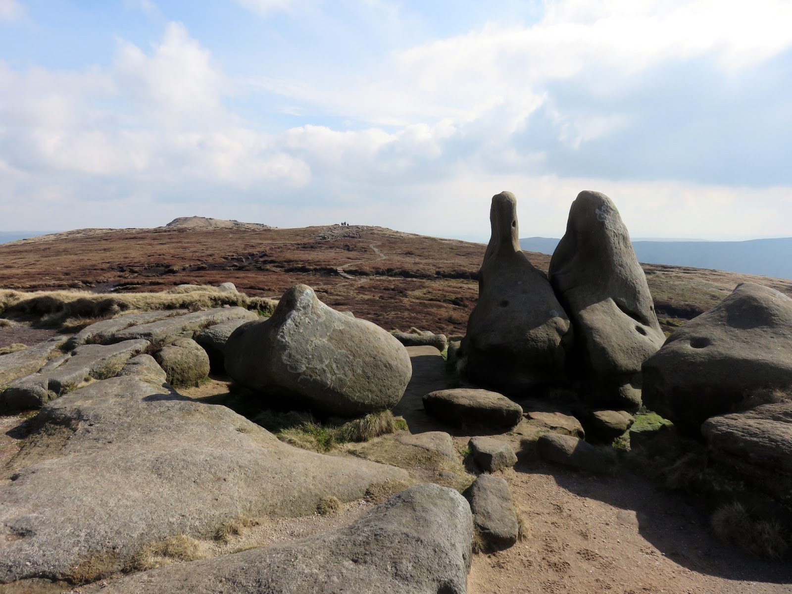
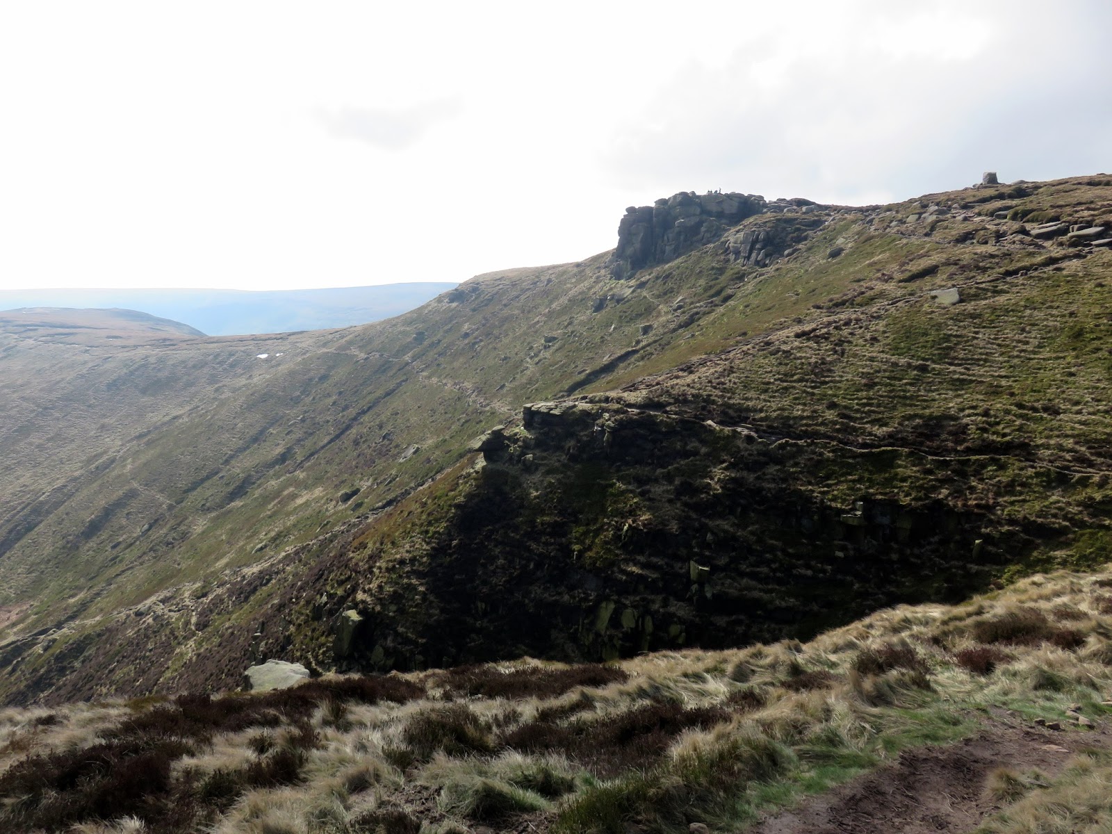
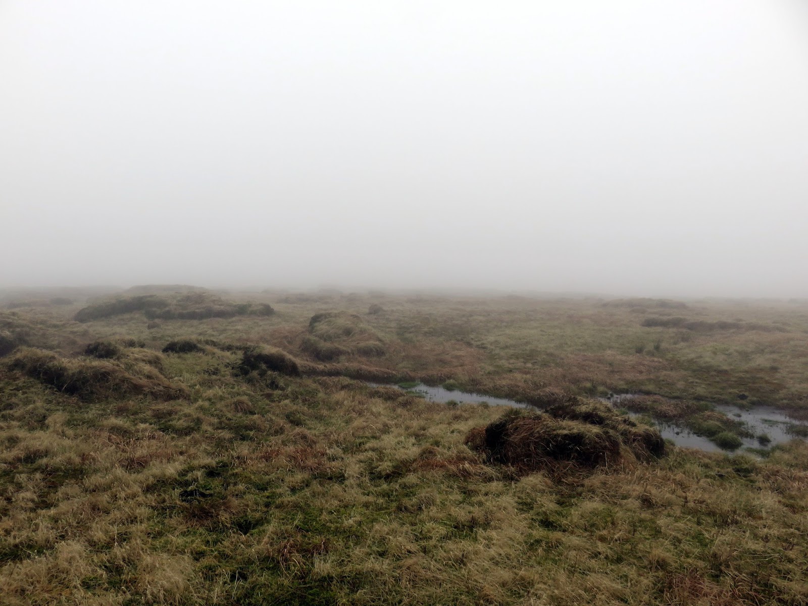
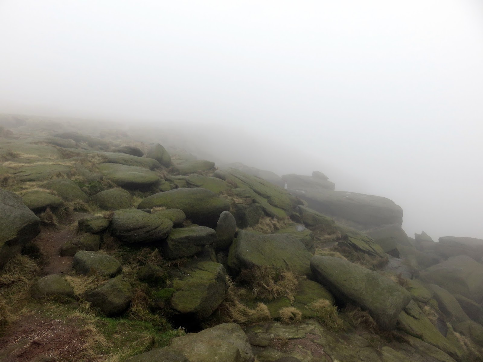
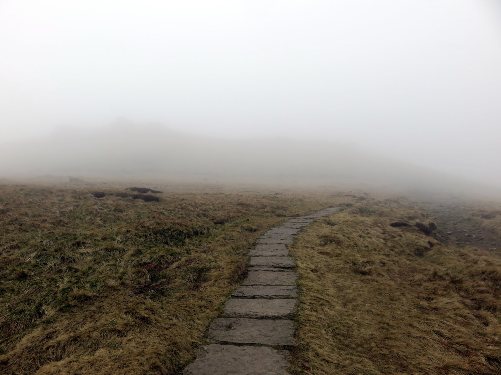
We returned to the south edge to make our way west to Crowden Tower, stopping in a small clough for a bite to eat, giving the weather enough time to cloud over. Once fed, we set out onto the main Kinder Plateau. Our aim was to brush up on our map reading skills by navigating to Kinder Downfall using the tried and tested map and compass. Things would be made all the more interesting by the cloud, which had now draped itself over Kinder.
 |
| Gristone rocks – a feature of Kinder Scout |
 |
| Crowden Tower |
 |
| Looking east to Edale |
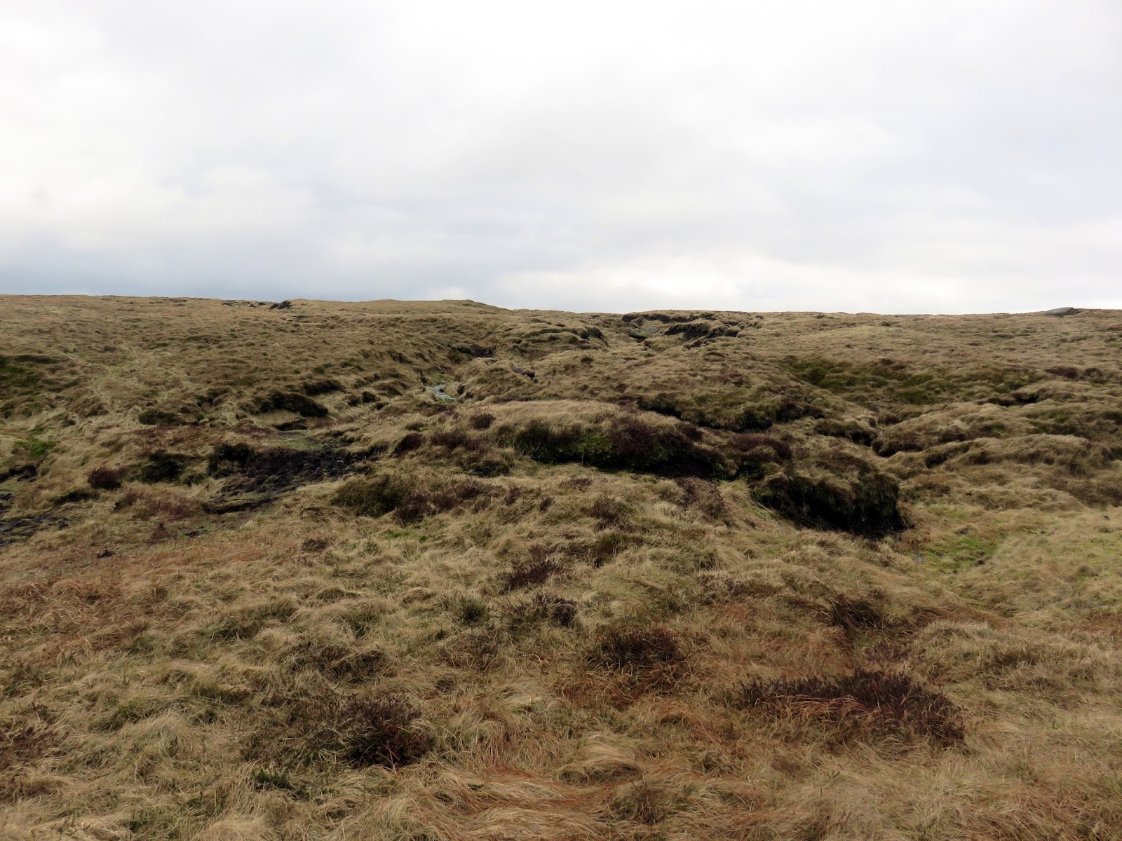
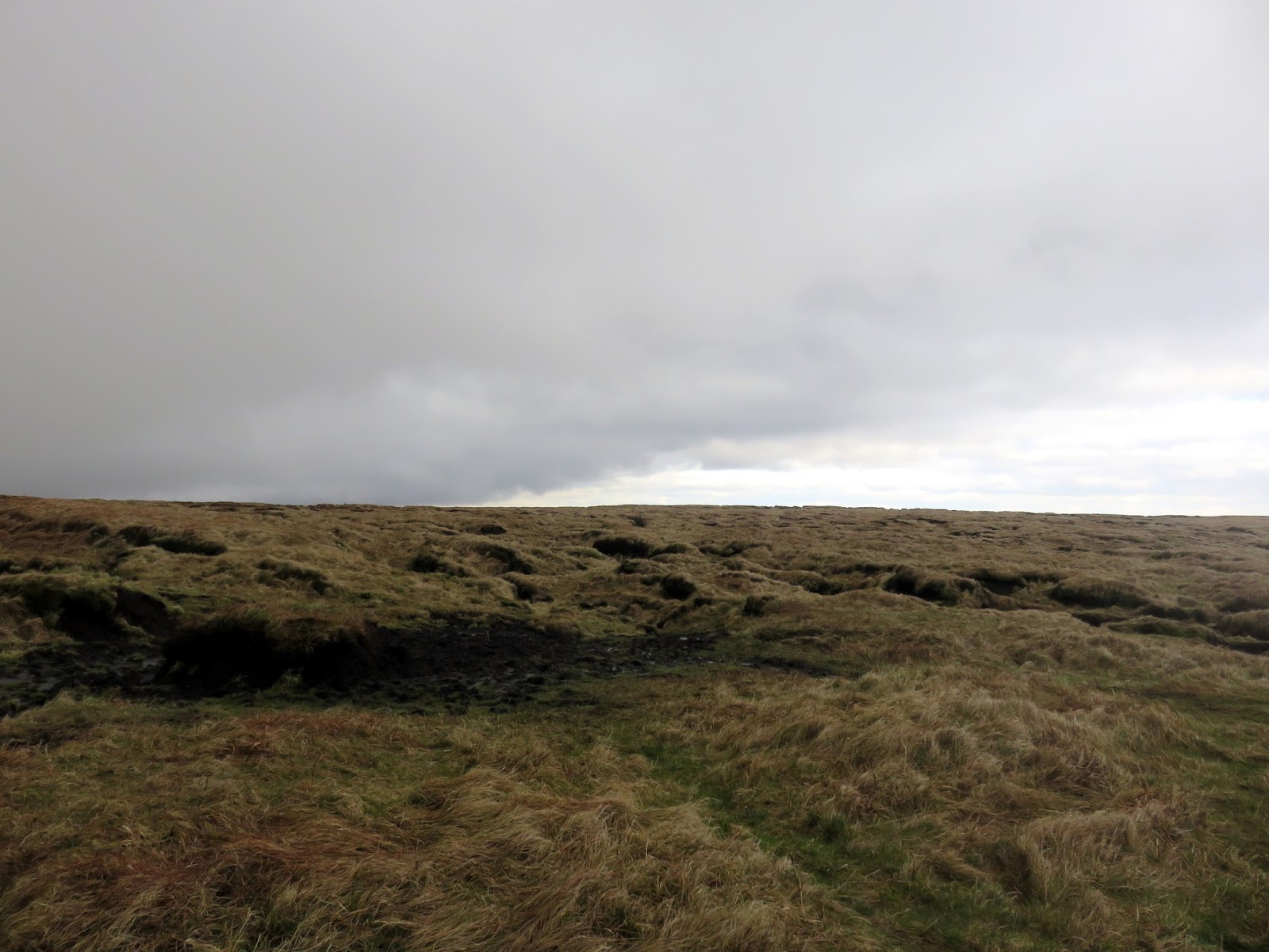
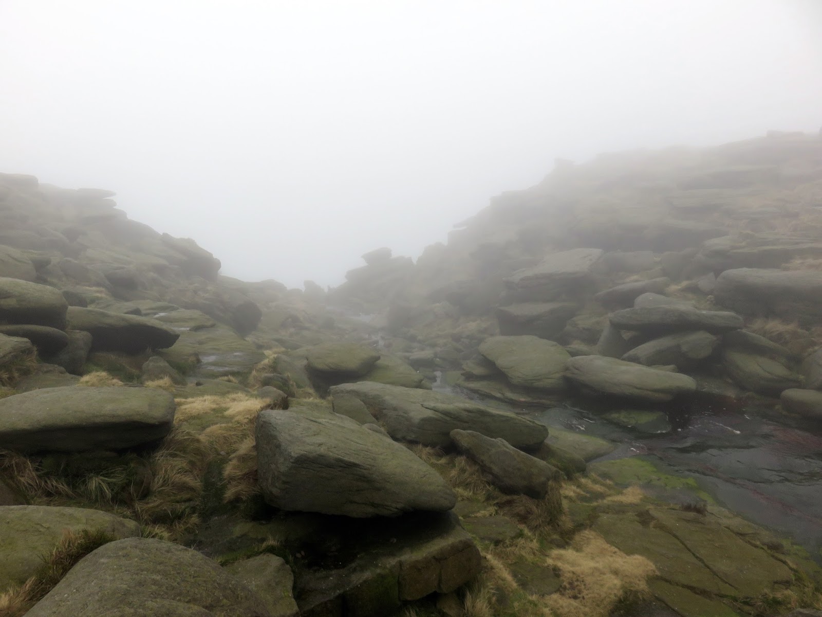
Bearing and compass in hand we set off into the mist, crossing streams and avoiding peat bogs. This is classic Kinder territory, a unique landscape that is both devoid of features but endlessly interesting in equal measure.
 |
| Clouds roll in |
 |
| Classic Kinder |
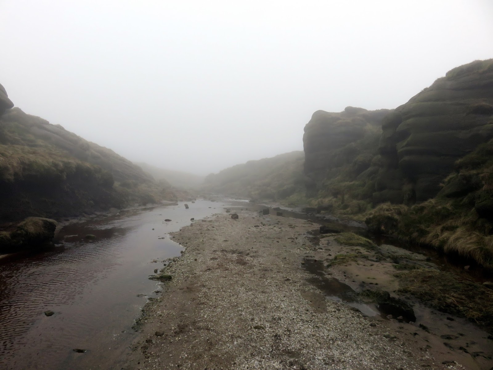
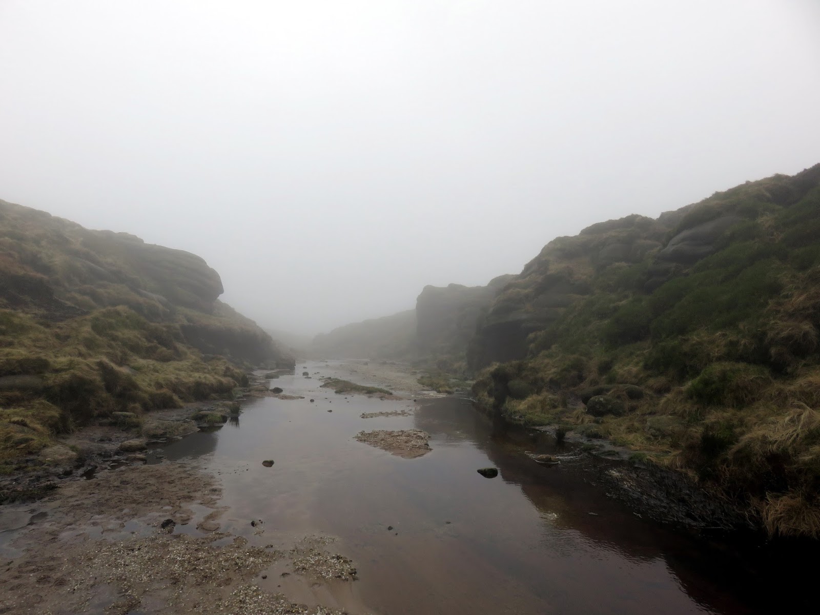
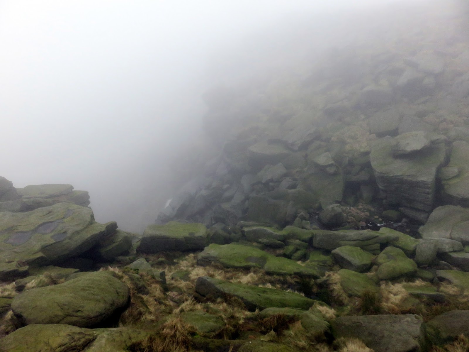
After successfully negotiating our way to the Kinder River (confirmed as we passed through the Kinder Gates) and followed it to Kinder Downfall. Kinder Downfall (or simply ‘the Downfall’) is the Peak District’s tallest waterfall, taking the Kinder River on a turbulent 30m cascade to the waiting valley below. It is surrounded on both sides by near vertical rocks, a phenomenal sight, not seen today thanks to the mist. Once called Kinder Scut, the Kinder River lends its name to the entire plateau we now refer to as Kinder Scout.
 |
| Kinder Gates |
 |
| Kinder Gates |
 |
| Kinder Downfall |
 |
| Kinder Downfall – not much to see today |
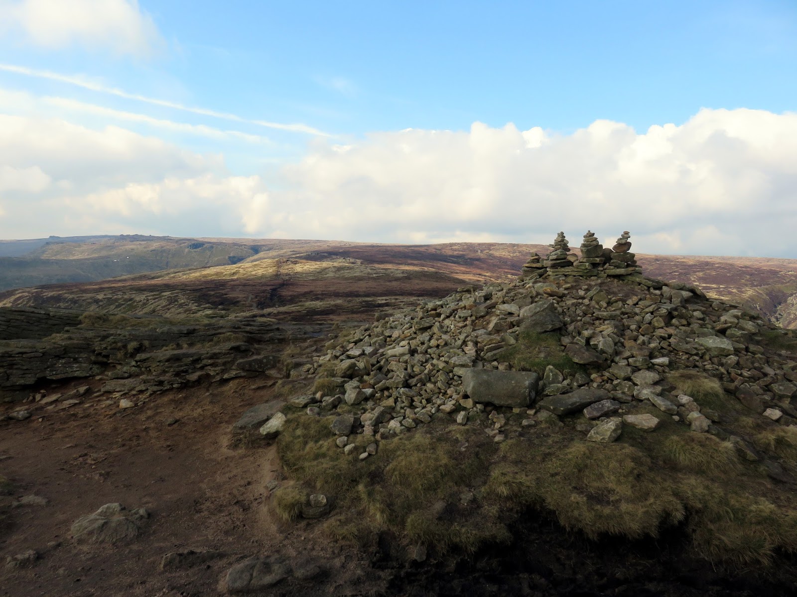
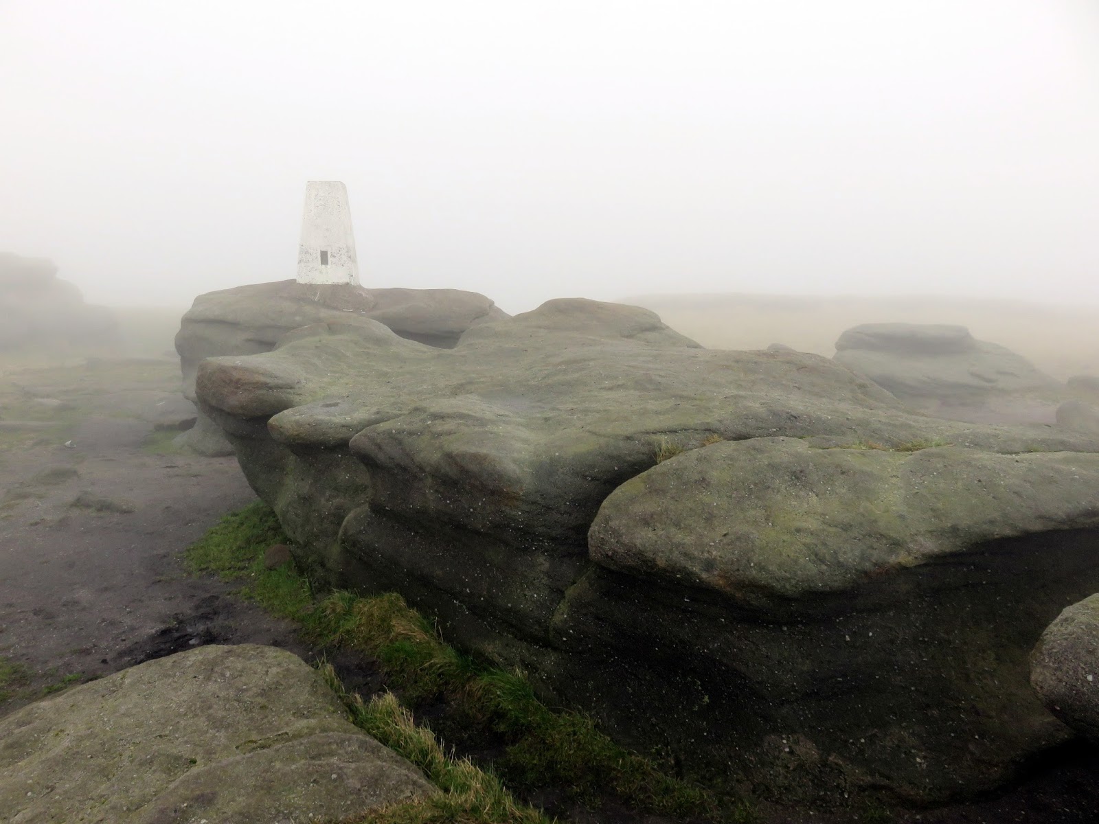
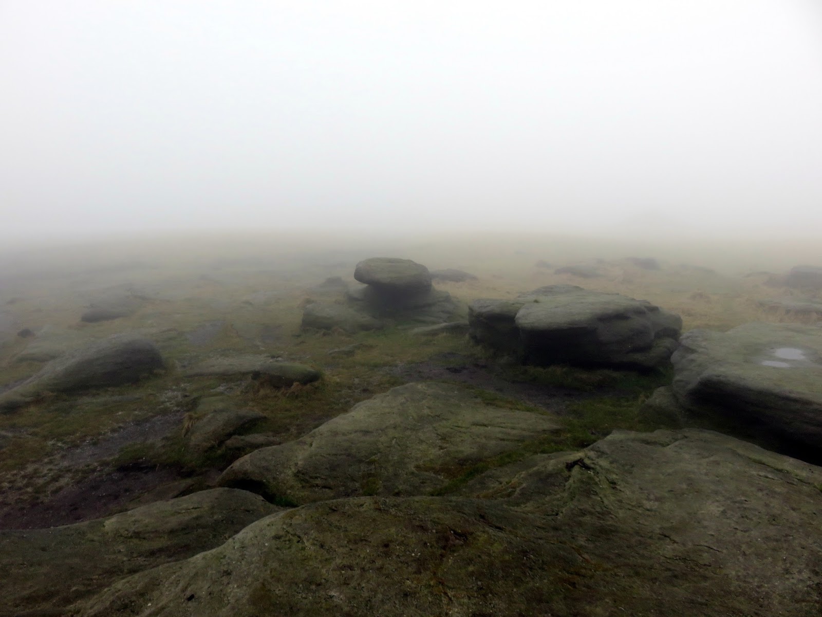
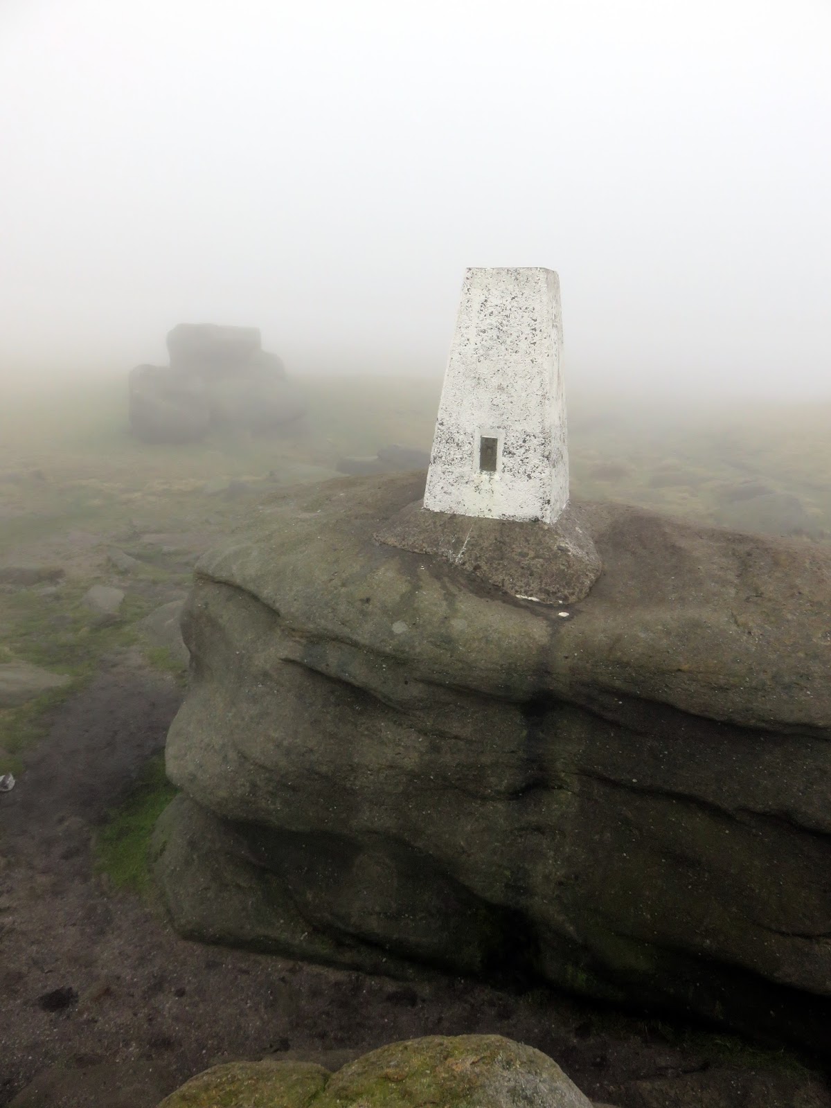
From Kinder Downfall, the path heads South for a couple of miles on the Pennine Way, crossing Red Brook on its way. It leads to Kinder Low, an interesting area of Kinder Scout where the majority of the peat that is common across the moor has been eroded away, leaving a dusty and dry landscape behind.
 |
| Cluther Rocks |
 |
| Kinder Low |
There is a trig pillar perched upon a rock at Kinder Low which many wrongly believe to the highest point of the moor, though there is little difference between this location and the high point a short distance northeast, which can take a bit of finding. Kinder Low also marks the southwestern corner of the moor.
 |
| Bare peat at Kinder Low |
 |
| Kinder Low |
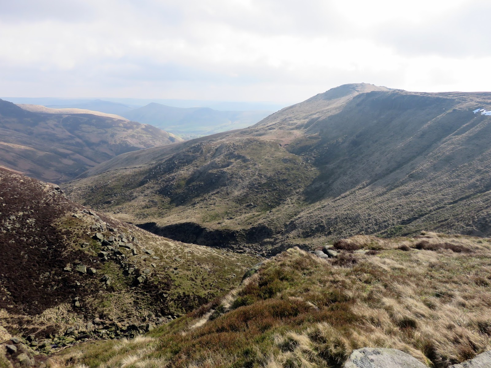
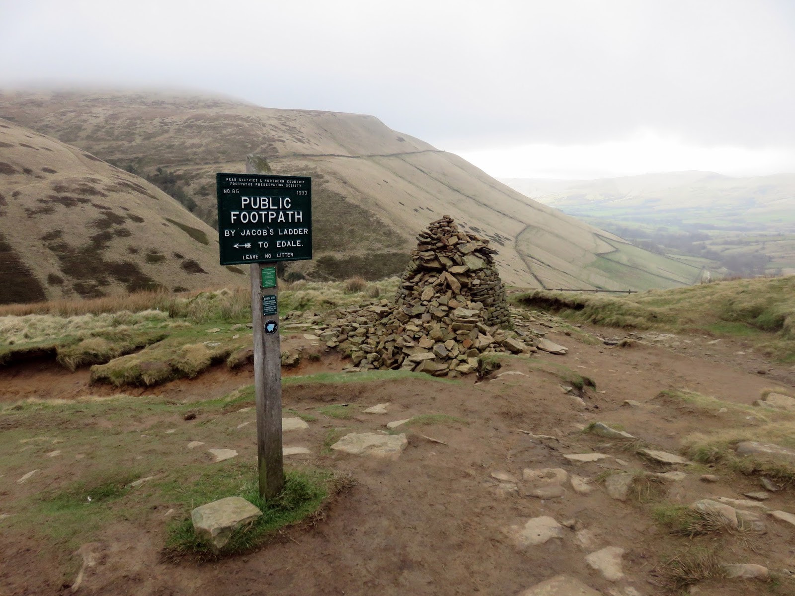
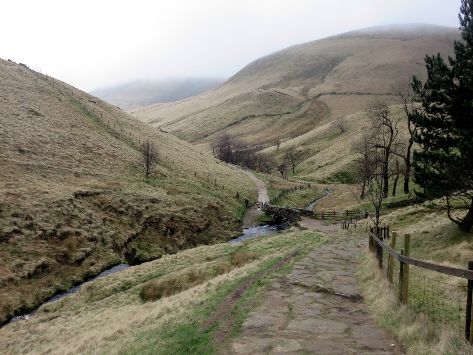
The Pennine Way – the long distance path that runs the length of the northern England – actually begins in Edale and it would lead us back to the car park where we started. The Pennine Way drops down Jacob’s Ladder, an ancient packhorse route that links Edale to the neighbouring Hayfield and the subsequent riches of Manchester.
 |
| The Pennine Way leads away from Kinder Low |
 |
| Edale below the clouds |
 |
| Jacob’s Ladder |
 |
| Kinder Low |
 |
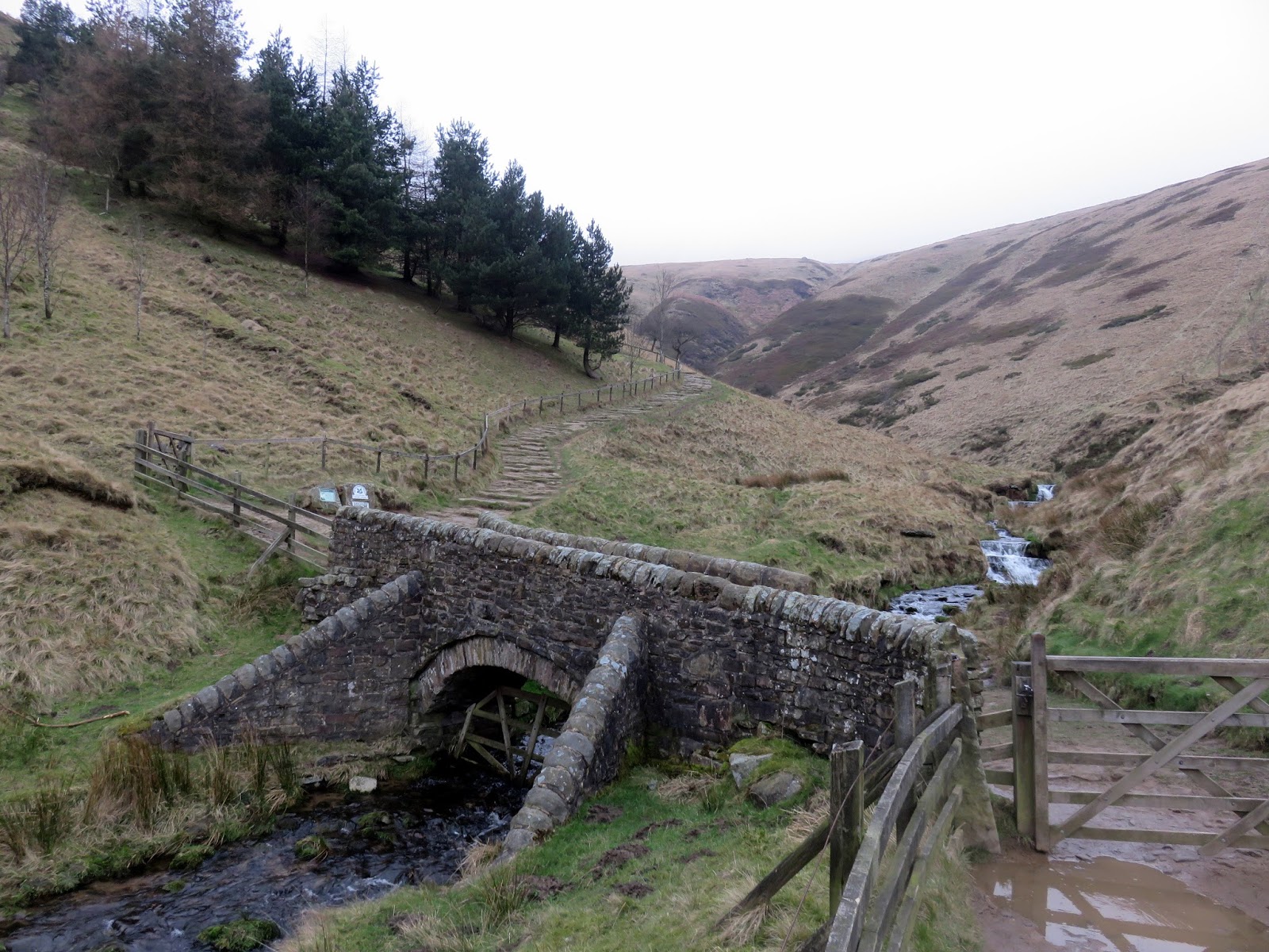
| The packhorse bridge at the foot of Jacob’s Ladder |
 |
| The River Noe |
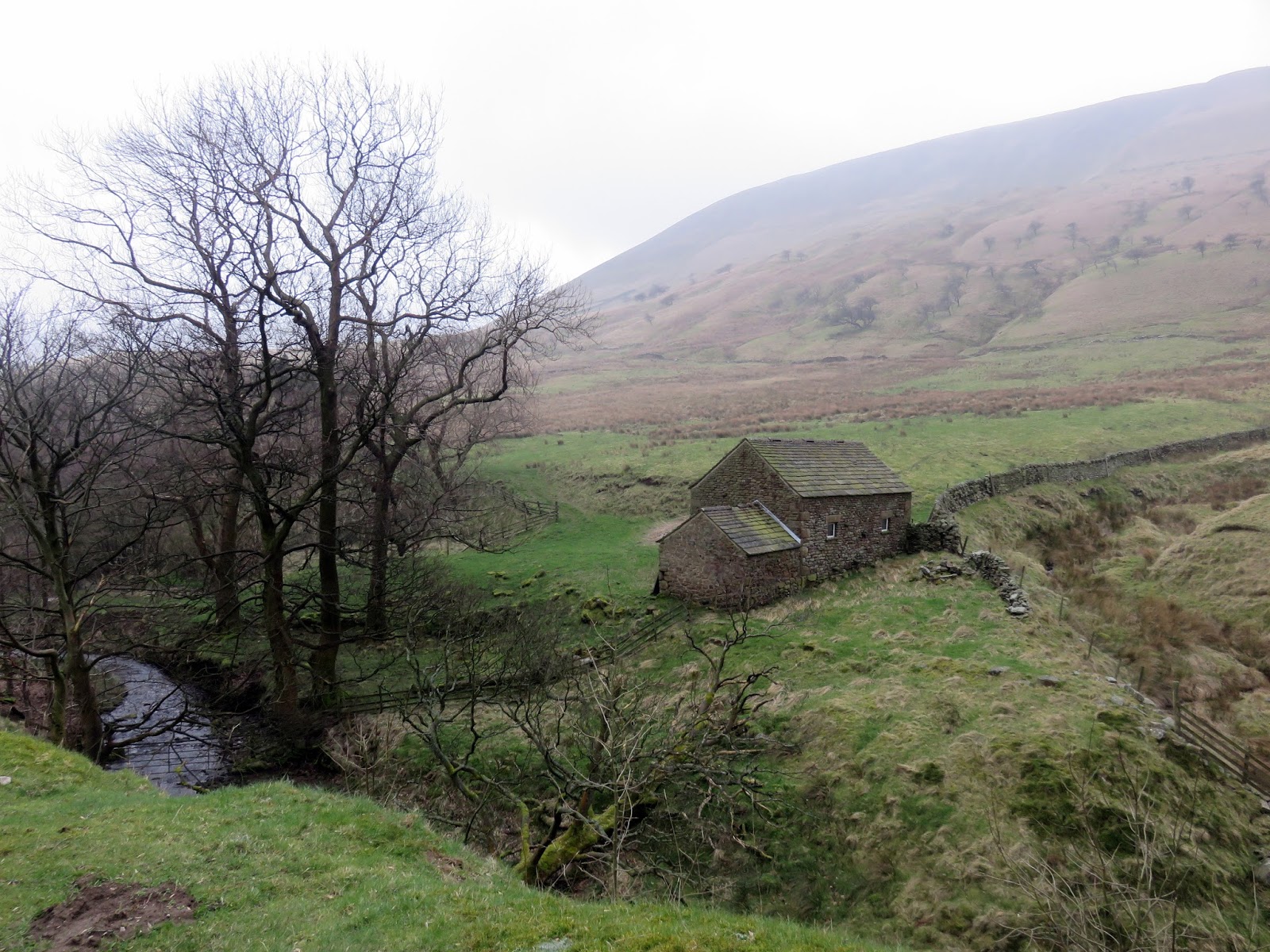
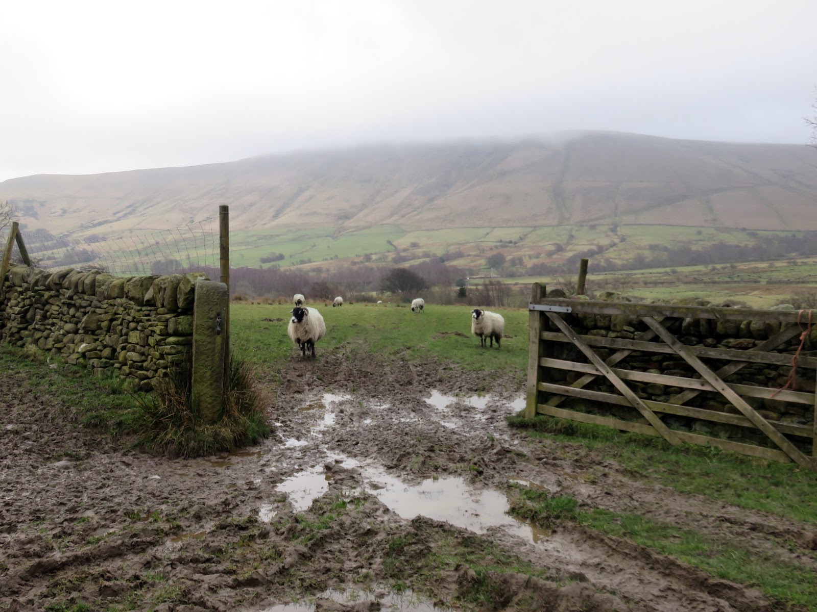
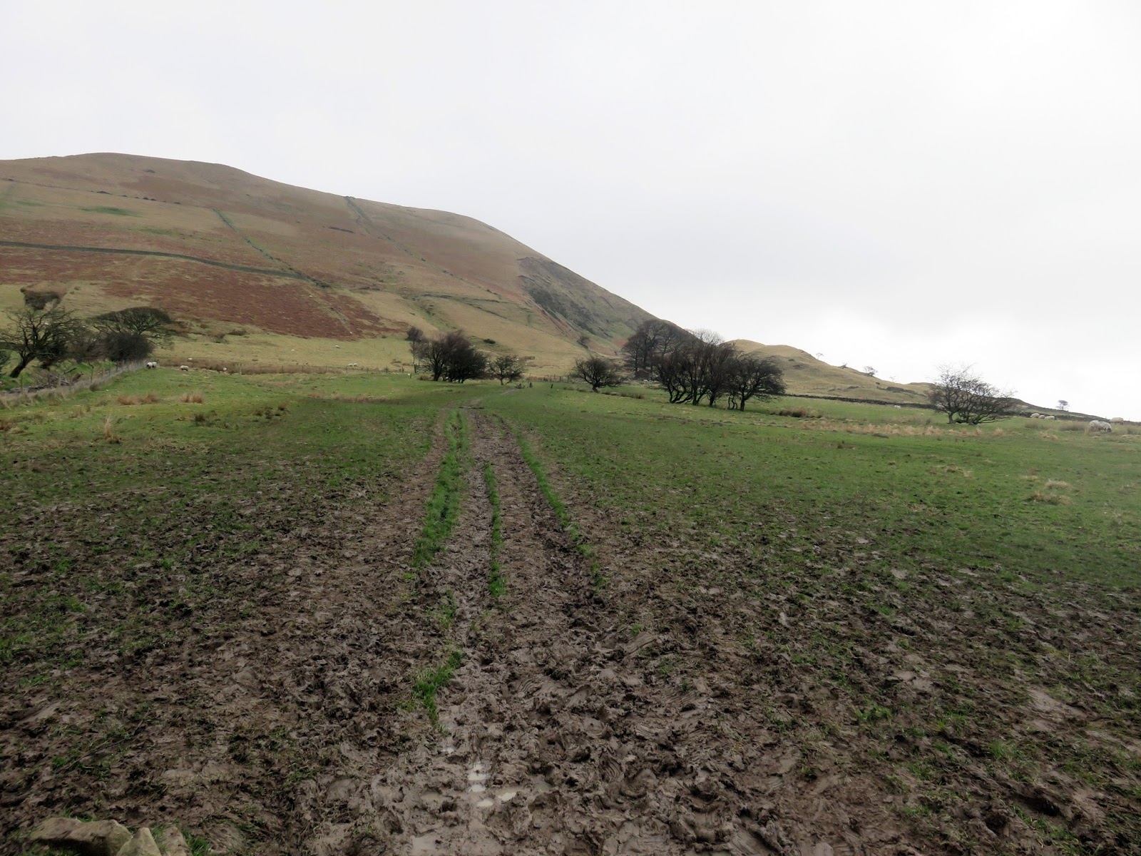
The route passes through Upper Booth before a dispiriting climb up over the lower slopes of Grindslow Knoll. Luckily its downhill all the way to Edale from here the starting point of the Pennine Way at the Rambler Inn, concluding a very agreeable walk in one of my favourite places in the country.
 |
| Onlookers |
 |
| Climbing the last hill of the day |
 |
| Rainy Edale |
 |
| Ringing Roger |
