Open Space Web-Map builder Codehttps://openspace.ordnancesurvey.co.uk/osmapapi/openspace.js?key=3119F72552FD5C22E0530C6CA40A5A92https://openspace.ordnancesurvey.co.uk/osmapapi/script/mapbuilder/basicmap.jshttps://openspace.ordnancesurvey.co.uk/osmapapi/script/mapbuilder/searchbox.js//variables for routes var linesLayer, points, lineFeature, lineString, routeMarkersLayer, routepos, routesize, routeoffset, routeicon; var style_blue = {strokeColor: “#0000CD”, strokeOpacity: 0.5, strokeWidth: 4.5}; function initmapbuilder() { //initiate the map var options = {resolutions: [2500, 1000, 500, 200, 100, 50, 25, 10, 5, 4, 2.5, 2, 1]}; osMap = new OpenSpace.Map(‘map’, options); //configure map options (basicmap.js) setglobaloptions(); //set the center of the map and the zoom level osMap.setCenter(new OpenSpace.MapPoint(262869.99874115,355025.00125885),7); linesLayer = osMap.getVectorLayer(); // Set up layer for route markers routeMarkersLayer = new OpenLayers.Layer.Markers(“Route Markers”); //make a route points = new Array(); points.push(new OpenLayers.Geometry.Point(264743.33206177,355586.66793823)); points.push(new OpenLayers.Geometry.Point(264723.33206177,355481.66793823)); points.push(new OpenLayers.Geometry.Point(264743.33206177,355286.66793823)); points.push(new OpenLayers.Geometry.Point(264658.33206177,355226.66793823)); points.push(new OpenLayers.Geometry.Point(264713.33206177,355066.66793823)); points.push(new OpenLayers.Geometry.Point(264683.33206177,354921.66793823)); points.push(new OpenLayers.Geometry.Point(264613.33206177,354821.66793823)); points.push(new OpenLayers.Geometry.Point(264468.33206177,354826.66793823)); points.push(new OpenLayers.Geometry.Point(264373.33206177,354776.66793823)); points.push(new OpenLayers.Geometry.Point(264273.33206177,354801.66793823)); points.push(new OpenLayers.Geometry.Point(264168.33206177,354876.66793823)); points.push(new OpenLayers.Geometry.Point(263803.33206177,354686.66793823)); points.push(new OpenLayers.Geometry.Point(263728.33206177,354521.66793823)); points.push(new OpenLayers.Geometry.Point(263608.33206177,354516.66793823)); points.push(new OpenLayers.Geometry.Point(263553.33206177,354546.66793823)); points.push(new OpenLayers.Geometry.Point(263448.33206177,354561.66793823)); points.push(new OpenLayers.Geometry.Point(263453.33206177,354656.66793823)); points.push(new OpenLayers.Geometry.Point(263388.33206177,354741.66793823)); points.push(new OpenLayers.Geometry.Point(263293.33206177,354866.66793823)); points.push(new OpenLayers.Geometry.Point(263213.33206177,354846.66793823)); points.push(new OpenLayers.Geometry.Point(263168.33206177,354746.66793823)); points.push(new OpenLayers.Geometry.Point(263208.33206177,354626.66793823)); points.push(new OpenLayers.Geometry.Point(262963.33206177,354586.66793823)); points.push(new OpenLayers.Geometry.Point(262893.33206177,354526.66793823)); points.push(new OpenLayers.Geometry.Point(262853.33206177,354446.66793823)); points.push(new OpenLayers.Geometry.Point(262738.33206177,354401.66793823)); points.push(new OpenLayers.Geometry.Point(262543.33206177,354381.66793823)); points.push(new OpenLayers.Geometry.Point(262408.33206177,354456.66793823)); points.push(new OpenLayers.Geometry.Point(262358.33206177,354561.66793823)); points.push(new OpenLayers.Geometry.Point(262238.33206177,354621.66793823)); points.push(new OpenLayers.Geometry.Point(262218.33206177,354601.66793823)); points.push(new OpenLayers.Geometry.Point(262038.33206177,354601.66793823)); points.push(new OpenLayers.Geometry.Point(261928.33206177,354576.66793823)); points.push(new OpenLayers.Geometry.Point(261883.33206177,354466.66793823)); points.push(new OpenLayers.Geometry.Point(261898.33206177,354416.66793823)); points.push(new OpenLayers.Geometry.Point(261858.33206177,354361.66793823)); points.push(new OpenLayers.Geometry.Point(261718.33206177,354261.66793823)); points.push(new OpenLayers.Geometry.Point(261643.33206177,354131.66793823)); points.push(new OpenLayers.Geometry.Point(261488.33206177,354106.66793823)); points.push(new OpenLayers.Geometry.Point(261398.33206177,354156.66793823)); points.push(new OpenLayers.Geometry.Point(261358.33206177,354206.66793823)); points.push(new OpenLayers.Geometry.Point(261268.33206177,354231.66793823)); points.push(new OpenLayers.Geometry.Point(261233.33206177,354296.66793823)); points.push(new OpenLayers.Geometry.Point(261158.33206177,354311.66793823)); points.push(new OpenLayers.Geometry.Point(261093.33206177,354331.66793823)); points.push(new OpenLayers.Geometry.Point(260988.33206177,354406.66793823)); points.push(new OpenLayers.Geometry.Point(260933.33206177,354466.66793823)); points.push(new OpenLayers.Geometry.Point(260798.33206177,354706.66793823)); points.push(new OpenLayers.Geometry.Point(260768.33206177,354846.66793823)); points.push(new OpenLayers.Geometry.Point(260798.33206177,354911.66793823)); points.push(new OpenLayers.Geometry.Point(260868.33206177,354956.66793823)); points.push(new OpenLayers.Geometry.Point(260973.33206177,354966.66793823)); points.push(new OpenLayers.Geometry.Point(261013.33206177,354936.66793823)); points.push(new OpenLayers.Geometry.Point(260978.33206177,354866.66793823)); points.push(new OpenLayers.Geometry.Point(261188.33206177,354836.66793823)); points.push(new OpenLayers.Geometry.Point(261338.33206177,354836.66793823)); points.push(new OpenLayers.Geometry.Point(261418.33206177,354851.66793823)); points.push(new OpenLayers.Geometry.Point(261528.33206177,354896.66793823)); points.push(new OpenLayers.Geometry.Point(261653.33206177,354951.66793823)); points.push(new OpenLayers.Geometry.Point(261758.33206177,354956.66793823)); points.push(new OpenLayers.Geometry.Point(261888.33206177,354956.66793823)); points.push(new OpenLayers.Geometry.Point(261958.33206177,354806.66793823)); points.push(new OpenLayers.Geometry.Point(262038.33206177,354791.66793823)); points.push(new OpenLayers.Geometry.Point(262178.33206177,354831.66793823)); points.push(new OpenLayers.Geometry.Point(262423.33206177,354816.66793823)); points.push(new OpenLayers.Geometry.Point(262473.33206177,354771.66793823)); points.push(new OpenLayers.Geometry.Point(262633.33206177,354901.66793823)); points.push(new OpenLayers.Geometry.Point(262748.33206177,354896.66793823)); points.push(new OpenLayers.Geometry.Point(263028.33206177,355051.66793823)); points.push(new OpenLayers.Geometry.Point(263198.33206177,355161.66793823)); points.push(new OpenLayers.Geometry.Point(263338.33206177,355251.66793823)); points.push(new OpenLayers.Geometry.Point(263408.33206177,355336.66793823)); points.push(new OpenLayers.Geometry.Point(263438.33206177,355381.66793823)); points.push(new OpenLayers.Geometry.Point(263528.33206177,355421.66793823)); points.push(new OpenLayers.Geometry.Point(263578.33206177,355416.66793823)); points.push(new OpenLayers.Geometry.Point(263643.33206177,355411.66793823)); points.push(new OpenLayers.Geometry.Point(263953.33206177,355381.66793823)); points.push(new OpenLayers.Geometry.Point(264083.33206177,355371.66793823)); points.push(new OpenLayers.Geometry.Point(264113.33206177,355451.66793823)); points.push(new OpenLayers.Geometry.Point(264193.33206177,355431.66793823)); points.push(new OpenLayers.Geometry.Point(264378.33206177,355541.66793823)); points.push(new OpenLayers.Geometry.Point(264493.33206177,355581.66793823)); points.push(new OpenLayers.Geometry.Point(264623.33206177,355581.66793823)); points.push(new OpenLayers.Geometry.Point(264743.33206177,355586.66793823)); // create a polyline feature from the array of points lineString = new OpenLayers.Geometry.LineString(points); lineFeature = new OpenLayers.Feature.Vector(lineString, null, style_blue); linesLayer.addFeatures([lineFeature]); //crate a route start/end marker routepos = new OpenSpace.MapPoint(264743.33206177,355586.66793823); routesize = new OpenLayers.Size(33,45); routeoffset = new OpenLayers.Pixel(-5,-37); routeicon = new OpenSpace.Icon(‘https://openspace.ordnancesurvey.co.uk/osmapapi/img_versions/img_1.1/mapbuilder/routemarker-startend.png’, routesize, routeoffset, null, null); routeMarkersLayer.addMarker(new OpenLayers.Marker(routepos, routeicon)); osMap.addLayer(routeMarkersLayer);}
Route: Pen-y-Pass, Miner’s Track, Causeway, Y Gribin, Snowdon, Pyg Track, Bwlch y Moch, Pen-y-Pass
Date: 28/01/2017
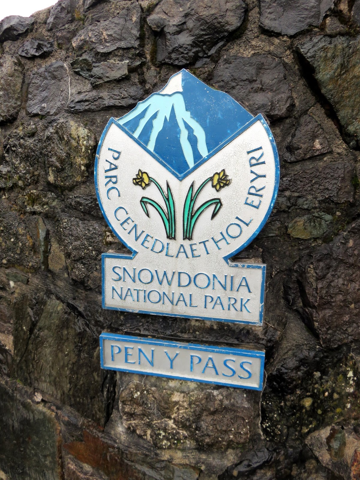
From: Pen-y-Pass
Parking: Pen-y-Pass
Start Point: Pen-y-Pass
Region: Snowdonia – Snowdon
Route length: 7.0 miles (11.2 km)
Time taken: 04:15
Average speed: 1.75 mph
Ascent: 767m
Descent: 783m
Summits: Yr Wydffa (1,085m)
Other points of interest: Y Gribin
I spent the weekend in the company of the National Mountain Training Centre at Plas y Brenin, honing some of the winter skills that I’ve been taught over the last couple of years. The event was organised in collaboration with the famous Joe Brown’s, a popular gear shop in Capel-Curig. I had to wait to find out where we would be walking. The choices on offer were around the Carneddau or an ascent of Snowdon by Y Gribin. With snow in the forecast, it was an easy decision for me.
We piled in the minibus to be driven the short distance to the Pen-y-Pass car park; always a useful starting point as it saves you a reasonable climb from the valley. Despite the rain the car park was, as ever, full. The forecast was full of promise, with rain coming and going in the morning before things settled down a bit later in the day. The most important factor though was snow and lots of it – just what we were after.
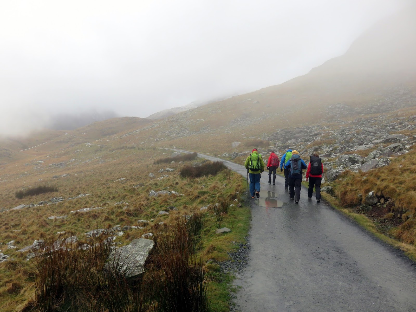
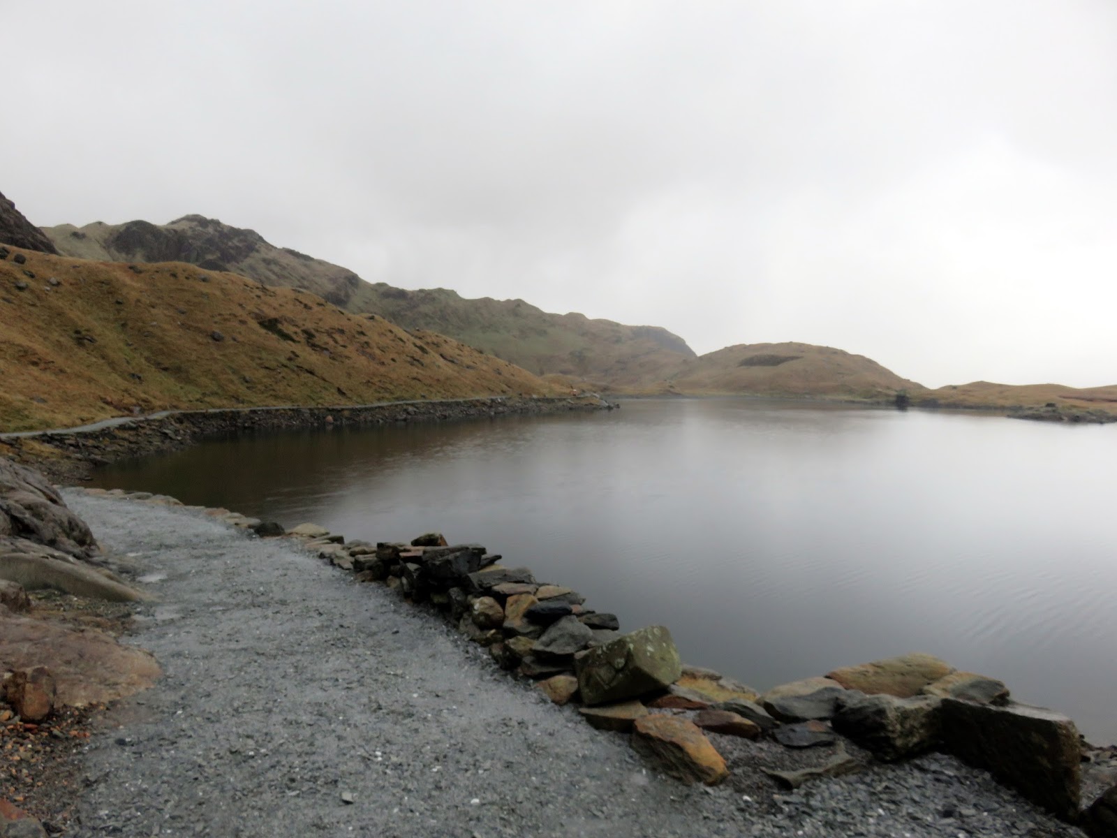
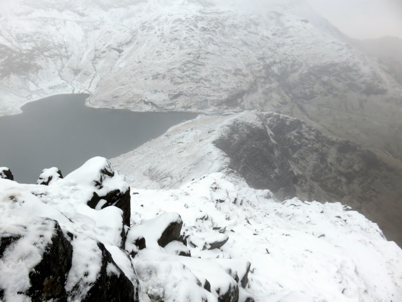
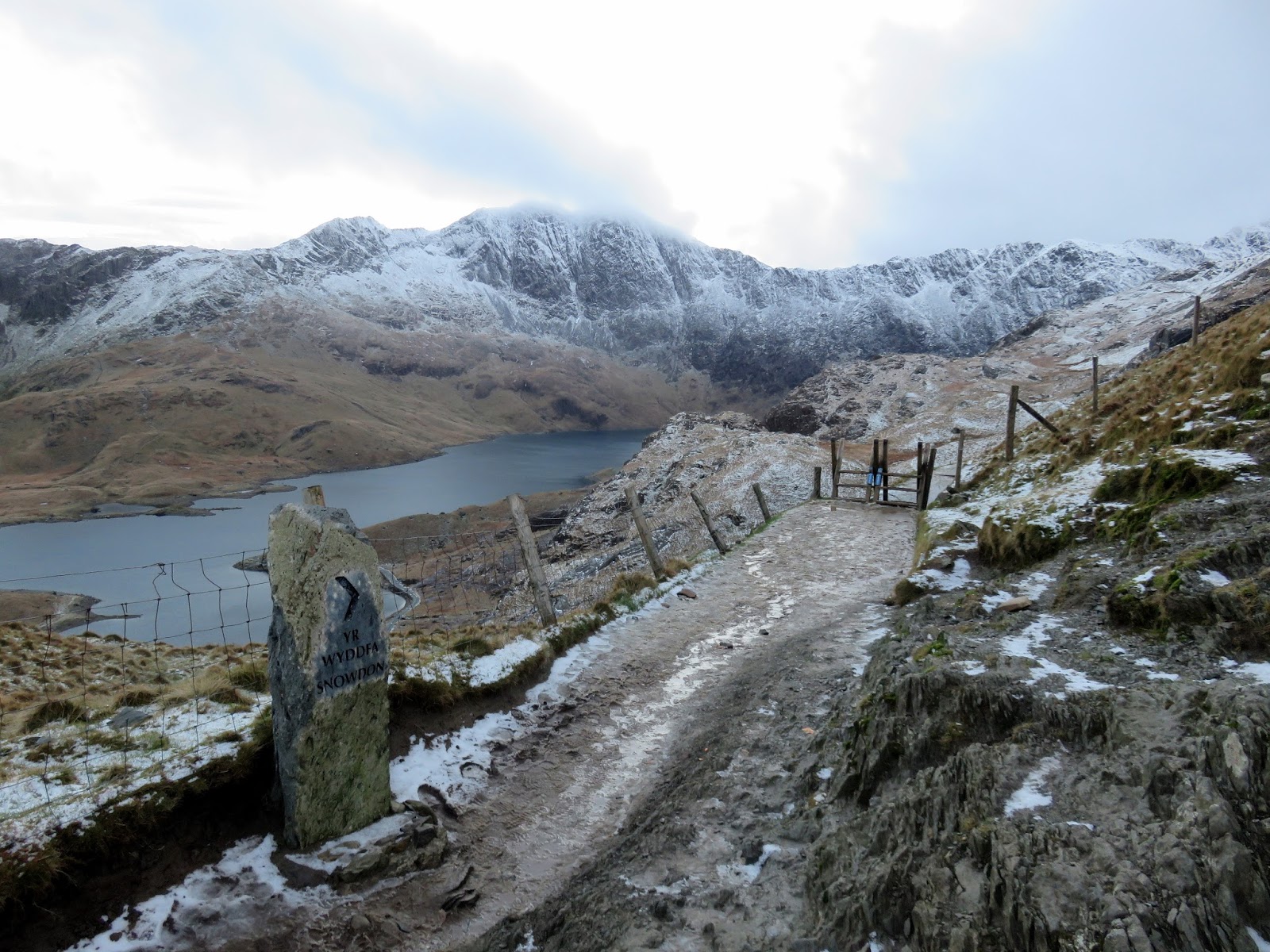
The walk started with an easy walk along the Miner’s Track which climbs very gradually up to Llyn Llydaw, crossing it via a causeway. The causeway was constructed in 1853 to facilitate the copper mining on Snowdon – prior to this horses and the extracted copper were carried across Llyn Llydaw by raft. The Miner’s Track was constructed at the same time.
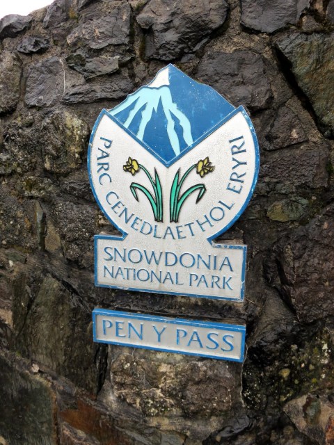 |
| Pen-y-Pass – the start of many walks up Snowdon |
 |
| Heading along the Miner’s Track |
 |
| The small Llyn Teyra |
 |
| The causeway on Llyn Llydaw |
 |
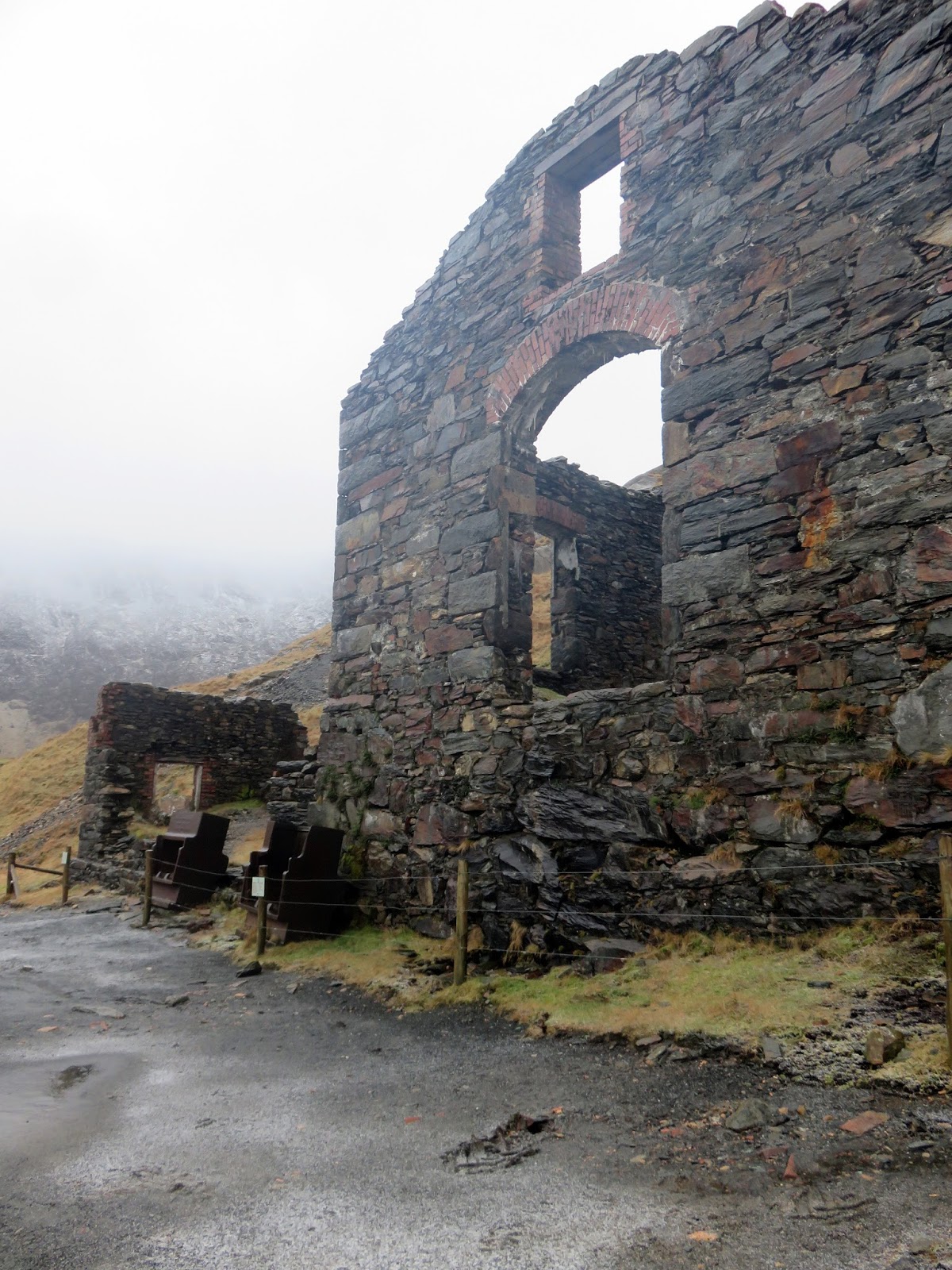
| One of the derelict mine buildings |
 |
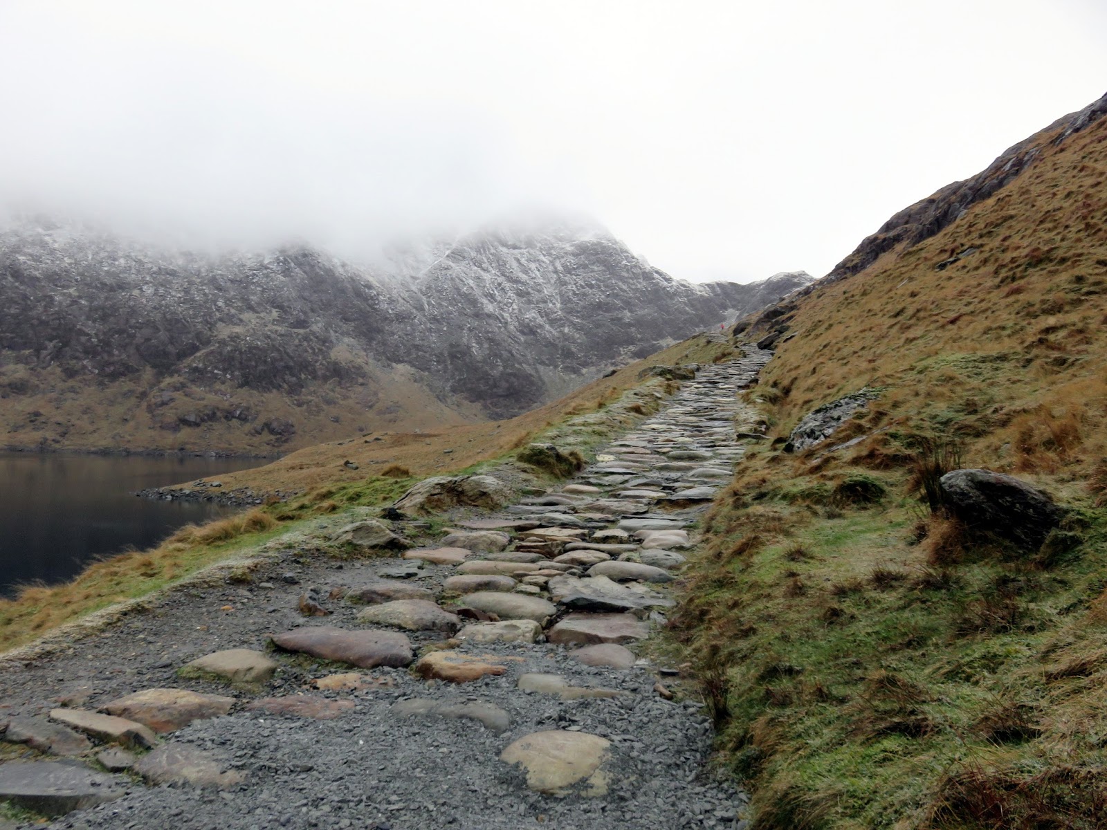
| The Miner’s Track climbs up towards Glaslyn |
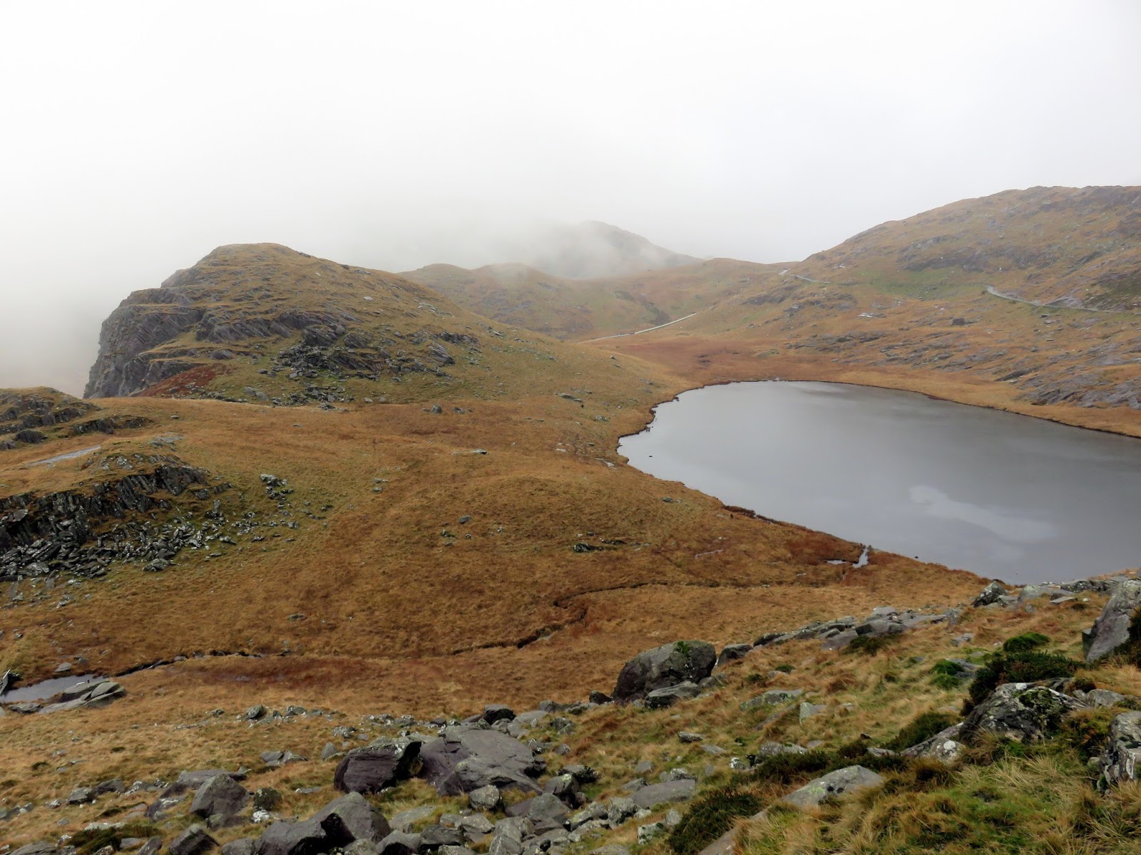
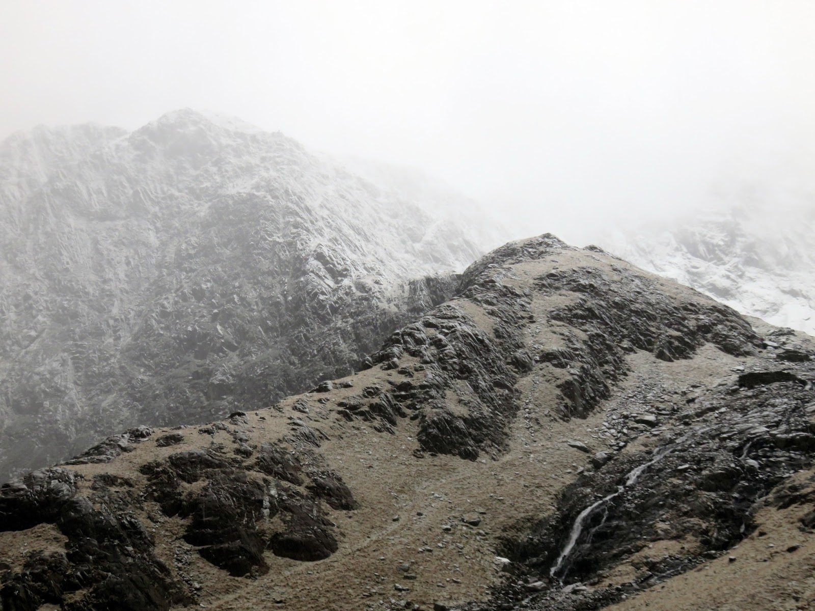
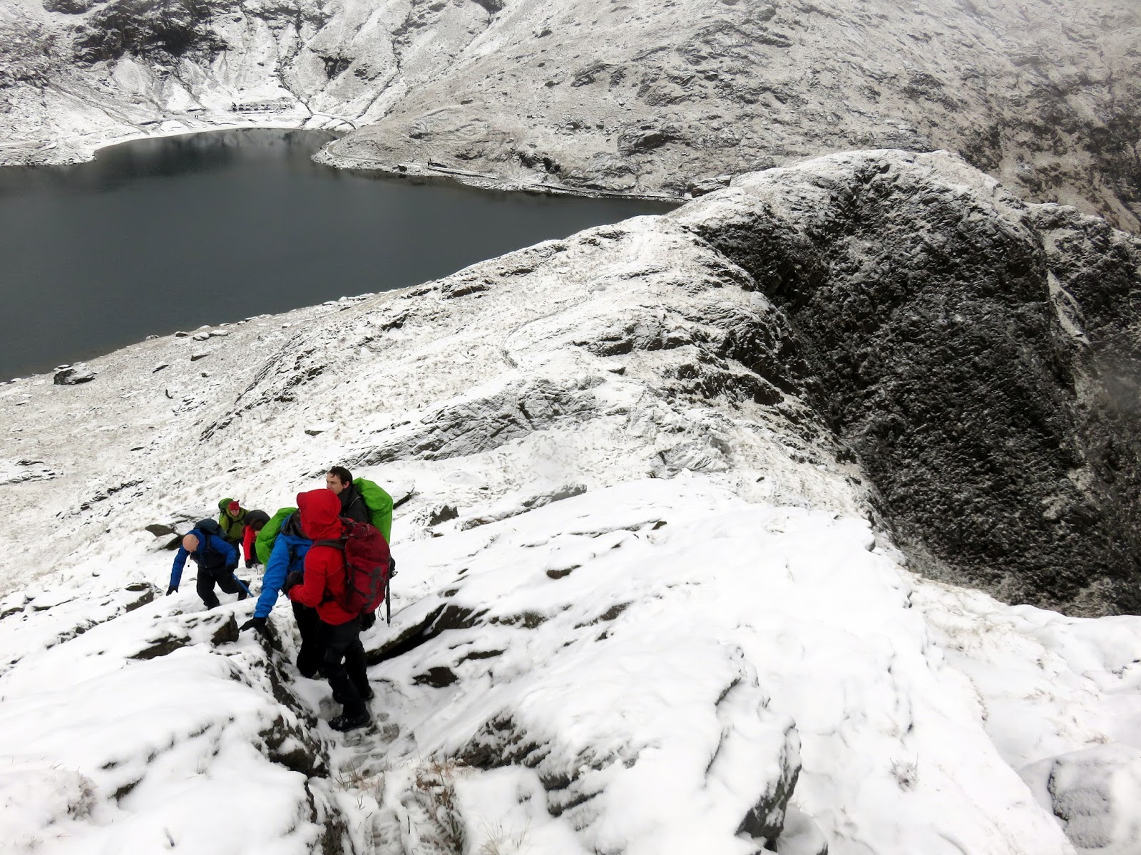
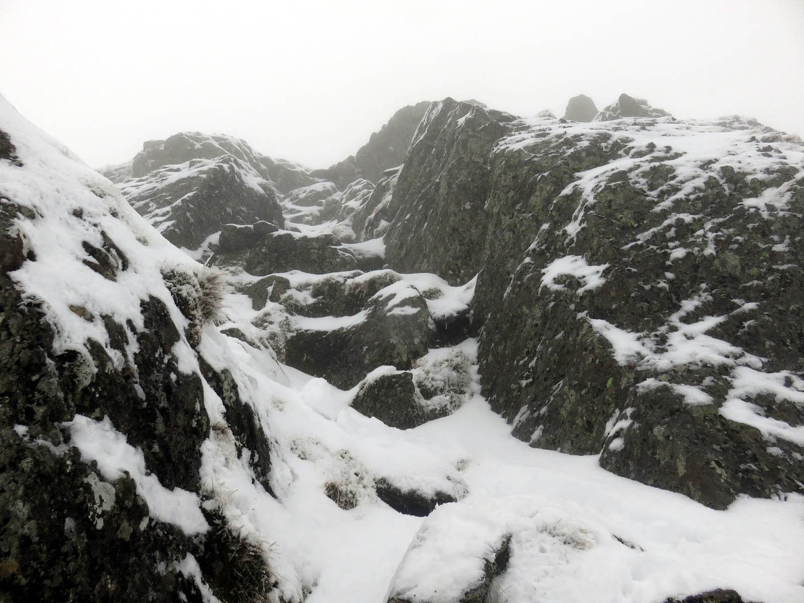
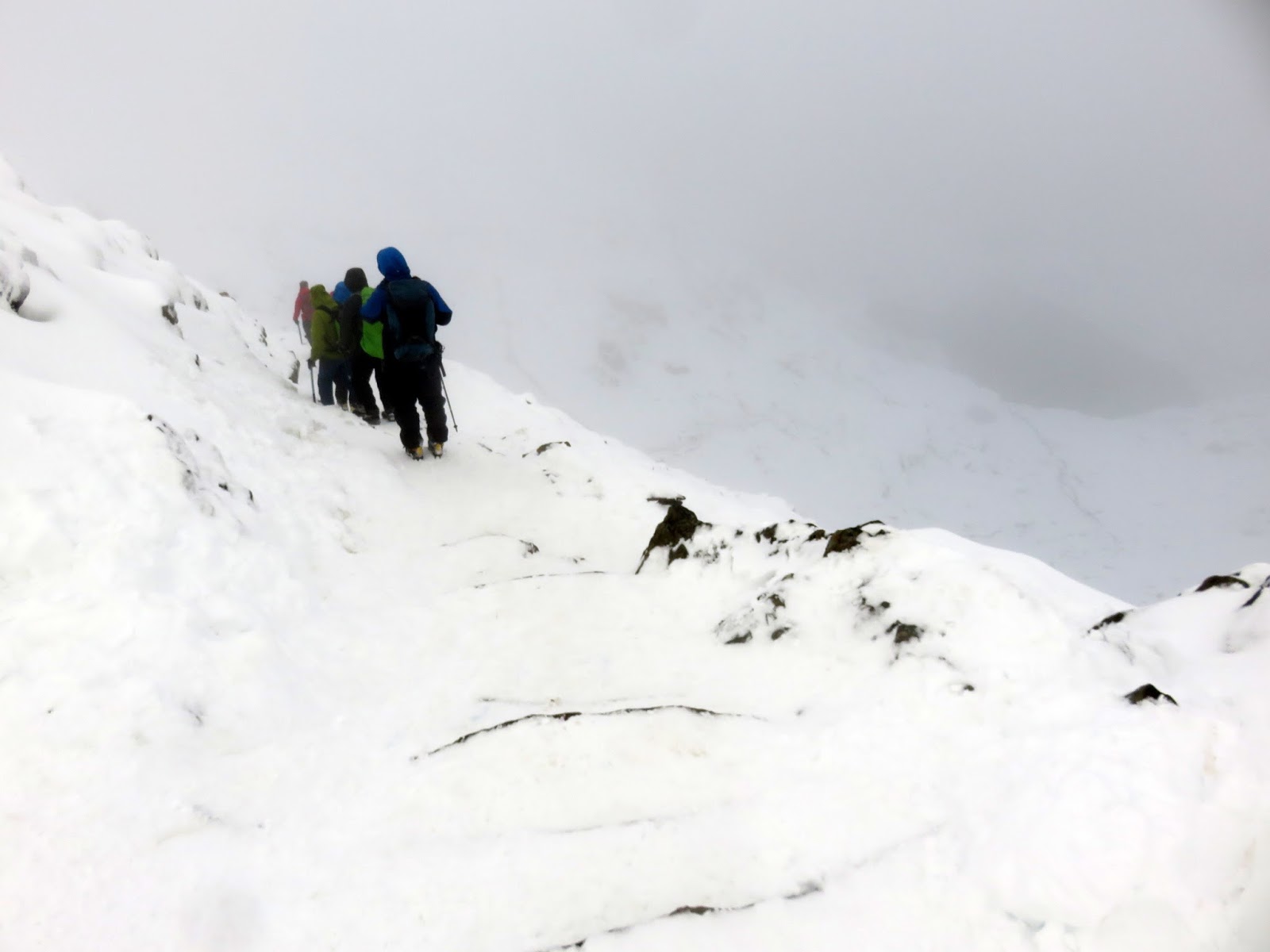
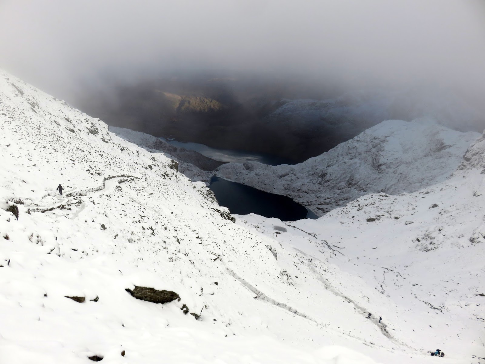
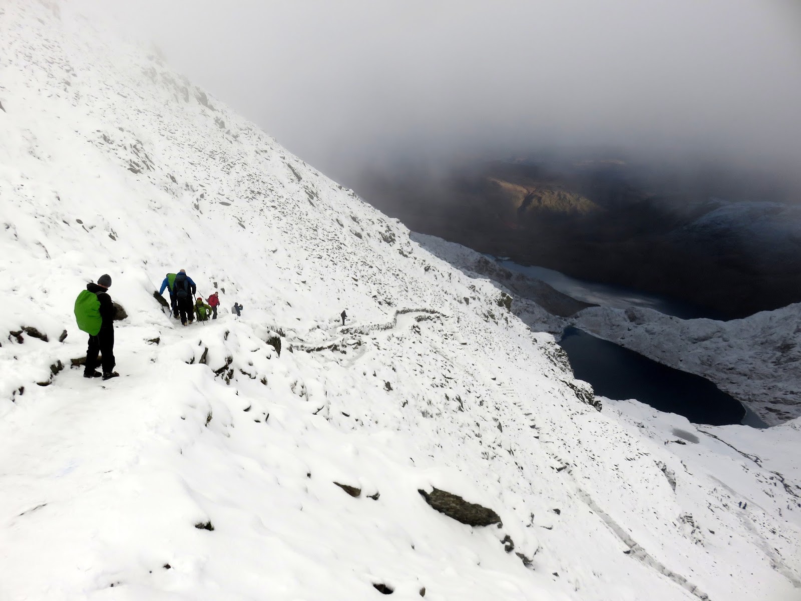
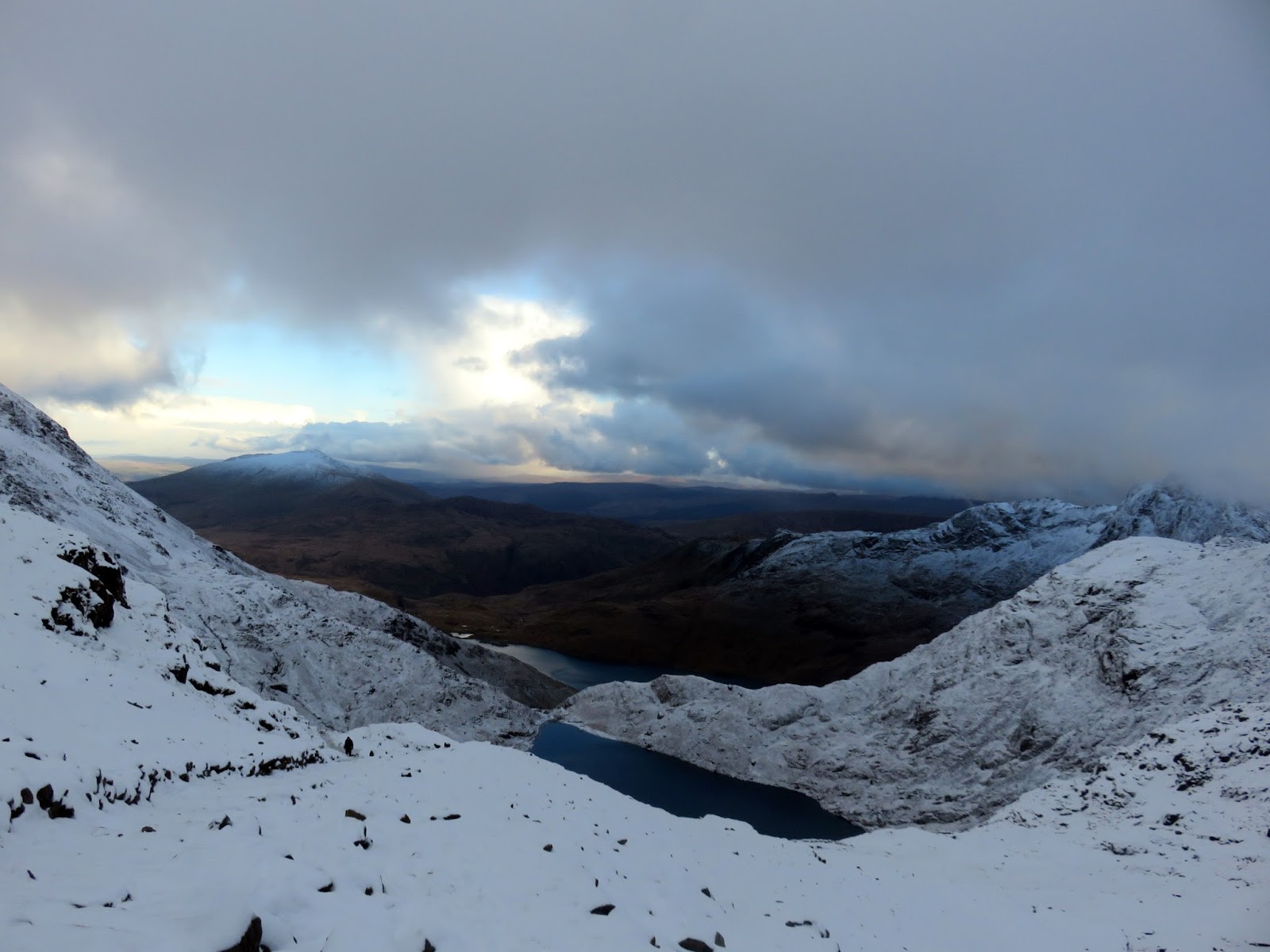
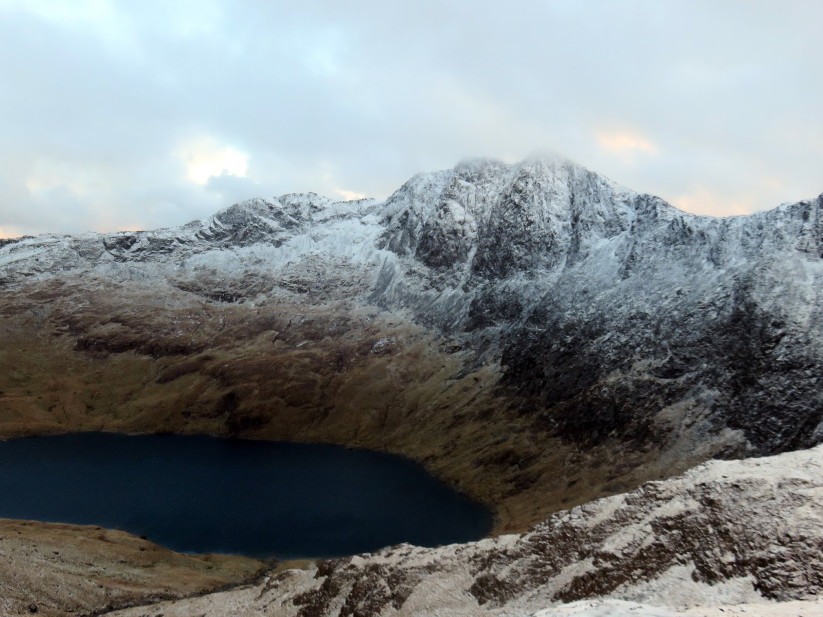
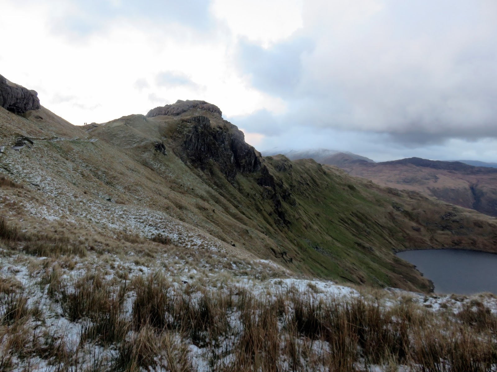
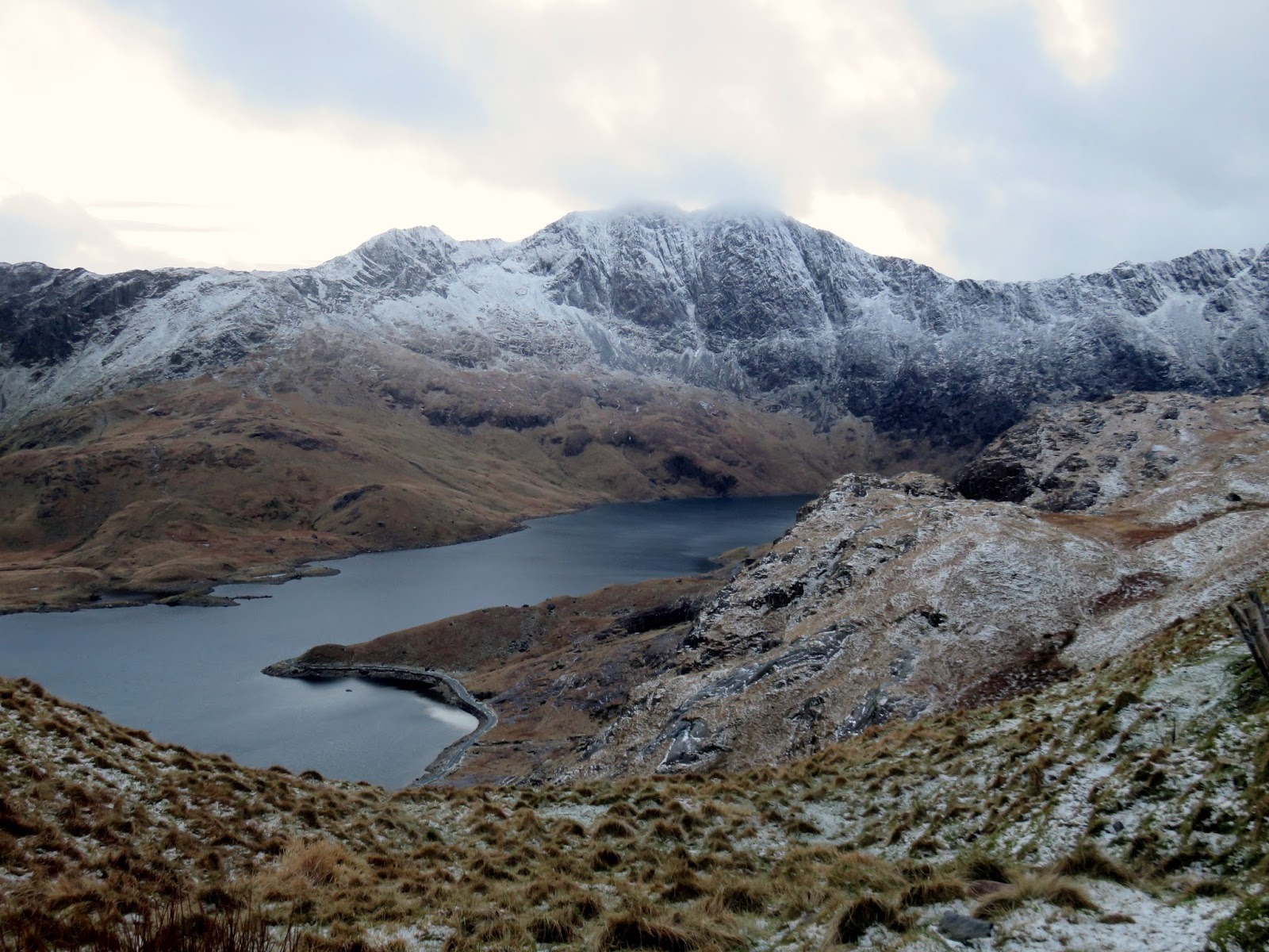
With the rain turning to snow, we left the Miner’s Track at Glaslyn to start making our way up Y Gribin which climbs some 200m up to Bwlch y Saethau. With fresh, slippery snow underfoot it was slow going but we made it in one piece. Y Gribin is probably best compared to Tryfan’s north ridge, lots of big blocks and a few tricky little scrambles but nothing that should put off a confident walker.
 |
| Y Gribin |
 |
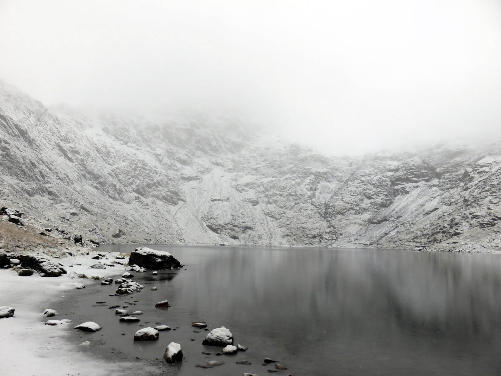
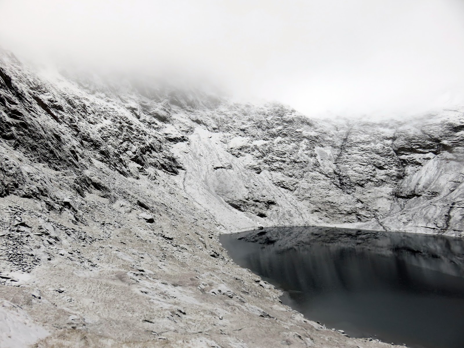
| Glaslyn |
 |
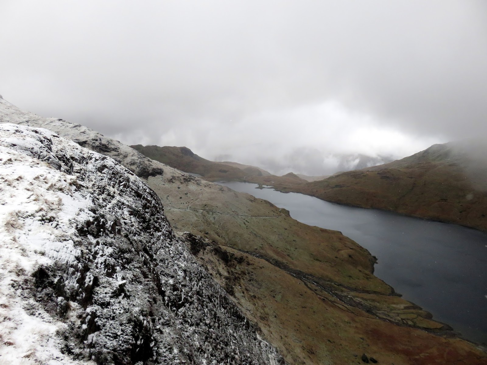
| Looking back to Llyn Llydaw |
 |
| The lower slopes of Snowdon over Glaslyn |
 |
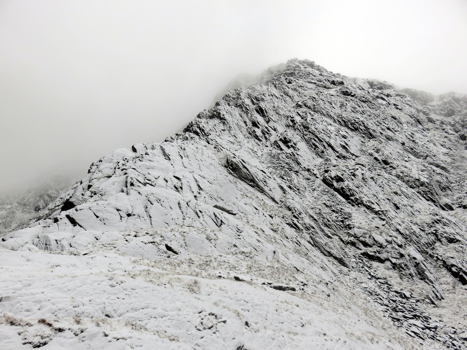
| Y Gribin – our route of ascent |
 |
| Starting the climb |
 |
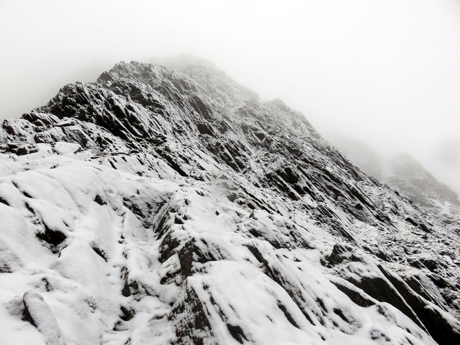
| Looking up Y Gribin |
 |
| Looking back down Y Gribin |
 |
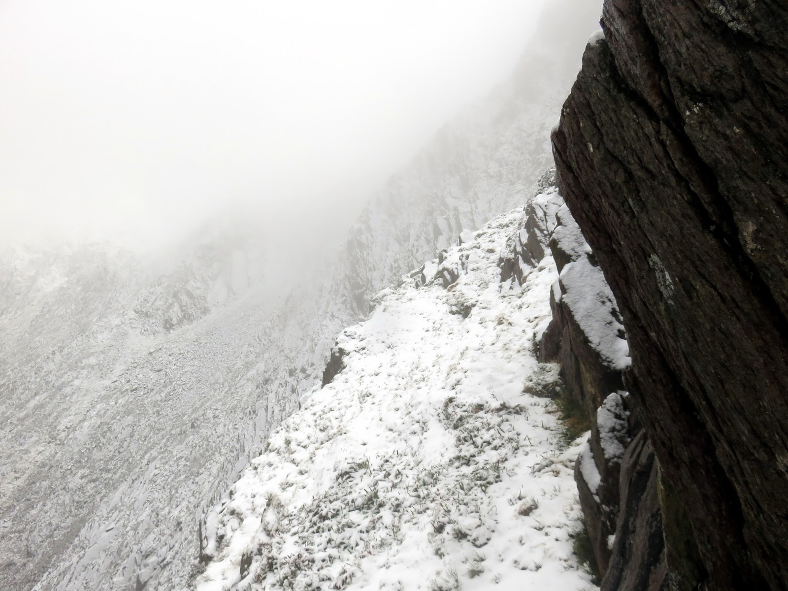
| A sketchy grassy ledge |
 |
| Y Gribin |
 |
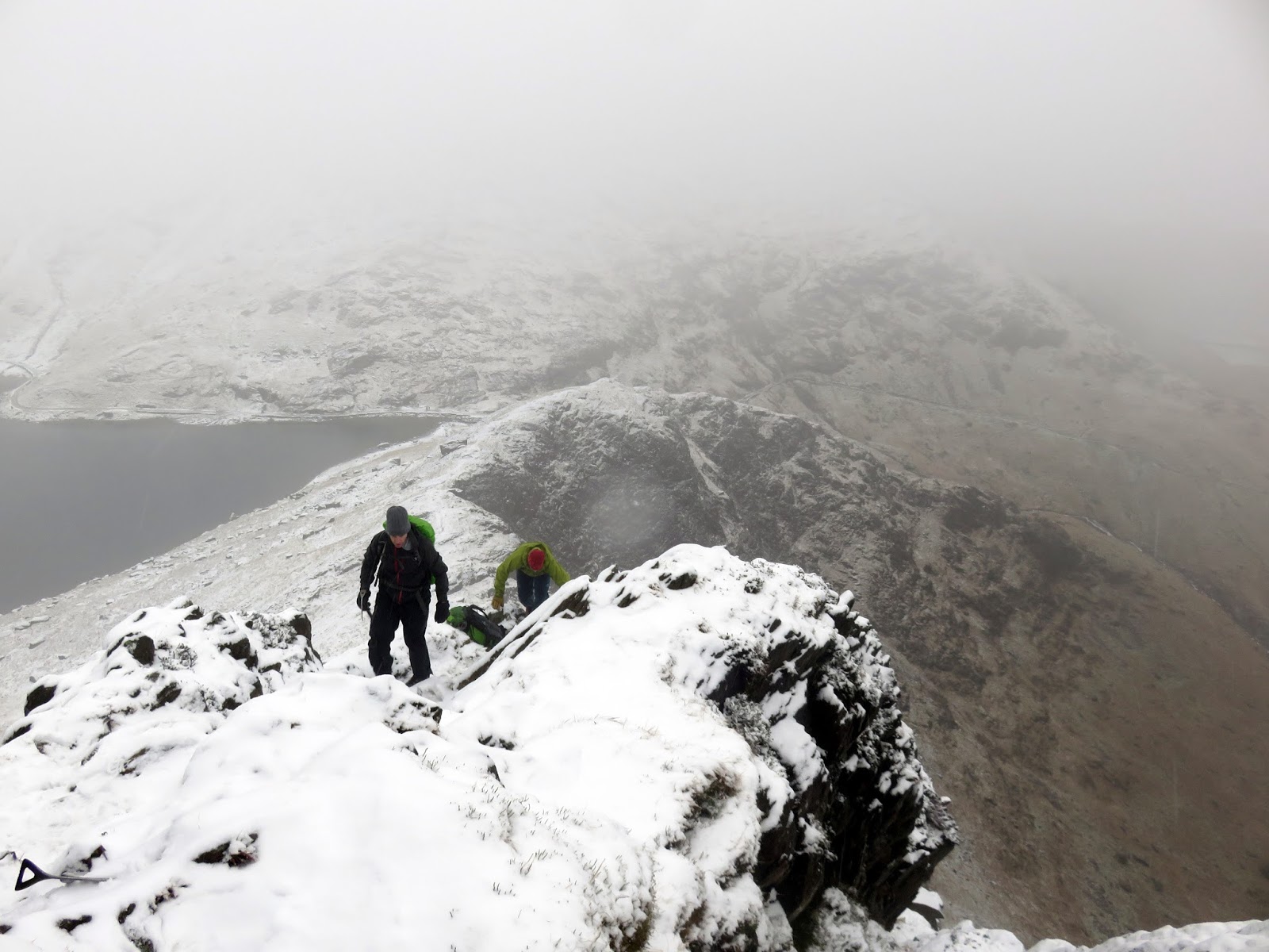
| Reaching the top |
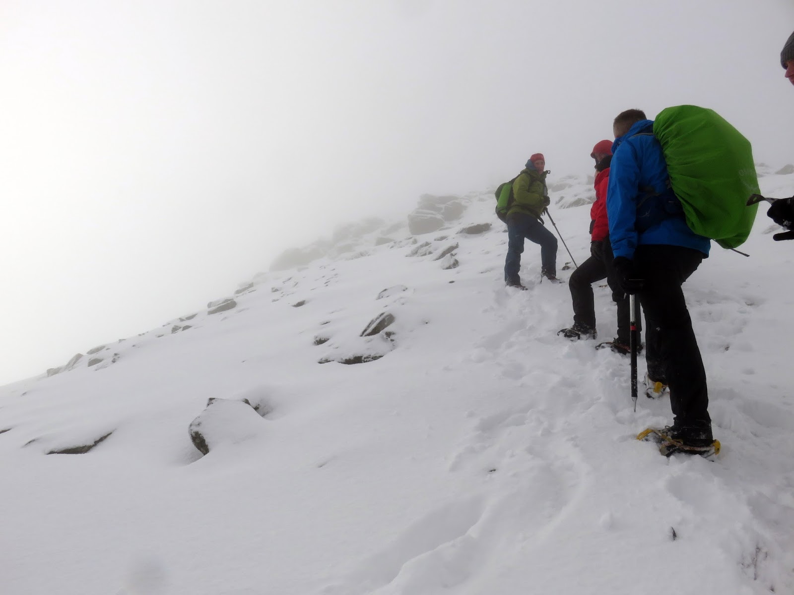
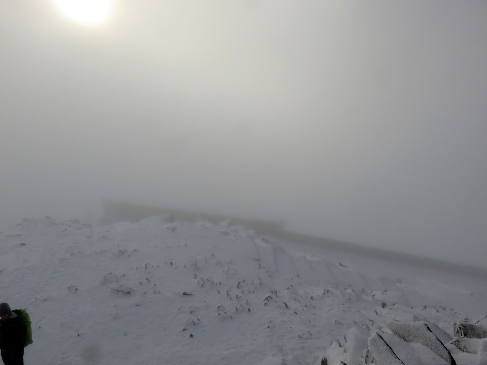
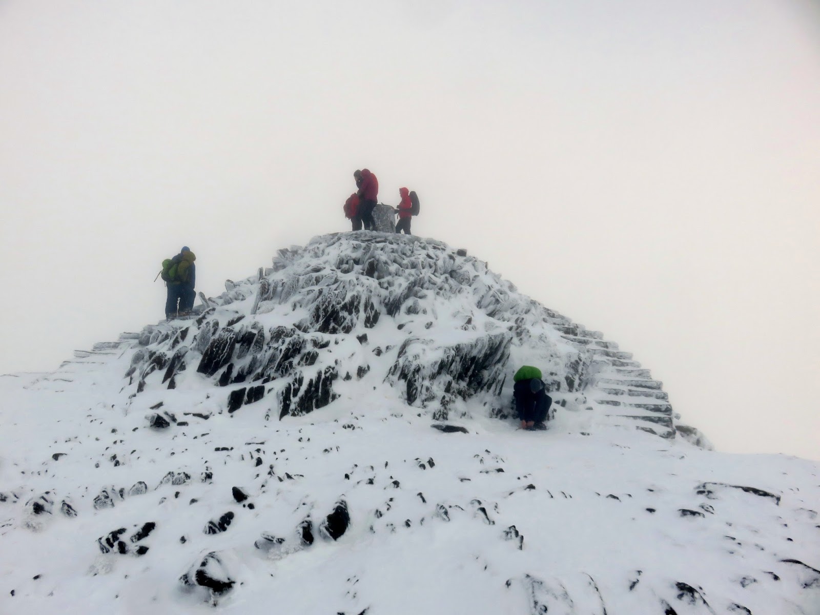
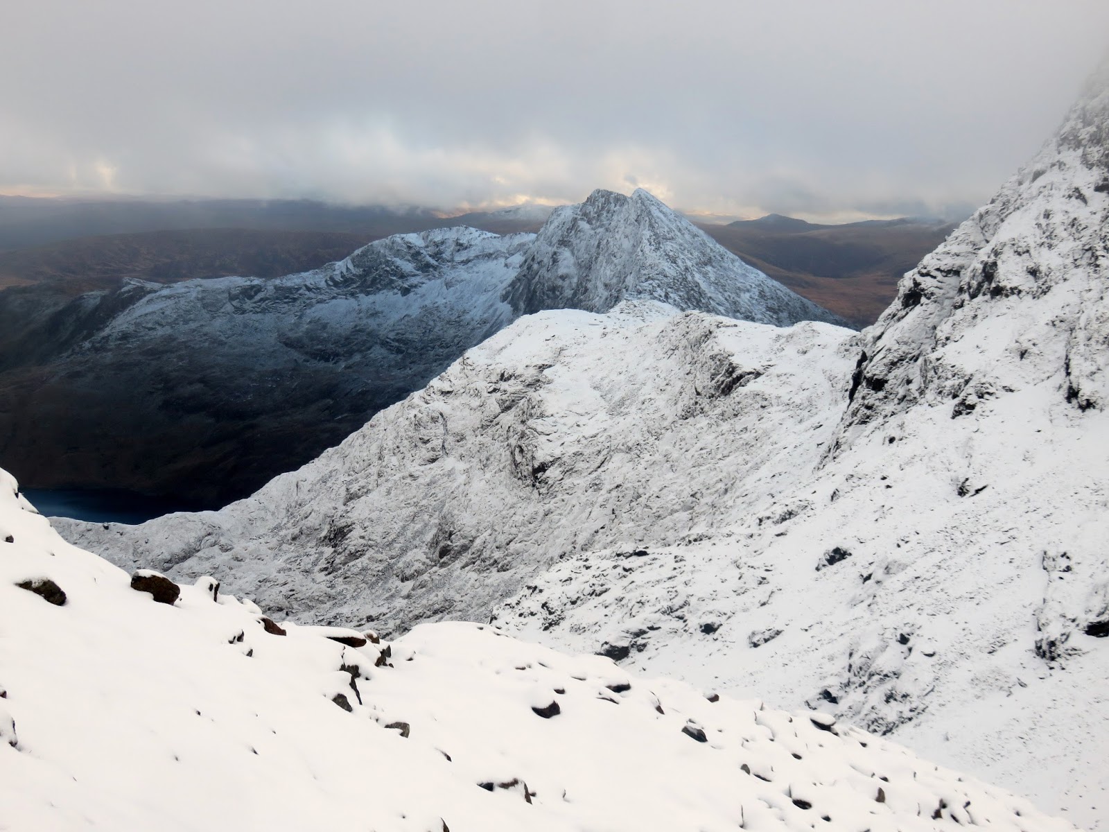
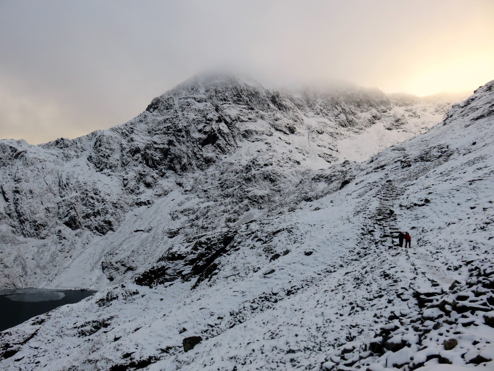
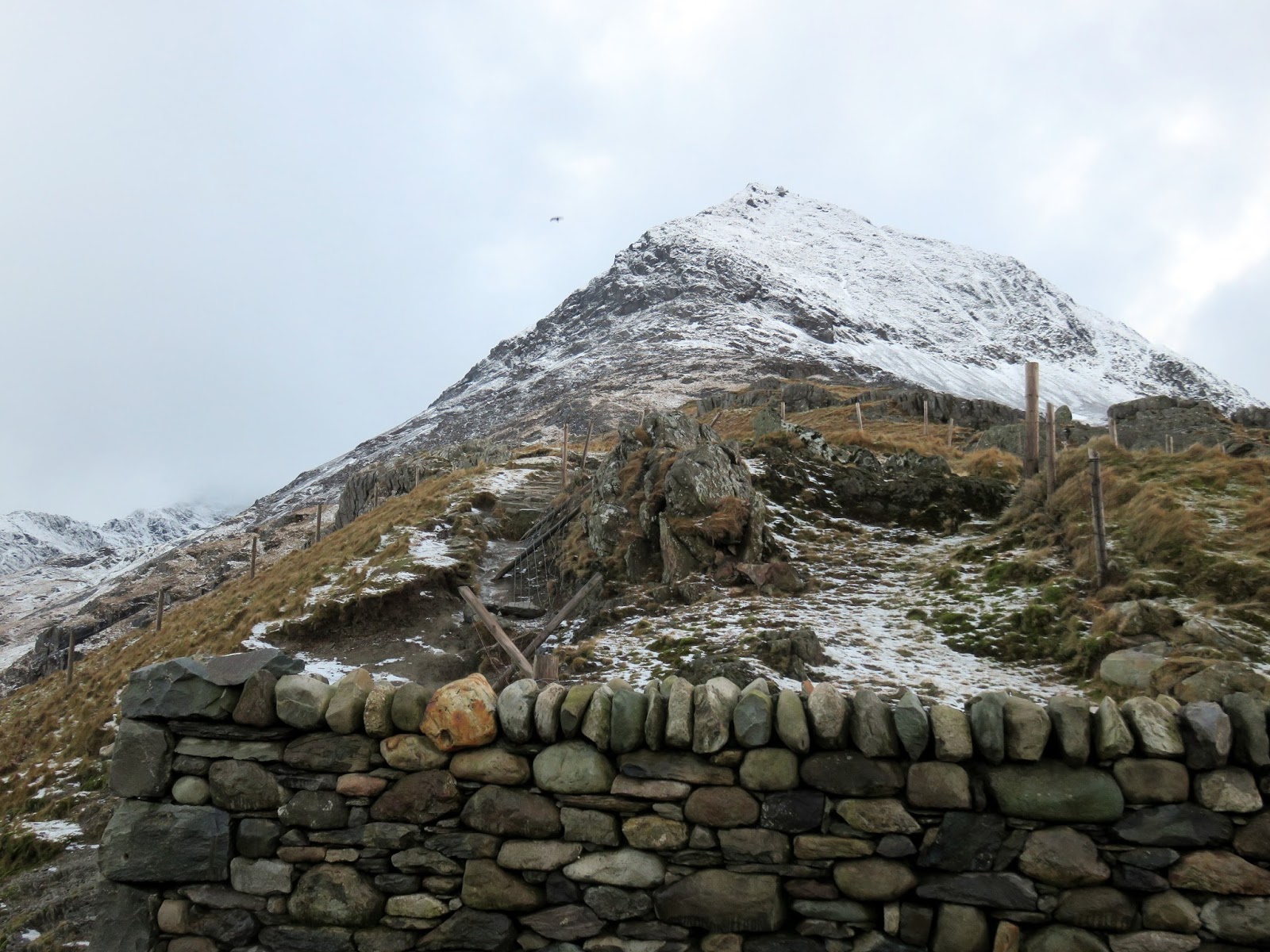
By the time we had reached Bwlch y Saethau, between Y Lliwedd and Snowdon, it had stopped snowing but the clouds stubbornly refused to lift. After donning our crampons and having a bite to eat, we spent the next hour or so making the final climb directly to the summit, up the steep slope above Clogwyn y Garnedd, rather than following the Watkin Path.
 |
| Climbing the steep slope above Clogwyn y Garnedd |
 |
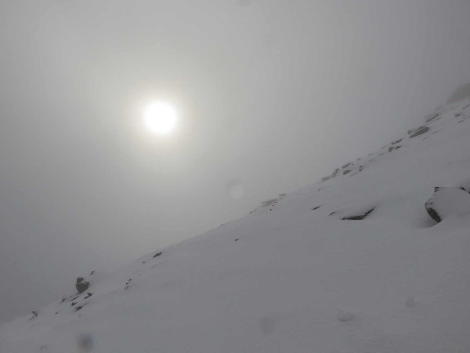
| The sun tries to poke through |
 |
| Hafod Eryri |
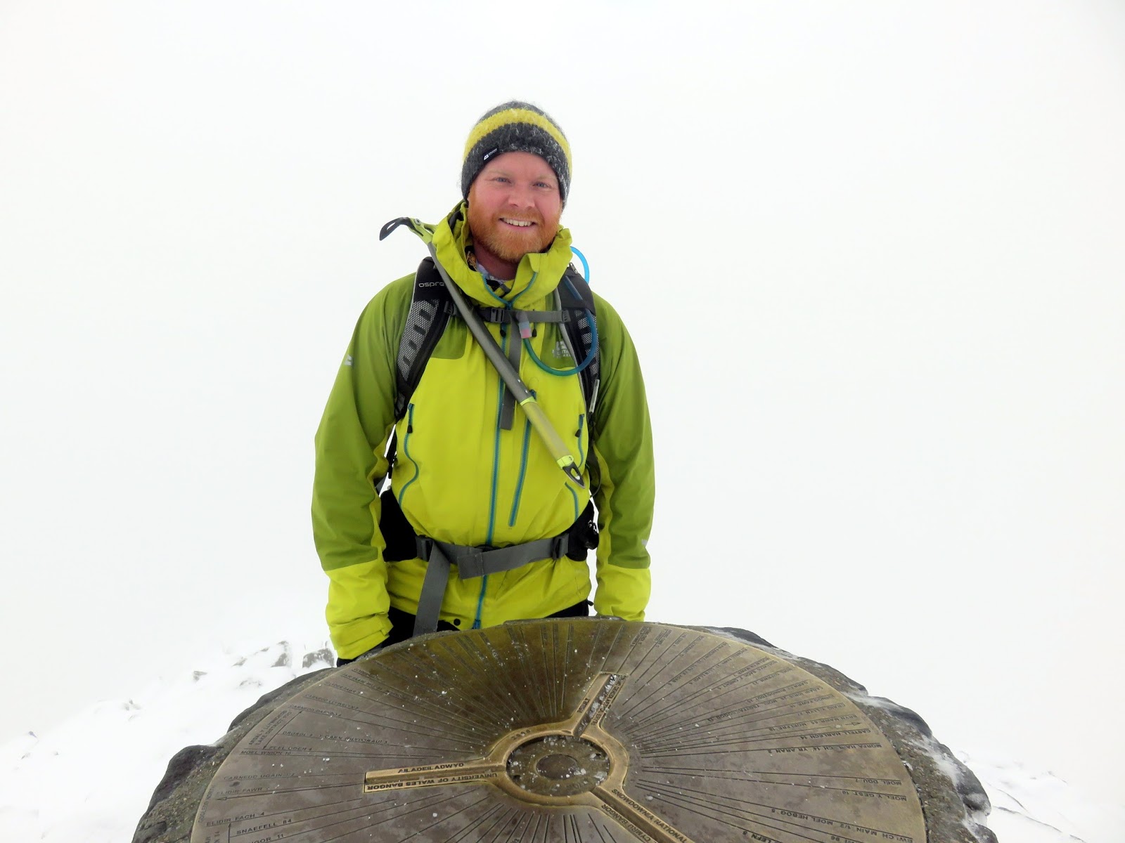
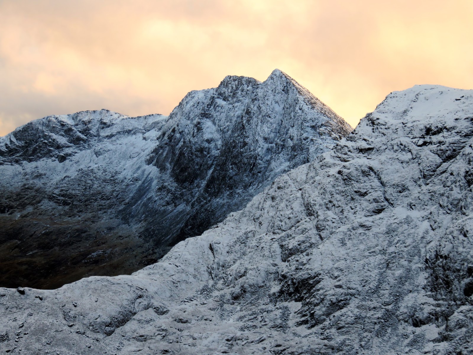
Vague hints of blue greeted our arrival and Snowdon’s summit but no views were revealed. We pottered around for a few moments, enjoying having Wales’ highest mountain to ourselves for a while before heading north to find the Pyg Track. Almost immediately, spectacular views began to reveal themselves – the cloud only lingering on Snowdon’s summit.
 |
| One of yours truly |
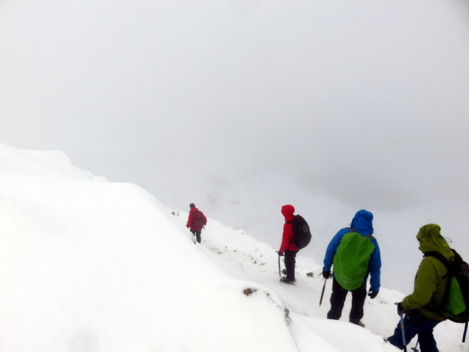
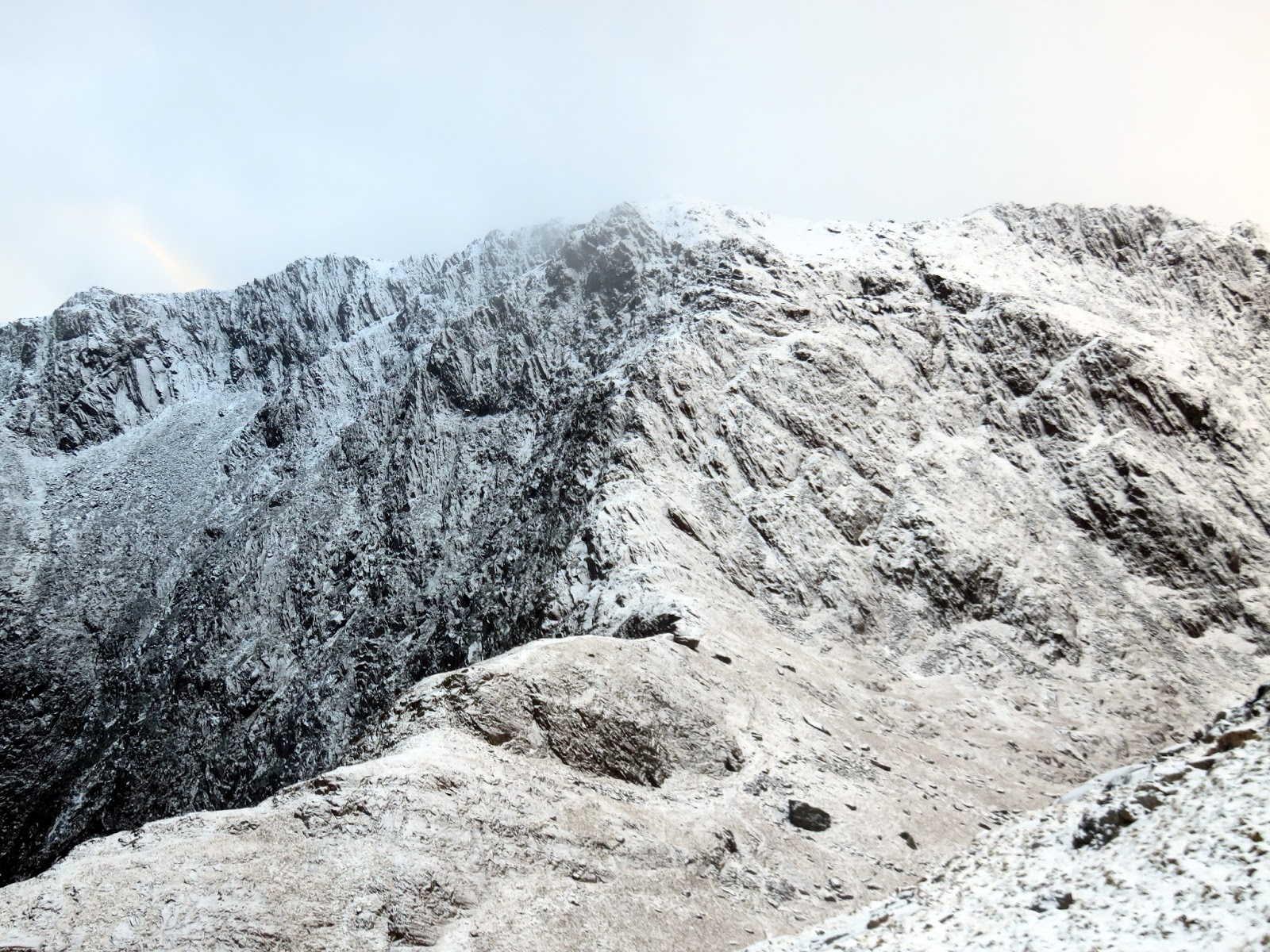
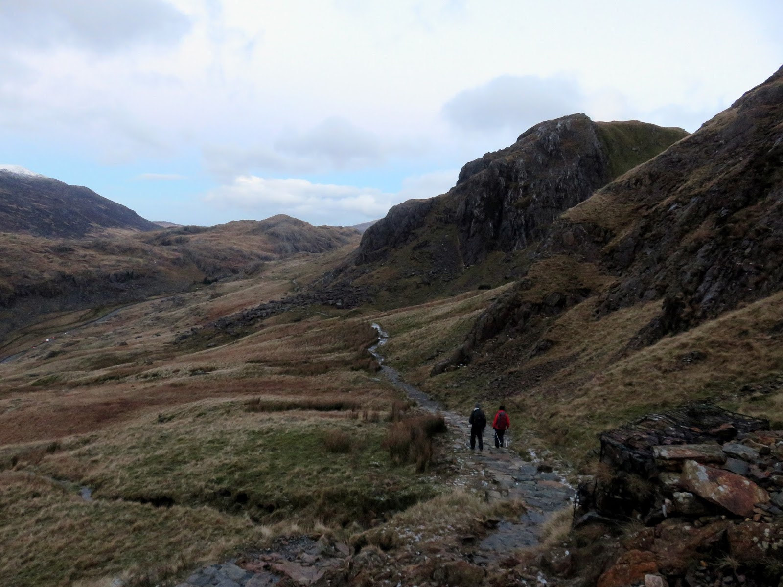
We followed the Pyg Track down beneath the slopes of Crib Goch until the path became suitably snow-free as to stop and remove our winter equipment. The Pyg Track remains high above Llyn Llydaw to reach the twin stile at Bwlch y Moch (pass of the pigs) which is one of the possible sources of the Pyg Track’s name (though it’s generally regarded to come from the Pen y Gwyrd Hotel).
 |
| Starting our descent down the Pyg Track |
 |
| The Pyg Track |
 |
| Glaslyn |
 |
| The Pyg Track |
 |
| Y Gribin once again |
 |
| Craig Fach |
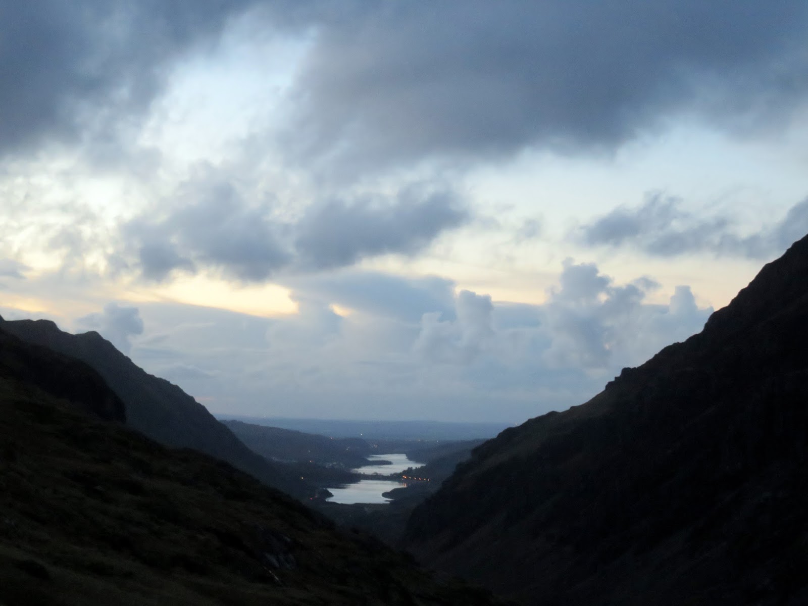
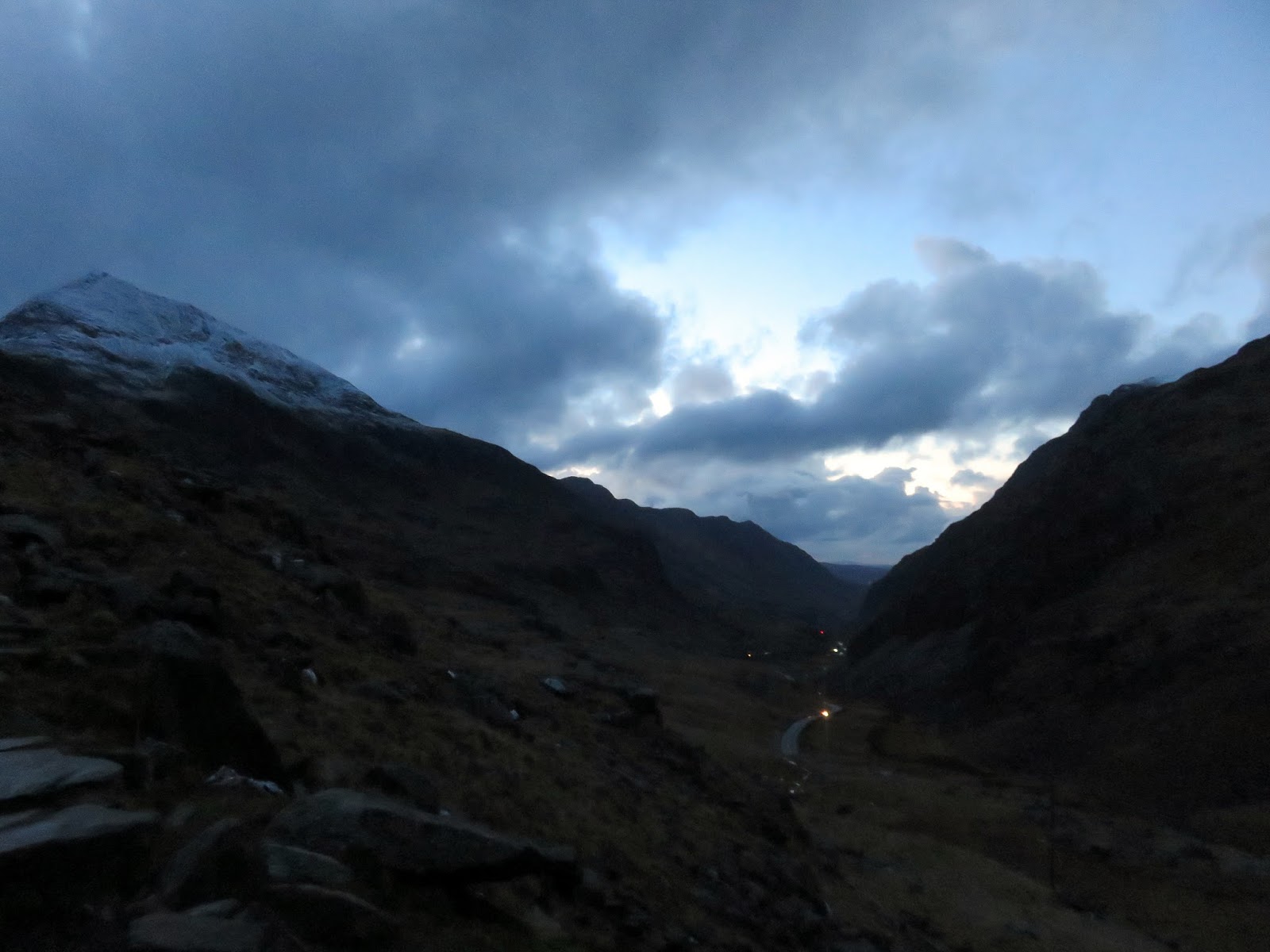
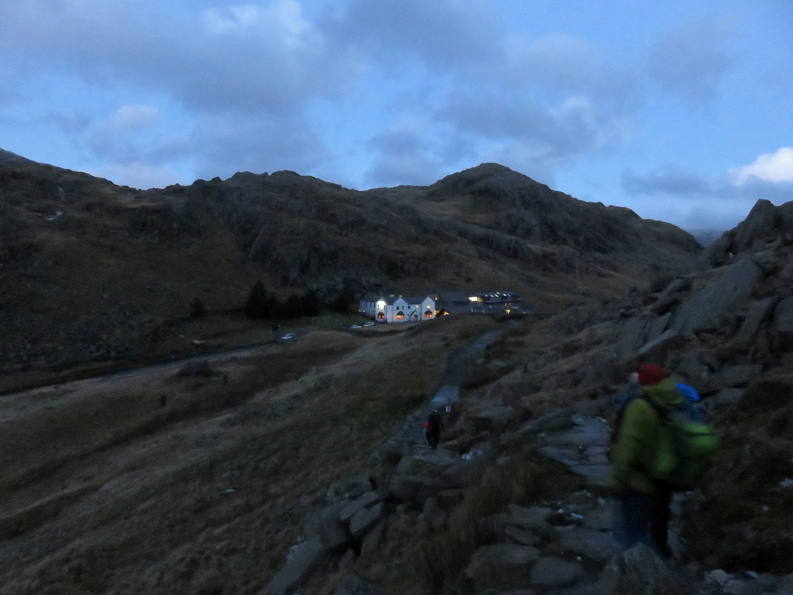
The light was starting to fail as we finally reached Pen-y-Pass once again, satisfied with a quality winter outing. Another shout out to the staff at Plas y Brenin who are excellent. If you’re considering taking your hill walking into the winter months that there’s no better place to learn the skills necessary to make the most of it.
 |
| The double stile below Crib Goch |
 |
| Crib Goch |
 |
| The Pyg Track |
 |
| View to Llanberis |
 |
| The Llanberis Pass |
 |
| Pen y Pass |
