Open Space Web-Map builder Codehttps://openspace.ordnancesurvey.co.uk/osmapapi/openspace.js?key=3119F72552FD5C22E0530C6CA40A5A92https://openspace.ordnancesurvey.co.uk/osmapapi/script/mapbuilder/basicmap.jshttps://openspace.ordnancesurvey.co.uk/osmapapi/script/mapbuilder/searchbox.js//variables for routes var linesLayer, points, lineFeature, lineString, routeMarkersLayer, routepos, routesize, routeoffset, routeicon; var style_blue = {strokeColor: “#0000CD”, strokeOpacity: 0.5, strokeWidth: 4.5}; function initmapbuilder() { //initiate the map var options = {resolutions: [2500, 1000, 500, 200, 100, 50, 25, 10, 5, 4, 2.5, 2, 1]}; osMap = new OpenSpace.Map(‘map’, options); //configure map options (basicmap.js) setglobaloptions(); //set the center of the map and the zoom level osMap.setCenter(new OpenSpace.MapPoint(330519.20944557,506631.89590664),7); linesLayer = osMap.getVectorLayer(); // Set up layer for route markers routeMarkersLayer = new OpenLayers.Layer.Markers(“Route Markers”); //make a route points = new Array(); points.push(new OpenLayers.Geometry.Point(329526.33206177,506631.66793823)); points.push(new OpenLayers.Geometry.Point(329651.33206177,506696.66793823)); points.push(new OpenLayers.Geometry.Point(329731.33206177,506721.66793823)); points.push(new OpenLayers.Geometry.Point(329726.33206177,506936.66793823)); points.push(new OpenLayers.Geometry.Point(329716.33206177,507121.66793823)); points.push(new OpenLayers.Geometry.Point(329726.33206177,507251.66793823)); points.push(new OpenLayers.Geometry.Point(329766.33206177,507416.66793823)); points.push(new OpenLayers.Geometry.Point(329791.33206177,507231.66793823)); points.push(new OpenLayers.Geometry.Point(329796.33206177,507511.66793823)); points.push(new OpenLayers.Geometry.Point(329886.33206177,507616.66793823)); points.push(new OpenLayers.Geometry.Point(330161.33206177,507836.66793823)); points.push(new OpenLayers.Geometry.Point(330306.33206177,507806.66793823)); points.push(new OpenLayers.Geometry.Point(330461.33206177,507796.66793823)); points.push(new OpenLayers.Geometry.Point(330626.33206177,507766.66793823)); points.push(new OpenLayers.Geometry.Point(330806.33206177,507816.66793823)); points.push(new OpenLayers.Geometry.Point(330801.33206177,507696.66793823)); points.push(new OpenLayers.Geometry.Point(330761.33206177,507566.66793823)); points.push(new OpenLayers.Geometry.Point(330986.33206177,507601.66793823)); points.push(new OpenLayers.Geometry.Point(331106.33206177,507486.66793823)); points.push(new OpenLayers.Geometry.Point(331181.33206177,507291.66793823)); points.push(new OpenLayers.Geometry.Point(331356.33206177,507166.66793823)); points.push(new OpenLayers.Geometry.Point(331516.33206177,507091.66793823)); points.push(new OpenLayers.Geometry.Point(331681.33206177,507091.66793823)); points.push(new OpenLayers.Geometry.Point(331821.33206177,507086.66793823)); points.push(new OpenLayers.Geometry.Point(331851.33206177,507006.66793823)); points.push(new OpenLayers.Geometry.Point(331811.33206177,506951.66793823)); points.push(new OpenLayers.Geometry.Point(331831.33206177,506866.66793823)); points.push(new OpenLayers.Geometry.Point(331896.33206177,506746.66793823)); points.push(new OpenLayers.Geometry.Point(332036.33206177,506691.66793823)); points.push(new OpenLayers.Geometry.Point(332176.33206177,506671.66793823)); points.push(new OpenLayers.Geometry.Point(332486.33206177,506621.66793823)); points.push(new OpenLayers.Geometry.Point(332246.33206177,506526.66793823)); points.push(new OpenLayers.Geometry.Point(332091.33206177,506521.66793823)); points.push(new OpenLayers.Geometry.Point(332068.33206177,506288.66793823)); points.push(new OpenLayers.Geometry.Point(332072.33206177,506176.66793823)); points.push(new OpenLayers.Geometry.Point(332072.33206177,506072.66793823)); points.push(new OpenLayers.Geometry.Point(332036.33206177,505976.66793823)); points.push(new OpenLayers.Geometry.Point(332008.33206177,505876.66793823)); points.push(new OpenLayers.Geometry.Point(331976.33206177,505832.66793823)); points.push(new OpenLayers.Geometry.Point(331992.33206177,505664.66793823)); points.push(new OpenLayers.Geometry.Point(331940.33206177,505604.66793823)); points.push(new OpenLayers.Geometry.Point(331868.33206177,505432.66793823)); points.push(new OpenLayers.Geometry.Point(331752.33206177,505400.66793823)); points.push(new OpenLayers.Geometry.Point(331668.33206177,505408.66793823)); points.push(new OpenLayers.Geometry.Point(331572.33206177,505664.66793823)); points.push(new OpenLayers.Geometry.Point(331480.33206177,505740.66793823)); points.push(new OpenLayers.Geometry.Point(331368.33206177,505992.66793823)); points.push(new OpenLayers.Geometry.Point(331320.33206177,506096.66793823)); points.push(new OpenLayers.Geometry.Point(331126.33206177,506200.66793823)); points.push(new OpenLayers.Geometry.Point(331031.33206177,506160.66793823)); points.push(new OpenLayers.Geometry.Point(330661.33206177,506255.66793823)); points.push(new OpenLayers.Geometry.Point(330201.33206177,506360.66793823)); points.push(new OpenLayers.Geometry.Point(329756.33206177,506415.66793823)); points.push(new OpenLayers.Geometry.Point(329551.33206177,506420.66793823)); points.push(new OpenLayers.Geometry.Point(329702.33206177,506508.66793823)); points.push(new OpenLayers.Geometry.Point(329526.33206177,506631.66793823)); // create a polyline feature from the array of points lineString = new OpenLayers.Geometry.LineString(points); lineFeature = new OpenLayers.Feature.Vector(lineString, null, style_blue); linesLayer.addFeatures([lineFeature]); //crate a route start/end marker routepos = new OpenSpace.MapPoint(329526.33206177,506631.66793823); routesize = new OpenLayers.Size(33,45); routeoffset = new OpenLayers.Pixel(-5,-37); routeicon = new OpenSpace.Icon(‘https://openspace.ordnancesurvey.co.uk/osmapapi/img_versions/img_1.1/mapbuilder/routemarker-startend.png’, routesize, routeoffset, null, null); routeMarkersLayer.addMarker(new OpenLayers.Marker(routepos, routeicon)); osMap.addLayer(routeMarkersLayer);}
Route: Millbeck, Whitegill Ravine, Blea Rigg, Castle How, Swinescar Hause, Swinescar Pike, Lang How, Silver How, Megs Gill, Chapel Stile, Robinson Place, Millbeck
Date: 22/01/2017
From: Millbeck Farm
Parking: Stickle Ghyll
Start Point: Millbeck Farm
Region: Central Fells
Route length: 6.4 miles (9.5 km)
Time taken : 03:28
Average speed: 1.3 mph
Ascent: 584m
Descent: 587m
Wainwrights on this walk: Blea Rigg (541m), Silver How (395m)
Additional summits: Castle How (500m), Swinescar Pike (411m), Lang How (414m)
Other Points of Interest: Whitegill Ravine, Megs Gill
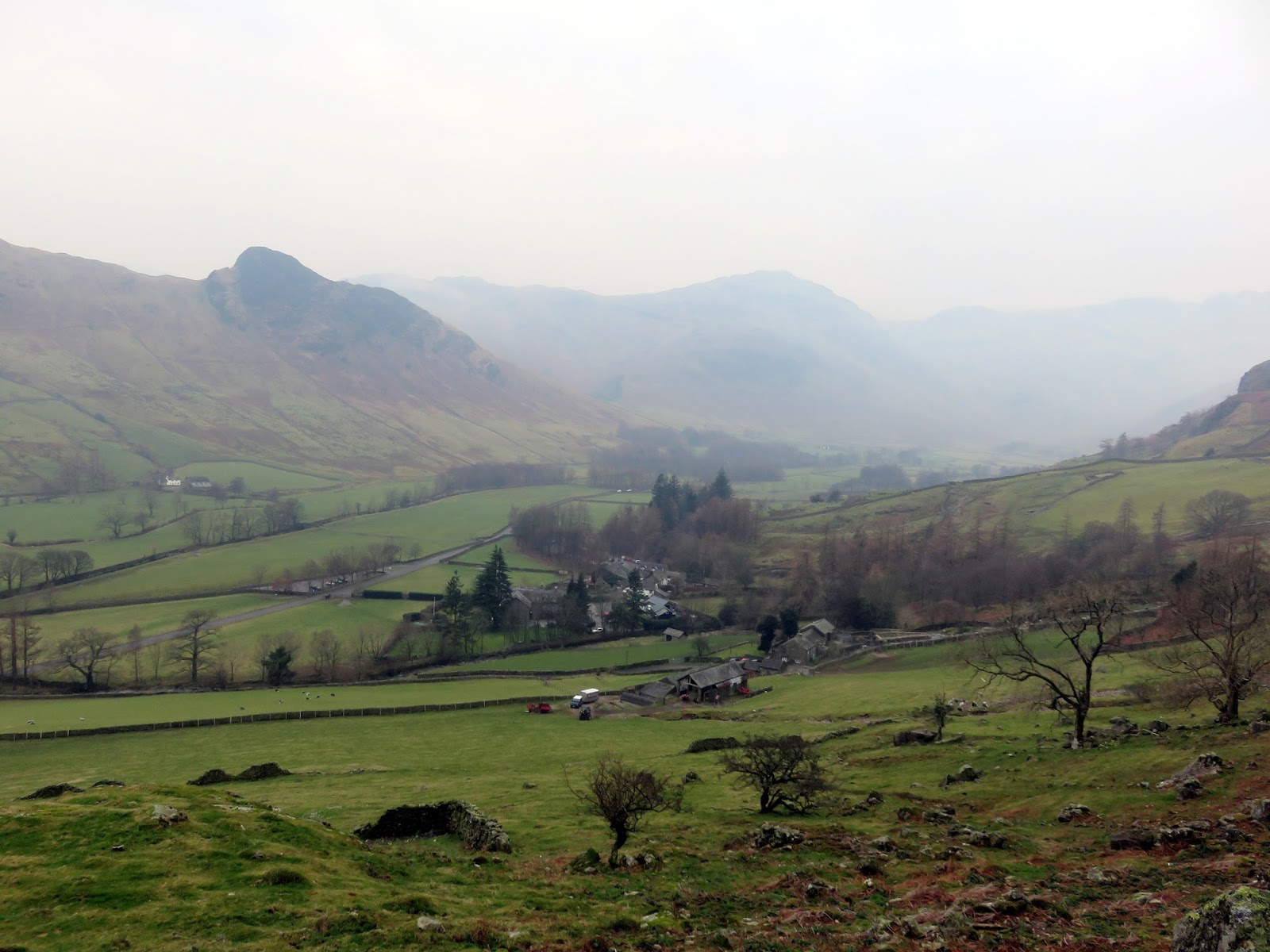
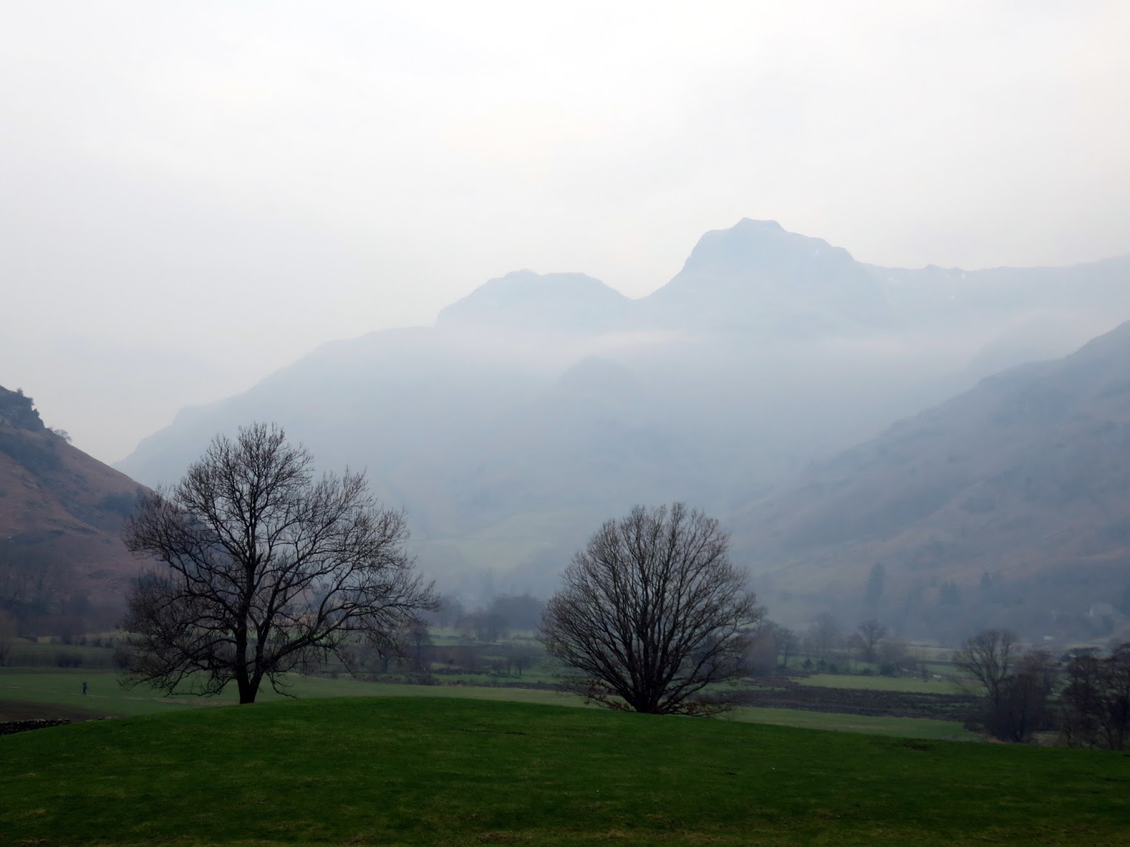
Cloud and mist were the order of the dayb today, though, in hindsight, this turned out to be a very enjoyable walk with some atmospheric scenes through the day. The Blea Rigg ridge is often an overlooked walking area with more people opting for the attractive Langdale Pikes or the famous Helm Crag. This leaves it free for exploration without crowds.
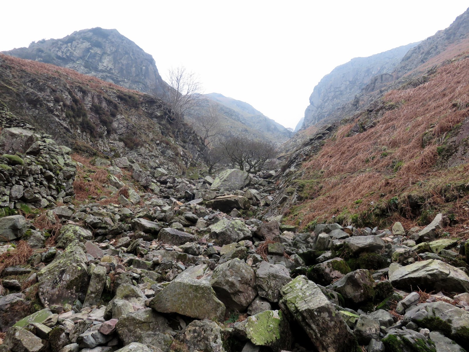
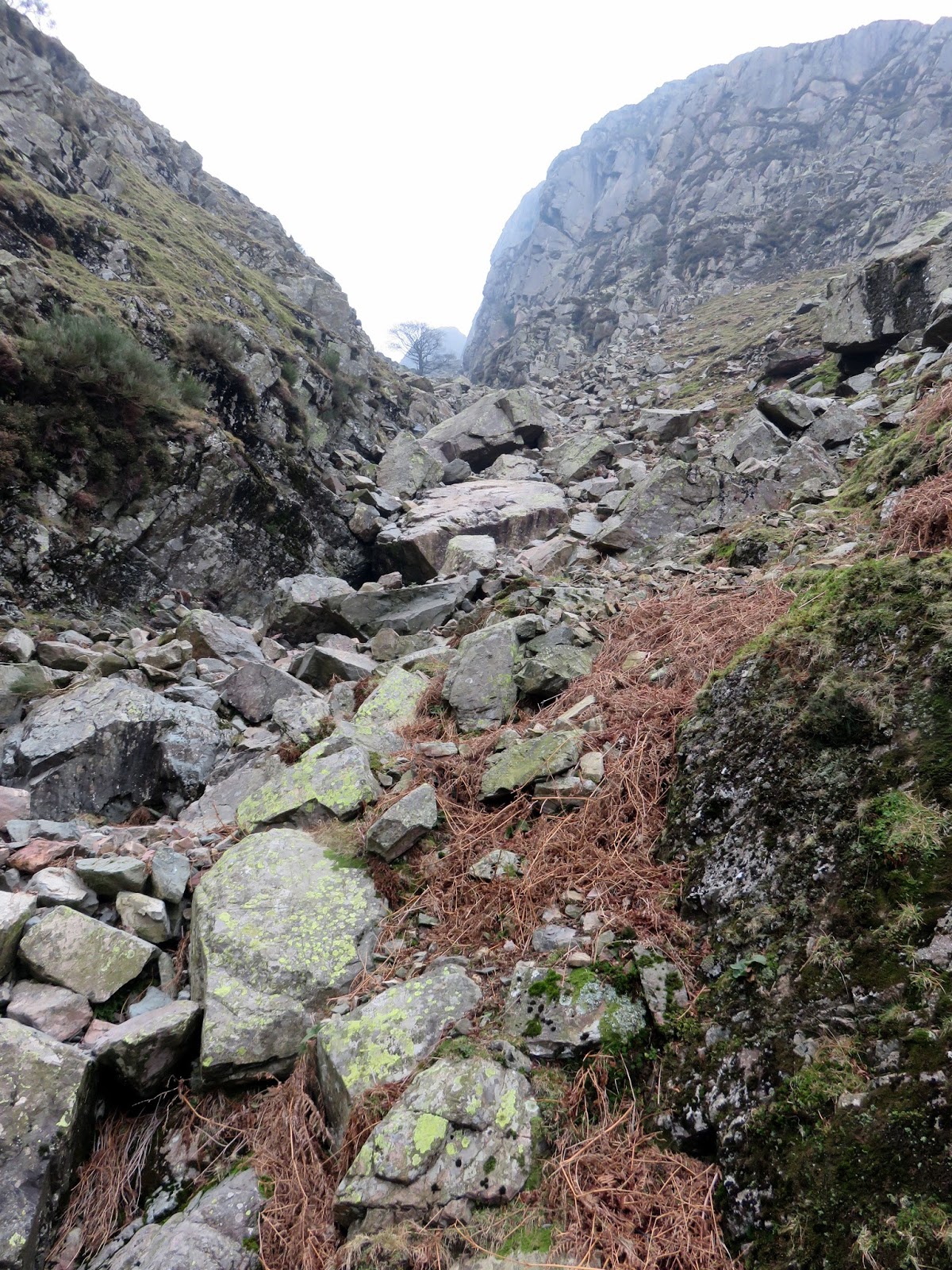
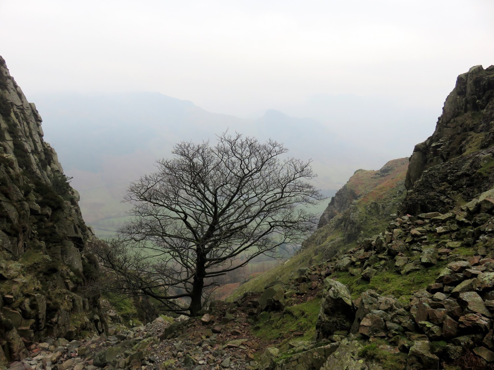
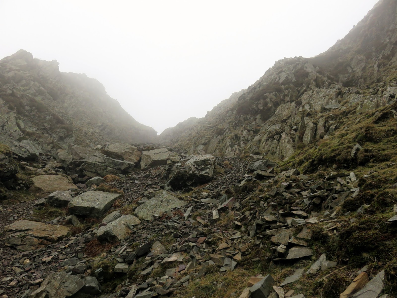
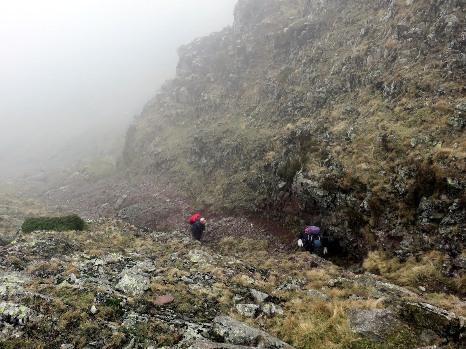
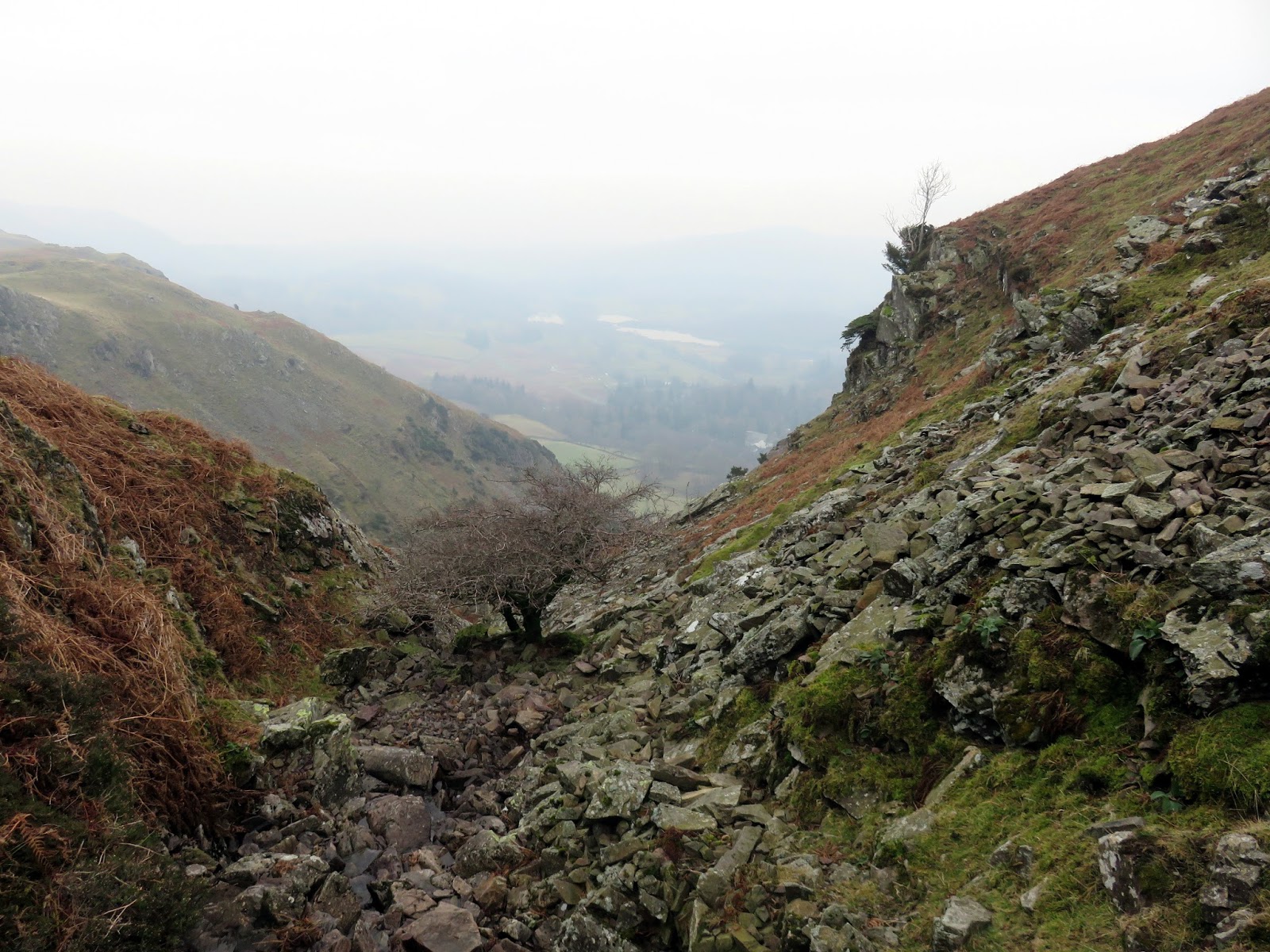
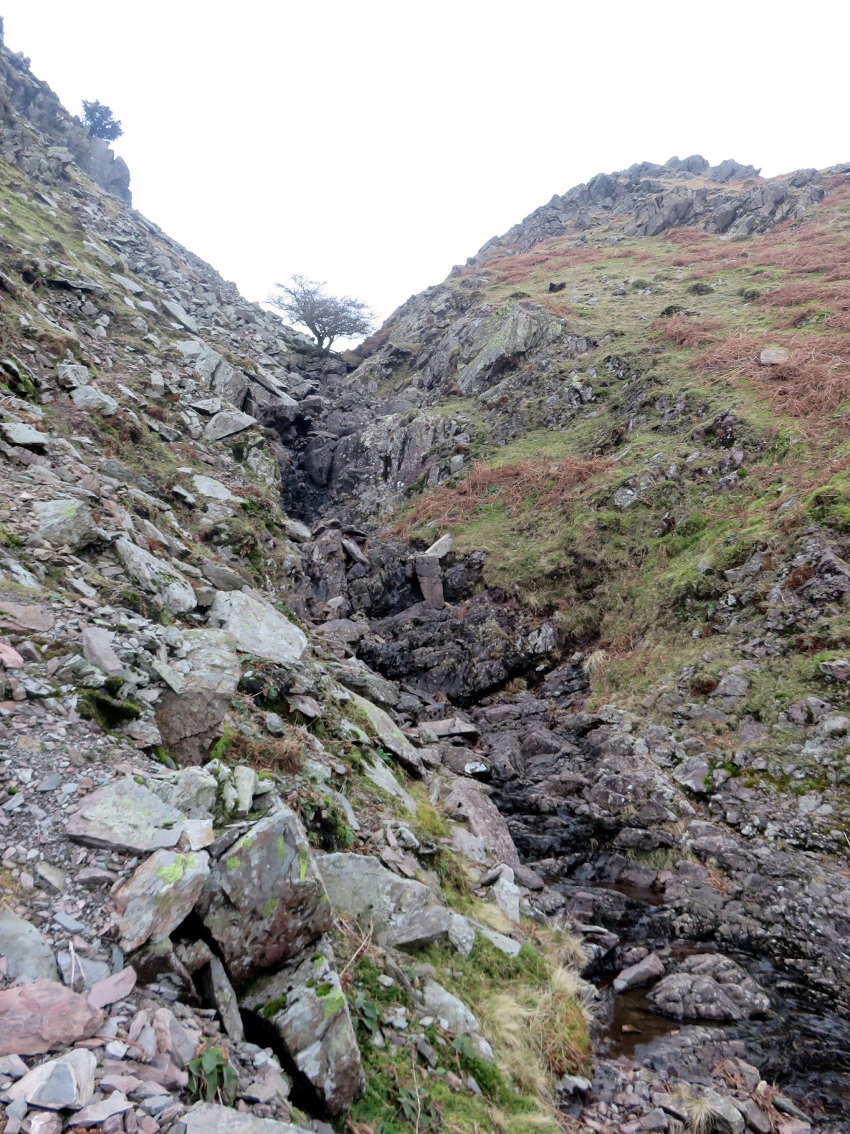
We set off from Great Langdale, using the dry valley of Whitegill Ravine to get from the valley floor up onto the ridge. You can access it by following a path from the rear of the Old Dungeon Ghyll Hotel, behind Millbeck Farm and passing through some woodland to its base. There, it runs directly up onto the Blea Rigg ridge beneath the watchful Whitegill Crag. It’s a much more agreeable route than the Stickle Ghyll path, which can get very busy. In the ravine, we didn’t see a soul.
 |
| A misty morning in Great Langdale |
 |
| Whitegill Ravine |
 |
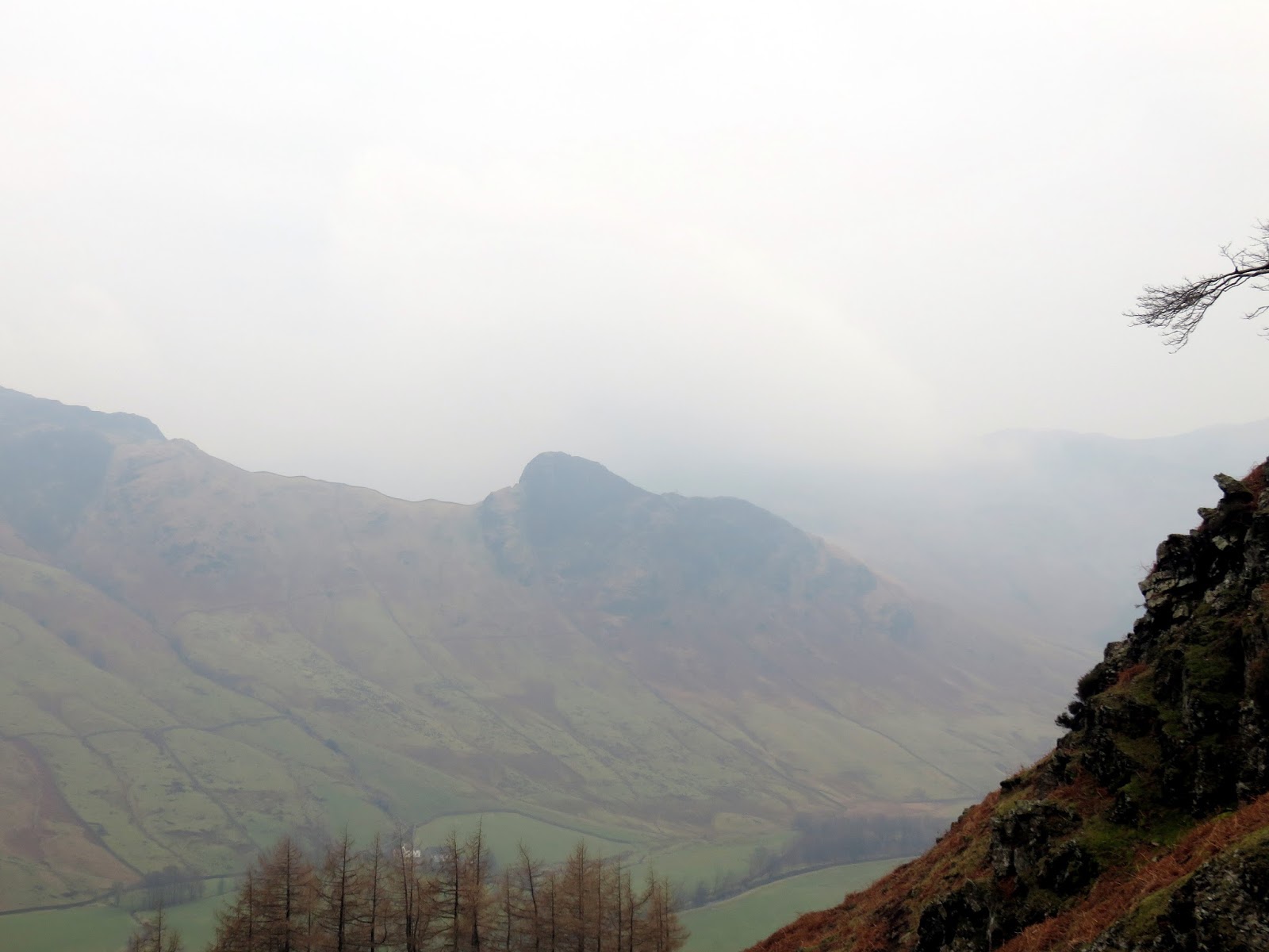
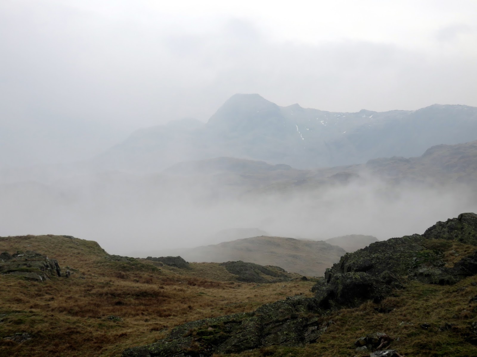
| Side Pike through the cloom |
 |
| Whitegill Ravine |
 |
| A tree stands around halfway up the ravine |
 |
| Whitegill Ravine |
 |
| Exiting the top of the ravine |
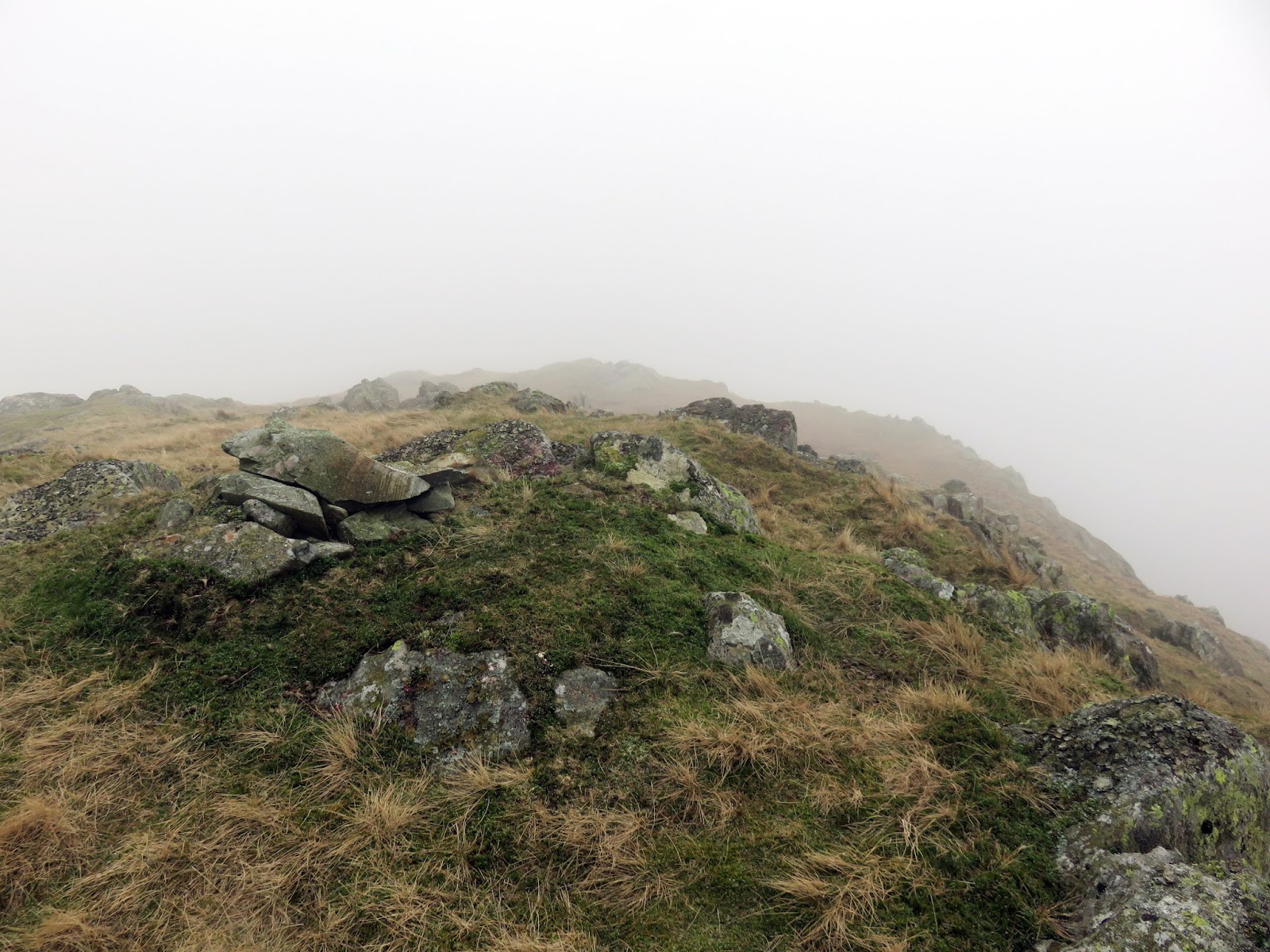
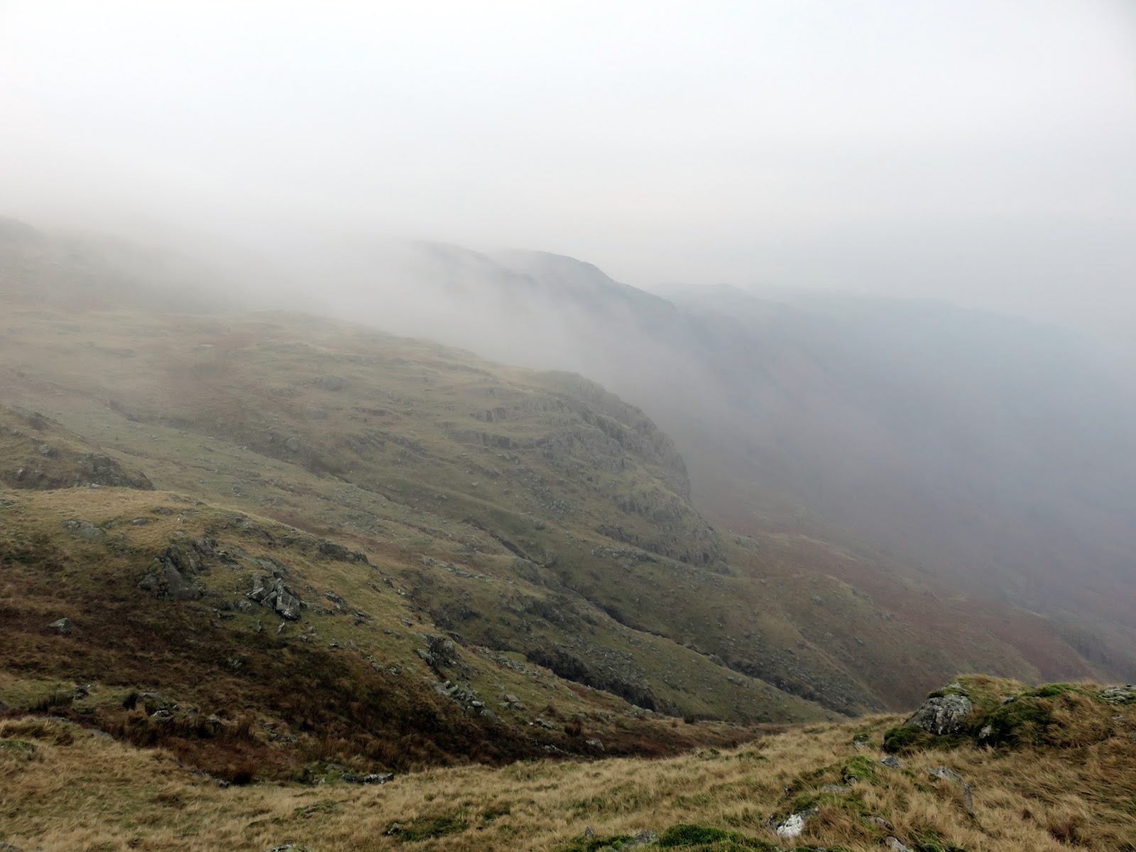
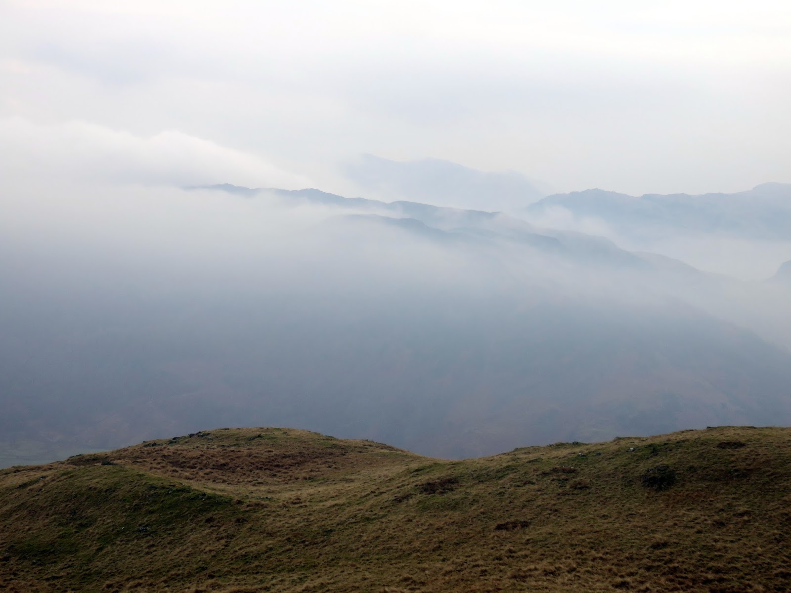
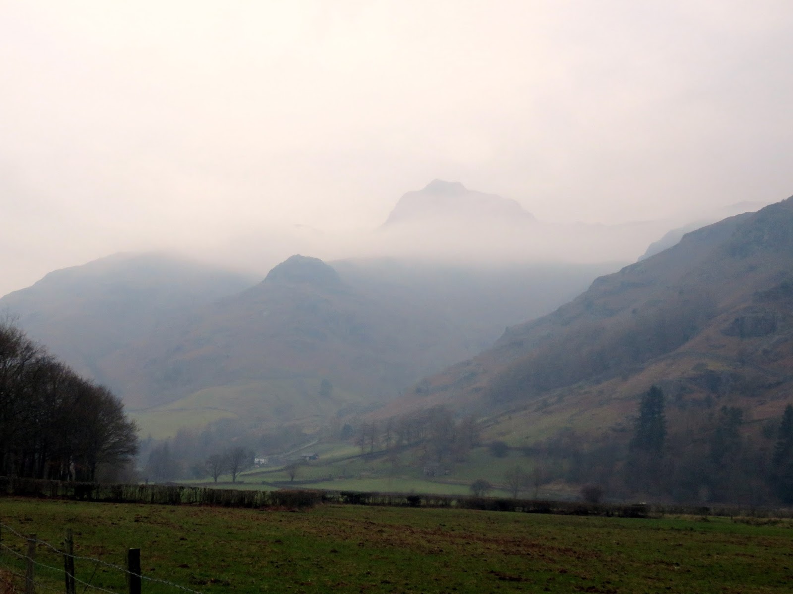
We emerged into onto the quiet, misty ridge, quickly ticking off the summit of Whitegill Crag before taking a bearing for Blea Rigg. As fortune had it, the cloud and mist lifted enough for us to see our destination, just over half a mile away. The long ridge comprises a broad plateau with a succession of rocky tops and many ill-defined paths – the perfect place to wander from height to height.
 |
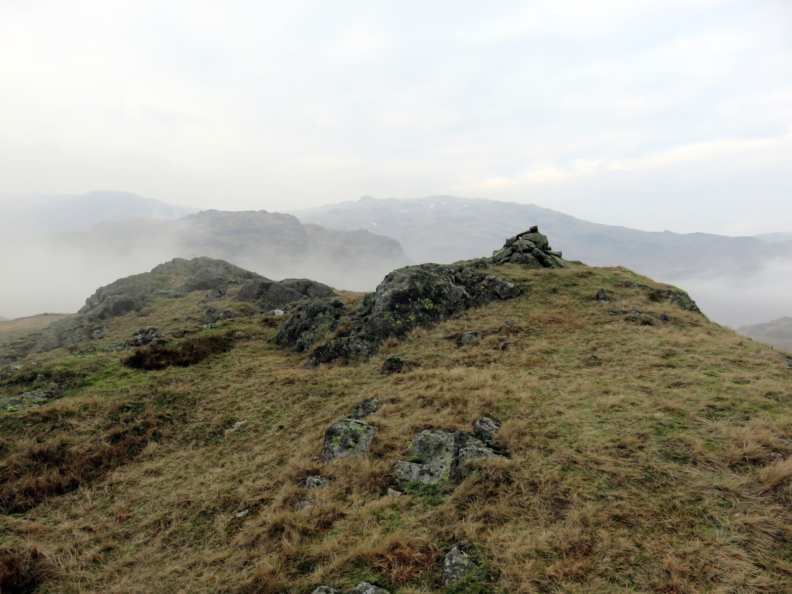
| The summit of Whitegill Crag |
 |
| Raw Pike pokes out of the mist |
 |
| The summit comes into view |
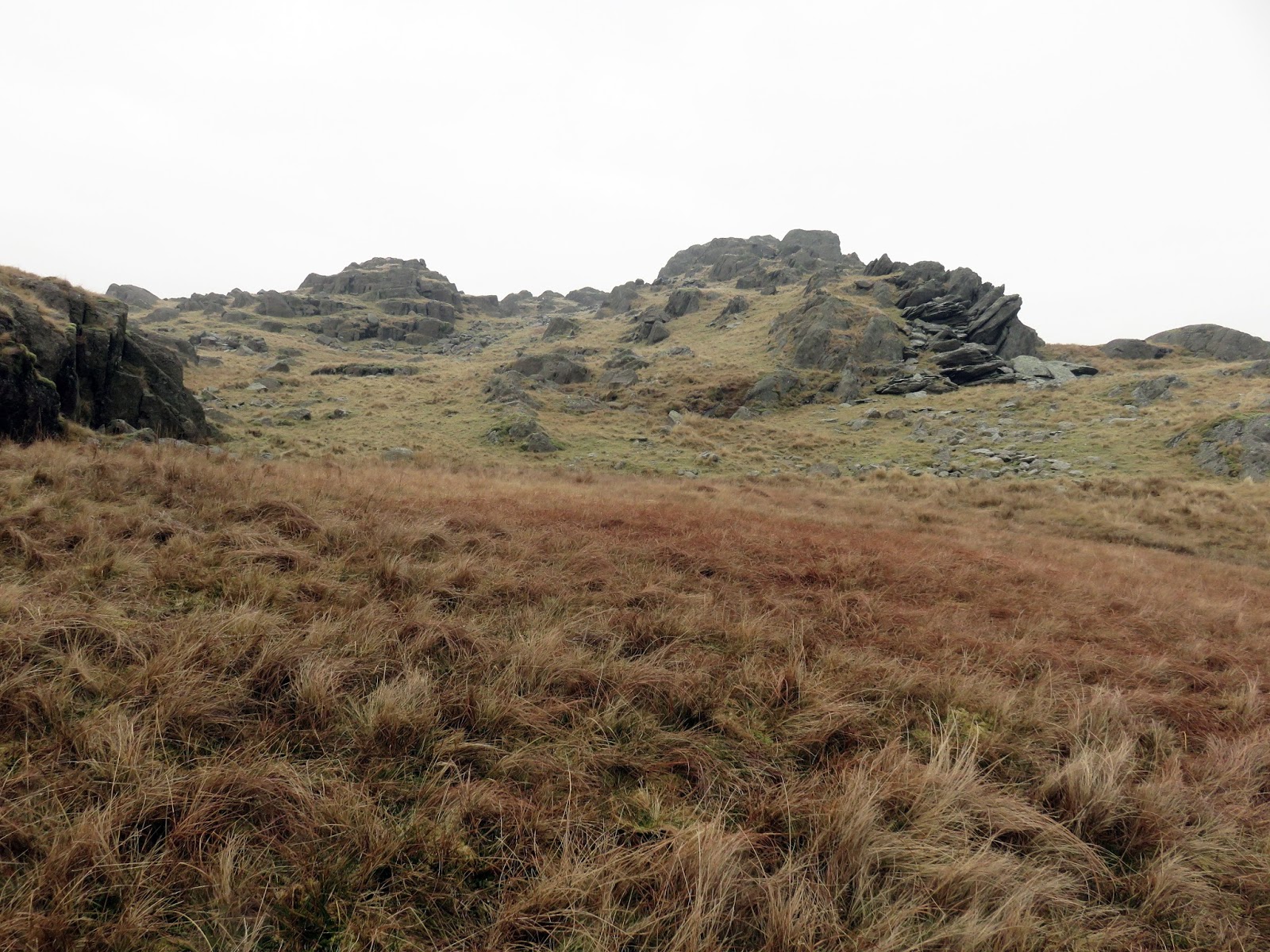
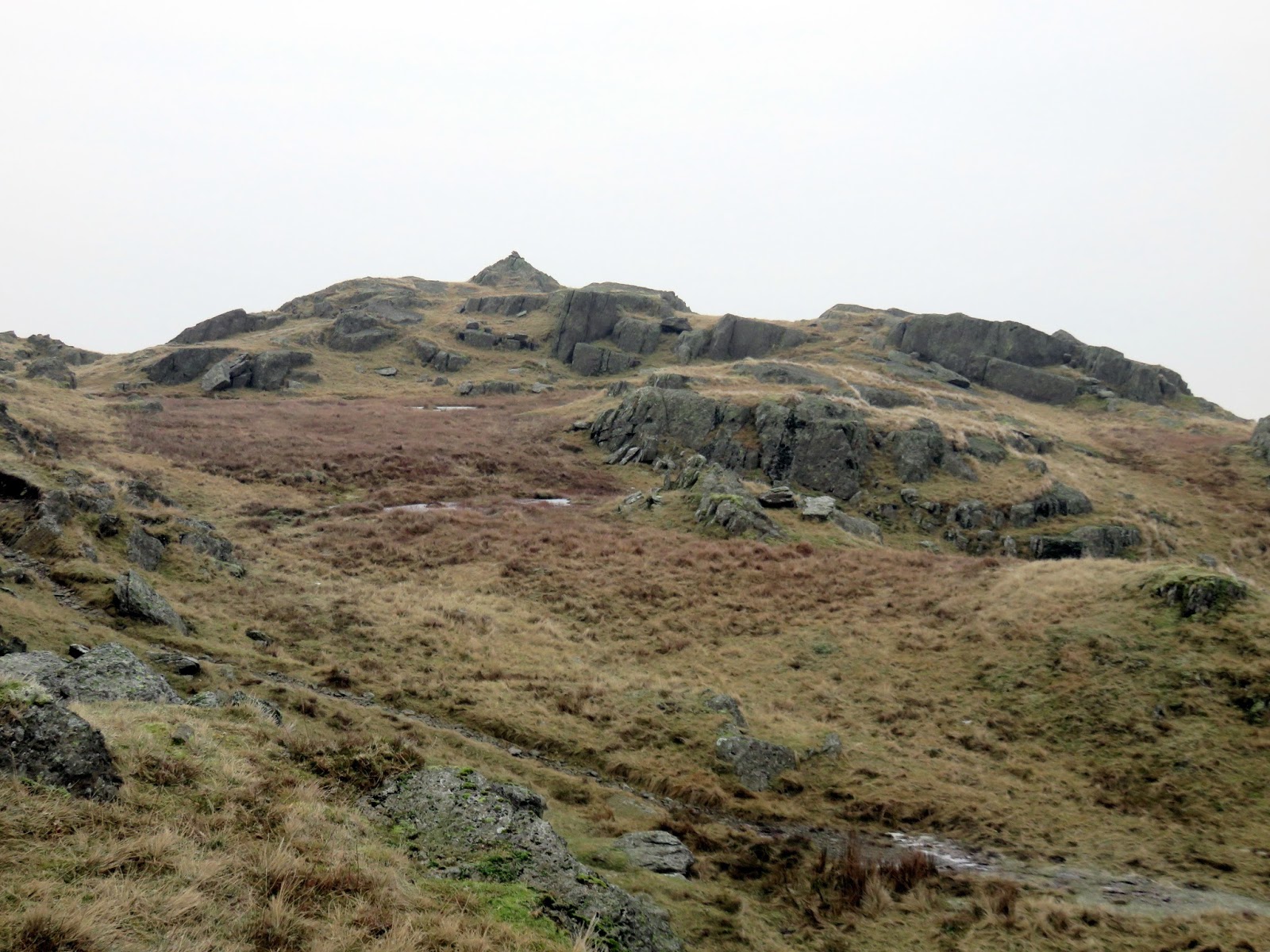
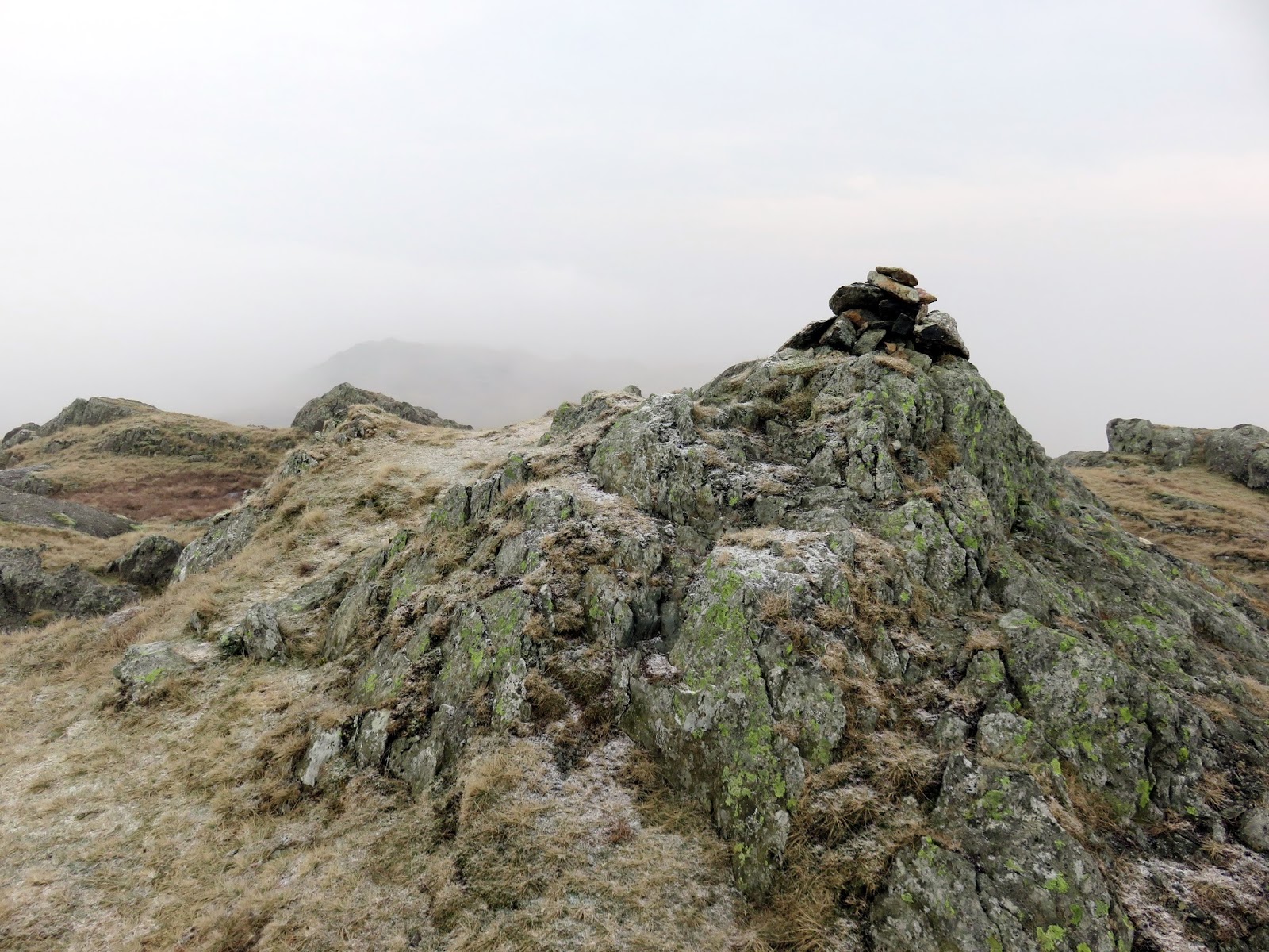
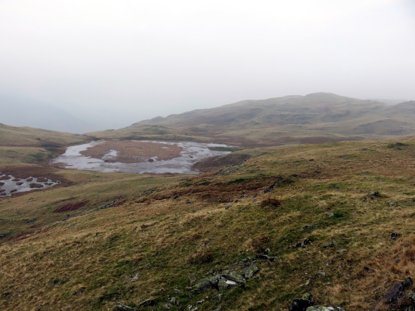
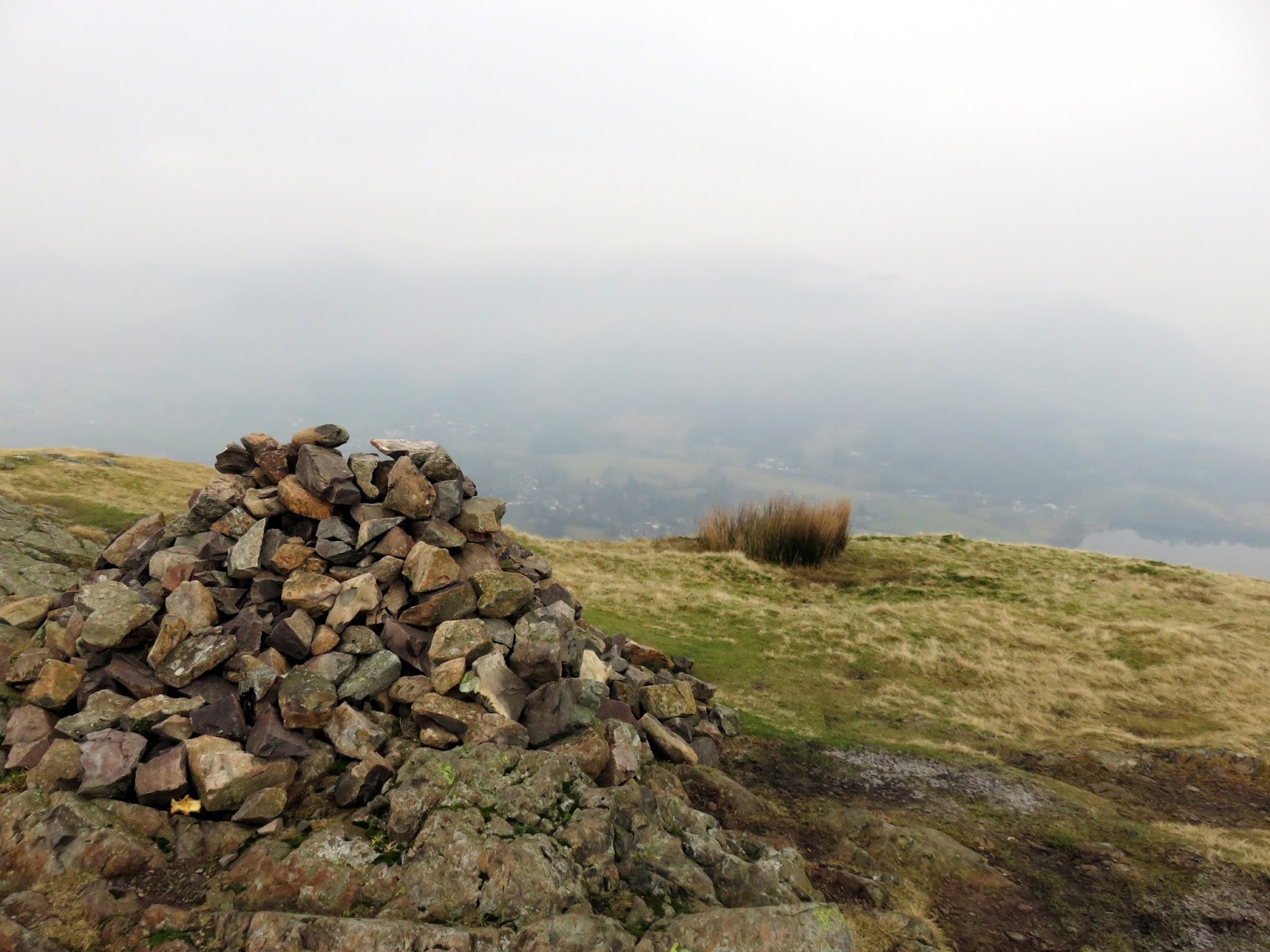
Blea Rigg has a number of rocky tops and a number of sizeable tarns alongside added bogs. This can make the area a confusing place – it is not always immediately obvious which outcrop forms the actual summit, but a small cairn sitting on rock confirms your location.
 |
| Mist rolls up from Great Langdale |
 |
| An otherworldly landscape |
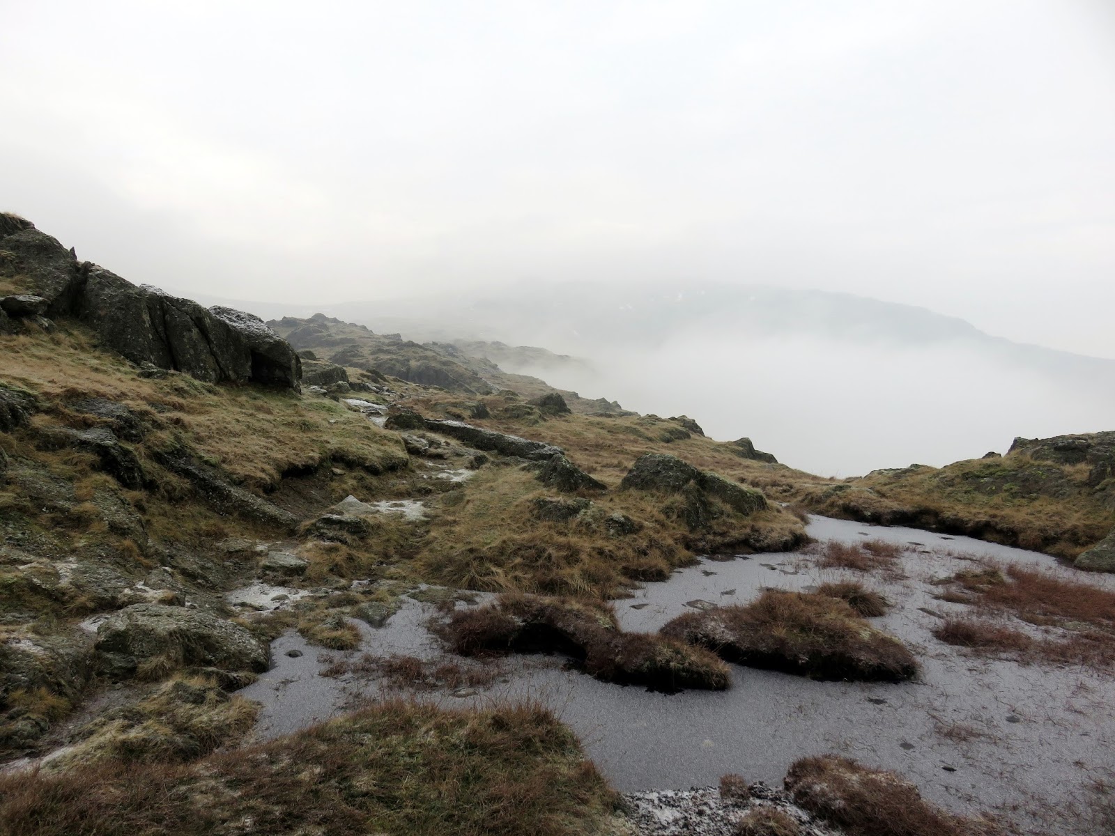
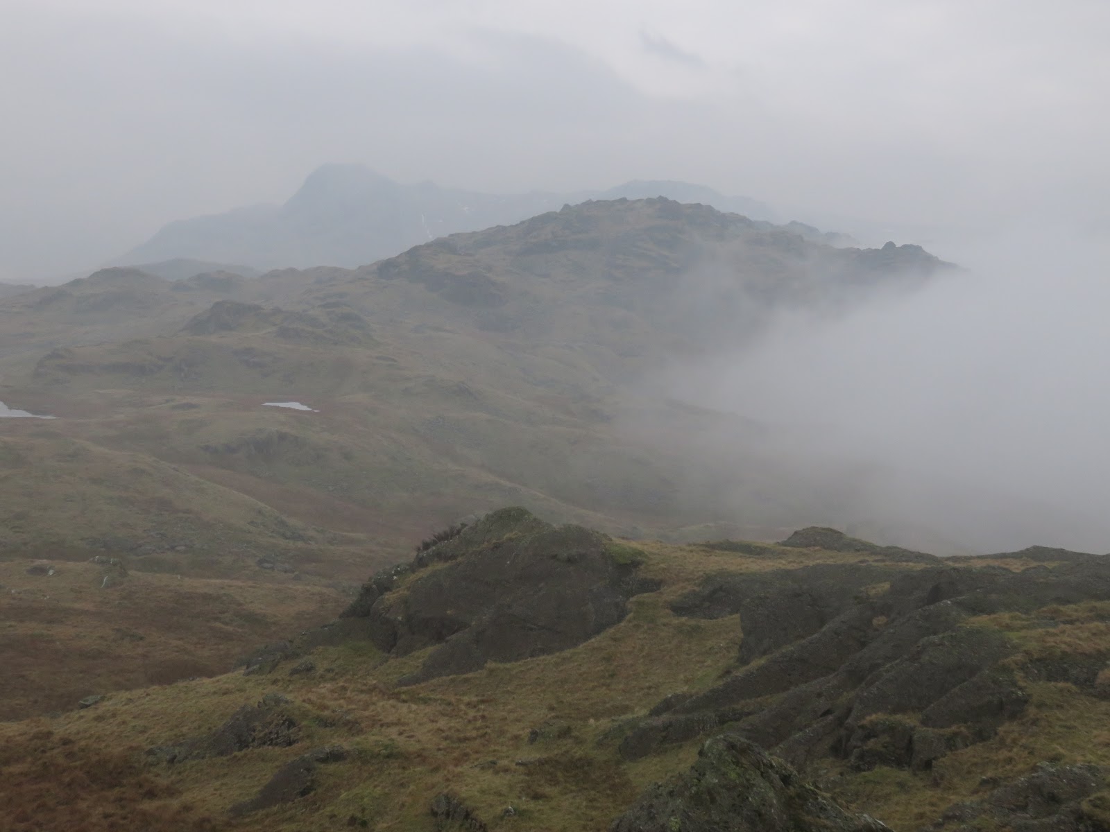
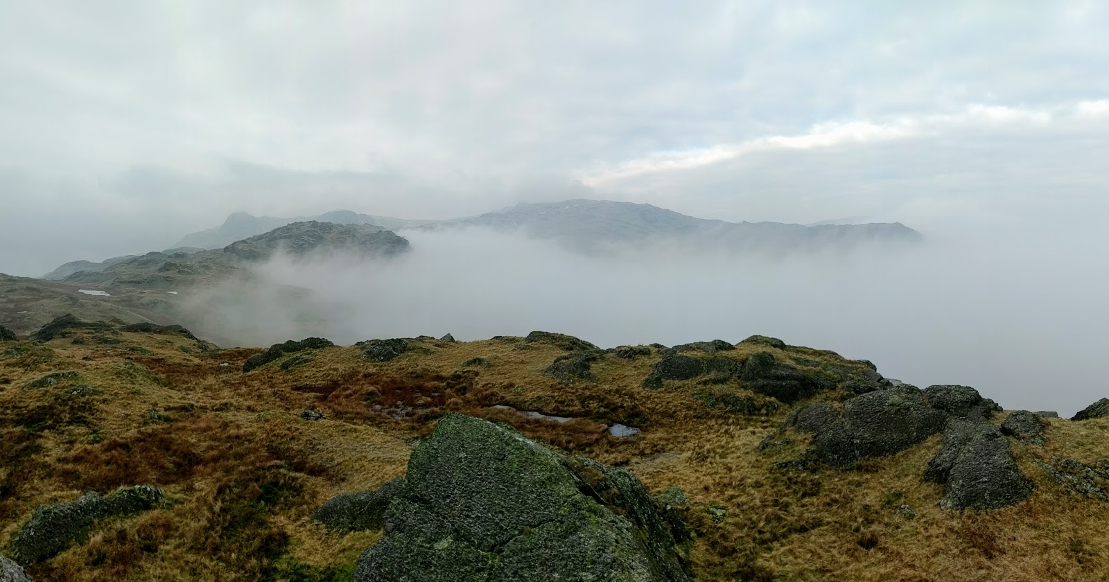
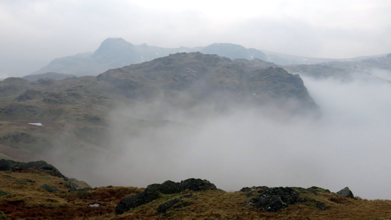
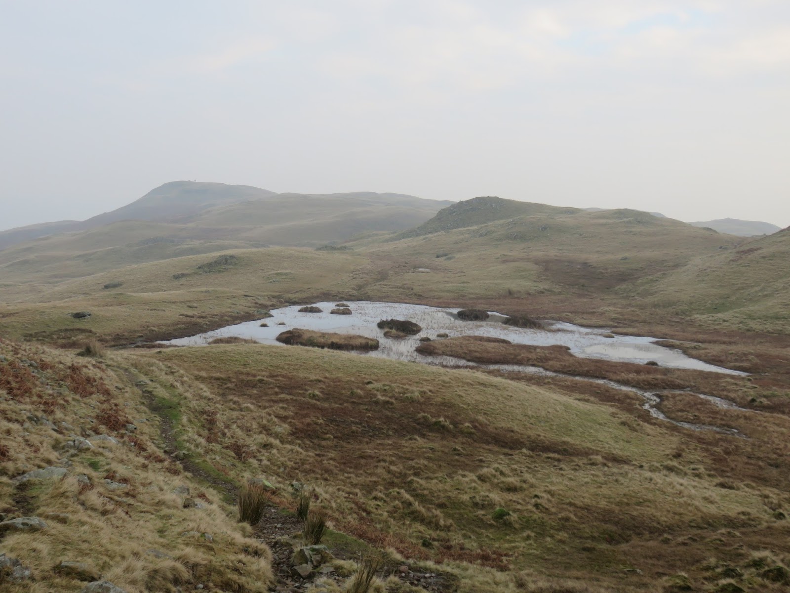
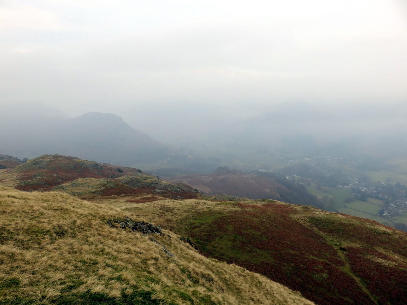
We spent the next few hours in and out of the cloud following the long ridge south-east, hunting out the minor tops as we did. The route led us down to Swinescar Hause before rising gently to the summit of Silver How.
 |
| Clouds fill Far Easedale |
 |
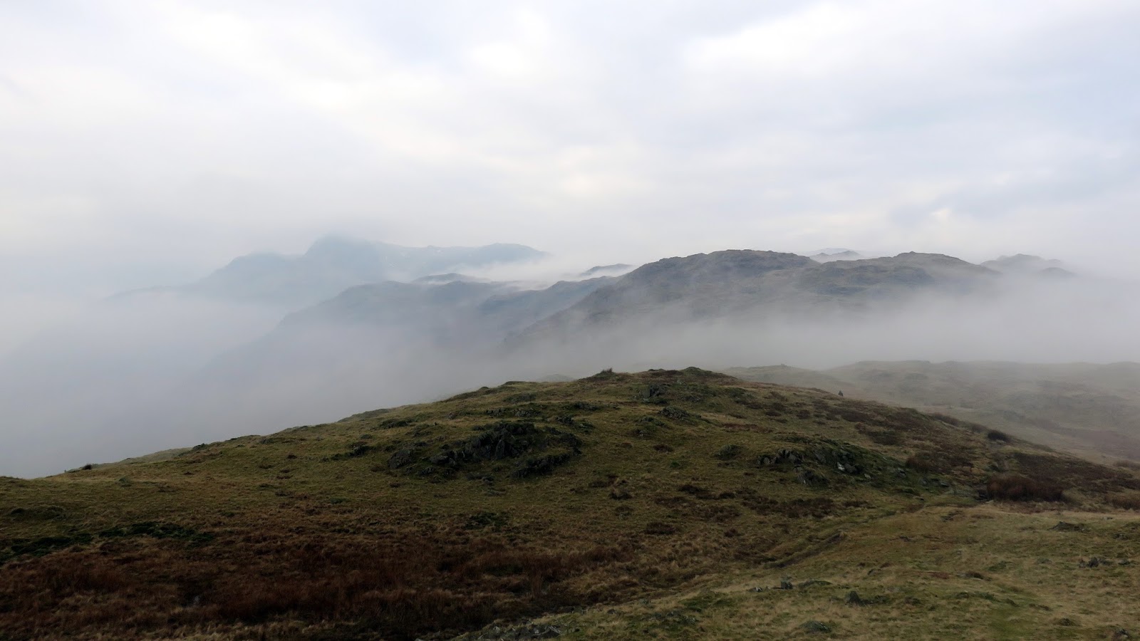
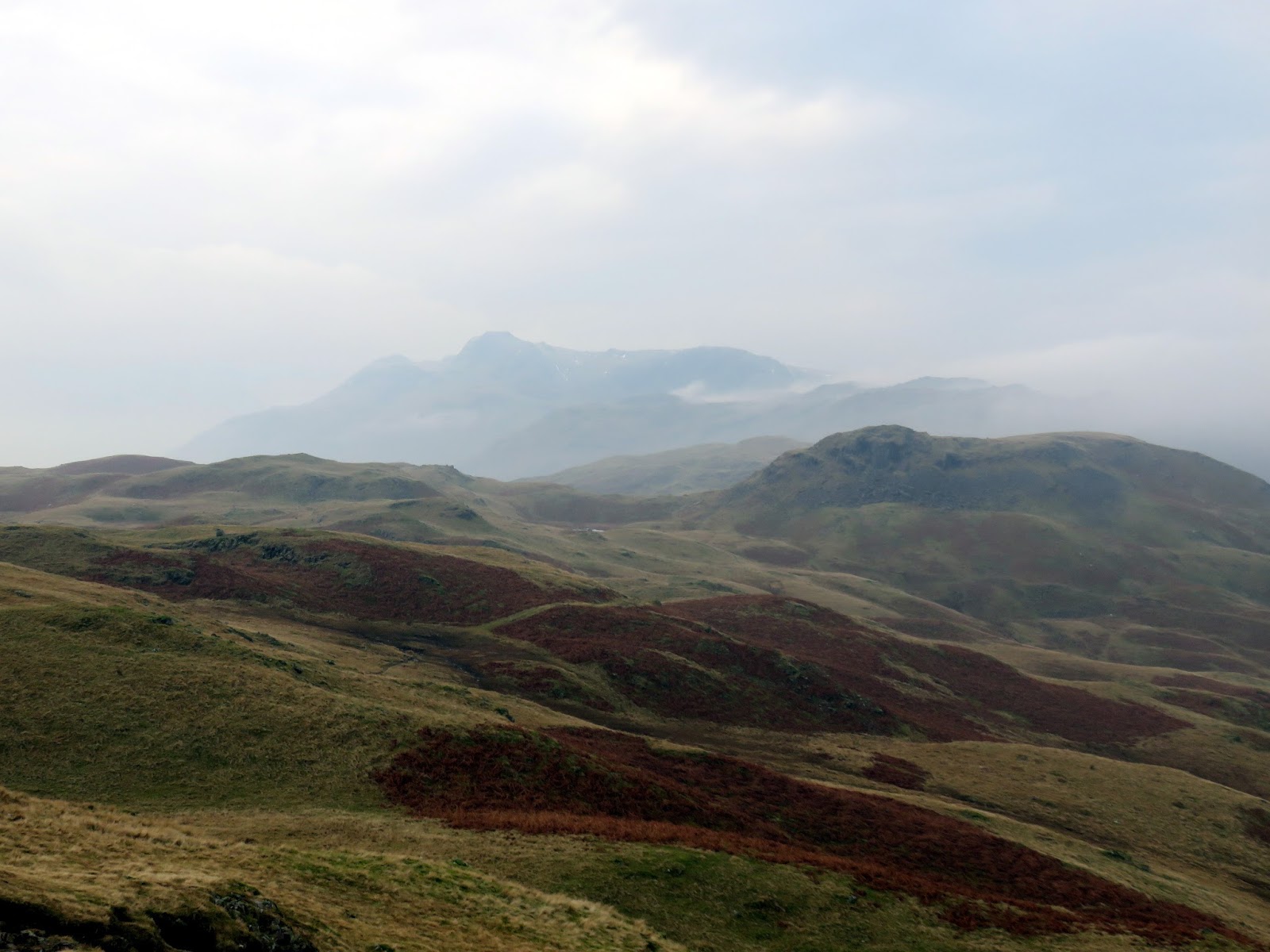
| The Langdale Pikes |
 |
| Great Castle How |
 |
| Clouds envelop the fells |
 |
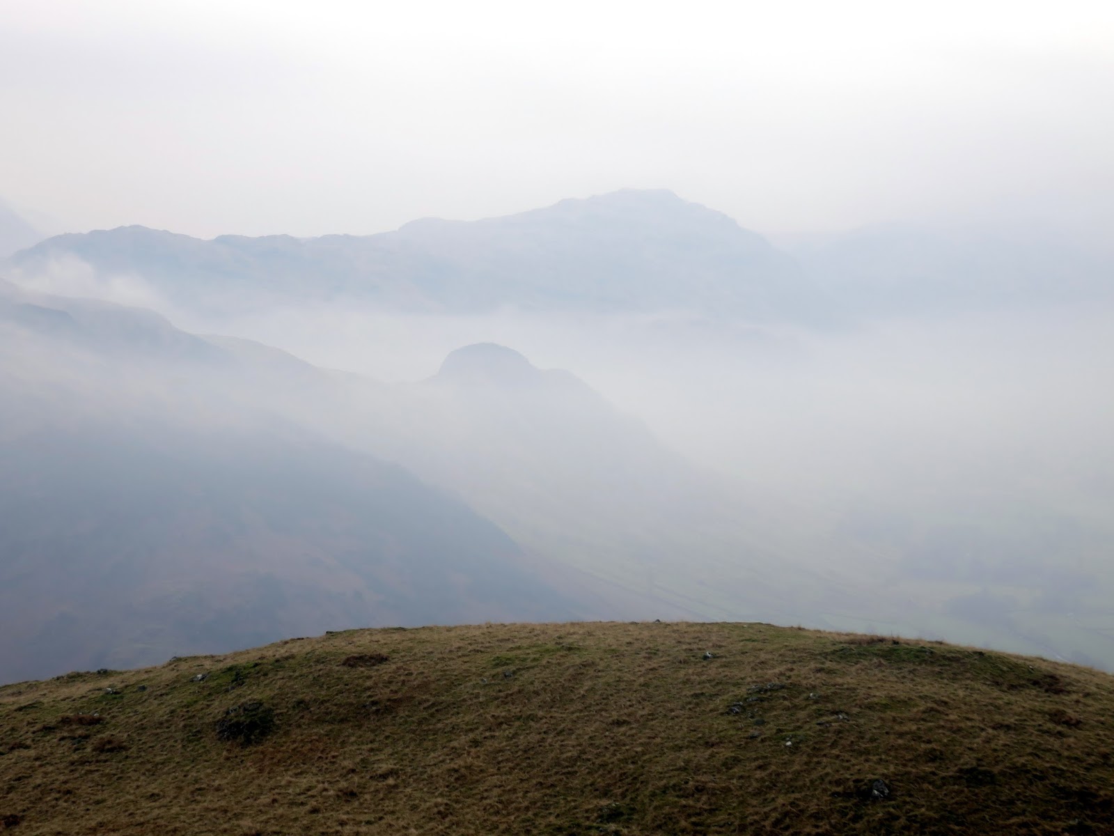
| Tarns below Lang How |
 |
| The view from Lang How |
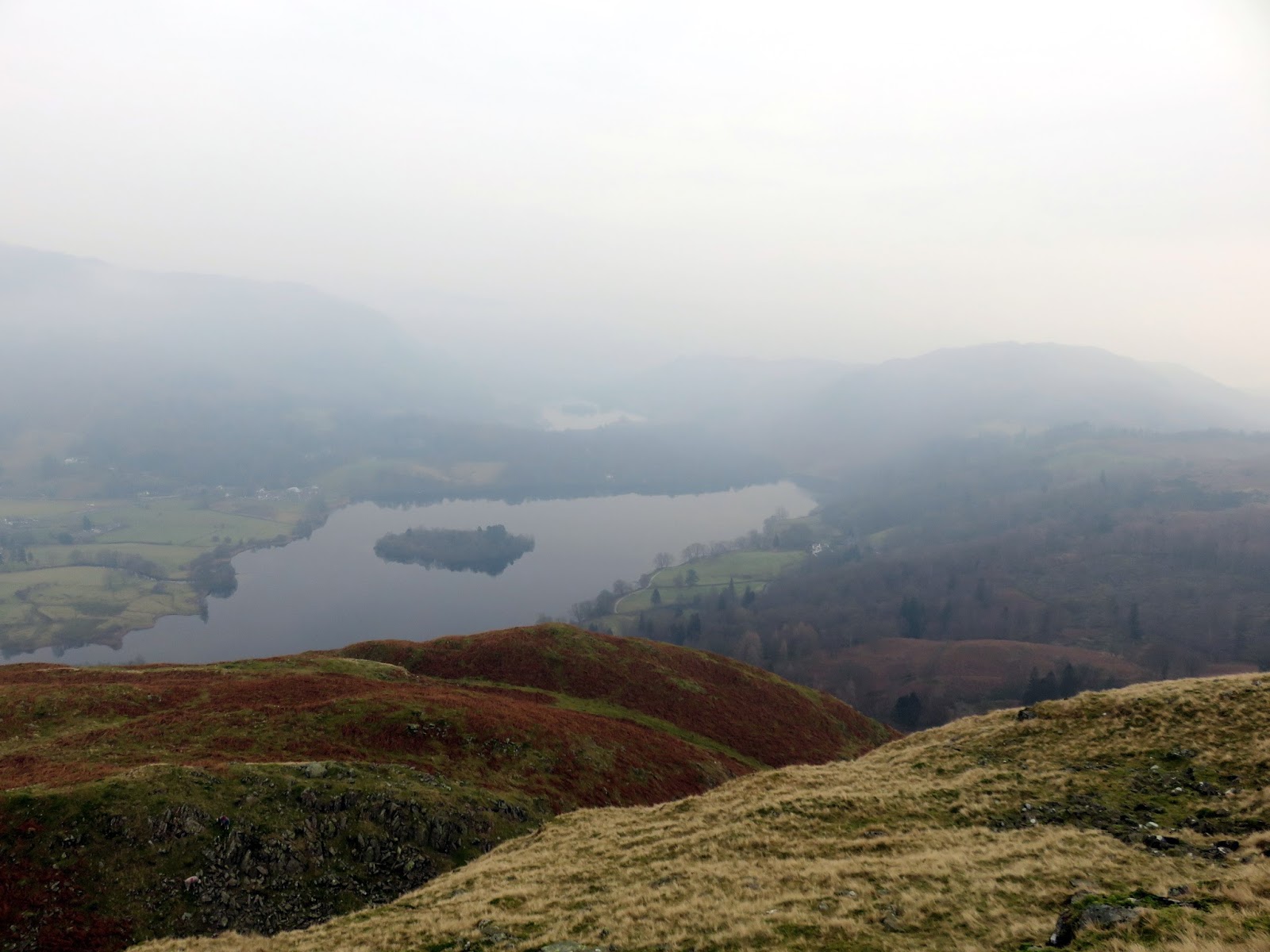
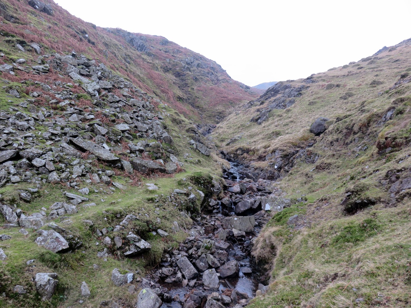
The views were severely limited by the haze but Silver How does have a commanding view across Grasmere and Rydal – a perfect hill for a summer evening perhaps. From Silver How we turned south, aiming for the deep gash of Megs Gill that carves a route down the hillside. Having climbed the route a few years ago, I knew that it would be a safe route for descent, despite no paths being marked. The trick is to get into the gill itself and follow it down until an obvious path does appear on the right.
 |
| Grasmere and Rydak |
 |
| Grasmere |
 |
| Megs Gill |
 |
| Megs Gill |
 |
| Megs Gill |
 |
| Chapel Stile |
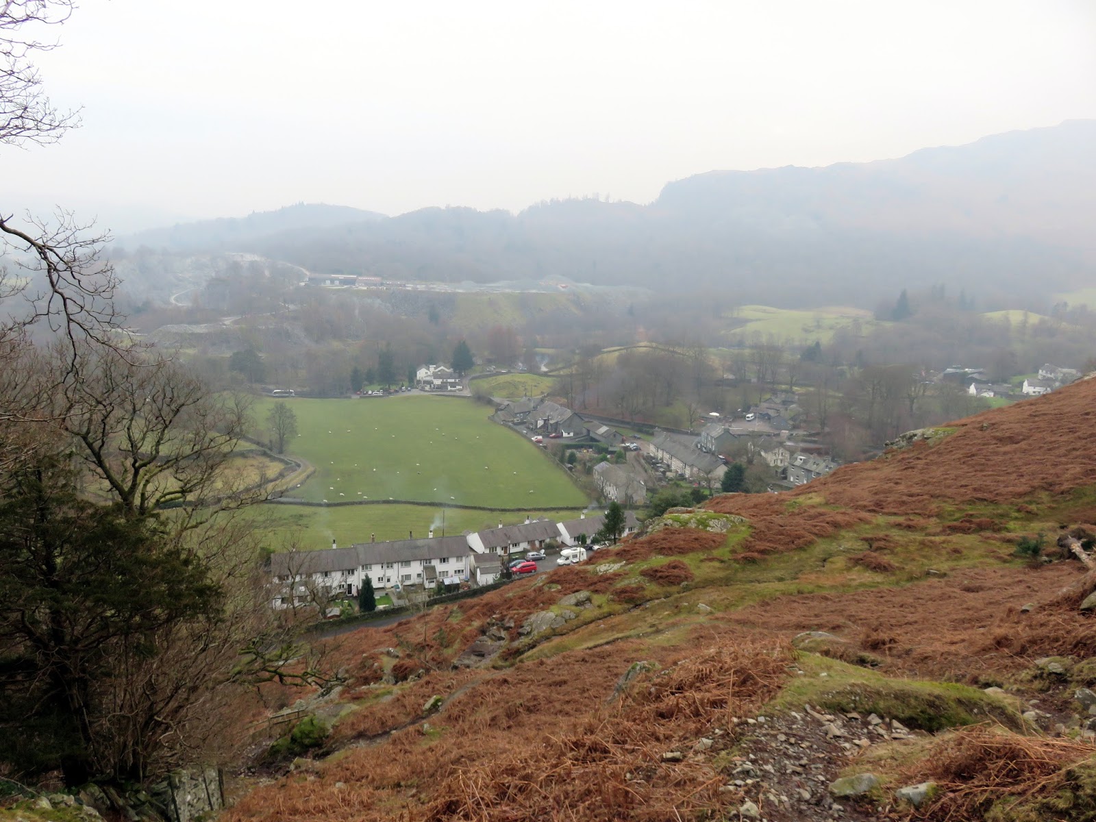
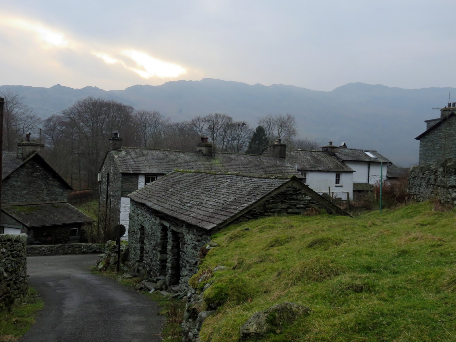
The path leads to Chapel Stile where we’d hoped to grab a quick coffee and cake but the tea room was closed as the owners were on holiday – bummer. That left the simple but slightly time-consuming task of returning along the valley floor to the Dungeon Ghyll hotel.
 |
| Chapel Stile |
 |
| The Langdale Pikes |
 |
| The Langdale Pikes |

