Open Space Web-Map builder Codehttps://openspace.ordnancesurvey.co.uk/osmapapi/openspace.js?key=3119F72552FD5C22E0530C6CA40A5A92https://openspace.ordnancesurvey.co.uk/osmapapi/script/mapbuilder/basicmap.jshttps://openspace.ordnancesurvey.co.uk/osmapapi/script/mapbuilder/searchbox.js//variables for routes var linesLayer, points, lineFeature, lineString, routeMarkersLayer, routepos, routesize, routeoffset, routeicon; var style_blue = {strokeColor: “#0000CD”, strokeOpacity: 0.5, strokeWidth: 4.5}; function initmapbuilder() { //initiate the map var options = {resolutions: [2500, 1000, 500, 200, 100, 50, 25, 10, 5, 4, 2.5, 2, 1]}; osMap = new OpenSpace.Map(‘map’, options); //configure map options (basicmap.js) setglobaloptions(); //set the center of the map and the zoom level osMap.setCenter(new OpenSpace.MapPoint(328597.55538147,499205.85326248),7); linesLayer = osMap.getVectorLayer(); // Set up layer for route markers routeMarkersLayer = new OpenLayers.Layer.Markers(“Route Markers”); //make a route points = new Array(); points.push(new OpenLayers.Geometry.Point(330184.66603088,497722.66793823)); points.push(new OpenLayers.Geometry.Point(330109.66603088,497827.66793823)); points.push(new OpenLayers.Geometry.Point(330024.66603088,497987.66793823)); points.push(new OpenLayers.Geometry.Point(329889.66603088,497982.66793823)); points.push(new OpenLayers.Geometry.Point(329804.66603088,498012.66793823)); points.push(new OpenLayers.Geometry.Point(329634.66603088,498002.66793823)); points.push(new OpenLayers.Geometry.Point(329404.66603088,498142.66793823)); points.push(new OpenLayers.Geometry.Point(329354.66603088,498082.66793823)); points.push(new OpenLayers.Geometry.Point(329134.66603088,498232.66793823)); points.push(new OpenLayers.Geometry.Point(328904.66603088,498227.66793823)); points.push(new OpenLayers.Geometry.Point(328774.66603088,498172.66793823)); points.push(new OpenLayers.Geometry.Point(328589.66603088,498202.66793823)); points.push(new OpenLayers.Geometry.Point(328414.66603088,498102.66793823)); points.push(new OpenLayers.Geometry.Point(328159.66603088,498087.66793823)); points.push(new OpenLayers.Geometry.Point(327844.66603088,498092.66793823)); points.push(new OpenLayers.Geometry.Point(327684.66603088,498142.66793823)); points.push(new OpenLayers.Geometry.Point(327594.66603088,498202.66793823)); points.push(new OpenLayers.Geometry.Point(327414.66603088,498032.66793823)); points.push(new OpenLayers.Geometry.Point(327499.66603088,498042.66793823)); points.push(new OpenLayers.Geometry.Point(327464.66603088,497947.66793823)); points.push(new OpenLayers.Geometry.Point(327494.66603088,497872.66793823)); points.push(new OpenLayers.Geometry.Point(327364.66603088,497792.66793823)); points.push(new OpenLayers.Geometry.Point(327304.66603088,497767.66793823)); points.push(new OpenLayers.Geometry.Point(327174.66603088,497832.66793823)); points.push(new OpenLayers.Geometry.Point(327064.66603088,498232.66793823)); points.push(new OpenLayers.Geometry.Point(327059.66603088,498627.66793823)); points.push(new OpenLayers.Geometry.Point(327064.66603088,498927.66793823)); points.push(new OpenLayers.Geometry.Point(327004.66603088,499207.66793823)); points.push(new OpenLayers.Geometry.Point(327019.66603088,499472.66793823)); points.push(new OpenLayers.Geometry.Point(327219.66603088,499747.66793823)); points.push(new OpenLayers.Geometry.Point(327244.66603088,499942.66793823)); points.push(new OpenLayers.Geometry.Point(327239.66603088,500132.66793823)); points.push(new OpenLayers.Geometry.Point(327184.66603088,500317.66793823)); points.push(new OpenLayers.Geometry.Point(327259.66603088,500552.66793823)); points.push(new OpenLayers.Geometry.Point(327599.66603088,500622.66793823)); points.push(new OpenLayers.Geometry.Point(327814.66603088,500717.66793823)); points.push(new OpenLayers.Geometry.Point(327924.66603088,500832.66793823)); points.push(new OpenLayers.Geometry.Point(328084.66603088,500822.66793823)); points.push(new OpenLayers.Geometry.Point(328294.66603088,500772.66793823)); points.push(new OpenLayers.Geometry.Point(328474.66603088,500937.66793823)); points.push(new OpenLayers.Geometry.Point(328824.66603088,501137.66793823)); points.push(new OpenLayers.Geometry.Point(328934.66603088,500727.66793823)); points.push(new OpenLayers.Geometry.Point(329004.66603088,500507.66793823)); points.push(new OpenLayers.Geometry.Point(329214.66603088,500282.66793823)); points.push(new OpenLayers.Geometry.Point(329244.66603088,499997.66793823)); points.push(new OpenLayers.Geometry.Point(329194.66603088,499757.66793823)); points.push(new OpenLayers.Geometry.Point(329174.66603088,499442.66793823)); points.push(new OpenLayers.Geometry.Point(329324.66603088,499122.66793823)); points.push(new OpenLayers.Geometry.Point(329279.66603088,498962.66793823)); points.push(new OpenLayers.Geometry.Point(329369.66603088,498627.66793823)); points.push(new OpenLayers.Geometry.Point(329329.66603088,498412.66793823)); points.push(new OpenLayers.Geometry.Point(329284.66603088,498522.66793823)); points.push(new OpenLayers.Geometry.Point(329284.66603088,498387.66793823)); points.push(new OpenLayers.Geometry.Point(329424.66603088,498112.66793823)); points.push(new OpenLayers.Geometry.Point(329624.66603088,497992.66793823)); points.push(new OpenLayers.Geometry.Point(329819.66603088,498022.66793823)); points.push(new OpenLayers.Geometry.Point(329894.66603088,497987.66793823)); points.push(new OpenLayers.Geometry.Point(330004.66603088,497972.66793823)); points.push(new OpenLayers.Geometry.Point(330184.66603088,497722.66793823)); // create a polyline feature from the array of points lineString = new OpenLayers.Geometry.LineString(points); lineFeature = new OpenLayers.Feature.Vector(lineString, null, style_blue); linesLayer.addFeatures([lineFeature]); //crate a route start/end marker routepos = new OpenSpace.MapPoint(330184.66603088,497722.66793823); routesize = new OpenLayers.Size(33,45); routeoffset = new OpenLayers.Pixel(-5,-37); routeicon = new OpenSpace.Icon(‘https://openspace.ordnancesurvey.co.uk/osmapapi/img_versions/img_1.1/mapbuilder/routemarker-startend.png’, routesize, routeoffset, null, null); routeMarkersLayer.addMarker(new OpenLayers.Marker(routepos, routeicon)); osMap.addLayer(routeMarkersLayer);}
Route: Coniston, Miners Bridge, Levers Moss Scrow, Crowberry Haws, The Old Man of Coniston, Brim Fell, Levers Hawse, Great How Crags, Swilr Band, Swirl How, Prison Band, Swirl Hawse, Black Sails, Red Dell Head Moss, Wetherlam, Lower Hows, Hole Rake, Miners Bridge, Coniston
Date: 03/12/2016
From: Coniston
Parking: Coniston
Start Point: Coniston
Region: Southern Fells
Route length: 8.9 miles (14.2 km)
Time taken : 04:31
Average speed: 2.0 mph
Ascent: 1,106m
Descent: 1,117m
Wainwrights on this walk: The Old Man of Coniston (803m), Brim Fell (796m), Swirl How (802m), Wetherlam (762m)
Additional summits: Black Sails (745m)
With snow starting to return to the mountains, I took the opportunity to get out to the Lake District after a hectic couple of months at HQ. Though early days this winter season, I missed the best of the late November snow but believe that good things come to those who wait. The best of winter is just around the corner though today would be a useful barometer for the number of daylight hours available.
My destination today would be the sublime Coniston fells, an area that I don’t have a great deal of experience with. That said, the previous walks have all lived long in the memory as Coniston is home to some of the finest scenery in the Lake District. After another early departure, I arrived in the village shortly after sunrise to maximise the amount of daylight available.
 |
| Morning in Coniston |
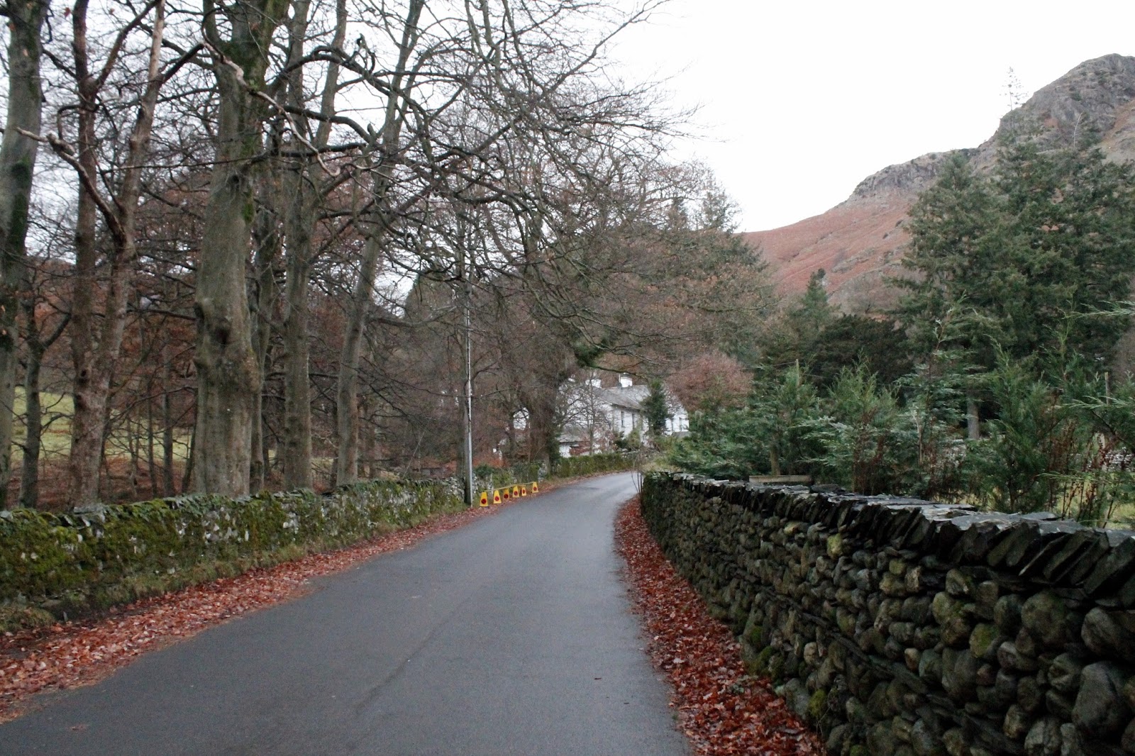
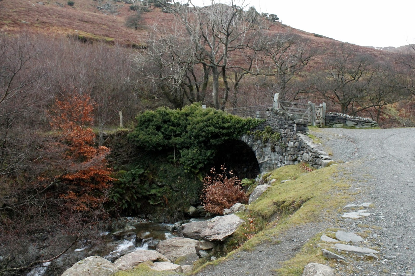
I opted to start from Coniston, rather than take the short drive up to the car park on the Walna Scar road. I’ve often felt that climbing a mountain from half way is missing the point, though that’s not to say it never appeals to me. To start from Coniston means climbing the old mine road alongside Church Beck, past the old Miners Bridge before heading out onto the fellside.
 |
| The Miners Bridge |
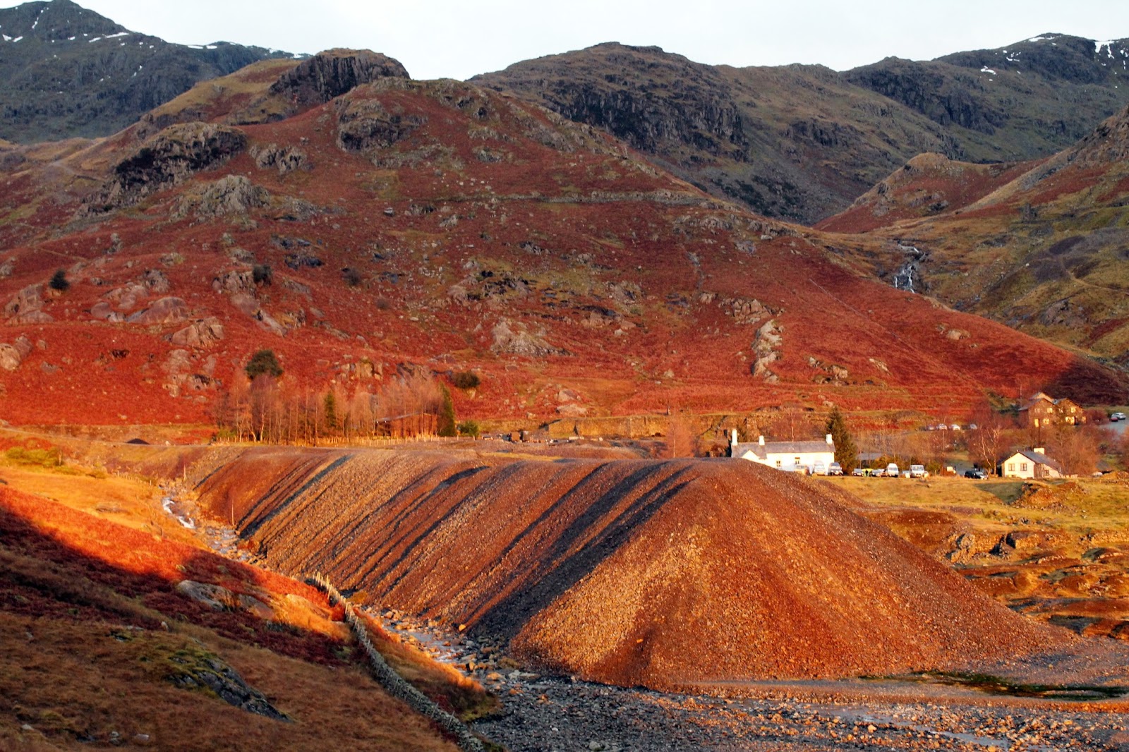
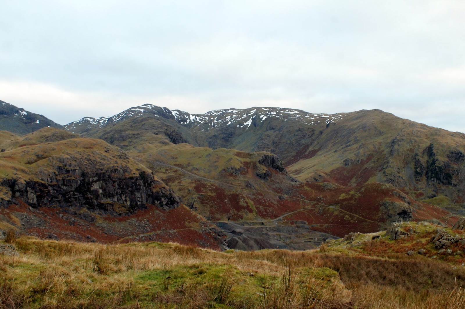
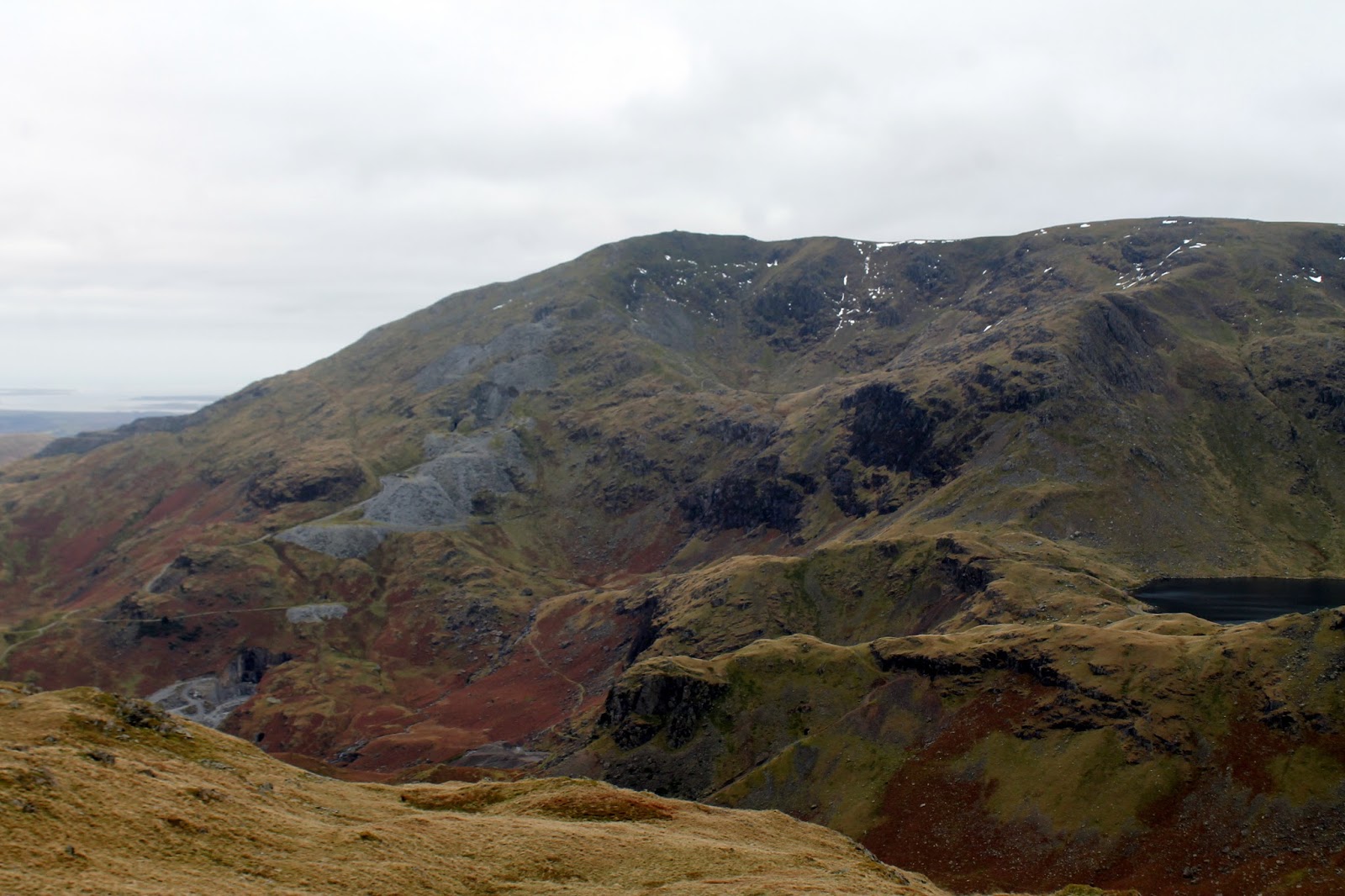
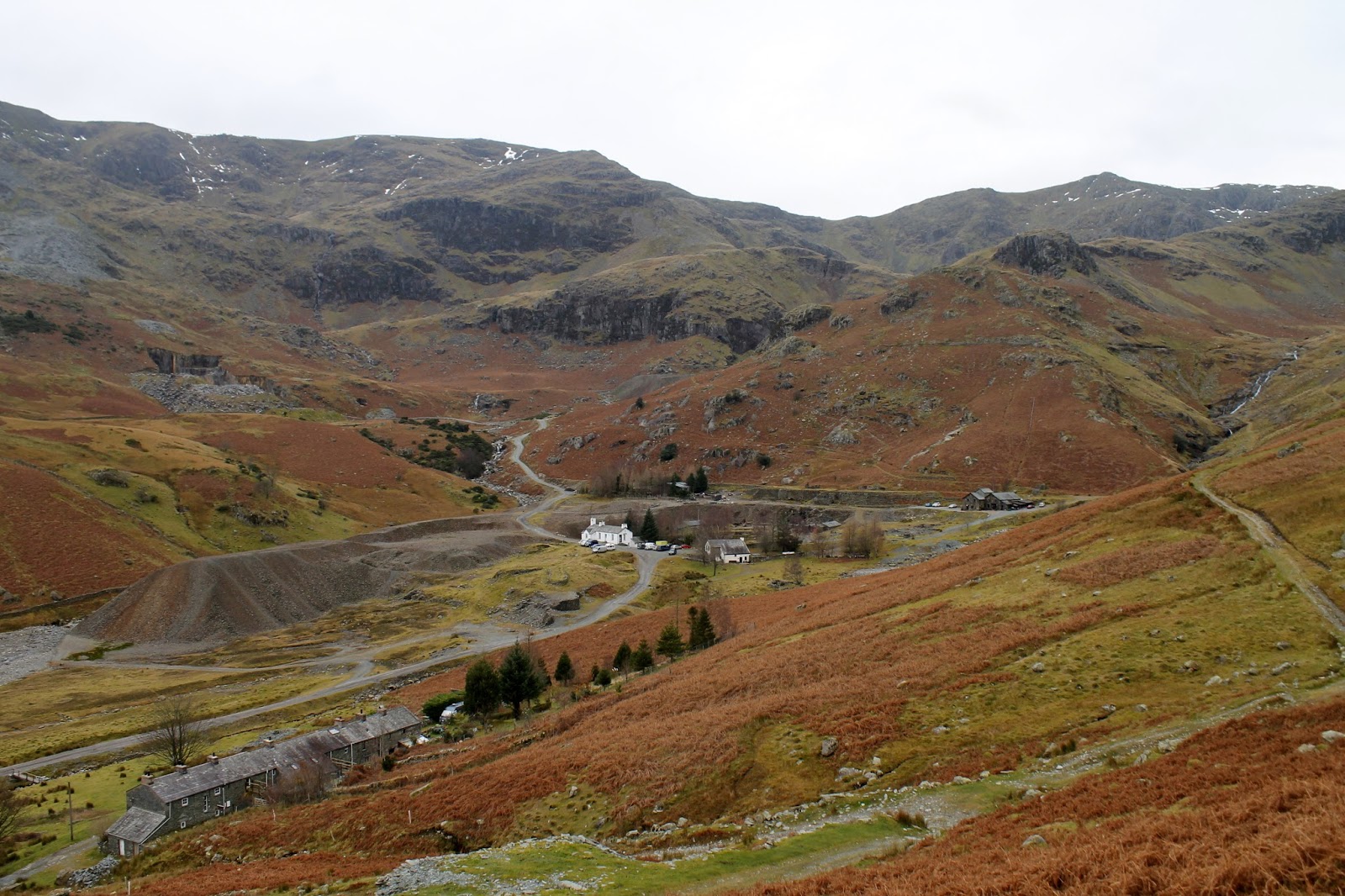
Coniston is famous for its mining heritage, largely in pursuit of copper, with mining in the Coniston area starting towards the end of the 16th century. The mines grew to such an extent that, in 1850, Ore production was so great that a railway line was constructed from the Furness to Coniston. Production started to decline through the late 19th Century before eventually ceasing in the 1940s.
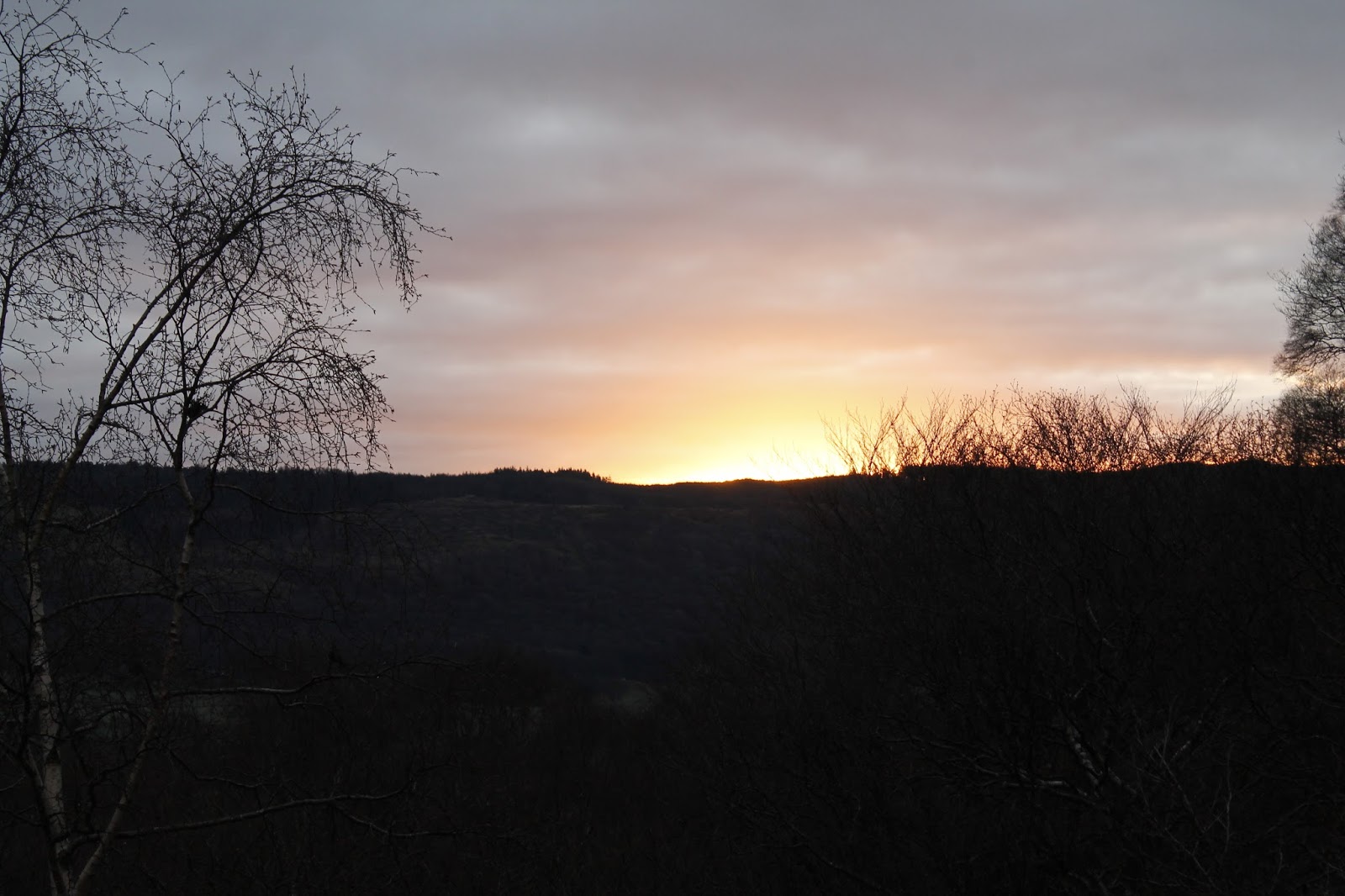
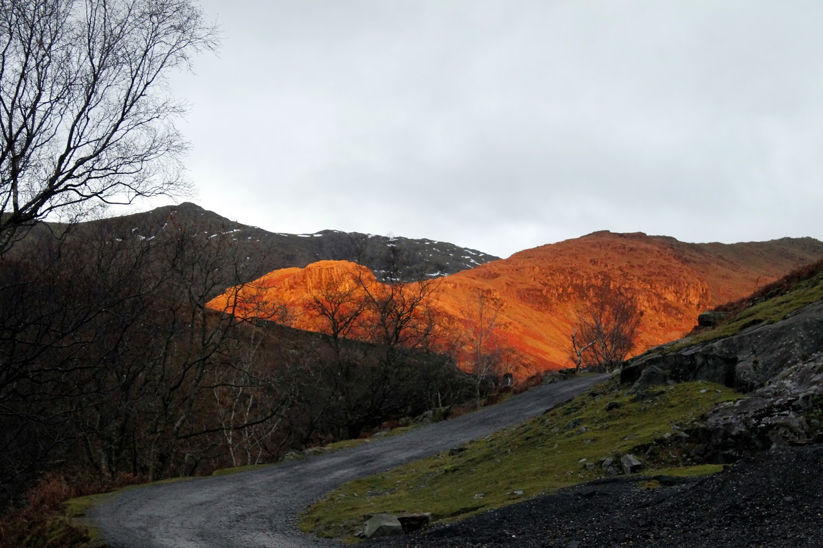
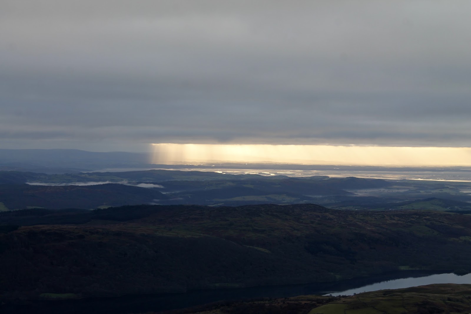
There was a brief moment of excitement as the rising sun lit up the hills around the Coppermines Valley before it was swallowed up by the blanket of cloud that hung over the park. Morecambe was clearly having a sparkling morning – I could see the rays of sunlight beaming down upon it from the climb up The Old Man.
 |
| Sunrise |
 |
| The Coppermines Valley |
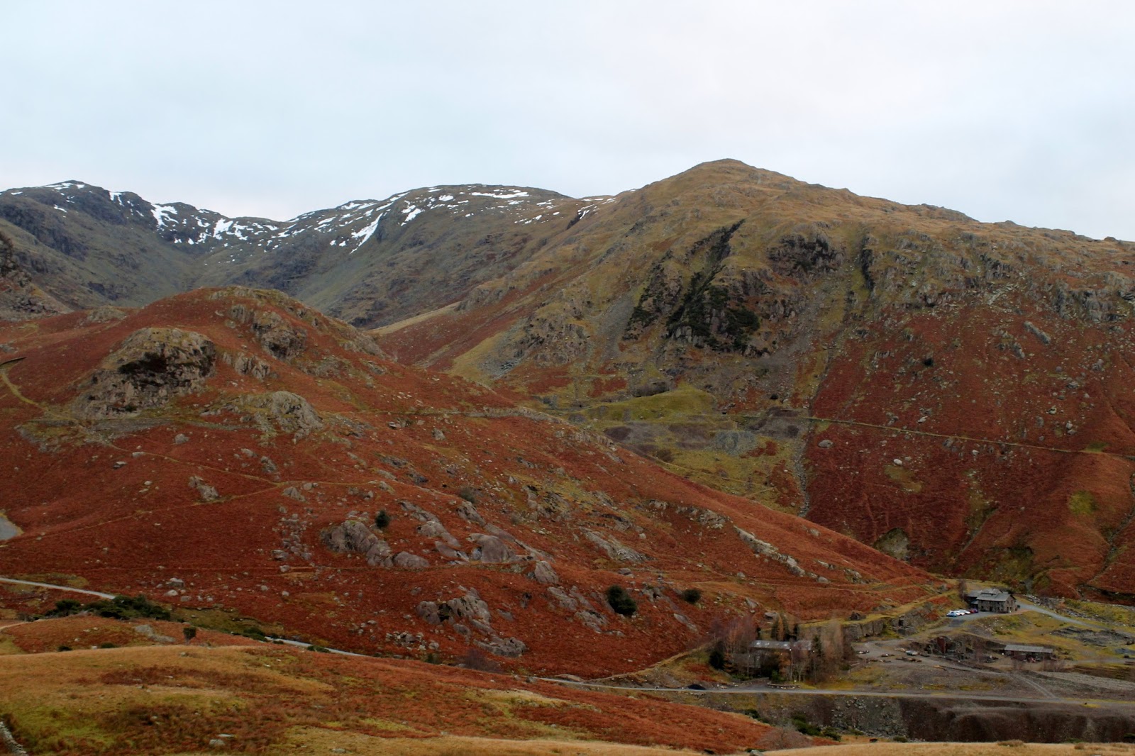
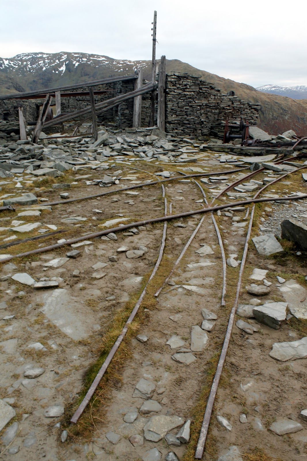
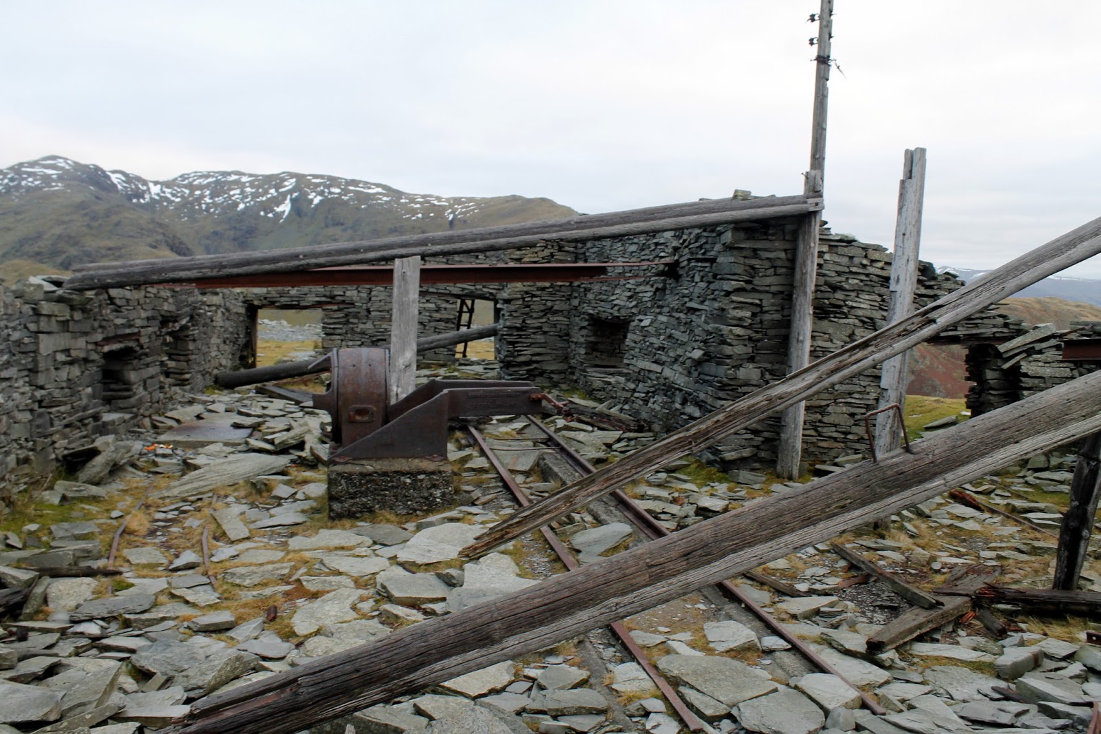
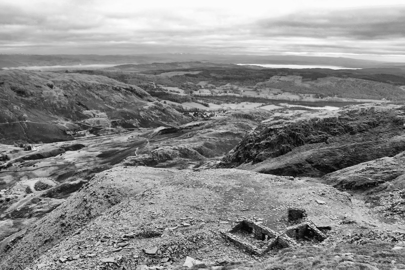
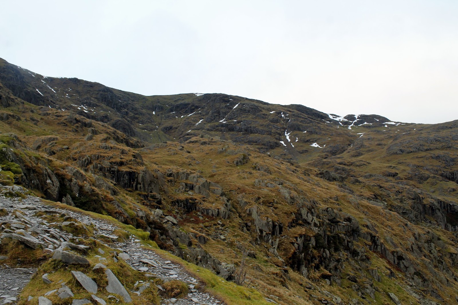
Slate was the material of choice to be mined from The Old Man and the extensive Low Water Quarry bears the remains of Coniston’s industrial past. The path winds up through huge spoil tips, following the rusting cables of an old aerial tramway. Derelict buildings and tracks litter the levels – I salute them men that had to work up here.
 |
| Wetherlam and Tongue Brow |
 |
| The path at Stubthwaite Crag |
 |
| Beams of sunlight to the south |
 |
| Remains of the old mine tracks |
 |
| Winding gear – from Leeds don’t you know? |
 |
| Looking over the spoil heaps to Coniston |
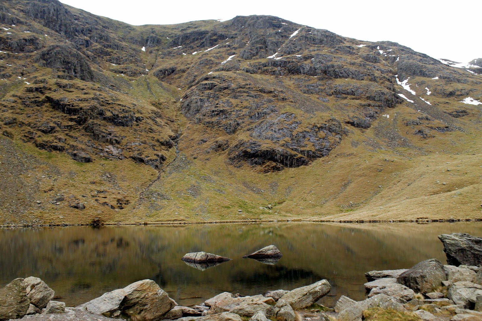
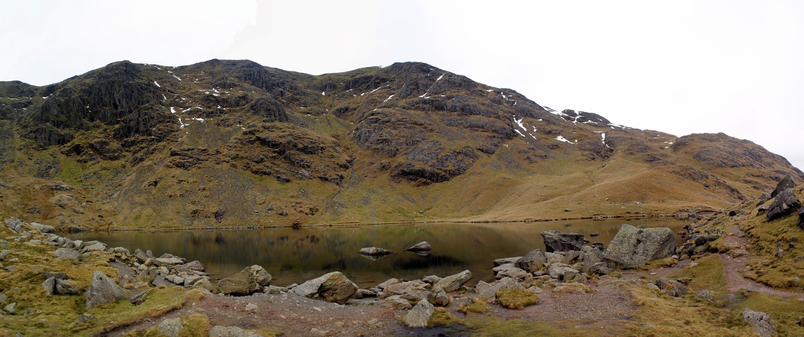
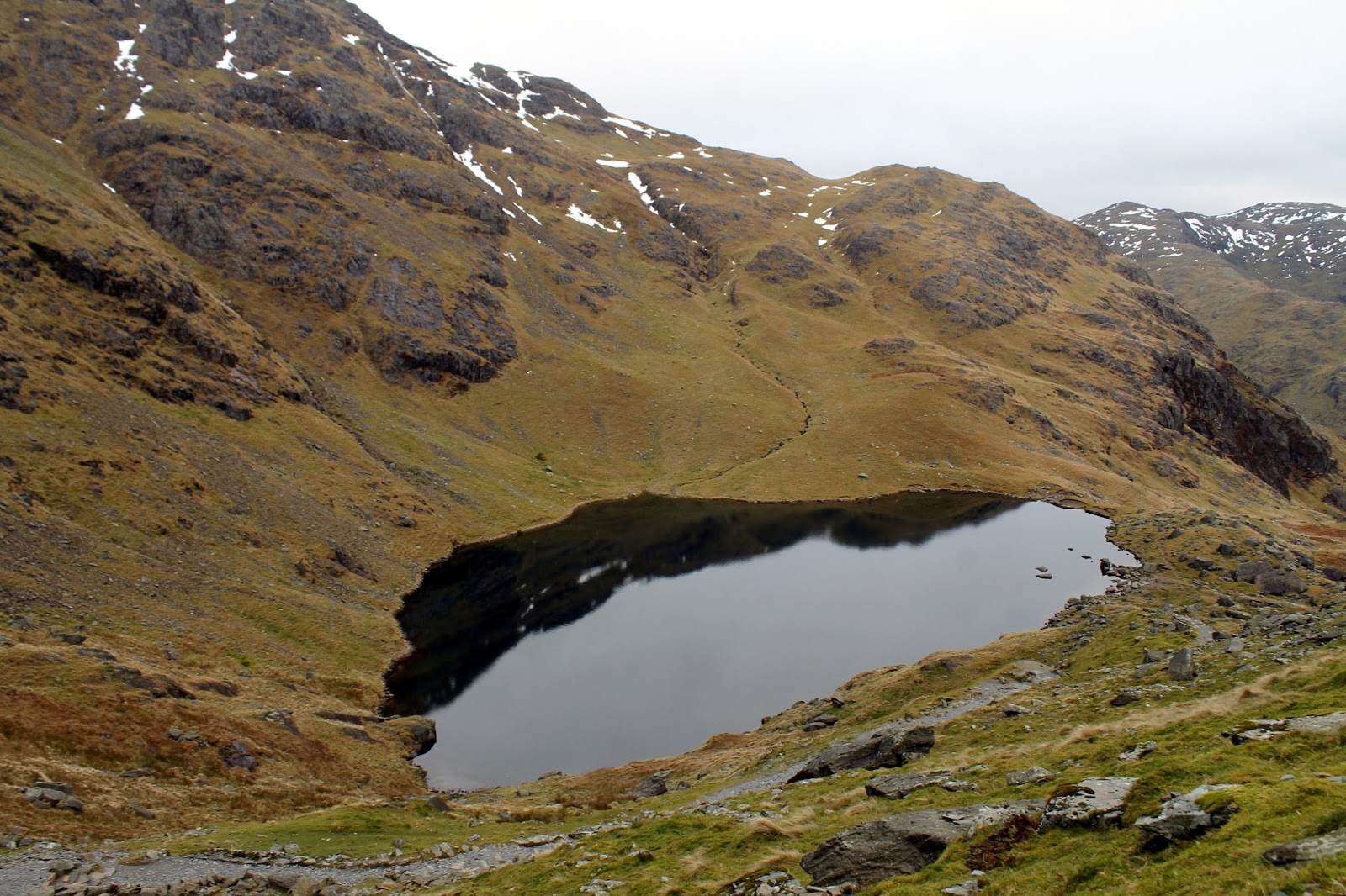
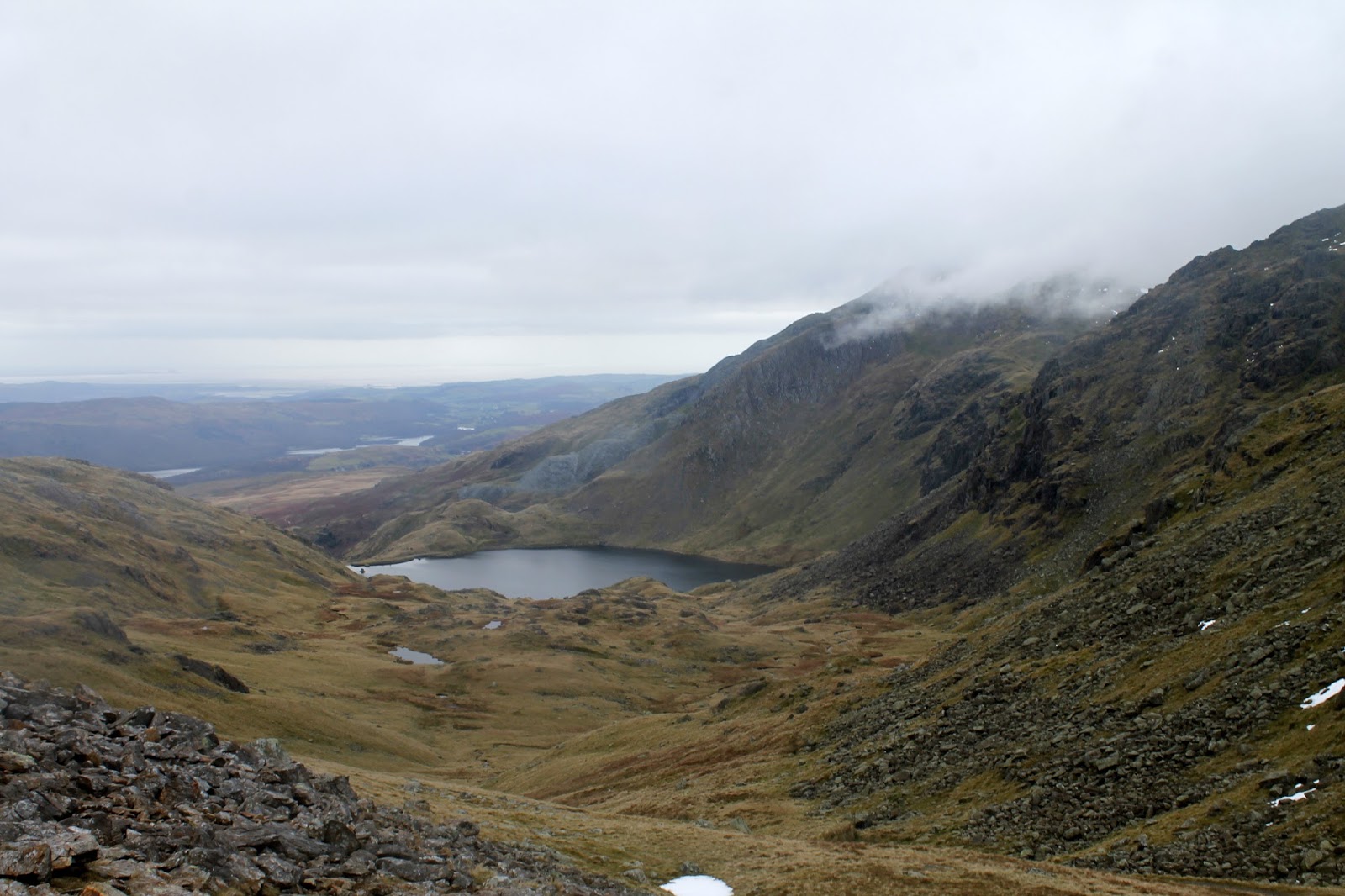
Eventually, the path reaches Low Water, a fine glacial tarn that sits below the summit of The Old Man. If you’re feeling the strain of the climb, it’s the perfect place to pause before the final push. Though it appears steep, the path zigzags its way up the final 100m to reach the top.
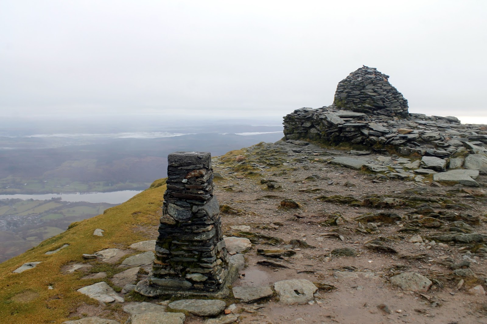
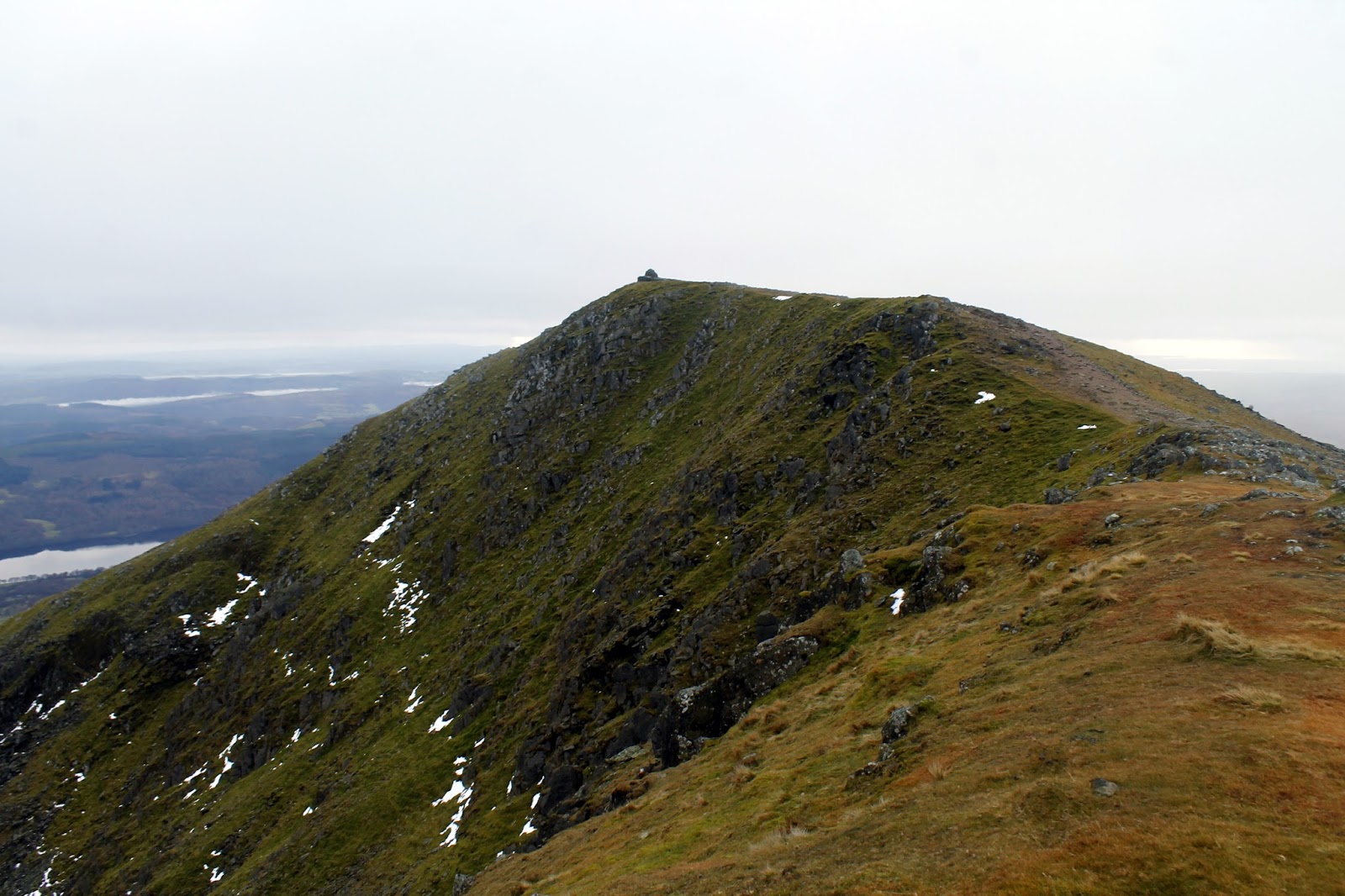
The blanket of cloud had decided to lower itself just as I arrived on the summit – a fairly typical action in the Lake District. That said, it briefly revealed the view down to Low Water, which is excellent. For the first time, I had the summit of The Old Man to myself – it is often teeming with people. A narrow but short ridge joins The Old Man to the neighbouring Brim Fell.
 |
| Low Water |
 |
| Sunlight over Morecambe Bay |
 |
| Coniston |
 |
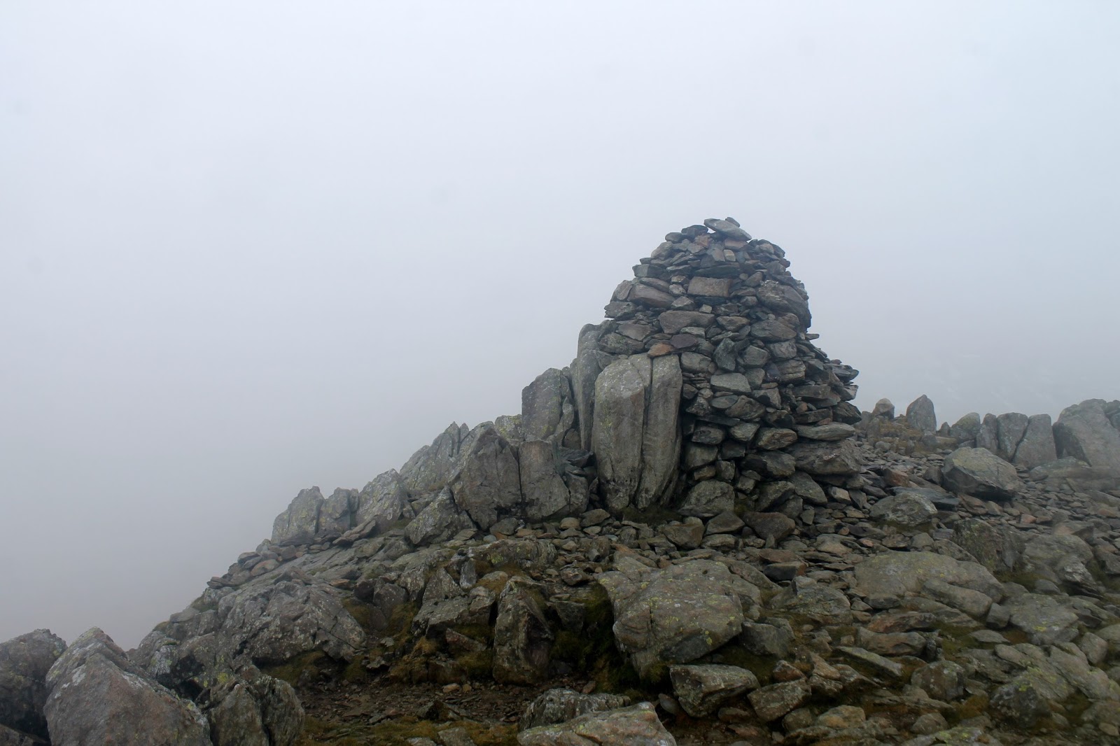
| A trig pillar marks the summit |
 |
| Along with a platform and cairn |
 |
| Proof the summit was empty |
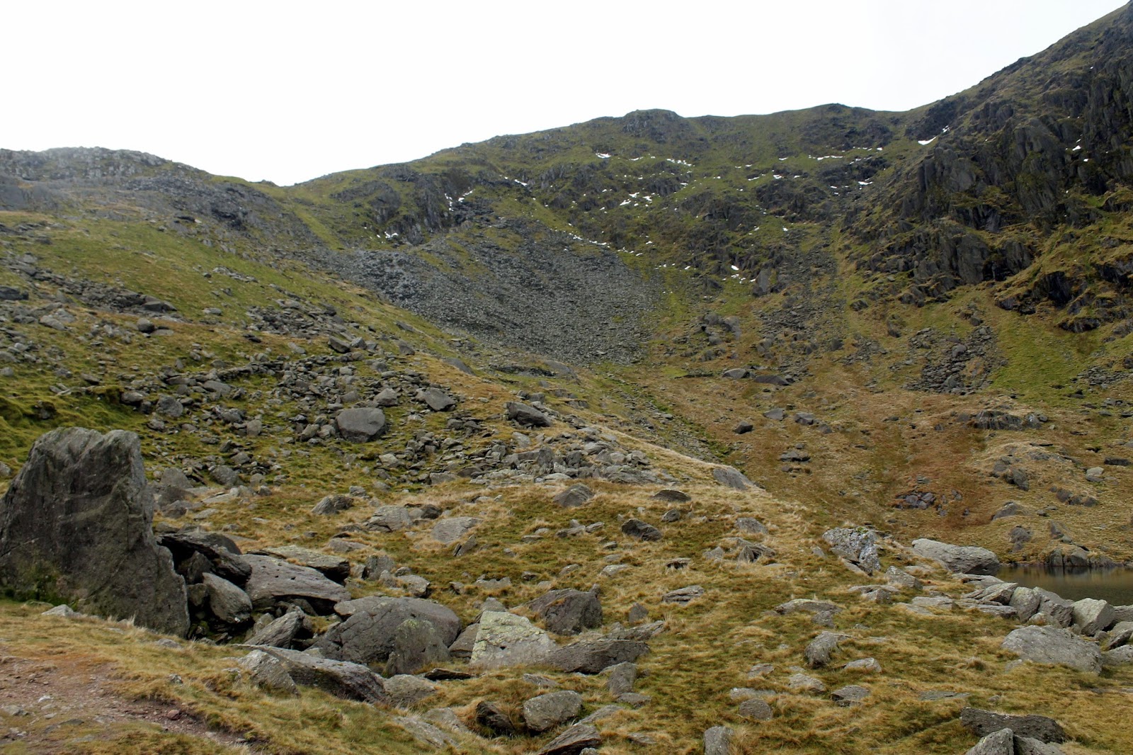
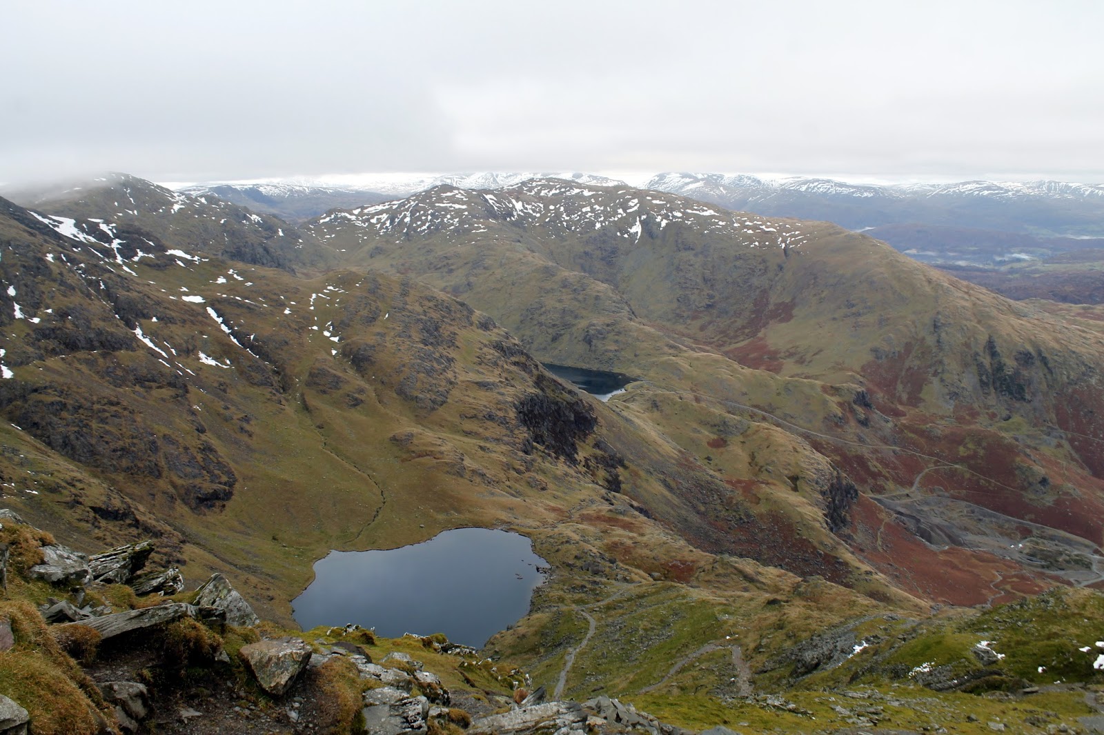
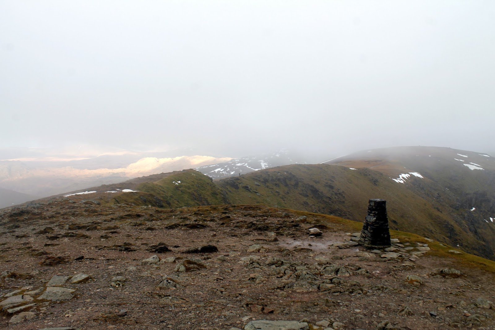
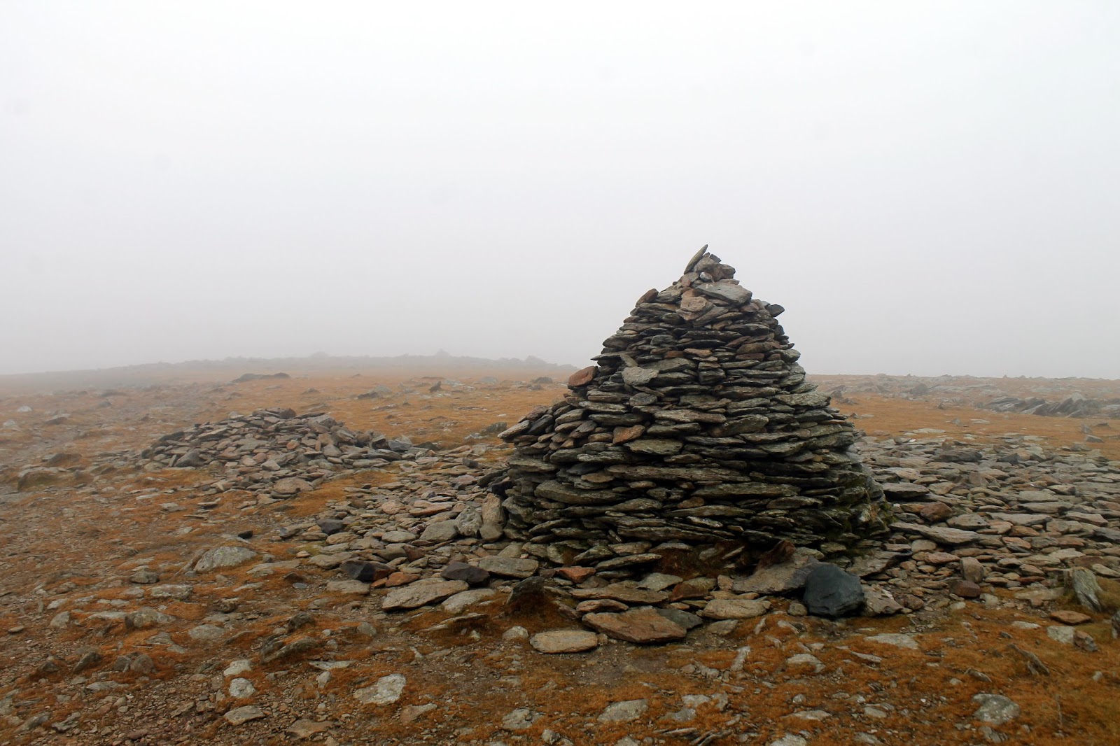
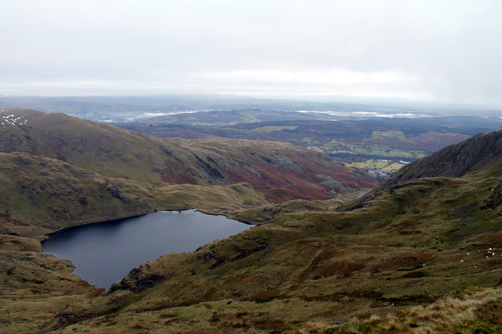
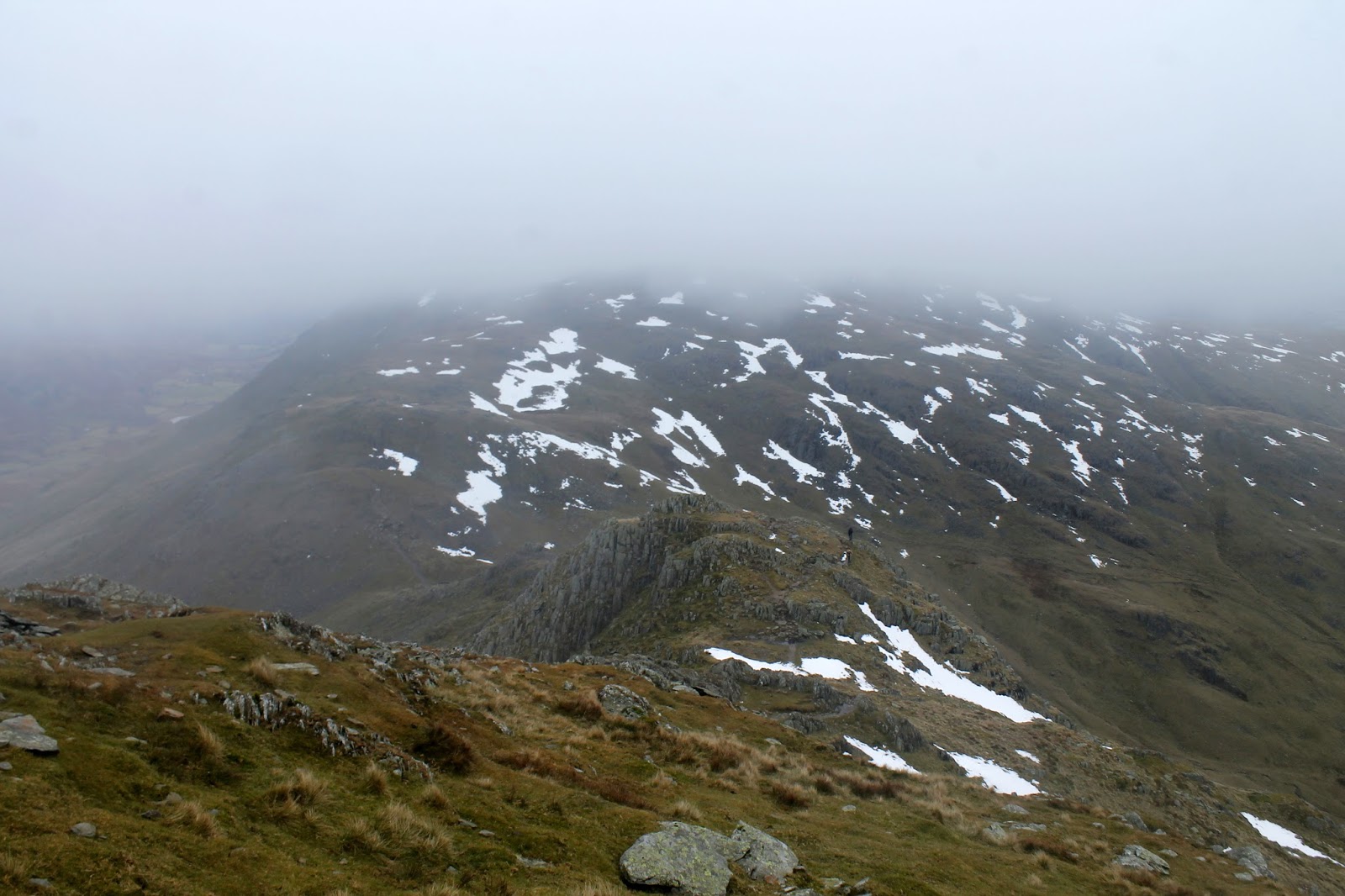
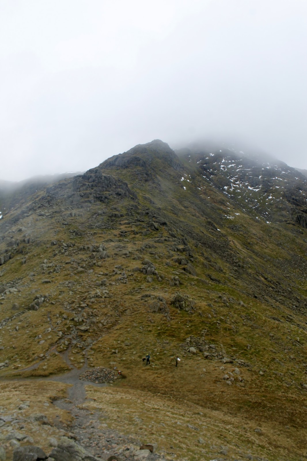
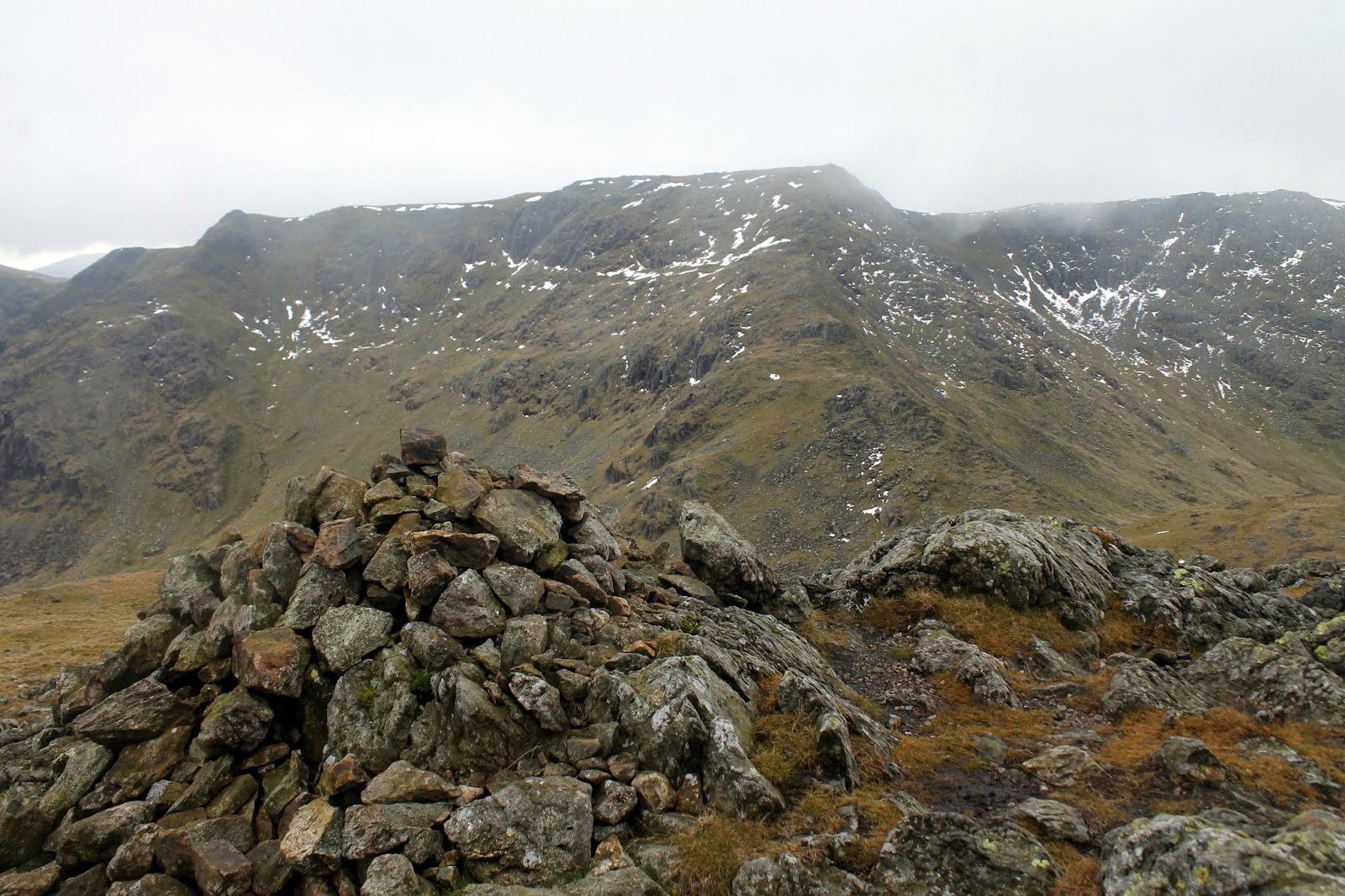
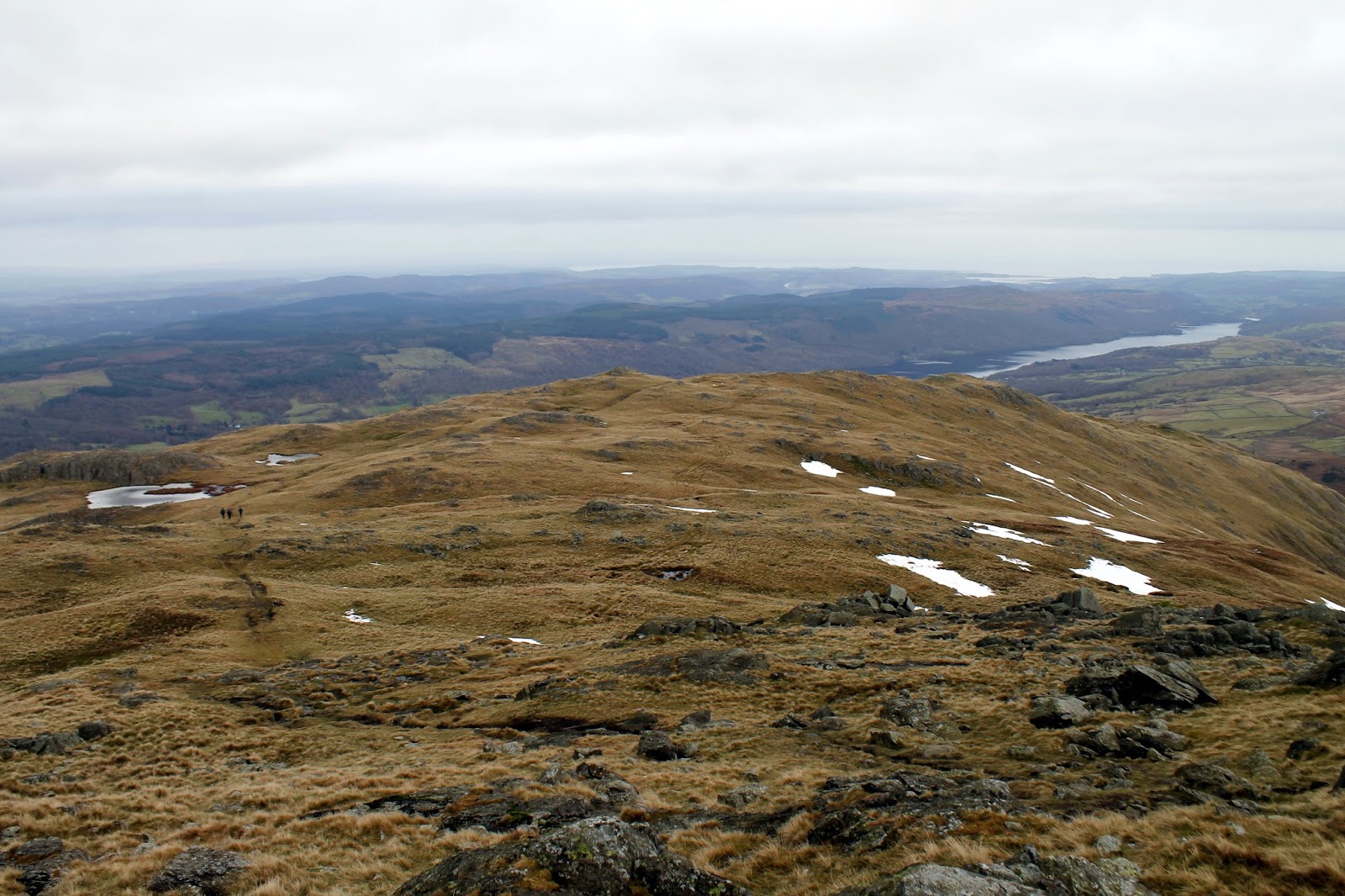
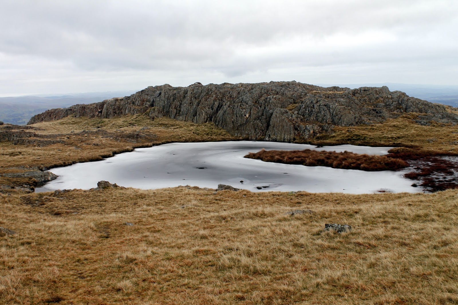
An unnecessary proliferation of cairns lines the path – why there are so many I have no idea; it’s hard to get lost on a ridge. A fat cairn marks the top before the path drops once again, this time into Levers Hawse before starting a steady climb up Swirl Band towards Swirl How. At Levers Hawse, you can opt to descend to Levers Water for an investigation of the Boulder Valley – one for another time I think.
 |
| Cairns mark the way |
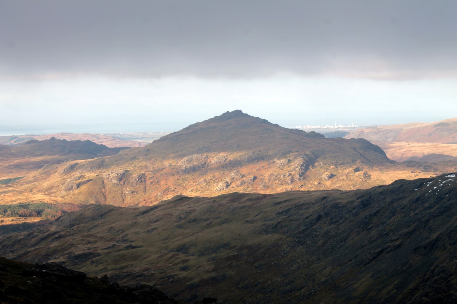
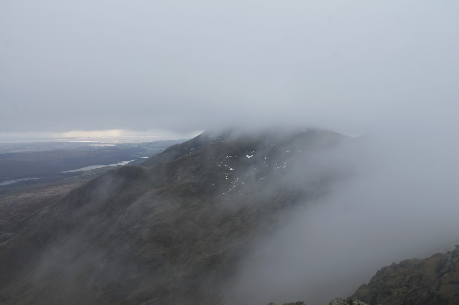
The cloud was sat below the summits but above the cols so I could see along Seathwaite Tarn into the Duddon Valley. Harter Fell and Grey Friar were also visible, the sun even had the audacity to shine on the far western fells – tantalisingly out of reach.
 |
| Harter Fell |
 |
| Levers Water and the Coppermines Valley |
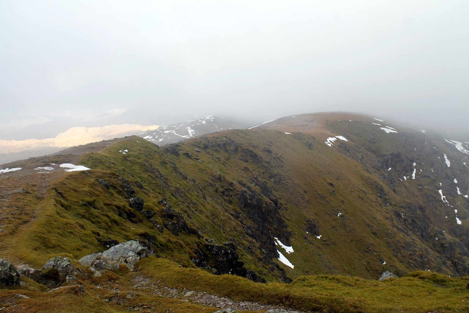
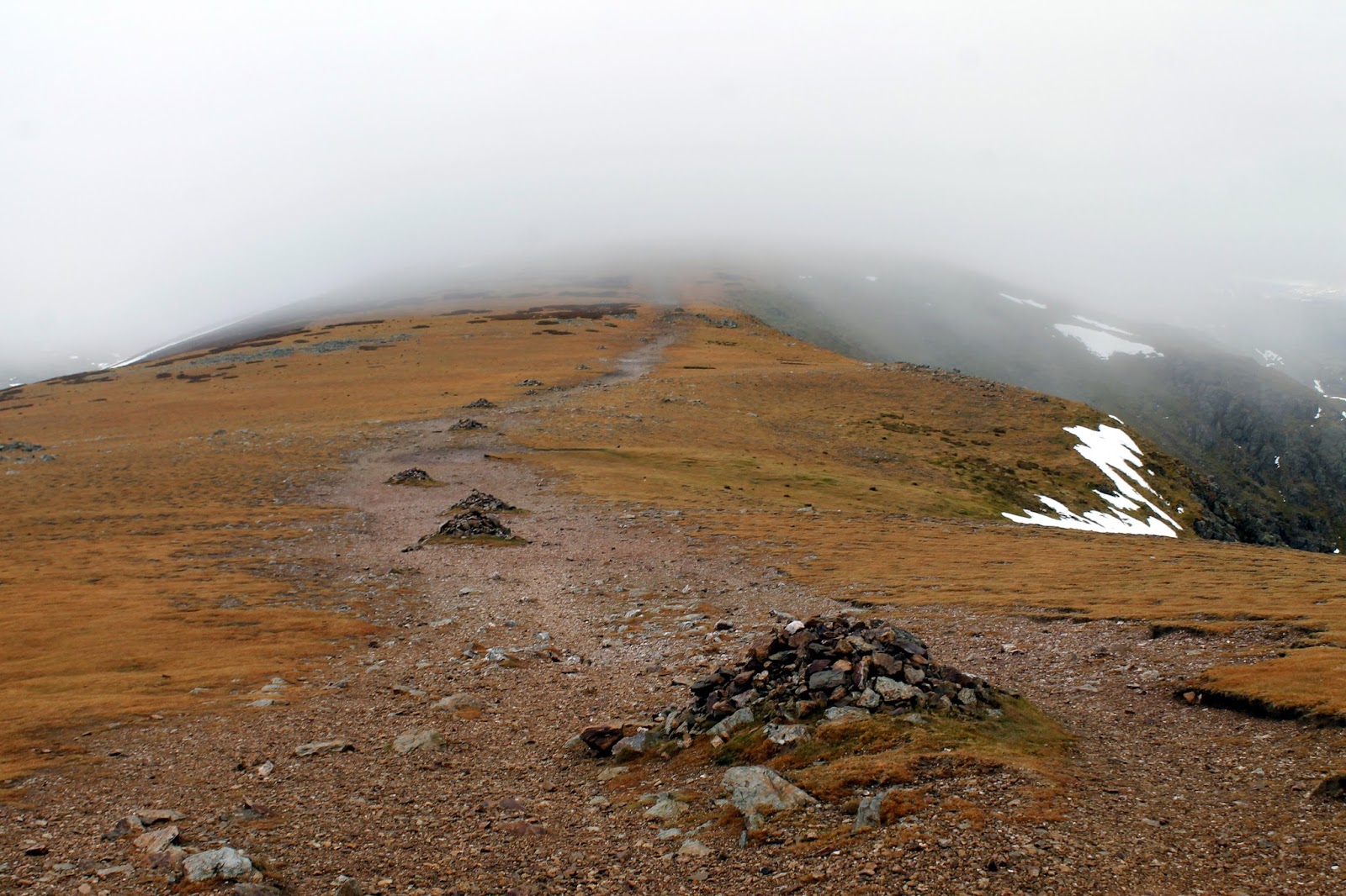
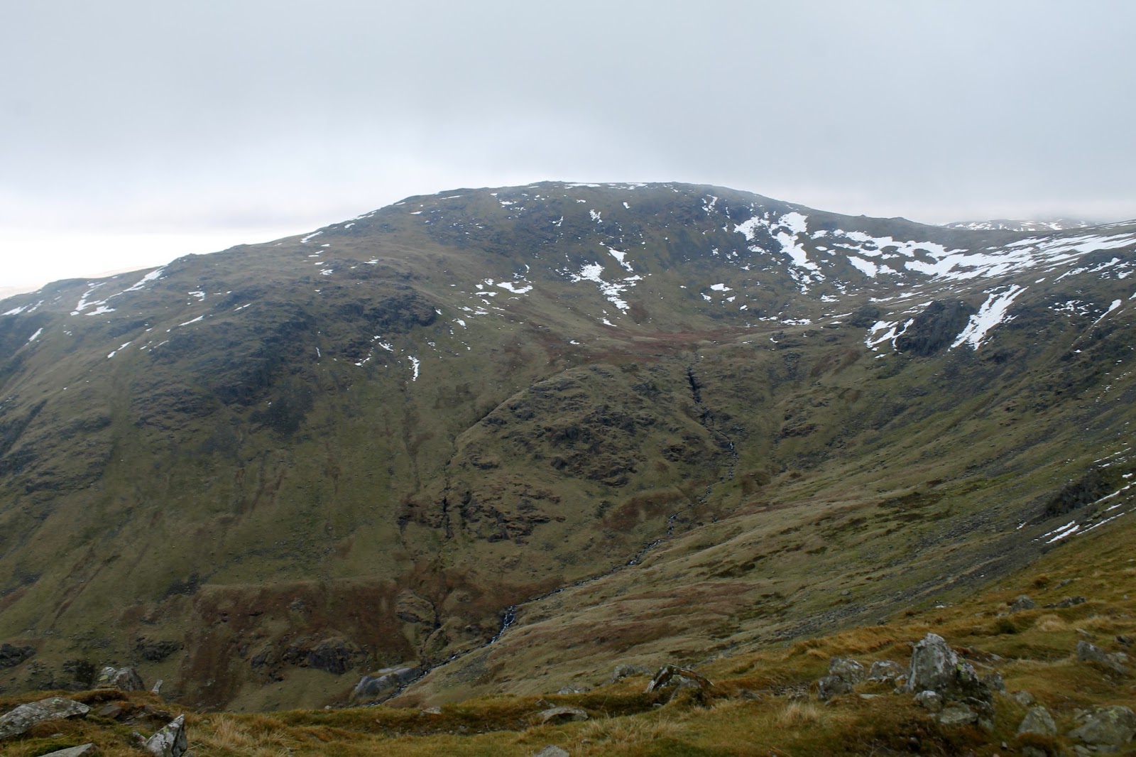
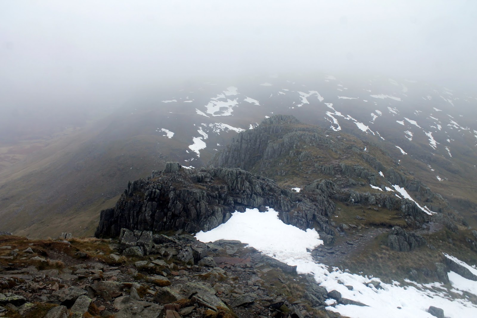
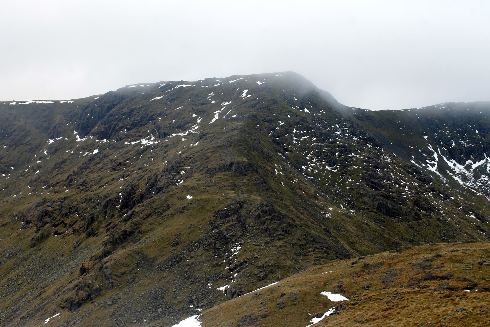
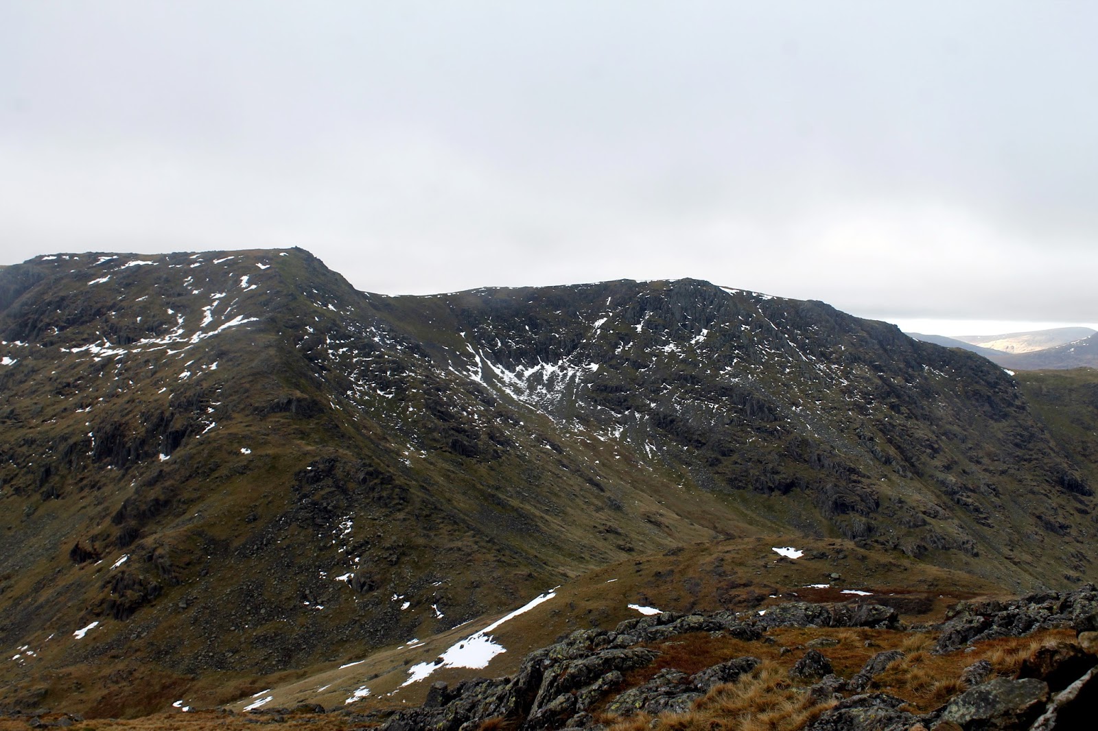
The slow climb up Swirl Band affords a fine view back to Brim Fell and The Old Man, at least when the clouds momentarily parted. Once past Great How Crags I was back in the thick of it heading for Swirl How. There is some debate over the height of Swirl How, Ordnance Survey maps mark it as 802m while BMC mapping has 804m. Generally, this would be inconsequential, however, a height of 804m would make it the highest of the Coniston Fells, rather than The Old Man.
 |
| Levers Water |
 |
| More cloud sweeps in |
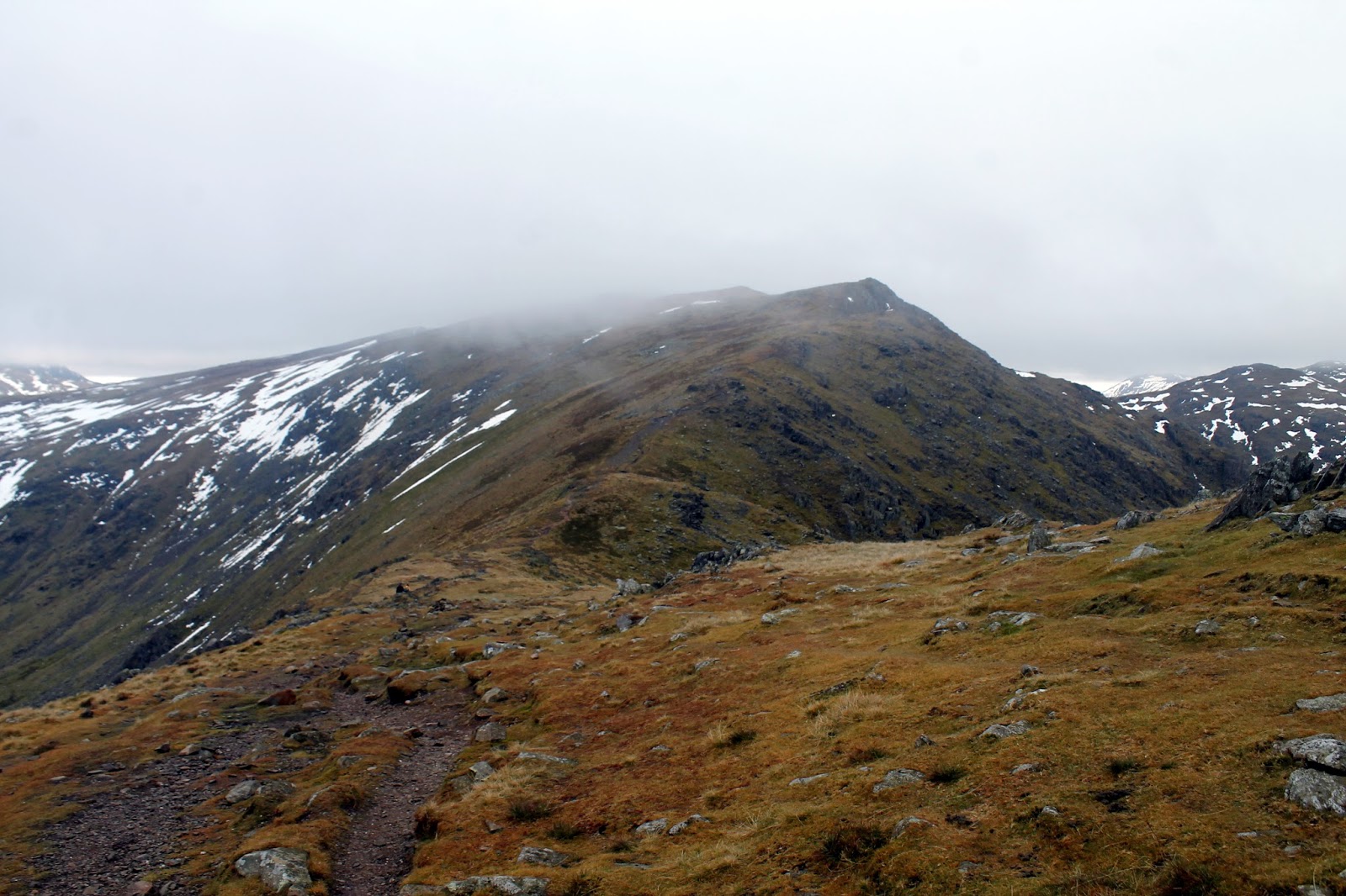
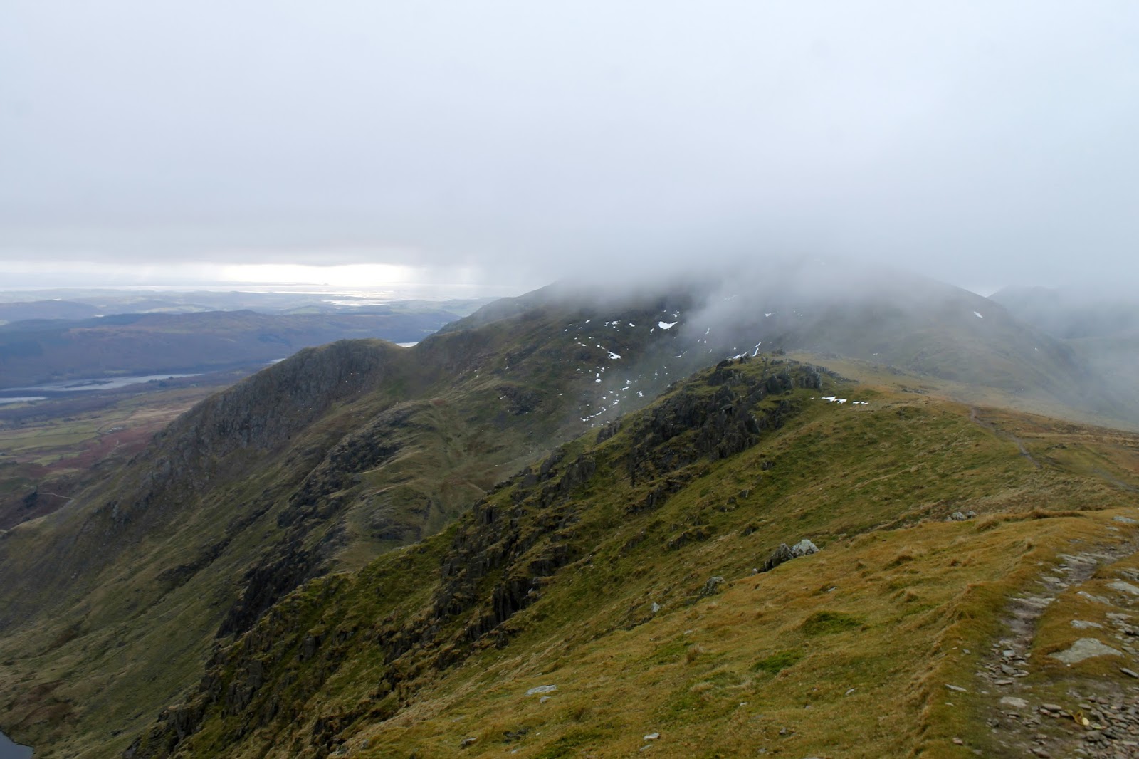
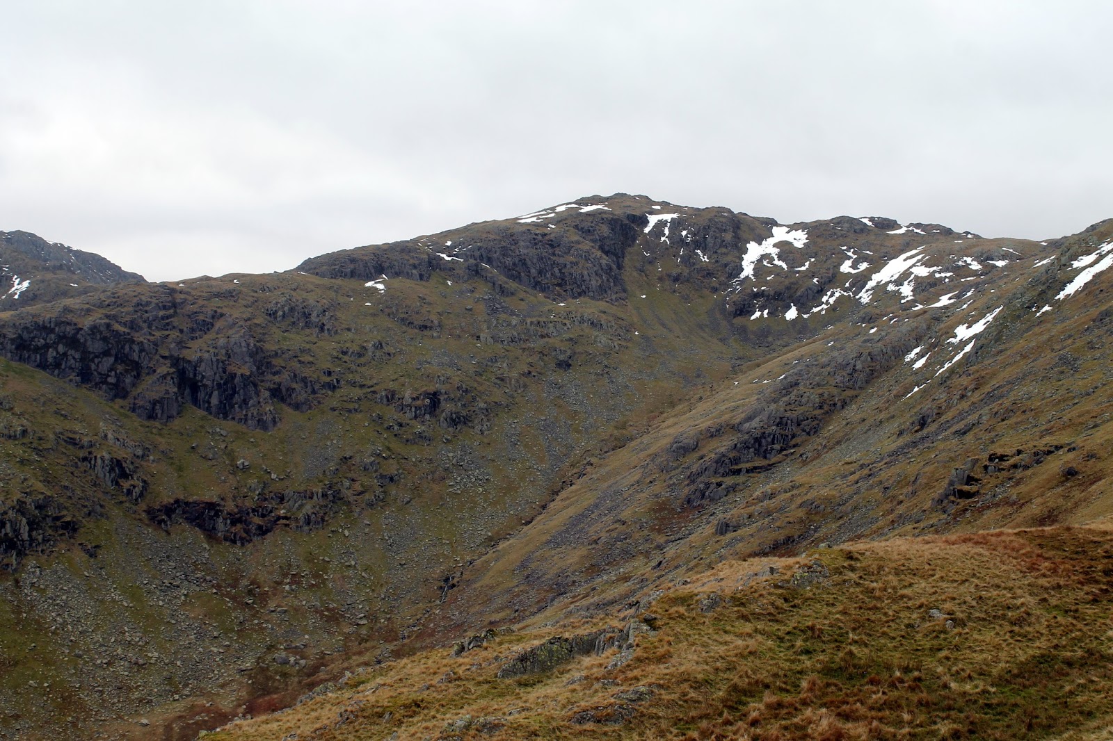
I had considered making the short crossing to Great Carrs but the low cloud quashed any idea of that. Alternatively, I pressed on, steeply down the stony slope of Prison Band which falls some 200m into Swirl Hause.
 |
| Looking down Prison Band |
 |
| Prison Band |
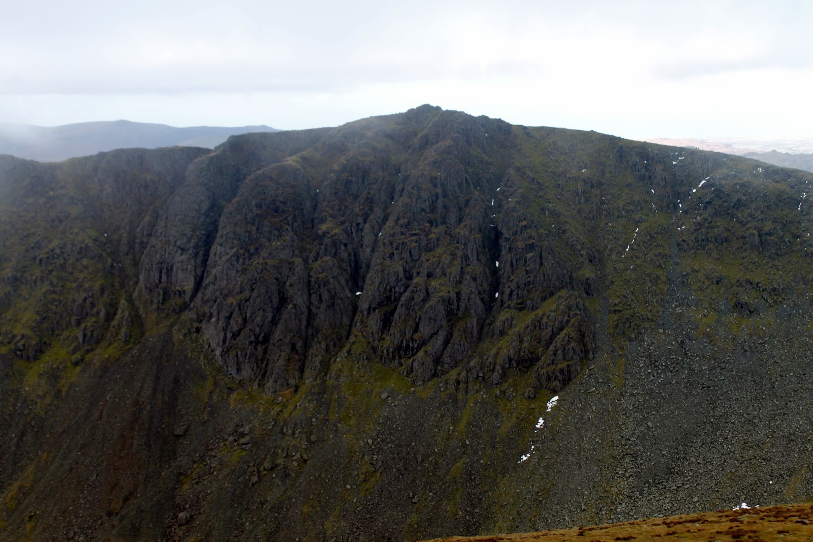
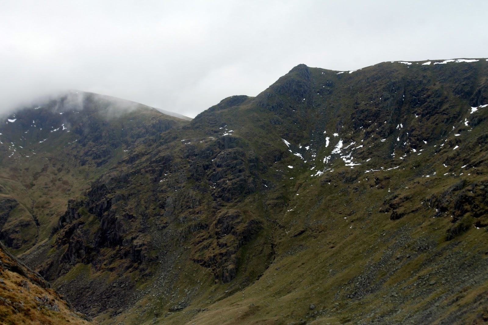
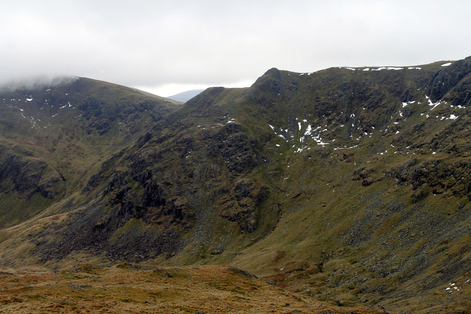
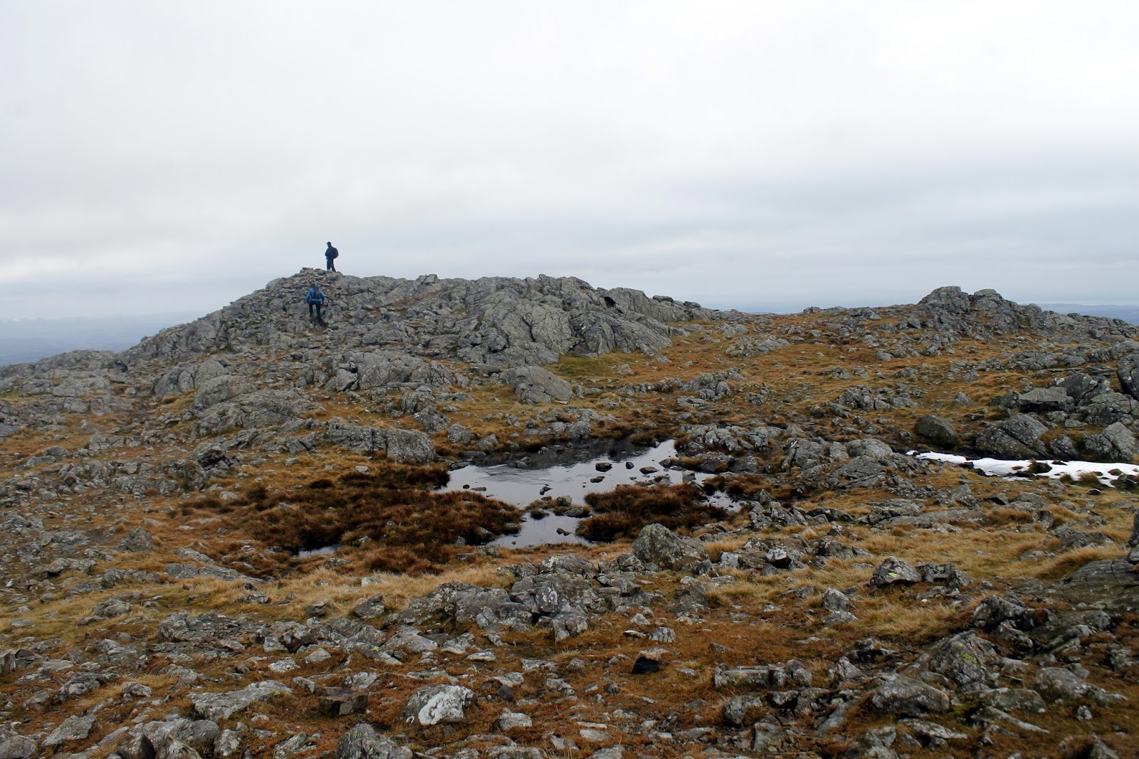
By the time I had reached the bottom, the cloud had slowly started to lift, revealing the eastern slopes of the three fells I had just crossed – they are some of the best in the Lake District with numerous crags hanging above Levers Water. I opted to head off path at this point, climbing directly up grassy slopes to the summit of Black Sail, a peak I had missed out on my last outing. It offered the perfect opportunity for a quick lunch stop.
 |
| Levers Water |
 |
| Looking up Prison Band |
 |
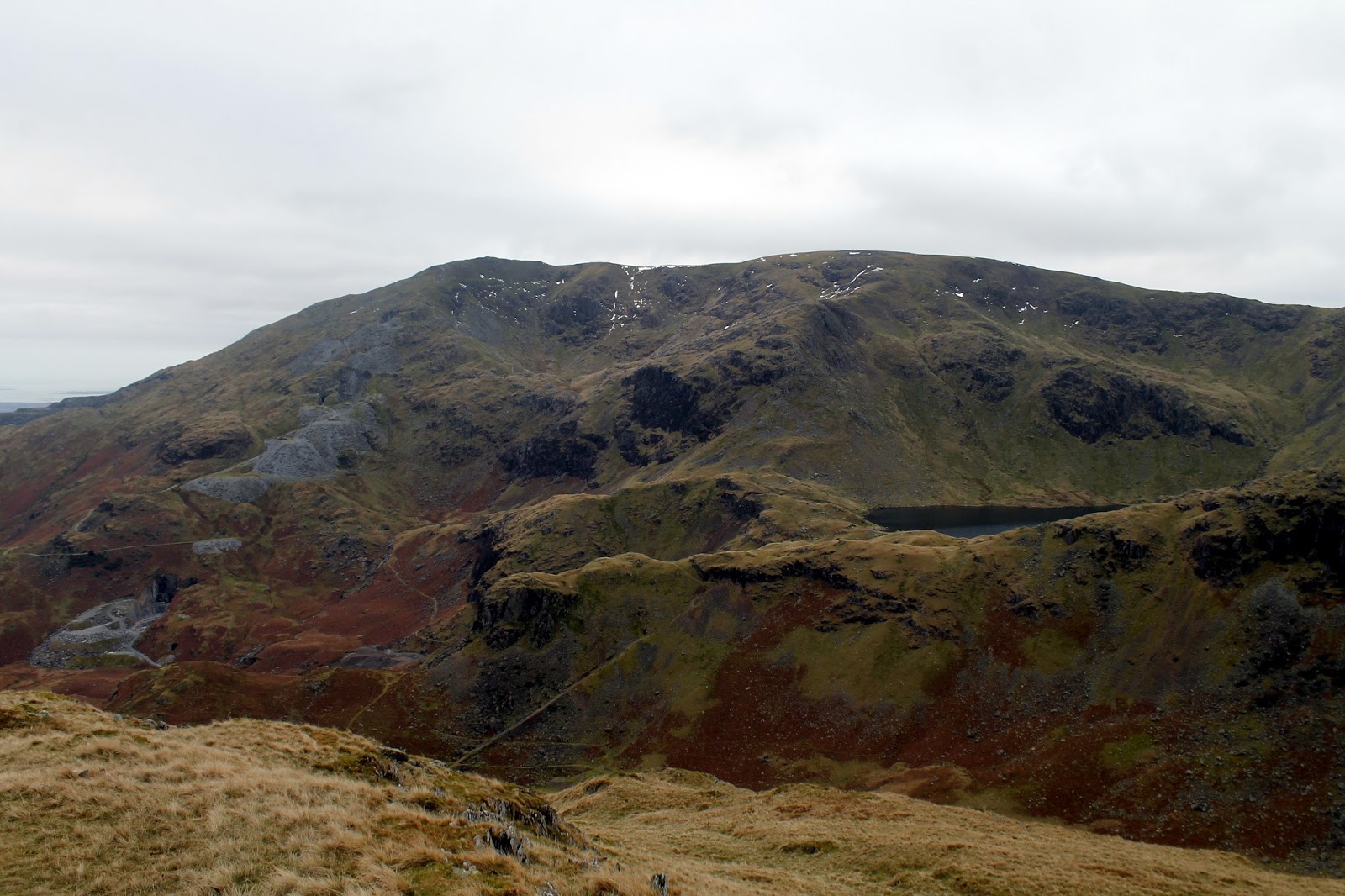
| Great How Crags |
 |
| Great How Crags |
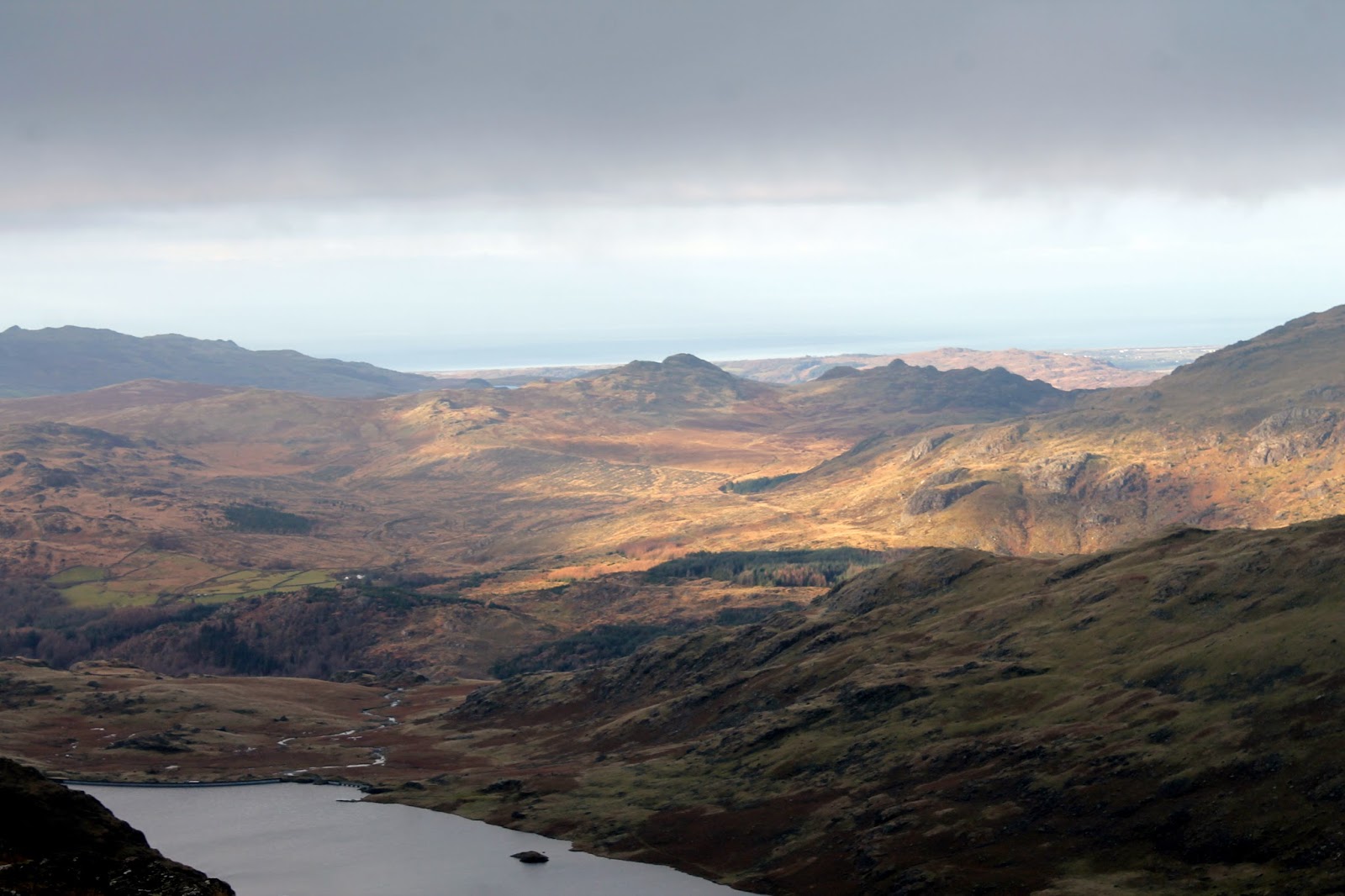
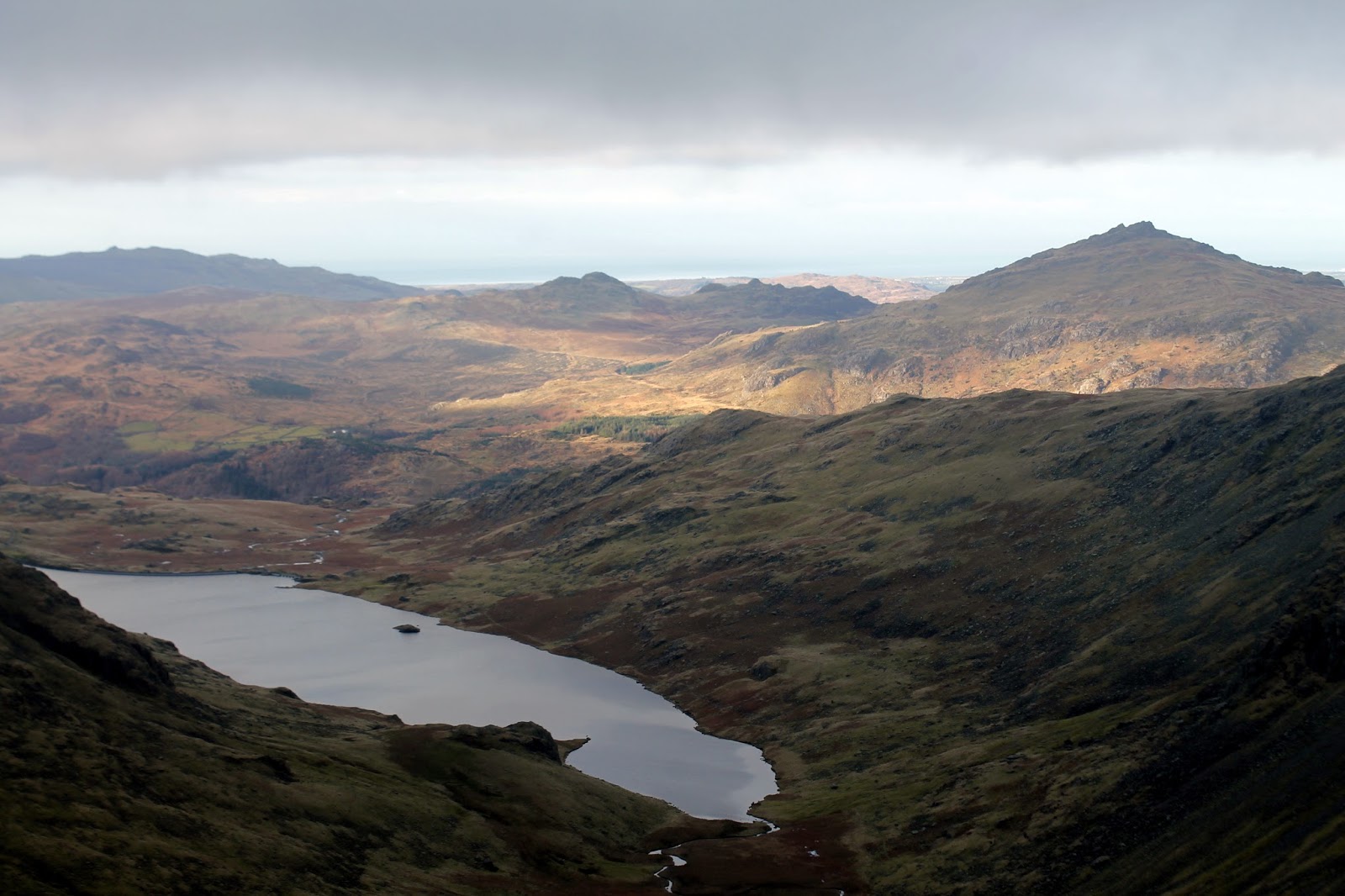
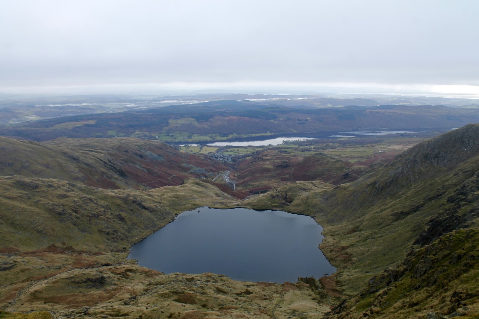
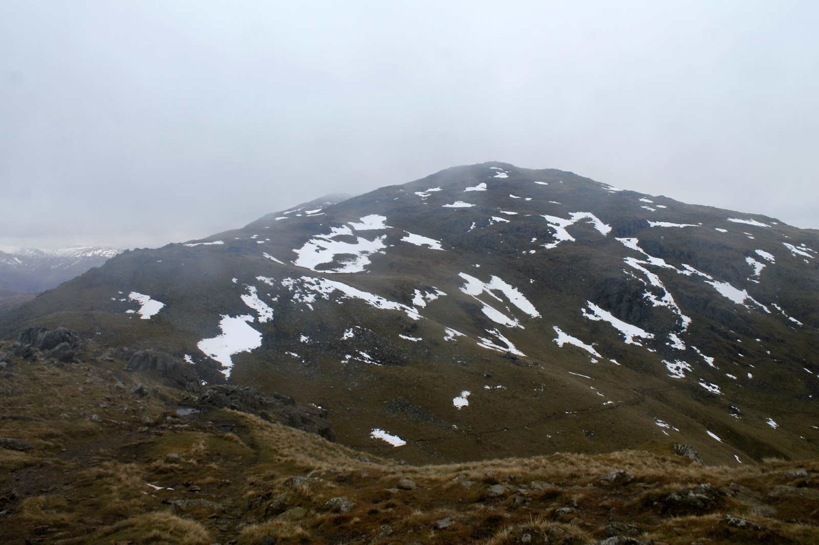
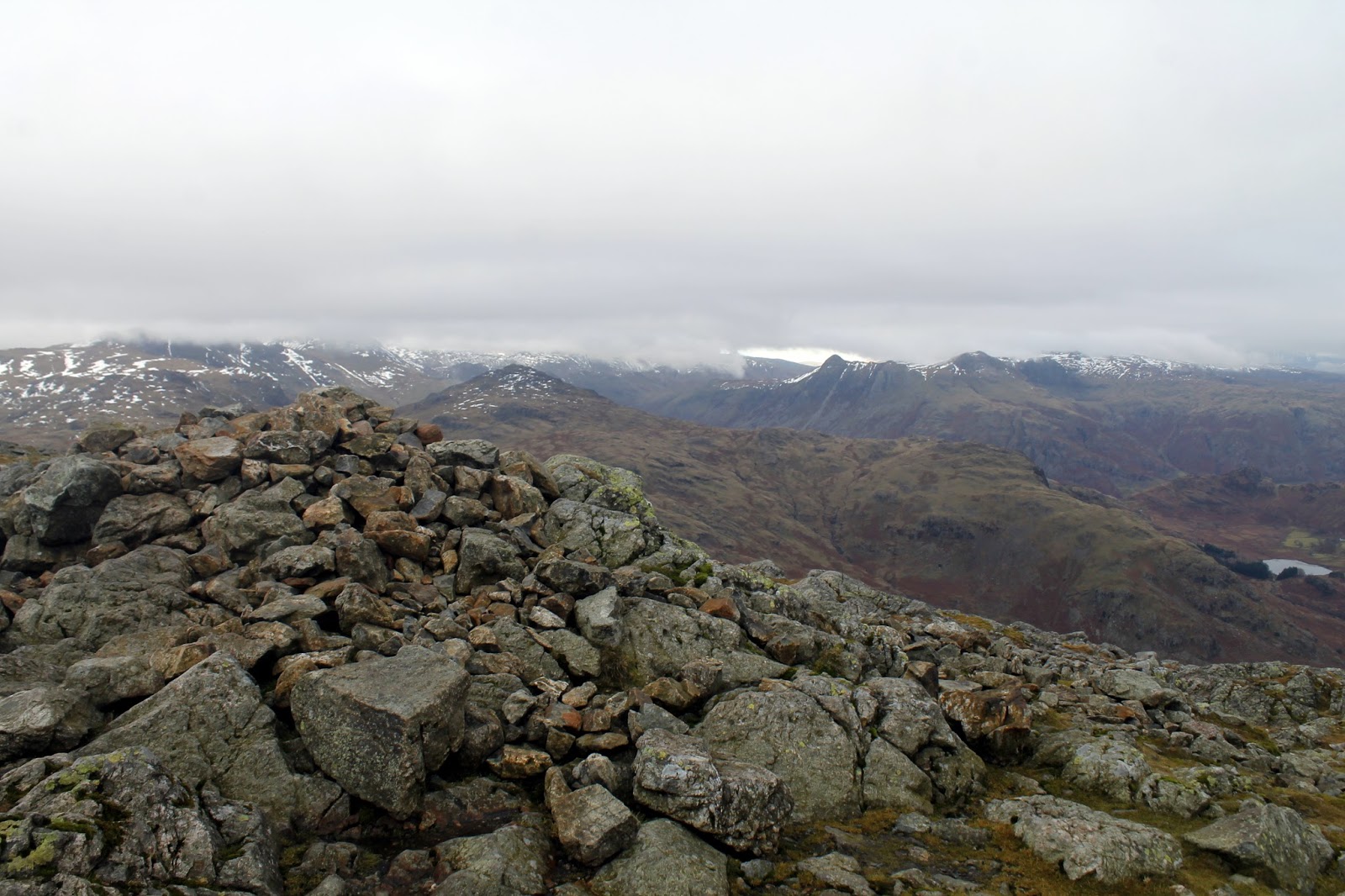
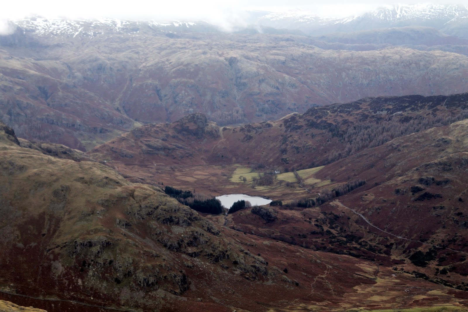
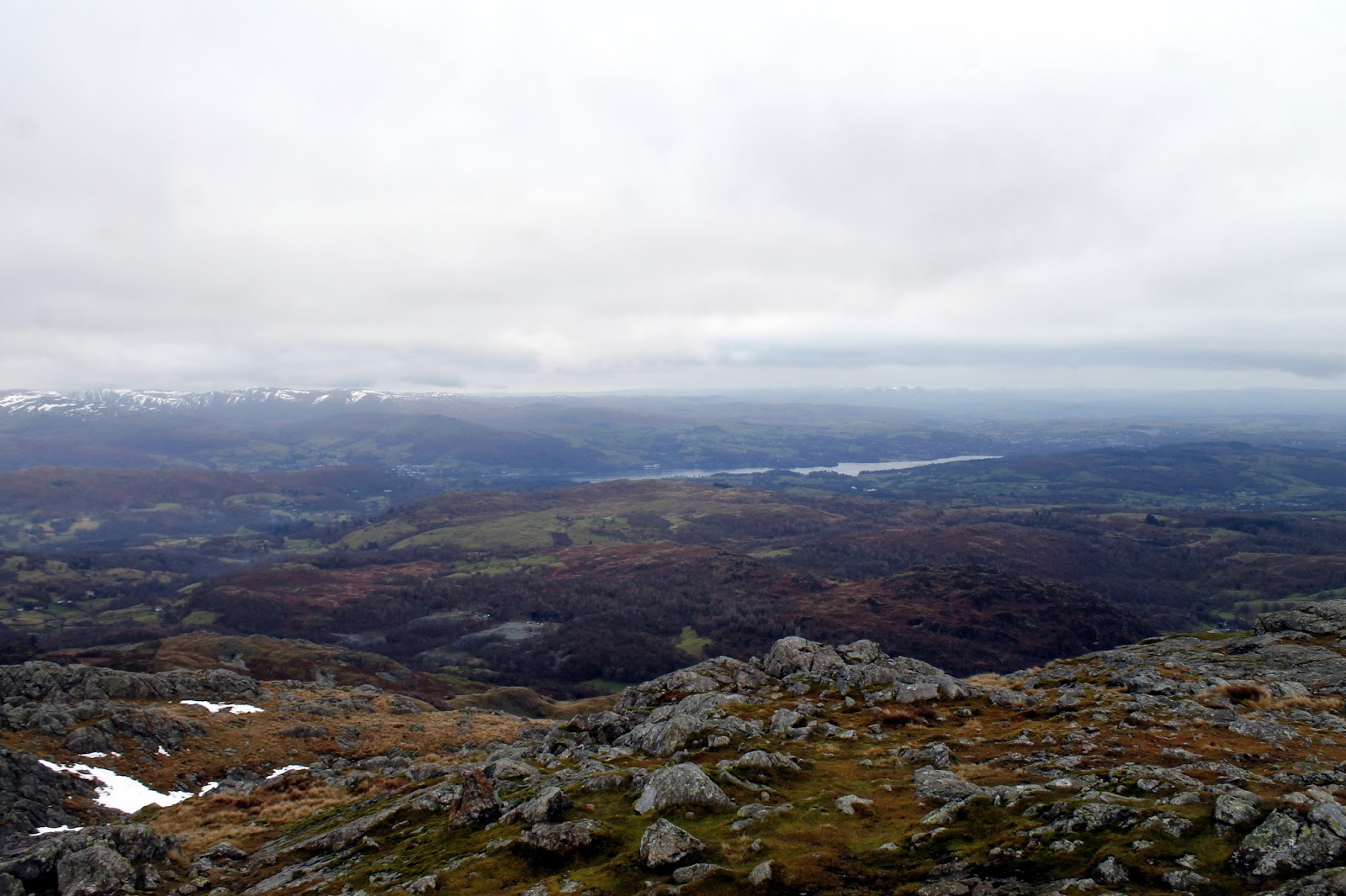
Wetherlam stands just a short stroll away; Black Sails being a subsidiary summit of the main fell. Fine views are your reward for reaching the top, stretching across the main bulk of the southern fells and Little Langdale.
 |
| Side Pike and Blea Tarn |
 |
| Looking towards Windermere |
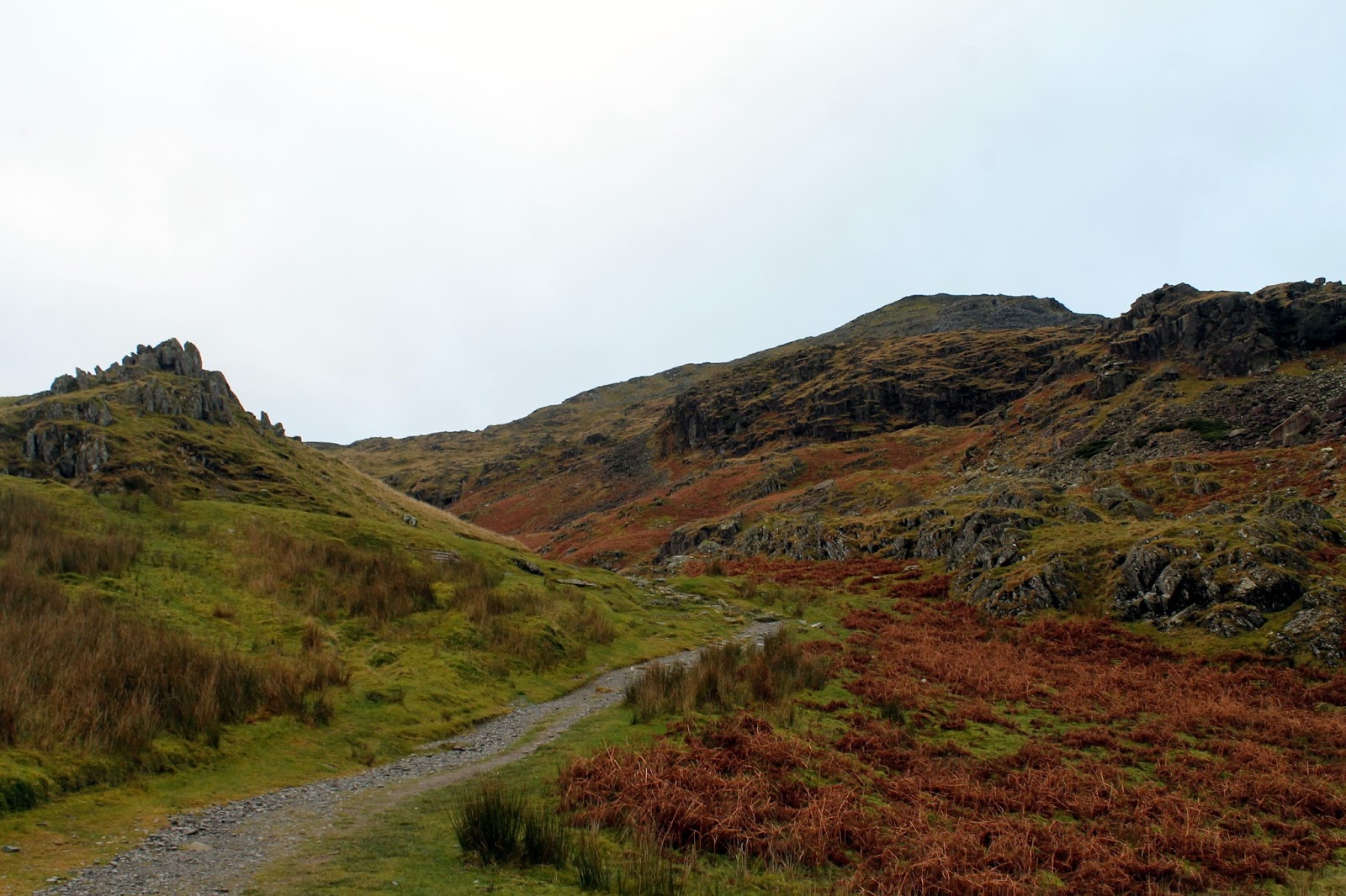
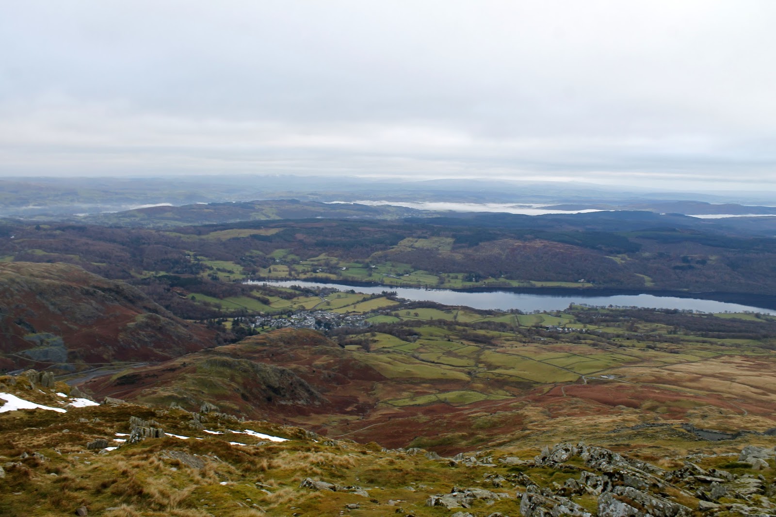
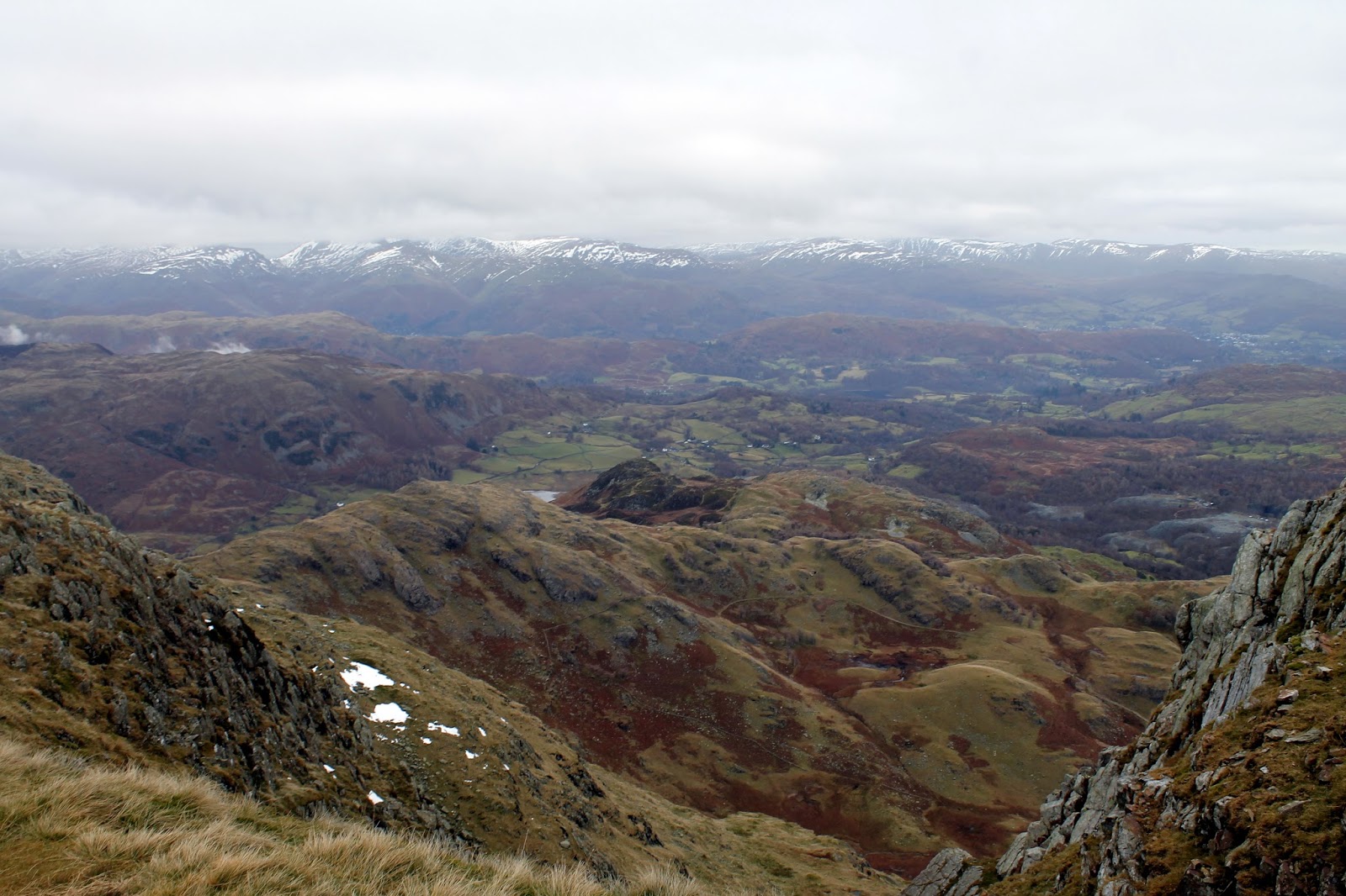
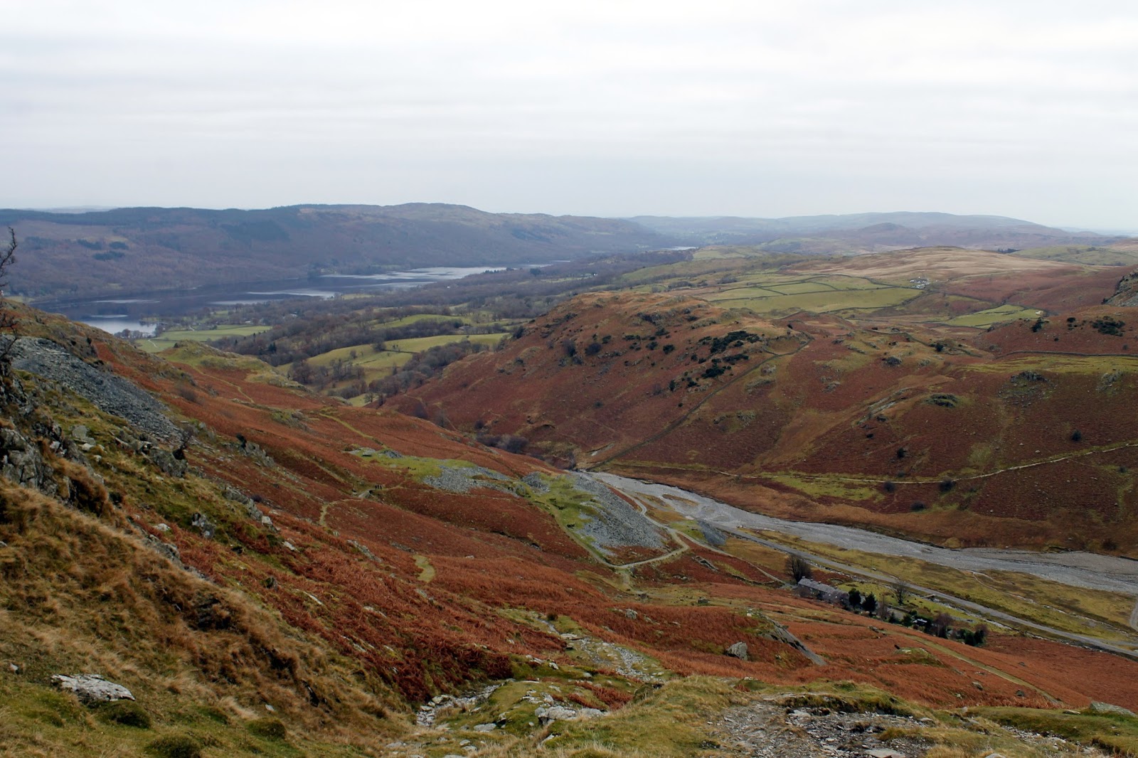
The route back to the valley is easy, following the gentle ridge of Lad Stones to Hole Rake which, in turn, drops you back into the Coppermines Valley. I returned to the car by the same track by the miner’s bridge, snapping some final autumnal colours as I did. The only disappointment on this walk was the weather, which was being particularly obstinate today. Still, it was great to get back out and about.
 |
| Wetherlam Edge |
 |
| The Lad Stones ridge |
 |
| A frozen pond |
 |
| Coppermines Valley |
 |
| Coppermines Valley |
 |
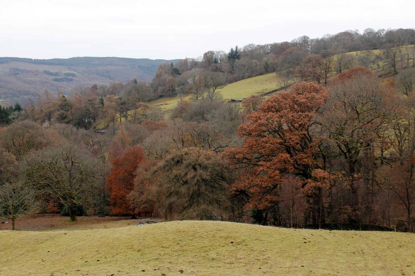
| The final colours of autumn |

