Open Space Web-Map builder Codehttps://openspace.ordnancesurvey.co.uk/osmapapi/openspace.js?key=3119F72552FD5C22E0530C6CA40A5A92https://openspace.ordnancesurvey.co.uk/osmapapi/script/mapbuilder/basicmap.jshttps://openspace.ordnancesurvey.co.uk/osmapapi/script/mapbuilder/searchbox.js//variables for routes var linesLayer, points, lineFeature, lineString, routeMarkersLayer, routepos, routesize, routeoffset, routeicon; var style_blue = {strokeColor: “#0000CD”, strokeOpacity: 0.5, strokeWidth: 4.5}; function initmapbuilder() { //initiate the map var options = {resolutions: [2500, 1000, 500, 200, 100, 50, 25, 10, 5, 4, 2.5, 2, 1]}; osMap = new OpenSpace.Map(‘map’, options); //configure map options (basicmap.js) setglobaloptions(); //set the center of the map and the zoom level osMap.setCenter(new OpenSpace.MapPoint(331770.9974823,526613.00125885),7); linesLayer = osMap.getVectorLayer(); // Set up layer for route markers routeMarkersLayer = new OpenLayers.Layer.Markers(“Route Markers”); //make a route points = new Array(); points.push(new OpenLayers.Geometry.Point(332452.66412354,525479.66793823)); points.push(new OpenLayers.Geometry.Point(332567.66412354,525754.66793823)); points.push(new OpenLayers.Geometry.Point(332592.66412354,525829.66793823)); points.push(new OpenLayers.Geometry.Point(332447.66412354,526039.66793823)); points.push(new OpenLayers.Geometry.Point(332492.66412354,526094.66793823)); points.push(new OpenLayers.Geometry.Point(332417.66412354,526239.66793823)); points.push(new OpenLayers.Geometry.Point(332472.66412354,526254.66793823)); points.push(new OpenLayers.Geometry.Point(332537.66412354,526389.66793823)); points.push(new OpenLayers.Geometry.Point(332537.66412354,526539.66793823)); points.push(new OpenLayers.Geometry.Point(332687.66412354,526694.66793823)); points.push(new OpenLayers.Geometry.Point(332637.66412354,526809.66793823)); points.push(new OpenLayers.Geometry.Point(332612.66412354,527099.66793823)); points.push(new OpenLayers.Geometry.Point(332497.66412354,527439.66793823)); points.push(new OpenLayers.Geometry.Point(332397.66412354,527599.66793823)); points.push(new OpenLayers.Geometry.Point(332317.66412354,527724.66793823)); points.push(new OpenLayers.Geometry.Point(332352.66412354,527799.66793823)); points.push(new OpenLayers.Geometry.Point(332467.66412354,527964.66793823)); points.push(new OpenLayers.Geometry.Point(332327.66412354,527739.66793823)); points.push(new OpenLayers.Geometry.Point(332137.66412354,527709.66793823)); points.push(new OpenLayers.Geometry.Point(331927.66412354,527504.66793823)); points.push(new OpenLayers.Geometry.Point(331692.66412354,527339.66793823)); points.push(new OpenLayers.Geometry.Point(331432.66412354,527224.66793823)); points.push(new OpenLayers.Geometry.Point(331262.66412354,527154.66793823)); points.push(new OpenLayers.Geometry.Point(331177.66412354,527049.66793823)); points.push(new OpenLayers.Geometry.Point(331062.66412354,526934.66793823)); points.push(new OpenLayers.Geometry.Point(330952.66412354,526849.66793823)); points.push(new OpenLayers.Geometry.Point(330752.66412354,526679.66793823)); points.push(new OpenLayers.Geometry.Point(330657.66412354,526594.66793823)); points.push(new OpenLayers.Geometry.Point(330697.66412354,526469.66793823)); points.push(new OpenLayers.Geometry.Point(330582.66412354,526414.66793823)); points.push(new OpenLayers.Geometry.Point(330477.66412354,526299.66793823)); points.push(new OpenLayers.Geometry.Point(330517.66412354,526229.66793823)); points.push(new OpenLayers.Geometry.Point(330632.66412354,526094.66793823)); points.push(new OpenLayers.Geometry.Point(330917.66412354,525994.66793823)); points.push(new OpenLayers.Geometry.Point(331072.66412354,526024.66793823)); points.push(new OpenLayers.Geometry.Point(331207.66412354,526124.66793823)); points.push(new OpenLayers.Geometry.Point(331257.66412354,525979.66793823)); points.push(new OpenLayers.Geometry.Point(331592.66412354,526039.66793823)); points.push(new OpenLayers.Geometry.Point(331627.66412354,525944.66793823)); points.push(new OpenLayers.Geometry.Point(331607.66412354,525899.66793823)); points.push(new OpenLayers.Geometry.Point(331842.66412354,525584.66793823)); points.push(new OpenLayers.Geometry.Point(331942.66412354,525379.66793823)); points.push(new OpenLayers.Geometry.Point(332087.66412354,525359.66793823)); points.push(new OpenLayers.Geometry.Point(332262.66412354,525429.66793823)); points.push(new OpenLayers.Geometry.Point(332347.66412354,525489.66793823)); points.push(new OpenLayers.Geometry.Point(332452.66412354,525479.66793823)); // create a polyline feature from the array of points lineString = new OpenLayers.Geometry.LineString(points); lineFeature = new OpenLayers.Feature.Vector(lineString, null, style_blue); linesLayer.addFeatures([lineFeature]); //crate a route start/end marker routepos = new OpenSpace.MapPoint(332452.66412354,525479.66793823); routesize = new OpenLayers.Size(33,45); routeoffset = new OpenLayers.Pixel(-5,-37); routeicon = new OpenSpace.Icon(‘https://openspace.ordnancesurvey.co.uk/osmapapi/img_versions/img_1.1/mapbuilder/routemarker-startend.png’, routesize, routeoffset, null, null); routeMarkersLayer.addMarker(new OpenLayers.Marker(routepos, routeicon)); osMap.addLayer(routeMarkersLayer);}
Route: Threlkeld, Gategill, Hall’s Fell, Hall’s Fell Ridge, Blencathra (Hallsfell Top), Gategill Fell Top, Knowe Crags, Blease Fell, Blease Farm, Threlkeld
Date: 16/07/2016
From: Thelkeld
Parking: Threlkeld
Start Point: Threlkeld
Region: Northern Fells
Route length: 5.3 miles (8.52 km)
Time taken : 02:33
Average speed: 2.0 mph
Ascent: 784m
Descent: 807m
Wainwrights on this walk:
Blencathra (868m)
Additional summits: Gategill Fell Top (851m), Knowe Crags (804m)
Other points of interest: Hall’s Fell Ridge
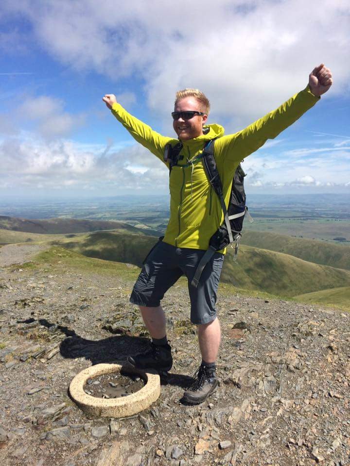
The time had finally arrived to climb the 214th and final Wainwright and what a day we had planned. A few years ago I had been recommended to leave something good until the end which would make that triumphant feeling all the more special. I’m not sure many people would be impressed by my claim that I finished on Mungrisdale Common. For many years I have driven in and out of the Lake District along the A66, passing beneath the inviting crags and ridges of Blencathra, promising one day to finally stake my claim on the summit. That day was today.
I chose
Blencathra for no personal or sentimental reasons other than it is a fine looking mountain with a number of interesting and exciting approaches and, ultimately, it stands has a huge isolated lump on the north eastern fringe of the National Park rather than the crowning glory of a round or horseshoe.
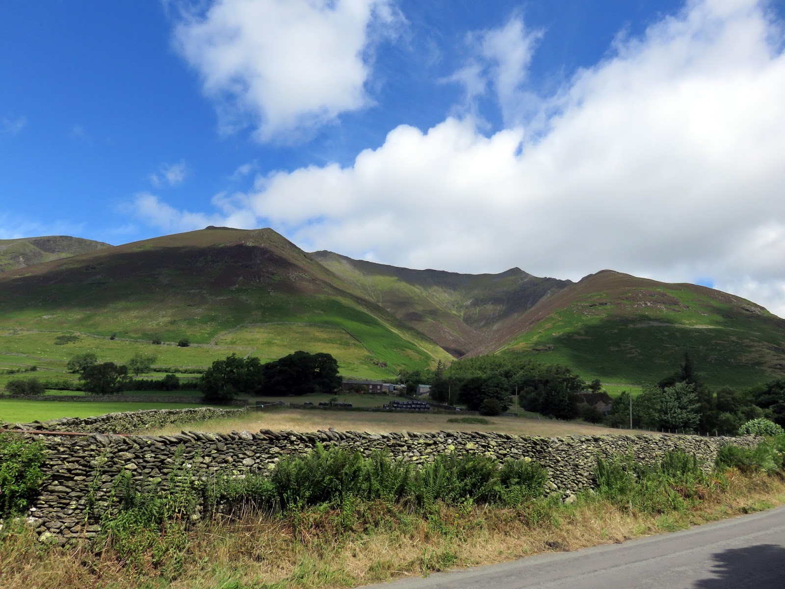
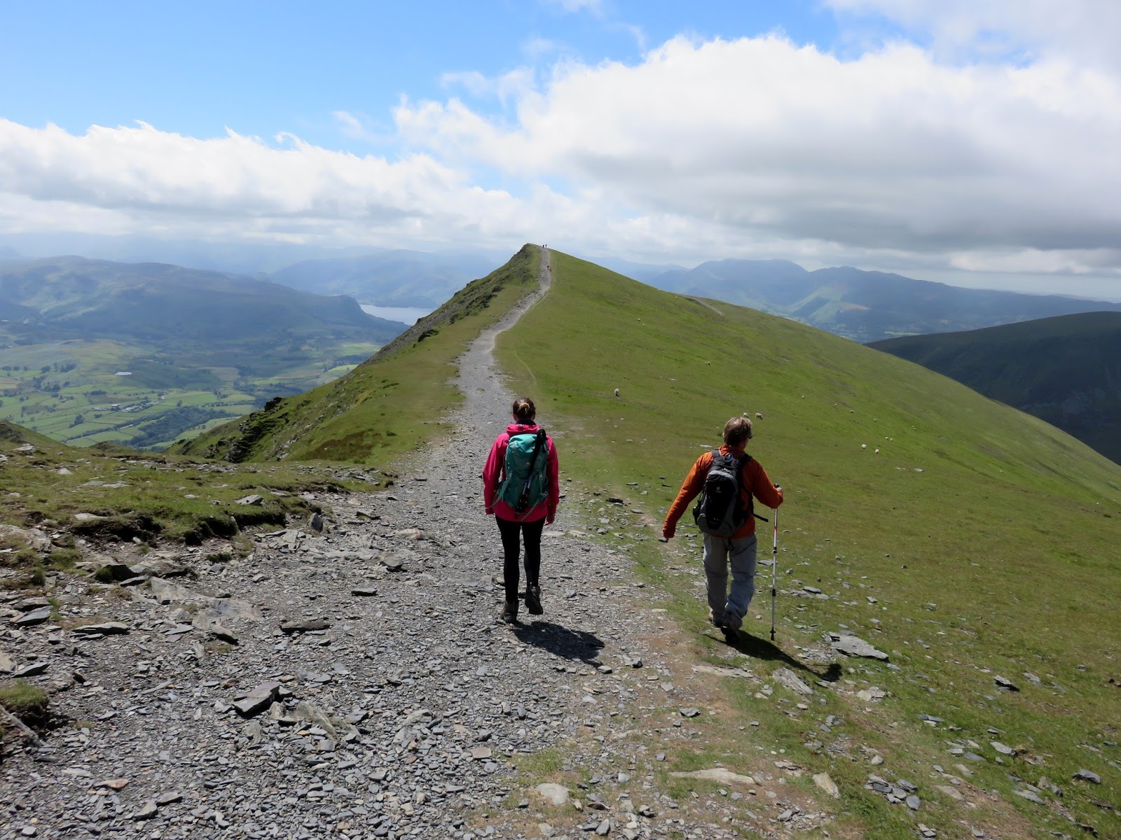
You may think that I would have chosen Sharp Edge to make my triumphant ascent to the summit but with a few well wishers in tow, we decided on the slightly less intimidating Hall’s Fell Ridge (though only less-so). Wainwright was very complimentary about this ridge “positively the finest way up to any mountain-top in the district” were his words and, from the roadside in Threlkeld, it certainly looks like it means business.
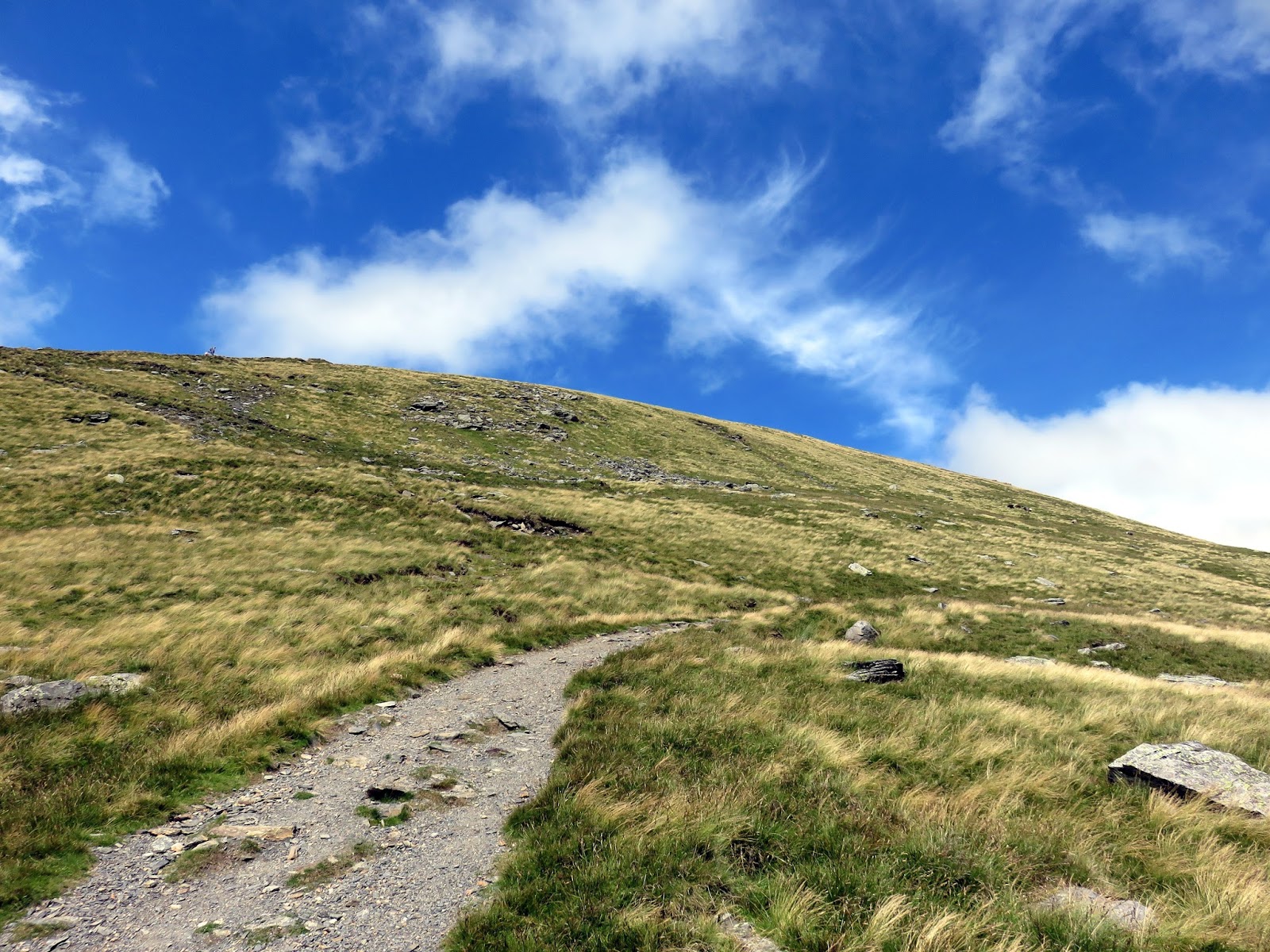
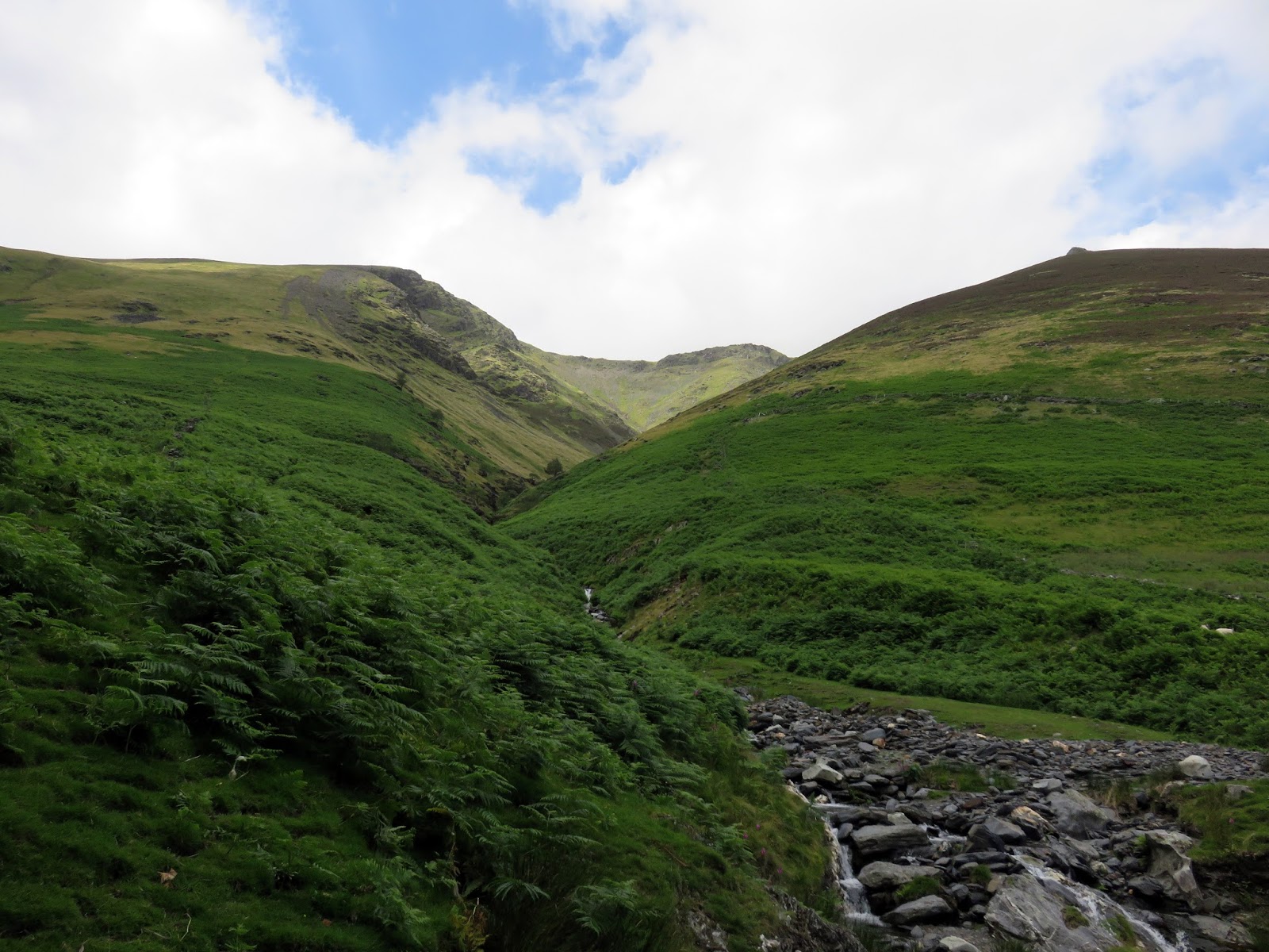
The day could not have been better for tackling such an exciting route, fluffy white clouds filled the blue sky though a strong breeze did have me slightly concerned for a while. As I mentioned, we started in Thelkeld, which sits in the shadow of the fell, making our way along farm tracks fields to the foot of the ridge. After crossing Gate Gill, the steep climb begins.
 |
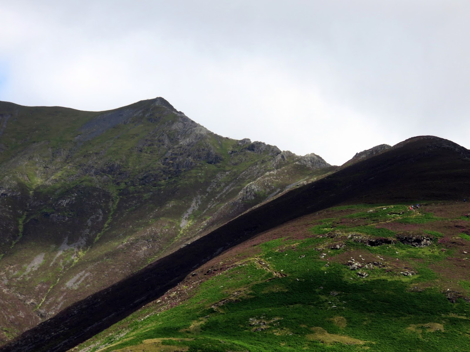
| The Hall’s Fell Ridge leads directly to the summit |
 |
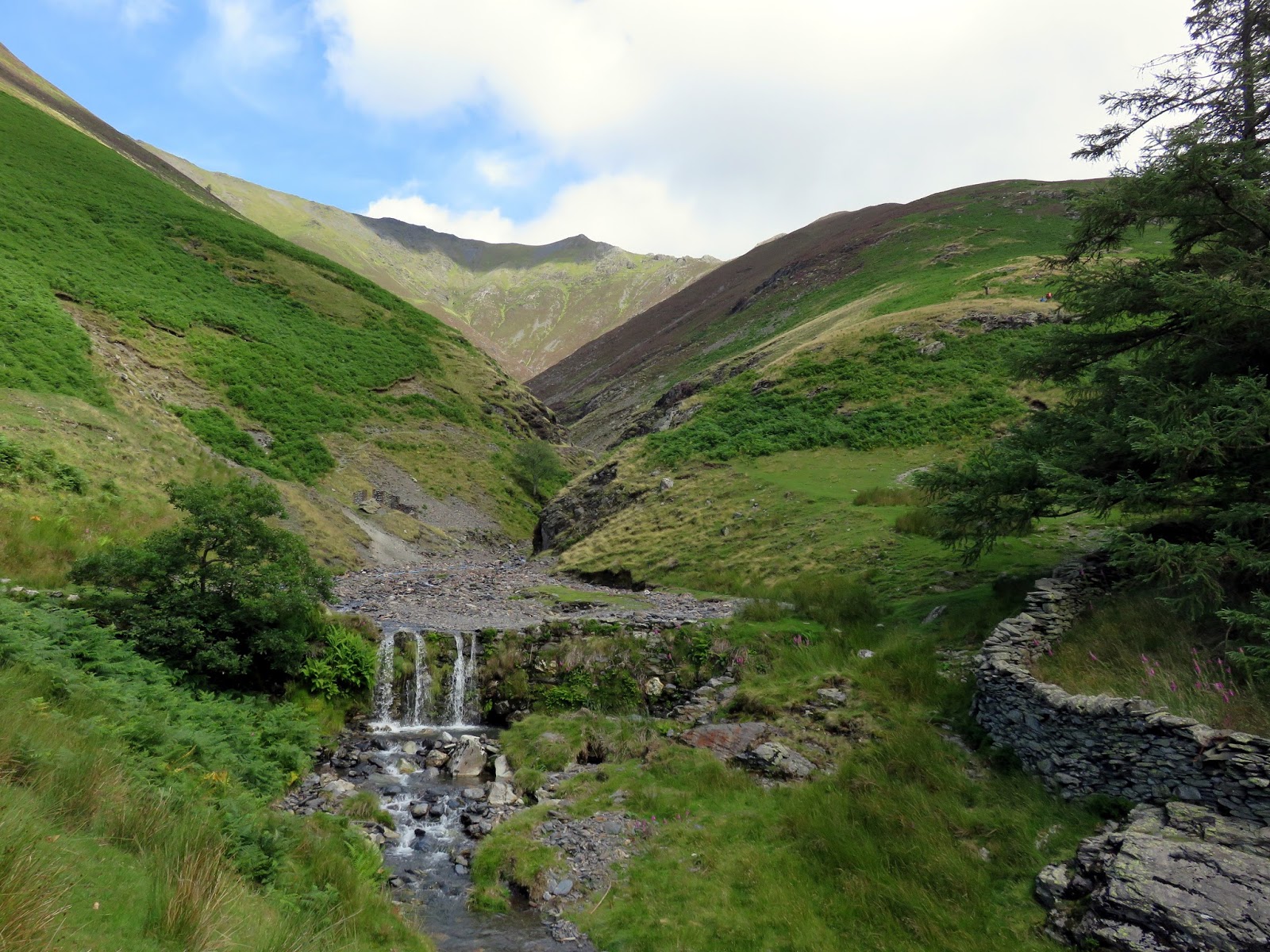
| Crossing Gate Gill |
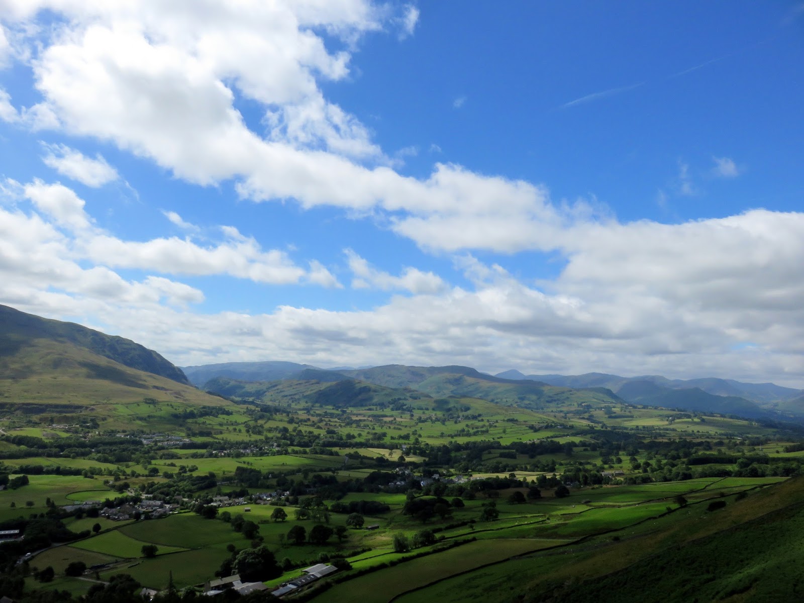
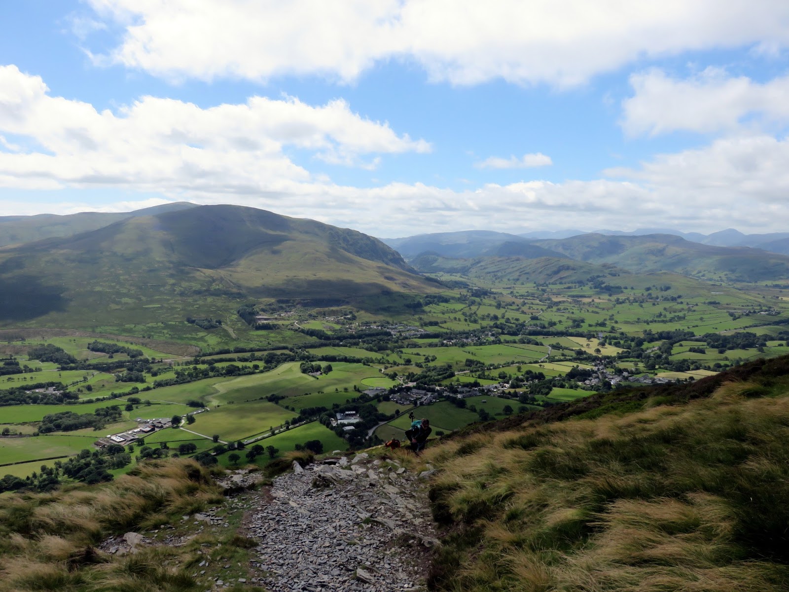
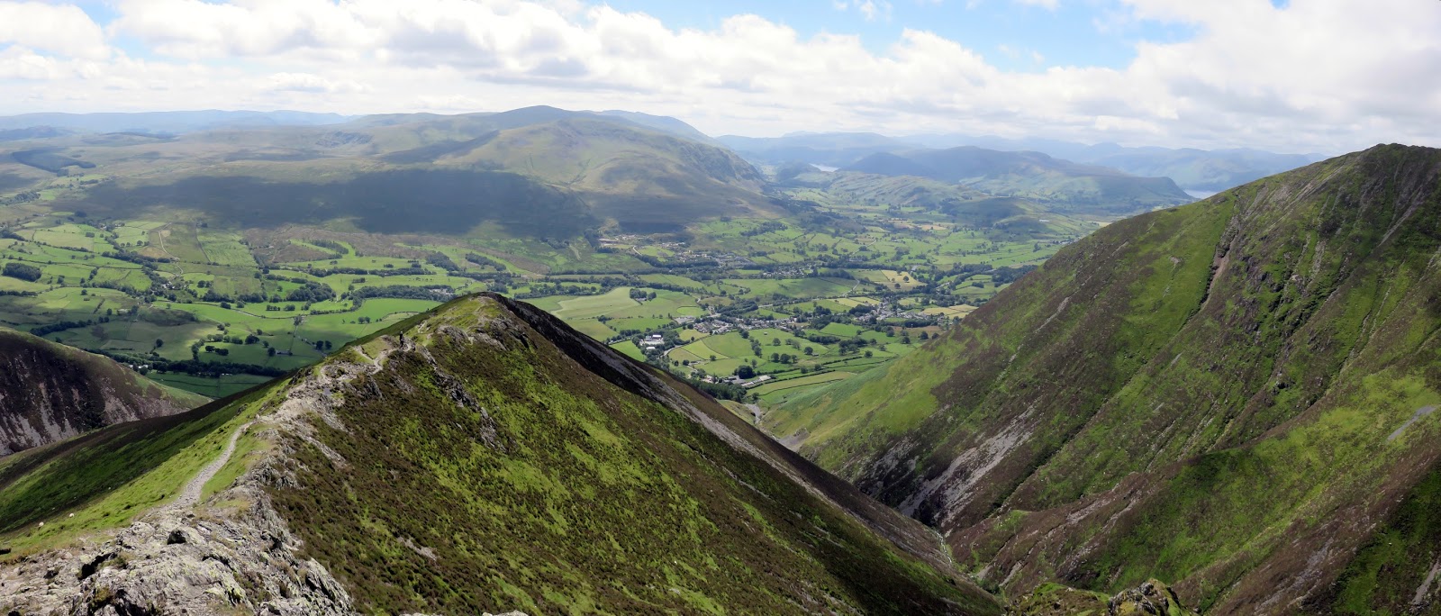
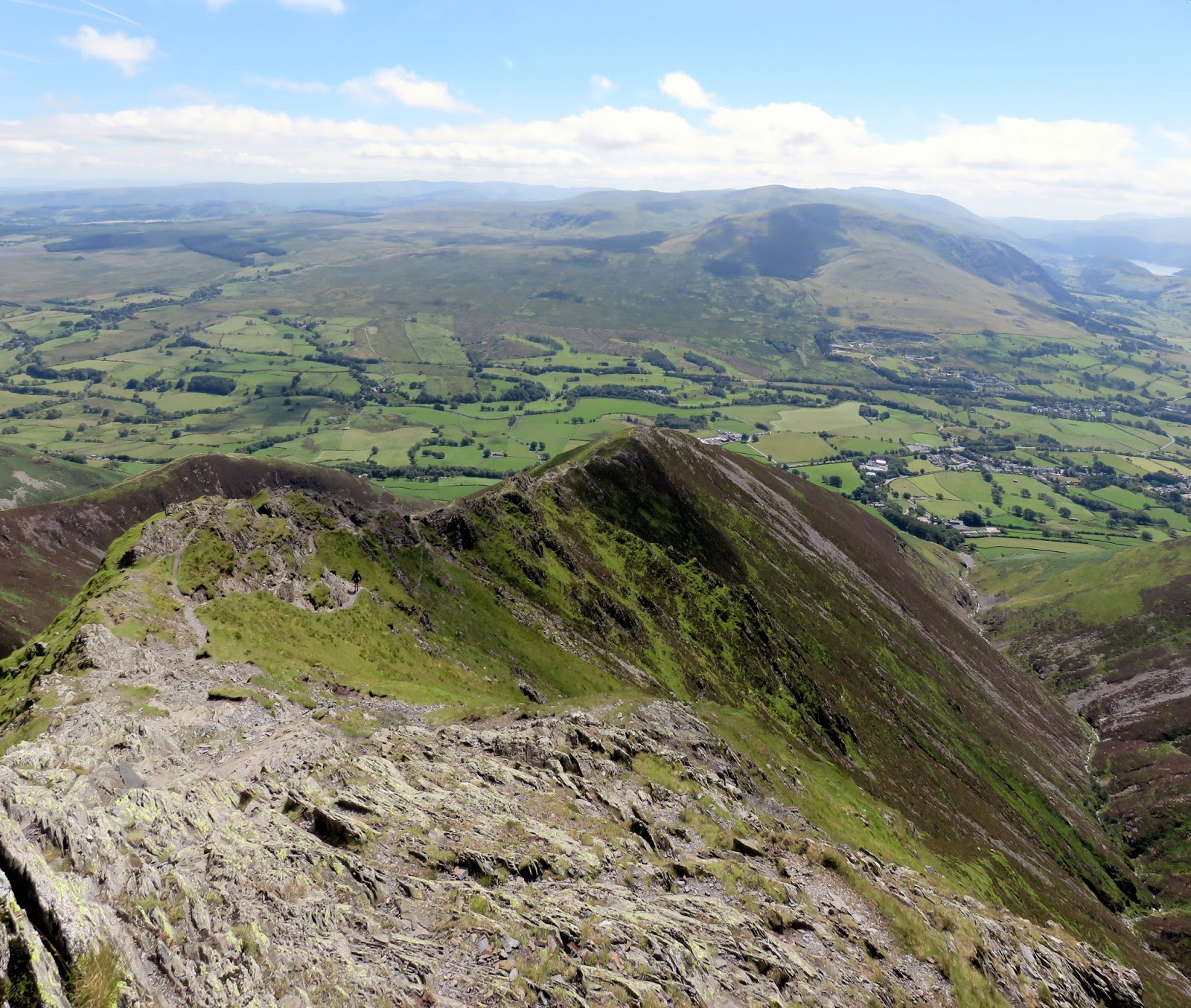
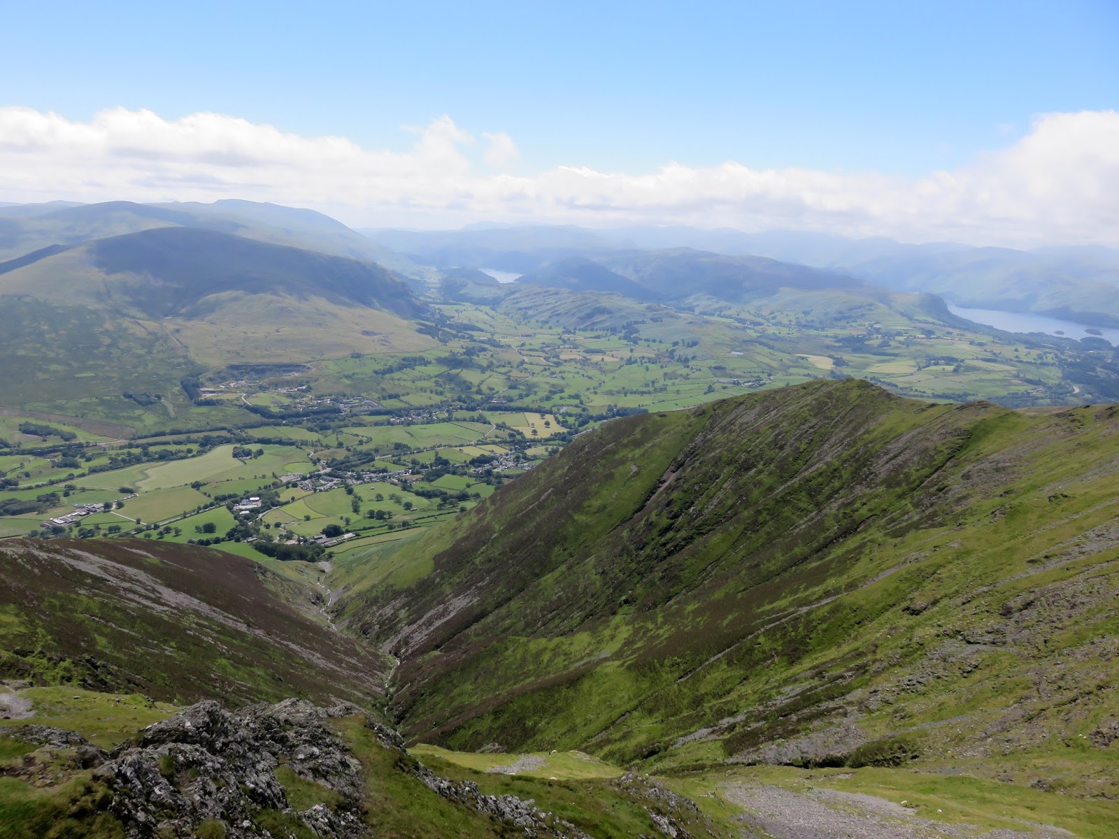
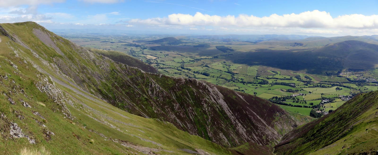
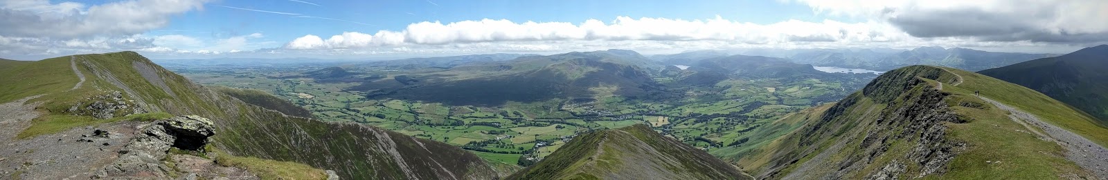
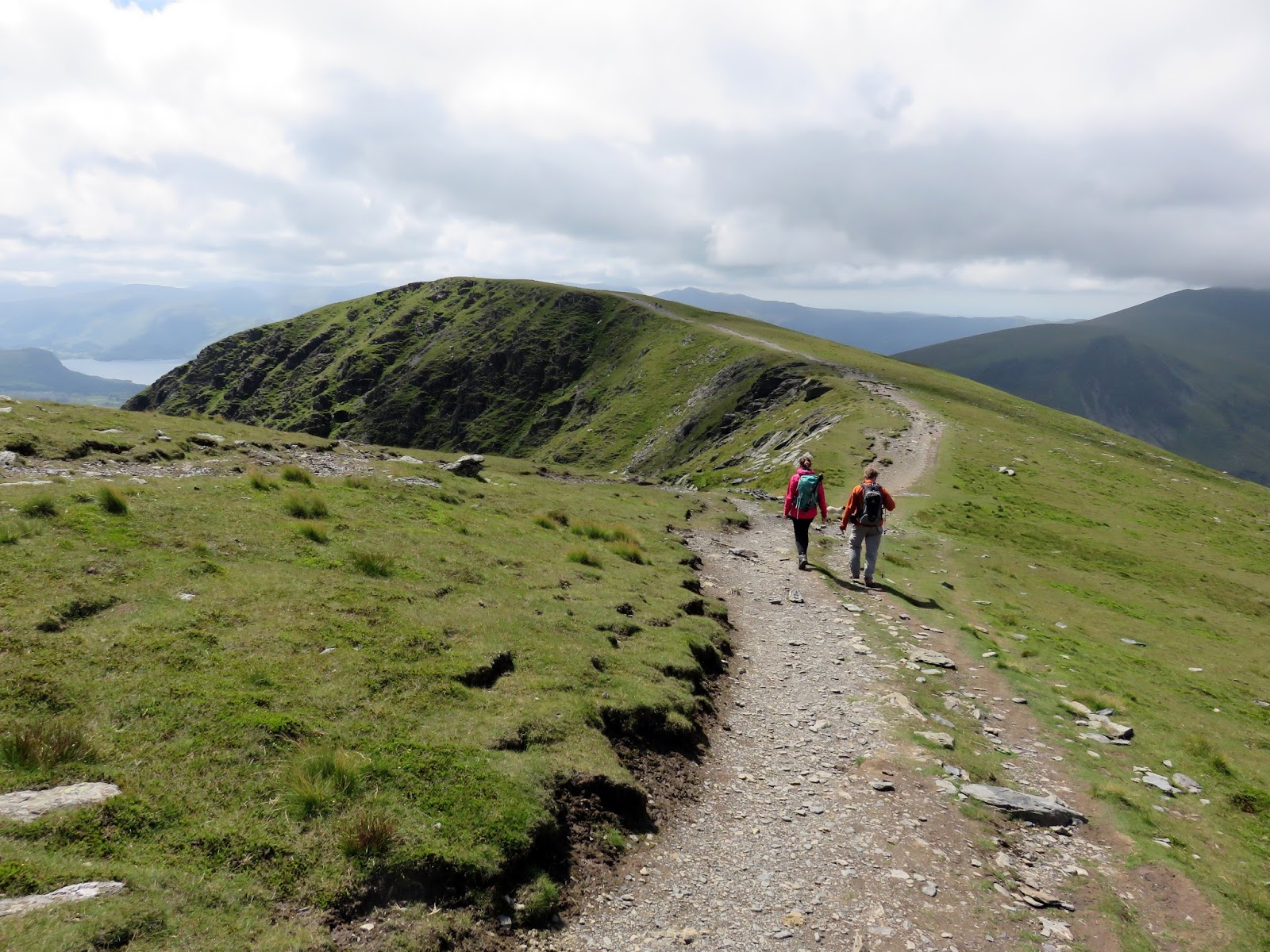
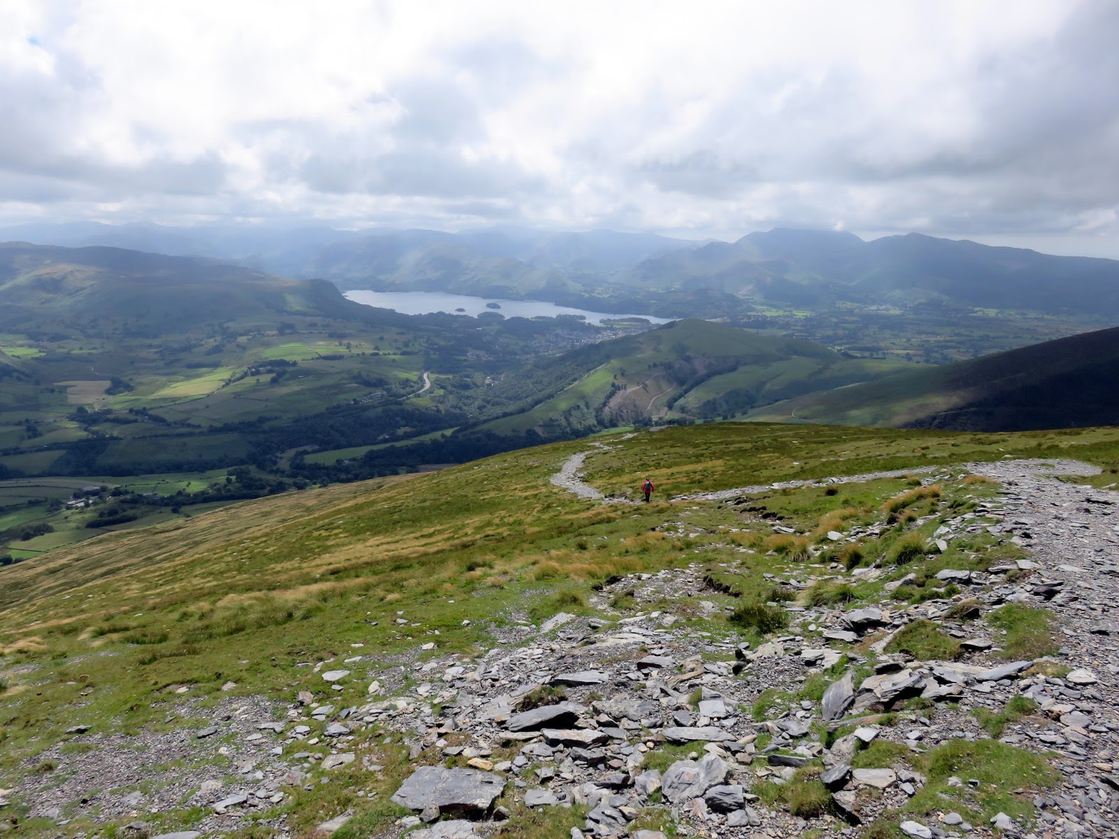
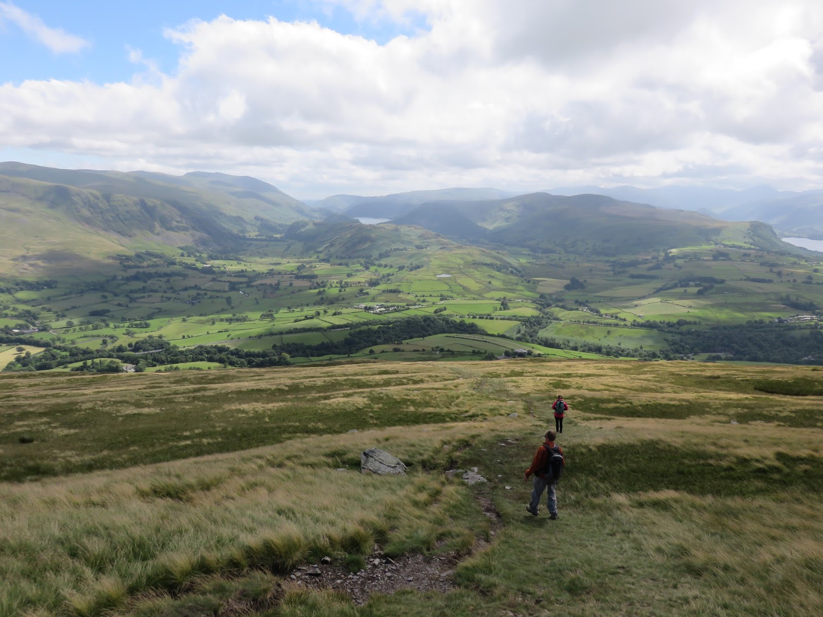
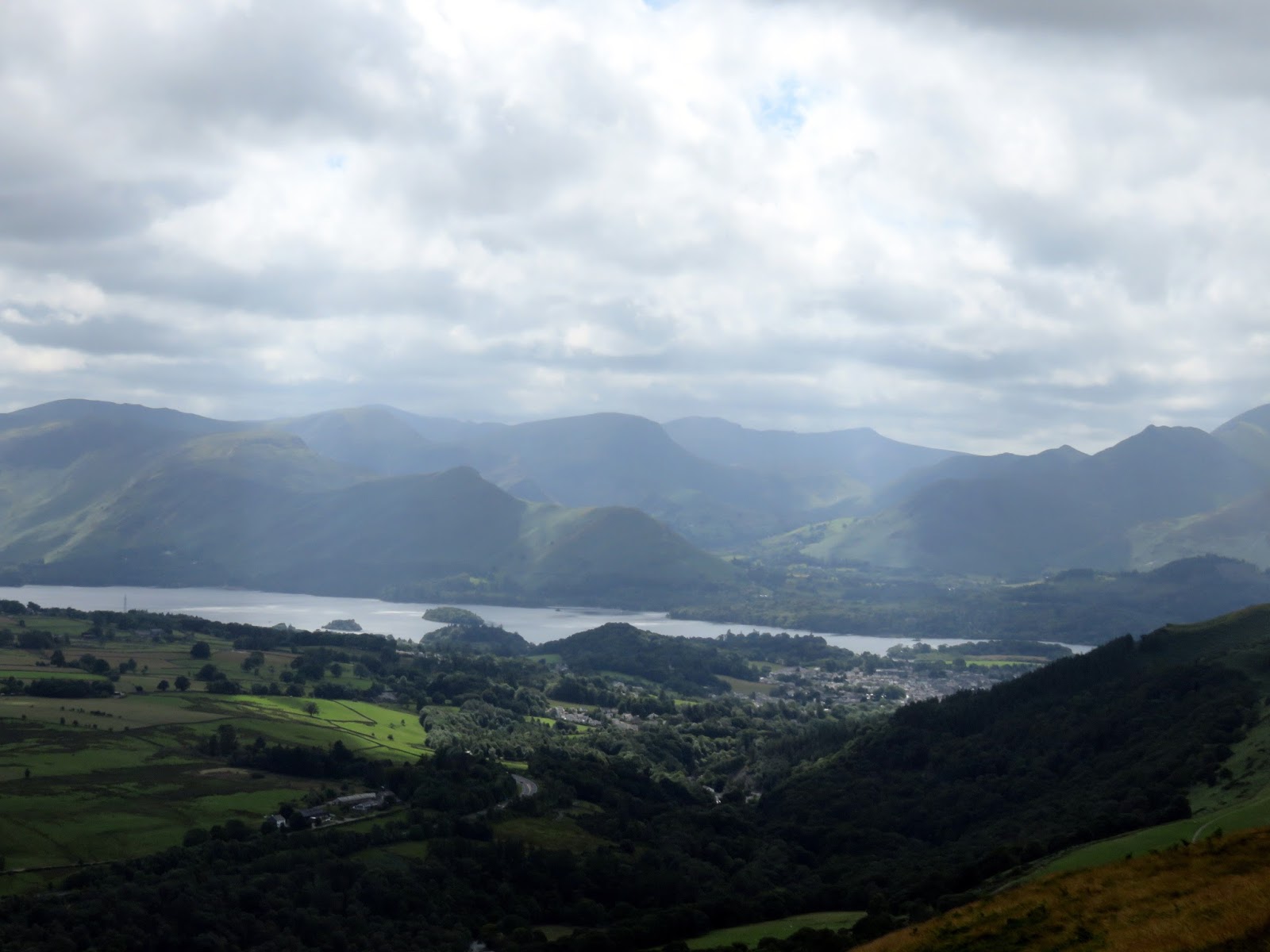
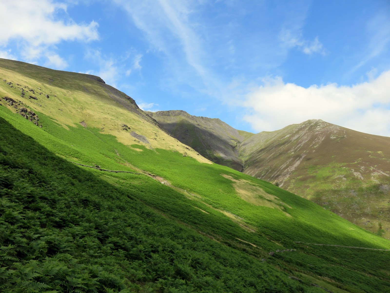
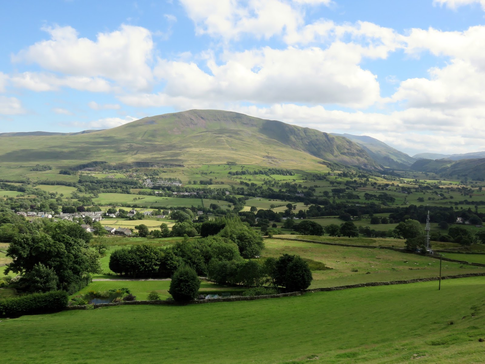
The first third of the ridge is a fairly tiring slog up a steep but easy to follow path. In fact, once on the ridge you can’t really go wrong in terms of navigation. The steepness does lead to ever increasing views across the Vale of Keswick and down the steep valleys of Gate Gill and Doddick Gill.
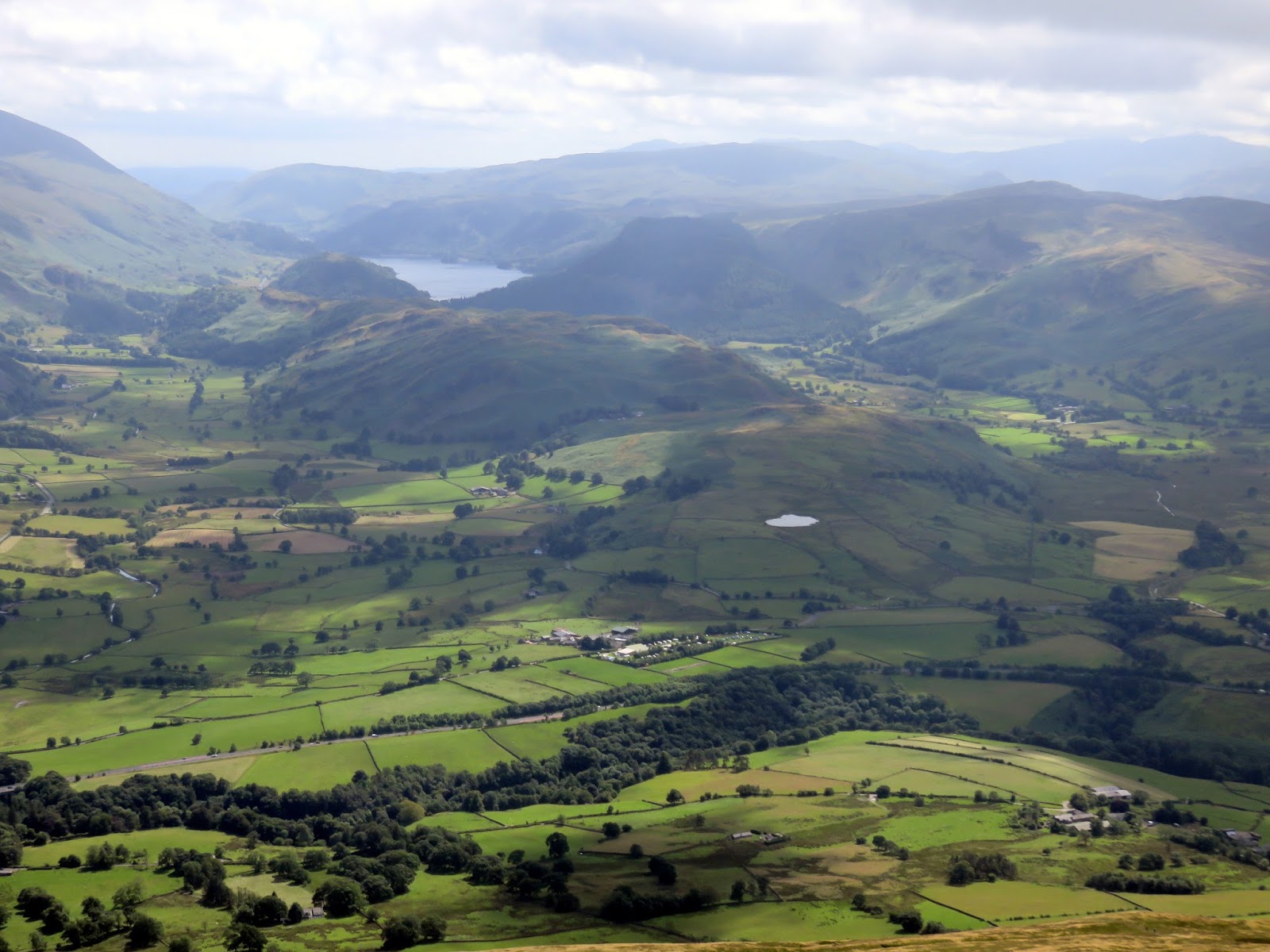
 |
| The Vale of Keswick |
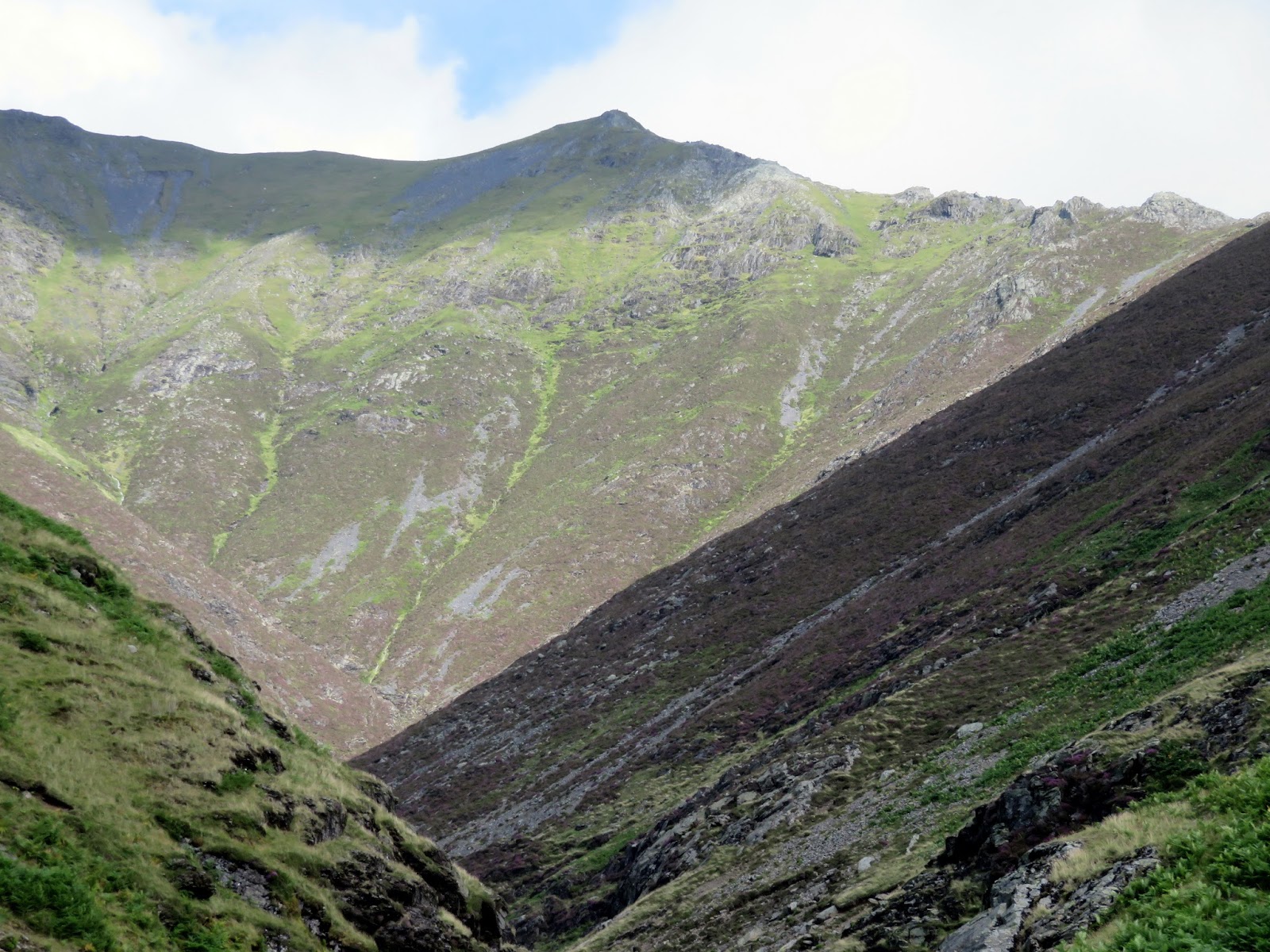
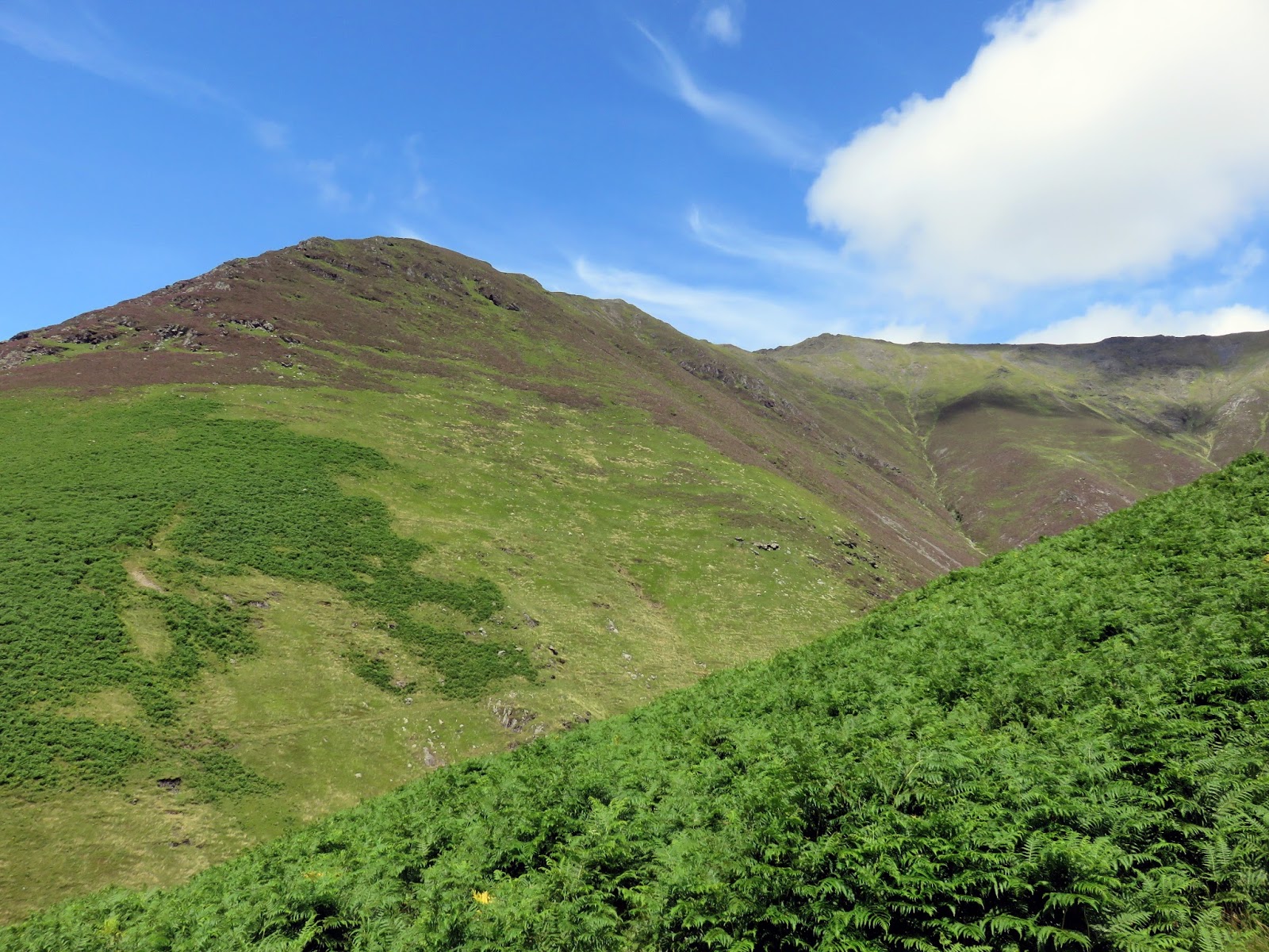
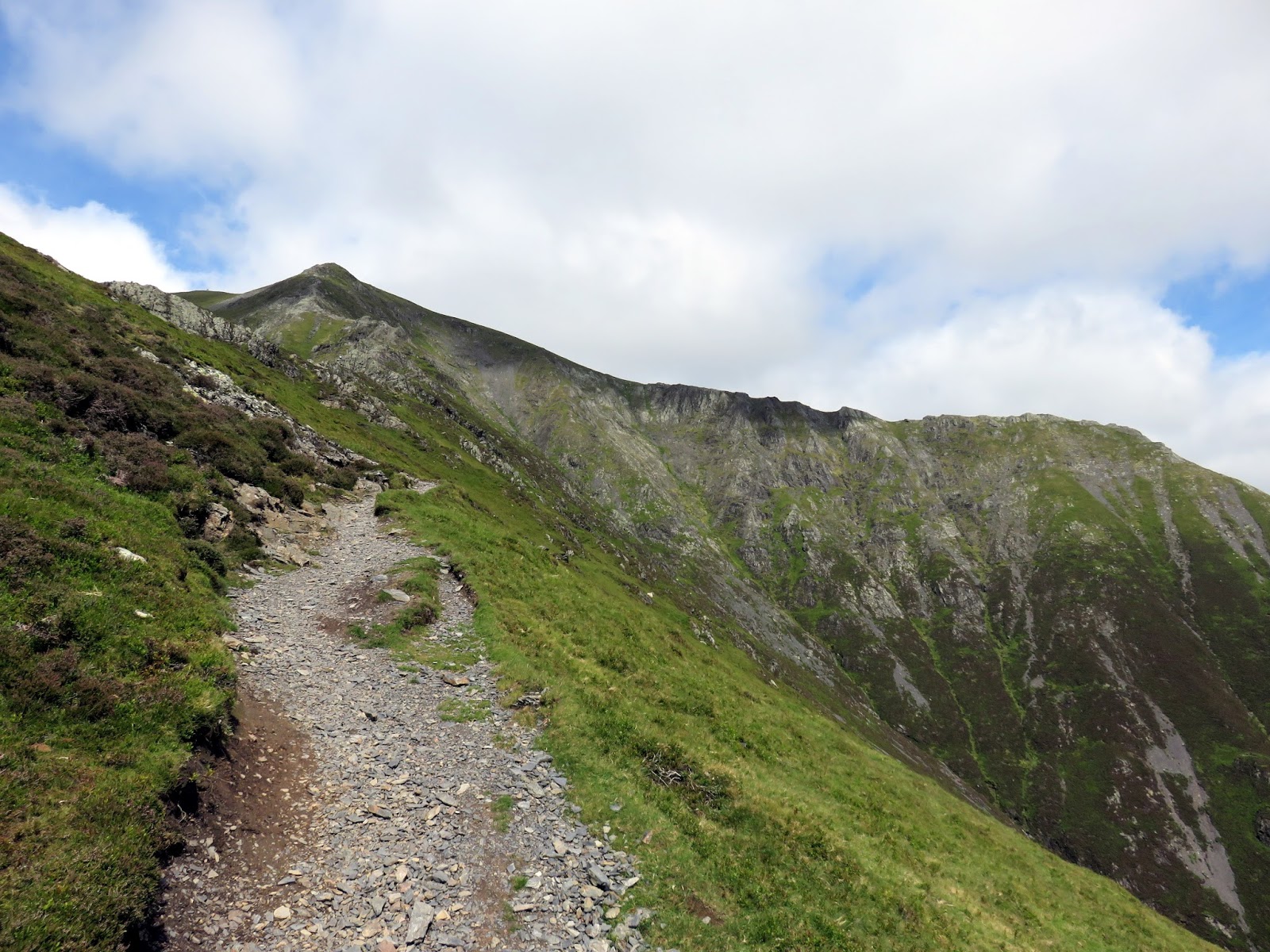
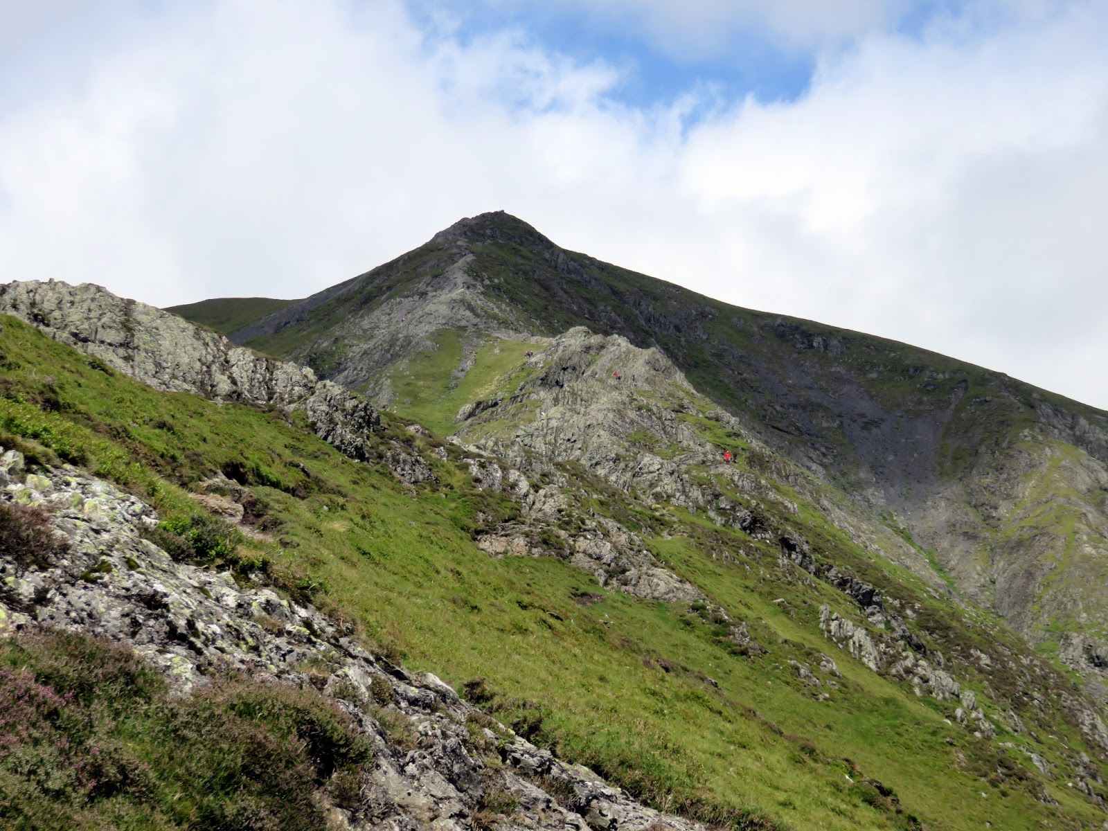
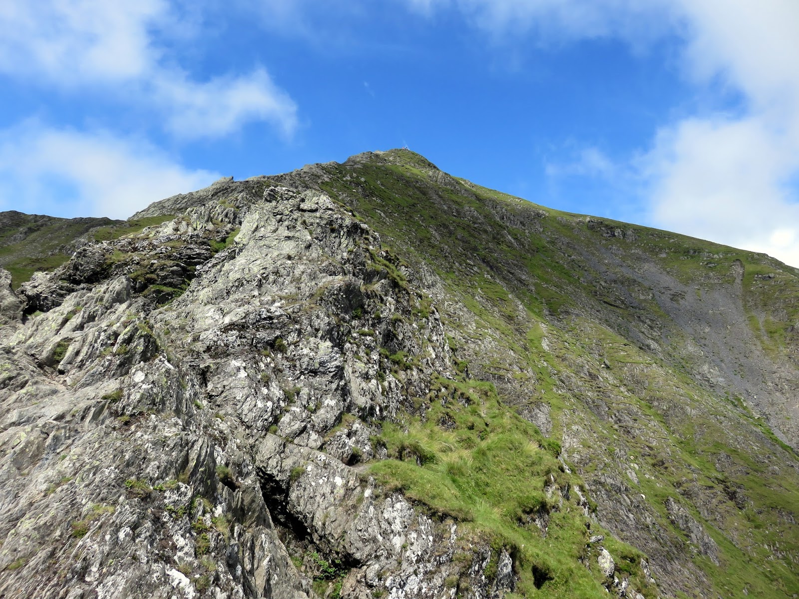
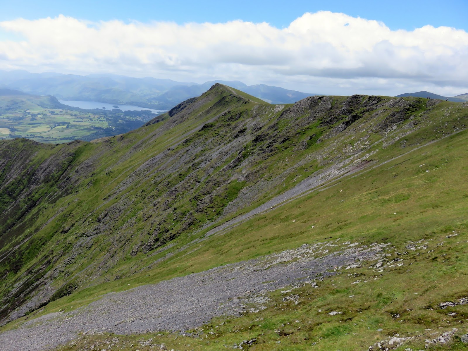
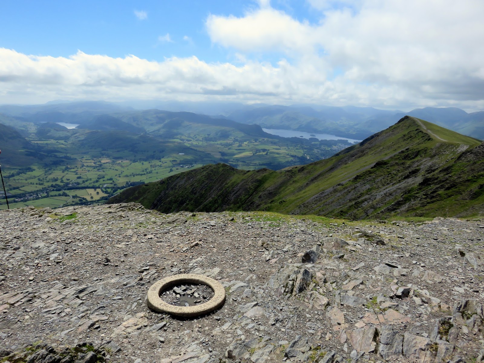
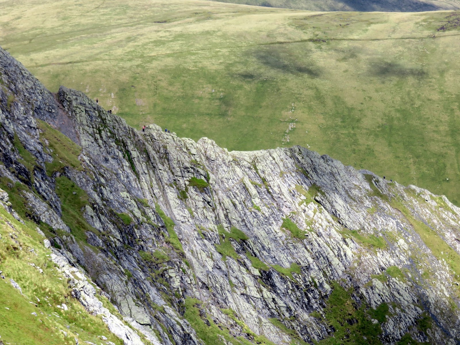
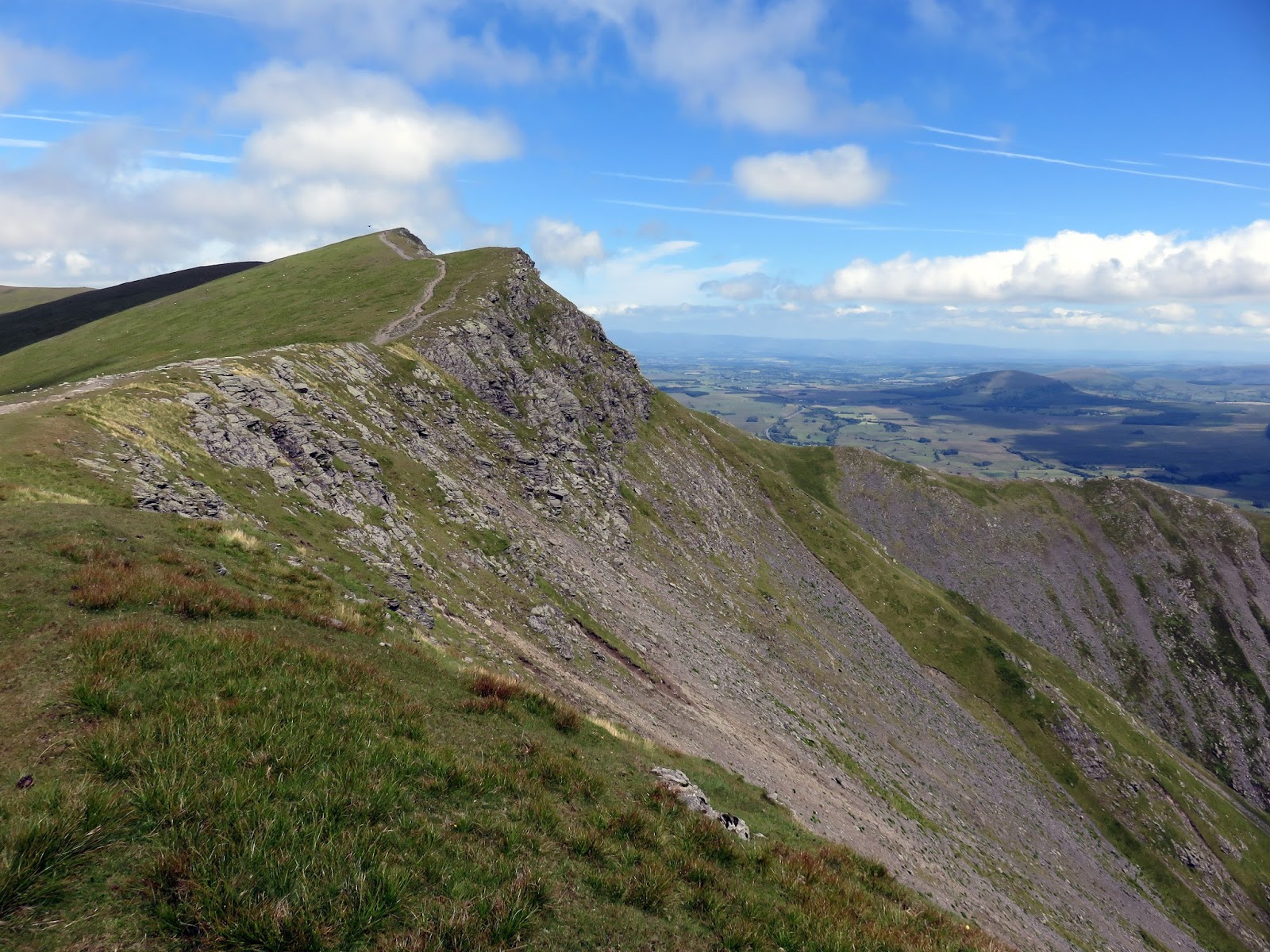
Eventually the steep path rounds a heathery shoulder and reveals the superb Hall’s Fell Ridge. The ridge shares many similarities to Striding Edge and requires just as much respect to negotiate it safely. The most interesting route is directly along the crest which climbs directly to
Blencathra’s summit. There is an element of exposure so a good head for heights is required.
 |
| Rounding the shoulder to reveal Hall’s Fell Ridge |
 |
| Hall’s Fell Ridge |
 |
| The crest of Hall’s Fell Ridge |
 |
| Looking up Hall’s Fell Ridge |
 |
| Hall’s Fell Ridge and Gate Gill |
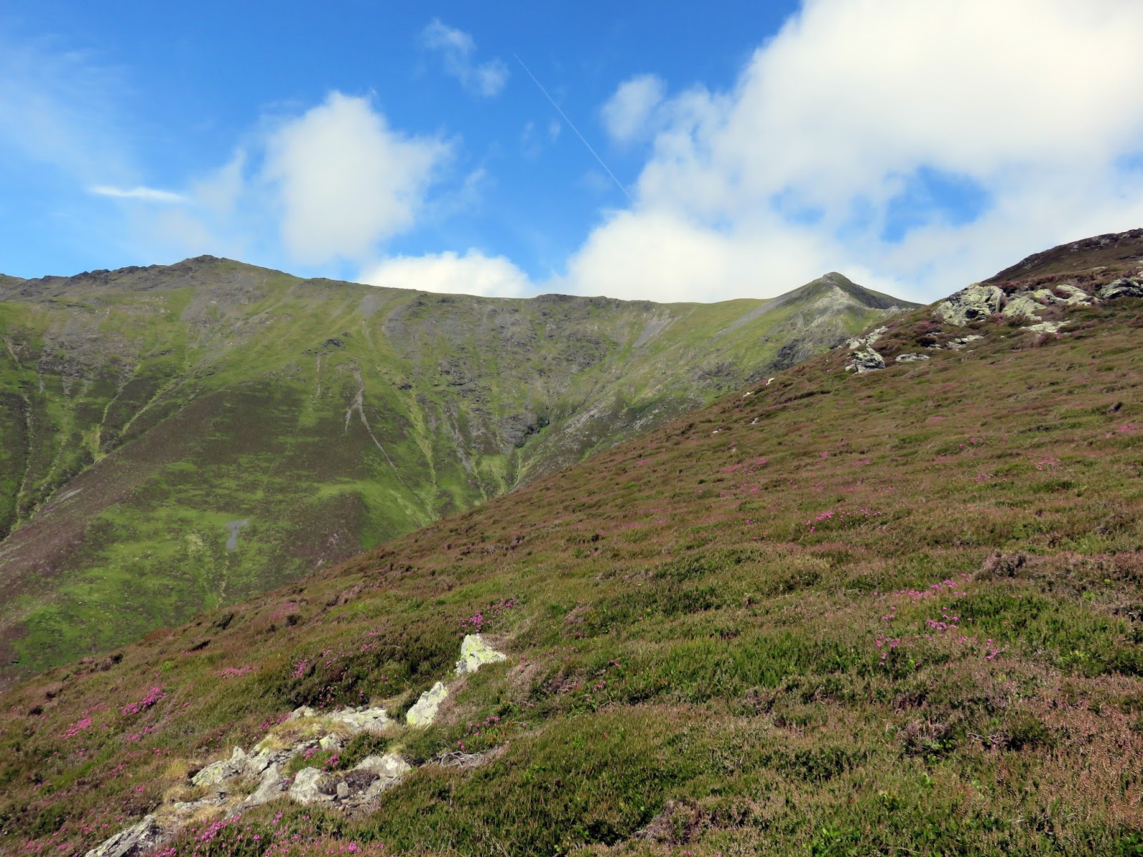
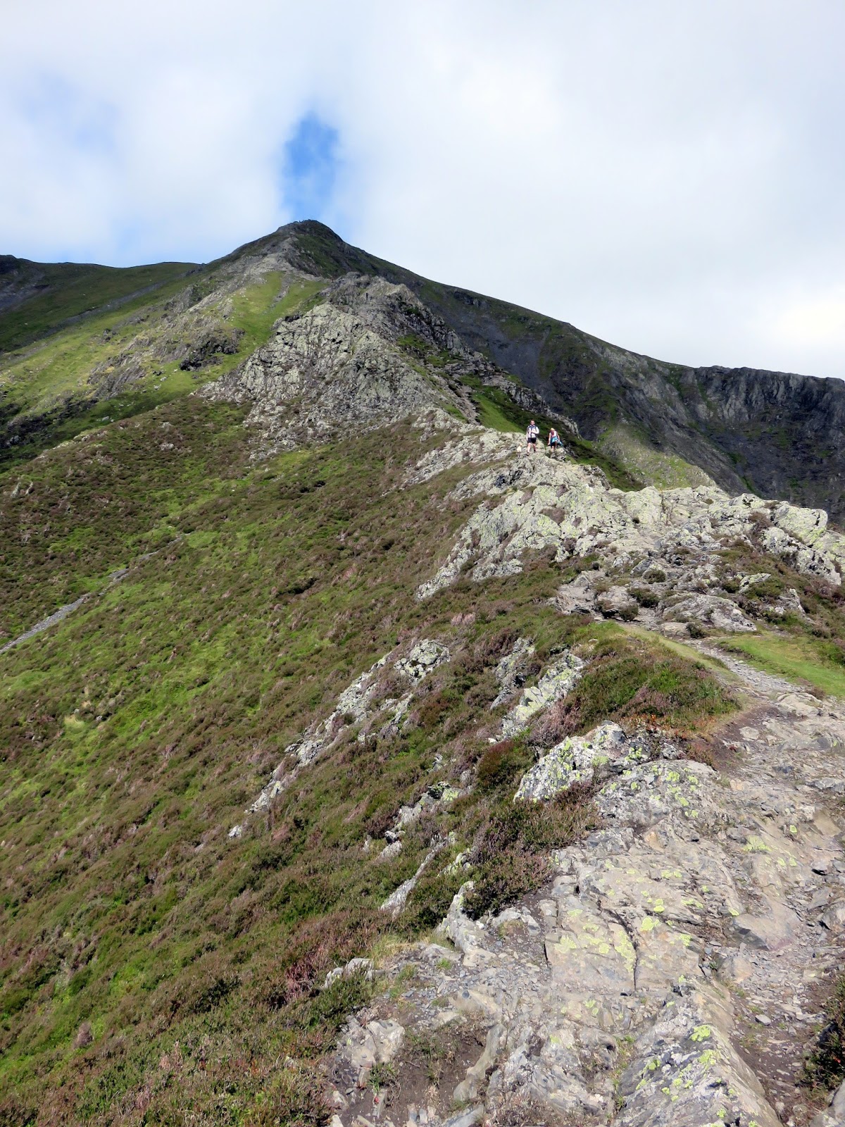
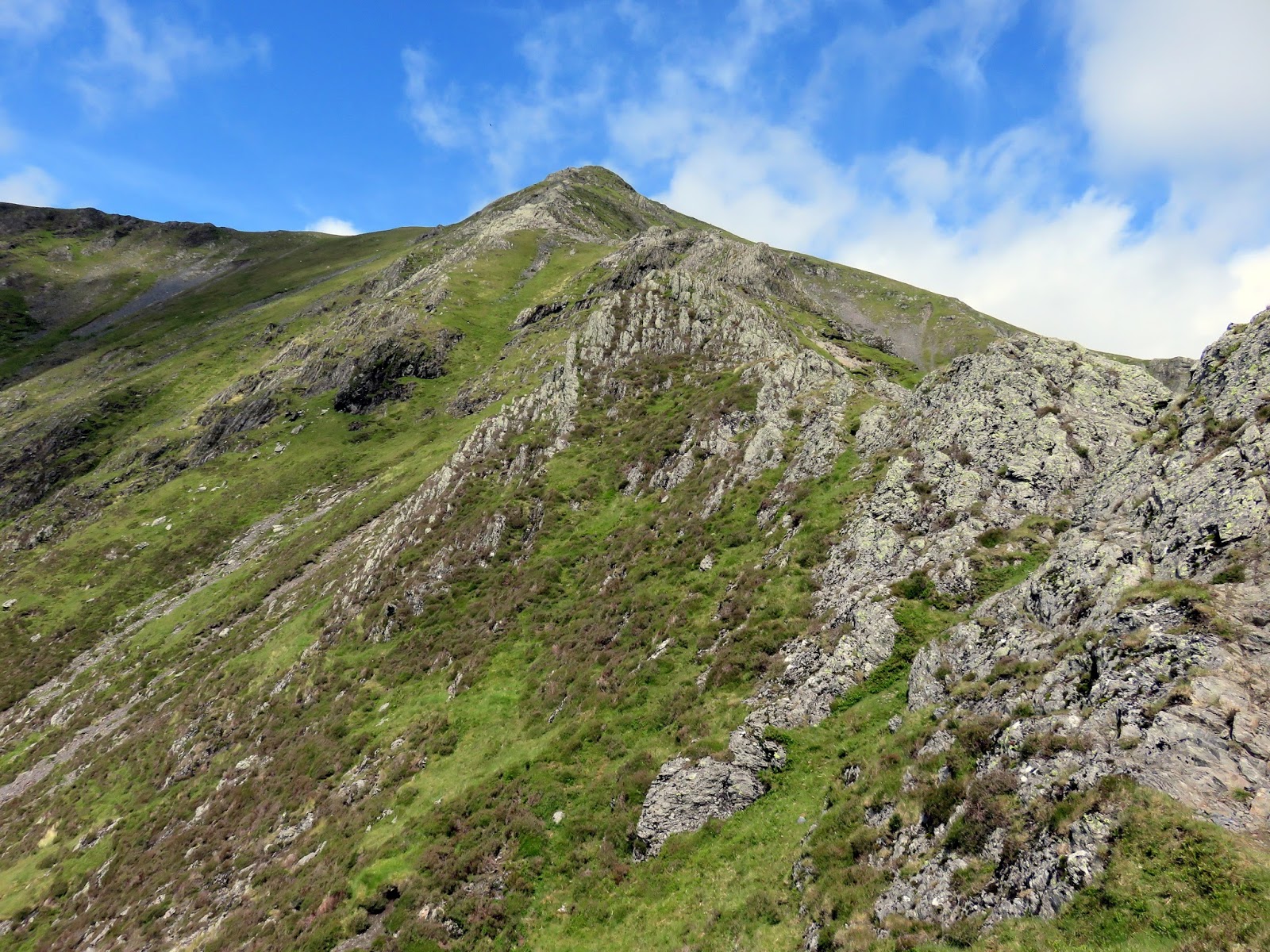
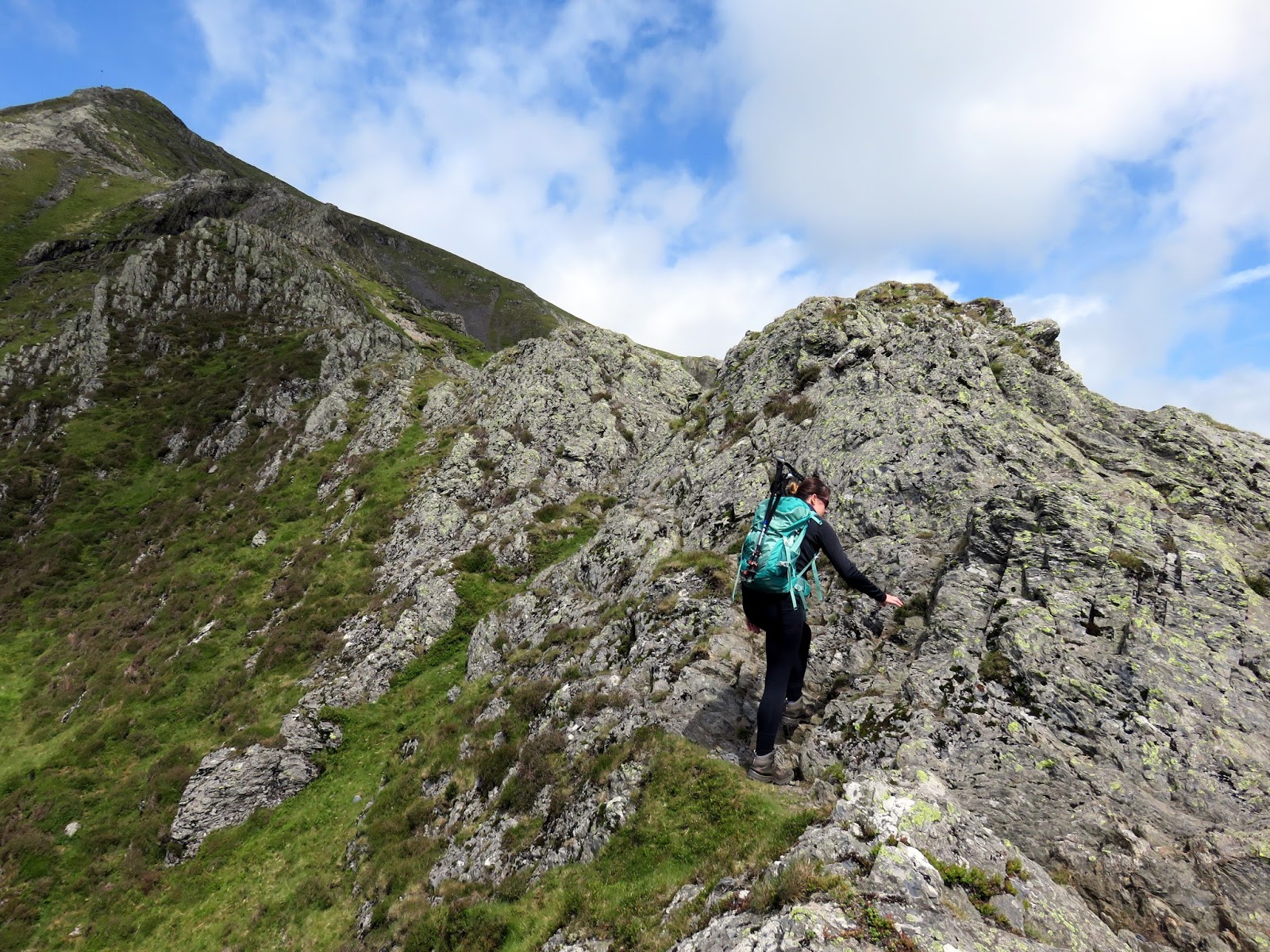
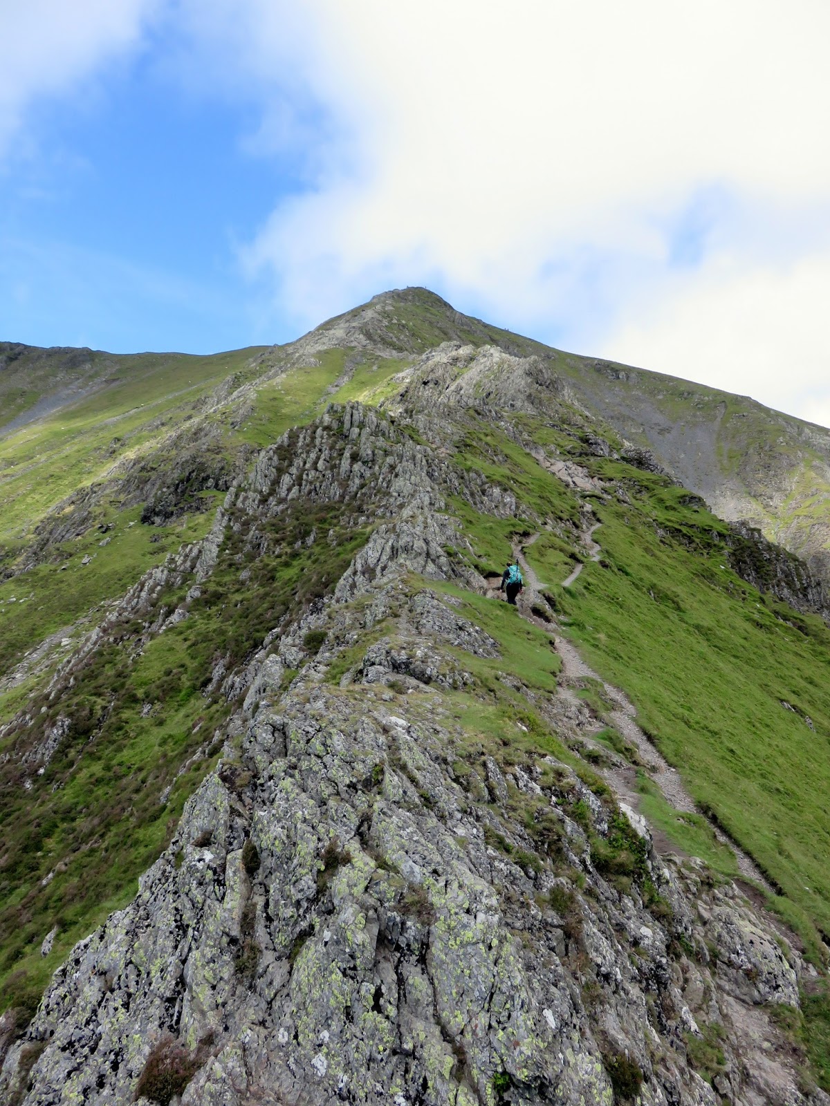
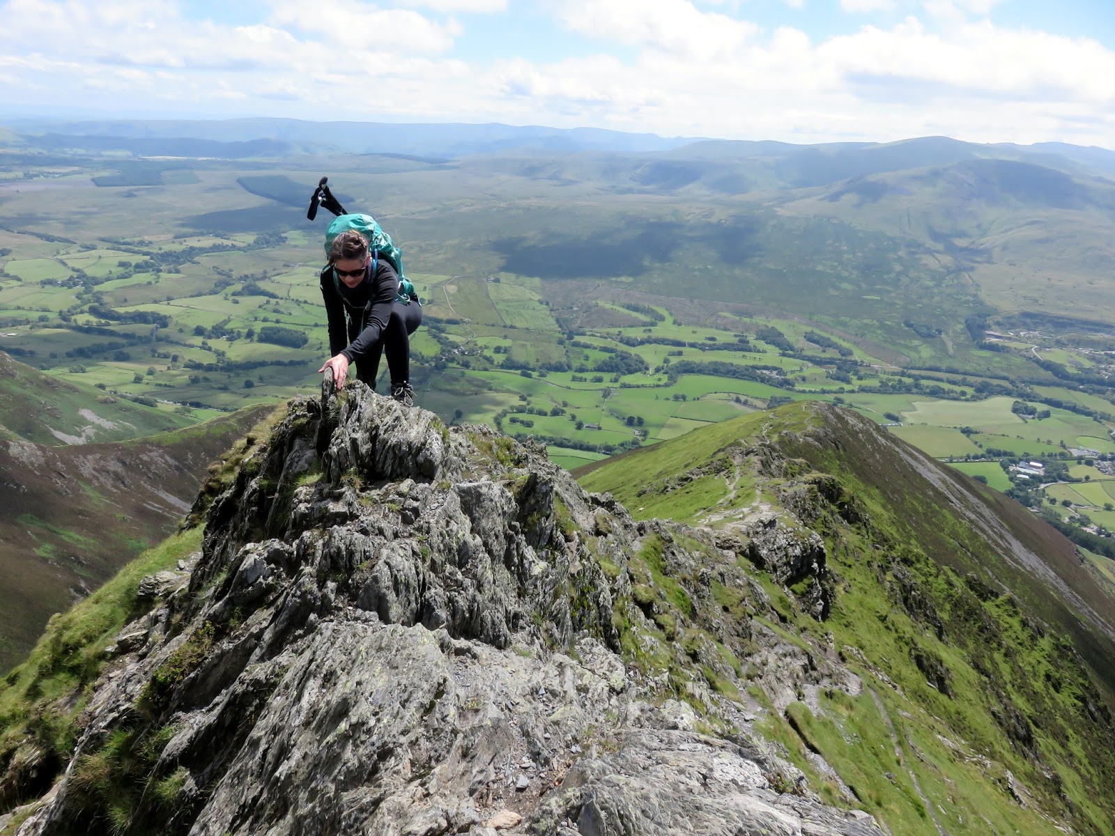
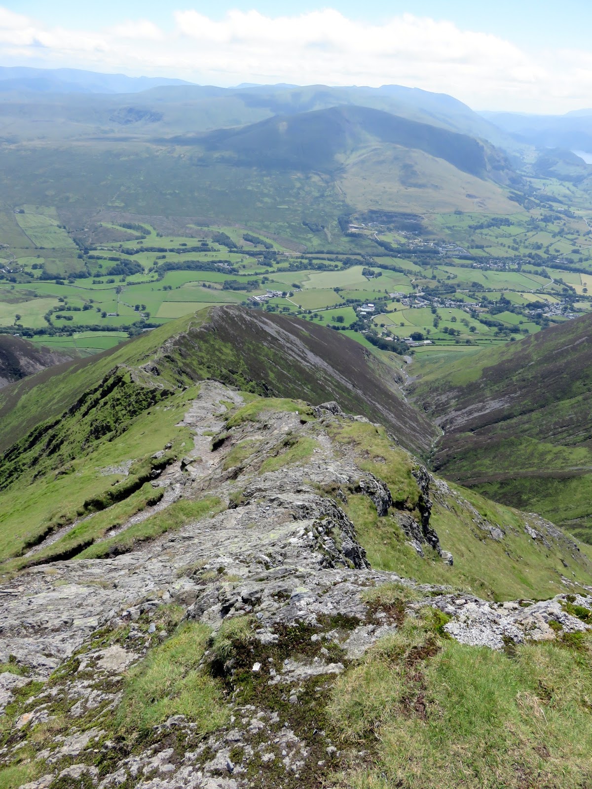
While the first part of Hall’s Fell is very good, it gets even better as the ridge makes a subtle curve on its way up. Here there are some seriously narrow parts, evidenced below, which make for an exhilarating few minutes. If you so please, these parts can be bypassed but where’s the fun in that?
 |
| Sara gets on to the scramble |
 |
| Hall’s Fell Ridge |
 |
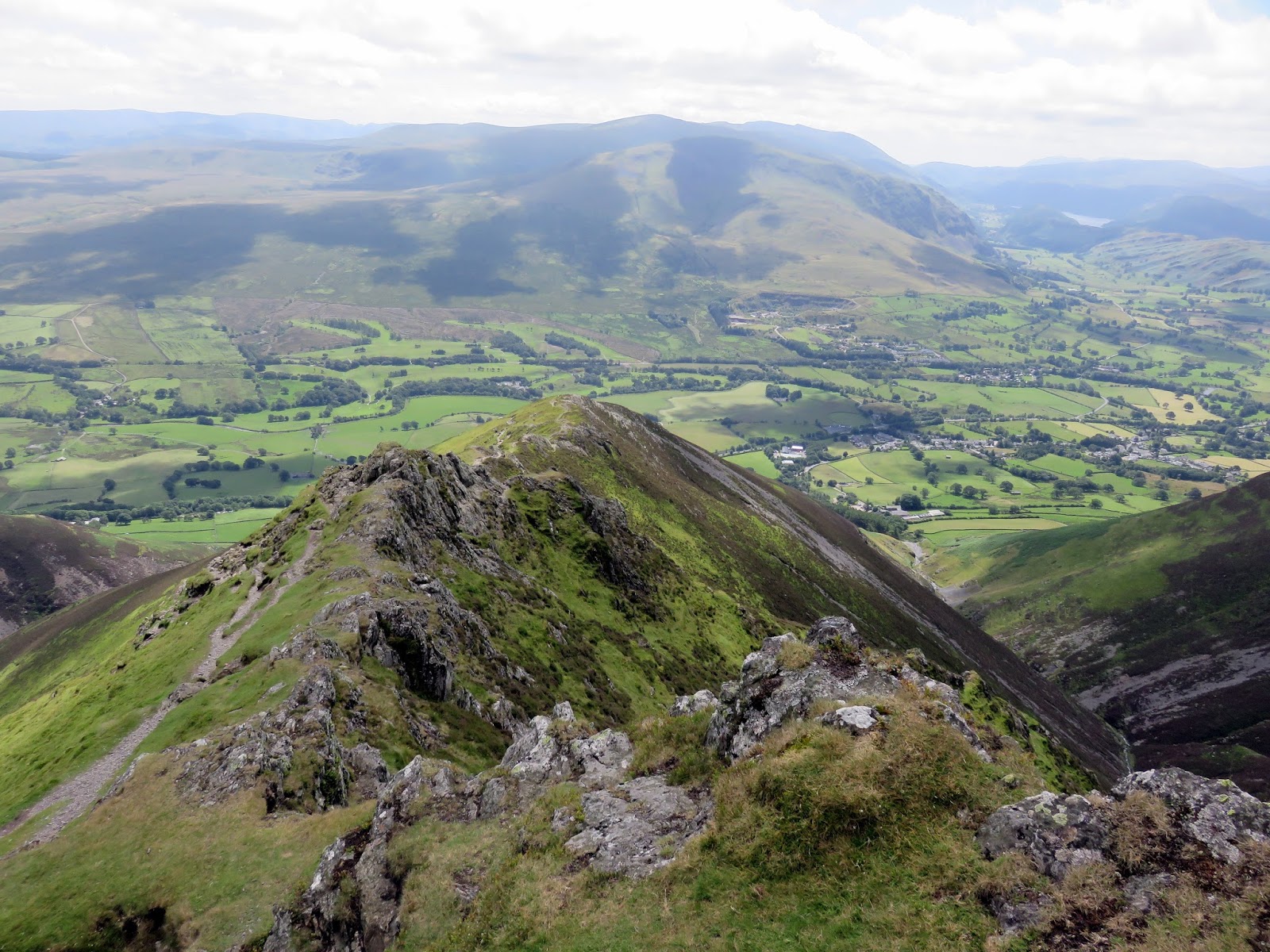
| Hall’s Fell Ridge and the Vale of Keswick |
 |
| Looking over the curve towards the summit |
 |
| Sara negotiates the crest |
 |
| The curve in the ridge |

