Open Space Web-Map builder Codehttps://openspace.ordnancesurvey.co.uk/osmapapi/openspace.js?key=3119F72552FD5C22E0530C6CA40A5A92https://openspace.ordnancesurvey.co.uk/osmapapi/script/mapbuilder/basicmap.jshttps://openspace.ordnancesurvey.co.uk/osmapapi/script/mapbuilder/searchbox.js//variables for routes var linesLayer, points, lineFeature, lineString, routeMarkersLayer, routepos, routesize, routeoffset, routeicon; var style_blue = {strokeColor: “#0000CD”, strokeOpacity: 0.5, strokeWidth: 4.5}; function initmapbuilder() { //initiate the map var options = {resolutions: [2500, 1000, 500, 200, 100, 50, 25, 10, 5, 4, 2.5, 2, 1]}; osMap = new OpenSpace.Map(‘map’, options); //configure map options (basicmap.js) setglobaloptions(); //set the center of the map and the zoom level osMap.setCenter(new OpenSpace.MapPoint(414931.9974823,384432.00125885),7); linesLayer = osMap.getVectorLayer(); // Set up layer for route markers routeMarkersLayer = new OpenLayers.Layer.Markers(“Route Markers”); //make a route points = new Array(); points.push(new OpenLayers.Geometry.Point(412551.66412354,383151.66793823)); points.push(new OpenLayers.Geometry.Point(412496.66412354,383306.66793823)); points.push(new OpenLayers.Geometry.Point(412471.66412354,383411.66793823)); points.push(new OpenLayers.Geometry.Point(412346.66412354,383436.66793823)); points.push(new OpenLayers.Geometry.Point(412051.66412354,383466.66793823)); points.push(new OpenLayers.Geometry.Point(411876.66412354,383451.66793823)); points.push(new OpenLayers.Geometry.Point(411631.66412354,383431.66793823)); points.push(new OpenLayers.Geometry.Point(411311.66412354,383451.66793823)); points.push(new OpenLayers.Geometry.Point(411186.66412354,383486.66793823)); points.push(new OpenLayers.Geometry.Point(410966.66412354,383471.66793823)); points.push(new OpenLayers.Geometry.Point(410856.66412354,383396.66793823)); points.push(new OpenLayers.Geometry.Point(410706.66412354,383296.66793823)); points.push(new OpenLayers.Geometry.Point(410641.66412354,383216.66793823)); points.push(new OpenLayers.Geometry.Point(410801.66412354,383271.66793823)); points.push(new OpenLayers.Geometry.Point(411056.66412354,383411.66793823)); points.push(new OpenLayers.Geometry.Point(411206.66412354,383426.66793823)); points.push(new OpenLayers.Geometry.Point(411541.66412354,383411.66793823)); points.push(new OpenLayers.Geometry.Point(411956.66412354,383426.66793823)); points.push(new OpenLayers.Geometry.Point(412181.66412354,383411.66793823)); points.push(new OpenLayers.Geometry.Point(412316.66412354,383376.66793823)); points.push(new OpenLayers.Geometry.Point(412426.66412354,383376.66793823)); points.push(new OpenLayers.Geometry.Point(412481.66412354,383406.66793823)); points.push(new OpenLayers.Geometry.Point(412646.66412354,383516.66793823)); points.push(new OpenLayers.Geometry.Point(412761.66412354,383631.66793823)); points.push(new OpenLayers.Geometry.Point(412816.66412354,383791.66793823)); points.push(new OpenLayers.Geometry.Point(412841.66412354,383941.66793823)); points.push(new OpenLayers.Geometry.Point(412941.66412354,384126.66793823)); points.push(new OpenLayers.Geometry.Point(413021.66412354,384246.66793823)); points.push(new OpenLayers.Geometry.Point(413196.66412354,384381.66793823)); points.push(new OpenLayers.Geometry.Point(413346.66412354,384441.66793823)); points.push(new OpenLayers.Geometry.Point(413556.66412354,384501.66793823)); points.push(new OpenLayers.Geometry.Point(413716.66412354,384516.66793823)); points.push(new OpenLayers.Geometry.Point(413855.66412354,384521.66793823)); points.push(new OpenLayers.Geometry.Point(413985.66412354,384611.66793823)); points.push(new OpenLayers.Geometry.Point(414225.66412354,384711.66793823)); points.push(new OpenLayers.Geometry.Point(414345.66412354,384811.66793823)); points.push(new OpenLayers.Geometry.Point(414475.66412354,384861.66793823)); points.push(new OpenLayers.Geometry.Point(414565.66412354,384951.66793823)); points.push(new OpenLayers.Geometry.Point(414615.66412354,385061.66793823)); points.push(new OpenLayers.Geometry.Point(414800.66412354,385091.66793823)); points.push(new OpenLayers.Geometry.Point(414990.66412354,385181.66793823)); points.push(new OpenLayers.Geometry.Point(415270.66412354,385371.66793823)); points.push(new OpenLayers.Geometry.Point(415370.66412354,385281.66793823)); points.push(new OpenLayers.Geometry.Point(415410.66412354,385141.66793823)); points.push(new OpenLayers.Geometry.Point(415465.66412354,385041.66793823)); points.push(new OpenLayers.Geometry.Point(415600.66412354,384951.66793823)); points.push(new OpenLayers.Geometry.Point(415740.66412354,384891.66793823)); points.push(new OpenLayers.Geometry.Point(415865.66412354,384831.66793823)); points.push(new OpenLayers.Geometry.Point(416125.66412354,384791.66793823)); points.push(new OpenLayers.Geometry.Point(416280.66412354,384776.66793823)); points.push(new OpenLayers.Geometry.Point(416350.66412354,384721.66793823)); points.push(new OpenLayers.Geometry.Point(416440.66412354,384601.66793823)); points.push(new OpenLayers.Geometry.Point(416565.66412354,384601.66793823)); points.push(new OpenLayers.Geometry.Point(416745.66412354,384456.66793823)); points.push(new OpenLayers.Geometry.Point(416770.66412354,384471.66793823)); points.push(new OpenLayers.Geometry.Point(416770.66412354,384571.66793823)); points.push(new OpenLayers.Geometry.Point(416830.66412354,384656.66793823)); points.push(new OpenLayers.Geometry.Point(416940.66412354,384751.66793823)); points.push(new OpenLayers.Geometry.Point(417010.66412354,384851.66793823)); points.push(new OpenLayers.Geometry.Point(417065.66412354,384871.66793823)); points.push(new OpenLayers.Geometry.Point(417065.66412354,385336.66793823)); points.push(new OpenLayers.Geometry.Point(417065.66412354,385411.66793823)); points.push(new OpenLayers.Geometry.Point(417105.66412354,386086.66793823)); points.push(new OpenLayers.Geometry.Point(417200.66412354,386071.66793823)); points.push(new OpenLayers.Geometry.Point(417325.66412354,385696.66793823)); points.push(new OpenLayers.Geometry.Point(417545.66412354,385361.66793823)); points.push(new OpenLayers.Geometry.Point(417785.66412354,385116.66793823)); points.push(new OpenLayers.Geometry.Point(417985.66412354,385091.66793823)); points.push(new OpenLayers.Geometry.Point(418190.66412354,385056.66793823)); points.push(new OpenLayers.Geometry.Point(418525.66412354,385051.66793823)); points.push(new OpenLayers.Geometry.Point(418630.66412354,385071.66793823)); points.push(new OpenLayers.Geometry.Point(418760.66412354,385121.66793823)); points.push(new OpenLayers.Geometry.Point(418600.66412354,385061.66793823)); points.push(new OpenLayers.Geometry.Point(418300.66412354,385081.66793823)); points.push(new OpenLayers.Geometry.Point(418245.66412354,384936.66793823)); points.push(new OpenLayers.Geometry.Point(417965.66412354,384736.66793823)); points.push(new OpenLayers.Geometry.Point(417855.66412354,384661.66793823)); points.push(new OpenLayers.Geometry.Point(417965.66412354,384541.66793823)); points.push(new OpenLayers.Geometry.Point(417990.66412354,384416.66793823)); points.push(new OpenLayers.Geometry.Point(418090.66412354,384336.66793823)); points.push(new OpenLayers.Geometry.Point(418125.66412354,384291.66793823)); points.push(new OpenLayers.Geometry.Point(418128.66412354,384052.66793823)); points.push(new OpenLayers.Geometry.Point(418178.66412354,383936.66793823)); points.push(new OpenLayers.Geometry.Point(418078.66412354,383896.66793823)); points.push(new OpenLayers.Geometry.Point(417918.66412354,383648.66793823)); points.push(new OpenLayers.Geometry.Point(417738.66412354,383460.66793823)); points.push(new OpenLayers.Geometry.Point(417698.66412354,383344.66793823)); points.push(new OpenLayers.Geometry.Point(417630.66412354,383336.66793823)); points.push(new OpenLayers.Geometry.Point(417610.66412354,383304.66793823)); points.push(new OpenLayers.Geometry.Point(417438.66412354,383376.66793823)); points.push(new OpenLayers.Geometry.Point(417310.66412354,383476.66793823)); points.push(new OpenLayers.Geometry.Point(417262.66412354,383484.66793823)); // create a polyline feature from the array of points lineString = new OpenLayers.Geometry.LineString(points); lineFeature = new OpenLayers.Feature.Vector(lineString, null, style_blue); linesLayer.addFeatures([lineFeature]); //crate a route start/end marker routepos = new OpenSpace.MapPoint(412551.66412354,383151.66793823); routesize = new OpenLayers.Size(33,45); routeoffset = new OpenLayers.Pixel(-5,-37); routeicon = new OpenSpace.Icon(‘https://openspace.ordnancesurvey.co.uk/osmapapi/img_versions/img_1.1/mapbuilder/routemarker-start.png’, routesize, routeoffset, null, null); routeMarkersLayer.addMarker(new OpenLayers.Marker(routepos, routeicon)); //crate a route start/end marker routepos = new OpenSpace.MapPoint(417262.66412354,383484.66793823); routesize = new OpenLayers.Size(33,45); routeoffset = new OpenLayers.Pixel(-5,-37); routeicon = new OpenSpace.Icon(‘https://openspace.ordnancesurvey.co.uk/osmapapi/img_versions/img_1.1/mapbuilder/routemarker-end.png’, routesize, routeoffset, null, null); routeMarkersLayer.addMarker(new OpenLayers.Marker(routepos, routeicon)); osMap.addLayer(routeMarkersLayer);}
Route: Rushup Edge, Mam Tor, Hollins Cross, Barker Bank, Back Tor, Lose Hill, Losehill End, Townhead Bridge, Hope Brink, Win Hill, Twitchill Farm, Edge Farm, Aston, Hope
Date: 03/07/2016
From: Mam Tor
Parking: Car park at Mam Tor
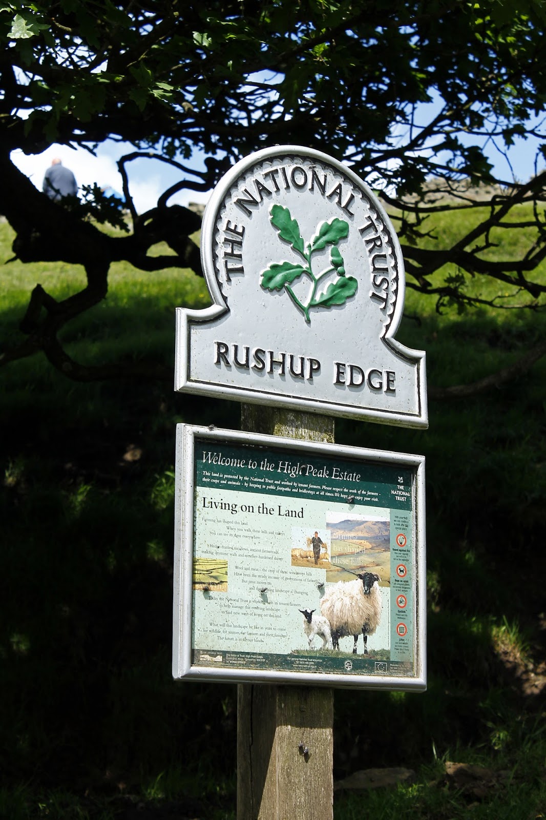
Start Point: Rushup Edge
Region: Peak District Dark Peak
Route length: 10.1 miles (16.2 km)
Time Taken: 04:15
Average speed: 2.4 mph
Ascent: 653m
Descent: 911m
Summits: Rushup Edge (550m), Mam Tor (517m), Barker Bank (426m), Back Tor (391m), Lose Hill (476m), Win Hill (462m)
Other points of interest: Hollins Cross
After a day spent exploring Grindsbrook Clough and the southern edge of Kinder Scout, I was back in the Peak District this weekend to make the most of a sunny summer afternoon in Hope, the parallel valley to Edale. The modest ridge that separates the two valleys, the Great Ridge as it is known, would provide our walking pleasure today, as it does for thousands of visitors every year.
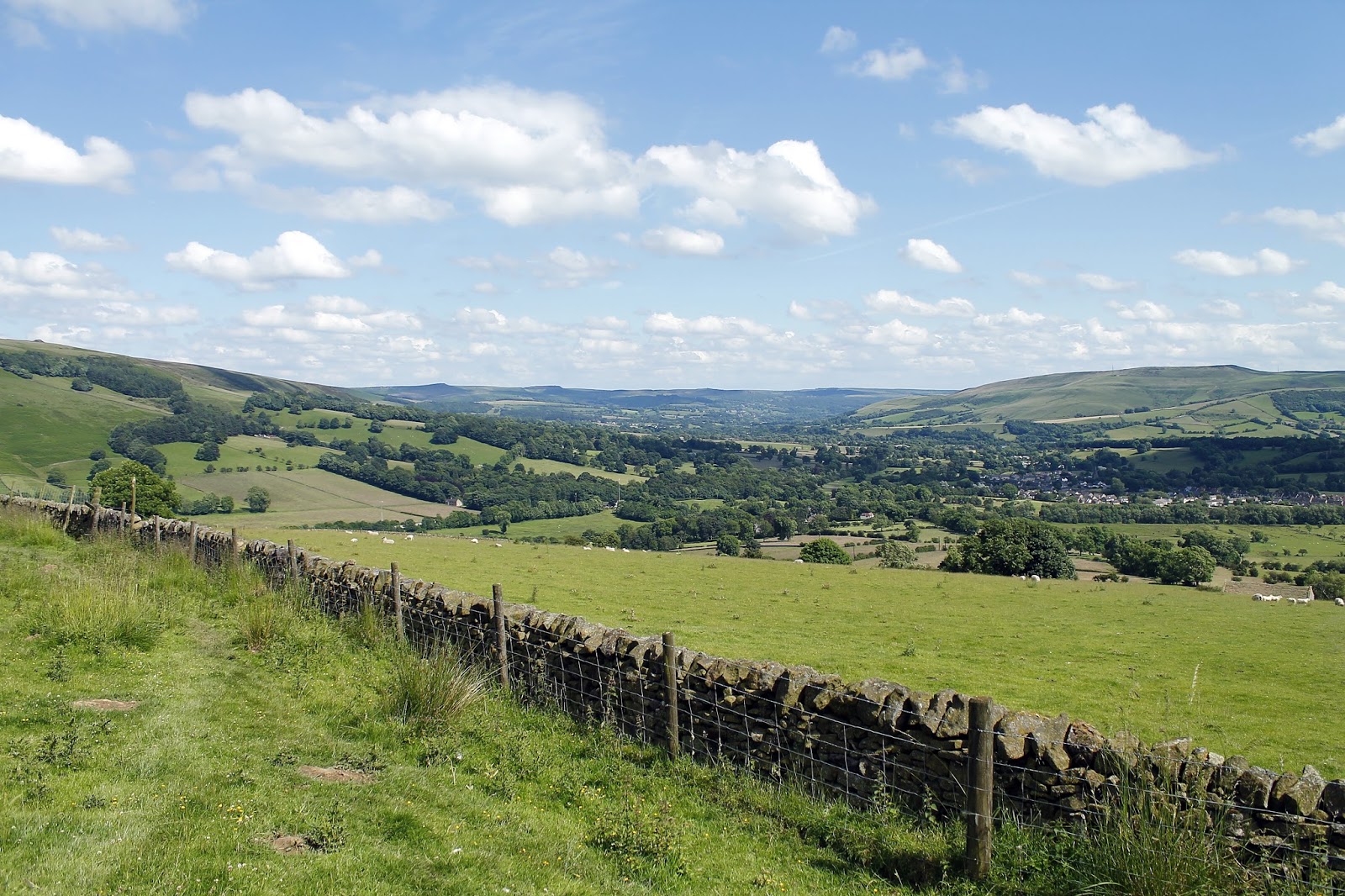
The Great Ridge forms a finger of high ground from Mam Tor to Lose Hill and is justifiably popular as it commands sweeping views of Edale, Hope and the surrounds of Kinder Scout and Derwent Edge. Unlike most who visit however, we were able to call on two cars to maximise our time on the ridge and save any of the slightly tedious walking down in the valley. With one waiting in Hope we shuffled the other up Winnats Pass to the National Trust car park below Mam Tor.
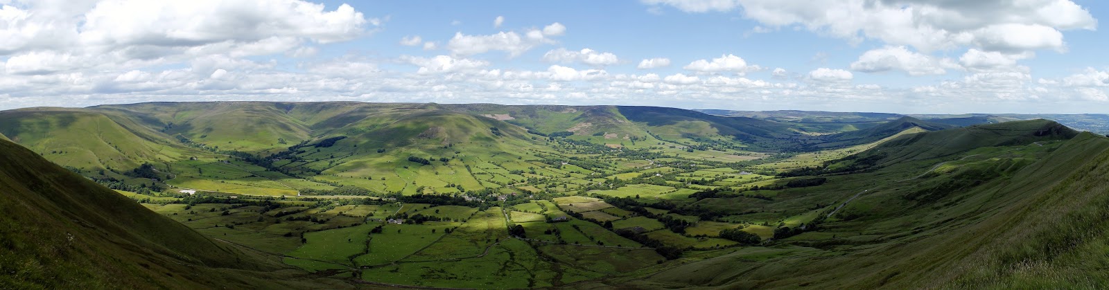
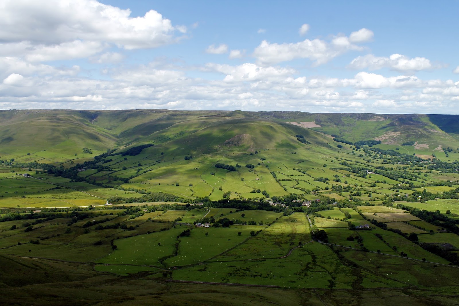
Though the car park is primarily used to reach Mam Tor, we set out in the opposite direction to reach an alternate starting point on Rushup Edge. Rushup Edge is a lesser visited height to the west of Mam Tor, though still reaches a height of 550m. It’s an easy climb over a mile to reach the top with superb view of Edale and Edale Head as accompaniment. The very top of Rushup Edge is fenced off as it bears the remains of a round barrow, known as Lord’s Seat.
 |
| Edale Head |
 |
| Edale |
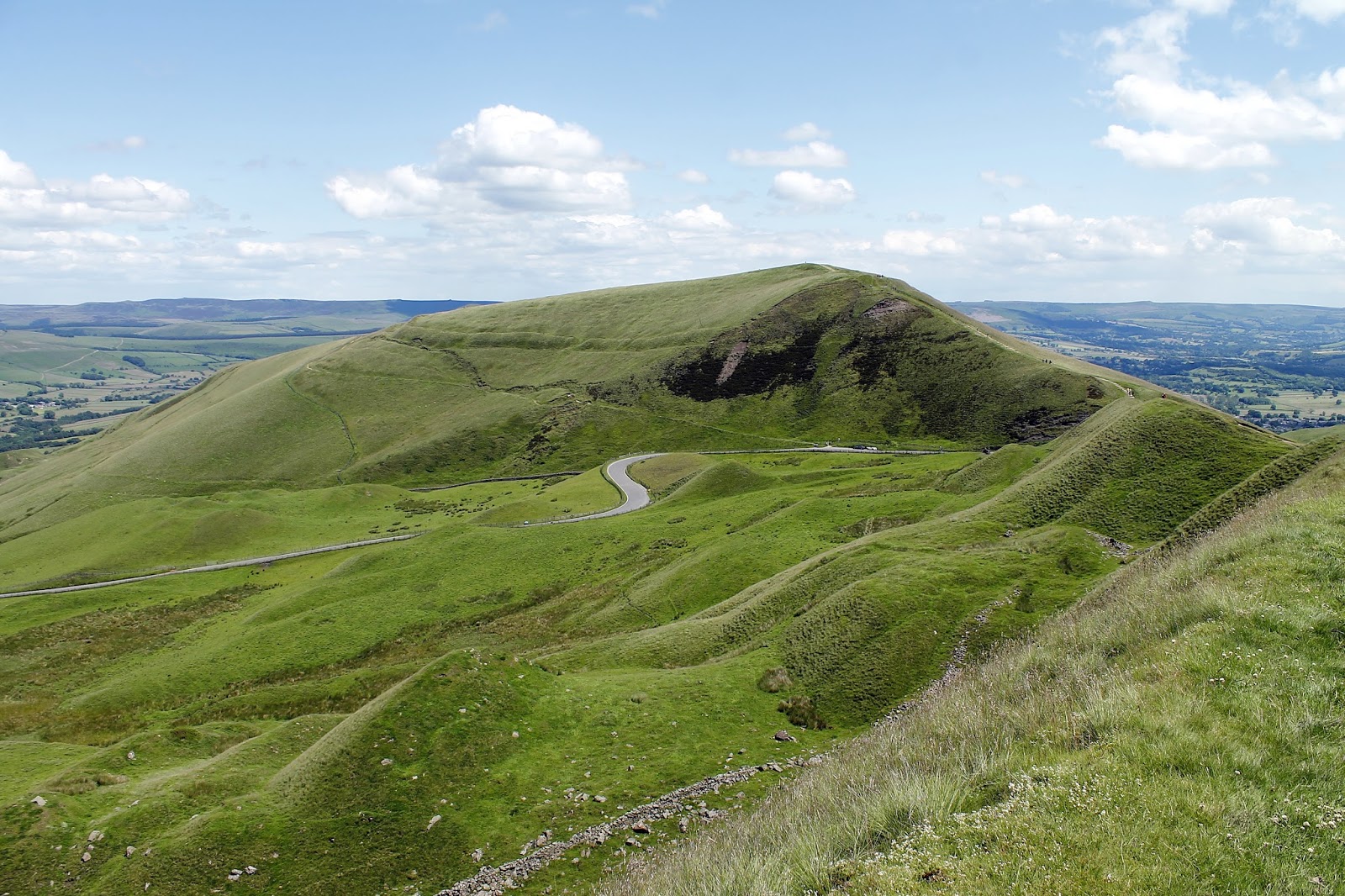
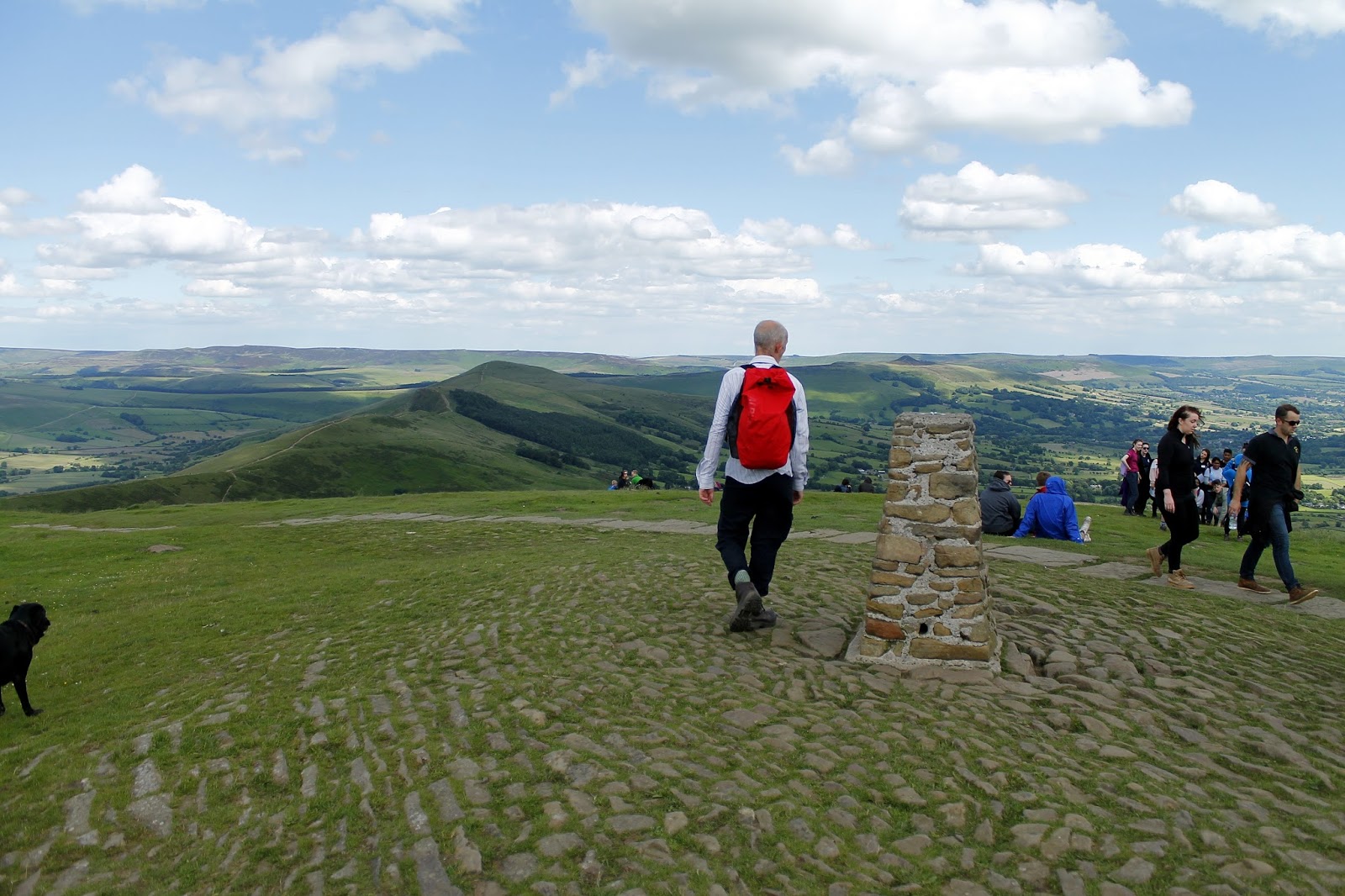
We wandered around for a moment and set off back to Mam Tor which marks the traditional beginning of the Great Ridge. It’s a short climb from the road up to the summit. Mam Tor (or mother hill) is one of the most famous hills in the Peak District. It gets its name thanks to the numerous small hillocks located on its eastern side, the result of frequent landslips. These landslips, which are caused by unstable lower layers of shale, also give the hill its alternative name of Shivering Mountain.
 |
| Edale |
The summit of Mam Tor is encircled by a late Bronze Age and early Iron Age hill fort. Radiocarbon analysis suggests occupation from around 1200 BC. The earliest remaining features are two Bronze Age burial mounds, one just below the summit and the other on the summit itself, though now buried under the paving.
The most notable feature of Mam Tor is the active landslip which invades its southeast side almost to the summit, and interrupts the ramparts of the hillfort, unless its builders used it as part of the defences. This rotational landslide began roughly 4,000 years ago. The toe is a debris flow. The landslide is due to weak shales underlying sandstones, a common phenomenon all around the Dark Peak, notably at Alport Castles. Indeed, three larger landslips occur on the north side of Mam Tor, one of them cutting the main ridge at Mam Nick which allows a minor road over into Edale; another creates the striking crag of Back Tor well seen from Mam Tor.
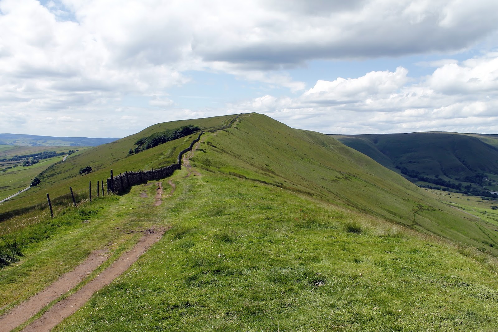
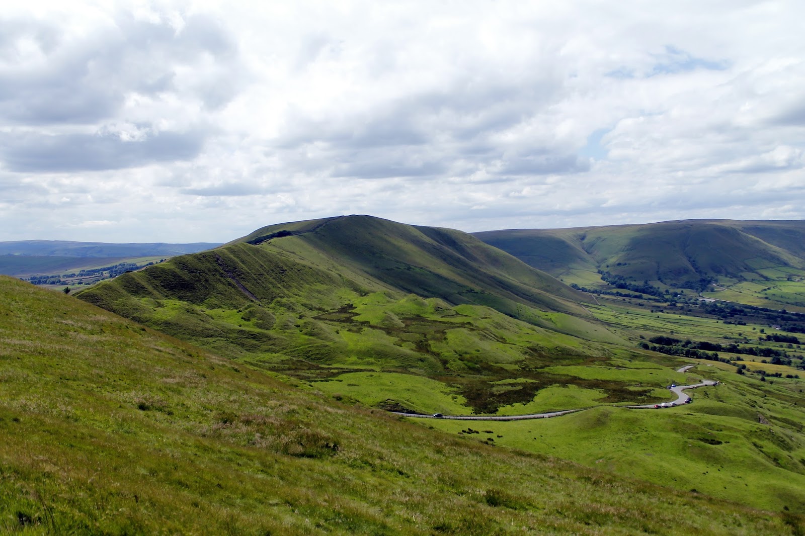
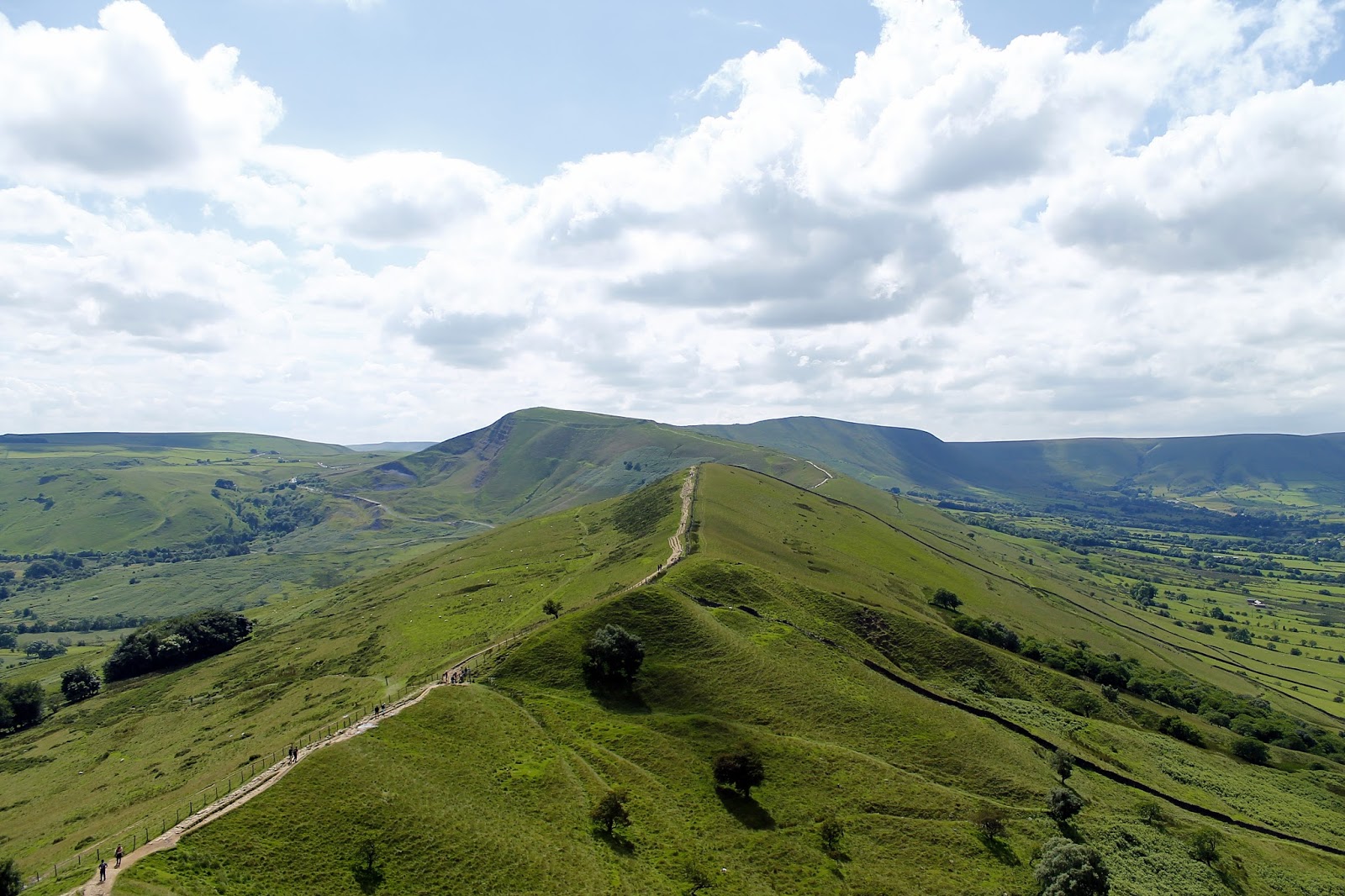
Enough about Mam Tor, which was bustling with people when we left, we were bound for our trip along the Great Ridge. A path runs along the length of the ridge, and is roughly paved to prevent erosion caused by the large number of visitors – it is perhaps one of the most accessible and visited ridges in the country.
 |
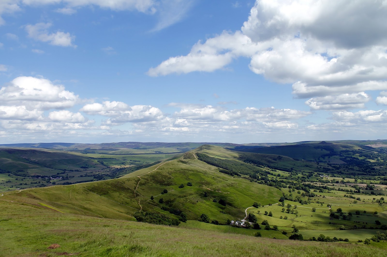
| Edale’s Great Ridge |
 |
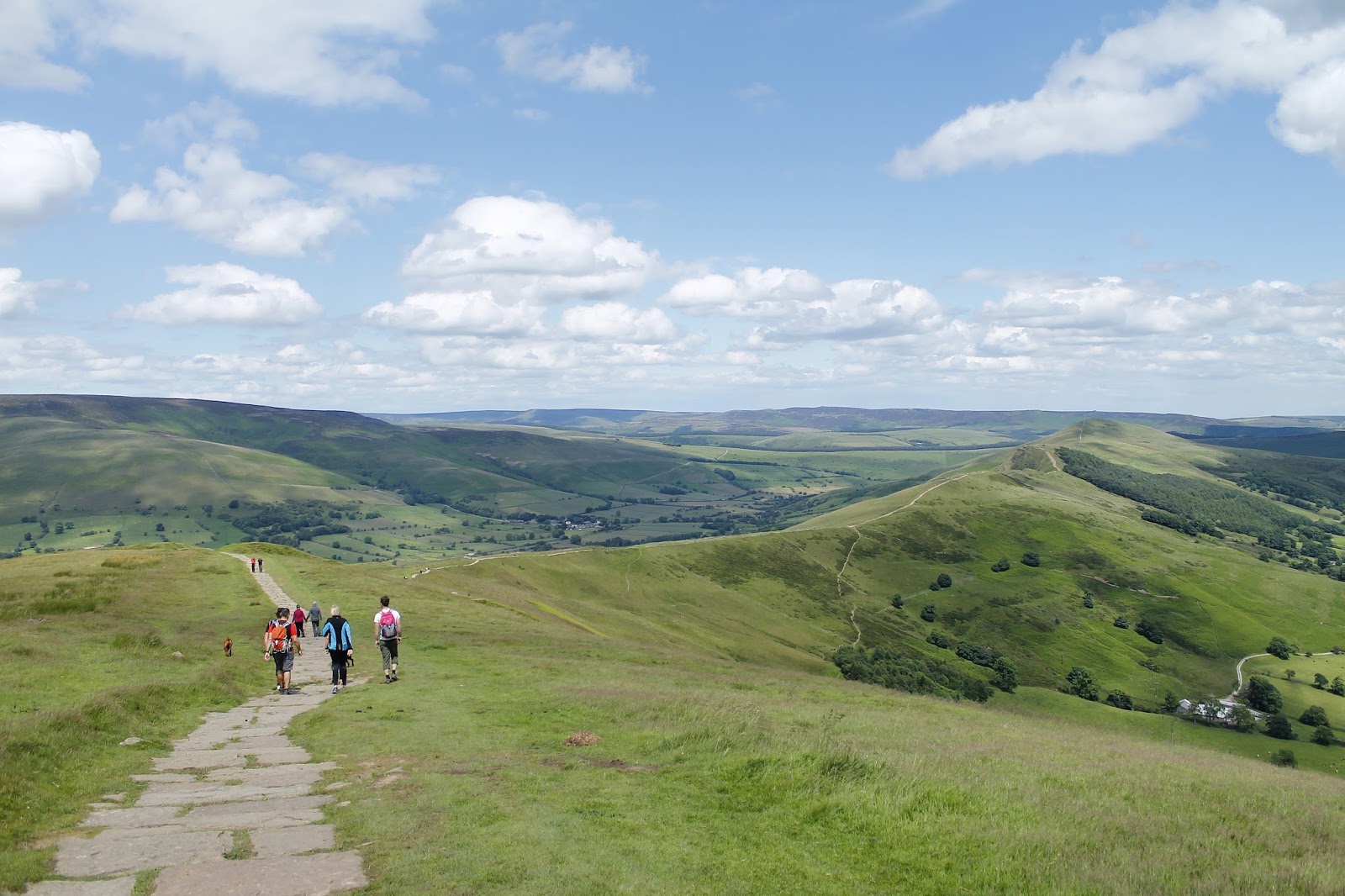
| A well engineered path leads along the top |
 |
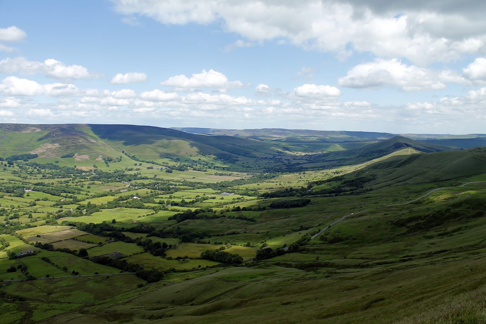
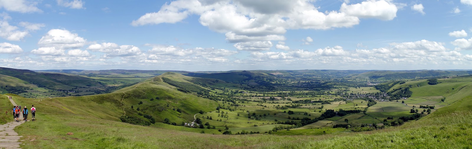
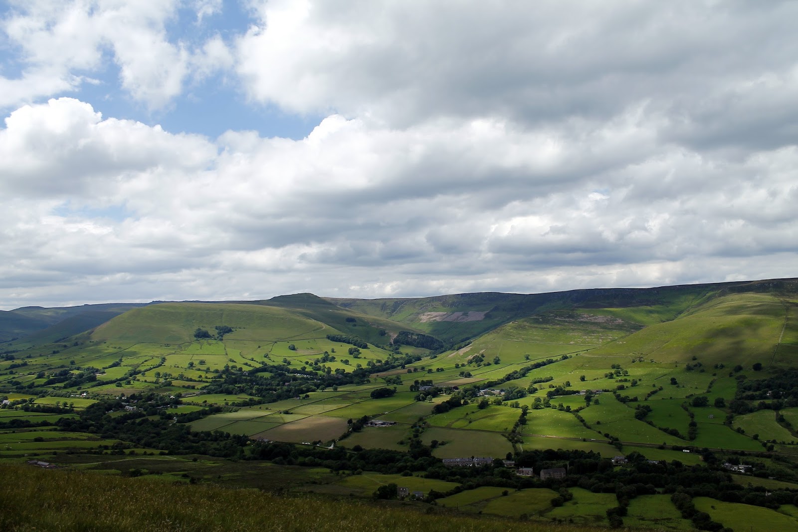
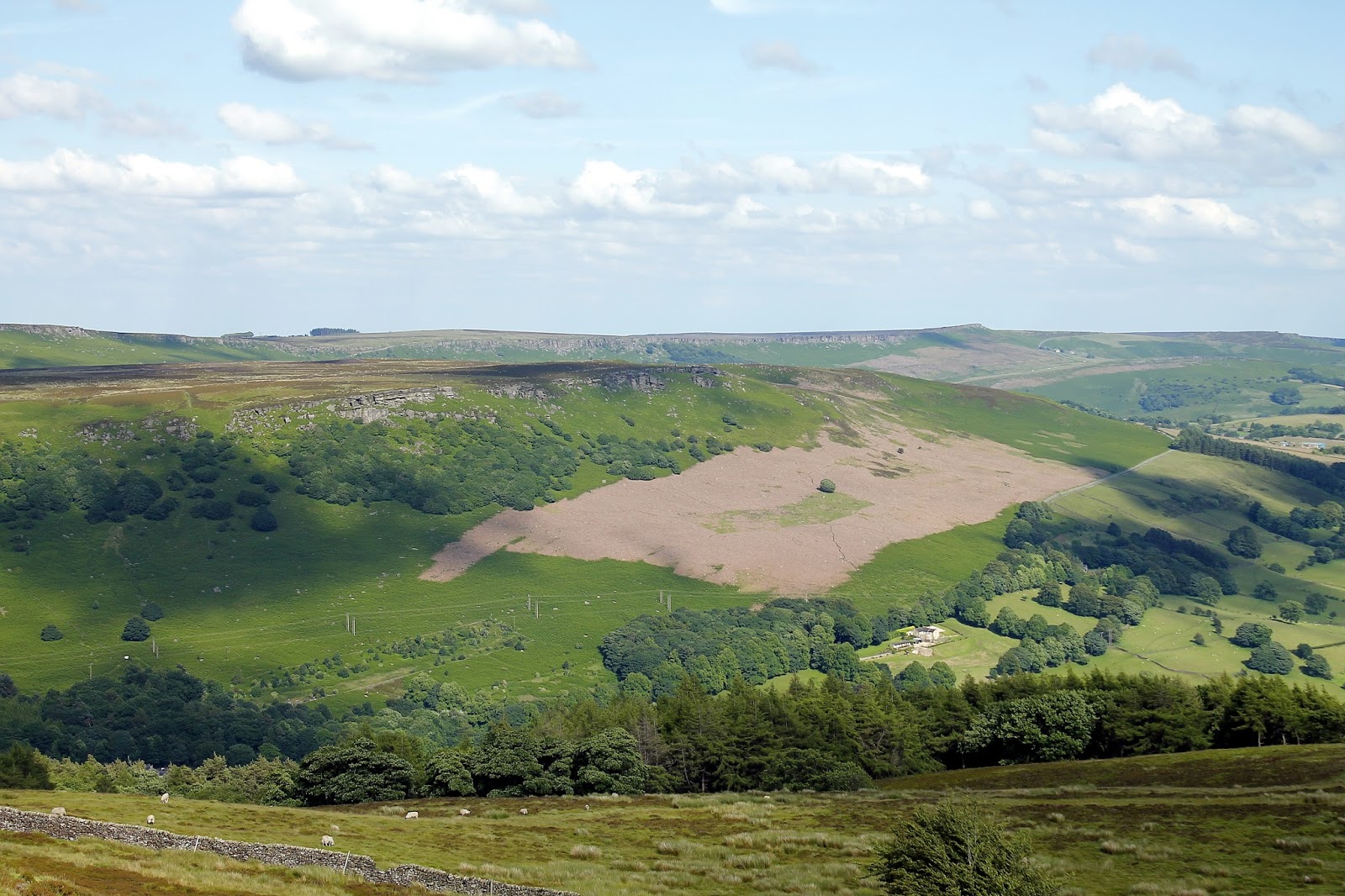
| The Great Ridge and Hope Valley |
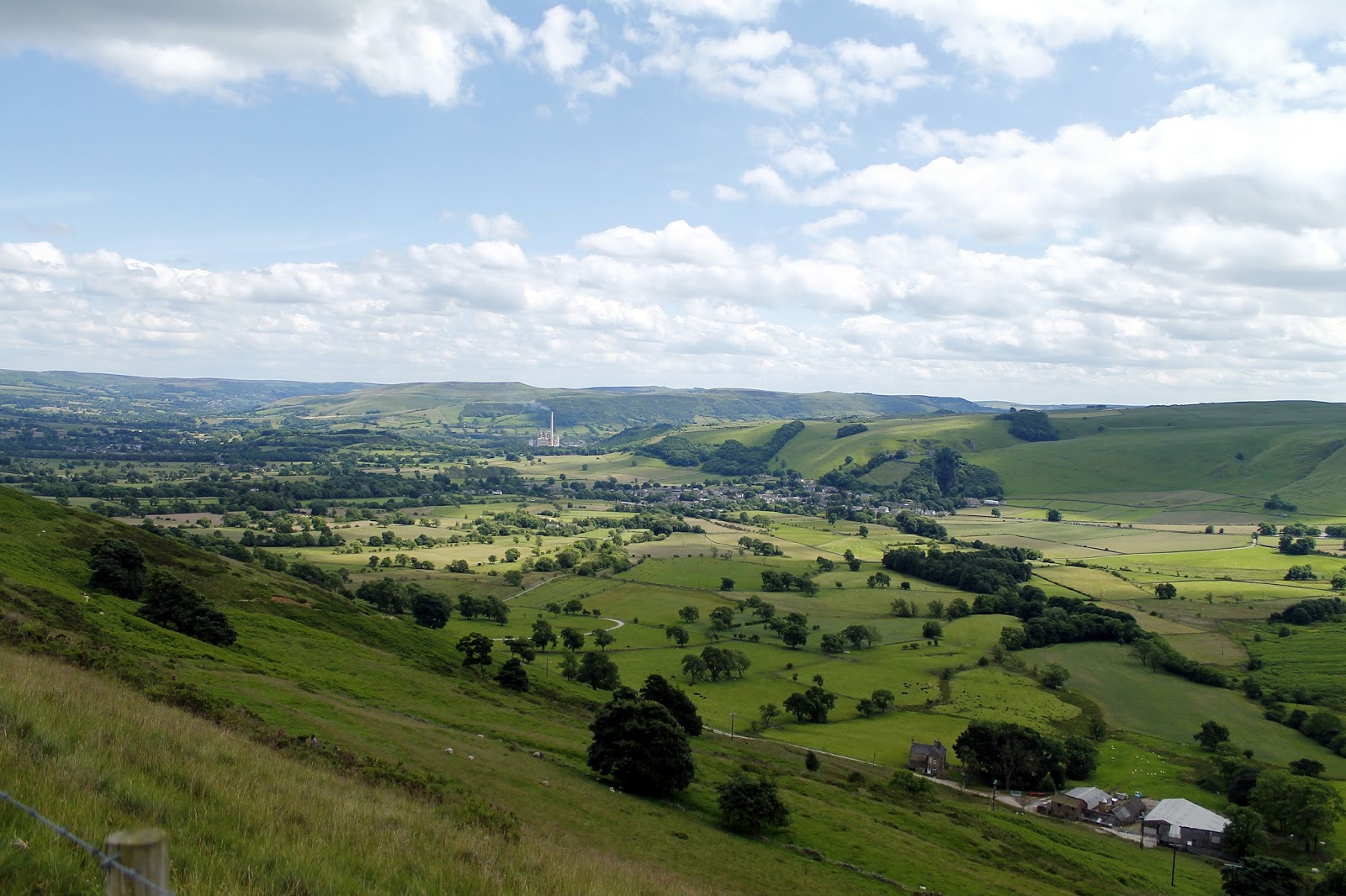
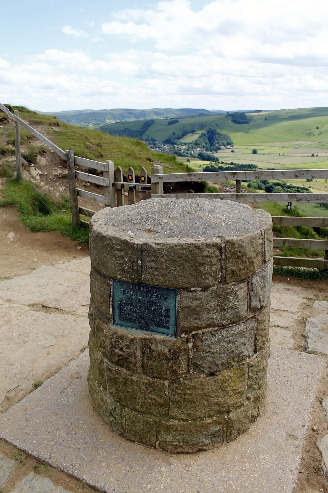
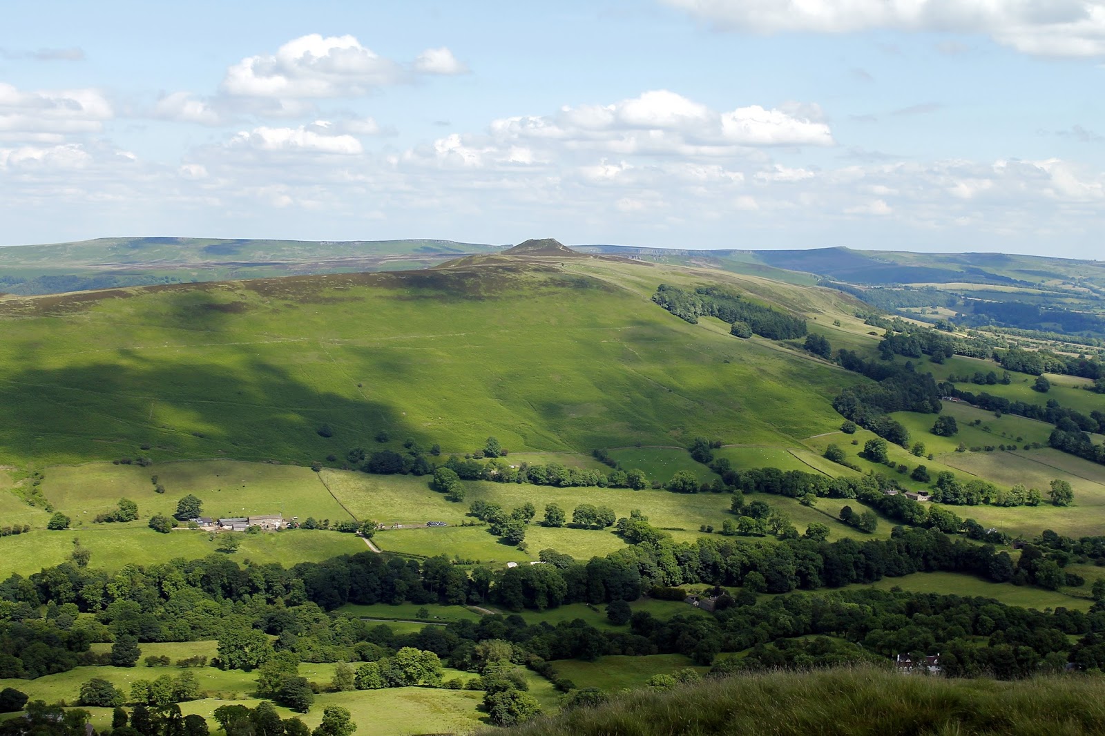
The path falls from Mam Tor to Hollins Cross, the lowest point on the ridge. It was also the traditional route from Castleton to Edale. Coffins from Edale were taken over Hollins Cross to Hope church until a church was constructed in Edale, leading to the nickname of the “coffin road” for this route. A cairn sits in Hollins Cross, a memorial to Tom Hyett, erected in his memory by his walking club.
 |
| Castleton and the Hope valley |
 |
| Tom Hyett’s Memorial |
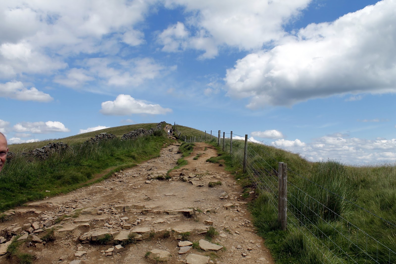
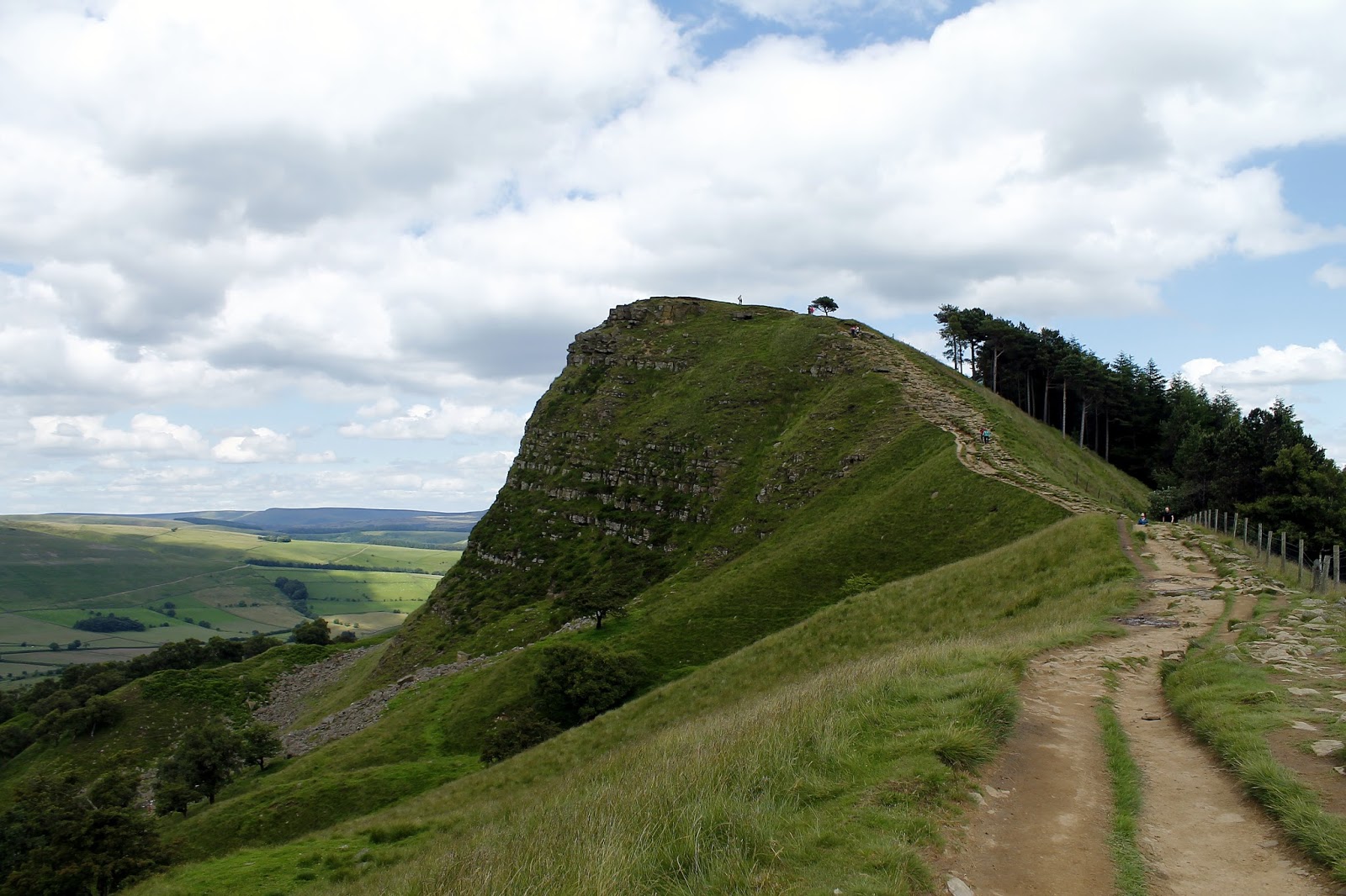
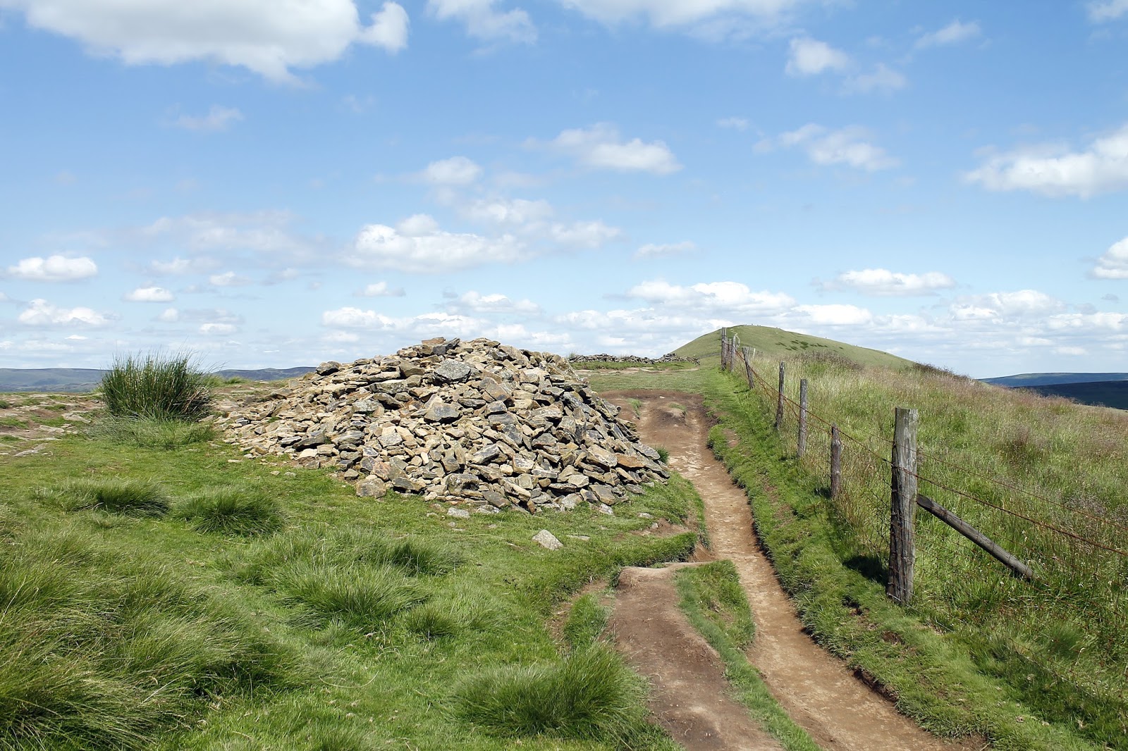
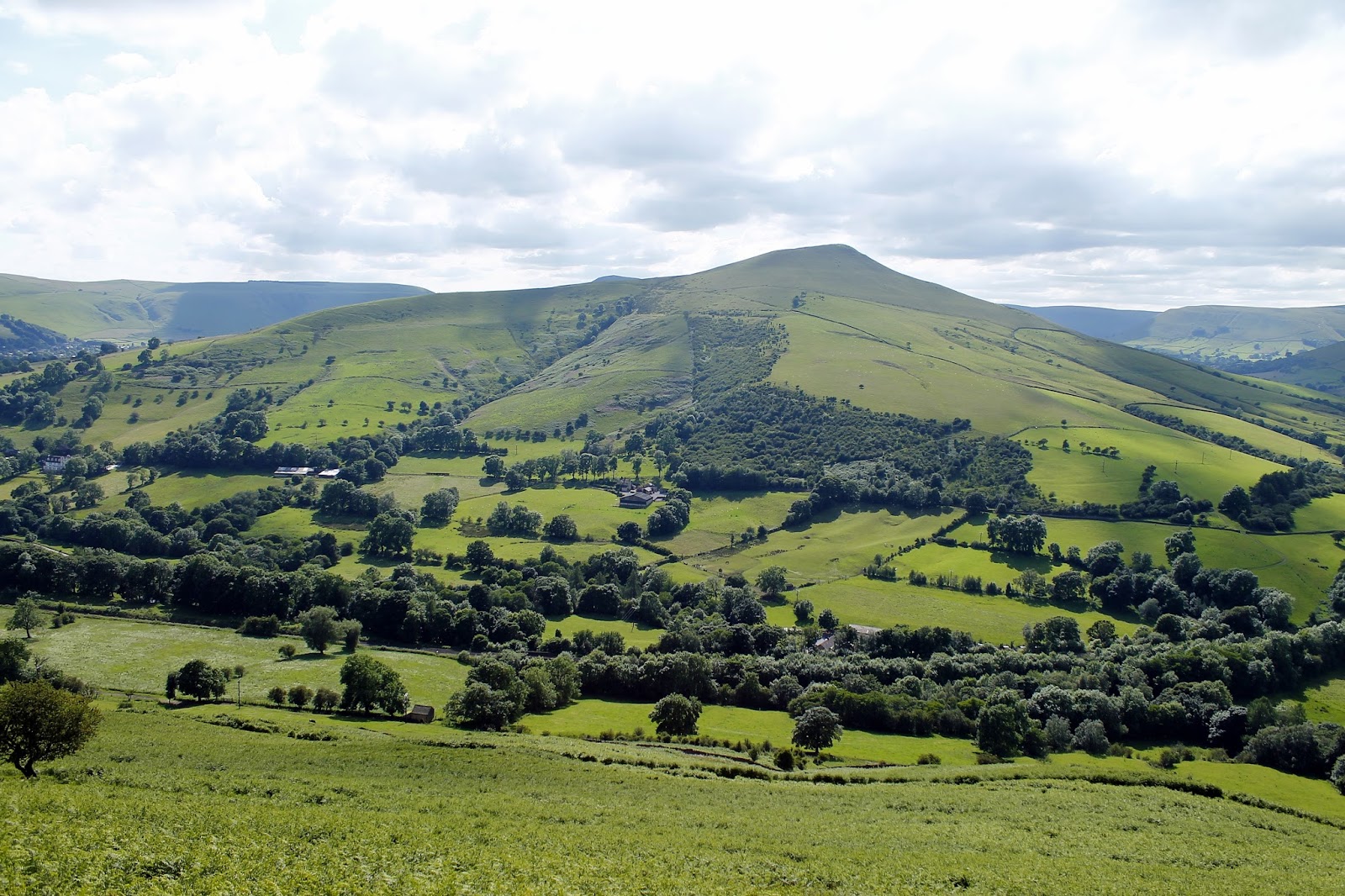
From Hollins Cross, the Great Ridge swells over Barker Bank to the Brockett Booth Plantation. Here is the only notably steep climb on the ridge up to the small but dramatic Back Tor. The outcrop has a fine view back along the ridge towards Mam Tor as well as a sweeping view of Edale – it’s a fine place, perfect for a lunch stop.
 |
| The path climbs Barker Bank |
 |
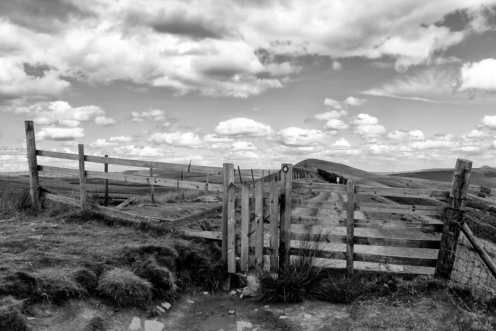
| Fence and gate on Barker Bank |
 |
| Back Tor |
 |
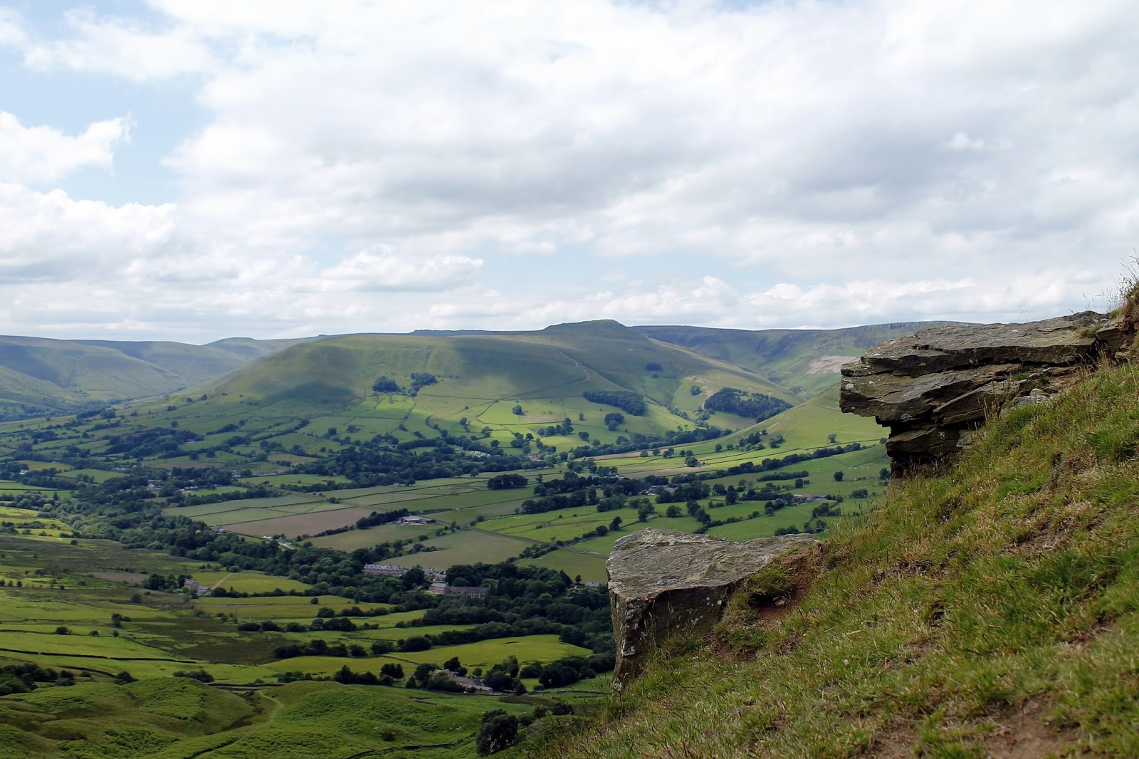
| Edale from Back Tor |
 |
| The Great Ridge |
 |
| A cairn sits atop Back Tor |
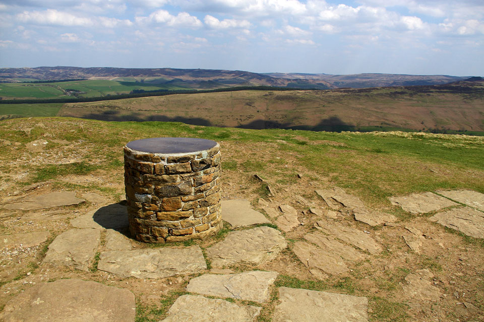
A rutted track continues the Great Ridge to its final summit, that of Lose Hill. The top was given to local access activist G. H. B. Ward by the Sheffield and District Federation of the Ramblers Association in 1945, which was named Ward’s Piece; he subsequently presented this to the National Trust.
 |
| Toposcope atop Lose Hill |
It is wrongly thought that the name (and that of the neighbouring Win Hill) are the result of a great battle. Local legend states that Lose Hill derives its name from the Dark Age Battle Battle of Win Hill and Lose Hill which is said to have been fought there in 626 AD. The army of Prince Cwichelm and his father, Cynegils, King of Wessex, stationed on Lose Hill and probably aided by Penda, King of Mercia, advanced on the Northumbrians, who were based on nearby Win Hill.
The battle was supposedly long and fierce and, despite having superior numbers, Cynegils’ forces were defeated by the Northumbrians who built a wall and rolled boulders down upon them. However exciting and bloodthirsty this may seem, there is no record of this battle occurring in any contemporary Anglo-Saxon source.
Suggested explanations for the name of Lose Hill include that it derives from the Old English “hlose”, meaning pigsties, or that it may be a corruption of ‘loose’, as in ‘free land’.
 |
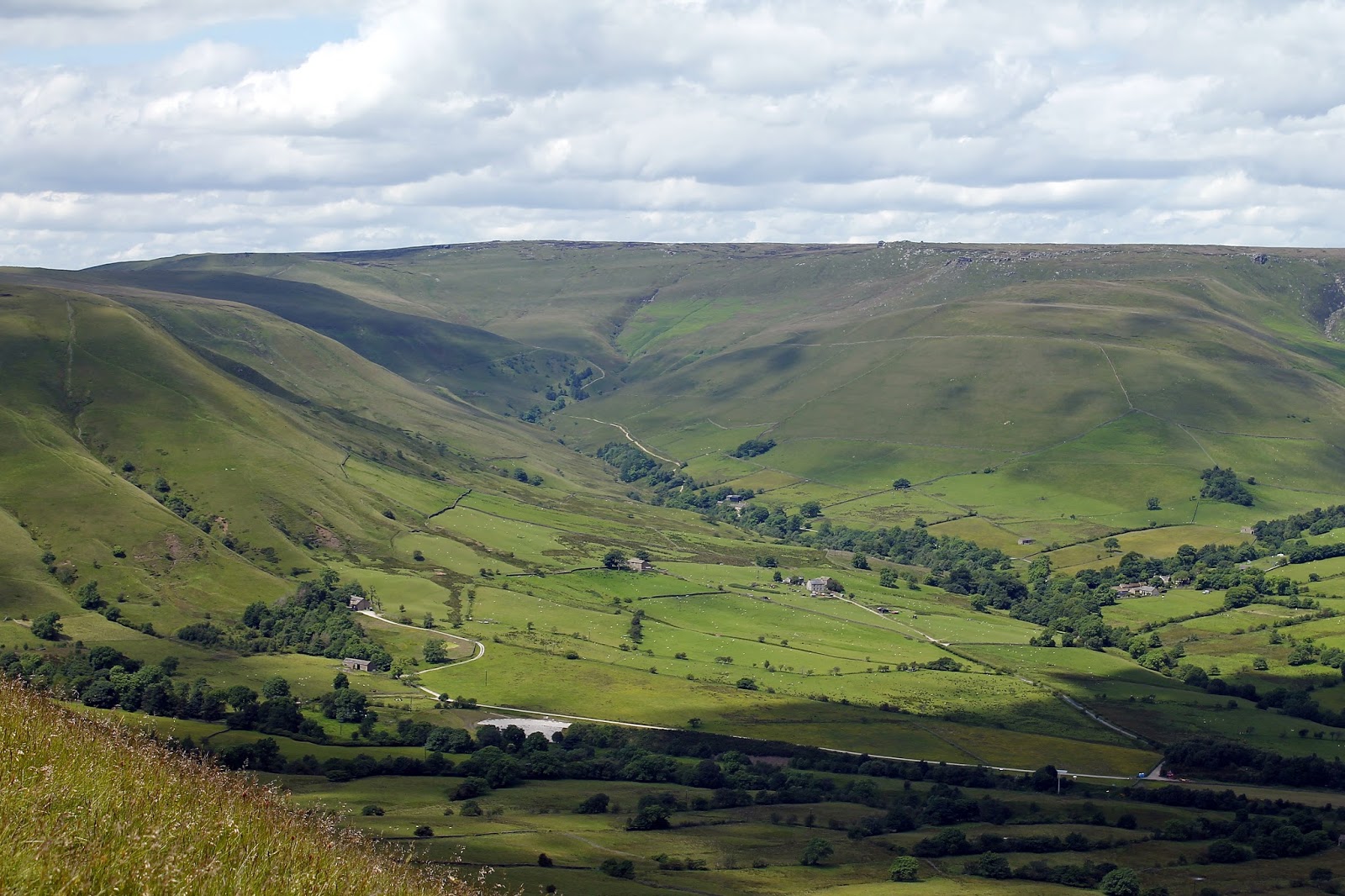
| Hope Valley |
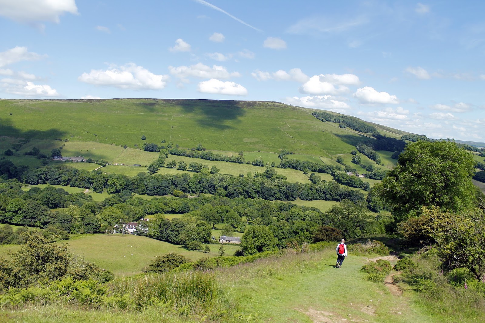
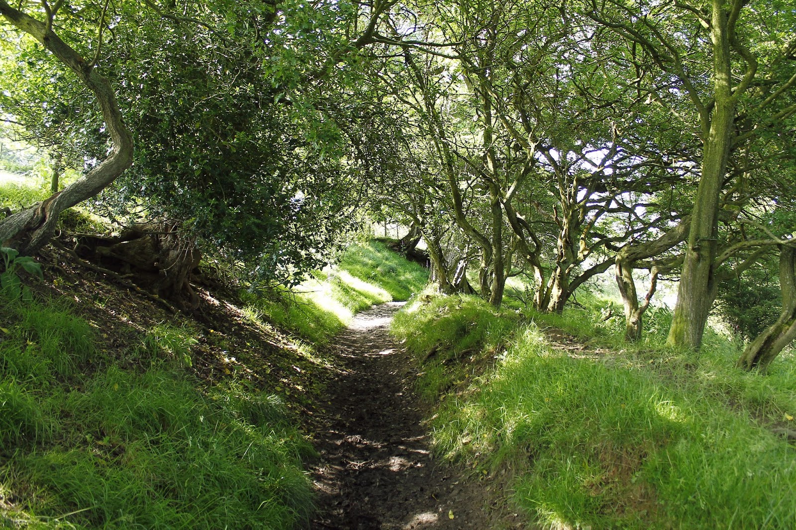
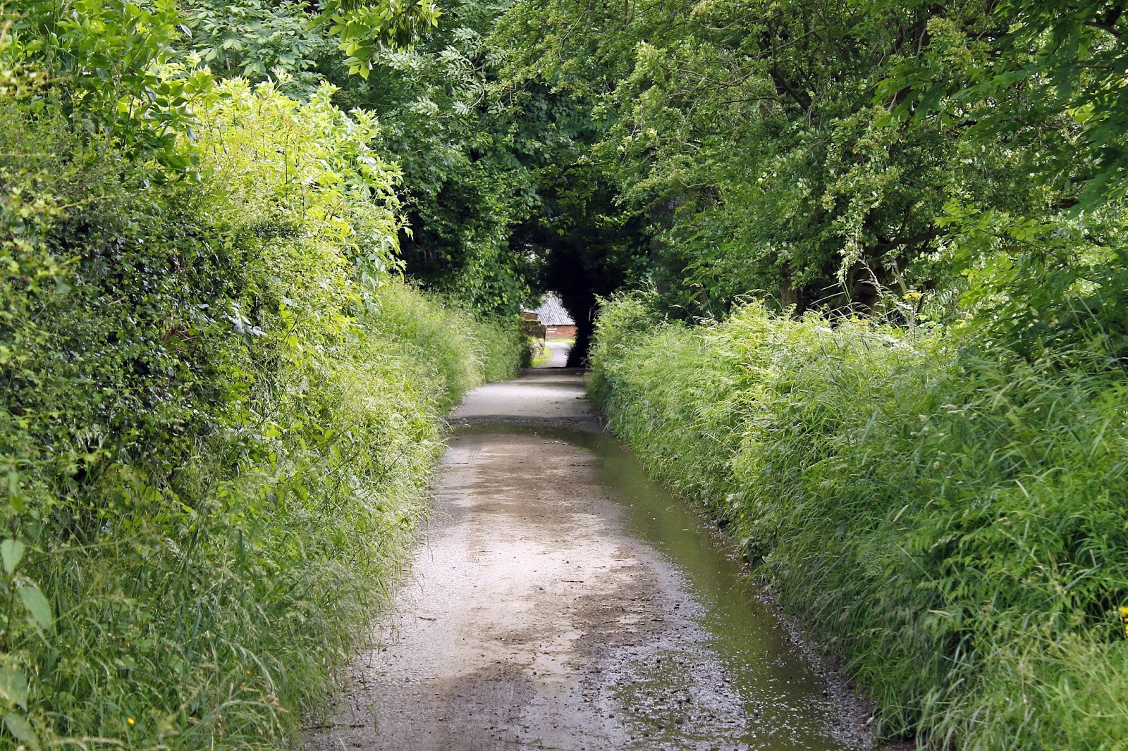
Leaving Lose Hill, the path exits the strip of Access Land that runs along the ridge. A series of muddy paths and tracks drops down to the River Noe as it crosses beneath Edale Road. A quite lane then branches off, passes over the Hope Valley railway line and makes an unerringly straight route north up the slopes of Win Hill.
 |
| Woods at Losehill End |
 |
| Fullwood Stile Lane |
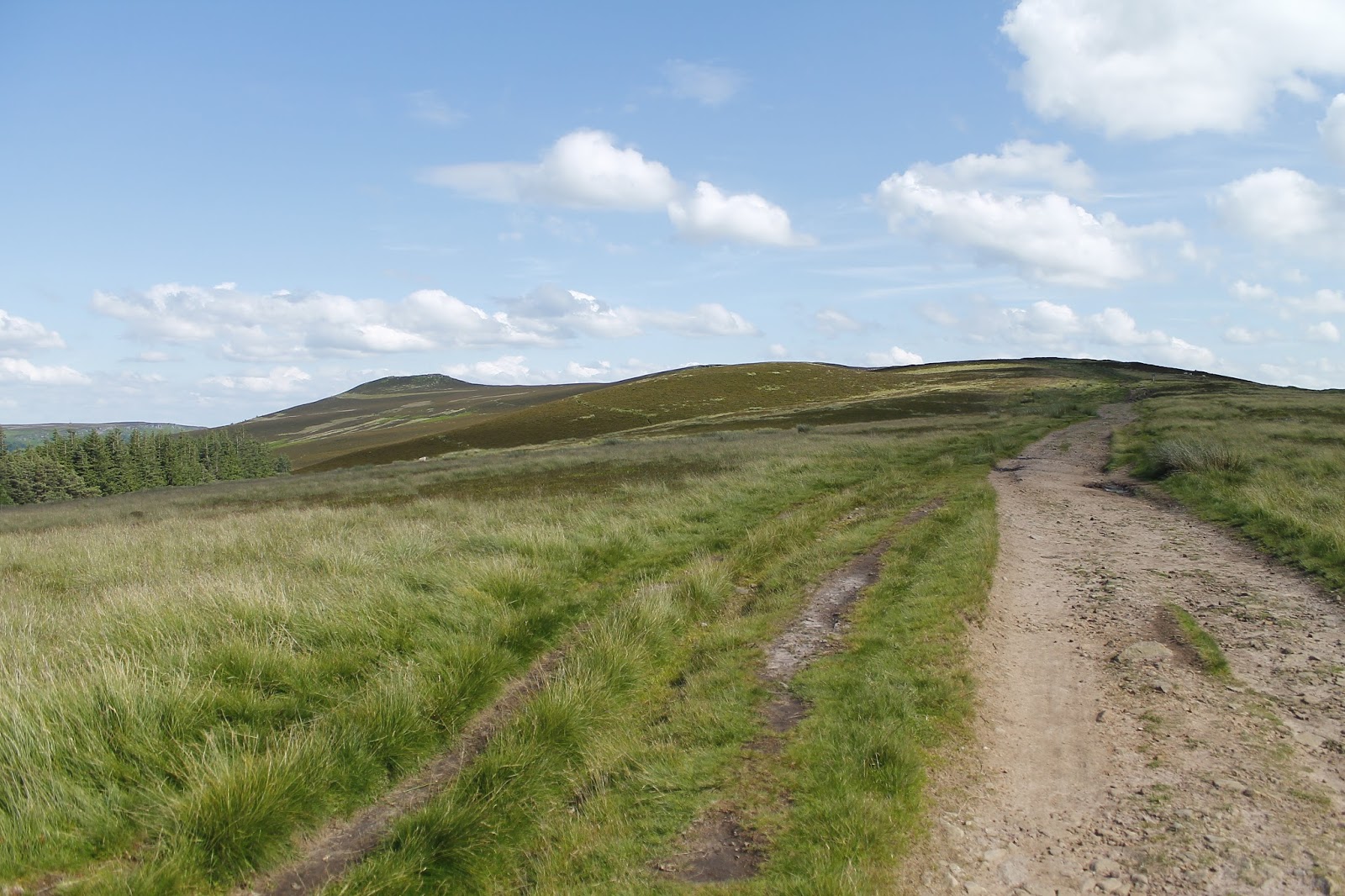
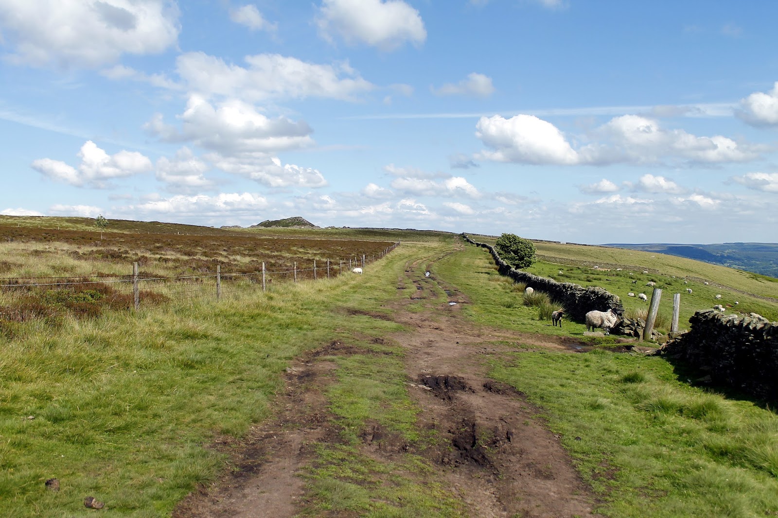
The lane branches as it reaches another island of Access Land with the right fork making for the high ground. It was surprisingly steep, especially towards the end of the day but, luckily, it’s not long until the ridge is reached close to Wooler Knoll.
 |
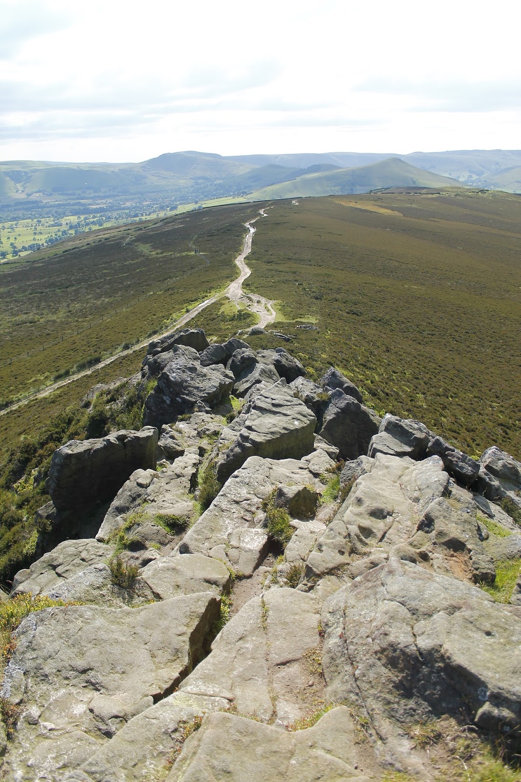
| The path along the top of Hope Brink |
 |
| Heading for Win Hill |
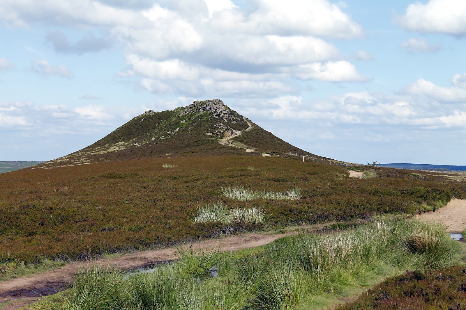
 |
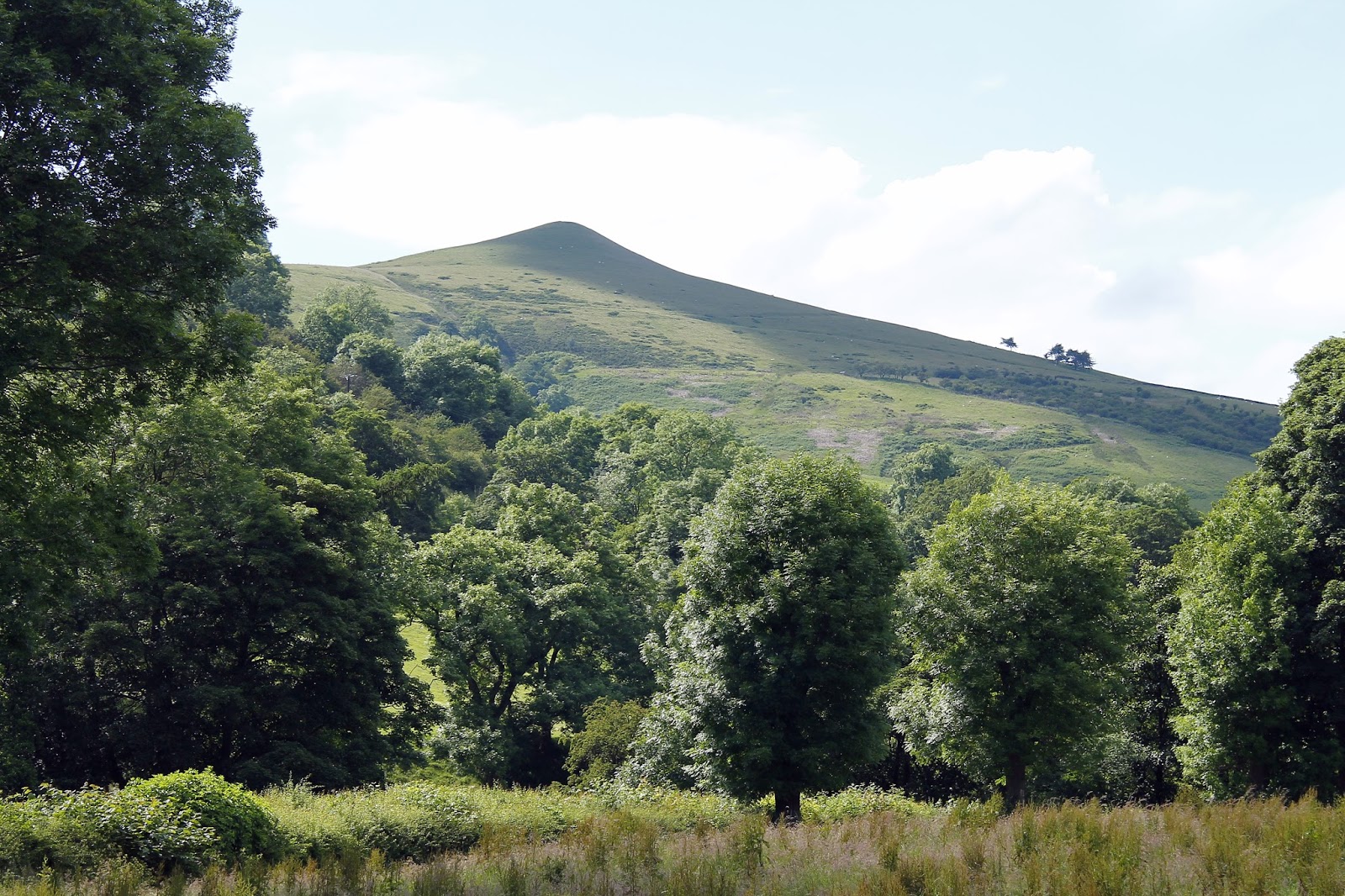
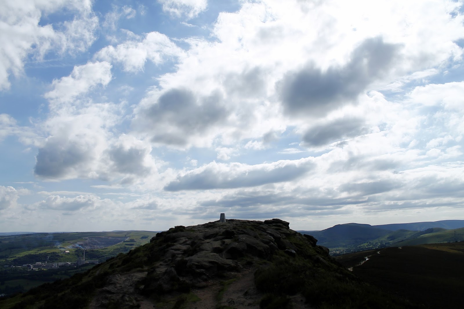
| Win Hill Pike |
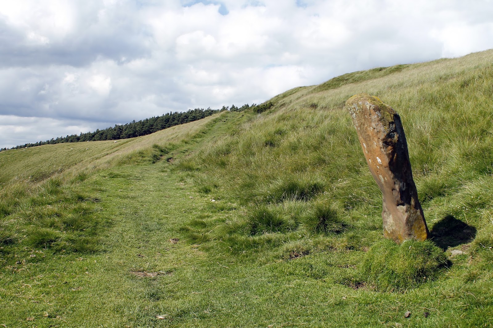
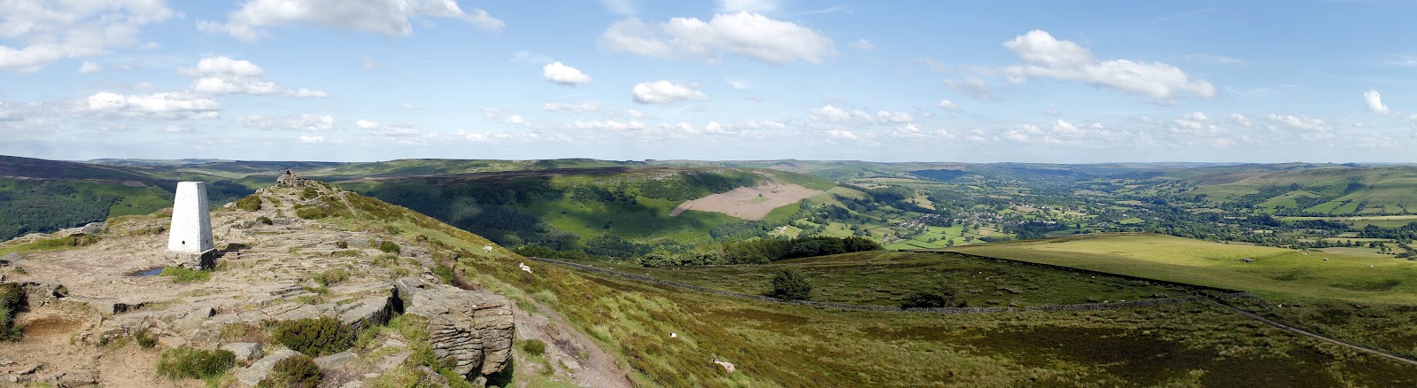
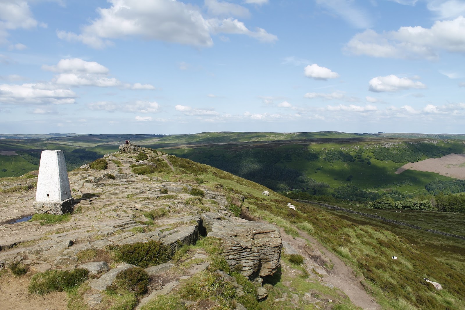
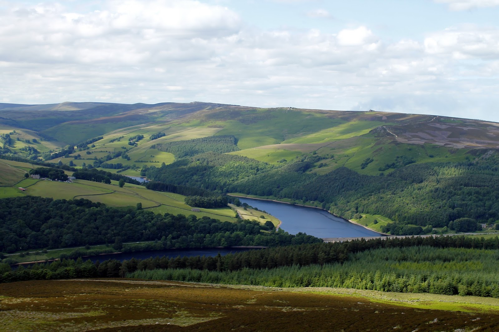
An easy, if not slightly long-winded stroll took us along the top of Hope Brink to Thornhill Brink and the interesting top of Win Hill, also known as Win Hill Pike. Win Hill was originally recorded as Wythinehull, meaning “Withy Hill” or “Willow Hill”. Fragments of willow can still be found in the otherwise largely coniferous plantation on the approach from Yorkshire Bridge. The summit, compelte with OS trig pillar, is an excellent vantage point with expansive view of the Hope Valley, the famous Stanage Edge and the Ladybower Reservoir.
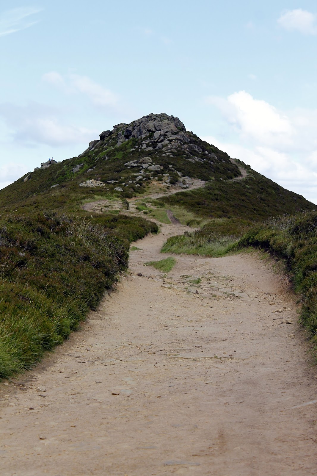
 |
| Win Hill Pike |
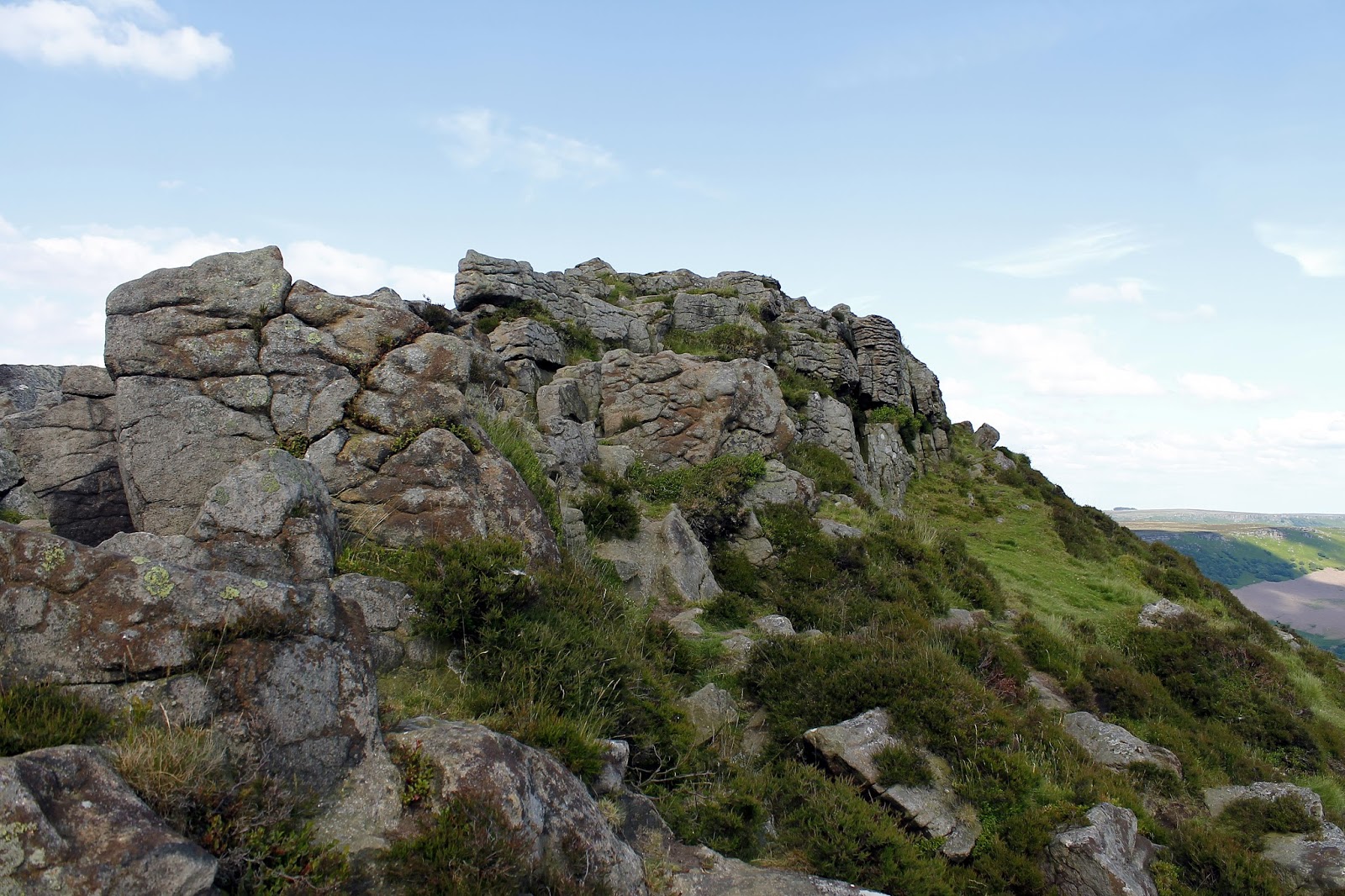
 |
| Some interesting rocks cap the summit |
 |
| Stanage Edge |
 |
| A trig pillar marks the top |
With the warm afternoon sun on our faces, we retraced our steps south west, and began our descent back to Hope where we had left a car earlier in the day. This is a superb day walk which embraces the full 4 mile Great Ridge before descending again. Win Hill and its sublime views are an added bonus though, as would be expected from such a walk the views are stunning throughout – it comes highly recommended.
 |
| Ladybower Reservoir |
 |
| Starting back to Hope |
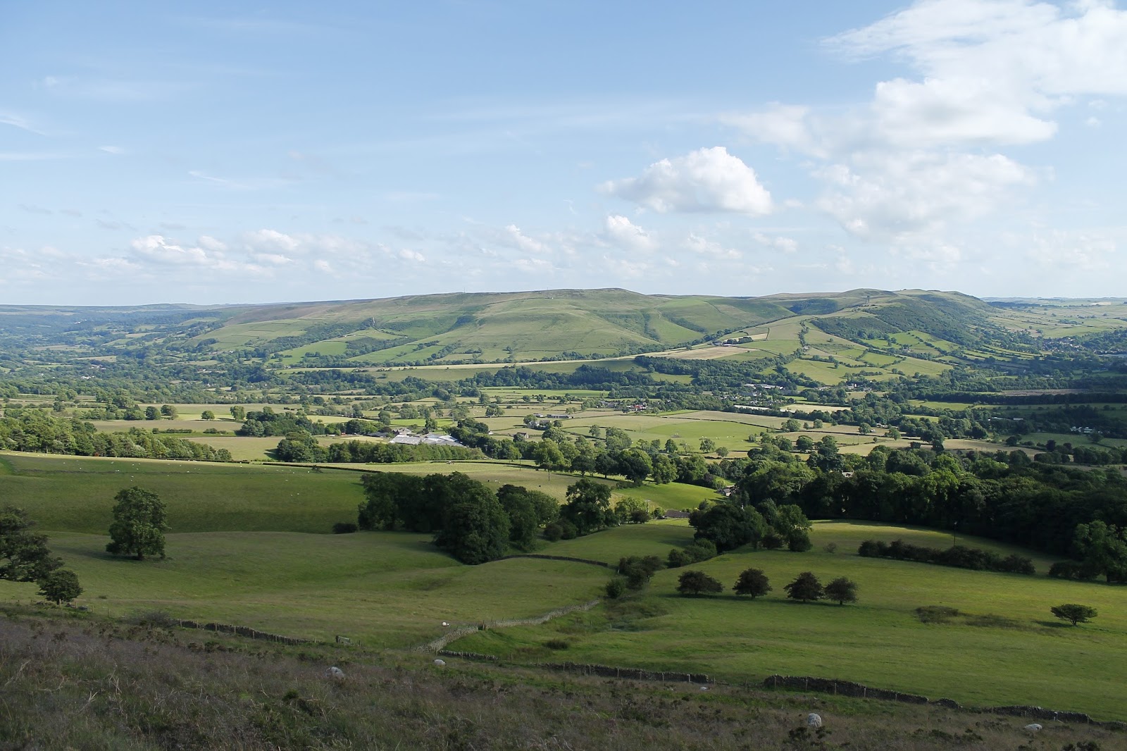
 |
| Hope Valley |
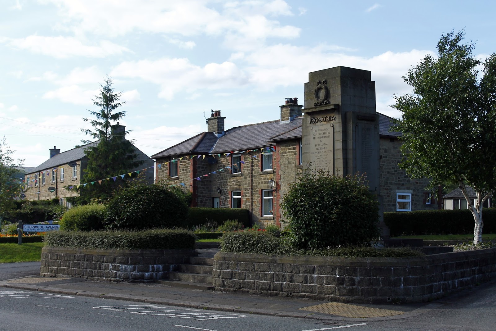
 |
| Hope village |

