Open Space Web-Map builder Codehttps://openspace.ordnancesurvey.co.uk/osmapapi/openspace.js?key=3119F72552FD5C22E0530C6CA40A5A92https://openspace.ordnancesurvey.co.uk/osmapapi/script/mapbuilder/basicmap.jshttps://openspace.ordnancesurvey.co.uk/osmapapi/script/mapbuilder/searchbox.js//variables for routes var linesLayer, points, lineFeature, lineString, routeMarkersLayer, routepos, routesize, routeoffset, routeicon; var style_blue = {strokeColor: “#0000CD”, strokeOpacity: 0.5, strokeWidth: 4.5}; function initmapbuilder() { //initiate the map var options = {resolutions: [2500, 1000, 500, 200, 100, 50, 25, 10, 5, 4, 2.5, 2, 1]}; osMap = new OpenSpace.Map(‘map’, options); //configure map options (basicmap.js) setglobaloptions(); //set the center of the map and the zoom level osMap.setCenter(new OpenSpace.MapPoint(336360.9974823,514821.00125885),7); linesLayer = osMap.getVectorLayer(); // Set up layer for route markers routeMarkersLayer = new OpenLayers.Layer.Markers(“Route Markers”); //make a route points = new Array(); points.push(new OpenLayers.Geometry.Point(338676.66412354,516901.66793823)); points.push(new OpenLayers.Geometry.Point(338521.66412354,516866.66793823)); points.push(new OpenLayers.Geometry.Point(338381.66412354,516766.66793823)); points.push(new OpenLayers.Geometry.Point(338271.66412354,516786.66793823)); points.push(new OpenLayers.Geometry.Point(338181.66412354,516851.66793823)); points.push(new OpenLayers.Geometry.Point(338071.66412354,516851.66793823)); points.push(new OpenLayers.Geometry.Point(337996.66412354,516851.66793823)); points.push(new OpenLayers.Geometry.Point(337936.66412354,516886.66793823)); points.push(new OpenLayers.Geometry.Point(337876.66412354,516821.66793823)); points.push(new OpenLayers.Geometry.Point(337796.66412354,516826.66793823)); points.push(new OpenLayers.Geometry.Point(337776.66412354,516701.66793823)); points.push(new OpenLayers.Geometry.Point(337636.66412354,516741.66793823)); points.push(new OpenLayers.Geometry.Point(337601.66412354,516681.66793823)); points.push(new OpenLayers.Geometry.Point(337611.66412354,516541.66793823)); points.push(new OpenLayers.Geometry.Point(337221.66412354,516121.66793823)); points.push(new OpenLayers.Geometry.Point(337071.66412354,516091.66793823)); points.push(new OpenLayers.Geometry.Point(336876.66412354,516066.66793823)); points.push(new OpenLayers.Geometry.Point(336691.66412354,516081.66793823)); points.push(new OpenLayers.Geometry.Point(336571.66412354,516261.66793823)); points.push(new OpenLayers.Geometry.Point(336481.66412354,516281.66793823)); points.push(new OpenLayers.Geometry.Point(336376.66412354,516116.66793823)); points.push(new OpenLayers.Geometry.Point(336181.66412354,515831.66793823)); points.push(new OpenLayers.Geometry.Point(335996.66412354,515636.66793823)); points.push(new OpenLayers.Geometry.Point(335888.66412354,515445.66793823)); points.push(new OpenLayers.Geometry.Point(335868.66412354,515365.66793823)); points.push(new OpenLayers.Geometry.Point(335668.66412354,515235.66793823)); points.push(new OpenLayers.Geometry.Point(335383.66412354,515130.66793823)); points.push(new OpenLayers.Geometry.Point(335273.66412354,515075.66793823)); points.push(new OpenLayers.Geometry.Point(335068.66412354,514950.66793823)); points.push(new OpenLayers.Geometry.Point(335008.66412354,514950.66793823)); points.push(new OpenLayers.Geometry.Point(334653.66412354,514995.66793823)); points.push(new OpenLayers.Geometry.Point(334498.66412354,514990.66793823)); points.push(new OpenLayers.Geometry.Point(334358.66412354,515035.66793823)); points.push(new OpenLayers.Geometry.Point(334258.66412354,515105.66793823)); points.push(new OpenLayers.Geometry.Point(334143.66412354,515165.66793823)); points.push(new OpenLayers.Geometry.Point(334258.66412354,515025.66793823)); points.push(new OpenLayers.Geometry.Point(334303.66412354,514920.66793823)); points.push(new OpenLayers.Geometry.Point(334298.66412354,514715.66793823)); points.push(new OpenLayers.Geometry.Point(334273.66412354,514520.66793823)); points.push(new OpenLayers.Geometry.Point(334363.66412354,514185.66793823)); points.push(new OpenLayers.Geometry.Point(334333.66412354,514070.66793823)); points.push(new OpenLayers.Geometry.Point(334253.66412354,513800.66793823)); points.push(new OpenLayers.Geometry.Point(334358.66412354,513665.66793823)); points.push(new OpenLayers.Geometry.Point(334318.66412354,513460.66793823)); points.push(new OpenLayers.Geometry.Point(334338.66412354,513355.66793823)); points.push(new OpenLayers.Geometry.Point(334338.66412354,513165.66793823)); points.push(new OpenLayers.Geometry.Point(334428.66412354,513120.66793823)); points.push(new OpenLayers.Geometry.Point(334603.66412354,513085.66793823)); points.push(new OpenLayers.Geometry.Point(334668.66412354,513120.66793823)); points.push(new OpenLayers.Geometry.Point(334588.66412354,512990.66793823)); points.push(new OpenLayers.Geometry.Point(334568.66412354,512860.66793823)); points.push(new OpenLayers.Geometry.Point(334648.66412354,512830.66793823)); points.push(new OpenLayers.Geometry.Point(334788.66412354,512805.66793823)); points.push(new OpenLayers.Geometry.Point(334833.66412354,512710.66793823)); points.push(new OpenLayers.Geometry.Point(334833.66412354,512600.66793823)); points.push(new OpenLayers.Geometry.Point(334948.66412354,512545.66793823)); points.push(new OpenLayers.Geometry.Point(334873.66412354,512460.66793823)); points.push(new OpenLayers.Geometry.Point(334828.66412354,512345.66793823)); points.push(new OpenLayers.Geometry.Point(335003.66412354,512280.66793823)); points.push(new OpenLayers.Geometry.Point(335168.66412354,512360.66793823)); points.push(new OpenLayers.Geometry.Point(335303.66412354,512505.66793823)); points.push(new OpenLayers.Geometry.Point(335363.66412354,512650.66793823)); points.push(new OpenLayers.Geometry.Point(335323.66412354,512780.66793823)); points.push(new OpenLayers.Geometry.Point(335443.66412354,512970.66793823)); points.push(new OpenLayers.Geometry.Point(335468.66412354,513085.66793823)); points.push(new OpenLayers.Geometry.Point(335468.66412354,513160.66793823)); points.push(new OpenLayers.Geometry.Point(335523.66412354,513385.66793823)); points.push(new OpenLayers.Geometry.Point(335548.66412354,513505.66793823)); points.push(new OpenLayers.Geometry.Point(335573.66412354,513585.66793823)); points.push(new OpenLayers.Geometry.Point(335793.66412354,513760.66793823)); points.push(new OpenLayers.Geometry.Point(335963.66412354,513840.66793823)); points.push(new OpenLayers.Geometry.Point(336048.66412354,513980.66793823)); points.push(new OpenLayers.Geometry.Point(336143.66412354,514205.66793823)); points.push(new OpenLayers.Geometry.Point(336318.66412354,514355.66793823)); points.push(new OpenLayers.Geometry.Point(336628.66412354,514535.66793823)); points.push(new OpenLayers.Geometry.Point(336743.66412354,514595.66793823)); points.push(new OpenLayers.Geometry.Point(336798.66412354,514610.66793823)); points.push(new OpenLayers.Geometry.Point(336838.66412354,514655.66793823)); points.push(new OpenLayers.Geometry.Point(336943.66412354,514730.66793823)); points.push(new OpenLayers.Geometry.Point(336968.66412354,514840.66793823)); points.push(new OpenLayers.Geometry.Point(337123.66412354,515030.66793823)); points.push(new OpenLayers.Geometry.Point(337223.66412354,515090.66793823)); points.push(new OpenLayers.Geometry.Point(337333.66412354,515090.66793823)); points.push(new OpenLayers.Geometry.Point(337412.66412354,515153.66793823)); points.push(new OpenLayers.Geometry.Point(337544.66412354,515245.66793823)); points.push(new OpenLayers.Geometry.Point(337748.66412354,515317.66793823)); points.push(new OpenLayers.Geometry.Point(337988.66412354,515525.66793823)); points.push(new OpenLayers.Geometry.Point(338084.66412354,515605.66793823)); points.push(new OpenLayers.Geometry.Point(338344.66412354,515681.66793823)); points.push(new OpenLayers.Geometry.Point(338576.66412354,515741.66793823)); points.push(new OpenLayers.Geometry.Point(338708.66412354,515857.66793823)); points.push(new OpenLayers.Geometry.Point(338992.66412354,515949.66793823)); points.push(new OpenLayers.Geometry.Point(338992.66412354,516029.66793823)); points.push(new OpenLayers.Geometry.Point(339060.66412354,516129.66793823)); points.push(new OpenLayers.Geometry.Point(338928.66412354,516253.66793823)); points.push(new OpenLayers.Geometry.Point(338848.66412354,516377.66793823)); points.push(new OpenLayers.Geometry.Point(338800.66412354,516465.66793823)); points.push(new OpenLayers.Geometry.Point(338804.66412354,516521.66793823)); points.push(new OpenLayers.Geometry.Point(338752.66412354,516701.66793823)); points.push(new OpenLayers.Geometry.Point(338768.66412354,516813.66793823)); points.push(new OpenLayers.Geometry.Point(338676.66412354,516901.66793823)); // create a polyline feature from the array of points lineString = new OpenLayers.Geometry.LineString(points); lineFeature = new OpenLayers.Feature.Vector(lineString, null, style_blue); linesLayer.addFeatures([lineFeature]); //crate a route start/end marker routepos = new OpenSpace.MapPoint(338676.66412354,516901.66793823); routesize = new OpenLayers.Size(33,45); routeoffset = new OpenLayers.Pixel(-5,-37); routeicon = new OpenSpace.Icon(‘https://openspace.ordnancesurvey.co.uk/osmapapi/img_versions/img_1.1/mapbuilder/routemarker-startend.png’, routesize, routeoffset, null, null); routeMarkersLayer.addMarker(new OpenLayers.Marker(routepos, routeicon)); osMap.addLayer(routeMarkersLayer);}
Route: Glenridding, Gillside, Mires Beck, Little Cove, Birkhouse Moor, Hole-in-the-Wall, Low Spying How, High Spying How, Striding Edge, Helvellyn, Swallow Scarth, Nethermost Pike, High Crag, Dollywaggon Pike, Brothers Parting Stone, Ruthwaite Lodge, Grisedale, Grisedale Bridge, Glenridding
Date: 11/06/2016
From: Glenridding
Parking: Glenridding
Start Point: Glenridding
Region: Eastern Fells
Route length: 10.8 miles (17.4 km)
Time taken : 05:12
Average speed: 2.1 mph
Ascent: 1059m
Descent: 1068m
Wainwrights on this walk:
Birkhouse Moor (718m), Helvellyn (950m), Nethermost Pike (891m), Dollywaggon Pike (858m)
Additional summits: High Spying Howe (863m), High Crag (884m)
Other points of interest: Striding Edge, Brothers Parting Stone, Ruthwaite Lodge
Early summer usually means one thing at All The Gear HQ – the annual WaterAid Mountain Challenge. Having scaled Scafell Pike, tackled the Langdale Horseshoe and moseyed along Buttermere Ridge in previous years, it was time to acquaint people with a Lake District legend; the mighty Helvellyn with Striding Edge being the standout highlight of the day.
Sadly, despite being summer, the weather had conspired against us with a spell of warm sunny weather breaking on the Friday we were due to travel up. The forecasters were predicting rain on an off all day and low clouds throughout. Still, on a positive note, there was not to be a breath of wind – an ideal condition for crossing Striding Edge.
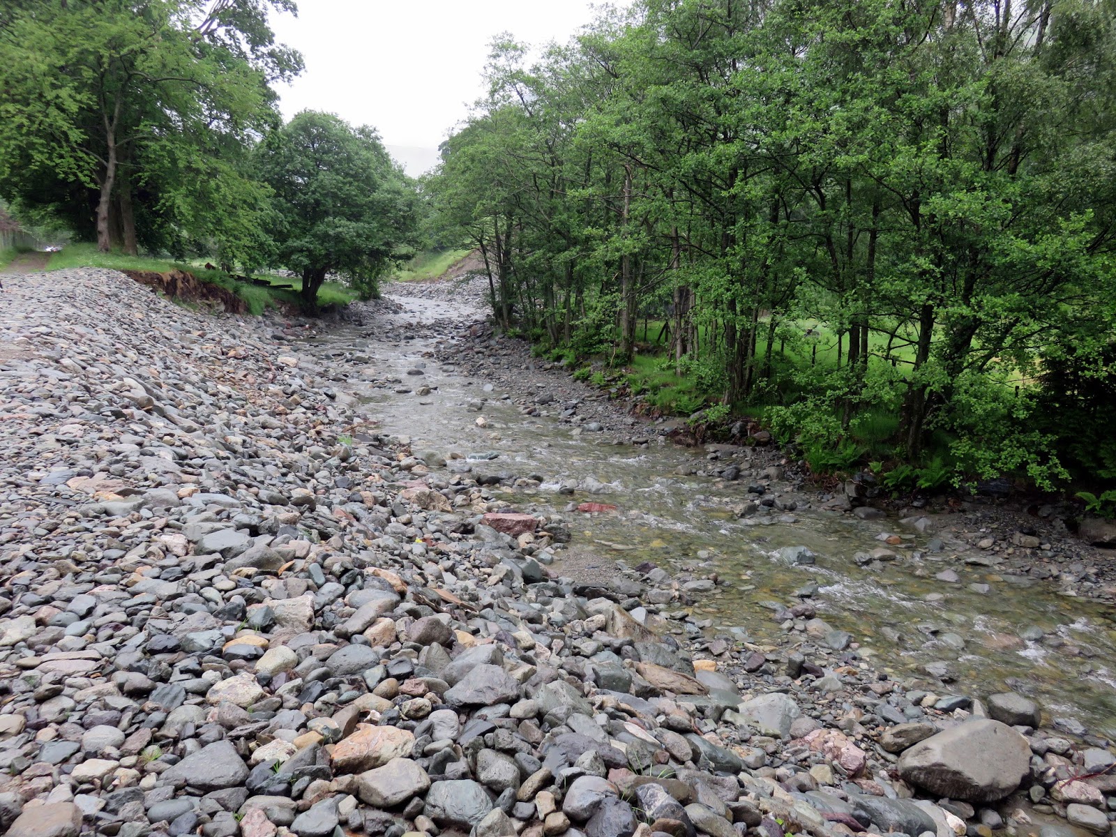
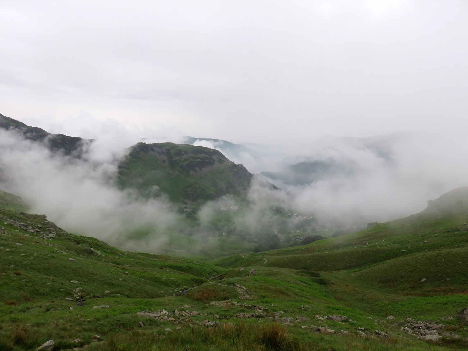
We convened early in Glenridding with a steady drizzle falling. The clouds were low, shrouding all but the lowest of tops but it was remarkably warm and humid. Still, the group appeared cheerful and optimistic despite the dreadful forecast, I myself held a high hope that the weather would not washout the day. We set off a short distance behind another WaterAid group, heading up the bridleway along Glenridding Beck.
 |
| Glenridding Beck – still suffering the after effects of Storm Desmond |
 |
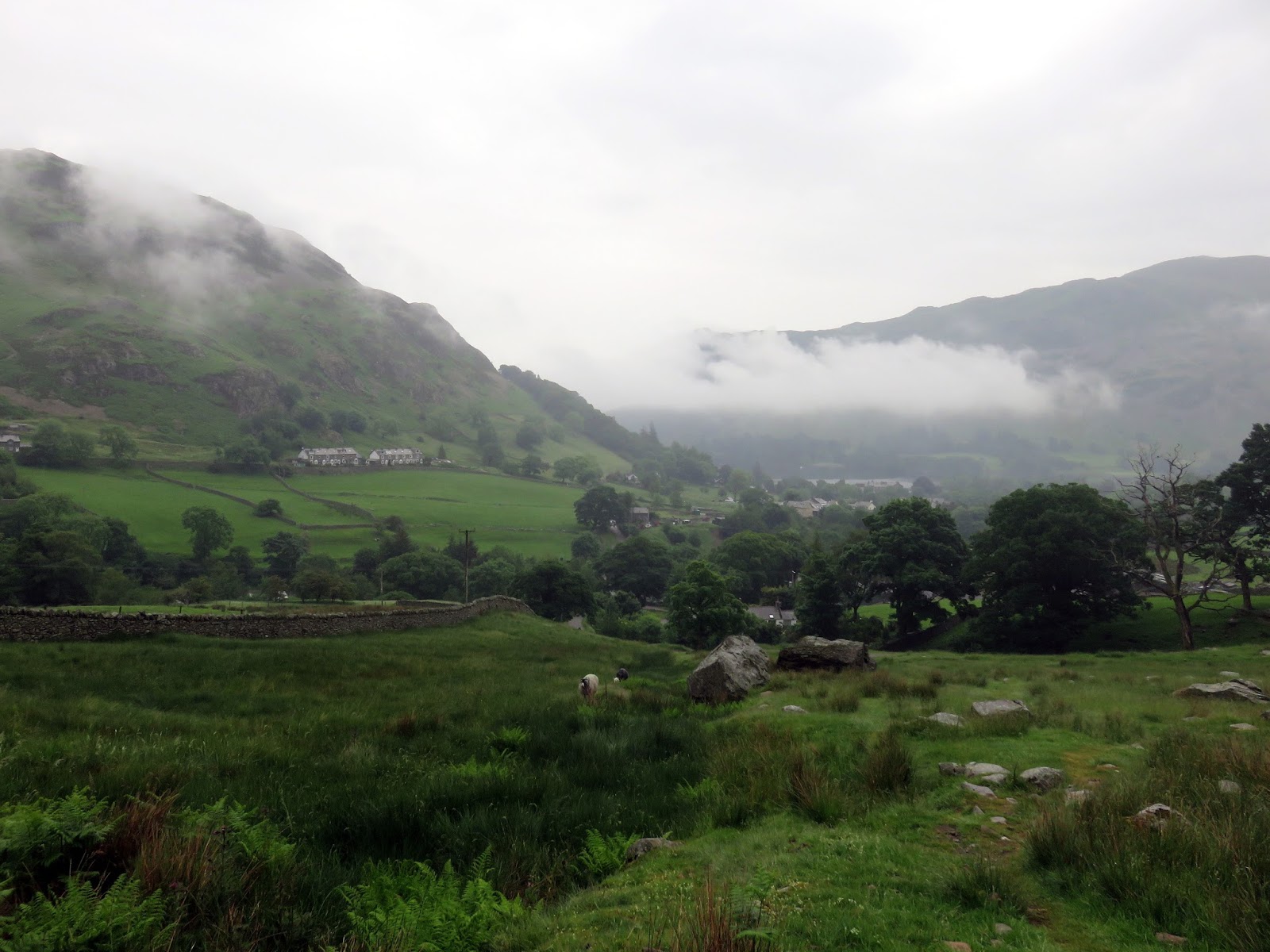
| Clouds drift around Patterdale |
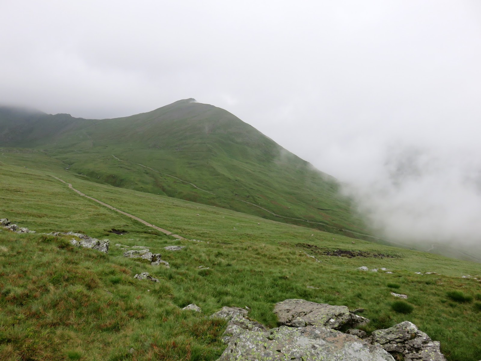
The path climbs out of Glenridding alongside Mires Beck following the course of the stream right up the fellside into Little Cove. This is the territory of Birkhouse Moor, a fell often overlooked by those with their sights set on Helvellyn but one with an impressive stature seen from the east. The climb up is fairly uninteresting though is not so steep as to make it unpleasant.
 |
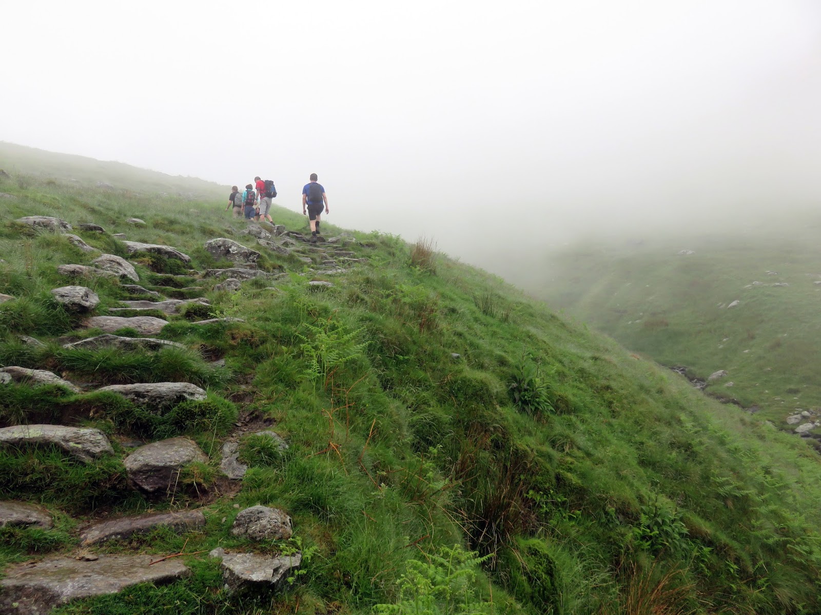
| Climbing towards the clouds in Little Cove |
 |
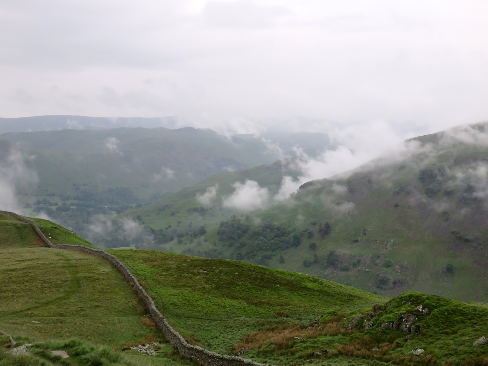
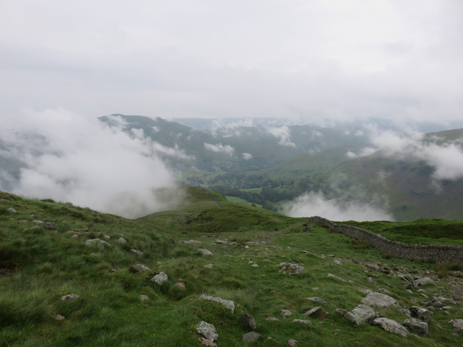
| Patterdale and the nose of Birks |
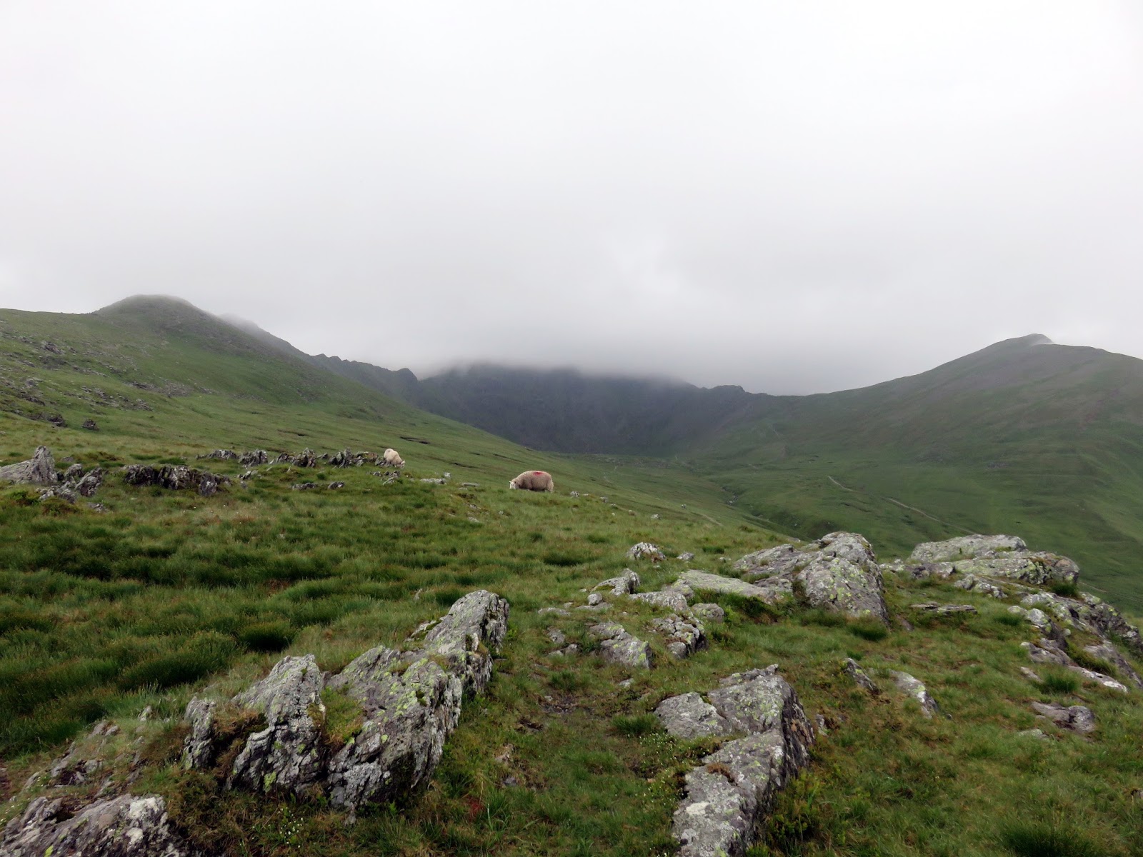
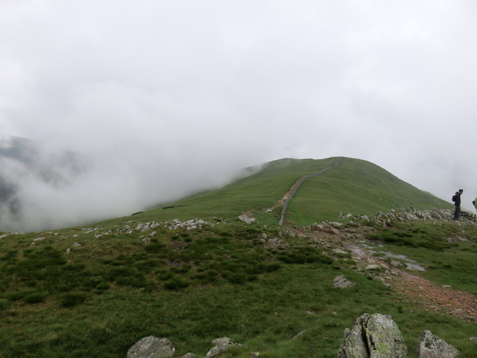
Around halfway up, the path emerges from Little Cove, bringing St. Sunday Crag into view, and turns to follow a drystone wall in direction of the summit of Birkhouse Moor. Happily, it has stopped drizzling now and the clouds were beginning to lift – if Helvellyn was covered at least we might have some luck on Striding Edge.
 |
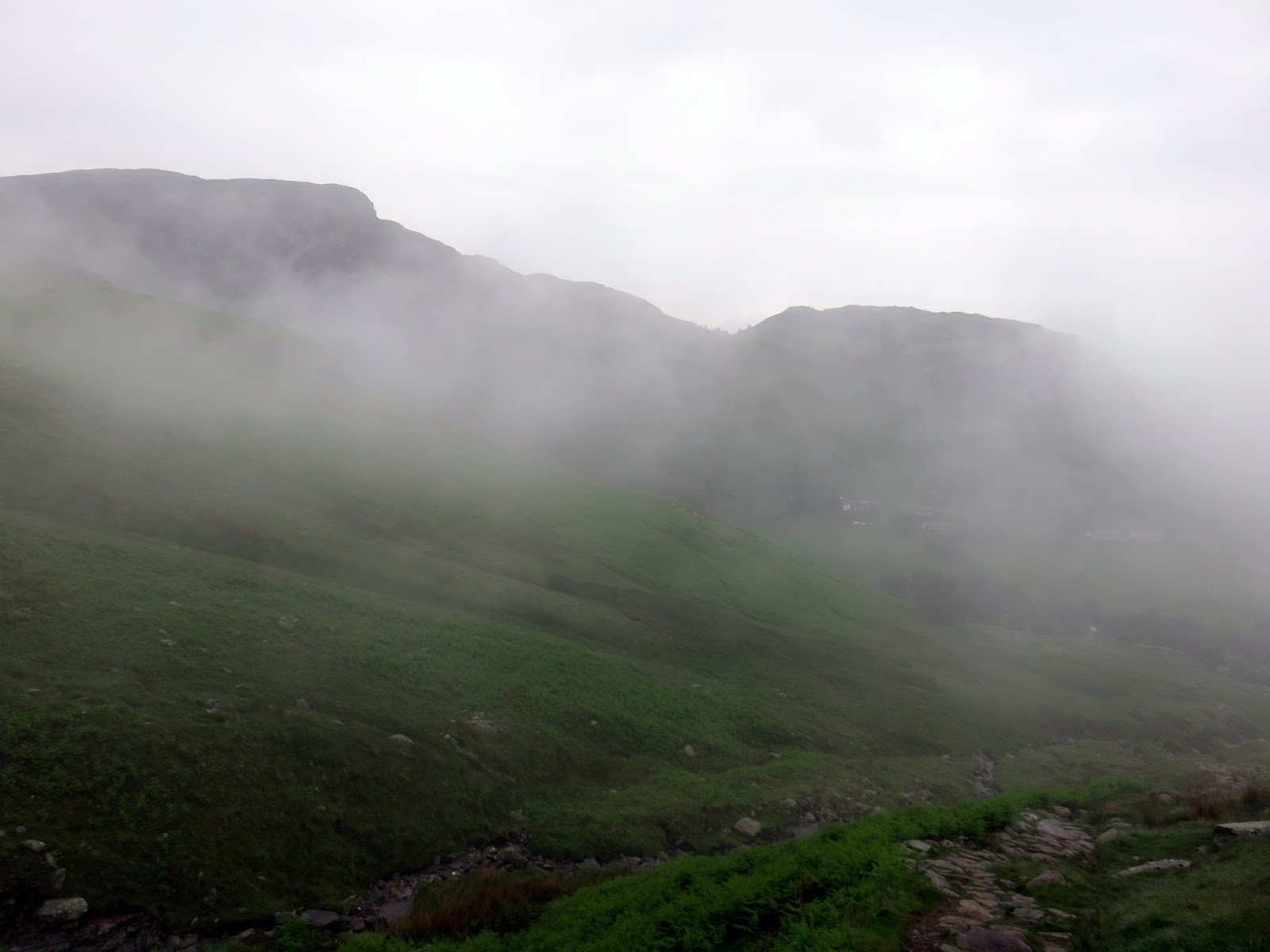
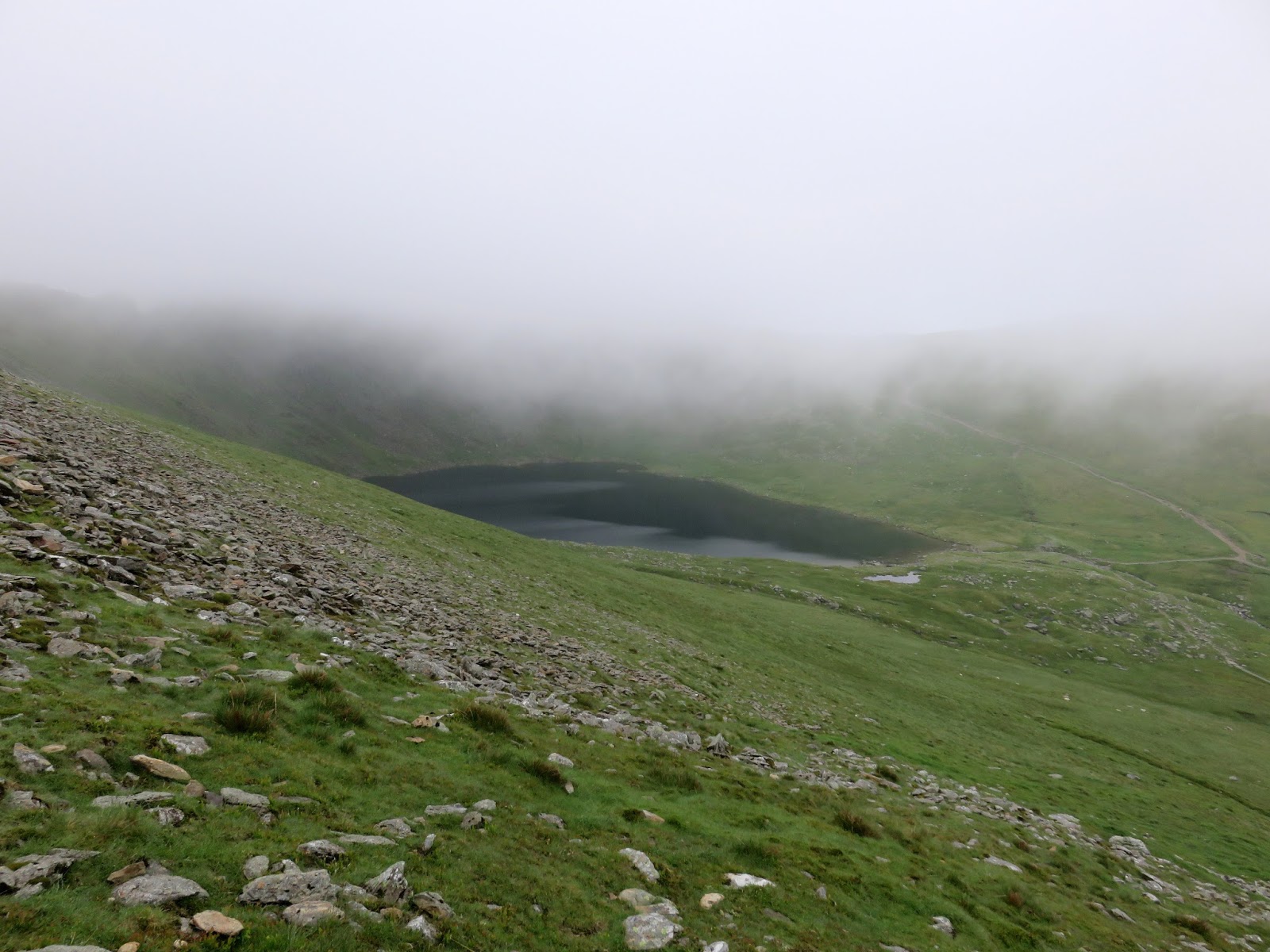
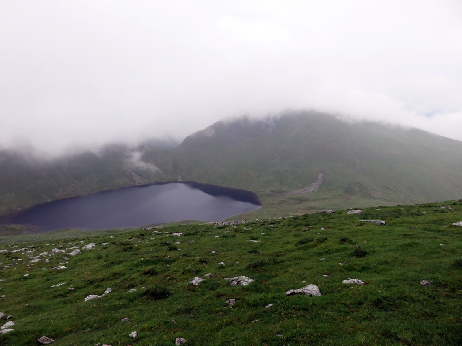
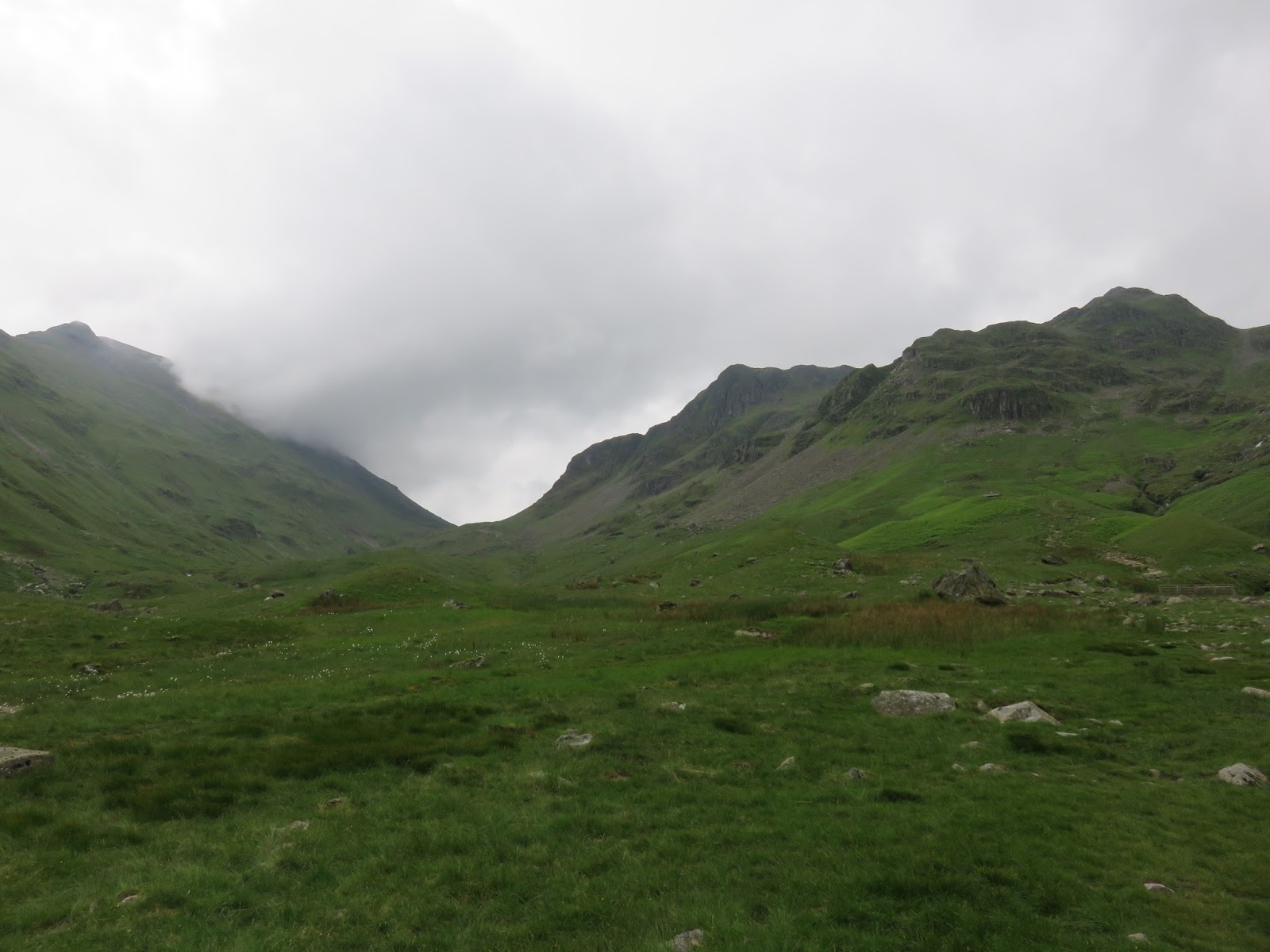
| The glacial bowl created by Striding Edge, Helvellyn and Catstye Cam |
 |
| Catstye Cam |
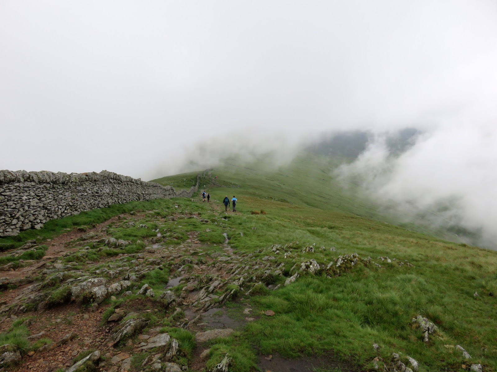
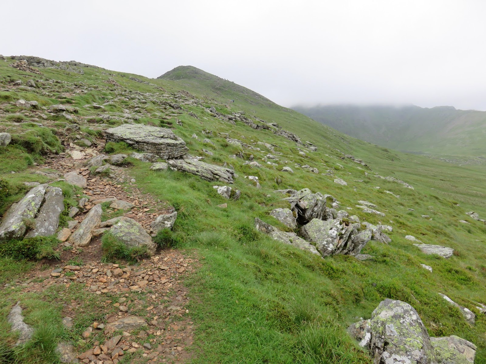
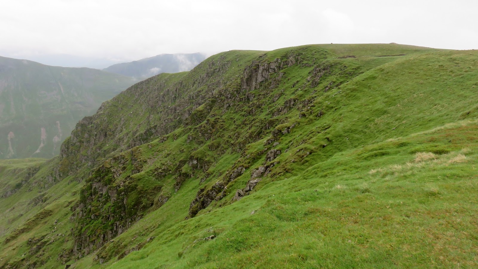
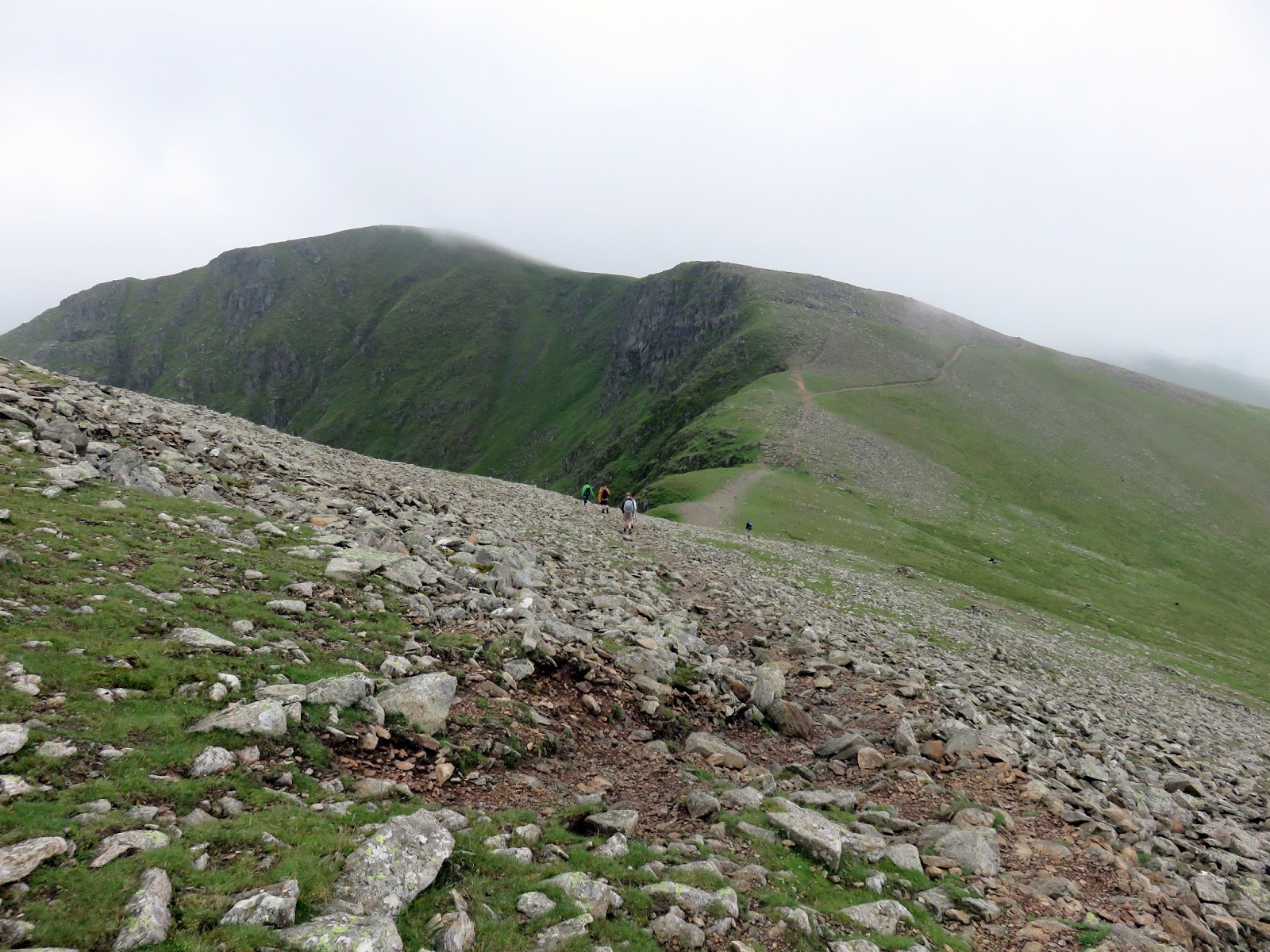
A path follows the drystone wall across Birkhouse Moor, passing the summit as it does, and drops a short way to Hole-in-the-Wall, the meeting point of a number of paths rising up from the valleys below. Interestingly, there is a wall with a stile crossing but no hole. The flanks of Striding Edge is clearly visible but the dramatic ridge only really comes into view once you reach Low Spying How, the first of a number of rocky turrets along the edge.
 |
| Climbing up to Low Spying How |
 |
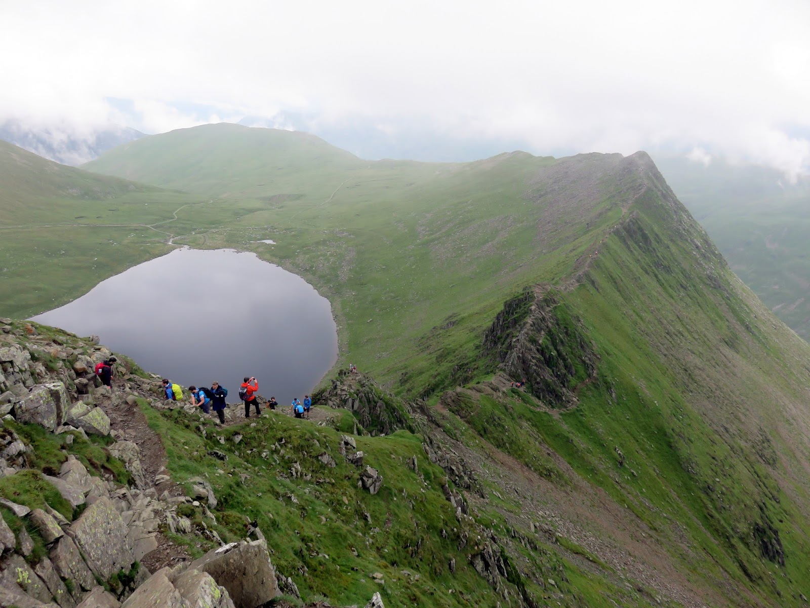
| Red Tarn makes an appearance |
 |
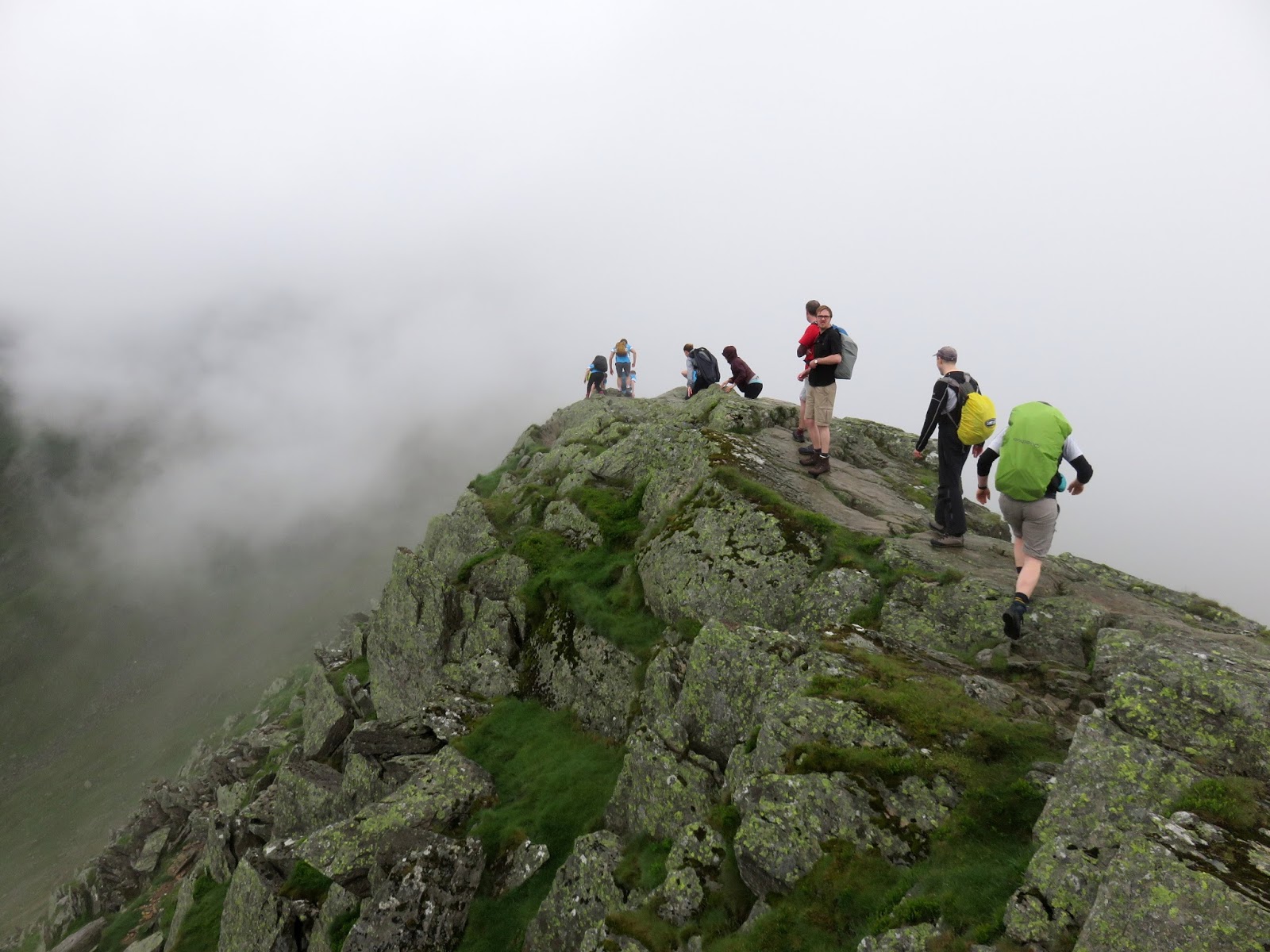
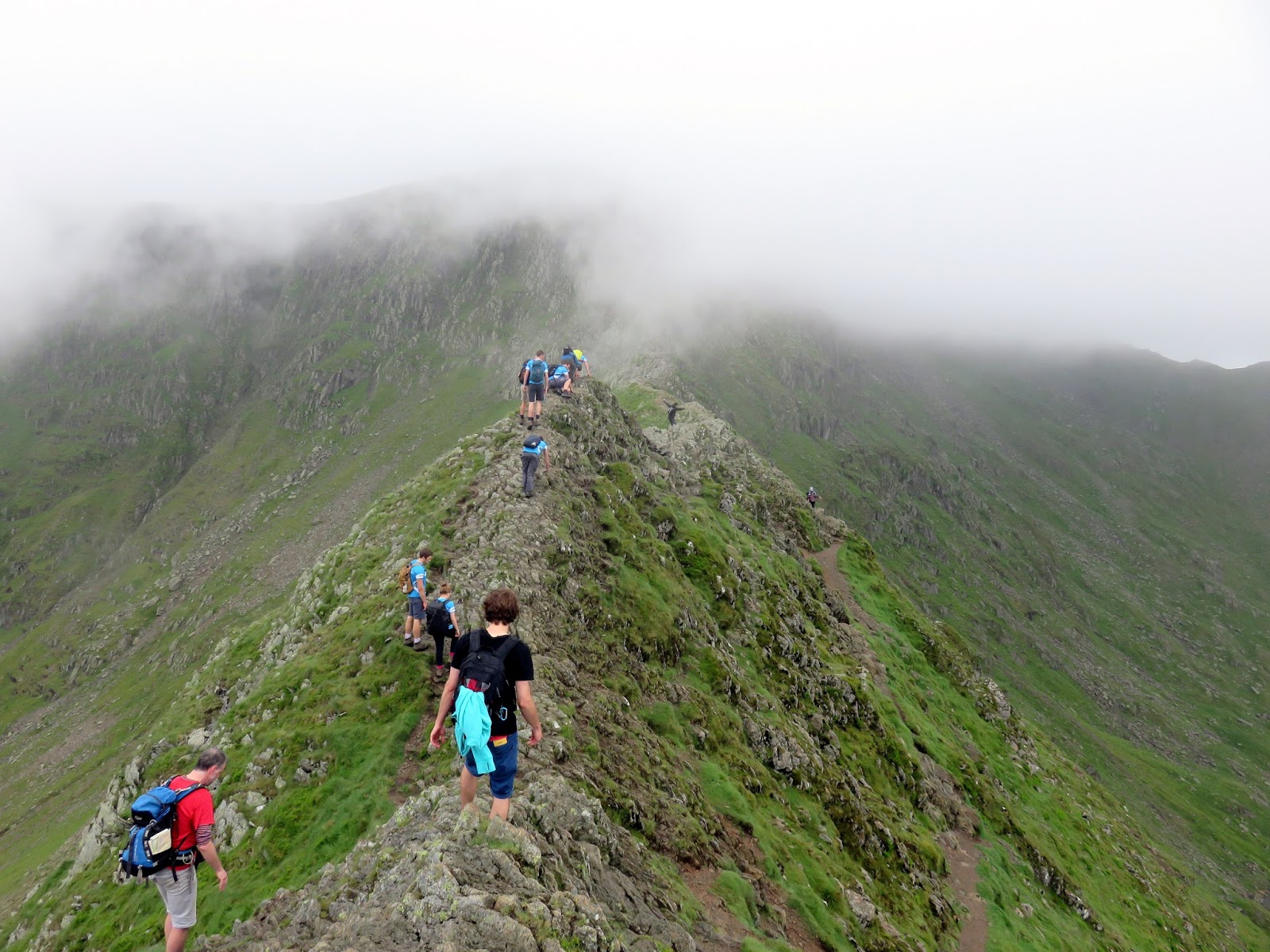
| On Striding Edge |
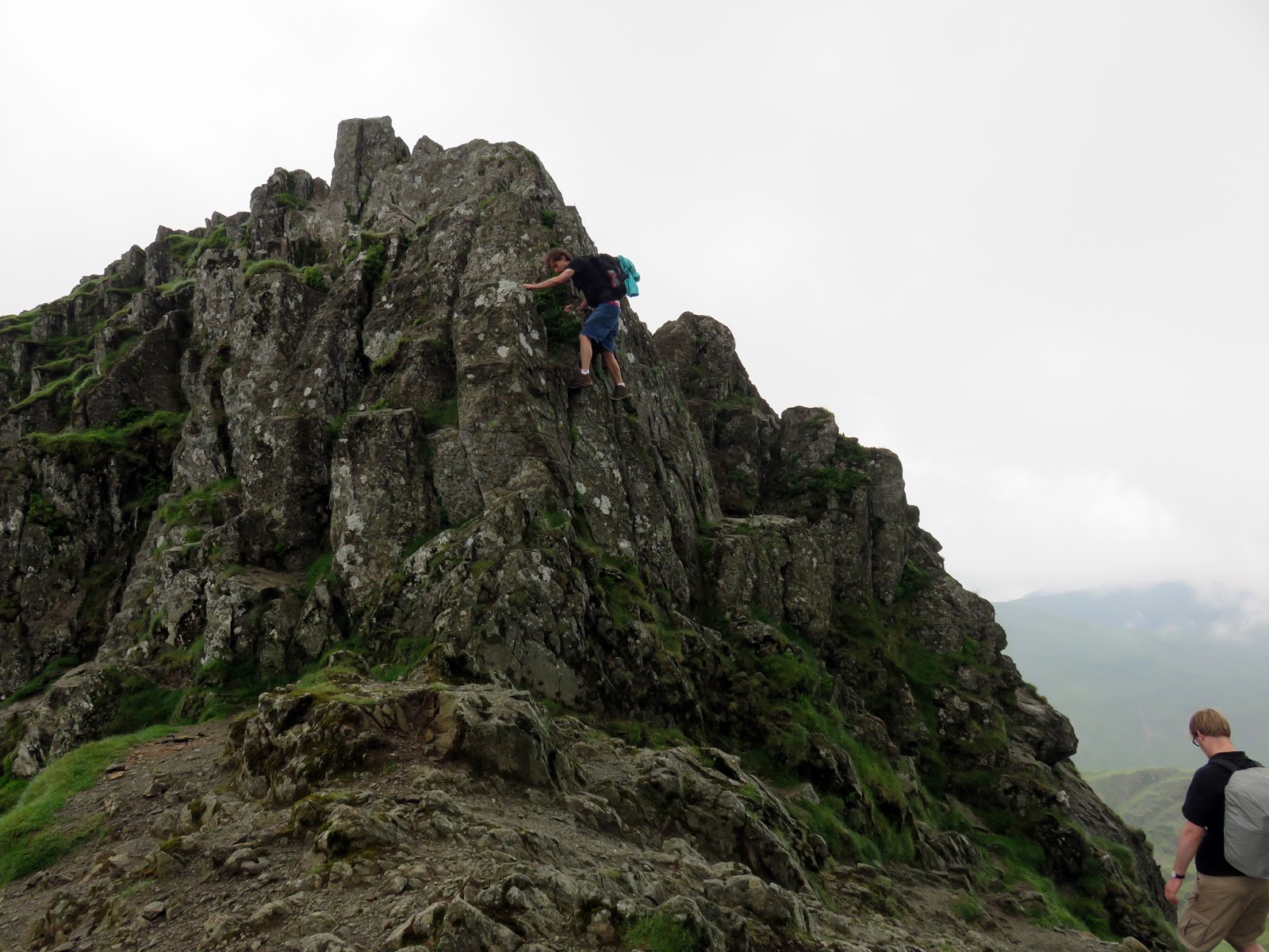
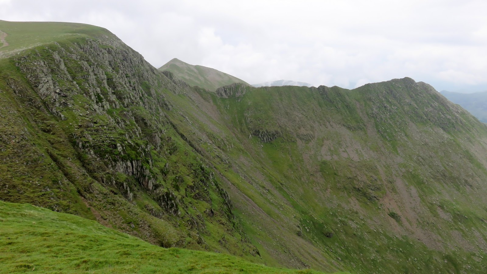
Here you can savour the magnificence of the ridge, arguably one of the most dramatic ridges in the Lake District – certainly of those accessible to regular walkers. Between Low Spying How and High Spying How, the ridge is actually quite broad, relatively speaking and only truly becomes an arête after High Spying How. This short section typifies Striding Edge, seemingly narrow enough to straddle and enough to set the heart thumping a couple of beats faster.
 |
| Striding Edge in the gloom |
 |
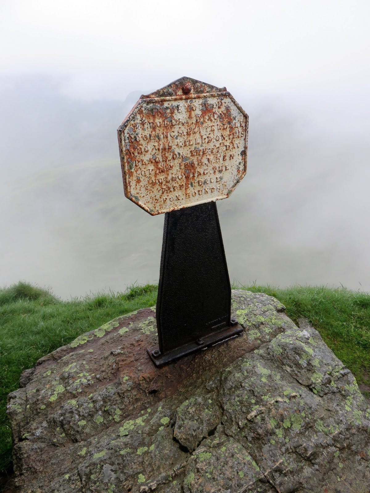
| The Dixon Memorial |
 |
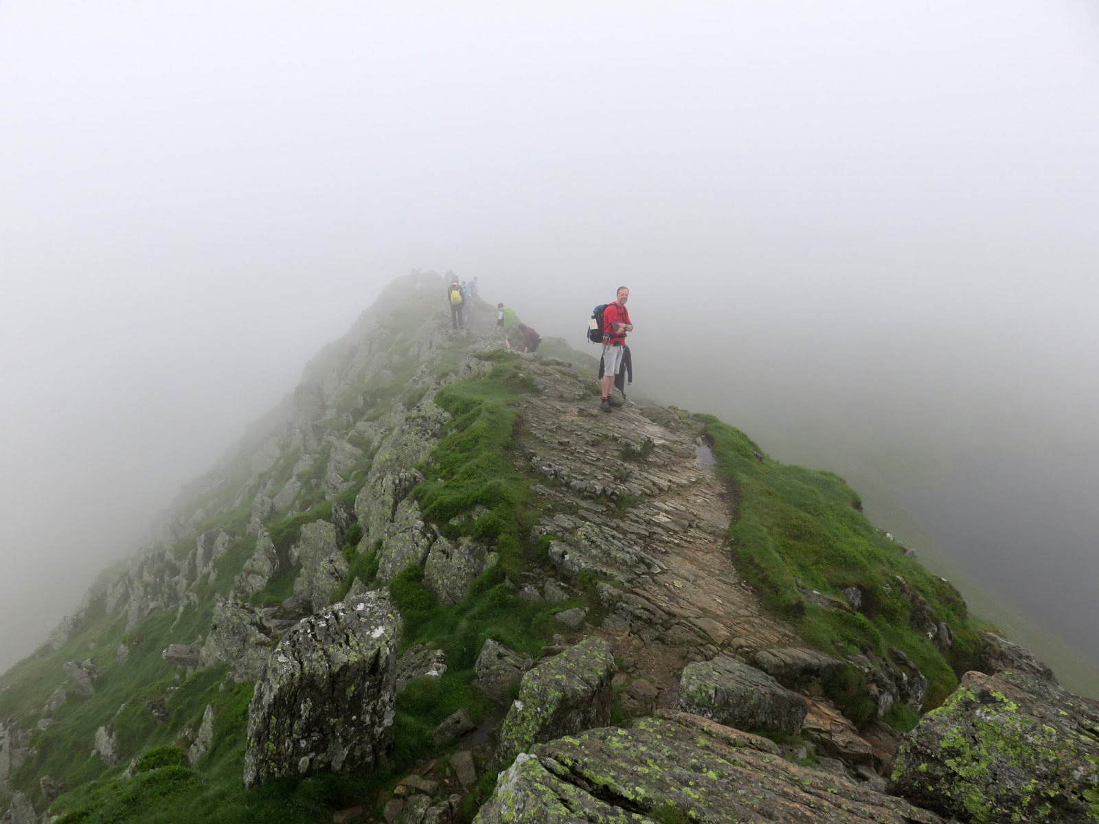
| Clouds lift as we make our way along |
 |
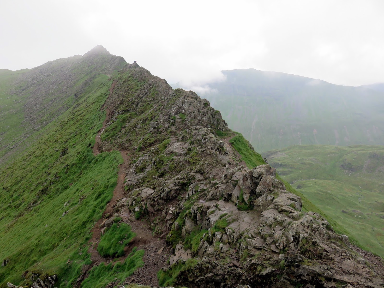
| Striding Edge |
The clouds were clear of the edge as we made our crossing. I think it’s worth pointing out that Striding Edge, in my opinion, doesn’t actually feel as narrow as it looks once you are on it and the subtle curve of the ridge before it falls away certainly dispels any fears of imminently falling off. True, this would be much more of a challenge on a rainy, windy or icy day but today, were ideal. I must add though, Striding Edge does require your full care and attention as a fall would be likely be fatal. There is an excellent guide to tackling it on the aptly-named StridingEdge.net – you can find it here.
 |
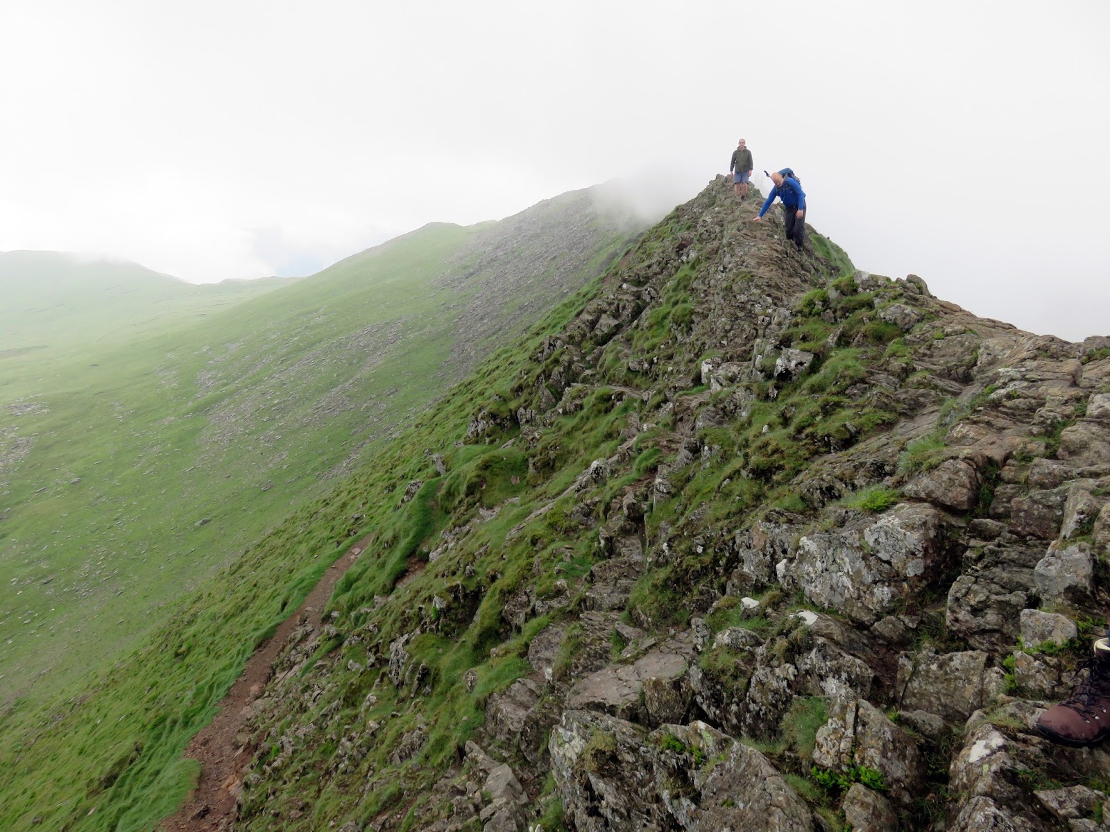
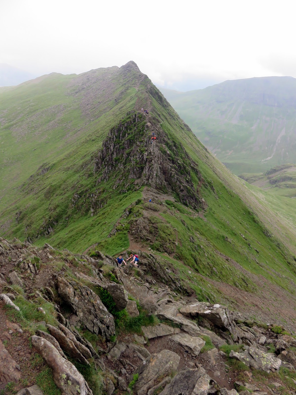
| Looking back along Striding Edge – the path can be used if you not keen on the exposure of the crest |
 |
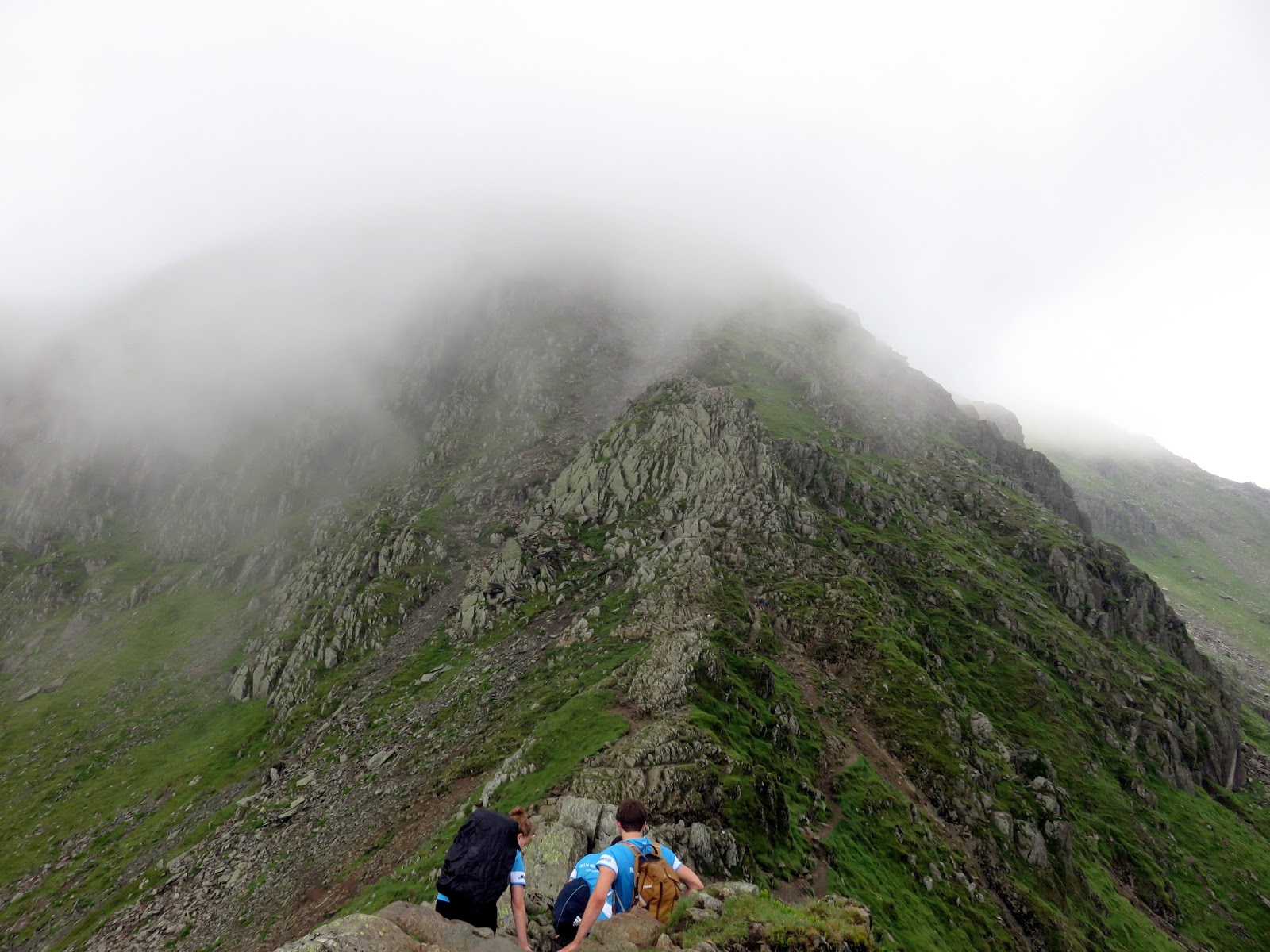
| The Chimney presents a final obstacle |
 |
| Striding Edge |
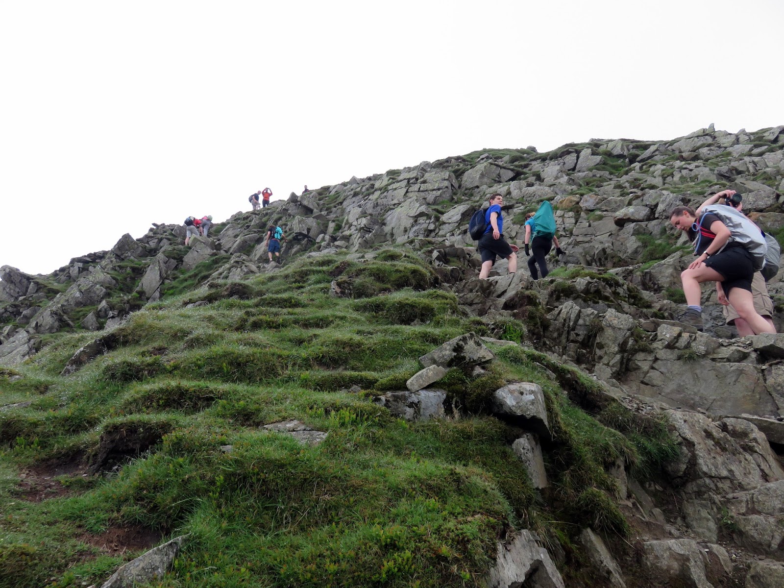
Crossing Striding Edge, though generally slow going, doesn’t take too long and a final scramble down The Chimney at the Helvellyn end mark its termination. Now you are faced with a 100m or so climb/scrabble up onto Helvellyn itself which lends to some imperious views back to Striding Edge and Nethermost Cove.
 |
| Red Tarn and Striding Edge |
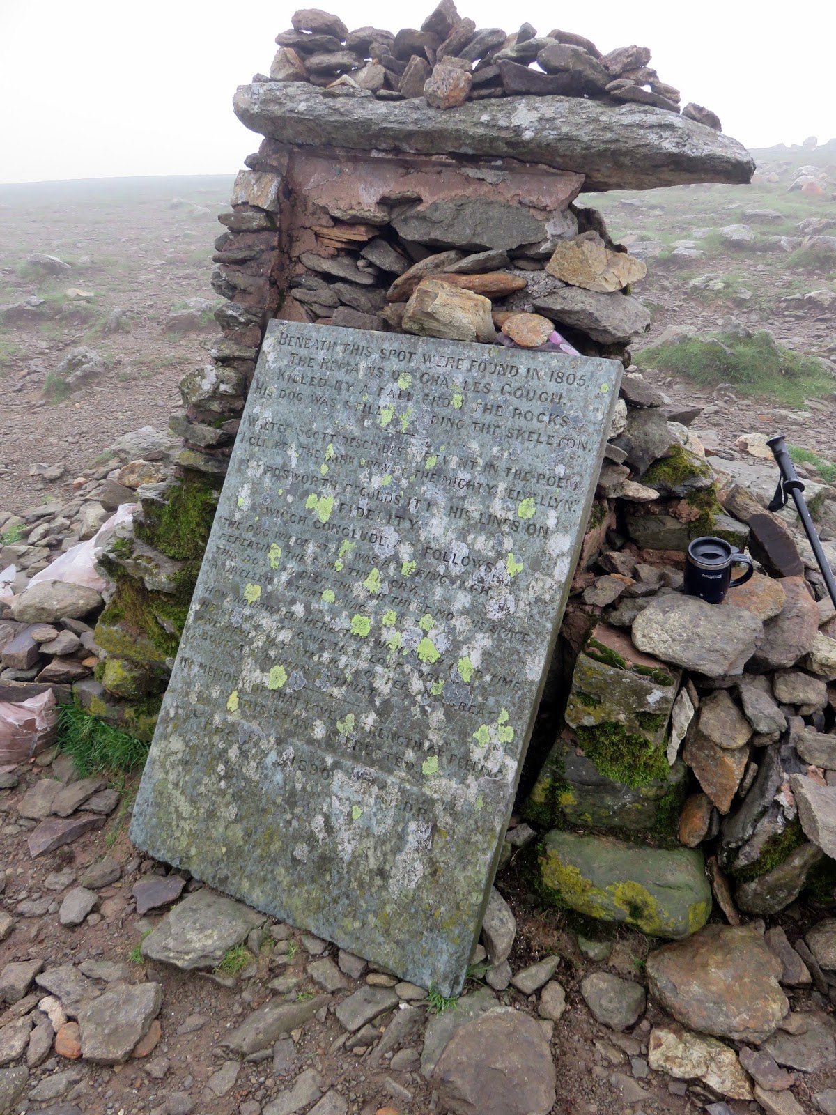
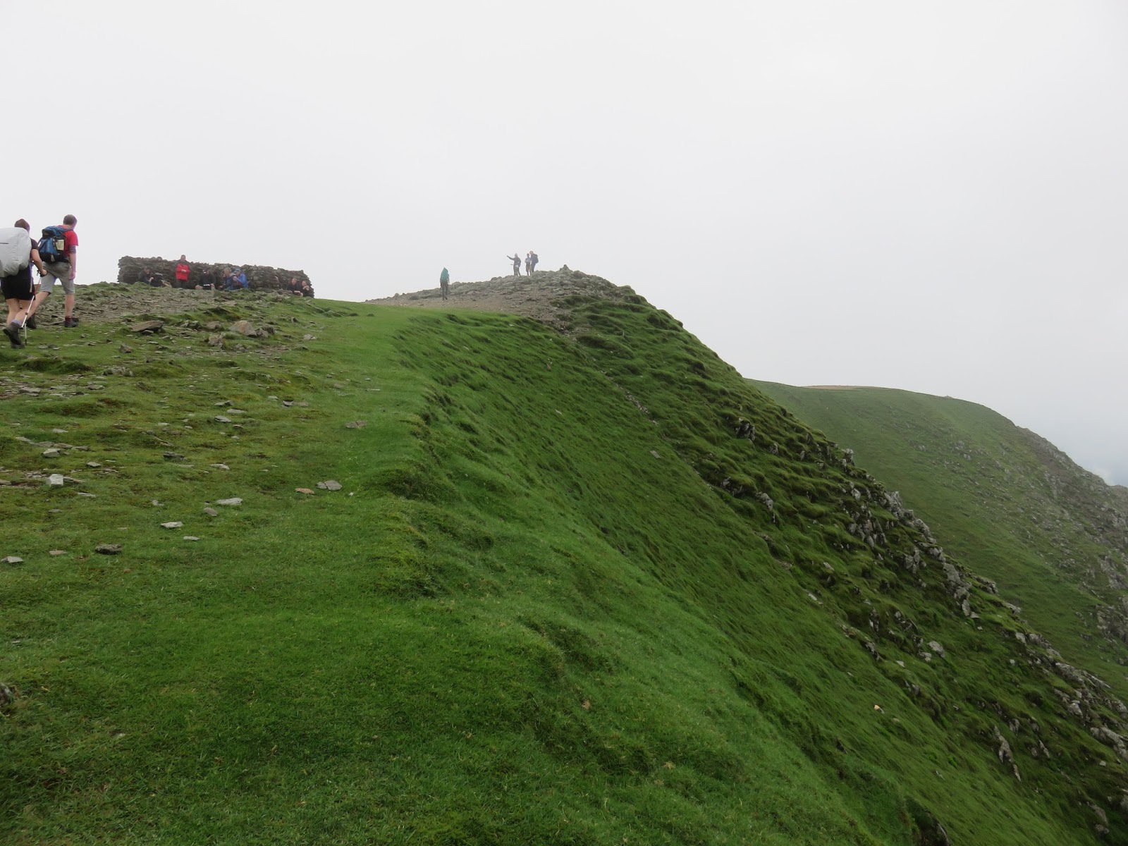
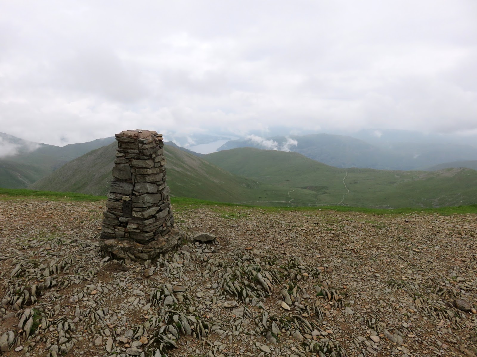
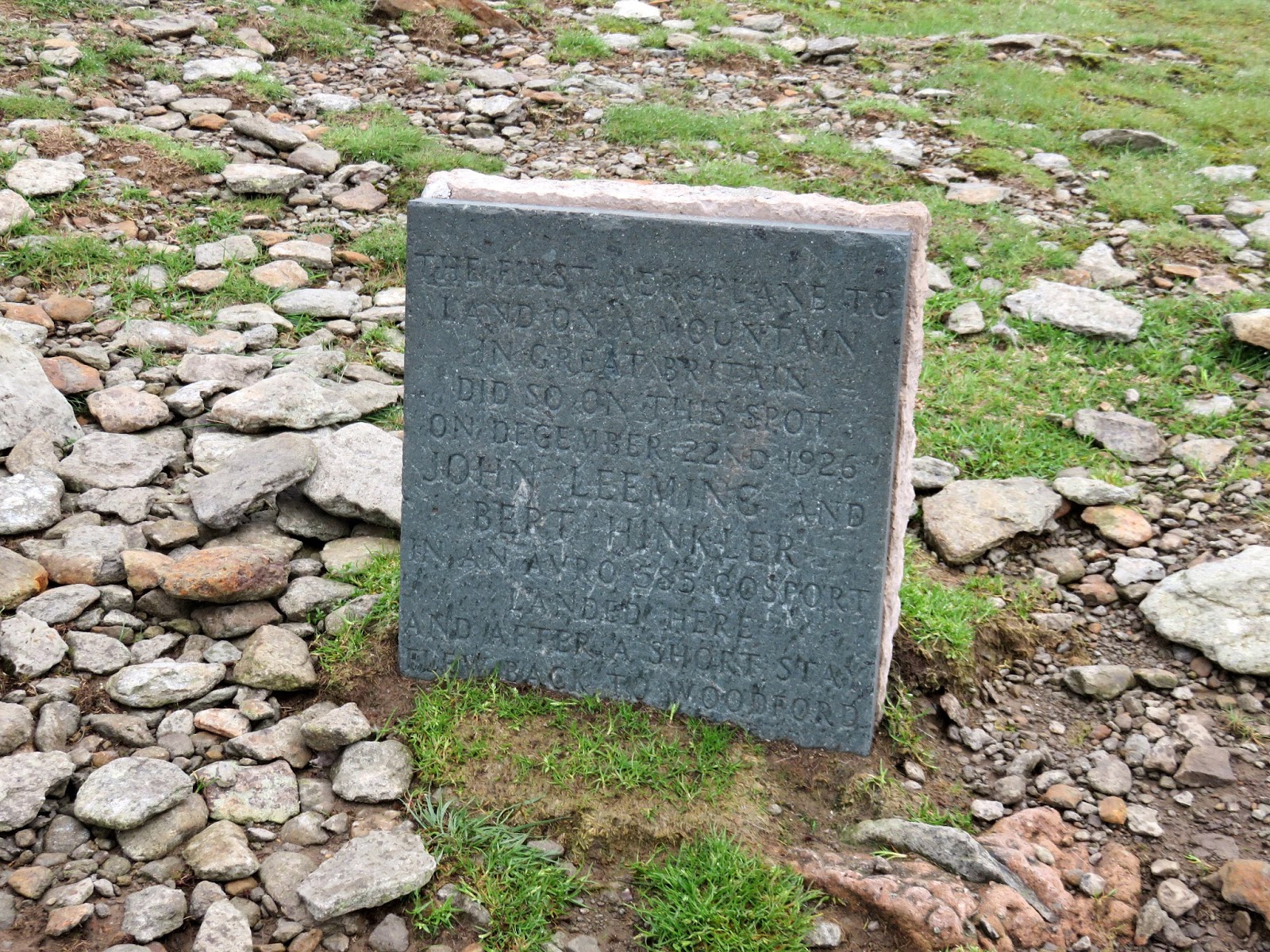
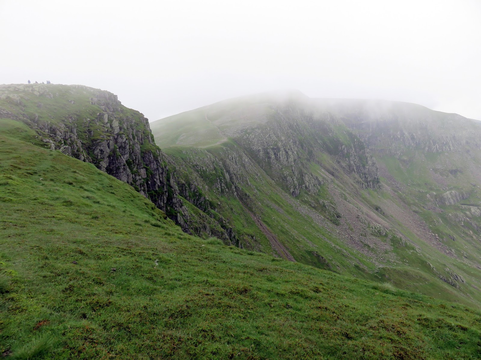
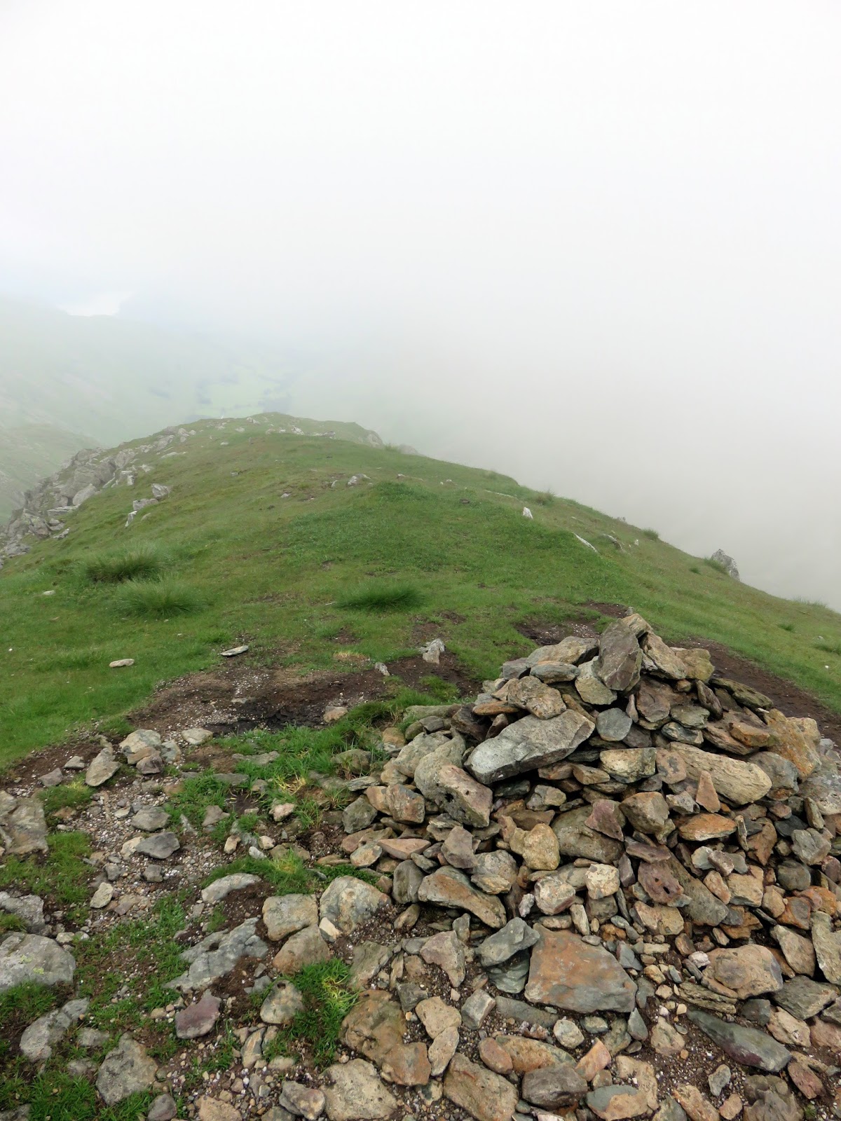
The climb emerges onto the summit at a large memorial to Charles Gough – Helvellyn’s first recorded casualty whom you can read more about here. A short distance away, on the path bound for Nethermost Pike, is a much smaller memorial to the intrepid Bert Hinkler who landed a small biplane on Helvellyn in 1926. There’s also the oft-busy summit shelter, the summit cairn and an OS trig pillar to investigate so plenty to see once you arrive at the top.
 |
| Memorial to Charles Gough |
 |
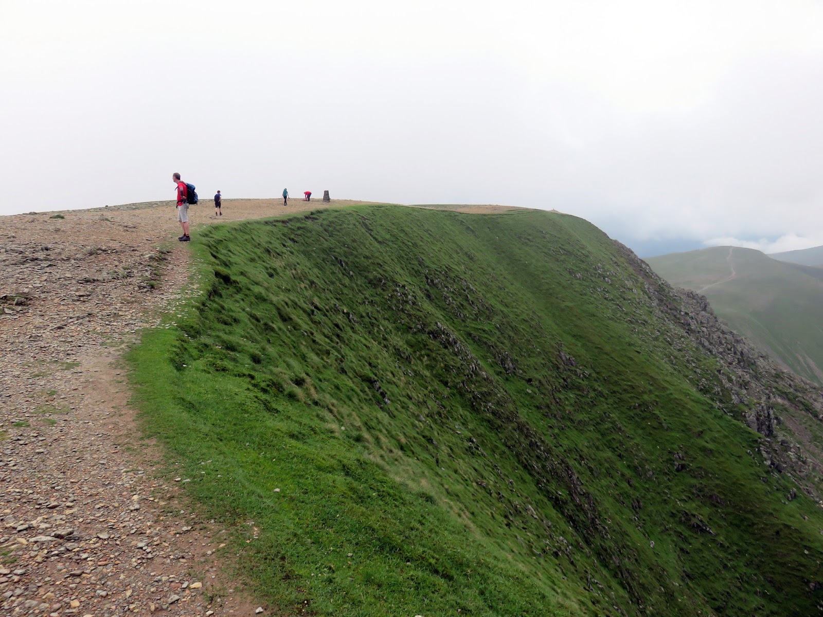
| The final push to the summit |
 |
| Swirral Edge and Catstye Cam |
 |
| Memorial to Bert Hinkler |
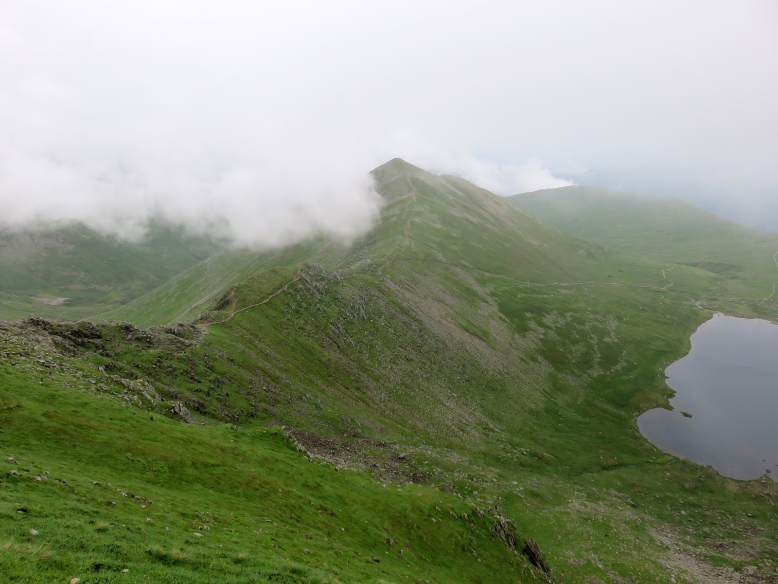
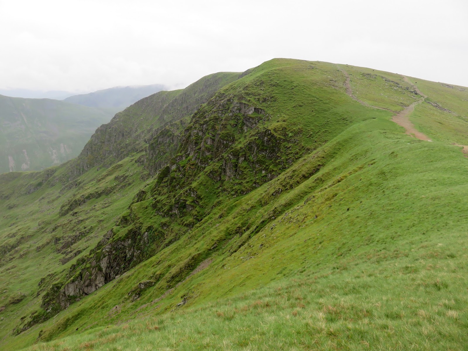
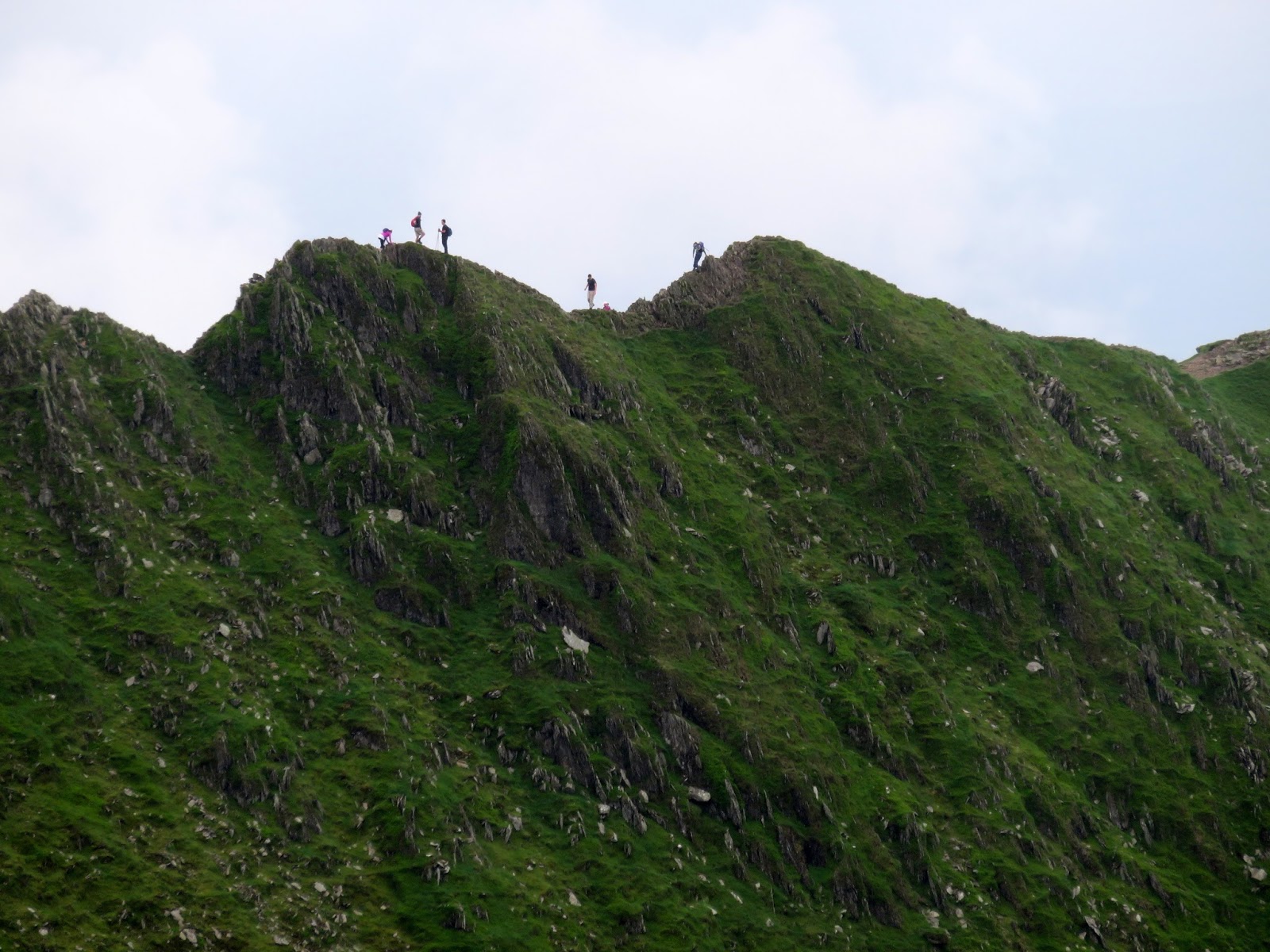
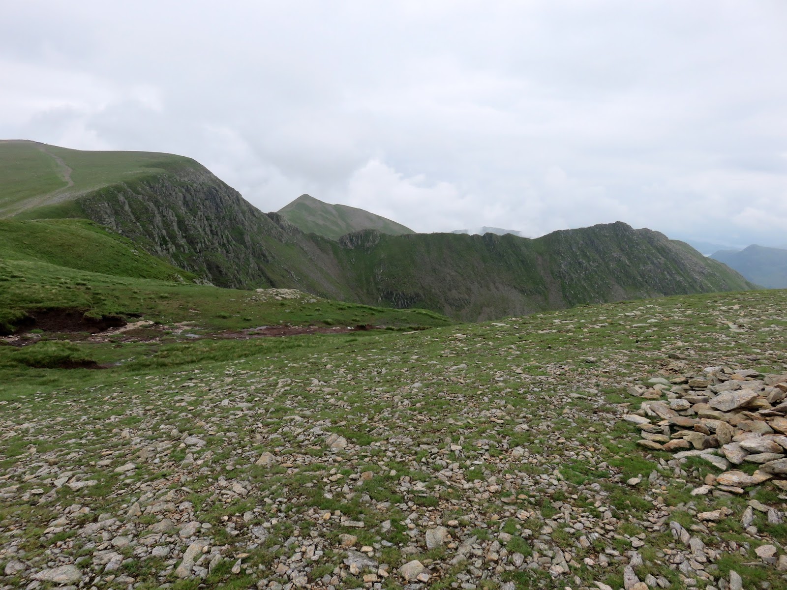
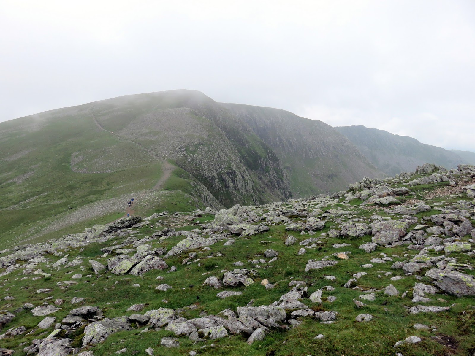
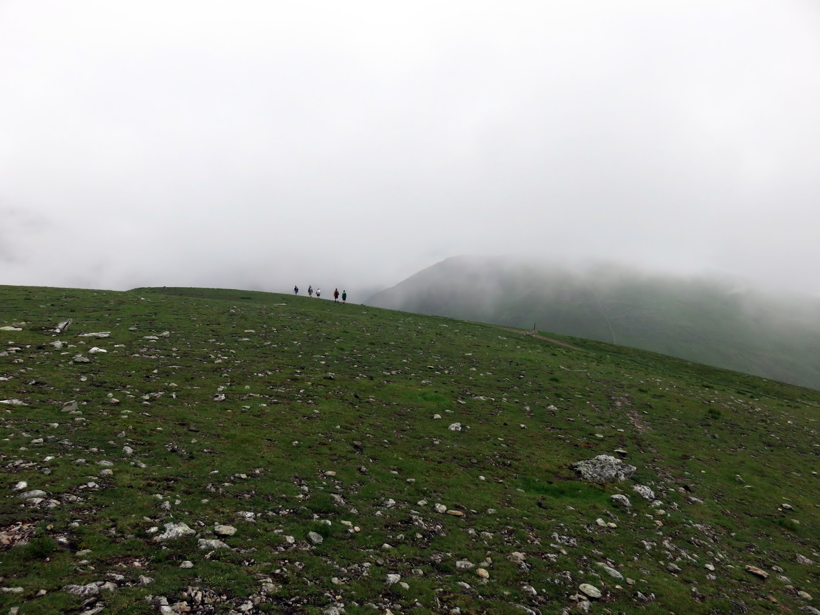
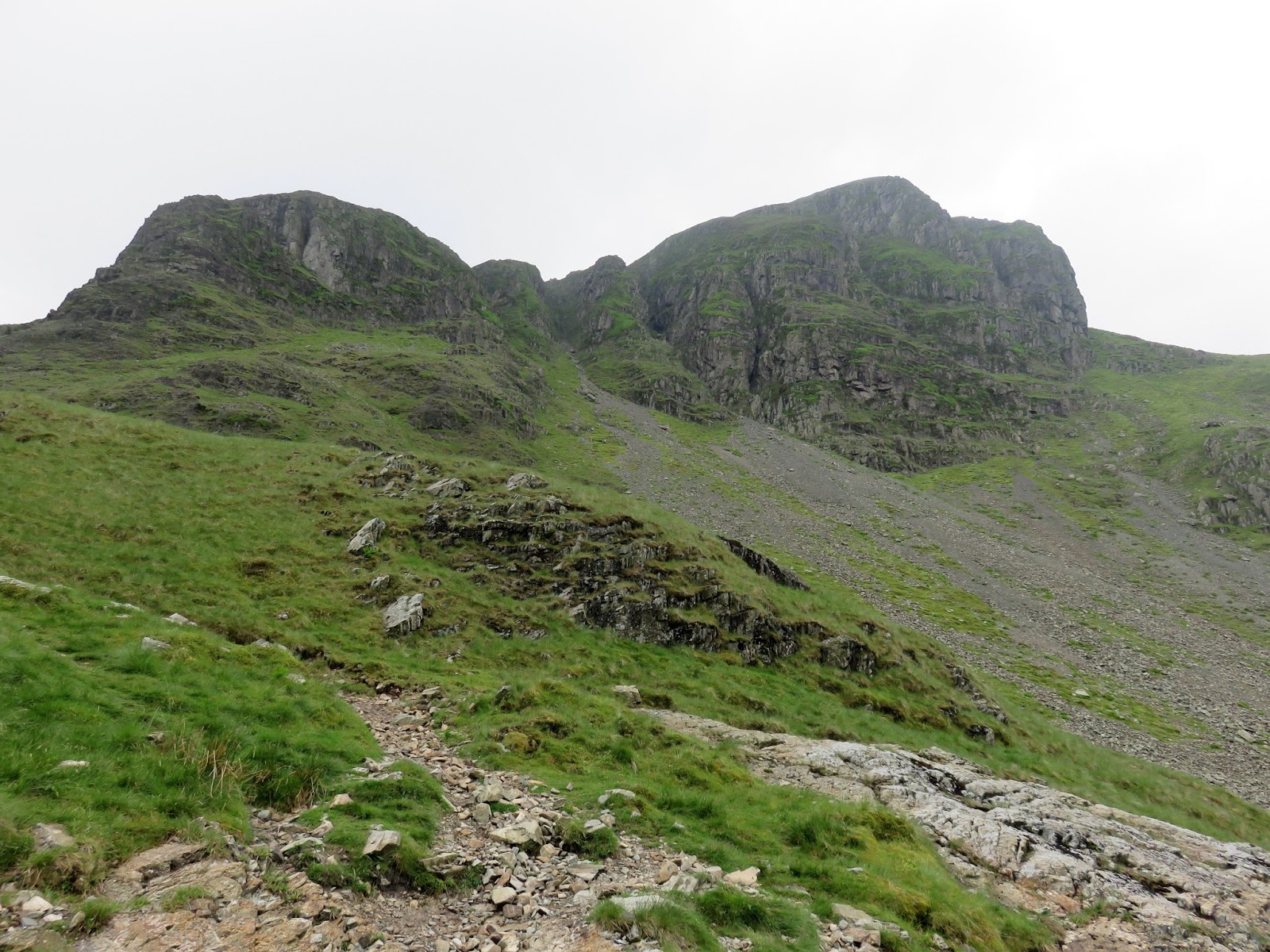
Between Helvellyn and Grisedale Tarn (where we were heading next) the ridge undulates over a number of summits, a fairly easy stroll in most peoples books. The first summit is that of Nethermost Pike, a short distance to the south over the depression of Swallow Scarth. Like Helvellyn, Nethermost Pike has a craggy eastern face juxtaposed with a sloping, grass covered western aspect. It even has its own arete leading to the summit though nothing quite like Striding Edge. On that subject though, from Nethermost Pike, it’s clear to see just how high and steep-sided Striding Edge really is.
 |
| Walkers on Striding Edge |
 |
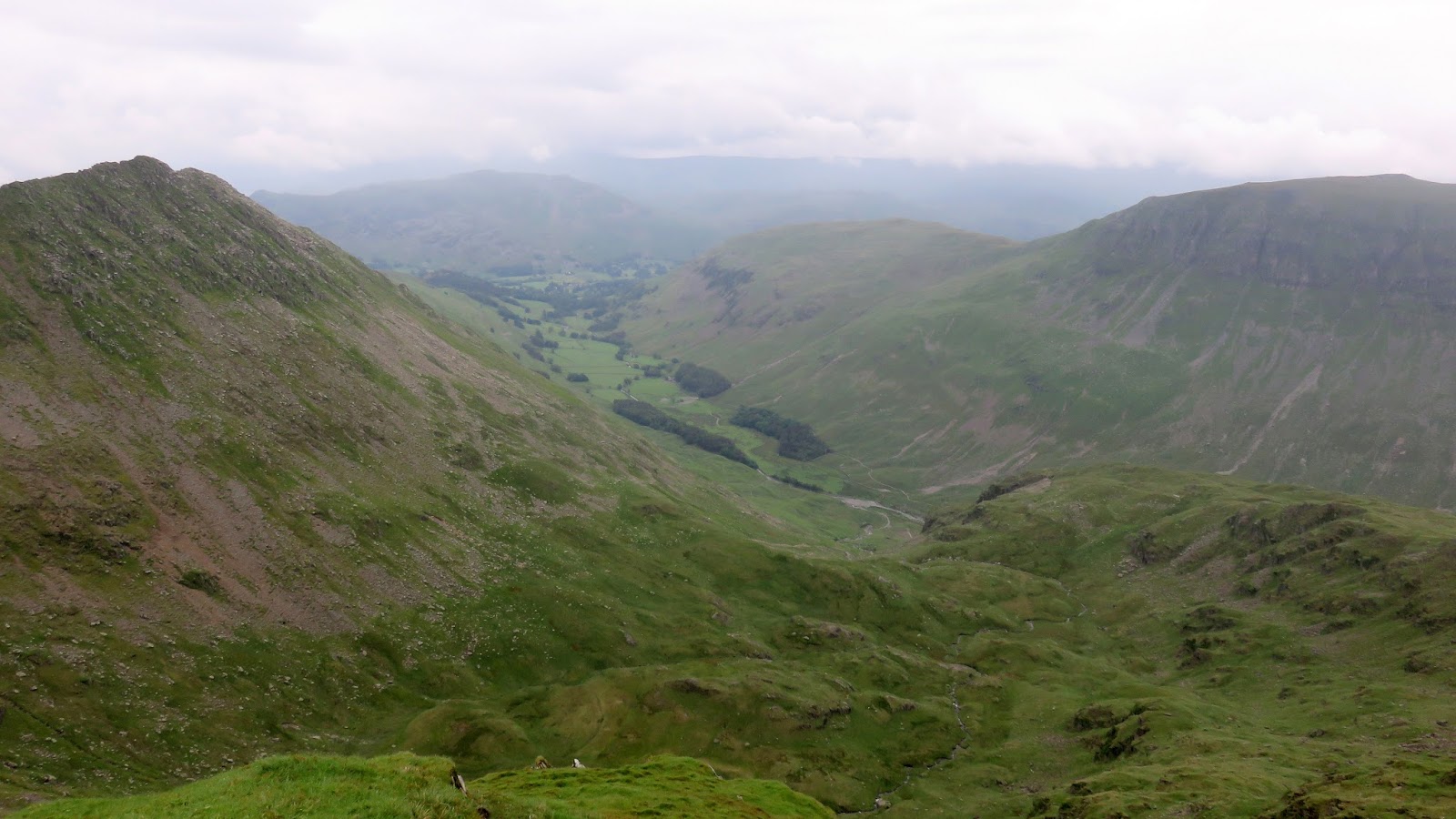
| Grisedale |
High Crag is a short distance again from Nethermost Pike and despite having a noticeable peak and cairn atop it, many regard it as part of Nethermost Pike rather than as a separate fell. Just under a kilometre to the south east is Dollywaggon Pike, the final high fell in the Helvellyn range. The summit cairn can be found on a small extension leading to The Tongue and provides a superb view of Grisedale to the north east, Fairfield and St. Sunday Crag to the east and Nethermost Pike to the north.
 |
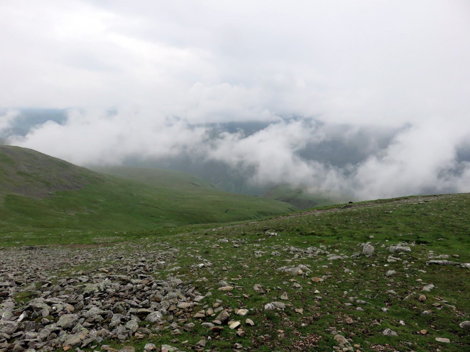
| Clouds still swirl in the Thirlmere valley |
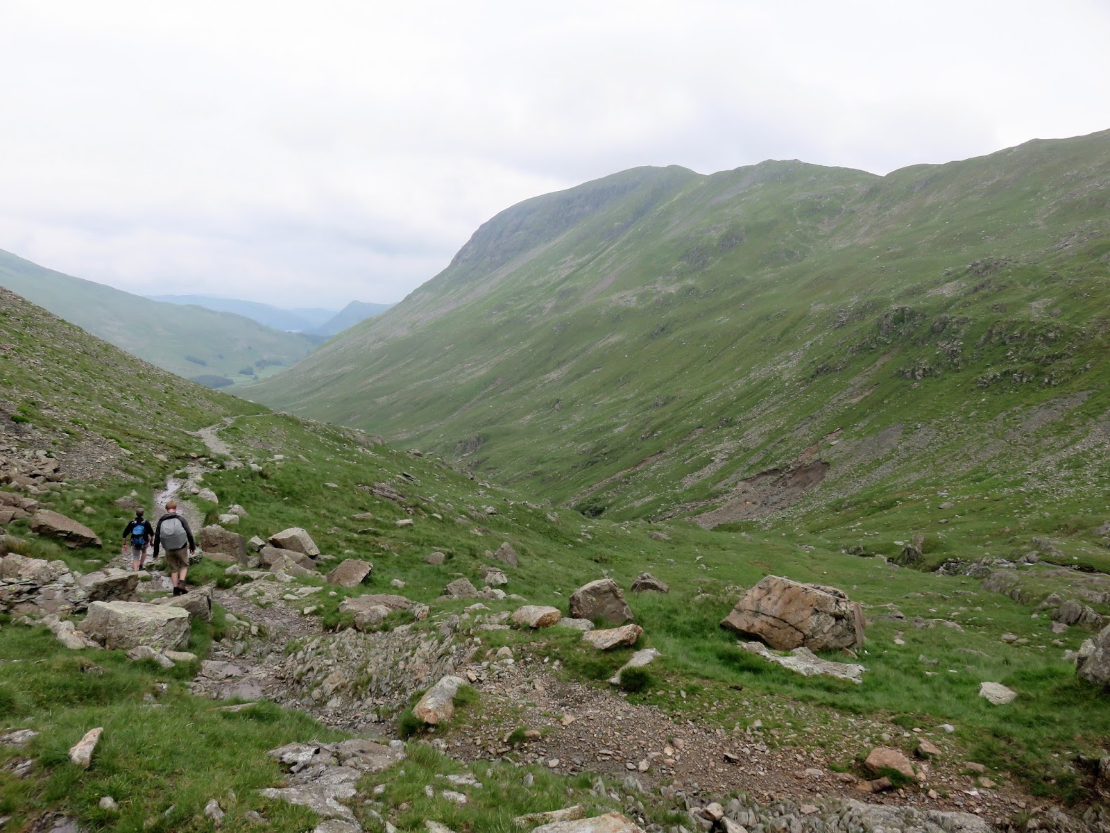
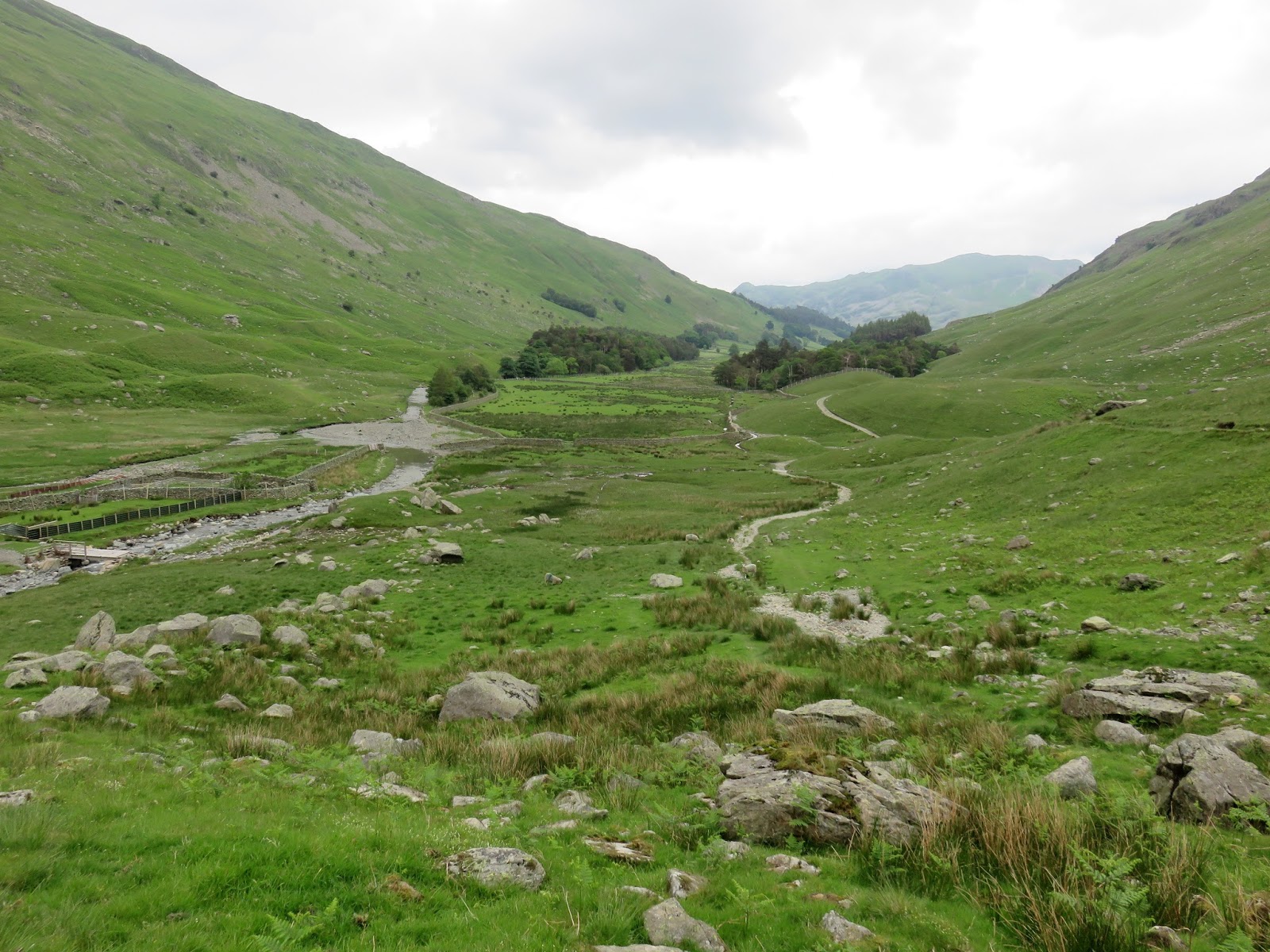
A well laid path drops to Grisedale Tarn and then begins a long descent along the valley of Grisedale. This was new territory for me as previous walks have taken me back up over St. Sunday Pike or Fairfield. The valley of Grisedale is interesting at first with Falcon Crag and Tarn Crag looming overhead and the Brothers Parting Stone drawing some interest.
 |
| Clouds roll in as we begin to descend |
 |
| Grisedale |
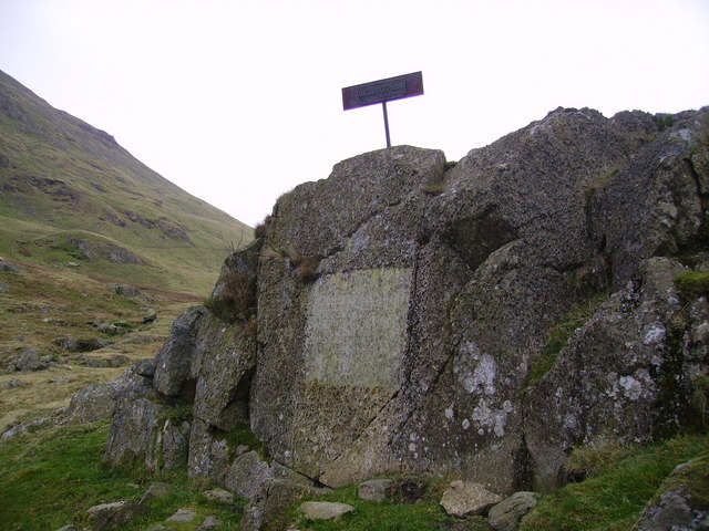
The Parting Stone marks the place where William Wordsworth last saw his brother John in 1800. John was a Commander of the East Indiaman “Earl of Abergavenny”, a ship that sank of Portland on 5th February 1805; claiming the lives of almost 300 people, including William’s brother.
 |
| The Brothers Parting Stone |
 |
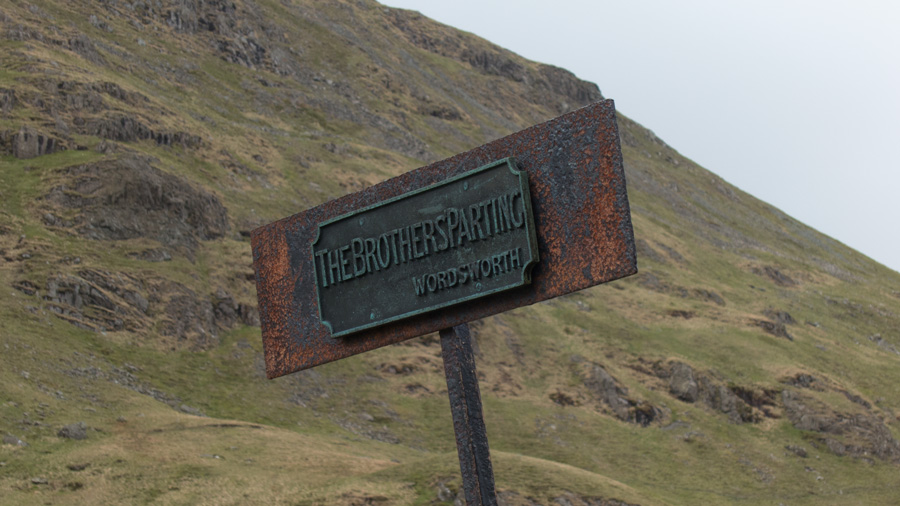
| The metal sign atop the Parting Stone |
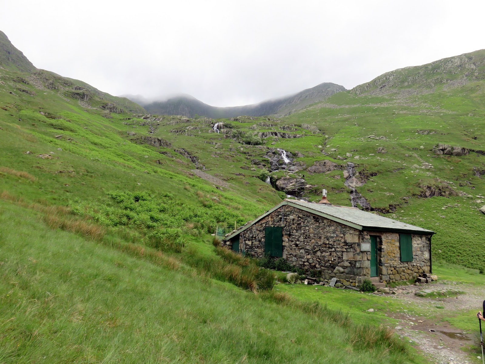
The valley remains interesting until you reach Ruthwaite Lodge. The Lodge was found as a roofless shell, by members of Sheffield University Mountaineering Club in the early 1950s. It had previously been a hunter’s refuge. On acquiring the lease, the discoverers rebuilt it to its present state, as a base from which they could walk and climb on the surrounding hills. By the end of the 1950s it had become a major focus of activity.
 |
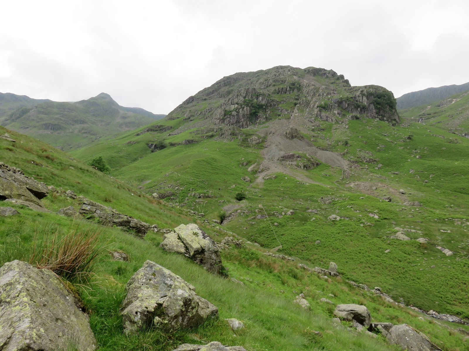
| Tarn Crag andfFalcon Crag |
 |
| Ruthwaite Lodge |
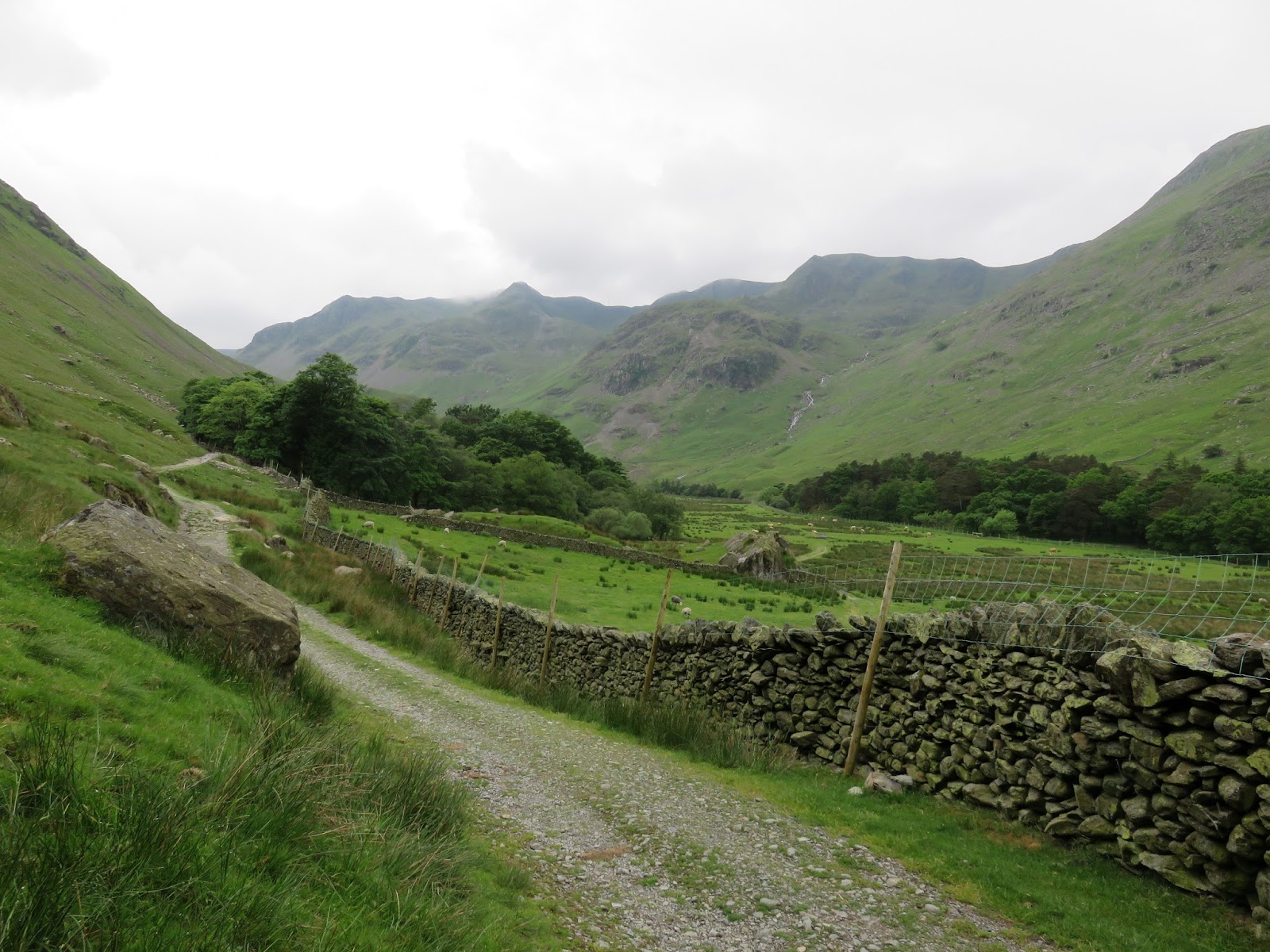
The hut stands at the base of the majestic set of waterfalls which cascade out of Nethermost Cove. Sadly, from this point onward, Grisedale becomes a bit tedious as the seemingly endless path makes its way along the valley, passing green fields and little else. I suppose it’s one of the downsides of climbing Helvellyn and not heading for one of the edges.
 |
| The falls of Nethermost Beck |
 |
| Tarn Crag and Falcon Crage |
 |
| Grisedale |
 |
| Spout Crag |
 |
| Looking back up Grisedale |
Eventually we reached the Patterdale road, turning left to make our way to Glenridding and conclude a very satisfying walk. Striding Edge is a superb route, one of the best in the Lake District so I’d highly recommend it. The weather played its part too – the day could have been a miserable washout but ended up being a largely dry and fine (if not a tad hazy). As ever, if you expect the worse and it’s anything but, I would call that a good day.

