Open Space Web-Map builder Codehttps://openspace.ordnancesurvey.co.uk/osmapapi/openspace.js?key=3119F72552FD5C22E0530C6CA40A5A92https://openspace.ordnancesurvey.co.uk/osmapapi/script/mapbuilder/basicmap.jshttps://openspace.ordnancesurvey.co.uk/osmapapi/script/mapbuilder/searchbox.js//variables for routes var linesLayer, points, lineFeature, lineString, routeMarkersLayer, routepos, routesize, routeoffset, routeicon; var style_blue = {strokeColor: “#0000CD”, strokeOpacity: 0.5, strokeWidth: 4.5}; function initmapbuilder() { //initiate the map var options = {resolutions: [2500, 1000, 500, 200, 100, 50, 25, 10, 5, 4, 2.5, 2, 1]}; osMap = new OpenSpace.Map(‘map’, options); //configure map options (basicmap.js) setglobaloptions(); //set the center of the map and the zoom level osMap.setCenter(new OpenSpace.MapPoint(271803,356199),7); linesLayer = osMap.getVectorLayer(); // Set up layer for route markers routeMarkersLayer = new OpenLayers.Layer.Markers(“Route Markers”); //make a route points = new Array(); points.push(new OpenLayers.Geometry.Point(272605,357860)); points.push(new OpenLayers.Geometry.Point(272795,357735)); points.push(new OpenLayers.Geometry.Point(272930,357605)); points.push(new OpenLayers.Geometry.Point(273095,357625)); points.push(new OpenLayers.Geometry.Point(273065,357350)); points.push(new OpenLayers.Geometry.Point(273115,357265)); points.push(new OpenLayers.Geometry.Point(273165,357235)); points.push(new OpenLayers.Geometry.Point(273230,357240)); points.push(new OpenLayers.Geometry.Point(273305,357150)); points.push(new OpenLayers.Geometry.Point(273340,357100)); points.push(new OpenLayers.Geometry.Point(273425,357140)); points.push(new OpenLayers.Geometry.Point(273445,357050)); points.push(new OpenLayers.Geometry.Point(273315,356815)); points.push(new OpenLayers.Geometry.Point(273190,356675)); points.push(new OpenLayers.Geometry.Point(273105,356695)); points.push(new OpenLayers.Geometry.Point(273055,356675)); points.push(new OpenLayers.Geometry.Point(273005,356575)); points.push(new OpenLayers.Geometry.Point(272815,356485)); points.push(new OpenLayers.Geometry.Point(272615,356395)); points.push(new OpenLayers.Geometry.Point(272410,356230)); points.push(new OpenLayers.Geometry.Point(272320,356060)); points.push(new OpenLayers.Geometry.Point(272225,355960)); points.push(new OpenLayers.Geometry.Point(272140,355935)); points.push(new OpenLayers.Geometry.Point(272110,355820)); points.push(new OpenLayers.Geometry.Point(271935,355685)); points.push(new OpenLayers.Geometry.Point(271845,355660)); points.push(new OpenLayers.Geometry.Point(271795,355580)); points.push(new OpenLayers.Geometry.Point(271770,355470)); points.push(new OpenLayers.Geometry.Point(271660,355260)); points.push(new OpenLayers.Geometry.Point(271430,355010)); points.push(new OpenLayers.Geometry.Point(271295,354905)); points.push(new OpenLayers.Geometry.Point(271185,354765)); points.push(new OpenLayers.Geometry.Point(271200,354665)); points.push(new OpenLayers.Geometry.Point(271179,354569)); points.push(new OpenLayers.Geometry.Point(271115,354549)); points.push(new OpenLayers.Geometry.Point(271043,354525)); points.push(new OpenLayers.Geometry.Point(270959,354505)); points.push(new OpenLayers.Geometry.Point(270867,354509)); points.push(new OpenLayers.Geometry.Point(270803,354529)); points.push(new OpenLayers.Geometry.Point(270747,354569)); points.push(new OpenLayers.Geometry.Point(270691,354609)); points.push(new OpenLayers.Geometry.Point(270635,354633)); points.push(new OpenLayers.Geometry.Point(270527,354645)); points.push(new OpenLayers.Geometry.Point(270608,354804)); points.push(new OpenLayers.Geometry.Point(270743,354949)); points.push(new OpenLayers.Geometry.Point(270868,355089)); points.push(new OpenLayers.Geometry.Point(271018,355174)); points.push(new OpenLayers.Geometry.Point(271153,355289)); points.push(new OpenLayers.Geometry.Point(271213,355394)); points.push(new OpenLayers.Geometry.Point(271283,355524)); points.push(new OpenLayers.Geometry.Point(271353,355649)); points.push(new OpenLayers.Geometry.Point(271493,355769)); points.push(new OpenLayers.Geometry.Point(271628,355834)); points.push(new OpenLayers.Geometry.Point(271823,355964)); points.push(new OpenLayers.Geometry.Point(271943,356039)); points.push(new OpenLayers.Geometry.Point(272078,356089)); points.push(new OpenLayers.Geometry.Point(272278,356159)); points.push(new OpenLayers.Geometry.Point(272398,356239)); points.push(new OpenLayers.Geometry.Point(272633,356394)); points.push(new OpenLayers.Geometry.Point(272973,356559)); points.push(new OpenLayers.Geometry.Point(273093,356679)); points.push(new OpenLayers.Geometry.Point(273178,356679)); points.push(new OpenLayers.Geometry.Point(273288,356794)); points.push(new OpenLayers.Geometry.Point(273448,357039)); points.push(new OpenLayers.Geometry.Point(273438,357144)); points.push(new OpenLayers.Geometry.Point(273433,357189)); points.push(new OpenLayers.Geometry.Point(273313,357264)); points.push(new OpenLayers.Geometry.Point(273178,357449)); points.push(new OpenLayers.Geometry.Point(273168,357584)); points.push(new OpenLayers.Geometry.Point(273123,357624)); points.push(new OpenLayers.Geometry.Point(272898,357619)); points.push(new OpenLayers.Geometry.Point(272605,357860)); // create a polyline feature from the array of points lineString = new OpenLayers.Geometry.LineString(points); lineFeature = new OpenLayers.Feature.Vector(lineString, null, style_blue); linesLayer.addFeatures([lineFeature]); //crate a route start/end marker routepos = new OpenSpace.MapPoint(272605,357860); routesize = new OpenLayers.Size(33,45); routeoffset = new OpenLayers.Pixel(-5,-37); routeicon = new OpenSpace.Icon(‘https://openspace.ordnancesurvey.co.uk/osmapapi/img_versions/img_1.1/mapbuilder/routemarker-startend.png’, routesize, routeoffset, null, null); routeMarkersLayer.addMarker(new OpenLayers.Marker(routepos, routeicon)); osMap.addLayer(routeMarkersLayer);}
Route: Capel Curig, Pont-Cyfyng, Rhos, Rhos Slate Quarry, Llyn y Foel, Daear Ddu ridge, Carnedd Siabod, Moel Siabod, Rhos, Pont-Cyfyng, Capel Curig
Date: 25/05/2016
From: Capel Curig
Parking: Moel Siabod Cafe
Start Point: Pont-Cyfyng
Region: Snowdonia
Route length: 8.0 miles (12.9 km)
Time taken: 03:35
Average speed: 2.1 mph
Ascent: 866m
Descent: 877m
Summits: Carnedd Siabod (872m)
Other points of interest: Llyn y Foel, Daear Ddu, Moel Siabod
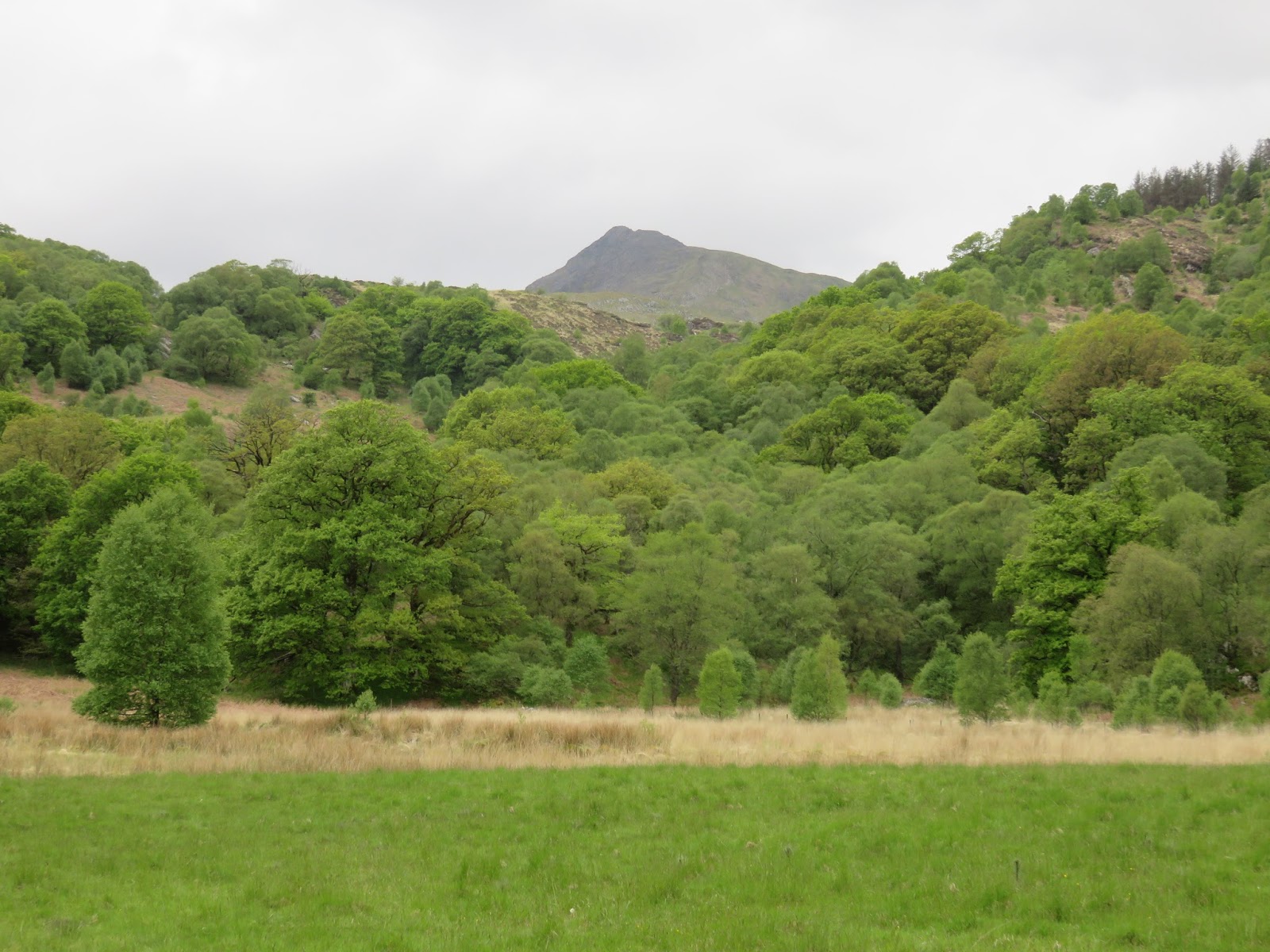
Drawing to a close our extended weekend in Snowdonia, we were searching around for something to occupy a morning before we were back on the road home and the name of Moel Siabod had been turning up time and again. Isolated from all other mountains, it doesn’t present itself for an extended epic, rather and entertaining few hours and a few rocky scrambles – the ideal end to what had been a superb few days in North Wales.
As I mentioned,
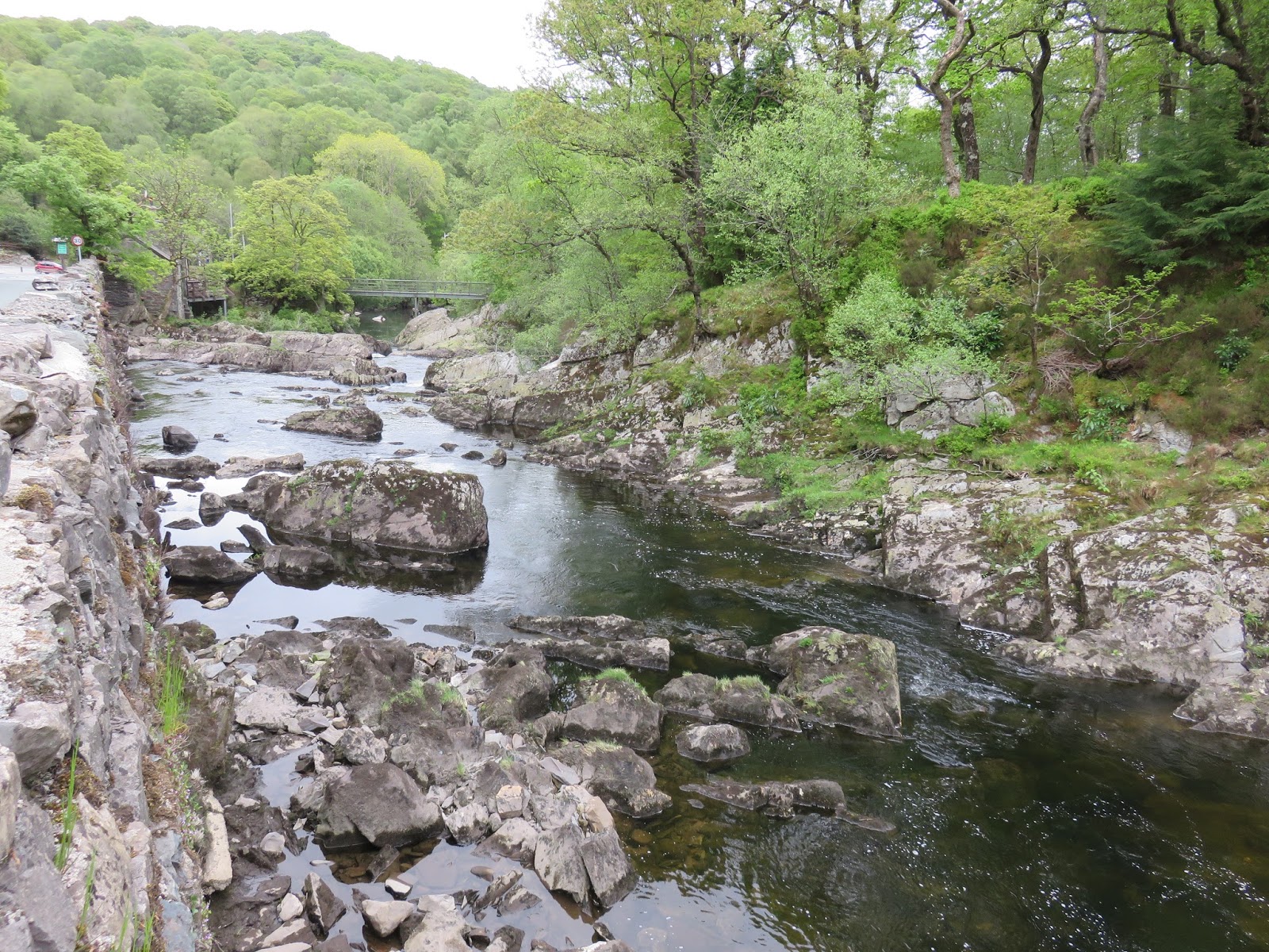
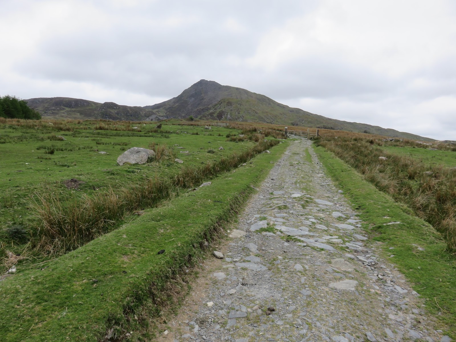
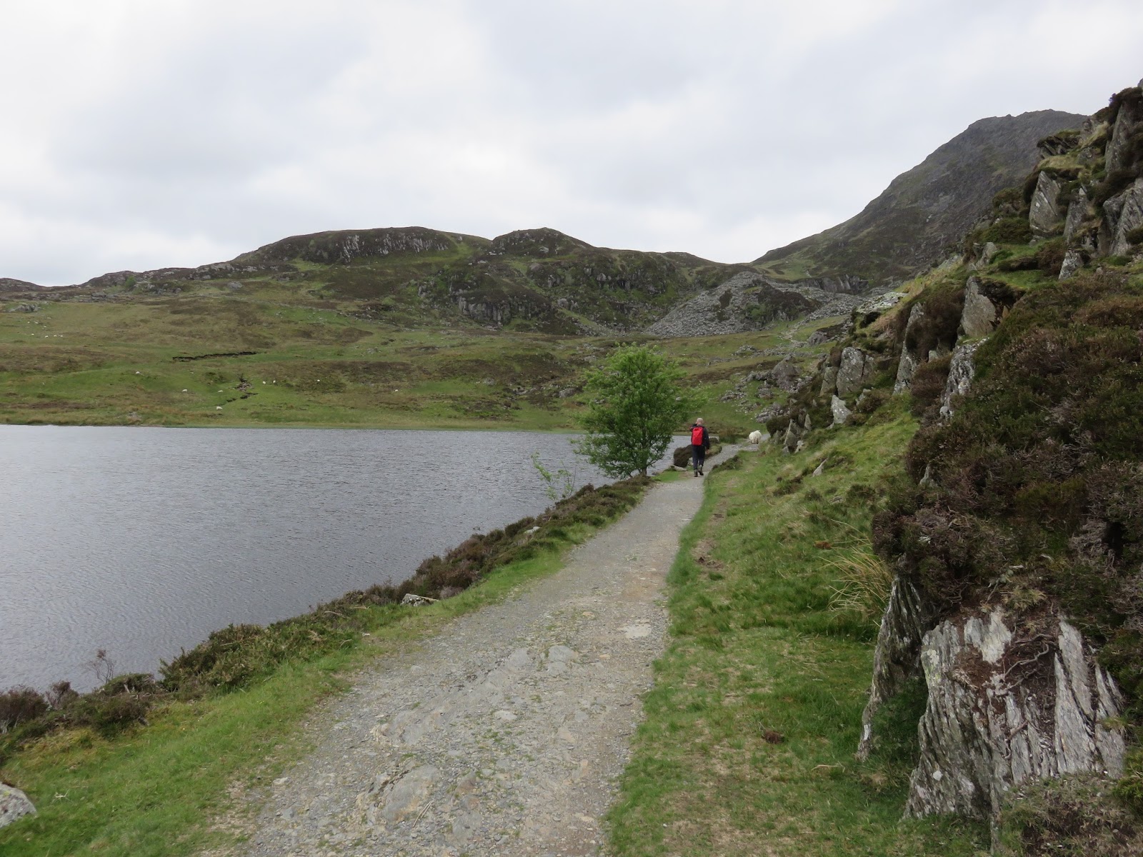
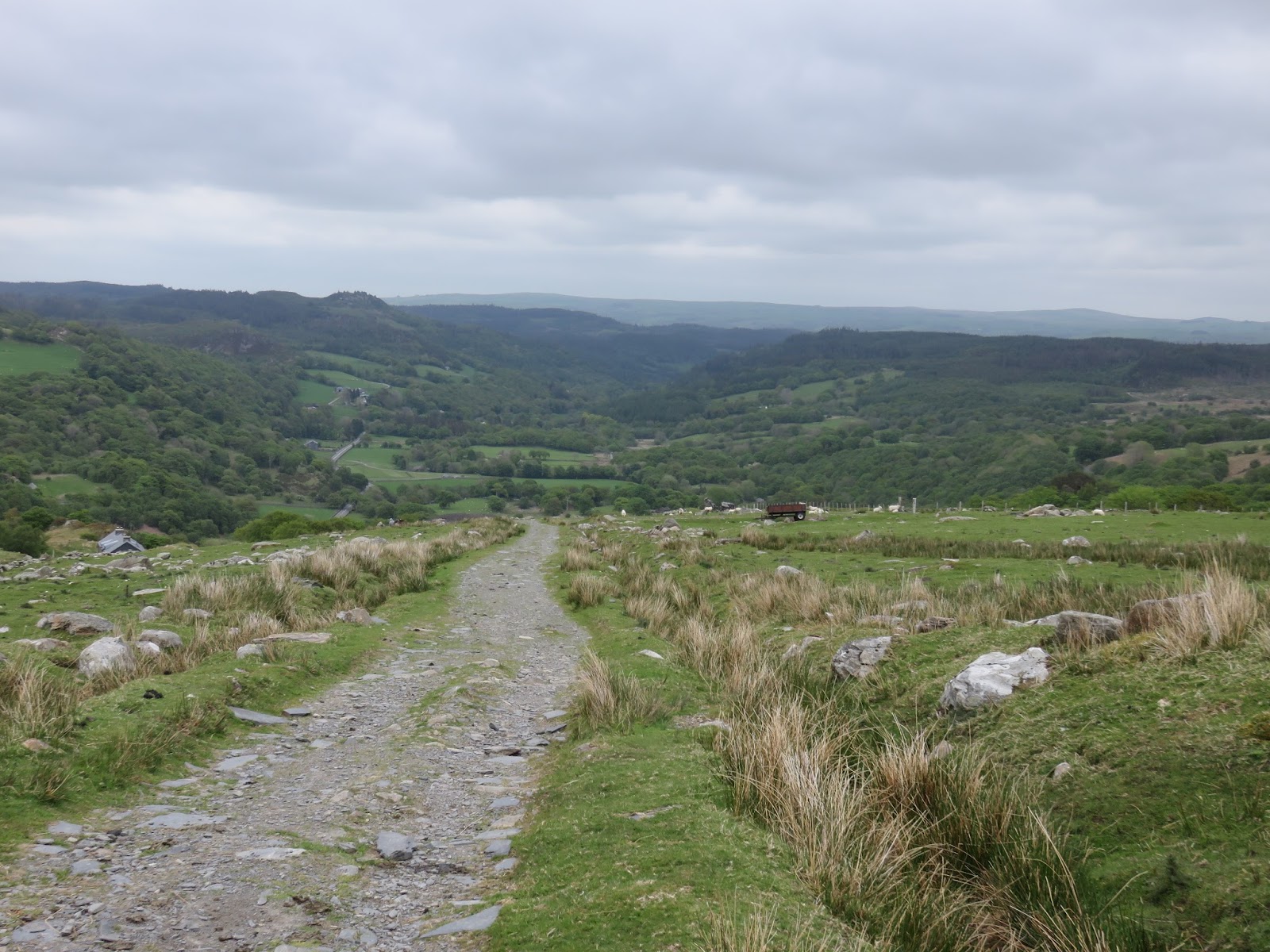
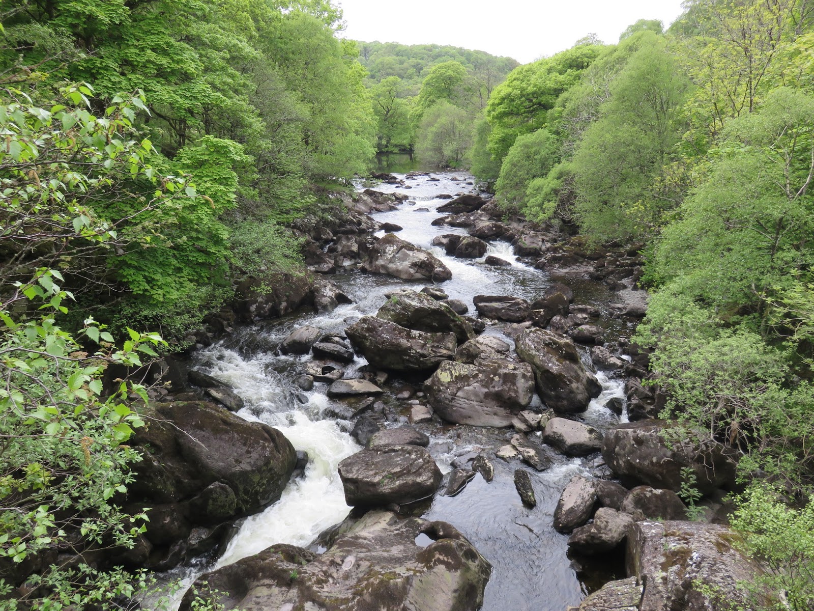
Moel Siabod (or more strictly speaking, Carnedd Siabod) is an isolated peak, high above Capel Curig, where we had been staying. After a short stroll around from our campsite we arrived at Pont-Cyfyng, a popular spot for white water kayaking. From Pont-Cyfyng, a lane leads uphill towards a few holiday cottages before leading out onto a wide track towards the abandoned Rhos slate quarry.
 |
| The Afon Llugwy at Capel Curig |
 |
| The quarry road |
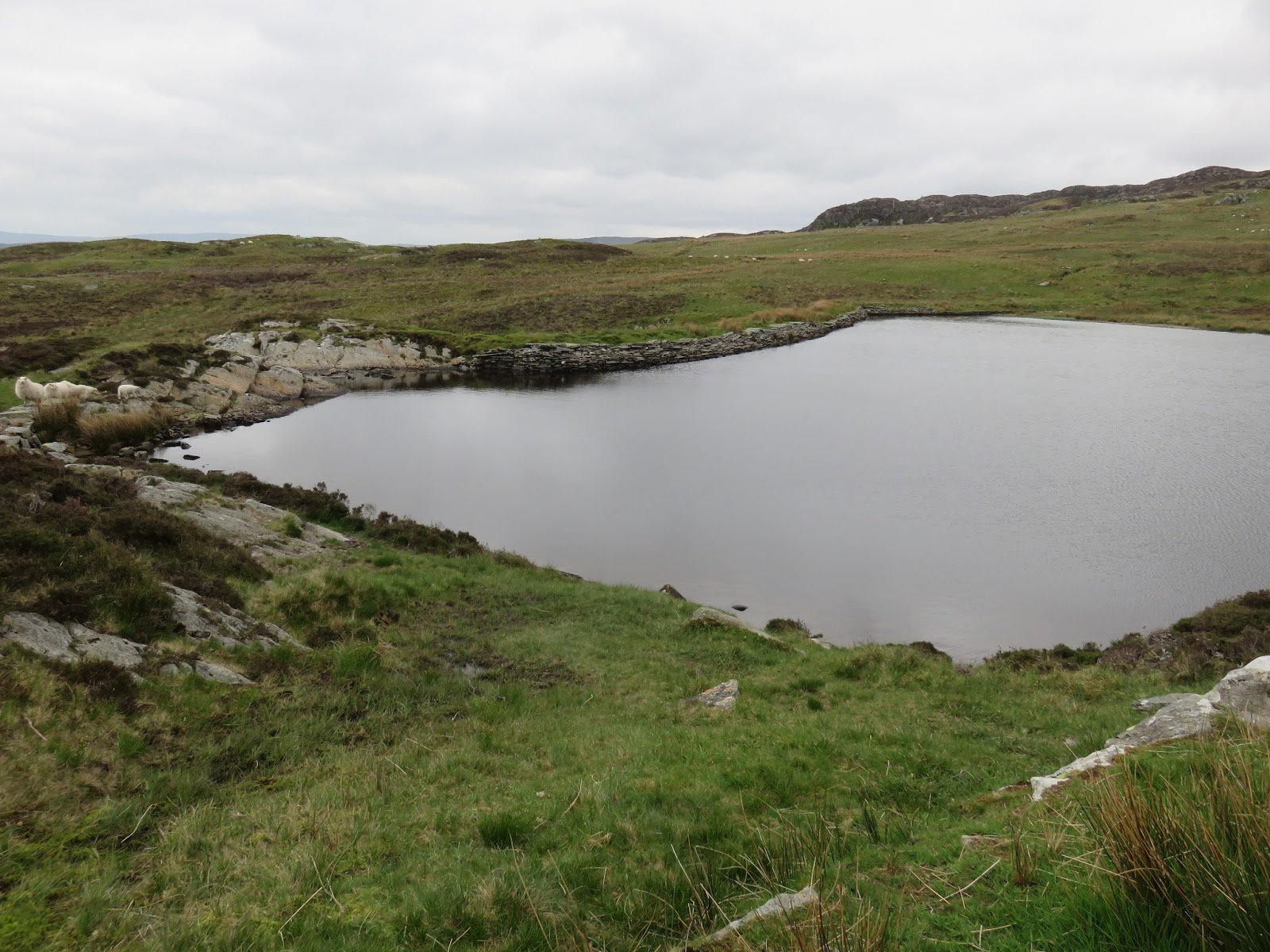
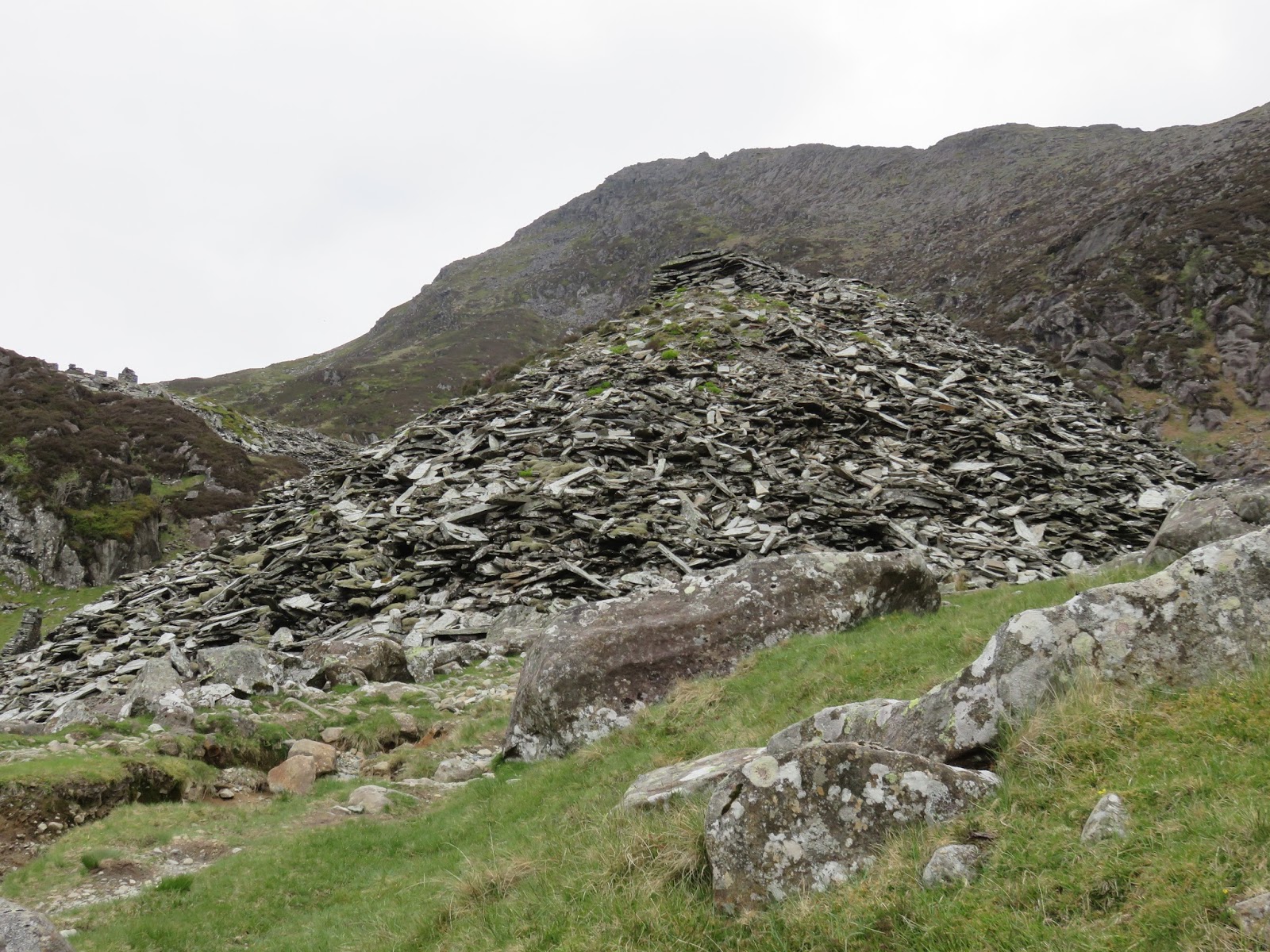
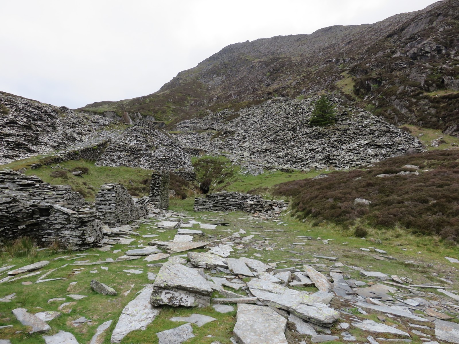
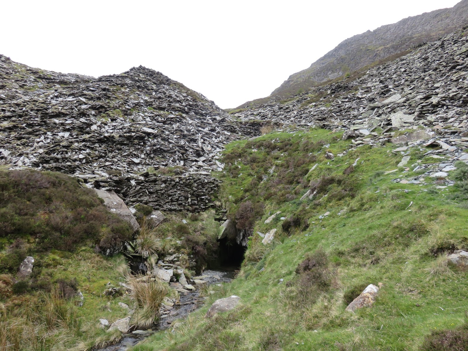
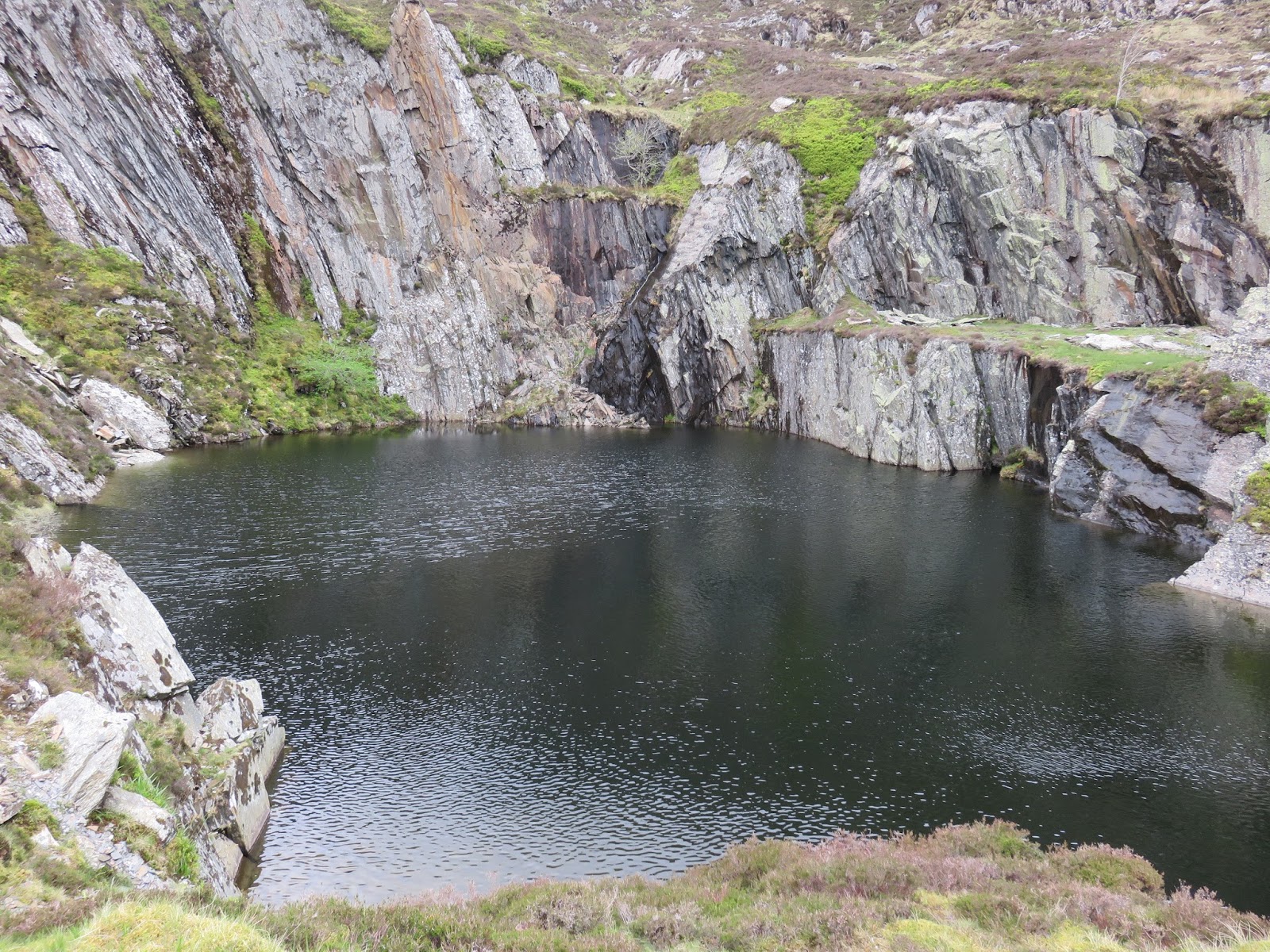
It’s an easy climb that passes around a dammed lake before threading it way through the ruins of the old quarry buildings and up to a second, small and more interesting lake fed by a pair of waterfalls. The quarry was worked from the nineteenth century and was later amalgamated with others to become the Caernarvonshire Crown Slate Quarries Company in 1918 but like many others closed down later in the twentieth century. The slate barracks and old mine buildings are almost gone but one of the levels still exists.
 |
| The dammed lake |
 |
| The track leads around the edge |
 |
| The old quarry |
 |
| Entrance to one of the mines |
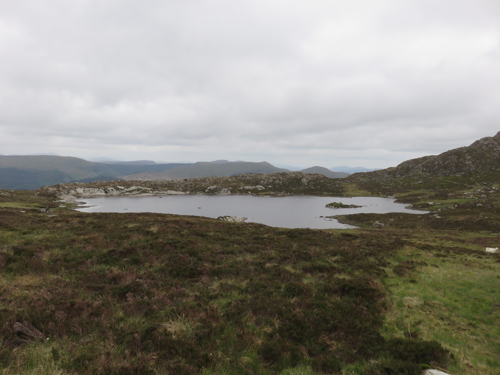
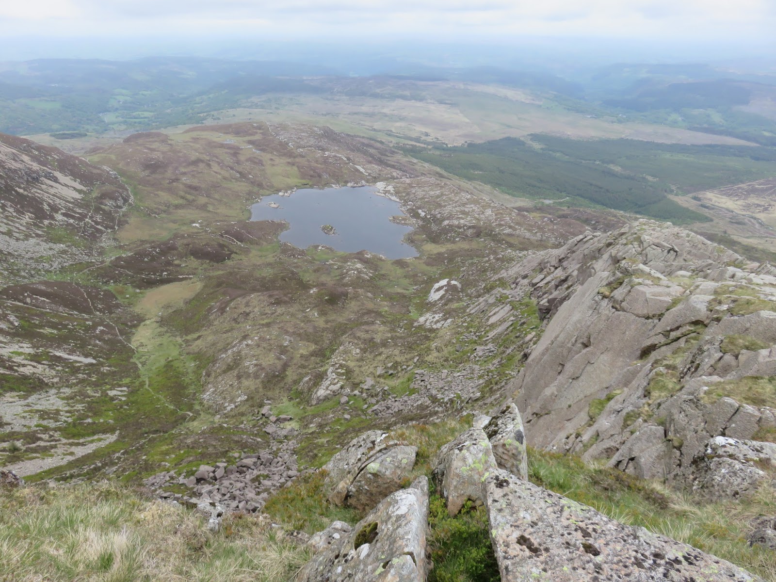
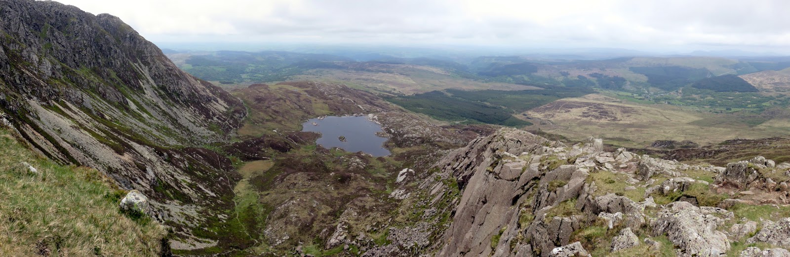
Past the quarry, the path reaches the shores of Llyn y Foel, an isolated lake cradled beneath the cliffs of Moel Siabod. Although the lake bears the name Llyn y Foel, it does have another name – Llyn Llygad yr Ych, the Lake of the Ox’s Eye – which recounts a tale about an ox that lost an eye under the strain of pulling the dreadful afanc from Betws y Coed to Glaslyn below Snowdon.
 |
| A dark quarry lake |
 |
| Looking back down into the valley |
 |
| The Daear Ddu ridge |
 |
| Llyn y Foel |
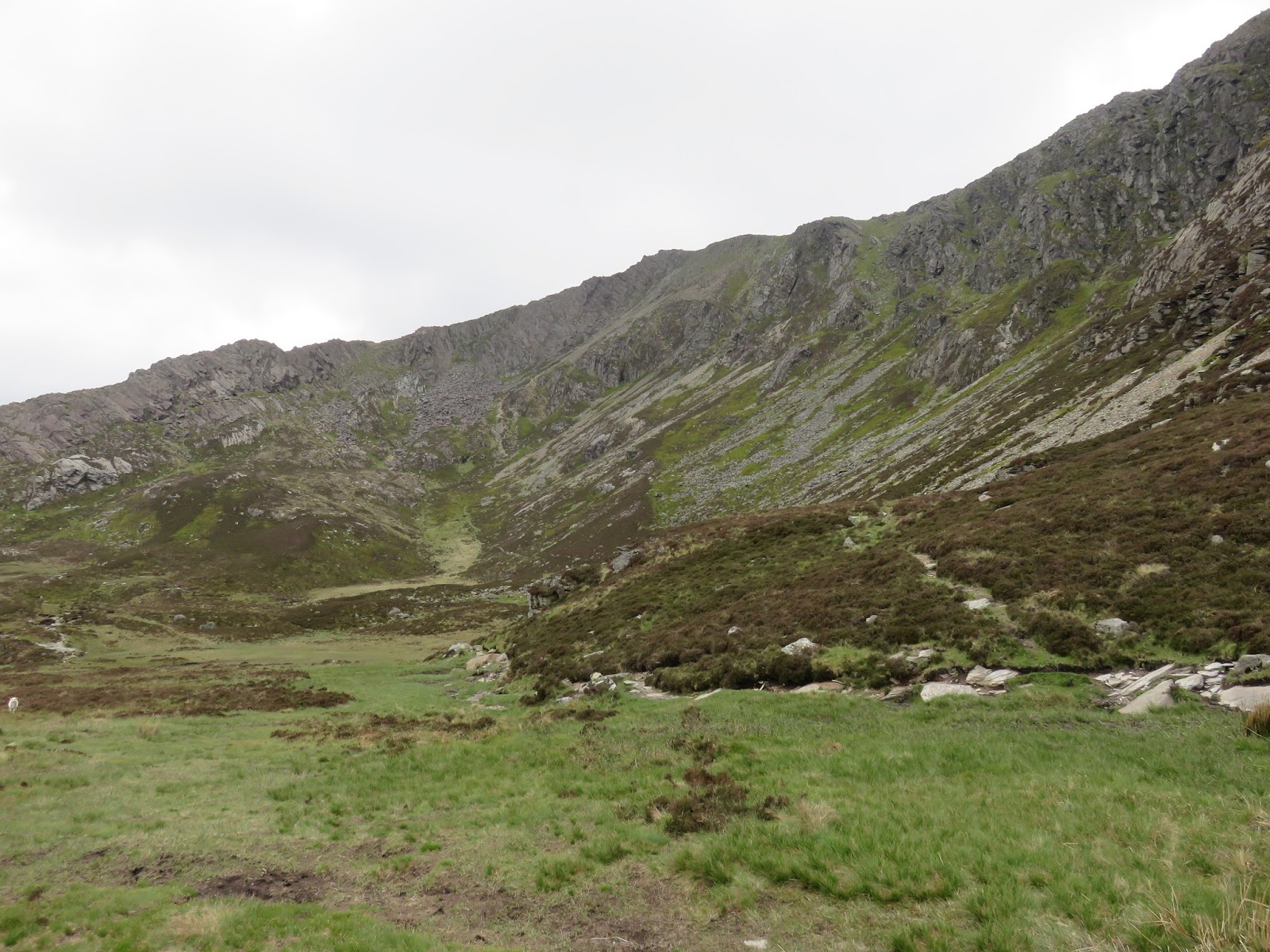
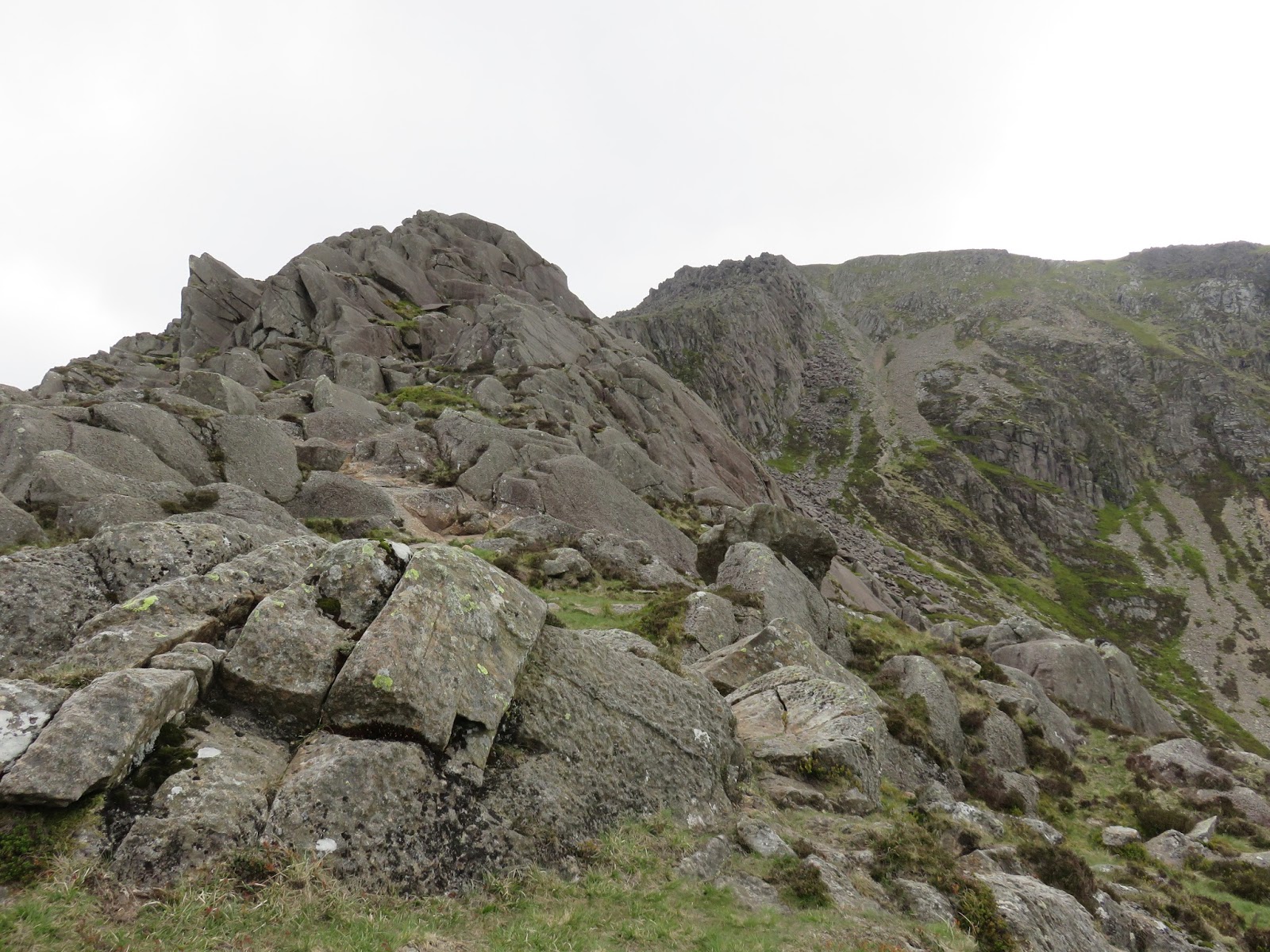
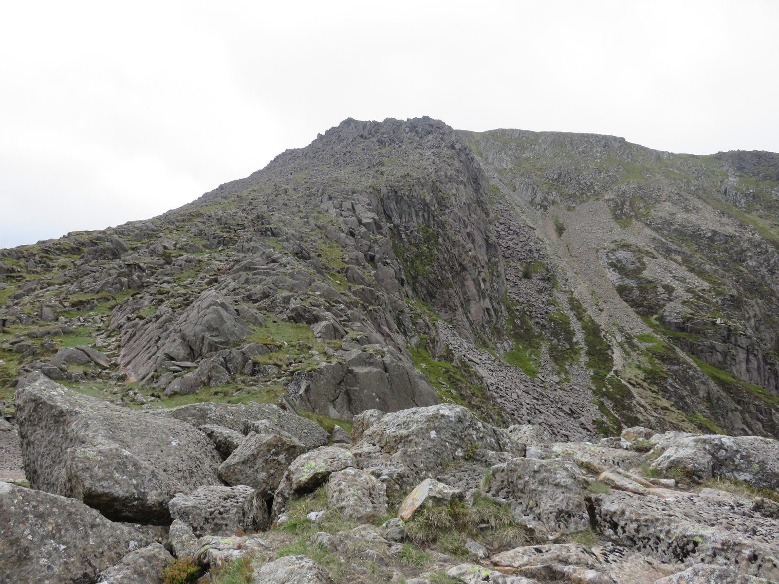
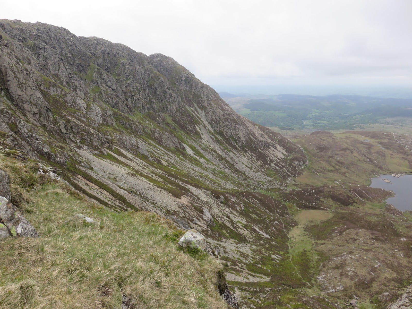
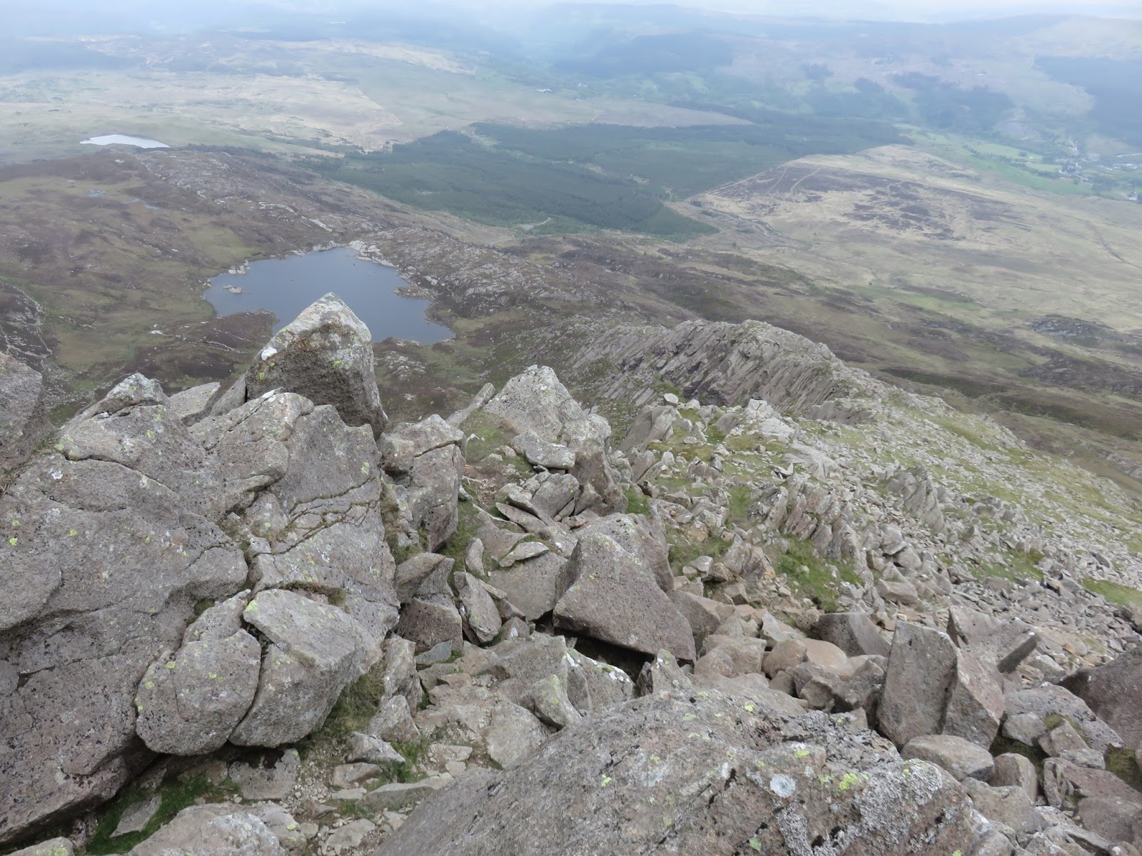
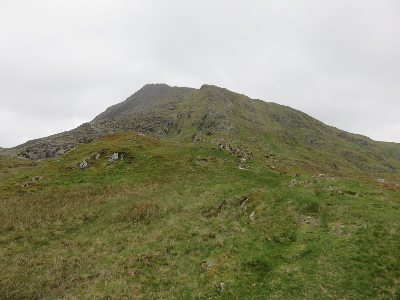
Paths pass either side of the lake, both are fairly boggy and neither is easier than the other. We kept to the right of the lake, moving around the foot of the Daear Ddu ridge. The ridge presents an interesting and rewarding way up to the summit. Keeping left presents an easier route or to the right for a more challenging scramble. The scrambling is easy and enjoyable and shouldn’t cause too many problems. Moel Siabod quickly changes character and soon becomes a proper mountain as you work your way to the rocky summit.
 |
| The Daear Ddu ridge stretching up |
 |
| Looking down to Llyn y Foel |
 |
| More scrambling on the Daear Ddu ridge |
 |
| Llyn y Foel starting to look smaller |
 |
| The north east ridge |
 |
| Looking down the Daear Ddu ridge |
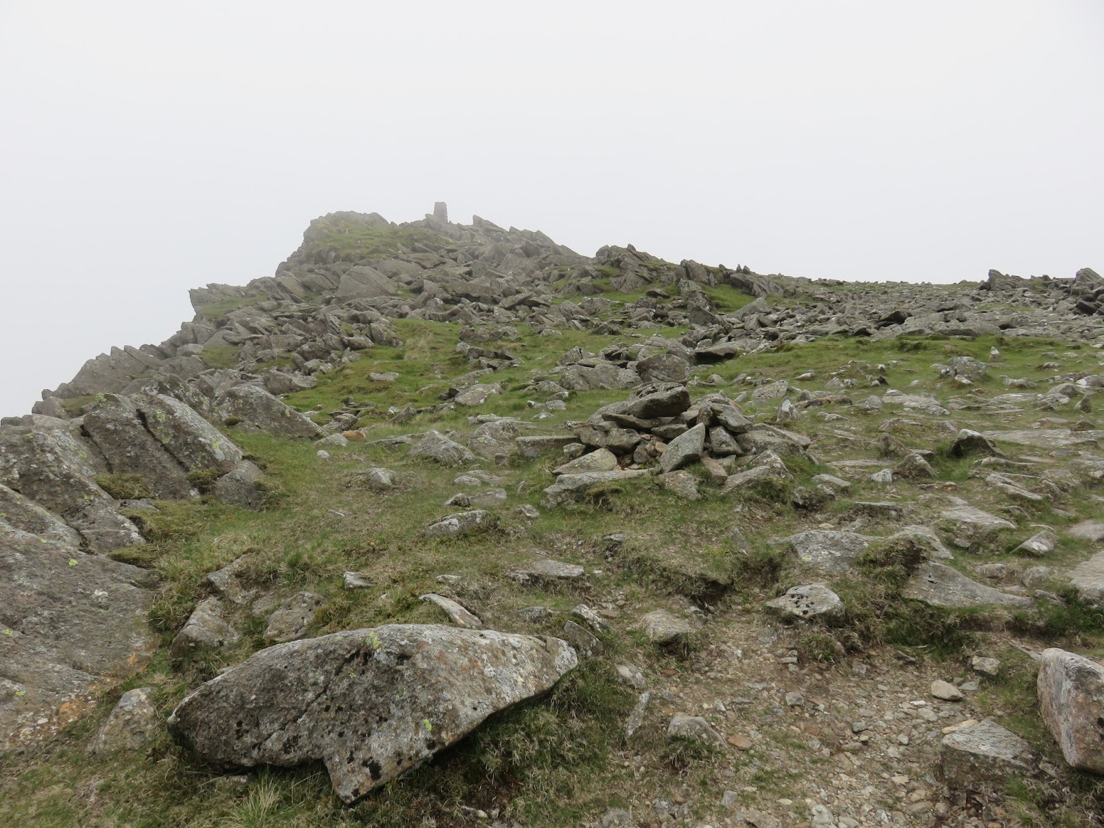
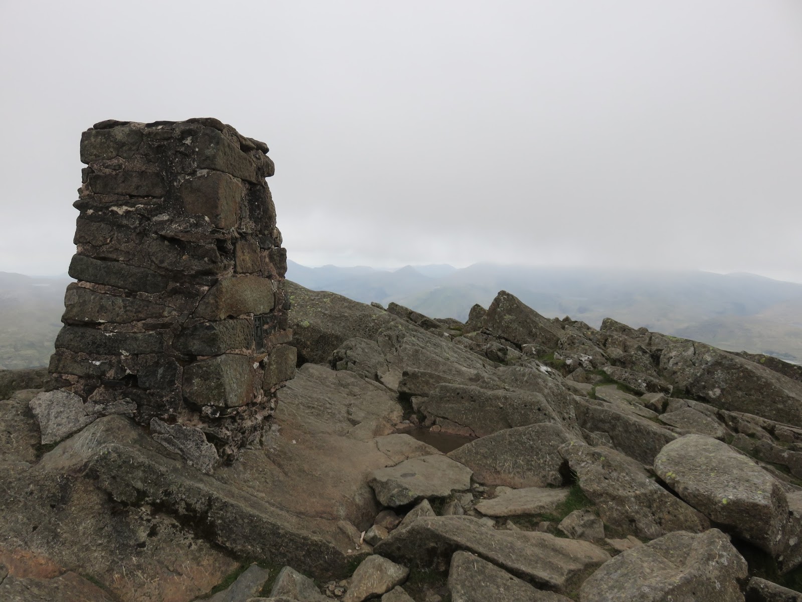
The summit if topped by a trig pillar and it is alleged that you can see 13 of the 14 3,000ft peaks without turning ones head. We were lucky to see the base of them as the clouds drifted in and out just above Moel Siabod’s summit. We were a little disappointed but at least it was dry and we had enjoyed a few excellent days before hand.
 |
| Llyn y Foel and the Daear Ddu ridge |
 |
| Approaching the summit |
 |
| The obligatory trig pillar shot |
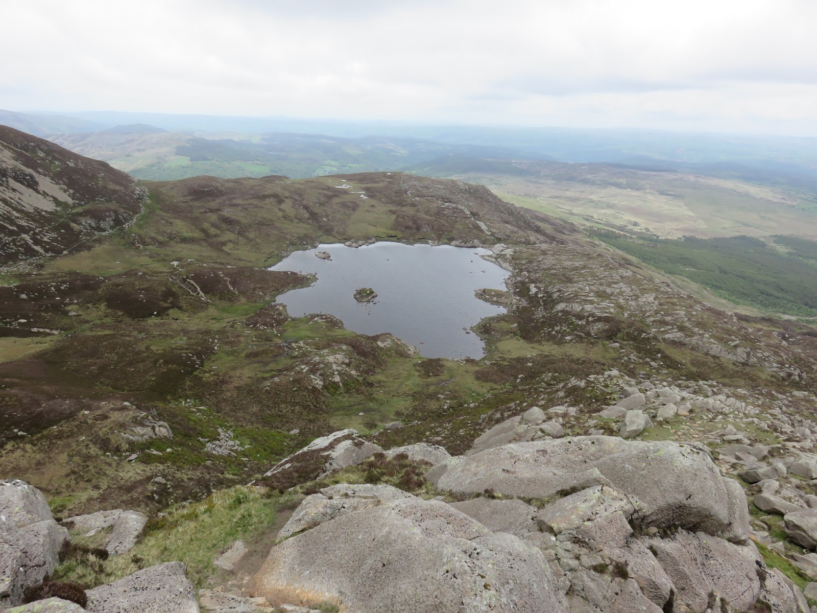
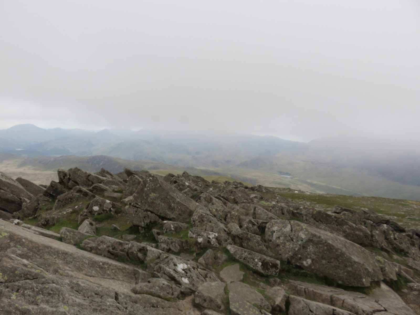
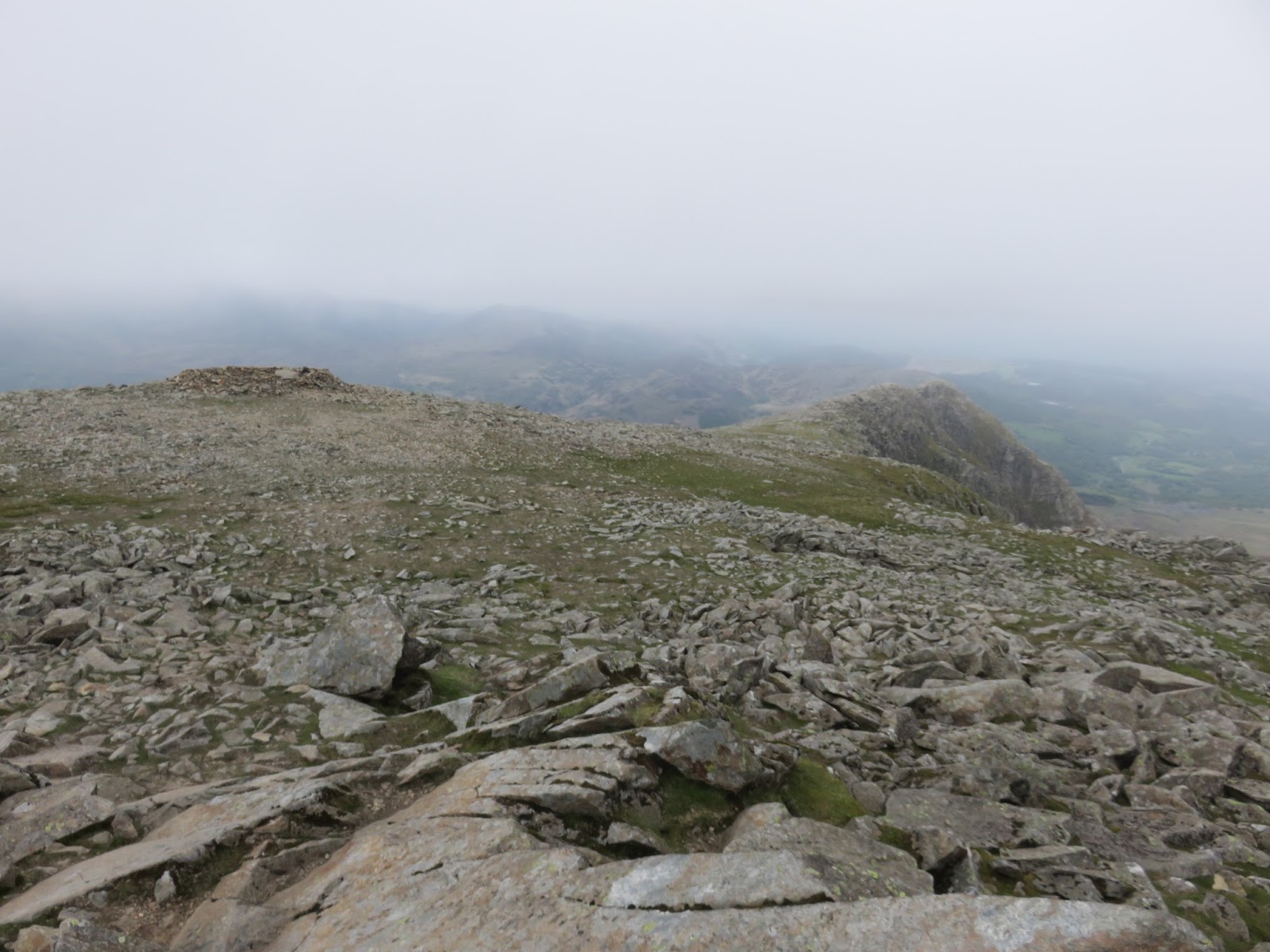
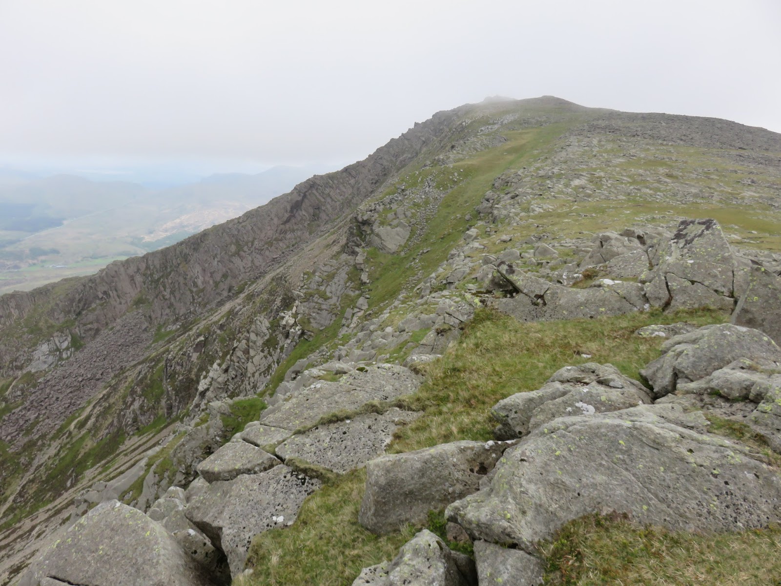
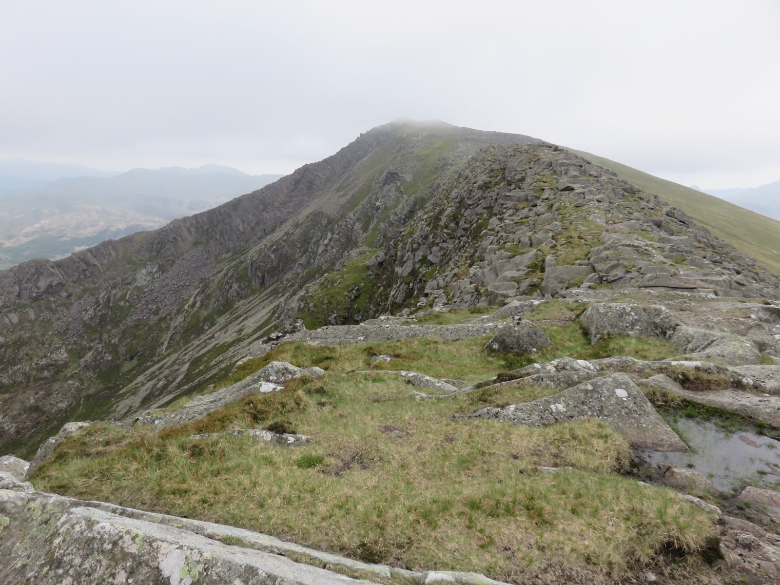
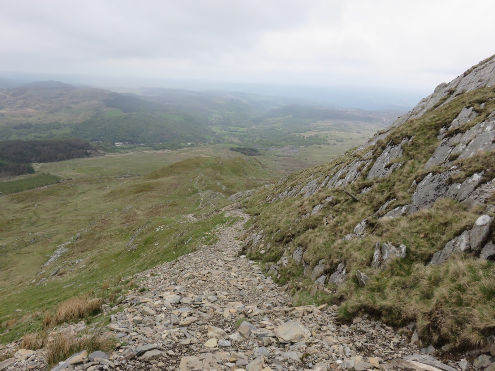
We loitered in the summit shelter before starting our descent back towards Pont-Cyfyng. A broad rocky ridge stretches out to the north east, some 800m in length and not losing much height until towards the end. The path simply sticks to the highest part of the ridge and descends in a very straight north east direction for two and a half kilometres. The only difficulties you’ll find will be walking over the flat slabs in wet weather. It’s a superb way off the mountain.
 |
| Something resembling a view |
 |
| The summit shelter and the north east ridge |
 |
| The view looking back towards the summit |
 |
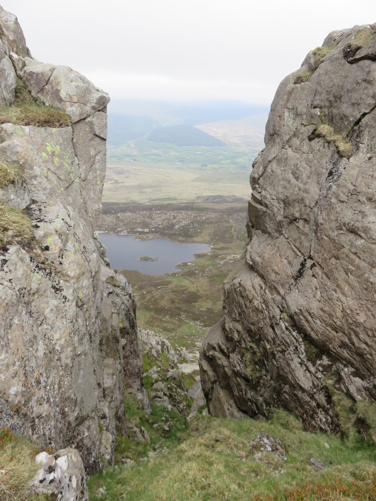
| A framed Llyn y Foel |
 |
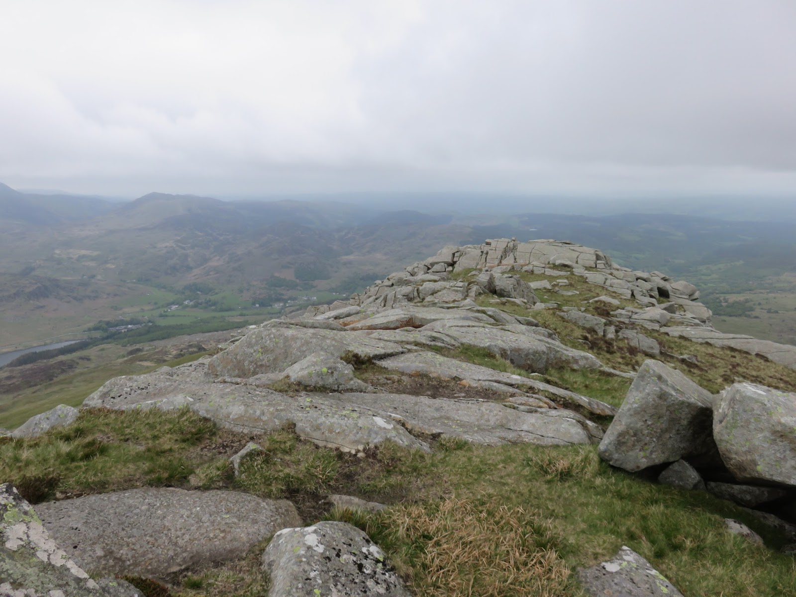
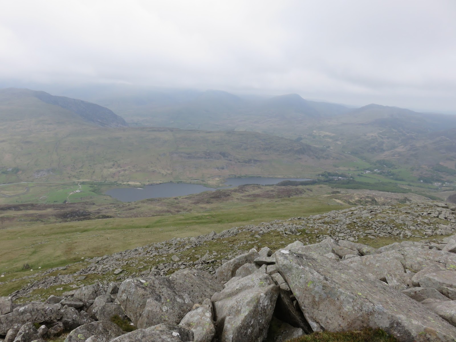
| Looking towards Capel Curig |
 |
| Llynnau Mymbyr through the haze |
 |
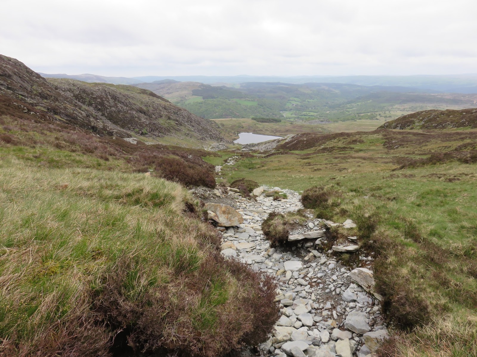
| An obvious track leads back to Pont-Cyfyng |
 |
| The straight quarry track to Pont-Cyfyng |
 |
| Afon Llugwy |
We retraced our route back down the quarry road to Pont-Cyfyng and along the road back to the car. As estimated, the total route only took us a few hours and it’s an ideal way to spend a morning or afternoon. The route livens up after a fairly tedious beginning and the Daear Ddu ridge is an entertaining climb that can be as easy or as challenging as you wish. It’s just a shame the clouds were down today but I doubt this will be my last time on Moel Siabod.
