Open Space Web-Map builder Codehttps://openspace.ordnancesurvey.co.uk/osmapapi/openspace.js?key=3119F72552FD5C22E0530C6CA40A5A92https://openspace.ordnancesurvey.co.uk/osmapapi/script/mapbuilder/basicmap.jshttps://openspace.ordnancesurvey.co.uk/osmapapi/script/mapbuilder/searchbox.js//variables for routes var linesLayer, points, lineFeature, lineString, routeMarkersLayer, routepos, routesize, routeoffset, routeicon; var style_blue = {strokeColor: “#0000CD”, strokeOpacity: 0.5, strokeWidth: 4.5}; function initmapbuilder() { //initiate the map var options = {resolutions: [2500, 1000, 500, 200, 100, 50, 25, 10, 5, 4, 2.5, 2, 1]}; osMap = new OpenSpace.Map(‘map’, options); //configure map options (basicmap.js) setglobaloptions(); //set the center of the map and the zoom level osMap.setCenter(new OpenSpace.MapPoint(312409.2,519644),7); linesLayer = osMap.getVectorLayer(); // Set up layer for route markers routeMarkersLayer = new OpenLayers.Layer.Markers(“Route Markers”); //make a route points = new Array(); points.push(new OpenLayers.Geometry.Point(313409.66664124,521018.66667938)); points.push(new OpenLayers.Geometry.Point(313569.66664124,521018.66667938)); points.push(new OpenLayers.Geometry.Point(313633.66664124,521036.66667938)); points.push(new OpenLayers.Geometry.Point(313743.66664124,521076.66667938)); points.push(new OpenLayers.Geometry.Point(313813.66664124,521136.66667938)); points.push(new OpenLayers.Geometry.Point(313974.66664124,521073.66667938)); points.push(new OpenLayers.Geometry.Point(314038.66664124,521061.66667938)); points.push(new OpenLayers.Geometry.Point(314137.66664124,520897.66667938)); points.push(new OpenLayers.Geometry.Point(314037.66664124,520847.66667938)); points.push(new OpenLayers.Geometry.Point(314017.66664124,520717.66667938)); points.push(new OpenLayers.Geometry.Point(314022.66664124,520582.66667938)); points.push(new OpenLayers.Geometry.Point(313987.66664124,520352.66667938)); points.push(new OpenLayers.Geometry.Point(313927.66664124,520337.66667938)); points.push(new OpenLayers.Geometry.Point(313882.66664124,520192.66667938)); points.push(new OpenLayers.Geometry.Point(313923.66664124,520122.66667938)); points.push(new OpenLayers.Geometry.Point(314008.66664124,520102.66667938)); points.push(new OpenLayers.Geometry.Point(314118.66664124,519977.66667938)); points.push(new OpenLayers.Geometry.Point(314308.66664124,519852.66667938)); points.push(new OpenLayers.Geometry.Point(314328.66664124,519742.66667938)); points.push(new OpenLayers.Geometry.Point(314303.66664124,519557.66667938)); points.push(new OpenLayers.Geometry.Point(314328.66664124,519457.66667938)); points.push(new OpenLayers.Geometry.Point(314403.66664124,519197.66667938)); points.push(new OpenLayers.Geometry.Point(314468.66664124,518977.66667938)); points.push(new OpenLayers.Geometry.Point(314583.66664124,518937.66667938)); points.push(new OpenLayers.Geometry.Point(314663.66664124,518937.66667938)); points.push(new OpenLayers.Geometry.Point(314843.66664124,518602.66667938)); points.push(new OpenLayers.Geometry.Point(314808.66664124,518572.66667938)); points.push(new OpenLayers.Geometry.Point(314708.66664124,518562.66667938)); points.push(new OpenLayers.Geometry.Point(314633.66664124,518762.66667938)); points.push(new OpenLayers.Geometry.Point(314453.66664124,518992.66667938)); points.push(new OpenLayers.Geometry.Point(314418.66664124,518857.66667938)); points.push(new OpenLayers.Geometry.Point(314338.66664124,518717.66667938)); points.push(new OpenLayers.Geometry.Point(314173.66664124,518622.66667938)); points.push(new OpenLayers.Geometry.Point(314018.66664124,518712.66667938)); points.push(new OpenLayers.Geometry.Point(314038.66664124,518637.66667938)); points.push(new OpenLayers.Geometry.Point(313858.66664124,518537.66667938)); points.push(new OpenLayers.Geometry.Point(313656.66664124,518485.66667938)); points.push(new OpenLayers.Geometry.Point(313491.66664124,518465.66667938)); points.push(new OpenLayers.Geometry.Point(313331.66664124,518460.66667938)); points.push(new OpenLayers.Geometry.Point(313186.66664124,518500.66667938)); points.push(new OpenLayers.Geometry.Point(313171.66664124,518330.66667938)); points.push(new OpenLayers.Geometry.Point(313206.66664124,518140.66667938)); points.push(new OpenLayers.Geometry.Point(313146.66664124,517945.66667938)); points.push(new OpenLayers.Geometry.Point(313011.66664124,517765.66667938)); points.push(new OpenLayers.Geometry.Point(312826.66664124,517580.66667938)); points.push(new OpenLayers.Geometry.Point(312546.66664124,517410.66667938)); points.push(new OpenLayers.Geometry.Point(312241.66664124,517375.66667938)); points.push(new OpenLayers.Geometry.Point(311846.66664124,517505.66667938)); points.push(new OpenLayers.Geometry.Point(311876.66664124,517770.66667938)); points.push(new OpenLayers.Geometry.Point(311876.66664124,517965.66667938)); points.push(new OpenLayers.Geometry.Point(311871.66664124,518200.66667938)); points.push(new OpenLayers.Geometry.Point(311711.66664124,518405.66667938)); points.push(new OpenLayers.Geometry.Point(311661.66664124,518530.66667938)); points.push(new OpenLayers.Geometry.Point(311451.66664124,518660.66667938)); points.push(new OpenLayers.Geometry.Point(311501.66664124,519000.66667938)); points.push(new OpenLayers.Geometry.Point(311351.66664124,519125.66667938)); points.push(new OpenLayers.Geometry.Point(311371.66664124,519310.66667938)); points.push(new OpenLayers.Geometry.Point(311136.66664124,519610.66667938)); points.push(new OpenLayers.Geometry.Point(311041.66664124,519685.66667938)); points.push(new OpenLayers.Geometry.Point(311146.66664124,519815.66667938)); points.push(new OpenLayers.Geometry.Point(311141.66664124,519935.66667938)); points.push(new OpenLayers.Geometry.Point(311081.66664124,520070.66667938)); points.push(new OpenLayers.Geometry.Point(311141.66664124,520375.66667938)); points.push(new OpenLayers.Geometry.Point(311141.66664124,520625.66667938)); points.push(new OpenLayers.Geometry.Point(311006.66664124,520965.66667938)); points.push(new OpenLayers.Geometry.Point(311161.66664124,521125.66667938)); points.push(new OpenLayers.Geometry.Point(311261.66664124,521300.66667938)); points.push(new OpenLayers.Geometry.Point(311266.66664124,521425.66667938)); points.push(new OpenLayers.Geometry.Point(311216.66664124,521495.66667938)); points.push(new OpenLayers.Geometry.Point(311206.66664124,521600.66667938)); points.push(new OpenLayers.Geometry.Point(311266.66664124,521675.66667938)); points.push(new OpenLayers.Geometry.Point(311416.66664124,521705.66667938)); points.push(new OpenLayers.Geometry.Point(311536.66664124,521665.66667938)); points.push(new OpenLayers.Geometry.Point(311716.66664124,521505.66667938)); points.push(new OpenLayers.Geometry.Point(311801.66664124,521445.66667938)); points.push(new OpenLayers.Geometry.Point(311816.66664124,521320.66667938)); points.push(new OpenLayers.Geometry.Point(311761.66664124,521205.66667938)); points.push(new OpenLayers.Geometry.Point(311806.66664124,521160.66667938)); points.push(new OpenLayers.Geometry.Point(311921.66664124,521180.66667938)); points.push(new OpenLayers.Geometry.Point(311981.66664124,521240.66667938)); points.push(new OpenLayers.Geometry.Point(312121.66664124,521185.66667938)); points.push(new OpenLayers.Geometry.Point(312316.66664124,521160.66667938)); points.push(new OpenLayers.Geometry.Point(312581.66664124,521175.66667938)); points.push(new OpenLayers.Geometry.Point(312681.66664124,521135.66667938)); points.push(new OpenLayers.Geometry.Point(312756.66664124,521195.66667938)); points.push(new OpenLayers.Geometry.Point(313136.66664124,521175.66667938)); points.push(new OpenLayers.Geometry.Point(313326.66664124,521045.66667938)); points.push(new OpenLayers.Geometry.Point(313409.66664124,521018.66667938)); // create a polyline feature from the array of points lineString = new OpenLayers.Geometry.LineString(points); lineFeature = new OpenLayers.Feature.Vector(lineString, null, style_blue); linesLayer.addFeatures([lineFeature]); //crate a route start/end marker routepos = new OpenSpace.MapPoint(313409.66664124,521018.66667938); routesize = new OpenLayers.Size(33,45); routeoffset = new OpenLayers.Pixel(-5,-37); routeicon = new OpenSpace.Icon(‘https://openspace.ordnancesurvey.co.uk/osmapapi/img_versions/img_1.1/mapbuilder/routemarker-startend.png’, routesize, routeoffset, null, null); routeMarkersLayer.addMarker(new OpenLayers.Marker(routepos, routeicon)); osMap.addLayer(routeMarkersLayer);}
Route: Maggie’s Bridge, Loweswater, Kirkstile Inn, Kirkgate Farm, Raven Crag, White Crag, Mellbreak North Top, Mellbreak, Mosedale, Hen Comb, Whiteoak Moss, Floutern Cop, White Oak, Gavel Fell, Fothergill Head, Blake Fell, Burnbank Fell, Holme Wood, Watergate Farm, Maggie’s Bridge
Date: 08/05/2016
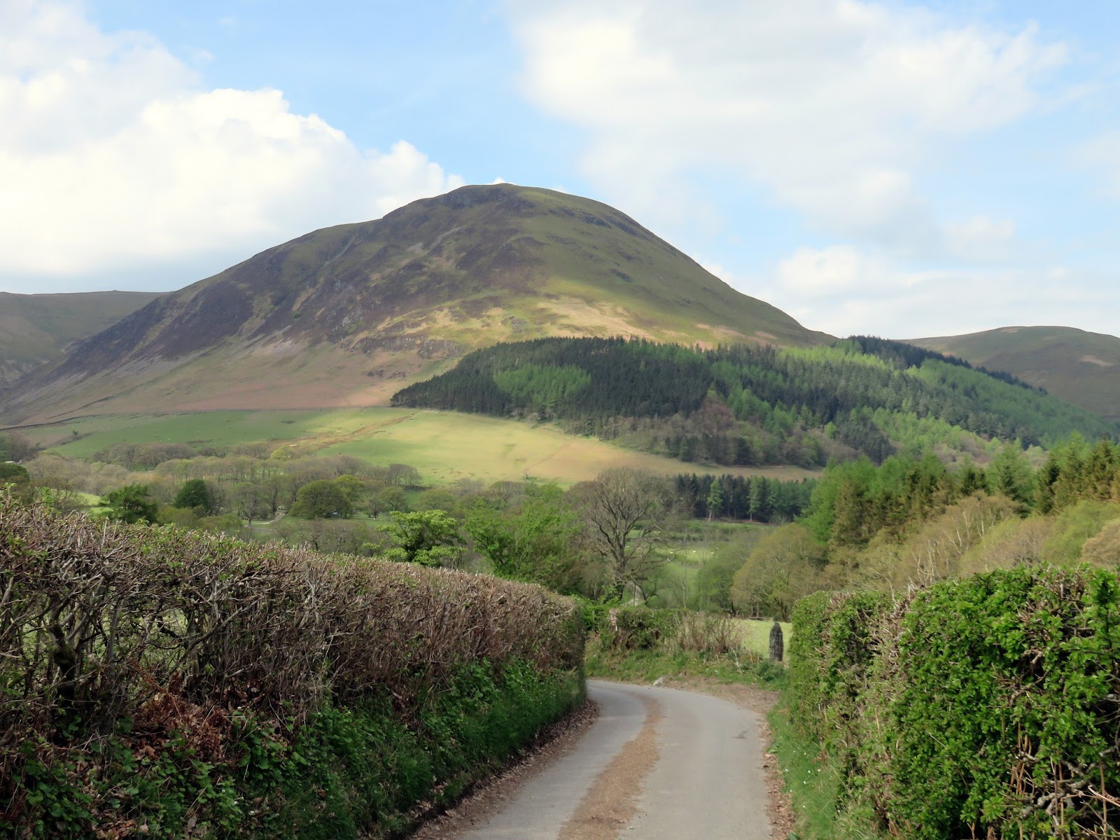
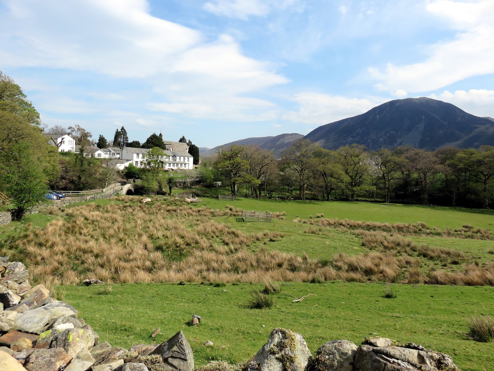
From: Loweswater
Parking: Maggie’s Bridge
Start Point: Loweswater
Region: Western Fells
Route length: 10.1 miles (16.2 km)
Time taken : 04:51
Average speed: 2.1 mph
Ascent: 1194m
Descent: 1195m
Wainwrights on this walk:
Mellbreak (512m), Hen Comb (509m), Gavel Fell (526m), Blake Fell (573m), Burnbank Fell (475m)
Additional summits: Mellbreak North Top (509m), Floutern Cop (451m)
Other points of interest: Mellbreak North Ridge, Mosedale, Mosedale Holly Tree
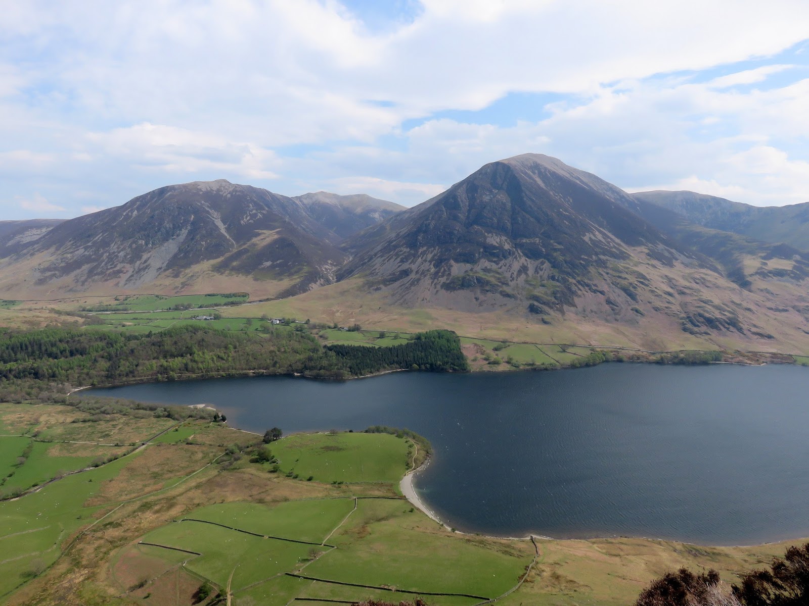
This has been a walk on my to do list for a very long time. The final push before the end and, sadly, the last day where I’d be out to collect a large number of new Wainwrights. The Loweswater Five would take my total up to 213, leaving just the mighty Blencathra to complete the set.
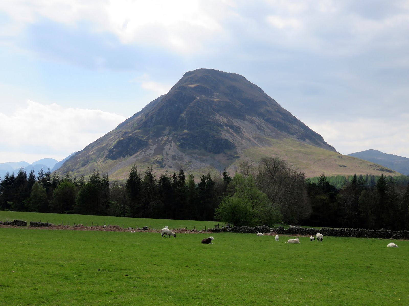
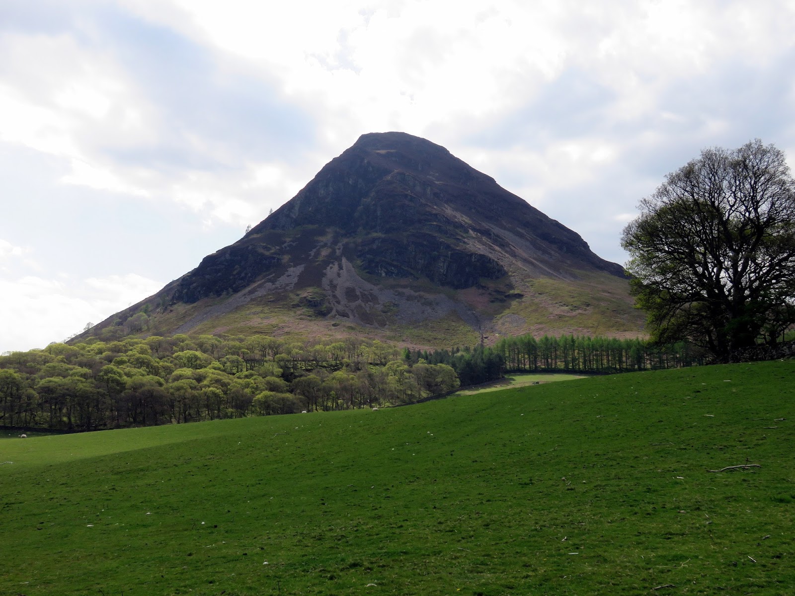
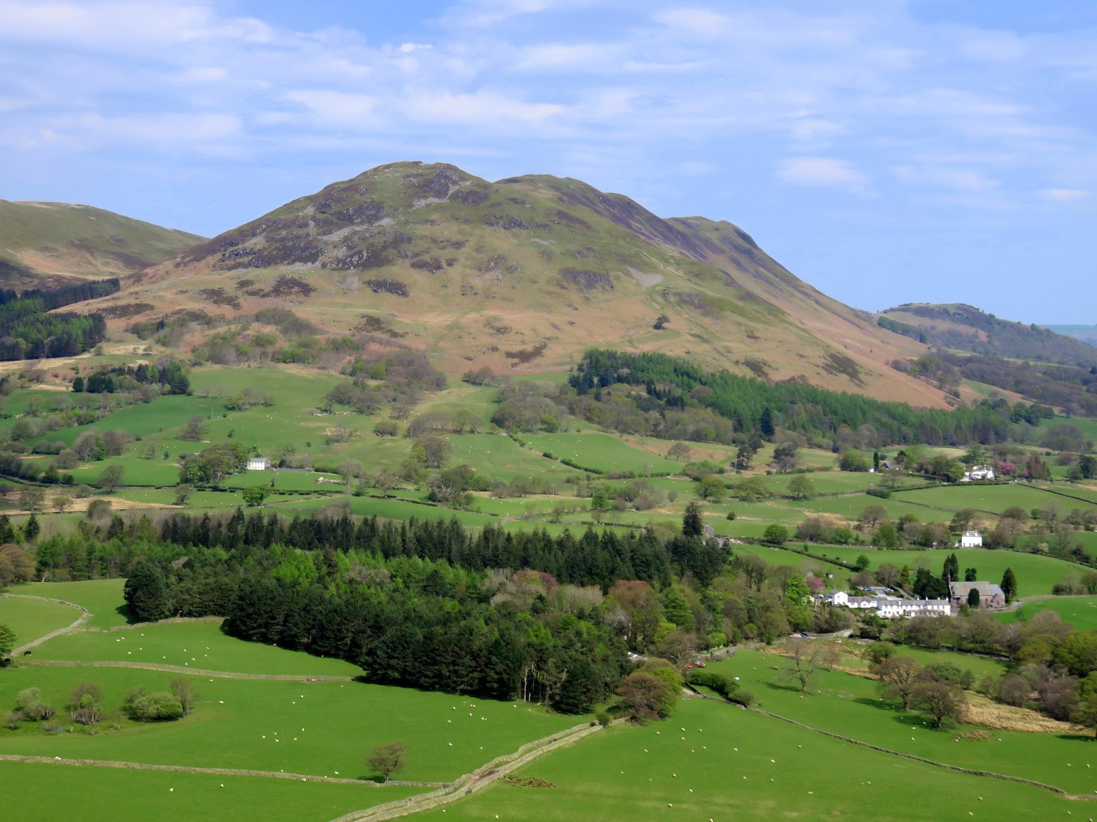
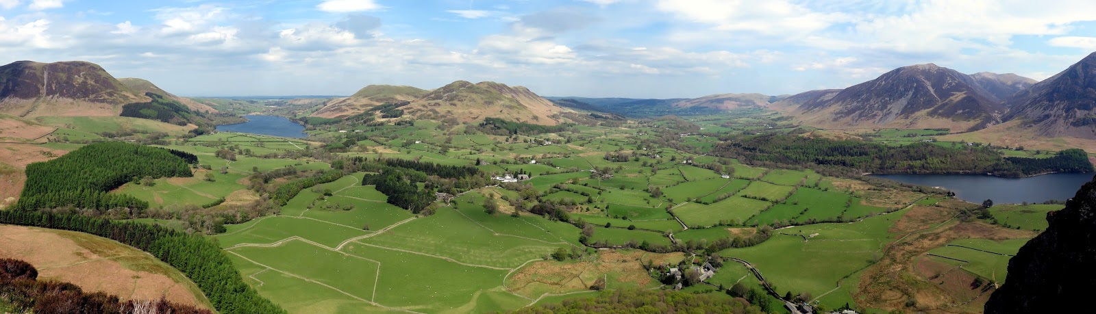
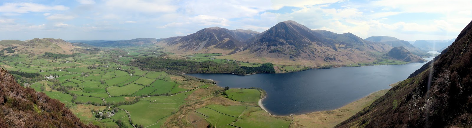
The five Loweswater fells radiate out from the small Loweswater, often compared to five digits of a hand with Loweswater being the palm. Those five digits are Mellbreak, Hen Comb, Gavel Fell, Blake Fell and Burnbank Fell – often names overlooked by most Lakeland tourists. The final three of those form a splendid ridge whereas Mellbreak and Hen Comb stand alone. This was going to be a fairly tough walk, with a lot of steep ascent.
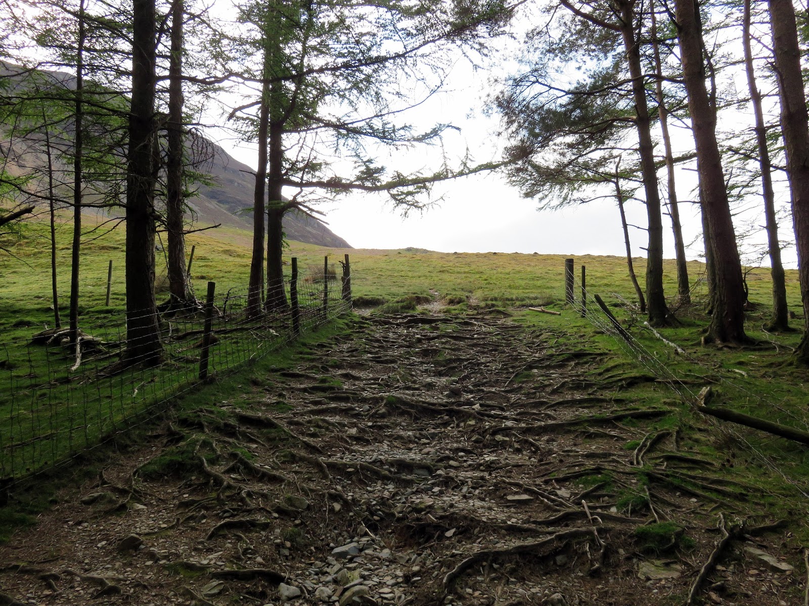
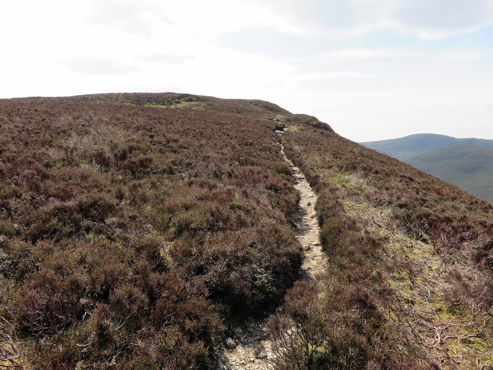
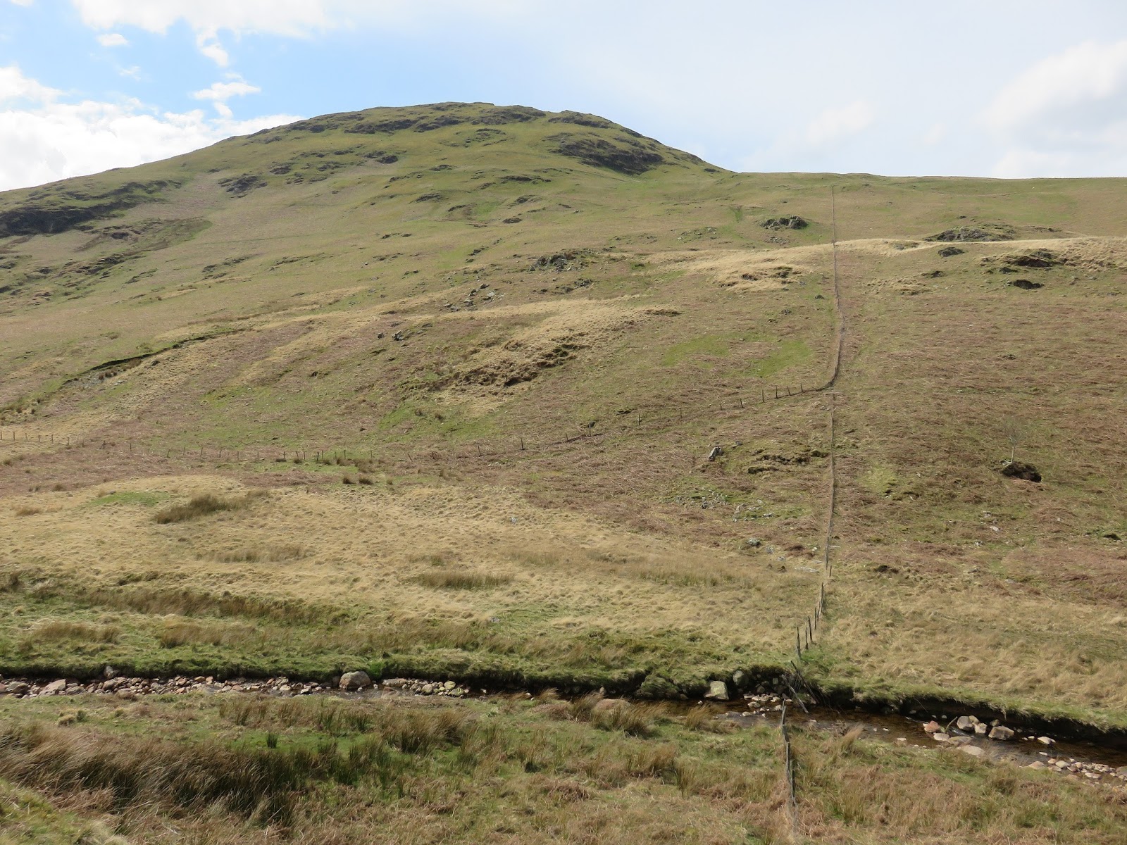
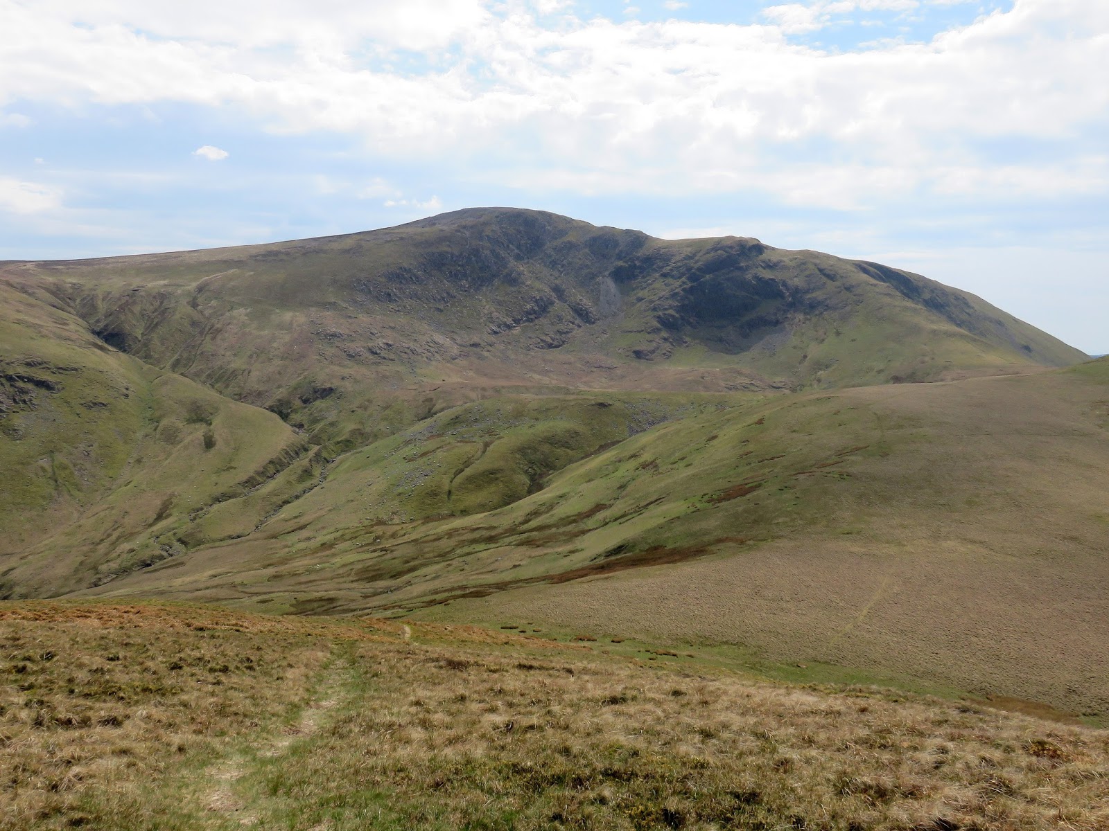
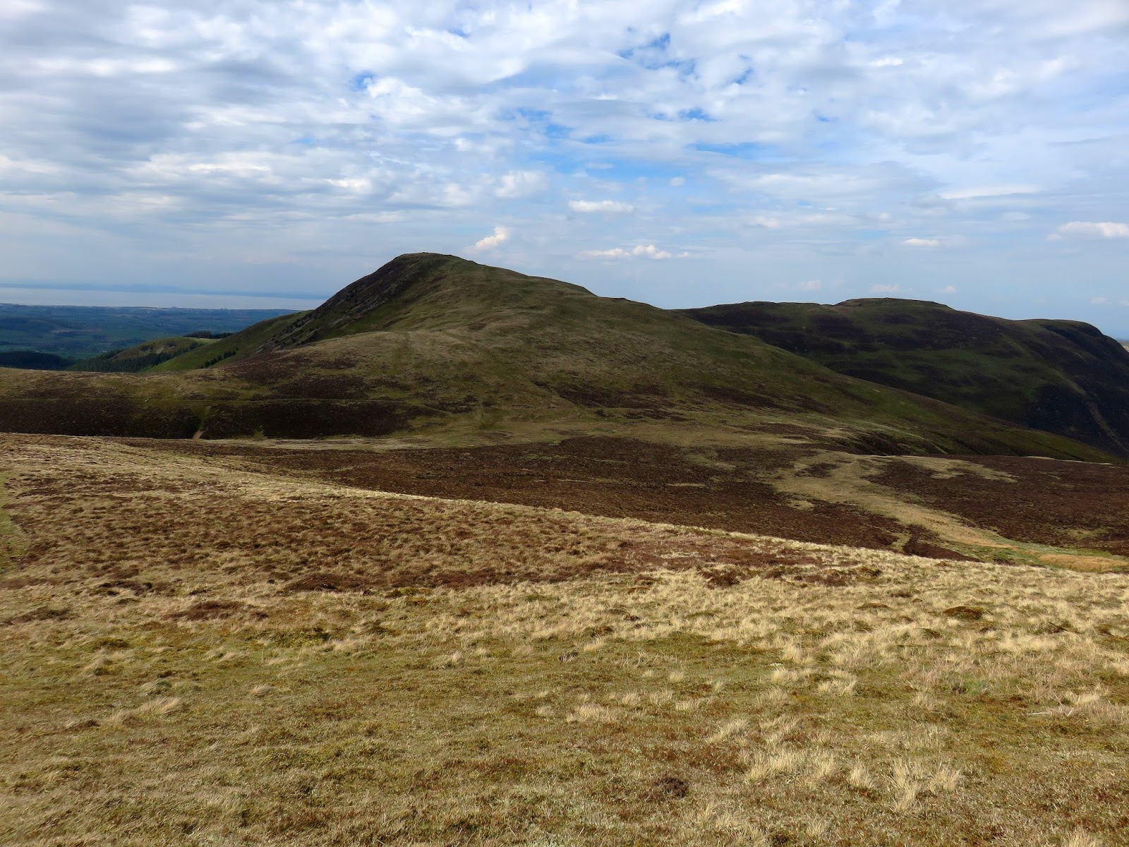
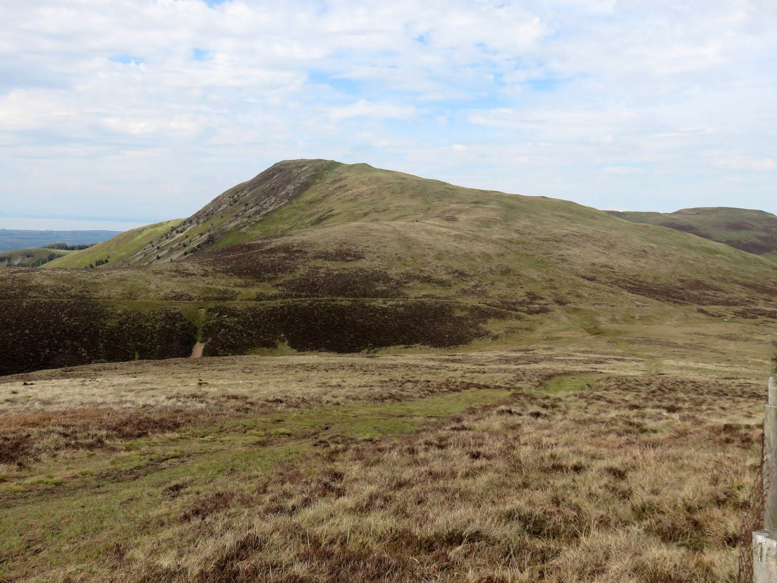
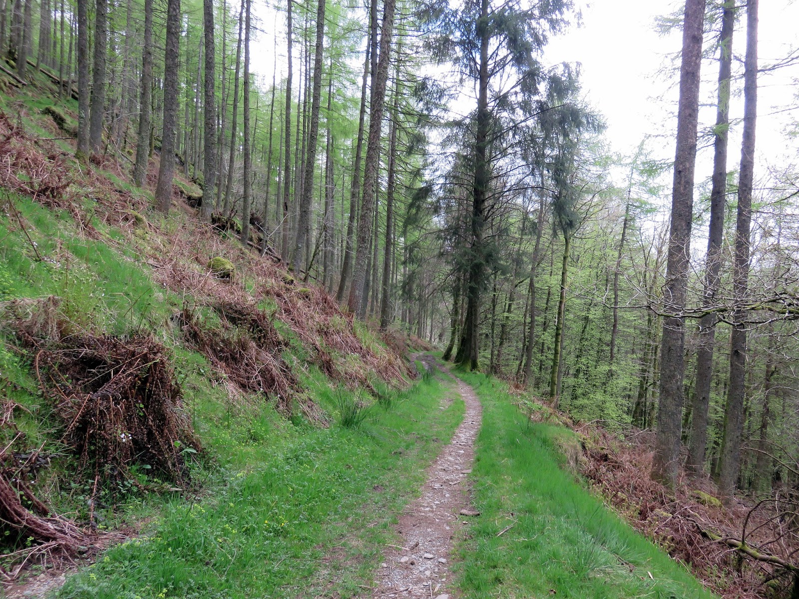
First up is Mellbreak, accessed by the bridleway that leads to Kirkgate Farm. Following it we passed through a small plantation to reach the lower slopes of the fell. Mellbreak towers overhead, an intimidating prospect with nothing suggesting there would be any relenting to the steepness, which is largely true aside from a pair of level prominences where you can stop to admire the views.
 |
| Up through the plantation |
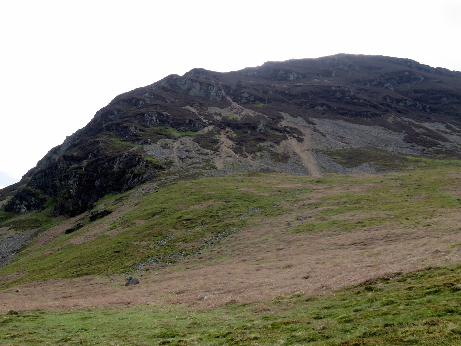
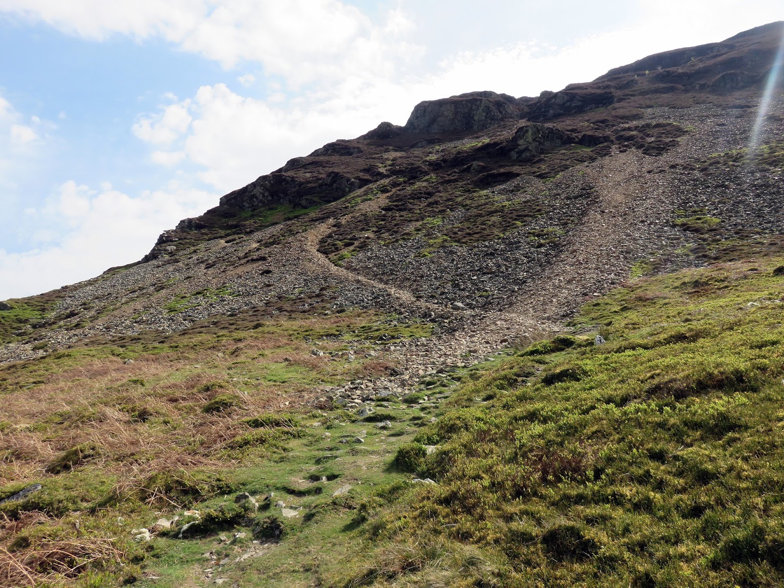
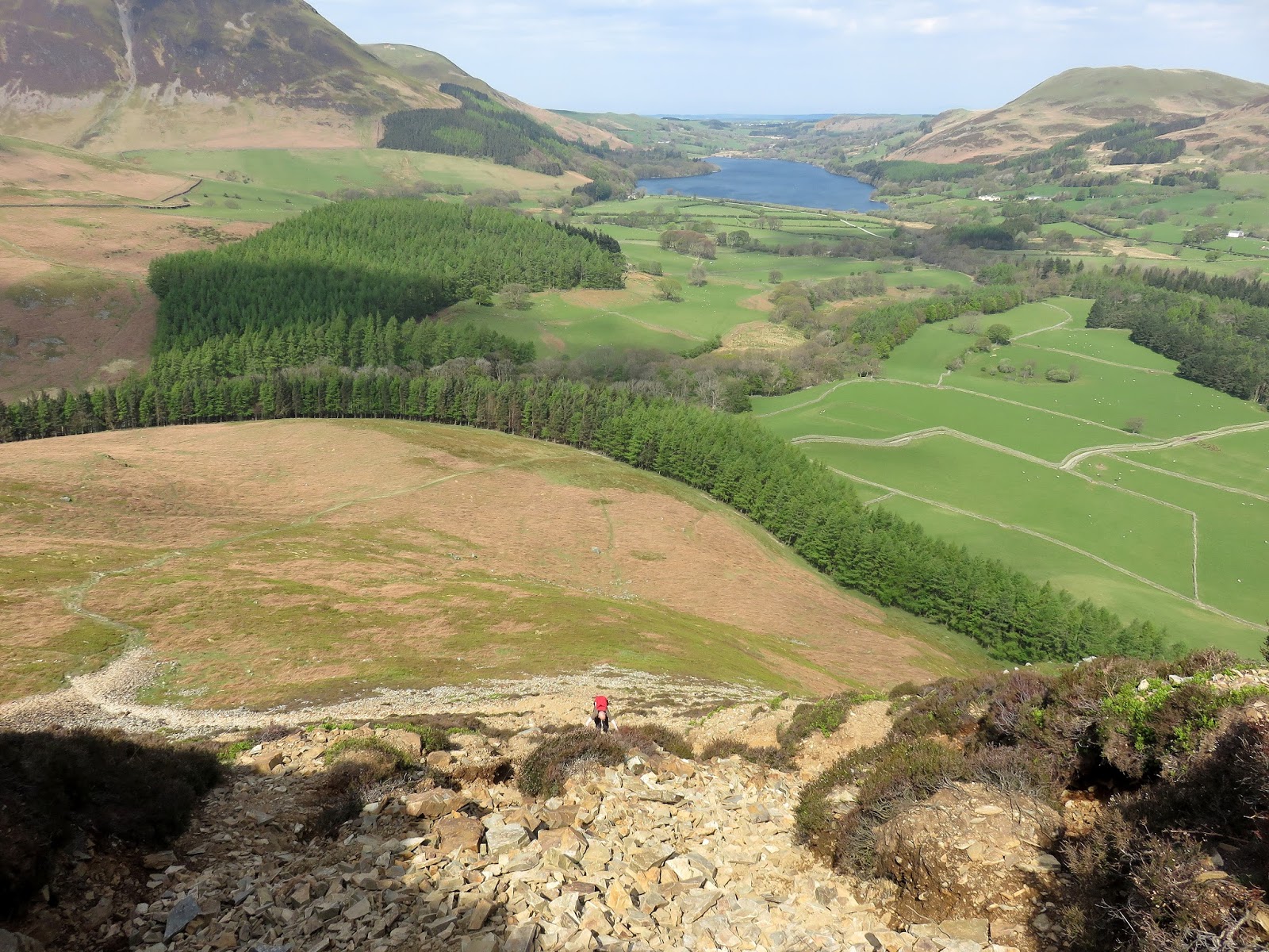
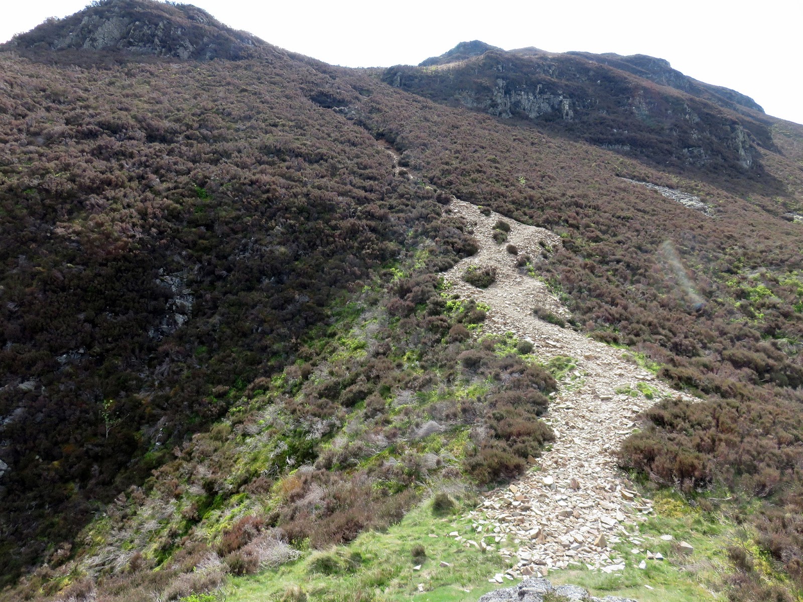
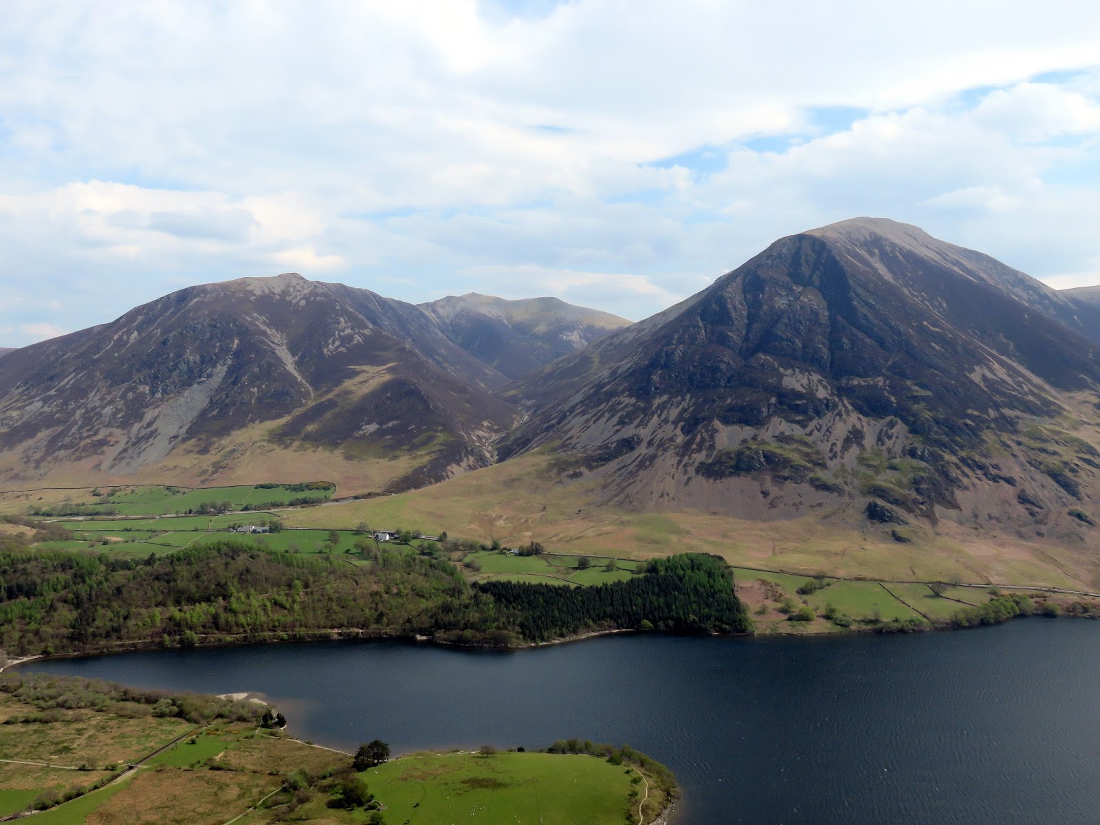
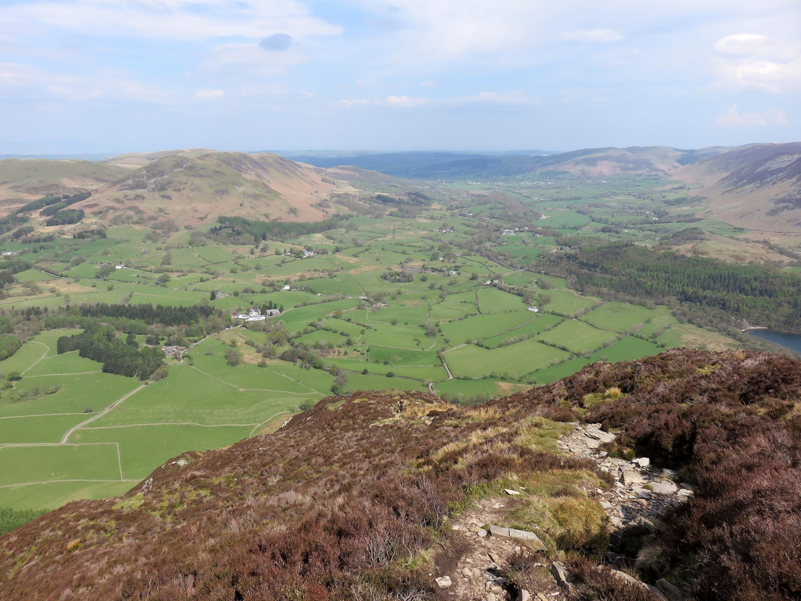
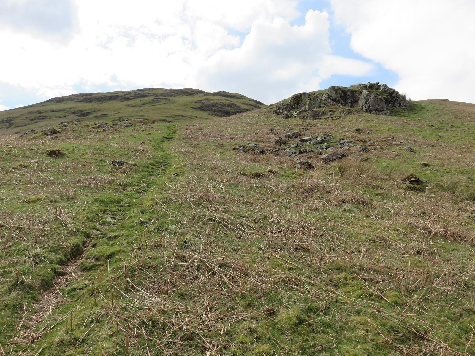
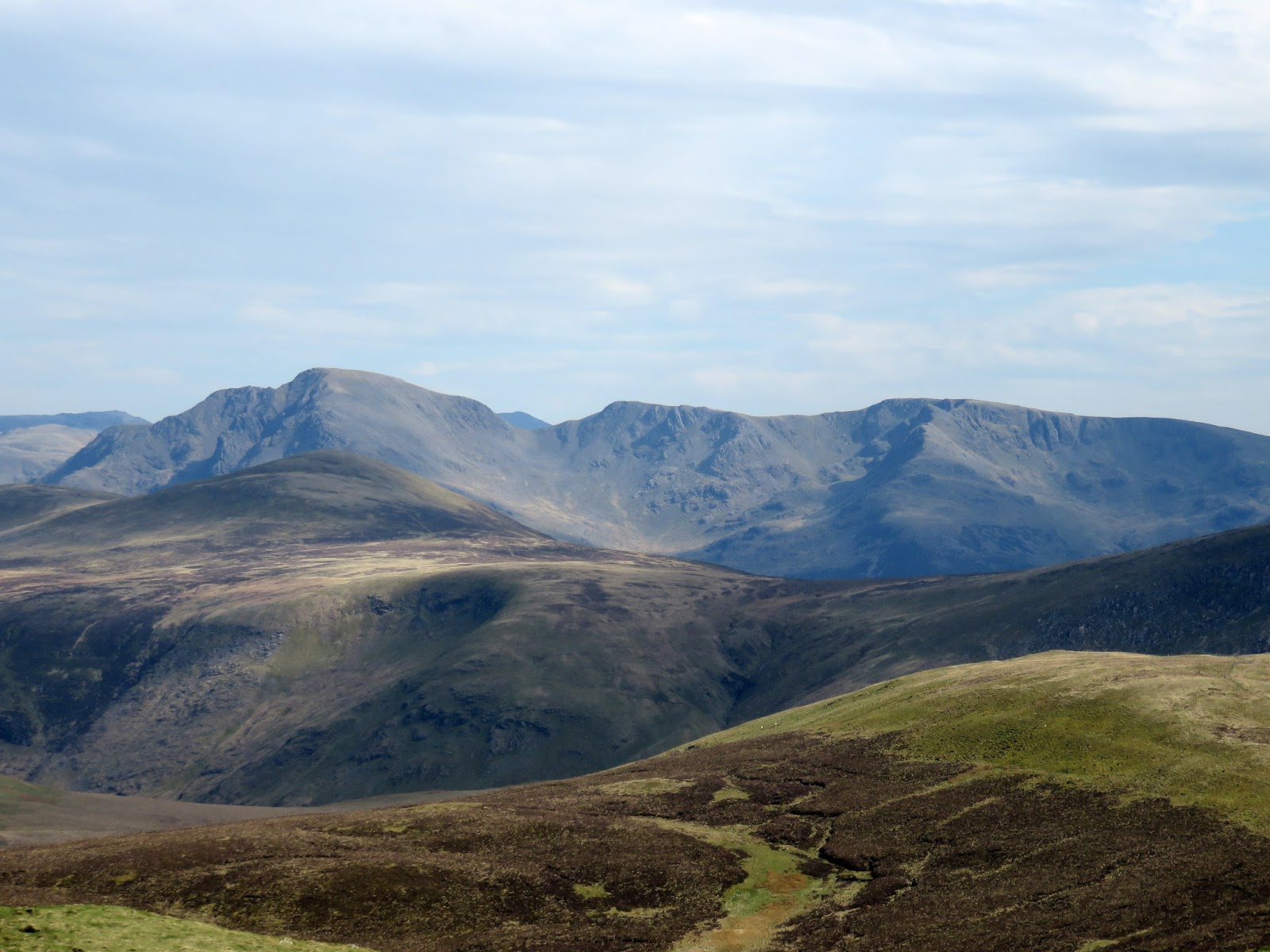
The route up Mellbreak begins with a steep scree path that winds up over Raven Crag to White Crag, steepening as it climbs which requires a few hand holds here and there. This reaches the first flat section which has a spectacular view of the Vale of Lorton and of Loweswater. From here, the path skirts the head of a deep ravine which falls to Highpark Farm and continues on up to the second prominence. From here you can see the ‘lovely peep around the corner’ made so famous by Alfred Wainwright.
 |
| Up the grass to the foot of the crags. The path winds up to a small gap between the rocks on the horizon |
 |
| The scree path |
 |
| Carling Knott |
 |
| Looking down the scree path towards Loweswater |
 |
| Blake Fell flanked by Black Crag and Carling Knott |
 |
| A superb panorama of the Vale of Lorton from the first prominence |
 |
| Looking down to Highpark |
 |
| Continuing the climb |
 |
| The second prominence |
 |
| “….a lovely peep around the corner” – directly into the sun |
 |
| Another phenomenal view from the second prominence this time |
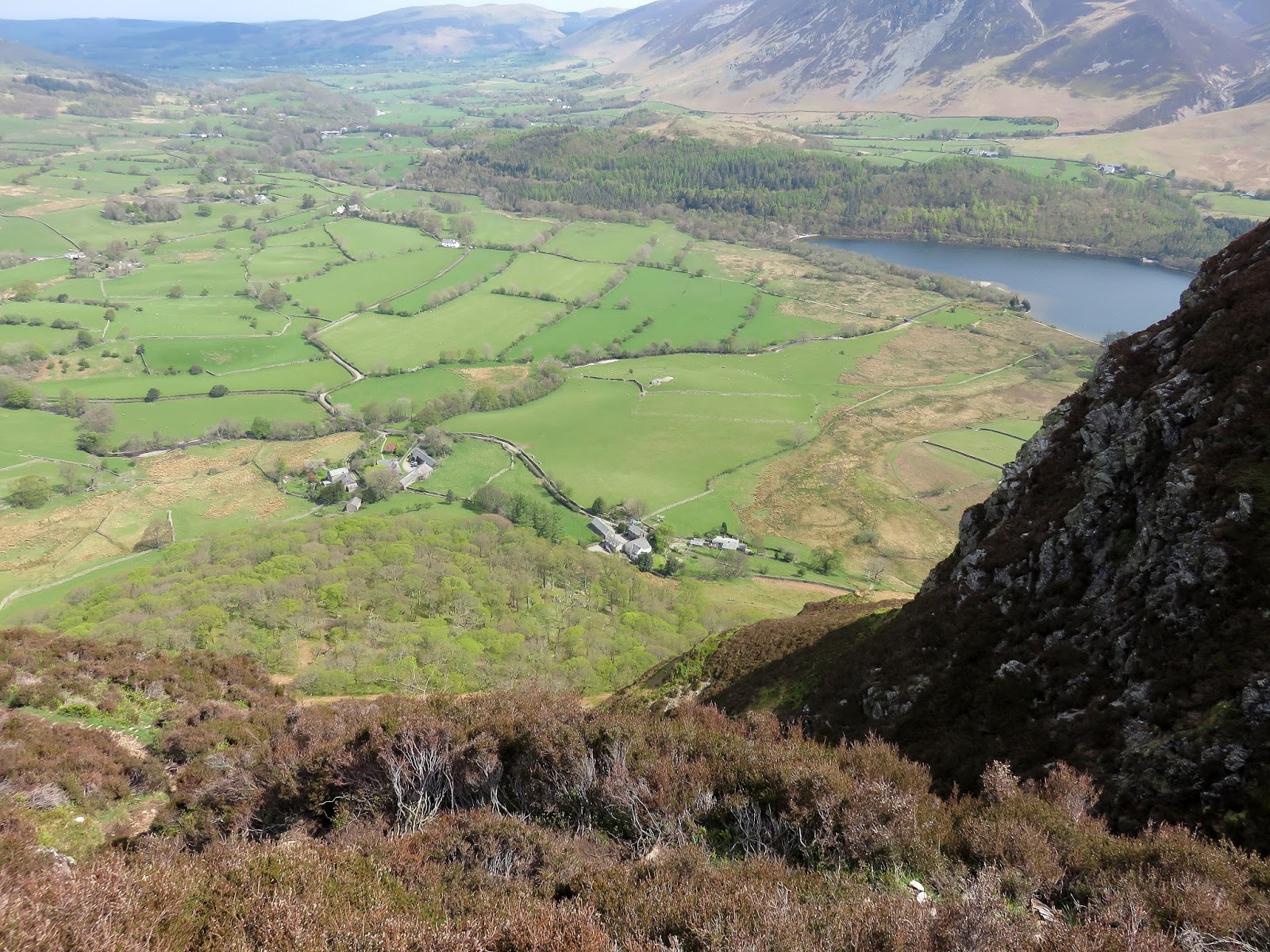
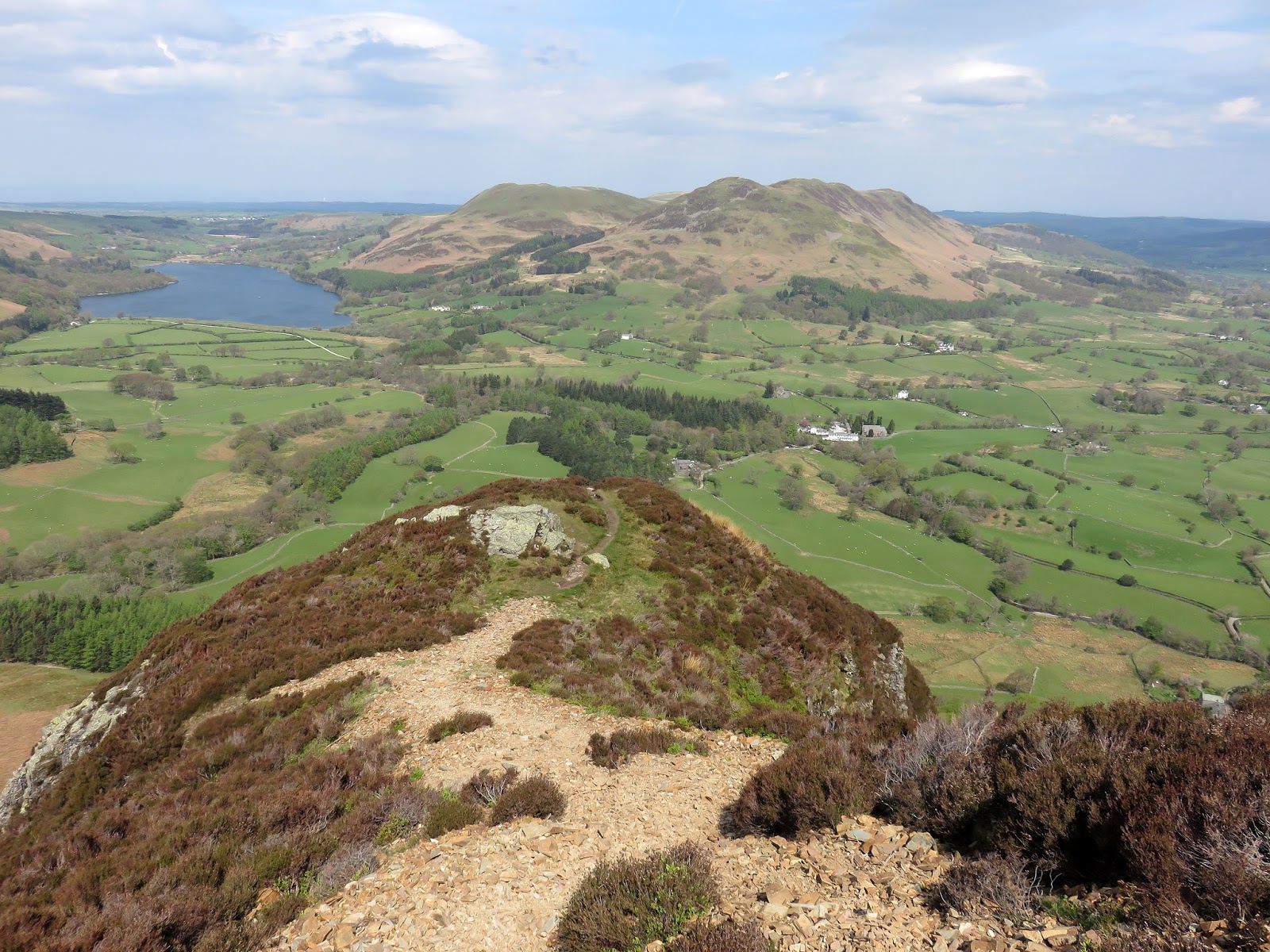
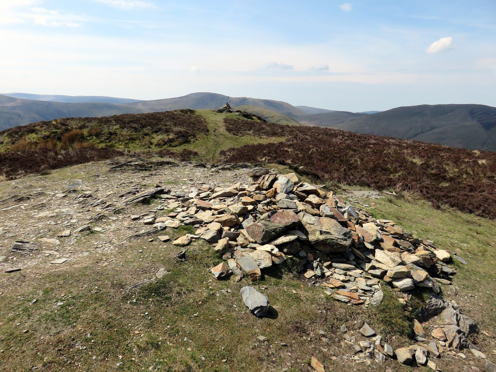
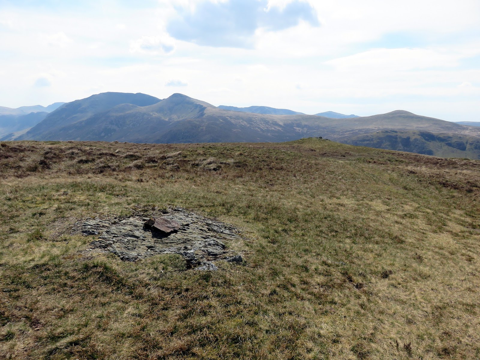
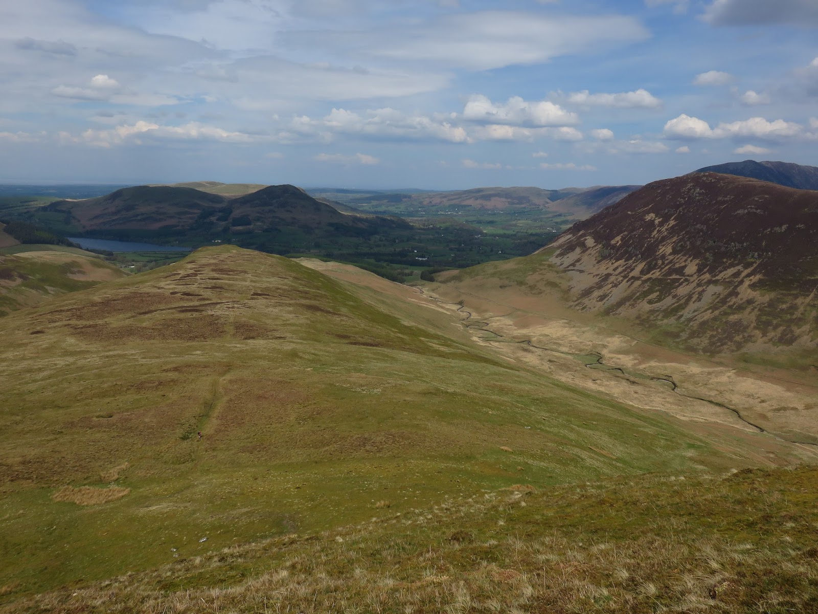
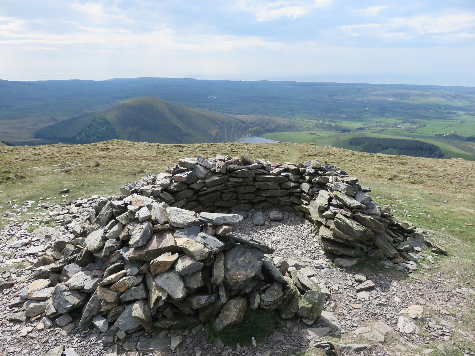
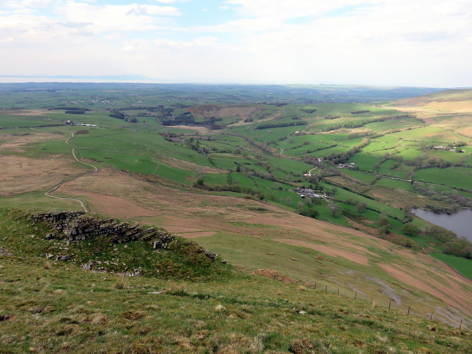
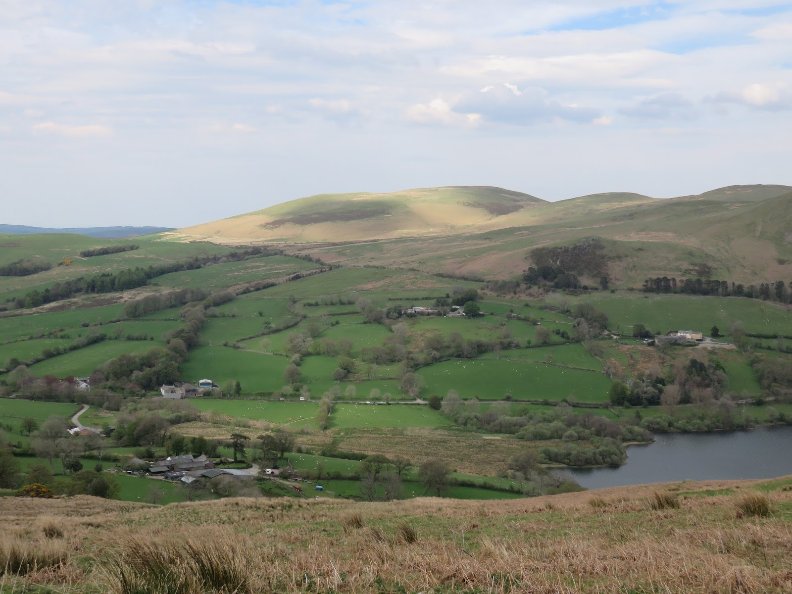
Most difficulty ceases here and the path climbs further until it reaches the north top of Mellbreak, the lower of the two but the better in terms of character. A depression separates the two tops with the southern one located around a kilometre away. It was already around midday by the time we arrived, a combination of car malfunctions, bank fraud and 2000 cyclists undertaking the Fred Whitton challenge all conspired for a later than planned start. As you may imagine, the south top has a very good view down Buttermere.
 |
| The Vale of Lorton |
 |
| The final climb to the north top |
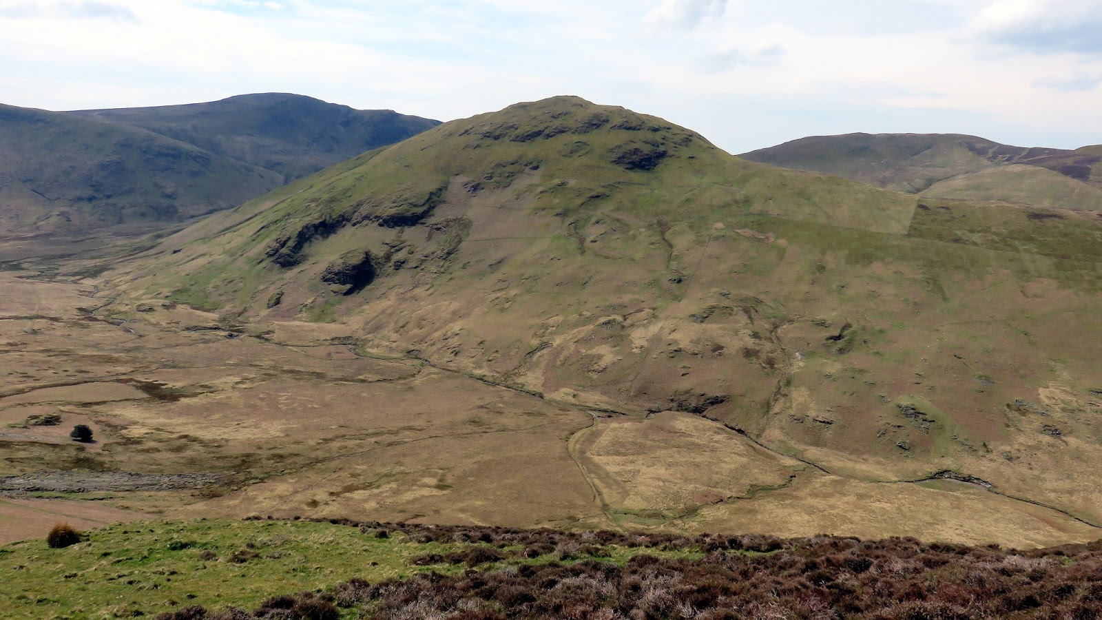
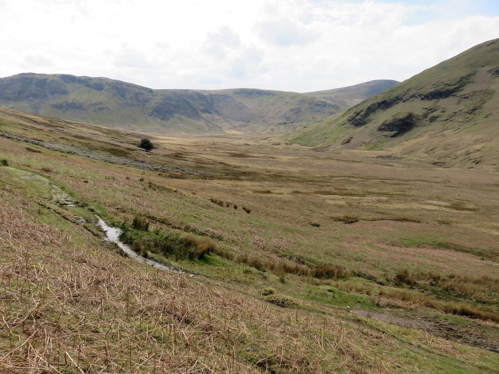
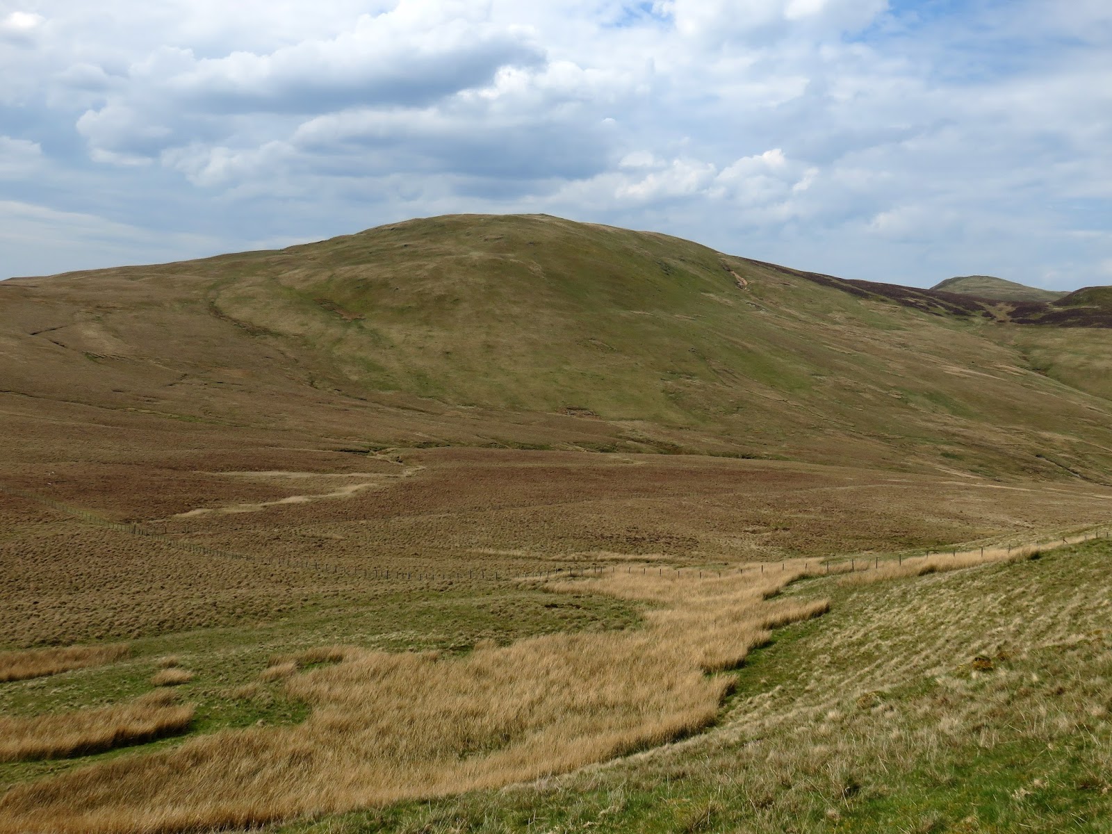
We’d been eyeing up our route to Hen Comb as soon as we arrived on the Mellbreak ridge, two options were presented to us. The first being a descent of the south ridge of Mellbreak followed by a long detour around the head of Mosedale. Longer but much less steep. The second option was the direct route, straight down and straight up. We opted for the latter.
 |
| Mosedale |
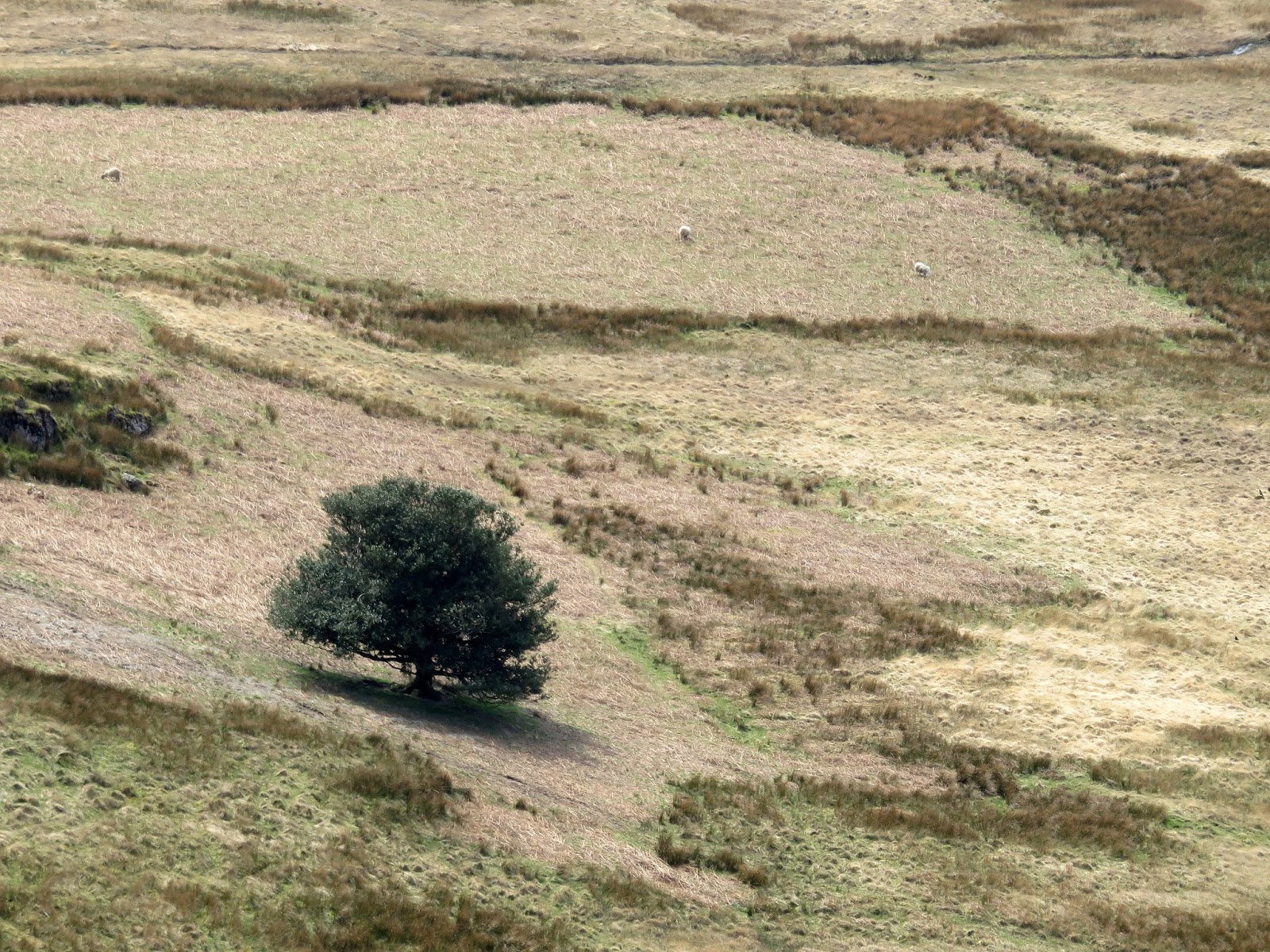
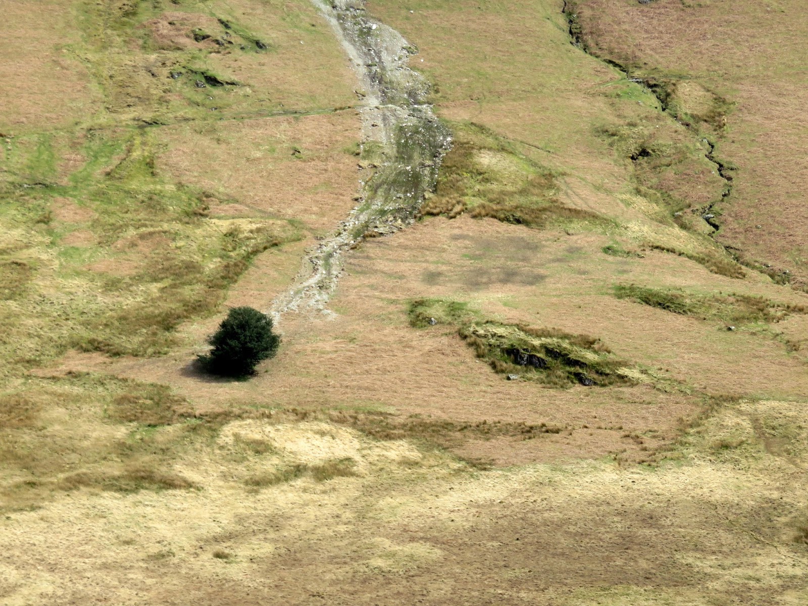
A path descends off Mellbreak to the west, down the steep slopes into Mosedale, eventually reaching Mosedale Beck. It was exceptionally warm in the valley so we stopped to refill water bottles in Mosedale Beck before the punishing climb up Hen Comb.
 |
| The Mosedale Holly Tree |
 |
| Mosedale |
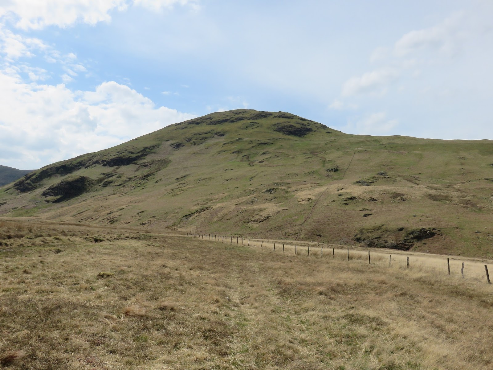
We took a direct route following a fence, straight up a 200m climb. It had appeared nearly vertical when viewed from Mellbreak but it wasn’t as bad as I had anticipated. There are no difficulties other than its steepness and we made fairly good time as we plodded up to the summit.
 |
| Looking up the steep climb |
 |
| The Mosedale Holly Tree once again |
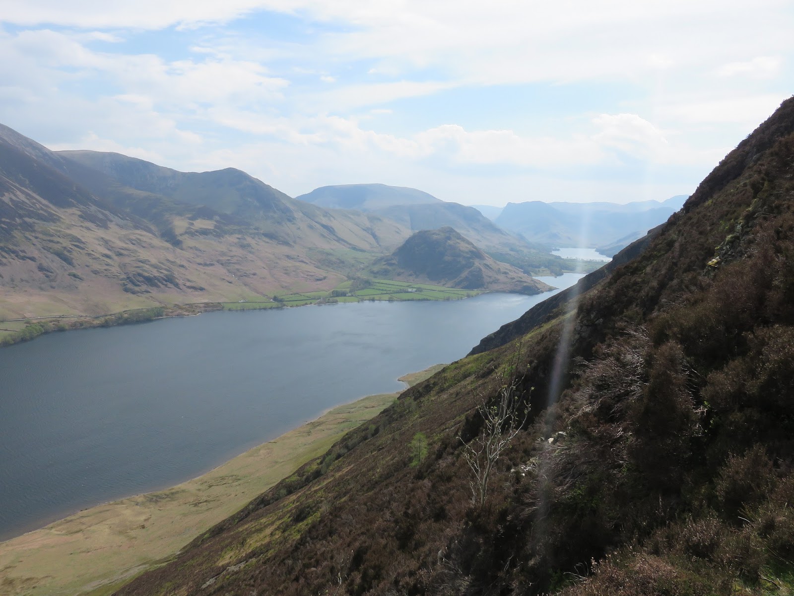
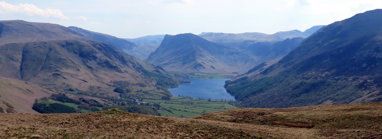
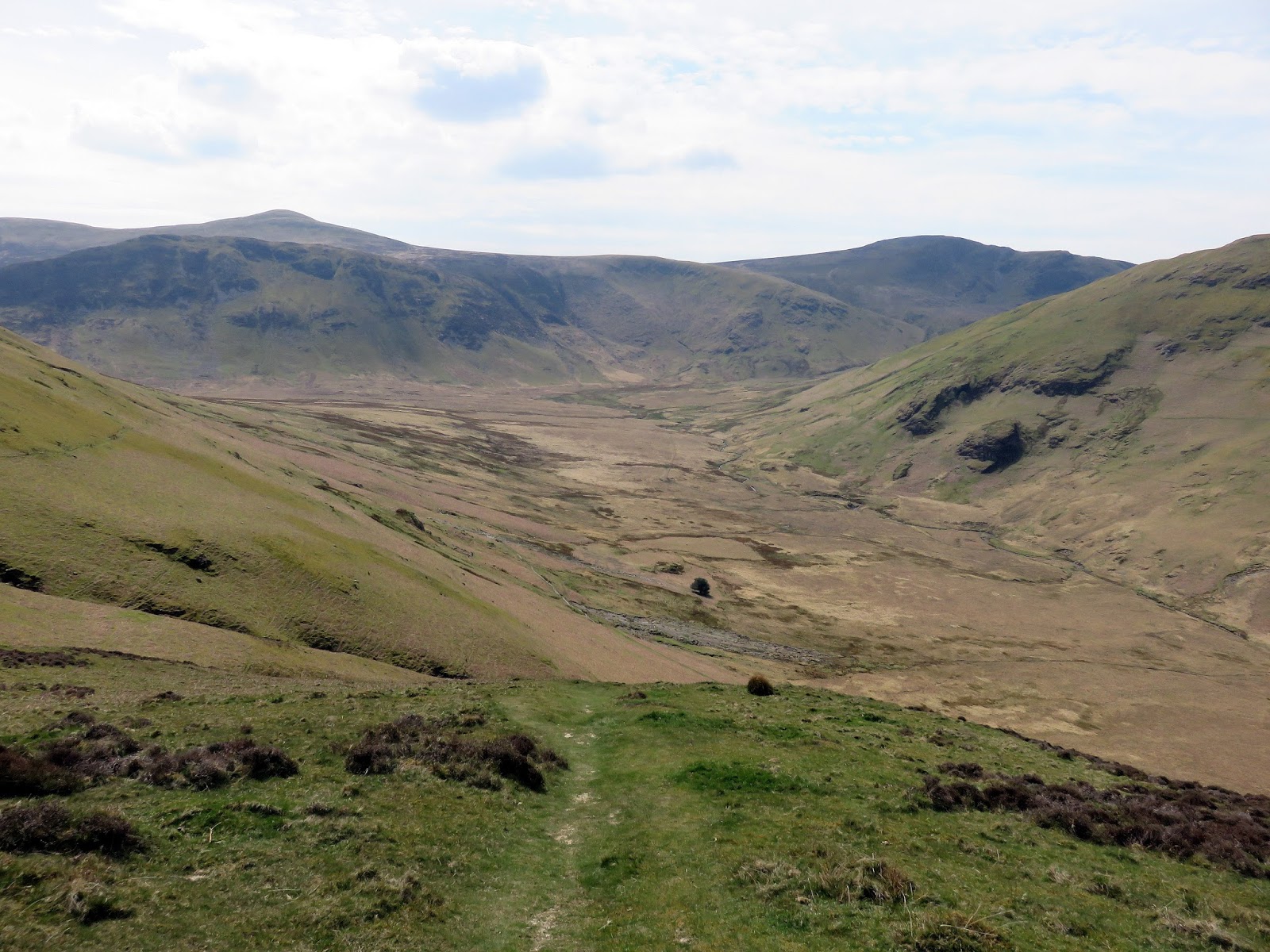
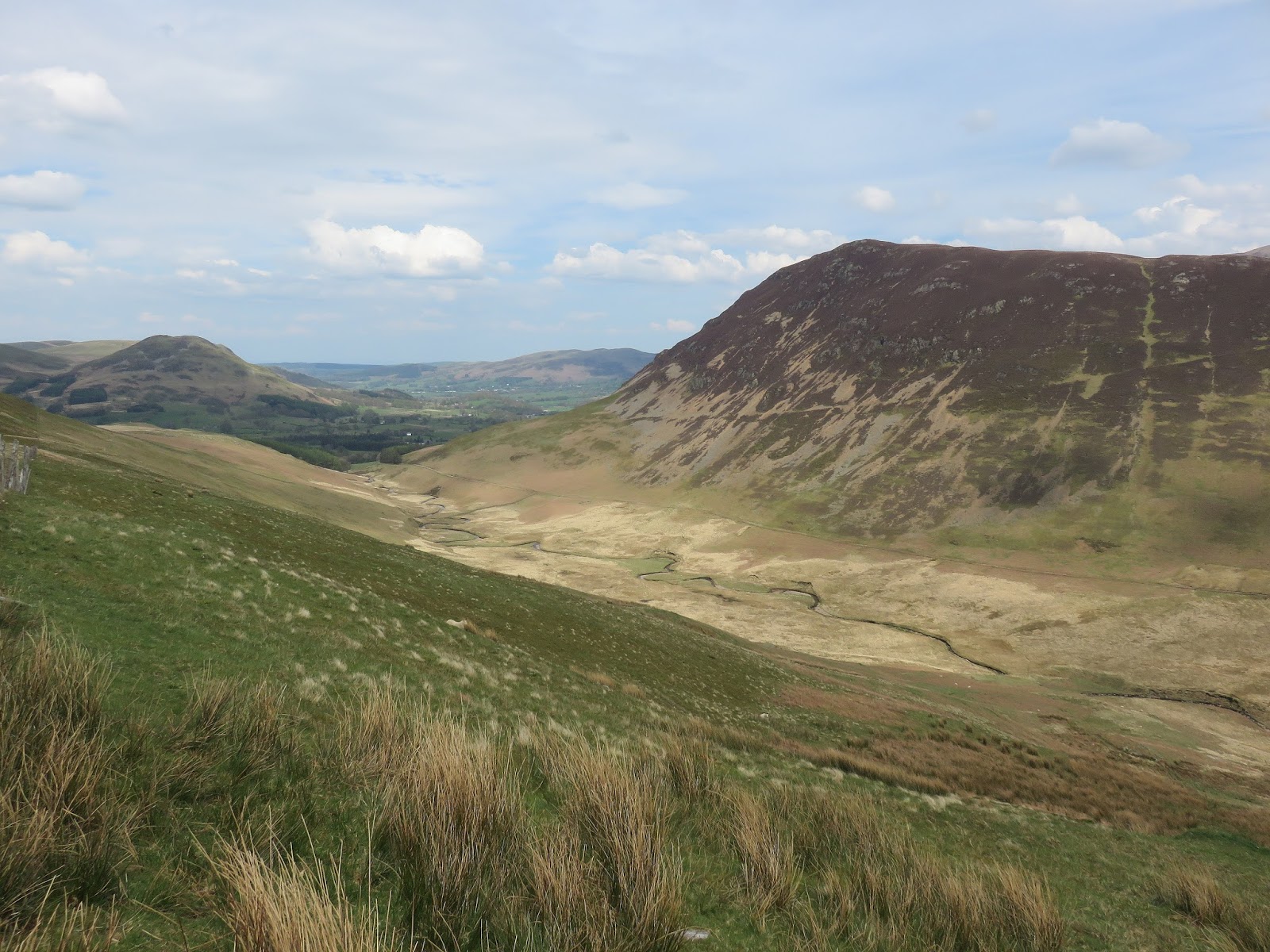
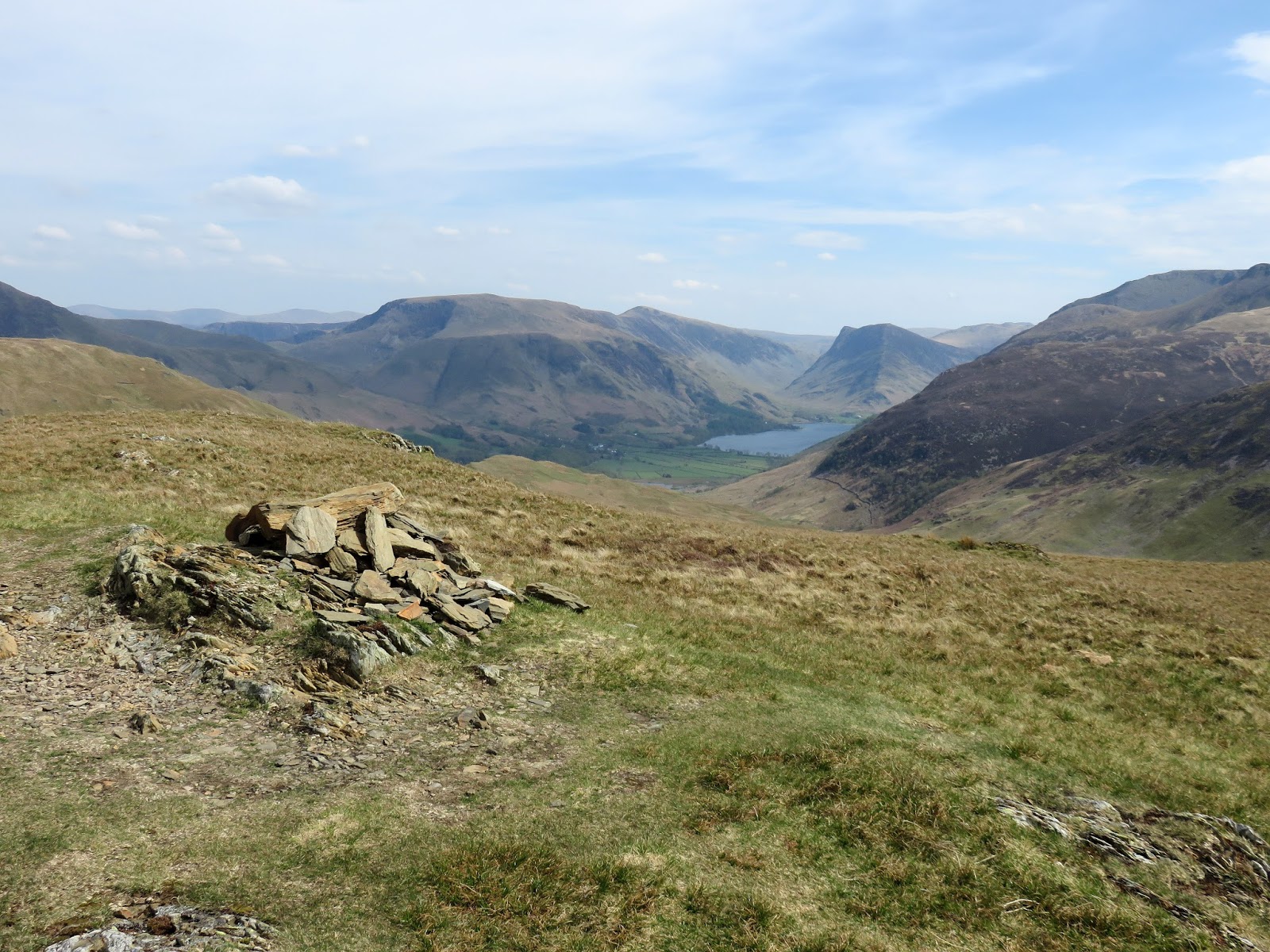
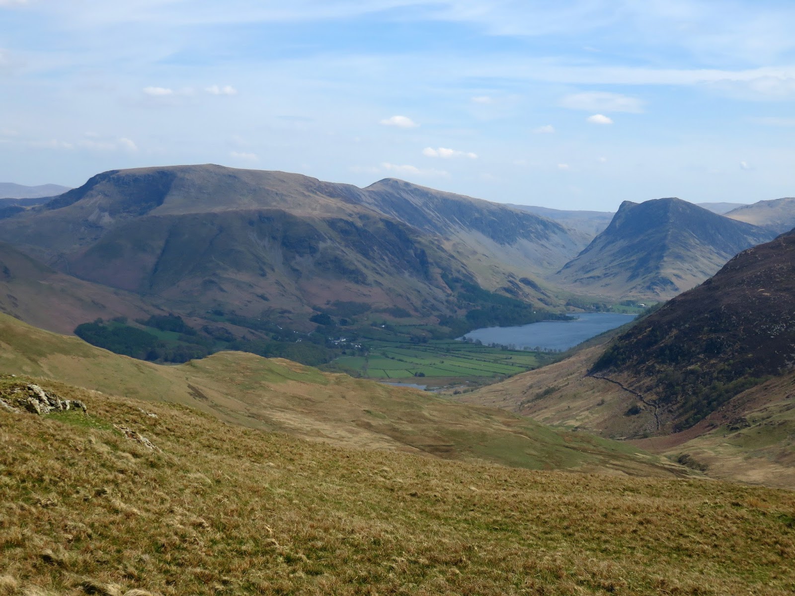
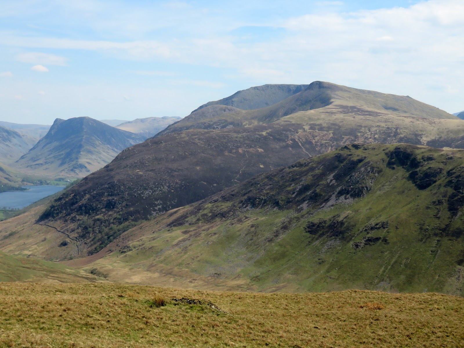
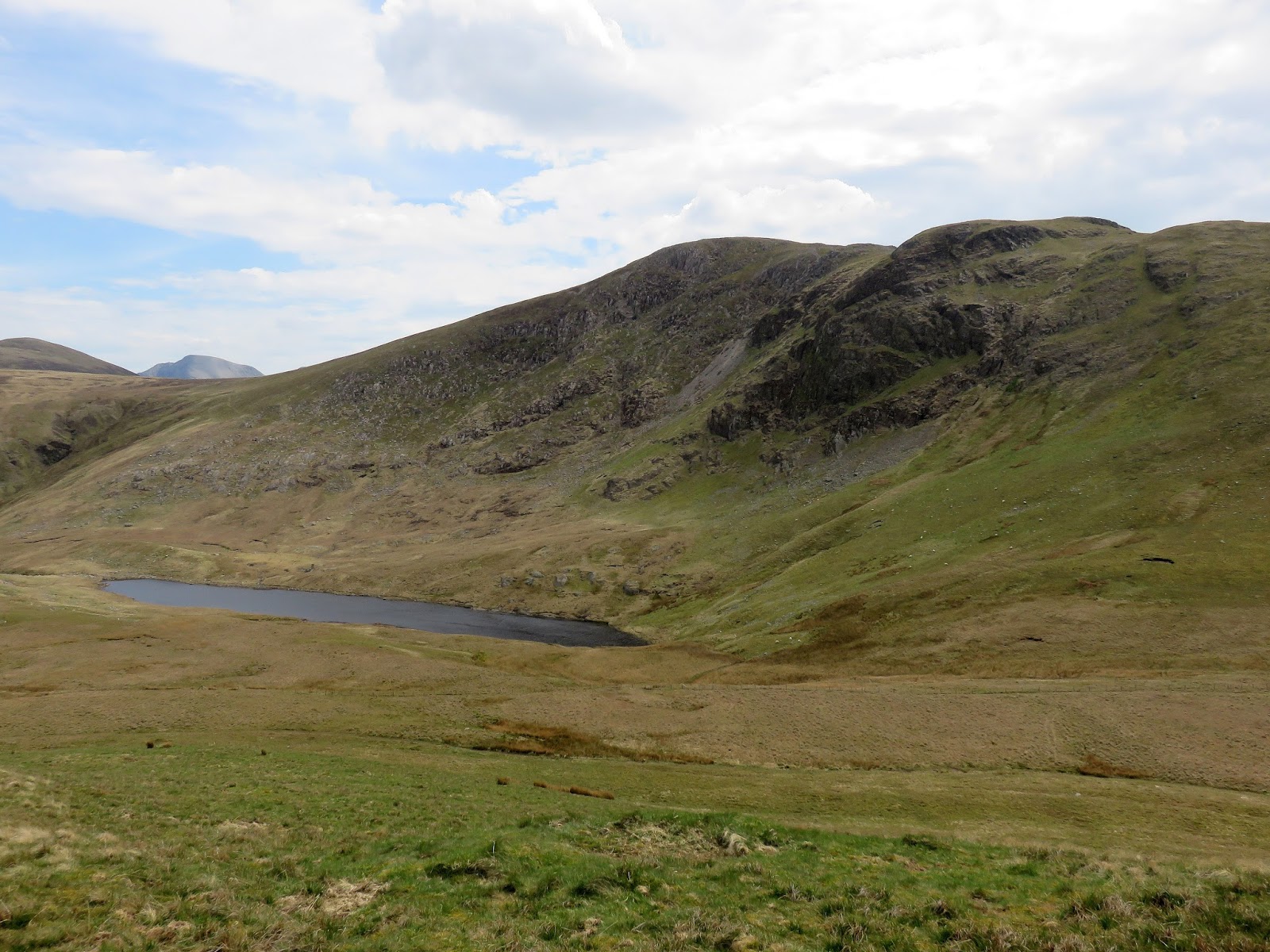
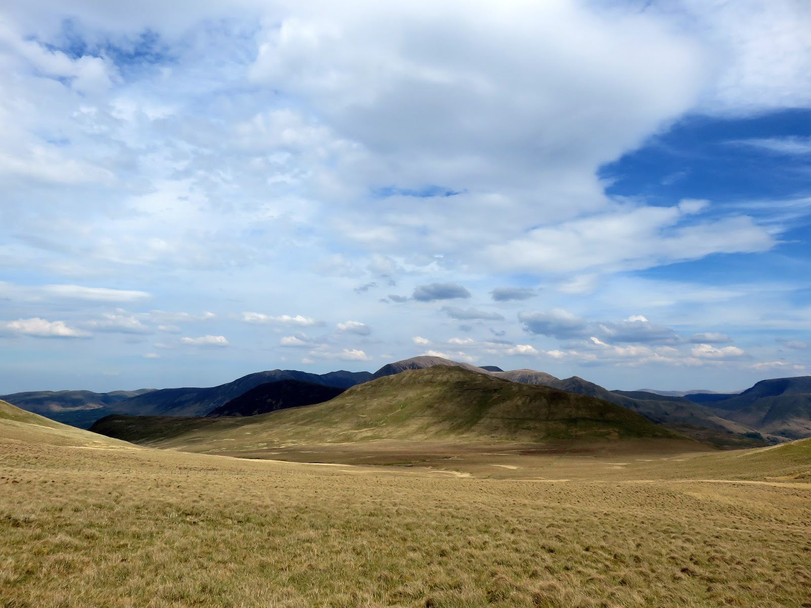
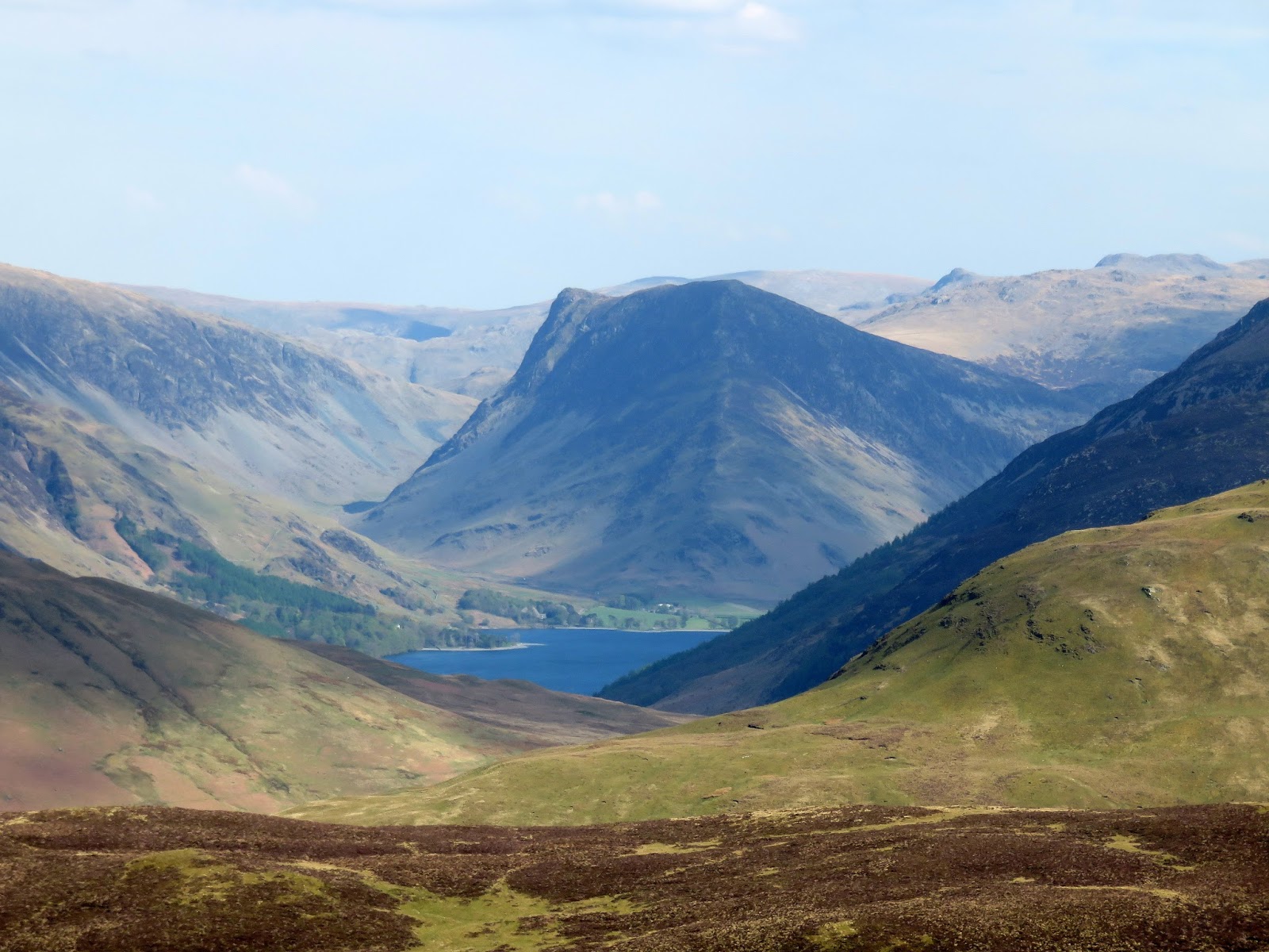
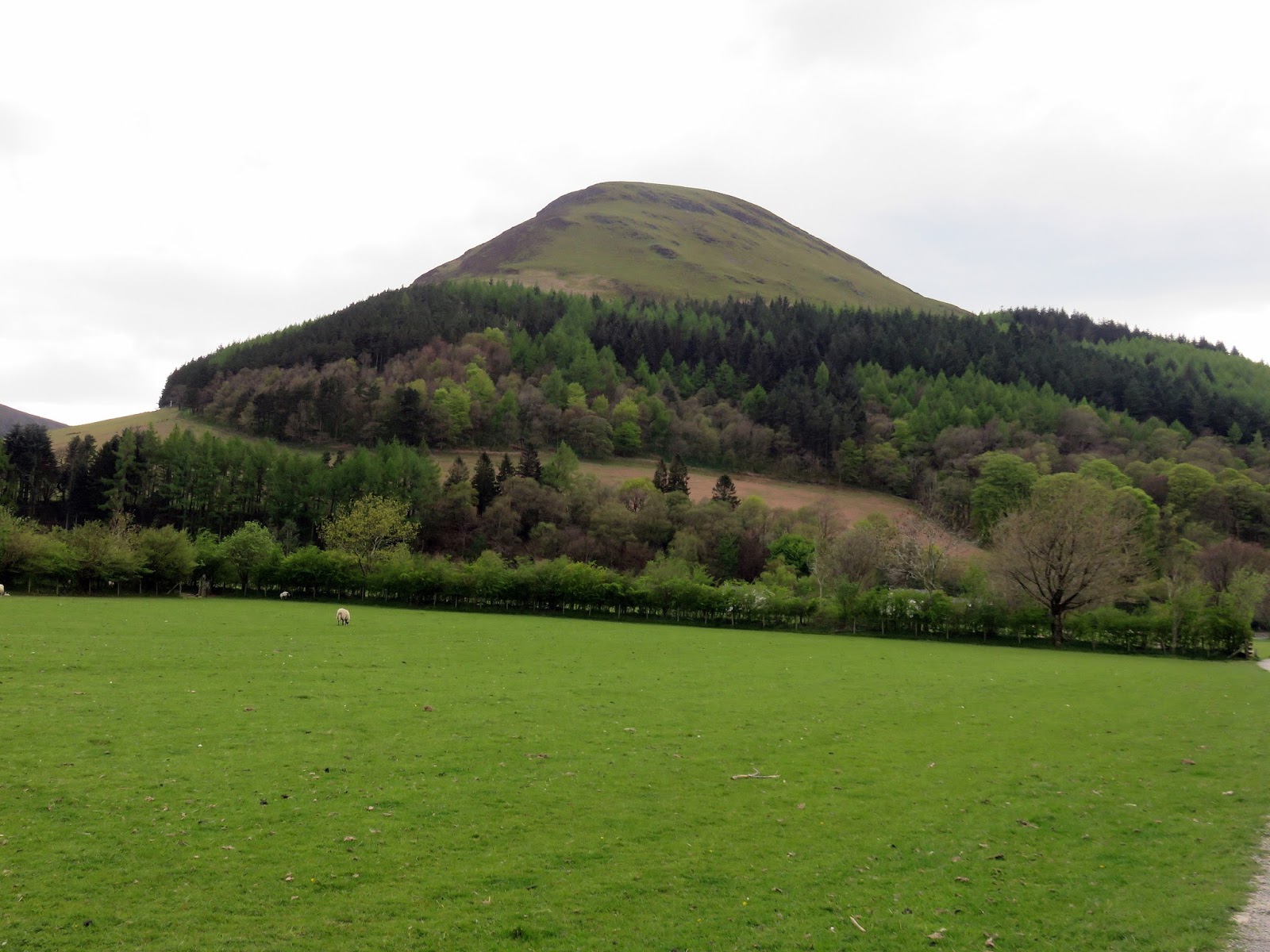
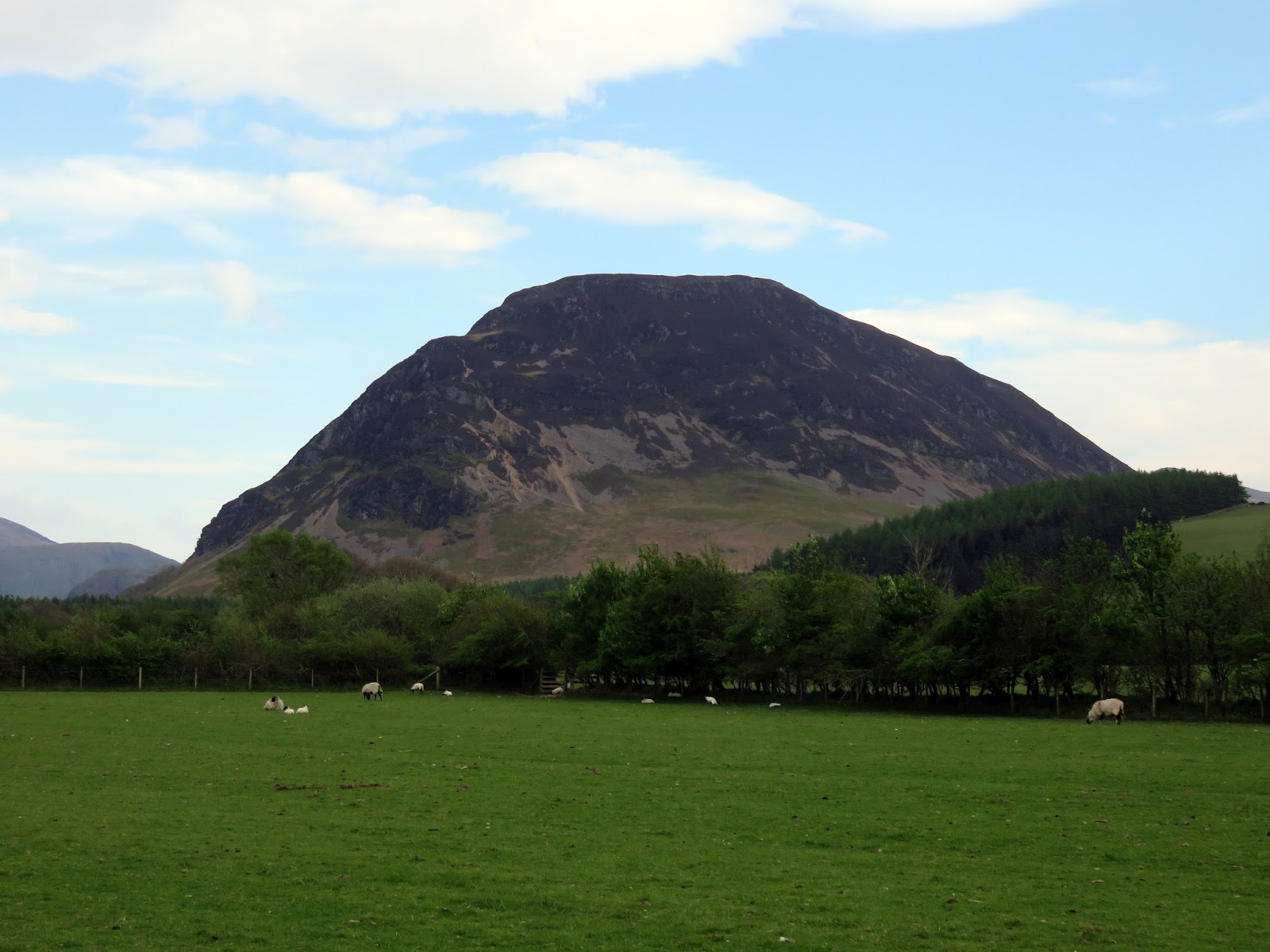
Hen Comb has a surprisingly good view, peeking through the gap of Scale Beck to see Fleetwith Pike and Buttermere to great effect. We took a more traditional route off Hen Comb into Whiteoak Moss, once again not half as bad as I expected, and made a short detour to the shapely Floutern Cop. The craggy north face of Great Borne can be well seen, towering above Floutern Tarn.
 |
| Floutern Cop |
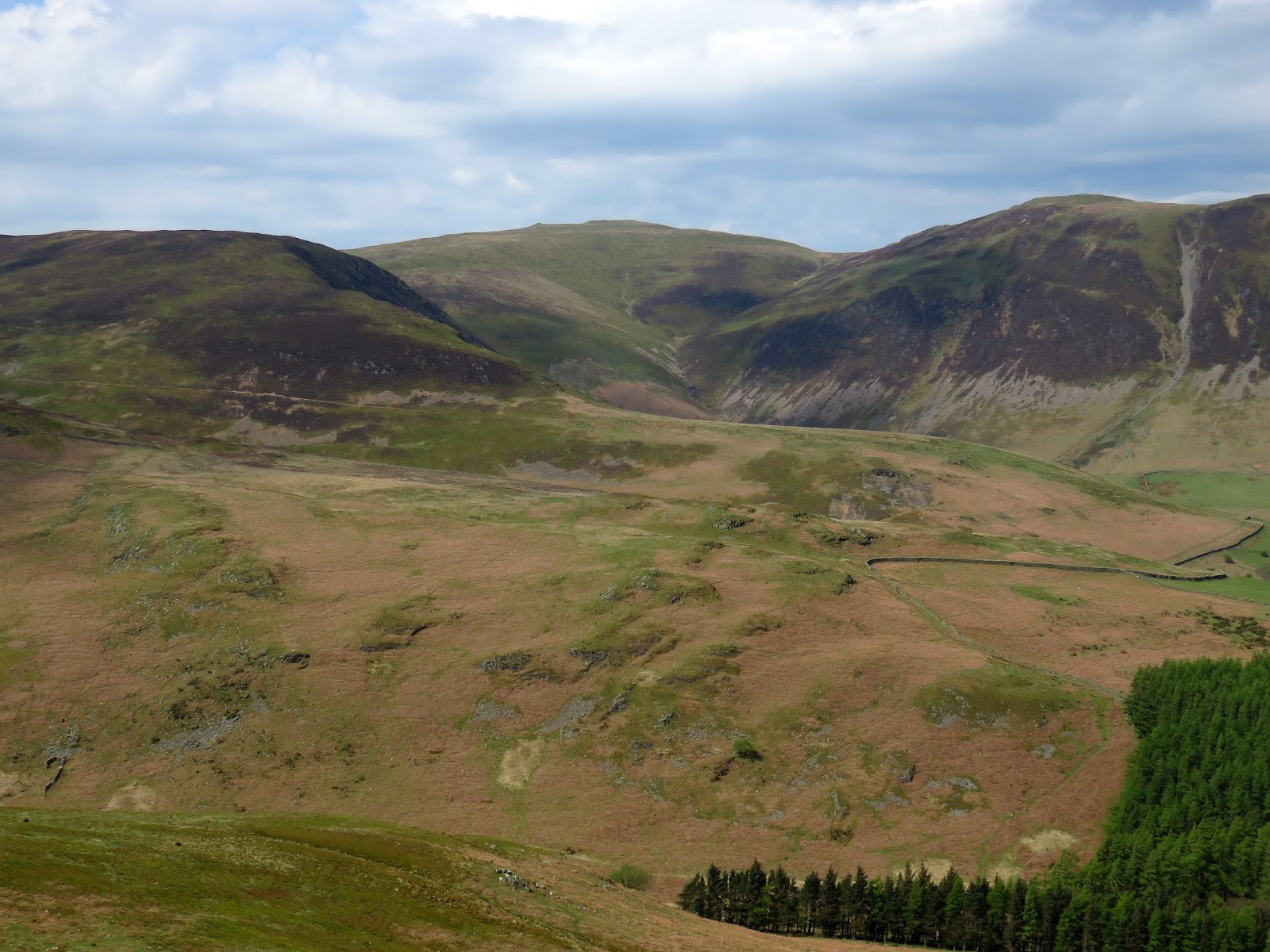
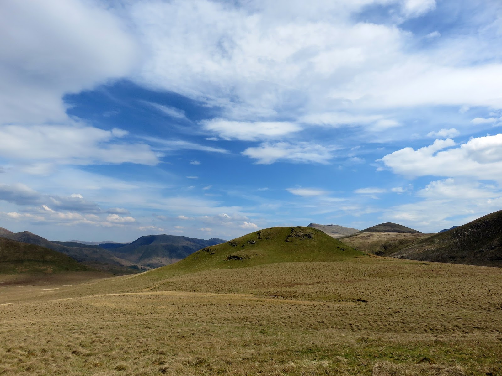
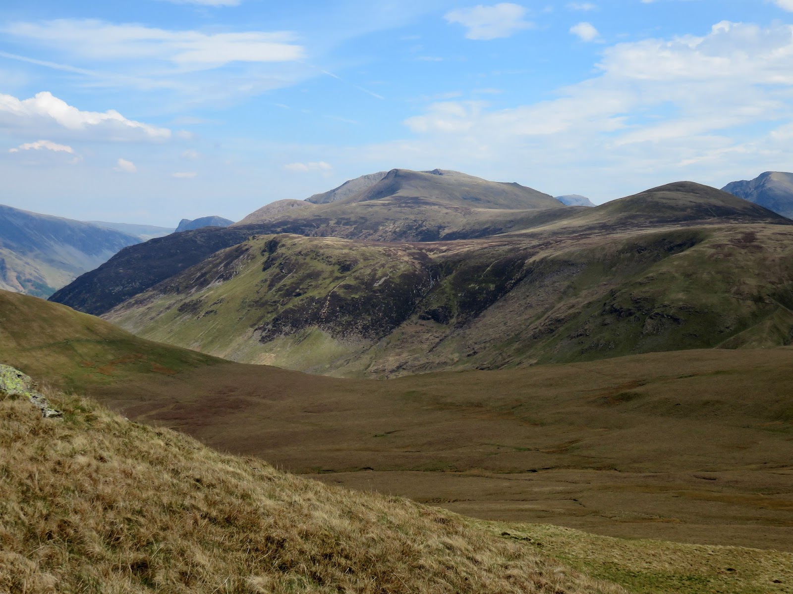
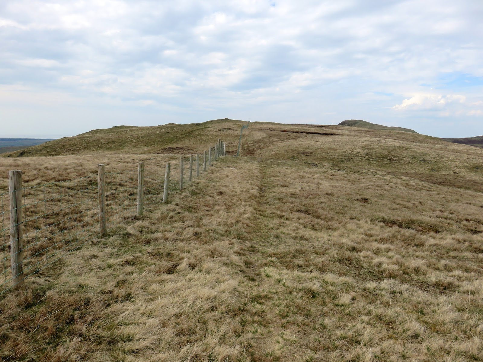
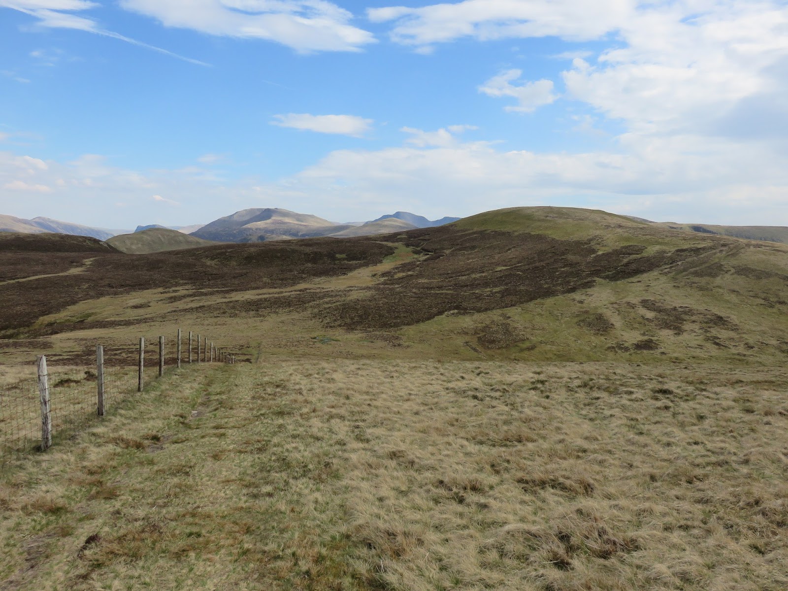
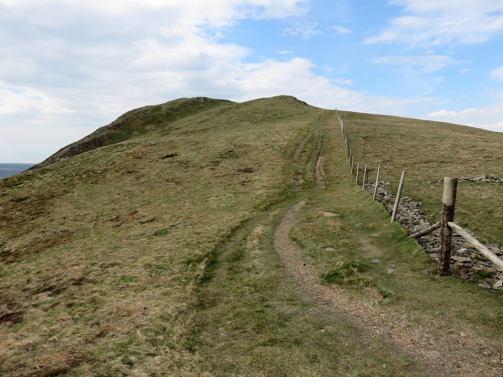
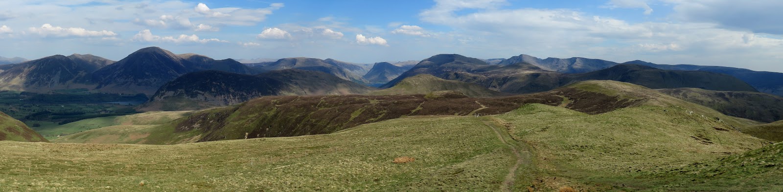
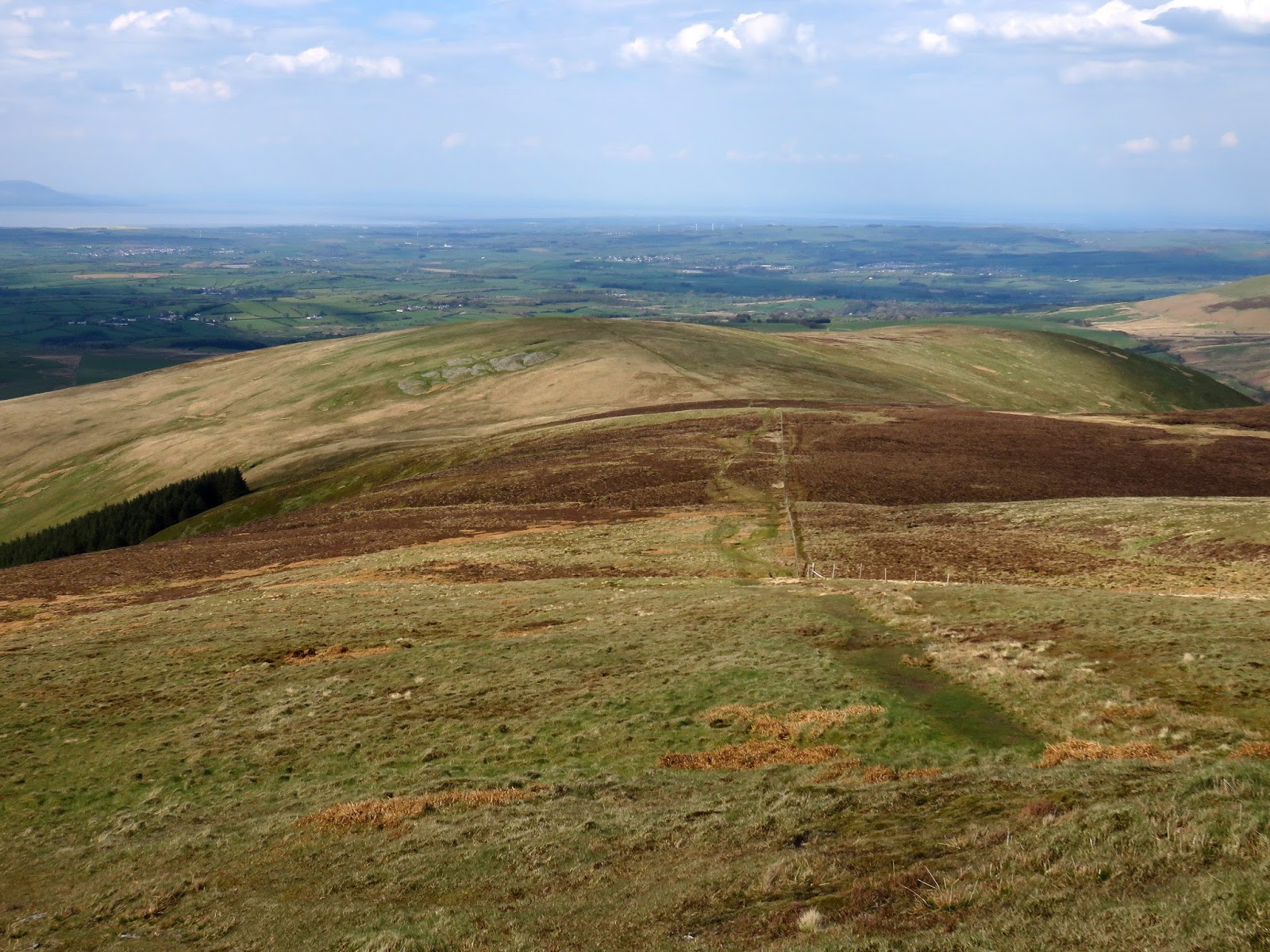
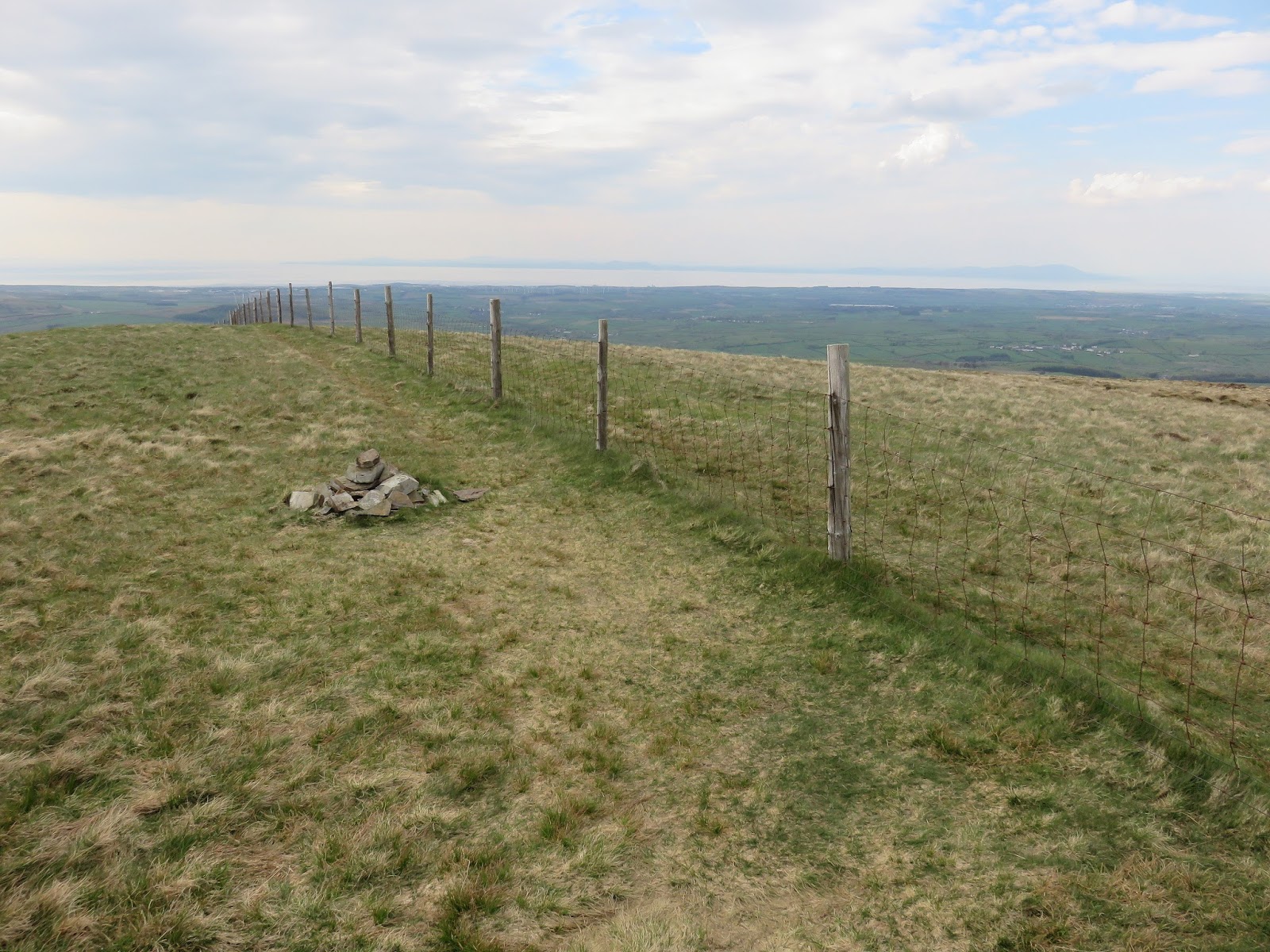
Crossing Whiteoak Moss once again, we rounded the head of Grain Gill before making the climb up Gavel Fell, the first of the final trio of Loweswater fells. Like most of the grassy fells of Lakeland, Gavel Fell bears little in the way of excitement but does have interesting view of the Pillar ridge from its summit. The route from here would follow a boundary fence across the tops of Blake Fell and Burnbank Fell – a great navigational aid if the clouds are down.
 |
| Beautiful skies over Hen Comb and Whiteoak Moss |
 |
| A view directly along the famous Buttermere ridge |
 |
| A feint path leads to the summit |
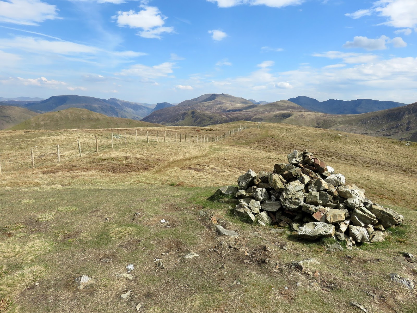
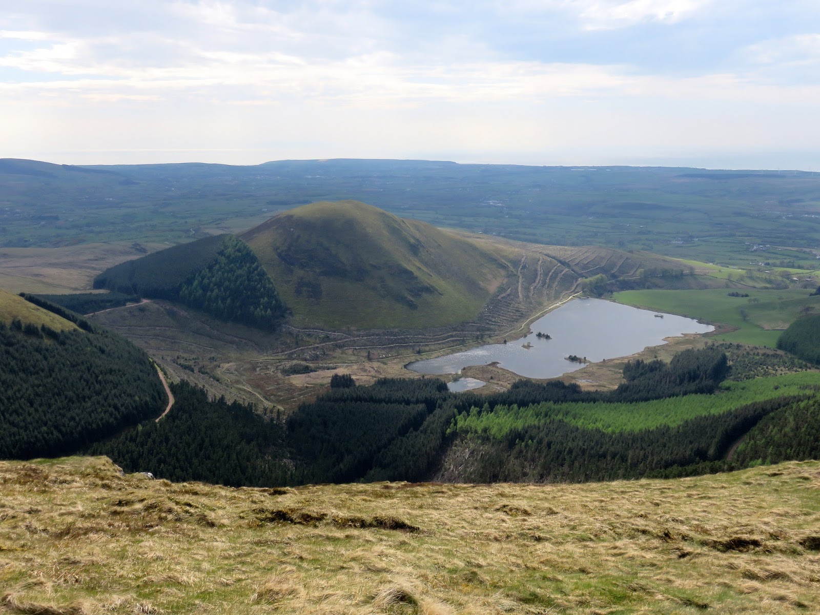
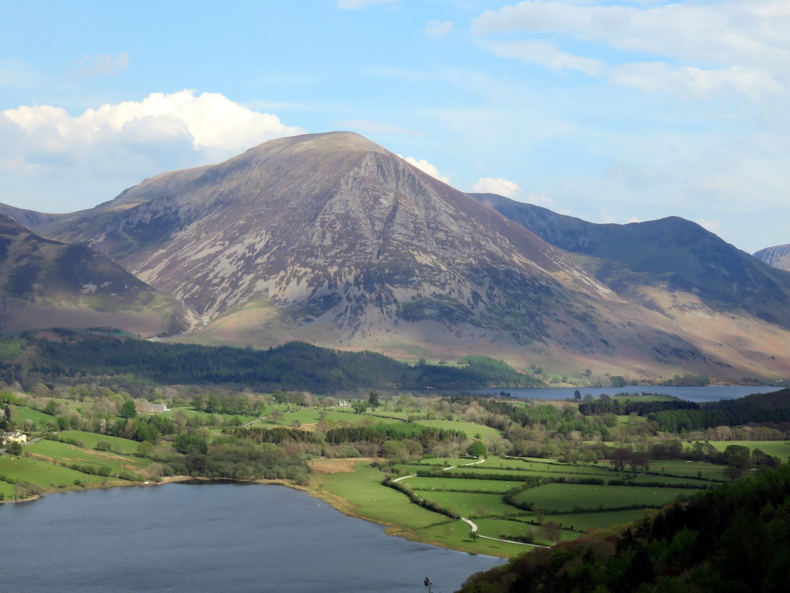
The climb up Blake Fell is straightforward and it marks the highest point of the Loweswater group, standing at a height of 573m. If it hadn’t been for the loss of height between Mellbreak and Hen Comb, this would have been a much easier day out. Blake Fell has a view of some of the lesser known areas of the Lake District, Lamplugh and the large Cogra Moss lake. Knock Murton also makes an appearance.
 |
| Add caption |
 |
| The path follows the fence to the summit |
 |
| Knock Murton and Cogra Moss |
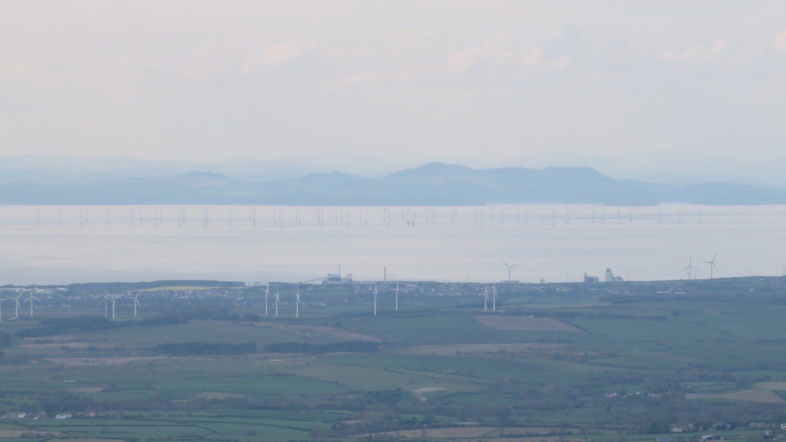
Over a peaty low spot stands Burnbank Fell, the beginning of the end of the Lake District. Again, like the fells before it, Burnbank Fell holds little in the way of excitement. Though not marked on the map, a path leaves the summit in a north easterly direction to the top of some steep and lose ground where it turns to bypass it on its way down the fell. It leads to a broad bridleway that links the small hamlet of Mockerin to the slightly larger hamlet of Loweswater. Despite the sensation that we were near the end of the walk, the bridleway follows the 300m contour among most of its length until it crosses Holme Beck.
 |
| View across the Solway Firth |
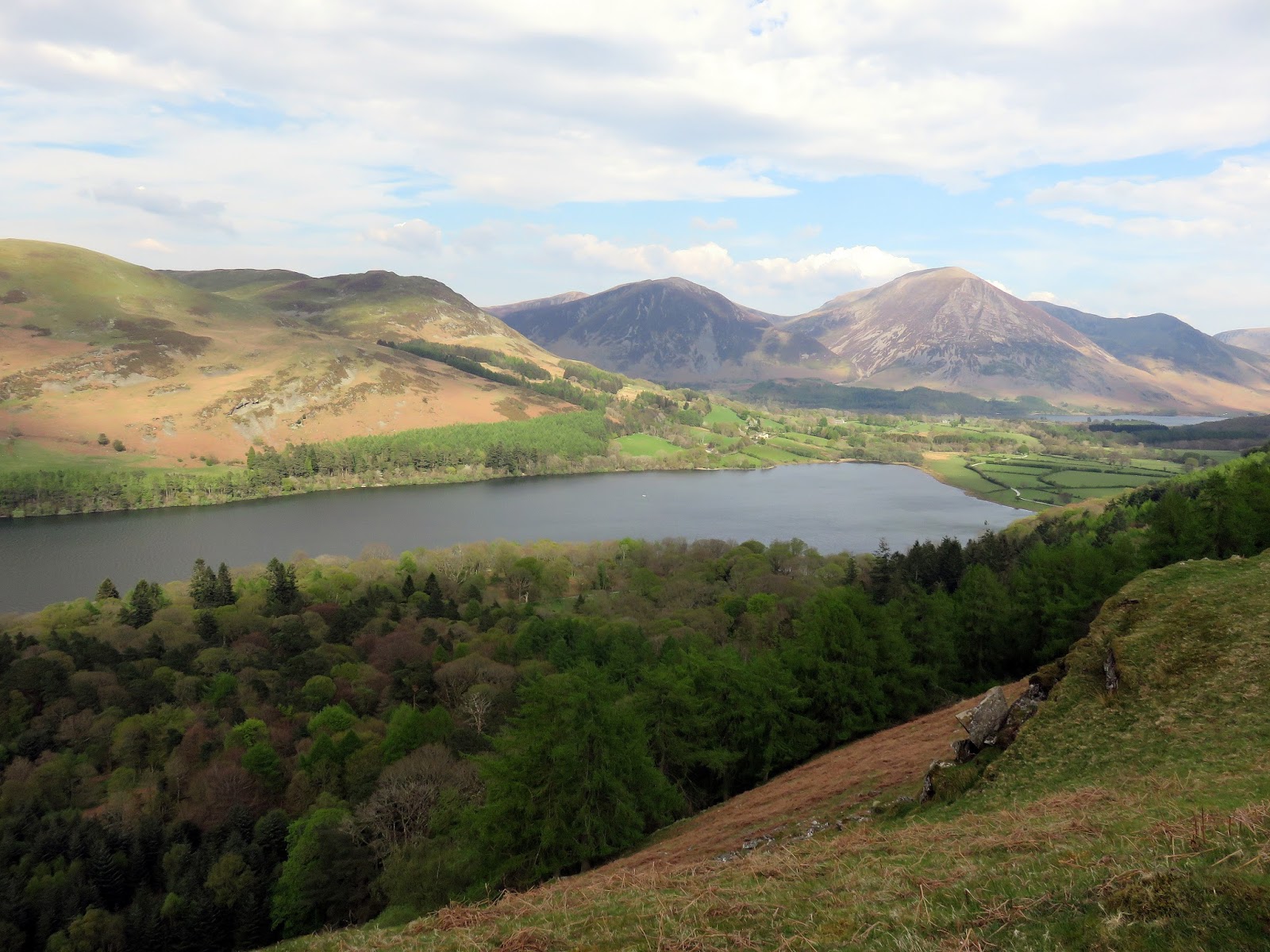
Here we entered Holme Wood, owned by the National Trust, and made a long, shallow descent down to the shores of Loweswater and Watergate Farm. An easy stroll across the flat lands at the outlet of Loweswater leads back to Maggie’s Bridge.
 |
| The edge of the Lake District at Mockerin |
 |
| Fellbarrow makes an appearance |
 |
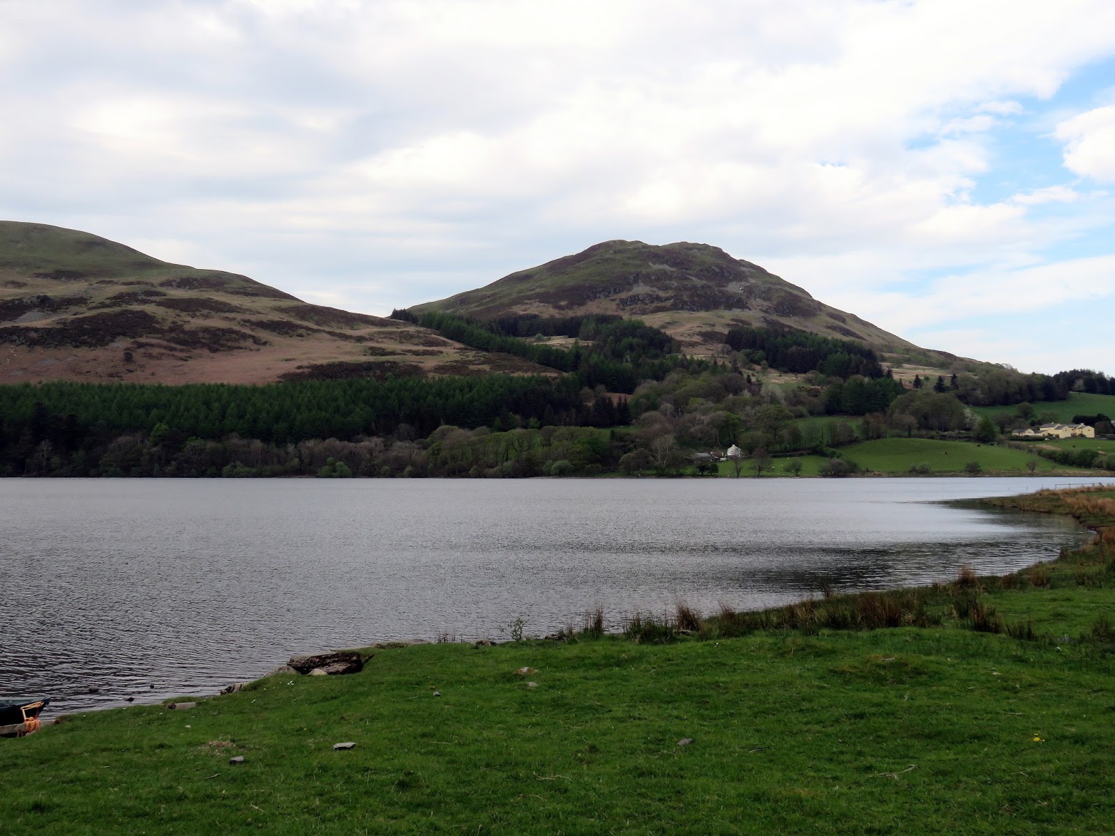
| Loweswater |
 |
| The trees of Holme Wood |
 |
| Low Fell over Loweswater |
 |
| Holme Wood wrapped around Carling Knott |
I’d say this was a walk of two halves, the highlight being the climb up Mellbreak which is as exciting as it appears from the map. The interest and the views start to diminish once you leave Hen Comb and venture into the hills of Blake Fell. There are plenty of additional summits hidden among the trees and I’d like to get acquainted with them at some point – probably if I start to walk the routes described in Bill Birkett’s complete Lakeland fells book.


