Open Space Web-Map builder Codehttps://openspace.ordnancesurvey.co.uk/osmapapi/openspace.js?key=3119F72552FD5C22E0530C6CA40A5A92https://openspace.ordnancesurvey.co.uk/osmapapi/script/mapbuilder/basicmap.jshttps://openspace.ordnancesurvey.co.uk/osmapapi/script/mapbuilder/searchbox.js//variables for routes var linesLayer, points, lineFeature, lineString, routeMarkersLayer, routepos, routesize, routeoffset, routeicon; var style_blue = {strokeColor: “#0000CD”, strokeOpacity: 0.5, strokeWidth: 4.5}; function initmapbuilder() { //initiate the map var options = {resolutions: [2500, 1000, 500, 200, 100, 50, 25, 10, 5, 4, 2.5, 2, 1]}; osMap = new OpenSpace.Map(‘map’, options); //configure map options (basicmap.js) setglobaloptions(); //set the center of the map and the zoom level osMap.setCenter(new OpenSpace.MapPoint(395188.9974823,476562.00125885),7); linesLayer = osMap.getVectorLayer(); // Set up layer for route markers routeMarkersLayer = new OpenLayers.Layer.Markers(“Route Markers”); //make a route points = new Array(); points.push(new OpenLayers.Geometry.Point(394275.66412354,477253.66793823)); points.push(new OpenLayers.Geometry.Point(394355.66412354,477308.66793823)); points.push(new OpenLayers.Geometry.Point(394410.66412354,477398.66793823)); points.push(new OpenLayers.Geometry.Point(394485.66412354,477488.66793823)); points.push(new OpenLayers.Geometry.Point(394545.66412354,477528.66793823)); points.push(new OpenLayers.Geometry.Point(394570.66412354,477568.66793823)); points.push(new OpenLayers.Geometry.Point(394630.66412354,477628.66793823)); points.push(new OpenLayers.Geometry.Point(394715.66412354,477633.66793823)); points.push(new OpenLayers.Geometry.Point(394830.66412354,477688.66793823)); points.push(new OpenLayers.Geometry.Point(394970.66412354,477768.66793823)); points.push(new OpenLayers.Geometry.Point(395045.66412354,477838.66793823)); points.push(new OpenLayers.Geometry.Point(395130.66412354,477938.66793823)); points.push(new OpenLayers.Geometry.Point(395185.66412354,477993.66793823)); points.push(new OpenLayers.Geometry.Point(395275.66412354,478038.66793823)); points.push(new OpenLayers.Geometry.Point(395395.66412354,478058.66793823)); points.push(new OpenLayers.Geometry.Point(395455.66412354,478113.66793823)); points.push(new OpenLayers.Geometry.Point(395405.66412354,478133.66793823)); points.push(new OpenLayers.Geometry.Point(395405.66412354,478248.66793823)); points.push(new OpenLayers.Geometry.Point(395445.66412354,478348.66793823)); points.push(new OpenLayers.Geometry.Point(395570.66412354,478438.66793823)); points.push(new OpenLayers.Geometry.Point(395725.66412354,478528.66793823)); points.push(new OpenLayers.Geometry.Point(395855.66412354,478573.66793823)); points.push(new OpenLayers.Geometry.Point(395945.66412354,478653.66793823)); points.push(new OpenLayers.Geometry.Point(396090.66412354,478778.66793823)); points.push(new OpenLayers.Geometry.Point(396115.66412354,478518.66793823)); points.push(new OpenLayers.Geometry.Point(396190.66412354,478298.66793823)); points.push(new OpenLayers.Geometry.Point(396210.66412354,477943.66793823)); points.push(new OpenLayers.Geometry.Point(396270.66412354,477888.66793823)); points.push(new OpenLayers.Geometry.Point(396370.66412354,477828.66793823)); points.push(new OpenLayers.Geometry.Point(396525.66412354,477718.66793823)); points.push(new OpenLayers.Geometry.Point(396565.66412354,477663.66793823)); points.push(new OpenLayers.Geometry.Point(396485.66412354,477558.66793823)); points.push(new OpenLayers.Geometry.Point(396470.66412354,477458.66793823)); points.push(new OpenLayers.Geometry.Point(396365.66412354,477288.66793823)); points.push(new OpenLayers.Geometry.Point(396210.66412354,477158.66793823)); points.push(new OpenLayers.Geometry.Point(396090.66412354,477123.66793823)); points.push(new OpenLayers.Geometry.Point(395950.66412354,477058.66793823)); points.push(new OpenLayers.Geometry.Point(395805.66412354,476933.66793823)); points.push(new OpenLayers.Geometry.Point(395710.66412354,476768.66793823)); points.push(new OpenLayers.Geometry.Point(395610.66412354,476508.66793823)); points.push(new OpenLayers.Geometry.Point(395555.66412354,476168.66793823)); points.push(new OpenLayers.Geometry.Point(395565.66412354,476188.66793823)); points.push(new OpenLayers.Geometry.Point(395565.66412354,475998.66793823)); points.push(new OpenLayers.Geometry.Point(395510.66412354,475838.66793823)); points.push(new OpenLayers.Geometry.Point(395495.66412354,475648.66793823)); points.push(new OpenLayers.Geometry.Point(395470.66412354,475468.66793823)); points.push(new OpenLayers.Geometry.Point(395365.66412354,475343.66793823)); points.push(new OpenLayers.Geometry.Point(395310.66412354,475228.66793823)); points.push(new OpenLayers.Geometry.Point(395365.66412354,475143.66793823)); points.push(new OpenLayers.Geometry.Point(395345.66412354,474998.66793823)); points.push(new OpenLayers.Geometry.Point(395355.66412354,474898.66793823)); points.push(new OpenLayers.Geometry.Point(395405.66412354,474703.66793823)); points.push(new OpenLayers.Geometry.Point(395345.66412354,474643.66793823)); points.push(new OpenLayers.Geometry.Point(395095.66412354,474468.66793823)); points.push(new OpenLayers.Geometry.Point(394930.66412354,474543.66793823)); points.push(new OpenLayers.Geometry.Point(394760.66412354,474848.66793823)); points.push(new OpenLayers.Geometry.Point(394405.66412354,475333.66793823)); points.push(new OpenLayers.Geometry.Point(394385.66412354,475488.66793823)); points.push(new OpenLayers.Geometry.Point(394250.66412354,475818.66793823)); points.push(new OpenLayers.Geometry.Point(394135.66412354,475883.66793823)); points.push(new OpenLayers.Geometry.Point(393865.66412354,476523.66793823)); points.push(new OpenLayers.Geometry.Point(393980.66412354,476783.66793823)); points.push(new OpenLayers.Geometry.Point(393960.66412354,476838.66793823)); points.push(new OpenLayers.Geometry.Point(393810.66412354,476943.66793823)); points.push(new OpenLayers.Geometry.Point(393820.66412354,477143.66793823)); points.push(new OpenLayers.Geometry.Point(393810.66412354,477303.66793823)); points.push(new OpenLayers.Geometry.Point(393925.66412354,477338.66793823)); points.push(new OpenLayers.Geometry.Point(394065.66412354,477283.66793823)); points.push(new OpenLayers.Geometry.Point(394180.66412354,477308.66793823)); points.push(new OpenLayers.Geometry.Point(394275.66412354,477253.66793823)); // create a polyline feature from the array of points lineString = new OpenLayers.Geometry.LineString(points); lineFeature = new OpenLayers.Feature.Vector(lineString, null, style_blue); linesLayer.addFeatures([lineFeature]); //crate a route start/end marker routepos = new OpenSpace.MapPoint(394275.66412354,477253.66793823); routesize = new OpenLayers.Size(33,45); routeoffset = new OpenLayers.Pixel(-5,-37); routeicon = new OpenSpace.Icon(‘https://openspace.ordnancesurvey.co.uk/osmapapi/img_versions/img_1.1/mapbuilder/routemarker-startend.png’, routesize, routeoffset, null, null); routeMarkersLayer.addMarker(new OpenLayers.Marker(routepos, routeicon)); osMap.addLayer(routeMarkersLayer);}
Route: Buckden, Buckden Beck, Buckden Lead Mine, Buckden Out Moor, Buckden Pike, Memorial, Walden Road, Starbotton, Calf Hall Farm, Dales Way, Dubb’s Lane, Buckden
Date: 02/05/2016
From: Buckden
Parking: The Buck Inn
Start Point: Buckden
Region: Yorkshire Dales
Route length: 7.6 miles (12.3 km)
Time taken : 03:33
Average speed: 2.2 mph
Ascent: 618m
Descent: 631m
Summits on this walk:
Buckden Pike (702m)
Additional summits: None
Other points of interest: Polish Memorial
This is a repeat of a walk that I did a couple of years ago, a walk that ultimately prompted me to head to the shops in search of some new boots, a decision I hesitated on but ultimately did not regret. That aside, this walk is a great little excursion from Buckden with a few surprises along the way. Putting our trust in the Met Office, we delayed our trip until the early afternoon to avoid a brief spell of heavy rain.
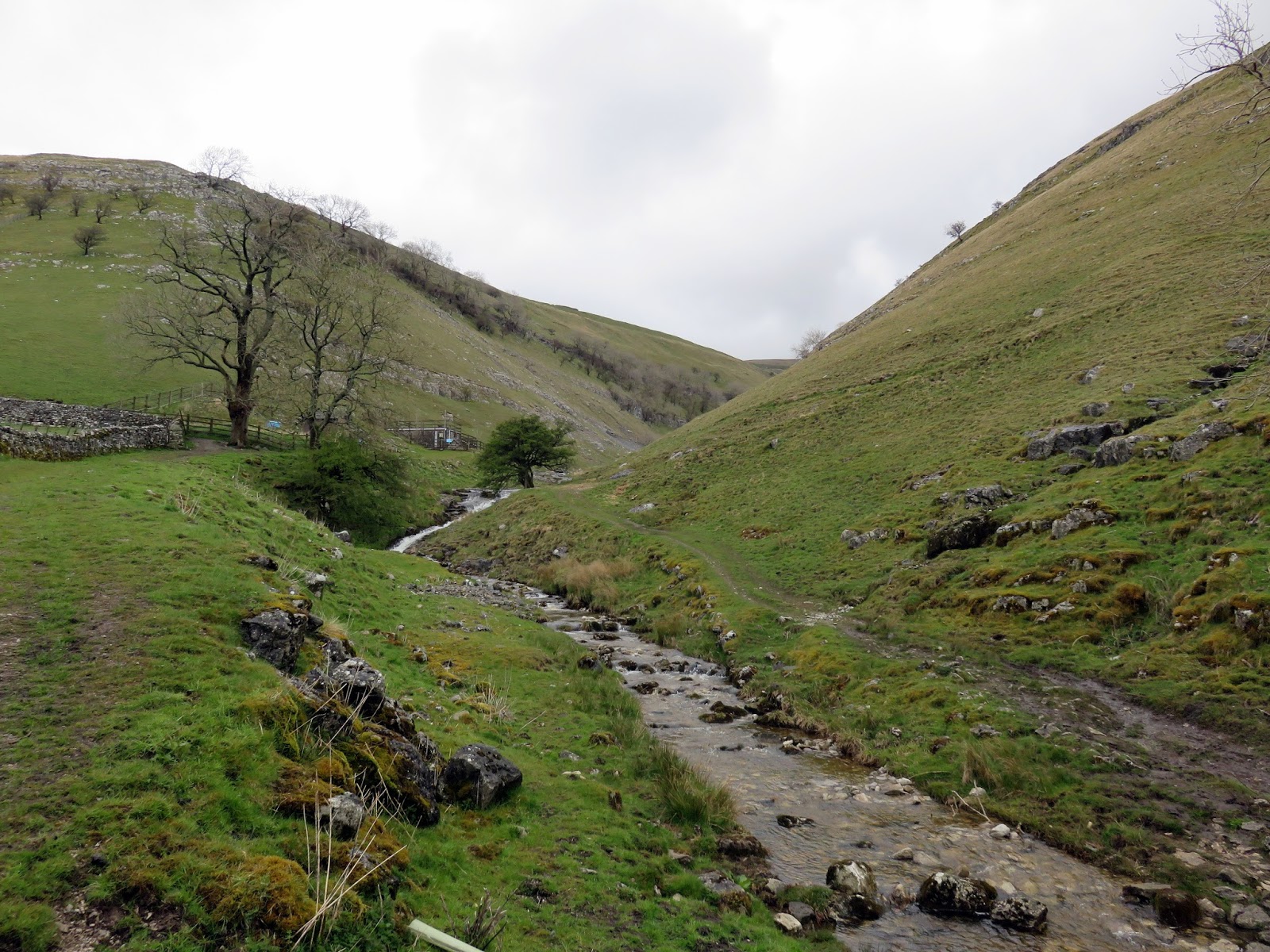
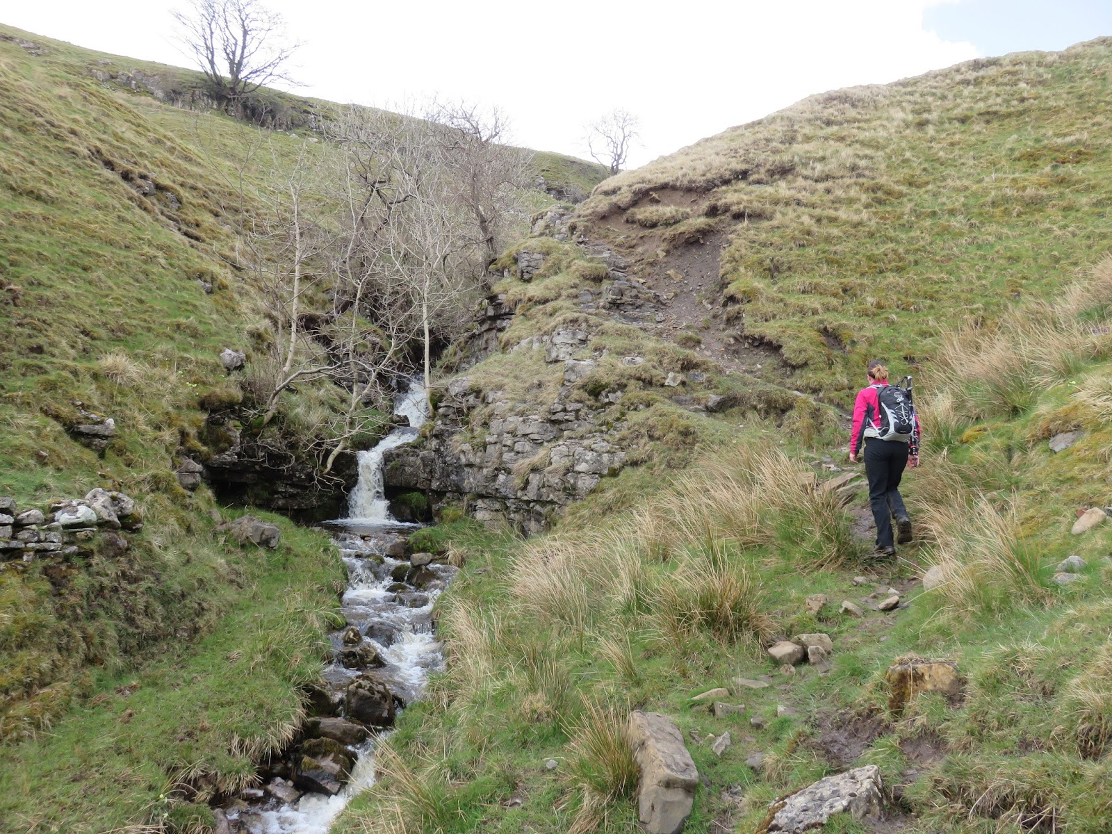
As I’ve just mentioned, the walk starts from the small village of Buckden, nestled in the depths of Upper Wharfedale and situated directly below Buckden Pike. Thanks to the fells mining heritage, there are a number of routes that utilise old mine roads that can get you to the summit. This route, however, is a little more exciting than that. Buckden Beck forges a direct route down the hillside from its source up at the old Buckden Lead Mine.
This route follows the beck along its length, visiting the old mine in the process. Despite the height of Buckden Pike, this route makes light work of the climb thanks to a couple of interesting little scrambles.
 |
| Buckden Beck above the village of Buckden |
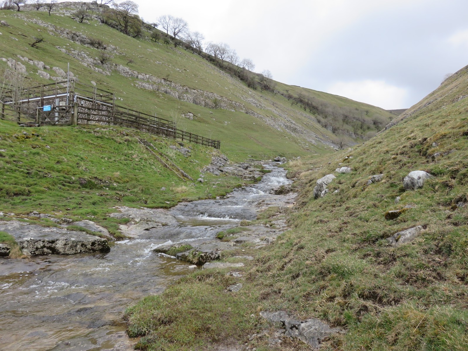
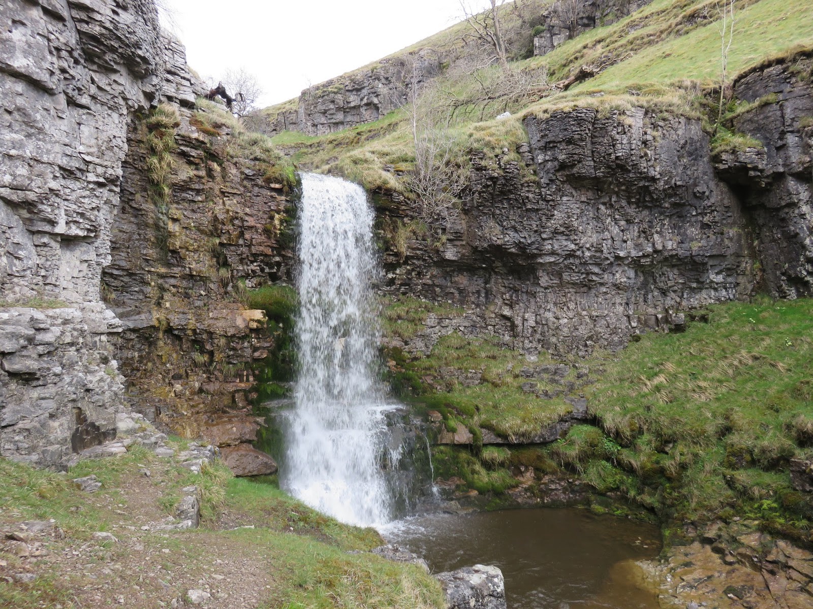
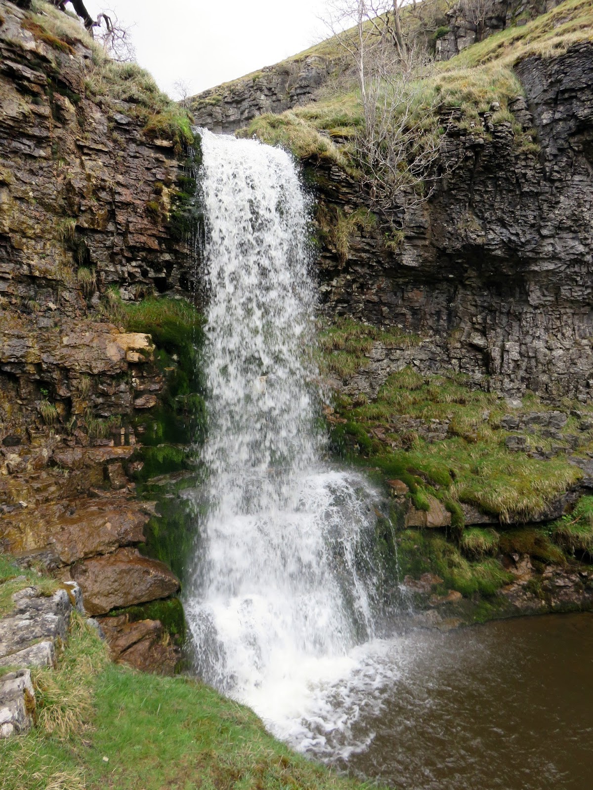
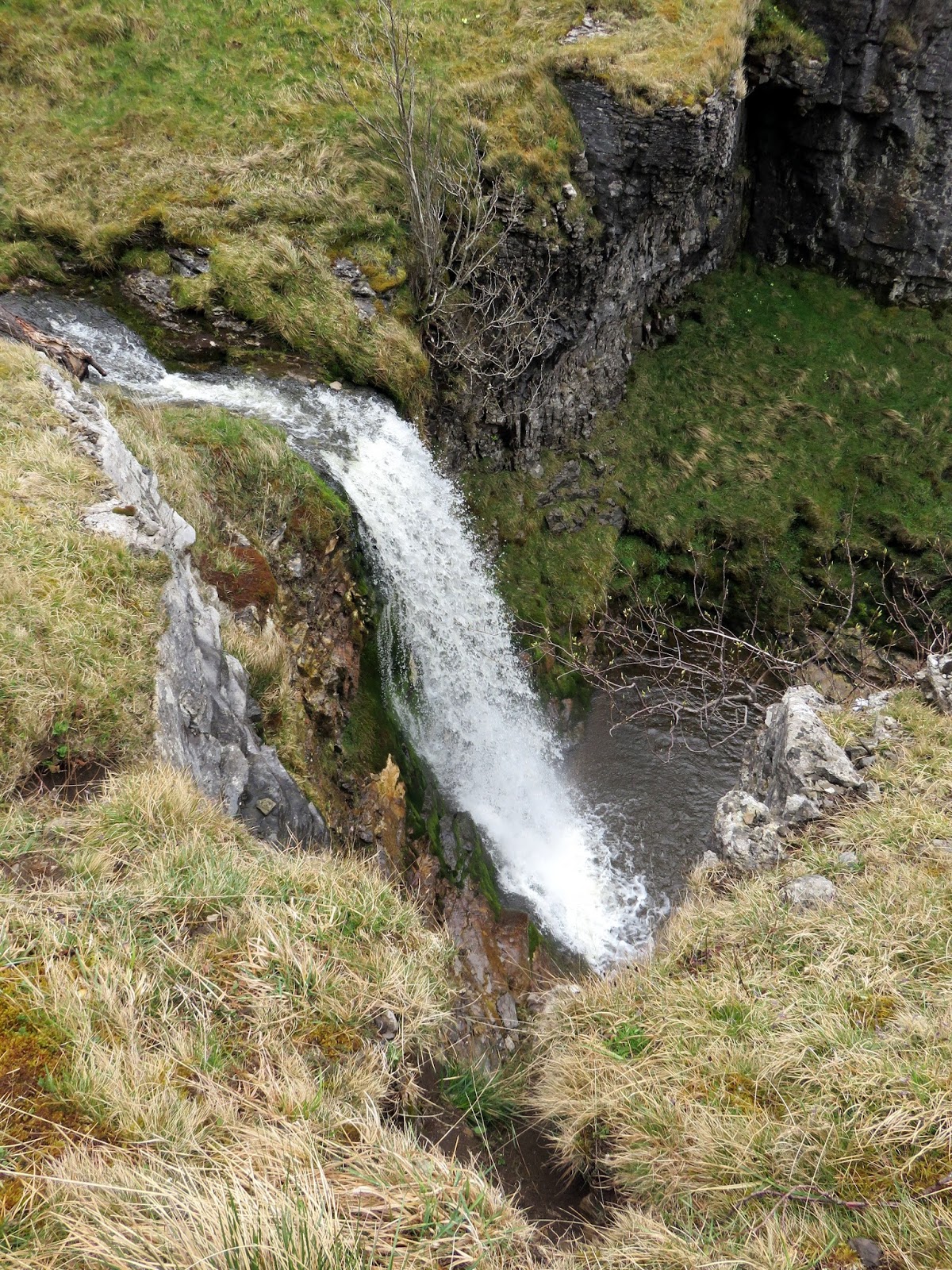
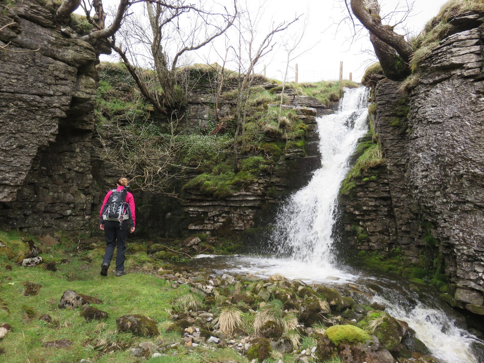
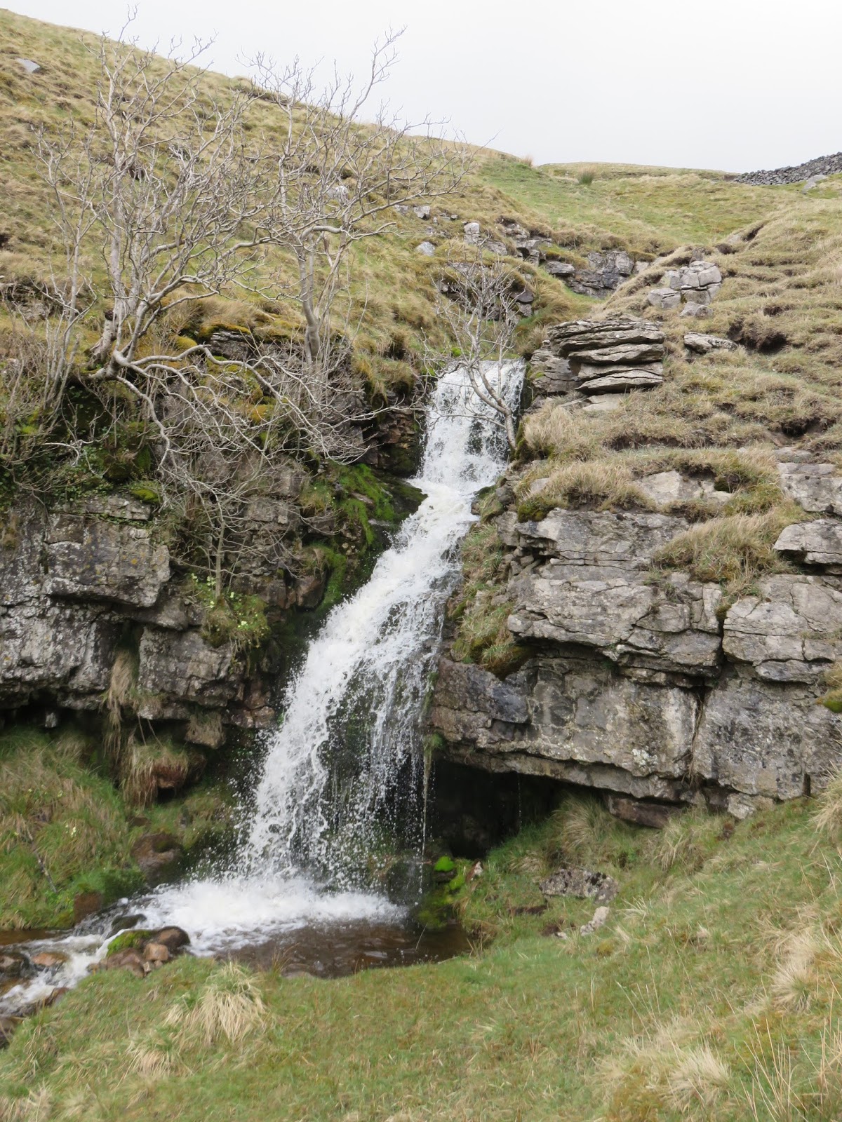
Passing around The Buck pub, the narrow village lanes lead towards the opening of the valley of Buckden Beck. Once through a gate, a small path can be seen heading towards the small Yorkshire Water reservoir that serves the village, heading off up into the ravine beyond. After a short distance, a magnificent waterfall is reached, falling some 6 or 7 metres over a sheer wall of rock. Its great to be able to inspect it up close but, on first inspection, the route around it is not particularly clear.
 |
| Buckden Beck below the Yorkshire Water treatment works |
 |
| Buckden Beck |
 |
| The first fall – probably the most impressive |
 |
| A close-up of the waterfall |
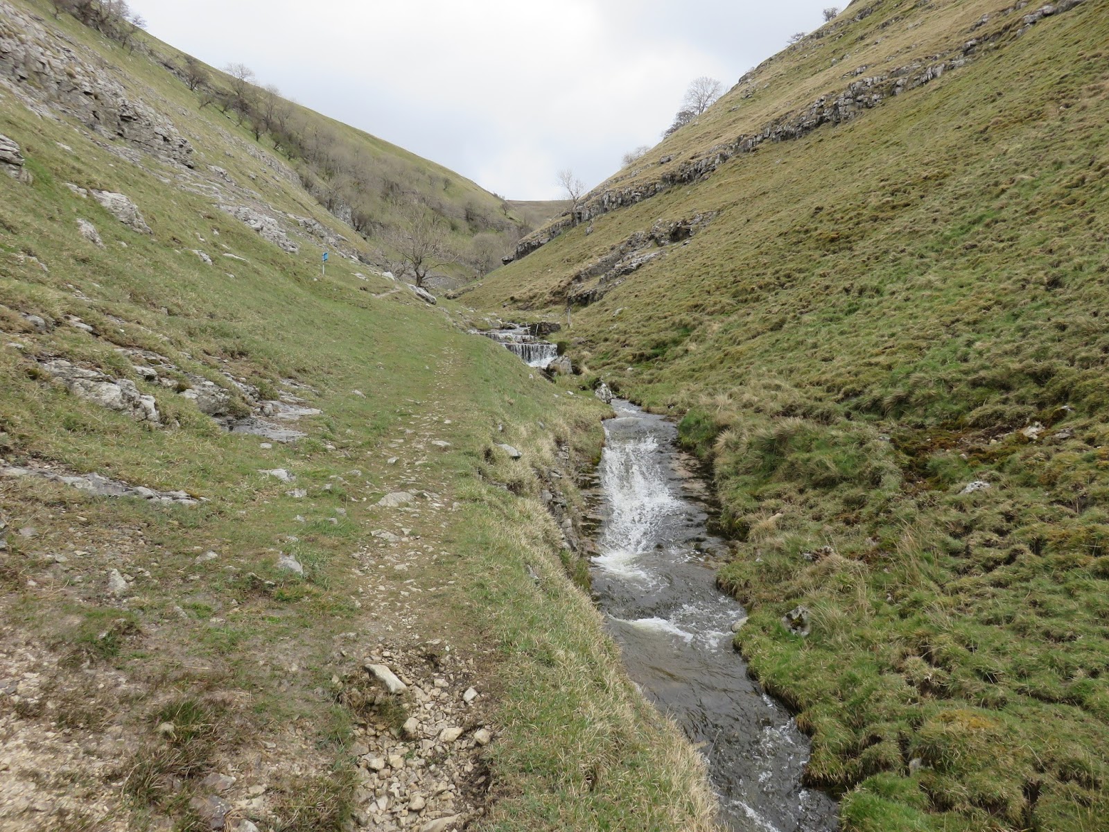
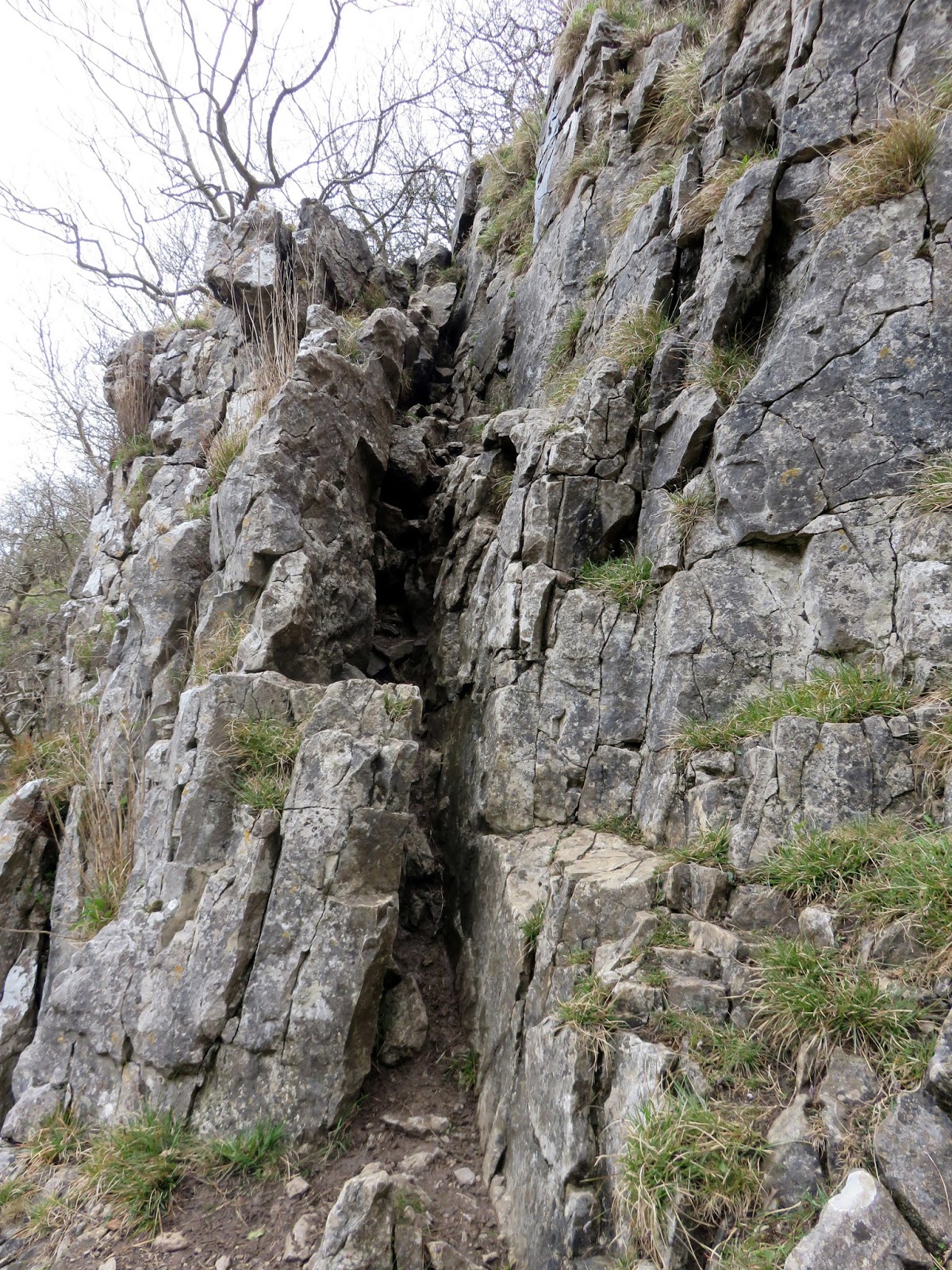
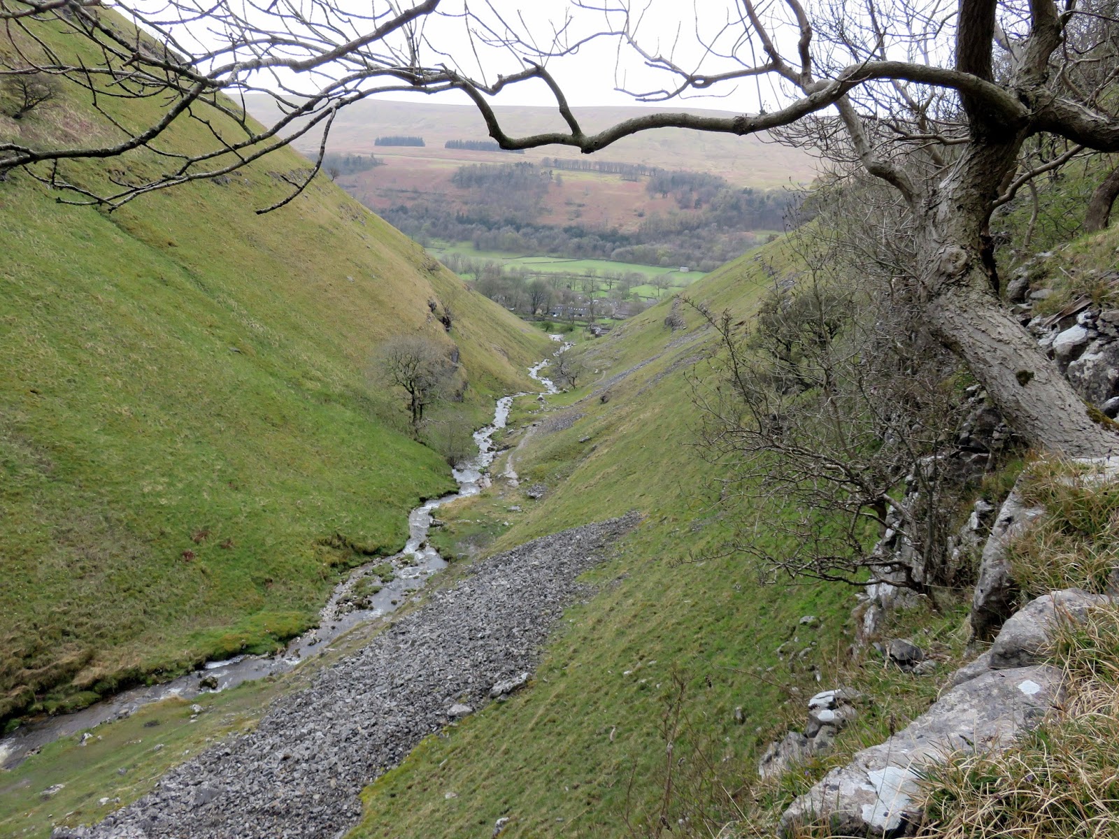
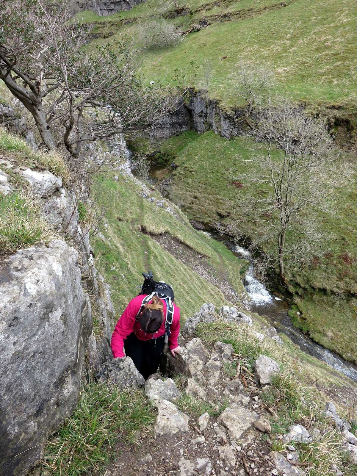
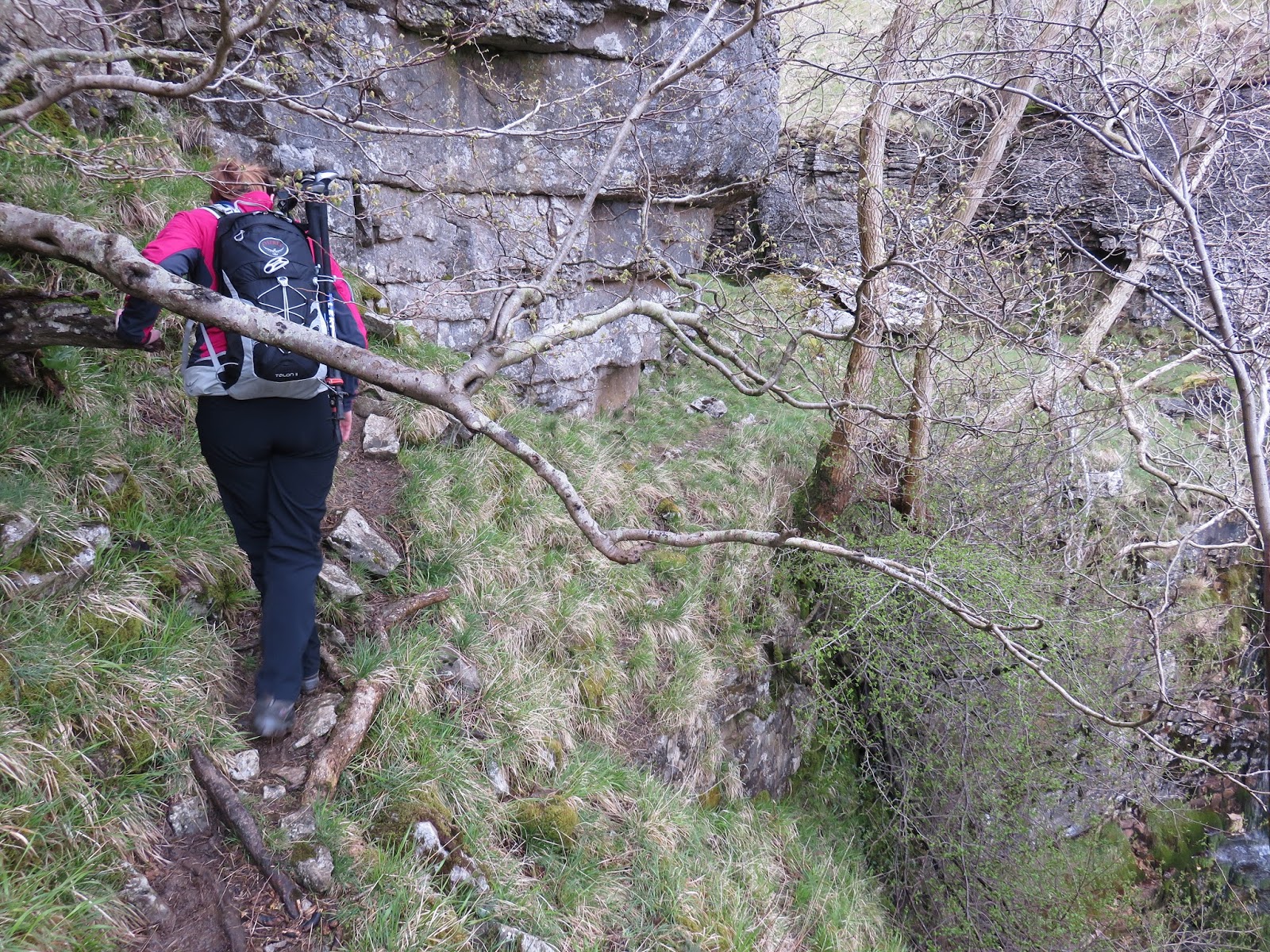
By retracing your steps slightly back along the valley, a cleft in the rocks can be found which leads to an easy climb up to the terrace above the fall. Continuing on, another two large waterfalls are bypassed in similar fashion, the second of them requiring some care on the narrow path above the plunge pool. While the views of each waterfall are superb, the view of the valley opening up behind you is equally impressive.
 |
| The cleft in the rocks that lets you bypass the first waterfall |
 |
| Buckden Beck |
 |
| Sara makes the climb |
 |
| Looking down on the first waterfall |
 |
| The second waterfall |
 |
| The second waterfall |
 |
| The narrow path around the second waterfall |
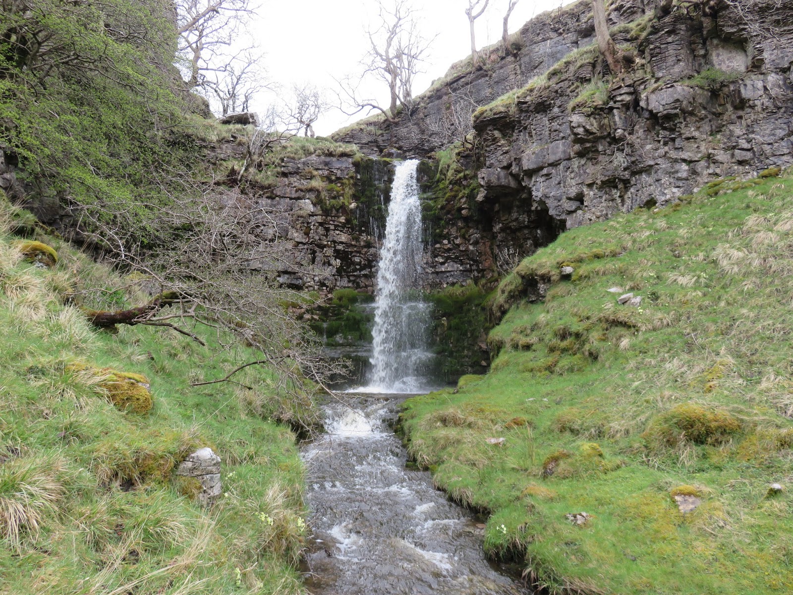
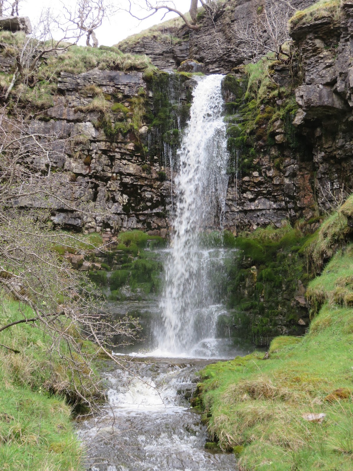
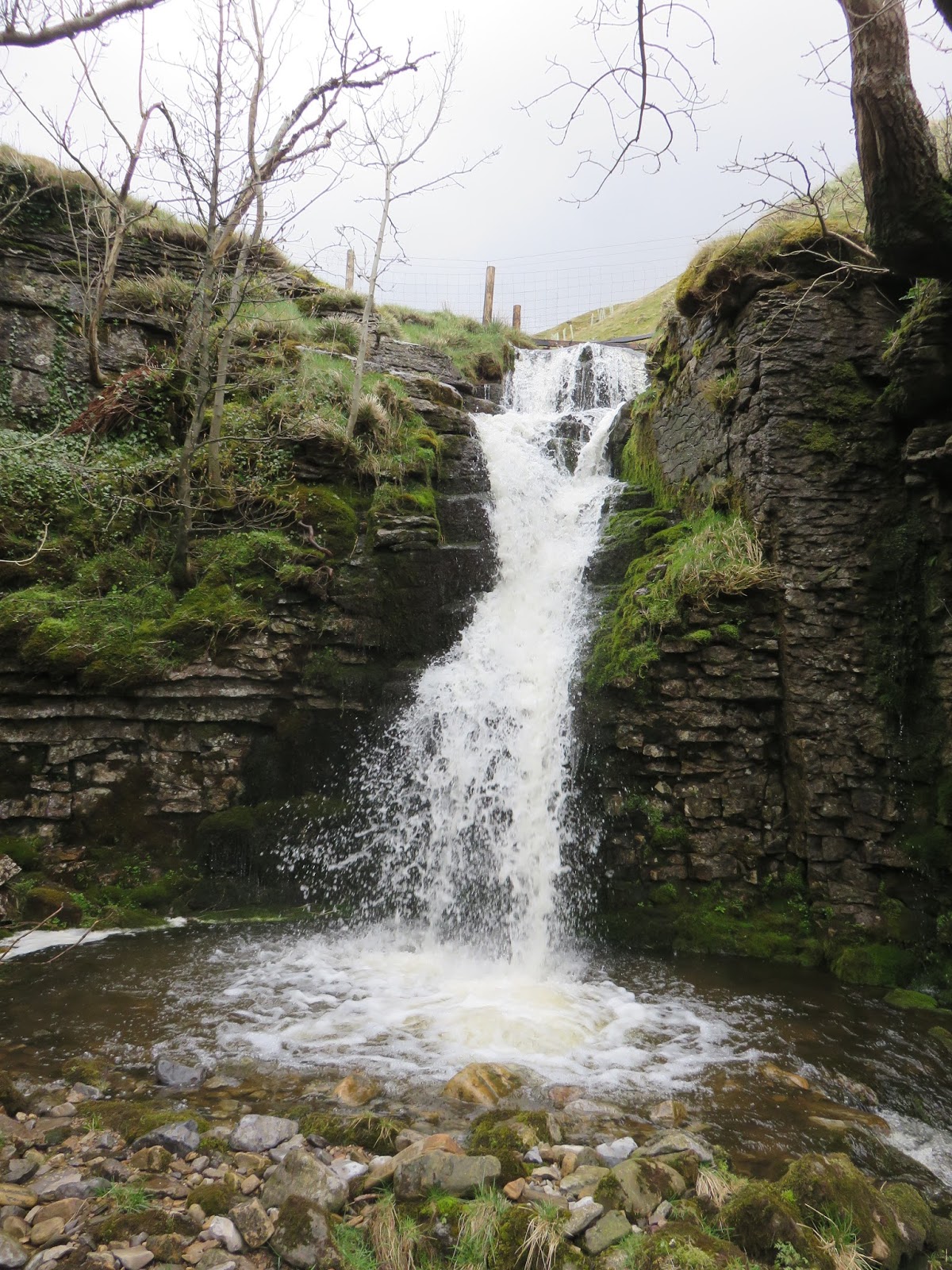
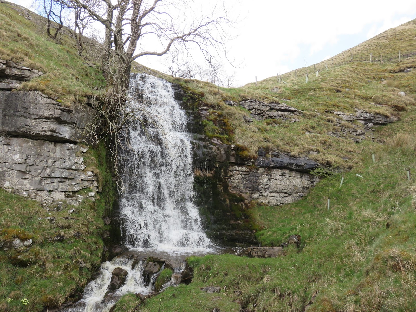
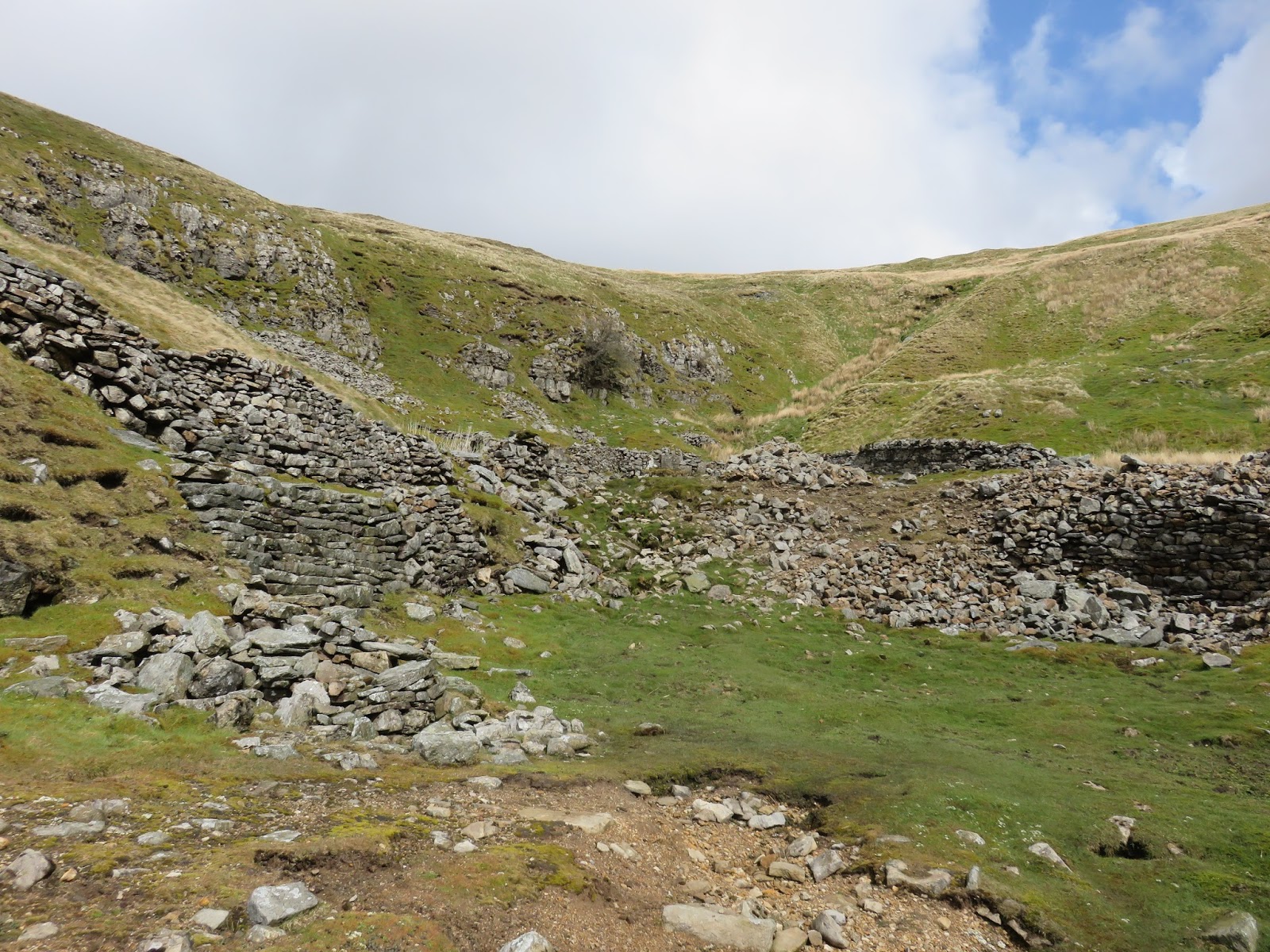
The third fall marks the last of the difficulties, from here the route is easy to follow, the remaining few falls being easily bypassed up their grassy banks. After a few moments of steady climbing, the path reaches the sad remains of Buckden Gavel Lead Mine, perched high up on the hill side.
 |
| Sara inspects the third waterfall |
 |
| The third waterfall |
 |
| Looking down on the third waterfall |
 |
| The fourth waterfall |
 |
| Sara approaches the fifth waterfall |
 |
| The fifth and final waterfall |
 |
| Buckden Gavel Lead Mine |
The mine was unique in Wharfedale in that most of its ore came from pipes and flats in the limestone instead of from veins. The Old Pipe was discovered at its northern end, near Bishopdale, by a mine called Blow Groves, in the 1690s. In the steep sides of the beck, immediately below the tips from the level, are the remains of Buckden High Smelt Mill, which is where ore was smelted over 100 years before the level was driven. This mill had a single, bellows-blown orehearth and only worked for about eight years. A shooting hut on Water Gill, marks the site of Buckden Low Smelt Mill.
 |
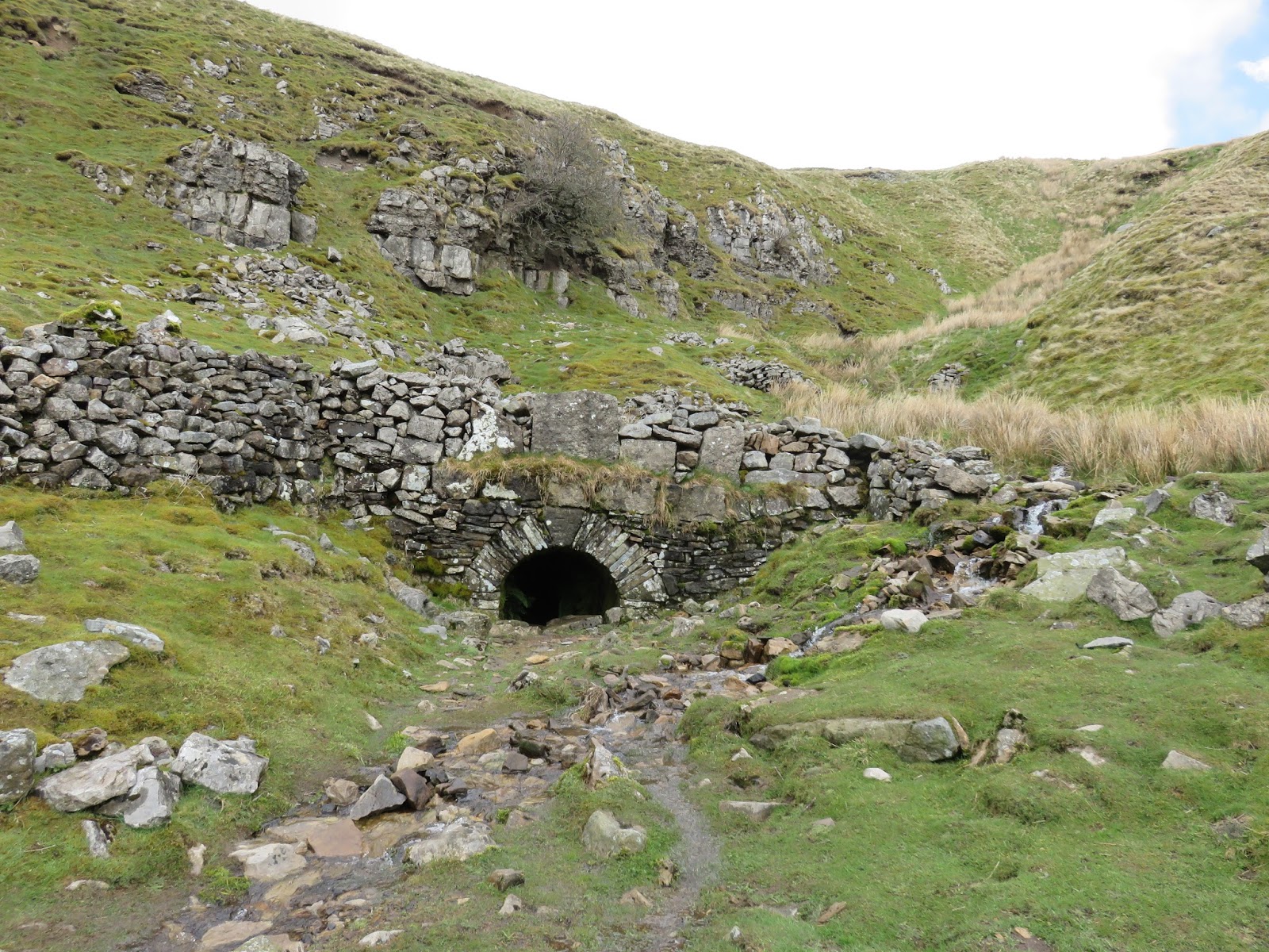
| The mine entrance is still accessible |
 |
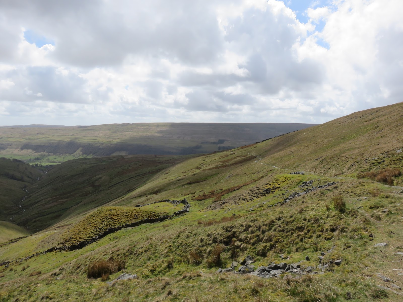
| Buckden Out Moor |
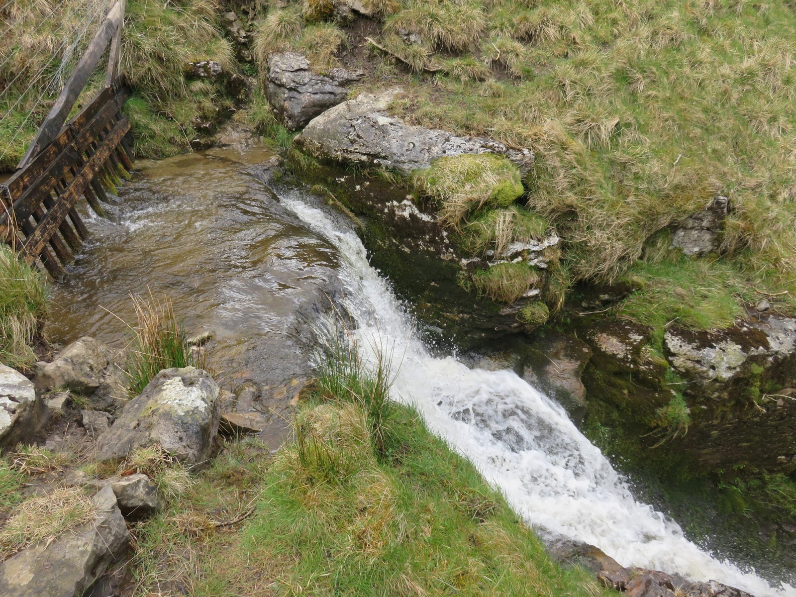
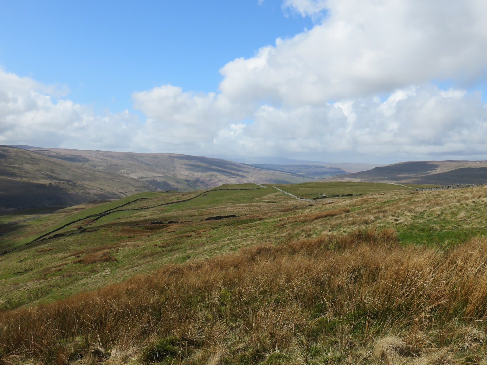
It is still possible to enter the mine, through the small brick-built hole at the head of the valley. Subterranean activities are not really my strong point so it was back to the path and the final 100m climb across Buckden Out Moor towards the summit. This is the steeper part of the overall route and the wind had started to get up, bringing with it a bit of a chill.
 |
| Langstrothdale |
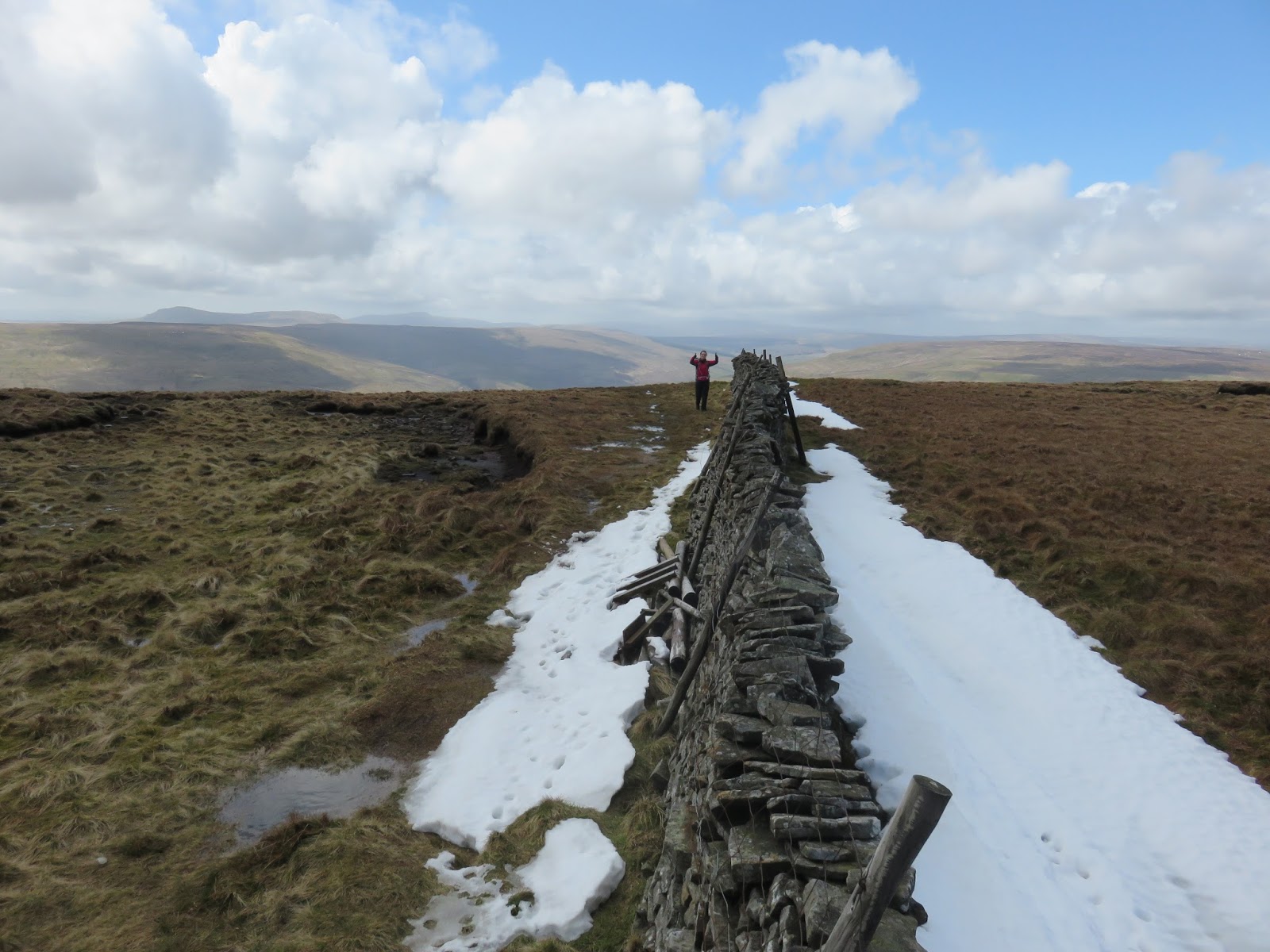
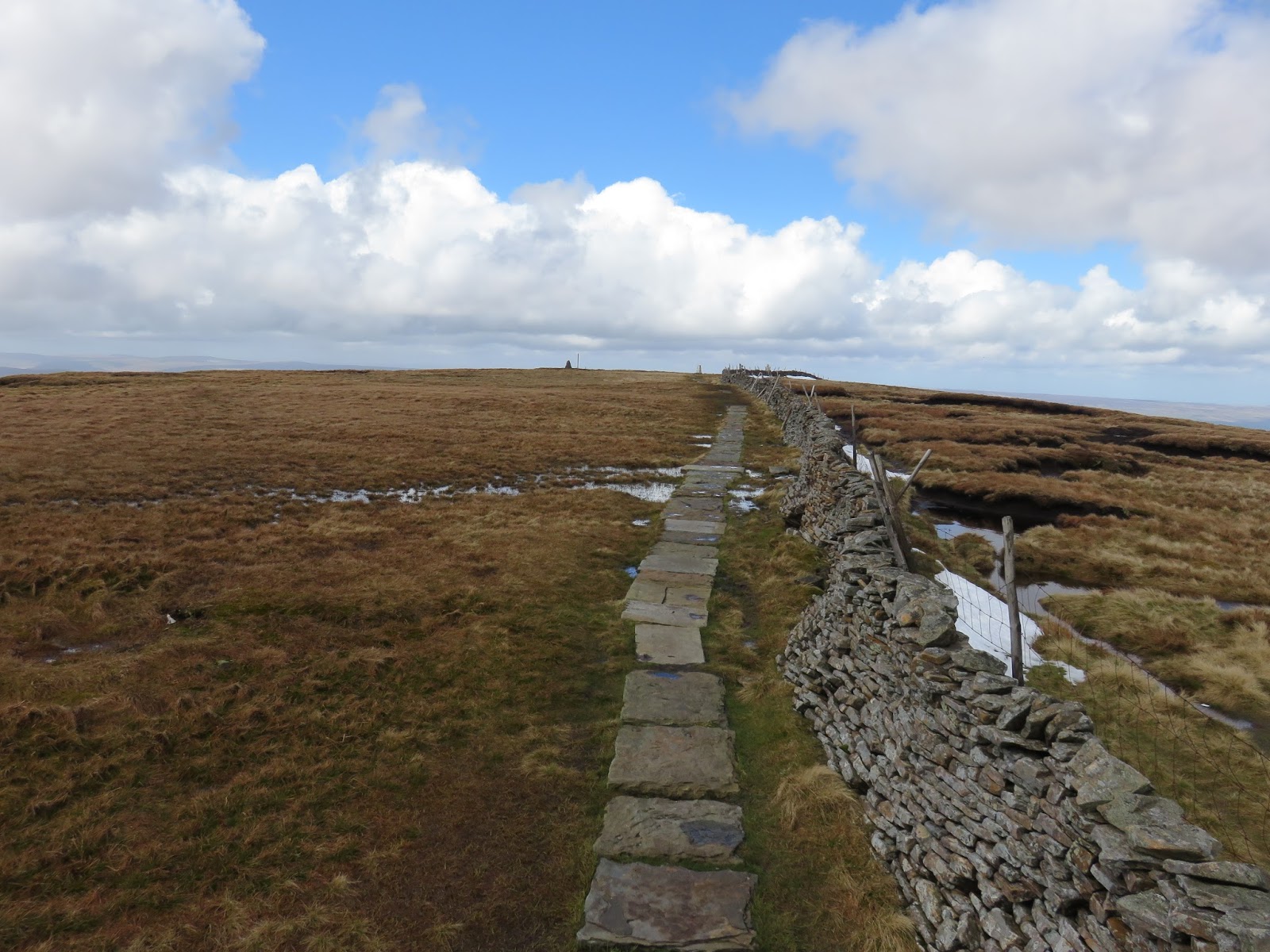
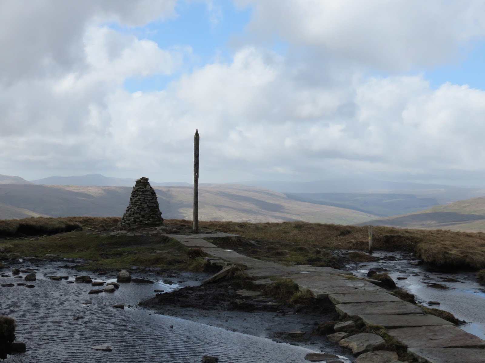
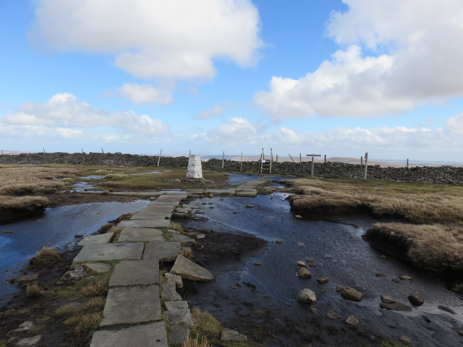
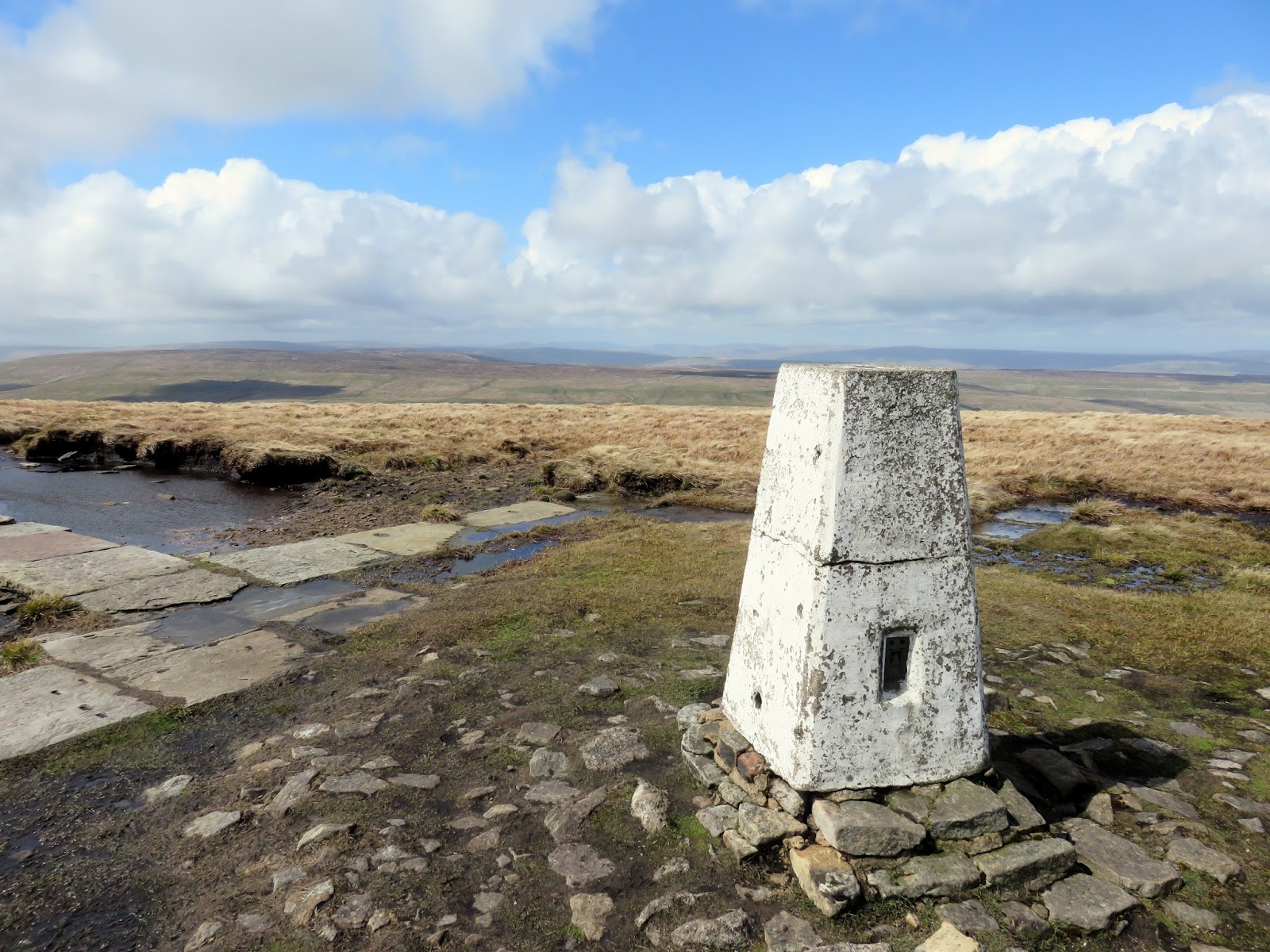
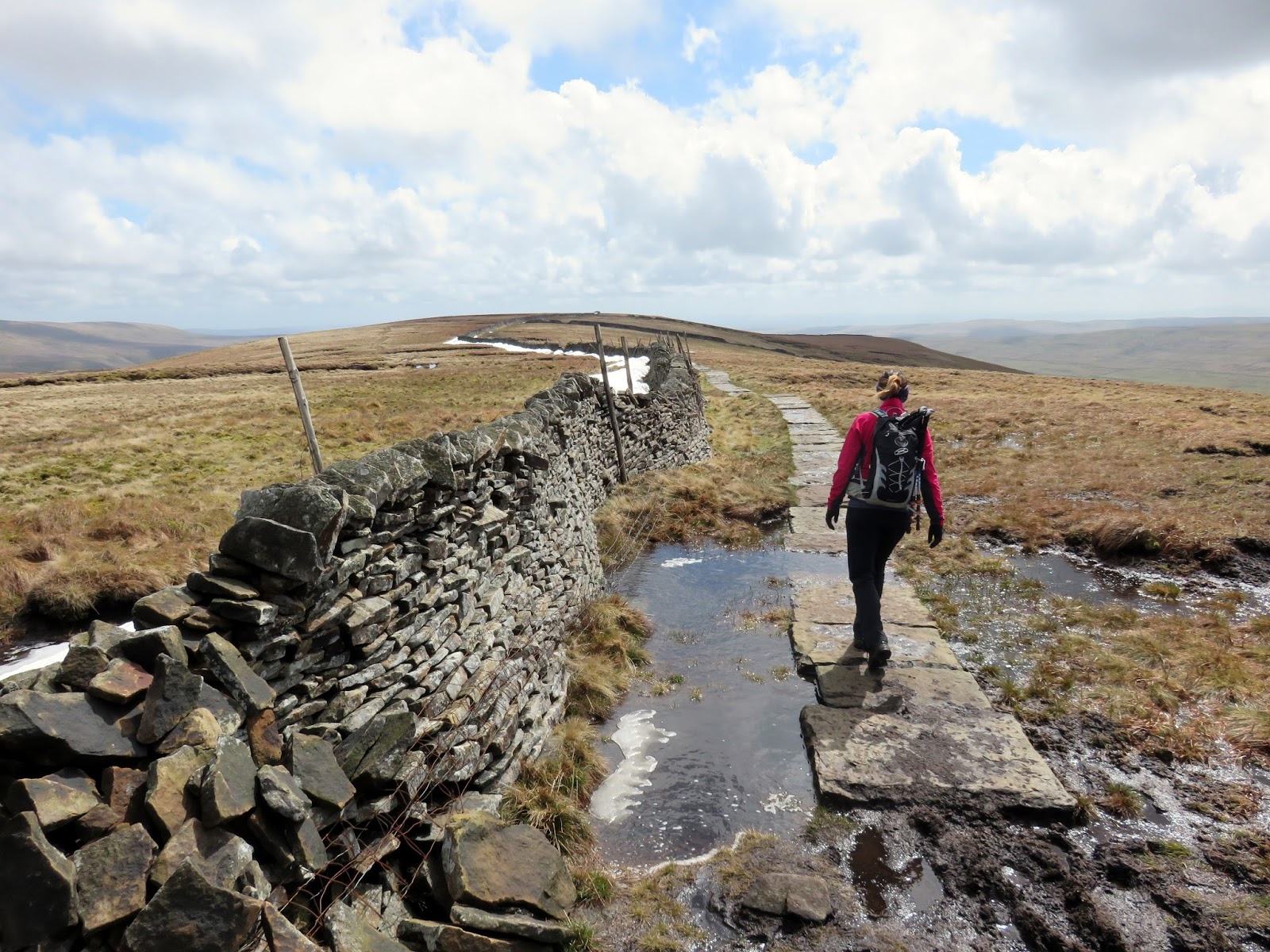
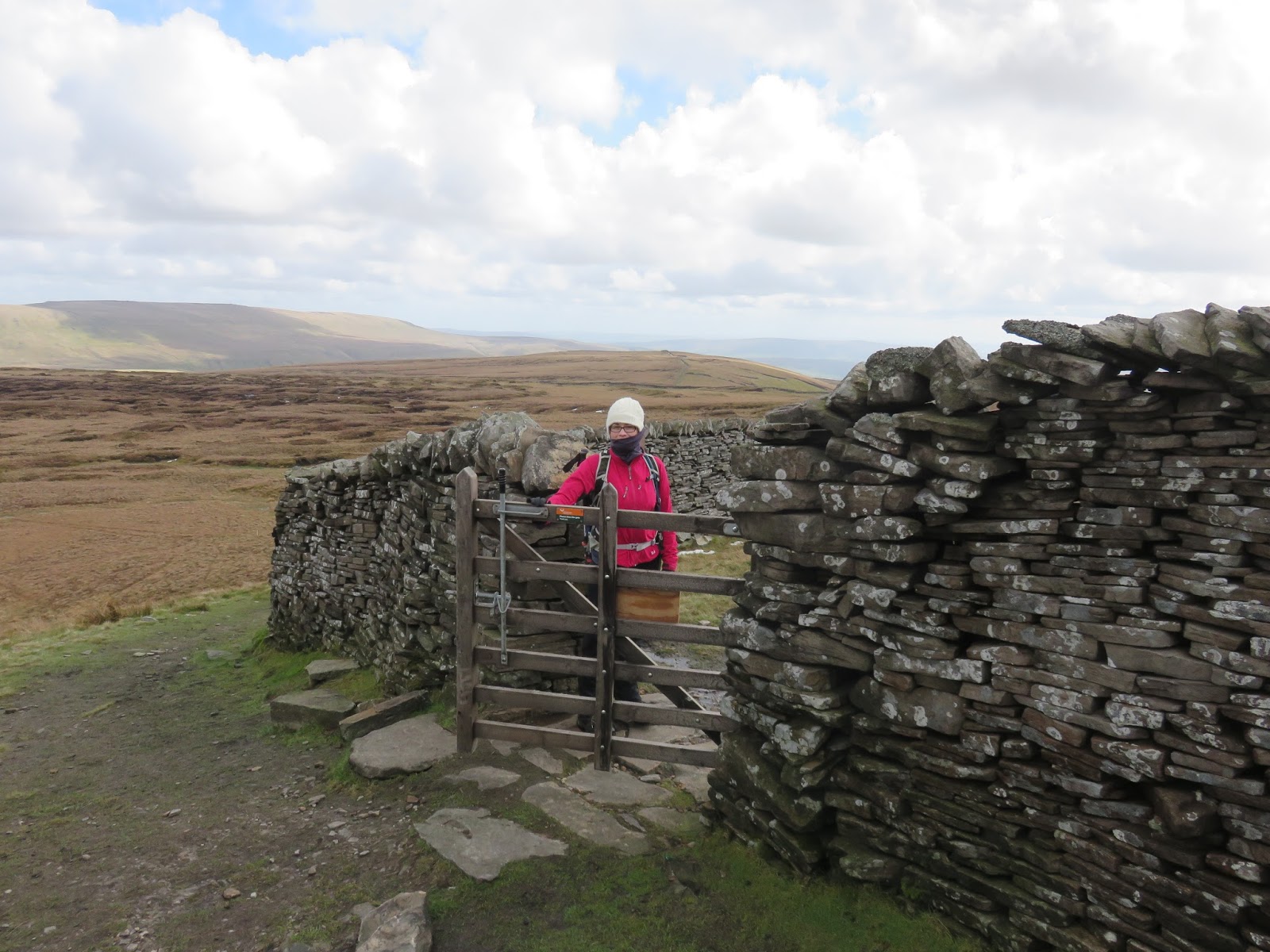
The steepness abates as the path reaches the broad ridge of Buckden Pike, the lies a short distance to the north after crossing a drystone wall. A white OS pillar sits proudly on top, accompanied by an odd cairn with a post some metres distant. The summit also benefits from some fairly recently laid stone slabs to avoid any boggy parts.
 |
| Sara reaches the summit ridge |
 |
| A short walk is required to reach the trig pillar |
 |
| A cairn sits alongside a wooden post. The holes in the post direct you to different views of Wharfedale |
 |
| Summit trig pillar |
 |
| Bucken Pike’s trig pillar |
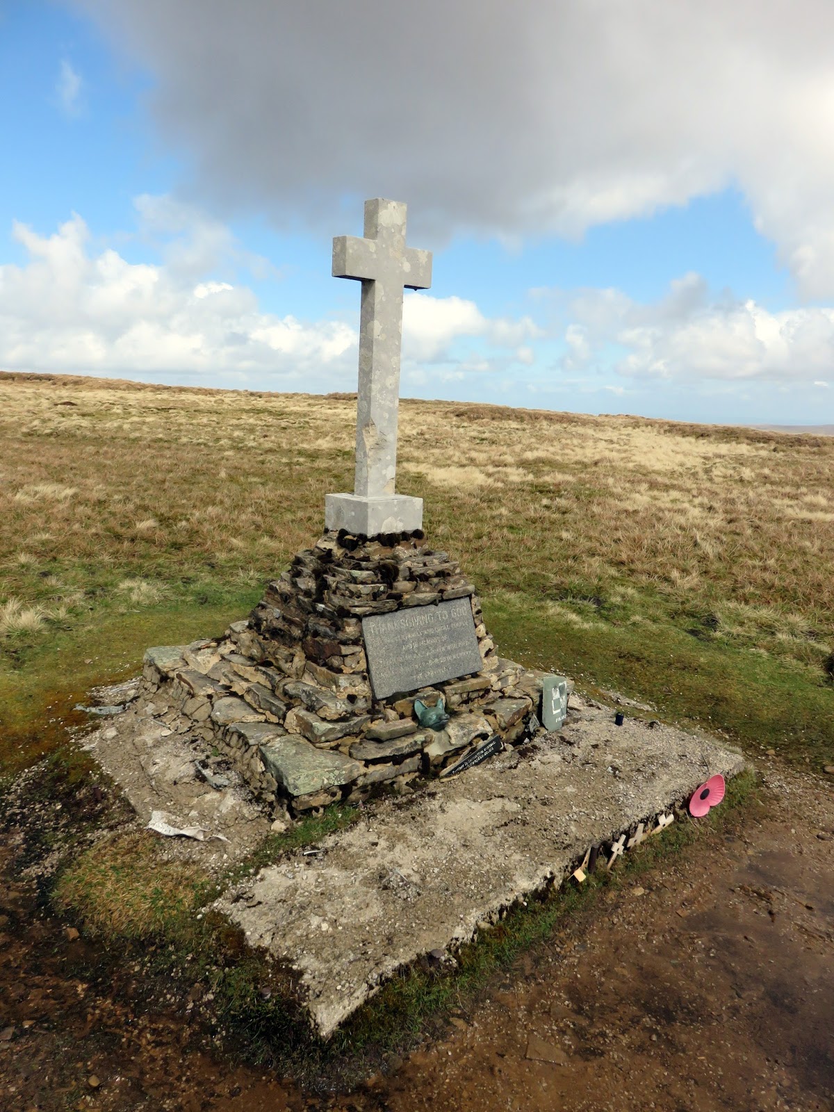
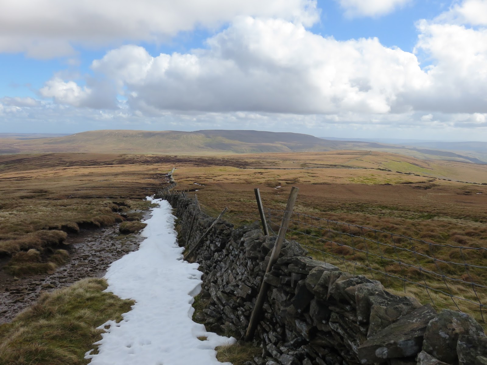
Leaving the summit, travelling south this time, the stone capped path follows the wind-swept ridge for just under a mile before reaching another junction of drystone walls. On the other side stands a modest memorial, the final remnants of a remarkable story.
 |
| Sara heads towards the war memorial south of the summit |
 |
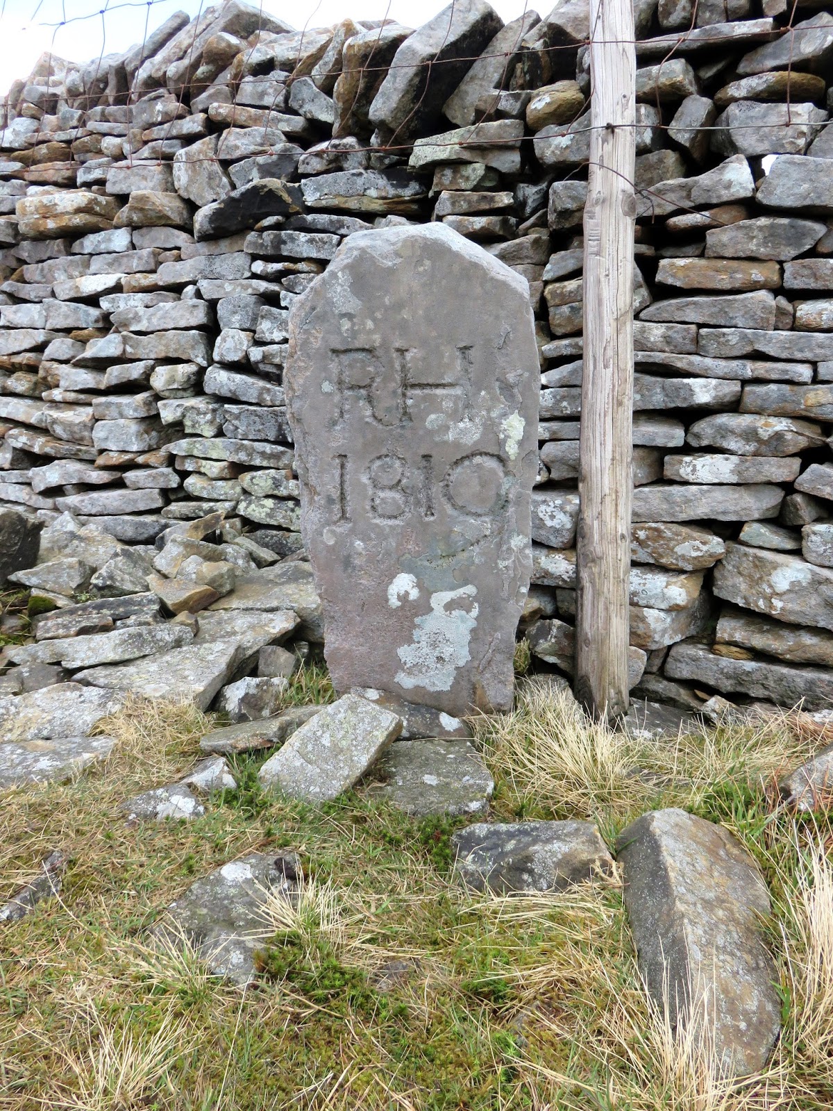
| Boundary stone on the summit ridge |
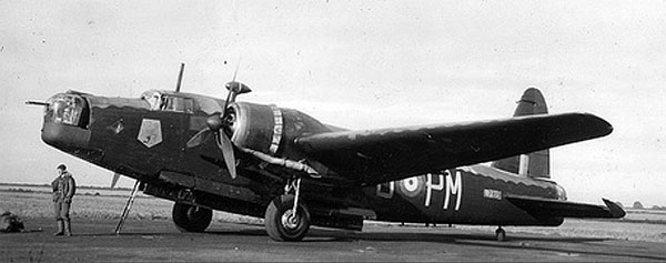
On Jan 30 1942, a crew of six Polish airmen from 18 O.T.U. took off from RAF Bramcote, Warwickshire on a training mission in a Wellington Bomber when, without warning, they flew into a bad snowstorm. In an attempt to find a suitable point of reference, the bomber clipped a stone wall on the ridge sending it careening into the hillside.
 |
| Wellington N2848 |
Sergeant Jozef Fusniak, the tail gunner, survived the crash when the rear section of the aircraft broke away upon impact. With a broken ankle, Jozef followed the tracks of a fox down to the village of Cray where he was rescued. Sadly, the other crash survivor, Jan Sadowski, did not survive the night.
 |
| Memorial to the Polish airmen |
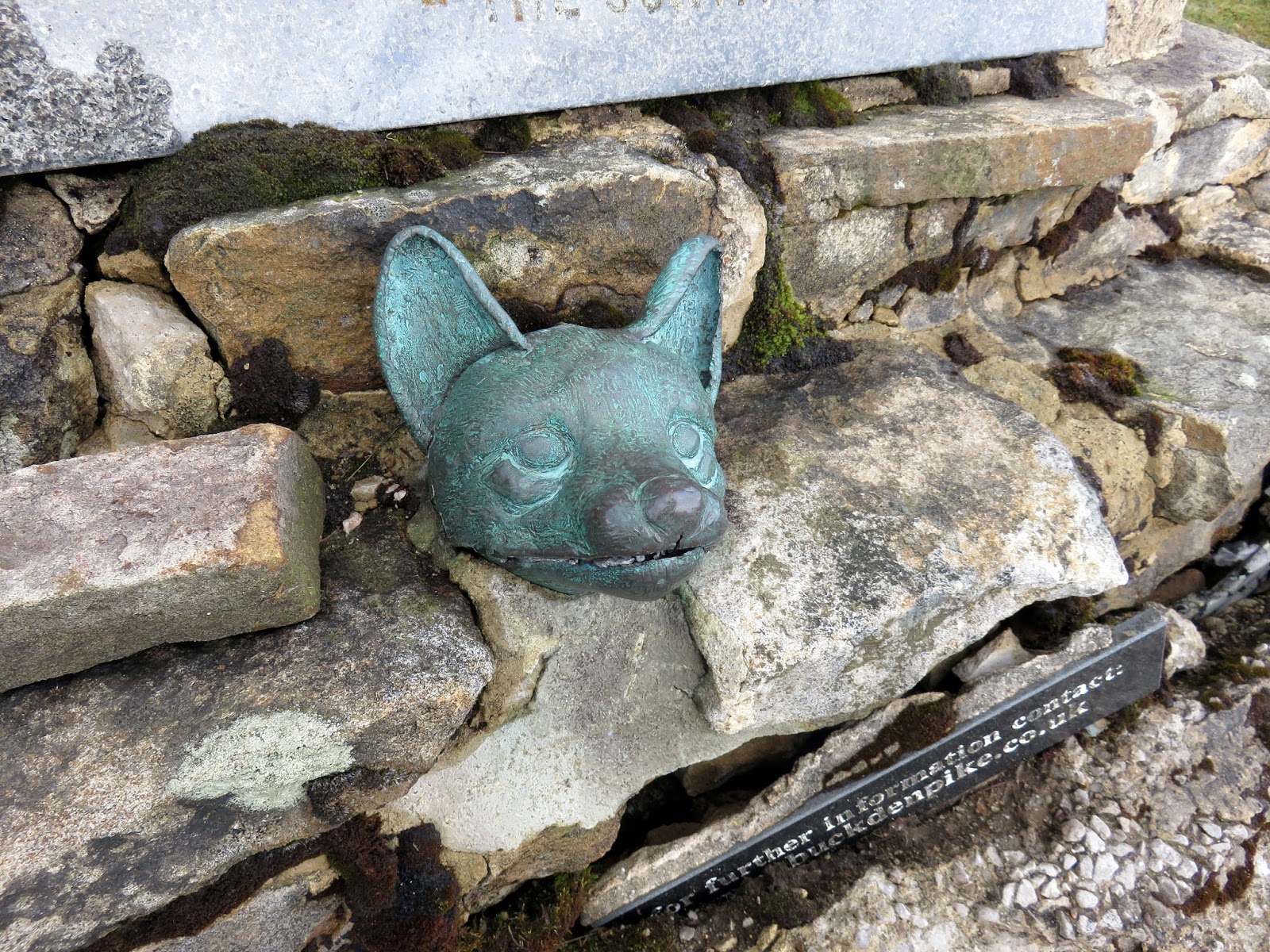
Jozef was instrumental in getting the memorial erected in the 1970s, the current cross is perched on a substantial base in which parts of the wrecked aircraft are embedded. A bronze foxes head pays homage to the animal that undoubtedly saved Jozef’s life.
 |
| The bronze foxes head |
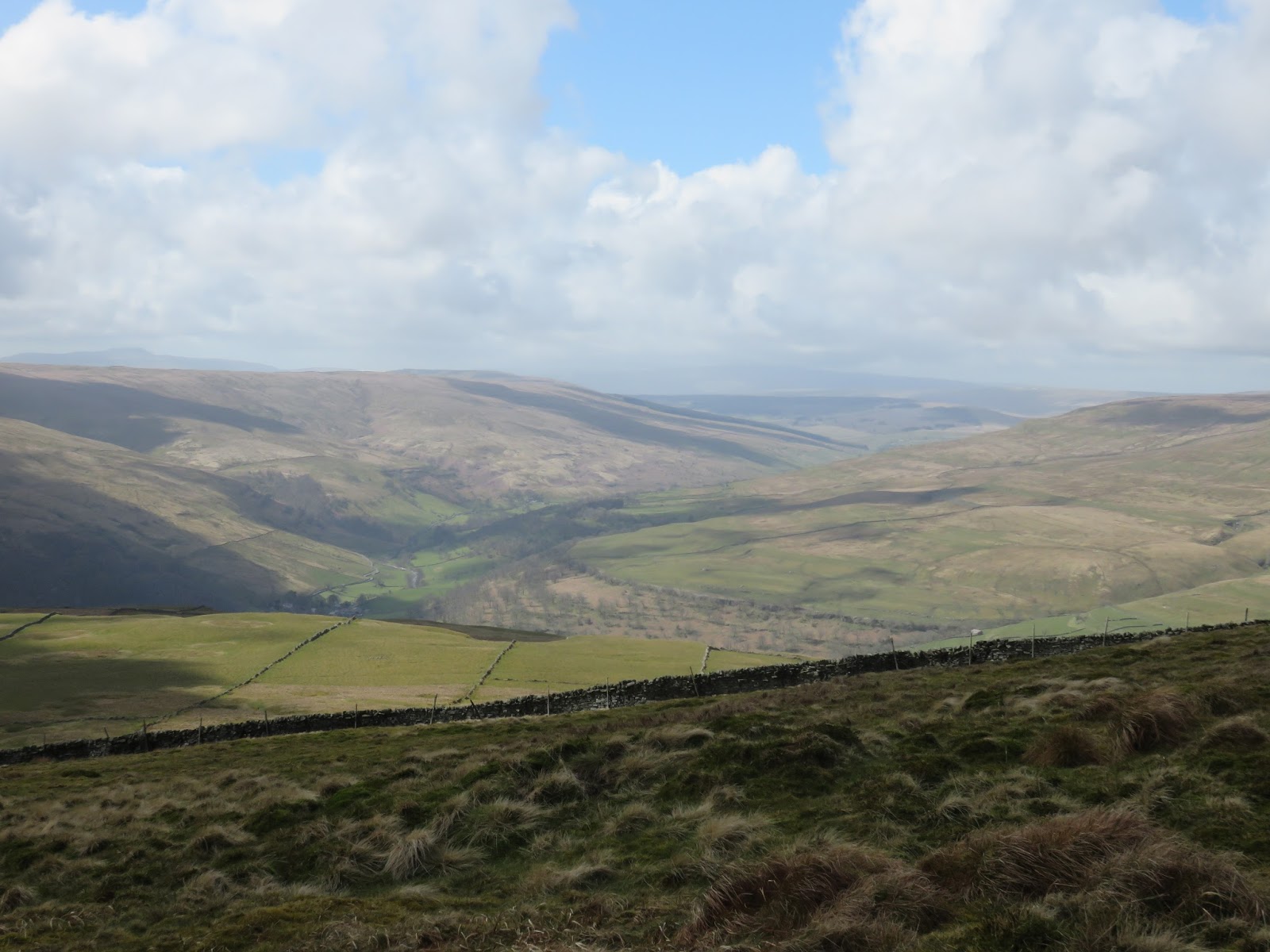
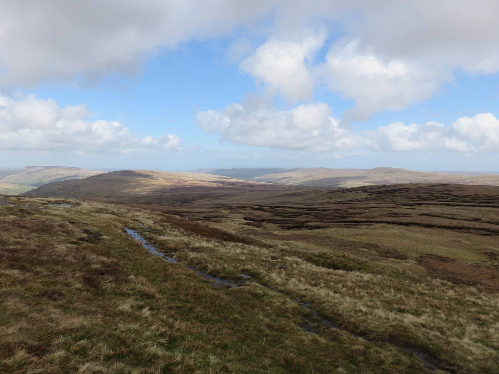
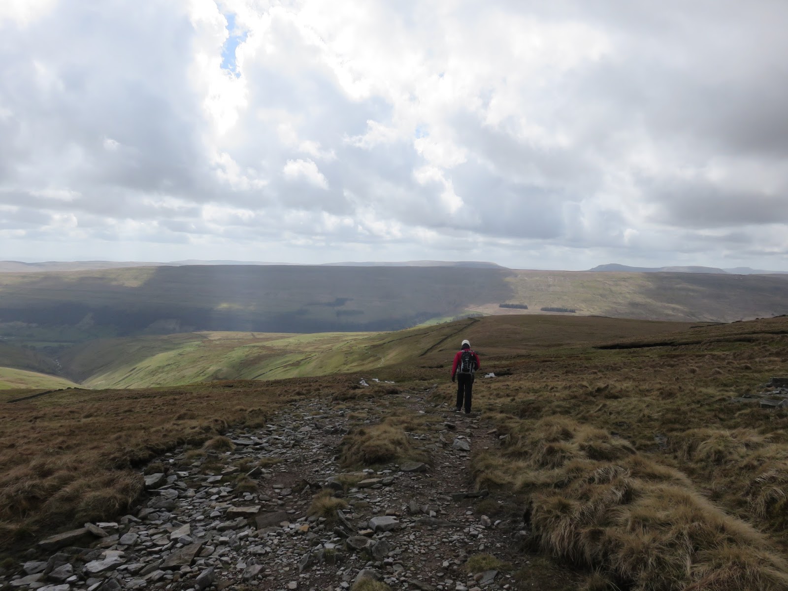
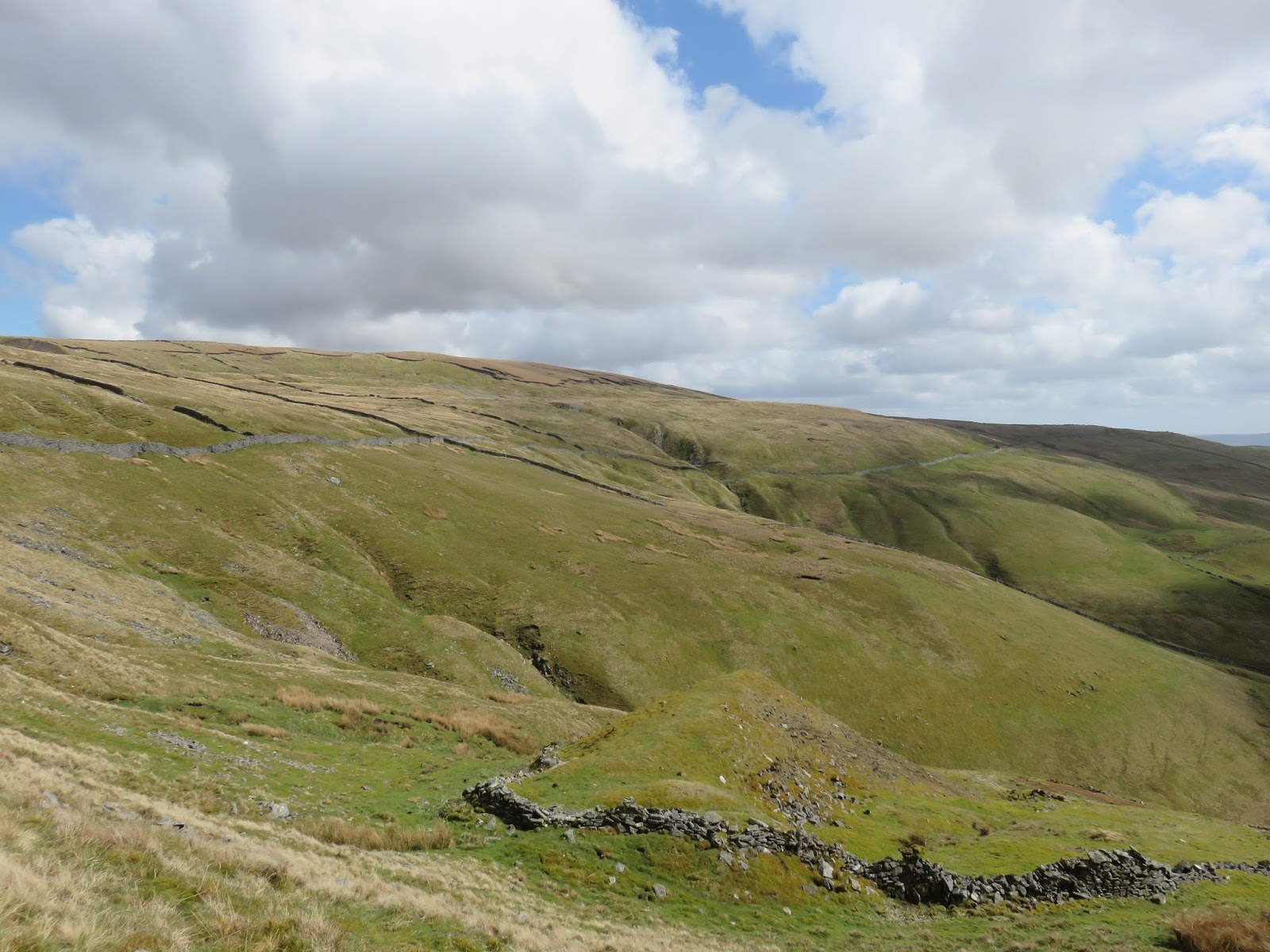
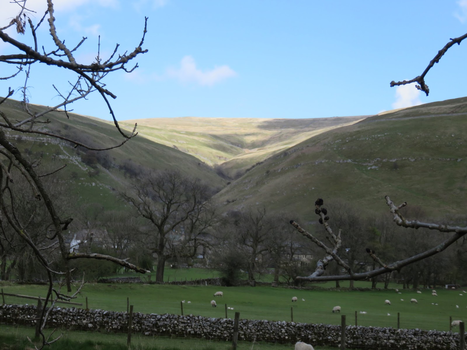
We left the memorial behind and began our descent back into Wharfedale, initially following the ridge down long-lasting peat bog before ultimately following the Walden Road as it steadily makes its way down into Starbotton. From Starbotton we crossed the Wharfe and joined the Dales Way, the grassy motorway that allows you to walk between Addingham and Bowness in Cumbria.
 |
| The vast Riggs Moor |
 |
| Sara at the top of Walden Road |
 |
| Walden Road with Old Cote Moor in the distance |
 |
| Cam Gill Beck |
 |
| Tor Mere Top |
 |
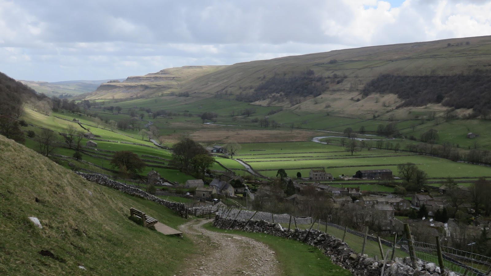
| Wharfedale at Starbotton |
It’s an easy stroll through the rolling Yorkshire Dales scenery, beneath the steep slopes of Old Cote Moor. Eventually we reached Dubb’s Lane which took us back into Buckden for a quick break at the local pub. As I’m sure I concluded in my original post, this is a superb walk, definitely the best way up Buckden Pike and perhaps the best route up any of the high Yorkshire fells – well worth a visit.
 |
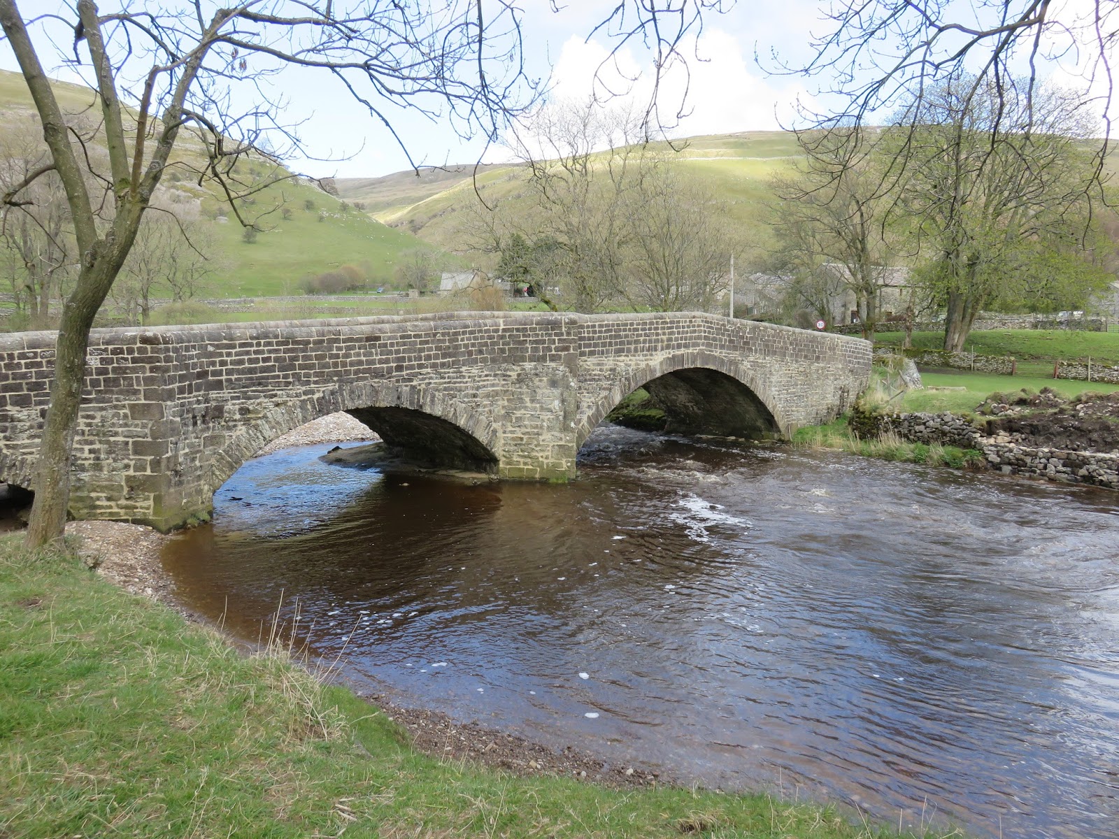
| Arch bridge on Dubb’s Lane |
 |
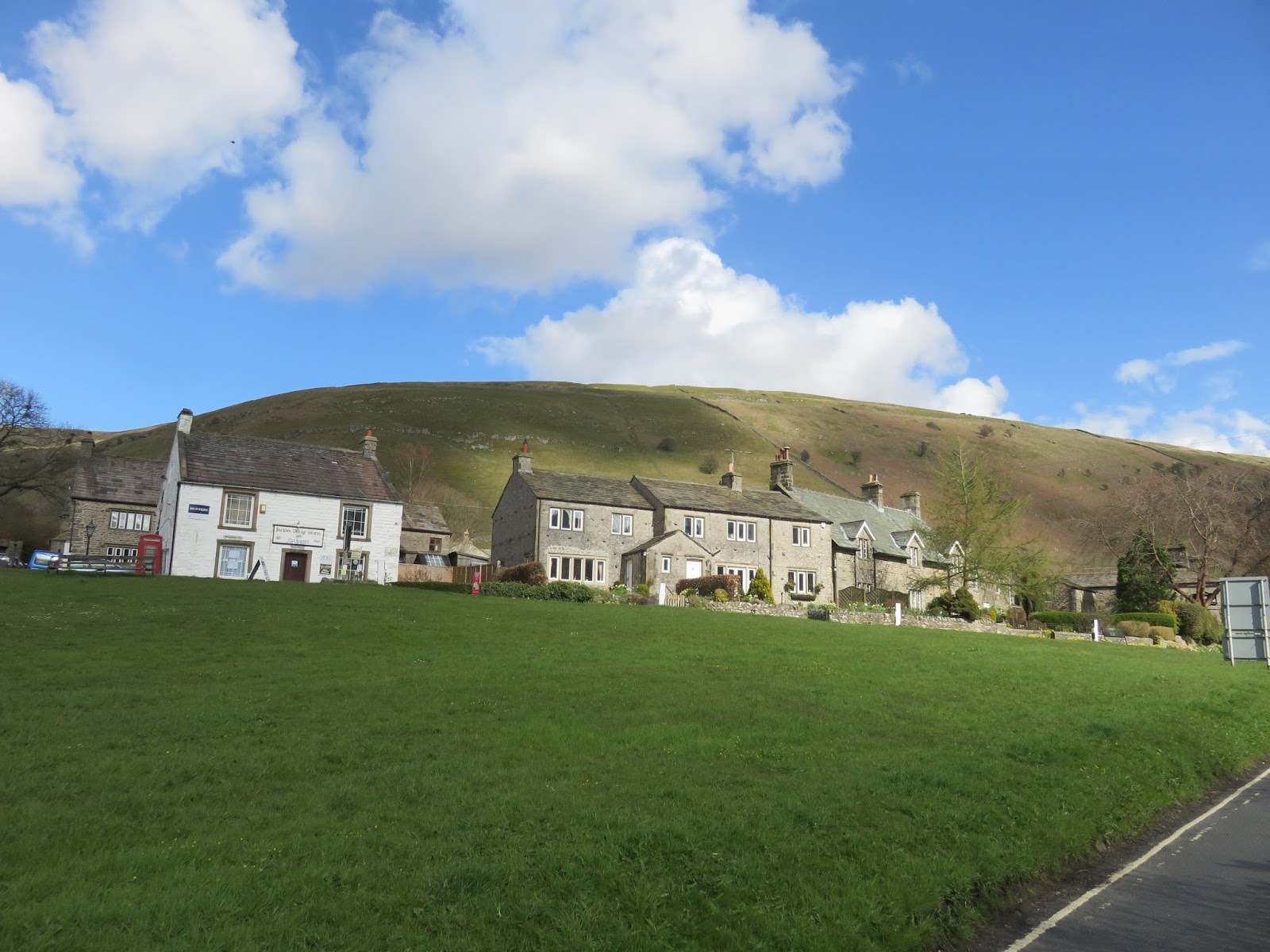
| The village of Buckden |
