Open Space Web-Map builder Codehttps://openspace.ordnancesurvey.co.uk/osmapapi/openspace.js?key=3119F72552FD5C22E0530C6CA40A5A92https://openspace.ordnancesurvey.co.uk/osmapapi/script/mapbuilder/basicmap.jshttps://openspace.ordnancesurvey.co.uk/osmapapi/script/mapbuilder/searchbox.js//variables for routes var linesLayer, points, lineFeature, lineString, routeMarkersLayer, routepos, routesize, routeoffset, routeicon; var style_blue = {strokeColor: “#0000CD”, strokeOpacity: 0.5, strokeWidth: 4.5}; function initmapbuilder() { //initiate the map var options = {resolutions: [2500, 1000, 500, 200, 100, 50, 25, 10, 5, 4, 2.5, 2, 1]}; osMap = new OpenSpace.Map(‘map’, options); //configure map options (basicmap.js) setglobaloptions(); //set the center of the map and the zoom level osMap.setCenter(new OpenSpace.MapPoint(325101.08752467,530269.00125885),7); linesLayer = osMap.getVectorLayer(); // Set up layer for route markers routeMarkersLayer = new OpenLayers.Layer.Markers(“Route Markers”); //make a route points = new Array(); points.push(new OpenLayers.Geometry.Point(323616.66412354,531056.66793823)); points.push(new OpenLayers.Geometry.Point(323836.66412354,530826.66793823)); points.push(new OpenLayers.Geometry.Point(323936.66412354,530881.66793823)); points.push(new OpenLayers.Geometry.Point(324056.66412354,530886.66793823)); points.push(new OpenLayers.Geometry.Point(324116.66412354,530836.66793823)); points.push(new OpenLayers.Geometry.Point(324126.66412354,530686.66793823)); points.push(new OpenLayers.Geometry.Point(324036.66412354,530726.66793823)); points.push(new OpenLayers.Geometry.Point(324056.66412354,530576.66793823)); points.push(new OpenLayers.Geometry.Point(324076.66412354,530116.66793823)); points.push(new OpenLayers.Geometry.Point(324081.66412354,529971.66793823)); points.push(new OpenLayers.Geometry.Point(324106.66412354,529806.66793823)); points.push(new OpenLayers.Geometry.Point(324131.66412354,529471.66793823)); points.push(new OpenLayers.Geometry.Point(324171.66412354,529291.66793823)); points.push(new OpenLayers.Geometry.Point(324371.66412354,528936.66793823)); points.push(new OpenLayers.Geometry.Point(324421.66412354,528741.66793823)); points.push(new OpenLayers.Geometry.Point(324646.66412354,528571.66793823)); points.push(new OpenLayers.Geometry.Point(324906.66412354,528436.66793823)); points.push(new OpenLayers.Geometry.Point(325086.66412354,528356.66793823)); points.push(new OpenLayers.Geometry.Point(325401.66412354,528341.66793823)); points.push(new OpenLayers.Geometry.Point(325486.66412354,528106.66793823)); points.push(new OpenLayers.Geometry.Point(325566.66412354,528196.66793823)); points.push(new OpenLayers.Geometry.Point(325671.66412354,528316.66793823)); points.push(new OpenLayers.Geometry.Point(325771.66412354,528456.66793823)); points.push(new OpenLayers.Geometry.Point(325866.66412354,528606.66793823)); points.push(new OpenLayers.Geometry.Point(326041.66412354,528656.66793823)); points.push(new OpenLayers.Geometry.Point(326026.66412354,529081.66793823)); points.push(new OpenLayers.Geometry.Point(326081.66412354,529246.66793823)); points.push(new OpenLayers.Geometry.Point(326176.66412354,529626.66793823)); points.push(new OpenLayers.Geometry.Point(326096.66412354,529896.66793823)); points.push(new OpenLayers.Geometry.Point(326226.66412354,530106.66793823)); points.push(new OpenLayers.Geometry.Point(326371.66412354,530251.66793823)); points.push(new OpenLayers.Geometry.Point(326451.66412354,530386.66793823)); points.push(new OpenLayers.Geometry.Point(326626.66412354,530731.66793823)); points.push(new OpenLayers.Geometry.Point(326811.66412354,530826.66793823)); points.push(new OpenLayers.Geometry.Point(326916.66412354,530906.66793823)); points.push(new OpenLayers.Geometry.Point(327091.66412354,531066.66793823)); points.push(new OpenLayers.Geometry.Point(327221.66412354,531306.66793823)); points.push(new OpenLayers.Geometry.Point(327151.66412354,531306.66793823)); points.push(new OpenLayers.Geometry.Point(327021.66412354,531266.66793823)); points.push(new OpenLayers.Geometry.Point(326921.66412354,531356.66793823)); points.push(new OpenLayers.Geometry.Point(326626.66412354,531661.66793823)); points.push(new OpenLayers.Geometry.Point(326386.66412354,531766.66793823)); points.push(new OpenLayers.Geometry.Point(326276.66412354,531801.66793823)); points.push(new OpenLayers.Geometry.Point(326221.66412354,531946.66793823)); points.push(new OpenLayers.Geometry.Point(326161.66412354,532001.66793823)); points.push(new OpenLayers.Geometry.Point(326061.66412354,531986.66793823)); points.push(new OpenLayers.Geometry.Point(325919.16412354,532101.16793823)); points.push(new OpenLayers.Geometry.Point(325736.66412354,532191.66793823)); points.push(new OpenLayers.Geometry.Point(325471.66412354,532151.66793823)); points.push(new OpenLayers.Geometry.Point(325276.66412354,532161.66793823)); points.push(new OpenLayers.Geometry.Point(325221.66412354,532151.66793823)); points.push(new OpenLayers.Geometry.Point(325136.66412354,532141.66793823)); points.push(new OpenLayers.Geometry.Point(324916.66412354,532321.66793823)); points.push(new OpenLayers.Geometry.Point(324736.66412354,532166.66793823)); points.push(new OpenLayers.Geometry.Point(324566.66412354,531991.66793823)); points.push(new OpenLayers.Geometry.Point(324586.66412354,531961.66793823)); points.push(new OpenLayers.Geometry.Point(324506.66412354,531871.66793823)); points.push(new OpenLayers.Geometry.Point(324576.66412354,531811.66793823)); points.push(new OpenLayers.Geometry.Point(324591.66412354,531761.66793823)); points.push(new OpenLayers.Geometry.Point(324466.66412354,531701.66793823)); points.push(new OpenLayers.Geometry.Point(324236.66412354,531401.66793823)); points.push(new OpenLayers.Geometry.Point(324151.66412354,531466.66793823)); points.push(new OpenLayers.Geometry.Point(324181.66412354,531376.66793823)); points.push(new OpenLayers.Geometry.Point(324041.66412354,531241.66793823)); points.push(new OpenLayers.Geometry.Point(323956.66412354,531201.66793823)); points.push(new OpenLayers.Geometry.Point(323876.66412354,531126.66793823)); points.push(new OpenLayers.Geometry.Point(323726.66412354,531066.66793823)); points.push(new OpenLayers.Geometry.Point(323616.66412354,531056.66793823)); // create a polyline feature from the array of points lineString = new OpenLayers.Geometry.LineString(points); lineFeature = new OpenLayers.Feature.Vector(lineString, null, style_blue); linesLayer.addFeatures([lineFeature]); //crate a route start/end marker routepos = new OpenSpace.MapPoint(323616.66412354,531056.66793823); routesize = new OpenLayers.Size(33,45); routeoffset = new OpenLayers.Pixel(-5,-37); routeicon = new OpenSpace.Icon(‘https://openspace.ordnancesurvey.co.uk/osmapapi/img_versions/img_1.1/mapbuilder/routemarker-startend.png’, routesize, routeoffset, null, null); routeMarkersLayer.addMarker(new OpenLayers.Marker(routepos, routeicon)); osMap.addLayer(routeMarkersLayer);}
Route: High Side House, Watches, Ling How, Kiln Pots, The Edge, Ullock Pike, Long Side, Carl Side, Skiddaw, Broad End, Bakestall, Dead Crags, Whitewater Dash, Cumbria Way, Peter House Farm, Melbreaks, Barkbeth, High Side House
Date: 28/02/2016
From: High Side House
Parking: Layby on Orthwaite Road
Start Point: High Side House
Region: Northern Fells
Route length: 8.2 miles (13.1 km)
Time taken: 03:59
Average speed: 2.1 mph
Ascent: 957m
Descent: 958m
Wainwrights on this walk:
Ullock Pike (692m), Long Side (734m), Carl Side (746m), Skiddaw (931m), Bakestall (673m)
Additional summits: Watches (333m), Skiddaw Middle Top (928m), Skiddaw North Top (922m), Broad End (831m)
Other points of interest: Dead Crags, Whitewater Dash
Route: High Side House, Watches, Ling How, Kiln Pots, The Edge, Ullock Pike, Long Side, Carl Side, Skiddaw, Broad End, Bakestall, Dead Crags, Whitewater Dash, Cumbria Way, Peter House Farm, Melbreaks, Barkbeth, High Side House
With the prospect of a fine sunny day on the cards, I left our Glenridding base for a long drive to the northern fringes of the National Park with the aim of climbing one of the Lake District’s giants; Skiddaw. The curving ridge of Long Side is arguably the best approach and would form the beginning of a fine circuit to Skiddaw, Bakestall and beyond.
There’s a layby with room for a number of cars on the minor road to Orthwaite where I managed to squeeze the car in for the day. A signposted path leaves the road up through the fields and on to the access land that encompasses the northern fells. The sun was dazzling, and the temperature was warm, a sure sign that Spring is just around the corner.
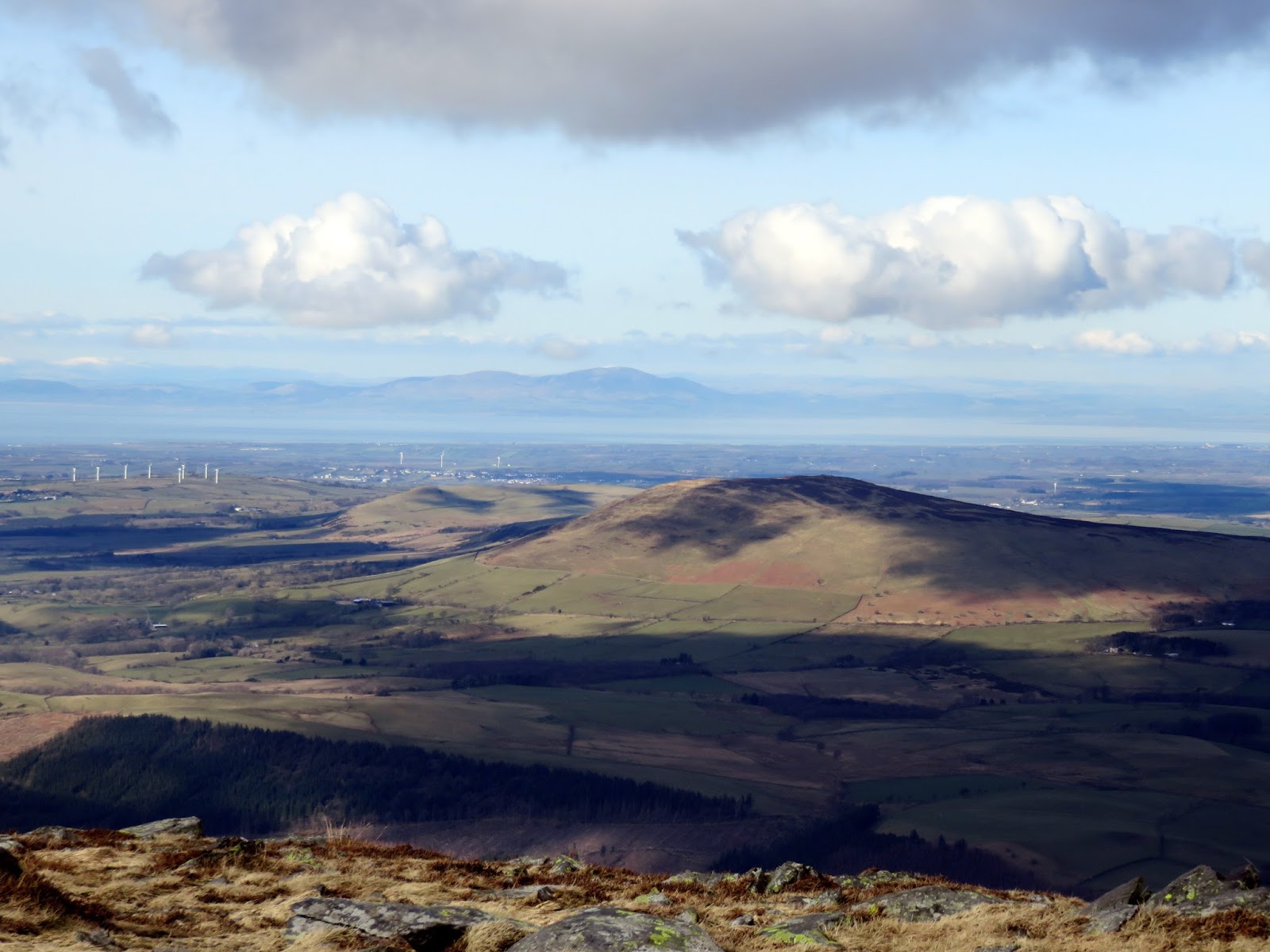
 |
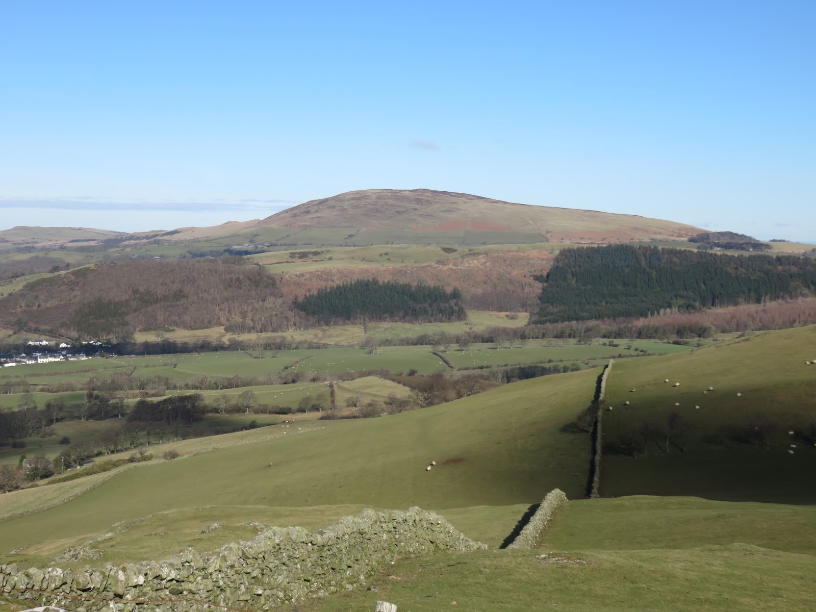
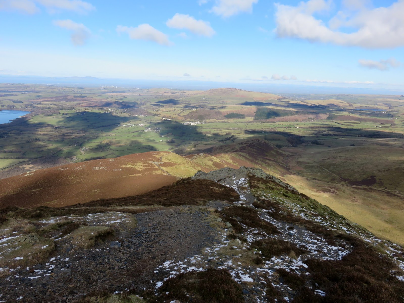
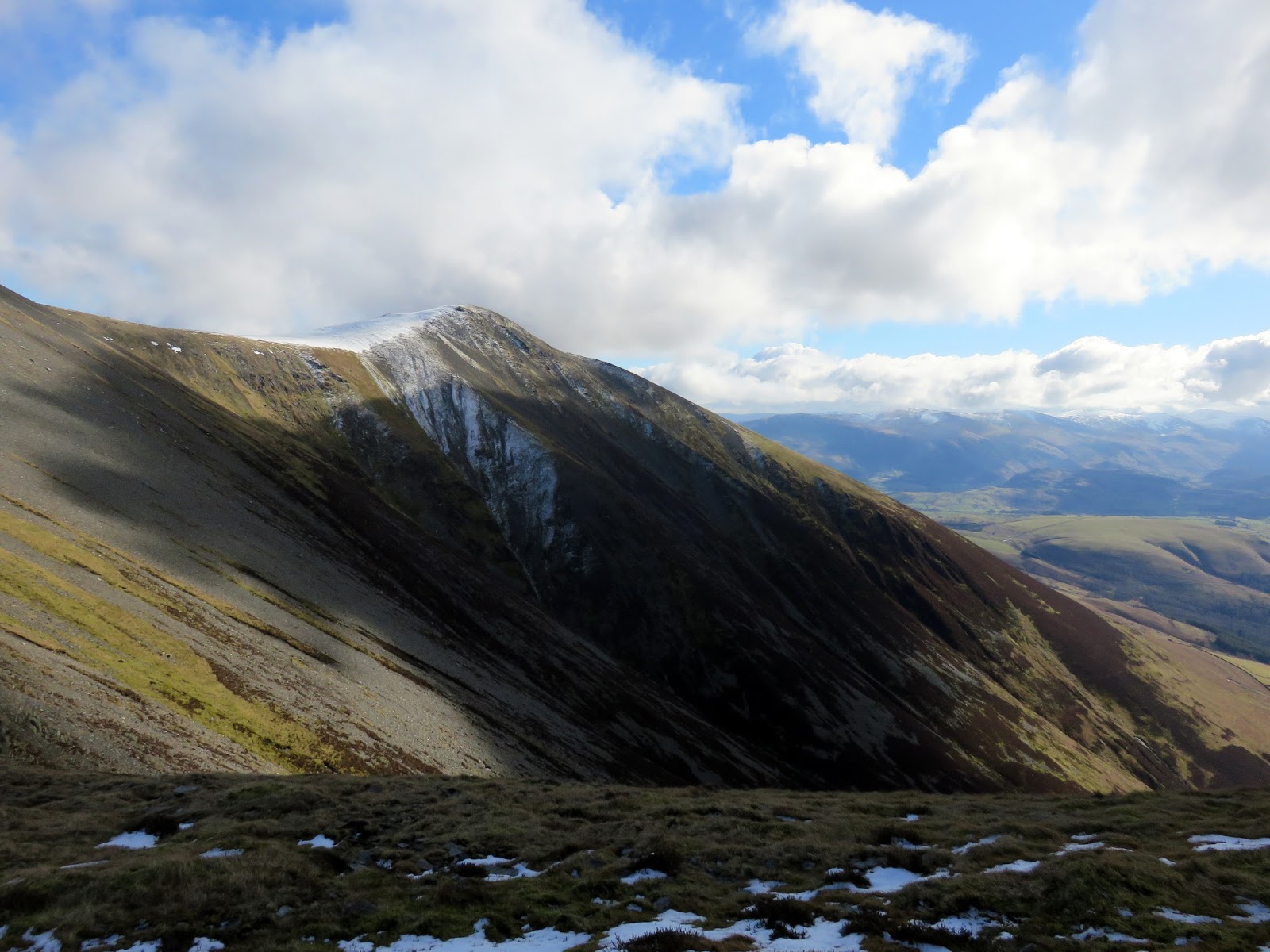
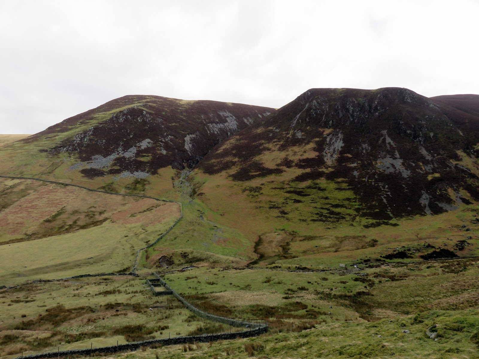
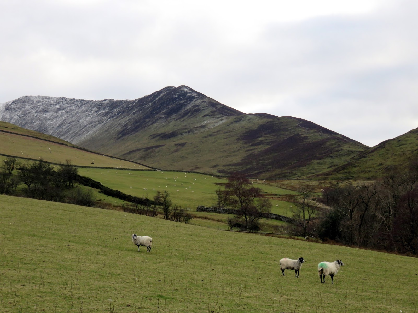
| Cockup |
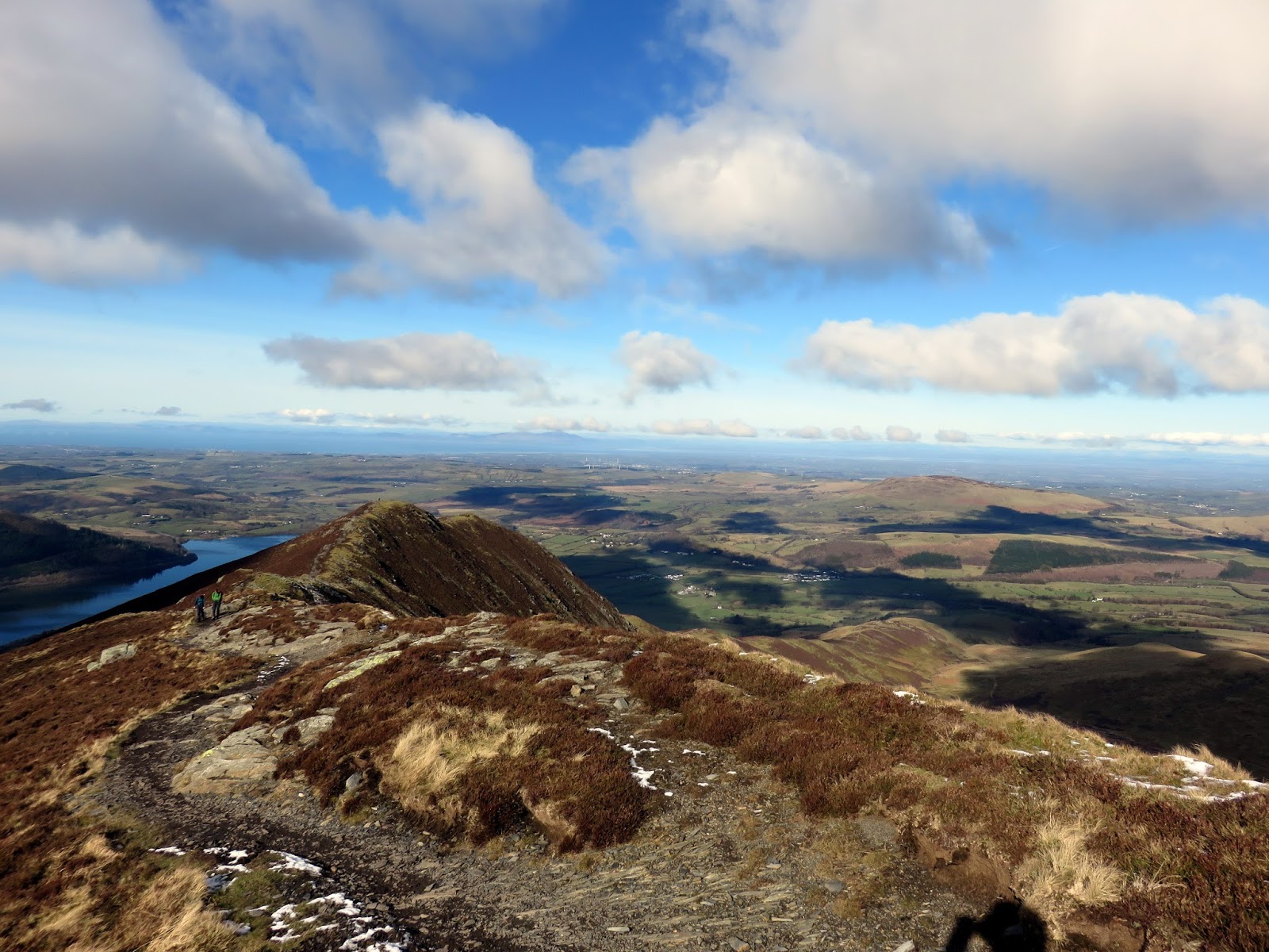
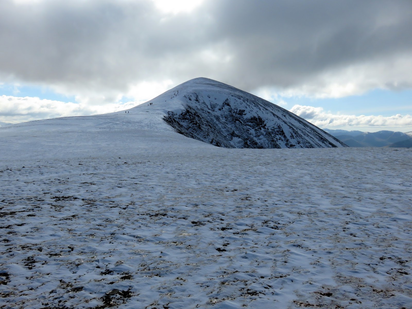
The first climb of the day leads to the oddly named summit of Watches with its satisfying elevation of 333m. The path undulates along the ridge to Ling How where it steepens briefly before continuing on its way. This pattern of steep and flat is repeated a couple of times until you reach The Edge where Ullock Pike looms overhead.
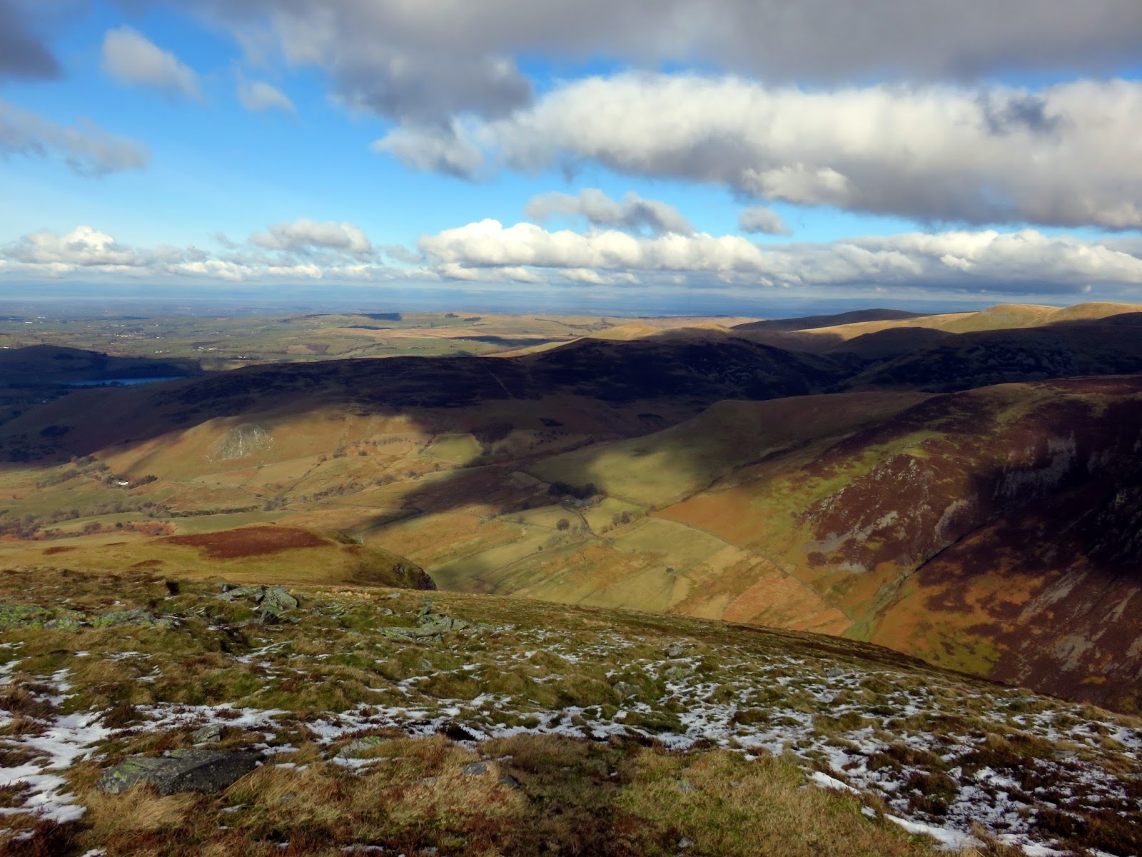
 |
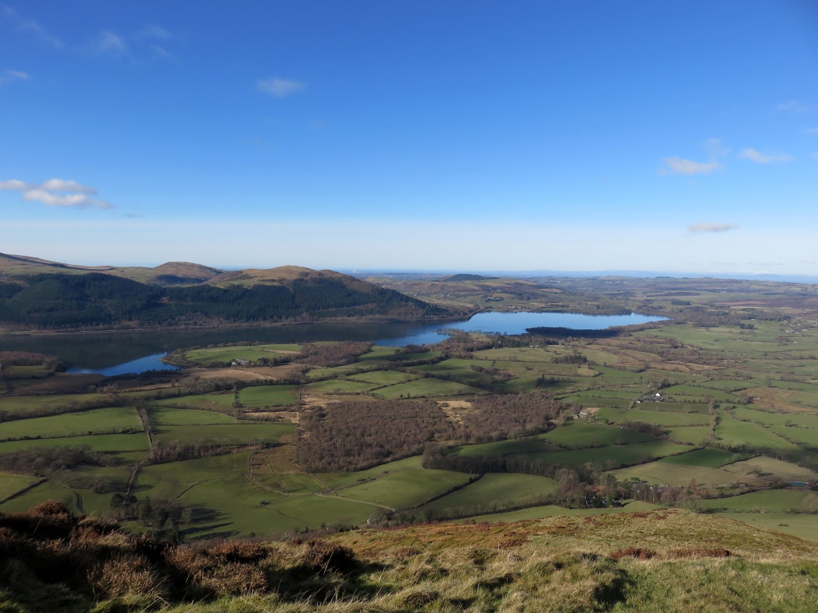
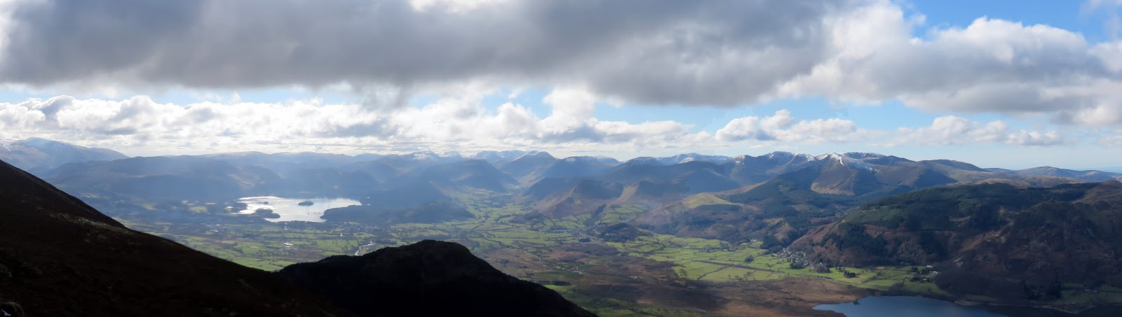
| The view across Bassenthwaite towards Sale Fell |
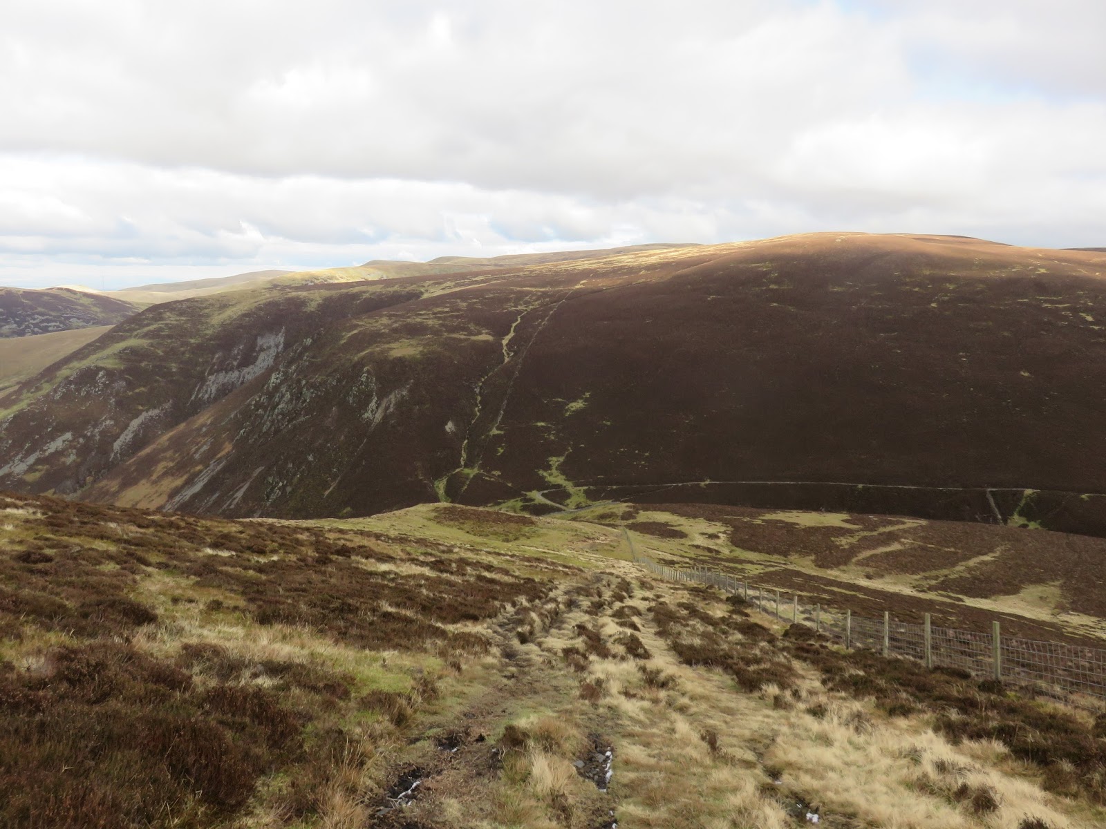
 |
| Looking down The Edge |
 |
| The Edge |
Here the path becomes very steep and steeper still towards the summit, almost becoming a minor scramble at times. The view either side of the ridge though is excellent with Southerndale and Skiddaw to the east and Bassenthwaite to the west. Despite being over 3,000ft high, Skiddaw doesn’t seem so tall from this angle, largely because of the absence of crags. Don’t let this fool you though – there’s still a way to go.
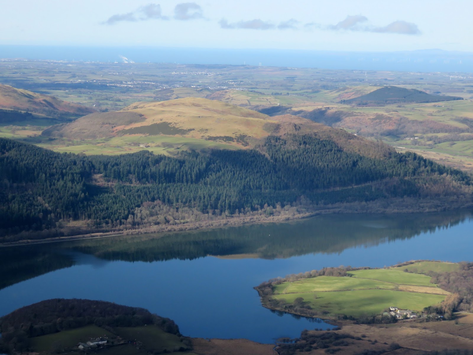
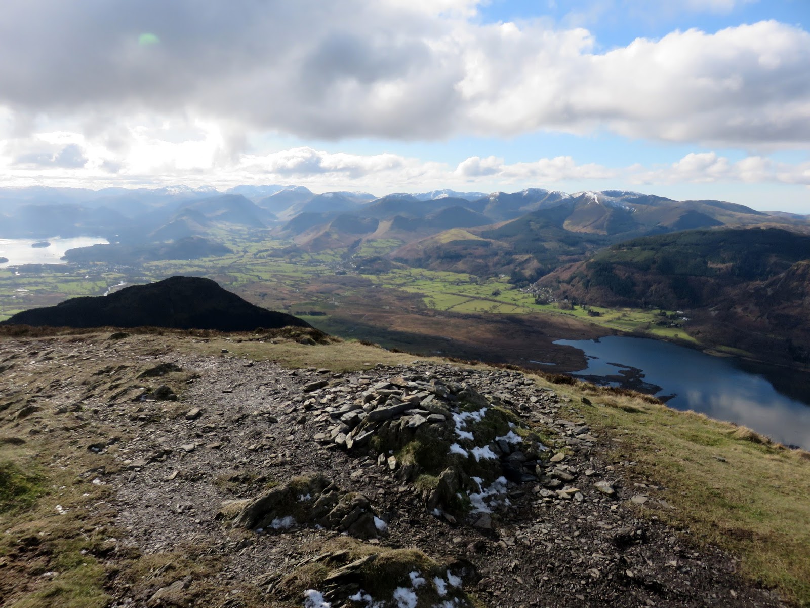
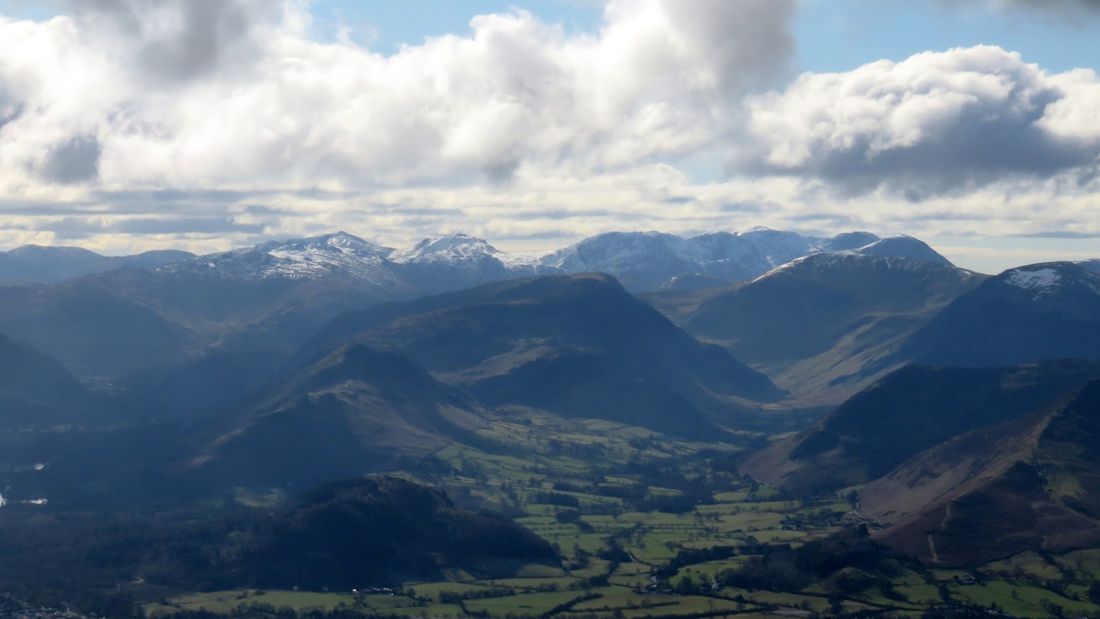
The steepness finally gives way at the summit of Ullock Pike, the first significant named peak of the walk. Presented ahead is the fine Long Side ridge and one of the most expansive views in the entire Lake District stretching from Helvellyn over Borrowdale and the Scafells and the entirety of the north western fells. I can’t think of many views that contain so much interest.
 |
| The view along Newlands towards the Scafells |
 |
| The view along Longside Edge |
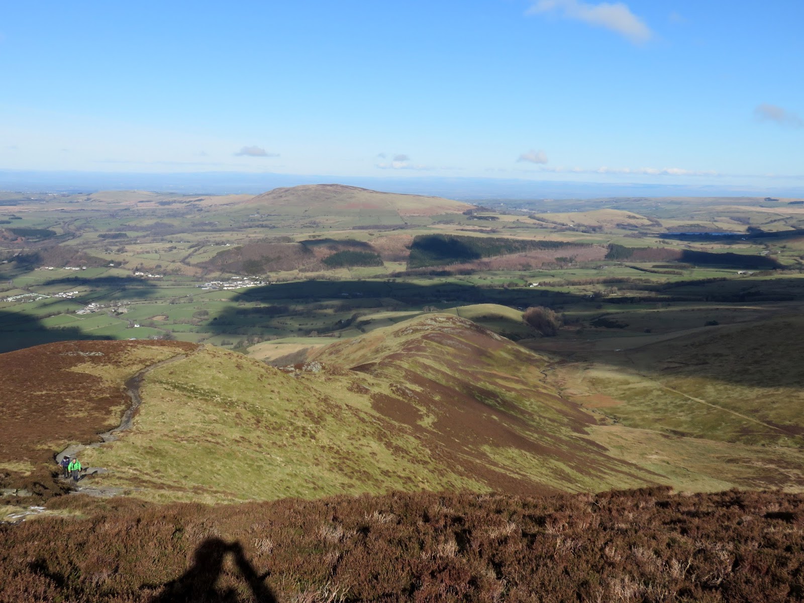
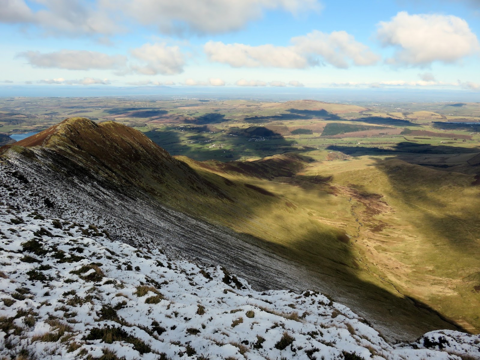
It’s a view that accompanies you along the ridge of Long Side, a named fell though really a high point on Longside Edge, the link between Ullock Pike and Carl Side (some may argue that Ullock Pike is just the end of Long Side, which would also be correct). A huge group of people were just departing the summit as I arrived, and proceeded to follow the path below Carl Side towards Skiddaw. In order put a bit of distance between them and myself, I aimed for Carl Side’s quiet summit.
 |
| Southerndale |
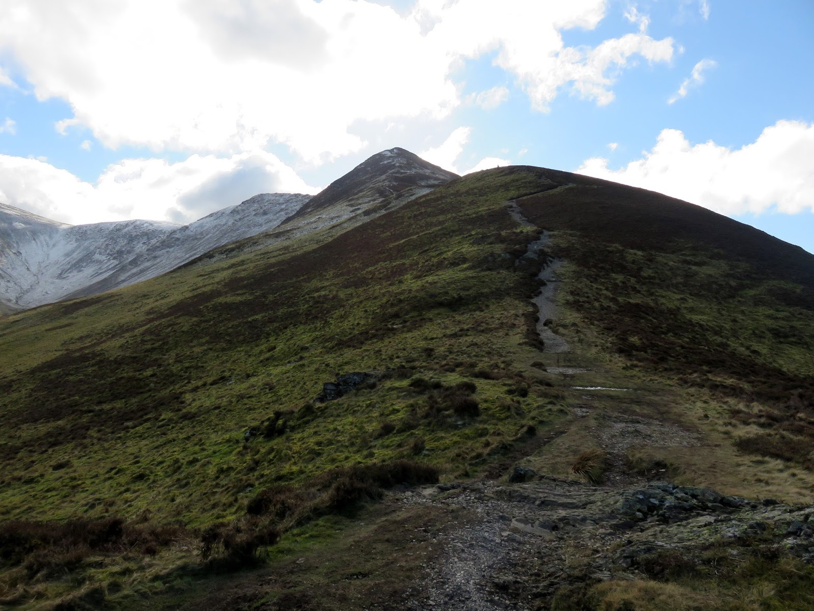
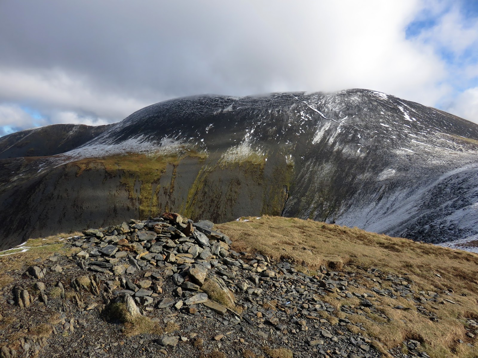
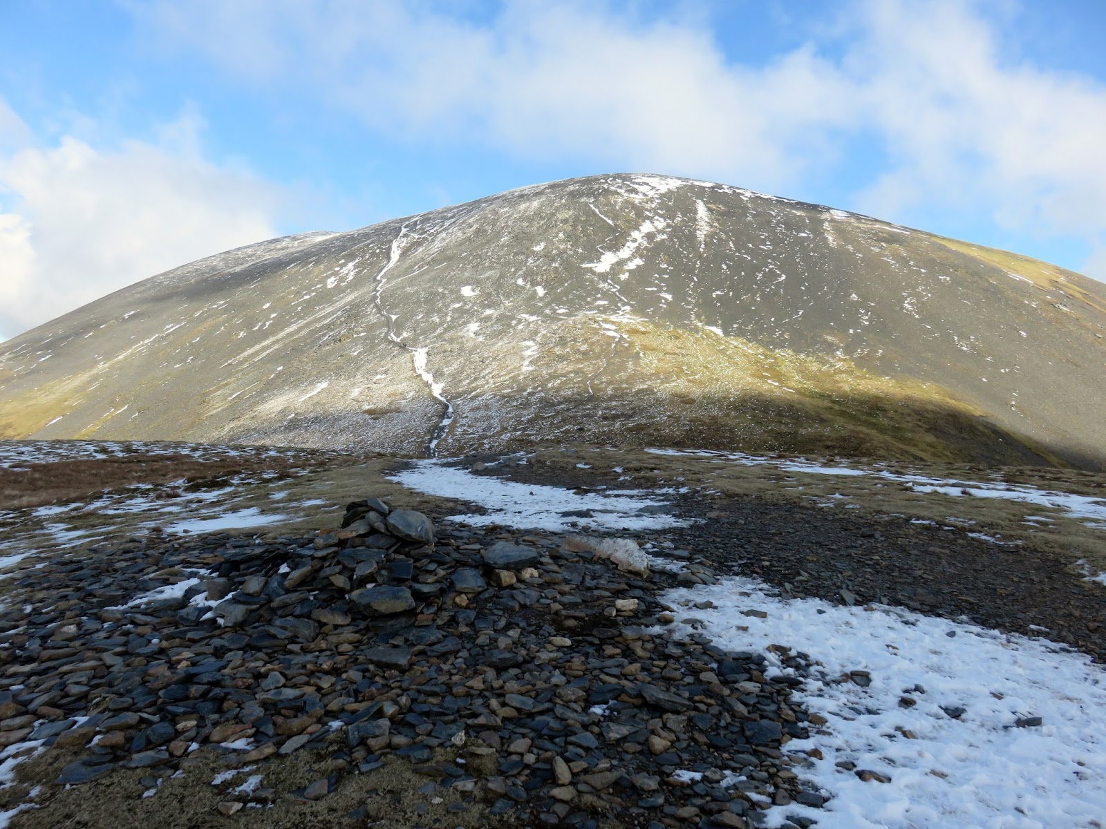
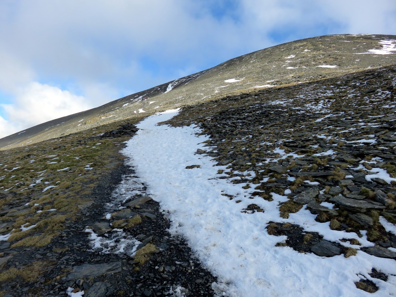
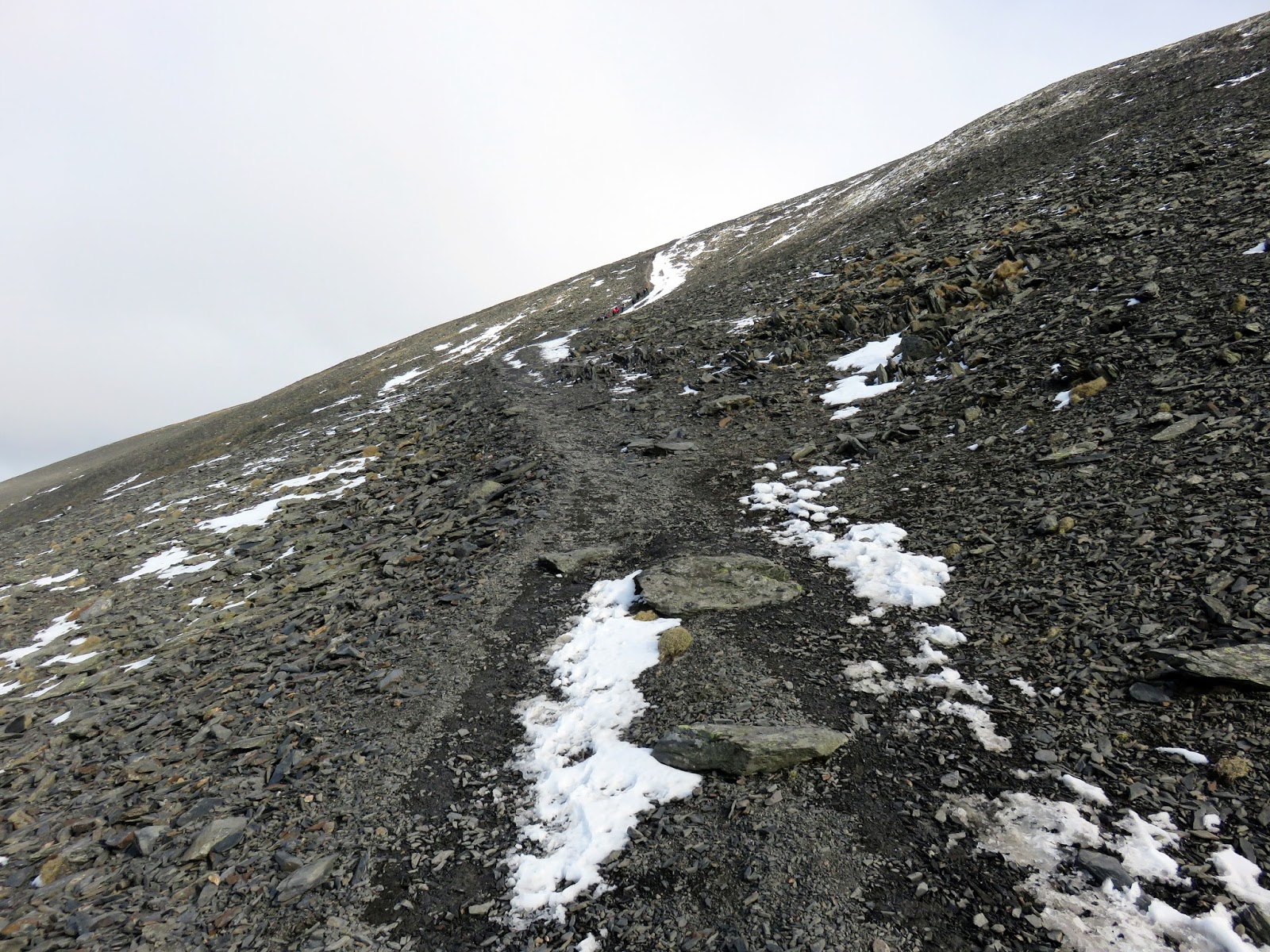
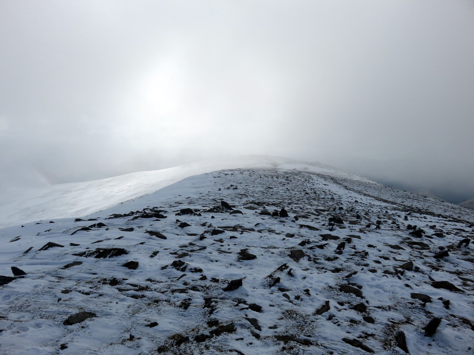
Skiddaw looms ahead with a path running up the flanks. I remember it being steep the last time I did it but had forgotten just how steep it is – it must be one of the steepest paths in the Lake District – that is one without steps. It’s a tough climb up and I was a little disappointed to find no need for the crampons as the path was largely clear of snow. My ploy of giving the large group a head start failed as I caught them around the half way mark. No doubt I’ll show up in a few of the photos they were taking, becoming an honorary member if you will.
 |
| I think I may have mentioned that the path is steep |
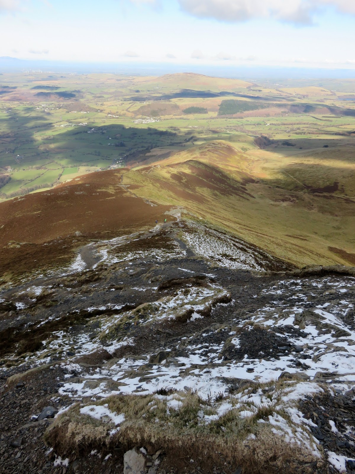
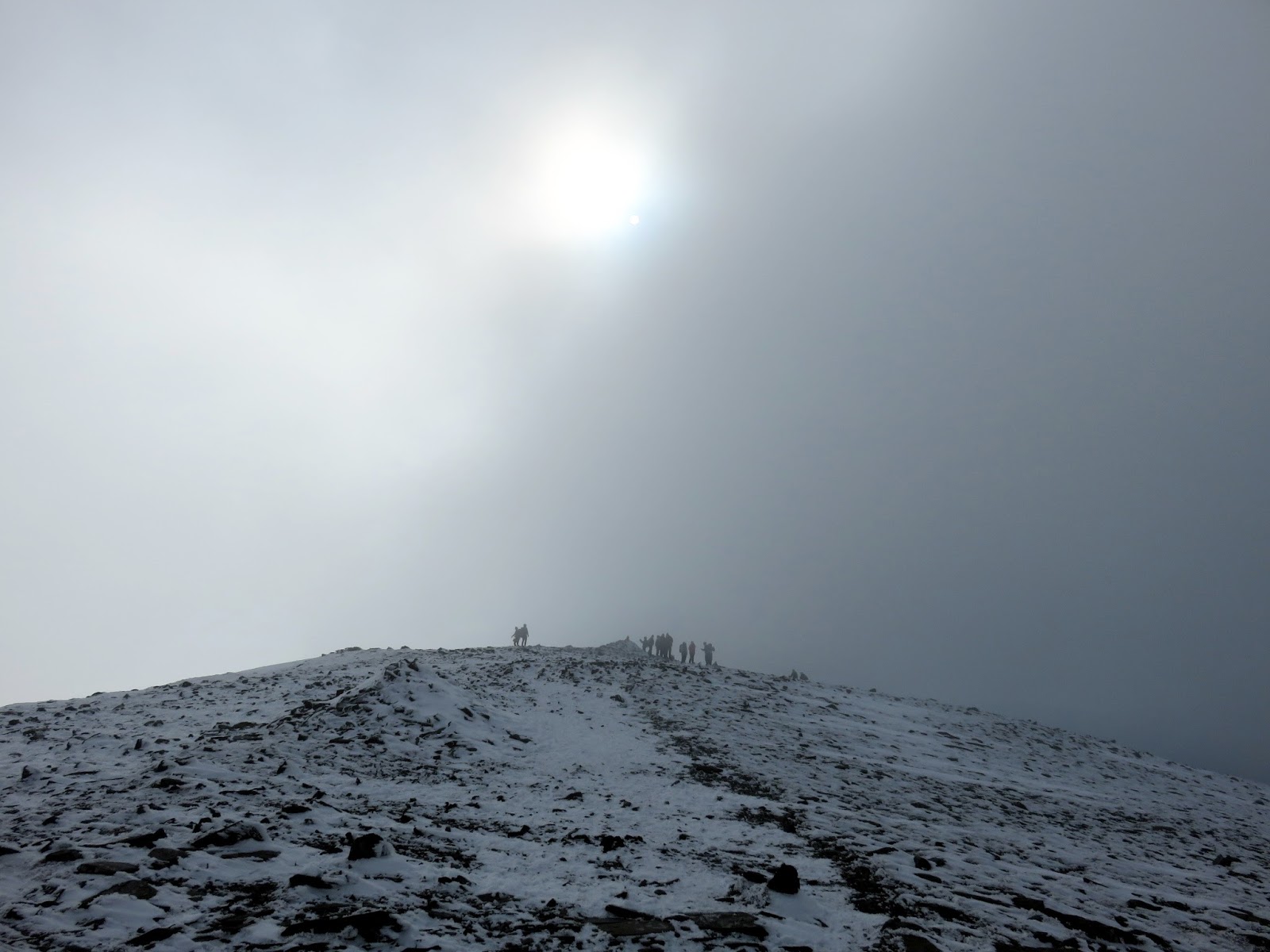
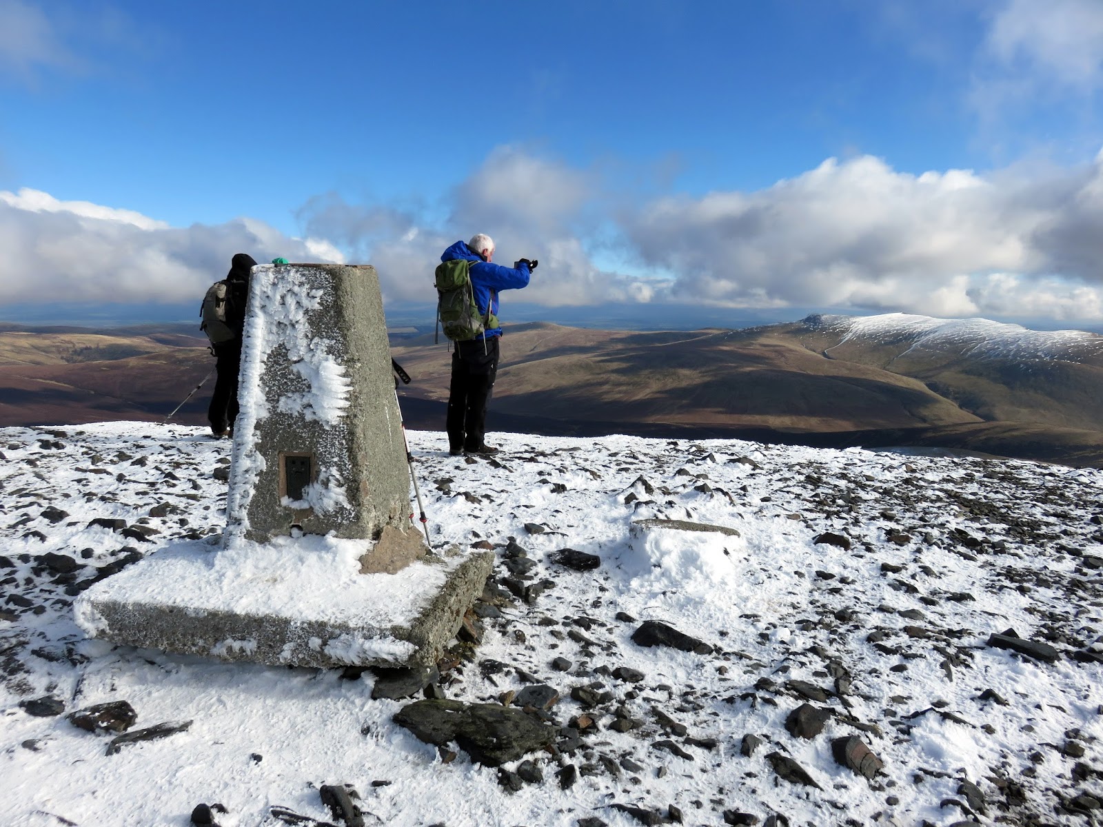
We eventually reached the top and while the group re-grouped, I left them to and headed for the summit. The snow on the summit ridge was perfect and some brief broken cloud added to the atmosphere. Skiddaw was busy today – a large number of people were either heading for or from the summit trig pillar.
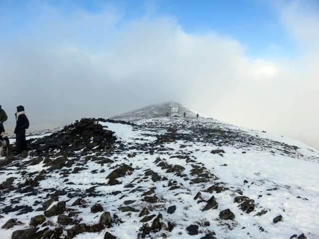 |
| Looking north towards the very top |
 |
| Skiddaw Middle Top |
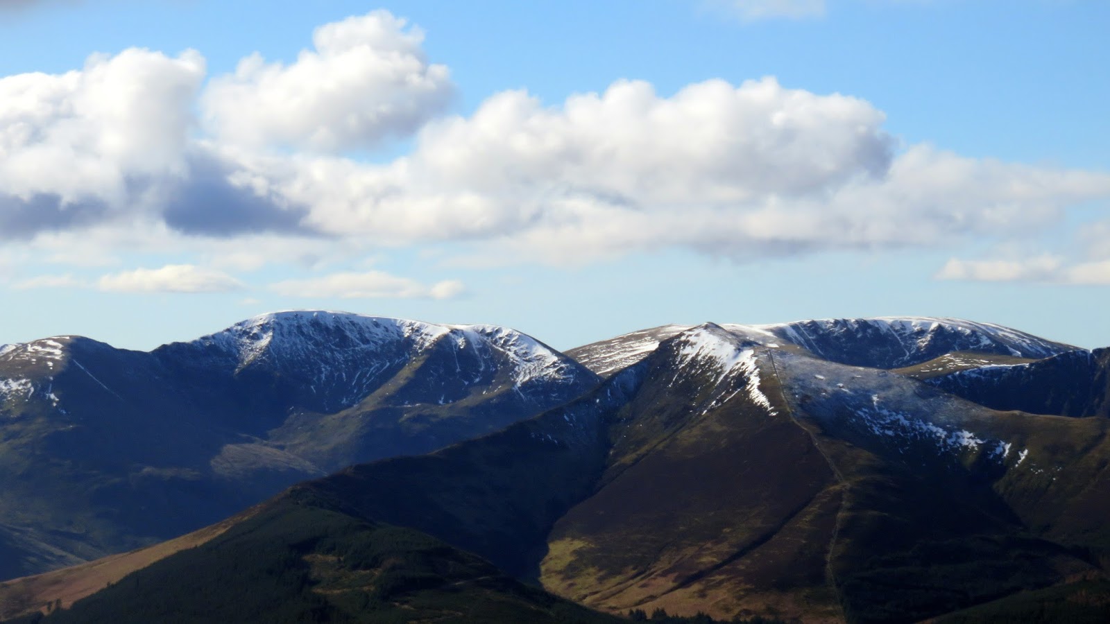
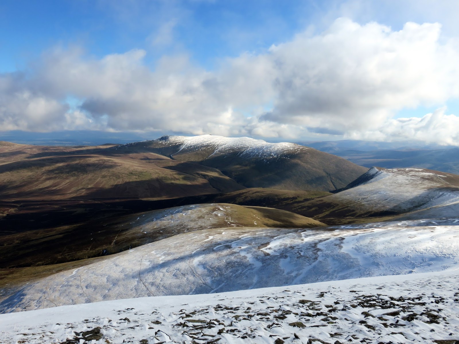
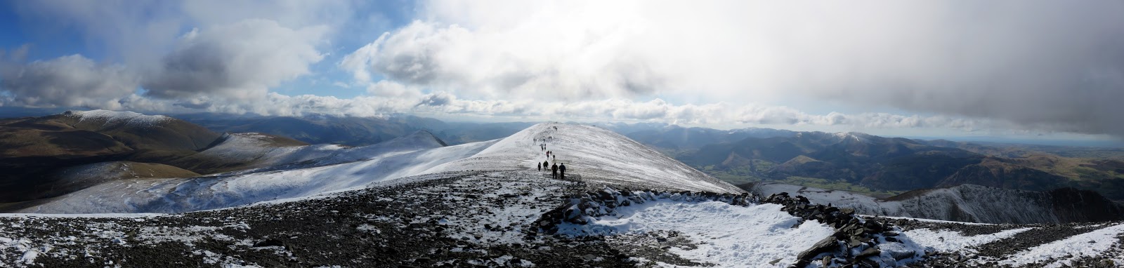
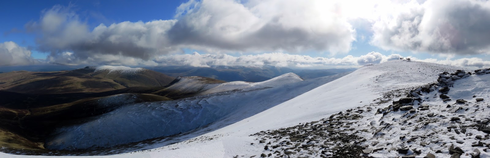
Skiddaw has a tremendous view of the northern fells though it’s a shame the view from here is of the back of Blencathra and not the front. The long ridge that forms Skiddaw’s summit is, however, superb and consists of a number of mini-peaks in addition to the main one. The winter conditions on the top were very pleasant and made for a nice walk down to Broad End.
 |
| The summit ridge |
 |
| Gibraltar Crag |
 |
| Broad End |
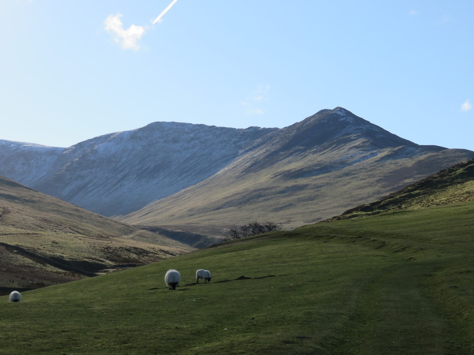
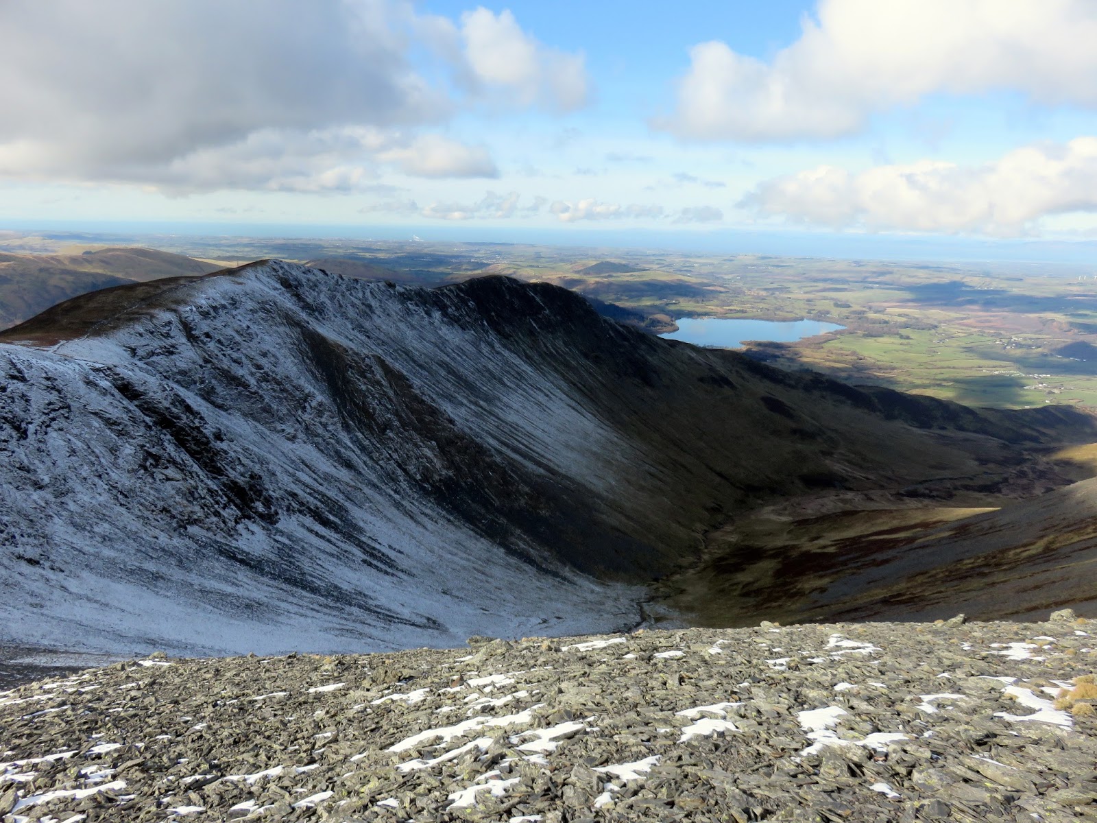
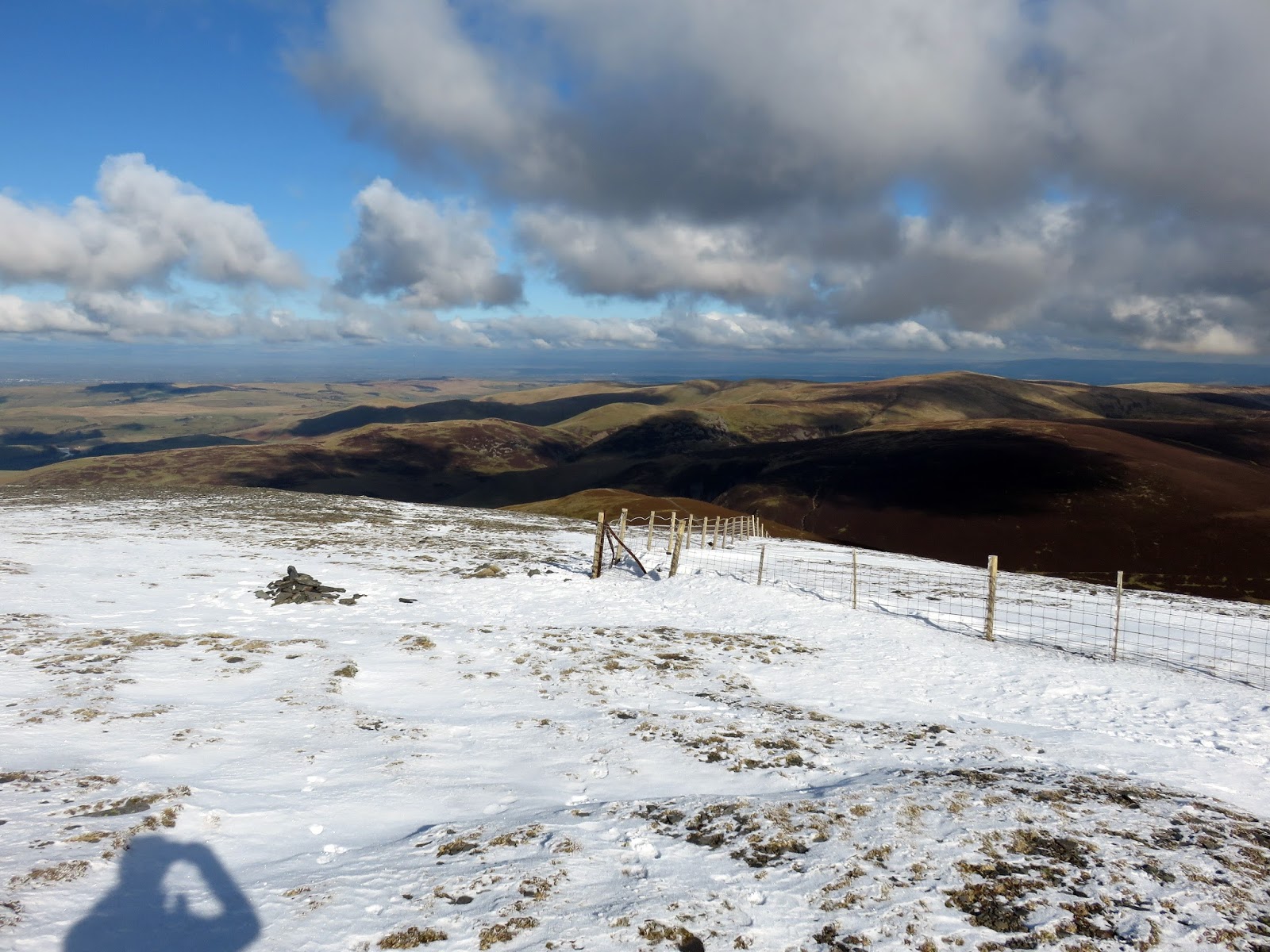
The navigation from Broad End to Bakestall couldn’t be more straight forward as a fence joins the two summits. More hard snow on this north facing ridge meant for an easy walk down with the odd glissade thrown in for good measure. It doesn’t take long to reach the top of Bakestall.
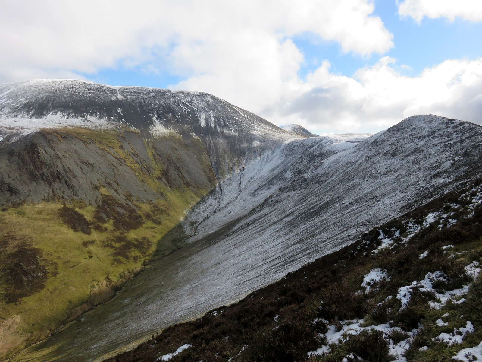
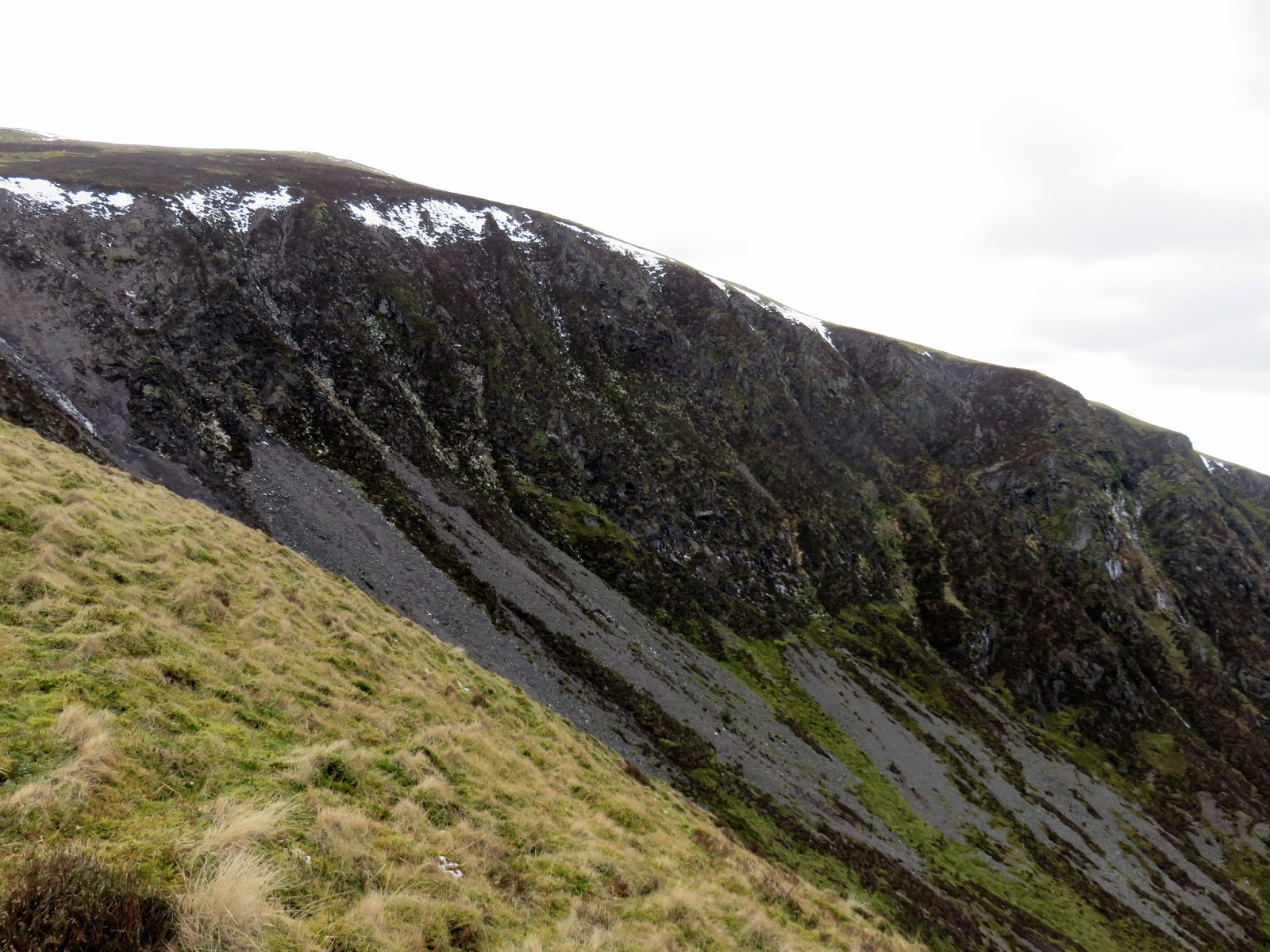
Though not really a fell in its own right, Dead Crags make Bakestall worth a visit. Now that I was away from the Skiddaw crowds I decided to stop of lunch on the rim, peering down into the coomb below.
 |
| Birkett Edge |
 |
| Dead Crags |
 |
| The valley of Dash Beck |
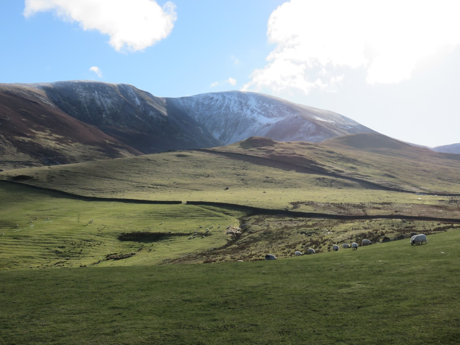
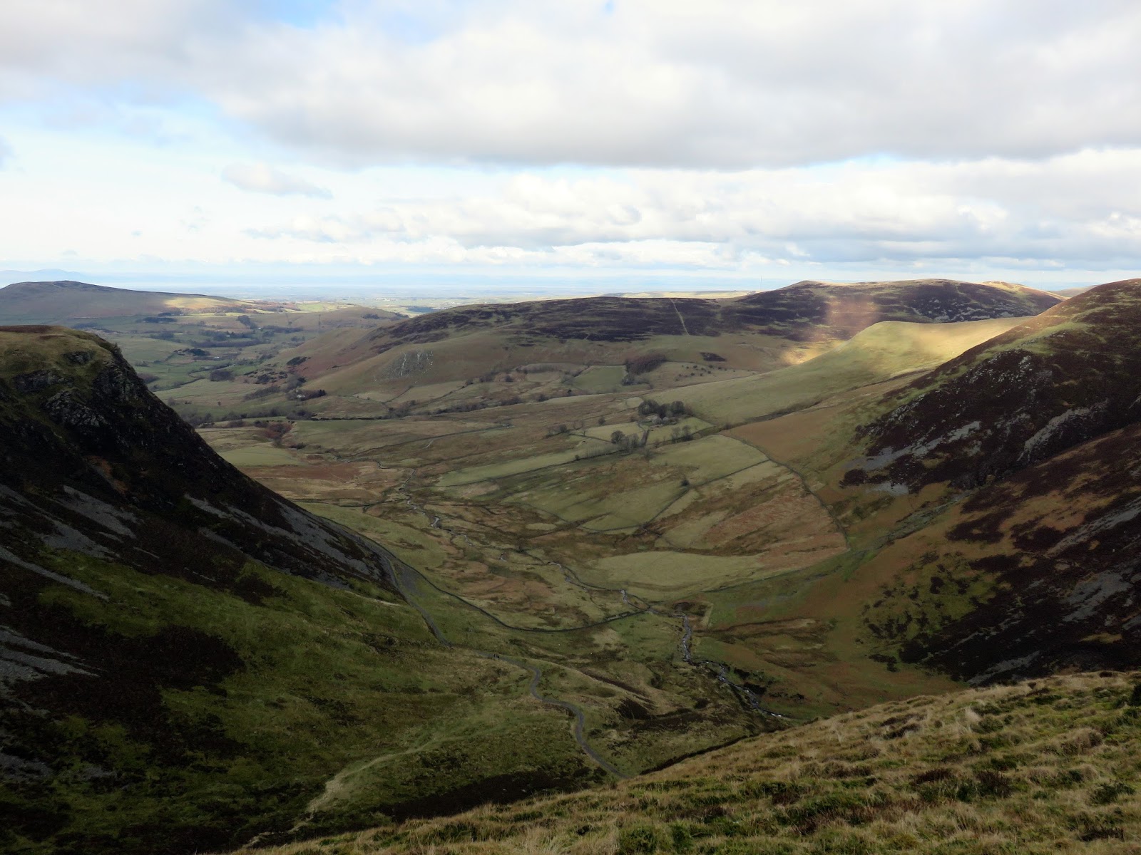
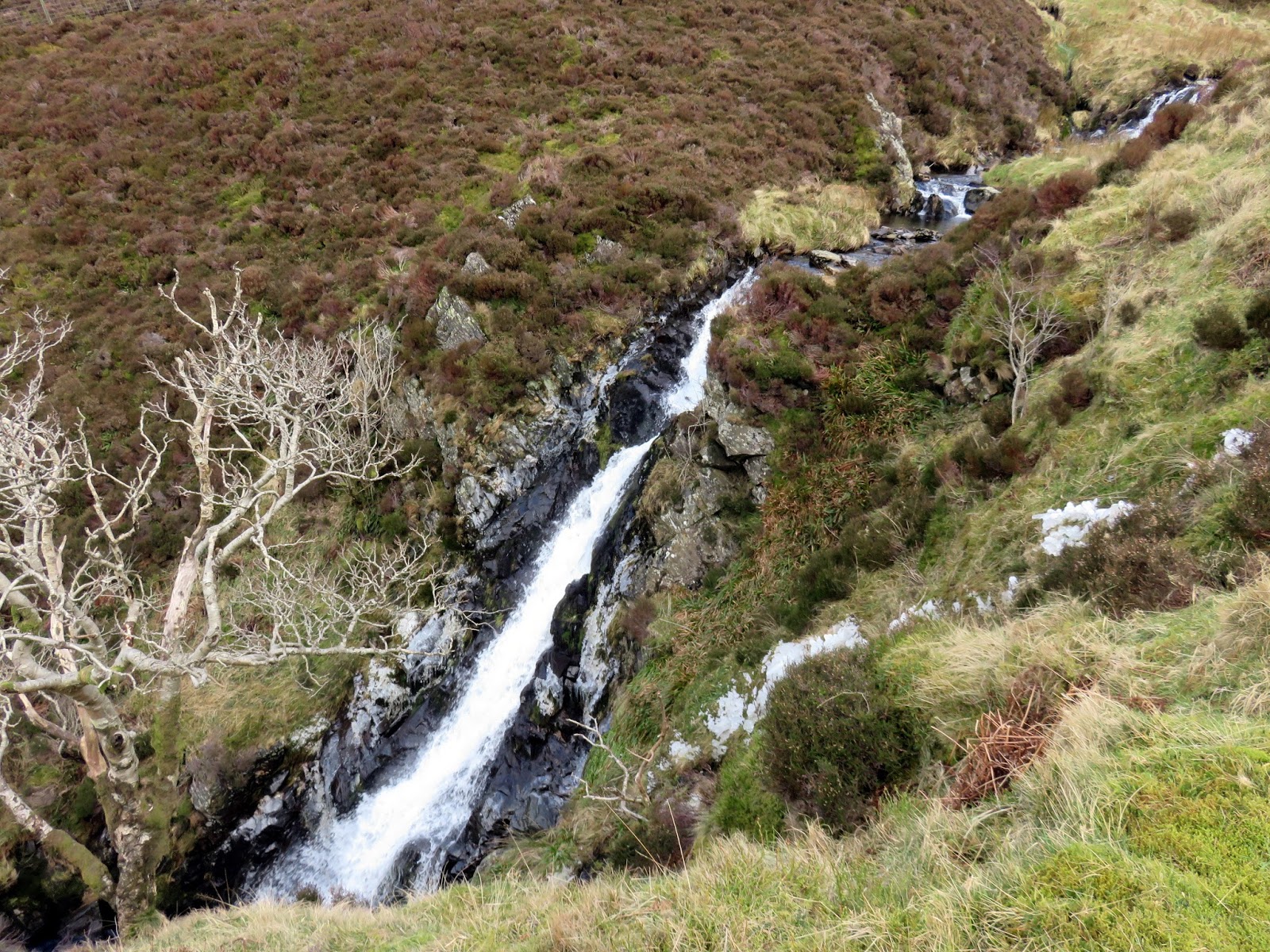
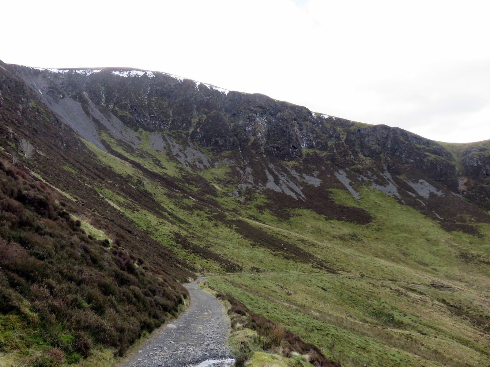
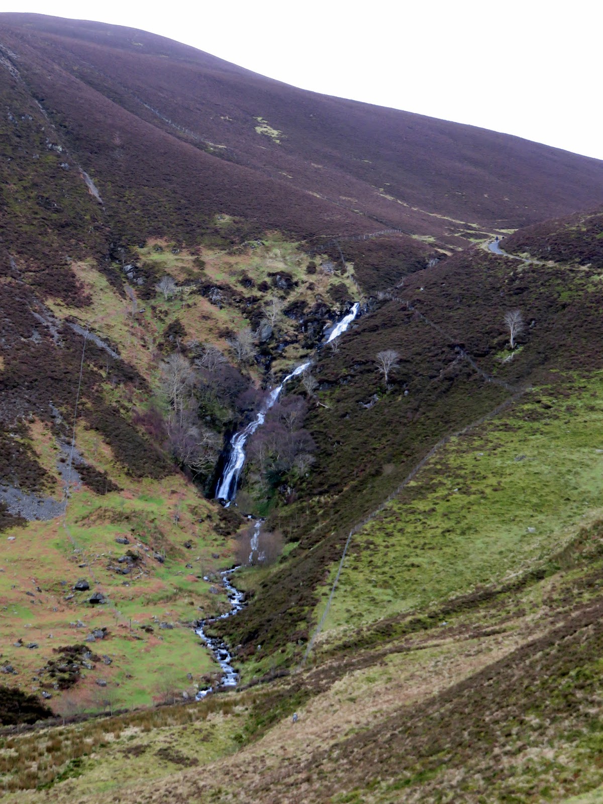
Afterwards I followed the fence down Birkett Edge (more grassy bank than edge) to the Cumbria Way. After rounding the corner the full spectacle of Dead Crags is revealed, a rare sight of cliffs in the grassy northern fells. As coming into view is Whitewater Dash, a delightful waterfall that tumbles some 100m over Black Nettle Hause. Sadly, it’s a difficult one to access so I couldn’t inspect it up close.
 |
| The upper portion of Whitewater Dash |
 |
| The Cumbria Way underneath Dead Crags |
 |
| Whitewater Dash |
 |
| Foul Gill and Little Nettle Hause |
 |
| White Hause |
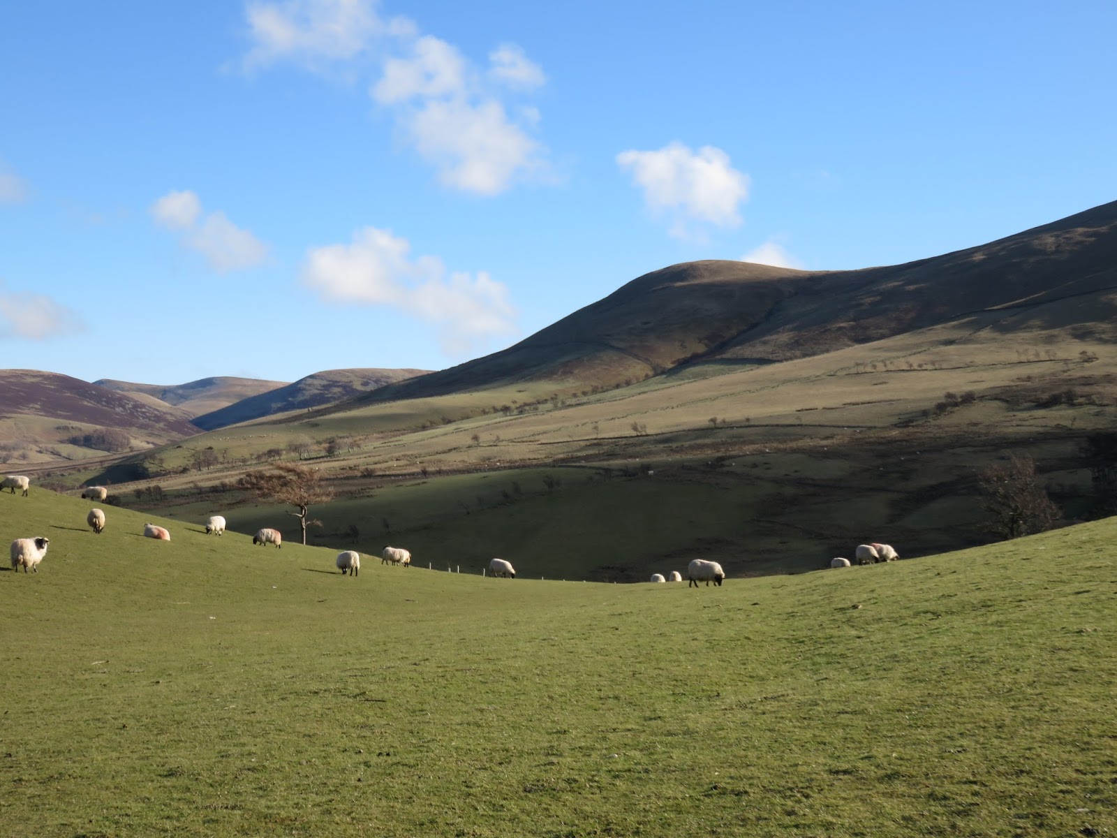
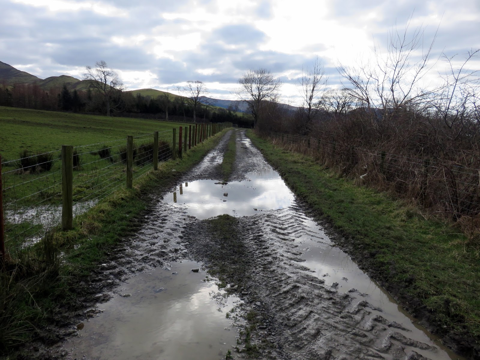
The Cumbria Way leads across fields and past farms until it reaches the Orthwaite Road though it was a fair trudge back to the car including a diversion around Barkbeth Farm. In hindsight, it would have been best to leave the car in a layby at the Cumbria Way close to Peter House Farm but hadn’t know it was there at the time. One to remember for the future.
 |
| Bassenthwaite emerges in the distance |
 |
| Farm lane at Barkbeth |
 |
| Ullock Pike |
The Long Side ridge is without a doubt the best way to reach Skiddaw, the sixth highest mountain in England, and has some mountain character in an area where it is hard to find, despite the lofty elevation of Skiddaw. It is perhaps the most accessible mountain in the Lake District thanks to the paths rising directly from Keswick but I would urge you to consider this route over any approaching from the south.

