Open Space Web-Map builder Codehttps://openspace.ordnancesurvey.co.uk/osmapapi/openspace.js?key=3119F72552FD5C22E0530C6CA40A5A92https://openspace.ordnancesurvey.co.uk/osmapapi/script/mapbuilder/basicmap.jshttps://openspace.ordnancesurvey.co.uk/osmapapi/script/mapbuilder/searchbox.js//variables for routes var linesLayer, points, lineFeature, lineString, routeMarkersLayer, routepos, routesize, routeoffset, routeicon; var style_blue = {strokeColor: “#0000CD”, strokeOpacity: 0.5, strokeWidth: 4.5}; function initmapbuilder() { //initiate the map var options = {resolutions: [2500, 1000, 500, 200, 100, 50, 25, 10, 5, 4, 2.5, 2, 1]}; osMap = new OpenSpace.Map(‘map’, options); //configure map options (basicmap.js) setglobaloptions(); //set the center of the map and the zoom level osMap.setCenter(new OpenSpace.MapPoint(382505.9974823,465705.00125885),7); linesLayer = osMap.getVectorLayer(); // Set up layer for route markers routeMarkersLayer = new OpenLayers.Layer.Markers(“Route Markers”); //make a route points = new Array(); points.push(new OpenLayers.Geometry.Point(382102.66412354,467366.66793823)); points.push(new OpenLayers.Geometry.Point(382182.66412354,467261.66793823)); points.push(new OpenLayers.Geometry.Point(382207.66412354,467281.66793823)); points.push(new OpenLayers.Geometry.Point(382267.66412354,467386.66793823)); points.push(new OpenLayers.Geometry.Point(382377.66412354,467326.66793823)); points.push(new OpenLayers.Geometry.Point(382482.66412354,467346.66793823)); points.push(new OpenLayers.Geometry.Point(382597.66412354,467321.66793823)); points.push(new OpenLayers.Geometry.Point(382617.66412354,467266.66793823)); points.push(new OpenLayers.Geometry.Point(382922.66412354,467121.66793823)); points.push(new OpenLayers.Geometry.Point(383147.66412354,467001.66793823)); points.push(new OpenLayers.Geometry.Point(383157.66412354,467081.66793823)); points.push(new OpenLayers.Geometry.Point(383162.66412354,466986.66793823)); points.push(new OpenLayers.Geometry.Point(383217.66412354,466951.66793823)); points.push(new OpenLayers.Geometry.Point(383237.66412354,466791.66793823)); points.push(new OpenLayers.Geometry.Point(383367.66412354,466691.66793823)); points.push(new OpenLayers.Geometry.Point(383662.66412354,466551.66793823)); points.push(new OpenLayers.Geometry.Point(383782.66412354,466486.66793823)); points.push(new OpenLayers.Geometry.Point(383907.66412354,466451.66793823)); points.push(new OpenLayers.Geometry.Point(383837.66412354,466366.66793823)); points.push(new OpenLayers.Geometry.Point(383652.66412354,466231.66793823)); points.push(new OpenLayers.Geometry.Point(383442.66412354,465936.66793823)); points.push(new OpenLayers.Geometry.Point(383497.66412354,465806.66793823)); points.push(new OpenLayers.Geometry.Point(383617.66412354,465611.66793823)); points.push(new OpenLayers.Geometry.Point(383692.66412354,465351.66793823)); points.push(new OpenLayers.Geometry.Point(383677.66412354,465176.66793823)); points.push(new OpenLayers.Geometry.Point(383742.66412354,465036.66793823)); points.push(new OpenLayers.Geometry.Point(383852.66412354,465026.66793823)); points.push(new OpenLayers.Geometry.Point(383802.66412354,464906.66793823)); points.push(new OpenLayers.Geometry.Point(383852.66412354,464756.66793823)); points.push(new OpenLayers.Geometry.Point(383892.66412354,464566.66793823)); points.push(new OpenLayers.Geometry.Point(383902.66412354,464221.66793823)); points.push(new OpenLayers.Geometry.Point(383842.66412354,464111.66793823)); points.push(new OpenLayers.Geometry.Point(383692.66412354,464111.66793823)); points.push(new OpenLayers.Geometry.Point(383582.66412354,464201.66793823)); points.push(new OpenLayers.Geometry.Point(383542.66412354,464346.66793823)); points.push(new OpenLayers.Geometry.Point(383517.66412354,464411.66793823)); points.push(new OpenLayers.Geometry.Point(383452.66412354,464411.66793823)); points.push(new OpenLayers.Geometry.Point(383402.66412354,464311.66793823)); points.push(new OpenLayers.Geometry.Point(383372.66412354,464231.66793823)); points.push(new OpenLayers.Geometry.Point(383282.66412354,464281.66793823)); points.push(new OpenLayers.Geometry.Point(383162.66412354,464381.66793823)); points.push(new OpenLayers.Geometry.Point(383062.66412354,464391.66793823)); points.push(new OpenLayers.Geometry.Point(383137.66412354,464086.66793823)); points.push(new OpenLayers.Geometry.Point(382977.66412354,464051.66793823)); points.push(new OpenLayers.Geometry.Point(382777.66412354,464146.66793823)); points.push(new OpenLayers.Geometry.Point(382597.66412354,464171.66793823)); points.push(new OpenLayers.Geometry.Point(382392.66412354,464151.66793823)); points.push(new OpenLayers.Geometry.Point(382302.66412354,464131.66793823)); points.push(new OpenLayers.Geometry.Point(382307.66412354,464031.66793823)); points.push(new OpenLayers.Geometry.Point(382272.66412354,463931.66793823)); points.push(new OpenLayers.Geometry.Point(382147.66412354,463806.66793823)); points.push(new OpenLayers.Geometry.Point(382122.66412354,463711.66793823)); points.push(new OpenLayers.Geometry.Point(381967.66412354,463706.66793823)); points.push(new OpenLayers.Geometry.Point(381932.66412354,463821.66793823)); points.push(new OpenLayers.Geometry.Point(381672.66412354,464086.66793823)); points.push(new OpenLayers.Geometry.Point(381607.66412354,464126.66793823)); points.push(new OpenLayers.Geometry.Point(381722.66412354,464321.66793823)); points.push(new OpenLayers.Geometry.Point(381667.66412354,464506.66793823)); points.push(new OpenLayers.Geometry.Point(381552.66412354,464841.66793823)); points.push(new OpenLayers.Geometry.Point(381467.66412354,464926.66793823)); points.push(new OpenLayers.Geometry.Point(381432.66412354,465101.66793823)); points.push(new OpenLayers.Geometry.Point(381357.66412354,465346.66793823)); points.push(new OpenLayers.Geometry.Point(381407.66412354,465426.66793823)); points.push(new OpenLayers.Geometry.Point(381492.66412354,465491.66793823)); points.push(new OpenLayers.Geometry.Point(381537.66412354,465541.66793823)); points.push(new OpenLayers.Geometry.Point(381732.66412354,465446.66793823)); points.push(new OpenLayers.Geometry.Point(381807.66412354,465591.66793823)); points.push(new OpenLayers.Geometry.Point(381927.66412354,465726.66793823)); points.push(new OpenLayers.Geometry.Point(382107.66412354,465891.66793823)); points.push(new OpenLayers.Geometry.Point(382117.66412354,466001.66793823)); points.push(new OpenLayers.Geometry.Point(382107.66412354,466191.66793823)); points.push(new OpenLayers.Geometry.Point(382027.66412354,466276.66793823)); points.push(new OpenLayers.Geometry.Point(381797.66412354,466421.66793823)); points.push(new OpenLayers.Geometry.Point(381657.66412354,466501.66793823)); points.push(new OpenLayers.Geometry.Point(381612.66412354,466616.66793823)); points.push(new OpenLayers.Geometry.Point(381612.66412354,466726.66793823)); points.push(new OpenLayers.Geometry.Point(381637.66412354,466841.66793823)); points.push(new OpenLayers.Geometry.Point(381812.66412354,467111.66793823)); points.push(new OpenLayers.Geometry.Point(381727.66412354,467226.66793823)); points.push(new OpenLayers.Geometry.Point(381832.66412354,467246.66793823)); points.push(new OpenLayers.Geometry.Point(381797.66412354,467351.66793823)); points.push(new OpenLayers.Geometry.Point(381867.66412354,467366.66793823)); points.push(new OpenLayers.Geometry.Point(381952.66412354,467166.66793823)); points.push(new OpenLayers.Geometry.Point(382047.66412354,467291.66793823)); points.push(new OpenLayers.Geometry.Point(382102.66412354,467366.66793823)); // create a polyline feature from the array of points lineString = new OpenLayers.Geometry.LineString(points); lineFeature = new OpenLayers.Feature.Vector(lineString, null, style_blue); linesLayer.addFeatures([lineFeature]); //crate a route start/end marker routepos = new OpenSpace.MapPoint(382102.66412354,467366.66793823); routesize = new OpenLayers.Size(33,45); routeoffset = new OpenLayers.Pixel(-5,-37); routeicon = new OpenSpace.Icon(‘https://openspace.ordnancesurvey.co.uk/osmapapi/img_versions/img_1.1/mapbuilder/routemarker-startend.png’, routesize, routeoffset, null, null); routeMarkersLayer.addMarker(new OpenLayers.Marker(routepos, routeicon)); osMap.addLayer(routeMarkersLayer);}
Route: Stainforth, Pennine Bridleway, Catrigg Force, Winskill Stones, Cowside, Jubilee Cave, Victoria Cave, Brent Scar, Attermire Scar, Warrendale Knotts, Yorkshire Dales High Way, Pennine Bridleway, Settle, Ribble Way, Stackhouse, Stainforth Force, Stainforth
Date: 07/02/2016
From: Stainforth
Parking: Stainforth
Start Point: Stainforth
Region: Yorkshire Dales
Route length: 8.6 miles (13.8 km)
Time taken: 03:34
Average speed: 2.4 mph
Ascent: 594m
Descent: 602m
Summits: Warrendale Knotts (440m)
Other points of interest: Catrigg Force, Winskill Stones, Jubilee Cave, Victoria Cave, Attermire Scar, Stainforth Force
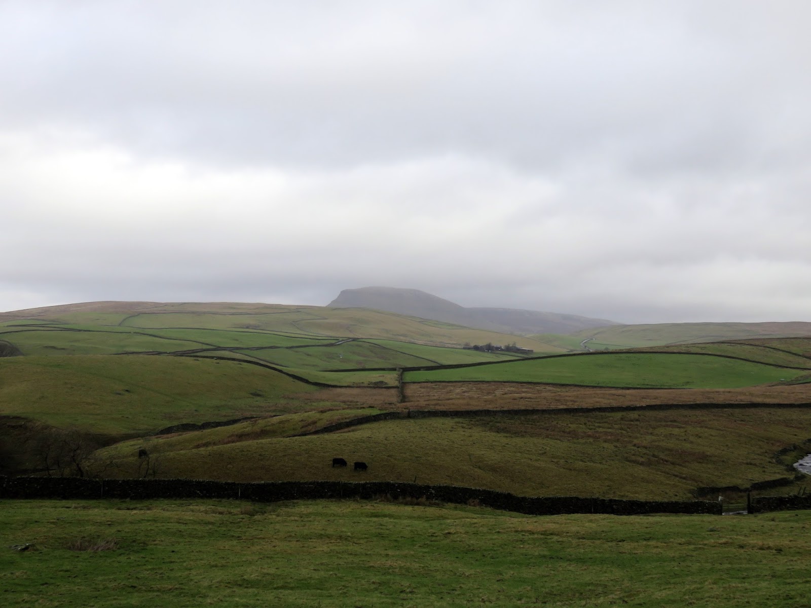
The Craven Fault is a series of geological fault lines which run along the southern and western edges of the Yorkshire Dales and includes the North Craven Fault, the Mid Craven Fault and the South Craven Fault. It is a wonderful place to walk and includes many of the Yorkshire Dales’ finest features; Malham Cove and Cross Field Knotts to name a couple. Our highlights would be the scars at Attermire and the interesting Warrendale Knotts. Throw in a few waterfalls and caves and you have a classic Dales day out.
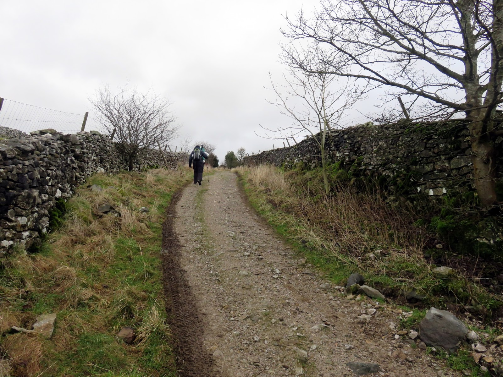
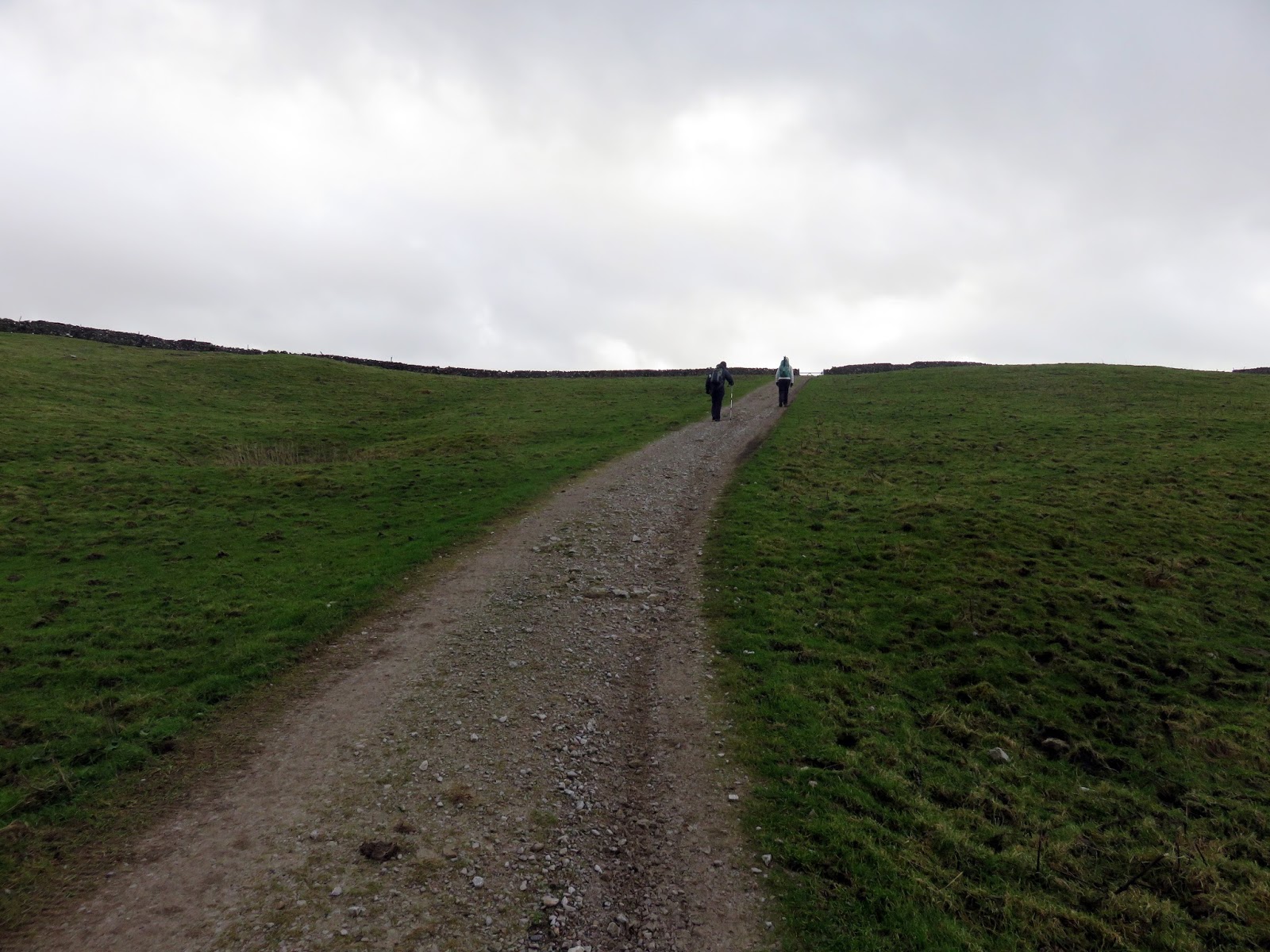
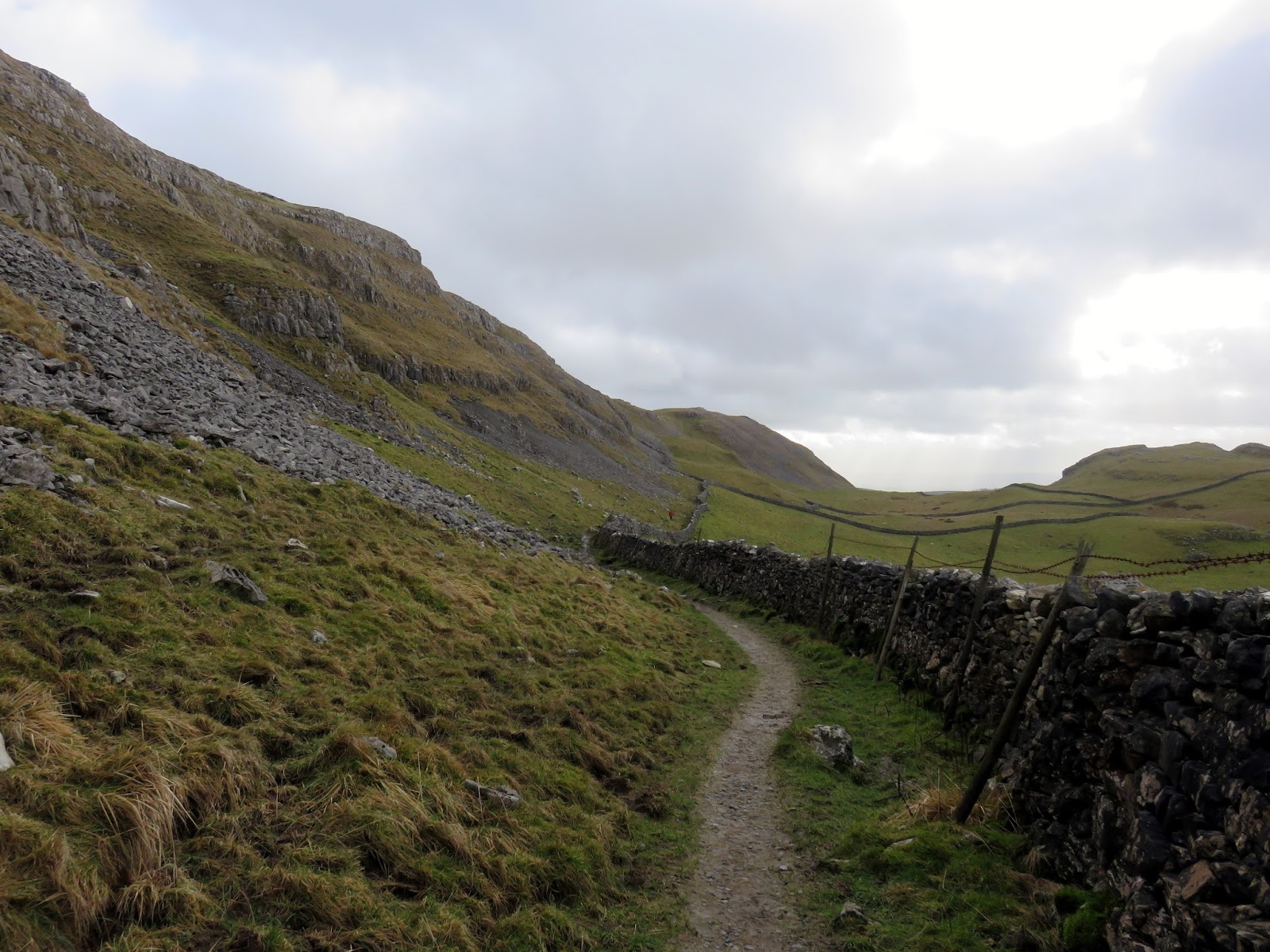
We started from Stainforth, a small village a few miles north of Settle nestled deep within limestone territory. From Stainforth we took the Pennine Bridleway as it initially climbs steeply out of the village before wending its way across open fields towards Catrigg Force. The Pennine Bridleway is a recent long distance route designed to complement the famous Pennine Way by allowing horseriders and cyclists to make the 200 mile journey through the Pennine hills.
 |
| The Pennine Bridleway climbs out of Stainforth |
 |
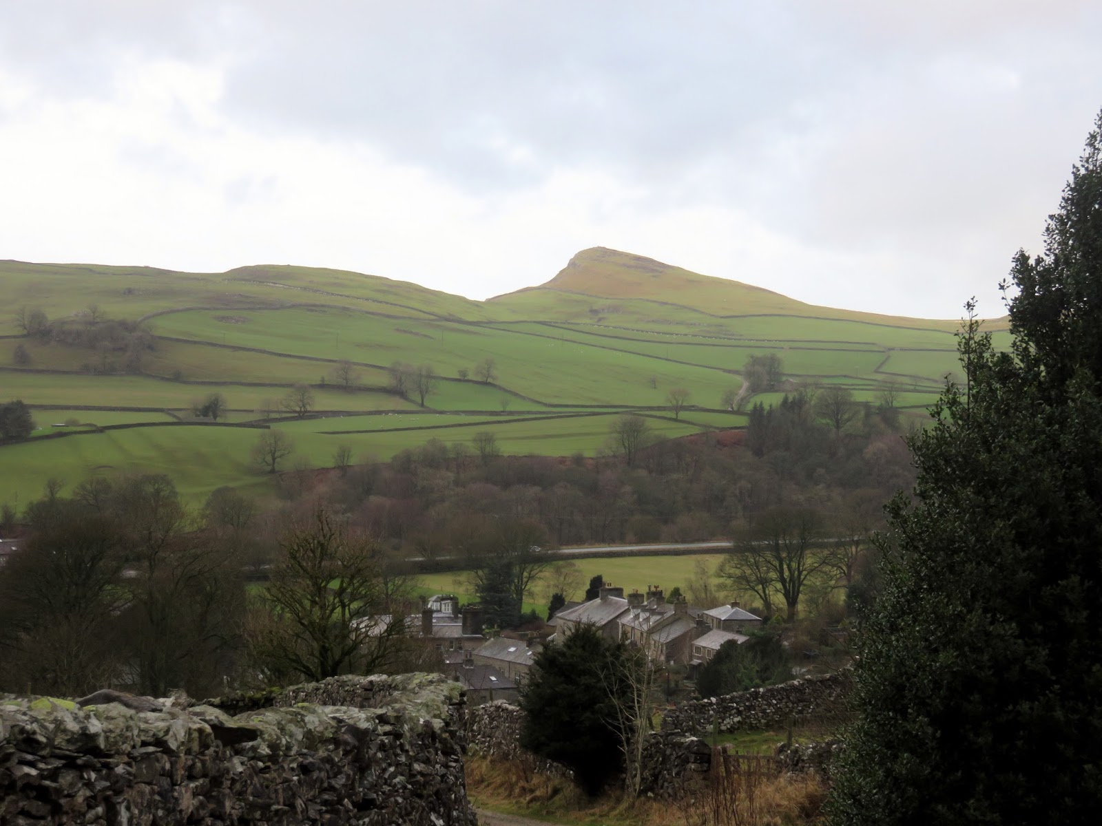
| Stainforth and the attractive Smearsett Scar |
 |
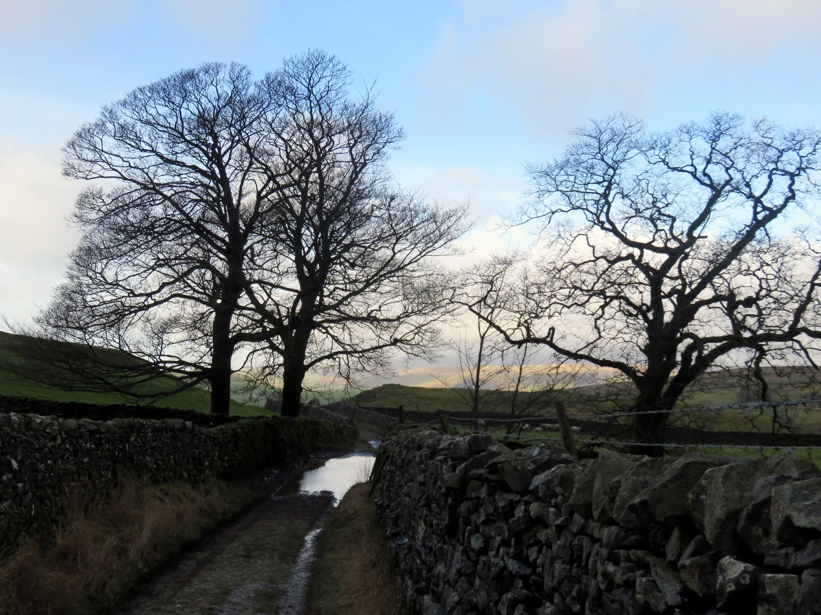
| A hint of blue in the sky – a rarity this winter |
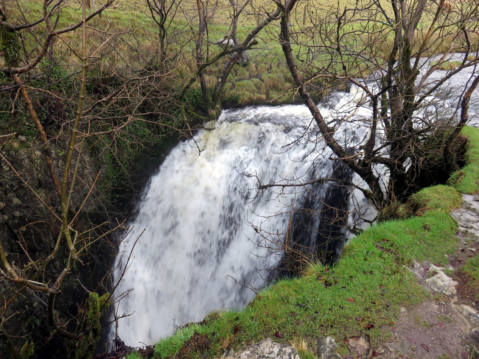
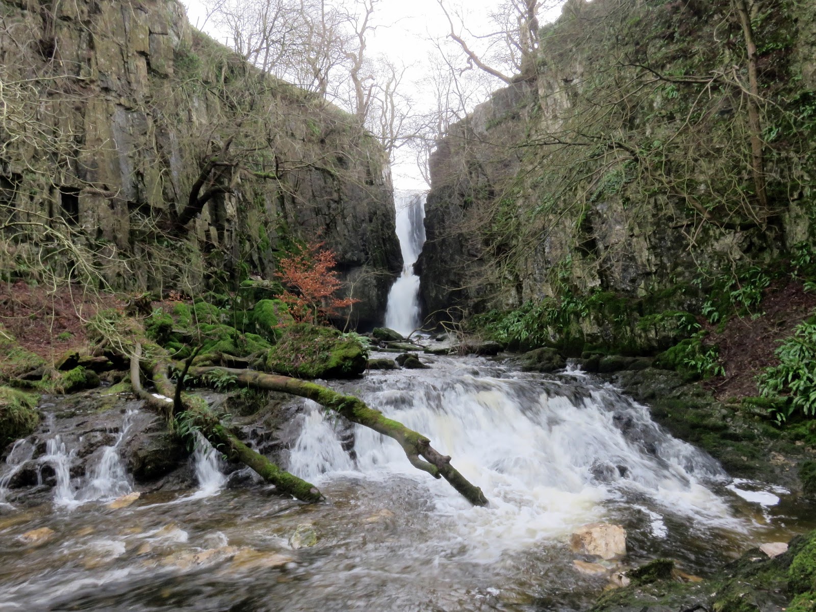
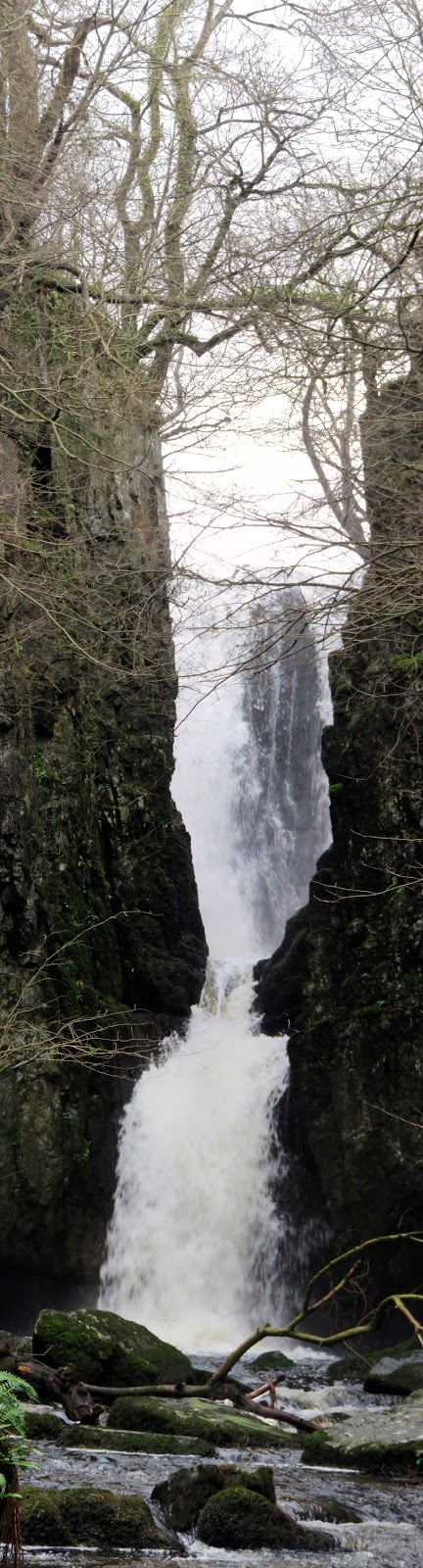
You’d be forgiven for walking past Catrigg Force were it not signposted. It’s craftily hidden in a deep ravine which makes it all the more spectacular. You can stand right on the precipice of the 6m drop before making your way down into the depth to see the waterfalls full height. Given the amount of rain we’ve had this winter, the falls were at their raging best. We didn’t hang around long thanks to the arrival of a very large and noisy walking group and returned back to the bridleway to continue across Winskill Stones.
 |
| The top of Catrigg Force |
 |
| Catrigg Force within the ravine |
 |
| The full height of Catrigg Force |
 |
| Pen-y-Ghent makes an appearance |
 |
| The Pennine Bridleway heading for Winskill Stones |
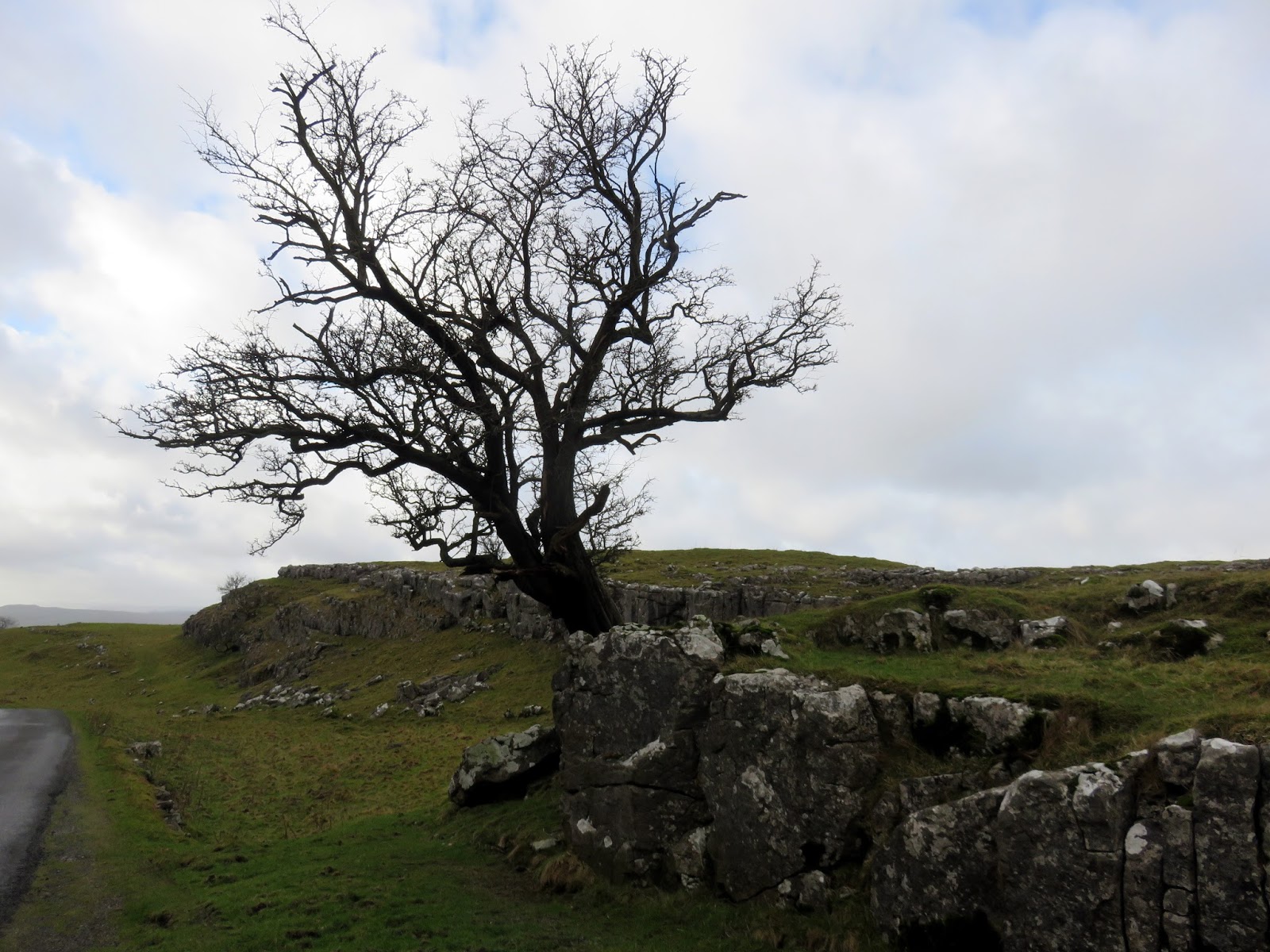
Winskill Stones is an area of limestone grassland and limestone pavement, one of Britain’s most threatened habitats. It is a National Nature Reserve overseen by an advisory group which includes representatives from the Yorkshire Dales National Park Authority, the farming community and local residents.
 |
| A tree set into the limestone pavement at Winskill Stones |
 |
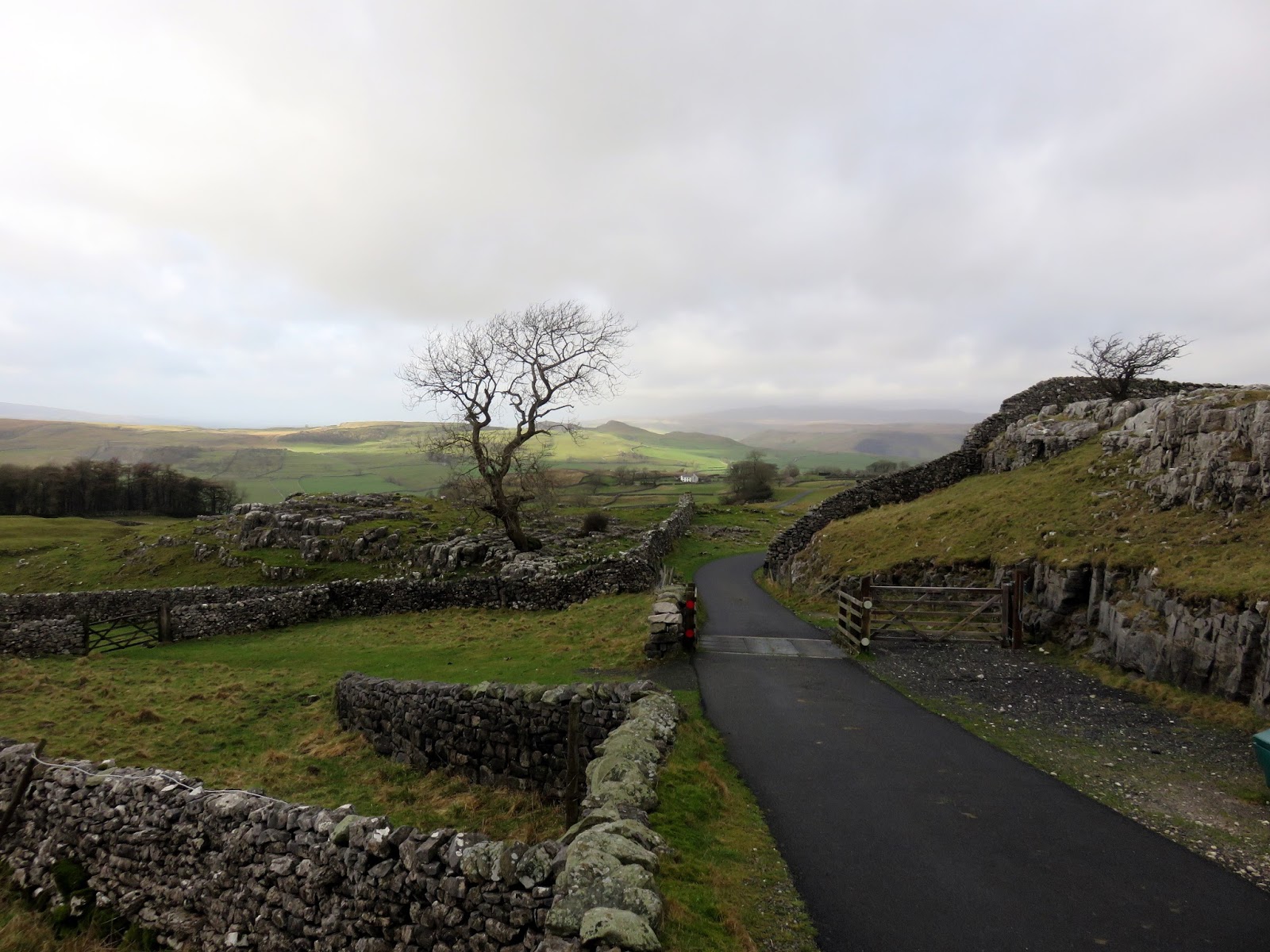
| Looking towards Upper Winskill farm |
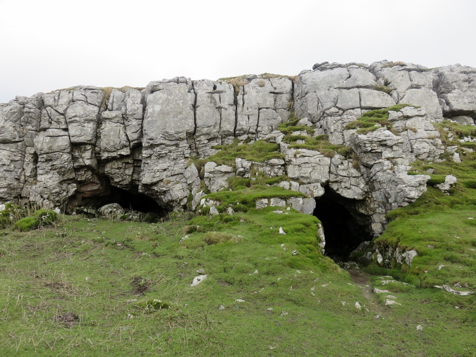
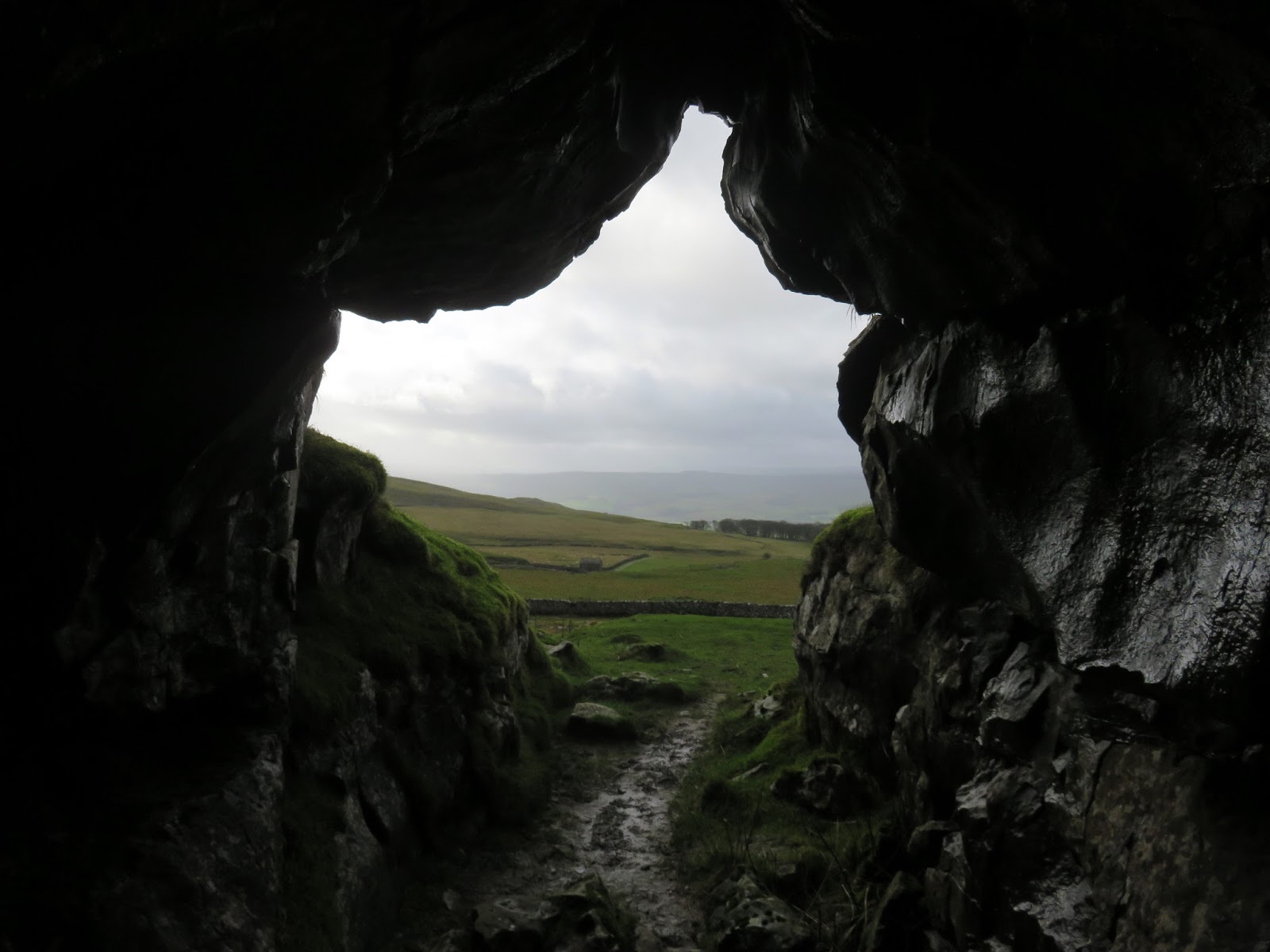
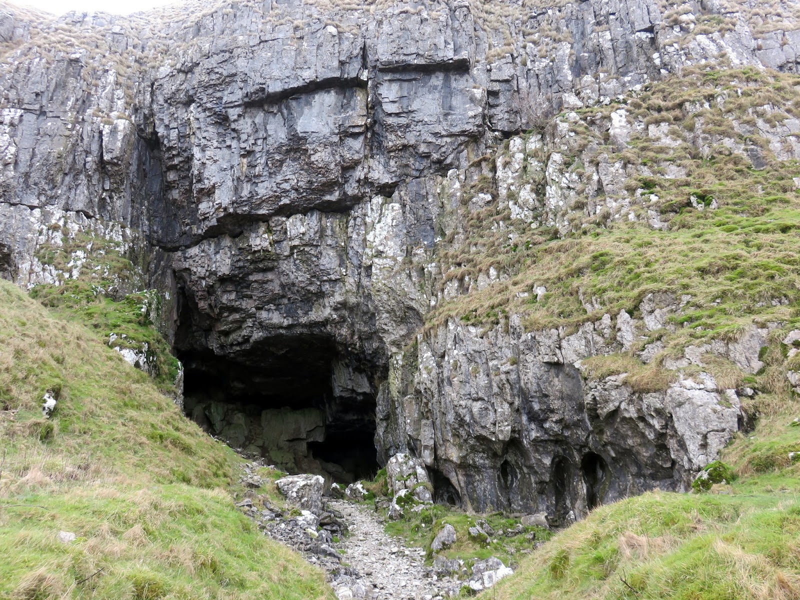
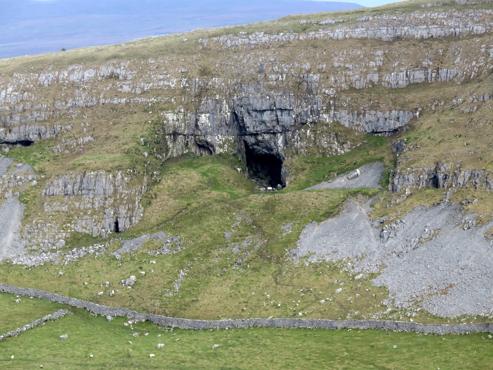
The path reaches the Langcliffe – Malham road, a superb drive if you’re in the area, which we used to make our way to Jubilee cave on the fringes of Langcliffe Scar. Jubilee Cave is very modest in size though gave us a much-needed respite from the cold wind that was blowing in from the northwest. It is, however, overshadowed by the monstrous Victoria Cave which is hidden up the hillside at Brent Scar.
 |
| Jubilee Cave |
 |
| Looking out of Jubilee Cave |
 |
| The path below Brent Scar |
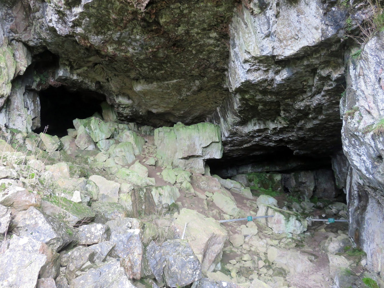
Victoria Cave gets its name because the inner chamber was discovered in 1837, the year of Queen Victoria’s coronation. Since then it has been completely excavated and has yielded a fantastic record of climate change in the Dales over thousands of years. It contained a large number of bones, of which the earliest were 130,000 years old and included those of hippos, narrow-nosed rhino, elephants and spotted hyenas. They date to a period when the climate was much warmer than today. Following the last Ice Age, the cave was used by hibernating brown bear. In amongst the bones of reindeer was an 11,000 year old antler harpoon point, the first evidence for people in the Yorkshire Dales.
 |
| Victoria Cave |
 |
| Inside Victoria Cave |
 |
| Warrendale Knotts |
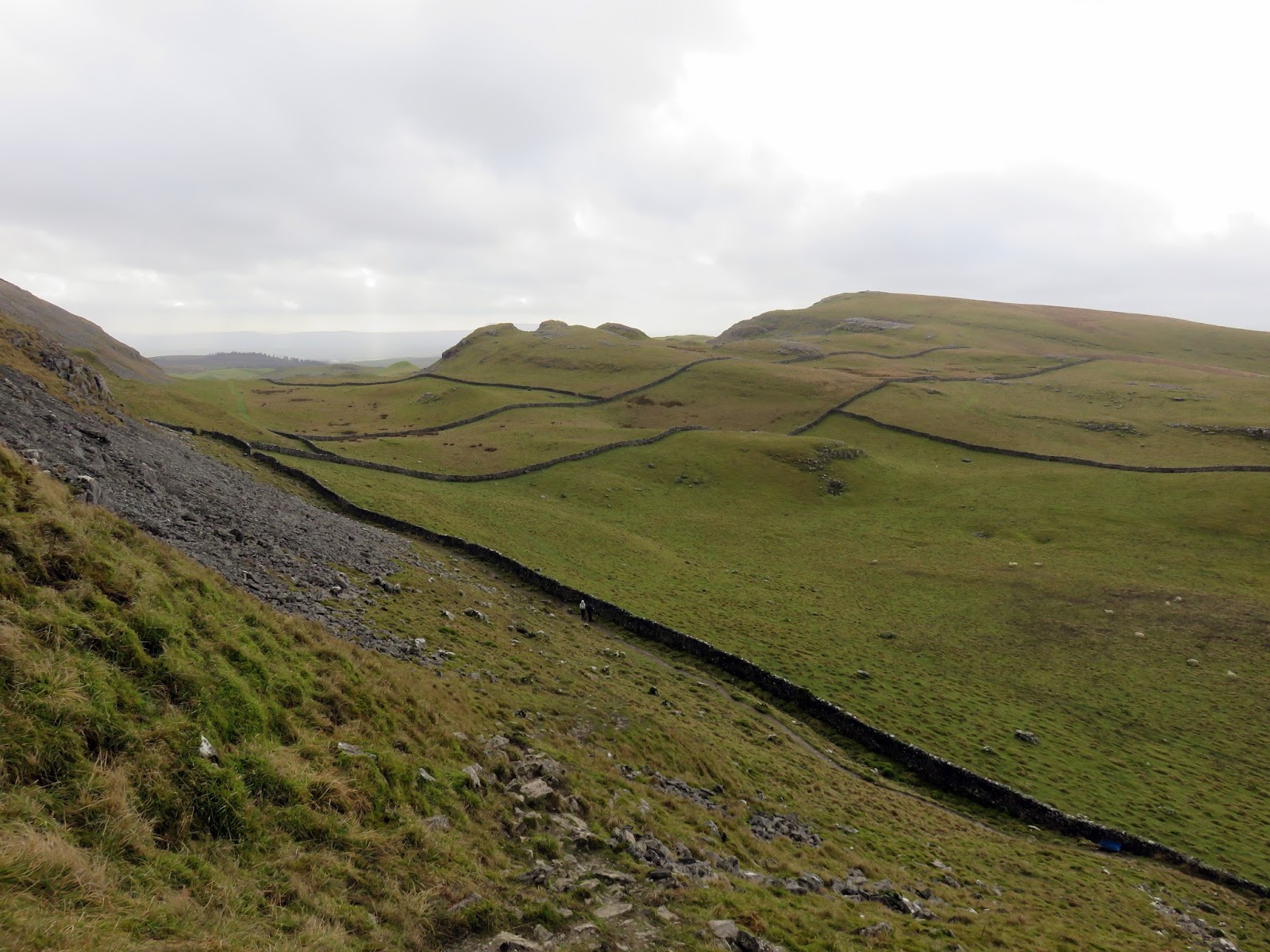
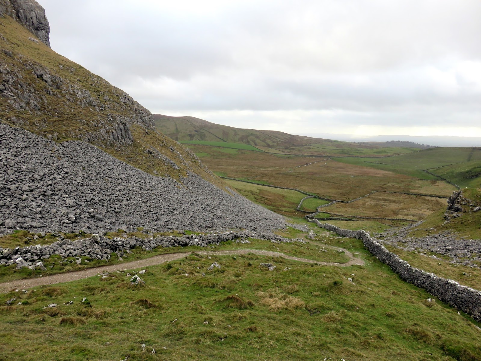
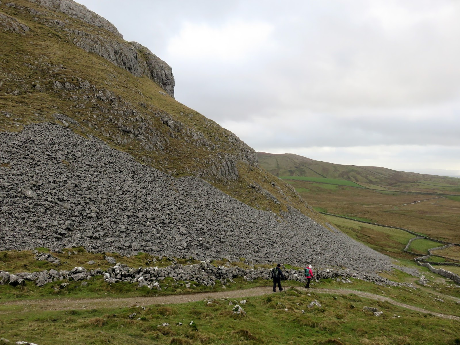
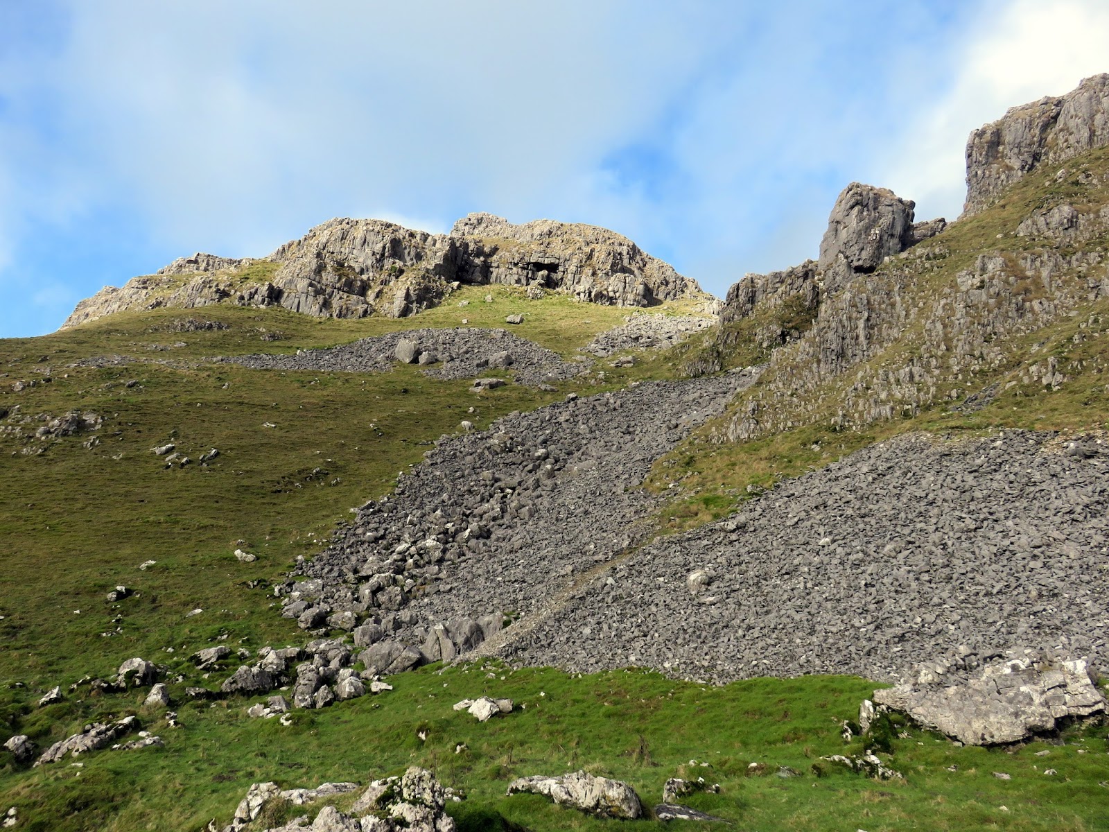
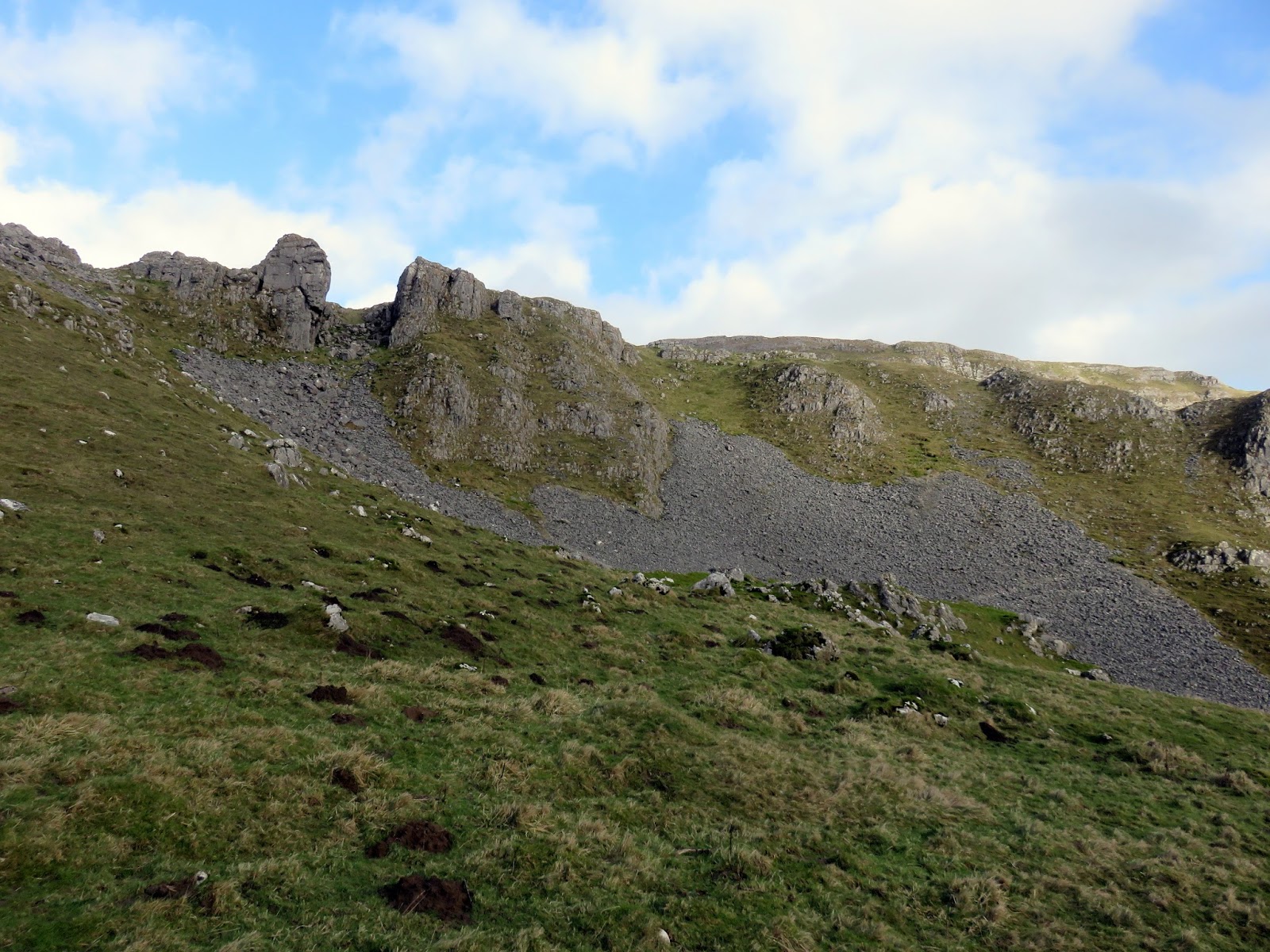
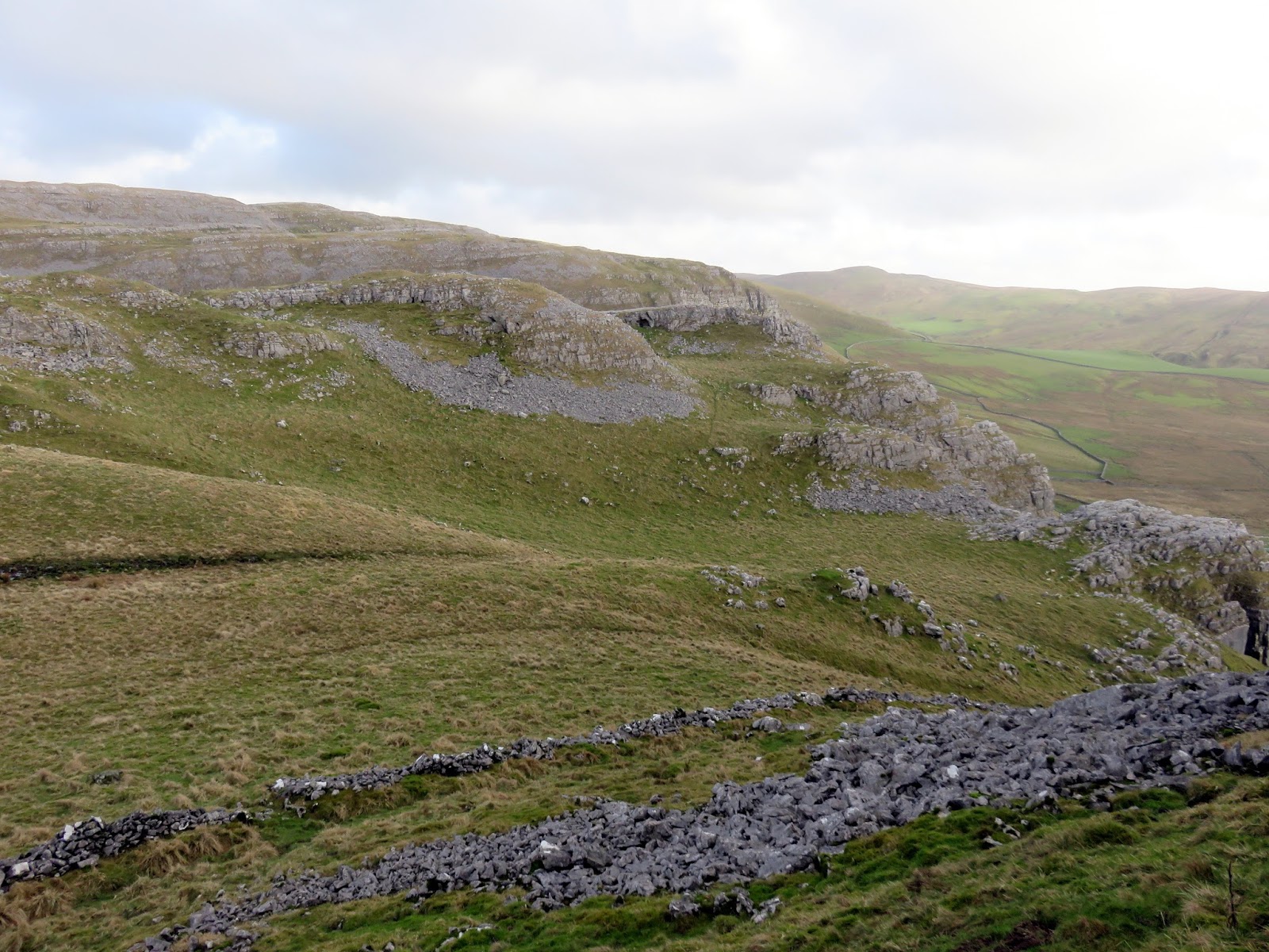
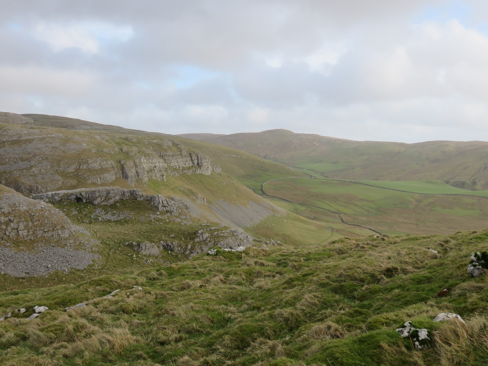
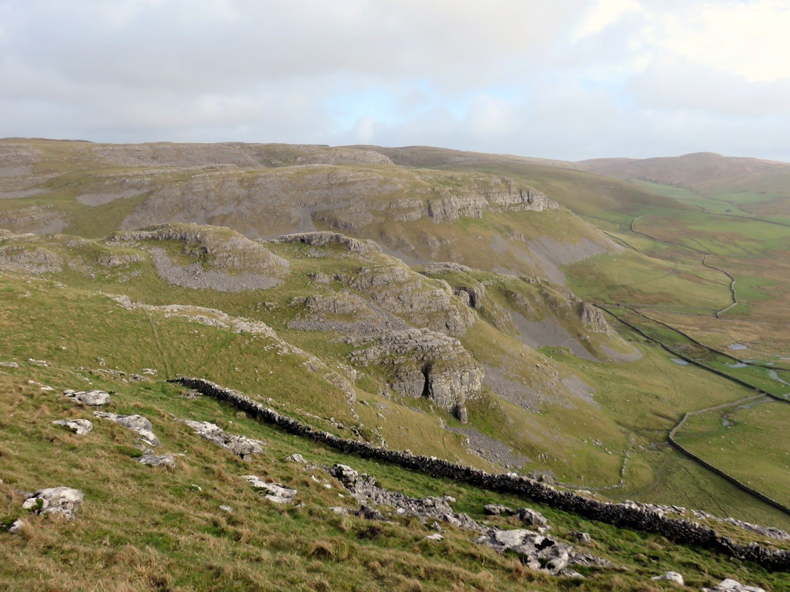
From the cave the path heads south into the depths of Attermire Scar, a magnificent example of the Craven Fault. To the west is the rear of the interesting Warrendale Knotts; more about that in a moment. There are more caves around Attermire Scar including Horseshoe Cave and Attermire Cave though we gave them a miss on this occasion.
 |
| Attermire Scar |
 |
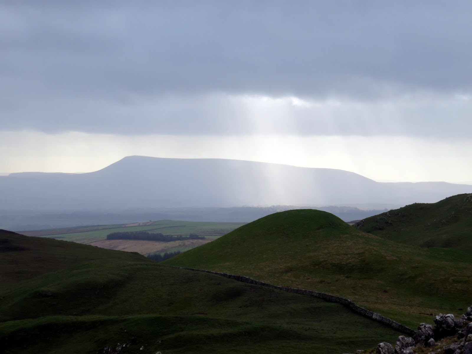
| Pendle Hill |
 |
| Attermire Scar |
We broke for lunch at the foot of Warrendale Knotts as the sun threatened to emerge from the veil of cloud that sat across the sky. I had had my eye on the summit of Warrendale Knotts since Victoria Cave and a breach in the rocky face leads up to the summit.
 |
| Warrendale Knotts |
 |
| Warrendale Knotts |
 |
| The view towards Attermire Scar |
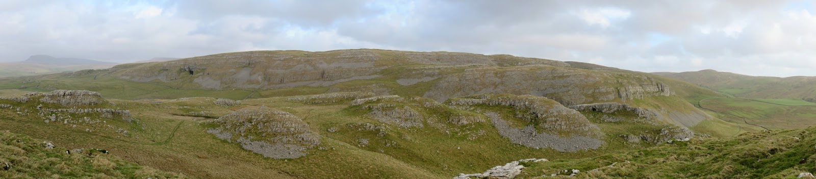
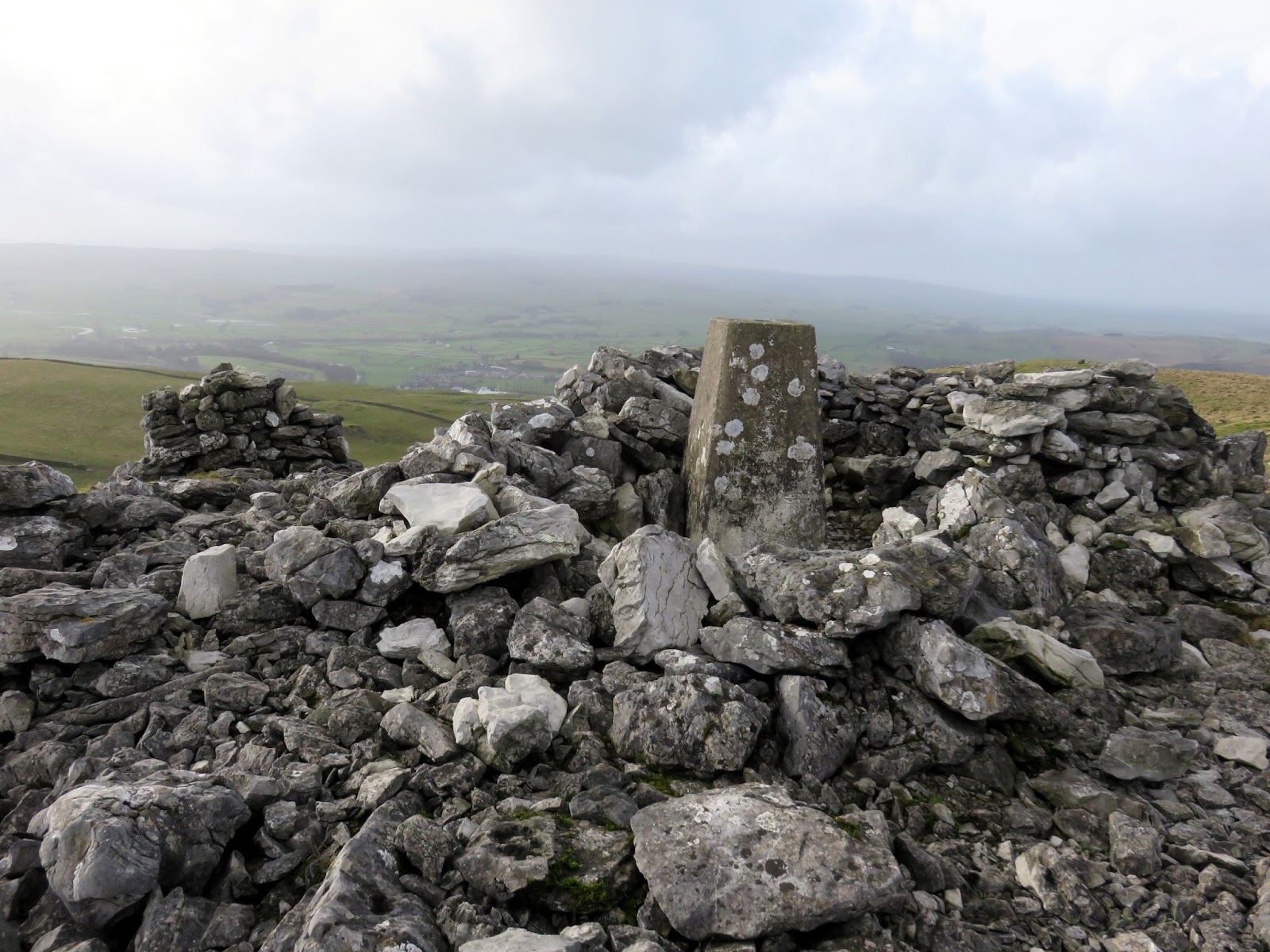
Warrendale Knotts takes its name from the large number of rabbit warrens within it and, possibly, the warren of caves that also dwell beneath the surface. It has a grand summit, crowned by a very Lakeland-esque trig pillar and stone wind shelter. It has a tremendous panorama that takes in the full length of Brent and Attemire Scars, the front face of the Craven Fault and distance sightings of Pen-y-Ghent and Ingleborough. It’s well worth a visit in my opinion.
 |
| Brent Scar and Attermire Scar |
 |
| The Craven Fault |
 |
| Victoria Cave |
 |
| The summit of Warrendale Knotts |
 |
| Warrendale Knotts and the Craven Fault – classic Yorkshire Dales scenery |
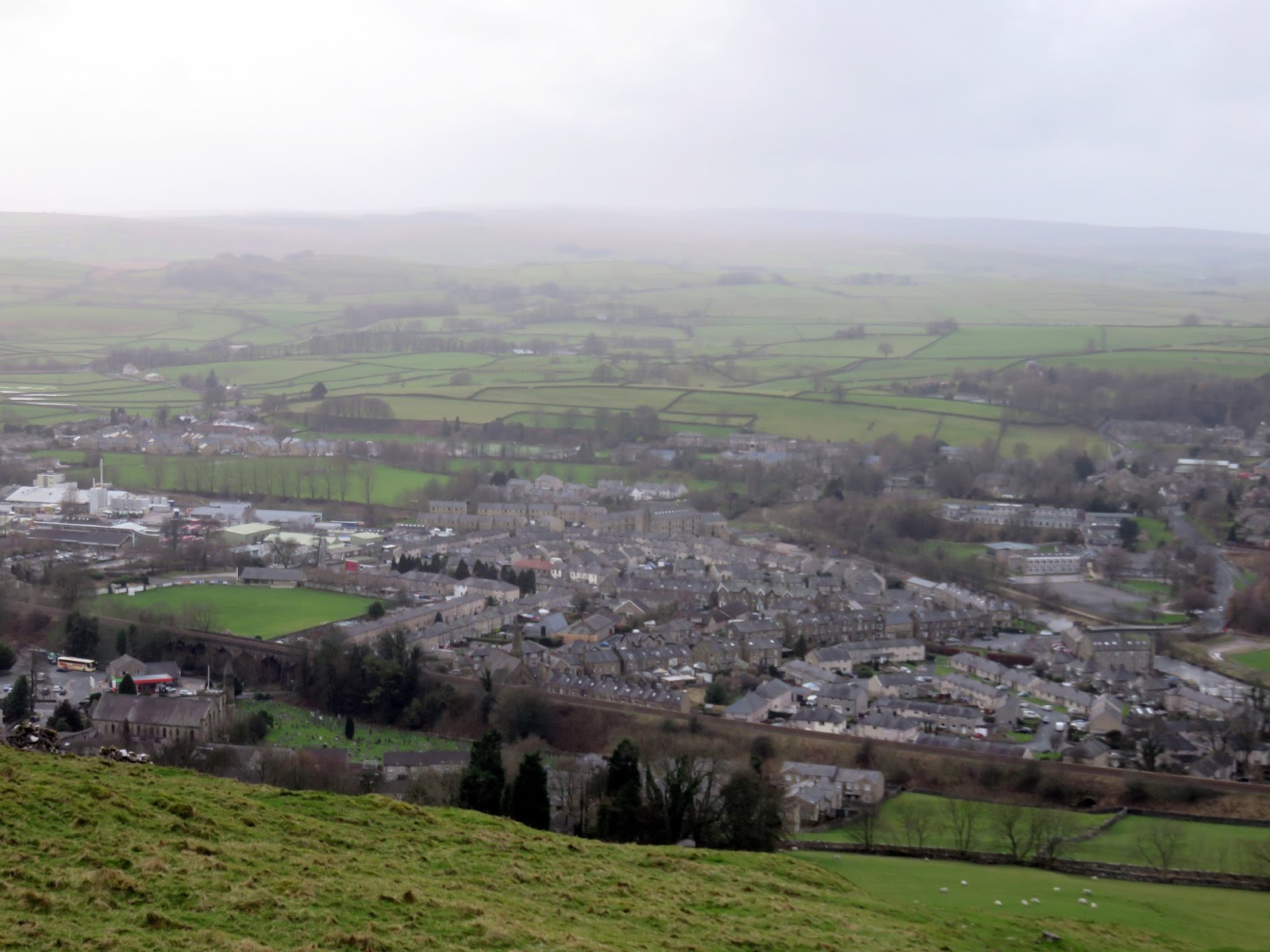
After battling back through a natural wind tunnel to the Dales High Way, we made the descent down into Settle to cross the River Ribble and begin our return to Stainforth. Settle is the perfect base to get out into the scenery and enjoy walking, riding, cycling, caving and a host of other outdoor activities and is also the starting point of the famous Settle-Carlisle Railway.
 |
| Settle |
 |
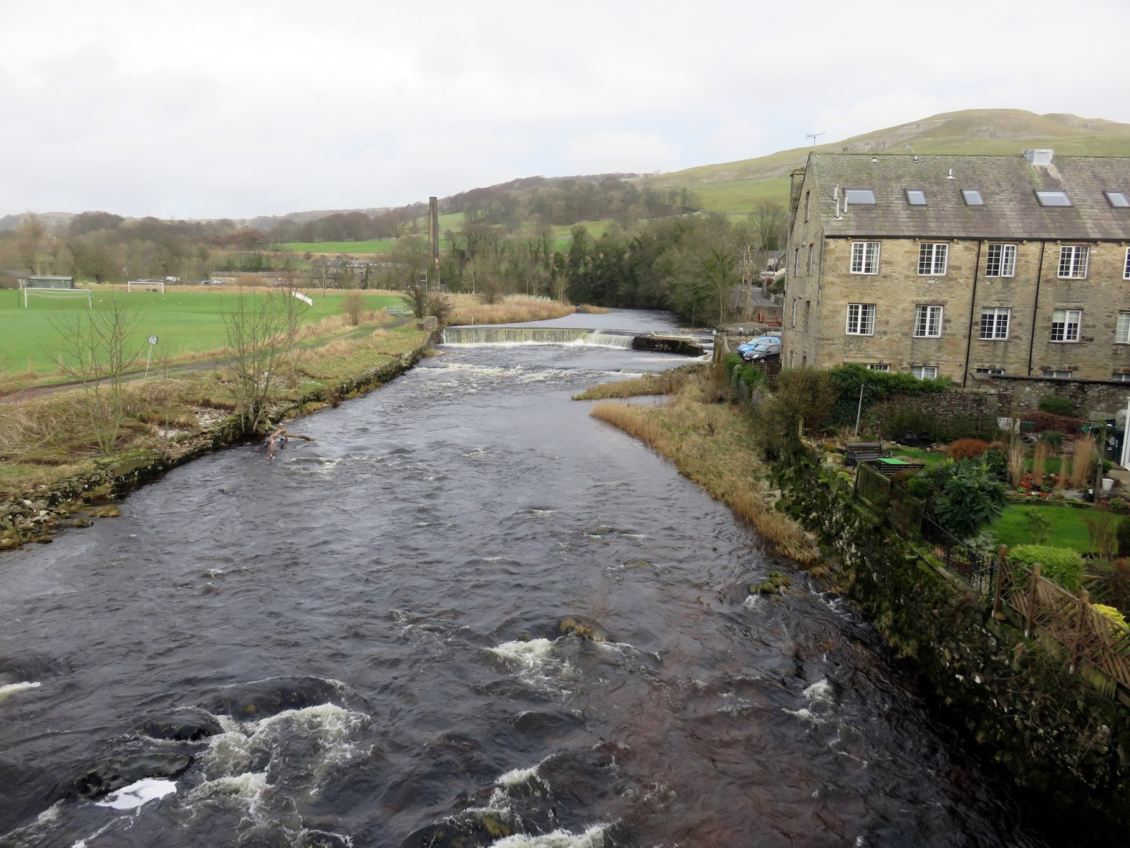
| The River Ribble at Settle |
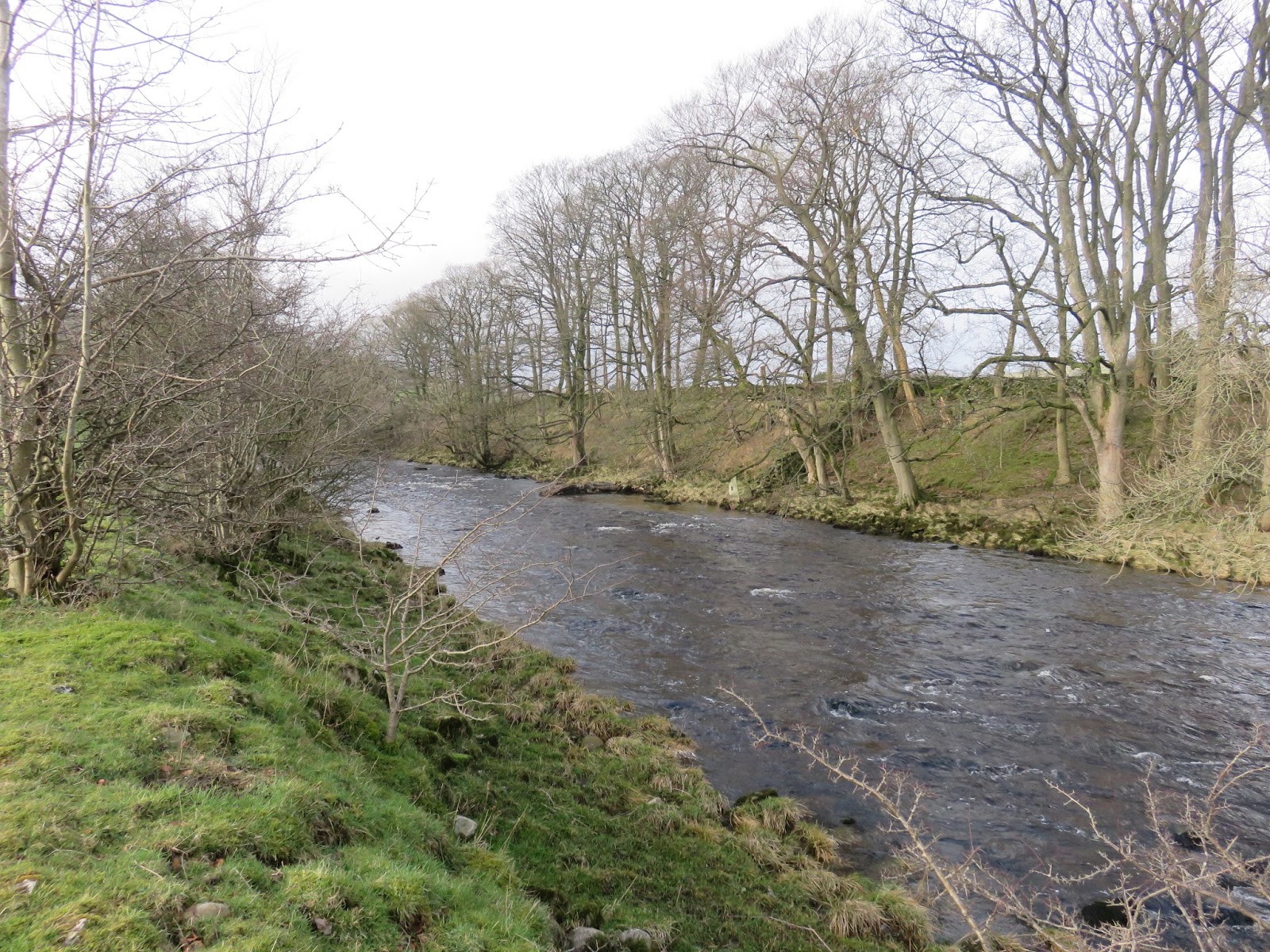
We joined the Ribble Way, another long-distance route along the length of the River Ribble, making our way along the river banks towards Stainforth. I must admit that this leg of the walk is fairly uninteresting though it takes you close to the immense Stainforth Scar. There was also Stainforth Force to look forward to.
 |
| The River Ribble |
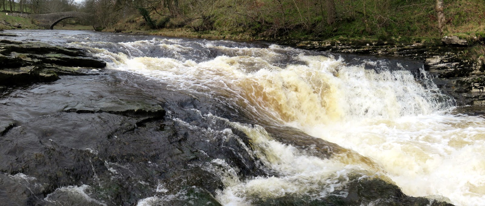
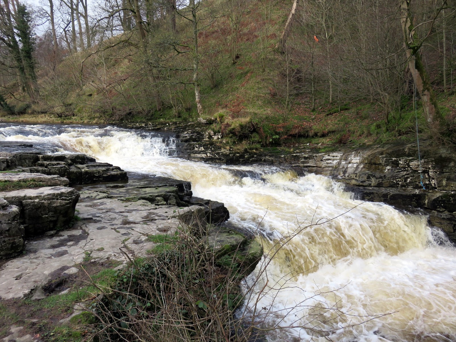
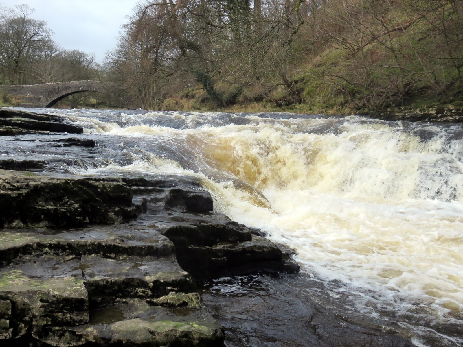
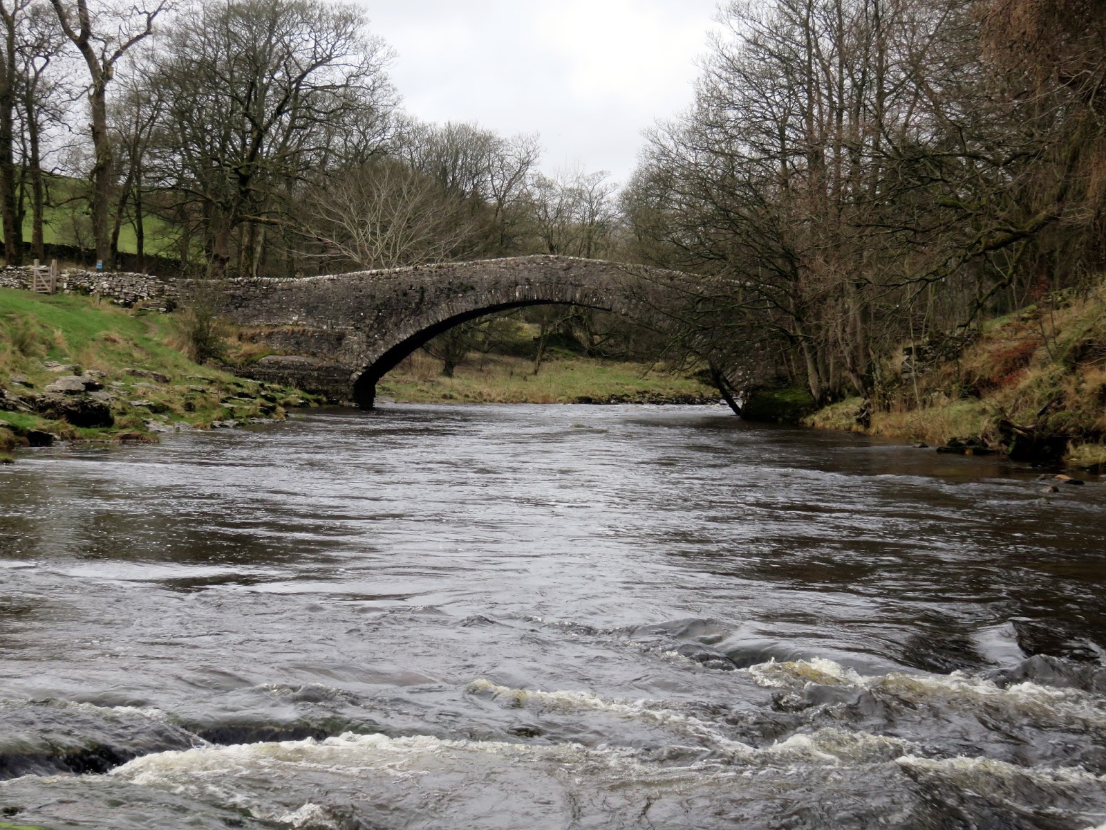
Stainforth Force is another fine waterfall, very close to the village of Stainforth. It is where the River Ribble tumbles over a series of cascades much like Aysgarth Falls near Hawes. Today it was absolutely roaring and make for quite a sight. Just upstream of the falls is an old packhorse bridge, a single span bridge dating from 1672. On 23rd September 1931, the bridge was transferred into the care of the National Trust.
 |
| Stainforth Force and the packhorse bridge |
 |
| Stainforth Force |
 |
| Stainforth Force |
 |
| The packhorse bridge |
From the bridge, a narrow lane follows the railway line, crossing over a footbridge near a sewage works and heading back into Stainforth, concluding a superb walk – one that I would highly recommend, despite mentioning ‘sewage works’ in the closing paragraph.
