Open Space Web-Map builder Codehttps://openspace.ordnancesurvey.co.uk/osmapapi/openspace.js?key=3119F72552FD5C22E0530C6CA40A5A92https://openspace.ordnancesurvey.co.uk/osmapapi/script/mapbuilder/basicmap.jshttps://openspace.ordnancesurvey.co.uk/osmapapi/script/mapbuilder/searchbox.js//variables for routes var linesLayer, points, lineFeature, lineString, routeMarkersLayer, routepos, routesize, routeoffset, routeicon; var style_blue = {strokeColor: “#0000CD”, strokeOpacity: 0.5, strokeWidth: 4.5}; function initmapbuilder() { //initiate the map var options = {resolutions: [2500, 1000, 500, 200, 100, 50, 25, 10, 5, 4, 2.5, 2, 1]}; osMap = new OpenSpace.Map(‘map’, options); //configure map options (basicmap.js) setglobaloptions(); //set the center of the map and the zoom level osMap.setCenter(new OpenSpace.MapPoint(413662.9974823,358644.00125885),7); linesLayer = osMap.getVectorLayer(); // Set up layer for route markers routeMarkersLayer = new OpenLayers.Layer.Markers(“Route Markers”); //make a route points = new Array(); points.push(new OpenLayers.Geometry.Point(412911.66412354,360421.66793823)); points.push(new OpenLayers.Geometry.Point(412911.16412354,360362.66793823)); points.push(new OpenLayers.Geometry.Point(412970.66412354,360331.66793823)); points.push(new OpenLayers.Geometry.Point(412963.66412354,360282.66793823)); points.push(new OpenLayers.Geometry.Point(412942.66412354,360247.66793823)); points.push(new OpenLayers.Geometry.Point(412997.66412354,360134.66793823)); points.push(new OpenLayers.Geometry.Point(413046.66412354,359971.66793823)); points.push(new OpenLayers.Geometry.Point(413102.66412354,359880.16793823)); points.push(new OpenLayers.Geometry.Point(413166.66412354,359806.66793823)); points.push(new OpenLayers.Geometry.Point(413326.66412354,359661.66793823)); points.push(new OpenLayers.Geometry.Point(413572.66412354,359478.66793823)); points.push(new OpenLayers.Geometry.Point(413522.66412354,359333.66793823)); points.push(new OpenLayers.Geometry.Point(413468.91412354,359299.66793823)); points.push(new OpenLayers.Geometry.Point(413423.16412354,359235.66793823)); points.push(new OpenLayers.Geometry.Point(413491.66412354,359081.66793823)); points.push(new OpenLayers.Geometry.Point(413611.66412354,358911.66793823)); points.push(new OpenLayers.Geometry.Point(413656.66412354,358701.66793823)); points.push(new OpenLayers.Geometry.Point(413671.66412354,358446.66793823)); points.push(new OpenLayers.Geometry.Point(413716.66412354,358271.66793823)); points.push(new OpenLayers.Geometry.Point(413806.66412354,358166.66793823)); points.push(new OpenLayers.Geometry.Point(413986.66412354,358131.66793823)); points.push(new OpenLayers.Geometry.Point(414066.66412354,358151.66793823)); points.push(new OpenLayers.Geometry.Point(414111.66412354,357941.66793823)); points.push(new OpenLayers.Geometry.Point(414316.66412354,358161.66793823)); points.push(new OpenLayers.Geometry.Point(414551.66412354,358371.66793823)); points.push(new OpenLayers.Geometry.Point(414596.66412354,358331.66793823)); points.push(new OpenLayers.Geometry.Point(414466.66412354,358086.66793823)); points.push(new OpenLayers.Geometry.Point(414296.66412354,357791.66793823)); points.push(new OpenLayers.Geometry.Point(414316.66412354,357621.66793823)); points.push(new OpenLayers.Geometry.Point(414236.66412354,357501.66793823)); points.push(new OpenLayers.Geometry.Point(414226.66412354,357316.66793823)); points.push(new OpenLayers.Geometry.Point(414226.66412354,357241.66793823)); points.push(new OpenLayers.Geometry.Point(414254.16412354,357169.16793823)); points.push(new OpenLayers.Geometry.Point(414206.66412354,357101.66793823)); points.push(new OpenLayers.Geometry.Point(414191.66412354,356986.66793823)); points.push(new OpenLayers.Geometry.Point(414150.41412354,356977.91793823)); points.push(new OpenLayers.Geometry.Point(414074.16412354,357009.16793823)); points.push(new OpenLayers.Geometry.Point(413979.16412354,357044.16793823)); points.push(new OpenLayers.Geometry.Point(413909.16412354,357076.66793823)); points.push(new OpenLayers.Geometry.Point(413872.91412354,357194.16793823)); points.push(new OpenLayers.Geometry.Point(413816.66412354,357316.66793823)); points.push(new OpenLayers.Geometry.Point(413616.66412354,357496.66793823)); points.push(new OpenLayers.Geometry.Point(413451.66412354,357541.66793823)); points.push(new OpenLayers.Geometry.Point(413431.66412354,357676.66793823)); points.push(new OpenLayers.Geometry.Point(413391.66412354,357766.66793823)); points.push(new OpenLayers.Geometry.Point(413391.66412354,357896.66793823)); points.push(new OpenLayers.Geometry.Point(413271.66412354,358111.66793823)); points.push(new OpenLayers.Geometry.Point(413116.66412354,358331.66793823)); points.push(new OpenLayers.Geometry.Point(413111.66412354,358406.66793823)); points.push(new OpenLayers.Geometry.Point(413071.66412354,358456.66793823)); points.push(new OpenLayers.Geometry.Point(413071.66412354,358486.66793823)); points.push(new OpenLayers.Geometry.Point(412951.66412354,358526.66793823)); points.push(new OpenLayers.Geometry.Point(412871.66412354,358631.66793823)); points.push(new OpenLayers.Geometry.Point(412843.66412354,358635.66793823)); points.push(new OpenLayers.Geometry.Point(412808.66412354,358635.66793823)); points.push(new OpenLayers.Geometry.Point(412768.66412354,358710.66793823)); points.push(new OpenLayers.Geometry.Point(412756.66412354,358766.66793823)); points.push(new OpenLayers.Geometry.Point(412763.66412354,358804.66793823)); points.push(new OpenLayers.Geometry.Point(412831.66412354,358871.66793823)); points.push(new OpenLayers.Geometry.Point(412891.66412354,358859.66793823)); points.push(new OpenLayers.Geometry.Point(412891.66412354,358931.66793823)); points.push(new OpenLayers.Geometry.Point(412798.66412354,359057.66793823)); points.push(new OpenLayers.Geometry.Point(412799.91412354,359132.66793823)); points.push(new OpenLayers.Geometry.Point(412817.16412354,359189.66793823)); points.push(new OpenLayers.Geometry.Point(412831.66412354,359421.66793823)); points.push(new OpenLayers.Geometry.Point(412821.66412354,359601.66793823)); points.push(new OpenLayers.Geometry.Point(412796.66412354,359656.66793823)); points.push(new OpenLayers.Geometry.Point(412794.16412354,359821.66793823)); points.push(new OpenLayers.Geometry.Point(412821.66412354,359996.66793823)); points.push(new OpenLayers.Geometry.Point(412814.66412354,360109.66793823)); points.push(new OpenLayers.Geometry.Point(412756.16412354,360142.16793823)); points.push(new OpenLayers.Geometry.Point(412697.66412354,360168.66793823)); points.push(new OpenLayers.Geometry.Point(412764.66412354,360303.16793823)); points.push(new OpenLayers.Geometry.Point(412811.66412354,360441.66793823)); points.push(new OpenLayers.Geometry.Point(412910.66412354,360420.66793823)); // create a polyline feature from the array of points lineString = new OpenLayers.Geometry.LineString(points); lineFeature = new OpenLayers.Feature.Vector(lineString, null, style_blue); linesLayer.addFeatures([lineFeature]); //crate a route start/end marker routepos = new OpenSpace.MapPoint(412911.66412354,360421.66793823); routesize = new OpenLayers.Size(33,45); routeoffset = new OpenLayers.Pixel(-5,-37); routeicon = new OpenSpace.Icon(‘https://openspace.ordnancesurvey.co.uk/osmapapi/img_versions/img_1.1/mapbuilder/routemarker-startend.png’, routesize, routeoffset, null, null); routeMarkersLayer.addMarker(new OpenLayers.Marker(routepos, routeicon)); osMap.addLayer(routeMarkersLayer);}
Route: Hartington, Reynard’s Lane, Wolfscote Hill, Ferny Bottom, Biggin Dale, Peaseland Rocks, Wolfscote Dale, Drabber Tor, Beresford Dale, Pike Pool, Pennilow, Hartington
Date: 09/01/2016
From: Hartington
Parking: Hartington
Start Point: Hartington
Region: Peak District White Peak
Route length: 6.3 miles (10 km)
Time taken: 02:23
Average speed: 2.6 mph
Ascent: 478m
Descent: 483m
Summits: Wolfscote Hill (388m)
Other points of interest: Biggin Dale, Wolfscote Dale, Peaseland Rocks, Drabber Tor, Beresford Dale, Pike Pool
Route: Hartington, Reynard’s Lane, Wolfscote Hill, Ferny Bottom, Biggin Dale, Peaseland Rocks, Wolfscote Dale, Drabber Tor, Beresford Dale, Pike Pool, Pennilow, Hartington
A slight change of scenery took me down to the White Peak of the Peak District, an area reminiscent of the Yorkshire Dales and one full on interesting features. One of its main attractions are the deep valleys, eroded away of millennia to form spectacular sights such as Dovedale and the Manifold Valley. I chose to visit one of the lesser visited of these, Wolfscote Dale, which is every bit as impressive and dramatic as Dovedale but much less busy. Thrown in the delightful Biggin Dale and Wolfscote Hill and you have a wonderful day out in the White Peak.
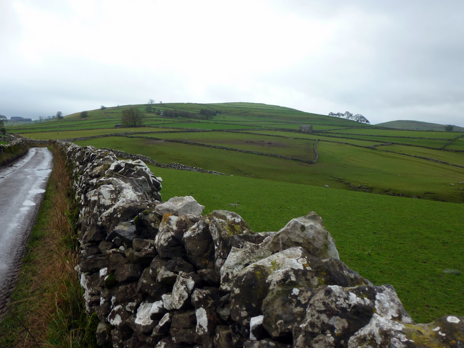
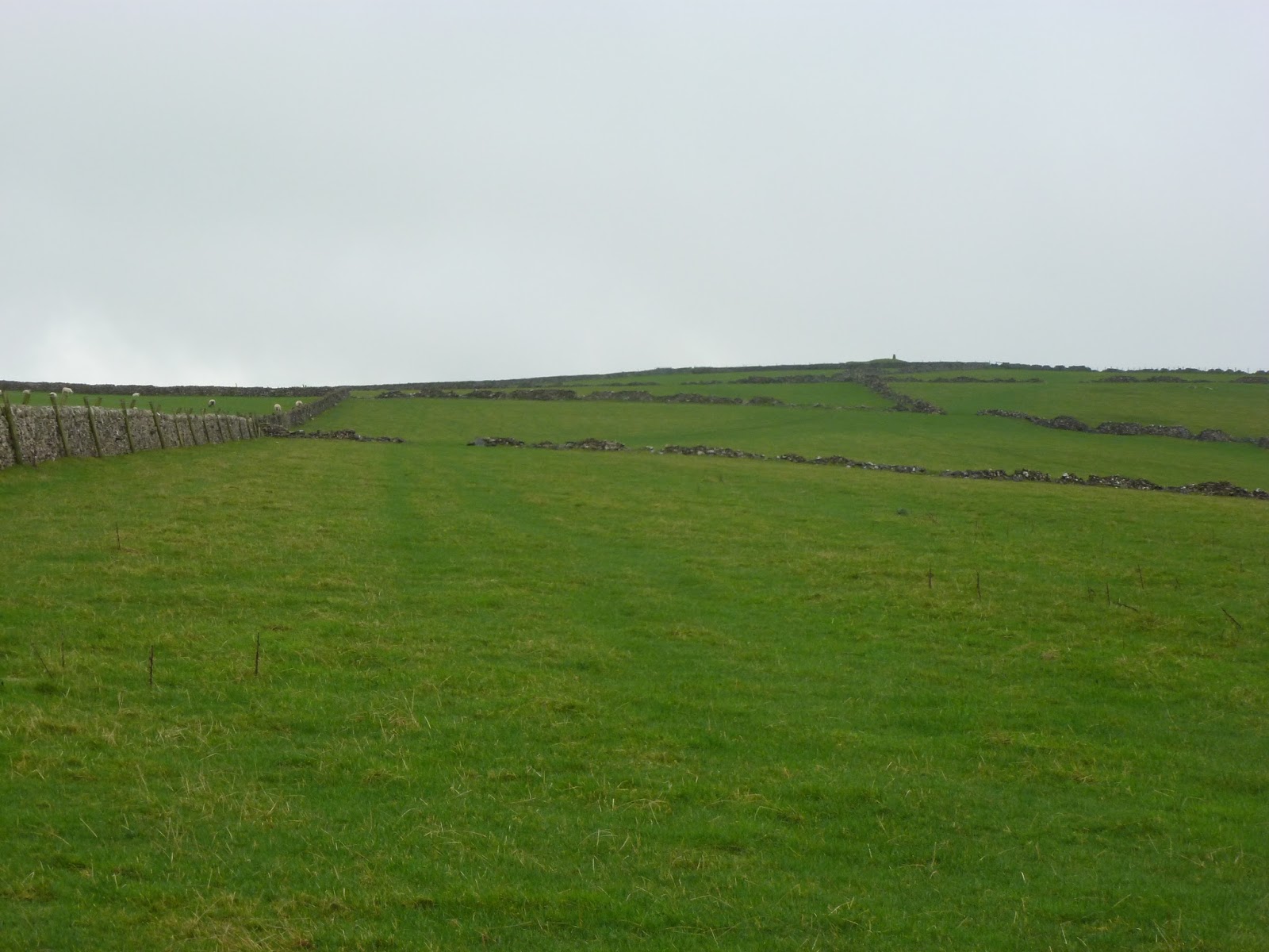
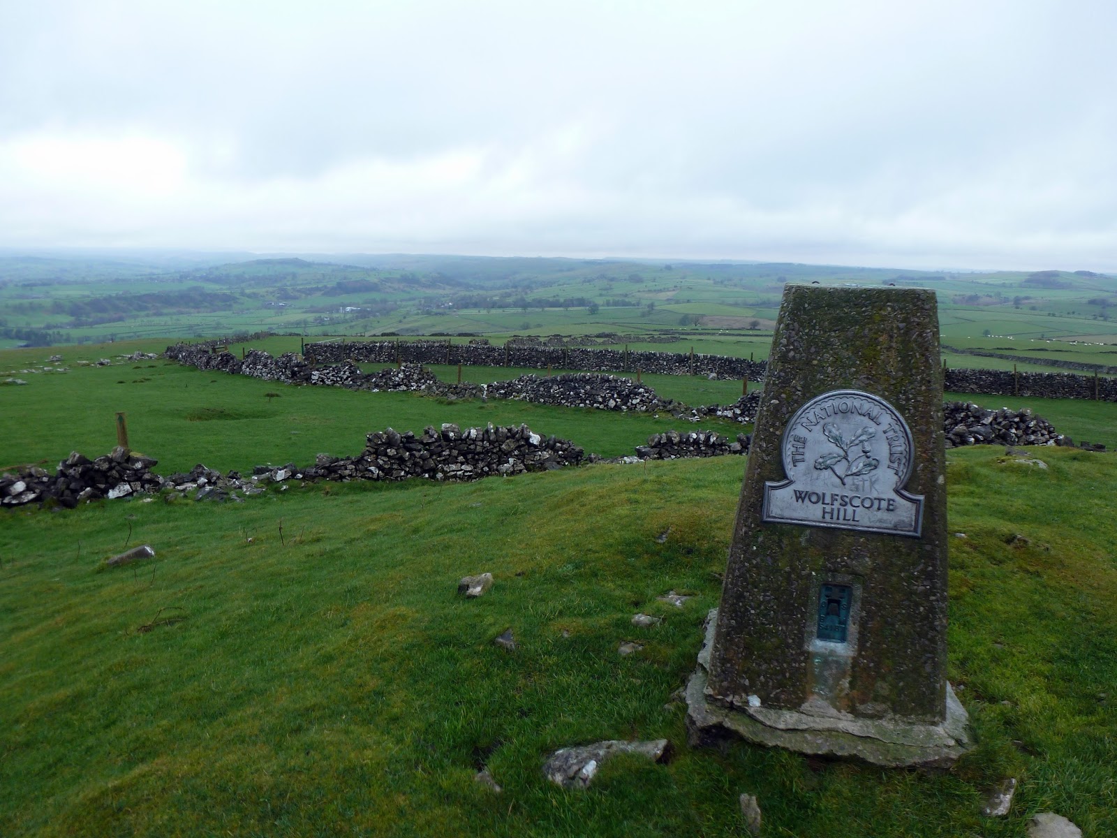
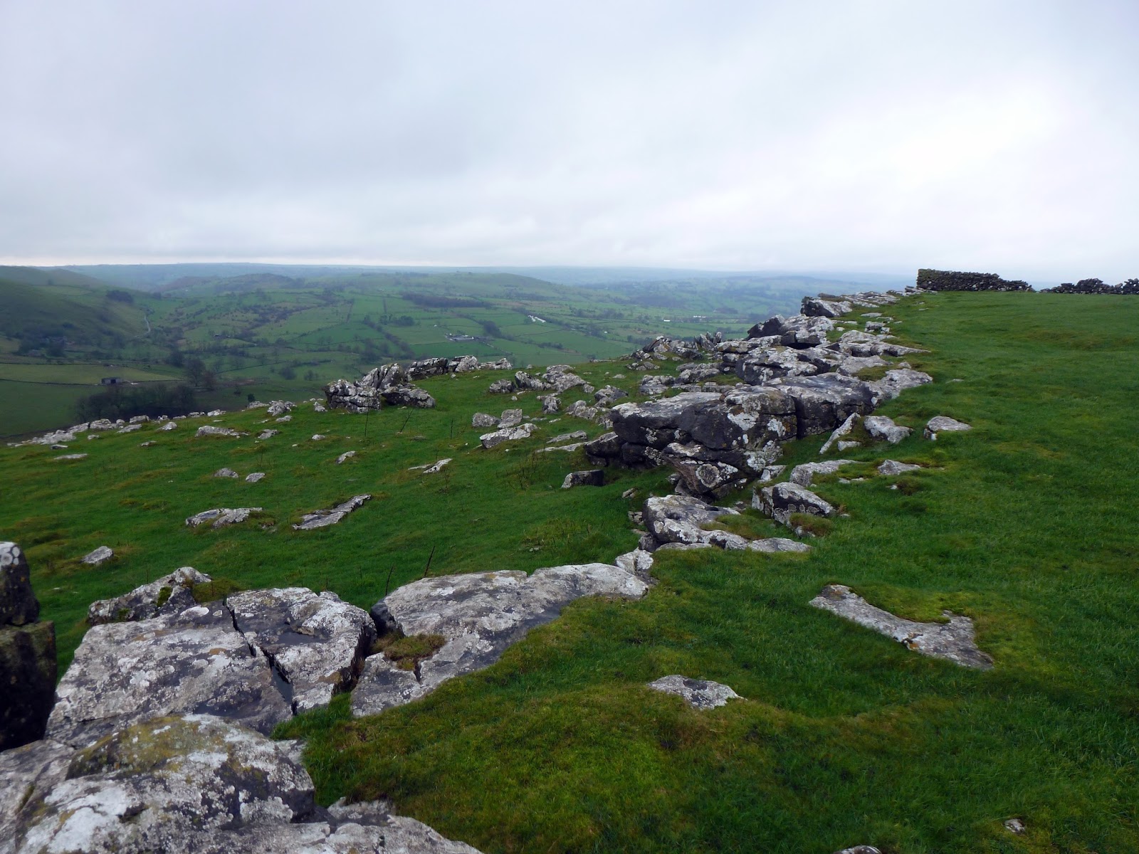
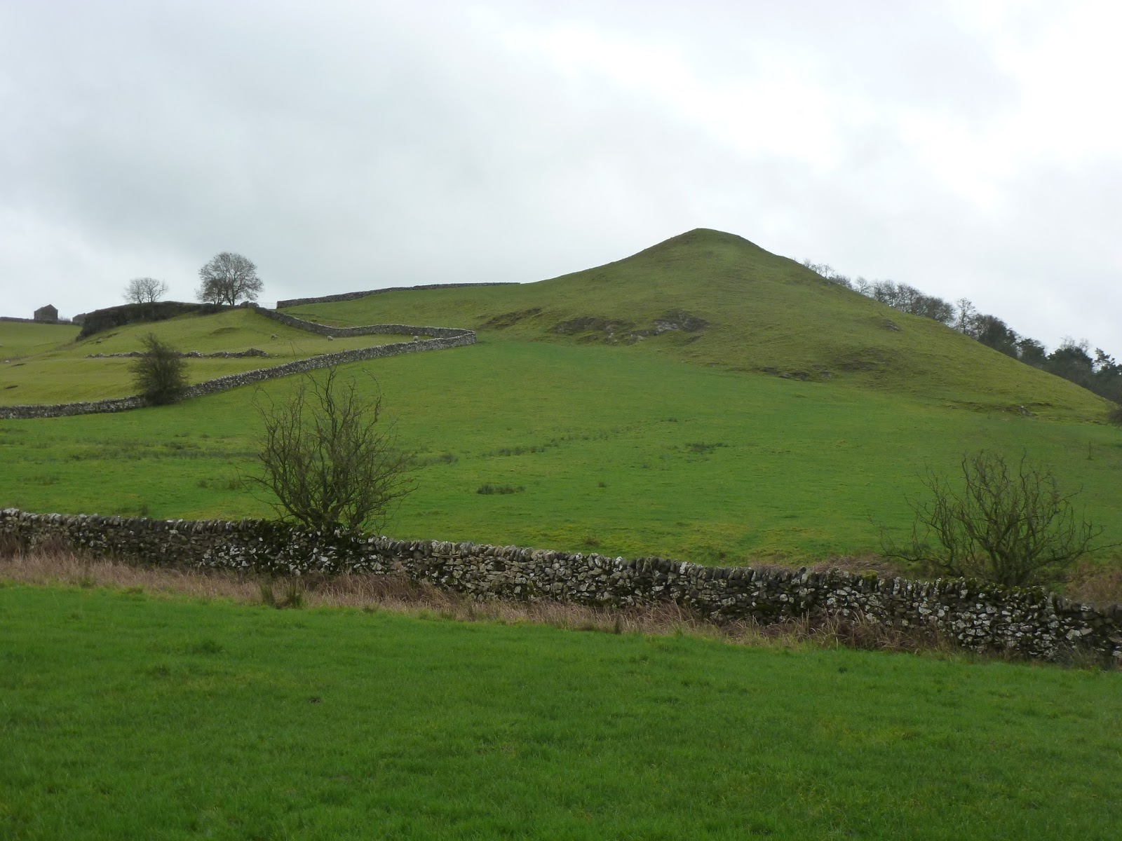
The walk begins in Hartington where there are a number of parking areas to choose from, all of them free. I chose to start the walk by climbing Wolfscote Hill, a fairly large dome that overlooks the village to the south. I reached the slopes of Wolfscote Hill along Raynards Lane before doing some mild trespassing through the broken walls that line the slopes. It’s an easy climb right up to the trig pillar on the summit which in the care of the National Trust. The hill overlooks both Biggin Dale and Wolfscote Dale and has expansive views in all directions. The limestone outcrops that line to top are very reminiscent of the Yorkshire Dales.
 |
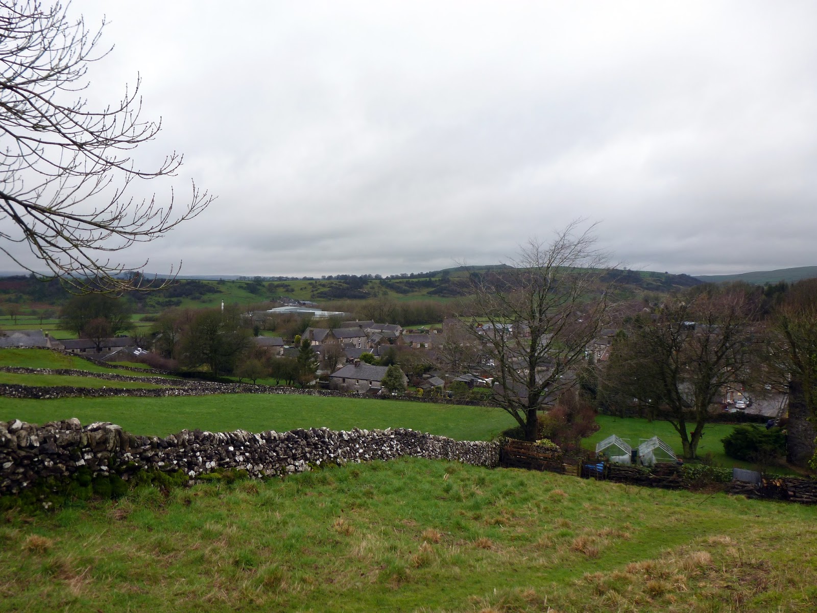
| Hartington |
 |
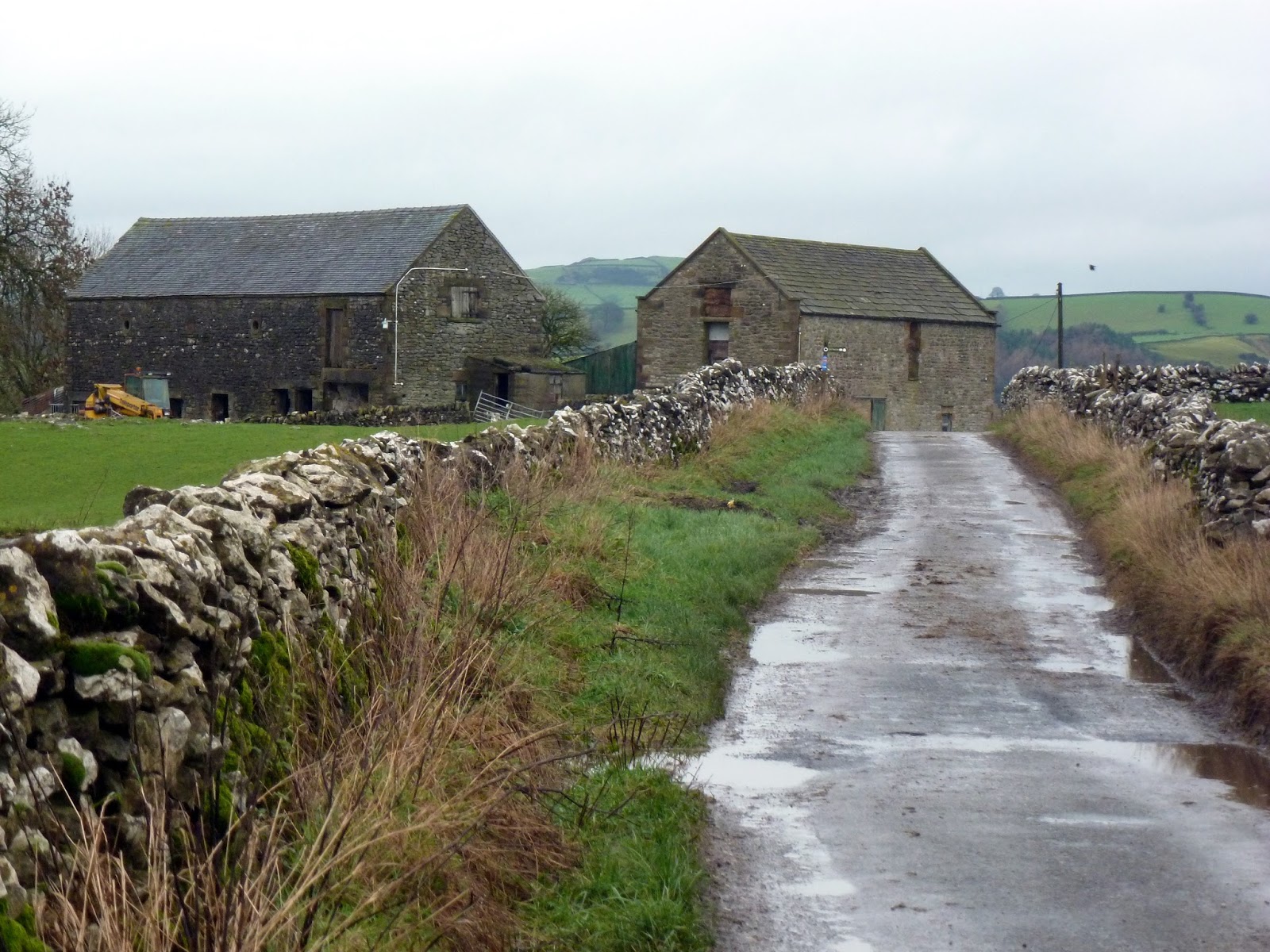
| Barns at Crossland Sides |
 |
| Wolfscote Hill |
 |
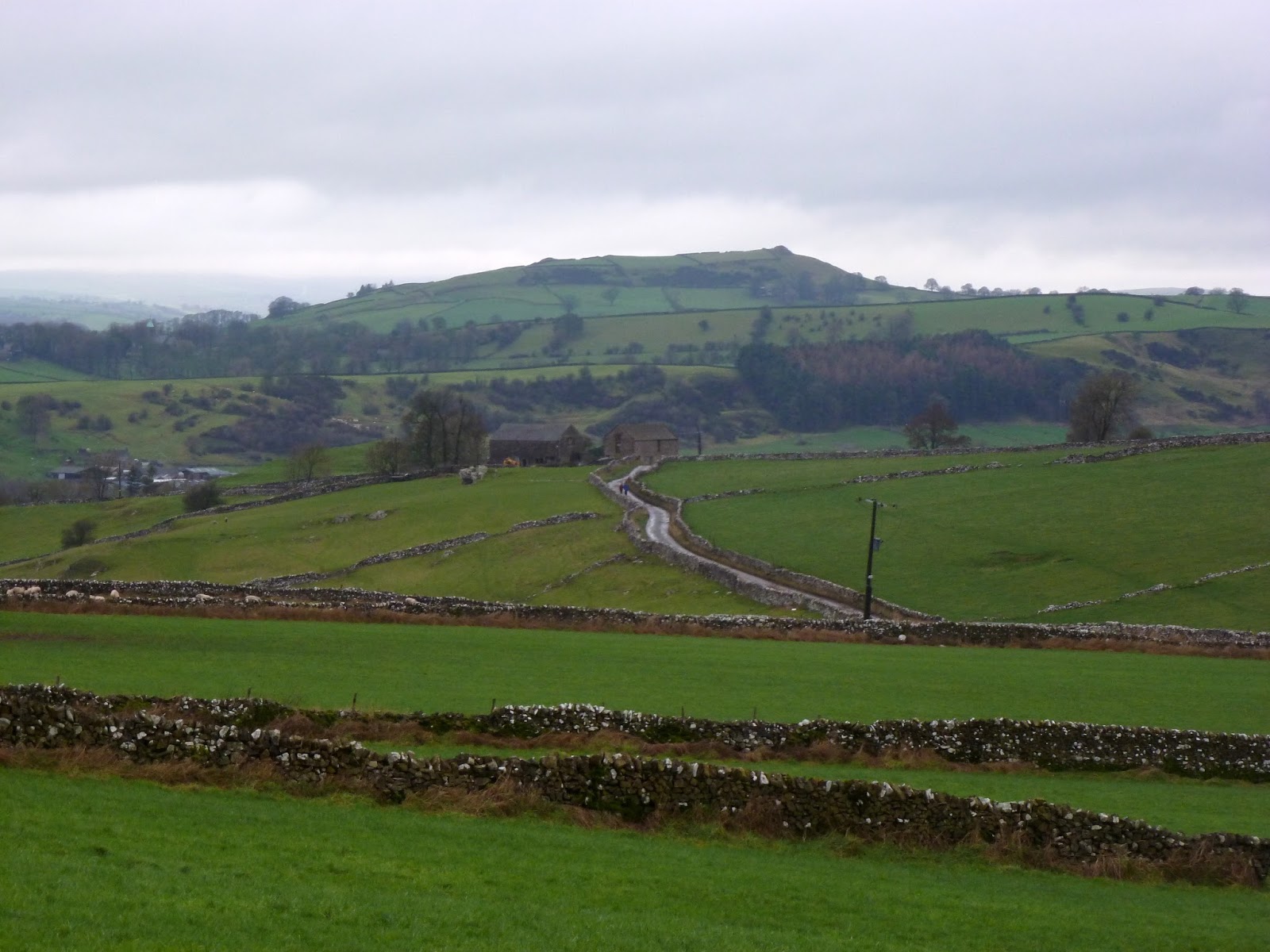
| Sheen Hill in the distance |
 |
| The gentle slope of Wolfscote Hill |
 |
| Trig pillar on the summit |
 |
| Limestone protrusions on the top |
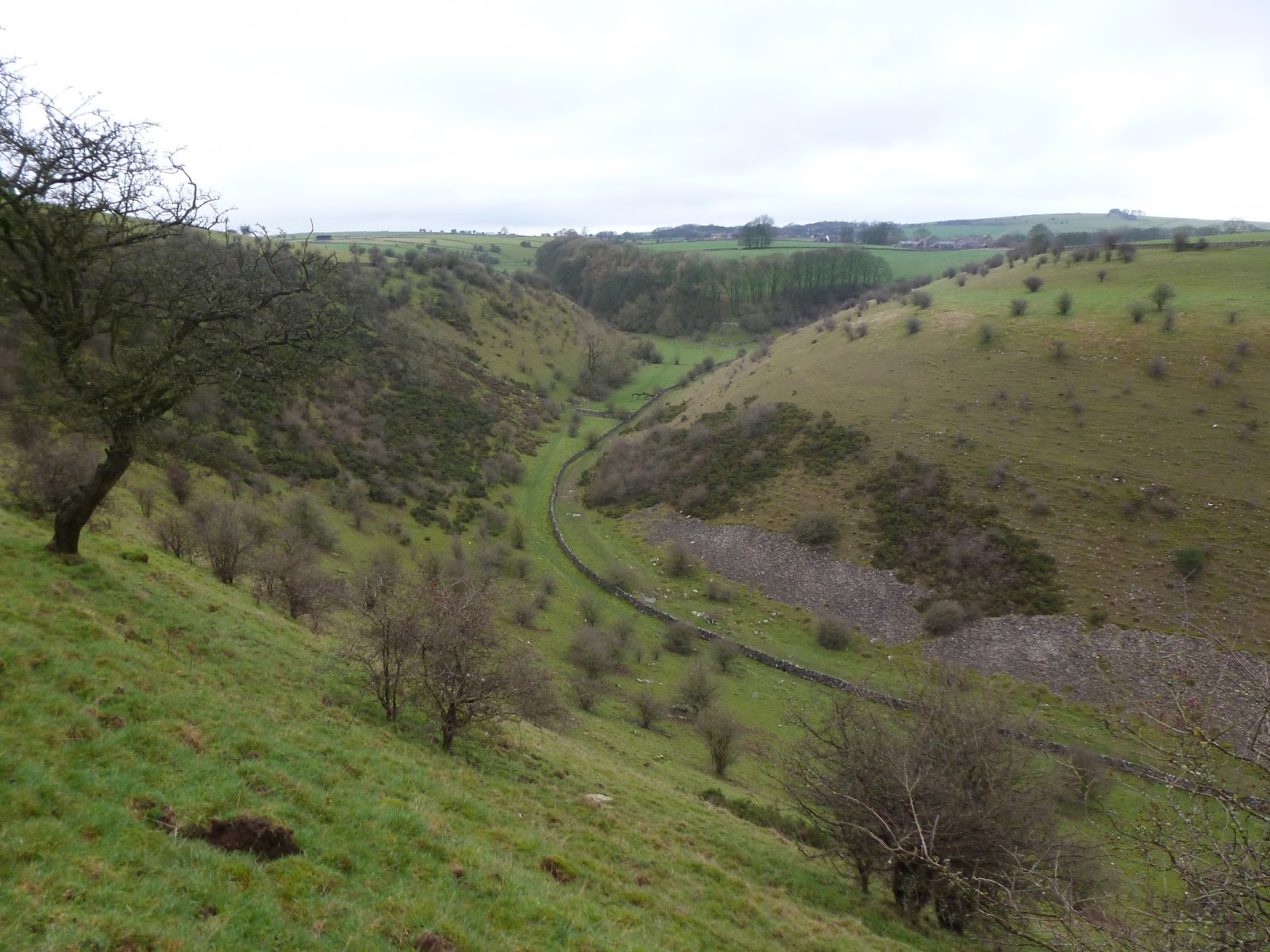
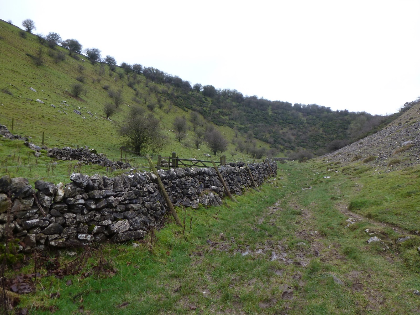
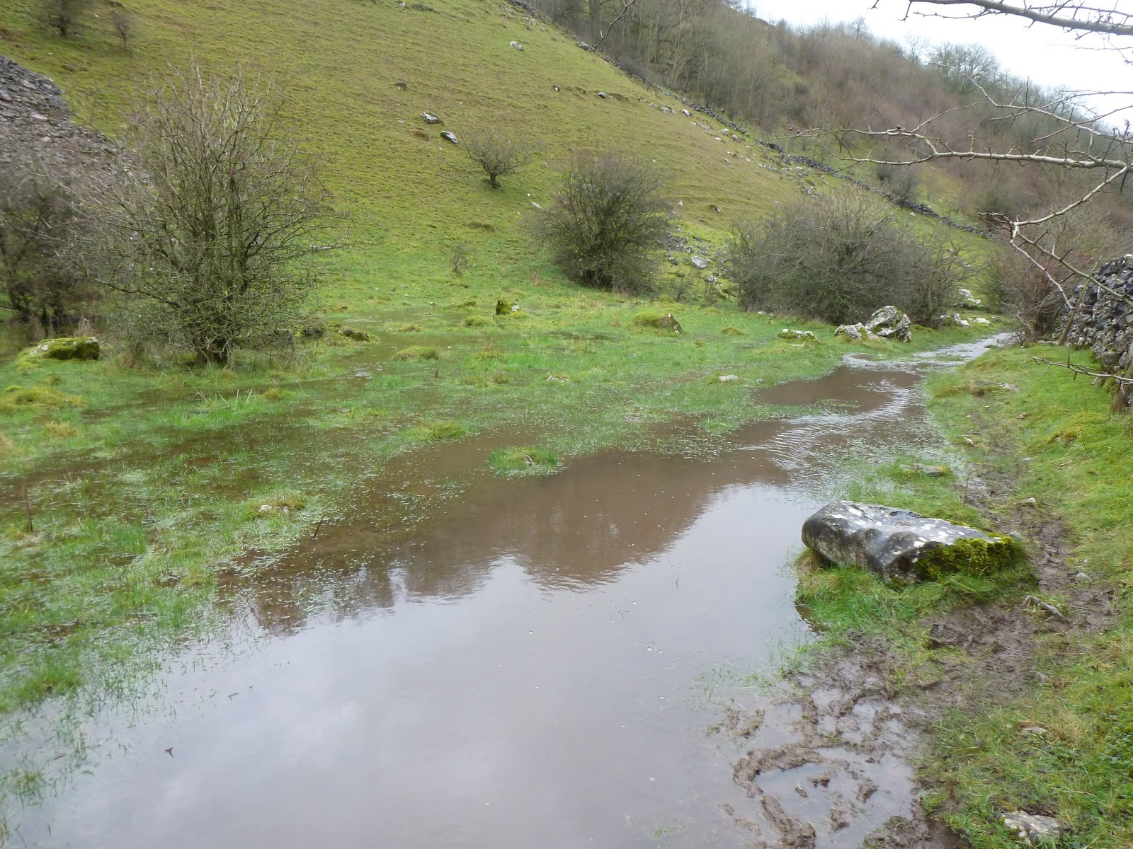
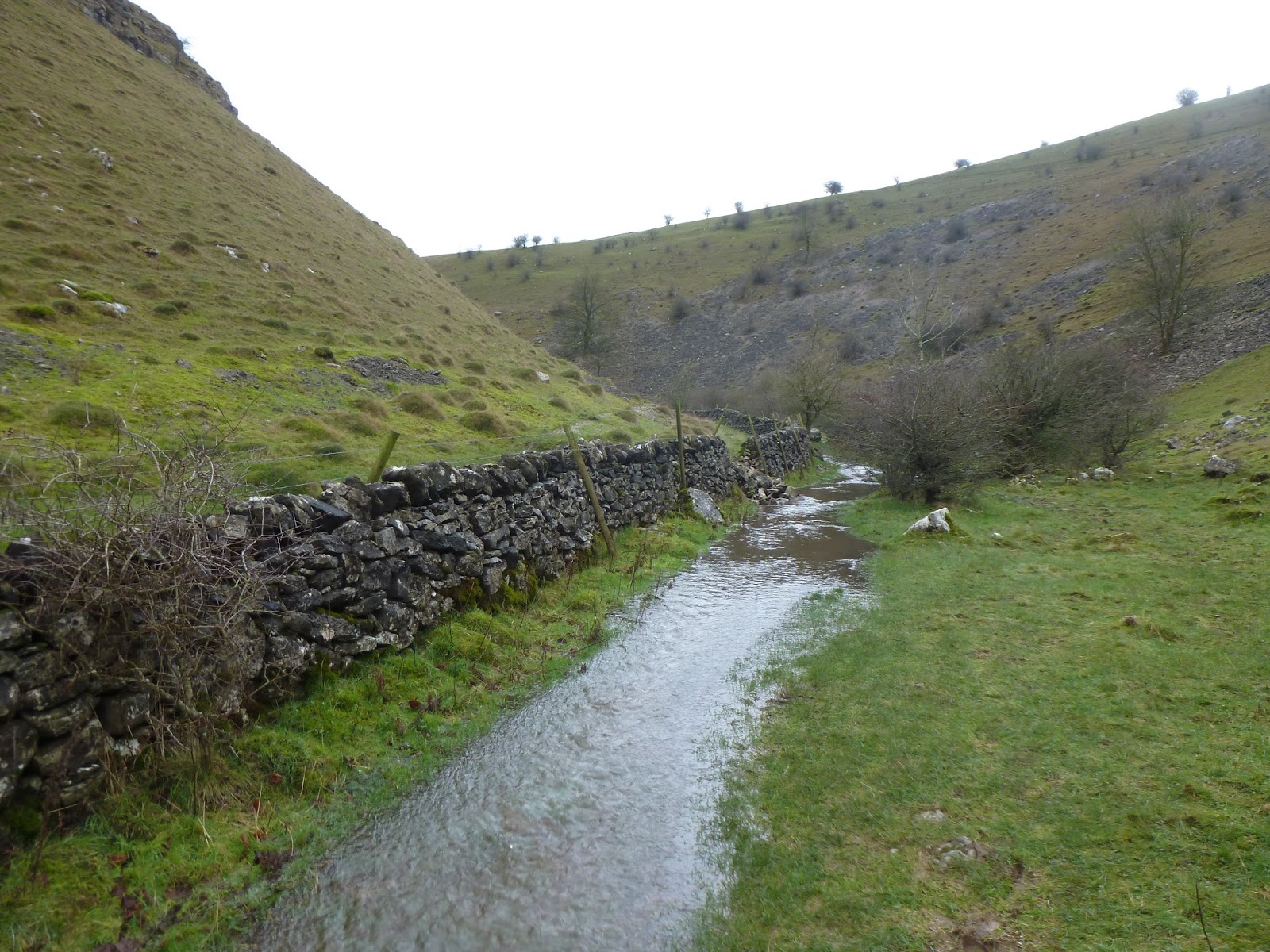
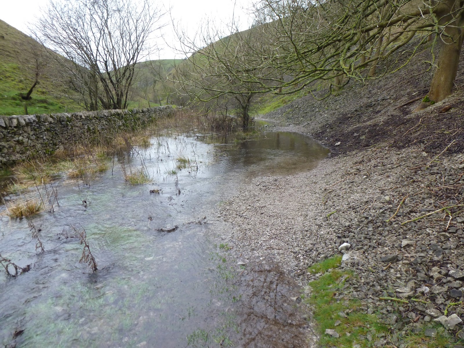
Heading East I made my way down towards Biggin Dale, threading a path between the drystone walls and the sheep before the slope drops steeply into the valley. Once I had negotiated a dry stone wall to get on to the path, it became abundantly clear that the usual path was now taken up by a fairly swiftly flowing river, a result of the copious amounts of rainfall we’ve seen over the last few weeks. It’s worth pointing out that the valley is usually dry. I was glad I wore my leather boots today, I’m not sure a fabric pair would have resisted the onslaught of water and mud. The Dale is a National Nature Reserve, leased to the National Trust and, at a little over one mile long, is a delightful stroll.
 |
| Biggin Dale |
 |
| Biggin Dale |
 |
| This is usually dry |
 |
| Biggin Dale |
 |
| A brief section of dry path |
 |
| A brief section of very flooded path |
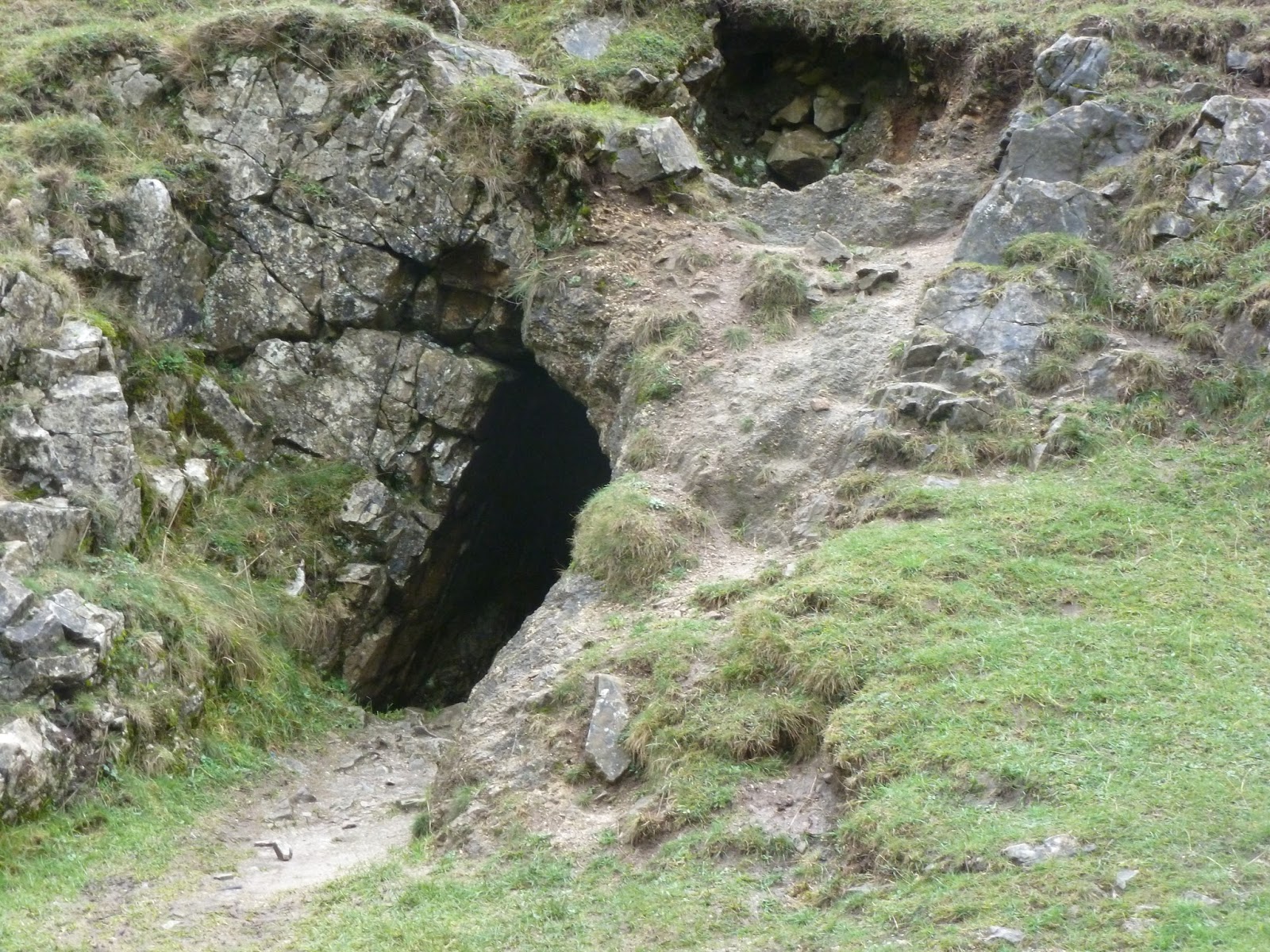
Part way down is an all-too irresistible cave – an old mine to be precise consisting of a short trial level dug into the side of the dale. Shortly down the valley from the mine is the dramatic meeting point of Wolfscote Dale.
 |
| The old iron mine |
 |
| Biggin Dale from the iron mine entrance |
 |
| Wolfscote Dale appears ahead |
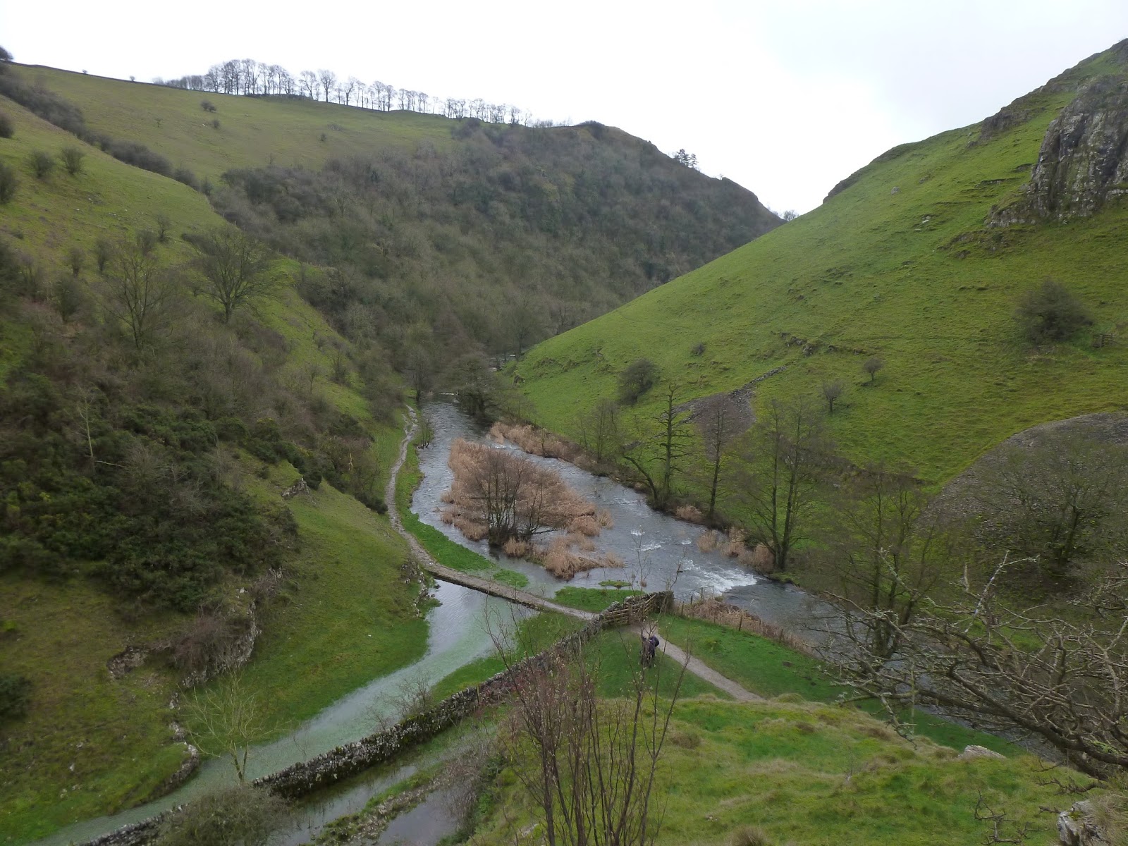
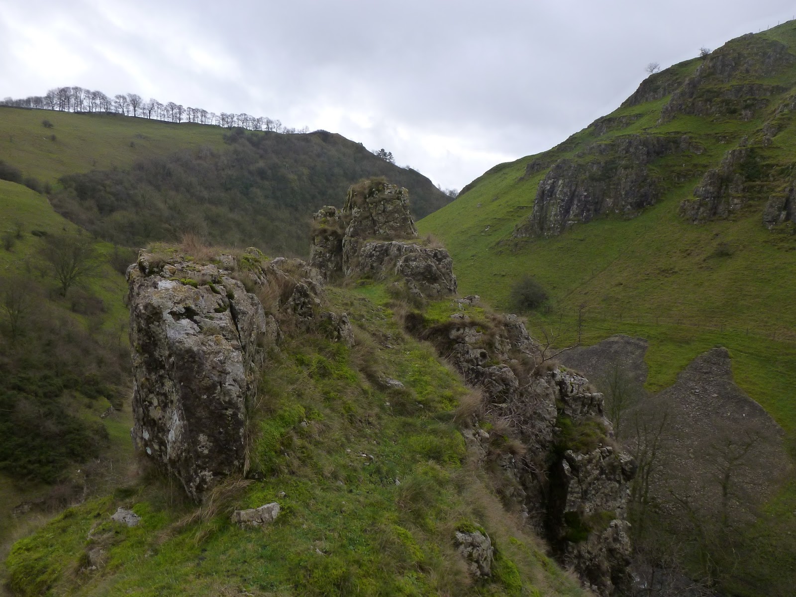
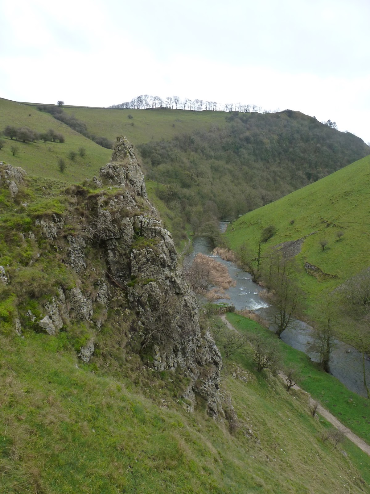
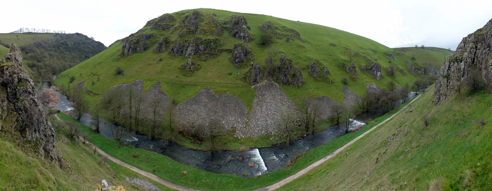
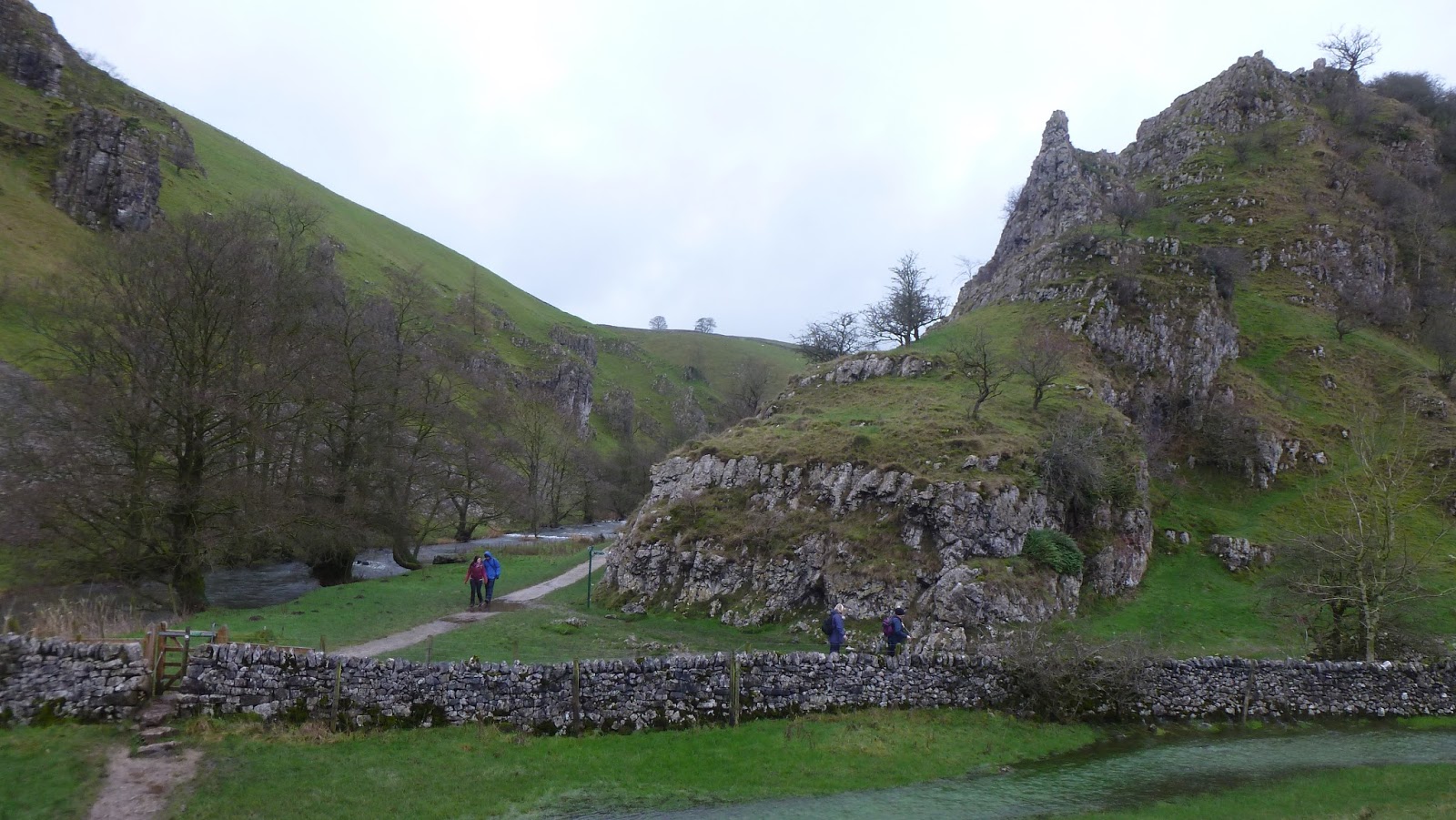
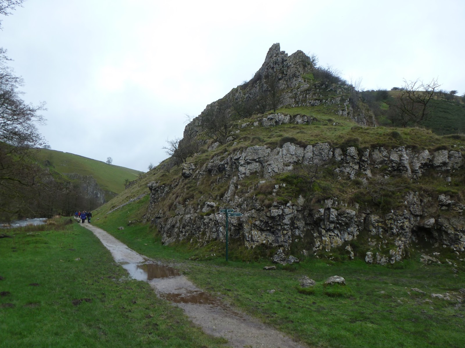
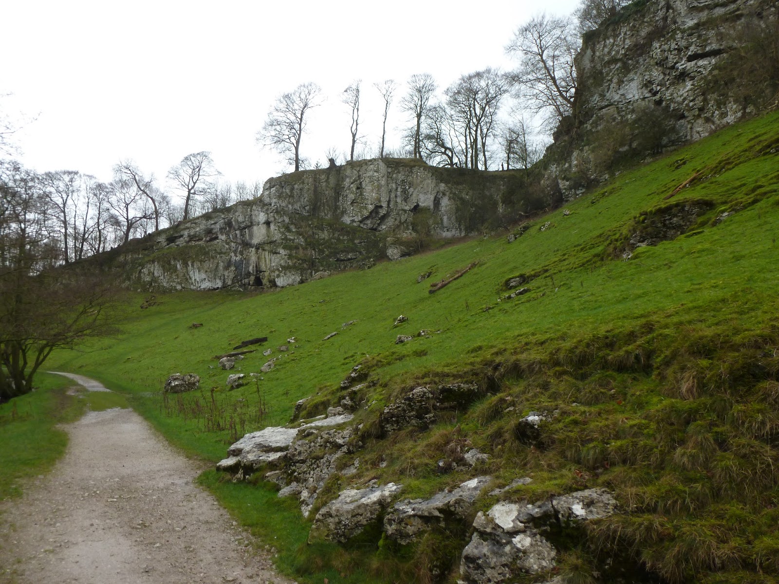
As I mentioned earlier, Wolfscote Dale is similar in many ways to Dovedale with towering limestone cliffs and tors dominating the river below. Wolfscote Dale, though lacking some of the drama of Dovedale, is still impressive, especially when viewed from part way up the hillside at the meeting point with Biggin Dale. Here are a series of rocky outcrops, easily accessible by a short climb, that offer a superb panorama of both Wolfscote Dale and Biggin Dale and the perfect spot to stop for lunch.
 |
| Wolfscote Dale |
 |
| Biggin Dale |
 |
| The rocky protrusion at the meeting point of the two valleys |
 |
| The same outcrop once again, looking much pointier |
 |
| Wolfscote Dale |
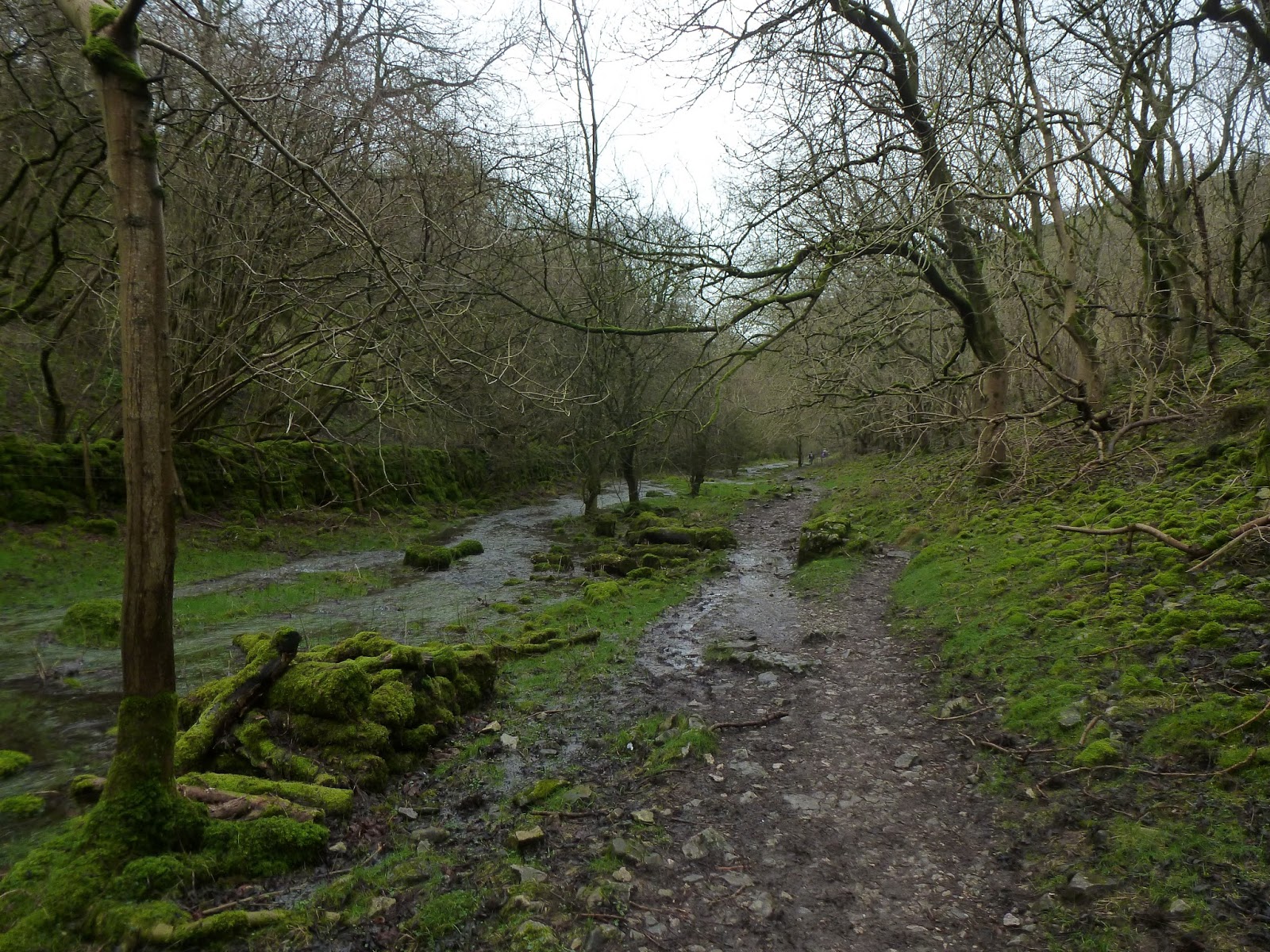
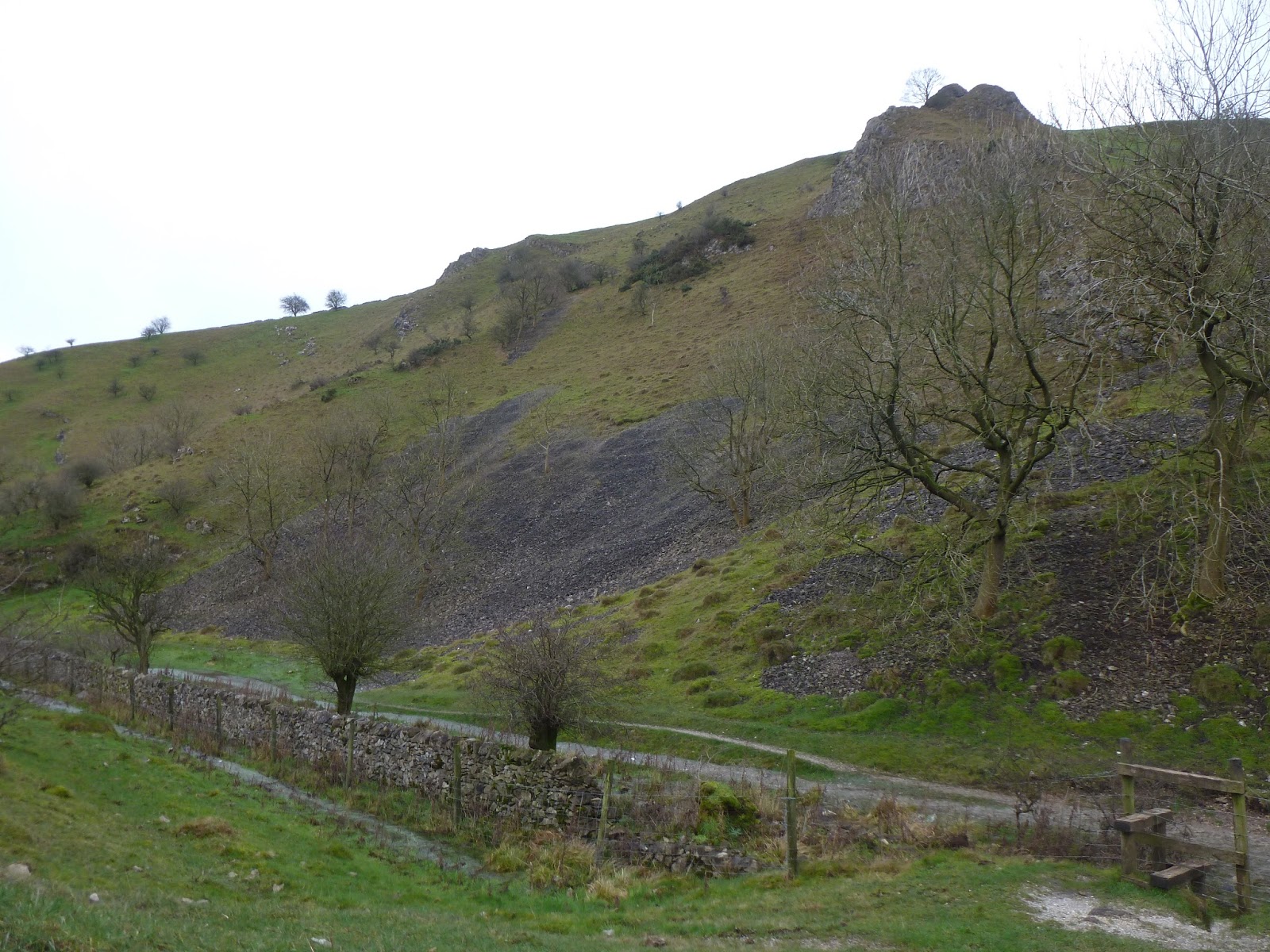
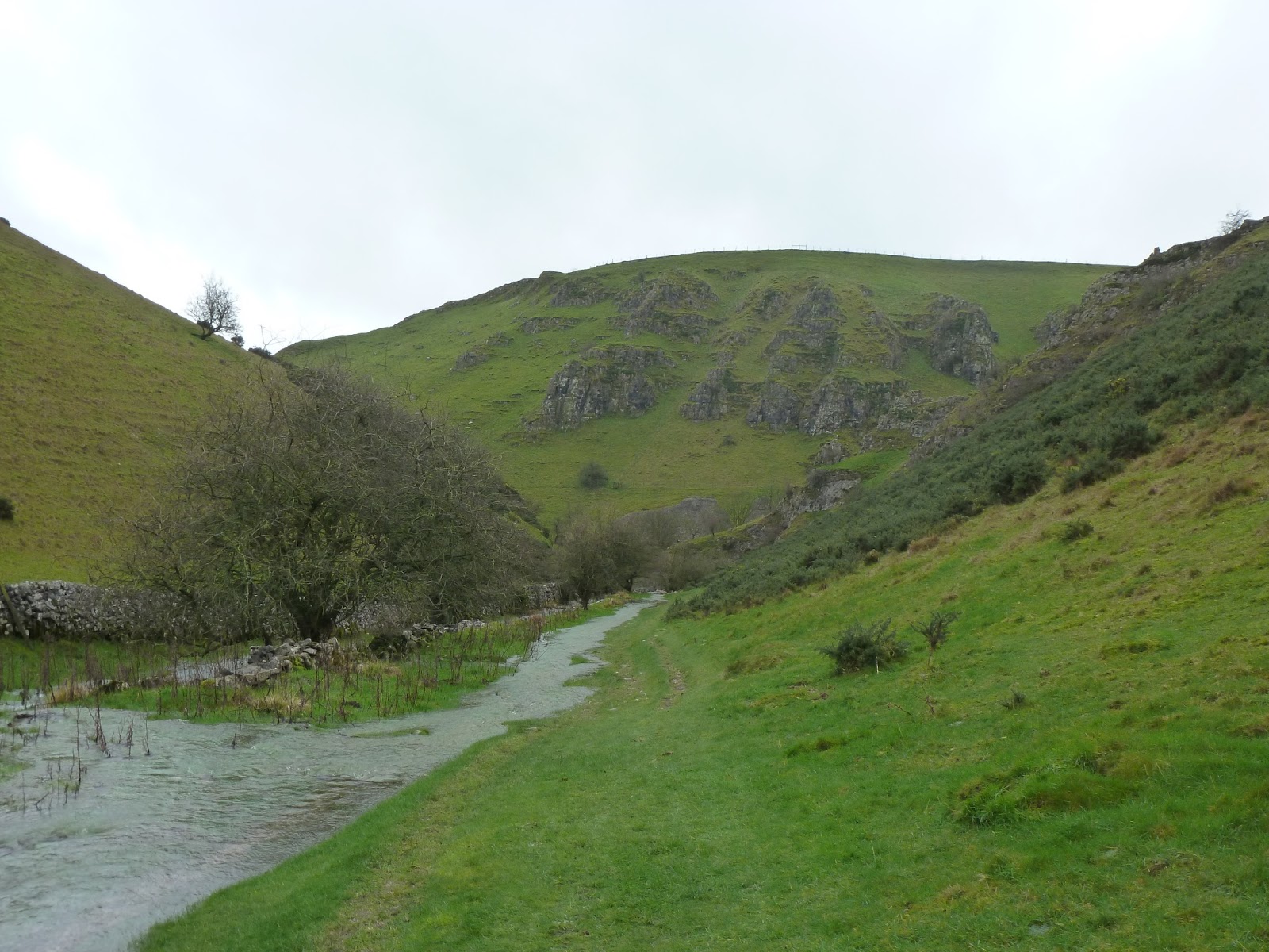
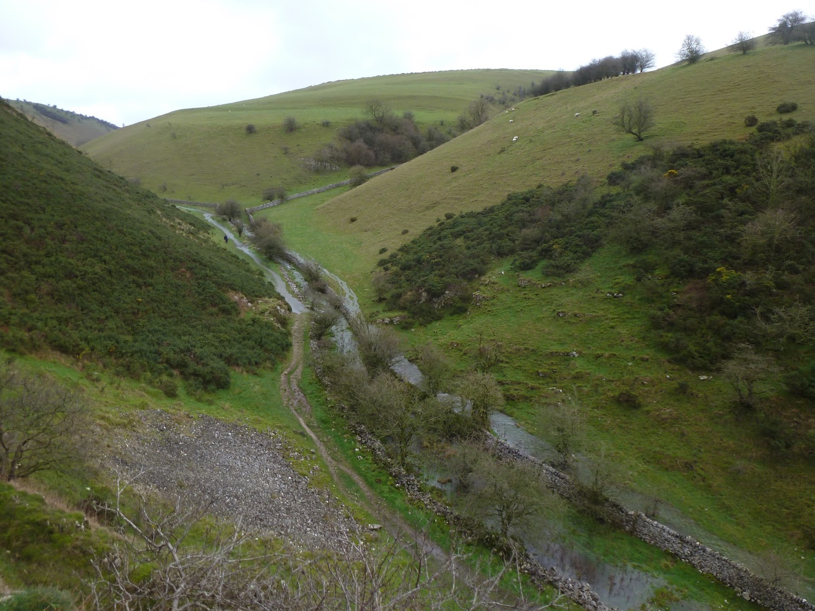
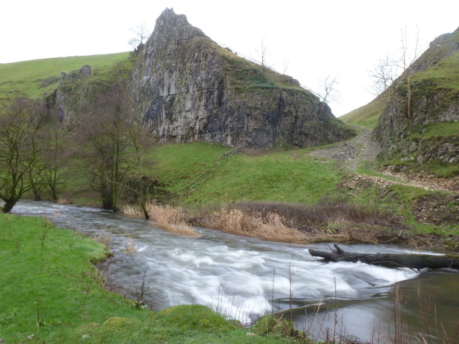
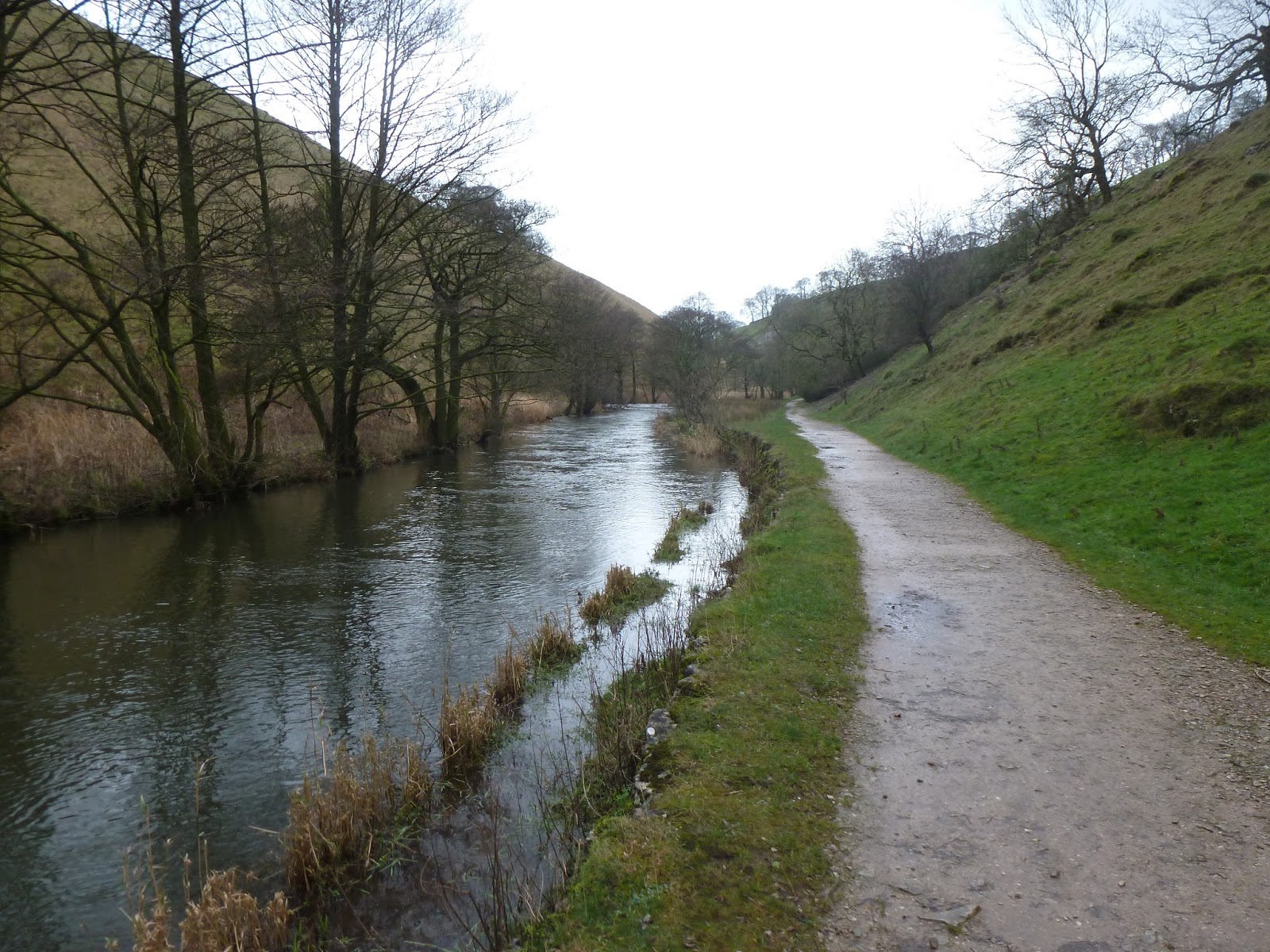
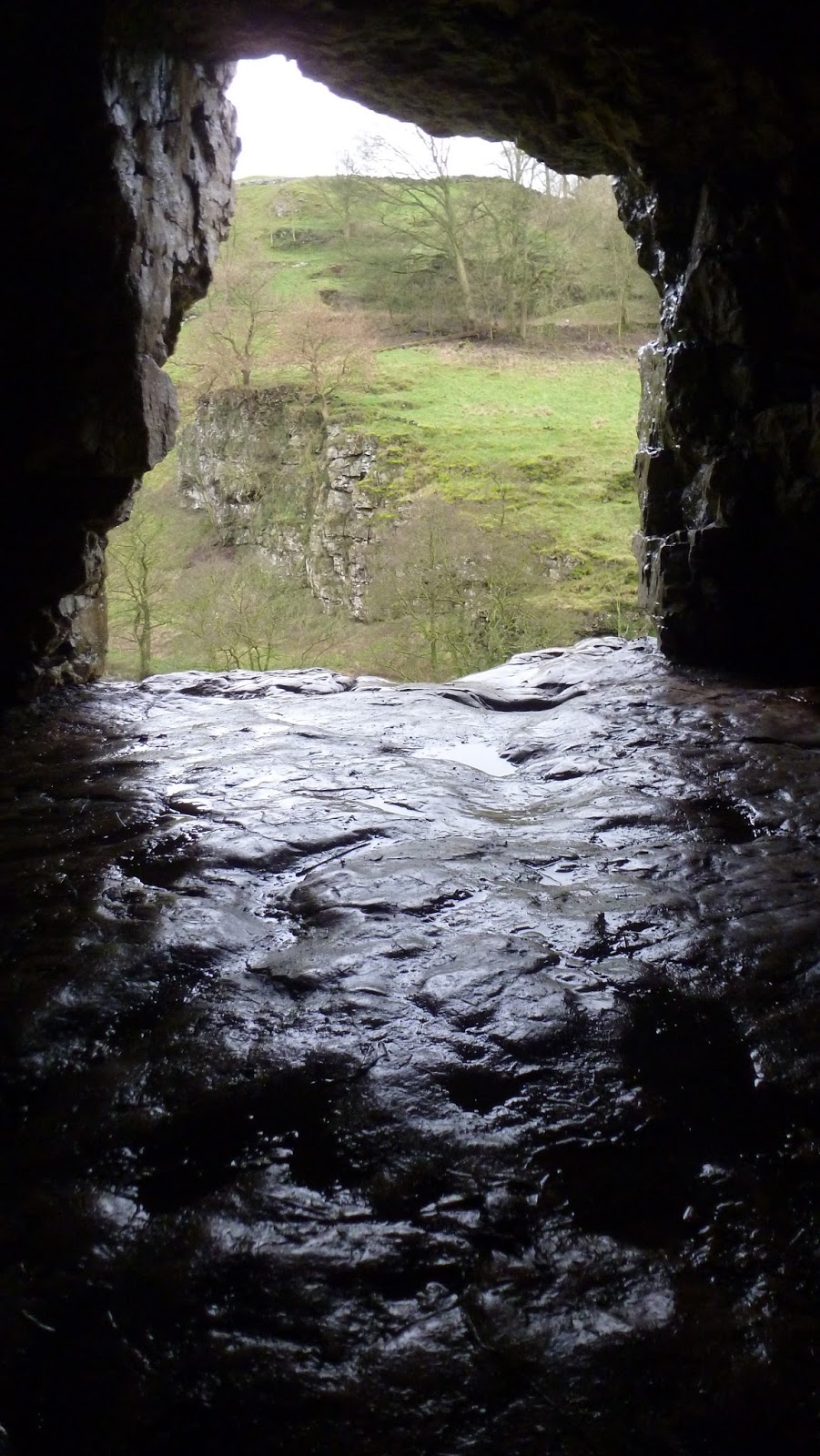
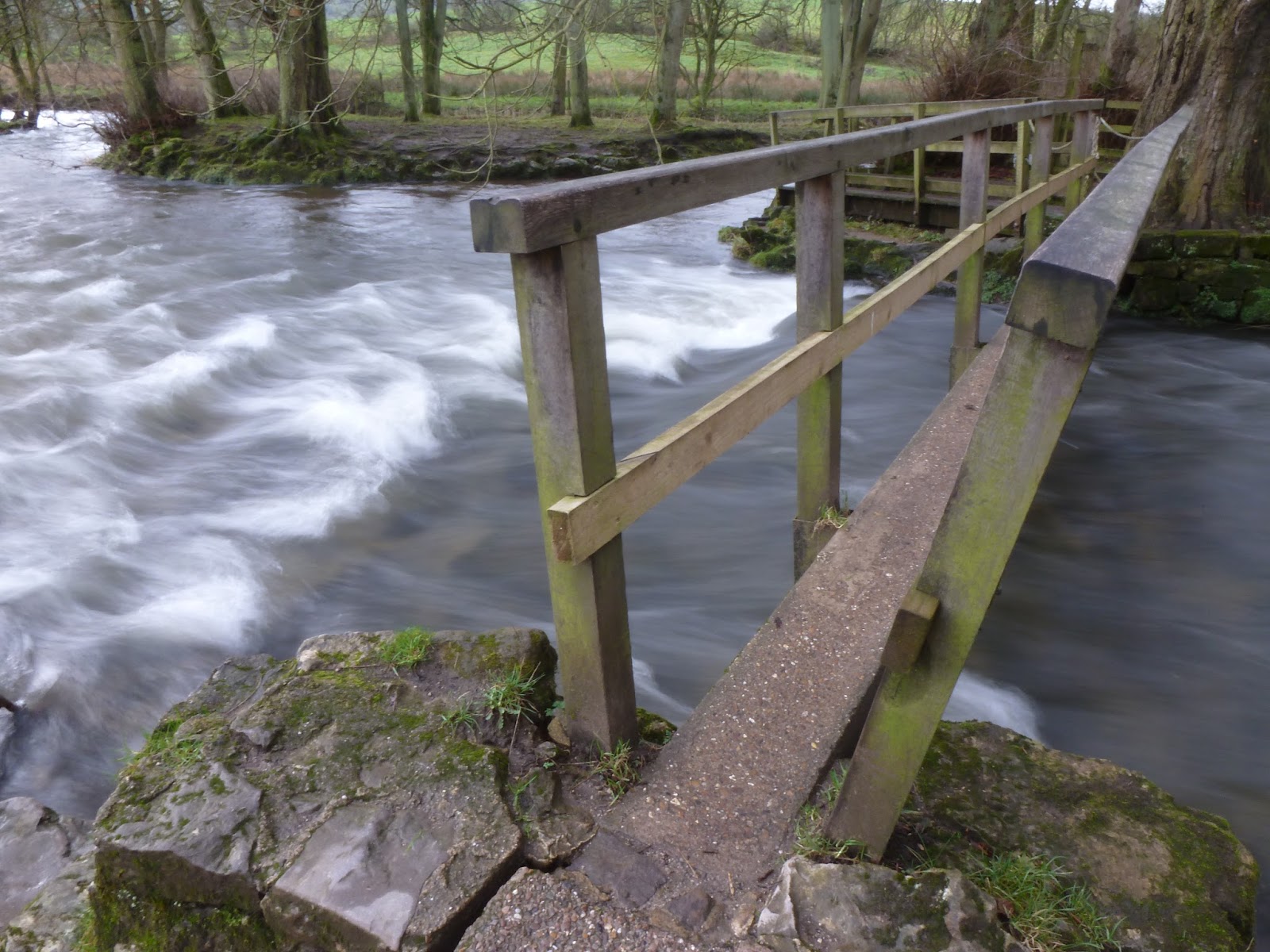
After returning back to the valley floor, it was time to head up Wolfscote Dale en-route back to Hartington. Again, its an easy stroll along well laid paths that follow the River Dove. The dramatic rocks give way to steep grassy slopes though there is one final rocky flourish at the top of the valley, finished off by another small cave. Legend has it that the last wolf that roamed the area was killed at the end of Wolfscote Dale which may account for its name.
 |
| Wolfscote Dale |
 |
| Wolfscote Dale |
 |
| Drabber Tor |
 |
| The River Dove |
 |
| The top of Wolfscote Dale |
 |
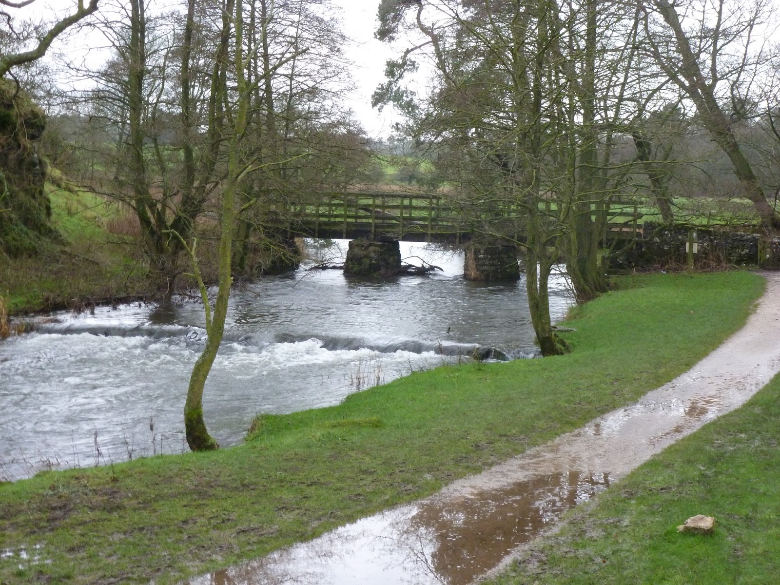
| Footbridge over the River Dove |
 |
| Peering out of the cave entrance |
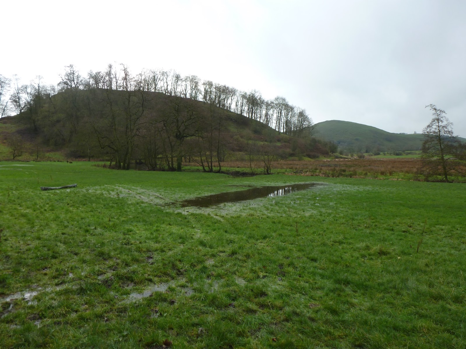
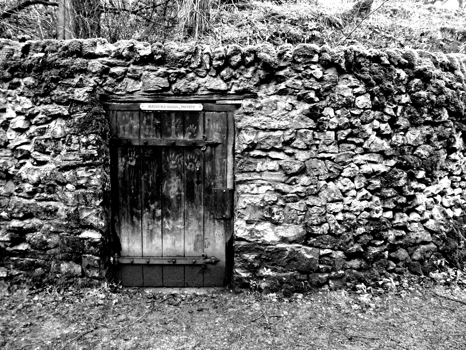
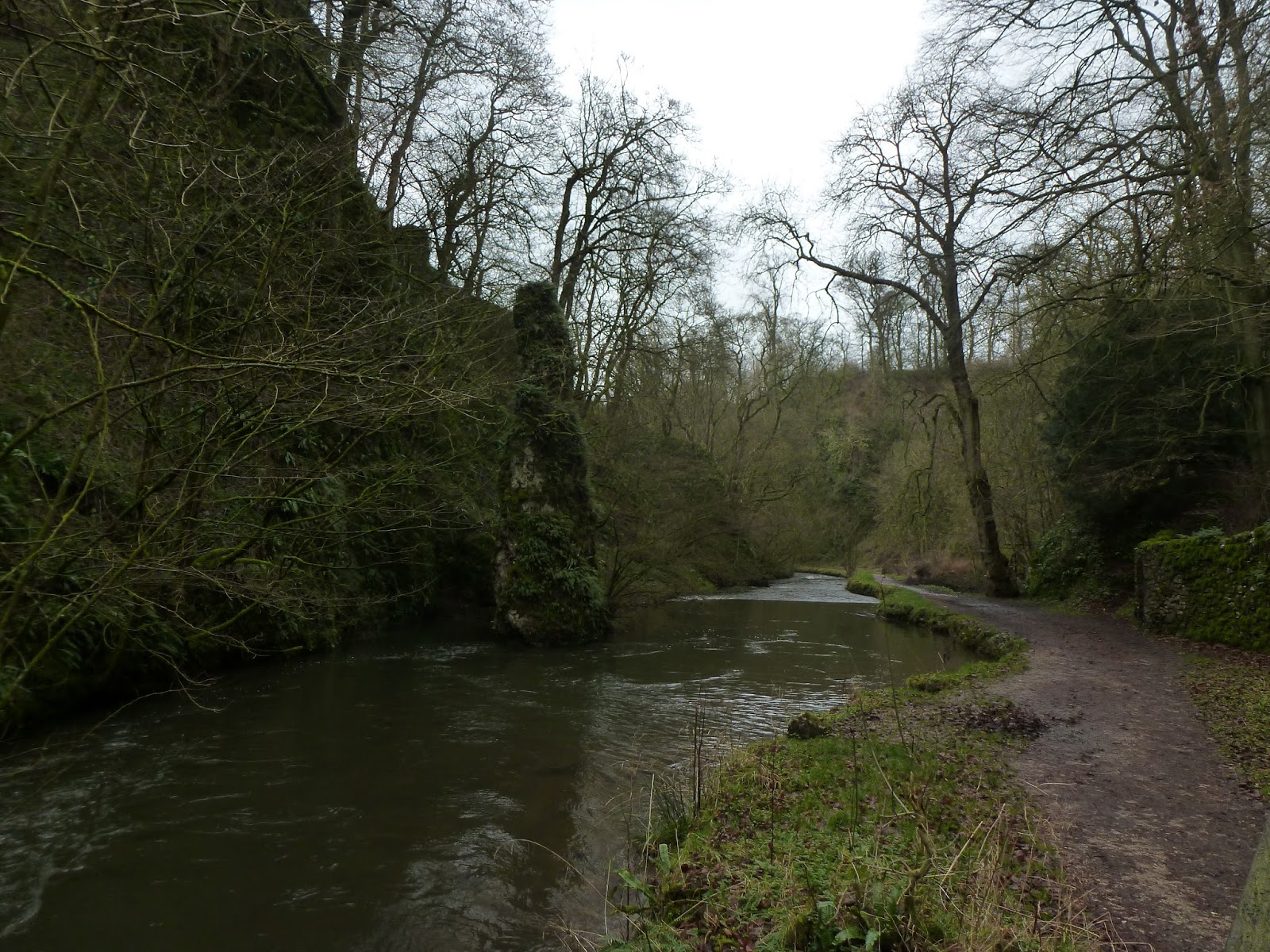
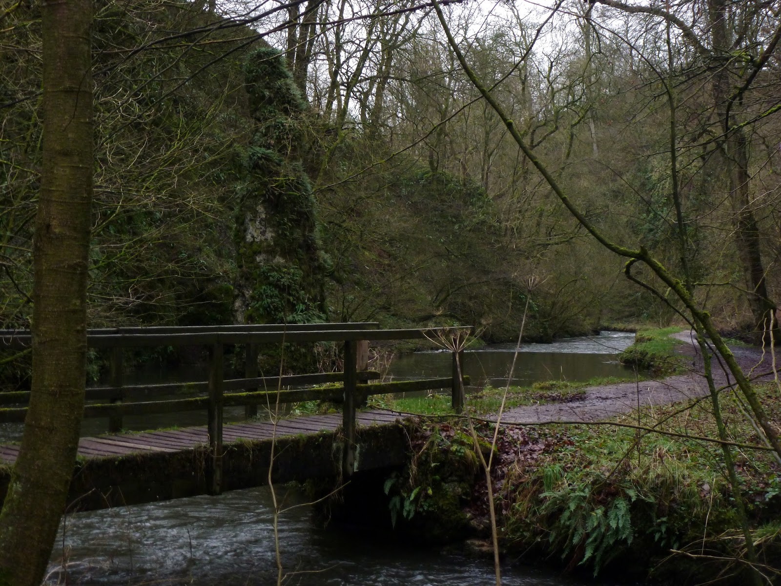
Crossing a flooded field led me to the lower end of Beresford Dale, the last of the valleys on this walk but no less interesting. Smaller and more modest that Wolfscote and Biggin Dale, the wooded flanks of Beresford Dale are a change to the towering limestone canyons of the River Dove. Half way along Beresford Dale is Pike Pool, so called because of the grey spire (or pike) of limestone that rises abruptly out of the water, likely to have been a natural arch at one point in its life.
 |
| Narrowdale Hill |
 |
| The River Dove |
 |
| Entrance to Beresford House. A little creepy |
 |
| Pike Pool in Beresford Dale |
 |
| Beresford Dale |
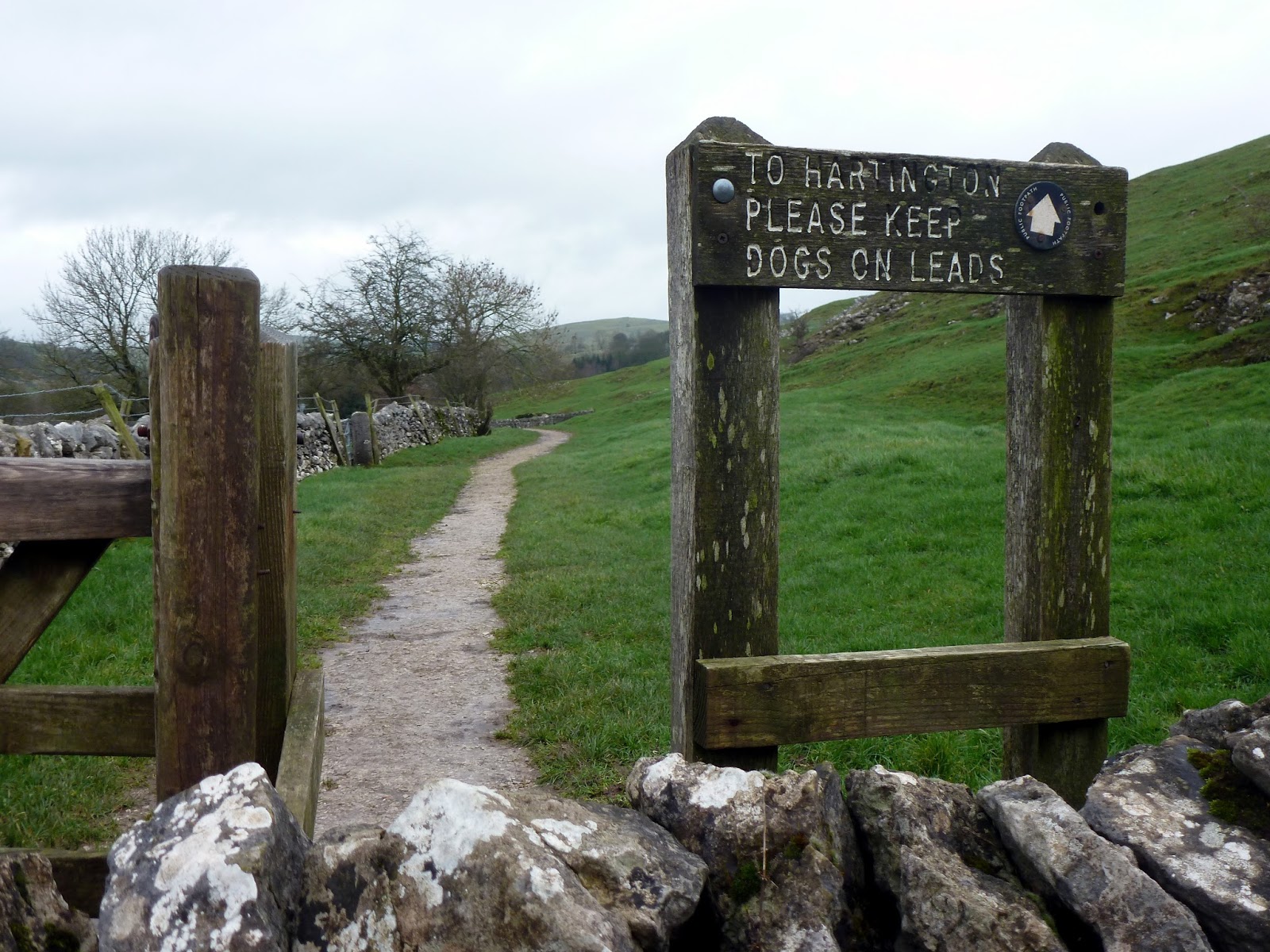
The valley opens out to the north with the path returning to Hartington around the knoll of Pennilow and across a number of boggy fields which I’m sure are a joy in the summer, less so today. This concluded a very satisfying walk, made all the better by the fact it didn’t rain and the scenery was superb. Definitely one to explore again.
 |
| Pennilow |
 |
| Path back to Hartington |
