Open Space Web-Map builder Codehttps://openspace.ordnancesurvey.co.uk/osmapapi/openspace.js?key=3119F72552FD5C22E0530C6CA40A5A92https://openspace.ordnancesurvey.co.uk/osmapapi/script/mapbuilder/basicmap.jshttps://openspace.ordnancesurvey.co.uk/osmapapi/script/mapbuilder/searchbox.js//variables for routes var linesLayer, points, lineFeature, lineString, routeMarkersLayer, routepos, routesize, routeoffset, routeicon; var style_blue = {strokeColor: “#0000CD”, strokeOpacity: 0.5, strokeWidth: 4.5}; function initmapbuilder() { //initiate the map var options = {resolutions: [2500, 1000, 500, 200, 100, 50, 25, 10, 5, 4, 2.5, 2, 1]}; osMap = new OpenSpace.Map(‘map’, options); //configure map options (basicmap.js) setglobaloptions(); //set the center of the map and the zoom level osMap.setCenter(new OpenSpace.MapPoint(327933.33080292,524930.33459854),8); linesLayer = osMap.getVectorLayer(); // Set up layer for route markers routeMarkersLayer = new OpenLayers.Layer.Markers(“Route Markers”); //make a route points = new Array(); points.push(new OpenLayers.Geometry.Point(328056.66412354,525378.66793823)); points.push(new OpenLayers.Geometry.Point(328101.66412354,525263.66793823)); points.push(new OpenLayers.Geometry.Point(328101.66412354,525103.66793823)); points.push(new OpenLayers.Geometry.Point(328001.66412354,524838.66793823)); points.push(new OpenLayers.Geometry.Point(327901.66412354,524758.66793823)); points.push(new OpenLayers.Geometry.Point(327756.66412354,524648.66793823)); points.push(new OpenLayers.Geometry.Point(327666.66412354,524658.66793823)); points.push(new OpenLayers.Geometry.Point(327726.66412354,524958.66793823)); points.push(new OpenLayers.Geometry.Point(327736.66412354,525003.66793823)); points.push(new OpenLayers.Geometry.Point(327691.66412354,525078.66793823)); points.push(new OpenLayers.Geometry.Point(327646.66412354,525128.66793823)); points.push(new OpenLayers.Geometry.Point(327651.66412354,525208.66793823)); points.push(new OpenLayers.Geometry.Point(327716.66412354,525268.66793823)); points.push(new OpenLayers.Geometry.Point(327966.66412354,525323.66793823)); points.push(new OpenLayers.Geometry.Point(328056.66412354,525378.66793823)); // create a polyline feature from the array of points lineString = new OpenLayers.Geometry.LineString(points); lineFeature = new OpenLayers.Feature.Vector(lineString, null, style_blue); linesLayer.addFeatures([lineFeature]); //crate a route start/end marker routepos = new OpenSpace.MapPoint(328056.66412354,525378.66793823); routesize = new OpenLayers.Size(33,45); routeoffset = new OpenLayers.Pixel(-5,-37); routeicon = new OpenSpace.Icon(‘https://openspace.ordnancesurvey.co.uk/osmapapi/img_versions/img_1.1/mapbuilder/routemarker-startend.png’, routesize, routeoffset, null, null); routeMarkersLayer.addMarker(new OpenLayers.Marker(routepos, routeicon)); osMap.addLayer(routeMarkersLayer);}
Route: Gale Road, Latrigg, Mallen Dodd, Gale Road
Date: 26/09/2015
From: Gale Road
Parking: Gale Road
Start Point: Gale Road
Region: Northern Fells
Route length: 1.8 miles (2.8 km)
Time taken: 00:30
Average speed: 2.5 mph
Ascent: 96m
Descent: 104m
Wainwrights on this walk:
Latrigg (368m)
Other Summits: None
Other points of interest: None
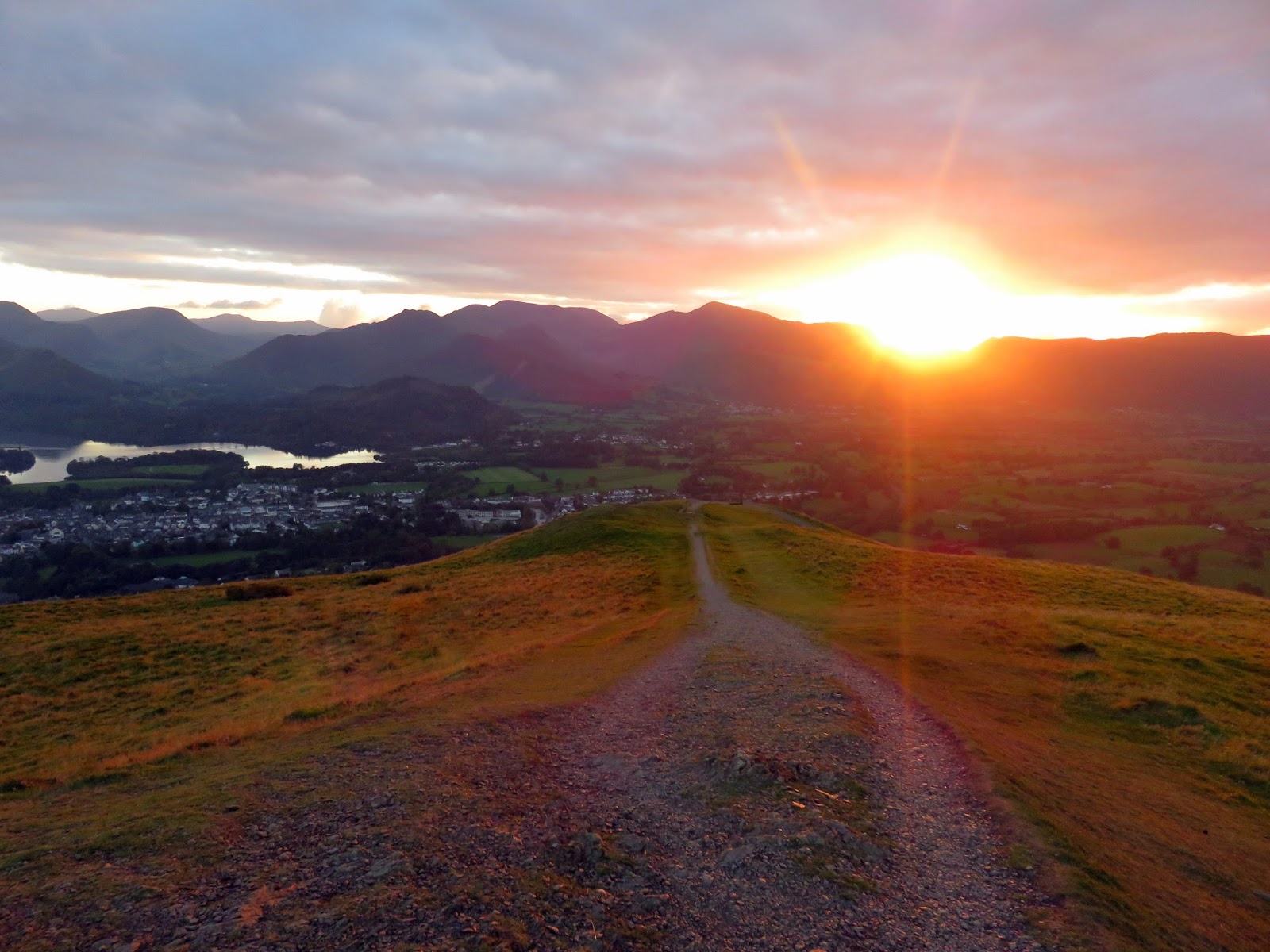
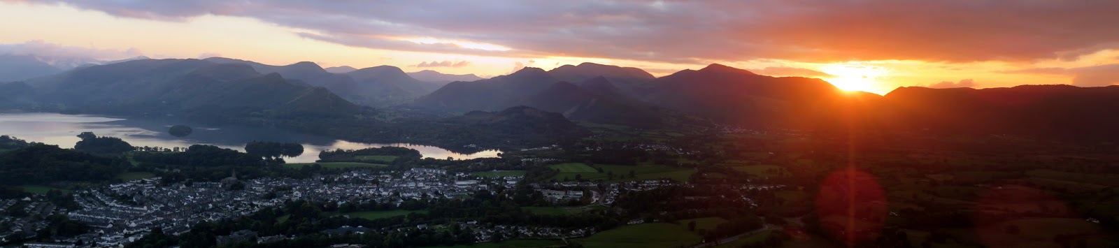
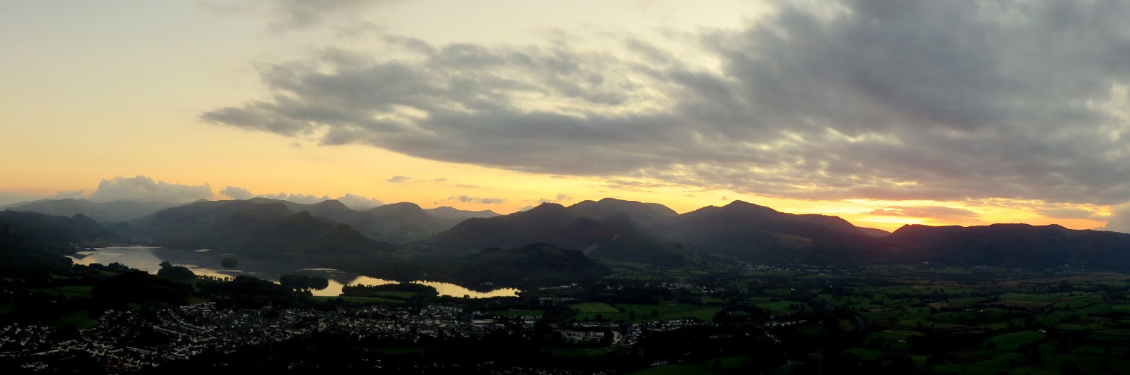
Latrigg forms a perfect spot for a short, early evening stroll. Parking at the top of Gale Road gives you springboard on to the fell and a non-too onerous walk to the summit. The best of the view is from the memorial bench at the end of the ridge.
 |
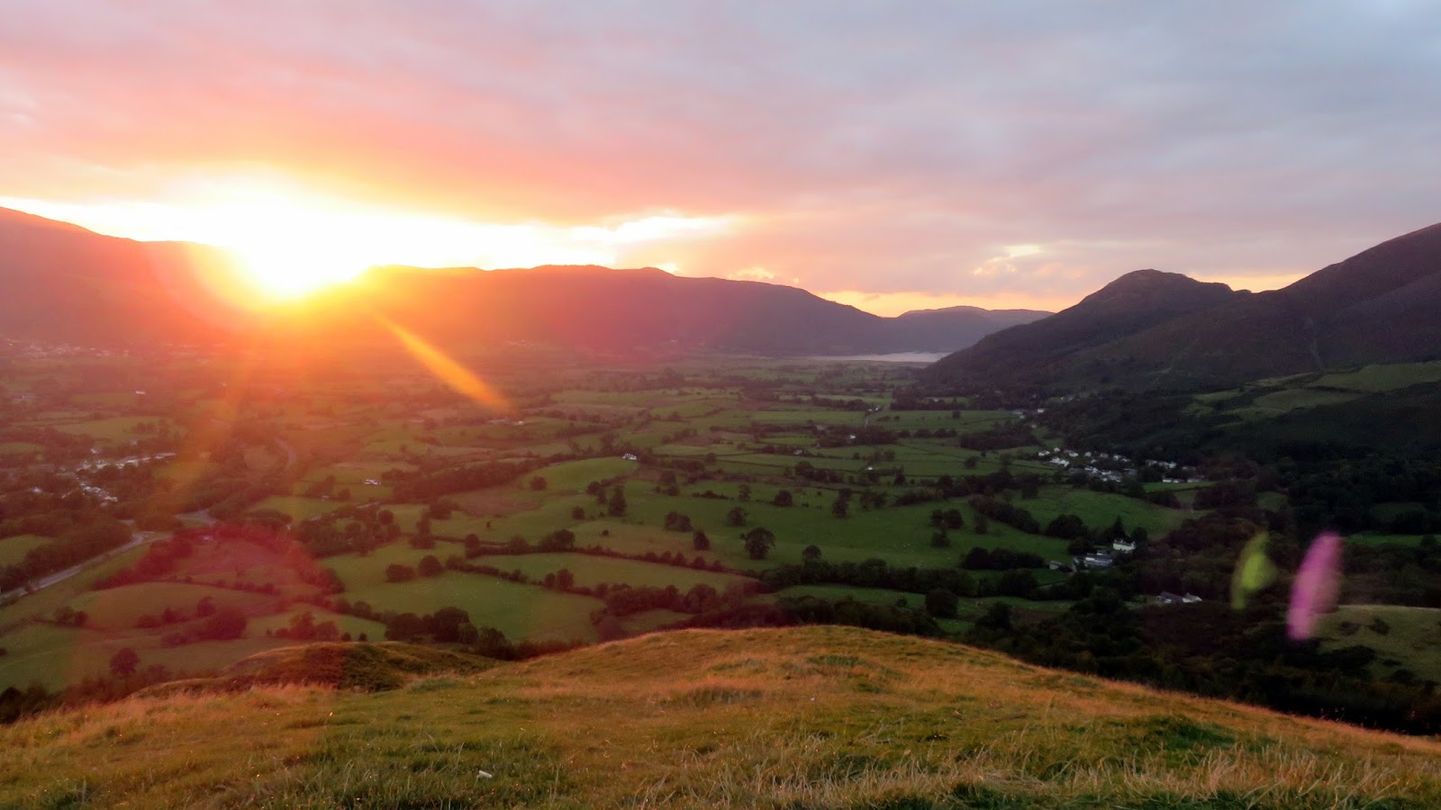
| Sun streams over the Whinlatter Pass |
 |
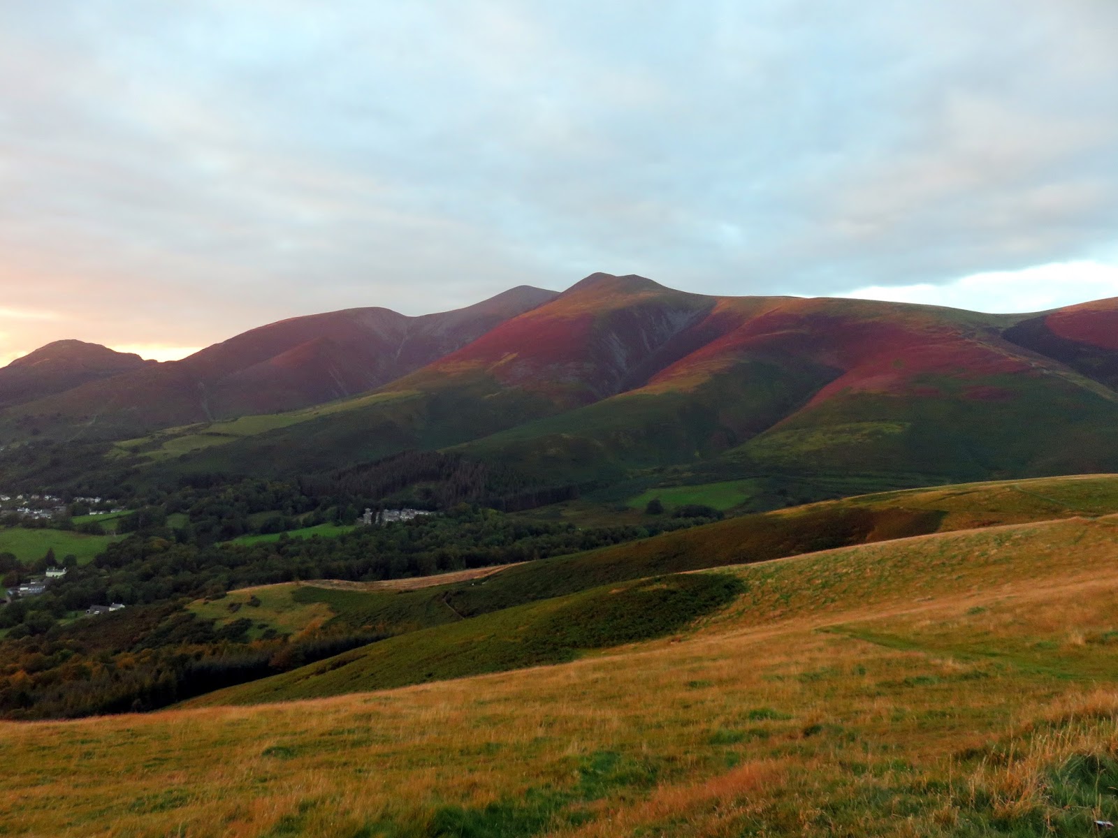
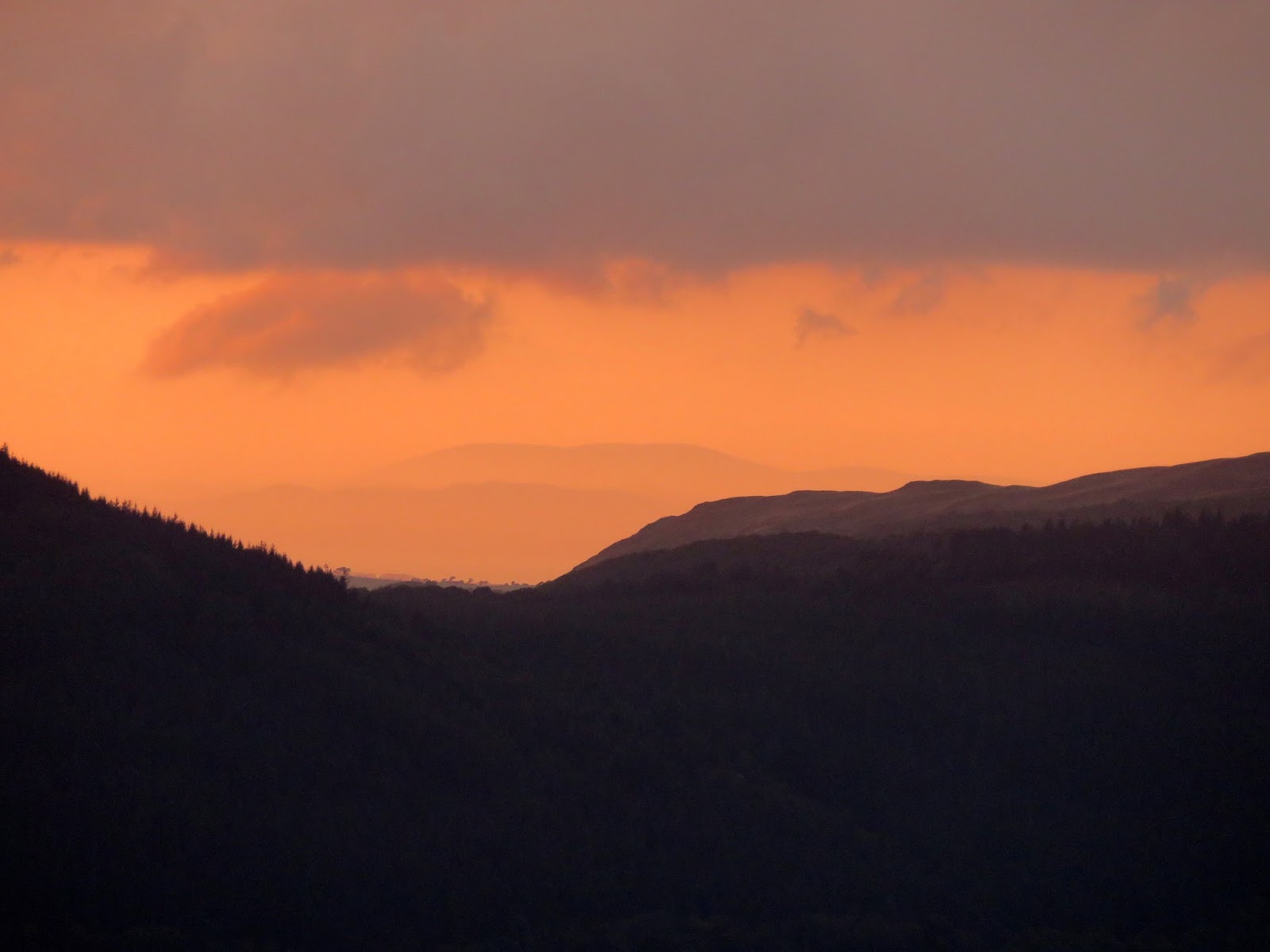
| The North Western Fells |
 |
| Looking to Bassenthwaite |
 |
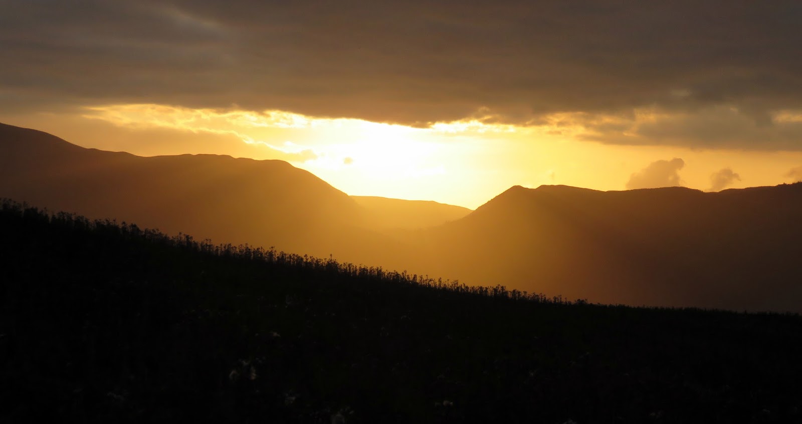
| Looking over the Whinlatter Pass |
 |
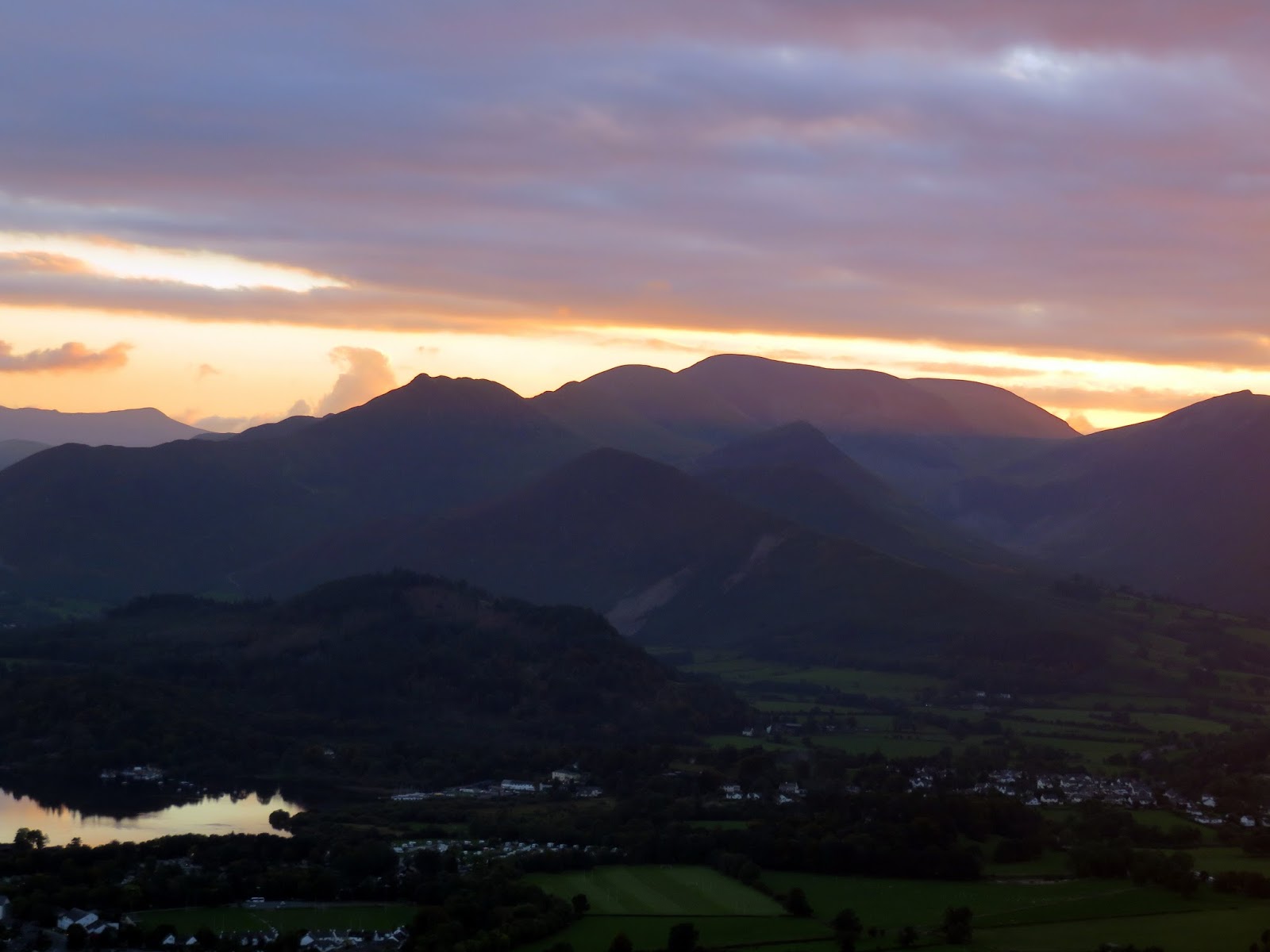
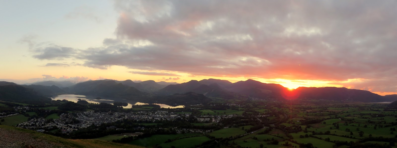
| Derwentwater and the North Western Fells |
 |
| Derwentwater and the North Western Fells |
 |
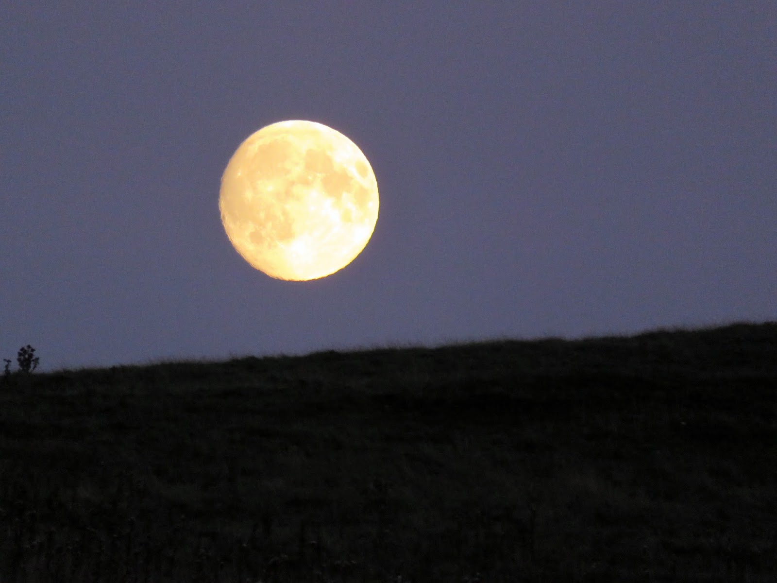
| The ‘supermoon’ |
