Open Space Web-Map builder Codehttps://openspace.ordnancesurvey.co.uk/osmapapi/openspace.js?key=3119F72552FD5C22E0530C6CA40A5A92https://openspace.ordnancesurvey.co.uk/osmapapi/script/mapbuilder/basicmap.jshttps://openspace.ordnancesurvey.co.uk/osmapapi/script/mapbuilder/searchbox.js//variables for routes var linesLayer, points, lineFeature, lineString, routeMarkersLayer, routepos, routesize, routeoffset, routeicon; var style_blue = {strokeColor: “#0000CD”, strokeOpacity: 0.5, strokeWidth: 4.5}; function initmapbuilder() { //initiate the map var options = {resolutions: [2500, 1000, 500, 200, 100, 50, 25, 10, 5, 4, 2.5, 2, 1]}; osMap = new OpenSpace.Map(‘map’, options); //configure map options (basicmap.js) setglobaloptions(); //set the center of the map and the zoom level osMap.setCenter(new OpenSpace.MapPoint(419707.9974823,365113.00125885),7); linesLayer = osMap.getVectorLayer(); // Set up layer for route markers routeMarkersLayer = new OpenLayers.Layer.Markers(“Route Markers”); //make a route points = new Array(); points.push(new OpenLayers.Geometry.Point(420814.66412354,364149.66793823)); points.push(new OpenLayers.Geometry.Point(420544.66412354,364049.66793823)); points.push(new OpenLayers.Geometry.Point(420384.66412354,364039.66793823)); points.push(new OpenLayers.Geometry.Point(420259.66412354,364064.66793823)); points.push(new OpenLayers.Geometry.Point(420064.66412354,364039.66793823)); points.push(new OpenLayers.Geometry.Point(419924.66412354,364159.66793823)); points.push(new OpenLayers.Geometry.Point(419859.66412354,364189.66793823)); points.push(new OpenLayers.Geometry.Point(419759.66412354,364159.66793823)); points.push(new OpenLayers.Geometry.Point(419639.66412354,364064.66793823)); points.push(new OpenLayers.Geometry.Point(419544.66412354,364004.66793823)); points.push(new OpenLayers.Geometry.Point(419474.66412354,364024.66793823)); points.push(new OpenLayers.Geometry.Point(419474.66412354,364164.66793823)); points.push(new OpenLayers.Geometry.Point(419474.66412354,364344.66793823)); points.push(new OpenLayers.Geometry.Point(419424.66412354,364504.66793823)); points.push(new OpenLayers.Geometry.Point(419234.66412354,364504.66793823)); points.push(new OpenLayers.Geometry.Point(419019.66412354,364524.66793823)); points.push(new OpenLayers.Geometry.Point(418809.66412354,364624.66793823)); points.push(new OpenLayers.Geometry.Point(418724.66412354,364754.66793823)); points.push(new OpenLayers.Geometry.Point(418289.66412354,364879.66793823)); points.push(new OpenLayers.Geometry.Point(418094.66412354,364974.66793823)); points.push(new OpenLayers.Geometry.Point(418074.66412354,365024.66793823)); points.push(new OpenLayers.Geometry.Point(417829.66412354,365034.66793823)); points.push(new OpenLayers.Geometry.Point(417289.66412354,365244.66793823)); points.push(new OpenLayers.Geometry.Point(417254.66412354,365299.66793823)); points.push(new OpenLayers.Geometry.Point(417294.66412354,365374.66793823)); points.push(new OpenLayers.Geometry.Point(417449.66412354,365444.66793823)); points.push(new OpenLayers.Geometry.Point(417459.66412354,365514.66793823)); points.push(new OpenLayers.Geometry.Point(417589.66412354,365514.66793823)); points.push(new OpenLayers.Geometry.Point(417779.66412354,365639.66793823)); points.push(new OpenLayers.Geometry.Point(417889.66412354,365774.66793823)); points.push(new OpenLayers.Geometry.Point(417939.66412354,365814.66793823)); points.push(new OpenLayers.Geometry.Point(418009.66412354,365819.66793823)); points.push(new OpenLayers.Geometry.Point(418099.66412354,365719.66793823)); points.push(new OpenLayers.Geometry.Point(418264.66412354,365769.66793823)); points.push(new OpenLayers.Geometry.Point(418439.66412354,365799.66793823)); points.push(new OpenLayers.Geometry.Point(418754.66412354,365844.66793823)); points.push(new OpenLayers.Geometry.Point(419134.66412354,365844.66793823)); points.push(new OpenLayers.Geometry.Point(419334.66412354,365844.66793823)); points.push(new OpenLayers.Geometry.Point(419394.66412354,365924.66793823)); points.push(new OpenLayers.Geometry.Point(419514.66412354,366139.66793823)); points.push(new OpenLayers.Geometry.Point(419819.66412354,366179.66793823)); points.push(new OpenLayers.Geometry.Point(420179.66412354,366214.66793823)); points.push(new OpenLayers.Geometry.Point(420289.66412354,366144.66793823)); points.push(new OpenLayers.Geometry.Point(420379.66412354,366194.66793823)); points.push(new OpenLayers.Geometry.Point(420629.66412354,366124.66793823)); points.push(new OpenLayers.Geometry.Point(420914.66412354,366074.66793823)); points.push(new OpenLayers.Geometry.Point(421039.66412354,365979.66793823)); points.push(new OpenLayers.Geometry.Point(421094.66412354,365934.66793823)); points.push(new OpenLayers.Geometry.Point(421099.66412354,365824.66793823)); points.push(new OpenLayers.Geometry.Point(421169.66412354,365699.66793823)); points.push(new OpenLayers.Geometry.Point(421194.66412354,365569.66793823)); points.push(new OpenLayers.Geometry.Point(421169.66412354,365519.66793823)); points.push(new OpenLayers.Geometry.Point(421149.66412354,365449.66793823)); points.push(new OpenLayers.Geometry.Point(421274.66412354,365294.66793823)); points.push(new OpenLayers.Geometry.Point(421404.66412354,365139.66793823)); points.push(new OpenLayers.Geometry.Point(421609.66412354,364744.66793823)); points.push(new OpenLayers.Geometry.Point(421689.66412354,364699.66793823)); points.push(new OpenLayers.Geometry.Point(421974.66412354,364644.66793823)); points.push(new OpenLayers.Geometry.Point(422019.66412354,364534.66793823)); points.push(new OpenLayers.Geometry.Point(421889.66412354,364419.66793823)); points.push(new OpenLayers.Geometry.Point(421794.66412354,364254.66793823)); points.push(new OpenLayers.Geometry.Point(421629.66412354,364194.66793823)); points.push(new OpenLayers.Geometry.Point(421534.66412354,364084.66793823)); points.push(new OpenLayers.Geometry.Point(421494.66412354,363989.66793823)); points.push(new OpenLayers.Geometry.Point(421429.66412354,363969.66793823)); points.push(new OpenLayers.Geometry.Point(421349.66412354,363994.66793823)); points.push(new OpenLayers.Geometry.Point(421399.66412354,364134.66793823)); points.push(new OpenLayers.Geometry.Point(421184.66412354,364384.66793823)); points.push(new OpenLayers.Geometry.Point(420894.66412354,364184.66793823)); points.push(new OpenLayers.Geometry.Point(420814.66412354,364149.66793823)); // create a polyline feature from the array of points lineString = new OpenLayers.Geometry.LineString(points); lineFeature = new OpenLayers.Feature.Vector(lineString, null, style_blue); linesLayer.addFeatures([lineFeature]); //crate a route start/end marker routepos = new OpenSpace.MapPoint(420814.66412354,364149.66793823); routesize = new OpenLayers.Size(33,45); routeoffset = new OpenLayers.Pixel(-5,-37); routeicon = new OpenSpace.Icon(‘https://openspace.ordnancesurvey.co.uk/osmapapi/img_versions/img_1.1/mapbuilder/routemarker-startend.png’, routesize, routeoffset, null, null); routeMarkersLayer.addMarker(new OpenLayers.Marker(routepos, routeicon)); osMap.addLayer(routeMarkersLayer);}
Route: Youlgreave, Coldwell End, Limestone Way, Low Moor Plantation, Calling Low, Cales Dale, Lathkill Dale, Palmerston Wood, Conksbury Bridge, Raper Close, Alport, Bradford Dale, Youlgreave
Date: 29/08/2015
From: Youlgreave
Parking: Car park in Youlgreave
Start Point: Youlgreave
Region: Peak District White Peak
Route length: 7.3 miles (11.7 km)
Time taken: 02:54
Average speed: 2.5 mph
Ascent: 403m
Descent: 426m
Summits: None
Other points of interest: Cales Dale, Bradford Dale, Alsop
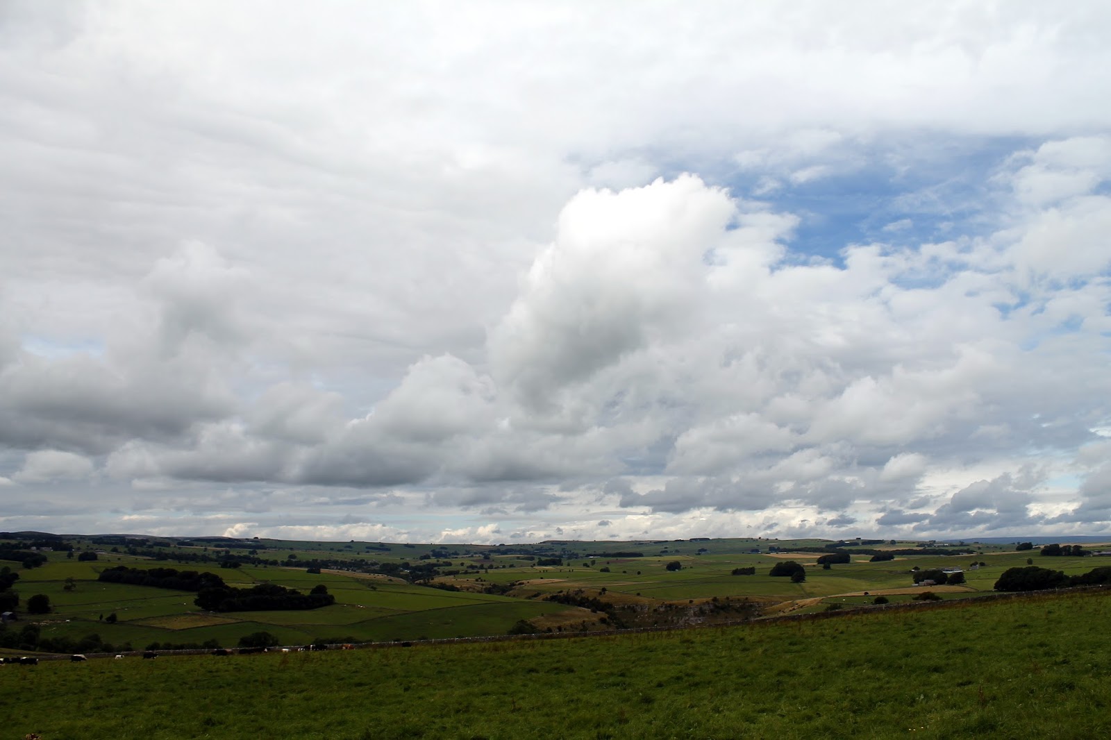
We were back in the Peak District this weekend, the White Peak to be precise – a departure from my recent explorations of the wild and wonderful Dark Peak. The White Peak, characterised by the underlying limestone geology, is very reminiscent of the Yorkshire Dales but perhaps on a more modest scale though that’s not to say it isn’t impressive. The stunning Chrome Hill belongs to the White Peak and is a magnificent hill indeed.
Our route today would take us from the bustling village of Youlgreave (or Youlgrave) over rolling hills and into Lathkill Dale – one of the many delightful valleys that burrow their way through the surrounding rocks, other examples being Dovedale and the Manifold Valley. In a departure from my normal rampages across the country, this was a more sedate walk with family to make to most of the final days of summer.
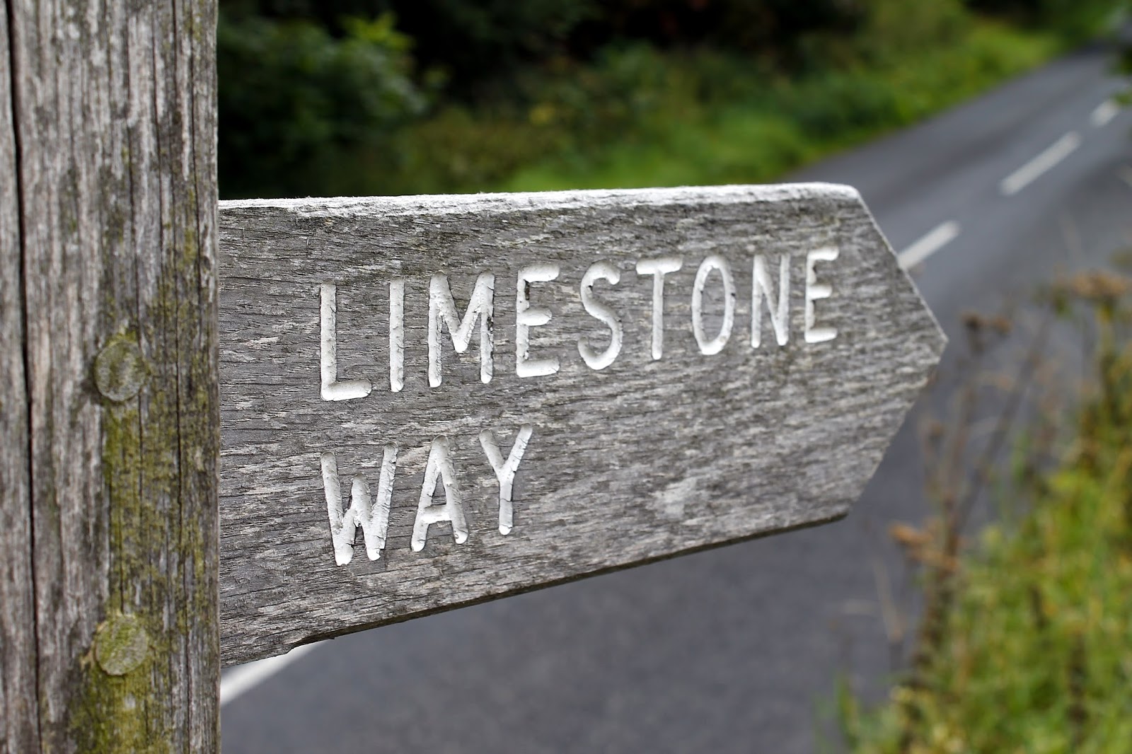
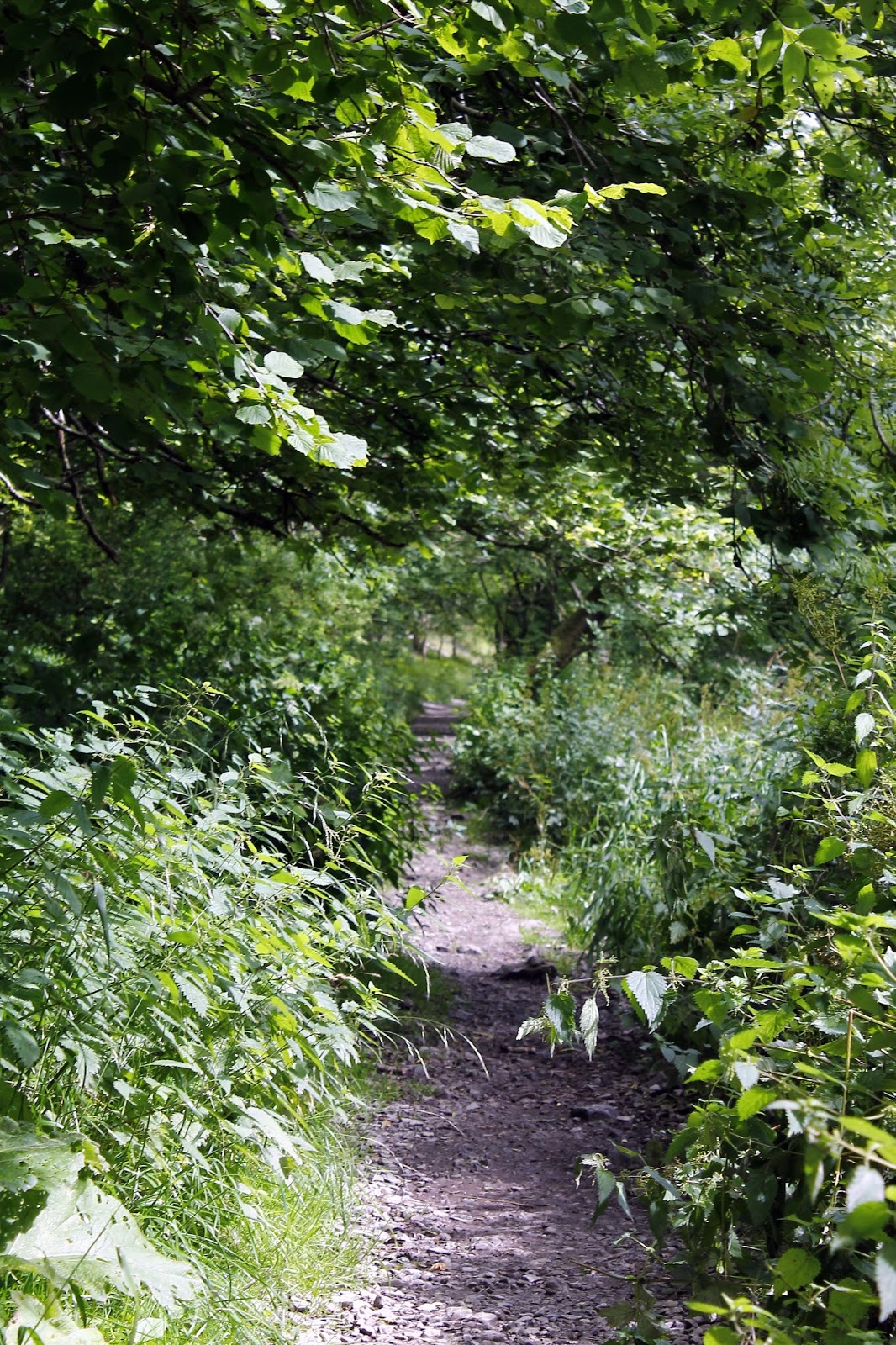
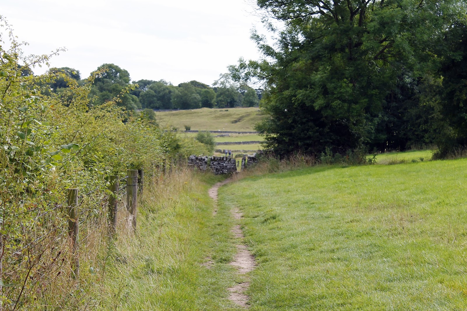
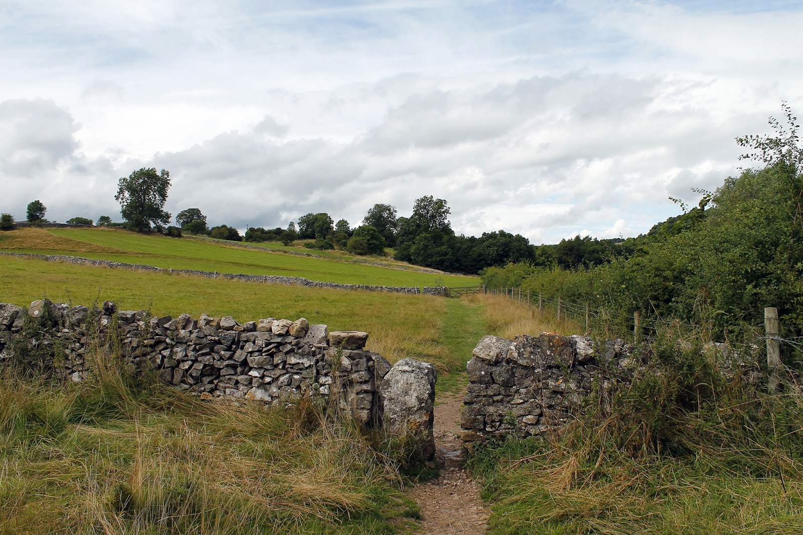
We parked in Youlgreave using a small car park in the west of the village and made our way along the road to the Limestone Way, one of the many long distance paths that cross the UK. This one in particular is a 46 mile effort from Castleton to the Dove Valley. We would use a very short section of it to cross from Bradford Dale to Cales Dale and, ultimately, Lathkill Dale.
 |
| Proof we were on the right track |
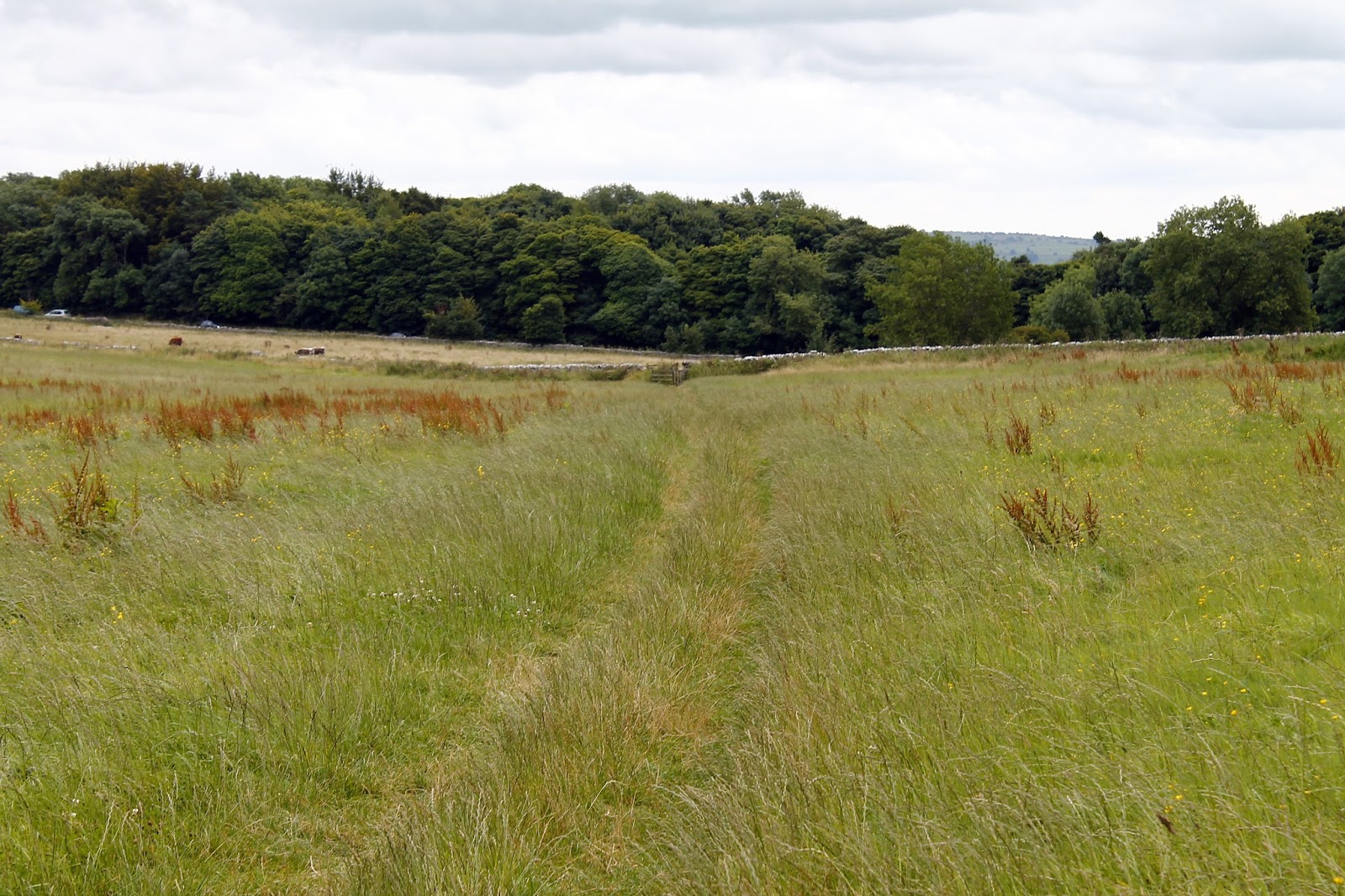
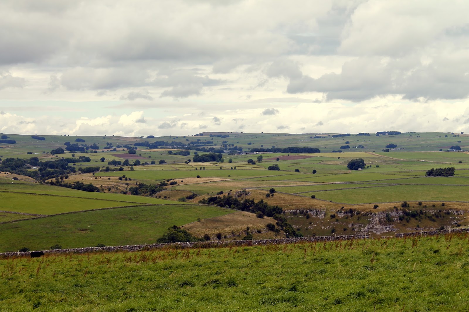
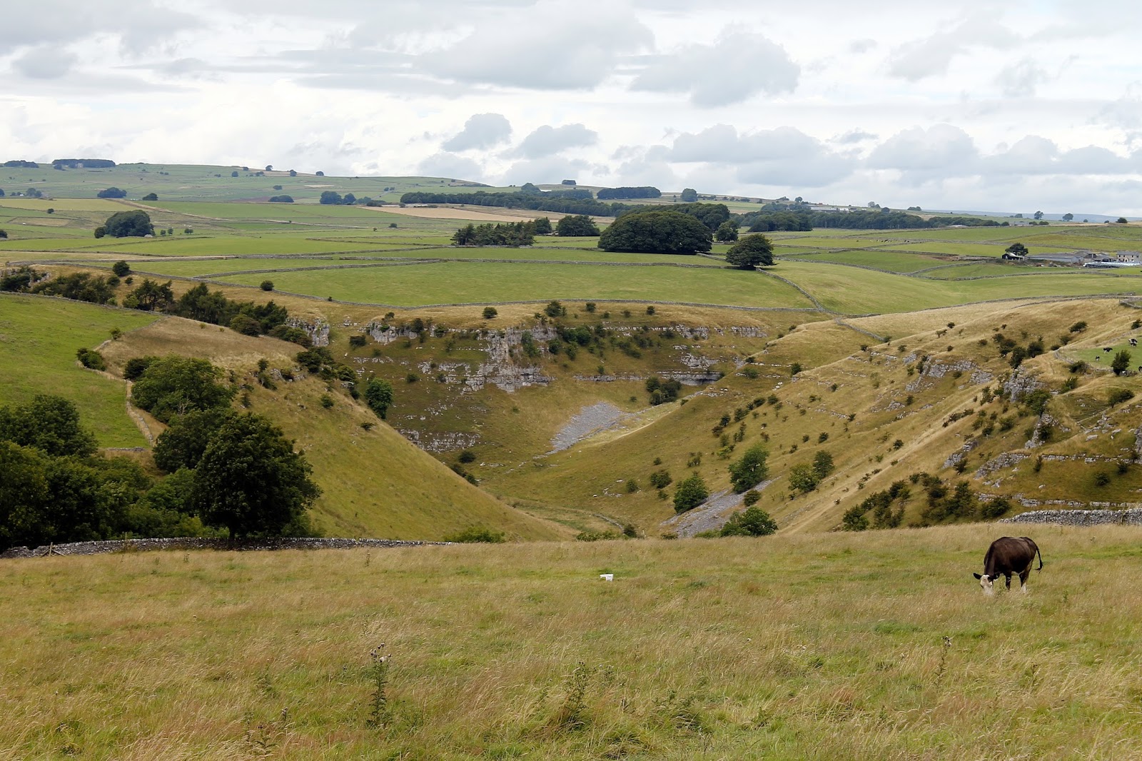
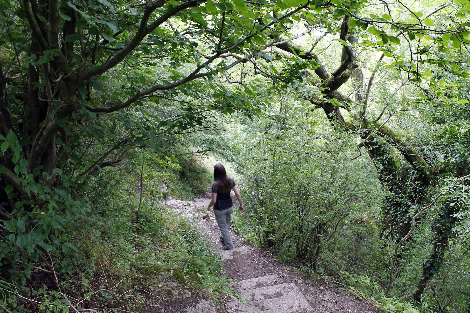
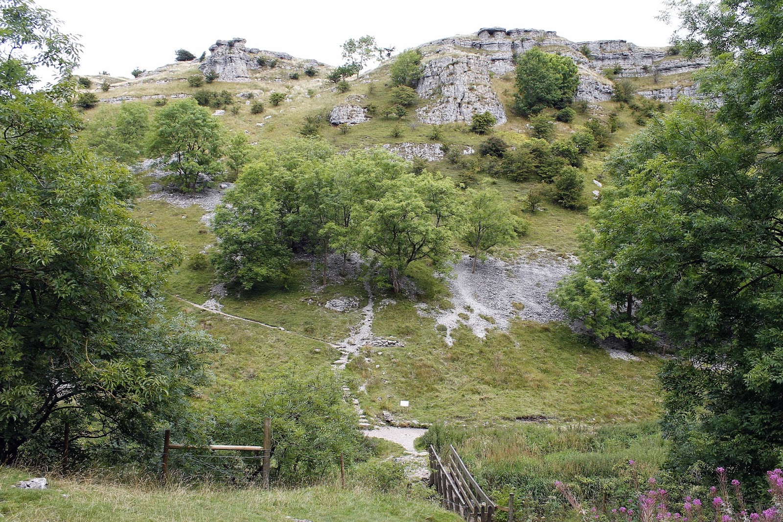
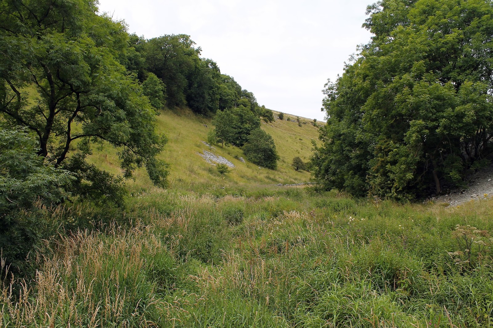
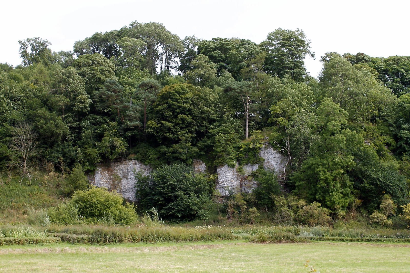
It was a cloudy but warm day, typical of the British summer and it didn’t take long to get a sweat on motoring along the Limestone Way, across fields of wary cows and fellow walkers. The path rounds a farm at Calling Low before starting a steady descent down towards some of the dramatic limestone scenery that characterises the White Peak. Suddenly, the path falls away steeply down a set of stone steps into the depths of Cales Dale. While it’s no trouble getting down, it didn’t look particularly pleasant to climb, given the expressions on some fellow walkers’ faces.
 |
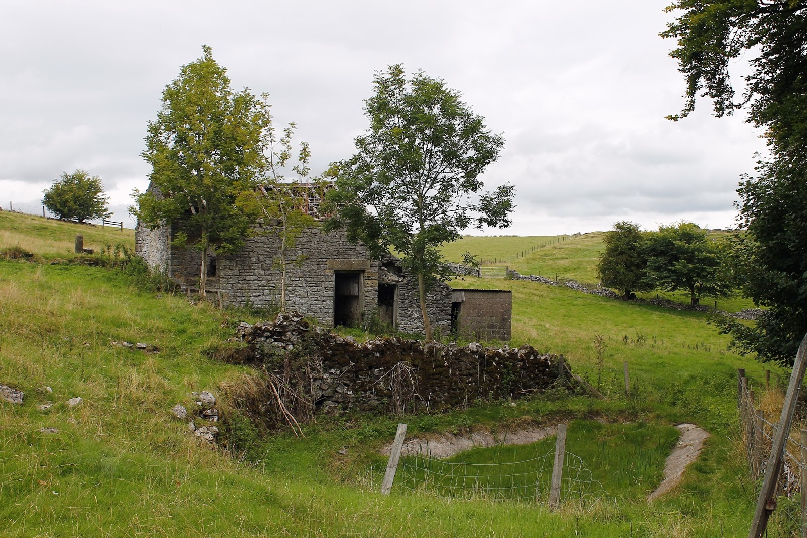
| An abandoned barn along side the Limestone Way |
 |
| The Limestone Way |
 |
| Approaching Lathkill Dale |
 |
| Lovely cloudscape today |
 |
| Lathkill Dale |
 |
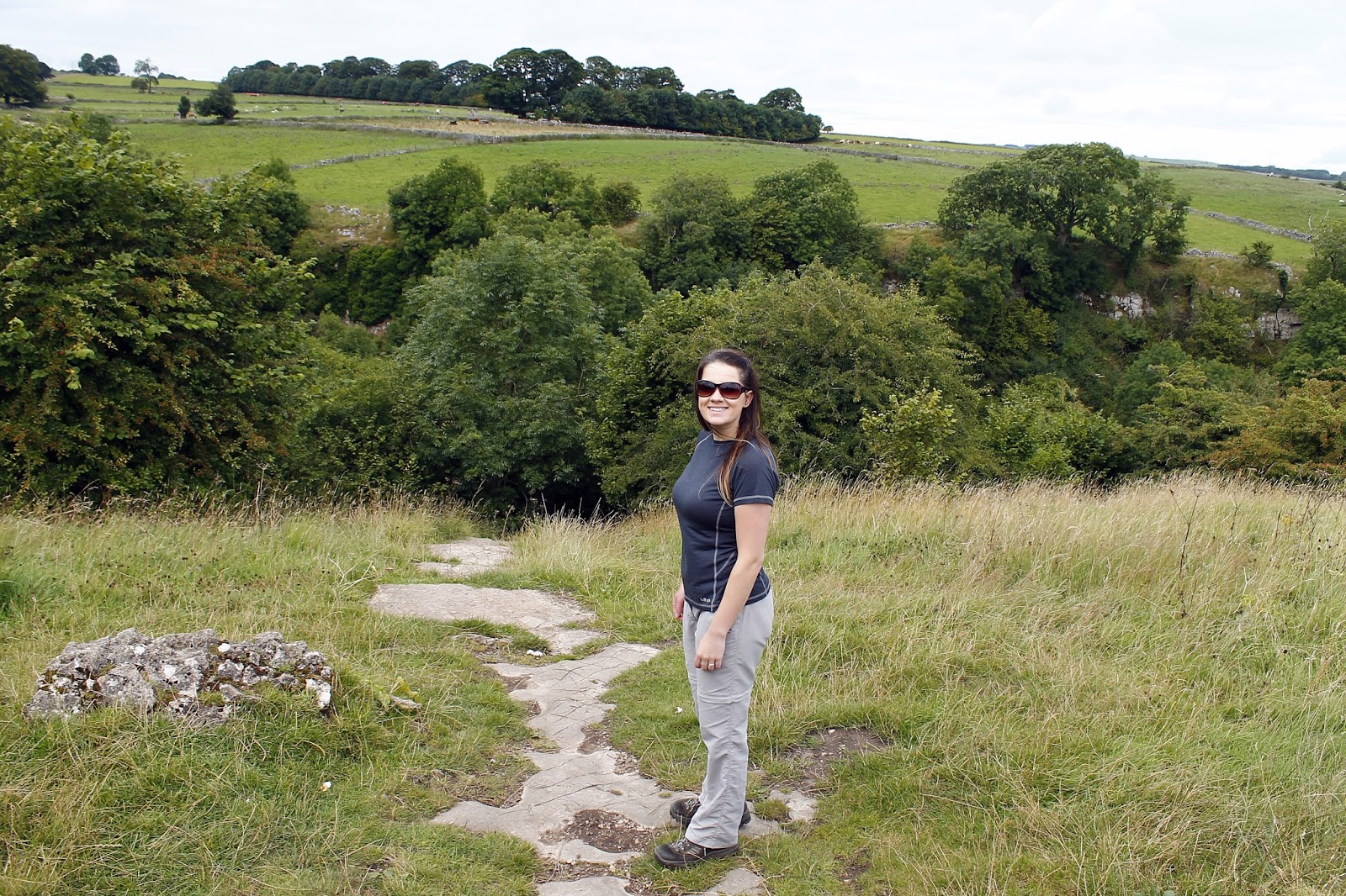
| Sara above Cales Dale |
 |
| Descending the steep steps down into the valley |
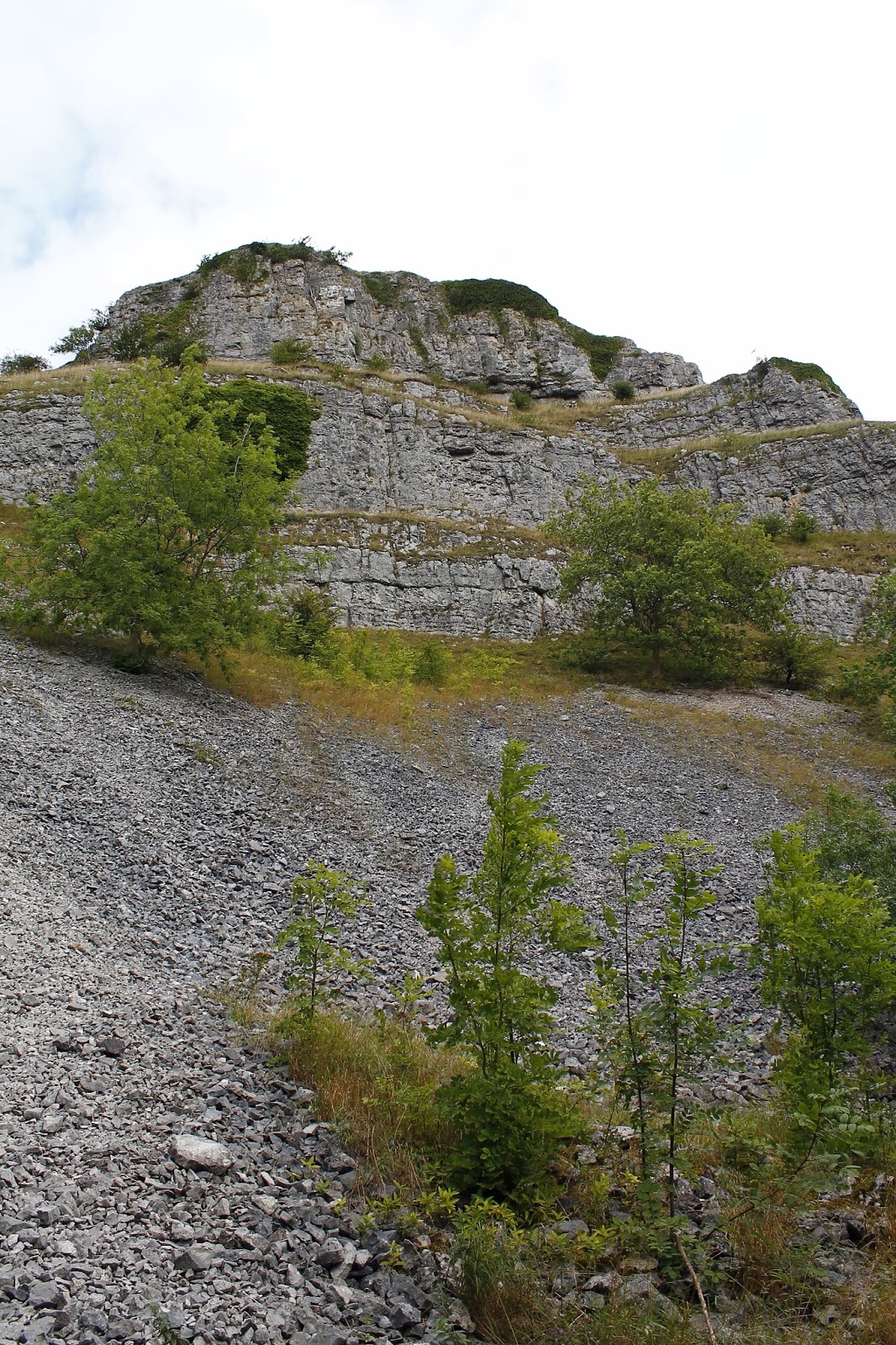
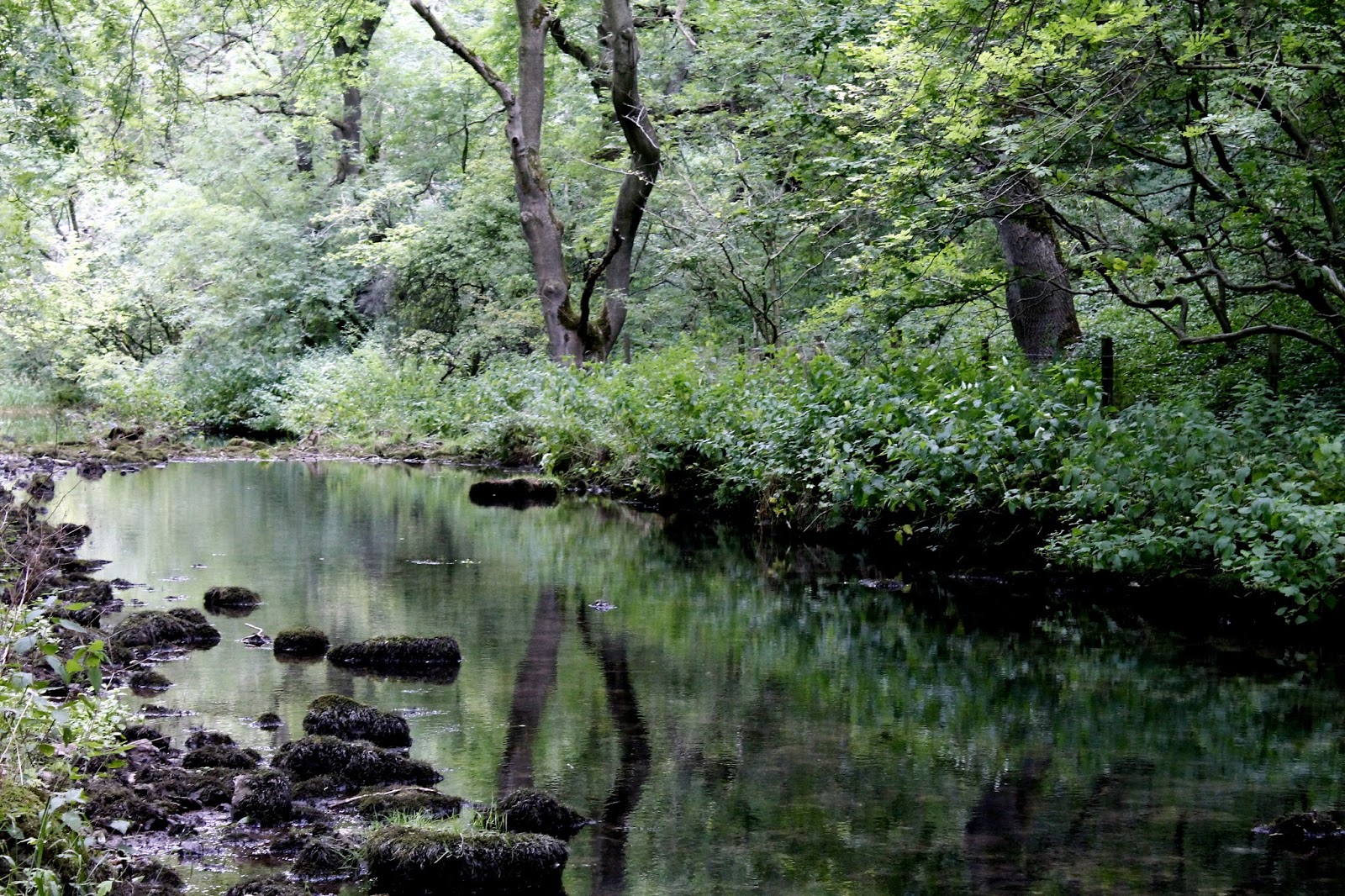
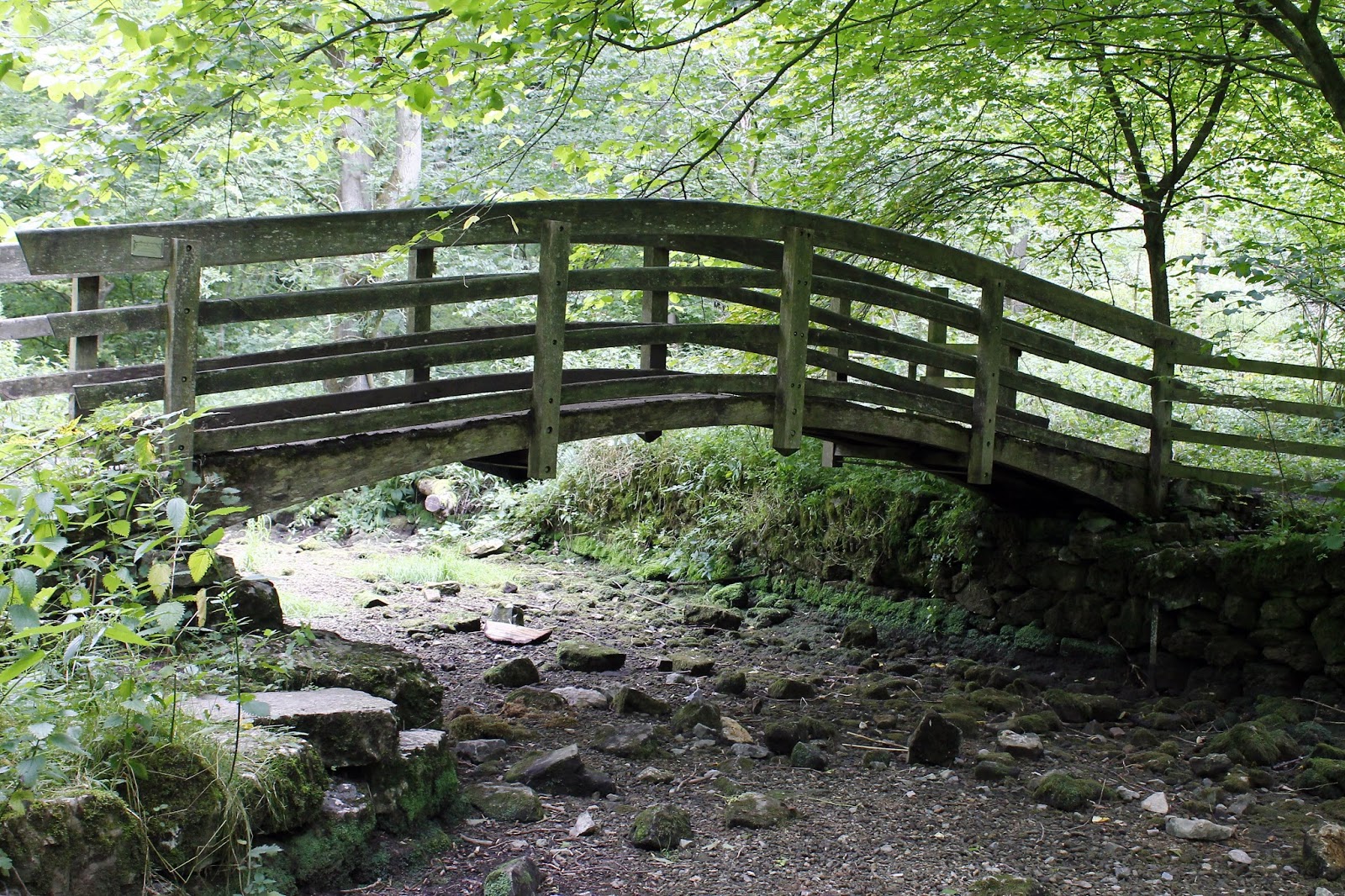
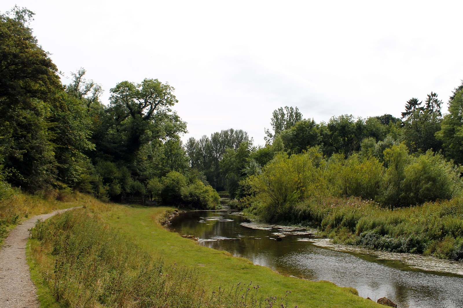
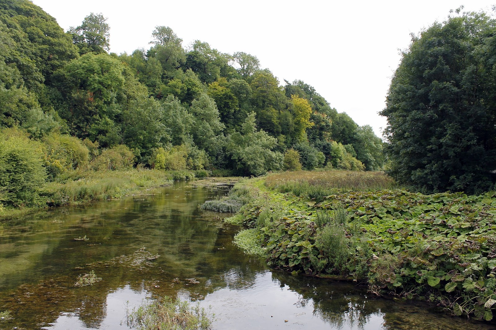
Cales Dale, along with Ricklow Dale and Fern Dale form part of the deeply riven Lathkill Dale, one of the finest limestone dales in the Peak District. The valley isn’t particularly wide but it is enclosed by steep rocky sides while the River Lathkill appears and disappears at will, flowing freely one minute and hiding amongst the limestone bedrock the next. Interestingly, it is the only river within the District that flows entirely over limestone.
 |
| The limestone walls of Lathkill Dale – It is reputed that the footbridge was once supported by wheels from one of Cromwell’s cannons |
 |
| Lathkill Dale and the largely dry River Lathkill |
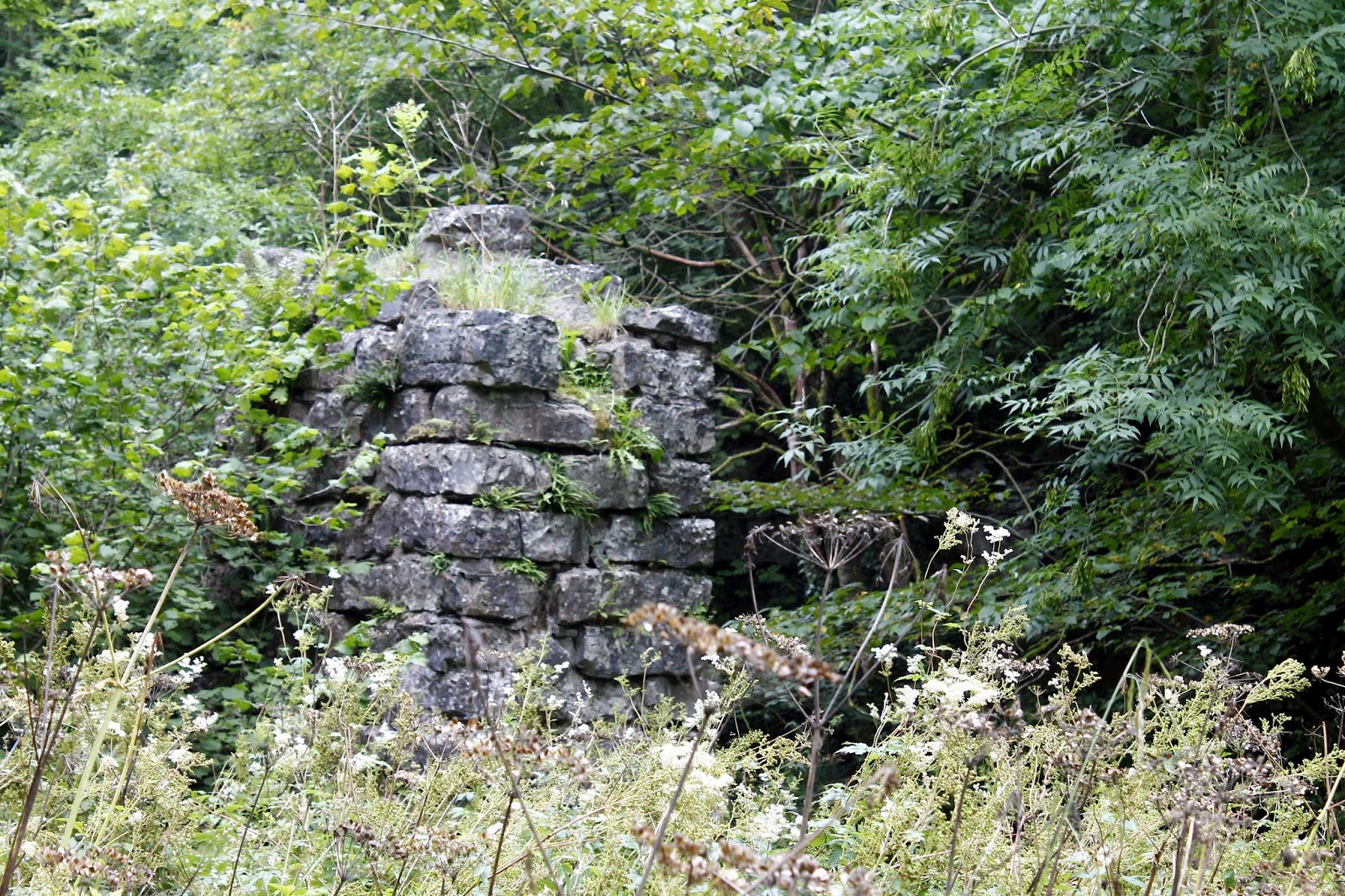
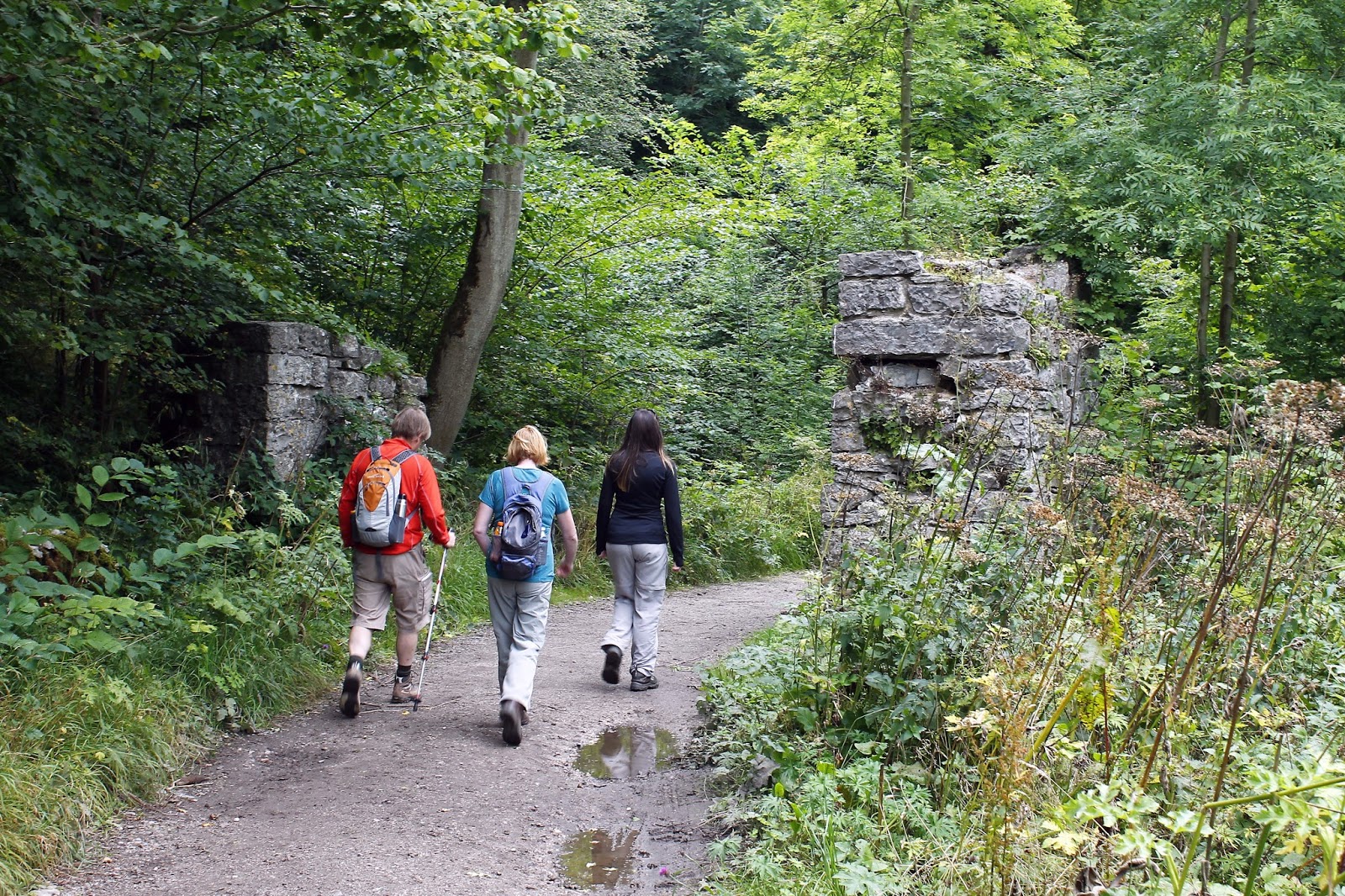
The upper part of Lathkill Dale is a National Nature Reserve, home to rare wild plants such as Jacob’s Ladder. A broad bridleway spans the length of the valley, passing many features of its historic lead mining past including the remains of the 19th Century Mandale Mine, supports for an old aqueduct and the ruins of a pump house.
 |
| Towering limestone guards the valley |
 |
| Path alongside the River Lathkill |
 |
| The River Lathkill |
 |
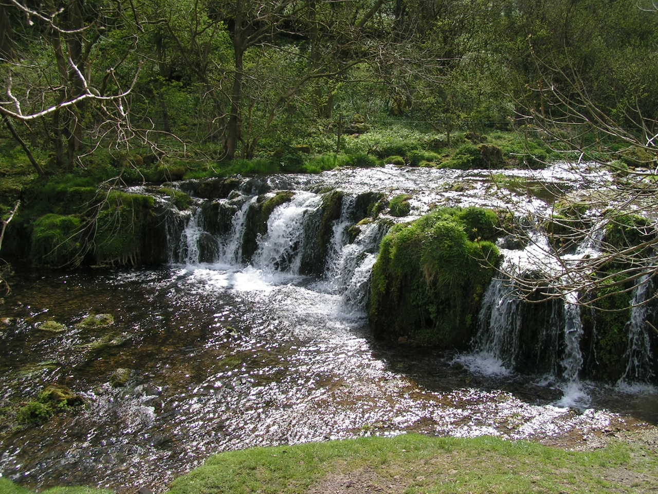
| Tufa dam on the River Lathkill |
 |
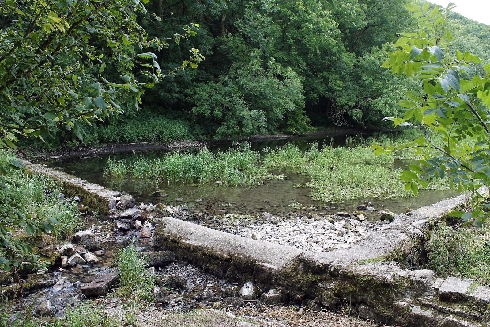
| Old mill pond at Carters Mill |
 |
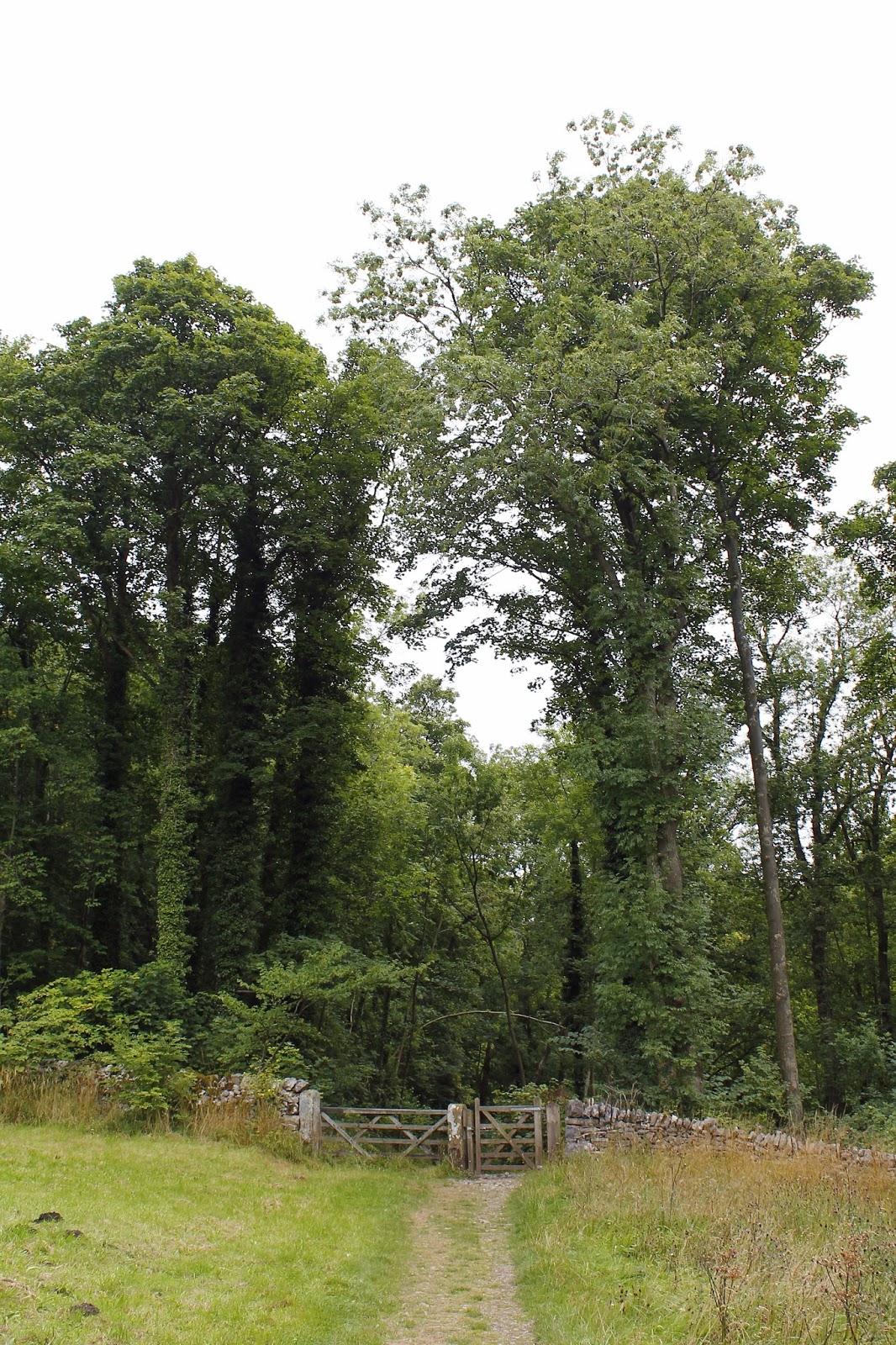
| Entrance to Palmerston Wood |
 |
| Footbridge that accesses the ruins of Batemans House – an old miners house that is was built over an old mine shaft with fairly obvious consequences |
 |
| The old mine aqueduct supports |
 |
| The path passes right between them |
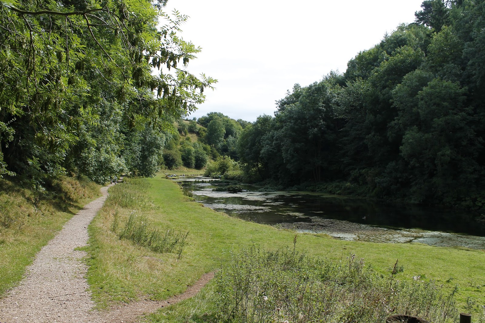
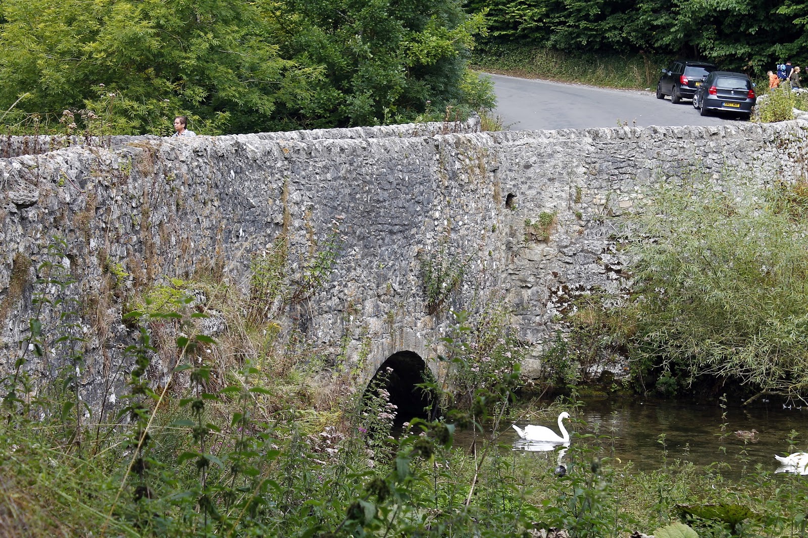
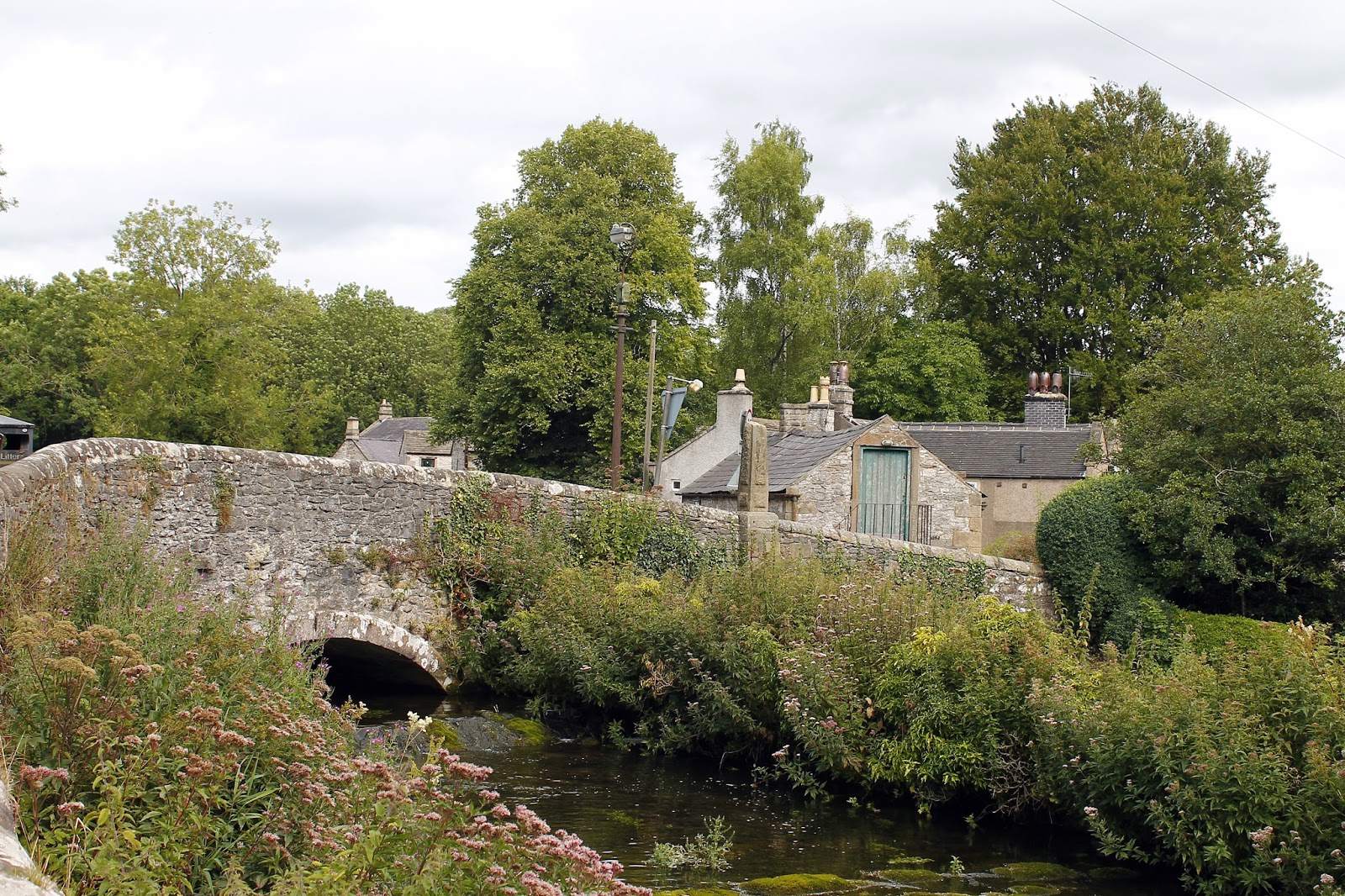
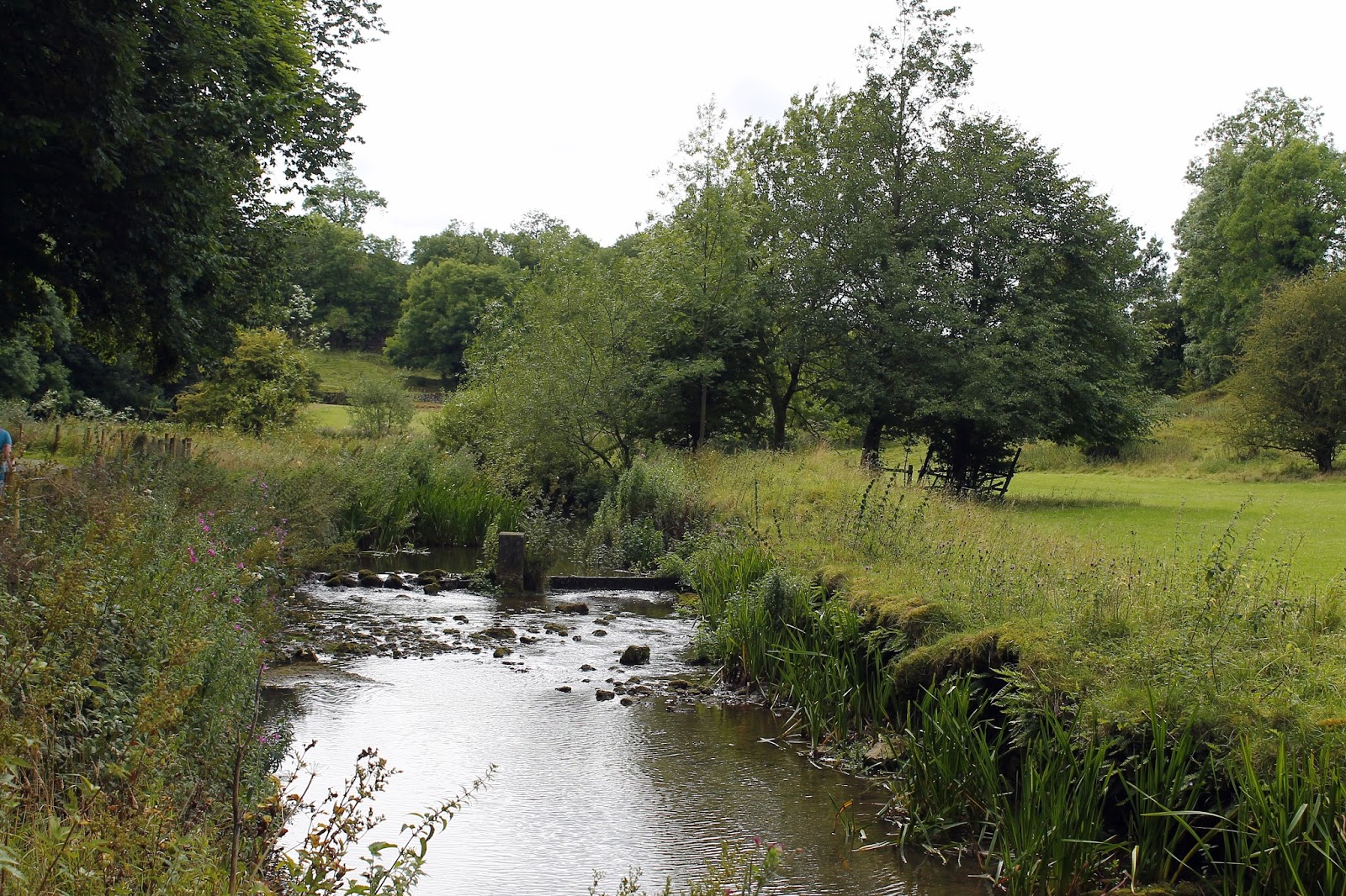
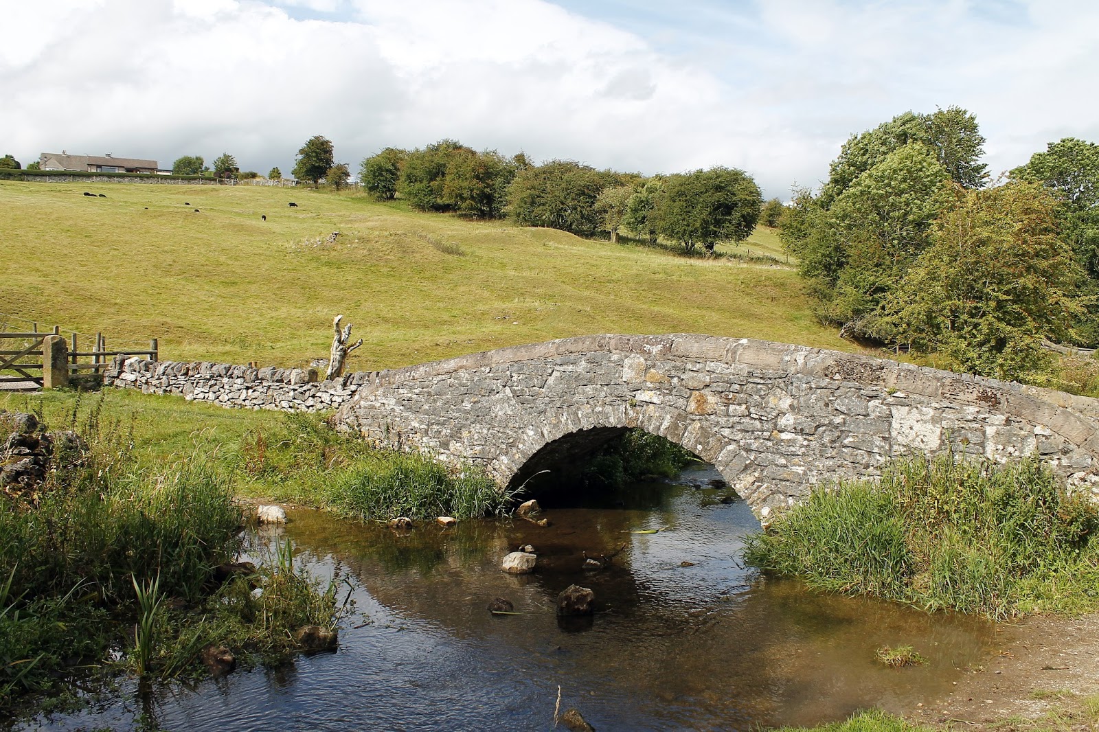
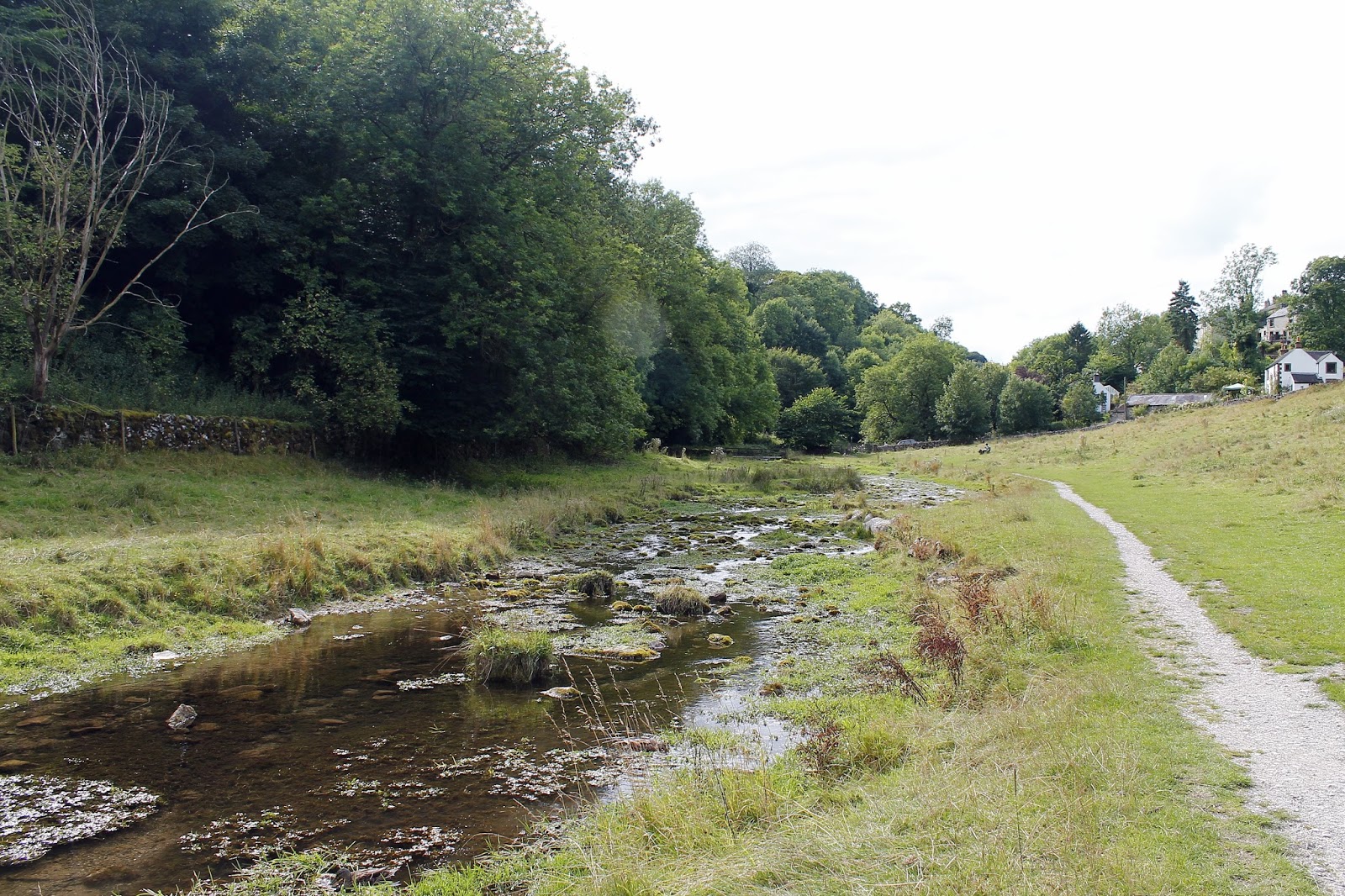
The valley opens up into an idyllic countryside scene where a series of weirs (constructed to encourage trout to breed) deliver the pristine waters of the Lathkill down towards Alport, passing the site of the Medieval village of Conksbury. All that remains now is the unique stone-built Conksbury Bridge, a Grade II listed building.
 |
| The River Lathkill |
 |
| The River Lathkill |
 |
| Conksbury Bridge |
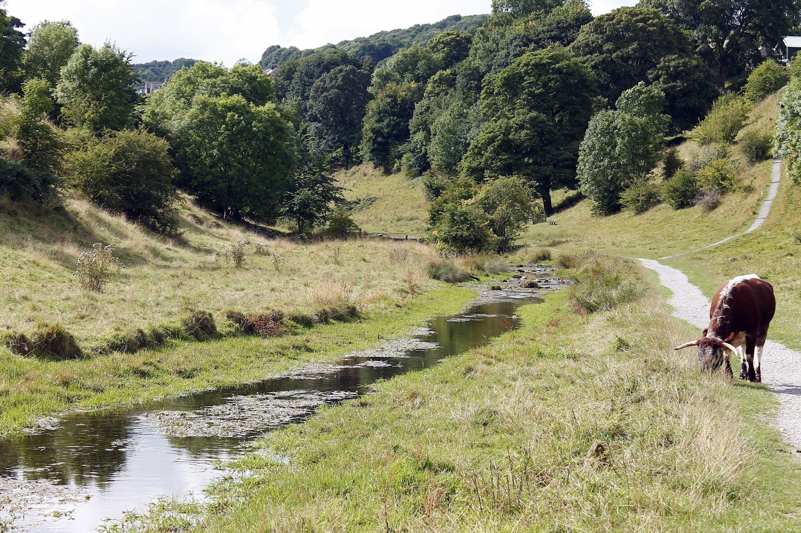
Back to open fields now and it was down to the delightful little hamlet of Alport, a settlement that has been around since the 17th Century though Alport Mill has been recorded since 1159, making it considerably old indeed.
 |
| The path runs alongside the river |
 |
| Still some evidence of the River Lathkill’s limestone heritage |
 |
| Looking back towards the site of Conksbury |
 |
| Alport |
 |
| River Bradford |
Our route continued into Bradford Dale, equally as beautiful as the lower reaches of Lathkill Dale, if not slightly less dramatic. The sun was out in force by now, a splendid afternoon to be out wandering the countryside. The course of the river Bradford is interrupted by another series of pools and weirs, this time constructed to create outdoor swimming pools, which were being taken advantage of as we passed. Despite the summer sun, the yelps emanating from the swimmers suggested the pool was less than temperate.
 |
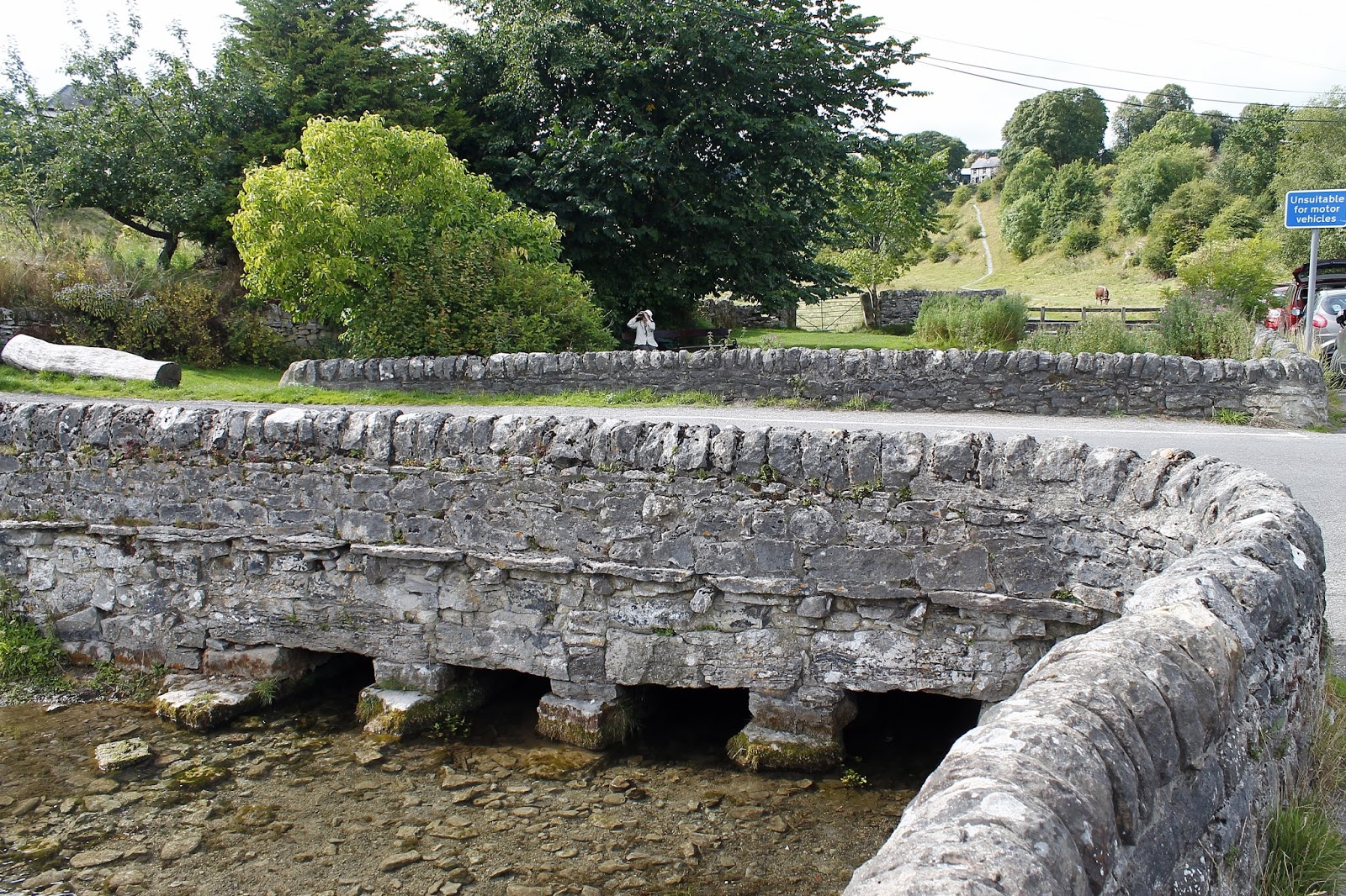
| Packhorse bridge over the River Bradford |
 |
| Another interesting bridge close to Bradford |
 |
| Bradford Dale |
 |
| The River Bradford |
The final part of the walk was a stern climb out of Bradford Dale into Youlgreave though the prospect of a cold beer spurred us on somewhat as was extremely well received. It’s nice to spend time away from the mountains fells of the north and this was the perfect way to spend a day with family. It’s always a bonus when it’s someone else’s walk which means you can concentrate on the surroundings rather than which gatepost to turn left at. I’m still likely to get lost mind.
