Open Space Web-Map builder Codehttps://openspace.ordnancesurvey.co.uk/osmapapi/openspace.js?key=3119F72552FD5C22E0530C6CA40A5A92https://openspace.ordnancesurvey.co.uk/osmapapi/script/mapbuilder/basicmap.jshttps://openspace.ordnancesurvey.co.uk/osmapapi/script/mapbuilder/searchbox.js//variables for routes var linesLayer, points, lineFeature, lineString, routeMarkersLayer, routepos, routesize, routeoffset, routeicon; var style_blue = {strokeColor: “#0000CD”, strokeOpacity: 0.5, strokeWidth: 4.5}; function initmapbuilder() { //initiate the map var options = {resolutions: [2500, 1000, 500, 200, 100, 50, 25, 10, 5, 4, 2.5, 2, 1]}; osMap = new OpenSpace.Map(‘map’, options); //configure map options (basicmap.js) setglobaloptions(); //set the center of the map and the zoom level osMap.setCenter(new OpenSpace.MapPoint(410584.9974823,446315.00125885),7); linesLayer = osMap.getVectorLayer(); // Set up layer for route markers routeMarkersLayer = new OpenLayers.Layer.Markers(“Route Markers”); //make a route points = new Array(); points.push(new OpenLayers.Geometry.Point(411411.66412354,447001.66793823)); points.push(new OpenLayers.Geometry.Point(411291.66412354,446986.66793823)); points.push(new OpenLayers.Geometry.Point(411191.66412354,446851.66793823)); points.push(new OpenLayers.Geometry.Point(411031.66412354,446861.66793823)); points.push(new OpenLayers.Geometry.Point(410731.66412354,446861.66793823)); points.push(new OpenLayers.Geometry.Point(410651.66412354,446866.66793823)); points.push(new OpenLayers.Geometry.Point(410546.66412354,446941.66793823)); points.push(new OpenLayers.Geometry.Point(410251.66412354,446891.66793823)); points.push(new OpenLayers.Geometry.Point(410121.66412354,446861.66793823)); points.push(new OpenLayers.Geometry.Point(409981.66412354,446901.66793823)); points.push(new OpenLayers.Geometry.Point(409891.66412354,446886.66793823)); points.push(new OpenLayers.Geometry.Point(409676.66412354,446926.66793823)); points.push(new OpenLayers.Geometry.Point(409456.66412354,447006.66793823)); points.push(new OpenLayers.Geometry.Point(409096.66412354,447011.66793823)); points.push(new OpenLayers.Geometry.Point(408836.66412354,447046.66793823)); points.push(new OpenLayers.Geometry.Point(408566.66412354,447081.66793823)); points.push(new OpenLayers.Geometry.Point(408586.66412354,446931.66793823)); points.push(new OpenLayers.Geometry.Point(408581.66412354,446796.66793823)); points.push(new OpenLayers.Geometry.Point(408436.66412354,446711.66793823)); points.push(new OpenLayers.Geometry.Point(408206.66412354,446691.66793823)); points.push(new OpenLayers.Geometry.Point(408311.66412354,446571.66793823)); points.push(new OpenLayers.Geometry.Point(408896.66412354,446121.66793823)); points.push(new OpenLayers.Geometry.Point(409206.66412354,445646.66793823)); points.push(new OpenLayers.Geometry.Point(409226.66412354,445596.66793823)); points.push(new OpenLayers.Geometry.Point(409426.66412354,445681.66793823)); points.push(new OpenLayers.Geometry.Point(410146.66412354,445346.66793823)); points.push(new OpenLayers.Geometry.Point(410221.66412354,445546.66793823)); points.push(new OpenLayers.Geometry.Point(410226.66412354,445636.66793823)); points.push(new OpenLayers.Geometry.Point(410246.66412354,445576.66793823)); points.push(new OpenLayers.Geometry.Point(410166.66412354,445396.66793823)); points.push(new OpenLayers.Geometry.Point(410141.66412354,445346.66793823)); points.push(new OpenLayers.Geometry.Point(410526.66412354,445241.66793823)); points.push(new OpenLayers.Geometry.Point(410936.66412354,445206.66793823)); points.push(new OpenLayers.Geometry.Point(411481.66412354,445221.66793823)); points.push(new OpenLayers.Geometry.Point(411921.66412354,445341.66793823)); points.push(new OpenLayers.Geometry.Point(412436.66412354,445176.66793823)); points.push(new OpenLayers.Geometry.Point(412321.66412354,445476.66793823)); points.push(new OpenLayers.Geometry.Point(412371.66412354,445626.66793823)); points.push(new OpenLayers.Geometry.Point(412356.66412354,445886.66793823)); points.push(new OpenLayers.Geometry.Point(412366.66412354,446036.66793823)); points.push(new OpenLayers.Geometry.Point(412396.66412354,446316.66793823)); points.push(new OpenLayers.Geometry.Point(412556.66412354,446311.66793823)); points.push(new OpenLayers.Geometry.Point(412686.66412354,446391.66793823)); points.push(new OpenLayers.Geometry.Point(412751.66412354,446456.66793823)); points.push(new OpenLayers.Geometry.Point(412856.66412354,446596.66793823)); points.push(new OpenLayers.Geometry.Point(412936.66412354,446681.66793823)); points.push(new OpenLayers.Geometry.Point(413086.66412354,446791.66793823)); points.push(new OpenLayers.Geometry.Point(412976.66412354,446701.66793823)); points.push(new OpenLayers.Geometry.Point(412796.66412354,446541.66793823)); points.push(new OpenLayers.Geometry.Point(412676.66412354,446491.66793823)); points.push(new OpenLayers.Geometry.Point(412526.66412354,446501.66793823)); points.push(new OpenLayers.Geometry.Point(412336.66412354,446571.66793823)); points.push(new OpenLayers.Geometry.Point(412226.66412354,446561.66793823)); points.push(new OpenLayers.Geometry.Point(412086.66412354,446521.66793823)); points.push(new OpenLayers.Geometry.Point(411916.66412354,446631.66793823)); points.push(new OpenLayers.Geometry.Point(411846.66412354,446761.66793823)); points.push(new OpenLayers.Geometry.Point(411726.66412354,446811.66793823)); points.push(new OpenLayers.Geometry.Point(411666.66412354,446811.66793823)); points.push(new OpenLayers.Geometry.Point(411621.66412354,446791.66793823)); points.push(new OpenLayers.Geometry.Point(411506.66412354,447031.66793823)); points.push(new OpenLayers.Geometry.Point(411411.66412354,447001.66793823)); // create a polyline feature from the array of points lineString = new OpenLayers.Geometry.LineString(points); lineFeature = new OpenLayers.Feature.Vector(lineString, null, style_blue); linesLayer.addFeatures([lineFeature]); //crate a route start/end marker routepos = new OpenSpace.MapPoint(411411.66412354,447001.66793823); routesize = new OpenLayers.Size(33,45); routeoffset = new OpenLayers.Pixel(-5,-37); routeicon = new OpenSpace.Icon(‘https://openspace.ordnancesurvey.co.uk/osmapapi/img_versions/img_1.1/mapbuilder/routemarker-startend.png’, routesize, routeoffset, null, null); routeMarkersLayer.addMarker(new OpenLayers.Marker(routepos, routeicon)); osMap.addLayer(routeMarkersLayer);}
Route: Millennium Way, Intake Heads, Swastika Stone, Piper’s Crag, Long Ridge End., Shepherd’s Hill, West Buck Stones, East Buck Stones, Cowper’s Cross, Whetstone Gate, Thimble Stones, Ilkley Moor, Lanshaw Lad, Twelve Apostles, Dales Way Link, Ilkley Crags, Caw and Calf, Rocky Valley, West Rock, White Wells, Millennium Way
Date: 23/08/2015
From: Ilkley
Parking: Westwood Drive
Start Point: Westwood Drive
Region: Yorkshire
Route length: 8.5 miles (13.7 km)
Time taken: 03:37
Average speed: 2.3 mph
Ascent: 362m
Descent: 369m
Summits: Ilkley Moor (402m)
Other points of interest: Swastika Stone, Long Ridge End, Buck Stones, Cowper’s Cross, Thimble Stones, Lanshaw Lad, Twelve Apostles, Ilkley Crags, Cow and Calf, Rocky Valley, White Wells
The response I normally receive to the statement ‘I’ve never been up Ilkley Moor’ is often one of surprise and disbelief. It seems everyone I know has been up Ilkley Moor and that fact I haven’t comes unexpectedly to most. That, however, is all to change as Sara and I made the most of a superb summer day to finally scratch the Ilkley Moor itch.
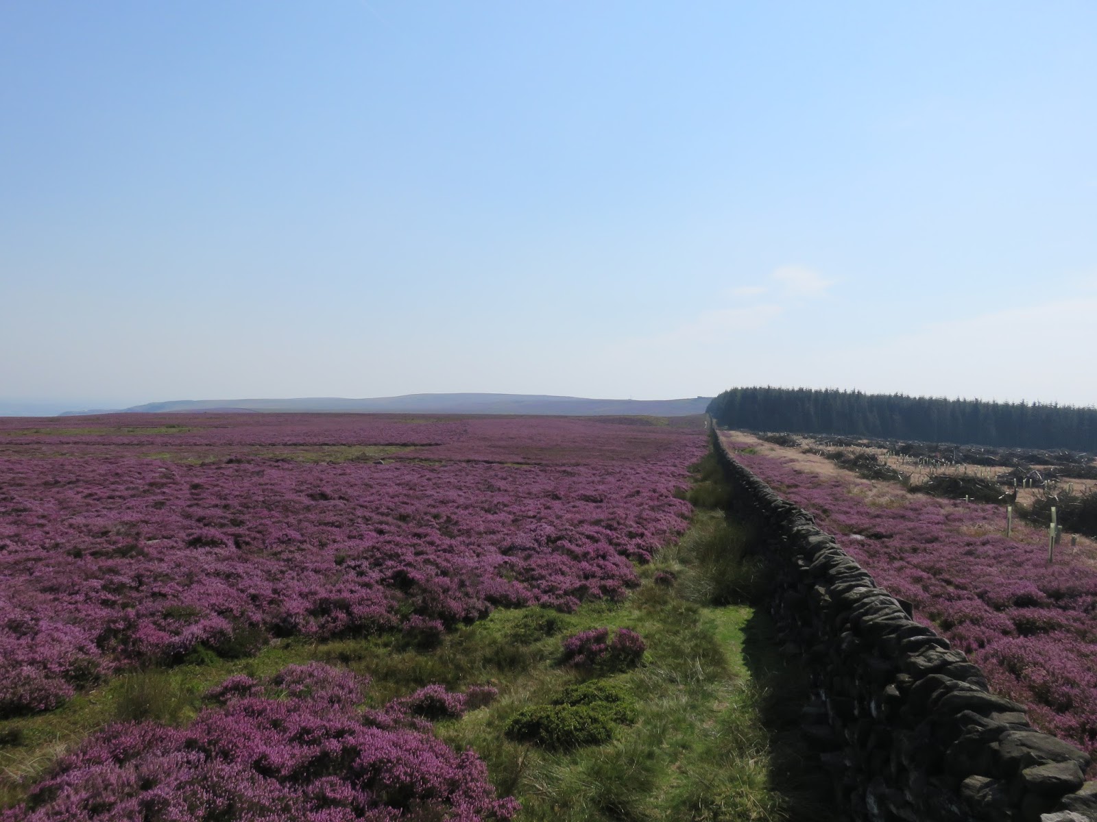
Ilkley Moor stands just outside of the Yorkshire Dales boundary but don’t let that fact suggest that it is dull or lacking in character because it isn’t. A bewildering array of things to see make it a fairly unique place among the lower Pennines, largely thanks to its location close to the ancient settlements of Ilkley and Skipton. The area around Ilkley has been continuously settled since at least the early Bronze Age.
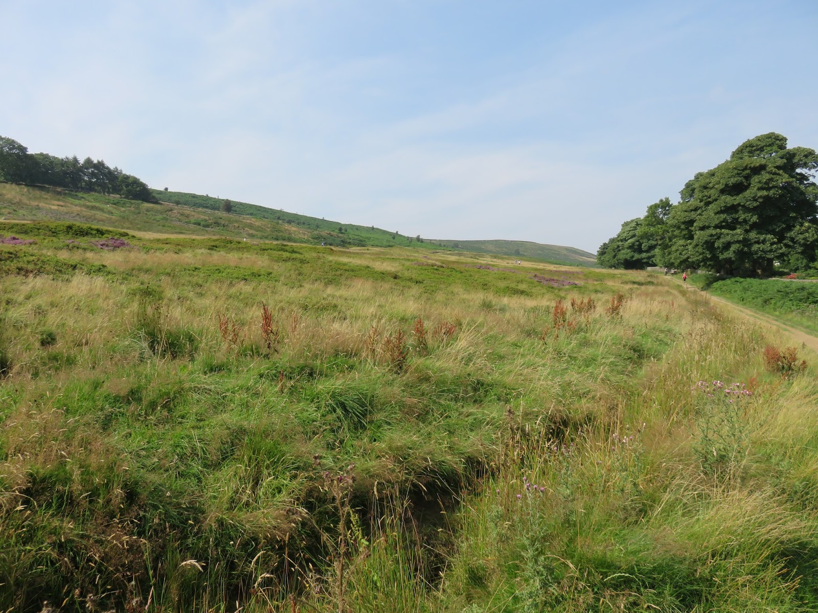
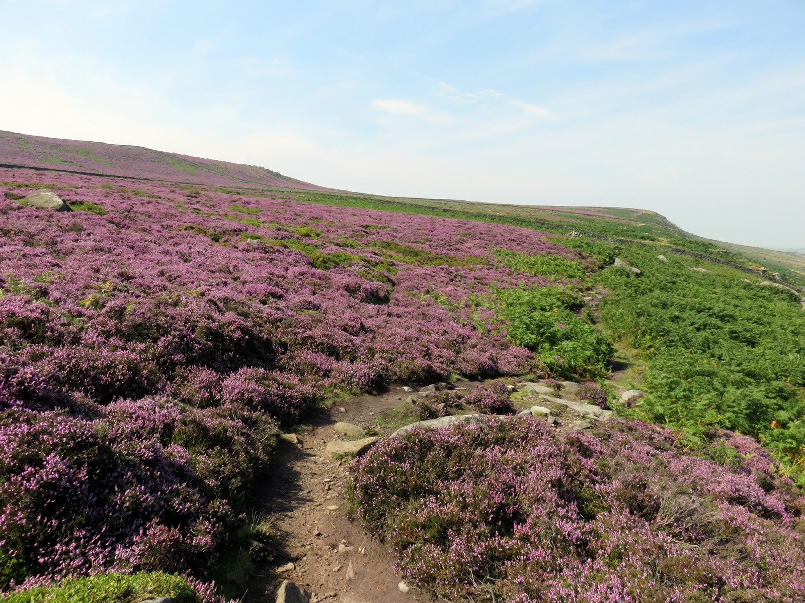
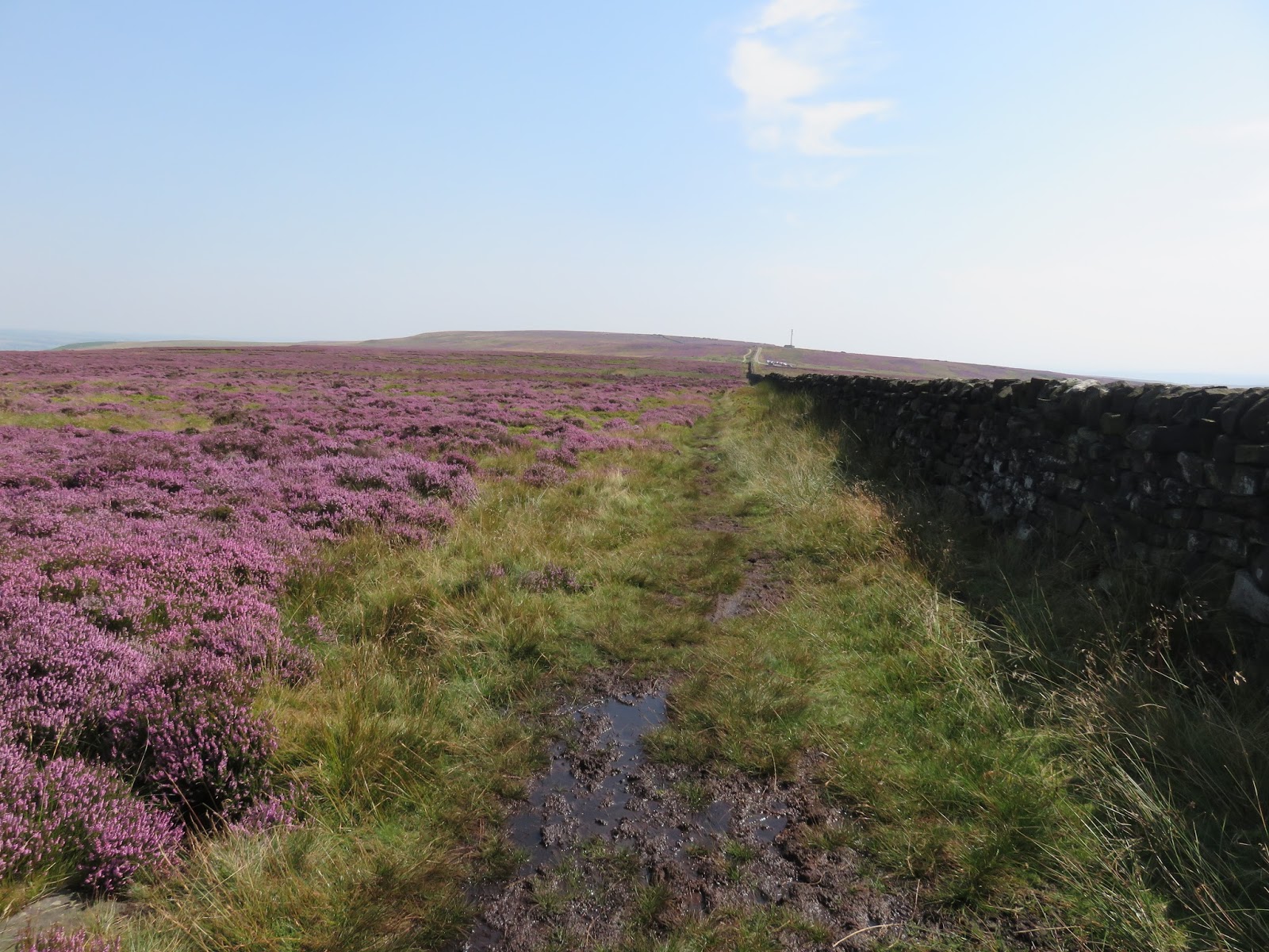
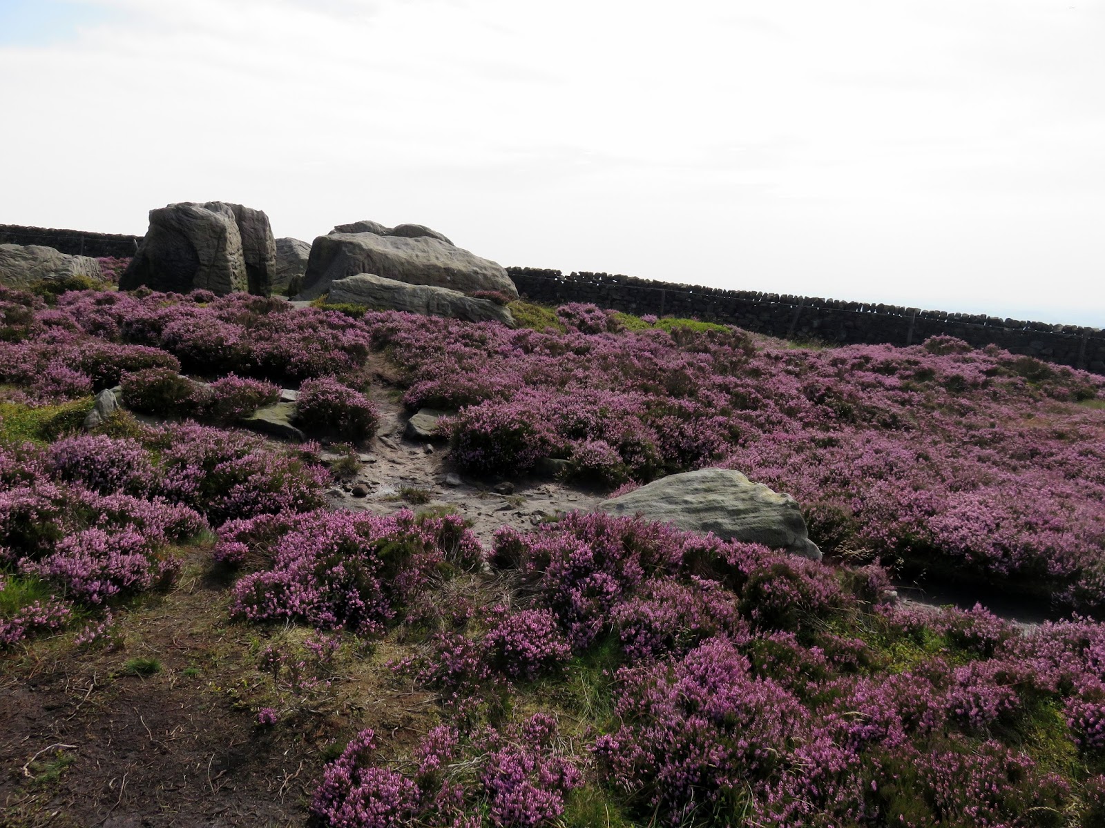
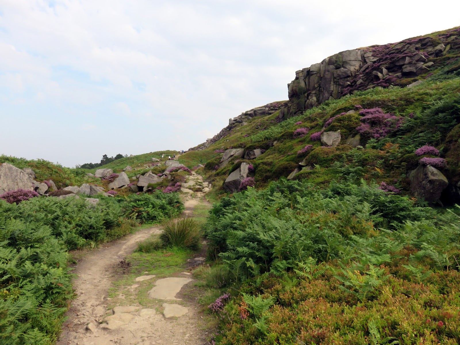
There’s plenty of space to leave a car along the road close to the Millennium Way, a 45 mile circuit of the countryside north of Bradford and our route along the northern face of the moor. At first it passes behind the last few houses in the south western corner of the town and the small reservoir above Panorama Rocks where the views open up and it makes its way out onto open moor. It crosses the small Black Beck, descending a short distance as it does so before climbing back up to the Swastika Stone, one of Ikley Moor’s most famous landmarks.
 |
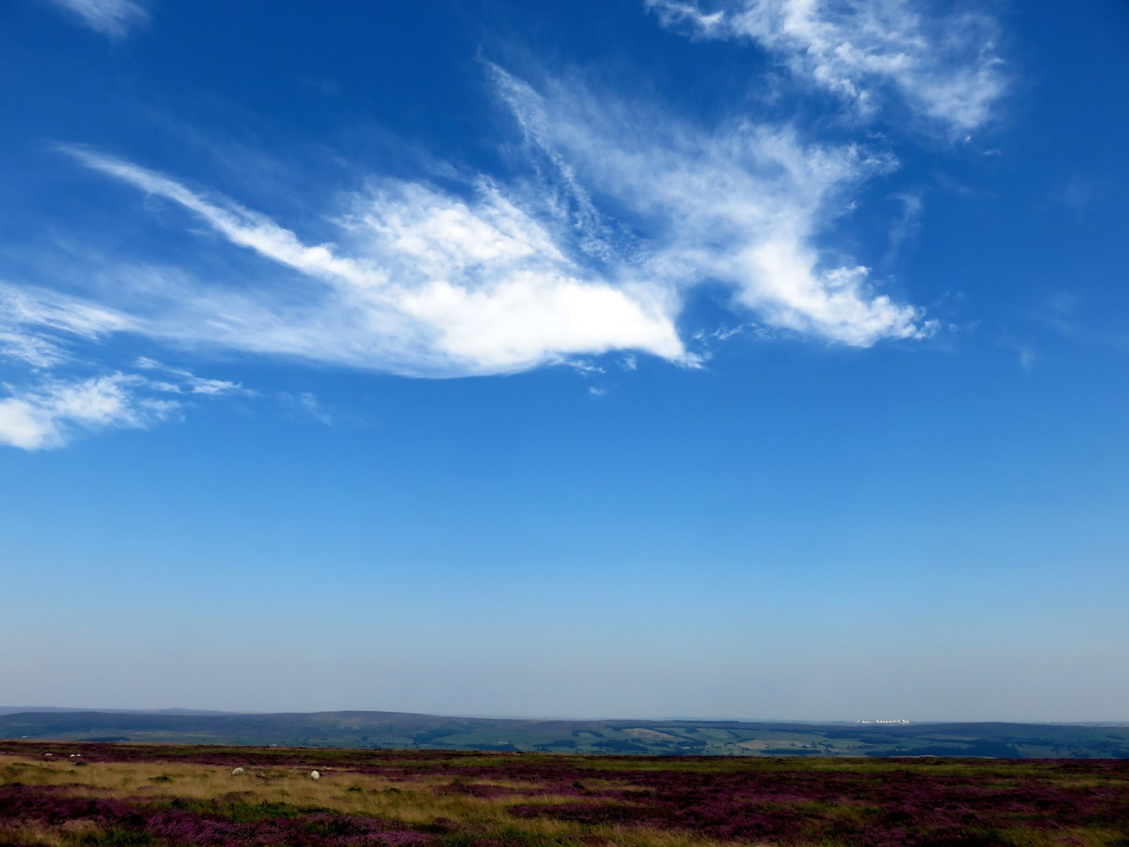
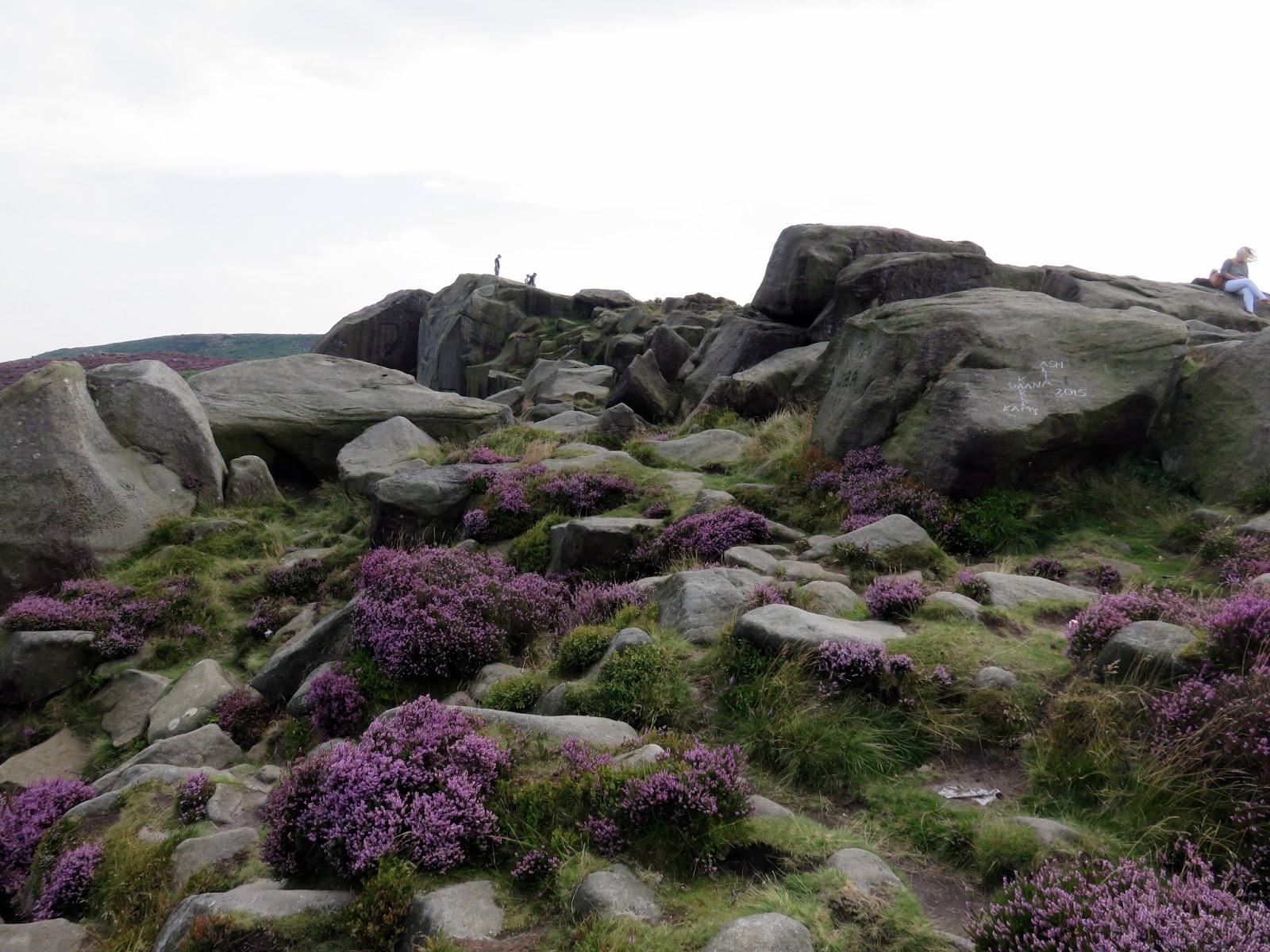
| The slopes of Ilkley Moor on a fine summer day |
 |
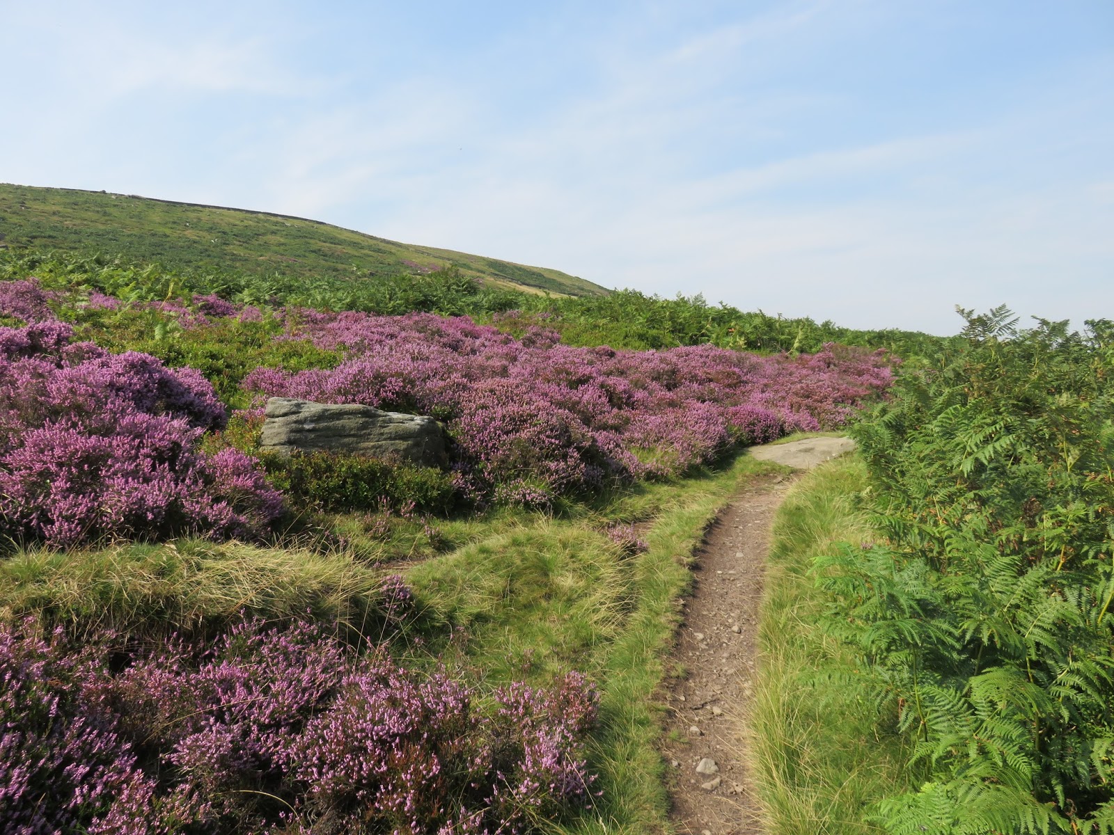
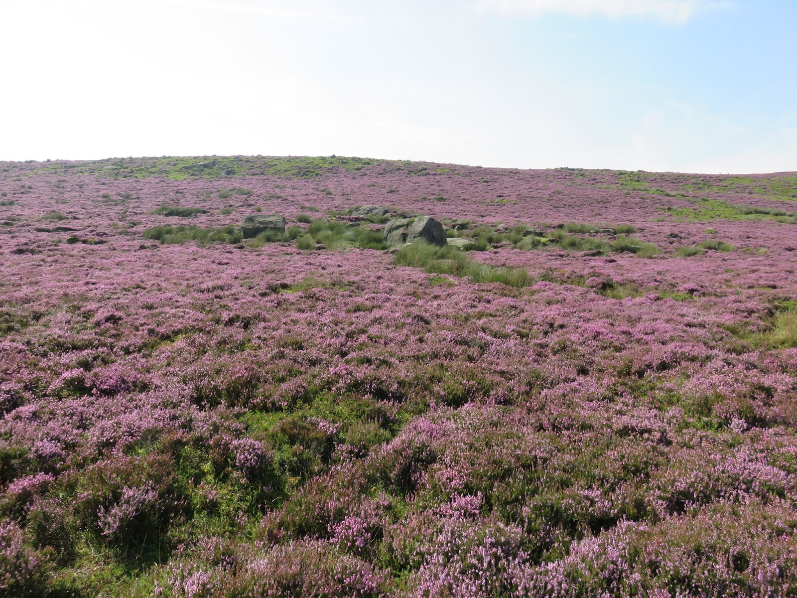
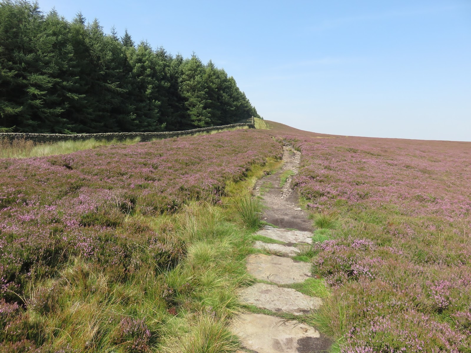
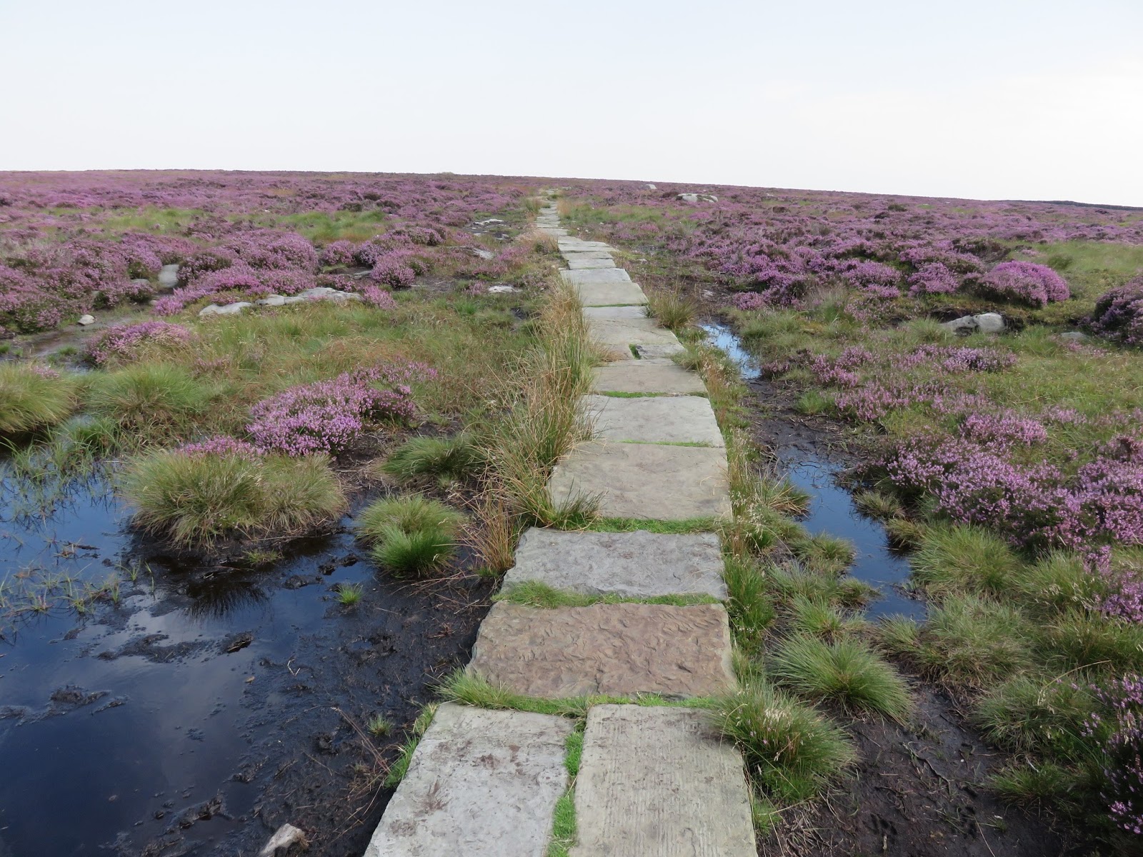
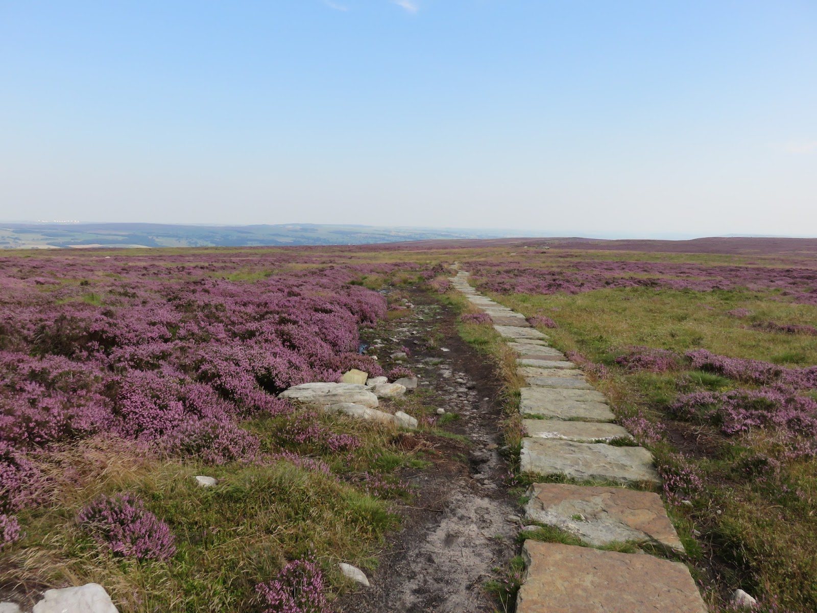
| The Millennium Way winds its way among the heather |
 |
| Approaching the Swastika Stone |
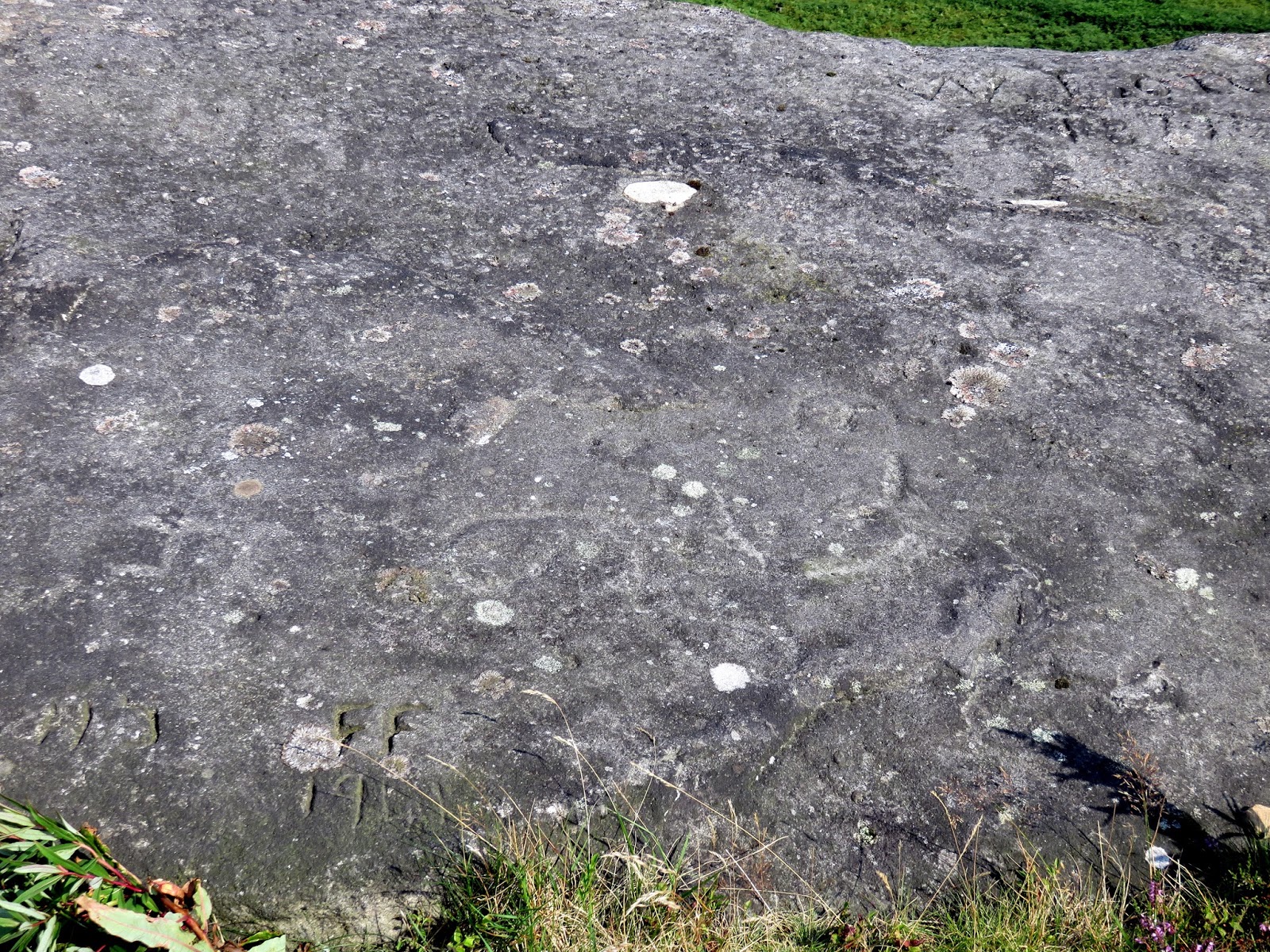
The Swastika Stone is a stone adorned with a Swastika located at Woodhouse Crag. The design has a double outline with five curved arms enclosing several so-called ‘cup’ marks, the like of which can be found on other stones nearby. The design is unique in the British Isles, so its close similarity to Camunian rose designs in Italy have led some to theorise that the two are connected. In fact, the troops stationed in Ilkley during Roman occupation were recruited from the Celtic Lingones. This tribe was native to Gaul, but in around 400 BC, some migrated across the Alps to the Adriatic coast. Some believe the Ilkley Lingones were recruited from here rather than from Gaul. It is possible that the Italian Lingones passed through the Valcamonica region at some point, took on the Swastika designs they found as part of their tribal symbolism, and carved it on the nearby moor when stationed in Ilkley.
 |
| The Swastika Stone |
 |
| The feint swastika carving |
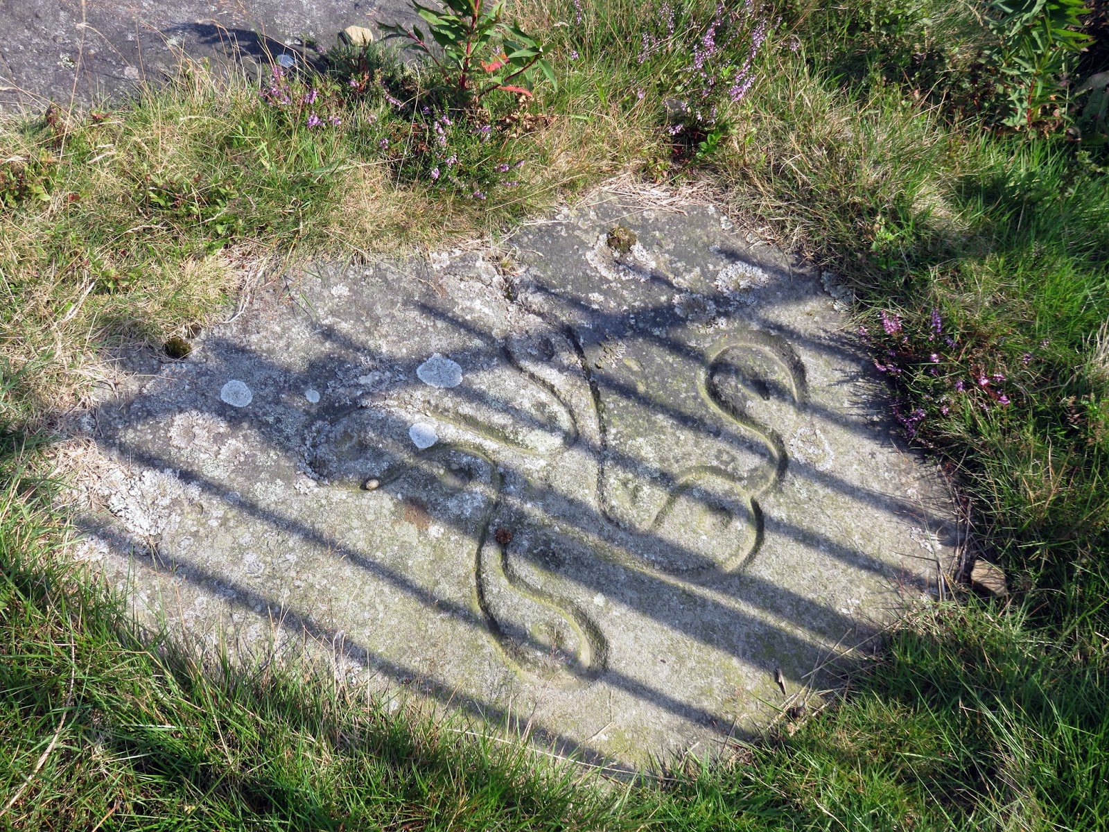
There is a very clear carving close to the fence, this is a Victorian copy of the original, which is much fainter and can be seen on the main rock about 1m away from the copy. I’ve tried my best to adjust the photo to make it out but its best seen early in the morning or late in the afternoon when the sun is low and the shadows are long.
 |
| The recreated carving |
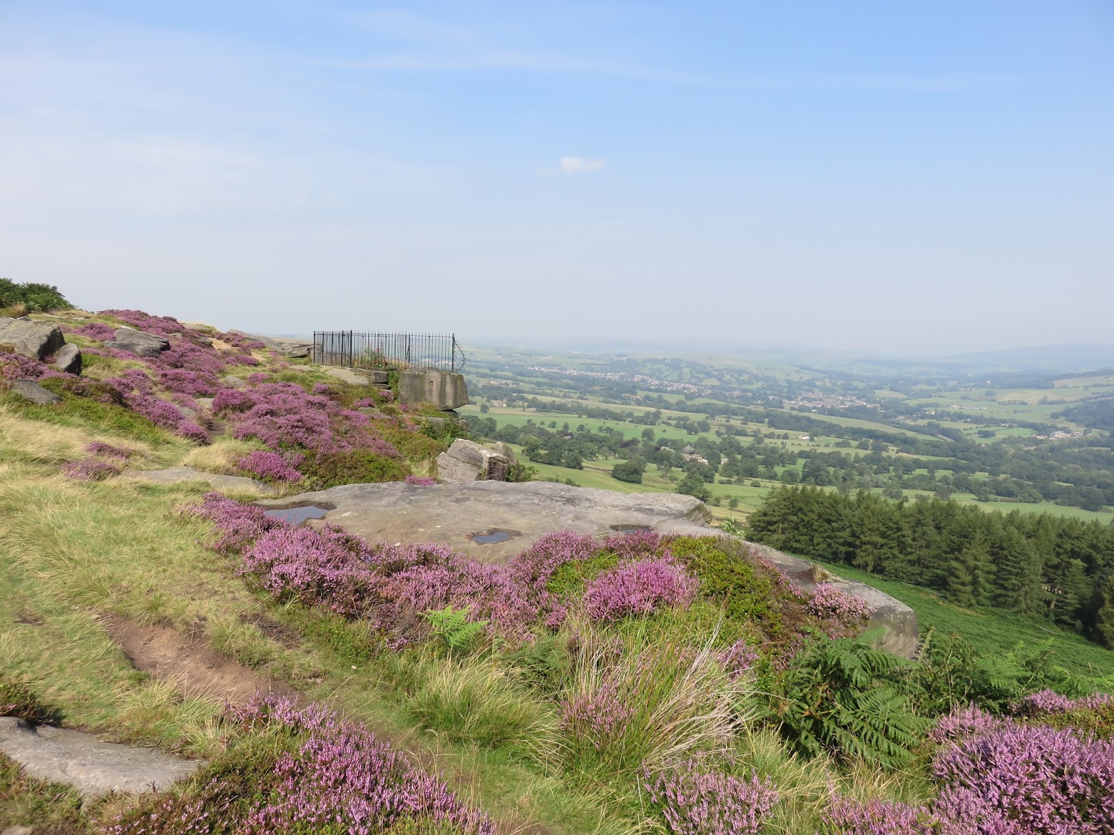
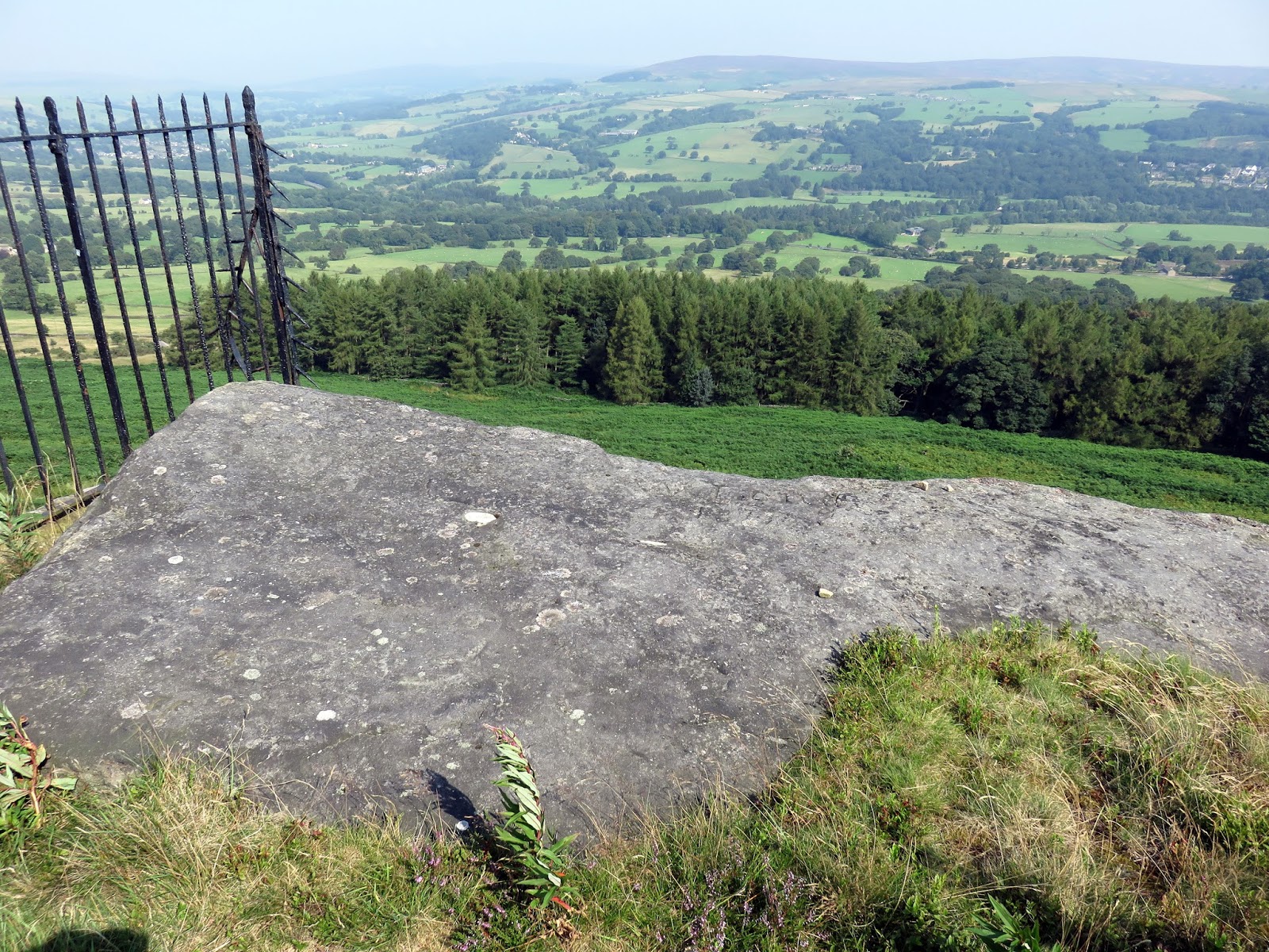
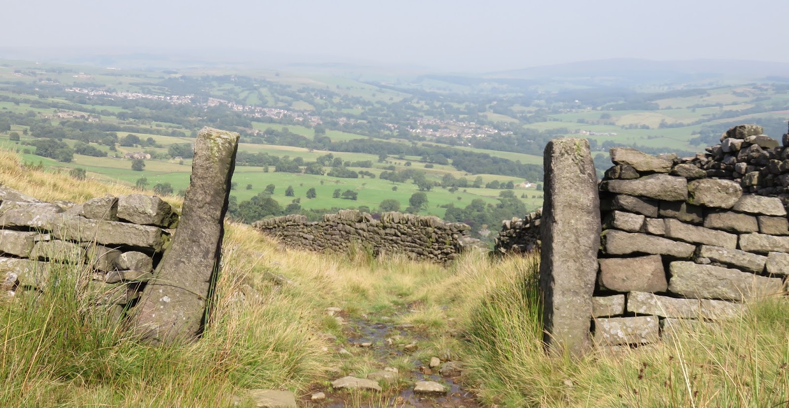
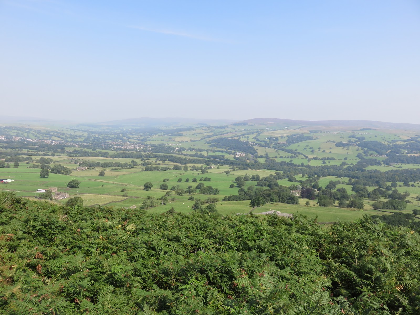
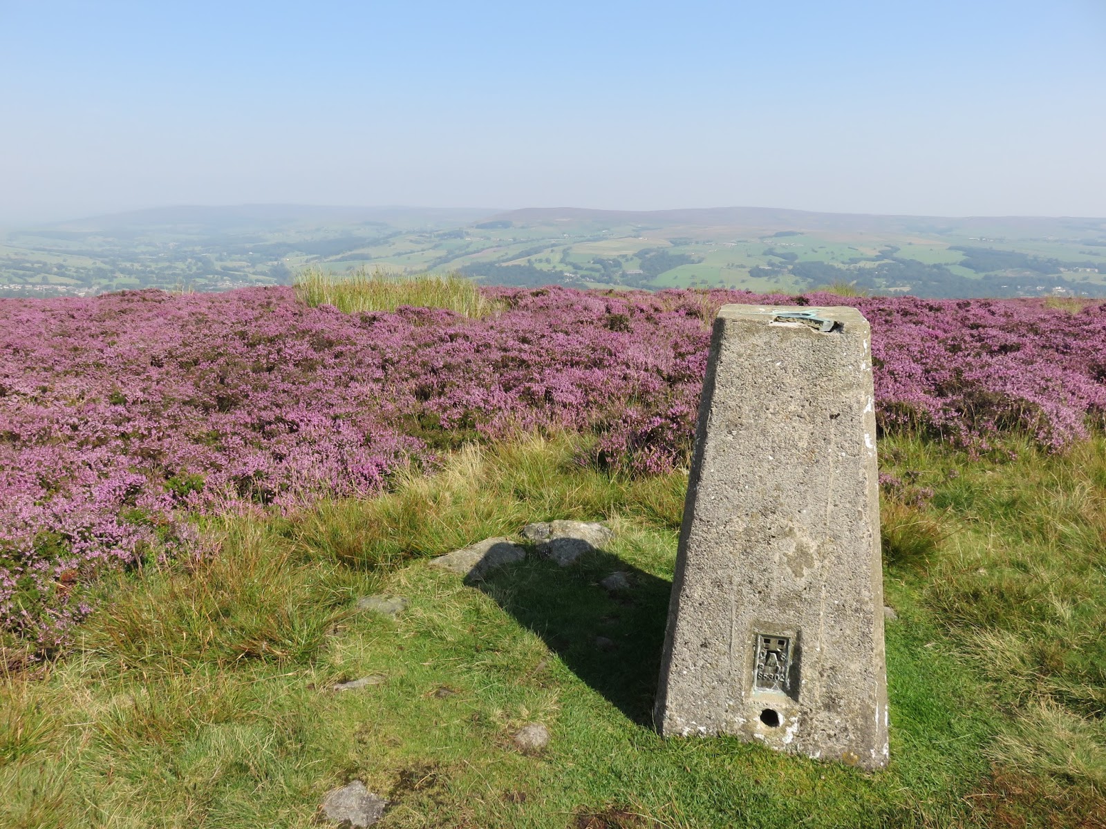
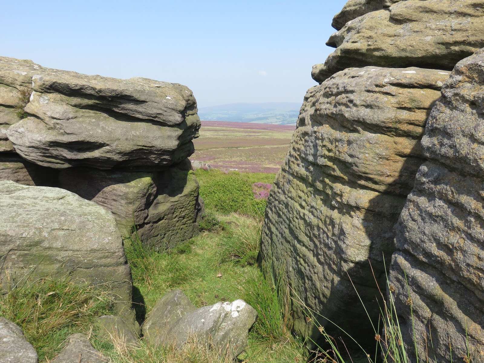
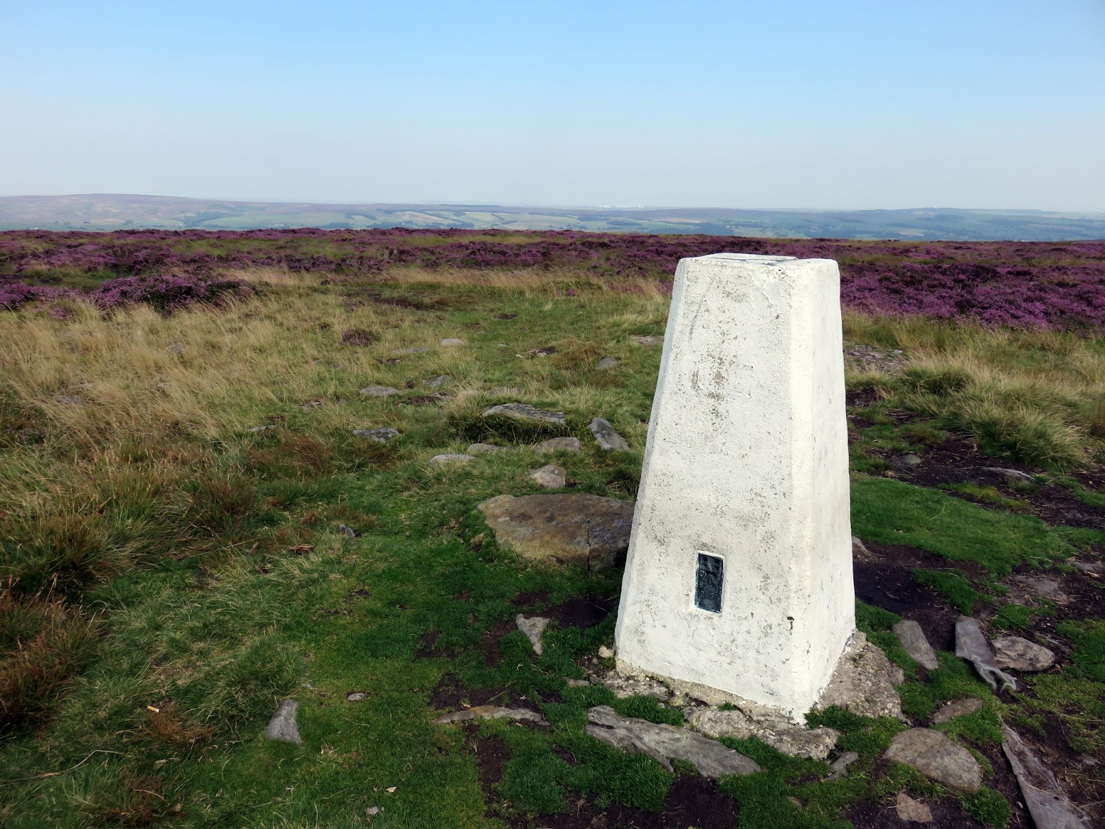
We continued heading west until we decided it was time for a bit of heather bashing, which was out in full force today. We were aiming for the trig pillar at Long Ridge End, a viewpoint that scans Addingham High Moor and the Aire Valley beyond. Views north into Wharfedale were excellent though the haze made any distant viewing a challenge.
 |
| View through the gate close to Piper’s Crag |
 |
| Looking north towards Beamsley Beacon |
 |
| Reaching the moor above Hardwick Holes |
 |
| Heading off-path through the heather |
 |
| Trig pillar at Long Ridge End |
 |
| View west from the trig pillar across Addingham High Moor |
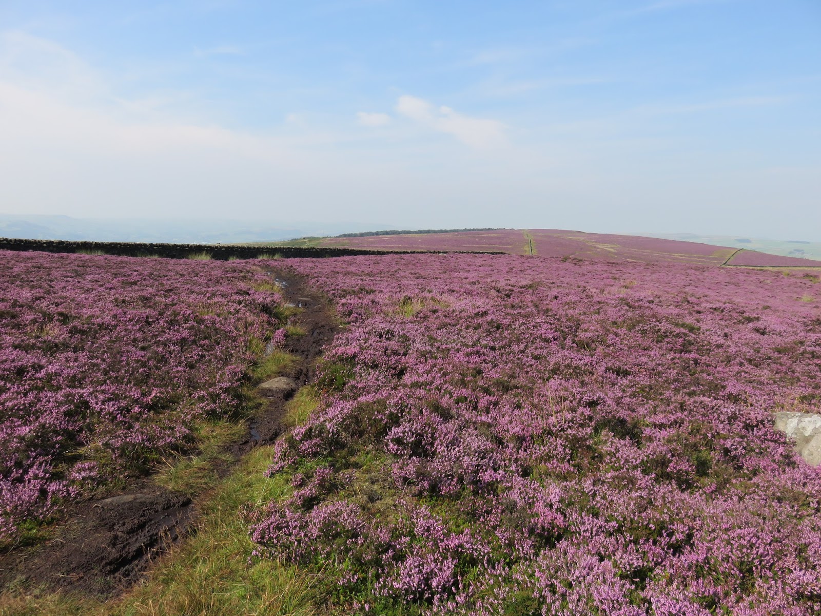
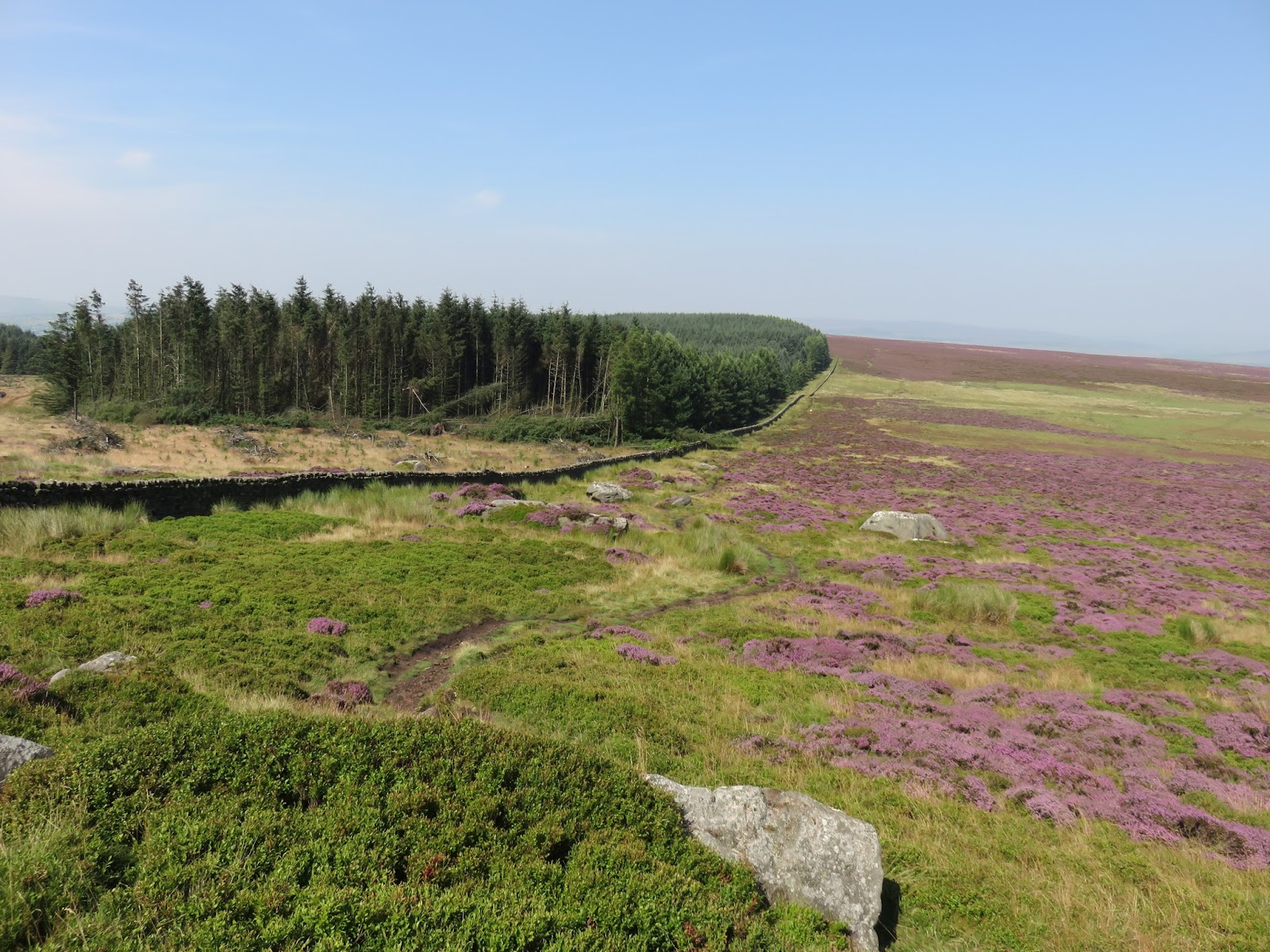
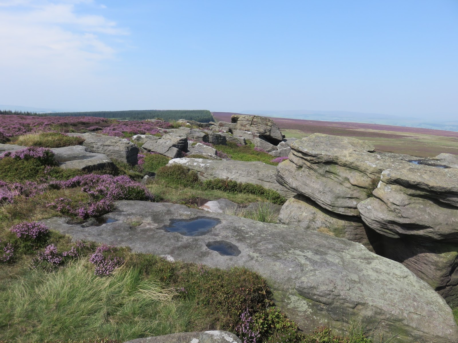
We doubled back from the trig pillar heading along the gently undulating path alongside the windy woods of High Moor, being careful to avoid the worst of the boggy bits as we went. This ended up being a dismal failure but is one of the trade offs of wearing trainers out for a walk. We reached the Buck Stones and used their shelter to stop for lunch as the wind was pretty chilly, despite it being mid-August. The Buck Stones (both East and West varieties) are millstone grit outcrops, reminiscent of those found on Kinder Scout.
 |
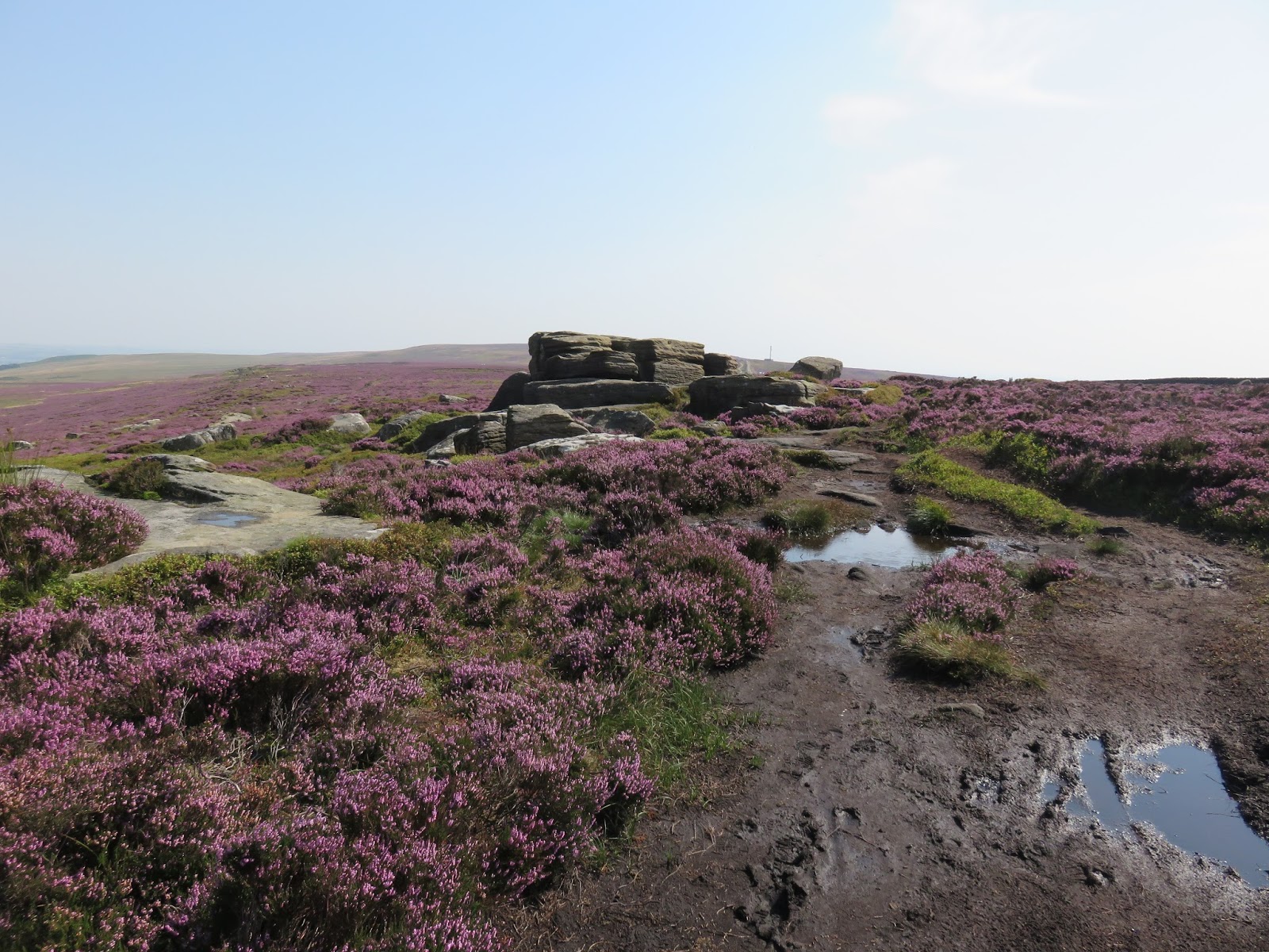
| Heather out in full force across Rombalds Moor |
 |
| Some stone flags help cross some of the boggier bits |
 |
| Plantation at High Moor |
 |
| East Buck Stones |
 |
| East Buck Stones |
 |
| East Buck Stones |
 |
| East Buck Stones |
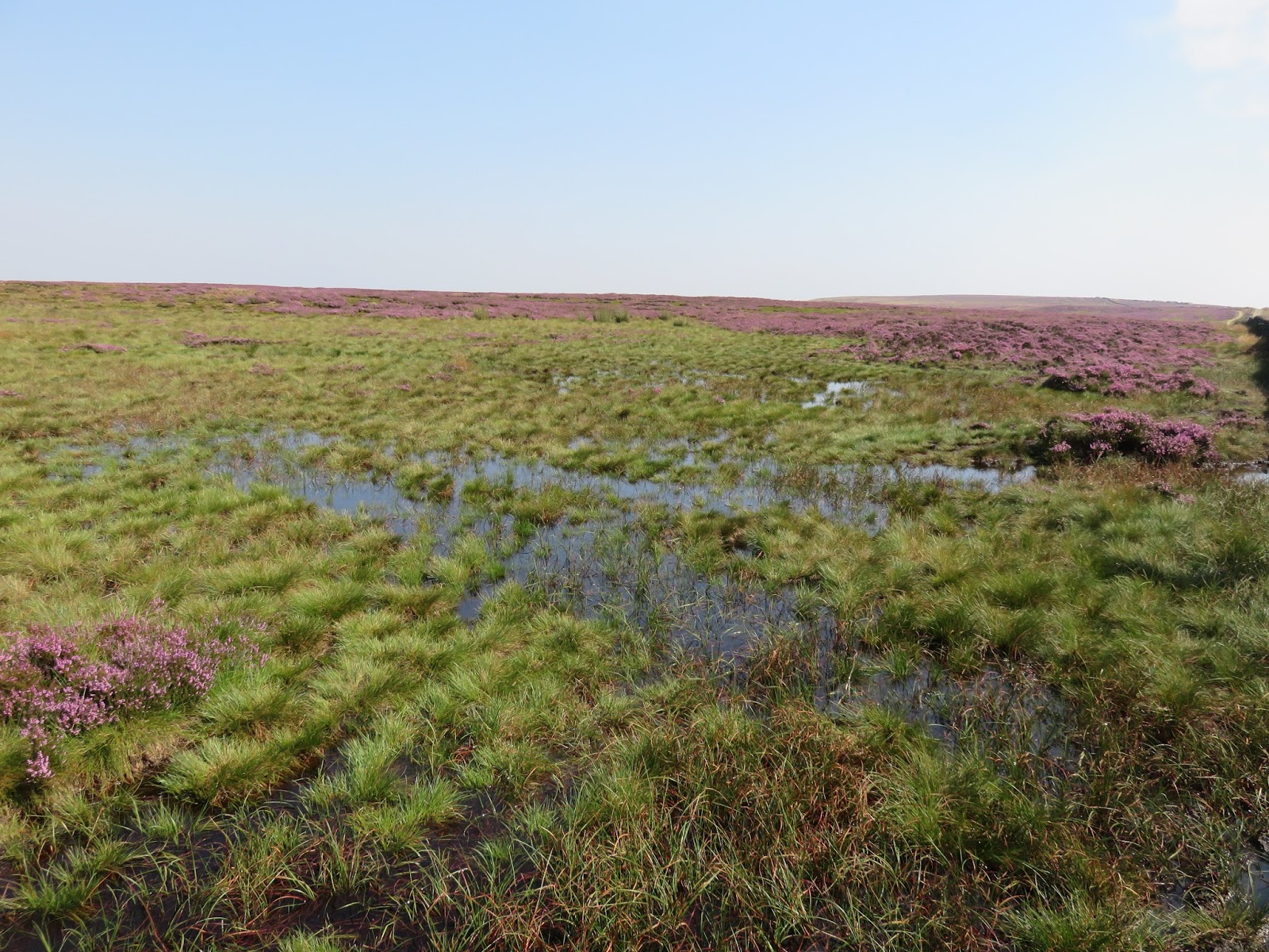
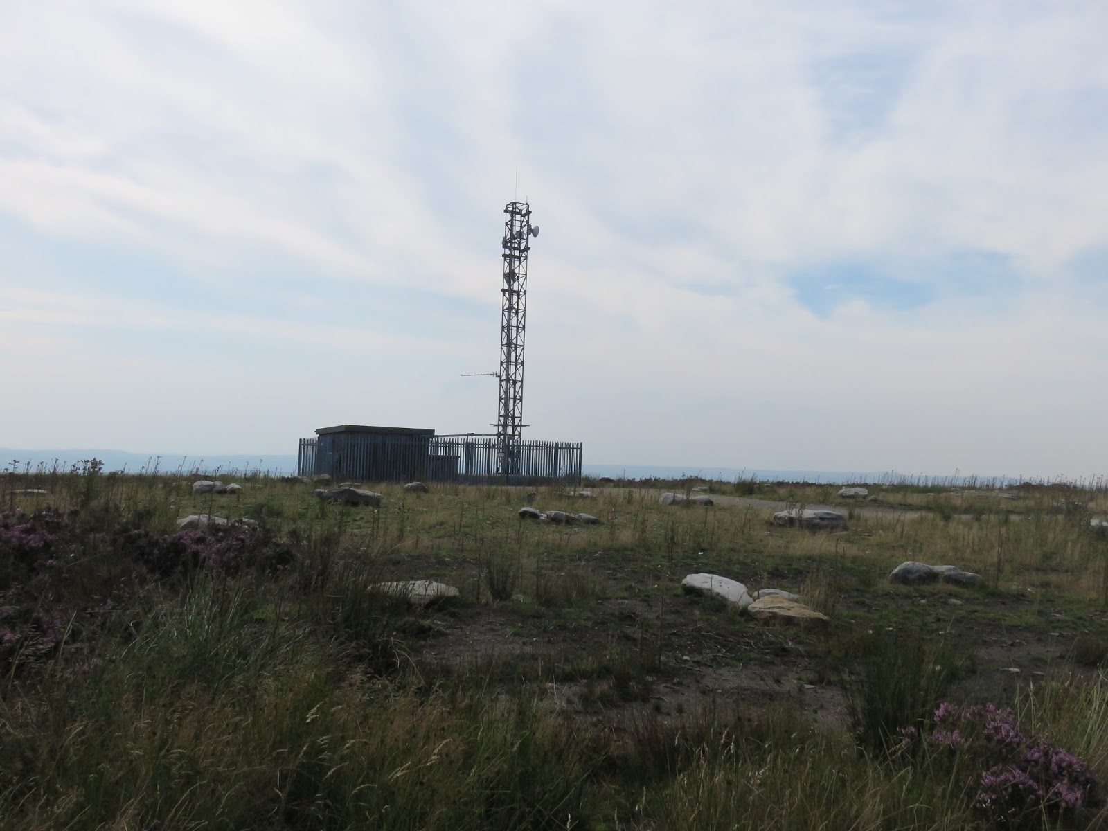
There’s another boggy length of path that joins the Buck Stones to Whetstone Gate, the location of a pair of radio masts operated by West Yorkshire Police. From here, a short detour to the north along the unmetalled Keighley Road, is Cowper’s Cross.
 |
| Bogs |
 |
| More bogs |
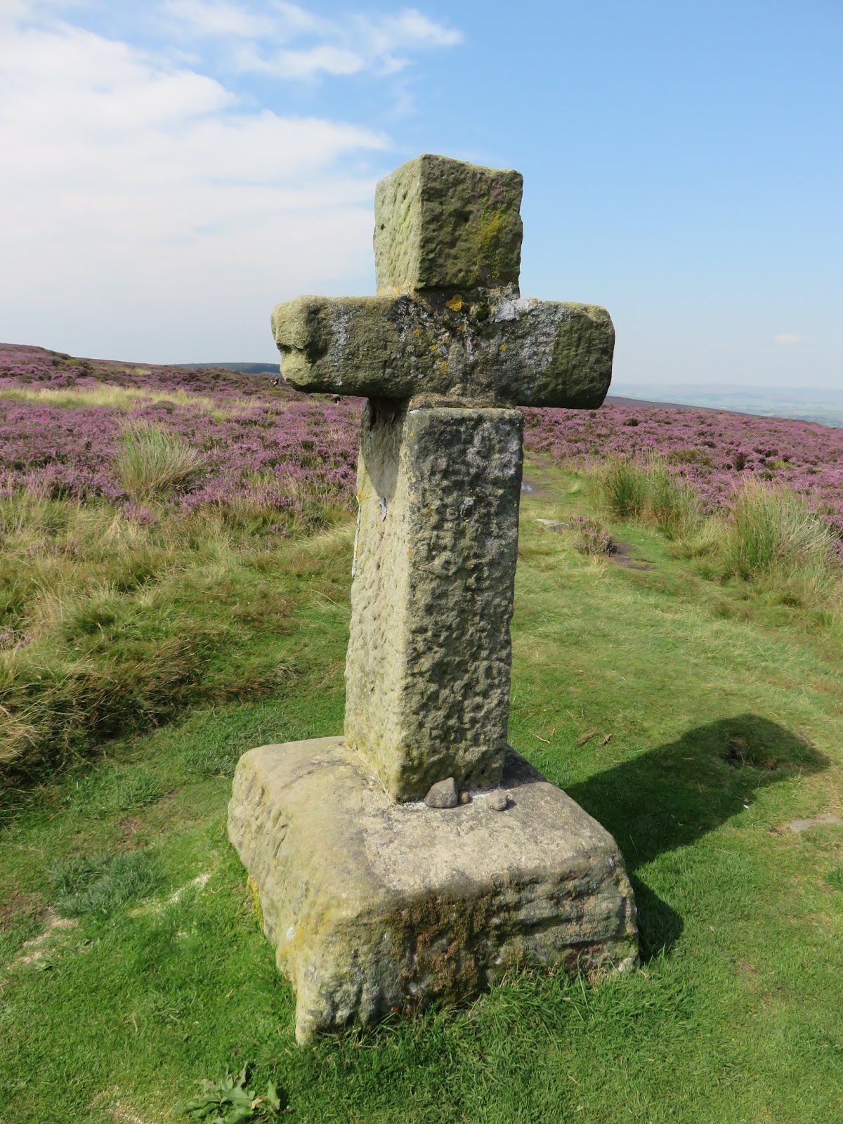
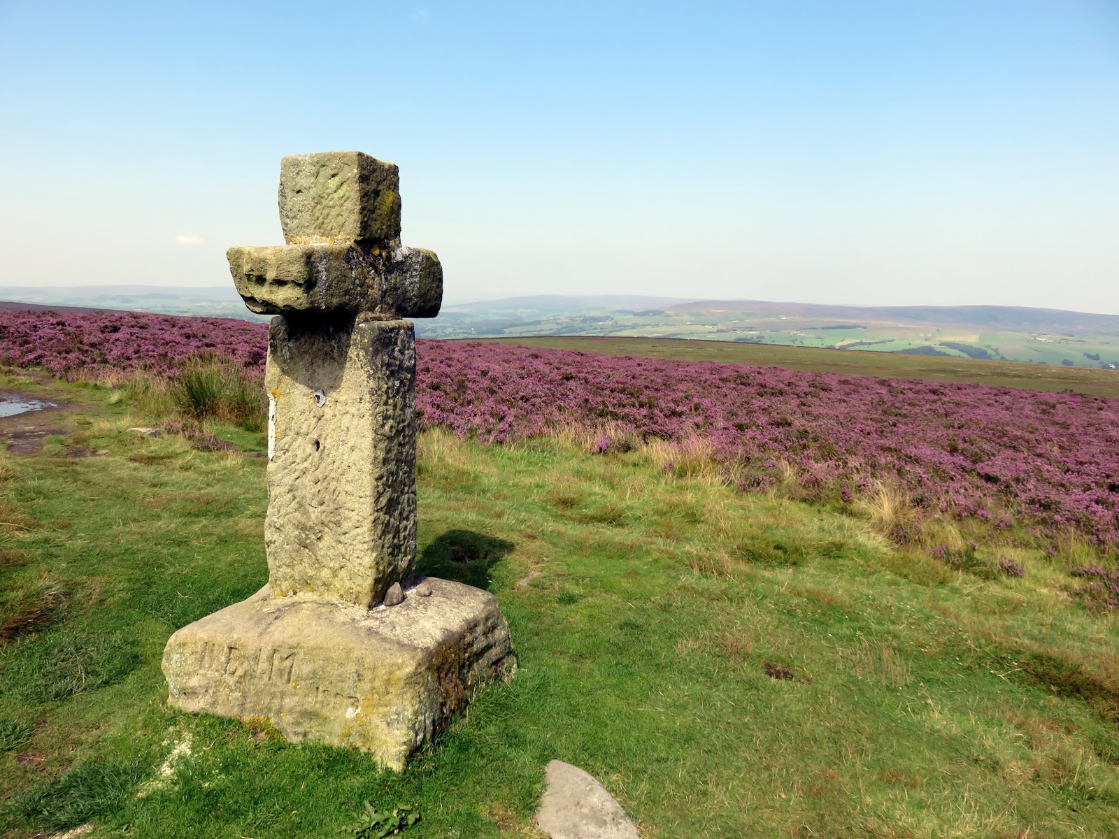
Named after the local Ilkley family name Cawper, Cowper’s Cross is a stone cross, possibly a christianised monolith, but more likely an original placed on the site. It is thought that it was erected in an attempt to make local people stop going to the Badger Stone for regular spring gatherings. The site was struck by lightning a number of years ago, damaging the monolith, but has since been rebuilt and stands adjacent to its original position, next to Keighley Road, an old Roman road that crosses the moor.
 |
| Cowper’s Cross |
 |
| Cowper’s Cross |
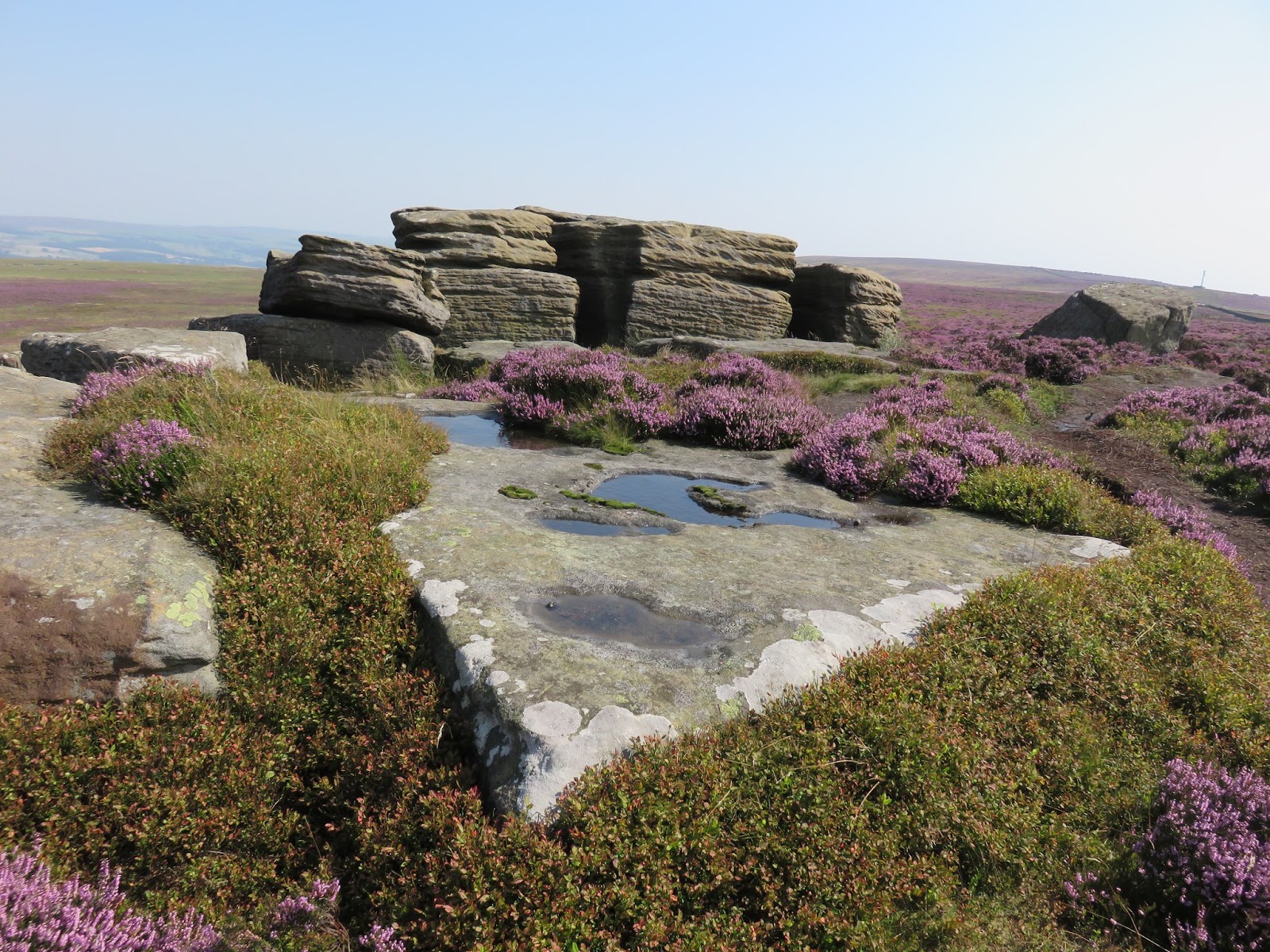
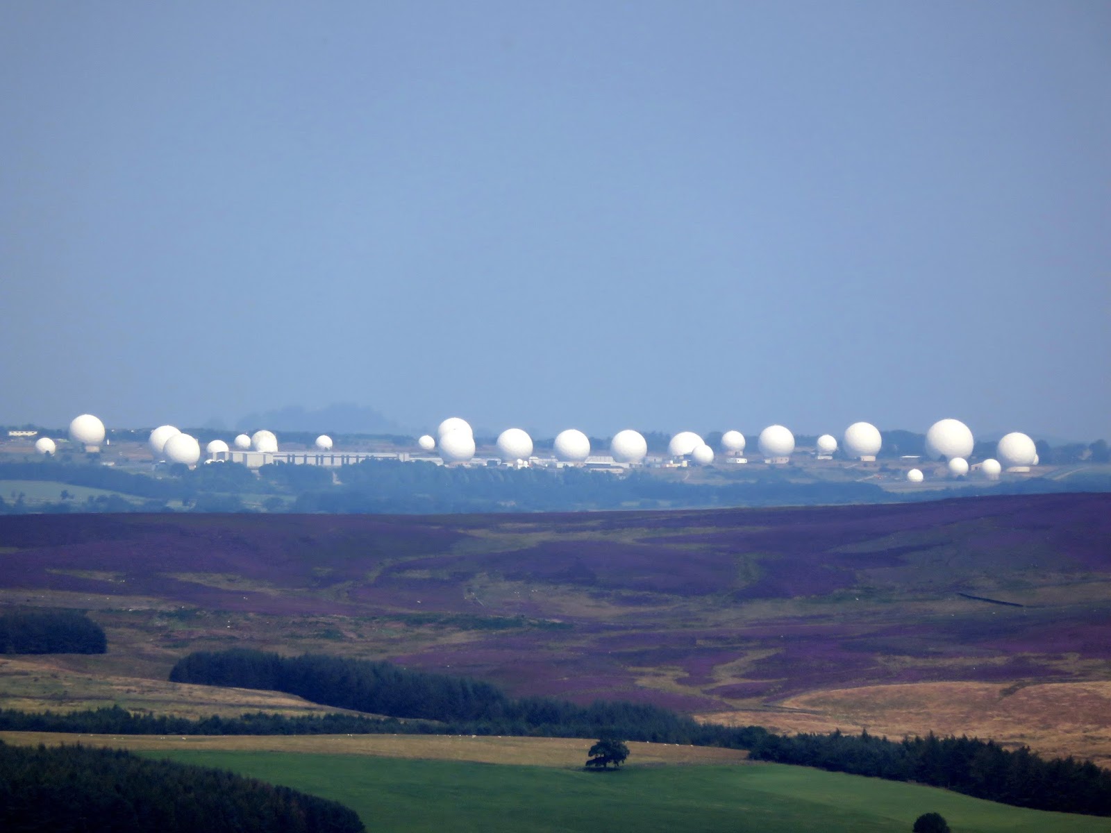
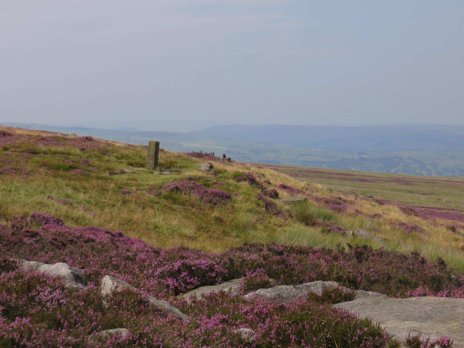
Heading to the summit is a path reminiscent of many across the Pennines – large blocks ofstone floating atop a peaty bog. The shallow slopes around the summit limit the views though the radars of RAF Menwith Hill are clearly visible. A short distance from the summit is Lanshaw Lad, a vertical block of stone that marked the 19th Century boundary between Burley and Ilkley. Here, the path joins the Dales Way Link, a bridleway that, as its name suggests, joins Airedale to Wharfedale and the famous long distance Dales Way. Alongside the bridleway you will find the Twelve Apostles.
 |
| The police radio mast atop the moor |
 |
| The Thimble Stones |
 |
| A familiar scene along many a moor |
 |
| The summit of Ilkley Moor |
 |
| A long stroll along the summit |
 |
| Contrasting colours were out in force today |
 |
| RAF Menwith Hill |
 |
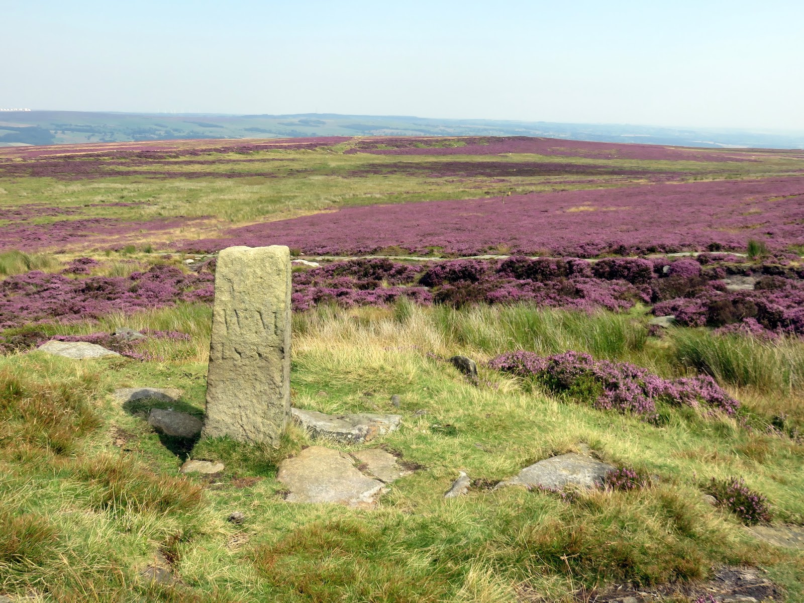
| Lanshaw Lad |
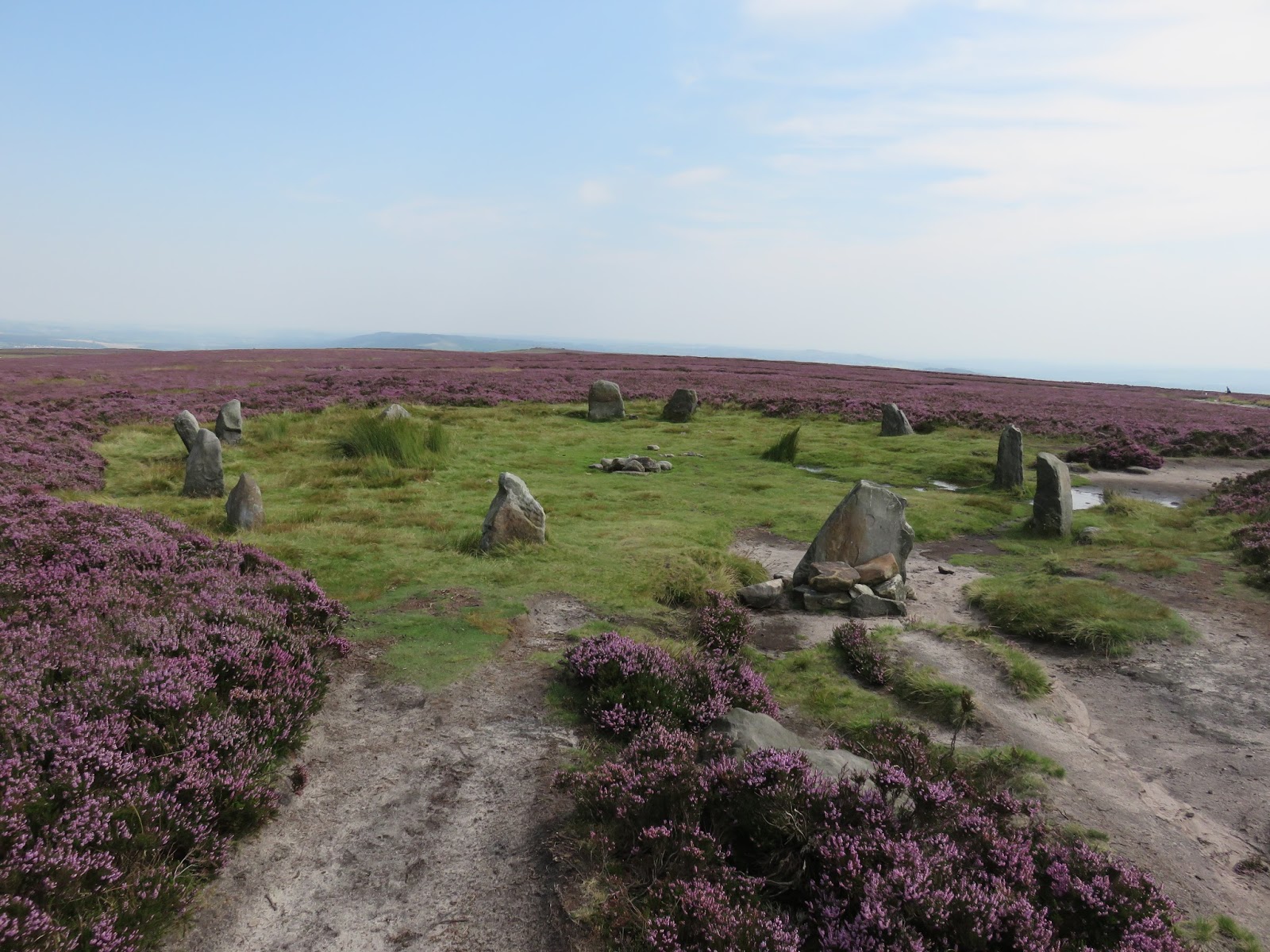
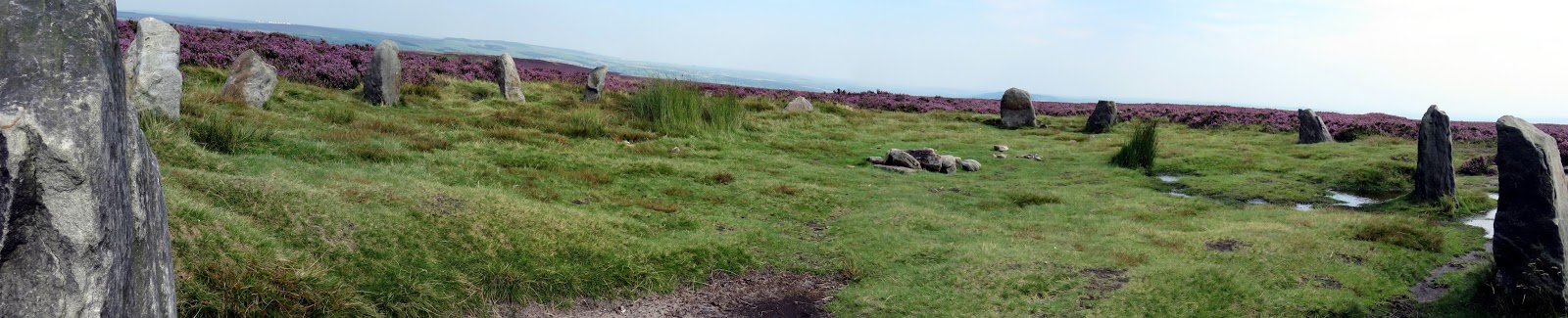
The Twelve Apostles consists of the remains of a stone circle with a diameter of about 15 metres. The circle originally had between 16 and 20 stones, but it is now reduced to 12. All of the stones were fallen by the mid-20th-century and were lying loose upon the ground but have since been re-erected. Originally, the circle stood inside a bank 1.2 metres wide and half a metre high. The bank was still traceable in the 1920s but has apparently eroded since then due to visitors walking over the ground.
 |
| The Twelve Apostles |
 |
| Panorama of the stone circle |
 |
| Looking back to Lanshaw Lad |
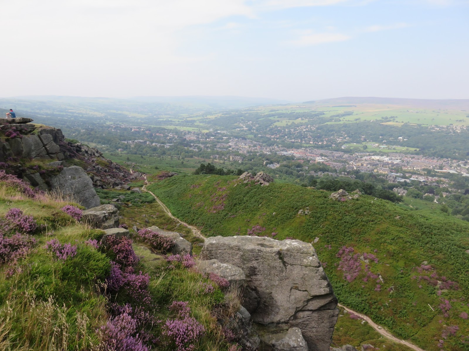
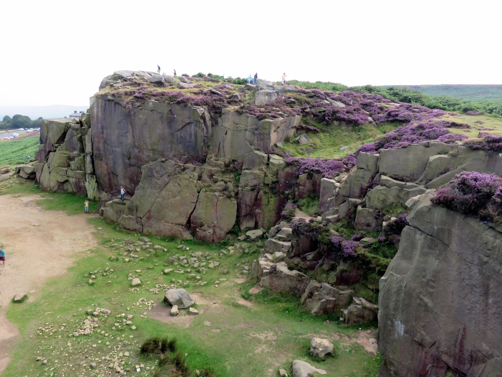
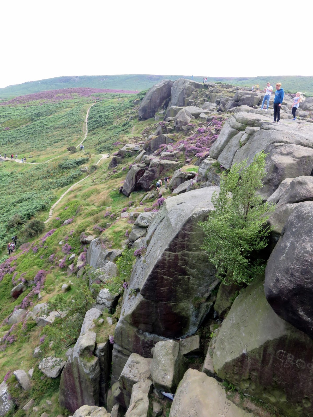
From the stone circle we made our way down hill along the Dales Link to the top of Ilkley Crag before heading down further to the Cow and Calf, one of the most popular spots on the moor. The Cow and Calf are a rock outcrop which dominates the local scene from the valley level. The Cow is the main formation while the Calf is a smaller boulder that has detached at some point in the past. It is said there was also a Bull but there is no evidence to support this. We joined the crowds of people milling around the rocks, taking in the fine views of the valley below.
 |
| The view from Ilkley Crags |
 |
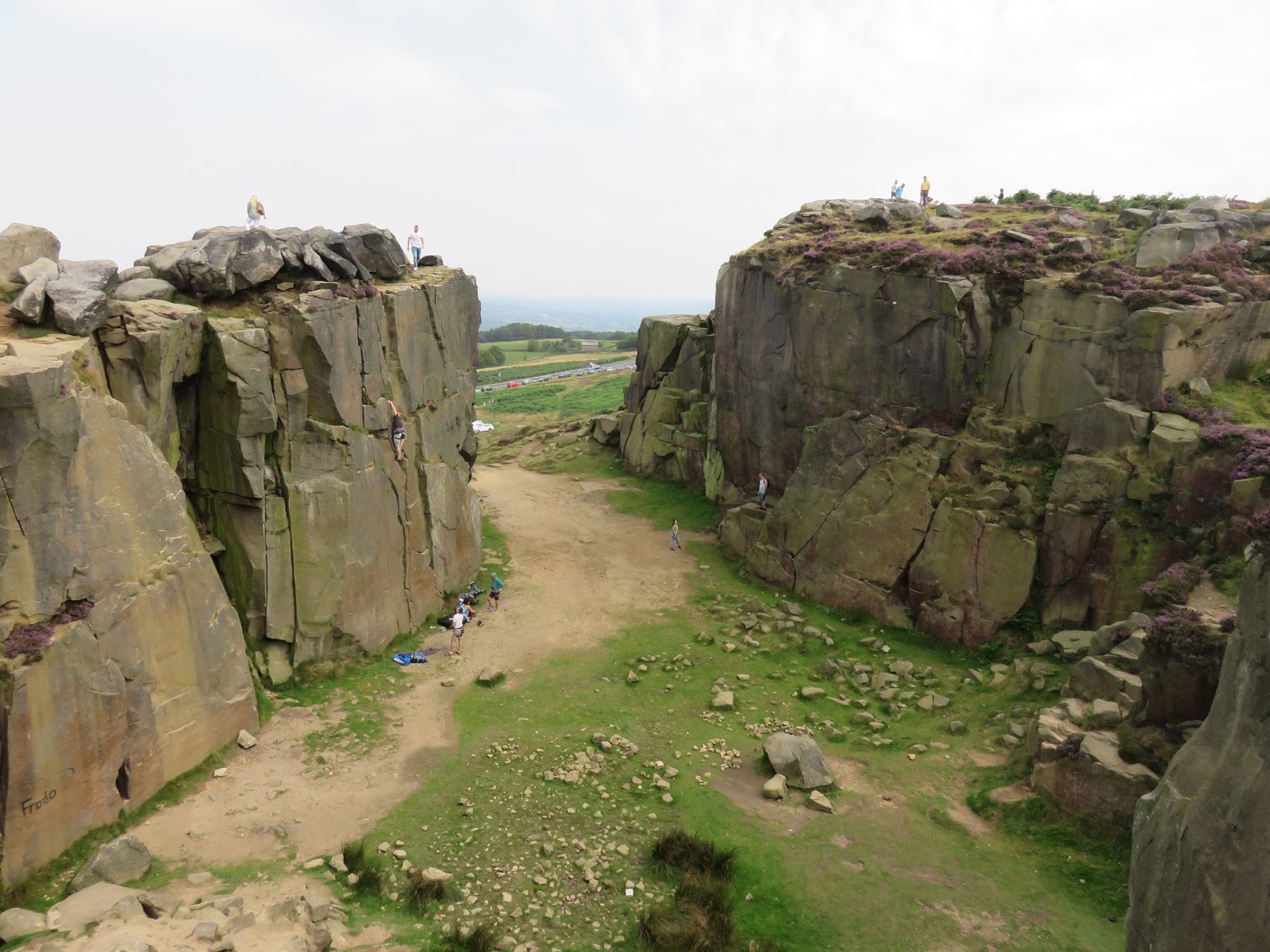
| A quarry that is part of the Cow and Calf |
 |
| Cow and Calf quarry |
 |
| Cow and Calf Rocks |
 |
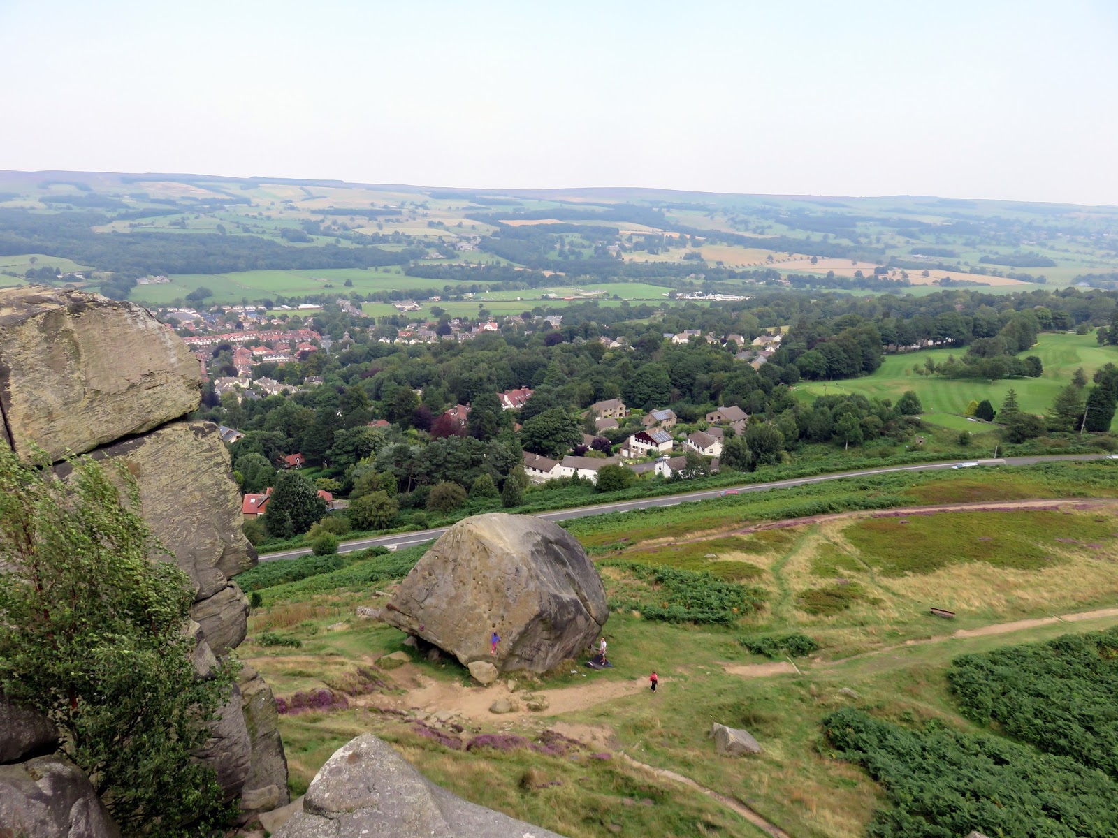
| The Calf and Ben Rhydding below |
 |
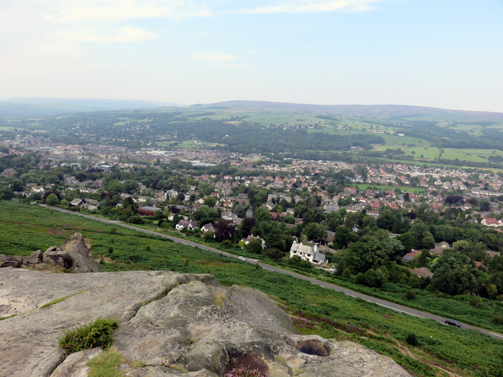
| Ilkley |
 |
| Cow and Calf Rocks |
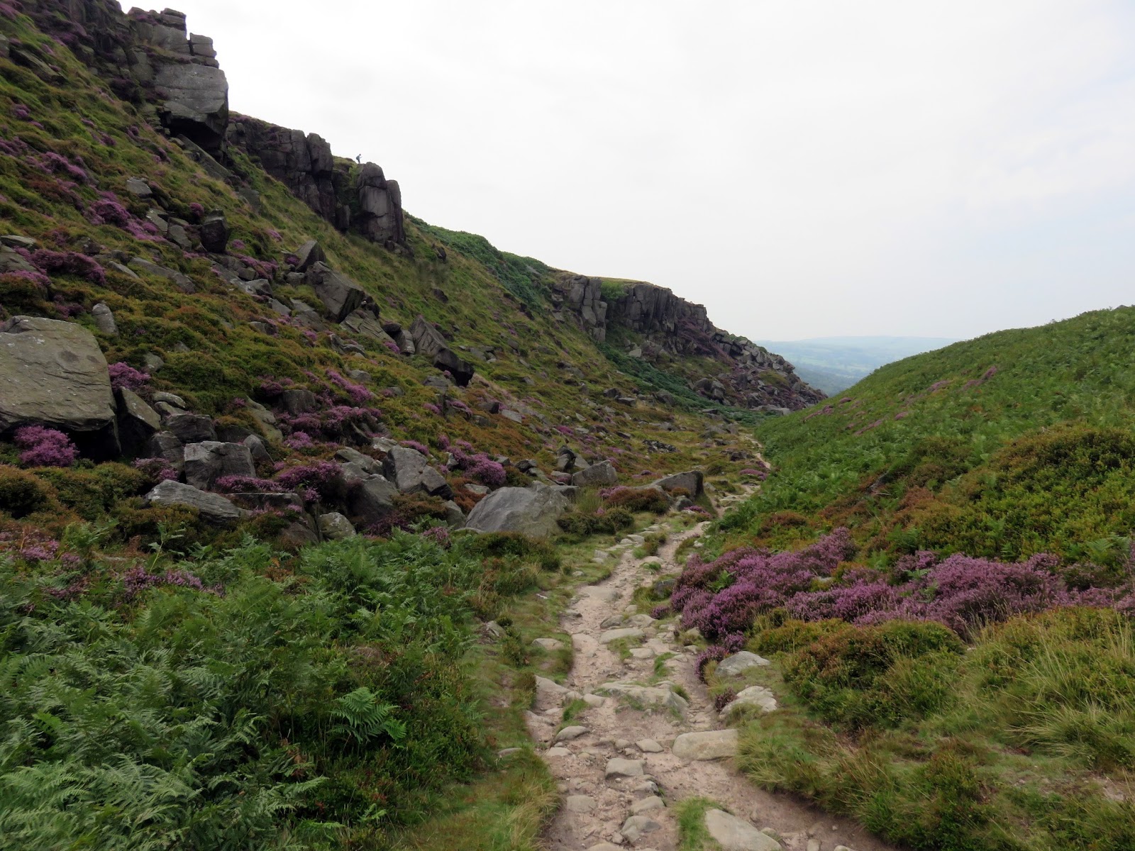
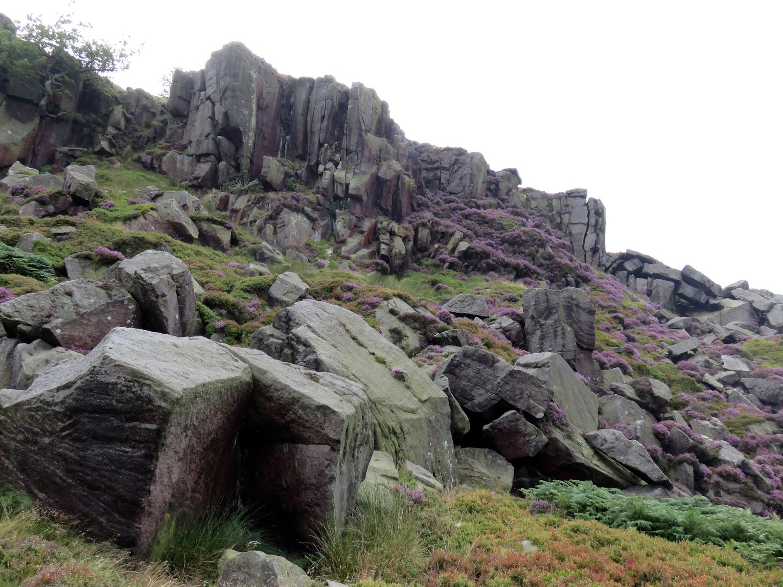
After braving the wind for a while we turned back towards Ilkley Crags, this time passing below them through the aptly named Rocky Valley, a small valley that is filling with rocks. Despite the walk drawing towards a close, the impressive scenery does not diminish as the path winds its way past the boulders in the valley. A short distance further is the curious White Wells.
 |
| Hangingstone Quarry |
 |
| Entering Rocky Valley |
 |
| West Rock |
 |
| West Rock |
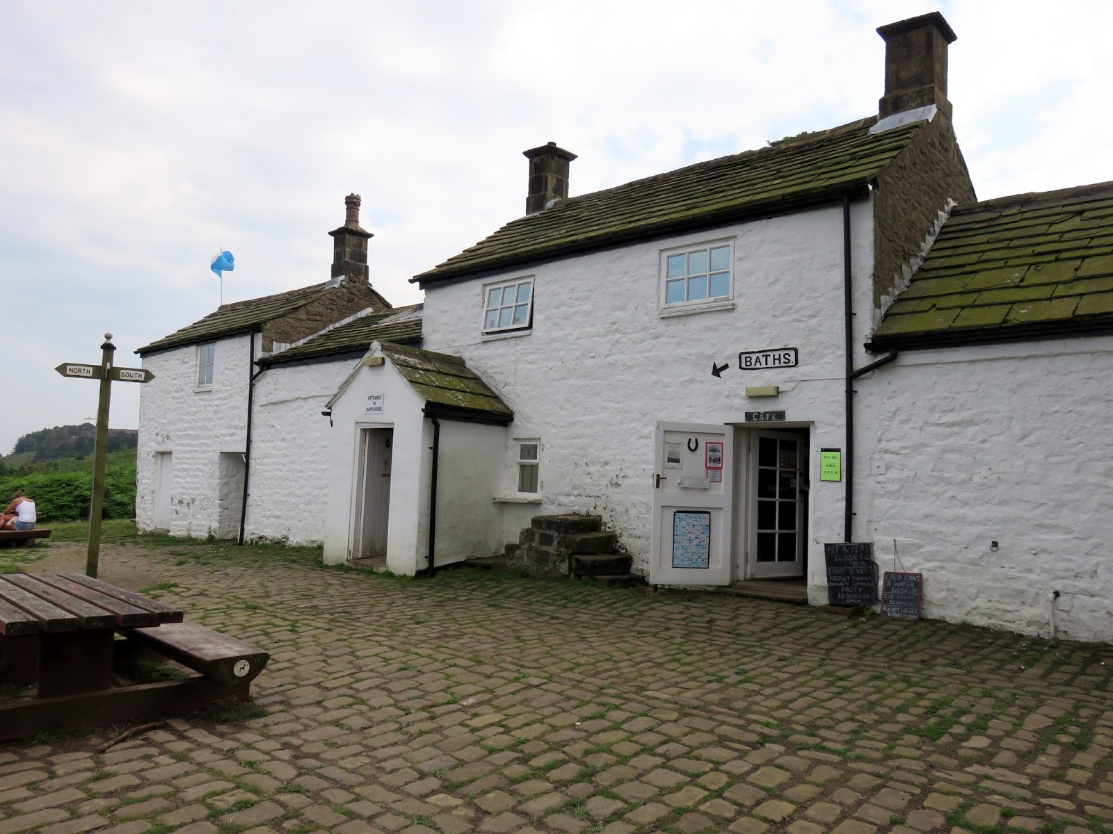
White Wells actually a spa bath situated, built 1700 as an open air spa bath. A single plunge pool survives today inside the White Wells Spa. An advert in the Leeds Intelligencer of 26 April 1791 made claims that the medicinal properties of the ‘Spaw’ could heal ‘bad eyes’, ‘tumours and sores’, ‘scrophula’ and ‘all cases where the spine is affected. Today, the plunge pool is used to welcome in the New Year and is noted as the most popular day of the year for plunging.
 |
| White Wells |
It’s a relatively short downhill walk back to the car where we concluded a truly satisfying day out on Ilkley Moor, one that I really should have done a lot sooner. Despite seeing a number of the highlights, there are many more that we couldn’t fit in which gives us the perfect excuse to come back. That and that it’s only half an hour up the road.

