Open Space Web-Map builder Codehttps://openspace.ordnancesurvey.co.uk/osmapapi/openspace.js?key=3119F72552FD5C22E0530C6CA40A5A92https://openspace.ordnancesurvey.co.uk/osmapapi/script/mapbuilder/basicmap.jshttps://openspace.ordnancesurvey.co.uk/osmapapi/script/mapbuilder/searchbox.js//variables for routes var linesLayer, points, lineFeature, lineString, routeMarkersLayer, routepos, routesize, routeoffset, routeicon; var style_blue = {strokeColor: “#0000CD”, strokeOpacity: 0.5, strokeWidth: 4.5}; function initmapbuilder() { //initiate the map var options = {resolutions: [2500, 1000, 500, 200, 100, 50, 25, 10, 5, 4, 2.5, 2, 1]}; osMap = new OpenSpace.Map(‘map’, options); //configure map options (basicmap.js) setglobaloptions(); //set the center of the map and the zoom level osMap.setCenter(new OpenSpace.MapPoint(313998.33270073,523718.33459854),8); linesLayer = osMap.getVectorLayer(); // Set up layer for route markers routeMarkersLayer = new OpenLayers.Layer.Markers(“Route Markers”); //make a route points = new Array(); points.push(new OpenLayers.Geometry.Point(314801.66603088,523611.66793823)); points.push(new OpenLayers.Geometry.Point(314701.66603088,523651.66793823)); points.push(new OpenLayers.Geometry.Point(314576.66603088,523671.66793823)); points.push(new OpenLayers.Geometry.Point(314236.66603088,523731.66793823)); points.push(new OpenLayers.Geometry.Point(314116.66603088,523741.66793823)); points.push(new OpenLayers.Geometry.Point(314021.66603088,523446.66793823)); points.push(new OpenLayers.Geometry.Point(313976.66603088,523321.66793823)); points.push(new OpenLayers.Geometry.Point(313841.66603088,523291.66793823)); points.push(new OpenLayers.Geometry.Point(313786.66603088,523206.66793823)); points.push(new OpenLayers.Geometry.Point(313776.66603088,522976.66793823)); points.push(new OpenLayers.Geometry.Point(313721.66603088,522821.66793823)); points.push(new OpenLayers.Geometry.Point(313721.66603088,522601.66793823)); points.push(new OpenLayers.Geometry.Point(313716.66603088,522856.66793823)); points.push(new OpenLayers.Geometry.Point(313761.66603088,523041.66793823)); points.push(new OpenLayers.Geometry.Point(313796.66603088,523201.66793823)); points.push(new OpenLayers.Geometry.Point(313501.66603088,523441.66793823)); points.push(new OpenLayers.Geometry.Point(313381.66603088,523516.66793823)); points.push(new OpenLayers.Geometry.Point(313321.66603088,523706.66793823)); points.push(new OpenLayers.Geometry.Point(313286.66603088,523831.66793823)); points.push(new OpenLayers.Geometry.Point(313226.66603088,524071.66793823)); points.push(new OpenLayers.Geometry.Point(313221.66603088,524231.66793823)); points.push(new OpenLayers.Geometry.Point(313206.66603088,524426.66793823)); points.push(new OpenLayers.Geometry.Point(313376.66603088,524536.66793823)); points.push(new OpenLayers.Geometry.Point(313431.66603088,524641.66793823)); points.push(new OpenLayers.Geometry.Point(313376.66603088,524756.66793823)); points.push(new OpenLayers.Geometry.Point(313556.66603088,524646.66793823)); points.push(new OpenLayers.Geometry.Point(313681.66603088,524481.66793823)); points.push(new OpenLayers.Geometry.Point(313896.66603088,524416.66793823)); points.push(new OpenLayers.Geometry.Point(313996.66603088,524266.66793823)); points.push(new OpenLayers.Geometry.Point(314016.66603088,524196.66793823)); points.push(new OpenLayers.Geometry.Point(314136.66603088,524136.66793823)); points.push(new OpenLayers.Geometry.Point(314156.66603088,524046.66793823)); points.push(new OpenLayers.Geometry.Point(314116.66603088,523956.66793823)); points.push(new OpenLayers.Geometry.Point(314111.66603088,523746.66793823)); points.push(new OpenLayers.Geometry.Point(314341.66603088,523701.66793823)); points.push(new OpenLayers.Geometry.Point(314561.66603088,523681.66793823)); points.push(new OpenLayers.Geometry.Point(314701.66603088,523641.66793823)); points.push(new OpenLayers.Geometry.Point(314801.66603088,523611.66793823)); // create a polyline feature from the array of points lineString = new OpenLayers.Geometry.LineString(points); lineFeature = new OpenLayers.Feature.Vector(lineString, null, style_blue); linesLayer.addFeatures([lineFeature]); //crate a route start/end marker routepos = new OpenSpace.MapPoint(314801.66603088,523611.66793823); routesize = new OpenLayers.Size(33,45); routeoffset = new OpenLayers.Pixel(-5,-37); routeicon = new OpenSpace.Icon(‘https://openspace.ordnancesurvey.co.uk/osmapapi/img_versions/img_1.1/mapbuilder/routemarker-startend.png’, routesize, routeoffset, null, null); routeMarkersLayer.addMarker(new OpenLayers.Marker(routepos, routeicon)); osMap.addLayer(routeMarkersLayer);}
Route: Thackthwaite, Galloway Farm, Quarry, Watching Crag, Low Fell, Sourfoot Fell, Smithy Fell, Fellbarrow, Hattergill Head, Larch, Quarry, Thackthwaite
Date: 28/03/2015
From: Thackthwaite
Parking: Thackthwaite
Start Point: Thackthwaite
Region: Western Fells
Route length: 4.9 miles (7.8 km)
Time taken: 01:59
Average speed: 2.4 mph
Ascent: 501m
Descent: 510m
Wainwrights on this walk:
Low Fell (423m), Fellbarrow (416m)
Other Summits: Sourfoot Fell (411m), Smithy Fell (392m), Hattergill Head (385m)
Other points of interest: Buttermere
After a somewhat disappointing morning of walking, an improvement in the weather and a change of location afforded the opportunity to climb two of the smaller and more remote fells of the Lake District; Low Fell and Fellbarrow. Located west of the Whinlatter Pass, these are the fells that usually occupy people’s ‘to climb’ list until the very end and they were no different on mine, coming in after I’d already climbed a significant number of Wainwrights. They are, however, the last of the really small fells on my list which means a return to the bigger boys in the Spring and Summer. That isn’t to say that these fells are not worthy, as you’ll see in a moment.
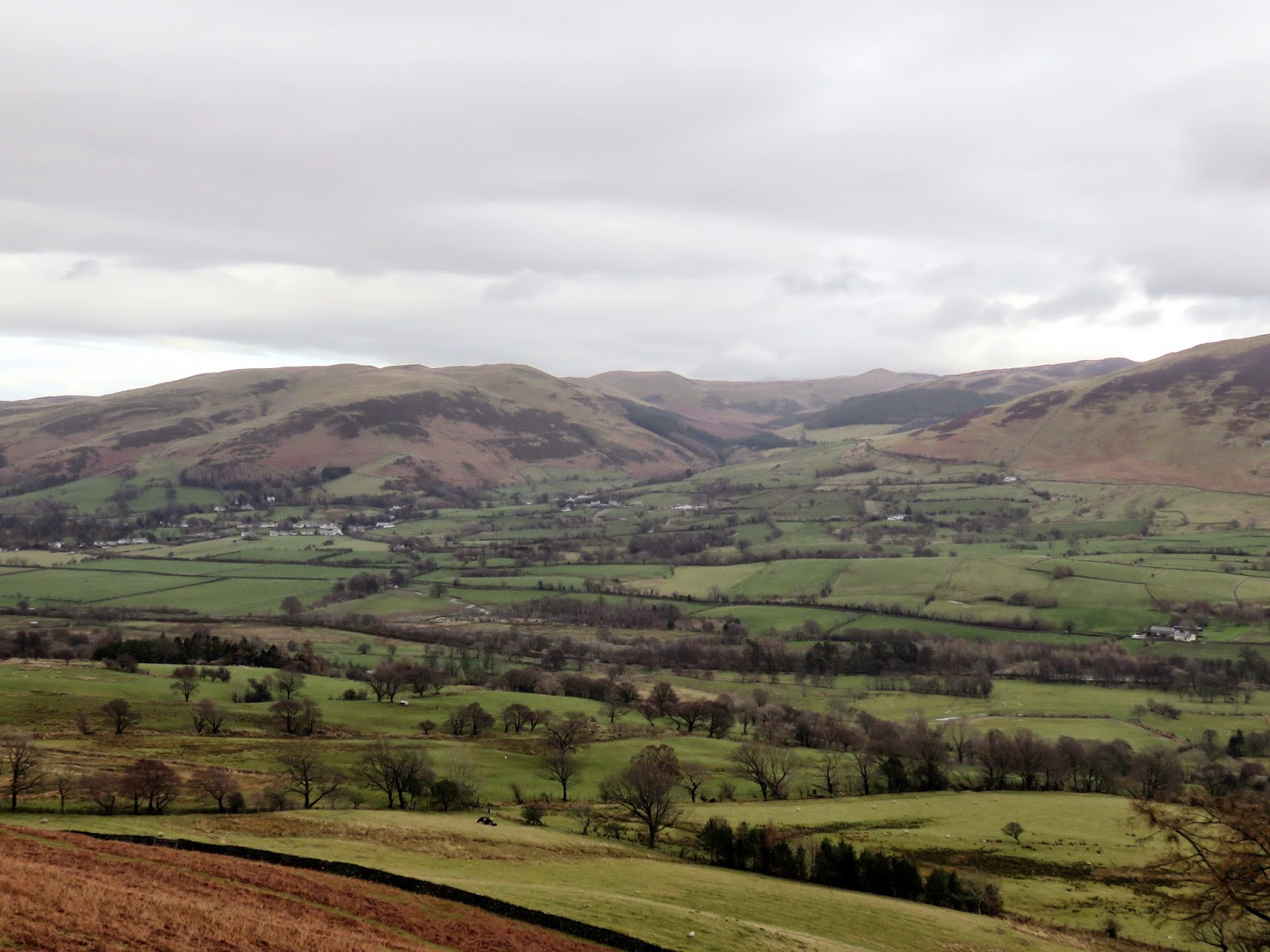
 |
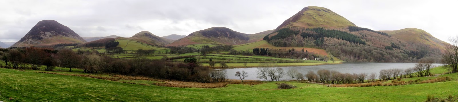
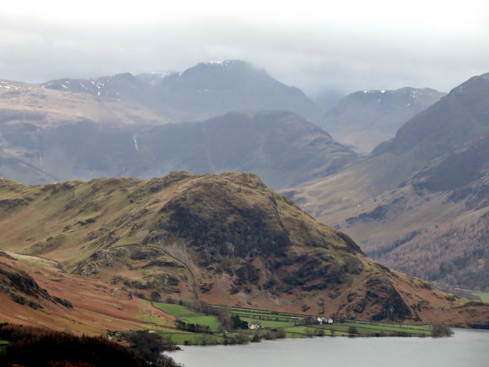
| A superb view of the Loweswater fells from the drive from Ennerdale |
There’s a small layby to the north of the hamlet of Thackthwaite that provides the perfect starting point for a quick circuit of these two fells. A signposted track leads out of Thackthwaite and straight into an easy climb to the footings of the fell. I followed this track before making an error of judgement by following the old quarry track that’s visible on the map.
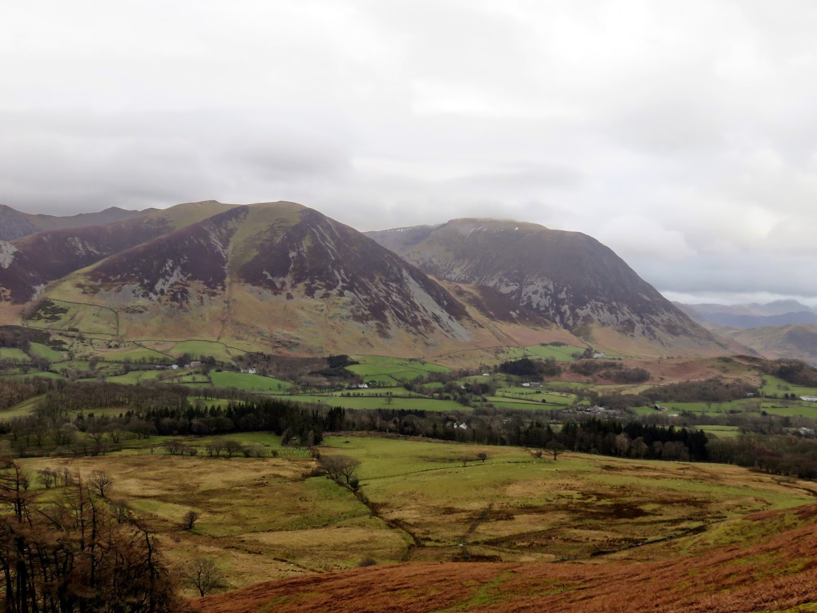
 |
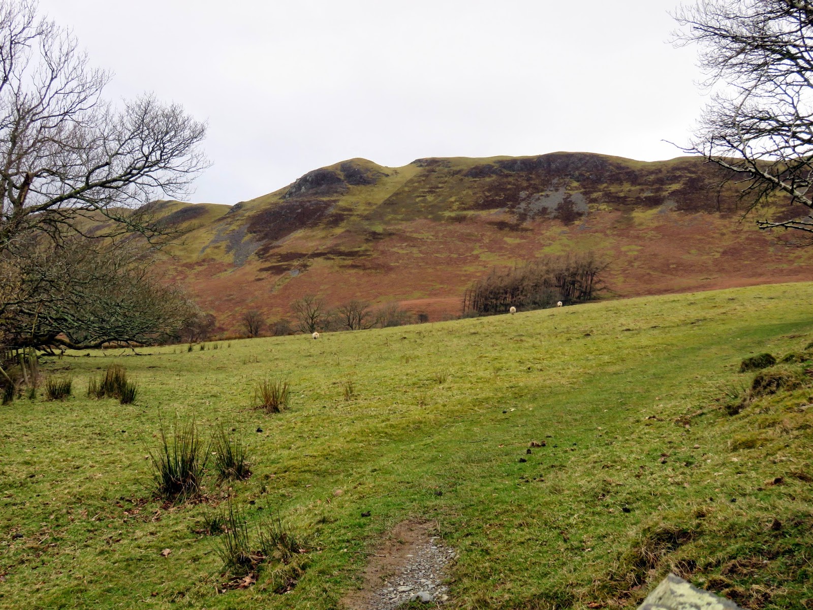
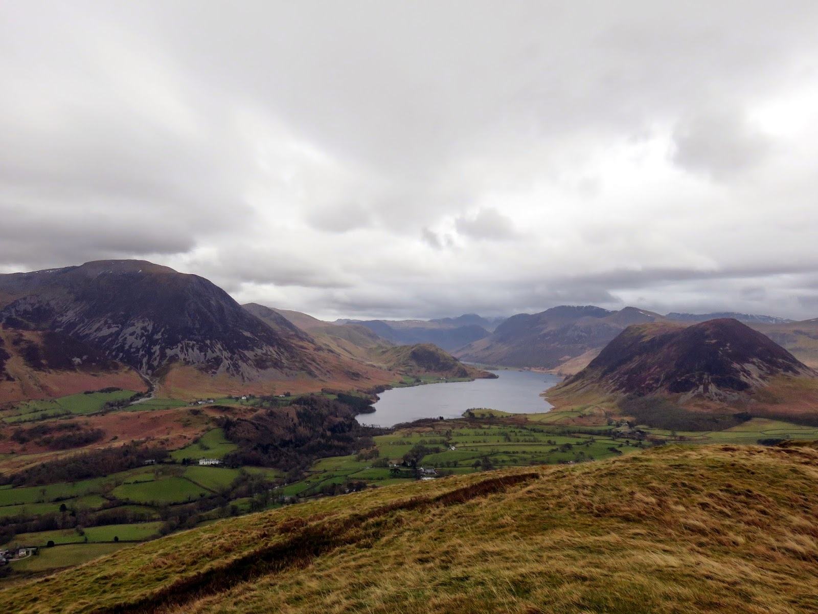
| Low Fell with Watching Crag dominating the horizon |
From Thackthwaite, a path of shorts is visible running across the steep slopes of Low Fell, a path I assumed would make a diagonal route up to Watching Crag and save a bit of time getting up onto the fell. I was wrong, falling into the trap that many or all of us have made before; following a sheep trod. Instead of climbing to an anticipated emergence above Watching Crag, the ‘path’ took joy in promptly disappearing, leaving me stood rather embarrassingly halfway up the steep flanks. In my mind I was too far up the fell to turn back so I made the decision to zigzag up the hillside, following a fence that would ultimately lead to where I intended. It sounds, after writing, much easier than it actually was.
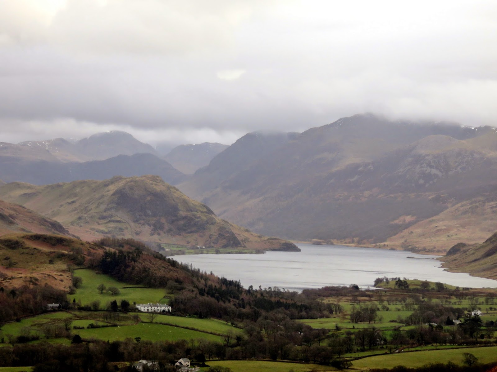
 |
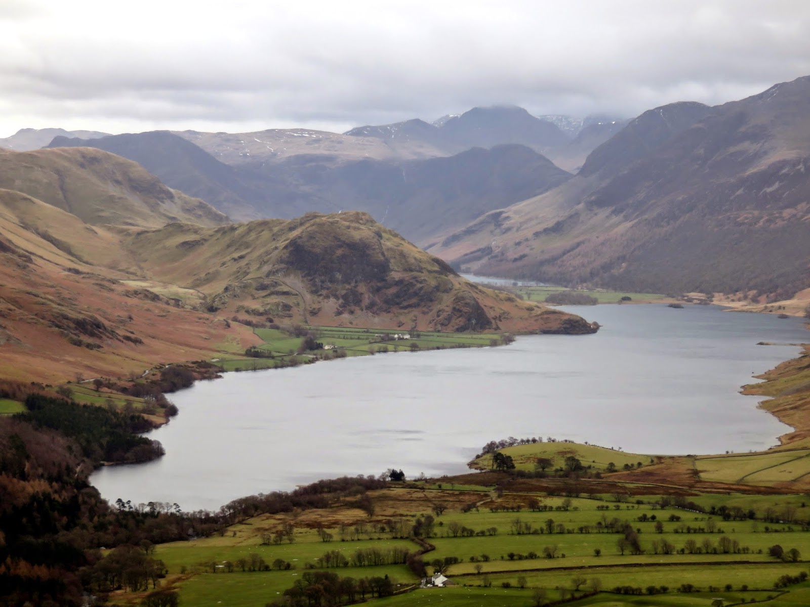
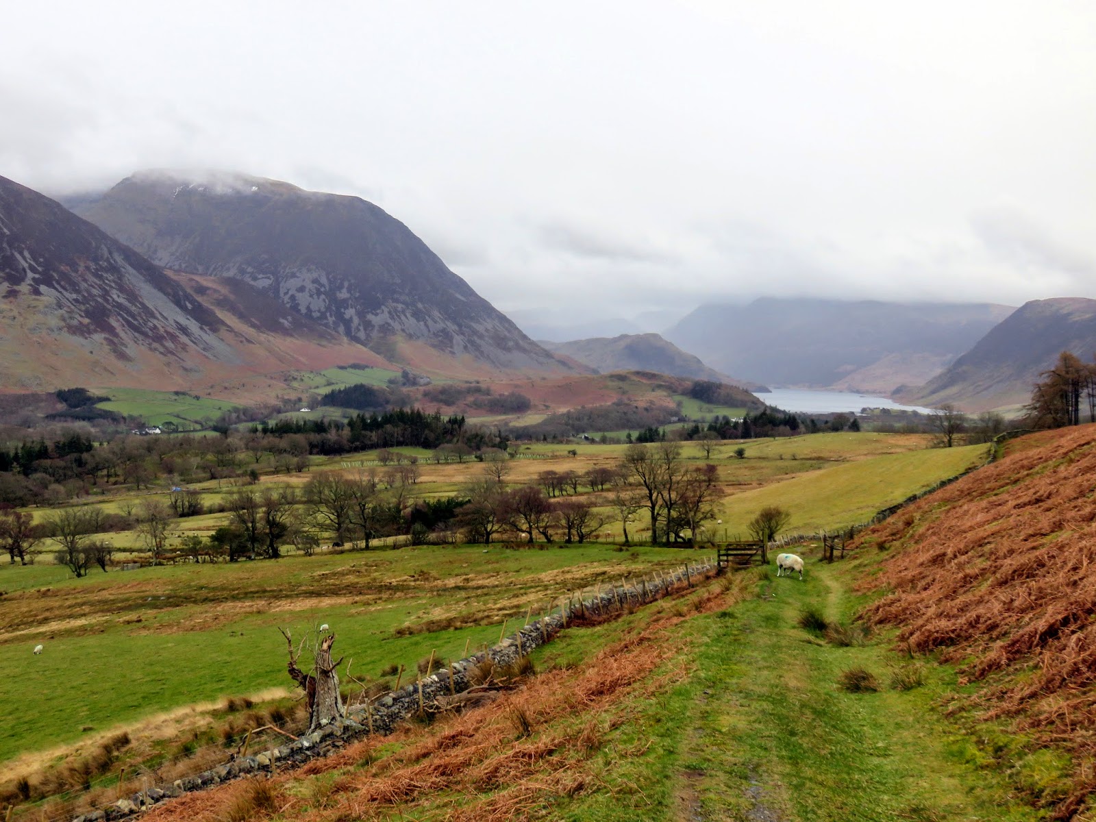
| Crummock Water |
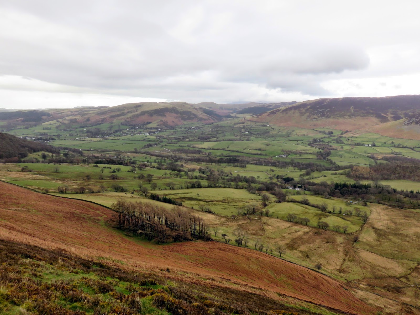
 |
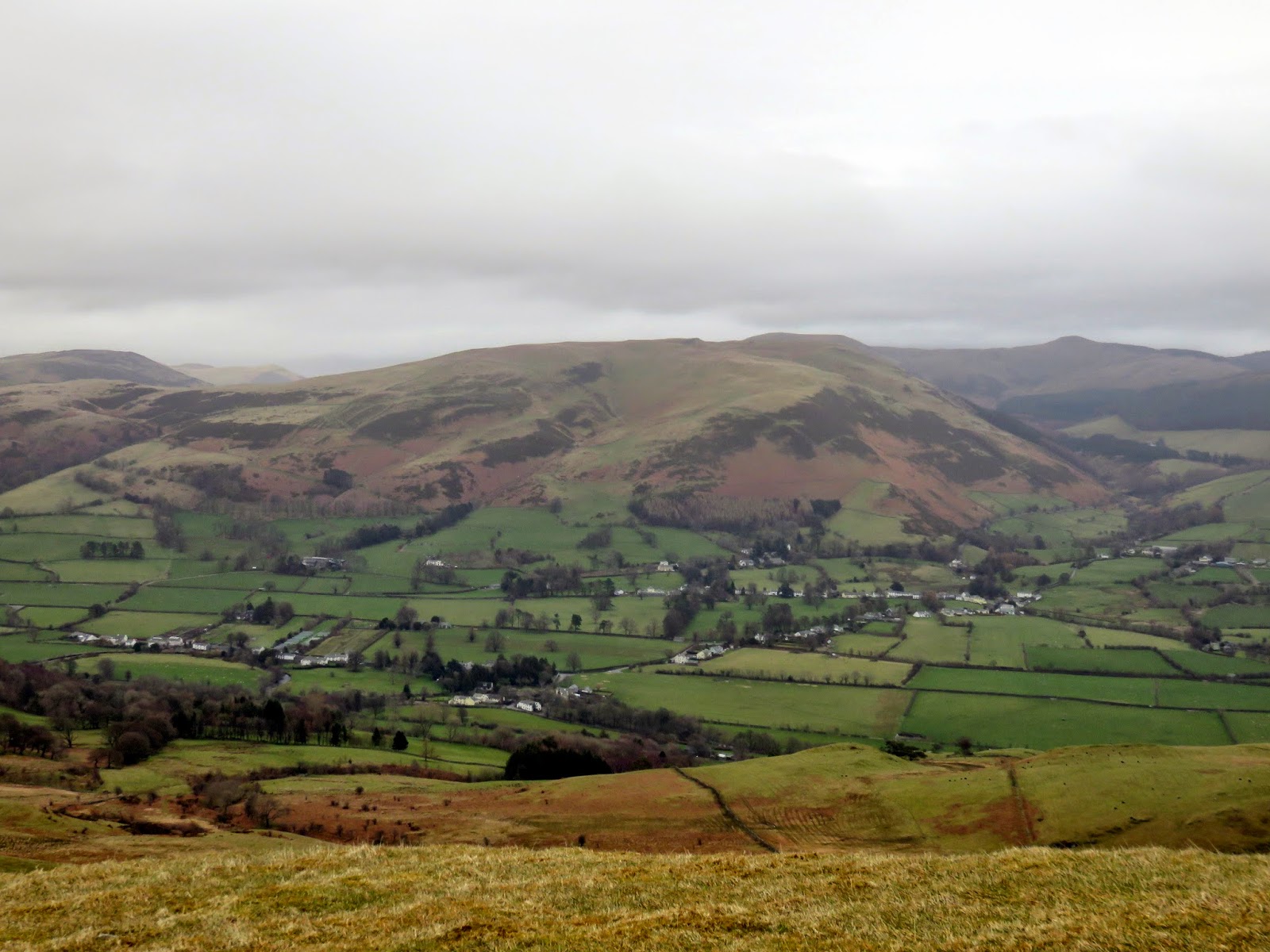
| Lorton Vale |
 |
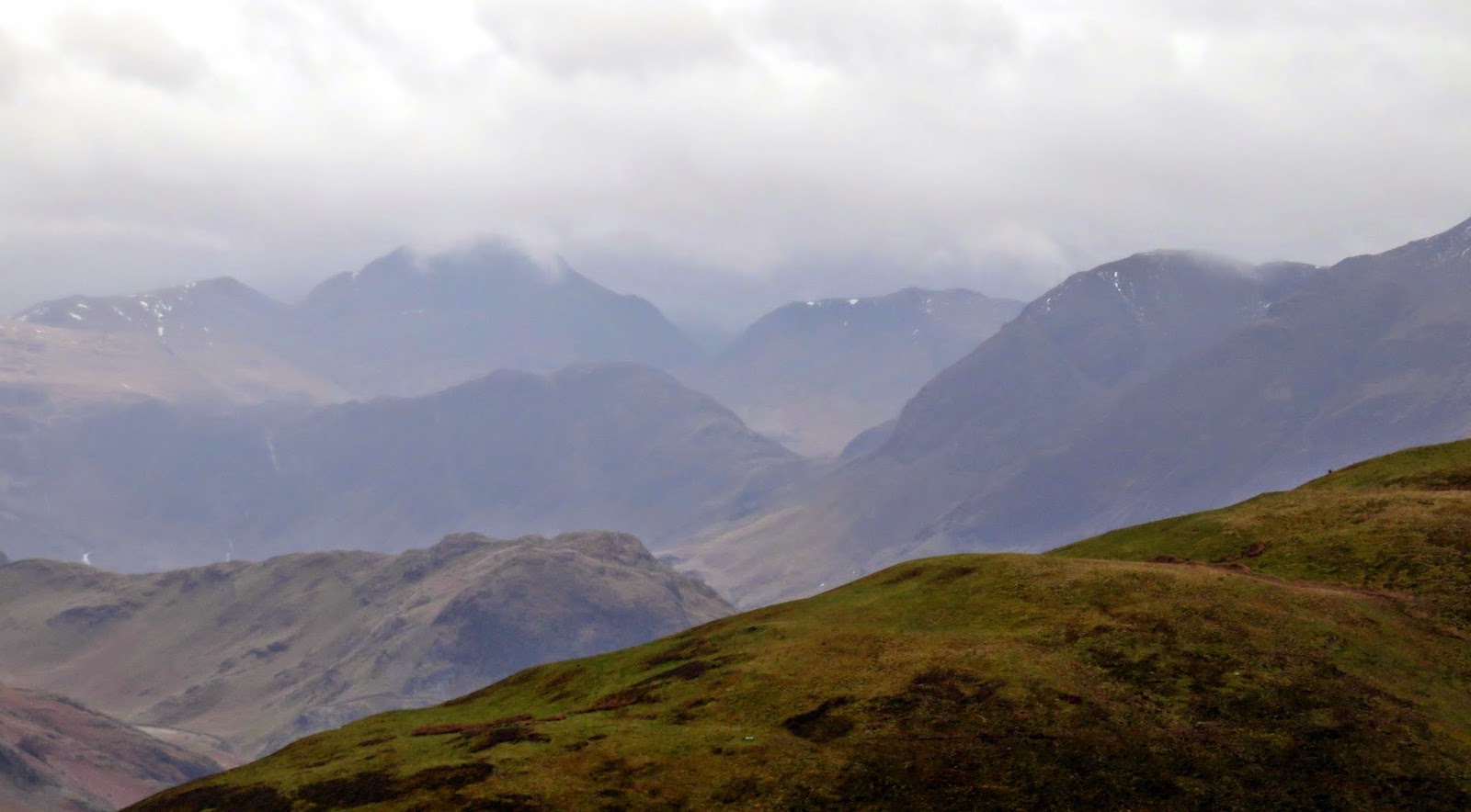
| Layers of fells |
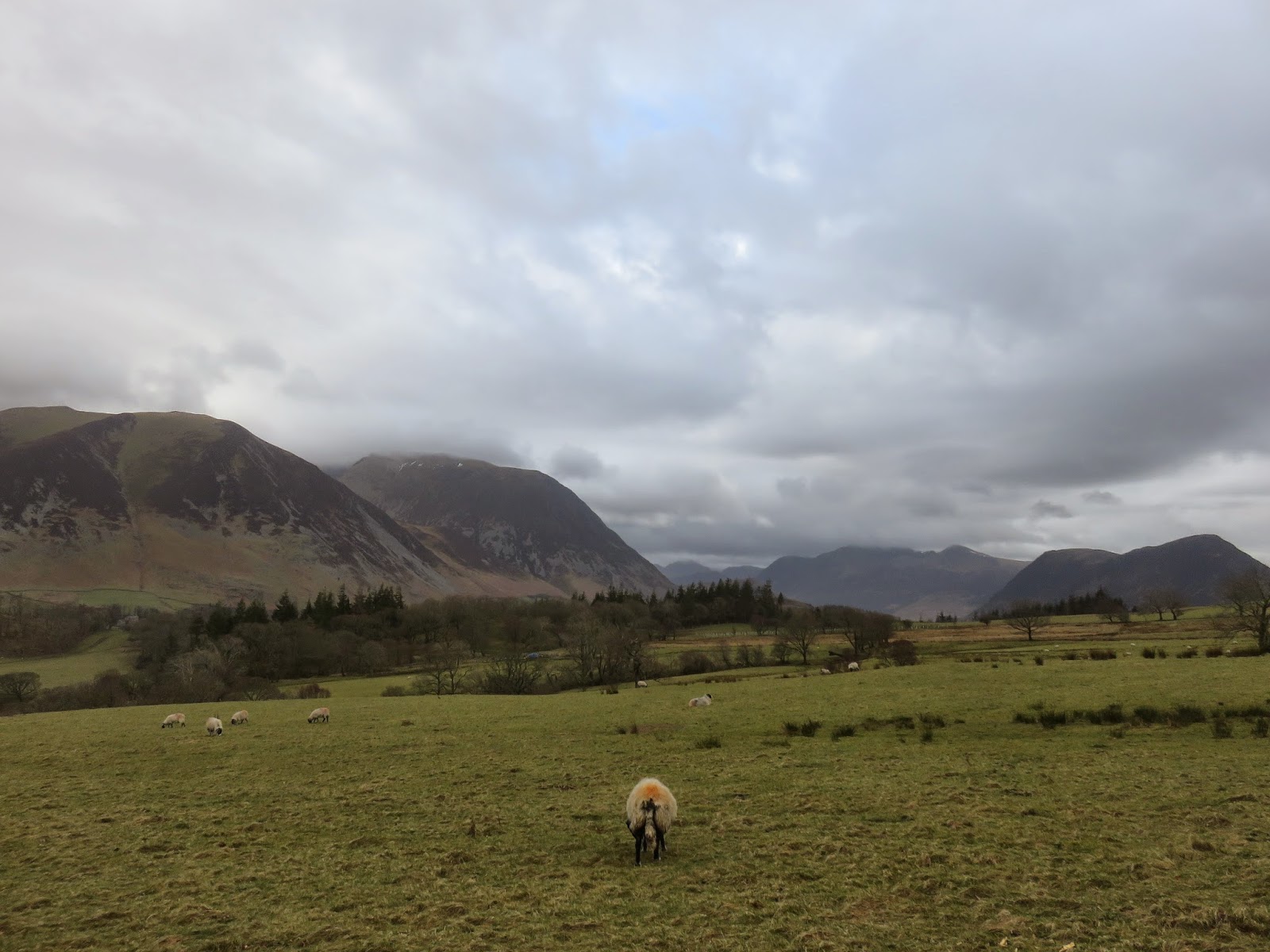
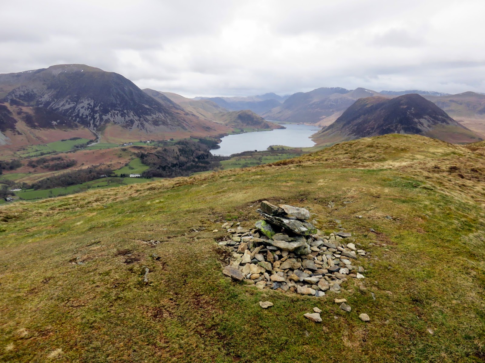
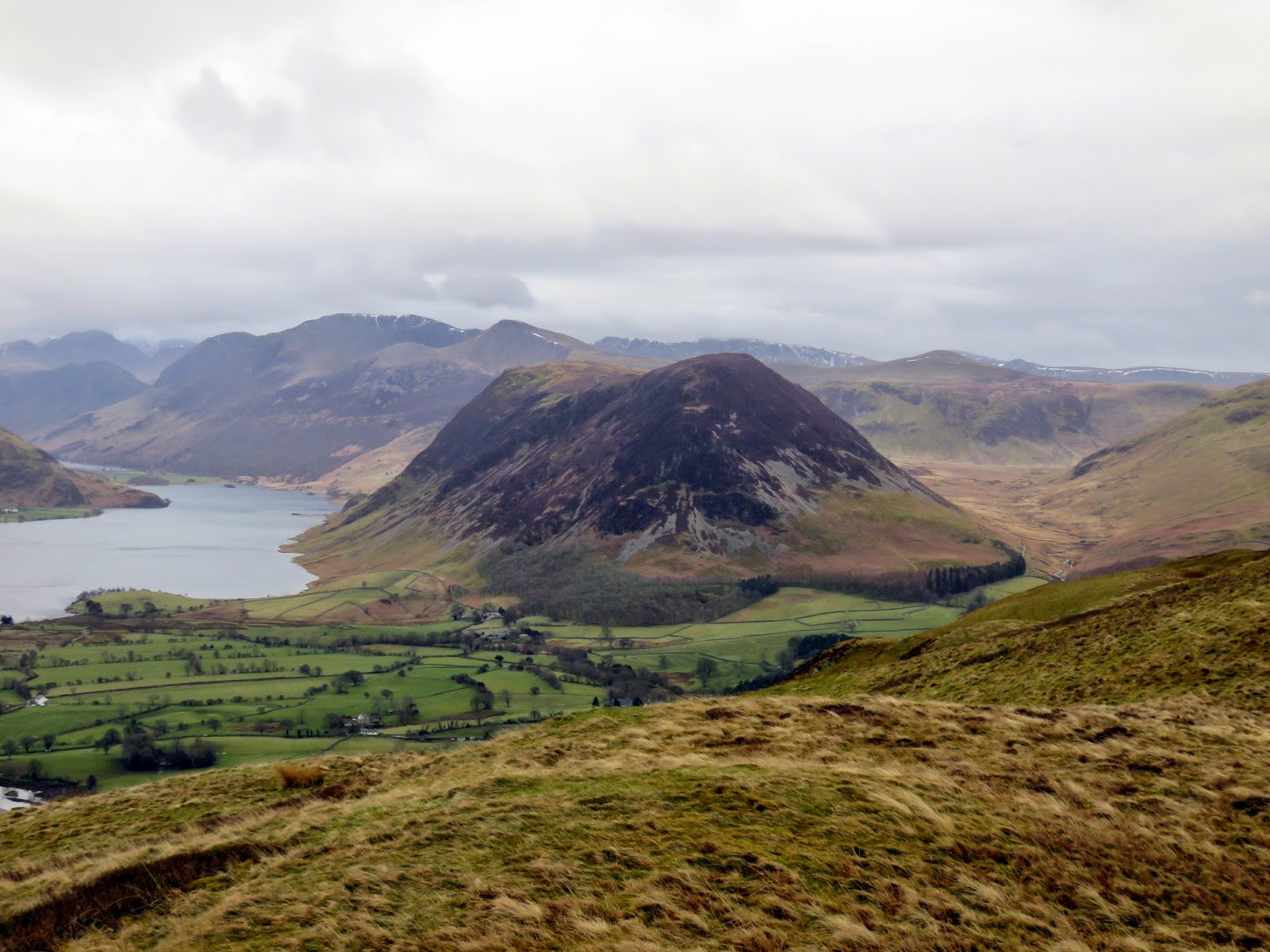
After a few sweaty and tiring minutes, I eventually emerged onto the felltop, welcomed by the stiff breeze that I’d been sheltered from previously. Another short climb leads up onto the summit of Low Fell and opens up a tremendous view along Crummock Water and Buttermere. Despite the wind and the low clouds, I spent a few minutes on the summit snapping away at the views, the results of which can be seen below – Mellbreak looks particularly imposing from this vantage point.
 |
| The summit looking to Crummock Water |
 |
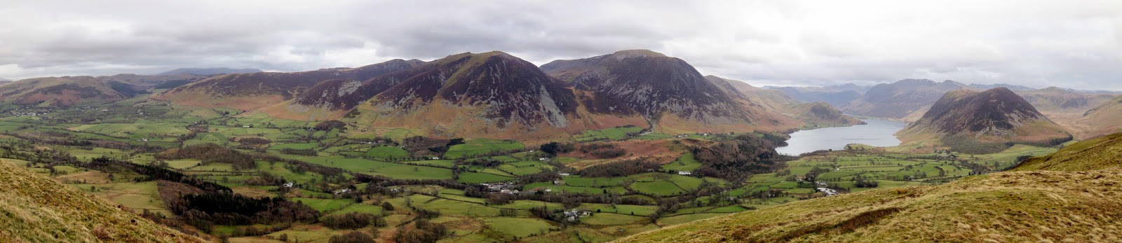
| Panorama of Lorton Vale |
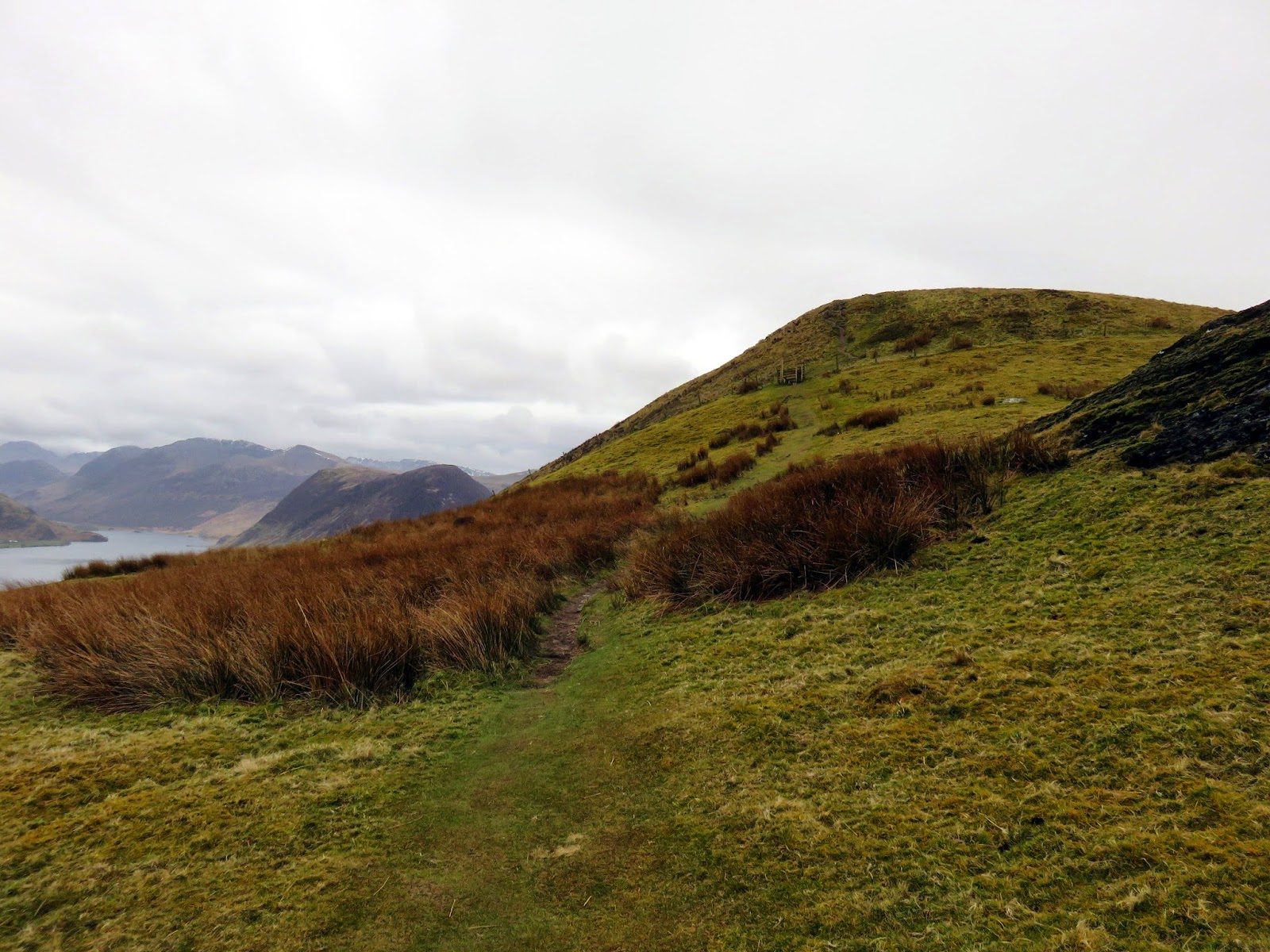
Low Fell, despite the name, is the highest fell of the group which form their own little range in miniature. There are cols and subsidiary tops and the odd crag or two which makes for an interesting afternoon out. I retraced my steps to Watching Crag and made a short crossing on Sourfoot Fell before heading up to Smithy Fell, both hills falling into the category of Birketts. Directly north of Smithy Fell is Fellbarrow.
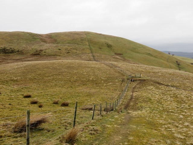 |
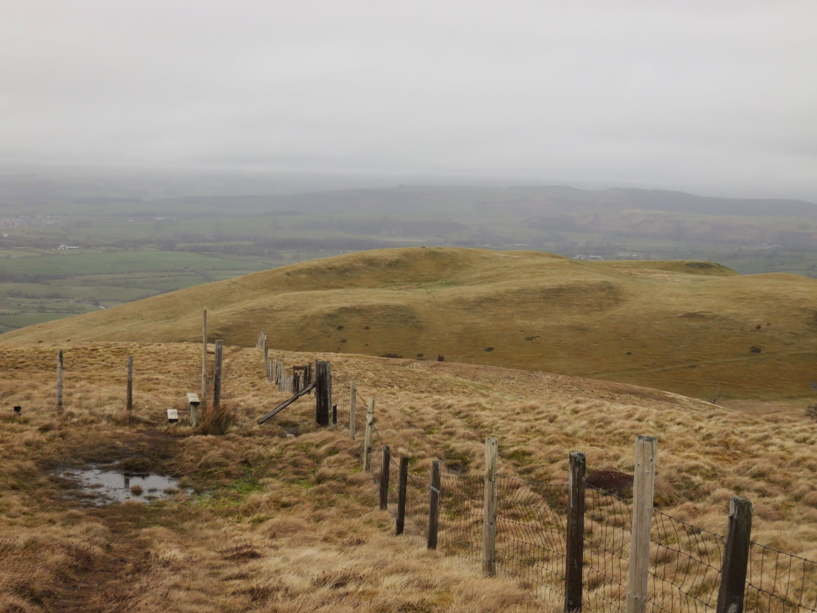
| The fence leads right up to the summit of Fellbarrow |
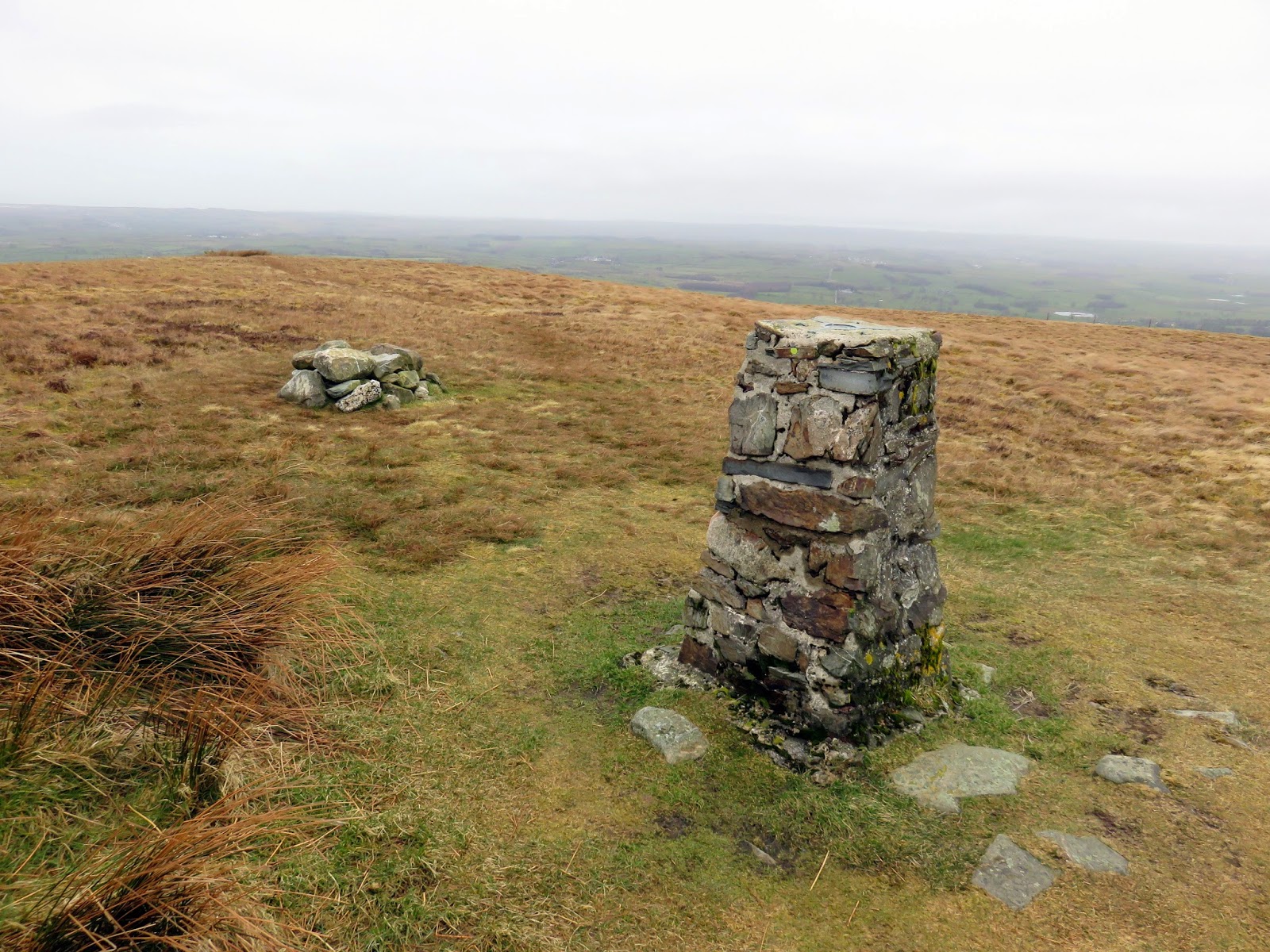
Fellbarrow was originally considered to be the higher of the two fells, a mistake that’s easy to make thanks to its relative prominence from surrounding hills and the fact that there is actually only 7m difference in height between them. 7m viewed from a few miles away becomes inconsequential. It is also topped by a trig pillar which may have swayed the decision in its favour, despite the pillar overlooking Cockermouth and great swath of farmland in the valley of the River Marron rather than towards the heart of the western Lake District.
 |
| Hattergill Head |
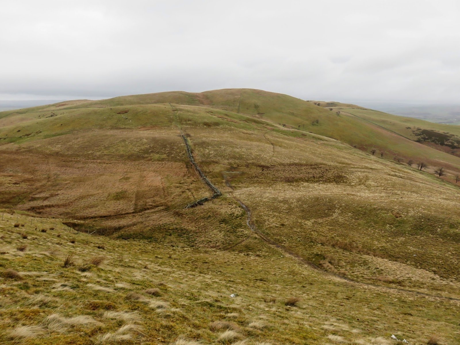
Hattergill Head, another Birkett fell, was too close not to visit (seeing as I’d travelled all this way anyway) so I made the short trip over to it before deciding that that would be it for the days adventures and made plans to return to the car. Despite the lesson learned earlier in the day (the lesson about what happens when you don’t follow the paths), I made an off-path descent from Hattergill Head into the small valley of Meregill Beck.
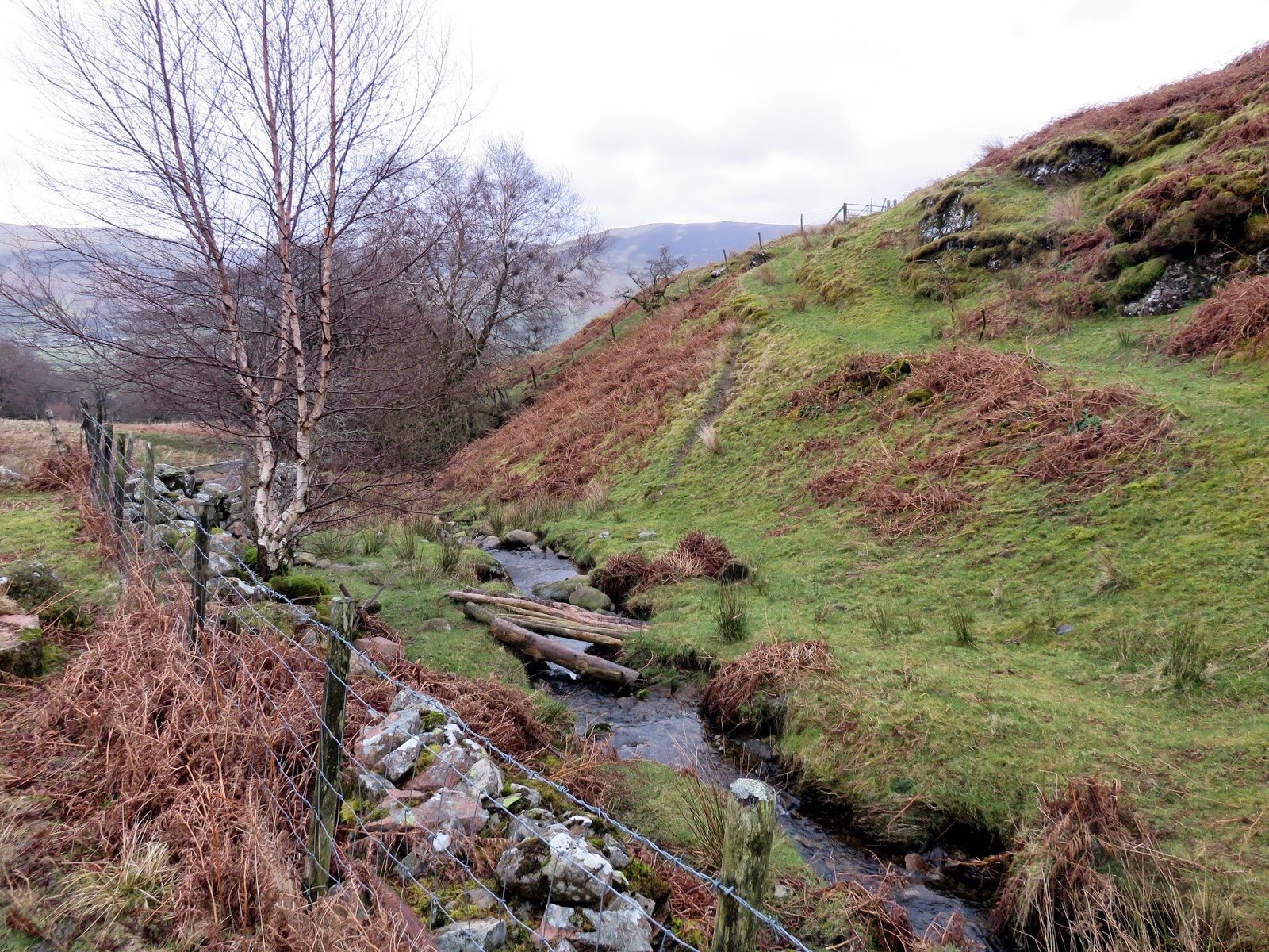
 |
| Meregill Beck |
After a few routes were blocked by dense, thorny bushes, I found a way through before awkwardly crossing a dodgy fence/wall combination and an agricultural looking footbridge. The ultimate aim was to reach the track that I should have followed earlier in the day, the track that leads gently back down to Thackthwaite.
 |
| The track I should have followed earlier in the day |
 |
| Back to Thackthwaite |
A light drizzle had started to fall again by the time I reached the car, a precursor to a night of high winds and heavy rain that lay ahead. Despite the unconventional choice of route, I thoroughly enjoyed this walk, something that may be due to the fact that it stayed relatively dry compared to the mornings effort. They may be far away for most tourists but Low Fell has some commanding views of the Vale of Lorton and Crummock Water which make the trip wholly worth it.

