Open Space Web-Map builder Codehttps://openspace.ordnancesurvey.co.uk/osmapapi/openspace.js?key=3119F72552FD5C22E0530C6CA40A5A92https://openspace.ordnancesurvey.co.uk/osmapapi/script/mapbuilder/basicmap.jshttps://openspace.ordnancesurvey.co.uk/osmapapi/script/mapbuilder/searchbox.js//variables for routes var linesLayer, points, lineFeature, lineString, routeMarkersLayer, routepos, routesize, routeoffset, routeicon; var style_blue = {strokeColor: “#0000CD”, strokeOpacity: 0.5, strokeWidth: 4.5}; function initmapbuilder() { //initiate the map var options = {resolutions: [2500, 1000, 500, 200, 100, 50, 25, 10, 5, 4, 2.5, 2, 1]}; osMap = new OpenSpace.Map(‘map’, options); //configure map options (basicmap.js) setglobaloptions(); //set the center of the map and the zoom level osMap.setCenter(new OpenSpace.MapPoint(406920,457765),7); linesLayer = osMap.getVectorLayer(); // Set up layer for route markers routeMarkersLayer = new OpenLayers.Layer.Markers(“Route Markers”); //make a route points = new Array(); points.push(new OpenLayers.Geometry.Point(407196.66666031,453961.66667938)); points.push(new OpenLayers.Geometry.Point(407391.66666031,454031.66667938)); points.push(new OpenLayers.Geometry.Point(407526.66666031,454151.66667938)); points.push(new OpenLayers.Geometry.Point(407606.66666031,454151.66667938)); points.push(new OpenLayers.Geometry.Point(407746.66666031,454361.66667938)); points.push(new OpenLayers.Geometry.Point(407901.66666031,454511.66667938)); points.push(new OpenLayers.Geometry.Point(408031.66666031,454846.66667938)); points.push(new OpenLayers.Geometry.Point(408046.66666031,455006.66667938)); points.push(new OpenLayers.Geometry.Point(407926.66666031,455191.66667938)); points.push(new OpenLayers.Geometry.Point(407801.66666031,455371.66667938)); points.push(new OpenLayers.Geometry.Point(407651.66666031,455461.66667938)); points.push(new OpenLayers.Geometry.Point(407621.66666031,455591.66667938)); points.push(new OpenLayers.Geometry.Point(407546.66666031,455661.66667938)); points.push(new OpenLayers.Geometry.Point(407586.66666031,455781.66667938)); points.push(new OpenLayers.Geometry.Point(407606.66666031,456051.66667938)); points.push(new OpenLayers.Geometry.Point(407686.66666031,456316.66667938)); points.push(new OpenLayers.Geometry.Point(407821.66666031,456441.66667938)); points.push(new OpenLayers.Geometry.Point(407906.66666031,456601.66667938)); points.push(new OpenLayers.Geometry.Point(407991.66666031,456841.66667938)); points.push(new OpenLayers.Geometry.Point(408021.66666031,456996.66667938)); points.push(new OpenLayers.Geometry.Point(408106.66666031,457126.66667938)); points.push(new OpenLayers.Geometry.Point(408191.66666031,457356.66667938)); points.push(new OpenLayers.Geometry.Point(408151.66666031,457476.66667938)); points.push(new OpenLayers.Geometry.Point(408146.66666031,457756.66667938)); points.push(new OpenLayers.Geometry.Point(408146.66666031,457841.66667938)); points.push(new OpenLayers.Geometry.Point(408151.66666031,457946.66667938)); points.push(new OpenLayers.Geometry.Point(408031.66666031,458196.66667938)); points.push(new OpenLayers.Geometry.Point(407946.66666031,458436.66667938)); points.push(new OpenLayers.Geometry.Point(407961.66666031,458621.66667938)); points.push(new OpenLayers.Geometry.Point(408021.66666031,458941.66667938)); points.push(new OpenLayers.Geometry.Point(407861.66666031,459106.66667938)); points.push(new OpenLayers.Geometry.Point(407851.66666031,459341.66667938)); points.push(new OpenLayers.Geometry.Point(407906.66666031,459466.66667938)); points.push(new OpenLayers.Geometry.Point(407891.66666031,459806.66667938)); points.push(new OpenLayers.Geometry.Point(407806.66666031,459666.66667938)); points.push(new OpenLayers.Geometry.Point(407446.66666031,459481.66667938)); points.push(new OpenLayers.Geometry.Point(407231.66666031,459266.66667938)); points.push(new OpenLayers.Geometry.Point(406931.66666031,458931.66667938)); points.push(new OpenLayers.Geometry.Point(406871.66666031,458836.66667938)); points.push(new OpenLayers.Geometry.Point(406646.66666031,458816.66667938)); points.push(new OpenLayers.Geometry.Point(406606.66666031,458871.66667938)); points.push(new OpenLayers.Geometry.Point(406571.66666031,458866.66667938)); points.push(new OpenLayers.Geometry.Point(406436.66666031,458956.66667938)); points.push(new OpenLayers.Geometry.Point(406406.66666031,459066.66667938)); points.push(new OpenLayers.Geometry.Point(406326.66666031,459146.66667938)); points.push(new OpenLayers.Geometry.Point(406186.66666031,459181.66667938)); points.push(new OpenLayers.Geometry.Point(406076.66666031,459261.66667938)); points.push(new OpenLayers.Geometry.Point(406016.66666031,459256.66667938)); points.push(new OpenLayers.Geometry.Point(405941.66666031,459251.66667938)); points.push(new OpenLayers.Geometry.Point(405876.66666031,459121.66667938)); points.push(new OpenLayers.Geometry.Point(405706.66666031,458841.66667938)); points.push(new OpenLayers.Geometry.Point(405536.66666031,458636.66667938)); points.push(new OpenLayers.Geometry.Point(405536.66666031,458461.66667938)); points.push(new OpenLayers.Geometry.Point(405501.66666031,458411.66667938)); points.push(new OpenLayers.Geometry.Point(405341.66666031,458301.66667938)); points.push(new OpenLayers.Geometry.Point(405266.66666031,458091.66667938)); points.push(new OpenLayers.Geometry.Point(405366.66666031,457916.66667938)); points.push(new OpenLayers.Geometry.Point(405381.66666031,457741.66667938)); points.push(new OpenLayers.Geometry.Point(405381.66666031,457646.66667938)); points.push(new OpenLayers.Geometry.Point(405346.66666031,457561.66667938)); points.push(new OpenLayers.Geometry.Point(405246.66666031,457396.66667938)); points.push(new OpenLayers.Geometry.Point(405346.66666031,457261.66667938)); points.push(new OpenLayers.Geometry.Point(405501.66666031,457006.66667938)); points.push(new OpenLayers.Geometry.Point(405646.66666031,456881.66667938)); points.push(new OpenLayers.Geometry.Point(405721.66666031,456846.66667938)); points.push(new OpenLayers.Geometry.Point(405696.66666031,456721.66667938)); points.push(new OpenLayers.Geometry.Point(405856.66666031,456721.66667938)); points.push(new OpenLayers.Geometry.Point(405996.66666031,456606.66667938)); points.push(new OpenLayers.Geometry.Point(406081.66666031,456586.66667938)); points.push(new OpenLayers.Geometry.Point(406206.66666031,456636.66667938)); points.push(new OpenLayers.Geometry.Point(406326.66666031,456501.66667938)); points.push(new OpenLayers.Geometry.Point(406451.66666031,456356.66667938)); points.push(new OpenLayers.Geometry.Point(406541.66666031,456201.66667938)); points.push(new OpenLayers.Geometry.Point(406621.66666031,456156.66667938)); points.push(new OpenLayers.Geometry.Point(406751.66666031,456181.66667938)); points.push(new OpenLayers.Geometry.Point(406886.66666031,456161.66667938)); points.push(new OpenLayers.Geometry.Point(406986.66666031,456101.66667938)); points.push(new OpenLayers.Geometry.Point(407071.66666031,455981.66667938)); points.push(new OpenLayers.Geometry.Point(407291.66666031,455876.66667938)); points.push(new OpenLayers.Geometry.Point(407366.66666031,455781.66667938)); points.push(new OpenLayers.Geometry.Point(407426.66666031,455656.66667938)); points.push(new OpenLayers.Geometry.Point(407461.66666031,455581.66667938)); points.push(new OpenLayers.Geometry.Point(407691.66666031,455321.66667938)); points.push(new OpenLayers.Geometry.Point(407761.66666031,455301.66667938)); points.push(new OpenLayers.Geometry.Point(407831.66666031,455121.66667938)); points.push(new OpenLayers.Geometry.Point(407866.66666031,455081.66667938)); points.push(new OpenLayers.Geometry.Point(407916.66666031,455031.66667938)); points.push(new OpenLayers.Geometry.Point(407926.66666031,454876.66667938)); points.push(new OpenLayers.Geometry.Point(407856.66666031,454671.66667938)); points.push(new OpenLayers.Geometry.Point(407696.66666031,454491.66667938)); points.push(new OpenLayers.Geometry.Point(407566.66666031,454451.66667938)); points.push(new OpenLayers.Geometry.Point(407466.66666031,454456.66667938)); points.push(new OpenLayers.Geometry.Point(407391.66666031,454396.66667938)); points.push(new OpenLayers.Geometry.Point(407386.66666031,454296.66667938)); points.push(new OpenLayers.Geometry.Point(407386.66666031,454176.66667938)); points.push(new OpenLayers.Geometry.Point(407371.66666031,454031.66667938)); points.push(new OpenLayers.Geometry.Point(407286.66666031,453981.66667938)); points.push(new OpenLayers.Geometry.Point(407196.66666031,453961.66667938)); // create a polyline feature from the array of points lineString = new OpenLayers.Geometry.LineString(points); lineFeature = new OpenLayers.Feature.Vector(lineString, null, style_blue); linesLayer.addFeatures([lineFeature]); //crate a route start/end marker routepos = new OpenSpace.MapPoint(407196.66666031,453961.66667938); routesize = new OpenLayers.Size(33,45); routeoffset = new OpenLayers.Pixel(-5,-37); routeicon = new OpenSpace.Icon(‘https://openspace.ordnancesurvey.co.uk/osmapapi/img_versions/img_1.1/mapbuilder/routemarker-startend.png’, routesize, routeoffset, null, null); routeMarkersLayer.addMarker(new OpenLayers.Marker(routepos, routeicon)); osMap.addLayer(routeMarkersLayer);}
Route: Bolton Abbey, Dales Way, Lud Stream Brow, Posforth Gill, Posforth Force, Valley of Desolation, Sheepshaw Plantation, Great Agill Bottom, Great Agill Head, Truckle Crags, Simon’s Seat, Grey Stone, Howgill, Dales Way, Barden Bridge, The Strid, Strid Wood, Sulphury Well, Bolton Abbey
Date: 07/03/2015
From: Bolton Abbey
Parking: Bolton Abbey
Start Point: Bolton Abbey
Region: Yorkshire Dales
Route length: 11.8 miles ( km)
Time taken: 04:32
Average speed: 2.6 mph
Ascent: 788m
Descent: 792m
2000s on this walk:
None
Other Summits: Simon’s Seat (486m)
Other points of interest: Valley of Desolation, Barden Bridge, The Strid, Bolton Priory
This walk is a combination of two previous walks around the fabulous valley of Wharfedale. The first half uses the focal point of Simon’s Seat, a rocky outcrop reminiscent of those found in the Peak District – taken from the aforementioned walk. The second half is a repeat of the walk along the River Wharfe found in the Barden Tower, The Strid and Bolton Priory walk. In essence, it’s taking the best bits of two walks and combining them into one even better one.
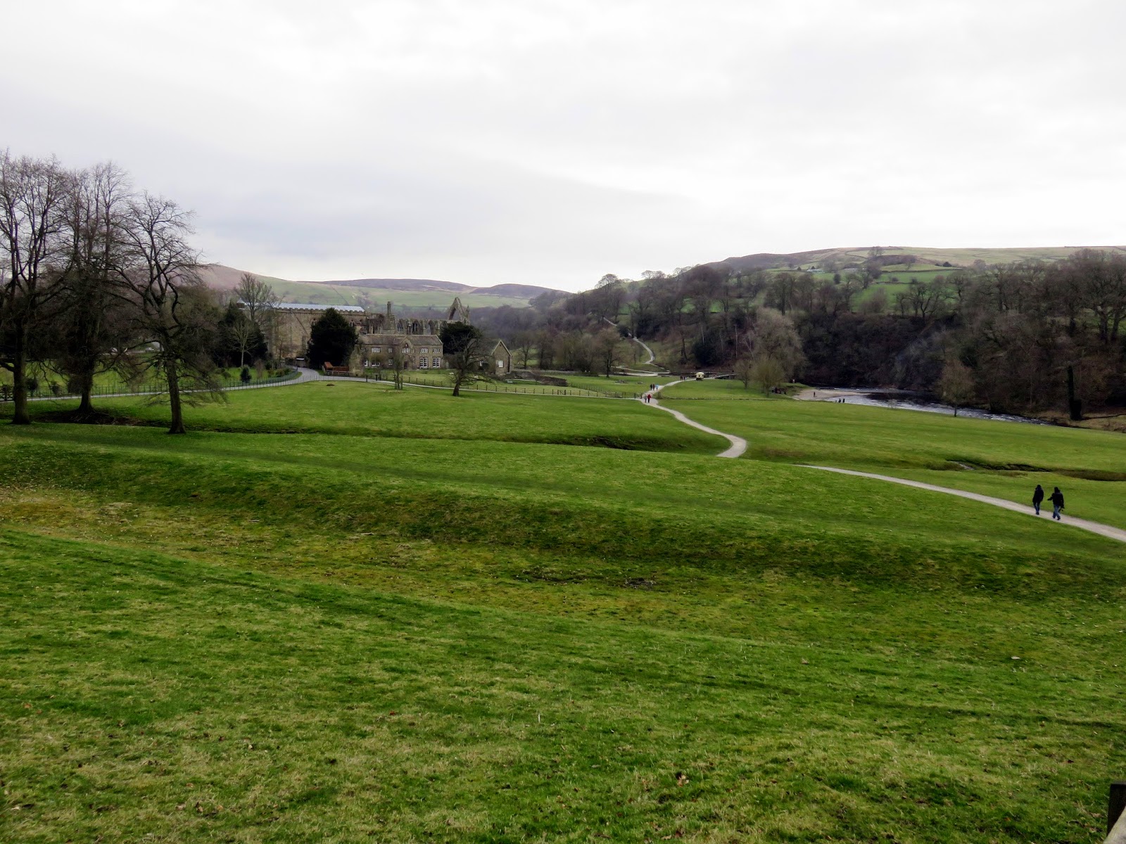
We started from the car park of Bolton Priory. It’s expensive (£7) but does allow guilt-free access into the estate where much of this walk takes place. Obviously, if you move your start point to somewhere like Drebley or Appletreewick you could avoid the fee but the car park at Bolton Abbey is convenient.
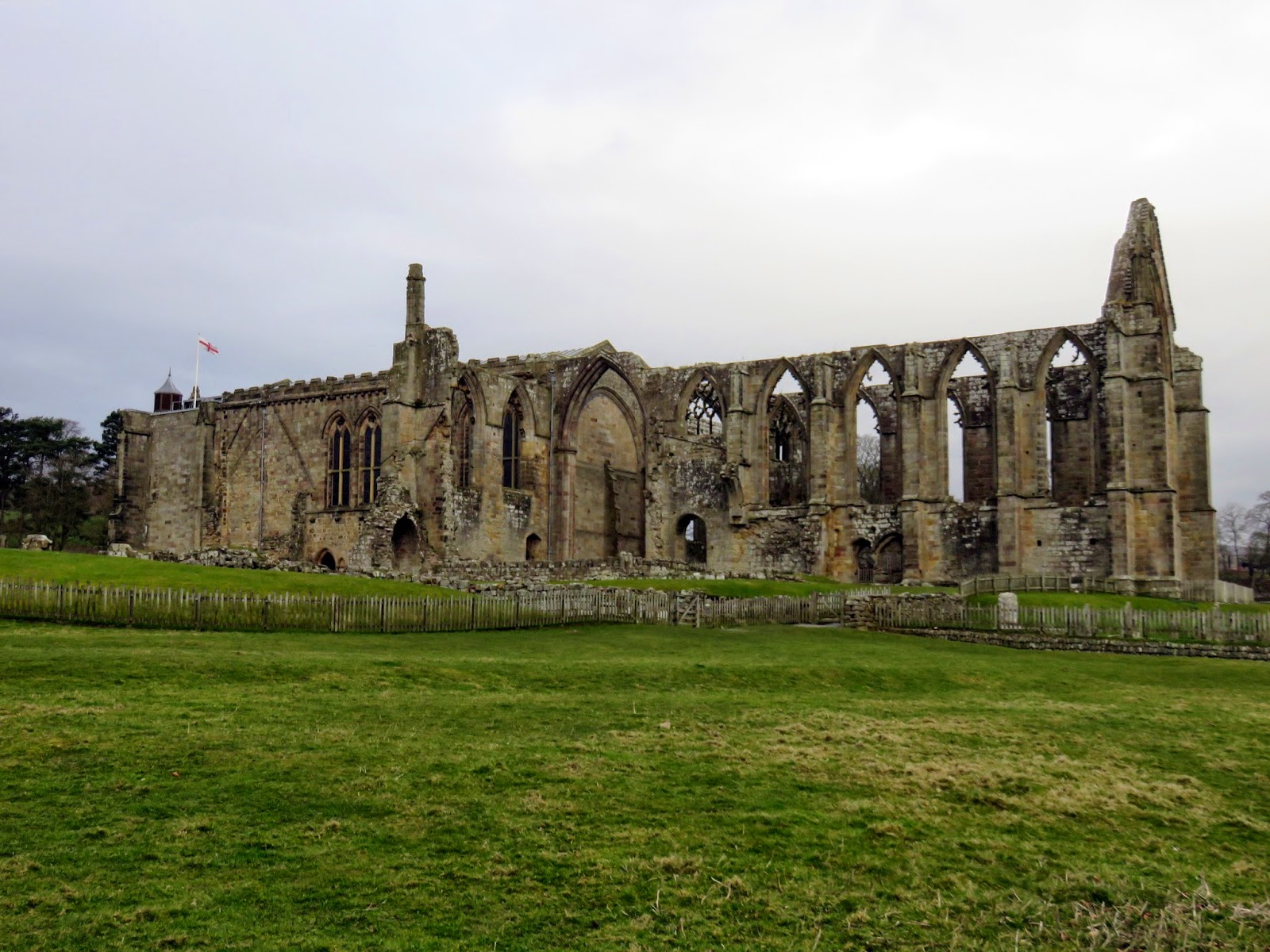
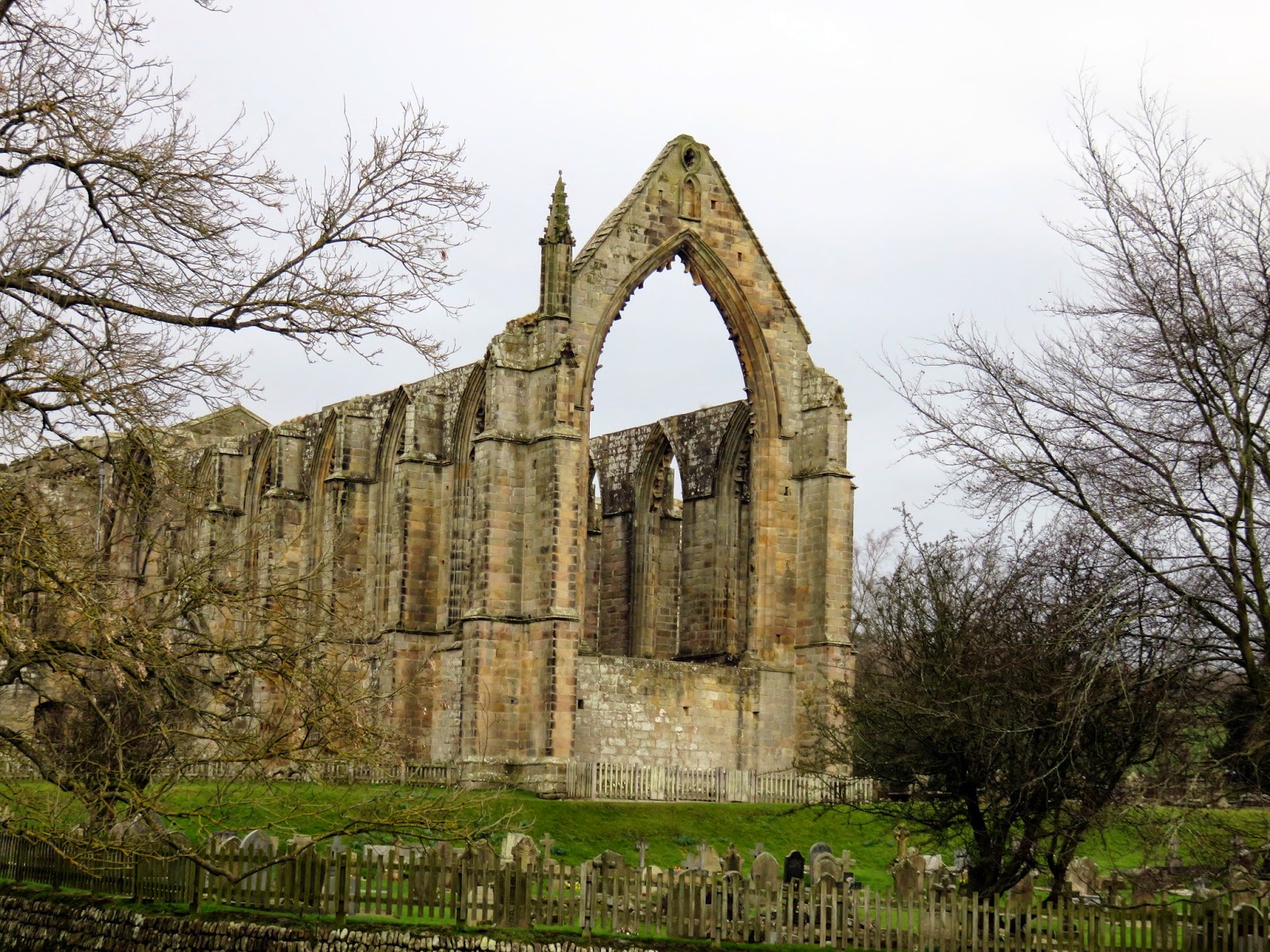
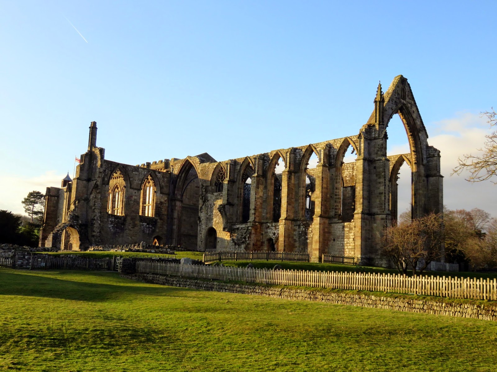
From the beginning, the route enters the estate of Bolton Priory, a ruined 12C monastery which I’ll mention a bit more about later. We crossed the river, opting for the footbridge to avoid the partly submerged stepping stones, and followed the route of the Dales Way as it sets off northwards towards Burnsall.
 |
| The grounds of Bolton Priory |
 |
| Bolton Priory |
 |
| The unfinished east end of Bolton Priory |
 |
| Sara strides out onto the Dales Way |
 |
| The River Wharfe with North Nab beyond |
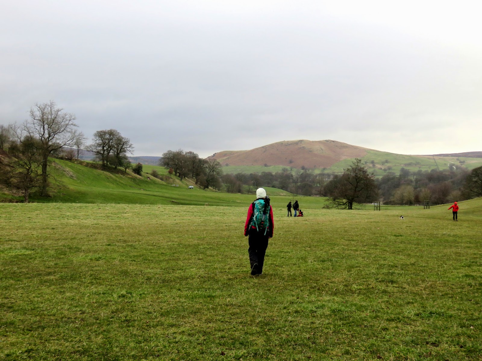
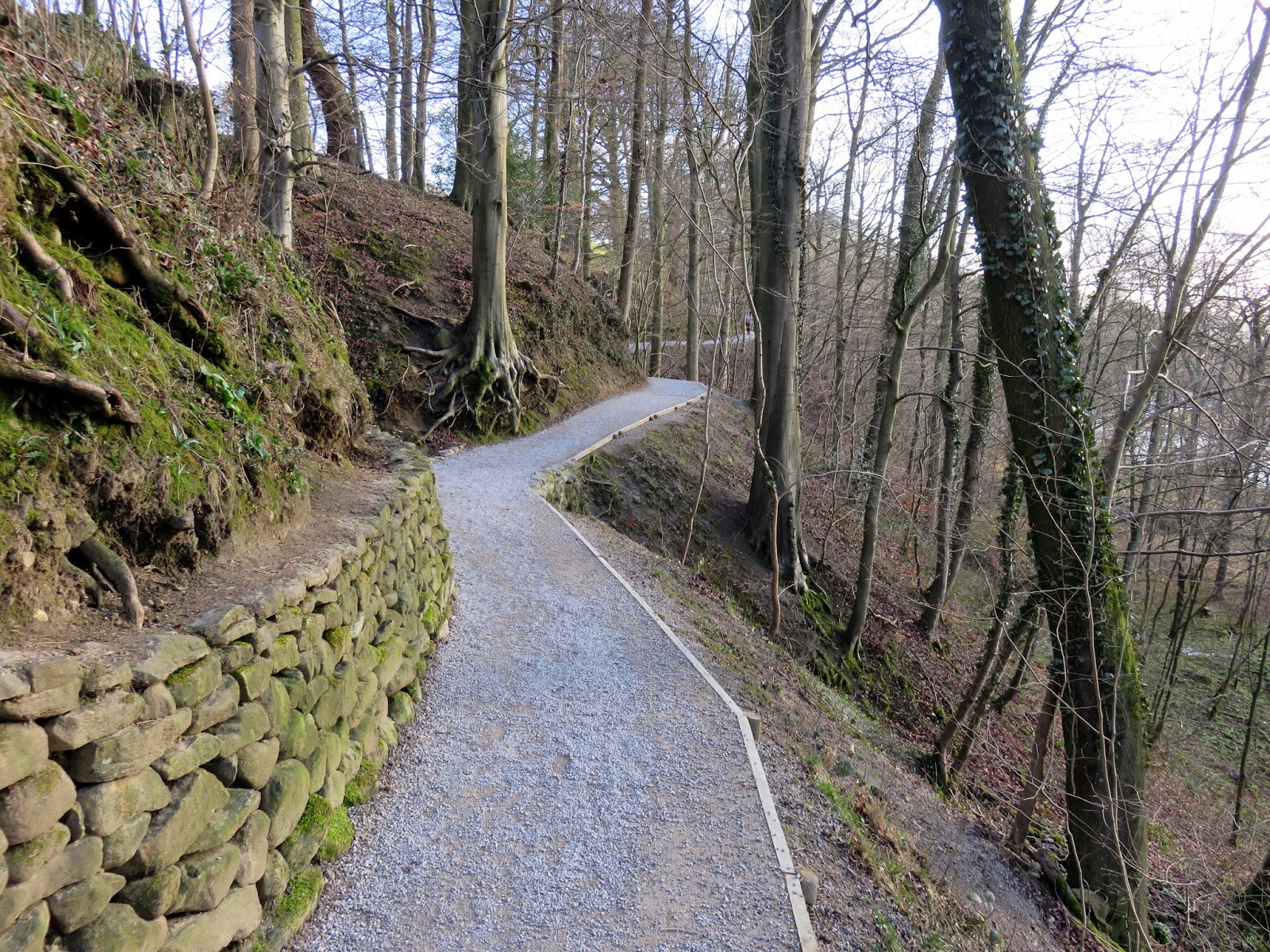
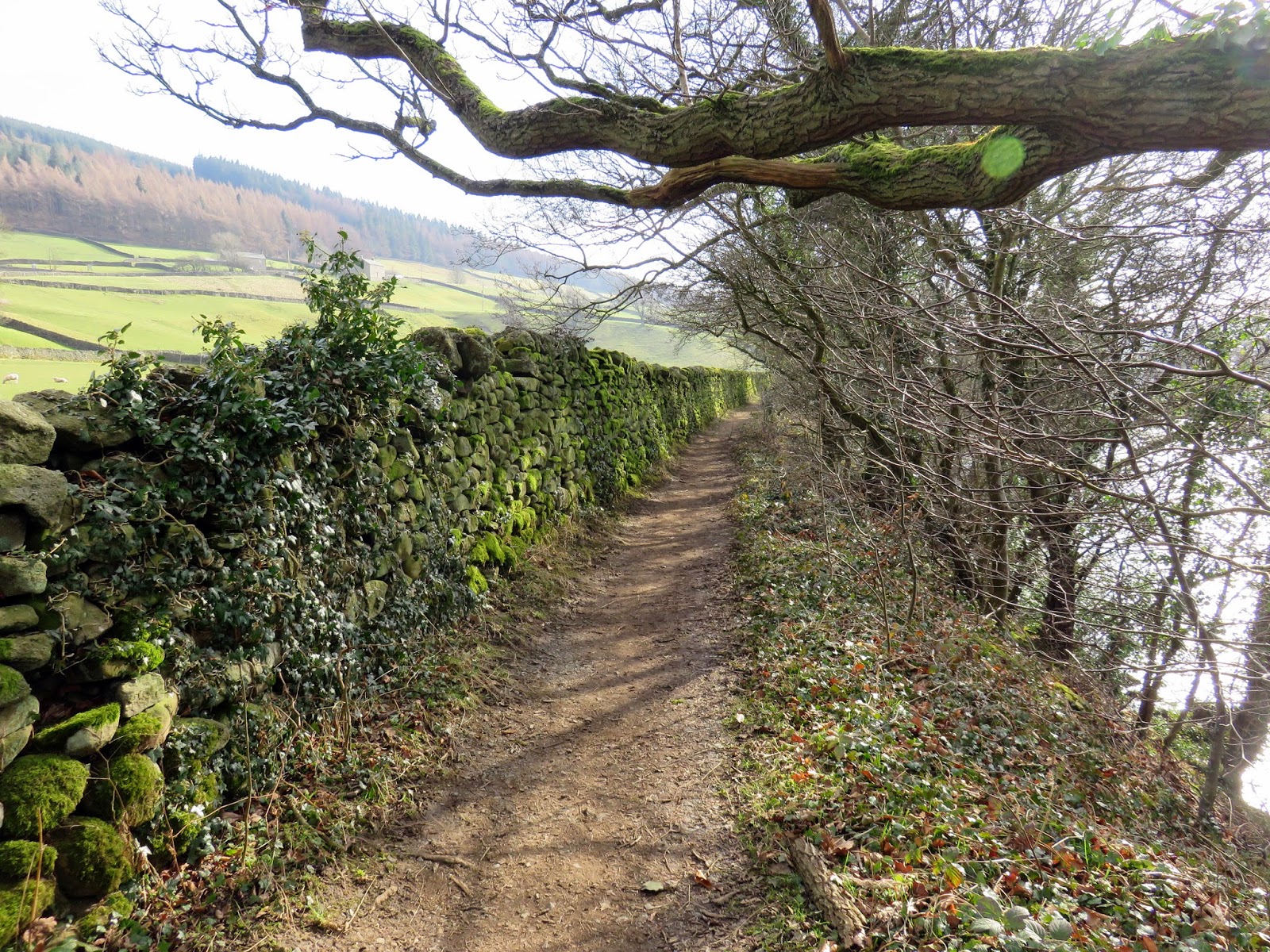
We left the Dales Way after a short distance, choosing to use one of the estates many footpaths as it climbed up the hillside above the River Wharfe. I was obvious that the path had been recently reconstructed (or even constructed!) as it was in perfect condition – proof that price of the car park is probably worth it for the upkeep of the estate. As a route of efficiency, though, this path was a mistake. No sooner had we climbed a fair distance, we were back down by the river fording the small stream of Pickles Beck. Still, it was enjoyable.
 |
| The immaculate path above the Wharfe |
 |
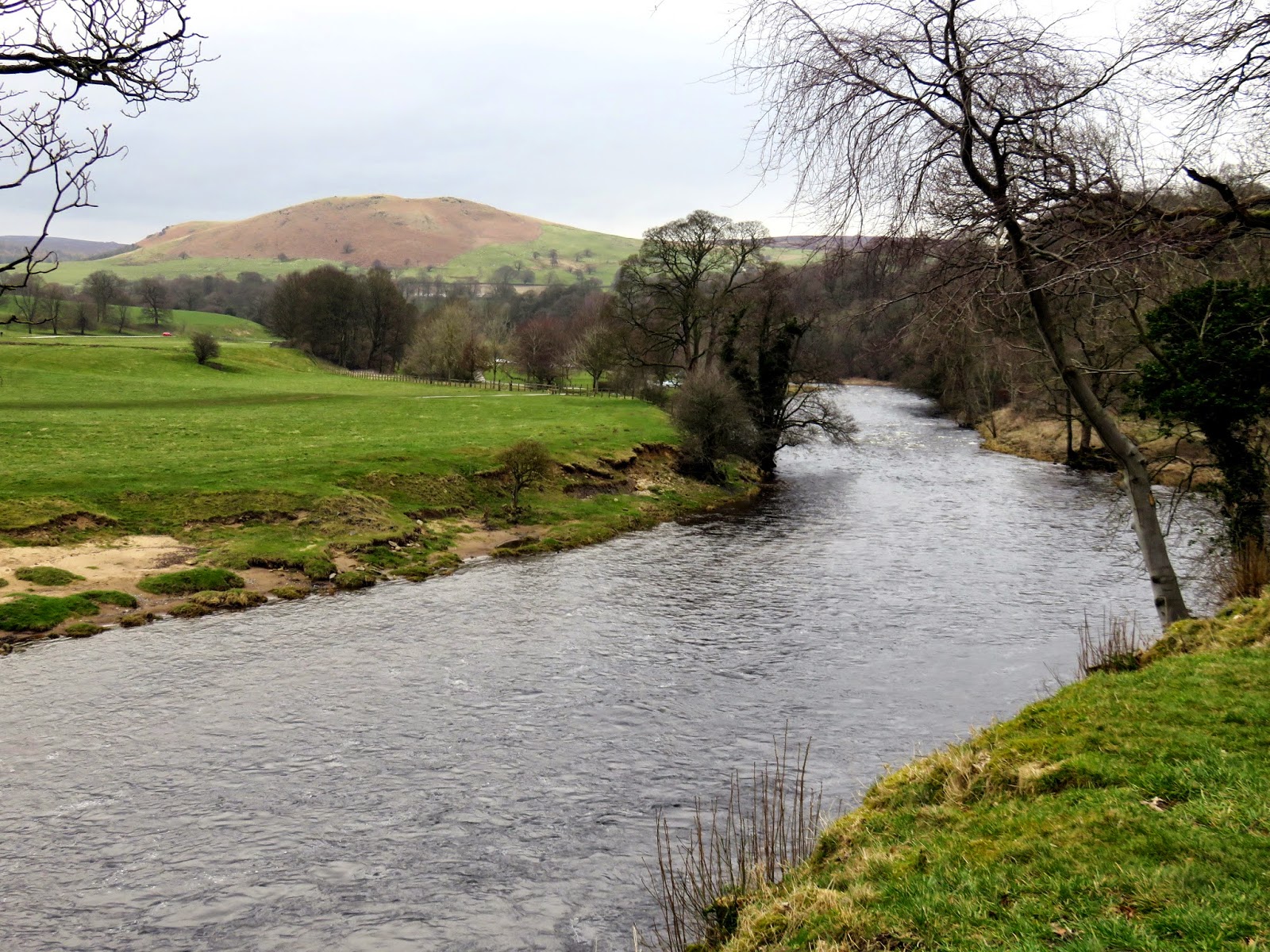
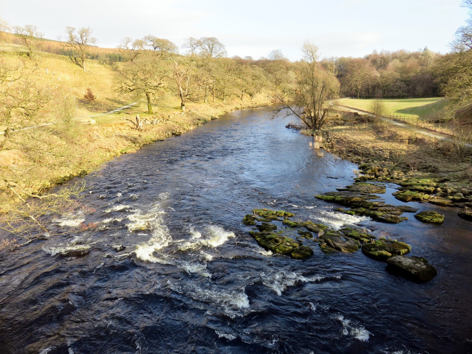
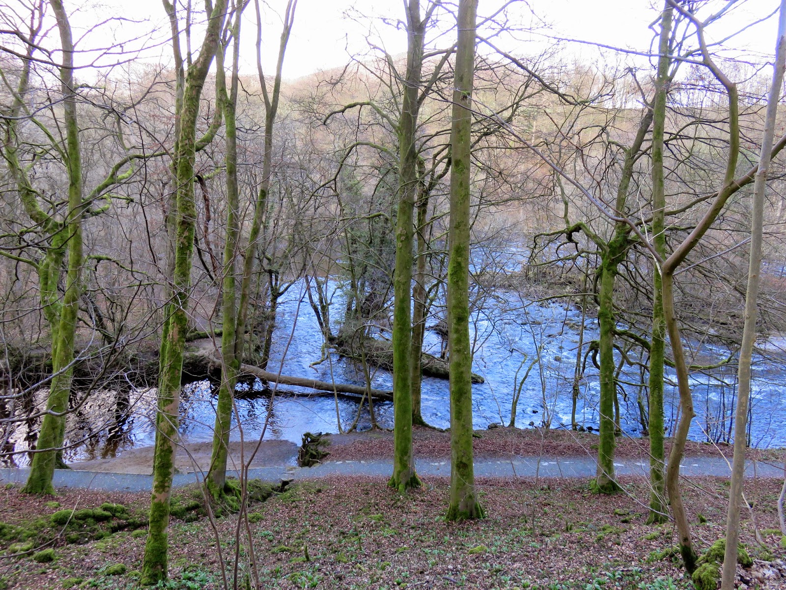
| The Wharfe as it braids at Sulphur Well |
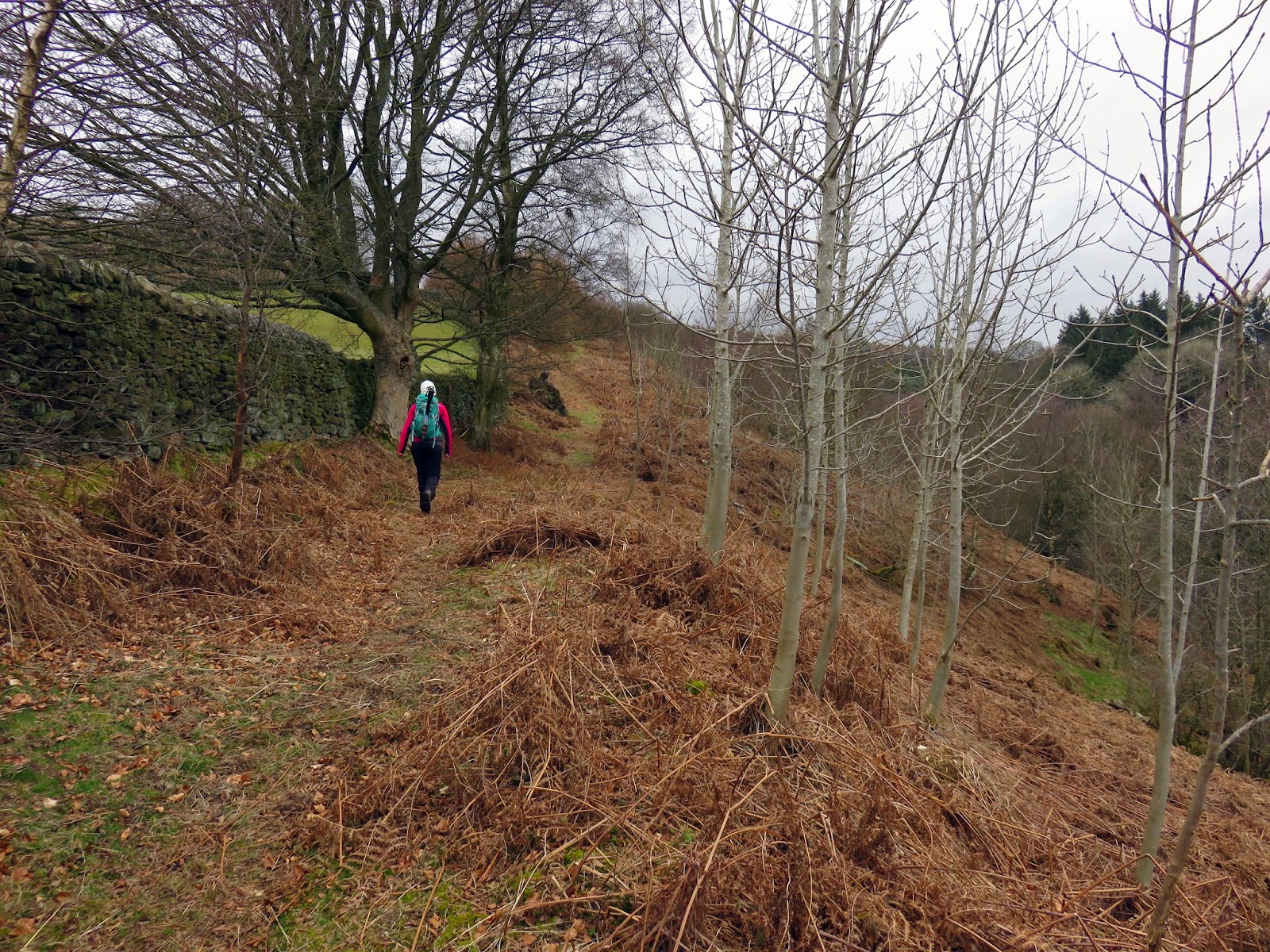
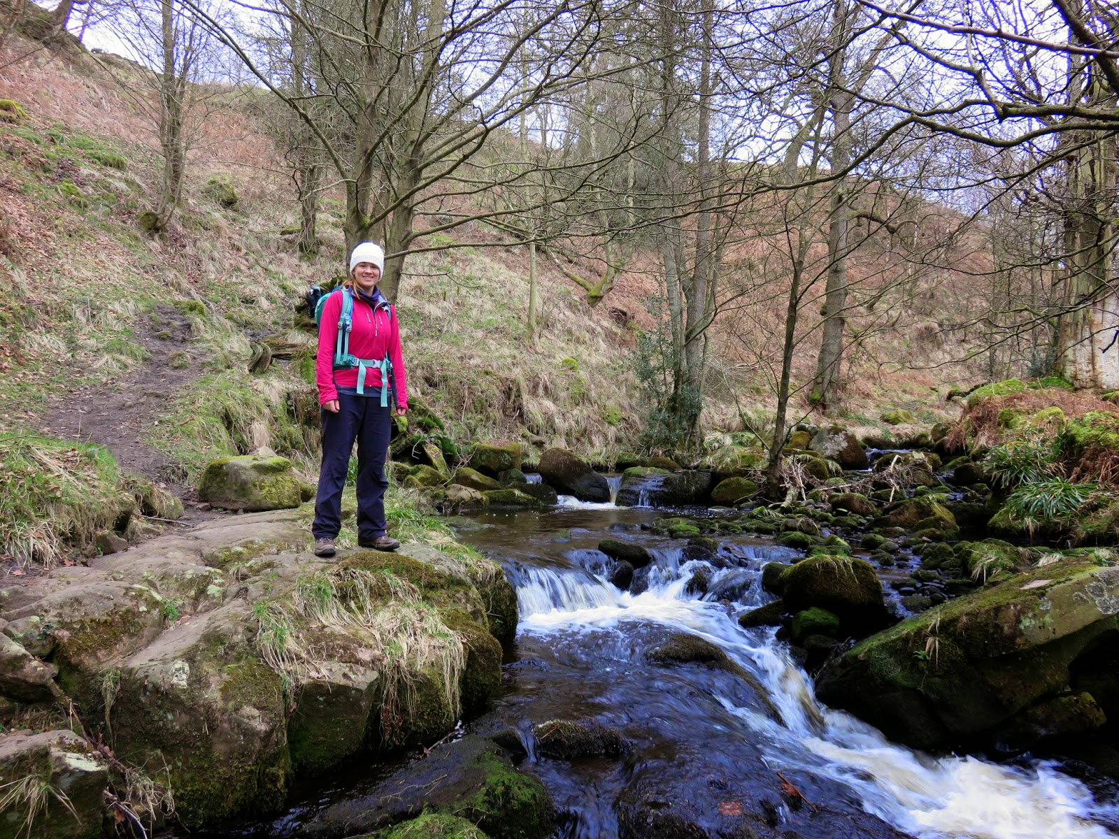
We continued along the riverside, past the footbridge near Sulphur Well to Posforth Bridge where we left the many people on the Dales Way and started up the valley of Posforth Gill. There are two parallel tracks that follow the valley, the main one is well signposted for Simon’s Seat but looked as though it was of little interest. The second, small track runs up the opposite side of the valley, high above the stream below. I’m still not 100% sure if were allowed to use this route but it is marked as a path on the map and no one was around to tell us otherwise.
 |
| The track climbs steeply at first |
 |
| Before levelling out |
 |
| Posforth Gill lies in the valley below |
 |
| The valley sides are certainly steep |
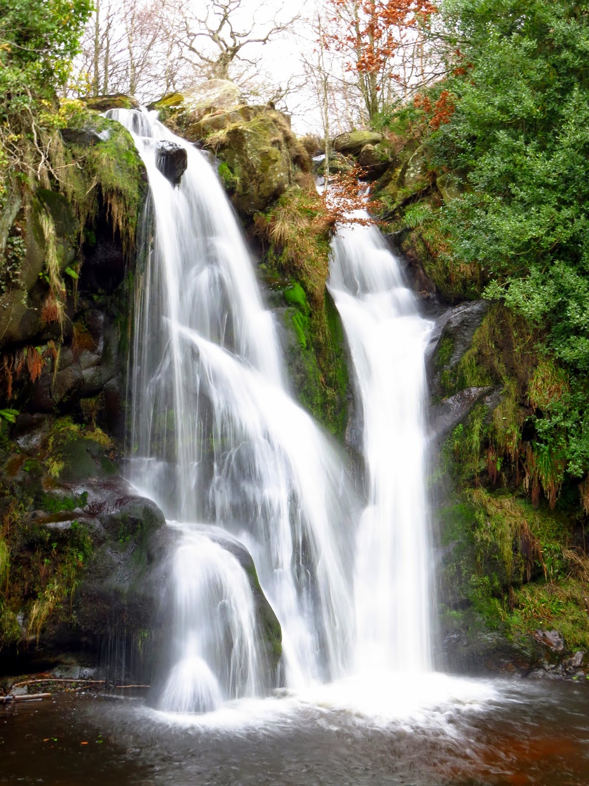
Eventually, we came across Posforth Force, a superb waterfall part way up Posforth Gill. The falls mark the entrance to The Valley of Desolation, a name that instantly triggered my attention while looking at routes around Bolton Priory. What could be so desolate about it? We ventured in to find out.
 |
| The magnificent Posforth Force |
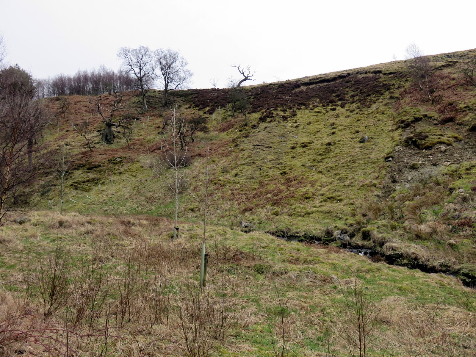
It turns out that valley really is desolate, relatively speaking. All of a sudden it feels much more open with fewer trees and vegetation covering the surrounding hillsides. The reason behind this, and its rather ominous name was a great storm which hit the valley in 1826, laying waste to many of the mature trees. The remains of some of these can still be found today.
 |
| Sara above Posforth Force |
 |
| The Valley of Desolation |
 |
| The Valley of Desolation |
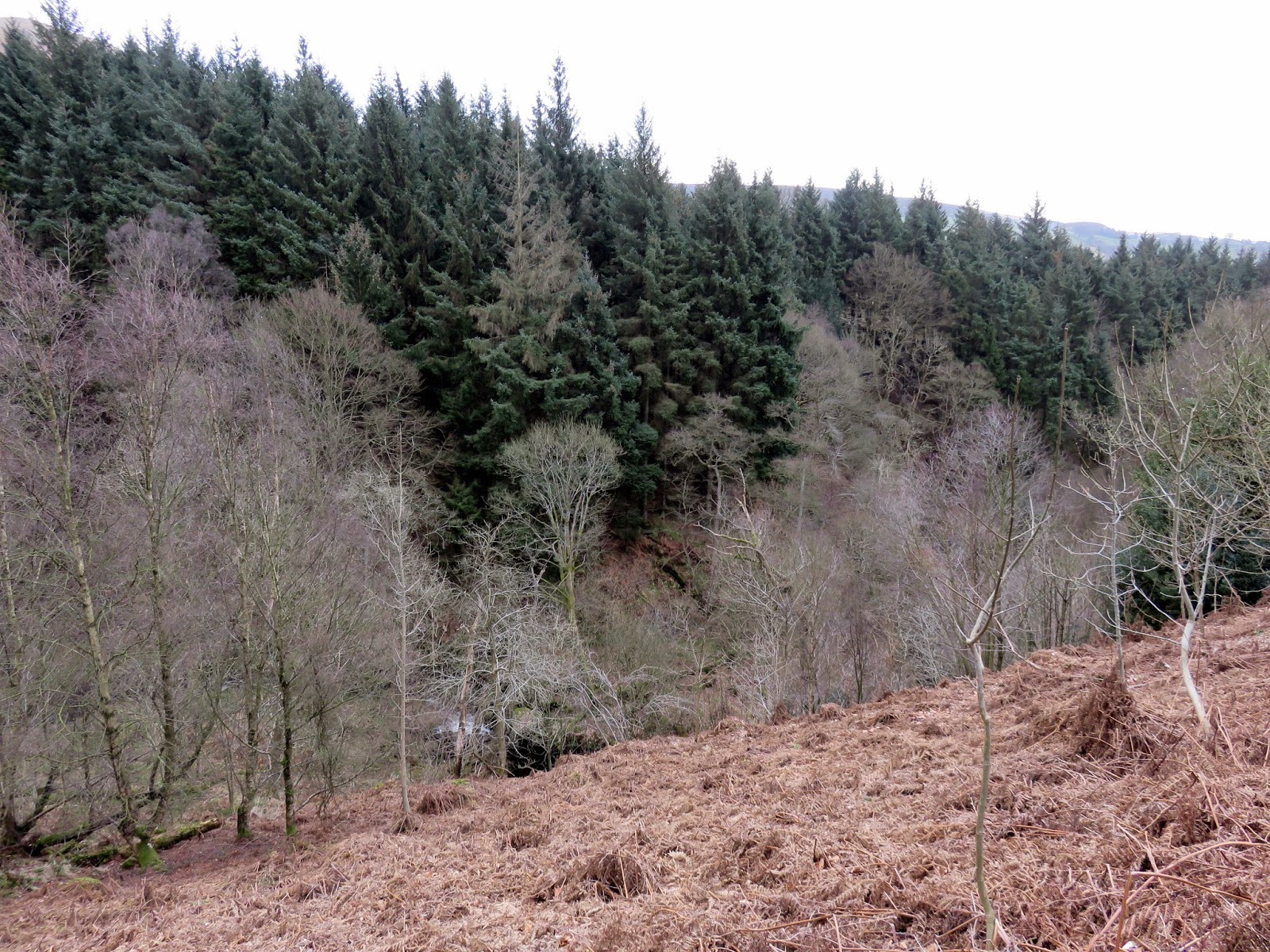
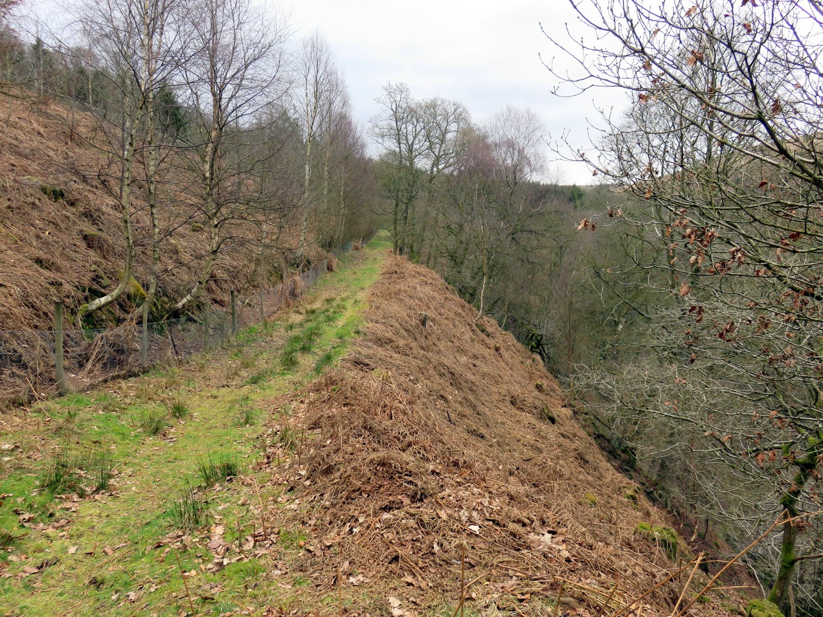
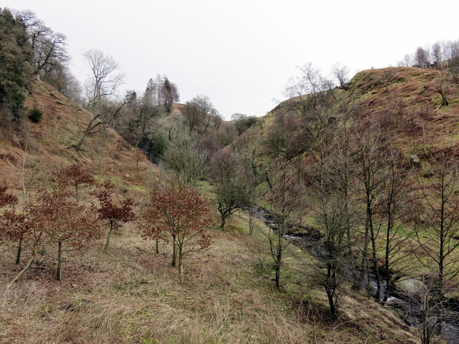
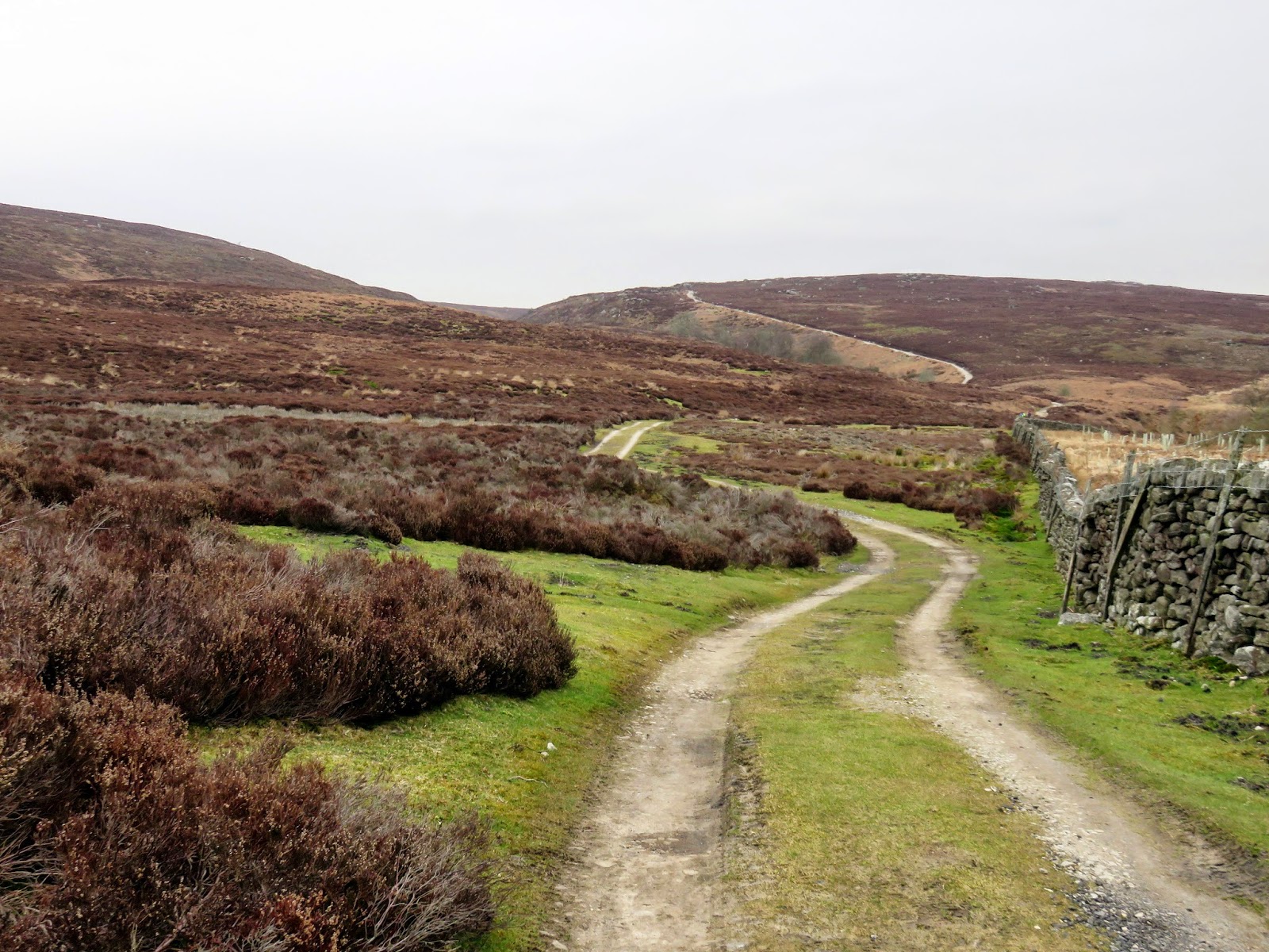
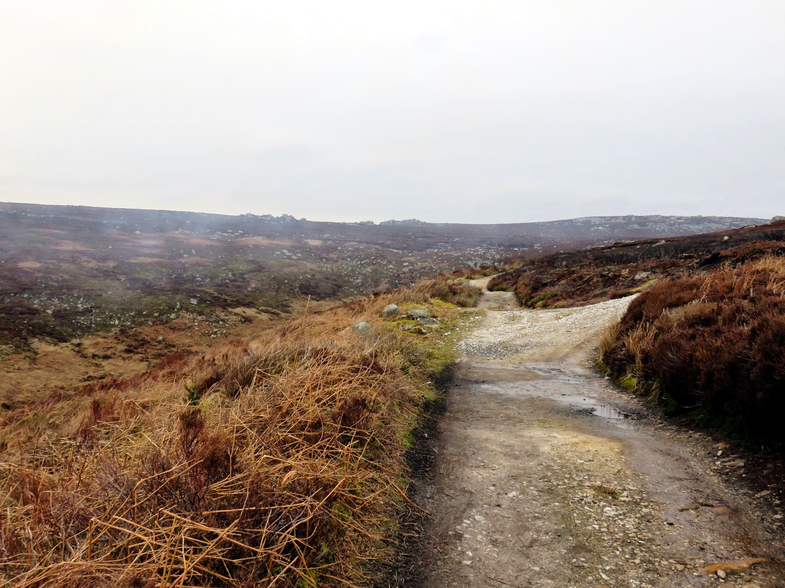
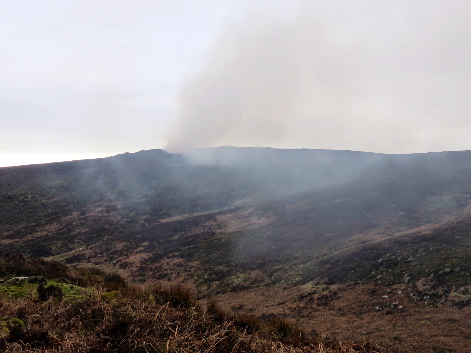
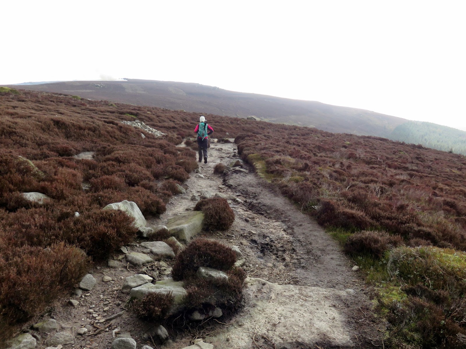
The valley doesn’t last long and we were shortly in the plantation of Laund Pasture. On the other side of this lies the open moorland of Barden Fell, the top of which is crowned by Simon’s Seat. The track from the plantation climbs right the way up the hillside alongside Great Agill Beck, crossing the stream at Great Aygill Head. It’s well built, designed to shuttle shooting parties up onto the grouse moorland of Barden Fell. Though the climb is easy enough, we had to endure a thick smoke for the most of it thanks to some moorland management on Carncliff Top. The heather is burnt in cycles to keep it young and vigorous.
 |
| Laund Pasture |
 |
| Open moorland – the track leads all the way to Simon’s Seat |
 |
| Reaching Great Aygill Head |
 |
| Heather burning on Carncliff Top |
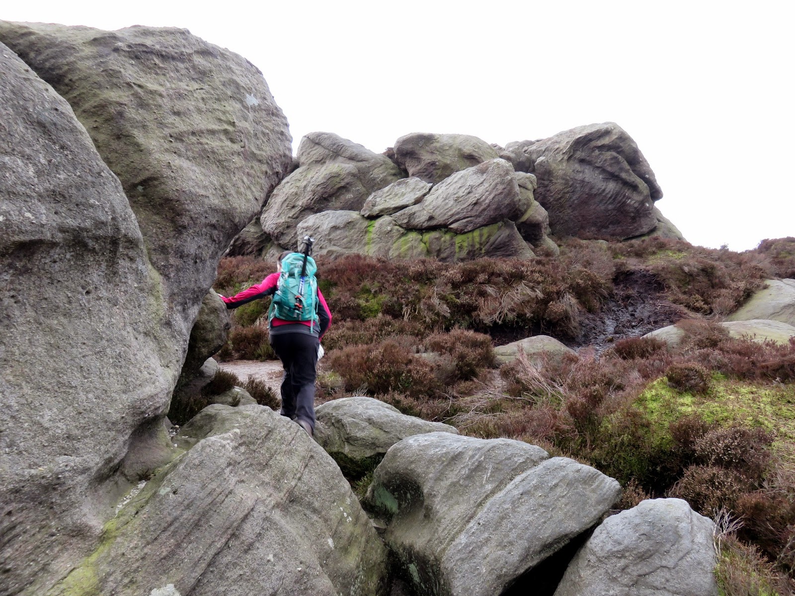
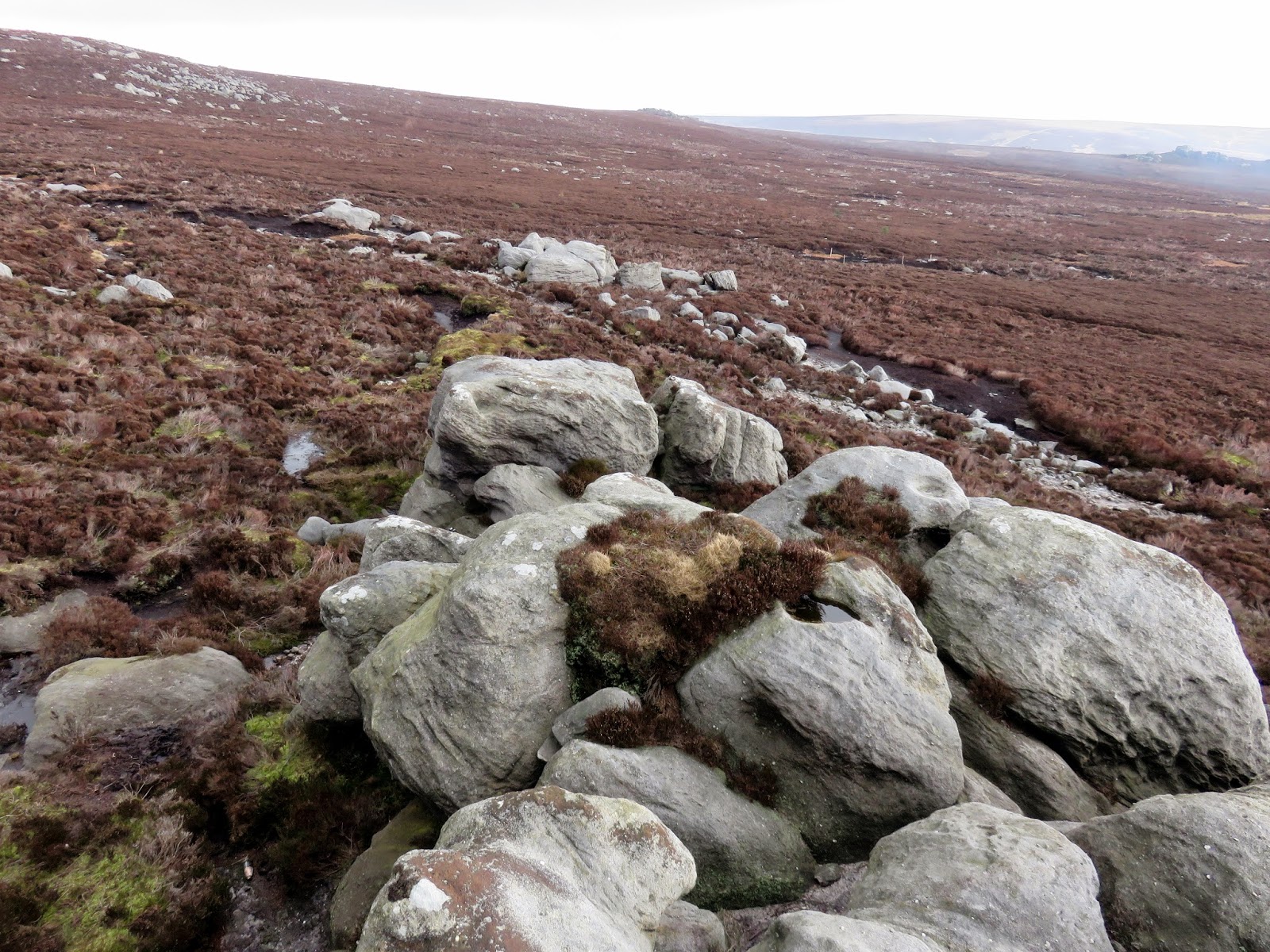
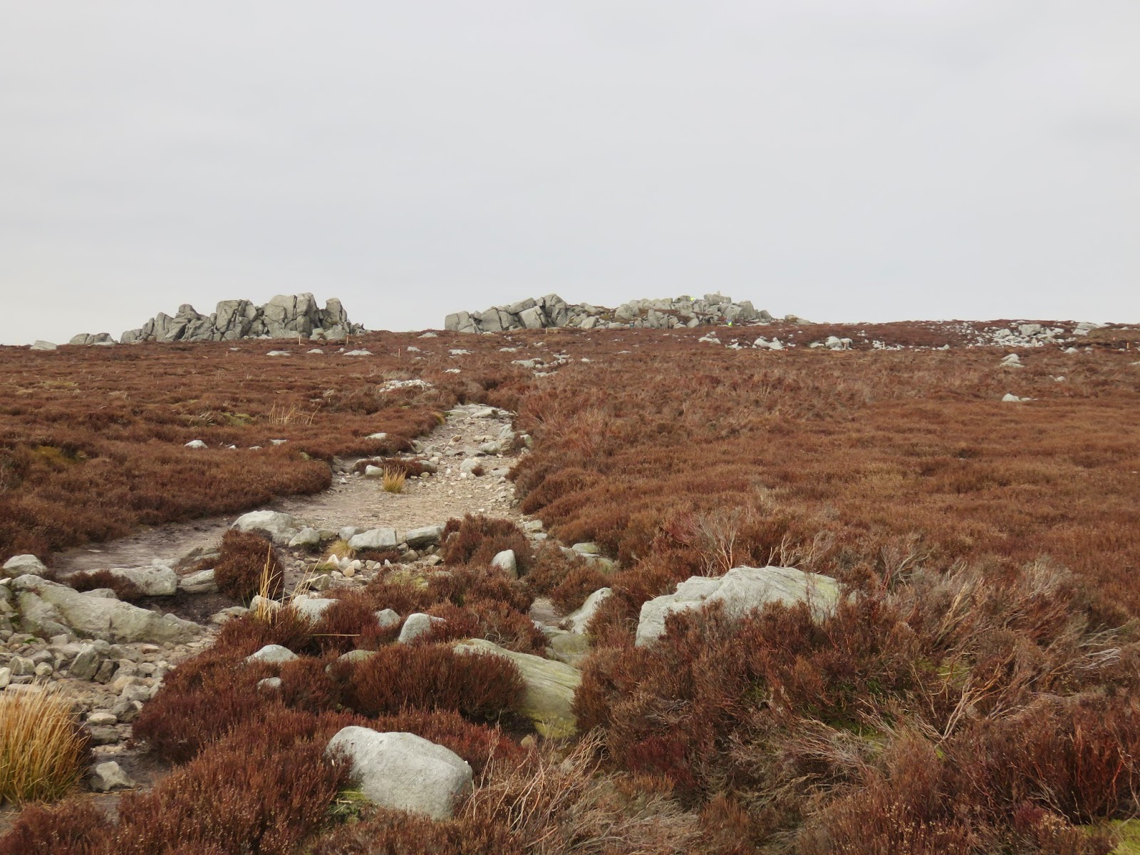
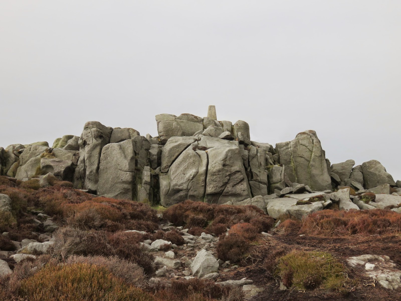
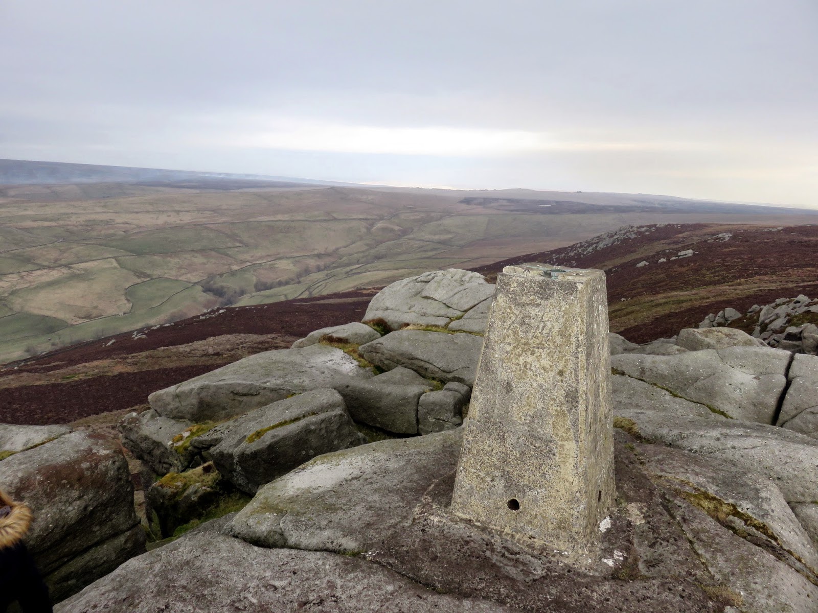
Past Great Aygill Head, a smaller path winds off to Truckle Crags where we hid away from prying eyes for lunch before venturing further across the moor. Simon’s Seat is the obvious arrangement of rocks made all the more prominent by the crowds of people on it and the trig pillar. We milled around for a while pretending to look at the views (which are excellent) while waiting for a clear picture of the top. I had to concede defeat though and use the magic of photoshop to produce the following, unspoilt photos.
 |
| Investigating Truckle Crags |
 |
| Truckle Crags |
 |
| Simon’s Seat dominates the skyline |
 |
| Simon’s Seat |
 |
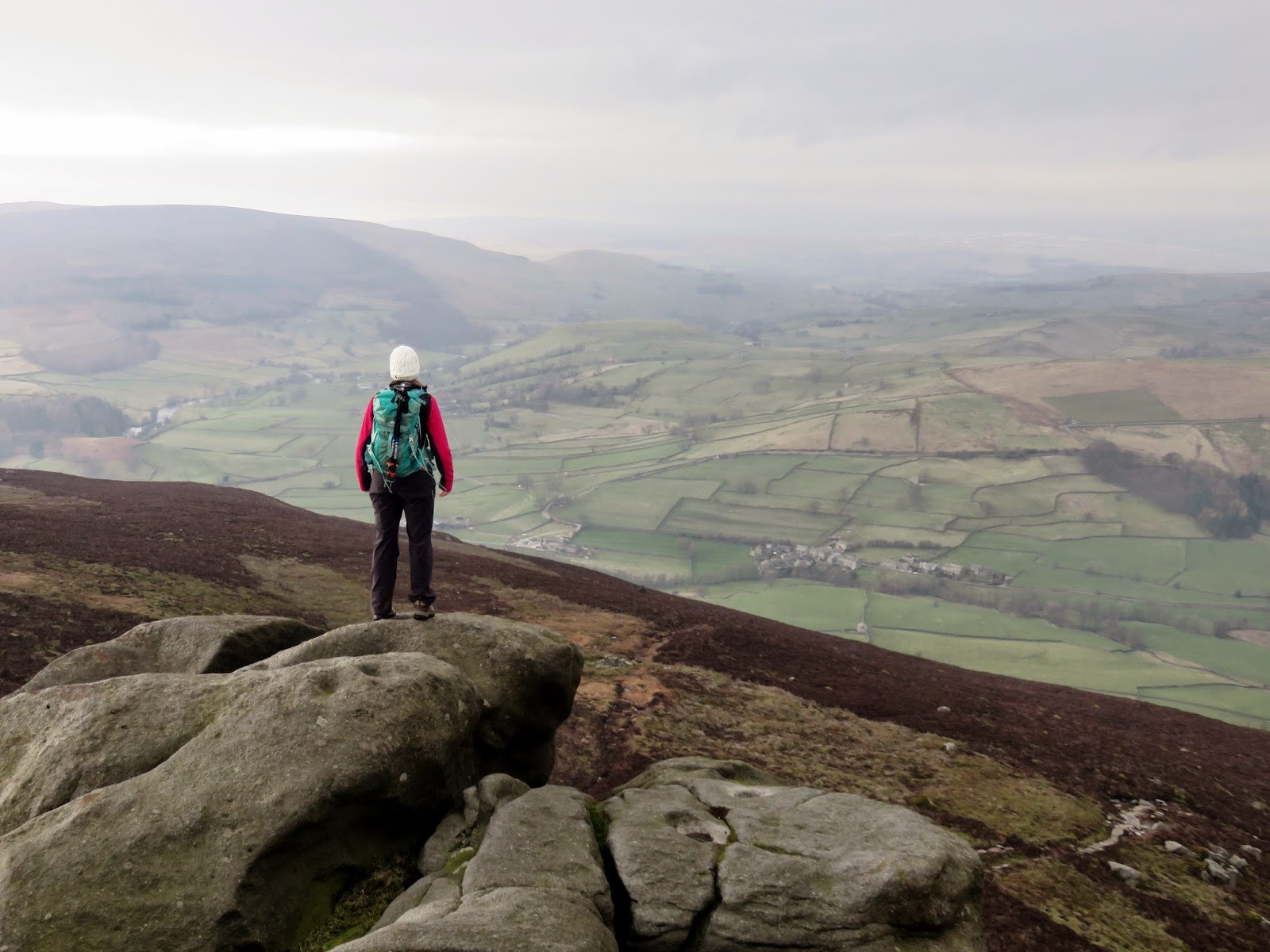
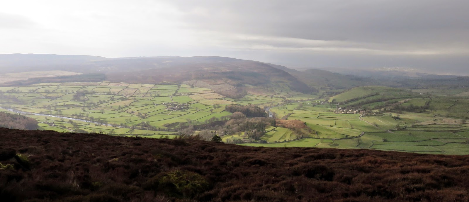
| Sara surveys Wharfedale below |
 |
| Simon’s Seat trig pillar |
 |
| Sun illuminates Wharfedale |
 |
| Leaving Simon’s Seat |
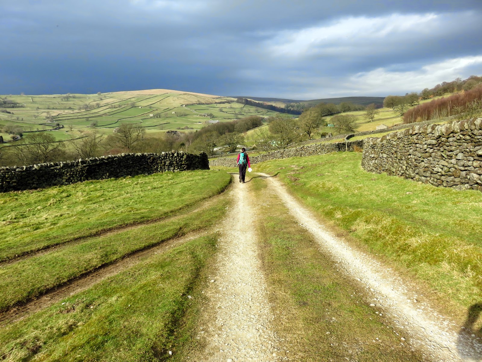
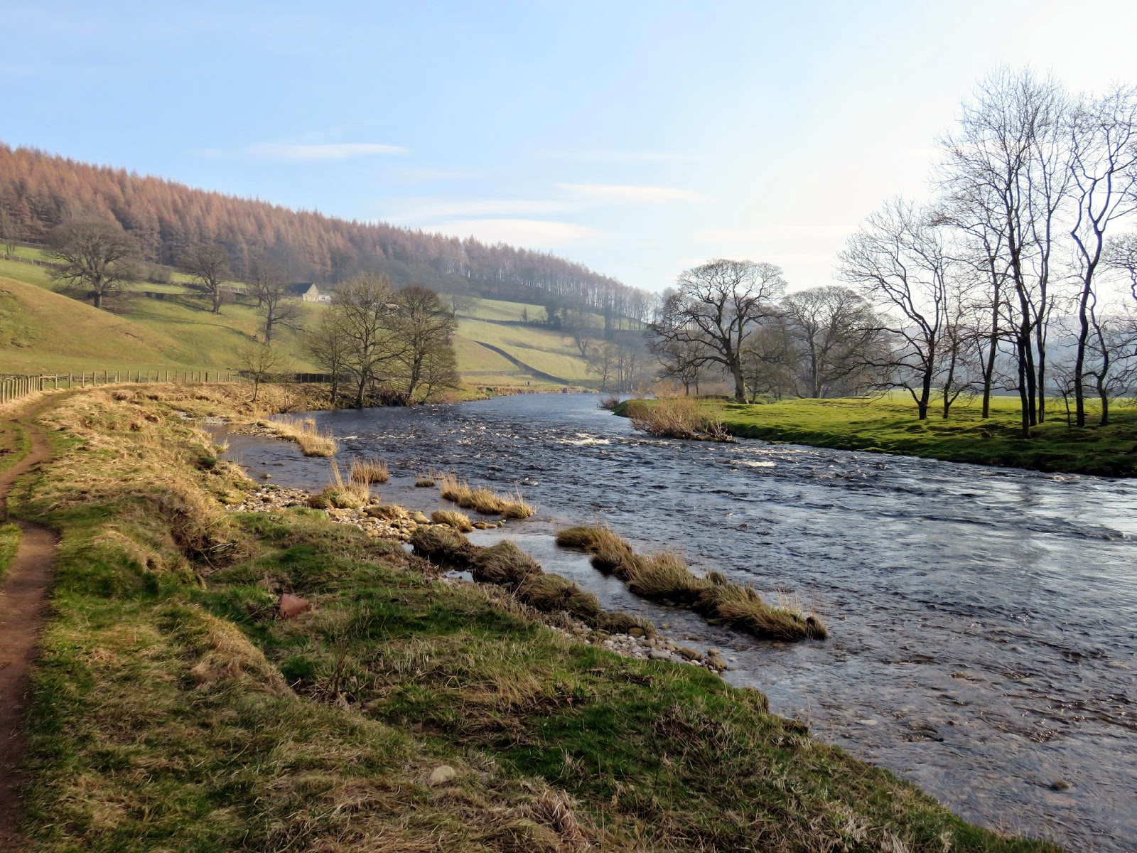
We left the grey-haired masses behind and followed the path heading south-west past the Devil’s Apronful cairn to the top of a steep track that winds down through the Lower Fell Plantation to the hamlet of Howgill. Here (or shortly beyond) we joined the Dales Way for a long, fairly uninteresting walk along the Wharfe to Barden Bridge.
 |
| The sun appears as we head down to Howgill |
 |
| The Dales Way |
 |
| The River Wharfe once again |
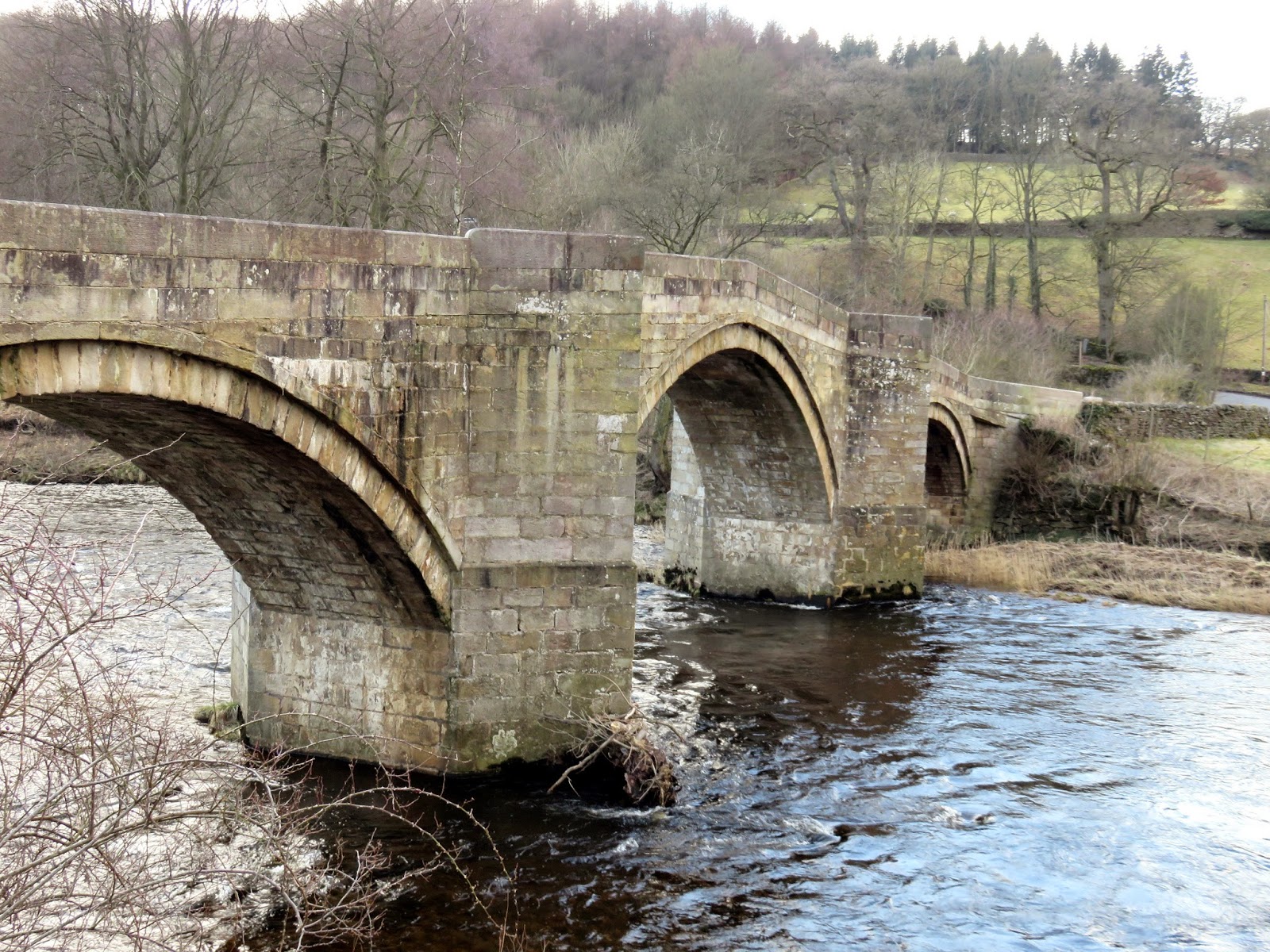
Barden Bridge is a picturesque Grade II listed bridge crossing the Wharfe just adjacent to Barden Tower. Whilst the first recorded bridge existed in the 14th century it was probably not the first. In 1659 £300 was spent on the bridge but by 1673 it was washed away in a ‘great inundation of water’. A tablet on the approach wall records ‘This bridge was repaired at the charge of the whole west riding 1676′. The marks the beginning of the final section of this walk along the mysterious Strid.
 |
| Barden Bridge |
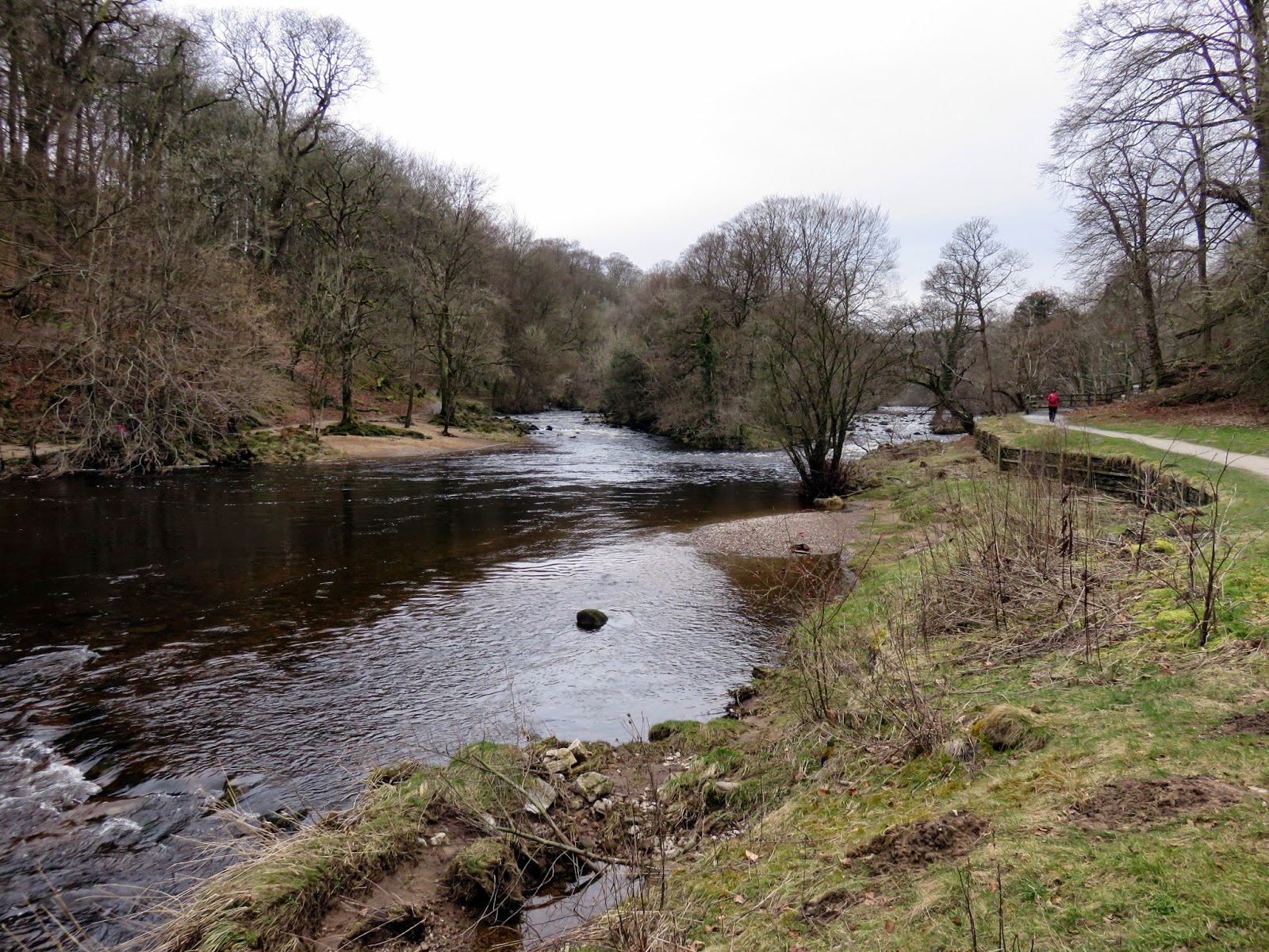
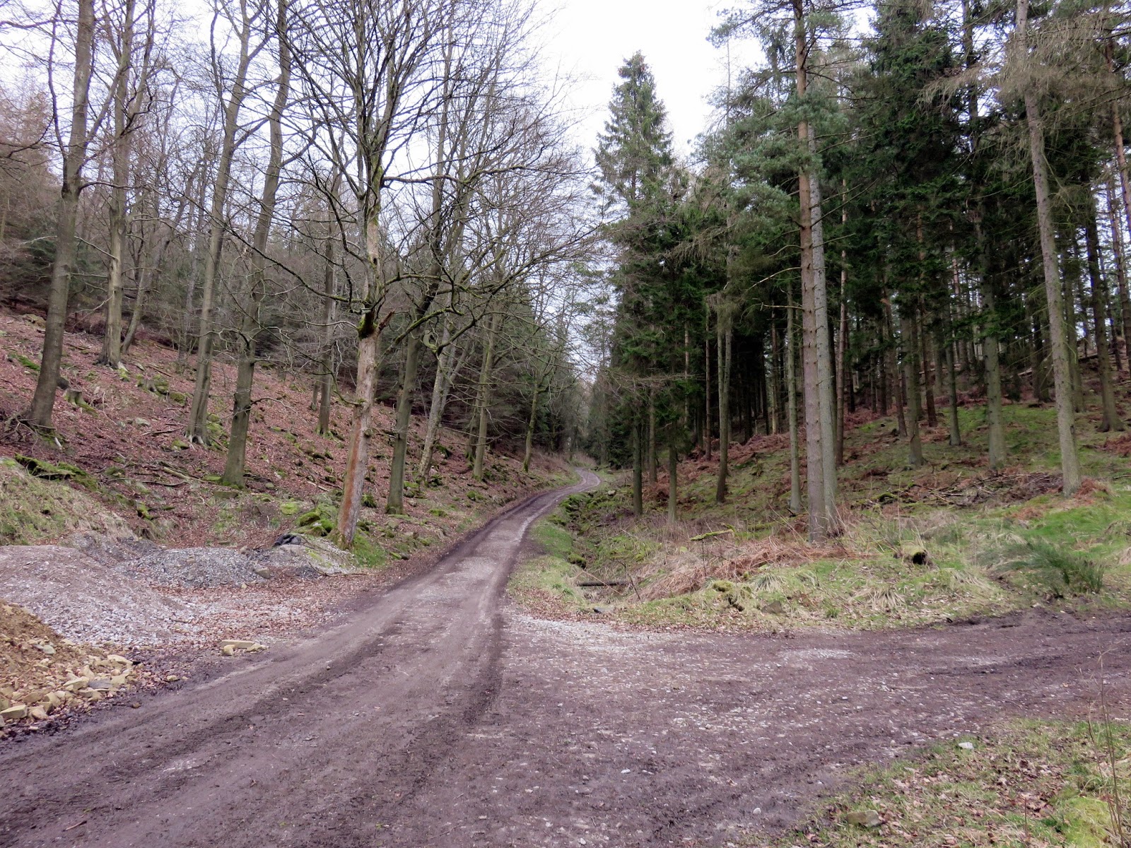
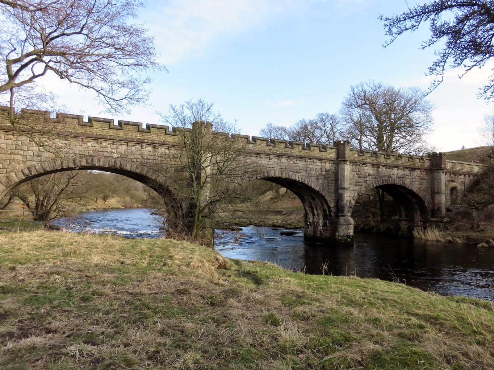
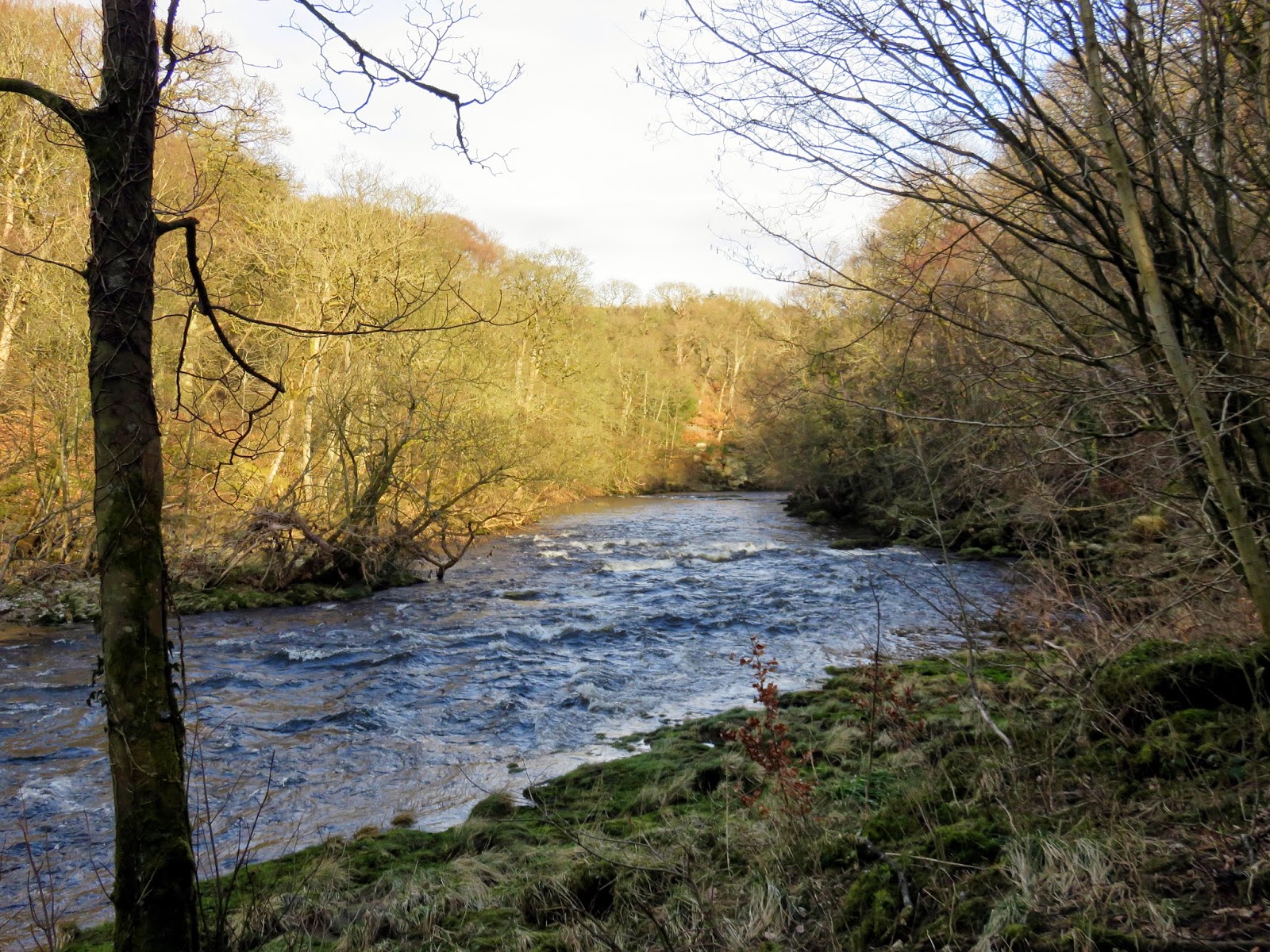
Along the river from Barden Bridge, the path crosses another equally grand bridge and enters Strid Wood, an ancient oak woodland, in fact, one of the largest areas of acidic oak woodland in the Yorkshire. A number of paths make their separate ways through the wood but ultimately they all lead to The Strid.
 |
| The second crossing close to Barden Bridge |
 |
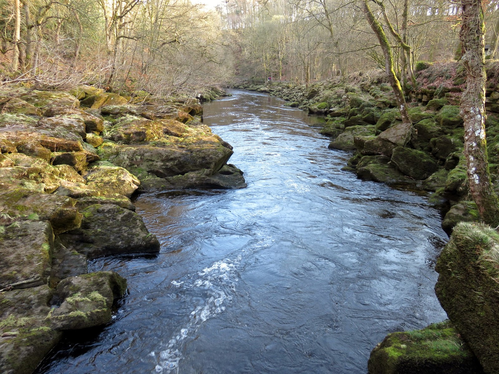
| The Wharfe from the bridge prior to entering The Strid – note its width |
 |
| The Wharfe enters Strid Wood |
 |
| The beginnings of The Strid |
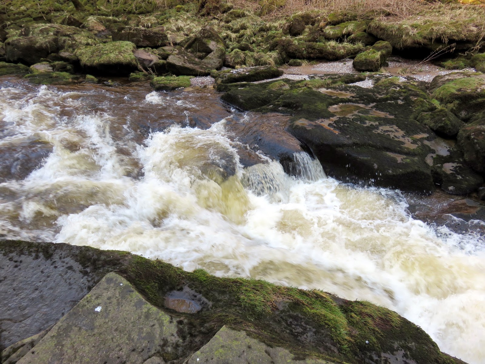
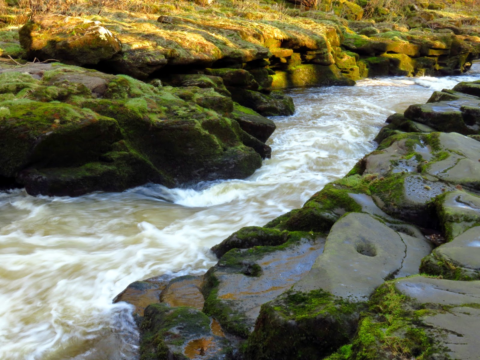
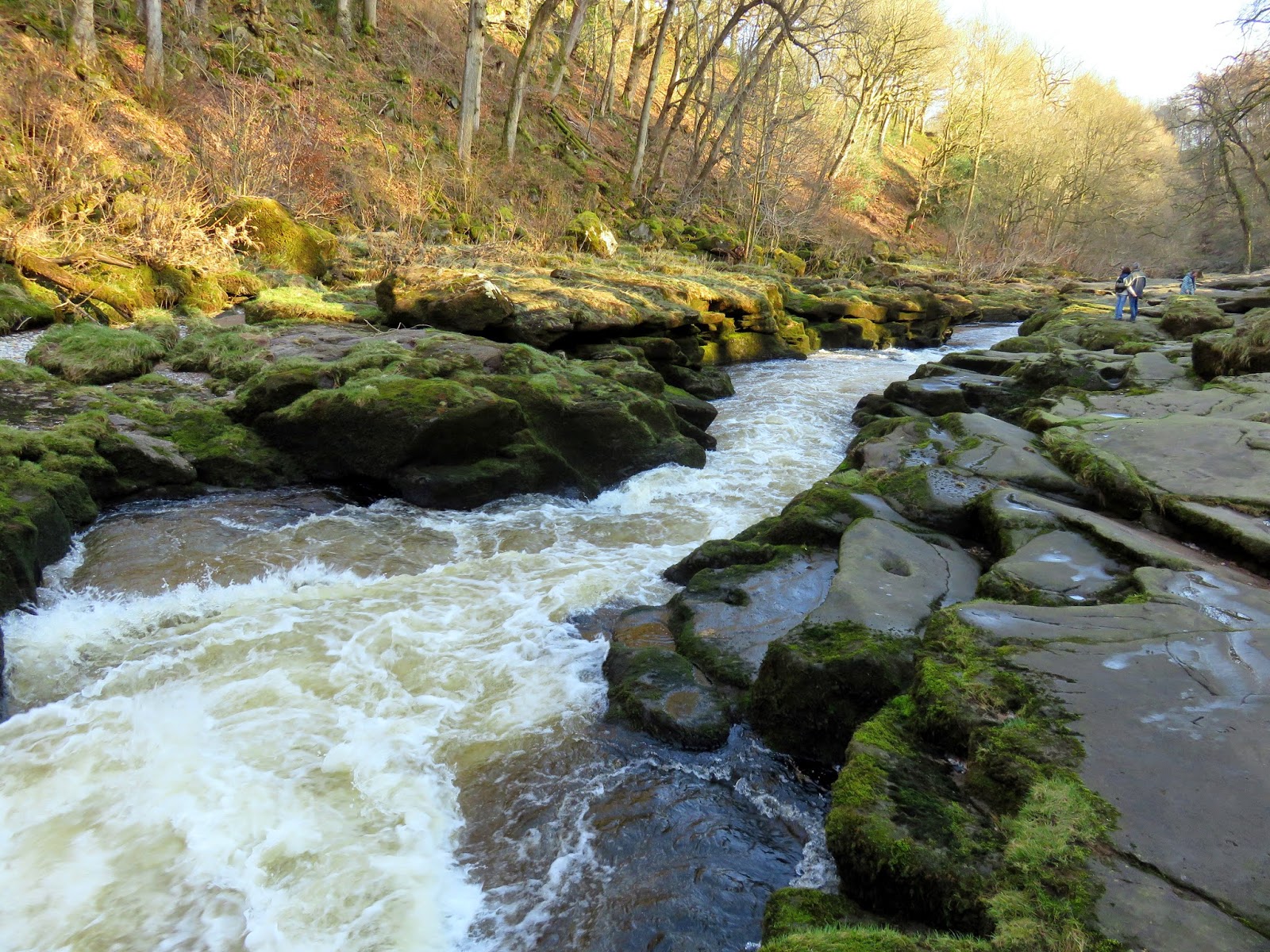
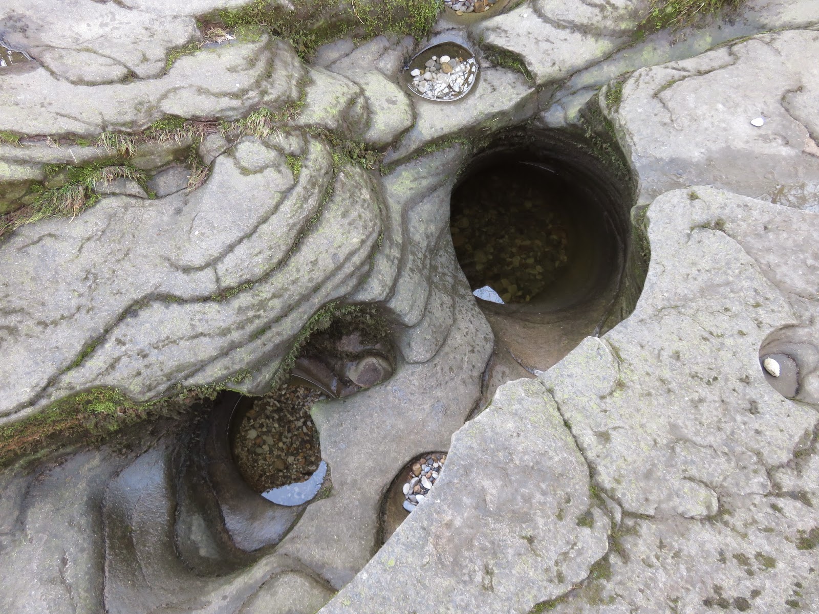
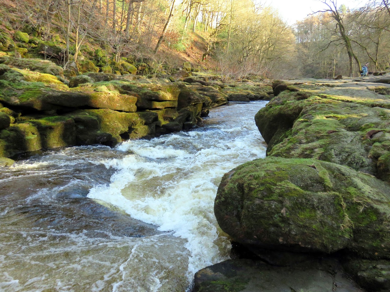
Named after the Anglo-Saxon word ‘Stryth’ meaning Turmoil or Tumult; corrupted into Strid to suggest it is a ‘stride’ wide. The Strid is as dramatic as its name suggests. As you can see from the photos previously, the River Wharfe narrows from tens of metres to just a few feet, confined to rage as a swirling torrent between a narrow rock passage. The Strid was formed by the wearing away of softer rock by the circular motion of small stones in hollows, forming a series of potholes which in time linked together to form a deep, water-filled chasm. Many of these potholes are visible on the banks either side.
 |
| The turbulent waters of The Strid |
 |
| The Strid |
 |
| Some of the many potholes that litter the banks |
 |
| The Strid |
I must note that it is not recommended to stride across the Strid as the rocks on either side are slippery and it is wider than it initially appears. Failure to jump the Strid is inevitably fatal and no one who has fallen into the tumultuous gorge was ever known to survive.
 |
| Things begin to calm down a bit |
Passing the dangers of The Strid by, it was a return to the high-level path that takes you back to the stepping stones and Bolton Priory – the old priory that gives Bolton Abbey its name. It was founded in 1154 and was led by a prior despite its name. The nave of the abbey church was in use as a parish church from about 1170 onwards and survived the Dissolution of the Monasteries. Building work was still going on at the abbey when the Dissolution of the Monasteries resulted in the termination of the priory in January 1540. The east end remains in ruins but is an icon of the estate. A tower, begun in 1520, was left half-standing, and its base was later given a bell-turret and converted into an entrance porch.
 |
| The Wharfe at Sulphur Well |
 |
| Bolton Priory looking resplendent in the afternoon sun |
The Bolton Abbey estate holds some of the Yorkshire Dales’ most fascinating scenery, a mixture of natural and man-made sights that make for a great day out. We’re lucky that these sorts of days out are right on our doorstep in Yorkshire. I believe this walk visits the most interesting parts of the estate though any section can be tackled as a short afternoon stroll, such is its accessibility. Sara and I come to Wharfedale often and I’m fairly confident that we’ll be back again.
