Open Space Web-Map builder Codehttps://openspace.ordnancesurvey.co.uk/osmapapi/openspace.js?key=3119F72552FD5C22E0530C6CA40A5A92https://openspace.ordnancesurvey.co.uk/osmapapi/script/mapbuilder/basicmap.jshttps://openspace.ordnancesurvey.co.uk/osmapapi/script/mapbuilder/searchbox.js//variables for routes var linesLayer, points, lineFeature, lineString, routeMarkersLayer, routepos, routesize, routeoffset, routeicon; var style_blue = {strokeColor: “#0000CD”, strokeOpacity: 0.5, strokeWidth: 4.5}; function initmapbuilder() { //initiate the map var options = {resolutions: [2500, 1000, 500, 200, 100, 50, 25, 10, 5, 4, 2.5, 2, 1]}; osMap = new OpenSpace.Map(‘map’, options); //configure map options (basicmap.js) setglobaloptions(); //set the center of the map and the zoom level osMap.setCenter(new OpenSpace.MapPoint(341348.33270073,499163.33459854),8); linesLayer = osMap.getVectorLayer(); // Set up layer for route markers routeMarkersLayer = new OpenLayers.Layer.Markers(“Route Markers”); //make a route points = new Array(); points.push(new OpenLayers.Geometry.Point(339806.66603088,502501.66793823)); // create a polyline feature from the array of points lineString = new OpenLayers.Geometry.LineString(points); lineFeature = new OpenLayers.Feature.Vector(lineString, null, style_blue); linesLayer.addFeatures([lineFeature]); //make a route points = new Array(); points.push(new OpenLayers.Geometry.Point(341241.66605949,498781.66793823)); points.push(new OpenLayers.Geometry.Point(341281.66605949,498866.66793823)); points.push(new OpenLayers.Geometry.Point(341376.66605949,498926.66793823)); points.push(new OpenLayers.Geometry.Point(341376.66605949,499001.66793823)); points.push(new OpenLayers.Geometry.Point(341316.66605949,499101.66793823)); points.push(new OpenLayers.Geometry.Point(341281.66605949,499191.66793823)); points.push(new OpenLayers.Geometry.Point(341211.66605949,499291.66793823)); points.push(new OpenLayers.Geometry.Point(341191.66605949,499366.66793823)); points.push(new OpenLayers.Geometry.Point(341336.66605949,499591.66793823)); points.push(new OpenLayers.Geometry.Point(341461.66605949,499361.66793823)); points.push(new OpenLayers.Geometry.Point(341601.66605949,499431.66793823)); points.push(new OpenLayers.Geometry.Point(341716.66605949,499406.66793823)); points.push(new OpenLayers.Geometry.Point(341796.66605949,499301.66793823)); points.push(new OpenLayers.Geometry.Point(341801.66605949,499146.66793823)); points.push(new OpenLayers.Geometry.Point(341796.66605949,498971.66793823)); points.push(new OpenLayers.Geometry.Point(341751.66605949,498801.66793823)); points.push(new OpenLayers.Geometry.Point(341641.66605949,498631.66793823)); points.push(new OpenLayers.Geometry.Point(341481.66605949,498711.66793823)); points.push(new OpenLayers.Geometry.Point(341241.66605949,498781.66793823)); // create a polyline feature from the array of points lineString = new OpenLayers.Geometry.LineString(points); lineFeature = new OpenLayers.Feature.Vector(lineString, null, style_blue); linesLayer.addFeatures([lineFeature]); //crate a route start/end marker routepos = new OpenSpace.MapPoint(341241.66605949,498781.66793823); routesize = new OpenLayers.Size(33,45); routeoffset = new OpenLayers.Pixel(-5,-37); routeicon = new OpenSpace.Icon(‘https://openspace.ordnancesurvey.co.uk/osmapapi/img_versions/img_1.1/mapbuilder/routemarker-startend.png’, routesize, routeoffset, null, null); routeMarkersLayer.addMarker(new OpenLayers.Marker(routepos, routeicon)); osMap.addLayer(routeMarkersLayer);}
Route: Windermere, Elleray Bank, Orrest Head, Common Wood, Windermere
Date: 07/02/2015
From: Windermere
Parking: Layby near railway station
Start Point: Windermere
Region: Outlying Fells
Route length: 1.5 miles (2.4 km)
Time taken: 0:37
Average speed: 2.4 mph
Ascent: 149m
Descent: 146m
Outlying Fells on this walk: Orrest Head (238m)
Additional summits: None
Other points of interest: None
“…quite suddenly, we emerged from the trees and were on a bare headland, and, as though a curtain had dramatically been torn aside, beheld a truly magnificent view. …”
Orrest Head would be an unremarkable hill with a fine view were it not for Alfred Wainwright. His visit in 1930 led to the publication of the most famous documentation of the Lakeland Fells and a lifelong dedication to walking that people, like I, follow today.
This was a short afternoon walk I did during the winter, a deliberate attempt to watch the sunset over the fells and to see the view that changed a young mans life forever. Not a pilgrimage as such, more of a curiosity to see what could have changed someone’s life so dramatically.
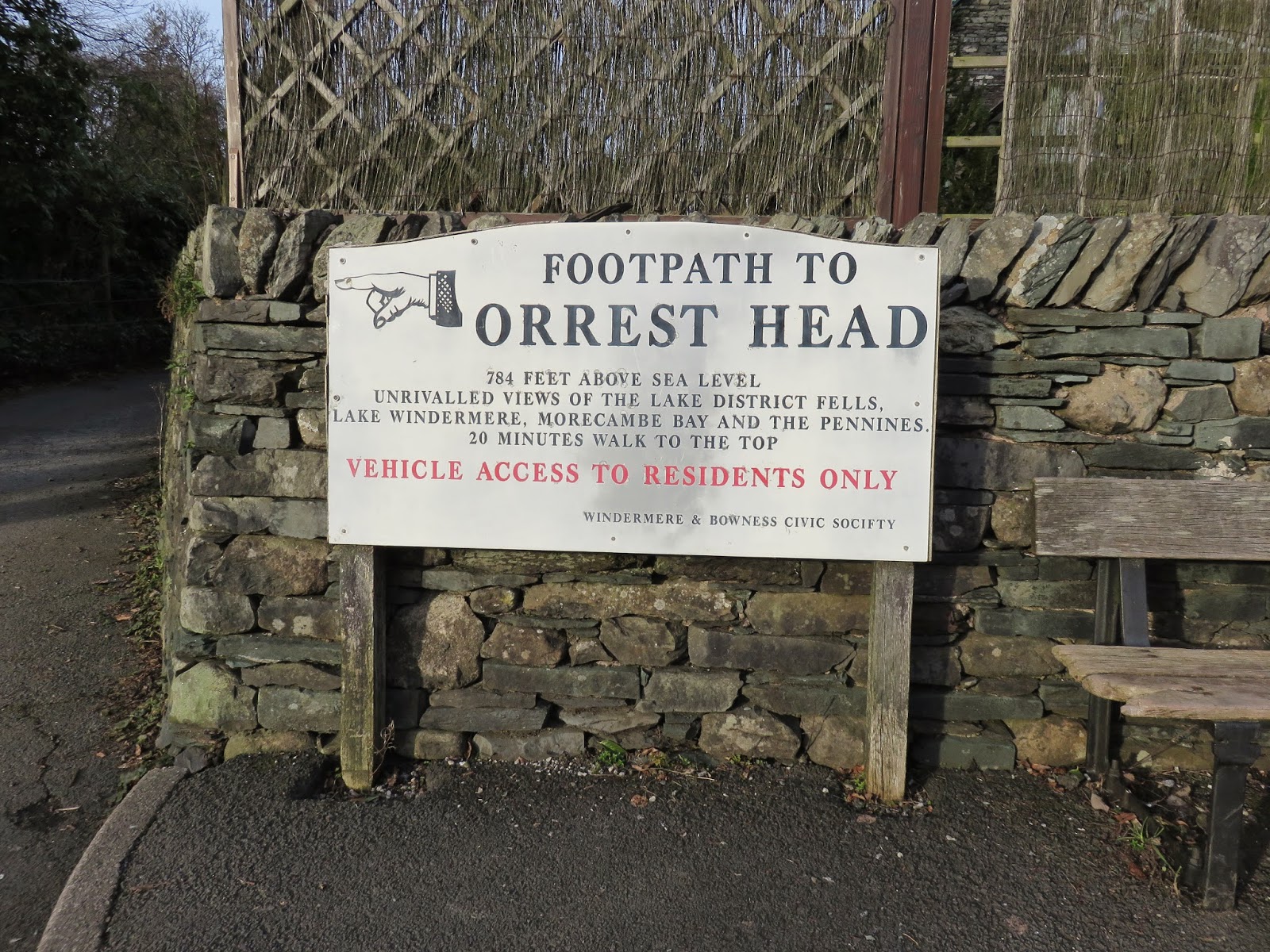
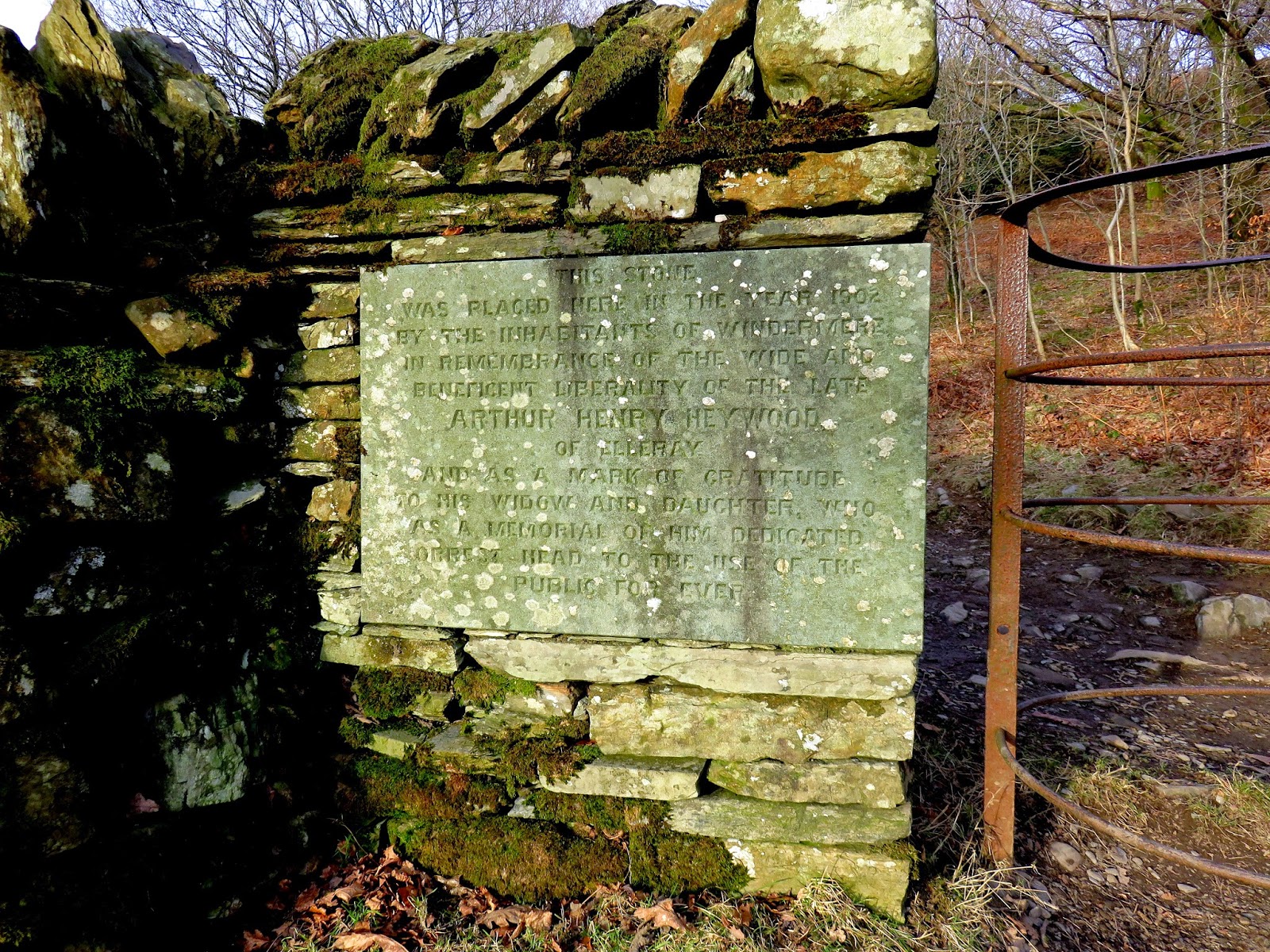
I left the car in a layby off the main road and made straight for the signposted road that leads pretty much to the top. It doesn’t take long and isn’t difficult but it holds great rewards. After passing through a gate (guarded by a pair of large, inscribed stones dedicated to a former landowner) the summit is reached and the views are revealed.
 |
| The unmistakable sign at the foot of Orrest Head |
 |
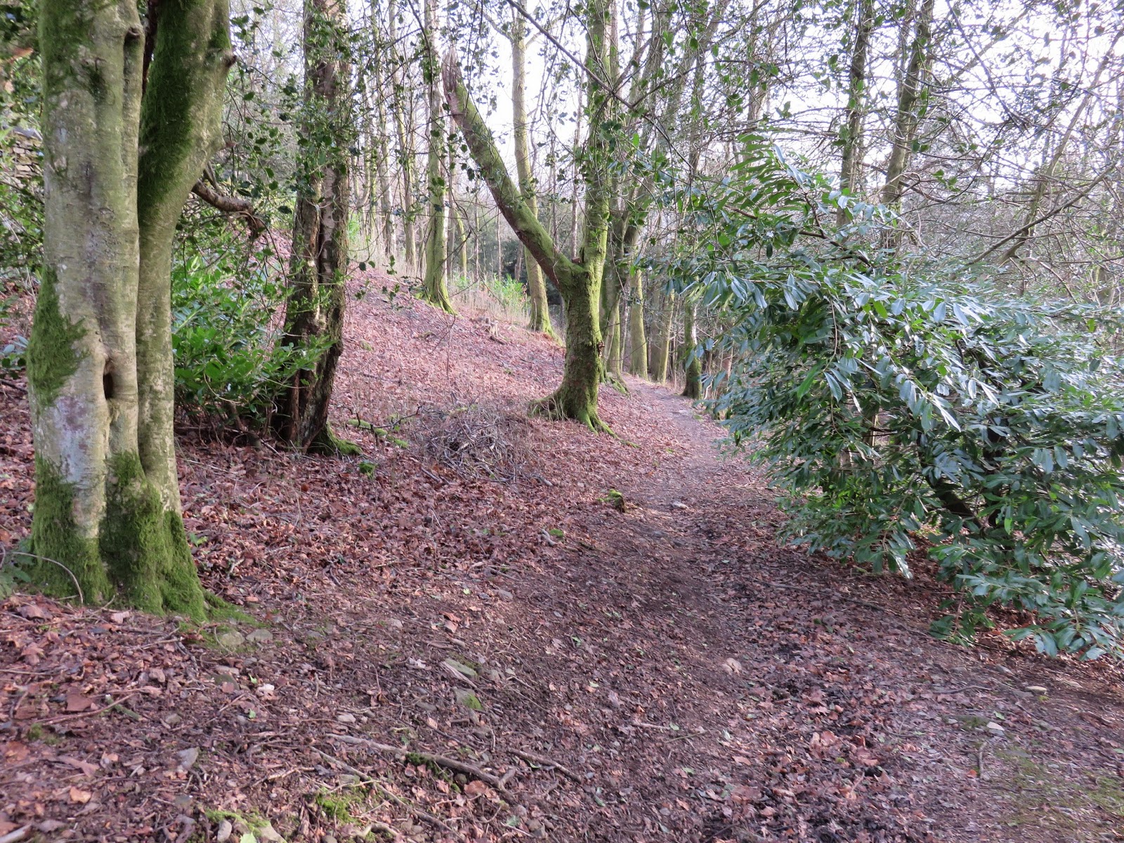
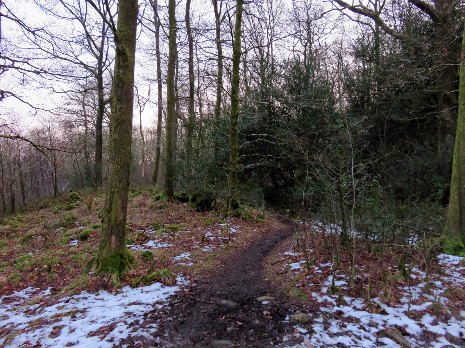
| The path through the trees of Elleray Bank |
 |
| Dedication to Arthur Heywood |
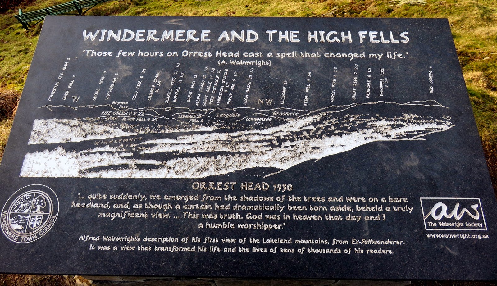
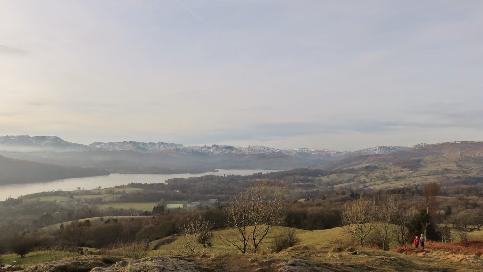
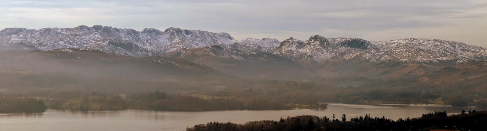
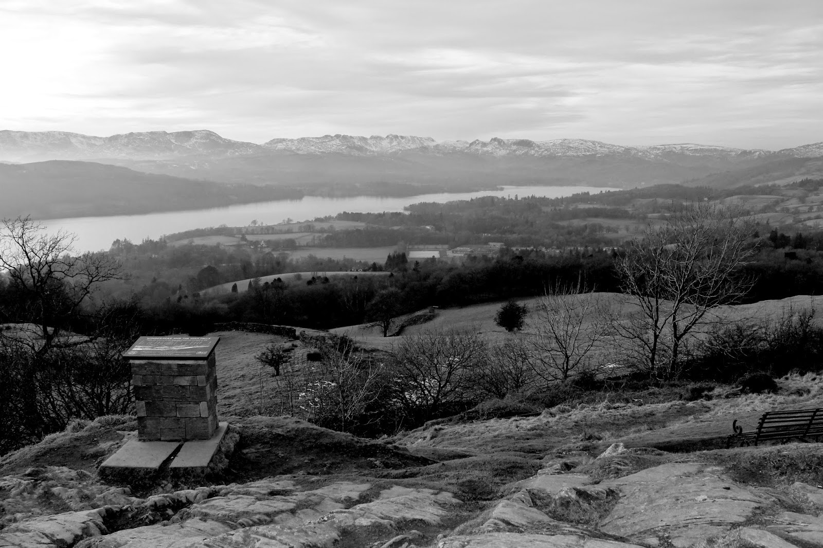
The panorama is sublime and includes nearly all the major fells in the Lake District. From left to right it is possible to see Coniston Old Man, Brim Fell, Swirl How, Wetherlam, Crinkle Crags, Bowfell Scafell Pike, The Langdale Pikes, High Raise, Fairfield and Red Screes to name a few. Some view for such a small hill. I know this thanks to the large marble plinth that has been erected by the Wainwright Society detailing the view that’s laid out in front of you.
 |
| The memorial on Orrest Head |
 |
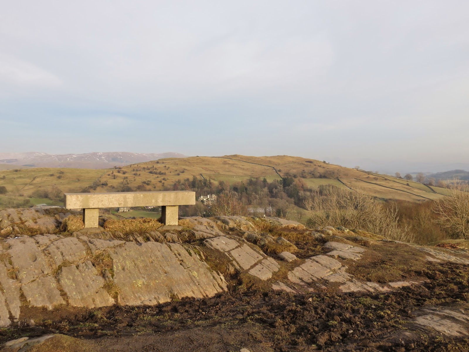
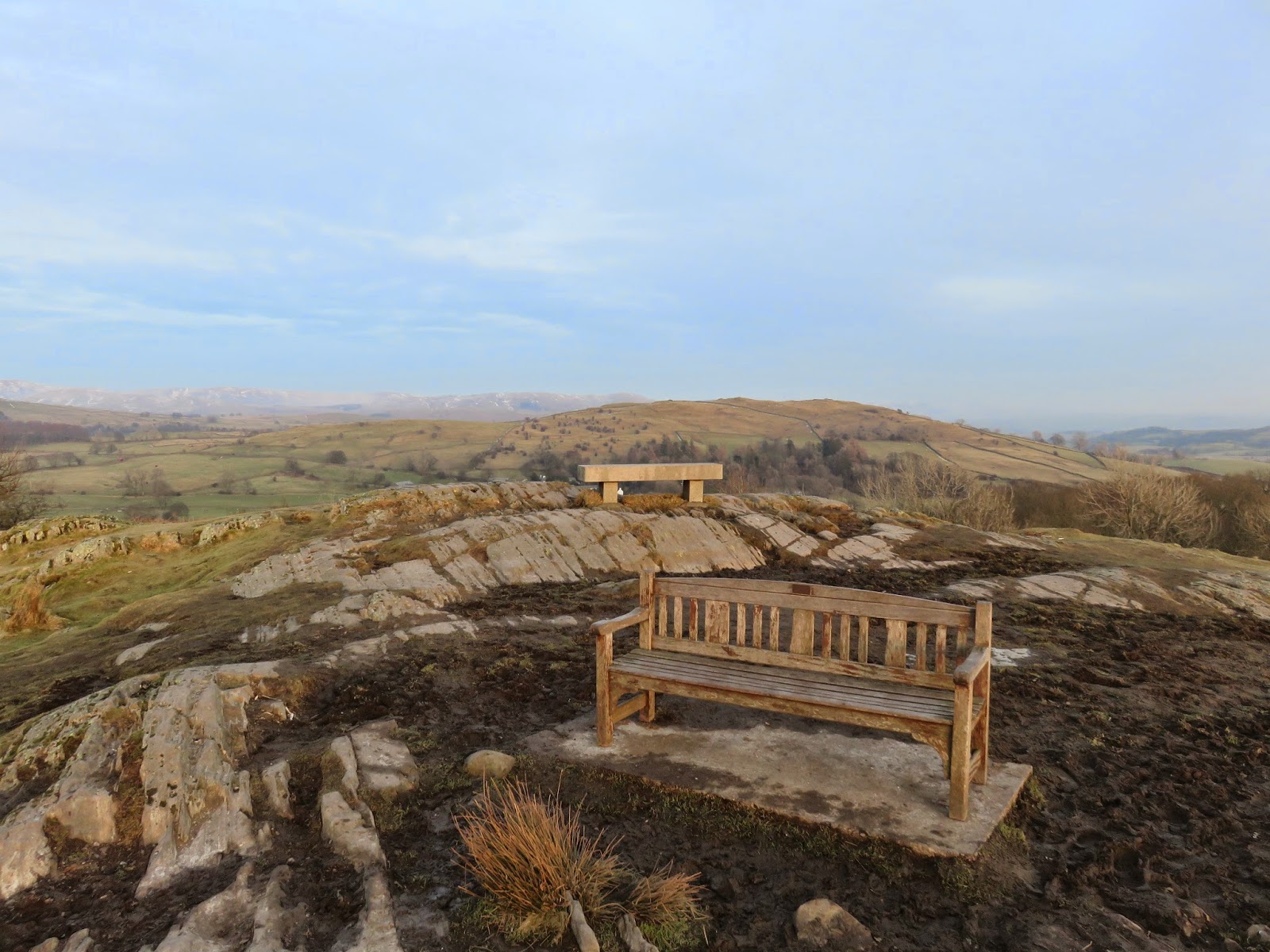
| Bench on the summit of Orrest Head with Banner Rigg behind |
 |
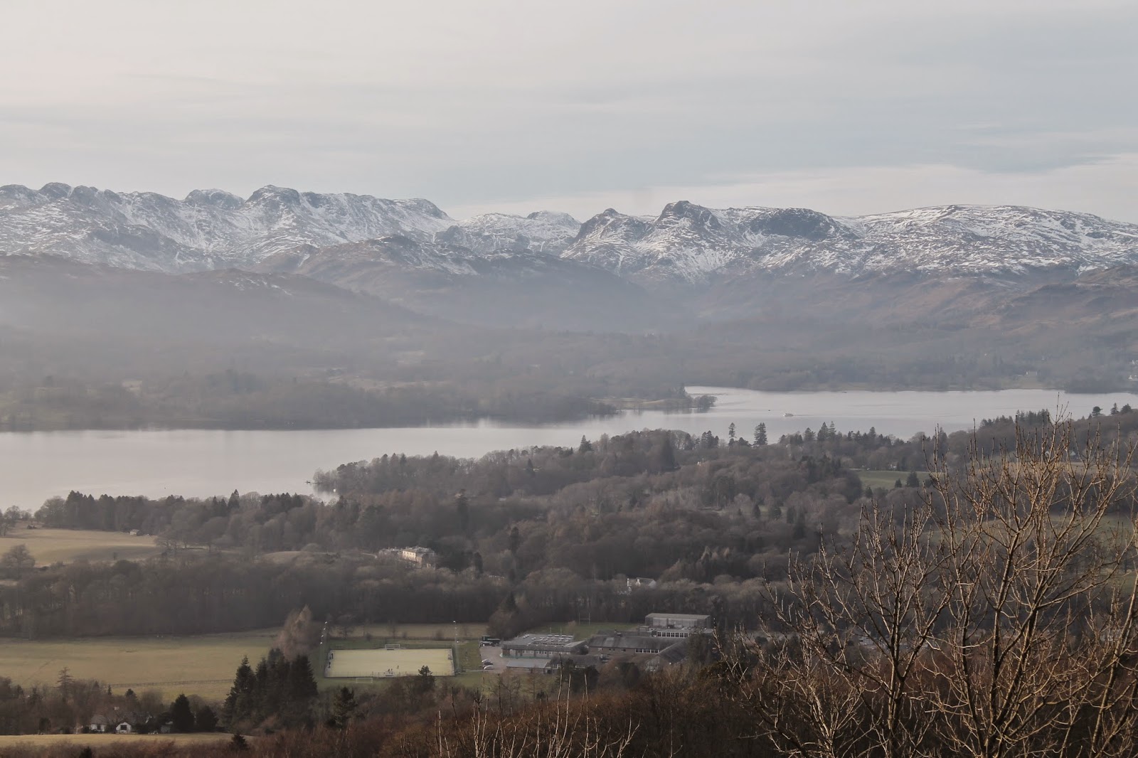
| Windermere with Crinkle Crags, Bowfell, Scafell Pike, the Langdale Pikes and High Raise forming the skyline |
 |
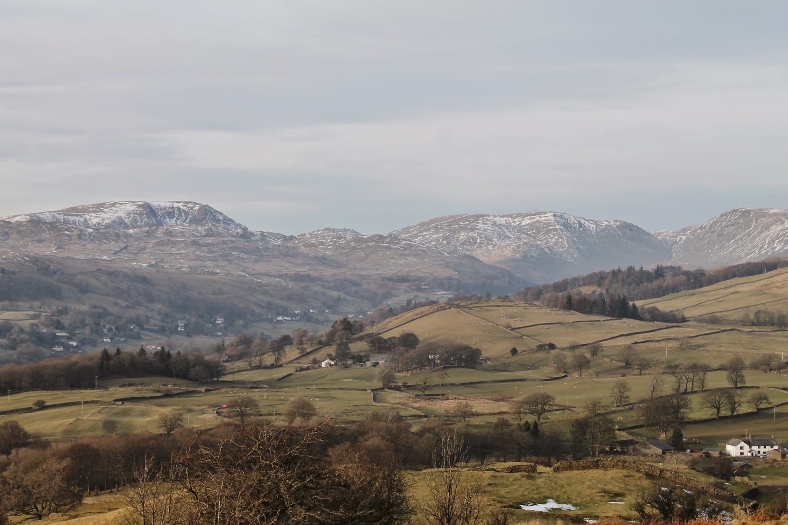
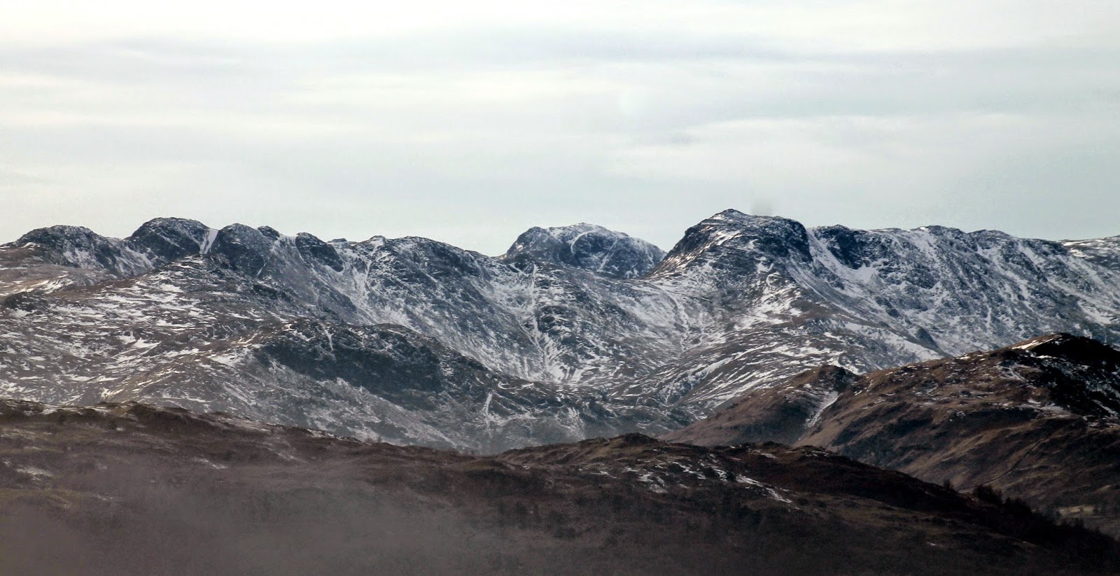
| Red Screes, Caudale Moor and Thornthwaite Crag |
 |
| The view north from Orrest Head |
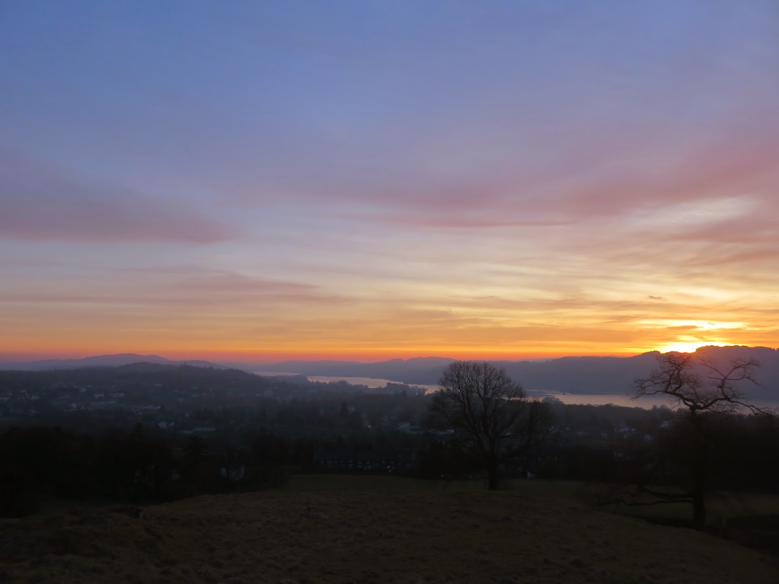
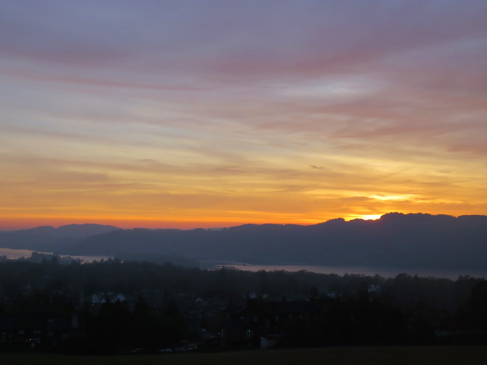
I remained on the summit snapping away for an hour or so and left after the sun had sunk behind The Old Man of Coniston. In hindsight I should have stayed longer (you’ll see in a minute why) but I had a campsite to reach and a tent to pitch.
 |
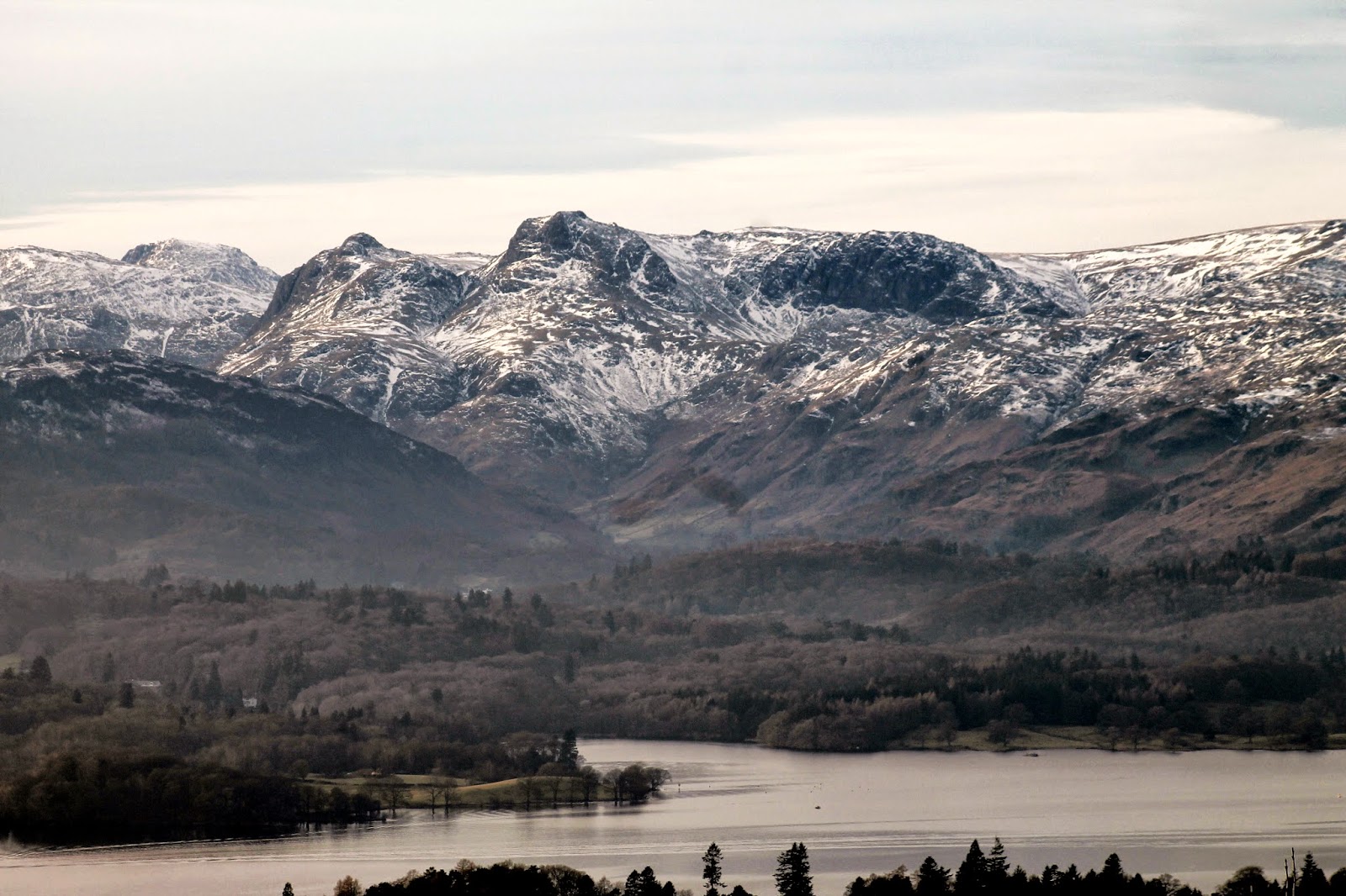
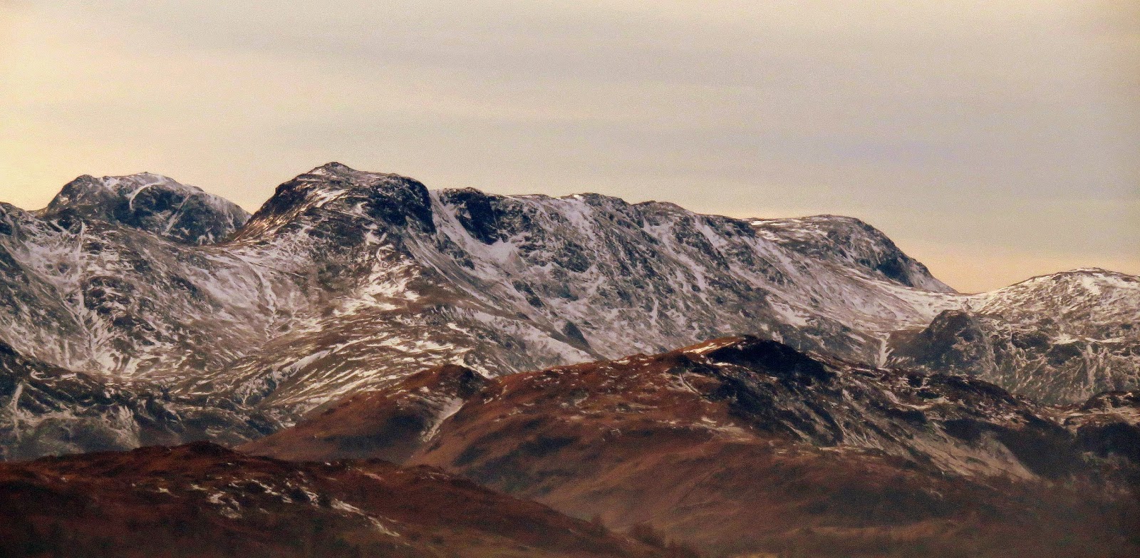
| Pike O’Stickle, Harrison Stickle and Pavey Ark |
 |
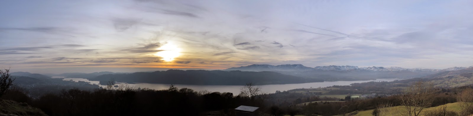
| Panorama of Windermere |
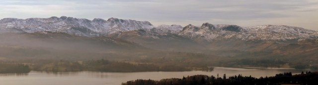 |
| Panorama of the high fells from Orrest Head |
 |
| The Old Man of Coniston and Wetherlam |
 |
| Orrest Head summit |
 |
| Looking south |
 |
| Monochrome view looking northwest |
I returned to the car though Common Wood, a National Trust owned woodland above Windermere. Once again, it took little time to reach the car once again, such is the diminutive size of Orrest Head. It’s well worth a visit though and really gives the opportunity to people of all abilities to marvel at the beauty of the Lake District.
 |
| Common Wood |
 |
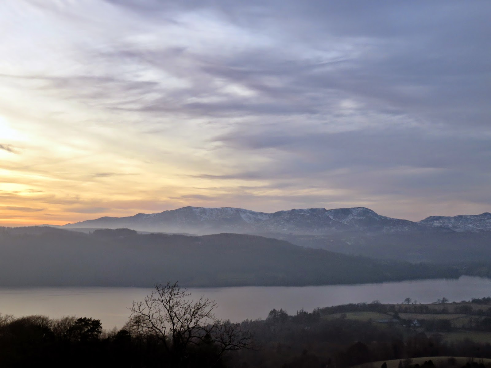
| The last throws on sunshine over Claife Heights |
 |
| Sunset from Ambleside YHA |
 |
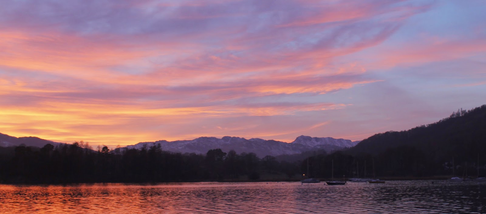
| Sunset over Wetherlam and Windermere |
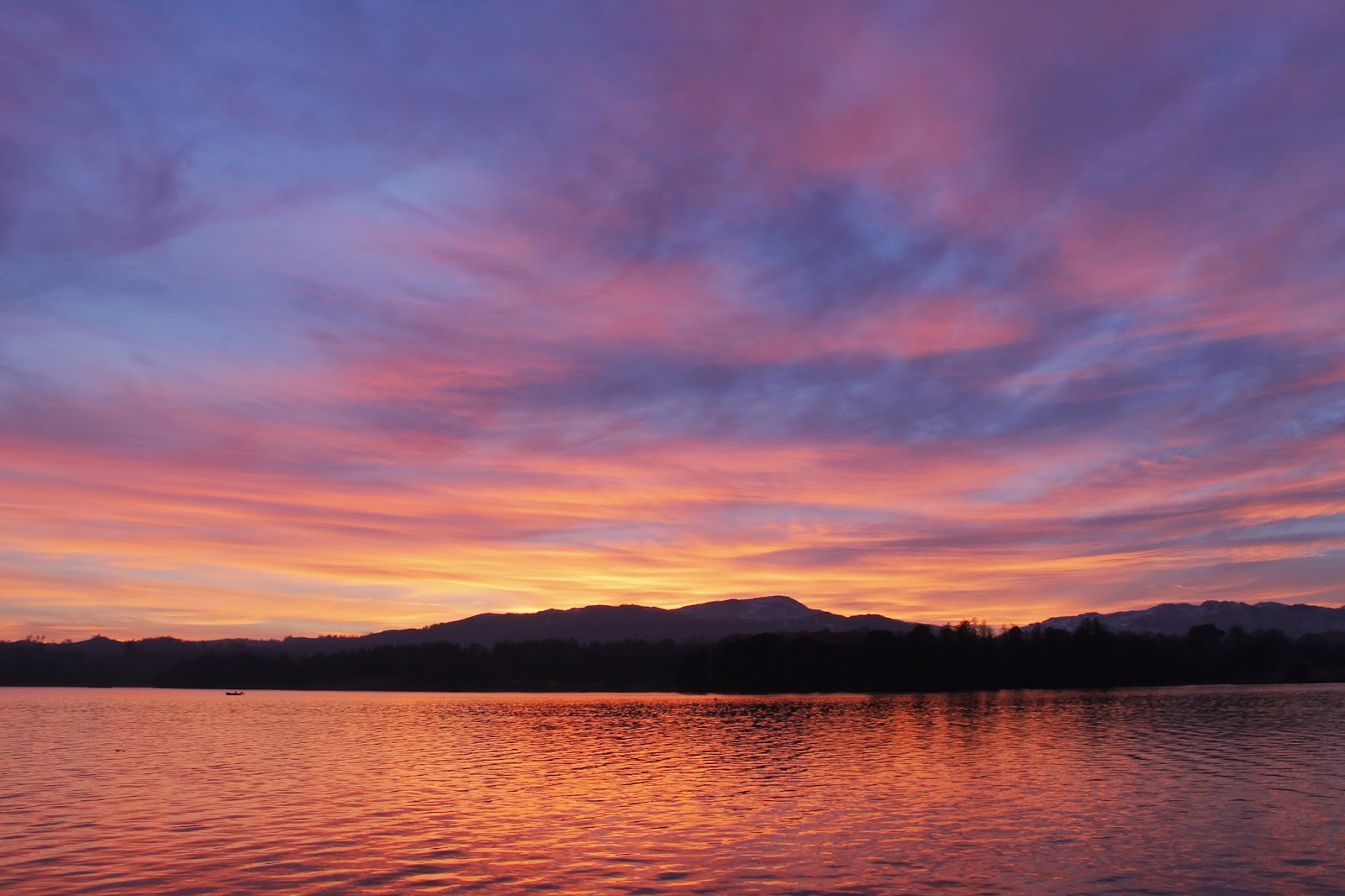
 |
| The sunset sets everything ablaze |
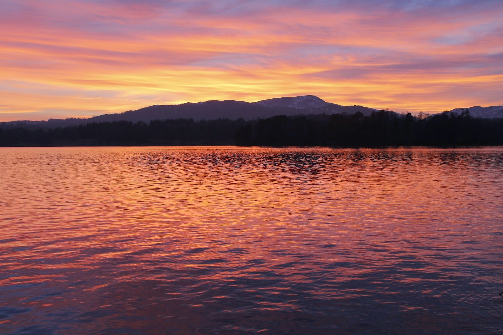
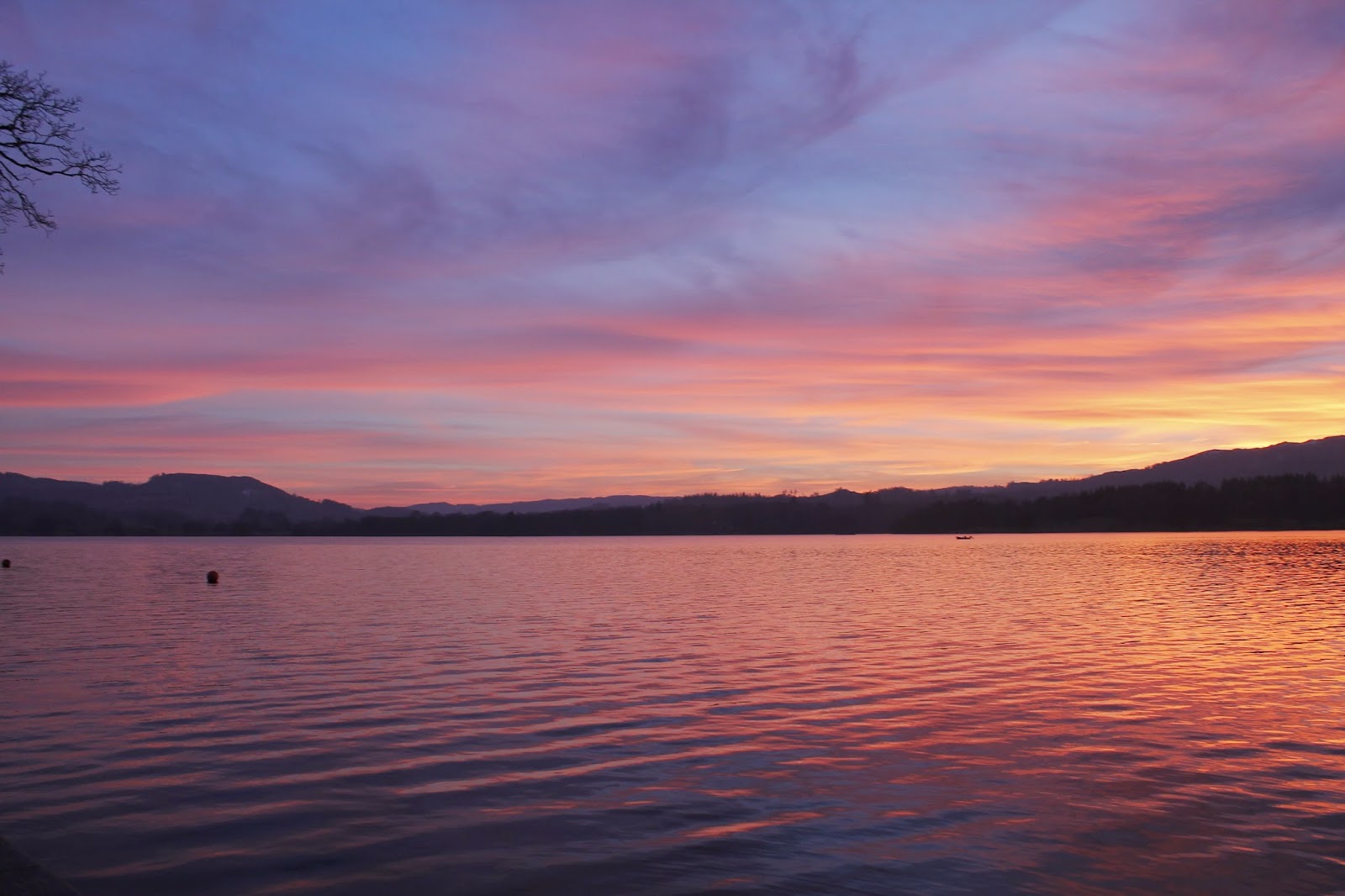
 |
| Sunset over Windermere |
