Open Space Web-Map builder Codehttps://openspace.ordnancesurvey.co.uk/osmapapi/openspace.js?key=3119F72552FD5C22E0530C6CA40A5A92https://openspace.ordnancesurvey.co.uk/osmapapi/script/mapbuilder/basicmap.jshttps://openspace.ordnancesurvey.co.uk/osmapapi/script/mapbuilder/searchbox.js//variables for routes var linesLayer, points, lineFeature, lineString, routeMarkersLayer, routepos, routesize, routeoffset, routeicon; var style_blue = {strokeColor: “#0000CD”, strokeOpacity: 0.5, strokeWidth: 4.5}; function initmapbuilder() { //initiate the map var options = {resolutions: [2500, 1000, 500, 200, 100, 50, 25, 10, 5, 4, 2.5, 2, 1]}; osMap = new OpenSpace.Map(‘map’, options); //configure map options (basicmap.js) setglobaloptions(); //set the center of the map and the zoom level osMap.setCenter(new OpenSpace.MapPoint(333004.33333016,508517.33333969),8); linesLayer = osMap.getVectorLayer(); // Set up layer for route markers routeMarkersLayer = new OpenLayers.Layer.Markers(“Route Markers”); //make a route points = new Array(); points.push(new OpenLayers.Geometry.Point(333616.66666031,507571.66667938)); points.push(new OpenLayers.Geometry.Point(333691.66666031,507626.66667938)); points.push(new OpenLayers.Geometry.Point(333615.66666031,507713.66667938)); points.push(new OpenLayers.Geometry.Point(333567.66666031,507849.66667938)); points.push(new OpenLayers.Geometry.Point(333499.66666031,507901.66667938)); points.push(new OpenLayers.Geometry.Point(333247.66666031,508097.66667938)); points.push(new OpenLayers.Geometry.Point(333050.66666031,508153.66667938)); points.push(new OpenLayers.Geometry.Point(333025.66666031,508283.66667938)); points.push(new OpenLayers.Geometry.Point(332781.66666031,508391.66667938)); points.push(new OpenLayers.Geometry.Point(332701.66666031,508447.66667938)); points.push(new OpenLayers.Geometry.Point(332481.66666031,508463.66667938)); points.push(new OpenLayers.Geometry.Point(332539.66666031,508596.66667938)); points.push(new OpenLayers.Geometry.Point(332664.66666031,508596.66667938)); points.push(new OpenLayers.Geometry.Point(332739.66666031,508706.66667938)); points.push(new OpenLayers.Geometry.Point(332659.66666031,508816.66667938)); points.push(new OpenLayers.Geometry.Point(332659.66666031,508846.66667938)); points.push(new OpenLayers.Geometry.Point(332599.66666031,508971.66667938)); points.push(new OpenLayers.Geometry.Point(332624.66666031,509006.66667938)); points.push(new OpenLayers.Geometry.Point(332804.66666031,509006.66667938)); points.push(new OpenLayers.Geometry.Point(332799.66666031,509126.66667938)); points.push(new OpenLayers.Geometry.Point(332684.66666031,509276.66667938)); points.push(new OpenLayers.Geometry.Point(332624.66666031,509331.66667938)); points.push(new OpenLayers.Geometry.Point(332794.66666031,509156.66667938)); points.push(new OpenLayers.Geometry.Point(332784.66666031,508996.66667938)); points.push(new OpenLayers.Geometry.Point(332624.66666031,509006.66667938)); points.push(new OpenLayers.Geometry.Point(332609.66666031,508971.66667938)); points.push(new OpenLayers.Geometry.Point(332739.66666031,508711.66667938)); points.push(new OpenLayers.Geometry.Point(332689.66666031,508616.66667938)); points.push(new OpenLayers.Geometry.Point(332519.66666031,508606.66667938)); points.push(new OpenLayers.Geometry.Point(332464.66666031,508446.66667938)); points.push(new OpenLayers.Geometry.Point(332499.66666031,508331.66667938)); points.push(new OpenLayers.Geometry.Point(332619.66666031,508266.66667938)); points.push(new OpenLayers.Geometry.Point(333069.66666031,508151.66667938)); points.push(new OpenLayers.Geometry.Point(333309.66666031,508051.66667938)); points.push(new OpenLayers.Geometry.Point(333504.66666031,507921.66667938)); points.push(new OpenLayers.Geometry.Point(333614.66666031,507771.66667938)); points.push(new OpenLayers.Geometry.Point(333674.66666031,507631.66667938)); points.push(new OpenLayers.Geometry.Point(333682.66666031,507615.66667938)); points.push(new OpenLayers.Geometry.Point(333616.66666031,507571.66667938)); // create a polyline feature from the array of points lineString = new OpenLayers.Geometry.LineString(points); lineFeature = new OpenLayers.Feature.Vector(lineString, null, style_blue); linesLayer.addFeatures([lineFeature]); //crate a route start/end marker routepos = new OpenSpace.MapPoint(333616.66666031,507571.66667938); routesize = new OpenLayers.Size(33,45); routeoffset = new OpenLayers.Pixel(-5,-37); routeicon = new OpenSpace.Icon(‘https://openspace.ordnancesurvey.co.uk/osmapapi/img_versions/img_1.1/mapbuilder/routemarker-startend.png’, routesize, routeoffset, null, null); routeMarkersLayer.addMarker(new OpenLayers.Marker(routepos, routeicon)); osMap.addLayer(routeMarkersLayer);}
Route: Grasmere, Easedale Road, Lanerigg, White Crag, High Raven Crag, Helm Crag, New Bridge, Easedale Road
Date: 18/01/2015
From: Grasmere
Parking: Roadside parking
Start Point: Grasmere
Region: Central Fells
Route length: 4.4 miles (7 km)
Time taken: 02:03
Average speed: 2.1 mph
Ascent: 407m
Descent: 417m
Wainwrights on this walk: Helm Crag (405m)
Additional summits: None
Other points of interest: None
A relatively short one this but a prime example of just how seriously anyone should take winter walking in the Lake District – even on the so-called smaller fells.
A prolonged and fairly heavy snowfall on the morning we awoke necessitated a change of plans and, after a glance at the latest forecast (which had changed considerably), we set our sights on the more modest target of Helm Crag and Gibson Knott, or so we thought.
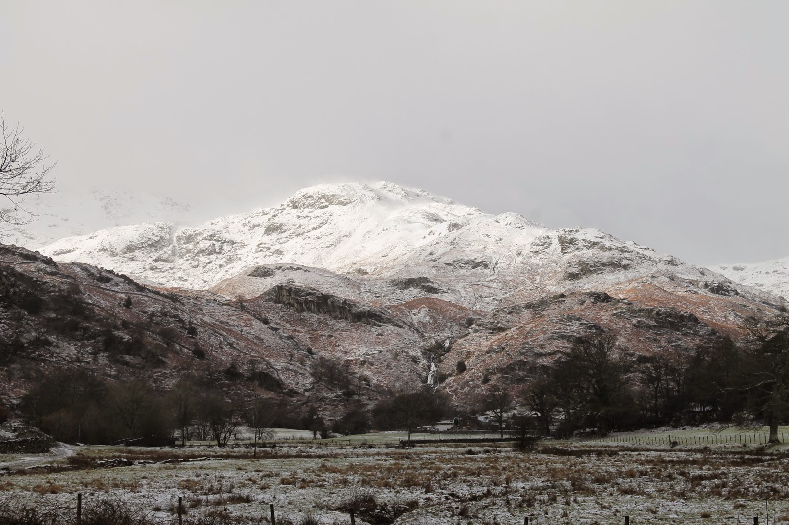
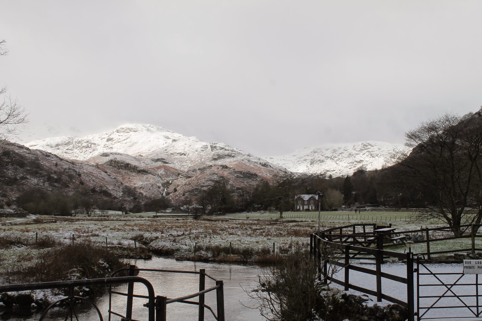
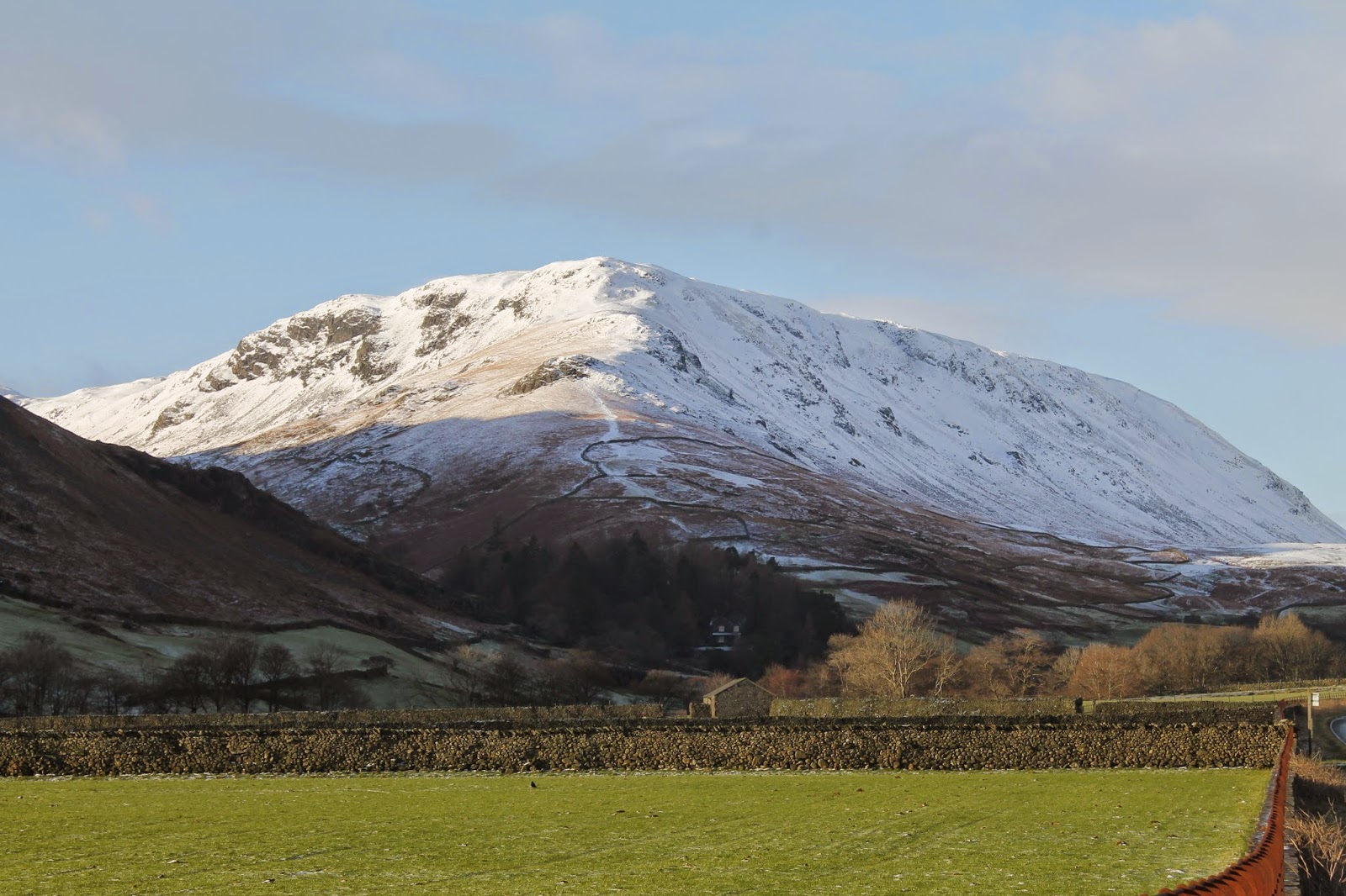
Kitted up for the cold we left Grasmere along the main route towards Helm Crag, Easedale Road. Once the clouds had lifted the fells were looking resplendent with the winter coating though it was obvious, even on the lower elevations, that a brisk wind was whipping the snow off the ridges into a swirling white cloud.
 |
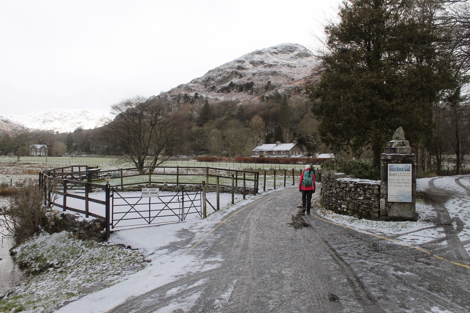
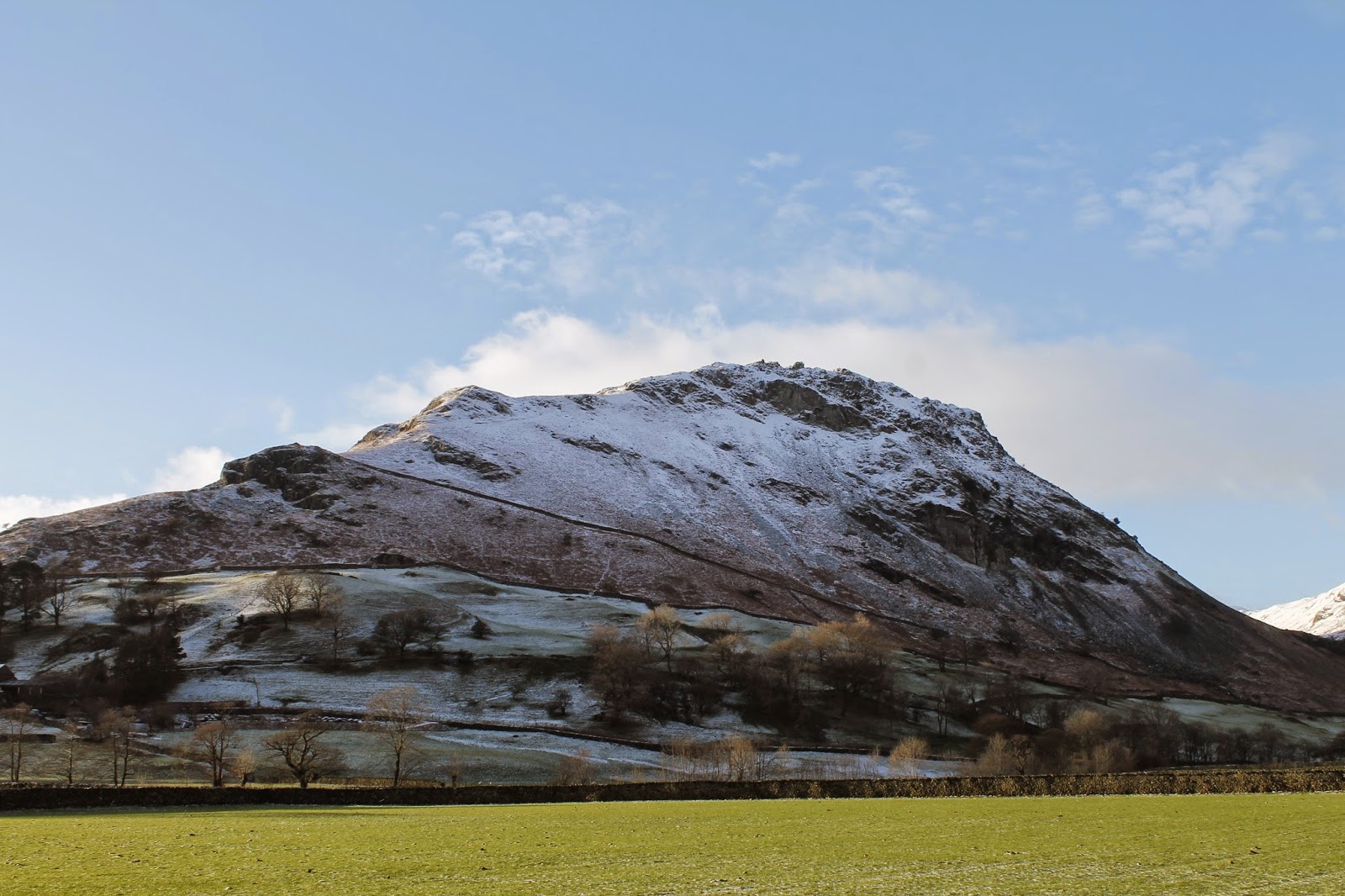
| The lane leading to Brimmer Head Farm with Helm Crag in the background |
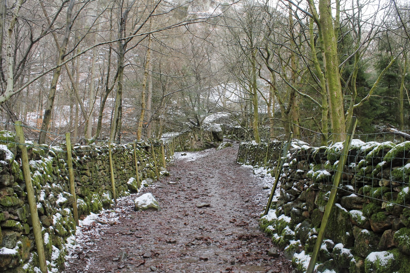
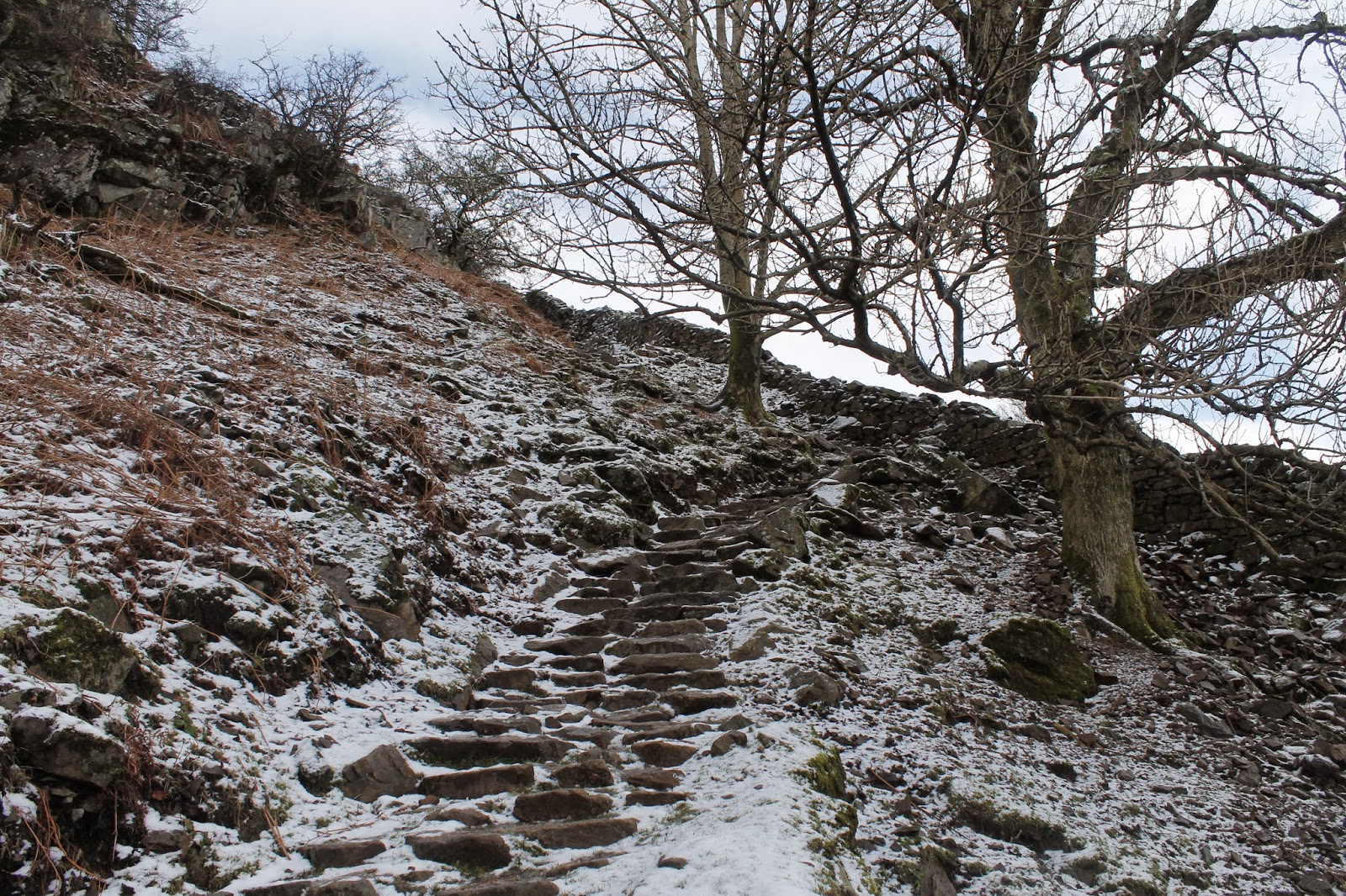
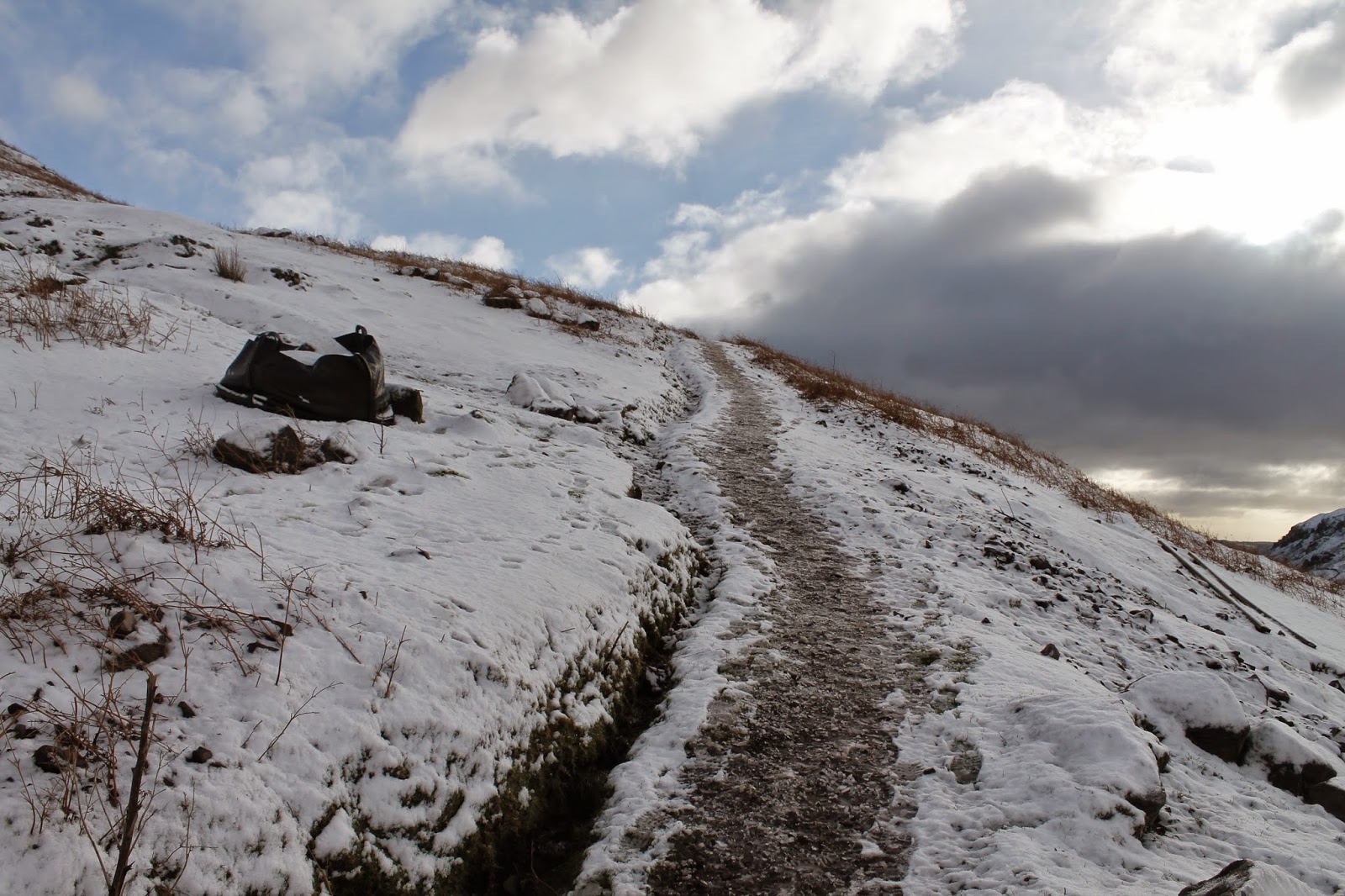
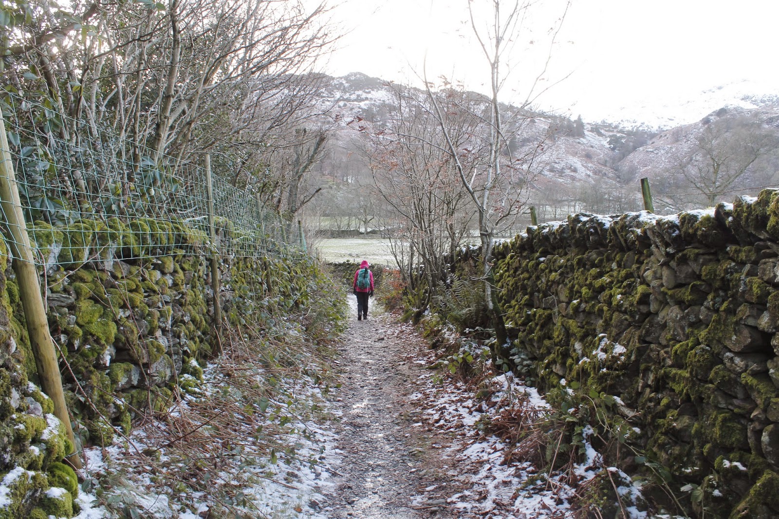
The lane crosses Goody Bridge and onto the lane leading to Brimmer Head Farm. Dating from 1574, it is reputed to be the oldest building in Grasmere and is protected by its Grade I listed status. At the entrance to Brimmer Head Farm, the path turns and begins its stepped climb up the slopes of Helm Crag.
 |
| The bridleway leading to the footings of Helm Crag |
 |
| A stepped path climbs the southern slopes |
 |
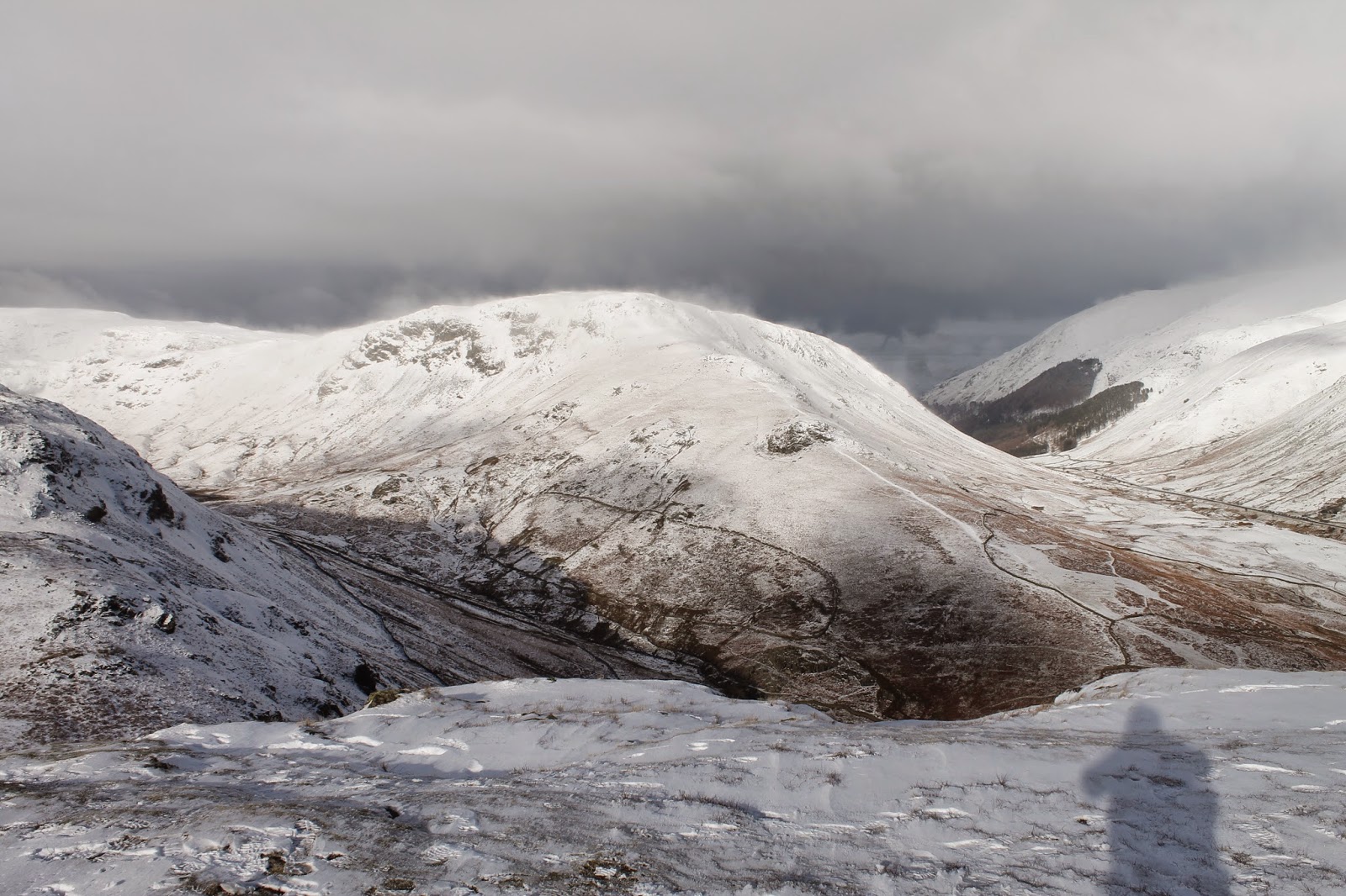
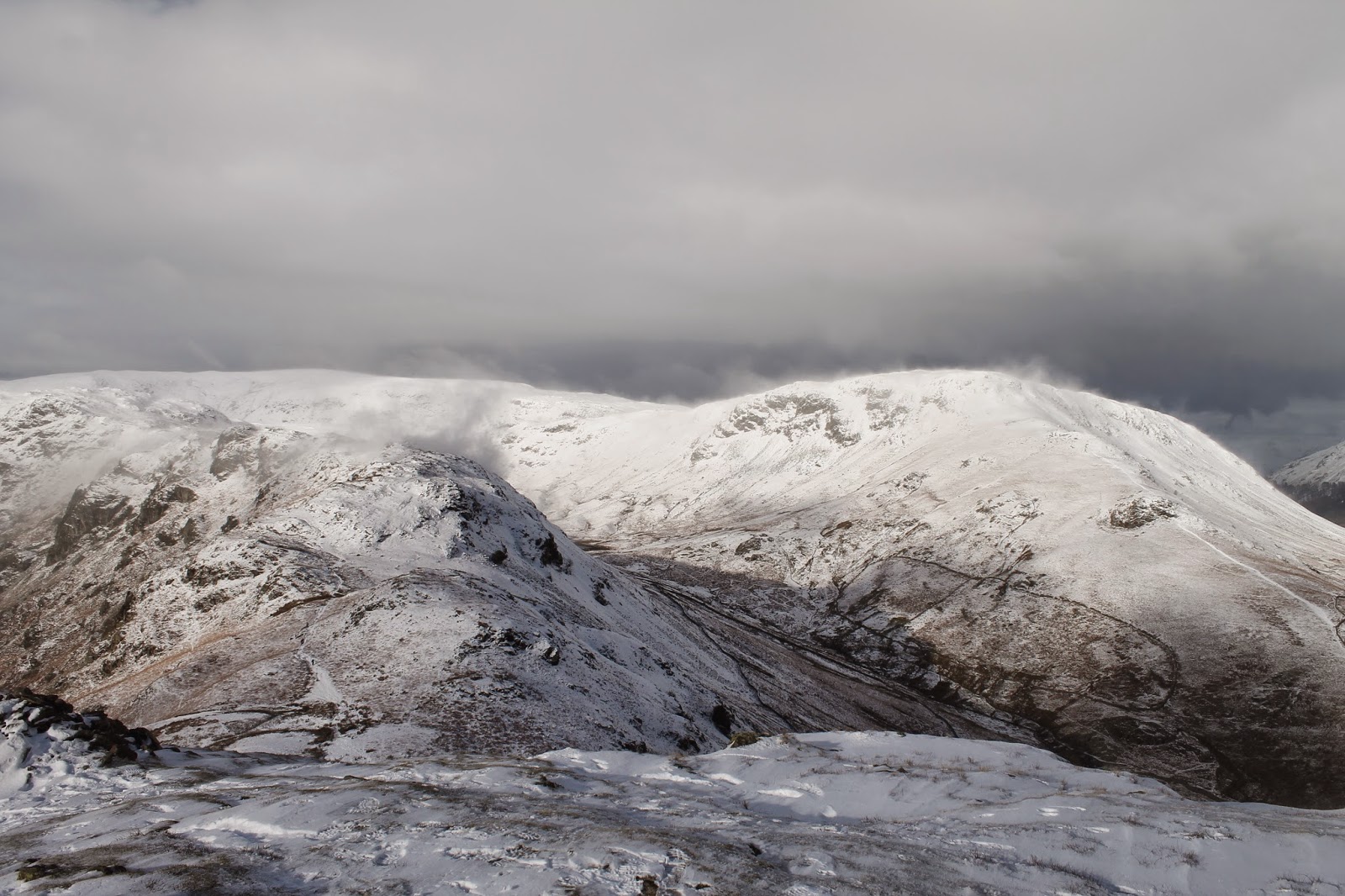
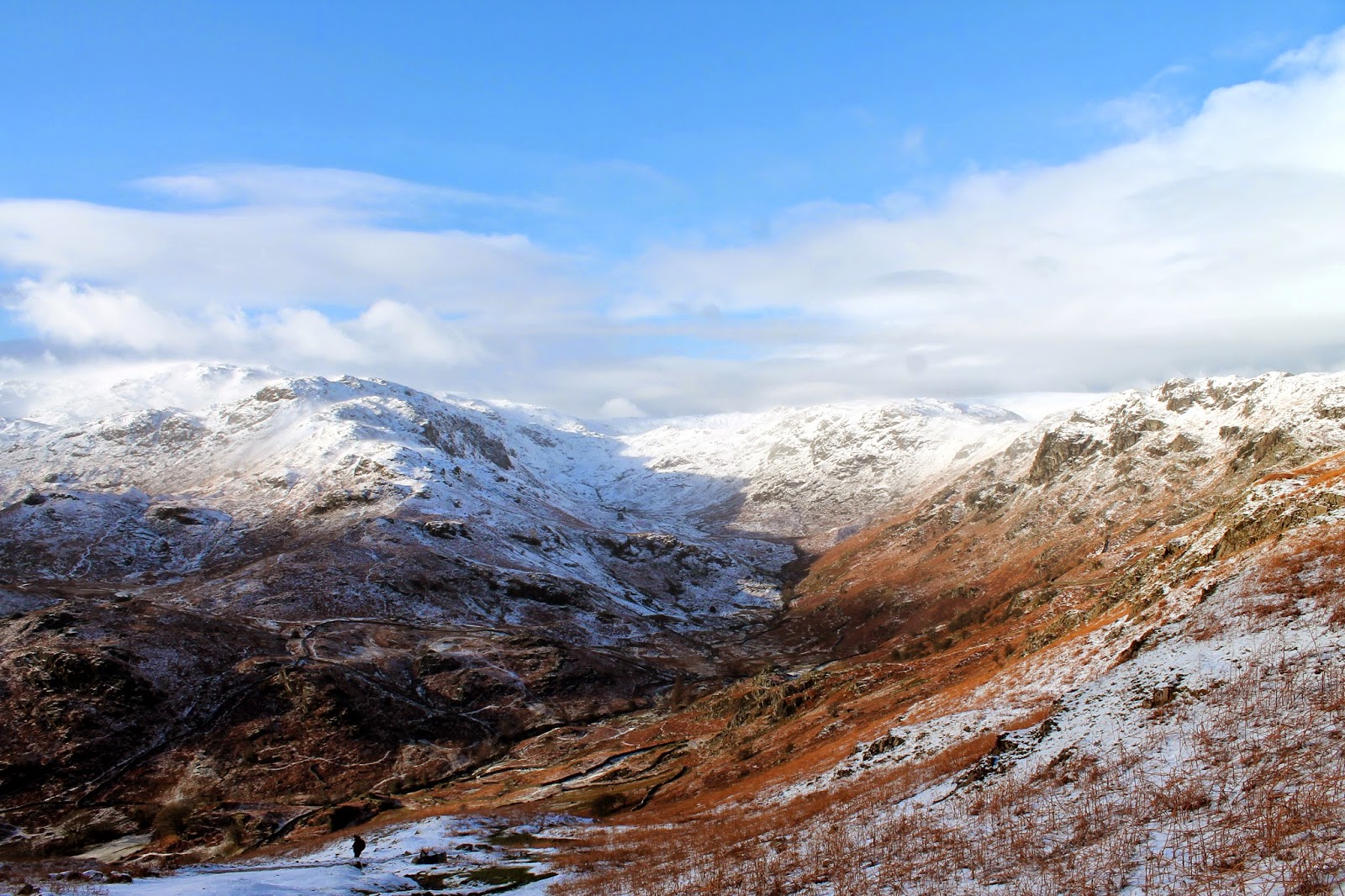
| Tarn Crag and Easedale |
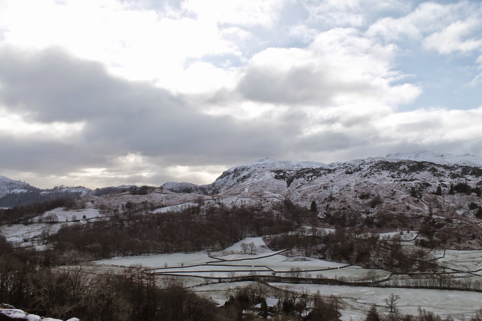
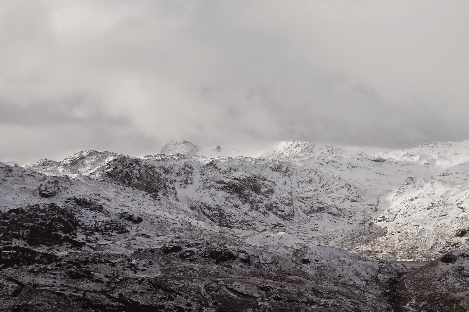
We plodded up the path to White Crag which provides a fine overlook of lower Easedale and marked the beginning of any serious snow. This was around the 250m mark after the snow that fell in the morning. The forecast was ringing true though and the early cloud had lifted off all but the highest summits – Fairfield was still looking rather bleak.
 |
| The path climbing the hillside |
 |
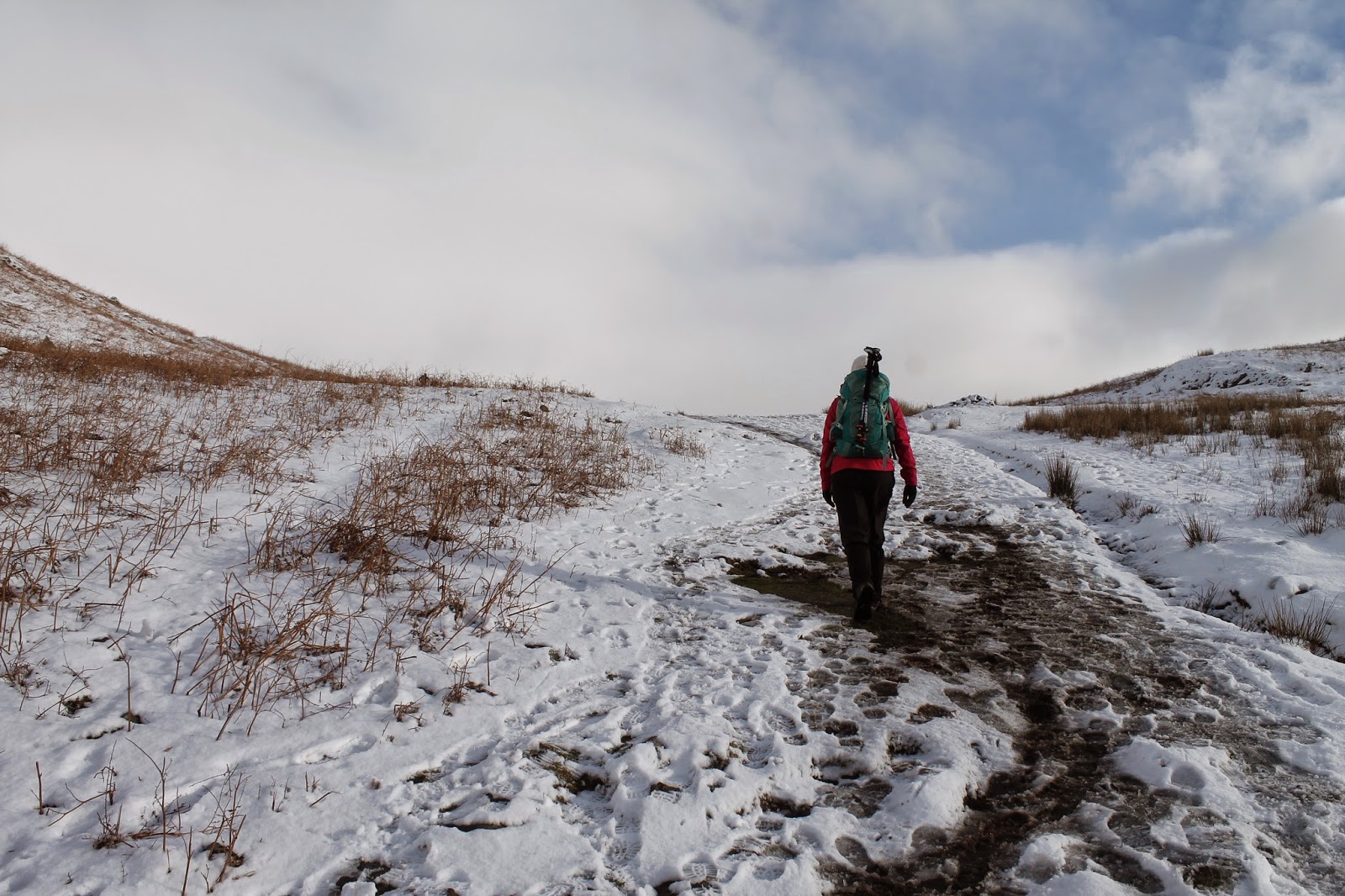
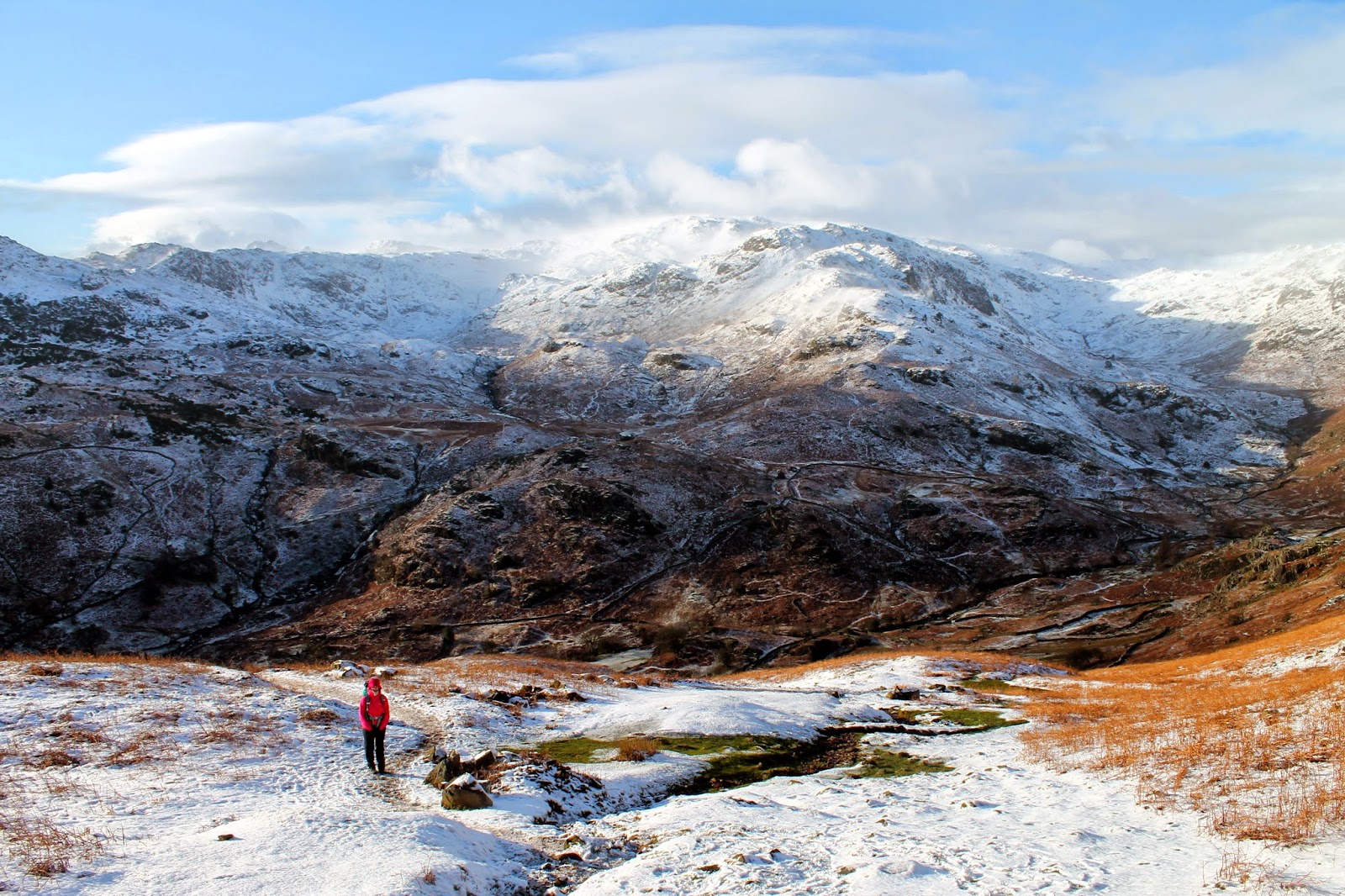
| Sara climbs up towards High Raven Crag |
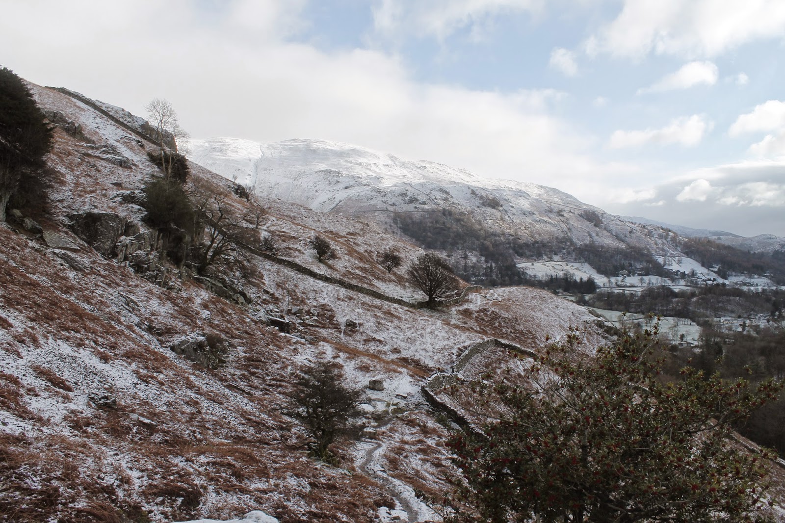
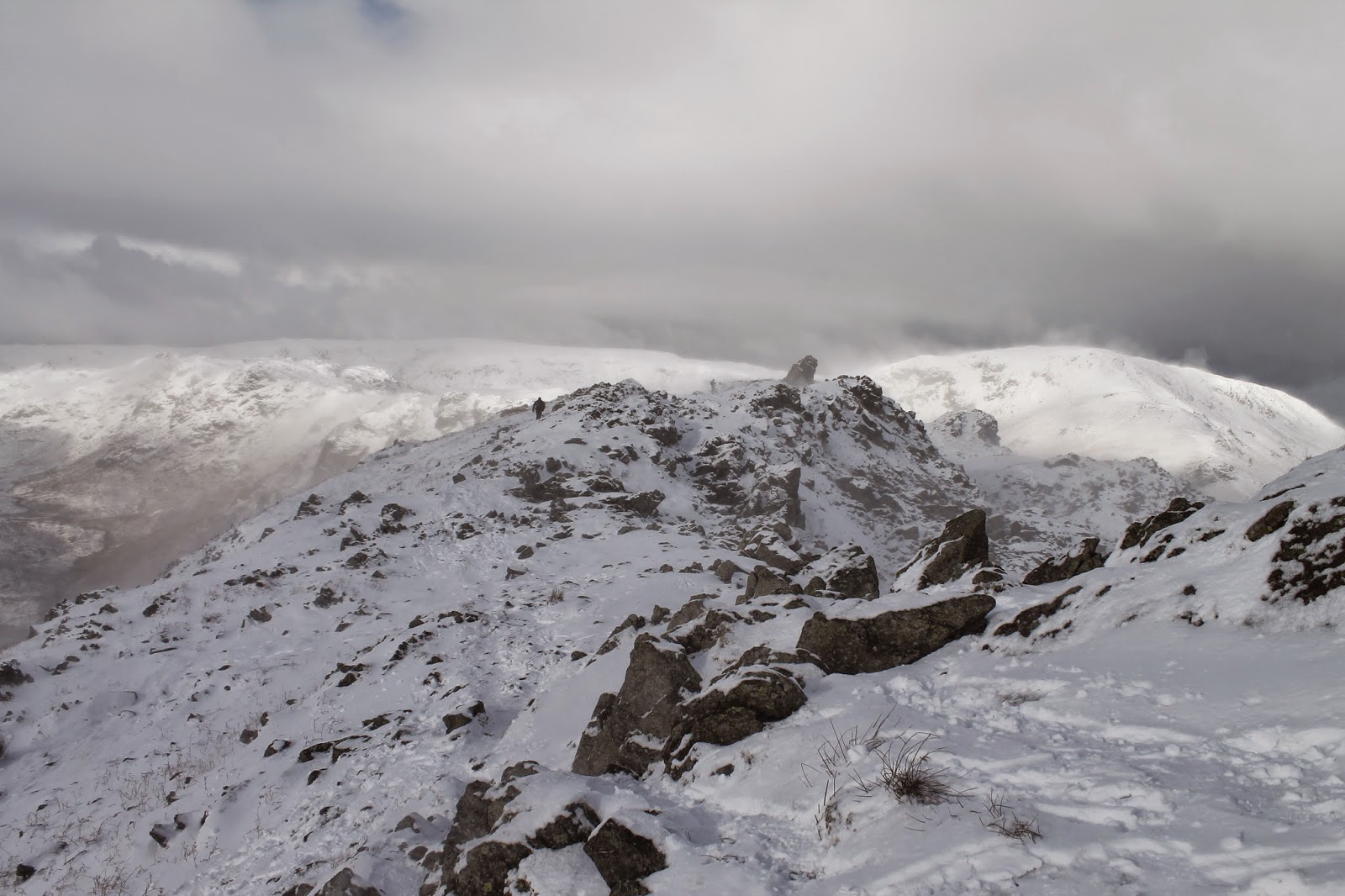
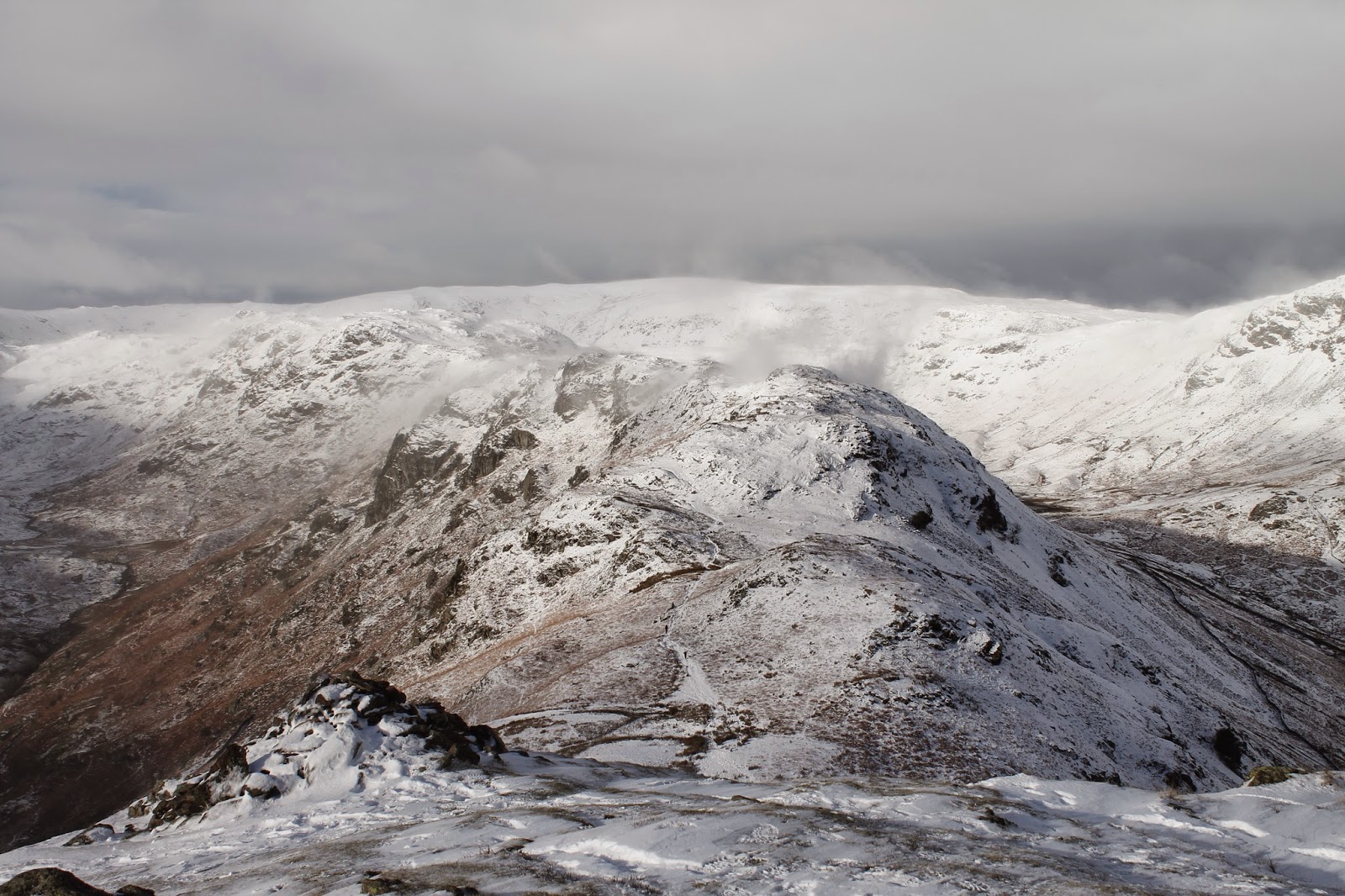
We forged on, noting the spindrift being lifted off Gibson Knott, climbing up alongside Raven High Crag and into the icy breath of the northerly wind. The outcrops and crags of Helm Crag offered the slightest bit of shelter until we reached the famous outcrop that forms The Lion when seen from valley level.
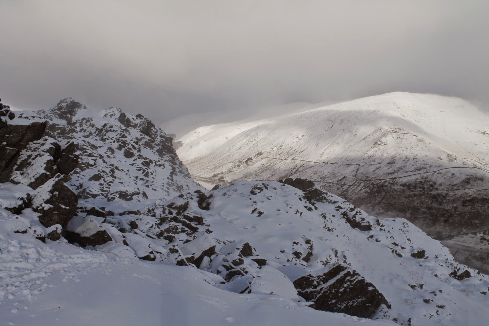
 |
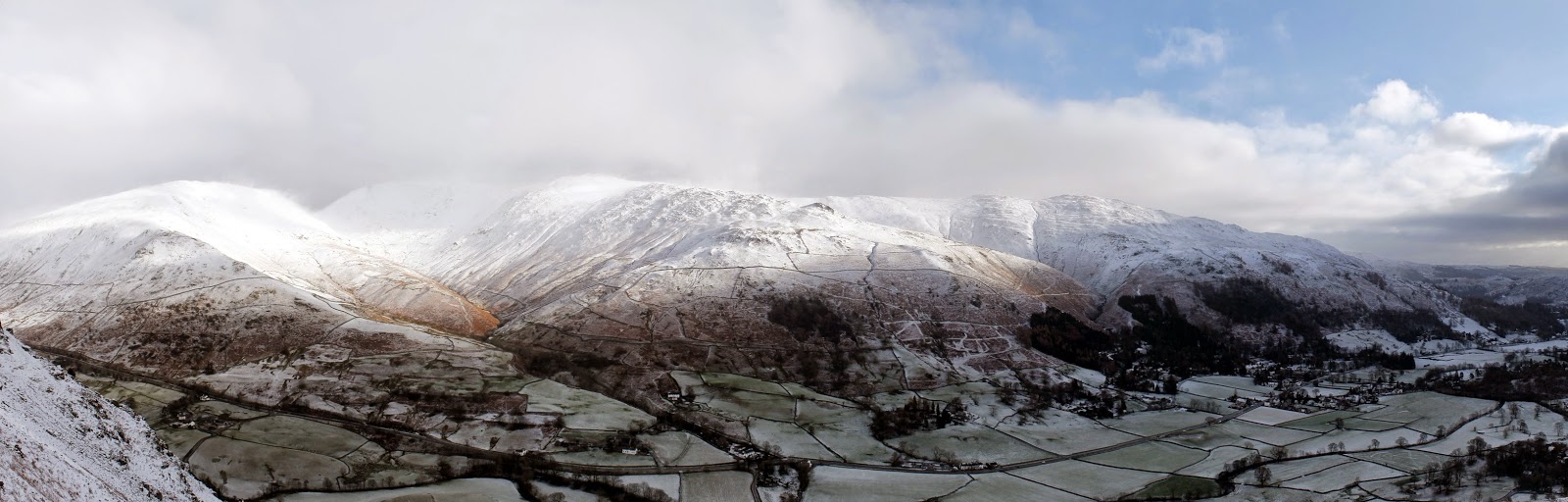
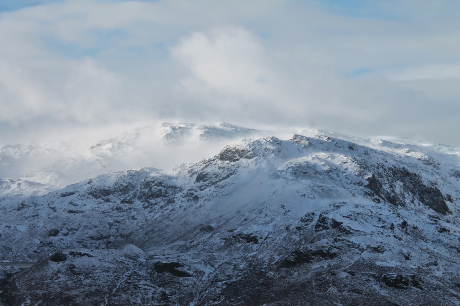
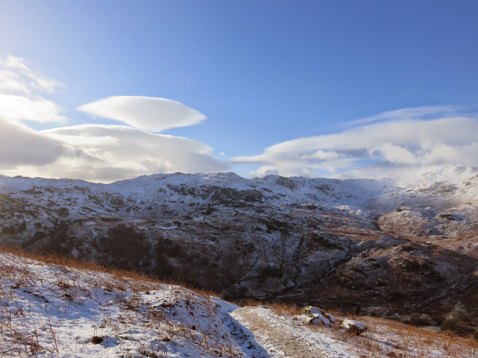
| Blea Rigg and Slapestone Edge with the Langdale Pikes behind |
 |
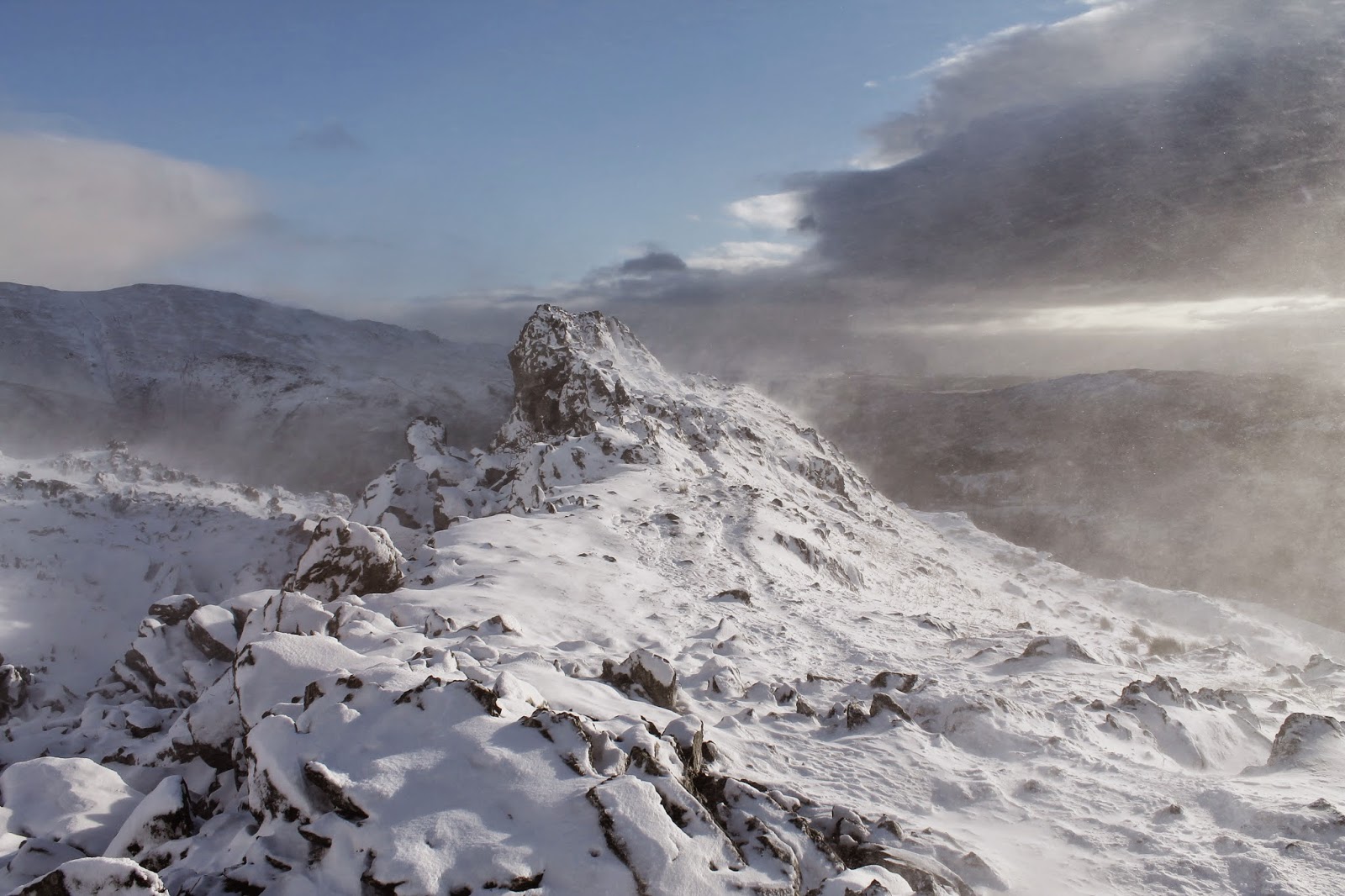
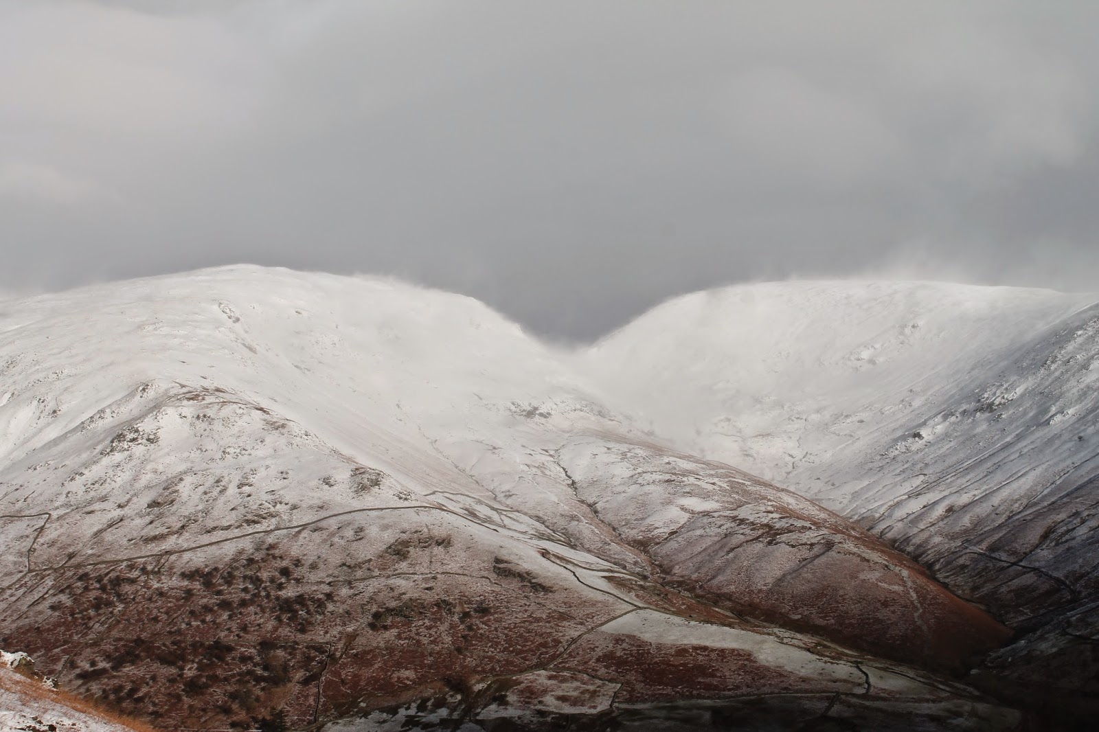
| The view across the top of Helm Crag – the summit is to prominent rock sticking out of the ground |
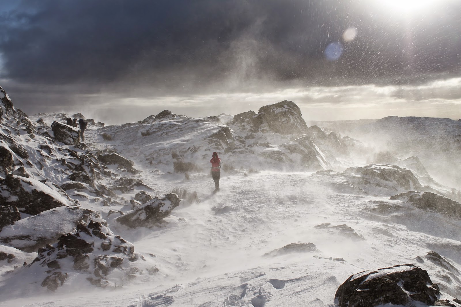
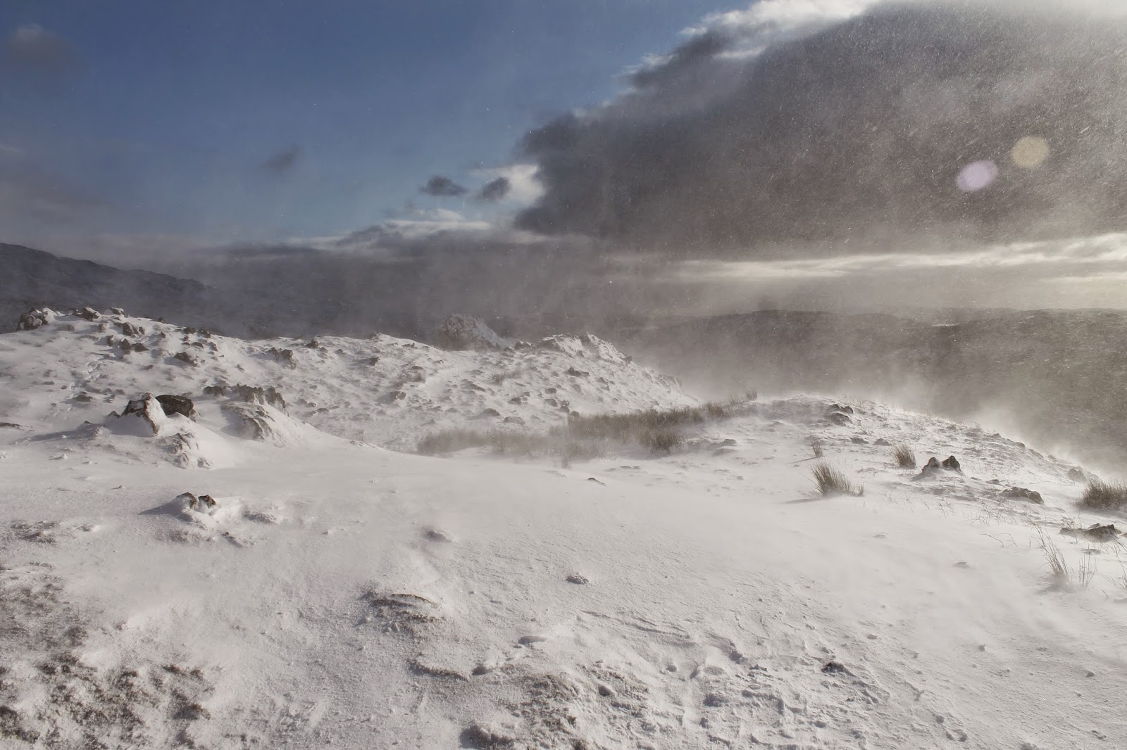
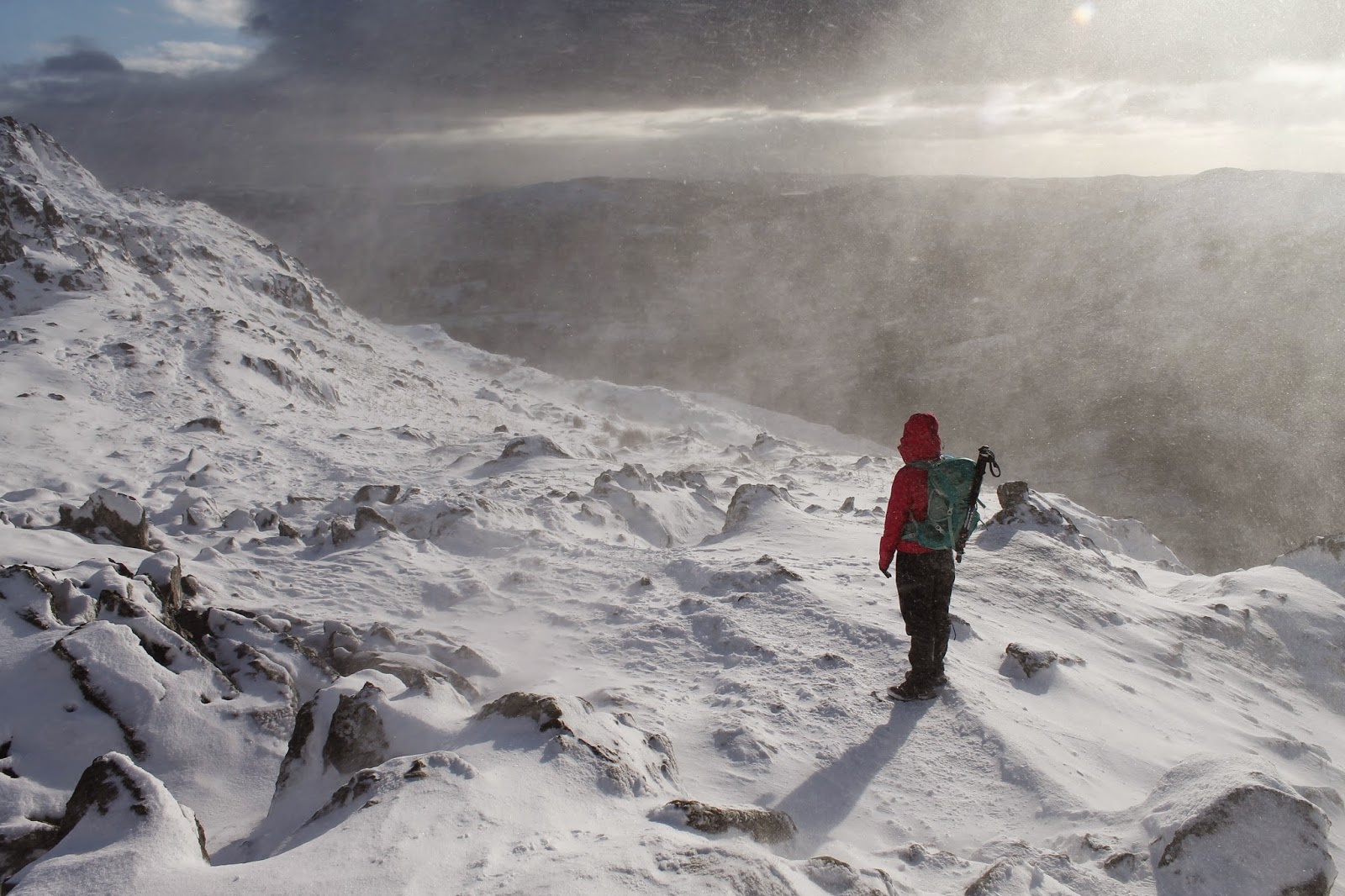
Still largely sheltered by the rocks, we proceeded to the summit proper, a prominent outcrop known as The Howitzer. We had passed a few people who had turned back from this point and it was easy to see why. While the wind didn’t particularly hinder progress, it was enough to raise a stinging cloud of spindrift which could only safely be overcome by a pair of goggles of some foolhardiness, of which we had neither. This was to be as far as we got today, even The Howitzer itself didn’t look an appetising climb.
 |
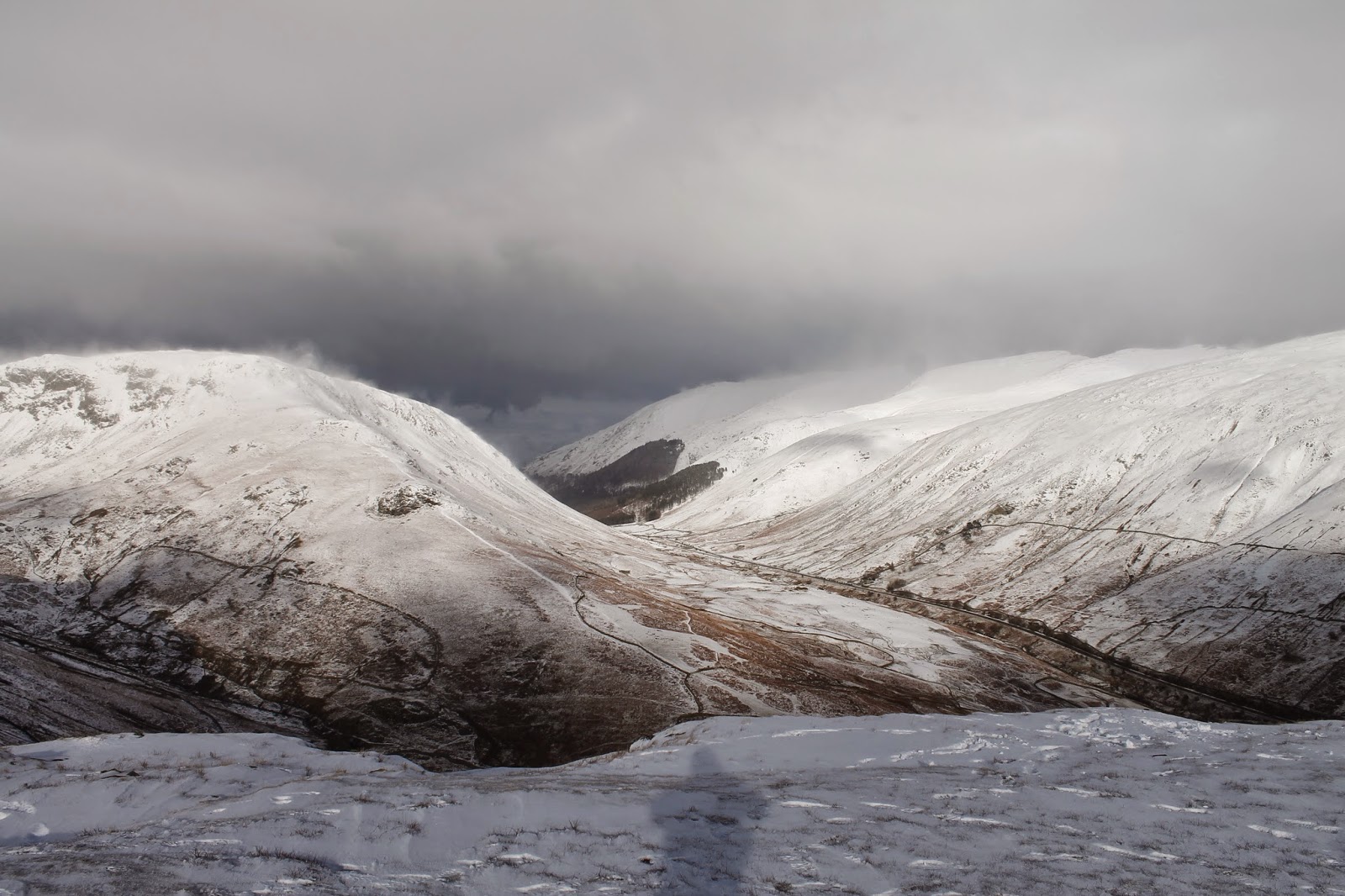
| Dunmail Raise |
 |
| More spindrift on the summit |
 |
| The famous outcrop that forms The Lion |
 |
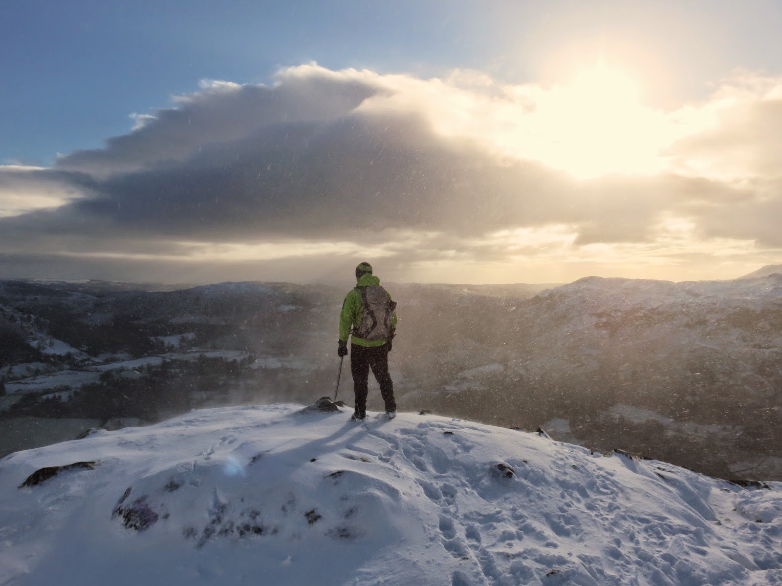
| Sara on the summit |
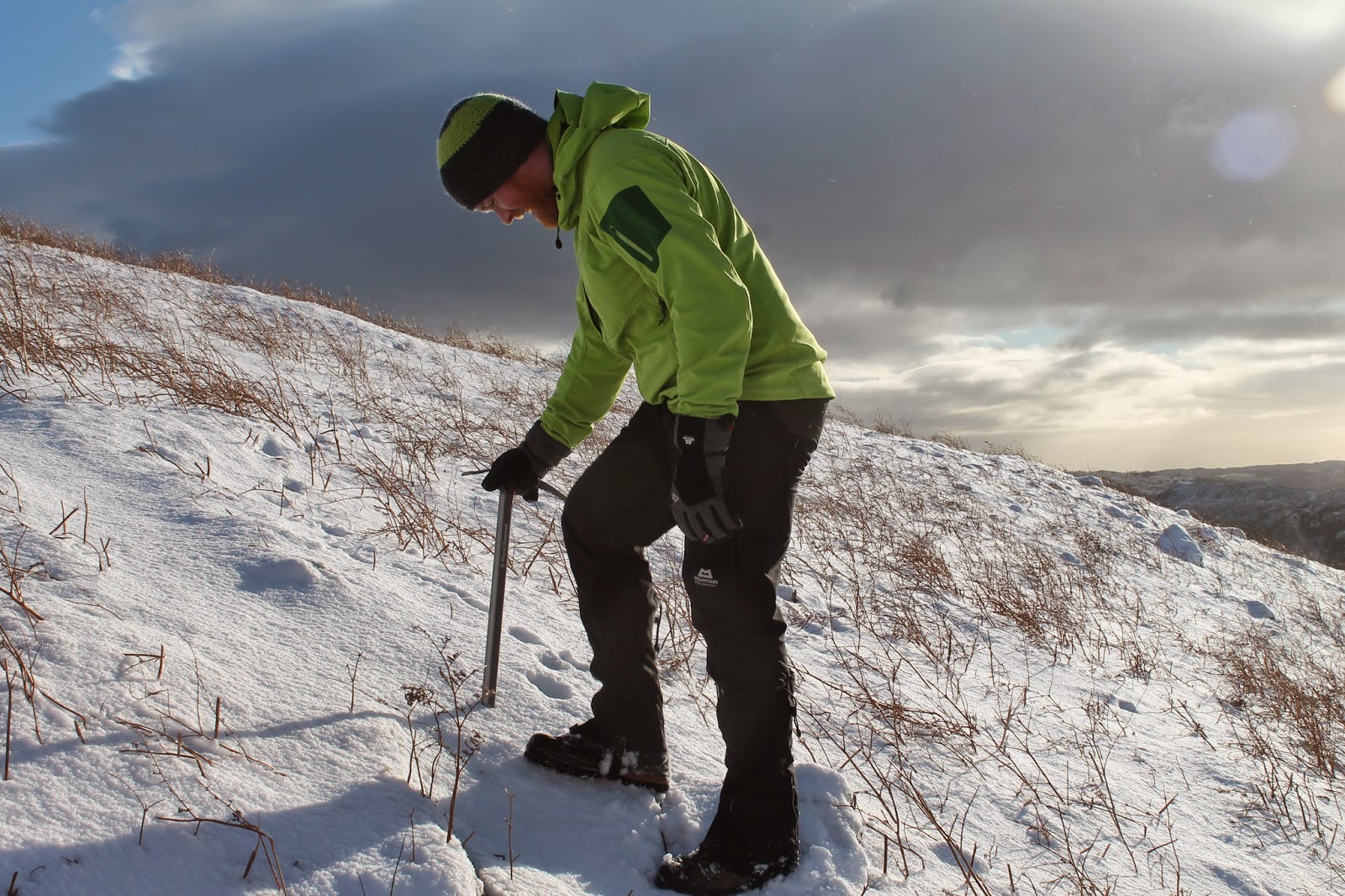
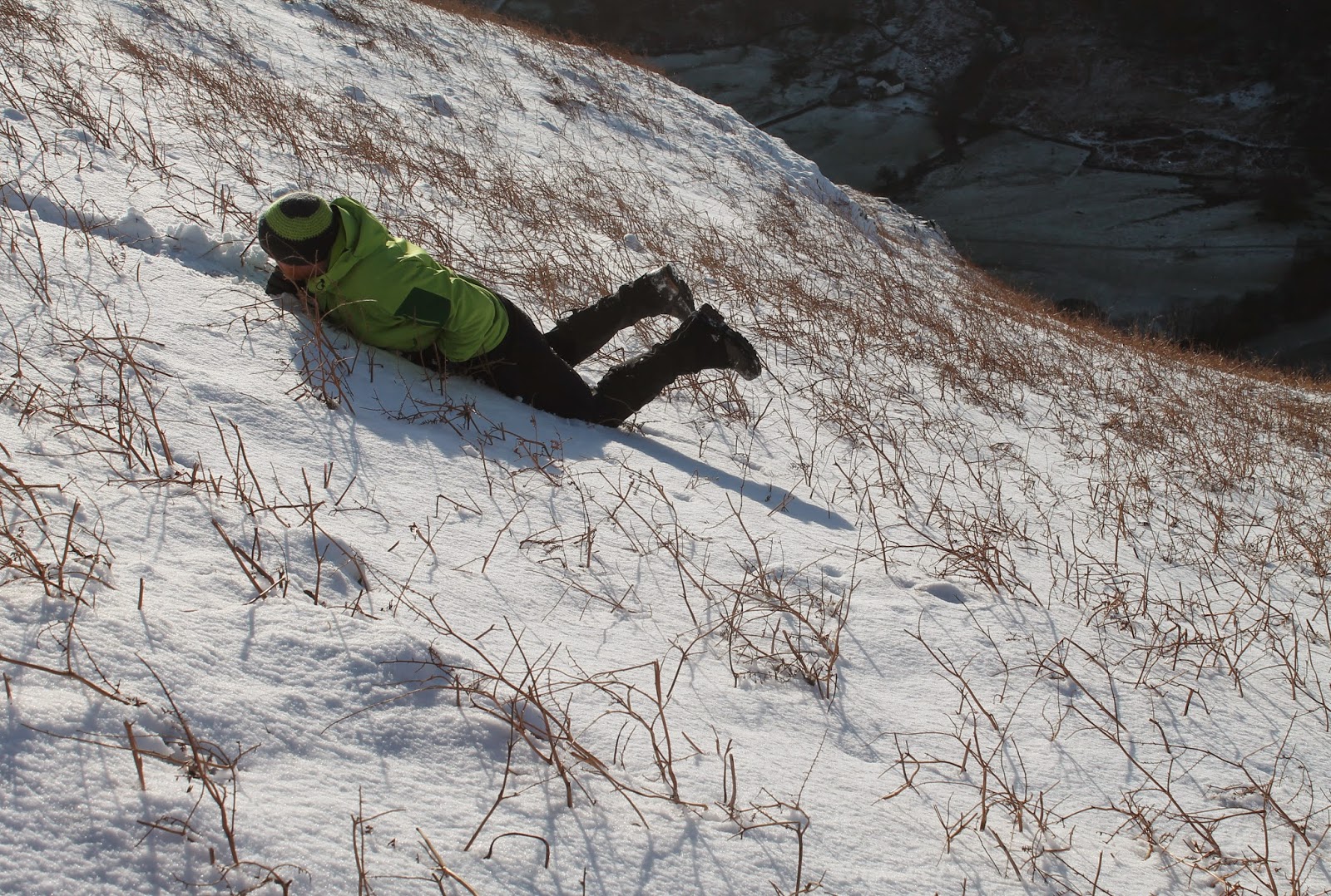
A brief lull allowed me to get some nice pictures of Gibson Knott and Sara being hammered by the spindrift before we retraced our steps back to the shelter beneath High Raven Crag. This did allow me to practice the ice axe arrest technique I was taught last year and, thankfully, I haven’t fully forgotten it.
 |
| Looking out over Grasmere |
 |
| Practicing with the ice axe |
 |
| Still practicing with the ice axe…. |
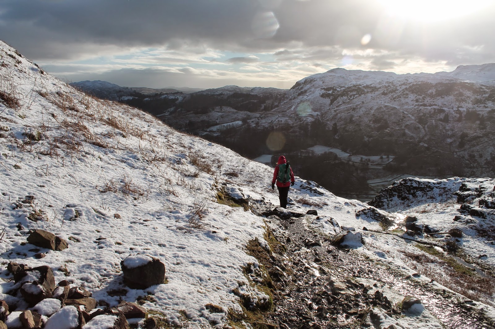
We followed the same ascent route back to the valley floor and decided that what we really needed now was a hot drink, so we retired to Grasmere to do just that. So, there it is, possibly one of the shorter posts I’ll ever write but we certainly learned some valuable lessons in the relative safety of the lower fells of the Lake District. I’ll be off to the shops now to get a pair of goggles – a small piece of kit that can make a huge difference.
 |
| View across to Blea Rigg and Great Castle How |
 |
| Sara with Easedale behind |
 |
| Retracing our route down the fellside |
 |
| The return to Grasmere |
