Open Space Web-Map builder Codehttps://openspace.ordnancesurvey.co.uk/osmapapi/openspace.js?key=3119F72552FD5C22E0530C6CA40A5A92https://openspace.ordnancesurvey.co.uk/osmapapi/script/mapbuilder/basicmap.jshttps://openspace.ordnancesurvey.co.uk/osmapapi/script/mapbuilder/searchbox.js//variables for routes var linesLayer, points, lineFeature, lineString, routeMarkersLayer, routepos, routesize, routeoffset, routeicon; var style_blue = {strokeColor: “#0000CD”, strokeOpacity: 0.5, strokeWidth: 4.5}; function initmapbuilder() { //initiate the map var options = {resolutions: [2500, 1000, 500, 200, 100, 50, 25, 10, 5, 4, 2.5, 2, 1]}; osMap = new OpenSpace.Map(‘map’, options); //configure map options (basicmap.js) setglobaloptions(); //set the center of the map and the zoom level osMap.setCenter(new OpenSpace.MapPoint(328109.33270073,504935.33459854),8); linesLayer = osMap.getVectorLayer(); // Set up layer for route markers routeMarkersLayer = new OpenLayers.Layer.Markers(“Route Markers”); //make a route points = new Array(); points.push(new OpenLayers.Geometry.Point(328823.66603088,505796.66793823)); points.push(new OpenLayers.Geometry.Point(328613.66603088,505736.66793823)); points.push(new OpenLayers.Geometry.Point(328663.66603088,505571.66793823)); points.push(new OpenLayers.Geometry.Point(328718.66603088,505376.66793823)); points.push(new OpenLayers.Geometry.Point(328818.66603088,505251.66793823)); points.push(new OpenLayers.Geometry.Point(328878.66603088,505175.66793823)); points.push(new OpenLayers.Geometry.Point(328977.66603088,505099.66793823)); points.push(new OpenLayers.Geometry.Point(328858.66603088,504951.66793823)); points.push(new OpenLayers.Geometry.Point(328763.66603088,504716.66793823)); points.push(new OpenLayers.Geometry.Point(328738.66603088,504501.66793823)); points.push(new OpenLayers.Geometry.Point(328438.66603088,504331.66793823)); points.push(new OpenLayers.Geometry.Point(328118.66603088,504206.66793823)); points.push(new OpenLayers.Geometry.Point(327528.66603088,504231.66793823)); points.push(new OpenLayers.Geometry.Point(327258.66603088,504181.66793823)); points.push(new OpenLayers.Geometry.Point(327108.66603088,504221.66793823)); points.push(new OpenLayers.Geometry.Point(327328.66603088,504141.66793823)); points.push(new OpenLayers.Geometry.Point(327548.66603088,504106.66793823)); points.push(new OpenLayers.Geometry.Point(327748.66603088,504141.66793823)); points.push(new OpenLayers.Geometry.Point(327978.66603088,504286.66793823)); points.push(new OpenLayers.Geometry.Point(328138.66603088,504481.66793823)); points.push(new OpenLayers.Geometry.Point(328158.66603088,504561.66793823)); points.push(new OpenLayers.Geometry.Point(328403.66603088,504781.66793823)); points.push(new OpenLayers.Geometry.Point(328558.66603088,504951.66793823)); points.push(new OpenLayers.Geometry.Point(328557.66603088,505147.66793823)); points.push(new OpenLayers.Geometry.Point(328538.66603088,505331.66793823)); points.push(new OpenLayers.Geometry.Point(328388.66603088,505406.66793823)); points.push(new OpenLayers.Geometry.Point(328388.66603088,505491.66793823)); points.push(new OpenLayers.Geometry.Point(328513.66603088,505726.66793823)); points.push(new OpenLayers.Geometry.Point(328608.66603088,505726.66793823)); points.push(new OpenLayers.Geometry.Point(328823.66603088,505796.66793823)); // create a polyline feature from the array of points lineString = new OpenLayers.Geometry.LineString(points); lineFeature = new OpenLayers.Feature.Vector(lineString, null, style_blue); linesLayer.addFeatures([lineFeature]); //crate a route start/end marker routepos = new OpenSpace.MapPoint(328823.66603088,505796.66793823); routesize = new OpenLayers.Size(33,45); routeoffset = new OpenLayers.Pixel(-5,-37); routeicon = new OpenSpace.Icon(‘https://openspace.ordnancesurvey.co.uk/osmapapi/img_versions/img_1.1/mapbuilder/routemarker-startend.png’, routesize, routeoffset, null, null); routeMarkersLayer.addMarker(new OpenLayers.Marker(routepos, routeicon)); osMap.addLayer(routeMarkersLayer);}
Route: Langdale NT campsite, Wall End, Red Acre Gill, Rakerigg, Bleaberry Knott, Wrynose Fell, Pike O’Blisco, Wrynose Fell, Red Acre Gill, Wall End, Langdale NT Campsite
Date: 18/10/2014
From: Great Langdale
Parking: Great Langdale NT Campsite
Start Point: Great Langdale NT Campsite
Region: Southern Fells
Route length: 4.7 miles (7.5 km)
Time taken: 02:30
Average speed: 1.86 mph
Ascent: 639m
Descent: 660m
Wainwrights on this walk:
Pike O’Blisco (705m)
Additional summits: None
Other points of interest: Red Acre Gill
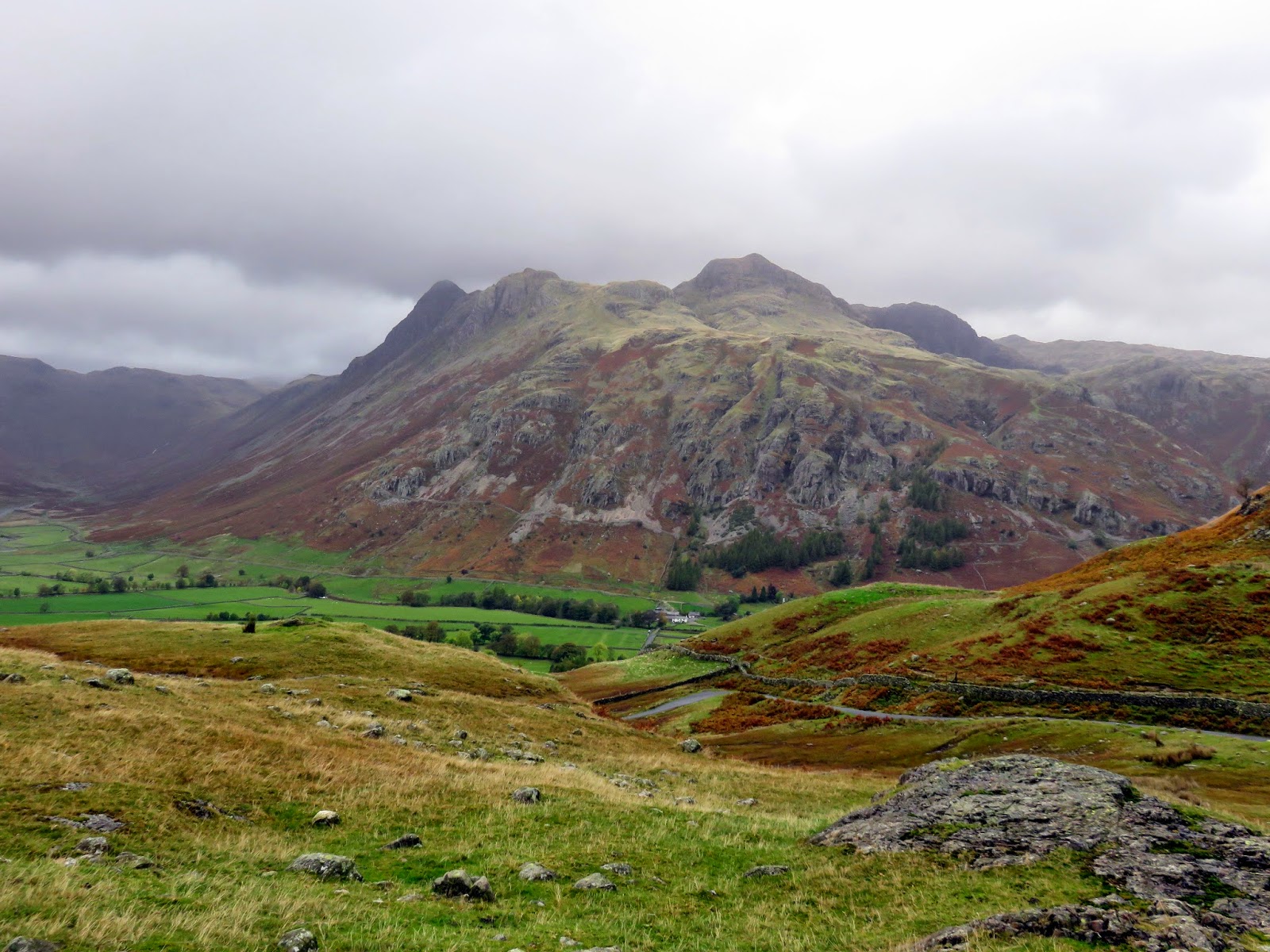
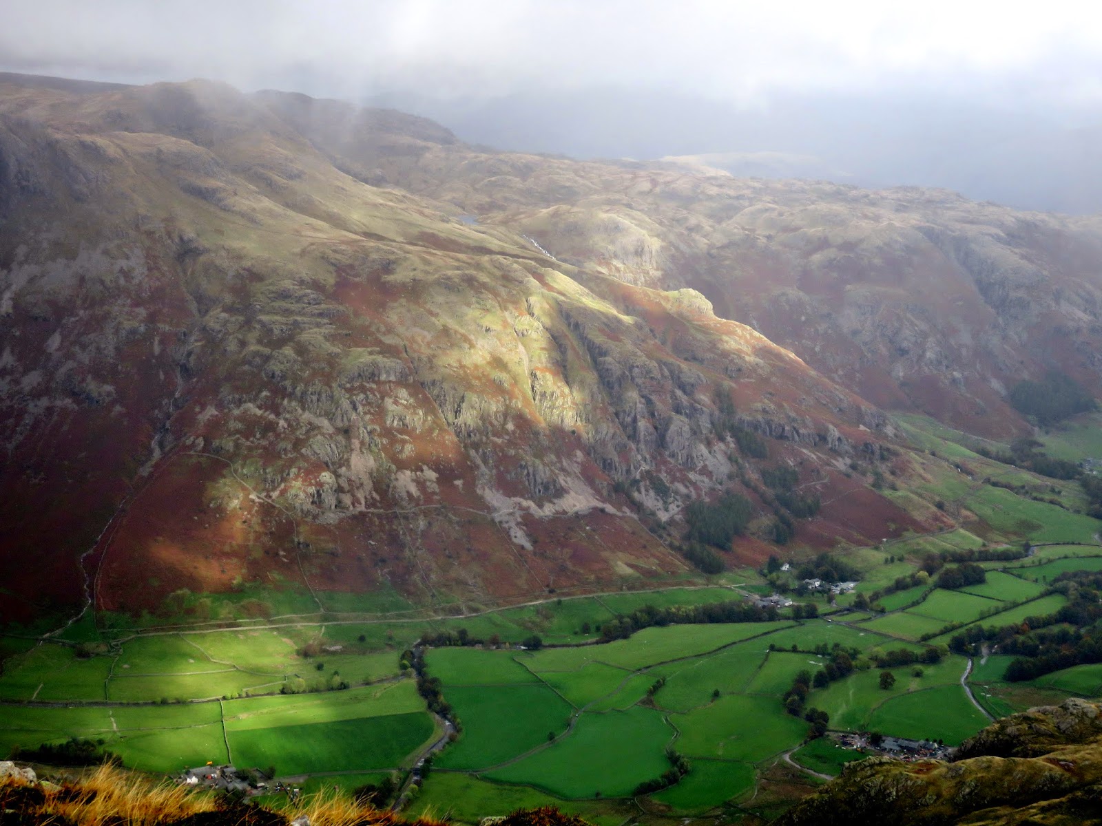
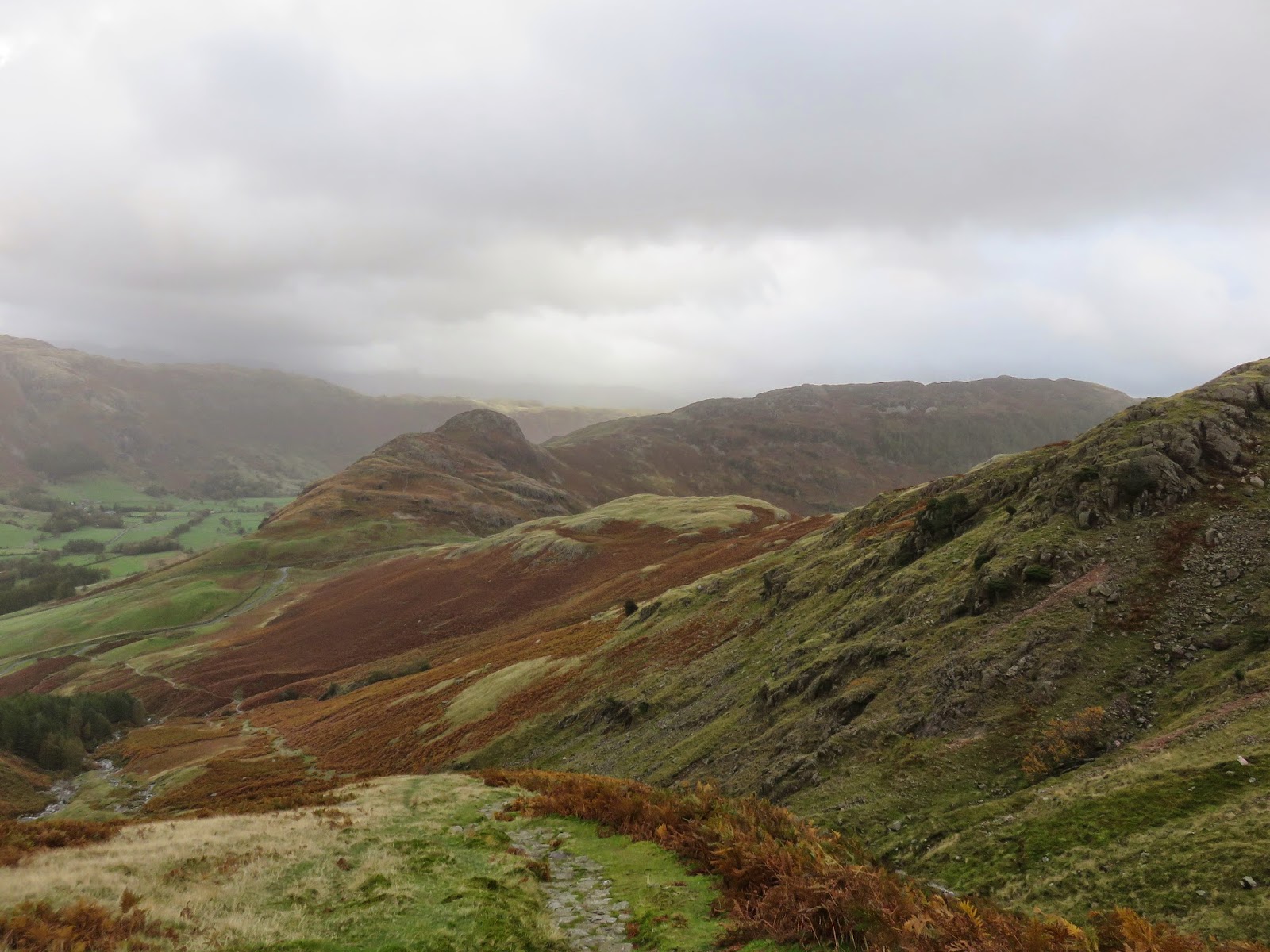
Pike O’Blisco is one of the more overlooked mountains that form the castellated ring around the head of Great Langdale, loftier fells such as Crinkle Crags and Bowfell tend to draw the attention of discerning hikers. Pike O’Blisco does have an ace up its sleeve however. It stands in perfect isolation, with steep sides surrounding the twin-peaked summit, affording it with stunning views in all directions, especially of Great Langdale and its popular pikes.
We were staying at the National Trust campsite once again, wisely staying in on of the camping pods on account of the weather. Think a heated shed and you’re pretty much there. The weather really wasn’t the best; cloudy, windy and rainy, a typical autumn day in the Lake District. With that in mind, we planned a short excursion to Pike O’Blisco on account of its views, holding on to Lake District levels of optimism.
Given the forecast of a strong wind from the South, we altered our route slightly from an ascent up the south face by Black Crag to one up the north eastern flanks around Kettle Crag and across the expanse of Wrynose Fell. This would shelter us for the most part and, in fact, made for quite a warm, sweaty climb.
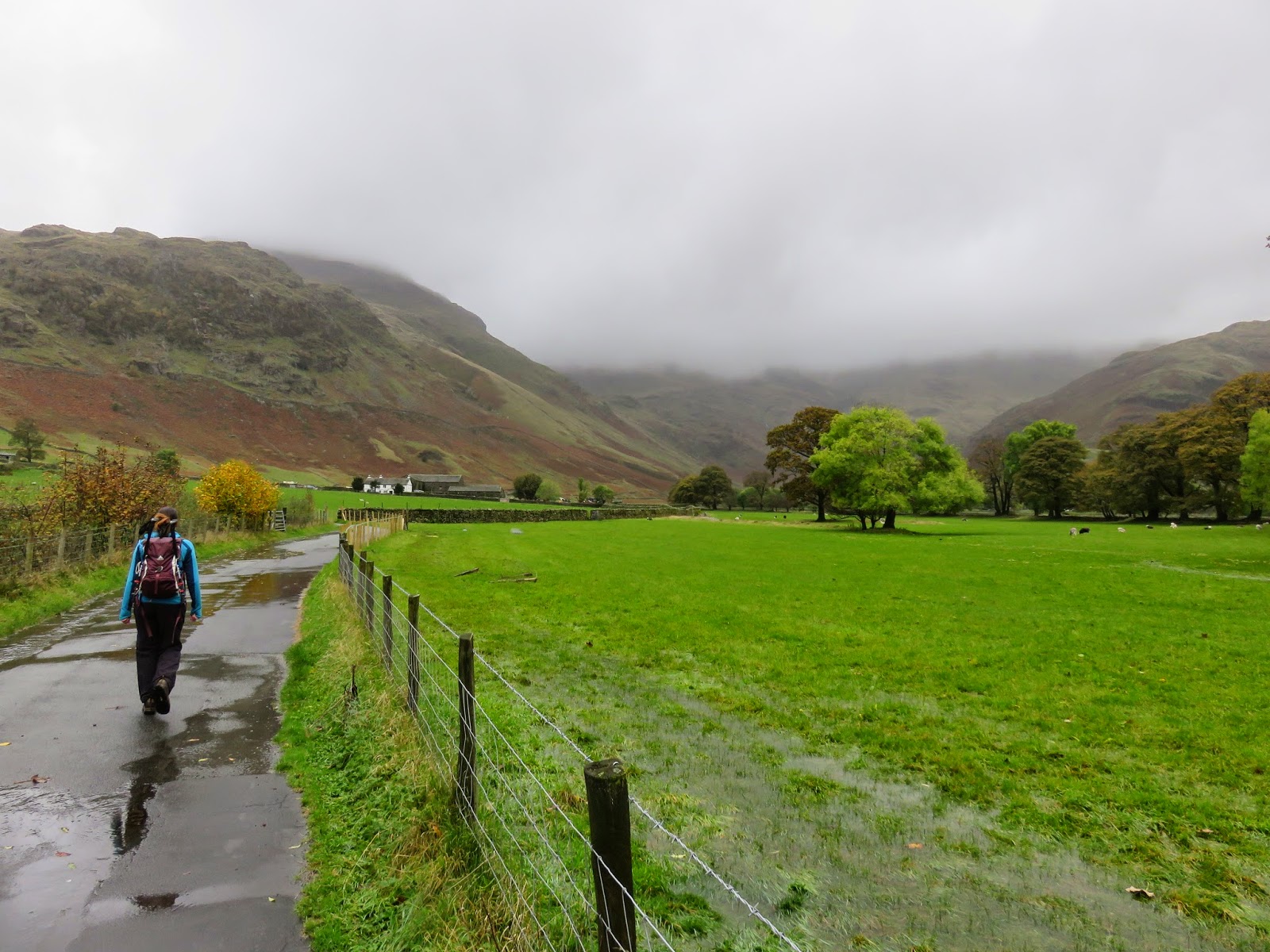
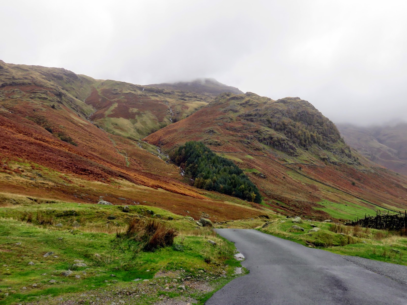
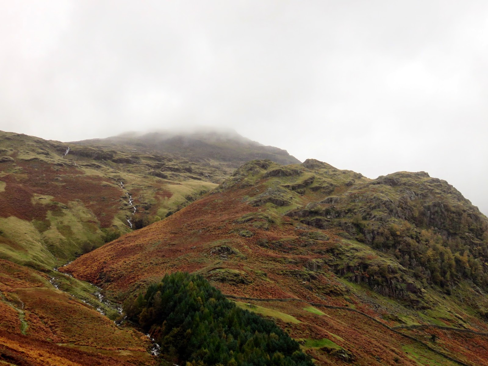
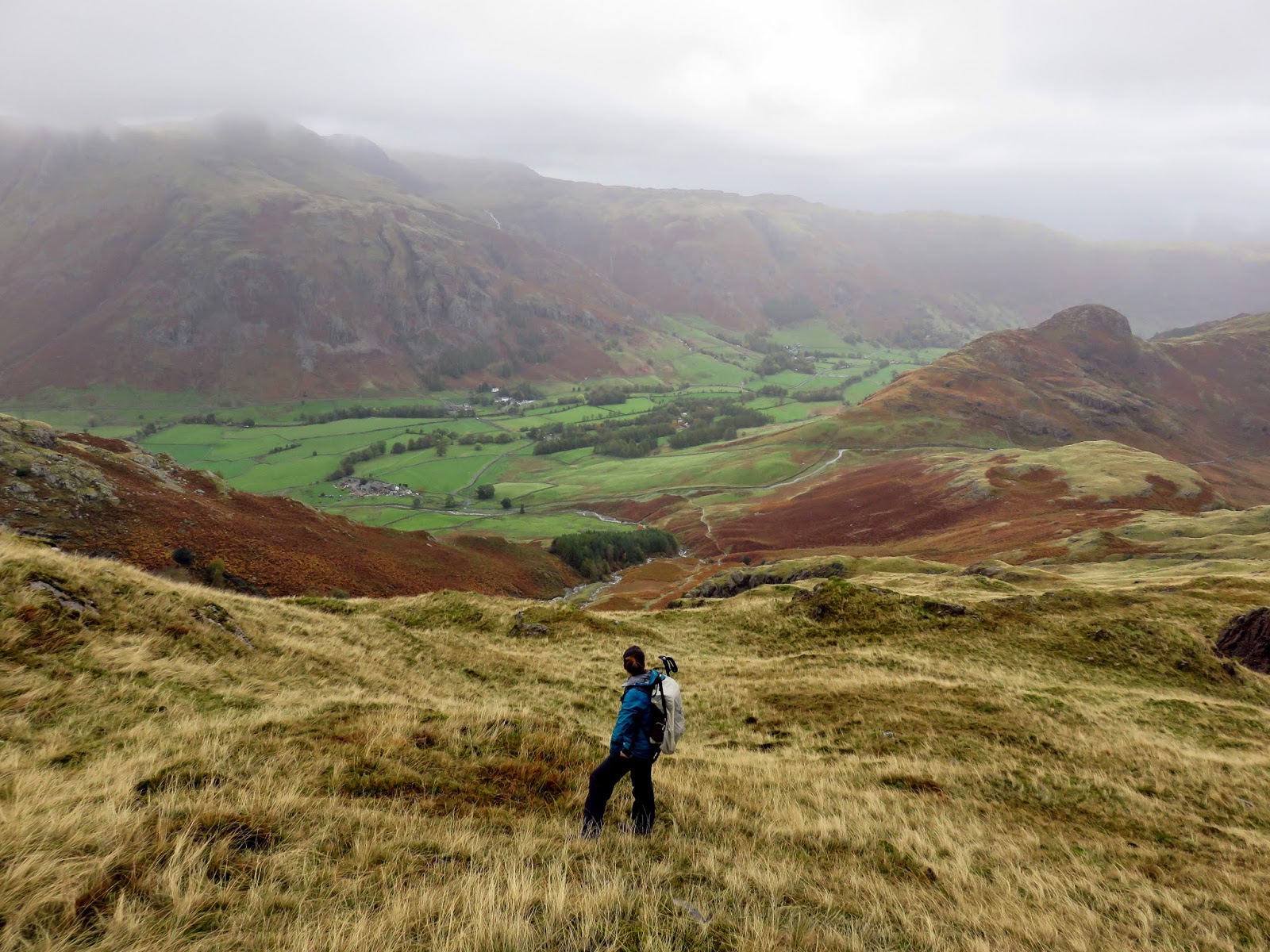
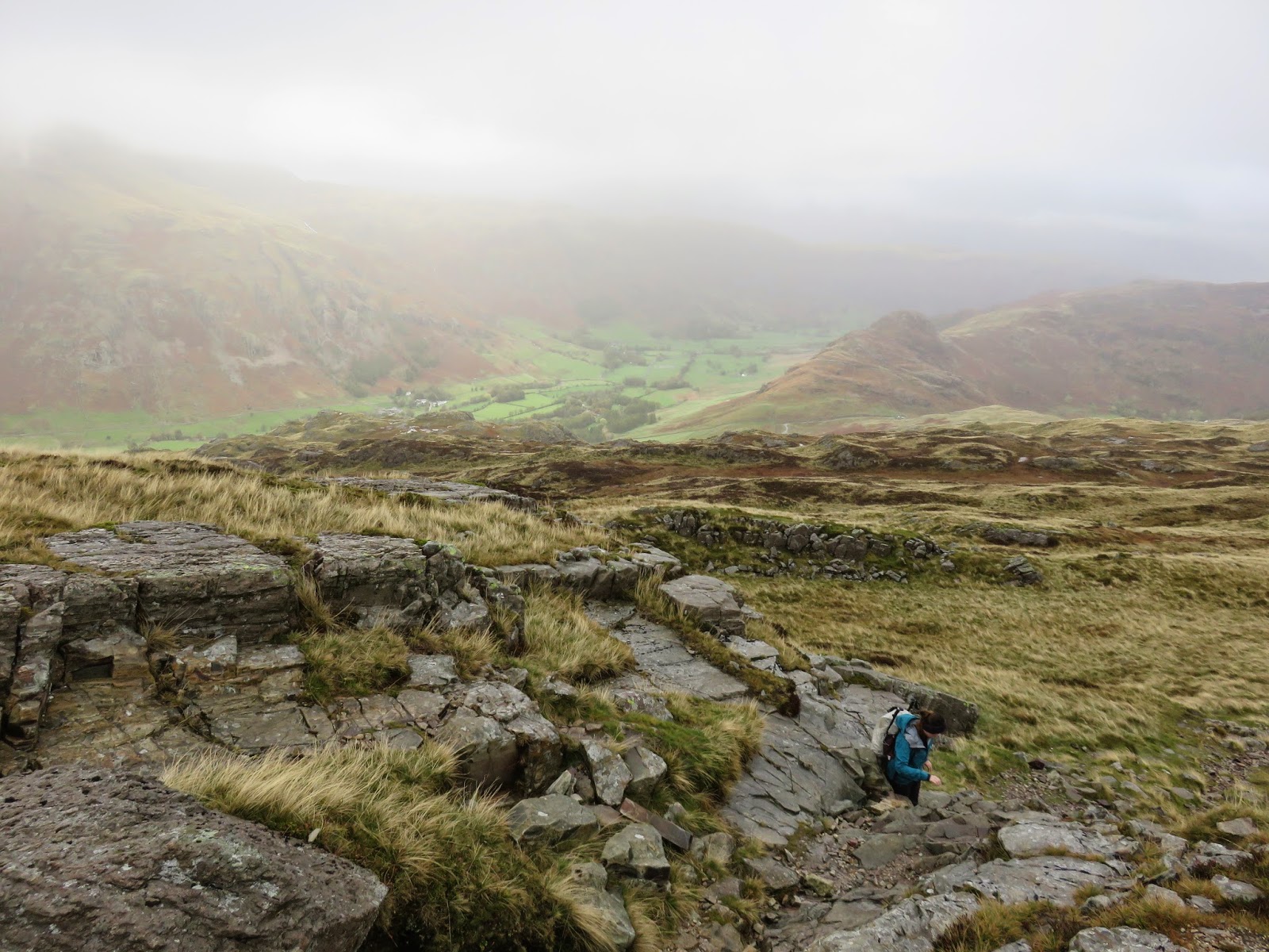
We left the campsite mid-morning and made our way along the sodden road towards Red Acre Gill. We decided against the main route by Red Acre Gill in favour of following a lesser-trodden way that starts the climb a little higher up the hillside at the head of the pass between Great Langdale and Little Langdale. No only would this way be quieter (we passed a large group who were about to embark on the path up Red Acre Gill) but it would also be much less steep.
 |
| Heading into the heart of Great Langdale |
 |
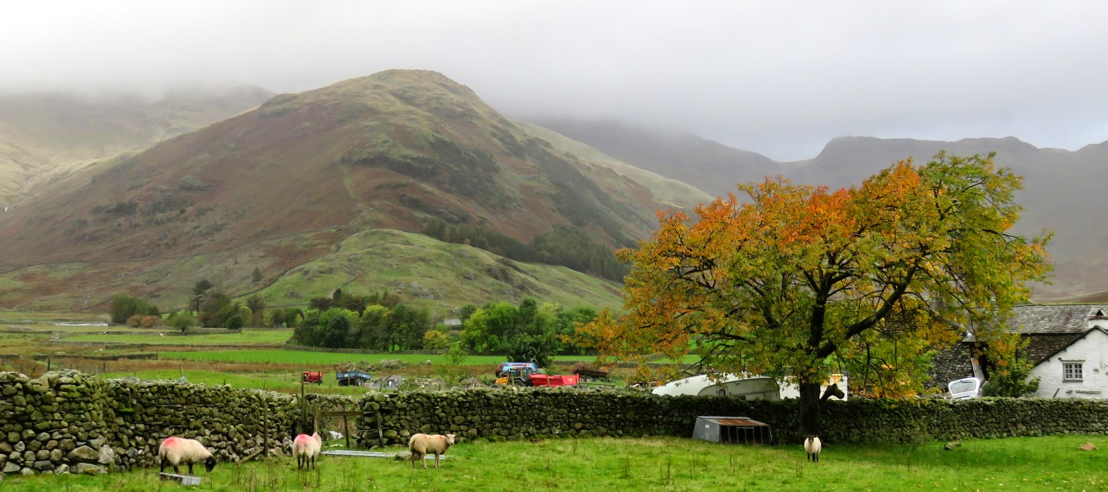
| Raven Crag |
 |
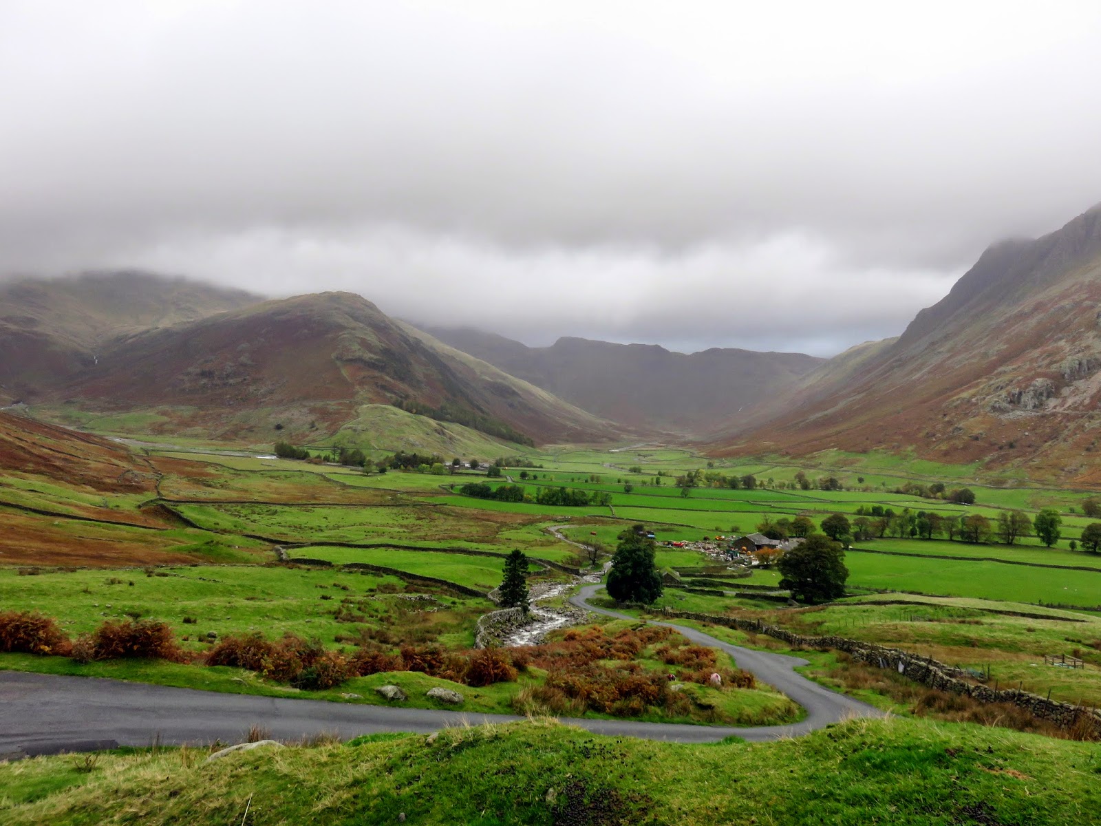
| The Band |
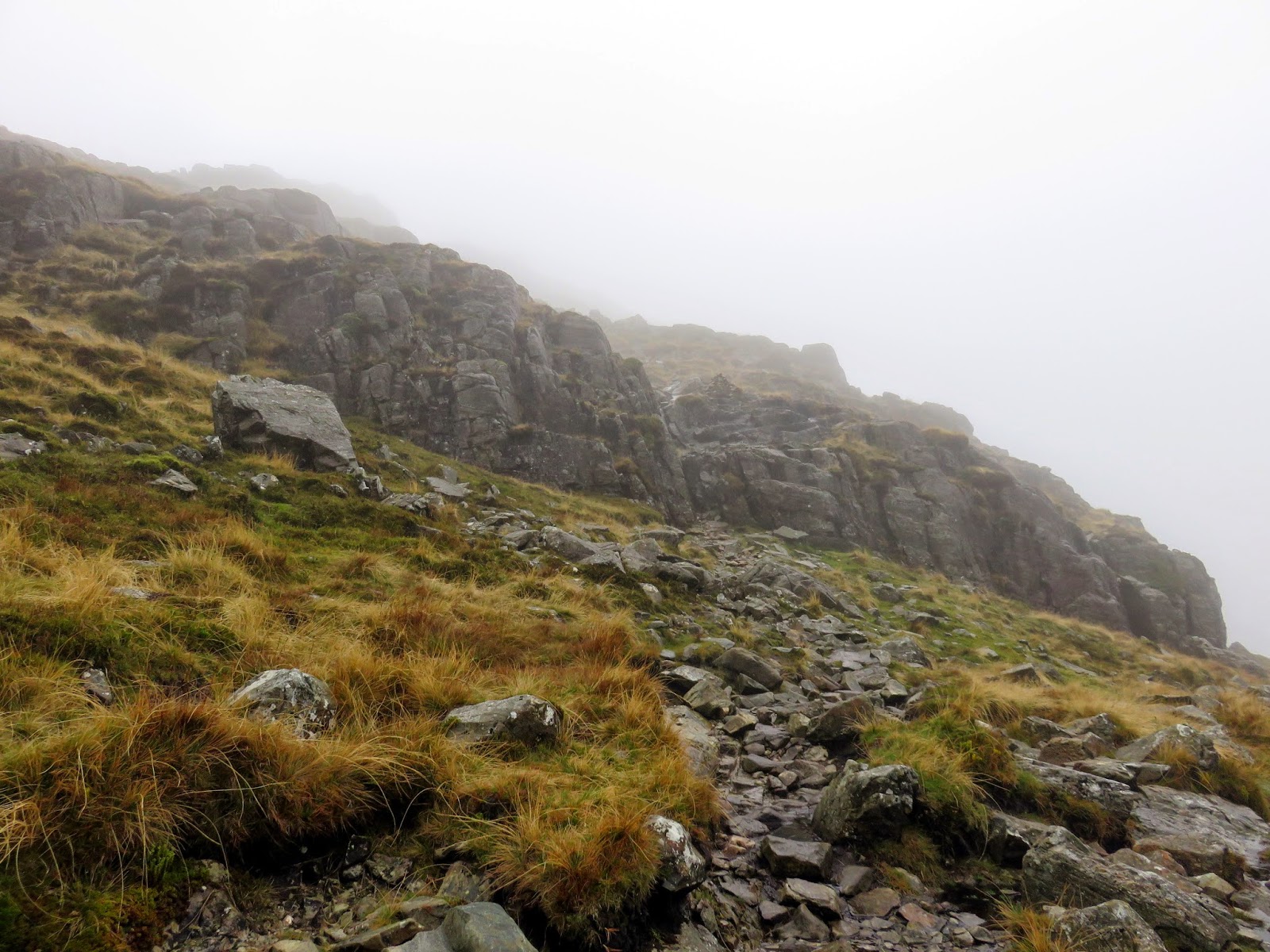
The path, indistinct at times, makes its way steadily up the hillside, crossing a number of small gills and requiring an entertaining little scramble to get around Bleaberry Knott. As you may see from the GPS, the route we followed isn’t actually marked on the map as a path but follow it we did.
 |
| The view down Mickleden |
 |
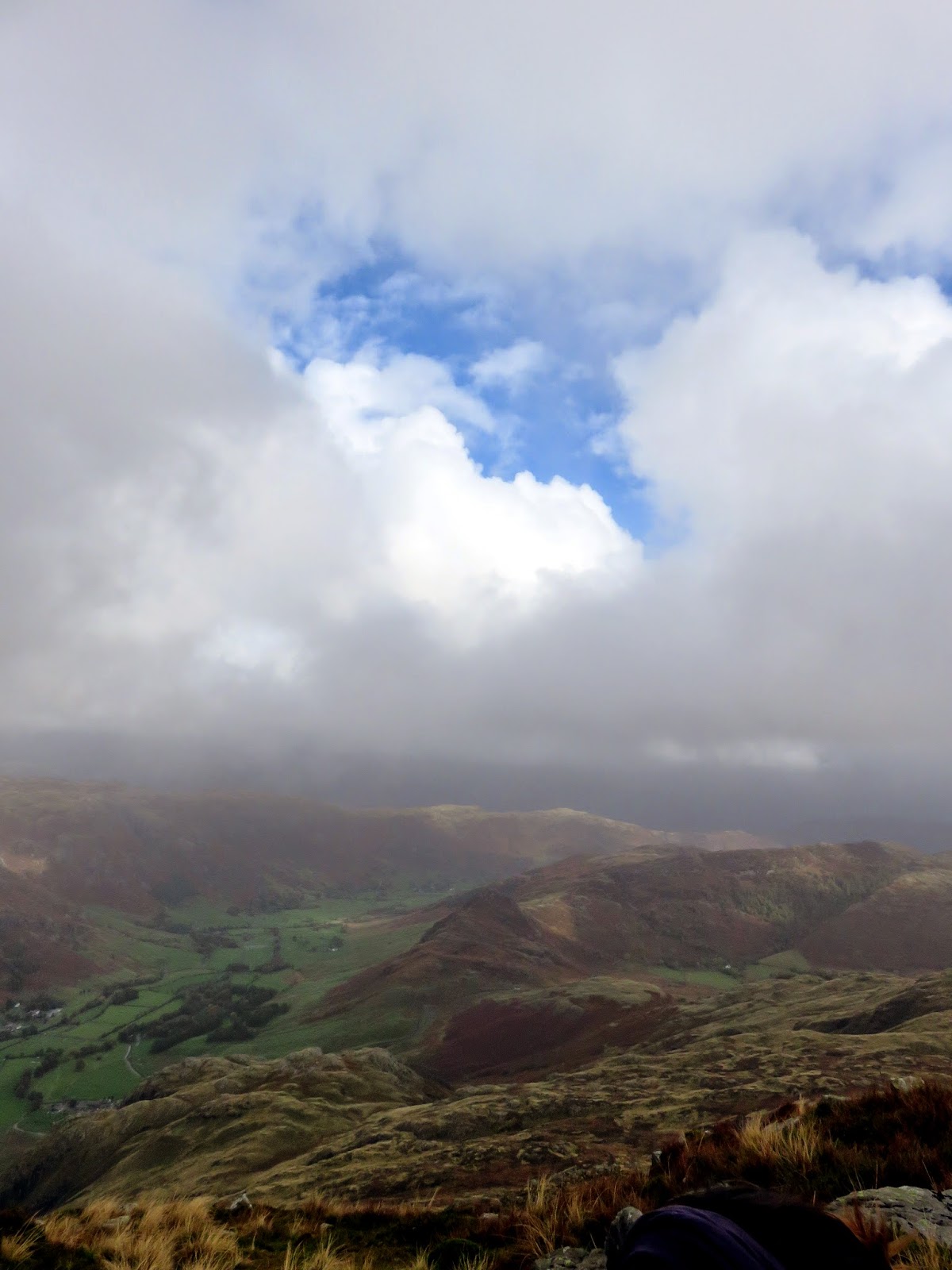
| Clouds shroud the summit |
 |
| The Langdale Pikes |
 |
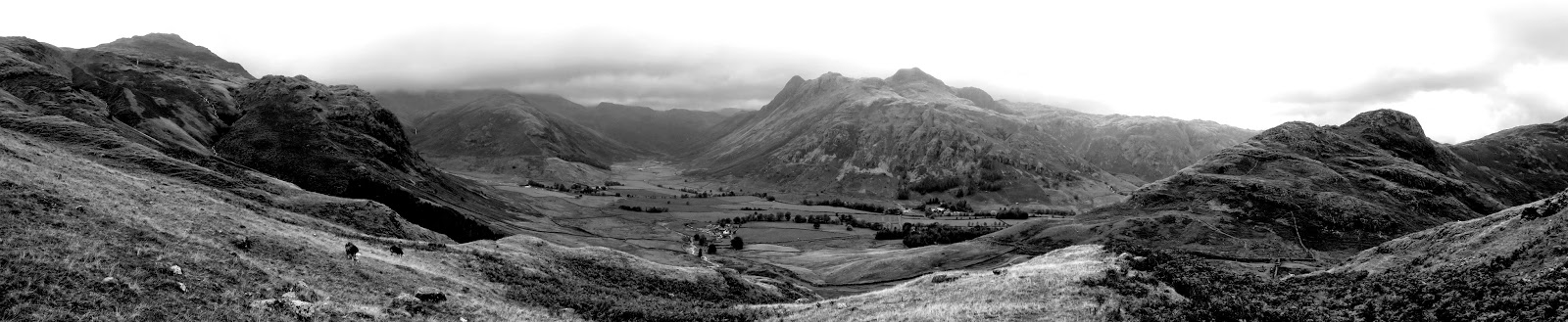
| Great Langdale panorama |
 |
| The path up towards Bleaberry Knott |
 |
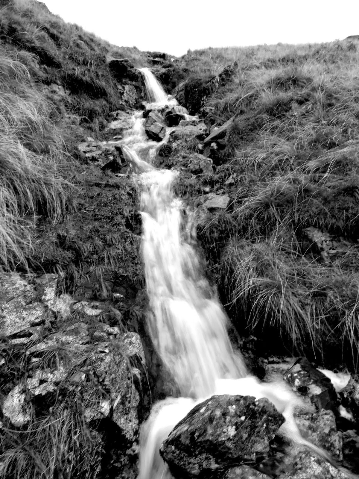
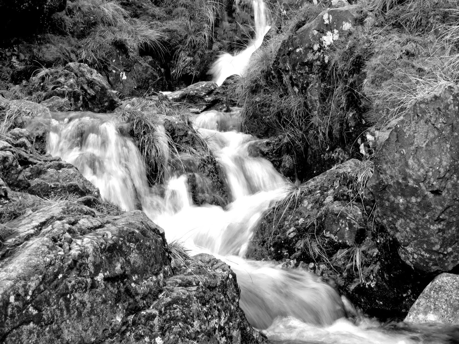
| Monochrome waterfall |
 |
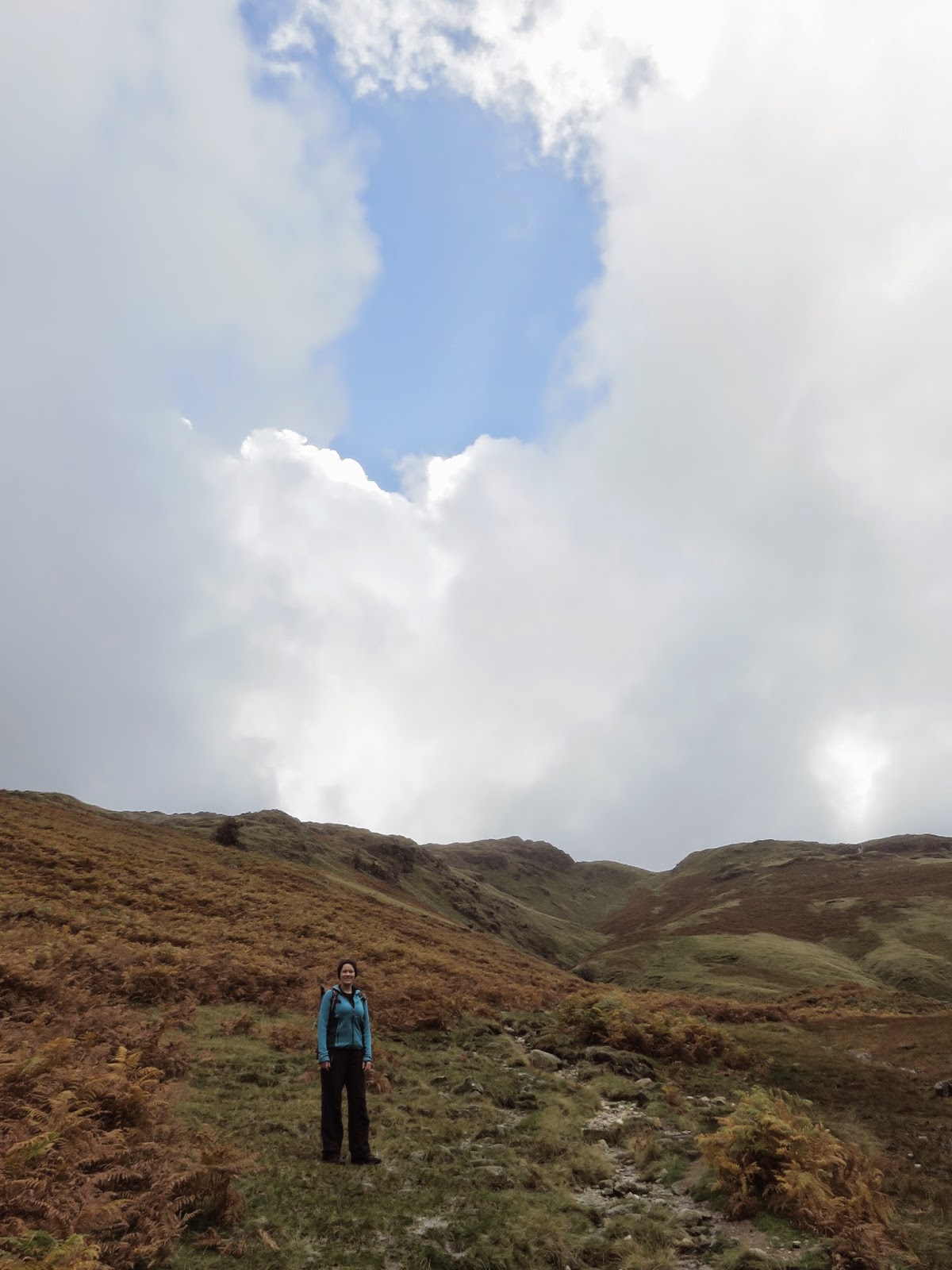
| Sara observes the scenery |
We strode out onto the relative flatness of Wrynose Fell in time for a passing shower to warrant the wearing of waterproofs. It was noticeably windier on the fellside, given the fact that Wrynose Fell forms a broad plateau prior to the climb onto Pike O’Blisco.
 |
| The summit in sight |
 |
| Sara negotiates some of the rockier parts |
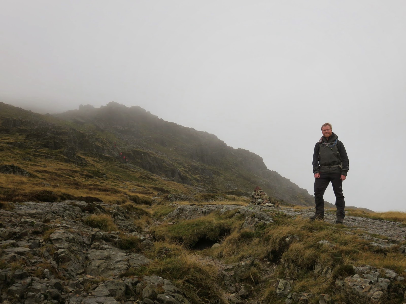
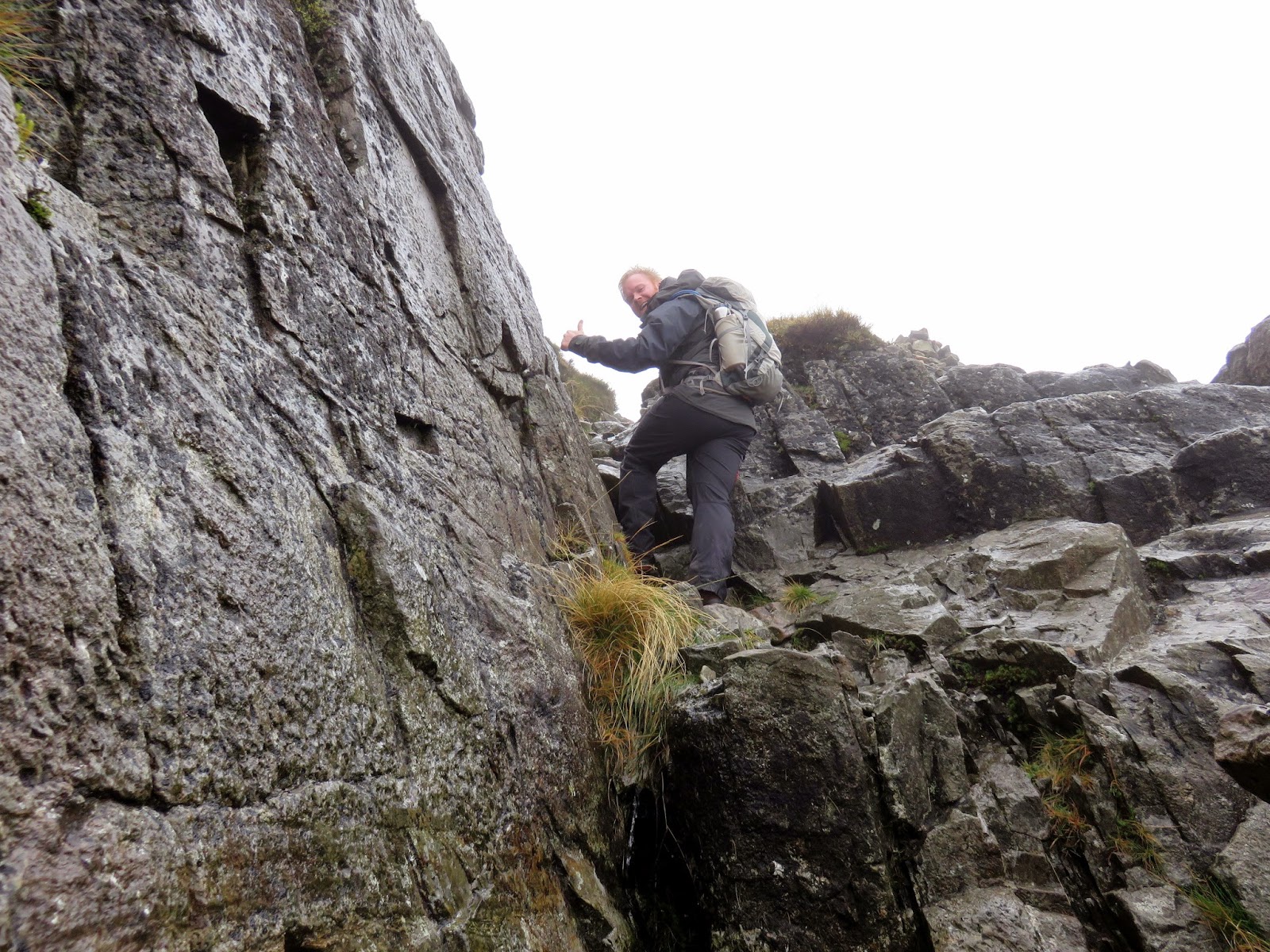
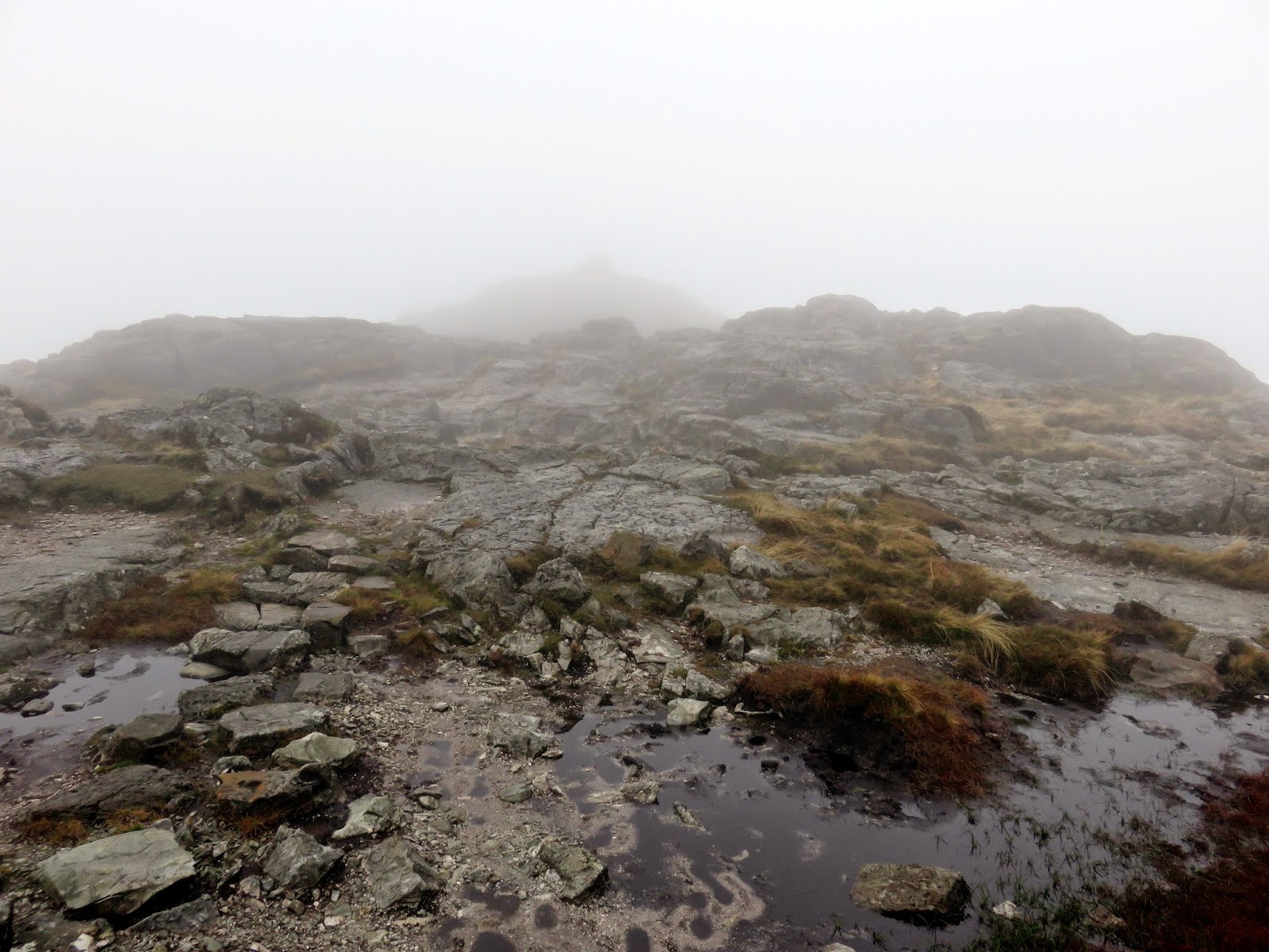
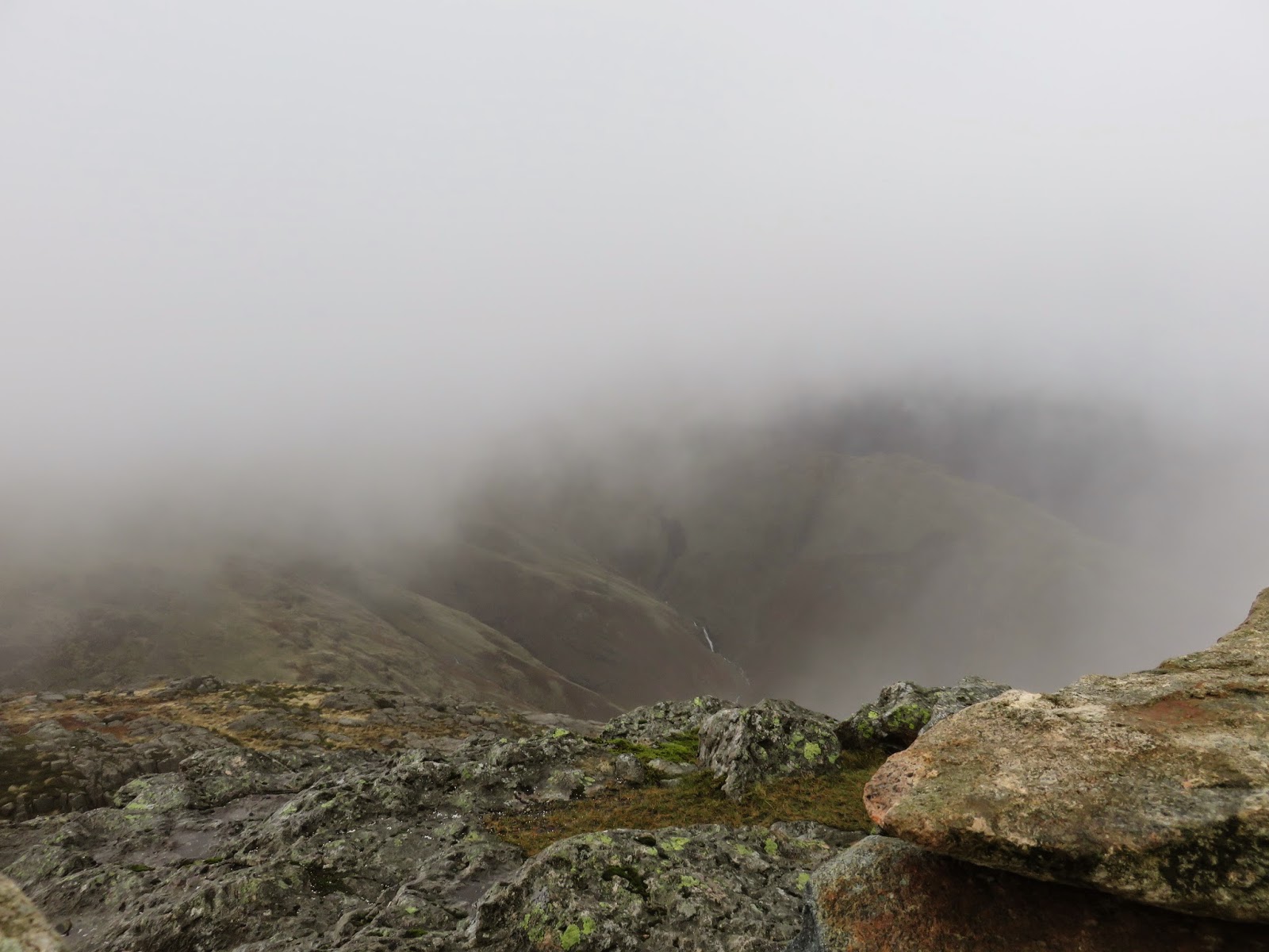
We were rapidly approaching the cloud base which had descended to shroud the summit. Fortunately though, we were out of the worst of the wind, once again being in the shelter of the fellside. A series of rocky terraces guard the route up the Pike O’Blisco, each requiring an entertaining scramble to climb over (or through!). Some are more difficult than others to conquer though the wet, slippery rocks added to the challenge.
 |
| Enjoying some rock-based action |
 |
| The summit in sight |
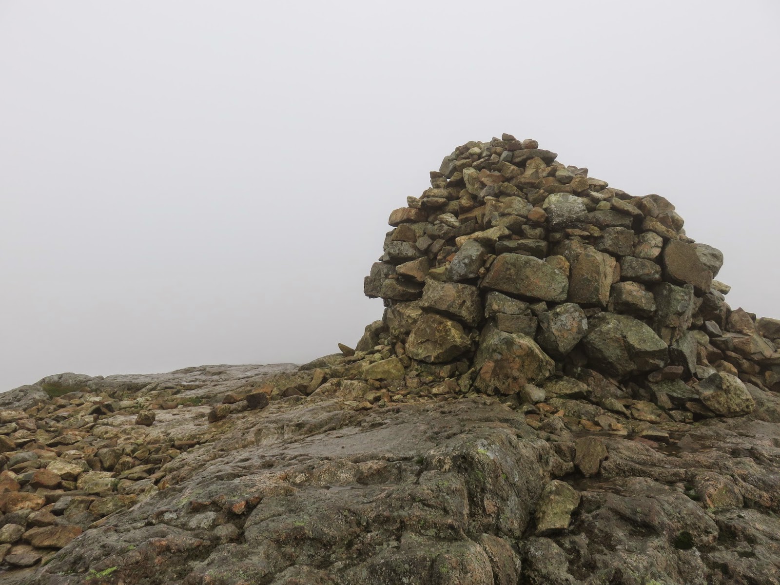
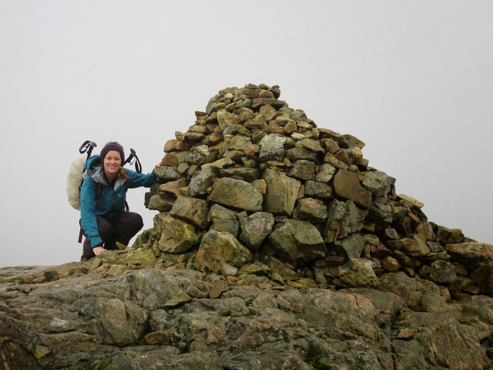
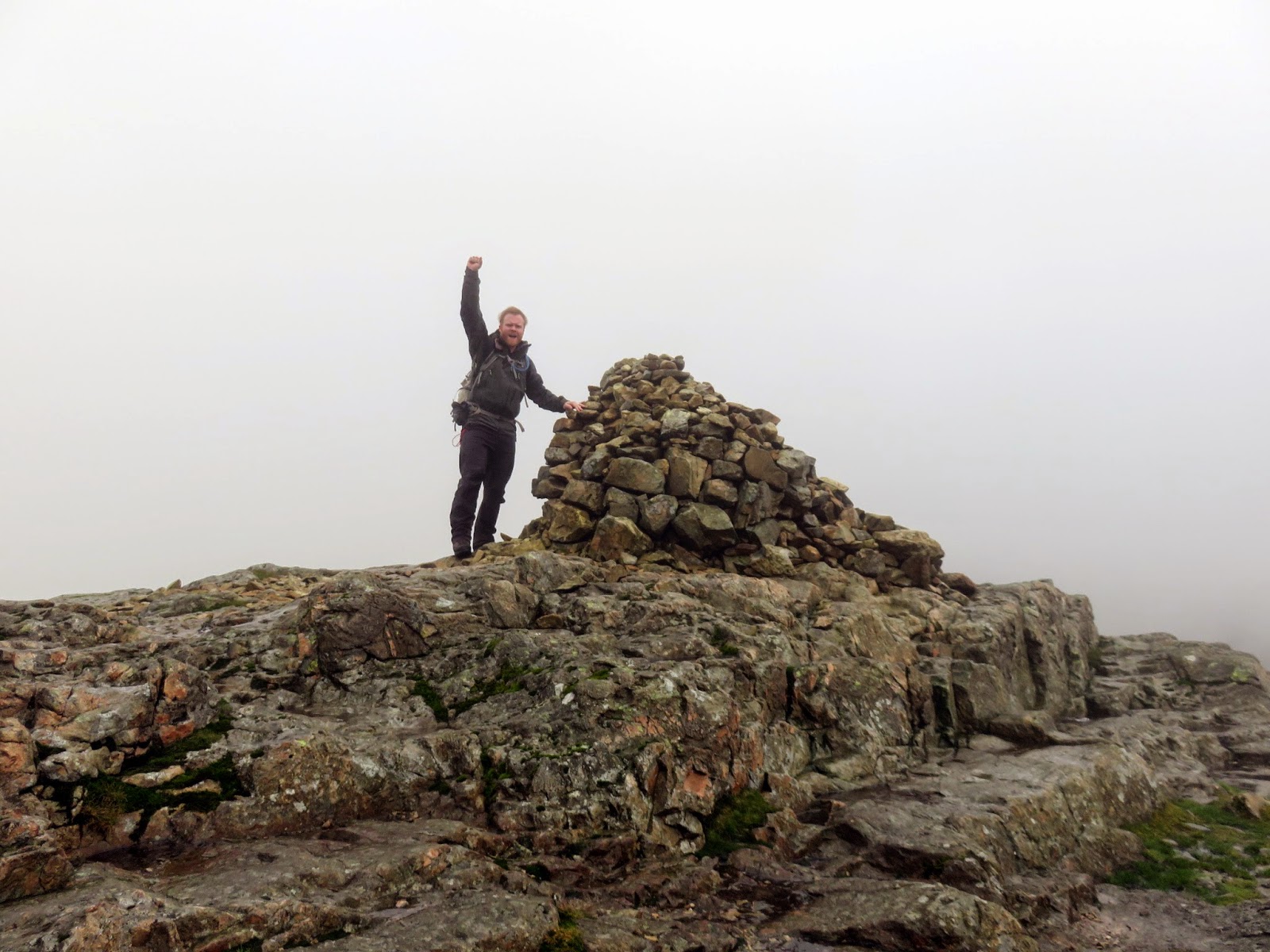
With the last of the terraces behind us we found ourselves below the base of Pike O’Blisco’s second summit, a marginally lower rocky top adjacent to the main one. Between us and the summit however, lay a short, exposed section of mountain top which was acting as a funnel for the strong wind. We made our move, dashing across to the northern side of the main summit, briefly experiencing the howl of gusty wind before sheltering behind the main cairn and subsequently in the small shelter next to it.
 |
| Sara in the shelter of the cairn |
There we waited, the swirling cloud providing an exciting distraction as it lifted momentarily to expose Red Tarn and the path towards Crinkle Crags. We’d maintained that we’d decide which direction to take once we’d reached the summit and, given the weather, that direction was back the way we came.
 |
| Braving the wind on the summit |
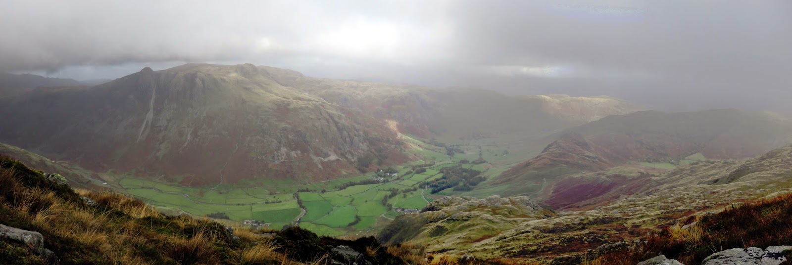
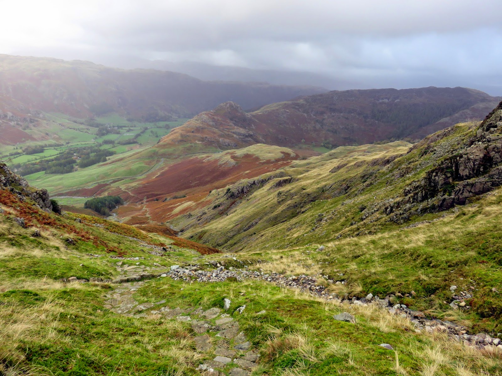
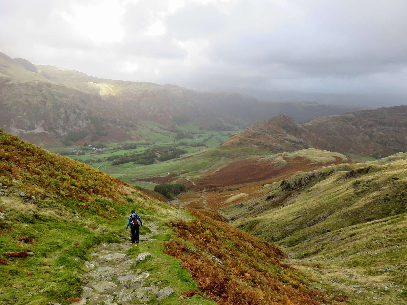
We spent half an hour sheltered below the summit while we ate lunch, time enough for the clouds to lift and reveal much of Great Langdale below which is what we’d set out to see in the first place. I had wanted to visit Black Crag to look at the pinnacle but that would have exposed us to the full force of the wind so we decided against it instead making our way across Wrynose Fell to the head of Red Acre Gill.
 |
| Great Langdale |
 |
| Sun on Raven Crag |
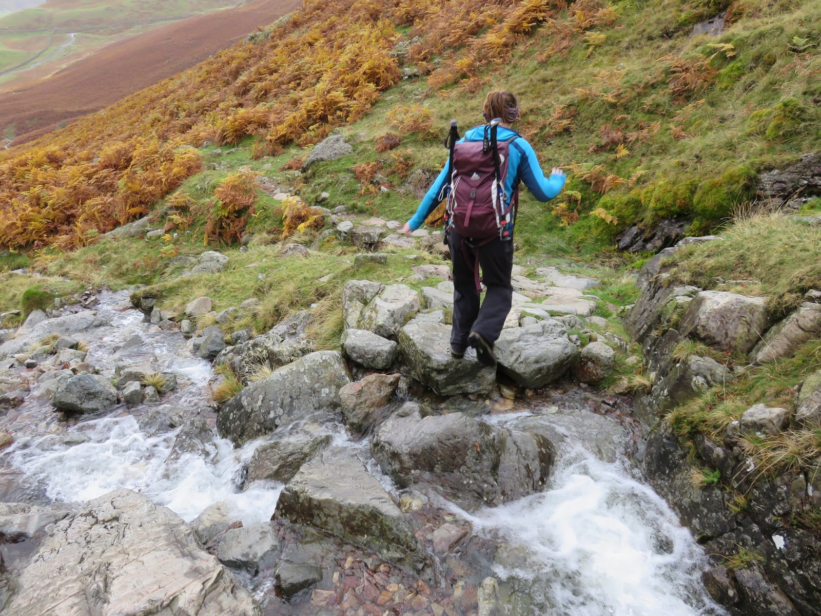
Instead of retracing our steps, we favoured the path down beside Red Acre Gill, the same path we’d avoided climbing up earlier in the day. Though slippery (as Sara will attest), it’s a ncie route that, once again, sheltered us from the wind and provided some nice opportunities to play with the shutter speed setting on my camera.
 |
| Red Acre Gill |
 |
| Sara on the path to Great Langdale |
 |
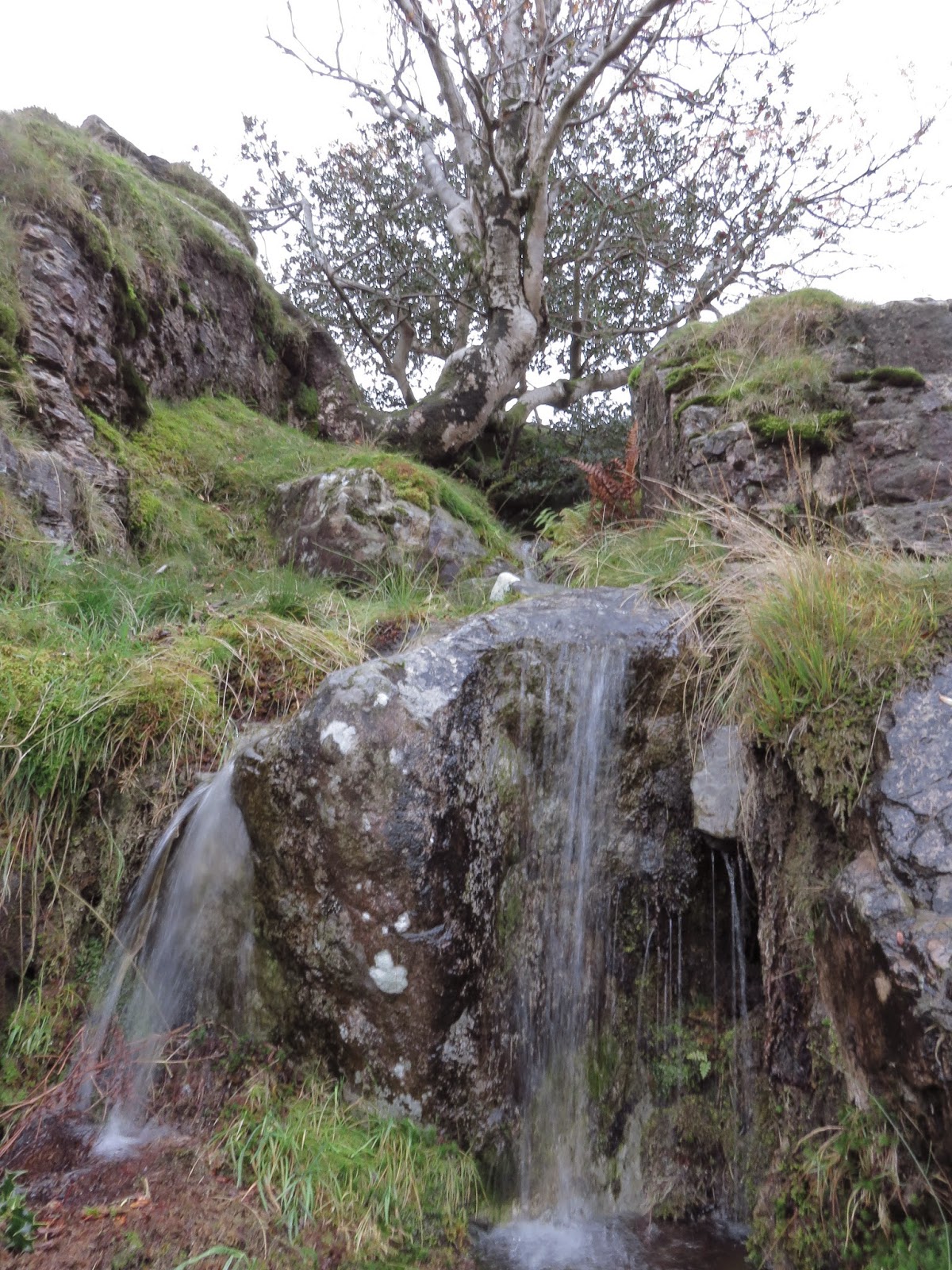
| Some more monochrome waterfalls |
 |
| Sara successfully crossing the raging torrent |
 |
| Water everywhere today |
 |
| Clouds break once again |
Before long we were back on the road we started out along, concluding our mid-morning dash up Pike O’Blisco and back. While not ideal conditions, some of the photos came out looking quite nice, the autumnal colours are starting to come out in full force. It was also nice to be able to get back into something warm and dry in the camping pod, rather than grubbing around on the floor of a tent. It’s something definitely worth considering as things get a little more wintery.

