Open Space Web-Map builder Codehttps://openspace.ordnancesurvey.co.uk/osmapapi/openspace.js?key=3119F72552FD5C22E0530C6CA40A5A92https://openspace.ordnancesurvey.co.uk/osmapapi/script/mapbuilder/basicmap.jshttps://openspace.ordnancesurvey.co.uk/osmapapi/script/mapbuilder/searchbox.js//variables for routes var linesLayer, points, lineFeature, lineString, routeMarkersLayer, routepos, routesize, routeoffset, routeicon; var style_blue = {strokeColor: “#0000CD”, strokeOpacity: 0.5, strokeWidth: 4.5}; function initmapbuilder() { //initiate the map var options = {resolutions: [2500, 1000, 500, 200, 100, 50, 25, 10, 5, 4, 2.5, 2, 1]}; osMap = new OpenSpace.Map(‘map’, options); //configure map options (basicmap.js) setglobaloptions(); //set the center of the map and the zoom level osMap.setCenter(new OpenSpace.MapPoint(321220.03416667,515105),7); linesLayer = osMap.getVectorLayer(); // Set up layer for route markers routeMarkersLayer = new OpenLayers.Layer.Markers(“Route Markers”); //make a route points = new Array(); points.push(new OpenLayers.Geometry.Point(322490,513575)); points.push(new OpenLayers.Geometry.Point(322500,513985)); points.push(new OpenLayers.Geometry.Point(322500,514535)); points.push(new OpenLayers.Geometry.Point(322470,514875)); points.push(new OpenLayers.Geometry.Point(322360,515335)); points.push(new OpenLayers.Geometry.Point(321860,515465)); points.push(new OpenLayers.Geometry.Point(321540,515745)); points.push(new OpenLayers.Geometry.Point(321430,515955)); points.push(new OpenLayers.Geometry.Point(321580,516575)); points.push(new OpenLayers.Geometry.Point(321430,515995)); points.push(new OpenLayers.Geometry.Point(321590,515625)); points.push(new OpenLayers.Geometry.Point(321900,515425)); points.push(new OpenLayers.Geometry.Point(322380,515325)); points.push(new OpenLayers.Geometry.Point(322540,514655)); points.push(new OpenLayers.Geometry.Point(322540,514015)); points.push(new OpenLayers.Geometry.Point(322490,513575)); // create a polyline feature from the array of points lineString = new OpenLayers.Geometry.LineString(points); lineFeature = new OpenLayers.Feature.Vector(lineString, null, style_blue); linesLayer.addFeatures([lineFeature]); //crate a route start/end marker routepos = new OpenSpace.MapPoint(322490,513575); routesize = new OpenLayers.Size(33,45); routeoffset = new OpenLayers.Pixel(-5,-37); routeicon = new OpenSpace.Icon(‘https://openspace.ordnancesurvey.co.uk/osmapapi/img_versions/img_1.1/mapbuilder/routemarker-startend.png’, routesize, routeoffset, null, null); routeMarkersLayer.addMarker(new OpenLayers.Marker(routepos, routeicon)); osMap.addLayer(routeMarkersLayer);}
Route: Honister Hause, Yewcrag Quarries, Dale Head, Hindscarth Edge, Hindscarth, Hindscarth Edge, Dale Head, Yewcrag Quarries, Honister
Date: 01/06/2014
From: Honister
Parking: Honister Slate Mine
Start Point: Honister Slate Mine
Region: Western Fells
Route length: 5 miles (8km)
Time taken: 02:27
Average speed: 2.0mph
Ascent: 598m
Descent: 601m
Wainwrights on this walk:
Dale Head (753m), Hindscarth (727m)
Additional summits: None
Other points of interest: Honister Crag
As a fan of all things mountainous (in the Lake District at least), what better place to have a stag do than the aforementioned National Park? Yes, that’s right, at the time of writing this I am now a very happily married man.
As part of a classic stag do-type weekend away, in the tradition that is to complete a manly task one day followed by copious amounts of drinking and something less taxing the next, we found ourselves based in a rustic camping barn in Borrowdale, ideally located for a trip to the slate mine at Honister followed up by a quick glimpse at the fells that guard the Honister Pass.
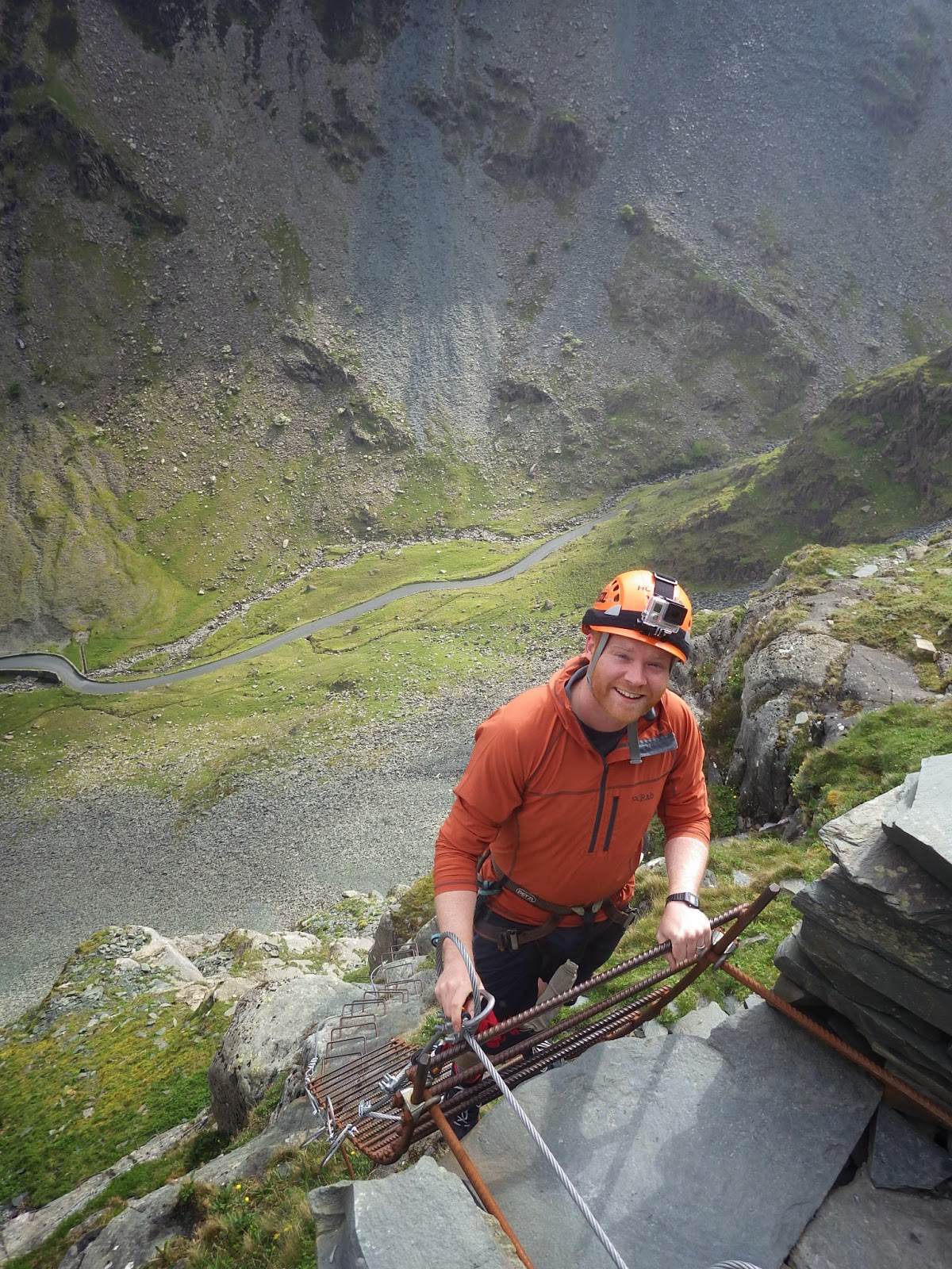
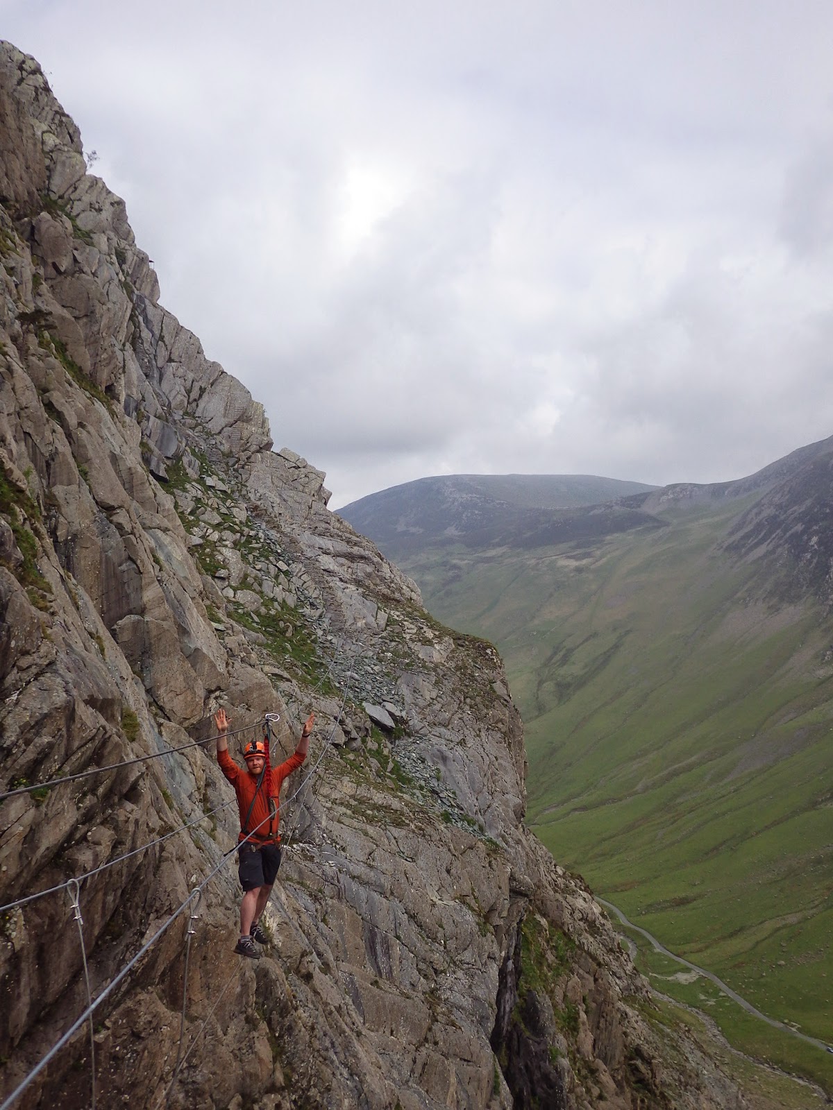
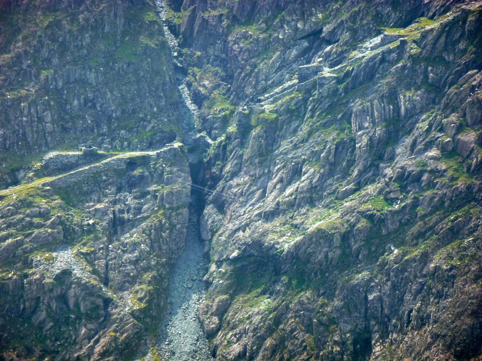
Some of you may be aware that Honister is home to the UK’s only via ferrata route (excluding a small one that can be found at How Stean Gorge in the Yorkshire Dales). For those of you who aren’t aware, a via ferrata (Italian for “iron road”) is a protected climbing route – generally found in the Alps. The essence of a via ferrata route is a steel cable that is periodically bolted to the mountainside, in addition to other climbing aids such as metal rungs, pegs and bridges. This allows even the most inexperienced (like us) to experience something resembling rock climbing, without the risk of falling or the actual requirement to be able to do it.
Via ferratas are strongly associated with the First World War, when several were built in the Dolomite mountain region of Italy to aid the movement of troops. Thankfully, Honister’s is purely for tourism rather than the rapid deployment of Italian soldiers.
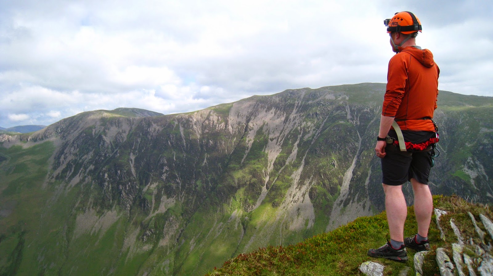
 |
| The via ferrata at Honister |
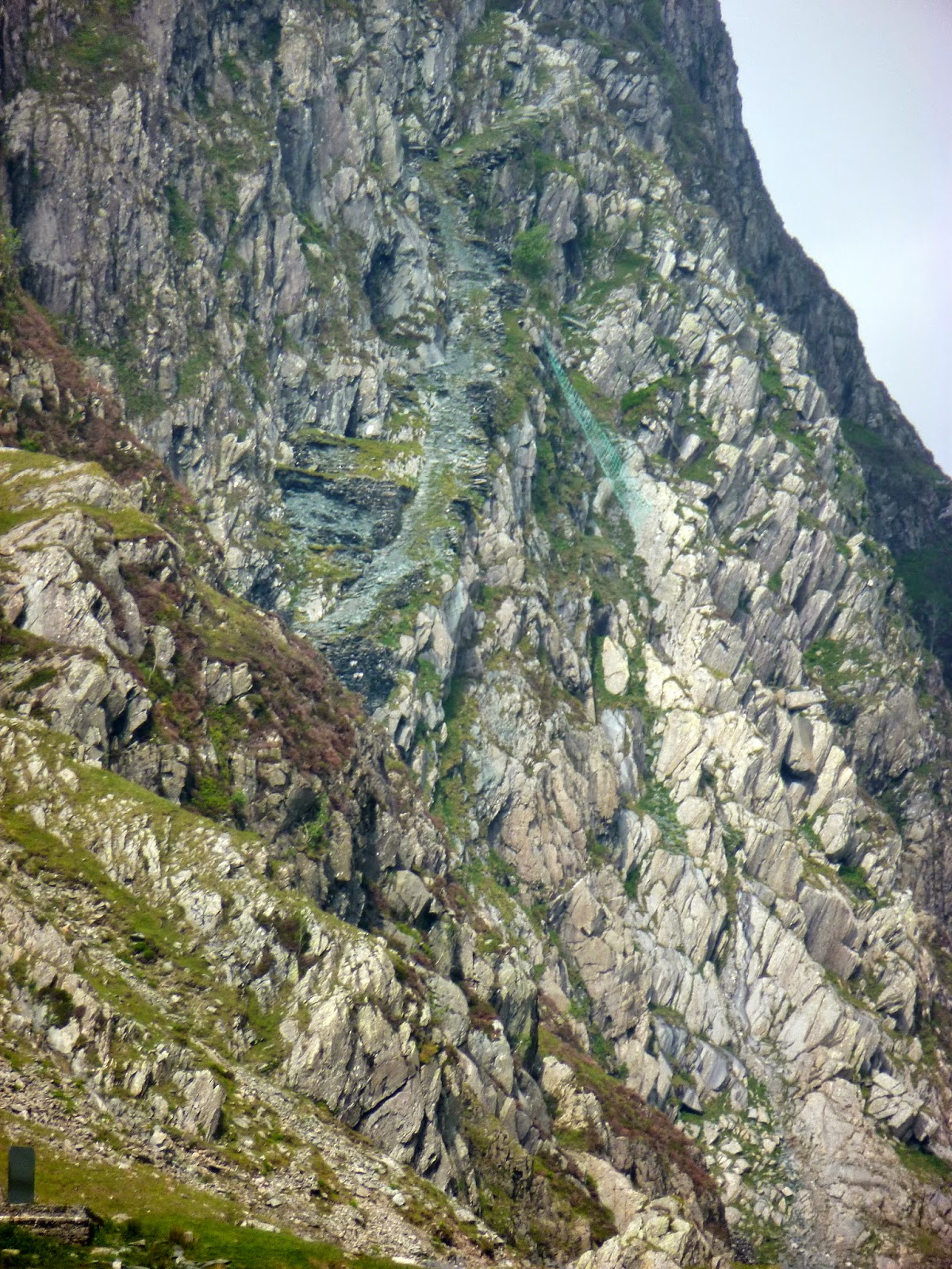
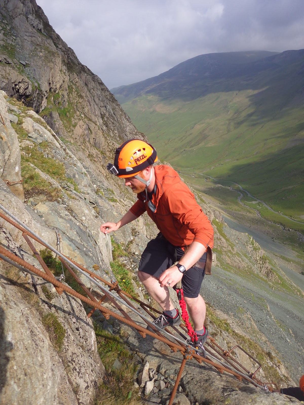
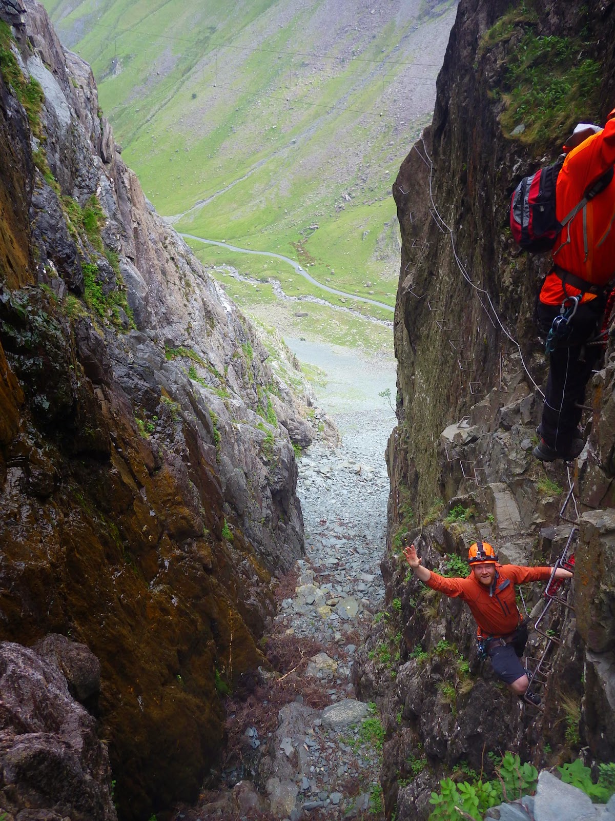
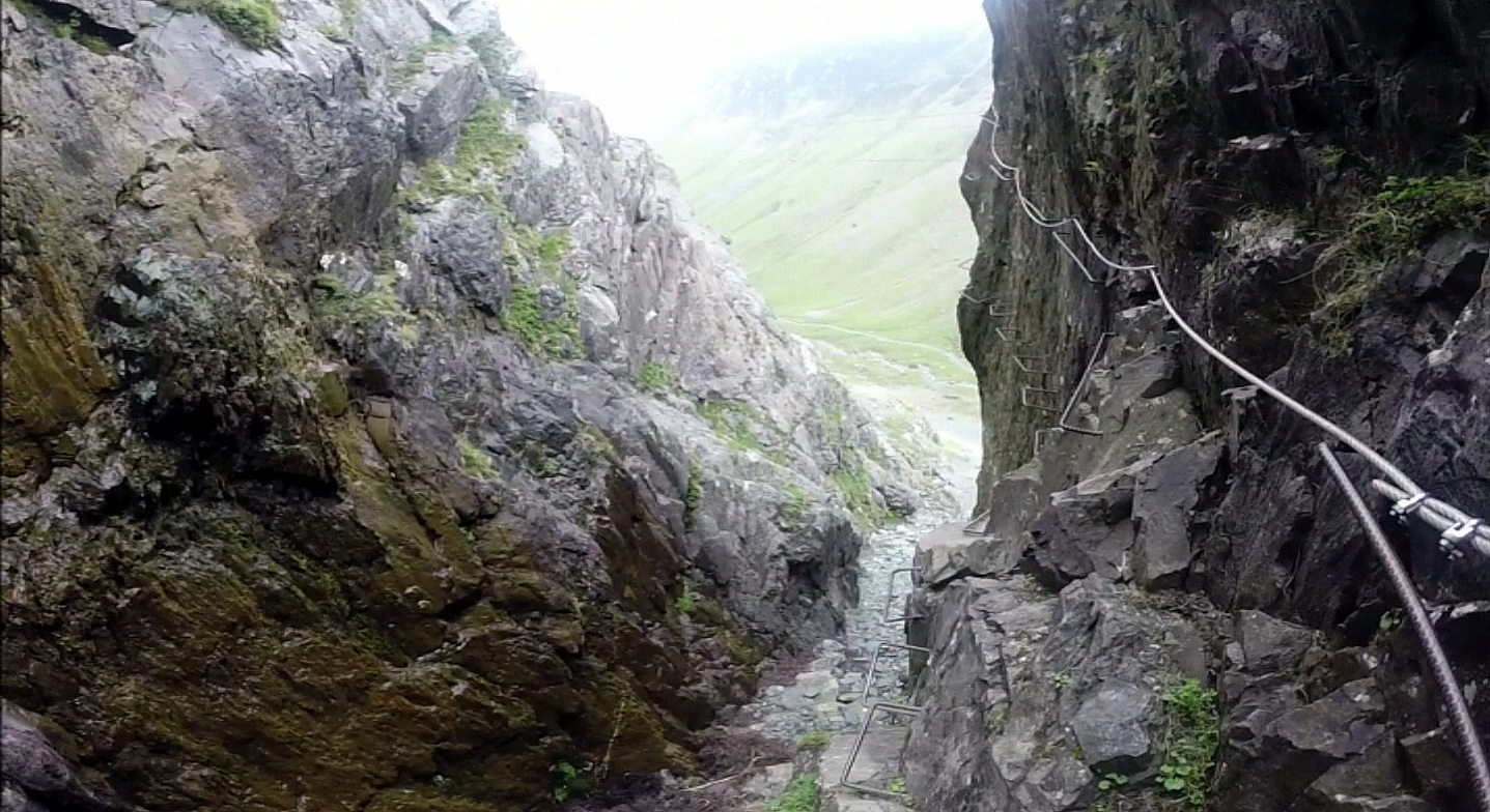
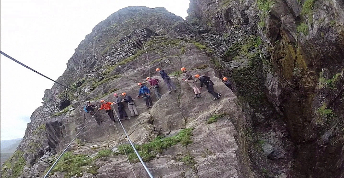
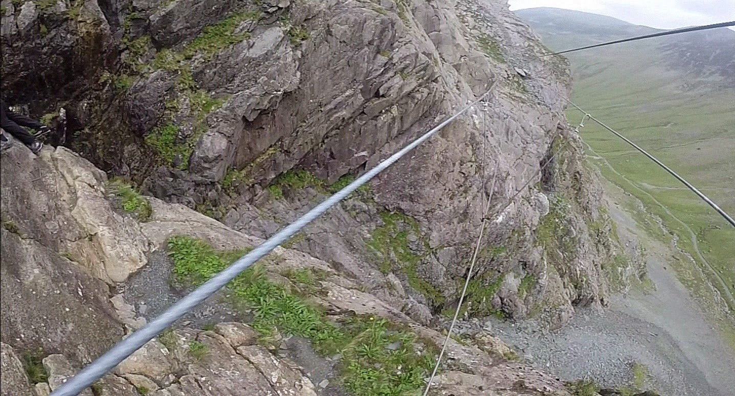
So, the event itself. The via ferrata (the ‘extreme’ version in this case) can be broadly split into three sections – a nice, fairly straightforward warm-up – a traverse round a sheer rock face in Bull Gill followed by a tricky wire bridge and, thirdly, a long climb assisted by metal rungs and a cargo net. I won’t go into too much detail but the pictures below tell a bit of the story. Some are screen shots from a handy camera that was mounted to my helmet. What I will say was that it’s a great way to spend a few hours doing something a little different and a novel way to see the mighty Honister Crag up close.
 |
| The route follows an old mine track, you can see the cargo net just above the centre of the picture |
 |
| The starting point |
 |
| One of a number of ladders we had to climb |
 |
| Entering Bull Gill |
 |
| Bull Gill from my point of view |
 |
| On the Burma Bridge |
 |
| The gang and Bull Gill |
 |
| The Burma Bridge crossing Bull Gill |
 |
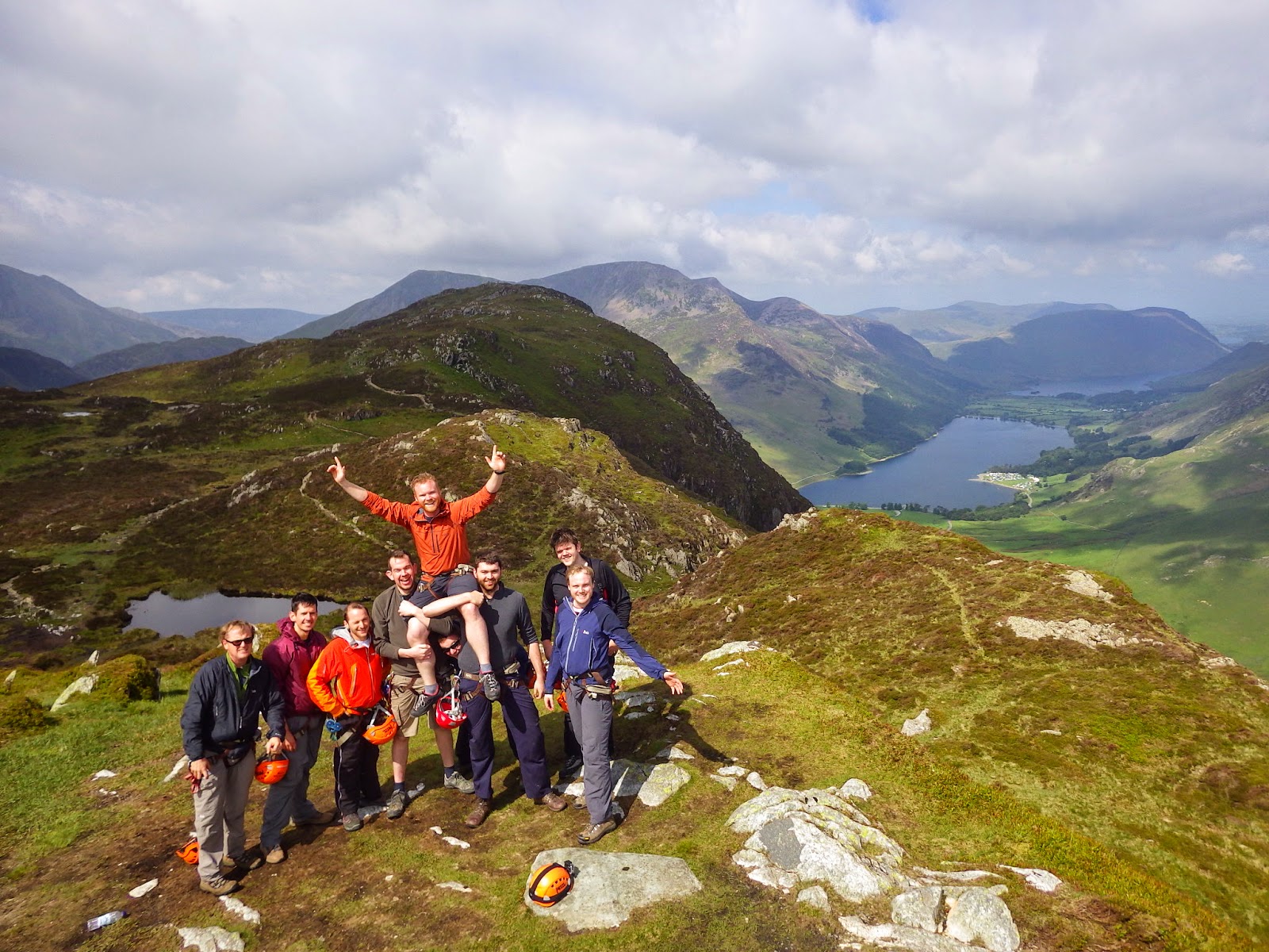
| Atop Honister Crag |
 |
| Success! |
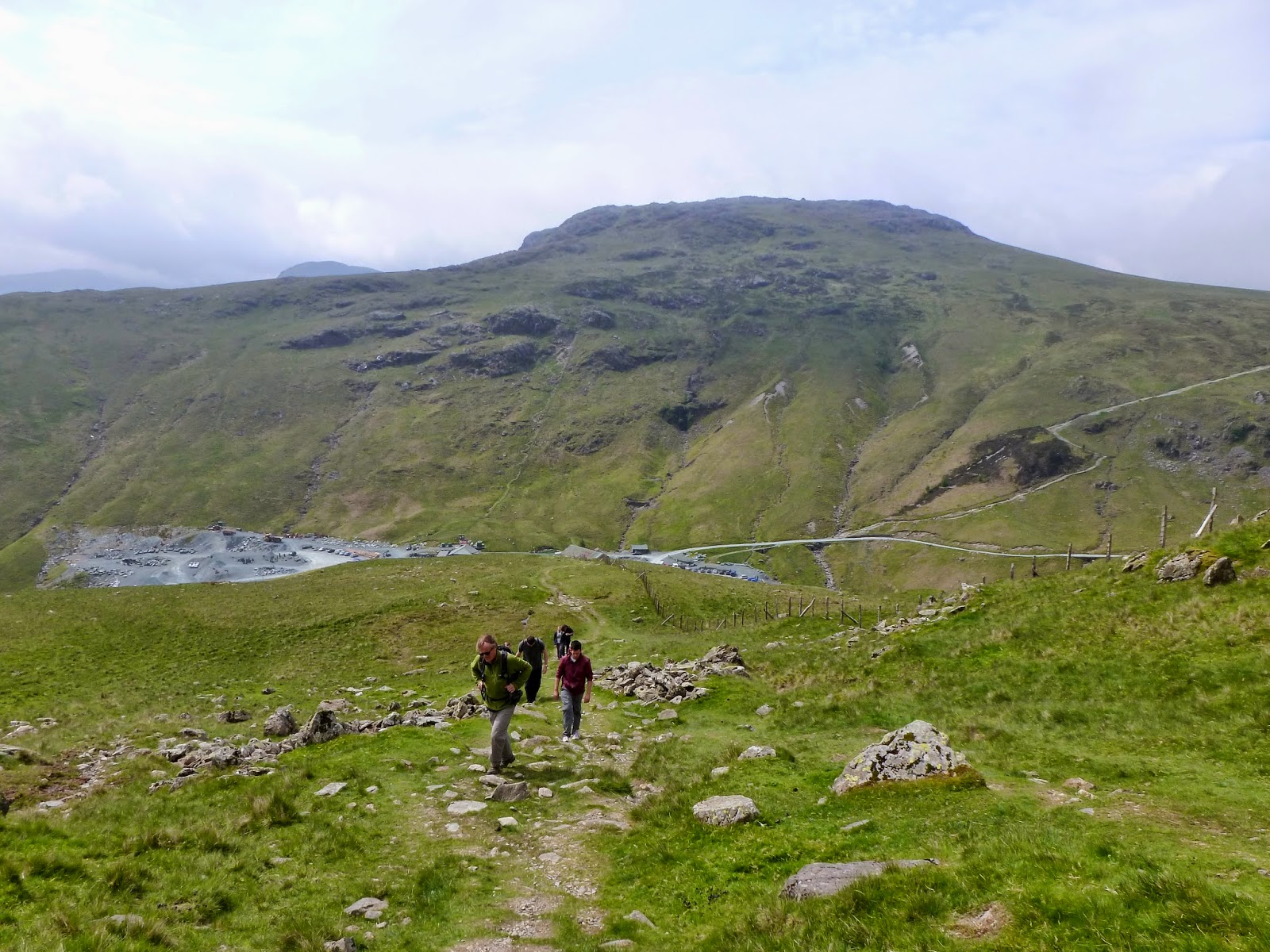
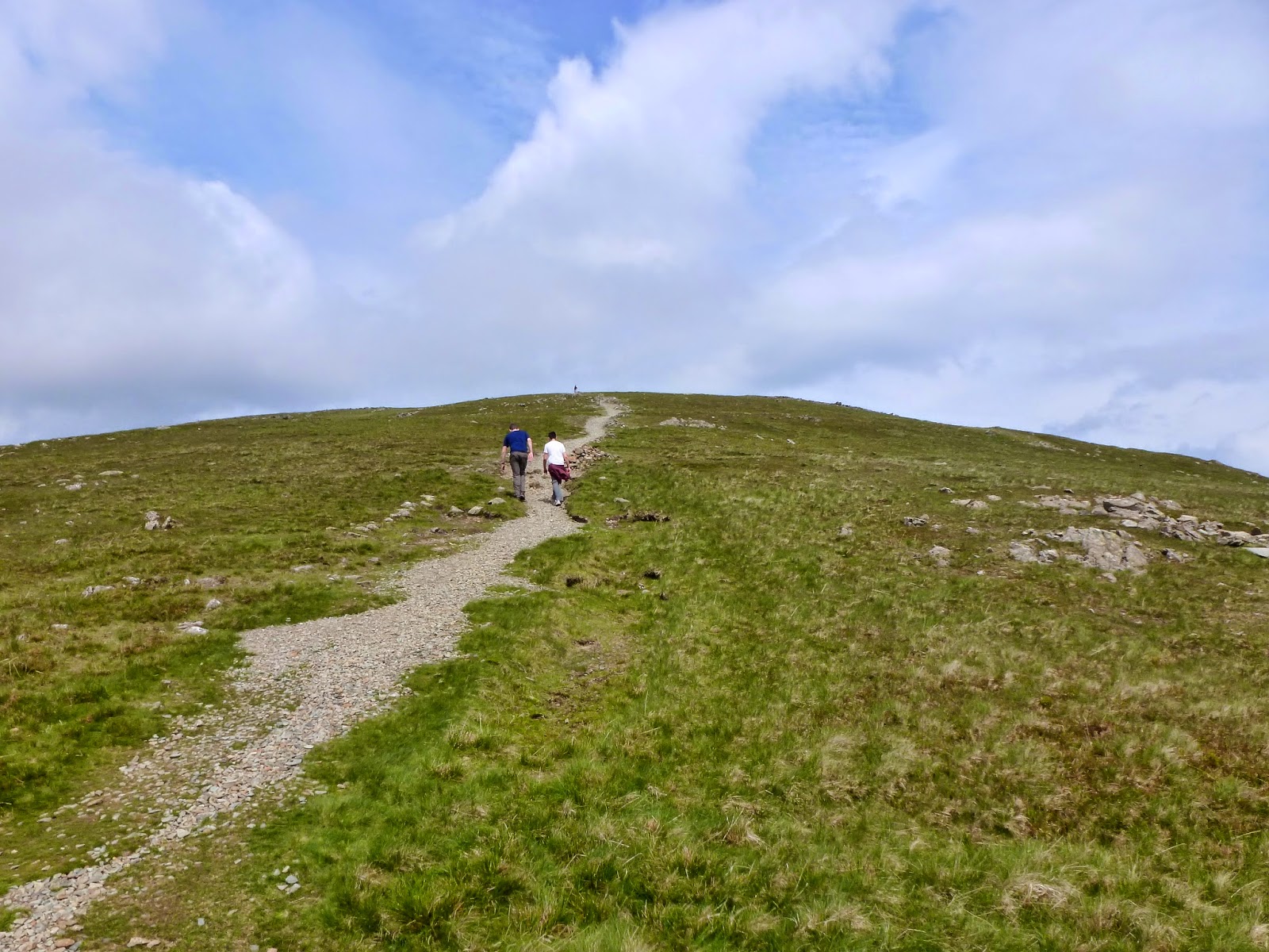
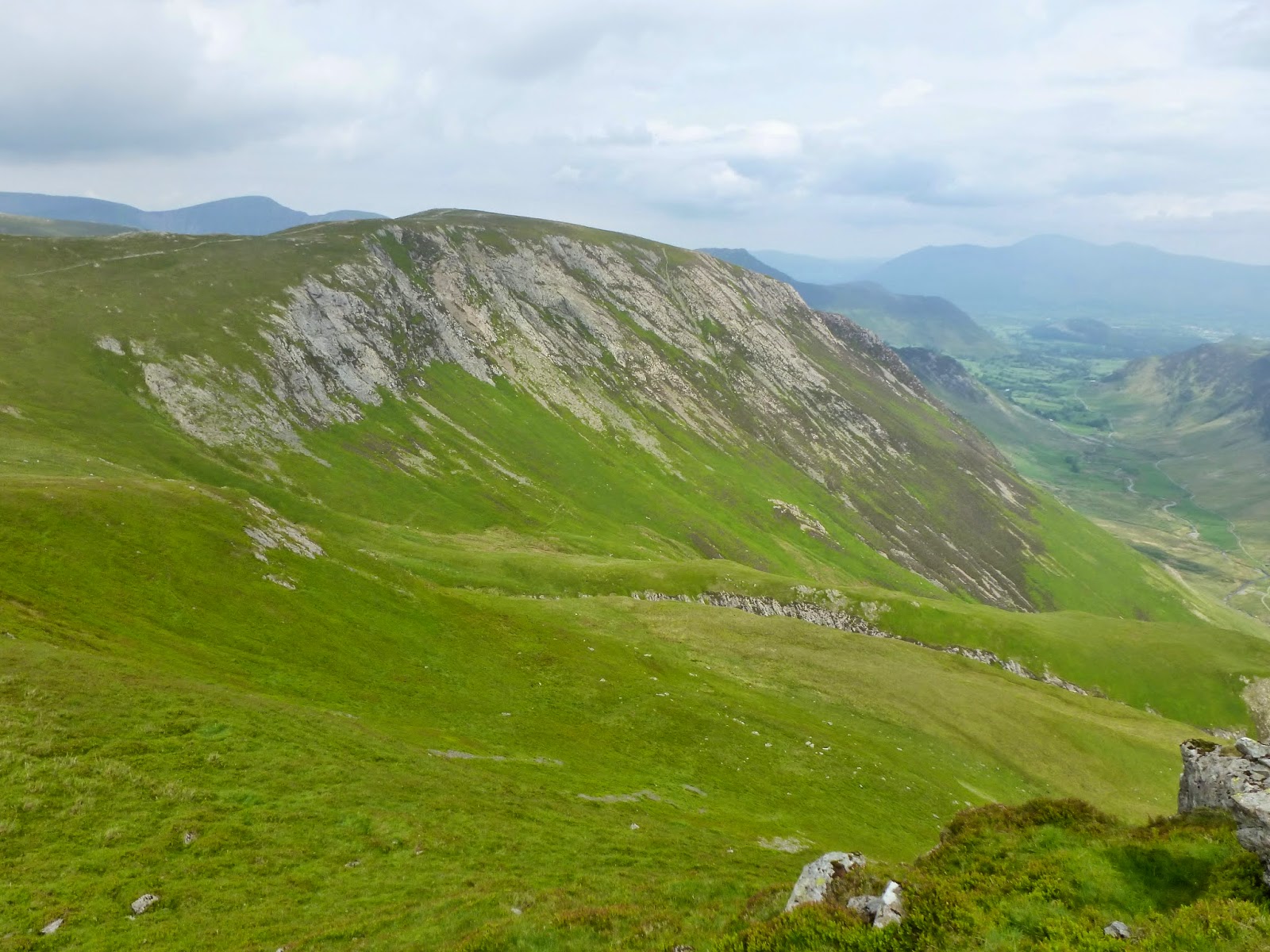
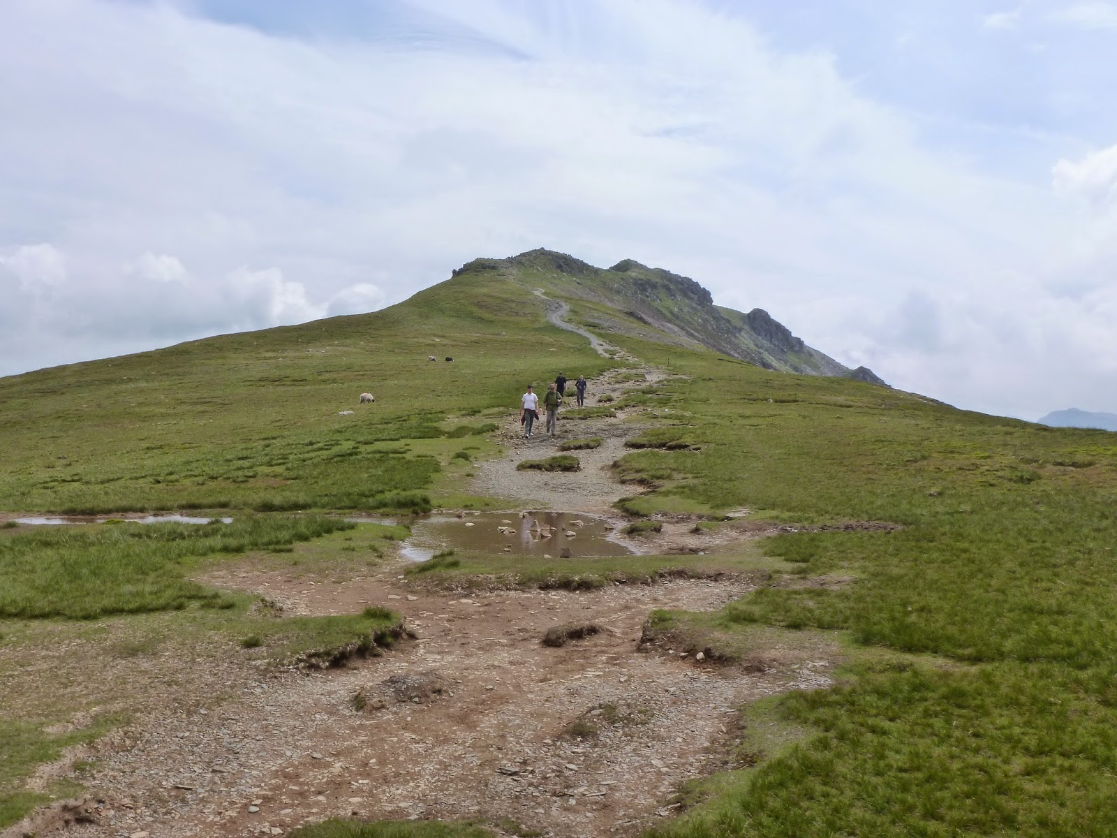
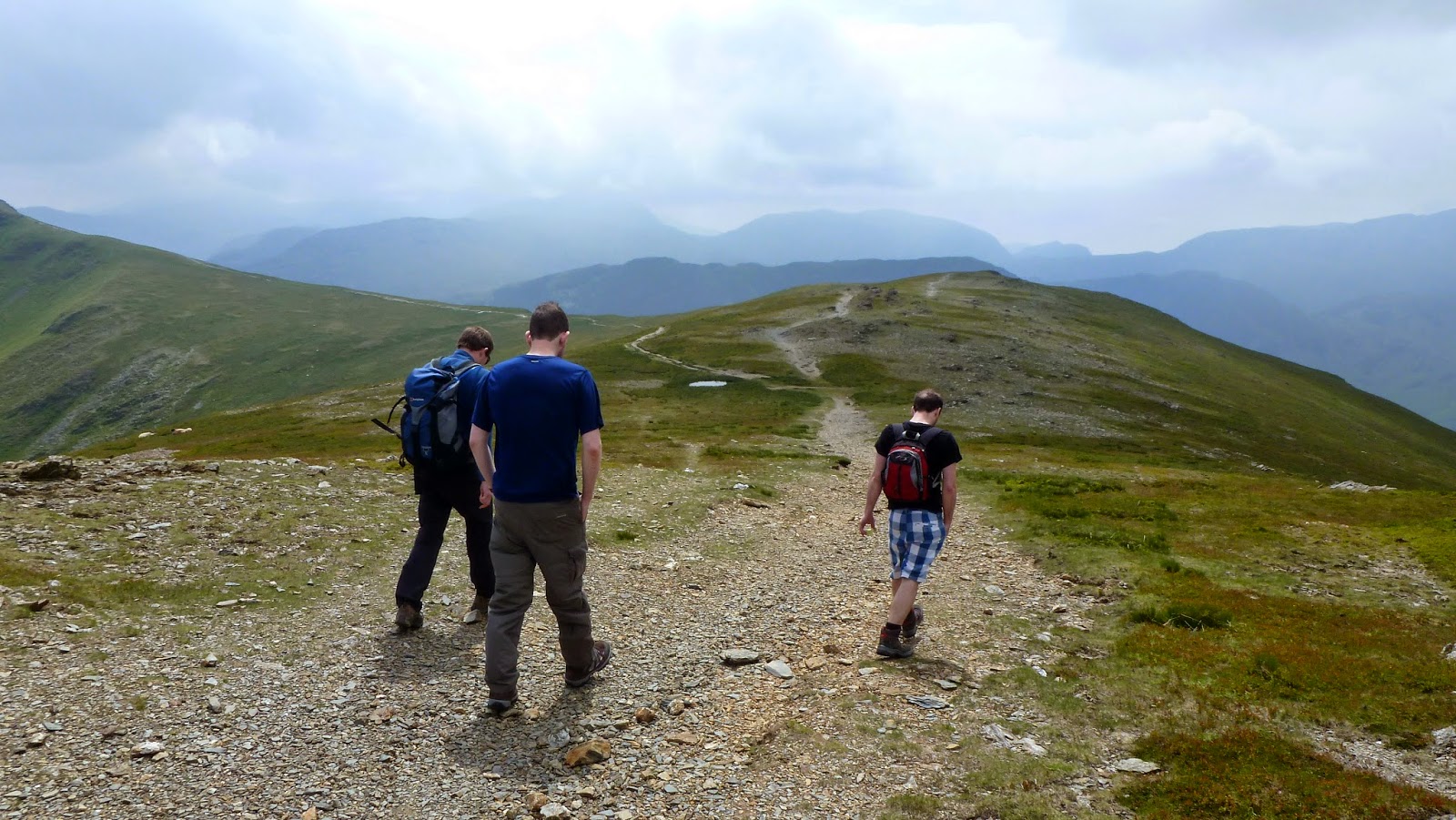
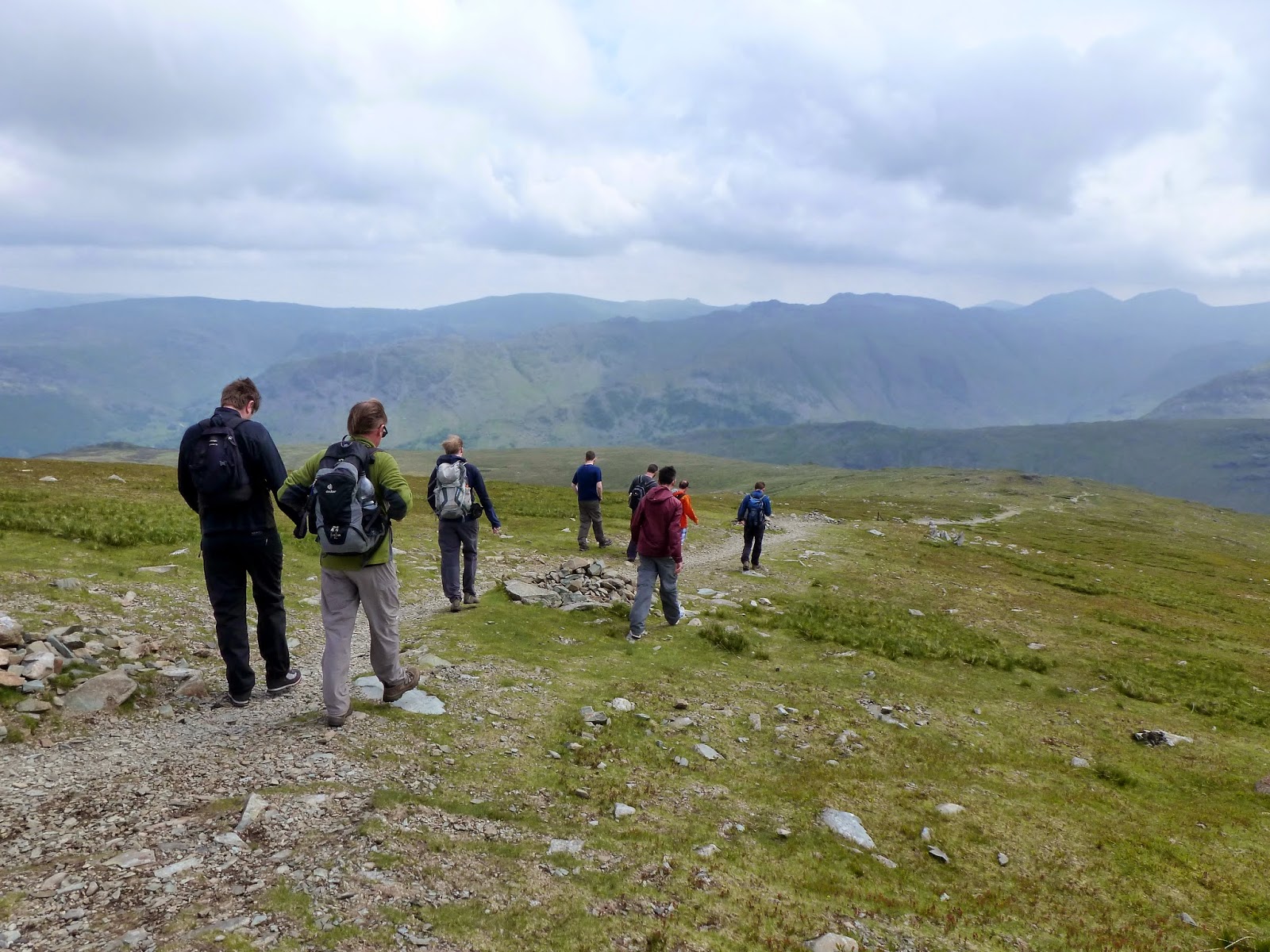
So, with that and a night on the tiles out of the way, what’s the best way to clear out a hangover? By climbing a mountain of course (though a not too taxing one for obvious reasons). We’d chosen to cheat a little and climb Dale Head and Hindscarth from Honister as some of the hard work is achieved with the aid of a car. A steady path leads in an almost direct line straight up the side of Dale Head, one the fells that surround the drama of the Newlands Valley.
 |
| Heading up from Honister |
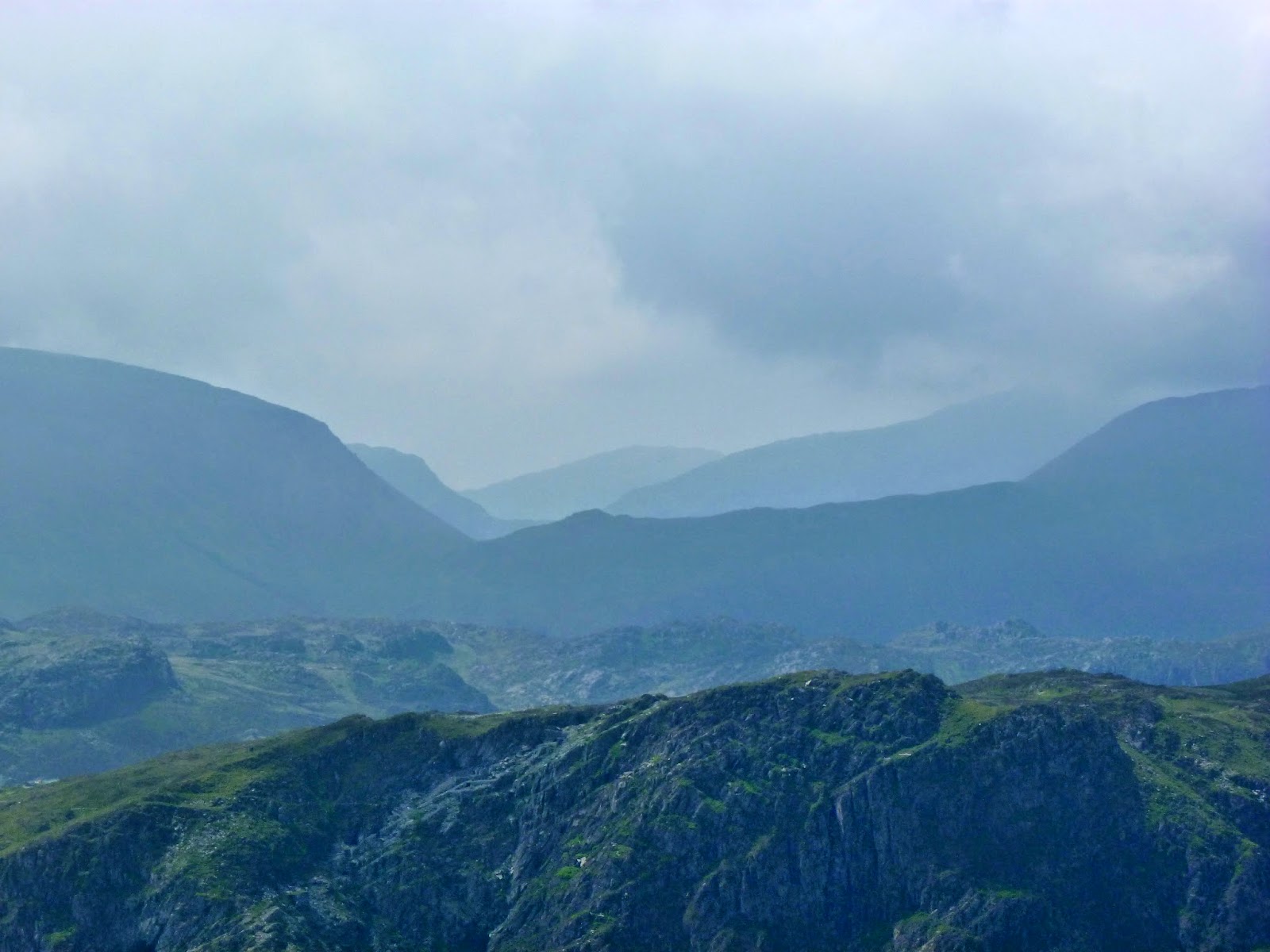
It was a nice day, a bit cloudy but dry and bright. Fortunately for us, the clouds were confined to the higher fells leaving us with clear views throughout the day. This wasn’t to be one of our usual marathon days out, more of a slow, enjoyable stroll. This was some peoples first visit to the Lake District so a 15 miler after a night on the tiles would probably put even the most enthusiastic people off. In any case, the vista from Dale Head is the ideal introduction to anyone.
 |
| Clouds build over Scafell Pike |
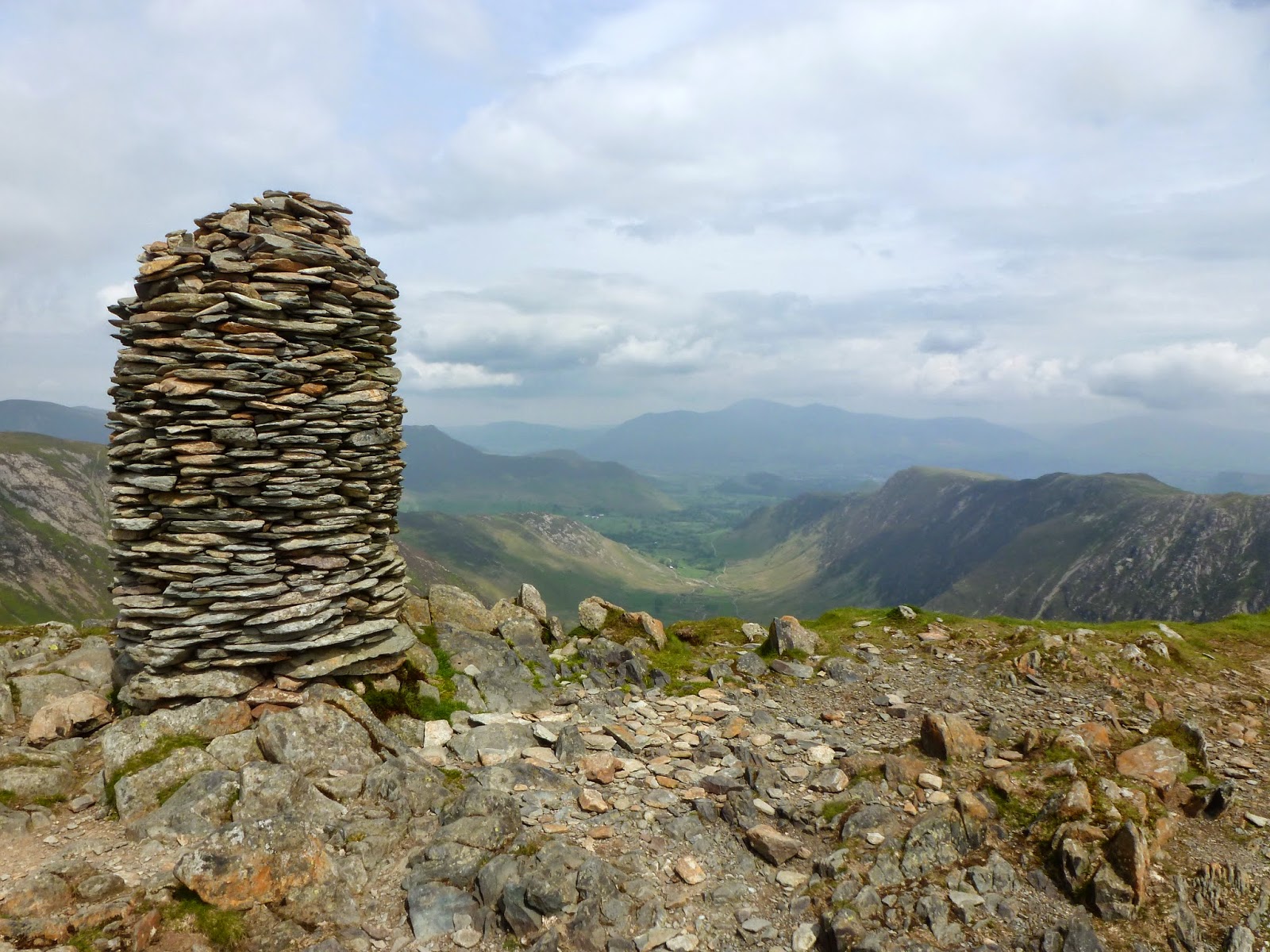
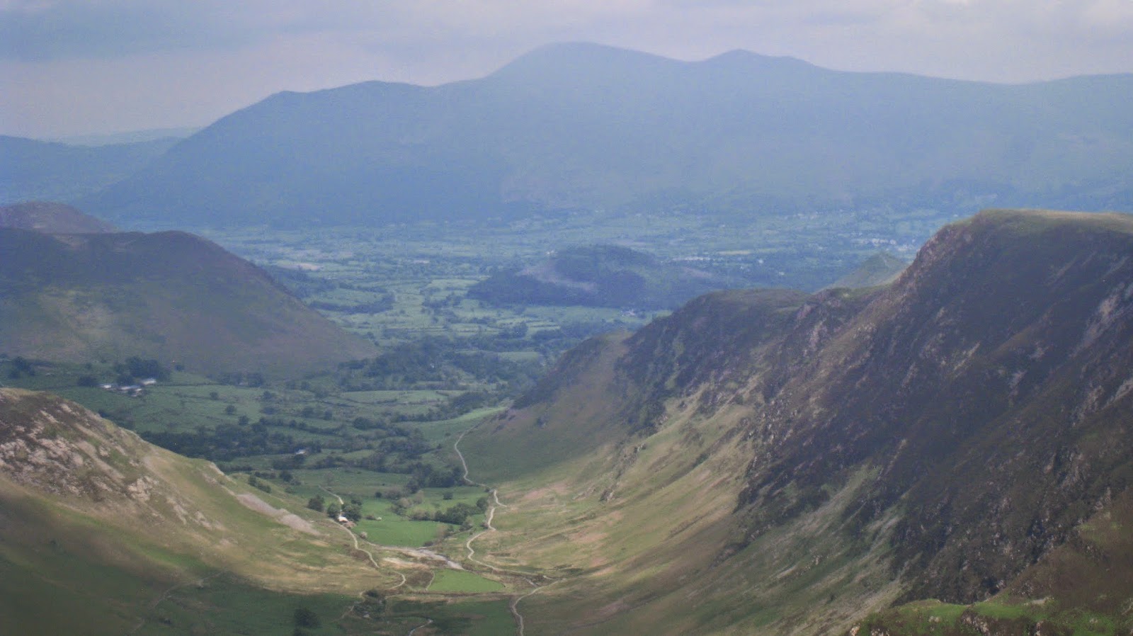
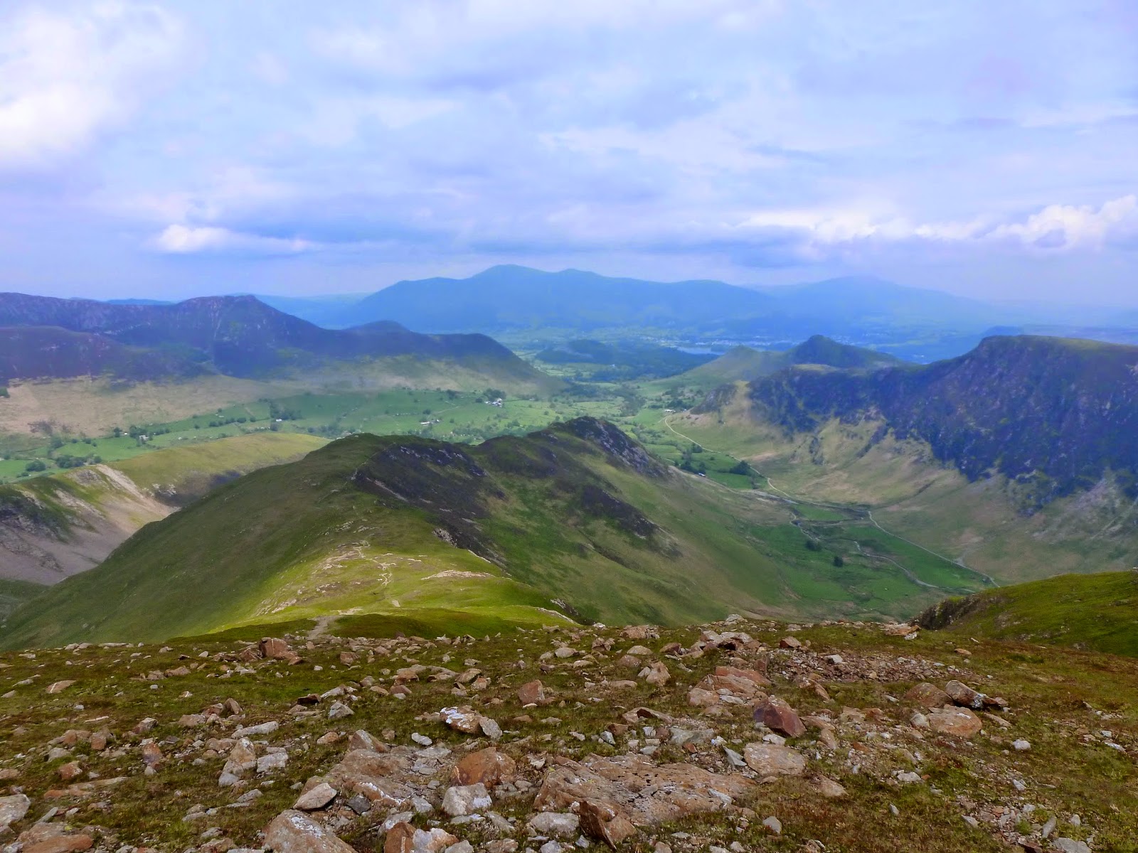
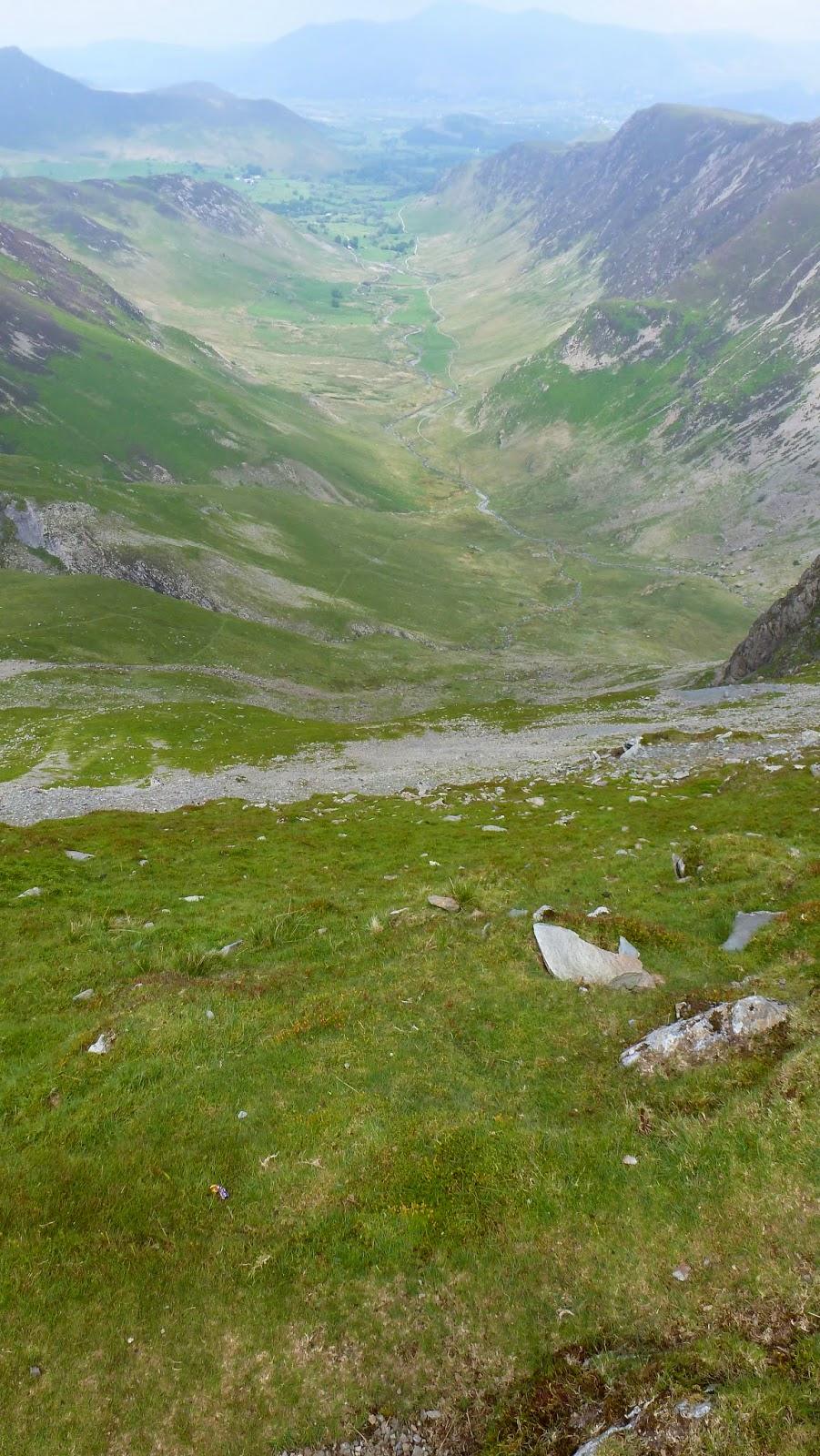
Dale Head has a wonderful view of the Newlands Valley to the north, it sits right at the very top of the valley, hence its name. The valley is regarded as one of the most picturesque in the entire National Park and we had a grandstand view of the entire thing from the handsome cairn atop Dale Head. The valley was once called Rogersat which was derived from the Old Norse “Roger-Saetr”, which translates as ‘Summer pasture belonging to Roger’; lucky guy. After the creation of new grazing land in the 13th Century, the name ‘Newlands’ was adopted.
 |
| The final stretch to the summit |
 |
| A glimpse through the Black Sail Pass |
 |
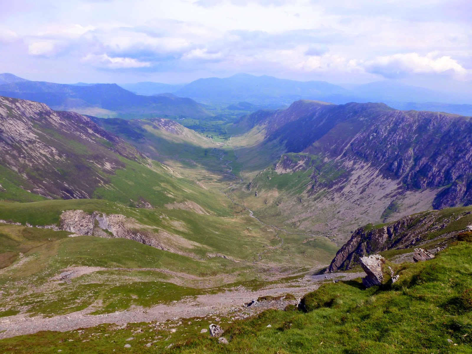
| The fabulous Newlands Valley |
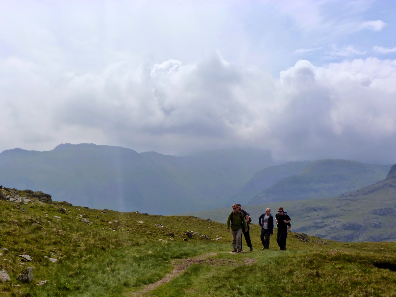
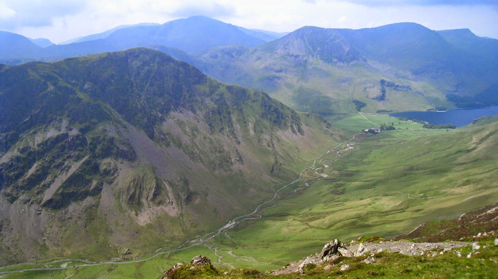
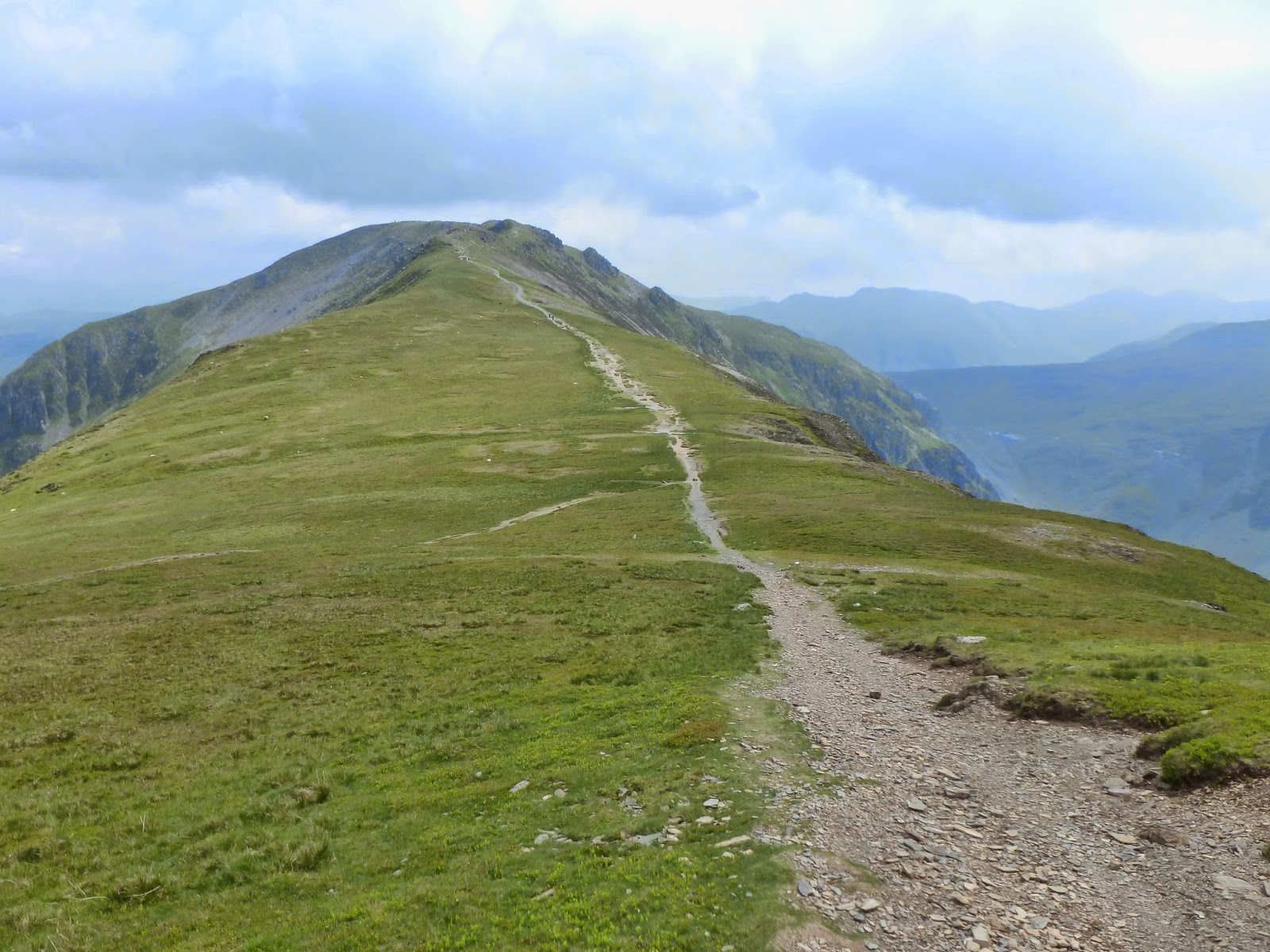
All our intention from here was a stroll to Hindscarth, stop for lunch and return the same way. I’ll admit that it’s probably not the most exciting of walks but it was just the ticket at that given moment, taking the evening before into account. A lovely ridge links Dale Head to Hindscarth, the summit of which stands a little way off to the north. Views from the ridge to Fleetwith Pike are excellent and gave us a good opportunity to survey the via ferrata route from the previous day. It certainly looks much higher from Hindscarth than it felt while we were on it.
 |
| Newlands and Skiddaw |
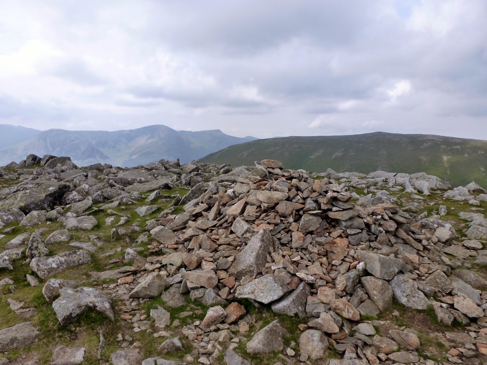
Hindscarth is another fell that owes its name to Old Norse; the two words Hind and Skarth mean ‘the pass used by the red deer’. No red deer here but some more excellent views, especially from the impressive shelter cairn located at the top of the northern ridge of Scope End.
 |
| The path descending from Dale Head along Hindscarth Edge |
 |
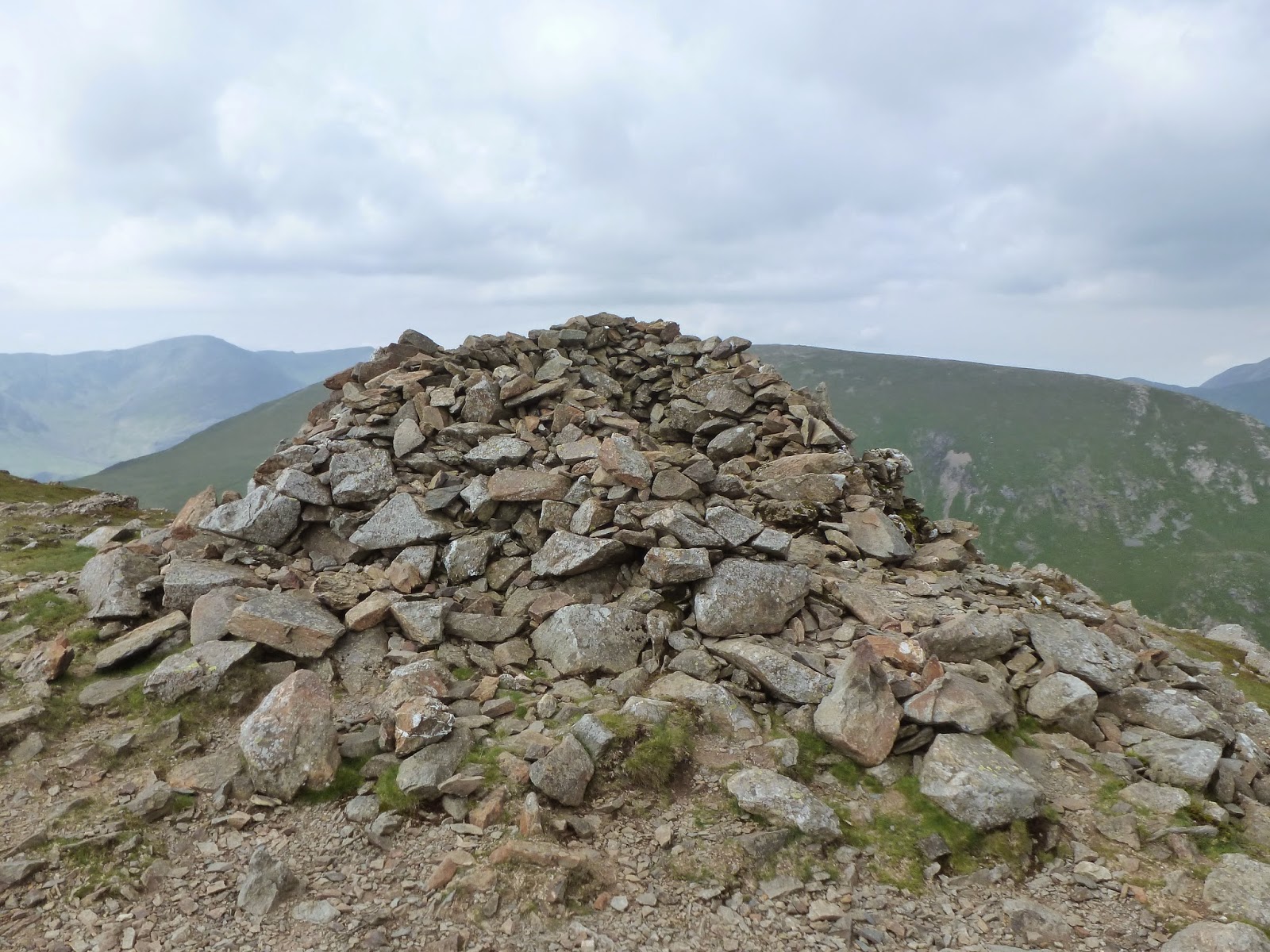
| Large shelter cairn at Scope End |
 |
| Red Knott, Scope End and Newlands |
We spent a while savouring lunch, we were in no rush and the weather, along with the last remaining hints of a hangover, was ideally suited for an extended sit down. Having completed this oh-so onerous of tasks, we up sticks and returned to the ridge to start our return back to Honister.
 |
| Hindscarth Edge |
We took a slightly different route back along the ridge towards Dale Head, this time sticking to the steep southern slopes high above the Honister Pass below. Though short, it’s an entertaining and airy traverse, one we didn’t notice existed as we passed by earlier in the day. A swift climb back up to Dale Head preceded the long descent down to the slate mine and a waiting ice cream.
 |
| Newlands |
 |
| Off back to Honister |
While not up to my usual length of Lake District days out, this was easily a case of quality over quantity and did little to quell my desire to complete the full Newlands round. I’d also heartily recommend the via ferrata at Honister, it’s a great experience, particularly if you not of the climbing ilk though genuine climbers will find it a tad tame I’m sure. All in all, it was a great weekend and a fantastic bookmark before the next great adventure of marriage.

