Open Space Web-Map builder Codehttps://openspace.ordnancesurvey.co.uk/osmapapi/openspace.js?key=3119F72552FD5C22E0530C6CA40A5A92https://openspace.ordnancesurvey.co.uk/osmapapi/script/mapbuilder/basicmap.jshttps://openspace.ordnancesurvey.co.uk/osmapapi/script/mapbuilder/searchbox.js//variables for routes var linesLayer, points, lineFeature, lineString, routeMarkersLayer, routepos, routesize, routeoffset, routeicon; var style_blue = {strokeColor: “#0000CD”, strokeOpacity: 0.5, strokeWidth: 4.5}; function initmapbuilder() { //initiate the map var options = {resolutions: [2500, 1000, 500, 200, 100, 50, 25, 10, 5, 4, 2.5, 2, 1]}; osMap = new OpenSpace.Map(‘map’, options); //configure map options (basicmap.js) setglobaloptions(); //set the center of the map and the zoom level osMap.setCenter(new OpenSpace.MapPoint(386172,490881),7); linesLayer = osMap.getVectorLayer(); // Set up layer for route markers routeMarkersLayer = new OpenLayers.Layer.Markers(“Route Markers”); //make a route points = new Array(); points.push(new OpenLayers.Geometry.Point(387172,489876)); points.push(new OpenLayers.Geometry.Point(387437,489836)); points.push(new OpenLayers.Geometry.Point(387602,490036)); points.push(new OpenLayers.Geometry.Point(387587,490256)); points.push(new OpenLayers.Geometry.Point(387572,490306)); points.push(new OpenLayers.Geometry.Point(387597,490391)); points.push(new OpenLayers.Geometry.Point(387687,490421)); points.push(new OpenLayers.Geometry.Point(387752,490496)); points.push(new OpenLayers.Geometry.Point(387802,490631)); points.push(new OpenLayers.Geometry.Point(388067,490881)); points.push(new OpenLayers.Geometry.Point(388122,490911)); points.push(new OpenLayers.Geometry.Point(388227,491151)); points.push(new OpenLayers.Geometry.Point(388197,491256)); points.push(new OpenLayers.Geometry.Point(387897,491336)); points.push(new OpenLayers.Geometry.Point(387292,491491)); points.push(new OpenLayers.Geometry.Point(387147,491496)); points.push(new OpenLayers.Geometry.Point(386992,491461)); points.push(new OpenLayers.Geometry.Point(386917,491371)); points.push(new OpenLayers.Geometry.Point(386852,491336)); points.push(new OpenLayers.Geometry.Point(386797,491226)); points.push(new OpenLayers.Geometry.Point(386737,491236)); points.push(new OpenLayers.Geometry.Point(386747,491381)); points.push(new OpenLayers.Geometry.Point(386802,491486)); points.push(new OpenLayers.Geometry.Point(386917,491526)); points.push(new OpenLayers.Geometry.Point(386982,491666)); points.push(new OpenLayers.Geometry.Point(386912,491516)); points.push(new OpenLayers.Geometry.Point(386792,491481)); points.push(new OpenLayers.Geometry.Point(386742,491371)); points.push(new OpenLayers.Geometry.Point(386767,491231)); points.push(new OpenLayers.Geometry.Point(386582,491181)); points.push(new OpenLayers.Geometry.Point(386382,491031)); points.push(new OpenLayers.Geometry.Point(386192,491026)); points.push(new OpenLayers.Geometry.Point(385967,491036)); points.push(new OpenLayers.Geometry.Point(385877,491006)); points.push(new OpenLayers.Geometry.Point(385717,491066)); points.push(new OpenLayers.Geometry.Point(385737,490961)); points.push(new OpenLayers.Geometry.Point(385707,490921)); points.push(new OpenLayers.Geometry.Point(385522,491111)); points.push(new OpenLayers.Geometry.Point(385247,491161)); points.push(new OpenLayers.Geometry.Point(384927,491371)); points.push(new OpenLayers.Geometry.Point(384822,491401)); points.push(new OpenLayers.Geometry.Point(384712,491516)); points.push(new OpenLayers.Geometry.Point(384767,491596)); points.push(new OpenLayers.Geometry.Point(385032,491546)); points.push(new OpenLayers.Geometry.Point(385017,491621)); points.push(new OpenLayers.Geometry.Point(384917,491676)); points.push(new OpenLayers.Geometry.Point(384857,491736)); points.push(new OpenLayers.Geometry.Point(384852,492031)); points.push(new OpenLayers.Geometry.Point(384862,491731)); points.push(new OpenLayers.Geometry.Point(385017,491606)); points.push(new OpenLayers.Geometry.Point(385017,491526)); points.push(new OpenLayers.Geometry.Point(384782,491586)); points.push(new OpenLayers.Geometry.Point(384717,491521)); points.push(new OpenLayers.Geometry.Point(384832,491386)); points.push(new OpenLayers.Geometry.Point(384942,491381)); points.push(new OpenLayers.Geometry.Point(385237,491166)); points.push(new OpenLayers.Geometry.Point(385517,491101)); points.push(new OpenLayers.Geometry.Point(385702,490951)); points.push(new OpenLayers.Geometry.Point(385702,490786)); points.push(new OpenLayers.Geometry.Point(385802,490681)); points.push(new OpenLayers.Geometry.Point(385687,490361)); points.push(new OpenLayers.Geometry.Point(385757,490271)); points.push(new OpenLayers.Geometry.Point(385952,490036)); points.push(new OpenLayers.Geometry.Point(386022,490091)); points.push(new OpenLayers.Geometry.Point(386382,490056)); points.push(new OpenLayers.Geometry.Point(386432,490006)); points.push(new OpenLayers.Geometry.Point(386687,490046)); points.push(new OpenLayers.Geometry.Point(386772,490031)); points.push(new OpenLayers.Geometry.Point(386852,489856)); points.push(new OpenLayers.Geometry.Point(387172,489876)); // create a polyline feature from the array of points lineString = new OpenLayers.Geometry.LineString(points); lineFeature = new OpenLayers.Feature.Vector(lineString, null, style_blue); linesLayer.addFeatures([lineFeature]); //crate a route start/end marker routepos = new OpenSpace.MapPoint(387172,489876); routesize = new OpenLayers.Size(33,45); routeoffset = new OpenLayers.Pixel(-5,-37); routeicon = new OpenSpace.Icon(‘https://openspace.ordnancesurvey.co.uk/osmapapi/img_versions/img_1.1/mapbuilder/routemarker-startend.png’, routesize, routeoffset, null, null); routeMarkersLayer.addMarker(new OpenLayers.Marker(routepos, routeicon)); osMap.addLayer(routeMarkersLayer);}
Route: National Park Centre, Haylands Bridge, Sedbusk Farm, Simonstone Hotel, Hardraw, Hardraw Force, New Bridge, Holme Heads Bridge, Cotter Force, New Bridge, Appersett Viaduct, Spillian Green Sike, Pike Hill, Hawes
Date: 24/02/2013
From: Hawes
Parking: Roadside parking in Hawes
Start Point: Hawes
Region: Yorkshire Dales
Route length: 8.1 miles (13 km)
Time taken: 03:26
Average speed: 2.4 mph
Ascent: 477m
Descent: 492m
Points of interest: Hardraw Force, Cotter Force, Appersett Viaduct
Believe it or not England’s three highest waterfalls can all be found in the Yorkshire Dales; there’s Cautley Spout, highest cascade; Gaping Gill, highest unbroken (but falls underground) and Hardraw Force, highest unbroken above ground. In addition to these modest giants, the Dales is littered with many other, lesser known beauties such as Aysgarth and Linton Falls, Catrigg Force and Janet’s Foss. One of these hidden gems is Cotter Force, a wonderful tiered waterfall at the foot of Cotterdale.
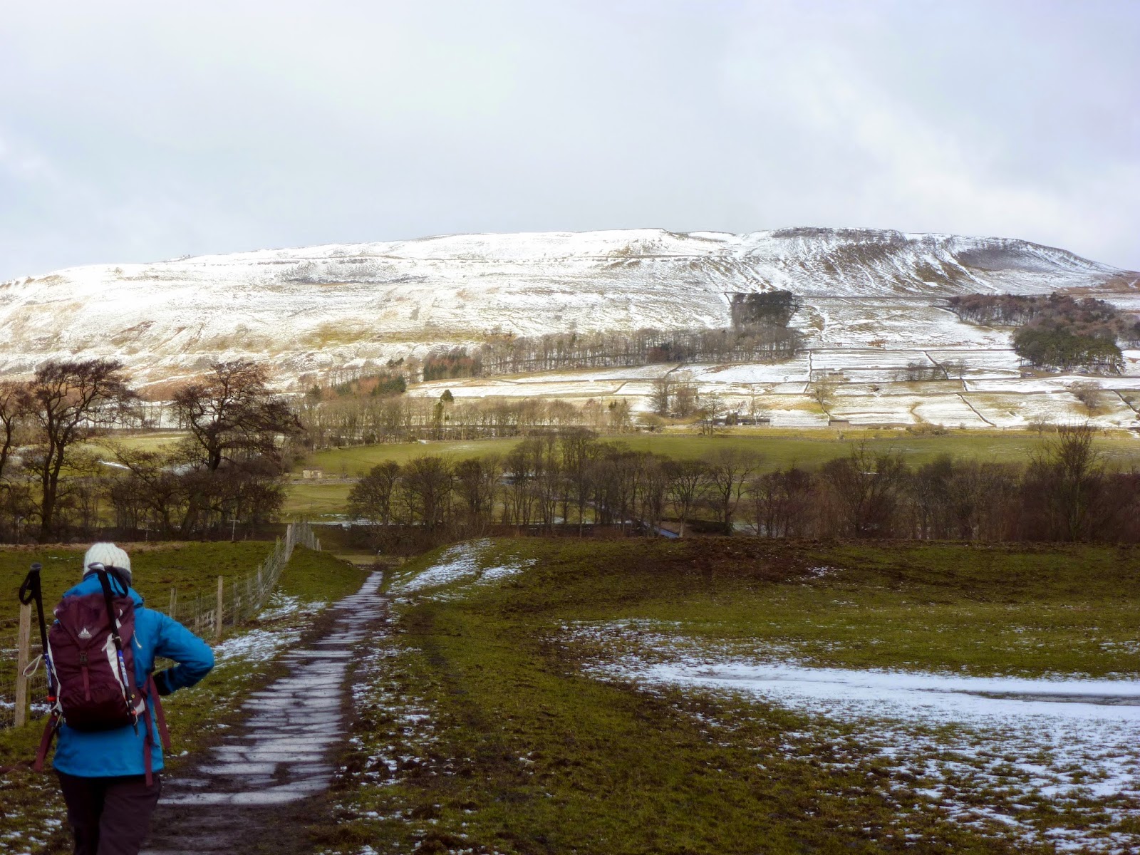
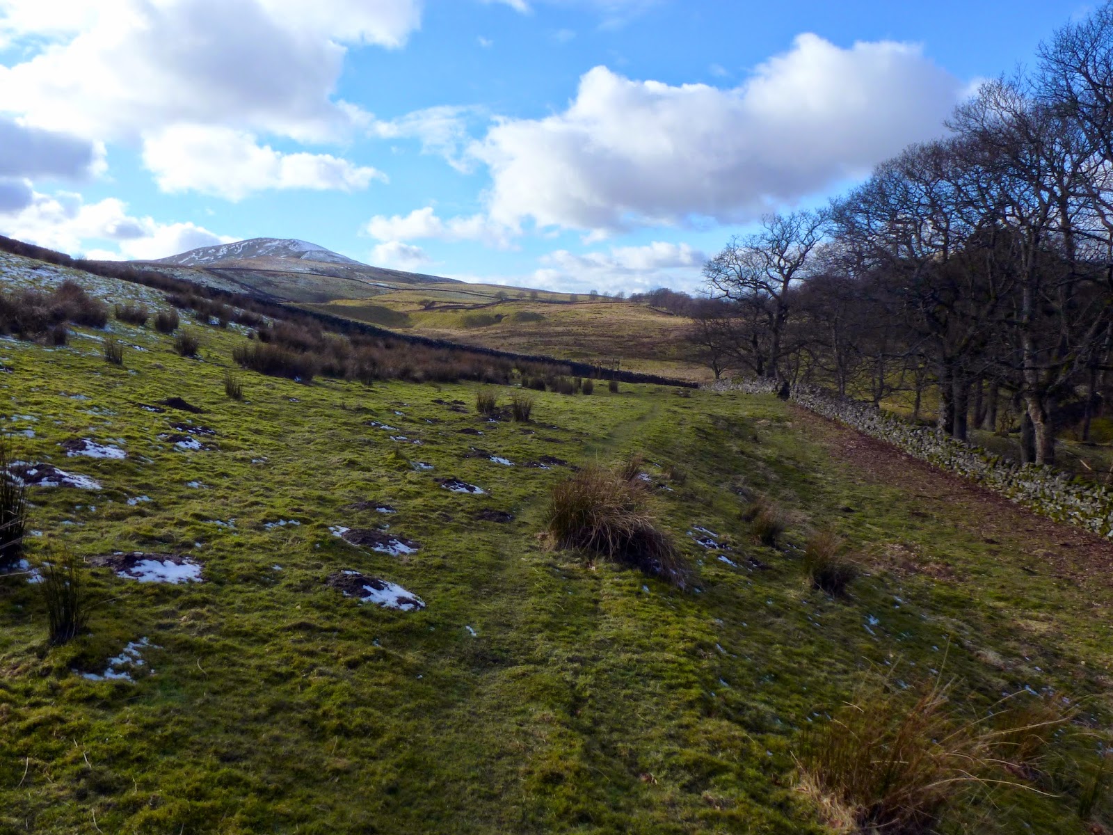
We parked in Hawes in the heart of Wensleydale as it offers the most convenient starting point for the walk, picking up the Pennine Way which heads through the town. The route passes through both Hawes and Hardraw so makes an ideal pedestrian highway between the two. The path crosses the River Ure on Burnt Acres Road, utilising a very nice old bridge to do so before striking out across the open farmland towards Hardraw.
 |
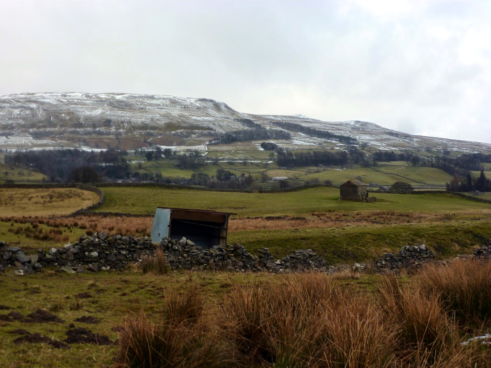
| Abbotside Common guards the northern side of Wensleydale |
 |
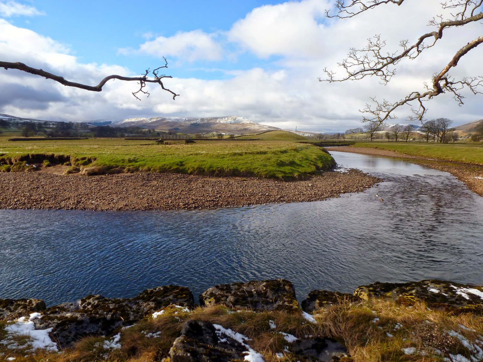
| River Ure |
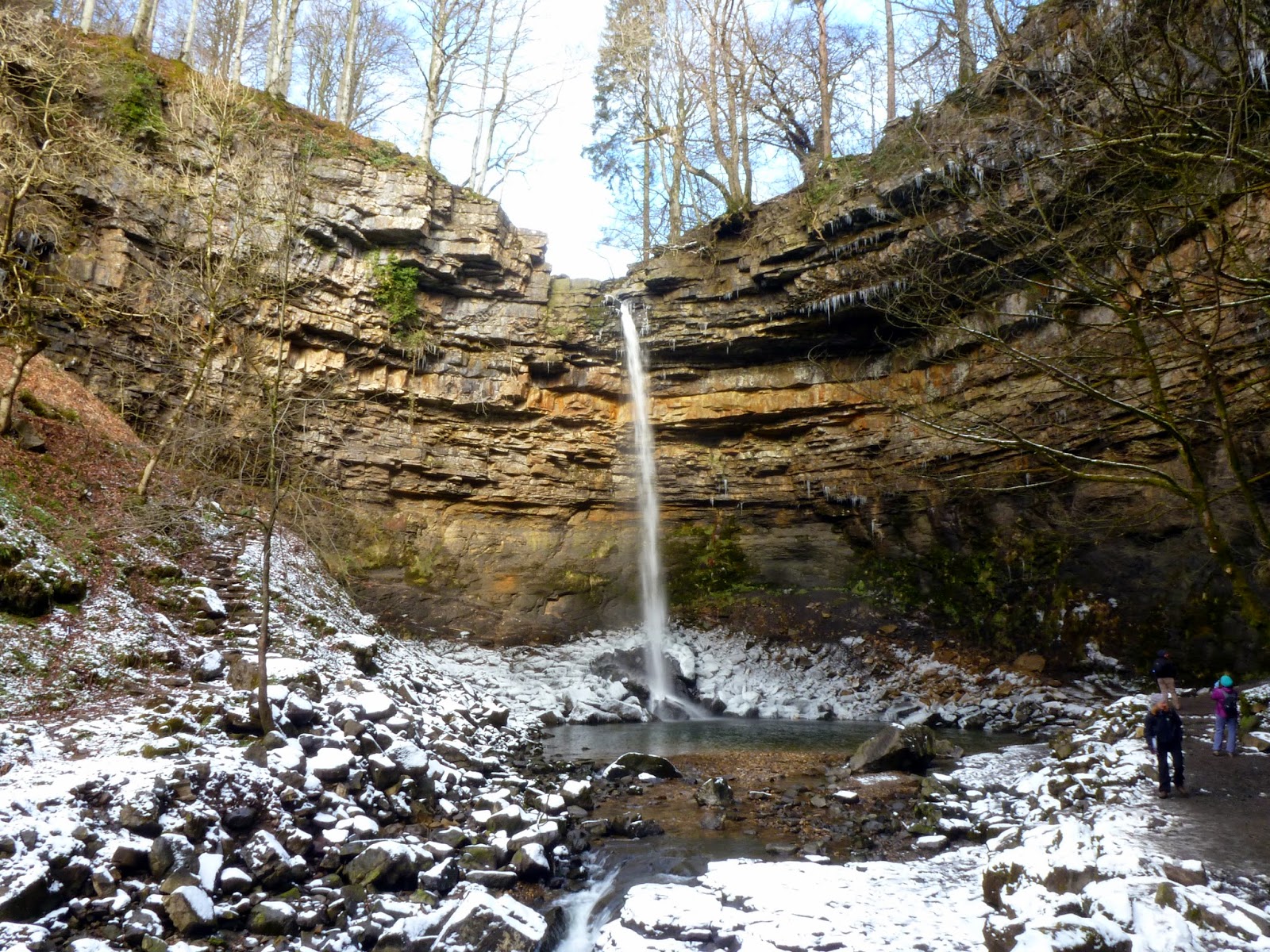
Hardraw village takes its name from the tall waterfall that hides behind it down a deep ravine. In actual fact, the waterfall is wholly owned by the Green Dragon Inn as Hardraw Beck and the gorge of Hardraw Scar (containing the waterfall) form part of the Inn’s 15 acre grounds. As a result of this, which may come as a surprise to some, there is a modest fee to pay to the Inn in order to visit the falls; £2.50 for adults and £1.50 for children.
 |
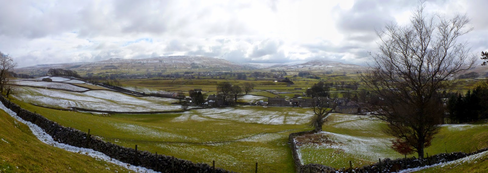
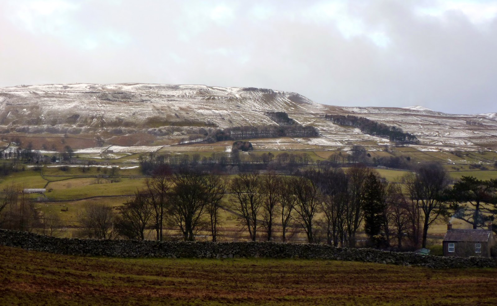
| A frozen Wensleydale |
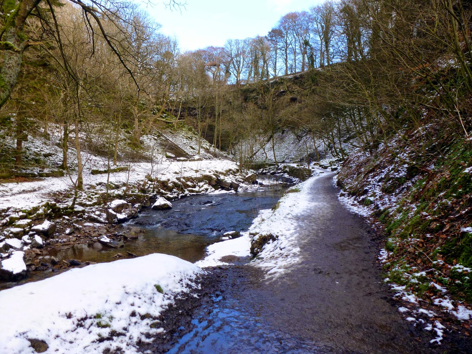
After making our payment we made our way through the pub and out to the grounds outside where a path winds its way alongside the river into the narrow Hardraw Scar. A tall rock wall marks the end of the gorge with the towering Hardraw Force pouring over a ledge in the middle. It’s a fine sight.
 |
| The path down Hardraw Scar |
 |
| Hardraw Beck |
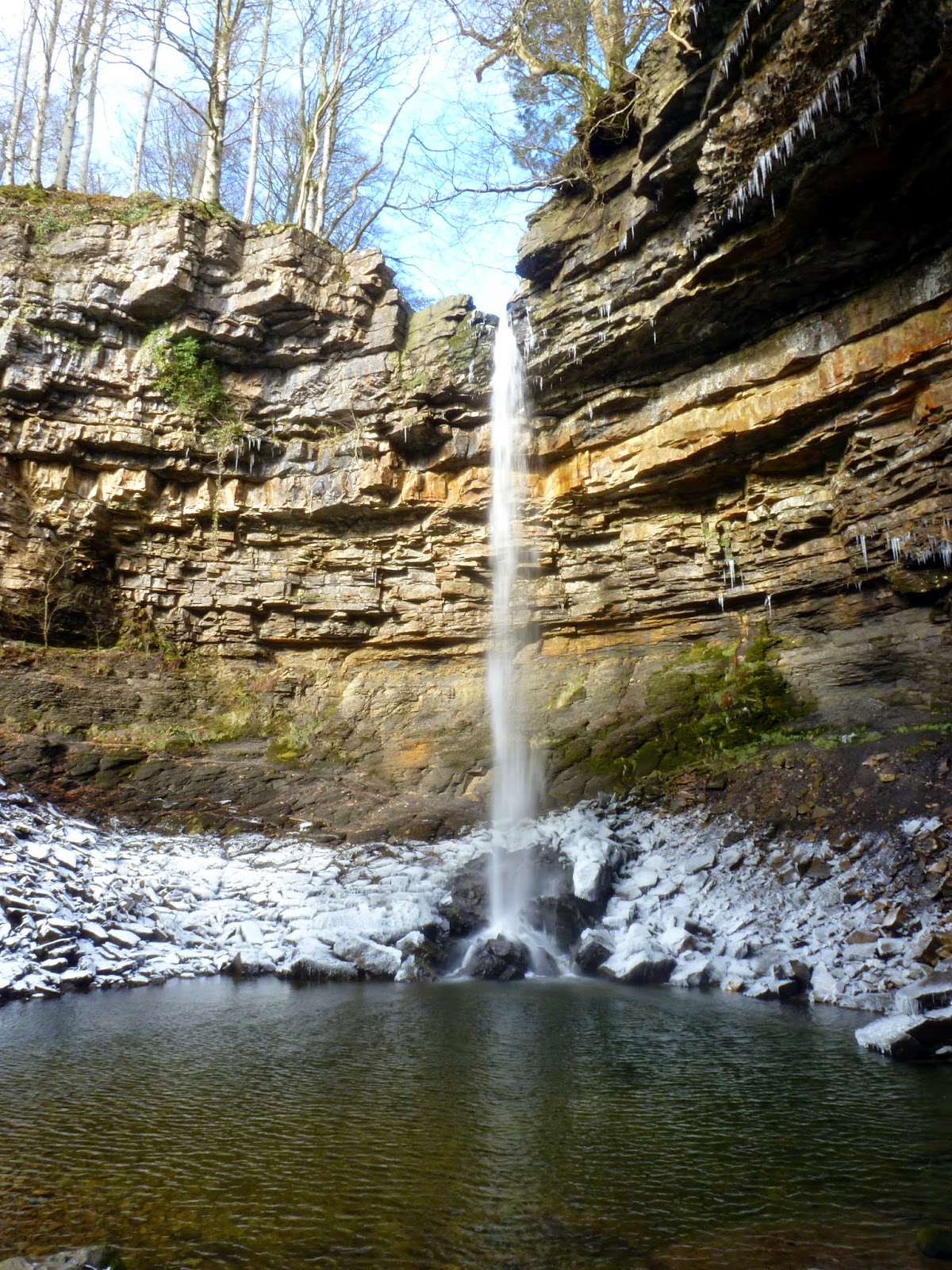
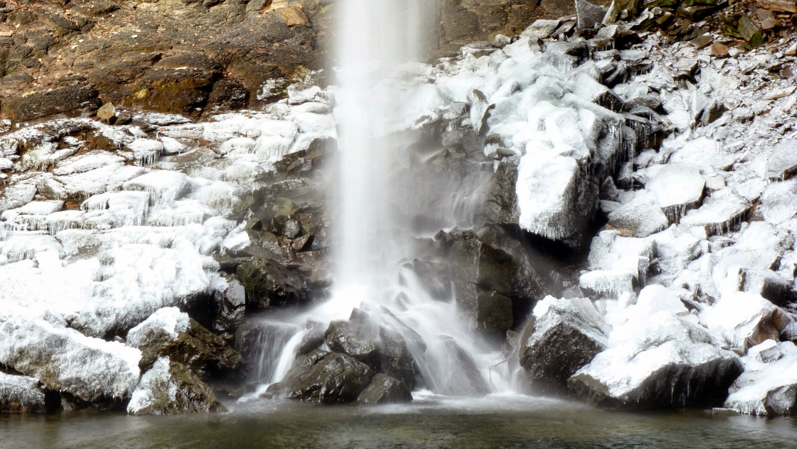
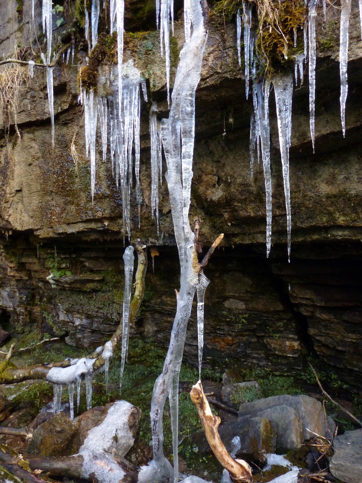
As I mentioned at the start, Hardraw Force is the highest unbroken waterfall in England, plummeting over 100ft into the plunge pool below. It was a bitterly cold day, enough to freeze the water that had fallen on the surrounding rocks and give them a delightful white and silver coating. The only real downside was it was so cold we didn’t want to be hanging around for too long.
 |
| Hardraw Force in all its glory |
 |
| Hardraw Force |
 |
| The frozen rocks below the spout |
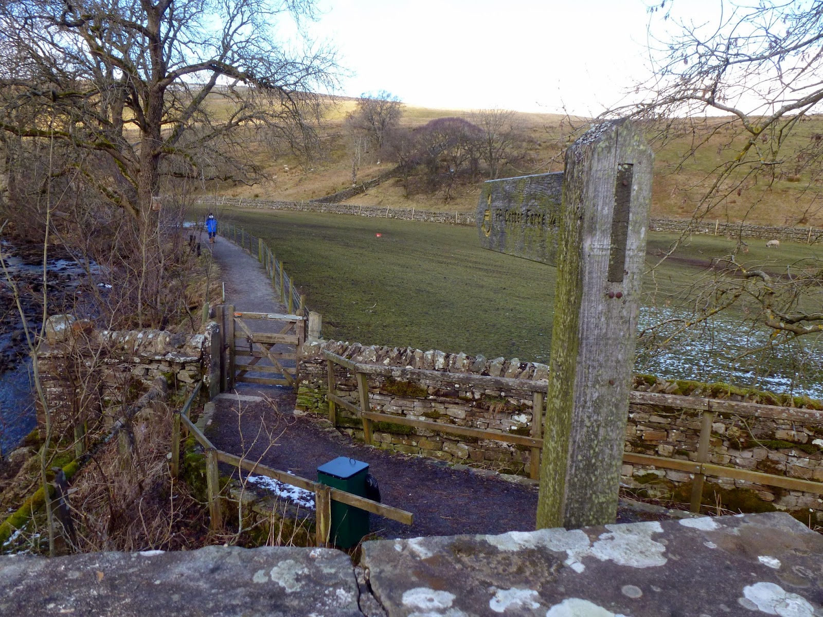
We retraced our steps back to the pub and out to the road, prepared for a short section of road walking to the River Ure at new Bridge. It’s a quiet road and we only encountered a couple of cars on the way before we reached New Bridge are were able to return to the footpaths. The path runs parallel to the River Ure and was extremely muddy underfoot but it’s not long before another brief road crossing is required to access the path to Cotter Force.
 |
| The path leading alongside the river |
 |
| The paved path leading to Cotter Force |
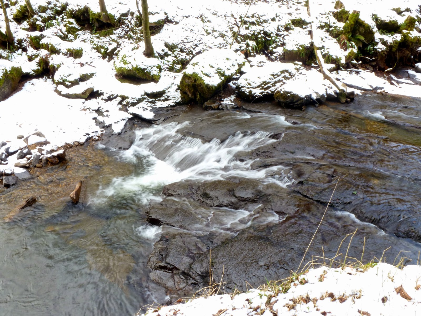
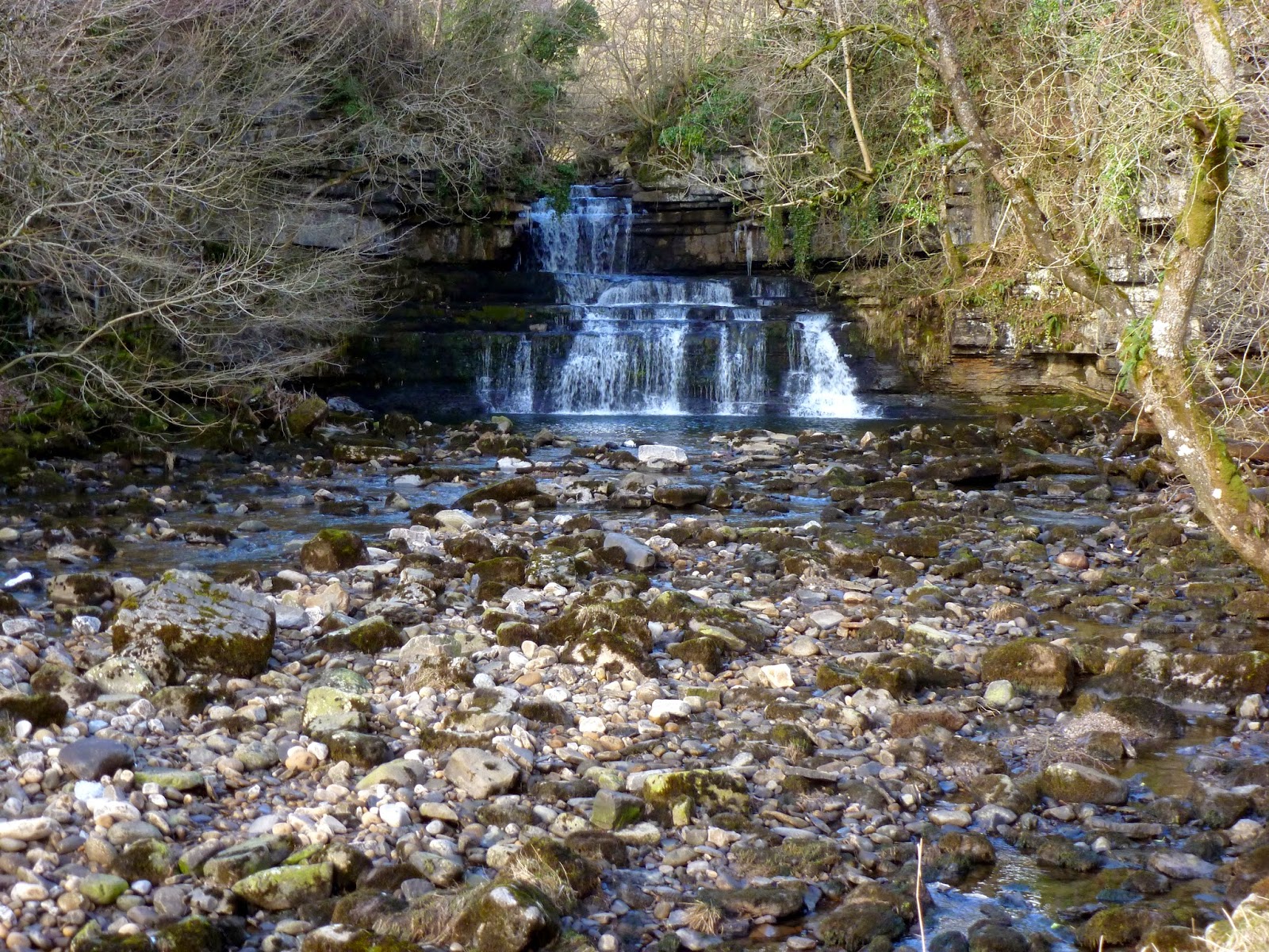
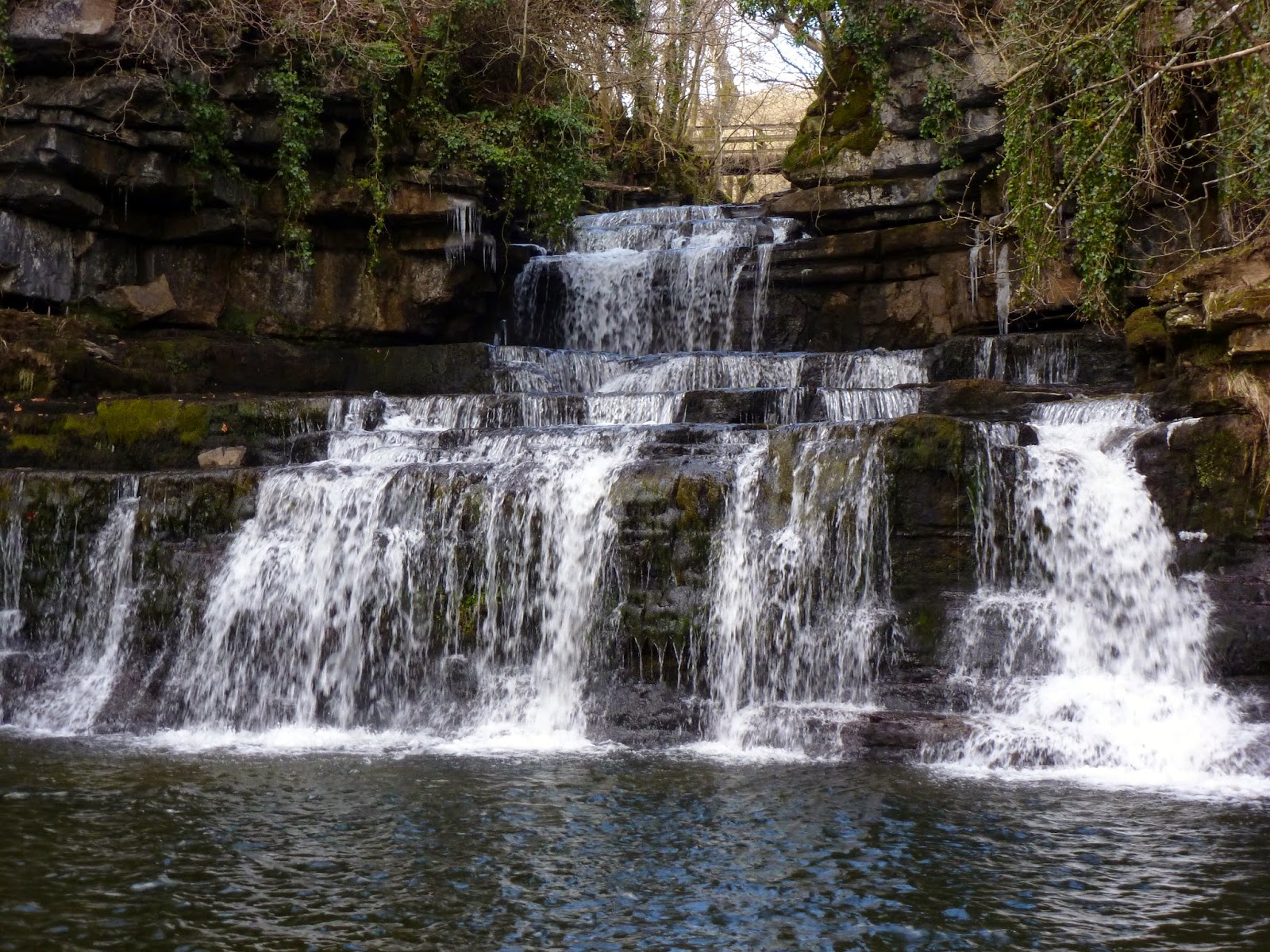
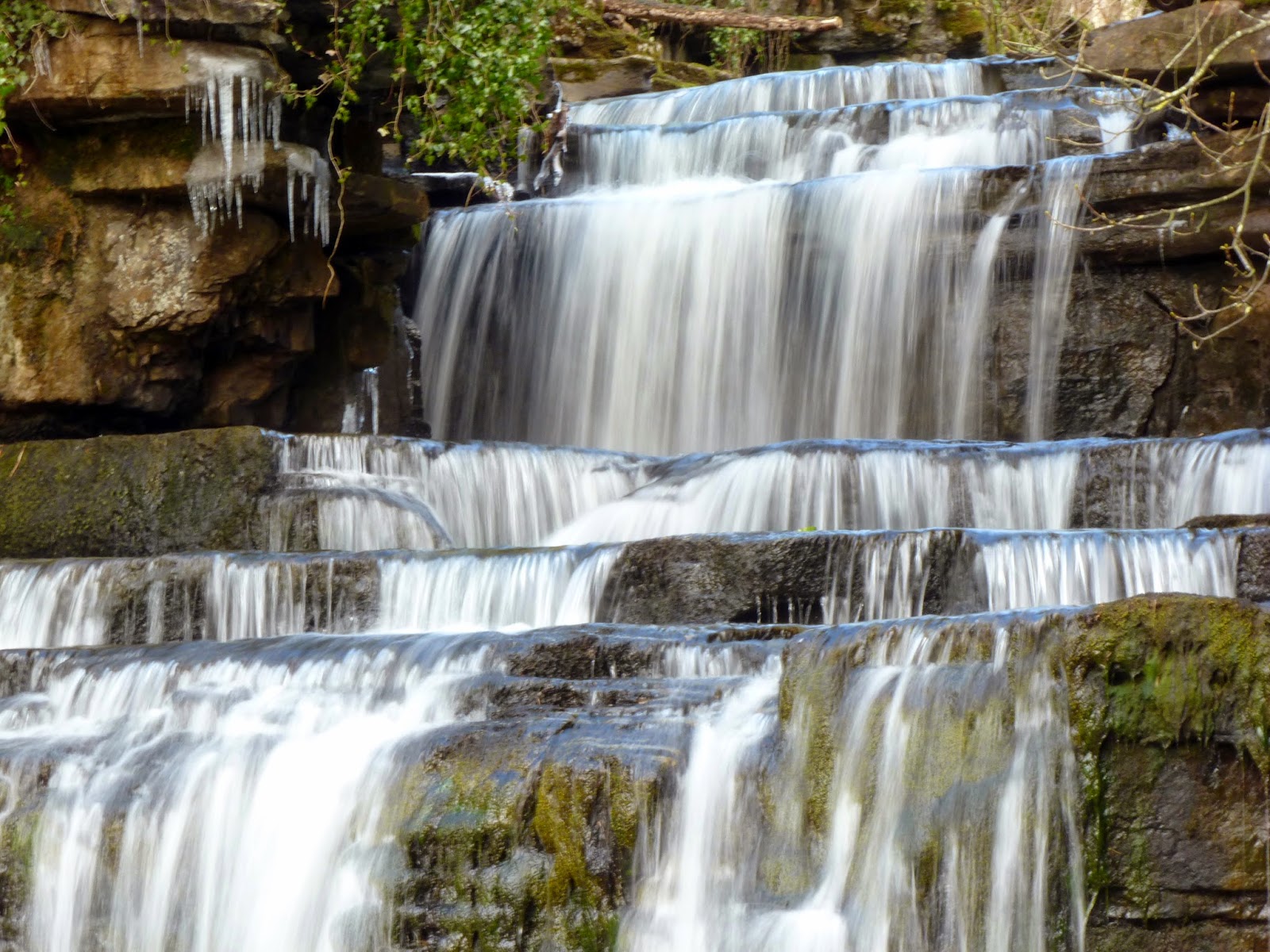
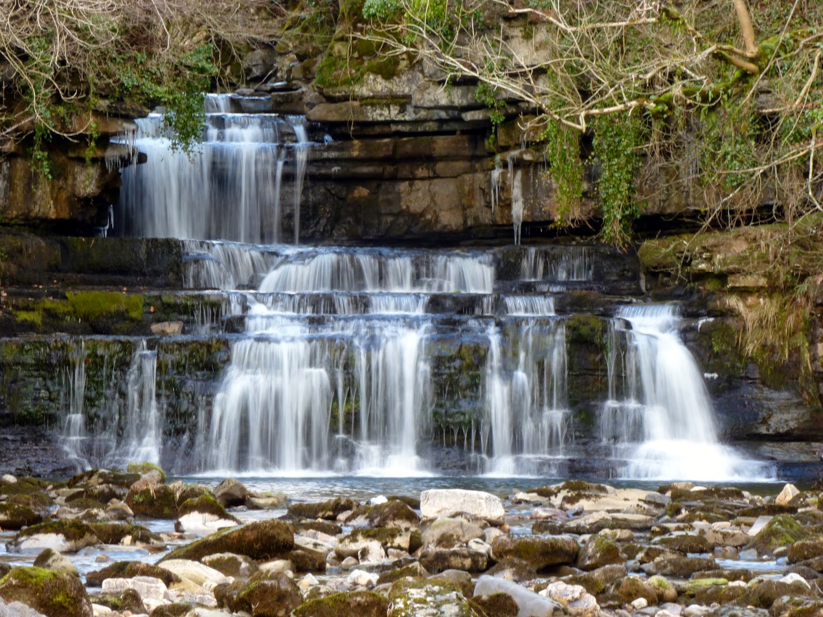
Cotter Force can be found at the end of a 500m long paved path, nestled in a wooded valley. I think that it’s a stunning fall, consisting of a wedge of of terraces that fan the water out in a particularly appealing pattern. It bears some similarities to the famous Aysgarth Falls but on a much smaller scale. It’s a delight.
 |
| Cotter Force |
 |
| The cascading falls |
 |
| A closeup of the upper shelves |
 |
| A slow-shutter photo which I am particularly fond of |
 |
| It certainly was cold! |
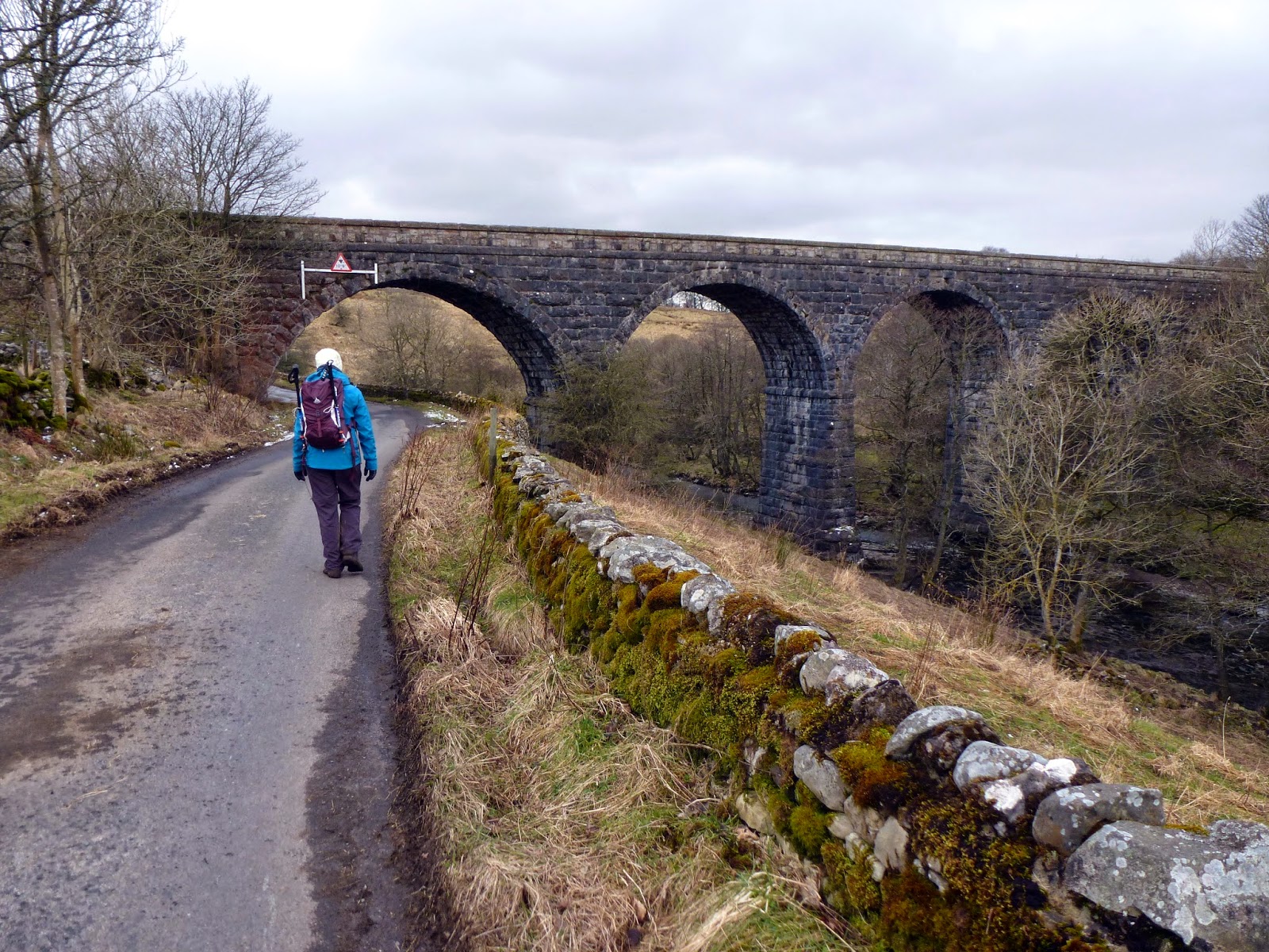
After leaving Cotter Force, we were once again forced to retrace our steps alongside the river to New Bridge this time turning south and entering the tiny hamlet of Appersett. The settlement comprises on only 23 houses but lends its name to the nearby viaduct, once carrying the western end of the Wensleydale Railway. It was opened in 1878, before the structure saw its last train in 1959. It is now a Grade II listed building.
 |
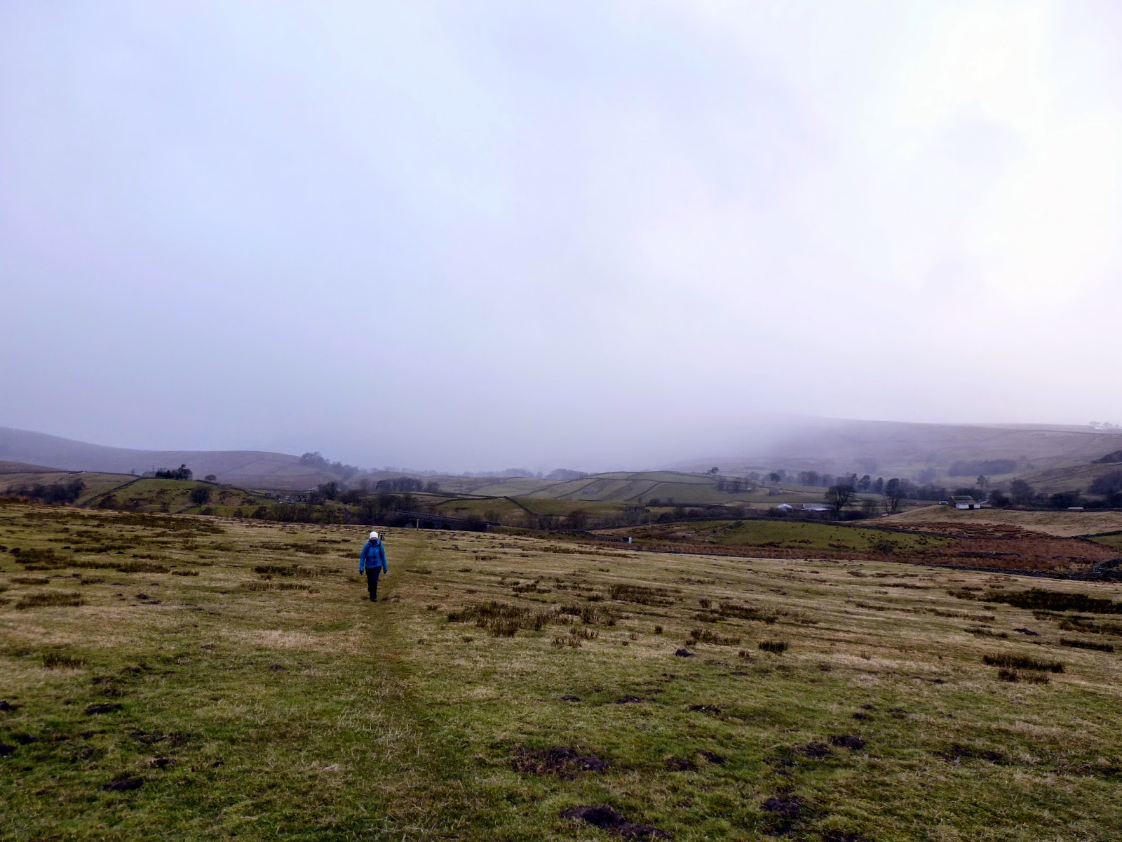
| Sara heads towards Appersett Viaduct |
 |
| Abbotside Common |
 |
| A snow shower threatens to engulf the valley |
 |
| Abbotside Common |
The weather had taken a bit of a turn so we decided to take the most direct route back to Hawes, a series of rights of way that cross numerous fields and enters Hawes from the west. There are a variety of routes that can be taken, including a slightly longer one that visits Gayle and its tremendous refurbished mill. One for another time I think. In summary, this is really a walk of two halves with most of the interest and excitement experienced in the first half. Both falls are places that need to be deliberately visited rather than passed on the way so they are a bit difficult to fit into a nice circuit. That said, both sit in the shadow of
Great Shunner Fell and can easily be included as diversions to a very rewarding walk.
