Open Space Web-Map builder Codehttps://openspace.ordnancesurvey.co.uk/osmapapi/openspace.js?key=3119F72552FD5C22E0530C6CA40A5A92https://openspace.ordnancesurvey.co.uk/osmapapi/script/mapbuilder/basicmap.jshttps://openspace.ordnancesurvey.co.uk/osmapapi/script/mapbuilder/searchbox.js//variables for routes var linesLayer, points, lineFeature, lineString, routeMarkersLayer, routepos, routesize, routeoffset, routeicon; var style_blue = {strokeColor: “#0000CD”, strokeOpacity: 0.5, strokeWidth: 4.5}; function initmapbuilder() { //initiate the map var options = {resolutions: [2500, 1000, 500, 200, 100, 50, 25, 10, 5, 4, 2.5, 2, 1]}; osMap = new OpenSpace.Map(‘map’, options); //configure map options (basicmap.js) setglobaloptions(); //set the center of the map and the zoom level osMap.setCenter(new OpenSpace.MapPoint(326535,505305),7); linesLayer = osMap.getVectorLayer(); // Set up layer for route markers routeMarkersLayer = new OpenLayers.Layer.Markers(“Route Markers”); //make a route points = new Array(); points.push(new OpenLayers.Geometry.Point(328635,505990)); points.push(new OpenLayers.Geometry.Point(328435,505970)); points.push(new OpenLayers.Geometry.Point(328135,505860)); points.push(new OpenLayers.Geometry.Point(327885,505640)); points.push(new OpenLayers.Geometry.Point(327745,505640)); points.push(new OpenLayers.Geometry.Point(327655,505690)); points.push(new OpenLayers.Geometry.Point(327515,505620)); points.push(new OpenLayers.Geometry.Point(327265,505730)); points.push(new OpenLayers.Geometry.Point(326975,505750)); points.push(new OpenLayers.Geometry.Point(326705,505880)); points.push(new OpenLayers.Geometry.Point(326315,505810)); points.push(new OpenLayers.Geometry.Point(326025,505850)); points.push(new OpenLayers.Geometry.Point(325955,505930)); points.push(new OpenLayers.Geometry.Point(325795,505960)); points.push(new OpenLayers.Geometry.Point(325535,506120)); points.push(new OpenLayers.Geometry.Point(325175,506310)); points.push(new OpenLayers.Geometry.Point(325005,506335)); points.push(new OpenLayers.Geometry.Point(324835,506460)); points.push(new OpenLayers.Geometry.Point(324690,506610)); points.push(new OpenLayers.Geometry.Point(324620,506555)); points.push(new OpenLayers.Geometry.Point(324590,506430)); points.push(new OpenLayers.Geometry.Point(324475,506505)); points.push(new OpenLayers.Geometry.Point(324440,506475)); points.push(new OpenLayers.Geometry.Point(324735,506355)); points.push(new OpenLayers.Geometry.Point(324840,506220)); points.push(new OpenLayers.Geometry.Point(324855,506080)); points.push(new OpenLayers.Geometry.Point(324855,505950)); points.push(new OpenLayers.Geometry.Point(324875,505845)); points.push(new OpenLayers.Geometry.Point(324890,505730)); points.push(new OpenLayers.Geometry.Point(324895,505590)); points.push(new OpenLayers.Geometry.Point(324975,505260)); points.push(new OpenLayers.Geometry.Point(324945,505035)); points.push(new OpenLayers.Geometry.Point(324825,504930)); points.push(new OpenLayers.Geometry.Point(324825,504850)); points.push(new OpenLayers.Geometry.Point(324965,504635)); points.push(new OpenLayers.Geometry.Point(325070,504495)); points.push(new OpenLayers.Geometry.Point(325220,504375)); points.push(new OpenLayers.Geometry.Point(325415,504340)); points.push(new OpenLayers.Geometry.Point(325560,504190)); points.push(new OpenLayers.Geometry.Point(325765,504075)); points.push(new OpenLayers.Geometry.Point(326000,504005)); points.push(new OpenLayers.Geometry.Point(326195,503950)); points.push(new OpenLayers.Geometry.Point(326400,503950)); points.push(new OpenLayers.Geometry.Point(326455,503925)); points.push(new OpenLayers.Geometry.Point(326625,503885)); points.push(new OpenLayers.Geometry.Point(326765,503940)); points.push(new OpenLayers.Geometry.Point(326610,504140)); points.push(new OpenLayers.Geometry.Point(326585,504270)); points.push(new OpenLayers.Geometry.Point(326640,504380)); points.push(new OpenLayers.Geometry.Point(326655,504480)); points.push(new OpenLayers.Geometry.Point(326660,504630)); points.push(new OpenLayers.Geometry.Point(326740,504760)); points.push(new OpenLayers.Geometry.Point(326850,504840)); points.push(new OpenLayers.Geometry.Point(326935,505090)); points.push(new OpenLayers.Geometry.Point(326985,505195)); points.push(new OpenLayers.Geometry.Point(327115,505300)); points.push(new OpenLayers.Geometry.Point(327235,505365)); points.push(new OpenLayers.Geometry.Point(327305,505460)); points.push(new OpenLayers.Geometry.Point(327480,505520)); points.push(new OpenLayers.Geometry.Point(327550,505595)); points.push(new OpenLayers.Geometry.Point(327630,505685)); points.push(new OpenLayers.Geometry.Point(327870,505635)); points.push(new OpenLayers.Geometry.Point(328120,505825)); points.push(new OpenLayers.Geometry.Point(328200,505885)); points.push(new OpenLayers.Geometry.Point(328570,505970)); points.push(new OpenLayers.Geometry.Point(328635,505990)); // create a polyline feature from the array of points lineString = new OpenLayers.Geometry.LineString(points); lineFeature = new OpenLayers.Feature.Vector(lineString, null, style_blue); linesLayer.addFeatures([lineFeature]); //crate a route start/end marker routepos = new OpenSpace.MapPoint(328635,505990); routesize = new OpenLayers.Size(33,45); routeoffset = new OpenLayers.Pixel(-5,-37); routeicon = new OpenSpace.Icon(‘https://openspace.ordnancesurvey.co.uk/osmapapi/img_versions/img_1.1/mapbuilder/routemarker-startend.png’, routesize, routeoffset, null, null); routeMarkersLayer.addMarker(new OpenLayers.Marker(routepos, routeicon)); osMap.addLayer(routeMarkersLayer);}
Route: NT Campsite, Stool End, The Band, White Stone, Earing Crag, Cimbers Traverse, Bowfell Buttress, Great Slab, Bowfell, Three Tarns, Shelter Crags, Crinkle Crags, Bad Step, Browney Gill, Brown Howe, Oxendale, Stool End, NT Campsite
Date: 06/10/2012
From: Great Langdale
Parking: National Trust Campsite
Start Point: National Trust Campsite
Region: Southern Fells
Route length: 7.9 miles (12.7 km)
Time taken: 04:02
Average speed: 1.7 mph
Ascent: 1,105m
Descent: 1,106m
Wainwrights on this walk:
Bowfell (902m), Crinkle Crags (859m)
Additional summits: Shelter Crags (815m), Fifth Crinkle (822m), Fourth Crinkle (832m), Gunson Knott (840m), Crinkle Crags South Top (834m)
Other points of interest:
Climbers Traverse, Bowfell Buttress, The Great Slab, Bad Step
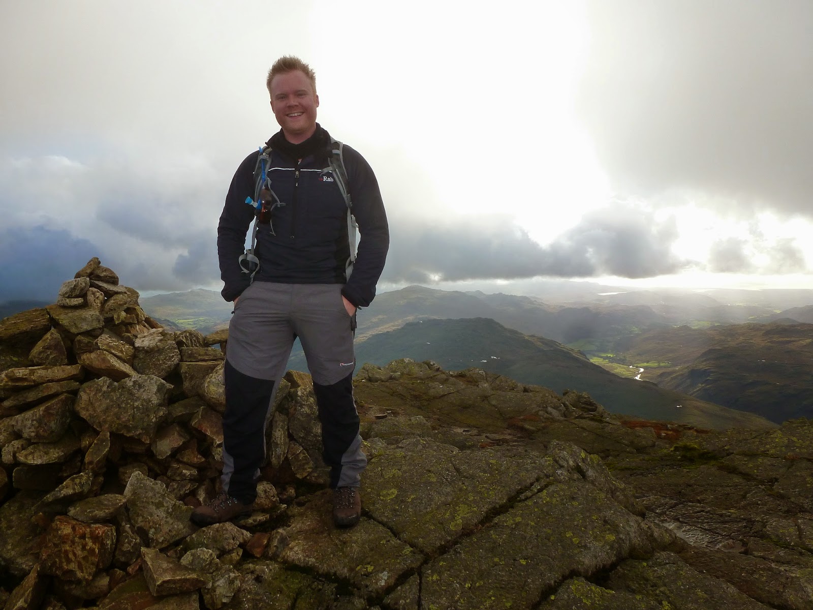
Bowfell is a true Lakeland great, loved by many for its mountain character and unsurpassed views. This would be mine and Saras first visit to the fell with it providing the highlight to one of the classic days out from Langdale. Despite it being autumn, we were blessed with rather favourable weather and we managed to remain dry for the entire day, not something you can often brag about after a day on the fells.
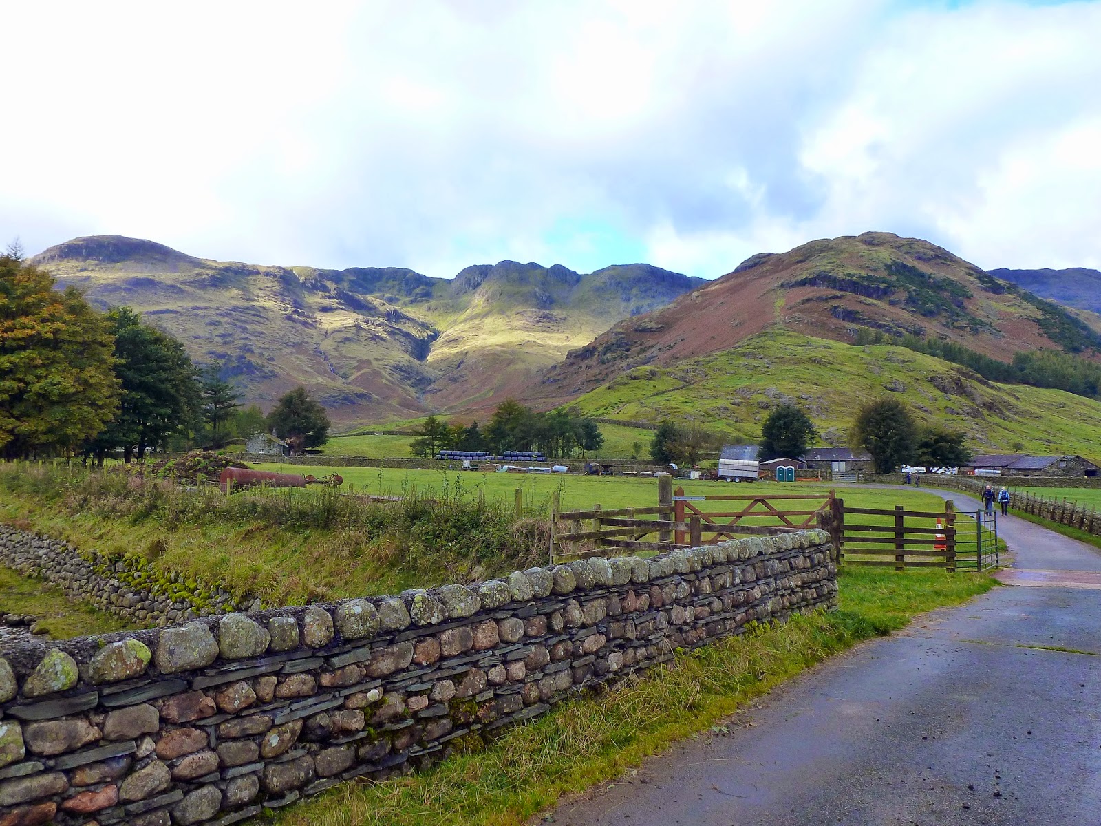
We were camping at the Great Langdale National Trust campsite, a location we’d used many times before as it’s a lovely location and gives you doorstep access to some of the finest fells the Lake District has to offer. As I mentioned, we were aiming to climb perhaps the finest of them all, Bowfell.
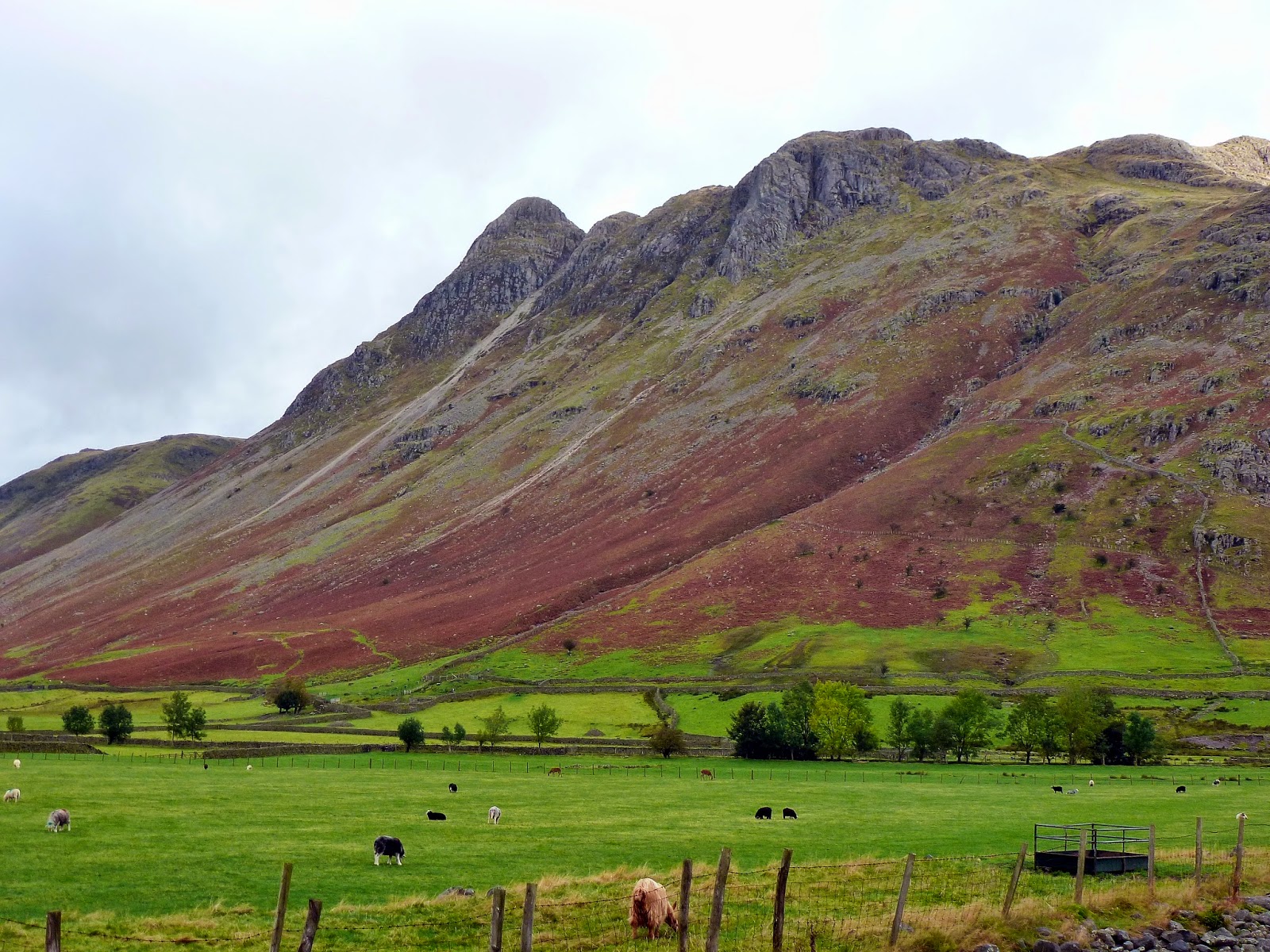
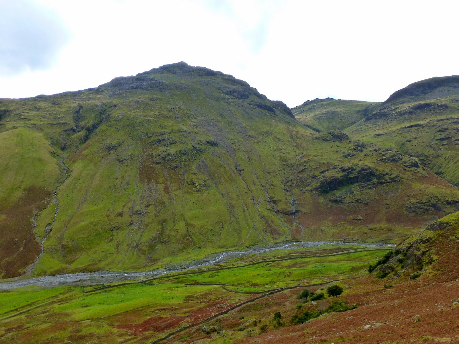
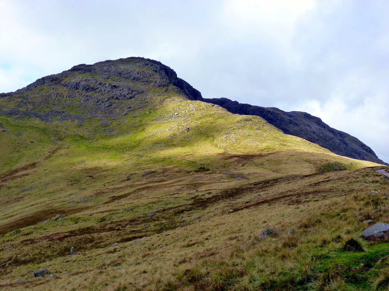
There was to be little adventure or thought given to our route, the obvious one stands out like a sore thumb; straight up The Band before crossing Crinkle Crags and returning down Browney Gill, essentially the skyline of Oxendale. We made our way along the track to the farm at Stool End where the majority of the days climbing would begin. The Band, loathed by some, extends all the way from the valley floor to the summit of Bowfell, gaining some 800m along the way.
 |
| A fine autumn morning in Langdale |
 |
| Beginning the climb up The Band |
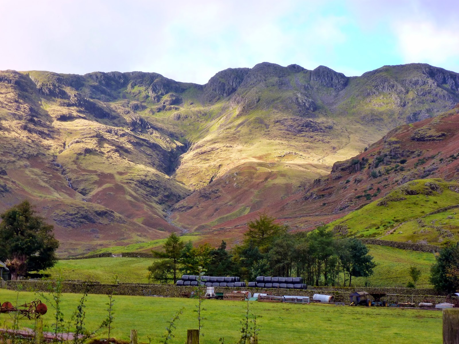
It is a long climb, though not a particularly challenging one and it does have a fine view of Great Langdale and the valleys of Mickleden and Oxendale either side. After the first 400m of ascent, the going gets slightly easier as the gradient decreases at White Stones.
 |
| Great Langdale from The Band |
 |
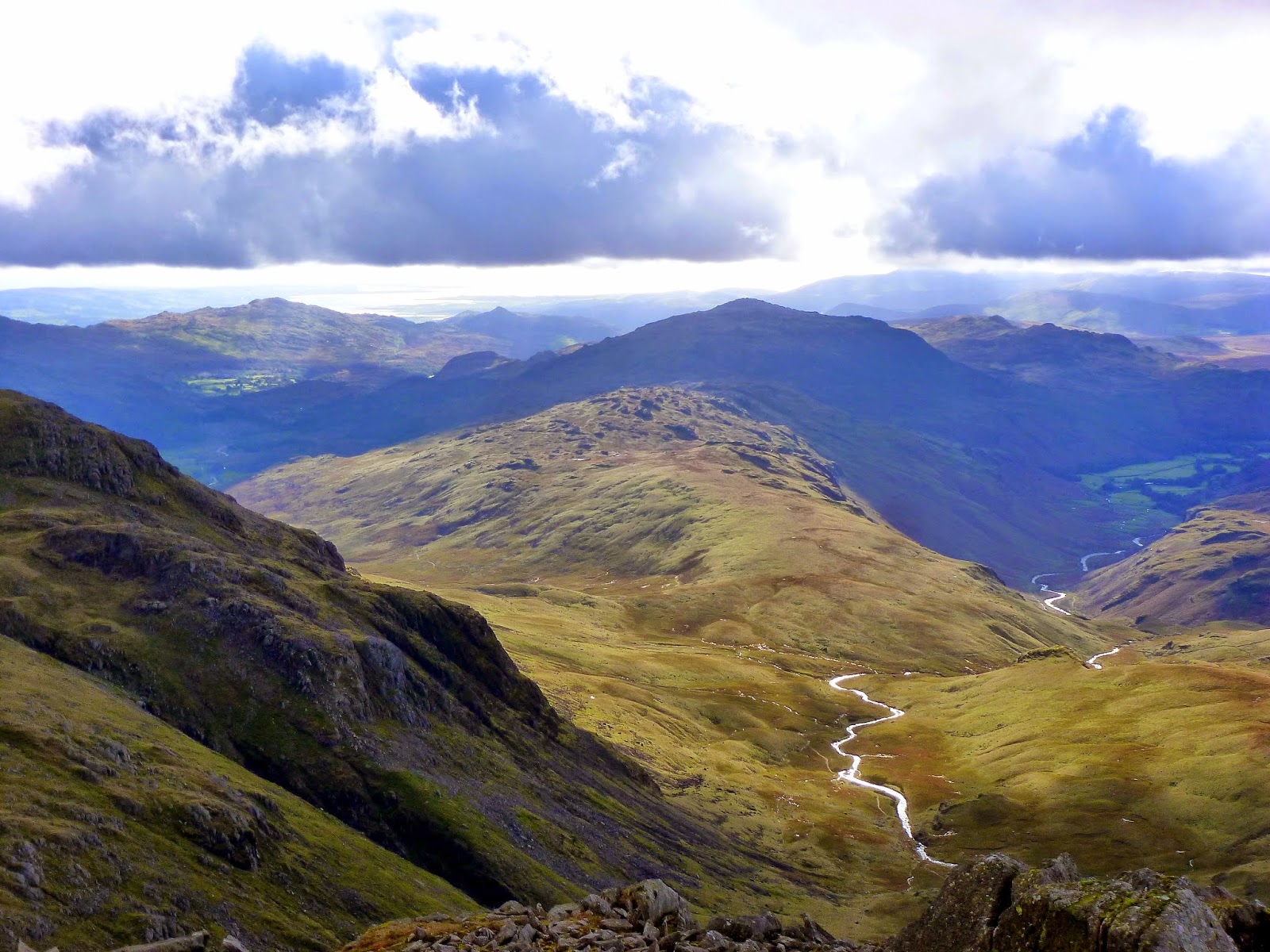
| Browney Gill seen from The Band |
 |
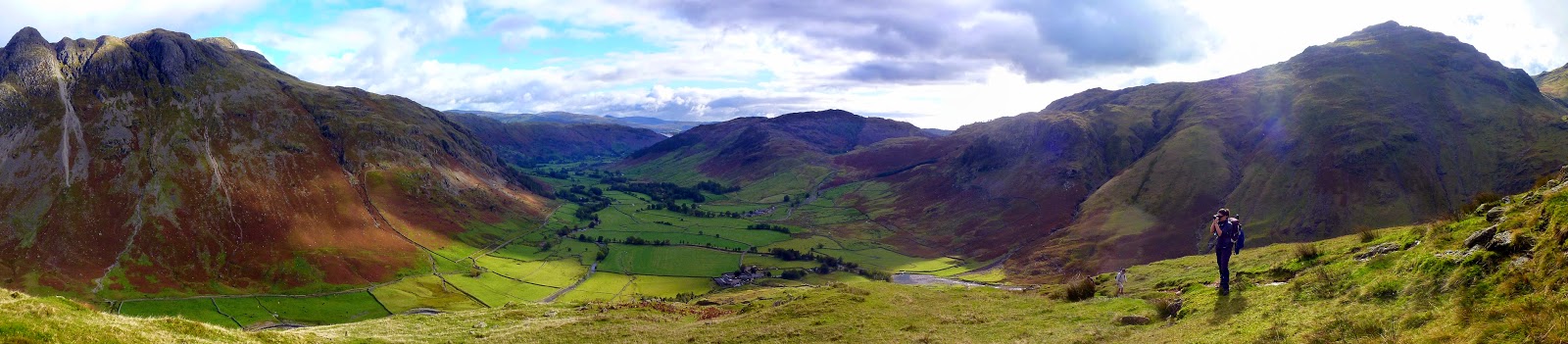
| Great Langdale panorama |
 |
| Pike O’Stickle up close with the great river of scree that falls the the mountainside |
 |
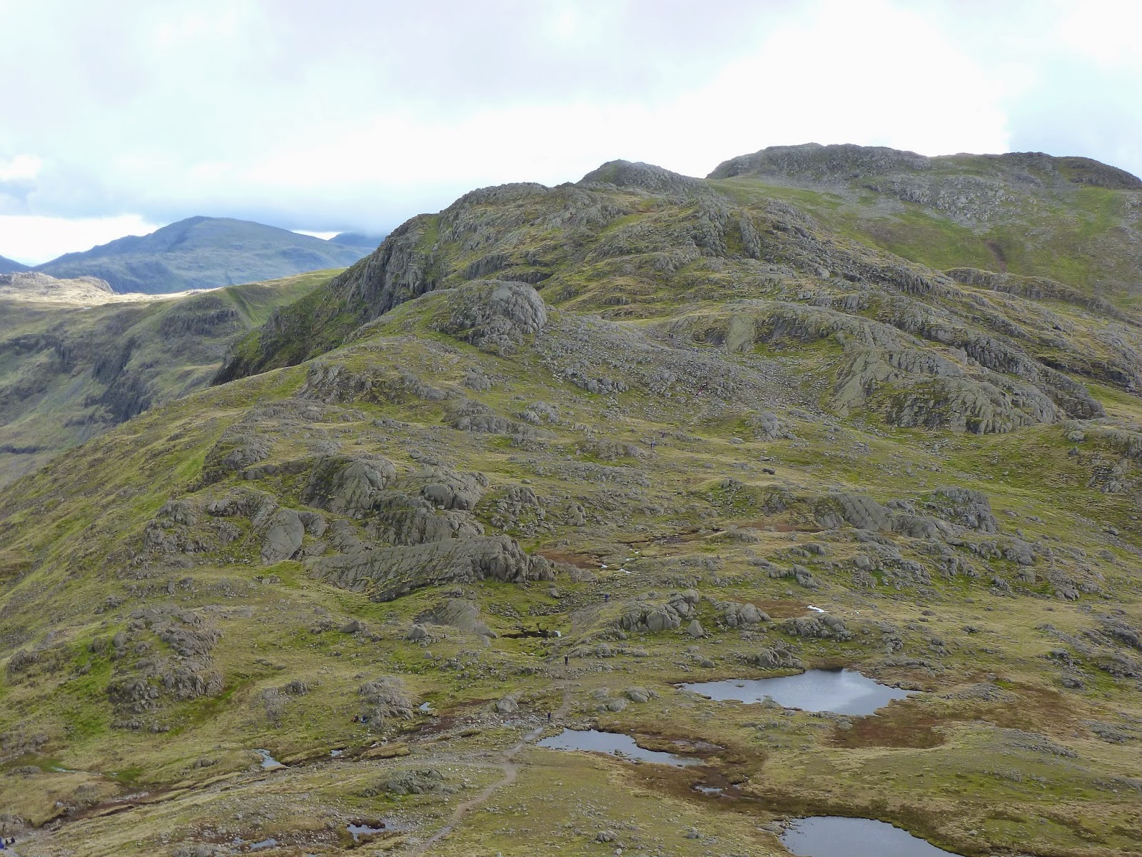
| The route towards Bowfell along Earing Crag |
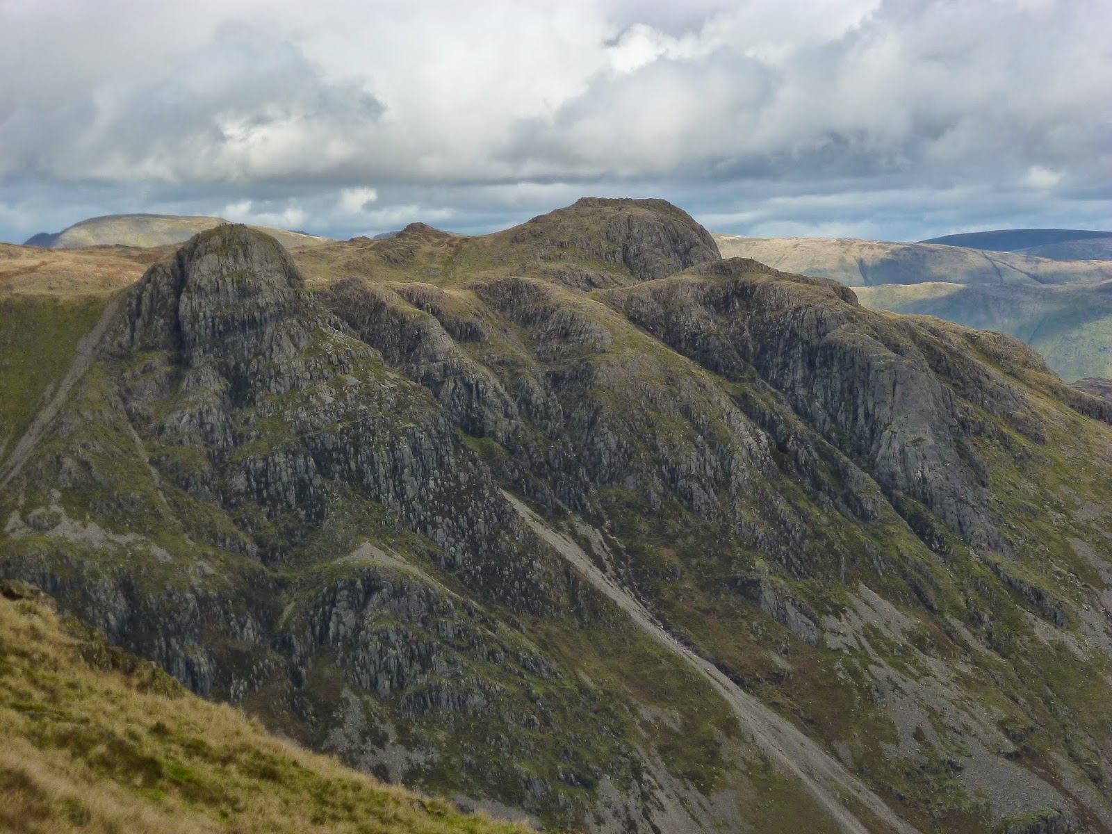
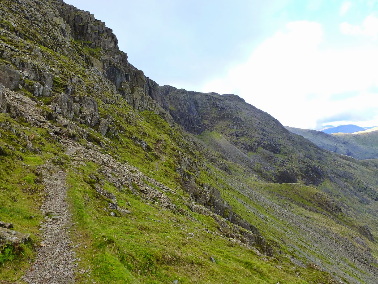
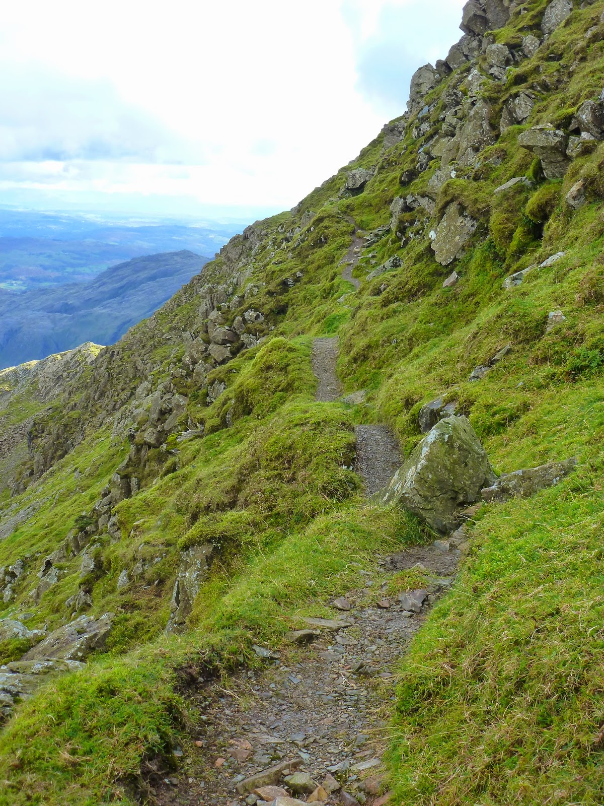
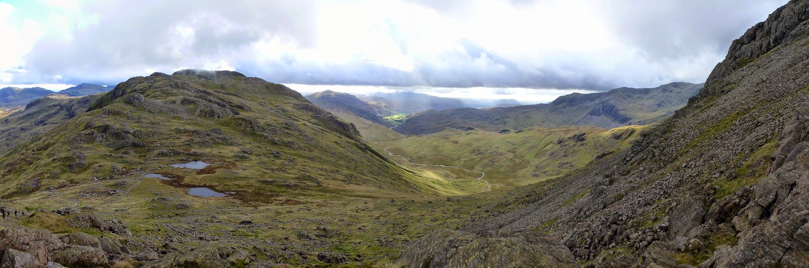
After crossing the top of Earing Crag, we chose the leave the main route which would reach Three Tarns, instead heading towards the lesser used (but vastly superior) Climbers Traverse. The traverse clings to the mountainside high above Mickleden, providing a route for climbers to access the towering crags of Bowfell Buttress. It also provides a route to the summit for walkers, one that gives panoramic views, and exhilarating high-level path and and up-close encounter with Bowfell’s Great Slab. More about that in a minute.
 |
| The Langdale Pikes |
 |
| The beginning of the Climbers Traverse at Flat Crags |
 |
| Pausing for a minute along the traverse |
 |
| The path is easy enough to follow |
 |
| Mickleden leading into Great Langdale |
 |
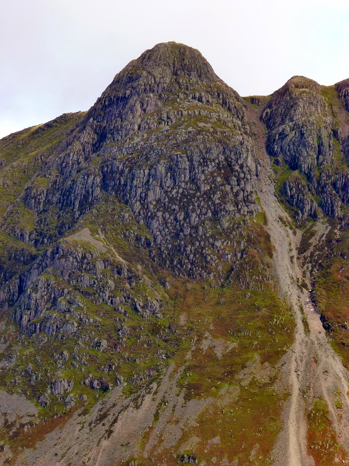
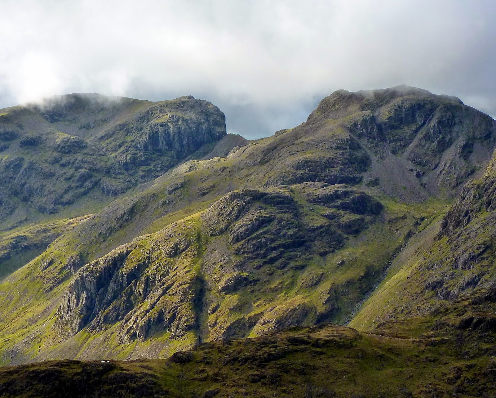
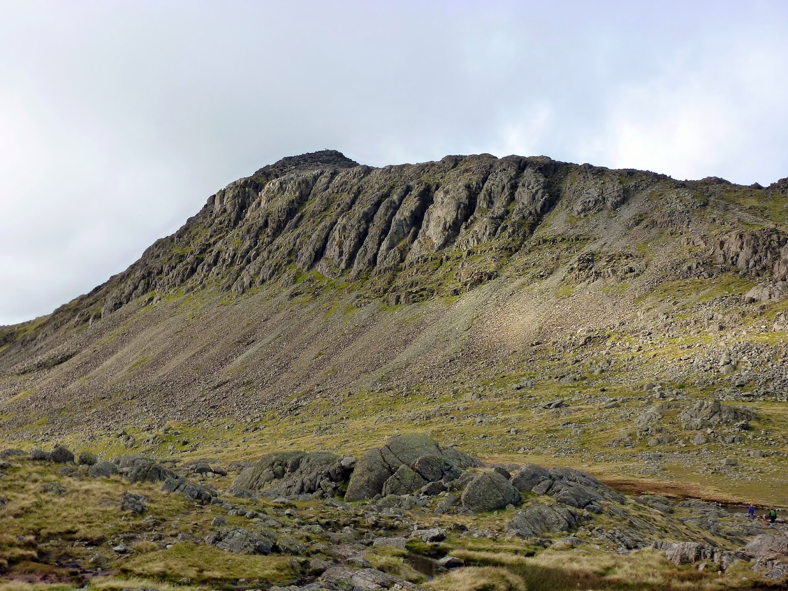
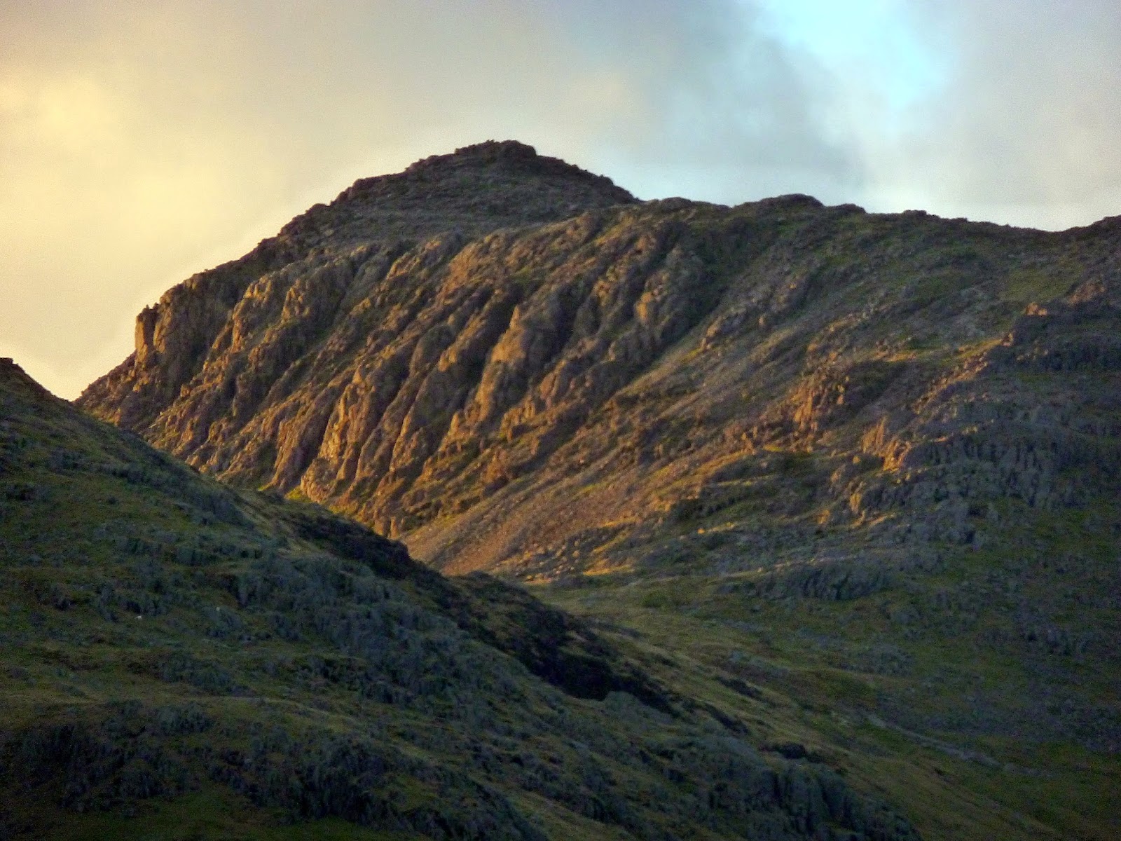
| The mighty Bowfell Buttress |
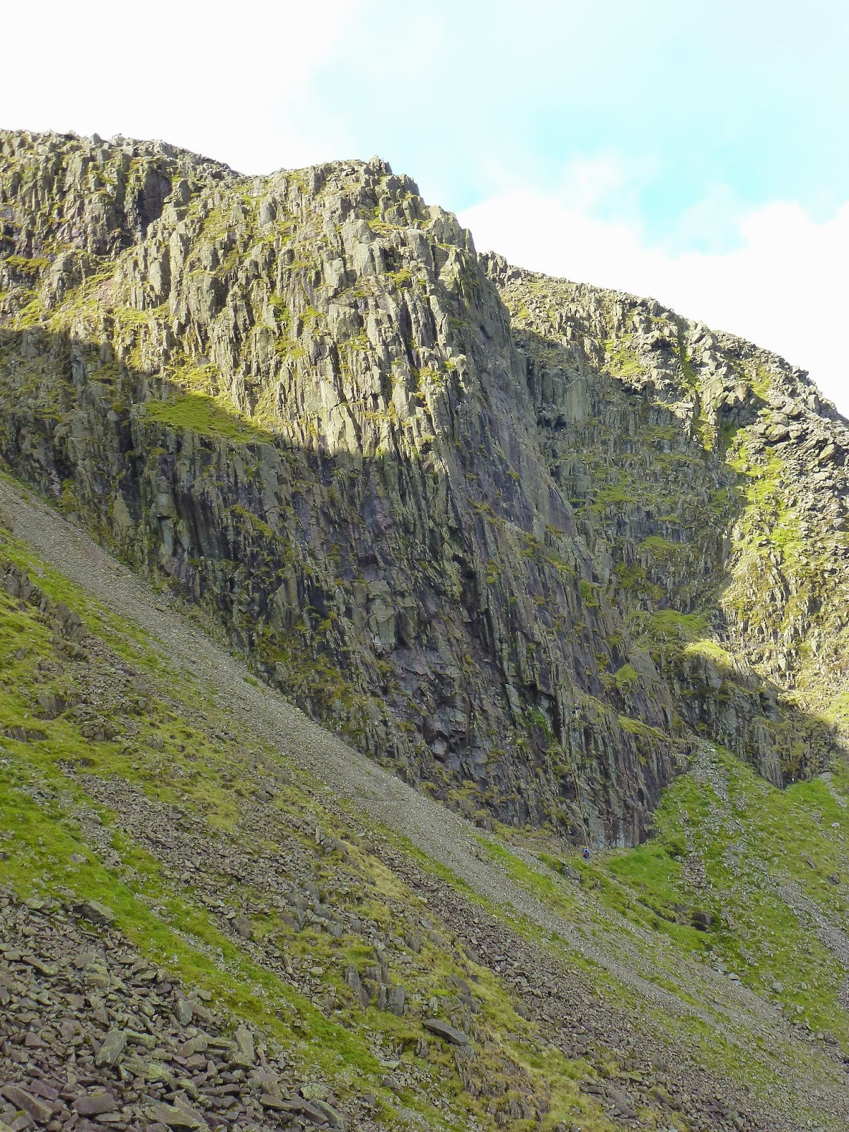
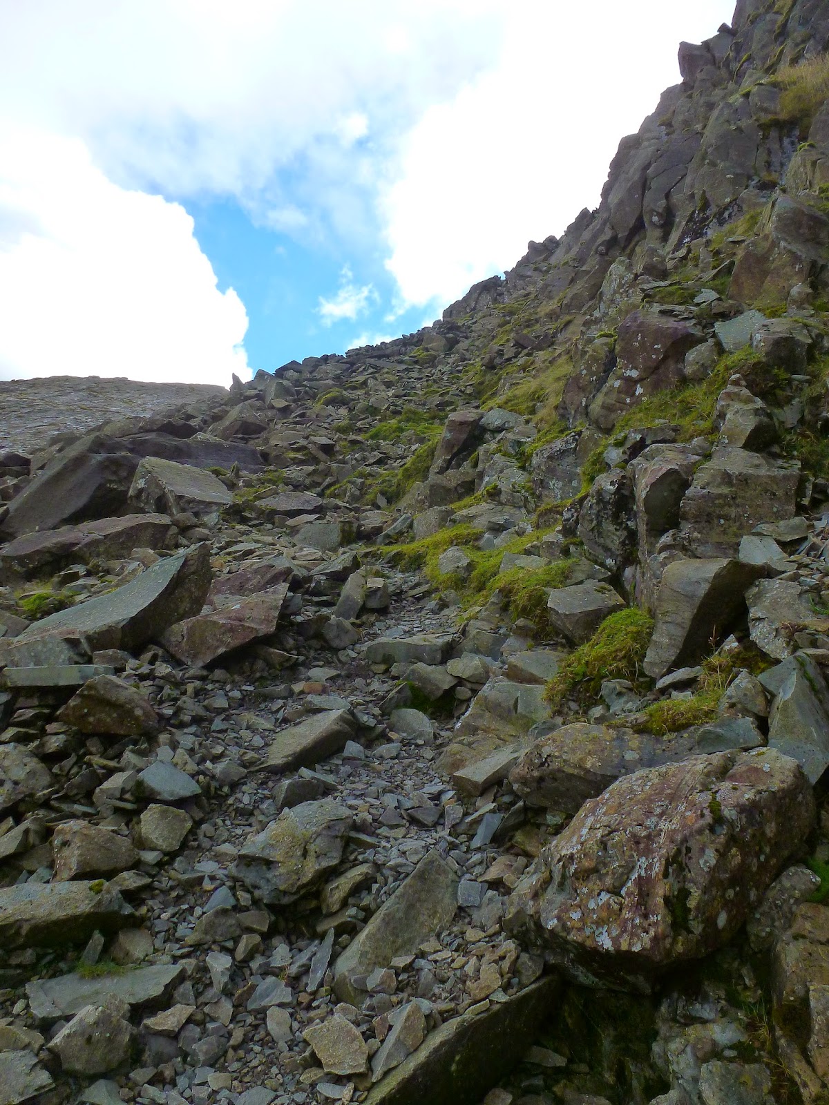
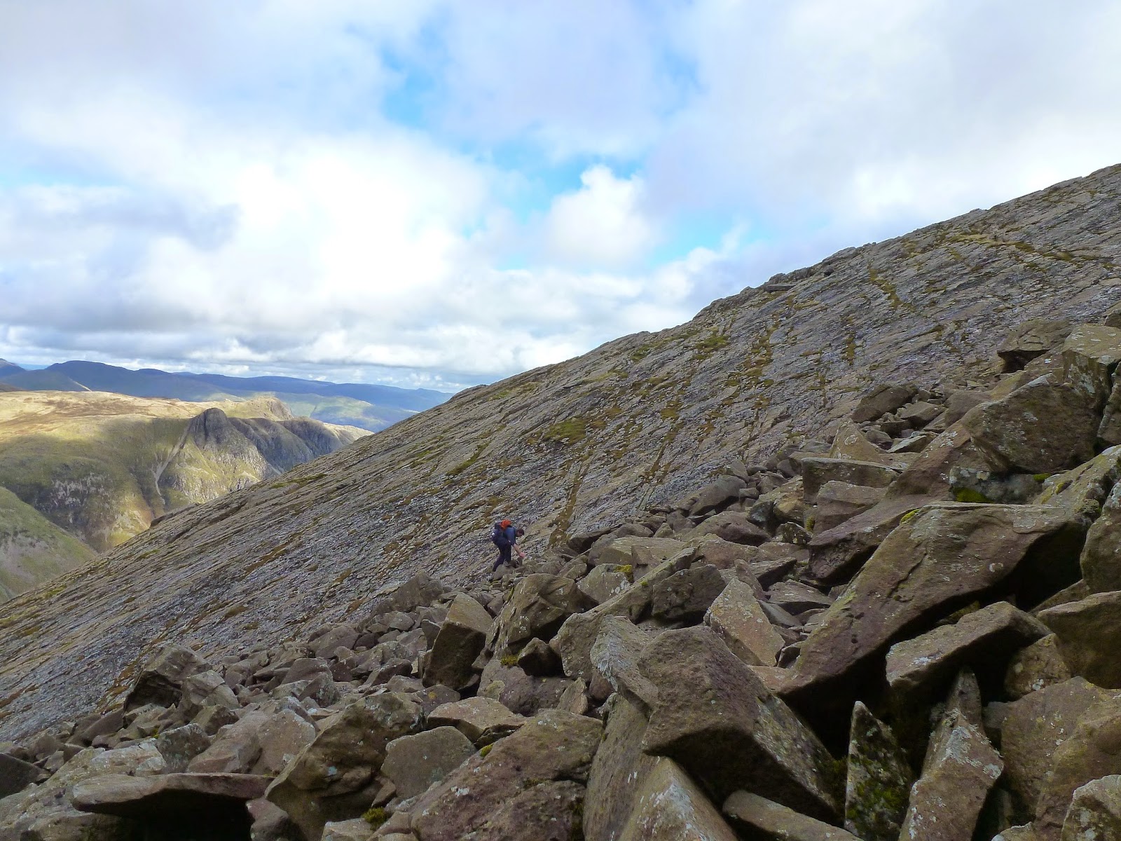
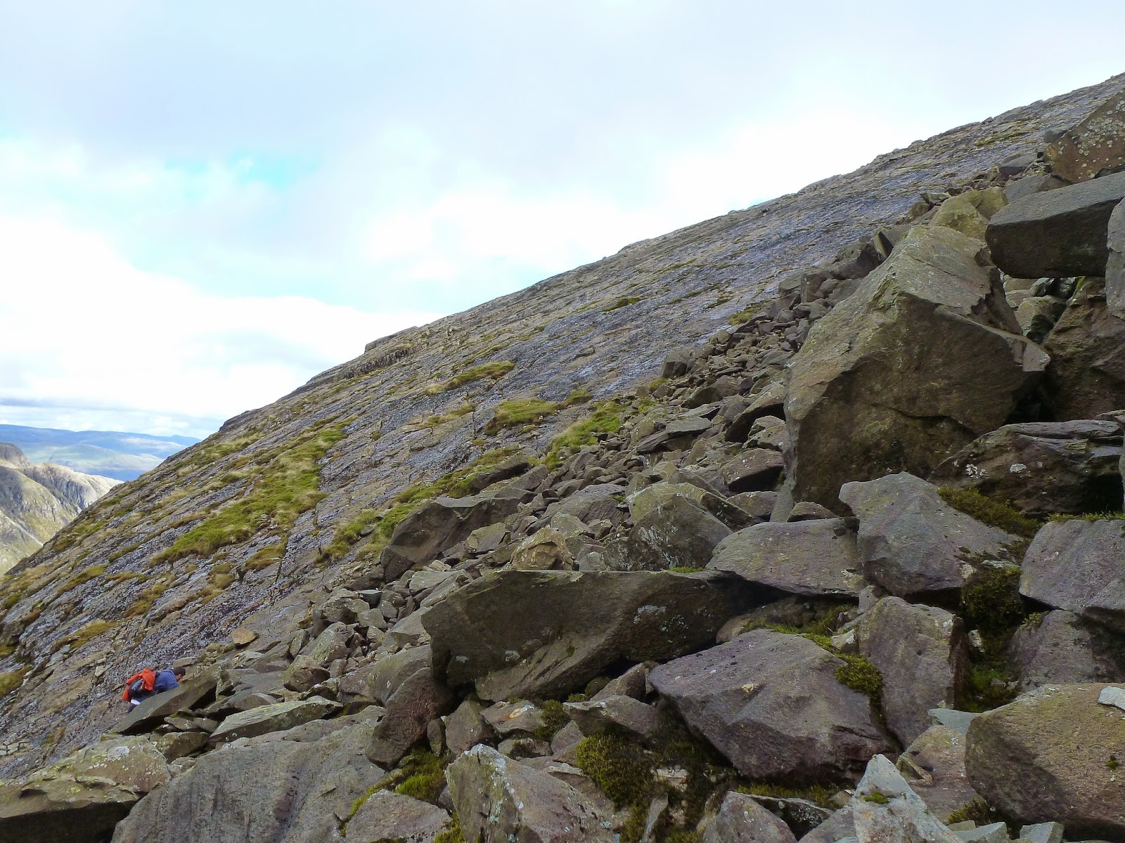
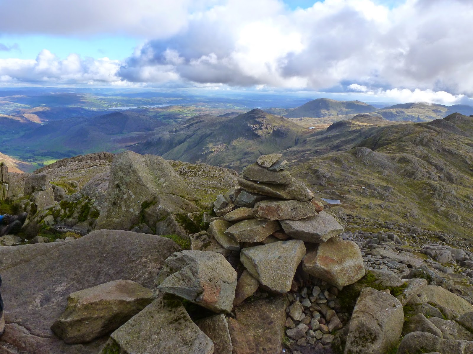
The traverse is very straightforward with one or two slightly awkward rock outcrops barring the way. For walkers, the route finishes at Cambridge Crags and offers a rare chance to fill water bottles with freshly filtered water as it seeps from the rockface. The route up to the summit is via the immense boulder field that cascades down beside the Great Slab, a near 200m climb that requires the use of all four appendages. In case you weren’t aware, the Great Slab is one of Bowfell’s most recognisable features, a huge slab of rock tilted at almost exactly 45 degrees.
 |
| The foot of the boulder field |
 |
| The Great Slab once again |
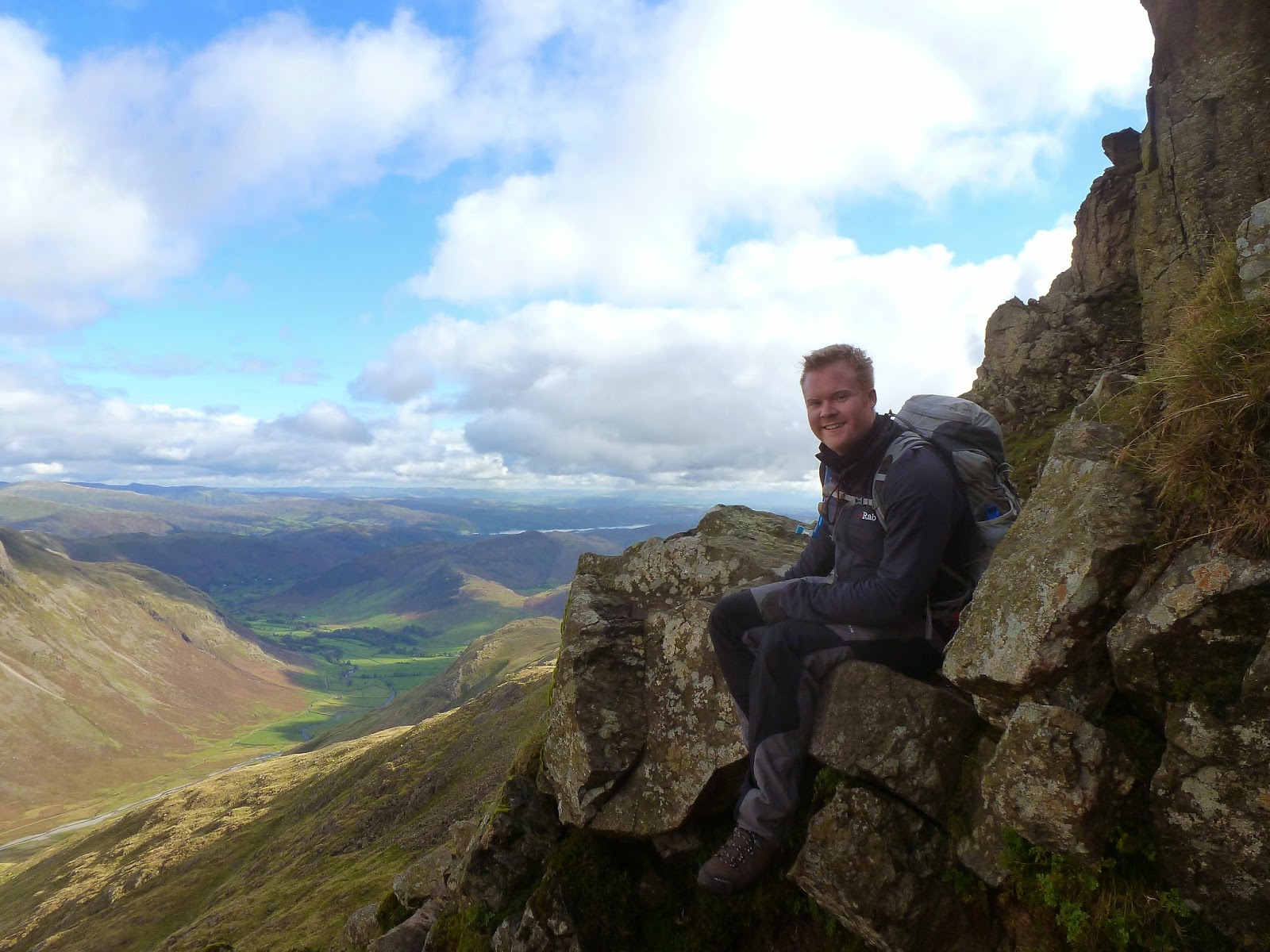
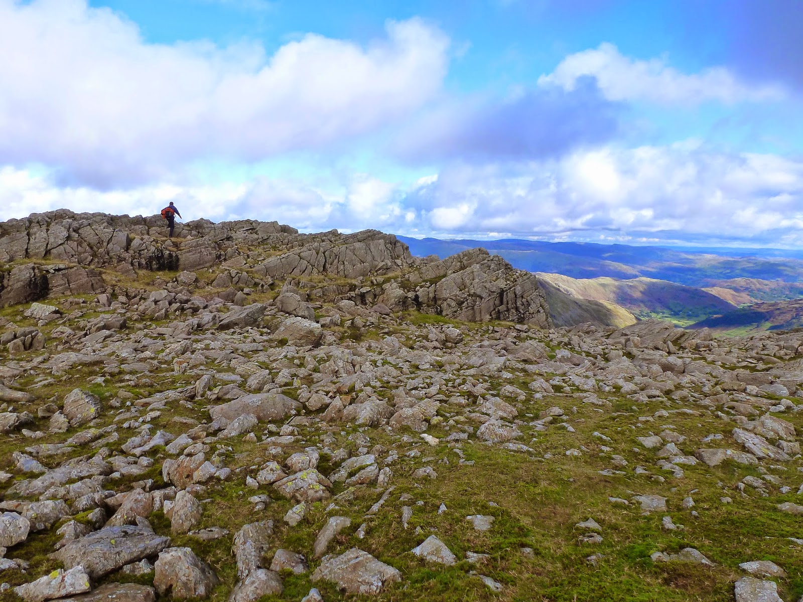
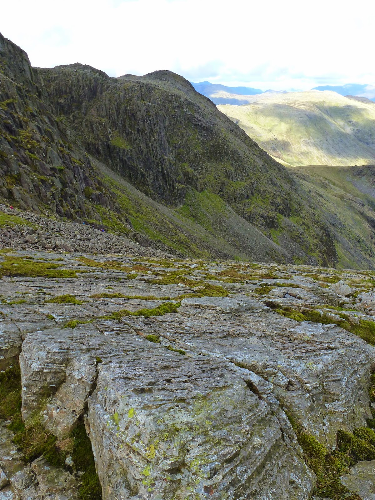
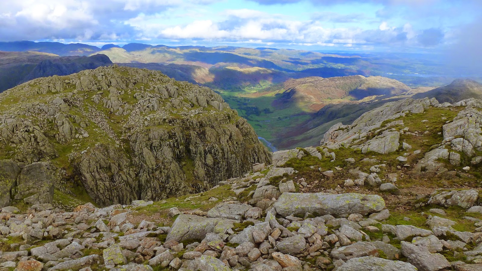
The top of the boulder field meets the main path we had avoided earlier, a final 30m climb-cum-scramble reaches the summit. It’s easy to see why Bowfell ranks highly among many people. The view is unsurpassed. As Bowfell has a small, peaked summit, the views in all directions are extensive. The highlight, in my opinion, are the menacing crags of Scafell and Scafell Pike, seen a short distance to the west. I think it is one of my favourite views in all the Lake District.
 |
| The scramble up the boulders emerges near the summit |
 |
| A look down the Great Slab |
 |
| Bowfell’s summit looking towards Pike O’Blisco |
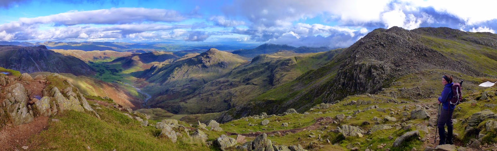
 |
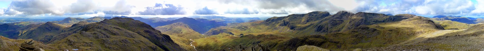
| Plenty of fells in this panorama of Eskdale |
 |
| The Scafells |
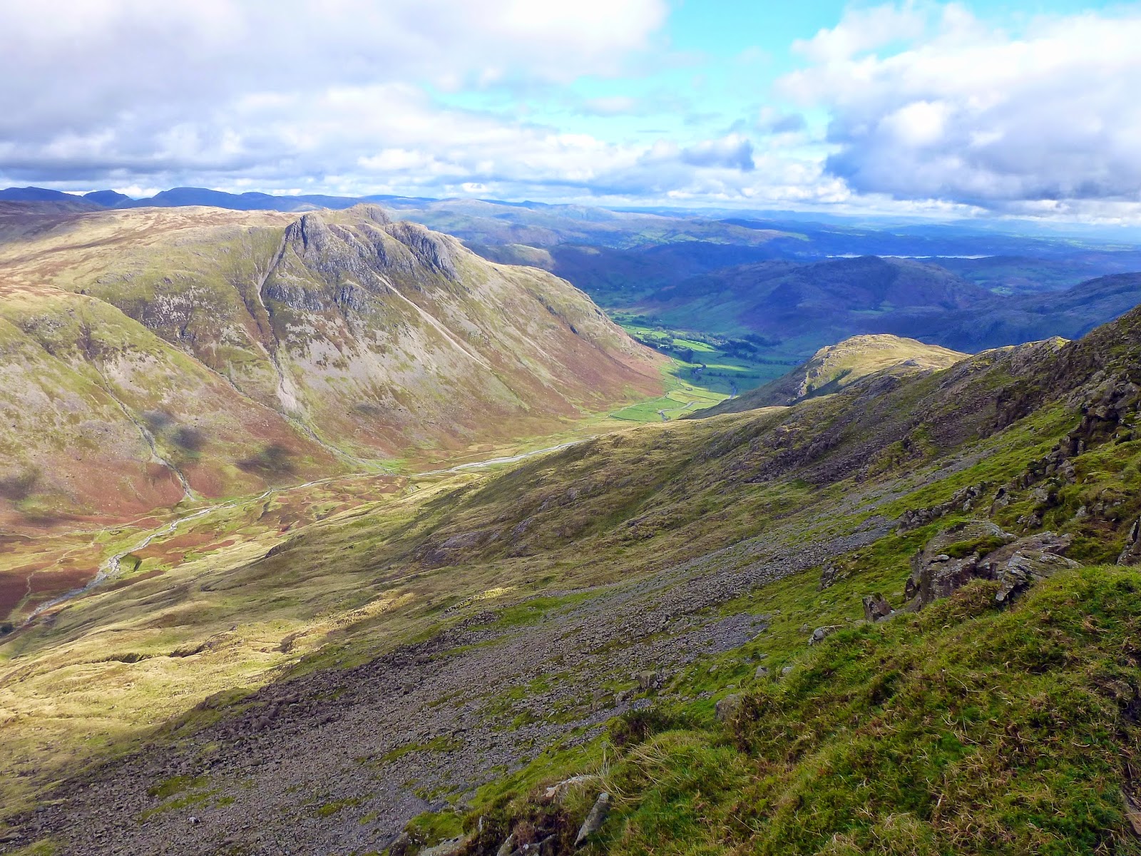
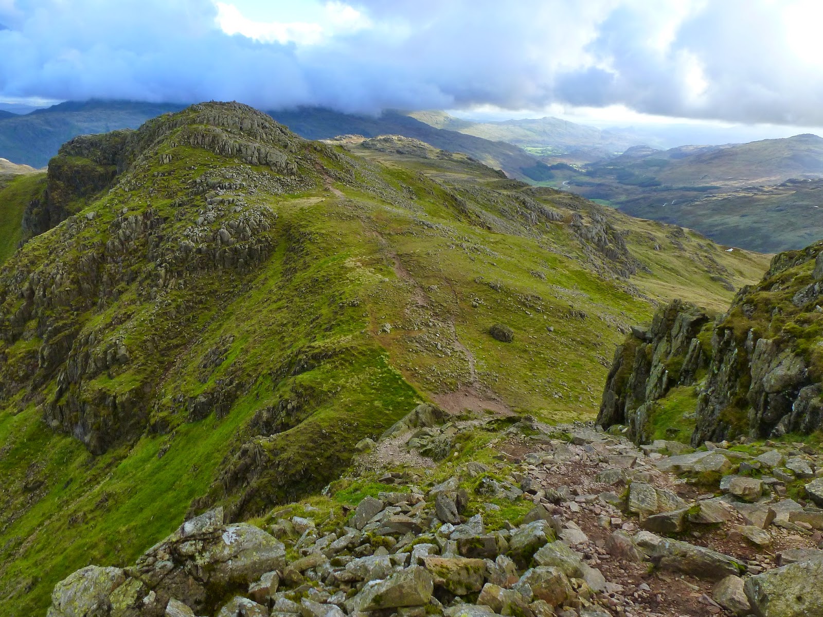
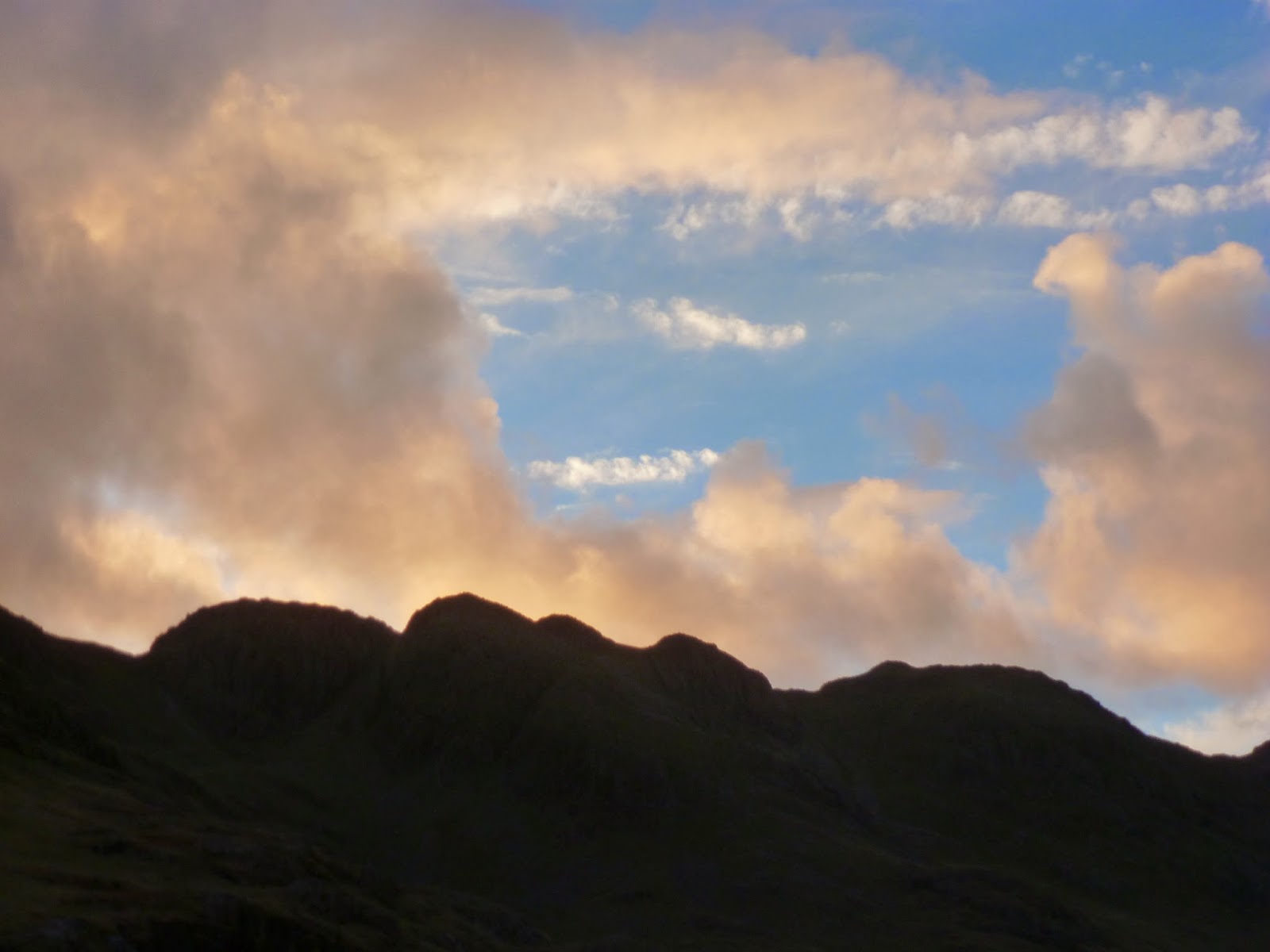
After savouring the views in all directions, we decamped from the summit down the steep path to the Three Tarns, the col between Bowfell and its neighbour, Crinkle Crags. Unsurprisingly, the path along Crinkle Crags contains a series of climbs and falls as it crosses the various summit of the Crinkles. There are five in all with two receiving names of their own; Gunson Knott and Long Top. Long Top is in fact the highest of them all and thus, the summit of Crinkle Crags.
 |
| Three Tarns and Lingcove Beck |
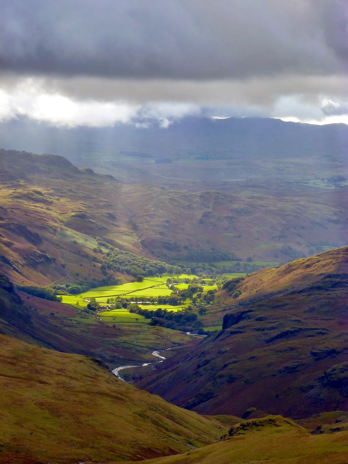
 |
| Sun streaming into Eskdale |
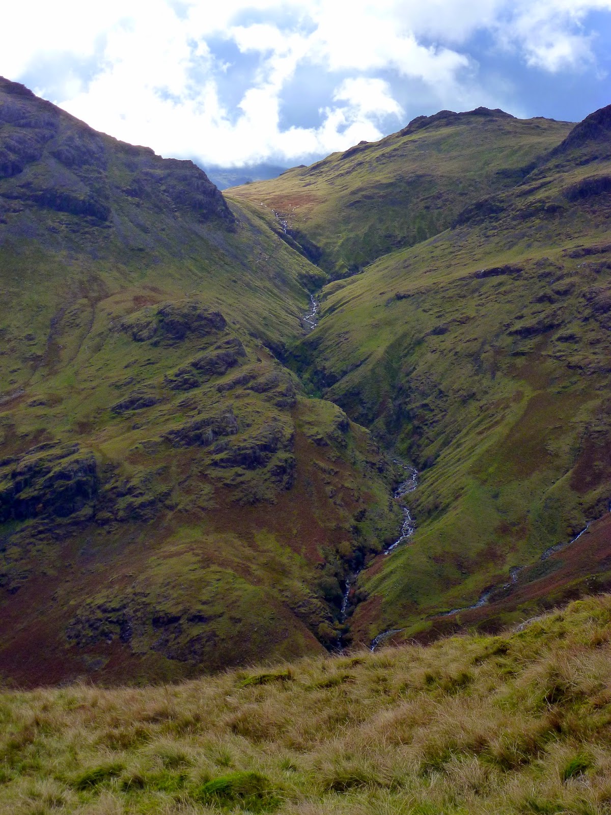
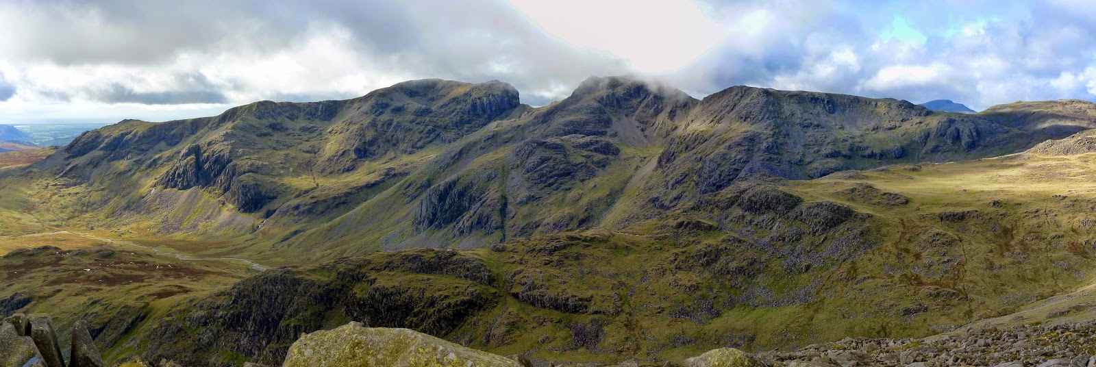
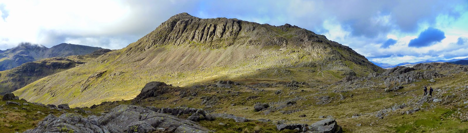
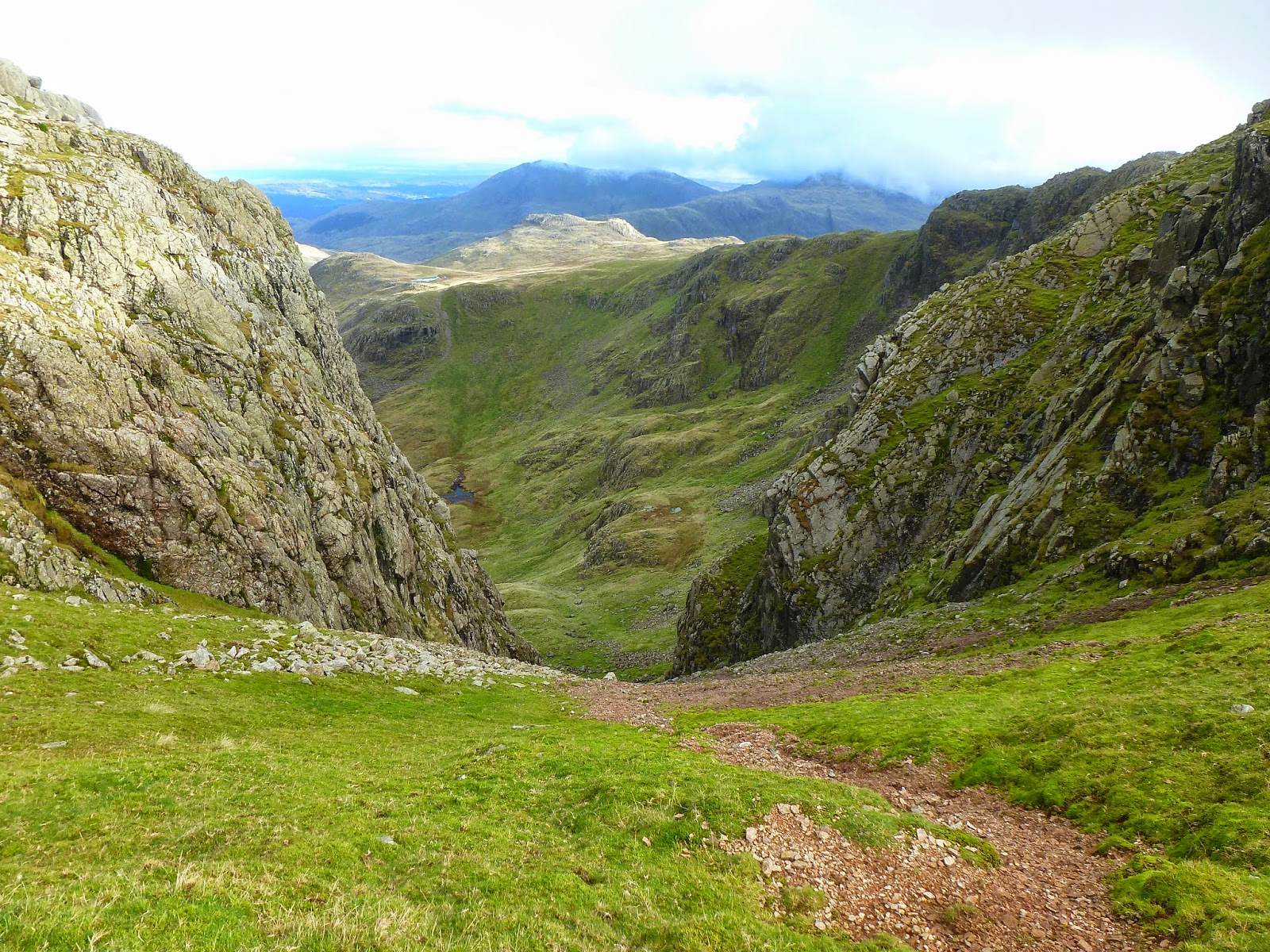
A walk along Crinkle Crags provides the iconic view of Bowfell from the south with the nine links carving their way up the mountain side. At times it gives equally impressive but much more precipitous views down to Mickleden, especially through Mickle Door, down the gully of Crinkle Gill. If that wasn’t enough, one last challenge faces walkers heading south, as we were. The Bad Step.
 |
| The view down Mickle Door |
 |
| Mickle Door once again |
 |
| The drop down towards Bad Step |
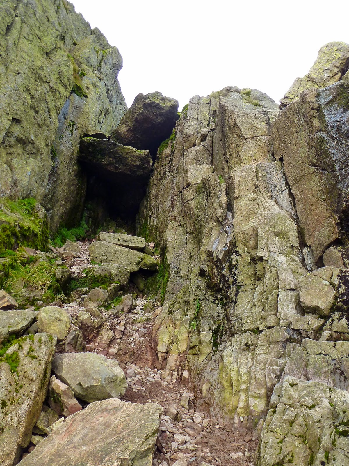
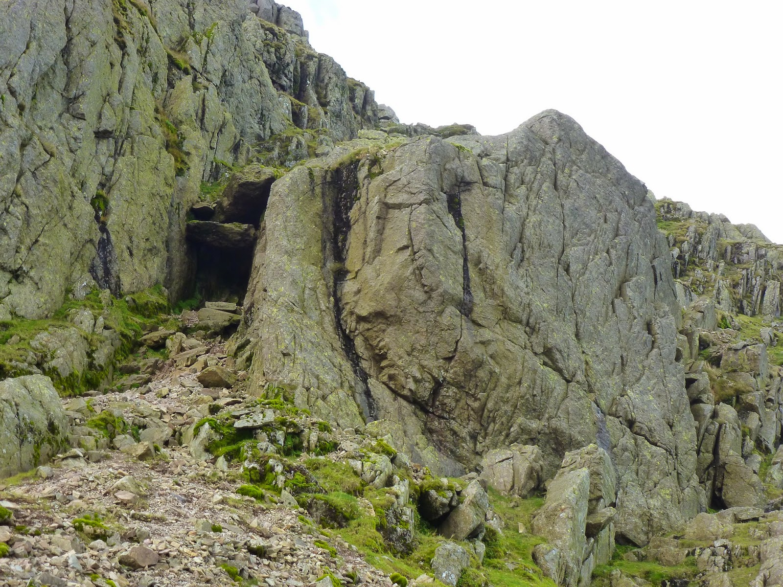
The Bad Step is a famous spot in Crinkle Crags, a steep-sided declivity capped with a couple of very large wedged rocks. It’s a bit of a challenge, especially to the unaware and. it’s fair to say, I certainly made a bit of a meal of it, falling with style rather than climbing down with any finesse. Still, with me on the lower deck of Bad Step, I was able to guide Sara down with a bit more grace though I don’t think she particularly enjoyed the experience.
 |
| The tricky Bad Step – the route is up the rocks to the right |
 |
| Bad Step in context – the bypass is to the right of the large boulder |
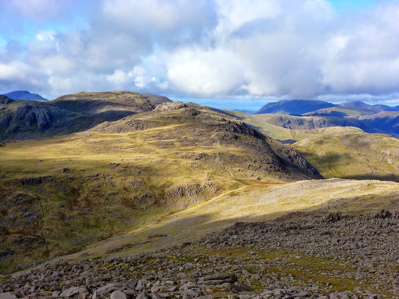
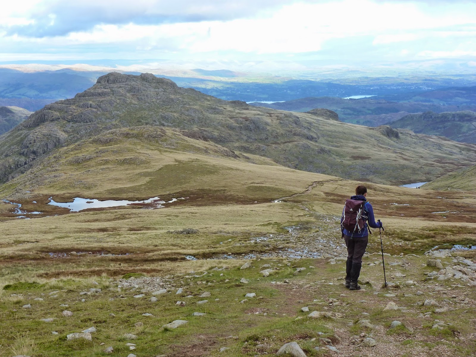
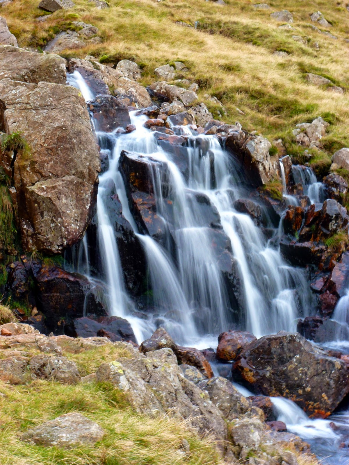
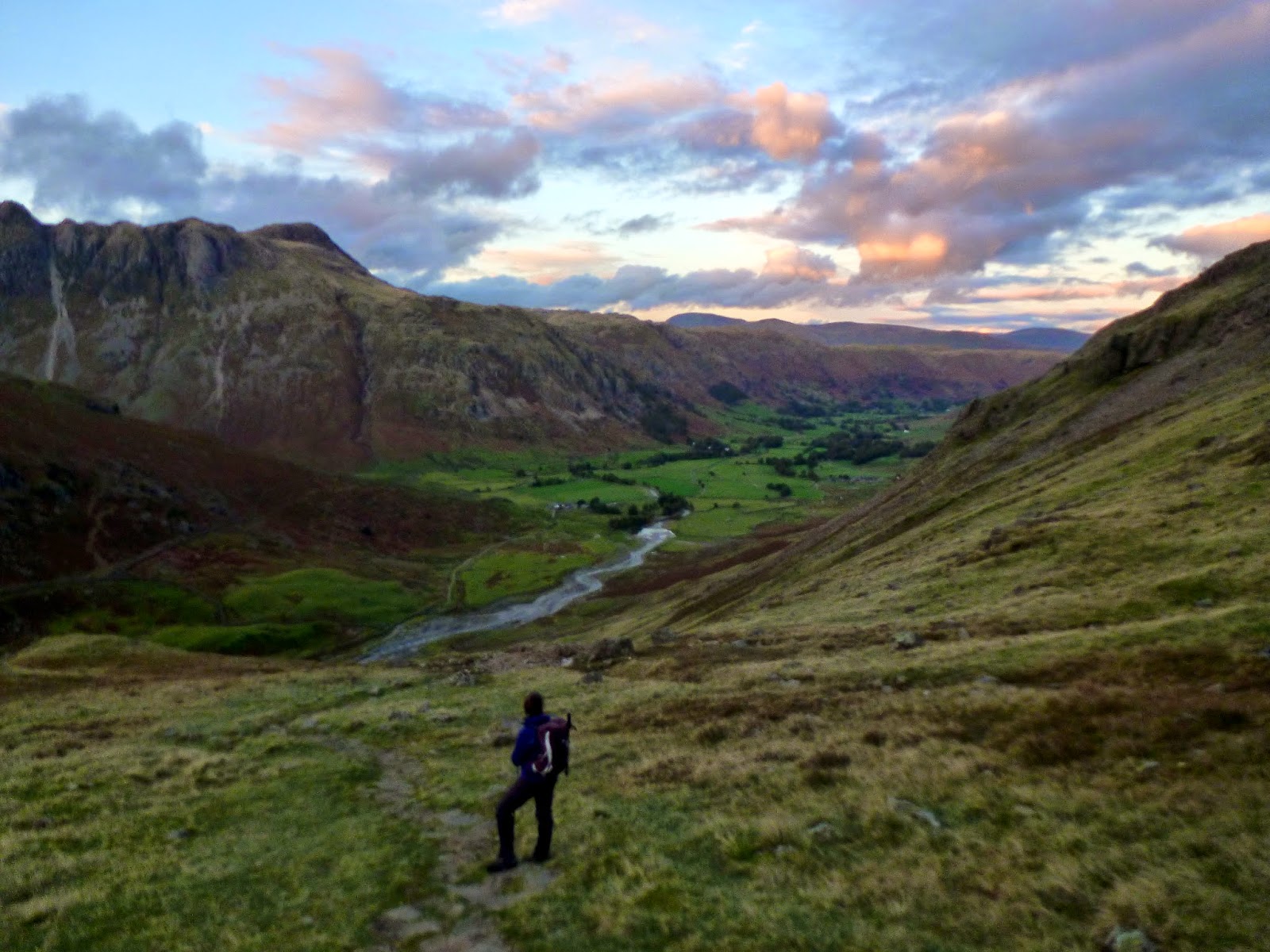
The Bad Step can be bypassed, though the route to the east is less obvious. A real motorway of a path stretches down the hillside between Great Knott and Cold Pike and is very easy going, that is until you reach Red Tarn at the footings of Pike O’Blisco. A steep path leads down the valley of Browney Gill and, despite it being adorned with pitched stones, its slippery and awkward, requiring a great deal of concentration to avoid a turned ankle or worse. It’s long as well, descending some 400m to Oxendale below.
 |
| Sara begins the long walk down to Red Tarn |
 |
| Waterfalls on Browney Gill |
 |
| Sara taking a break on the way into Mickleden |
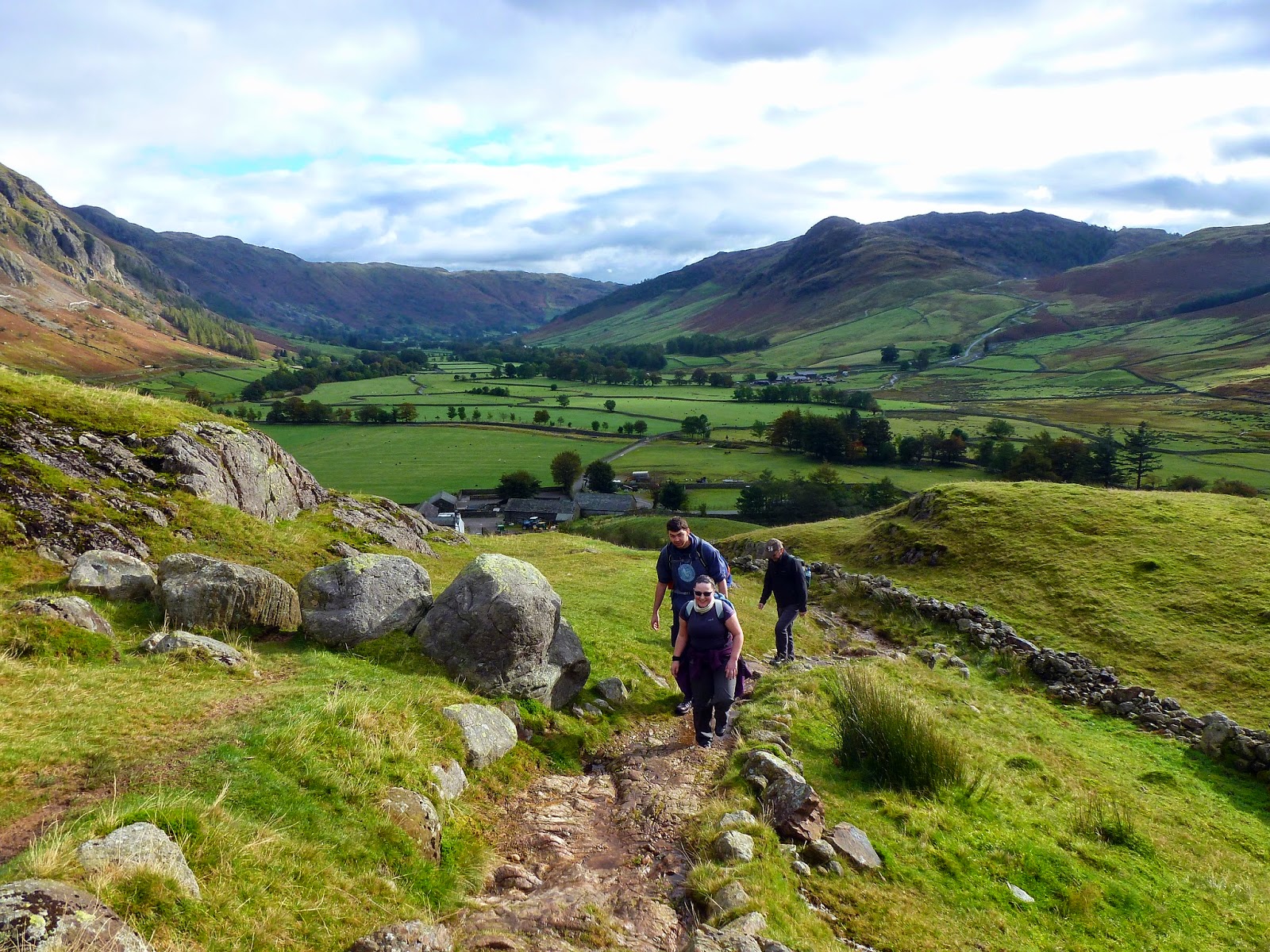
The light was starting to fade as we eventually reached the bottom of the path, though the path returning to the campsite is easy to follow and, ultimately, flat. After just a short distance, you will find yourself at Stool End, back at the farm that stands at the foot of The Band. Using the headtorches we’d sensibly packed, we made our way back along the lanes and roads to the campsite. As you can probably glean from my enthusiasm, this is one of my all time favourite walks to one of the best mountains in the Lake District and I wouldn’t hesitate to recommend it to anyone, especially those just starting out. There are no points of real technical difficulty and the route up The Band is long but not especially steep. Many of the more interesting sections, such as the Climbers Traverse and Bad Step, can be bypassed if necessary.

